Norwegian Fjords & Crossing the Arctic Circle
Norwegian Fjords & Crossing the Arctic Circle
Cruise overview
WHY BOOK WITH US?
- ✔ The Deluxe Cruises’ team has extensive experience in ultra-luxury cruising.
- ✔ Call now to speak to our helpful and experienced Cruise Concierge team.
- ✔ Enjoy our Unique Deluxe Cruises Bonus for substantial savings.
- ✔ Our team will tailor your holiday to your exacting requirements.
- ✔ As agents, we work under the protection of each cruise lines ABTA / ATOL licences
About Oslo
Oslo is the capital of Norway and is also its largest city, situated at the head of Oslo Fjord and surrounded by hills and forests. Home to some 50 museums and full of galleries, cafés, a sculpture park and the Royal Palace, this vibrant city with its handsome 19th-century buildings and wide streets has much to offer. Its history dates back 1,000 years, and includes a rich seafaring heritage that ranges from the Viking era to Thor Heyerdahl’s Kon Tiki expedition. Discover more about this exciting city on our varied selection of excursions.
About Longyearbyen
Longyearbyen is the biggest settlement in Svalbard. Seat of the Norwegian administration, it also has the best services and infrastructure in the archipelago. Located deep in the Adventfjord, a sidearm of the Isfjorden (Icefjord), Longyearbyen’s airport can be used all-year round, but its harbor is blocked by ice in winter. Most shops, hotels, restaurants and a hospital are within easy walking distance of the port. One of the most prominent buildings in town is the UNIS center, where several Norwegian universities have joined forces to operate and offer the northernmost higher education to both Norwegian and international students. Adjacent to UNIS, and well worth a visit, is the Svalbard Museum, covering the natural history and exploitation of Svalbard. Remnants of the former mining activity can be seen all around Longyearbyen and even in town.
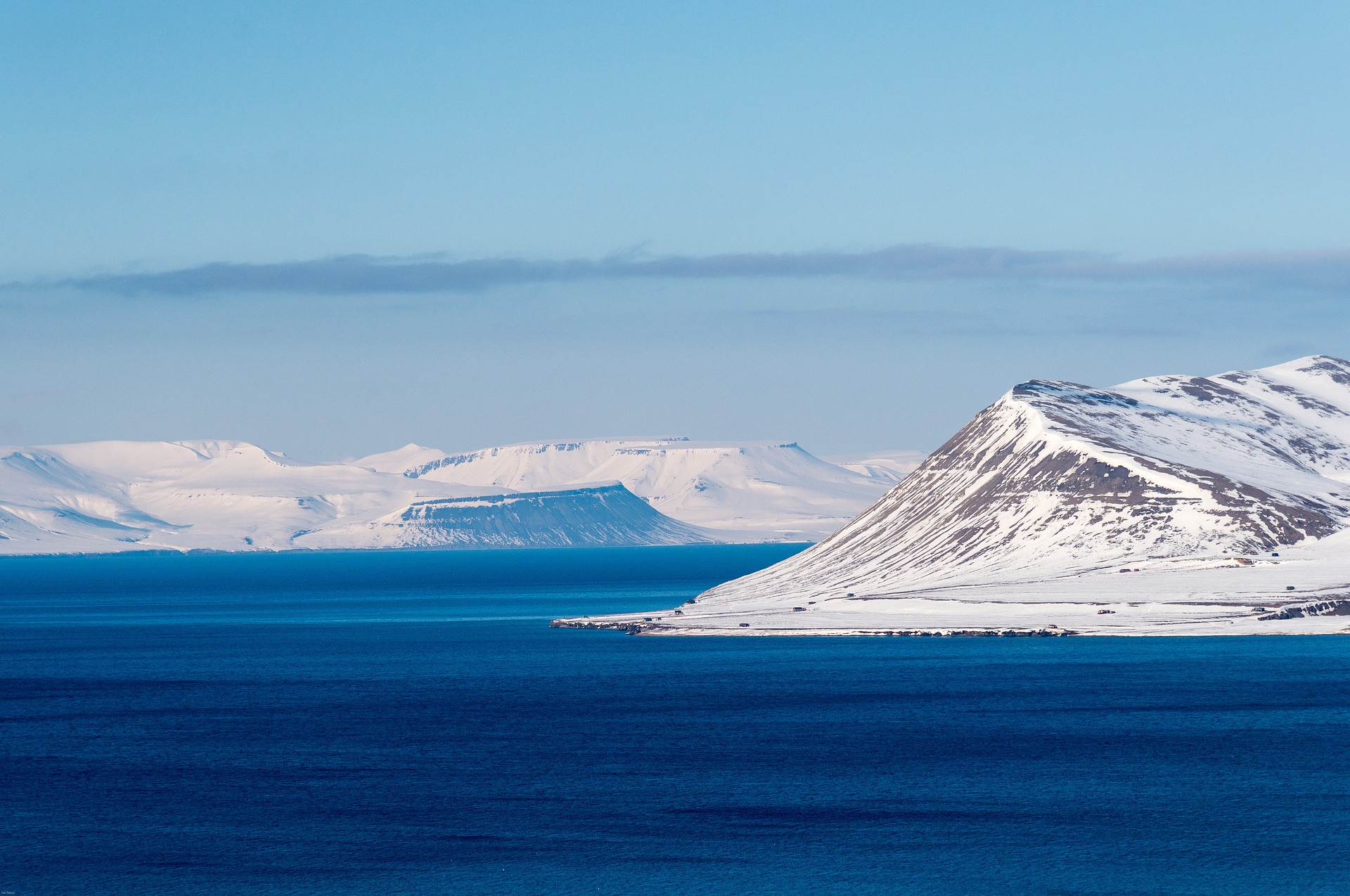
About Svalbard Archipelago
A flexible itinerary allows us to take advantage of favorable ice and weather conditions to travel through the northern stretches of Svalbard to points visited by famous polar explorers such as Andrée, Amundsen and Nobile. Destinations might include the narrow waterways and striking mountains of Krossfjord and Raudfjord. The ship may visit the historic settings of Ny Alesund, Ny London or Amsterdamoya. And of course, we hope to see distinctly Arctic wildlife from walrus hauled out in noisy groups on remote shorelines, to reindeer grazing alpine slopes, and from ptarmigan in their camouflaged hiding places, to mighty polar bears striding the shores in search of their next meal.
About Bear Island
Almost half way between Tromsø and Svalbard is isolated Bear Island – considered the southernmost island of the Svalbard Archipelago. The unglaciated island is an impressive Nature Reserve of steep, high cliffs that are frequented by seabirds, specifically at the southern tip. Brünnich’s Guillemots, Common Guillemots, Black Guillemots, Razorbills, Little Auks, Northern Fulmars, Glaucous Gulls, Black-legged Kittiwakes, and even Atlantic Puffins and Northern Gannets nest along the cliffs south of Sørhamna. Because of the large numbers of birds and the isolated location, Bear Island has been recognized as an Important Bird Area. It was once a hotspot for whaling and walrus hunting, and at one stage even mining. Bear Island received its name because of a polar bear encountered by early explorer Willem Barentsz. Today polar bears rarely visit the island and its only settlement is a meteorological station manned all-year round on the north side.
About Tromsø
With its centre located on the island of Tromsø, the municipality of Tromsø is more than five times the size of Norway’s capital, Oslo, and is the world’s northernmost university city. Lying 200 miles inside the Arctic Circle, it is known as the 'Gateway to the Arctic' because it was used as a starting point for hunters looking for Arctic foxes, polar bears and seals. In the 19th century it was a base for explorers on Arctic expeditions – a history that is remembered in the city’s Polar Museum, which you can visit on an excursion. Also commemorated in the area is the history of Norway’s indigenous people, the Sami. Visitors can learn about the traditions, heritage and modern preservation of the Sami culture at the Tromsø Museum. Nowadays, Tromsø is a charming mix of old and new, with wooden buildings sitting alongside contemporary architecture such as the impressive glacier-like Arctic Cathedral, which features one of the largest stained glass windows in Europe. Looking down on the city is Mount Storsteinen, and a cable car runs to the top, giving wonderful views over the surrounding countryside of forested peaks and reindeer pastures.


About Lofoten Archipelago


About Hellesylt
People have been trekking through Hellesylt since the end of the last ice age, but tourists began staying overnight only in 1875, when the village's first hotel was built. Hellesylt was the inspiration for Norwegian playwright Henrik Ibsen's long play in verse, Brand (1865). Despite more than 200,000 tourists and 100 cruise ships visiting annually, there's not much to see here besides the waterfall in the village center, oddly wedged between two bridges. A handful of tourists visit for the mountain walks, climbing, boating, and fishing in the region. But by far, most cruise-ship passengers use Hellesylt as the point of embarkation for a highway journey to Geiranger (while others remain onboard the ship to cruise into the fjord).

About Geiranger
The Geirangerfjord, which made the UNESCO World Heritage List in 2005, is Norway's most spectacular and perhaps best-known fjord. The 16-km-long (10-mile-long), 960-foot-deep Geirangerfjord's most stunning attractions are its roaring waterfalls—the Seven Sisters, the Bridal Veil, and the Suitor. Perched on mountain ledges along the fjord, deserted farms at Skageflå and Knivsflå are being restored and maintained by local enthusiasts.The village of Geiranger, at the end of the fjord, is home to fewer than 300 year-round residents, but in spring and summer its population swells to 5,000 due to visitors traveling from Hellesylt to the east. In winter, snow on the mountain roads often makes the village isolated.


About Ålesund
The coastal town of Ålesund is the commercial capital of the Møre og Romsdal district. But more important, it is noted for its characteristic Jugendstil (Art Nouveau) buildings, which some claim make Ålesund one of the most beautiful towns in Norway. This Art Nouveau style emerged when the town was completely rebuilt after a devastating fire in 1904 destroyed nearly 800 buildings and left 10,000 residents homeless. It is said that the fire started by a tipped oil lamp. Rebuilding was carried out with the help of many young, foreign architects who added their own flourishes to the architectural blend of German Jugendstil and Viking roots. Today, narrow streets are crammed with buildings topped with turrets, spires and gables that bear decorations of dragonheads and curlicues. As one of the few remaining Art Nouveau towns in the world, in 1998 Ålesund was awarded the coveted Houens National Memorial Prize for the preservation of its unique architecture.


About Flåm


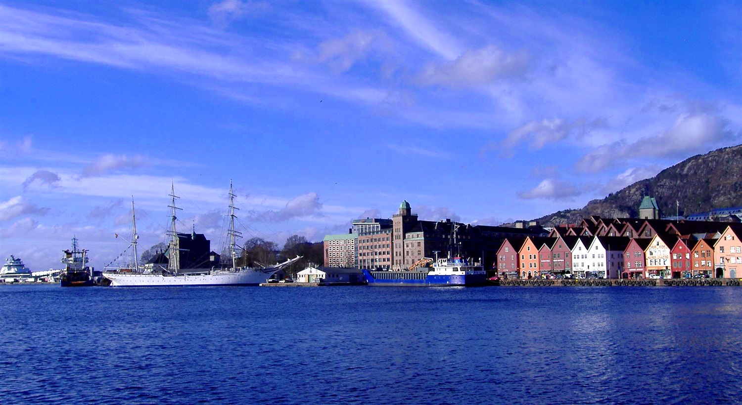
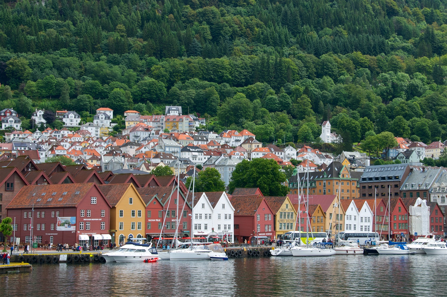
About Bergen
Surrounded by mountains and sparkling fjords, the waterside city of Bergen has a spectacular setting. There has been a settlement here since medieval times and the colourful waterfront buildings of the Hanseatic wharf, known as Bryggen, are testament to its fascinating history of trade. As Norway’s best known medieval settlement, the Bryggen is listed by UNESCO as a World Heritage Site. Our comprehensive selection of excursions allows you to discover the many sides of Bergen, such as the fish market and narrow cobbled streets, as well as stunning views of the city from the summit of Mt Fløyen. Alternatively, those who have visited the city previously may like to experience one of the tours that travel further afield. Just 300 yards from the main piers, you will find the Fortress Museum (Fesningsmuseum), which has an interesting collection of objects related to World War II.


Where You'll Go


