The Best of the Secluded Caribbean
The Best of the Secluded Caribbean
Cruise overview
WHY BOOK WITH US?
- ✔ The Deluxe Cruises’ team has extensive experience in ultra-luxury cruising.
- ✔ Call now to speak to our helpful and experienced Cruise Concierge team.
- ✔ Enjoy our Unique Deluxe Cruises Bonus for substantial savings.
- ✔ Our team will tailor your holiday to your exacting requirements.
- ✔ As agents, we work under the protection of each cruise lines ABTA / ATOL licences
About San Juan (Puerto Rico)
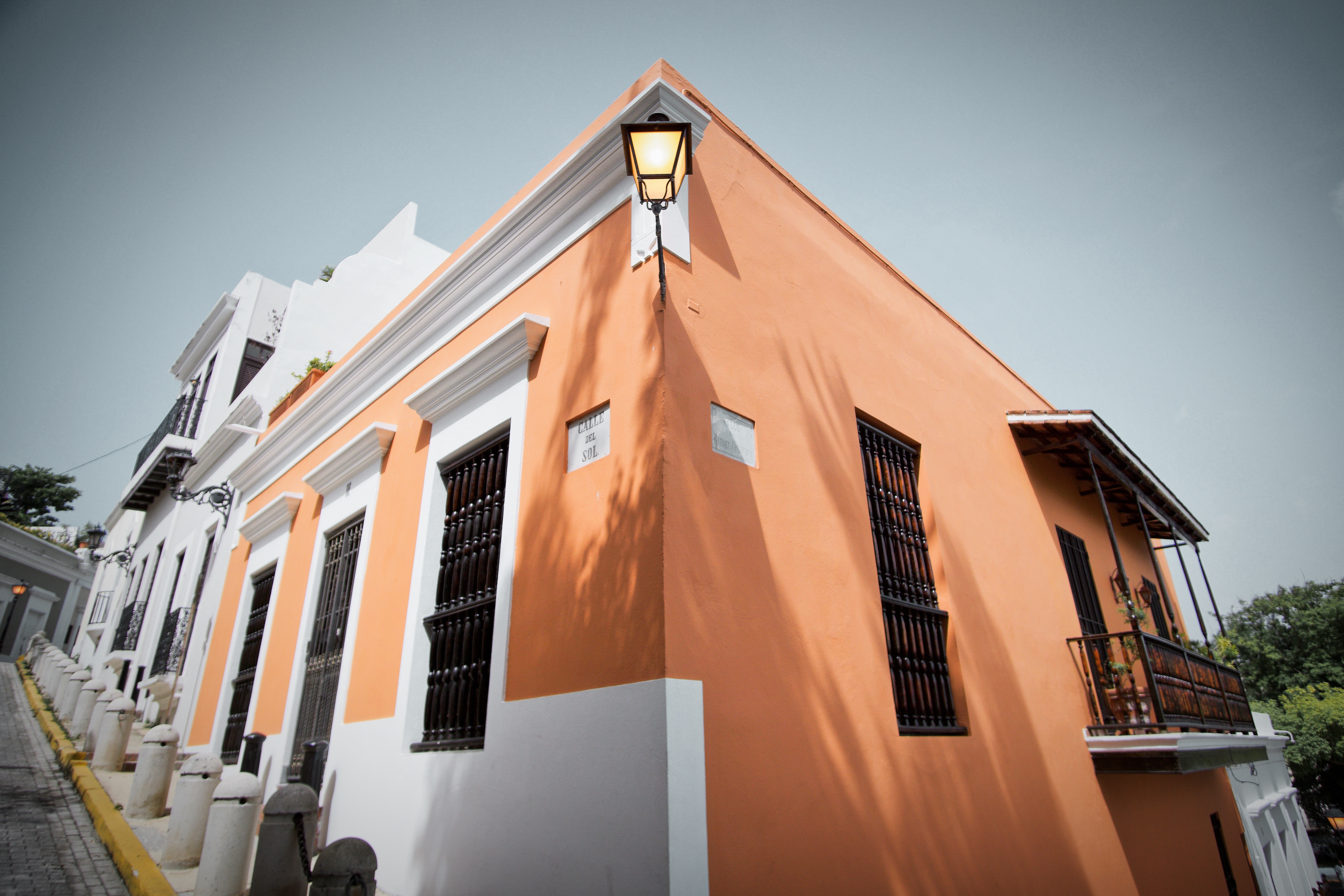
If you associate Puerto Rico's capital with the colonial streets of Old San Juan, then you know only part of the picture. San Juan is a major metropolis, radiating out from the bay on the Atlantic Ocean that was discovered by Juan Ponce de León. More than a third of the island's nearly 4 million citizens proudly call themselves sanjuaneros. The city may be rooted in the past, but it has its eye on the future. Locals go about their business surrounded by colonial architecture and towering modern structures.By 1508 the explorer Juan Ponce de León had established a colony in an area now known as Caparra, southeast of present-day San Juan. He later moved the settlement north to a more hospitable peninsular location. In 1521, after he became the first colonial governor, Ponce de León switched the name of the island—which was then called San Juan Bautista in honor of St. John the Baptist—with that of the settlement of Puerto Rico ("rich port").Defended by the imposing Castillo San Felipe del Morro (El Morro) and Castillo San Cristóbal, Puerto Rico's administrative and population center remained firmly in Spain's hands until 1898, when it came under U.S. control after the Spanish-American War. Centuries of Spanish rule left an indelible imprint on the city, particularly in the walled area now known as Old San Juan. The area is filled with cobblestone streets and brightly painted, colonial-era structures, and its fortifications have been designated a UNESCO World Heritage Site.Old San Juan is a monument to the past, but most of the rest of the city is planted firmly in the 21st century and draws migrants island-wide and from farther afield to jobs in its businesses and industries. The city captivates residents and visitors alike with its vibrant lifestyle as well as its balmy beaches, pulsing nightclubs, globe-spanning restaurants, and world-class museums. Once you set foot in this city, you may never want to leave.

About Cruz Bay, Saint John

About Prickly Pear Island
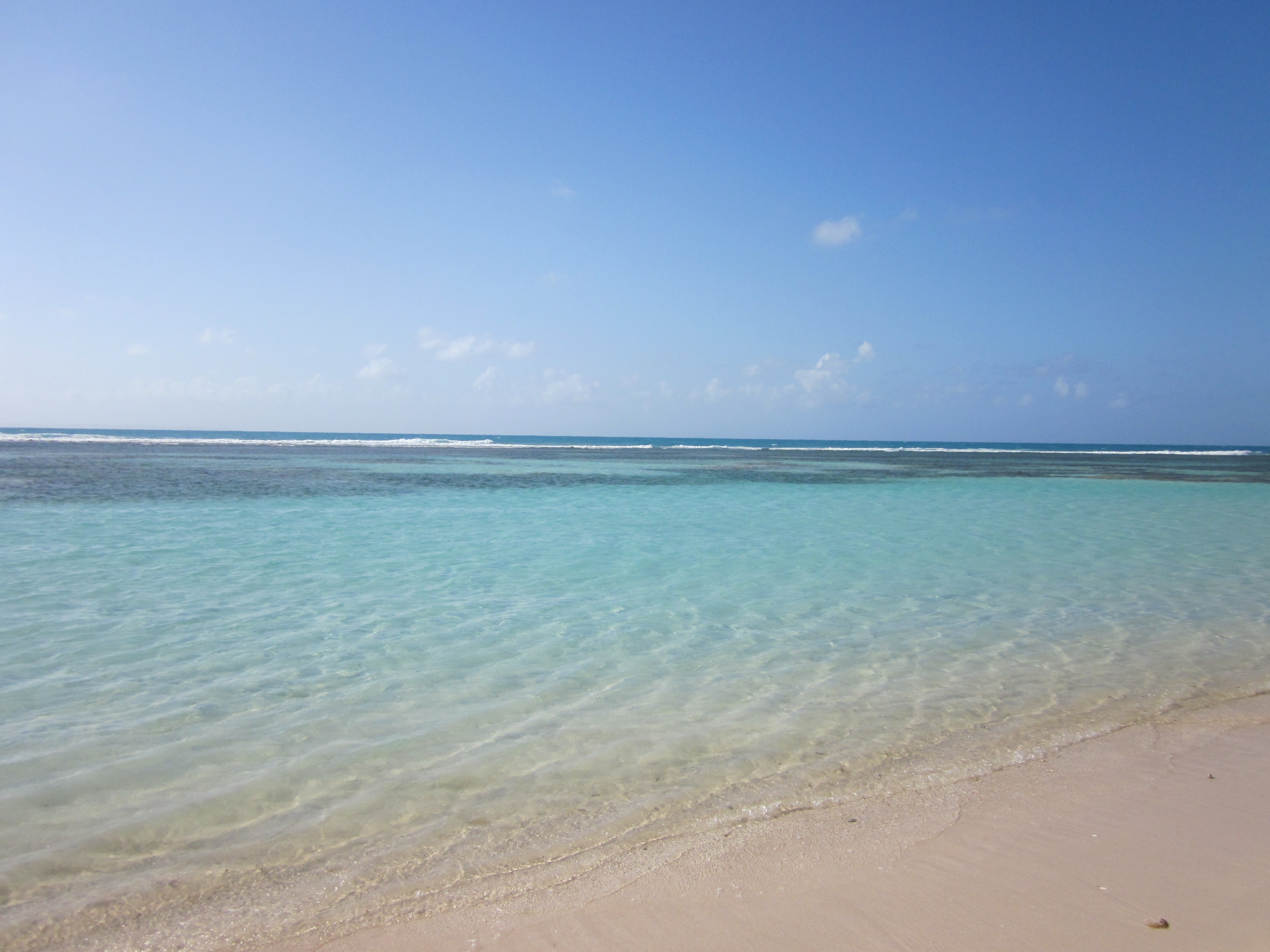
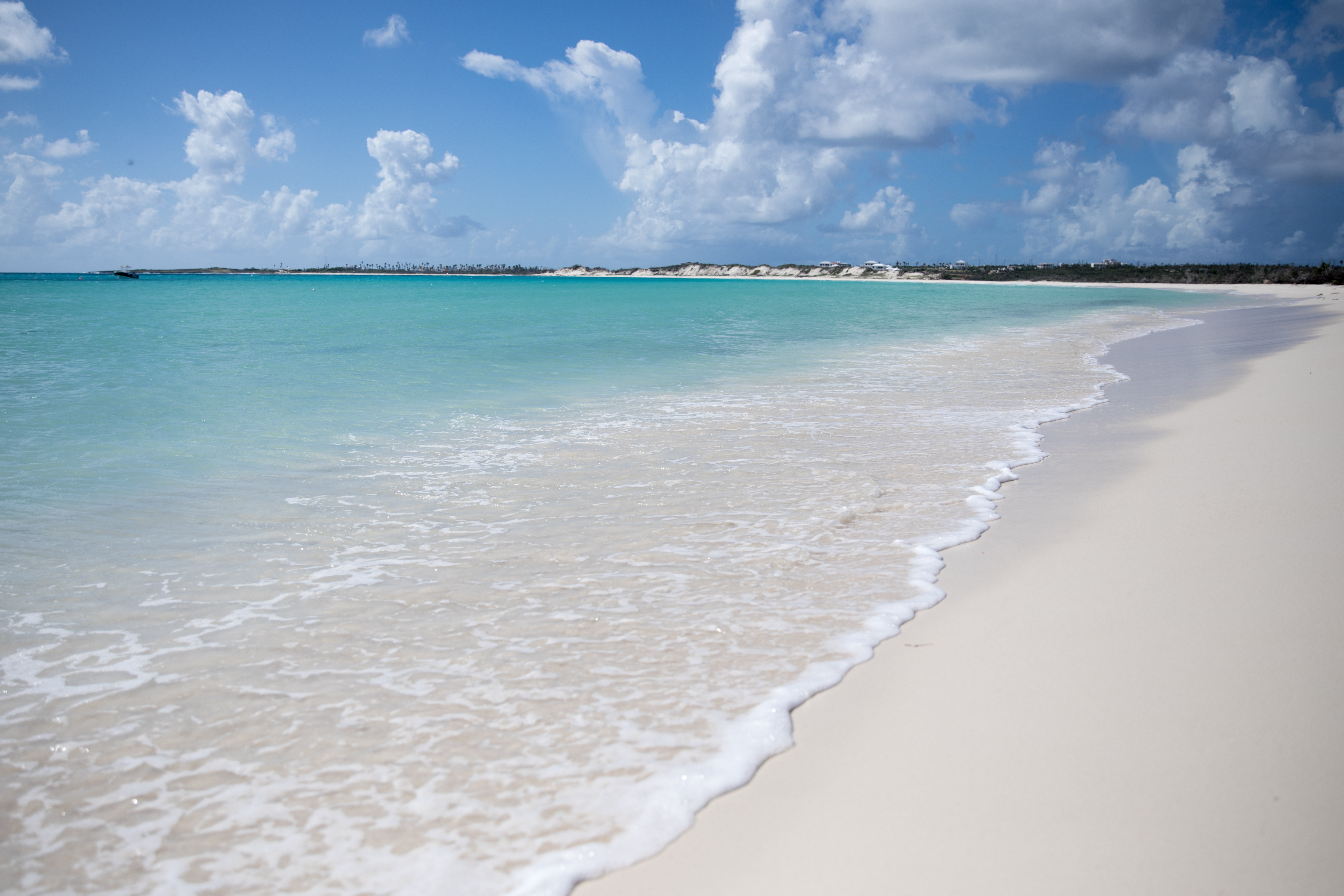
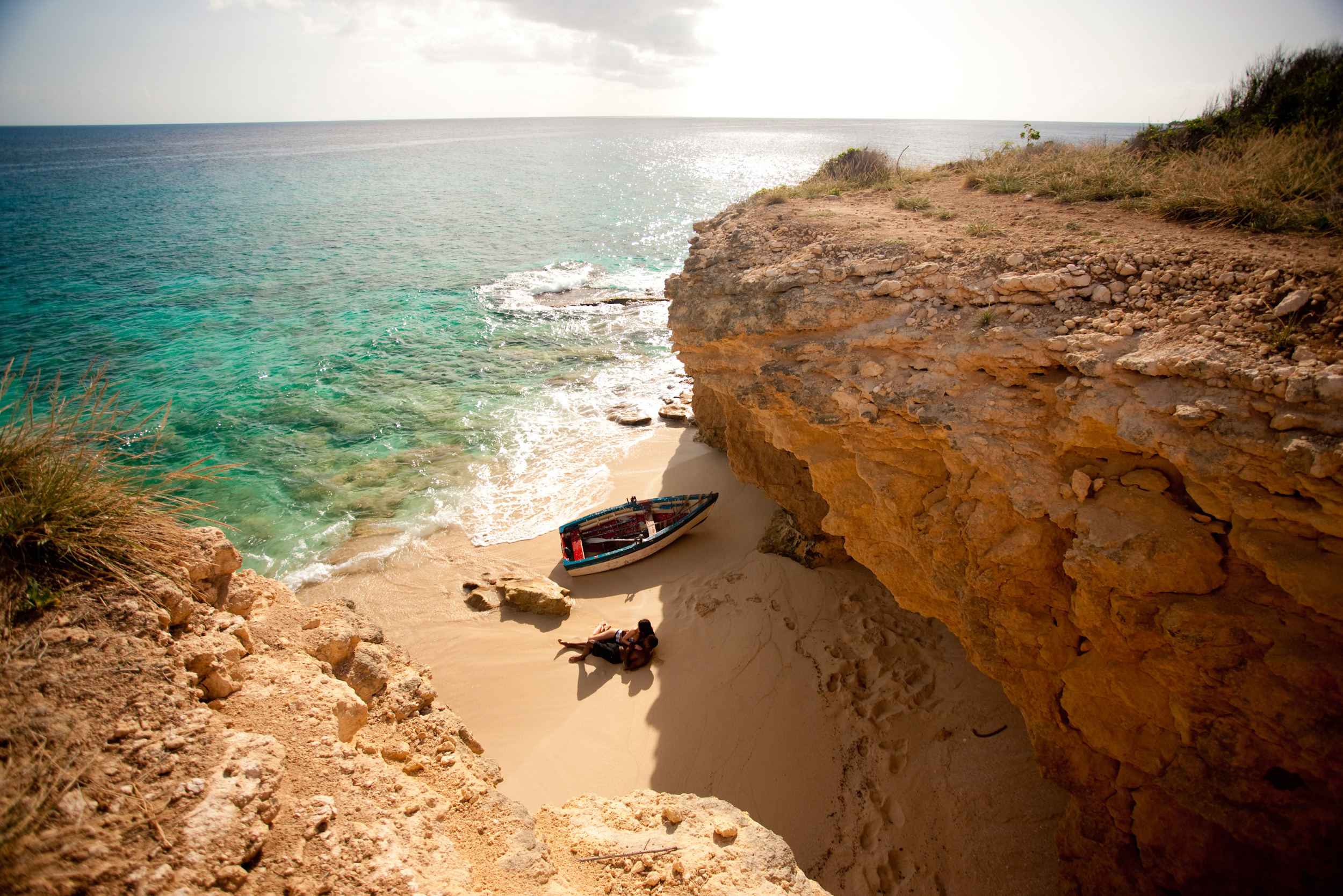
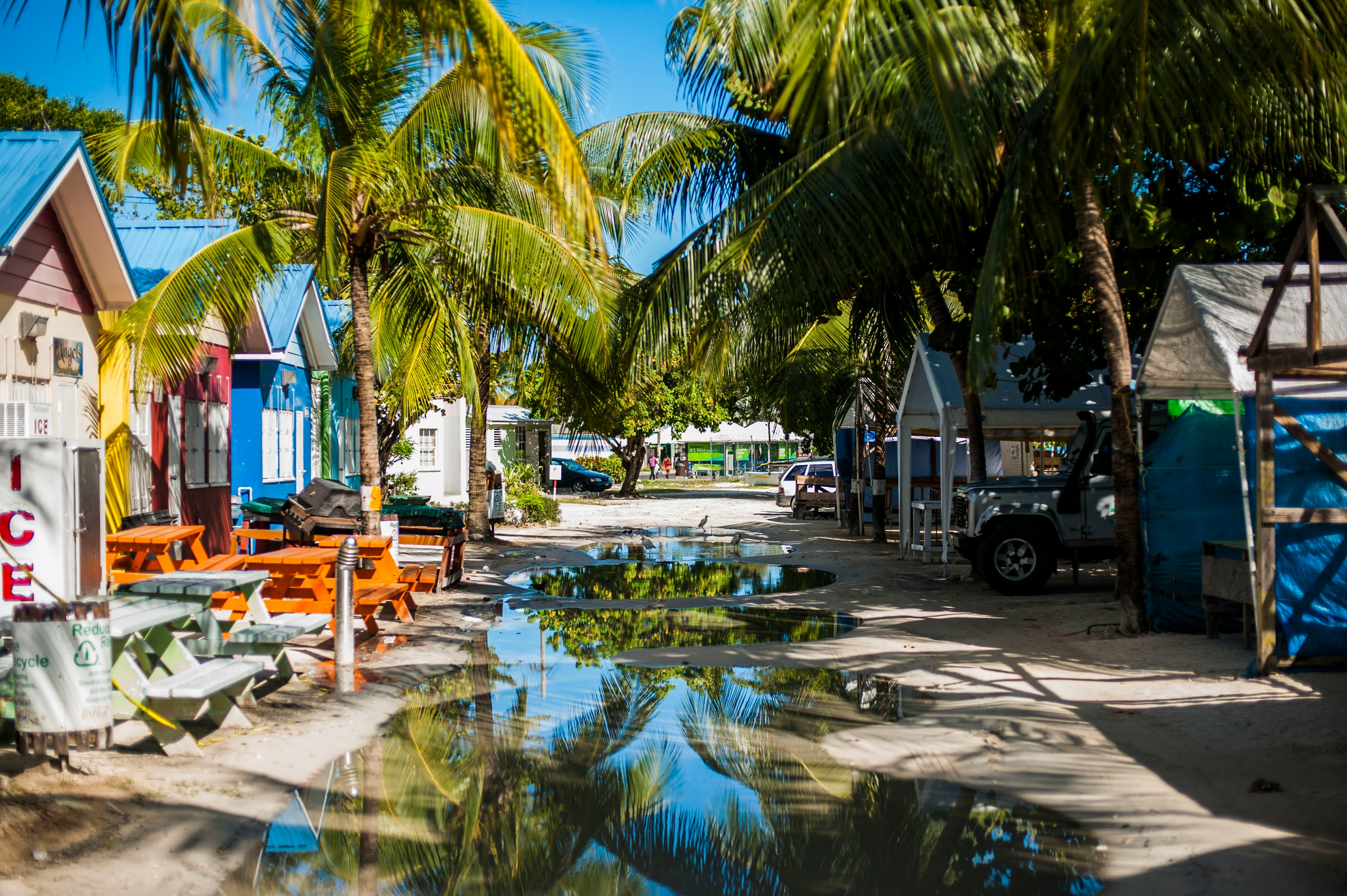
About Sandy Ground
Sandy Ground is a village beach on the island of Anguilla, located in the British West Indies. It benefits from a tropical climate and the warm Caribbean waters and is popular with tourists looking for a relaxing beach holiday. Sandy Ground is known by its long curved white sandy beach set against the backdrop of high cliff and a disused salt pond. It is the main port for the small island of Anguilla and its beach is popular with boat racing, beach bars, barbecues and dancing. The island of Anguilla is easy to explore with one main road running through the middle and plenty of beaches and bays to be discovered. The romantic Little Bay offers secluded coves, Junk’s Hole is home to the notorious Palm Grove barbeque, Island Harbour boasts bright coloured working fishing boats and the sands of Meads Bay host hotels for the elegant dining experience. At sunset, head to Crocus Bay and the coral cliffs for the best location on the island to watch the day’s end.
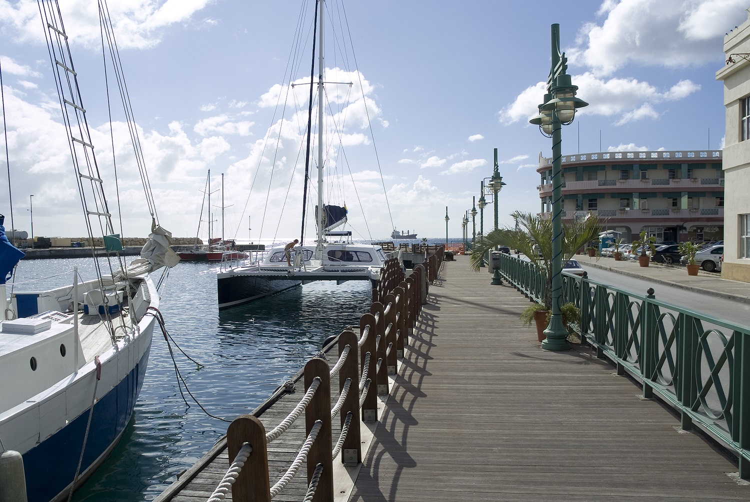
About Gustavia
You can easily explore all of Gustavia during a two-hour stroll. Some shops close from noon to 3 or 4, so plan lunch accordingly, but stores stay open past 7 in the evening. Parking in Gustavia is a challenge, especially during vacation times. A good spot to park is rue de la République, alongside the catamarans, yachts, and sailboats.
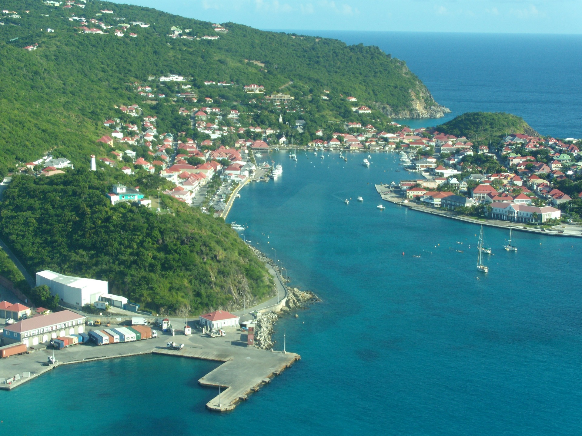
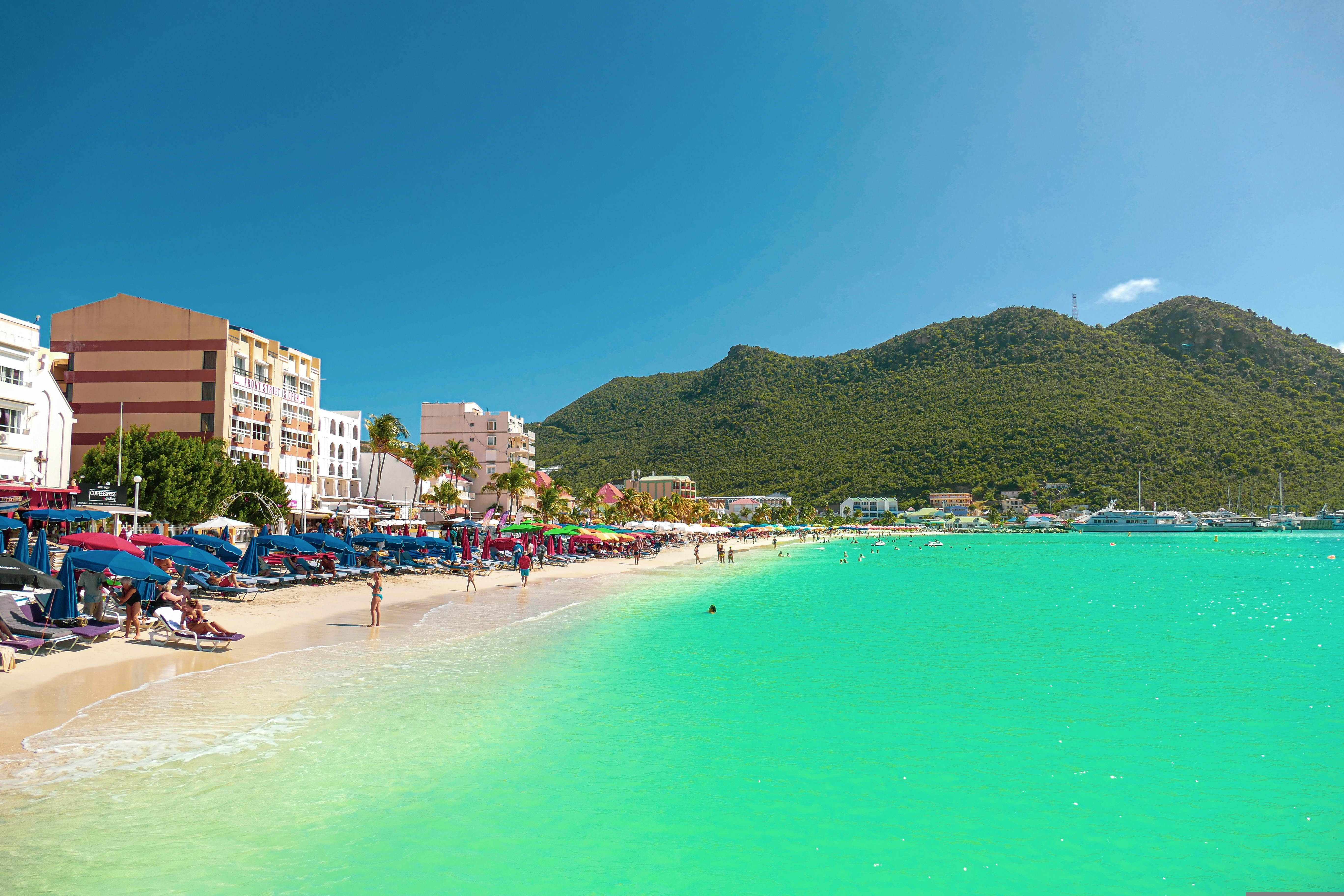
About Philipsburg
The capital of Dutch St. Maarten stretches about a mile (1½ km) along an isthmus between Great Bay and the Salt Pond and has five parallel streets. Most of the village's dozens of shops and restaurants are on Front Street, narrow and cobblestone, closest to Great Bay. It's generally congested when cruise ships are in port, because of its many duty-free shops and several casinos. Little lanes called steegjes connect Front Street with Back Street, which has fewer shops and considerably less congestion. Along the beach is a ½-mile-long (1-km-long) boardwalk with restaurants and several Wi-Fi hot spots.Wathey Square (pronounced watty) is in the heart of the village. Directly across from the square are the town hall and the courthouse, in a striking white building with cupola. The structure was built in 1793 and has served as the commander's home, a fire station, a jail, and a post office. The streets surrounding the square are lined with hotels, duty-free shops, restaurants, and cafés. The Captain Hodge Pier, just off the square, is a good spot to view Great Bay and the beach that stretches alongside.
About Terre-de-Haut
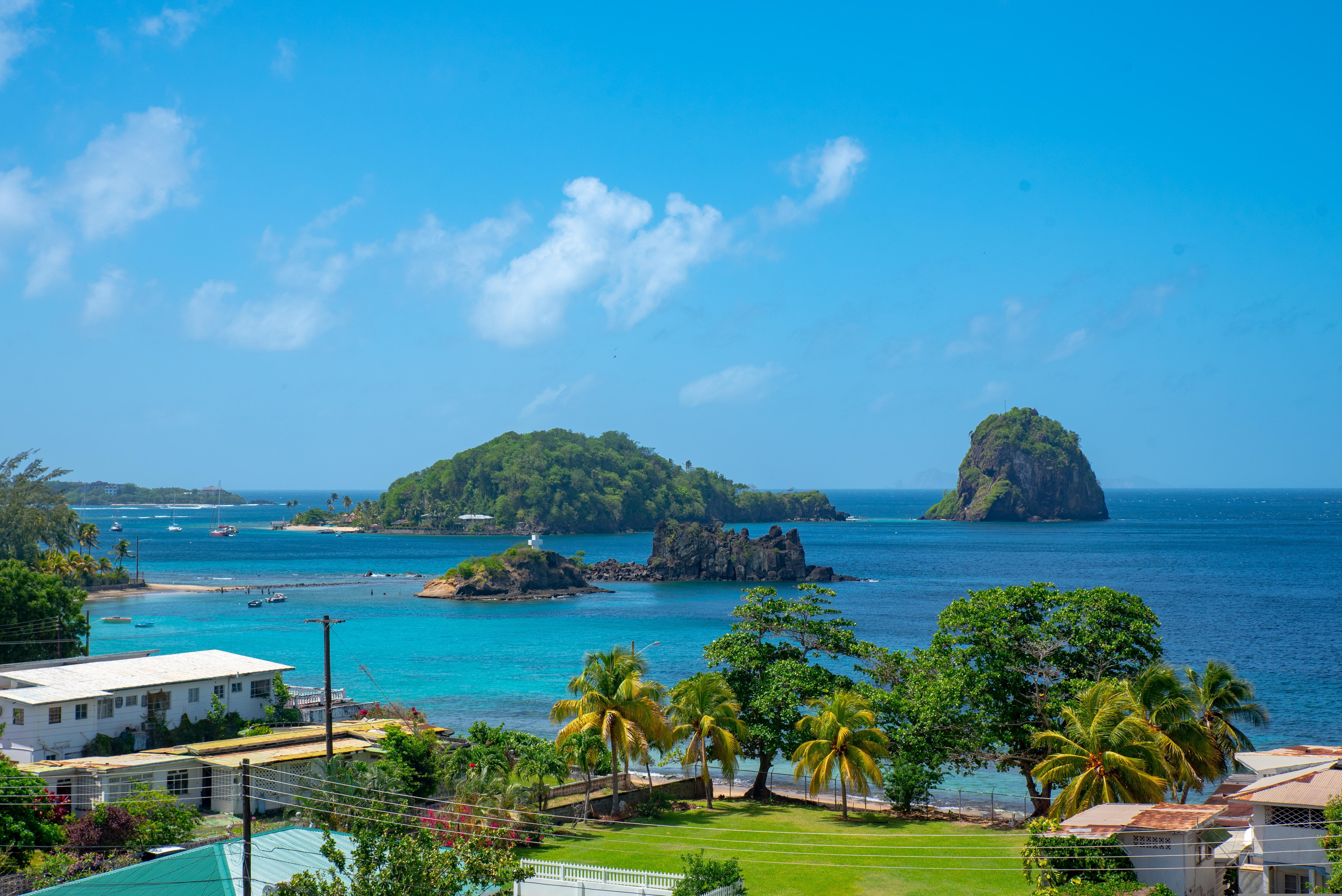
About Port Elizabeth, Bequia
Bequia is a Carib word meaning "island of the cloud." Hilly and green with several golden-sand beaches, Bequia is 9 miles (14½ km) south of St. Vincent's southwestern shore; with a population of 5,000, it's the largest of the Grenadines. Although boatbuilding, whaling, and fishing have been the predominant industries here for generations, sailing has now become almost synonymous with Bequia. Admiralty Bay is a favored anchorage for both privately owned and chartered yachts. Lodgings range from comfortable resorts and villas to cozy West Indian—style inns. Bequia's airport and the frequent ferry service from St. Vincent make this a favorite destination for day-trippers, as well. The ferry docks in Port Elizabeth, a tiny town with waterfront bars, restaurants, and shops where you can buy handmade souvenirs—including the exquisitely detailed model sailboats that are a famous Bequia export. The Easter Regatta is held during the four-day Easter weekend, when revelers gather to watch boat races and celebrate the island's seafaring traditions with food, music, dancing, and competitive games.To see the views, villages, beaches, and boatbuilding sites around Bequia, hire a taxi at the jetty in Port Elizabeth. Several usually line up under the almond trees to meet each ferry from St. Vincent.
About Tobago Cays
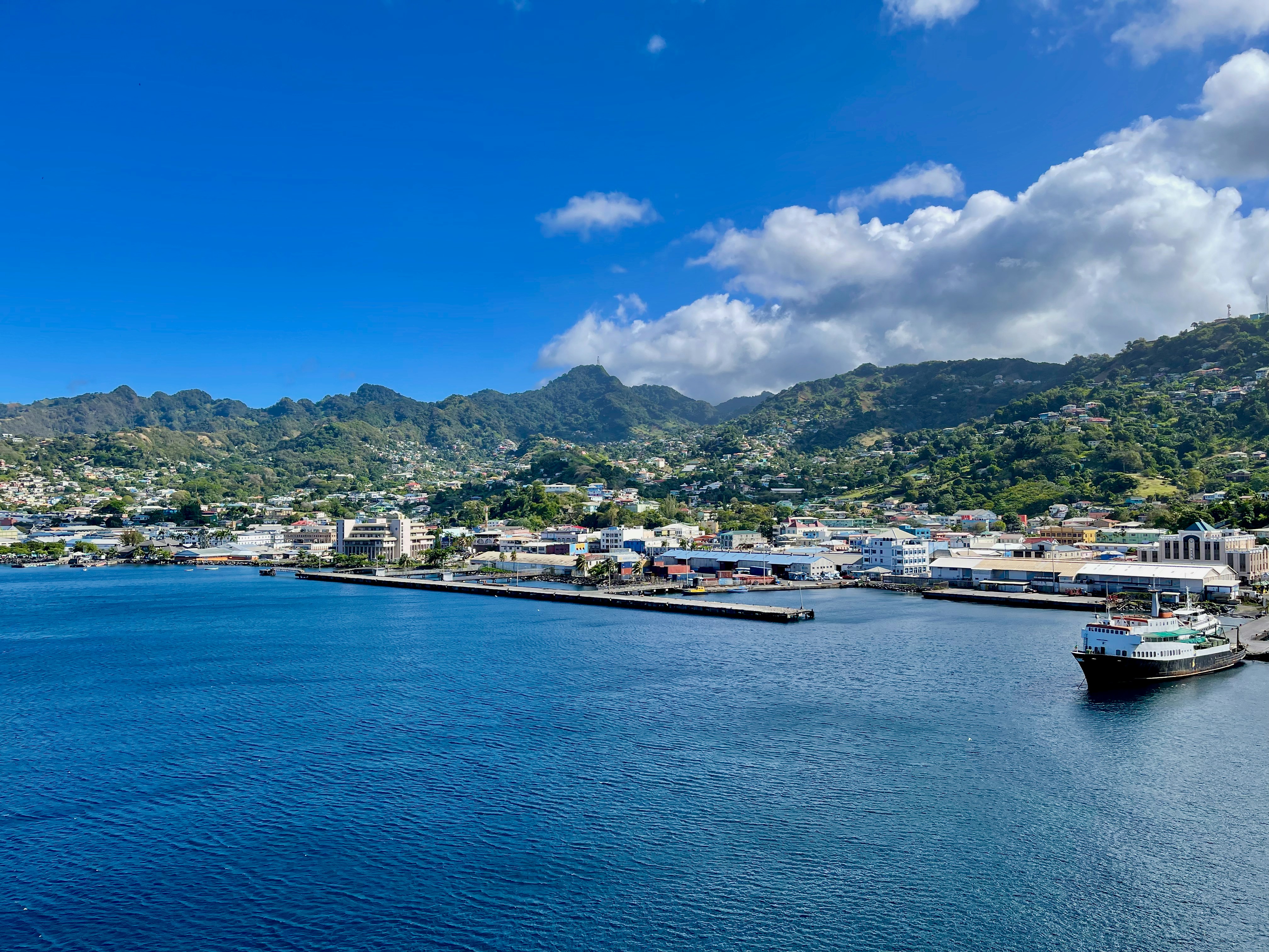
About Bridgetown
Located beside the island’s only natural harbour, the capital of Barbados combines modern and colonial architecture with glorious palm tree-lined beaches and a number of historical attractions. Experience the relaxed culture of the city renowned for its British-style parliament buildings and vibrant beach life, and seek out the Anglican church and the 19th-century Barbados Garrison. The distance between the ship and your tour vehicle may vary. This distance is not included in the excursion grades.
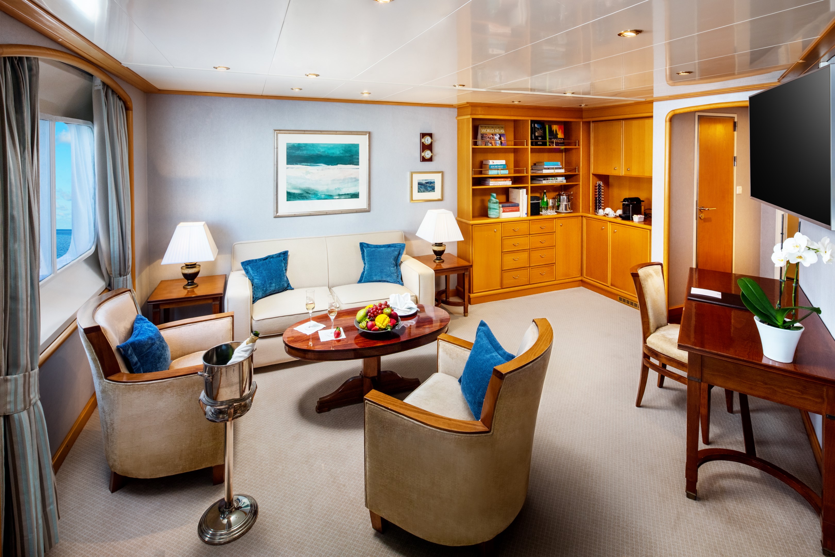
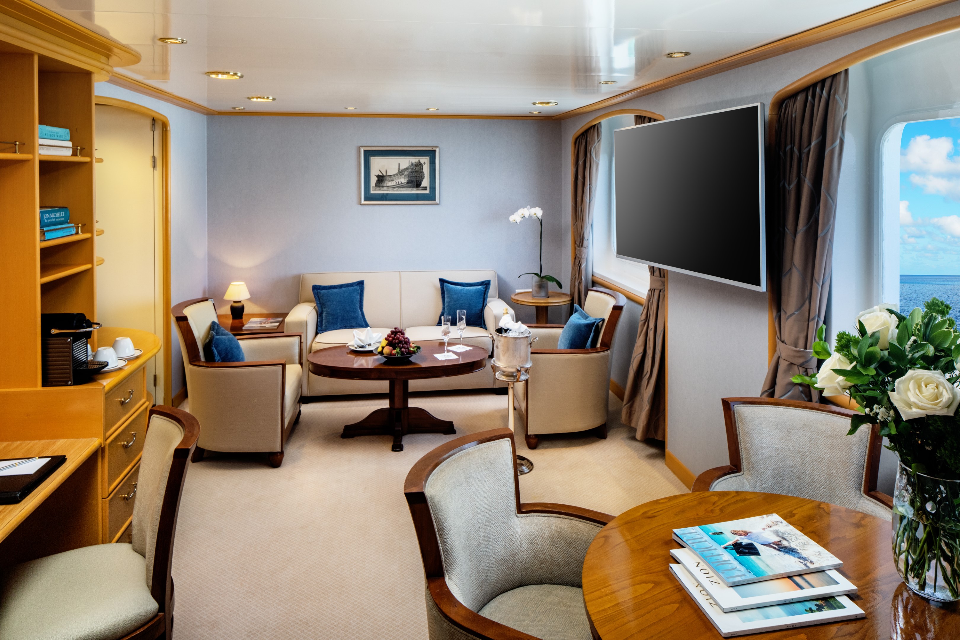
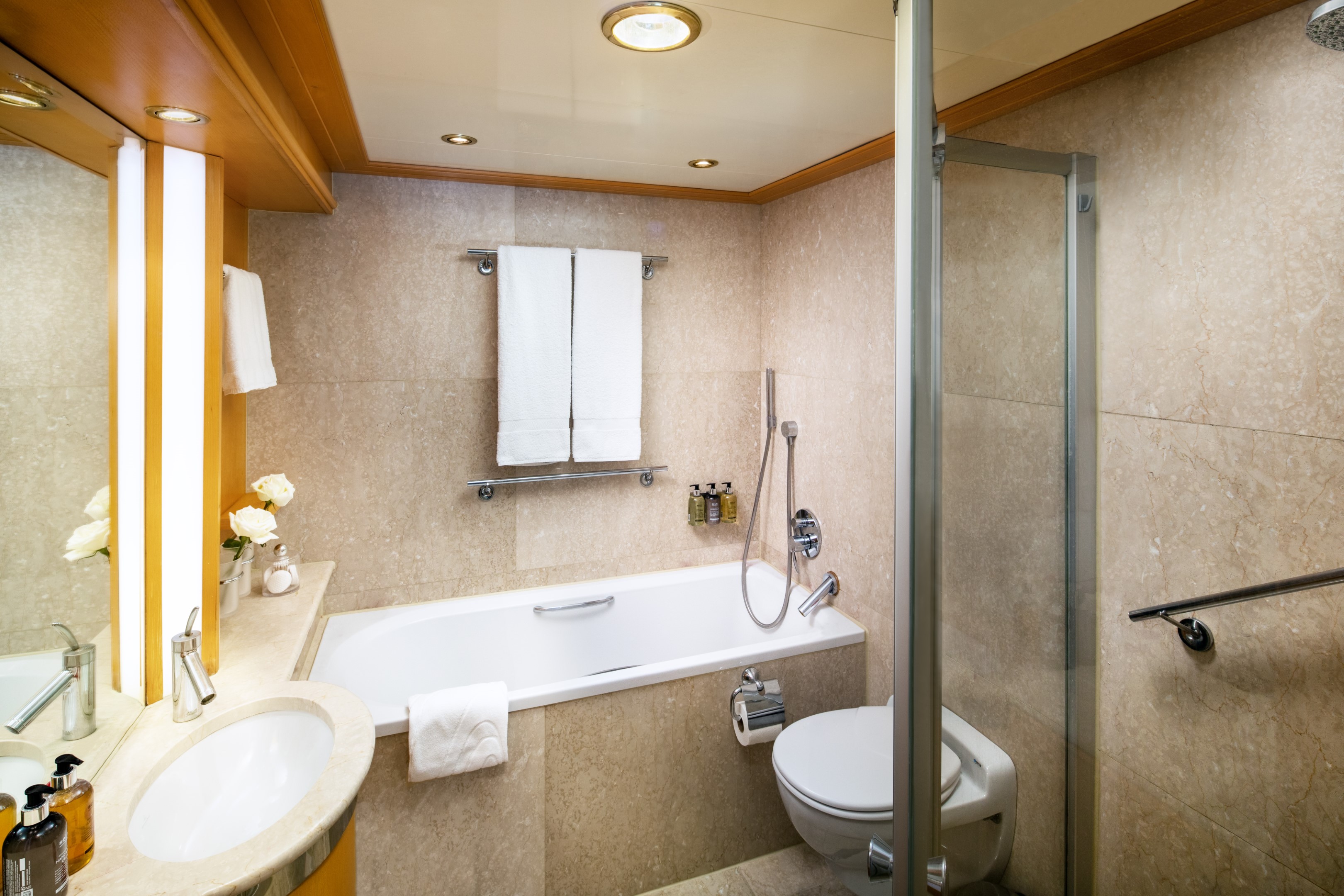
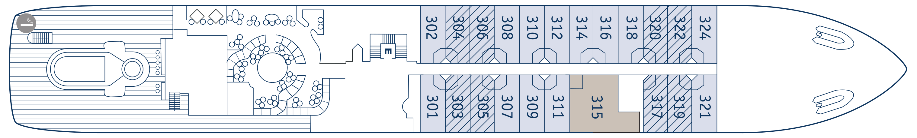
This premium suite (447 sq. ft. / 41.53 sq. meters) includes a thoughtfully appointed separate master bedroom with a permanent queen size bed and a flat-screen TV. The suite features a large master bathroom with a massage shower and a separate soaking tub with views of the sea. A spacious living area with a flat-screen TV, writing desk, and ½ guest bath. There is also a dining area suitable for hosting your friends and family. The Owner’s Suite is suite number 315 on both yachts, located mid-ship on Deck 3 – Close to the pool (aft, deck 3).
Additional Amenities:
- Well-stocked beverage refrigerator
- 2 – 55″ flat-screen TVs with “Infotainment”
- Nespresso® coffee machine
- Direct-dial telephone
- Safe
- Climate Control
- Make-Up Mirror
- Elm Organics bath amenities
- Hair dryer
- Superior Belgian bed & bath linens
- Luxury Bath Robes & Slippers
- Wooden & Padded Silk clothes hangers
- 24-hour in-stateroom “Small Bites” menu
- Wifi Available
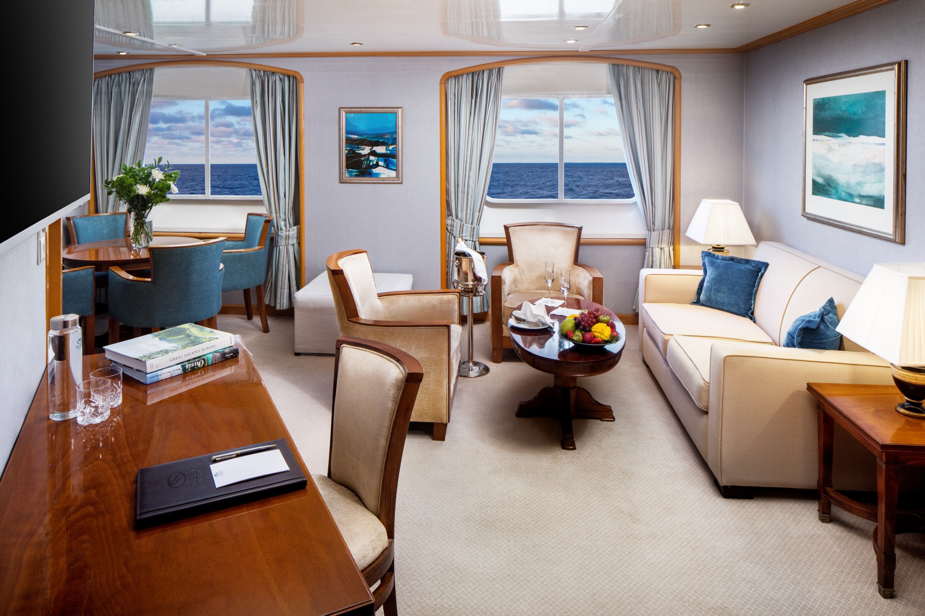
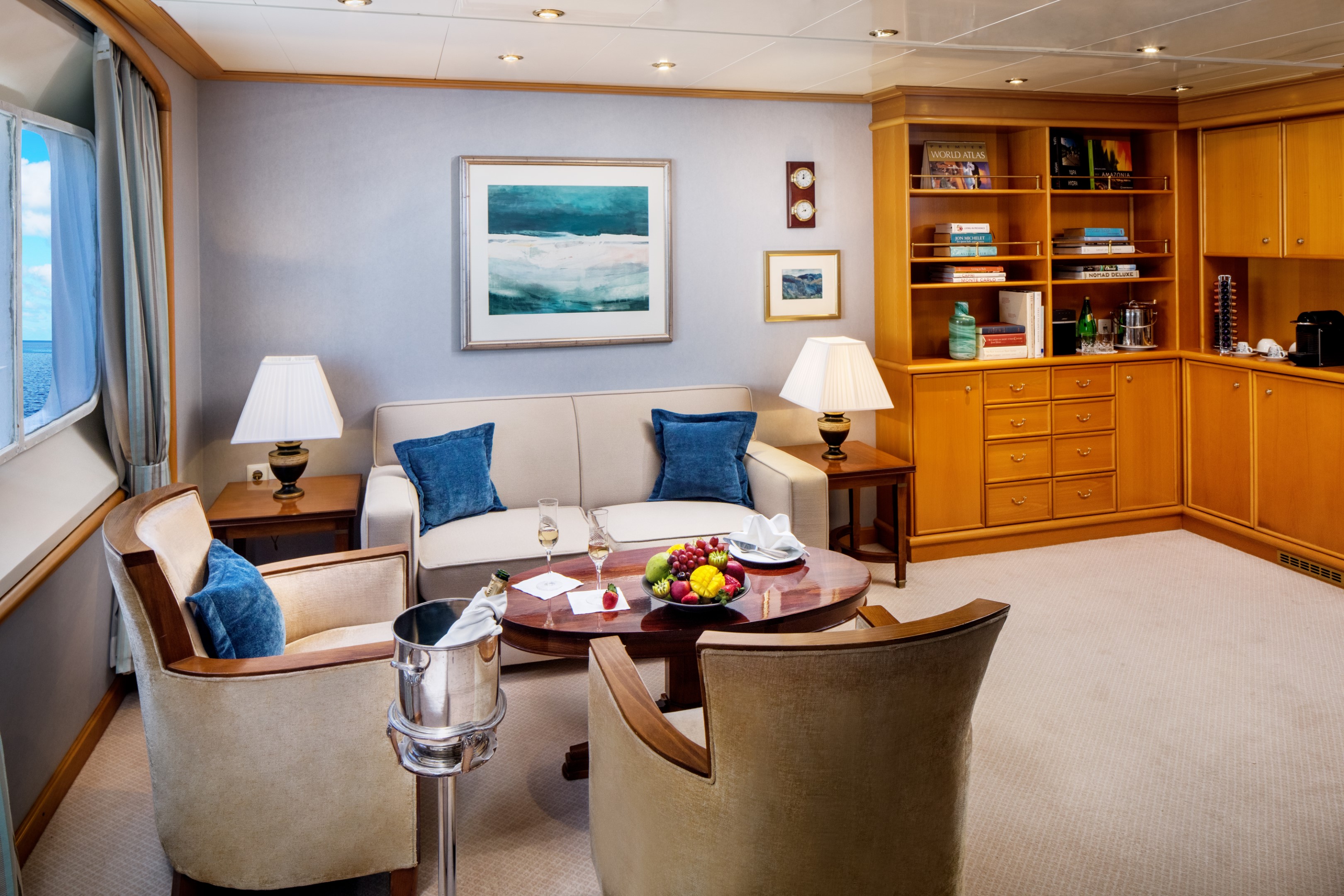
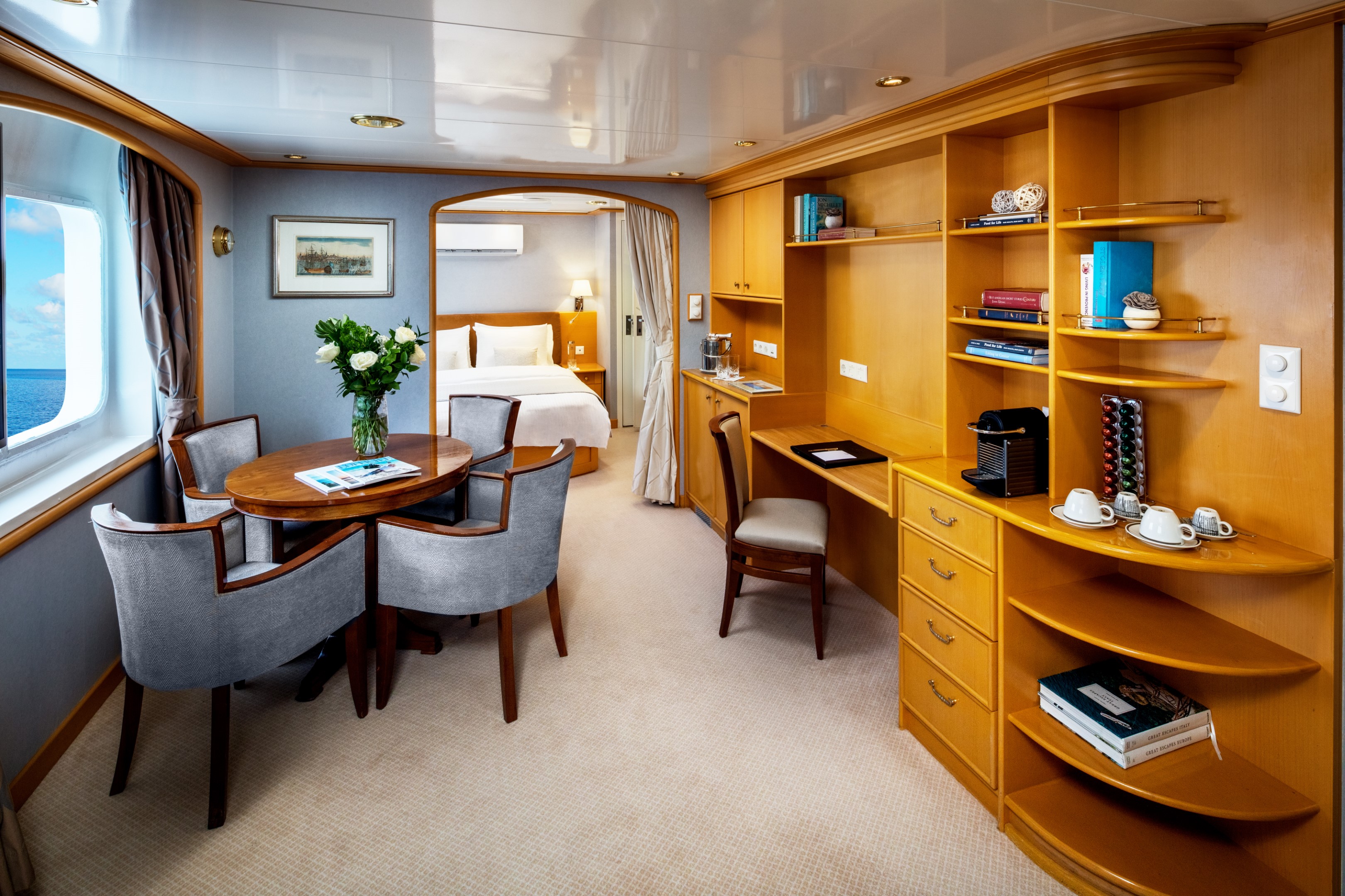
Enjoy 375 sq. ft. / 34.8 sq. meters of living space with ocean views from a total of 3 picture windows. Partitioned living and dining areas with ½ guest bath and closet. Separate and private en-suite master bedroom with permanent queen bed and closet. Marble-lined bathroom with multi-jet shower and soaking tub. Built-in dresser with writing desk. The Admiral Suite is Suite 400 on both yachts and is near the Library.
Additional Amenities:
- Well-stocked beverage refrigerator
- 2 – 55″ flat-screen TVs with “Infotainment”
- Nespresso® coffee machine
- Direct-dial telephone
- Safe
- Climate Control
- Make-Up Mirror
- Elm Organics bath amenities
- Hair dryer
- Superior Belgian bed & bath linens
- Luxury Bath Robes & Slippers
- Wooden & Padded Silk clothes hangers
- 24-hour in-stateroom “Small Bites” menu
- Wifi Available
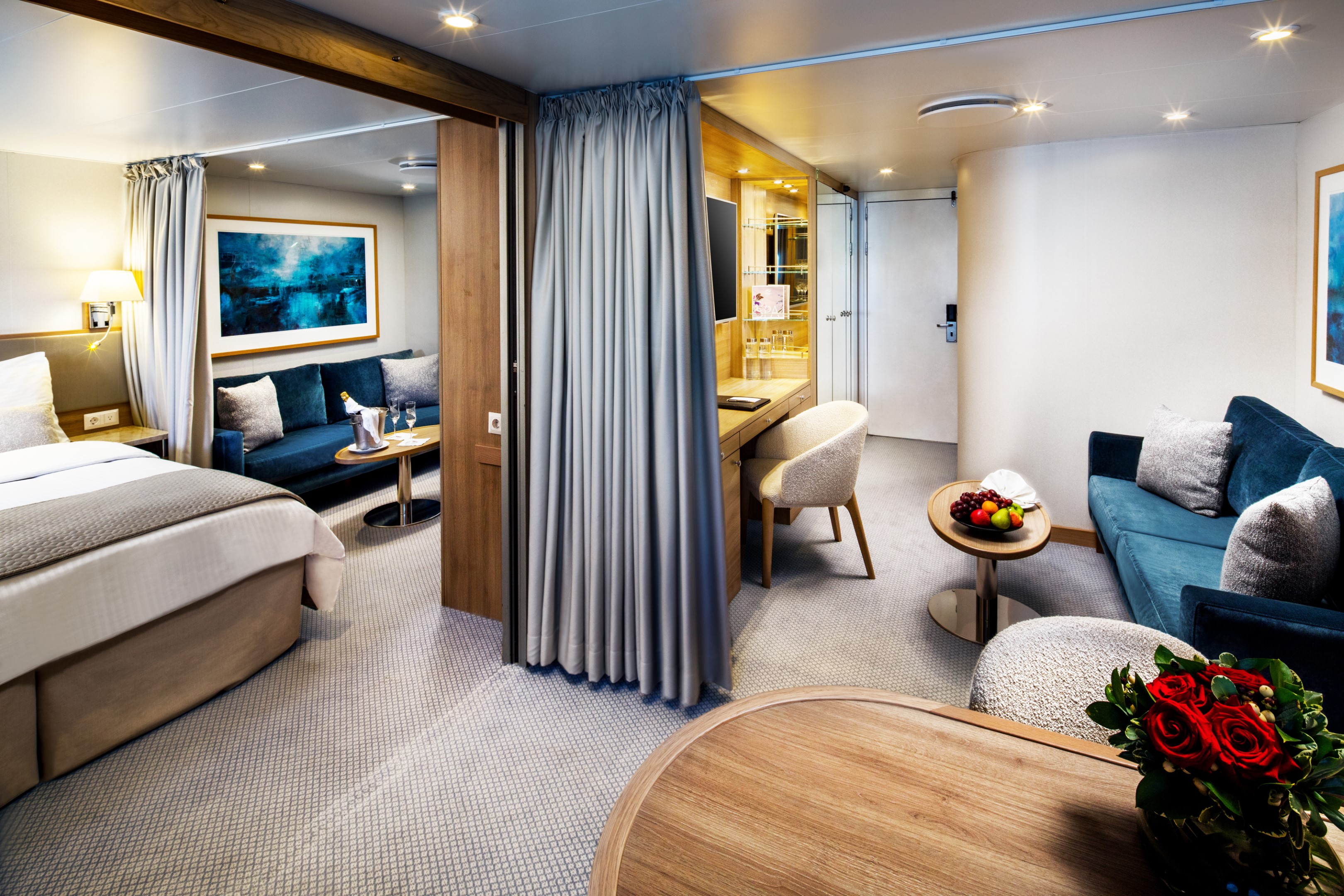
We combine two Yacht Club Staterooms to create a beautiful and spacious Commodore Suite. These comfortably appointed ocean-view suites provide a choice of two twin beds or a queen-size bed, two full marble-lined bathrooms with multi-jet showers, a seating area with sofa, coordinated chair and cocktail table, 2 spacious closets, and built-in dressers with writing desk. Configuration allows for either an additional permanent queen bed or dining area. There are eight possible Commodore Suites and they average 390 spacious sq. ft. / 36.23 sq. meters. Commodore Suites on Deck 2 feature four (4) 17” round windows instead of 2 picture windows found in Deck 3 Commodore Suites. Deck 3 Commodore Suites are close to the Pool and Main Salon.
Additional Amenities:
- Well-stocked beverage refrigerator
- 2 – 55″ flat-screen TVs with “Infotainment”
- Direct-dial telephone
- Safe
- Climate Control
- Make-Up Mirror
- Hair dryer
- Elm Organics bath amenities
- Superior Belgian bed & bath linens
- Luxury Bath Robes & Slippers
- Wooden & Padded Silk clothes hangers
- 24-hour in-stateroom “Small Bites” menu
- Wifi Available
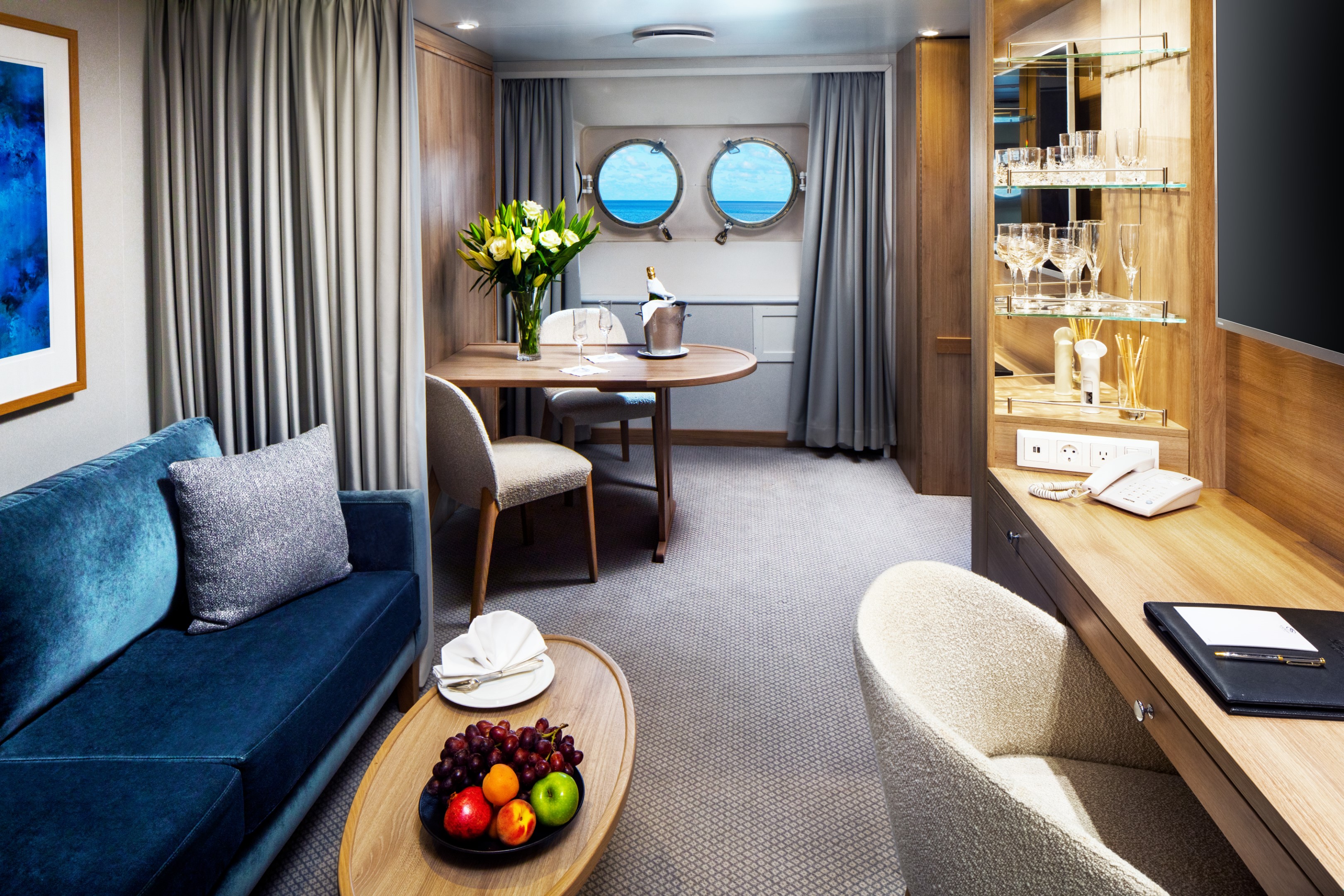
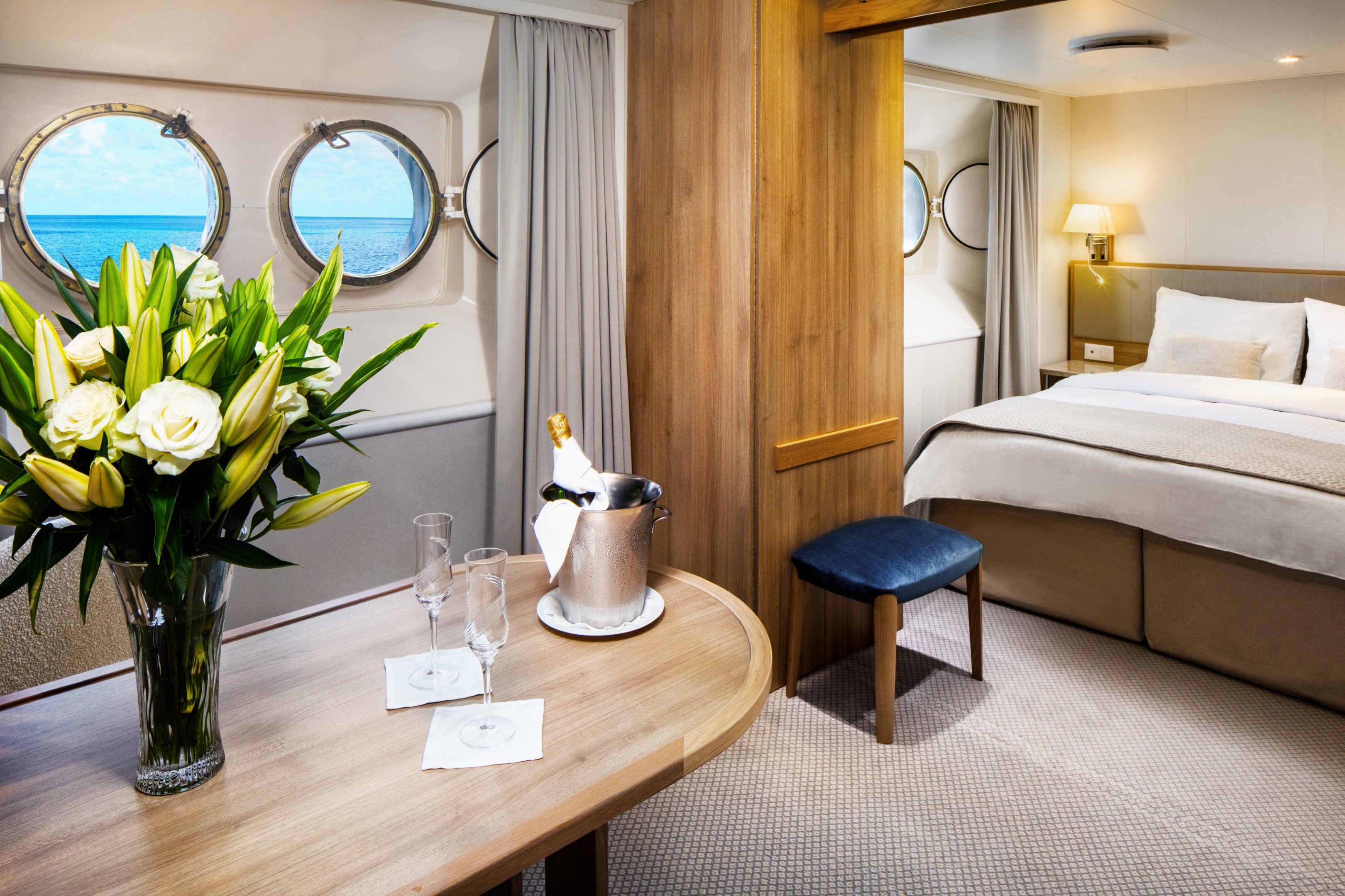
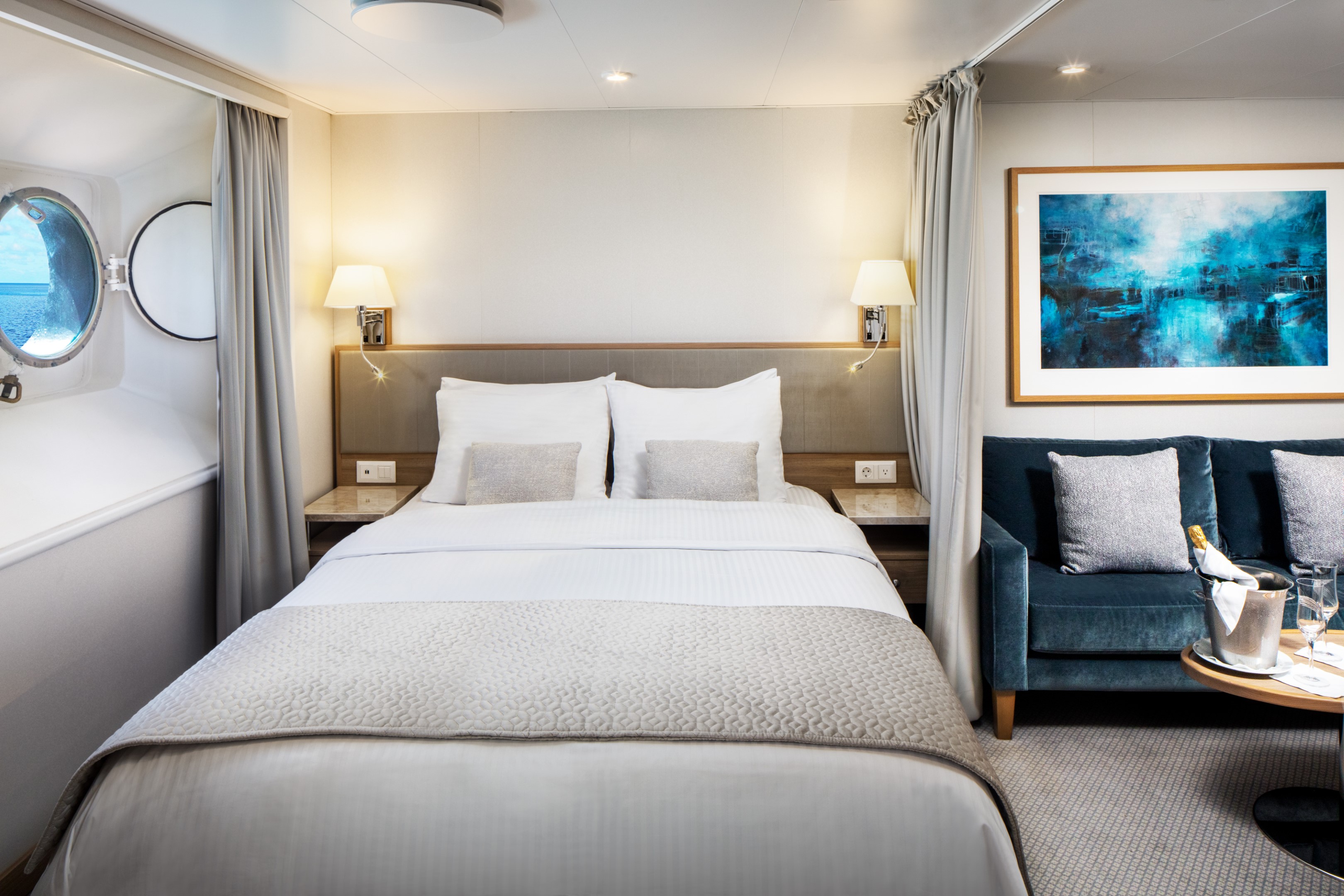
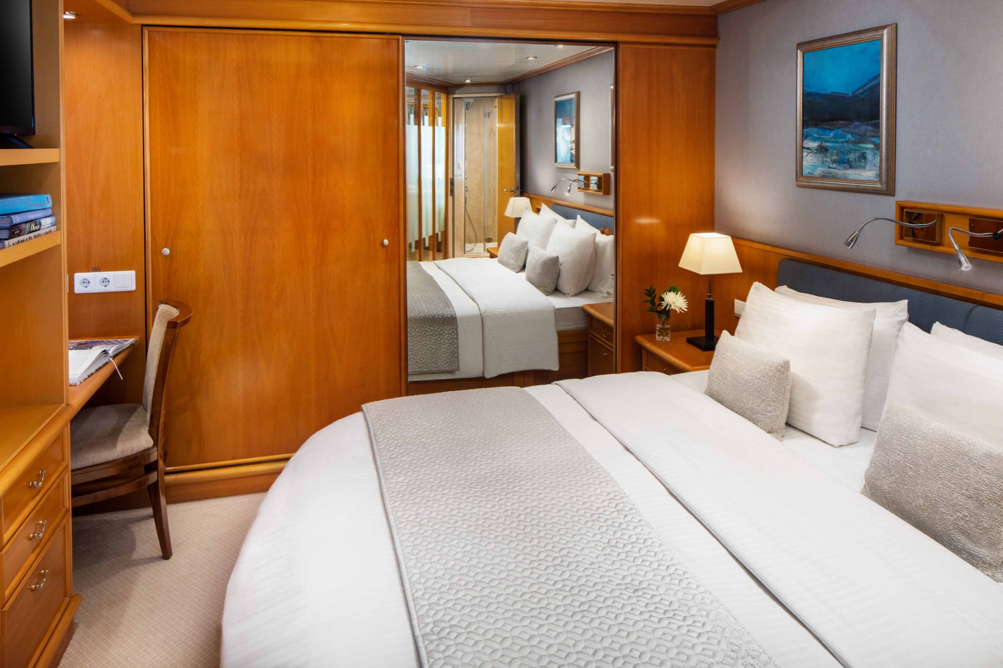
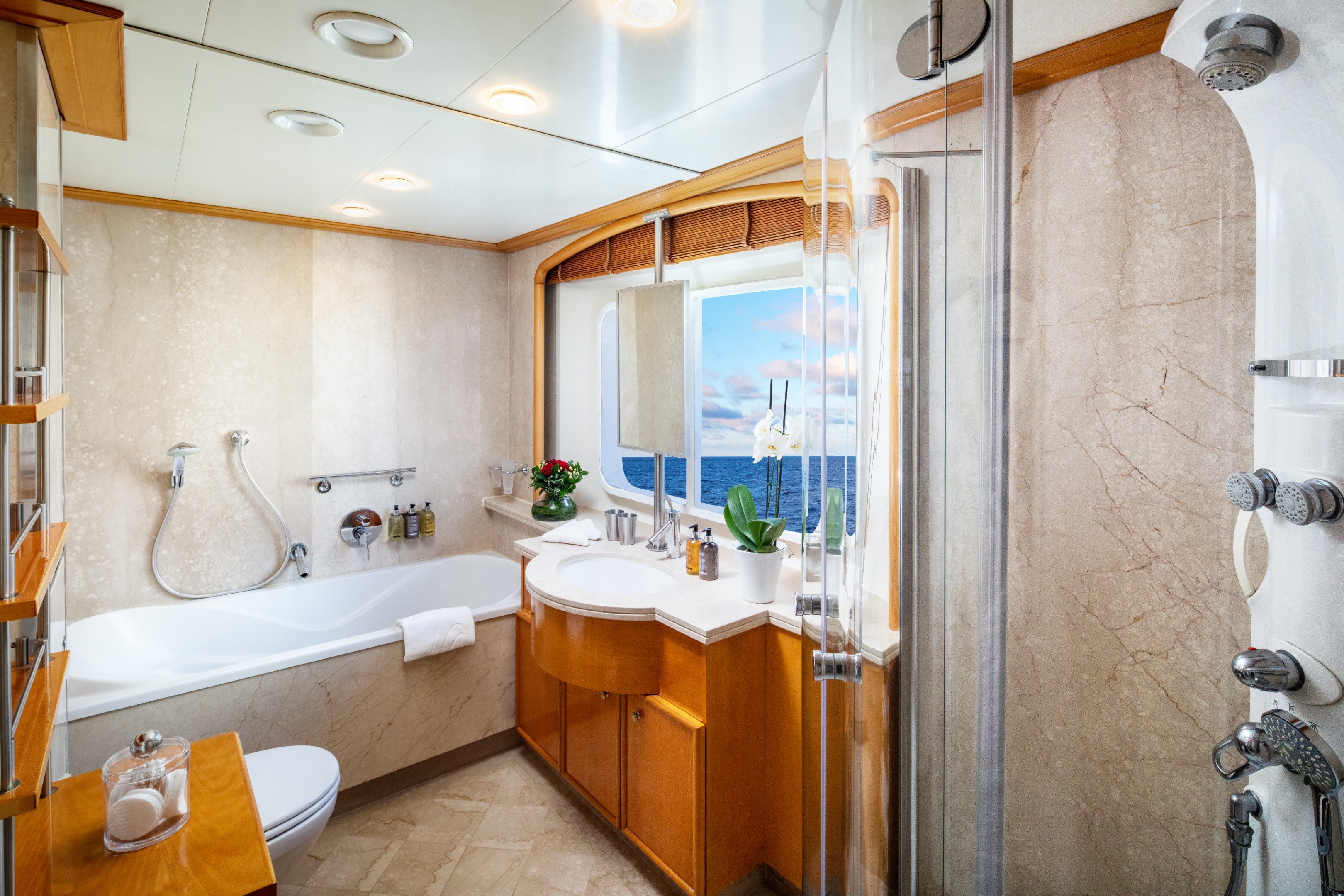
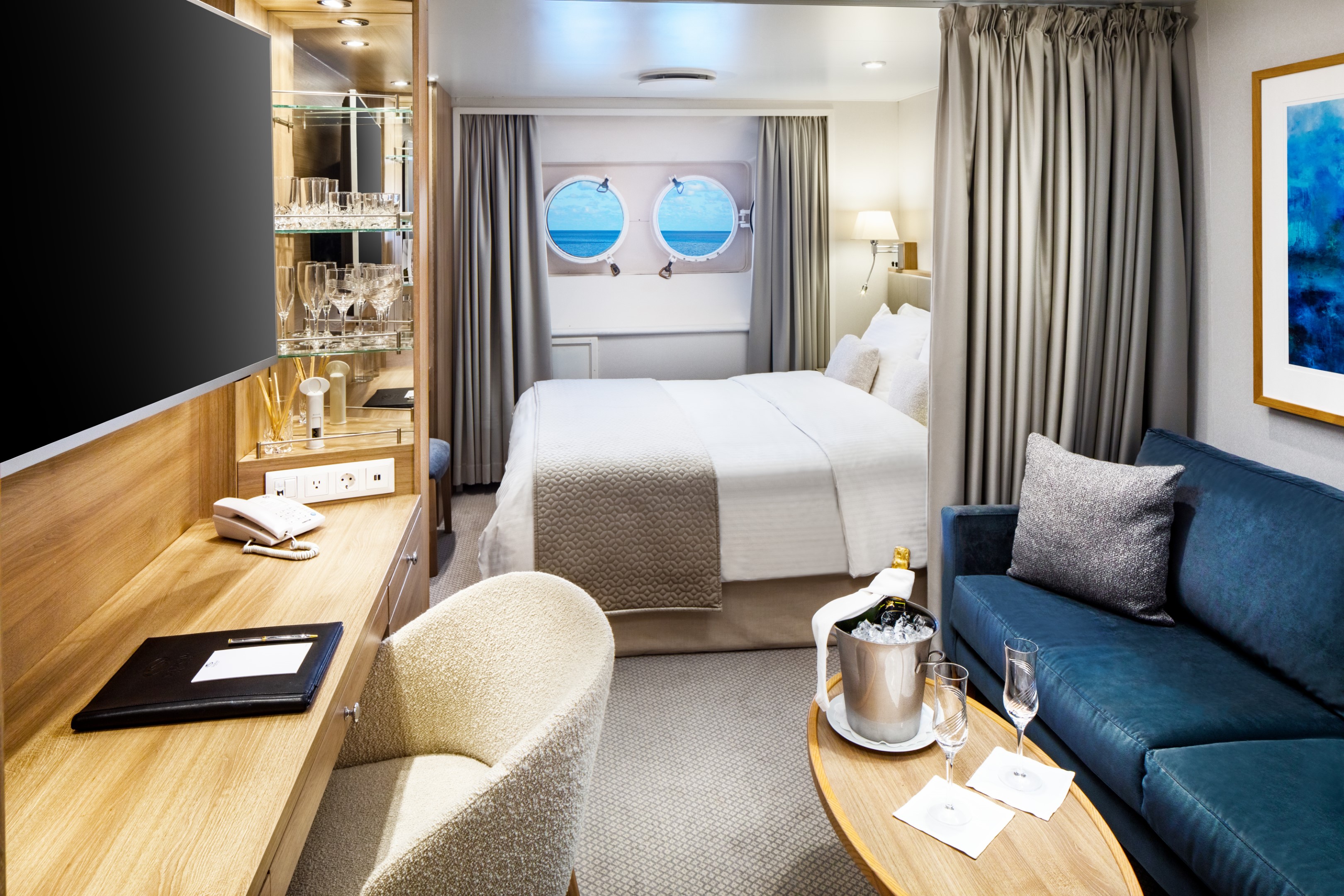
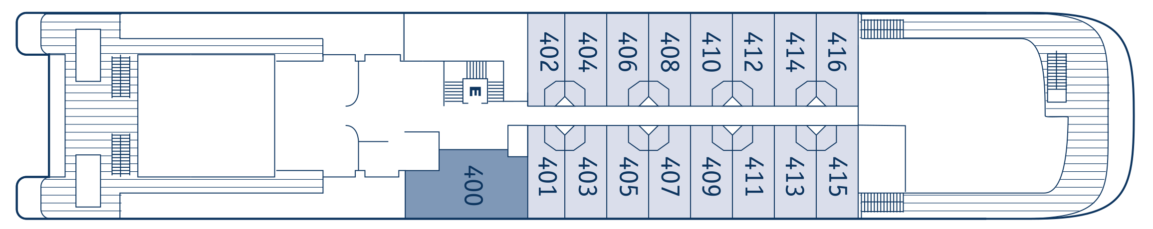
Yacht Club Deck 3 & 4 staterooms average 195 sq.ft./18.12 sq. meters. These picture window ocean view staterooms include a marble-lined bathroom in select staterooms with a multi-jet shower and a well-appointed open living area with sofa, chair, cocktail table, and built-in dresser with writing desk. Most staterooms offer a choice of 2 twin beds or 1 queen bed. Please contact the reservations team to confirm your choice. Deck 4 staterooms enjoy close proximity to the SeaDream Spa, Fitness Centre, and Library. Deck 3 is the perfect location for guests who desire to be just feet from the pool.
Additional Amenities:
- Well-stocked beverage refrigerator
- 55″ flat-screen TV with “Infotainment”
- Direct-dial telephone
- Safe
- Climate Control
- Make-Up Mirror
- Hair dryer
- Elm Organics bath amenities
- Superior Belgian bed & bath linens
- Luxury Bath Robes & Slippers
- Wooden & Padded Silk clothes hangers
- 24-hour in-stateroom “Small Bites” menu
- Wifi Available
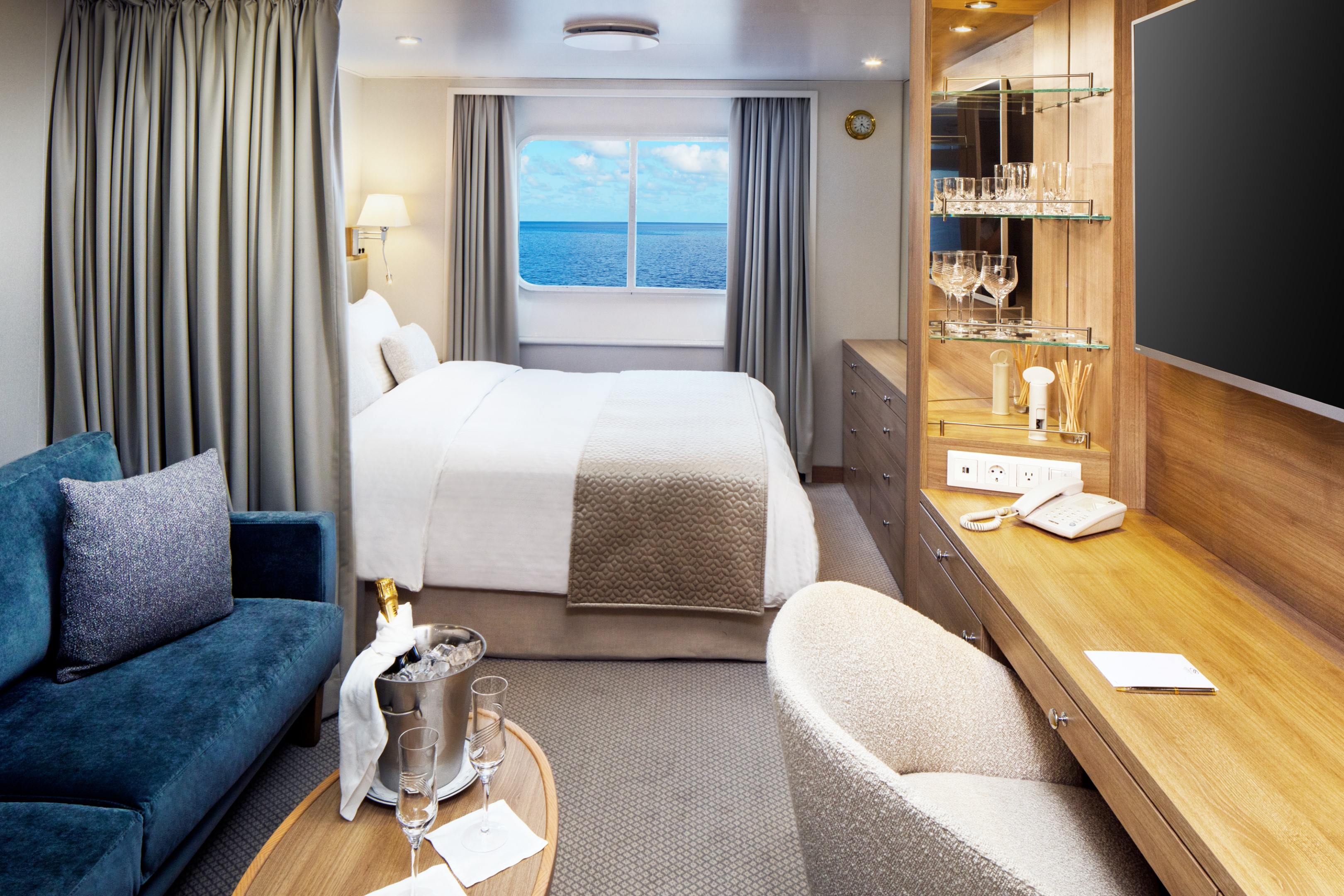
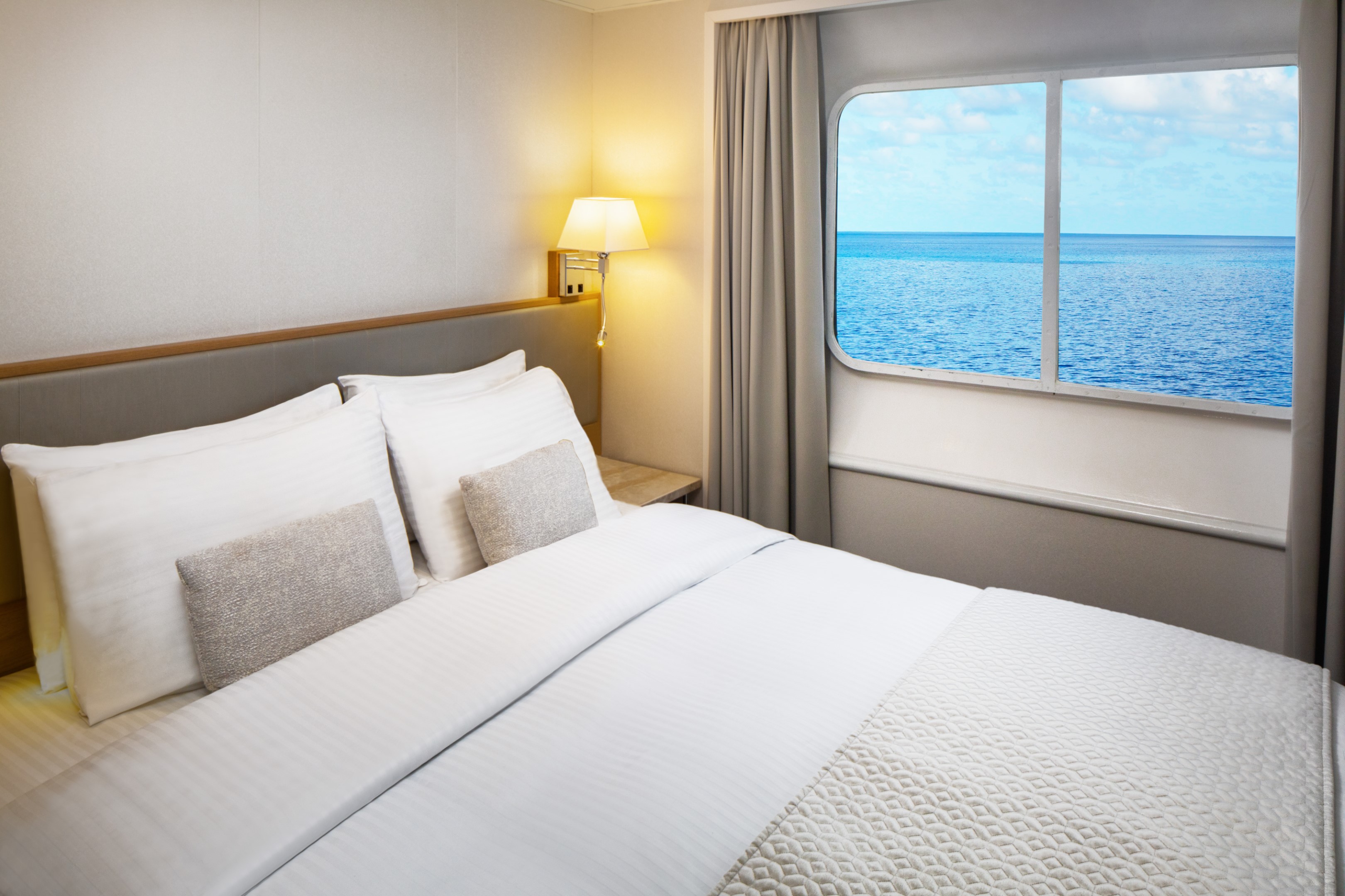
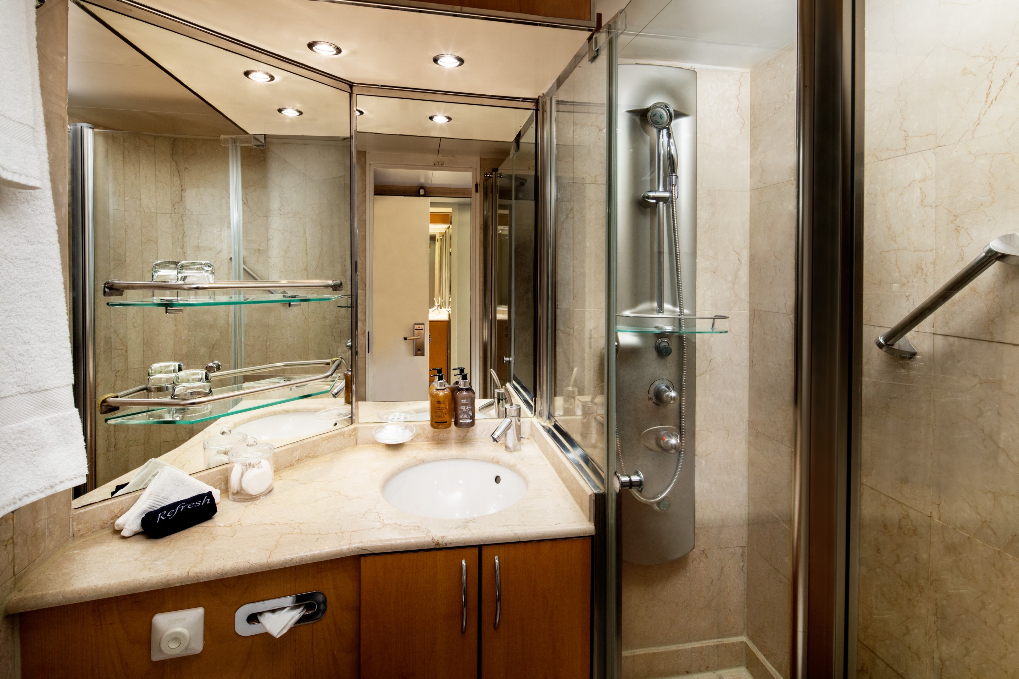
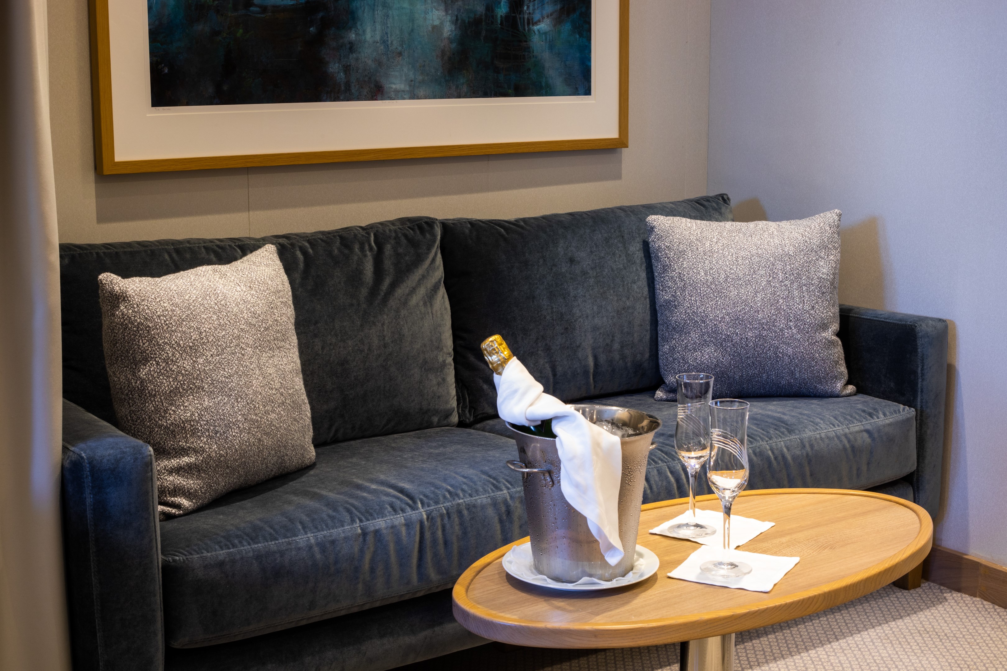
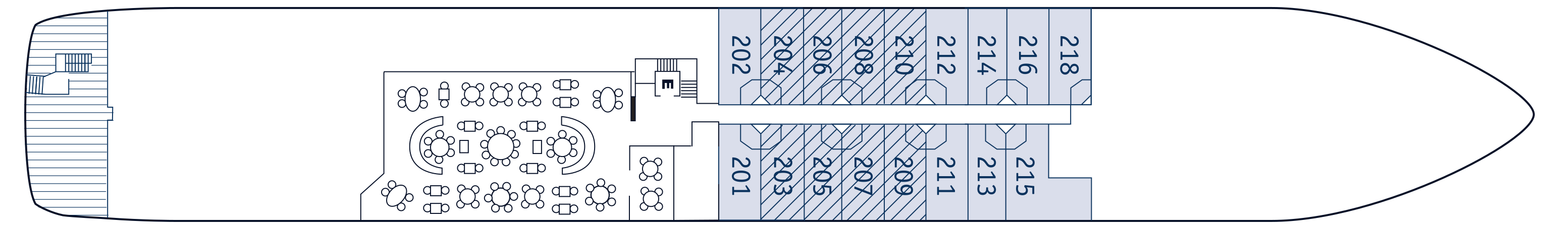
Yacht Club Deck 2 staterooms average 195 sq.ft./18.12 sq. meters. These ocean view staterooms include a marble-lined bathroom in select staterooms with a multi-jet shower and a well-appointed open living area with sofa, chair, cocktail table, built-in dresser with writing desk, and ample closet space. Most staterooms offer a choice of 2 twin beds or 1 queen bed. Please contact the reservations team to confirm your choice. Yacht Club Deck 2 staterooms feature two (2) 17” round windows instead of a picture window.
Additional Amenities:
- Well-stocked beverage refrigerator
- 55″ flat-screen TV with “Infotainment”
- Direct-dial telephone
- Safe
- Climate Control
- Make-Up Mirror
- Hair dryer
- Elm Organics bath amenities
- Superior Belgian bed & bath linens
- Luxury Bath Robes & Slippers
- Wooden & Padded Silk clothes hangers
- 24-hour in-stateroom “Small Bites” menu
- Wifi Available
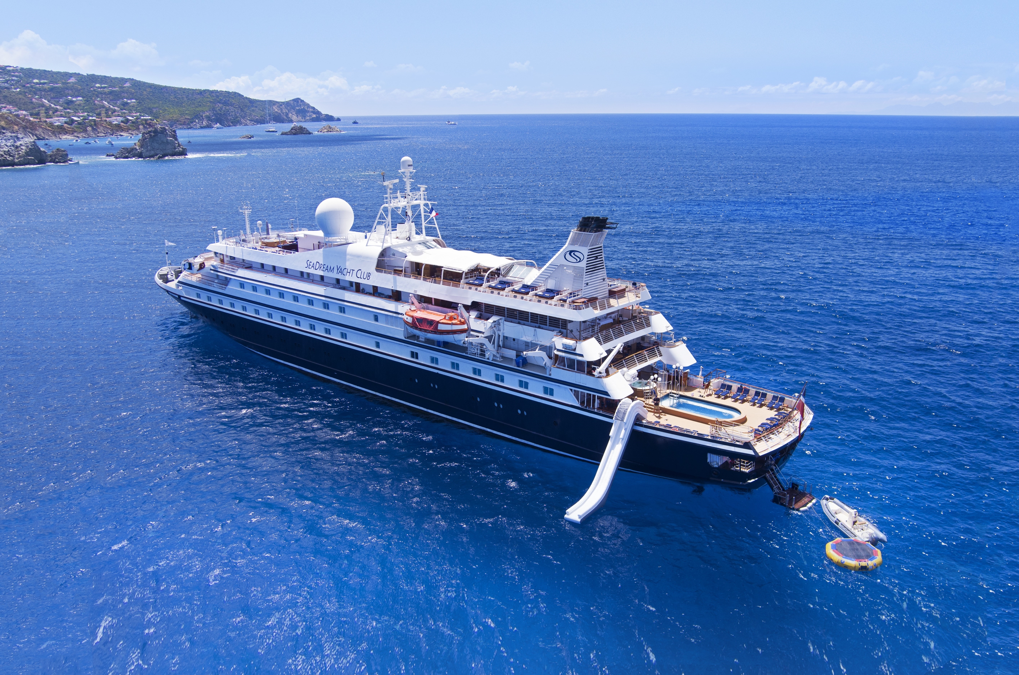
SeaDream I
Named “Best Small Luxury Cruise Ship of 2015” in ForbesLife, twin mega-yachts SeaDream I & II are intimate boutique ships that provide a unique travelling experience unlike any other cruise vacation. The expression “yachting” is not only a statement about size; it’s a lifestyle aboard our intimate vessels with the service of 95 crew members and 112 guests that make each guest feel like they are on their very own private luxury yacht. Chic and stylish, SeaDream’s 56-stateroom yachts are favoured for its elegant informality, highly personal service, inclusive open bar and gratuities, all ocean views staterooms and suites, luxury accommodations and world-class cuisine.
Excellence Begins at Embarkation
We welcome guests with the “SeaDream treatment” from the moment they come aboard. The yachting experience begins with a warm welcome from the captain with cocktails and hors d’oeuvres. The rest is up to you. Whether by day or night lounging on our signature Balinese Dream Beds, indulging in our Dream Cuisine, sipping a SeaDream cocktail at the back of the yacht, relaxing in the SeaDream Spa or being active with our Watersports Marina, this is your yacht, make it uniquely yours.
Ship Facts
| Launch Year | 1984 | ||||||||
| Refit Year | 2022 | ||||||||
| Language | en | ||||||||
| Gross Tonnage | 4300 | ||||||||
| Length | 105 | ||||||||
| Width | 14 | ||||||||
| Currency | USD | ||||||||
| Speed | 15 | ||||||||
| Capacity | 112 | ||||||||
| Crew Count | 95 | ||||||||
| Deck Count | 5 | ||||||||
| Cabin Count | 56 | ||||||||
| Large Cabin Count | 0 | ||||||||
| Wheelchair Cabin Count | 0 | ||||||||
| Electrical Plugs |
|
Deck 6
- Balinese Dream Beds
- Top Of The Yacht Bar
- Golf Simulator
- Sun Deck & Sun Beds
- Couples Hot Tubs
Deck 5
- Topside Restaurant
- Medical Facility
- Open Promenade
- Elevator
- Bridge
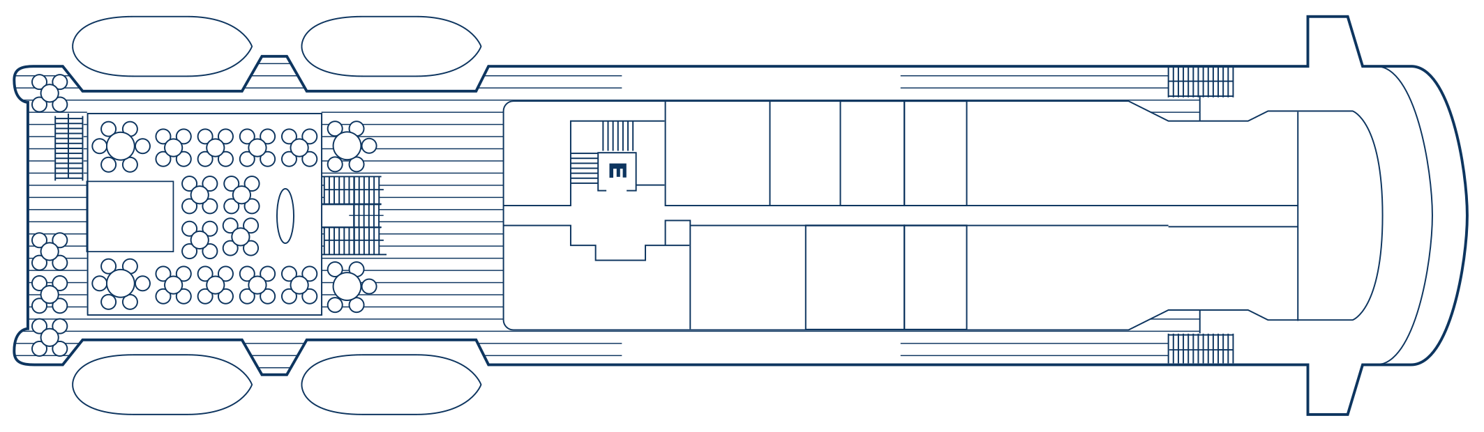
Deck 4
- Al Fresco Dining & Lounging
- Library
- Piano Bar
- Casino
- Admiral Suite
- SeaDream Spa
- Fitness Centre
- Beauty Salon
- Elevator
- Yacht Club Staterooms
- Admiral Suite
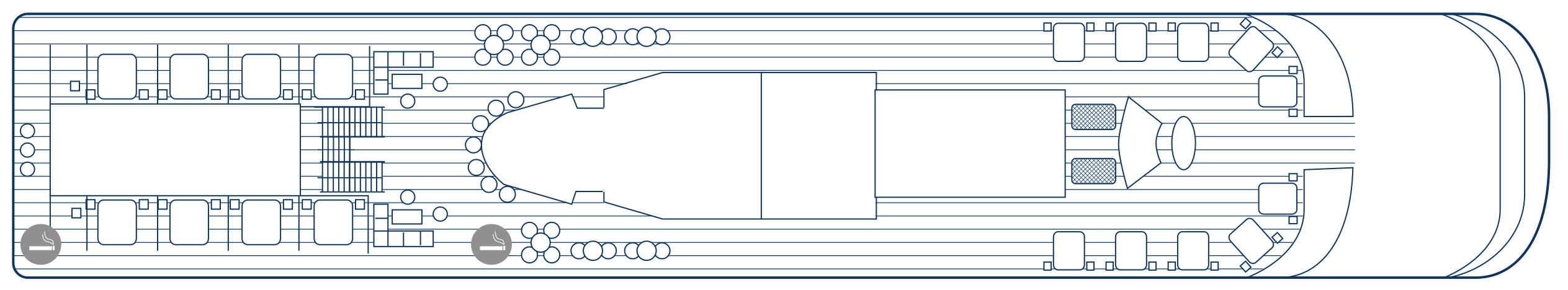
Deck 3
- Pool / Hot Tub
- Pool Bar
- Card Room
- Main Salon / Main Salon Bar
- Concierge & Boutique
- Yacht Club Staterooms
- Commodore Suites
- Owner's Suite
Deck 2
- Retractable Water Sports Platform Marina
- Dining Salon
- Yacht Club Staterooms
- Commodore Suites
A Gastronomical Experience
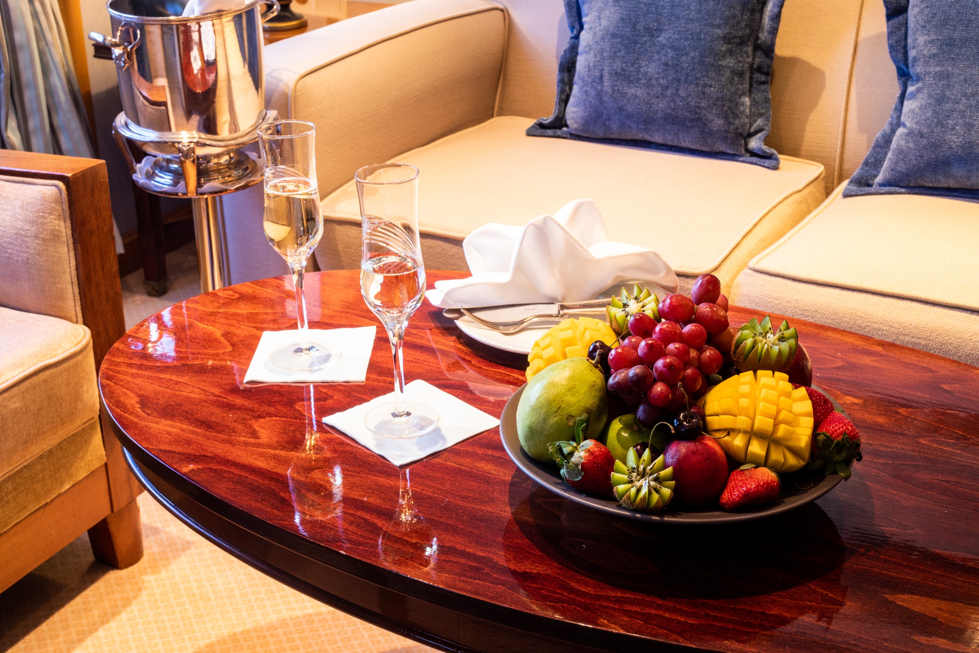
Experience what wining & dining on your very own yacht would be like with our expert chefs and sommeliers. We are dedicated to offer the best experience possible for each of our guests, including excellent gourmet dishes and the finest wine selection at sea. Our multi-course menu is specially designed with elegant, light portions in mind so that an entire service may be enjoyed, from introductory first courses, to decadent desserts, to expertly paired wines. It’s a gastronomical experience that will have you indulging in every bite. Bon Appétit!
Signature Dream Cuisine
Dining aboard our luxurious yachts is wherever and with whomever you choose. Selections are hand-crafted for every diet and taste, from plant-based meals to perfectly aged steaks and everything in between. All cuisine is prepared a la minute and served al fresco or in the elegant dining salon, with international menus that incorporate local flavours of the region with the freshest, high-quality ingredients and wine lists inspired by your destination. In true yachting style, our dining spaces can accommodate all 112 guests dining together either indoors or al fresco.
Aside from the main menu, SeaDream offers an “Always Available”, à la carte SeaDream selection of favourite cuisine dishes. Dining experiences also include Welcome Aboard cocktails and hors d’oeuvres, daily Early Risers Coffee, Topside Restaurant lunch dining, poolside sandwiches, afternoon snacks, tea service and freshly baked Small-Batch Dream Cookies and pastries. SeaDream’s menus also incorporate gourmet coffees and herbal tea selections, which are available anytime upon request.
Plant-Based & Organic Cuisine
As a pioneer in the living foods movement, we have carefully curated a variety of delicious and nutritious plant-based dishes that showcase the best of local and seasonal ingredients, providing a suite of healthy and sustainable dining choices. Expect a wide range of creative and flavourful vegan dishes, such as freshly prepared salads, hearty soups, flavourful stir-fries, and delectable desserts, all made with sustainable and locally sourced ingredients, including flavours from local farmers’ markets.
Specialty Options
In addition to vegan dining, SeaDream Yacht Club offers a range of other dietary options to cater to various preferences and dietary needs. Whether you are vegetarian, gluten-free, high-protein, or pescatarian, our culinary team is dedicated to ensuring that your dining experience on board is nothing short of exceptional. We even provide guests with Keto-friendly selections to accommodate those with specific dietary requirements.
Topside Restaurant
Indulge in a Signature SeaDream experience with our gourmet 5-star dining, prepared à la minute and served al fresco at the Topside Restaurant.
Aside from the main menu, SeaDream offers an “Always Available”, à la carte SeaDream selection of favourite cuisine dishes. Dining experiences also include Welcome Aboard cocktails and hors d’oeuvres, daily Early Risers Coffee, Topside Restaurant lunch dining, poolside sandwiches, afternoon snacks, tea service and freshly baked Small-Batch Dream Cookies and pastries. SeaDream’s menus also incorporate gourmet coffees and herbal tea selections, which are available anytime upon request.
Dining Salon
Indulge in a Signature SeaDream experience with our gourmet 5-star dining in the elegant Dining Salon. Immerse yourself with delectable flavours with selections like a guest favourite- L’oeuf Poule Au Caviar “Surprise”, succulent lobster, filet mignon, and delectable desserts.
Desert Extravaganza
The voyage of a lifetime deserves the dessert of a lifetime. Our Dessert Extravaganza is an elegant, after dinner gathering. The star of this party is the delectable display of desserts including baked treats, tarts, pies, cakes, ice cream and bananas foster. The perfect end to the perfect day.
An elegant, after dinner gathering. The star of this party is the delectable display of desserts including baked treats, tarts, pies, cakes, ice cream and bananas foster. Your favourite libation, music, fresh ocean air and the twinkle of candles and stars make this the perfect ending to another special SeaDream day
Healthy Corner and Raw & Living Menu
Raw, Vegan & Organic
The only “raw food” or “living food” menu at sea, guests have the option of experiencing an array of dishes prepared only with raw, organic and vegan ingredients, none of which are heated above 118º F. The menu, created in conjunction with the Hippocrates Health Institute even includes dessert options, highlighting light yet indulgent selections. Explore Raw and Living Food onboard Seadream.
Healthy Corner
Create your own healthy dish with our healthy corner. It’s all about choices. Customise your lunch with the following, healthy and organic selections: Alfalfa Sprouts • Fresh Vegetable Crudities • Rocket Lettuce • Lemon Wedges • Raw Capsicum • Raw Broccoli • Raw Cauliflower • Raw Red Radish • Raw Carrot Julienne • Raw Mushroom Slices • Lightly blanched Asparagus • Roasted Pignolias • Roasted pecan Nuts • Roasted Sesame Seeds • Sundried Tomato Tapenade • Black Olive Tapenade • Green Olive Tapenade • Artichoke Tapenade • Organic Olive Oil • Organic Sesame Oil • Braggs Aminos • Tamari
Specialty Options
Aside from the Raw Food Menu, SeaDream’s daily menus include vegetarian and gluten-free selections. Sugar-free options are always available on request. For other dietary needs, guests can consult with SeaDream at any time before the voyage to ensure that we fulfil your special needs.
SeaDream Tea Menu
SeaDream’s tea menu features (12) teas exclusively prepared for SeaDream by a master blender in Kent, United Kingdom. These bold and exciting selections are solely available only onboard. All tea is served in individual “Bodum” 0.51 teapots with plunger tea diffusers and waiters pay special attention to every pot that they serve. When the water is poured, the servers immediately start a timer so that the appropriate time is indicated to each guest upon being served. When the desired time expires, guests can depress the plunger to stop the diffusing process. All tea is served with homemade, gluten-free tea cookies.
Wine & Spirits
Dream gourmet cuisine harmonised with rich and colourful wine flavours enhances the overall gourmet dining experience. Inclusive wine pairings are thoughtfully selected to please your gastronomic palate. An open bar with select brands is available throughout the day, with beverages served upon request anywhere on board, including the Top of the Yacht Bar, featuring 360° views of the surrounding landscapes and seascapes. The Pool Bar offers refreshing beverages throughout the day and the Main Salon is enjoyed by guests for pre-dinner cocktails. After dinner service, the Piano Bar and Casino is a favourite locale for a nightcap.
For our wine connoisseur guests, specially designed Wine Voyages are available in the Mediterranean from May-November. Explore the wonderful flavours and history by immersing yourself with carefully crafted selections of world-renowned wineries, onboard or ashore. Our Wine Director designed these wine voyages exclusively for our SeaDream guests. Wine Voyages include specialised winery visits and land adventures with activities to satisfy the sommelier in you.
Premium Selections
In addition to complimentary wine selections, the SeaDream cellar is stocked with a varied collection from the Old and New World. A wide selection of rare and trendy wines including the Château Ducru Beaucaillou Grand Cru Classé, 2002; and Insignia, Napa Valley, 2006; is available. A premium listing of spirits and concoctions is available, offering a selection of rare whiskeys and cognacs, trendy gins and vodkas, all at attractive prices.
We welcome guests with the “SeaDream treatment” from the moment they come aboard. The yachting experience begins with a warm welcome from the captain with cocktails and hors d’oeuvres. The rest is up to you. Whether by day or night lounging on our signature Balinese Dream Beds, indulging in our Dream Cuisine, sipping a SeaDream cocktail at the back of the yacht, relaxing in the SeaDream Spa or being active with our Watersports Marina, this is your yacht, make it uniquely yours.
By Day
Be splendidly spoiled throughout the day. Signature SeaDream features include our Balinese Dream Beds for lounging at sea and the Watersports Marina Platform where you can enjoy water sports right off the back of the yacht. “Seas the Day” the SeaDream way.
By Night
Music and a lively social atmosphere fills the yacht by night. Enjoy your favorite after dinner cocktail and request a tune at the Piano Bar. Visit the Top of the Yacht Bar for breathtaking night views and mingle with new friends, or try your luck at the Casino on Deck 4. The night is waiting for you on SeaDream.
Starlit Movies®
The pool deck becomes your cinema under the open night sky. Get comfortable in a reclining lounge chair and watch a concert or movie on the outdoor big screen. Your port of call becomes your grand backdrop. Pillows, blankets, fresh popcorn and bar service make this a movie experience like no other.
Casino, Piano Bar & Library
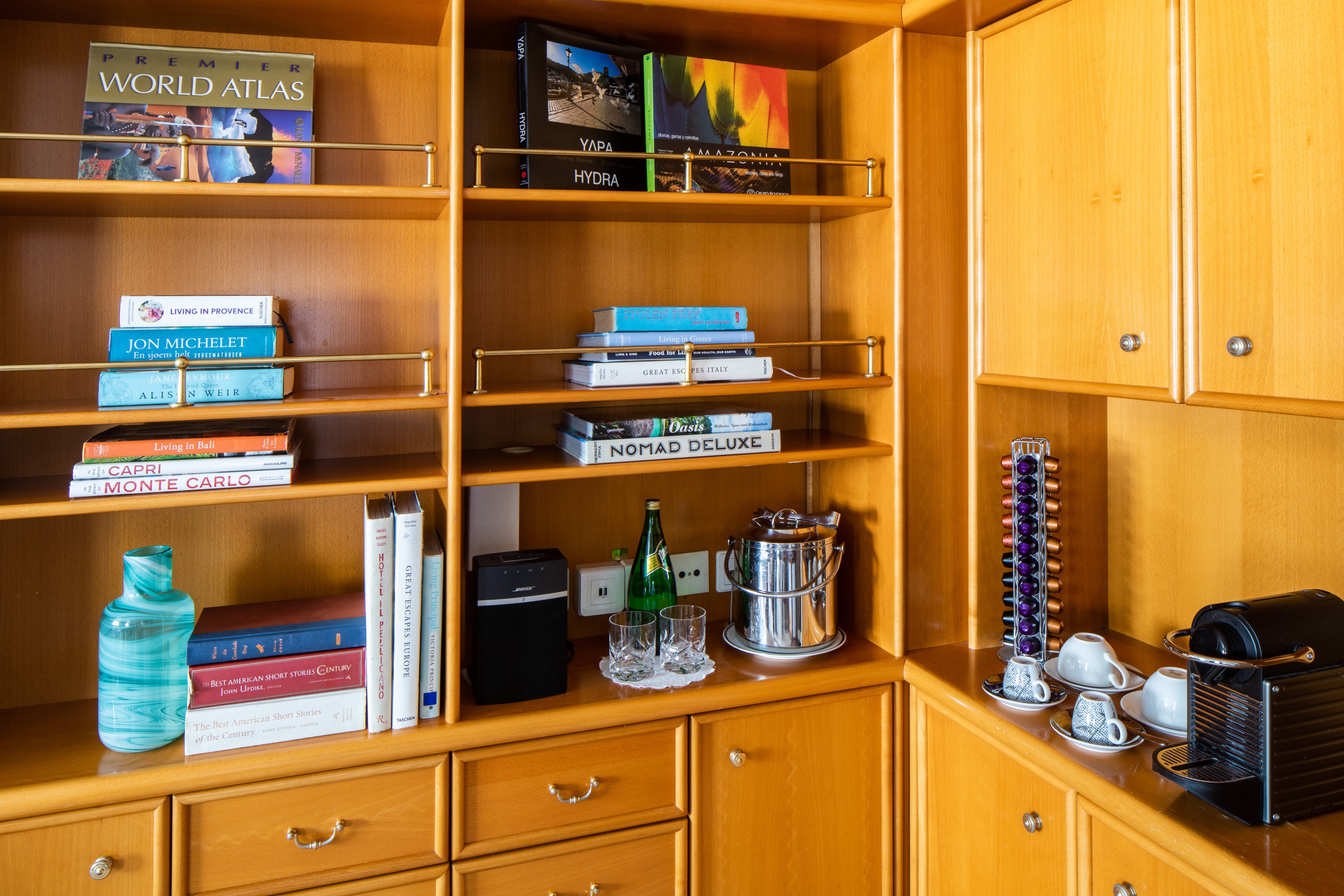
If you’re feeling lucky, begin your evening entertainment with a hand at the Blackjack table in the Casino on Deck 4. Just steps away, enjoy an after dinner drink at the Piano Bar, a relaxed and social lounge area where you enjoy listening to live guitar and piano music. Request your favourite tune and feel free to sing along. Or should you wish for something more quiet, take refuge in the Library. Enjoy a good read from our large selection of books or challenge a fellow yachtsman in a selection of board games. Computer and printer are also available.
Balinese Dream Beds
Take time to watch the world go by on SeaDream’s Signature Balinese Dream Beds. These specially designed beds are the perfect place to catch the views, read a book and sip your favorite beverage. Select a cozy corner of the yacht and take that little catnap you have missed all year. Our comfortable outdoor platform beds are designed with afternoon naps and sunbathing in mind. These thick cushion beds, with throw pillows and individual reclining backs, are the perfect spot on the yacht to stretch out and enjoy unobstructed ocean views and cool sea breezes.
Our signature Balinese Dream beds may be transformed at night to sleep and gaze upon the stars. Curl up in luxurious comfort with plush belgian bed linens and admire the starry night sky on a clear night. The soothing sound of the sea and cozy setting make this a magical, unforgettable experience.
Top of the Yacht Bar
Whether you are the first one to greet the day at the Early Risers Coffee or you enjoy a fine cigar and cognac after dinner, the Top of the Yacht Bar is the social heart of the yacht. Take in the sea breeze and 360° views. Before the sunrise, make your way to the Top of the Yacht Bar to greet the day at the Early Risers Coffee. Throughout the day, you may enjoy your favorite drink or request a special SeaDream cocktail from our expert bartenders. They are perhaps the most loved crew members on board. For those meals in between, order a light bite off the Insuite & Ondeck menu. Gourmet cheese platter anyone?
As day turns to night, enjoy the picturesque sunsets at the Top of the Yacht Bar. The night sky transforms the deck to a memorable night with accompanying music and a social atmosphere. Mingle with friends you meet on board for a night of cocktails, live guitar music, dancing and 360º views of the twinkling stars.
Concierge & Boutique
Our Concierge and Shop Manager are here to assist.
Pool Bar
Where cocktails, iced teas & finger foods abound.
Sun Deck & Sun Beds
Lounge with breathtaking panoramic views.