Best of the Mediterranean Isles
Best of the Mediterranean Isles
Cruise overview
WHY BOOK WITH US?
- ✔ The Deluxe Cruises’ team has extensive experience in ultra-luxury cruising.
- ✔ Call now to speak to our helpful and experienced Cruise Concierge team.
- ✔ Enjoy our Unique Deluxe Cruises Bonus for substantial savings.
- ✔ Our team will tailor your holiday to your exacting requirements.
- ✔ As agents, we work under the protection of each cruise lines ABTA / ATOL licences
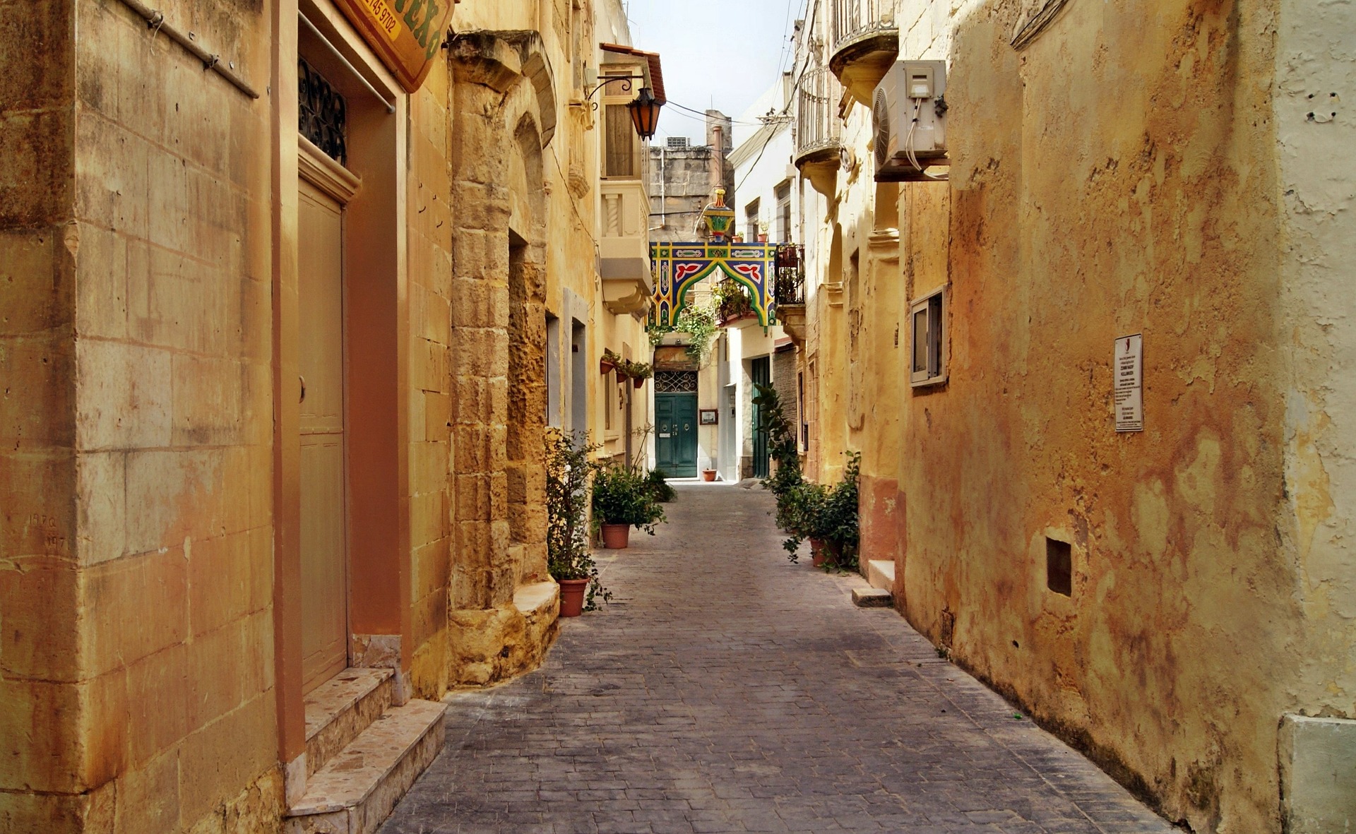
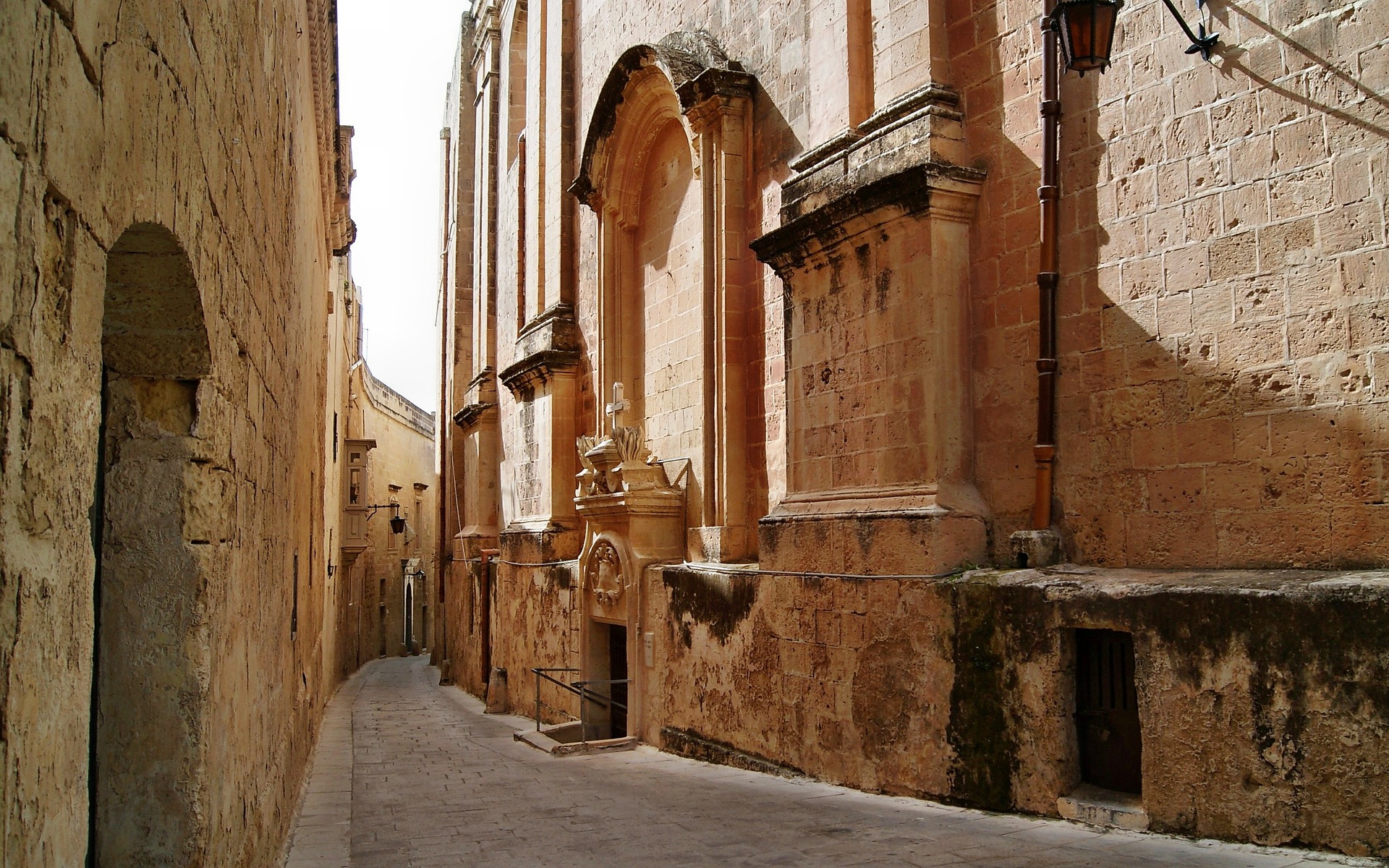
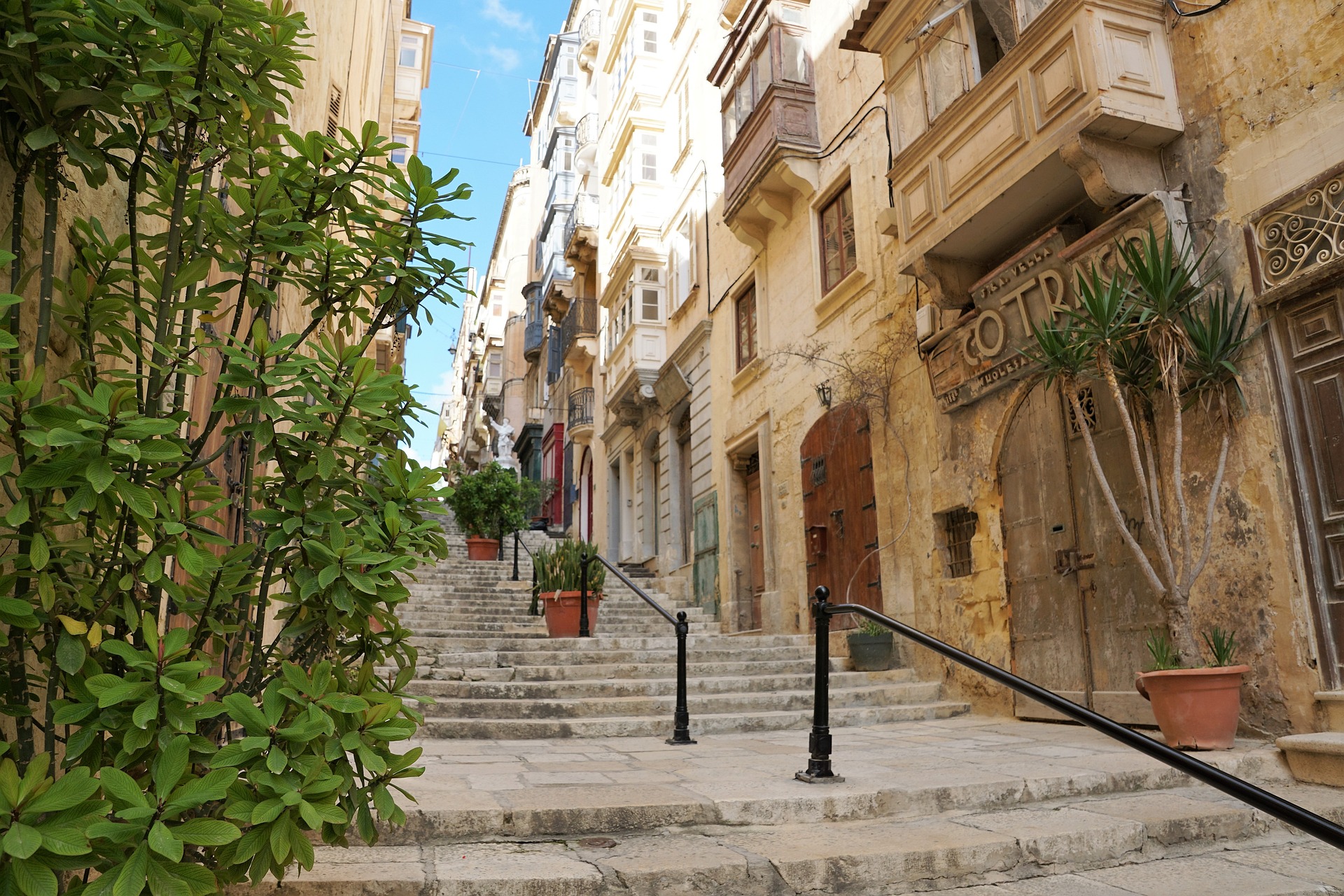
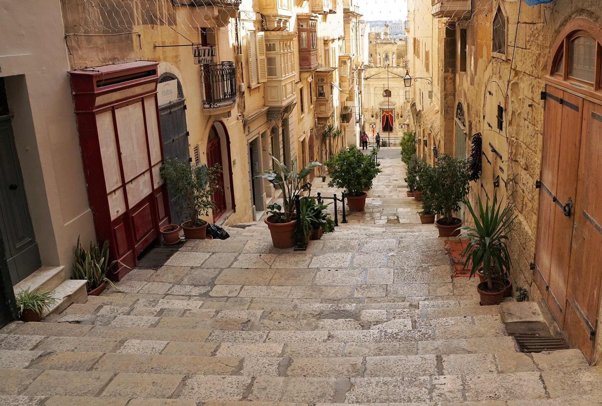
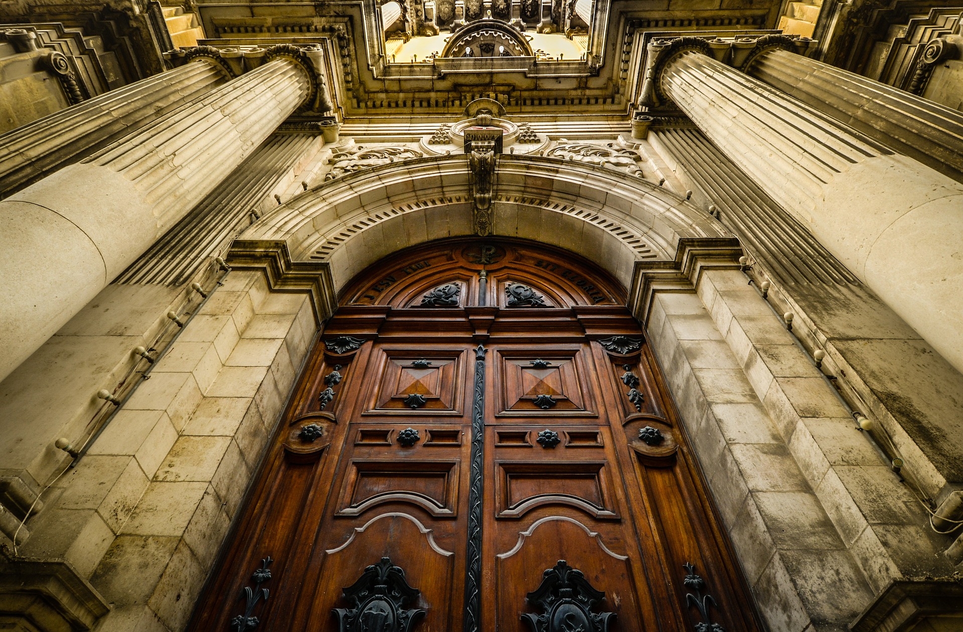
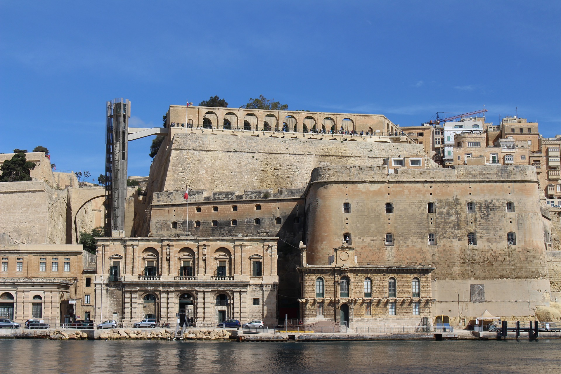
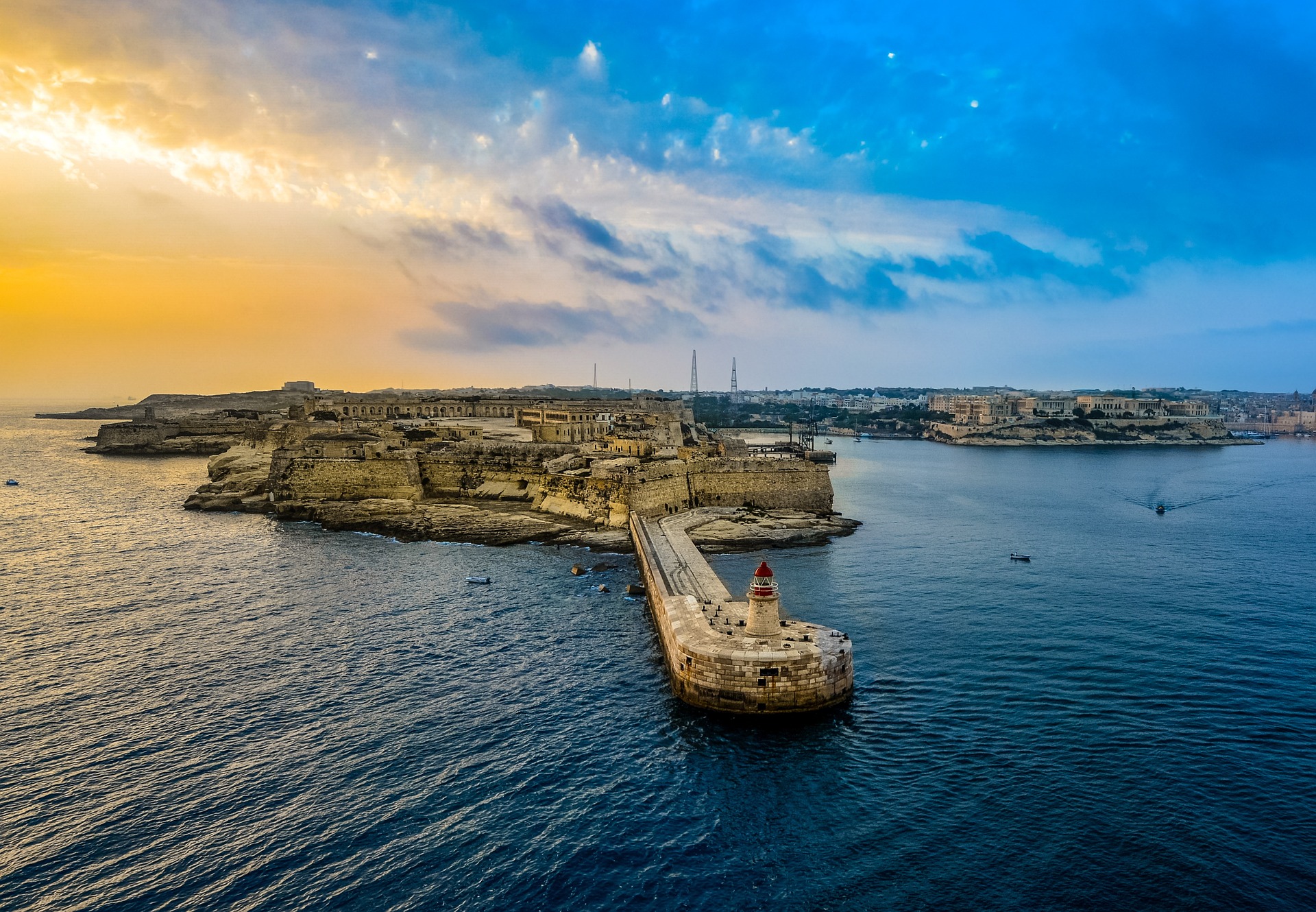
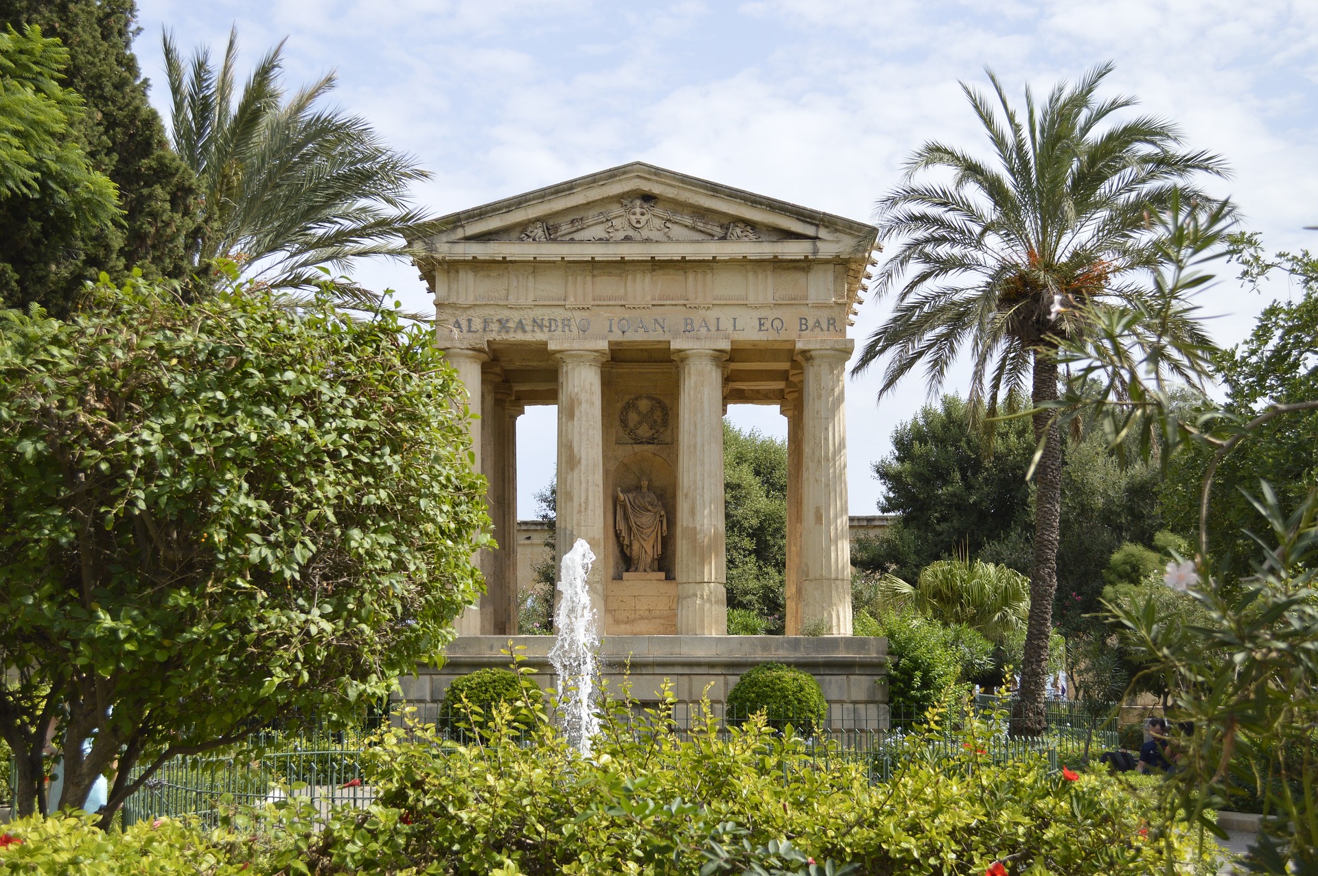
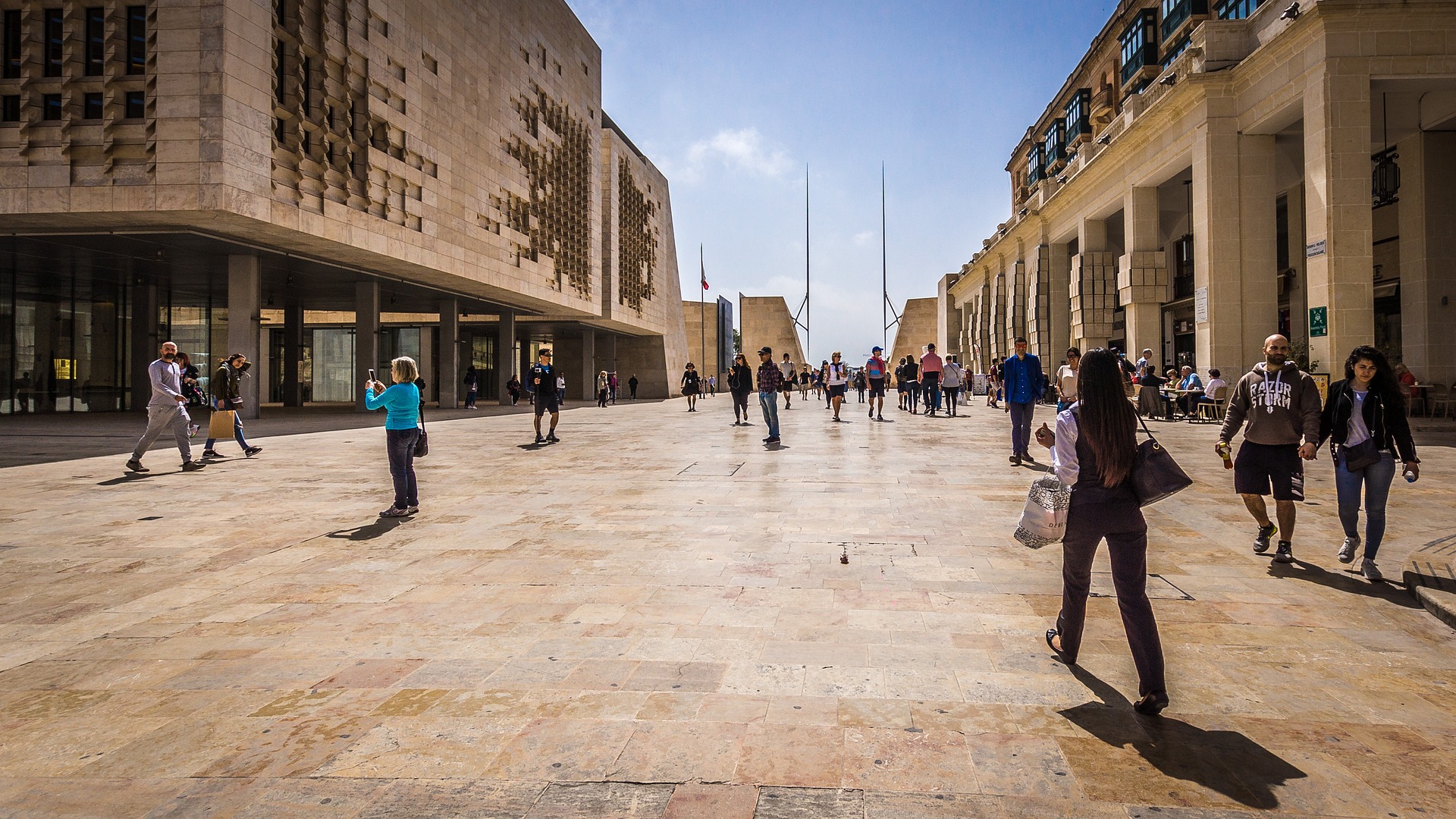
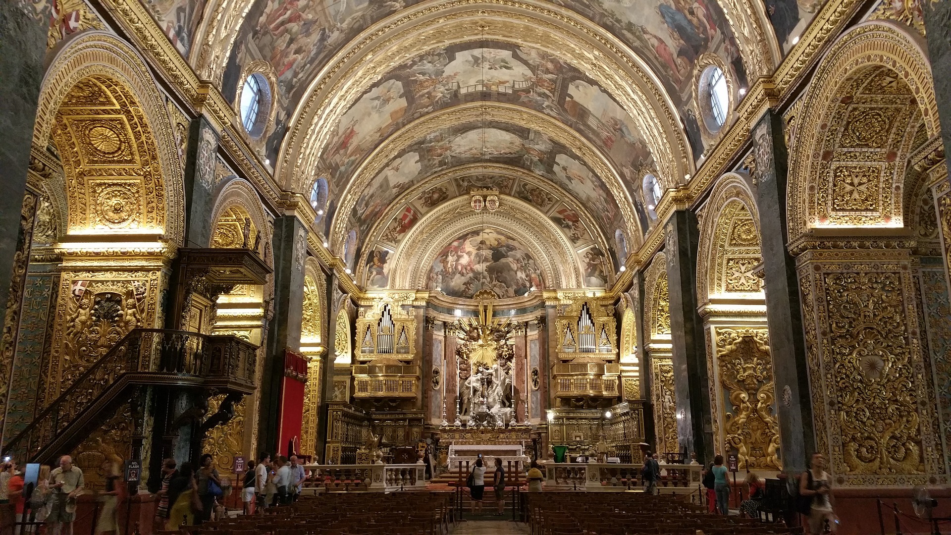
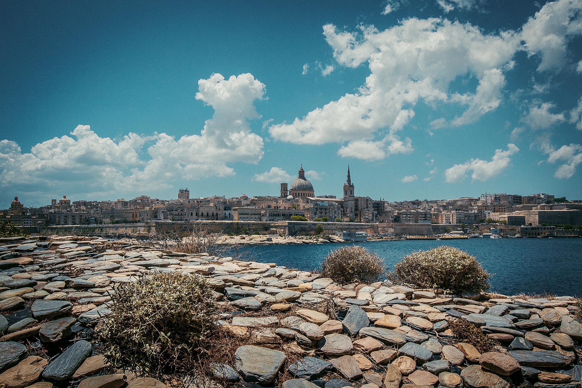
About Valletta
Malta's capital, the minicity of Valletta, has ornate palaces and museums protected by massive fortifications of honey-color limestone. Houses along the narrow streets have overhanging wooden balconies for people-watching from indoors. Generations ago they gave housebound women a window on the world of the street. The main entrance to town is through the City Gate (where all bus routes end), which leads onto Triq Repubblika (Republic Street), the spine of the grid-pattern city and the main shopping street. Triq Mercante (Merchant Street) parallels Repubblika to the east and is also good for strolling. From these two streets, cross streets descend toward the water; some are stepped. Valletta's compactness makes it ideal to explore on foot. City Gate and the upper part of Valletta are experiencing vast redevelopment that includes a new Parliament Building and open-air performance venue. The complex, completed mid-2013, has numerous pedestrian detours in place along with building noise and dust. Before setting out along Republic Street, stop at the tourist information office on Merchant Street for maps and brochures.
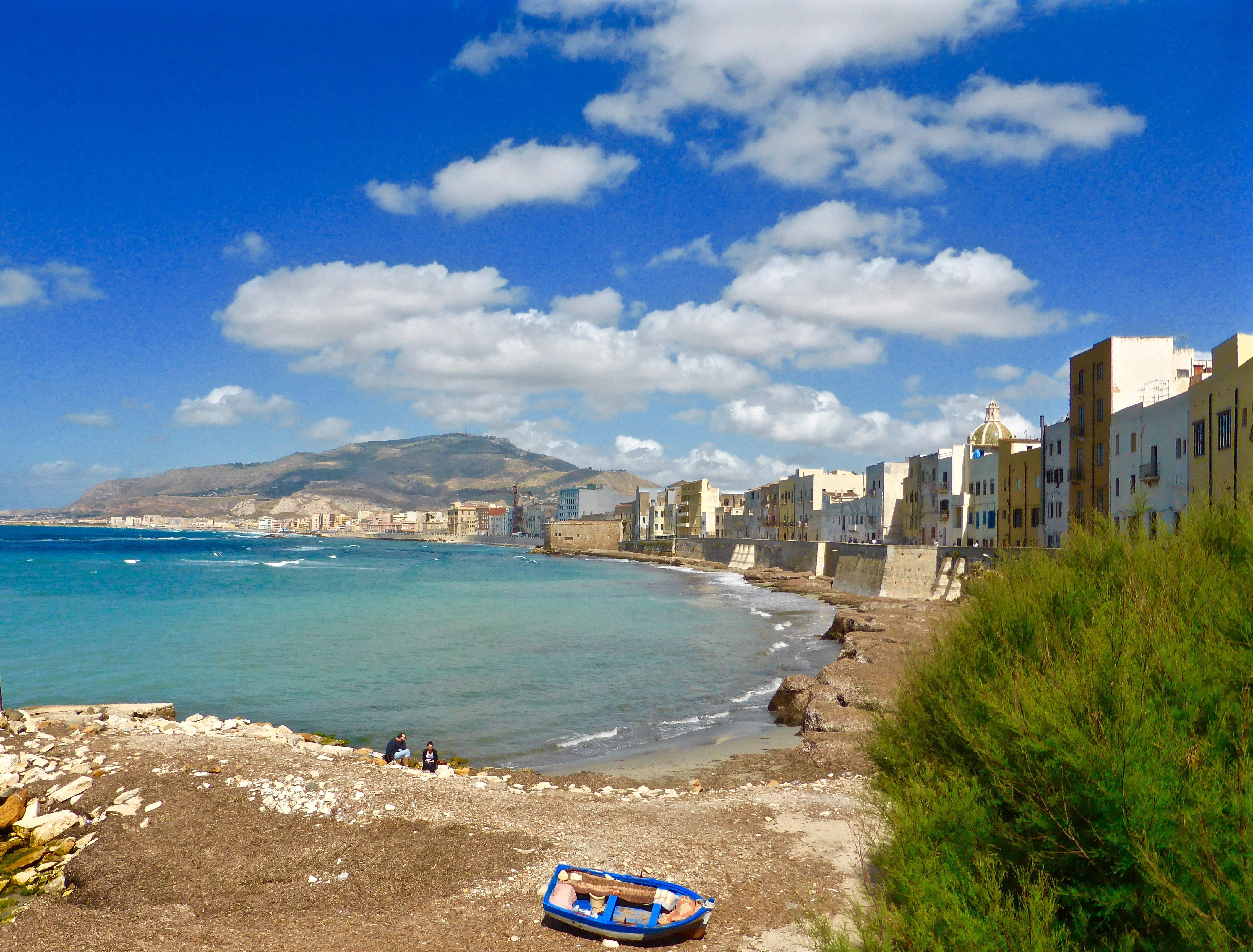
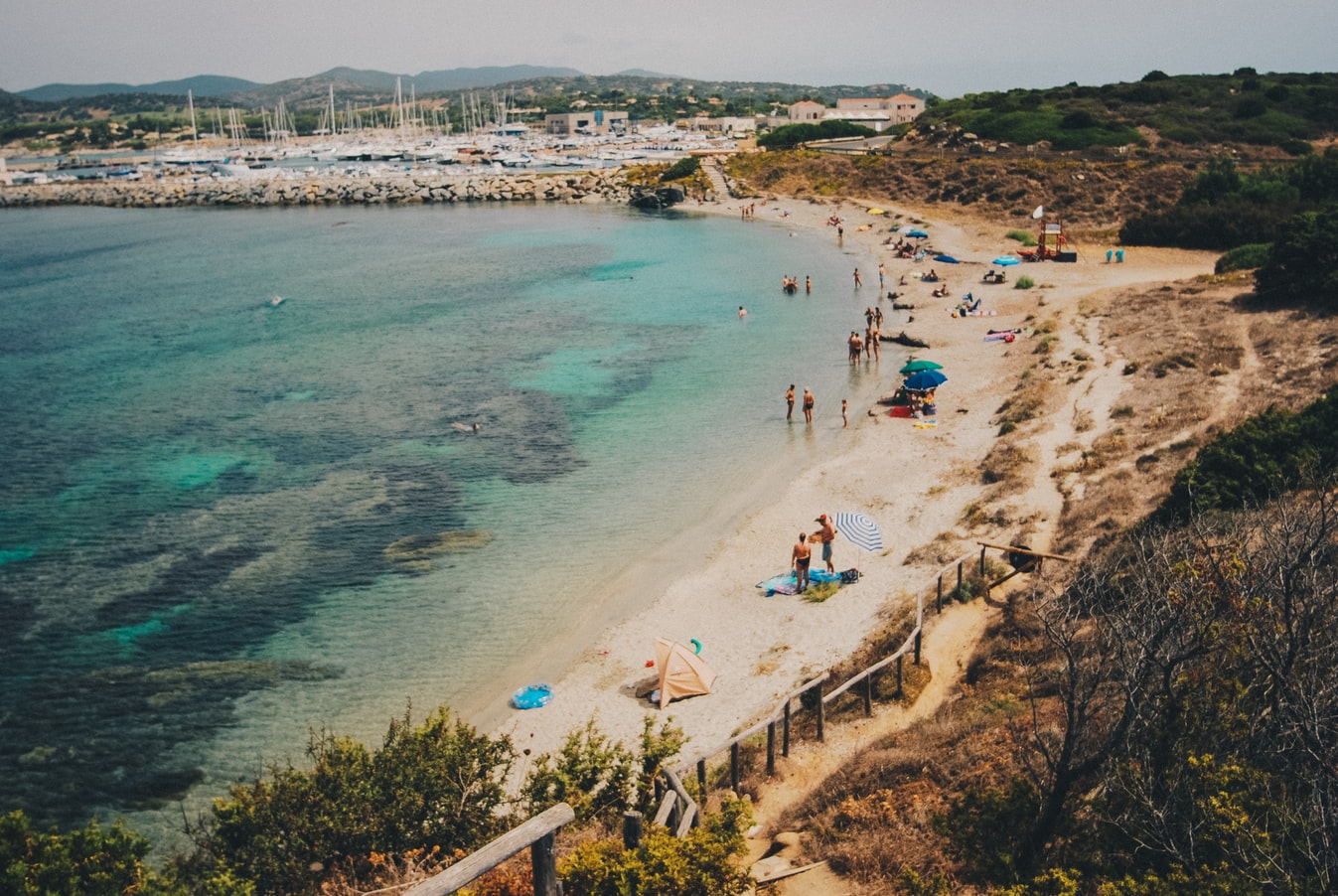
About Trapani, Sicily
Trapani, the most important town on Sicily’s west coast, lies below the headland of Mount Erice and offers stunning views of the Egadi Islands on a clear day. Trapani’s Old District occupies a scimitarshaped promontory between the open sea on the north and the salt marshes to the south. The ancient industry of extracting salt from the marshes has recently been revived, and it is documented in the Museo delle Saline. In addition to the salt marshes,Trapani’s other interesting environs include the beautiful little hill town of Erice, the promontory of Capo San Vito stretching north beyond the splendid headland of Monte Cofano, the lovely island of Motya and the town of Marsala. Trips farther afield will take you to the magnificent site of Segesta or the Egadi Islands, reached by boat or hydrofoil from Trapani Port.
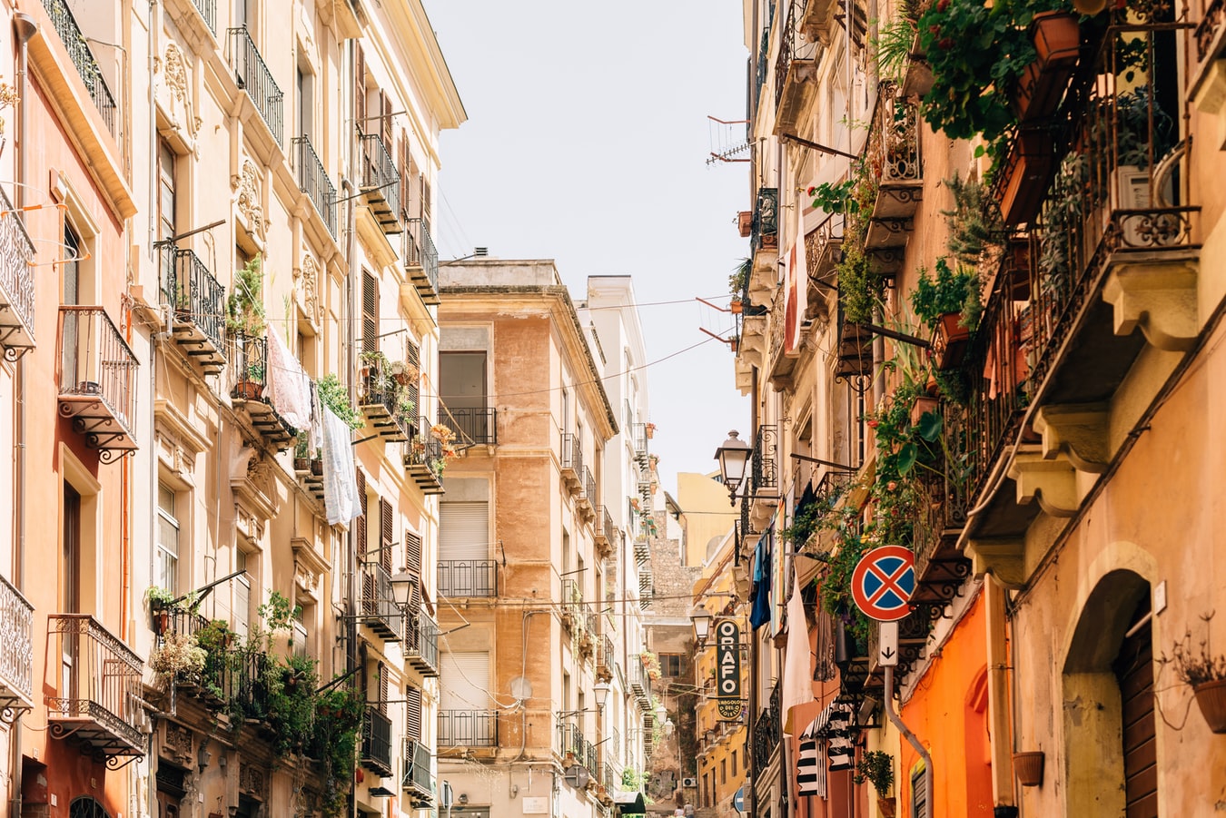
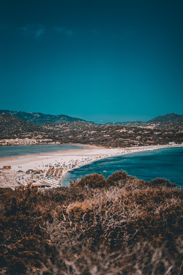
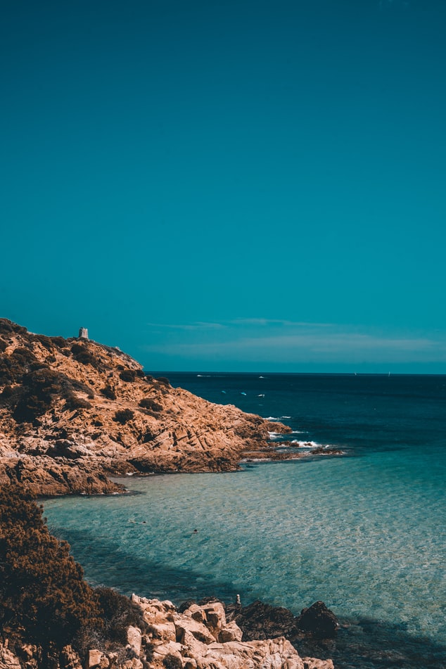
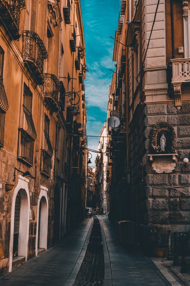
About Cagliari
Known in Sardinia as Casteddu, the island's capital has steep streets and impressive Italianate architecture, from modern to medieval. This city of nearly 160,000 people is characterized by a busy commercial center and waterfront with broad avenues and arched arcades, as well as by the typically narrow streets of the old hilltop citadel (called, simply, “Castello”). The Museo Archeologico makes a good starting point to a visit. The imposing Bastione di Saint Remy and Mercato di San Benedetto (one of the best fish markets in Italy) are both musts.
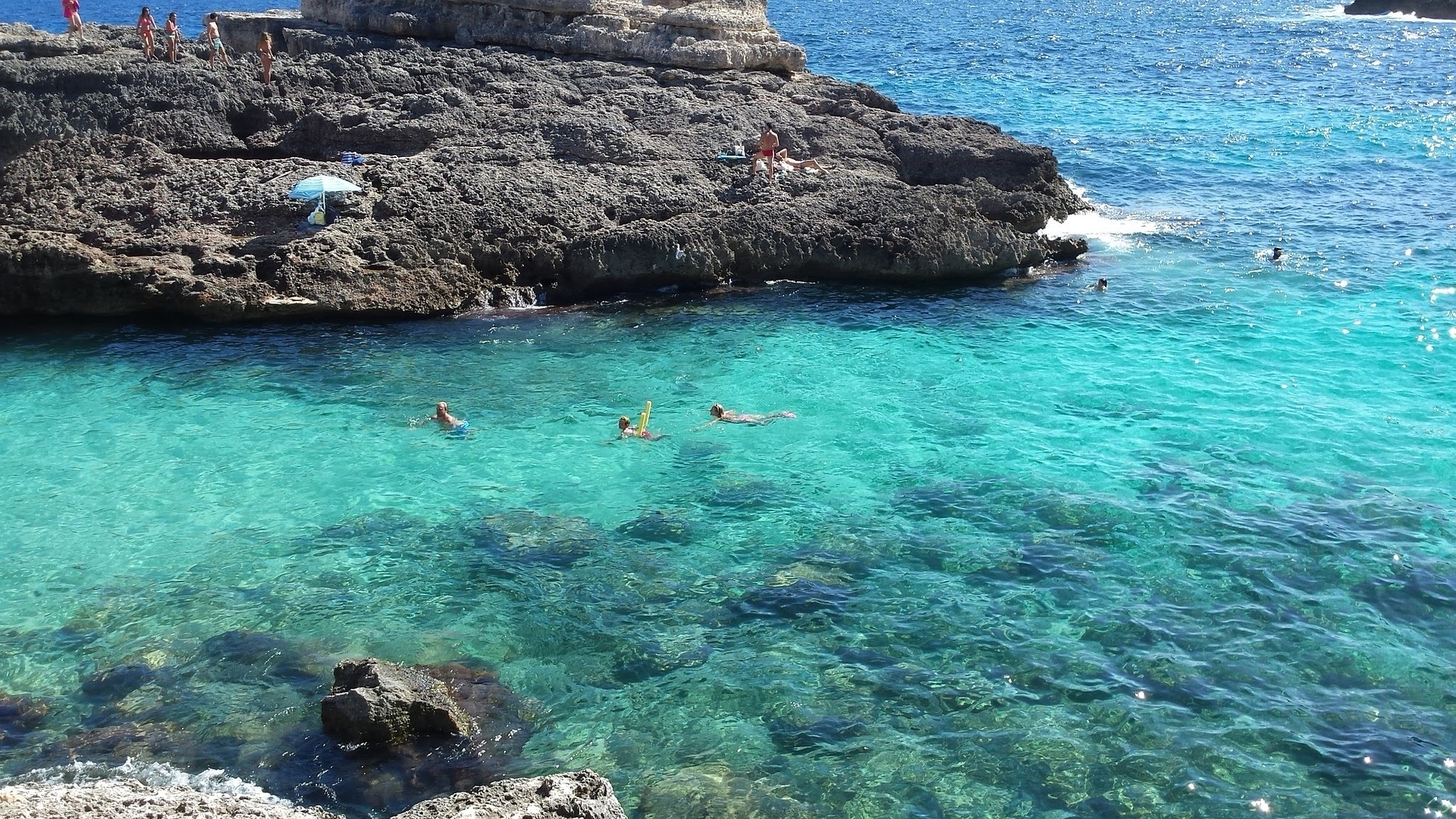
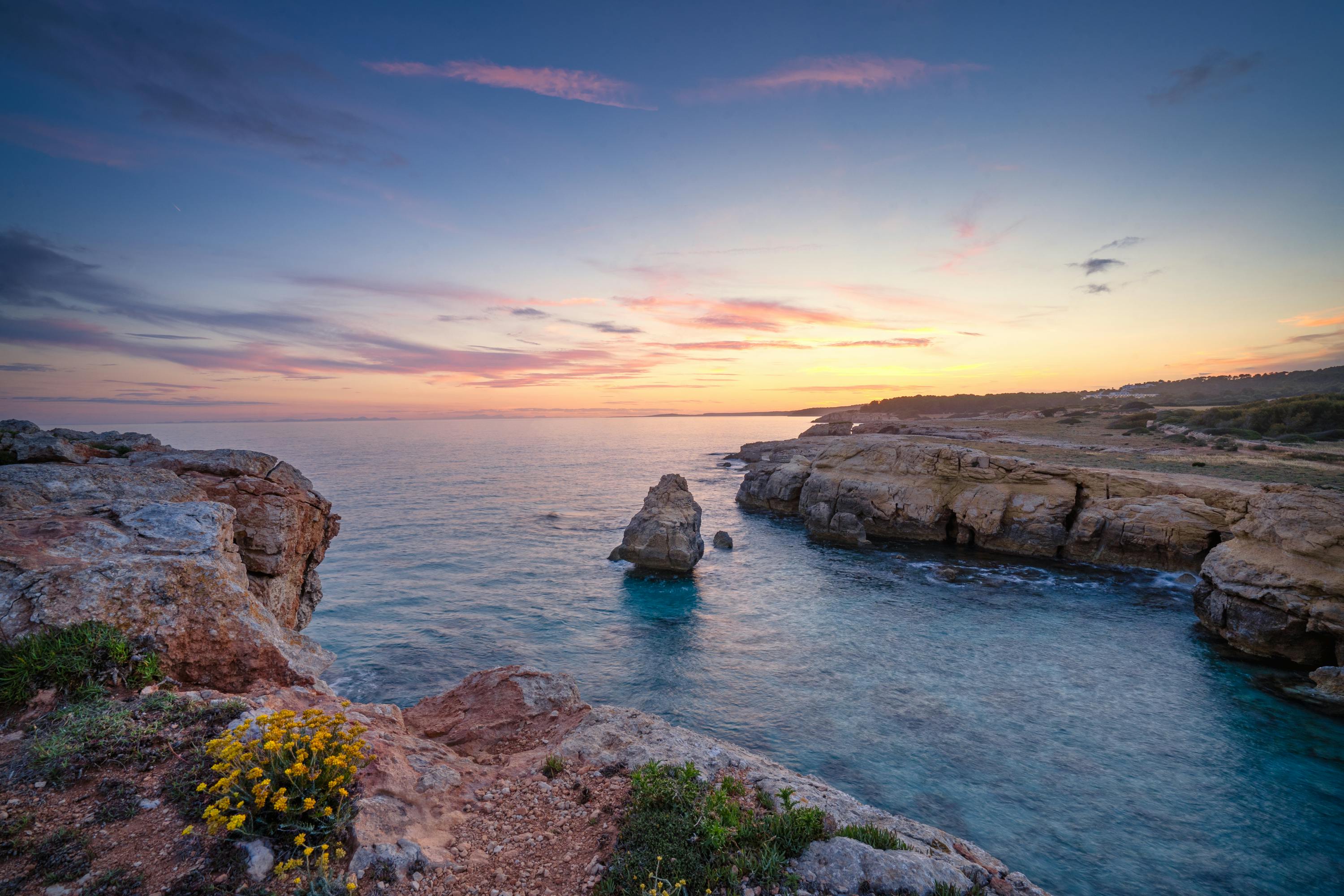
About Mahón, Menorca
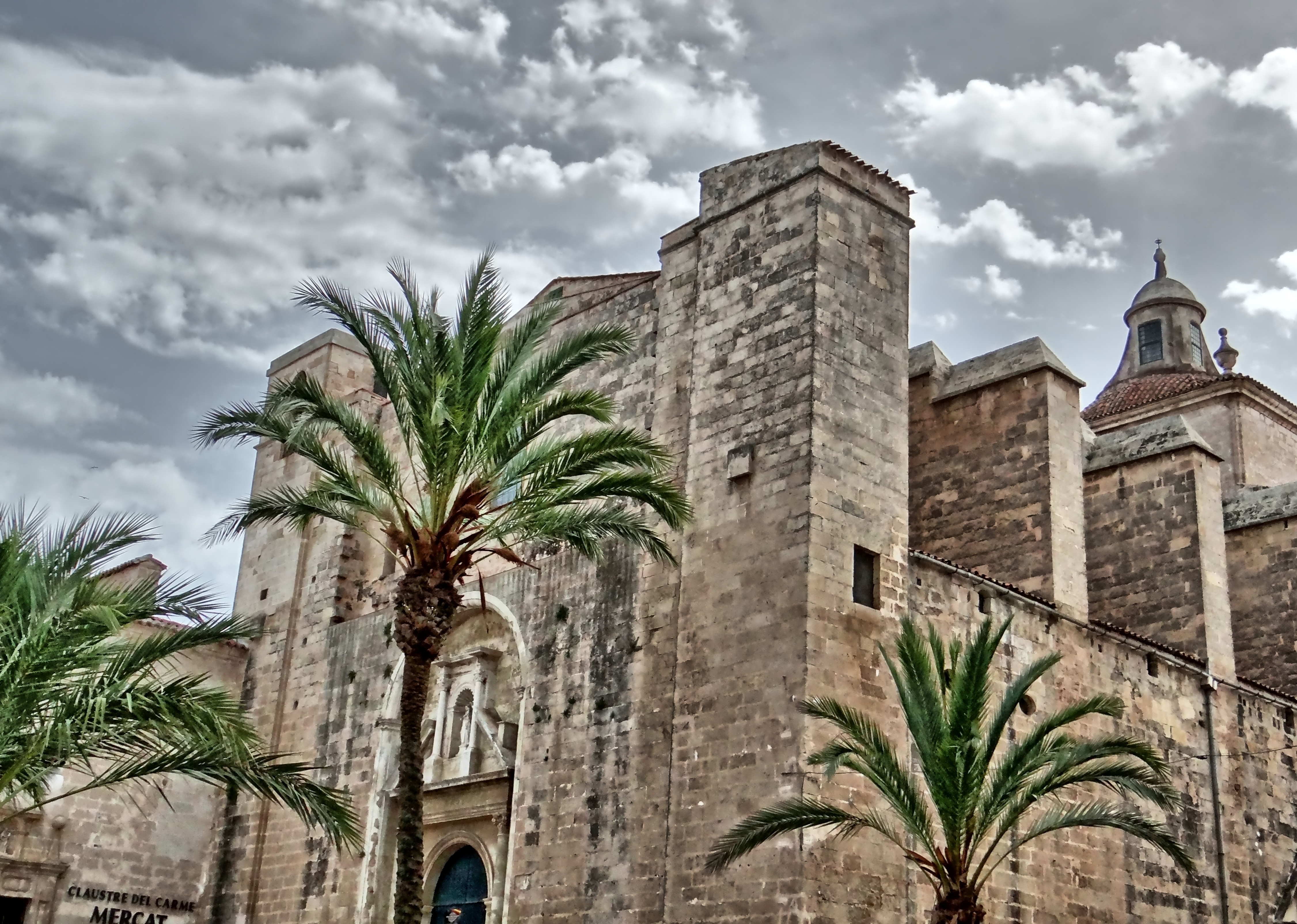
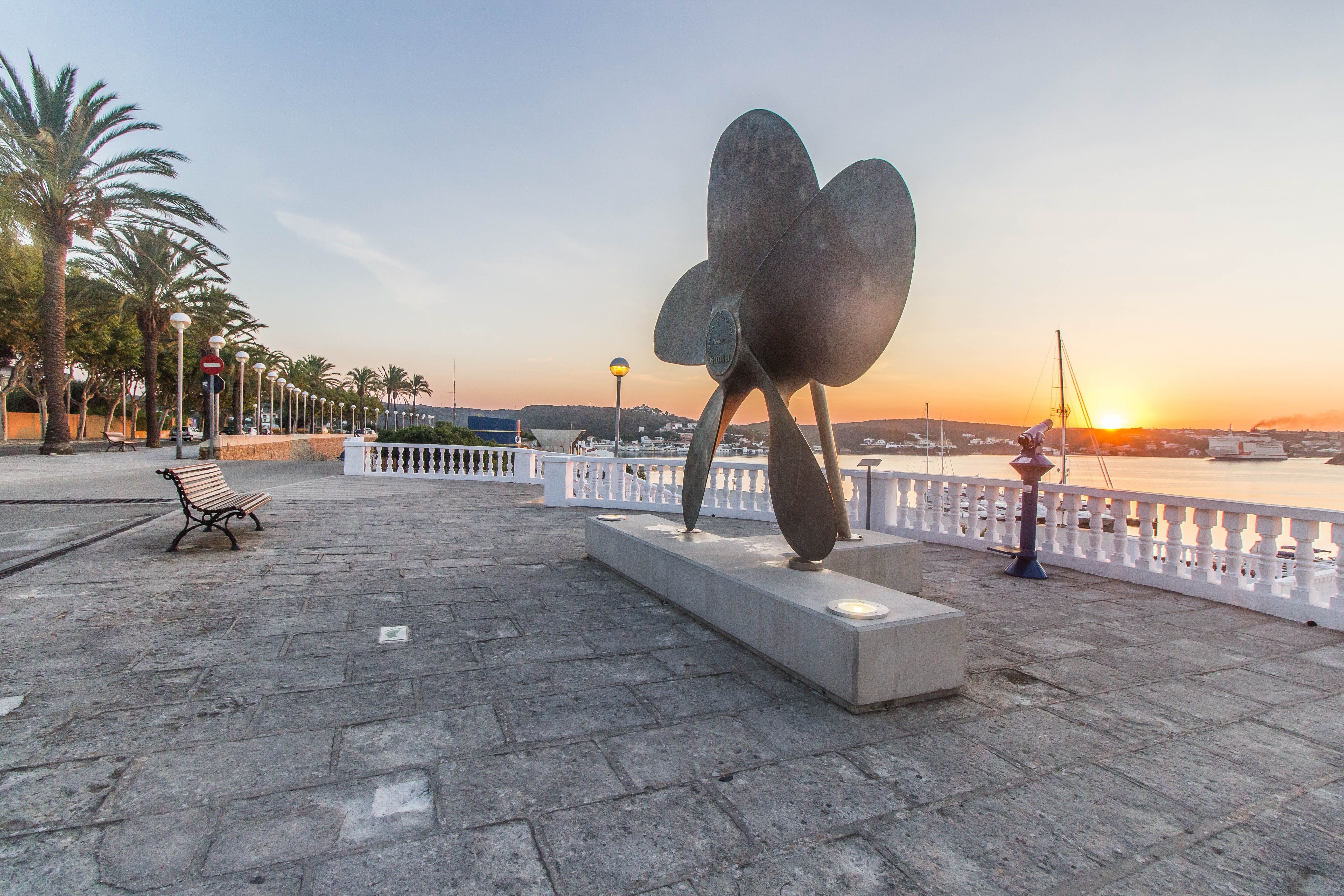
The capital of Menorca since 1721, Mahon has a impressive natural deep water harbour, which is one of the largest in the world. This, coupled with its strategic location, has made it a stronghold for many nations throughout history. Mahon has an abundance of historical buildings, the oldest being the Arch of Saint Roc which is all that remains of the wall that once encircled the whole town. The island was occupied by the British during the 18th century and Lord Nelson is thought to have stayed there. Indeed, San Antoni Mansion, located on the north side of the harbour, houses a collection of Nelson memorabilia. The legacy of colonial rule can be seen in the muted Georgian style of some of the buildings, but Mahon still boasts attractive examples of neo-Classical, Baroque and Romanesque architecture. With narrow streets to explore, pleasant shaded squares and welcoming pavement cafés, there is something for everyone to enjoy. Please be aware that most shops in town close for a siesta between 1330 and 1730.

About Mahón, Menorca
The capital of Menorca since 1721, Mahon has a impressive natural deep water harbour, which is one of the largest in the world. This, coupled with its strategic location, has made it a stronghold for many nations throughout history. Mahon has an abundance of historical buildings, the oldest being the Arch of Saint Roc which is all that remains of the wall that once encircled the whole town. The island was occupied by the British during the 18th century and Lord Nelson is thought to have stayed there. Indeed, San Antoni Mansion, located on the north side of the harbour, houses a collection of Nelson memorabilia. The legacy of colonial rule can be seen in the muted Georgian style of some of the buildings, but Mahon still boasts attractive examples of neo-Classical, Baroque and Romanesque architecture. With narrow streets to explore, pleasant shaded squares and welcoming pavement cafés, there is something for everyone to enjoy. Please be aware that most shops in town close for a siesta between 1330 and 1730.
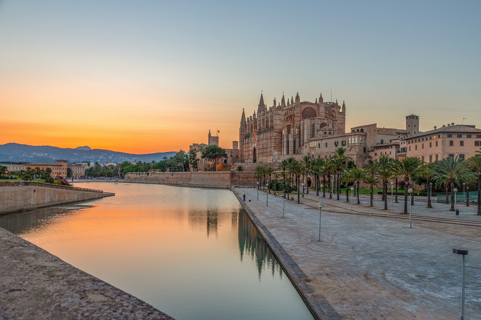
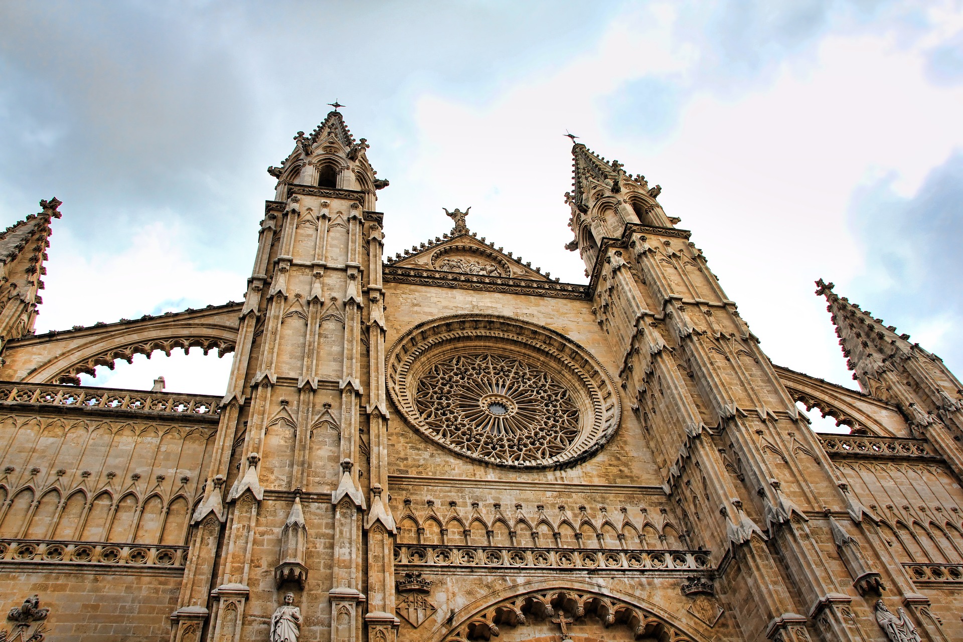
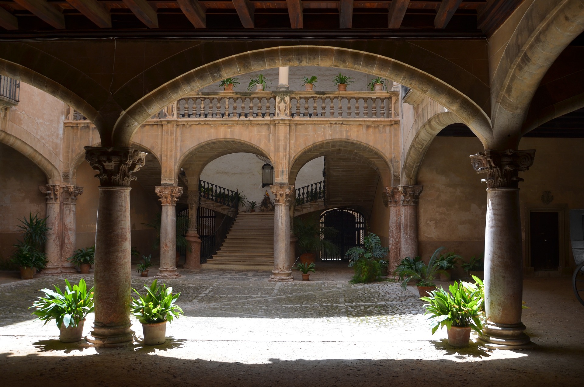
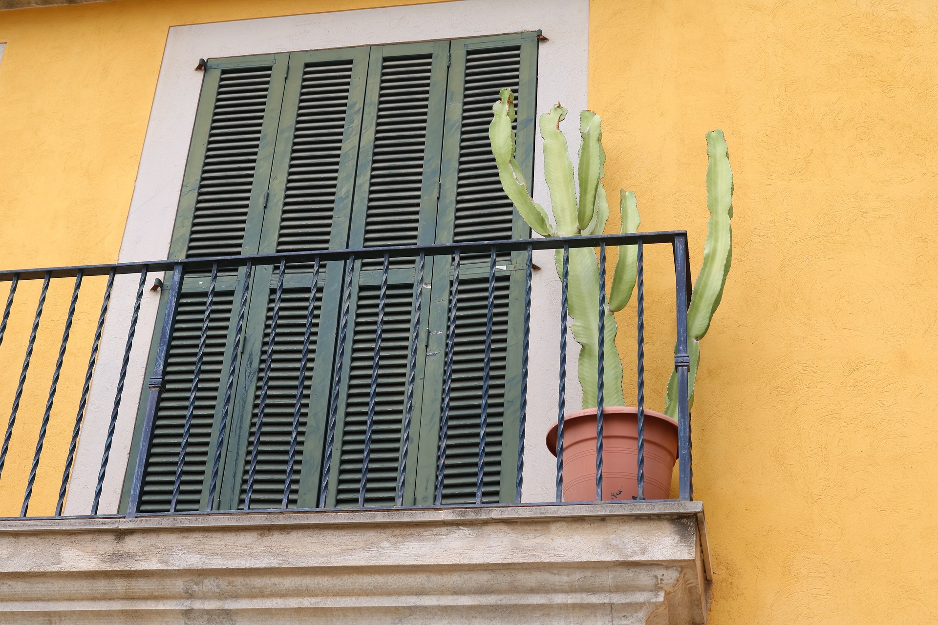
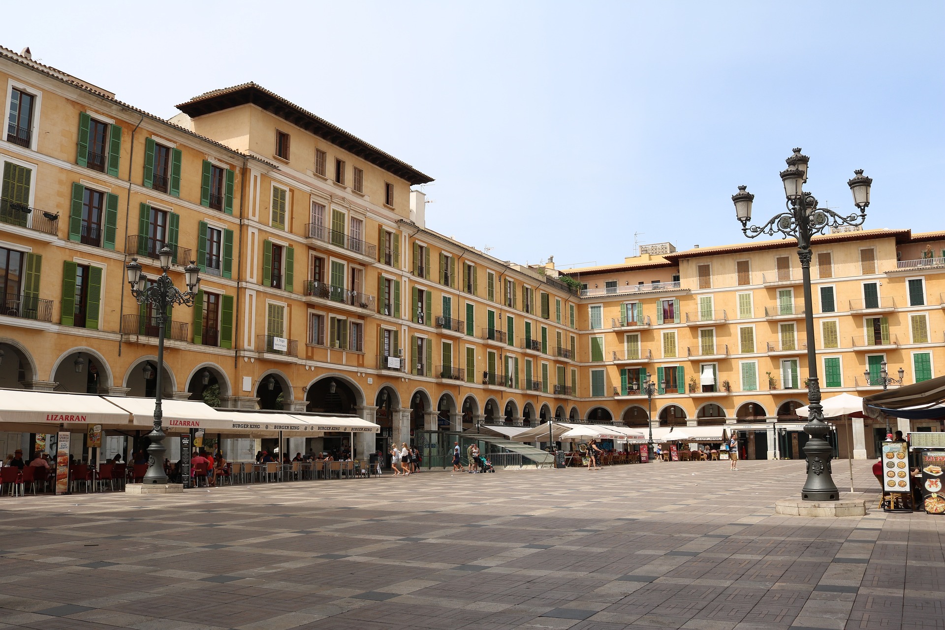
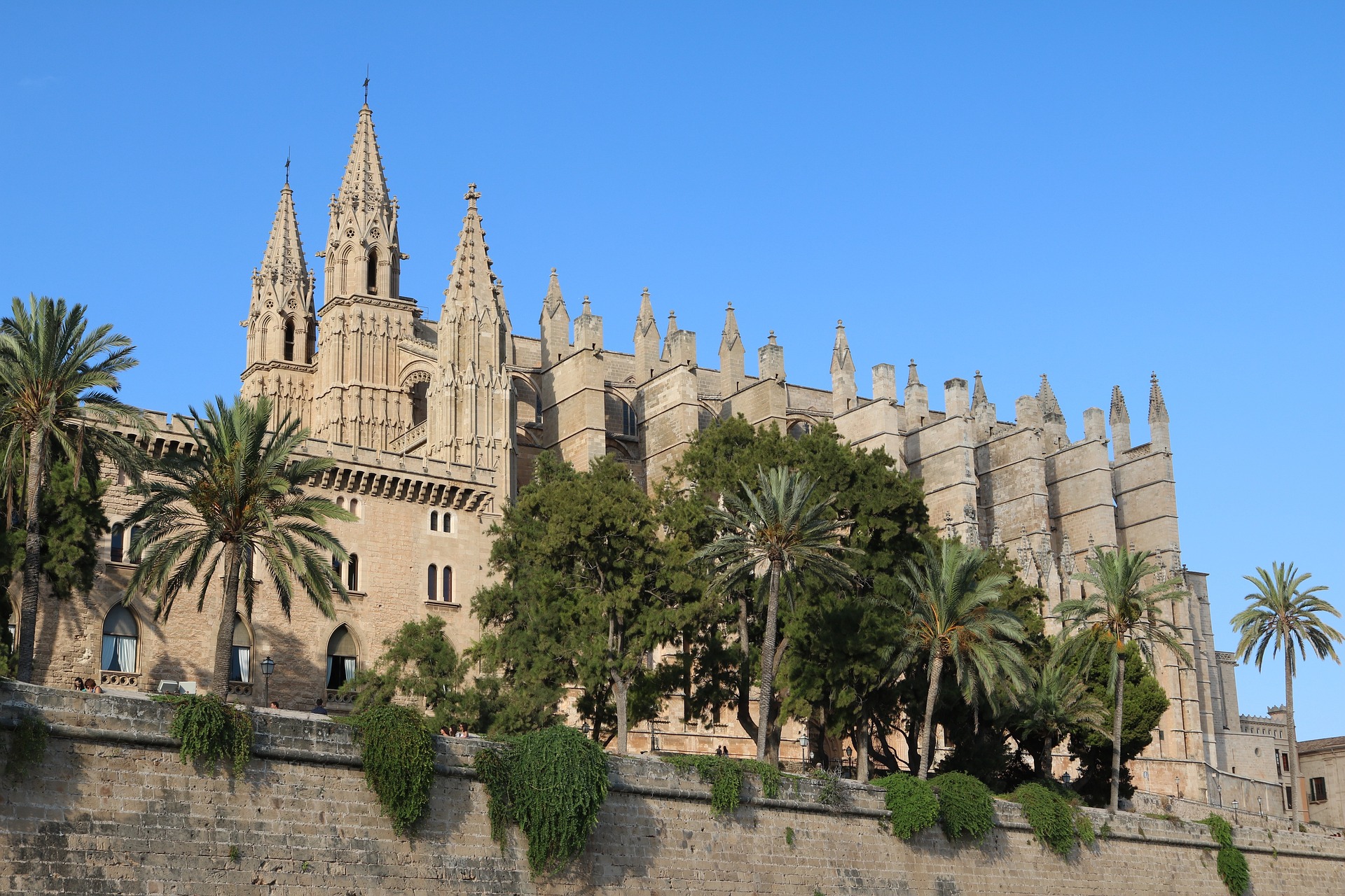
About Palma de Mallorca
If you look north of the cathedral (La Seu, or the seat of the bishopric, to Mallorcans) on a map of the city of Palma, you can see around the Plaça Santa Eulàlia a jumble of tiny streets that made up the earliest settlement. Farther out, a ring of wide boulevards traces the fortifications built by the Moors to defend the larger city that emerged by the 12th century. The zigzags mark the bastions that jutted out at regular intervals. By the end of the 19th century, most of the walls had been demolished; the only place where you can still see the massive defenses is at Ses Voltes, along the seafront west of the cathedral.A torrent (streambed) used to run through the middle of the old city, dry for most of the year but often a raging flood in the rainy season. In the 17th century it was diverted to the east, along the moat that ran outside the city walls. Two of Palma's main arteries, La Rambla and the Passeig d'es Born, now follow the stream's natural course. The traditional evening paseo (promenade) takes place on the Born.If you come to Palma by car, park in the garage beneath the Parc de la Mar (the ramp is just off the highway from the airport, as you reach the cathedral) and stroll along the park. Beside it run the huge bastions guarding the Almudaina Palace; the cathedral, golden and massive, rises beyond. Where you exit the garage, there's a ceramic mural by the late Catalan artist and Mallorca resident Joan Miró, facing the cathedral across the pool that runs the length of the park.If you begin early enough, a walk along the ramparts at Ses Voltes from the mirador beside the cathedral is spectacular. The first rays of the sun turn the upper pinnacles of La Seu bright gold and then begin to work their way down the sandstone walls. From the Parc de la Mar, follow Avinguda Antoni Maura past the steps to the palace. Just below the Plaça de la Reina, where the Passeig d'es Born begins, turn left on Carrer de la Boteria into the Plaça de la Llotja (if the Llotja itself is open, don't miss a chance to visit—it's the Mediterranean's finest Gothic-style civic building). From there stroll through the Plaça Drassana to the Museu d'Es Baluard, at the end of Carrer Sant Pere. Retrace your steps to Avinguda Antoni Maura. Walk up the Passeig d'es Born to Plaça Joan Carles I, then right on Avenida de La Unió.

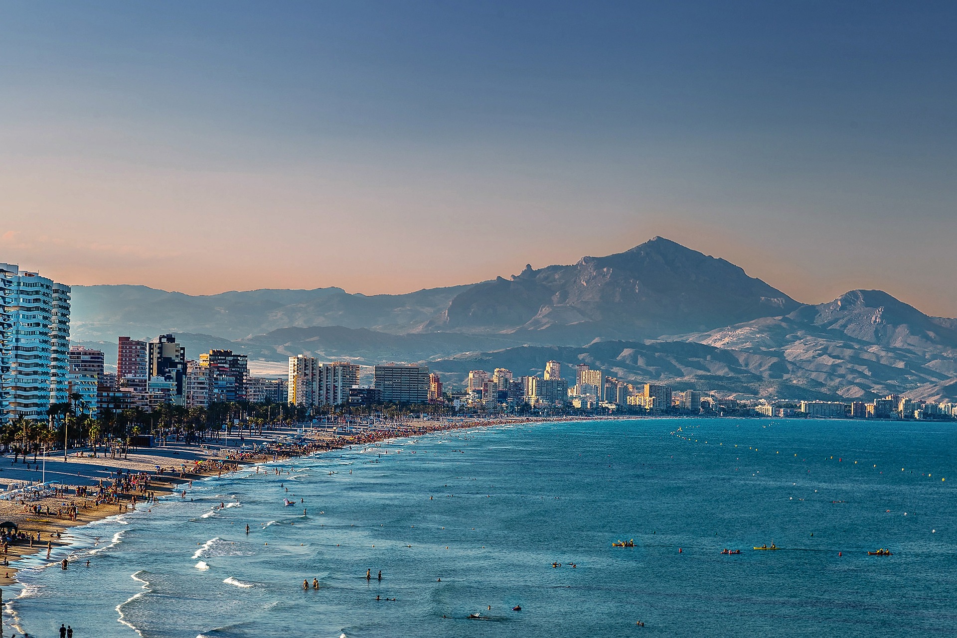
About Alicante
The provincial capital of the Valencian Community serves as a gateway to the huge influx of tourists that flock to the Costa Blanca resorts every year. Alicante is popular with holidaymakers who arrive for the warm, Mediterranean climate and seemingly endless golden beaches. However, there is much more to this city than sand and sun. With a picturesque waterfront, a hugely impressive castle, buzzing nightlife and a rich, complex history, Alicante is a fascinating destination all year round.
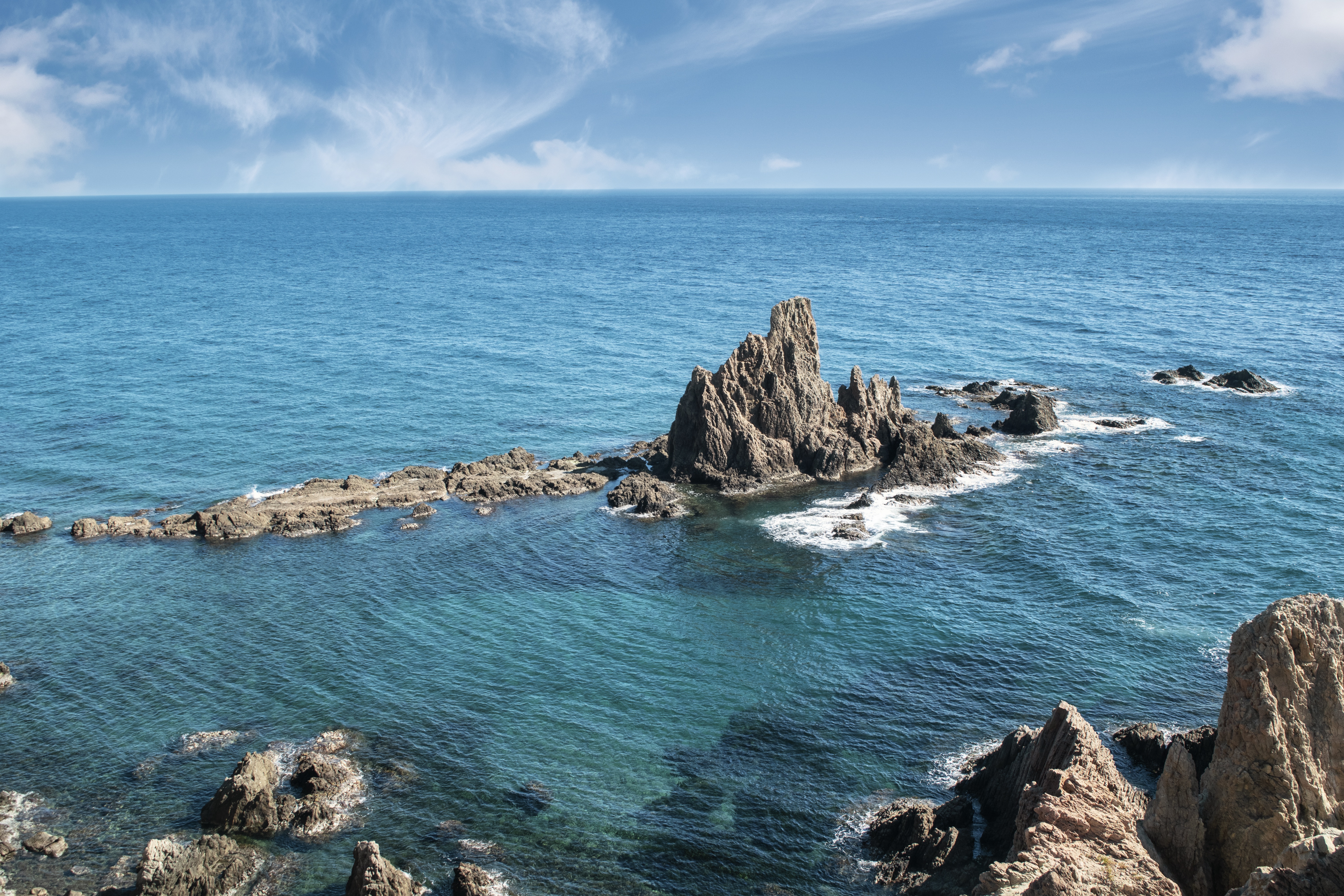
About Almería
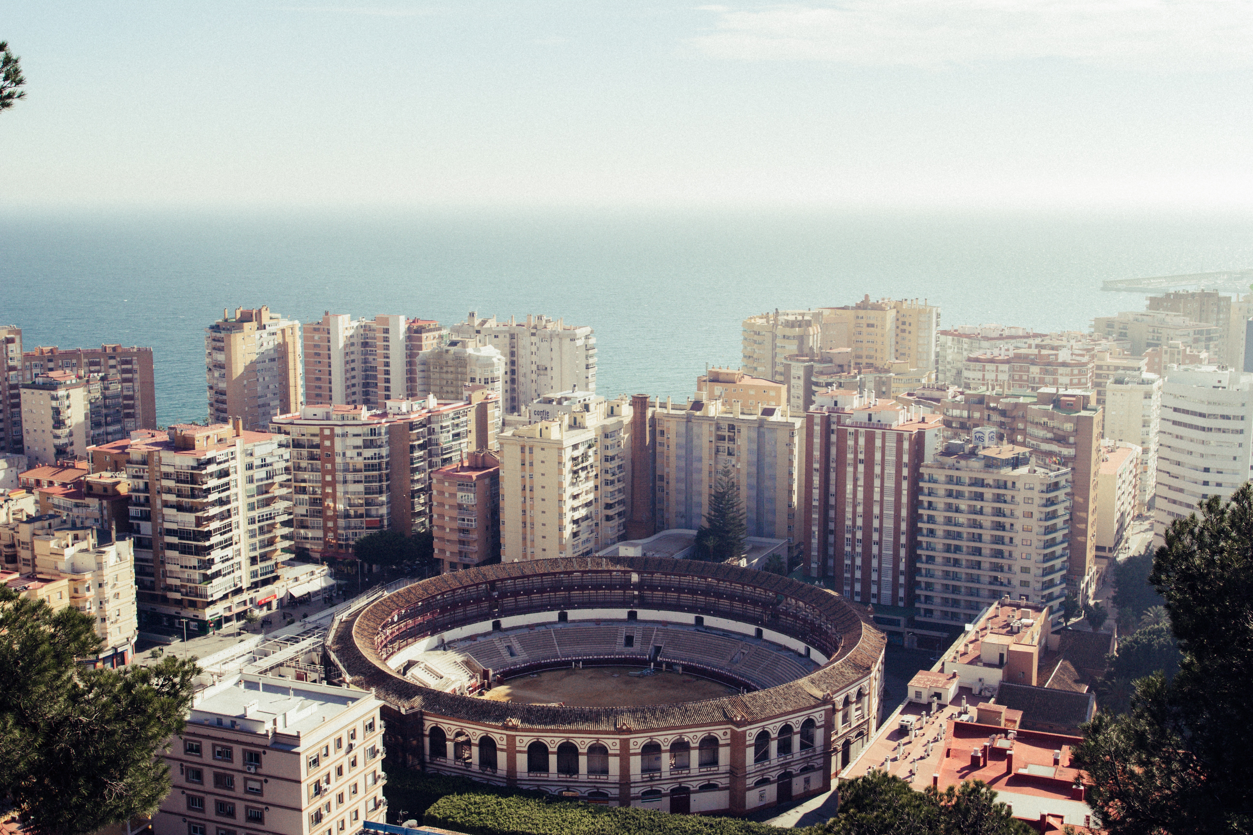
About Málaga
As you sail into Malaga you will notice what an idyllic setting the city enjoys on the famous Costa del Sol. To the east of this provincial capital, the coast along the region of La Axarqua is scattered with villages, farmland and sleepy fishing hamlets - the epitome of traditional rural Spain. To the west stretches a continuous city where the razzmatazz and bustle creates a colourful contrast that is easily recognisable as the Costa del Sol. Surrounding the region, the Penibéetica Mountains provide an attractive backdrop overlooking the lower terraced slopes which yield olives and almonds. This spectacular mountain chain shelters the province from cold northerly winds, giving it a reputation as a therapeutic and exotic place in which to escape from cold northern climes. Malaga is also the gateway to many of Andalusia's enchanting historic villages, towns and cities.
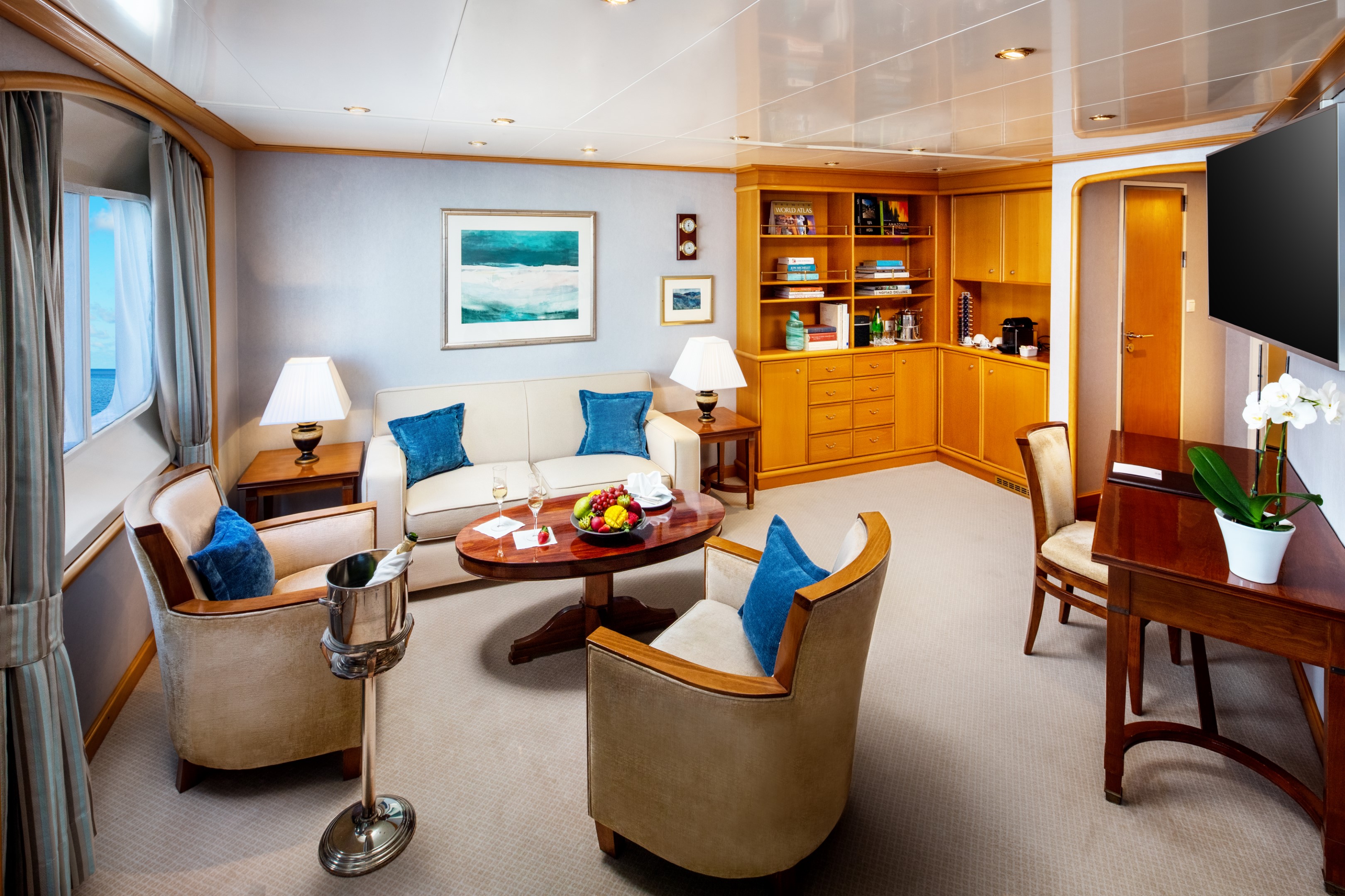
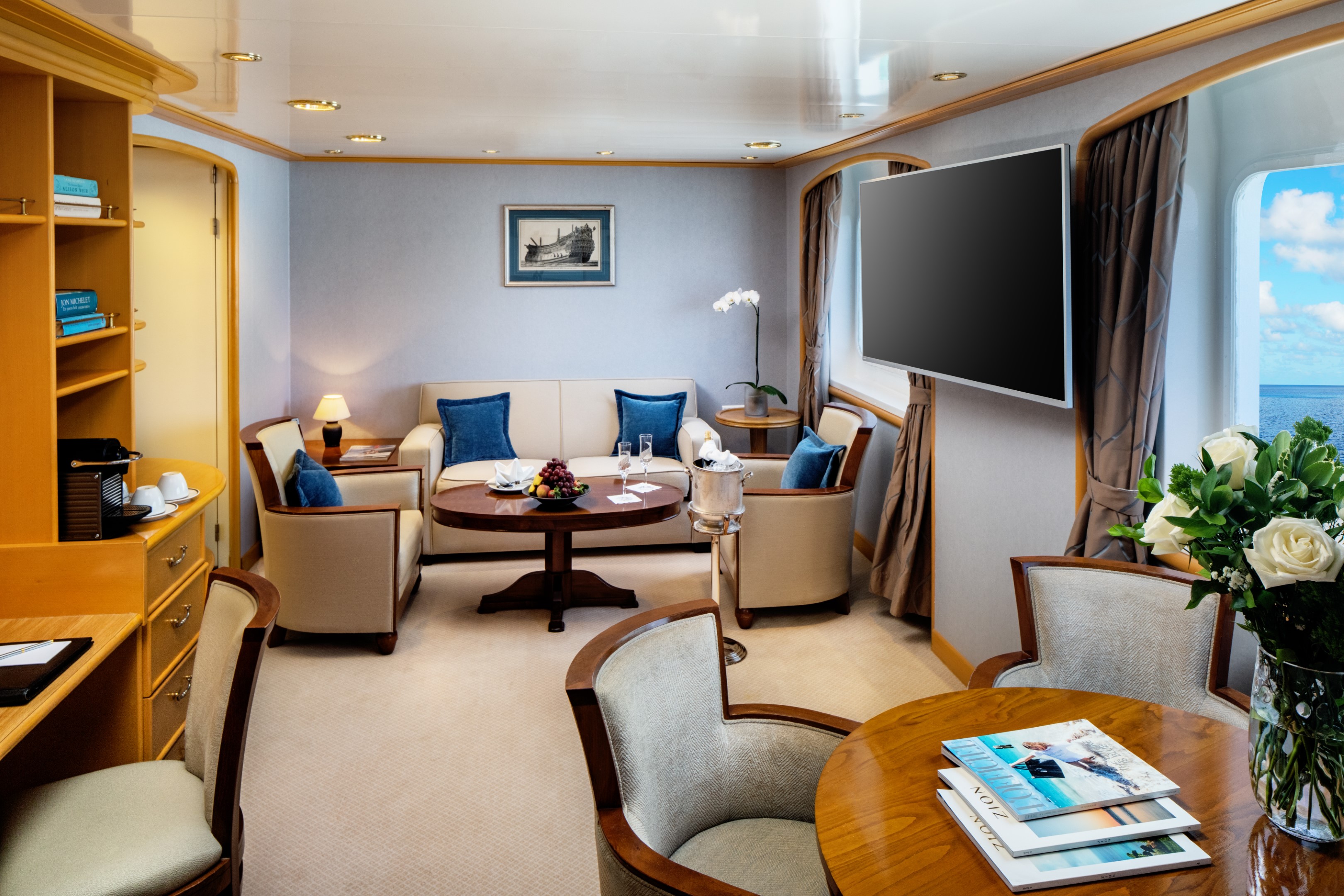
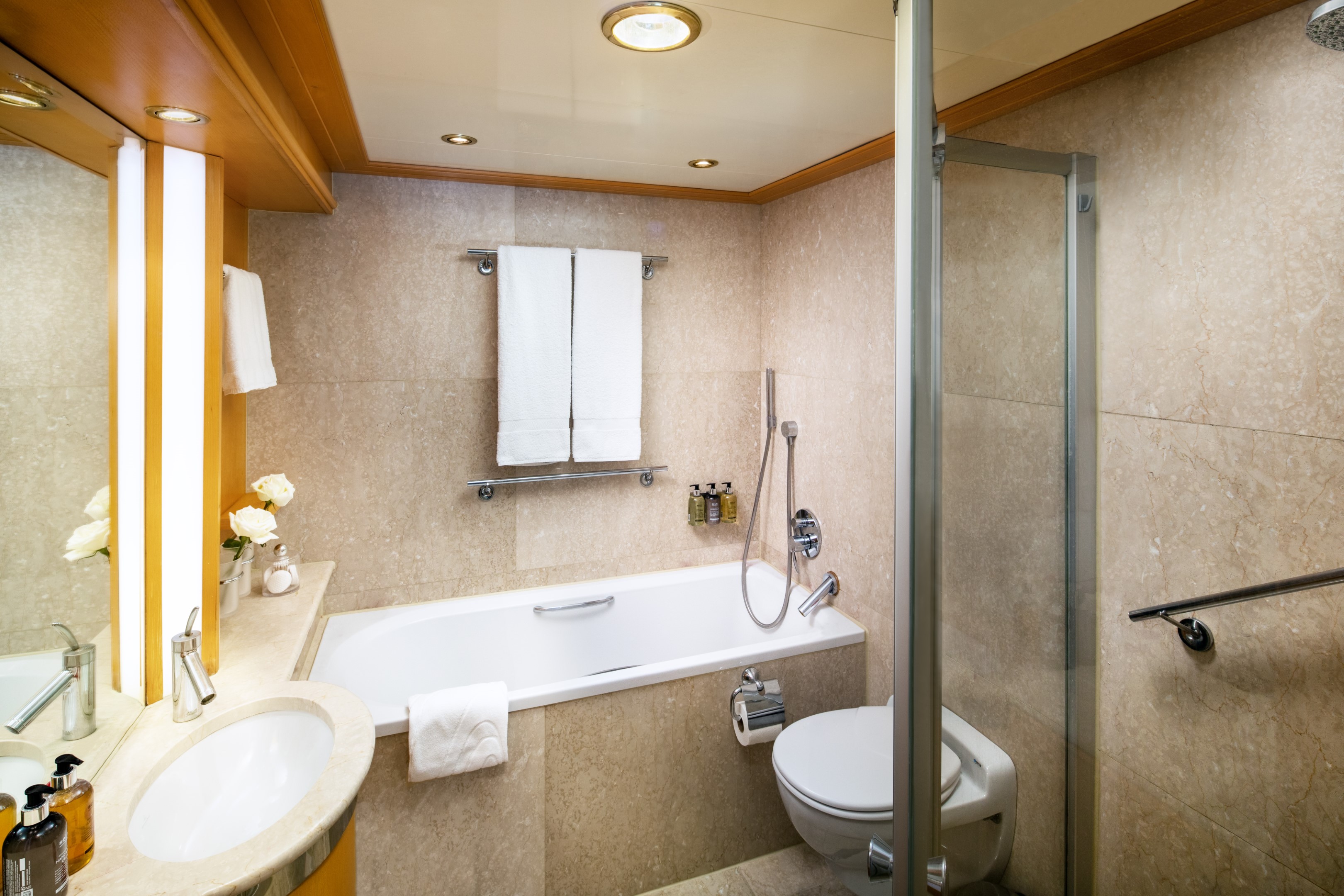
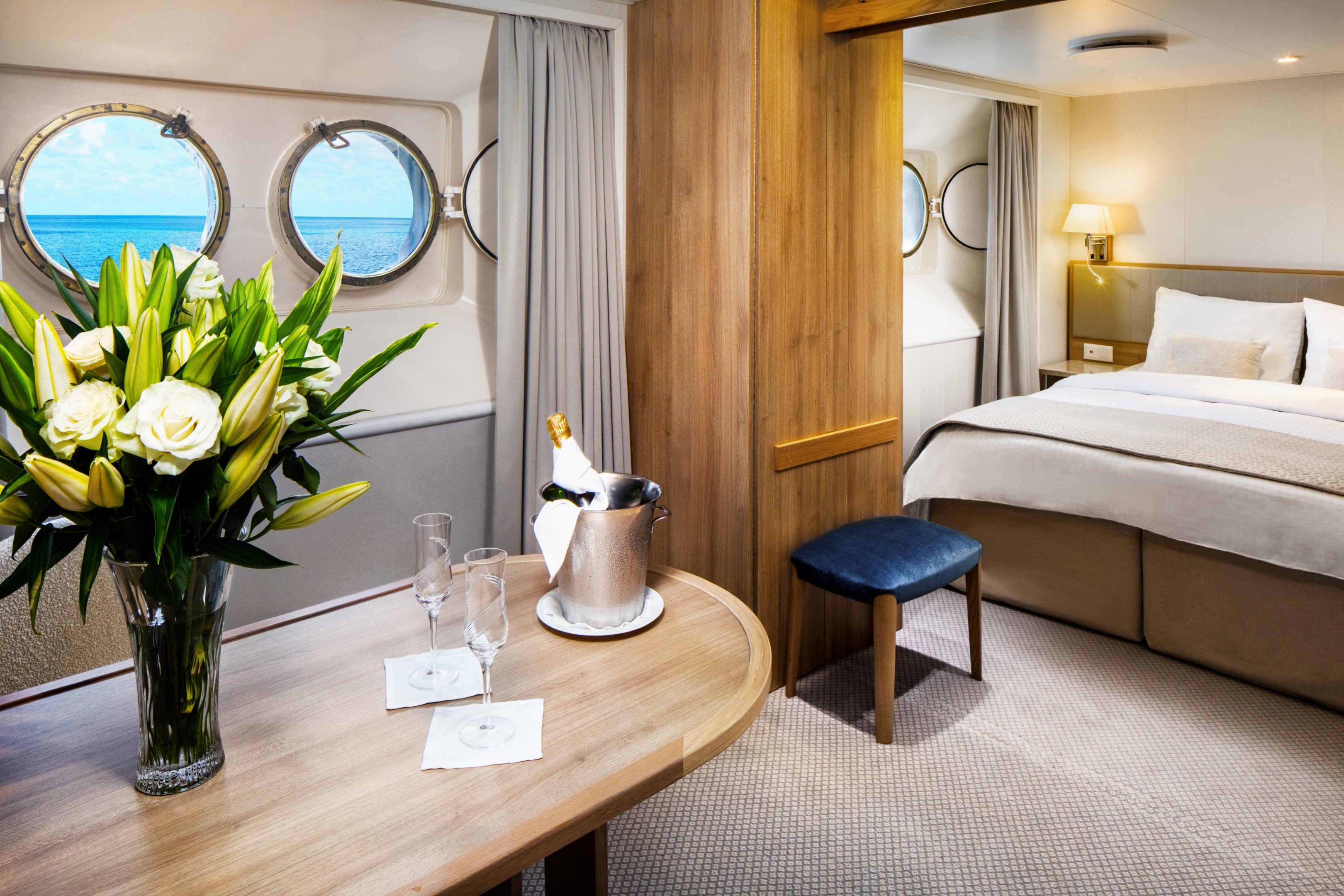
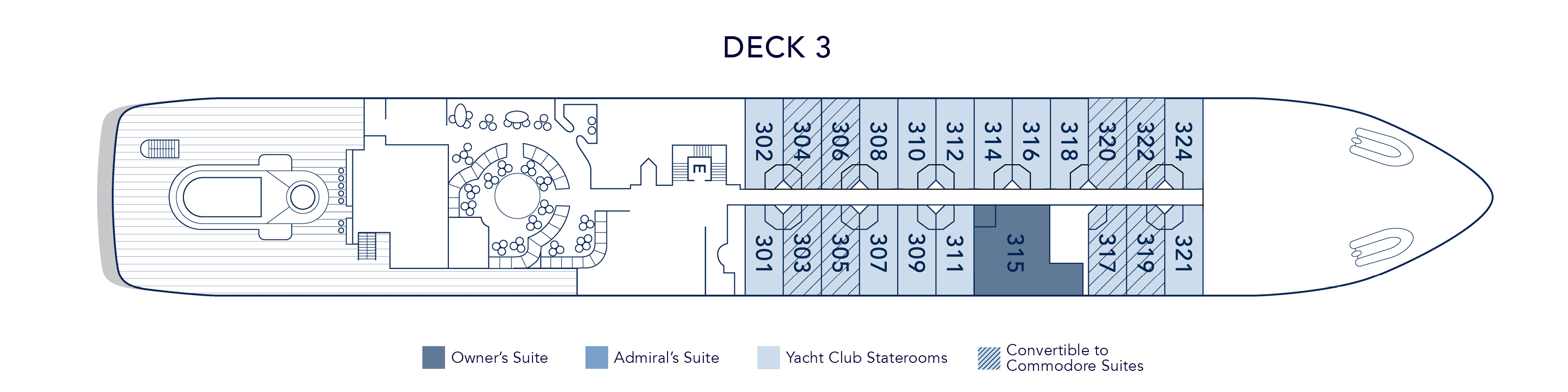
At 447 square feet, the Owner’s Suite is the largest and most considered accommodation on the yacht. A separate master bedroom with a permanent queen bed opens to a spacious living and dining area, generous enough to host family and friends in comfort, while the marble bathroom offers both a massage shower and a soaking tub with uninterrupted views of the sea. A half guest bath, writing desk, and Nespresso machine complete a suite designed for those who want the full breadth of the SeaDream experience, in a space entirely their own.
Suite 315, located mid-ship on Deck 3, just steps from the pool.
Owner’s Suite Additional Amenities:
- 55" flat-screen TVs
- Belgian linens
- Silk clothes hangers
- Direct-dial telephone
- 24-hour small bites
- Nespresso machine
- Luxury robes & slippers
- Make-up mirror
- Wi-Fi Available
- Climate control
- Beverage refrigerator
- Elm Organics bath amenities
- Hair dryer
- In-room safe
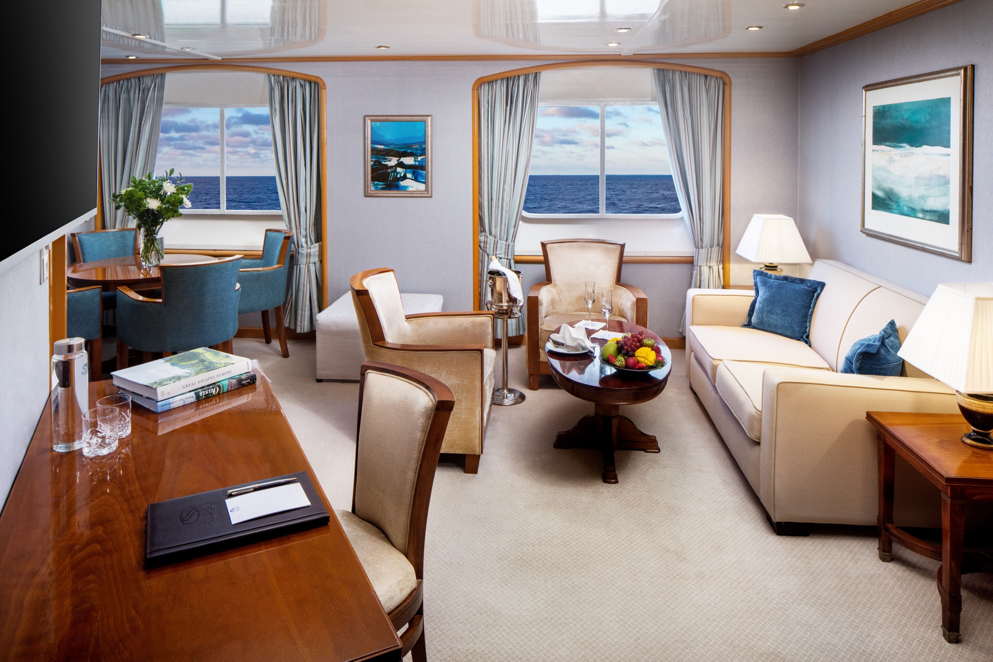
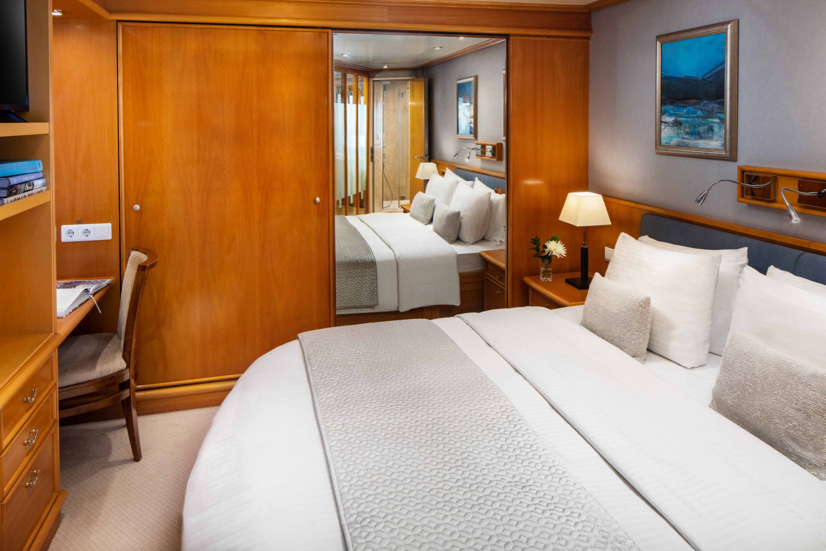
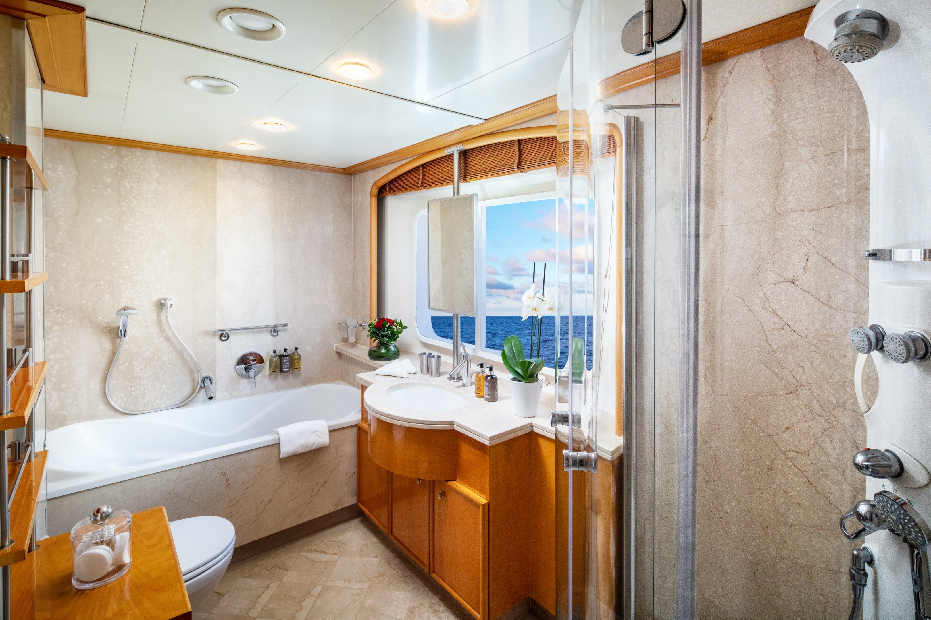
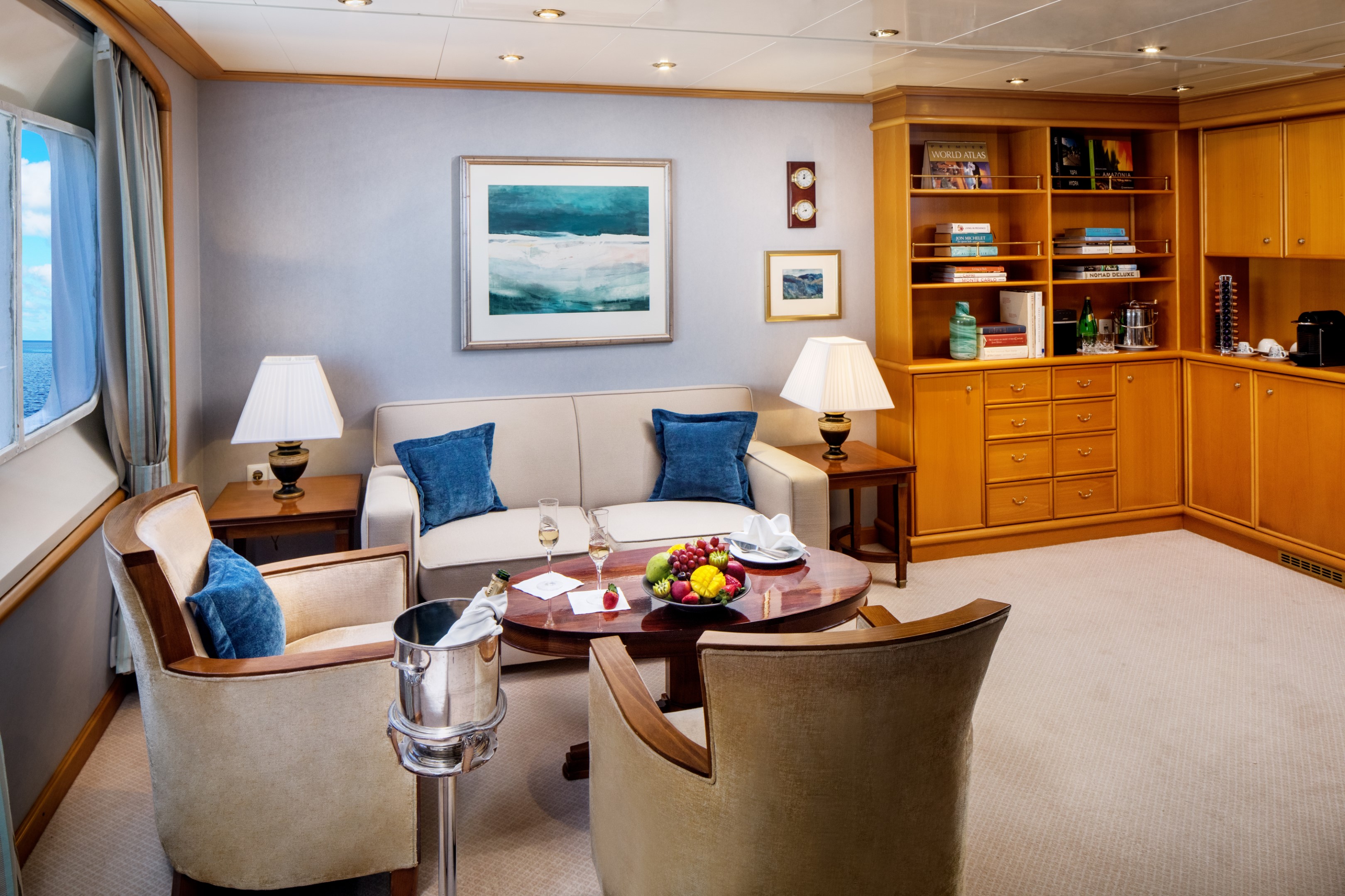
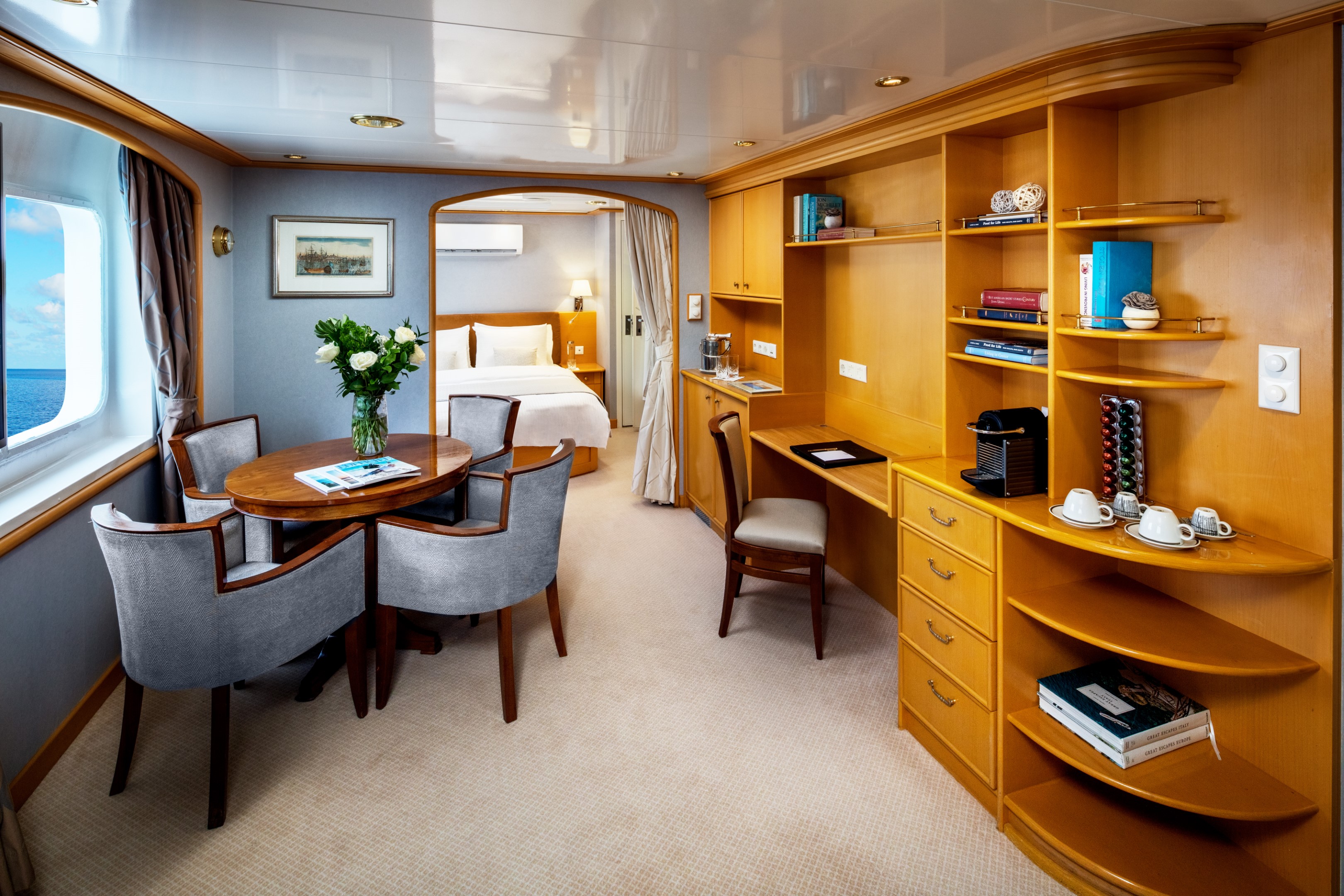
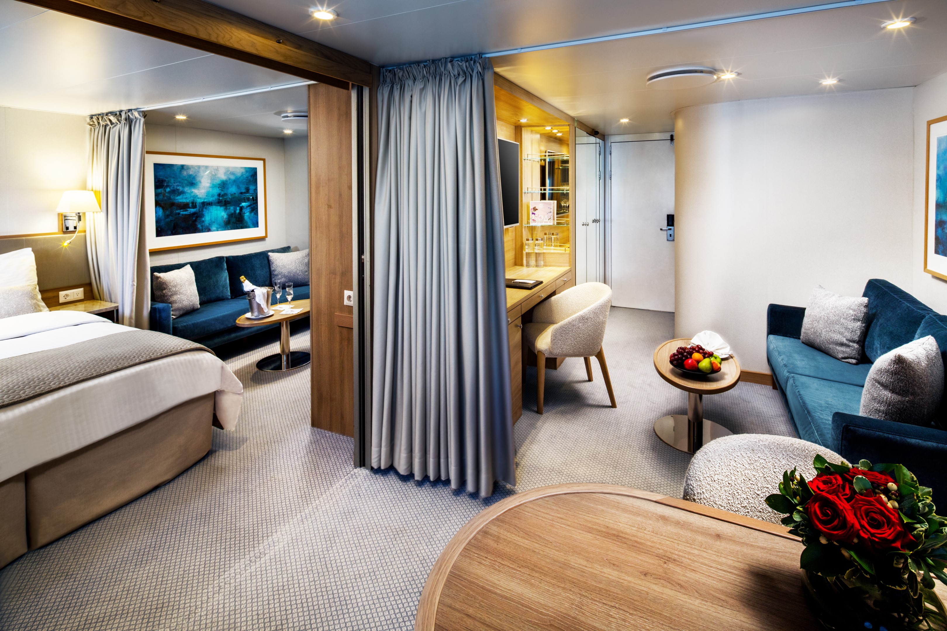
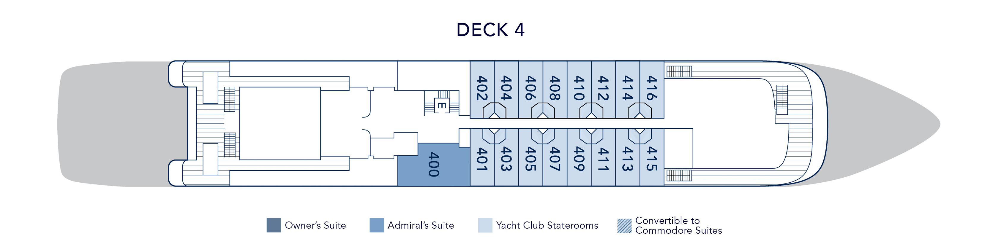
At 375 square feet, the Admiral’s Suite is a luminous retreat at sea. Three picture windows frame the ocean from every angle, filling the partitioned living and dining area with natural light throughout the day. A separate master bedroom with a permanent queen bed offers privacy and quiet, while the marble bathroom draws you in with both a soaking tub and a multi-jet shower. A half guest bath, built-in dresser, and writing desk round out a suite that balances elegance with ease.
Suite 400 on both yachts, located on Deck 4 near the Library.
Admiral’s Suite Additional Amenities:
- 55" flat-screen TVs
- Belgian linens
- Silk clothes hangers
- Direct-dial telephone
- 24-hour small bites
- Nespresso machine
- Luxury robes & slippers
- Make-up mirror
- Wi-Fi Available
- Climate control
- Beverage refrigerator
- Elm Organics bath amenities
- Hair dryer
- In-room safe
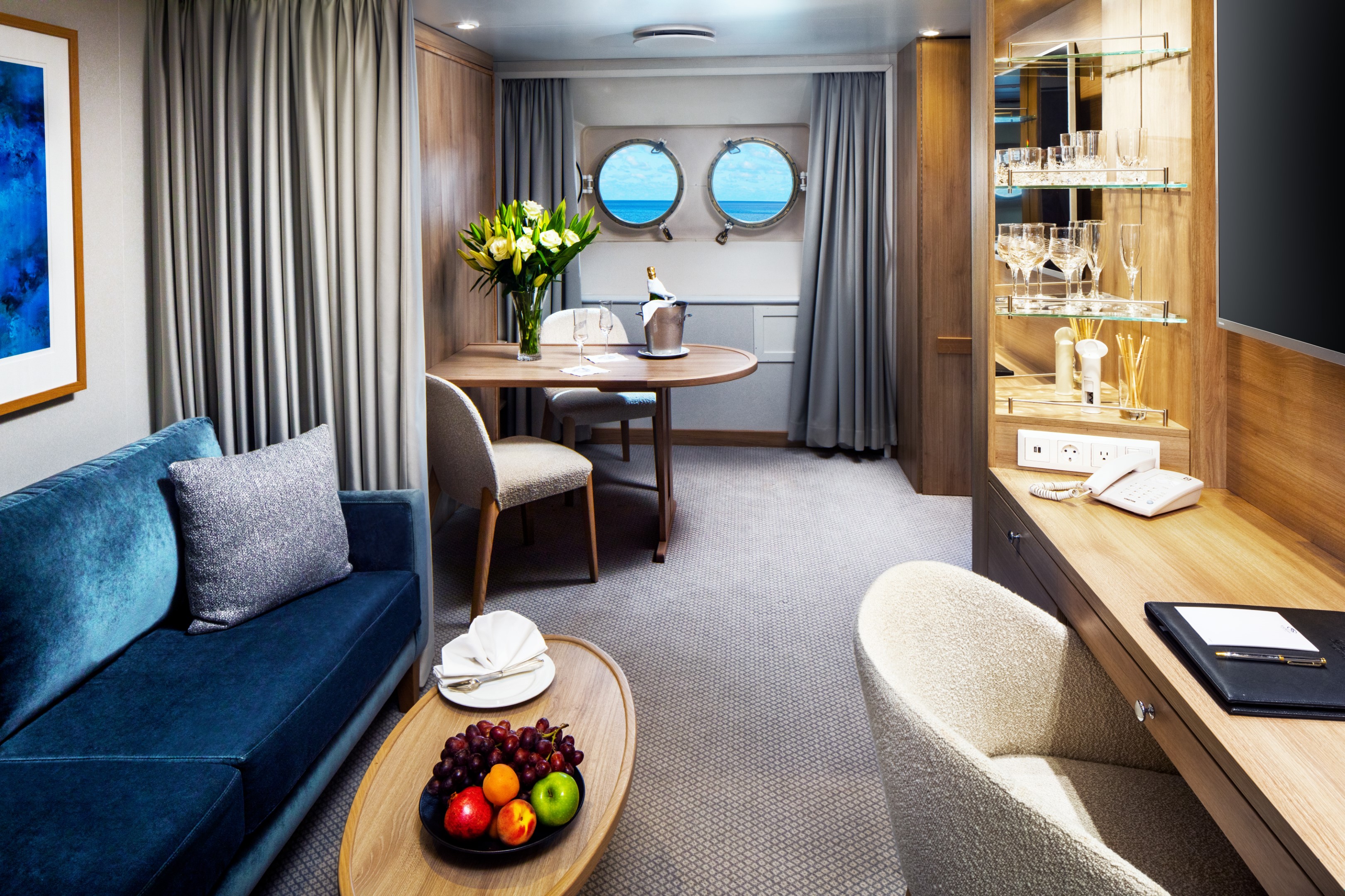
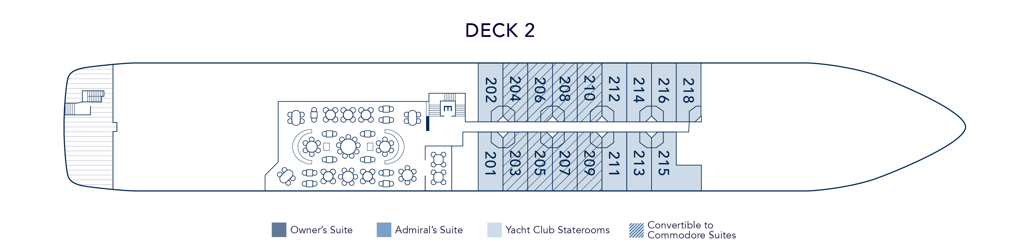
The Commodore Suite brings two Yacht Club Staterooms together into one beautifully considered space averaging 390 square feet. The result is a suite that feels genuinely spacious and luxurious. Two full marble bathrooms with multi-jet showers, a seating area with sofa and cocktail table, two spacious closets, and a built-in dresser with writing desk. Choose between twin beds or a queen and configure the second space as a dining area or additional queen bed, depending on how you want to use it.
Eight Commodore Suites are available across the yacht, with Deck 2 suites featuring four 17” round porthole windows and Deck 3 suites offering picture windows, steps from the pool and Main Salon.
Commodore Suite Additional Amenities:
- 55" flat-screen TVs
- Belgian linens
- Silk clothes hangers
- Direct-dial telephone
- 24-hour small bites
- Luxury robes & slippers
- Make-up mirror
- Wi-Fi Available
- Climate control
- Beverage refrigerator
- Elm Organics bath amenities
- Hair dryer
- In-room safe
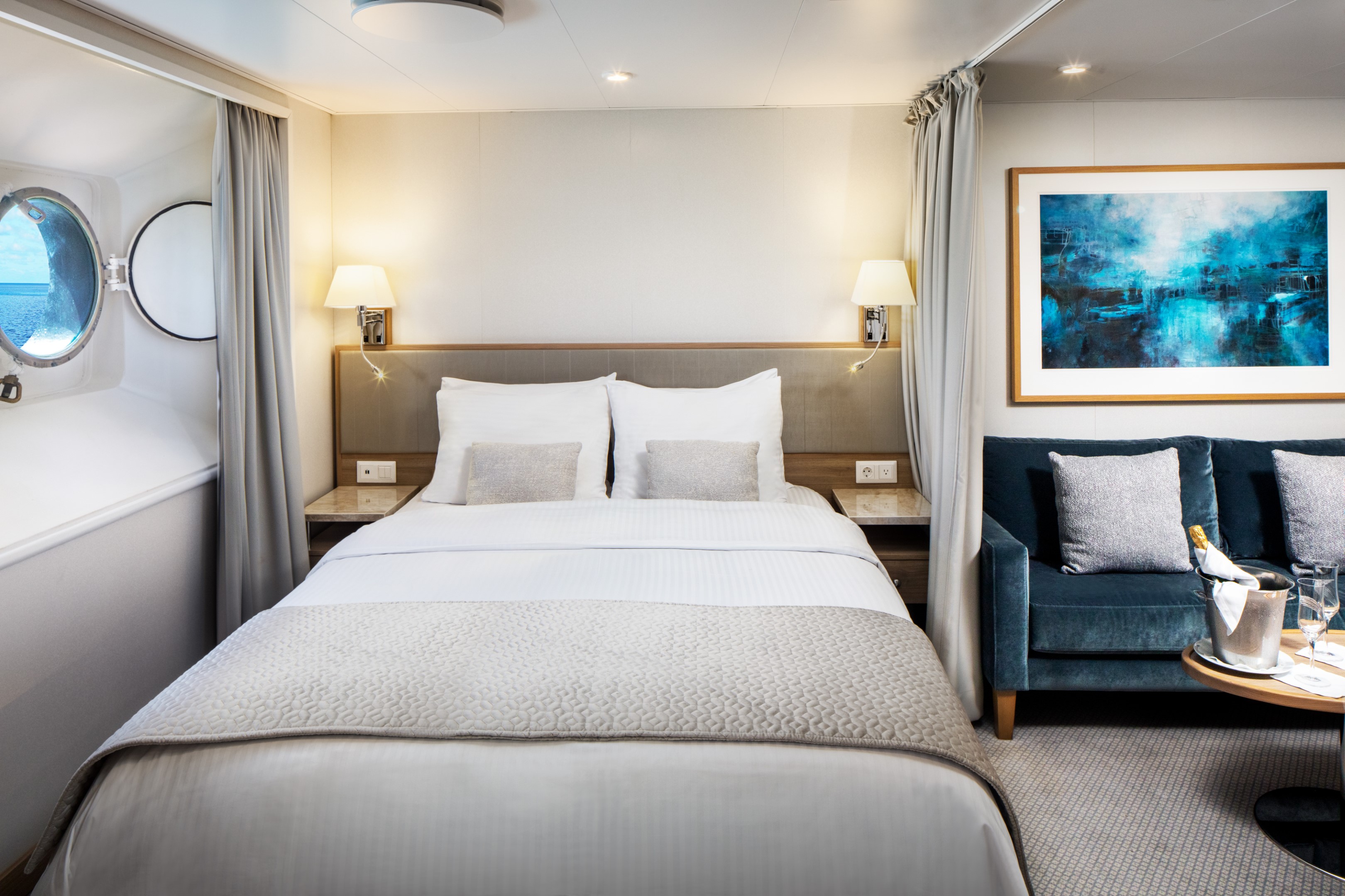
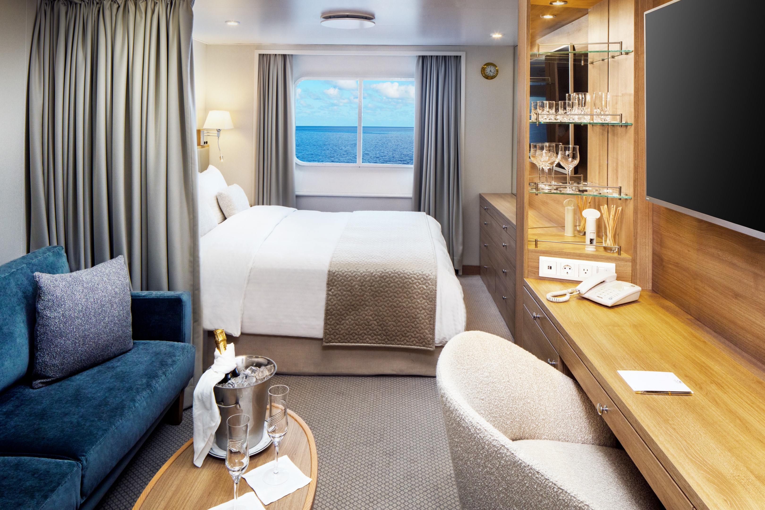
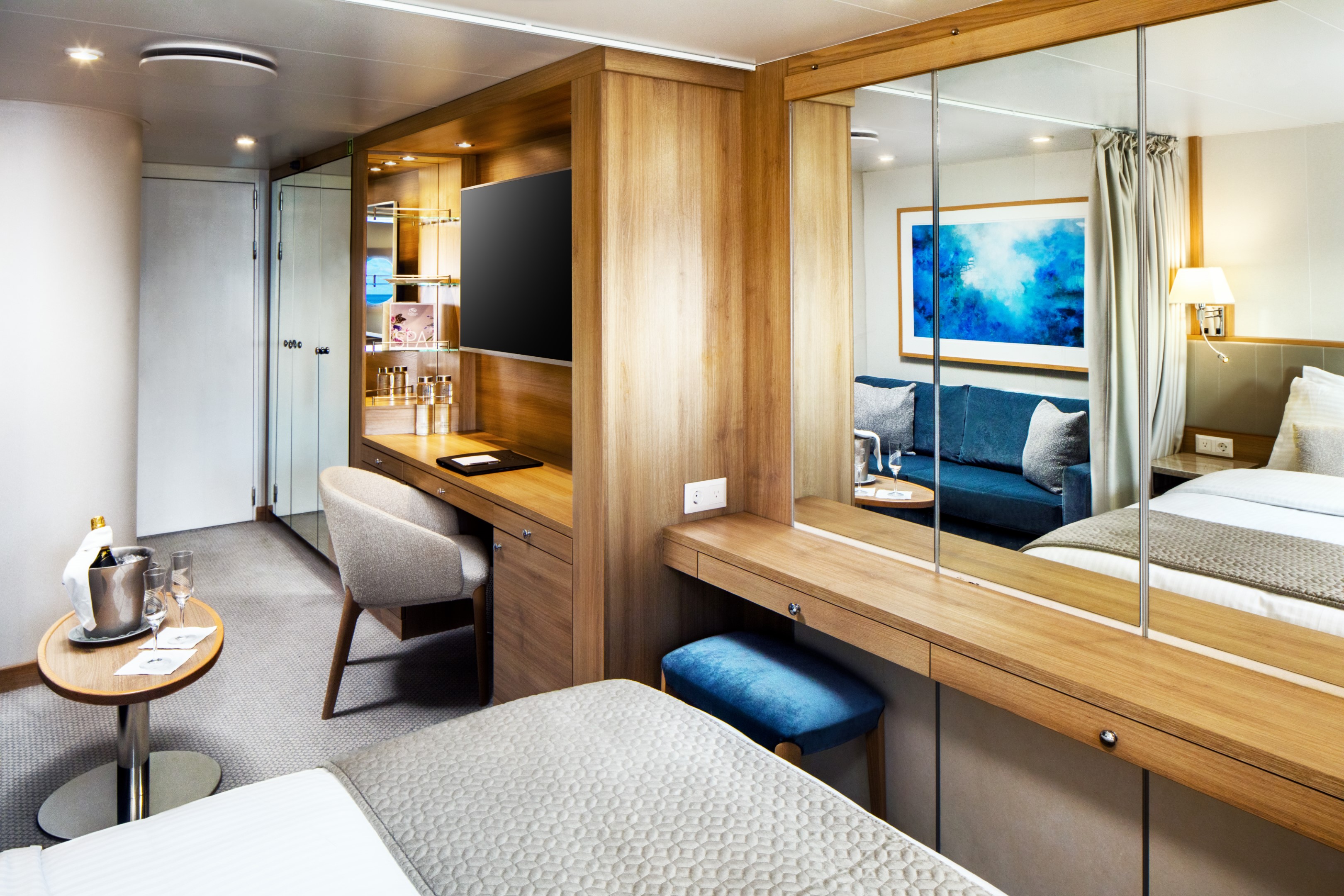
Averaging 195 square feet, the Yacht Club Stateroom is where the yachting lifestyle truly comes to life. Picture windows frame the open sea, while a marble-lined bathroom with a multi-jet shower and well-appointed living area with sofa, cocktail table, and writing desk offer every comfort you need. Choose between twin beds or a queen and settle into a space that feels considered from every angle.
Deck 3 staterooms sit just steps from the pool, while Deck 4 places you close to the SeaDream Spa, Fitness Center and Library.
Yacht Club Stateroom Additional Amenities:
- 55" flat-screen TVs
- Belgian linens
- Silk clothes hangers
- Direct-dial telephone
- 24-hour small bites
- Luxury robes & slippers
- Make-up mirror
- Wi-Fi Available
- Climate control
- Beverage refrigerator
- Elm Organics bath amenities
- Hair dryer
- In-room safe
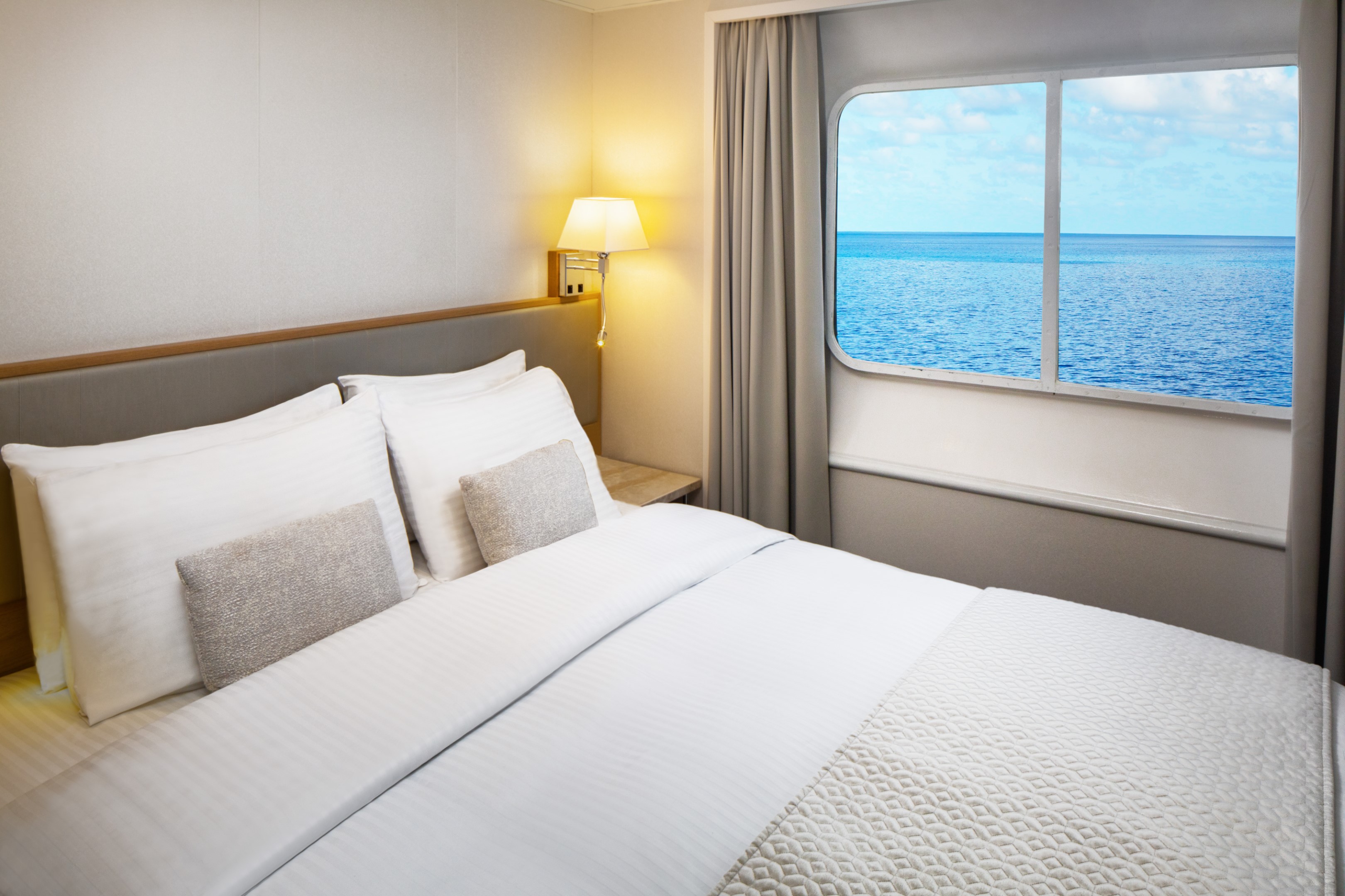
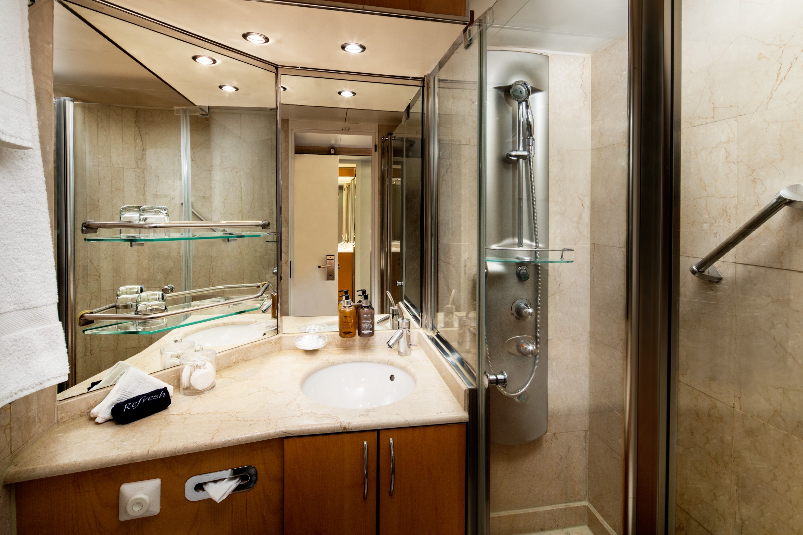
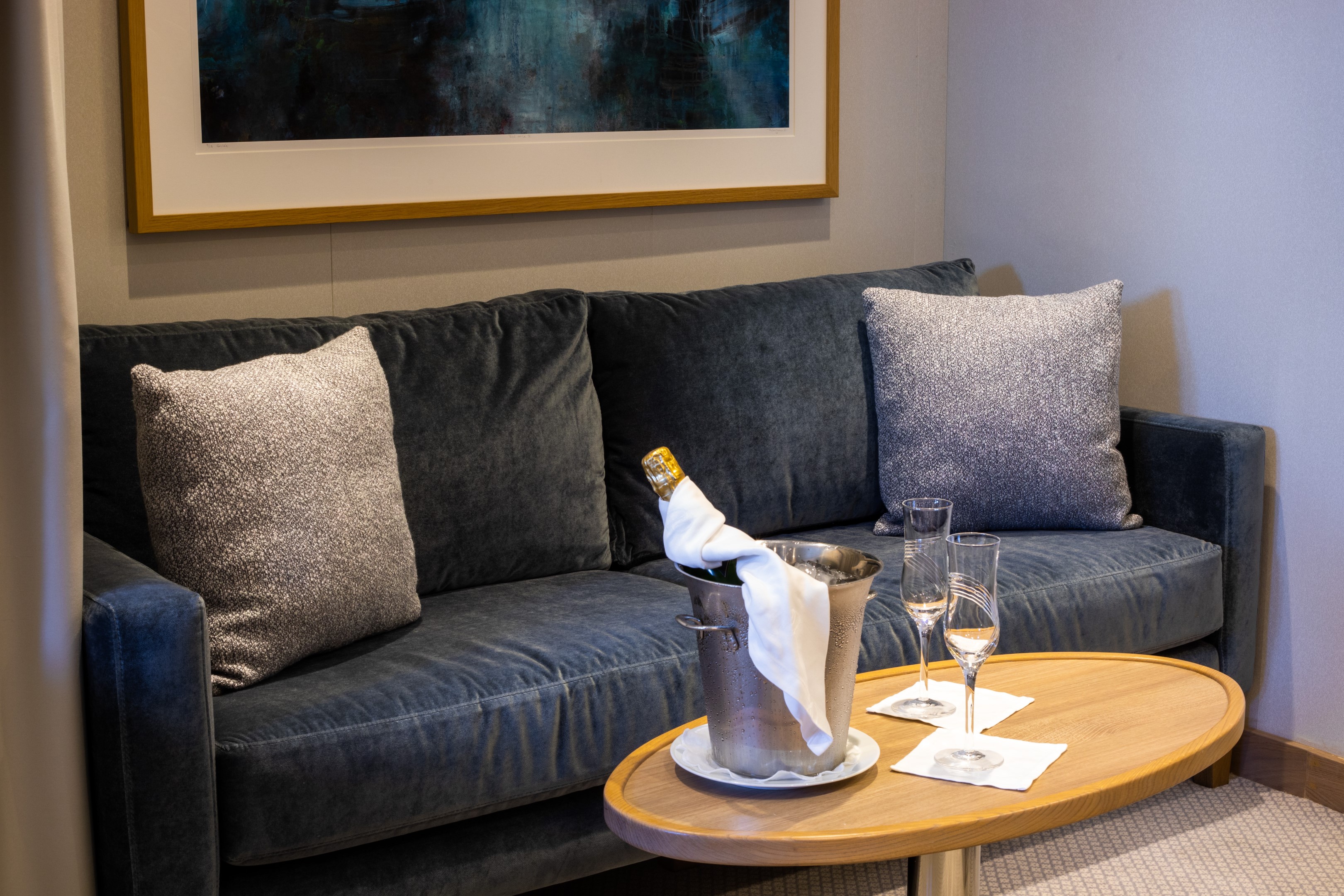
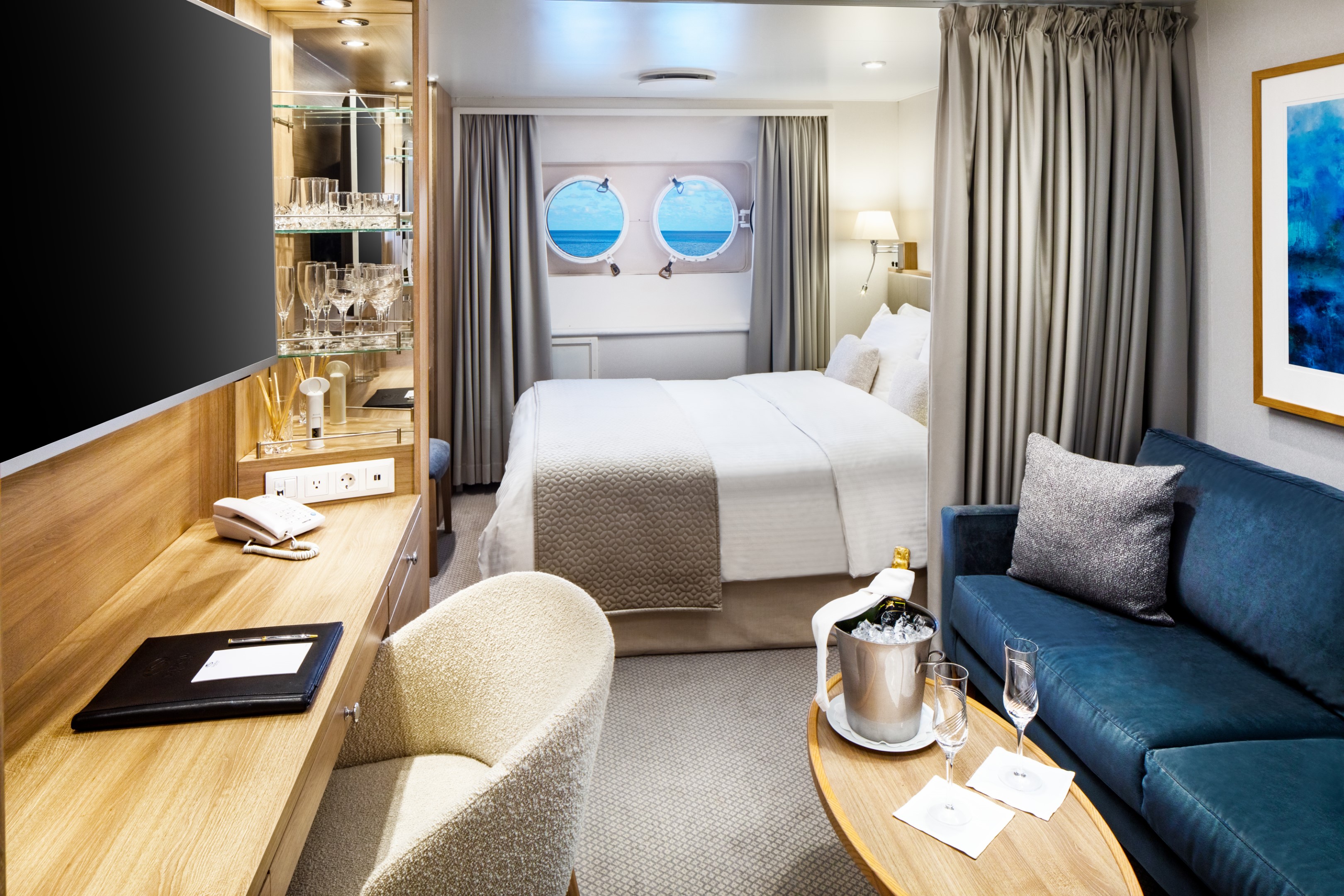
The Yacht Club Staterooms on Deck 2 offer 195 square feet of refined comfort at sea. Two round porthole windows bring the ocean into the room in a way that feels intimate and unhurried. A marble-lined bathroom with a multi-jet shower, an open living area with sofa, cocktail table, and writing desk, and ample closet space complete with a stateroom that is quietly, thoroughly considered.
Yacht Club Stateroom Additional Amenities:
- 55" flat-screen TVs
- Belgian linens
- Silk clothes hangers
- Direct-dial telephone
- 24-hour small bites
- Luxury robes & slippers
- Make-up mirror
- Wi-Fi Available
- Climate control
- Beverage refrigerator
- Elm Organics bath amenities
- Hair dryer
- In-room safe
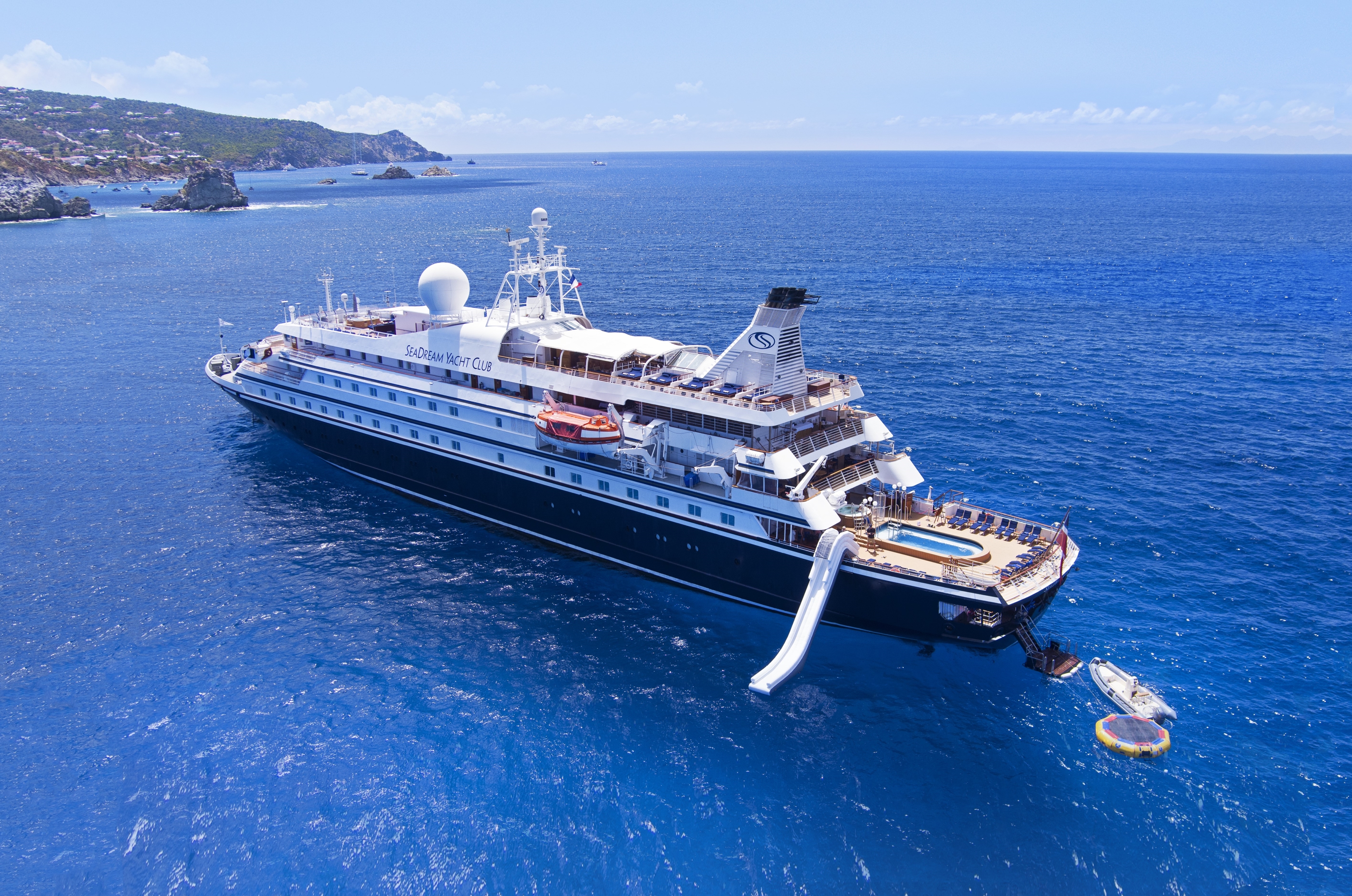
SeaDream I
With 95 crew members looking after just 112 guests across 56 staterooms and suites, the level of service aboard these intimate boutique ships is unlike anything else at sea. Every stateroom and suite faces the sea, each offering luxury accommodations designed around the yachting lifestyle. As an all-inclusive luxury yacht, everything from the open bar to gratuities is taken care of. This is what yachting feels like.
Luxury Suites & Staterooms
Aboard SeaDream, every stateroom and suite is a private luxury retreat designed around the sea. Queen-size beds, marble bathrooms, and uninterrupted ocean views come with every room. For those seeking even more space, the Owner's Suite and Admiral’s Suite offer soaking tubs and generous living areas perfect for entertaining friends and family.
The Onboard Experience
Life aboard SeaDream is defined by elegant informality. Mornings might begin with yoga on deck as the coastline drifts past. Afternoons open to watersports at sea from the Marina, a massage at the spa, or simply a Balinese Bed and the horizon. Evenings bring world-class cuisine under the stars. It feels less like a small ship cruise and more like a private yacht charter.
Among boutique cruise lines, SeaDream stands apart. A luxury yachting vacation built around an intimate setting, ultra luxury service, and a crew that knows your name. Year after year, the world's most trusted travel publications return to SeaDream. The Condé Nast Traveler Gold List, Travel + Leisure, and Cruise Critic have each recognized what guests already know.
Ship Facts
| Launch Year | 1984 | ||||||||
| Refit Year | 2022 | ||||||||
| Language | en | ||||||||
| Gross Tonnage | 4300 | ||||||||
| Length | 105 | ||||||||
| Width | 14 | ||||||||
| Currency | USD | ||||||||
| Speed | 15 | ||||||||
| Capacity | 112 | ||||||||
| Crew Count | 95 | ||||||||
| Deck Count | 5 | ||||||||
| Cabin Count | 56 | ||||||||
| Large Cabin Count | 0 | ||||||||
| Wheelchair Cabin Count | 0 | ||||||||
| Electrical Plugs |
|
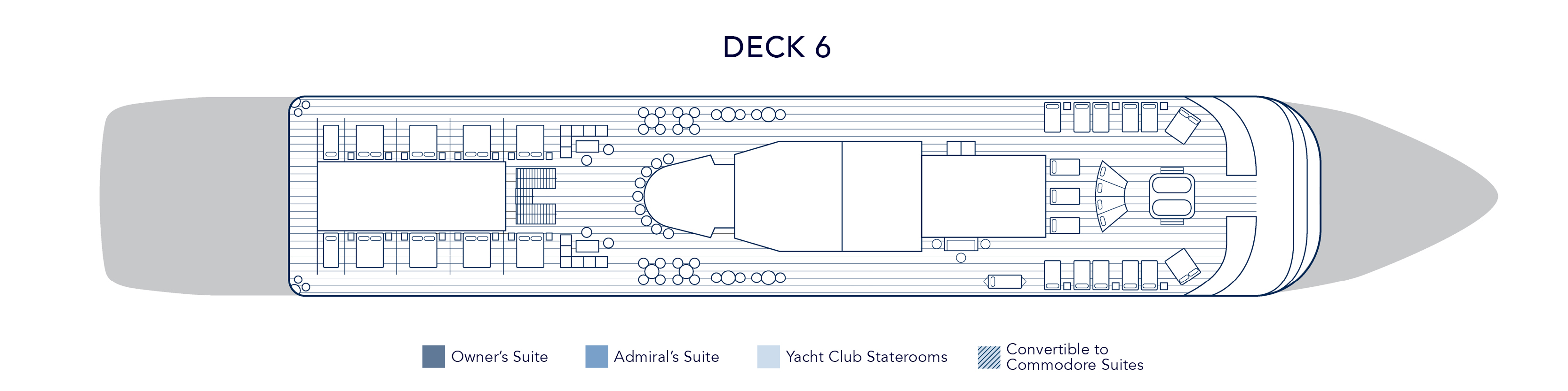
Deck 6
- Balinese Dream Beds
- Top Of The Yacht Bar
- Golf Simulator
- Sun Deck & Sun Beds
- Couples Hot Tubs
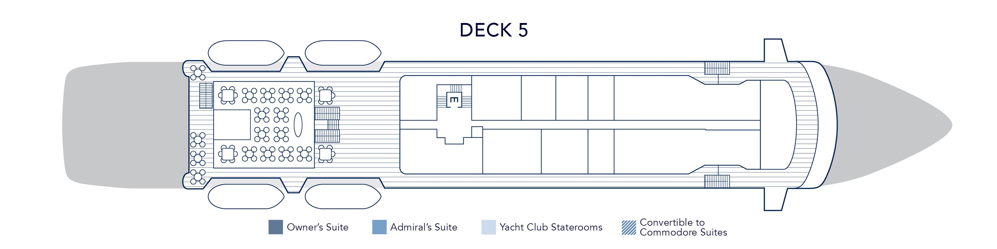
Deck 5
- Topside Restaurant
- Medical Facility
- Open Promenade
- Elevator
- Bridge
Deck 4
- Al Fresco Dining & Lounging
- Library
- Piano Bar
- Casino
- Admiral Suite
- SeaDream Spa
- Fitness Centre
- Beauty Salon
- Elevator
- Yacht Club Staterooms
- Admiral Suite
Deck 3
- Pool / Hot Tub
- Pool Bar
- Card Room
- Main Salon / Main Salon Bar
- Concierge & Boutique
- Yacht Club Staterooms
- Commodore Suites
- Owner's Suite
Deck 2
- Retractable Water Sports Platform Marina
- Dining Salon
- Yacht Club Staterooms
- Commodore Suites
Award-Winning Cuisine
Embark on a sensory adventure with our international menus, crafted with the freshest, high-quality ingredients, infused with local flavors, often locally sourced by our chefs. Always included, every dish is prepared à la minute and served al fresco or in our elegant Dining Salon, offering a dining experience that is uniquely yours.
Topside Restaurant
Multi-course menus are prepared à la minute and shaped by the destinations visited. Seasonal ingredients and regional flavors guide each service, delivering gourmet dining experiences available at sea with the standards expected of gourmet dining restaurants known for their excellent wine selection and Michelin-inspired cuisine. Inclusive wine pairing accompanies each dinner, thoughtfully chosen to complement the menu without overpowering it.
From luxury breakfast experiences on deck to candlelit evenings under the stars, the yacht dining experience becomes both a culinary journey and a defining part of life aboard.
Dining Salon
On SeaDream, an exclusive yacht dining experience unfolds with freedom, balance, and quiet refinement. Every breakfast, lunch, and dinner may be enjoyed al fresco beneath open sky or within the elegant dining salon, creating a seamless expression of dining on a yacht. There are no fixed seatings and no crowds, only the ease of following the moment.
Desert Extravaganza
The Dessert Extravaganza is one of the most anticipated culinary events aboard SeaDream. Presented as an elegant after-dinner gathering on deck, it highlights the creativity and craftsmanship behind our award-winning yacht and luxury cruise dining program.
Prepared entirely on board by our skilled pastry chefs, this signature onboard dining event features an expansive display of gourmet desserts at sea. Guests are invited to explore freshly baked cakes and pies, delicate tarts, handcrafted pastries, house-made ice creams, specialty confections, and our signature Bananas Foster prepared to order. Each selection reflects the same standards found throughout our fine dining at sea and our acclaimed award-winning cuisine.
While many cruise lines offer a traditional cruise dessert buffet, SeaDream’s Dessert Extravaganza elevates the concept through thoughtful curation and elegant presentation, creating a refined culinary experience at sea. The open-air setting encourages guests to gather, connect, and celebrate together, making it a memorable part of the luxury yacht dining experience.
More than a sweet finale, the Dessert Extravaganza reflects SeaDream’s commitment to exceptional food at sea, blending variety, quality, and community in a way that defines our intimate luxury cruise dining experience.
Plant-Based & Organic Cuisine at Sea
Morning light settles over the deck. Fresh fruit, pressed juices, and vibrant greens arrive quietly at the table. On SeaDream, plant-based cuisine is not an alternative. It is an integral part of our luxury yacht dining experience.
Our embraces organic cuisine at sea, thoughtfully crafted vegan menus, and plant-forward dishes that reflect both wellness and indulgence. Each course is prepared à la minute, shaped by the destinations we visit and the seasonal ingredients sourced along the way. This is gourmet plant-based dining designed for life aboard a private luxury yacht.
A Pioneer in Plant-Based Yacht Dining
SeaDream was among the first luxury cruise experiences to introduce a dedicated plant-based menu at sea. Today, our expanded vegan dining options are available at every meal, seamlessly integrated into our Michelin-inspired cuisine and refined yacht food menu.
The philosophy is simple. Whole foods. Organic produce. Clean flavors. Elegant presentation.
Our chefs transform vegetables, legumes, ancient grains, nuts, and seeds into dishes that feel both nourishing and indulgent. The result is a plant-based dining experience that satisfies devoted vegans, vegetarians, and wellness-minded travelers alike.
Organic Ingredients. Global Inspiration.
Seasonal produce and locally sourced ingredients guide our organic yacht cuisine. Mediterranean herbs, Caribbean spices, and coastal citrus shape menus that evolve with each voyage. Whether sailing the Greek Isles or the Caribbean, plant-based dishes reflect the regions explored.
SeaDream Tea Menu
SeaDream Yacht Club’s Tea Menu features twelve exclusive tea blends created specifically for SeaDream by a master blender in Kent, United Kingdom. Available only on board, this curated collection is part of our luxury yacht tea service and refined private yacht dining experience.
Each premium loose-leaf tea is prepared in an individual 0.51 Bodum teapot with an integrated plunger diffuser, ensuring precise steeping and full flavor expression. When hot water is poured, our service team begins a measured infusion timer. Guests are informed when the recommended steeping time has been reached and may depress the plunger to stop the brewing process at their preferred strength.
This attentive preparation defines our onboard tea service and ensures a consistently elevated tea experience at sea.
The Collection
Our exclusive tea blends include a selection of black teas, green teas, herbal infusions, and specialty teas crafted solely for SeaDream. Each blend is selected for quality, prevenance, and balance, offering guests a premium tea service at sea that reflects the standards of luxury cruise dining.
Whether enjoyed during afternoon tea at sea or a quiet moment between destinations, the collection delivered depth, clarity, and refinement in every cup.
Luxury Tea Service at Sea
Available throughout the day, SeaDream’s luxury tea service enhances the yacht dining experience with exclusive blends, precise preparation, and attentive yet unintrusive service. From afternoon tea on deck to quiet moments in the Salon, this curated tea program offers a distinctive luxury cruise tea experience found only aboard SeaDream.
Wine & Spirits
An All-Inclusive Bar at Sea
Dream cuisine is harmonized with expressive wines, each pairing thoughtfully selected to complement the flavors of the menu and the places explored. As part of SeaDream’s all-inclusive luxury yacht experience, wine pairings accompany lunch and dinner with quiet intention.
An all-inclusive open bar at sea is available throughout the day, offering select wines, premium spirits, and handcrafted cocktails served wherever you choose to settle. At the Top of the Yacht Bar, by the pool, the Piano Bar or in the Main Salon before dinner, each pour arrives with ease.
Service remains attentive yet unassuming. A glass appears at the right moment. Nothing feels hurried.
The Cellar
SeaDream’s luxury cruise wine program reflects both the Old and New World, from mineral-driven Mediterranean whites to structured Bordeaux and Napa Valley reds. Inclusive selections accompany lunch and dinner, enhancing each course without overshadowing it.
Beyond these, the cellar extends to rare and distinguished vintages for those who wish to explore further. Each bottle is chosen for provenance, balance, and the way it complements life at sea.
Wine here is not a list. It is part of the rhythm of the voyage.
Premium Selections
For guests seeking exceptional expressions, a refined collection of rare wines and aged spirits is available. Distinguished labels such as Château Ducru Beaucaillou Grand Cru Classé and Insignia, Napa Valley, sit alongside small-batch gins, aged whiskies, and fine cognacs.
Selections are offered with the same intention that guides every aspect of this all-inclusive luxury cruise experience: thoughtful, measured, and never overstated.
Activities & Amenities Onboard SeaDream
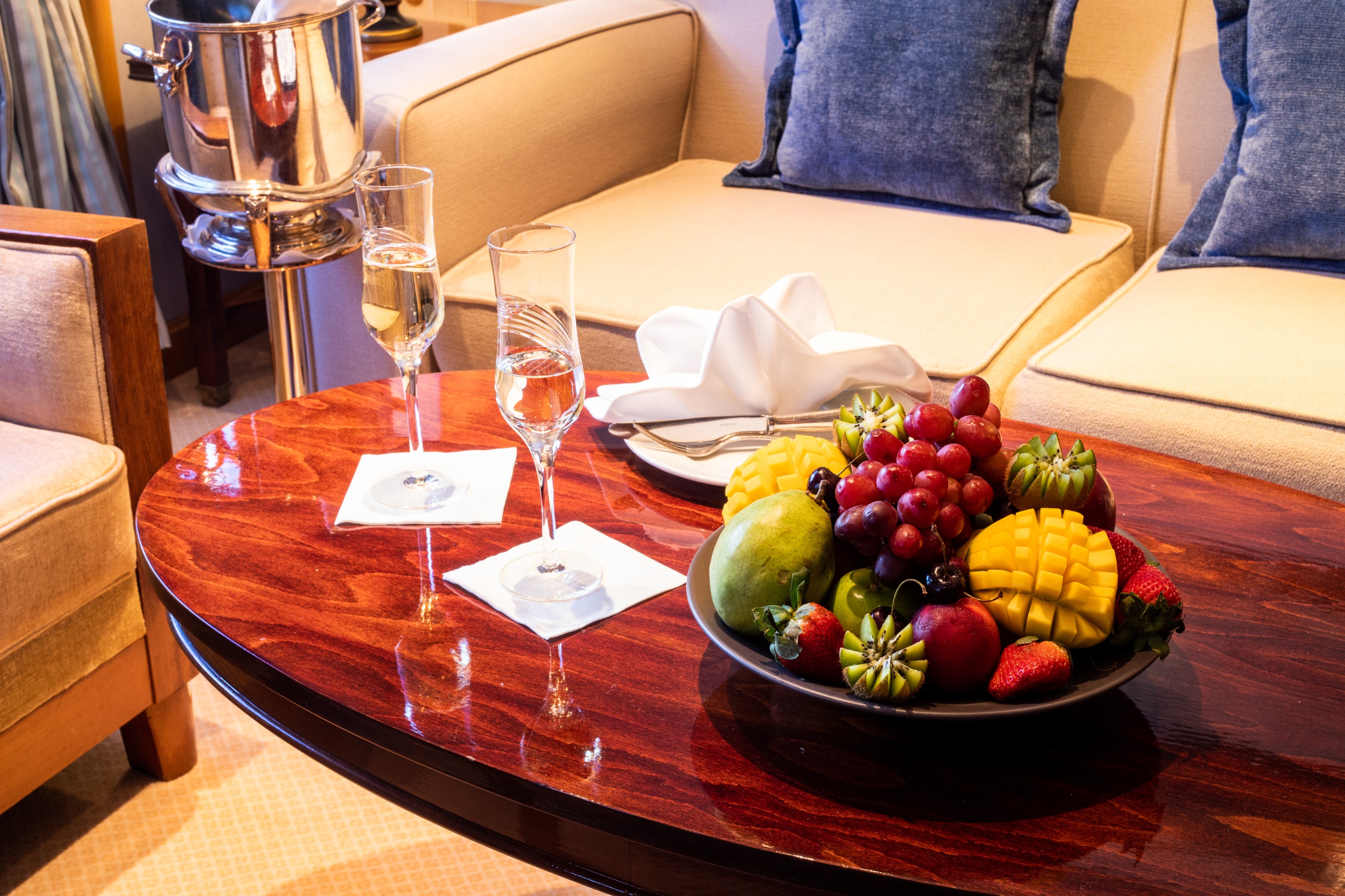
Your SeaDream journey begins the moment you step aboard, welcomed by the captain with cocktails and hors d'oeuvres as the yacht sets sail. With just 112 guests, a relaxed, uncrowded atmosphere and award-winning crew who anticipate your every need create an intimate, all-inclusive luxury yacht experience where every detail is thoughtfully curated.
This is yachting, the SeaDream way.
Starlit Movies®
Underneath the vast canvas of the night sky, your yacht comes alive with our signature Starlit Movies® poolside. Whether you're enjoying a classic film or the latest blockbuster, this open-air cinema transforms your evenings into cinematic adventures.
Casino, Piano Bar & Library
Located on Deck 4, the casino offers a relaxed setting for classic table games, while the nearby Piano Bar invites guests to linger over after-dinner drinks with live guitar and piano music, perfect for conversation and unwinding at sea. For quieter moments, the library provides a peaceful onboard space with books and board games, a welcome retreat whenever the mood calls for stillness.
Balinese Dream Beds
Our signature Balinese Dream Beds are among the most distinctive all-inclusive yacht amenities at sea, inviting guests to stretch out and enjoy unobstructed ocean views by day or unwind beneath the stars by night. Select beds may be transformed for sleeping beneath the open sky, wrapped in luxurious Belgian linens as the sea moves softly beneath you.
Top of the Yacht Bar
Every moment aboard SeaDream is as effortless as the voyage itself. An open bar with select premium wines, spirits, and cocktails is available throughout the day, while evenings bring live music, social gatherings at the Top of the Yacht Bar, and Starlit Movies® on the open-air pool deck. With 360° ocean views as the backdrop and award-winning crew at your service, the night is always yours to enjoy.
Concierge & Boutique
Our Concierge and Shop Manager are here to assist.