
Best of Scotland & the Faroe Islands
Best of Scotland & the Faroe Islands
Cruise overview
WHY BOOK WITH US?
- ✔ The Deluxe Cruises’ team has extensive experience in ultra-luxury cruising.
- ✔ Call now to speak to our helpful and experienced Cruise Concierge team.
- ✔ Enjoy our Unique Deluxe Cruises Bonus for substantial savings.
- ✔ Our team will tailor your holiday to your exacting requirements.
- ✔ As agents, we work under the protection of each cruise lines ABTA / ATOL licences
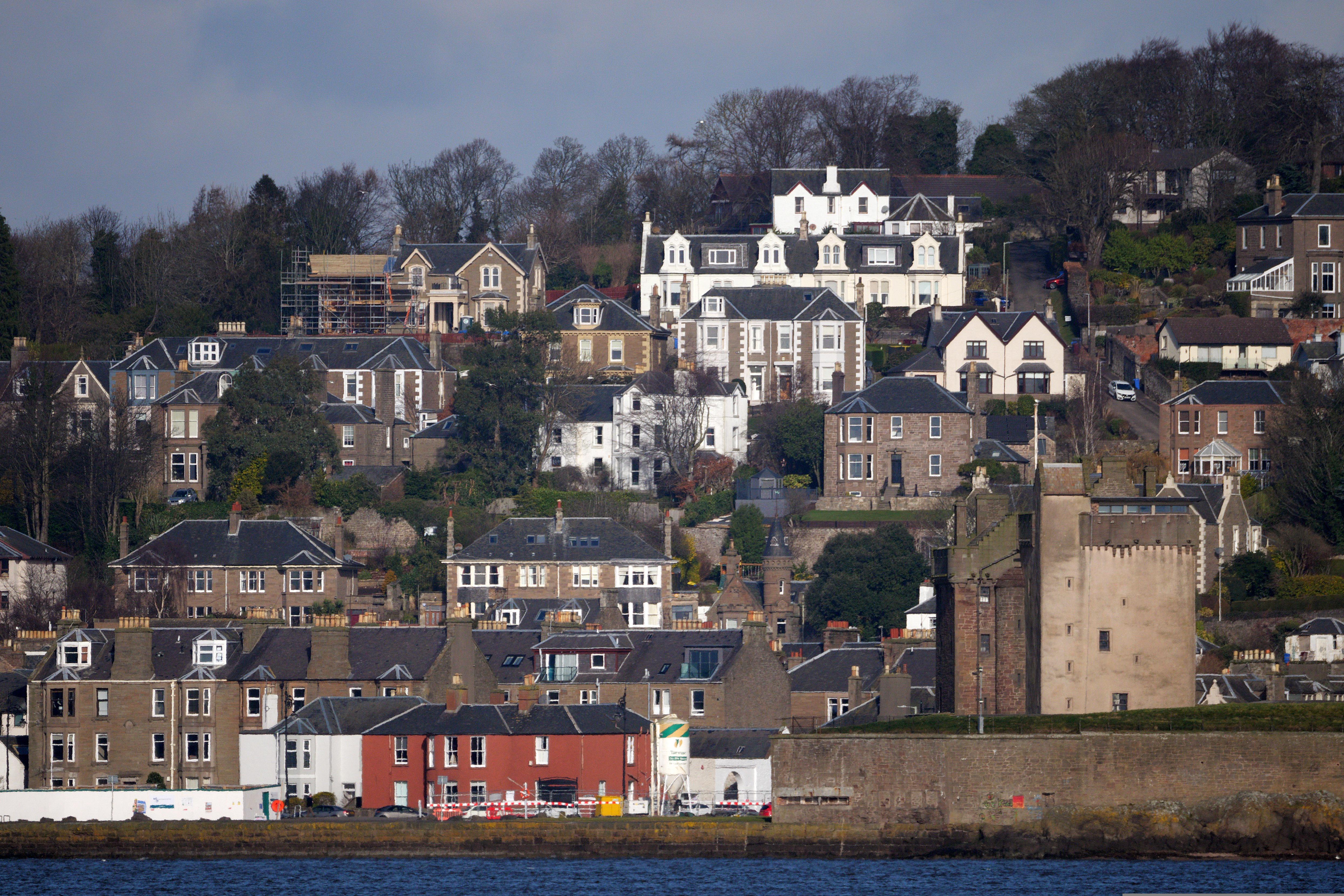
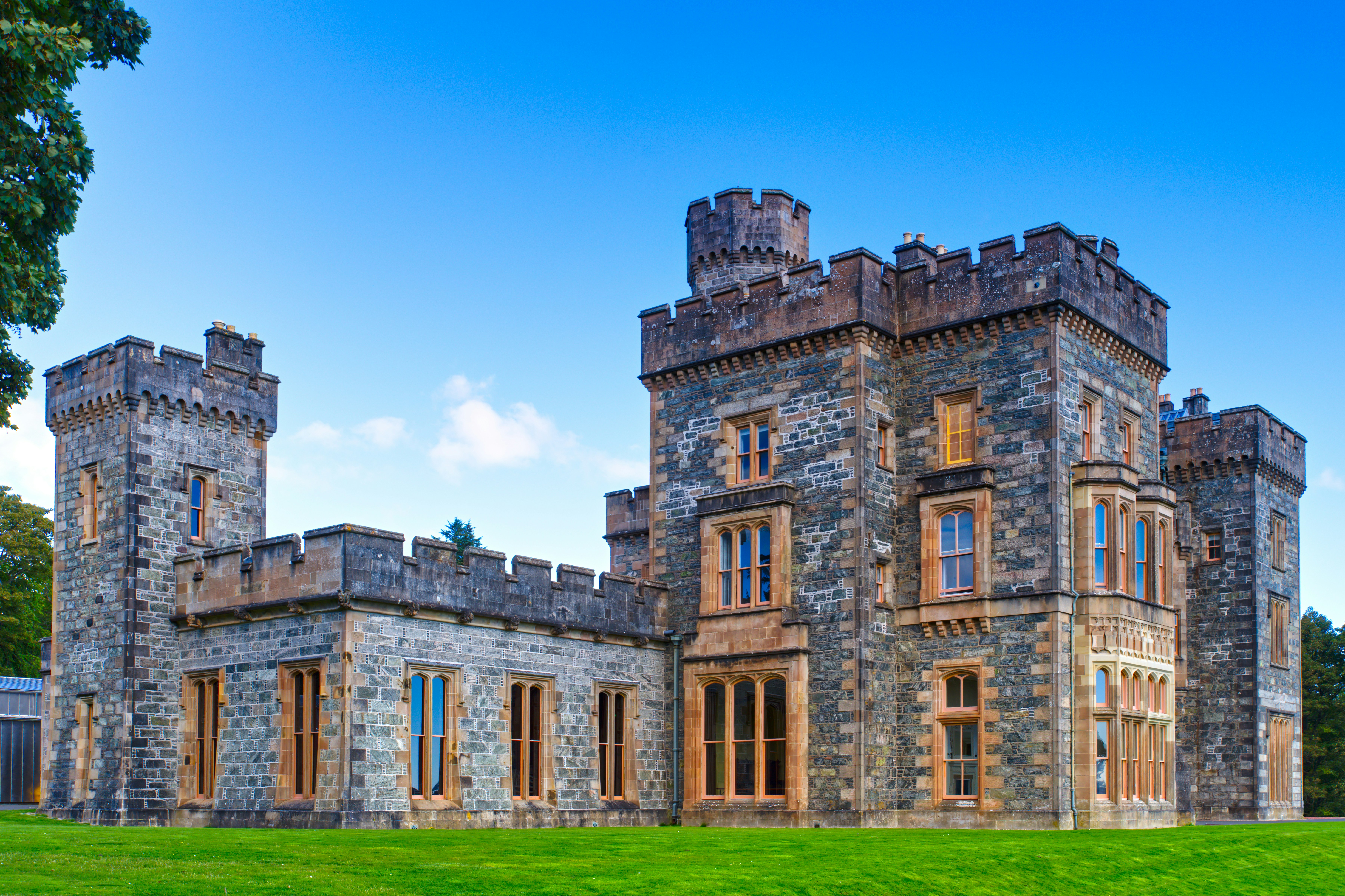
About Edinburgh
Edinburgh is to London as poetry is to prose, as Charlotte Brontë once wrote. One of the world's stateliest cities and proudest capitals, it's built—like Rome—on seven hills, making it a striking backdrop for the ancient pageant of history. In a skyline of sheer drama, Edinburgh Castle watches over the capital city, frowning down on Princes Street’s glamour and glitz. But despite its rich past, the city’s famous festivals, excellent museums and galleries, as well as the modern Scottish Parliament, are reminders that Edinburgh has its feet firmly in the 21st century.Nearly everywhere in Edinburgh (the burgh is always pronounced burra in Scotland) there are spectacular buildings, whose Doric, Ionic, and Corinthian pillars add touches of neoclassical grandeur to the largely Presbyterian backdrop. Large gardens are a strong feature of central Edinburgh, where the city council is one of the most stridently conservationist in Europe. Arthur's Seat, a mountain of bright green and yellow furze, rears up behind the spires of the Old Town. This child-size mountain jutting 822 feet above its surroundings has steep slopes and little crags, like a miniature Highlands set down in the middle of the busy city. Appropriately, these theatrical elements match Edinburgh's character—after all, the city has been a stage that has seen its fair share of romance, violence, tragedy, and triumph.Modern Edinburgh has become a cultural capital, staging the Edinburgh International Festival and the Fringe Festival in every possible venue each August. The stunning Museum of Scotland complements the city’s wealth of galleries and artsy hangouts. Add Edinburgh’s growing reputation for food and nightlife and you have one of the world’s most beguiling cities.Today the city is the second most important financial center in the United Kingdom, and the fifth most important in Europe. The city regularly is ranked near the top in quality-of-life surveys. Accordingly, New Town apartments on fashionable streets sell for considerable sums. In some senses the city is showy and materialistic, but Edinburgh still supports learned societies, some of which have their roots in the Scottish Enlightenment. The Royal Society of Edinburgh, for example, established in 1783 "for the advancement of learning and useful knowledge," remains an important forum for interdisciplinary activities.Even as Edinburgh moves through the 21st century, its tall guardian castle remains the focal point of the city and its venerable history. Take time to explore the streets—peopled by the spirits of Mary, Queen of Scots; Sir Walter Scott; and Robert Louis Stevenson—and pay your respects to the world's best-loved terrier, Greyfriars Bobby. In the evenings you can enjoy candlelit restaurants or a folk ceilidh (pronounced kay-lee, a traditional Scottish dance with music), though you should remember that you haven't earned your porridge until you've climbed Arthur's Seat. Should you wander around a corner, say, on George Street, you might see not an endless cityscape, but blue sea and a patchwork of fields. This is the county of Fife, beyond the inlet of the North Sea called the Firth of Forth—a reminder, like the mountains to the northwest that can be glimpsed from Edinburgh's highest points, that the rest of Scotland lies within easy reach.

About Dundee
About Invergordon
The port of Invergordon is your gateway to the Great Glen, an area of Scotland that includes Loch Ness and the city of Inverness. Inverness, the capital of the Highlands, has the flavor of a Lowland town, its winds blowing in a sea-salt air from the Moray Firth. The Great Glen is also home to one of the world's most famous monster myths: in 1933, during a quiet news week, the editor of a local paper decided to run a story about a strange sighting of something splashing about in Loch Ness. But there's more to look for here besides Nessie, including inland lochs, craggy and steep-sided mountains, rugged promontories, deep inlets, brilliant purple and emerald moorland, and forests filled with astonishingly varied wildlife, including mountain hares, red deer, golden eagles, and ospreys.
About Stromness
About Tórshavn
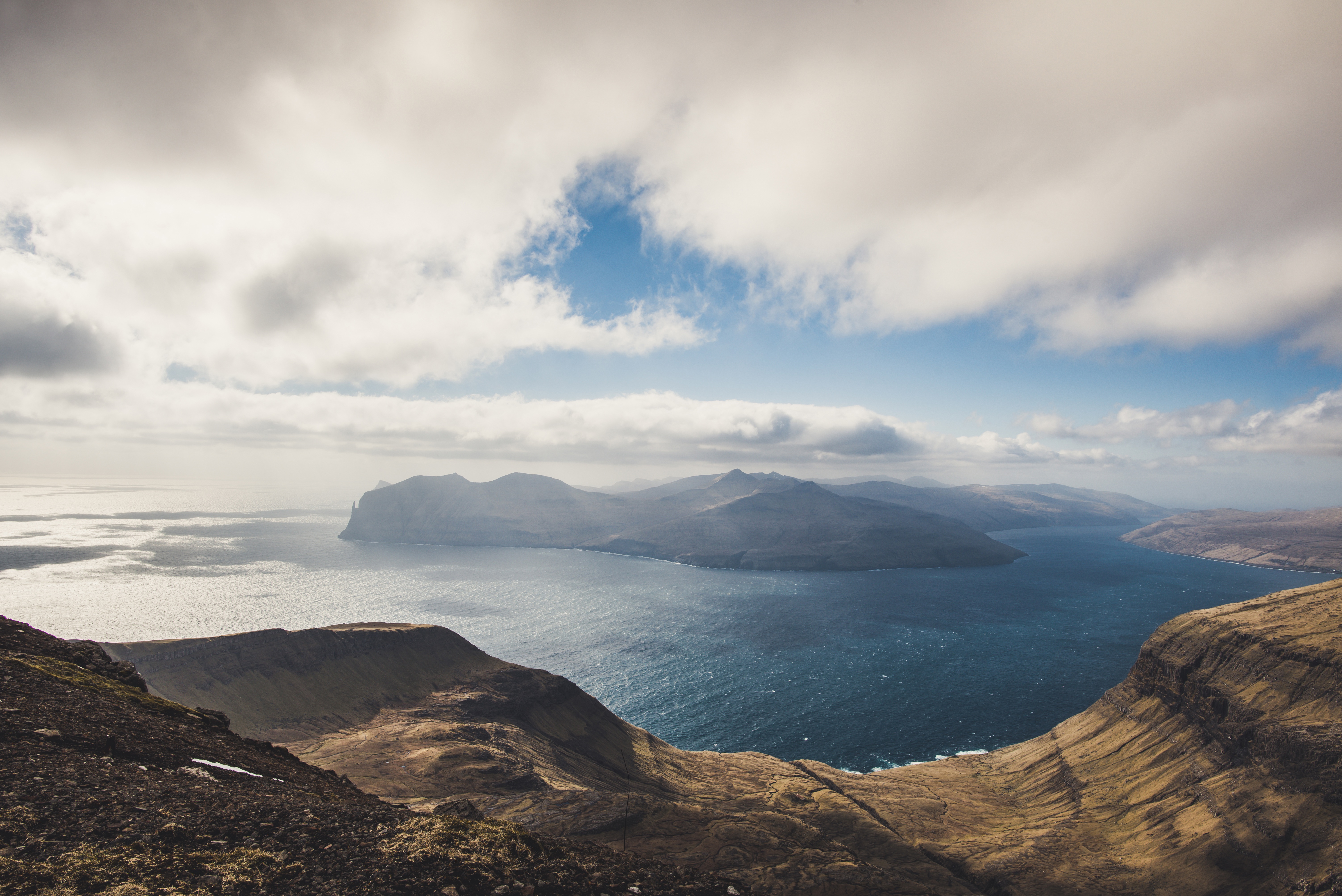
About Vágur, Suduroy Island
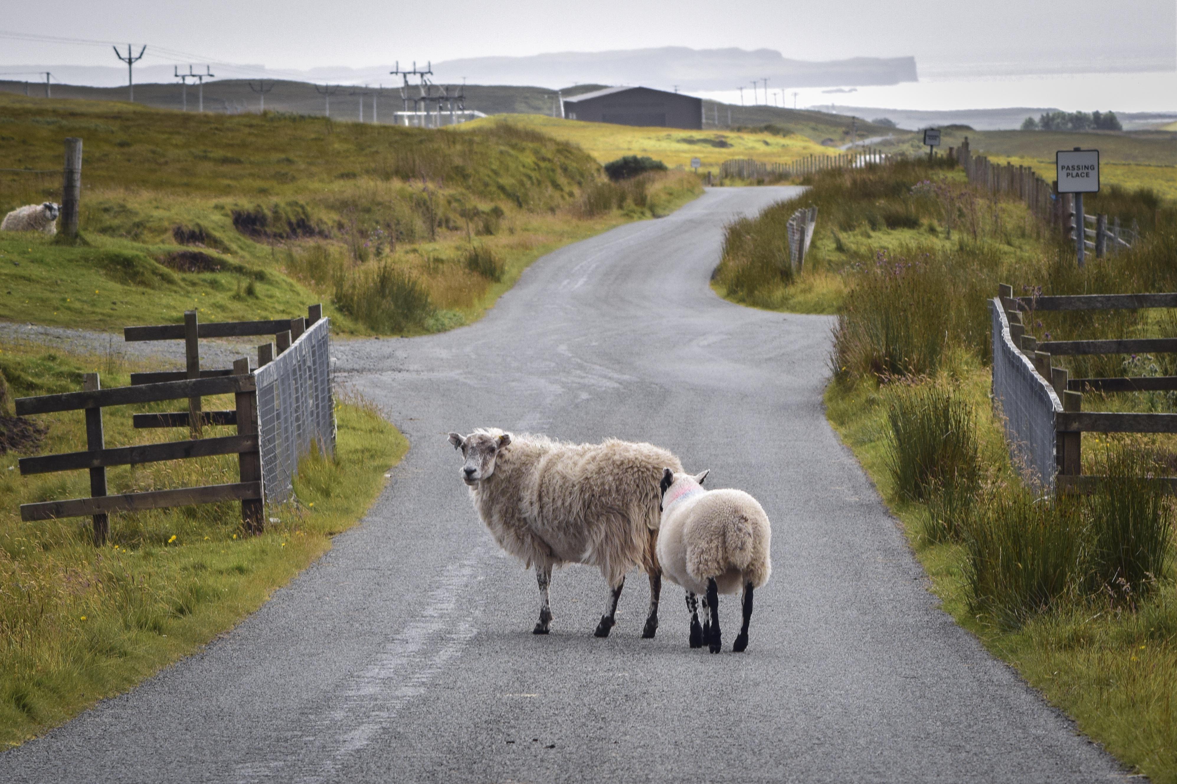
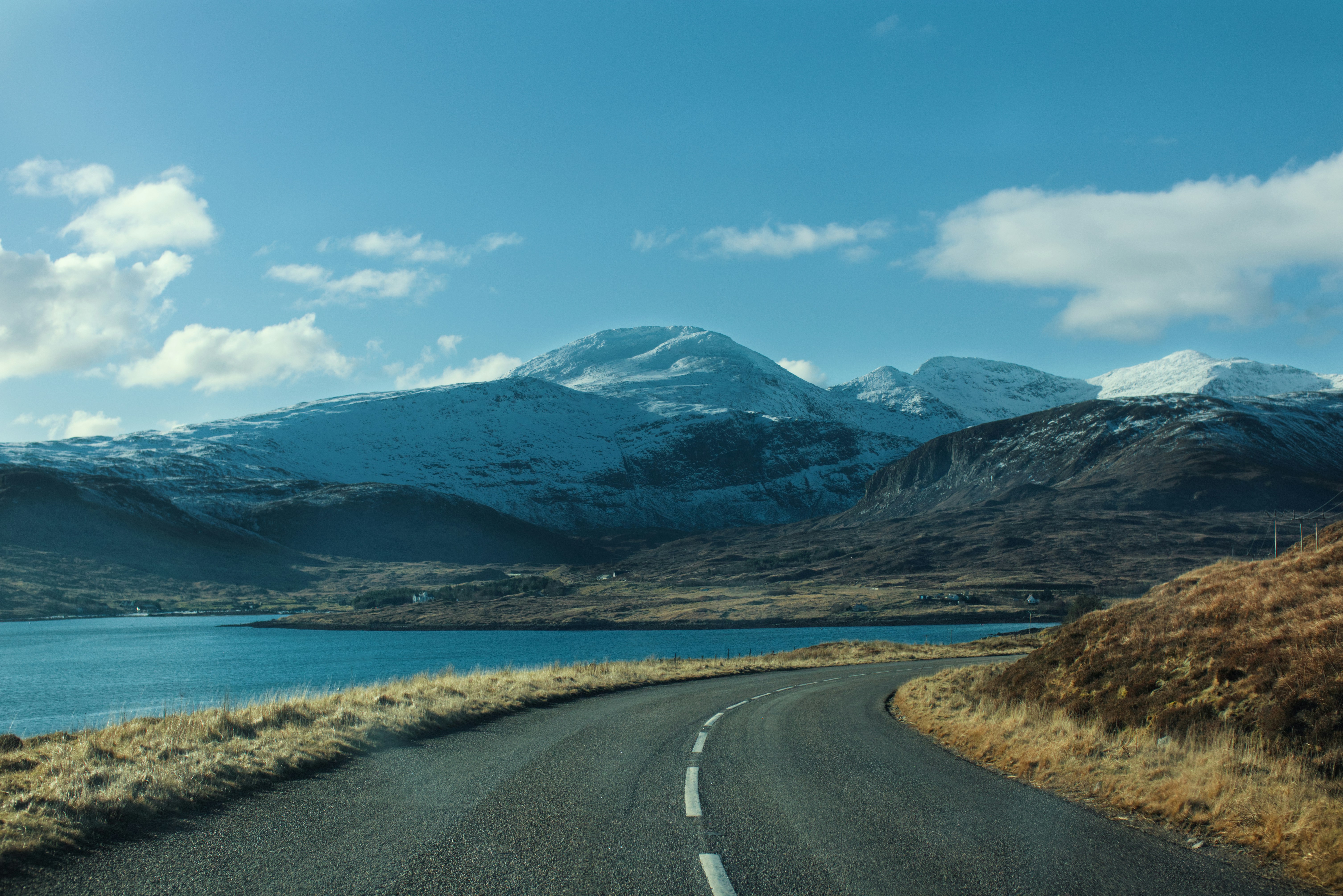
About Portree, Isle of Skye
The Isle of Skye ranks near the top of most visitors' priority lists: the romance of Prince Charles Edward Stuart, known as Bonnie Prince Charlie, combined with the misty Cuillin Hills and their proximity to the mainland all contribute to its popularity. Today Skye remains mysterious and mountainous, an island of sunsets that linger brilliantly until late at night and of beautiful, soft mists. Much photographed are the really old crofts, one or two of which are still inhabited, with their thick stone walls and thatch roofs. Orientation on Skye is easy: follow the only roads around the loops on the northern part of the island and enjoy the road running the length of the Sleat Peninsula in southern Skye, taking the loop roads that exit to the north and south as you please. There are some stretches of single-lane road, but none poses a problem.

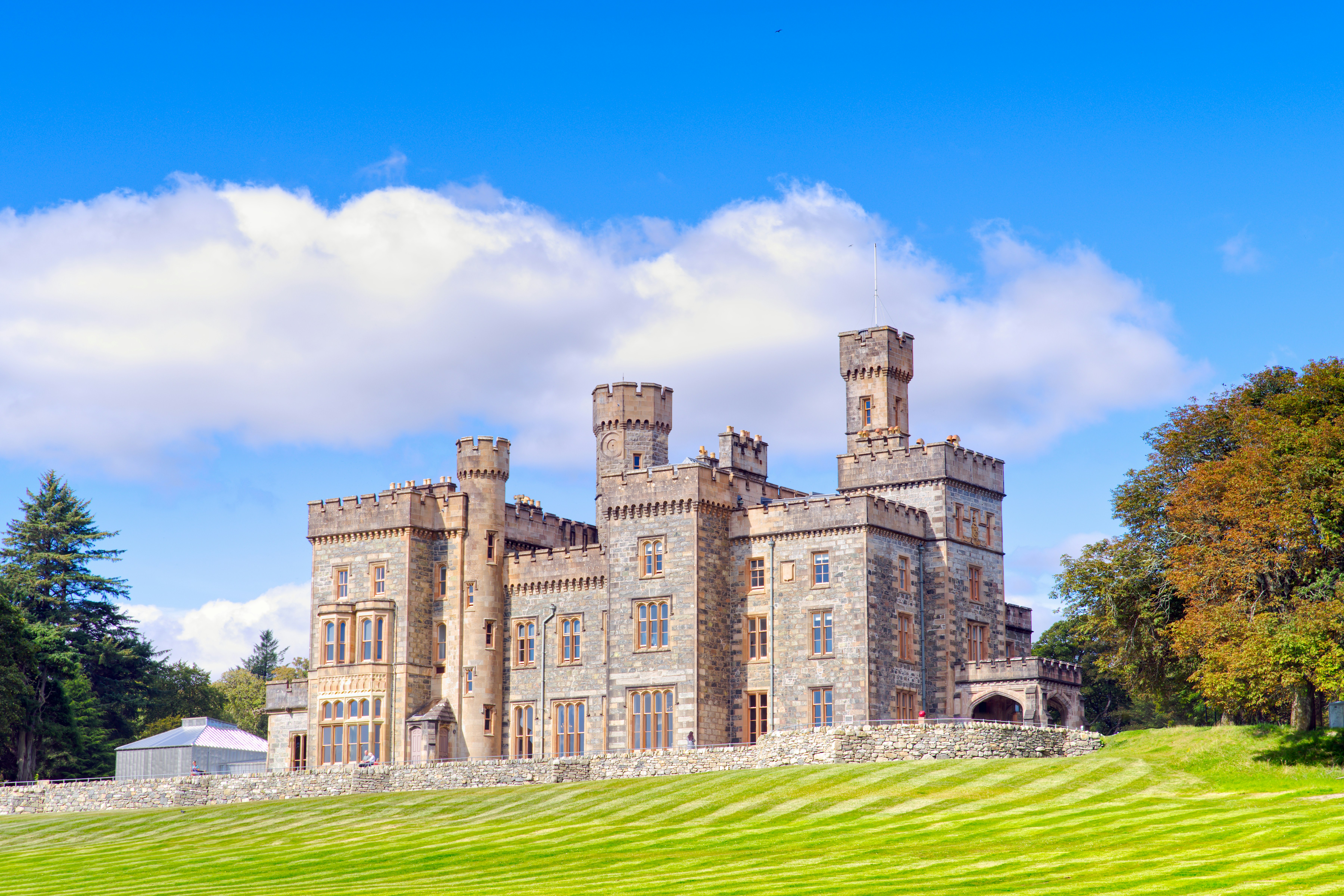
About Stornoway, Isle of Lewis
Tour description Stornoway, Scotland The Isle of Lewis and Harris is the northernmost and largest of the Outer Hebrides-the Western Isles in common parlance. The island's only major town, Stornoway, is on a nearly landlocked harbor on the east coast of Lewis. It's the port capital for the Outer Hebrides and the island's cultural center, such that it is. Stornoway has an increasing number of good restaurants. Lewis has some fine historic attractions, including the Calanais Standing Stones-a truly magical place. The Uists are known for their rare, plentiful wildlife. Stornoway. Besides being the island's main entry point for ferries, Stornoway is also Lewis's main arts center. You'll find some good restaurants in town if you want to have lunch off the ship. The town can be explored by bicycle if you are so inclined. Local rental shops can give you advice on where to ride, including a route to Tolsta that takes in five stunning beaches before reaching the edge of moorland. An Lanntair Arts Centre. The fabulous An Lanntair Arts Centre has exhibitions of contemporary and traditional art, as well as a cinema, a gift shop, and a restaurant serving international and Scottish fare. There are frequent traditional musical and theatrical events in the impressive auditorium. Kenneth St.. Black House. In the small community of Arnol, the Black House is a well-preserved example of an increasingly rare type of traditional Hebridean home. Once common throughout the islands-even into the 1950s-these dwellings were built without mortar and thatched on a timber framework without eaves. Other characteristic features include an open central peat hearth and the absence of a chimney-hence the soot and the designation black. On display inside are many of the house's original furnishings. To reach Arnol from Port of Ness, head south on the A857 and pick up the A858 at Barvas. Off A858, 21 mi southwest of Port of Ness. Admission charged. Calanais Standing Stones. These impressive stones are actually part of a cluster of several different archaeological sites in this area. Probably positioned in several stages between 3000 BC and 1500 BC, the grouping consists of an avenue of 19 monoliths extending northward from a circle of 13 stones, with other rows leading south, east, and west. Ruins of a cairn sit within the circle on the east side. Researchers believe they may have been used for astronomical observations, but you can create your own explanations. The visitor center has an exhibit on the stones, a gift shop, and a tearoom. On an unmarked road off A858. Admission charged. Dun Carloway. One of the best-preserved Iron Age brochs (circular stone towers) in Scotland, Dun Carloway dominates the scattered community of Carloway. The mysterious tower was probably built around 2,000 years ago as protection against seaborne raiders. The Dun Broch Centre explains more about the broch and its setting. Off A857. Gearrannan. Up a side road north from Carloway, Gearrannan is an old black-house village that has been brought back to life with a museum screening excellent short films on peat cutting and weaving. For a unique experience, groups can rent the restored houses. Leverburgh. At Leverburgh you can take the ferry to North Uist. Nearby Northton has several attractions; St. Clement's Church at Rodel is particularly worth a visit. MacGillivray Centre. Located in a round building overlooking the bay, the MacGillivray Centre gives insight into the life and work of William MacGillivray (1796-1852), a noted naturalist with strong links to Harris. MacGillivray authored the five-volume History of British Birds. This is a great location for a picnic (there are tables for just such a purpose). A walk to a ruined church starts at the parking lot. A859, Northton. Seallam! Visitor Centre and Co Leis Thu? Genealogical Research Centre. The center is where you can trace your Western Isles ancestry. Photographs and interpretive signs describe the history of Harris and its people. The owners organize guided walks and cultural evenings weekly between May and September. Off A859, Northton. Admission charged. St. Clement's Church. At the southernmost point of Harris is the community of Rodel, where you can find St. Clement's Church, a cruciform church standing on a hillock. This is the most impressive pre-Reformation church in the Outer Hebrides; it was built around 1500 and contains the magnificently sculptured tomb (1528) of the church's builder, Alasdair Crotach, MacLeod chief of Dunvegan Castle. Rodel is 3 mi south of Leverburgh and 21 mi south of Tarbert. A859, Rodel. Port of Ness. The stark, windswept community of Port of Ness, 30 mi north of Stornoway, cradles a small harbor squeezed in among the rocks. Butt of Lewis Lighthouse. At the northernmost point of Lewis stands the Butt of Lewis Lighthouse, designed by David and Thomas Stevenson (of the prominent engineering family whose best-known member was not an engineer at all, but the novelist Robert Louis Stevenson). The structure was first lighted in 1862. The adjacent cliffs provide a good vantage point for viewing seabirds, whales, and porpoises. The lighthouse is northwest of Port of Ness along the B8014. Shopping Harris tweed is available at many outlets on the islands, including some of the weavers' homes; keep an eye out for signs directing you to weavers' workshops. Harris Tweed Artisans Cooperative. The Harris Tweed Artisans Cooperative sells stylish and quirky hand-crafted tweed clothing, hats, accessories, all made by artists belonging to the cooperative. 40 Point St., Stornoway. Borgh Pottery. At Borgh Pottery, open from Monday to Saturday 9:30 to 6, you can buy attractive hand-thrown studio pottery made on the premises, including lamps, vases, mugs, and dishes. Fivepenny House, A857, Borve.

About Castlebay
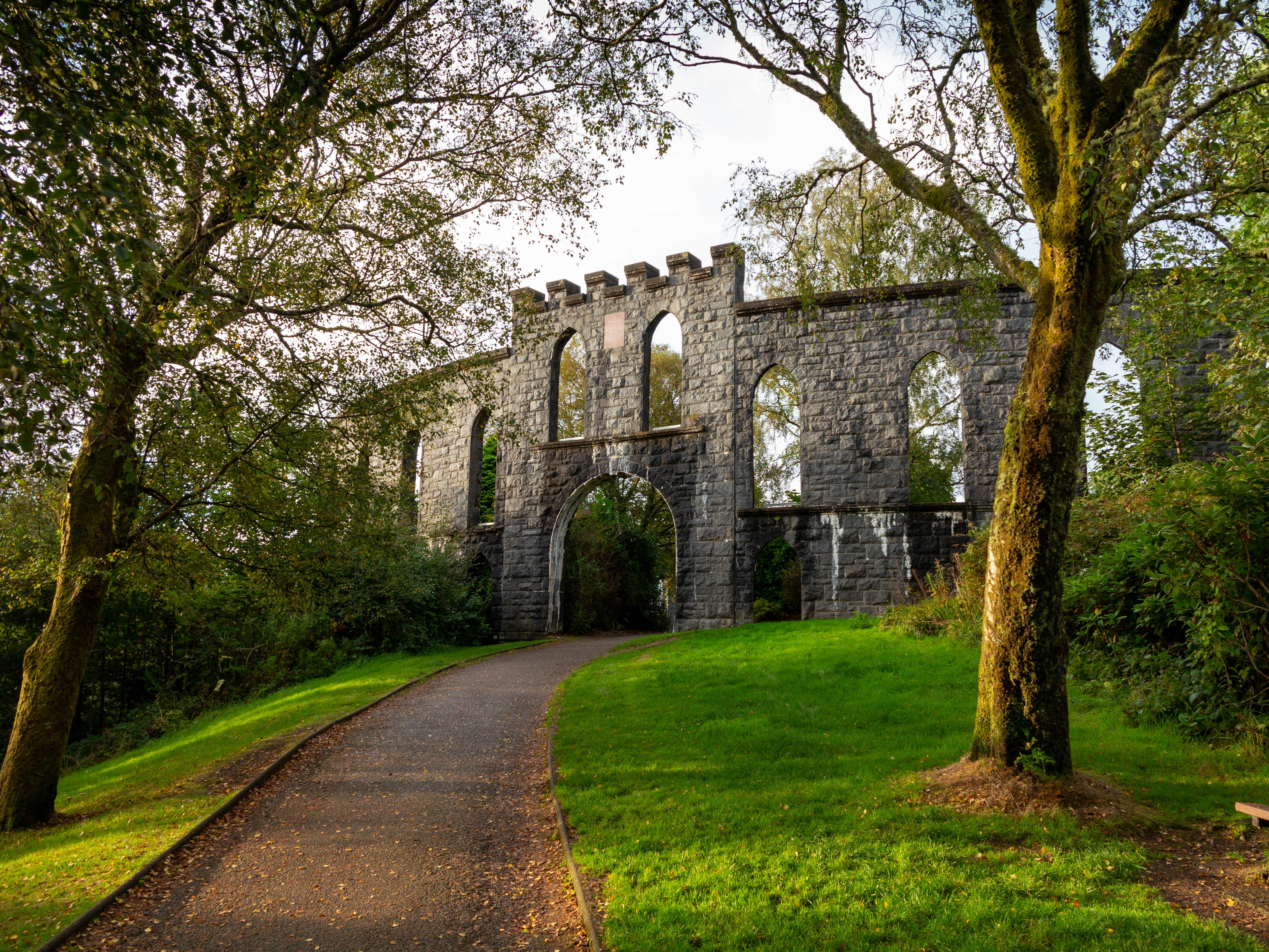
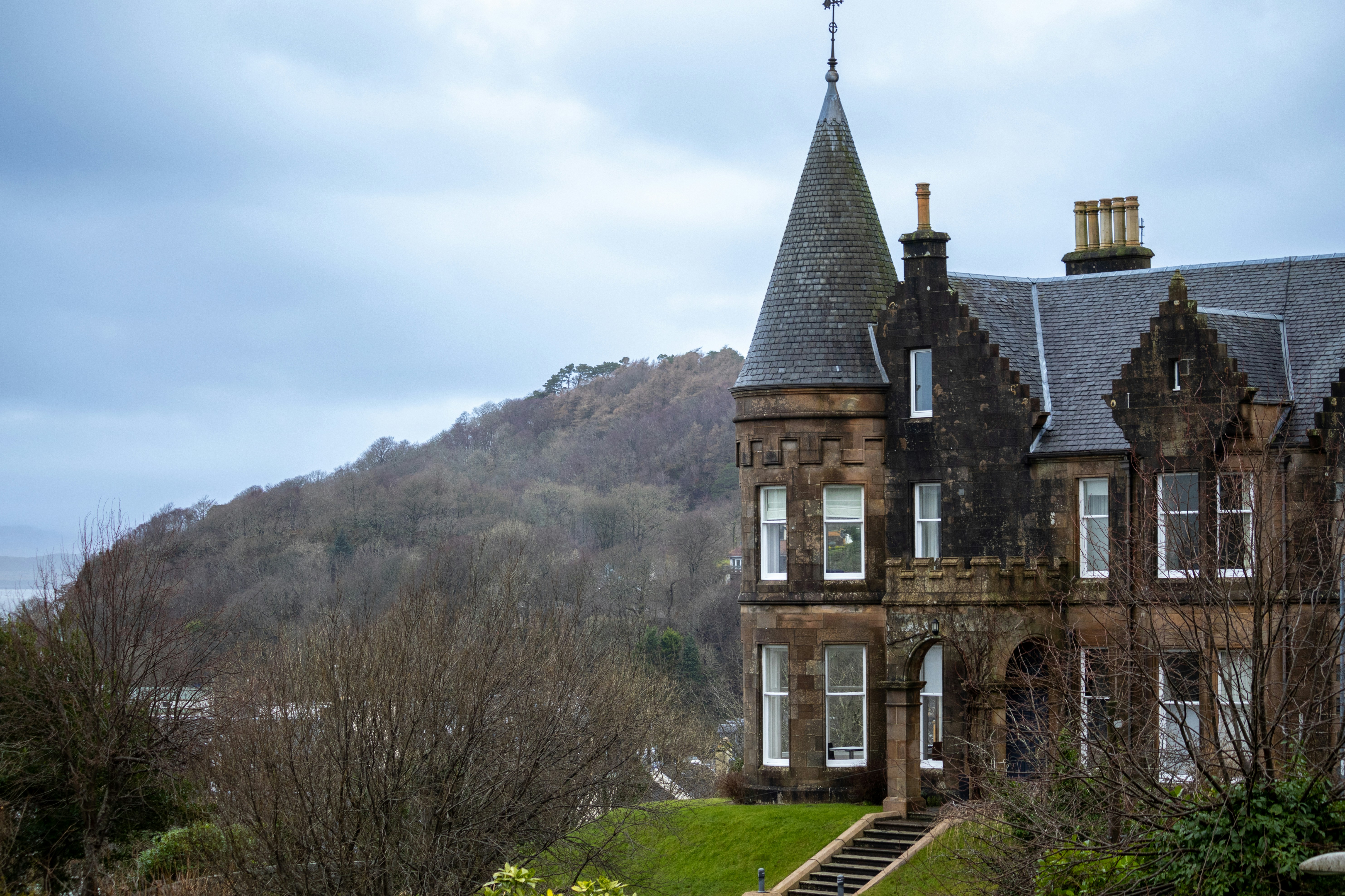
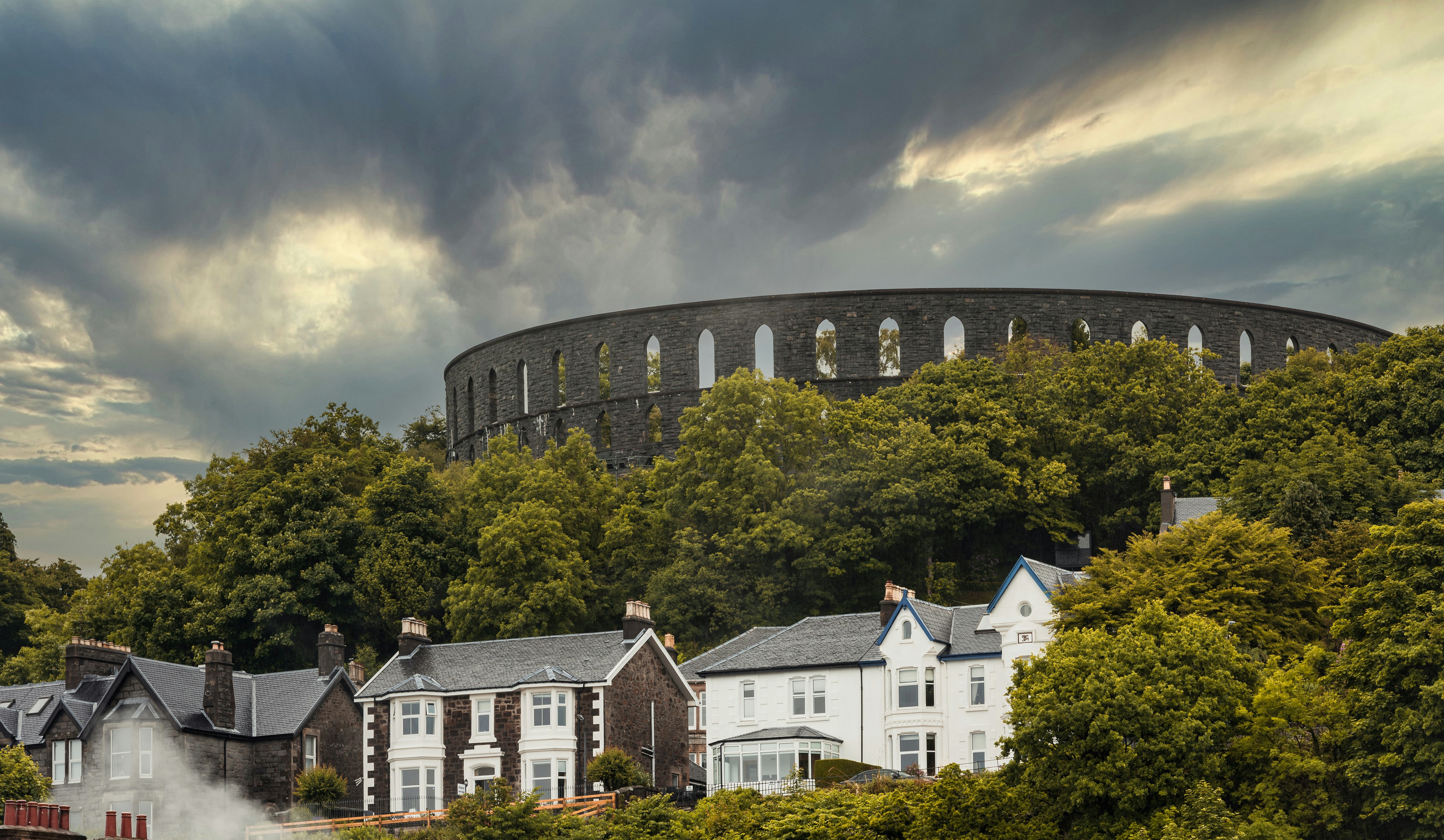
About Oban
Oban, "little bay" in Gaelic, today has a resident population of 8,500 and is the unofficial capital of the West Highlands - the "Gateway to the Isles." The panoramic views of the mountains, lochs and islands which have captivated artists, authors, composers, and poets for centuries are as striking now as they were when Dunollie Castle, a ruined keep which has stood sentinel over the narrow entrance to the sheltered bay for around six hundred years, was the northern outpost of the Dalriadic Scots. It is no surprise to find Oban in the 21st-century remains a magnet for travellers from all over the world. The town's present day popularity owes much to the Victorians, and as early as 1812, when the Comet steamship linked Oban with Glasgow, the town played host to intrepid travellers touring Staffa - the inspiration for Mendelssohn's Hebridean Overture - and Iona - home of Scottish Christianity since St Columba stepped ashore in AD563. Indeed once Oban had the royal seal of approval from Queen Victoria, who called it "one of the finest spots we have seen," the town's destiny as an endearingly enchanting holiday destination was as firmly set as the lava columns of Fingal's Cave in Oban is justifiably known as the “gateway to the Isles.” The town's south pier is the embarkation point for car ferries to Mull, Coll, Tiree, Barra, South Uist, Colonsay, Lismore and Islay. From these islands you can travel further a field to Iona, Staffa and to many of the smaller less well known isles.

About Troon

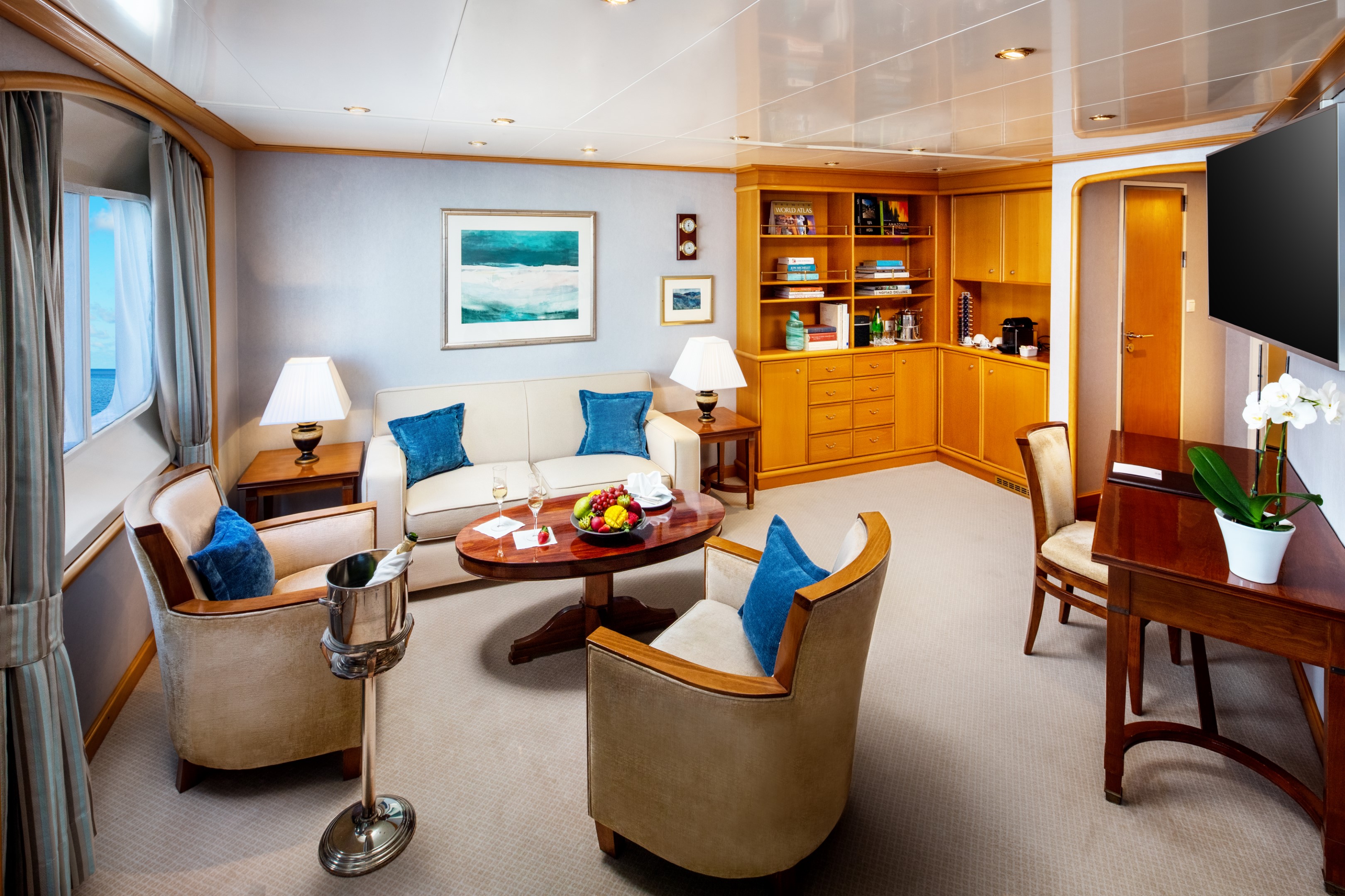
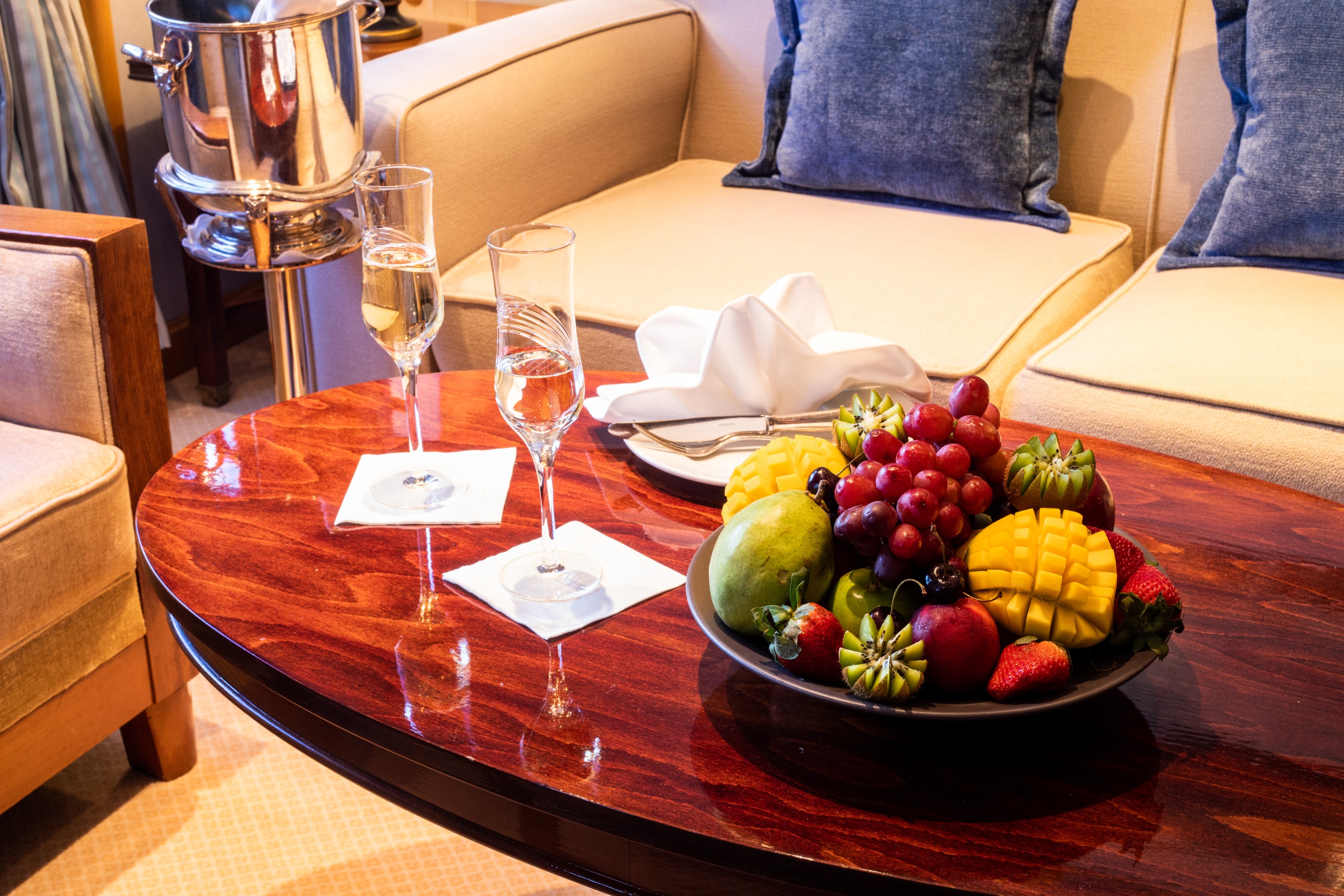
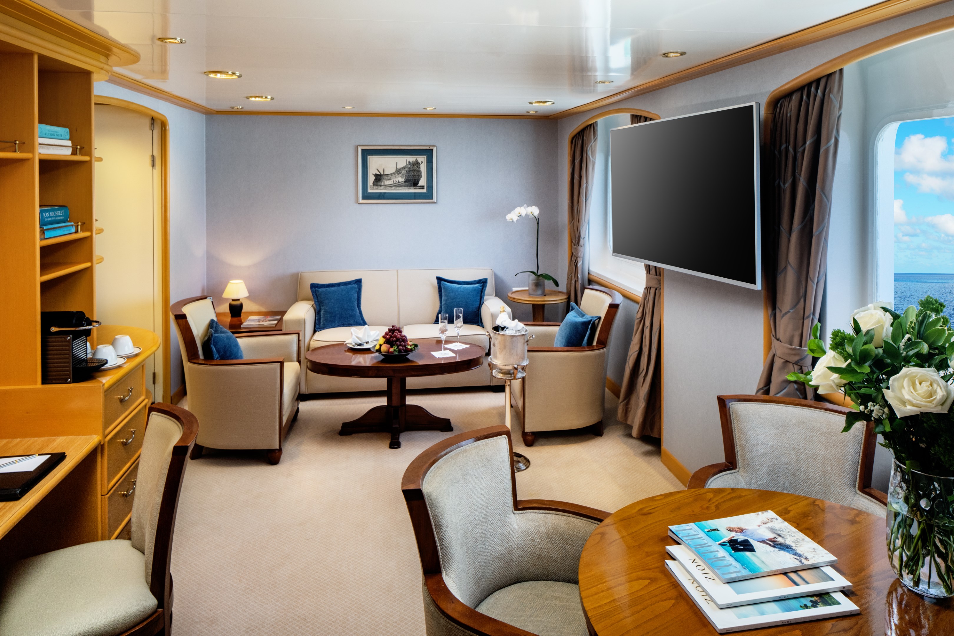
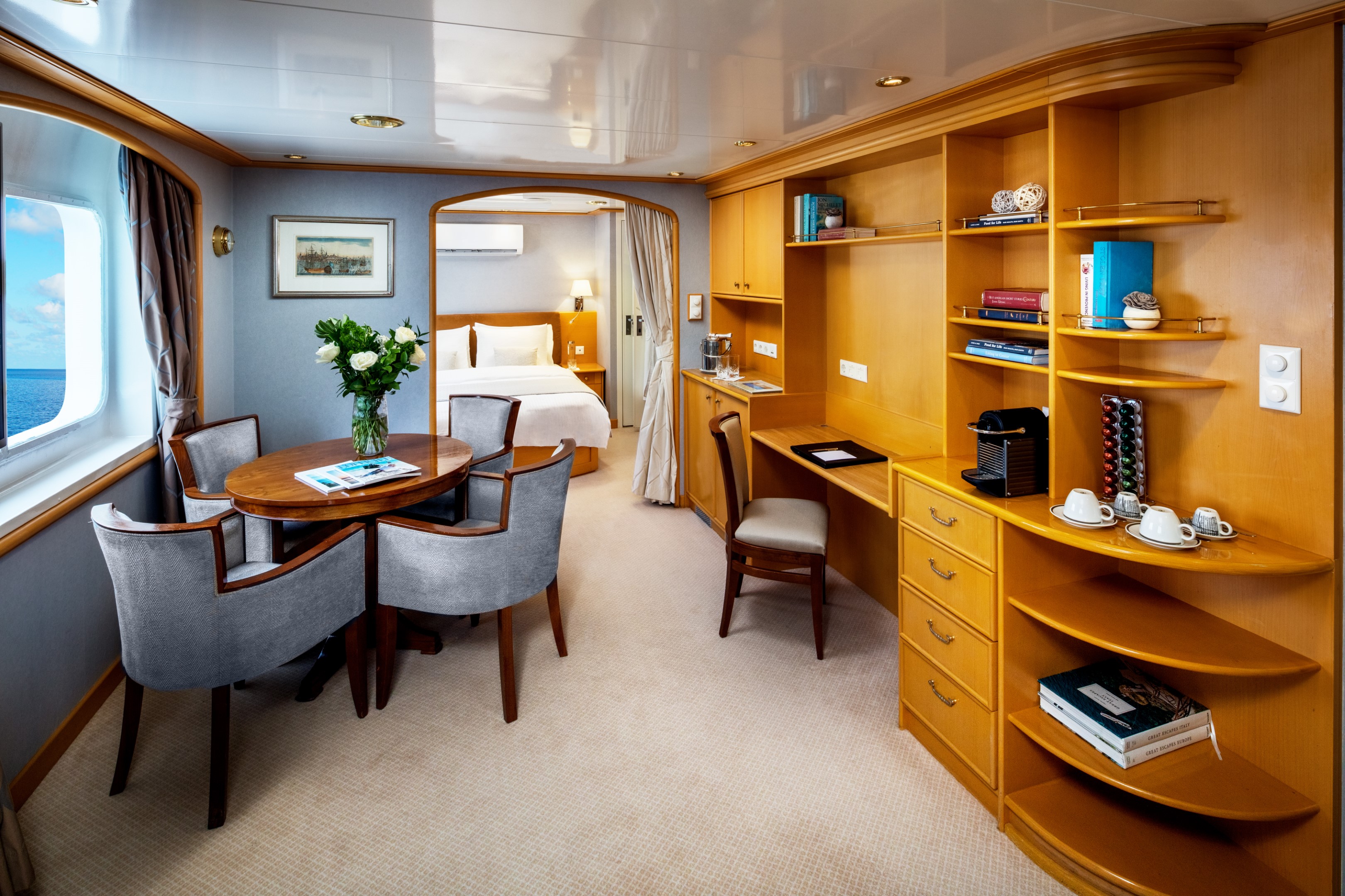
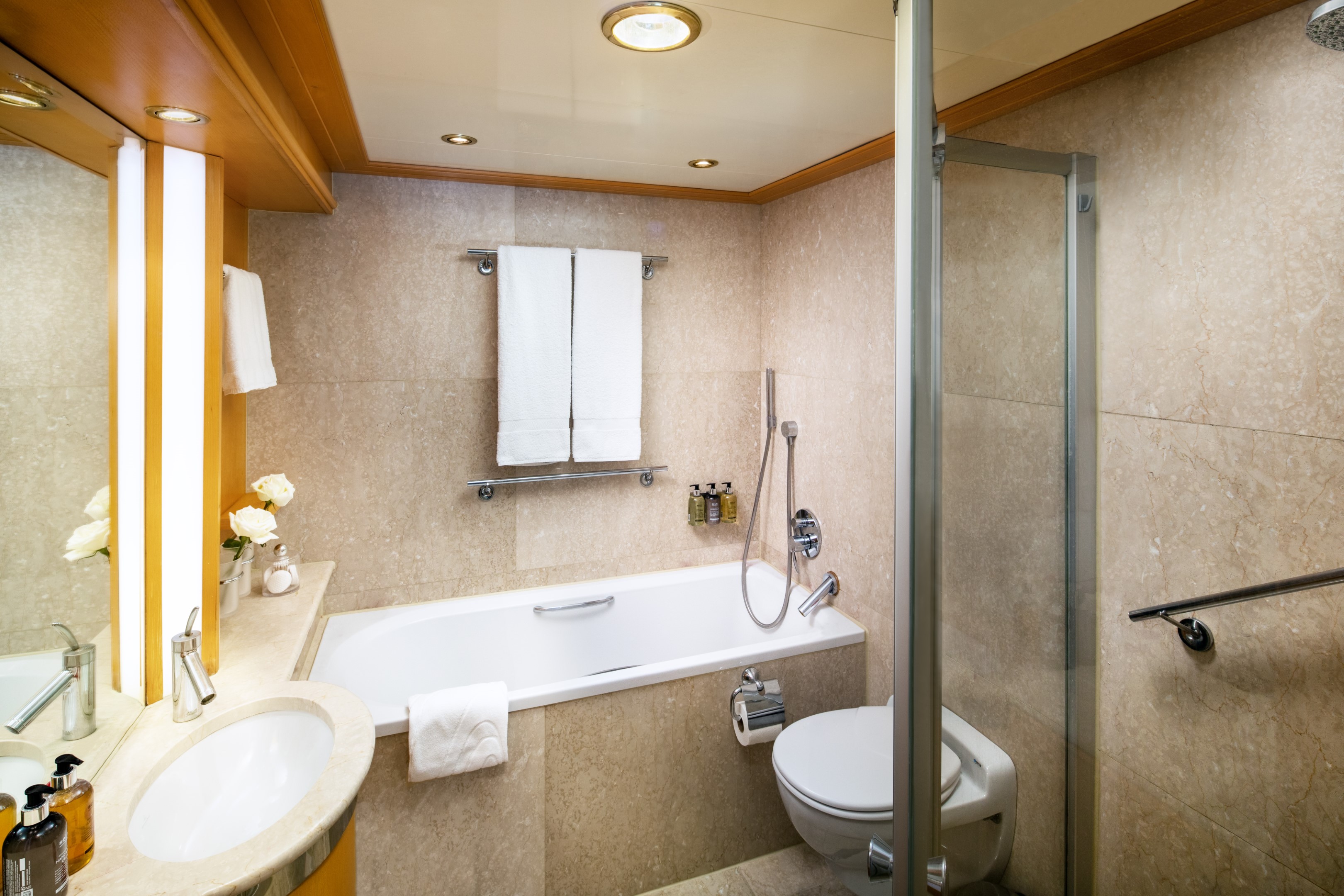
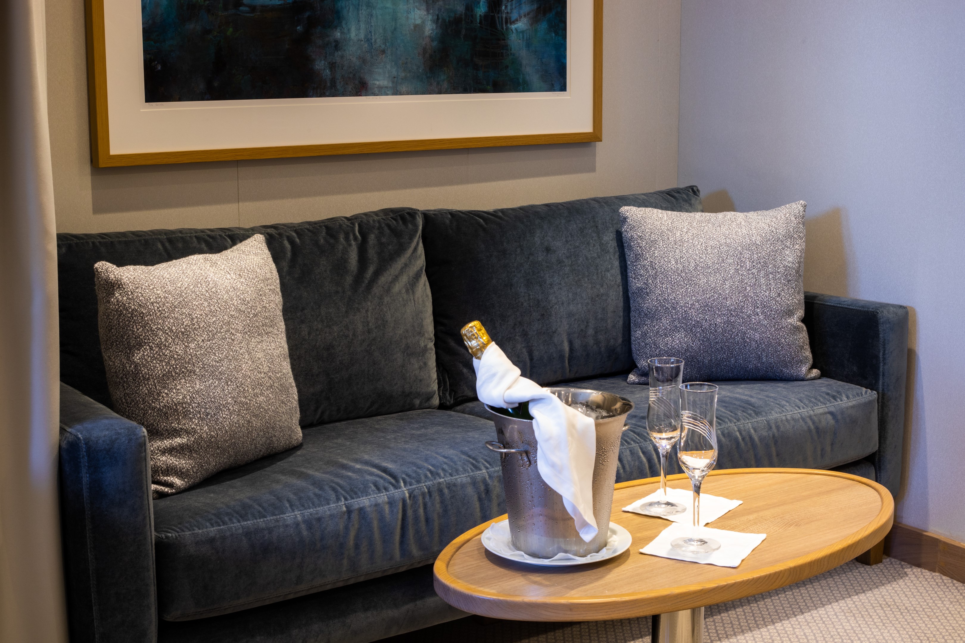
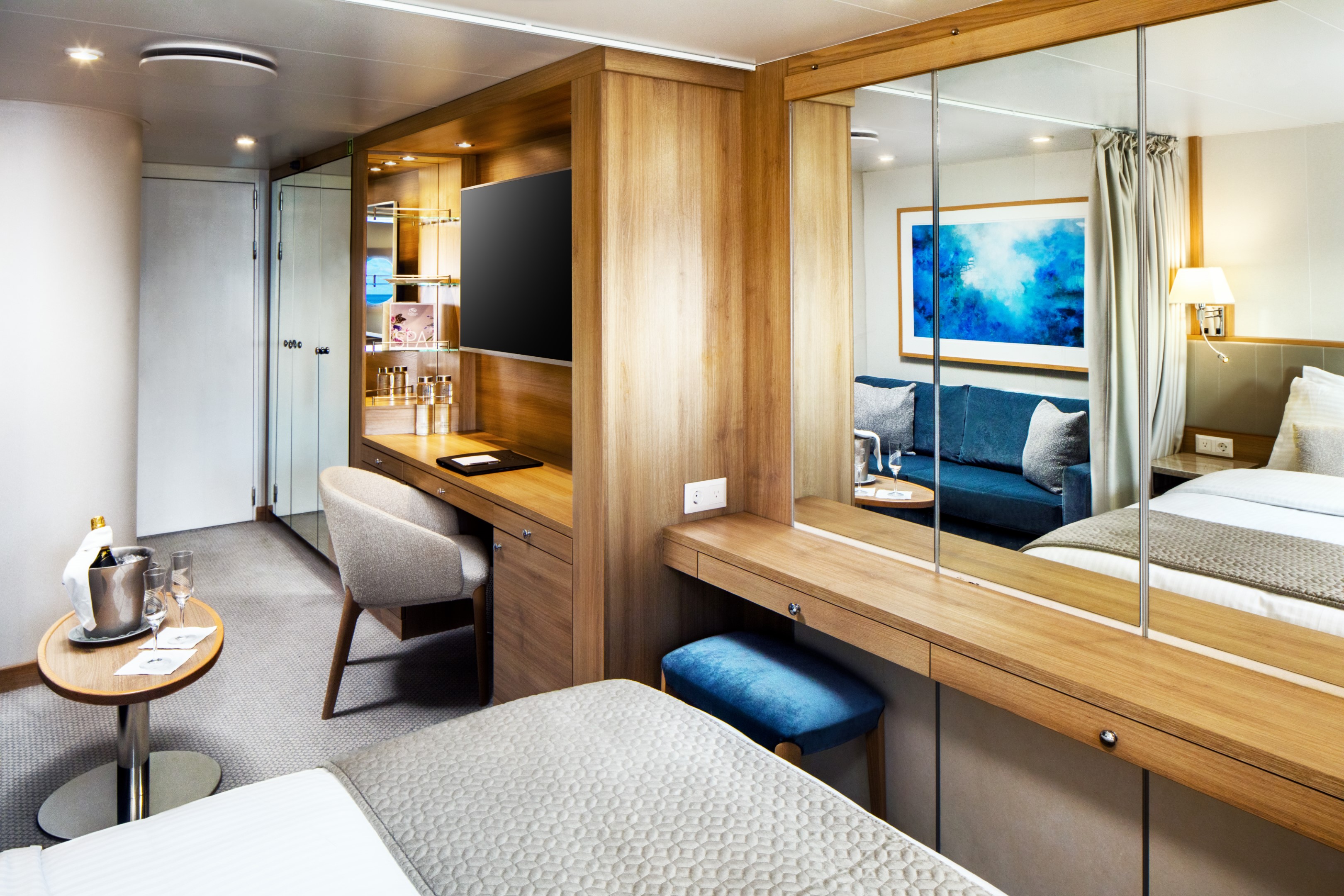
At 447 square feet, the Owner’s Suite is the largest and most considered accommodation on the yacht. A separate master bedroom with a permanent queen bed opens to a spacious living and dining area, generous enough to host family and friends in comfort, while the marble bathroom offers both a massage shower and a soaking tub with uninterrupted views of the sea. A half guest bath, writing desk, and Nespresso machine complete a suite designed for those who want the full breadth of the SeaDream experience, in a space entirely their own.
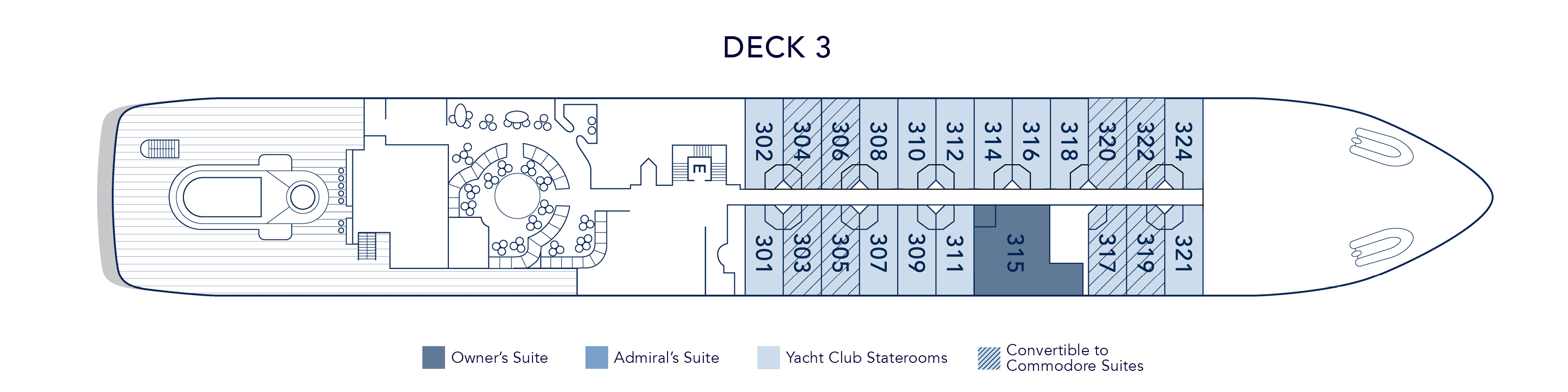
Suite 315, located mid-ship on Deck 3, just steps from the pool.
Owner’s Suite Additional Amenities:
- 55" flat-screen TVs
- Belgian linens
- Silk clothes hangers
- Direct-dial telephone
- 24-hour small bites
- Nespresso machine
- Luxury robes & slippers
- Make-up mirror
- Wi-Fi Available
- Climate control
- Beverage refrigerator
- Elm Organics bath amenities
- Hair dryer
- In-room safe
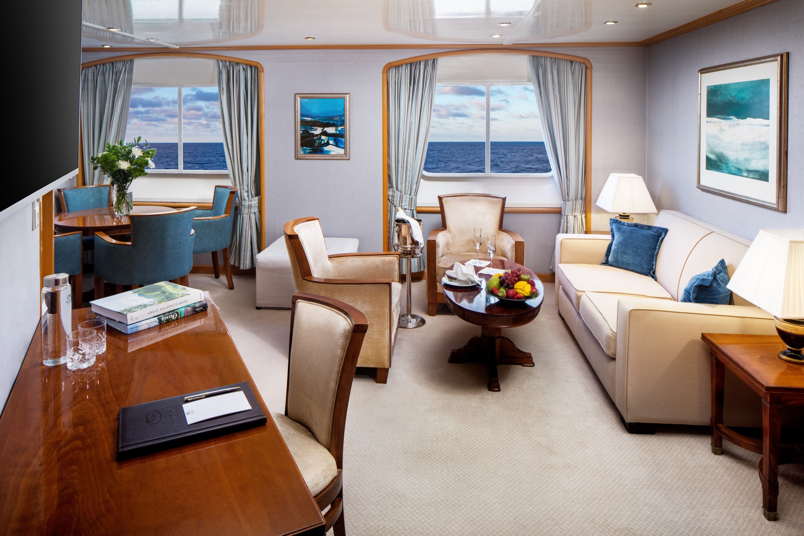
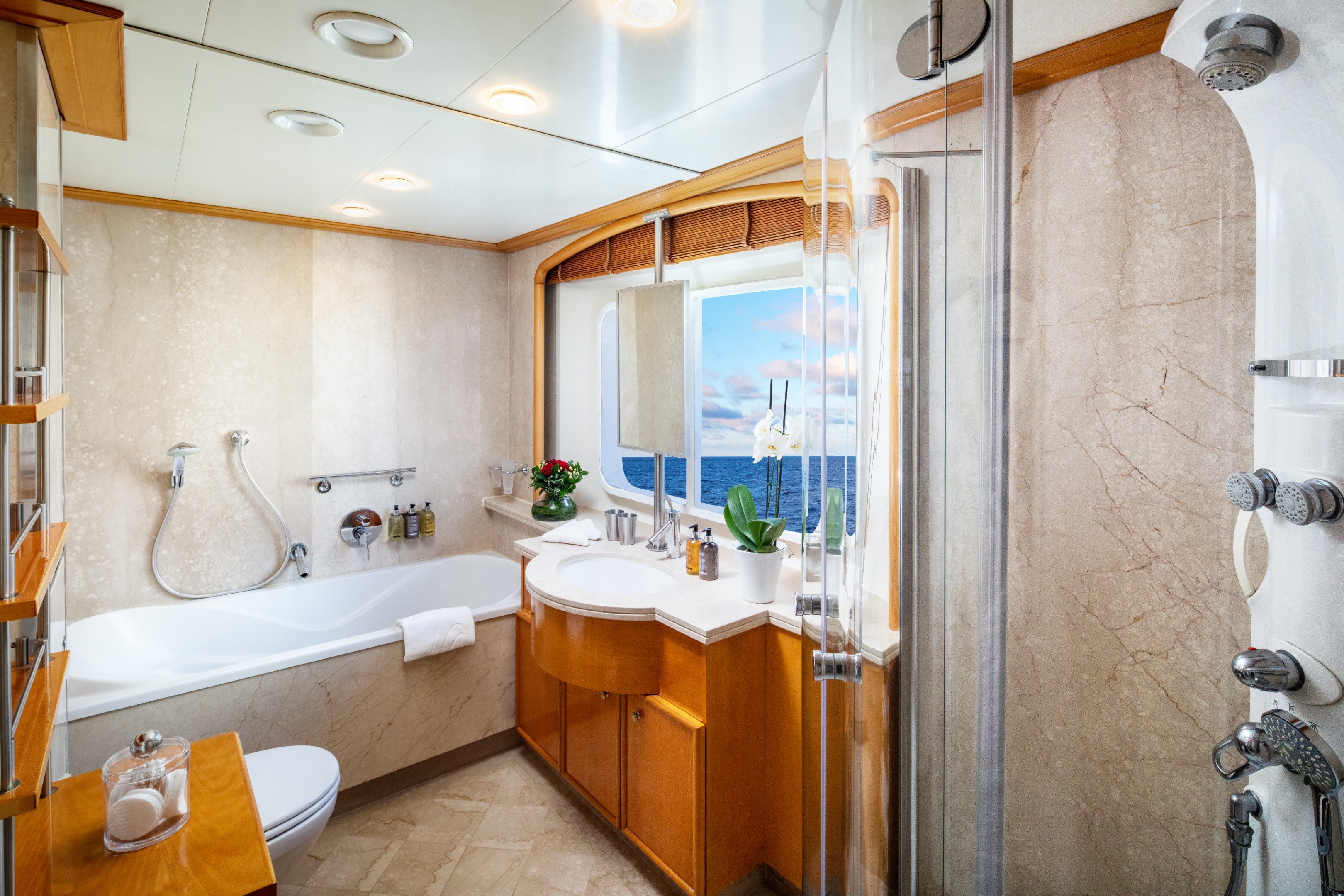
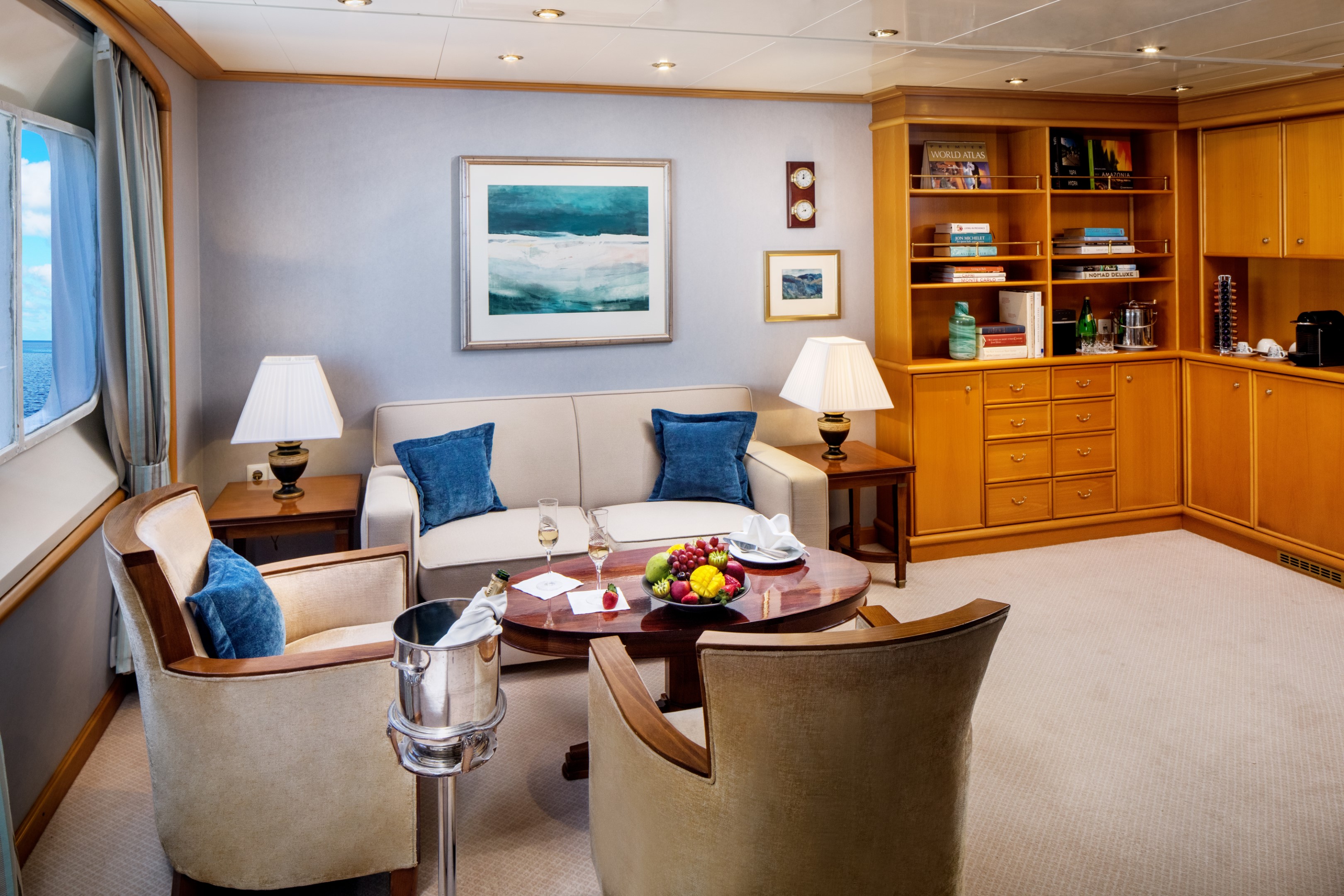
At 375 square feet, the Admiral’s Suite is a luminous retreat at sea. Three picture windows frame the ocean from every angle, filling the partitioned living and dining area with natural light throughout the day. A separate master bedroom with a permanent queen bed offers privacy and quiet, while the marble bathroom draws you in with both a soaking tub and a multi-jet shower. A half guest bath, built-in dresser, and writing desk round out a suite that balances elegance with ease.
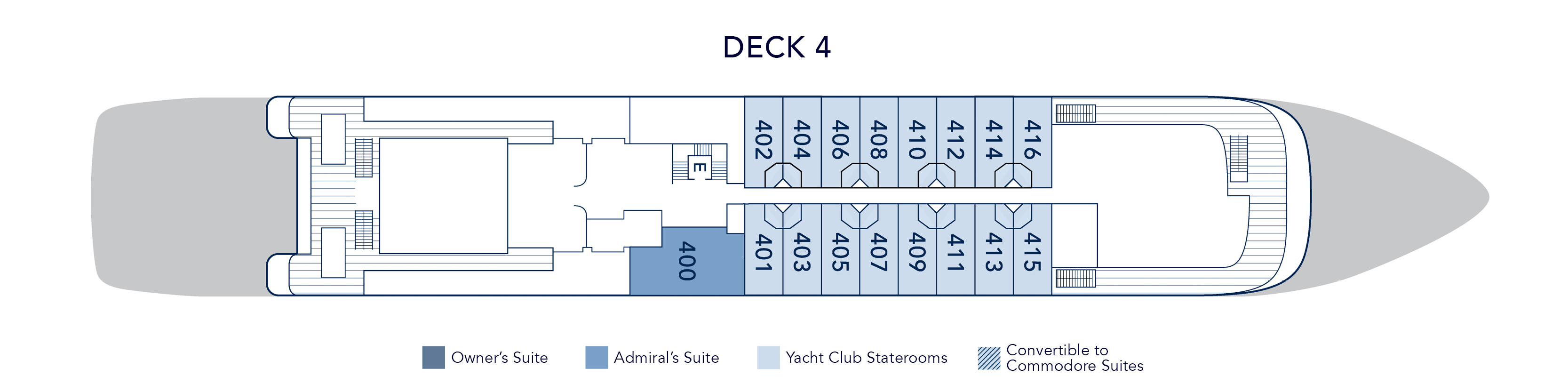
Suite 400 on both yachts, located on Deck 4 near the Library.
Admiral’s Suite Additional Amenities:
- 55" flat-screen TVs
- Belgian linens
- Silk clothes hangers
- Direct-dial telephone
- 24-hour small bites
- Nespresso machine
- Luxury robes & slippers
- Make-up mirror
- Wi-Fi Available
- Climate control
- Beverage refrigerator
- Elm Organics bath amenities
- Hair dryer
- In-room safe
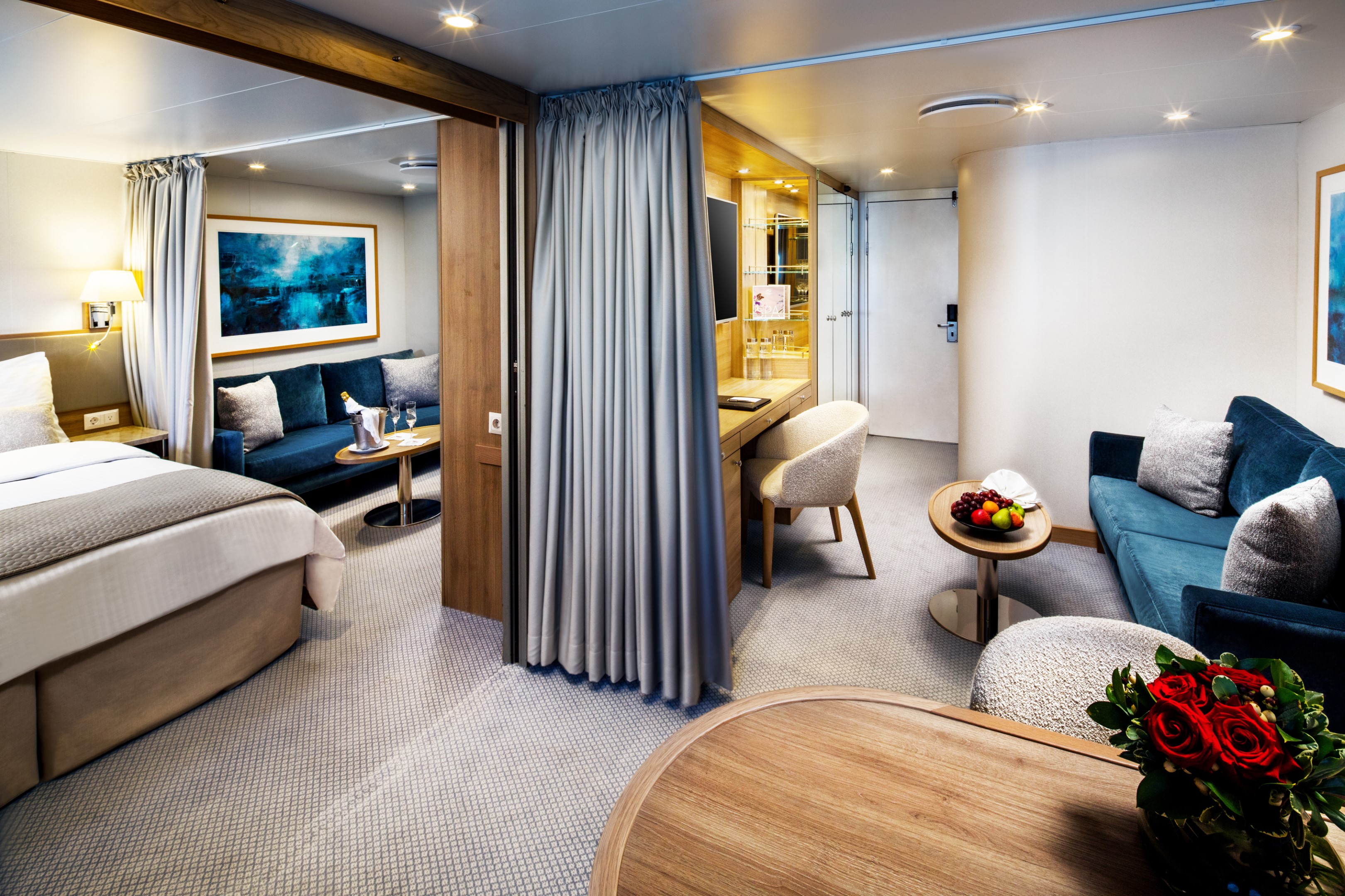
The Commodore Suite brings two Yacht Club Staterooms together into one beautifully considered space averaging 390 square feet. The result is a suite that feels genuinely spacious and luxurious. Two full marble bathrooms with multi-jet showers, a seating area with sofa and cocktail table, two spacious closets, and a built-in dresser with writing desk. Choose between twin beds or a queen and configure the second space as a dining area or additional queen bed, depending on how you want to use it.
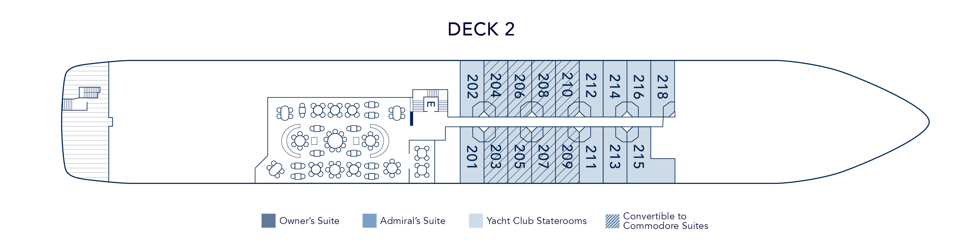
Eight Commodore Suites are available across the yacht, with Deck 2 suites featuring four 17” round porthole windows and Deck 3 suites offering picture windows, steps from the pool and Main Salon.
Commodore Suite Additional Amenities:
- 55" flat-screen TVs
- Belgian linens
- Silk clothes hangers
- Direct-dial telephone
- 24-hour small bites
- Luxury robes & slippers
- Make-up mirror
- Wi-Fi Available
- Climate control
- Beverage refrigerator
- Elm Organics bath amenities
- Hair dryer
- In-room safe
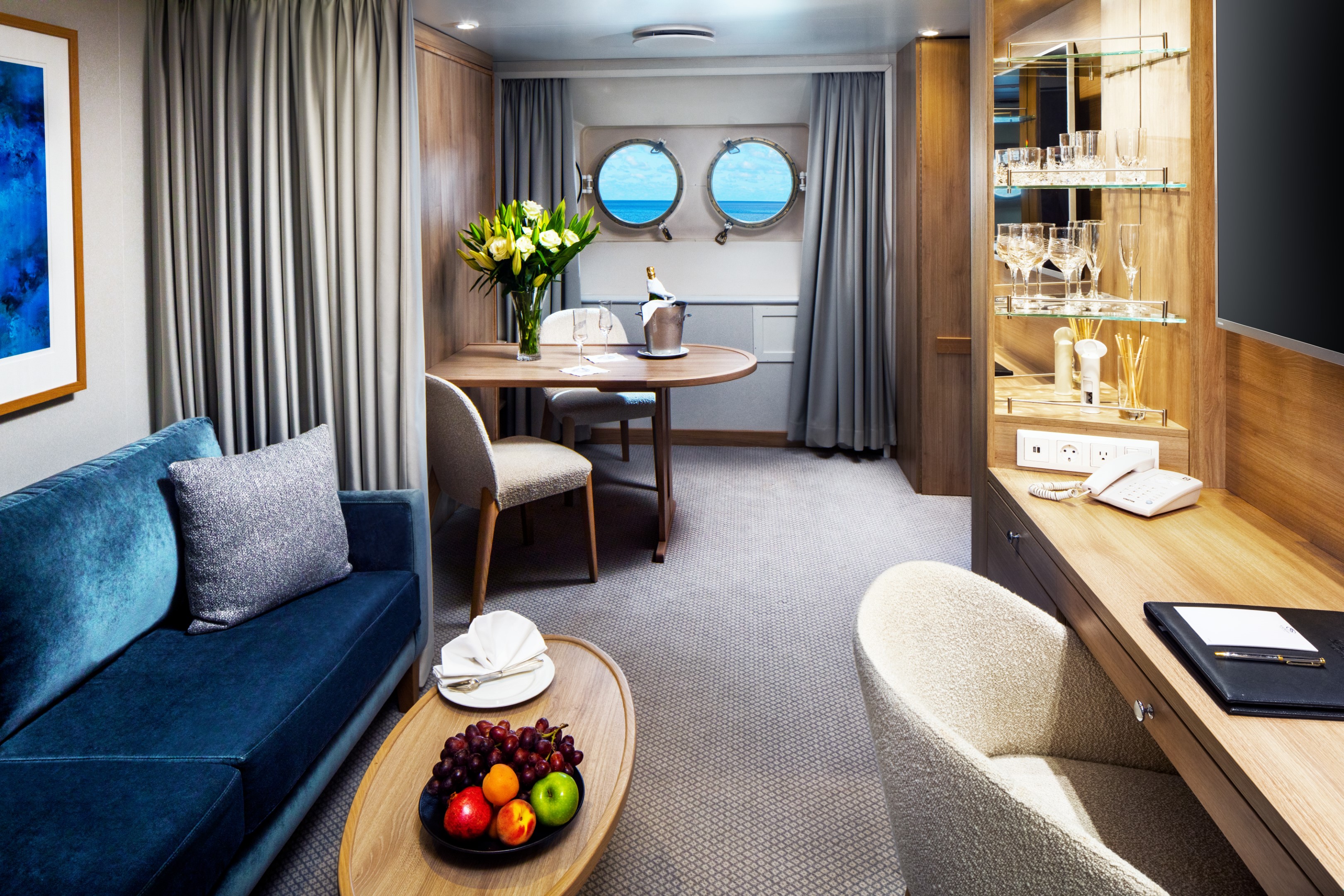
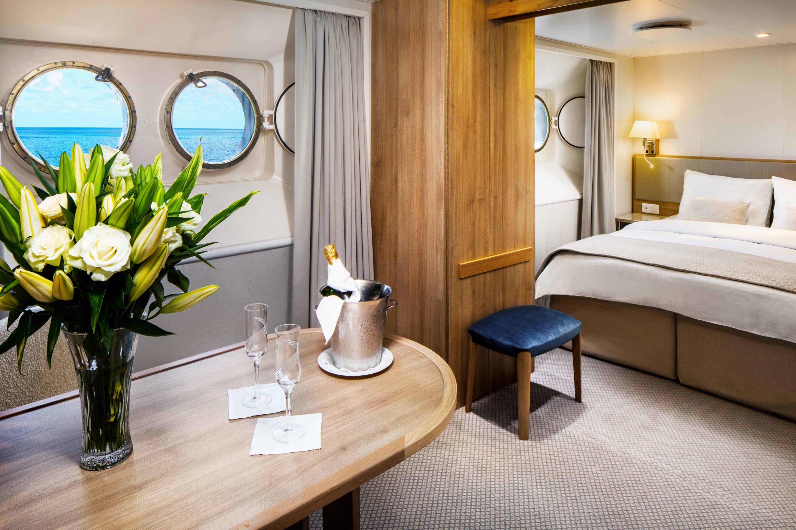
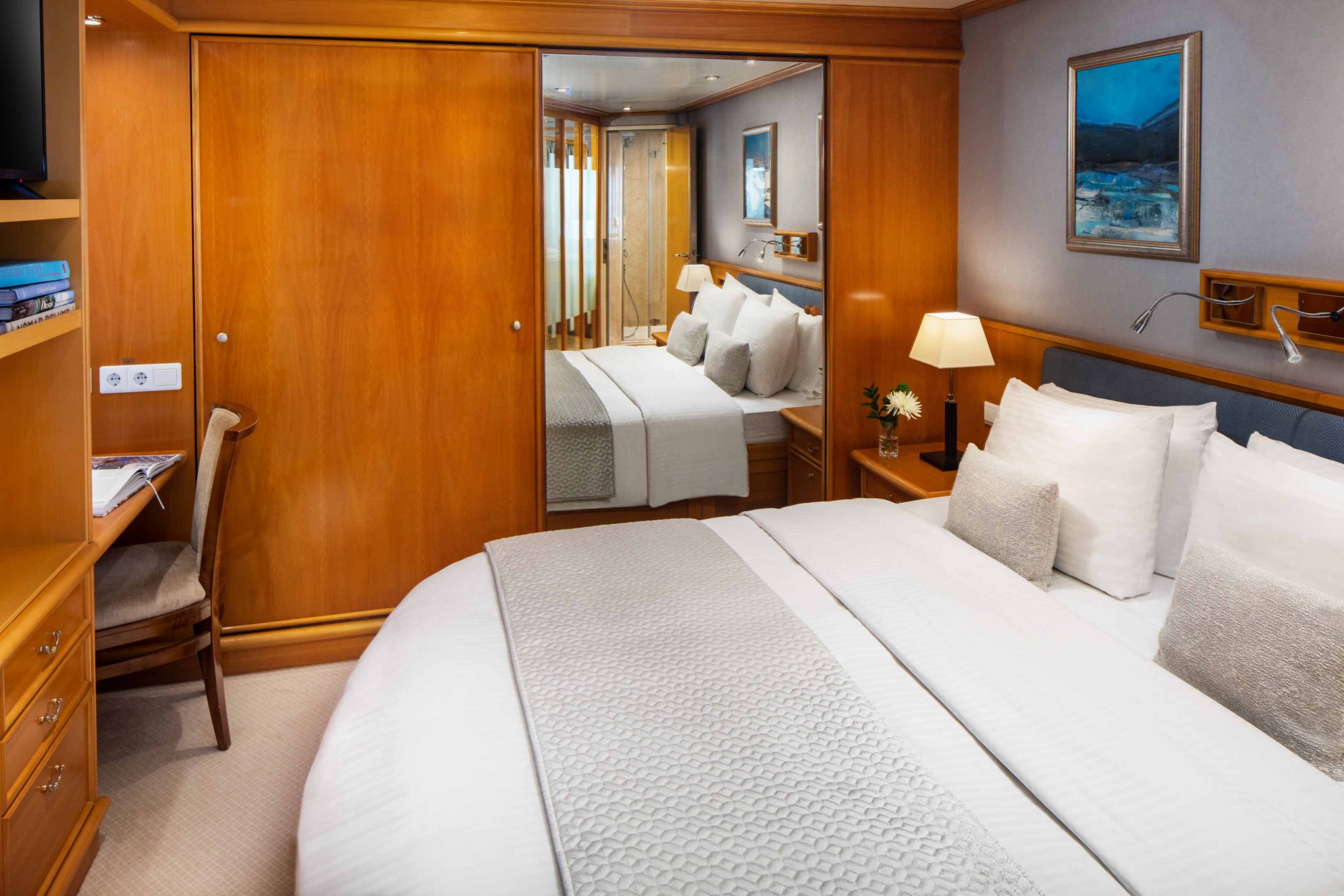
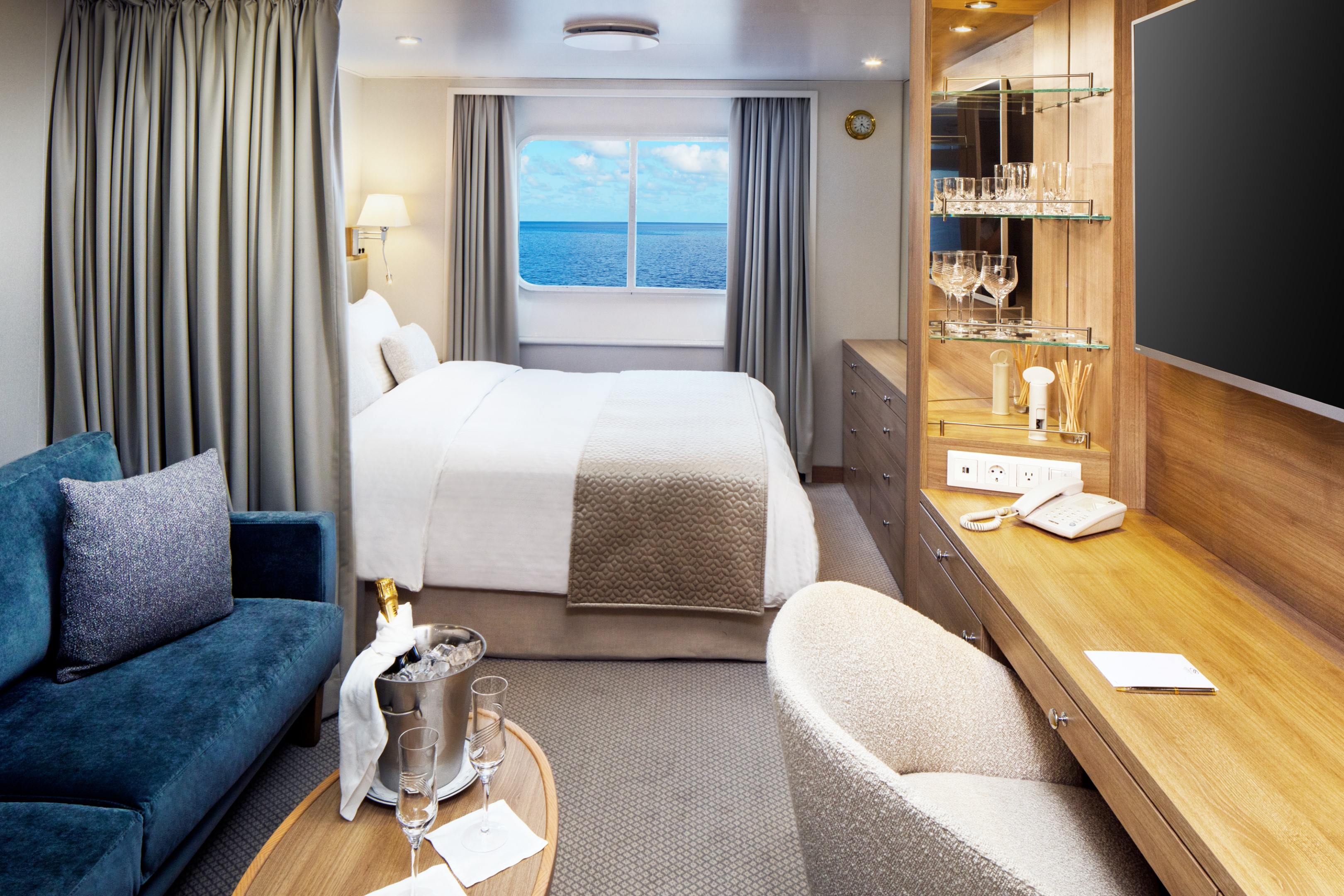
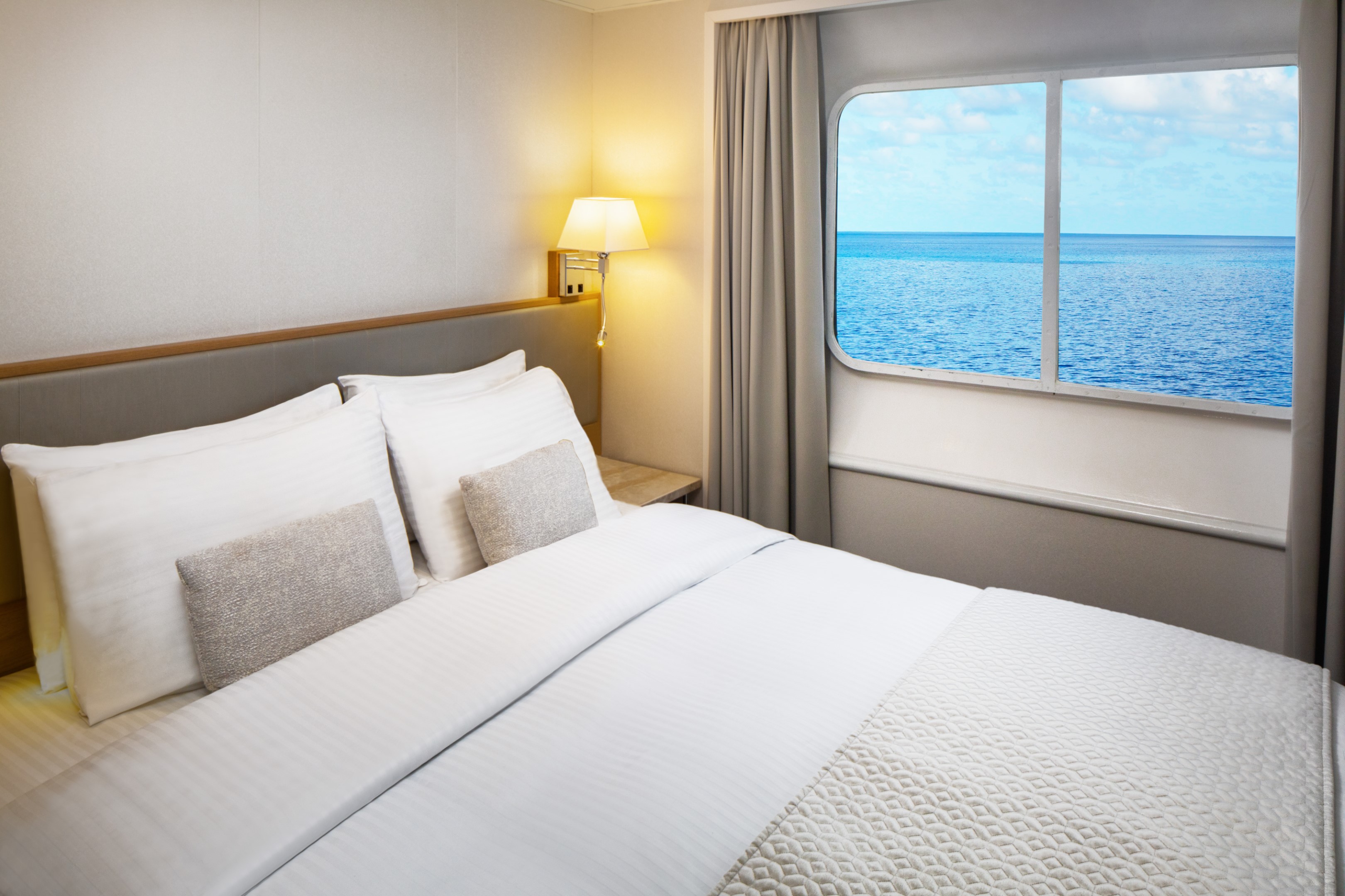
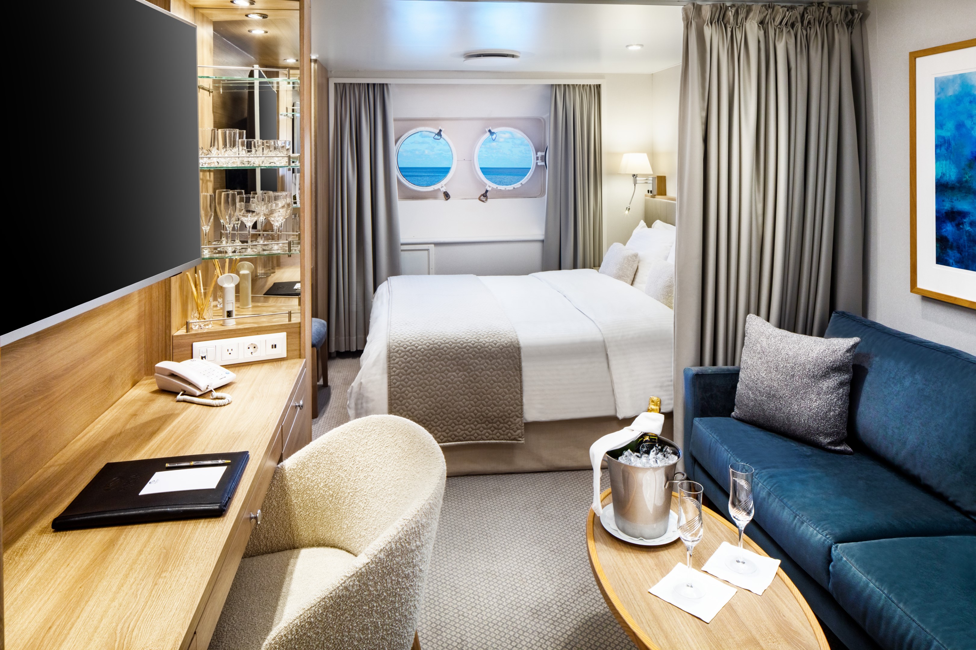
Averaging 195 square feet, the Yacht Club Stateroom is where the yachting lifestyle truly comes to life. Picture windows frame the open sea, while a marble-lined bathroom with a multi-jet shower and well-appointed living area with sofa, cocktail table, and writing desk offer every comfort you need. Choose between twin beds or a queen and settle into a space that feels considered from every angle.
Deck 3 staterooms sit just steps from the pool, while Deck 4 places you close to the SeaDream Spa, Fitness Center and Library.
Yacht Club Stateroom Additional Amenities:
- 55" flat-screen TVs
- Belgian linens
- Silk clothes hangers
- Direct-dial telephone
- 24-hour small bites
- Luxury robes & slippers
- Make-up mirror
- Wi-Fi Available
- Climate control
- Beverage refrigerator
- Elm Organics bath amenities
- Hair dryer
- In-room safe
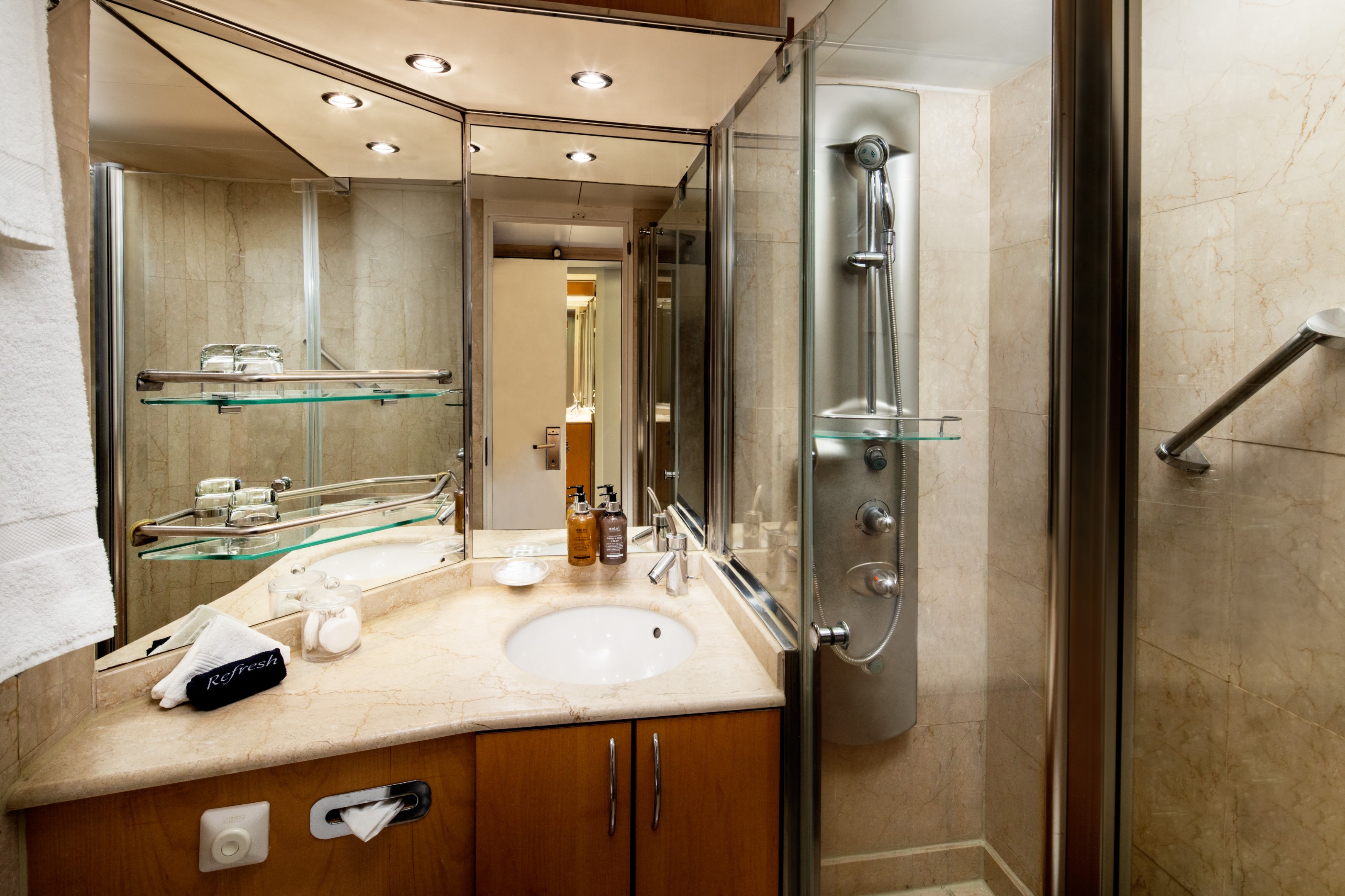
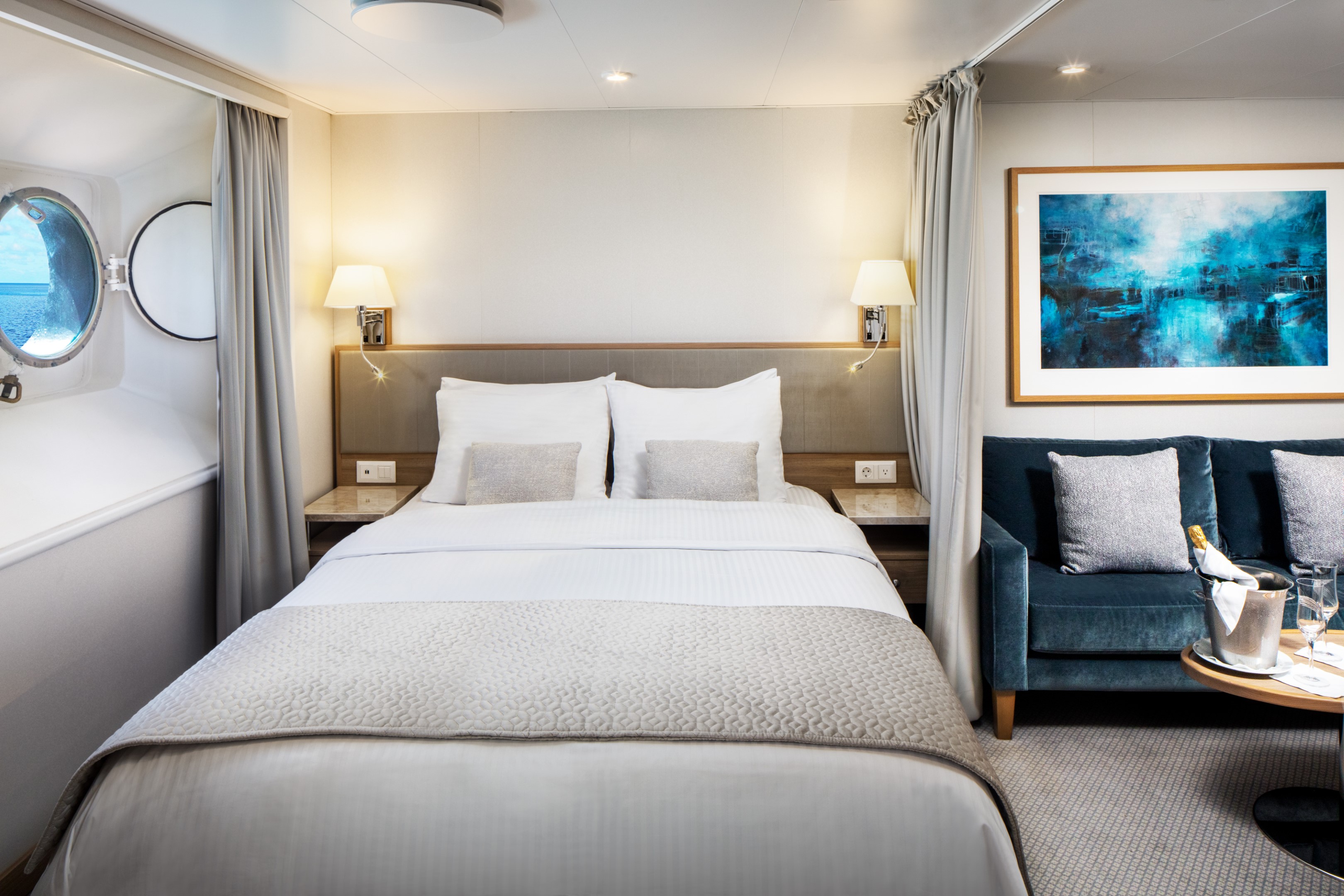
The Yacht Club Staterooms on Deck 2 offer 195 square feet of refined comfort at sea. Two round porthole windows bring the ocean into the room in a way that feels intimate and unhurried. A marble-lined bathroom with a multi-jet shower, an open living area with sofa, cocktail table, and writing desk, and ample closet space complete with a stateroom that is quietly, thoroughly considered.
Yacht Club Stateroom Additional Amenities:
- 55" flat-screen TVs
- Belgian linens
- Silk clothes hangers
- Direct-dial telephone
- 24-hour small bites
- Luxury robes & slippers
- Make-up mirror
- Wi-Fi Available
- Climate control
- Beverage refrigerator
- Elm Organics bath amenities
- Hair dryer
- In-room safe
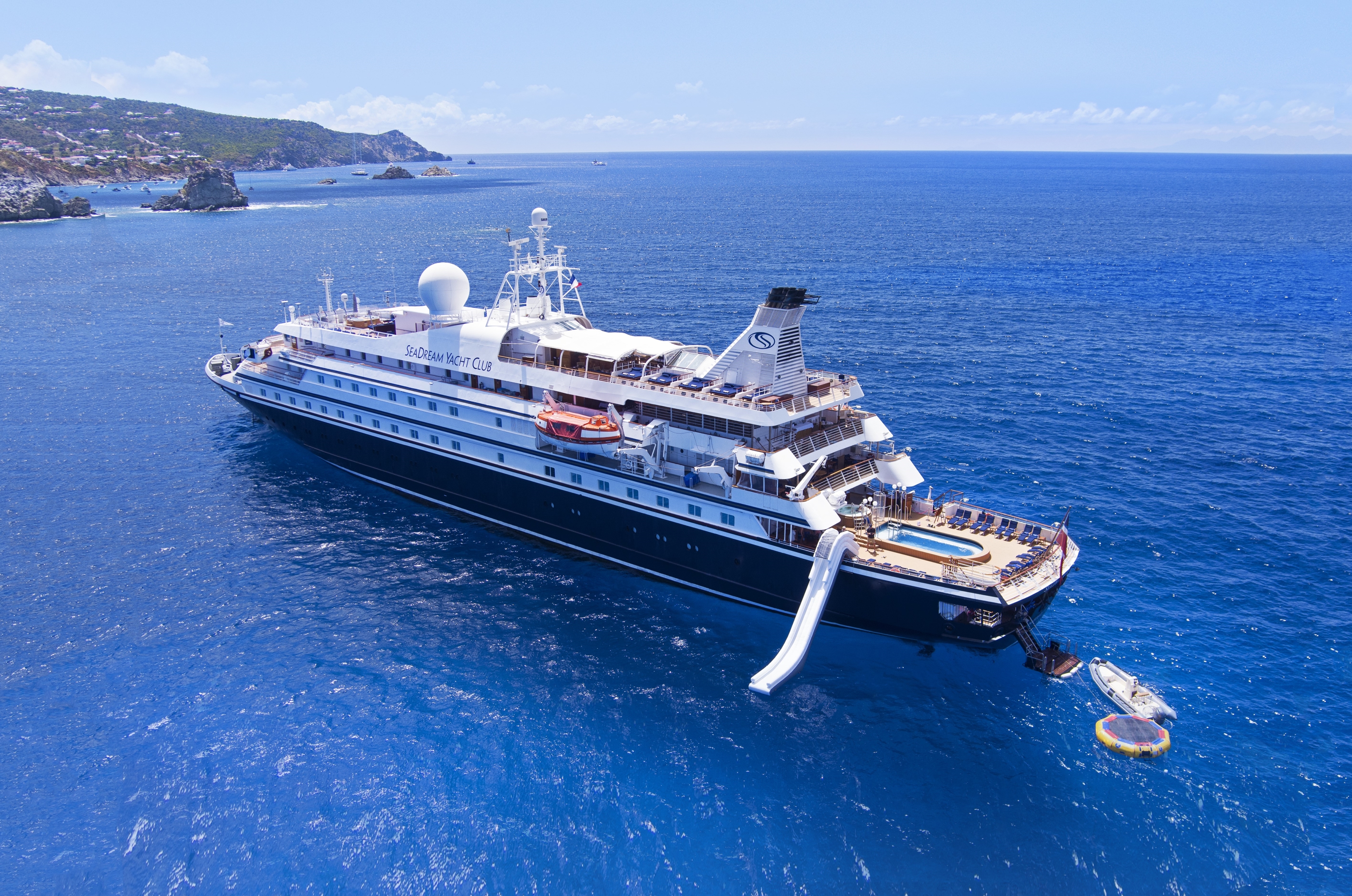
SeaDream I
With 95 crew members looking after just 112 guests across 56 staterooms and suites, the level of service aboard these intimate boutique ships is unlike anything else at sea. Every stateroom and suite faces the sea, each offering luxury accommodations designed around the yachting lifestyle. As an all-inclusive luxury yacht, everything from the open bar to gratuities is taken care of. This is what yachting feels like.
Luxury Suites & Staterooms
Aboard SeaDream, every stateroom and suite is a private luxury retreat designed around the sea. Queen-size beds, marble bathrooms, and uninterrupted ocean views come with every room. For those seeking even more space, the Owner's Suite and Admiral’s Suite offer soaking tubs and generous living areas perfect for entertaining friends and family.
The Onboard Experience
Life aboard SeaDream is defined by elegant informality. Mornings might begin with yoga on deck as the coastline drifts past. Afternoons open to watersports at sea from the Marina, a massage at the spa, or simply a Balinese Bed and the horizon. Evenings bring world-class cuisine under the stars. It feels less like a small ship cruise and more like a private yacht charter.
Among boutique cruise lines, SeaDream stands apart. A luxury yachting vacation built around an intimate setting, ultra luxury service, and a crew that knows your name. Year after year, the world's most trusted travel publications return to SeaDream. The Condé Nast Traveler Gold List, Travel + Leisure, and Cruise Critic have each recognized what guests already know.
Ship Facts
| Launch Year | 1984 | ||||||||
| Refit Year | 2022 | ||||||||
| Language | en | ||||||||
| Gross Tonnage | 4300 | ||||||||
| Length | 105 | ||||||||
| Width | 14 | ||||||||
| Currency | USD | ||||||||
| Speed | 15 | ||||||||
| Capacity | 112 | ||||||||
| Crew Count | 95 | ||||||||
| Deck Count | 5 | ||||||||
| Cabin Count | 56 | ||||||||
| Large Cabin Count | 0 | ||||||||
| Wheelchair Cabin Count | 0 | ||||||||
| Electrical Plugs |
|
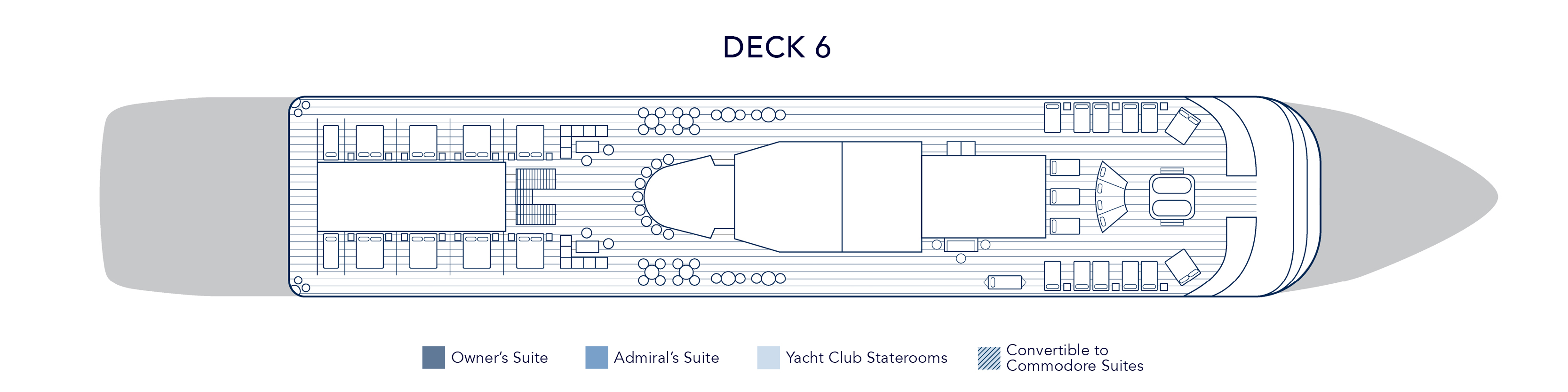
Deck 6
- Balinese Dream Beds
- Top Of The Yacht Bar
- Golf Simulator
- Sun Deck & Sun Beds
- Couples Hot Tubs
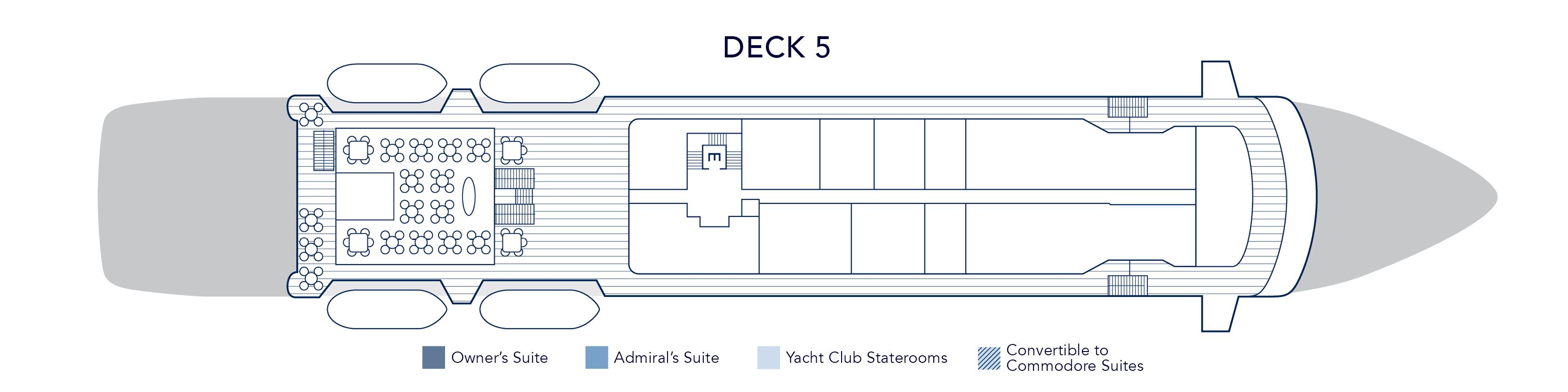
Deck 5
- Topside Restaurant
- Medical Facility
- Open Promenade
- Elevator
- Bridge
Deck 4
- Al Fresco Dining & Lounging
- Library
- Piano Bar
- Casino
- Admiral Suite
- SeaDream Spa
- Fitness Centre
- Beauty Salon
- Elevator
- Yacht Club Staterooms
- Admiral Suite
Deck 3
- Pool / Hot Tub
- Pool Bar
- Card Room
- Main Salon / Main Salon Bar
- Concierge & Boutique
- Yacht Club Staterooms
- Commodore Suites
- Owner's Suite
Deck 2
- Retractable Water Sports Platform Marina
- Dining Salon
- Yacht Club Staterooms
- Commodore Suites
Award-Winning Cuisine
Embark on a sensory adventure with our international menus, crafted with the freshest, high-quality ingredients, infused with local flavors, often locally sourced by our chefs. Always included, every dish is prepared à la minute and served al fresco or in our elegant Dining Salon, offering a dining experience that is uniquely yours.
Topside Restaurant
Multi-course menus are prepared à la minute and shaped by the destinations visited. Seasonal ingredients and regional flavors guide each service, delivering gourmet dining experiences available at sea with the standards expected of gourmet dining restaurants known for their excellent wine selection and Michelin-inspired cuisine. Inclusive wine pairing accompanies each dinner, thoughtfully chosen to complement the menu without overpowering it.
From luxury breakfast experiences on deck to candlelit evenings under the stars, the yacht dining experience becomes both a culinary journey and a defining part of life aboard.
Dining Salon
On SeaDream, an exclusive yacht dining experience unfolds with freedom, balance, and quiet refinement. Every breakfast, lunch, and dinner may be enjoyed al fresco beneath open sky or within the elegant dining salon, creating a seamless expression of dining on a yacht. There are no fixed seatings and no crowds, only the ease of following the moment.
Desert Extravaganza
The Dessert Extravaganza is one of the most anticipated culinary events aboard SeaDream. Presented as an elegant after-dinner gathering on deck, it highlights the creativity and craftsmanship behind our award-winning yacht and luxury cruise dining program.
Prepared entirely on board by our skilled pastry chefs, this signature onboard dining event features an expansive display of gourmet desserts at sea. Guests are invited to explore freshly baked cakes and pies, delicate tarts, handcrafted pastries, house-made ice creams, specialty confections, and our signature Bananas Foster prepared to order. Each selection reflects the same standards found throughout our fine dining at sea and our acclaimed award-winning cuisine.
While many cruise lines offer a traditional cruise dessert buffet, SeaDream’s Dessert Extravaganza elevates the concept through thoughtful curation and elegant presentation, creating a refined culinary experience at sea. The open-air setting encourages guests to gather, connect, and celebrate together, making it a memorable part of the luxury yacht dining experience.
More than a sweet finale, the Dessert Extravaganza reflects SeaDream’s commitment to exceptional food at sea, blending variety, quality, and community in a way that defines our intimate luxury cruise dining experience.
Plant-Based & Organic Cuisine at Sea
Morning light settles over the deck. Fresh fruit, pressed juices, and vibrant greens arrive quietly at the table. On SeaDream, plant-based cuisine is not an alternative. It is an integral part of our luxury yacht dining experience.
Our embraces organic cuisine at sea, thoughtfully crafted vegan menus, and plant-forward dishes that reflect both wellness and indulgence. Each course is prepared à la minute, shaped by the destinations we visit and the seasonal ingredients sourced along the way. This is gourmet plant-based dining designed for life aboard a private luxury yacht.
A Pioneer in Plant-Based Yacht Dining
SeaDream was among the first luxury cruise experiences to introduce a dedicated plant-based menu at sea. Today, our expanded vegan dining options are available at every meal, seamlessly integrated into our Michelin-inspired cuisine and refined yacht food menu.
The philosophy is simple. Whole foods. Organic produce. Clean flavors. Elegant presentation.
Our chefs transform vegetables, legumes, ancient grains, nuts, and seeds into dishes that feel both nourishing and indulgent. The result is a plant-based dining experience that satisfies devoted vegans, vegetarians, and wellness-minded travelers alike.
Organic Ingredients. Global Inspiration.
Seasonal produce and locally sourced ingredients guide our organic yacht cuisine. Mediterranean herbs, Caribbean spices, and coastal citrus shape menus that evolve with each voyage. Whether sailing the Greek Isles or the Caribbean, plant-based dishes reflect the regions explored.
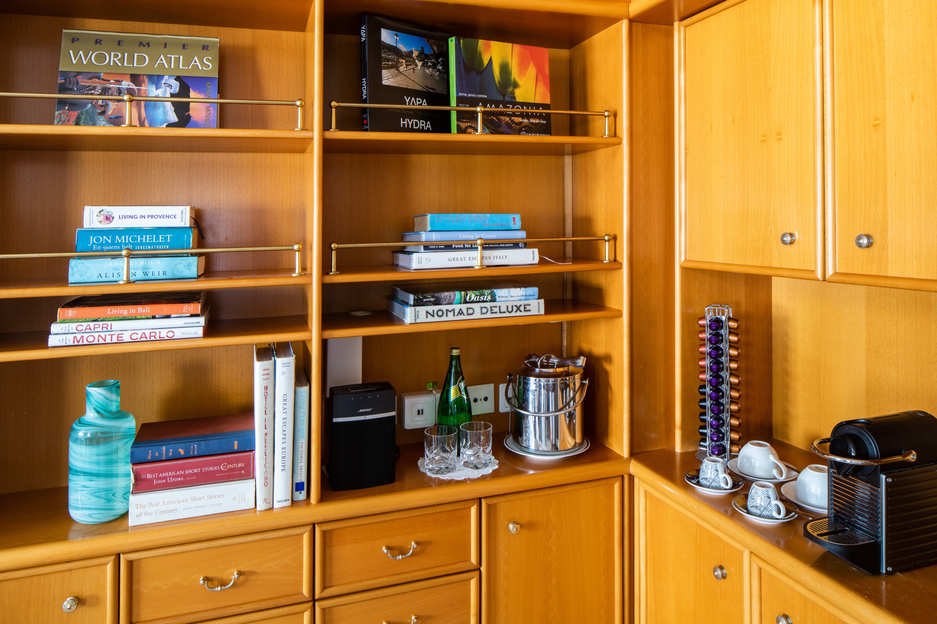
SeaDream Tea Menu
SeaDream Yacht Club’s Tea Menu features twelve exclusive tea blends created specifically for SeaDream by a master blender in Kent, United Kingdom. Available only on board, this curated collection is part of our luxury yacht tea service and refined private yacht dining experience.
Each premium loose-leaf tea is prepared in an individual 0.51 Bodum teapot with an integrated plunger diffuser, ensuring precise steeping and full flavor expression. When hot water is poured, our service team begins a measured infusion timer. Guests are informed when the recommended steeping time has been reached and may depress the plunger to stop the brewing process at their preferred strength.
This attentive preparation defines our onboard tea service and ensures a consistently elevated tea experience at sea.
The Collection
Our exclusive tea blends include a selection of black teas, green teas, herbal infusions, and specialty teas crafted solely for SeaDream. Each blend is selected for quality, prevenance, and balance, offering guests a premium tea service at sea that reflects the standards of luxury cruise dining.
Whether enjoyed during afternoon tea at sea or a quiet moment between destinations, the collection delivered depth, clarity, and refinement in every cup.
Luxury Tea Service at Sea
Available throughout the day, SeaDream’s luxury tea service enhances the yacht dining experience with exclusive blends, precise preparation, and attentive yet unintrusive service. From afternoon tea on deck to quiet moments in the Salon, this curated tea program offers a distinctive luxury cruise tea experience found only aboard SeaDream.
Wine & Spirits
An All-Inclusive Bar at Sea
Dream cuisine is harmonized with expressive wines, each pairing thoughtfully selected to complement the flavors of the menu and the places explored. As part of SeaDream’s all-inclusive luxury yacht experience, wine pairings accompany lunch and dinner with quiet intention.
An all-inclusive open bar at sea is available throughout the day, offering select wines, premium spirits, and handcrafted cocktails served wherever you choose to settle. At the Top of the Yacht Bar, by the pool, the Piano Bar or in the Main Salon before dinner, each pour arrives with ease.
Service remains attentive yet unassuming. A glass appears at the right moment. Nothing feels hurried.
The Cellar
SeaDream’s luxury cruise wine program reflects both the Old and New World, from mineral-driven Mediterranean whites to structured Bordeaux and Napa Valley reds. Inclusive selections accompany lunch and dinner, enhancing each course without overshadowing it.
Beyond these, the cellar extends to rare and distinguished vintages for those who wish to explore further. Each bottle is chosen for provenance, balance, and the way it complements life at sea.
Wine here is not a list. It is part of the rhythm of the voyage.
Premium Selections
For guests seeking exceptional expressions, a refined collection of rare wines and aged spirits is available. Distinguished labels such as Château Ducru Beaucaillou Grand Cru Classé and Insignia, Napa Valley, sit alongside small-batch gins, aged whiskies, and fine cognacs.
Selections are offered with the same intention that guides every aspect of this all-inclusive luxury cruise experience: thoughtful, measured, and never overstated.
Activities & Amenities Onboard SeaDream
Your SeaDream journey begins the moment you step aboard, welcomed by the captain with cocktails and hors d'oeuvres as the yacht sets sail. With just 112 guests, a relaxed, uncrowded atmosphere and award-winning crew who anticipate your every need create an intimate, all-inclusive luxury yacht experience where every detail is thoughtfully curated.
This is yachting, the SeaDream way.
Starlit Movies®
Underneath the vast canvas of the night sky, your yacht comes alive with our signature Starlit Movies® poolside. Whether you're enjoying a classic film or the latest blockbuster, this open-air cinema transforms your evenings into cinematic adventures.
Casino, Piano Bar & Library
Located on Deck 4, the casino offers a relaxed setting for classic table games, while the nearby Piano Bar invites guests to linger over after-dinner drinks with live guitar and piano music, perfect for conversation and unwinding at sea. For quieter moments, the library provides a peaceful onboard space with books and board games, a welcome retreat whenever the mood calls for stillness.
Balinese Dream Beds
Our signature Balinese Dream Beds are among the most distinctive all-inclusive yacht amenities at sea, inviting guests to stretch out and enjoy unobstructed ocean views by day or unwind beneath the stars by night. Select beds may be transformed for sleeping beneath the open sky, wrapped in luxurious Belgian linens as the sea moves softly beneath you.
Top of the Yacht Bar
Every moment aboard SeaDream is as effortless as the voyage itself. An open bar with select premium wines, spirits, and cocktails is available throughout the day, while evenings bring live music, social gatherings at the Top of the Yacht Bar, and Starlit Movies® on the open-air pool deck. With 360° ocean views as the backdrop and award-winning crew at your service, the night is always yours to enjoy.
Concierge & Boutique
Our Concierge and Shop Manager are here to assist.