
Marigot to Bridgetown
Marigot to Bridgetown
Cruise overview
WHY BOOK WITH US?
- ✔ The Deluxe Cruises’ team has extensive experience in ultra-luxury cruising.
- ✔ Call now to speak to our helpful and experienced Cruise Concierge team.
- ✔ Enjoy our Unique Deluxe Cruises Bonus for substantial savings.
- ✔ Our team will tailor your holiday to your exacting requirements.
- ✔ As agents, we work under the protection of each cruise lines ABTA / ATOL licences
About Marigot
French and Dutch have lived side by side on St. Maarten/St. Martin for hundreds of years—with no border patrols or customs between them. The French side has a more genteel ambience, more fashionable shopping, and a Continental flair. The Dutch tends to be less expensive, has casino hotels, and more nightlife. Water sports abound all over—diving, snorkeling, sailing, and windsurfing are all top draws. And it's easy to while away the day relaxing on one of the 37 beaches, strolling the boardwalk of Dutch-side Philipsburg, and exploring the very French town of Marigot. Although luck is an important commodity at St. Maarten's 13 casinos, chance plays no part in finding a good meal at the island’s excellent eateries. The best way to explore St. Maarten/St. Martin is by car. Though often congested, especially around Philipsburg and Marigot, the roads are fairly good, though narrow and winding, with some speed bumps, potholes, roundabouts, and an occasional wandering goat herd. Few roads are marked with their names, but destination signs are common. Besides, the island is so small that it's hard to get really lost—at least that is what locals tell you. If you’re spending a few days, get to know the area with a scenic "loop" around the island. Be sure to pack a towel and some water shoes, a hat, sunglasses, and sunblock. Head up the east shoreline from Philipsburg, and follow the signs to Dawn Beach and Oyster Pond. The road winds past soaring hills, turquoise waters, quaint West Indian houses, and wonderful views of St. Barth. As you cross over to the French side, turn into Le Galion for a stop at the calm sheltered beach, the stables, the butterflies, or the windsurfing school, then keep following the road toward Orient Bay, the St-Tropez of the Caribbean. Continue to Anse Marcel, Grand Case, Marigot, and Sandy Ground. From Marigot, the flat island of Anguilla is visible. Completing the loop brings you past Cupecoy Beach, through Maho and Simpson Bay, where Saba looms in the horizon, and back over the mountain road into Philipsburg.


About Terre-de-Haut

About Marie-Galante
About Rodney Bay

About Port Elizabeth, Bequia
Bequia is a Carib word meaning "island of the cloud." Hilly and green with several golden-sand beaches, Bequia is 9 miles (14½ km) south of St. Vincent's southwestern shore; with a population of 5,000, it's the largest of the Grenadines. Although boatbuilding, whaling, and fishing have been the predominant industries here for generations, sailing has now become almost synonymous with Bequia. Admiralty Bay is a favored anchorage for both privately owned and chartered yachts. Lodgings range from comfortable resorts and villas to cozy West Indian—style inns. Bequia's airport and the frequent ferry service from St. Vincent make this a favorite destination for day-trippers, as well. The ferry docks in Port Elizabeth, a tiny town with waterfront bars, restaurants, and shops where you can buy handmade souvenirs—including the exquisitely detailed model sailboats that are a famous Bequia export. The Easter Regatta is held during the four-day Easter weekend, when revelers gather to watch boat races and celebrate the island's seafaring traditions with food, music, dancing, and competitive games.To see the views, villages, beaches, and boatbuilding sites around Bequia, hire a taxi at the jetty in Port Elizabeth. Several usually line up under the almond trees to meet each ferry from St. Vincent.
About Mayreau Island
The small island of Mayreau, just one and 1/2 square miles in area (3.9 square kilometres) is the smallest inhabited island of The Grenadines, and is part of the independent state of St.Vincent in the eastern Caribbean Sea. Two of the best known islands in The Grenadines are Mustique and Bequia, the second largest island in this group. The Grenadine Islands are strung out in a gentle sweep between St.Vincent and Grenada. Most visitors to Mayreau arrive from cruise ships, on the regular ferry, or by yacht. There are no proper roads on the island, only a few vehicles, no airport and only a single unnamed village. Mayreau and the neighboring Tobago Cays are very popular for divers and snorkellers. Saline Bay, on the west coast of the island, has a wonderful broad beach and a few local vendors selling T-shirts and local craft. A climb up the road to the hilltop village on the island provides breathtaking views across Mayreau, Canouan, the Tobago Cays and Carriacou.

About Tobago Cays

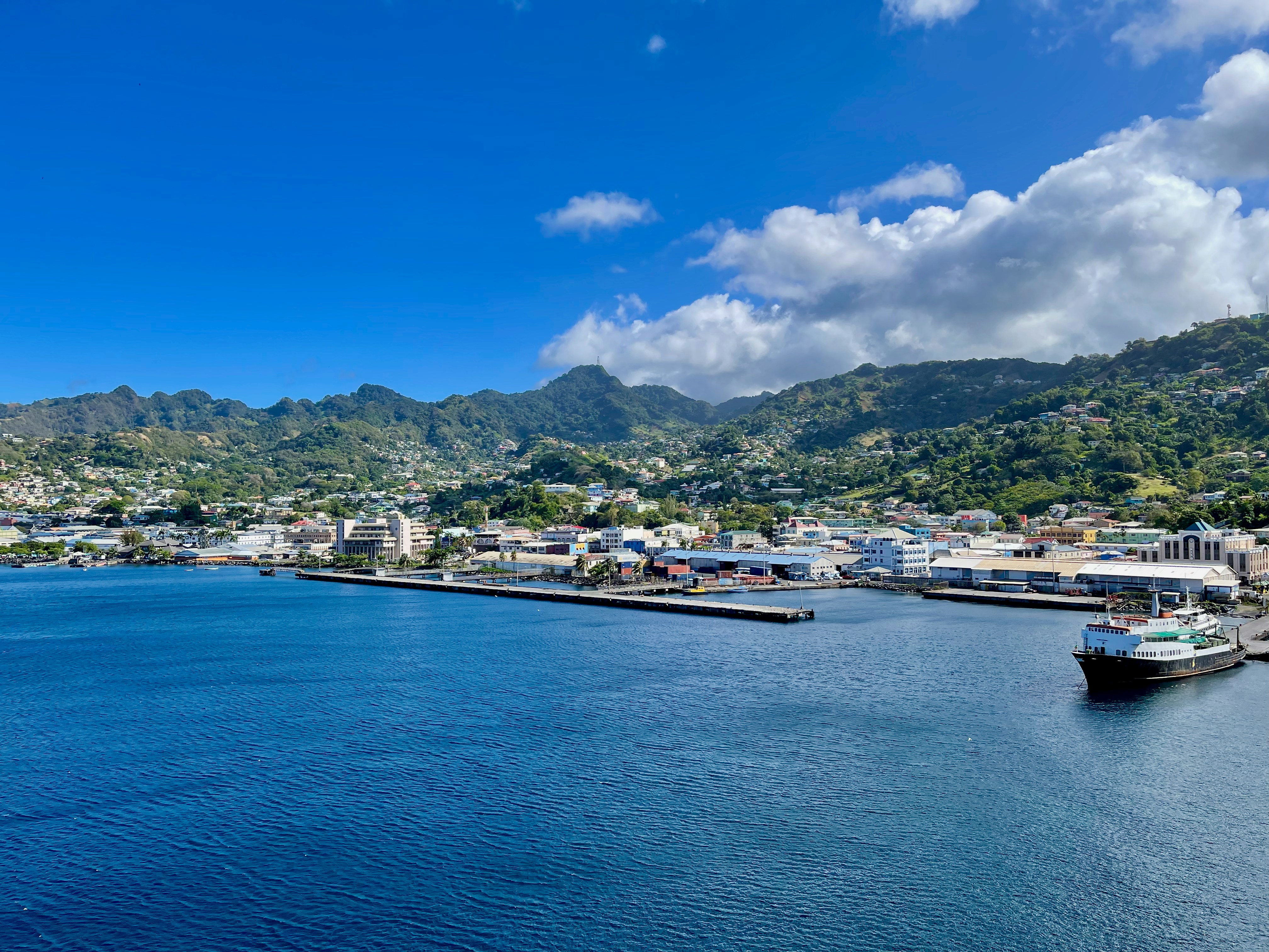
About Bridgetown
Located beside the island’s only natural harbour, the capital of Barbados combines modern and colonial architecture with glorious palm tree-lined beaches and a number of historical attractions. Experience the relaxed culture of the city renowned for its British-style parliament buildings and vibrant beach life, and seek out the Anglican church and the 19th-century Barbados Garrison. The distance between the ship and your tour vehicle may vary. This distance is not included in the excursion grades.


Where You'll Go


