
Stockholm to Reykjavik
Stockholm to Reykjavik
Cruise overview
WHY BOOK WITH US?
- ✔ The Deluxe Cruises’ team has extensive experience in ultra-luxury cruising.
- ✔ Call now to speak to our helpful and experienced Cruise Concierge team.
- ✔ Enjoy our Unique Deluxe Cruises Bonus for substantial savings.
- ✔ Our team will tailor your holiday to your exacting requirements.
- ✔ As agents, we work under the protection of each cruise lines ABTA / ATOL licences
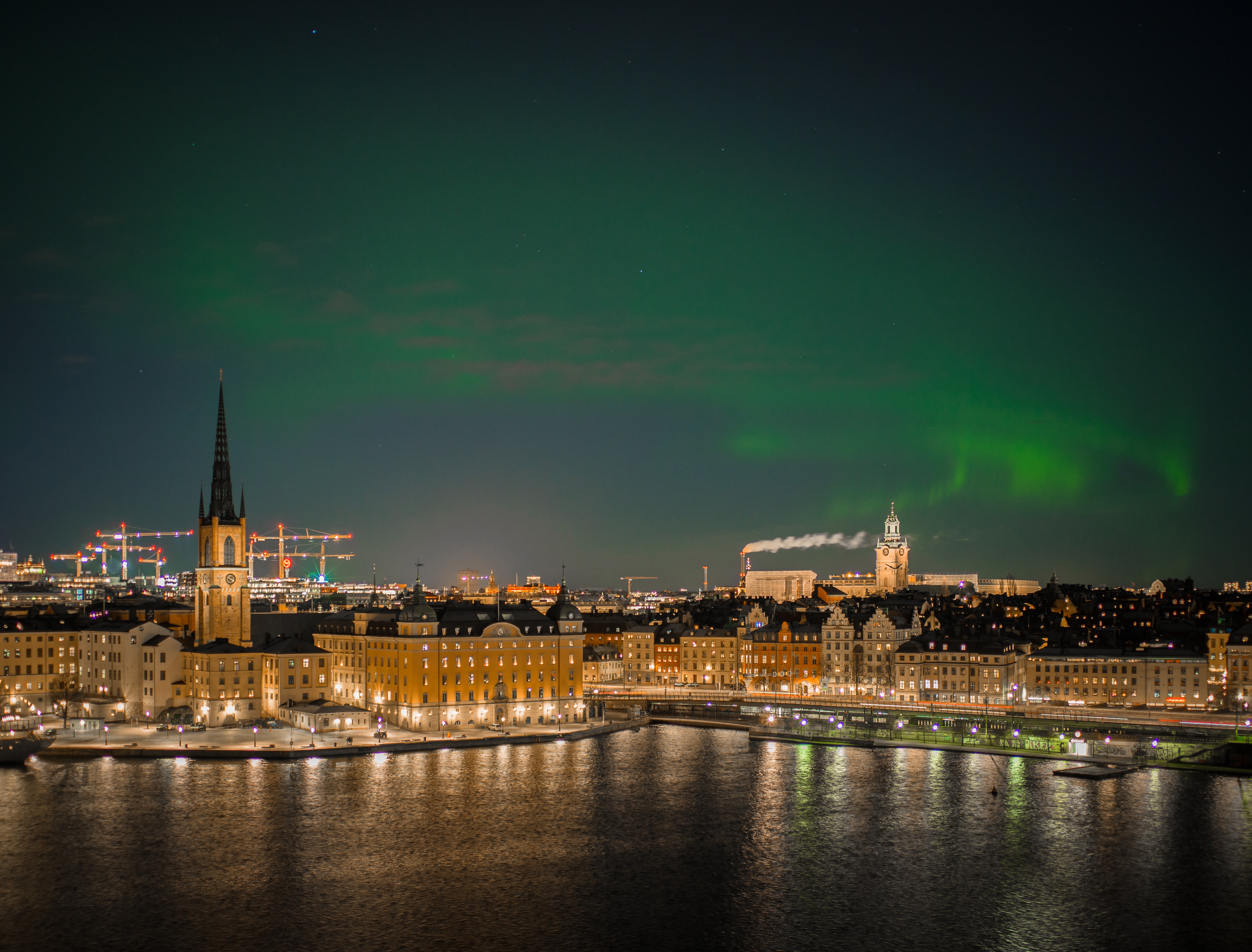
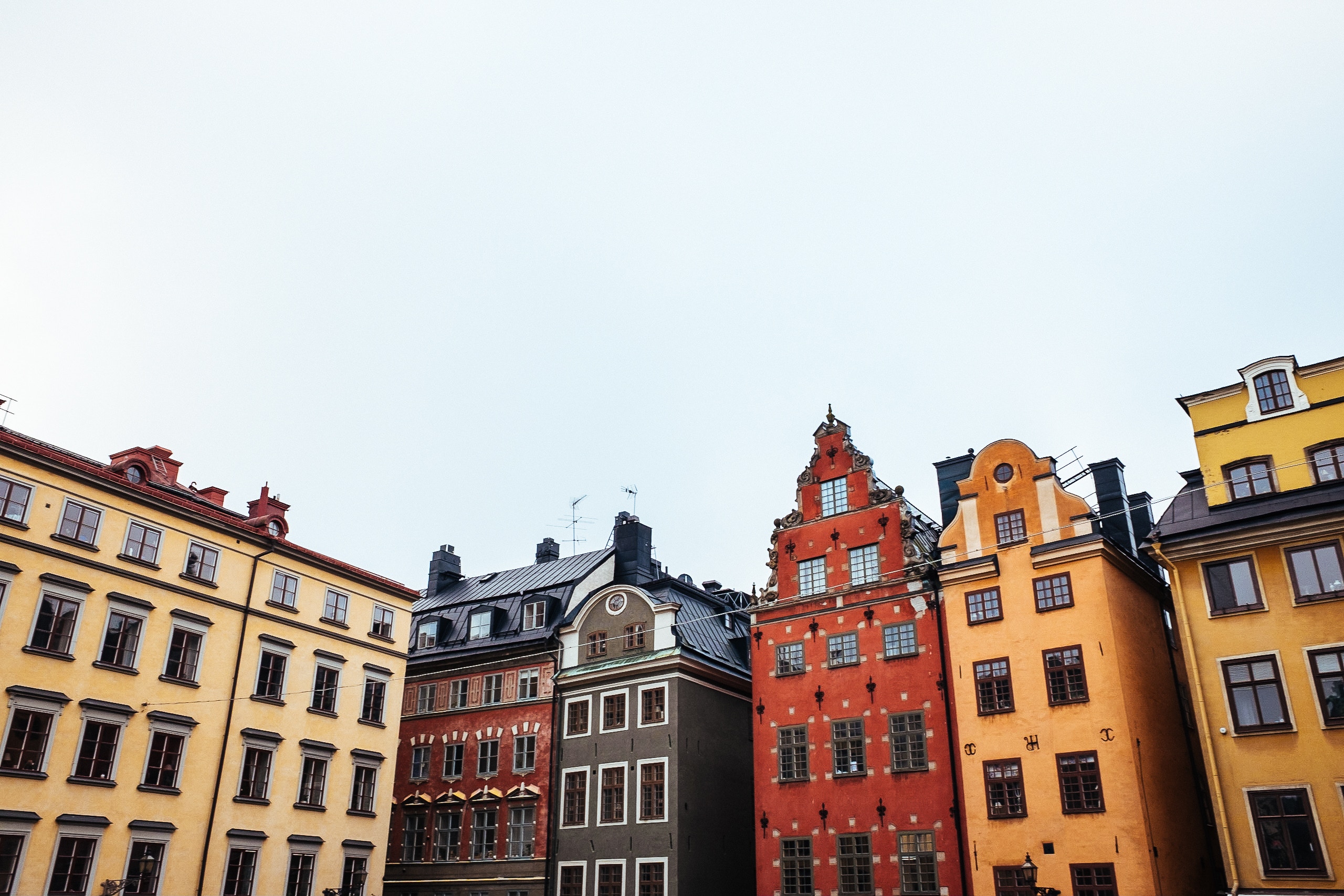
About Stockholm
Stockholm is a city in the flush of its second youth. Since the mid-1990s, Sweden's capital has emerged from its cold, Nordic shadow to take the stage as a truly international city. What started with entry into the European Union in 1995 gained pace with the extraordinary IT boom of the late 1990s, strengthened with the Skype-led IT second wave of 2003, and solidified with the hedge-fund invasion that is still happening today as Stockholm gains even more global confidence. And despite more recent economic turmoil, Stockholm's 1 million or so inhabitants have, almost as one, realized that their city is one to rival Paris, London, New York, or any other great metropolis.With this realization comes change. Stockholm has become a city of design, fashion, innovation, technology, and world-class food, pairing homegrown talent with an international outlook. The streets are flowing with a young and confident population keen to drink in everything the city has to offer. The glittering feeling of optimism, success, and living in the here and now is rampant in Stockholm.Stockholm also has plenty of history. Positioned where the waters of Lake Mälaren rush into the Baltic, it’s been an important trading site and a wealthy international city for centuries. Built on 14 islands joined by bridges crossing open bays and narrow channels, Stockholm boasts the story of its history in its glorious medieval old town, grand palaces, ancient churches, sturdy edifices, public parks, and 19th-century museums—its history is soaked into the very fabric of its airy boulevards, built as a public display of trading glory.


About Oslo
Oslo is the capital of Norway and is also its largest city, situated at the head of Oslo Fjord and surrounded by hills and forests. Home to some 50 museums and full of galleries, cafés, a sculpture park and the Royal Palace, this vibrant city with its handsome 19th-century buildings and wide streets has much to offer. Its history dates back 1,000 years, and includes a rich seafaring heritage that ranges from the Viking era to Thor Heyerdahl’s Kon Tiki expedition. Discover more about this exciting city on our varied selection of excursions.
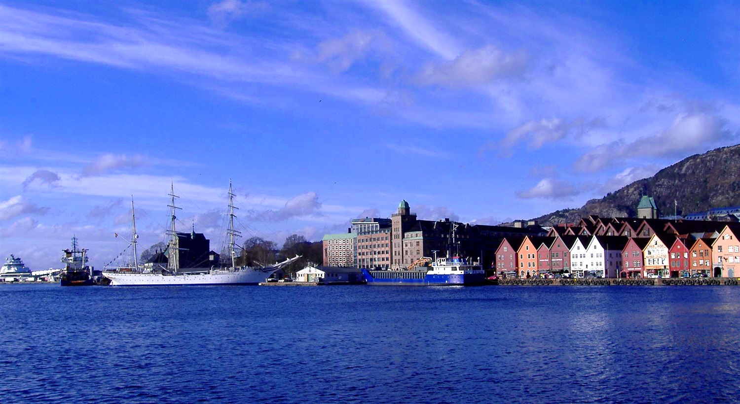
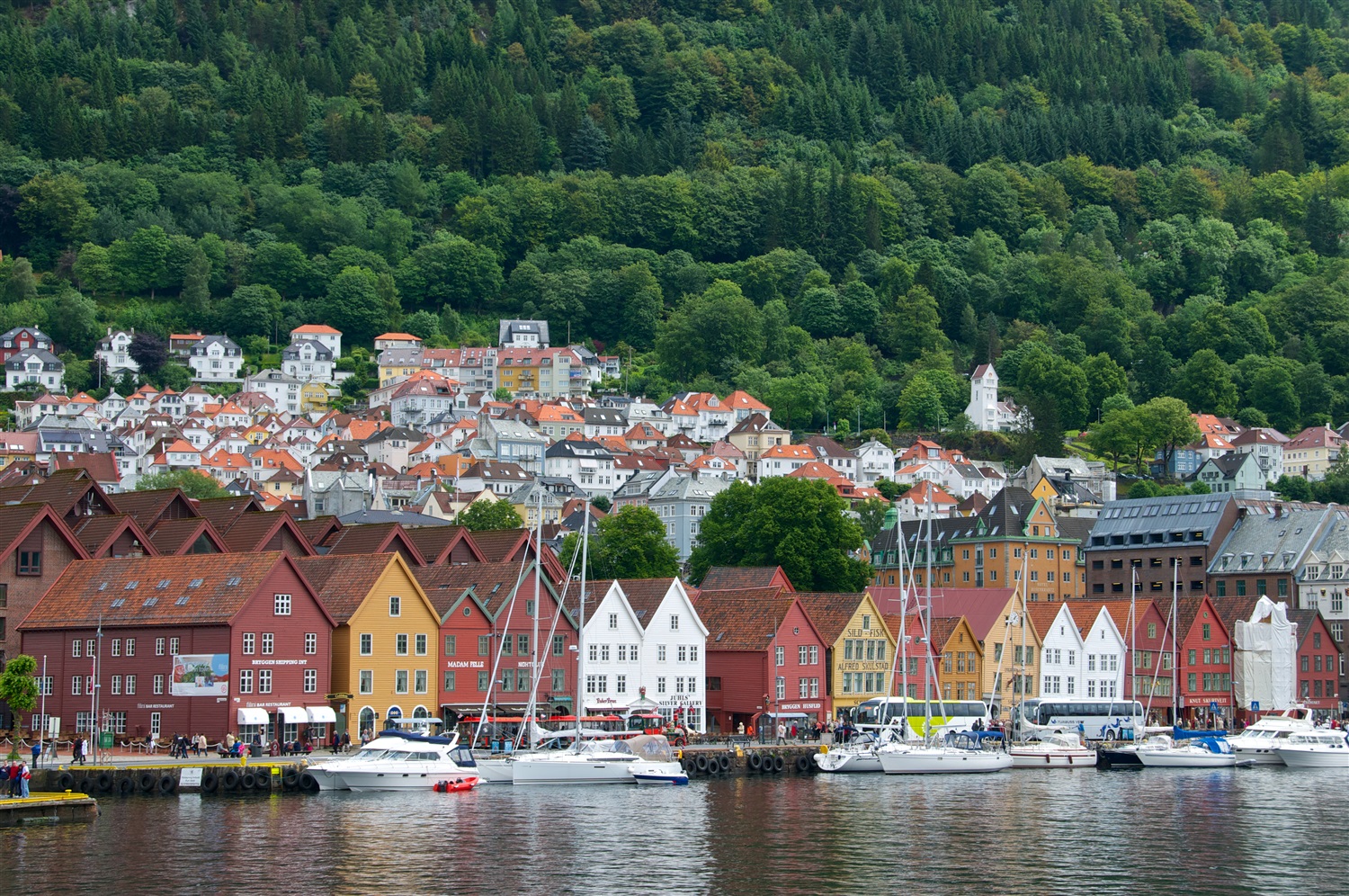
About Bergen
Surrounded by mountains and sparkling fjords, the waterside city of Bergen has a spectacular setting. There has been a settlement here since medieval times and the colourful waterfront buildings of the Hanseatic wharf, known as Bryggen, are testament to its fascinating history of trade. As Norway’s best known medieval settlement, the Bryggen is listed by UNESCO as a World Heritage Site. Our comprehensive selection of excursions allows you to discover the many sides of Bergen, such as the fish market and narrow cobbled streets, as well as stunning views of the city from the summit of Mt Fløyen. Alternatively, those who have visited the city previously may like to experience one of the tours that travel further afield. Just 300 yards from the main piers, you will find the Fortress Museum (Fesningsmuseum), which has an interesting collection of objects related to World War II.


About Thorshavn
More than 600 miles (nearly 1,000 kilometres) from Denmark’s west coast lie the Faroes, a triangle of eighteen windswept islands, seventeen of which are inhabited. Only 48,500 people plus some 70,000 sheep roam these remote lands. Much of the islands’ heritage reflects a medieval past, beginning with the arrival of farmers from western Norway who settled here in the 9th century. Evidence of this Scandinavian heritage is preserved through centuries of isolation; ancient structures can still be seen in villages clustered around old churches. Sheer cliffs and waterfalls carve Streymoy, the largest of the islands, where Torshavn is one of the world’s smallest capitals with about 12,400 inhabitants, plus another 5,000 living in the suburbs of Argir and Hoyvik. Visitors find interesting museums, churches, monuments and all the amenities of a modern town and thriving harbour here. The world’s oldest, still active parliament was founded in the Viking age. Today, it houses the main offices of the local government. Many of the attractions are found outside of Torshavn in the rugged beauty of Streymoy. There are fields with grazing ponies and sheep, tiny hamlets where residents live in half-timbered houses topped by green grass roofs, and dramatic rock formations. Birds by the thousands populate the craggy seaside cliffs, which make an ideal stopover for migratory gannets, guillemots and puffins. The Faroes' climate is generally wet and windy. Because of the Gulf Stream, the temperature is a good deal more moderate than the latitude might imply; it also helps to keep Faroe harbours ice-free year-round.

About Akureyri
Akureyri, called the Capital of the North is the second largest urban area in Iceland, and a lively one at that. Hemmed by the 60-km (37-mile) long Eyjafjörður, Akureyri is sheltered from the ocean winds and embraced by mountains on three sides. Late 19th-century wooden houses impart a sense of history, and the twin spires of a modern Lutheran church rising on a green hill near the waterfront, provide a focal point. To the south of Akureyri is the pyramid-shape rhyolite mountain Súlur. Beyond it is Kerling, the highest peak in Eyjafjörður District.


About Isafjørdur
Two colossal terraces of sheer rock stand either side of this extraordinarily located town - which rides a jutting spit onto an immensity of black fjord water. Surprisingly, considering the remoteness of its location and its compact size, Isafjordur is a modern and lively place to visit, offering a great choice of cafes and delicious restaurants – which are well stocked to impress visitors. The town is a perfectly located base for adventures amongst Iceland's fantastic wilderness - with skiing, hiking and water-sports popular pursuits among visitors.

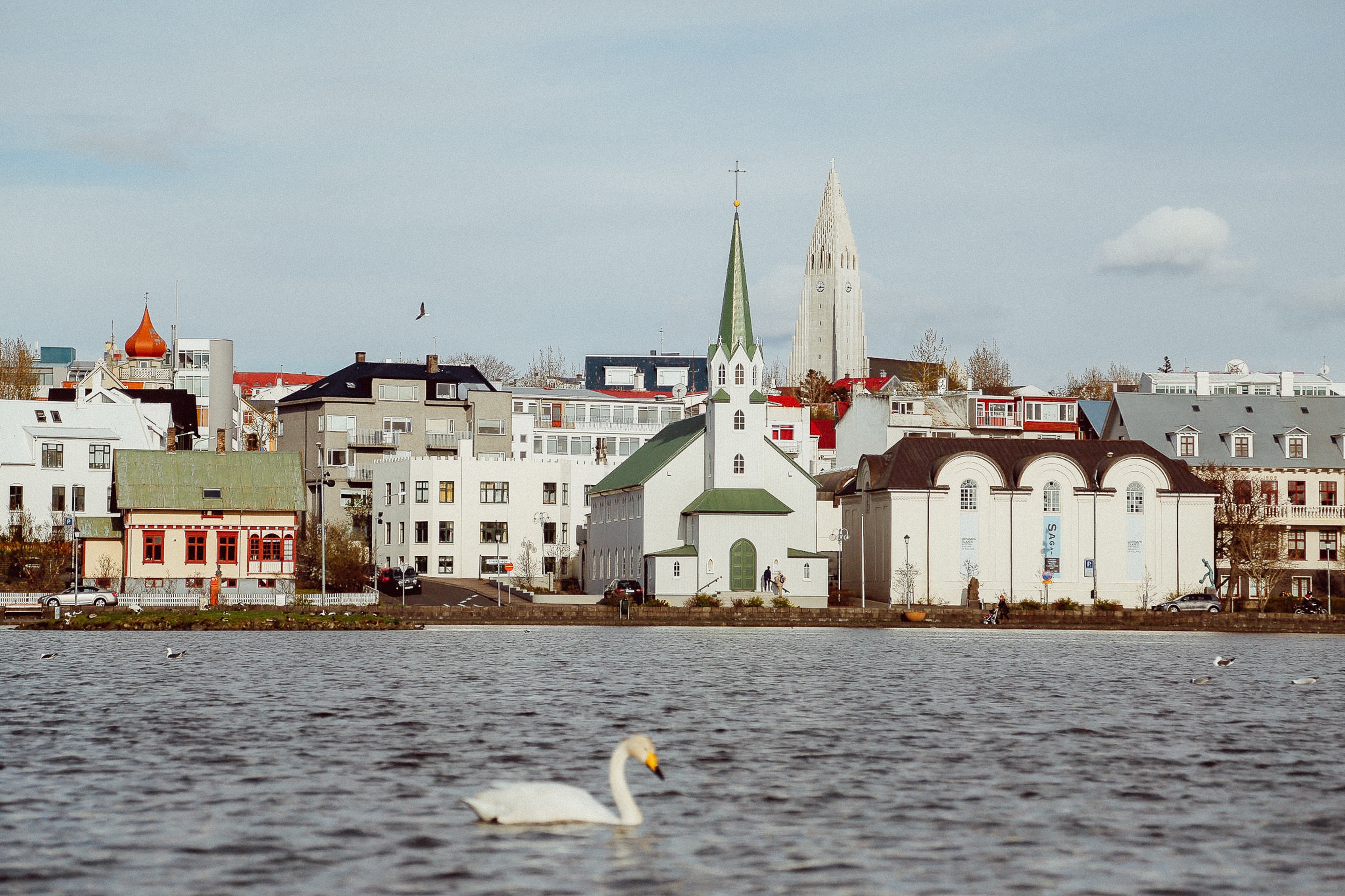
About Reykjavík
Sprawling Reykjavík, the nation's nerve center and government seat, is home to half the island's population. On a bay overlooked by proud Mt. Esja (pronounced eh-shyuh), with its ever-changing hues, Reykjavík presents a colorful sight, its concrete houses painted in light colors and topped by vibrant red, blue, and green roofs. In contrast to the almost treeless countryside, Reykjavík has many tall, native birches, rowans, and willows, as well as imported aspen, pines, and spruces.Reykjavík's name comes from the Icelandic words for smoke, reykur, and bay, vík. In AD 874, Norseman Ingólfur Arnarson saw Iceland rising out of the misty sea and came ashore at a bay eerily shrouded with plumes of steam from nearby hot springs. Today most of the houses in Reykjavík are heated by near-boiling water from the hot springs. Natural heating avoids air pollution; there's no smoke around. You may notice, however, that the hot water brings a slight sulfur smell to the bathroom.Prices are easily on a par with other major European cities. A practical option is to purchase a Reykjavík City Card at the Tourist Information Center or at the Reykjavík Youth Hostel. This card permits unlimited bus usage and admission to any of the city's seven pools, the Family Park and Zoo, and city museums. The cards are valid for one (ISK 3,300), two (ISK 4,400), or three days (ISK 4,900), and they pay for themselves after three or four uses a day. Even lacking the City Card, paying admission (ISK 500, or ISK 250 for seniors and people with disabilities) to one of the city art museums (Hafnarhús, Kjarvalsstaðir, or Ásmundarsafn) gets you free same-day admission to the other two.


Where You'll Go


