
New York, NY to Copenhagen
New York, NY to Copenhagen
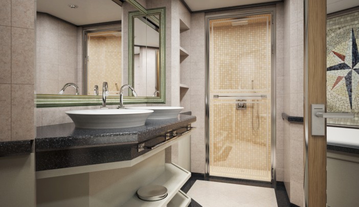
Cruise overview
WHY BOOK WITH US?
- ✔ The Deluxe Cruises’ team has extensive experience in ultra-luxury cruising.
- ✔ Call now to speak to our helpful and experienced Cruise Concierge team.
- ✔ Enjoy our Unique Deluxe Cruises Bonus for substantial savings.
- ✔ Our team will tailor your holiday to your exacting requirements.
- ✔ As agents, we work under the protection of each cruise lines ABTA / ATOL licences
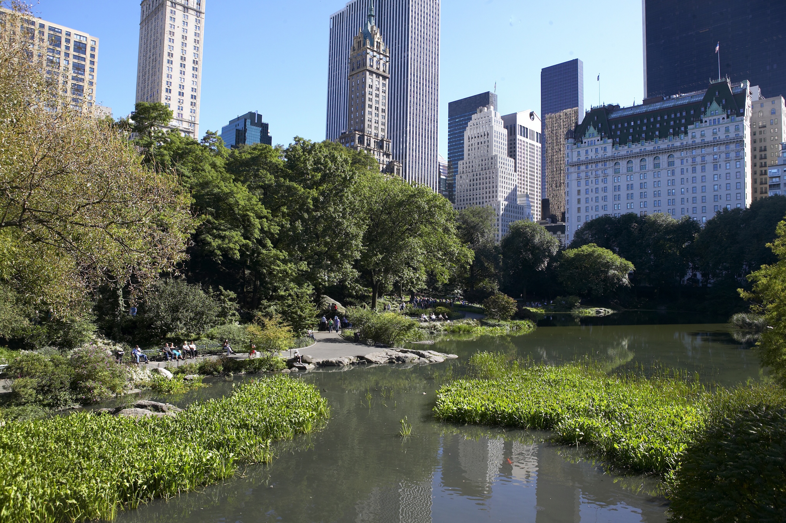
About New York, New York
From Wall Street's skyscrapers to the neon of Times Square to Central Park's leafy paths, New York City pulses with an irrepressible energy. History meets hipness in this global center of entertainment, fashion, media, and finance. World-class museums like MoMA and unforgettable icons like the Statue of Liberty beckon, but discovering the subtler strains of New York's vast ambition is equally rewarding: ethnic enclaves and shops, historic streets of dignified brownstones, and trendy bars and eateries all add to the urban buzz.


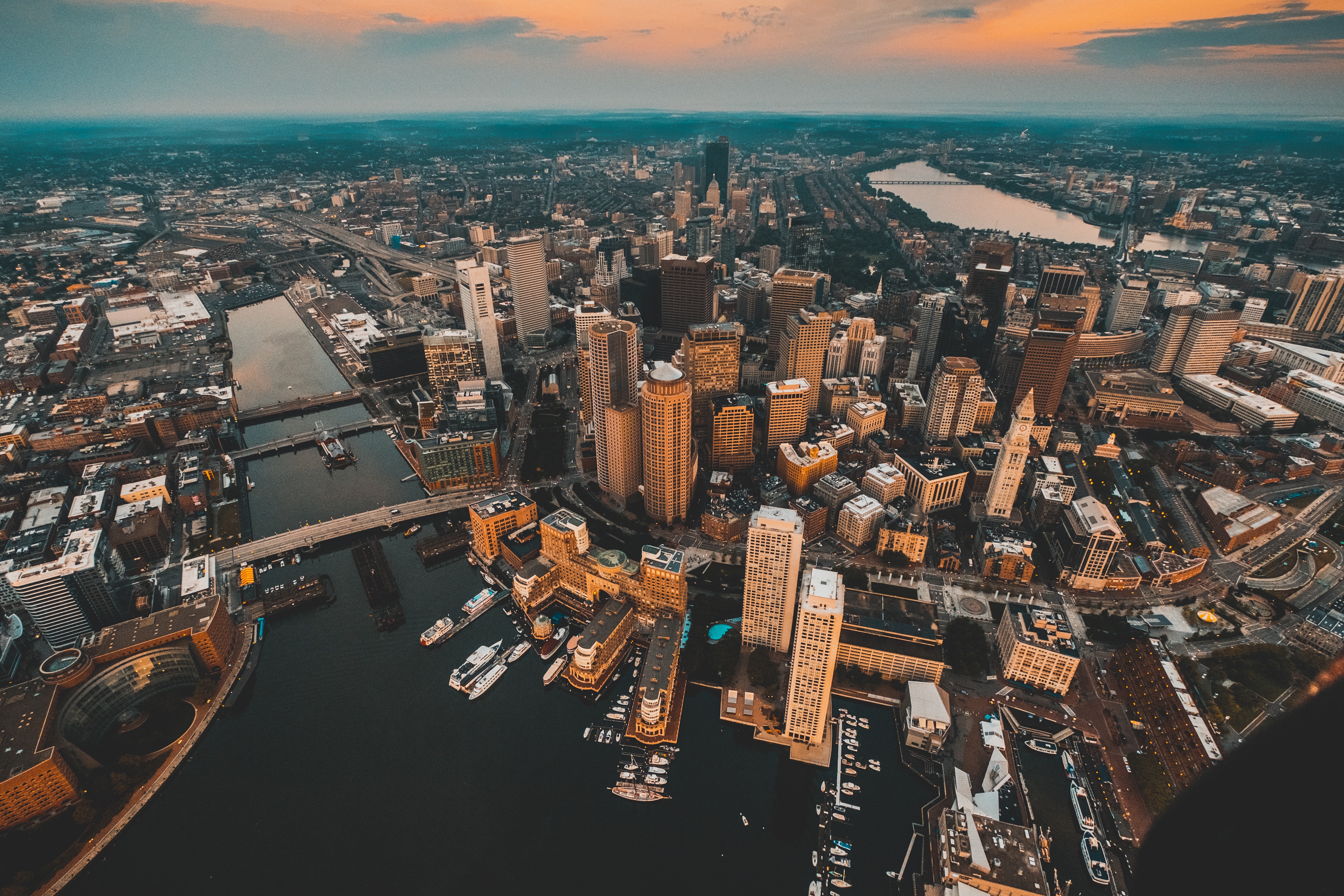
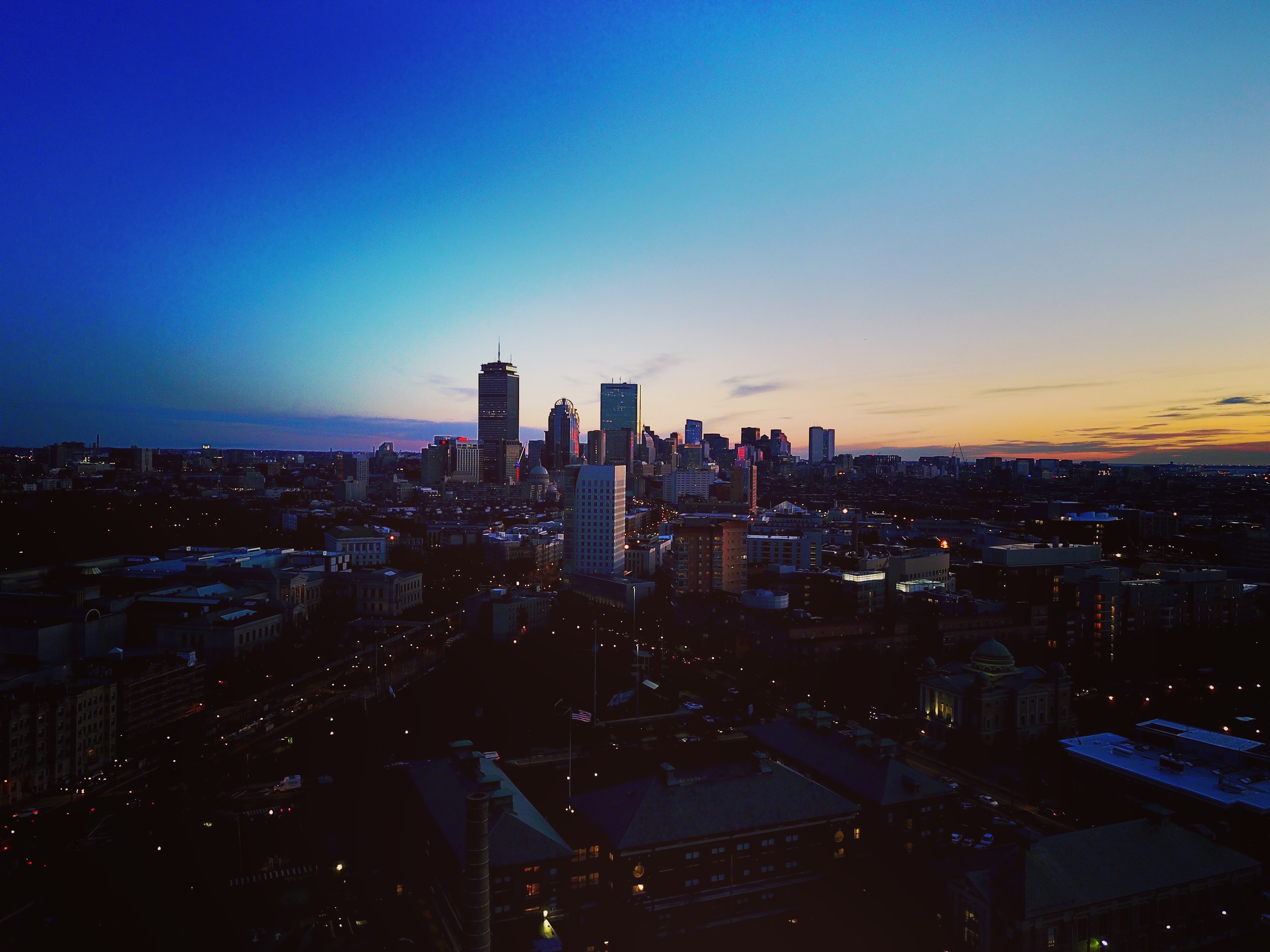
About Boston, Massachusetts
There’s history and culture around every bend in Boston—skyscrapers nestle next to historic hotels while modern marketplaces line the antique cobblestone streets. But to Bostonians, living in a city that blends yesterday and today is just another day in beloved Beantown.

About Halifax, Nova Scotia
Surrounded by natural treasures and glorious seascapes, Halifax is an attractive and vibrant hub with noteworthy historic and modern architecture, great dining and shopping, and a lively nightlife and festival scene. The old city manages to feel both hip and historic. Previous generations had the foresight to preserve the cultural and architectural integrity of the city, yet students from five local universities keep it lively and current. It's a perfect starting point to any tour of the Atlantic provinces, but even if you don't venture beyond its boundaries, you will get a real taste of the region.It was Halifax’s natural harbor—the second largest in the world after Sydney, Australia’s—that first drew the British here in 1749, and today most major sites are conveniently located either along it or on the Citadel-crowned hill overlooking it. That’s good news for visitors because this city actually covers quite a bit of ground.Since amalgamating with Dartmouth (directly across the harbor) and several suburbs in 1996, Halifax has been absorbed into the Halifax Regional Municipality, and the HRM, as it is known, has around 415,000 residents. That may not sound like a lot by U.S. standards, but it makes Nova Scotia’s capital the most significant Canadian urban center east of Montréal.There's easy access to the water, and despite being the focal point of a busy commercial port, Halifax Harbour doubles as a playground, with one of the world's longest downtown boardwalks. It's a place where container ships, commuter ferries, cruise ships, and tour boats compete for space, and where workaday tugs and fishing vessels tie up beside glitzy yachts. Like Halifax as a whole, the harbor represents a blend of the traditional and the contemporary.

About Saint-John's, Newfoundland and Labrador
Old meets new in the province's capital (metro-area population a little more than 200,000), with modern office buildings surrounded by heritage shops and colorful row houses. St. John's mixes English and Irish influences, Victorian architecture and modern convenience, and traditional music and rock and roll into a heady brew. The arts scene is lively, but overall the city moves at a relaxed pace.For centuries, Newfoundland was the largest supplier of salt cod in the world, and St. John's Harbour was the center of the trade. As early as 1627, the merchants of Water Street—then known as the Lower Path—were doing a thriving business buying fish, selling goods, and supplying alcohol to soldiers and sailors.

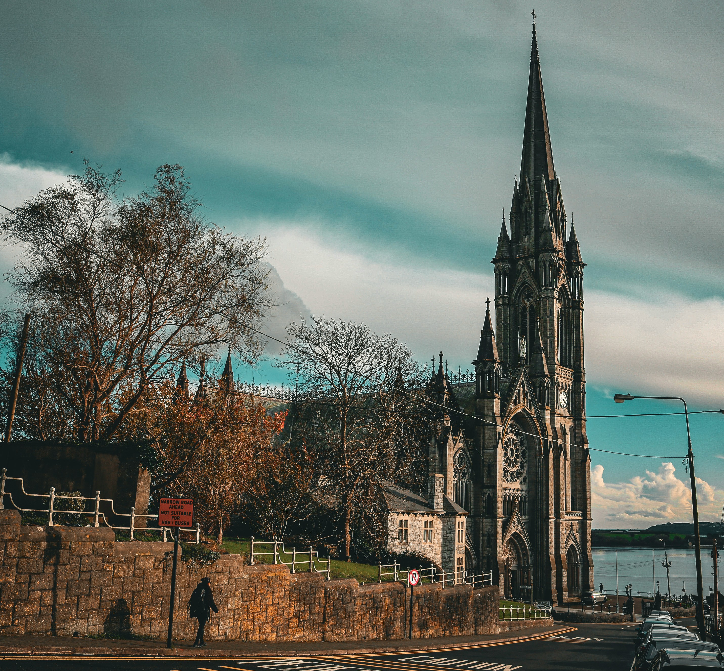
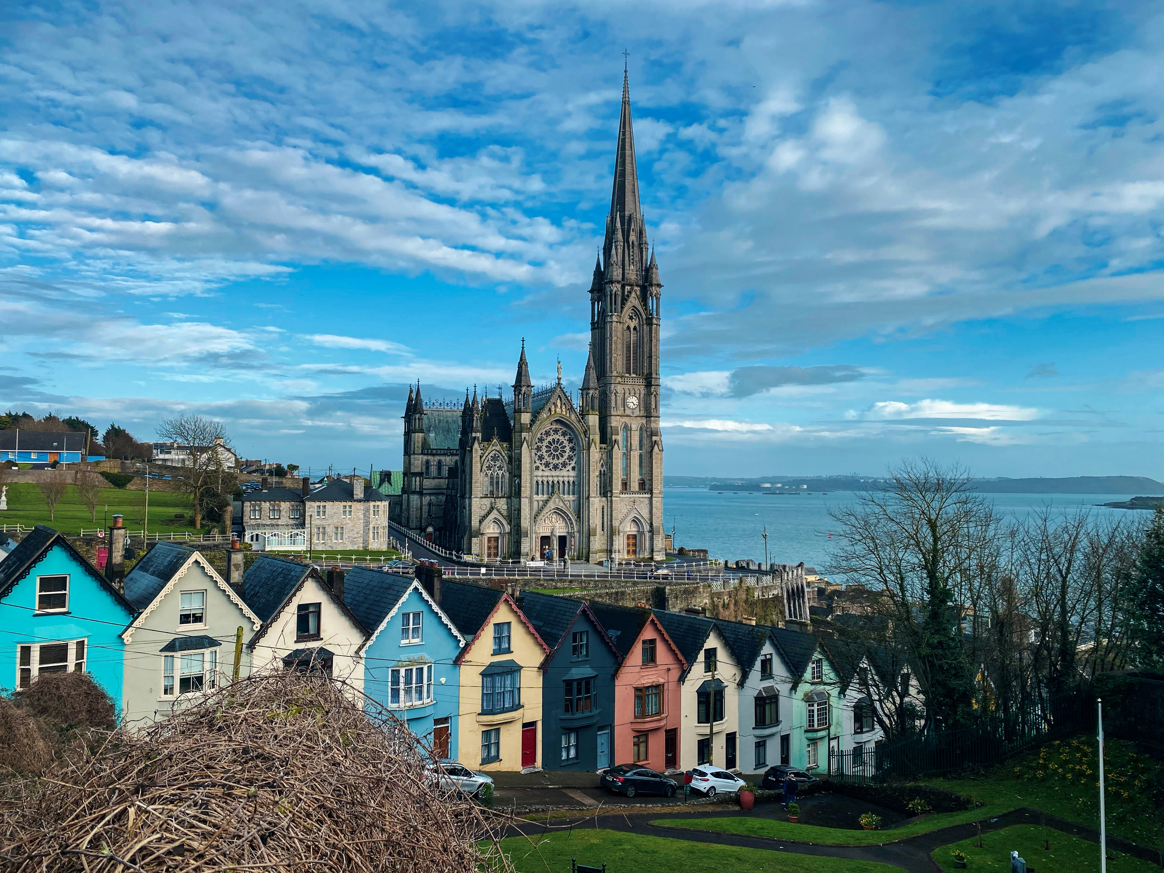
About Cobh
Cork City's nearby harbor district has seen plenty of history. Cork Harbour's draws include Fota Island—with an arboretum, a wildlife park, and the Fota House ancestral estate—and the fishing port of Cobh.
About Falmouth
The bustle of this resort town's fishing harbor, yachting center, and commercial port only adds to its charm. In the 18th century Falmouth was the main mail-boat port for North America, and in Flushing, a village across the inlet, you can see the slate-covered houses built by prosperous mail-boat captains. A ferry service now links the two towns. On Custom House Quay, off Arwenack Street, is the King's Pipe, an oven in which seized contraband was burned.

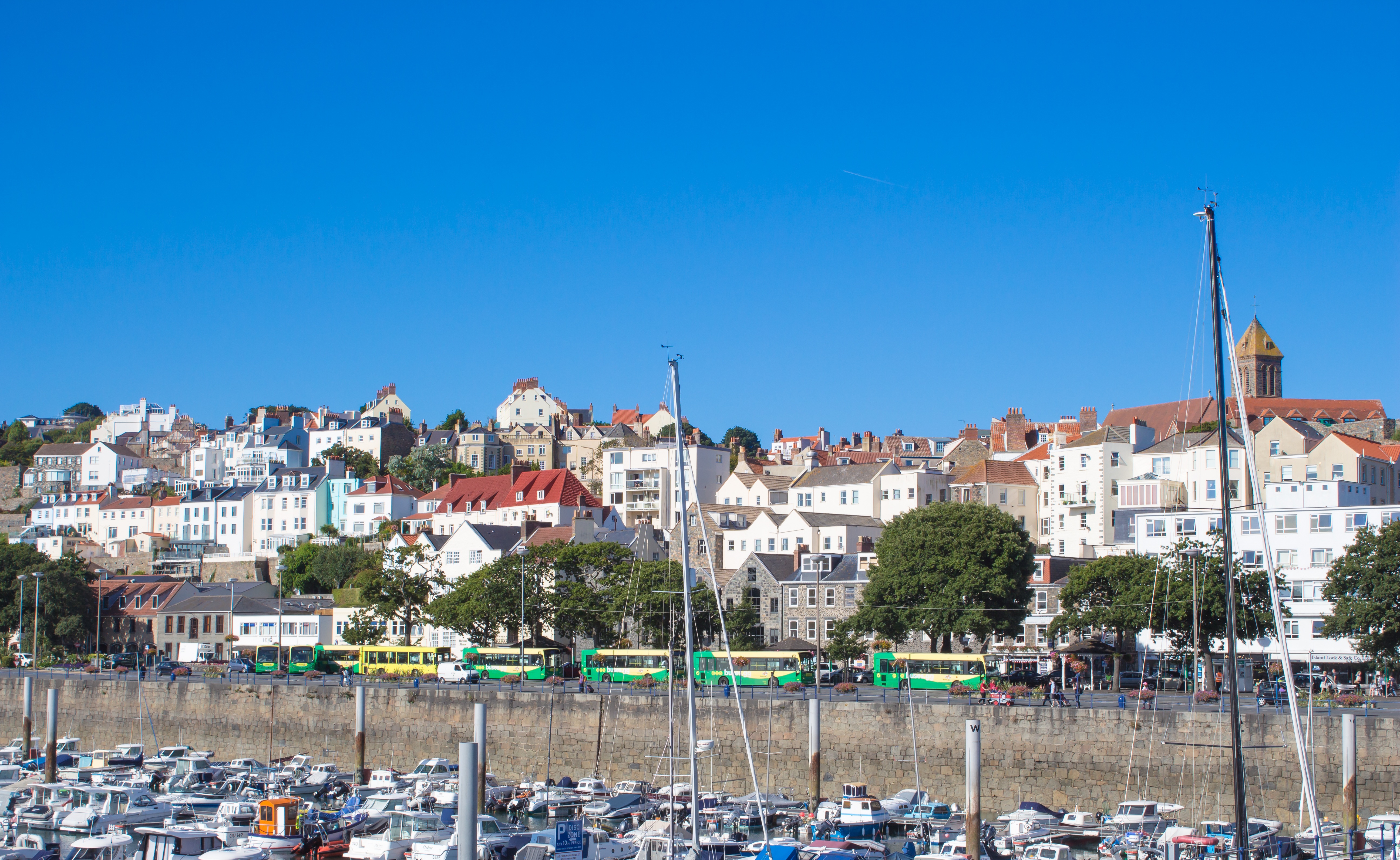
About Saint Peter Port
Cobblestone streets, blooming floral displays, and tiny churches welcome you to this wonderfully pretty harbour. The town of St Peter Port is as pretty as they come, with glowing flower displays painting practically every street corner and window-ledge with colour. As the capital, and main port of Guernsey, St Peter Port puts all of the island’s gorgeous beaches, wonderful history and inspiring stories at your fingertips. Feel the gut punch of the midday gun firing at Castle Cornet, which stands guard over one of the world's prettiest ports. This 800-year-old, Medieval castle offers staggering views of the harbour from its imposing, craggy island location, and you can look out across to the looming shorelines of the other Channel Islands from its weathered battlements. With four well-tended gardens, and five museums offering a rich overview of Guernsey's history, you’ll want to leave a few hours aside to explore the many treasures that lie within the castle’s walls.
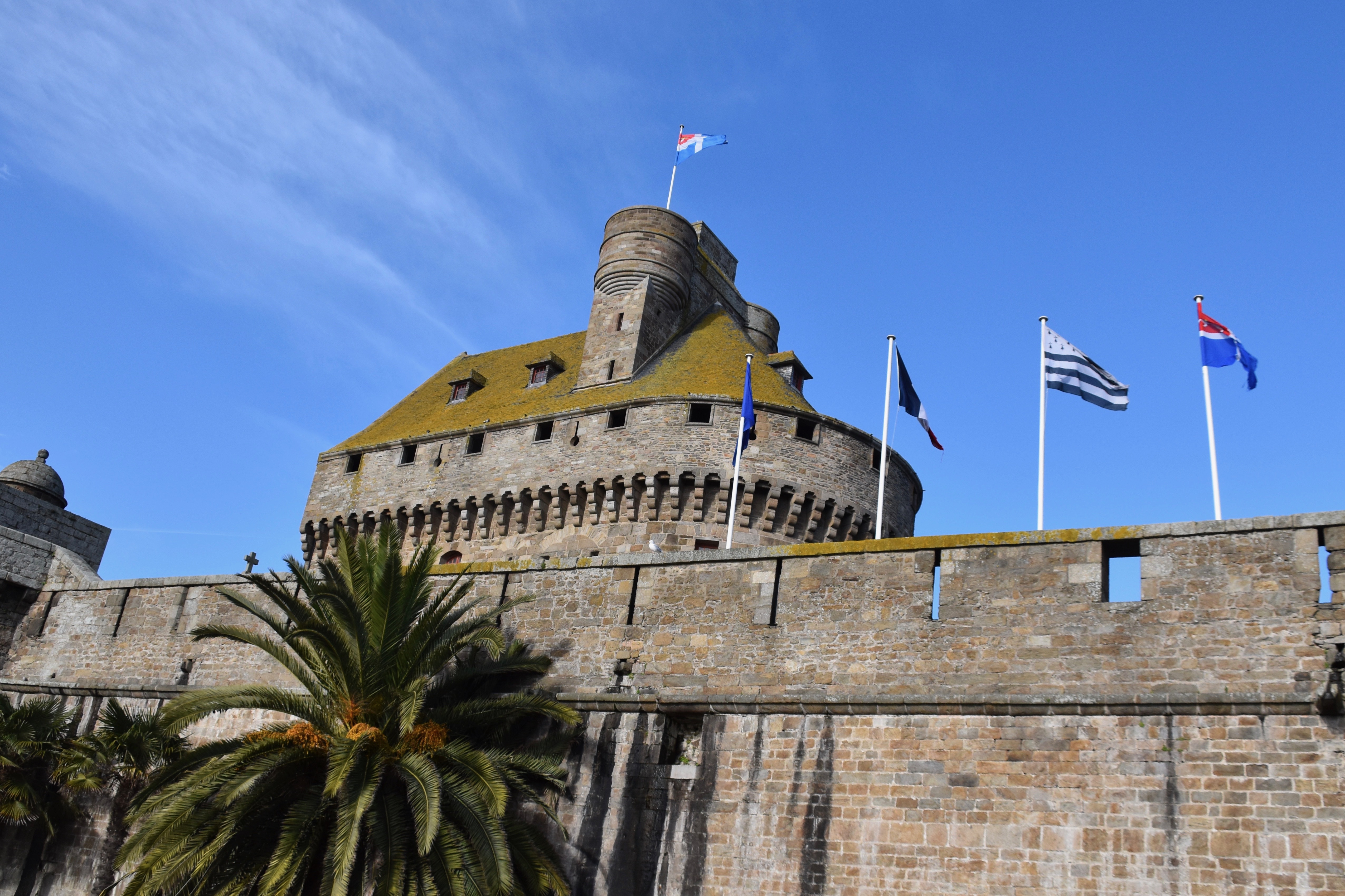
About Saint-Malo
Thrust out into the sea and bound to the mainland only by tenuous man-made causeways, romantic St-Malo has built a reputation as a breeding ground for phenomenal sailors. Many were fishermen, but others—most notably Jacques Cartier, who claimed Canada for Francis I in 1534—were New World explorers. Still others were corsairs, "sea dogs" paid by the French crown to harass the Limeys across the Channel: legendary ones like Robert Surcouf and Duguay-Trouin helped make St-Malo rich through their pillaging, in the process earning it the nickname "the pirates' city." The St-Malo you see today isn’t quite the one they called home because a weeklong fire in 1944, kindled by retreating Nazis, wiped out nearly all of the old buildings. Restoration work was more painstaking than brilliant, but the narrow streets and granite houses of the Vieille Ville were satisfactorily recreated, enabling St-Malo to regain its role as a busy fishing port, seaside resort, and tourist destination. The ramparts that help define this city figuratively and literally are authentic, and the flames also spared houses along Rue de Pelicot in the Vieille Ville. Battalions of tourists invade this quaint part of town in summer, so arrive off-season if you want to avoid crowds.
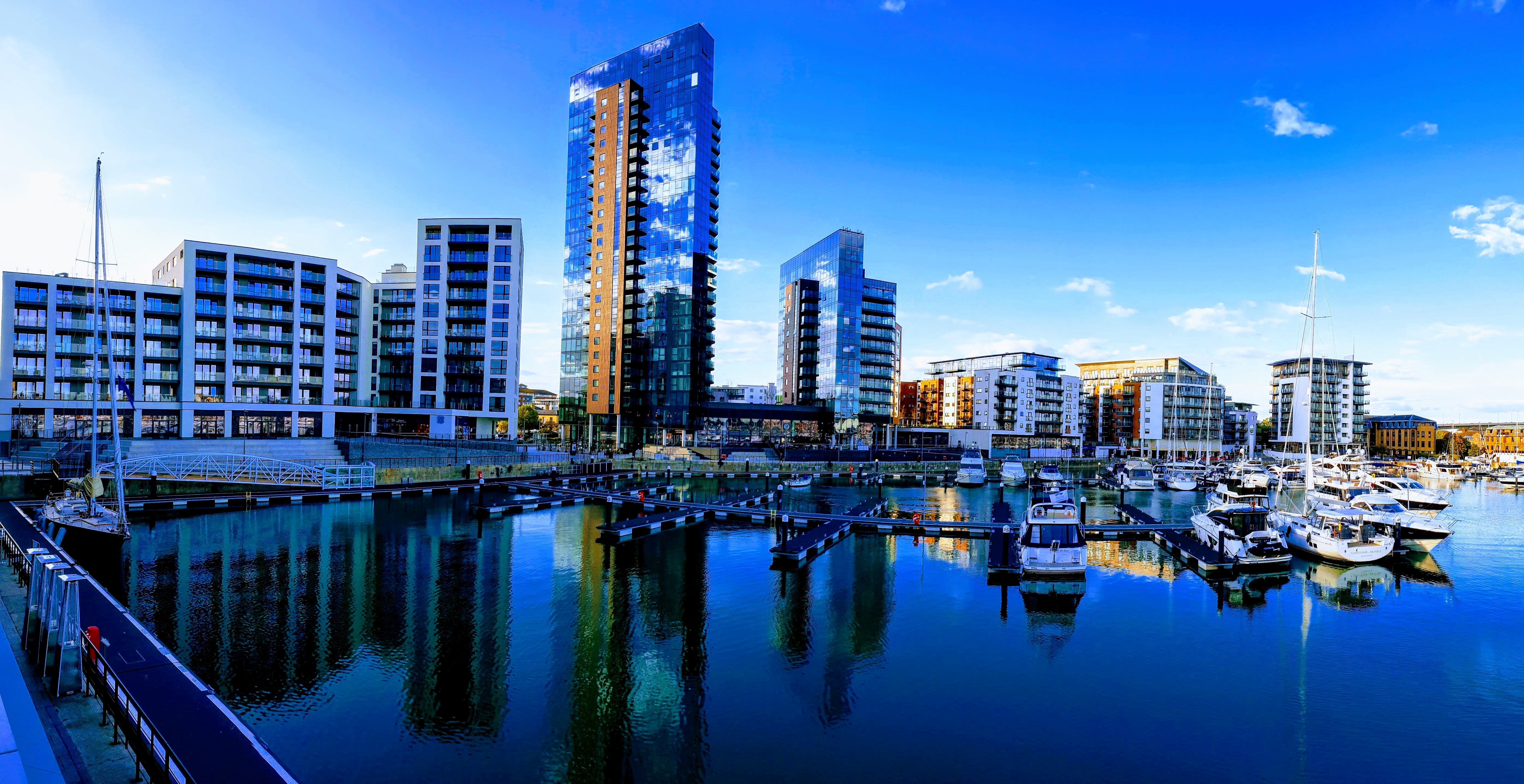
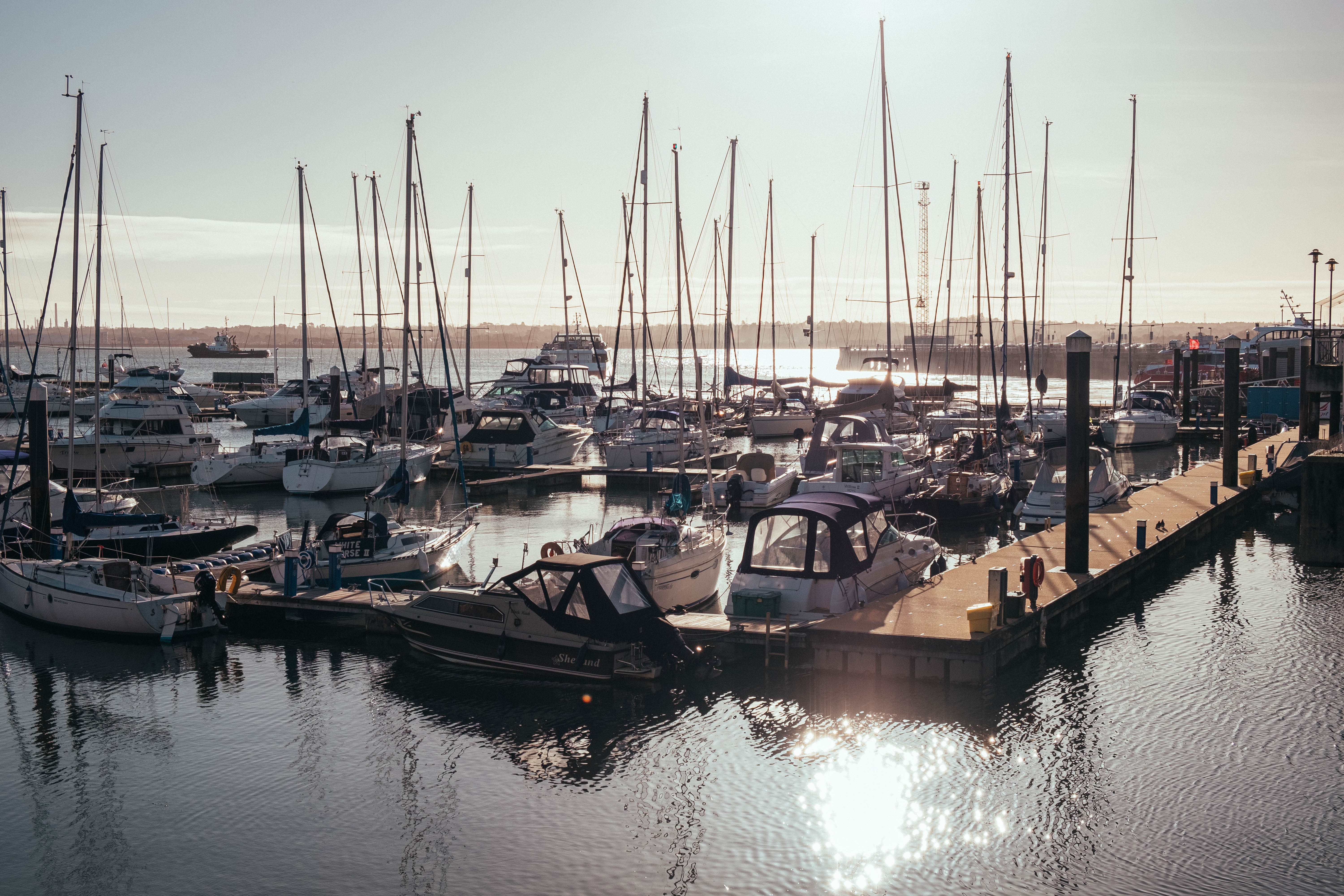
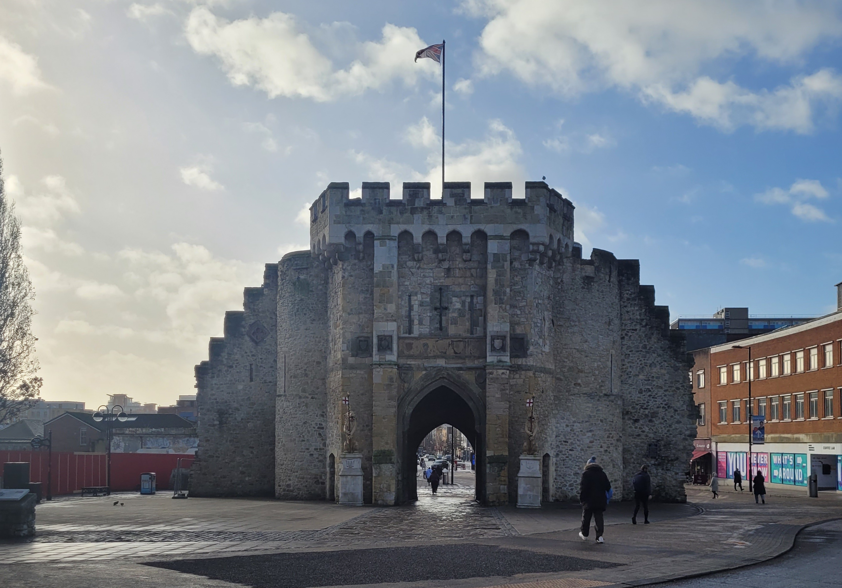
About Southampton
Lying near the head of Southampton Water, a peninsula between the estuaries of the Rivers Test and Itchen, Southampton is Britain’s largest cruise port. It has been one of England’s major ports since the Middle Ages, when it exported wool and hides from the hinterland and imported wine from Bordeaux. The city suffered heavy damage during World War Two and as a result the centre has been extensively rebuilt, but there are still some interesting medieval buildings including the Bargate, one of the finest city gatehouses in England.
About Ålesund
The coastal town of Ålesund is the commercial capital of the Møre og Romsdal district. But more important, it is noted for its characteristic Jugendstil (Art Nouveau) buildings, which some claim make Ålesund one of the most beautiful towns in Norway. This Art Nouveau style emerged when the town was completely rebuilt after a devastating fire in 1904 destroyed nearly 800 buildings and left 10,000 residents homeless. It is said that the fire started by a tipped oil lamp. Rebuilding was carried out with the help of many young, foreign architects who added their own flourishes to the architectural blend of German Jugendstil and Viking roots. Today, narrow streets are crammed with buildings topped with turrets, spires and gables that bear decorations of dragonheads and curlicues. As one of the few remaining Art Nouveau towns in the world, in 1998 Ålesund was awarded the coveted Houens National Memorial Prize for the preservation of its unique architecture.


About Leknes
Blessed with some of the most spectacular scenery in Norway (and goodness only know that this is land blessed with rolling hills, soaring peaks, valleys, tranquil fjords and white sandy beaches, so the competition is high!), Leknes is what Norway is meant to be. Pretty red houses lay dotted on the green covered hills, and the midnight sun is rises above the horizon from 26th May to 17th July, (while in winter the sun does not rise from 9th December to 4th January). Part of the stunning Lofoten islands, this pretty port offers much in the way of recreation, although understandably most of this is outdoor based. Take a boat ride around the archipelago, try your hand at some deep sea fishing, or simply stroll thought the city centre, perhaps rent a bicycle and discover the hinterland at your own pace. Bikes can be easily rented and note that hybrid and electric bikes are a great option for those who might be a bit out of practice with their pedal power. Gastronomes with a sweet tooth will be rewarded with one simple pleasure: a fresh-from-the-oven skillingsbolle – or big, fluffy cinnamon rolls, fit for indulging in if all the fresh air has made you hungry! Look out for the quirky coffee shops, settle down for some Norwegian kos, say takk for maten and enjoy!

About Tromsø
With its centre located on the island of Tromsø, the municipality of Tromsø is more than five times the size of Norway’s capital, Oslo, and is the world’s northernmost university city. Lying 200 miles inside the Arctic Circle, it is known as the 'Gateway to the Arctic' because it was used as a starting point for hunters looking for Arctic foxes, polar bears and seals. In the 19th century it was a base for explorers on Arctic expeditions – a history that is remembered in the city’s Polar Museum, which you can visit on an excursion. Also commemorated in the area is the history of Norway’s indigenous people, the Sami. Visitors can learn about the traditions, heritage and modern preservation of the Sami culture at the Tromsø Museum. Nowadays, Tromsø is a charming mix of old and new, with wooden buildings sitting alongside contemporary architecture such as the impressive glacier-like Arctic Cathedral, which features one of the largest stained glass windows in Europe. Looking down on the city is Mount Storsteinen, and a cable car runs to the top, giving wonderful views over the surrounding countryside of forested peaks and reindeer pastures.


About Honningsvåg
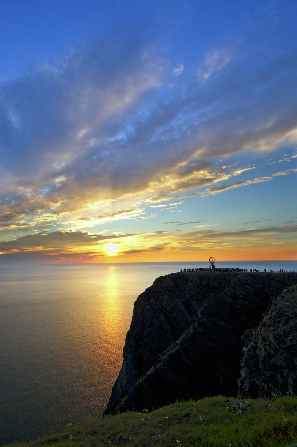
Searching in 1553 for a northeast passage to India, British navigator Richard Chancellor came upon a crag 307 yards above the Barents Sea. He named the jut of rock North Cape, or Nordkapp. Today Europe's northernmost point is a rite-of-passage journey for nearly all Scandinavians and many others. Most cruise passengers visit Nordkapp from Honningsvåg, a fishing village on Magerøya Island. The journey from Honningsvåg to Nordkapp covers about 35 km (22 miles) across a landscape characterized by rocky tundra and grazing reindeer, which are rounded up each spring by Sami herdsmen in boats. The herdsmen herd the reindeer across a mile-wide channel from their winter home on the mainland. Honningvåg's northerly location makes for long, dark winter nights and perpetually sun-filled summer days. The village serves as the gateway to Arctic exploration and the beautiful Nordkapp Plateau, a destination that calls to all visitors of this region. Most of those who journey to Nordkapp (North Cape), the northernmost tip of Europe, are in it for a taste of this unique, otherworldly, rugged yet delicate landscape. You'll see an incredible treeless tundra, with crumbling mountains and sparse dwarf plants. The subarctic environment is very vulnerable, so don't disturb the plants. Walk only on marked trails and don't remove stones, leave car marks, or make campfires. Because the roads are closed in winter, the only access is from the tiny fishing village of Skarsvåg via Sno-Cat, a thump-and-bump ride that's as unforgettable as the desolate view.


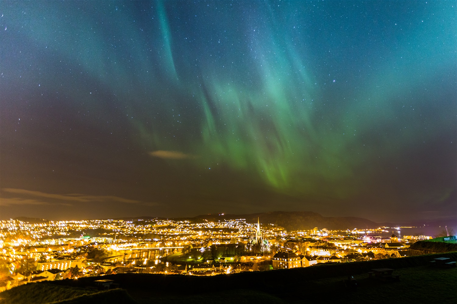
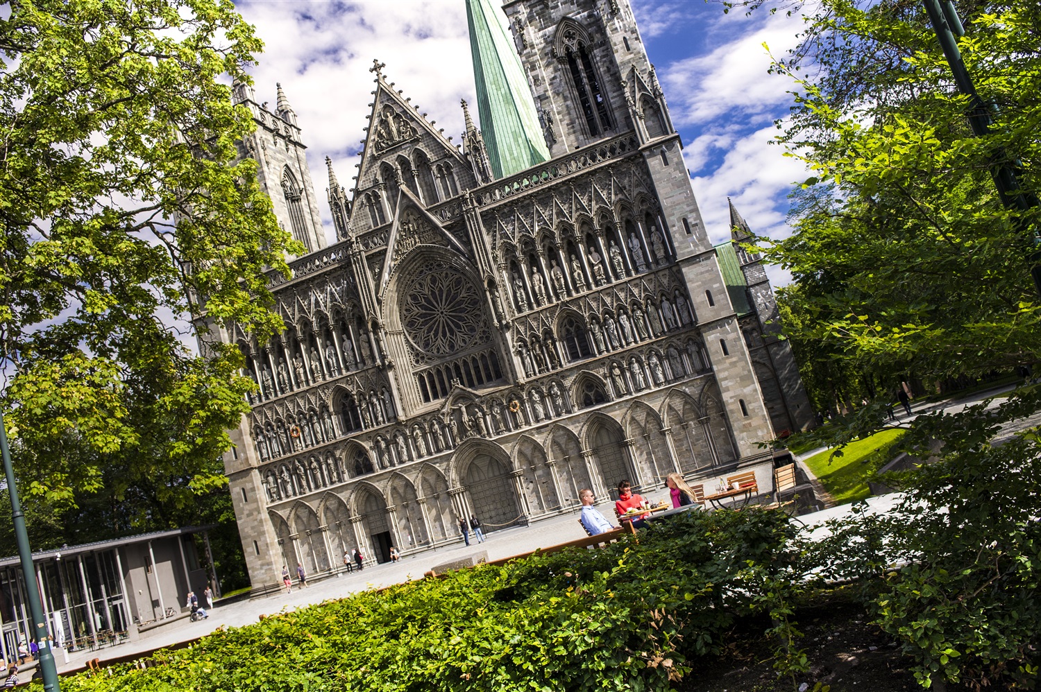
About Trondheim
One of Scandinavia's oldest cities, Trondheim was the first capital of Norway, from AD 997 to 1380. Founded in 997 by Viking king Olav Tryggvason, it was first named Nidaros (still the name of the cathedral), a composite word referring to the city's location at the mouth of the Nidelva River. Today, it's Central Norway's largest (and Norway's third largest) city, with a population of 150,000. The wide streets of the historic city center remain lined with brightly painted wood houses and striking warehouses. But it's no historic relic: it's also the home to NTNU (Norwegian University of Science and Technology) and is Norway's technological capital.


About Åndalsnes
A small town in Norway’s fjord country, Åndalsnes is a gateway to the rugged wilderness of the Romsdalfjord. Known as the 'village between the mountains and the fjords', it typifies Norway's striking natural beauty with its setting on a promontory lined by alps and set at the mouth of the Rauma River. The town itself is tucked under the lofty mountain peaks, backed by lush, green scenery. Nearby is the impressive Trollveggen, or 'Troll Wall', which at 6,000 feet is Europe's highest vertical cliff face and is often topped by cloud. The precipice is said to be the ultimate trial for rock climbers, who regularly flock here to accept the challenge. Åndalsnes is also the terminus of the famous Rauma Railway which runs 70 miles alongside the emerald-green Rauma river and through some of Norway’s most spectacular scenery to Dombås (2160 feet above sea level) where it then connects to the main Oslo to Trondheim line.

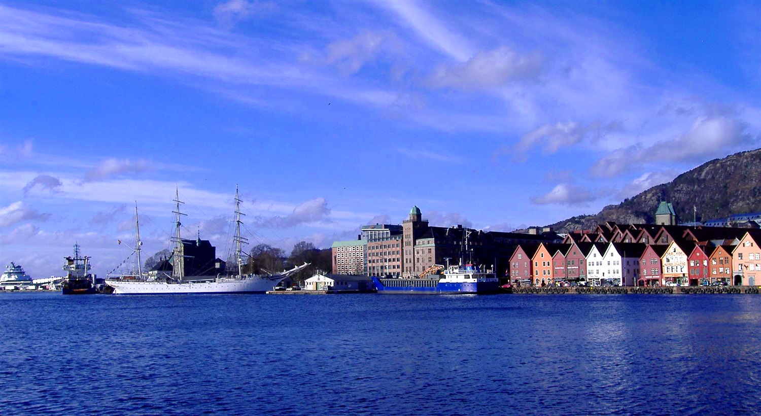
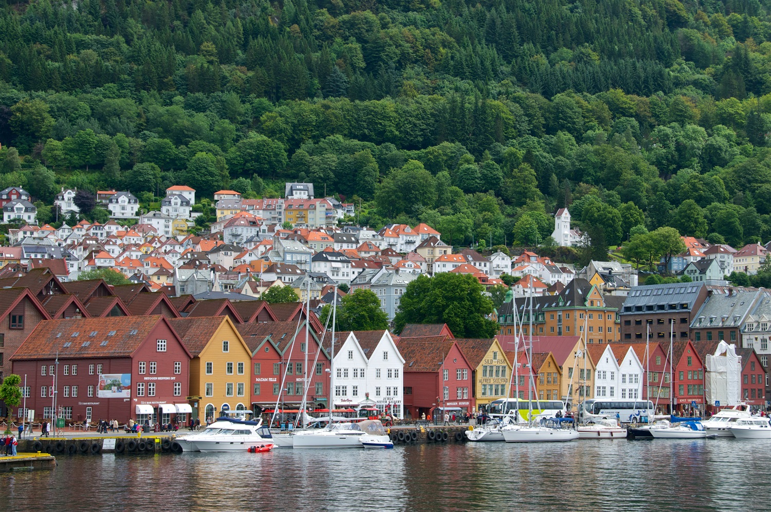
About Bergen
Surrounded by mountains and sparkling fjords, the waterside city of Bergen has a spectacular setting. There has been a settlement here since medieval times and the colourful waterfront buildings of the Hanseatic wharf, known as Bryggen, are testament to its fascinating history of trade. As Norway’s best known medieval settlement, the Bryggen is listed by UNESCO as a World Heritage Site. Our comprehensive selection of excursions allows you to discover the many sides of Bergen, such as the fish market and narrow cobbled streets, as well as stunning views of the city from the summit of Mt Fløyen. Alternatively, those who have visited the city previously may like to experience one of the tours that travel further afield. Just 300 yards from the main piers, you will find the Fortress Museum (Fesningsmuseum), which has an interesting collection of objects related to World War II.


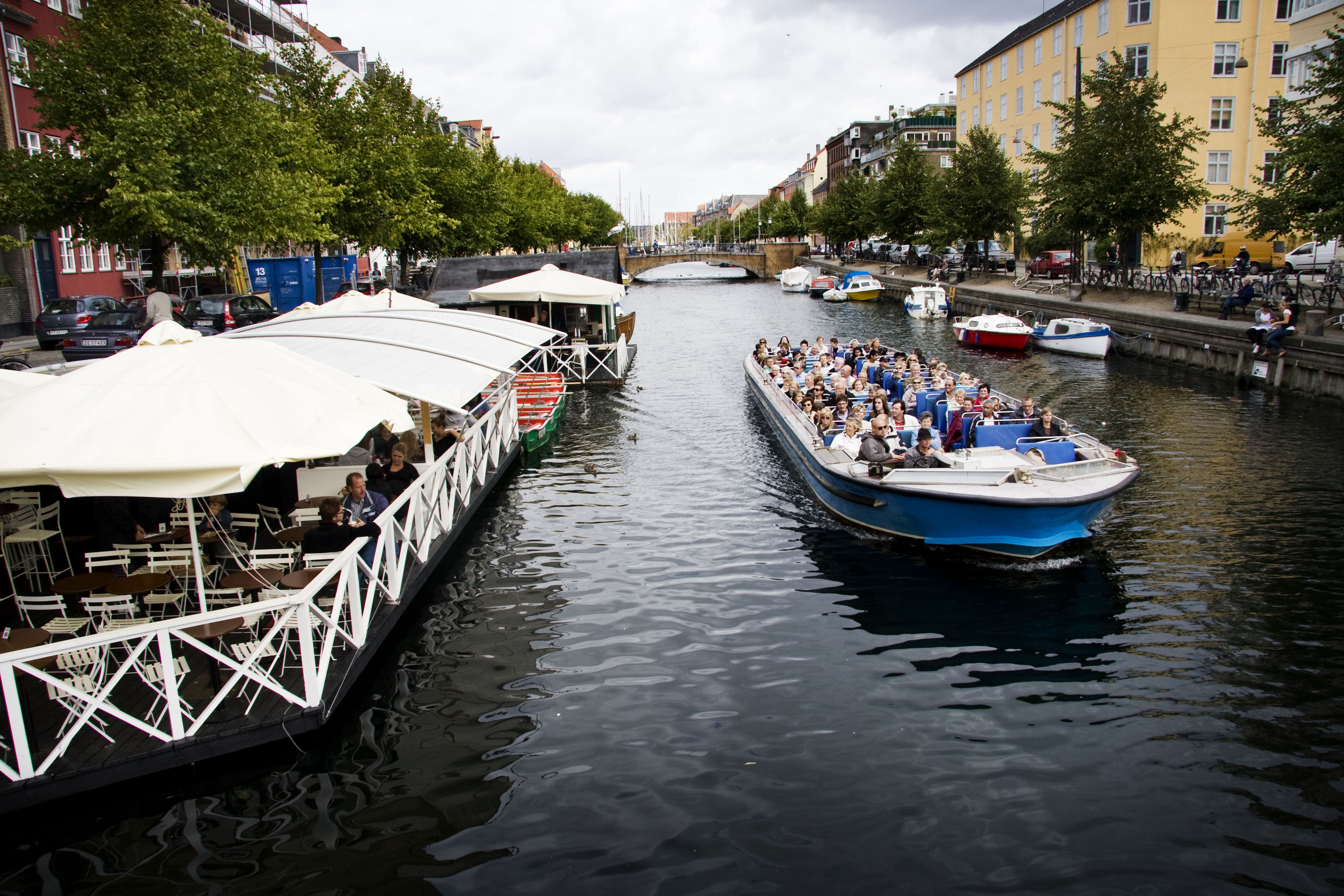
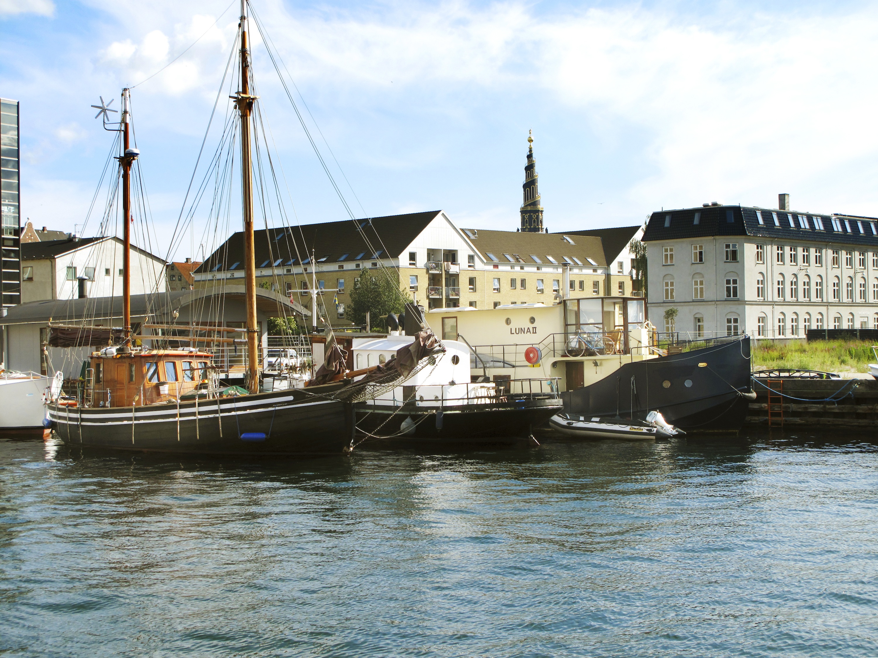
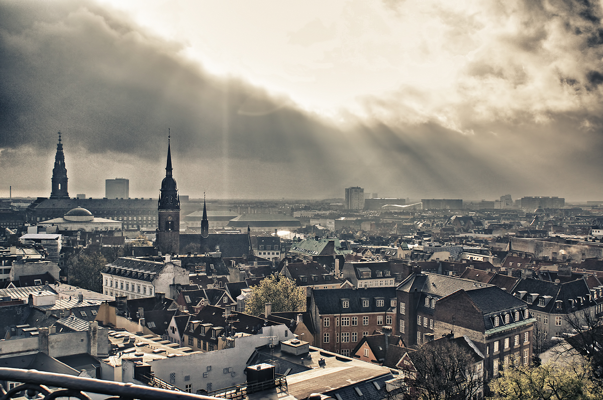
About Copenhagen
By the 11th century, Copenhagen was already an important trading and fishing centre and today you will find an attractive city which, although the largest in Scandinavia, has managed to retain its low-level skyline. Discover some of the famous attractions including Gefion Fountain and Amalienborg Palace, perhaps cruise the city’s waterways, visit Rosenborg Castle or explore the medieval fishing village of Dragoer. Once the home of Hans Christian Andersen, Copenhagen features many reminders of its fairytale heritage and lives up to the reputation immortalised in the famous song ‘Wonderful Copenhagen’.


Where You'll Go


