
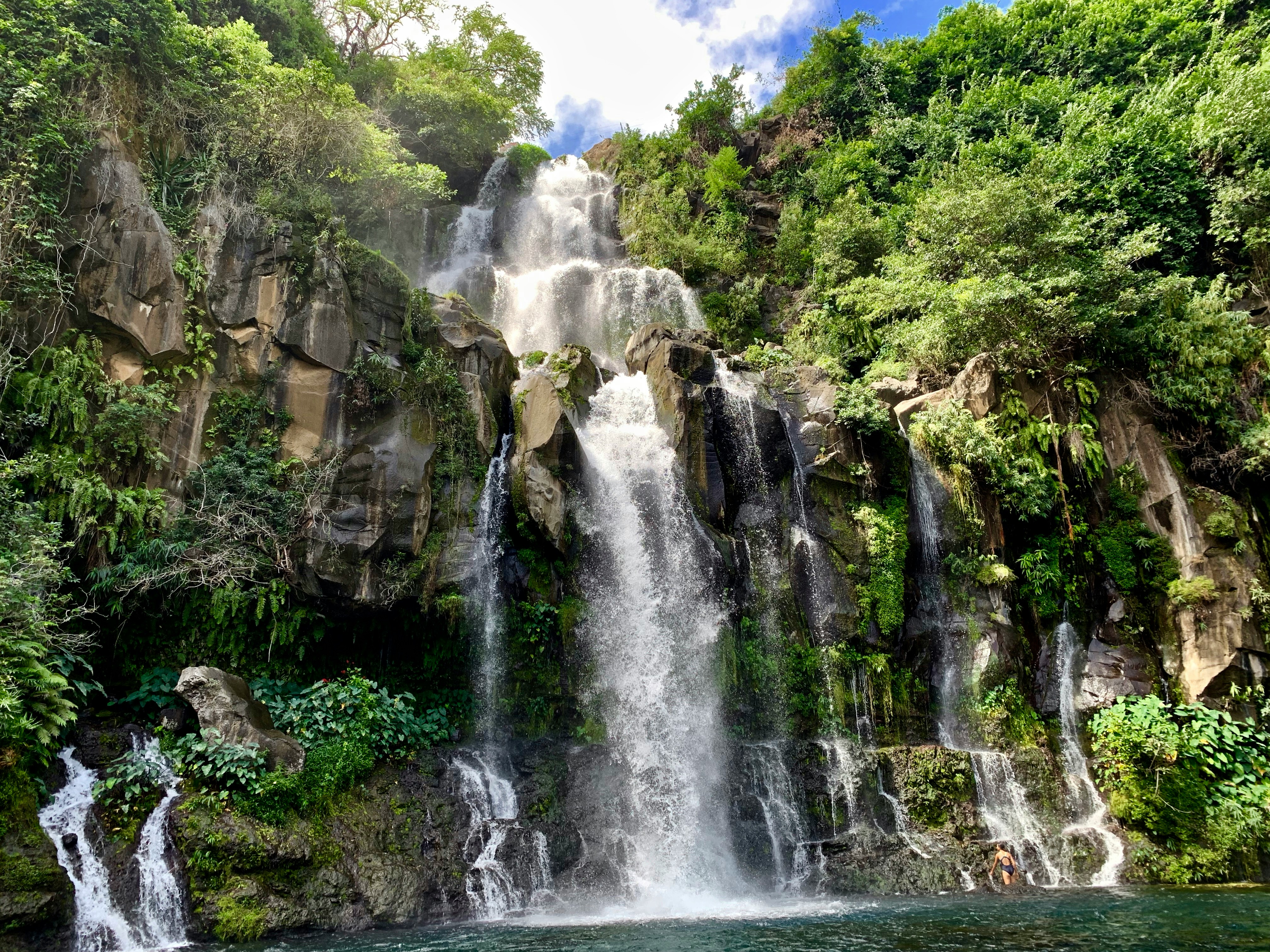
Mahe to Cape Town
Mahe to Cape Town
Cruise overview
WHY BOOK WITH US?
- ✔ The Deluxe Cruises’ team has extensive experience in ultra-luxury cruising.
- ✔ Call now to speak to our helpful and experienced Cruise Concierge team.
- ✔ Enjoy our Unique Deluxe Cruises Bonus for substantial savings.
- ✔ Our team will tailor your holiday to your exacting requirements.
- ✔ As agents, we work under the protection of each cruise lines ABTA / ATOL licences
About Mahé
Like jade-coloured jewels in the Indian Ocean, the more than 100 Seychelles Islands are often regarded as the Garden of Eden. Lying just four degrees south of the equator, the Seychelles are some 1,000 miles (1,610 km) from the nearest mainland Africa. Little more than 200 years ago, all 115 islands were uninhabited. Then in 1742 a French ship dispatched from Mauritius sailed into one of the small bays. Captain Lazare Picault was the first to explore these unnamed islands. He encountered breathtaking vistas of rugged mountains, lagoons, coral atolls, splendid beaches and secluded coves. After Picault sailed away, the islands remained untouched for the next 14 years. Then France took possession of the seven islands in the Mahé group. During an expedition Captain Morphey named them the Sechelles, in honour of Vicomte Moreau de Sechelles. This name was later anglicised to Seychelles. The first settlers arrived at St. Anne’s Island in 1770; 15 years later the population of Mahé consisted of seven Europeans and 123 slaves. Today there are about 80,000 Seychellois, the majority of whom live on Mahé; the rest are scattered in small communities throughout the archipelago. The people are a fusion of three continents - Africa, Asia and Europe. This has created a unique culture and the use of three languages - Creole, French and English. Mahé is the largest island in the archipelago and the location of the capital, Victoria. Ringed by steep, magnificent mountains, few capitals can claim a more beautiful backdrop. The town features a mixture of modern and indigenous architecture; it is the centre of business and commerce thanks to the extensive port facilities. Noteworthy sites in Victoria are the museum, cathedral, government house, clock tower, botanical gardens and an open-air market. The major attractions are found outside of town where the island’s quiet, lazy atmosphere delights visitors. With 68 pristine, white sand beaches, Mahé boasts more beaches and tourist facilities than any of the other Seychelles Islands. Beautiful and remote Mahé with its green-clad mountains and palm-fringed beaches is indeed an island of abundance; pleasant surprises are around every bend in the trail. Come ashore and discover for yourself this marvellous island paradise.


About Port Louis
Mauritius’ largest city, Port Louis is a vibrant and exciting place whose culture is a mix of African, Chinese and Indian influences. There are activities and sights to keep you busy and explore the different aspects of the city.
About Pointe des Galets
About Richards Bay
South Africa’s largest harbour is located on a lagoon on the Mhlatuze River on the northern coast of KwaZulu-Natal and takes its name from Admiral Sir F W Richards who sailed into the bay to deliver supplies to the troops during the Anglo/Zulu War of 1879. The Richards Bay lagoon was declared a game reserve in 1935, when conservationists objected to the growing industrialisation here. This however did nothing to halt development. Instead a compromise was agreed and a wall was built across the length of the bay to divide the lagoon. The north side became the seaport and the south remained a sanctuary for waterfowl and wildlife. The lagoon is famous for being the site where the longest crocodile ever recorded was shot by hunter John Dunn - it measured over 20 feet. The town was built on the shores of the lagoon in 1954 and although it was only a small fishing community in the 1960s, the development of the deep water harbour and railway in 1976 prompted the growth of the much larger township you see today. The bustling town is now a popular holiday destination with its unspoilt beaches at the edge of the Indian Ocean, year-round sunshine and excellent recreational facilities including surfing and fishing. It is also an excellent gateway to Zululand and the KwaZulu wildlife reserves. Richards Bay has recently undergone a major renovation that has given the town a Caribbean feel.
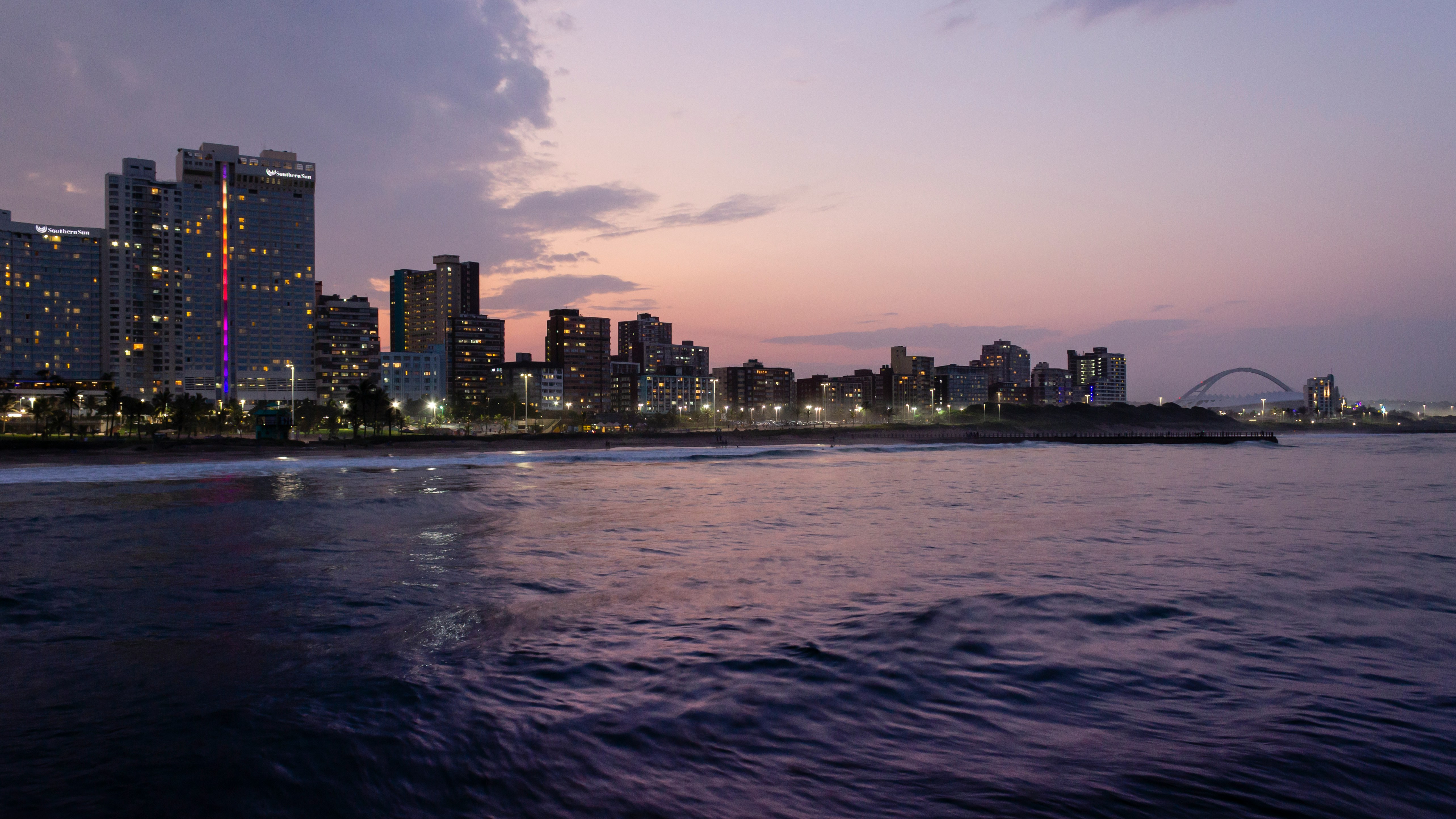
About Durban
Durban, a glistening jewel on the south-east coast of Africa, is the third largest city in South Africa and the major city of KwaZulu-Natal. It has been a centre of sea trade since before colonisation and now has a flourishing artistic centre, which perfectly complements the vibrant markets and rich cultures of the city. Durban’s port is a natural half-moon harbour lined with white sand and azure water, punctuated by the port’s many piers which reach into the water like the leaves of a fan. The beaches of Durban’s famous Golden Mile stretch along the harbour and are popular all year round, as travellers and locals alike enjoy Durban’s warm, humid summers and mild, dry winters.
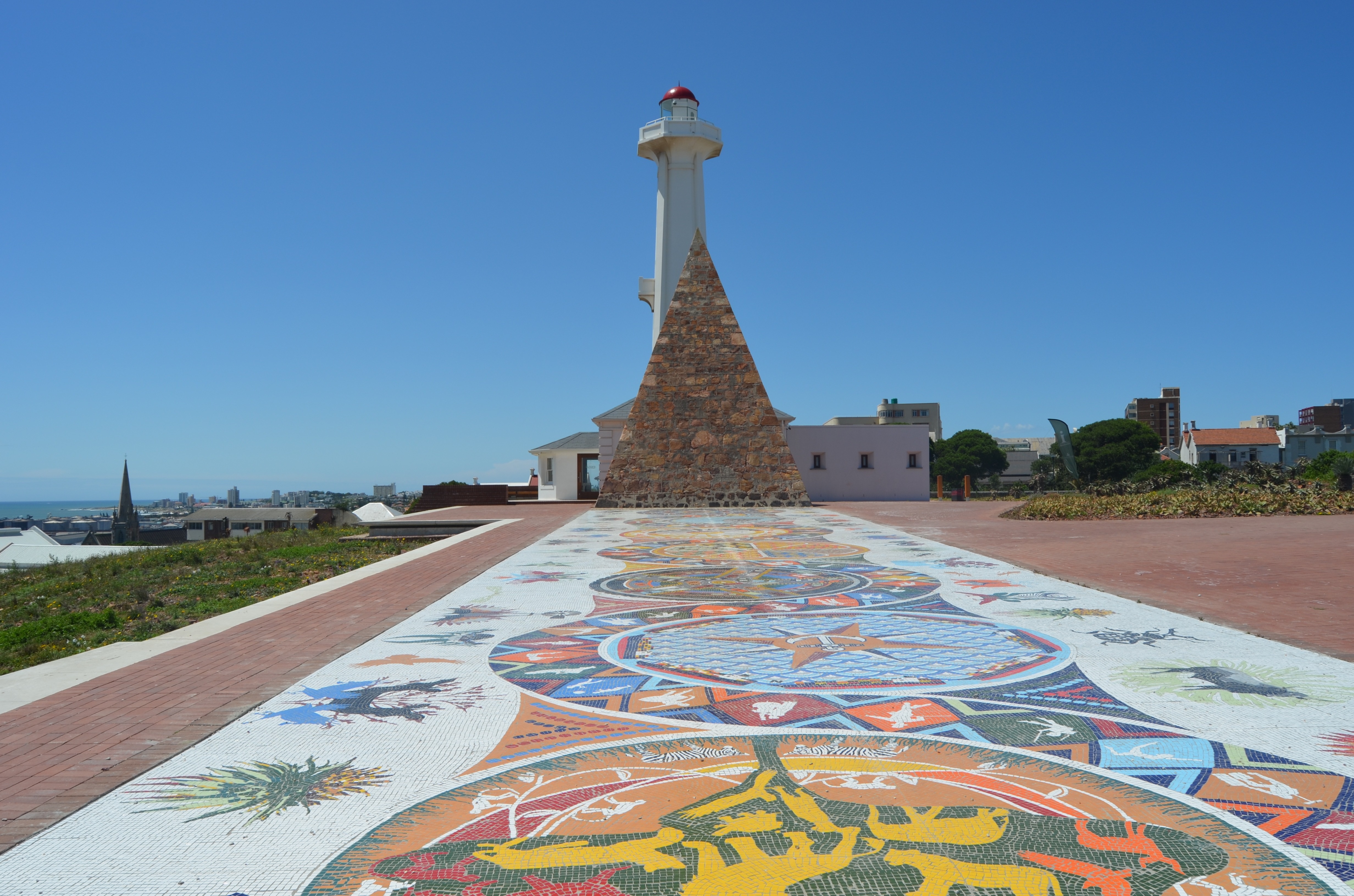
About Gqeberha (ex Port Elizabeth)
Originally the home of the San and Khoisan people and later the Xhosa tribe, the area now known as Gqeberha (previously Port Elizabeth) became a landing place for passing European ships after Portuguese navigator Bartolomew Diaz arrived in Algoa Bay in 1488. As part of the Cape Colony, the British occupied the area during the Napoleonic Wars and it was they who built Fort Frederick here in 1799. Twenty-one years later 4,000 settlers arrived, becoming the first permanent British residents of South Africa and Gqeberha. Sir Rufane Donkin, Acting Governor of the Cape Colony, founded Port Elizabeth, naming the settlement after his late wife. The town underwent rapid growth after 1873 following the construction of the railway to Kimberley, and is now one of the country’s major seaports. Like most South African cities, miles of beautiful coastline surround Gqeberha. Algoa Bay combines warm water and fair breezes, making it a mecca for swimmers and water sports enthusiasts. Those interested in history can follow the Donkin Heritage Trail, past a succession of Victorian and Edwardian town houses, trim gardens and neo-Gothic churches. Just outside the town are a number of game reserves, including the famous Addo Elephant National Park.
About Langebaan
About Cape Town
Sometimes referred to as the Mother City, Cape Town is the most famous port in South Africa and is influenced by many different cultures, including Dutch, British and Malay. The port was founded in 1652 by Dutch explorer Jan Van Riebeeck, and evidence of Dutch colonial rule remains throughout the region. The port is located on one of the world's most important trade routes, and is mainly a container port and handler of fresh fruit. Fishing is another vital industry, with large Asian fishing fleets using Cape Town as a logistical repair base for much of the year. The region is famous for its natural beauty, with the imposing Table Mountain and Lions Head, as well as the many nature reserves and botanical gardens such as Kirstenbosch which boasts an extensive range of indigenous plant life, including proteas and ferns. Cape Town's weather is mercurial, and can change from beautiful sunshine to dramatic thunderstorms within a short period. A local adage is that in Cape Town you can experience four seasons in one day.


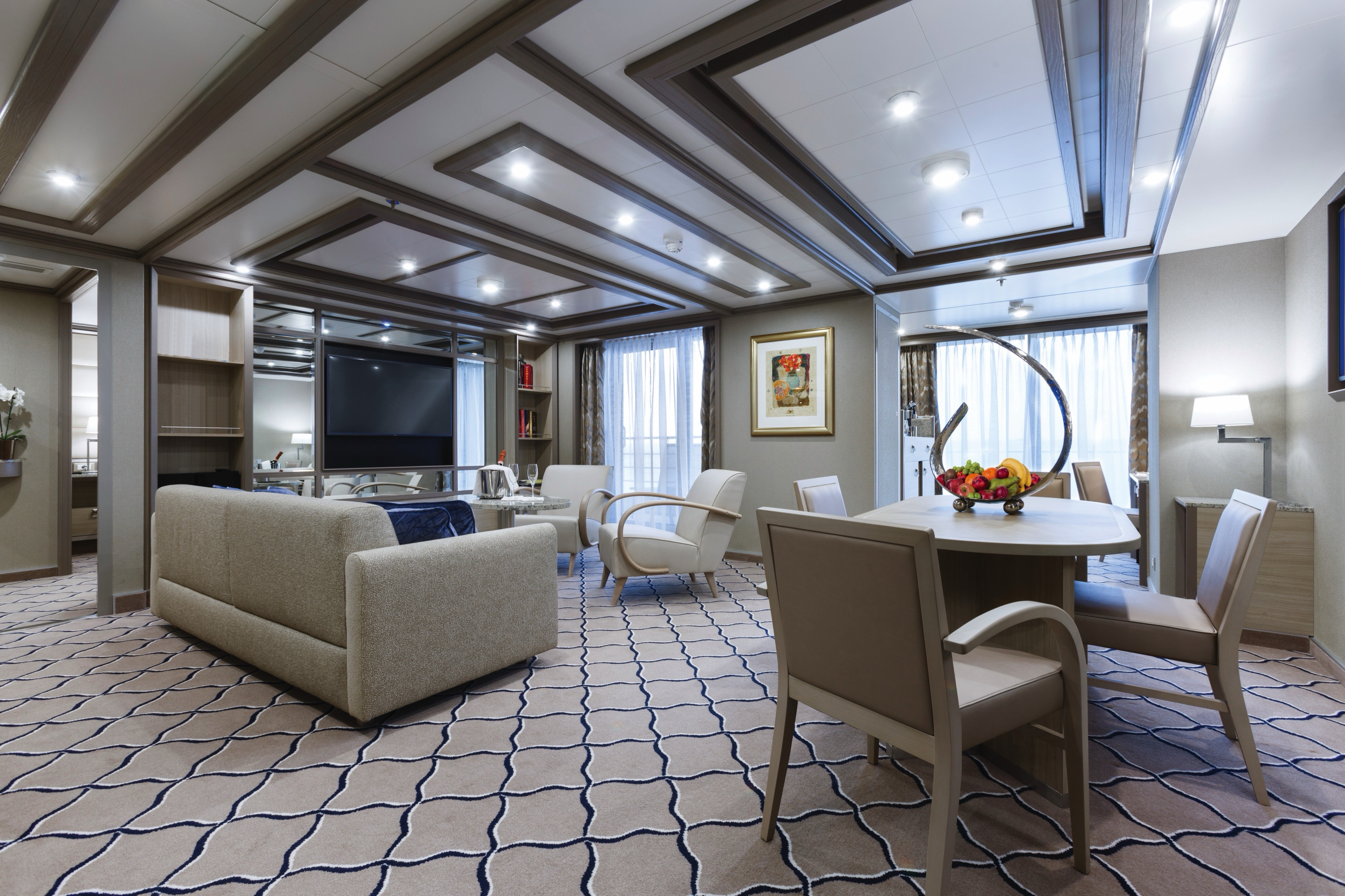
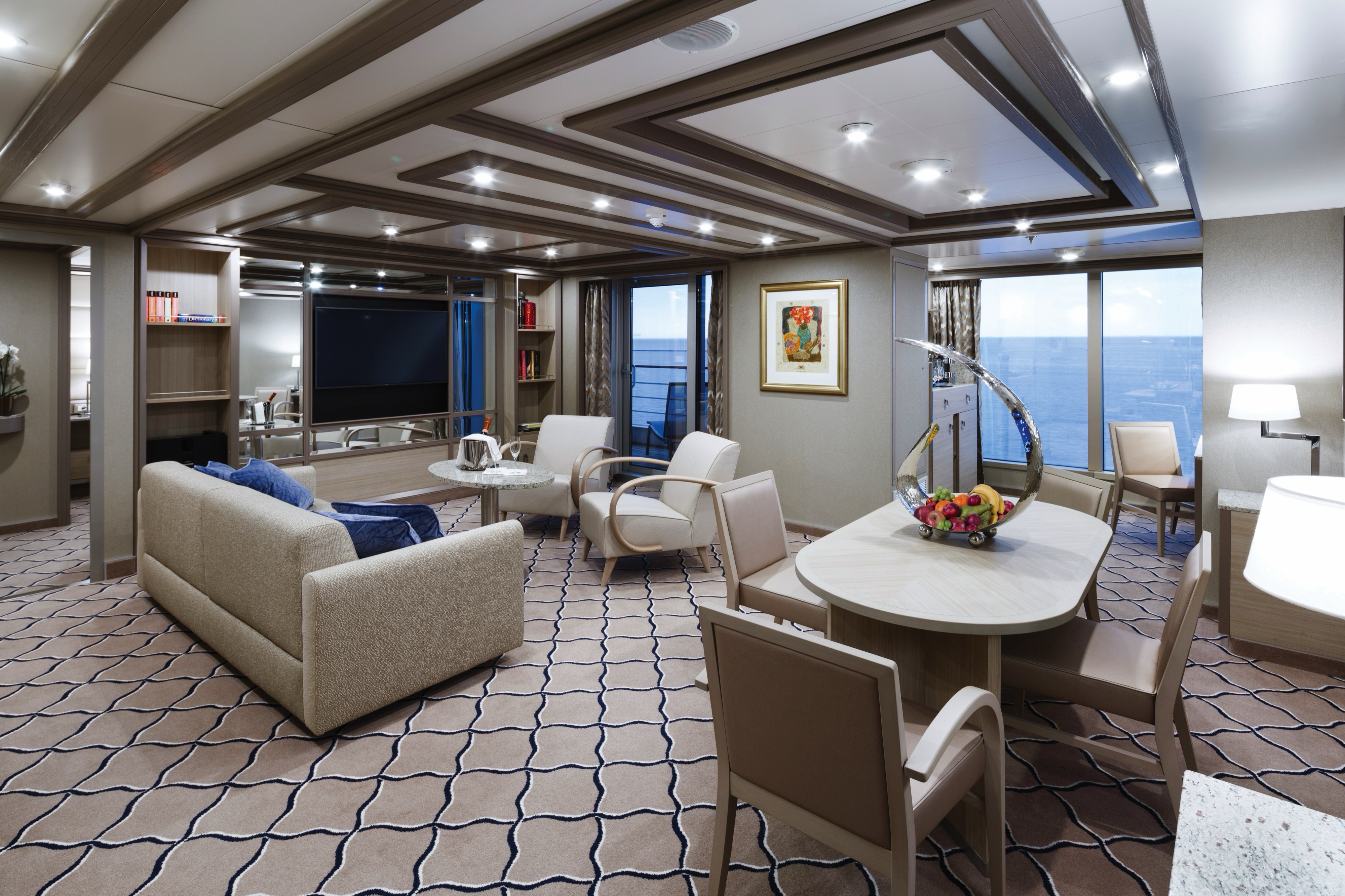
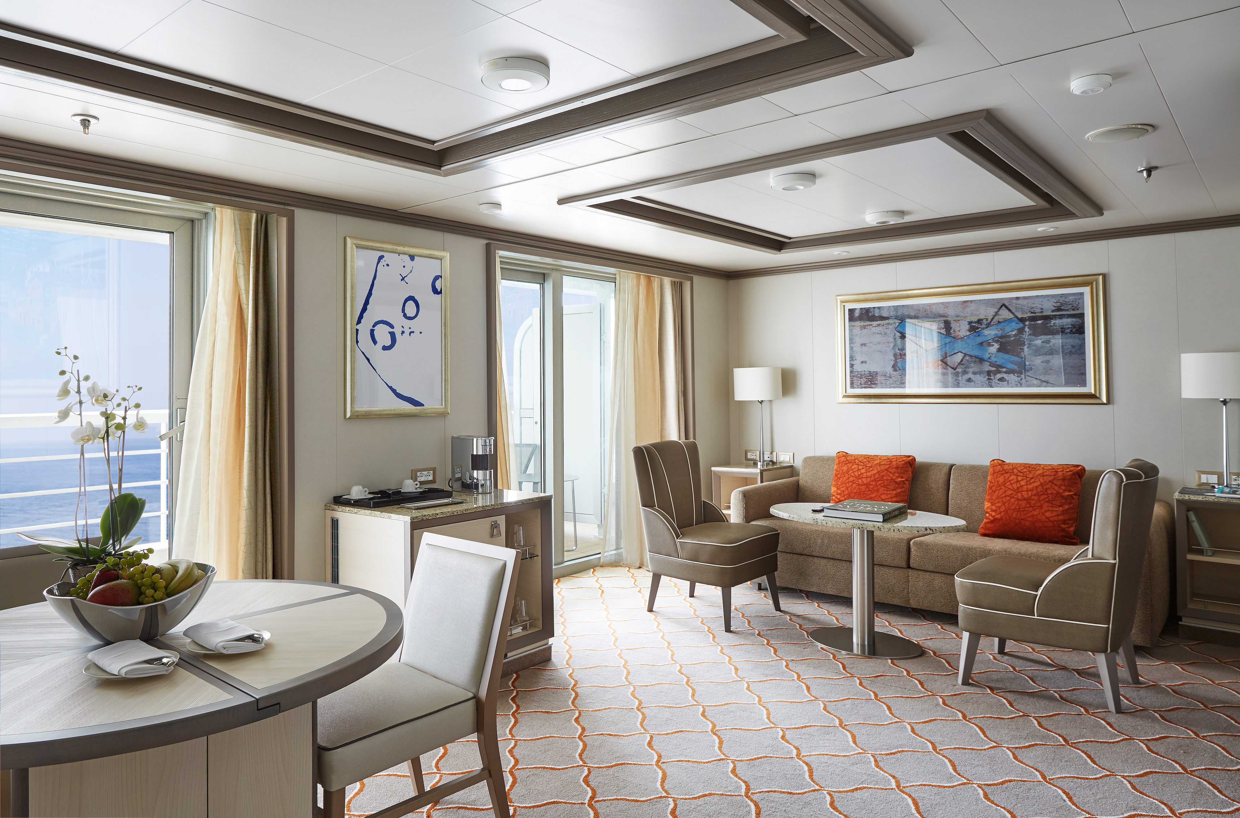
Available in a one- or two-bedroom configuration (so perfect for families), the Owner’s suite is the epitome of elegance at sea. A large seating area is the hub of the suite, equipped with all modern conveniences—think a Bose sound system, an interactive 55″ TV, and even an Illy coffee machine! Whether you are inside or relaxing on the large teak veranda, the Owner’s suite offers supreme comfort every hour of the day!
- One bedroom: up to 98 sq m (12 sq m)
- Two bedrooms: 119–129 sq m (12 sq m )
Essentials
- Deck(s): 9
- Section: Mid-Ship
Characteristics
- Veranda
- Separate dining area
- Living room with sitting area
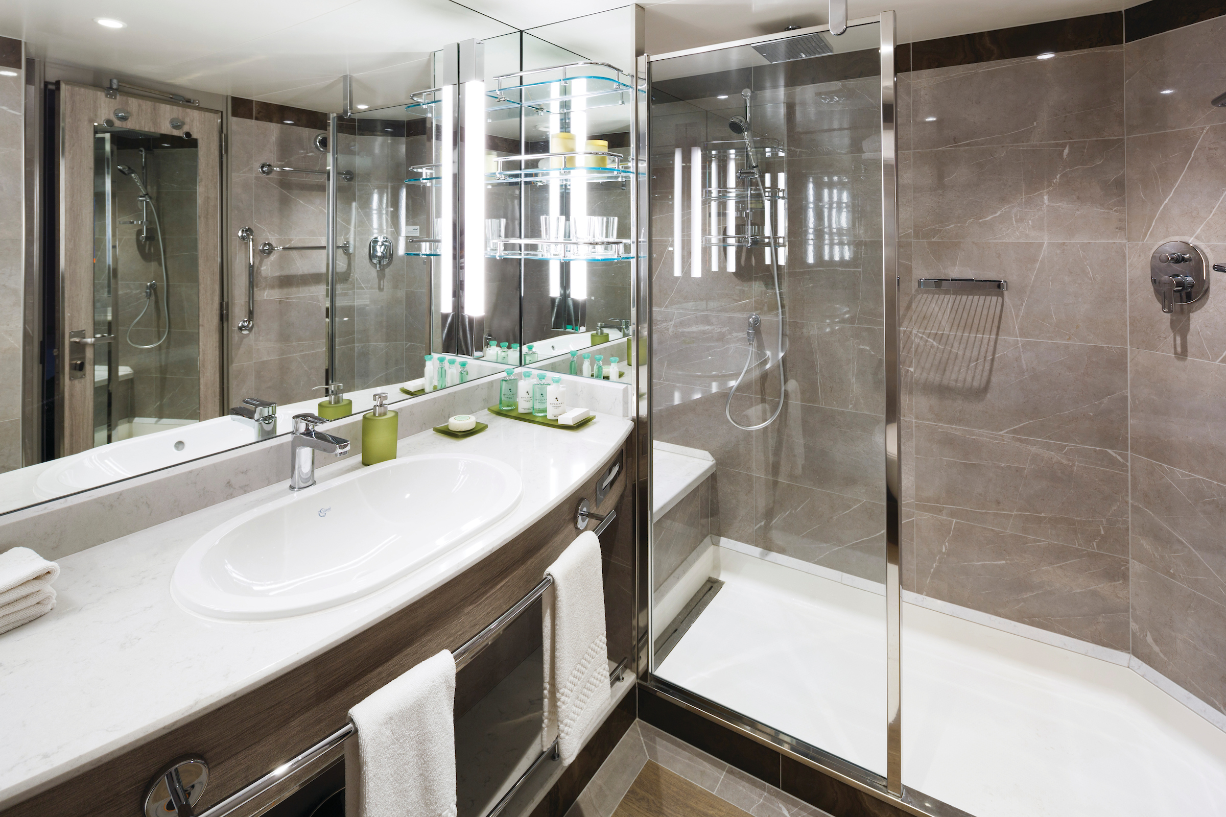
- Double vanity
- Separate shower
- Whirlpool bath
- Walk-in wardrobe with personal safe
Furniture
- King size bed
- Writing desk
- Vanity table
- Luxury bed mattresses
Media & Communication
- Unlimited Premium Wi-Fi
- 2 large flat screen TVs with Interactive Media Library
- Sound system with bluetooth connectivity
- Direct dial telephone
- Wall mounted USB-C mobile device chargers
- Dual voltage 110/220 outlets
Onboard Services
- Butler service
- Complimentary laundry, pressing & wet cleaning
- Dinner for two in La Dame, one evening per voyage,
- Two hours of worldwide phone use, per voyage segment
- Champagne on arrival
Amenities
- Espresso machine
- Pillow menu
- Refrigerator and bar setup stocked with your preferences
- Plush bathrobe
- Luxury bath amenities
- Umbrella
- Hair Dryer
- Slippers
*The difference in size is largely due to a larger entry corridor and does not affect the living or sleeping area.
Images are intended as a general reference. Features, materials, finishes and layout may be different than shown.
Please note that the third guest will sleep on a comfortable sofa bed in the reception area of the suite.
A grand traveler needs a grand suite, and we are happy to oblige! Get ready to scale new heights of comfort in our ultra-luxury Grand Suite. Situated at the front of the ship for the most spectacular views, the Grand Suite is for travelers who like the finer things in life. A large veranda, furnished with sun beds, makes for perfect memories. Indoors, the sumptuous seating area and cozy bedrooms are the very definition of relaxing in style.
- One bedroom: 137–146 sq m including veranda (44–53 sq m)
- Two bedrooms: 174–183 sq m including veranda (50–59 sq m)
Essentials
- Deck(s): 8, 9
- Section: Forward
Characteristics
- Veranda
- Separate dining area
- Living room with sitting area
- Double vanity
- Separate shower
- Whirlpool bath
- Walk-in wardrobe with personal safe
Furniture
- King size bed
- Writing desk
- Vanity table
- Luxury bed mattresses
Media & Communication
- Unlimited Premium Wi-Fi
- 2 large flat screen TVs with Interactive Media Library
- Sound system with bluetooth connectivity
- Direct dial telephone
- Wall mounted USB-C mobile device chargers
- Dual voltage 110/220 outlets
Onboard Services
- Butler service
- Complimentary laundry, pressing & wet cleaning
- Dinner for two in La Dame, one evening per voyage,
- Two hours of worldwide phone use, per voyage segment
- Champagne on arrival
Amenities
- Espresso machine
- Pillow menu
- Refrigerator and bar setup stocked with your preferences
- Plush bathrobe
- Luxury bath amenities
- Umbrella
- Hair Dryer
- Slippers
Images are intended as a general reference. Features, materials, finishes and layout may be different than shown.
Please note that the 3rd guest will sleep on a comfortable sofa bed in the reception area of the suite.
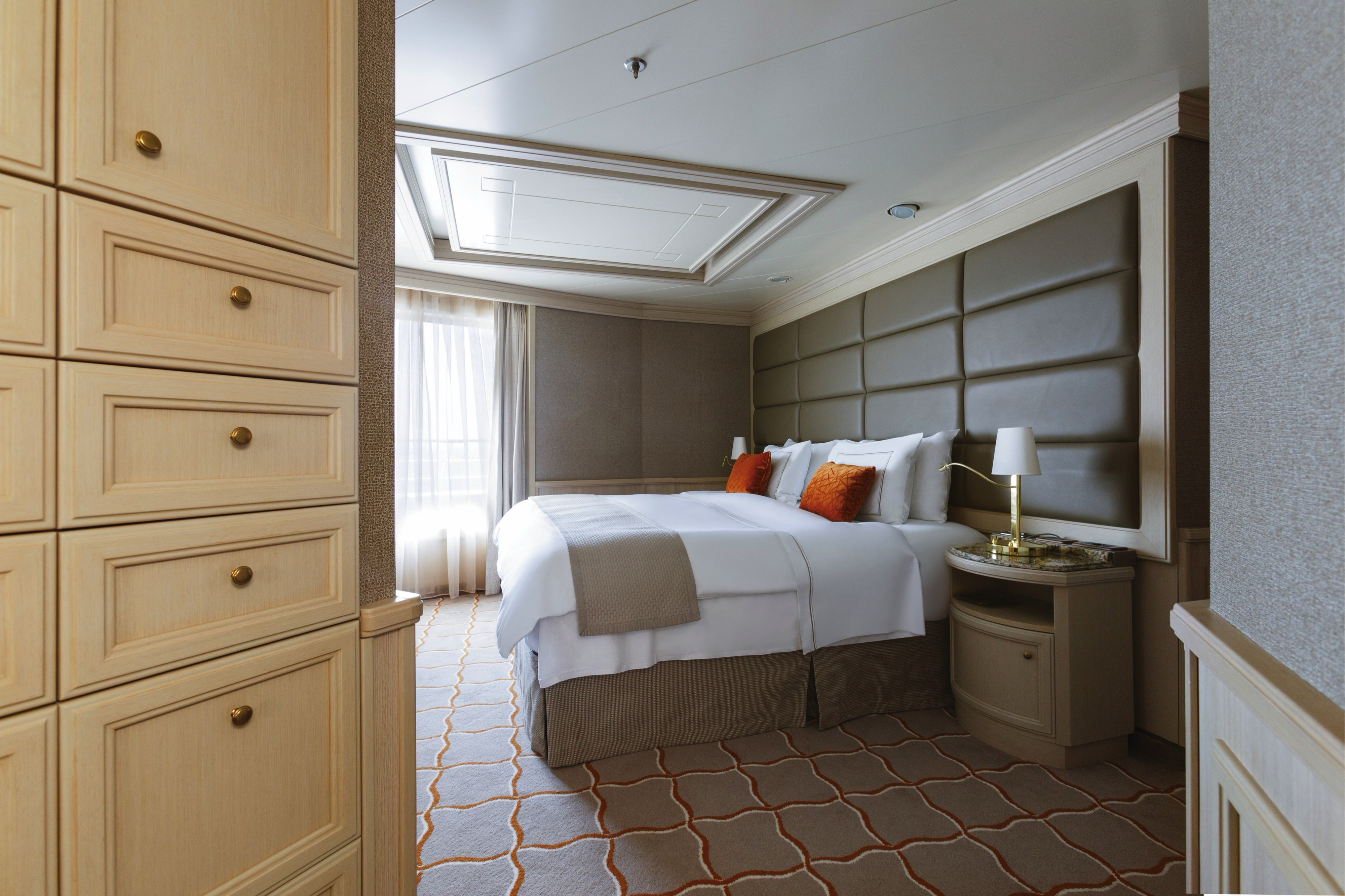
With just two Royal Suites on board, this stateroom is in a class all of its own! Spacious and dignified, commanding and majestic, there’s no secret to why we named this the Royal Suite. Ample indoor space with a living room (including state-of-the-art entertainment systems), twin beds that can be joined upon demand, and even an adjoining bedroom if required—the Royal Suite is the answer when traveling with the family! Not to mention unlimited Wi-Fi, a sumptuous marble bathroom, and spacious teak veranda—the Royal Suite is fit for a king!
- One bedroom: 105 sq m including veranda (12 sq m)
- Two bedrooms: 142 sq m including veranda (18 sq m )
Essentials
- Deck(s): 7
- Section: Forward
Characteristics
- Veranda
- Separate dining area
- Living room with sitting area
- Double vanity
- Separate shower
- Whirlpool bath
- Walk-in wardrobe with personal safe
Furniture
- King size bed
- Writing desk
- Vanity table
- Luxury bed mattresses
Media & Communication
- Unlimited Premium Wi-Fi
- 2 large flat screen TVs with Interactive Media Library
- Sound system with bluetooth connectivity
- Direct dial telephone
- Wall mounted USB-C mobile device chargers
- Dual voltage 110/220 outlets
Onboard Services
- Butler service
- Complimentary laundry, pressing & wet cleaning
- Dinner for two in La Dame, one evening per voyage,
- Two hours of worldwide phone use, per voyage segment
- Champagne on arrival
Amenities
- Espresso machine
- Pillow menu
- Refrigerator and bar setup stocked with your preferences
- Plush bathrobe
- Luxury bath amenities
- Umbrella
- Hair Dryer
- Slippers
Images are intended as a general reference. Features, materials, finishes and layout may be different than shown.
Please note that the 3rd guest will sleep on a comfortable sofa bed in the reception area of the suite.
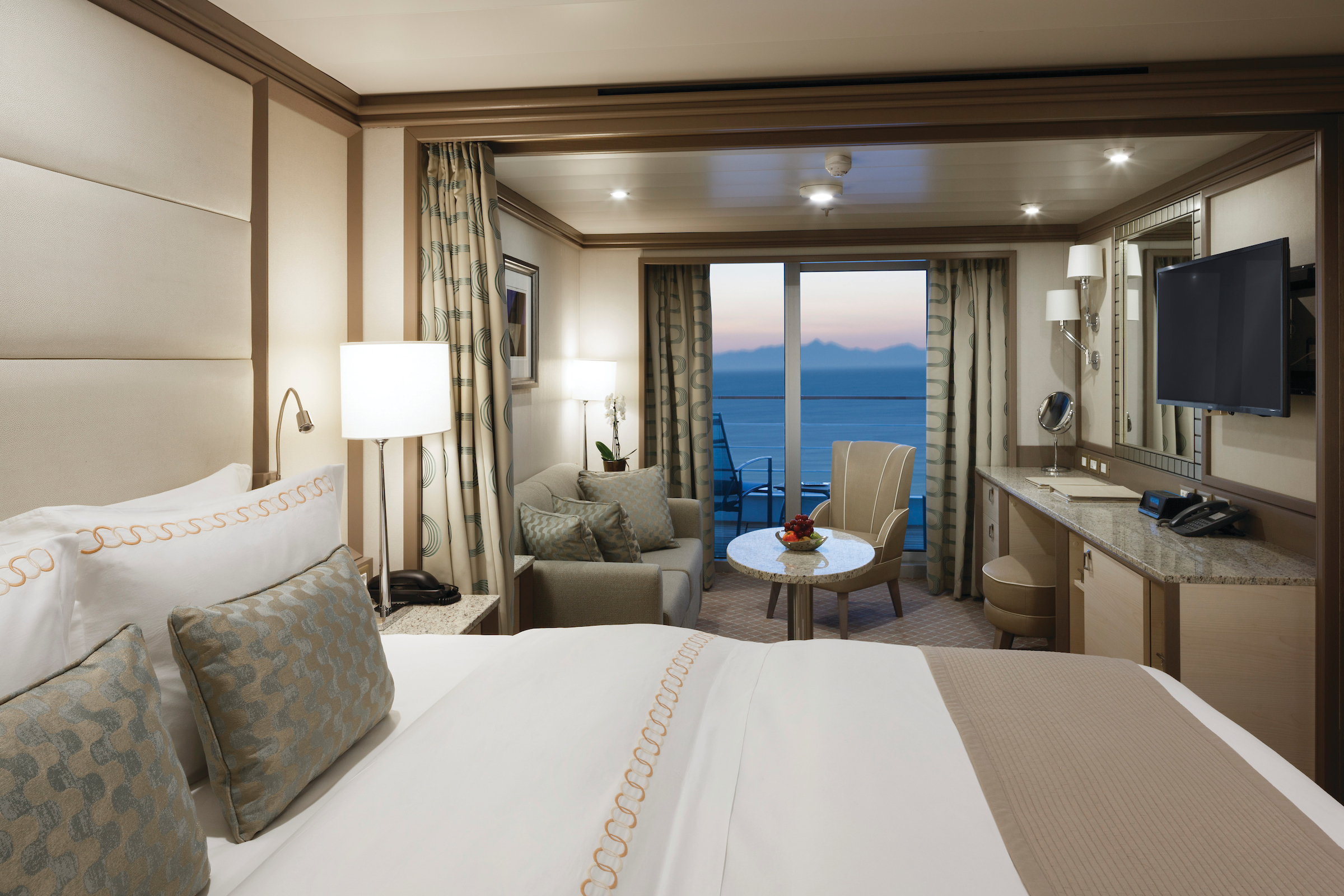
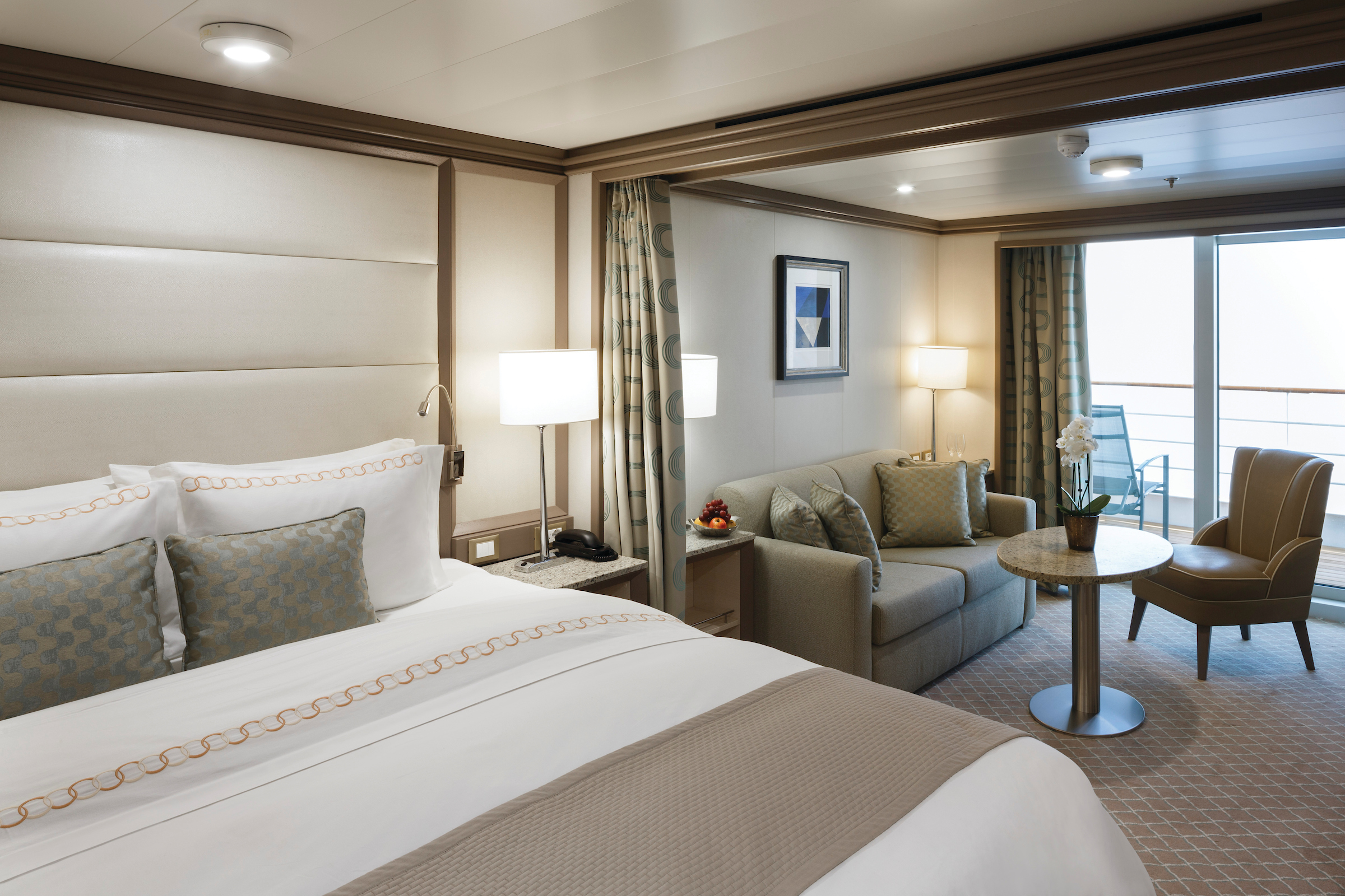
A Silversea favorite and by far our best-selling suite! The Silver Suite is one of the foundations of ultra-luxury cruising. Take traveling to a whole new level with the Silver Suite’s unparalleled levels of service, comfort, and of course, style! Available in either a one-bedroom, a two-bedroom, or wheelchair accessible configuration, Silver Suites are fully equipped for the discerning traveler. Whether enjoying the spectacular views from the veranda or relaxing in the large sitting room, Silver Suites offer a comfortable haven on the high seas.
- One bedroom: 73 sq m including veranda (12 sq m)
- Two bedrooms: 104 sq m including veranda (12 sq m)
Essentials
- Deck(s): 9, 10, 11
- Section: Forward, Mid-Ship
Characteristics
- Veranda
- Living room with sitting area
- Double vanity
- Separate shower
- Whirlpool bath
- Walk-in wardrobe with personal safe
Furniture
- King size bed
- Writing desk
- Vanity table
- Luxury bed mattresses
Media & Communication
- Unlimited Premium Wi-Fi
- 2 large flat screen TVs with Interactive Media Library
- Sound system with bluetooth connectivity
- Direct dial telephone
- Wall mounted USB-C mobile device chargers
- Dual voltage 110/220 outlets
Onboard Services
- Butler service
- Complimentary laundry, pressing & wet cleaning
- Champagne on arrival
Amenities
- Espresso machine
- Pillow menu
- Refrigerator and bar setup stocked with your preferences
- Plush bathrobe
- Luxury bath amenities
- Umbrella
- Hair Dryer
- Slippers
Wheelchair accessible suite: 931
Images are intended as a general reference. Features, materials, finishes and layout may be different than shown.
Please note that the 3rd guest will sleep on a comfortable sofa bed in the reception area of the suite.
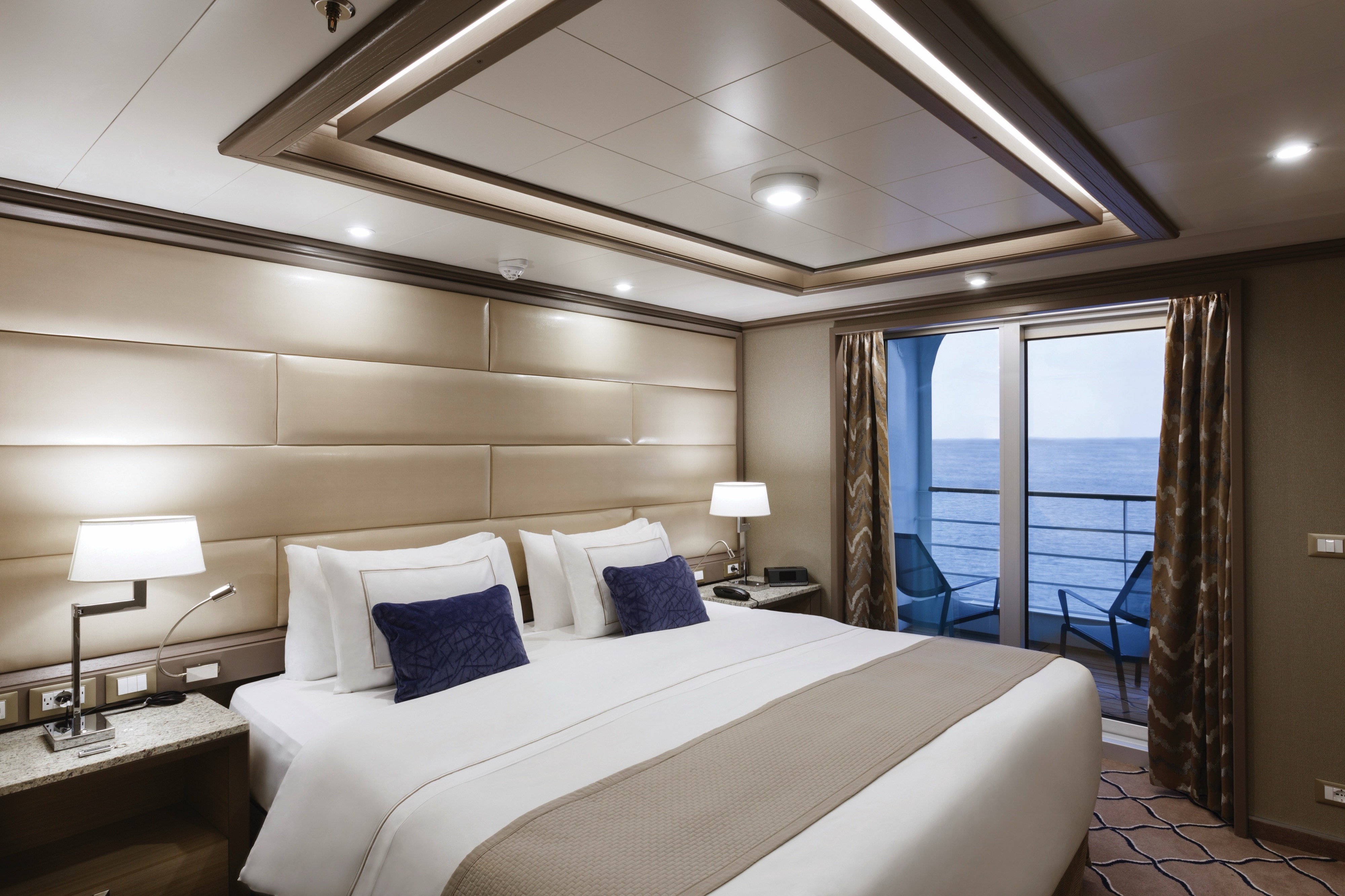
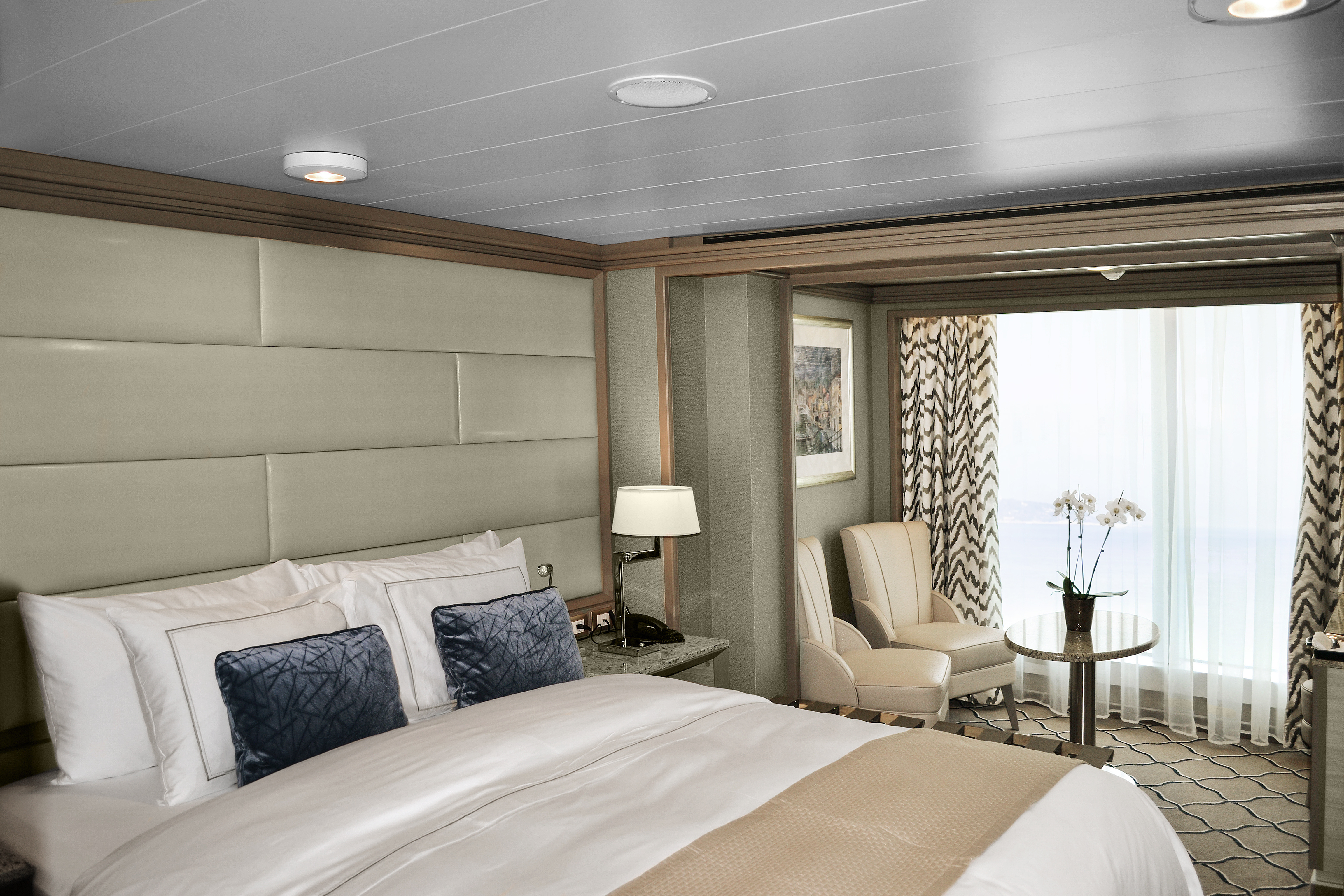
After a busy day of onshore exploring, the Deluxe Veranda Suite is the perfect home away from home. Spacious and well-situated, enjoy ultra-luxury amenities from the 24-hour butler service to the well-stocked mini-bar (and yes, they’re all included!). Not forgetting the teak veranda from which the suite takes her name, the Deluxe Veranda is the perfect setting for making perfect memories.
- One bedroom: 36 sq m including veranda (6 sq m)
Essentials
- Deck(s): 6, 7, 8
- Section: Mid-Ship
Characteristics
- Veranda
- Sitting area
- Standard vanity
- Separate shower
- Full-size bath
- Walk-in wardrobe with personal safe
Furniture
- Queen size bed
- Writing desk
- Luxury bed mattresses
Media & Communication
- Unlimited Standard Wi-Fi
- 1 large flat screen TV with Interactive Media Library
- Direct dial telephone
- Wall mounted USB-C mobile device chargers
- Dual voltage 110/220 outlets
Onboard Services
- Butler service
- Champagne on arrival
Amenities
- Pillow menu
- Refrigerator and bar setup stocked with your preferences
- Plush bathrobe
- Luxury bath amenities
- Umbrella
- Hair Dryer
- Slippers
Images are intended as a general reference. Features, materials, finishes and layout may be different than shown.
Please note that the 3rd guest will sleep on a comfortable sofa bed in the reception area of the suite.
A superior location makes the Superior Veranda Suite, well … superior! From the sumptuous views from the teak veranda to the spacious sitting room and large marble bathroom, everything about the Superior Veranda has been designed for your comfort. So settle in and get comfortable, order some 24-hour room service from your butler and enjoy a bit of R&R. We guarantee you won’t want to leave.
- One bedroom: 36 sq ft including veranda (6 sq m)
Essentials
- Deck(s): 7, 8, 9
- Section: Forward
Characteristics
- Veranda
- Sitting area
- Standard vanity
- Separate shower
- Full-size bath
- Walk-in wardrobe with personal safe
Furniture
- Queen size bed
- Writing desk
- Luxury bed mattresses
Media & Communication
- Unlimited Standard Wi-Fi
- 1 large flat screen TV with Interactive Media Library
- Direct dial telephone
- Wall mounted USB-C mobile device chargers
- Dual voltage 110/220 outlets
Onboard Services
- Butler service
- Champagne on arrival
Amenities
- Pillow menu
- Refrigerator and bar setup stocked with your preferences
- Plush bathrobe
- Luxury bath amenities
- Umbrella
- Hair Dryer
- Slippers
Images are intended as a general reference. Features, materials, finishes and layout may be different than shown.
Please note that the third guest will sleep on a comfortable sofa bed in the reception area of the suite.
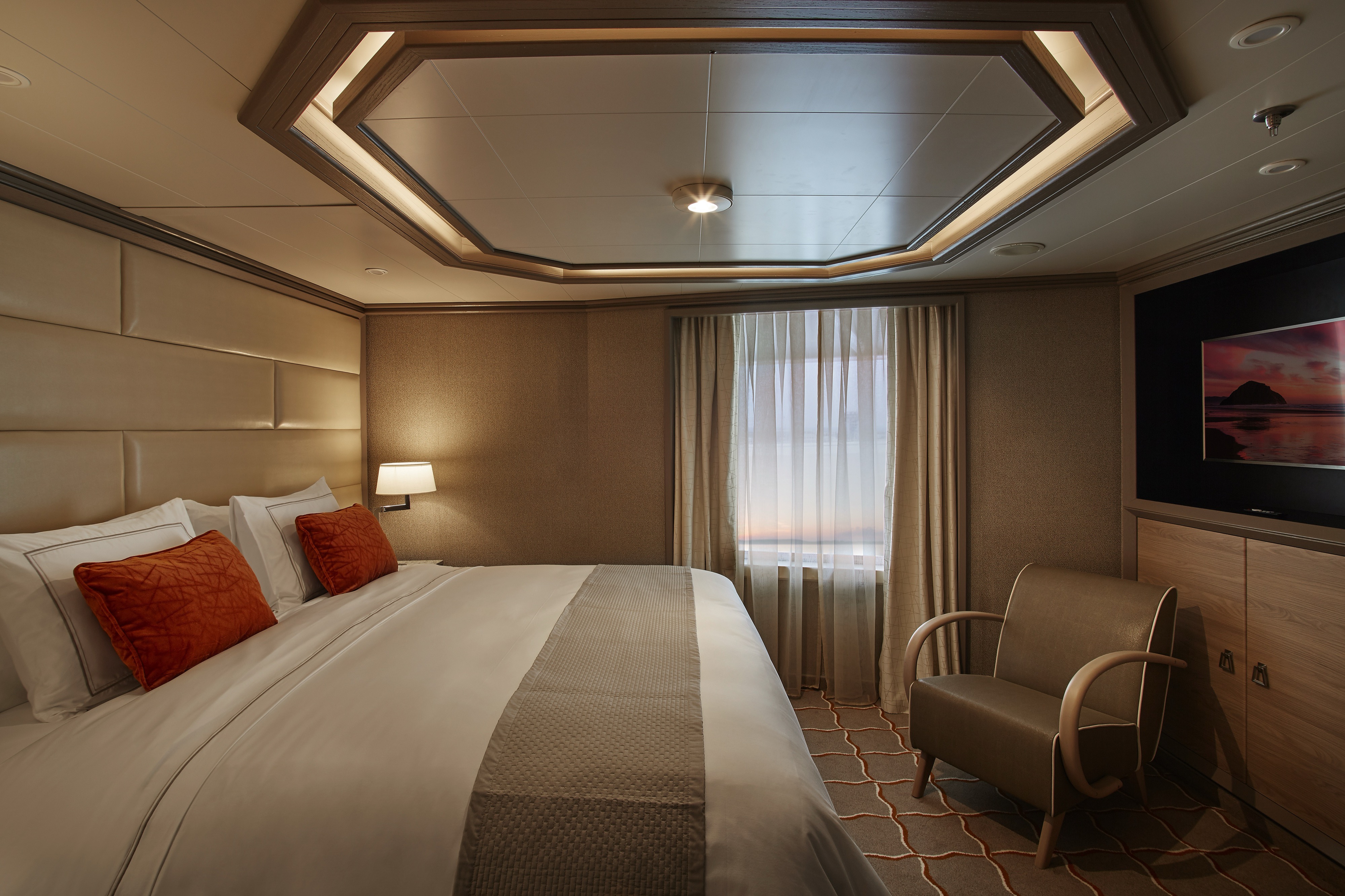
A lower-bow location makes the Classic Veranda Suite a comfortable choice for travelers. A lovely, comfortable bed—available in a twin- or queen-bed configuration—with a choice of mattress ensures that you enjoy the best night’s sleep of your life while the seating area is perfect for in-suite dining. But perhaps the Classic Veranda’s best feature lies outside the suite—with the 6-m2 (64-sq-ft) veranda for which the suite was named.
- One bedroom: 36 sq m including veranda (6 sq m)
Essentials
- Deck(s): 5, 6
- Section: Forward
Characteristics
- Veranda
- Sitting area
- Standard vanity
- Separate shower
- Full-size bath
- Walk-in wardrobe with personal safe
Furniture
- Queen size bed
- Writing desk
- Luxury bed mattresses
Media & Communication
- Unlimited Standard Wi-Fi
- 1 large flat screen TV with Interactive Media Library
- Direct dial telephone
- Wall mounted USB-C mobile device chargers
- Dual voltage 110/220 outlets
Onboard Services
- Butler service
- Champagne on arrival
Amenities
- Pillow menu
- Refrigerator and bar setup stocked with your preferences
- Plush bathrobe
- Luxury bath amenities
- Umbrella
- Hair Dryer
- Slippers
Images are intended as a general reference. Features, materials, finishes and layout may be different than shown.
Beautiful elegant furnishings are the perfect choice to soothe and relax as you sail from one destination to the next. Large windows flood the room with light, making for luxurious ocean views whether it’s morning, noon, or night! Panorama Suites are the perfect accompaniment to a Silver Suite for larger parties, or just perfect on their own. With all the modern conveniences that you would expect from an ultra-luxury cruise line, Panorama Suites offer comfort, space, and style!
- One bedroom: 31 sq m
Essentials
- Deck(s): 9
- Section: Forward
Characteristics
- Floor-to ceiling window
- Sitting area
- Standard vanity
- Separate shower
- Full-size bath
- Walk-in wardrobe with personal safe
Furniture
- Queen size bed
- Writing desk
- Luxury bed mattresses
Media & Communication
- Unlimited Standard Wi-Fi
- 1 large flat screen TV with Interactive Media Library
- Direct dial telephone
- Wall mounted USB-C mobile device chargers
- Dual voltage 110/220 outlets
- Butler service
- Champagne on arrival
Amenities
- Pillow menu
- Refrigerator and bar setup stocked with your preferences
- Plush bathrobe
- Luxury bath amenities
- Umbrella
- Hair Dryer
- Slippers
Images are intended as a general reference. Features, materials, finishes and layout may be different than shown.
Comfortable, spacious, and offering stupendous ocean views, the Vista Suite carries its name very well! Wake up to wide ocean views, eat breakfast to the sound of the waves lapping at the side of the ship, or simply relax with the in-suite entertainment system and comfy sofas. Some Vista Suites are a little larger than standard—perfect for our guests with limited mobility. If you have ever wanted a home away from home on the high seas, the Vista Suite is it.
- One bedroom: 32 sq m
Essentials
- Deck(s): 4
- Section: Forward
Characteristics
- Window
- Sitting area
- Standard vanity
- Separate shower
- Full-size bath
- Walk-in wardrobe with personal safe
Furniture
- Queen size bed
- Writing desk
- Luxury bed mattresses
Media & Communication
- Unlimited Standard Wi-Fi
- 1 large flat screen TV with Interactive Media Library
- Direct dial telephone
- Wall mounted USB-C mobile device chargers
- Dual voltage 110/220 outlets
Onboard Services
- Butler service
- Champagne on arrival
Amenities
- Pillow menu
- Refrigerator and bar setup stocked with your preferences
- Plush bathrobe
- Luxury bath amenities
- Umbrella
- Hair Dryer
- Slippers
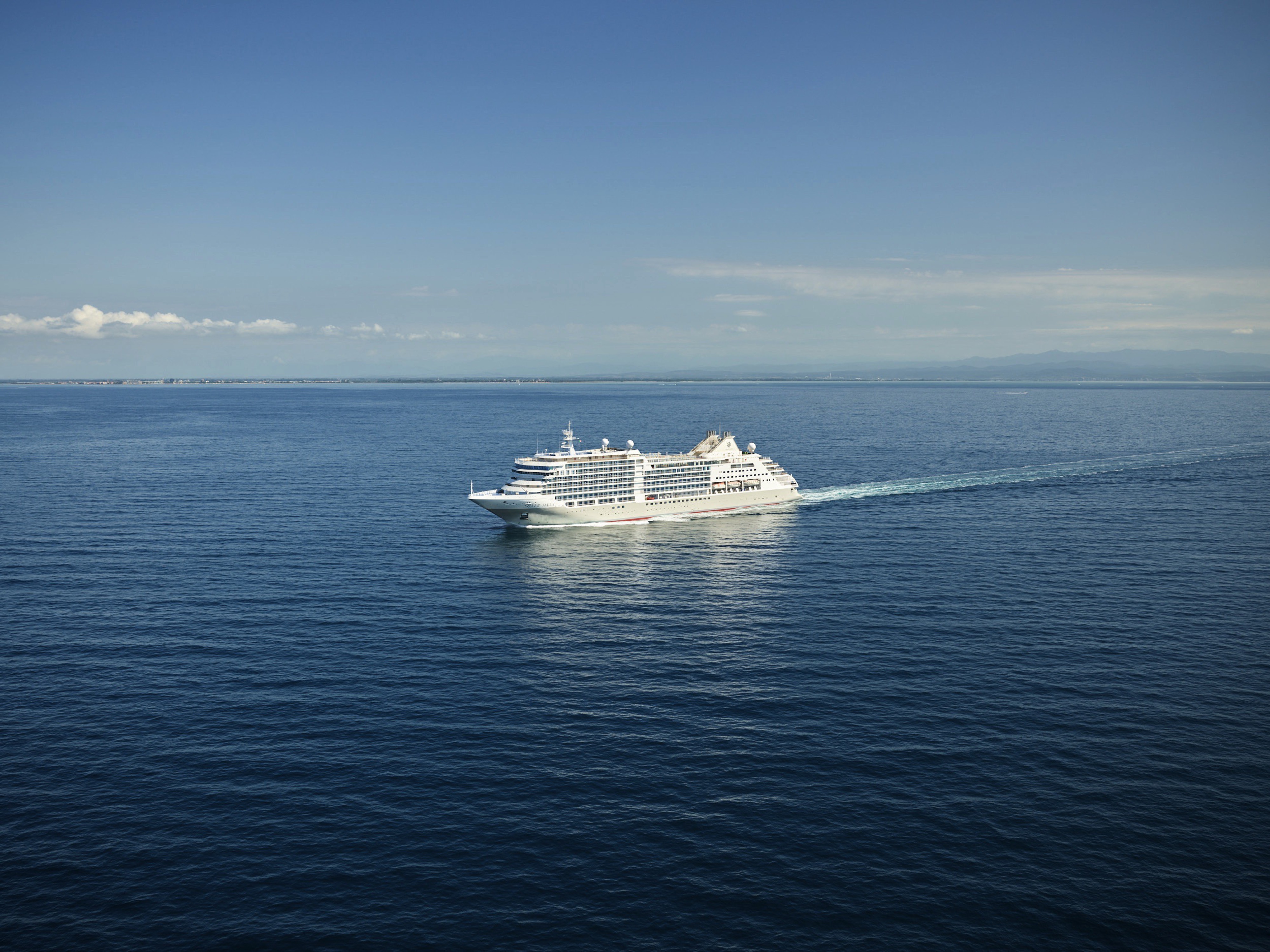
Silver Dawn
A new Dawn has arrived! Our tenth luxury ship joined our fleet in April 2022, sailing a worldwide itinerary that promises authentic, immersive experiences.
A new world of luxury is waiting aboard Silver Dawn. Elegant and modern, Silver Dawn is the natural evolution of our fleet. Large enough to offer eight dining options—including the superb Sea and Land Taste (S.A.L.T.) program—yet small enough for the famed Silversea onboard ambience, Silver Dawn inherits the best features of her sister ships Silver Muse and Silver Moon, but is in a class all of her own. With sumptuous suites, outstanding itineraries, plus cutting-edge design and technology, and the outstanding OTIVM wellness concept, Silver Dawn sets new standards of luxury. Wake up to a new dawn with Silversea.
Ship Facts
| Launch Year | 2022 | ||||||||||
| Refit Year | |||||||||||
| Language | en | ||||||||||
| Gross Tonnage | 40700 | ||||||||||
| Length | 213 | ||||||||||
| Width | 26 | ||||||||||
| Currency | USD | ||||||||||
| Speed | 20 | ||||||||||
| Capacity | 596 | ||||||||||
| Crew Count | 411 | ||||||||||
| Deck Count | 8 | ||||||||||
| Cabin Count | 288 | ||||||||||
| Large Cabin Count | N/A | ||||||||||
| Wheelchair Cabin Count | 4 | ||||||||||
| Electrical Plugs |
|
Deck 11
- Observation Library
- Spaccanapoli
- Jogging Track
- Silver Suites
- Elevator

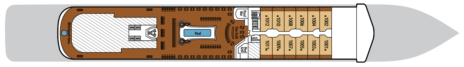
Deck 10
- Pool Deck
- Pool Bar
- Launderette
- The Grill
- Whirlpool Area
- Silver Suite
- Elevator
Deck 9
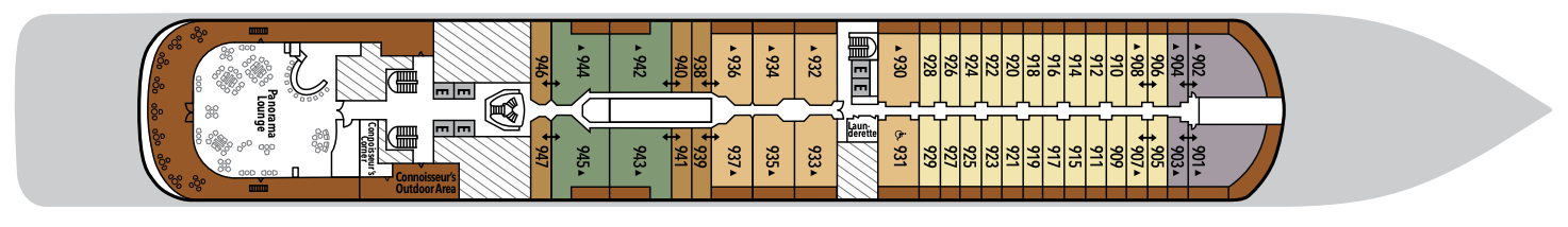
- Panorama Lounge
- Connoisseur's Corner
- Launderette
- Owner's Suite
- Panorama Suite
- Silver Suite
- Superior Veranda Suite
- Grand Suite
- Elevator
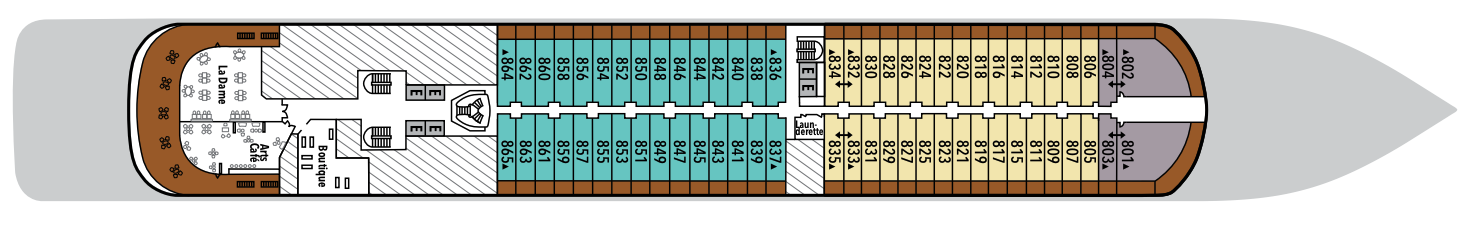
Deck 8
- Arts Café
- Boutique
- La Dame
- Launderette
- Deluxe Veranda Suite
- Superior Veranda suite
- Grand Suite
- Elevator
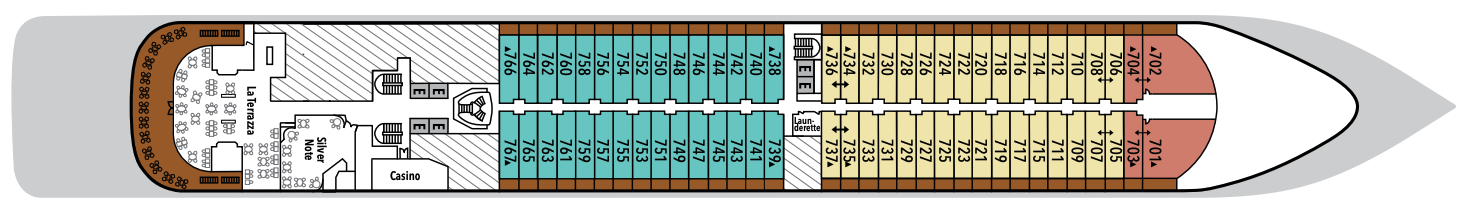
Deck 7
- La Terrazza
- Silver Note
- Casino
- Launderette
- Royal Suite
- Superior Veranda Suite
- Deluxe Veranda Suite
- Elevator
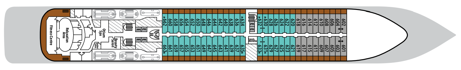
Deck 6
- Otium Spa
- Fitness Centre
- Relaxation Area
- Beauty Salon
- Launderette
- Deluxe Veranda Suite
- Classic Veranda Suite
- Elevator
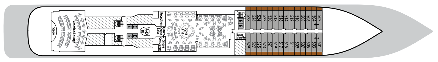
Deck 5
- Reception/Guest Relations
- Shore Concierge
- Dolce Vita
- Venetian Lounge
- Future Cruise Sales
- Launderette
- Cruise Consultant
- Classic Veranda Suite
- Elevator
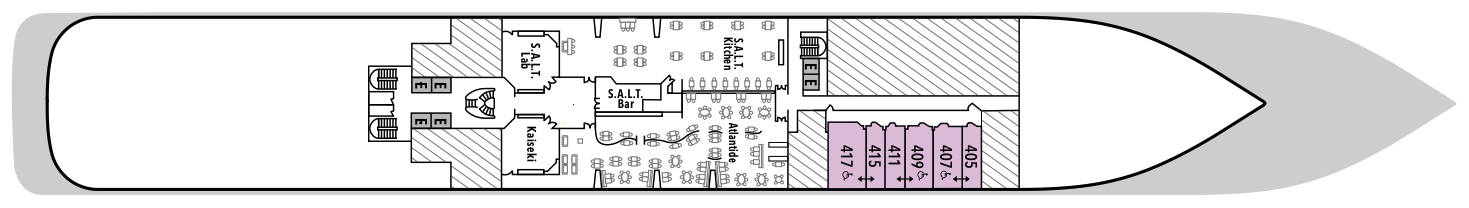
Deck 4
- Atlantide
- Kaiseki
- S.A.L.T Kitchen
- S.A.L.T Bar
- S.A.L.T Lab
- Vista Suite (3x Accessible)
- Elevator
Our passion for excellent cuisine is at the heart of everything we do. We believe that meals are a celebration of life, a way to bring people together, and an expression of culture and tradition. Each dining venue aboard our ships offers a unique and memorable experience, with multiple dining options available and a variety of spaces and experiences on board; every mealtime is a joy.
S.A.L.T. Kitchen
S.A.L.T. Kitchen transforms dining into discovery with menus that reflect the cuisines of the places you’ll visit. This complimentary venue is the only restaurant at sea with an ever-changing menu based on destination. Plus, a standing menu focuses on broader regional specialties, complemented by a menu featuring hyperlocal fare. Dishes are inspired by local flavors and prepared with responsibly sourced ingredients. Accompanied by a curated selection of over 160 regional wines, S.A.L.T. Kitchen delivers an immersive taste of place without ever leaving the ship.
Capacity: 154 guests
Opening hours: Dinner only (18:30 - 21:00)
Images are intended as a general reference. Features, materials, finishes and layout may be different than shown. Opening hours and menu are for reference only.
La Dame
Silversea’s signature French restaurant, La Dame, is the epitome of fine dining. Featuring the rich, smooth flavors of France, La Dame’s reputation for gastronomic excellence is fully upheld aboard Silver Dawn. Expect only the very best: chic, contemporary style, vast ocean-view windows, crisp, white table linens, and impeccable white-gloved service with a smile. Decorated with custom-made interior panel compositions created by Lalique, there is no better place to feel the culinary soul of France than in La Dame.
Location: Deck 8Capacity: 66 guests
Opening hours: hours: Dinner only (19:00 - 21:00)
Fee: USD 60 per person
Reservation is required
Images are intended as a general reference. Features, materials, finishes and layout may be different than shown. Opening hours and menu are for reference only.
La Terraza
La Terrazza elevates casual dining by day and delivers an authentic Italian experience by night. During the breakfast and lunch buffets, our master chefs prepare global favorites at live stations. As evening falls, handmade pastas and classic seafood dishes are the centerpiece — every impeccable bite paired with fine wines from around the world.
Breakfast* (Buffet) - Open seating
Opening hours: 7:00 AM - 10:00 AM
Day at sea: 7:30 AM - 10:00 AM
Lunch* (Buffet) - Open seating
Opening Hours: 12:00 PM – 2:00 PM
Dinner - Reservations required
Capacity: 208 guests (140 guests for dinner)
Images are intended as a general reference. Features, materials, finishes and layout may be different than shown. Opening hours and menu are for reference only.
The Grill
A poolside al fresco favorite, The Grill is casual by day and captivating by night. Dig in to crisp salads and grilled classics during lunch, then return after sunset for masterfully seasoned and seared cuts paired with balmy sea breezes.
Lunch - Open seating
Opening Hours: 12:00 PM – 3:30 PM
Dinner - Reservations required
Opening Hours: 7:00 PM – 10:00 PM
Capacity: 62
Images are intended as a general reference. Features, materials, finishes, and layout may be different than shown. Opening hours and menu are for reference only.
Atlantide
Refined global fare and grilled classics take center stage at Atlantide. Drop in for an indulgent à la carte breakfast, a leisurely lunch, or an elegant dinner among family and new friends, served in a timeless and sophisticated setting.
Location: Deck 4Capacity: 220 guests
Opening hours: Opening hours: Breakfast, lunch and dinner (dinner:
18:00 - 20:30)
Images are intended as a general reference. Features, materials, finishes and layout may be different than shown. Opening hours and menu are for reference only.
Kaiseki
Meals at Kaiseki are rooted in the Japanese philosophy of balance and precision. By day, refreshing sushi, sashimi, and izakaya-style dishes guide the menu. During dinner, specialties like miso black cod and wagyu teriyaki nod to Japan’s enduring culinary legacy, while fine sake, whiskies, and teas enhance every course.
Lunch - Open seating
Opening Hours: 12:00 PM – 2:30 PM
Dinner - Reservations required*
Opening Hours: 7:00 PM – 9:30 PM
Capacity: 32 guests
Lunch is part of our all-inclusive dining experiences.
Dinner fee: Menu or à la carte: USD 40 per person
Learn more about the Epicurean Experience, which includes dining in three specialty restaurants with preferential rates.
Images are intended as a general reference. Features, materials, finishes and layout may be different than shown. Opening hours and menu are for reference only.
Silver Note
As the stars come out, Silver Note comes alive with the rhythm of jazz and the artistry of small-plate fine dining. This intimate supper-club experience pairs soulful live performances with inventive, international cuisine in a chic, lounge-style setting — one of the most exclusive dining concepts at sea.
Dinner - Reservations required
Opening Hours: 8:00 PM – 10:00 PM
Capacity: 64 guests
Learn more about the Epicurean Experience, which includes dining in three specialty restaurants with preferential rates.
Images are intended as a general reference. Features, materials, finishes and layout may be different than shown. Opening hours and menu are for reference only.
Arts Café
Arts Café is a vibrant, light-filled haven for conversation, connection, and indulgence. Snack on creative canapés and decadent pastries paired with perfectly pulled espressos, fresh squeezed juices, and artisanal teas. Open all day, this inviting space provides a dynamic backdrop for unwinding, recharging, or catching up with fellow travelers.
Capacity: 26 guests
Images are intended as a general reference. Features, materials, finishes and layout may be different than shown.
Spaccanapoli
Reflecting Silversea’s Italian heritage, this emblematic street in Naples divides the city in two and is renowned for its pizzerias. No visit to the city is complete without a journey to Spaccanapoli. Therefore, it is unsurprising that Spaccanapoli aboard Silver Dawn reflects the true Italian way of life: the freshest ingredients, authentic dough, and a perfect sense of the fabled Italian lust for life. The simplicity of la dolce vita is reflected in the relaxed dining style of the restaurant.
Lunch - Open seating
Opening Hours: 12:00 PM – 2:30 PM
Dinner - Open seating
Opening Hours: 6:00 PM – 9:00 PM
Capacity: 72
Images are intended as a general reference. Features, materials, finishes and layout may be different than shown.
Opening hours and menu are for reference only.
In-Suite Dining
You can order from our Room Service menu 24 hours a day.
Opening hours are for reference only. For precise opening hours, please refer to the Daily Chronicles provided on board.
When you embark on an adventure with Silversea, we keep you thoroughly entertained while you’re sailing from one glorious port to another. Exploring the many different floors and strolling around the variety of areas on your ship is great fun as there’s always so much to see and do. Whether you want to recline on a lounger by the pool, try your luck in the casino, or indulge in our cutting-edge wellness and exercise programs, there’s something for everyone, including those who want to relax in their suite while their butler runs a bubble bath.
S.A.L.T Bar
S.A.L.T. Bar crafts authentic cultural connections through expertly prepared cocktails that tell the story of each region. A welcoming atmosphere invites you to indulge in regionally inspired libations prepared with local ingredients and traditional spirits.
Each perfectly balanced pour serves as your passport to the shores you’re exploring.
Images are intended as a general reference. Features, materials, finishes, and layout may be different than shown.
Dolce Vita
Surrender to a world of Italian elegance where the art of aperitivo takes pride of place. Ideal for connecting over spritzes, negronis, and light bites, here each evening feels like a celebration. As laughter lingers, crystal glasses clink, and live piano notes ripple through the air, Dolce Vita compels you to savor the sweetness of life on board.
Images are intended as a general reference. Features, materials, finishes and layout may be different than shown.
Panorama Lounge
From early morning to late at night, the Panorama Lounge offers everything you could wish for. A peaceful retreat that is the perfect place to take a break, a social place to meet and greet old friends, or an evening venue to partake in a cocktail as you sit back and watch the world go by. Sink into the plush seats, and come evening, enjoy listening to the gentle sounds of a pianist or the invigorating beats of our in-house DJ.
Images are intended as a general reference. Features, materials, finishes and layout may be different than shown.
Connoisseur's Corner
As evening stretches into night, Connoisseur’s Corner offers a stylish refuge for those who appreciate the time-honored rituals of smoke and spirit. Sink into tufted leather chairs with a hand-rolled cigar and a glass of one of our finest cognacs or whiskeys. Indoors or under the stars, every moment is marked by pure indulgence.
Images are intended as a general reference. Features, materials, finishes and layout may be different than shown.
Observation Library
Wrapped in glass and bathed in light, the Observation Lounge offers a serene escape high above the sea. Borrow a book from the in-house library, pour yourself a coffee or tea from the self-service bar, and curl into an armchair to watch the world drift by. This is a sanctuary for reflection, relaxation, and stories — both written and still in the making.
Images are intended as a general reference. Features, materials, finishes and layout may be different than shown.
Boutique
Exceptional shopping experiences do not end in the cosmopolitan cities we visit. Silversea’s striking new shipboard boutiques, reimagined and redesigned, are stunning modern design spaces befitting the finest creations from legendary designers. Carefully selected partners on board Silversea’s duty-free boutiques offer our guests a carefully curated selection of cutting-edge fashions, jewelry, accessories, fine perfumes, cosmetics, and Silversea Logo collection, all at duty-free prices.
Images are intended as a general reference. Features, materials, finishes and layout may be different than shown.
Casino
Let the fun begin! Channel your inner James Bond and place a bet at a variety of table games, including American Roulette, Blackjack, and Ocean Poker, as Silver Dawn glides silently through the waves. An assortment of multi-game, multi-denominational reel and video slot machines are also available. Prepare yourself for a luxurious and exhilarating experience with every turn of a card and spin of the wheel. Game on!
Images are intended as a general reference. Features, materials, finishes and layout may be different than shown.
Venetian Lounge
Step inside The Venetian Lounge, a cabaret-style theater draped in gilded glamour and Belle Époque charm. Cozy seating and intimate tables invite you to bask in the glow of live productions and cinematic screenings, complemented with Champagne, fine wines, and classic cocktails. In a setting this grand, every night feels like opening night.
Images are intended as a general reference. Features, materials, finishes and layout may be different than shown.