
Grand South Pacific Expedition 2025
Grand South Pacific Expedition 2025
Cruise overview
WHY BOOK WITH US?
- ✔ The Deluxe Cruises’ team has extensive experience in ultra-luxury cruising.
- ✔ Call now to speak to our helpful and experienced Cruise Concierge team.
- ✔ Enjoy our Unique Deluxe Cruises Bonus for substantial savings.
- ✔ Our team will tailor your holiday to your exacting requirements.
- ✔ As agents, we work under the protection of each cruise lines ABTA / ATOL licences
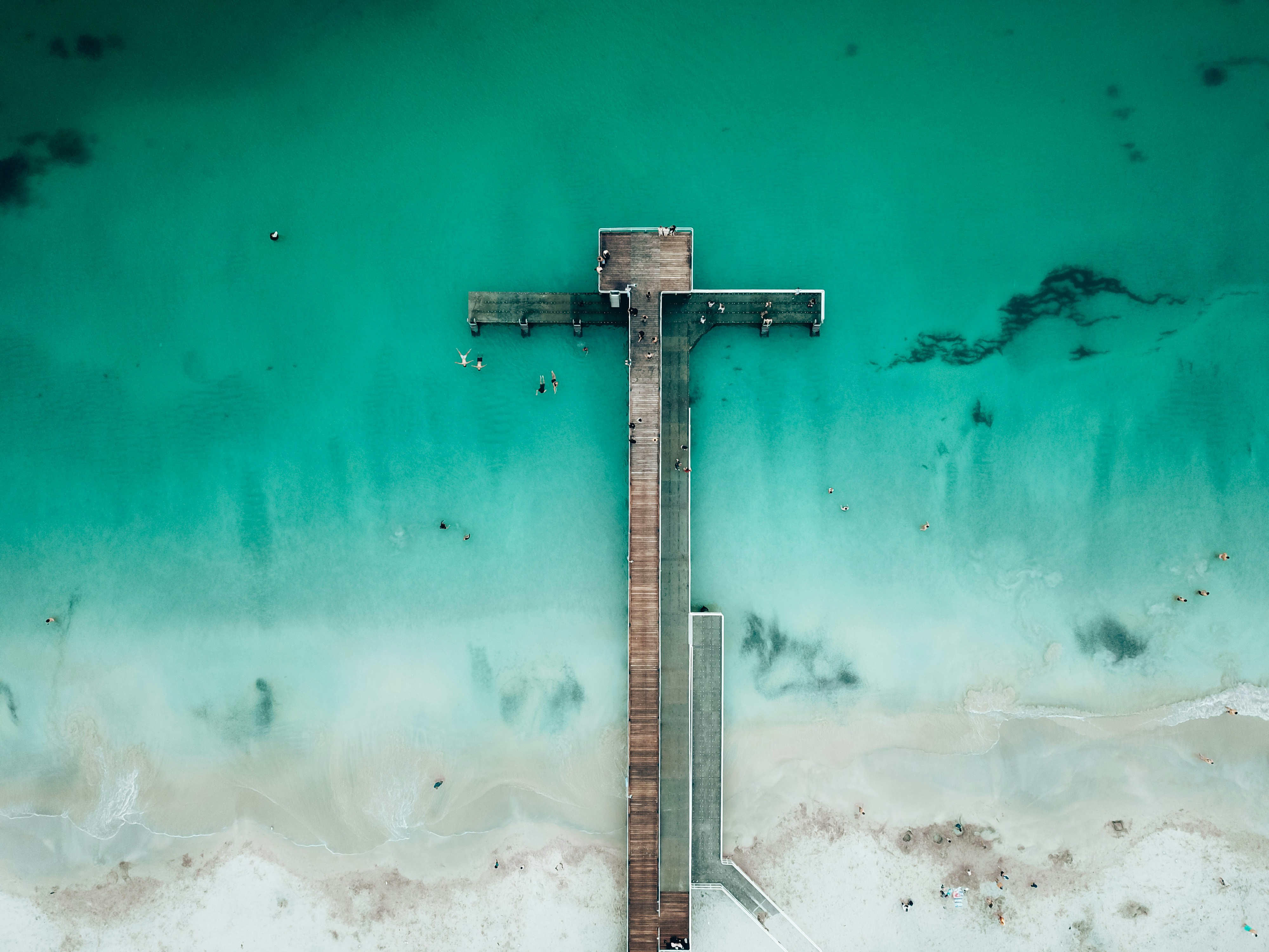
About Fremantle, Western Australia
The port city of Fremantle is a jewel in Western Australia's crown, largely because of its colonial architectural heritage and hippy vibe. Freo (as the locals call it) is a city of largely friendly, interesting, and sometimes eccentric residents supportive of busking, street art, and alfresco dining. Like all great port cities, Freo is cosmopolitan, with mariners from all parts of the world strolling the streets—including thousands of U.S. Navy personnel on rest and recreation throughout the year. It's also a good jumping-off point for a day trip to Rottnest Island, where lovely beaches, rocky coves, and unique wallaby-like inhabitants called quokkas set the scene.Modern Fremantle is a far cry from the barren, sandy plain that greeted the first wave of English settlers back in 1829 at the newly constituted Swan River Colony. Most were city dwellers, and after five months at sea in sailing ships they landed on salt-marsh flats that sorely tested their fortitude. Living in tents with packing cases for chairs, they found no edible crops, and the nearest freshwater was a distant 51 km (32 miles)—and a tortuous trip up the waters of the Swan. As a result they soon moved the settlement upriver to the vicinity of present-day Perth.Fremantle remained the principal port, and many attractive limestone buildings were built to service the port traders. Australia's 1987 defense of the America's Cup—held in waters off Fremantle—triggered a major restoration of the colonial streetscapes. In the leafy suburbs nearly every other house is a restored 19th-century gem.


About Abrolhos Islands, Western Australia
About Abrolhos Islands, Western Australia
About Cape Peron, Rockingham, Western Australia
About North Muiron Island
About Montebello Islands, Western Australia
About Dampier Archipelago, Western Australia
About Rowley Shoals, Western Australia
Rowley Shoals is regarded as one of the most incredible diving and snorkelling locations in the world. Three coral atolls; Mermaid, Clerke and Imperieuse reefs rise near vertical, from the surrounding crystal-clear waters on the edge of the continental shelf. Spot an array of rare, wonderful and vibrant marine wildlife who live within the corals and make for an exceptional diving and snorkelling exploration. To take full advantage of the location, Le Lapérouse will spend one and a half days at the Rowley Shoals, allowing you to swim and snorkel from Zodiac®.
About Lacepede Islands, Western Australia
The Lacepedes are a group of four islands, perfectly nestled off the Kimberley coast. The islands are imperative to Australia’s rich wildlife as they are key breeding habitats for Green Turtles and are home to a wealth of birds such as Masked Boobies, Australian Pelicans, Lesser Frigatebirds and the largest colony of Brown Bobbies in the world. Join your expedition team for a guided zodiac tour to view the prolific wildlife. Due to the sensitive nature of the environment, landings are prohibited on the Lacepede Islands.

About Talbot Bay, Western Australia

About Montgomery Reef, Western Australia
About Freshwater Cove
About Adele Island, Kimberley, Western Australia
About Ashmore and Cartier Islands
Ashmore Reef is a sanctuary for seabirds, shorebirds, marine turtles, dugongs, and many other marine species. Each year around 100,000 seabirds breed on Ashmore Reef including great knots, crested terns and white-tailed tropicbirds. The sanctuary zone provides the highest level of protection for wildlife.
About Swift Bay, Western Australia
The Bonaparte Archipelago is a rugged maze of islands that stretch almost 150km along Western Australia’s remote Kimberley coast. Remaining relatively unspoilt and remarkably pristine, Swift Bay is landscaped by heavily fractured sandstone providing an abundance of rock shelters. On the walls of these shelters are examples of both Wandjina and Gwion Gwion style rock art. Join your expedition team ashore for a guided walk to a number of rock art galleries depicting these unique rock art styles.

About Vansittart Bay, Western Australia
Vansittart Bay is a beautifully protected large bay with several islands and coves. Jar Island contains ancient rock art galleries depicting the Gwion Gwion style unique to the Kimberley region. Mainly neglected by, or unknown to, the early European researchers of Aboriginal culture in the Kimberley in favour of the dominant & more dramatic Wandjina art, Gwion Gwion art has in recent years gained world prominence. Join your Expedition Team ashore for a short walk, past some fascinating rock formations, to the site of the Gwion Gwion art galleries.

About Koolama Bay, Kimberley, Western Australia
About Darwin, Northern Territory
Darwin is Australia's most colorful, and exotic, capital city. Surrounded on three sides by the turquoise waters of the Timor Sea, the streets are lined with tropical flowers and trees. Warm and dry in winter, hot and steamy in summer, it's a relaxed and casual place, as well as a beguiling blend of tropical frontier outpost and Outback hardiness. Thanks to its close proximity to Southeast Asia and its multicultural population it also seems more like Asia than the rest of Australia. Darwin is a city that has always had to fight for its survival. The seductiveness of contemporary Darwin lifestyles belies a history of failed attempts that date from 1824 when Europeans attempted to establish an enclave in this harsh, unyielding climate. The original 1869 settlement, called Palmerston, was built on a parcel of mangrove wetlands and scrub forest that had changed little in 15 million years. It was not until 1911, after it had already weathered the disastrous cyclones of 1878, 1882, and 1897, that the town was named after the scientist who had visited Australia's shores aboard the Beagle in 1839. During World War II it was bombed more than 60 times, as the harbor full of warships was a prime target for the Japanese war planes. Then, on the night of Christmas Eve 1974, the city was almost completely destroyed by Cyclone Tracy, Australia’s greatest natural disaster. It's a tribute to those who stayed and to those who have come to live here after Tracy that the rebuilt city now thrives as an administrative and commercial center for northern Australia. Old Darwin has been replaced by something of an edifice complex—such buildings as Parliament House and the Supreme Court all seem very grand for such a small city, especially one that prides itself on its casual, outdoor-centric lifestyle. Today Darwin is the best place from which to explore Australia's Top End, with its wonders of Kakadu and the Kimberley region.
About Pulau Nai
About Triton Bay
In 2008, the Kaimana Regency declared a 6000 square kilometer (over 2,300 square mile) Marine Protected Area around the waters of Triton Bay. Conservation International maintains an office in Kaimana and a field station out in Triton Bay where visiting scientists can do their work studying the staggering marine biodiversity of the reserve. It is truly second to none, and the area offers everything from the tiniest pygmy seahorses, to large and graceful whale sharks. Triton Bay is known for its beautiful soft coral gardens as well as nesting green turtles, and a population of coastal Bryde’s whales.

About Sebakor Bay
About Misool, Raja Ampat
About Raja Ampat Islands

About Raja Ampat Islands
About Raja Ampat Islands
About Pulau Ayu
About Biak, Irian Jaya
About Vanimo
About Ali Island
About Madang
The eastern half of the island of New Guinea - second largest in the world - was divided between Germany (north) and the United Kingdom (south) in 1885. The latter area was transferred to Australia in 1902, which occupied the northern portion during World War I and continued to administer the combined areas until independence in 1975. A nine-year secessionist revolt on the island of Bougainville ended in 1997 after claiming some 20,000 lives. On the north coast of the island, we find colourful Madang, called the “prettiest town in the South Pacific”. Its peninsula-setting is a showplace of parks, waterways, luxuriant shade trees and sparkling tropical islands. Although small, the town has modern urban facilities, including hotels, department stores, markets and art shops. The people of Madang can be broken into four distinct groups - islanders, coastal people, river people and mountain people. These groups are similar in appearance except for the smaller Simbai mountain tribesmen from the foothills. The traditional dress consists mainly of traditional dyed multi-coloured grass skirts made out of either pandanas leaves or sago palm. The women from the mountain areas wear skirts that are colourless, narrow and stringy. Unlike the women, men wear meshy net aprons in front and a clutter of target leaves astern.
About Garove Island
About Rabaul, Bismarck Archipelago
Rabaul, the former provincial capital, has quite a remarkable location. The town is inside the flooded caldera of a giant volcano and several sub-vents are still quite active today! The fumes of the volcano Tavurvur can be seen continually and the town suffered greatly during the last major eruption of 1994 when some 80% of the houses collapsed due to the ash raining down onto their roofs. Rabaul has a Volcano Observatory sitting atop the town’s center, monitoring the 14 active and 23 dormant volcanoes in Papua New Guinea. A small museum opposite the bunker used by Yamamoto during World War II shows exhibits relating to Rabaul’s local, German, Australian and Japanese past from the 19th century to Papua New Guinea’s independence in the 1970s.

About Kasolo Island
About Mbili Island
About Santa Ana Island
Port Mary is the name of the bay adjacent to Ghupuna, the main village in Santa Ana. A bright white sand beach with huge shade-giving trees runs along the shoreline in front of the tidy village. The houses here are made with local materials and most are built on stilts. Islanders generally welcome visitors with traditional songs and dances performed by members of the three different villages on Santa Ana. Some local people will also set up stands offering souvenirs for purchase. The Solomons are best known for strings of traditional shell money and elegant carvings based on local stories and legends.
About Champagne Bay, Espiritu Santo Island

About Ambrym
Unlike Espiritu Santo with its raised coral reefs and white sand, Ambrym is a volcanically active island with dark sand beaches. Ambrym is known as the island of magic and is the source of five local languages that all evolved on Ambrym. This handful of languages contributes to the well over 100 languages of Vanuatu. Some of Ambrym’s magic takes place in the lush greenery of the local community of Ranon. Here the people perform a very special and traditional ‘Rom’ dance. Participants prepare their masks and costumes in secrecy and the dance is reserved for special occasions.
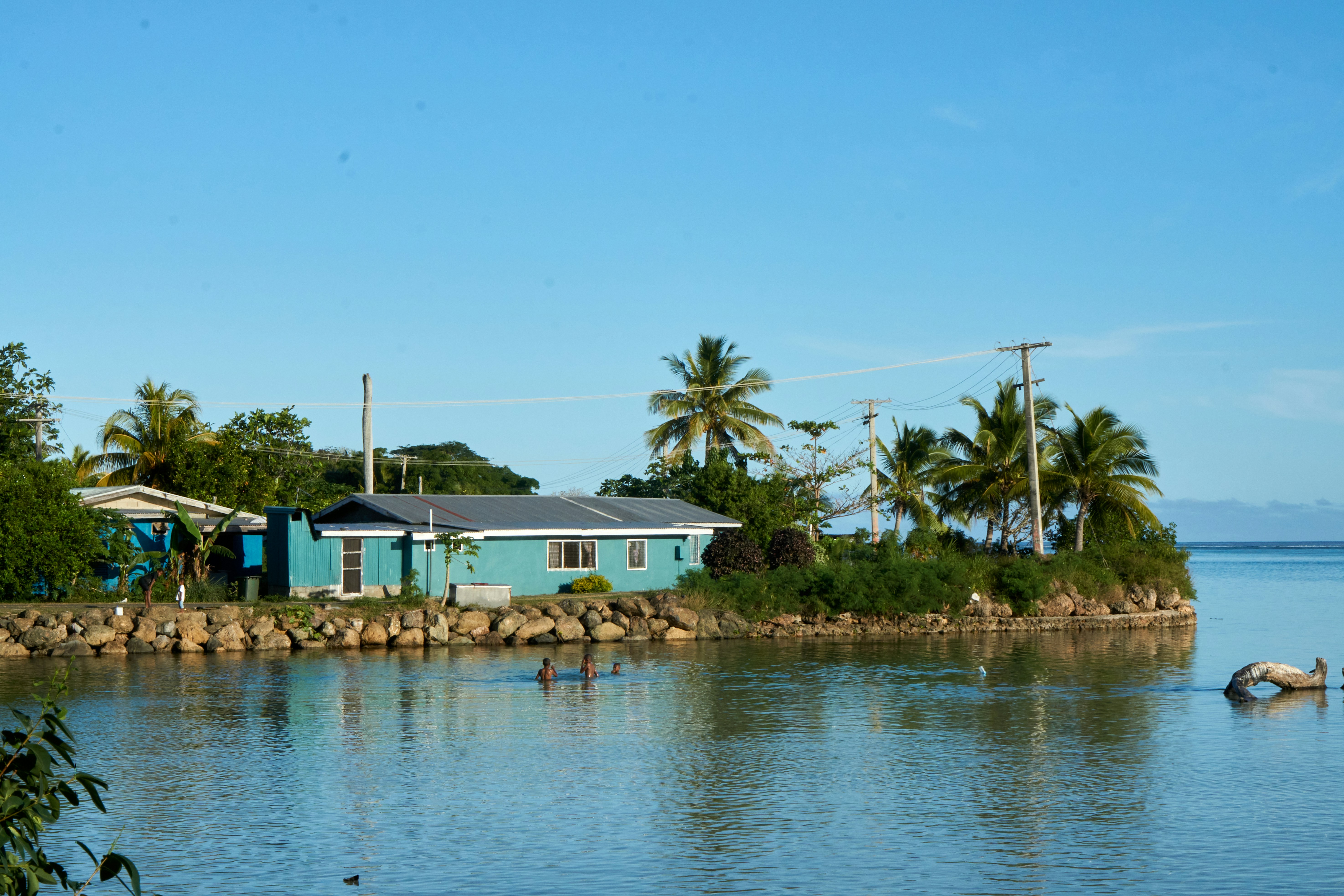
About Lautoka
North of Nadi through sugarcane plantations and past the Sabeto Mountains is Lautoka, nicknamed the Sugar City for the local agriculture and its big processing mill. With a population of around 50,000, it's the only city besides Suva and, like the capital, has a pleasant waterfront. It's the sailing point for Blue Lagoon and Beachcomber Cruises but is otherwise unremarkable for tourists, itself having few hotels and fewer good restaurants. Locals recommend the city as a less-expensive place to shop for clothing, but note that it can take as long as 45 minutes to drive here. Legend has it that Lautoka acquired its name when two chiefs engaged in combat and one hit the other with a spear. He proclaimed "lau toka" (spear hit) and thus the future town was named.
About Leleuvia Island
About Fulaga Island

About Uoleva Island
Within the Polynesian nation of Tonga, an archipelago of 169 islands (only 36 of which are inhabited), lies the sand-cay Uoleva Island, one of the Ha'apai islands of Tonga. Uoleva Island is one of the most beautiful and protected anchorages in Tonga and is mostly uninhabited but for its three small resorts. On Uoleva Island visitors will discover pristine, palm tree-lined white sand beaches and clear, light blue waters. In addition to reaching Uoleva by boat, it can also be reached by foot (via a 30-minute strenuous walk); the reef between the north tip of Uoleva and the south tip of Lifuka is shallow enough at low tide to walk across. Uoleva is one of the best places in Tonga for humpback whale sightings, and snorkelers appreciate its clear waters teeming with ocean life.
About Neiafu
With a population of 6,000, Neiafu is the capital city and the second largest municipality in the Polynesian nation of Tonga (a 169-island archipelago in the South Pacific). The city is situated in a deep- water harbor (Port of Refuge) on the south coast of Vava͛u, the main island of the Vava͛u archipelago in northern Tonga. The waters of this region are known for their clarity and beauty, and the area attracts many humpback whales between June and November. A popular destination in Neiafu is the Ene͛io Botanical Garden, a bird sanctuary that promotes the survival of exotic and native bird species as well as supports and conserves a diverse array of plant life. The island's city life can be experienced at the numerous cafes and restaurants that welcome visitors.
About Niuatoputapu
About Aitutaki
Even high praise like the 'world's most beautiful island' from Lonely Planet's co-founder, Tony Wheeler, won't prepare you for the intoxicating intensity of the coal blue ocean, the glow of the pure white sand, and the soothing ripple of the palm-tree forests at incredible Aitutaki. Breathless romance hangs thick in the air here, especially when a riot of purples, reds and oranges are spreading across the sky, accompanying the sun's descent each evening. It wasn't until 1789 that Europeans discovered this island haven, with the HMS Bounty's crew arriving, just a few weeks before a mutiny tore them apart. The Europeans were beaten to the islands, however, by the streamlined wooden canoes of the Polynesian settlers, who arrived around 900AD. While Western missionaries would eventually visit to spread Christianity to the island - evidenced by the white, coral-encrusted walls of the many churches - their efforts to repress the people’s deep love of communal singing and dancing ultimately failed, and music forms a key component of the islanders' culture to this day.The beaches here are flawless, and swaying in a hammock, suspended between leaning palm trees, as the ocean gently ruffles the sand nearby, feels gloriously indulgent. Aitutaki Lagoon is a huge aquamarine pool of water, alive with a kaleidoscopic swirl of tropical fish, which lurk just below the surface. You may even be lucky enough to spot turtles padding across the sand, scraping themselves towards the open ocean.The snorkelling opportunities here, and on One Foot Island - where you'll want to acquire the badge of honour of having your passport stamped with the island's iconic huge footprint - are sublime. Don't miss the tiny island of Moturakau either, which is crammed full of exotic birds and crabs, who have dominion over the island's tangled, jungle terrain.

About Palmerston Island
The low-lying atoll of Palmerston is inhabited by three families, all descendants of William Marsters (1831-1899). Members of the community are known to greet visitors and guide small boats into the lagoon through a maze of coral reef. Once ashore, the whole community generally turns out to meet visitors as it is a rare occurrence. The island’s highlights include a church, the oldest house, the cemetery, the school, the underground gardens and “Duke’s Pool,” inviting for a swim or snorkel. In the lagoon’s waters it is possible to find colorful reef-fish, sea cucumbers, rays, and sea turtles. Overhead there is birdlife including tropicbirds, boobies, noddies, frigatebirds and terns.
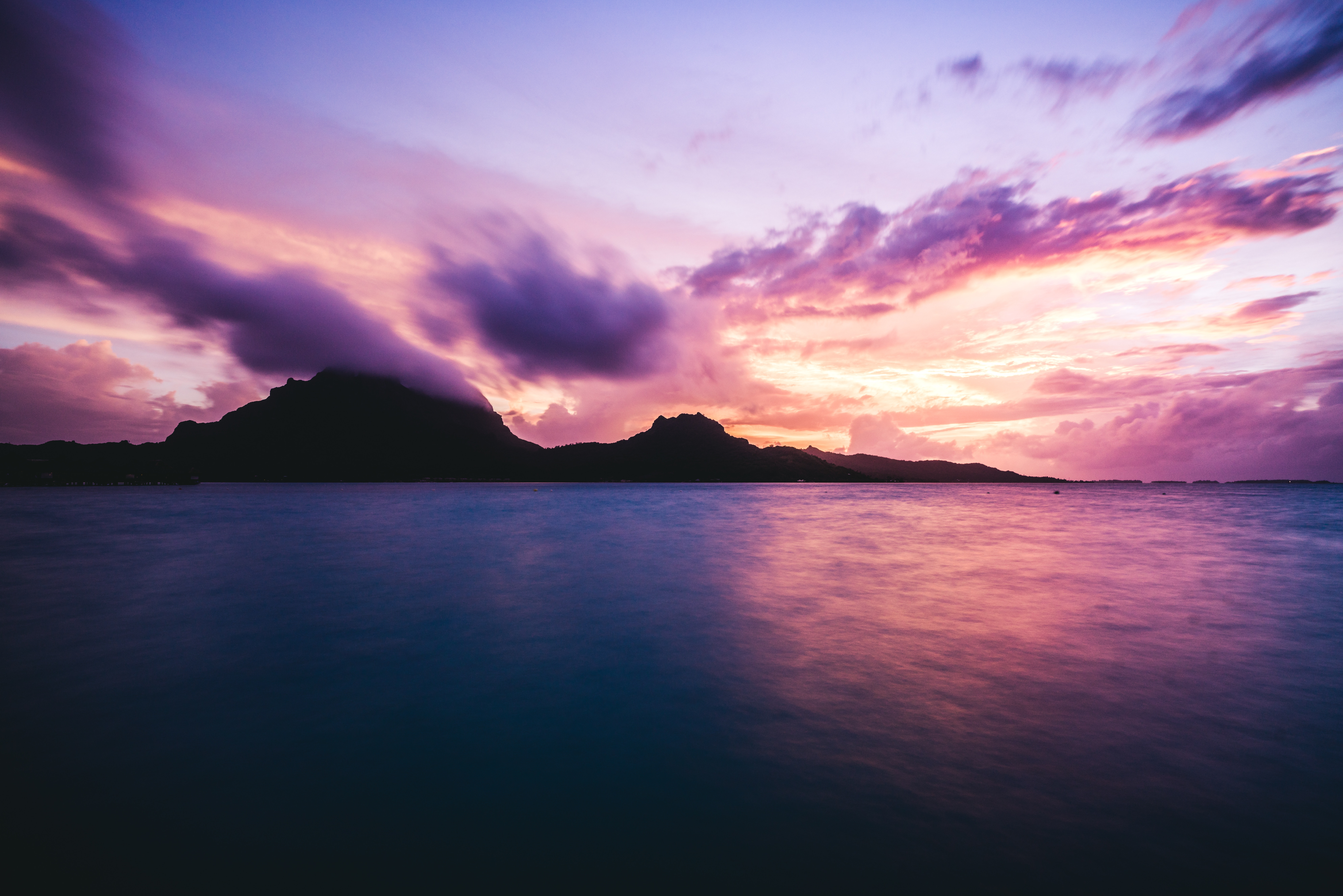
About Bora-Bora
Simply saying the name Bora Bora is usually enough to induce gasps of jealousy, as images of milky blue water, sparkling white beaches and casually leaning palm trees immediately spring to mind. The imagination doesn't lie, either, and if you visit, you’ll soon realise this island is every bit as gorgeous as you ever imagined. Thatched wooden huts stand out over shallow, sparkling seawater, with vivid fish swirling just below. Soak up the sun, scuba dive, or simply revel in the opulent luxury of one of the island's many magnificent resorts. If blissful inactivity doesn't appeal, then get active, and hike the greenery of the sharp Mount Pahia.


About Papeete, Tahiti
Papeete will be your gateway to the tropical paradise of French Polynesia, where islands fringed with gorgeous beaches and turquoise ocean await to soothe the soul. This spirited city is the capital of French Polynesia, and serves as a superb base for onward exploration of Tahiti – an island of breathtaking landscapes and oceanic vistas. Wonderful lagoons of crisp, clear water beg to be snorkelled, stunning black beaches and blowholes pay tribute to the island's volcanic heritage, and lush green mountains beckon you inland on adventures, as you explore extraordinary Tahiti. Visit to relax inside picturesque stilted huts, which stand out over shimmering water, as you settle into the intoxicating rhythm of life, in this Polynesian paradise.
About Rangiroa

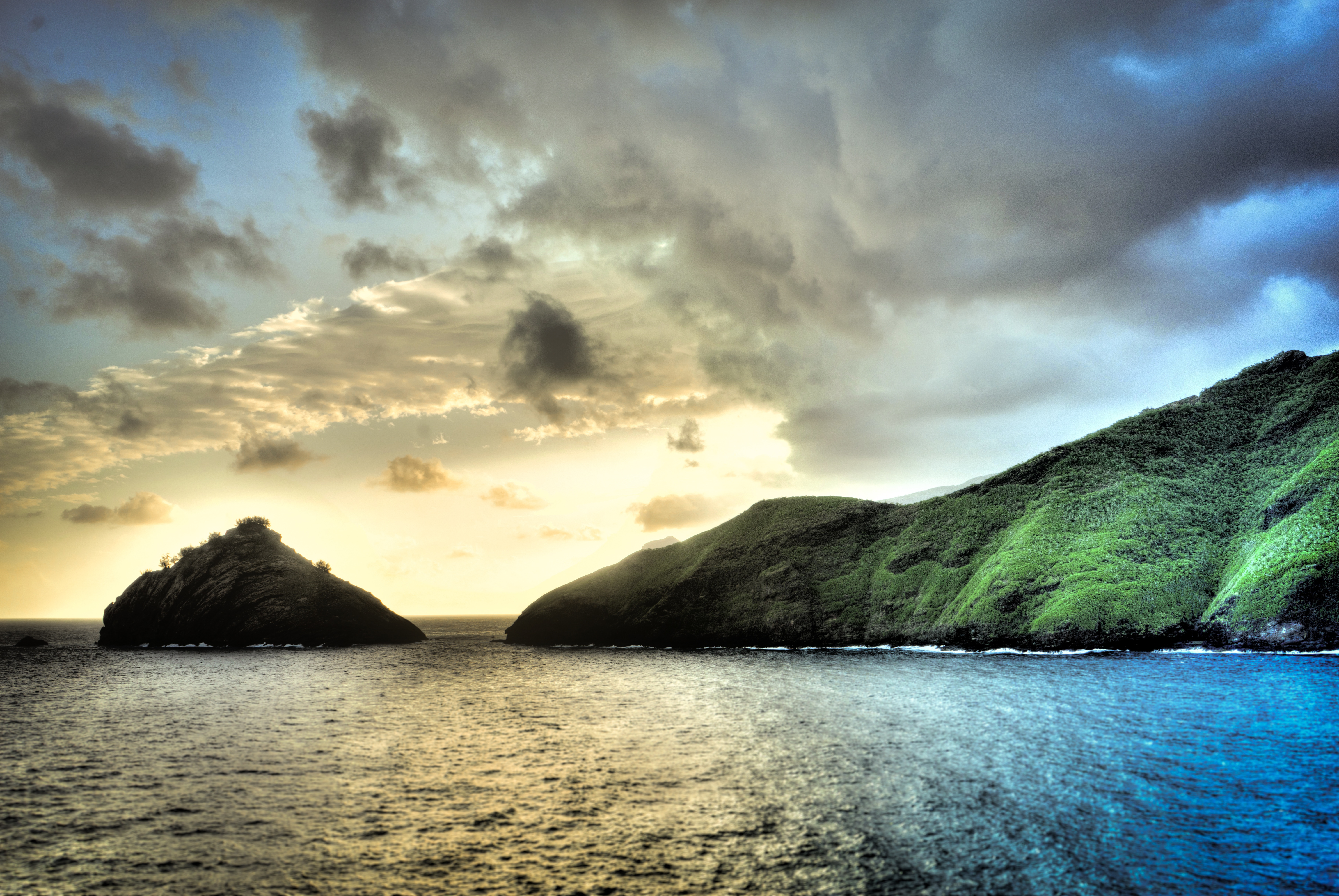
About Nuku Hiva Island

About Omo'a, Fatu Hiva

About Hana Vave, Fatu Hiva Island
About Tahuata Island
About Atuona, Hiva Oa
About Pitcairn Island
With a total of 56 residents on the island, Adamstown is the capital of the Pitcairn Islands and the only populated settlement, as all of the other Pitcairn Islands are uninhabited (although were populated by Polynesians in the 11th through 15th centuries). Halfway between Peru and New Zealand, Pitcairn was the perfect hiding spot for the famed HMS Bounty mutineers and their Tahitian wives. Not only had the island been misplaced on early maps of the region, but it can also be very difficult to come ashore as large breakers tend to build up just in front of the small harbour of Bounty Bay. On shore visit the local museum that houses the HMS Bounty Bible, the historic Adamstown Church, view Fletcher Christian’s cave, or keep an eye out for the Pitcairn Reed Warbler.
About Hangaroa, Easter Island
Discovered (by the Western world) on Easter Sunday, 1722, Easter Island is a UNESCO World Heritage Site and one of the most isolated places on the face of the Earth, some 2,300 miles from the Chilean mainland. Although more Polynesian than South American in character, the 64-square mile island was annexed by Chile in 1888, and is now famous as the world’s largest ‘open air museum’ on account of the Moai, or human-like stone statues, that can be found on the island. The Moai remain very much a mystery, which archaeologists are still trying to unlock by interpreting an ancient language of the Rapa Nui, which is the key to understanding this culture, and is written on the so called ‘rongo rongo tablets’. The island owes its origin to three volcanoes which erupted some three million years ago: Poike, Rano Kau and Maunga Terevaka. It is not known when or how the island was first populated, but the most credible theory suggests that the Rapa Nui people came from other Pacific islands in the 4th century AD. In addition to the cultural and archaeological interest, there are the beautiful beaches, transparent waters, and coral reefs that might be expected of a Pacific Island.
About Alejandro Selkirk Island
Alejandro Selkirk Island is part of the Juan Fernandez archipelago. The island itself was renamed in 1966 after the marooned sailor who served as the template for Daniel Defoe’s novel Robinson Crusoe, although Alejandro Selkirk was a castaway on a different island, named Robinson Crusoe Island. Alejandro Selkirk is located 165 kilometres west of the other islands in the archipelago. Throughout much of its history, the island has been uninhabited, although there is a former penal settlement on the middle of the east coast, which operated from 1909 to 1930. During the summer months, Selkirk welcomes a community of lobster fishermen and their families who come from Robinson Crusoe. As part of the Chilean National Park, it also holds the UNESCO World Biosphere Reserve title. The island is home to a number of rare and endangered plant and animal species. One of those iconic species—the Masafuera Rayadito—is found only on Selkirk; its global population numbers in the low hundreds and it is of particular interest to researchers and those looking to prevent species extinctions.

About San Juan Bautista (Robinson Crusoe Island)
Robinson Crusoe Island is located 600 kilometres off the coast of Chile. The island is a rugged volcanic speck where 70 percent of its plant species are endemic, and is the largest of the Juan Fernandez Islands, a small archipelago that since 1935 is a Chilean National Park which was declared a UNESCO World Biosphere Reserve. This island has witnessed and played an important role in Chilean and world history. In 1750 the village of San Juan Bautista was founded at Cumberland Bay and by 1779 there were already 7 fortresses bristling with guns. The island’s isolation offered Spain a splendid place for setting up a penal colony, to which high-ranking Chilean patriots were deported in the early 19th century. In 1915, during the First World War, three British ships and a German one, the Dresden, engaged in a sea battle which ended with the scuttling of the German cruiser. Today there are currently around one thousand people living in the archipelago, most of them in the village of San Juan Bautista engaged in fishing for the “pincer-less lobster”, a delicacy in the mainland.
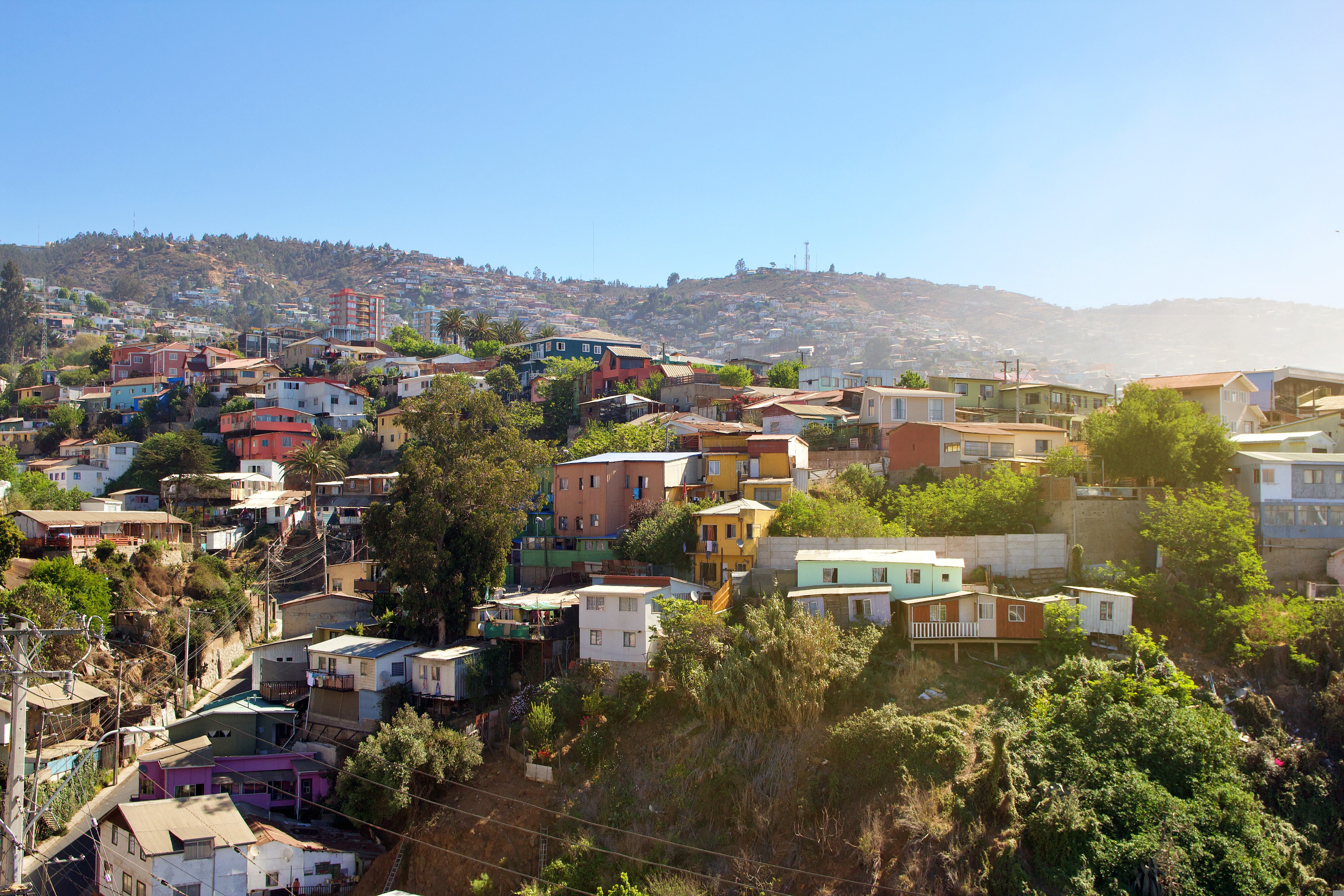
About Valparaiso
Valparaíso's dramatic topography—45 cerros, or hills, overlooking the ocean—requires the use of winding pathways and wooden ascensores (funiculars) to get up many of the grades. The slopes are covered by candy-color houses—there are almost no apartments in the city—most of which have exteriors of corrugated metal peeled from shipping containers decades ago. Valparaíso has served as Santiago's port for centuries. Before the Panama Canal opened, Valparaíso was the busiest port in South America. Harsh realities—changing trade routes, industrial decline—have diminished its importance, but it remains Chile's principal port. Most shops, banks, restaurants, bars, and other businesses cluster along the handful of streets called El Plan (the flat area) that are closest to the shoreline. Porteños (which means "the residents of the port") live in the surrounding hills in an undulating array of colorful abodes. At the top of any of the dozens of stairways, the paseos (promenades) have spectacular views; many are named after prominent Yugoslavian, Basque, and German immigrants. Neighborhoods are named for the hills they cover. With the jumble of power lines overhead and the hundreds of buses that slow down—but never completely stop—to pick up agile riders, it's hard to forget you're in a city. Still, walking is the best way to experience Valparaíso. Be careful where you step, though—locals aren't very conscientious about curbing their dogs.


Where You'll Go


