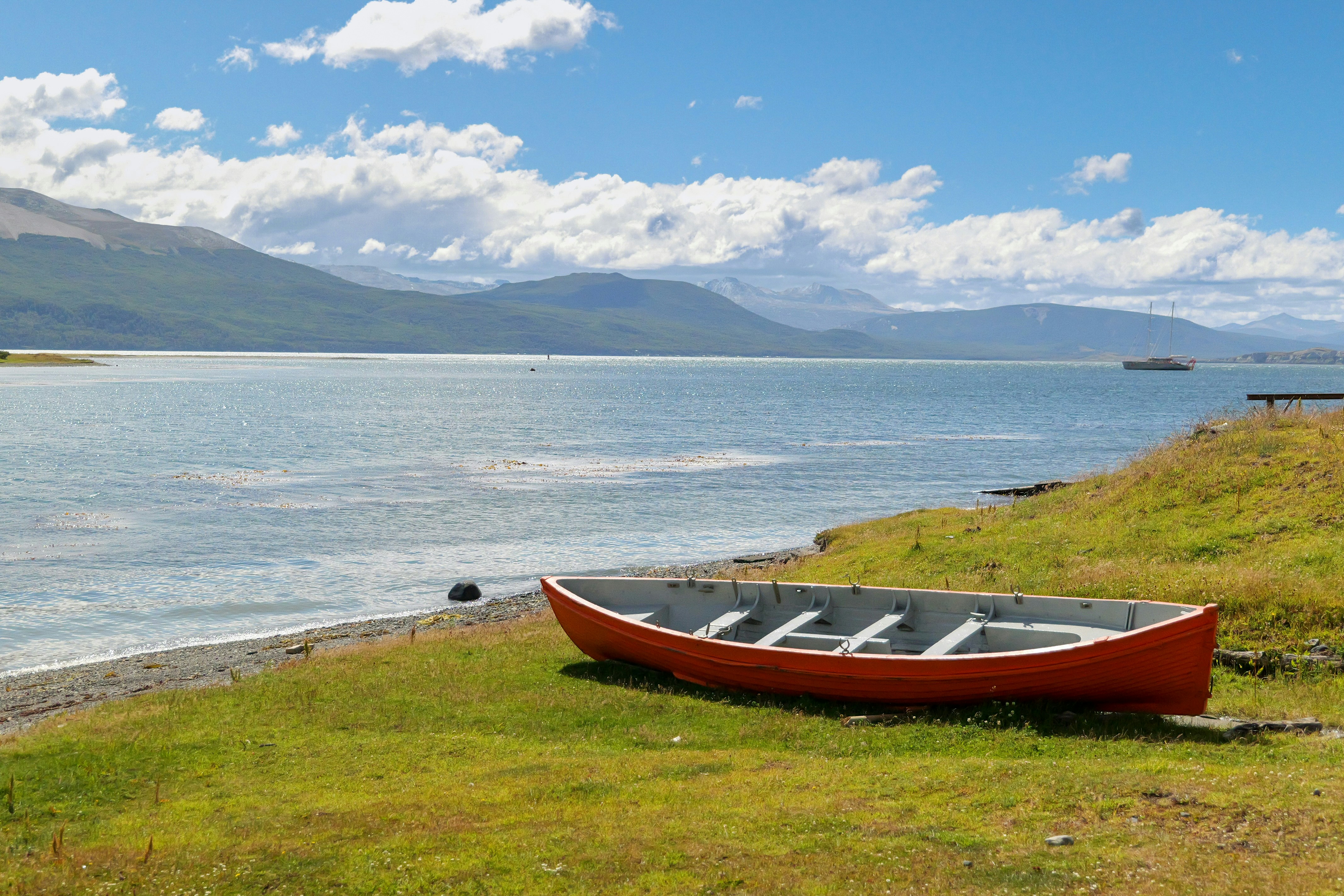
Puerto Williams to Ushuaia
Puerto Williams to Ushuaia
Cruise overview
WHY BOOK WITH US?
- ✔ The Deluxe Cruises’ team has extensive experience in ultra-luxury cruising.
- ✔ Call now to speak to our helpful and experienced Cruise Concierge team.
- ✔ Enjoy our Unique Deluxe Cruises Bonus for substantial savings.
- ✔ Our team will tailor your holiday to your exacting requirements.
- ✔ As agents, we work under the protection of each cruise lines ABTA / ATOL licences
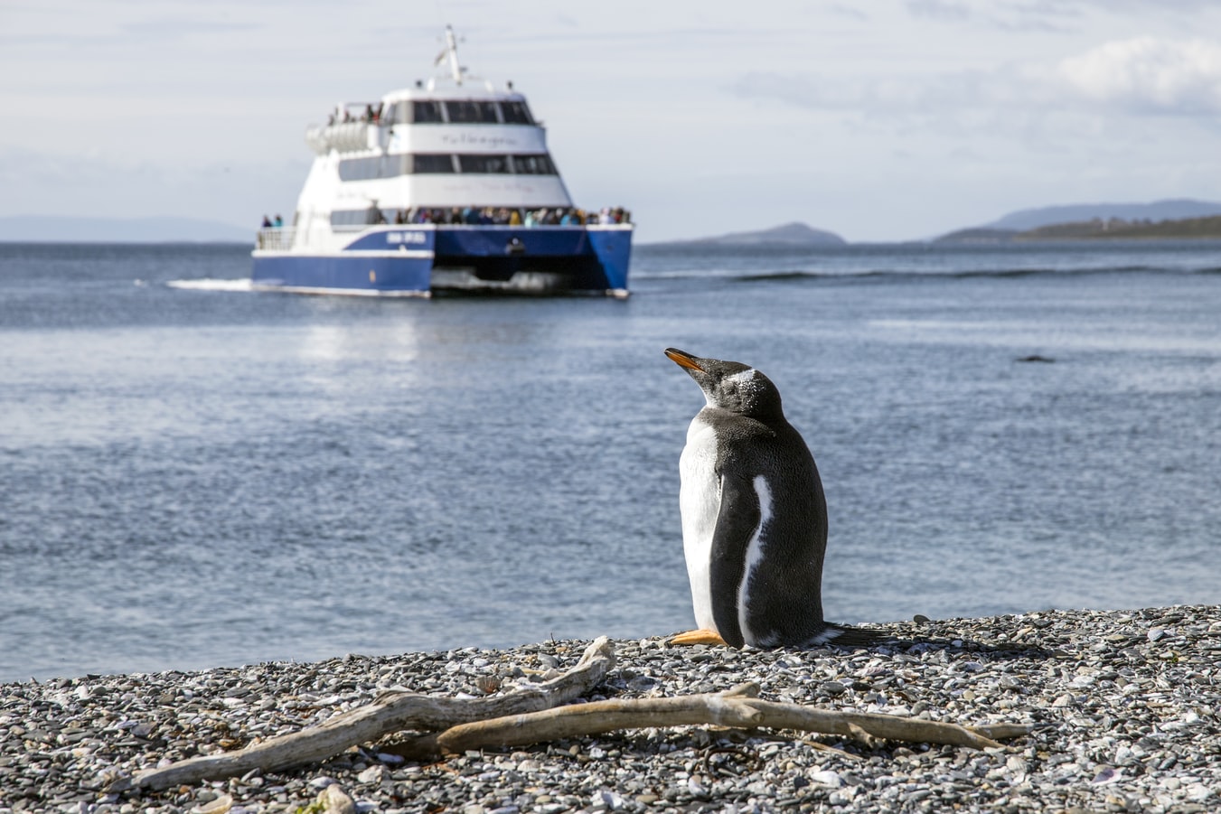
About Puerto Williams
About Antarctic Sound
The Antarctic Sound is a stretch of water named after the first ship to have passed through this body of water from the Bransfield Strait to the Weddell Sea in 1902. The Antarctic eventually sank and crew and scientists had to spend quite some time in this area before they could be rescued. Sites that have to do with this story - like Hope Bay or Paulet Island - are sometimes visited. At Paulet, Hope Bay and Brown Bluff Adelie and Gentoo Penguins breed, as do Kelp Gulls and Cape Petrels, Snow Petrels and Skuas. The Sound’s main attractions are the spectacular tabular icebergs that come from the Larsen Ice Shelf further south.
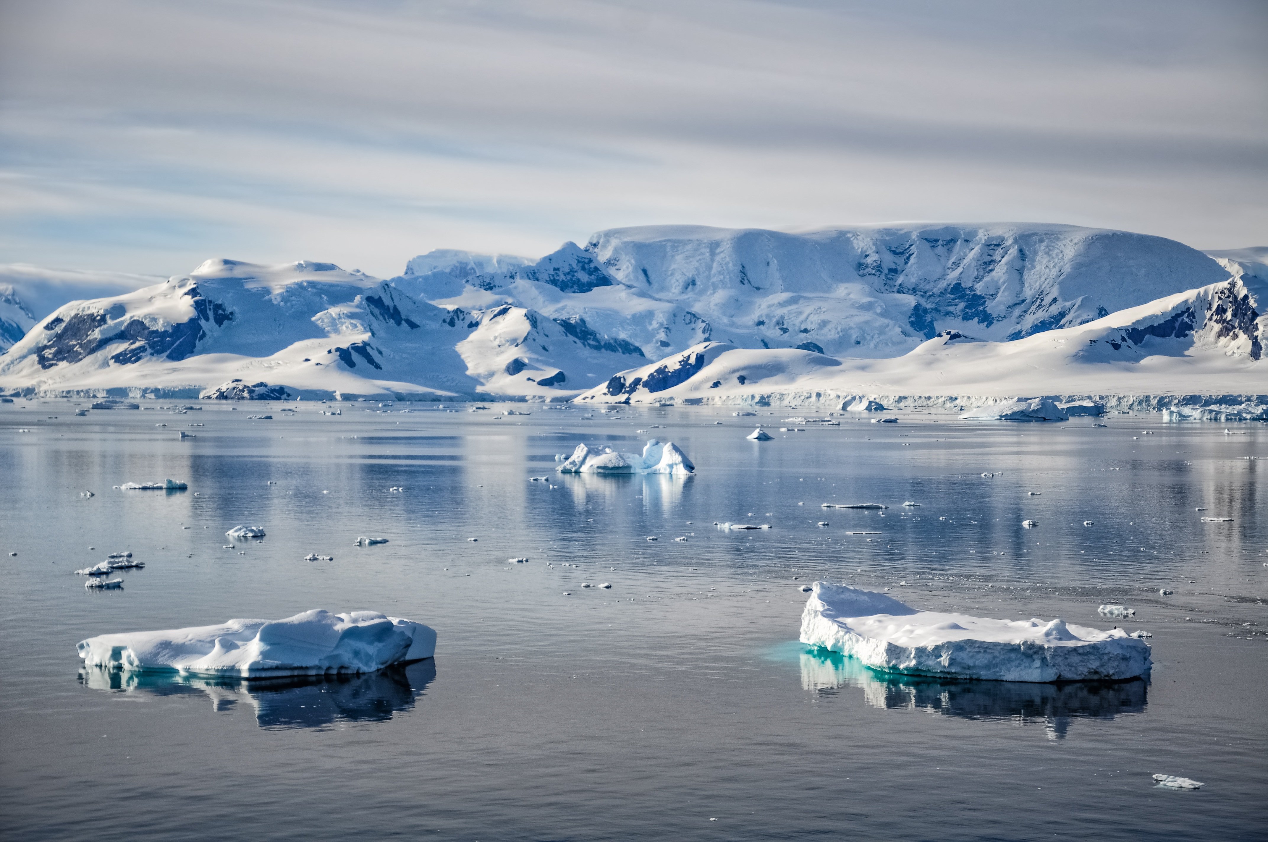
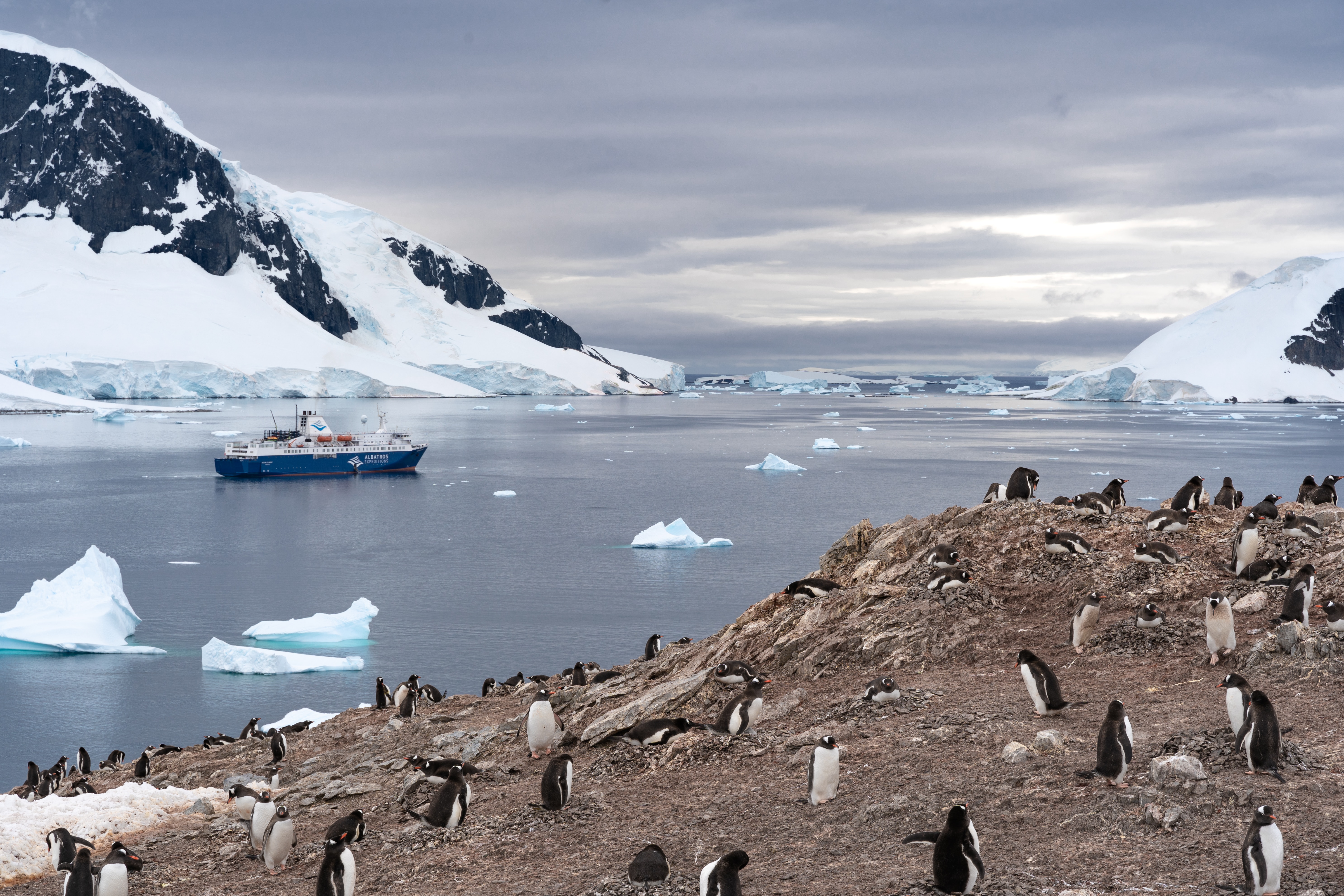
About Antarctic Peninsula
Remote and otherworldly, Antarctic is irresistible for its spectacular iceberg sculptures and calving glaciers, and for the possibility of up-close encounters with marine mammals and the iconic penguins. The Antarctic Peninsula – the main peninsula closest to South America – has a human history of almost 200 years, with explorers, sealers, whalers, and scientists who have come to work, and eventually intrepid visitors coming to enjoy this pristine and remote wilderness. It is a region of protected bays, unscaled snow-capped mountains, vast glaciers and a few places where whalers or scientists have worked. Just as irresistible are the many Gentoo and Chinstrap Penguin colonies, the seals basking on ice floes, the whales and orcas.
About South Shetland Islands
Some 770 kilometers (478 miles) south of Cape Horn, the South Shetland Islands are usually the first land seen in Antarctica. Separated from the Antarctic Peninsula by the Bransfield Strait, nine major islands make up the group. The region was the first to be exploited by sealers in the early 19th century, and because of its proximity to South America, it still is the most visited by scientists and tourists. Chinstrap, Adelie, Gentoo and Macaroni Penguins all breed here. In addition, because it is the warmest part of the continent, large moss beds as well as orange, black, grey and green lichens grow –even hair grass and pearlwort manage to survive. Leopard seals, Weddell seals, crabeater seals, Southern elephant seals and Antarctic fur seals can be seen in the water and on the beaches.
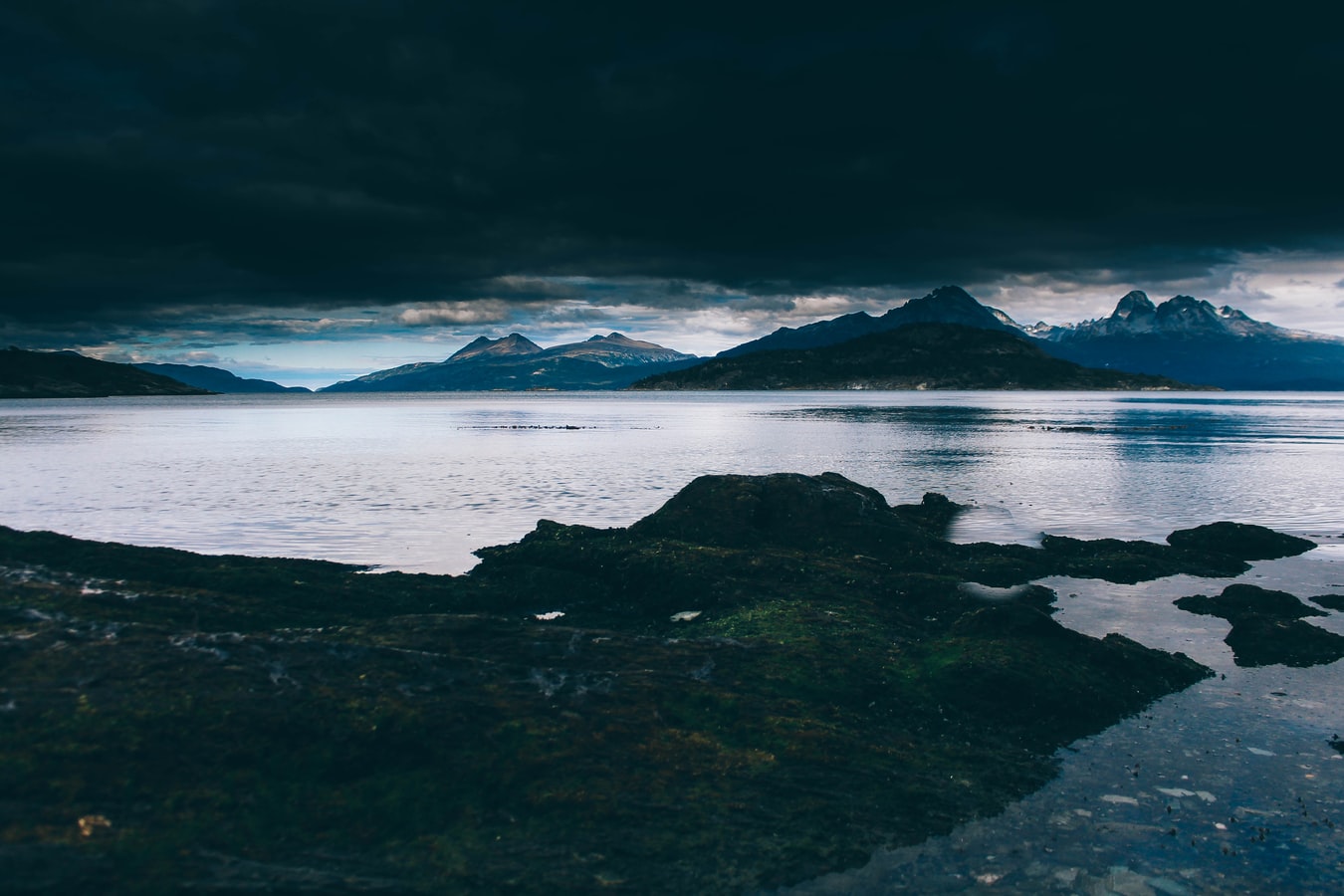
About Ushuaia
At 55 degrees latitude south, Ushuaia (pronounced oo-swy-ah) is closer to the South Pole than to Argentina's northern border with Bolivia. It is the capital and tourism base for Tierra del Fuego, the island at the southernmost tip of Argentina.Although its stark physical beauty is striking, Tierra del Fuego's historical allure is based more on its mythical past than on rugged reality. The island was inhabited for 6,000 years by Yámana, Haush, Selk'nam, and Alakaluf Indians. But in 1902 Argentina, eager to populate Patagonia to bolster its territorial claims, moved to initiate an Ushuaian penal colony, establishing the permanent settlement of its most southern territories and, by implication, everything in between.When the prison closed in 1947, Ushuaia had a population of about 3,000, made up mainly of former inmates and prison staff. Today the Indians of Darwin's "missing link" theory are long gone—wiped out by diseases brought by settlers and by indifference to their plight—and the 60,000 residents of Ushuaia are hitching their star to tourism.The city rightly (if perhaps too loudly) promotes itself as the southernmost city in the world (Puerto Williams, a few miles south on the Chilean side of the Beagle Channel, is a small town). You can make your way to the tourism office to get your clichéd, but oh-so-necessary, "Southernmost City in the World" passport stamp. Ushuaia feels like a frontier boomtown, at heart still a rugged, weather-beaten fishing village, but exhibiting the frayed edges of a city that quadrupled in size in the '70s and '80s and just keeps growing. Unpaved portions of Ruta 3, the last stretch of the Pan-American Highway, which connects Alaska to Tierra del Fuego, are finally being paved. The summer months (December through March) draw more than 120,000 visitors, and dozens of cruise ships. The city is trying to extend those visits with events like March's Marathon at the End of the World and by increasing the gamut of winter activities buoyed by the excellent snow conditions.A terrific trail winds through the town up to the Martial Glacier, where a ski lift can help cut down a steep kilometer of your journey. The chaotic and contradictory urban landscape includes a handful of luxury hotels amid the concrete of public housing projects. Scores of "sled houses" (wooden shacks) sit precariously on upright piers, ready for speedy displacement to a different site. But there are also many small, picturesque homes with tiny, carefully tended gardens. Many of the newer homes are built in a Swiss-chalet style, reinforcing the idea that this is a town into which tourism has breathed new life. At the same time, the weather-worn pastel colors that dominate the town's landscape remind you that Ushuaia was once just a tiny fishing village, snuggled at the end of the Earth.As you stand on the banks of the Canal Beagle (Beagle Channel) near Ushuaia, the spirit of the farthest corner of the world takes hold. What stands out is the light: at sundown the landscape is cast in a subdued, sensual tone; everything feels closer, softer, and more human in dimension despite the vastness of the setting. The snowcapped mountains reflect the setting sun back onto a stream rolling into the channel, as nearby peaks echo their image—on a windless day—in the still waters.Above the city rise the last mountains of the Andean Cordillera, and just south and west of Ushuaia they finally vanish into the often-stormy sea. Snow whitens the peaks well into summer. Nature is the principal attraction here, with trekking, fishing, horseback riding, wildlife spotting, and sailing among the most rewarding activities, especially in the Parque Nacional Tierra del Fuego (Tierra del Fuego National Park).
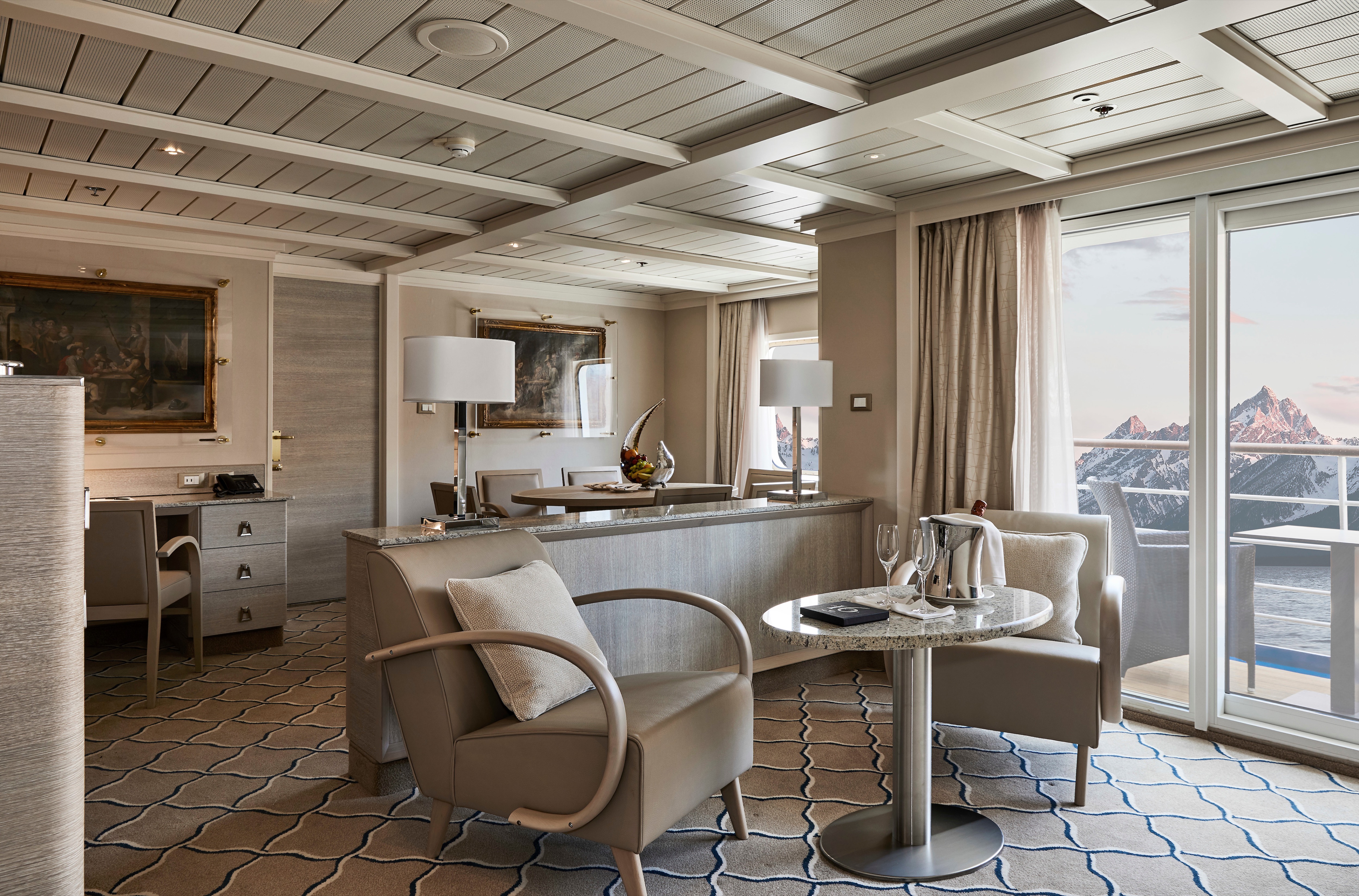
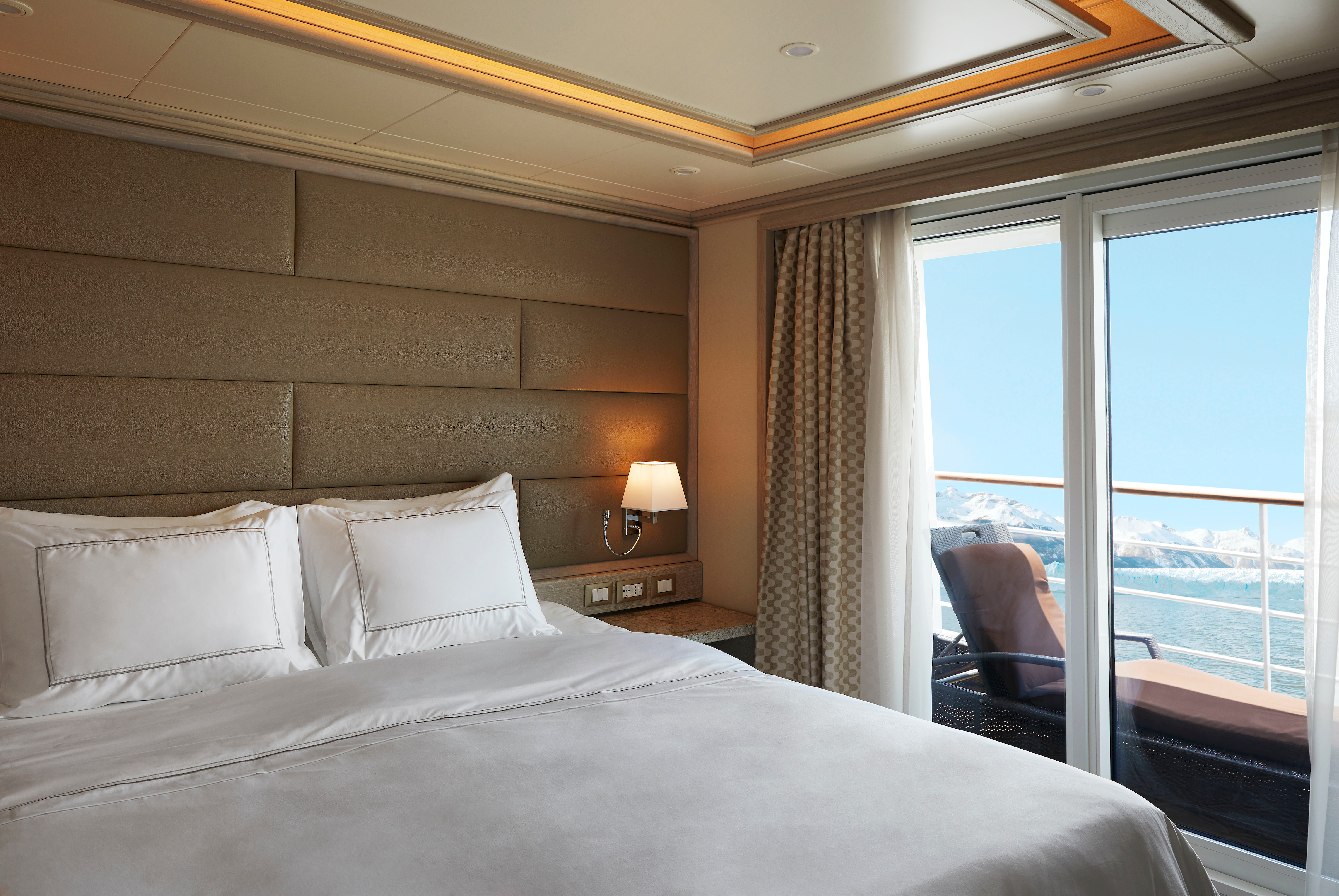
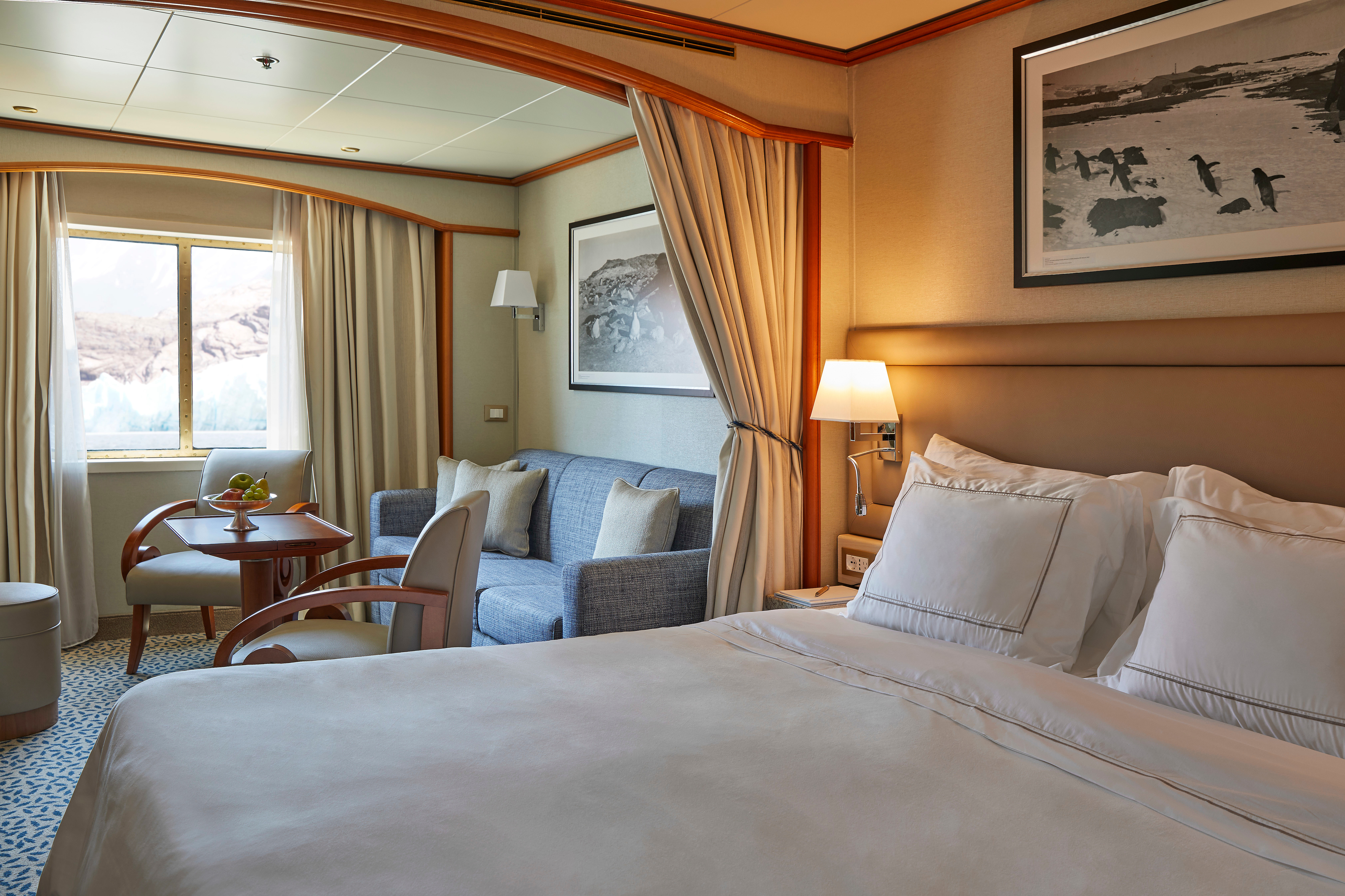
This stylish apartment offers the superlative in levels of space, comfort, and service on board. A perfect mix of expedition experience with luxury lifestyle. Available in a one-bedroom configuration or as two bedrooms by adjoining with a Vista Suite.
One bedroom: 55 sq m including veranda (8 sq m)
Two bedrooms: 77 sq m including veranda (8 sq m)
Images are intended as a general reference. Features, materials, finishes and layout may be different than shown.
Please note that the 3rd guest will sleep on a comfortable sofa bed in the reception area of the suite.
Essentials
- Deck(s): 7
- Section: Mid-Ship
Characteristics
- Veranda
- Separate dining area
- Living room with sitting area
- Standard vanity
- Separate shower
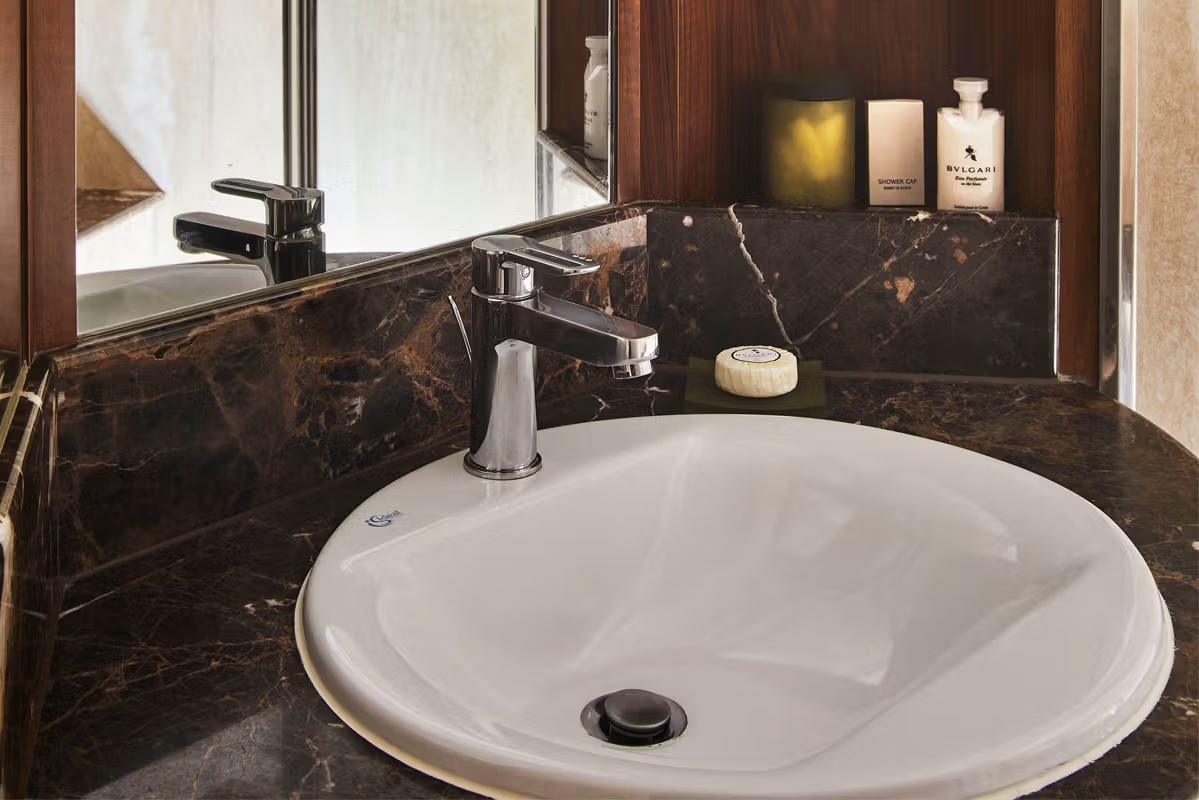
- Whirlpool bath
- Walk-in wardrobe with personal safe
Furniture
- King size bed
- Writing desk
- Vanity table
- Luxury bed mattresses
Media & Communication
- Unlimited Premium Wi-Fi
- 2 large flat screen TVs with Interactive Media Library
- Sound system with bluetooth connectivity
- Direct dial telephone
- Wall mounted USB-C mobile device chargers
- Dual voltage 110/220 outlets
Onboard Services
- Butler service
- Complimentary laundry, pressing & wet cleaning
- Daily canapé service, Welcome chocolate, Welcome fruit stand
- Dinner for two in La Dame, one evening per voyage,
- Two hours of worldwide phone use, per voyage segment
- Champagne on arrival
Amenities
- Espresso machine
- Pillow menu
- Refrigerator and bar setup stocked with your preferences
- Plush bathrobe
- Luxury bath amenities
- Umbrella
- Hair Dryer
- Slippers
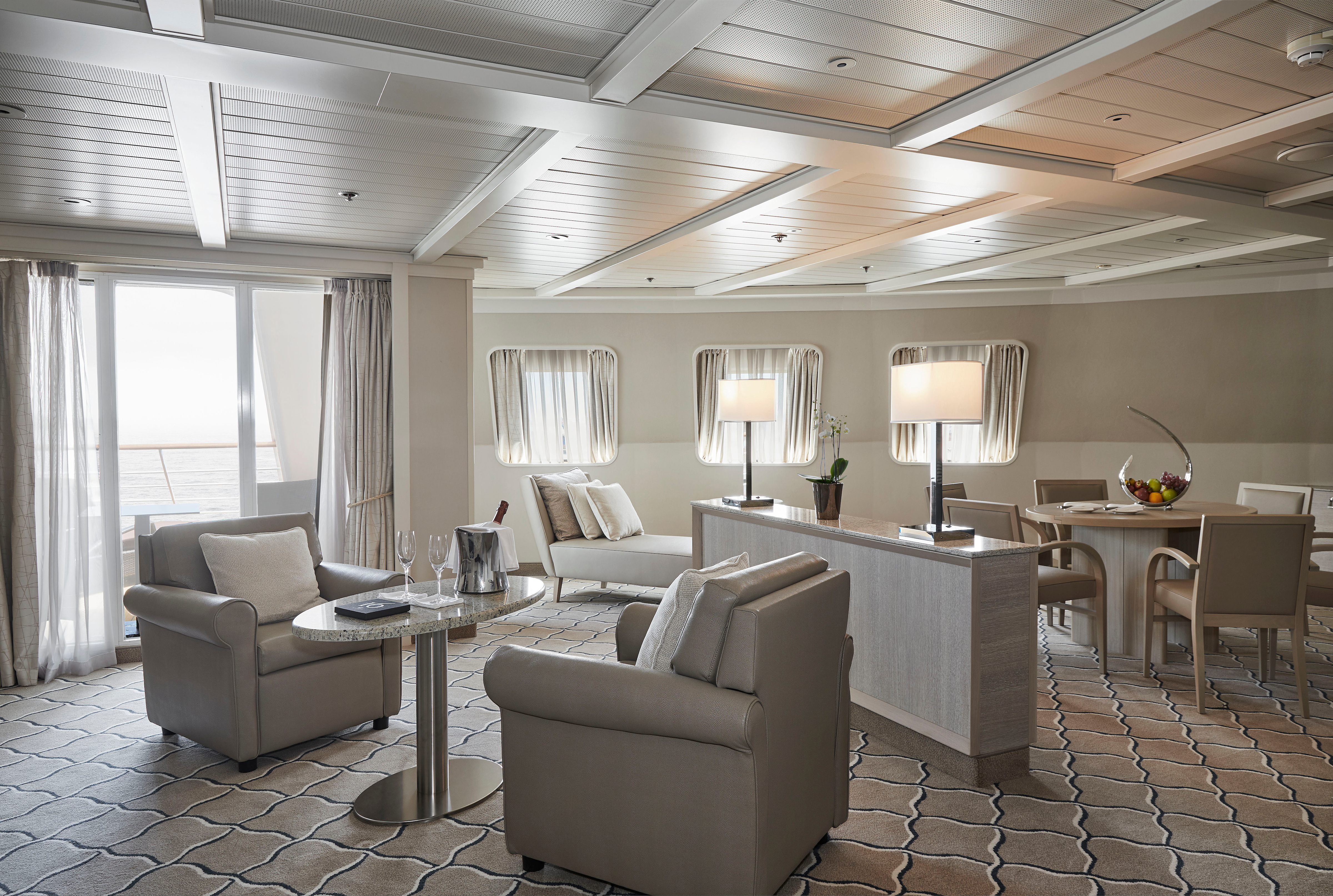
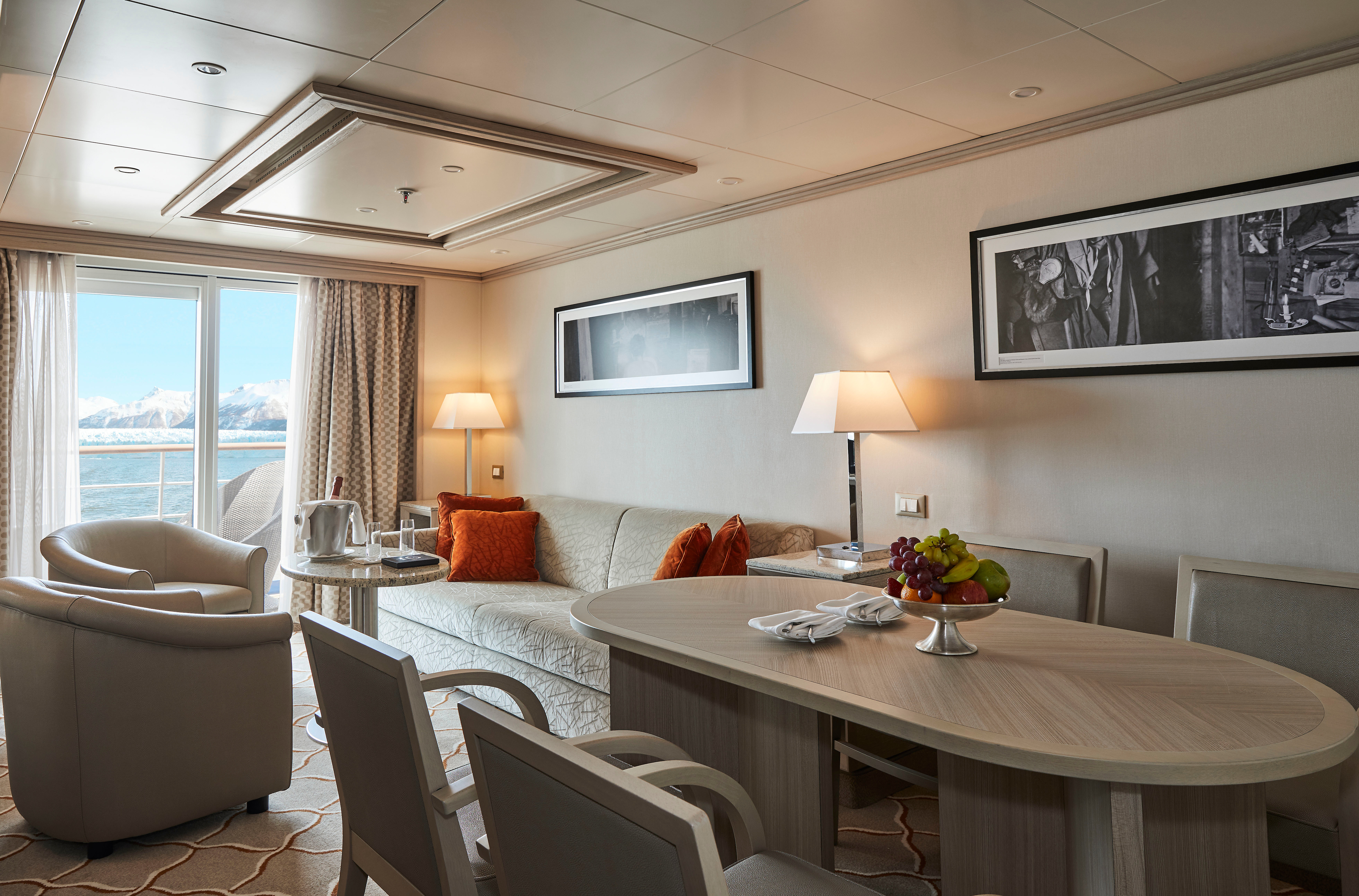
Expertly designed and exquisitely appointed. The ideal space for sharing stories with fellow explorers and new friends. With enough space to roam both inside and outside, this suite is perfect for relaxing and recounting the highlights of your day. Available in a one-bedroom configuration or as two bedrooms by adjoining with a Veranda Suite.
One bedroom: 95 sq m including veranda (14 sq m)
Images are intended as a general reference. Features, materials, finishes and layout may be different than shown.
Please note that the third guest will sleep on a comfortable sofa bed in the reception area of the suite.
Two bedrooms: 122 sq m including veranda (18.5 sq m)
Images are intended as a general reference. Features, materials, finishes and layout may be different than shown.
Please note that the 3rd guest will sleep on a comfortable sofa bed in the reception area of the suite.
Essentials
- Deck(s): 7
- Section: Forward
Characteristics
Veranda
- Separate dining area
- Living room with sitting area
- Standard vanity
- Separate shower
- Whirlpool bath
- Walk-in wardrobe with personal safe (Wardrobe closet in suite 702 & 703)
Furniture
- King size bed
- Writing desk
- Vanity table
- Luxury bed mattresses
Media & Communication
- Unlimited Premium Wi-Fi
- 2 large flat screen TVs with Interactive Media Library
- Sound system with bluetooth connectivity
- Direct dial telephone
- Wall mounted USB-C mobile device chargers
- Dual voltage 110/220 outlets
Onboard Services
Butler service
- Complimentary laundry, pressing & wet cleaning
- Dinner for two in La Dame, one evening per voyage,
- Two hours of worldwide phone use, per voyage segment
- Champagne on arrival
Amenities
- Espresso machine
- Pillow menu
- Refrigerator and bar setup stocked with your preferences
- Plush bathrobe
- Luxury bath amenities
- Umbrella
- Hair Dryer
- Slippers
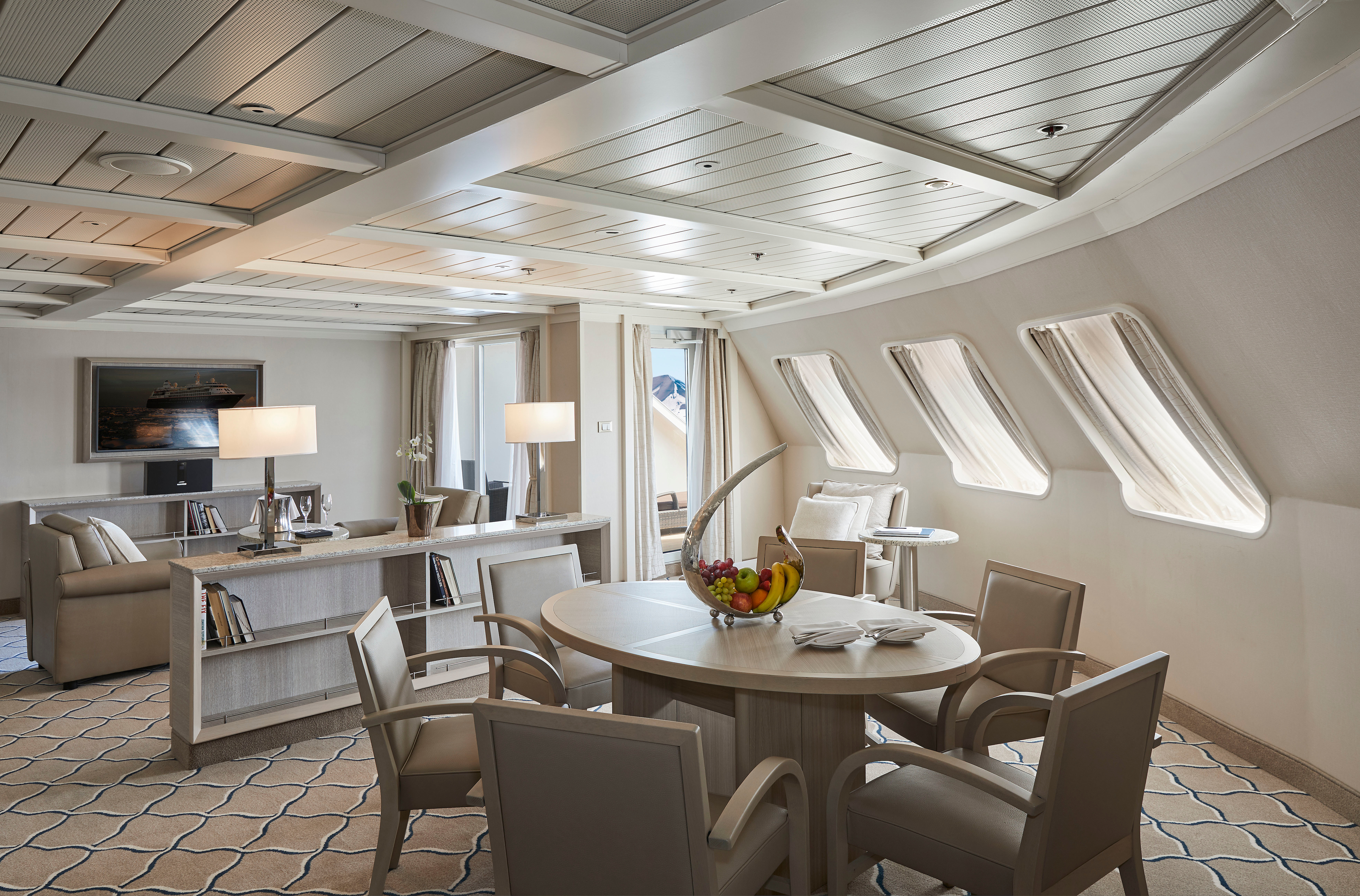
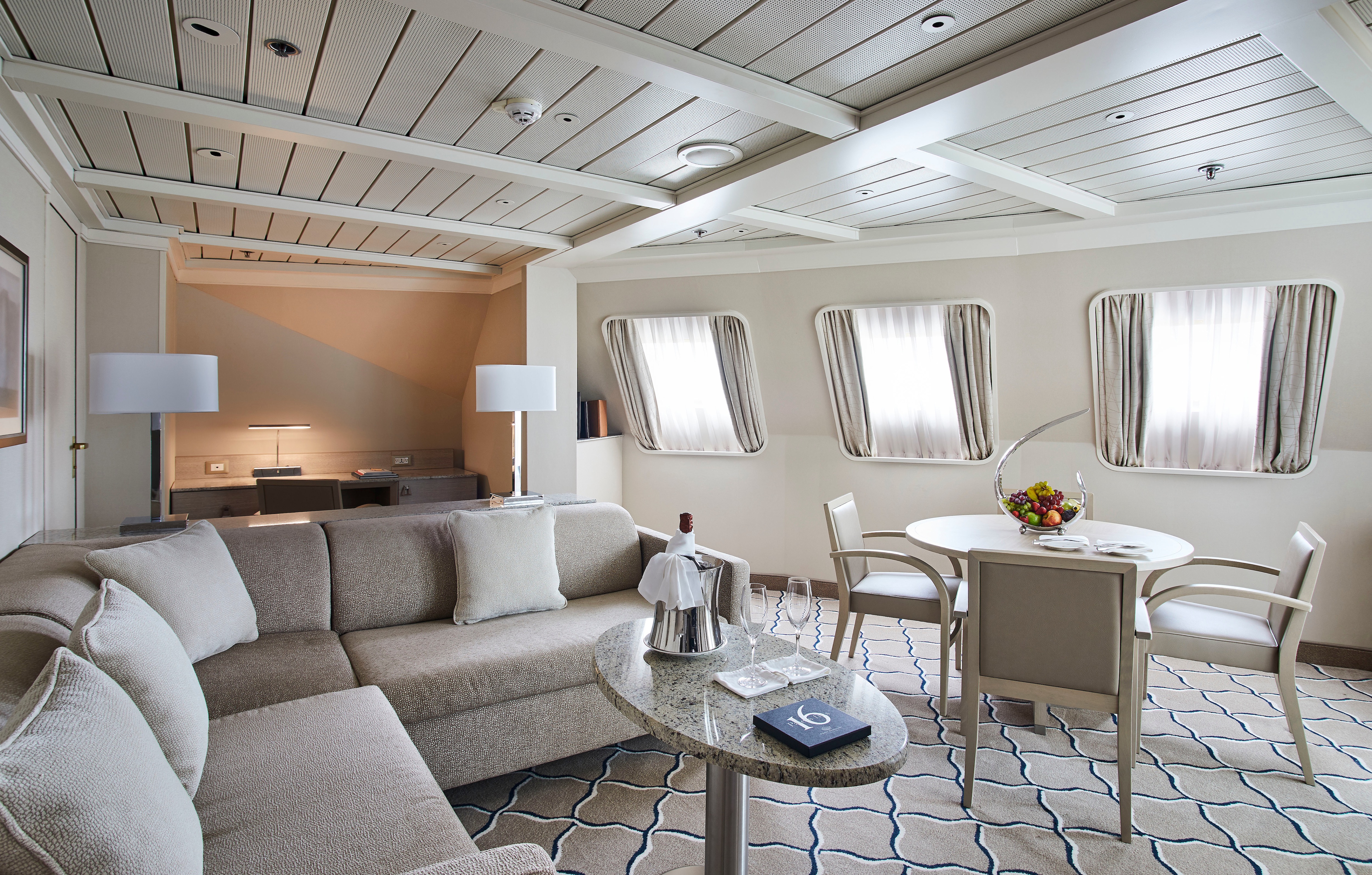
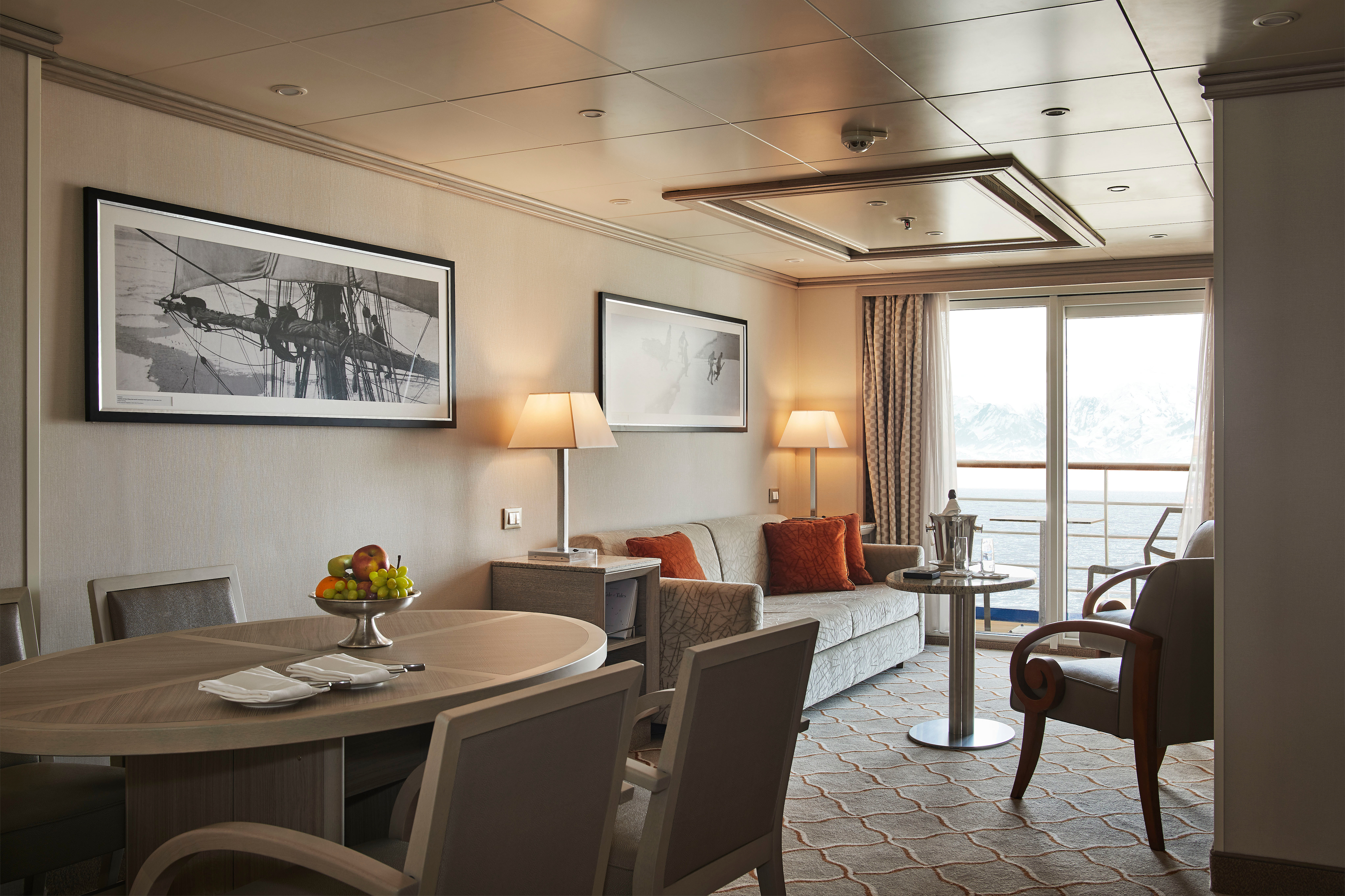
Stately. Commanding and majestic. Perfect for relaxing after a days’ exploring and looking through your photos. With lectures streamed live to your room, this is the pinnacle of good living at sea. Available in a one-bedroom configuration or as two bedrooms by adjoining with a Veranda Suite.
One bedroom: 69 sq m including veranda (12 sq m)
Two bedrooms: 96 sq m including veranda (16.5 sq m)
Images are intended as a general reference. Features, materials, finishes and layout may be different than shown.
Please note that the third guest will sleep on a comfortable sofa bed in the reception area of the suite.
Essentials
- Deck(s): 6
- Section: Forward
Characteristics
- Veranda
- Separate dining area
- Living room with sitting area
- Standard vanity
- Separate shower
- Whirlpool bath
- Walk-in wardrobe with personal safe
Furniture
- King size bed
- Writing desk
- Vanity table
- Luxury bed mattresses
Media & Communication
- Unlimited Premium Wi-Fi
- 2 large flat screen TVs with Interactive Media Library
- Sound system with bluetooth connectivity
- Direct dial telephone
- Wall mounted USB-C mobile device chargers
- Dual voltage 110/220 outlets
Onboard Services
- Butler service
- Complimentary laundry, pressing & wet cleaning
- Dinner for two in La Dame, one evening per voyage,
- Two hours of worldwide phone use, per voyage segment
- Champagne on arrival
Amenities
- Espresso machine
- Pillow menu
- Refrigerator and bar setup stocked with your preferences
- Plush bathrobe
- Luxury bath amenities
- Umbrella
- Hair Dryer
- Slippers
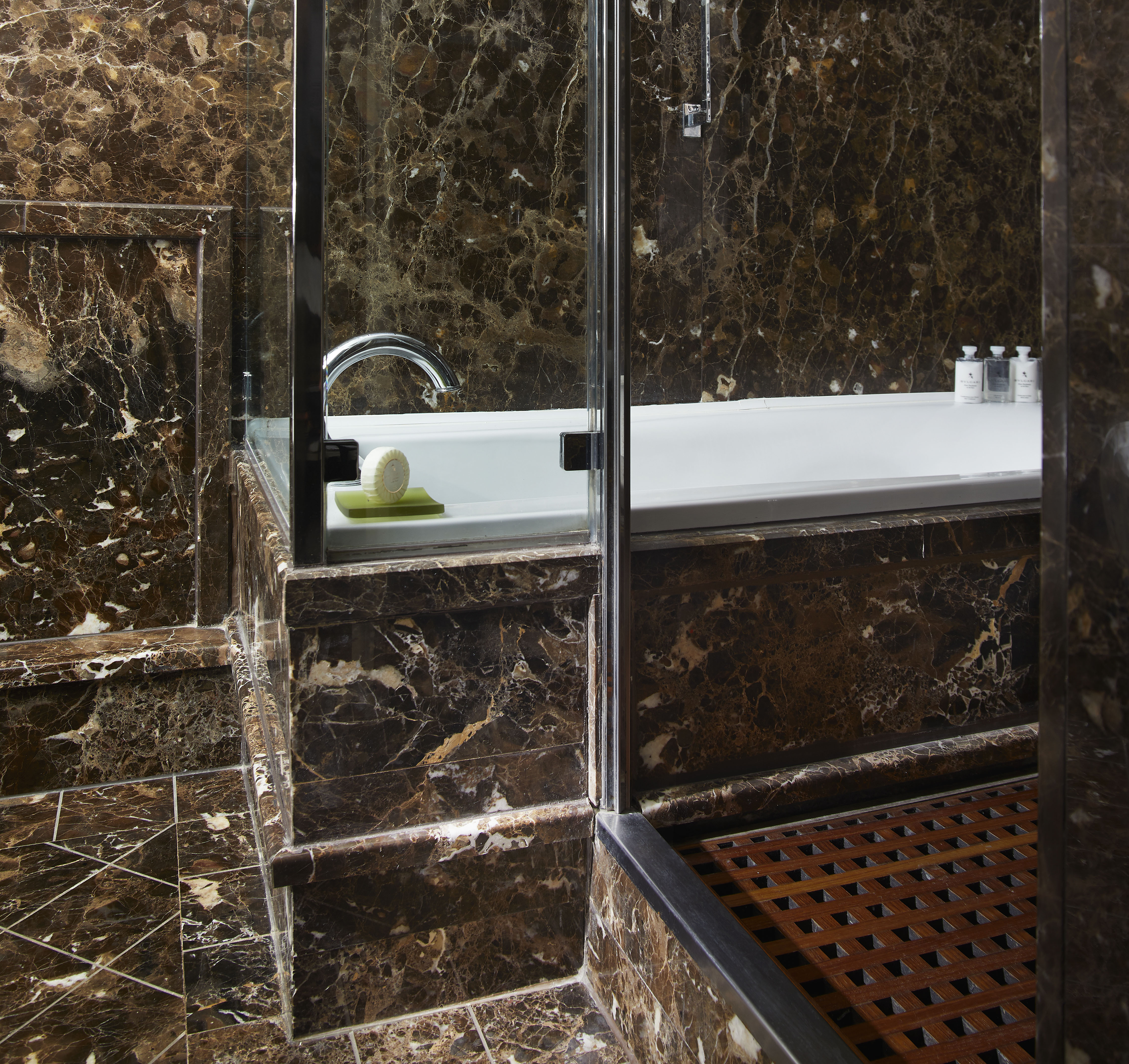
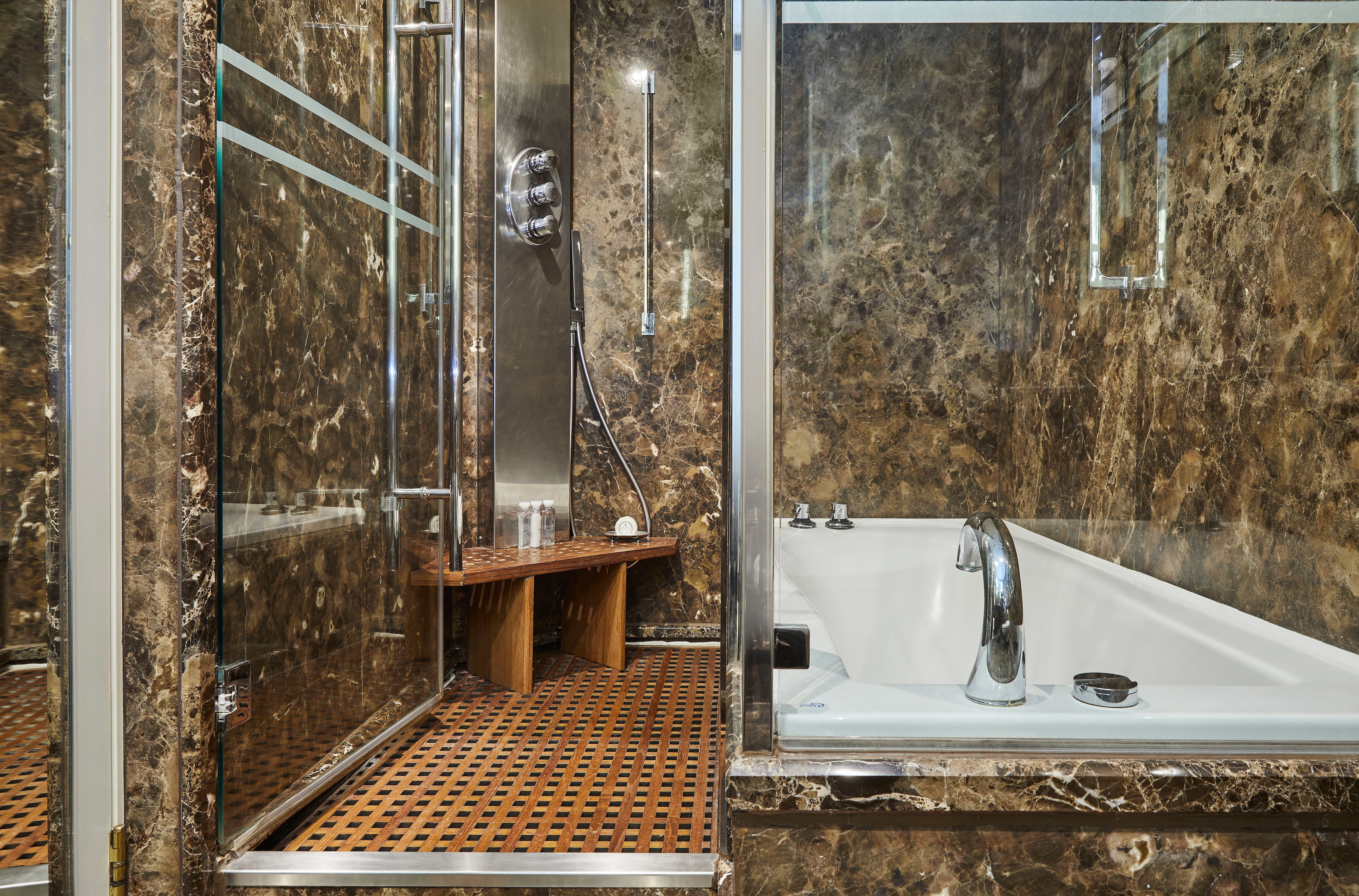
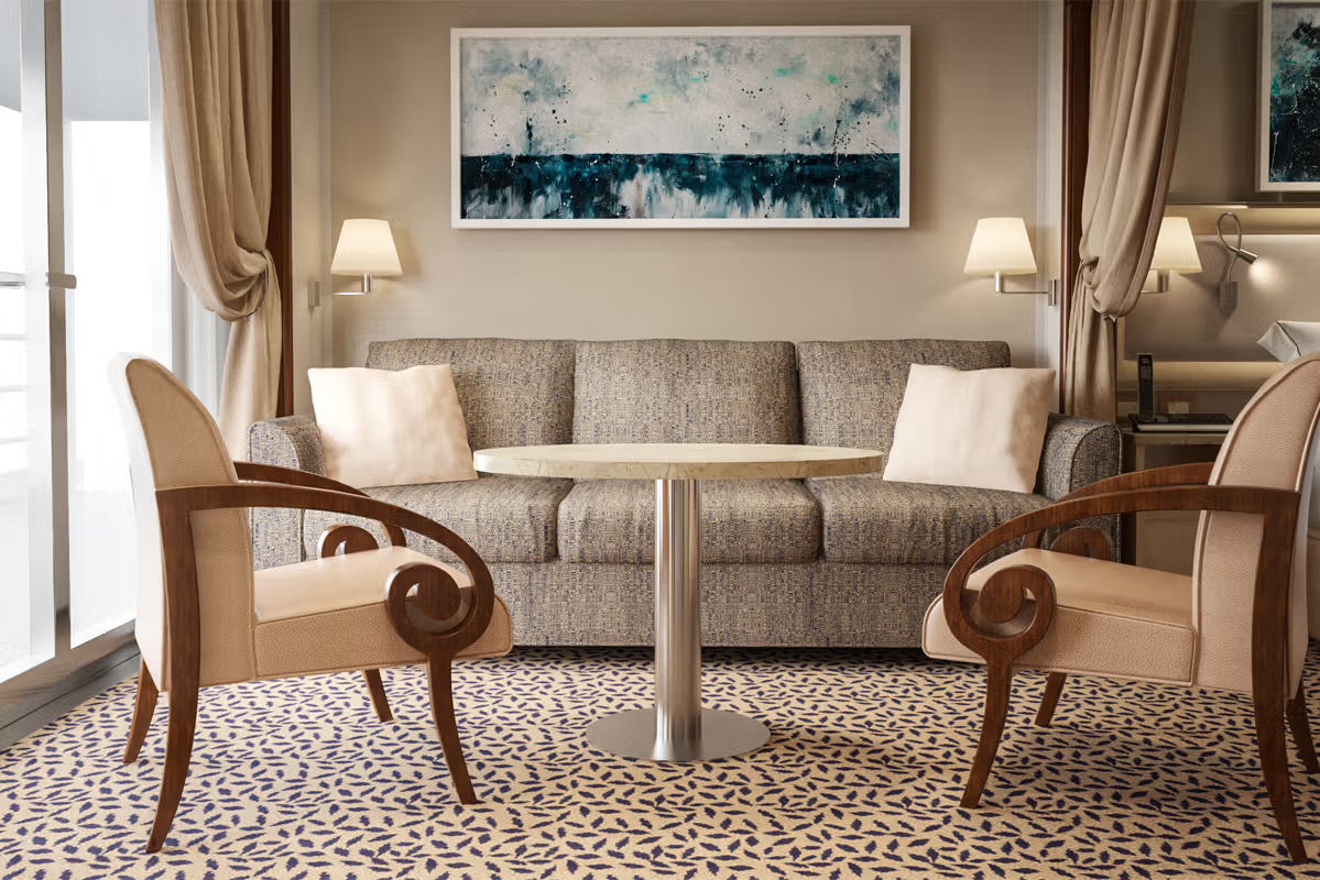
Stylish and sophisticated with larger verandas, excellent for taking pictures and bird-watching. Situated midship, this suite is perfection in design and comfortable living. A huge walk-in wardrobe, a beautiful marbled bathroom, and a spacious living area complete the picture. Silver Suites accommodate three guests.
One bedroom: 54 sq m including veranda (8 sq m)
Images are intended as a general reference. Features, materials, finishes and layout may be different than shown.
Please note that the 3rd guest will sleep on a comfortable sofa bed in the reception area of the suite.
Essentials
- Deck(s): 6, 7
- Section: Mid-Ship
Characteristics
- Veranda
- Separate dining area
- Living room with sitting area
- Standard vanity
- Separate shower
- Full-size bath
- Walk-in wardrobe with personal safe
Furniture
- Queen size bed
- Writing desk
- Vanity table
- Luxury bed mattresses
Media & Communication
- Unlimited Premium Wi-Fi
- 2 large flat screen TVs with Interactive Media Library
- Sound system with bluetooth connectivity
- Direct dial telephone
- Wall mounted USB-C mobile device chargers
- Dual voltage 110/220 outlets
Onboard Services
- Butler service
- Complimentary laundry, pressing & wet cleaning
- Champagne on arrival
Amenities
- Espresso machine
- Pillow menu
- Refrigerator and bar setup stocked with your preferences
- Plush bathrobe
- Luxury bath amenities
- Umbrella
- Hair Dryer
- Slippers
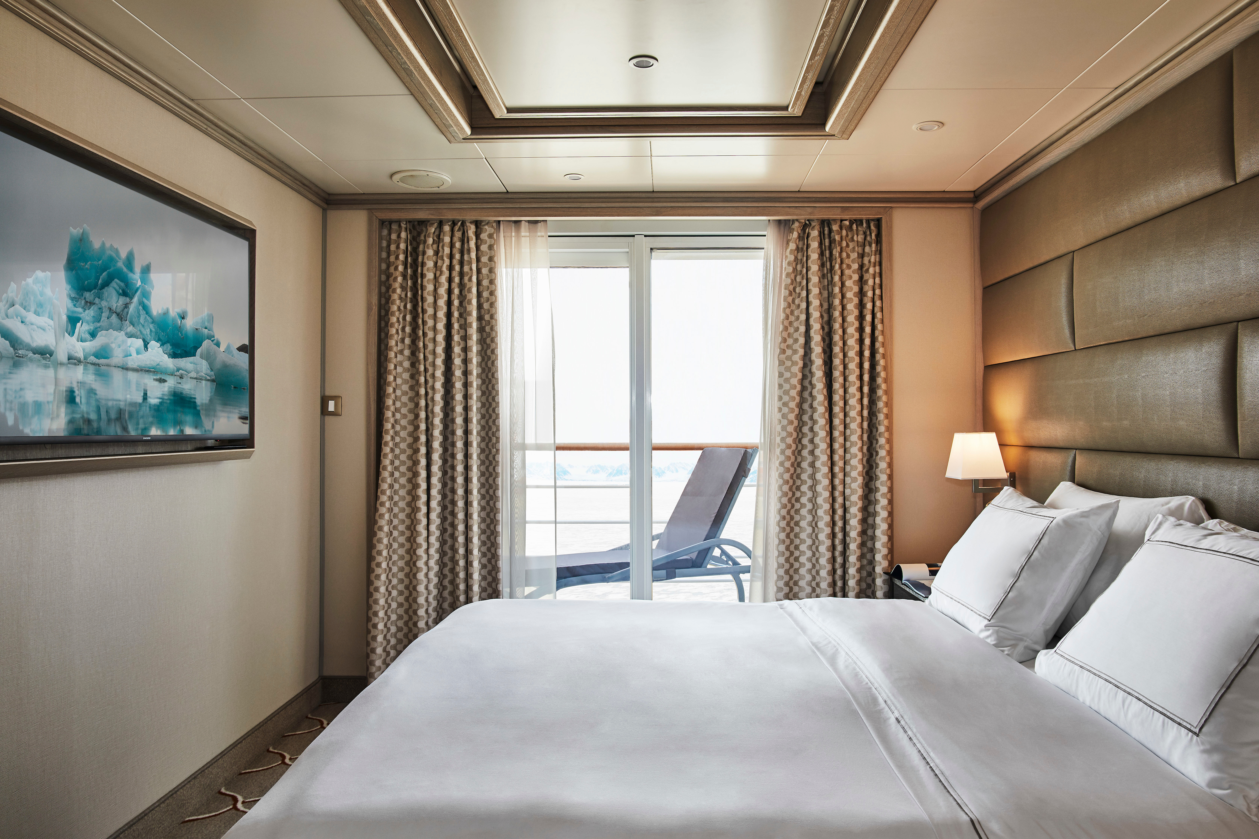
With a room configuration that favors watching the sun rise from the comfort of your bed and losing yourself in the mesmerizing seascapes, this suite is the perfect answer to adventure cruising. A large walk-in wardrobe and an expansive living room make the Medallion Suite your home away from home on the high seas. Medallion Suites accommodate three guests.
One bedroom: 48 sq m including veranda (7.6 sq m )
Images are intended as a general reference. Features, materials, finishes and layout may be different than shown.
Please note that the 3rd guest will sleep on a comfortable sofa bed in the reception area of the suite.
Essentials
- Deck(s): 5, 6, 7
- Section: Mid-Ship
Characteristics
- Veranda
- Separate dining area
- Living room with sitting area
- Standard vanity
- Separate shower
- Walk-in wardrobe with personal safe
Furniture
- Queen size bed
- Writing desk
- Vanity table
- Luxury bed mattresses
Media & Communication
- Unlimited Premium Wi-Fi
- 2 large flat screen TVs with Interactive Media Library
- Sound system with bluetooth connectivity
- Direct dial telephone
- Wall mounted USB-C mobile device chargers
- Dual voltage 110/220 outlets
Onboard Services
- Butler service
- Complimentary laundry, pressing & wet cleaning
- Champagne on arrival
Amenities
- Espresso machine
- Pillow menu
- Refrigerator and bar setup stocked with your preferences
- Plush bathrobe
- Luxury bath amenities
- Umbrella
- Hair Dryer
- Slippers
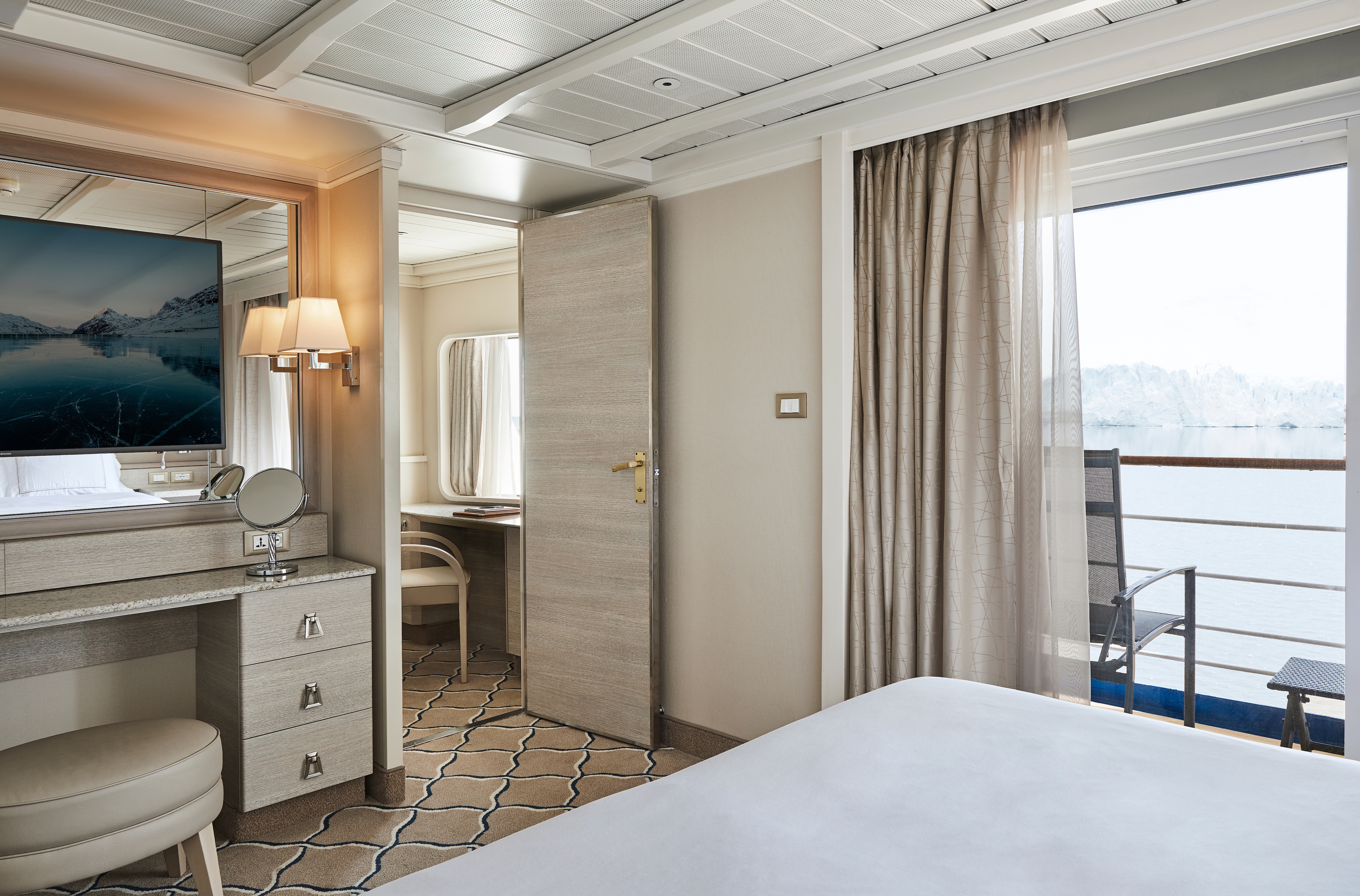
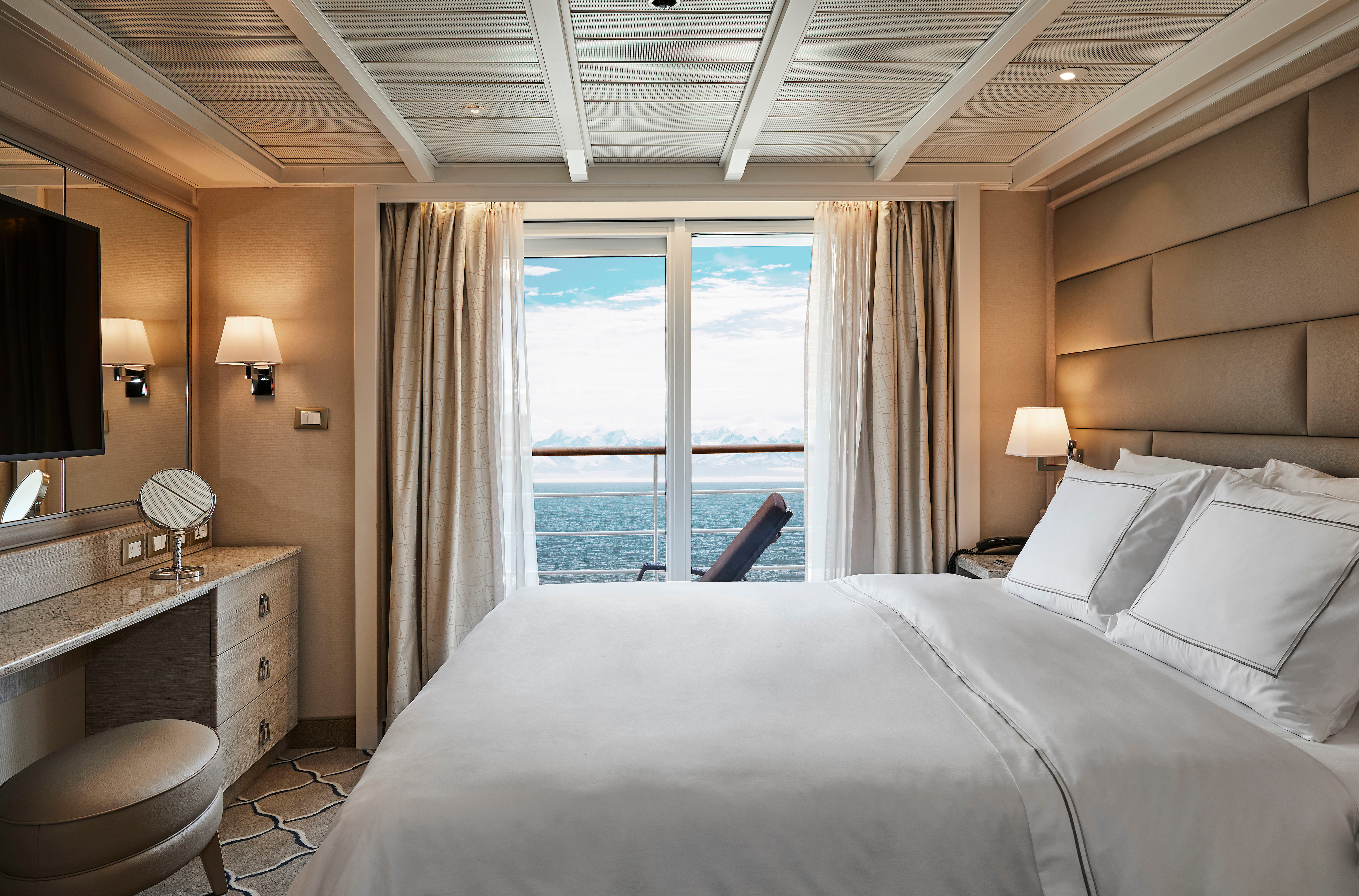
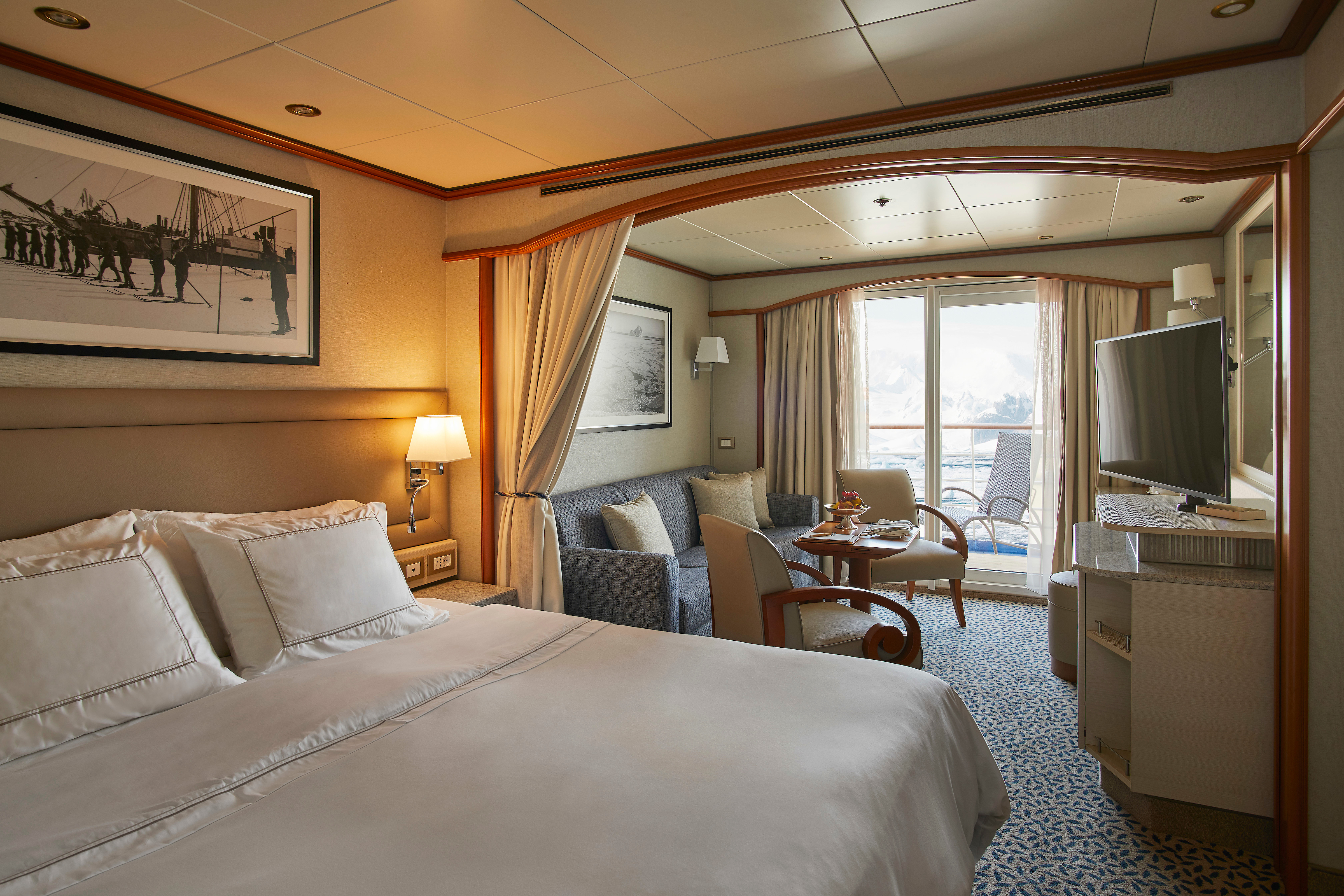
A Silversea signature, with a preferred central location, the Veranda Suite is spacious and welcoming. Floor-to-ceiling glass doors open onto a furnished private teak veranda from where you can contemplate anything from the midnight sun to an Antarctic sunrise. The Deluxe Veranda Suite offers a preferred central location with identical accommodation to a Veranda Suite.
One bedroom: 27 sq m including veranda (4.5 sq m)
Two bedrooms: 27 sq m including veranda (4.5 sq m)
Images are intended as a general reference. Features, materials, finishes and layout may be different than shown.
Essentials
- Deck(s): 5, 6, 7
- Section: Aft, Forward
Characteristics
- Veranda
- Sitting area
- Standard vanity
- Separate shower
- Some with full-size bath
- Walk-in wardrobe with personal safe
Furniture
- Queen size bed
- Writing desk
- Luxury bed mattresses
Media & Communication
- Unlimited Standard Wi-Fi
- 1 large flat screen TV with Interactive Media Library
- Direct dial telephone
- Wall mounted USB-C mobile device chargers
- Dual voltage 110/220 outlets
Onboard Services
- Butler service
- Champagne on arrival
Amenities
- Pillow menu
- Refrigerator and bar setup stocked with your preferences
- Plush bathrobe
- Luxury bath amenities
- Umbrella
- Hair Dryer
- Slippers
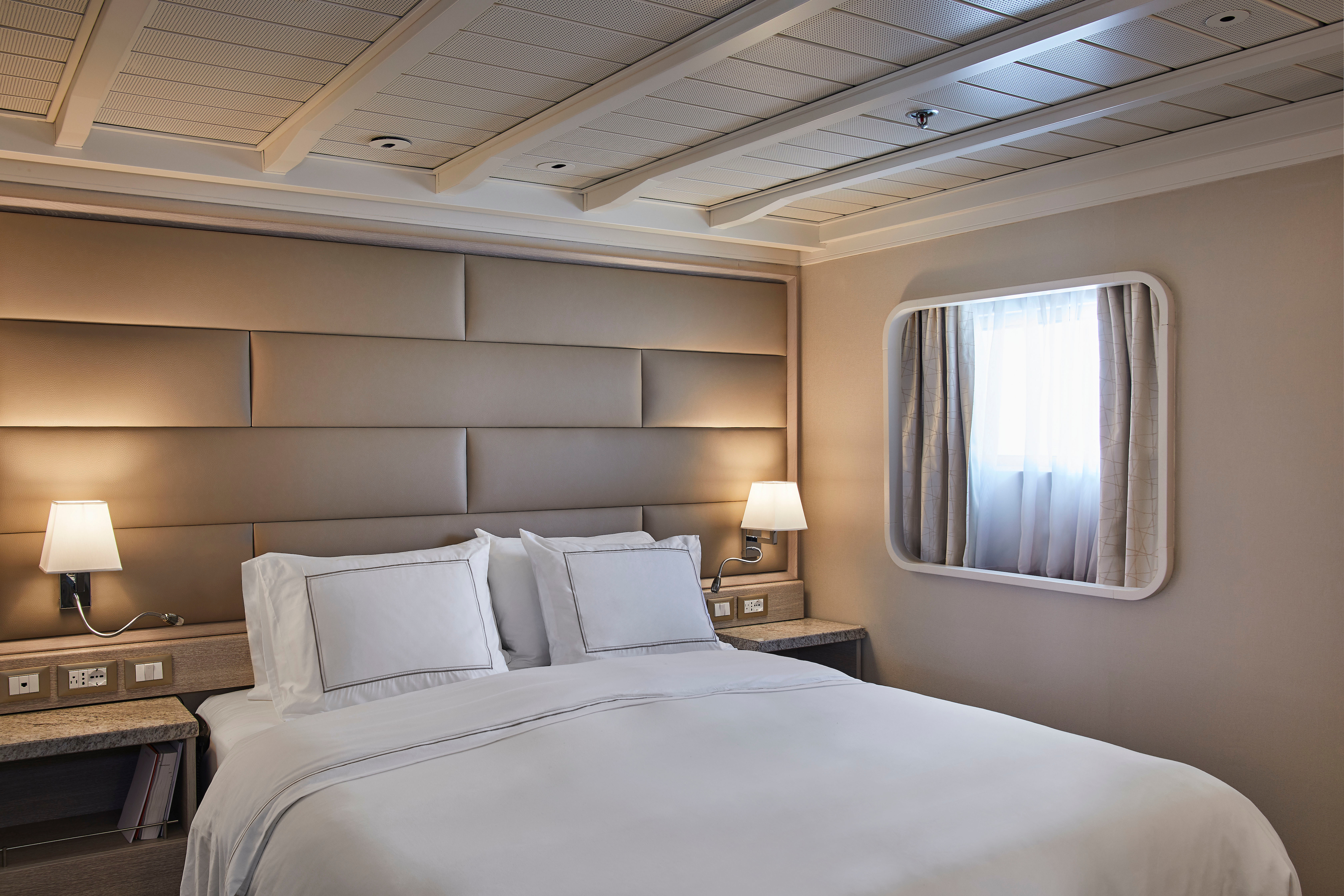
Your home away from home while you embrace the intrepid explorer within. The suite’s seating area has plenty of room to relax while you go over your notes, ready for the next adventure. Large picture windows frame panoramic ocean views, ideal for appraising the local wildlife.
One bedroom: 22 sq m
Wheelchair accessible suites: 449 and 451
Images are intended as a general reference. Features, materials, finishes and layout may be different than shown.
Essentials
- Deck(s): 4
- Section: Aft, Forward
Characteristics
- Window
- Sitting area
- Standard vanity
- Separate shower
- Some with full-size bath
- Walk-in wardrobe with personal safe
Furniture
- Queen size bed
- Writing desk
- Luxury bed mattresses
Media & Communication
- Unlimited Standard Wi-Fi
- 1 large flat screen TV with Interactive Media Library
- Direct dial telephone
- Wall mounted USB-C mobile device chargers
- Dual voltage 110/220 outlets
Onboard Services
- Butler service
- Champagne on arrival
Amenities
- Pillow menu
- Refrigerator and bar setup stocked with your preferences
- Plush bathrobe
- Luxury bath amenities
- Umbrella
- Hair Dryer
- Slippers
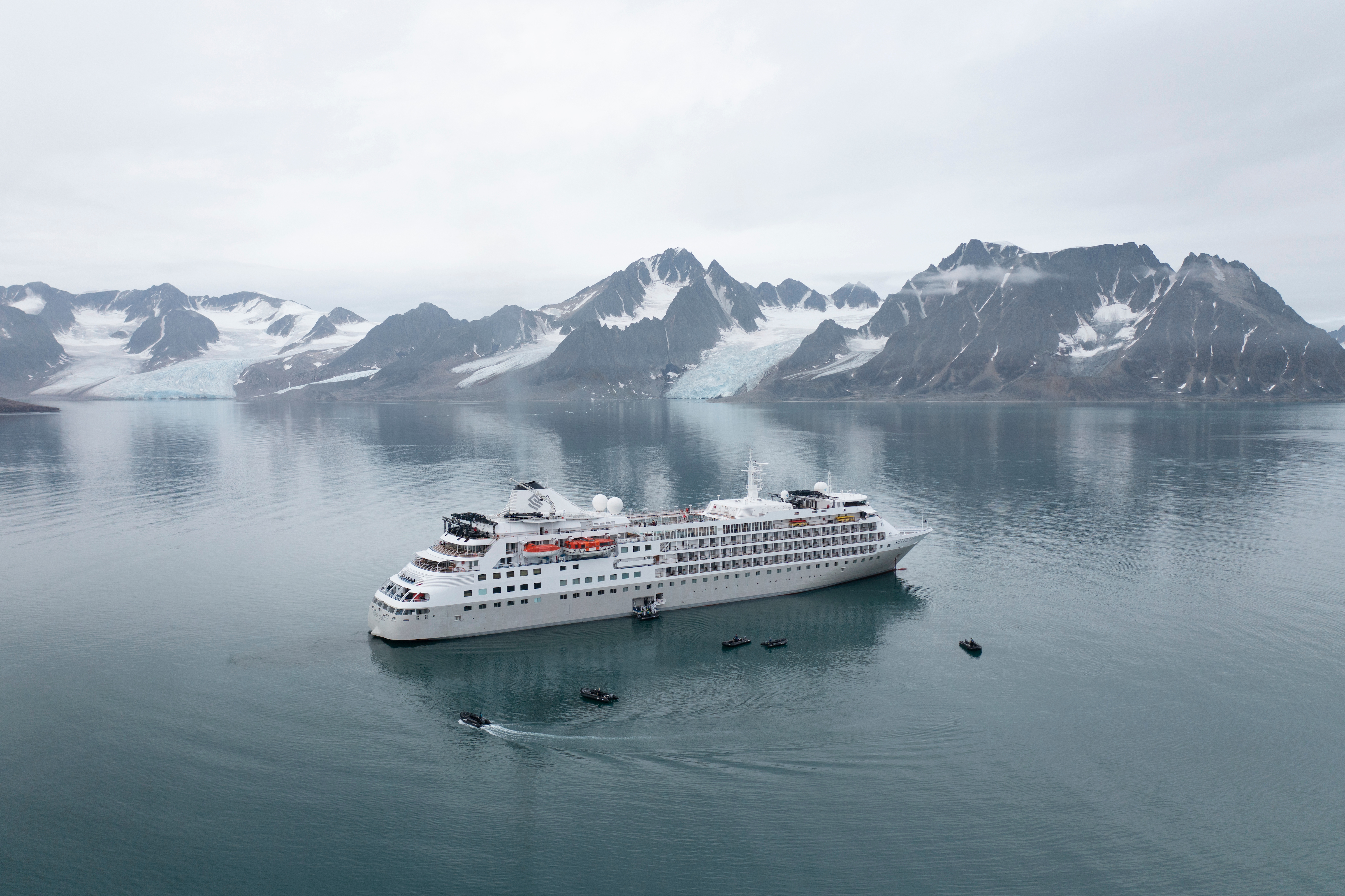
Silver Cloud
Silver Cloud offers one of the most personalised experiences in expedition voyages, with a high ratio of experts and Zodiacs unlocking access to the rare and remarkable.
Silver Cloud is the first crossover ship in our fleet, bringing the remote and remarkable to you in ultra-luxurious comfort. Her large suites, destination itineraries and unparalleled service make her truly special. Four dining options will tantalise your taste buds, and as 80% of her suites include a veranda, watching a breaching whale from the comfort of your balcony never been so personal. With her 20 zodiacs, 10 kayaks, possibilities are almost limitless with ship-wide simultaneous explorations.
Ship Facts
| Launch Year | 1994 | ||||||||||
| Refit Year | 2017 | ||||||||||
| Language | en | ||||||||||
| Gross Tonnage | 17400 | ||||||||||
| Length | 155 | ||||||||||
| Width | 21 | ||||||||||
| Currency | USD | ||||||||||
| Speed | 18 | ||||||||||
| Capacity | 254 | ||||||||||
| Crew Count | 212 | ||||||||||
| Deck Count | 7 | ||||||||||
| Cabin Count | 126 | ||||||||||
| Large Cabin Count | 28 | ||||||||||
| Wheelchair Cabin Count | 2 | ||||||||||
| Electrical Plugs |
|
Deck 9
- Observation Lounge
- Zodiacs
- Jogging Track
- Open view to Swimming Pool

Deck 8
- Pool
- Pool Bar
- Pool Grill
- The Grill
- Panorama Lounge
- Connoisseurs’s Corner

Deck 7
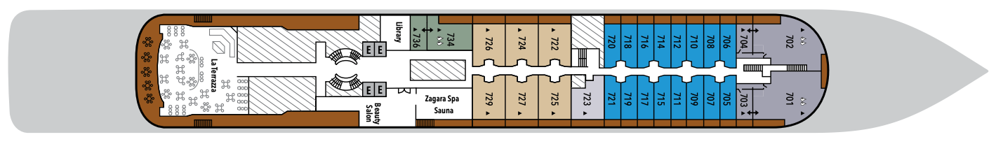
- La Terrazza
- Zagara Beauty Spa
- Library
- Medallion Suite
- Silver Suites
- Veranda Suites
- Owners Suites
- Grand Suites
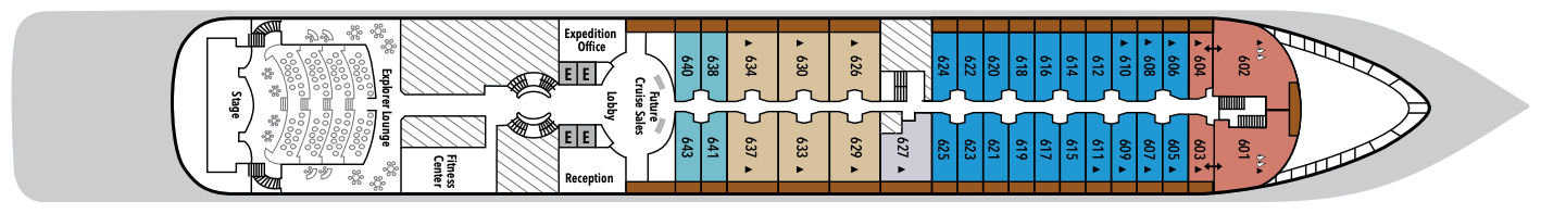
Deck 6
- Explorer Lounge
- Fitness Centre
- Reception/Guest Relations
- Expedition Office
- Lobby
- Future Cruise Sales
- Medallion Suite
- Deluxe Veranda Suites
- Silver Suites
- Royal Suites
- Veranda Suites
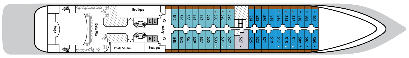
Deck 5
- Dolce Vita
- Lobby
- Boutique
- Photo Studio
- Deluxe Veranda Suites
- Veranda Suites
- Medallion Suites
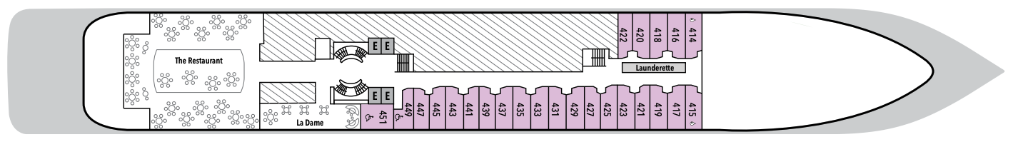
Deck 4
- The Restaurant
- La Dame
- Launderette
- Vista Suites
Deck 3
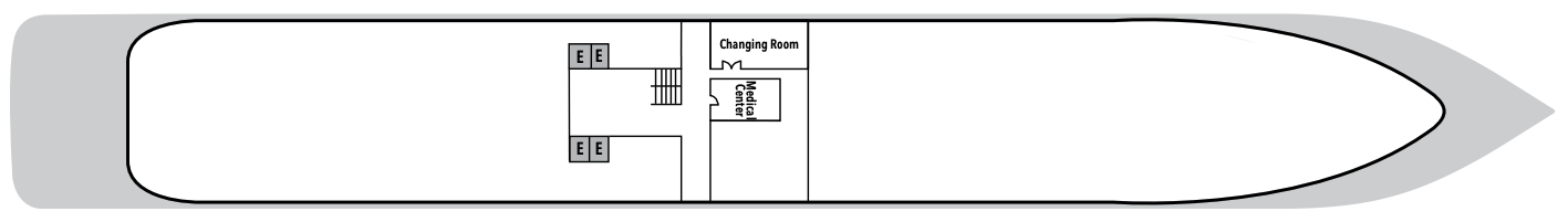
- Medical Centre
- Changing Room
With the importance of food in Italian culture, you would expect dining to be a high priority at Silversea. And it most assuredly is. No matter where you dine, their influence is readily apparent in the great diversity and presentation of culinary selections on board your all inclusive cruise.
The main dining room aboard every Silversea luxury cruise ship, The Restaurant, is always open seating so you can arrive at your leisure and dine with the friends you invite to join your table. And with the worldly crowd of international guests who sail on Silversea ships, socialising is yet another great advantage of the Silversea experience.
The Grill
Silversea’s much-loved casual dining restaurant serves a delectable range of burgers and salads by day and turns into our famous Hot Rocks table BBQ concept by night. The Grill is quite simply the best place to eat between sea and sky. If you like flavorsome meals cooked to perfection, a casual, laid-back atmosphere, and OMG views, then The Grill is the answer to your prayers.
Dress code: Casual
Casual wear consists of pants, blouses, or casual dresses for women; open-neck shirts and slacks for men are appropriate.
Images are intended as a general reference. Features, materials, finishes and layout may be different than shown.
La Dame
After a day of trekking through tundra and whale-watching, indulge in an evening of palette pampering, where fine wines are complemented by a set bespoke menu of regionally inspired dishes in an intimate, elegant setting. An extraordinary six-course experience celebrating the world’s most distinguished wine regions complete what is surely the finest dining at sea.
Per guest reservation fee of US$60. Please visit My Silversea to make your reservations.
Le Terrazza
La Terrazza is a celebration of the way Italians eat today, an ode to the delicious evolution of the world’s most beloved cuisine. Evolving one of Silversea’s signature restaurants, La Terrazza serves fresh twists on great classics, and also explores the new heroes of Italian cuisine. The notion of comfort traditionally associated with Italian cuisine is present in every dish, every bite, yet always with a subtle element of surprise. La Terrazza is open for casual, buffet-style breakfast and lunch with indoor or alfresco dining on the outdoor terrace. During the evening, the venue transforms into an à la carte Italian restaurant. Seating is limited for dinner and reservations are recommended.
The Restaurant
Sparkling with tales of adventure, bonhomie, and like-minded friends, The Restaurant offers contemporary, international cuisine created by our most talented chefs. Menus feature regional specialties unique to the destinations guests visit on their cruise, so don’t be surprised to see a roasted Chilean Sea Bass while cruising the Chilean fjords.
The ocean views and soothing sound of the surf can be quite intoxicating at sea, so it’s not surprising that daydreaming on deck is one of the most popular pastimes. However, every Silversea all inclusive cruise also includes a considerable number of more active pursuits — some for the body, some for the mind … and some just for fun.
Dolce Vita
With complimentary cocktails and engaging conversation, live music, and a dance floor, Dolce Vita on board Silver Cloud welcomes guests to mix and mingle. When living such unique experiences as these, there is never a dull moment!
Connoisseur's Corner
The Connoisseur’s Corner offers exceptional cognacs along with a premium selection of cigars for purchase.
Reception
This central lobby area welcomes guests to speak with our receptionist if they have a question or require any service. Assistance is available 24 hours a day. The Cruise Consultant may also be indispensable when planning your next Silversea voyage, or if you wish to extend your current voyage for a day, a week, a month … Like having your own personal onboard Silversea professional, the Cruise Consultant will help you to select the perfect voyage, reserve your preferred suite, and provide immediate confirmation.
Observation Lounge
The ideal place for scenic days at sea, this vantage point far forward and high atop this luxury cruise ship is perfect for that “king of the world” feeling.
Boutique
Exceptional shopping experiences do not end in the cosmopolitan cities we visit. Silversea’s striking new shipboard boutiques, reimagined and redesigned, are stunning modern design spaces befitting the finest creations from legendary designers. Carefully selected partners on board Silversea’s duty-free boutiques offer our guests a carefully curated selection of cutting-edge fashions, jewelry, accessories, fine perfumes, cosmetics, and Silversea Logo collection, all at duty-free prices.
Explorer Lounge
Perfect for presentations, lectures, and video screenings, this is where our team of dedicated experts share their knowledge on their specialized subject, not to mention their infectious passion and energy. The multitiered Explorer Lounge and banquette-style seating ensure that you enjoy every minute of the talk, with lectures streamed live to your suite if desired. This is one of the very few lecture theaters at sea to combine such comfort with such technology.
Panorama Lounge
The Panorama Lounge is specially designed to provide an uninterrupted view of the day’s destination from the comfort of the luxury cruise ship’s interior. This is an ideal place to unwind on your cruise, enjoy afternoon tea, listen to the pianist, and watch the setting sun. The drinks are complimentary, and the music is live and inviting. Enjoy dancing to a range of musical styles for every taste, from the classics to the latest club mixes.
Photo Studio
The Photo Studio offers a multitude of options to take your pictures from your camera to your walls. A vibrant, creatively inspiring space where you can not only master the art of digital photography with master classes in editing and Adobe Lightroom and Photoshop, but also an editing suite where you can print images (including postcard, panorama, and A2-sized prints). State-of-the-art equipment for both Mac and PC users, highly technological printers, plus a dedicated photo manager to guide you through the many techniques to help you define yourself as a serious photographer. Even the smartphone photographer can become pro-level with specialized training on how to use your camera phone to its best possible advantage. Fees apply.