Singapore to Darwin
Singapore to Darwin
Cruise overview
WHY BOOK WITH US?
- ✔ The Deluxe Cruises’ team has extensive experience in ultra-luxury cruising.
- ✔ Call now to speak to our helpful and experienced Cruise Concierge team.
- ✔ Enjoy our Unique Deluxe Cruises Bonus for substantial savings.
- ✔ Our team will tailor your holiday to your exacting requirements.
- ✔ As agents, we work under the protection of each cruise lines ABTA / ATOL licences
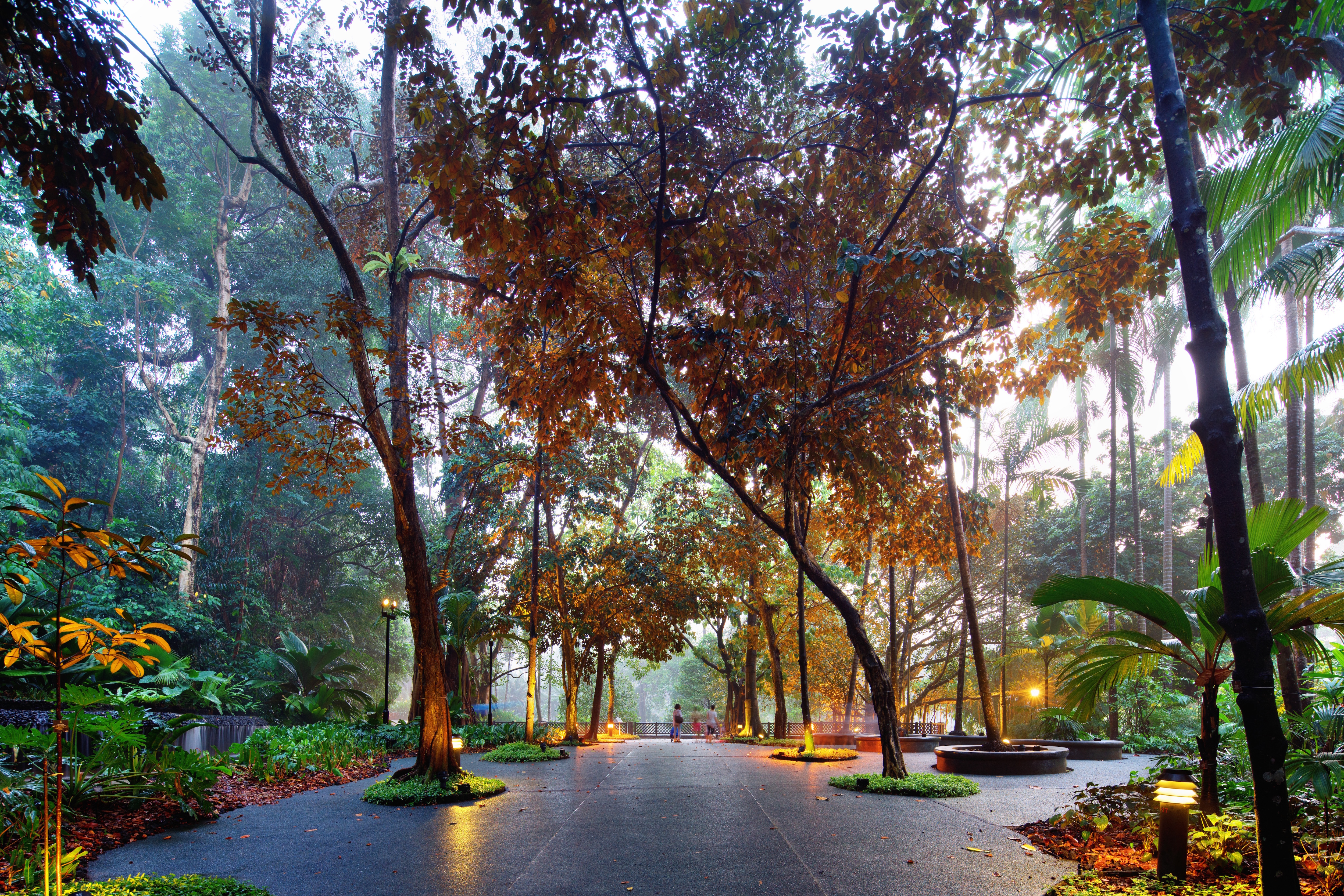
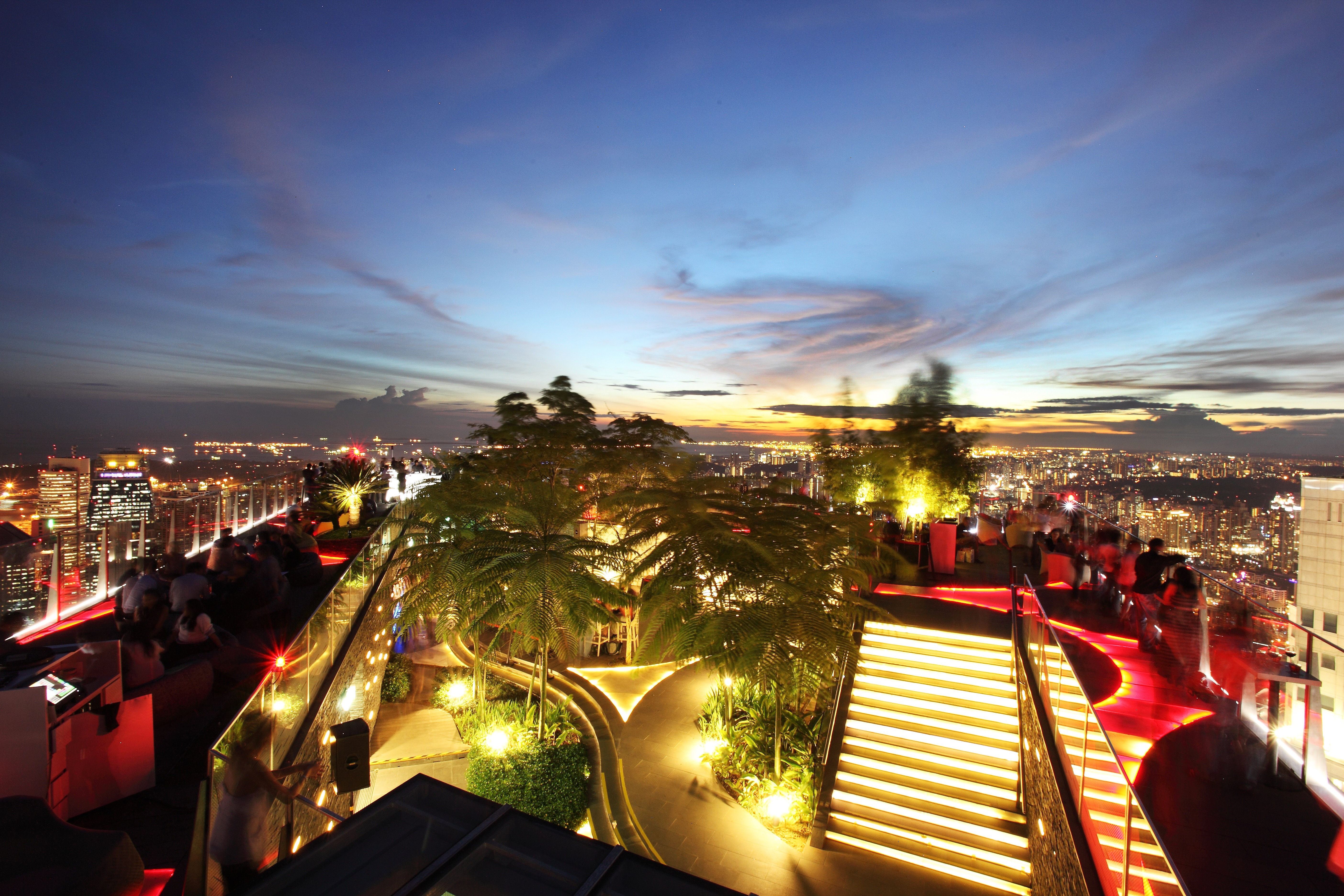
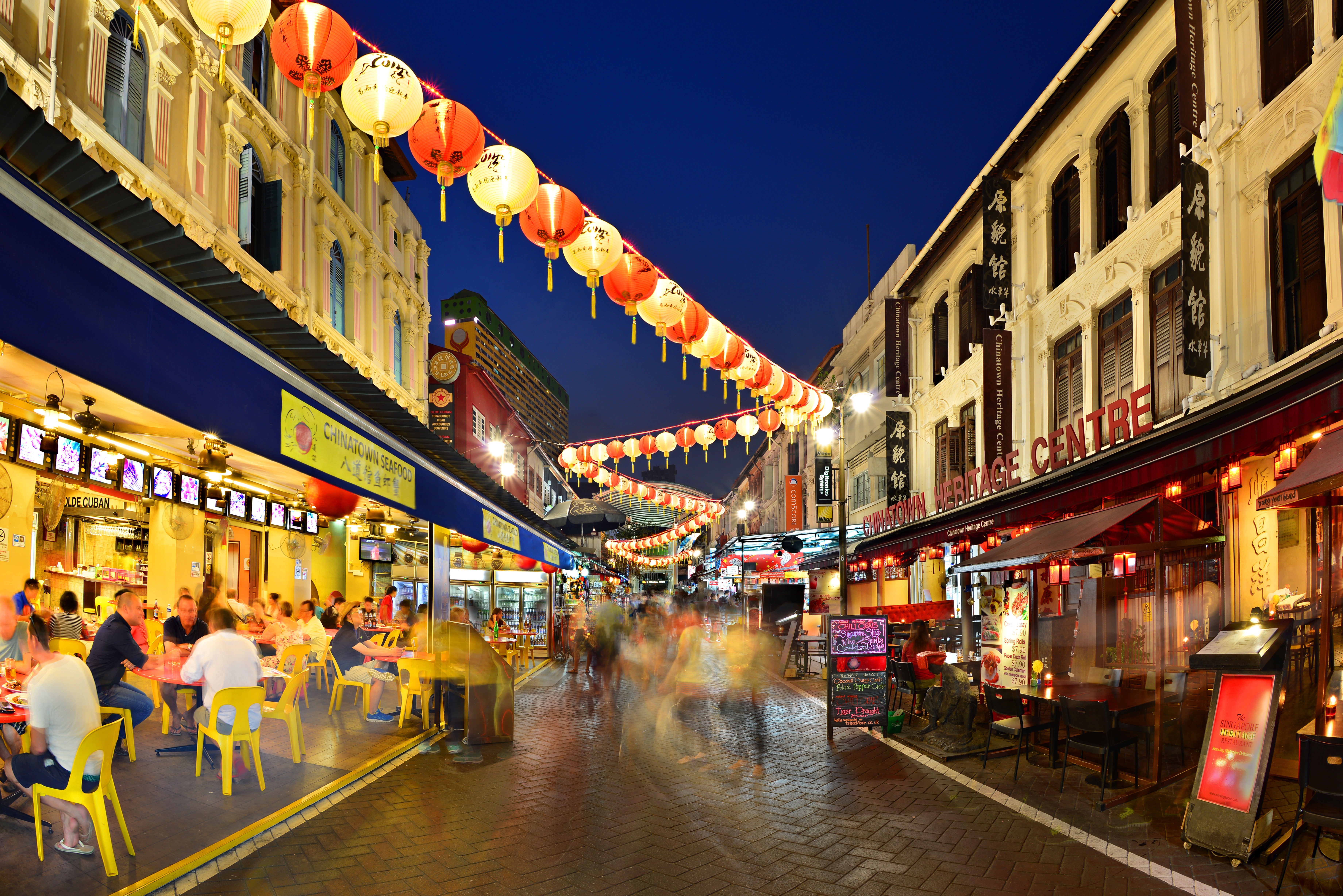
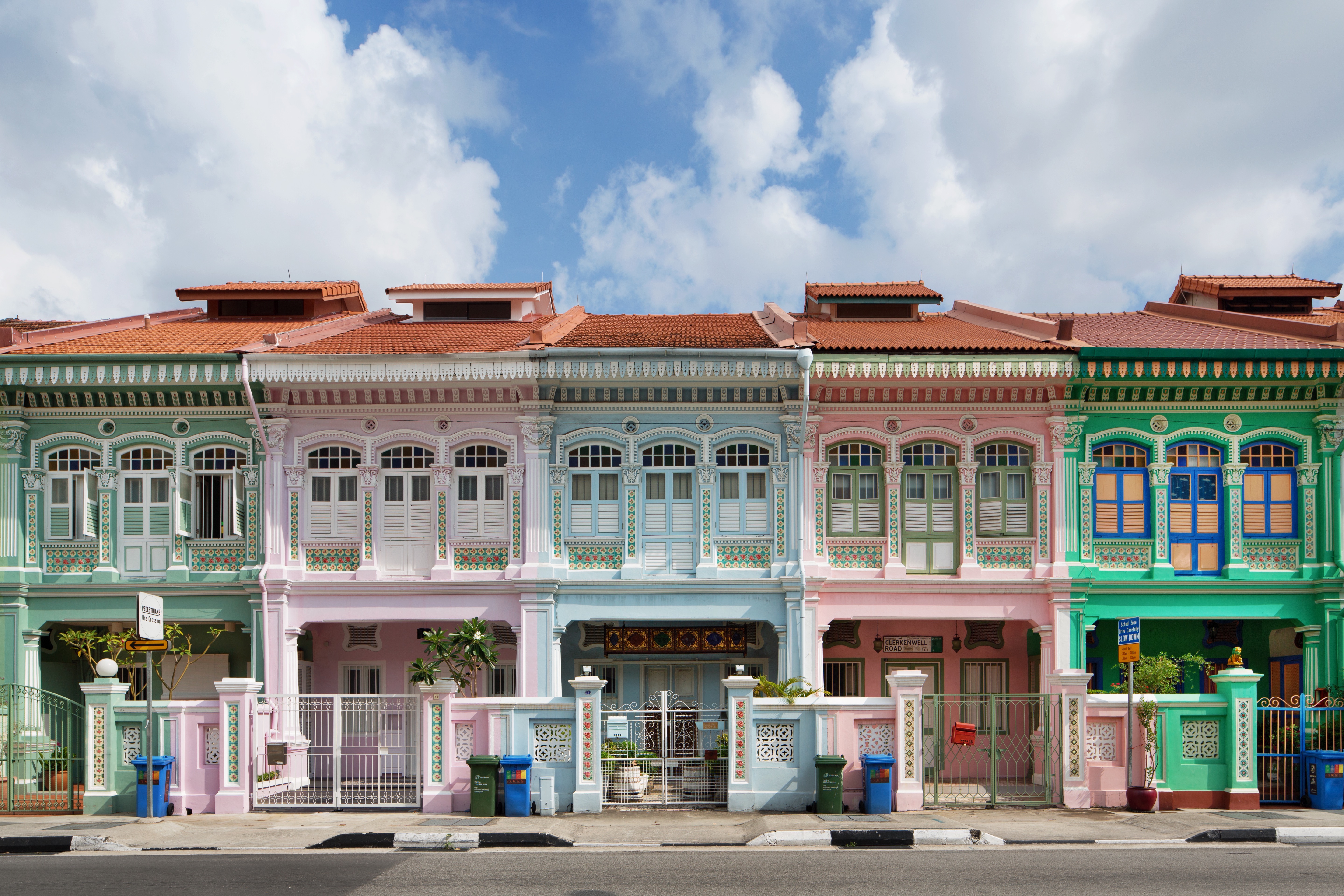
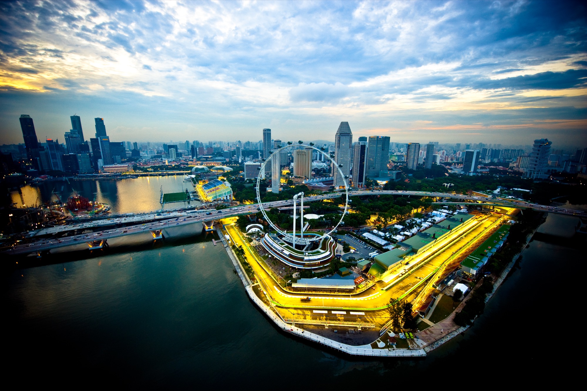
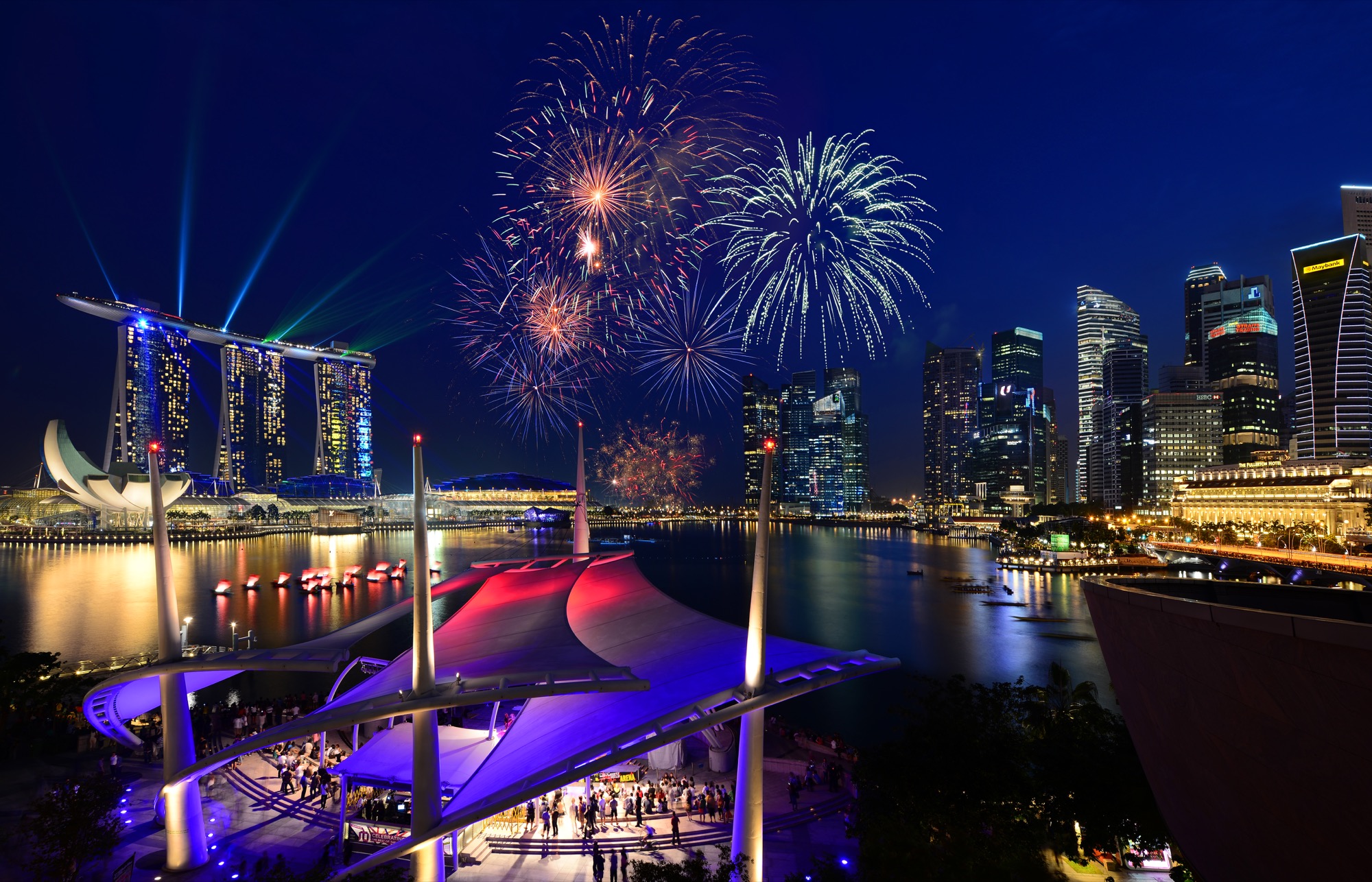
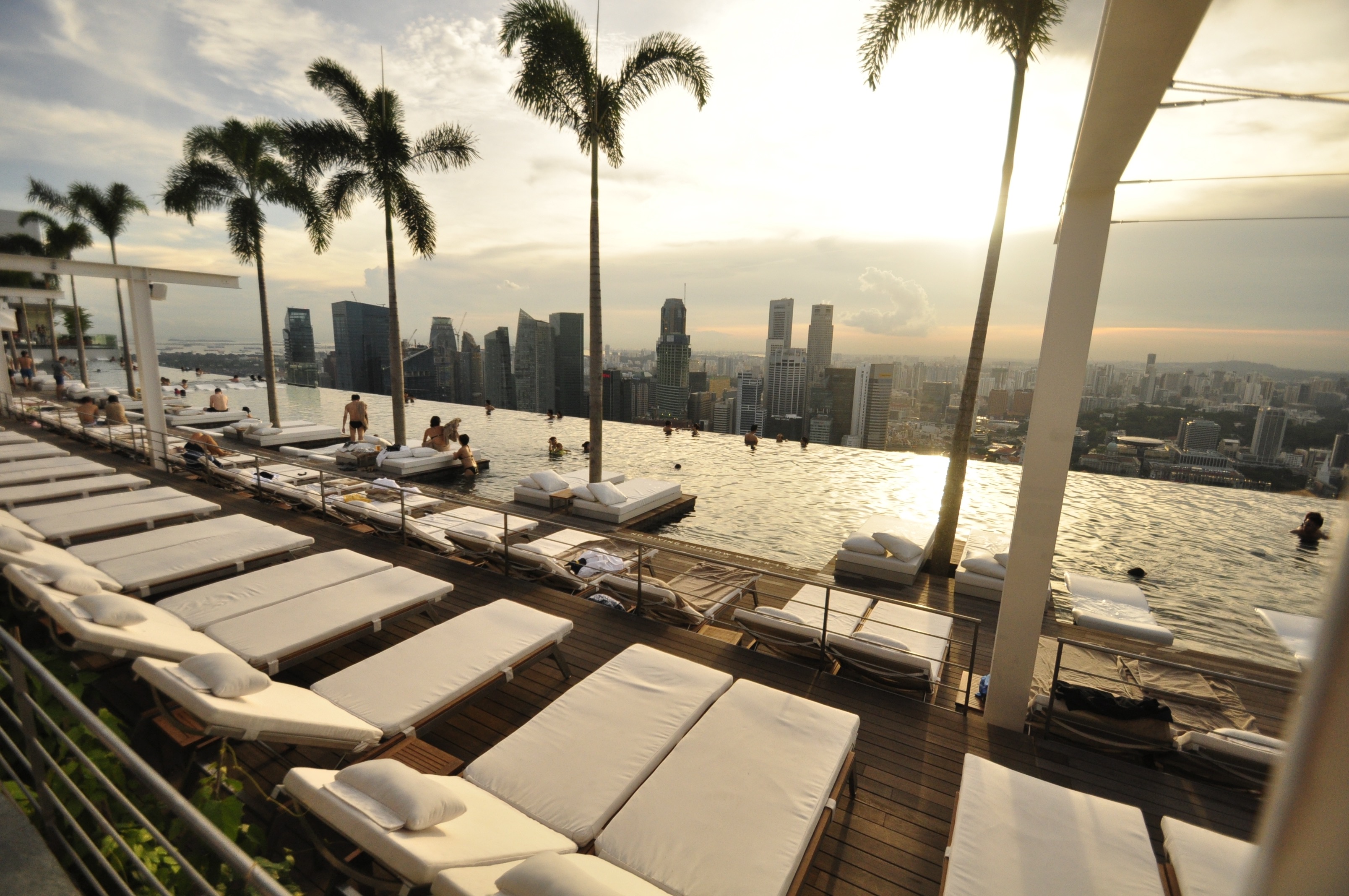
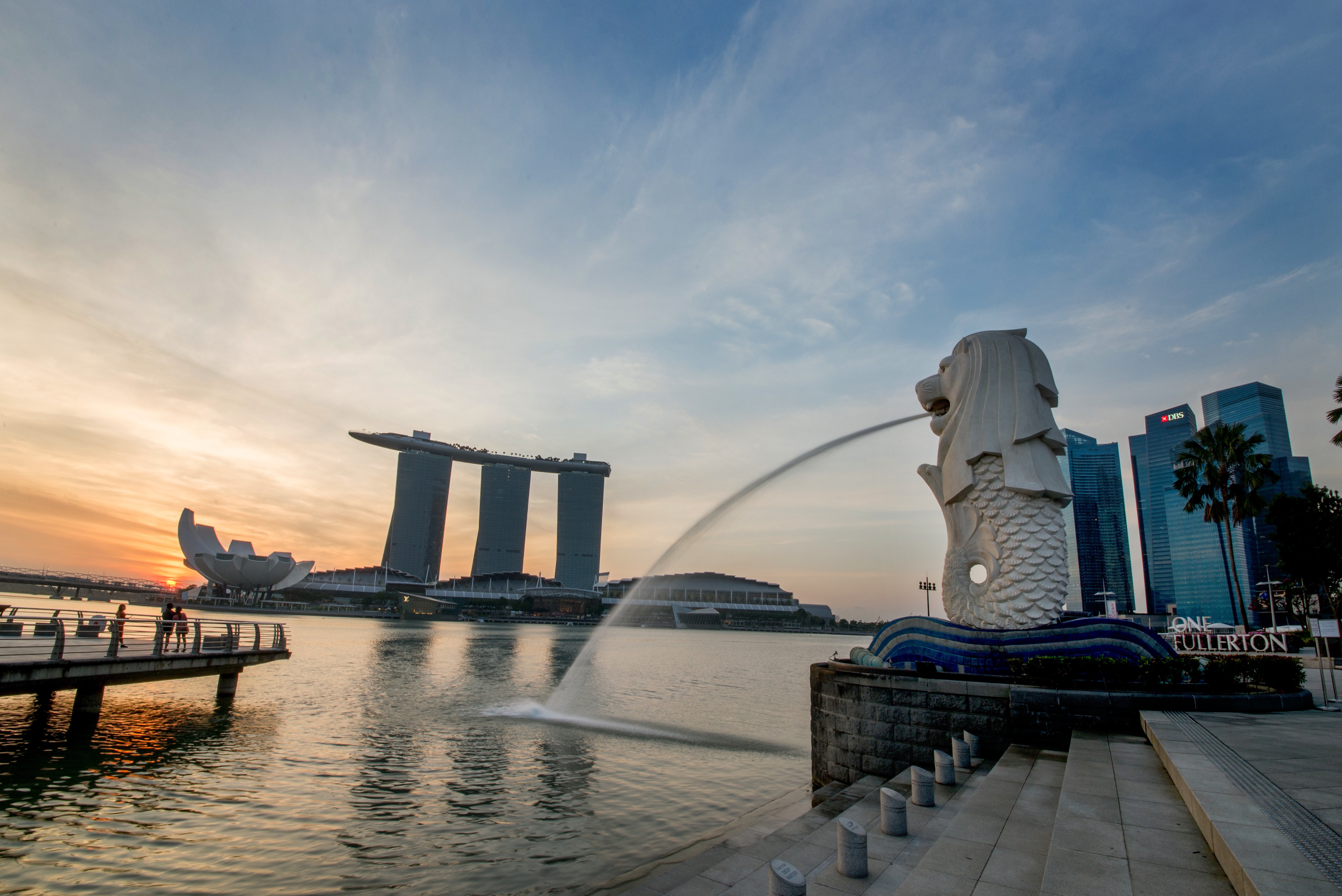
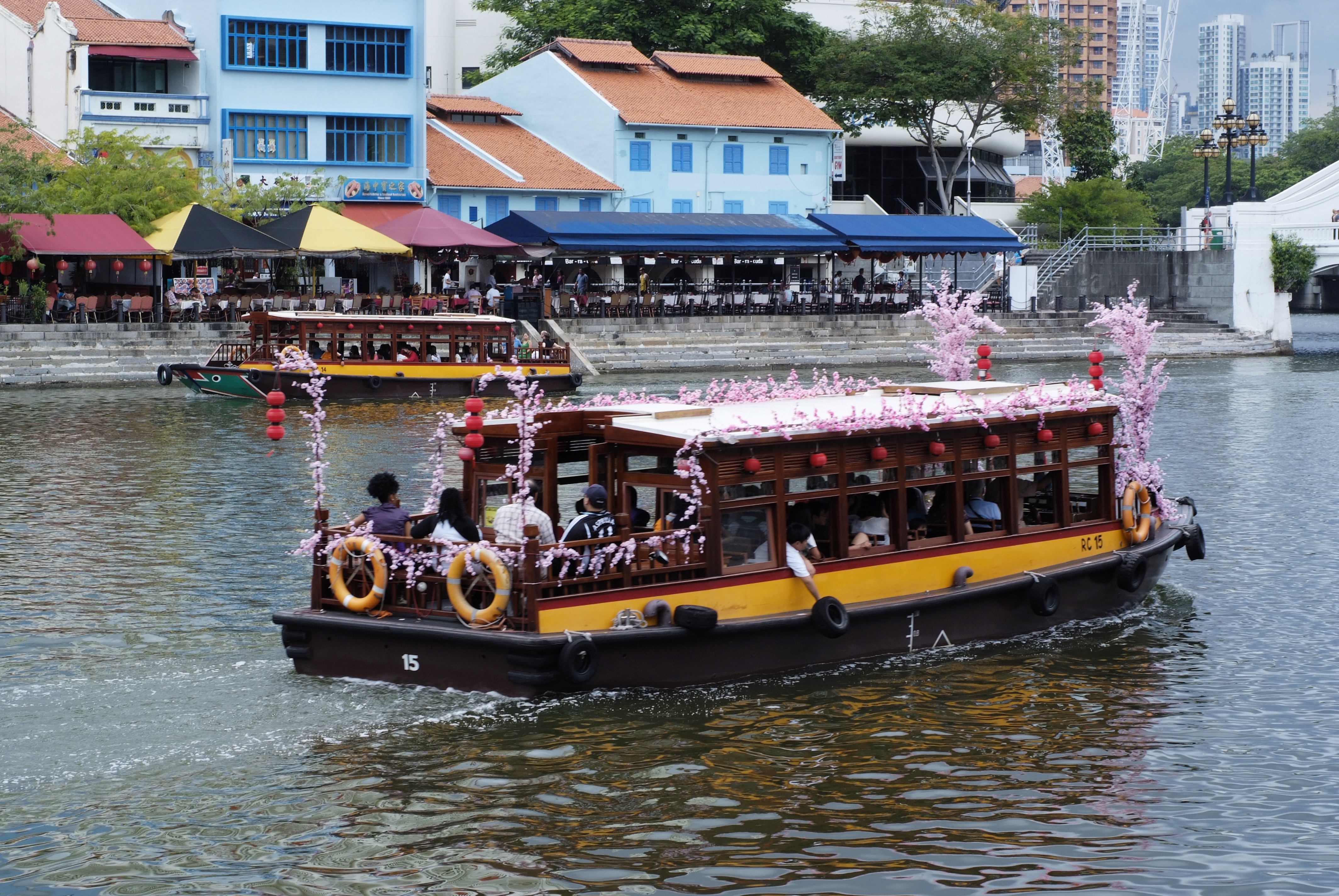
About Singapore
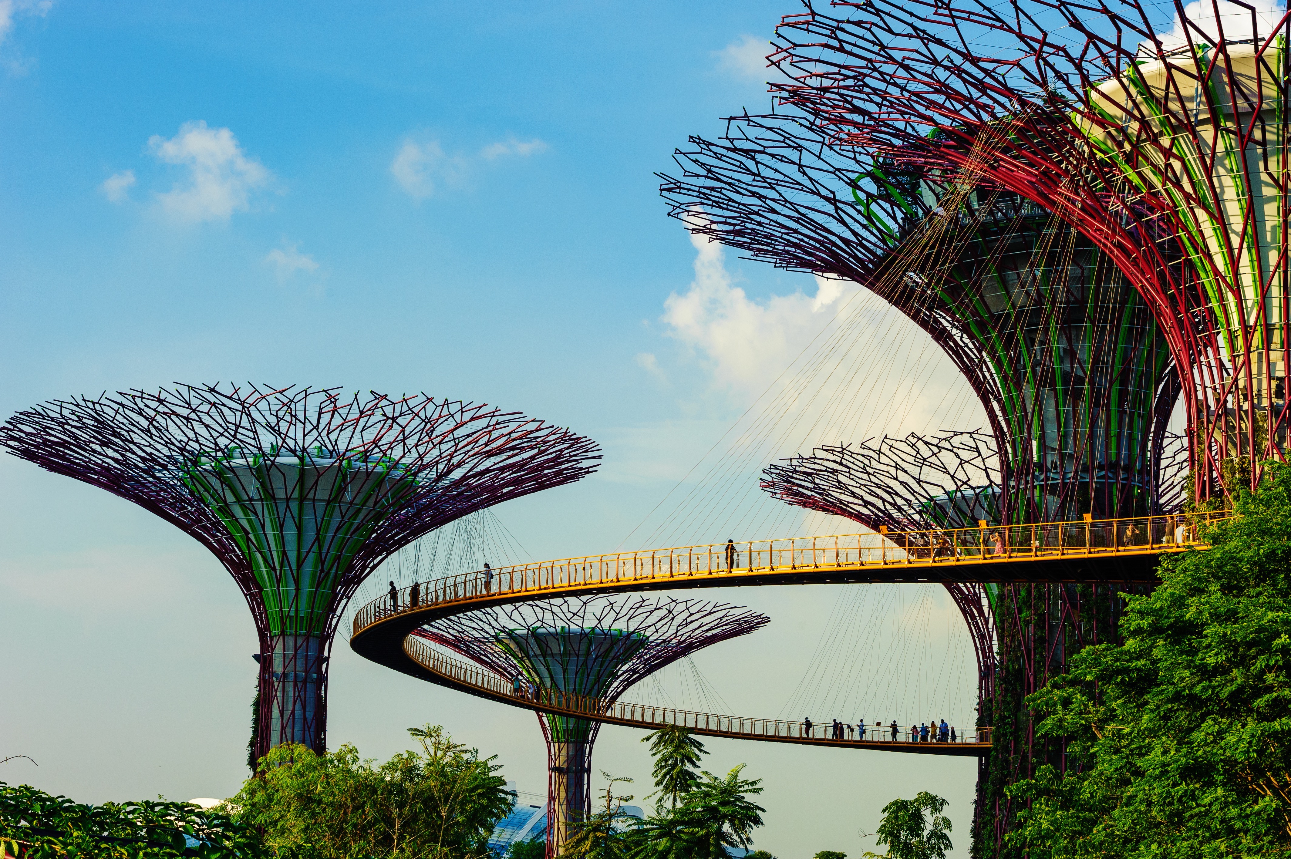
The main island of Singapore is shaped like a flattened diamond, 42 km (26 miles) east to west and 23 km (14 miles) north to south. Near the northern peak is the causeway leading to West Malaysia—Kuala Lumpur is less than four hours away by car. It is at the southern foot where you will find most of the city-state’s action, with its gleaming office towers, working docks, and futuristic "supertrees," which are solar-powered and serve as vertical gardens. Offshore are Sentosa and over 60 smaller islands, most uninhabited, that serve as bases for oil refining or as playgrounds and beach escapes from the city. To the east is Changi International Airport, connected to the city by metro, bus, and a tree-lined parkway. Of the island's total land area, more than half is built up, with the balance made up of parkland, farmland, plantations, swamp areas, and rain forest. Well-paved roads connect all parts of the island, and Singapore city has an excellent, and constantly expanding, public transportation system. The heart of Singapore's history and its modern wealth are in and around the Central Business District. The area includes the skyscrapers in the Central Business District, the 19th-century Raffles Hotel, the convention centers of Marina Square, on up to the top of Ft. Canning. Although most of old Singapore has been knocked down to make way for the modern city, most colonial landmarks have been preserved in the CBD, including early-19th-century buildings designed by the Irish architect George Coleman.
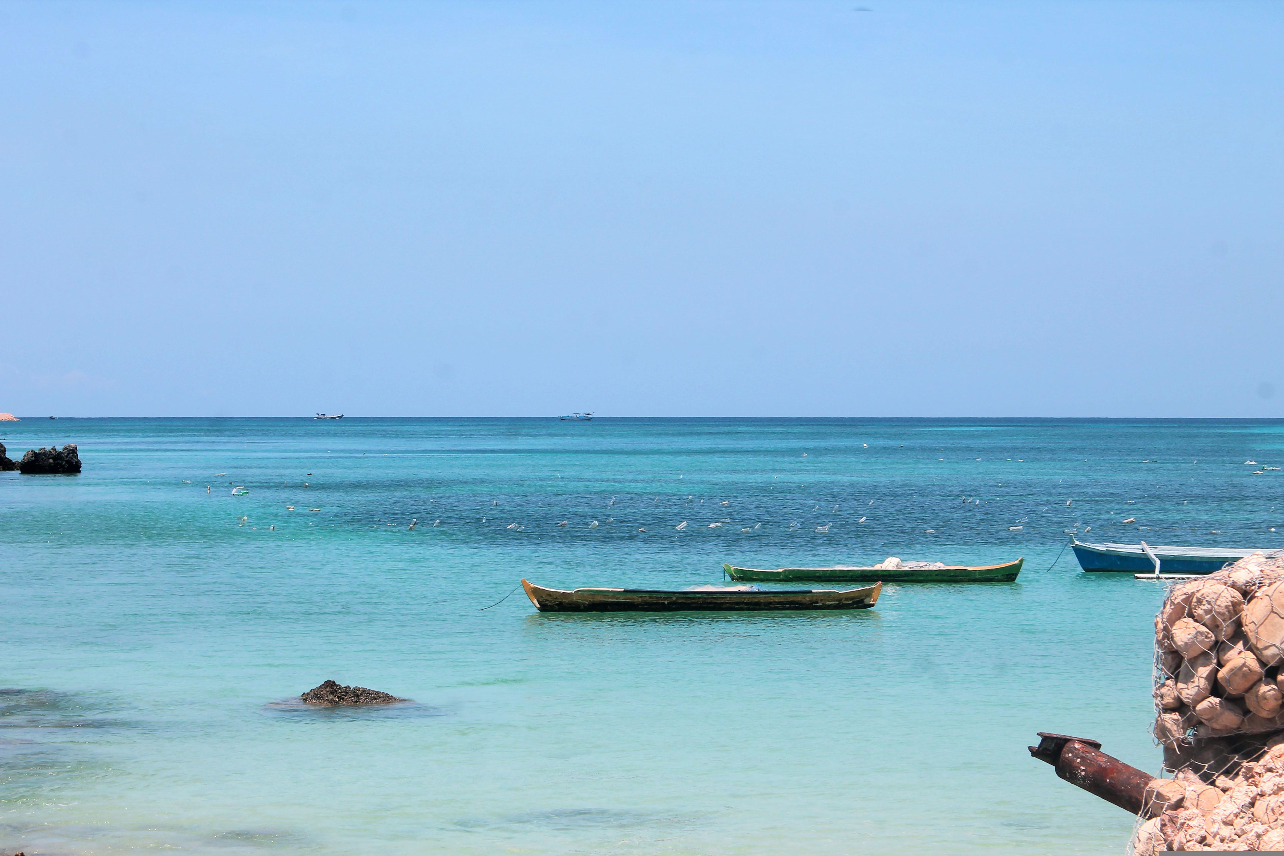
About Belitung Island
The island of Belitung is large, measuring roughly 4,800 square kilometer (1850 square miles). Along with neighbouring Bangka and the many other surrounding small islands this is not just an archipelago, but a substantial province of Indonesia. Belitung used to have many tin mines, but today the island is better known for its nature. The most distinct features of Belitung’s many beaches are the fascinating granite rock formations along the shallow shores. These rocks can reach the size of houses and lie in bold contrast to the white sand. Swimming and snorkeling in the crystal clear waters reveals healthy corals and hundreds of fish.
About Karimunjava Archipelago
Welcome to paradise. The 27 islands that comprise Karimunjawa, which sit in the sparkling turquoise expanse of the Java Sea, are true jewels - offering beaches of crisp white sand, and bath-like temperatures for swimming. With diverse marine life, extraordinary shelves of shallow water, and blooming coral reefs, there's an endless supply of wonderful beach scenery to make the most of. Take your front row seats for the sun's nightly descent, when rich pinks and vivid reds spill across the sky. Karimunjawa island is the largest of the archipelago, and you can explore on foot, or by renting a car, motorbike or bicycle. Work your way around - or through - the island's thick jungle, seeking out the wonderful, untouched beaches that are hidden across it. Only seven of the islands are inhabited, and the natural world is still very much in charge here. Encounter everything from sea turtles scraping themselves across the beach, to harmless sharks, which will circle around your legs before darting away.
About Pulau Satonda
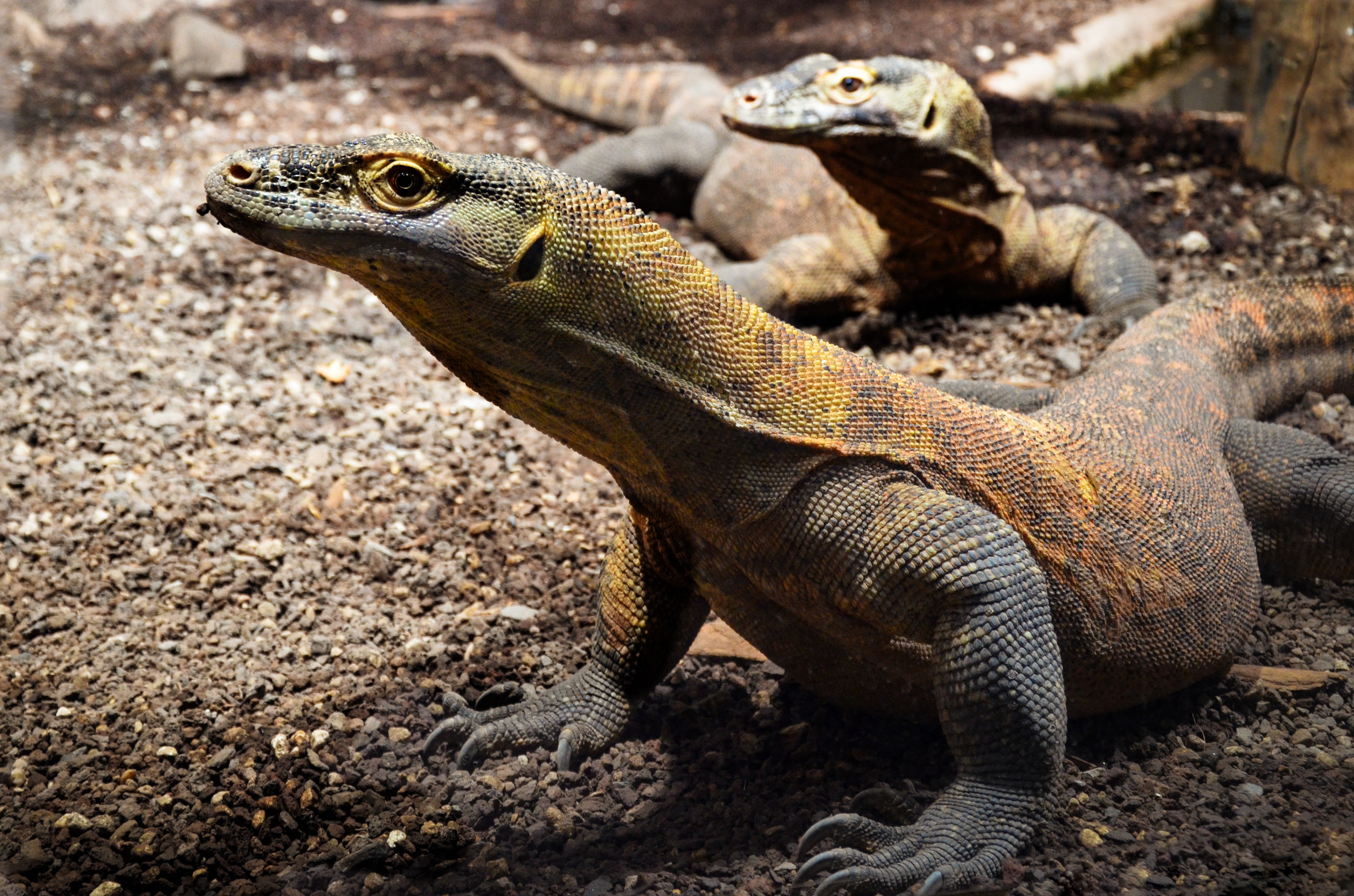
About Komodo Island
Pink Beach earned its name for the way the beach can appear to have a rosy hue in certain lights. The color comes from small flecks of red coral mixed in with the fine white reef sand. With a few trees along the beach for shade, this stretch of coast makes a fine place to relax or enjoy a snorkel or dive in the crystal clear waters. It is possible to spot a striped clown fish nestled among the protective tentacles of its sea anemone host, or to see a grouper lazily swimming by a flamboyant soft coral. The reef here is now protected by law and the maturing corals are a joy to behold.
About Komba Island
On the approach to Pulau Komodo, a tiny island just 36 km (22 miles) long and 16 km (9 miles) across at its widest point, it's hard to imagine that this is the home of the fearsome dragons described by late-19th-century explorers. The island, in the Indonesian region of Nusa Tenggara, lies between the islands of Sumbawa and Flores at the heart of the Komodo National Park, designated a UNESCO World Heritage Site and one of the New7Wonders of Nature. At first look, steep hillsides of parched, golden grasses slide down into topaz bays covered in glass-clear waters, and white-sand beaches hem quiet shorelines. But then you remember that this innocent-looking island is inhabited by 13-foot-long, 220-pound ora, as Komodo dragons are known locally. Don't be frightened: Although stories of people disappearing run rampant, a trip here is quite safe—as long as you stay with a park guide.While Komodo dragons are the main attraction, several other large species also reside here. Dark-brown deer and small buffalo nibble the grasses of the high plains, macaques peer through the trees, and wild pigs crash through the underbrush. More than 150 types of birds also inhabit the island, including cockatoos, imperial pigeons, sea eagles, and mound-building megapodes. Offshore in the marine reserve, you might spot dolphins, dugong (a relative of the manatee), sea turtles, manta rays, and even whales, as well as more than 1,000 species of fish.Lodging on Pulau Komodo was nonexistent until 2012, when a modest, eco-friendly resort and diving club opened, providing a rare opportunity for scuba divers and snorkelers to explore this pristine habitat's extensive coral reefs and extraordinary marine life. Travelers can also find comfortable lodging and a convenient base from which to explore the many natural wonders of the Komodo National Park in Labuan Bajo, on the island of Flores (East Nusa Tenggara).
About Kupang
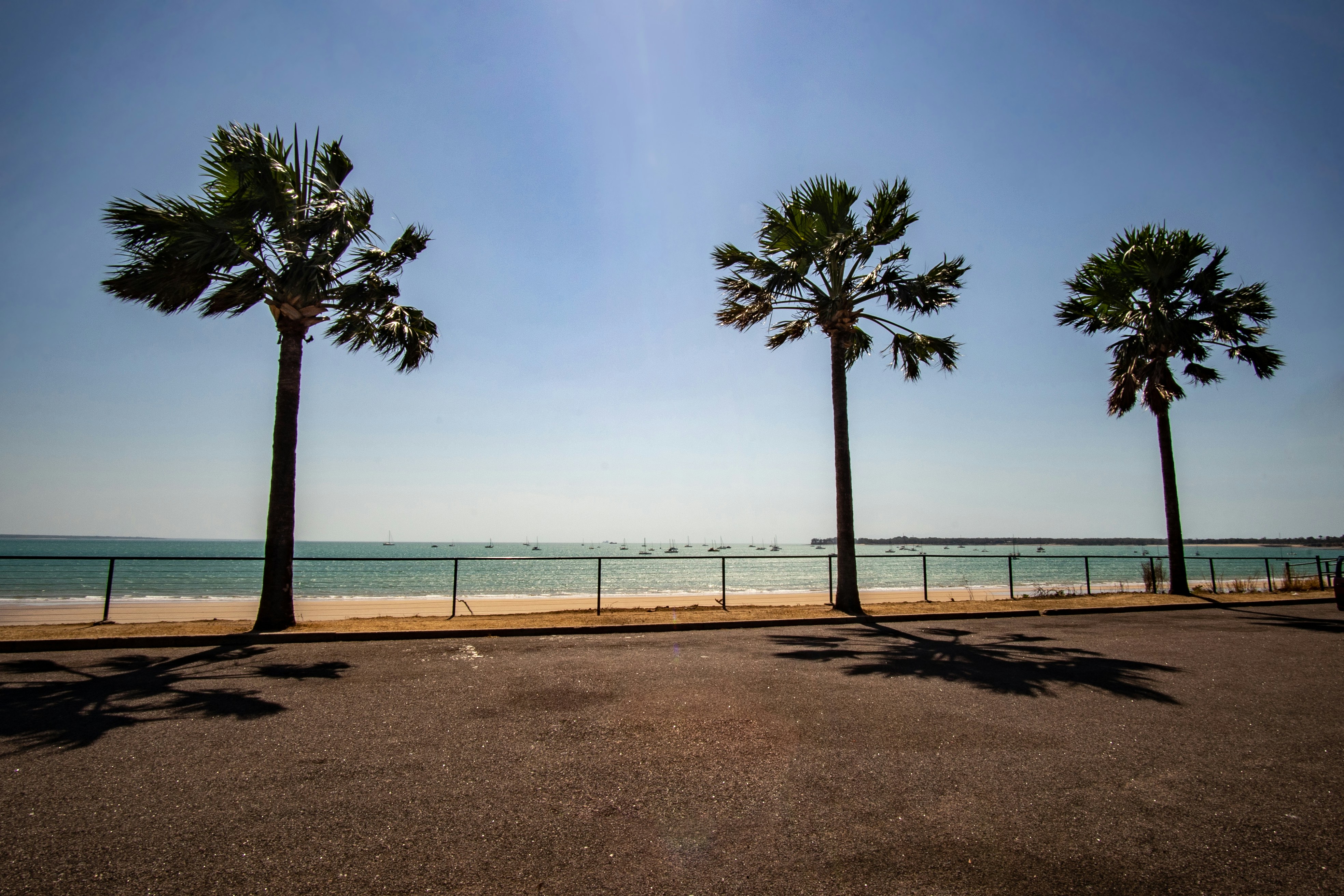
About Darwin, Northern Territory
Darwin is Australia's most colorful, and exotic, capital city. Surrounded on three sides by the turquoise waters of the Timor Sea, the streets are lined with tropical flowers and trees. Warm and dry in winter, hot and steamy in summer, it's a relaxed and casual place, as well as a beguiling blend of tropical frontier outpost and Outback hardiness. Thanks to its close proximity to Southeast Asia and its multicultural population it also seems more like Asia than the rest of Australia. Darwin is a city that has always had to fight for its survival. The seductiveness of contemporary Darwin lifestyles belies a history of failed attempts that date from 1824 when Europeans attempted to establish an enclave in this harsh, unyielding climate. The original 1869 settlement, called Palmerston, was built on a parcel of mangrove wetlands and scrub forest that had changed little in 15 million years. It was not until 1911, after it had already weathered the disastrous cyclones of 1878, 1882, and 1897, that the town was named after the scientist who had visited Australia's shores aboard the Beagle in 1839. During World War II it was bombed more than 60 times, as the harbor full of warships was a prime target for the Japanese war planes. Then, on the night of Christmas Eve 1974, the city was almost completely destroyed by Cyclone Tracy, Australia’s greatest natural disaster. It's a tribute to those who stayed and to those who have come to live here after Tracy that the rebuilt city now thrives as an administrative and commercial center for northern Australia. Old Darwin has been replaced by something of an edifice complex—such buildings as Parliament House and the Supreme Court all seem very grand for such a small city, especially one that prides itself on its casual, outdoor-centric lifestyle. Today Darwin is the best place from which to explore Australia's Top End, with its wonders of Kakadu and the Kimberley region.
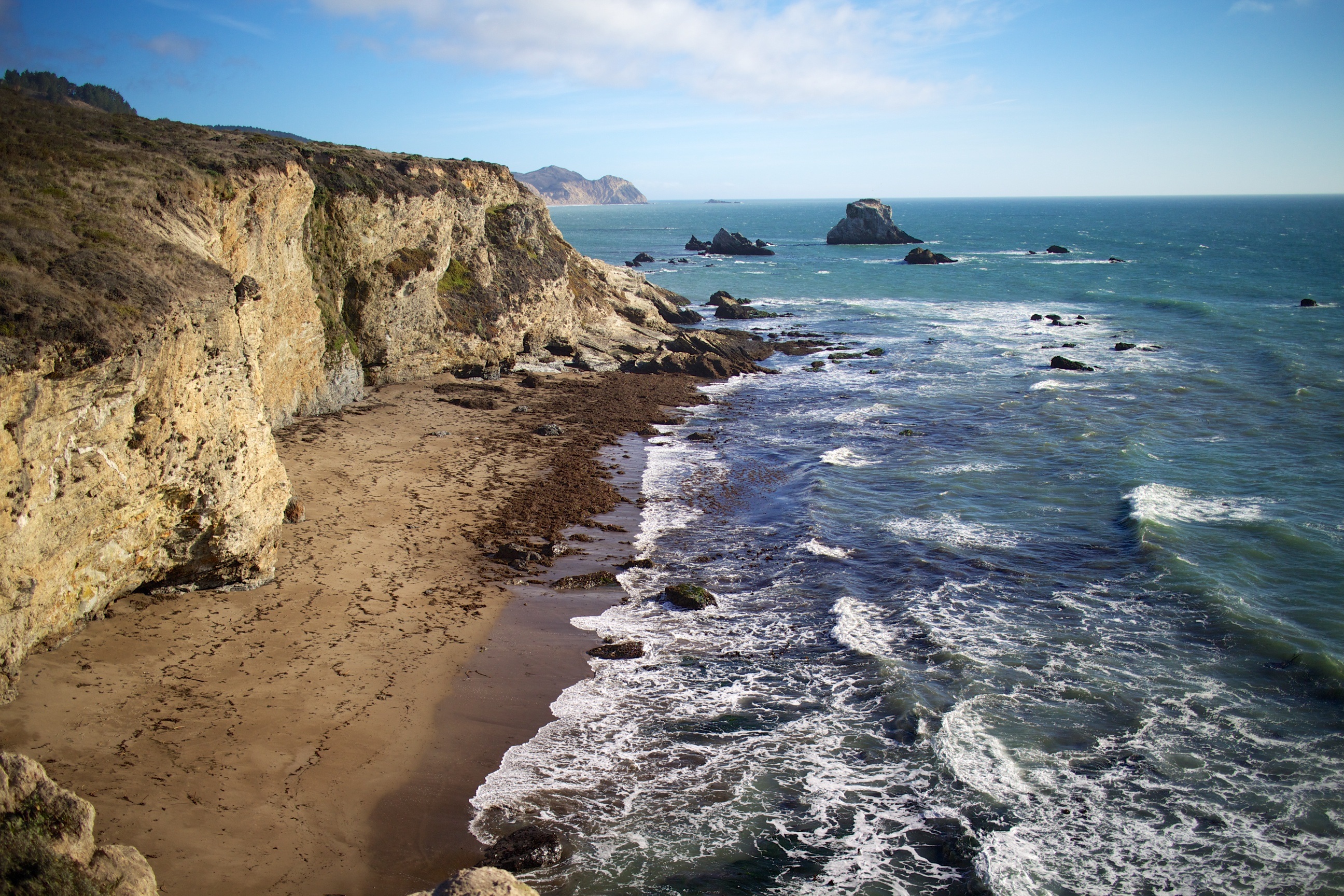
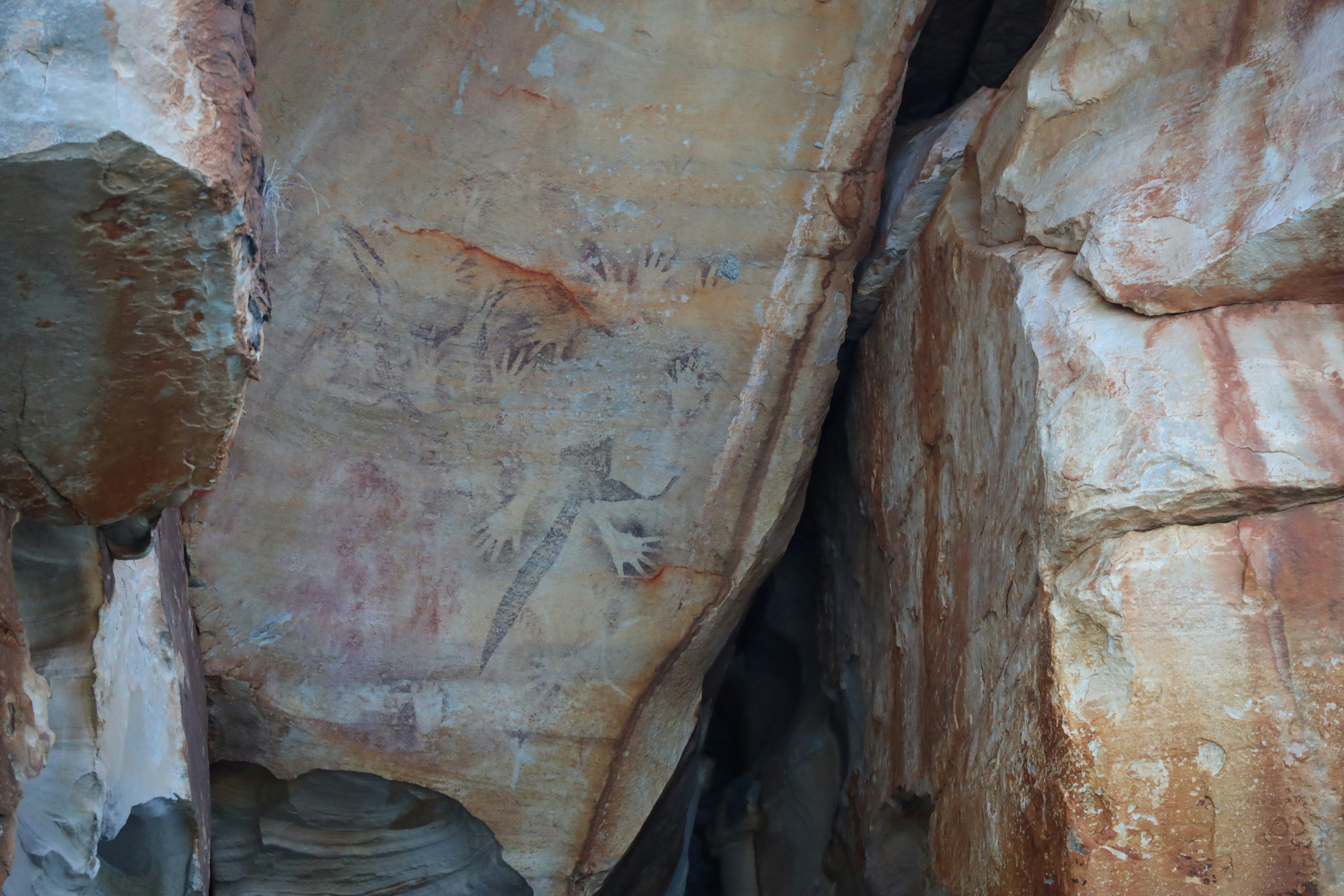
About Swift Bay, Western Australia
The Bonaparte Archipelago is a rugged maze of islands that stretch almost 150km along Western Australia’s remote Kimberley coast. Remaining relatively unspoilt and remarkably pristine, Swift Bay is landscaped by heavily fractured sandstone providing an abundance of rock shelters. On the walls of these shelters are examples of both Wandjina and Gwion Gwion style rock art. Join your expedition team ashore for a guided walk to a number of rock art galleries depicting these unique rock art styles.
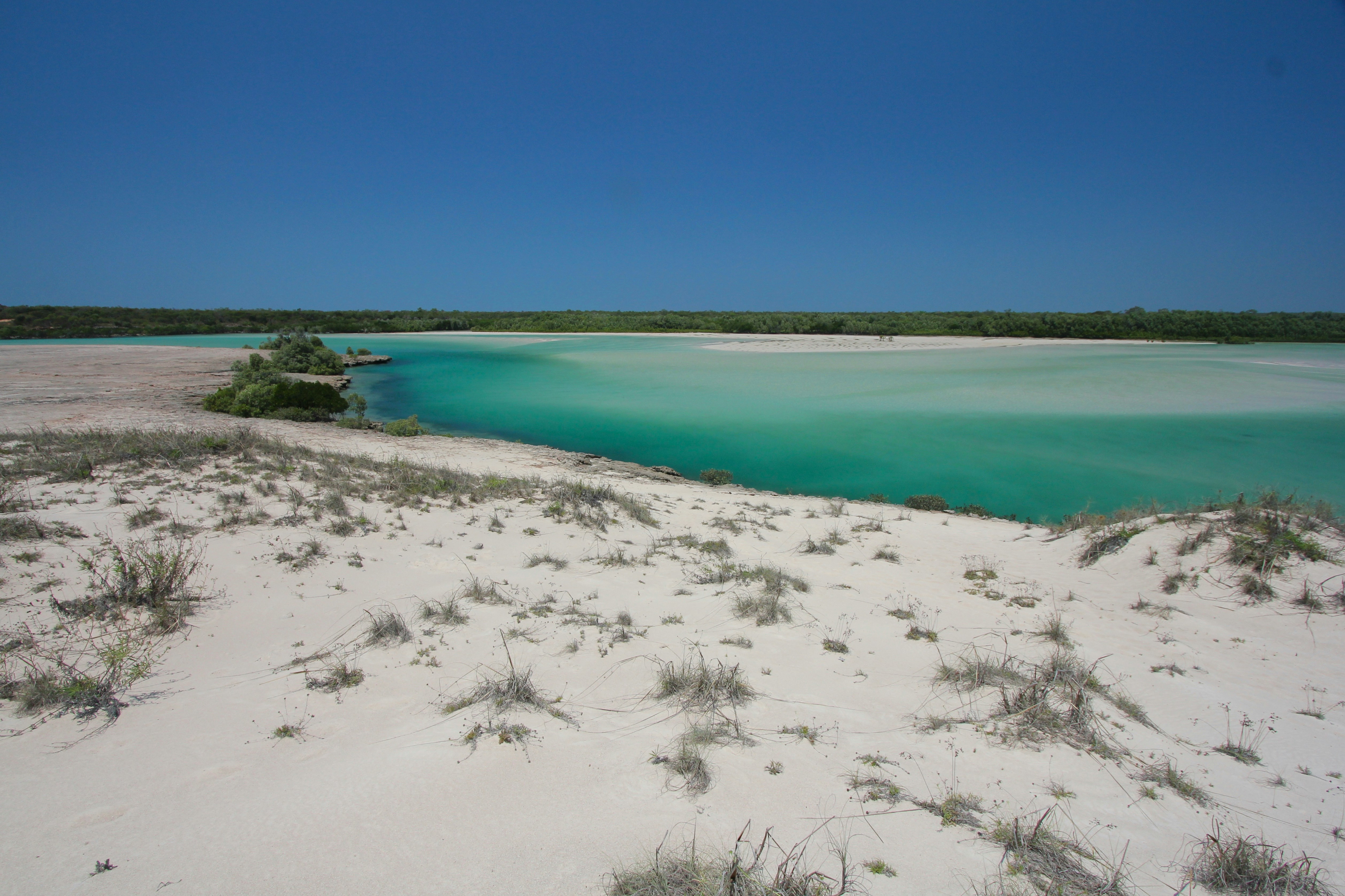
About Buccaneer Archipelago, Western Australia
Roughly 800 islands of the Buccaneer Archipelago surround and shelter the impressive spread of Yampi Sound (from the aboriginal word for water, “Yampee”). The area was named in 1821 by Captain Phillip Parker King, in commemoration of William Dampier’s visit in 1688. Pearlers began visiting the area in the late 1800s, and more recently mining operators established open-cut mines on Koolan Island on the east side of the Sound. Some of the richest iron ore in the world is extracted here to this day. The coastline of Yampi shows rock layers wildly twisted and contorted into great folds. White-bellied Sea Eagles, Brahminy Kites, Ospreys, Common Sandpipers and Eastern Reef Egrets inhabit the archipelago and the area is rich in fish life, which in turn is an attraction for bottlenose dolphins that come here to feed. Yampi Sound is also occassionaly a calving ground for humpback whales and mothers and calves can sometimes be spotted in the relatively shallow turquoise waters.
About Vansittart Bay, Western Australia
Vansittart Bay is a beautifully protected large bay with several islands and coves. Jar Island contains ancient rock art galleries depicting the Gwion Gwion style unique to the Kimberley region. Mainly neglected by, or unknown to, the early European researchers of Aboriginal culture in the Kimberley in favour of the dominant & more dramatic Wandjina art, Gwion Gwion art has in recent years gained world prominence. Join your Expedition Team ashore for a short walk, past some fascinating rock formations, to the site of the Gwion Gwion art galleries.
About Darwin, Northern Territory
Darwin is Australia's most colorful, and exotic, capital city. Surrounded on three sides by the turquoise waters of the Timor Sea, the streets are lined with tropical flowers and trees. Warm and dry in winter, hot and steamy in summer, it's a relaxed and casual place, as well as a beguiling blend of tropical frontier outpost and Outback hardiness. Thanks to its close proximity to Southeast Asia and its multicultural population it also seems more like Asia than the rest of Australia. Darwin is a city that has always had to fight for its survival. The seductiveness of contemporary Darwin lifestyles belies a history of failed attempts that date from 1824 when Europeans attempted to establish an enclave in this harsh, unyielding climate. The original 1869 settlement, called Palmerston, was built on a parcel of mangrove wetlands and scrub forest that had changed little in 15 million years. It was not until 1911, after it had already weathered the disastrous cyclones of 1878, 1882, and 1897, that the town was named after the scientist who had visited Australia's shores aboard the Beagle in 1839. During World War II it was bombed more than 60 times, as the harbor full of warships was a prime target for the Japanese war planes. Then, on the night of Christmas Eve 1974, the city was almost completely destroyed by Cyclone Tracy, Australia’s greatest natural disaster. It's a tribute to those who stayed and to those who have come to live here after Tracy that the rebuilt city now thrives as an administrative and commercial center for northern Australia. Old Darwin has been replaced by something of an edifice complex—such buildings as Parliament House and the Supreme Court all seem very grand for such a small city, especially one that prides itself on its casual, outdoor-centric lifestyle. Today Darwin is the best place from which to explore Australia's Top End, with its wonders of Kakadu and the Kimberley region.
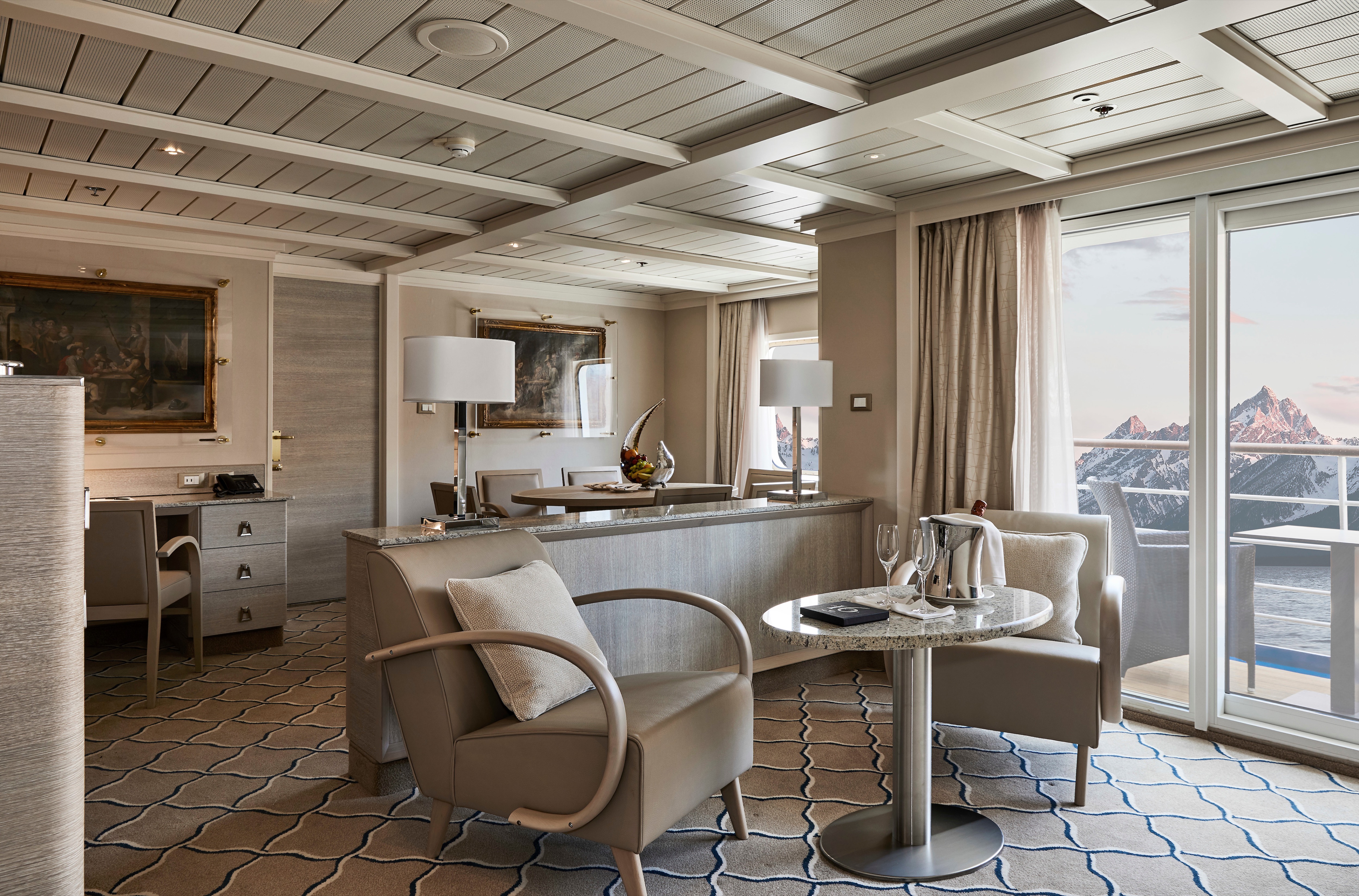
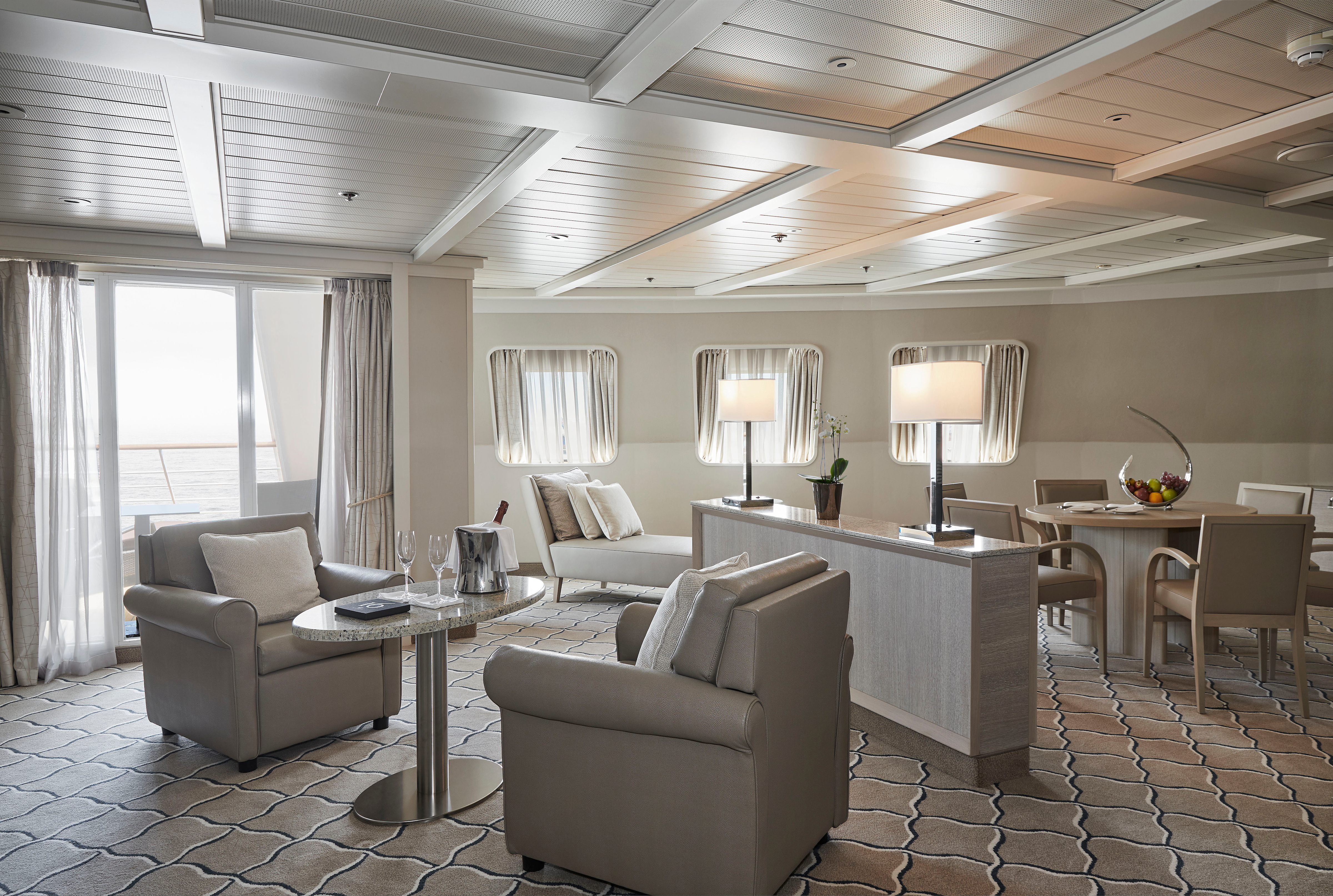
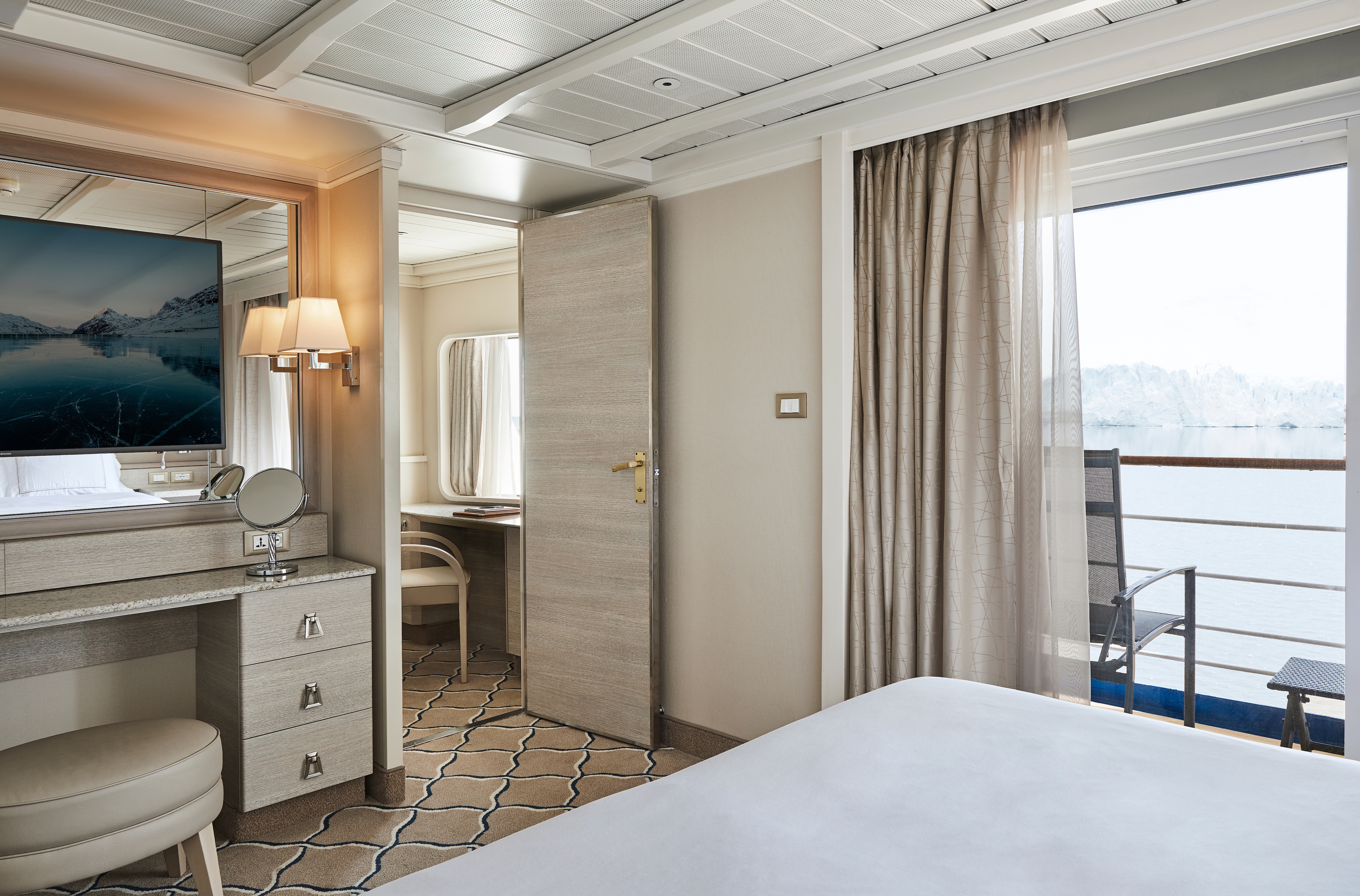
This stylish apartment offers the superlative in levels of space, comfort, and service on board. A perfect mix of expedition experience with luxury lifestyle. Available in a one-bedroom configuration or as two bedrooms by adjoining with a Vista Suite.
One bedroom: 55 sq m including veranda (8 sq m)
Two bedrooms: 77 sq m including veranda (8 sq m)
Images are intended as a general reference. Features, materials, finishes and layout may be different than shown.
Please note that the 3rd guest will sleep on a comfortable sofa bed in the reception area of the suite.
Essentials
- Deck(s): 7
- Section: Mid-Ship
Characteristics
- Veranda
- Separate dining area
- Living room with sitting area
- Standard vanity
- Separate shower
- Whirlpool bath
- Walk-in wardrobe with personal safe
Furniture
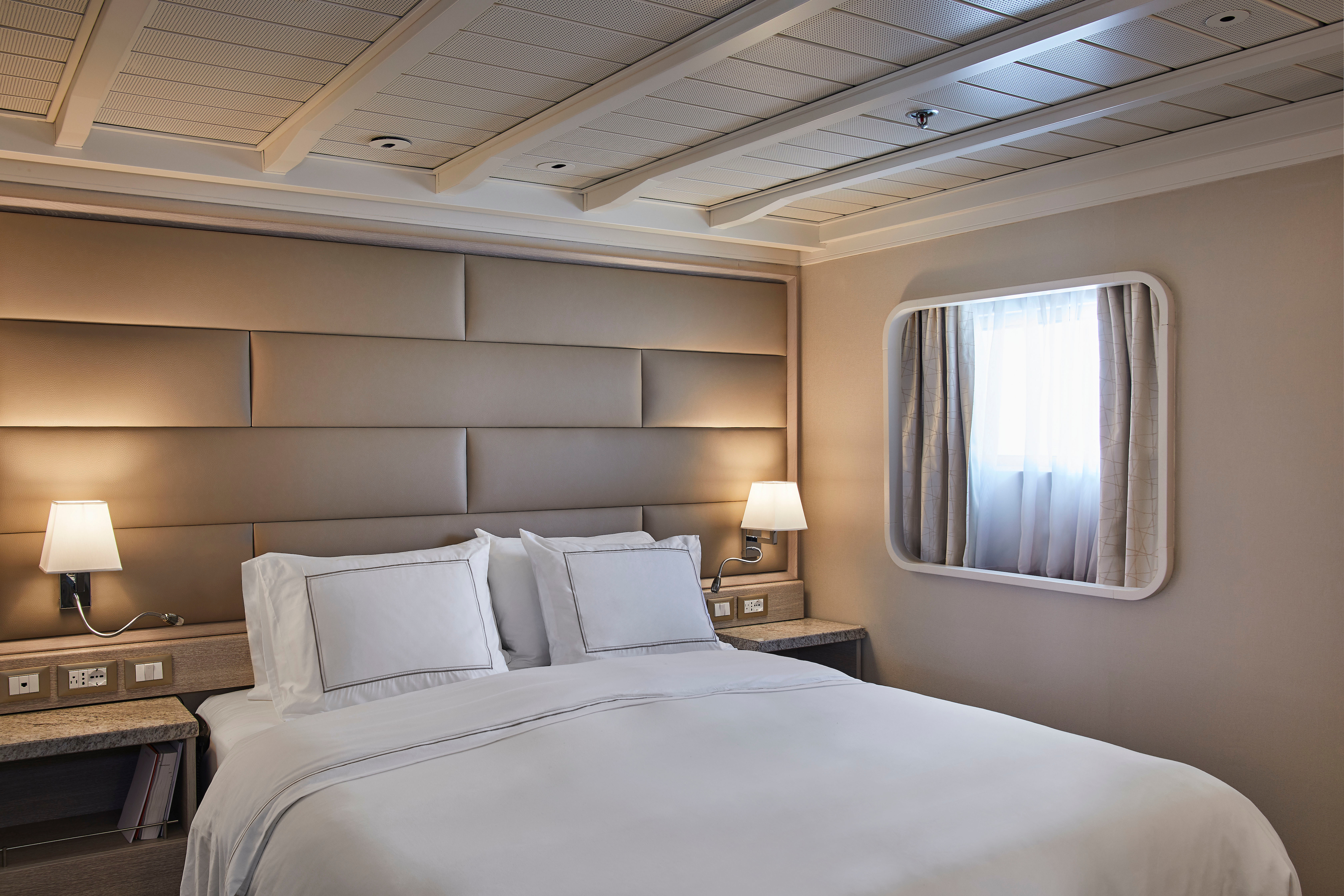
- King size bed
- Writing desk
- Vanity table
- Luxury bed mattresses
Media & Communication
- Unlimited Premium Wi-Fi
- 2 large flat screen TVs with Interactive Media Library
- Sound system with bluetooth connectivity
- Direct dial telephone
- Wall mounted USB-C mobile device chargers
- Dual voltage 110/220 outlets
Onboard Services
- Butler service
- Complimentary laundry, pressing & wet cleaning
- Daily canapé service, Welcome chocolate, Welcome fruit stand
- Dinner for two in La Dame, one evening per voyage,
- Two hours of worldwide phone use, per voyage segment
- Champagne on arrival
Amenities
- Espresso machine
- Pillow menu
- Refrigerator and bar setup stocked with your preferences
- Plush bathrobe
- Luxury bath amenities
- Umbrella
- Hair Dryer
- Slippers
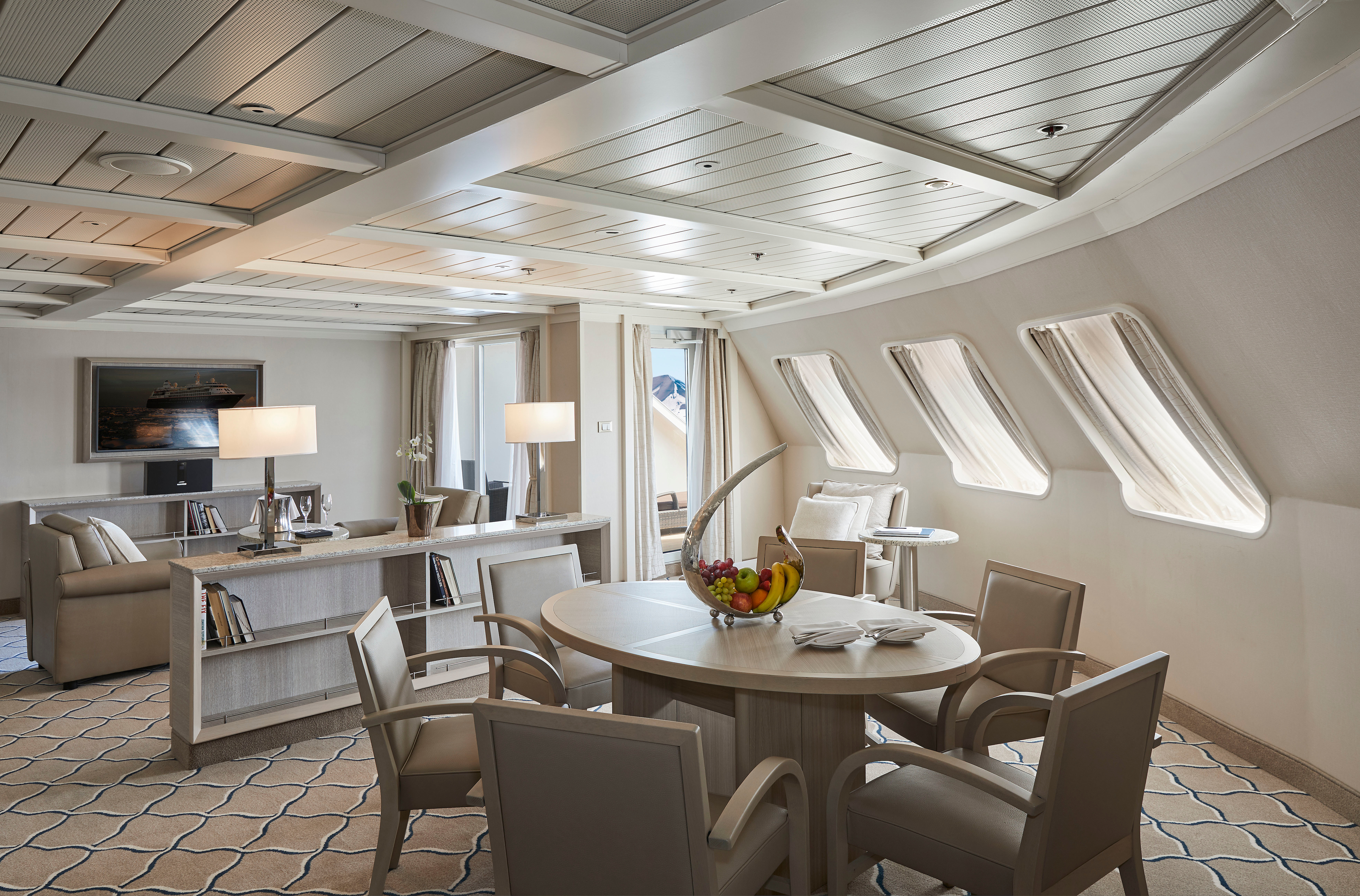
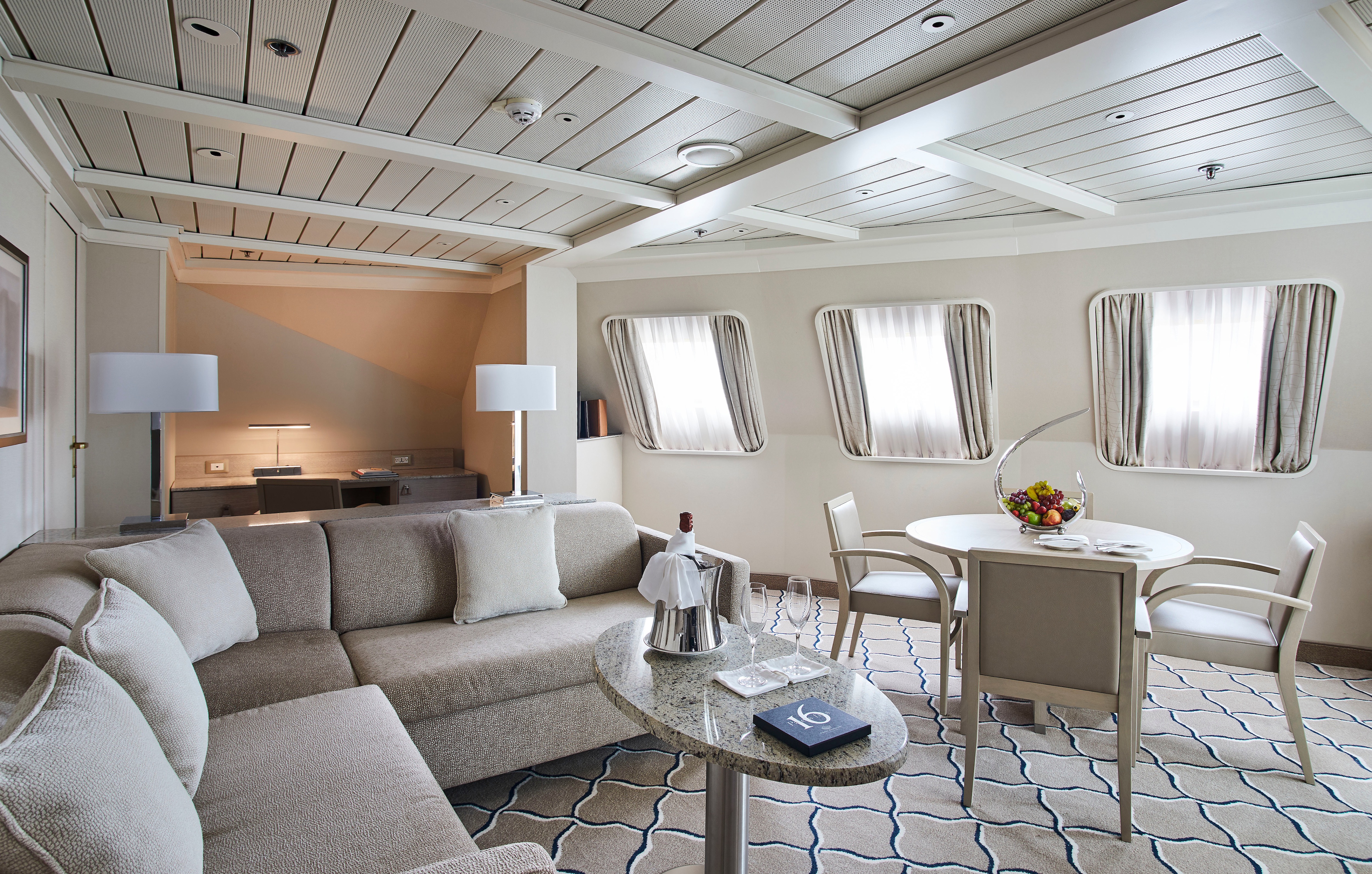
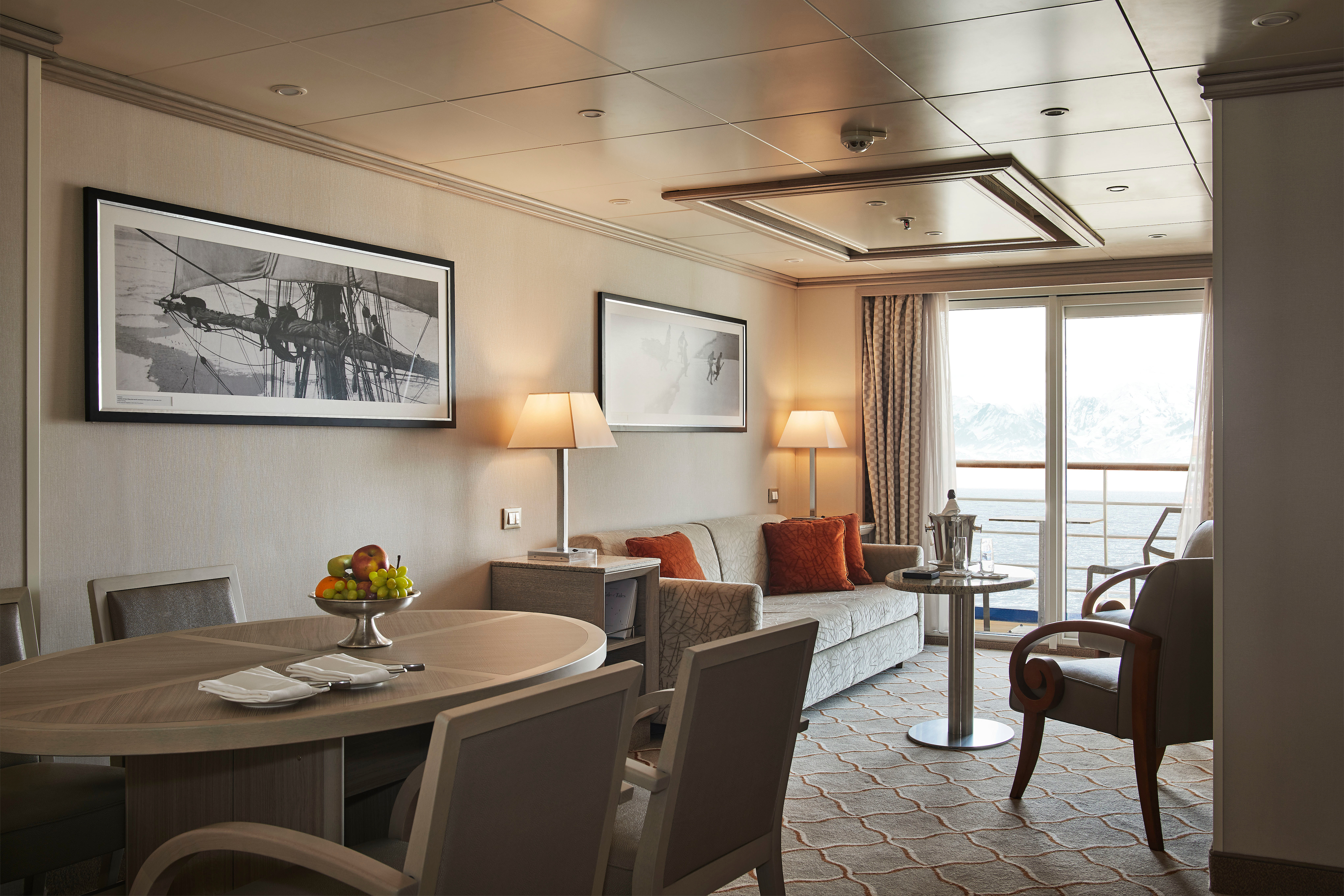
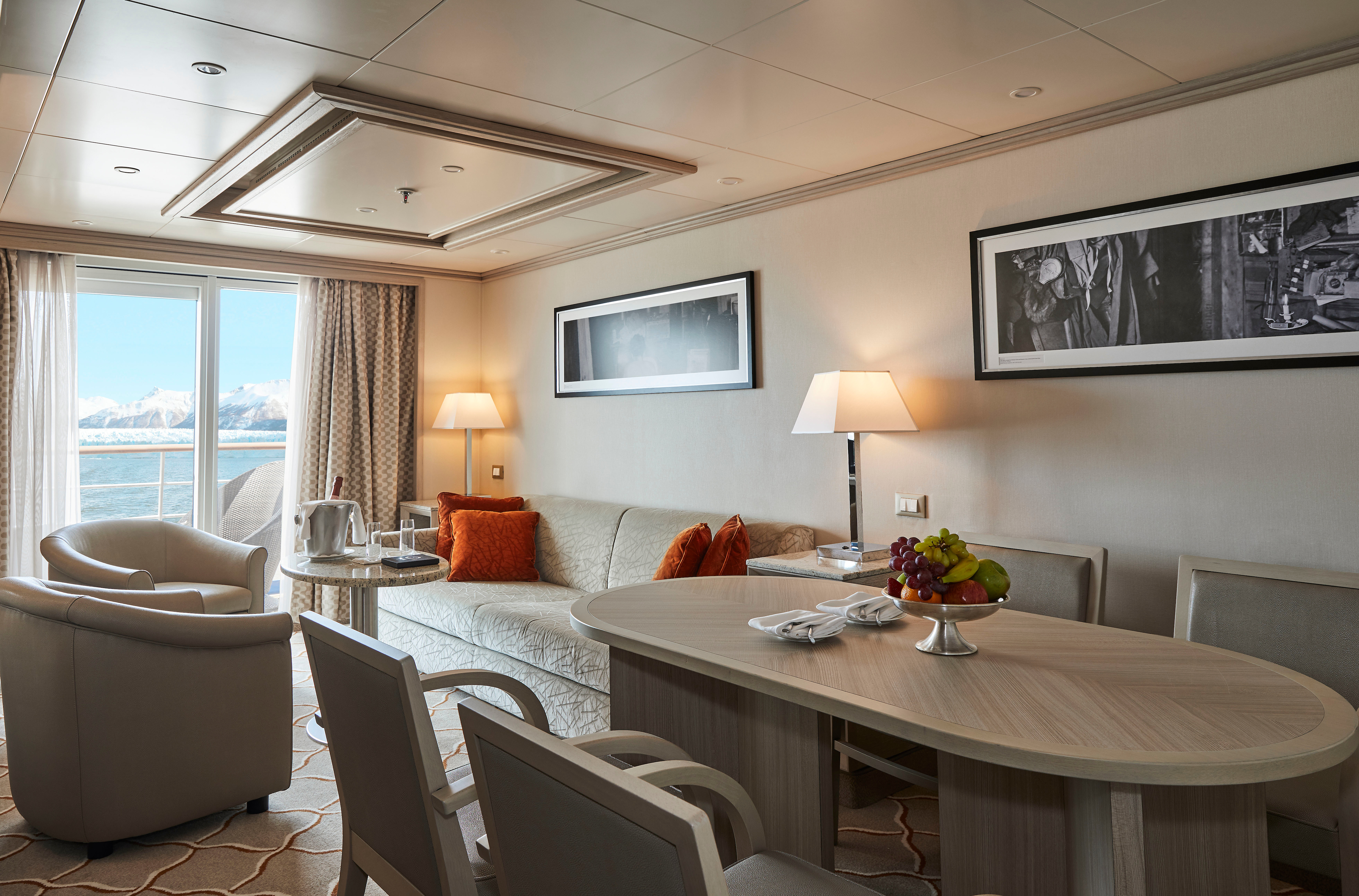
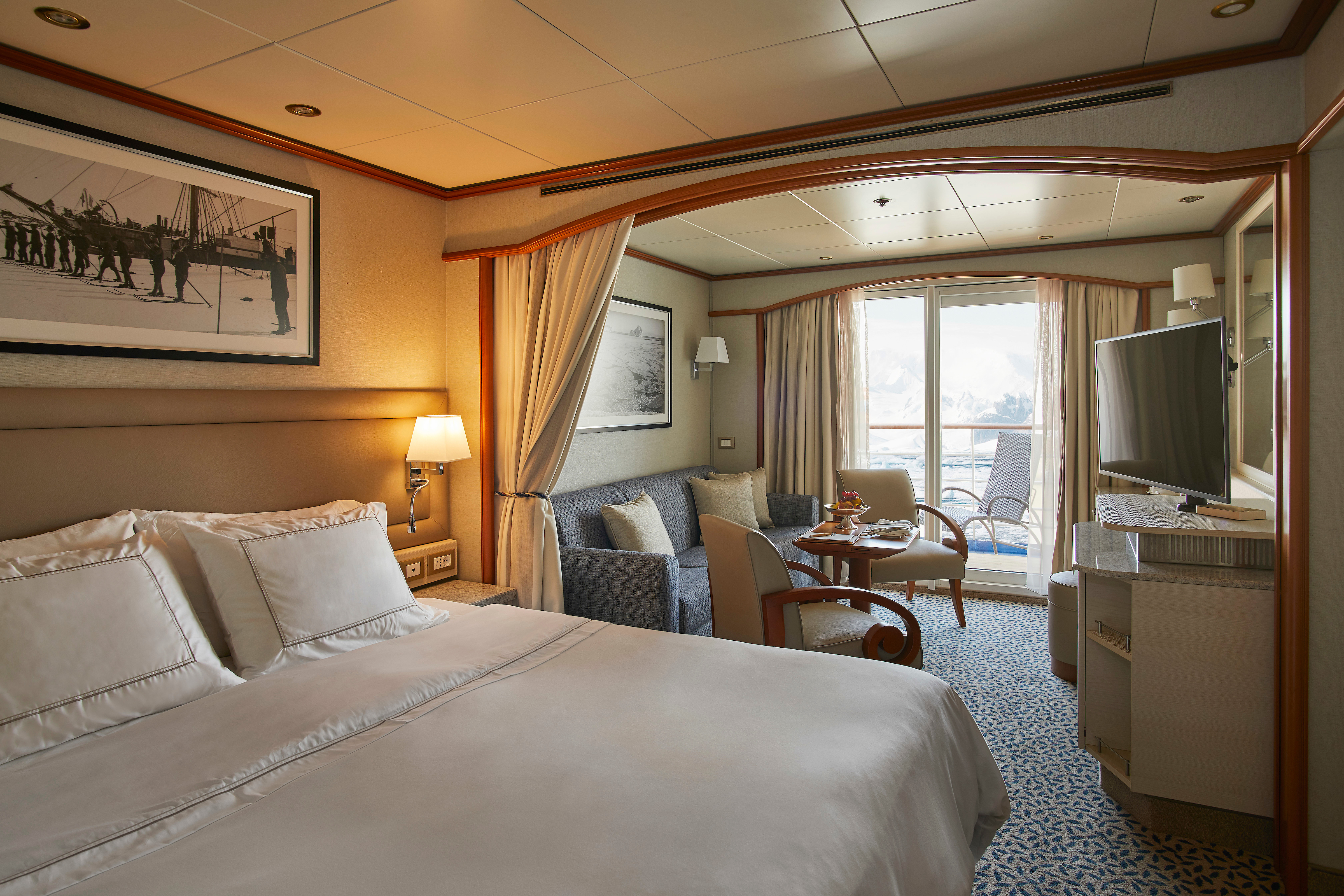
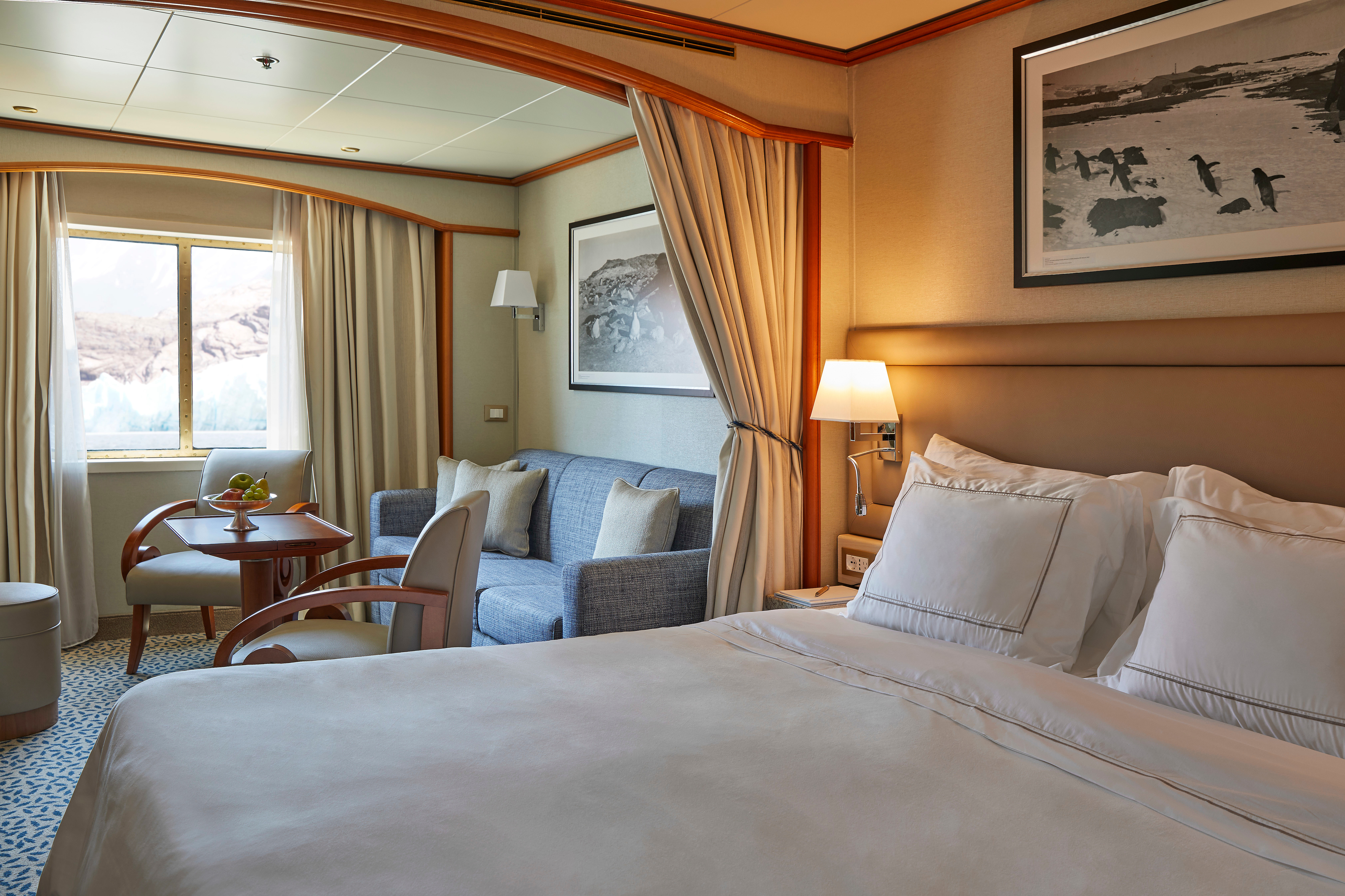
Expertly designed and exquisitely appointed. The ideal space for sharing stories with fellow explorers and new friends. With enough space to roam both inside and outside, this suite is perfect for relaxing and recounting the highlights of your day. Available in a one-bedroom configuration or as two bedrooms by adjoining with a Veranda Suite.
One bedroom: 95 sq m including veranda (14 sq m)
Images are intended as a general reference. Features, materials, finishes and layout may be different than shown.
Please note that the third guest will sleep on a comfortable sofa bed in the reception area of the suite.
Two bedrooms: 122 sq m including veranda (18.5 sq m)
Images are intended as a general reference. Features, materials, finishes and layout may be different than shown.
Please note that the 3rd guest will sleep on a comfortable sofa bed in the reception area of the suite.
Essentials
- Deck(s): 7
- Section: Forward
Characteristics
Veranda
- Separate dining area
- Living room with sitting area
- Standard vanity
- Separate shower
- Whirlpool bath
- Walk-in wardrobe with personal safe (Wardrobe closet in suite 702 & 703)
Furniture
- King size bed
- Writing desk
- Vanity table
- Luxury bed mattresses
Media & Communication
- Unlimited Premium Wi-Fi
- 2 large flat screen TVs with Interactive Media Library
- Sound system with bluetooth connectivity
- Direct dial telephone
- Wall mounted USB-C mobile device chargers
- Dual voltage 110/220 outlets
Onboard Services
Butler service
- Complimentary laundry, pressing & wet cleaning
- Dinner for two in La Dame, one evening per voyage,
- Two hours of worldwide phone use, per voyage segment
- Champagne on arrival
Amenities
- Espresso machine
- Pillow menu
- Refrigerator and bar setup stocked with your preferences
- Plush bathrobe
- Luxury bath amenities
- Umbrella
- Hair Dryer
- Slippers
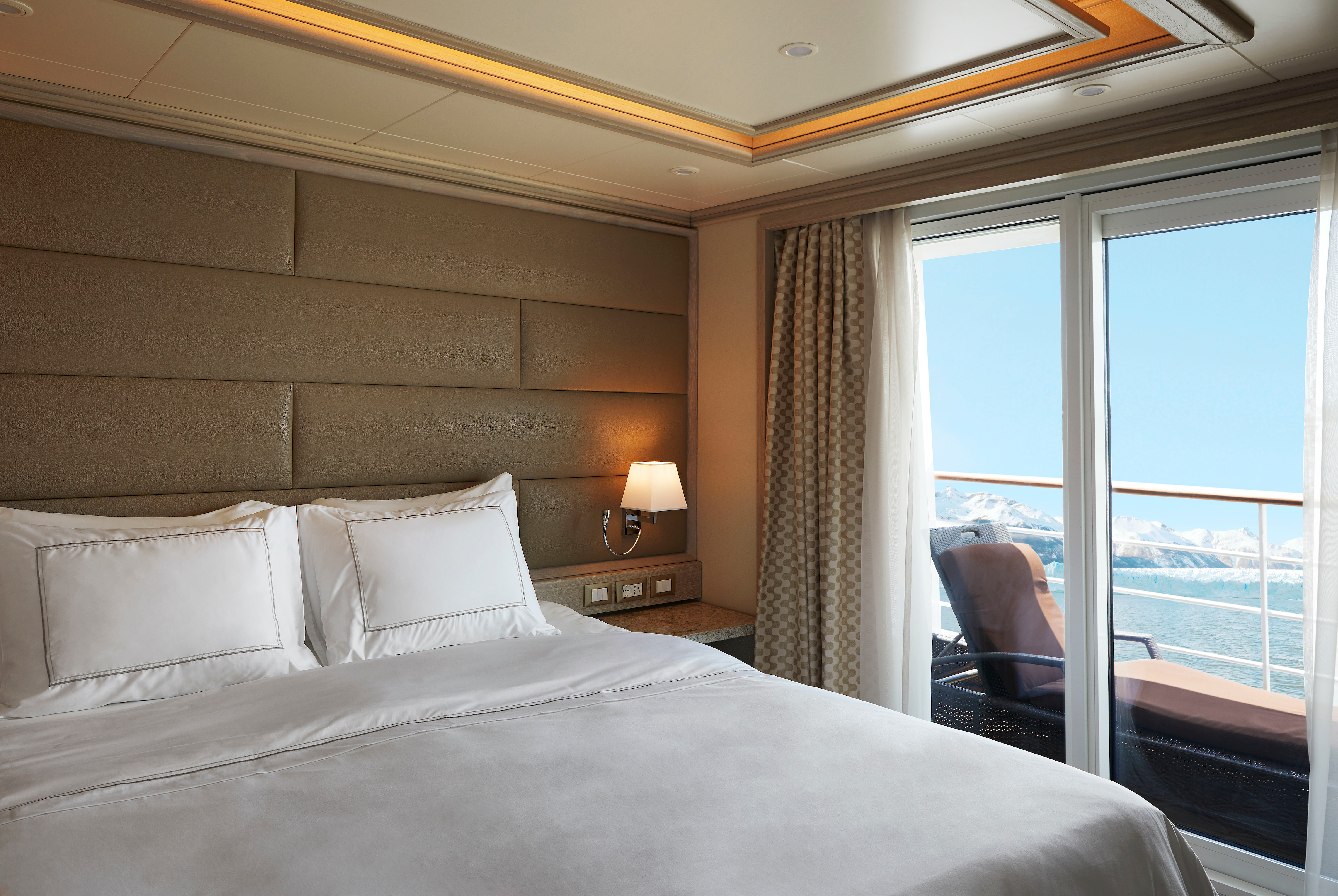
Stately. Commanding and majestic. Perfect for relaxing after a days’ exploring and looking through your photos. With lectures streamed live to your room, this is the pinnacle of good living at sea. Available in a one-bedroom configuration or as two bedrooms by adjoining with a Veranda Suite.
One bedroom: 69 sq m including veranda (12 sq m)
Two bedrooms: 96 sq m including veranda (16.5 sq m)
Images are intended as a general reference. Features, materials, finishes and layout may be different than shown.
Please note that the third guest will sleep on a comfortable sofa bed in the reception area of the suite.
Essentials
- Deck(s): 6
- Section: Forward
Characteristics
- Veranda
- Separate dining area
- Living room with sitting area
- Standard vanity
- Separate shower
- Whirlpool bath
- Walk-in wardrobe with personal safe
Furniture
- King size bed
- Writing desk
- Vanity table
- Luxury bed mattresses
Media & Communication
- Unlimited Premium Wi-Fi
- 2 large flat screen TVs with Interactive Media Library
- Sound system with bluetooth connectivity
- Direct dial telephone
- Wall mounted USB-C mobile device chargers
- Dual voltage 110/220 outlets
Onboard Services
- Butler service
- Complimentary laundry, pressing & wet cleaning
- Dinner for two in La Dame, one evening per voyage,
- Two hours of worldwide phone use, per voyage segment
- Champagne on arrival
Amenities
- Espresso machine
- Pillow menu
- Refrigerator and bar setup stocked with your preferences
- Plush bathrobe
- Luxury bath amenities
- Umbrella
- Hair Dryer
- Slippers
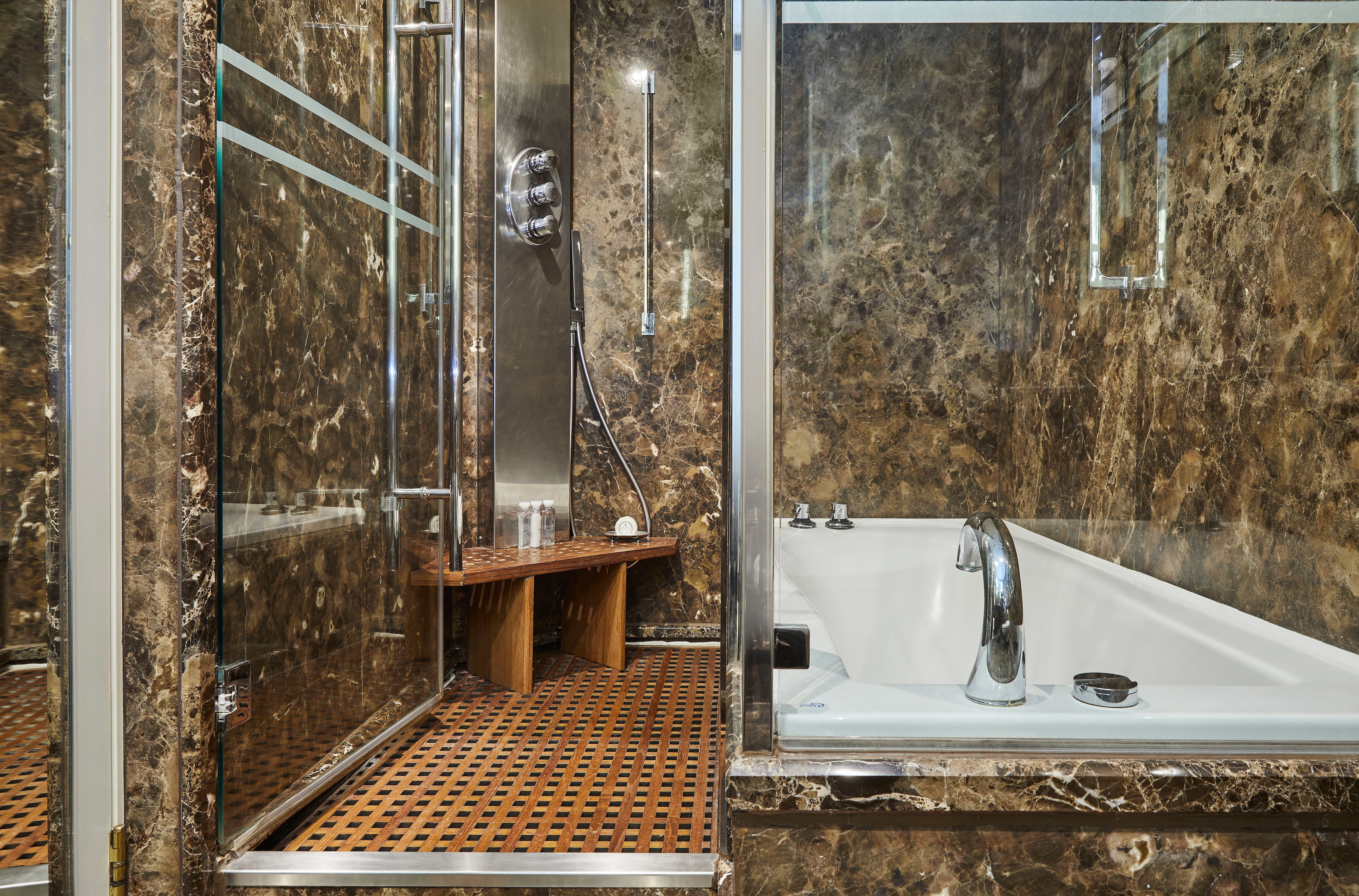
Stylish and sophisticated with larger verandas, excellent for taking pictures and bird-watching. Situated midship, this suite is perfection in design and comfortable living. A huge walk-in wardrobe, a beautiful marbled bathroom, and a spacious living area complete the picture. Silver Suites accommodate three guests.
One bedroom: 54 sq m including veranda (8 sq m)
Images are intended as a general reference. Features, materials, finishes and layout may be different than shown.
Please note that the 3rd guest will sleep on a comfortable sofa bed in the reception area of the suite.
Essentials
- Deck(s): 6, 7
- Section: Mid-Ship
Characteristics
- Veranda
- Separate dining area
- Living room with sitting area
- Standard vanity
- Separate shower
- Full-size bath
- Walk-in wardrobe with personal safe
Furniture
- Queen size bed
- Writing desk
- Vanity table
- Luxury bed mattresses
Media & Communication
- Unlimited Premium Wi-Fi
- 2 large flat screen TVs with Interactive Media Library
- Sound system with bluetooth connectivity
- Direct dial telephone
- Wall mounted USB-C mobile device chargers
- Dual voltage 110/220 outlets
Onboard Services
- Butler service
- Complimentary laundry, pressing & wet cleaning
- Champagne on arrival
Amenities
- Espresso machine
- Pillow menu
- Refrigerator and bar setup stocked with your preferences
- Plush bathrobe
- Luxury bath amenities
- Umbrella
- Hair Dryer
- Slippers
With a room configuration that favors watching the sun rise from the comfort of your bed and losing yourself in the mesmerizing seascapes, this suite is the perfect answer to adventure cruising. A large walk-in wardrobe and an expansive living room make the Medallion Suite your home away from home on the high seas. Medallion Suites accommodate three guests.
One bedroom: 48 sq m including veranda (7.6 sq m )
Images are intended as a general reference. Features, materials, finishes and layout may be different than shown.
Please note that the 3rd guest will sleep on a comfortable sofa bed in the reception area of the suite.
Essentials
- Deck(s): 5, 6, 7
- Section: Mid-Ship
Characteristics
- Veranda
- Separate dining area
- Living room with sitting area
- Standard vanity
- Separate shower
- Walk-in wardrobe with personal safe
Furniture
- Queen size bed
- Writing desk
- Vanity table
- Luxury bed mattresses
Media & Communication
- Unlimited Premium Wi-Fi
- 2 large flat screen TVs with Interactive Media Library
- Sound system with bluetooth connectivity
- Direct dial telephone
- Wall mounted USB-C mobile device chargers
- Dual voltage 110/220 outlets
Onboard Services
- Butler service
- Complimentary laundry, pressing & wet cleaning
- Champagne on arrival
Amenities
- Espresso machine
- Pillow menu
- Refrigerator and bar setup stocked with your preferences
- Plush bathrobe
- Luxury bath amenities
- Umbrella
- Hair Dryer
- Slippers
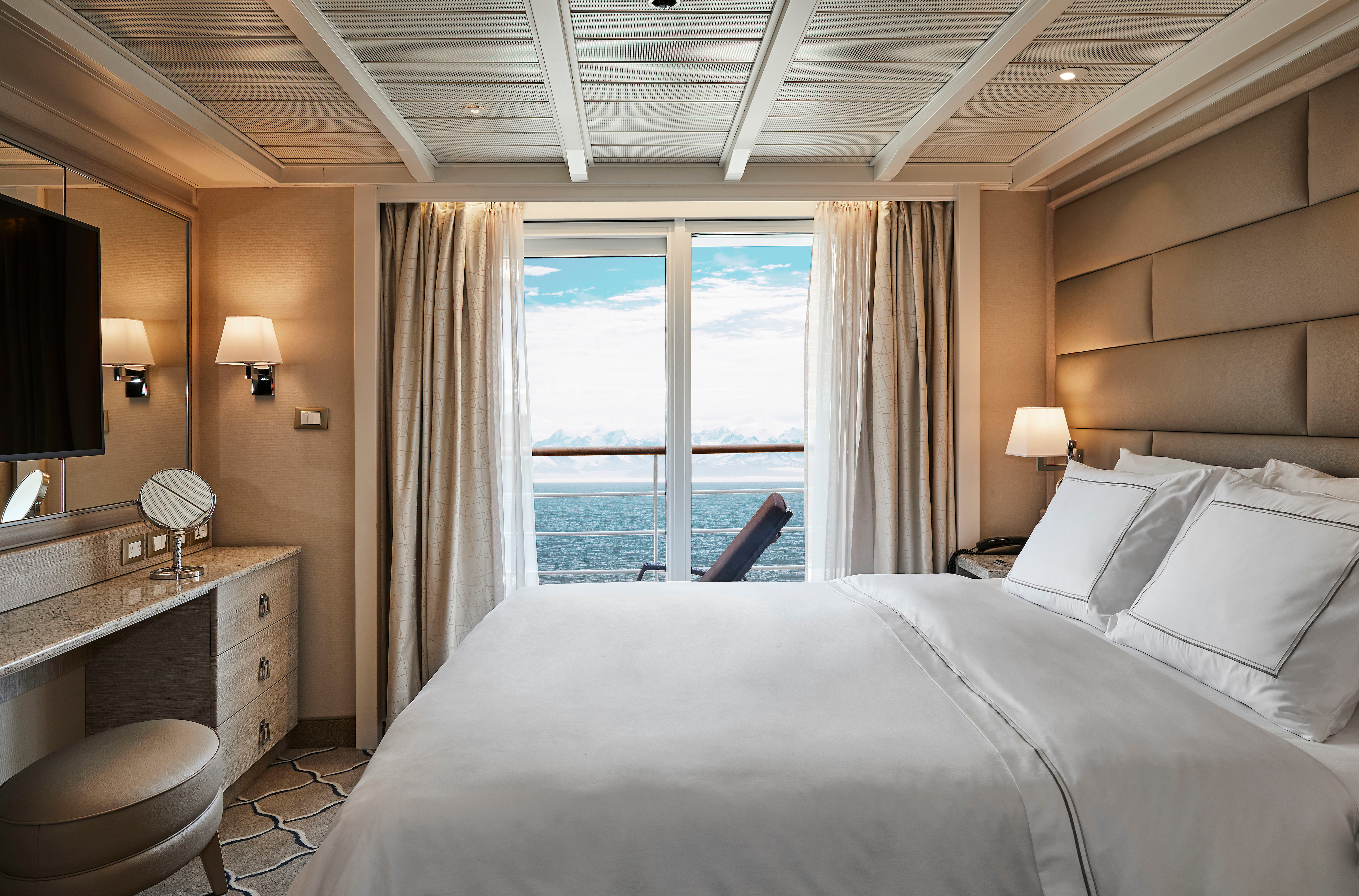
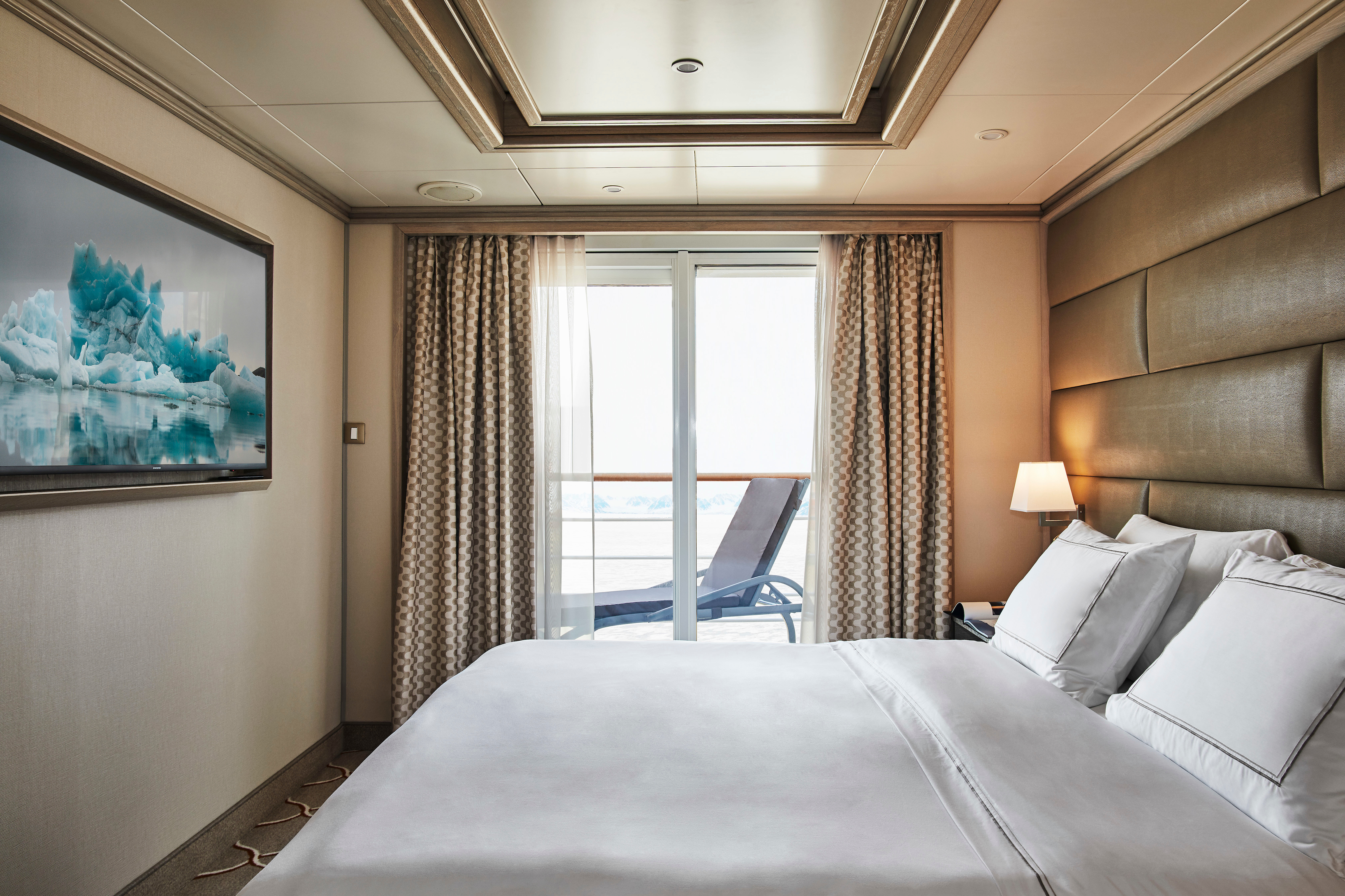
A Silversea signature, with a preferred central location, the Veranda Suite is spacious and welcoming. Floor-to-ceiling glass doors open onto a furnished private teak veranda from where you can contemplate anything from the midnight sun to an Antarctic sunrise. The Deluxe Veranda Suite offers a preferred central location with identical accommodation to a Veranda Suite.
One bedroom: 27 sq m including veranda (4.5 sq m)
Two bedrooms: 27 sq m including veranda (4.5 sq m)
Images are intended as a general reference. Features, materials, finishes and layout may be different than shown.
Essentials
- Deck(s): 5, 6, 7
- Section: Aft, Forward
Characteristics
- Veranda
- Sitting area
- Standard vanity
- Separate shower
- Some with full-size bath
- Walk-in wardrobe with personal safe
Furniture
- Queen size bed
- Writing desk
- Luxury bed mattresses
Media & Communication
- Unlimited Standard Wi-Fi
- 1 large flat screen TV with Interactive Media Library
- Direct dial telephone
- Wall mounted USB-C mobile device chargers
- Dual voltage 110/220 outlets
Onboard Services
- Butler service
- Champagne on arrival
Amenities
- Pillow menu
- Refrigerator and bar setup stocked with your preferences
- Plush bathrobe
- Luxury bath amenities
- Umbrella
- Hair Dryer
- Slippers
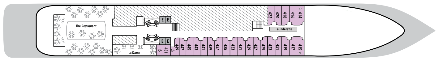
Your home away from home while you embrace the intrepid explorer within. The suite’s seating area has plenty of room to relax while you go over your notes, ready for the next adventure. Large picture windows frame panoramic ocean views, ideal for appraising the local wildlife.
One bedroom: 22 sq m
Wheelchair accessible suites: 449 and 451
Images are intended as a general reference. Features, materials, finishes and layout may be different than shown.
Essentials
- Deck(s): 4
- Section: Aft, Forward
Characteristics
- Window
- Sitting area
- Standard vanity
- Separate shower
- Some with full-size bath
- Walk-in wardrobe with personal safe
Furniture
- Queen size bed
- Writing desk
- Luxury bed mattresses
Media & Communication
- Unlimited Standard Wi-Fi
- 1 large flat screen TV with Interactive Media Library
- Direct dial telephone
- Wall mounted USB-C mobile device chargers
- Dual voltage 110/220 outlets
Onboard Services
- Butler service
- Champagne on arrival
Amenities
- Pillow menu
- Refrigerator and bar setup stocked with your preferences
- Plush bathrobe
- Luxury bath amenities
- Umbrella
- Hair Dryer
- Slippers
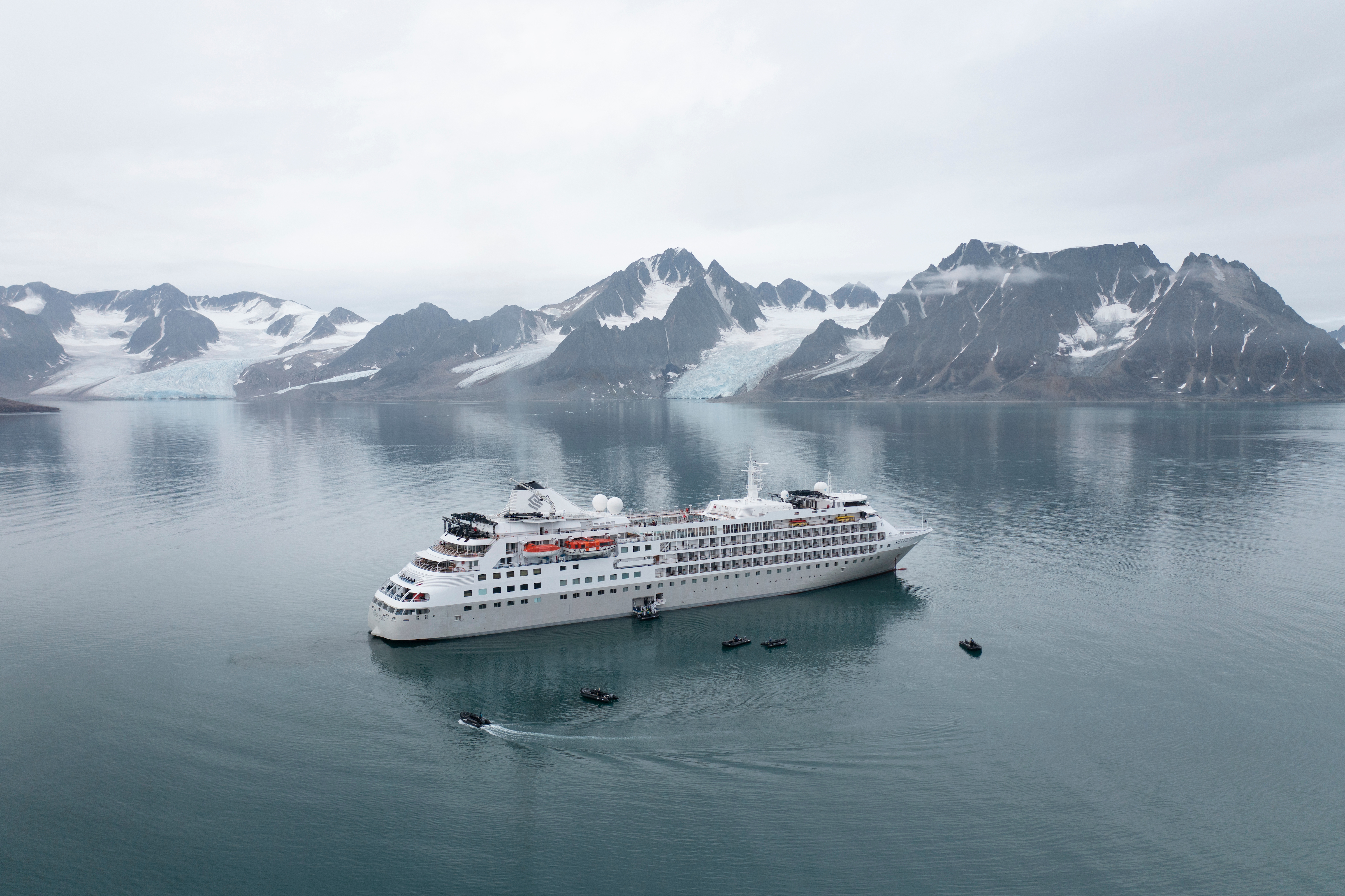
Silver Cloud
Silver Cloud offers one of the most personalised experiences in expedition voyages, with a high ratio of experts and Zodiacs unlocking access to the rare and remarkable.
Silver Cloud is the first crossover ship in our fleet, bringing the remote and remarkable to you in ultra-luxurious comfort. Her large suites, destination itineraries and unparalleled service make her truly special. Four dining options will tantalise your taste buds, and as 80% of her suites include a veranda, watching a breaching whale from the comfort of your balcony never been so personal. With her 20 zodiacs, 10 kayaks, possibilities are almost limitless with ship-wide simultaneous explorations.
Ship Facts
| Launch Year | 1994 | ||||||||||
| Refit Year | 2017 | ||||||||||
| Language | en | ||||||||||
| Gross Tonnage | 17400 | ||||||||||
| Length | 155 | ||||||||||
| Width | 21 | ||||||||||
| Currency | USD | ||||||||||
| Speed | 18 | ||||||||||
| Capacity | 254 | ||||||||||
| Crew Count | 212 | ||||||||||
| Deck Count | 7 | ||||||||||
| Cabin Count | 126 | ||||||||||
| Large Cabin Count | 28 | ||||||||||
| Wheelchair Cabin Count | 2 | ||||||||||
| Electrical Plugs |
|
Deck 9
- Observation Lounge
- Zodiacs
- Jogging Track
- Open view to Swimming Pool

Deck 8
- Pool
- Pool Bar
- Pool Grill
- The Grill
- Panorama Lounge
- Connoisseurs’s Corner

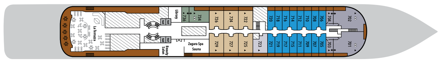
Deck 7
- La Terrazza
- Zagara Beauty Spa
- Library
- Medallion Suite
- Silver Suites
- Veranda Suites
- Owners Suites
- Grand Suites
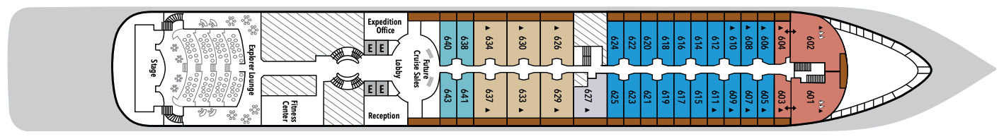
Deck 6
- Explorer Lounge
- Fitness Centre
- Reception/Guest Relations
- Expedition Office
- Lobby
- Future Cruise Sales
- Medallion Suite
- Deluxe Veranda Suites
- Silver Suites
- Royal Suites
- Veranda Suites
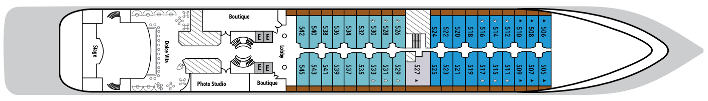
Deck 5
- Dolce Vita
- Lobby
- Boutique
- Photo Studio
- Deluxe Veranda Suites
- Veranda Suites
- Medallion Suites
Deck 4
- The Restaurant
- La Dame
- Launderette
- Vista Suites
Deck 3
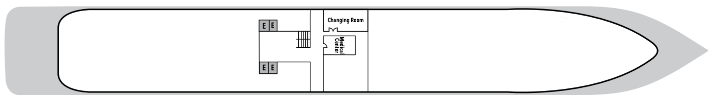
- Medical Centre
- Changing Room
With the importance of food in Italian culture, you would expect dining to be a high priority at Silversea. And it most assuredly is. No matter where you dine, their influence is readily apparent in the great diversity and presentation of culinary selections on board your all inclusive cruise.
The main dining room aboard every Silversea luxury cruise ship, The Restaurant, is always open seating so you can arrive at your leisure and dine with the friends you invite to join your table. And with the worldly crowd of international guests who sail on Silversea ships, socialising is yet another great advantage of the Silversea experience.
The Grill
Silversea’s much-loved casual dining restaurant serves a delectable range of burgers and salads by day and turns into our famous Hot Rocks table BBQ concept by night. The Grill is quite simply the best place to eat between sea and sky. If you like flavorsome meals cooked to perfection, a casual, laid-back atmosphere, and OMG views, then The Grill is the answer to your prayers.
Dress code: Casual
Casual wear consists of pants, blouses, or casual dresses for women; open-neck shirts and slacks for men are appropriate.
Images are intended as a general reference. Features, materials, finishes and layout may be different than shown.
La Dame
After a day of trekking through tundra and whale-watching, indulge in an evening of palette pampering, where fine wines are complemented by a set bespoke menu of regionally inspired dishes in an intimate, elegant setting. An extraordinary six-course experience celebrating the world’s most distinguished wine regions complete what is surely the finest dining at sea.
Per guest reservation fee of US$60. Please visit My Silversea to make your reservations.
Le Terrazza
La Terrazza is a celebration of the way Italians eat today, an ode to the delicious evolution of the world’s most beloved cuisine. Evolving one of Silversea’s signature restaurants, La Terrazza serves fresh twists on great classics, and also explores the new heroes of Italian cuisine. The notion of comfort traditionally associated with Italian cuisine is present in every dish, every bite, yet always with a subtle element of surprise. La Terrazza is open for casual, buffet-style breakfast and lunch with indoor or alfresco dining on the outdoor terrace. During the evening, the venue transforms into an à la carte Italian restaurant. Seating is limited for dinner and reservations are recommended.
The Restaurant
Sparkling with tales of adventure, bonhomie, and like-minded friends, The Restaurant offers contemporary, international cuisine created by our most talented chefs. Menus feature regional specialties unique to the destinations guests visit on their cruise, so don’t be surprised to see a roasted Chilean Sea Bass while cruising the Chilean fjords.
The ocean views and soothing sound of the surf can be quite intoxicating at sea, so it’s not surprising that daydreaming on deck is one of the most popular pastimes. However, every Silversea all inclusive cruise also includes a considerable number of more active pursuits — some for the body, some for the mind … and some just for fun.
Dolce Vita
With complimentary cocktails and engaging conversation, live music, and a dance floor, Dolce Vita on board Silver Cloud welcomes guests to mix and mingle. When living such unique experiences as these, there is never a dull moment!
Connoisseur's Corner
The Connoisseur’s Corner offers exceptional cognacs along with a premium selection of cigars for purchase.
Reception
This central lobby area welcomes guests to speak with our receptionist if they have a question or require any service. Assistance is available 24 hours a day. The Cruise Consultant may also be indispensable when planning your next Silversea voyage, or if you wish to extend your current voyage for a day, a week, a month … Like having your own personal onboard Silversea professional, the Cruise Consultant will help you to select the perfect voyage, reserve your preferred suite, and provide immediate confirmation.
Observation Lounge
The ideal place for scenic days at sea, this vantage point far forward and high atop this luxury cruise ship is perfect for that “king of the world” feeling.
Boutique
Exceptional shopping experiences do not end in the cosmopolitan cities we visit. Silversea’s striking new shipboard boutiques, reimagined and redesigned, are stunning modern design spaces befitting the finest creations from legendary designers. Carefully selected partners on board Silversea’s duty-free boutiques offer our guests a carefully curated selection of cutting-edge fashions, jewelry, accessories, fine perfumes, cosmetics, and Silversea Logo collection, all at duty-free prices.
Explorer Lounge
Perfect for presentations, lectures, and video screenings, this is where our team of dedicated experts share their knowledge on their specialized subject, not to mention their infectious passion and energy. The multitiered Explorer Lounge and banquette-style seating ensure that you enjoy every minute of the talk, with lectures streamed live to your suite if desired. This is one of the very few lecture theaters at sea to combine such comfort with such technology.
Panorama Lounge
The Panorama Lounge is specially designed to provide an uninterrupted view of the day’s destination from the comfort of the luxury cruise ship’s interior. This is an ideal place to unwind on your cruise, enjoy afternoon tea, listen to the pianist, and watch the setting sun. The drinks are complimentary, and the music is live and inviting. Enjoy dancing to a range of musical styles for every taste, from the classics to the latest club mixes.
Photo Studio
The Photo Studio offers a multitude of options to take your pictures from your camera to your walls. A vibrant, creatively inspiring space where you can not only master the art of digital photography with master classes in editing and Adobe Lightroom and Photoshop, but also an editing suite where you can print images (including postcard, panorama, and A2-sized prints). State-of-the-art equipment for both Mac and PC users, highly technological printers, plus a dedicated photo manager to guide you through the many techniques to help you define yourself as a serious photographer. Even the smartphone photographer can become pro-level with specialized training on how to use your camera phone to its best possible advantage. Fees apply.