Lautoka to Papeete
Lautoka to Papeete
Cruise overview
WHY BOOK WITH US?
- ✔ The Deluxe Cruises’ team has extensive experience in ultra-luxury cruising.
- ✔ Call now to speak to our helpful and experienced Cruise Concierge team.
- ✔ Enjoy our Unique Deluxe Cruises Bonus for substantial savings.
- ✔ Our team will tailor your holiday to your exacting requirements.
- ✔ As agents, we work under the protection of each cruise lines ABTA / ATOL licences
About Lautoka
North of Nadi through sugarcane plantations and past the Sabeto Mountains is Lautoka, nicknamed the Sugar City for the local agriculture and its big processing mill. With a population of around 50,000, it's the only city besides Suva and, like the capital, has a pleasant waterfront. It's the sailing point for Blue Lagoon and Beachcomber Cruises but is otherwise unremarkable for tourists, itself having few hotels and fewer good restaurants. Locals recommend the city as a less-expensive place to shop for clothing, but note that it can take as long as 45 minutes to drive here. Legend has it that Lautoka acquired its name when two chiefs engaged in combat and one hit the other with a spear. He proclaimed "lau toka" (spear hit) and thus the future town was named.
About Taveuni Island
About Ringgold Isles
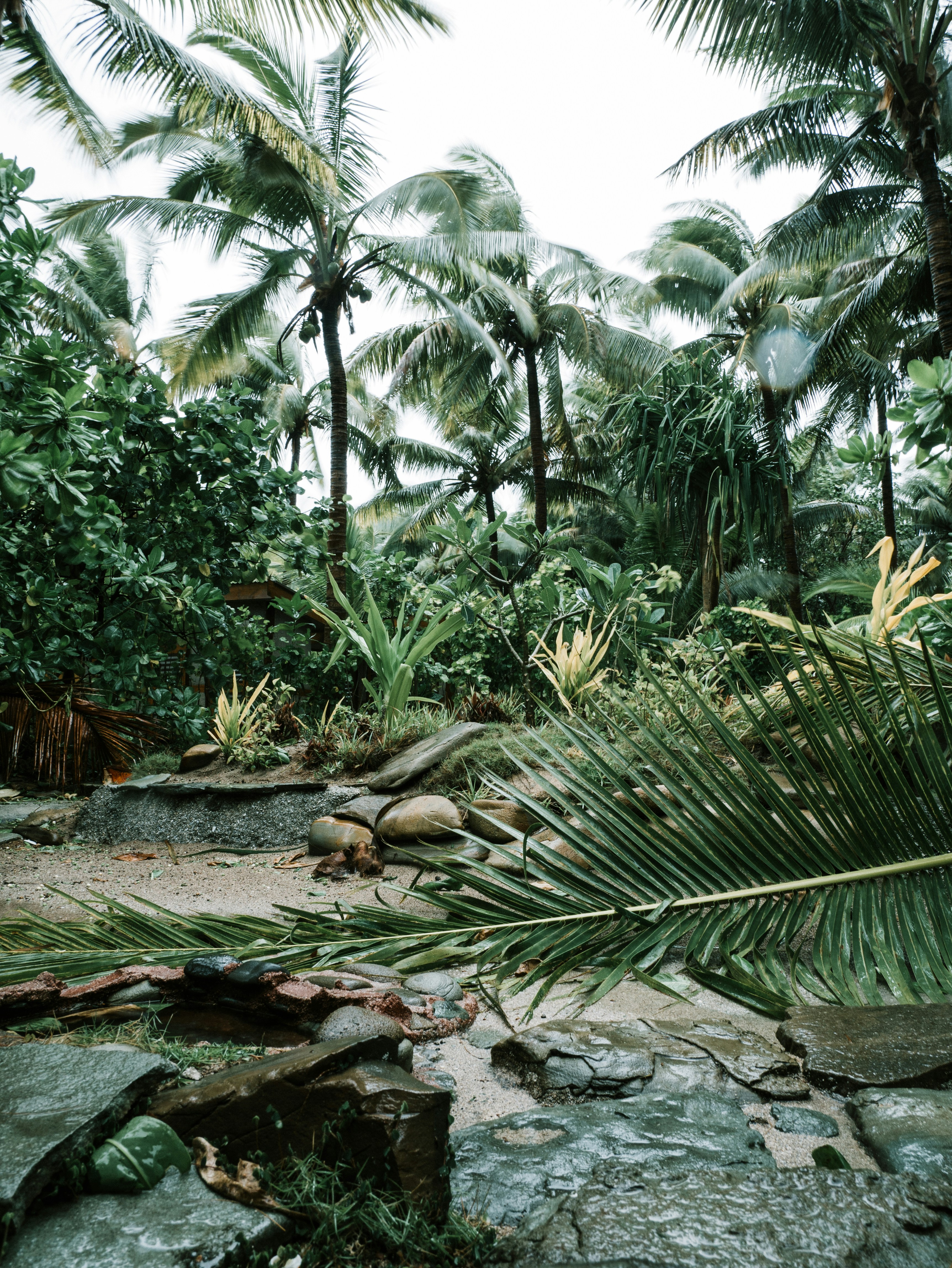
Idyllic and picturesque with possibly the lightest, clearest blue waters on the planet, the Ringgold Isles are an archipelago in Fiji that is mostly uninhabited, but for one small village. Tree-lined hills slope down onto white sandy beaches lined with palm trees and interesting rock outcroppings in some areas. Three reefs form part of this group: the Budd, Nukusemanu, and Heemskercq Reefs. The waters surrounding these islands, including Cobia Island, are favored for scuba diving because of their visibility down to 120 feet. The volcanic crater at Cobia Island can be also explored by small water craft.
About Cobia
Also known as Thombia Island, the crescent moon-shaped Cobia Island in Fiji is part of the Ringgold Isles archipelago. The arched entrance to Cobia island is lined with trees, and the island is teeming with biodiversity on land and underwater. Cobia Island is part of the Budd Reef and has a submerged volcanic crater with its highest elevation on the west side of the island. Considered a “conspicuous landmark” for seafarers at least as far back as 1899, this tropical island embodies a unique combination of wooded areas, tropical vistas and diverse sea life popular for kayakers, snorkelers and scuba divers. The island is an important component of Fiji’s Biodiversity and Action Plan due to its unique geological formations and beach forests.
About Fulaga Island

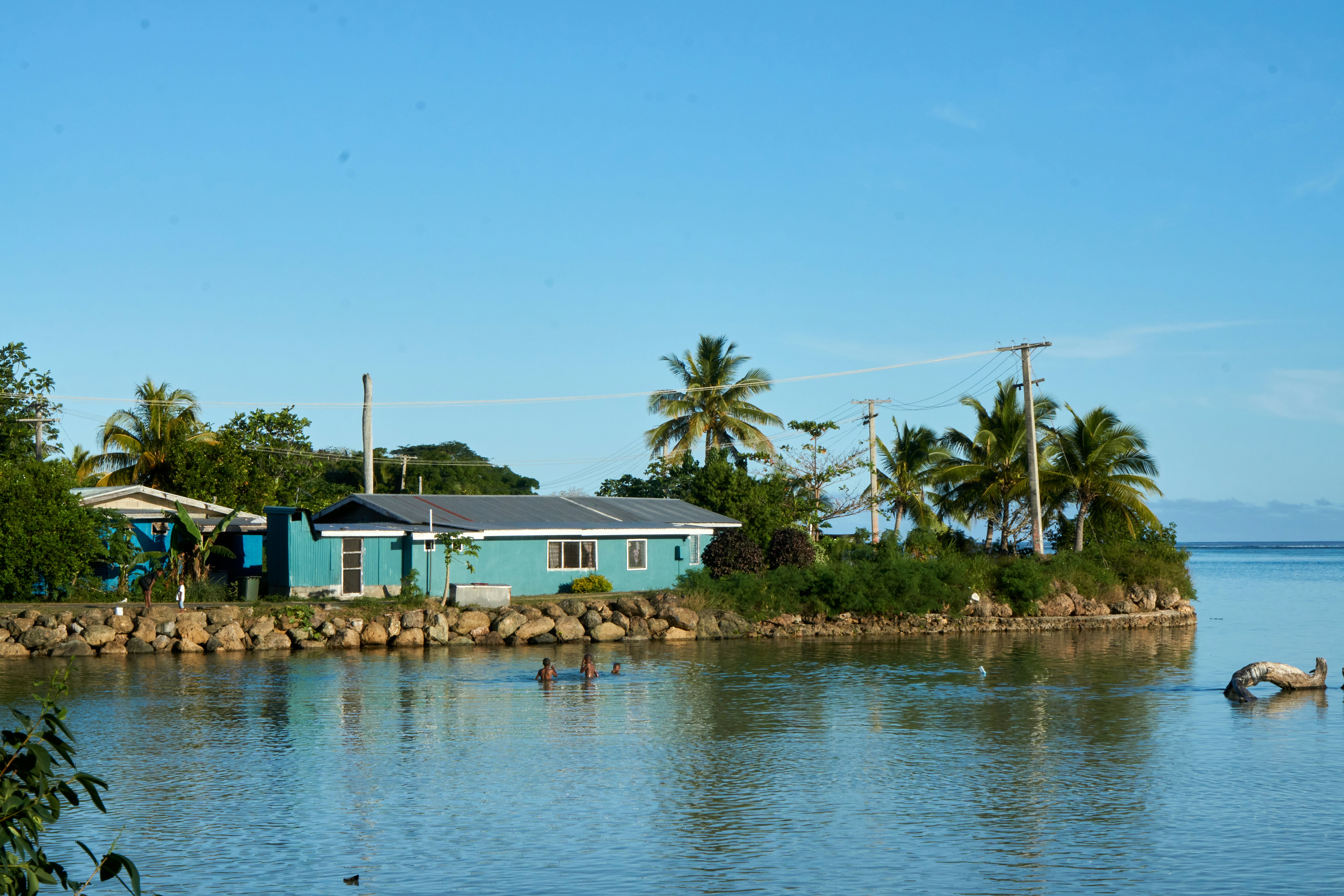
About Neiafu
With a population of 6,000, Neiafu is the capital city and the second largest municipality in the Polynesian nation of Tonga (a 169-island archipelago in the South Pacific). The city is situated in a deep- water harbor (Port of Refuge) on the south coast of Vava͛u, the main island of the Vava͛u archipelago in northern Tonga. The waters of this region are known for their clarity and beauty, and the area attracts many humpback whales between June and November. A popular destination in Neiafu is the Ene͛io Botanical Garden, a bird sanctuary that promotes the survival of exotic and native bird species as well as supports and conserves a diverse array of plant life. The island's city life can be experienced at the numerous cafes and restaurants that welcome visitors.
About Eueiki Island
About Uoleva Island
Within the Polynesian nation of Tonga, an archipelago of 169 islands (only 36 of which are inhabited), lies the sand-cay Uoleva Island, one of the Ha'apai islands of Tonga. Uoleva Island is one of the most beautiful and protected anchorages in Tonga and is mostly uninhabited but for its three small resorts. On Uoleva Island visitors will discover pristine, palm tree-lined white sand beaches and clear, light blue waters. In addition to reaching Uoleva by boat, it can also be reached by foot (via a 30-minute strenuous walk); the reef between the north tip of Uoleva and the south tip of Lifuka is shallow enough at low tide to walk across. Uoleva is one of the best places in Tonga for humpback whale sightings, and snorkelers appreciate its clear waters teeming with ocean life.
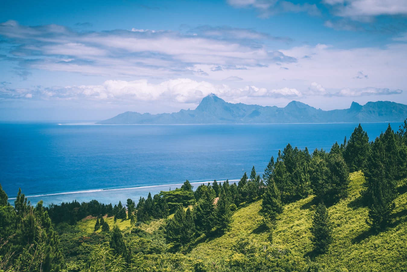
About Rarotonga
Life is laid back on Rarotonga, the most populous of the Cook Islands, but the residents are still an active bunch. Though there are plenty of white sandy beaches on which to laze—and people do, with plenty of napping— locals love to get out and move. Join them in snorkeling, diving, riding—bikes, horses, scooters—fishing, bush walking, and playing squash and tennis. Another popular, if odd, and favorite activity is lining up along the sea wall adjacent to the airport's runway to be jetblasted.

About Aitutaki
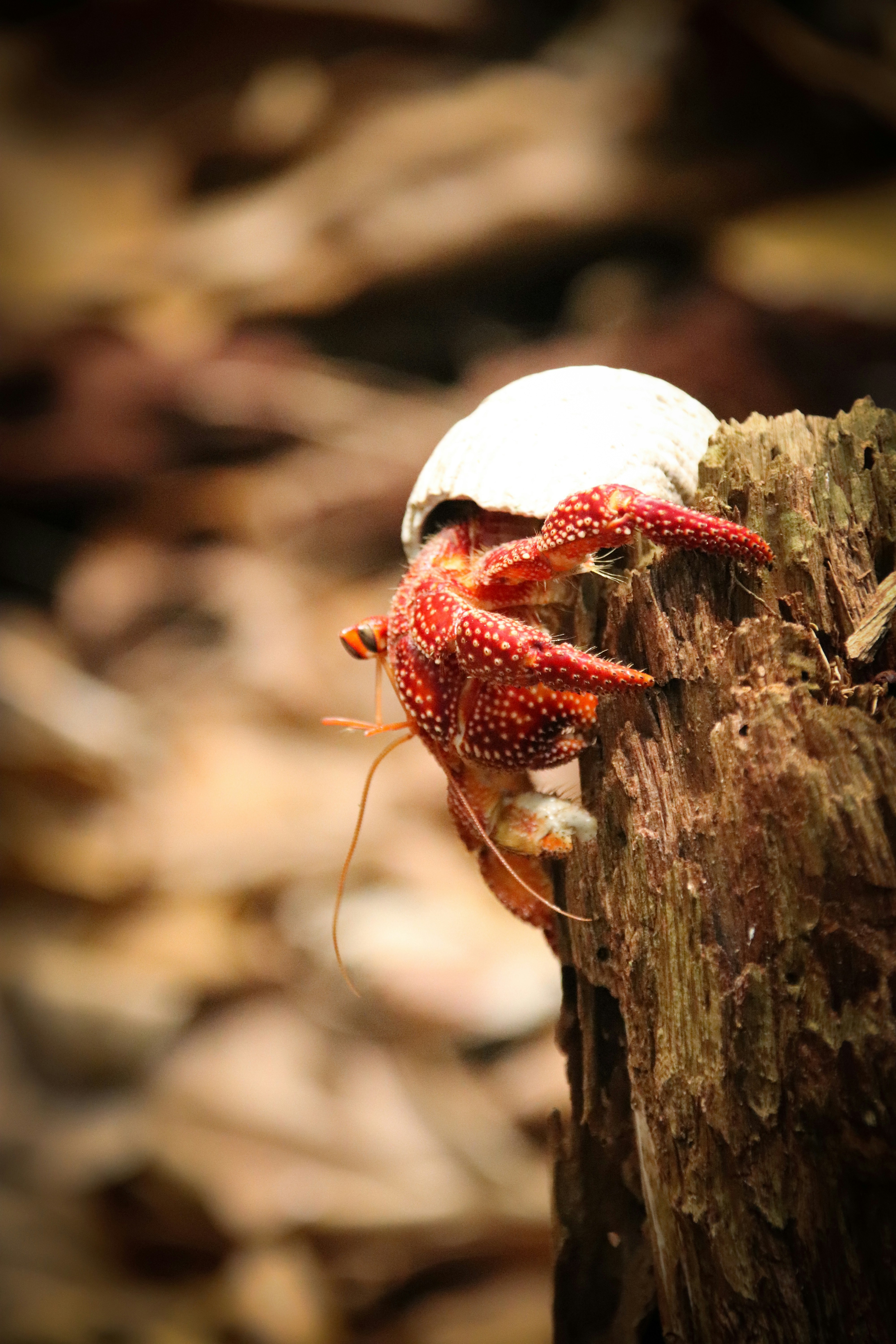
Even high praise like the 'world's most beautiful island' from Lonely Planet's co-founder, Tony Wheeler, won't prepare you for the intoxicating intensity of the coal blue ocean, the glow of the pure white sand, and the soothing ripple of the palm-tree forests at incredible Aitutaki. Breathless romance hangs thick in the air here, especially when a riot of purples, reds and oranges are spreading across the sky, accompanying the sun's descent each evening. It wasn't until 1789 that Europeans discovered this island haven, with the HMS Bounty's crew arriving, just a few weeks before a mutiny tore them apart. The Europeans were beaten to the islands, however, by the streamlined wooden canoes of the Polynesian settlers, who arrived around 900AD. While Western missionaries would eventually visit to spread Christianity to the island - evidenced by the white, coral-encrusted walls of the many churches - their efforts to repress the people’s deep love of communal singing and dancing ultimately failed, and music forms a key component of the islanders' culture to this day.The beaches here are flawless, and swaying in a hammock, suspended between leaning palm trees, as the ocean gently ruffles the sand nearby, feels gloriously indulgent. Aitutaki Lagoon is a huge aquamarine pool of water, alive with a kaleidoscopic swirl of tropical fish, which lurk just below the surface. You may even be lucky enough to spot turtles padding across the sand, scraping themselves towards the open ocean.The snorkelling opportunities here, and on One Foot Island - where you'll want to acquire the badge of honour of having your passport stamped with the island's iconic huge footprint - are sublime. Don't miss the tiny island of Moturakau either, which is crammed full of exotic birds and crabs, who have dominion over the island's tangled, jungle terrain.
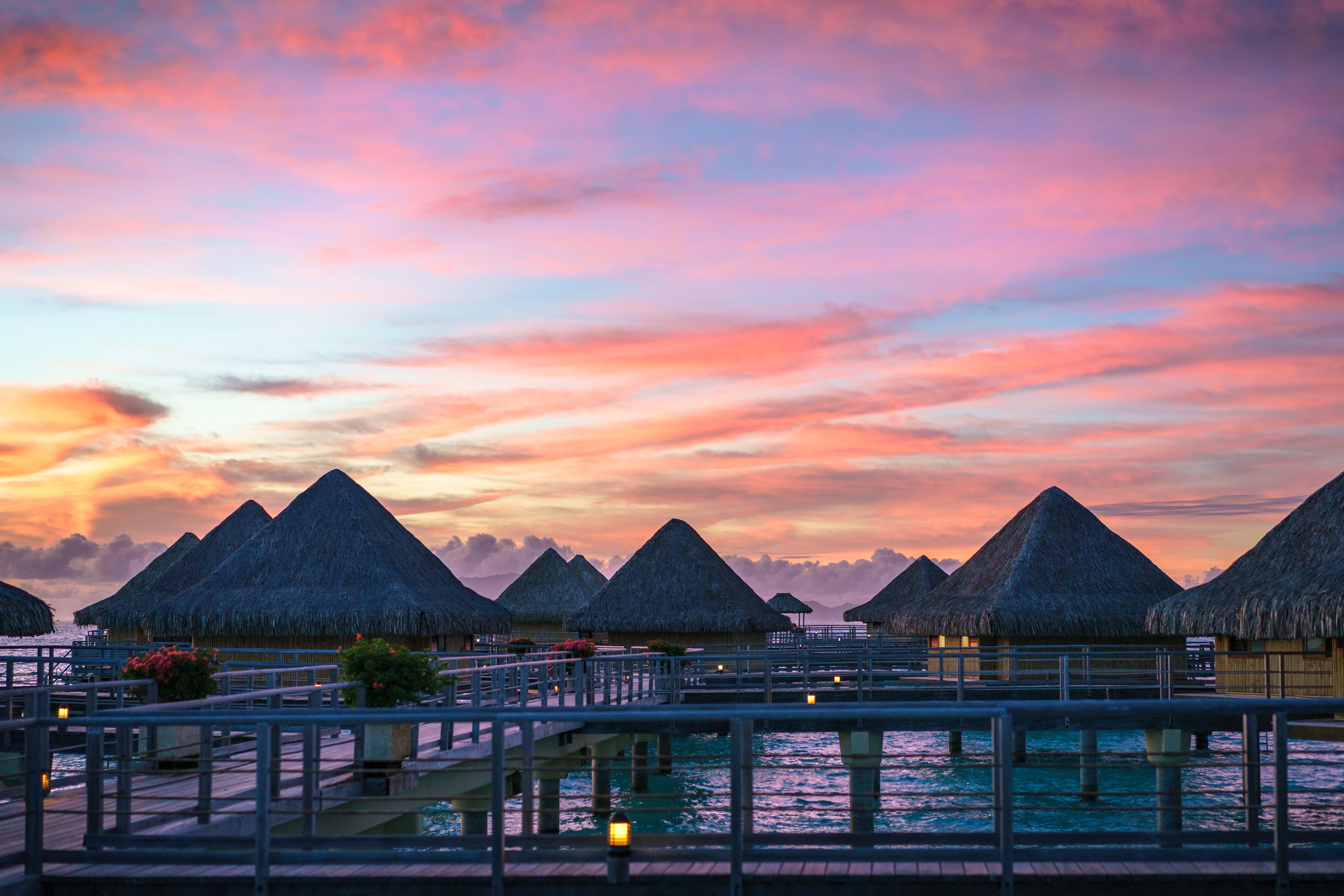
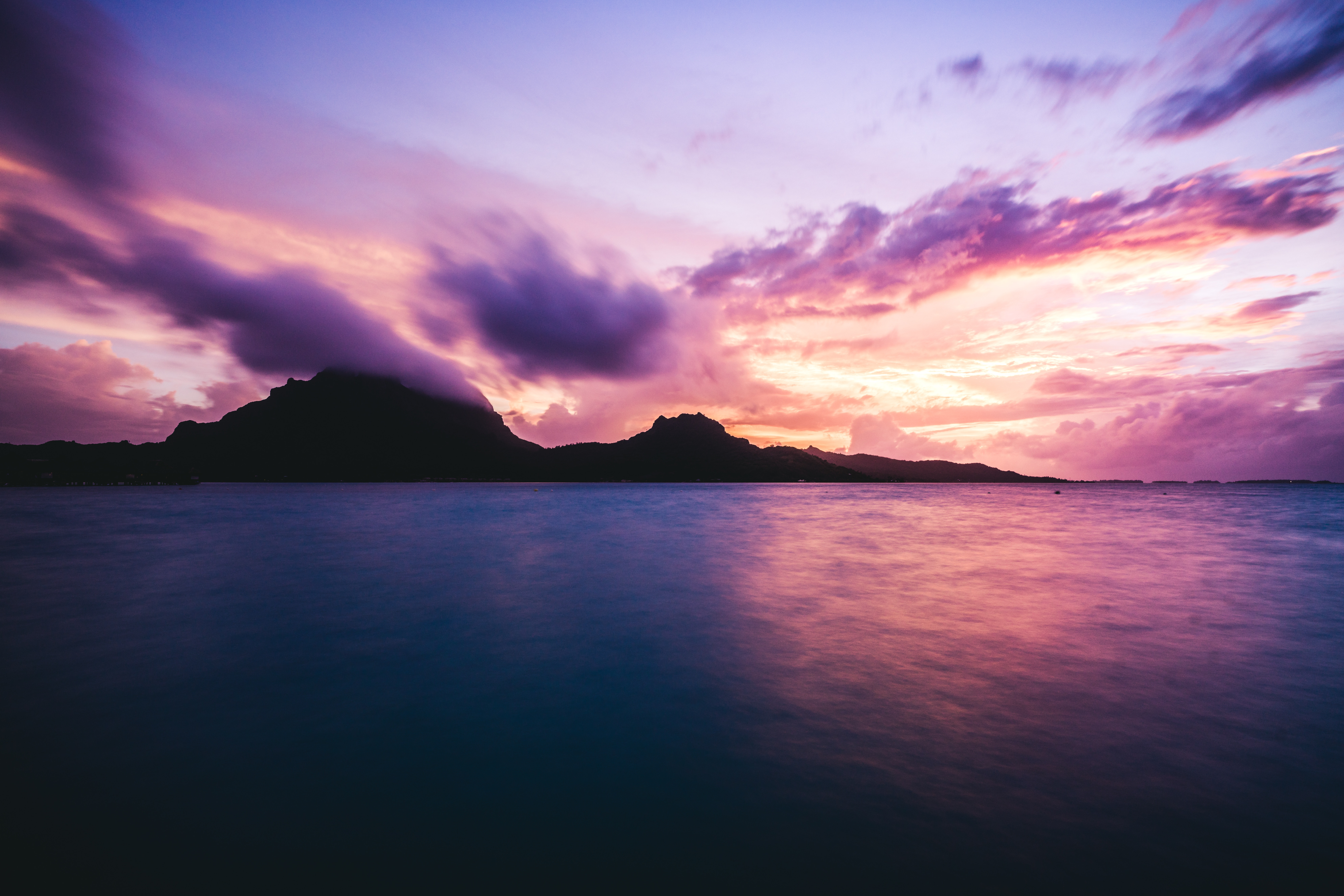
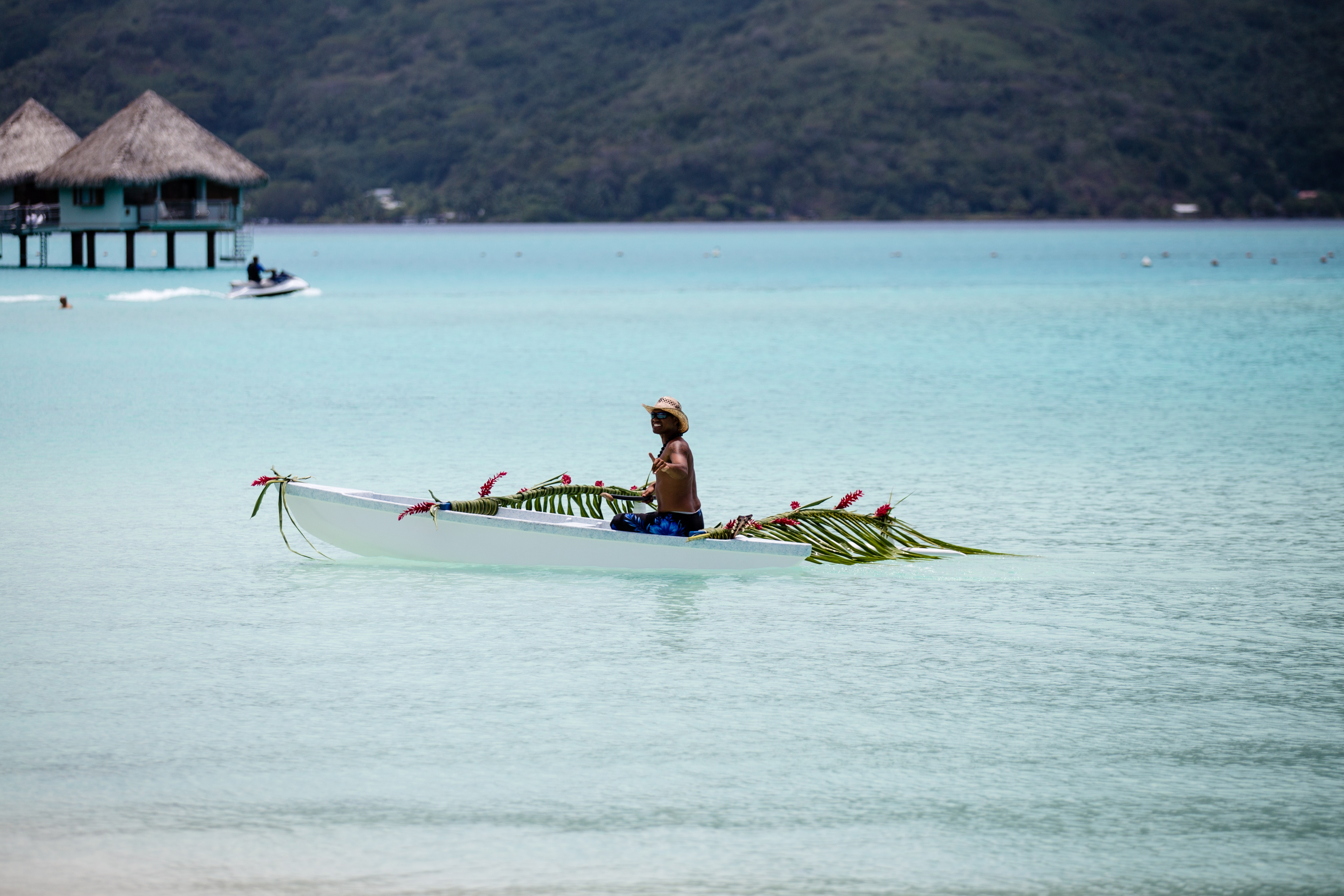
About Bora-Bora
Simply saying the name Bora Bora is usually enough to induce gasps of jealousy, as images of milky blue water, sparkling white beaches and casually leaning palm trees immediately spring to mind. The imagination doesn't lie, either, and if you visit, you’ll soon realise this island is every bit as gorgeous as you ever imagined. Thatched wooden huts stand out over shallow, sparkling seawater, with vivid fish swirling just below. Soak up the sun, scuba dive, or simply revel in the opulent luxury of one of the island's many magnificent resorts. If blissful inactivity doesn't appeal, then get active, and hike the greenery of the sharp Mount Pahia.
About Tikehau Atoll
About Rangiroa
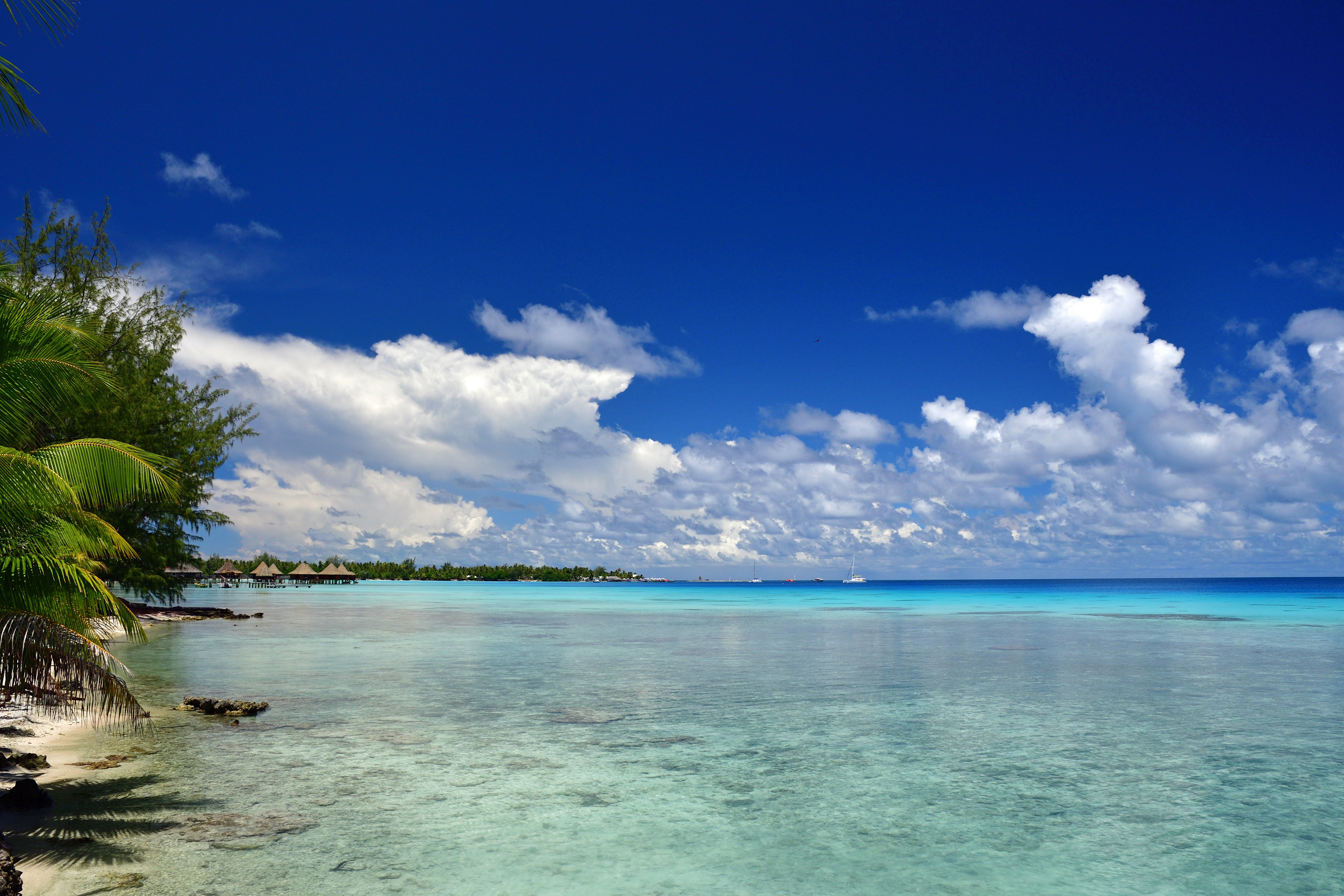
About Papeete, Tahiti
Papeete will be your gateway to the tropical paradise of French Polynesia, where islands fringed with gorgeous beaches and turquoise ocean await to soothe the soul. This spirited city is the capital of French Polynesia, and serves as a superb base for onward exploration of Tahiti – an island of breathtaking landscapes and oceanic vistas. Wonderful lagoons of crisp, clear water beg to be snorkelled, stunning black beaches and blowholes pay tribute to the island's volcanic heritage, and lush green mountains beckon you inland on adventures, as you explore extraordinary Tahiti. Visit to relax inside picturesque stilted huts, which stand out over shimmering water, as you settle into the intoxicating rhythm of life, in this Polynesian paradise.
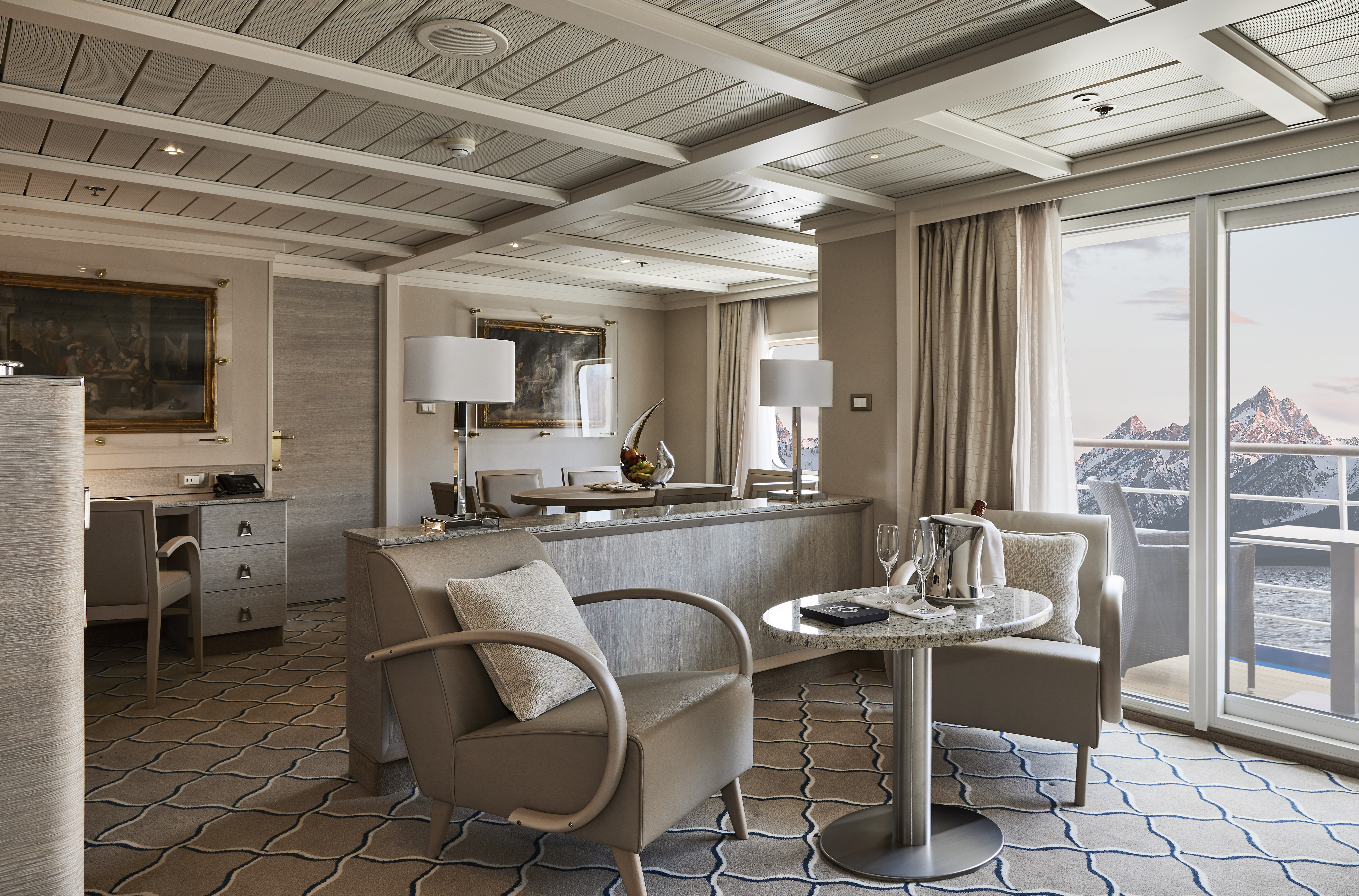
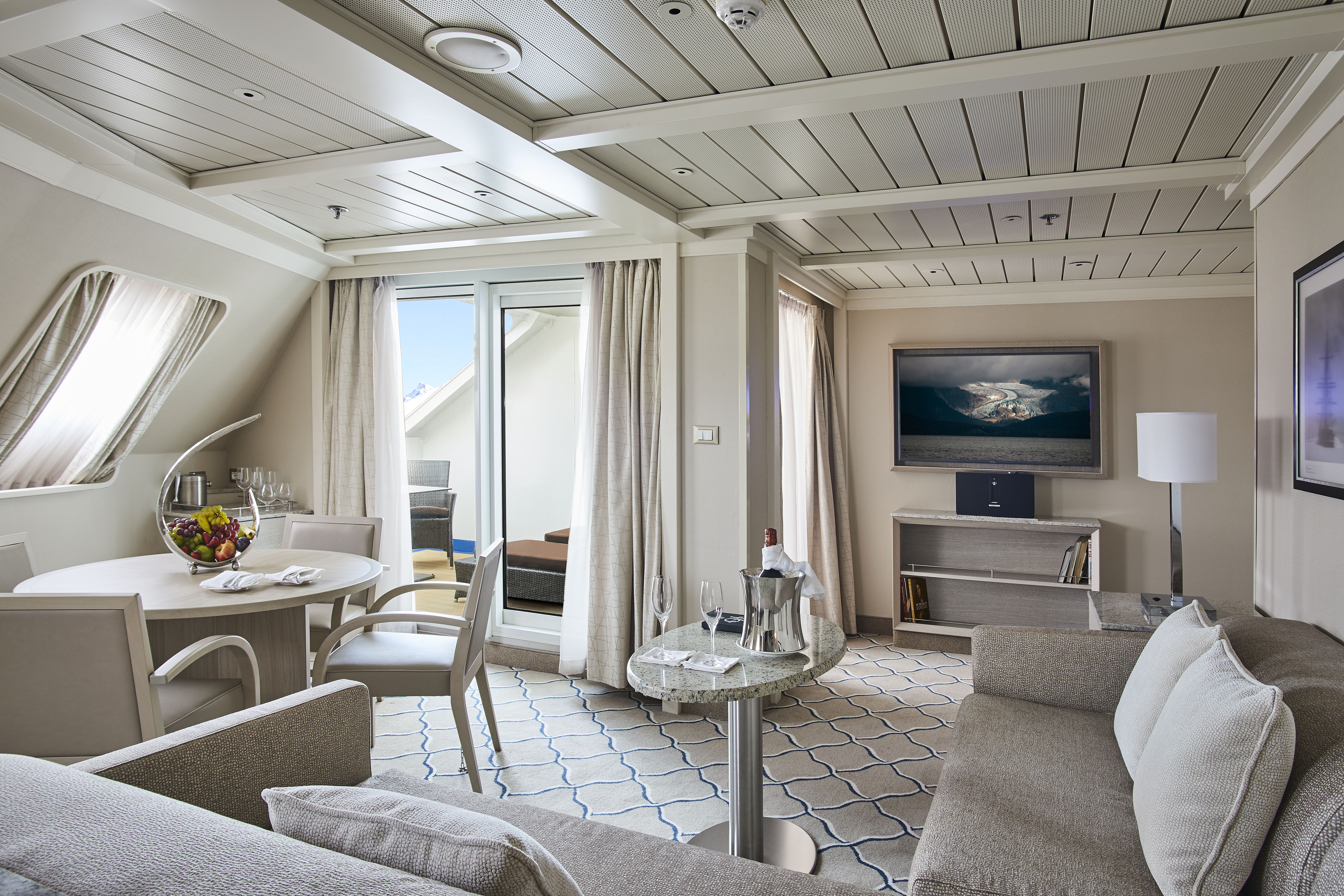
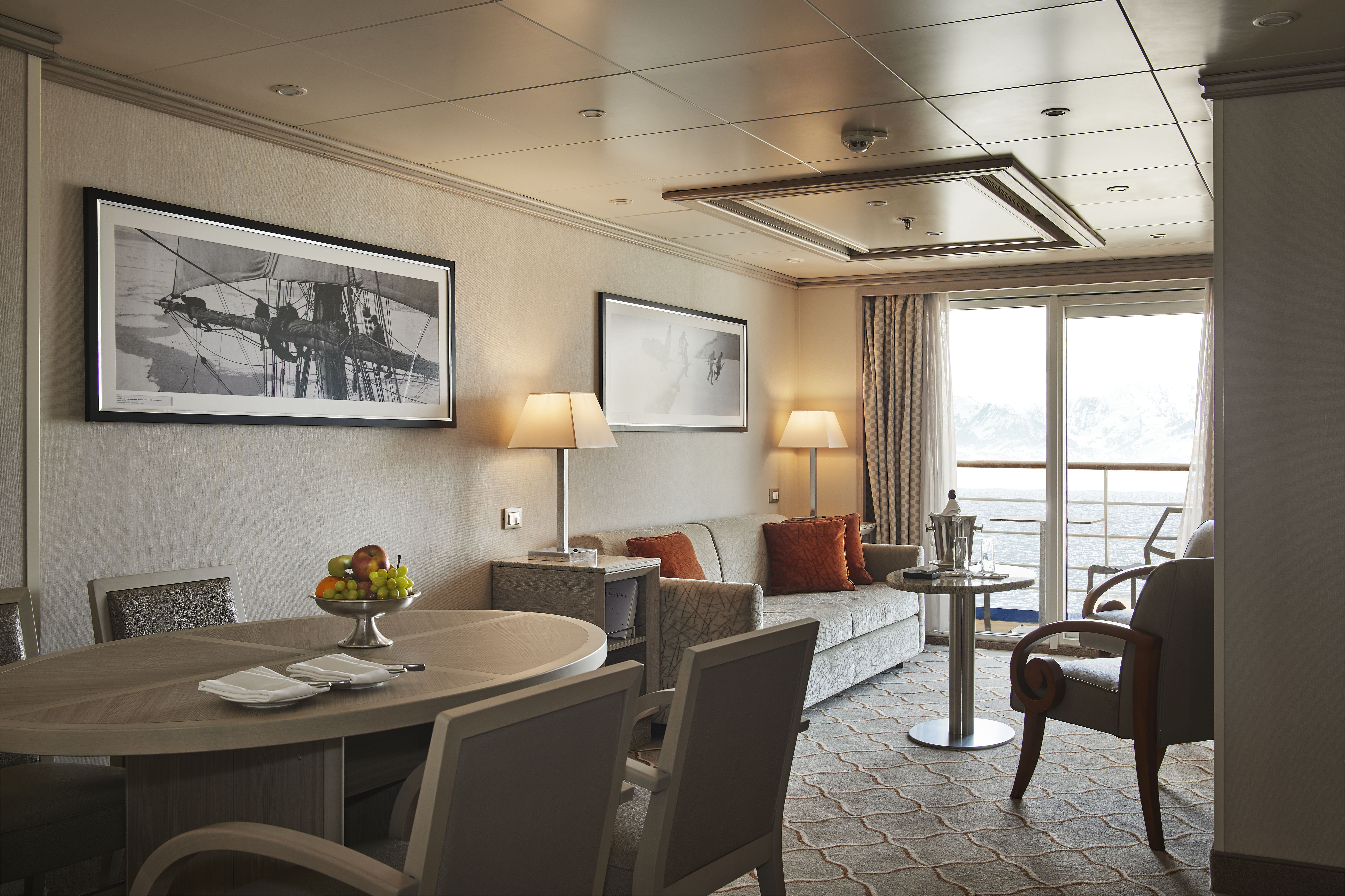
This stylish apartment offers the superlative in levels of space, comfort, and service on board. A perfect mix of expedition experience with luxury lifestyle. Available in a one-bedroom configuration or as two bedrooms by adjoining with a Vista Suite.
One bedroom: up to 55 sq m (8 sq m)
Two bedrooms: 77 sq m (8 sq m)
Images are intended as a general reference. Features, materials, finishes and layout may be different than shown.
Please note that the 3rd guest will sleep on a comfortable sofa bed in the reception area of the suite.
Essentials
- Deck(s): 7
- Section: Mid-Ship
Characteristics
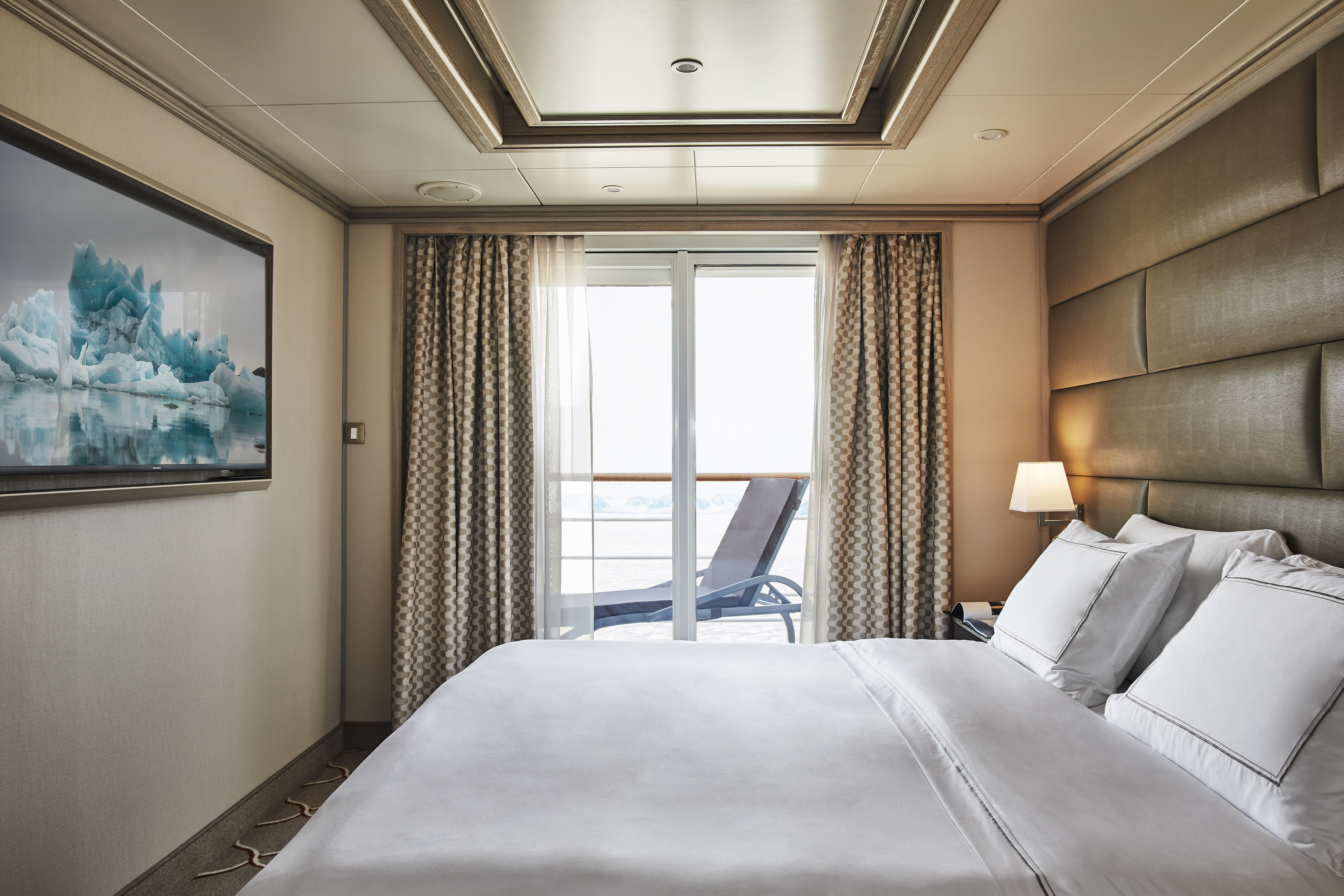
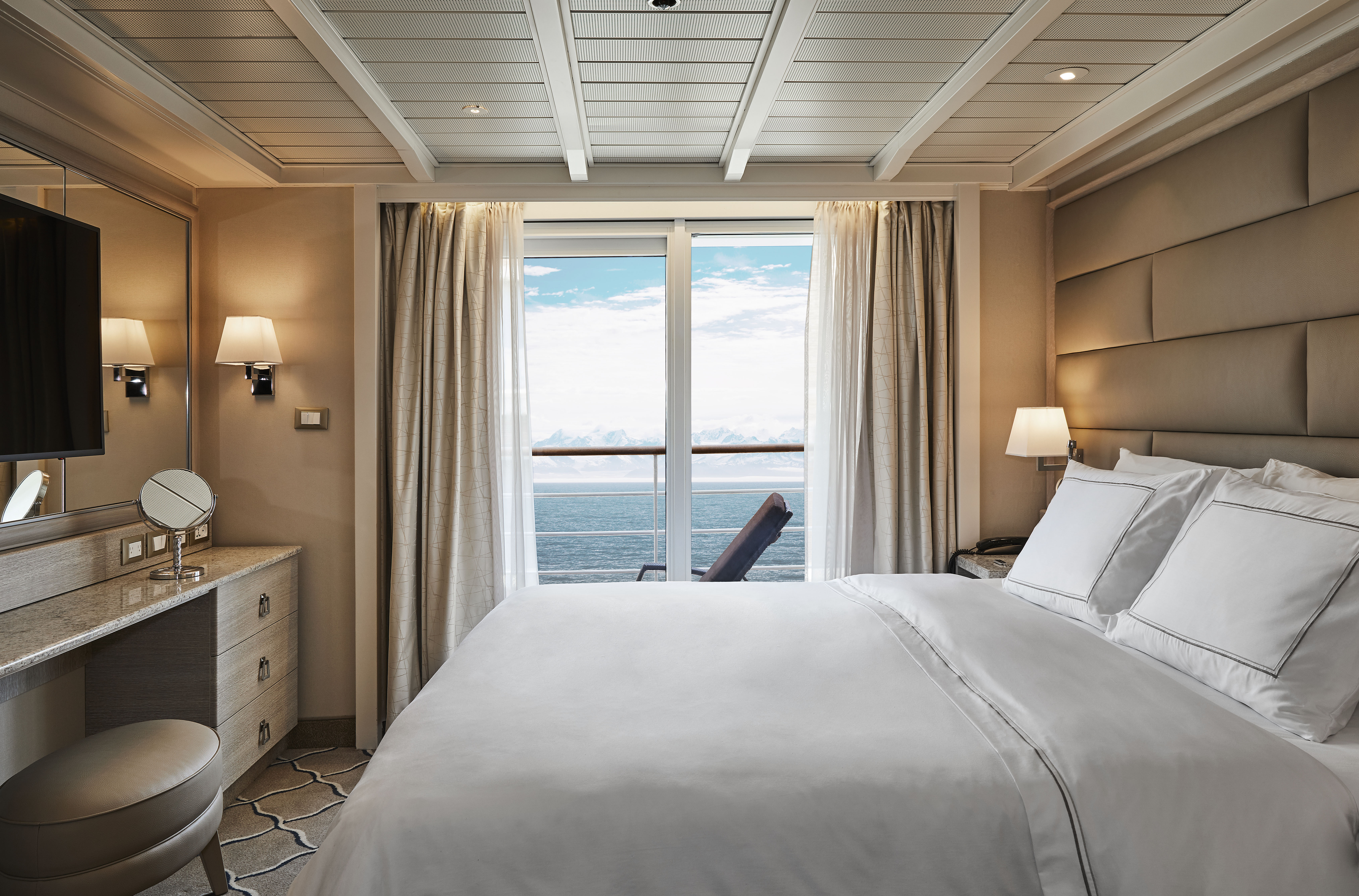
- Veranda
- Separate dining area
- Living room with sitting area
- Standard vanity
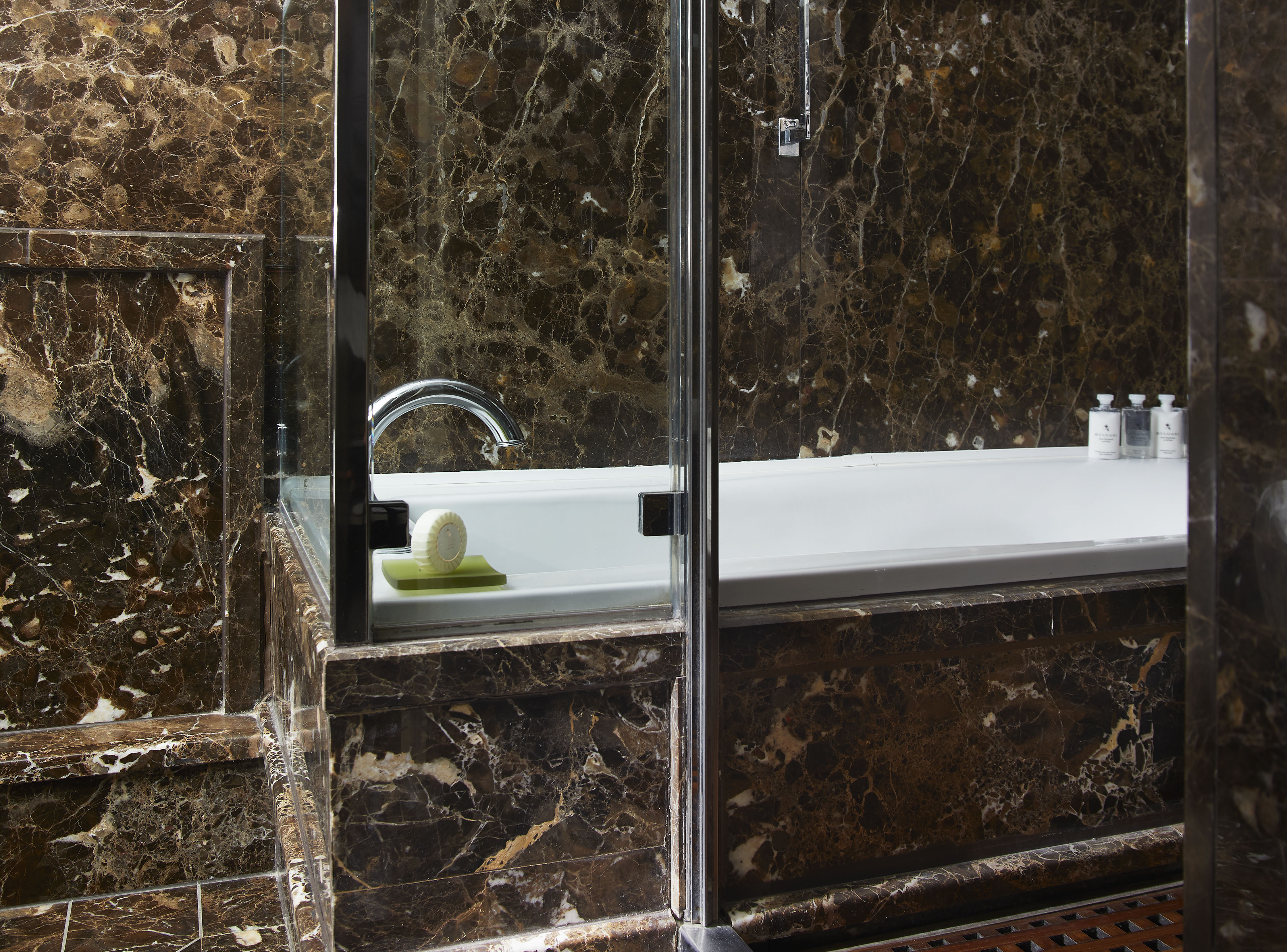
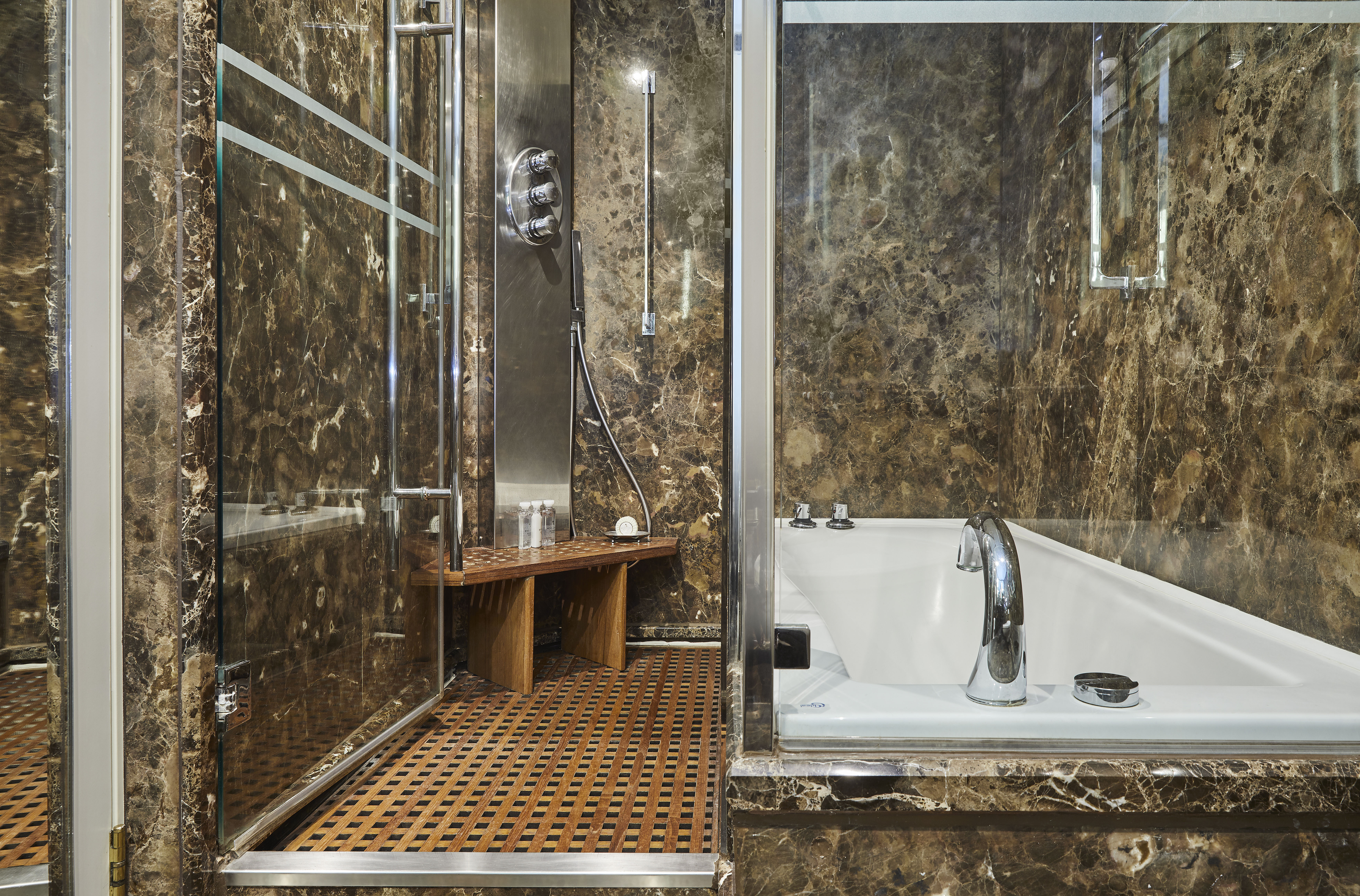
- Separate shower
- Whirlpool bath
- Walk-in wardrobe with personal safe
Furniture
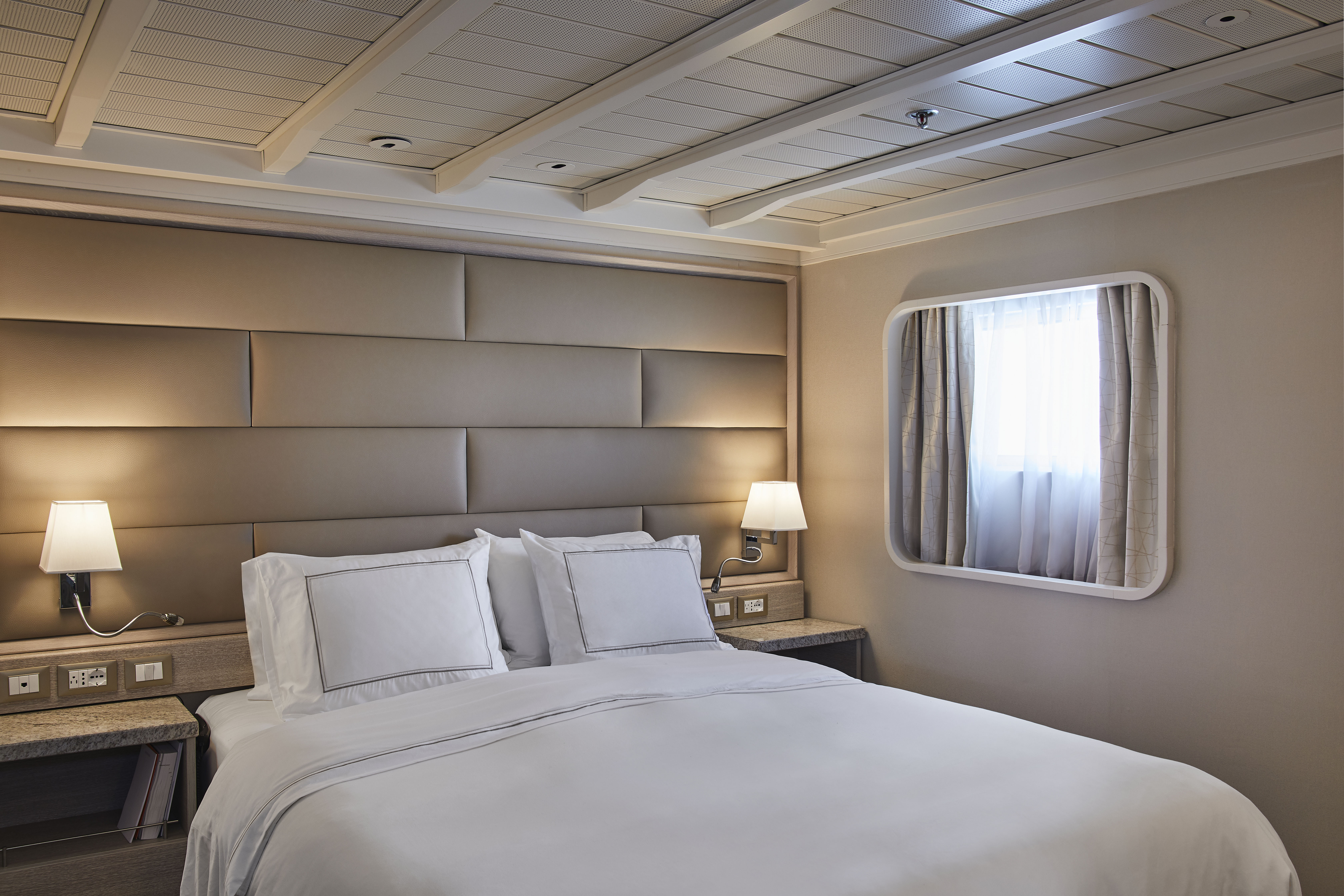
- King size bed
- Writing desk
- Vanity table
- Luxury bed mattresses
Media & Communication
- Unlimited Premium Wi-Fi
- 2 large flat screen TVs with Interactive Media Library
- Sound system with bluetooth connectivity
- Direct dial telephone
- Wall mounted USB-C mobile device chargers
- Dual voltage 110/220 outlets
Onboard Services
- Butler service
- Complimentary laundry, pressing & wet cleaning
- Dinner for two in La Dame, one evening per voyage,
- Two hours of worldwide phone use, per voyage segment
- Champagne on arrival
Amenities
- Espresso machine
- Tea kettles
- Pillow menu
- Refrigerator and bar setup stocked with your preferences
- Plush bathrobe
- Luxury bath amenities
- Umbrella
- Hair Dryer
- Slippers
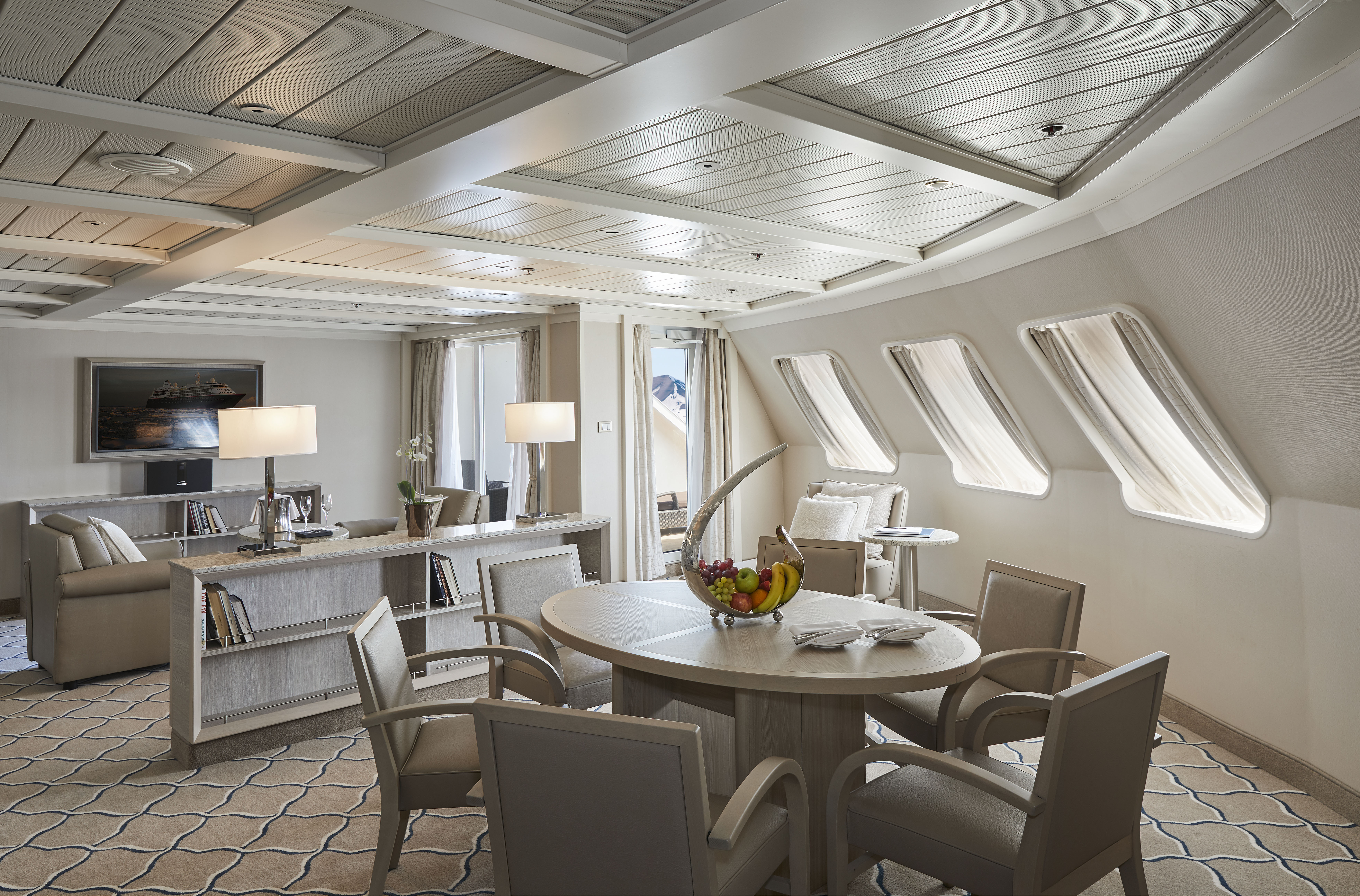
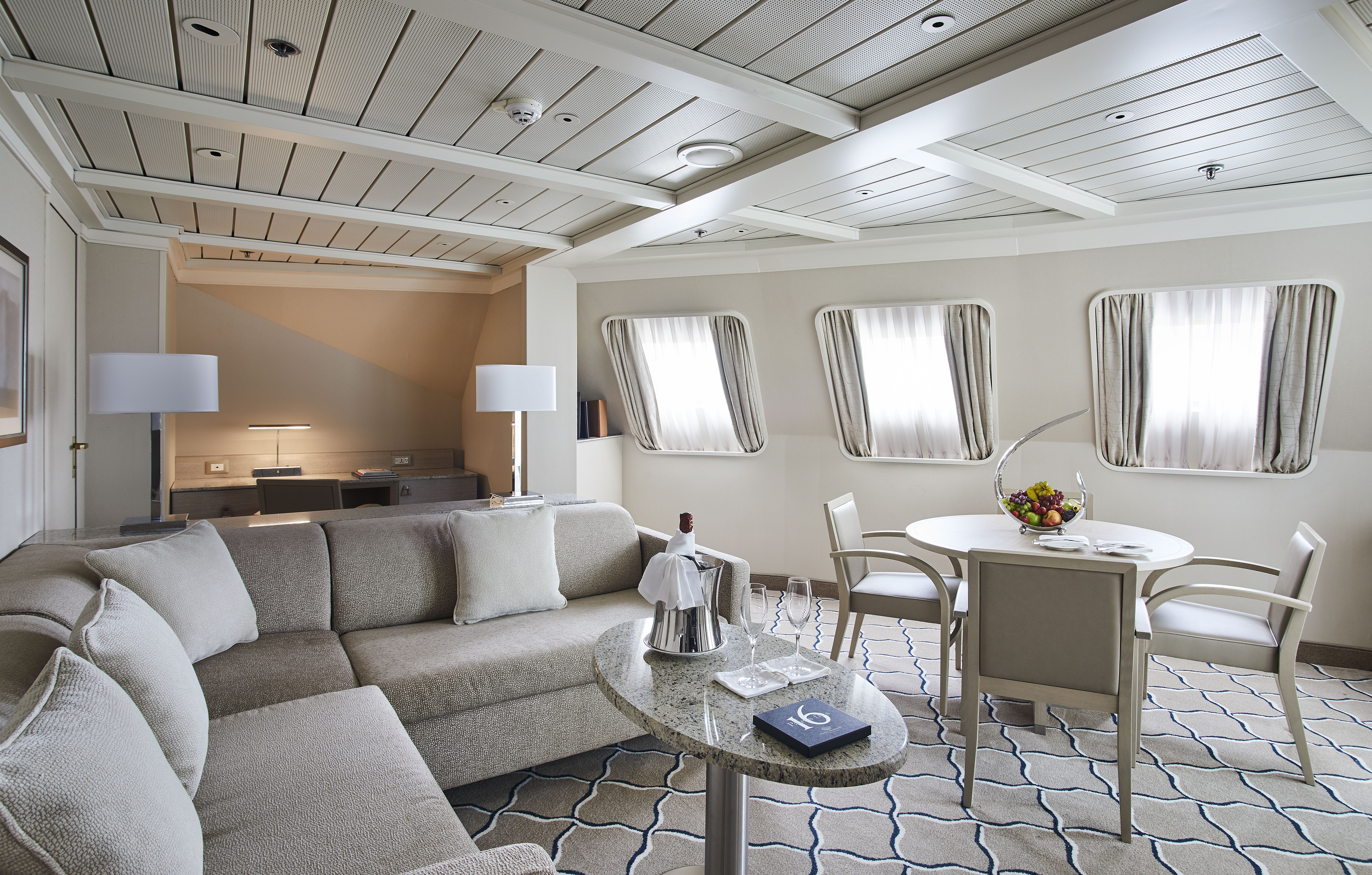
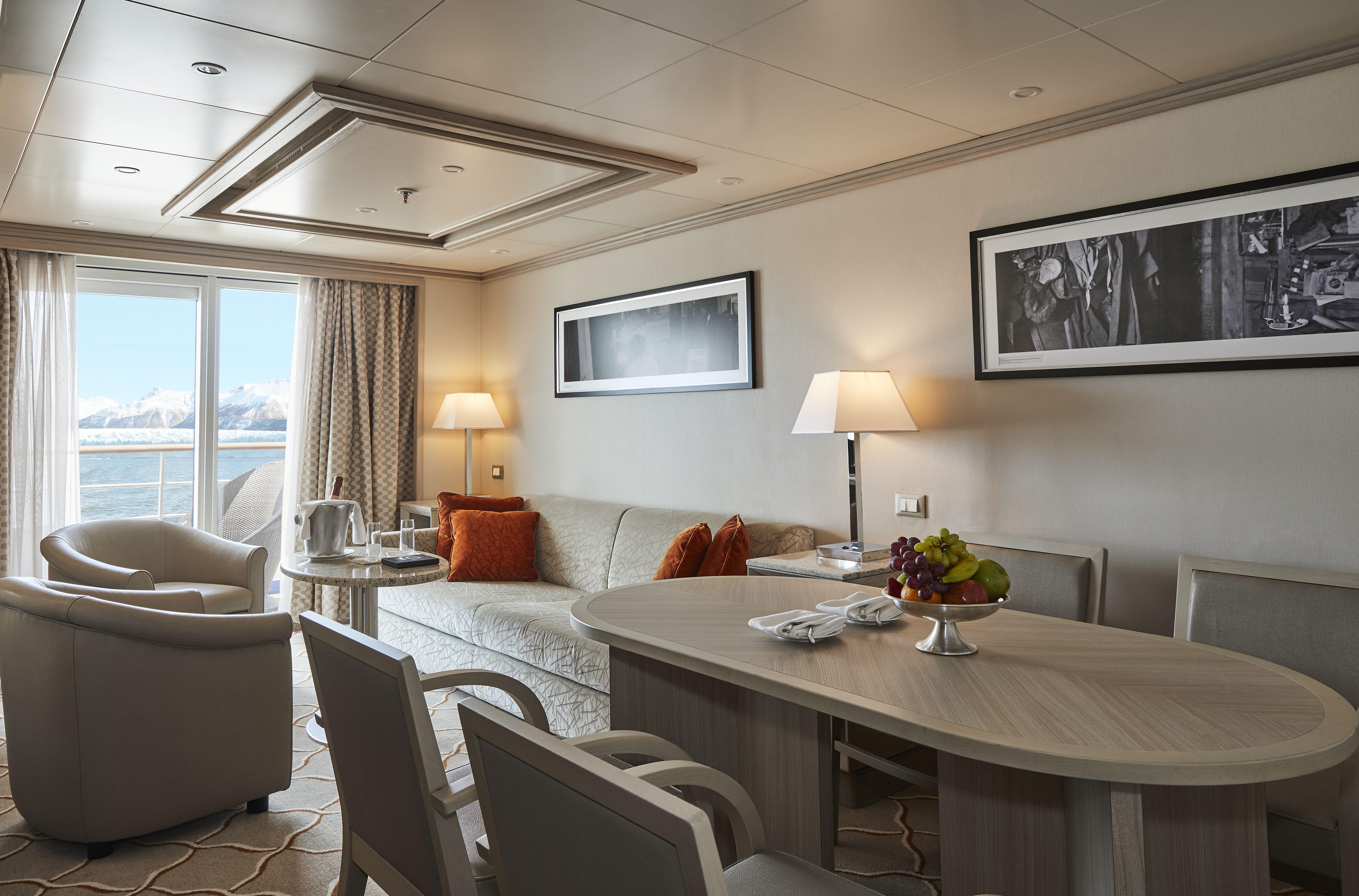
Expertly designed and exquisitely appointed. The ideal space for sharing stories with fellow explorers and new friends. With enough space to roam both inside and outside, this suite is perfect for relaxing and recounting the highlights of your day. Available in a one-bedroom configuration or as two bedrooms by adjoining with a Veranda Suite.
One bedroom: 95 sq m (14 sq m)
Images are intended as a general reference. Features, materials, finishes and layout may be different than shown.
Please note that the third guest will sleep on a comfortable sofa bed in the reception area of the suite.
Two bedrooms: 122 sq m (18.5 sq m)
Images are intended as a general reference. Features, materials, finishes and layout may be different than shown.
Please note that the 3rd guest will sleep on a comfortable sofa bed in the reception area of the suite.
Essentials
- Deck(s): 7
- Section: Forward
Characteristics
- Veranda
- Separate dining area
- Living room with sitting area
- Standard vanity
- Separate shower
- Whirlpool bath
- Walk-in wardrobe with personal safe (Wardrobe closet in suite 702 & 703)
Furniture
- King size bed
- Writing desk
- Vanity table
- Luxury bed mattresses
Media & Communication
- Unlimited Premium Wi-Fi
- 2 large flat screen TVs with Interactive Media Library
- Sound system with bluetooth connectivity
- Direct dial telephone
- Wall mounted USB-C mobile device chargers
- Dual voltage 110/220 outlets
Onboard Services
- Butler service
- Complimentary laundry, pressing & wet cleaning
- Dinner for two in La Dame, one evening per voyage,
- Two hours of worldwide phone use, per voyage segment
- Champagne on arrival
Amenities
- Espresso machine
- Tea kettles
- Pillow menu
- Refrigerator and bar setup stocked with your preferences
- Plush bathrobe
- Luxury bath amenities
- Umbrella
- Hair Dryer
- Slippers
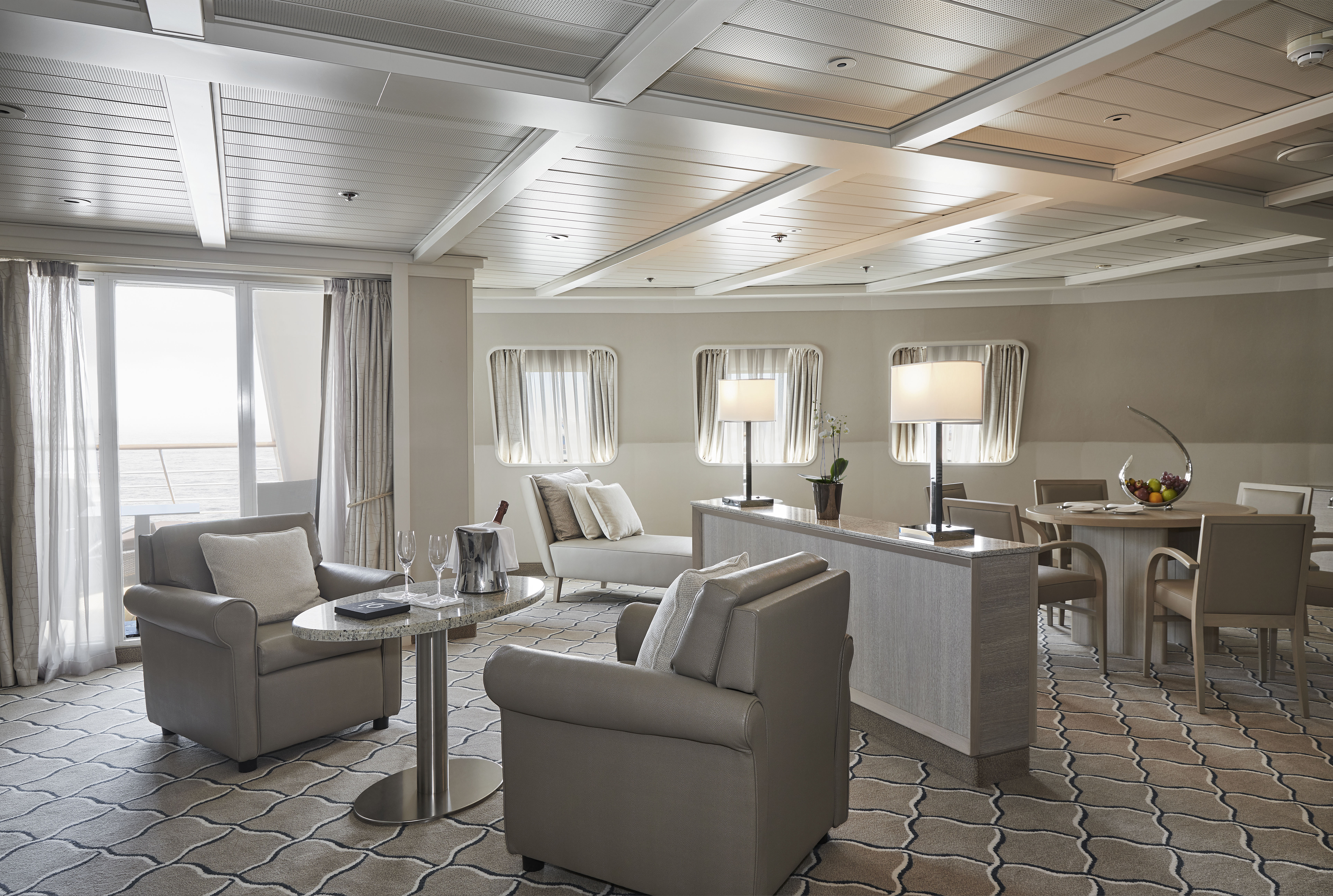
Stately. Commanding and majestic. Perfect for relaxing after a days’ exploring and looking through your photos. With lectures streamed live to your room, this is the pinnacle of good living at sea. Available in a one-bedroom configuration or as two bedrooms by adjoining with a Veranda Suite.
One bedroom: 69 sq m (12 sq m)
Two bedrooms: 96 sq m (16.5 sq m)
Images are intended as a general reference. Features, materials, finishes and layout may be different than shown.
Please note that the third guest will sleep on a comfortable sofa bed in the reception area of the suite.
Essentials
- Deck(s): 6
- Section: Forward
Characteristics
- Veranda
- Separate dining area
- Living room with sitting area
- Standard vanity
- Separate shower
- Whirlpool bath
- Walk-in wardrobe with personal safe
Furniture
- King size bed
- Writing desk
- Vanity table
- Luxury bed mattresses
Media & Communication
- Unlimited Premium Wi-Fi
- 2 large flat screen TVs with Interactive Media Library
- Sound system with bluetooth connectivity
- Direct dial telephone
- Wall mounted USB-C mobile device chargers
- Dual voltage 110/220 outlets
Onboard Services
- Butler service
- Complimentary laundry, pressing & wet cleaning
- Dinner for two in La Dame, one evening per voyage,
- Two hours of worldwide phone use, per voyage segment
- Champagne on arrival
Amenities
- Espresso machine
- Tea kettles
- Pillow menu
- Refrigerator and bar setup stocked with your preferences
- Plush bathrobe
- Luxury bath amenities
- Umbrella
- Hair Dryer
- Slippers
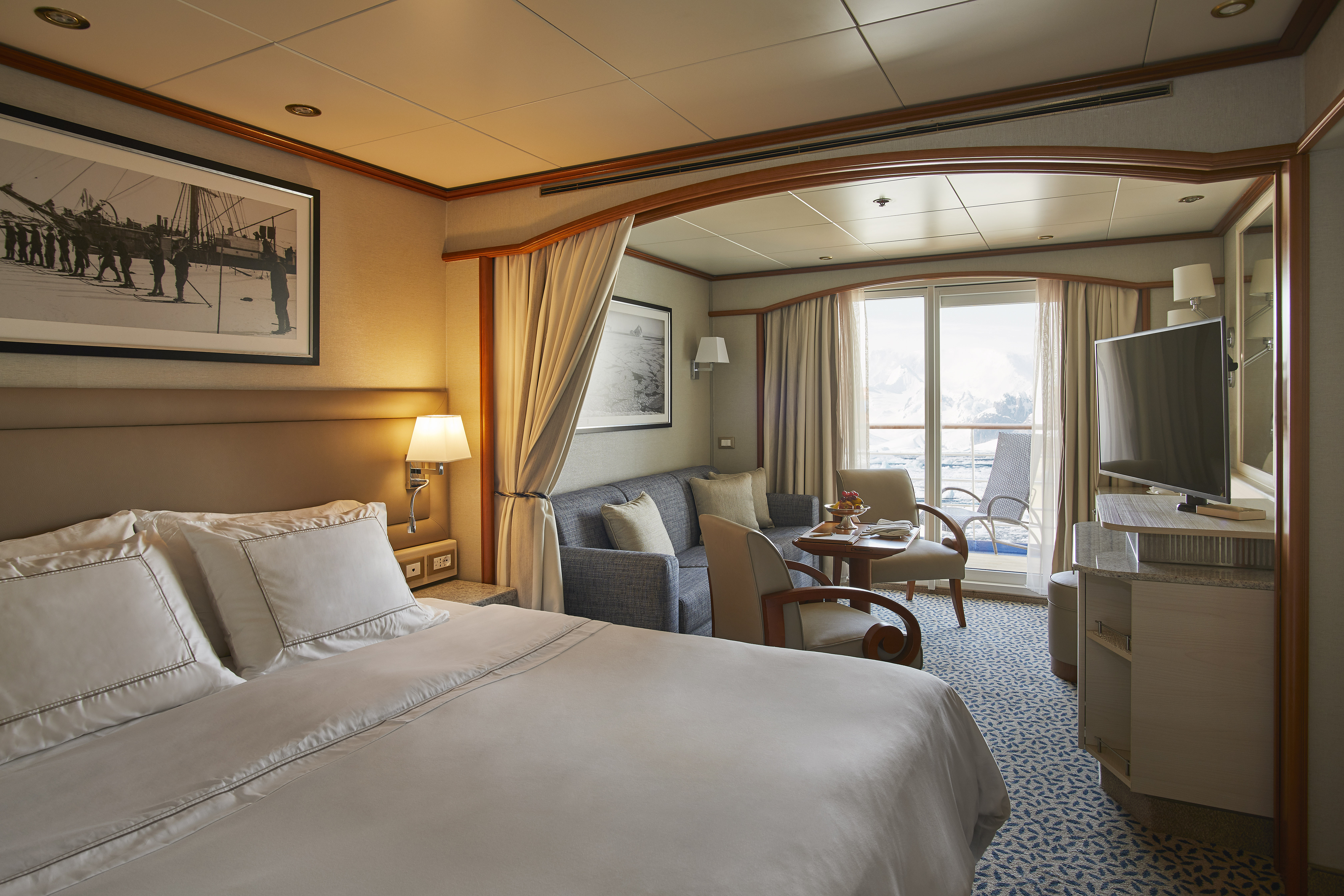
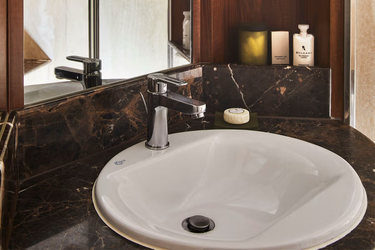
Stylish and sophisticated with larger verandas, excellent for taking pictures and bird-watching. Situated midship, this suite is perfection in design and comfortable living. A huge walk-in wardrobe, a beautiful marbled bathroom, and a spacious living area complete the picture. Silver Suites accommodate three guests.
One bedroom: 54 sq m (8 sq m)
Images are intended as a general reference. Features, materials, finishes and layout may be different than shown.
Please note that the 3rd guest will sleep on a comfortable sofa bed in the reception area of the suite.
Essentials
- Deck(s): 6, 7
- Section: Mid-Ship
Characteristics
- Veranda
- Separate dining area
- Living room with sitting area
- Standard vanity
- Separate shower (2 bathrooms with shower)
- Walk-in wardrobe with personal safe
Furniture
- Queen size bed
- Writing desk
- Vanity table
- Luxury bed mattresses
Media & Communication
- Unlimited Premium Wi-Fi
- 2 large flat screen TVs with Interactive Media Library
- Sound system with bluetooth connectivity
- Direct dial telephone
- Wall mounted USB-C mobile device chargers
- Dual voltage 110/220 outlets
Onboard Services
- Butler service
- Complimentary laundry, pressing & wet cleaning
- Champagne on arrival
Amenities
- Espresso machine
- Tea kettles
- Pillow menu
- Refrigerator and bar setup stocked with your preferences
- Plush bathrobe
- Luxury bath amenities
- Umbrella
- Hair Dryer
- Slippers
With a room configuration that favors watching the sun rise from the comfort of your bed and losing yourself in the mesmerizing seascapes, this suite is the perfect answer to adventure cruising. A large walk-in wardrobe and an expansive living room make the Medallion Suite your home away from home on the high seas. Medallion Suites accommodate three guests.
One bedroom: 48 sq m (7.6 sq m )
Images are intended as a general reference. Features, materials, finishes and layout may be different than shown.
Please note that the 3rd guest will sleep on a comfortable sofa bed in the reception area of the suite.
Essentials
- Deck(s): 5, 6, 7
- Section: Mid-Ship
Characteristics
- Veranda
- Separate dining area
- Living room with sitting area
- Standard vanity
- Separate shower
- Walk-in wardrobe with personal safe
Furniture
- Queen size bed
- Writing desk
- Vanity table
- Luxury bed mattresses
Media & Communication
- Unlimited Premium Wi-Fi
- 2 large flat screen TVs with Interactive Media Library
- Sound system with bluetooth connectivity
- Direct dial telephone
- Wall mounted USB-C mobile device chargers
- Dual voltage 110/220 outlets
Onboard Services
- Butler service
- Complimentary laundry, pressing & wet cleaning
- Champagne on arrival
Amenities
- Espresso machine
- Tea kettles
- Pillow menu
- Refrigerator and bar setup stocked with your preferences
- Plush bathrobe
- Luxury bath amenities
- Umbrella
- Hair Dryer
- Slippers
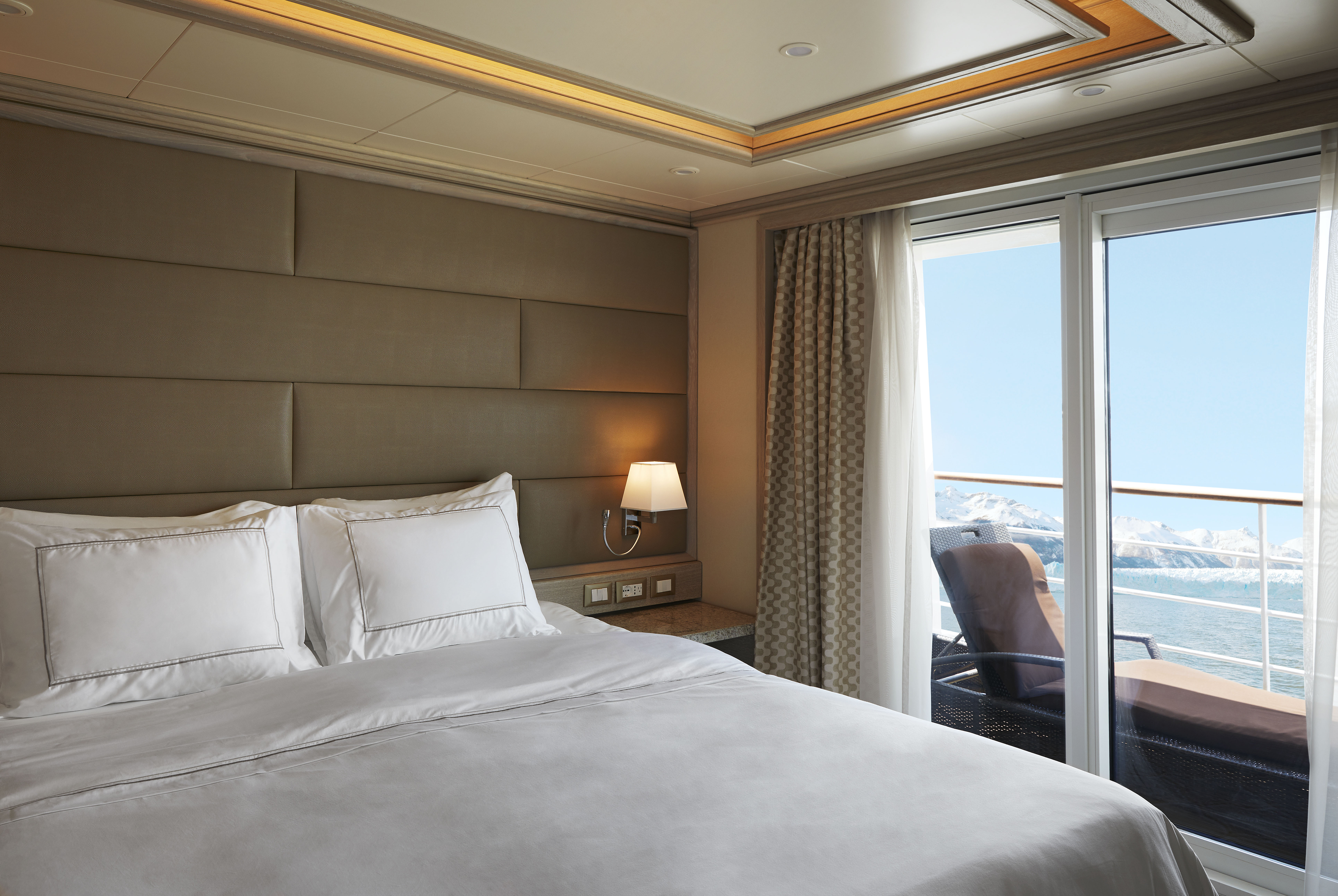
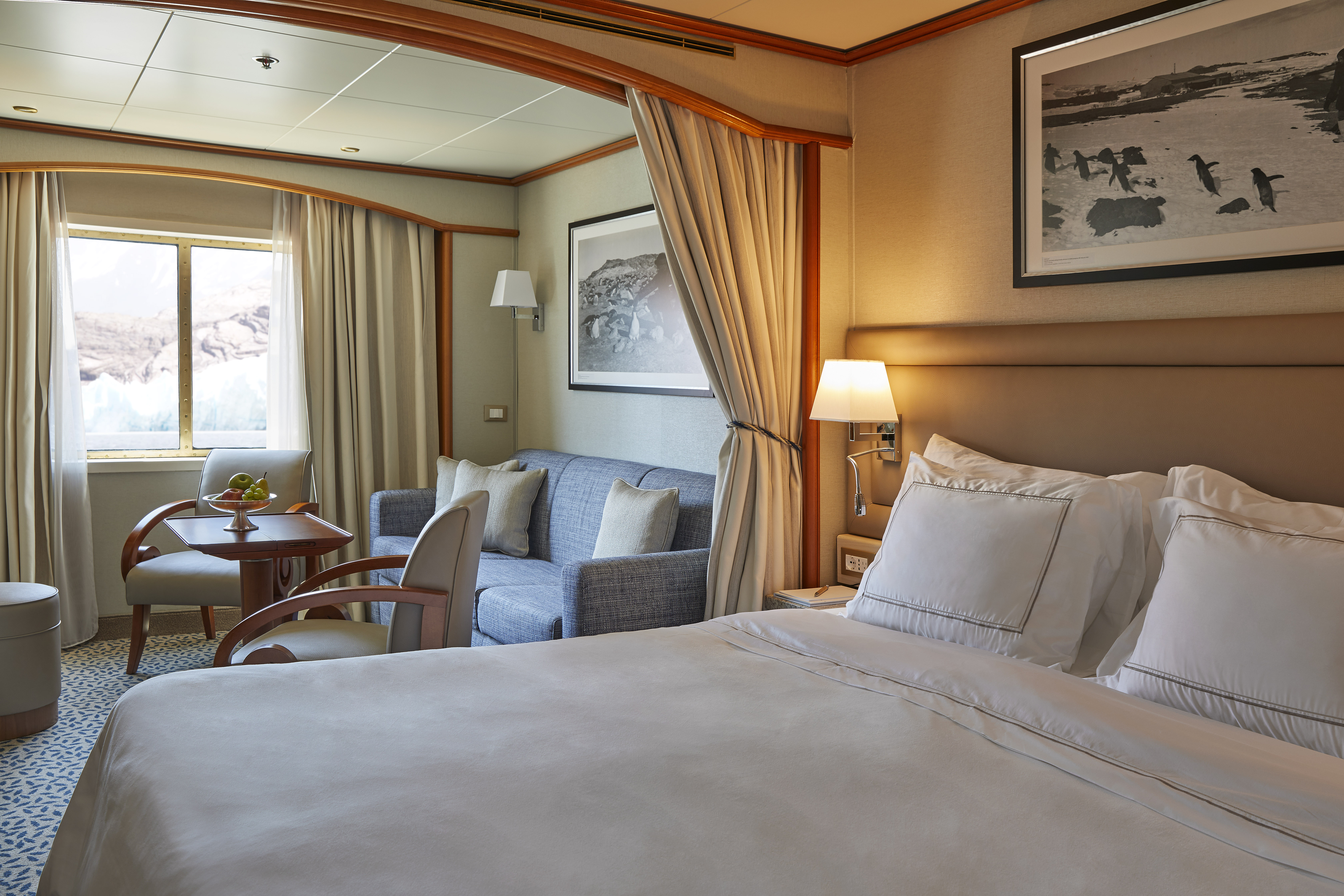
A Silversea signature, with a preferred central location, the Veranda Suite is spacious and welcoming. Floor-to-ceiling glass doors open onto a furnished private teak veranda from where you can contemplate anything from the midnight sun to an Antarctic sunrise. The Deluxe Veranda Suite offers a preferred central location with identical accommodation to a Veranda Suite.
One bedroom: 27 sq m (4.5 sq m)
Two bedrooms: 27 sq m (4.5 sq m)
Images are intended as a general reference. Features, materials, finishes and layout may be different than shown.
Essentials
- Deck(s): 5, 6, 7
- Section: Aft, Forward
Characteristics
- Veranda
- Sitting area
- Standard vanity
- Separate shower
- Some with full-size bath
- Walk-in wardrobe with personal safe
Furniture
- Queen size bed
- Writing desk
- Luxury bed mattresses
Media & Communication
- Unlimited Standard Wi-Fi
- 1 large flat screen TV with Interactive Media Library
- Direct dial telephone
- Wall mounted USB-C mobile device chargers
- Dual voltage 110/220 outlets
- Onboard Services
- Butler service
- Champagne on arrival
Amenities
- Espresso machine
- Tea kettles
- Pillow menu
- Refrigerator and bar setup stocked with your preferences
- Plush bathrobe
- Luxury bath amenities
- Umbrella
- Hair Dryer
- Slippers
A Silversea signature, the Veranda Suite is spacious and welcoming. Floor-to-ceiling glass doors open onto a furnished private teak veranda from where you can contemplate anything from the midnight sun to an Antarctic sunrise. Some Veranda Suites accommodate three guests (suites 505 to 510 and 605 to 610).
One bedroom: 27 sq m (4.5 sq m)
Images are intended as a general reference. Features, materials, finishes and layout may be different than shown.
Please note that the 3rd guest will sleep on a comfortable sofa bed in the reception area of the suite.
Essentials
- Deck(s): 5, 6, 7
- Section: Aft, Forward
Characteristics
- Veranda
- Sitting area
- Standard vanity
- Separate shower
- Some with full-size bath
- Walk-in wardrobe with personal safe
Furniture
- Queen size bed
- Writing desk
- Luxury bed mattresses
Media & Communication
- Unlimited Standard Wi-Fi
- 1 large flat screen TV with Interactive Media Library
- Direct dial telephone
- Wall mounted USB-C mobile device chargers
- Dual voltage 110/220 outlets
Onboard Services
- Butler service
- Champagne on arrival
Amenities
- Espresso machine
- Tea kettles
- Pillow menu
- Refrigerator and bar setup stocked with your preferences
- Plush bathrobe
- Luxury bath amenities
- Umbrella
- Hair Dryer
- Slippers
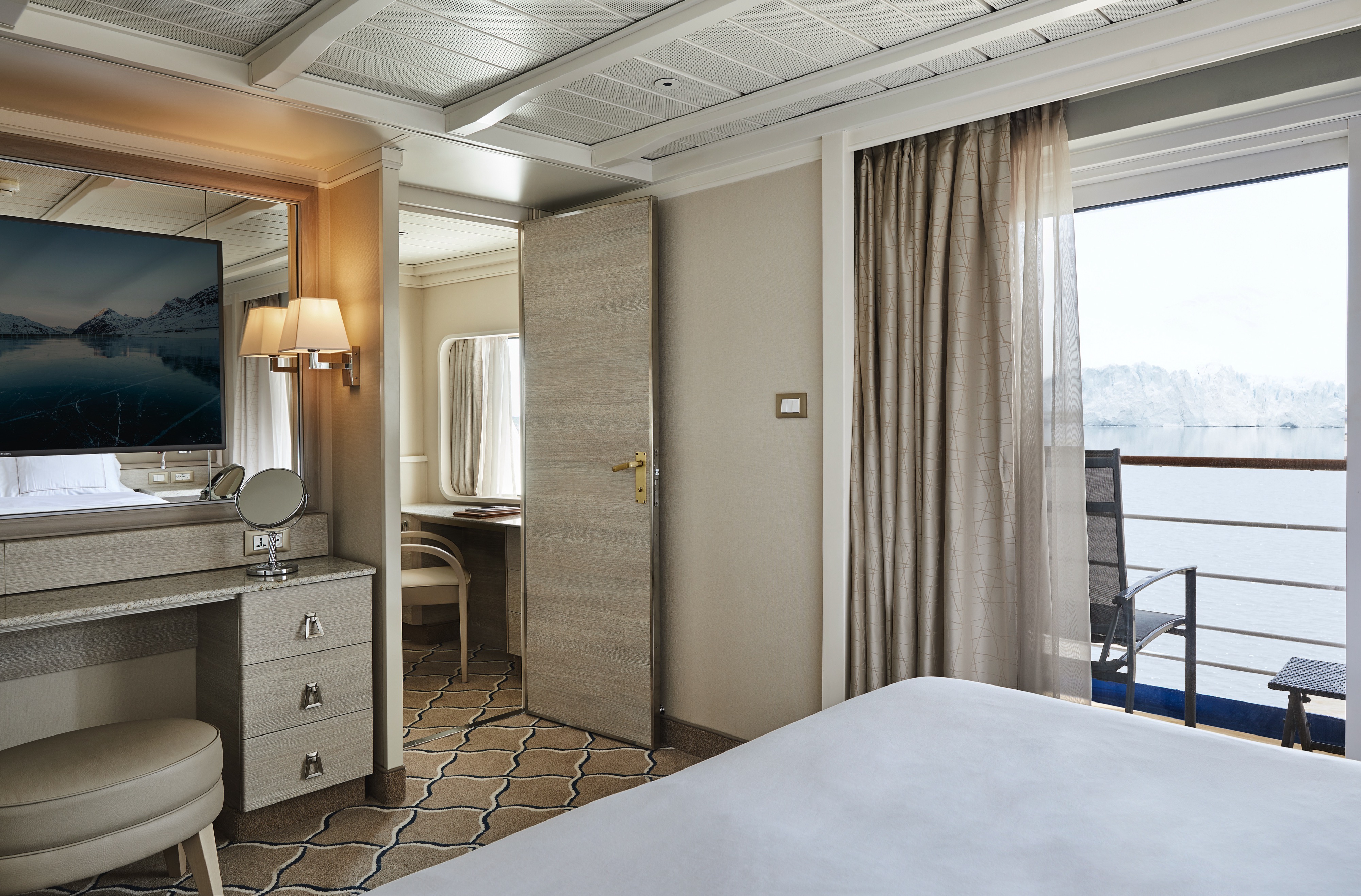
Your home away from home while you embrace the intrepid explorer within. The suite’s seating area has plenty of room to relax while you go over your notes, ready for the next adventure. Large picture windows frame panoramic ocean views, ideal for appraising the local wildlife.
One bedroom: 22 sq m
Wheelchair accessible suites: 449 and 451
Images are intended as a general reference. Features, materials, finishes and layout may be different than shown.
Essentials
- Deck(s): 4
- Section: Aft, Forward
Characteristics
- Window
- Sitting area
- Standard vanity
- Separate shower
- Some with full-size bath
- Walk-in wardrobe with personal safe
Furniture
- Queen size bed
- Writing desk
- Luxury bed mattresses
Media & Communication
- Unlimited Standard Wi-Fi
- 1 large flat screen TV with Interactive Media Library
- Direct dial telephone
- Wall mounted USB-C mobile device chargers
- Dual voltage 110/220 outlets
Onboard Services
- Butler service
- Champagne on arrival
Amenities
- Espresso machine
- Tea kettles
- Pillow menu
- Refrigerator and bar setup stocked with your preferences
- Plush bathrobe
- Luxury bath amenities
- Umbrella
- Hair Dryer
- Slippers
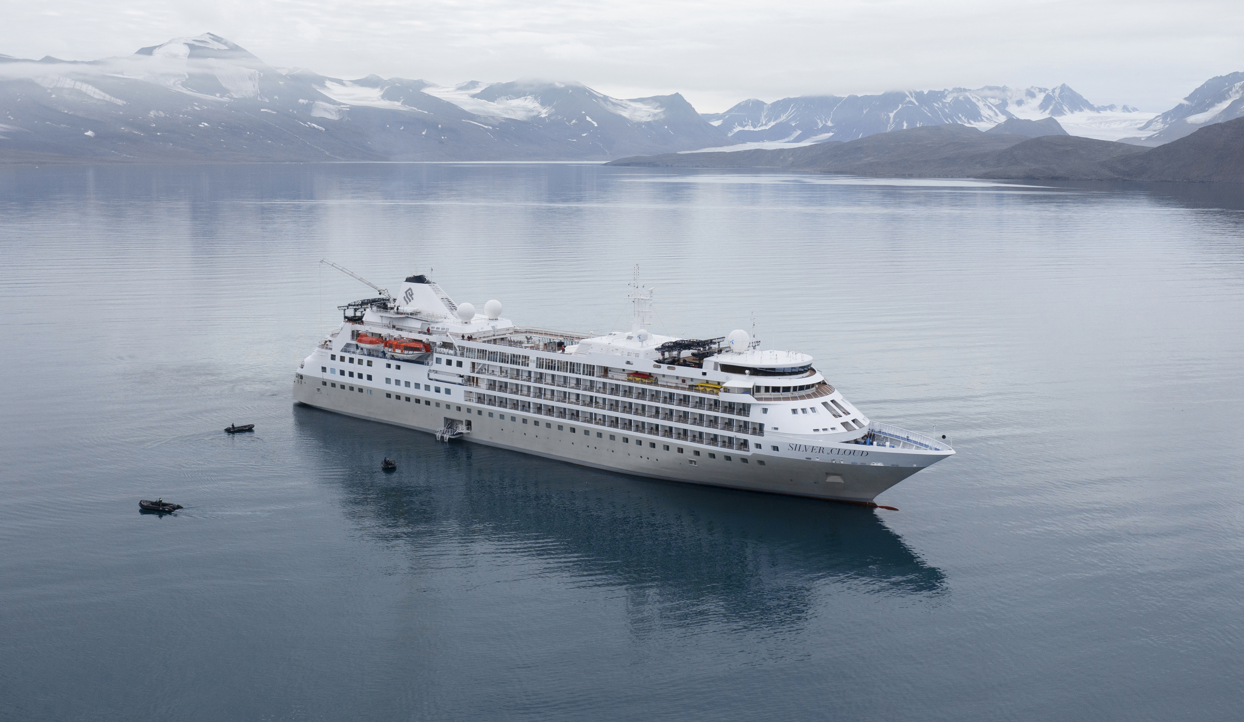
Silver Cloud
Silver Cloud is the first crossover ship in our fleet, bringing the remote and remarkable to you in ultra-luxurious comfort. Her large suites, destination itineraries and unparalleled service make her truly special. Four dining options will tantalise your taste buds, and as 80% of her suites include a veranda, watching a breaching whale from the comfort of your balcony never been so personal. With her 20 zodiacs, 10 kayaks, possibilities are almost limitless with ship-wide simultaneous explorations.
Ship Facts
| Launch Year | 1994 | ||||||||||
| Refit Year | 2017 | ||||||||||
| Language | en | ||||||||||
| Gross Tonnage | 17400 | ||||||||||
| Length | 155 | ||||||||||
| Width | 21 | ||||||||||
| Currency | USD | ||||||||||
| Speed | 18 | ||||||||||
| Capacity | 254 | ||||||||||
| Crew Count | 212 | ||||||||||
| Deck Count | 7 | ||||||||||
| Cabin Count | 126 | ||||||||||
| Large Cabin Count | 28 | ||||||||||
| Wheelchair Cabin Count | 2 | ||||||||||
| Electrical Plugs |
|
Deck 9
- Observation Lounge
- Zodiacs
- Jogging Track
- Open view to Swimming Pool

Deck 8
- Pool
- Pool Bar
- Pool Grill
- The Grill
- Panorama Lounge
- Connoisseurs’s Corner

Deck 7
- La Terrazza
- Zagara Beauty Spa
- Library
- Medallion Suite
- Silver Suites
- Veranda Suites
- Owners Suites
- Grand Suites

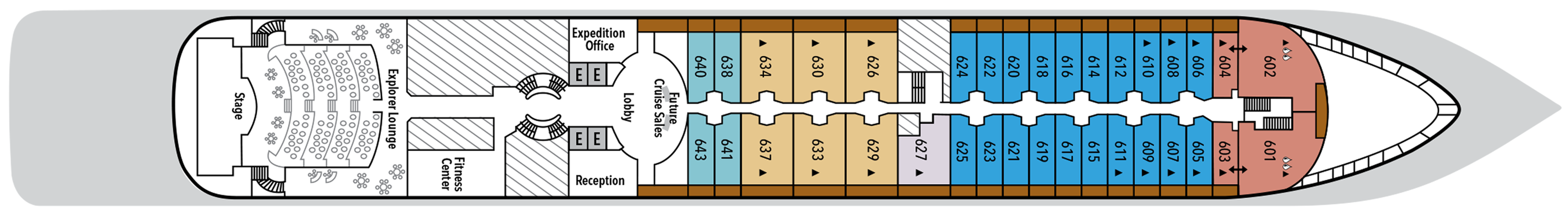
Deck 6
- Explorer Lounge
- Fitness Centre
- Reception/Guest Relations
- Expedition Office
- Lobby
- Future Cruise Sales
- Medallion Suite
- Deluxe Veranda Suites
- Silver Suites
- Royal Suites
- Veranda Suites
Deck 5
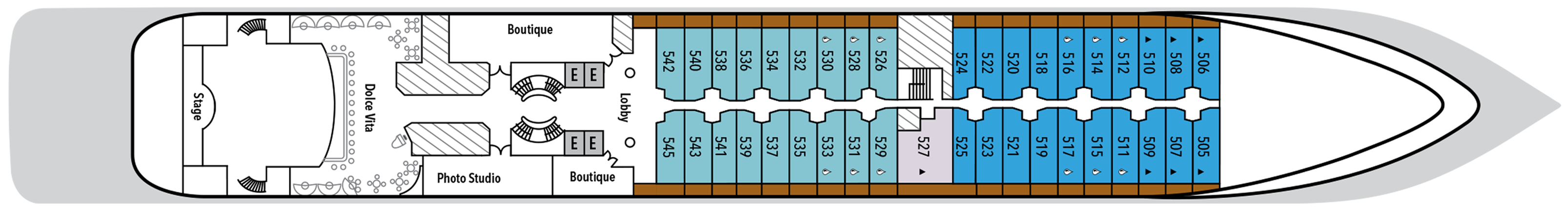
- Dolce Vita
- Lobby
- Boutique
- Photo Studio
- Deluxe Veranda Suites
- Veranda Suites
- Medallion Suites
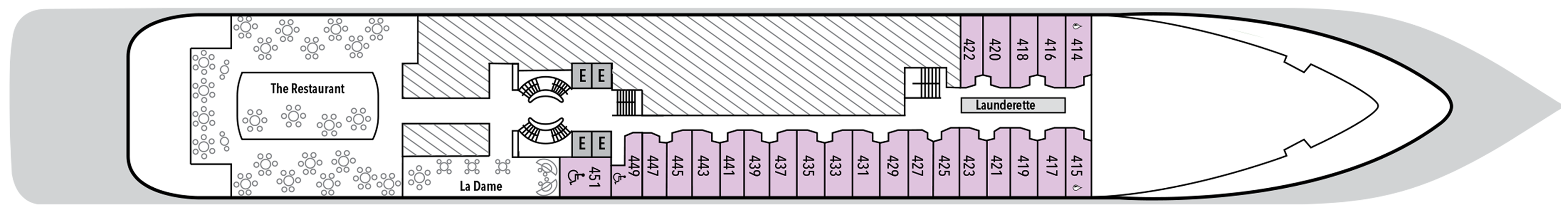
Deck 4
- The Restaurant
- La Dame
- Launderette
- Vista Suites
Deck 3
- Medical Centre
- Changing Room

Our passion for excellent cuisine is at the heart of everything we do. We believe that meals are a celebration of life, a way to bring people together, and an expression of culture and tradition. Each dining venue aboard our ships offers a unique and memorable experience, with multiple dining options available and a variety of spaces and experiences on board; every mealtime is a joy.
From fine French cuisine and flavourful Asian options to relaxed Italian meals and international options to suit everyone, our chefs’ creativity knows no limits.
With the importance of food in our culture, it’s no wonder that dining is a high priority at Silversea. We believe gastronomic excellence is a given, thanks to recipes that reflect our heritage and revamp tradition. No matter where you dine, destination influence is readily apparent in the great diversity and freshness of your selections. And every luxury ship also features an array of dining venues. Per guest reservation fee for specialty restaurants. Please visit MySilversea to make your reservations.
The Grill
A poolside al fresco favorite, The Grill is casual by day and captivating by night. Dig in to crisp salads and grilled classics during lunch, then return after sunset for masterfully seasoned and seared cuts paired with balmy sea breezes.
Dress code: Casual
Casual wear consists of pants, blouses, or casual dresses for women; open-neck shirts and slacks for men are appropriate.
Images are intended as a general reference. Features, materials, finishes and layout may be different than shown.
La Dame
Experience the pinnacle of French gastronomy at La Dame, where sophistication meets tradition. Here, an exclusive tasting menu unfolds course by course — each plate a study in masterful technique, seasonal ingredients, and modern refinement. From classic Kir Royales to exquisite signatures such as Dover sole à la Grenobloise, this is haute cuisine at its finest.
Per guest reservation fee of US$60. Please visit My Silversea to make your reservations.
Le Terrazza
La Terrazza elevates casual dining by day and delivers an authentic Italian experience by night. During the breakfast and lunch buffets, our master chefs prepare global favorites at live stations. As evening falls, handmade pastas and classic seafood dishes are the centerpiece — every impeccable bite paired with fine wines from around the world.
The Restaurant
The Restaurant transforms dining into an extraordinary journey of taste. Indulge in international delicacies, refined classics, and destination-driven creations that reflect the flavors of the region you’re exploring. From breakfast favorites to imaginative evening courses, every meal draws inspiration from your voyage.
Human connection and a sense of community is at the heart of every Silversea voyage, which is why we’ve created a variety of spaces on board to share the experience with your fellow adventurers. Relax in one of our many bars or restaurants with your favorite tipple and swap stories with other guests. Workout in our fully equipped gym or try our elite spa services. Sip a glass of bubbly by the pool by day, or a fine cognac in one of our elegant bars by night.
Dolce Vita
Surrender to a world of Italian elegance where the art of aperitivo takes pride of place. Ideal for connecting over spritzes, negronis, and light bites, here each evening feels like a celebration. As laughter lingers, crystal glasses clink, and live piano notes ripple through the air, Dolce Vita compels you to savor the sweetness of life on board.
Connoisseur's Corner
As evening stretches into night, Connoisseur’s Corner offers a stylish refuge for those who appreciate the time-honored rituals of smoke and spirit. Sink into tufted leather chairs with a hand-rolled cigar and a glass of one of our finest cognacs or whiskeys. Indoors or under the stars, every moment is marked by pure indulgence.
Observation Lounge
Wrapped in glass and bathed in light, the Observation Lounge offers a serene escape high above the sea. Borrow a book from the in-house library, pour yourself a coffee or tea from the self-service bar, and curl into an armchair to watch the world drift by. This is a sanctuary for reflection, relaxation, and stories — both written and still in the making.
Boutique
Exceptional shopping experiences do not end in the cosmopolitan cities we visit. Silversea’s striking new shipboard boutiques, reimagined and redesigned, are stunning modern design spaces befitting the finest creations from legendary designers. Carefully selected partners on board Silversea’s duty-free boutiques offer our guests a carefully curated selection of cutting-edge fashions, jewelry, accessories, fine perfumes, cosmetics, and Silversea Logo collection, all at duty-free prices.
Explorer Lounge
Unique to our Expedition ships, the Explorer Lounge is a versatile venue that adapts to the rhythm of your journey. Comfortable seating and refined refreshments create an atmosphere where learning and leisure meld seamlessly. From lectures and presentations to live entertainment and special events, this is a space where discovery thrives.
Panorama Lounge
True to its name, Panorama Lounge surrounds you with sweeping views from every angle. Sunlight pours through wraparound windows by day, framing horizons that shift like watercolors. Evenings hum with piano chords and DJ beats that carry you late into the night. And all of it pairs wonderfully with cocktails handcrafted to match your mood.
Photo Studio
The Photo Studio offers a multitude of options to take your pictures from your camera to your walls. A vibrant, creatively inspiring space where you can not only master the art of digital photography with master classes in editing and Adobe Lightroom and Photoshop, but also an editing suite where you can print images (including postcard, panorama, and A2-sized prints). State-of-the-art equipment for both Mac and PC users, highly technological printers, plus a dedicated photo manager to guide you through the many techniques to help you define yourself as a serious photographer. Even the smartphone photographer can become pro-level with specialized training on how to use your camera phone to its best possible advantage. Fees apply.
Reception
This central lobby area welcomes guests to speak with our receptionist if they have a question or require any service. Assistance is available 24 hours a day. The Cruise Consultant may also be indispensable when planning your next Silversea voyage, or if you wish to extend your current voyage for a day, a week, a month … Like having your own personal onboard Silversea professional, the Cruise Consultant will help you to select the perfect voyage, reserve your preferred suite, and provide immediate confirmation.