Nuuk to Nuuk
Nuuk to Nuuk
Cruise overview
WHY BOOK WITH US?
- ✔ The Deluxe Cruises’ team has extensive experience in ultra-luxury cruising.
- ✔ Call now to speak to our helpful and experienced Cruise Concierge team.
- ✔ Enjoy our Unique Deluxe Cruises Bonus for substantial savings.
- ✔ Our team will tailor your holiday to your exacting requirements.
- ✔ As agents, we work under the protection of each cruise lines ABTA / ATOL licences
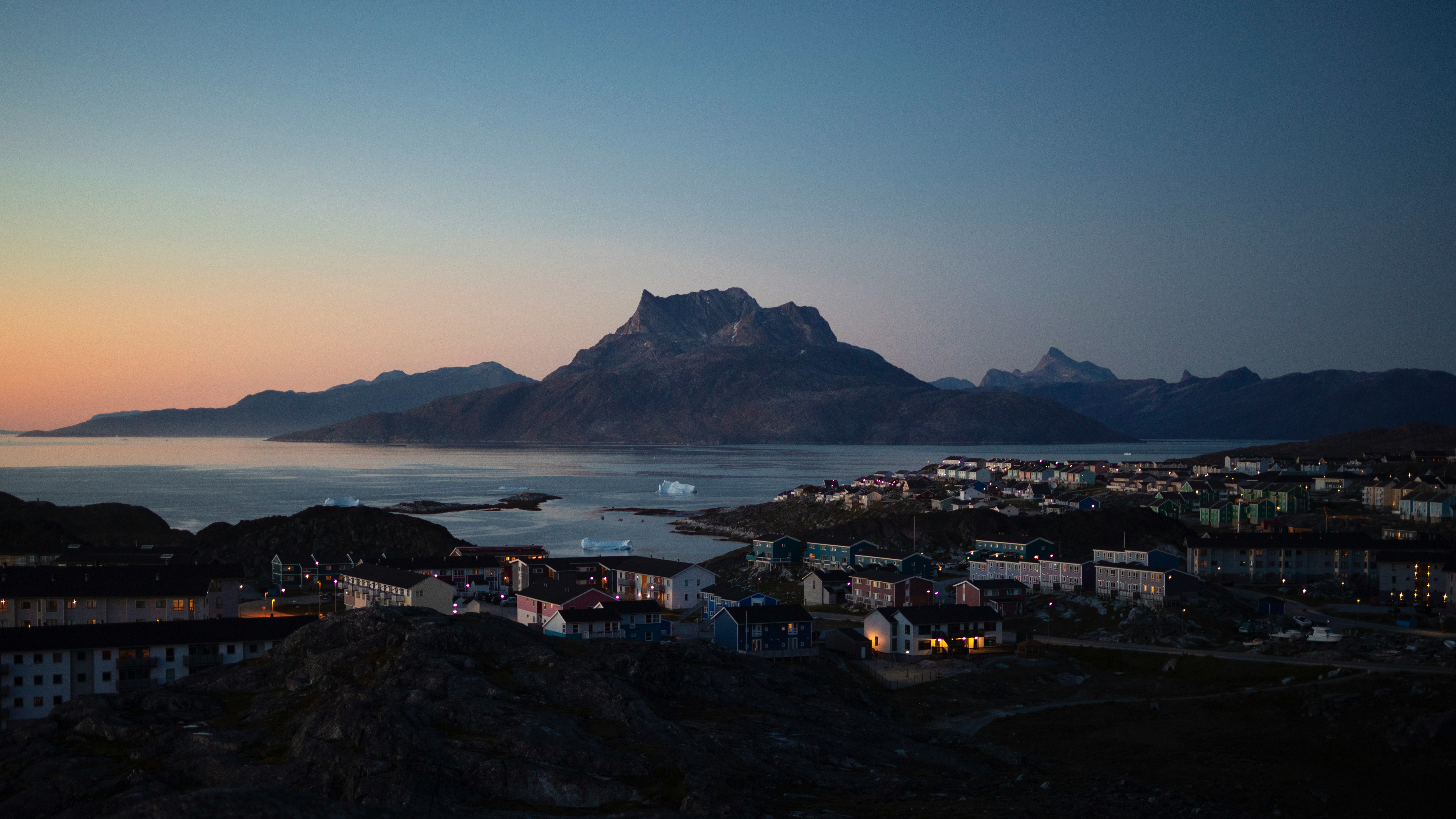
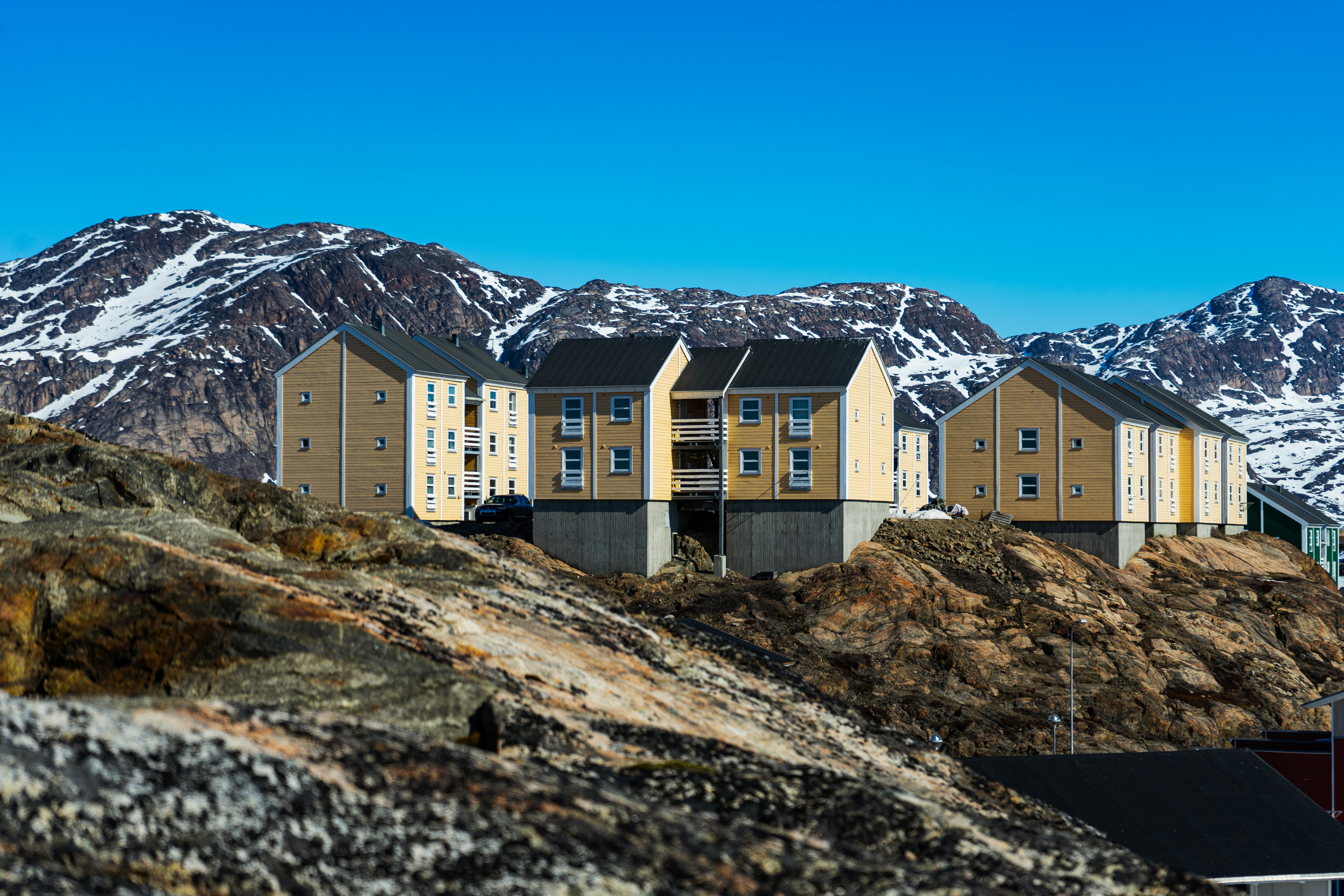
About Nuuk (Godthaab)
Nuuk, meaning “the cape”, was Greenland’s first town (1728). Started as a fort and later mission and trading post some 240 kilometers south of the Arctic Circle, it is the current capital. Almost 30% of Greenland’s population lives in the town. Not only does Nuuk have great natural beauty in its vicinity, but there are Inuit ruins, Hans Egede’s home, the parliament, and the Church of our Saviour as well. The Greenlandic National Museum has an outstanding collection of Greenlandic traditional dresses, as well as the famous Qilakitsoq mummies. The Katuaq Cultural Center’s building was inspired by the undulating Northern Lights and can house 10% of Nuuk’s inhabitants.


About Iqaluit, Nunavut
Iqaluit is the capital of Canada’s newest territory, Nunavut, which is Inuktitut for “our land”. The community is located at the head of Frobisher Bay, an inlet of the North Atlantic extending into southeastern Baffin Island. The Bay is so long that it was first taken to be the possible entrance of a Northwest Passage. In Iqaluit, the Nunatta Sunakkutaangit Museum and the Nunavut Legislative Assembly Building both house incredible collections of Inuit artwork with interesting local prints for sale in the museum shop.
About Lower Savage Islands, Nunavut
About Monumental Island, Baffin Islands, Nunavut
Monumental Island in Davis Strait was named by Arctic explorer Charles Francis Hall as a tribute to the memory of Sir John Franklin who died in his quest to find the Northwest Passage. The island is offshore of Baffin Island in the Canadian Arctic Archipelago of the territory of Nunavut. Around the shoreline scores of Black Guillemots dive and fish for little Arctic cods and capelins. Successful birds fly off with a minnow grasped tightly in their beaks. On a far larger scale, it is possible to find groups of walruses with their impressive tusks along the shores of the island. However, the coup de grâce is to spot a polar bear’s white silhouette against the dark background of the bedrock on Monumental Island.
About Lady Franklin Island, Nunavut
Named in honour of Sir John Franklin’s widow, the lonely and uninhabited Lady Franklin Island lies off of Baffin Island’s Hall Peninsula at the entrance to Cumberland Sound. The island is named for the wife of Sir John Franklin, the Arctic explorer who died trying to discover the Northwest Passage. The geology of the island is striking with vertical cliffs of Archean rocks, likely to be some of the oldest stone in Canada. The waters around Lady Franklin Island offer an abundance seabirds, ducks, seals, and walrus. With a bit of luck it is possible to see Atlantic Puffins here and perhaps even a rare Sabine’s Gull.
About Auyuittuq National Park
Picturesque park featuring hiking trails & arctic terrains, including glaciers, fjords & ice fields.
About Isabella Bay, Baffin Island, Nunavut
About Sam Ford Fiord, Baffin Island, Nunavut
The starkly beautiful Sam Ford Fjord area of Baffin Island has one of the most impressive concentrations of vertical rock walls to be found anywhere in the world. It is a 110-kilometer (68-mile) waterway lined with sheer cliffs that have attracted some of the world’s best (and most extreme) rock climbers to the region. The steep stone walls were formed by ancient glaciers that carved the landscape throughout the ages. However, the feature that makes the shoreline truly special is the way that many of these walls rise straight up from the dark waters of the deep fjord. Swimming these waters are marine mammals including narwhals and seals that once attracted Inuit hunters to this coast.
About Buchan Gulf, Nunavut
About Uummannaq
In the iceberg-laden waters surrounding the remote community of Uummannaq it is common to see whales. This area of Greenland is also known for its huge basalt mountains, and the small hunting and fishing village of Uummannaq rests at the foot of the heart-shaped Uummannaq Mountain, a name that translates to mean “in the shape of a seal’s heart”. The town of over 1200 people has a granite church and the country’s most northerly ferry terminal. The economy of Uummannaq revolves largely around the halibut/fish-processing factory.


About Ilulissat (Jakobshavn)
Known as the birthplace of icebergs, the Ilulissat Icefjord produces nearly 20 million tons of ice each day. In fact, the word Ilulissat means “icebergs” in the Kalaallisut language. The town of Ilulissat is known for its long periods of calm and settled weather, but the climate tends to be cold due to its proximity to the fjord. Approximately 4,500 people live in Ilulissat, the third-largest town in Greenland after Nuuk and Sisimiut. Some people here estimate that there are nearly as many sled dogs as human beings living in the town that also boasts a local history museum located in the former home of Greenlandic folk hero and famed polar explorer Knud Rasmussen.


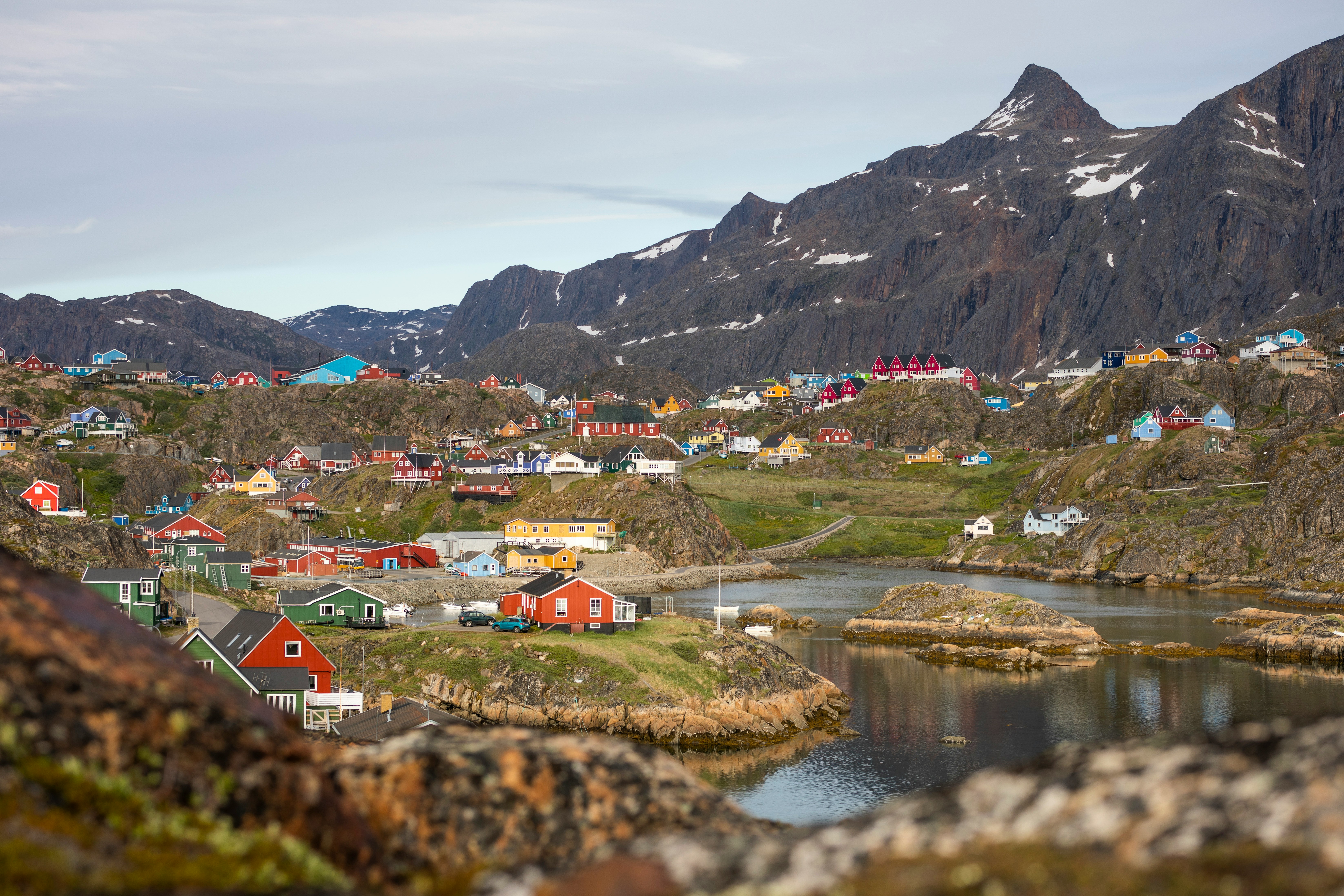
About Sisimiut (Holsteinsborg)
Located just north of the Arctic Circle, Sisimiut is the northernmost town in Greenland where the port remains free of ice in the winter. Yet it is also the southernmost town where there is enough snow and ice to drive a dogsled in winter and spring. In Sisimiut, travelling by sled has been the primary means of winter transportation for centuries. In fact, the area has been inhabited for approximately 4,500 years. Modern Sisimiut is the largest business center in the north of Greenland, and is one of the fastest growing Greenlandic cities. Commercial fishing is the lead economy in the town‘s thriving industrial base.

About Kangaamiut
Only 350 people live in the small Greenlandic community of Kangaamiut. Located on the south coast of Timerdlit Island and facing the Davis Strait, Kangaamiut is situated between the mouths of two long fjords: the Kangerlussuatsiaq Fjord (or Evighedsfjorden in Danish) to its south and to its north Kangaamiut Kangerluarsuat Fjord. Founded in 1755, it was called “Sugarloaf” (Sukkertoppen) because of the appearance of three nearby hills
About Nuuk (Godthaab)
Nuuk, meaning “the cape”, was Greenland’s first town (1728). Started as a fort and later mission and trading post some 240 kilometers south of the Arctic Circle, it is the current capital. Almost 30% of Greenland’s population lives in the town. Not only does Nuuk have great natural beauty in its vicinity, but there are Inuit ruins, Hans Egede’s home, the parliament, and the Church of our Saviour as well. The Greenlandic National Museum has an outstanding collection of Greenlandic traditional dresses, as well as the famous Qilakitsoq mummies. The Katuaq Cultural Center’s building was inspired by the undulating Northern Lights and can house 10% of Nuuk’s inhabitants.


Where You'll Go


