Bridgetown to Bridgetown
Bridgetown to Bridgetown
Cruise overview
WHY BOOK WITH US?
- ✔ The Deluxe Cruises’ team has extensive experience in ultra-luxury cruising.
- ✔ Call now to speak to our helpful and experienced Cruise Concierge team.
- ✔ Enjoy our Unique Deluxe Cruises Bonus for substantial savings.
- ✔ Our team will tailor your holiday to your exacting requirements.
- ✔ As agents, we work under the protection of each cruise lines ABTA / ATOL licences
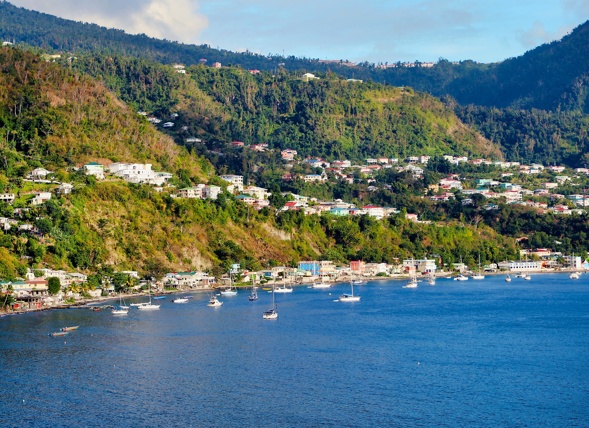
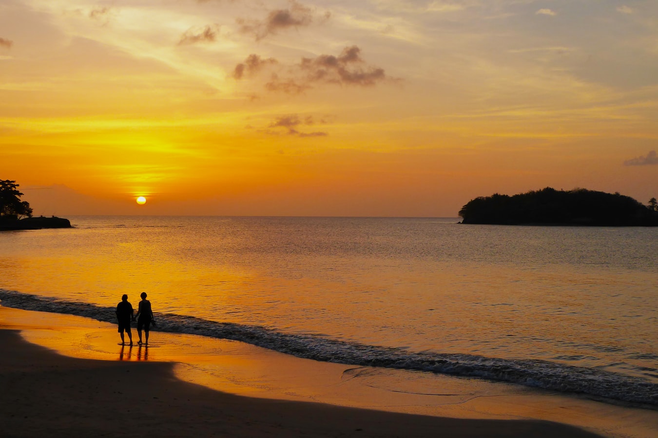
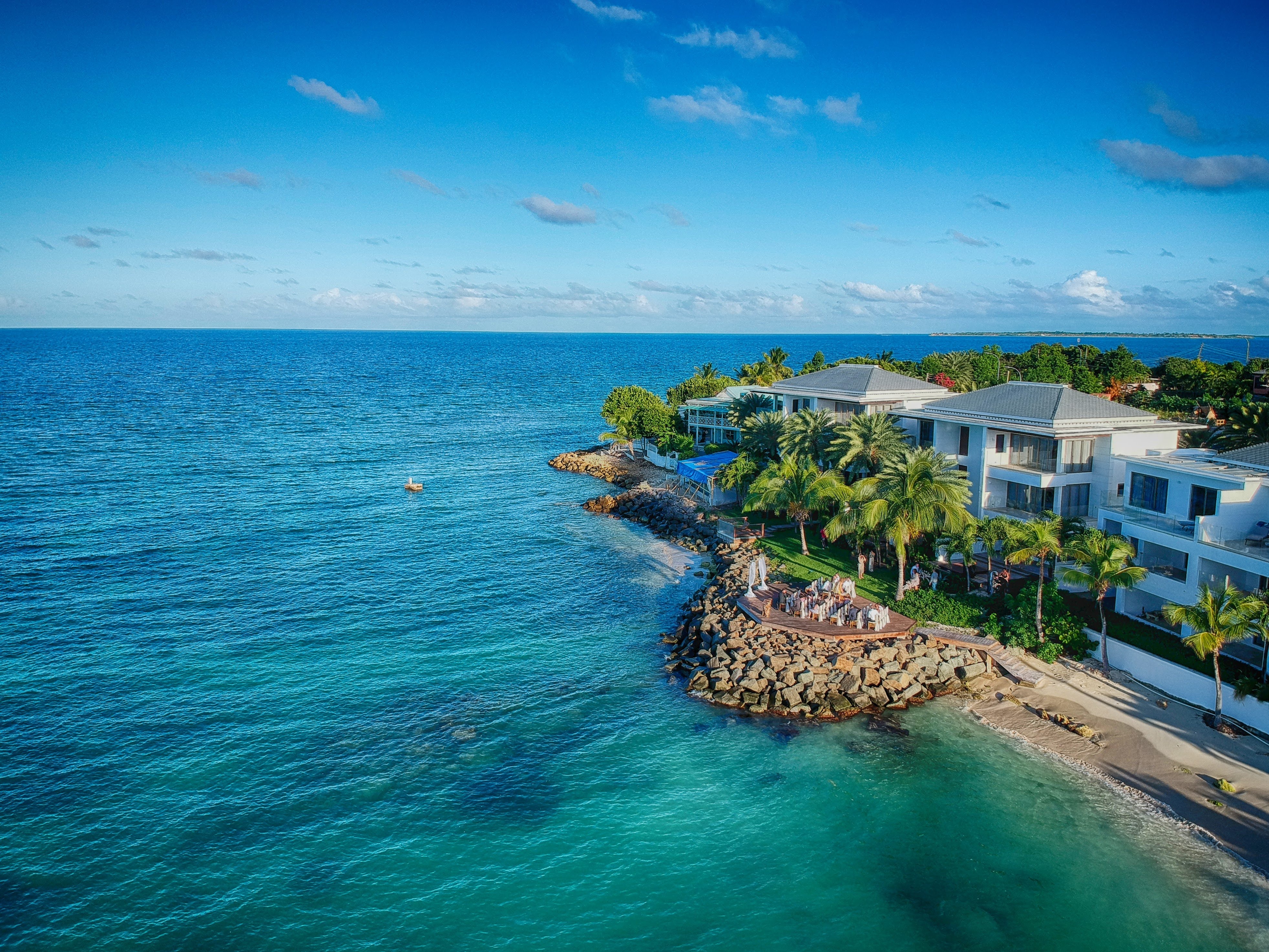
About Bridgetown
Located beside the island’s only natural harbour, the capital of Barbados combines modern and colonial architecture with glorious palm tree-lined beaches and a number of historical attractions. Experience the relaxed culture of the city renowned for its British-style parliament buildings and vibrant beach life, and seek out the Anglican church and the 19th-century Barbados Garrison. The distance between the ship and your tour vehicle may vary. This distance is not included in the excursion grades.
About Castries
The typical image of a lush tropical paradise comes to life on the friendly island of St Lucia. Despite its small size – just 27 miles long and 14 miles wide – St Lucia is rich in natural splendour with dense emerald rainforest, banana plantations and orchards of coconut, mango and papaya trees. The twin peaks of Les Pitons, now a UNESCO World Heritage Site rise dramatically 2,000 feet into the sky and dominate the island. Look out for unusual birds with brilliant plumage such as the St Lucia parrot, see a surprising diversity of exotic flora and enjoy the warm hospitality of the islanders in the small villages and open-air markets. Please be aware that St Lucia is a small, mountainous island, with steep, winding and bumpy roads. Customers with back and neck problems should take this into consideration when booking an excursion.
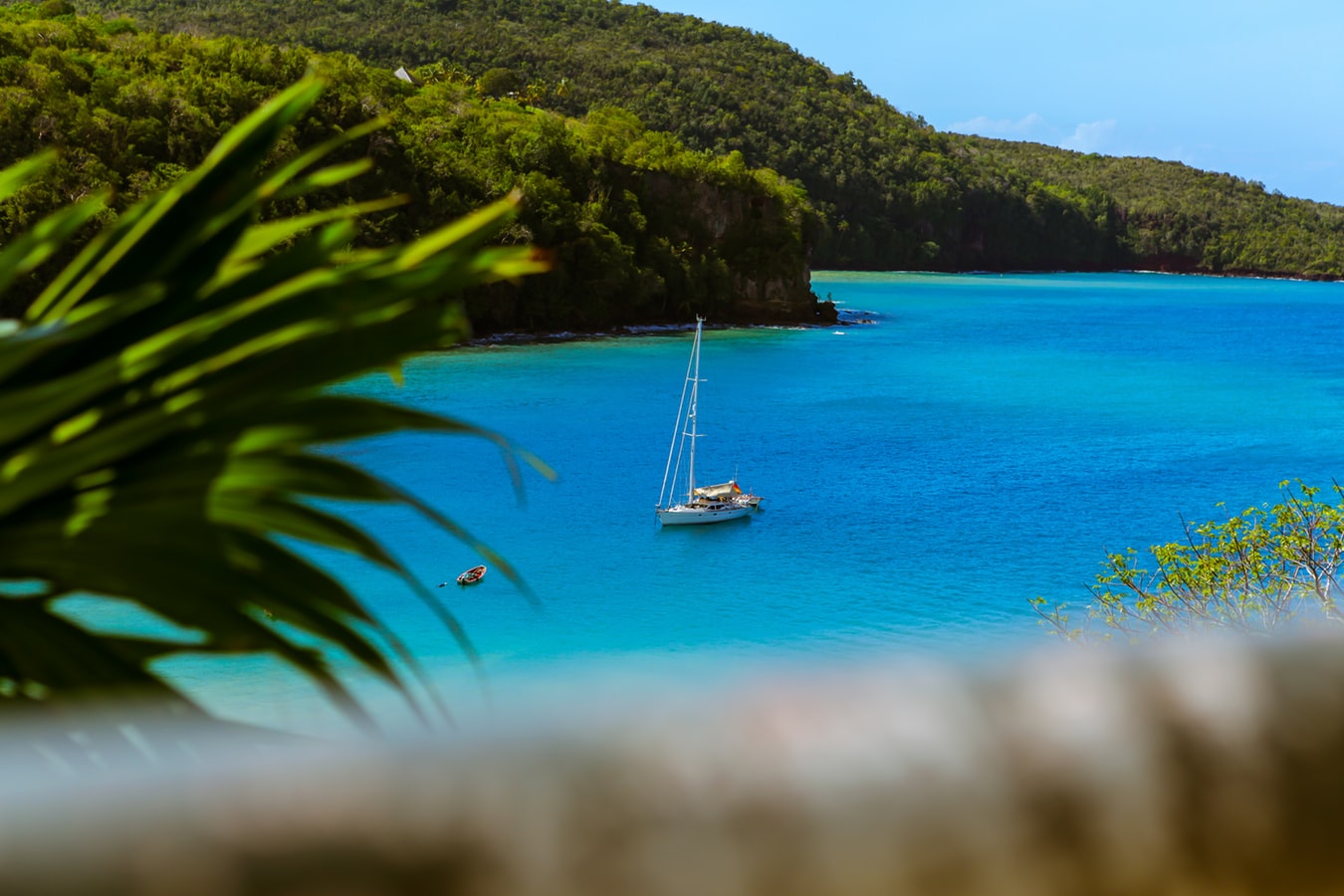
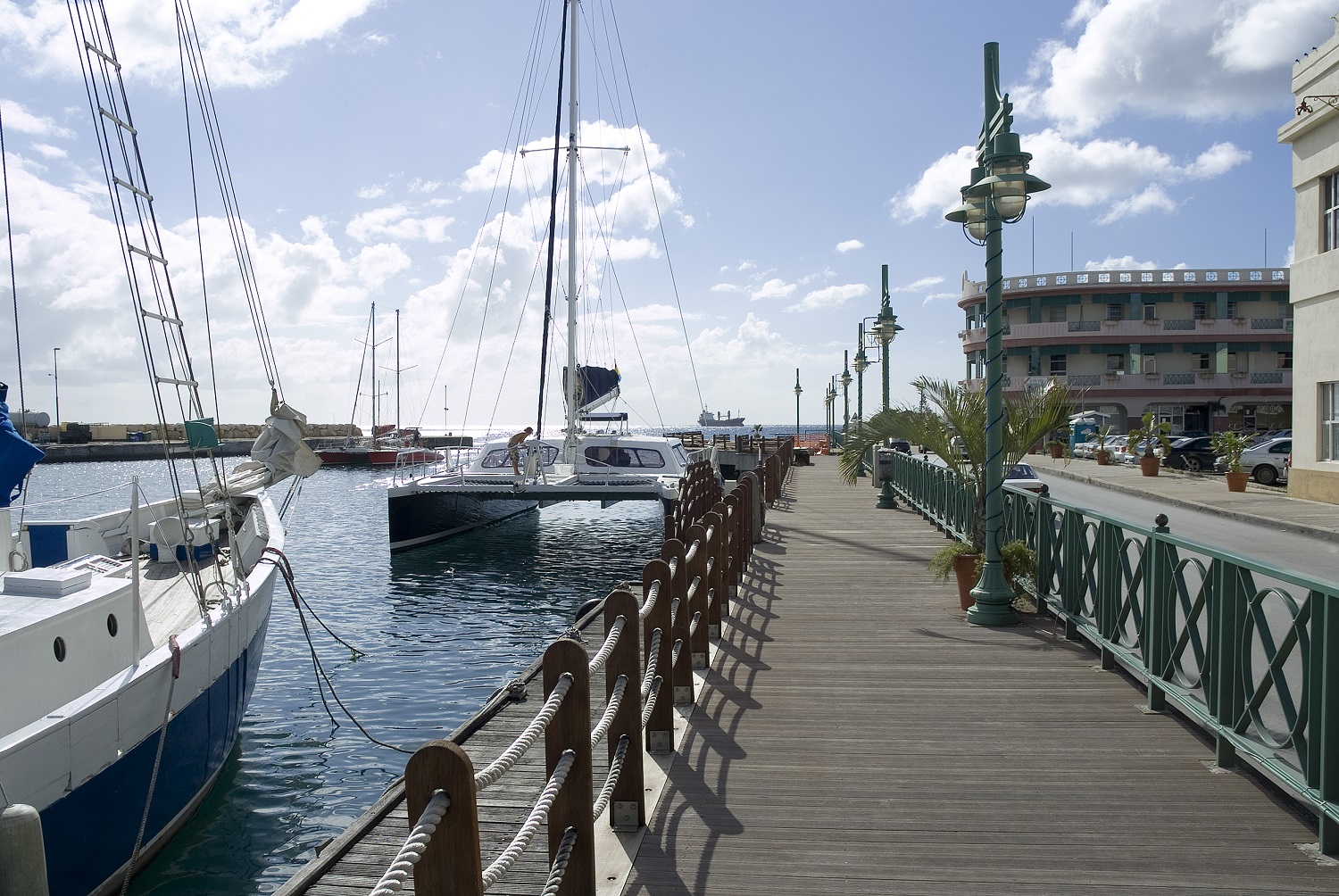
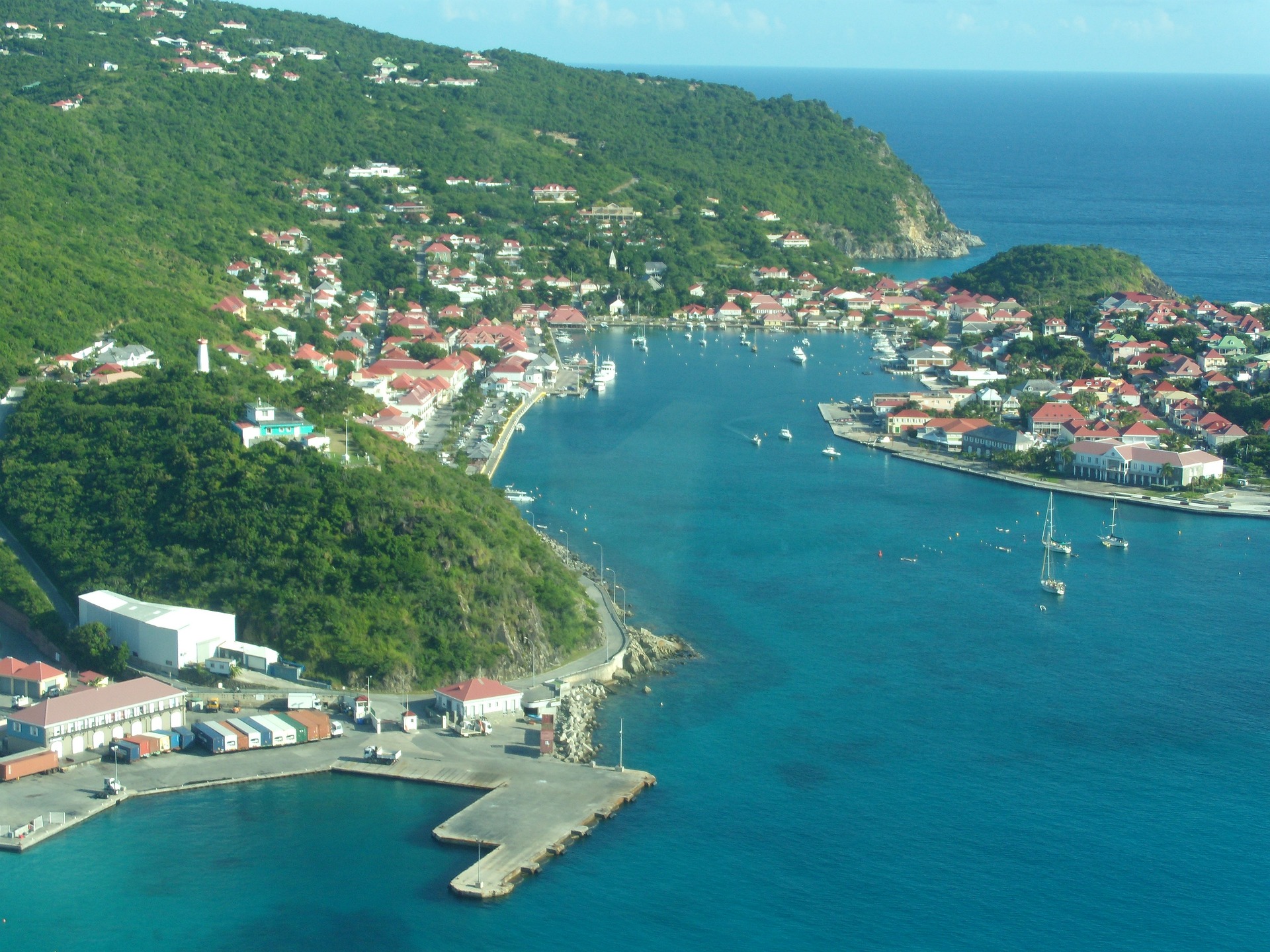
About Gustavia
You can easily explore all of Gustavia during a two-hour stroll. Some shops close from noon to 3 or 4, so plan lunch accordingly, but stores stay open past 7 in the evening. Parking in Gustavia is a challenge, especially during vacation times. A good spot to park is rue de la République, alongside the catamarans, yachts, and sailboats.
About Saint John Island
St. John, the smallest most idyllic of the three United States Virgin Islands, is best known for its dozens of post card perfect white sand beaches, turquoise bays abounding in colourful corals & rainbows of tropical fish endless vistas of green velvet hills. Only nine miles long (14.5 kilometres) and three miles (4.8 kilometres) wide, two thirds of the island is the Virgin Islands National Park, so its spectacular beaches & untouched forests will remain that way for generations to come and remain accessible to all. There are tours of the National Park by Jeep or safari bus and hikes on spectacular trails led by Park Rangers who enrich the experience with talks on the island's history and geology as well as its flora & fauna. While it is only twenty minutes from St. Thomas by convenient hourly ferry, St. John is the peaceful, uncommercialised paradise of island fantasies. It has no high-rise buildings, cruise ship docks or airport. Visitors can obtain discounted air fares to St. Thomas. Despite its unspoiled atmosphere, it offers every facility and amenity found at major resorts.
About Saint John's
With its superb beaches, historical attractions and beautiful coral reefs, Antigua provides a host of diversions. It is said that the island contains 365 beaches, one for every day of the year. Antigua maintains its traditional West Indian character, with gingerbread-house style architecture, calypso music and carnival festivities. St John’s has been the administrative capital since the island’s colonisation in 1632, and has been the seat of government since it gained independence in 1981. From the port you can explore the colourful Redcliffe district, with its restored wooden houses, and Heritage Quay with its shopping mall and craft shops. The city has some fine examples of Colonial architecture, including the twin-towered cathedral, built in 1845 and considered one of the finest church buildings in the Caribbean. All coaches in Antigua are operated by smaller vehicles, and commentary will be given by a driver/guide.
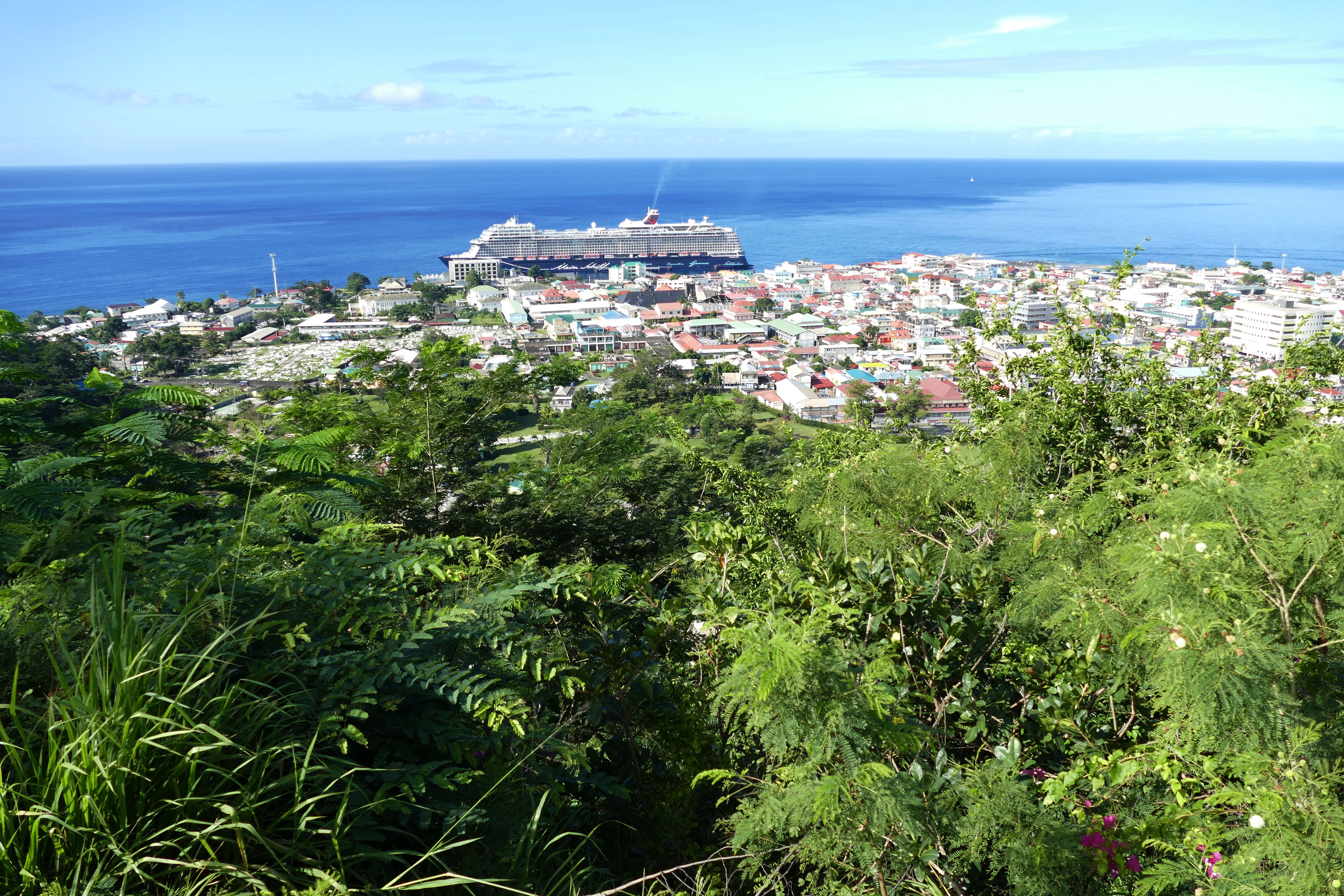
About Roseau
Although it's one of the smallest capitals in the Caribbean, Roseau has the highest concentration of inhabitants of any town in the eastern Caribbean. Caribbean vernacular architecture and a bustling marketplace transport visitors back in time. Although you can walk the entire town in about an hour, you'll get a much better feel for the place on a leisurely stroll. For some years now, the Society for Historical Architectural Preservation and Enhancement (SHAPE) has organized programs and projects to preserve the city's architectural heritage. Several interesting buildings have already been restored. Lilac House, on Kennedy Avenue, has three types of gingerbread fretwork, latticed verandah railings, and heavy hurricane shutters. The J.W. Edwards Building, at the corner of Old and King George V sreets, has a stone base and a wooden second-floor gallery. The Old Market Plaza is the center of Roseau's historic district, which was laid out by the French on a radial plan rather than a grid, so streets such as Hanover, King George V, and Old radiate from this area. South of the marketplace is the Fort Young Hotel, built as a British fort in the 18th century; the nearby statehouse, public library, and Anglican cathedral are also worth a visit. New developments at the bay front on Dame M.E. Charles Boulevard have brightened up the waterfront.
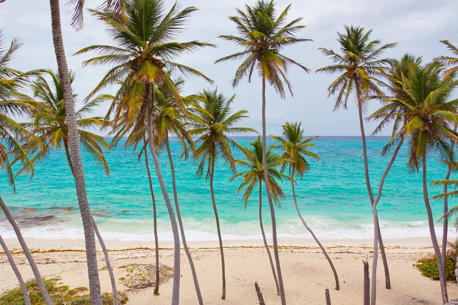
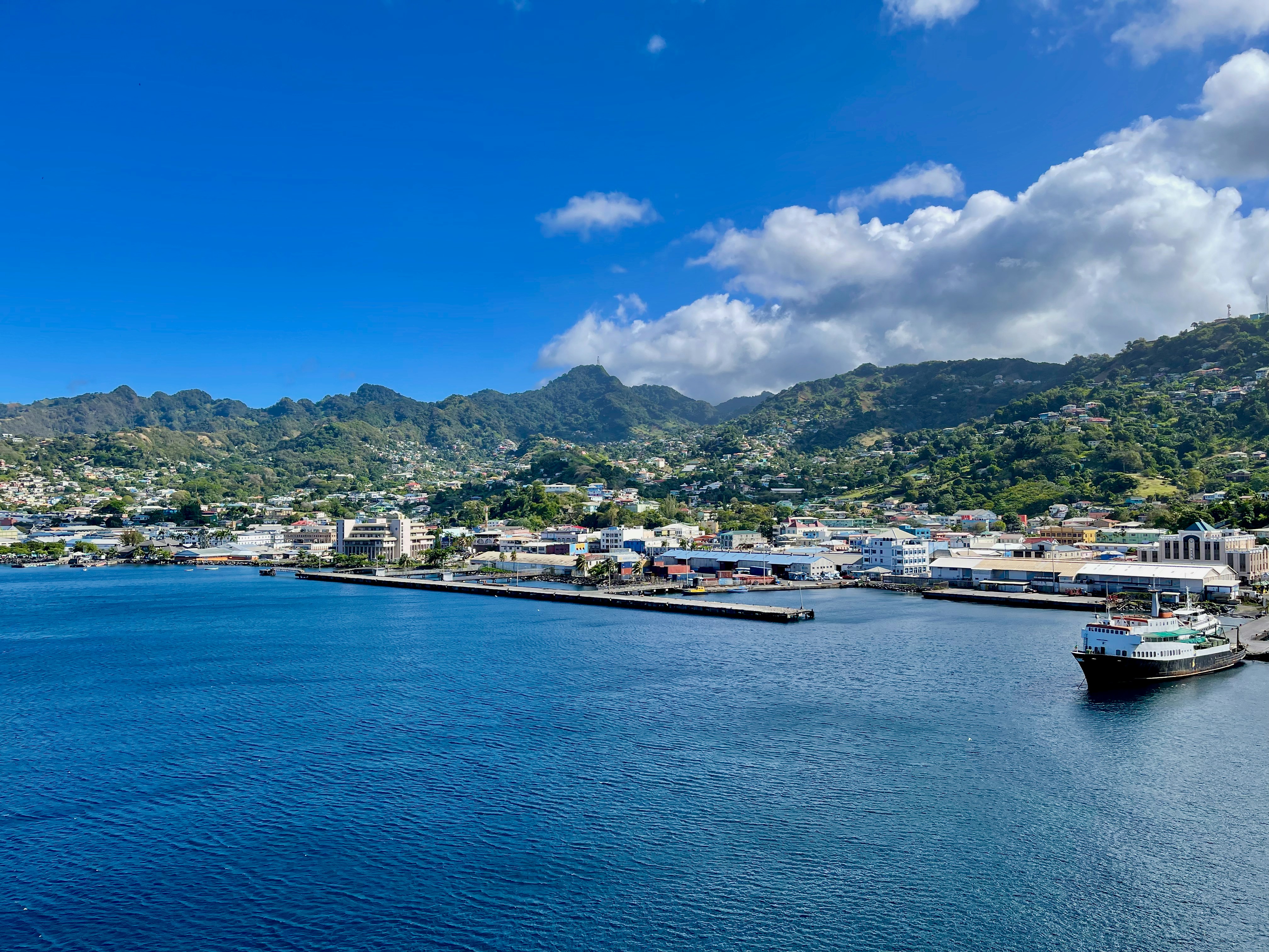
About Port Elizabeth, Bequia
Bequia is a Carib word meaning "island of the cloud." Hilly and green with several golden-sand beaches, Bequia is 9 miles (14½ km) south of St. Vincent's southwestern shore; with a population of 5,000, it's the largest of the Grenadines. Although boatbuilding, whaling, and fishing have been the predominant industries here for generations, sailing has now become almost synonymous with Bequia. Admiralty Bay is a favored anchorage for both privately owned and chartered yachts. Lodgings range from comfortable resorts and villas to cozy West Indian—style inns. Bequia's airport and the frequent ferry service from St. Vincent make this a favorite destination for day-trippers, as well. The ferry docks in Port Elizabeth, a tiny town with waterfront bars, restaurants, and shops where you can buy handmade souvenirs—including the exquisitely detailed model sailboats that are a famous Bequia export. The Easter Regatta is held during the four-day Easter weekend, when revelers gather to watch boat races and celebrate the island's seafaring traditions with food, music, dancing, and competitive games.To see the views, villages, beaches, and boatbuilding sites around Bequia, hire a taxi at the jetty in Port Elizabeth. Several usually line up under the almond trees to meet each ferry from St. Vincent.
About Bridgetown
Located beside the island’s only natural harbour, the capital of Barbados combines modern and colonial architecture with glorious palm tree-lined beaches and a number of historical attractions. Experience the relaxed culture of the city renowned for its British-style parliament buildings and vibrant beach life, and seek out the Anglican church and the 19th-century Barbados Garrison. The distance between the ship and your tour vehicle may vary. This distance is not included in the excursion grades.
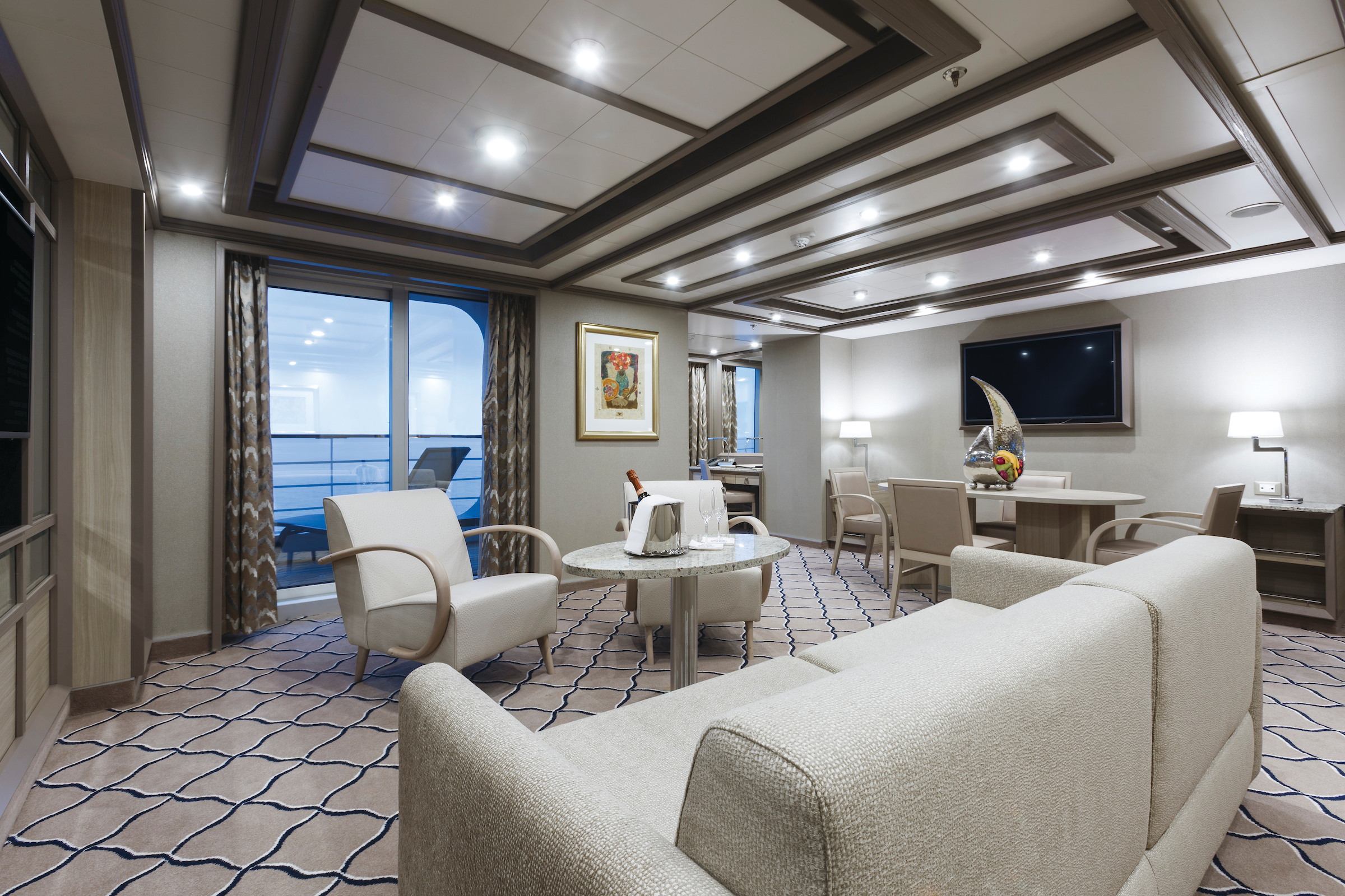
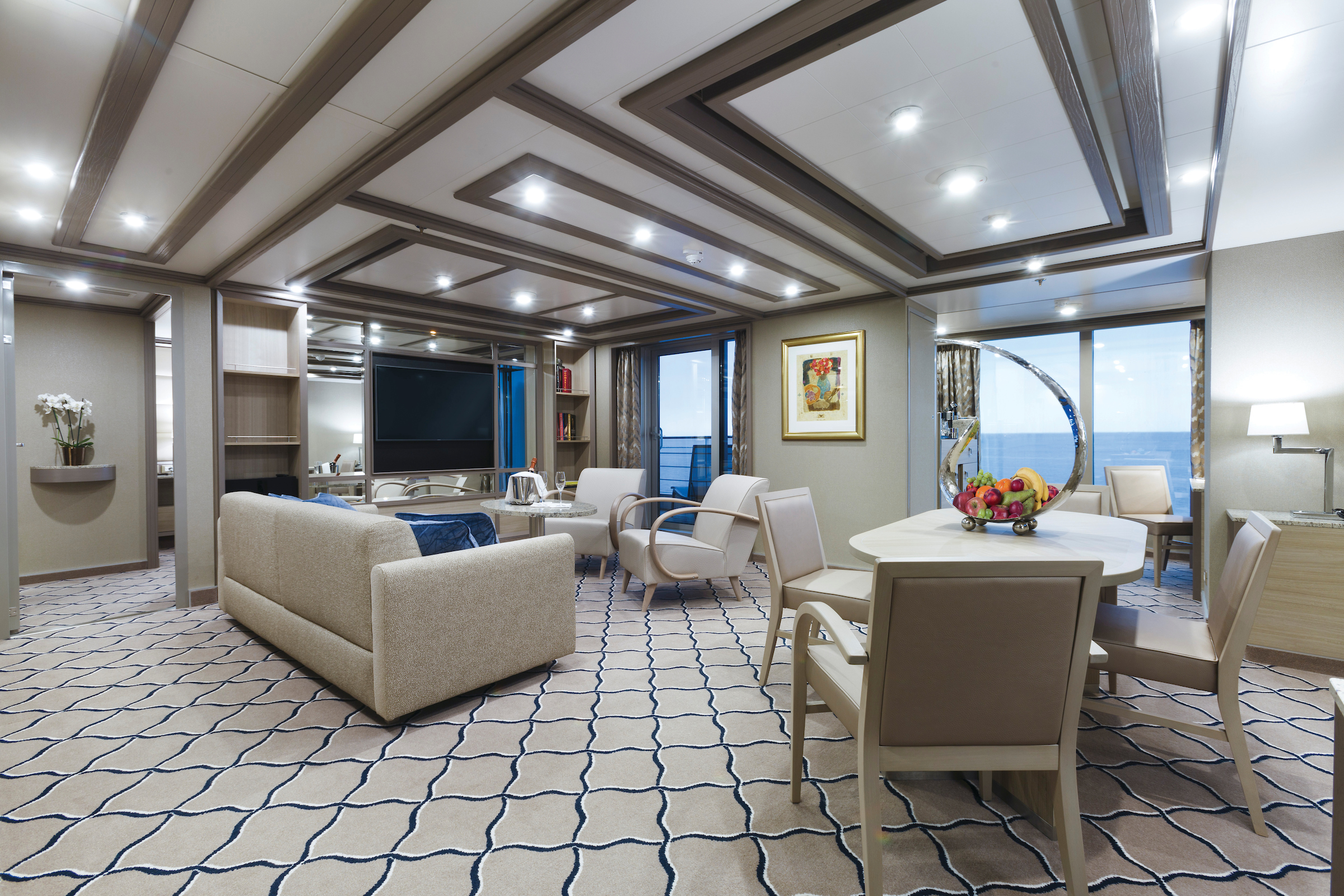
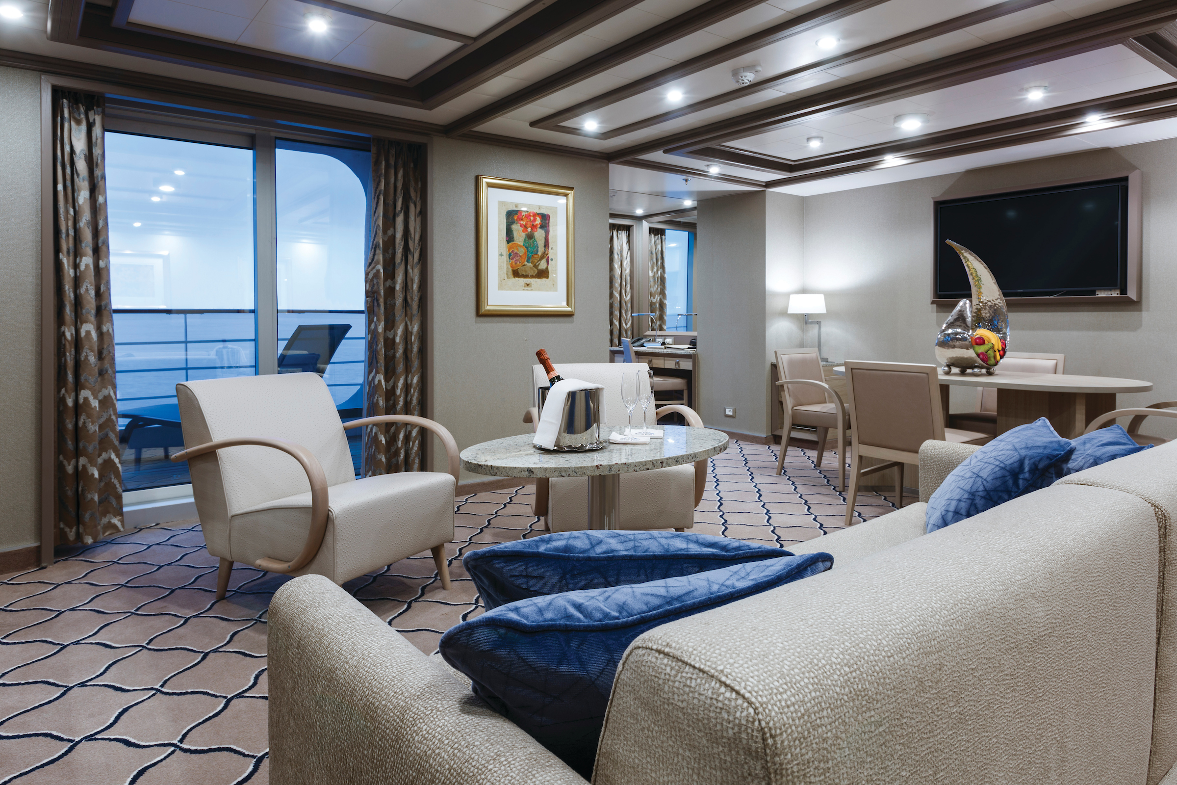
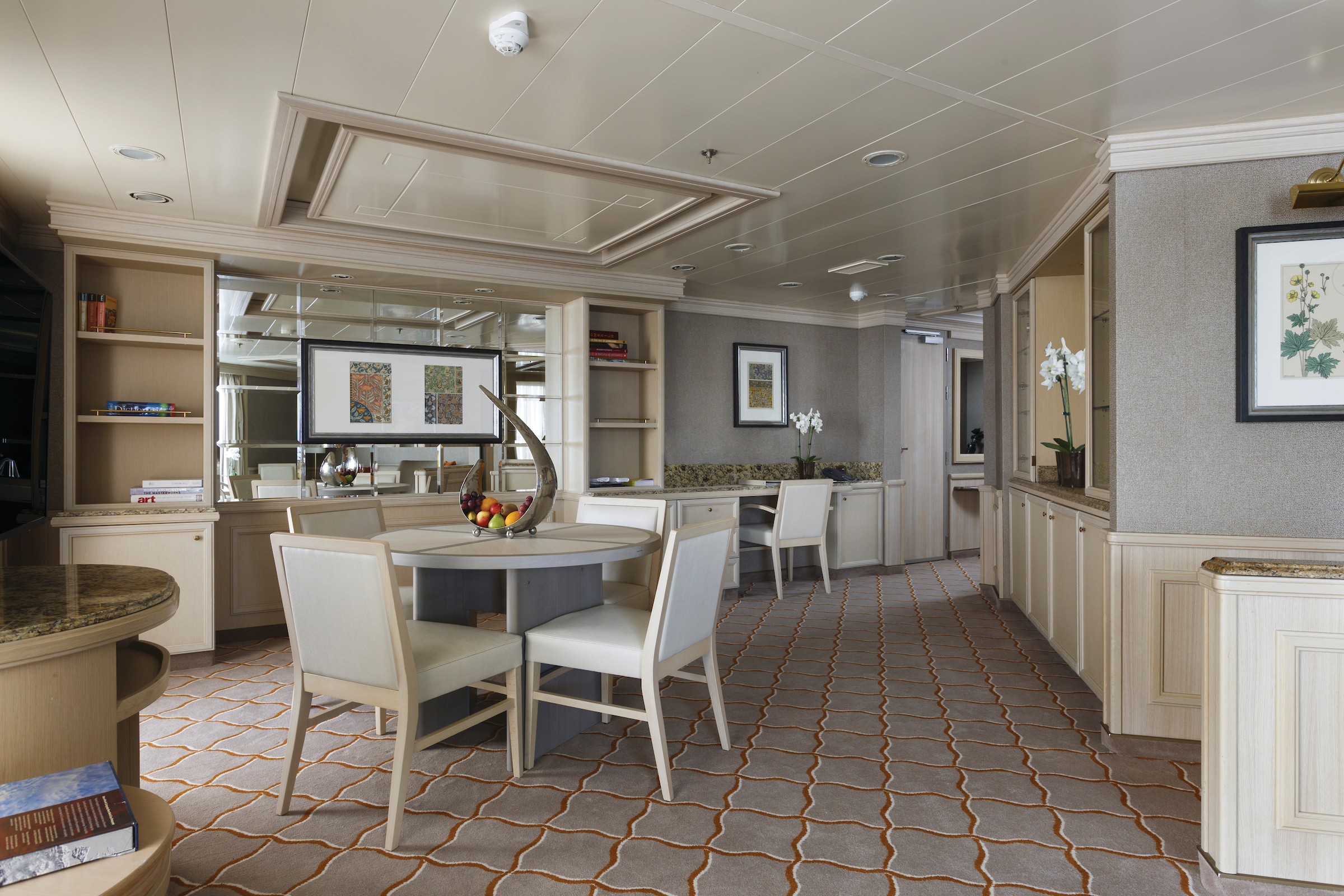
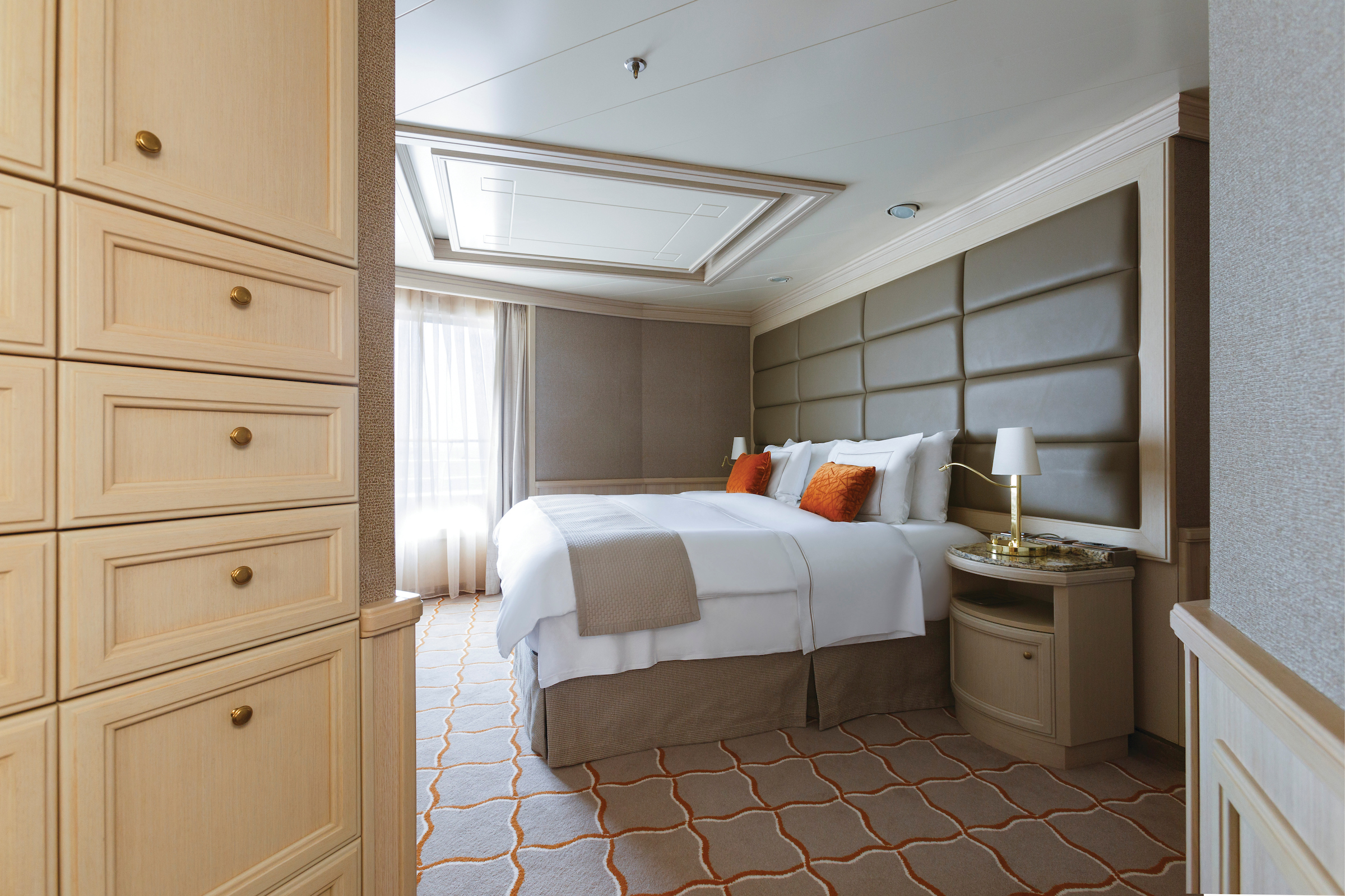
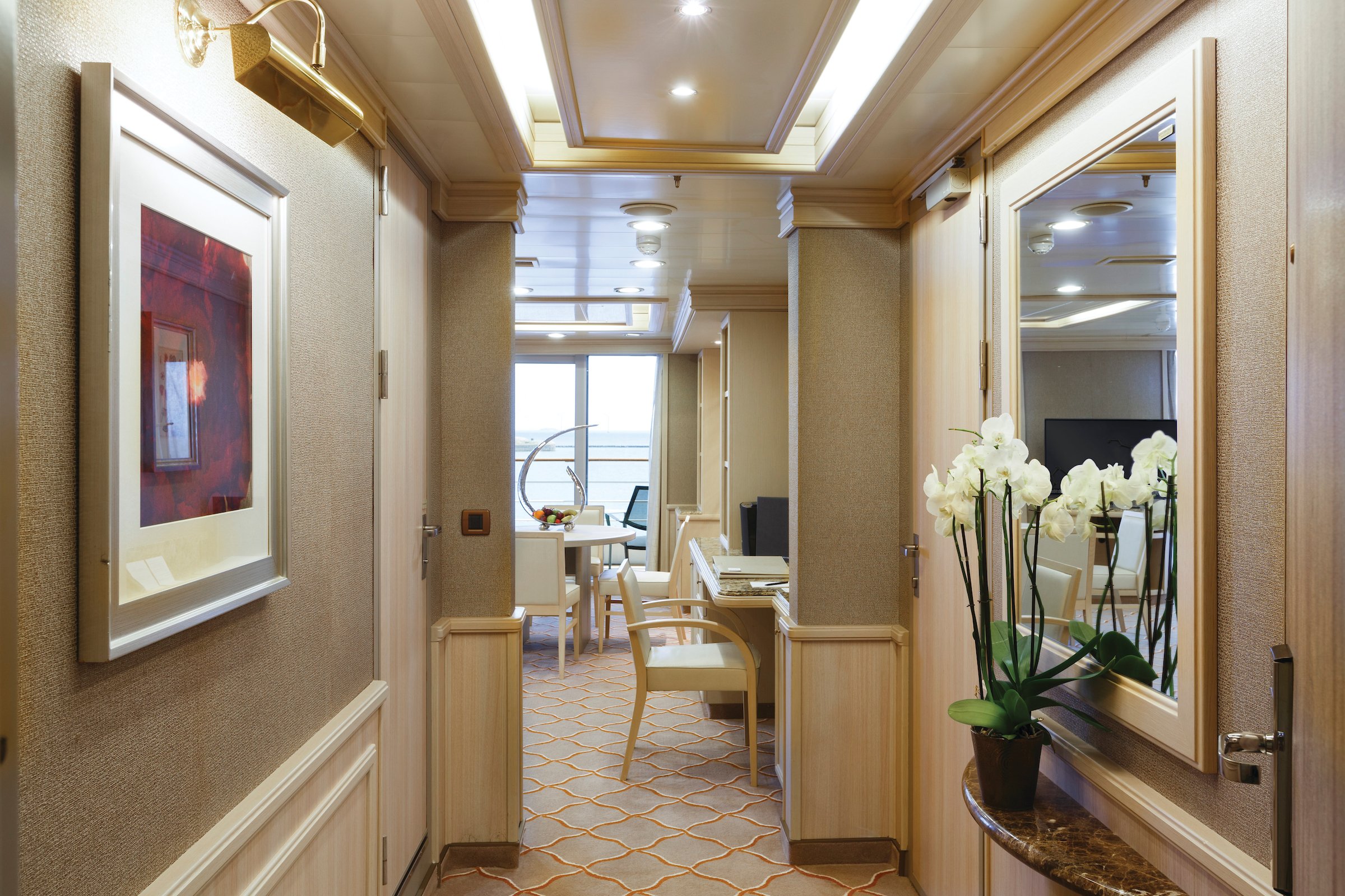
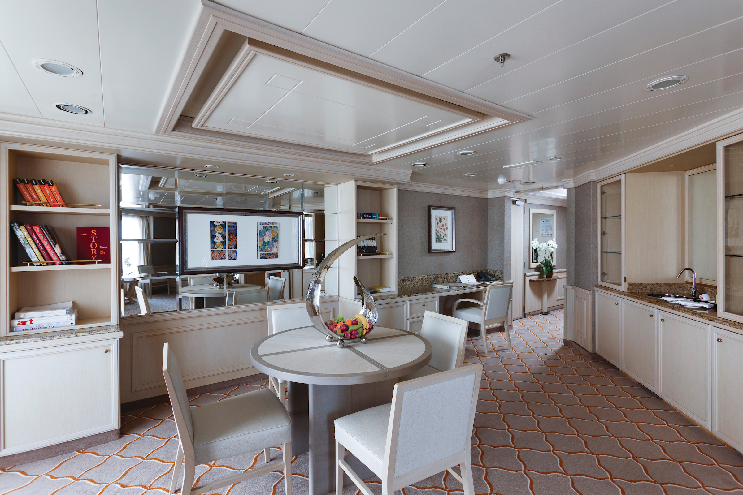
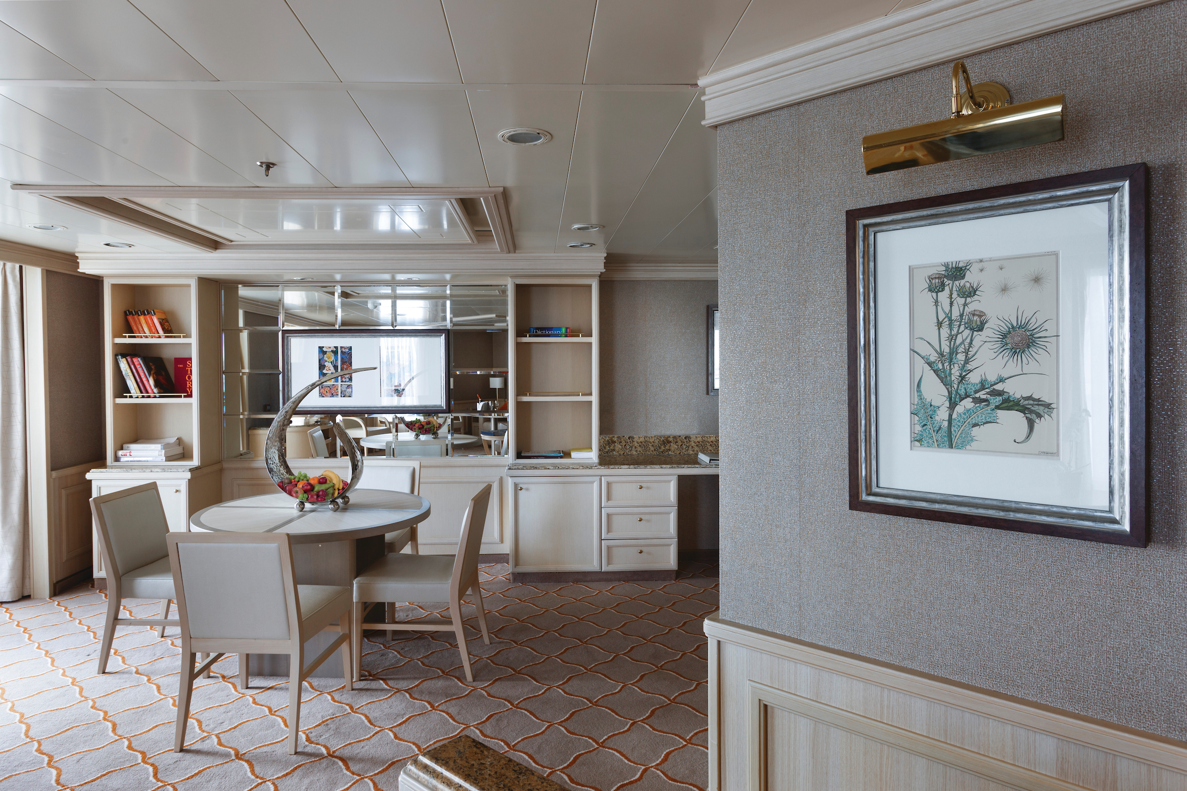
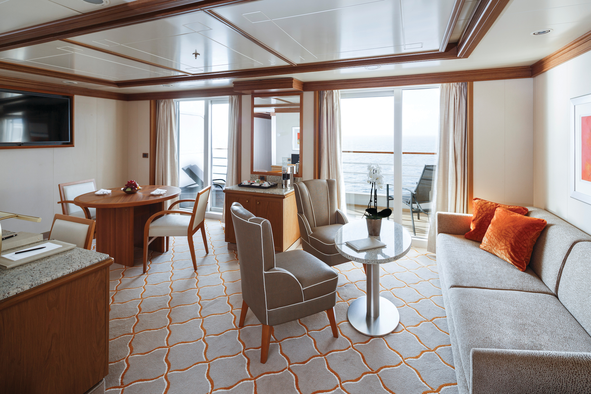
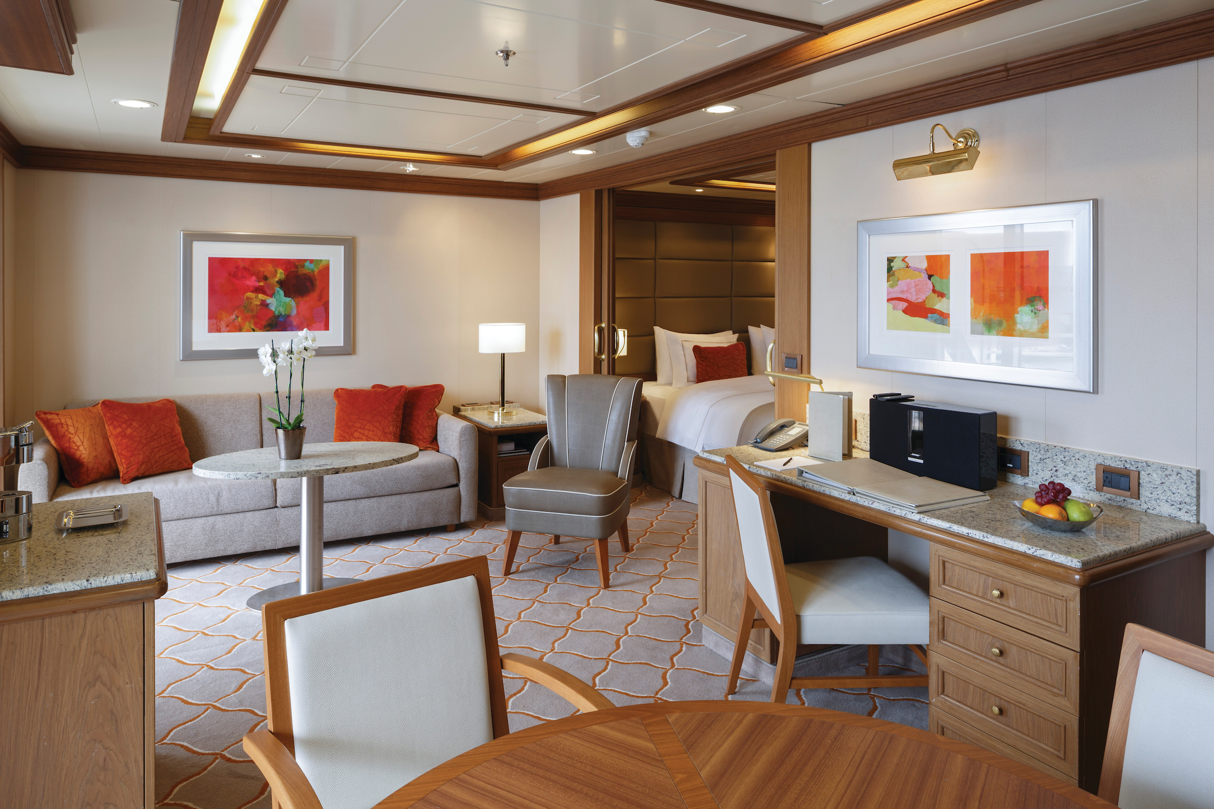
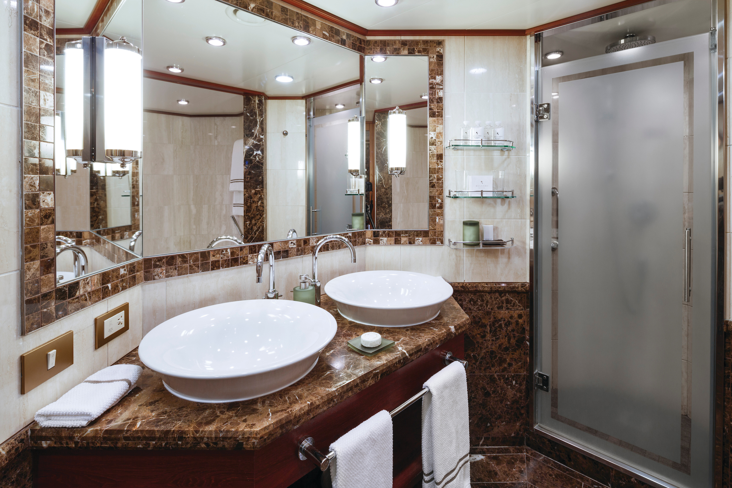
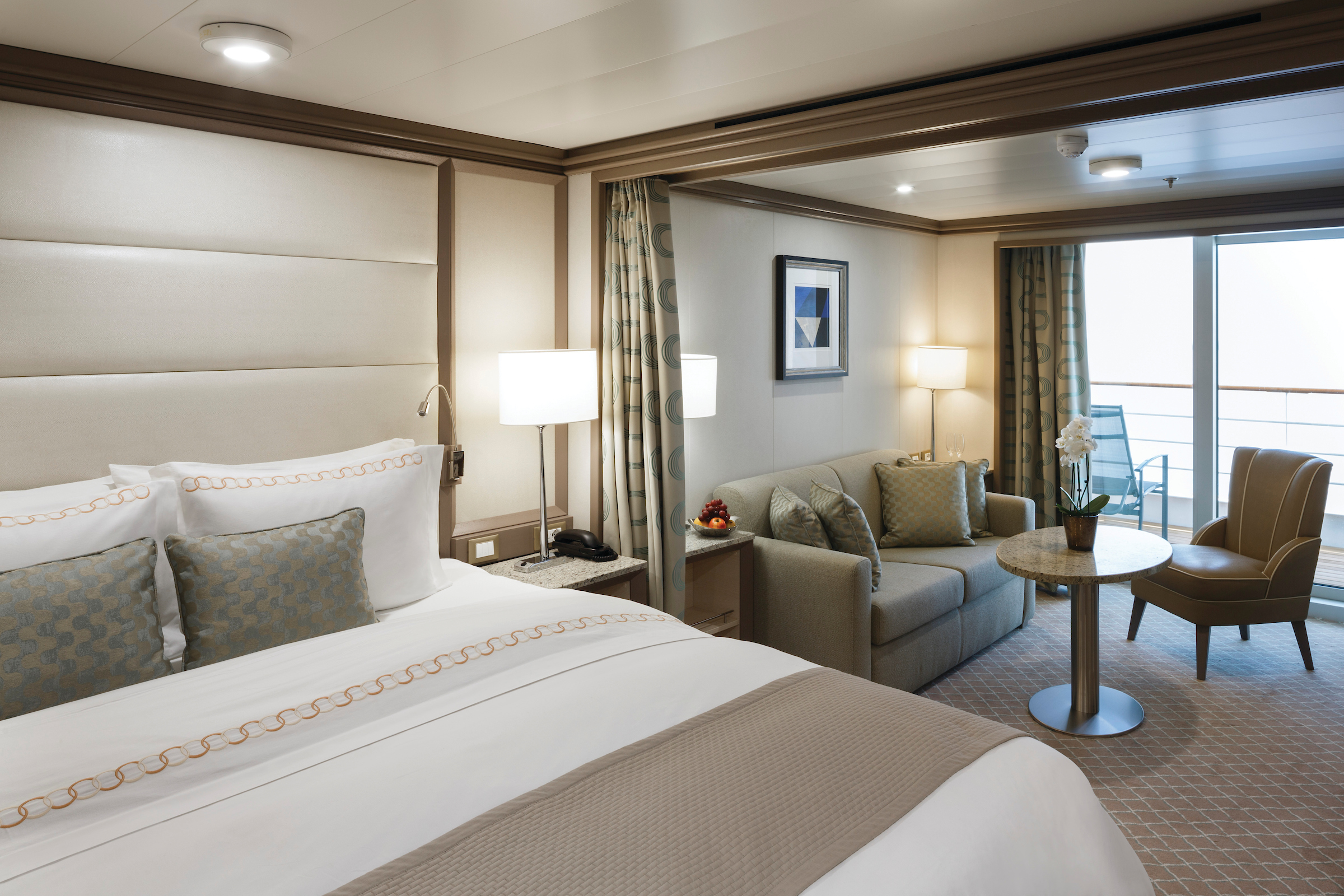
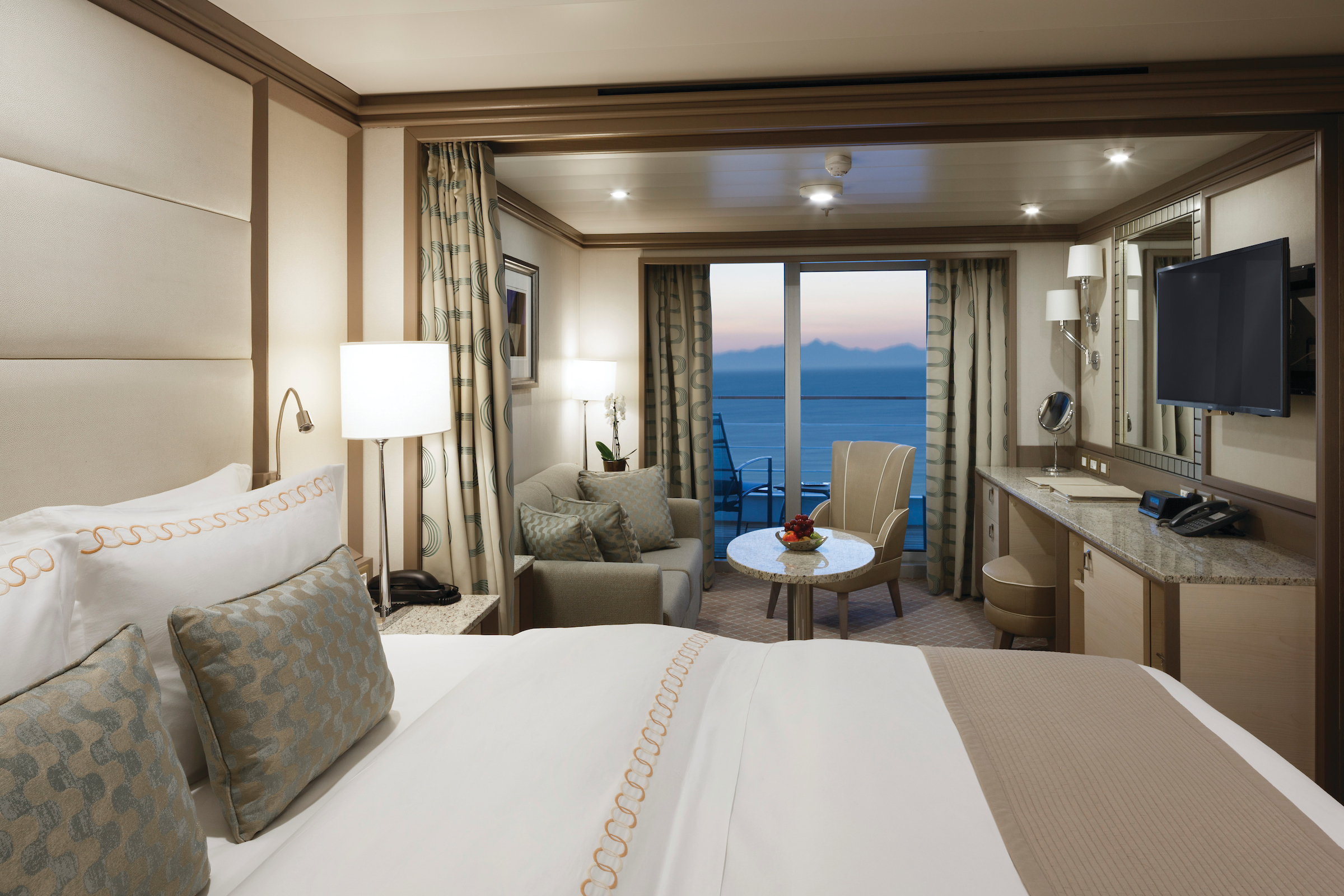
The name Owner’s Suite says it all. A stylish apartment. Prestigious and classic. For those who seek the superlative level of space, comfort, and service on board. Available as a one-bedroom configuration or as two bedrooms by adjoining with the Panorama Suite.
One bedroom: 120 sq m including veranda (12 sq m)
Two bedrooms: 114 sq m including veranda (12 sq m)
Please note that the 3rd guest will sleep on a comfortable sofa bed in the reception area of the suite.
Essentials
- Deck(s): 8
- Section: Mid-Ship
Characteristics
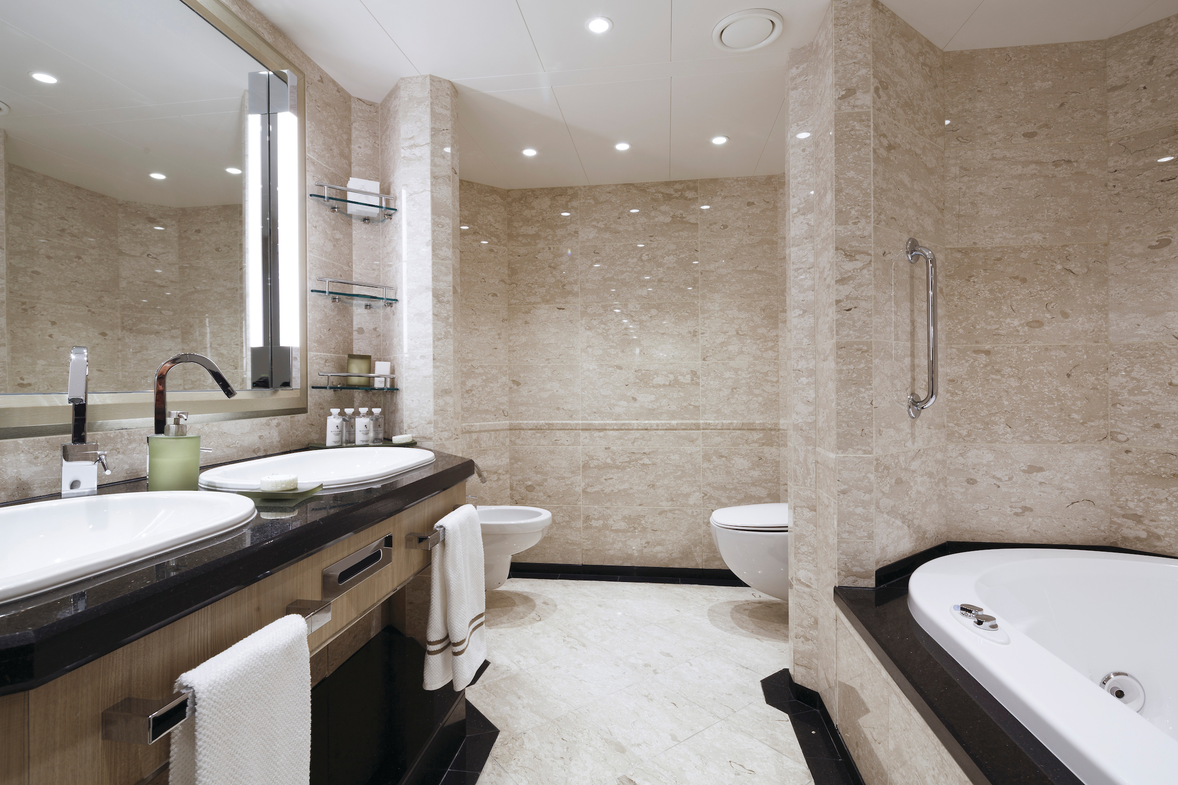
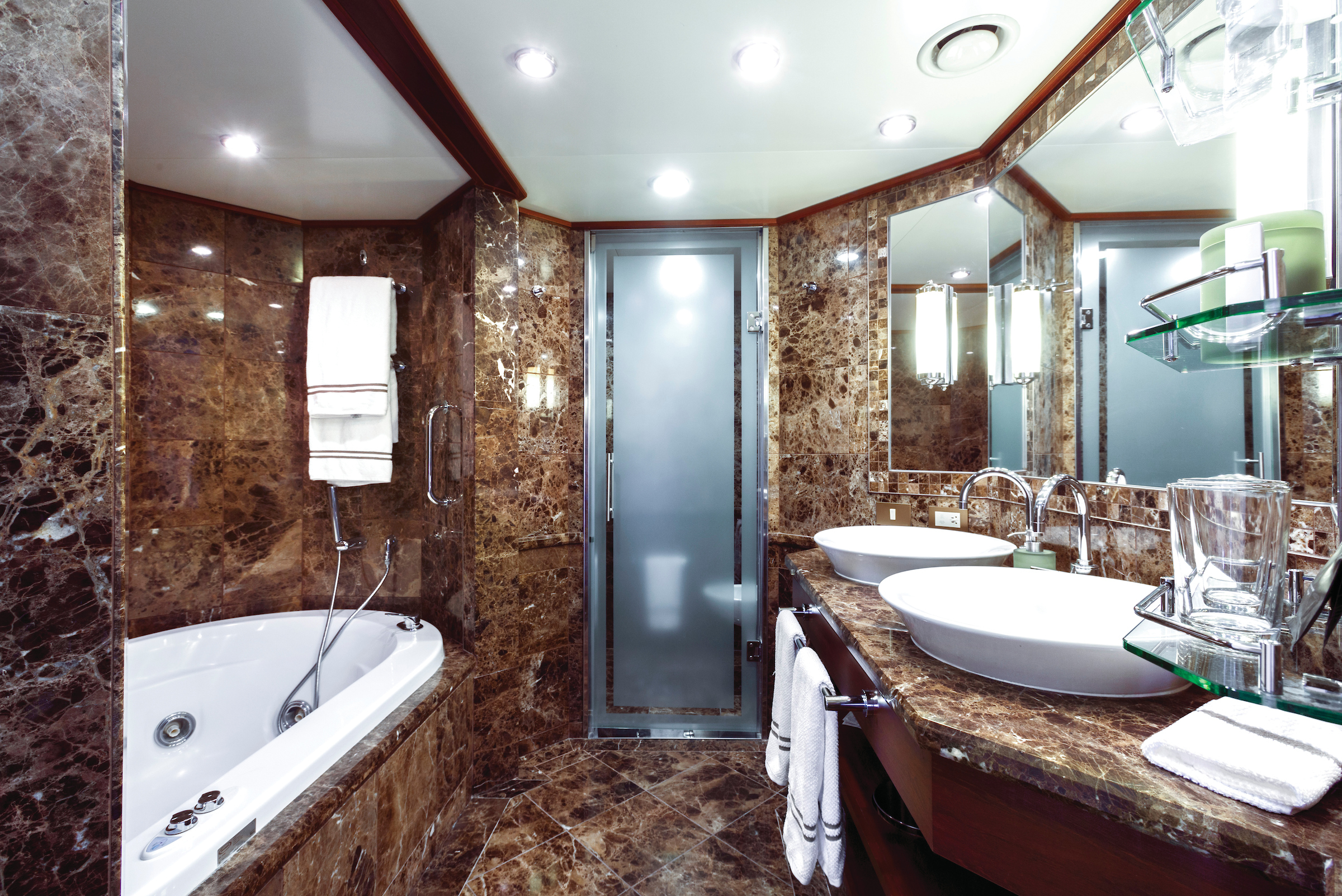
- Veranda
- Separate dining area
- Living room with sitting area
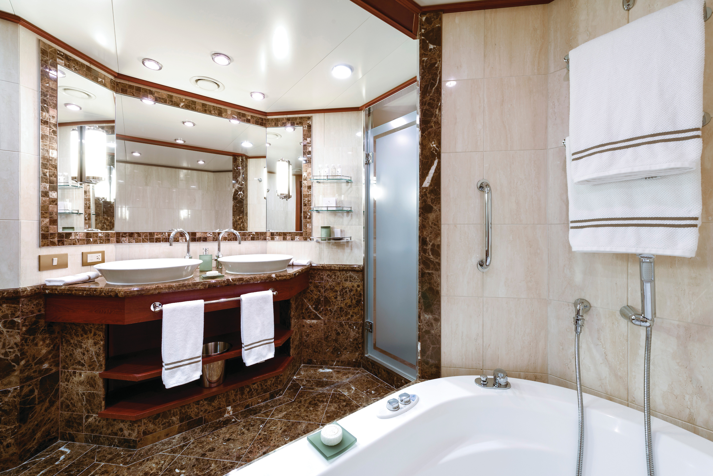
- Double vanity
- Separate shower
- Whirlpool bath
- Walk-in wardrobe with personal safe
Furniture
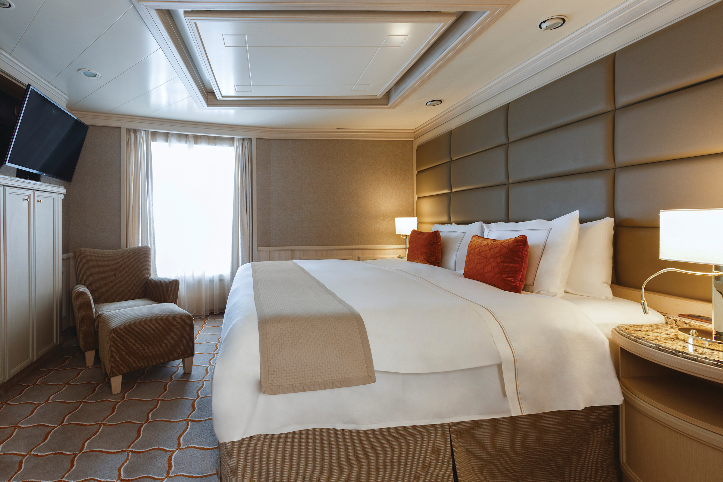
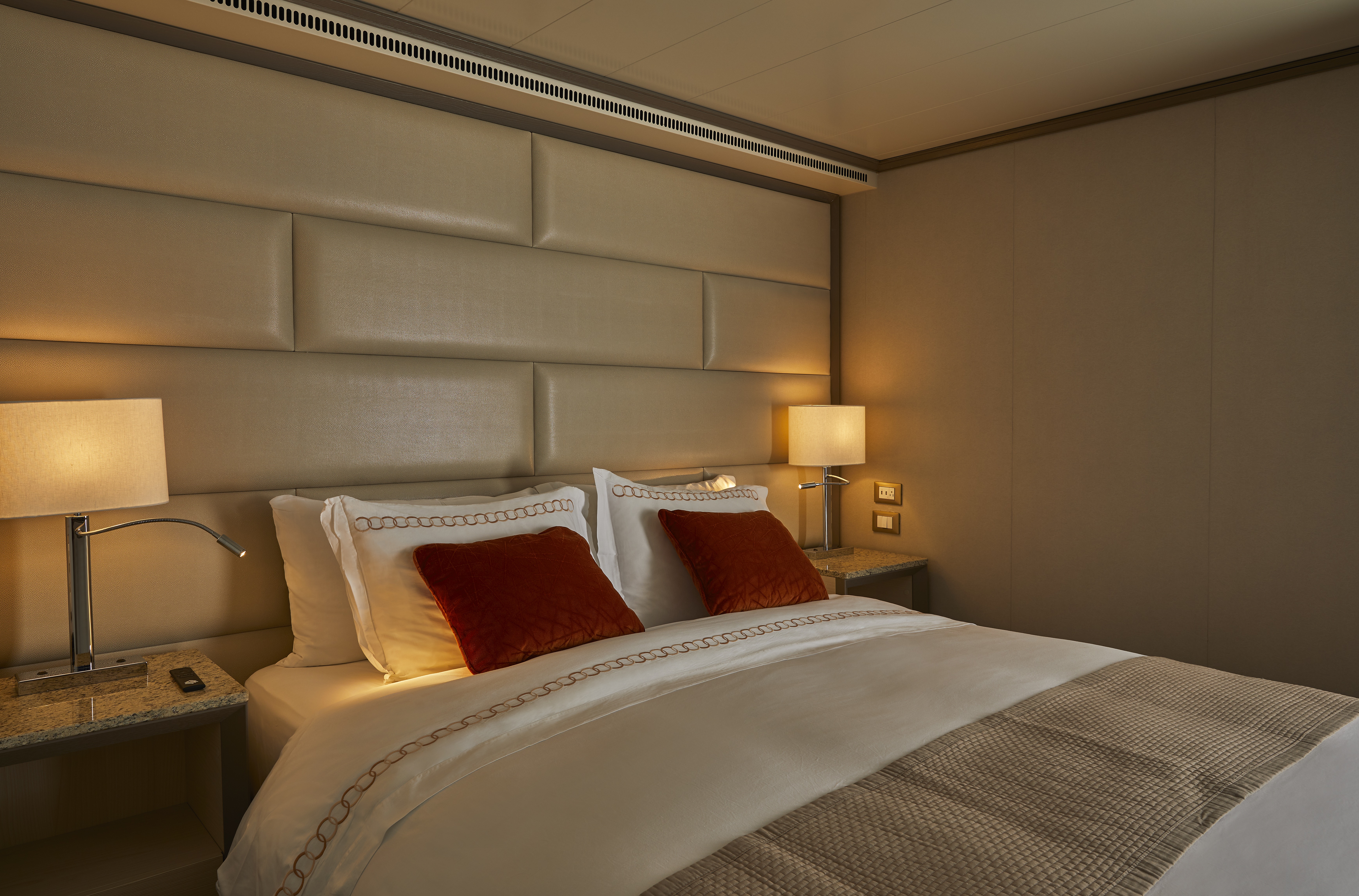
- King size bed
- Writing desk
- Vanity table
- Luxury bed mattresses
Media & Communication
- Unlimited Premium Wi-Fi
- 2 large flat screen TVs with Interactive Media Library
- Sound system with bluetooth connectivity
- Direct dial telephone
- Wall mounted USB-C mobile device chargers
- Dual voltage 110/220 outlets
Onboard Services
- Butler service
- Complimentary laundry, pressing & wet cleaning
- Dinner for two in La Dame, one evening per voyage,
- Two hours of worldwide phone use, per voyage segment
- Champagne on arrival
Amenities
- Espresso machine
- Pillow menu
- Refrigerator and bar setup stocked with your preferences
- Plush bathrobe
- Luxury bath amenities
- Umbrella
- Hair Dryer
- Slippers
Expertly designed and exquisitely appointed. Ideal for entertaining friends while you cruise or enjoying a quiet dinner “at home.” Available as a one-bedroom configuration or as two bedrooms by adjoining with a Veranda Suite.
One bedroom: 132–142 sq m including veranda (52–62 sq m)
Two bedrooms: 175 sq m including veranda (55–65 sq m)
Please note that the third guest will sleep on a comfortable sofa bed in the reception area of the suite.
Essentials
- Deck(s): 8, 9
- Section: Forward
Characteristics
- Veranda
- Separate dining area
- Living room with sitting area
- Double vanity
- Separate shower
- Whirlpool bath
- Walk-in wardrobe with personal safe
Furniture
- King size bed
- Writing desk
- Vanity table
- Luxury bed mattresses
Media & Communication
- Unlimited Premium Wi-Fi
- 2 large flat screen TVs with Interactive Media Library
- Sound system with bluetooth connectivity
- Direct dial telephone
- Wall mounted USB-C mobile device chargers
- Dual voltage 110/220 outlets
Onboard Services
- Butler service
- Complimentary laundry, pressing & wet cleaning
- Dinner for two in La Dame, one evening per voyage,
- Two hours of worldwide phone use, per voyage segment
- Champagne on arrival
Amenities
- Espresso machine
- Pillow menu
- Refrigerator and bar setup stocked with your preferences
- Plush bathrobe
- Luxury bath amenities
- Umbrella
- Hair Dryer
- Slippers
Stately describes the Royal Suite. Commanding and majestic. Perfect for entertaining. Enough living space to roam. The pinnacle of good living. Available as a one-bedroom configuration or as two bedrooms by adjoining with a Veranda Suite.
One bedroom: 92 sq m including veranda (12 sq ft)
Two bedrooms: 127 sq m including veranda (18 sq m)
Please note that the third guest will sleep on a comfortable sofa bed in the reception area of the suite.
Essentials
- Deck(s): 7
- Section: Forward
Characteristics
- Veranda
- Separate dining area
- Living room with sitting area
- Double vanity
- Separate shower
- Whirlpool bath
- Walk-in wardrobe with personal safe
Furniture
- King size bed
- Writing desk
- Vanity table
- Luxury bed mattresses
Media & Communication
- Unlimited Premium Wi-Fi
- 2 large flat screen TVs with Interactive Media Library
- Sound system with bluetooth connectivity
- Direct dial telephone
- Wall mounted USB-C mobile device chargers
- Dual voltage 110/220 outlets
Onboard Services
- Butler service
- Complimentary laundry, pressing & wet cleaning
- Dinner for two in La Dame, one evening per voyage,
- Two hours of worldwide phone use, per voyage segment
- Champagne on arrival
Amenities
- Espresso machine
- Pillow menu
- Refrigerator and bar setup stocked with your preferences
- Plush bathrobe
- Luxury bath amenities
- Umbrella
- Hair Dryer
- Slippers
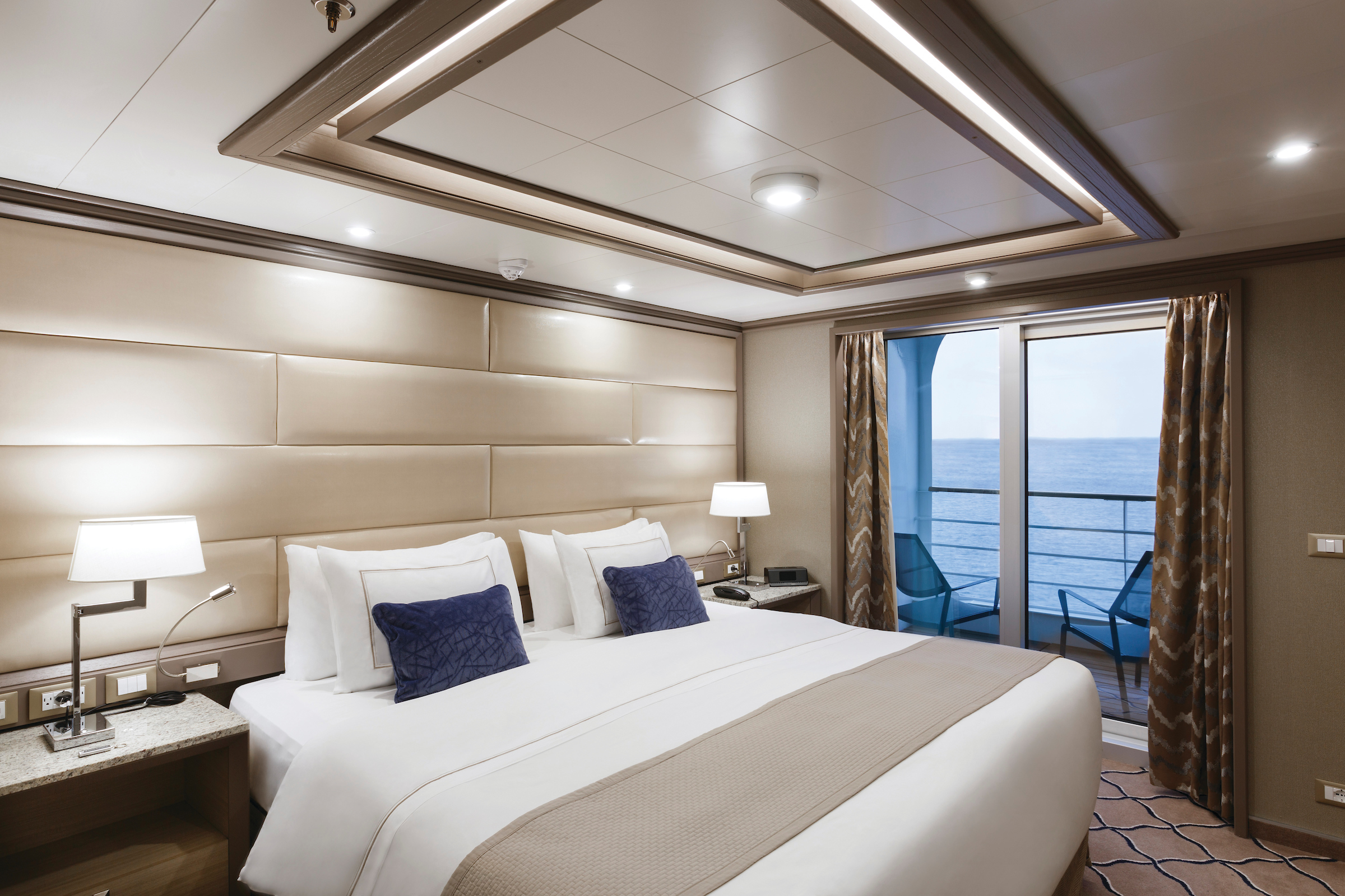
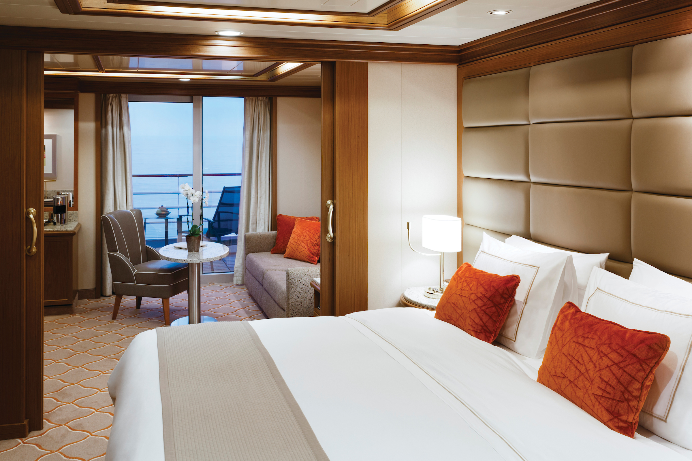
Step onto your terrace and bask in the calm feeling of the ocean breeze. Dissolve into the comfort of your king-size bed. Prepare for the evening in the beautiful marble bathroom. The upper deck location gives the most spectacular of ocean views while the spacious living area allows for comfortable relaxing, where cozy nights in become veritable experiences in themselves. The two-bedroom configuration of this suite makes this the ideal option for families.
One bedroom: 69 sq m including veranda (12 sq ft)
Please note that the 3rd guest will sleep on a comfortable sofa bed in the reception area of the suite.
Two bedrooms: 100 sq m including veranda (12 sq ft)
Essentials
- Deck(s): 8, 10, 11
- Section: Forward, Mid-Ship
Characteristics
- Veranda
- Separate dining area
- Sitting area
- Double vanity
- Separate shower
- Whirlpool bath
- Walk-in wardrobe with personal safe
Furniture
- King size bed
- Writing desk
- Vanity table
- Luxury bed mattresses
Media & Communication
- Unlimited Premium Wi-Fi
- 2 large flat screen TVs with Interactive Media Library
- Sound system with bluetooth connectivity
- Direct dial telephone
- Wall mounted USB-C mobile device chargers
- Dual voltage 110/220 outlets
Onboard Services
- Butler service
- Complimentary laundry, pressing & wet cleaning
- Champagne on arrival
Amenities
- Espresso machine
- Pillow menu
- Refrigerator and bar setup stocked with your preferences
- Plush bathrobe
- Luxury bath amenities
- Umbrella
- Hair Dryer
- Slippers
Inspired by the successful layout on our Nova Class ships, the new Medallion suite on board Silver Muse offers spacious comfort with a generous living area, a private veranda that overlooks an endless ocean horizon, and a lavish bathroom with a soaking tub. After a day of exploration, nestle under the plush bed linens of your suite and unwind in complete ease — with deliberate details to elevate even the simplest moments of your stay.
Images are intended as a general reference. Features, materials, finishes and layout may be different than shown.
One bedroom: 50 sq m including veranda (96 sq ft)
Please note that the 3rd guest will sleep on a comfortable sofa bed in the reception area of the suite.
Essentials
- Deck(s): 10, 11
- Section: Forward, Mid-Ship
Characteristics
- Floor-to ceiling window
- Living room with sitting area
- Standard vanity
- Separate shower
- Full-size bath
- Walk-in wardrobe with personal safe
Furniture
- Twin beds or king-size bed
- Writing desk
- Vanity table
Media & Communication
- Unlimited Premium Wi-Fi
- 2 large flat screen TVs with Interactive Media Library
- Sound system with bluetooth connectivity
- Direct dial telephone
- Wall mounted USB-C mobile device chargers
- Dual voltage 110/220 outlets
Onboard Services
- Butler service
- Complimentary laundry, pressing & wet cleaning
- Champagne on arrival
Amenities
- Espresso machine
- Tea kettles
- Pillow menu
- Refrigerator and bar setup stocked with your preferences
- Plush bathrobe
- Luxury bath amenities
- Umbrella
- Hair Dryer
- Slippers
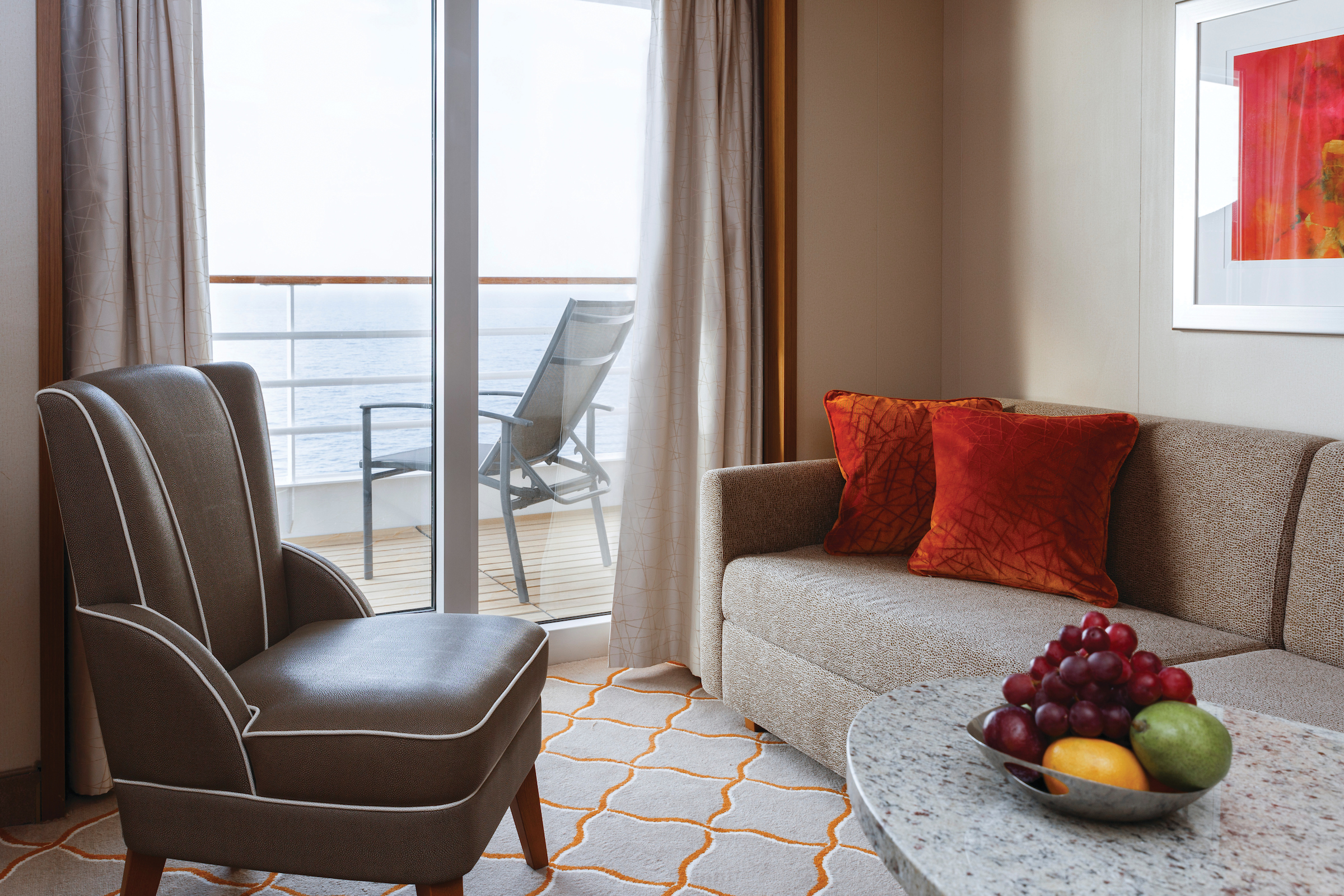
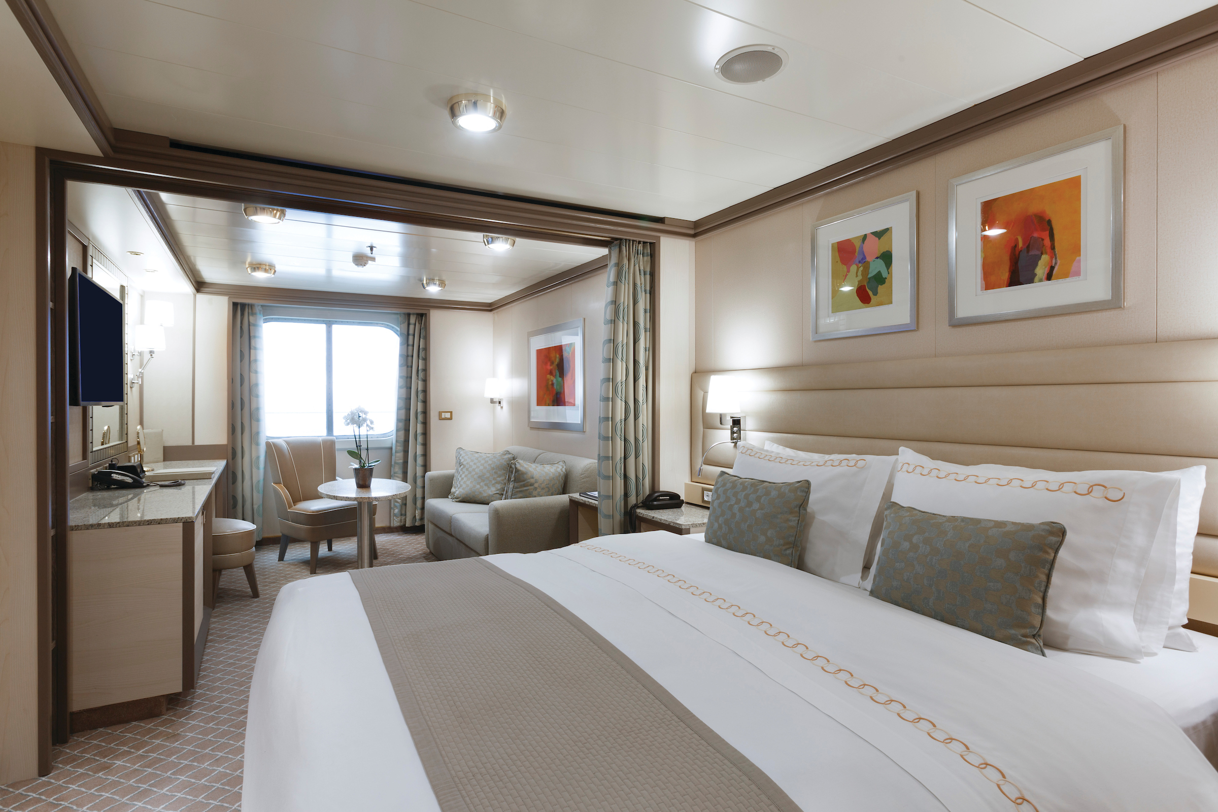
The Deluxe Veranda Suite offers a comfortable living space, close to the heart of the ship. With its preferred midship location and all the comfort and attention to detail that you can expect aboard, the Deluxe Veranda Suite is the savvy traveler’s paradise—both inside and out. Elegant decor, a stunning marble bathroom, and an ample seating area make this a cozy home away from home. But perhaps this suite’s finest asset lies just outside, as floor-to-ceiling glass doors open onto a private veranda, making every sunset feel as if it is yours alone.
One bedroom: 35 sq m including veranda (6 sq m)
Please note that the 3rd guest will sleep on a comfortable sofa bed in the reception area of the suite.
Essentials
- Deck(s): 6, 7, 8
- Section: Mid-Ship
Characteristics
- Veranda
- Sitting area
- Standard vanity
- Separate shower
- Full-size bath (Only Walk-in rain shower (no full-sized bath) from suite number 648 to 657, from 752 to 761 and from 844 to 849)
- Walk-in wardrobe with personal safe
Furniture
- Queen size bed
- Writing desk
- Luxury bed mattresses
Media & Communication
- Unlimited Standard Wi-Fi
- 1 large flat screen TV with Interactive Media Library
- Direct dial telephone
- Wall mounted USB-C mobile device chargers
- Dual voltage 110/220 outlets
Onboard Services
- Butler service
- Champagne on arrival
Amenities
- Pillow menu
- Refrigerator and bar setup stocked with your preferences
- Plush bathrobe
- Luxury bath amenities
- Umbrella
- Hair Dryer
- Slippers
Located on the upper deck and offering spectacular sunset views, the Superior Veranda Suite has all the comforts and luxury that you can expect aboard. A comfortable living space, attention to detail, and a generous expanse of amenities make this stunning suite a cozy home while on the seas. But perhaps this suite’s finest asset lies just outside, as floor-to-ceiling glass doors open onto a private veranda, making every sunset feel as if it is yours alone.
One bedroom: 35 sq m including veranda (6 sq m)
Please note that the 3rd guest will sleep on a comfortable sofa bed in the reception area of the suite.
Essentials
- Deck(s): 7, 8, 9
- Section: Forward
Characteristics
- Veranda
- Sitting area
- Standard vanity
- Separate shower
- Full-size bath (Only Walk-in rain shower (no full-sized bath) from suite number 648 to 657, from 752 to 761 and from 844 to 849)
- Walk-in wardrobe with personal safe
Furniture
- Queen size bed
- Writing desk
- Luxury bed mattresses
Media & Communication
- Unlimited Standard Wi-Fi
- 1 large flat screen TV with Interactive Media Library
- Direct dial telephone
- Wall mounted USB-C mobile device chargers
- Dual voltage 110/220 outlets
Onboard Services
- Butler service
- Champagne on arrival
Amenities
- Pillow menu
- Refrigerator and bar setup stocked with your preferences
- Plush bathrobe
- Luxury bath amenities
- Umbrella
- Hair Dryer
- Slippers
The Classic Veranda Suite provides generous living space for voyagers. Located on the lower decks in the bow, the Classic Veranda Suite offers all the comfort and attention to detail that you can expect aboard—both inside and out. A generous expanse of interior comforts—elegant decor, a stunning marble bathroom, and an ample seating area make this a cozy home away from home. But perhaps this suite’s finest asset lies just outside, as floor-to-ceiling glass doors open onto a private veranda, making every sunset feel as if it is yours alone.
One bedroom: 35 sq.m. including veranda (6 sq.m.)
Wheelchair accessible suites: 530, 531, 532, 533
Please note that the 3rd guest will sleep on a comfortable sofa bed in the reception area of the suite.
Essentials
- Deck(s): 5, 6
- Section: Forward
Characteristics
- Veranda
- Sitting area
- Standard vanity
- Separate shower
- Full-size bath (Only Walk-in rain shower (no full-sized bath) from suite number 648 to 657, from 752 to 761 and from 844 to 849)
- Walk-in wardrobe with personal safe
Furniture
- Queen size bed
- Writing desk
- Luxury bed mattresses
Media & Communication
- Unlimited Standard Wi-Fi
- 1 large flat screen TV with Interactive Media Library
- Direct dial telephone
- Wall mounted USB-C mobile device chargers
- Dual voltage 110/220 outlets
Onboard Services
- Butler service
- Champagne on arrival
Amenities
- Pillow menu
- Refrigerator and bar setup stocked with your preferences
- Plush bathrobe
- Luxury bath amenities
- Umbrella
- Hair Dryer
- Slippers
The Panorama Suite provides generous living space for voyagers. Located on deck 9, the Panorama offers all the comfort and attention to detail that you can expect aboard. A generous expanse of interior comforts—elegant decor, a stunning marble bathroom, and an ample seating area make this a cozy home away from home. The seating area of the Panorama Suite has plenty of room to relax while large picture windows frame panoramic ocean views.
One bedroom: 31 sq m
Essentials
- Deck(s): 8
- Section: Mid-Ship
Characteristics
- Floor-to ceiling window
- Sitting area
- Standard vanity
- Separate shower
- Full-size bath (Only Walk-in rain shower (no full-sized bath) from suite number 852 to 853)
- Walk-in wardrobe with personal safe
Furniture
- Queen size bed
- Writing desk
- Luxury bed mattresses
Media & Communication
- Unlimited Standard Wi-Fi
- 1 large flat screen TV with Interactive Media Library
- Direct dial telephone
- Wall mounted USB-C mobile device chargers
- Dual voltage 110/220 outlets
Onboard Services
- Butler service
- Champagne on arrival
Amenities
- Pillow menu
- Refrigerator and bar setup stocked with your preferences
- Plush bathrobe
- Luxury bath amenities
- Umbrella
- Hair Dryer
- Slippers
A quiet sanctuary. The seating area of the Vista Suite has plenty of room to relax. Large picture windows frame panoramic ocean views. The perfect backdrop for breakfast in bed during the cruise. Some Vista Suites accommodate three guests.
One bedroom: 32 sq m
Please note that the 3rd guest will sleep on a comfortable sofa bed in the reception area of the suite.
Essentials
- Deck(s): 4
- Section: Forward
Characteristics
- Window
- Sitting area
- Standard vanity
- Separate shower
- Full-size bath (Only Walk-in rain shower (no full-sized bath) from suite number 852 to 853)
- Walk-in wardrobe with personal safe
Furniture
- Queen size bed
- Writing desk
- Luxury bed mattresses
Media & Communication
- Unlimited Standard Wi-Fi
- 1 large flat screen TV with Interactive Media Library
- Direct dial telephone
- Wall mounted USB-C mobile device chargers
- Dual voltage 110/220 outlets
Onboard Services
- Butler service
- Champagne on arrival
Amenities
- Pillow menu
- Refrigerator and bar setup stocked with your preferences
- Plush bathrobe
- Luxury bath amenities
- Umbrella
- Hair Dryer
- Slippers
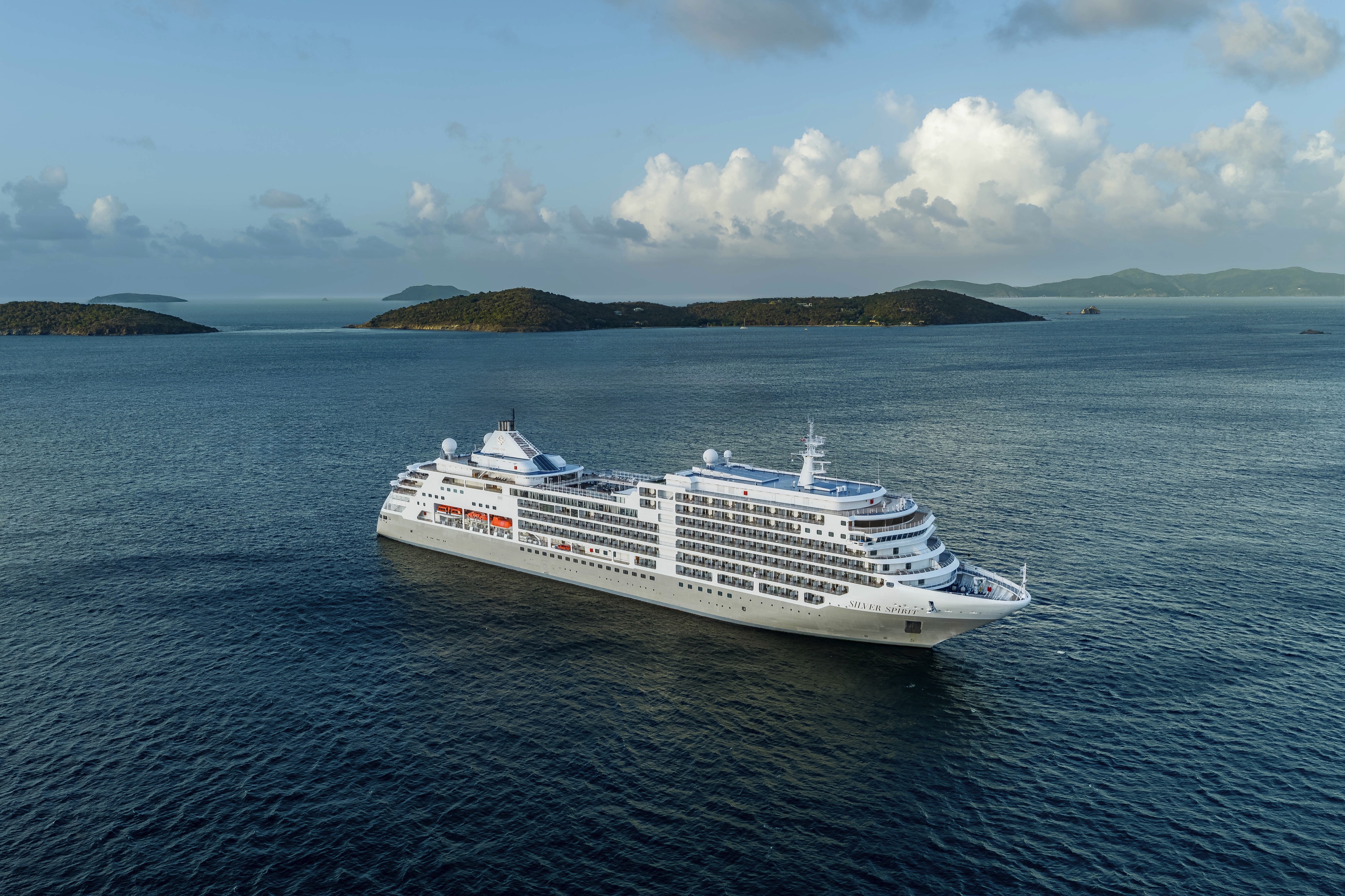
Silver Spirit
Following a thorough renovation, Silver Spirit® moves with the shared pulse of people, place, and past.
This commitment to continuous evolution has enhanced comfort and immersion across the ship. On board, our award-winning S.A.L.T. culinary program draws each destination to the table, pairing locally inspired dishes with signature cocktails. Between destinations, time is yours in spaces reimagined for your enjoyment. Step into the radiant world of Riviera, a new open-air concept inspired by the golden age of Mediterranean travel, where coastal food and refreshing beverages are served to you poolside. On a once-in-a-lifetime voyage, follow the spirit of the sea and the call of the journey.
Ship Facts
| Launch Year | 2009 | ||||||||||
| Refit Year | 2026 | ||||||||||
| Language | en | ||||||||||
| Gross Tonnage | 39519 | ||||||||||
| Length | 211 | ||||||||||
| Width | 27 | ||||||||||
| Currency | USD | ||||||||||
| Speed | 20 | ||||||||||
| Capacity | 636 | ||||||||||
| Crew Count | 415 | ||||||||||
| Deck Count | 8 | ||||||||||
| Cabin Count | 270 | ||||||||||
| Large Cabin Count | 65 | ||||||||||
| Wheelchair Cabin Count | 4 | ||||||||||
| Electrical Plugs |
|
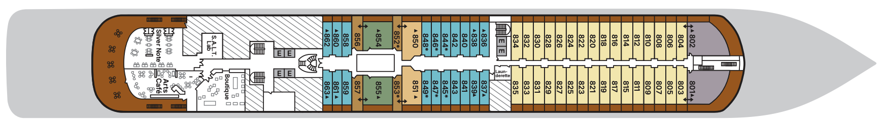
Deck 11
- Observation Library
- Launderette
- Silver Suites
- Medallion Suite
- Deluxe Veranda Suite
- Elevator

Deck 10
- Jogging Track
- Silver Suites
- Medallion Suite
- Deluxe Veranda Suite
- Spaccanapoli
- Launderette
- Elevator
- Open view to Swimming Pool

Deck 9
- Pool
- Whirlpools
- Pool Bar
- Card Room
- Launderette
- Panorama Lounge
- Riviera
- Grand Suites
- Superior Veranda Suites
- Elevator

Deck 8
- S.A.L.T. Lab
- Boutique
- Arts Café
- Silver Note
- Launderette
- Grand Suites
- Superior Veranda Suites
- Deluxe Veranda Suites
- Owner's Suites
- Panorama Suites
- Silver Suites
- Elevator
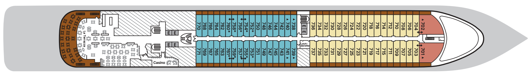
Deck 7
- La Terrazza
- Casino
- Launderette
- Royal Suites
- Deluxe Veranda Suites
- Superior Veranda Suites
- Elevator
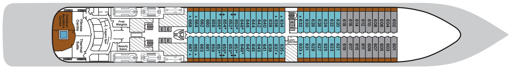
Deck 6
- Zagara Spa
- Fitness Center
- Launderette
- Beauty Salon
- Thermal Suite
- Free Weights
- Outdoor Aerobics Centre
- Deluxe Veranda Suites
- Classic Veranda Suites
- Elevator
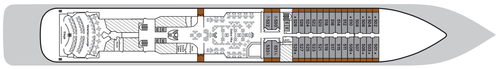
Deck 5
- Reception
- Shore Concierge
- Dolce Vita
- Venetian Lounge
- Conference Room
- Future Cruise Sales
- Launderette
- Classic Veranda Suites
- Elevator
Deck 4
- S.A.L.T. Kitchen
- S.A.L.T. Bar
- Atlantide
- Seishin
- La Dame
- Vista Suites
- Elevator

With the importance of food in Italian culture, you would expect dining to be a high priority at Silversea. And it most assuredly is. No matter where you dine, you will experience a great diversity and presentation of culinary selections on board your all inclusive cruise. Silversea offers a wide choice of open-seating dining venues, even aboard their smallest ships, and as many as eight restaurants on Silver Spirit and Silver Muse — remarkable for ships of their size. With the worldly crowd of international guests who sail on Silversea ships, socialising is yet another great advantage of the Silversea experience.
S.A.L.T. Kitchen
S.A.L.T. Kitchen transforms dining into discovery with menus that reflect the cuisines of the places you’ll visit. This complimentary venue is the only restaurant at sea with an ever-changing menu based on destination. Plus, a standing menu focuses on broader regional specialties, complemented by a menu featuring hyperlocal fare. Dishes are inspired by local flavors and prepared with responsibly sourced ingredients. Accompanied by a curated selection of over 160 regional wines, S.A.L.T. Kitchen delivers an immersive taste of place without ever leaving the ship.
Location: Deck 4Capacity: 154 guests
Opening hours: Dinner only (18:30 - 21:00)
Images are intended as a general reference. Features, materials, finishes and layout may be different than shown. Opening hours and menu are for reference only.
Riviera
Enter the radiant world of Riviera — where ice-cold spritzes elevate poolside afternoons, fresh seafood is served daily, and every moment glows with possibility. Inspired by the golden age of Mediterranean travel, this new open-air concept on Silver Spirit is part restaurant, part bar, and fully dedicated to everything the region does best. Savor coastal fare at your table or by the pool. Indulge in Mediterranean wines, handcrafted cocktails, and the sacred ritual of aperitivo hour. From morning yoga to evening soirées, a mix of daily activities adds yet another enchanting layer to Riviera’s timeless allure.
OPENING HOURS
Opening hours are for reference only.
Lunch - Reservations required
Opening hours: 12:00 p.m. - 3:30 p.m.
Dinner - Reservations required
Opening hours: 6:30 p.m. to 9:00 p.m.
Images are intended as general reference. Features, materials, finishes and layout may be different than shown.
Seishin
Drawing its name from the Japanese word for “spirit,” Seishin delivers an elegant take on Japanese cuisine on board Silver Spirit. The menu encompasses creative recipes from Japan, from tender wagyu beef to delicate spider crab rolls complemented by sake pairings and refreshing sushi at lunch.
OPENING HOURS
Opening hours and menu are for reference only.
Lunch - Open seating
Opening hours: 12:00 PM - 2:30 PM
Dinner - Reservation required*
Opening Hours: 7:00 PM – 9:30 PM
* Reservation fee applies (US$40 per person). Please visit My Silversea for more details and to make your reservations.
Silver Note
As the stars come out, Silver Note comes alive with the rhythm of jazz and the artistry of small-plate fine dining. This intimate supperclub experience pairs soulful live performances with inventive, international cuisine in a chic,
lounge-style setting — one of the most exclusive dining concepts at sea.
Reservation recommended for dinner.
Learn more about the Epicurean Experience, which includes dining in three specialty restaurants with preferential rates.
Images are intended as a general reference. Features, materials, finishes and layout may be different than shown.
La Terrazza
La Terrazza elevates casual dining by day and delivers an authentic Italian experience by night. During the breakfast and lunch buffets, our master chefs prepare global favorites at live stations. As evening falls, handmade pastas and classic seafood dishes are the centerpiece — every impeccable bite paired with fine wines from around the world.
Reservation recommended for dinner.
Images are intended as a general reference. Features, materials, finishes and layout may be different than shown.
La Dame
Experience the pinnacle of French gastronomy at La Dame, where sophistication meets tradition. Here, an exclusive tasting menu unfolds course by course — each plate a study in masterful technique, seasonal ingredients, and modern refinement. From classic Kir Royales to exquisite signatures such as Dover sole à la Grenobloise, this is haute cuisine at its finest.
Reservation recommended for dinner.
Per guest reservation fee of US$60. Please visit My Silversea to make your reservations.
Learn more about the Epicurean Experience, which includes dining in three specialty restaurants with preferential rates.
Images are intended as a general reference. Features, materials, finishes and layout may be different than shown.
Atlantide
Refined global fare and grilled classics take center stage at Atlantide. Drop in for an indulgent à la carte breakfast, a leisurely lunch, or an elegant dinner among family and new friends, served in a timeless and sophisticated setting.
Open seating.
Images are intended as a general reference. Features, materials, finishes and layout may be different than shown.
Spaccanapoli
Reflecting Silversea’s Italian heritage, this emblematic street in Naples divides the city in two and is renowned for its pizzerias. No visit to the city is complete without a journey to Spaccanapoli. Therefore, it is unsurprising that Spaccanapoli aboard Silver Spirit reflects the true Italian way of life: the freshest ingredients, authentic dough, and a perfect sense of the fabled Italian lust for life. The simplicity of la dolce vita is reflected in the relaxed dining style of the restaurant.
Open seating for dinner.
Arts Café
Arts Café is a vibrant, light-filled haven for conversation, creativity, and indulgence. Snack on light bites and decadent pastries paired with freshly brewed coffee and artisanal teas as you unwind with a good book or get to know your fellow travelers.
Images are intended as a general reference. Features, materials, finishes and layout may be different than shown.
In-Suite Dining
You can order from our Room Service menu 24 hours a day.
Opening hours are for reference only. For precise opening hours, please refer to the Daily Chronicles provided on board.
When you embark on an adventure with Silversea, we keep you thoroughly entertained while you’re sailing from one glorious port to another. Exploring the many different floors and strolling around the variety of areas on your ship is great fun as there’s always so much to see and do. Whether you want to recline on a lounger by the pool, try your luck in the casino, or indulge in our cutting-edge wellness and exercise programs, there’s something for everyone, including those who want to relax in their suite while their butler runs a bubble bath.
S.A.L.T. Bar
S.A.L.T. Bar crafts authentic cultural connections through expertly prepared cocktails that tell the story of each region. A welcoming atmosphere invites you to indulge in regionally inspired libations prepared with local ingredients and traditional spirits. Each perfectly balanced pour serves as your passport to the shores you’re exploring.
Images are intended as a general reference. Features, materials, finishes and layout may be different than shown.
Panorama Lounge
True to its name, Panorama Lounge surrounds you with sweeping views from every angle. Sunlight pours through wraparound windows by day, framing horizons that shift like watercolors. Evenings hum with piano chords and DJ beats that carry you late into the night. And all of it pairs wonderfully with cocktails handcrafted to match your mood.
Images are intended as a general reference. Features, materials, finishes and layout may be different than shown.
Dolce Vita
Surrender to a world of Italian elegance where the art of aperitivo takes pride of place. Ideal for connecting over spritzes, negronis, and light bites, here each evening feels like a celebration. As laughter lingers, crystal glasses clink, and live piano notes ripple through the air, Dolce Vita compels you to savor the sweetness of life on board.
Images are intended as a general reference. Features, materials, finishes and layout may be different than shown.
The Connoisseur’s Corner
Discreet. Tasteful. Polished. If you appreciate the finer things in life, then the sophisticated touches of the Connoisseur’s Corner will not disappoint. Rich and luxurious, yet airy and spacious, this indoor/outdoor venue is where you sip the finest cognac or whiskey from a prestigious range and revel in the tranquil murmur of after-dinner conversation. A premium choice of cigars is also available, making this a perfect evening haven of serenity.
Images are intended as a general reference. Features, materials, finishes and layout may be different than shown.
Observation Library
The eponymous lounge carries its name well. Set on the highest level at the very top of the ship, this is a quiet space for reading and reflection while being dazzled by the undulating seascapes that are part of life on board. Borrow a book from the in-house library, read the papers, or just embrace the tranquility of being at sea.
Images are intended as a general reference. Features, materials, finishes and layout may be different than shown.
Boutique
Exceptional shopping experiences do not end in the cosmopolitan cities we visit. Silversea’s striking new shipboard boutiques, reimagined and redesigned, are stunning modern design spaces befitting the finest creations from legendary designers. Carefully selected partners on board Silversea’s duty-free boutiques offer our guests a carefully curated selection of cutting-edge fashions, jewelry, accessories, fine perfumes, cosmetics, and Silversea Logo collection, all at duty-free prices.
Images are intended as a general reference. Features, materials, finishes and layout may be different than shown.
Venetian Lounge
Step inside The Venetian Lounge, a cabaret-style theater draped in gilded glamour and Belle Époque charm. Cozy seating and intimate tables invite you to bask in the glow of live productions and cinematic screenings, complemented with Champagne, fine wines, and classic cocktails. In a setting this grand, every night feels like opening night.
Images are intended as a general reference. Features, materials, finishes and layout may be different than shown.
Casino
Let the fun begin! Channel your inner James Bond and place a bet at a variety of table games, including American Roulette, Blackjack, and Ocean Poker, as Silver Spirit glides silently through the waves. An assortment of multi-game, multi-denominational reel and video slot machines are also available. Prepare yourself for a luxurious and exhilarating experience with every turn of a card and spin of the wheel. Game on!
Images are intended as a general reference. Features, materials, finishes and layout may be different than shown.
Card Room/Conference Room
Whatever your conference or meeting requirements, Silversea is pleased to provide a tailor-made experience. Audiovisual equipment is available and complimentary on board this luxury cruise ship.
Images are intended as a general reference. Features, materials, finishes and layout may be different than shown.