Singapore to Doha
Singapore to Doha
Cruise overview
WHY BOOK WITH US?
- ✔ The Deluxe Cruises’ team has extensive experience in ultra-luxury cruising.
- ✔ Call now to speak to our helpful and experienced Cruise Concierge team.
- ✔ Enjoy our Unique Deluxe Cruises Bonus for substantial savings.
- ✔ Our team will tailor your holiday to your exacting requirements.
- ✔ As agents, we work under the protection of each cruise lines ABTA / ATOL licences
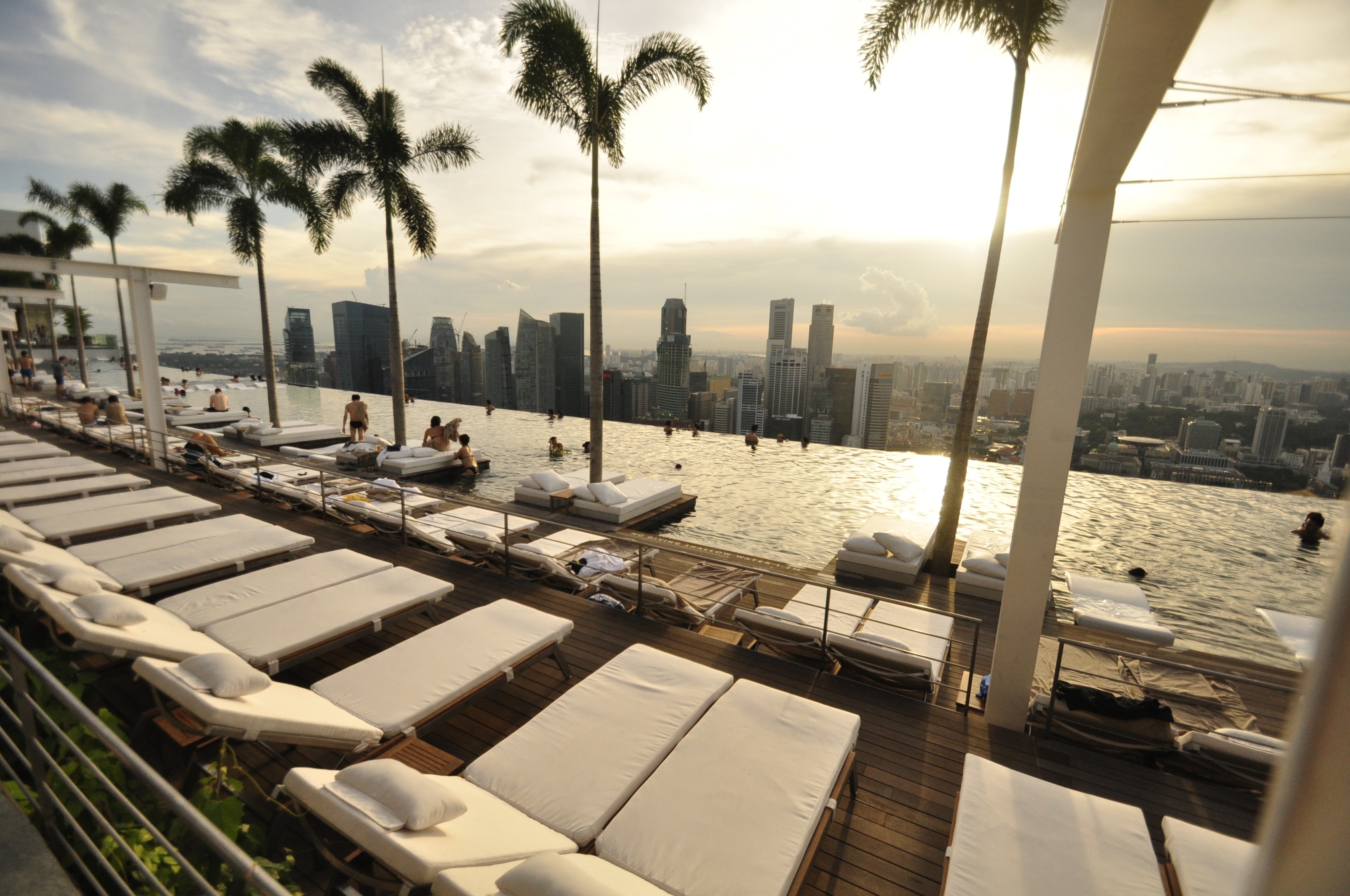
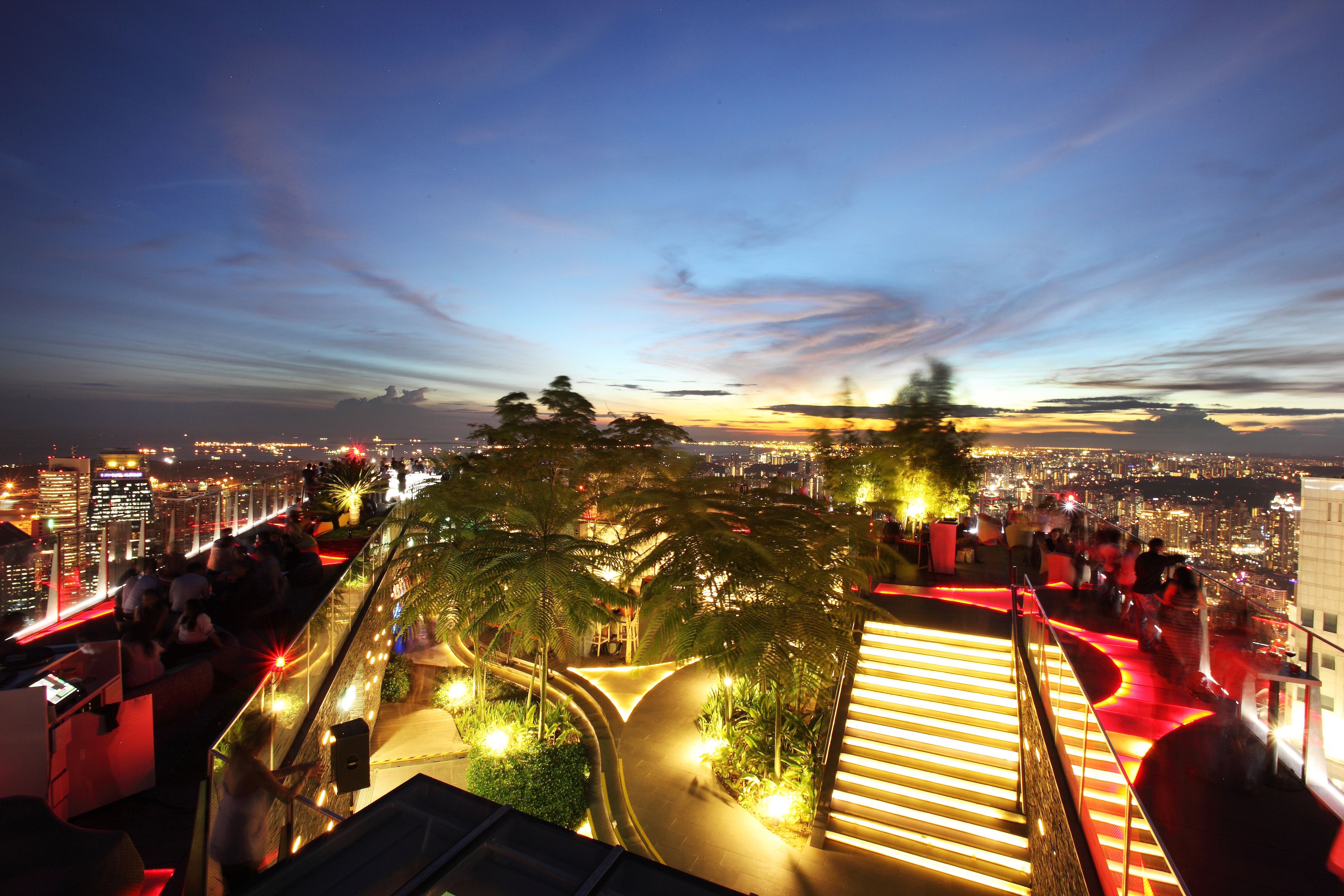
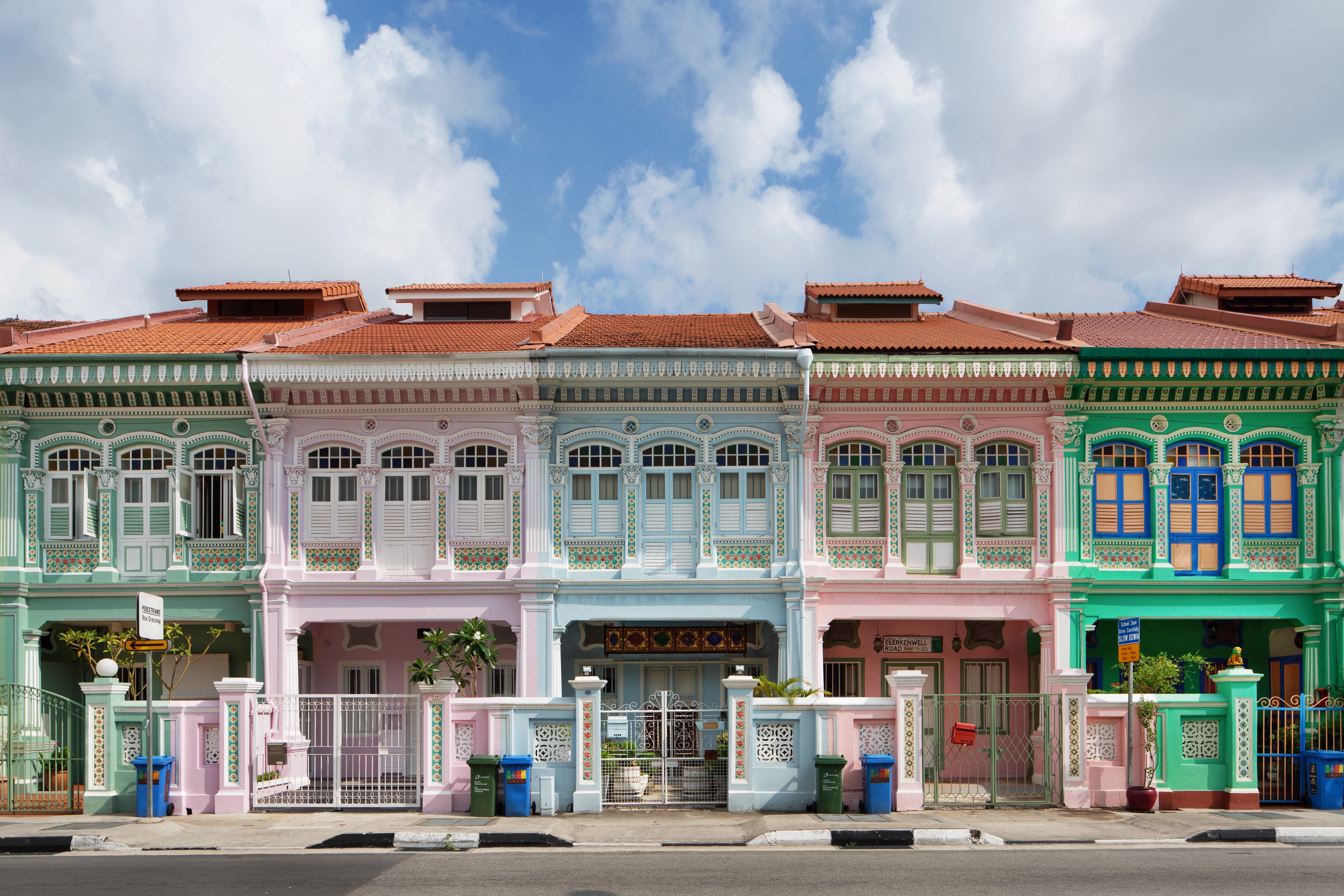
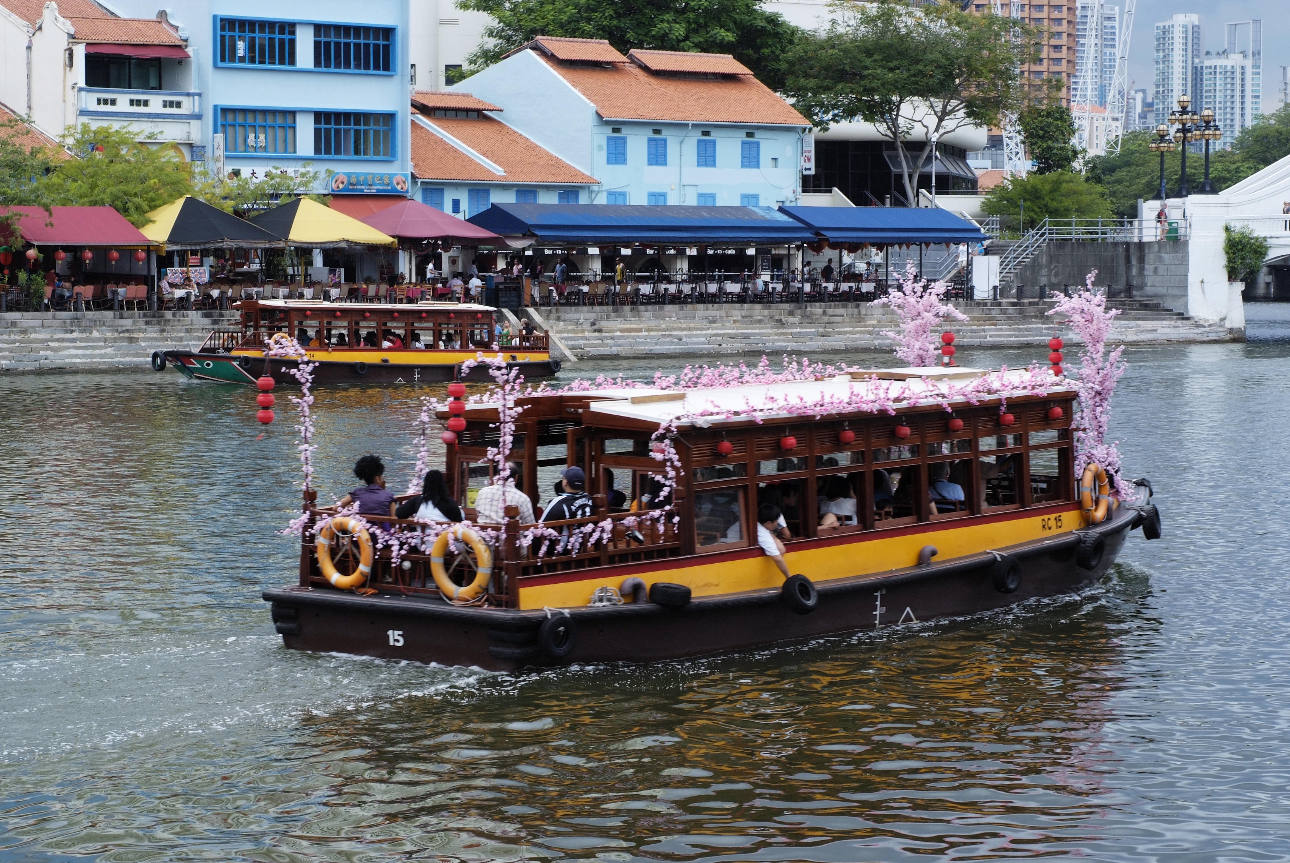
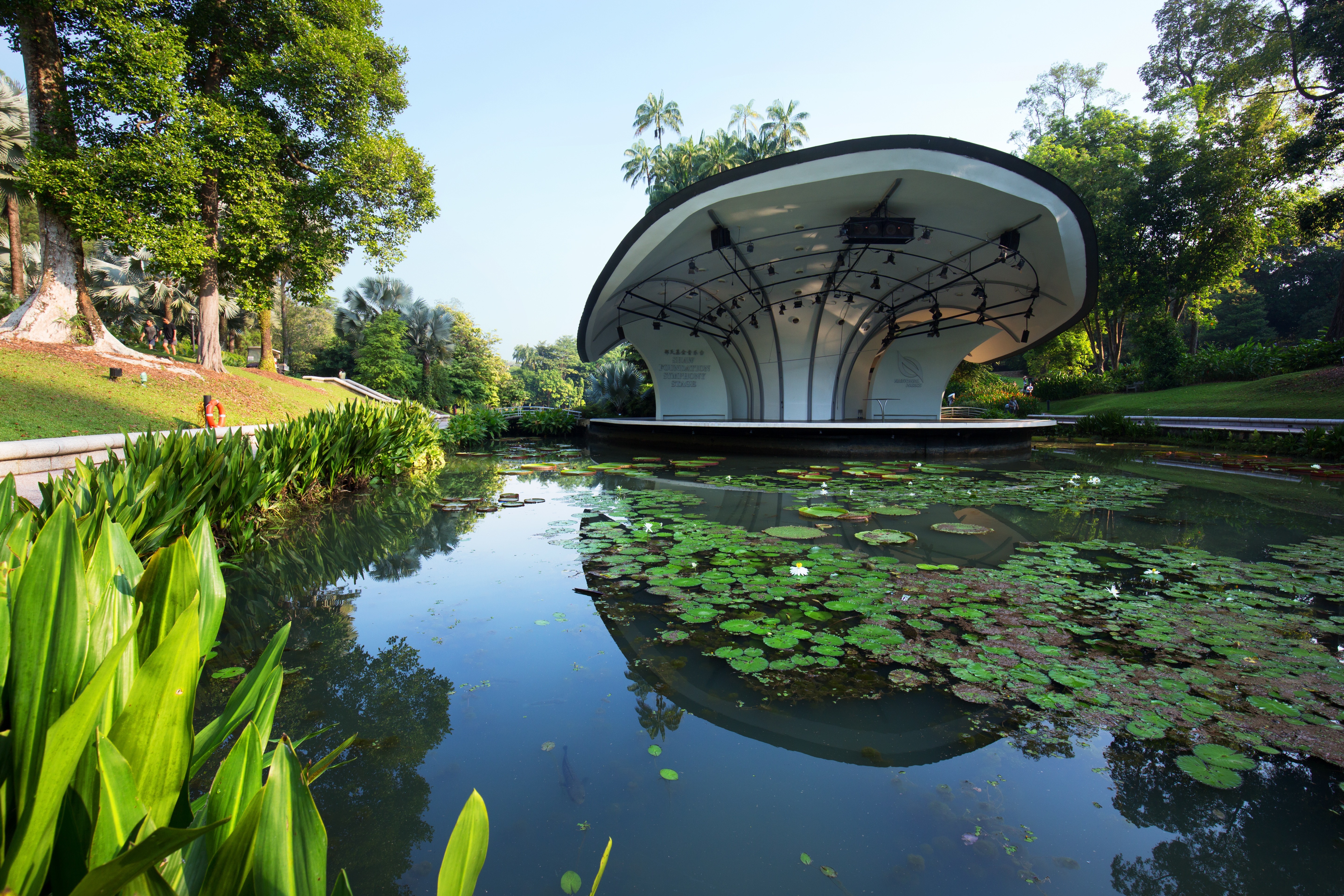
About Singapore
The main island of Singapore is shaped like a flattened diamond, 42 km (26 miles) east to west and 23 km (14 miles) north to south. Near the northern peak is the causeway leading to West Malaysia—Kuala Lumpur is less than four hours away by car. It is at the southern foot where you will find most of the city-state’s action, with its gleaming office towers, working docks, and futuristic "supertrees," which are solar-powered and serve as vertical gardens. Offshore are Sentosa and over 60 smaller islands, most uninhabited, that serve as bases for oil refining or as playgrounds and beach escapes from the city. To the east is Changi International Airport, connected to the city by metro, bus, and a tree-lined parkway. Of the island's total land area, more than half is built up, with the balance made up of parkland, farmland, plantations, swamp areas, and rain forest. Well-paved roads connect all parts of the island, and Singapore city has an excellent, and constantly expanding, public transportation system. The heart of Singapore's history and its modern wealth are in and around the Central Business District. The area includes the skyscrapers in the Central Business District, the 19th-century Raffles Hotel, the convention centers of Marina Square, on up to the top of Ft. Canning. Although most of old Singapore has been knocked down to make way for the modern city, most colonial landmarks have been preserved in the CBD, including early-19th-century buildings designed by the Irish architect George Coleman.


About Port Klang
Kuala Lumpur, or KL as locals refer to it, intrigues visitors with its diversity and multicultural character. The city's old quarter features stretches of shop houses that hint at its colonial past, while modern buildings—including the iconic Petronas Towers—give a glimpse of its modern financial ambitions. The city is filled with culturally colorful quarters dedicated to Chinese, Malay, and Indian communities. New shopping malls with designer labels, five-star hotels, and top-notch restaurants also proliferate in this bustling city of 1.6 million.

About Galle
Galle is the administrative capital of the Southern Province in Sri Lanka. The city has a beautiful tropical setting with Dutch-colonial architecture. Explore the maritime museums, try some of the delicacies and explore the shops for souvenirs.
About Colombo
Sri Lanka's capital and largest city, Colombo offers fine restaurants, a buzzing nightlife scene, and good museums, parks, and beautiful Buddhist temples that are all worth visiting. The beach resort of Mt. Lavinia is only a short taxi ride from the downtown area and offers a golden, sandy beach and sunset views to die for. As an exciting blur of colors and cultures, Colombo presents a neatly packaged microcosm of this island nation.

About Cochin
Kochi, formerly and still commonly known as Cochin, is one of the west coast's largest and oldest ports. The streets behind the docks of the historic Fort Cochin and Mattancherry districts are lined with old merchant houses, godowns (warehouses), and open courtyards heaped with betel nuts, ginger, peppercorns, and tea. Throughout the second millennium this ancient city exported spices, coffee, and coir (the fiber made from coconut husks), and imported culture and religion from Europe, China, and the Middle East. Today Kochi has a synagogue, several mosques, Portuguese Catholic churches, Hindu temples, and the United Church of South India (an amalgamation of several Protestant denominations). The city is spread out over mainland, peninsula, and islands. Ernakulam, on the mainland 2 km (3 miles) from the harbor, is the commercial center and the one-time capital of the former state of Cochin. Willingdon Island, which was created by dredging the harbor, holds several luxury hotels as well as a navy base. The beautiful Bolghatty Island, north of Ernakulam, is a favorite picnic spot for locals. On it there's a government-run hotel in a colonial structure that was once used by the Dutch governor and later by the British Resident. Another local favorite is Cherai beach on Vypin Island, which is a 10-minute ferry ride from Fort Cochin. The Fort Cochin district, Kochi's historic center, is at the northern tip of the Mattancherry peninsula. Houses here often recall Tudor manors; some have been converted to hotels, others remain in the hands of the venerable tea and trading companies. South of Fort Cochin, in the Mattancherry district, is where you'll find the city's dwindling Jewish community. Their small neighborhood, called Jew Town, which is now dotted with cafés and shops selling curios and antiques, is centered on the synagogue.

About Mumbai (ex Bombay)
Mumbai, India's financial capital, is a city of contrasts and colors, where towering skyscrapers stand alongside bustling bazaars. From the iconic Gateway of India to the vibrant street food scene of Chowpatty Beach, it's a melting pot of cultures and cuisines. The heartbeat of Bollywood echoes through its bustling streets, while historic landmarks like the Elephanta Caves whisper tales of bygone eras. With its bustling local trains and bustling markets, Mumbai is a city that never sleeps, where dreams are pursued against the backdrop of the Arabian Sea's shimmering waters.

About Muscat
Oman's capital city is hemmed in on one side by spectacular jagged-peaked mountains and on the other by royal blue sea. The architecture is a traditional, sophisticated arabesque blend of white-washed, low-rise buildings surrounded by manicured palms, intricately designed domes set atop the minarets of the mosques, sand-colored villas, a surprising blend of modern art installations, like a giant incense burner that towers over the Corniche, and ancient forts set in the rocky hills. Though tradition abounds, from distinct, local cuisine to the widely worn national dress, the dishdasha, Muscat is a completely modern city, featuring opulent luxury hotels, international restaurants, excellent cellular and data service, sprawling shopping malls, pristine beaches, lively nightlife, world-class performing arts, and a highly educated population, most of whom speak English, Arabic, and often Hindi. Muscat is the ideal base for exploring other areas of the country since many of the most desirable destinations are within a few hours' drive.
About Doha
Doha (population 700,000) is the capital of the State of Qatar, an emirate occupying the small Qatar Peninsula bordered by Saudi Arabia to the south and otherwise surrounded by the Persian Gulf. Qatar was ruled by many different powers through the centuries, in fact historians have traced human habitation dating back 5000 years. From its earliest history, Qatar was a very important trade route connecting Mesopotamia and the Indus Valley. Among its occupiers were the Portuguese, the Ottomans and finally the British during the turbulent years of the 20th century. Qatar gained independence in 1971, and with resources from oil exportation, His Highness Sheikh Khalifa Bin Hamad made improvements in social programmes including education, health and housing. In 1995, his son, His Highness Sheikh Hamad Bin Khalifa Al-Thani assumed the throne and brought with him a modern and progressive approach that quickly transformed the country. Doha, home to 80 percent of the country’s population, was founded under the name of Al-Bida in 1850. It became the capital of the British protectorate of Qatar in 1916. When the nation gained its independence, Doha remained the capital. During the early 20th century, much of Qatar’s economy depended on fishing and pearling. But after the introduction of Japanese cultured pearls, Doha and the whole region suffered a decline. Only when oil was discovered, prosperity returned following World War II. Today, the country produces over 800,000 barrels of oil daily. Doha is situated halfway down the east coast of the peninsula. It is an intriguing mixture of old and new, with ultra modern architecture next to traditional souqs and historic forts. It boasts a university and the Qatar National Museum (currently closed for renovation), which opened 1975 in what was originally the ruler’s palace. As the country’s cultural and commercial centre, Doha enjoys excellent communications with the outside world through its modern seaport, airport and telephone links. The Al Jazeera Arabic satellite television news channel began broadcasting in 1996 with its headquarters in Doha. While Arabic is the official language, English is widely spoken. Please Note: Conservative dress is required when going ashore. As a rule, women should not wear miniskirts, shorts or sleeveless tops and men should always wear a shirt in public. Please do not photograph people without their permission, especially women.You may not take pictures of government buildings, embassies or anything military in nature, including airports.


Where You'll Go


