Sydney to Auckland
Sydney to Auckland
Cruise overview
WHY BOOK WITH US?
- ✔ The Deluxe Cruises’ team has extensive experience in ultra-luxury cruising.
- ✔ Call now to speak to our helpful and experienced Cruise Concierge team.
- ✔ Enjoy our Unique Deluxe Cruises Bonus for substantial savings.
- ✔ Our team will tailor your holiday to your exacting requirements.
- ✔ As agents, we work under the protection of each cruise lines ABTA / ATOL licences
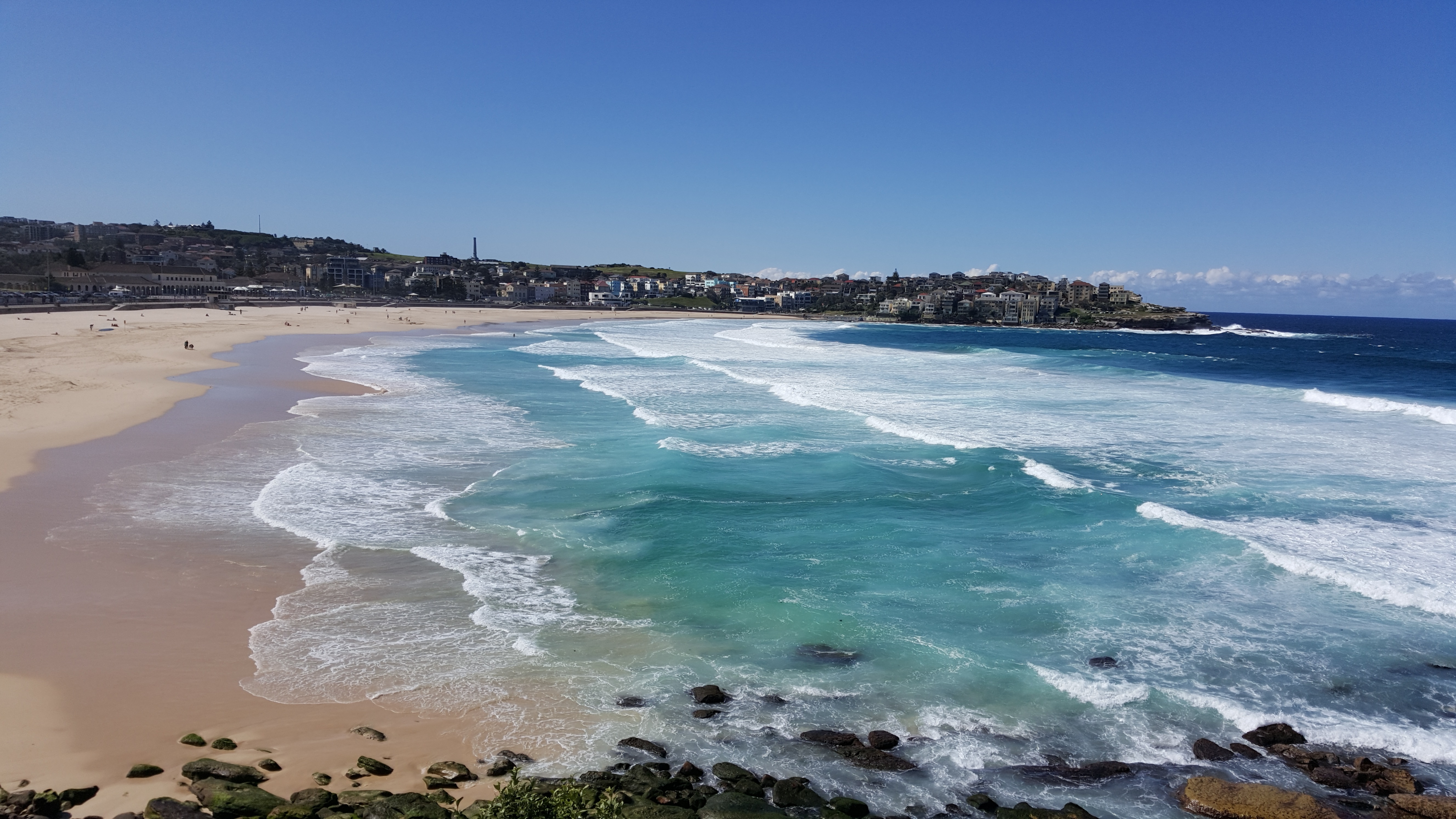
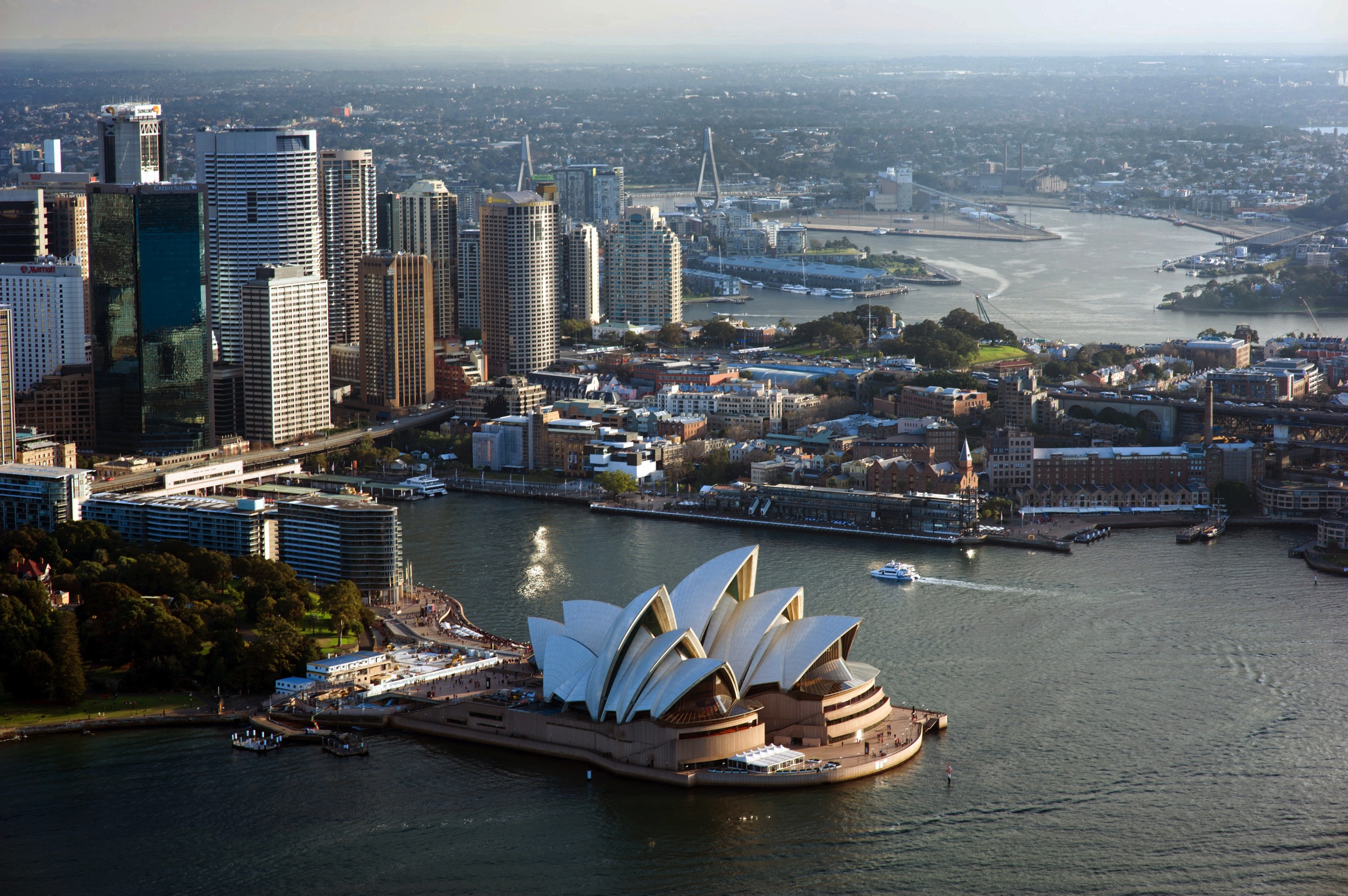
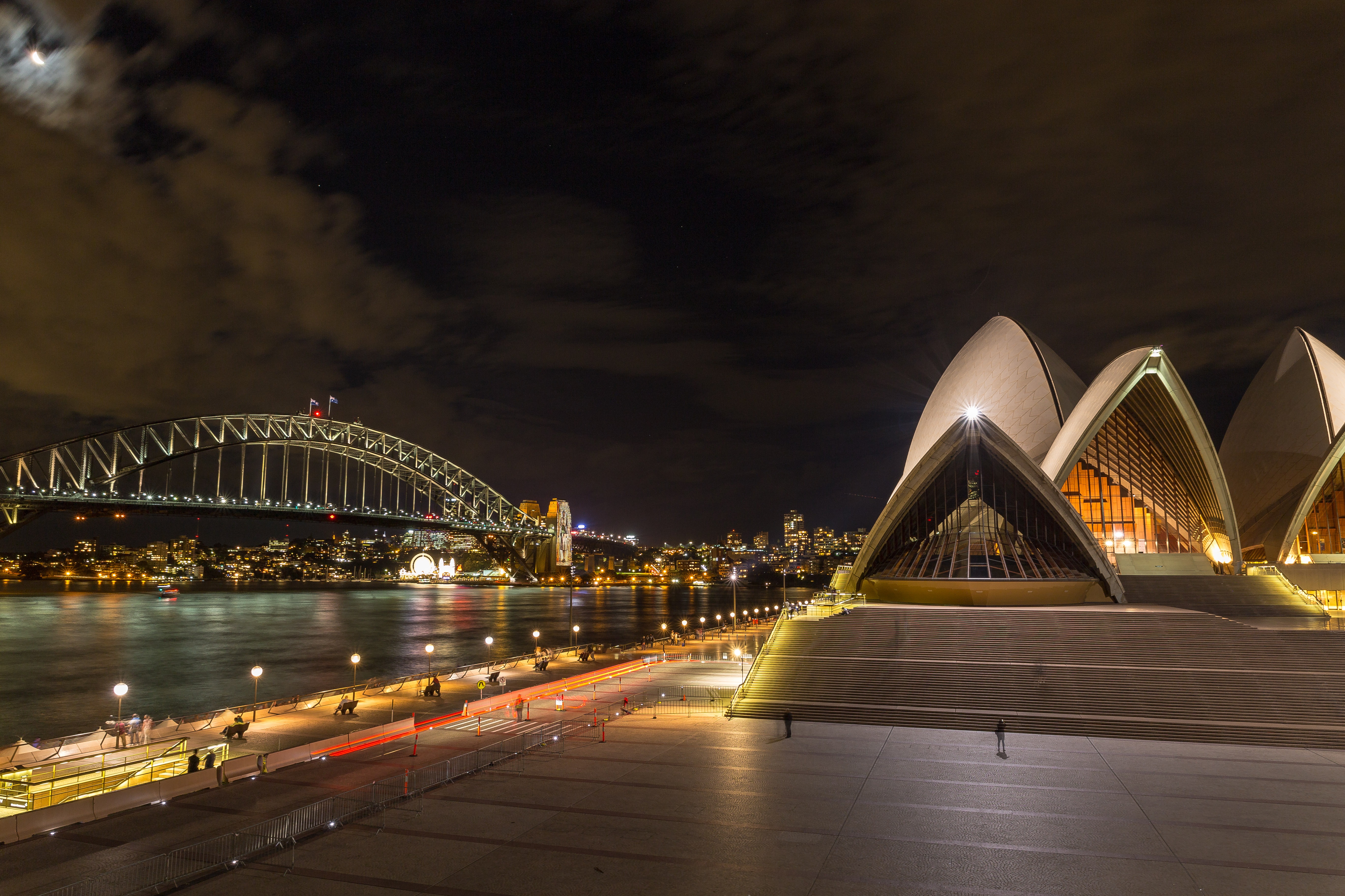
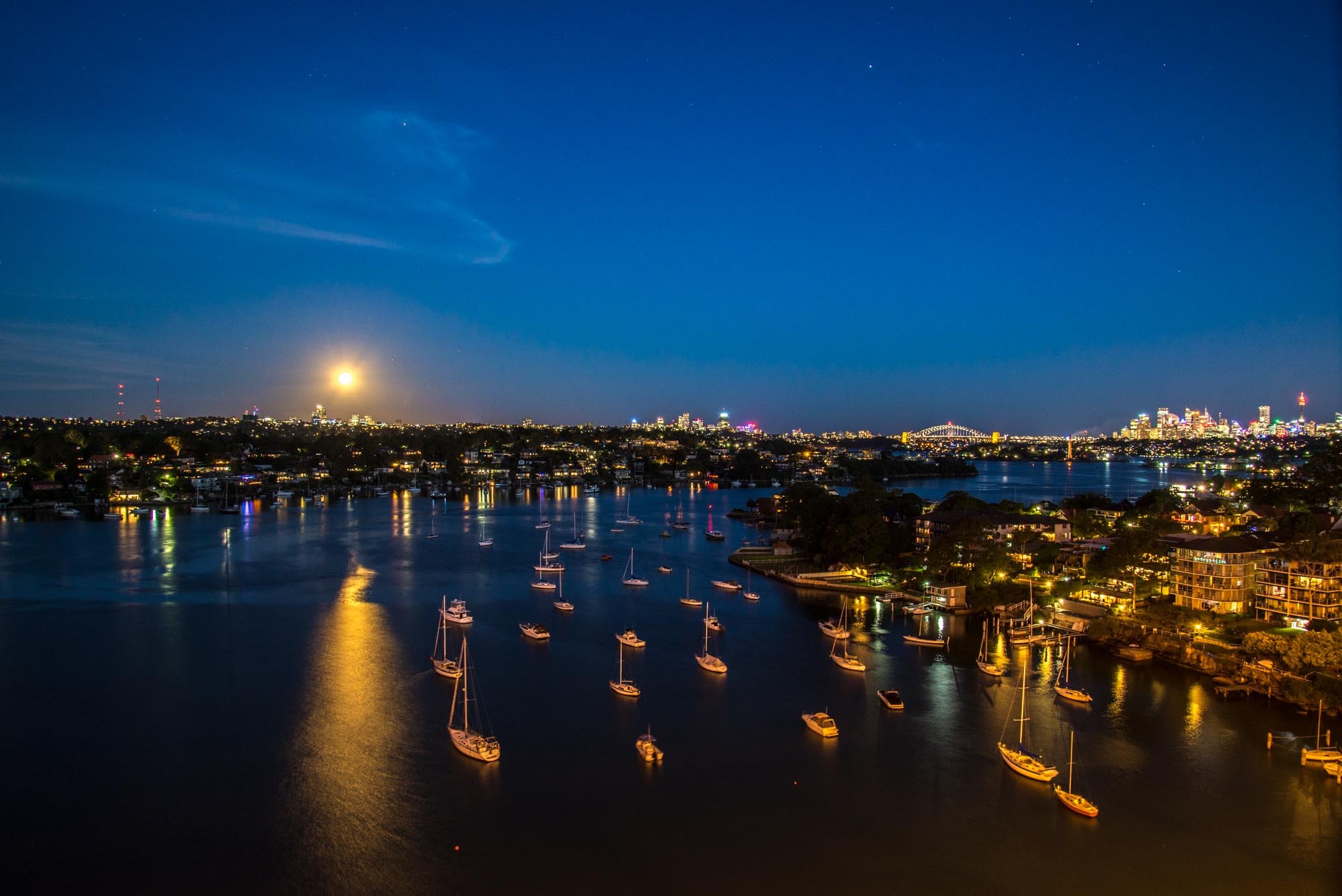
About Sydney, New South Wales
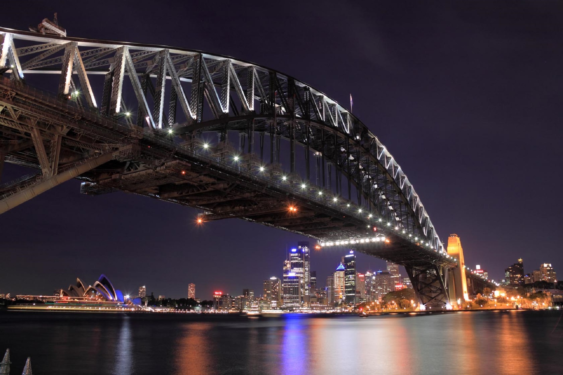
Sydney belongs to the exclusive club of cities that generate excitement. At the end of a marathon flight there's renewed vitality in the cabin as the plane circles the city, where thousands of yachts are suspended on the dark water and the sails of the Opera House glisten in the distance. Blessed with dazzling beaches and a sunny climate, Sydney is among the most beautiful cities on the planet.With 4.6 million people, Sydney is the biggest and most cosmopolitan city in Australia. A wave of immigration from the 1950s has seen the Anglo-Irish immigrants who made up the city's original population joined by Italians, Greeks, Turks, Lebanese, Chinese, Vietnamese, Thais, and Indonesians. This intermingling has created a cultural vibrancy and energy—and a culinary repertoire—that was missing only a generation ago.Sydneysiders embrace their harbor with a passion. Indented with numerous bays and beaches, Sydney Harbour is the presiding icon for the city, and urban Australia. Captain Arthur Phillip, commander of the 11-ship First Fleet, wrote in his diary when he first set eyes on the harbor on January 26, 1788: "We had the satisfaction of finding the finest harbor in the world."Although a visit to Sydney is an essential part of an Australian experience, the city is no more representative of Australia than Los Angeles is of the United States. Sydney has joined the ranks of the great cities whose characters are essentially international. What Sydney offers is style, sophistication, and great looks—an exhilarating prelude to the continent at its back door.
About Eden, New South Wales
About Hobart, Tasmania
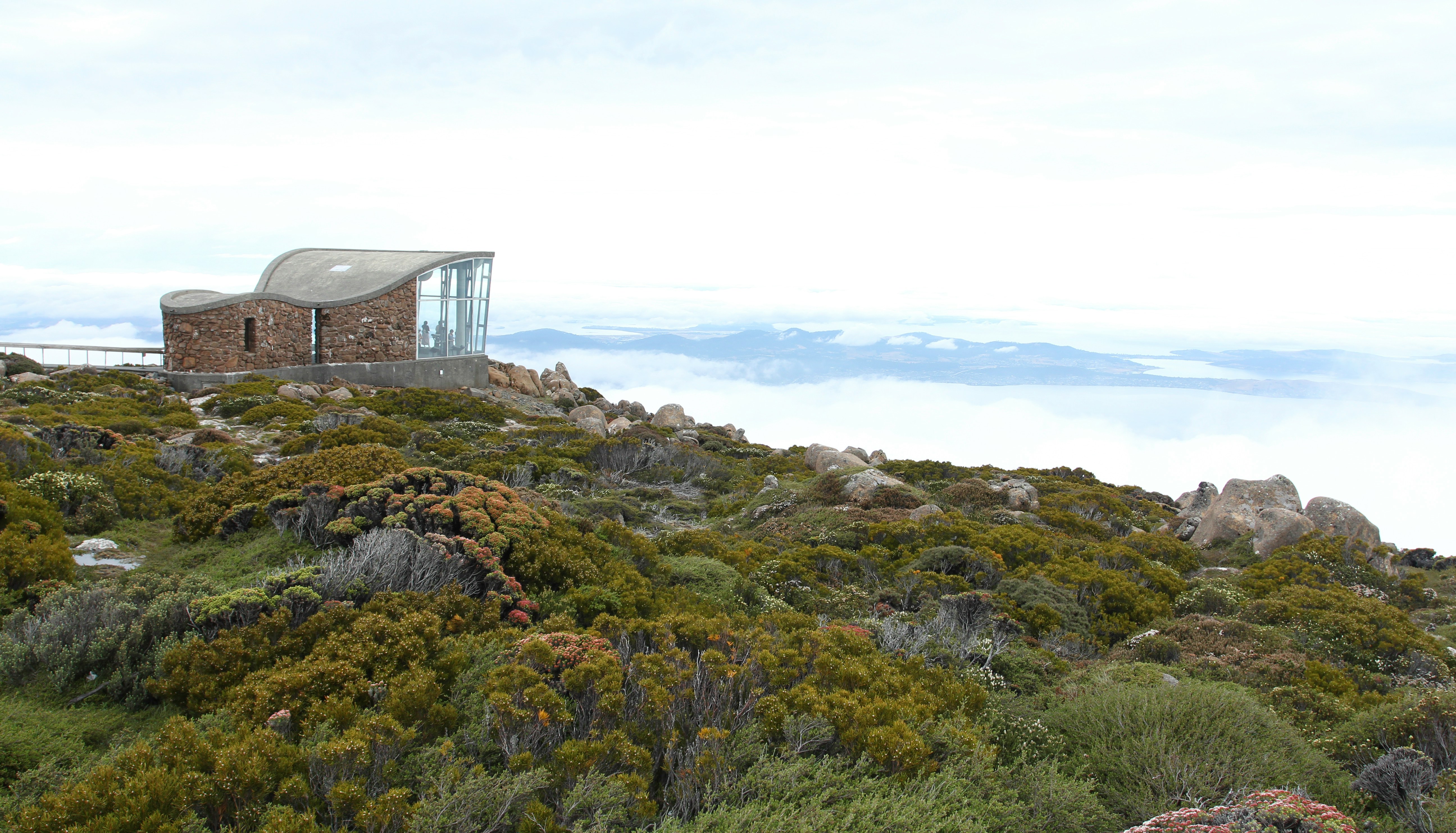
Straddling the Derwent River at the foot of Mt. Wellington's forested slopes, Hobart was founded as a penal settlement in 1803. It's the second-oldest city in the country after Sydney, and it certainly rivals its mainland counterpart as Australia's most beautiful state capital. Close-set colonial brick-and-sandstone shops and homes line the narrow, quiet streets, creating a genteel setting for this historic city of 215,000. Life revolves around the broad Derwent River port, one of the deepest harbors in the world. Here warehouses that once stored Hobart's major exports of fruit, wool, and corn and products from the city's former whaling fleet still stand alongside the wharf today.Hobart sparkles between Christmas and New Year's—summer Down Under—during the annual Sydney-to-Hobart yacht race. The event dominates conversations among Hobart's citizens, who descend on Constitution Dock to welcome the yachts and join in the boisterous festivities of the crews. The New Year also coincides with the Tastes of Tasmania Festival, when the dockside area comes alive with the best of Tasmanian food and wine on offer in numerous cafés, bars, and waterfront stalls. Otherwise, Hobart is a placid city whose nightlife is largely confined to excellent restaurants, jazz clubs, and the action at the Wrest Point Casino in Sandy Bay.The Hobart Tasmanian Travel and Information Centre hours are weekdays 8:30–5:30 and Saturday 9–5.
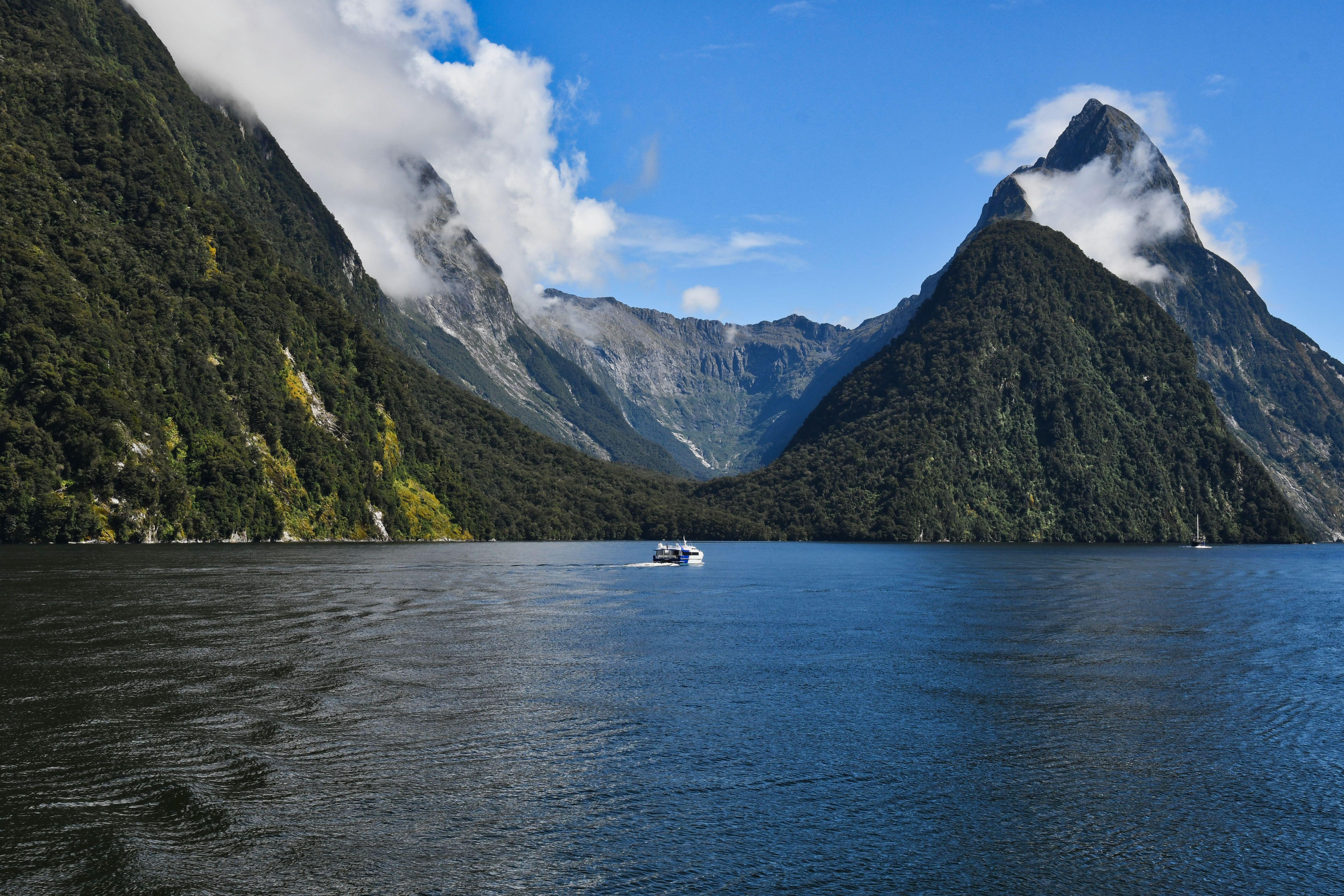
About Milford Sound
New Zealand fiord country along with Fiordland National Park is one of New Zealand's premier attractions. Incredibly beautiful, wild and remote, the region is an intriguing combination of rugged mountain ranges, dense rainforest, solitary alpine lakes, sparkling rivers and splashing waterfalls. Much of Fiordland is virtually unexplored wilderness and still the habitat of rare birds. As the ship cruises the beautiful Doubtful, Dusky and Milford Sounds, experience the majestic fiordland of South Island's western coast. Captain James Cook sailed along this coast in 1770 and again in 1773, when he anchored at Dusky Sound for a rest and ship repair. Doubtful Sound is one of the region's most majestic fiords. It is ten times larger than Milford Sound. As the ship cruises into Hall Arm, gaze at vertical cliffs and mighty waterfalls plunging over sheer rock faces. In fine weather, mountains and greenery are reflected in the protected waters of the fiord. Farther north lies Milford Sound. Far from any populated area, Milford Sound is famous for its grandeur and spectacular beauty. It is perhaps the best example of New Zealand's renowned classic landscape of steep granite peaks framing glacier-carved inlets with mirrored reflections on dark waters. Dominating the scene is Milford's landmark, the triangular pinnacle of Mitre Peak. Along the sheer cliffs, several waterfalls tumble more than 500 feet (154 metres) into the sheltered Sound. Only a few moored boats and a scattering of buildings at the head of the Sound break the unity of mountains, forest and water. This spectacular beauty and unspoiled setting is yours to enjoy as the ship cruises Milford Sound.
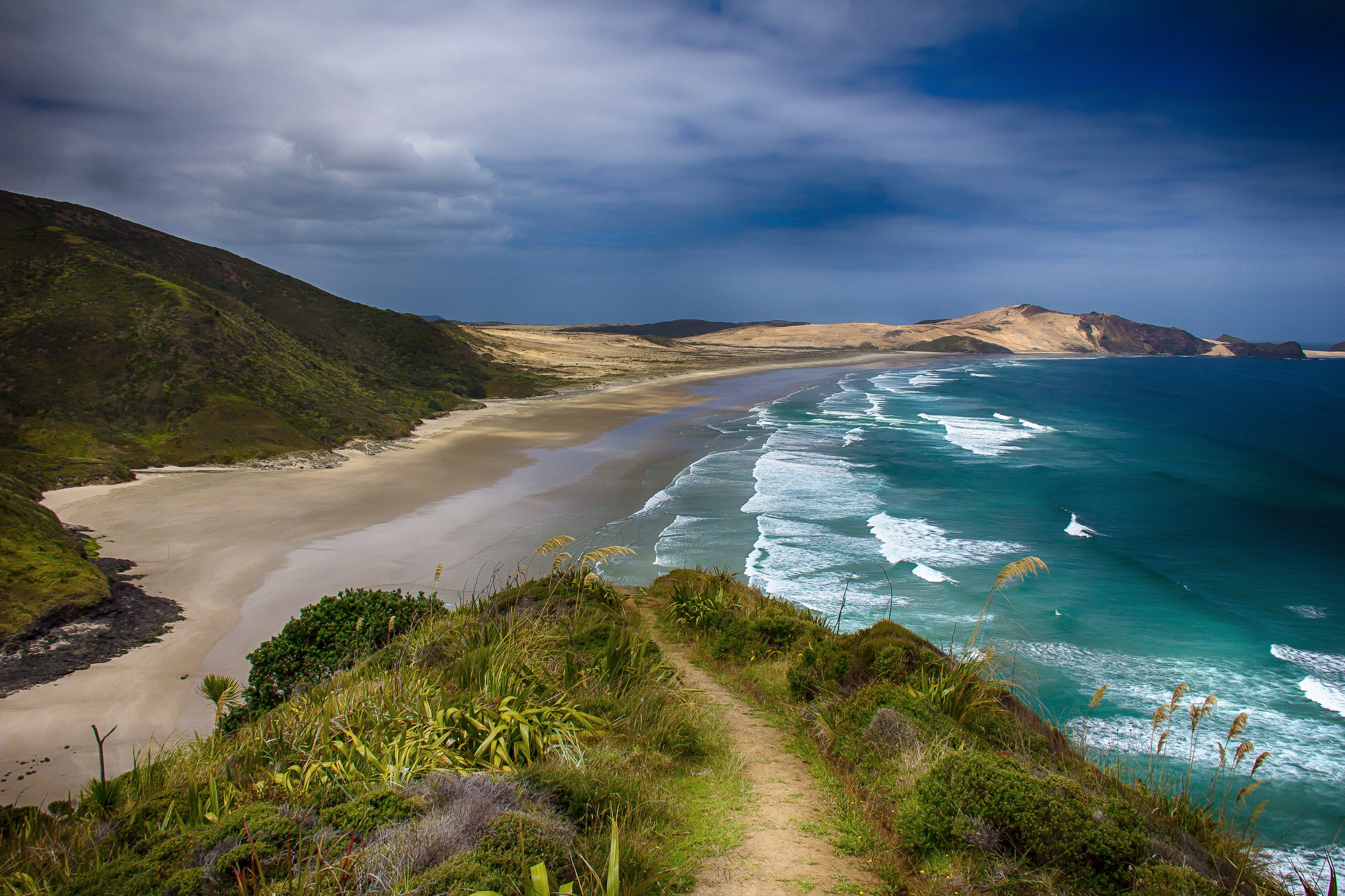
About Port Chalmers
European whaling ships first called at Otago Province during the early decades of the 1800s, yielding a mixed response from the native Māori. In 1848 Dunedin was settled, and by the mid-1860s the city was the economic hub of the Otago gold rush. Dunedin's historical wealth endures in such institutions as the University of Otago, the oldest in the country. But if any region can bring out the bird-watcher in you, this is it; the area is home to the Royal Albatross and yellow-eyed penguins.
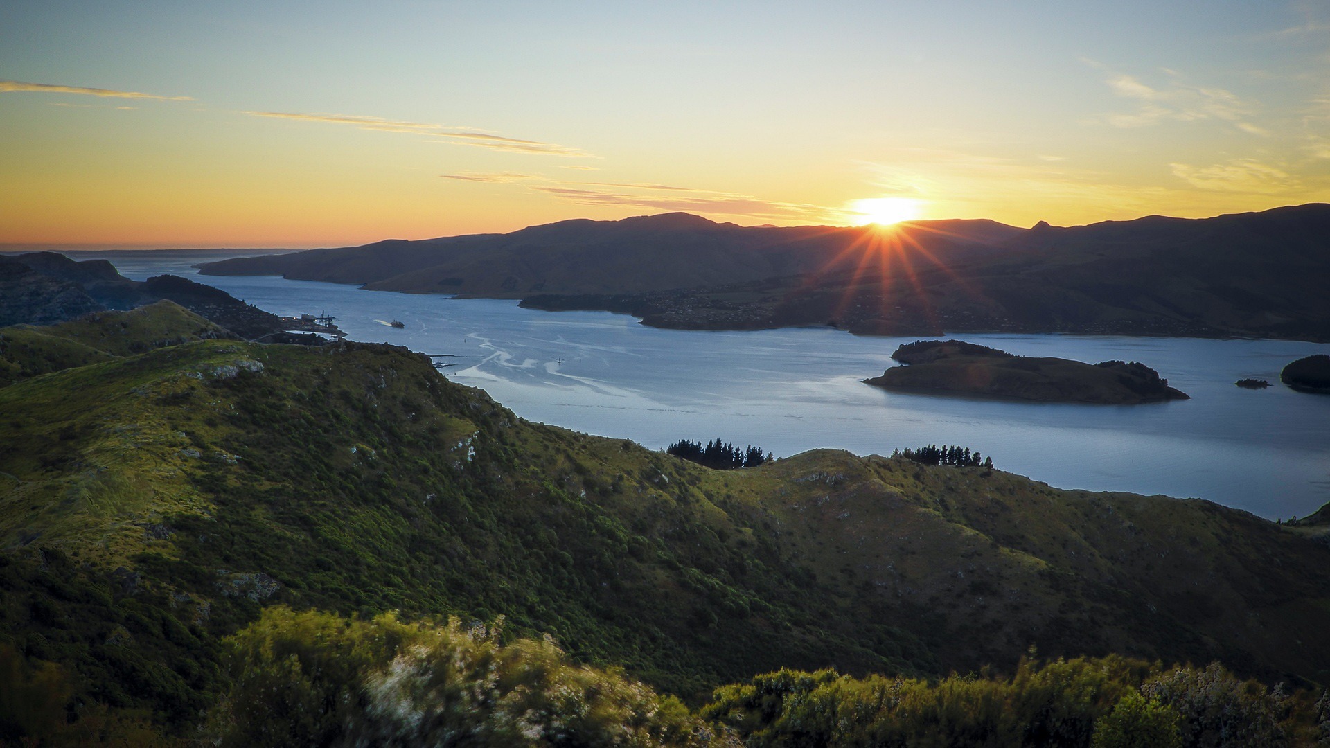
About Lyttelton
Your initial impression of Christchurch will likely be one of a genteel, green city. Joggers loop through shady Hagley Park, and punters ply the narrow Avon River, which bubbles between banks lined with willows and oaks. With a population approaching 350,000, Christchurch is the largest South Island city, and the second-largest in the country. It is also the forward supply depot for the main U.S. Antarctic base at McMurdo Sound. The face of Christchurch is changing rapidly, fueled by both internal and international immigration. The Māori community, although still below the national average in size, is growing. Ngai Tahu, the main South Island Māori tribe, settled Treaty of Waitangi claims in 1997 and have been investing in tourism ventures. Old wooden bungalows are making way for town houses, the arts scene is flourishing, and the city's university attracts cutting-edge technology companies. In short, there's plenty of fresh energy percolating underneath the English veneer.
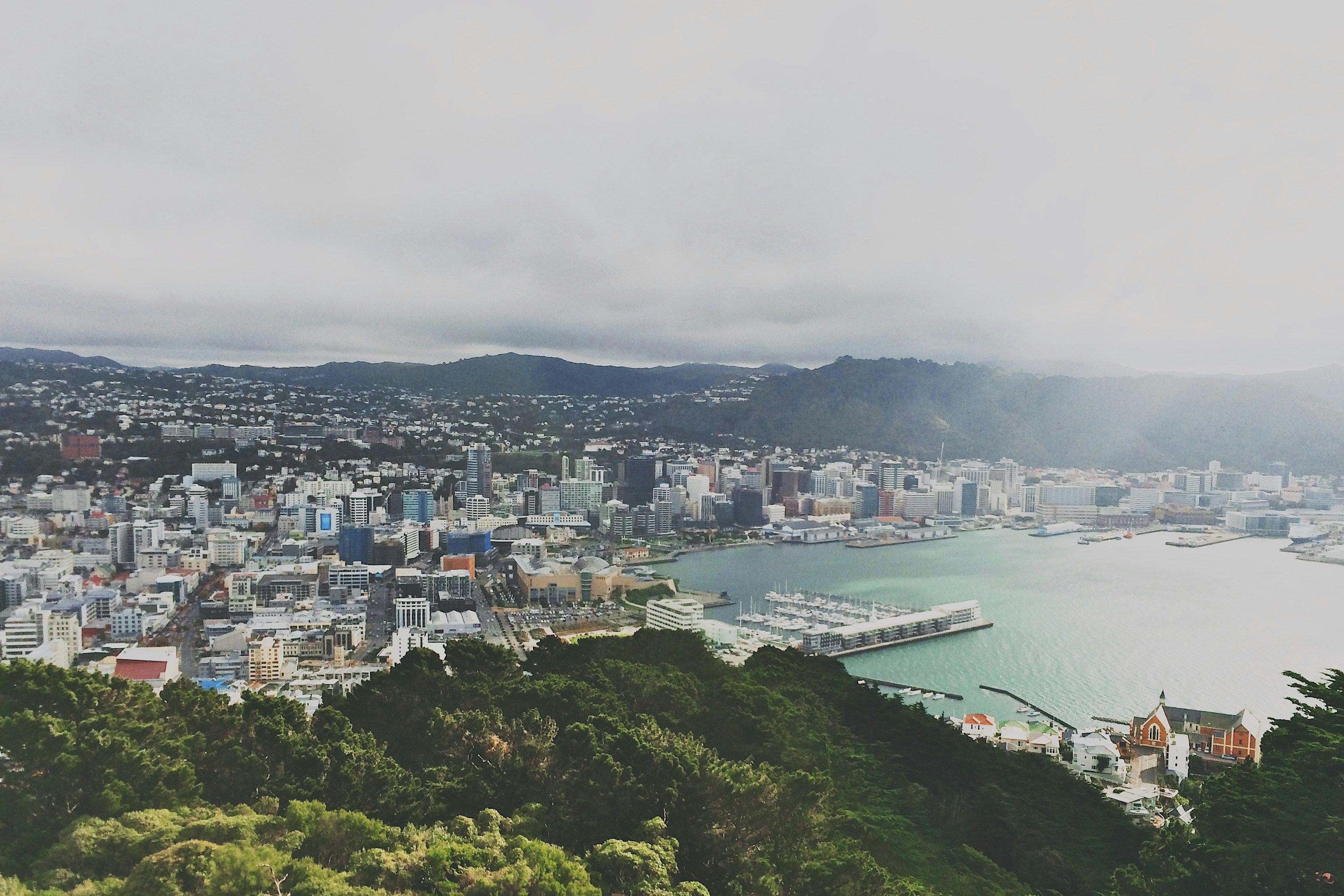
About Wellington
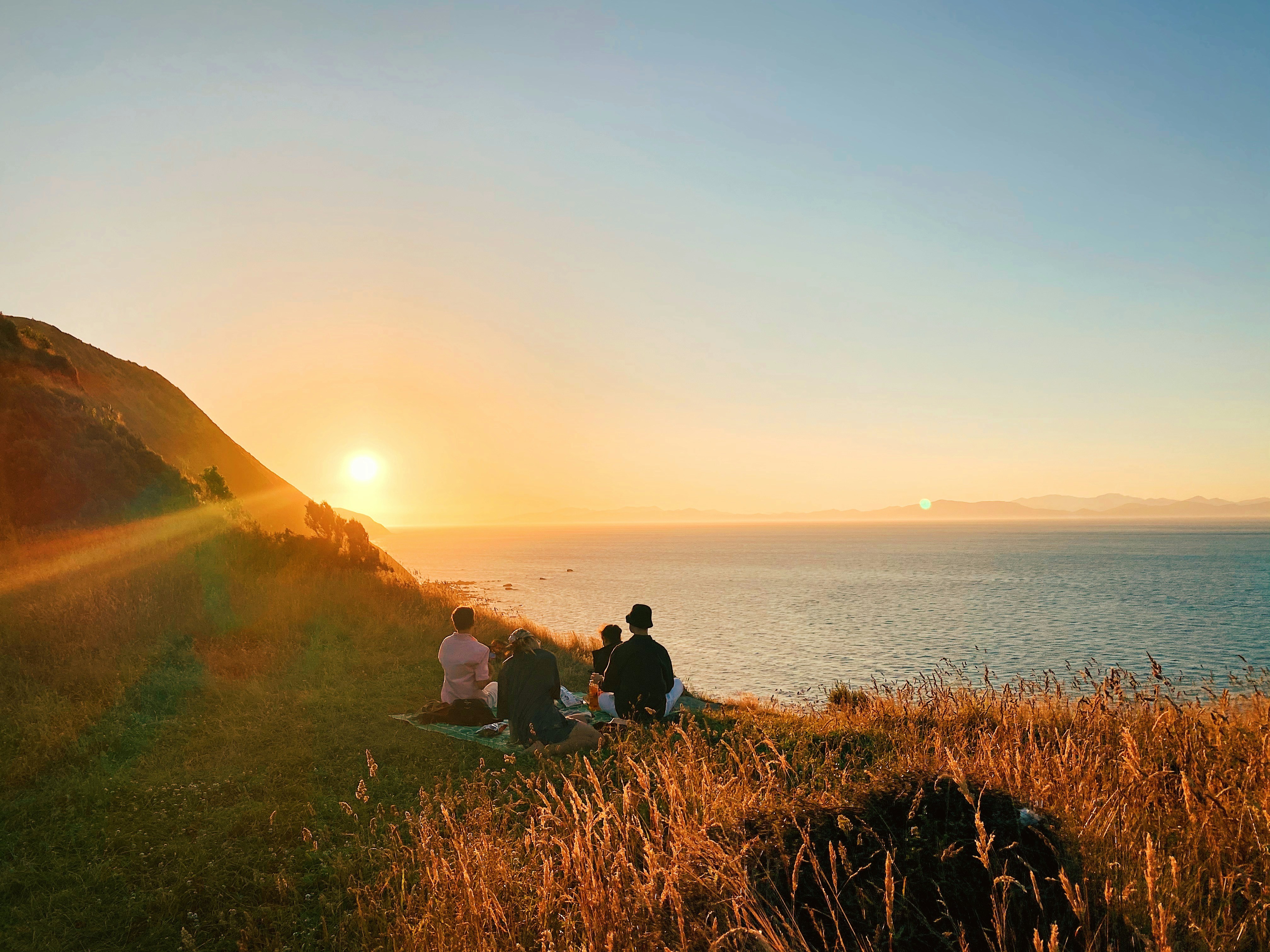
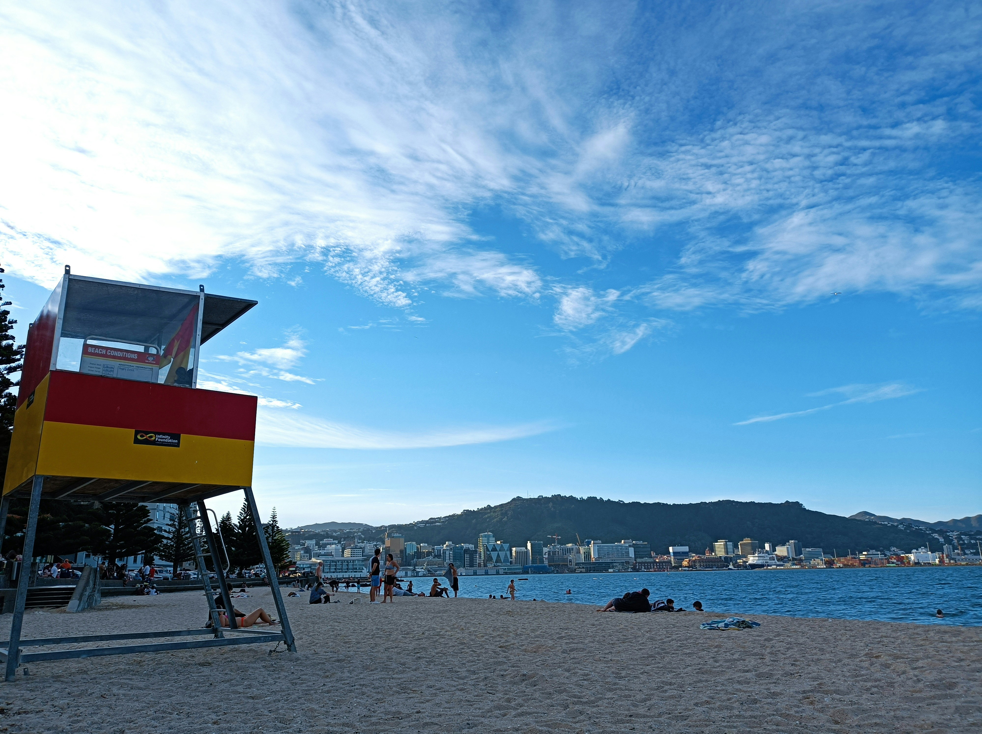
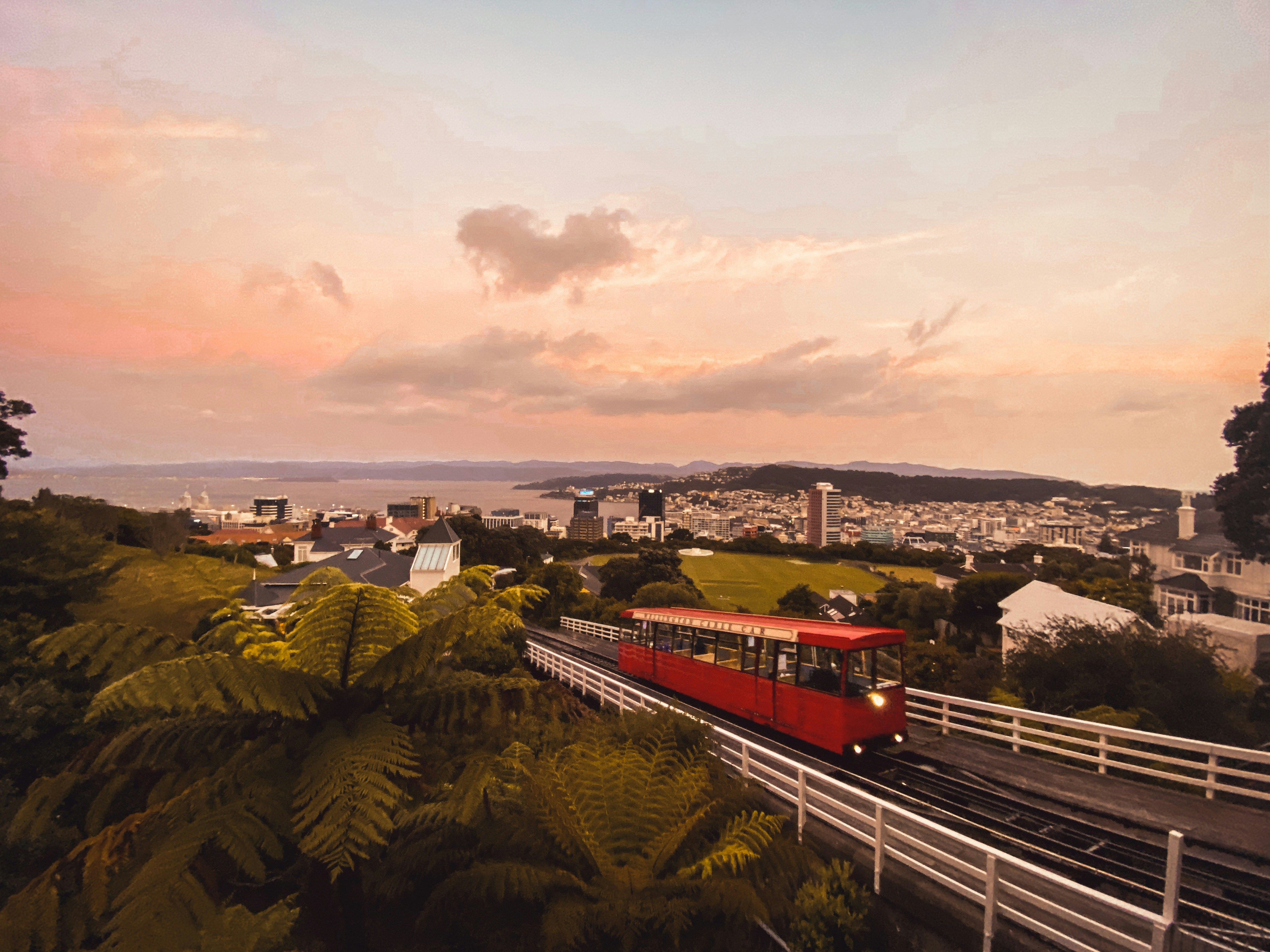
New Zealand's capital is, arguably, the country's most cosmopolitan metropolis. It's world-class Te Papa Tongarewa-Museum of New Zealand is a don't-miss attraction, and the burgeoning film industry led, of course, by the Lord of the Rings extravaganzas has injected new life into the local arts scene. Attractive and compact enough to be explored easily on foot, Wellington is a booming destination. Modern high-rise buildings gaze over Port Nicholson, surely one of the finest natural anchorages in the world. Known to local Māori as The Great Harbor of Tara, its two massive arms form the jaws of the fish of Maui from Māori legend. Sometimes referred to as the windy city, Wellington has been the seat of New Zealand's government since 1865.


About Napier
The earthquake that struck Napier at 10:46 am on February 3, 1931, was—at 7.8 on the Richter scale—the largest quake ever recorded in New Zealand. The coastline was wrenched upward several feet. Almost all the town's brick buildings collapsed; many people were killed on the footpaths as they rushed outside. The quake triggered fires throughout town, and with water mains shattered, little could be done to stop the blazes that devoured the remaining wooden structures. Only a few buildings survived (the Public Service Building with its neoclassical pillars is one), and the death toll was well over 100.The surviving townspeople set up tents and cookhouses in Nelson Park, and then tackled the city's reconstruction at a remarkable pace. In the rush to rebuild, Napier went mad for art deco, the bold, geometric style that had burst on the global design scene in 1925. Now a walk through the art deco district, concentrated between Emerson, Herschell, Dalton, and Browning streets, is a stylistic immersion. The decorative elements are often above the ground floors, so keep your eyes up.
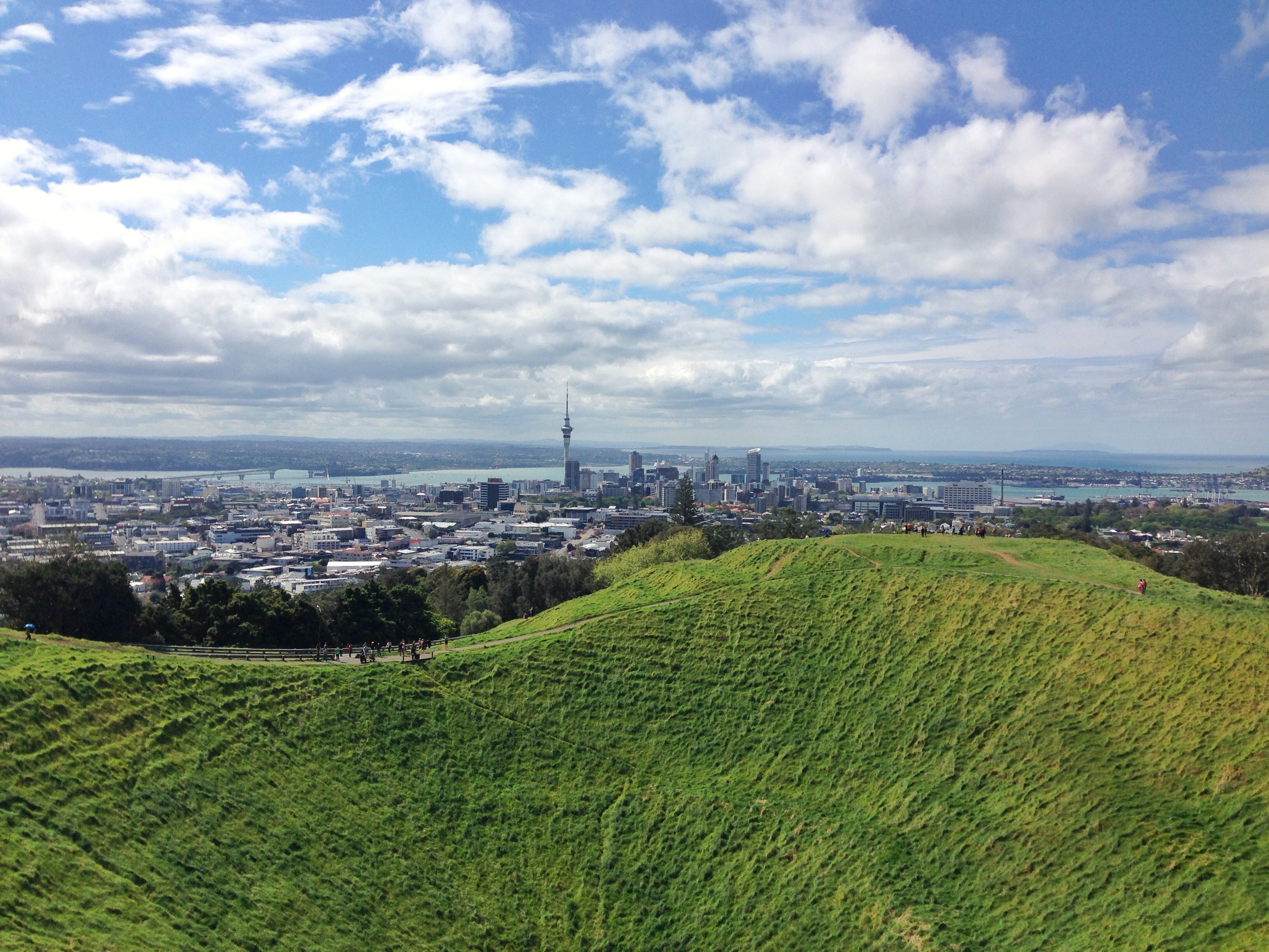
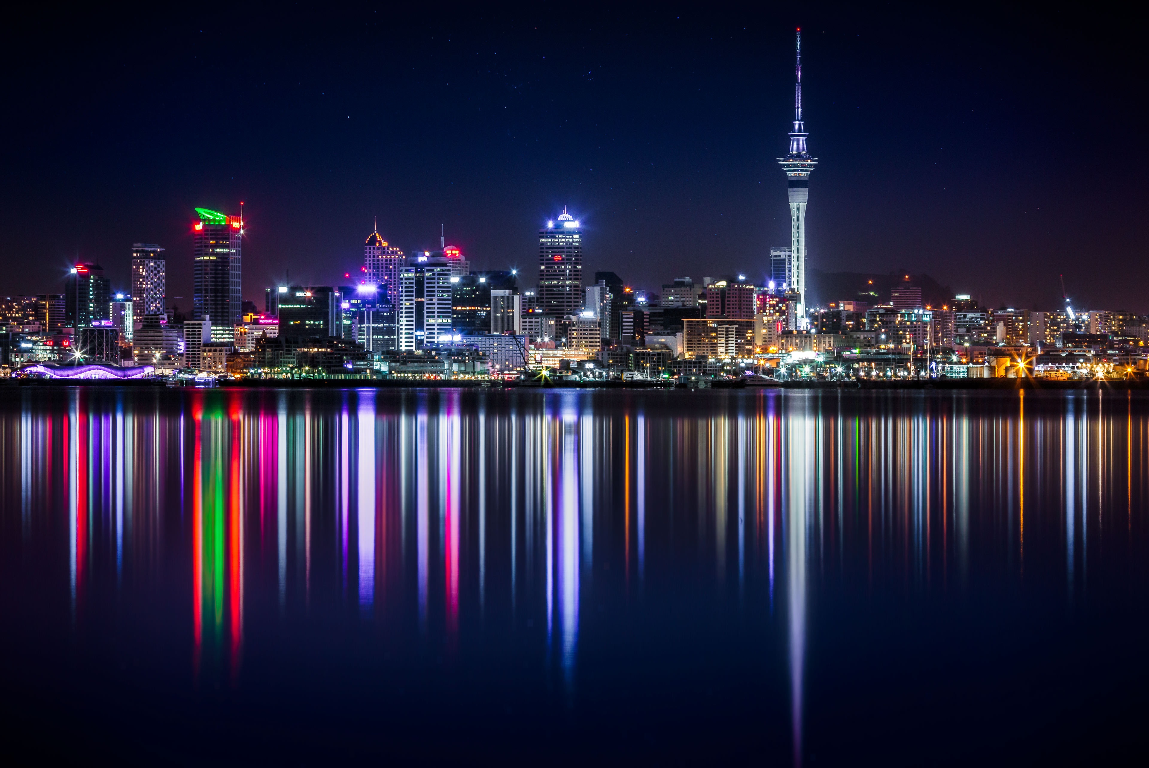
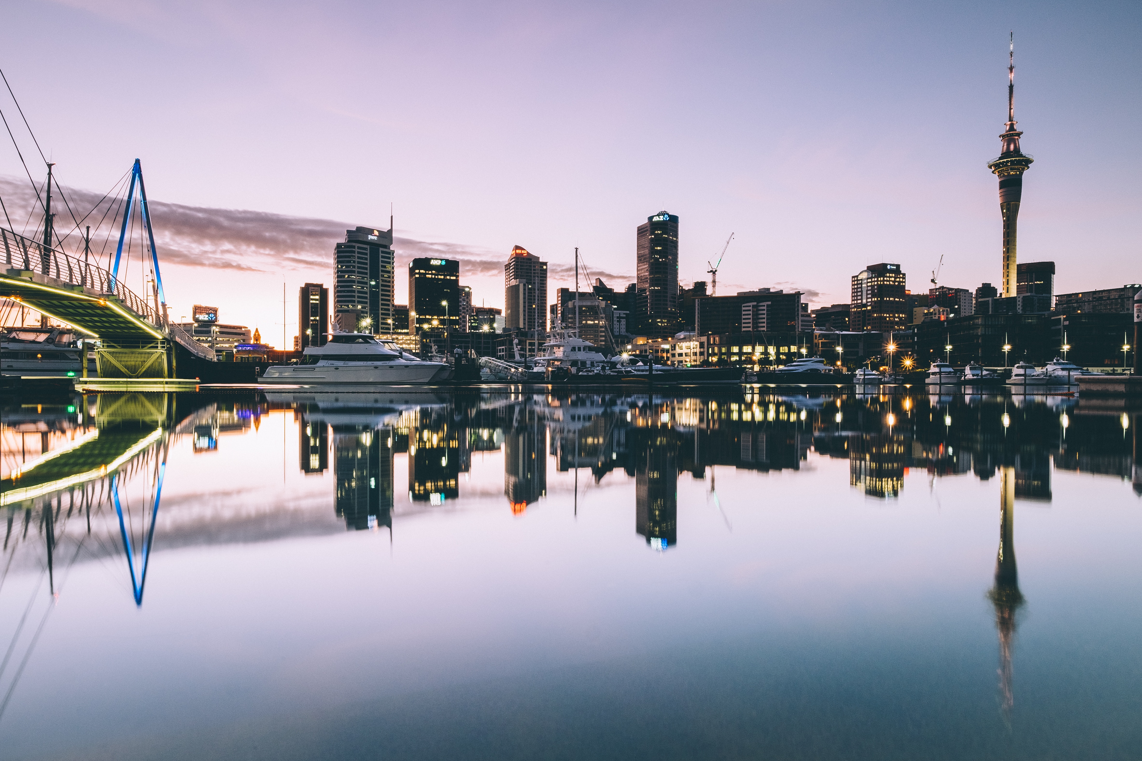
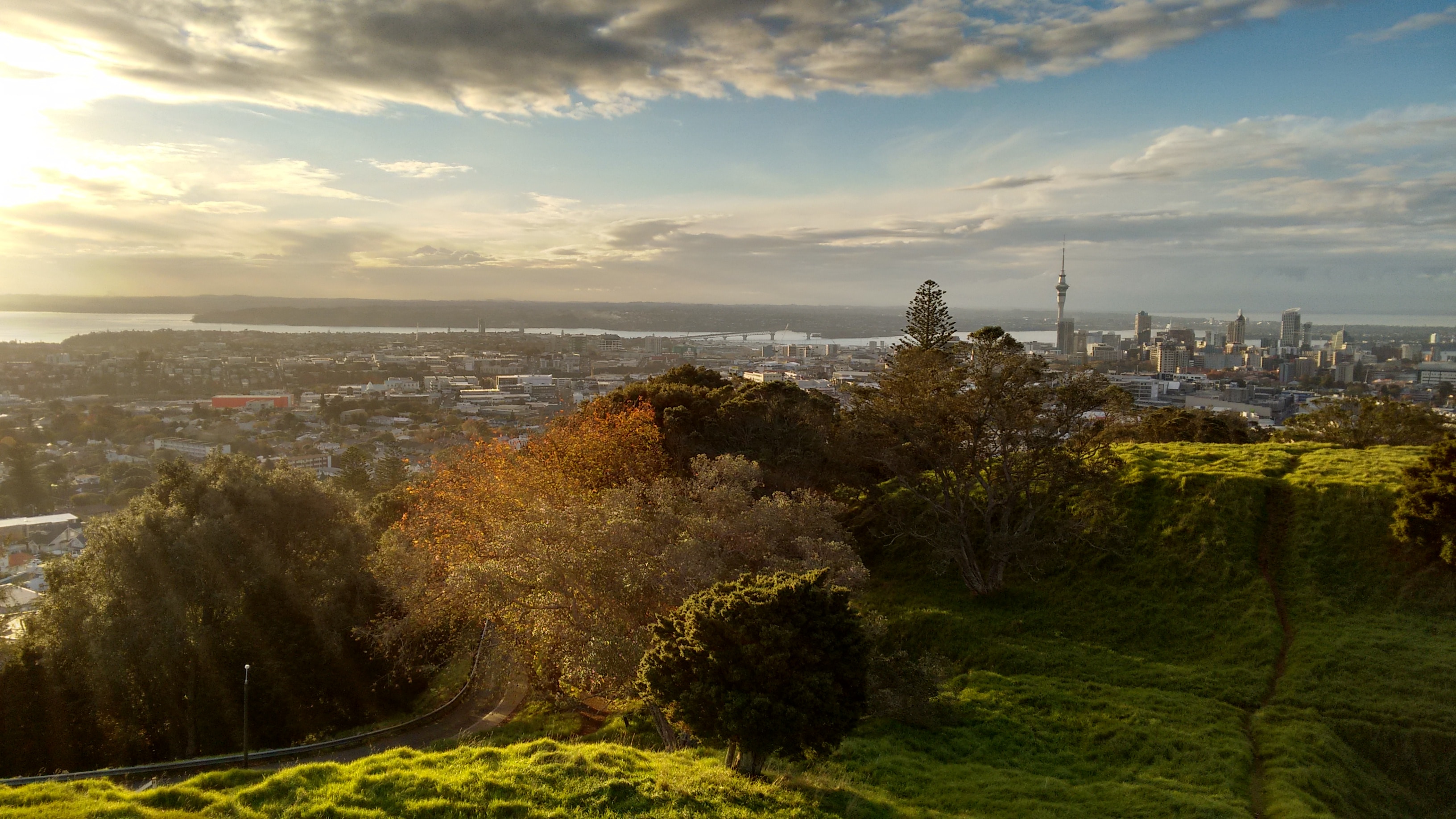
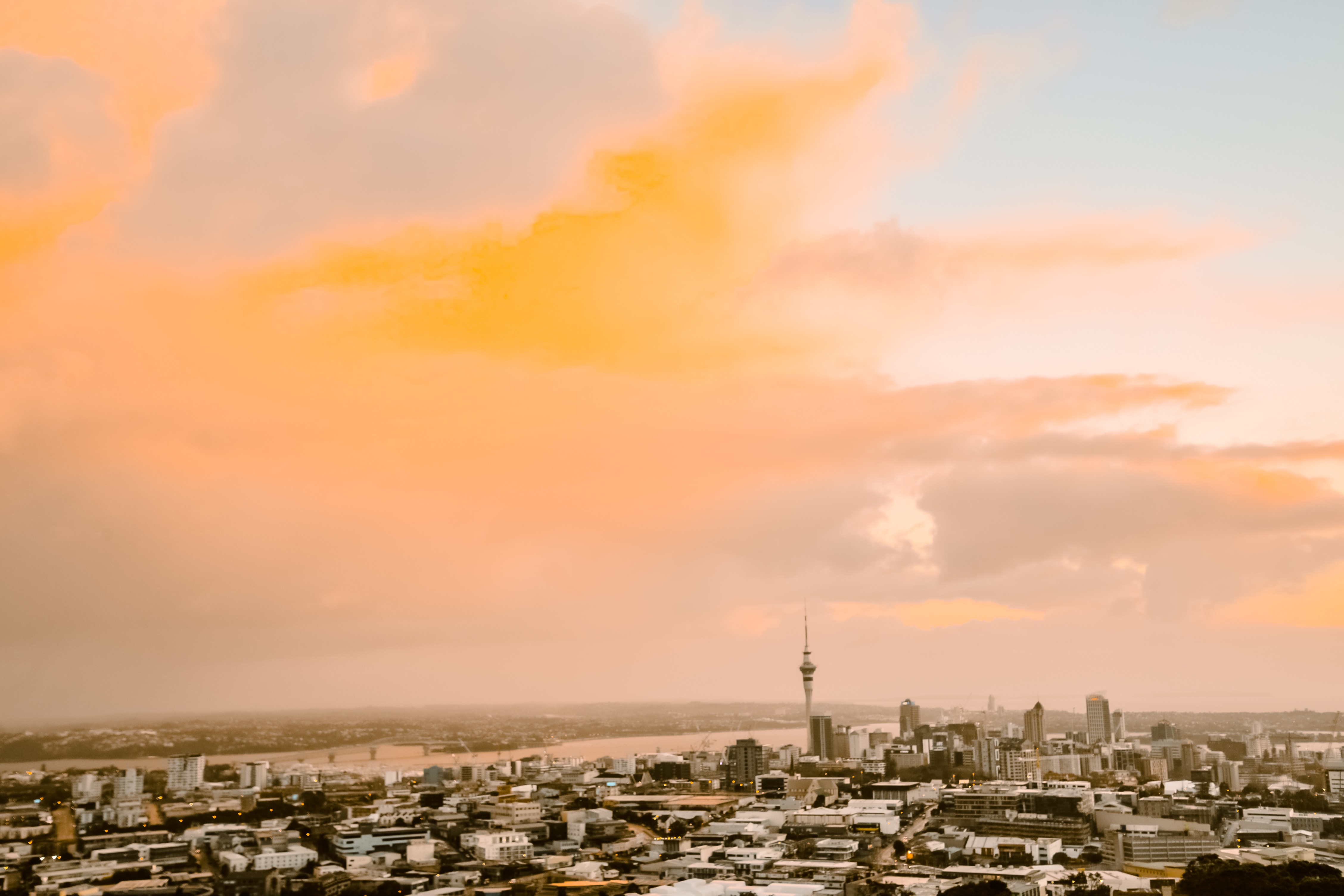
About Auckland
Auckland is called the City of Sails, and visitors flying in will see why. On the East Coast is the Waitemata Harbour—a Māori word meaning sparkling waters—which is bordered by the Hauraki Gulf, an aquatic playground peppered with small islands where many Aucklanders can be found "mucking around in boats."Not surprisingly, Auckland has some 70,000 boats. About one in four households in Auckland has a seacraft of some kind, and there are 102 beaches within an hour's drive; during the week many are quite empty. Even the airport is by the water; it borders the Manukau Harbour, which also takes its name from the Māori language and means solitary bird.According to Māori tradition, the Auckland isthmus was originally peopled by a race of giants and fairy folk. When Europeans arrived in the early 19th century, however, the Ngāti-Whātua tribe was firmly in control of the region. The British began negotiations with the Ngāti-Whātua in 1840 to purchase the isthmus and establish the colony's first capital. In September of that year the British flag was hoisted to mark the township's foundation, and Auckland remained the capital until 1865, when the seat of government was moved to Wellington. Aucklanders expected to suffer from the shift; it hurt their pride but not their pockets. As the terminal for the South Sea shipping routes, Auckland was already an established commercial center. Since then the urban sprawl has made this city of approximately 1.3 million people one of the world's largest geographically.A couple of days in the city will reveal just how developed and sophisticated Auckland is—the Mercer City Survey 2012 saw it ranked as the third-highest city for quality of life—though those seeking a New York in the South Pacific will be disappointed. Auckland is more get-up and go-outside than get-dressed-up and go-out. That said, most shops are open daily, central bars and a few nightclubs buzz well into the wee hours, especially Thursday through Saturday, and a mix of Māori, Pacific people, Asians, and Europeans contributes to the cultural milieu. Auckland has the world's largest single population of Pacific Islanders living outside their home countries, though many of them live outside the central parts of the city and in Manukau to the south. The Samoan language is the second most spoken in New Zealand. Most Pacific people came to New Zealand seeking a better life. When the plentiful, low-skilled work that attracted them dried up, the dream soured, and the population has suffered with poor health and education. Luckily, policies are now addressing that, and change is slowly coming. The Pacifica Festival in March is the region's biggest cultural event, attracting thousands to Western Springs. The annual Pacific Island Secondary Schools’ Competition, also in March, sees young Pacific Islander and Asian students compete in traditional dance, drumming, and singing. This event is open to the public.At the geographical center of Auckland city is the 1,082-foot Sky Tower, a convenient landmark for those exploring on foot and some say a visible sign of the city's naked aspiration. It has earned nicknames like the Needle and the Big Penis—a counterpoint to a poem by acclaimed New Zealand poet James K. Baxter, which refers to Rangitoto Island as a clitoris in the harbor.The Waitemata Harbour has become better known since New Zealand staged its first defense of the America's Cup in 2000 and the successful Louis Vuitton Pacific Series in early 2009. The first regatta saw major redevelopment of the waterfront. The area, where many of the city's most popular bars, cafés, and restaurants are located, is now known as Viaduct Basin or, more commonly, the Viaduct. A recent expansion has created another area, Wynyard Quarter, which is slowly adding restaurants.These days, Auckland is still considered too bold and brash for its own good by many Kiwis who live "south of the Bombay Hills," the geographical divide between Auckland and the rest of New Zealand (barring Northland). "Jafa," an acronym for "just another f—ing Aucklander," has entered the local lexicon; there's even a book out called Way of the Jafa: A Guide to Surviving Auckland and Aucklanders. A common complaint is that Auckland absorbs the wealth from the hard work of the rest of the country. Most Aucklanders, on the other hand, still try to shrug and see it as the parochial envy of those who live in small towns. But these internal identity squabbles aren't your problem. You can enjoy a well-made coffee in almost any café, or take a walk on a beach—knowing that within 30 minutes' driving time you could be cruising the spectacular harbor, playing a round at a public golf course, or even walking in subtropical forest while listening to the song of a native tûî bird.
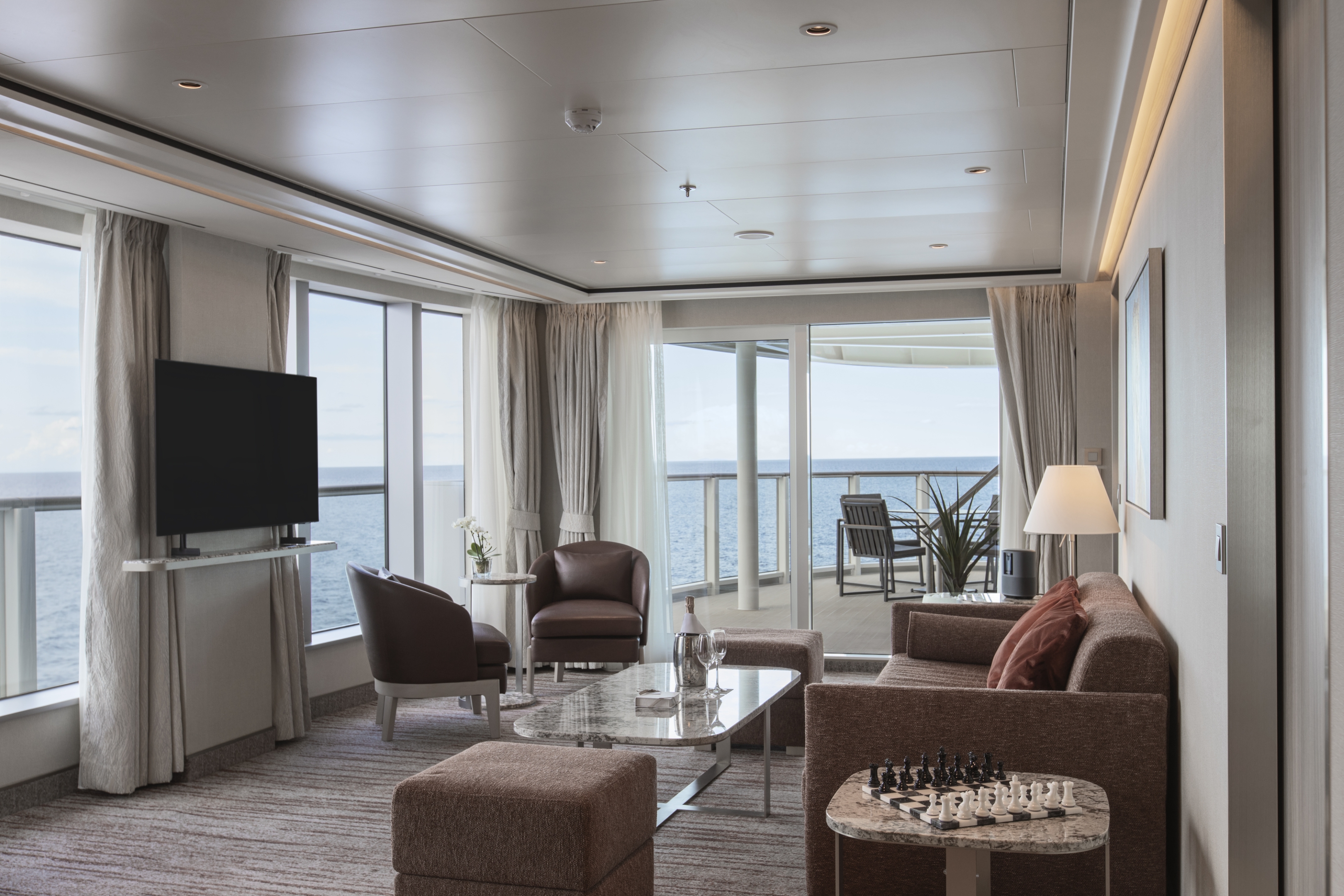
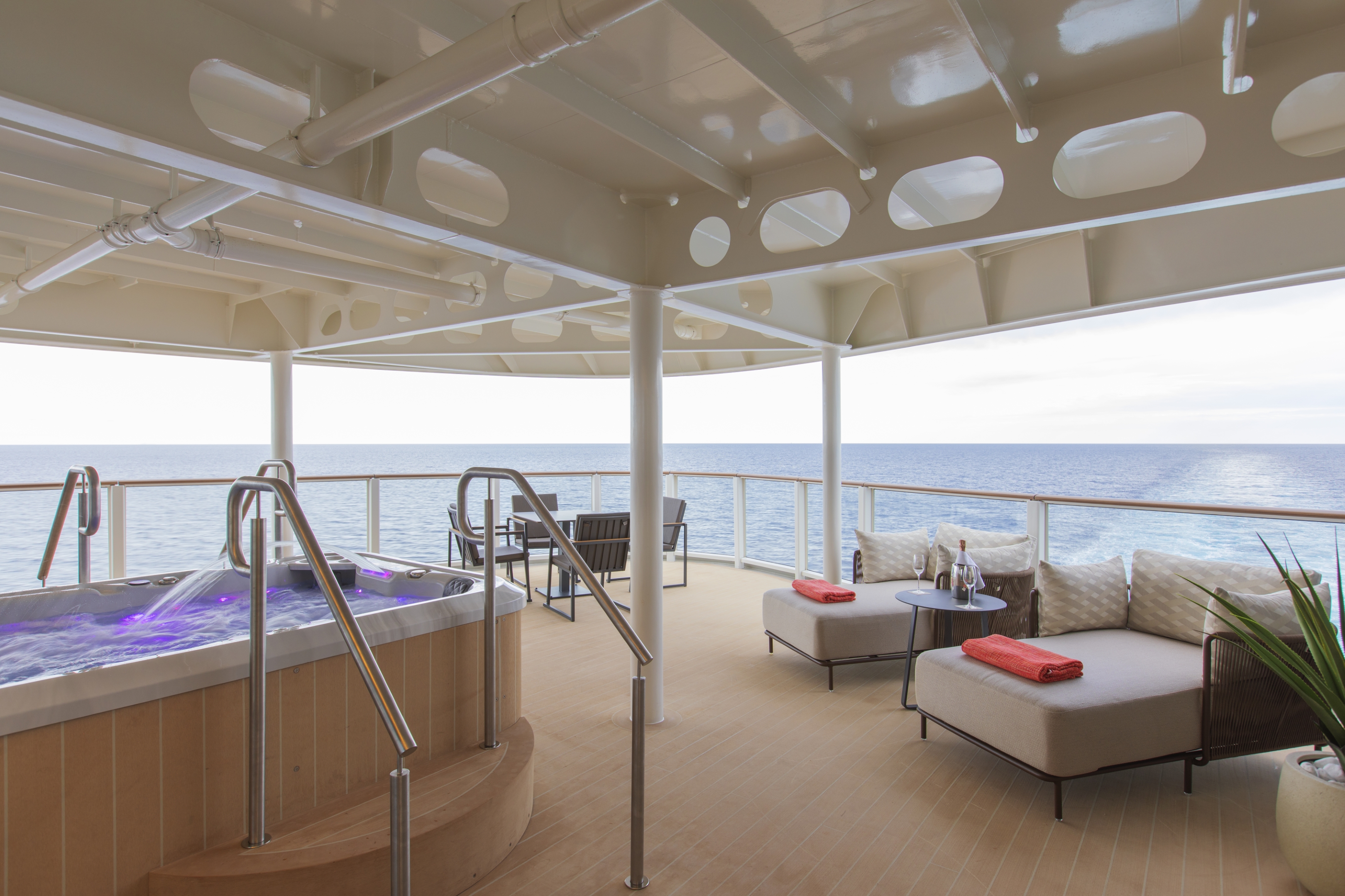
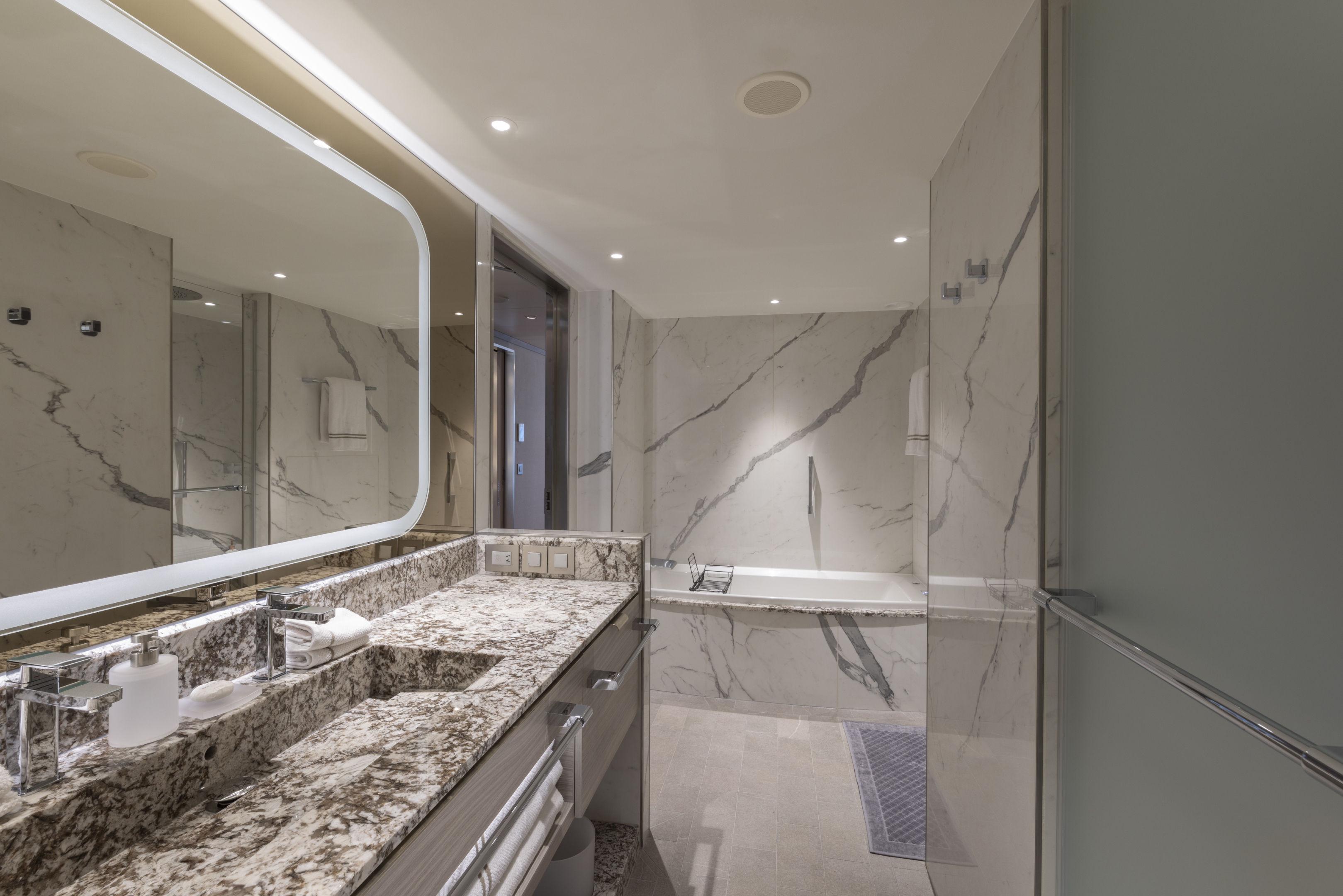
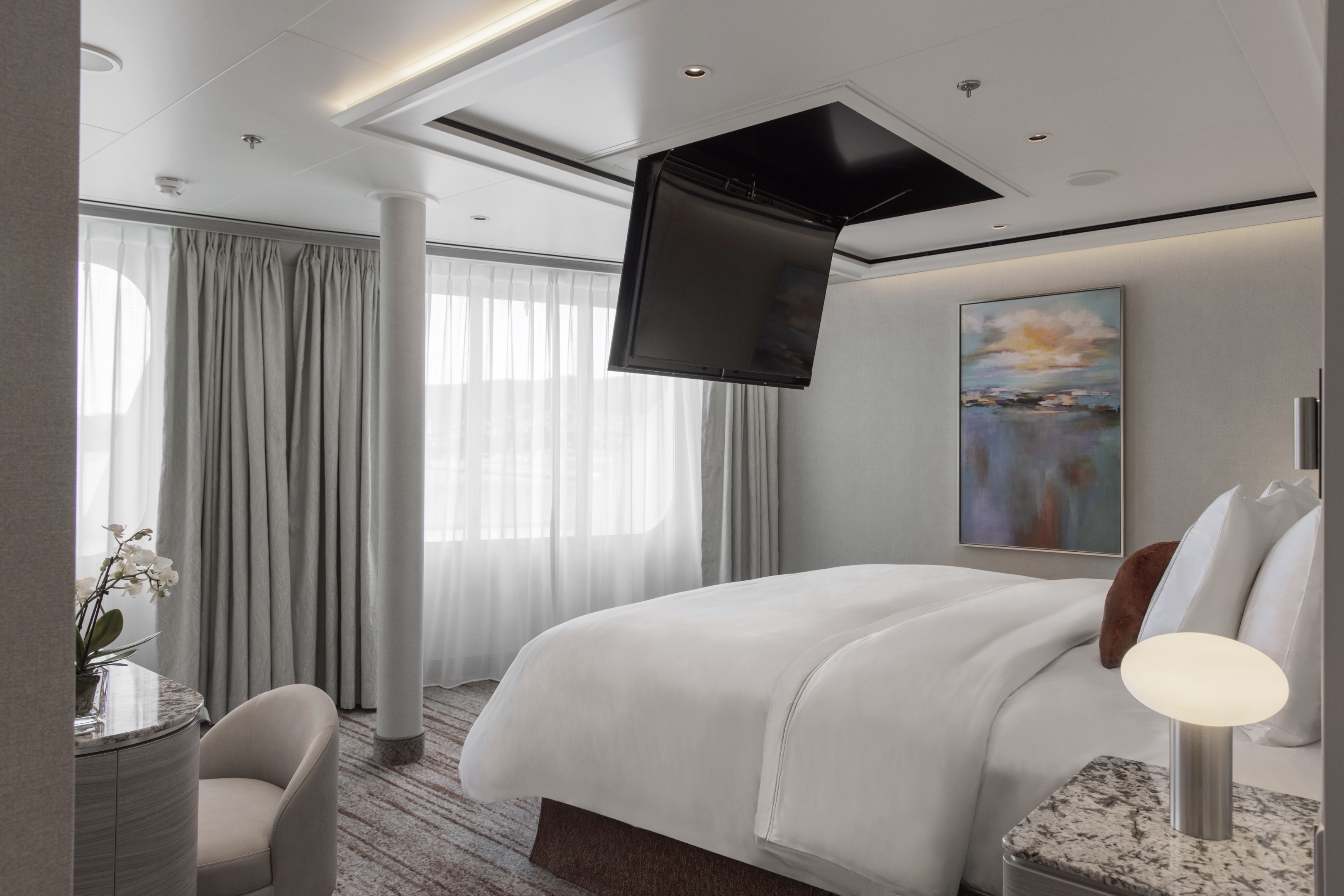
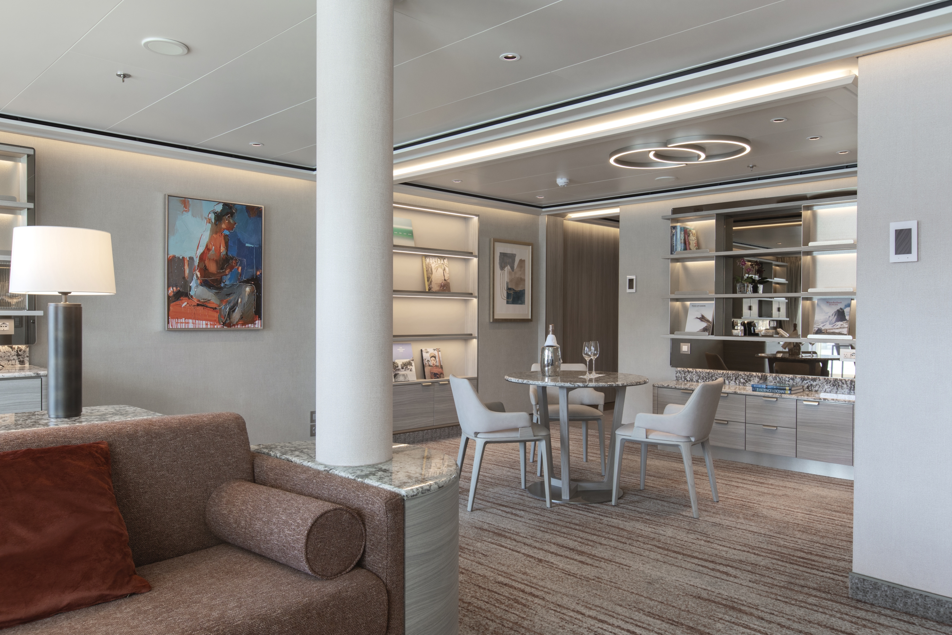
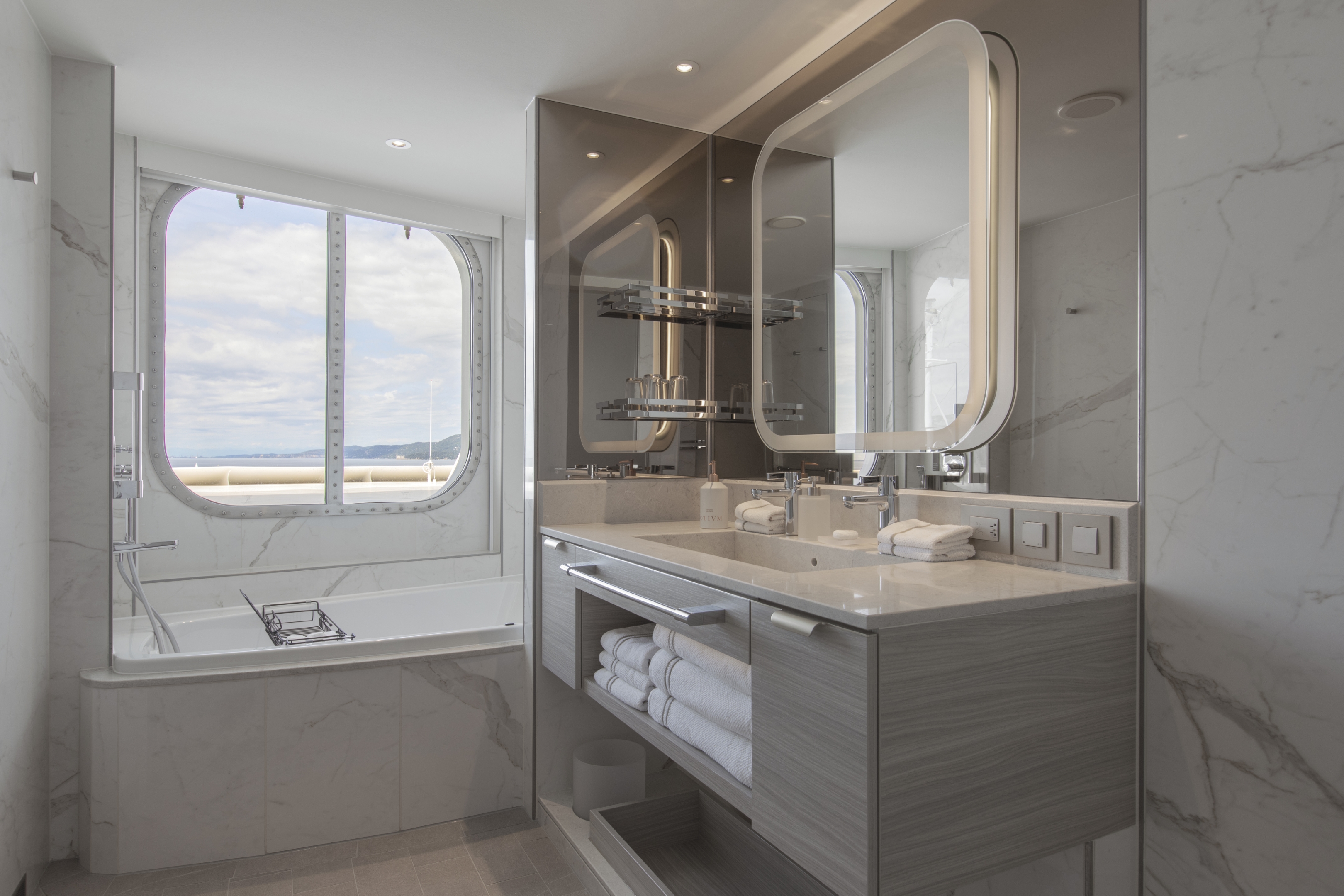
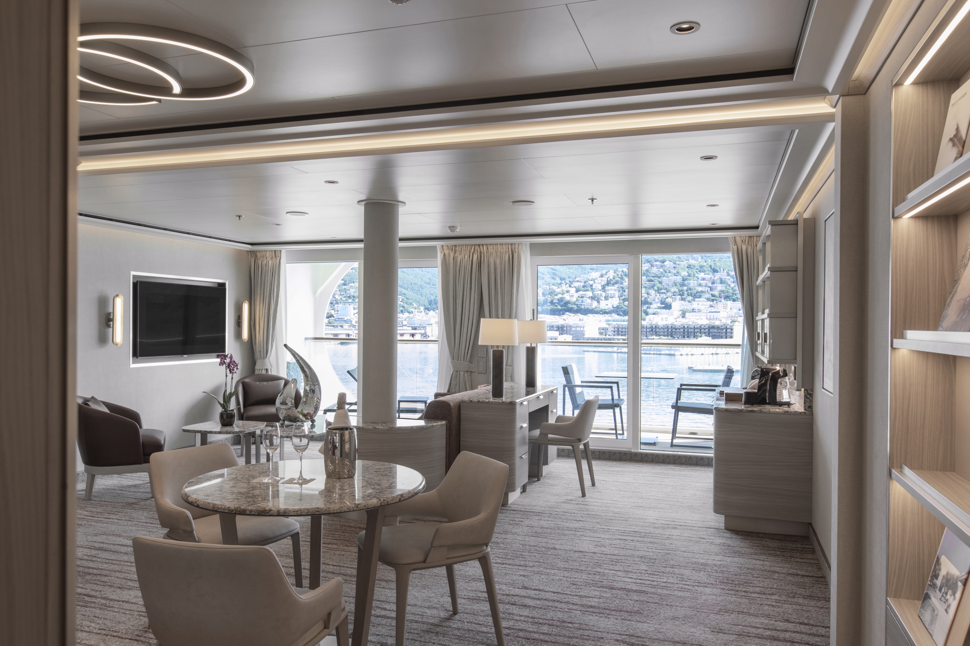
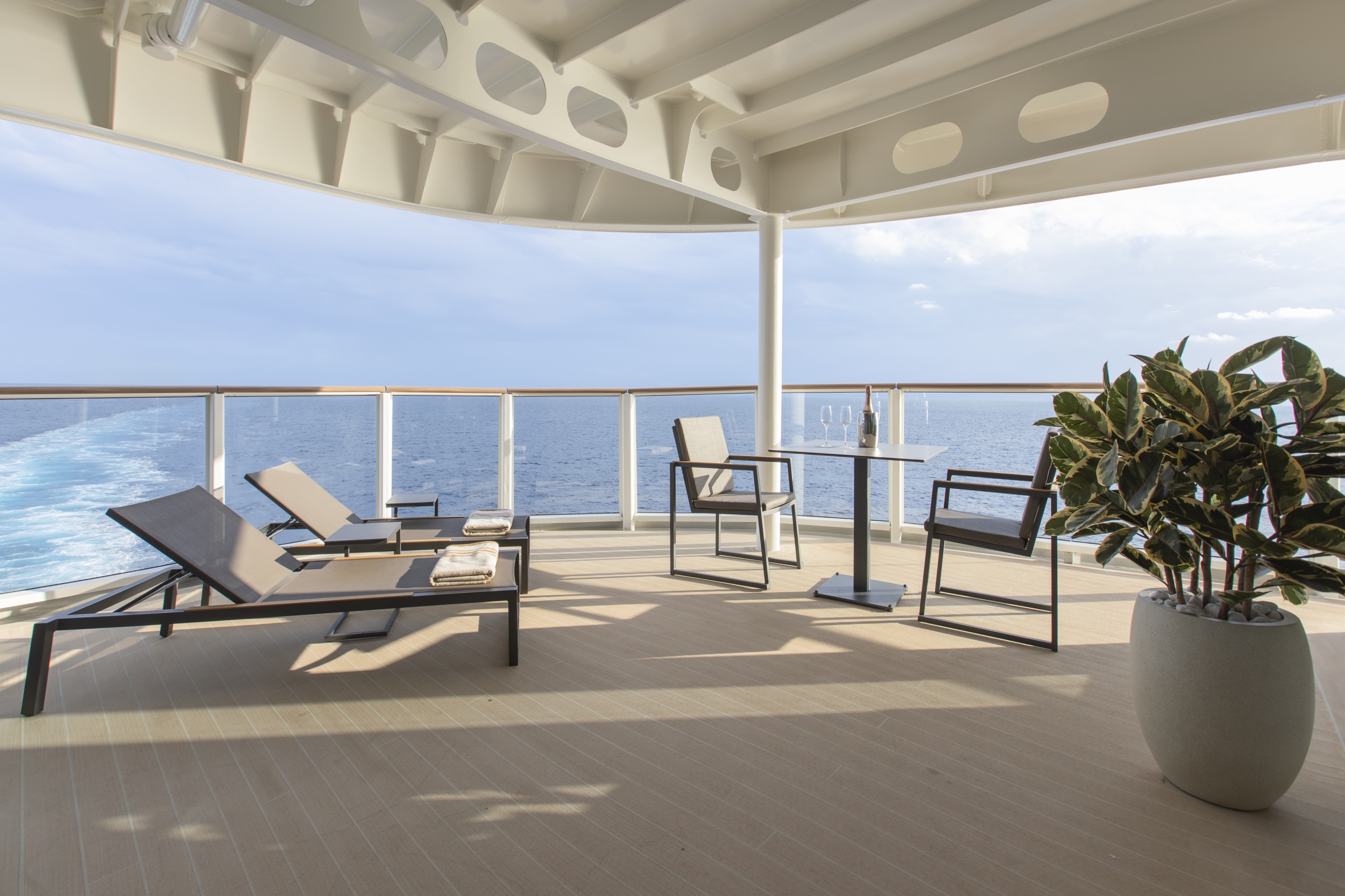
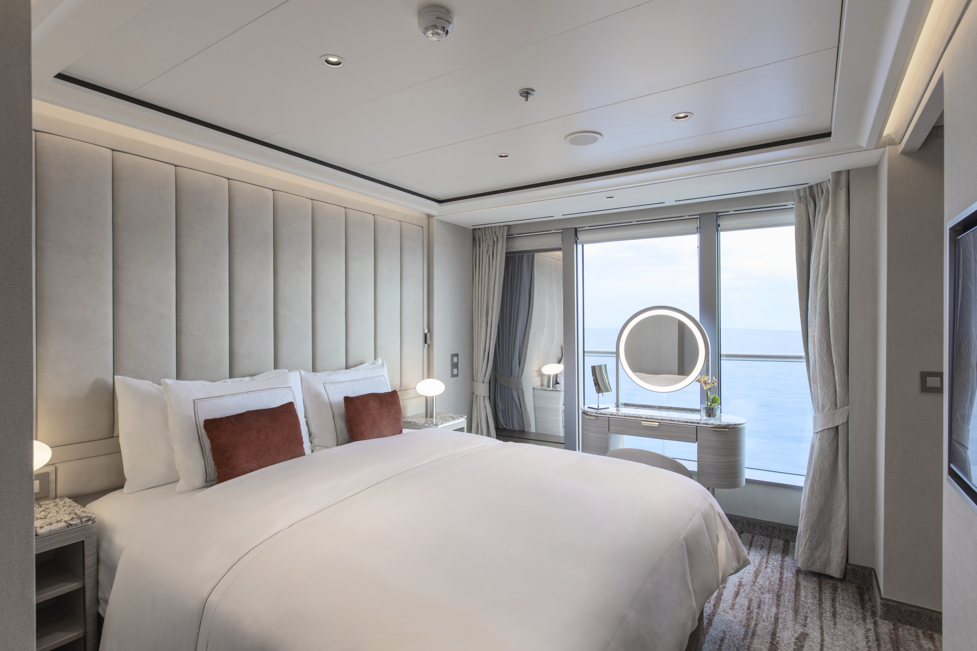
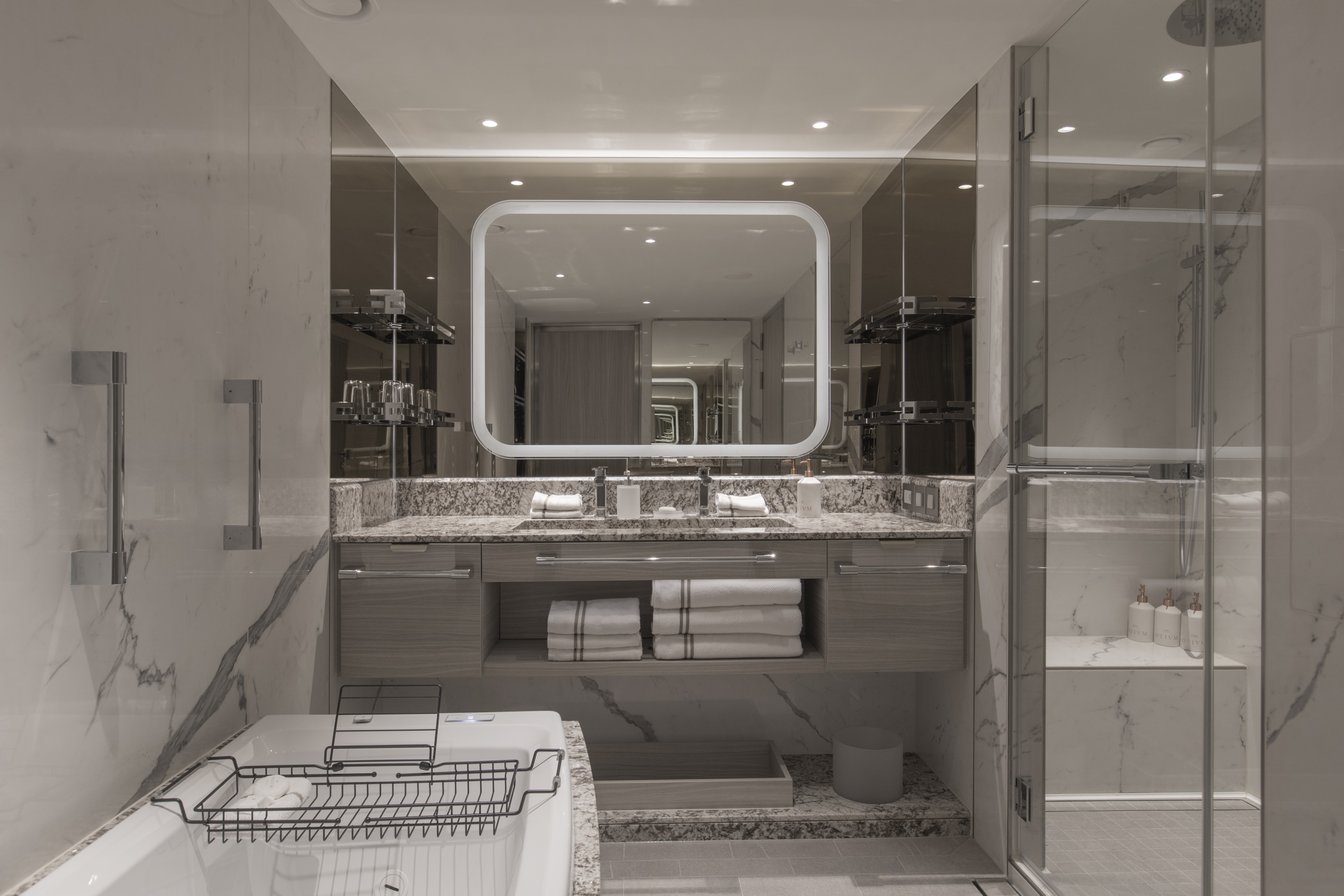
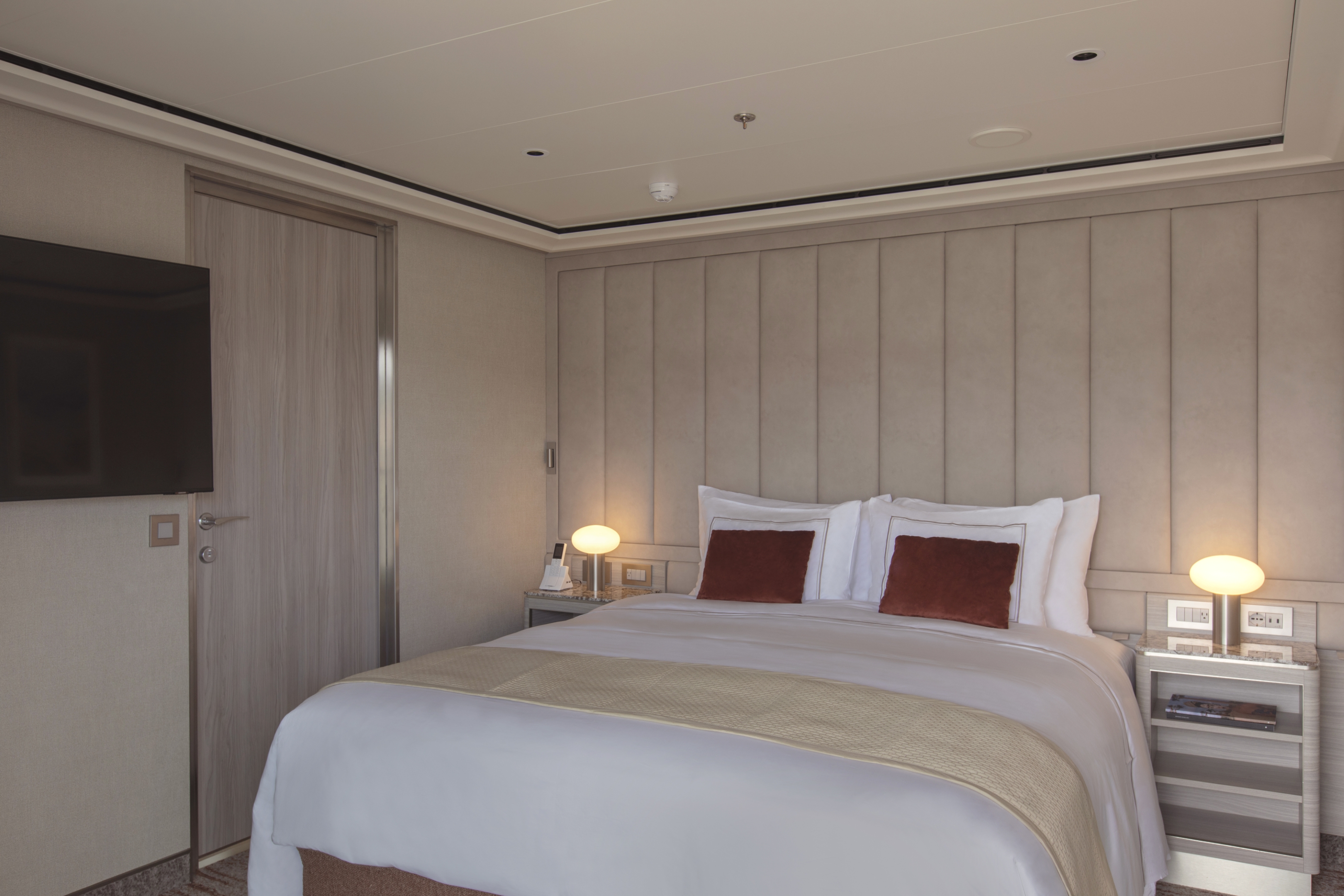
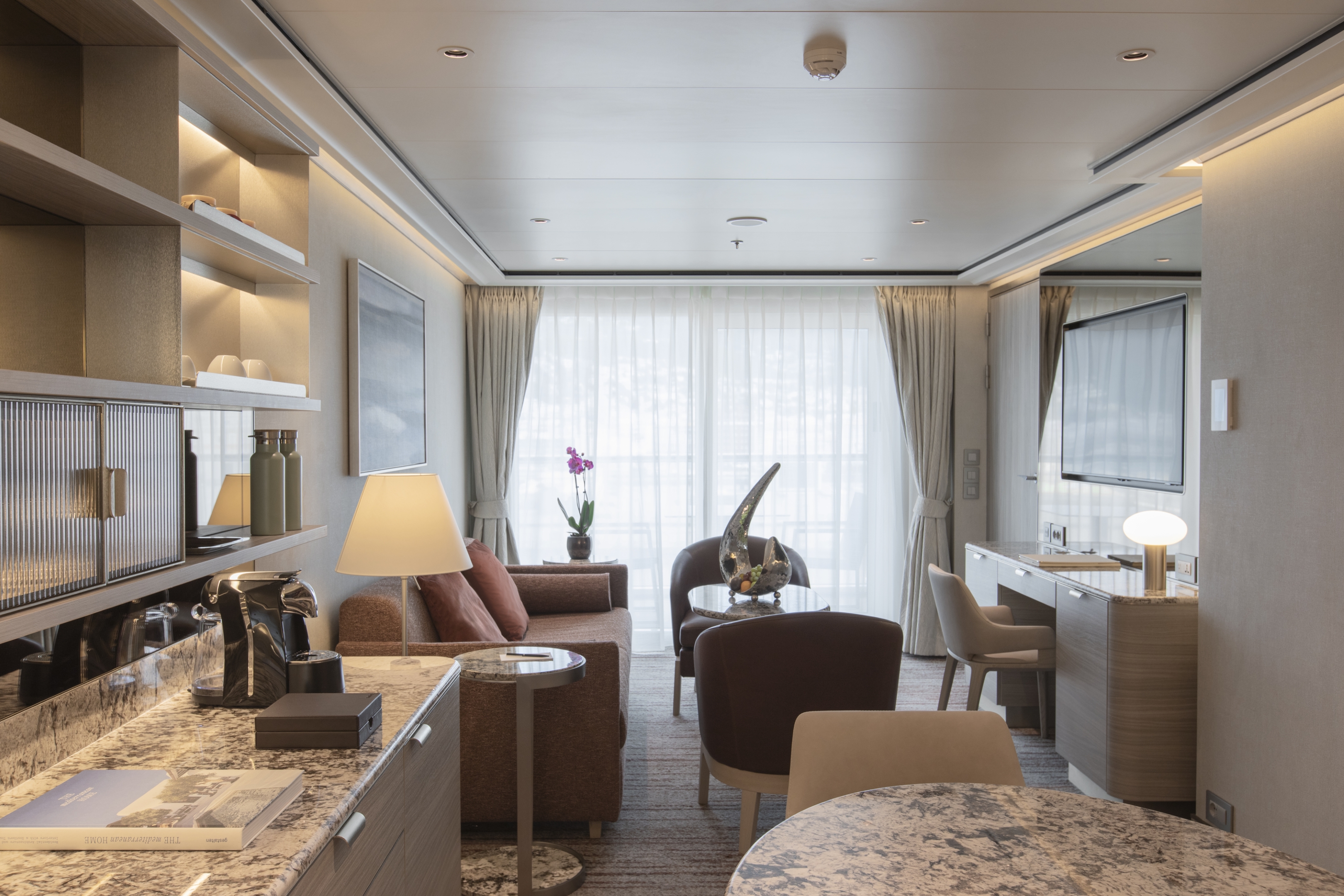
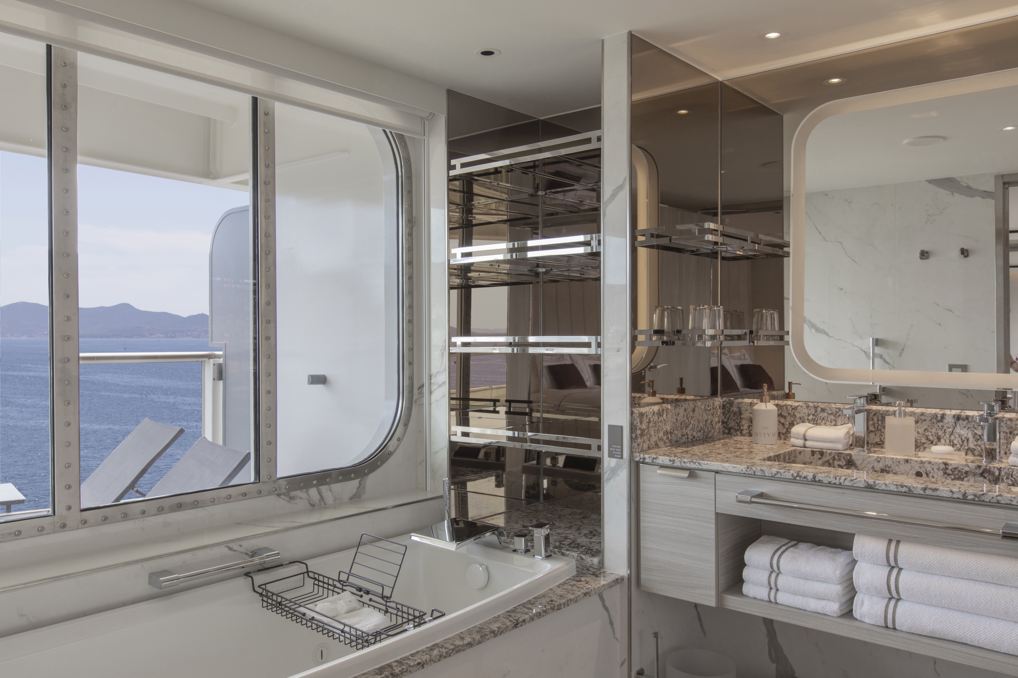
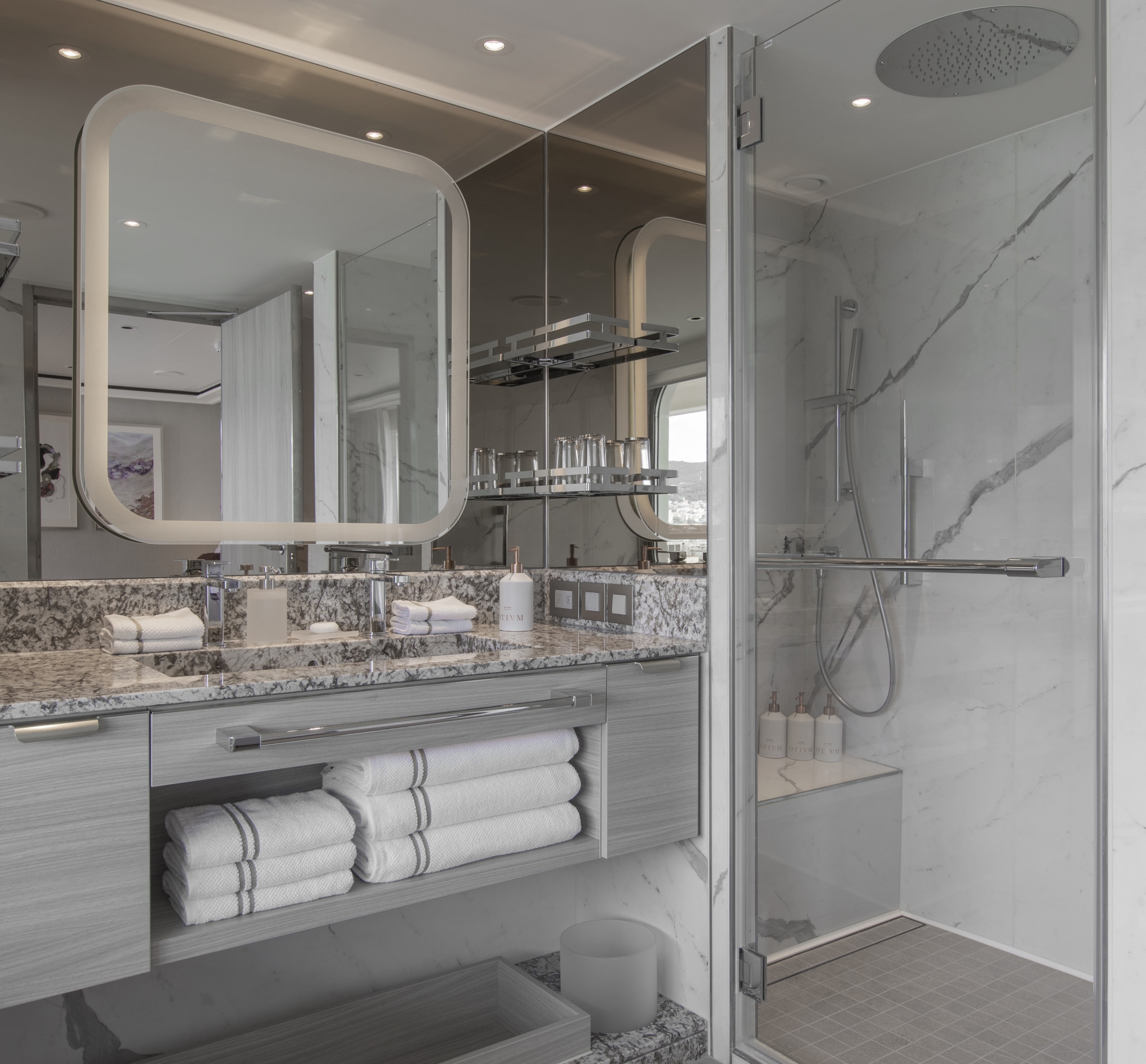
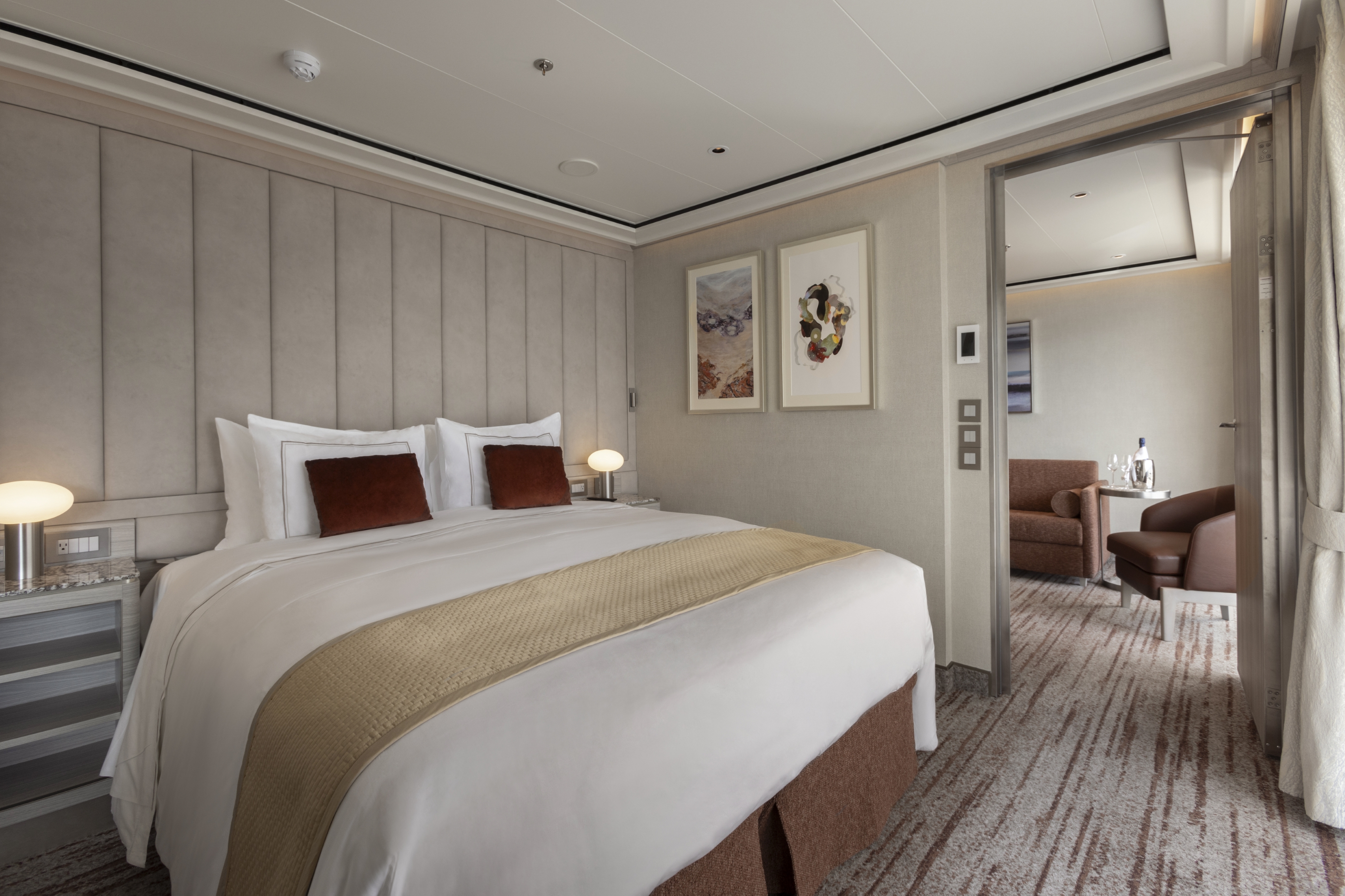
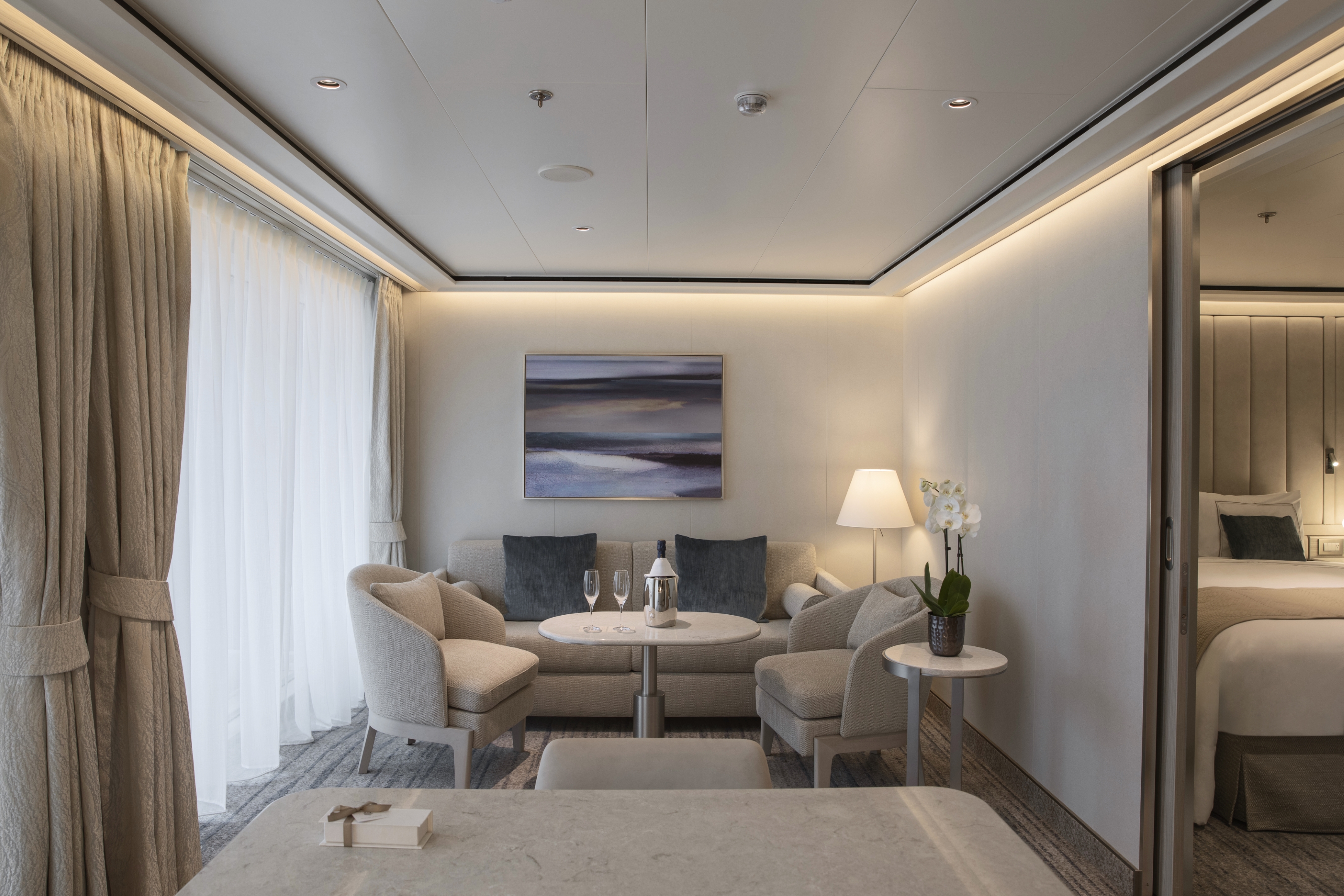
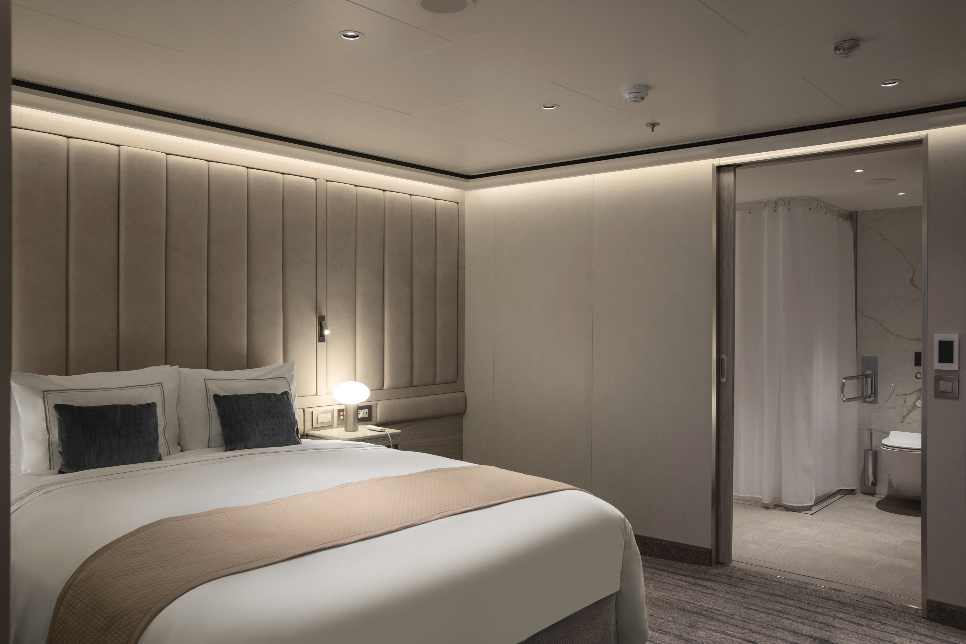
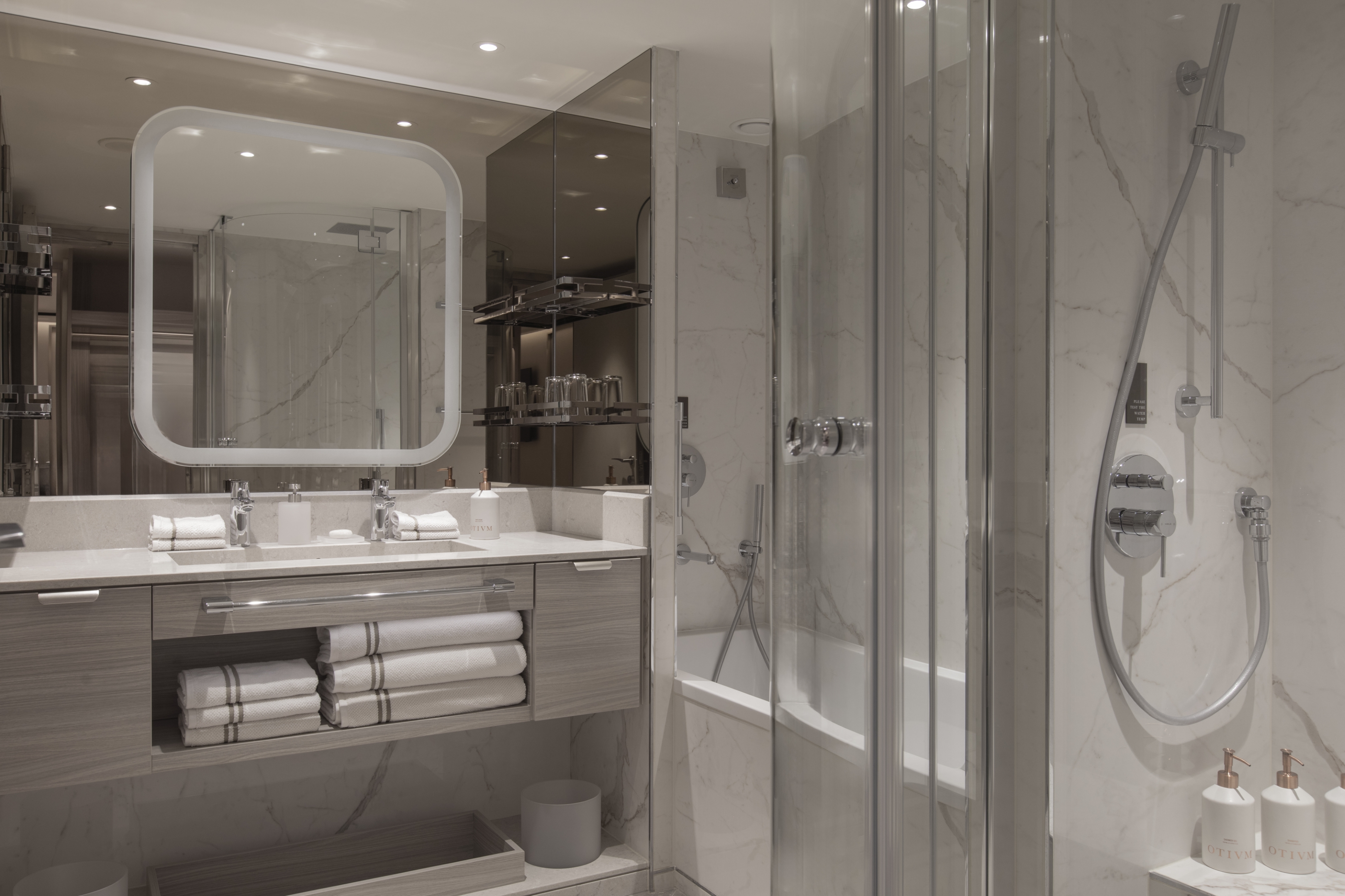
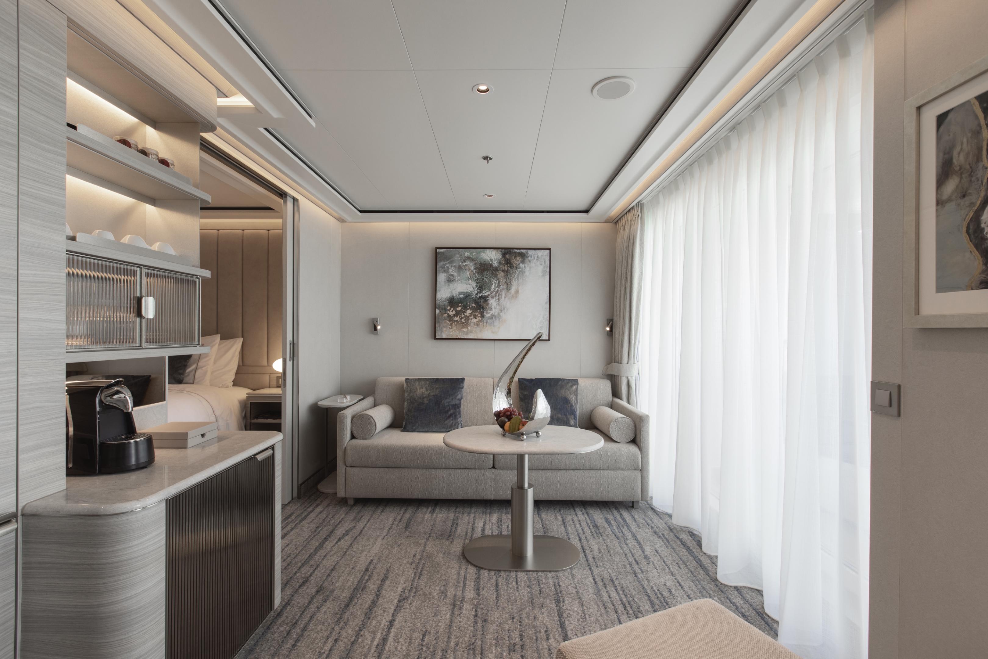
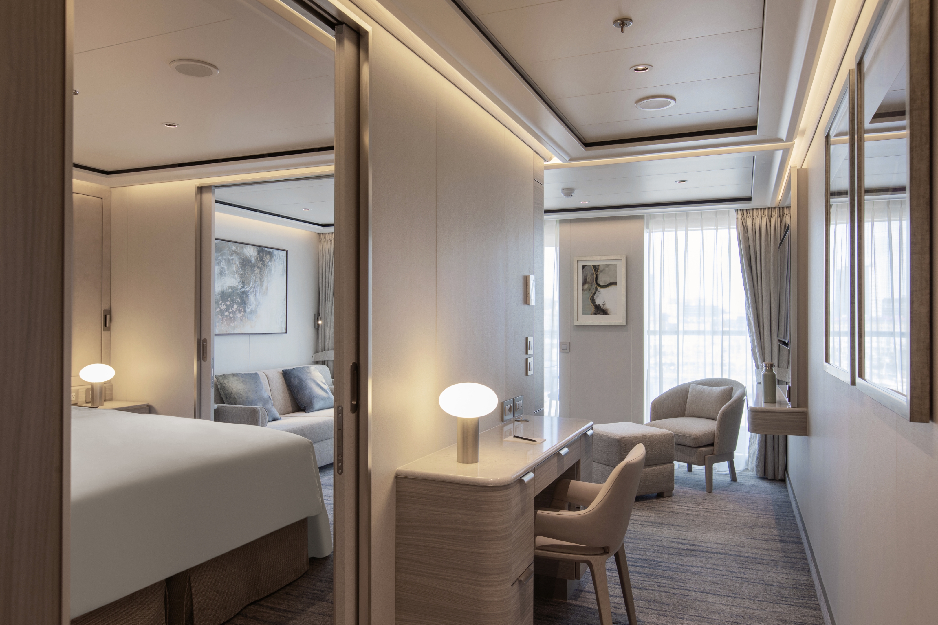
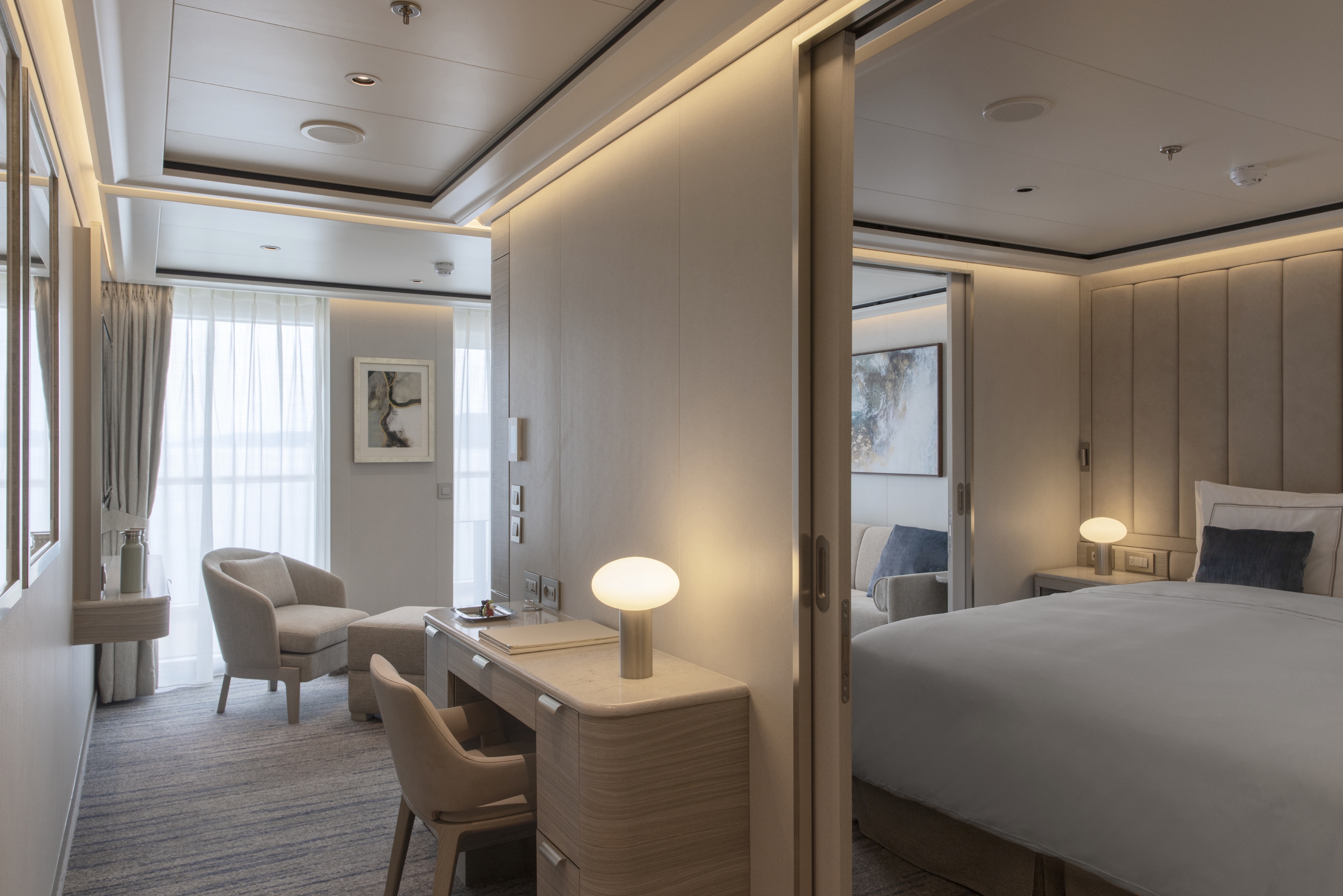
The Otium Suite is one of our newest and finest suites. Located in the premium aft corner position, the Otium Suite has a total size of 123 m2 (1,324 sq ft), including a 40 m2 (431 sq ft) balcony, which comes complete with a whirlpool. Features include a spacious living room area, a luxurious walk-in closet, a separate large bedroom, plus a bathroom with a whirlpool bath and walk-in shower. The crowning glory of the Otium Suite, however, is surely its unprecedented 270-degree view, giving you some of the best possible views of your destination.
One bedroom: 85 sq m including veranda (13 sq m)
Two bedrooms: 118 sq m including veranda (18 sq m)
Images are intended as a general reference. Features, materials, finishes and layout may be different than shown.
Please note the 3rd guest will sleep on a comfortable sofa bed in the reception area of suites that have 3rd berth capacity.
Essentials
- Deck(s): 6, 7
- Section: Aft
Characteristics
- Veranda
- Separate dining area
- Living room with sitting area
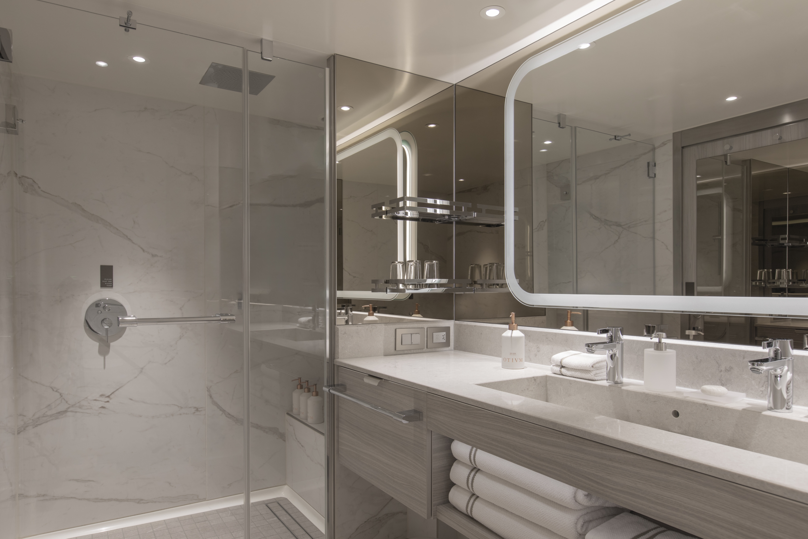
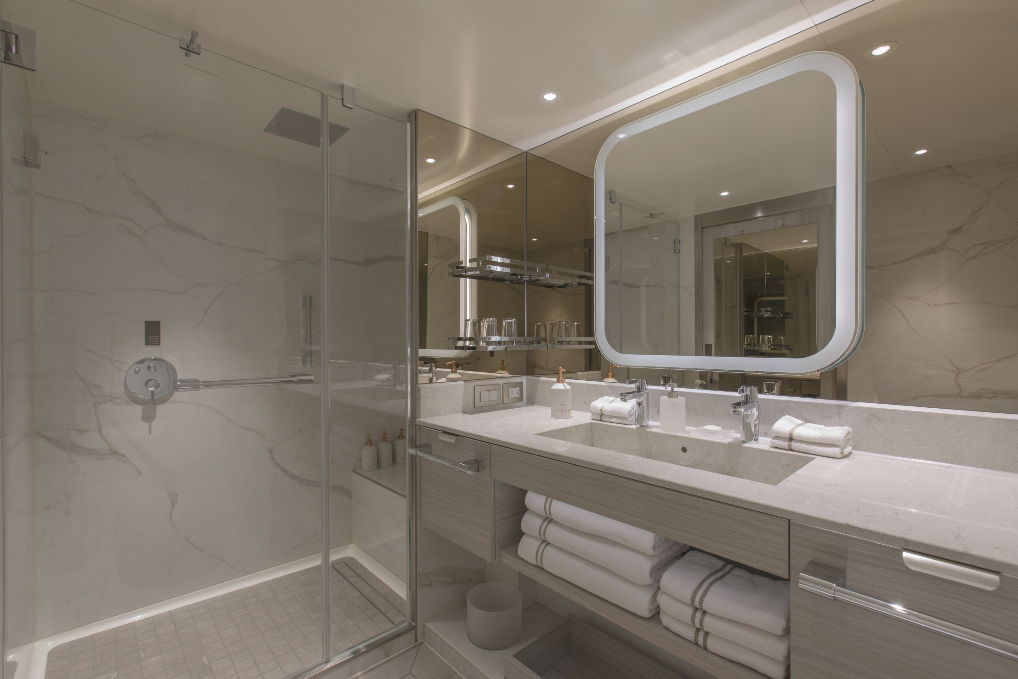
- Large vanity
- Separate shower
- Whirlpool bath
- Walk-in wardrobe with personal safe
Furniture
- King size bed
- Writing desk
- Vanity table
- Luxury bed mattresses (Custom made)
Media & Communication
- Unlimited Premium Wi-Fi
- 2 large flat screen TVs with Interactive Media Library
- Sound system with bluetooth connectivity
- Direct dial telephone
- Wall mounted USB-C mobile device chargers
- Dual voltage 110/220 outlets
Onboard Services
Butler service
- Complimentary laundry, pressing & wet cleaning
- Dinner for two in La Dame, one evening per voyage,
- Two hours of worldwide phone use, per voyage segment
- Champagne on arrival
Amenities
- Espresso machine
- Pillow menu
- Refrigerator and bar setup stocked with your preferences
- Plush bathrobe
- Luxury bath amenities
- Umbrella
- Hair Dryer
Slippers
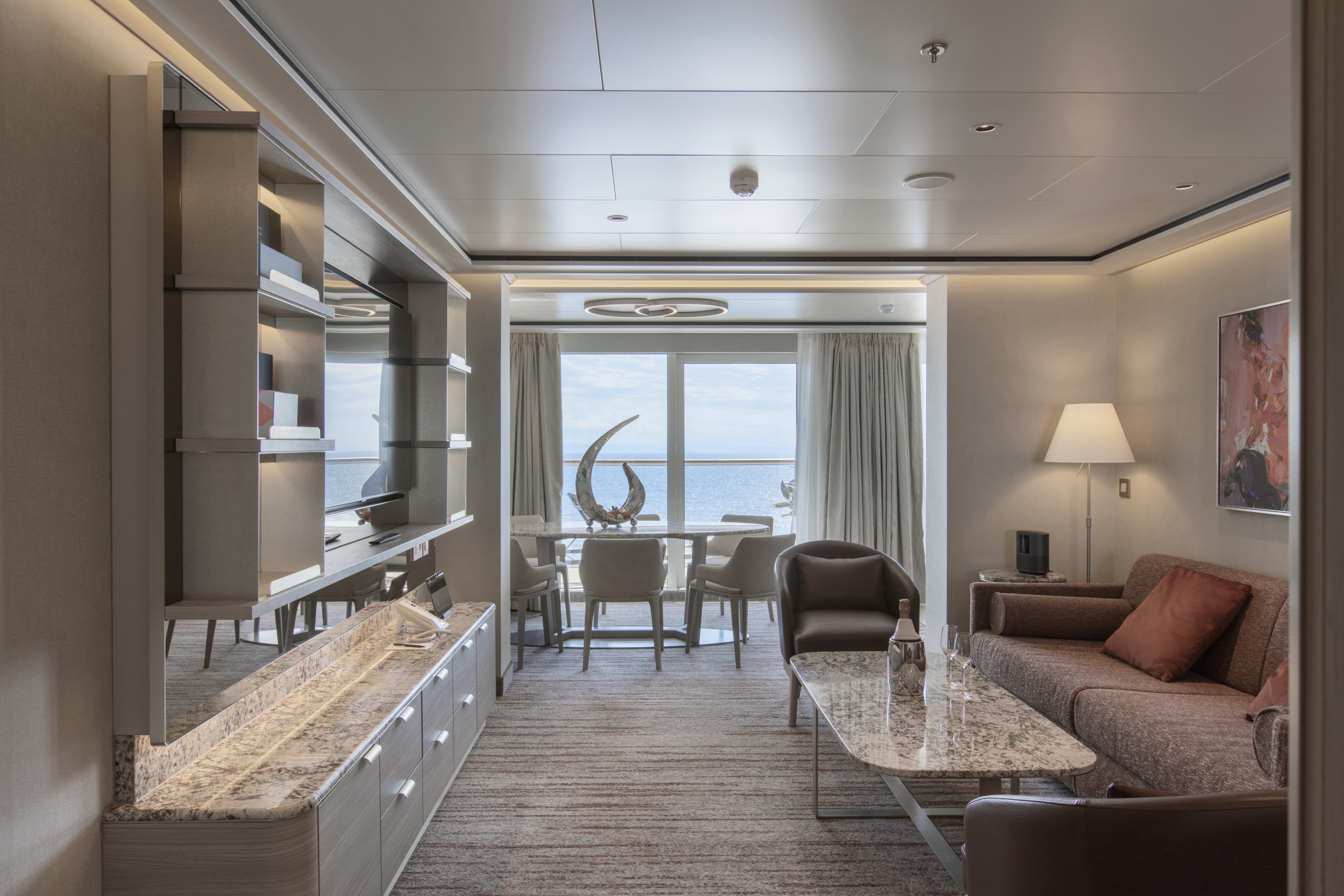
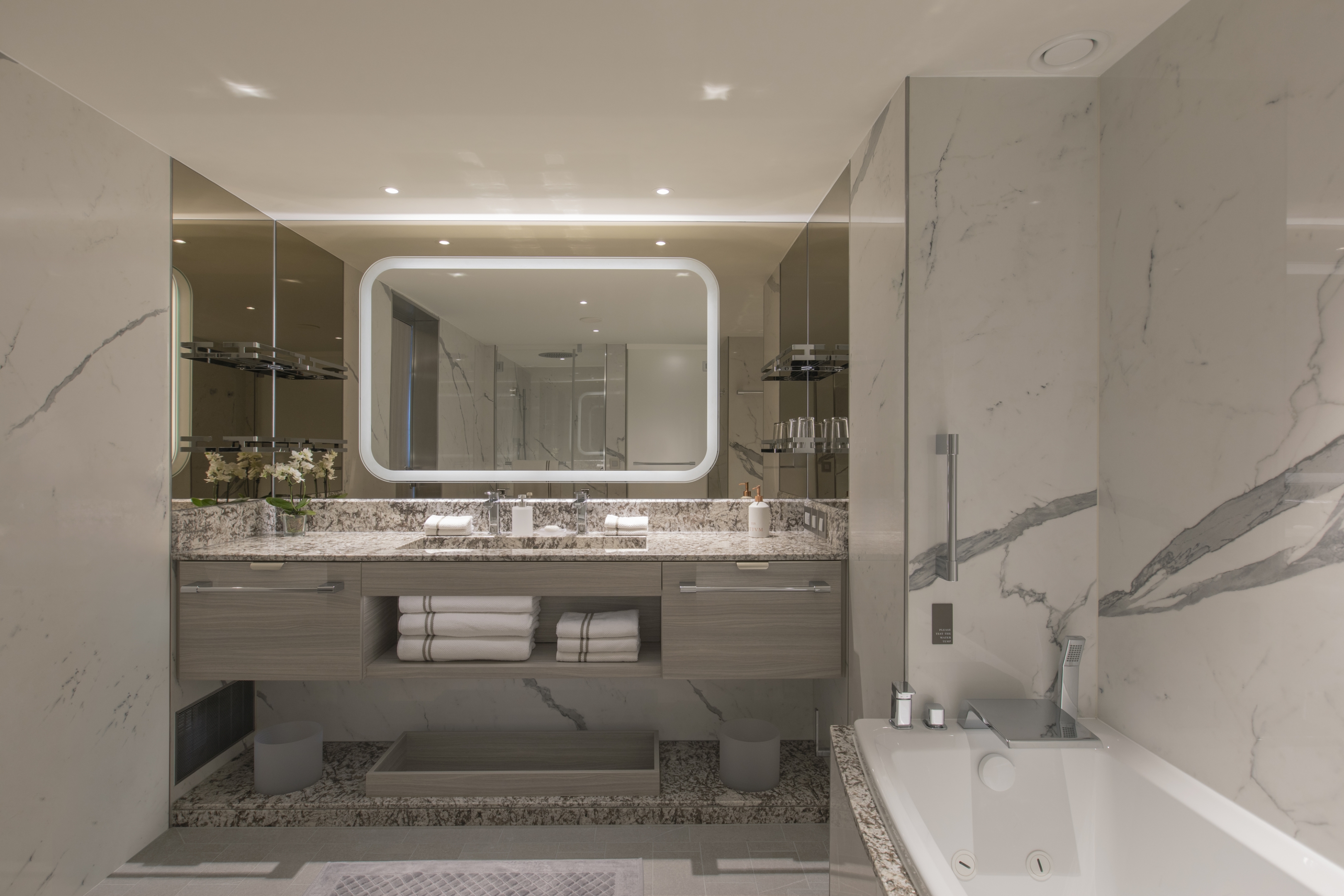
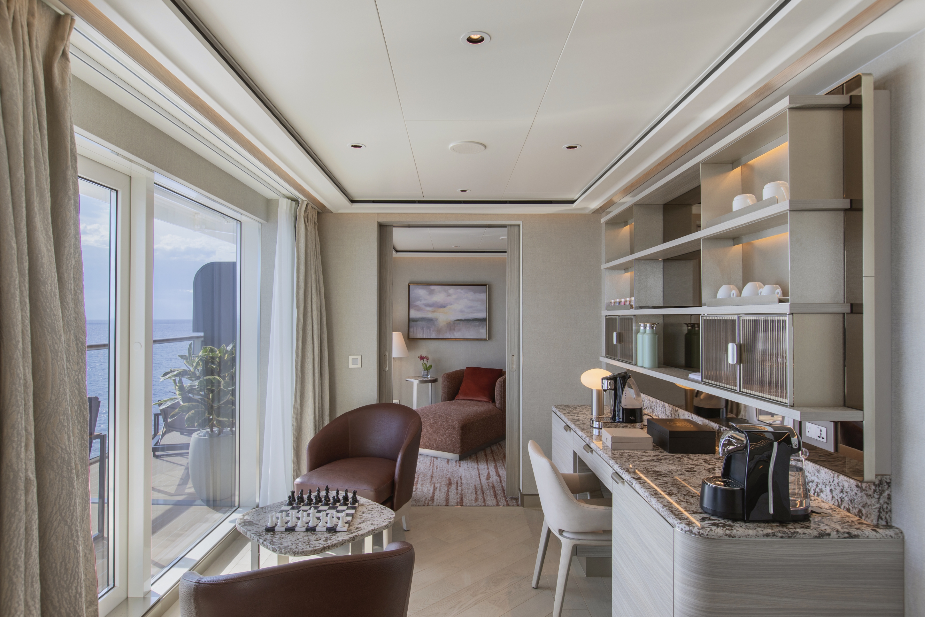
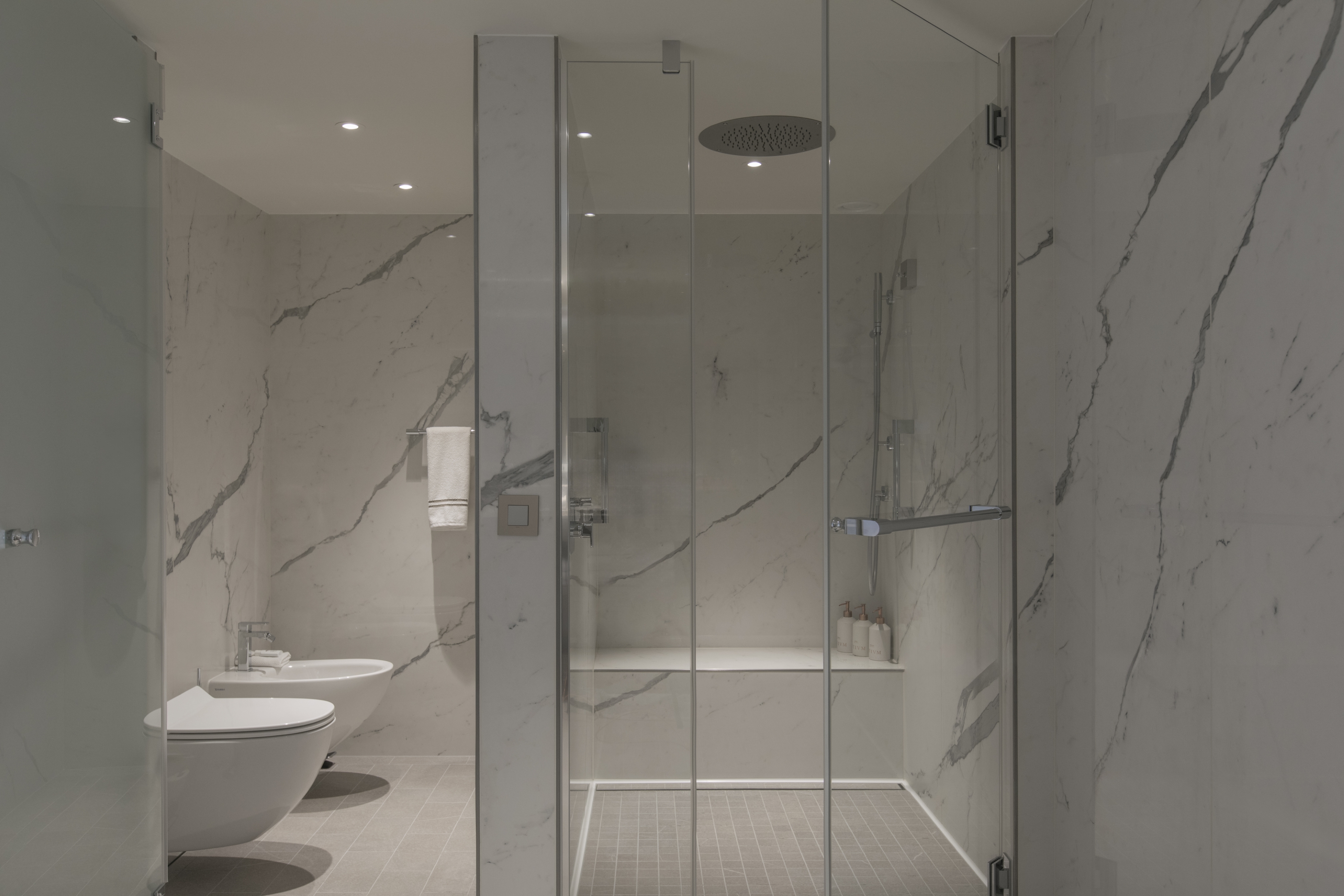
The aptly named Owner’s Suite is a Venetian Society favorite. So, why not travel in this stylish suite and get a taste of the ultimate luxury lifestyle. The suite’s total size is a huge 98 m2, or 1,055 sq ft, which includes 16 m2 (172 sq ft) of balcony, making for comfortable outdoor living. The favorite midship position gives incredible views from both the dining area and bedroom. A luxurious bathroom with a double vanity, plus a whirlpool bath and walk-in shower, bidet, lavatory, and guest restroom perfect the in-suite experience.
One bedroom: 98 sq.m. including veranda
Two bedroom: 131 sq.m. including veranda
Images are intended as a general reference. Features, materials, finishes and layout may be different than shown.
Please note the 3rd guest will sleep on a comfortable sofa bed in the reception area of suites that have 3rd berth capacity.
Essentials
- Deck(s): 8
- Section: Mid-Ship
Characteristics
- Veranda
- Separate dining area
- Living room with sitting area
- Large vanity
- Separate shower
- Whirlpool bath
- Walk-in wardrobe with personal safe
Furniture
- King size bed
- Writing desk
- Vanity table
- Luxury bed mattresses (Custom made)
Media & Communication
- Unlimited Premium Wi-Fi
- 2 large flat screen TVs with Interactive Media Library
- Sound system with bluetooth connectivity
- Direct dial telephone
- Wall mounted USB-C mobile device chargers
- Dual voltage 110/220 outlets
Onboard Services
- Butler service
- Complimentary laundry, pressing & wet cleaning
- Dinner for two in La Dame, one evening per voyage,
- Two hours of worldwide phone use, per voyage segment
- Champagne on arrival
- Espresso machine
- Pillow menu
- Refrigerator and bar setup stocked with your preferences
- Plush bathrobe
- Luxury bath amenities
- Umbrella
- Hair Dryer
- Slippers
If you have ever wanted to indulge in one of the epitomes of ultra-luxury cruising, then the Grand Suite is perhaps the answer. Situated at the front of the ship, the Grand Suite offers sophistication and style for serious travelers. Thanks to an innovative design, the Grand Suite is one of the most luxurious and spacious suites aboard Silver Nova, offering sweeping sea-to-sky views of your destination from all living areas. A luxurious bathroom with a double vanity, whirlpool bath, and walk-in shower, plus a complete guest restroom.
One bedroom: 85 sq m including veranda (13 sq m)
Two bedrooms: 118 sq m including veranda (18 sq m)
Images are intended as a general reference. Features, materials, finishes and layout may be different than shown.
Please note the 3rd guest will sleep on a comfortable sofa bed in the reception area of suites that have 3rd berth capacity.
Essentials
- Deck(s): 7
- Section: Forward
Characteristics
- Veranda
- Separate dining area
- Living room with sitting area
- Large vanity
- Separate shower
- Whirlpool bath
- Walk-in wardrobe with personal safe
Furniture
- King size bed
- Writing desk
- Vanity table
- Luxury bed mattresses (Custom made)
Media & Communication
- Unlimited Premium Wi-Fi
- 2 large flat screen TVs with Interactive Media Library
- Sound system with bluetooth connectivity
- Direct dial telephone
- Wall mounted USB-C mobile device chargers
- Dual voltage 110/220 outlets
Onboard Services
- Butler service
- Complimentary laundry, pressing & wet cleaning
- Dinner for two in La Dame, one evening per voyage,
- Two hours of worldwide phone use, per voyage segment
- Champagne on arrival
Amenities
- Espresso machine
- Pillow menu
- Refrigerator and bar setup stocked with your preferences
- Plush bathrobe
- Luxury bath amenities
- Umbrella
- Hair Dryer
- Slippers
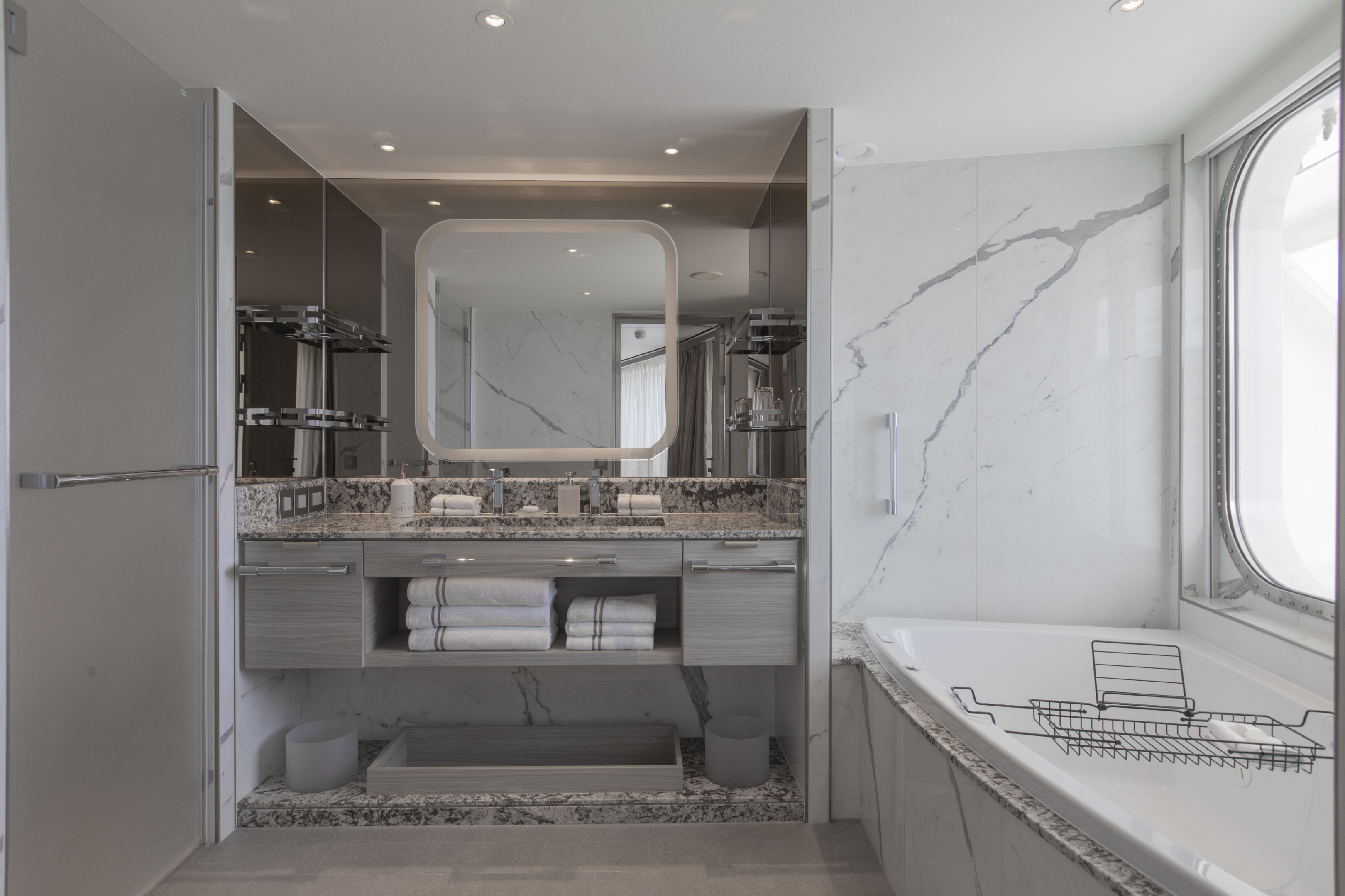
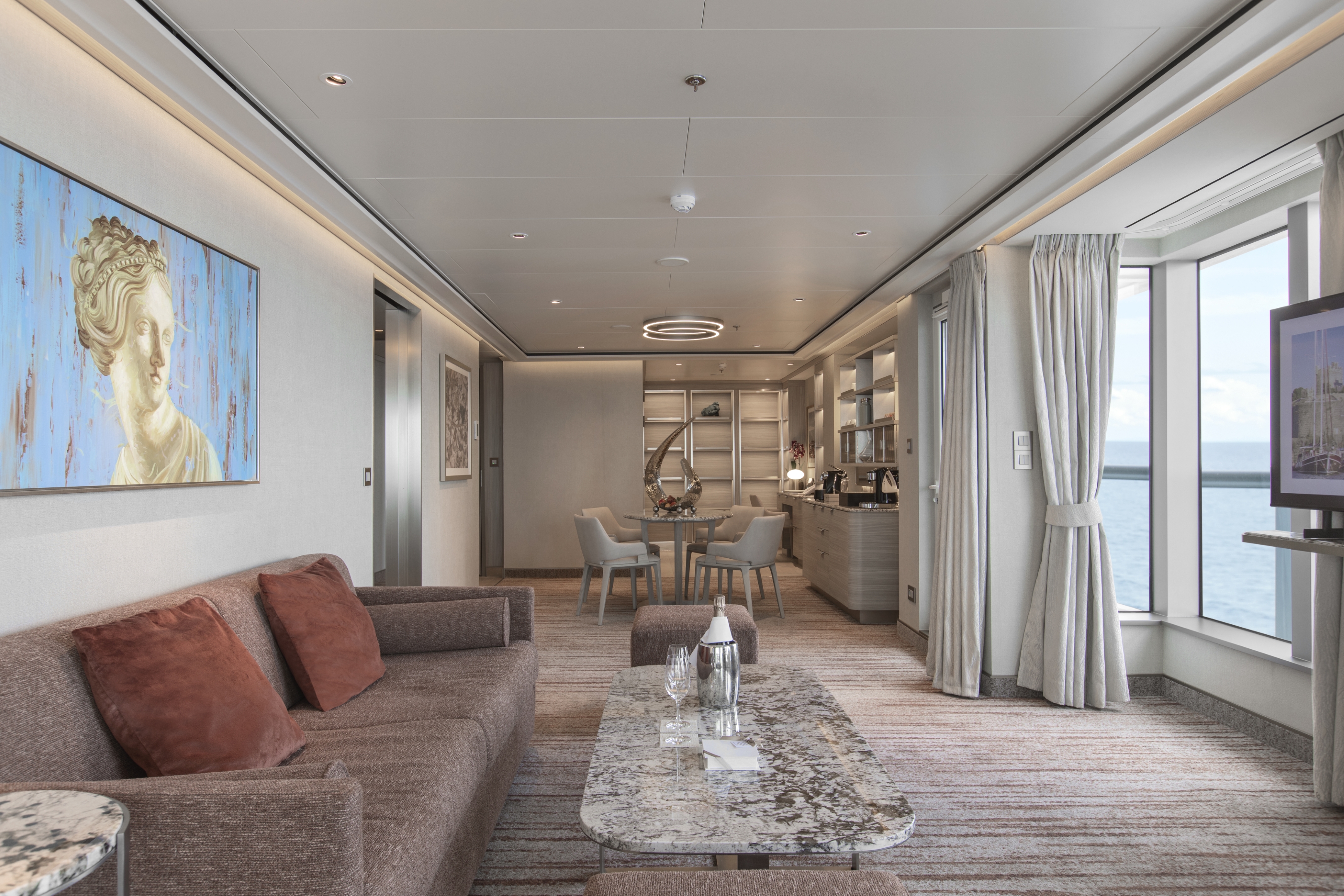
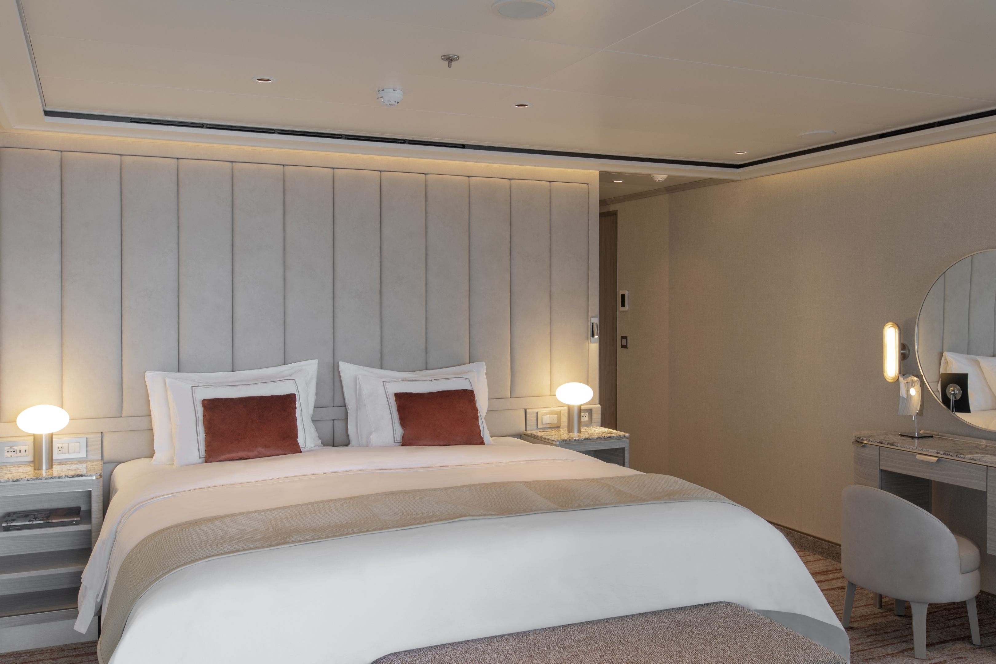
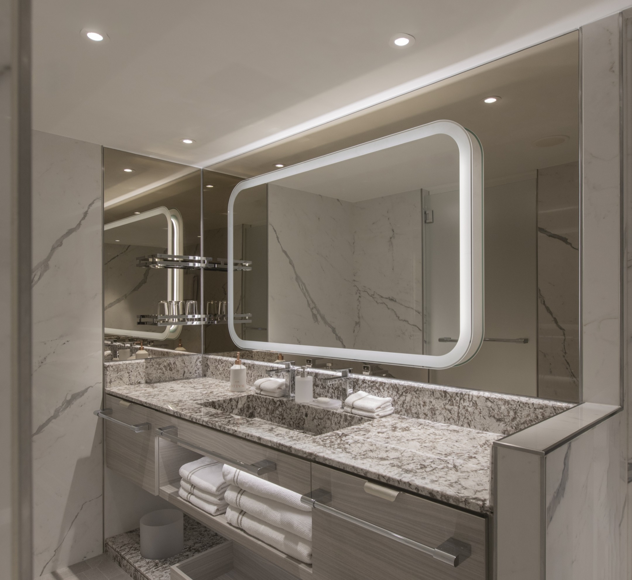
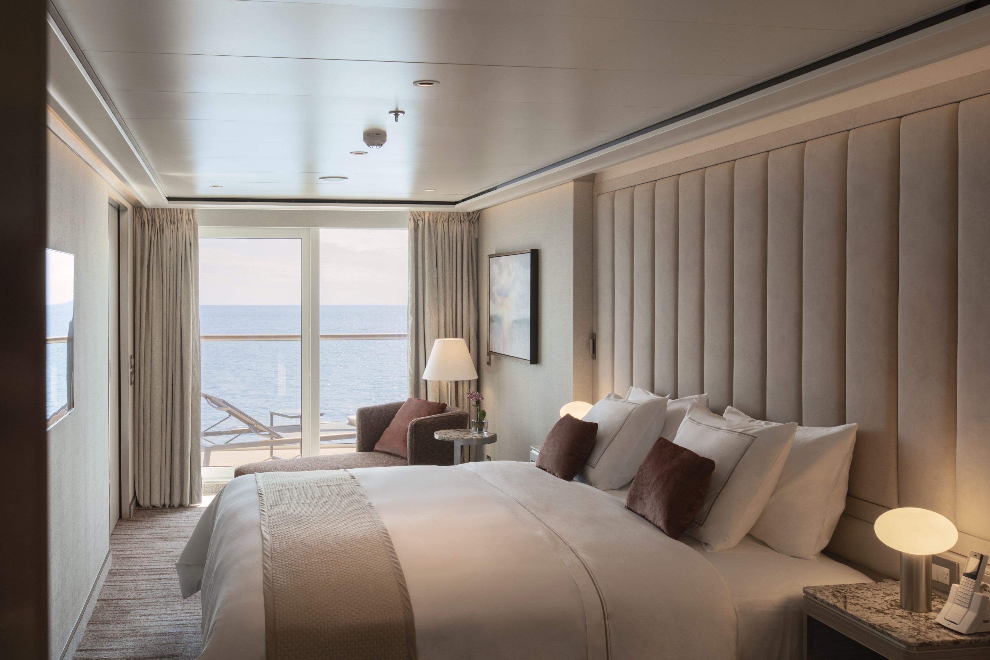
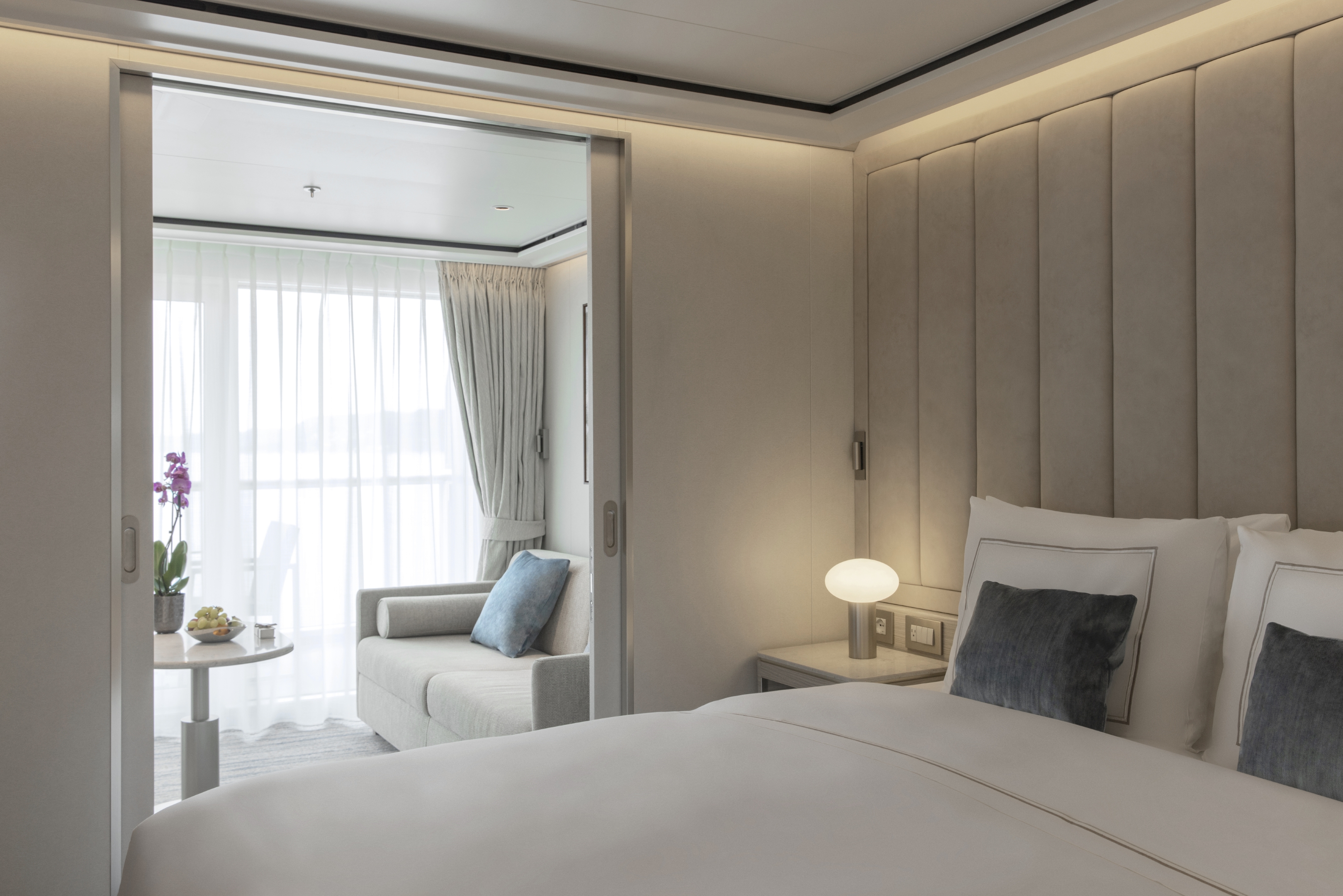
This new suite category is exclusive to Silver Nova. The Master Suite is stately, commanding, majestic, and perfect for relaxing after a day exploring onshore. Located in the premium aft corner position, the Master Suite has a total size of 67–77 m2 (721–826 sq ft) and includes 22–31 m2 (233–330 sq ft) of balcony. The incredible floor-to-ceiling glazing surrounding the living room and bedroom area will offer outstanding 270-degree views of your destination, regardless of where you are in the world.
Two bedrooms (when connected to a Premium Veranda Suite or a Classic Veranda Suite): 100–110 sq m including veranda (27–36 sq m)
Images are intended as a general reference. Features, materials, finishes and layout may be different than shown.
Please note that the third guest will sleep on a comfortable sofa bed in the reception area of suites that have third-berth capacity.
Essentials
- Deck(s): 6, 7, 8, 9
- Section: Aft
Characteristics
- Veranda
- Separate dining area
- Living room with sitting area
- Large vanity
- Separate shower
- Whirlpool bath
- Walk-in wardrobe with personal safe
Furniture
- King size bed
- Writing desk
- Vanity table
- Luxury bed mattresses (Custom made)
Media & Communication
- Unlimited Premium Wi-Fi
- 2 large flat screen TVs with Interactive Media Library
- Sound system with bluetooth connectivity
- Direct dial telephone
- Wall mounted USB-C mobile device chargers
- Dual voltage 110/220 outlets
Onboard Services
- Butler service
- Complimentary laundry, pressing & wet cleaning
- Dinner for two in La Dame, one evening per voyage,
- Two hours of worldwide phone use, per voyage segment
- Champagne on arrival
Amenities
- Espresso machine
- Pillow menu
- Refrigerator and bar setup stocked with your preferences
- Plush bathrobe
- Luxury bath amenities
- Umbrella
- Hair Dryer
- Slippers
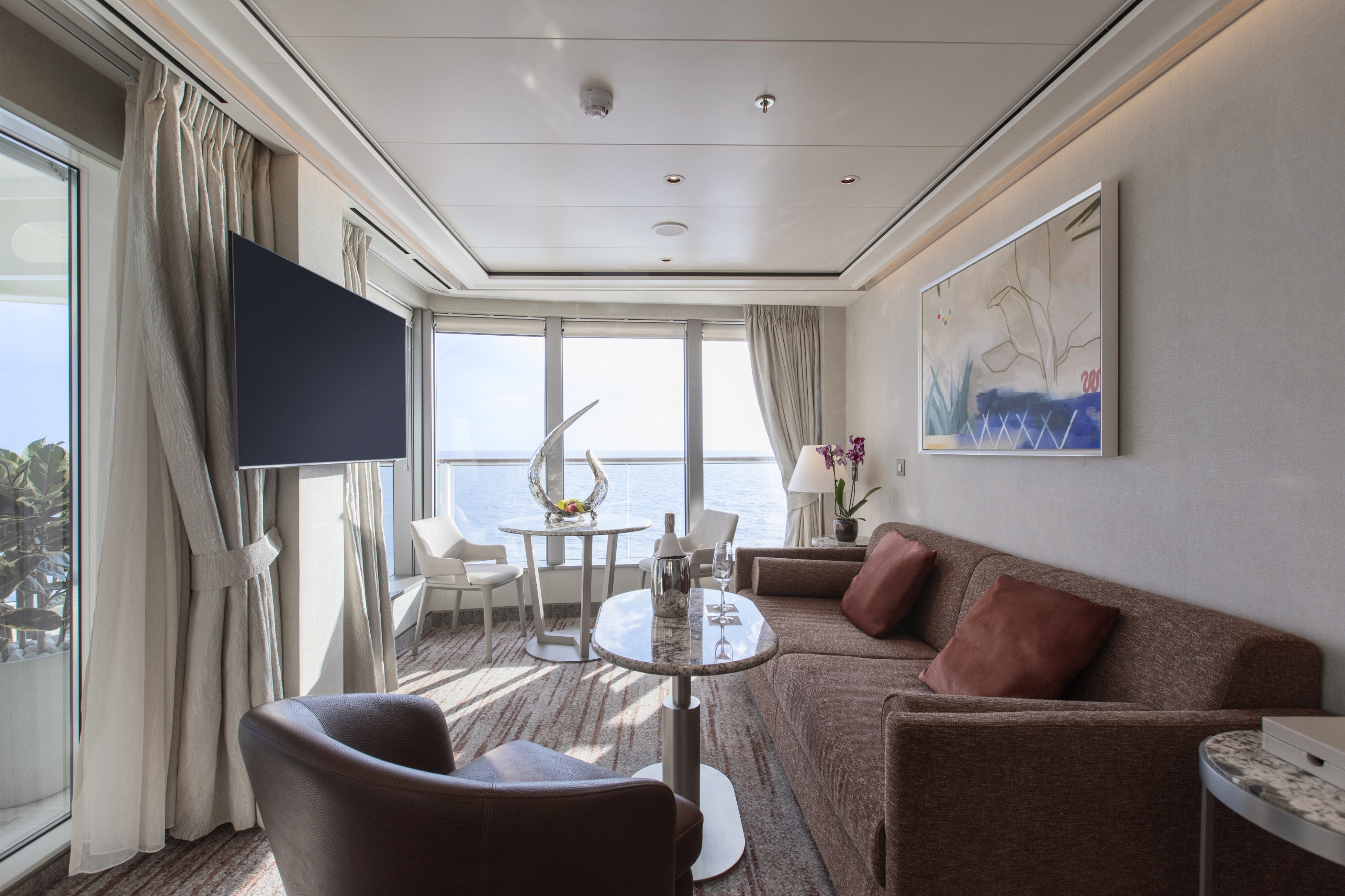
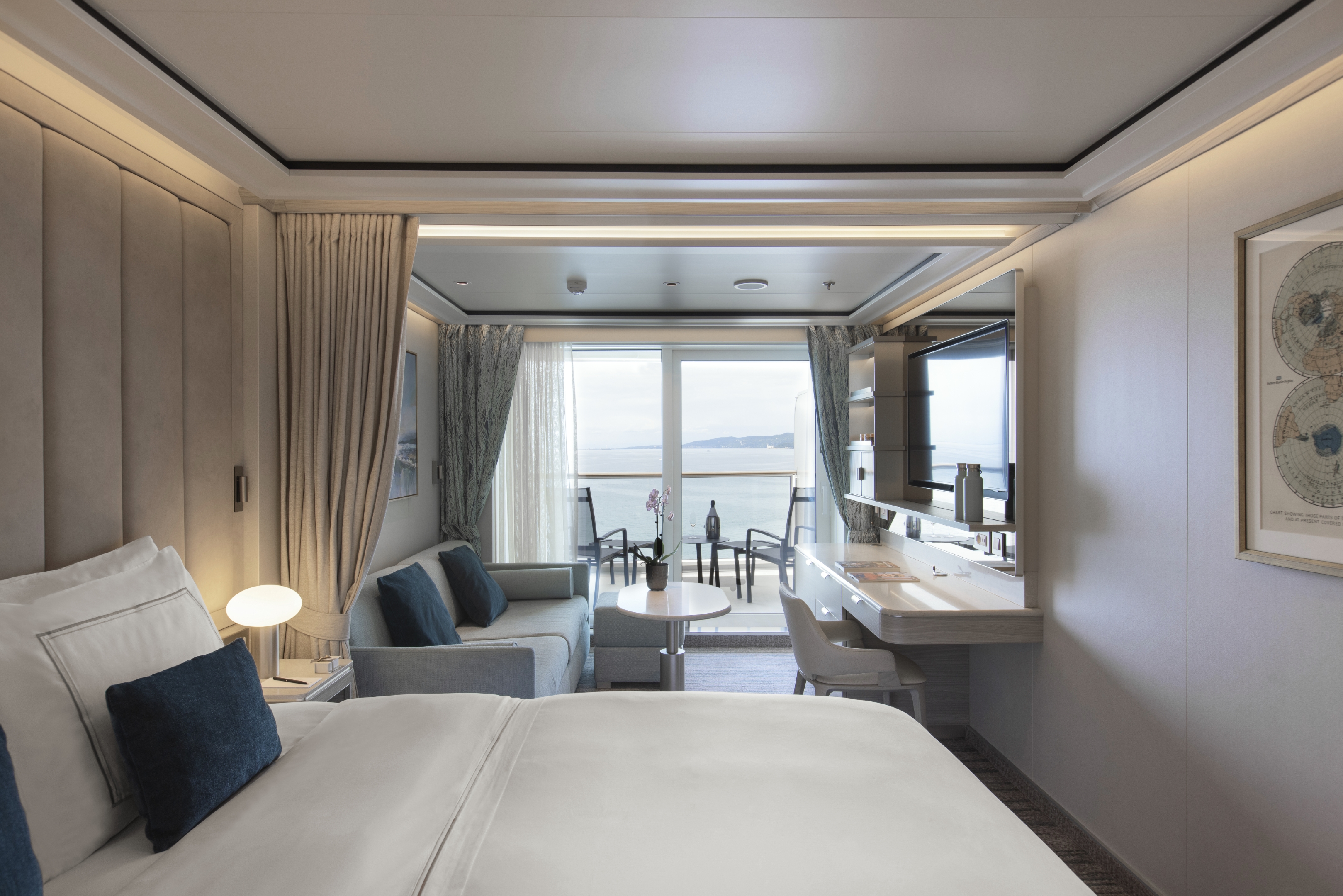
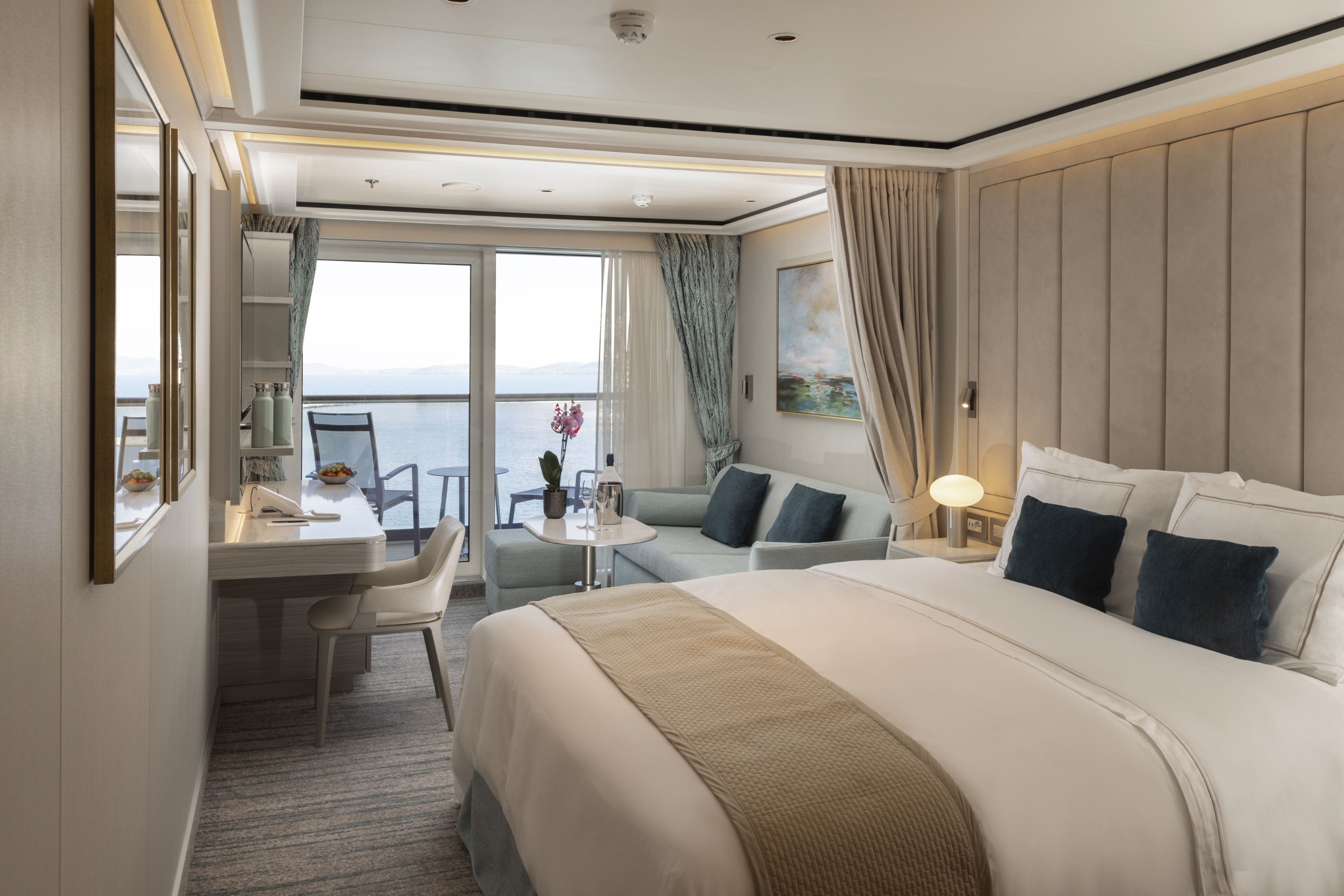
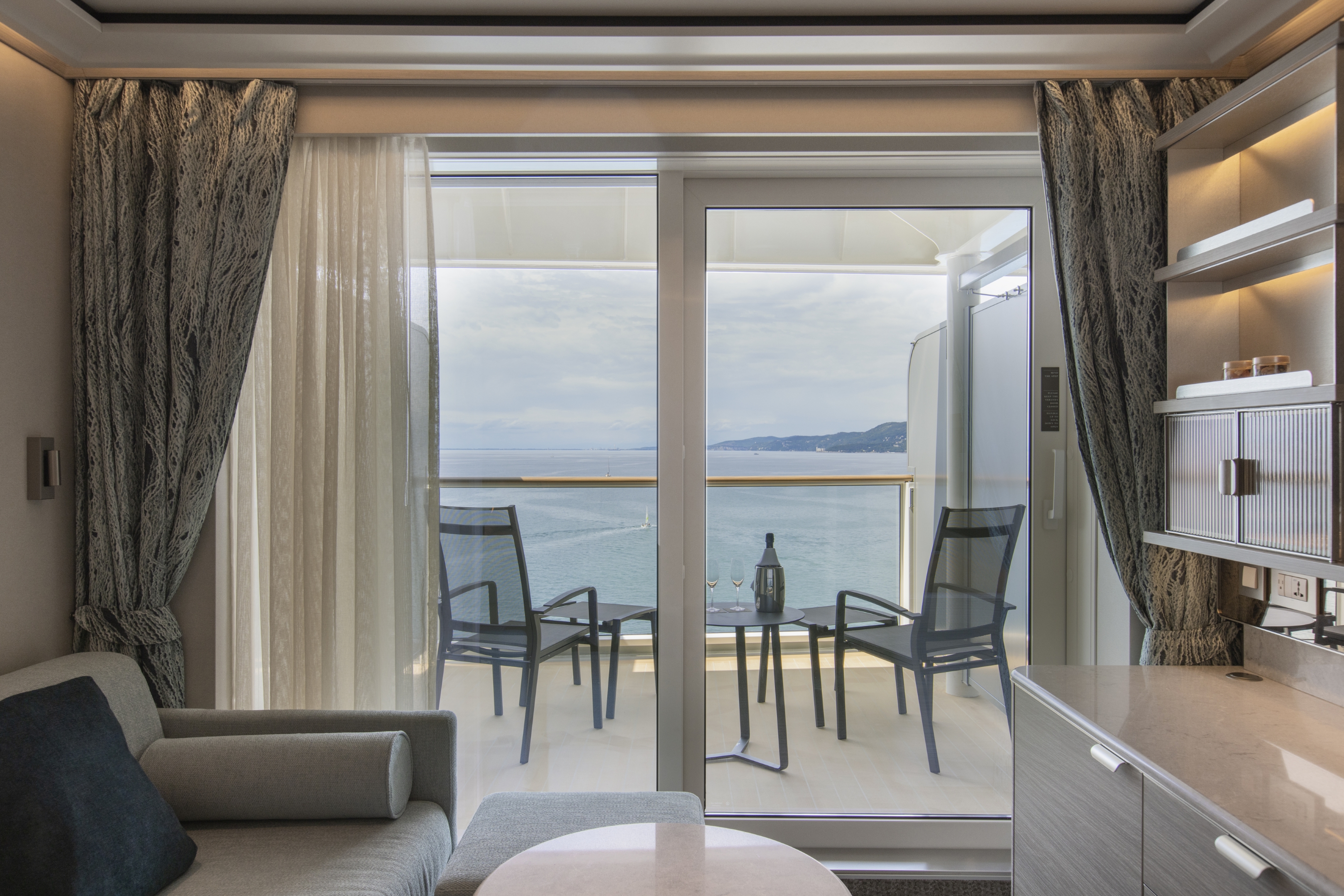
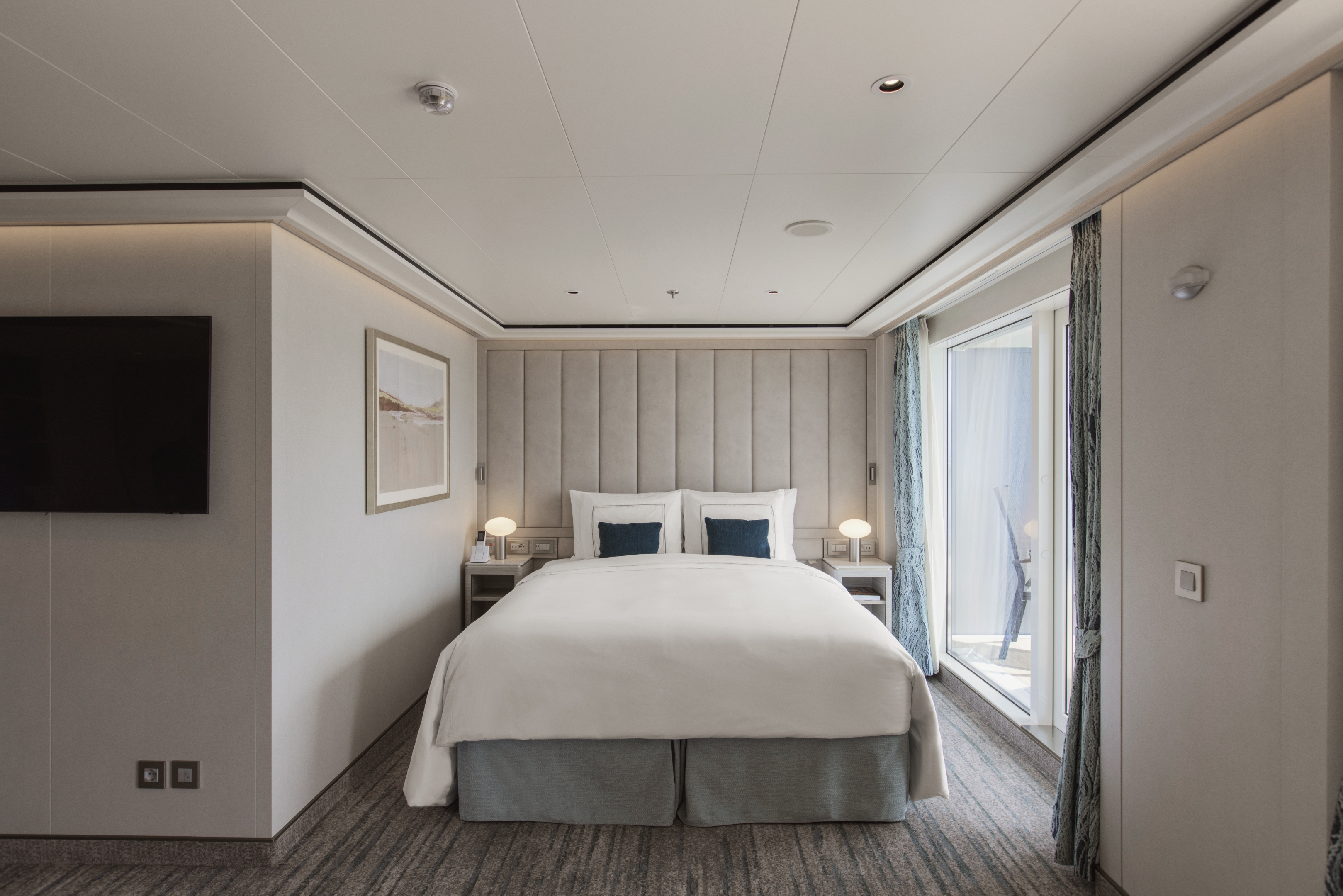
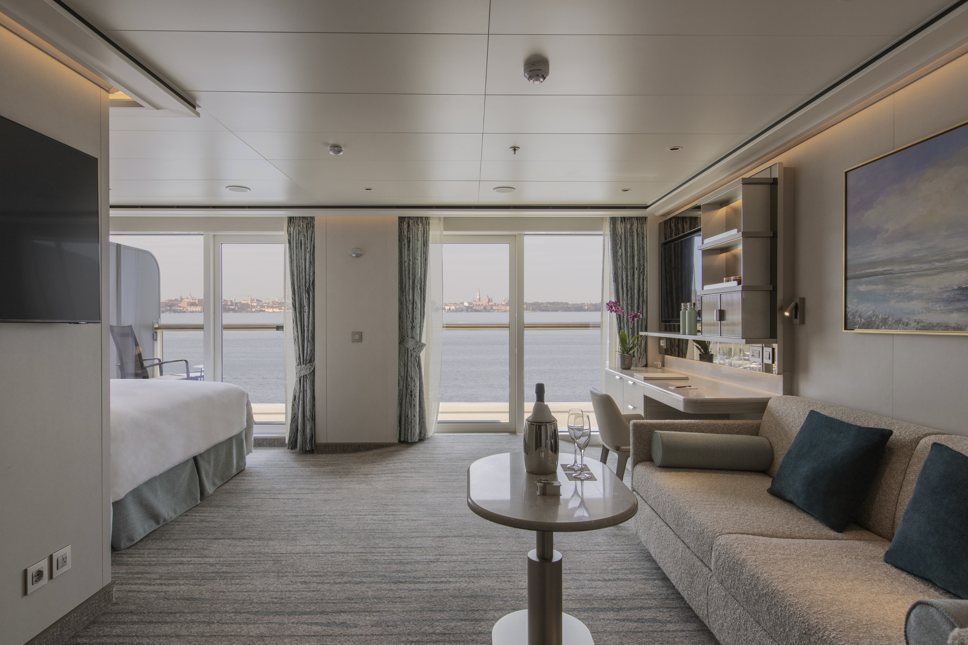
Another exclusivity for Silver Nova. The Signature Suite is one of our most distinctive new suites, offering unparalleled destination immersion through unobstructed views from all interior areas. The Signature Suite is one of the most spacious suites on board totaling 65 m2, or 700 sq ft, including 16 m2, or 172 sq ft, of balcony for superlative outdoor living. The innovative layout will feature a large dining and living room area, as well as a secluded bedroom. The large bathroom features a double vanity, whirlpool bath, walk-in shower, and lavatory, and the suite includes a guest restroom.
One bedroom: 65 sq m including veranda (16 sq m)
Images are intended as a general reference. Features, materials, finishes and layout may be different than shown.
Please note that the third guest will sleep on a comfortable sofa bed in the reception area of suites that have third-berth capacity.
Essentials
- Deck(s): 6, 7, 8, 9
- Section: Mid-Ship
Characteristics
- Veranda
- Separate dining area
- Living room with sitting area
- Large vanity
- Separate shower
- Whirlpool bath
- Walk-in wardrobe with personal safe
Furniture
- Queen size bed
- Writing desk
- Vanity table
- Luxury bed mattresses (Custom made)
Media & Communication
- Unlimited Premium Wi-Fi
- 2 large flat screen TVs with Interactive Media Library
- Sound system with bluetooth connectivity
- Direct dial telephone
- Wall mounted USB-C mobile device chargers
- Dual voltage 110/220 outlets
Onboard Services
- Butler service
- Complimentary laundry, pressing & wet cleaning
- Two hours of worldwide phone use, per voyage segment
- Champagne on arrival
Amenities
- Espresso machine
- Pillow menu
- Refrigerator and bar setup stocked with your preferences
- Plush bathrobe
- Luxury bath amenities
- Umbrella
- Hair Dryer
- Slippers
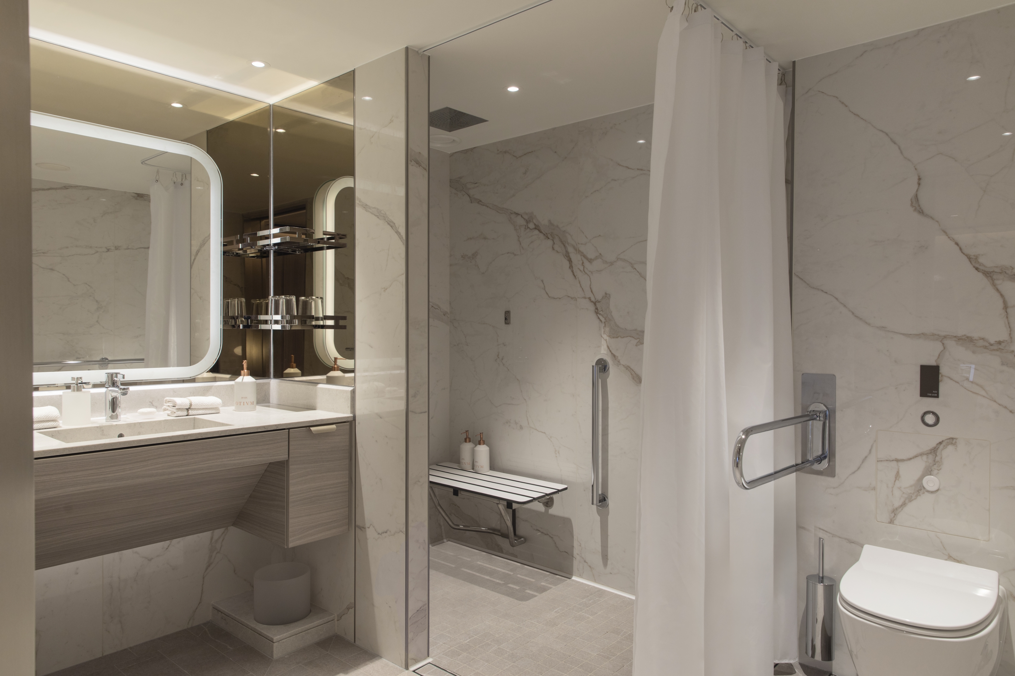
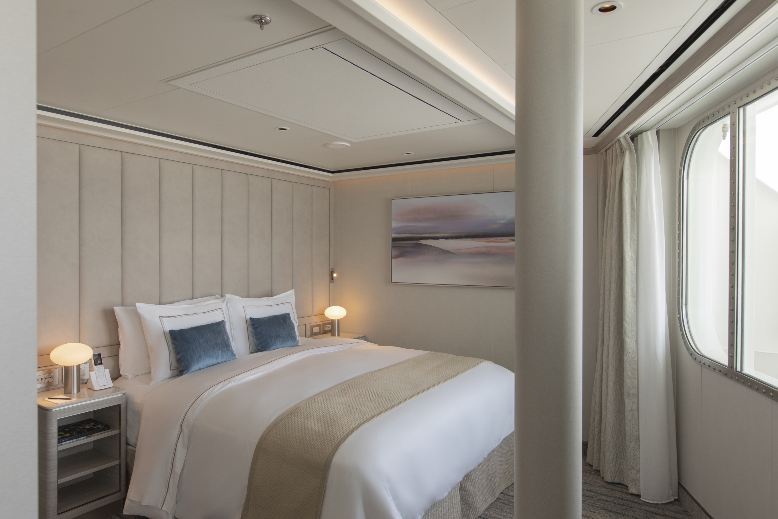
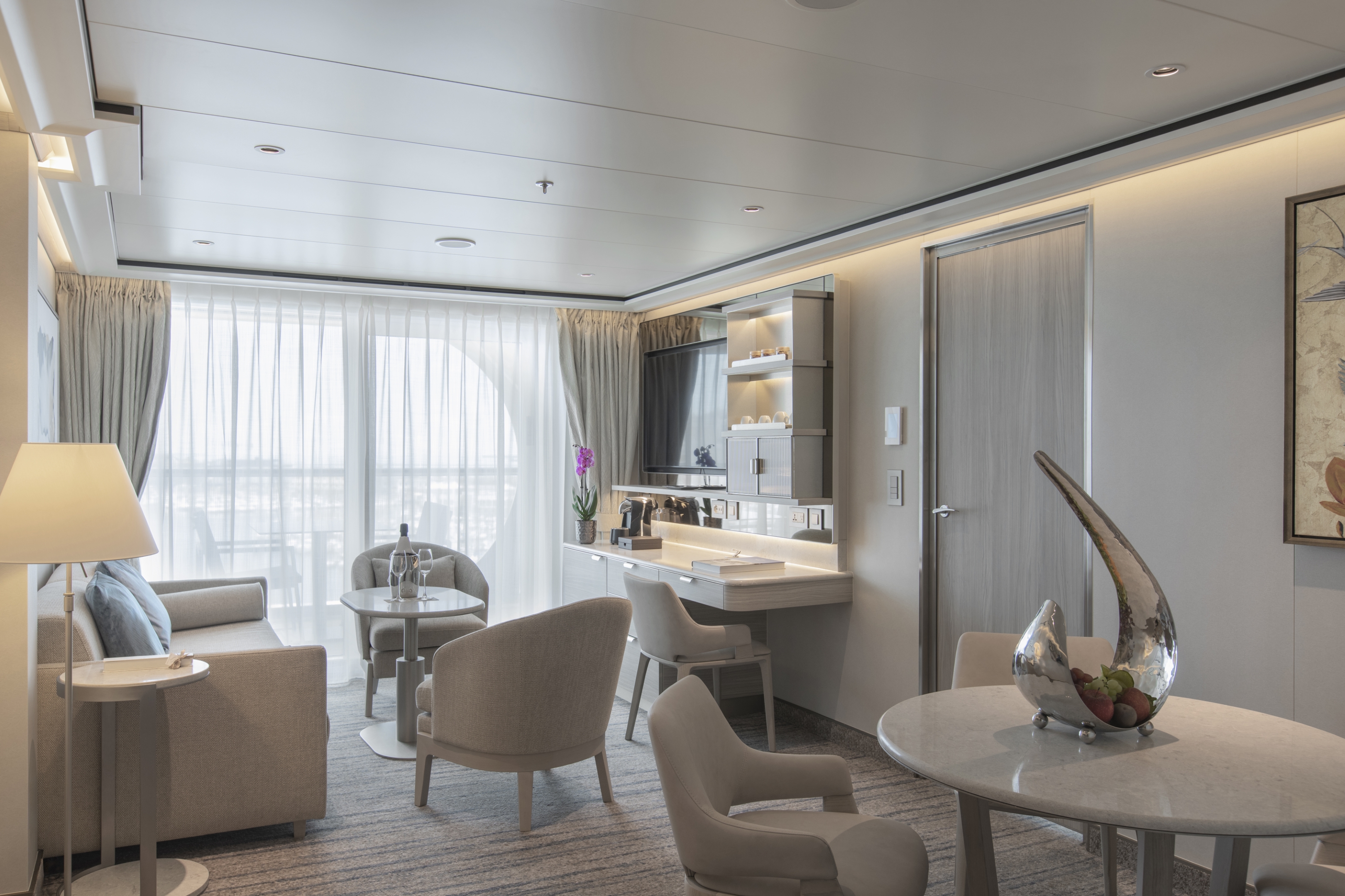
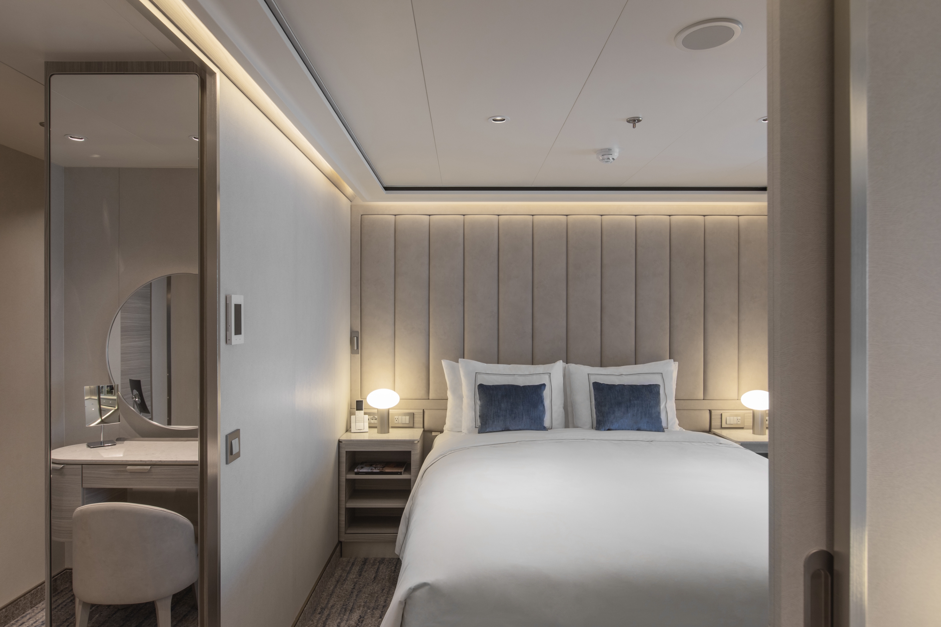
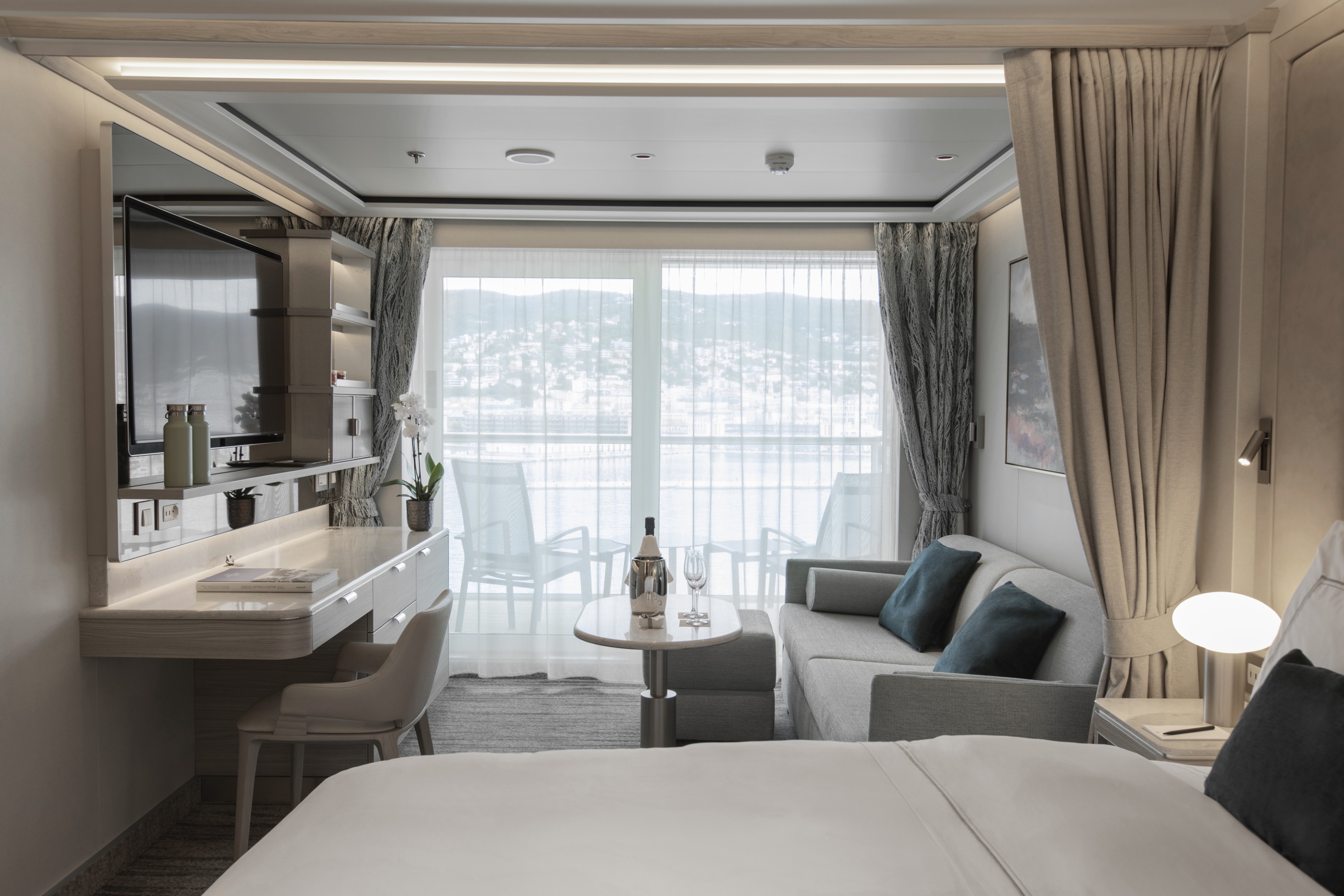
The Silver Suite is a Silversea favorite. It’s one of the Venetian Society’s favorite choices, and we can see why! The Silver Suite aboard Silver Nova offers an innovative design layout that will unlock full ocean views from both the living room and bedroom while the spacious living area allows for comfortable relaxing. A generous dining area makes cozy nights dining in veritable experiences in themselves. The suite features a generous walk-in closet as well as a bathroom with whirlpool bath, a walk-in shower, double vanity, and separate lavatory.
- One bedroom: 63 sq m including veranda (11 sq m)
- Two bedrooms: 96 sq m including veranda (16 sq m)
- Wheelchair accessible suites: 6022, 7018
- Images are intended as a general reference. Features, materials, finishes and layout may be different than shown.
- Please note the 3rd guest will sleep on a comfortable sofa bed in the reception area of suites that have 3rd berth capacity.
Essentials
- Deck(s): 6, 7, 8
- Section: Mid-Ship
Characteristics
- Veranda
- Separate dining area
- Living room with sitting area
- Large vanity
- Separate shower
- Whirlpool bath (Except ADA suite (shower))
- Walk-in wardrobe with personal safe
Furniture
- Queen size bed
- Writing desk
- Vanity table
- Luxury bed mattresses (Custom made)
Media & Communication
- Unlimited Premium Wi-Fi
- 2 large flat screen TVs with Interactive Media Library
- Sound system with bluetooth connectivity
- Direct dial telephone
- Wall mounted USB-C mobile device chargers
- Dual voltage 110/220 outlets
Onboard Services
- Butler service
- Complimentary laundry, pressing & wet cleaning
- Champagne on arrival
Amenities
- Espresso machine
- Pillow menu
- Refrigerator and bar setup stocked with your preferences
- Plush bathrobe
- Luxury bath amenities
- Umbrella
- Hair Dryer
- Slippers
Silver Nova’s Junior Grand Suite is a comfortably sized home away from home. Spaciously proportioned at 54-58 m2 or 581-624 sq. ft, including 6 m2 or 64 sq. ft of balcony, the Junior Grand builds on the success of the Grand Suite. It has inherited the best features of the Grand Suite by being positioned in the top bow position, offering spectacular views of the destination. The interior layout features a spacious living and dining area, as well as a secluded bedroom. The large bathroom features a double vanity, whirlpool and walk-in shower.
One bedroom: 54–58 sq m including veranda (6 sq m)
Two bedrooms: 87–91 sq m including veranda (11 sq m)
Images are intended as a general reference. Features, materials, finishes and layout may be different than shown.
Please note the 3rd guest will sleep on a comfortable sofa bed in the reception area of suites that have 3rd berth capacity.
Essentials
- Deck(s): 6, 9
- Section: Forward
Characteristics
- Veranda
- Separate dining area
- Living room with sitting area
- Large vanity
- Separate shower
- Whirlpool bath
- Walk-in wardrobe with personal safe
Furniture
- Queen size bed
- Writing desk
- Vanity table
- Luxury bed mattresses (Custom made)
Media & Communication
- Unlimited Premium Wi-Fi
- 2 large flat screen TVs with Interactive Media Library
- Sound system with bluetooth connectivity
- Direct dial telephone
- Wall mounted USB-C mobile device chargers
- Dual voltage 110/220 outlets
Onboard Services
- Butler service
- Complimentary laundry, pressing & wet cleaning
- Champagne on arrival
Amenities
- Espresso machine
- Pillow menu
- Refrigerator and bar setup stocked with your preferences
- Plush bathrobe
- Luxury bath amenities
- Umbrella
- Hair Dryer
- Slippers
With features similar to our best-selling Medallion Suite, the Premium Medallion enjoys an optimal location at the aft. The Medallion Suite design builds on the phenomenal success of our iconic Veranda Suite while offering the comfort of a generous interior and balcony (49 m2/527 sq ft and 8 m2/86 sq ft, respectively). Additionally, the suite features a large bathroom with a double vanity, a spacious bathtub, and separate shower, as well as a secluded bedroom area with a queen-size bed.
One bedroom: 49 sq m including veranda (8 sq m)
Images are intended as a general reference. Features, materials, finishes and layout may be different than shown.
Please note that the third guest will sleep on a comfortable sofa bed in the reception area of suites that have third-berth capacity.
Essentials
- Deck(s): 6, 7, 8, 9
- Section: Aft, Mid-Ship
Characteristics
- Veranda
- Living room with sitting area
- Large vanity
- Separate shower
- Full-size bath
- Walk-in wardrobe with personal safe
Furniture
- Queen size bed
- Writing desk
- Vanity table
- Luxury bed mattresses (Custom made)
Media & Communication
- Unlimited Premium Wi-Fi
- 2 large flat screen TVs with Interactive Media Library
- Sound system with bluetooth connectivity
- Direct dial telephone
- Wall mounted USB-C mobile device chargers
- Dual voltage 110/220 outlets
Onboard Services
- Butler service
- Complimentary laundry, pressing & wet cleaning
- Champagne on arrival
Amenities
- Espresso machine
- Pillow menu
- Refrigerator and bar setup stocked with your preferences
- Plush bathrobe
- Luxury bath amenities
- Umbrella
- Hair Dryer
- Slippers
A mark of distinction, the Medallion Suite boasts a sumptuous and spacious living area, complete with rich textures and panoramic views from your large private veranda (8 m2, or 86 sq ft). Nestle under plush bed linens for one of the best night’s sleeps of your life, or rejuvenate after a busy day of exploring onshore in the cozy indoor seating area (49 m2, or 527 sq ft) The large bathroom with a double vanity, spacious bathtub, and shower is the perfect place to soak the day away. Relax with ease in the Medallion Suite, as the grandeurs of this stateroom surround you with distinguished luxury.
One bedroom: 49 sq m including veranda (8 sq m)
One bedroom: 527 ft² / 49 m² including veranda
Images are intended as a general reference. Features, materials, finishes and layout may be different than shown.
Please note the 3rd guest will sleep on a comfortable sofa bed in the reception area of suites that have 3rd berth capacity.
Essentials
- Deck(s): 6, 7, 8, 9
- Section: Aft, Mid-Ship
Characteristics
- Veranda
- Living room with sitting area
- Large vanity
- Separate shower
- Full-size bath
- Walk-in wardrobe with personal safe
Furniture
- Queen size bed
- Writing desk
- Vanity table
- Luxury bed mattresses (Custom made)
Media & Communication
- Unlimited Premium Wi-Fi
- 2 large flat screen TVs with Interactive Media Library
- Sound system with bluetooth connectivity
- Direct dial telephone
- Wall mounted USB-C mobile device chargers
- Dual voltage 110/220 outlets
Onboard Services
- Butler service
- Complimentary laundry, pressing & wet cleaning
- Champagne on arrival
Amenities
- Espresso machine
- Pillow menu
- Refrigerator and bar setup stocked with your preferences
- Plush bathrobe
- Luxury bath amenities
- Umbrella
- Hair Dryer
- Slippers


A Silversea signature, the Veranda Suite offers elegant decor, a stunning marbled bathroom with a luxurious double vanity and sumptuous walk-in shower or large bathtub. Located now in the top aft location, the Premium Veranda will offer a comfortable interior. Additionally, an ample seating area provides a generous expanse of interior comforts. Four suites (one on each deck) will offer spacious interiors adapted for guests with disabilities and will be located in the ideal midship position. A new iteration of our iconic and perfect suite configuration.
One bedroom: 33 sq m including veranda (5 sq m)
Wheelchair accessible suites: 6045, 7037, 8031, 9041
Images are intended as a general reference. Features, materials, finishes and layout may be different than shown.
Please note that the third guest will sleep on a comfortable sofa bed in the reception area of suites that have third-berth capacity.
Essentials
- Deck(s): 6, 7, 8, 9
- Section: Aft, Mid-Ship
Characteristics
- Veranda
- Sitting area
- Large vanity
- Separate shower
- Some with full-size bath (Bath & shower combination (indicated with drop sign on deck plan))
- Walk-in wardrobe with personal safe
Furniture
- Queen size bed
- Writing desk
- Vanity table
- Luxury bed mattresses (Custom made)
Media & Communication
- Unlimited Standard Wi-Fi
- 1 large flat screen TV with Interactive Media Library
- Direct dial telephone
- Wall mounted USB-C mobile device chargers
- Dual voltage 110/220 outlets
Onboard Services
- Butler service
- Champagne on arrival
Amenities
- Pillow menu
- Refrigerator and bar setup stocked with your preferences
- Plush bathrobe
- Luxury bath amenities
- Umbrella
- Hair Dryer
- Slippers
Whether you are preparing for a dynamic day onshore, primping for a romantic dinner on board, or settling down for a quiet evening in-suite, you will be enveloped by the Deluxe Veranda Suite’s warm touches. Located in the ideal midship position, the Deluxe Veranda Suite offers a comfortable 33 m2, or 355 sq ft, of interior luxury. But perhaps this suite’s finest asset lies just outside, as floor-to-ceiling glass doors open onto a 5-m2 (54-sq-ft) furnished private teak veranda offering sweeping views of your destination.
One bedroom: 33 sq m including veranda (8 sq m)
Two bedrooms: 33 sq m including veranda (5 sq m)
Images are intended as a general reference. Features, materials, finishes and layout may be different than shown.
Please note the 3rd guest will sleep on a comfortable sofa bed in the reception area of suites that have 3rd berth capacity.
Essentials
- Deck(s): 6, 7, 8, 9
- Section: Aft, Mid-Ship
Characteristics
- Veranda
- Sitting area
- Large vanity
- Separate shower
- Some with full-size bath (Bath & shower combination (indicated with drop sign on deck plan))
- Walk-in wardrobe with personal safe
Furniture
- Queen size bed
- Writing desk
- Vanity table
- Luxury bed mattresses (Custom made)
Media & Communication
- Unlimited Standard Wi-Fi
- 1 large flat screen TV with Interactive Media Library
- Direct dial telephone
- Wall mounted USB-C mobile device chargers
- Dual voltage 110/220 outlets
Onboard Services
- Butler service
- Champagne on arrival
Amenities
- Pillow menu
- Refrigerator and bar setup stocked with your preferences
- Plush bathrobe
- Luxury bath amenities
- Umbrella
- Hair Dryer
- Slippers
Well situated at the front and back of the ship, the 28 m2 interior of the Veranda Suite is only the beginning. The 5m2 teak balcony makes each spectacular sunset feel like it is yours alone. From beautiful bed linens to sumptuous furniture, our Superior Veranda suites are luxurious inside and out! Whether enjoying some down time with the state of the art entertainment system or taking in dinner in-suite, the Superior Veranda is the cosiest home away from home on the high seas.
One bedroom: 33 sq.m. including veranda
Images are intended as a general reference. Features, materials, finishes and layout may be different than shown.
Please note the 3rd guest will sleep on a comfortable sofa bed in the reception area of suites that have 3rd berth capacity.
Essentials
- Deck(s): 6, 7, 8, 9
- Section: Aft, Mid-Ship
Characteristics
- Veranda
- Sitting area
- Large vanity
- Separate shower
- Some with full-size bath (Bath & shower combination (indicated with drop sign on deck plan))
- Walk-in wardrobe with personal safe
Furniture
- Queen size bed
- Writing desk
- Vanity table
- Luxury bed mattresses (Custom made)
Media & Communication
- Unlimited Standard Wi-Fi
- 1 large flat screen TV with Interactive Media Library
- Direct dial telephone
- Wall mounted USB-C mobile device chargers
- Dual voltage 110/220 outlets
Onboard Services
- Butler service
- Champagne on arrival
Amenities
- Pillow menu
- Refrigerator and bar setup stocked with your preferences
- Plush bathrobe
- Luxury bath amenities
- Umbrella
- Hair Dryer
- Slippers
Located at the bow and aft of the ship, the Classic Veranda Suite will offer travellers a taste of our famous on board luxury. After a busy day of exploring, welcome home to the haven of the Classic Veranda Suite. With butler service, a queen size bed (which can be separated on demand) and beautiful marble bathroom, you won’t want to leave! However, the best part of our Classic Veranda suite is by far the large (5m2) private, teak veranda which offer sweeping views of the destination. Pure bliss.
One bedroom: 33 sq m. including veranda (5 sq m)
Images are intended as a general reference. Features, materials, finishes and layout may be different than shown.
Please note the 3rd guest will sleep on a comfortable sofa bed in the reception area of suites that have 3rd berth capacity.
Essentials
- Deck(s): 6, 7, 8, 9
- Section: Aft, Mid-Ship
Characteristics
- Veranda
- Sitting area
- Large vanity
- Separate shower
- Some with full-size bath (Bath & shower combination (indicated with drop sign on deck plan))
- Walk-in wardrobe with personal safe
Furniture
- Queen size bed
- Writing desk
- Vanity table
- Luxury bed mattresses (Custom made)
Media & Communication
- Unlimited Standard Wi-Fi
- 1 large flat screen TV with Interactive Media Library
- Direct dial telephone
- Wall mounted USB-C mobile device chargers
- Dual voltage 110/220 outlets
Onboard Services
- Butler service
- Champagne on arrival
Amenities
- Pillow menu
- Refrigerator and bar setup stocked with your preferences
- Plush bathrobe
- Luxury bath amenities
- Umbrella
- Hair Dryer
- Slippers
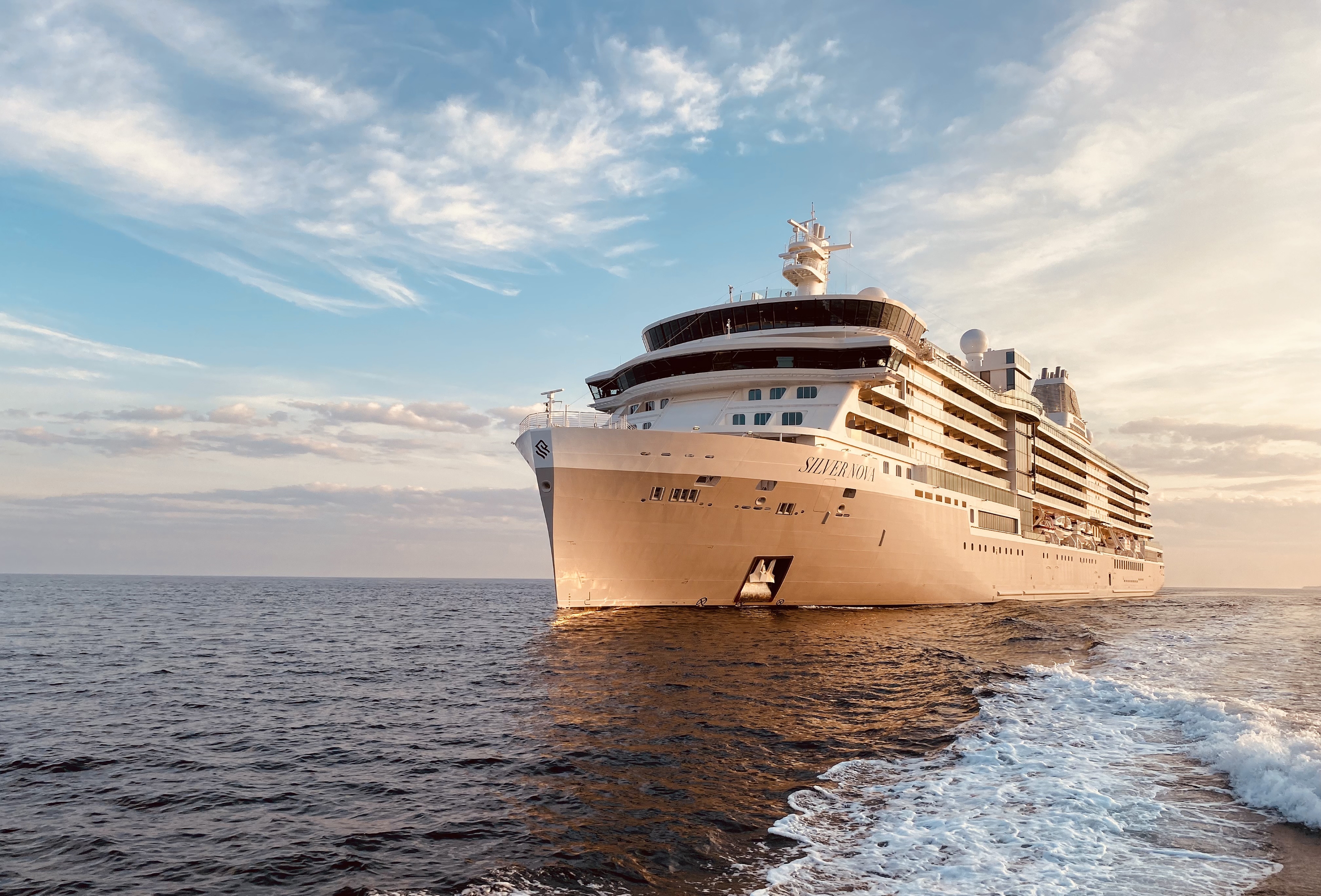
Silver Nova
Introducing Silver Nova - our vessel that joined us in summer 2023, and is a home away from home for up to 728 guests. Silver Nova’s innovative asymmetrical design introduces the world like never before, offering an immersive destination experience to our guests. With a gross tonnage of 54,700 tons, she offers a space-to-guest ratio of 75 GRT-per-passenger becoming one of the most spacious cruise ships ever built. What’s more, Silver Nova is our most environmentally friendly, and thanks to her groundbreaking technological solutions, she propels Silversea into a new era of sustainable cruising. It’s the Nova way to travel.
THIS IS SILVERSEA, THE NOVA WAY
Optimizing a new vision of luxury, Silver Nova revolutionizes 21st-century travel. Our latest flagship leads our fleet into sustainable cruising, respecting the fragile ecosystems of the remote and remarkable destinations we visit. The ship’s pioneering architecture offers a brand-new suite experience, including aft suites that deliver stunning 270-degree views. On board, the Silversea hallmarks are taken to the next level: butler service for every suite, exceptionally high crew-to-guest ratio (1:1.3), and outstanding gastronomy. Welcome to the Nova way of traveling.
Ship Facts
| Launch Year | 2023 | ||||||||||||
| Refit Year | |||||||||||||
| Language | en | ||||||||||||
| Gross Tonnage | 54700 | ||||||||||||
| Length | 244 | ||||||||||||
| Width | 30 | ||||||||||||
| Currency | USD | ||||||||||||
| Speed | 20 | ||||||||||||
| Capacity | 728 | ||||||||||||
| Crew Count | 556 | ||||||||||||
| Deck Count | 9 | ||||||||||||
| Cabin Count | 364 | ||||||||||||
| Large Cabin Count | N/A | ||||||||||||
| Wheelchair Cabin Count | N/A | ||||||||||||
| Electrical Plugs |
|
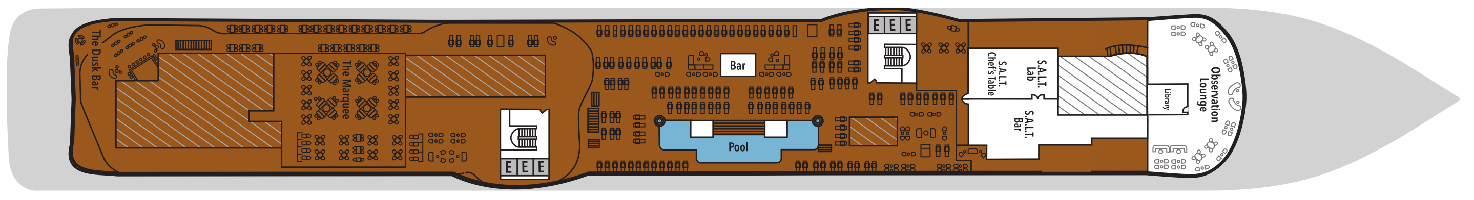
Deck 11
- The Cliff Whirlpool
- Sun Deck
- Elevator
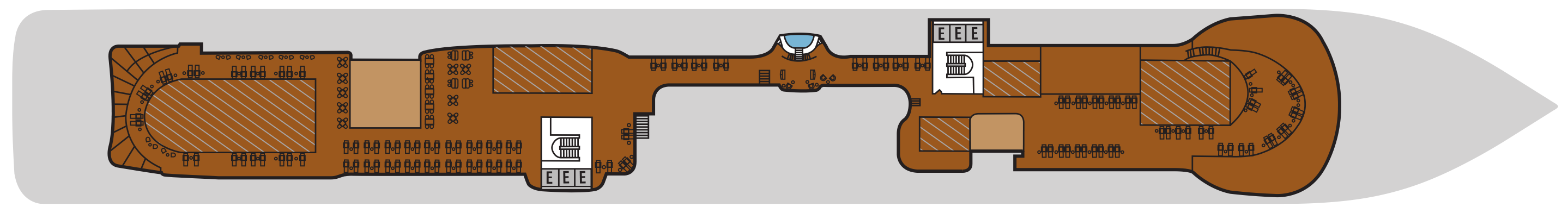
Deck 10
- Observation Lounge
- S.A.L.T. Lab
- S.A.L.T. Bar
- S.A.L.T Chef's Table
- Pool Deck
- Pool Bar
- Library
- The Marquee
- The Dusk Bar
- Jogging Track
- Elevator
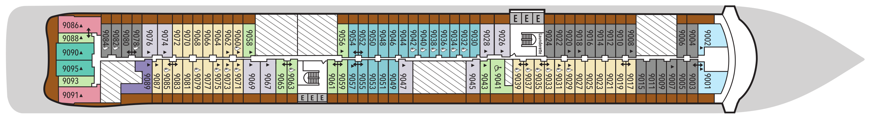
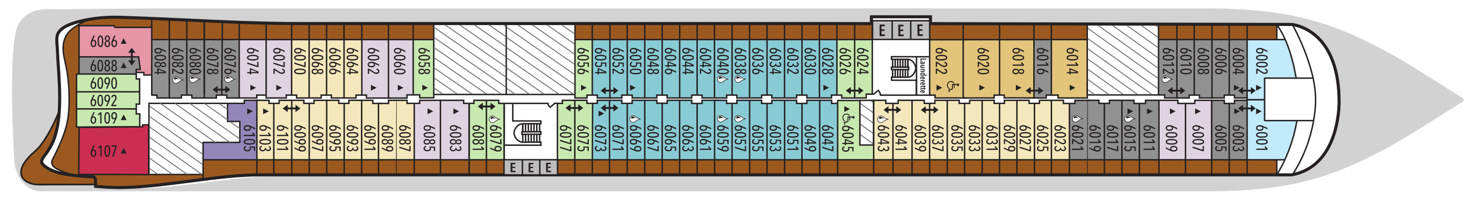
Deck 9
- Junior Grand Suite
- Classic Veranda Suite
- Superior Veranda Suite
- Premium Veranda Suite
- Medallion Suite
- Deluxe Veranda Suite
- Master Suite
- Signature Suite
- Premium Medallion Suite
- Launderette
- Elevator
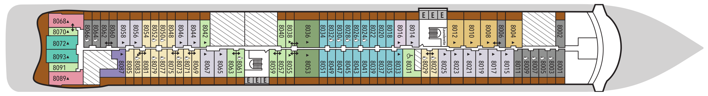
Deck 8
- Class Veranda Suite
- Silver Suite
- Medallion Suite
- Superior Veranda Suite
- Premium Veranda Suite
- Deluxe Veranda Suite
- Owner's Suite
- Master Suite
- Premium Medallion Suite
- Signature Suite
- Launderette
- Elevator
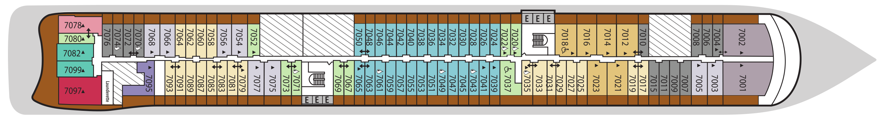
Deck 7
- Grand Suite
- Classic Veranda Suite
- Medallion Suite
- Silver Suite
- Superior Veranda Suite
- Premium Veranda Suite
- Deluxe Veranda Suite
- Otium Suite
- Premium Medallion Suite
- Master Suite
- Signature Suite
- Launderette
- Elevator
Deck 6
- Junior Grand Suite
- Classic Veranda Suite
- Medallion Suite
- Silver Suite
- Superior Veranda Suite
- Premium Veranda Suite
- Deluxe Veranda Suite
- Signature Suite
- Master Suite
- Otium Suite
- Elevator
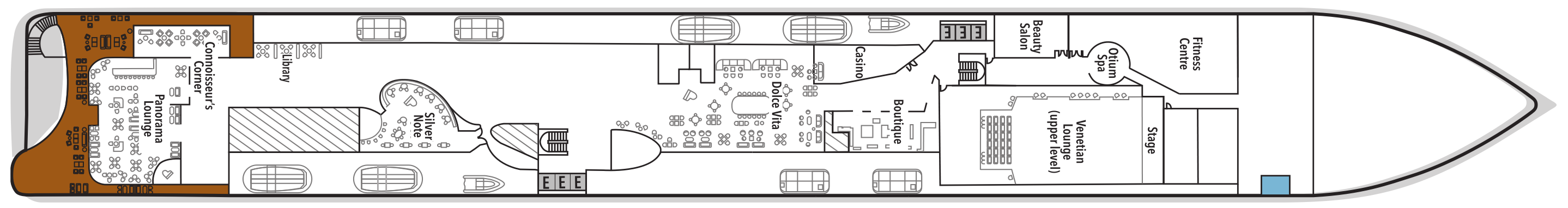
Deck 5
- Otium Spa
- Fitness Centre
- Beauty Salon
- Casino
- Boutique
- Dolce Vita
- Silver Note
- Library
- Connoisseur's Corner
- Panorama Lounge
- Venetian Lougne
- Elevator
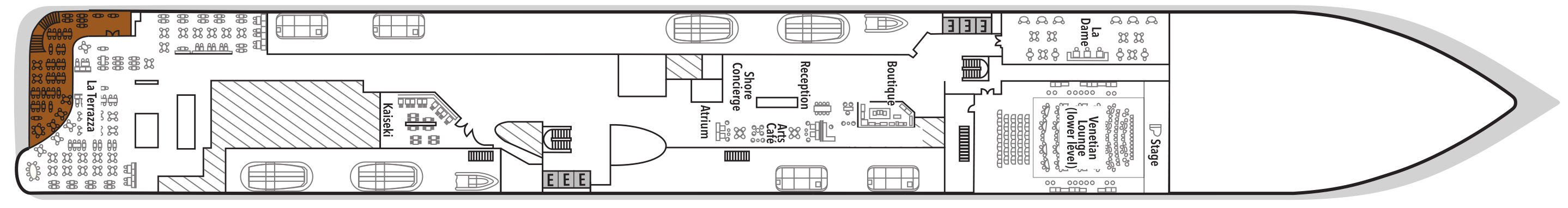
Deck 4
- La Dame
- Venetian Lounge
- Boutique
- Reception
- Arts Café
- Shore Concierge
- Atrium
- Kaiseki
- La Terrazza
- Elevator
Deck 3
- Atlantide
- S.A.L.T. Kitchen
- The Shelter
- Elevator

Silver Nova is a new dimension in luxury, with more of everything you love, and the space and time to enjoy it. You’ll be spoiled for choice with an outstanding selection of dining venues across the ship, as well as a series of onboard luxury experiences that will relax and pamper you throughout your voyage. All with much more personal space onboard than ever before. Enjoy.
Fine dining, day or night.
Onboard Silver Nova you’ll find an unrivalled variety of exquisite dining choices, with eight restaurants, from formal to casual, larger to more intimate. But the numbers tell only half the story, as many are available early morning to late evening and feature an incredible variety of cuisines, from international to French, Italian, Japanese and more. Bon appétit!
Sea And Land Taste - S.A.L.T.
Silver Nova isn’t just a new ship, it’s a new way to get to the heart and soul of your destination. On Silver Nova, our innovative culinary program S.A.L.T. features places, recipes and people that come together for an entirely new luxury gourmet experience. From menus that change with every place you visit, to onboard spaces for creating and recreating local dishes, we bring the flavours of the world right to your table.
The Marquee
The Marquee is our brand-new outdoor dining venue, open from early morning until late evening. It is the perfect place to enjoy a healthy breakfast in the morning, including delicious plant-based and vegan options, or try out our signature dining concepts: The Grill and Spaccanapoli for lunch or dinner.
Images are intended as a general reference. Features, materials, finishes and layout may be different than shown.
La Terrazza
Our hallmark Italian restaurant is as varied as the food-loving country itself. La Terrazza aboard Silver Nova offers an unparalleled destination dining experience, from its expansive floor-to-ceiling windows to its large, outdoor terrace. Enjoy all the tastes of the different regions, including the best homemade pasta, fresh antipasto, bowls of steaming risotto, hearty ragù, and delicious tiramisu. Be sure to try one of the bold wines from the cellar to wash it all down.
Images are intended as a general reference. Features, materials, finishes and layout may be different than shown.
Silver Note
Where do you go if you want great food and a brilliant atmosphere in a relaxed and sophisticated setting? Silver Note of course! Harkening back to the old school days of dinner and dancing, this venue embodies a feeling of fun and sense of glamour that is unequaled in the industry. Jazz bands and soul singers play live as you sample delicate tapas-style dishes with a gourmet twist. We guarantee a superlative night of entertainment in the gorgeously designed dinner venue.
Images are intended as a general reference. Features, materials, finishes and layout may be different than shown.
S.A.L.T. Kitchen
Are you hungry for something new? Eat your way through the places on your cruise in the S.A.L.T. Kitchen. Enjoy destination-inspired menus, including the Terrain menu, which offers recipes and flavors specific to the port visited, and the Voyage menu, which draws inspiration from the best flavors of the voyage. Pull up a chair and savor every taste of your cruise in a vibrant and welcoming atmosphere. S.A.L.T. Kitchen is the opportunity for all guests aboard Silver Nova to experience the very lifeblood of their destination.
Images are intended as a general reference. Features, materials, finishes and layout may be different than shown.
La Dame
Indulge in the new epitome of French fine dining aboard Silver Nova, where culinary heritage meets modern innovation. Immerse yourself in an exquisite gastronomic experience showcasing deep, balanced flavors, from curated tasting menus to à la carte selections paired with a thoughtfully curated wine selection.
Per guest reservation fee of US$160 (incl. complimentary wine pairing). Please visit My Silversea to make your reservations.
Images are intended as a general reference. Features, materials, finishes and layout may be different than shown.
Kaiseki
Experience the harmony of flavors and aesthetics with our enhanced Kaiseki dining experience. Delight in the fusion of Washoku’s culinary heritage and health benefits, where each meticulously crafted dish is a work of art. Explore the depth and diversity of Japanese spirits with our exclusive selection of sake and Japanese whiskeys, or savor a refreshing alternative from our delightful tea selection or cocktails.
Per guest reservation fee of US$80 (incl. complimentary sake, Japanese whiskeys, or TWG tea and tea cocktails selection). Please visit My Silversea to make your reservations.
Images are intended as a general reference. Features, materials, finishes and layout may be different than shown.
Atlantide
Atlantide offers guests our quintessential dining experience. Combining contemporary elegance and hallmark Silversea service, this classic restaurant offers our signature fine dining. Atlantide is one of our best-loved eateries, and on Silver Nova we have given it an updated design. Large picture windows, sophisticated lighting design, plus a warm color spectrum give Atlantide a blend of high-end, whispered luxury. The menu prides itself on superb ingredients and sublime flavor combinations, from caviar to lobster to gorgeous, melt-in-your-mouth desserts.
Images are intended as a general reference. Features, materials, finishes and layout may be different than shown.
Art Café
The Arts Café offers a cultural setting for eating, drinking, and socializing, as well as a chance to lose yourself while reading up on all your favorite artists and art. Enjoy healthy snacks and smoothies plus hot and cold drinks, juices, pastries, and sandwiches in a light and airy space. Pop in for a late breakfast or afternoon snack, along with real Italian espresso plus a great range of tea.
Images are intended as a general reference. Features, materials, finishes and layout may be different than shown.
S.A.L.T. Chef's Table
Prepare for an intimate and interactive dining experience like no other at the S.A.L.T. Chef's Table. Indulge in a choreographed menu of small plates highlighting regional flavours and star ingredients, all accompanied by unique wines and cocktails.
Per guest reservation fee of U$180 (incl. complimentary wine & cocktail pairing). Reservations will be taken exclusively on board Silver Nova.
Images are intended as a general reference. Features, materials, finishes and layout may be different than shown.
The Grill
Silversea’s much-loved casual dining restaurant serves a delectable range of burgers and salads by day and turns into our famous Hot Rocks table BBQ concept by night. Found in our brand-new eating venue The Marquee, The Grill is quite simply the best place to eat between sea and sky. If you like flavorsome meals cooked to perfection, a casual, laid-back atmosphere, and OMG views, then The Grill is the answer to your prayers.
Images are intended as a general reference. Features, materials, finishes and layout may be different than shown.
Spaccanapoli
Nothing says Italy quite as well as a hot, fresh pizza. Spaccanapoli is a slice of Naples, where you’ll taste deliciously thin, freshly made pizzas, topped with creamy mozzarella and minimalist toppings. The light and airy pizzeria forms part of our new alfresco eatery The Marquee, and it is the perfect choice for diners who want to be dazzled by our talented pizzaiolos spinning the dough in the open-air kitchen. Whether you want a light lunch or to share a slice with friends over an aperitif, it’s always the right time for Spaccanapoli.
Images are intended as a general reference. Features, materials, finishes and layout may be different than shown.
A bar or lounge, wherever you are.
Silver Nova connects you to your fellow travellers like never before, with its unique bars and lounges. With a total of ten venues throughout the ship, you’ll be able to enjoy the luxury of choice: from spacious to small, elegant to more laid back. All perfect for enjoying your favourite drink with your favourite fellow travellers.
The Dusk Bar
With an emphasis on the destination, panoramic views connect you with the world beyond at The Dusk Bar. This superb open-air sky bar provides plenty of space for guests to enjoy a pre- or post-dinner drink while taking in the jaw-dropping, 270-degree, panoramic views from the stern. The Dusk Bar’s delightful combination of idyllic atmosphere and lovely drinks is guaranteed to check your boxes time after time. Whether you’re enjoying a spritz in South America, a cocktail in the Caribbean, or a night cap in the Mediterranean, we think The Dusk Bar’s unobstructed views give you a new perspective on sunsets at sea.
Images are intended as a general reference. Features, materials, finishes and layout may be different than shown.
The Pool Deck
Enjoy a reimagined space where you can relax, refresh, and rejuvenate on decks 10 and 11. Ample sun beds for everyone, more space than ever before, and the largest pool in the fleet—which offers exceptional, unhampered, 270-degree views—are just the beginning. The upper-level sun deck is perfectly placed for those who want a quieter space to relax and still enjoy those incredible, expansive views that are the hallmark of Silver Nova. But it is The Cliff Whirlpool, an infinity-edge, glass-fronted whirlpool, that really makes The Pool Deck something special.
Images are intended as a general reference. Features, materials, finishes and layout may be different than shown.
S.A.L.T. Bar
Nothing says authentic experience better than Silver Nova’s S.A.L.T. Bar. Get a taste for the authentic and settle down to enjoy locally inspired cocktails and drinks. How can you go wrong with a rum punch in Barbados, a pastis over ice in Marseille, or a pisco sour in Lima? Nothing unites new faces and old friends in quite the same way. Be inspired to find your perfect locally inspired beverage at the S.A.L.T. Bar and let the color and flavors of your journey rush in.
Images are intended as a general reference. Features, materials, finishes and layout may be different than shown.
The Shelter
The Shelter is our newest pre- and post-dinner cocktail venue. Settle in amid an intimate and elegant setting, resplendent with sophisticated lighting, inviting sofas, and a stunning wraparound bar. Strategically located on deck 3, the atmospheric hideaway opens onto the Atrium, creating openness and connection to the other neighboring venues. We promise you’ll fall in love with one of the best bars on board while our talented team of mixologists mix and shake our range of signature and bespoke cocktails. With the perfect destination, warm smiles, and legendary Silversea service, get set for unforgettable nights in The Shelter.
Images are intended as a general reference. Features, materials, finishes and layout may be different than shown.
Dolce Vita
Our main bar has been newly reimagined for Silver Nova! Dolce Vita has of course kept her legendary charm, inspired cocktails, stylish decor, and comfortable seating, but a central bar now means the warm ambience is better than ever! Oozing Italian glamour, Dolce Vita is a relaxed, refined bar with a nightly piano player playing all your favorite tunes. Perfect for pre-dinner aperitifs or even a post-dinner cocktail, Dolce Vita is truly the beating heart of social life on board.
Images are intended as a general reference. Features, materials, finishes and layout may be different than shown.
Panorama Lounge
From early morning to late at night, the Panorama Lounge offers everything you could wish for. A peaceful retreat that is the perfect place to take a break, a social place to meet and greet old friends, or an evening venue to partake in a cocktail as you sit back and watch the world go by. Sink into the plush seats, and come evening, enjoy listening to the gentle sounds of a pianist or the invigorating beats of our in-house DJ.
Images are intended as a general reference. Features, materials, finishes and layout may be different than shown.
Connoisseur's Corner
Our smoking lounge aboard Silver Nova is our latest venue where cigar lovers can buy and sample some of the world’s finest Havanas, Cohibas, Partagás, Montecristos, Ramón Allones, and Bolívars. Combining all the elements of cigar culture indoors and on its stylish terrace, the Connoisseur’s Corner is where aficionados can meet and mingle to share their iconic passion.
Images are intended as a general reference. Features, materials, finishes and layout may be different than shown.
Atrium
Located on deck 4, the Atrium is the beating heart of Silver Nova. Inspired by Roman architecture, the Atrium’s magnificent windows floods our central meeting areas with abundant natural light. The area is home to both the Arts Café and The Shelter, as well as main service areas such as the Reception, Shore Concierge, and Future Cruise Sales. The Atrium’s enormous glass wall stretches over two decks, guaranteeing a deep connection with your destination whether at sea or docked in port.
Images are intended as a general reference. Features, materials, finishes and layout may be different than shown.
Observation Lounge
Set on the highest level at the very top of the ship, this is a quiet space for reading and reflection while being dazzled by the undulating seascapes that are part of life on board. Borrow a book from the in-house library, read the papers, or just embrace the tranquility of being at sea.
Images are intended as a general reference. Features, materials, finishes and layout may be different than shown.
Boutique
Exceptional shopping experiences do not end in the cosmopolitan cities we visit. Silversea’s striking new shipboard boutiques, reimagined and redesigned, are stunning modern design spaces befitting the finest creations from legendary designers. Carefully selected partners on board Silversea’s duty-free boutiques offer our guests a carefully curated selection of cutting-edge fashions, jewelry, accessories, fine perfumes, cosmetics, and Silversea Logo collection, all at duty-free prices.
Images are intended as a general reference. Features, materials, finishes and layout may be different than shown.
Casino
Let the fun begin! Channel your inner James Bond and place a bet at a variety of table games, including American Roulette, Blackjack, and Poker, as Silver Nova glides silently through the waves. An assortment of multi-game, multi-denominational reel and video slot machines are also available. Prepare yourself for a luxurious and exhilarating experience with every turn of a card and spin of the wheel. Game on!
Images are intended as a general reference. Features, materials, finishes and layout may be different than shown.
The Venetian Lounge
The grandeur and magic of music and theater. The experience of being transported by performance. That satisfying feeling of seeing an evening show … Welcome to the Venetian Lounge, a place where the arts of theater and music meet with full-scale productions and feature films. Paying tribute to a golden age of glamour, the Venetian Lounge offers belle-époque-style cabaret seating, with intimate tables and chairs subtly placed between the rows of comfortable tiered banquettes. As the stage lights are dimmed, soak up the atmosphere, relax, and enjoy a night of dazzling sights and sounds.
Images are intended as a general reference. Features, materials, finishes and layout may be different than shown.