Valparaiso to Miami
Valparaiso to Miami
Cruise overview
WHY BOOK WITH US?
- ✔ The Deluxe Cruises’ team has extensive experience in ultra-luxury cruising.
- ✔ Call now to speak to our helpful and experienced Cruise Concierge team.
- ✔ Enjoy our Unique Deluxe Cruises Bonus for substantial savings.
- ✔ Our team will tailor your holiday to your exacting requirements.
- ✔ As agents, we work under the protection of each cruise lines ABTA / ATOL licences
About Valparaiso
Valparaíso's dramatic topography—45 cerros, or hills, overlooking the ocean—requires the use of winding pathways and wooden ascensores (funiculars) to get up many of the grades. The slopes are covered by candy-color houses—there are almost no apartments in the city—most of which have exteriors of corrugated metal peeled from shipping containers decades ago. Valparaíso has served as Santiago's port for centuries. Before the Panama Canal opened, Valparaíso was the busiest port in South America. Harsh realities—changing trade routes, industrial decline—have diminished its importance, but it remains Chile's principal port. Most shops, banks, restaurants, bars, and other businesses cluster along the handful of streets called El Plan (the flat area) that are closest to the shoreline. Porteños (which means "the residents of the port") live in the surrounding hills in an undulating array of colorful abodes. At the top of any of the dozens of stairways, the paseos (promenades) have spectacular views; many are named after prominent Yugoslavian, Basque, and German immigrants. Neighborhoods are named for the hills they cover. With the jumble of power lines overhead and the hundreds of buses that slow down—but never completely stop—to pick up agile riders, it's hard to forget you're in a city. Still, walking is the best way to experience Valparaíso. Be careful where you step, though—locals aren't very conscientious about curbing their dogs.

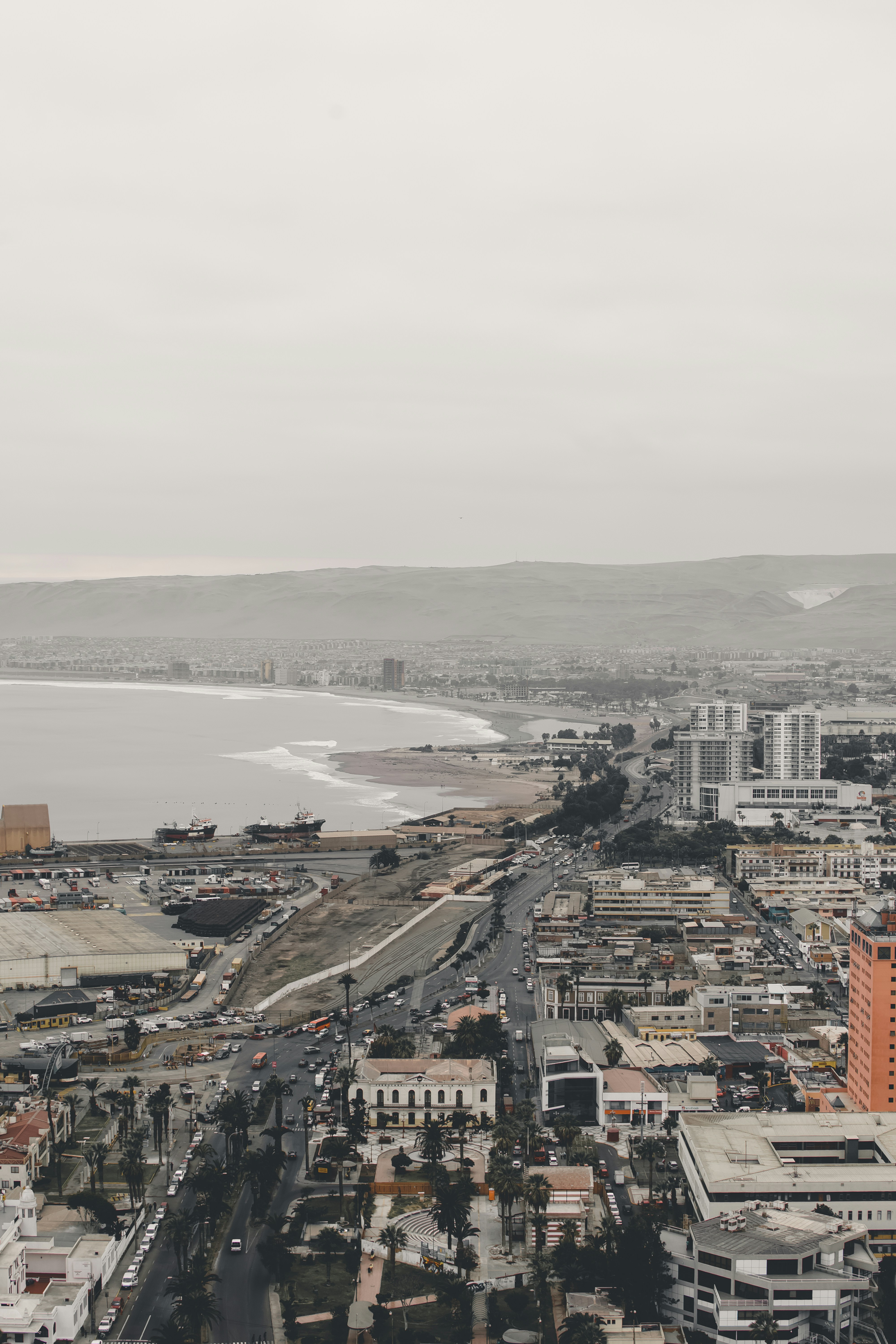
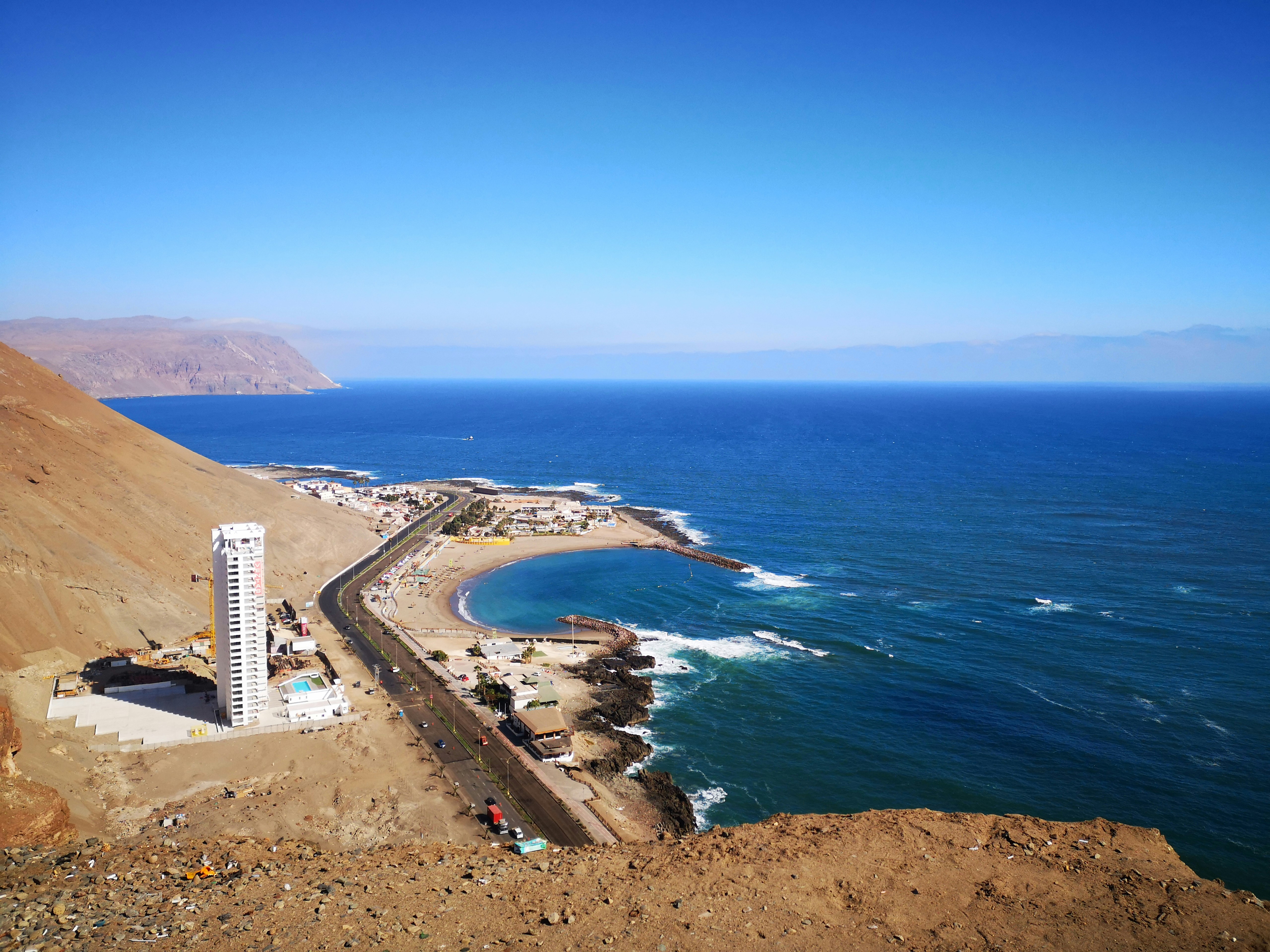
About Arica
Arica boasts that it is "the land of the eternal spring," but its temperate climate and beaches are not the only reason to visit this small city. Relax for an hour or two on the Plaza 21 de Mayo. Walk to the pier and watch the pelicans and sea lions trail the fishing boats as the afternoon's catch comes in. Walk to the top of the Morro and imagine battles of days gone by, or wonder at the magnitude of modern shipping as Chilean goods leave the port below by container ship.Arica is gaining notice for its great surfing conditions, and in 2009 hosted the Rusty Arica Pro Surf Challenge, a qualifying event to the world series of surf.

About Callao
When people discuss great South American cities, Lima is often overlooked. But Peru's capital can hold its own against its neighbors. It has an oceanfront setting, colonial-era splendor, sophisticated dining, and nonstop nightlife.It's true that the city—clogged with traffic and choked with fumes—doesn't make a good first impression, especially since the airport is in an industrial neighborhood. But wander around the regal edifices surrounding the Plaza de Armas, among the gnarled olive trees of San Isidro's Parque El Olivar, or along the winding lanes in the coastal community of Barranco, and you'll find yourself charmed.In 1535 Francisco Pizarro found the perfect place for the capital of Spain's colonial empire. On a natural port, the so-called Ciudad de los Reyes (City of Kings) allowed Spain to ship home all the gold the conquistador plundered from the Inca. Lima served as the capital of Spain's South American empire for 300 years, and it's safe to say that no other colonial city enjoyed such power and prestige during this period.When Peru declared its independence from Spain in 1821, the declaration was read in the square that Pizarro had so carefully designed. Many of the colonial-era buildings around the Plaza de Armas are standing today. Walk a few blocks in any direction for churches and elegant houses that reveal just how wealthy this city once was. But the poor state of most buildings attests to the fact that the country's wealthy families have moved to neighborhoods to the south over the past century.The walls that surrounded the city were demolished in 1870, making way for unprecedented growth. A former hacienda became the graceful residential neighborhood of San Isidro. In the early 1920s the construction of tree-lined Avenida Arequipa heralded the development of neighborhoods such as bustling Miraflores and bohemian Barranco.Almost a third of the country's population of 29 million lives in the metropolitan area, many of them in relatively poor conos: newer neighborhoods on the outskirts of the city. Most residents of those neighborhoods moved there from mountain villages during the political violence and poverty that marked the 1980s and ’90s, when crime increased dramatically. During the past decade the country has enjoyed peace and steady economic growth, which have been accompanied by many improvements and refurbishment in the city. Residents who used to steer clear of the historic center now stroll along its streets. And many travelers who once would have avoided the city altogether now plan to spend a day here and end up staying two or three.
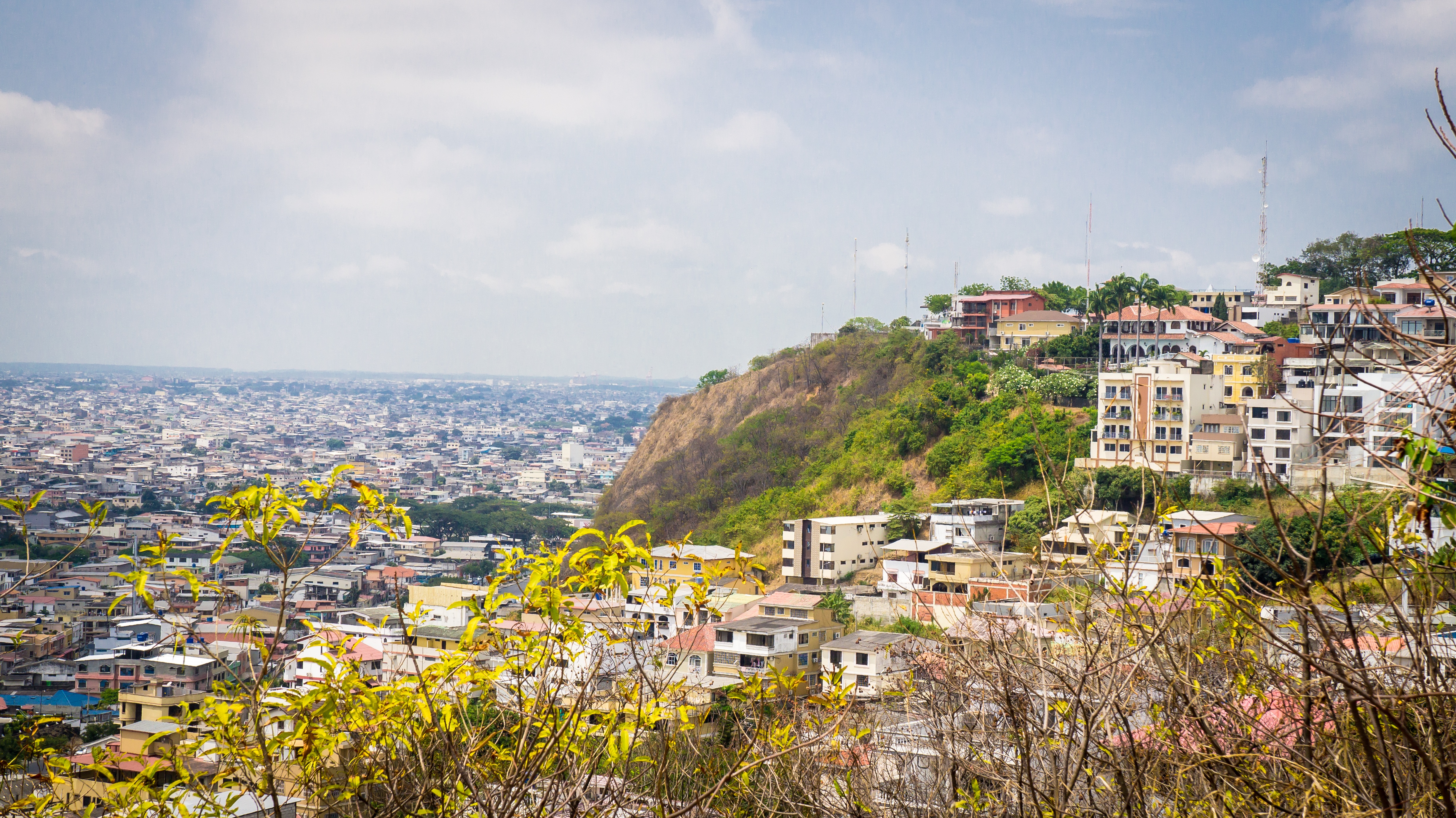
About Guayaquil
The second major jumping off point for the Galapagos Islands after Quito, this is a little city with a big heart. A sea port first and foremost, the city’s personality has been founded on that, and all the better it is for it too. Almost Caribbean in feeling, the clement climate coupled with the intermingling rhythms floating from the windows and abundance of fresh seafood make this a very tropical destination. Once not even considered by the travel books as a potential destination in its own right, the city has undergone something of a resurgence in the past few years. Proud Guayaquileños will not hestitate to point out the Malecón or the exciting new riverfront promenade, once a no-go area after dark, now happily (and hippily) lined with museums, restaurants, shops, and ongoing entertainment. The new airport and urban transportation network are also lauded to the happy tourists who find themselves here. As the largest and most populous city in Ecuador as well as being the commercial centre, it would only be natural that the city would have some kind of modern architecture, but it is the colourful favelas, or to use their real name guasmos, that cling to the side of the hillside like limpets that really catch your eye. A blend of old and new, the first inhabitants can be traced back to 1948 when the government cleared the area for affordable housing, these shanty towns are witness to the social and political particularities that Guayaquil has faced in the past.
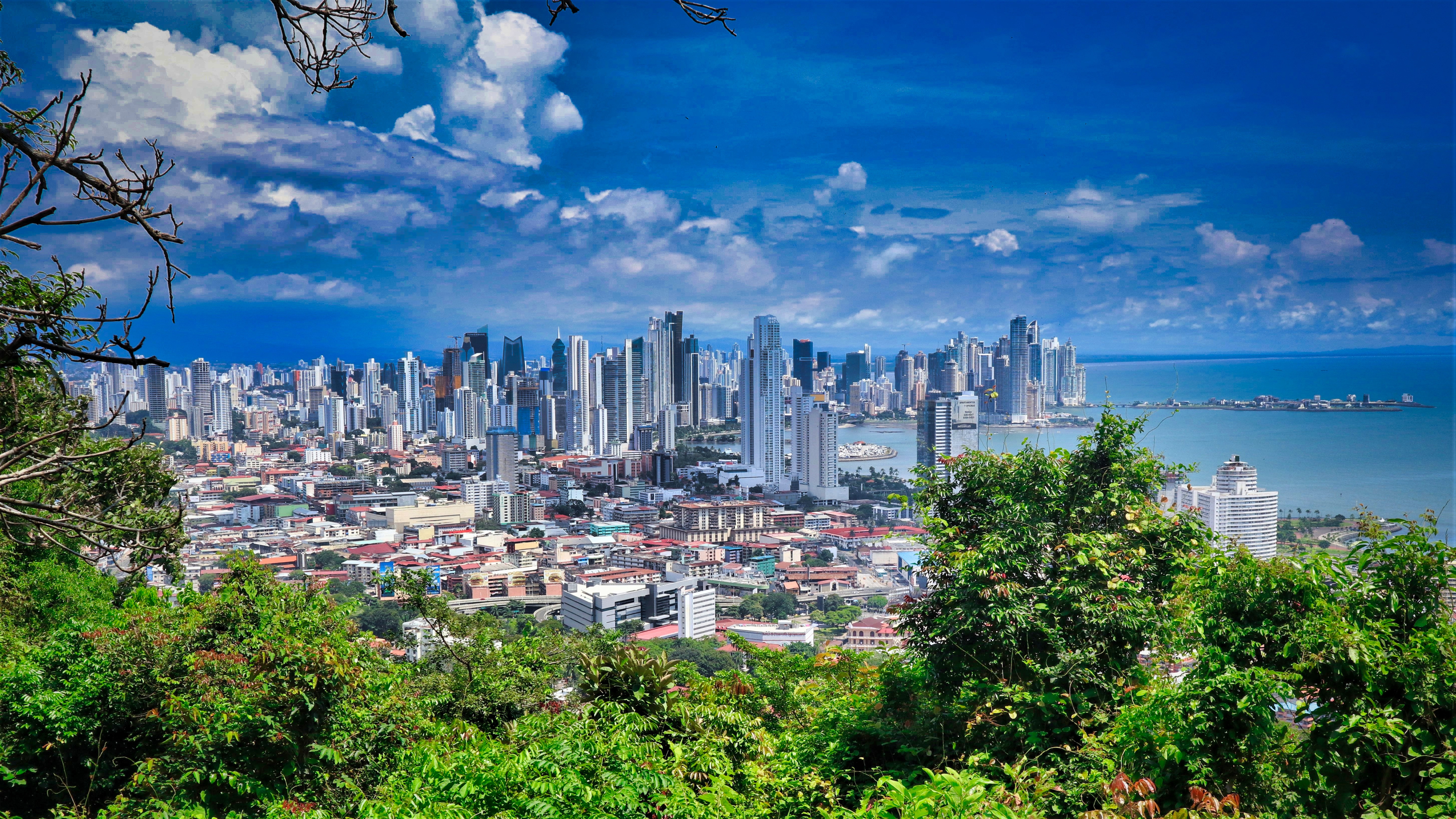
About Panama City
Expect incredible morning views as you arrive into the port for Panama City. Tinged with a silver pre-dawn light, the city will metamorphosise into a golden glow as the sun rises above it. And from then on expect one stunning view after another. Very interesting in its own right, Fuerte Amador is obviously overshadowed by its proximity to Panama City. So should the Miraflores museum of the Canal, which offers a comprehensive and immersive tour of the Canal including a 3-D experience, four exhibition halls, an observation deck, and a surprisingly good restaurant not interest you then there is always the option of lovely Casco Viejo – literally the old quartier of Panama. The grand old colonial houses, cobbled streets, independent boutiques and buzzing street scene make this a must stop on your itinerary. And if you like seafood, you will not want miss the many restaurants and market stalls serving different variations of so-fresh-it’s-still-practically-swimming ceviche. Best eaten like the Panamanians do, with salty crackers and a cold beer on the beach. And if money is no object, a cup of geisha coffee – supposedly the world’s best and definitely the world’s most expensive at $7 a shot is definitely a pick me up! Cool cosmopolitan capital aside, Panama has a skyscraper filled skyline that is worthy of some of its North American counterparts. But if urban utopia is not your scene then fear not, the sandy beaches and lush rainforests are never more than a short cab ride away.
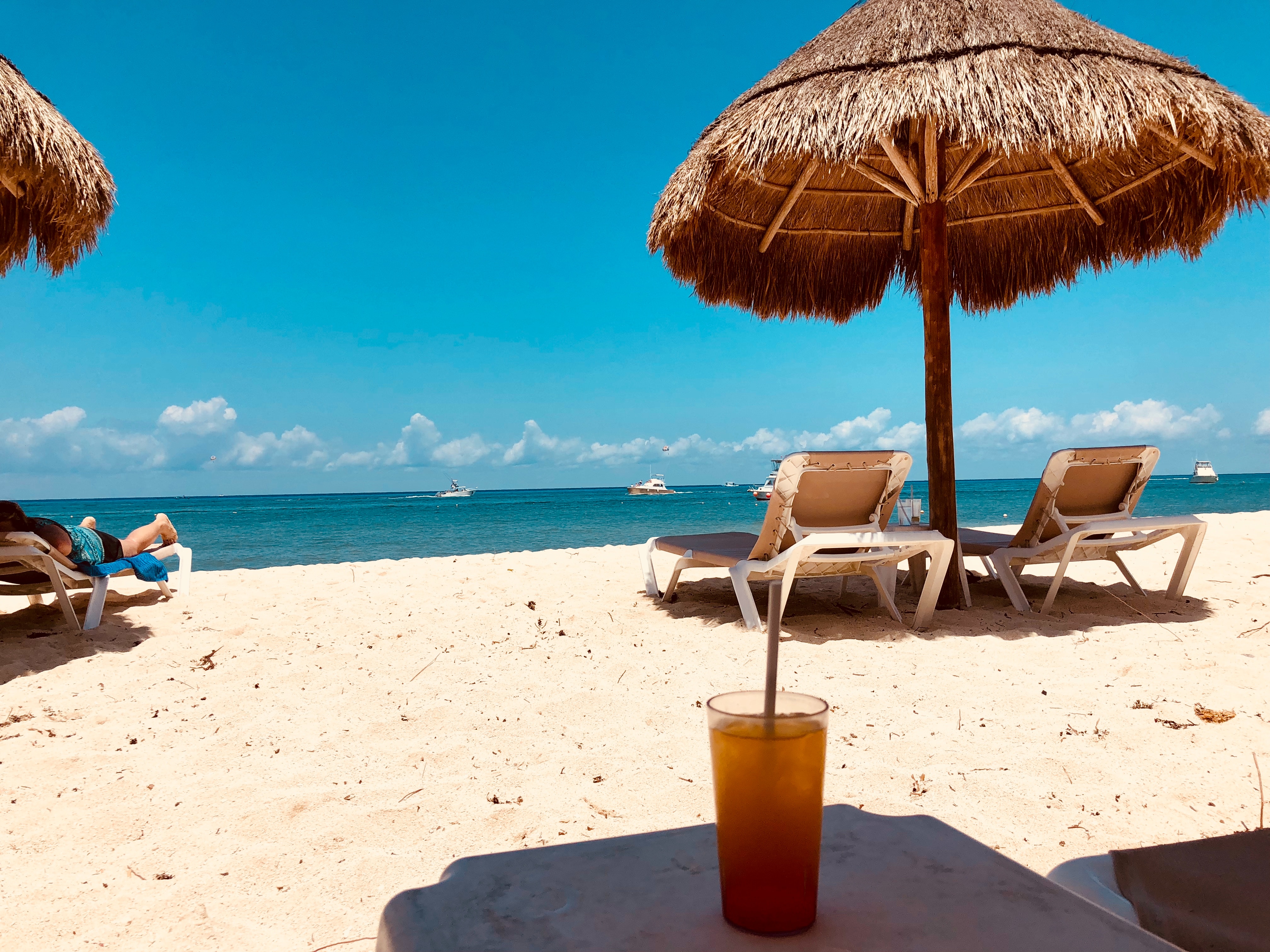
About Cozumel
Cozumel, a Caribbean gem off Mexico’s Yucatán Peninsula, is celebrated for its crystal-clear waters, vibrant coral reefs, and rich Mayan history. A haven for divers and snorkelers, the island is home to the Mesoamerican Reef, teeming with colorful marine life. Beyond the sea, explore ancient ruins like San Gervasio, enjoy local charm in San Miguel’s markets, or relax on pristine beaches. Eco-parks like Punta Sur offer lush landscapes and wildlife encounters. Blending natural beauty, cultural heritage, and adventure, Cozumel promises a tropical escape that captivates every traveler.

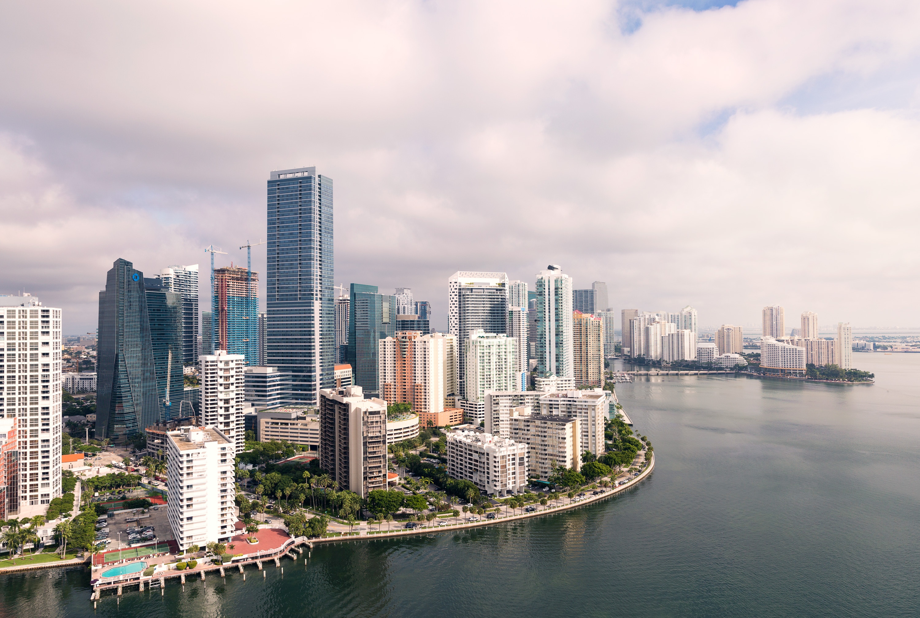
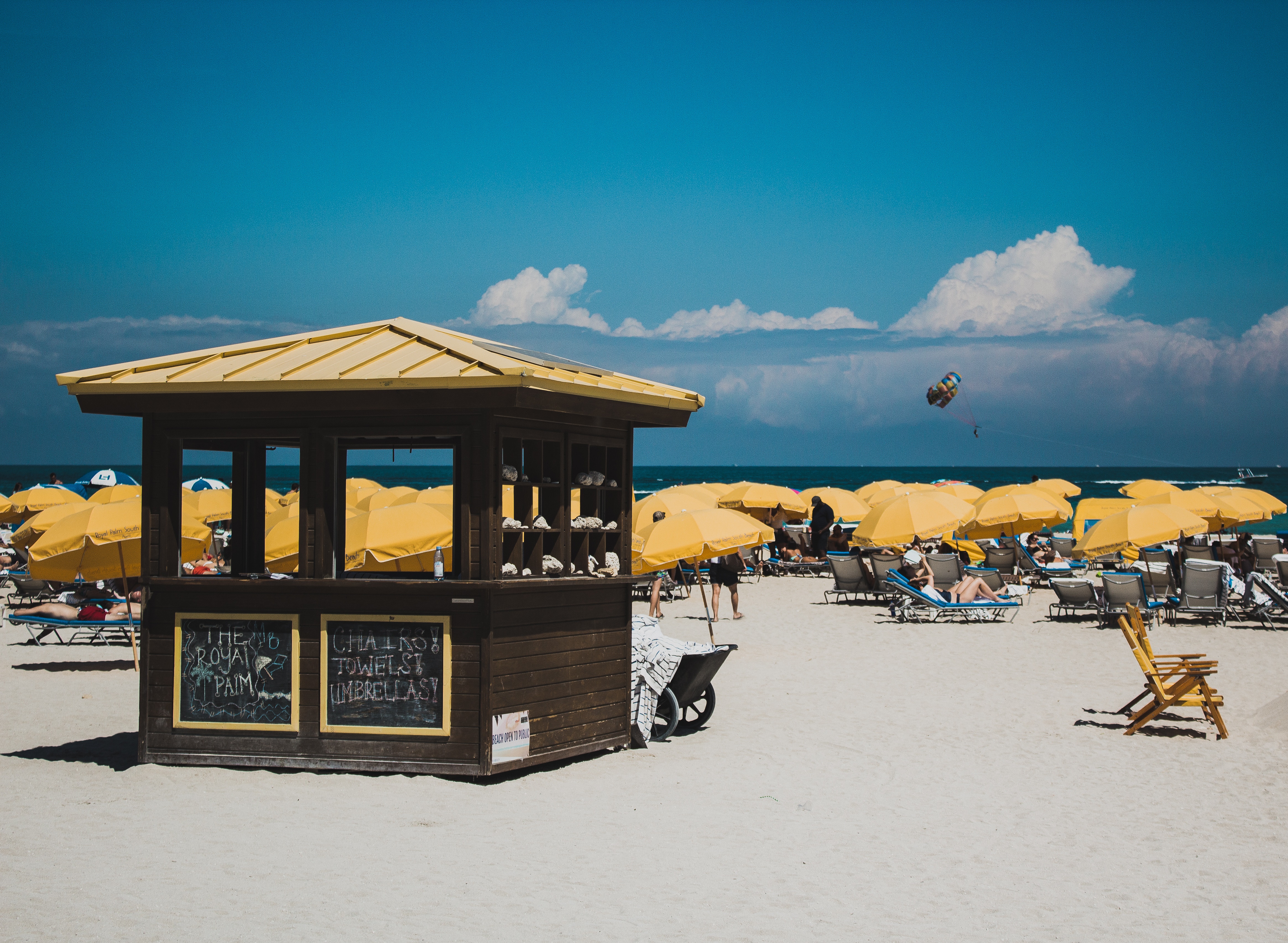
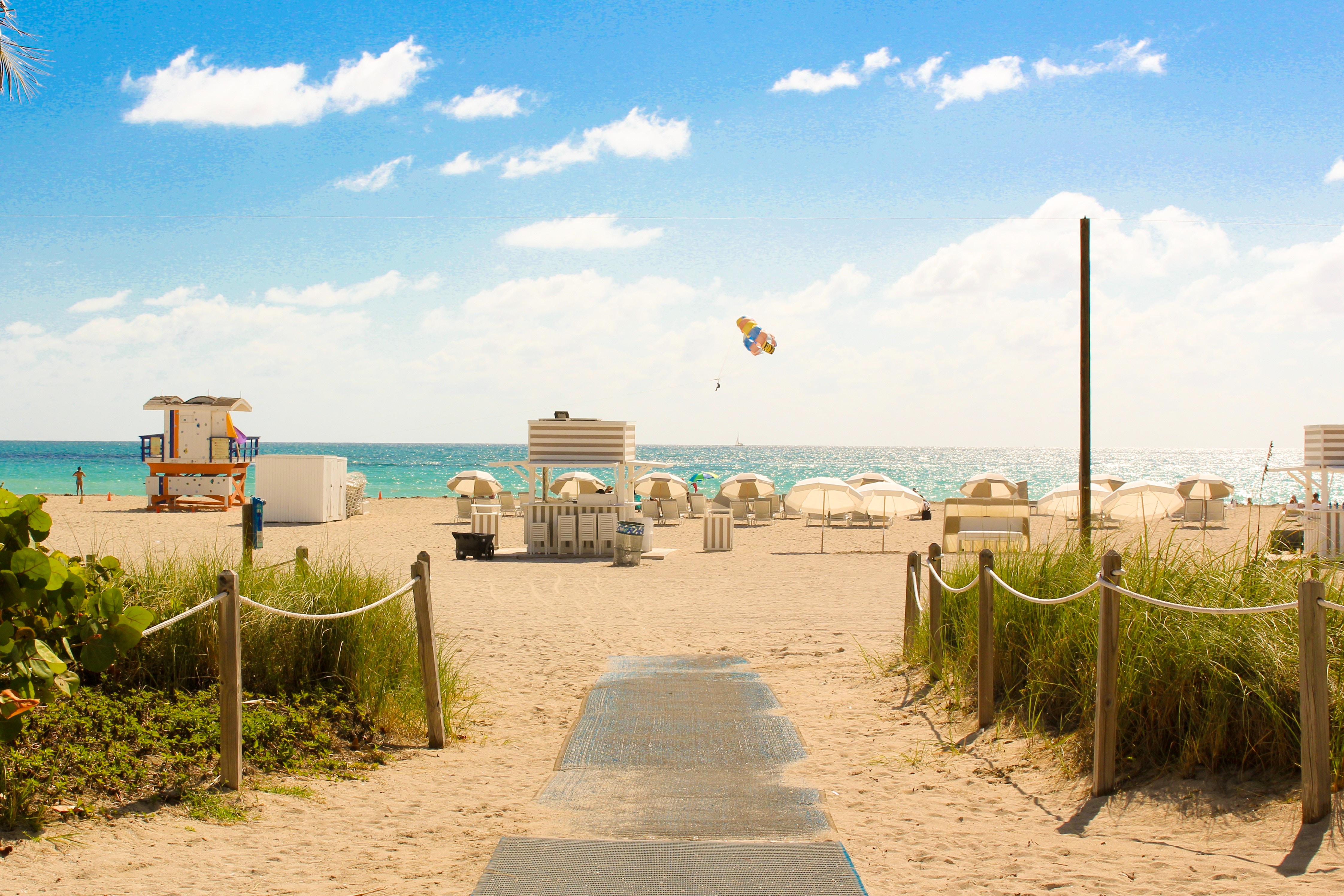
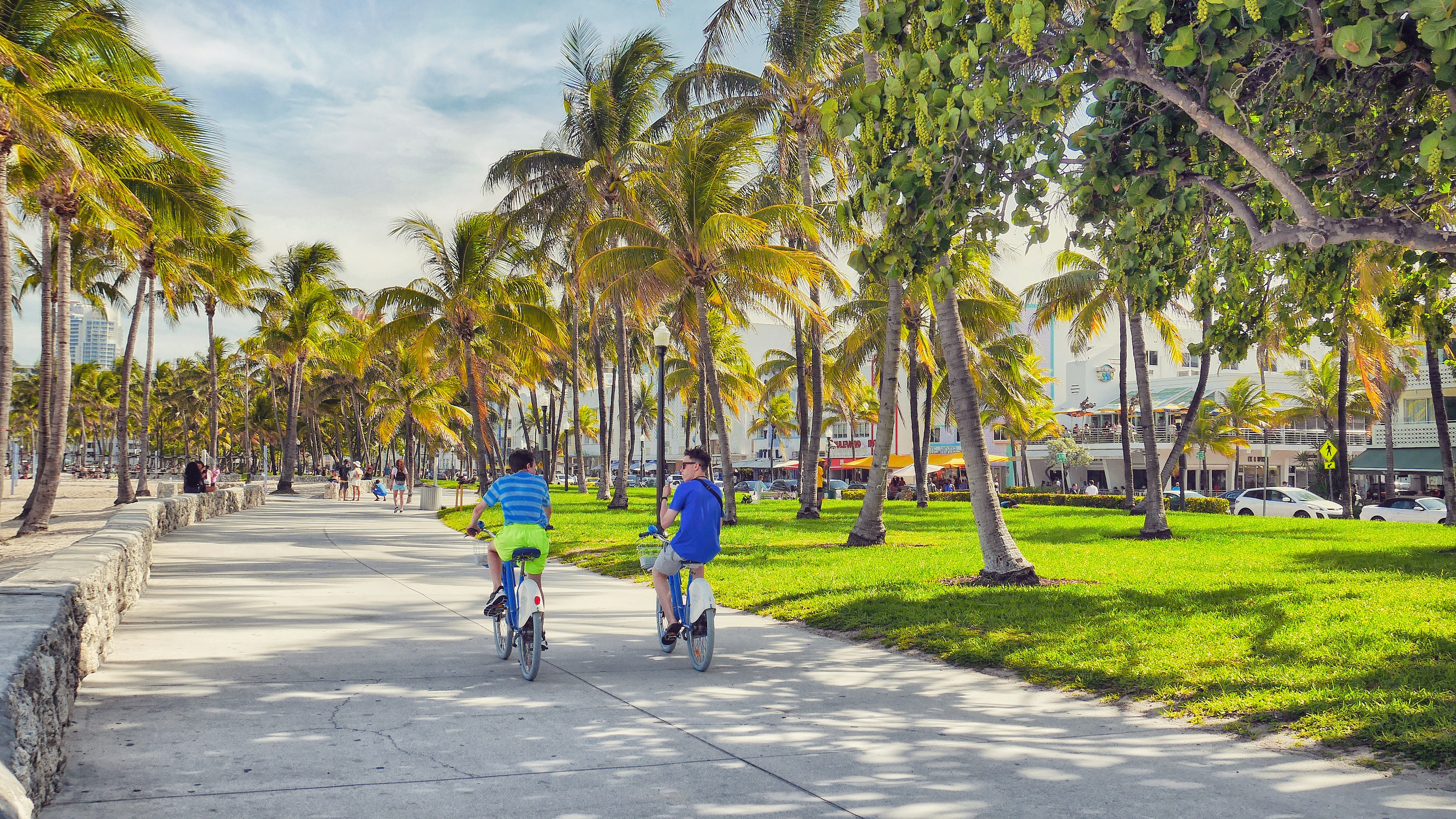
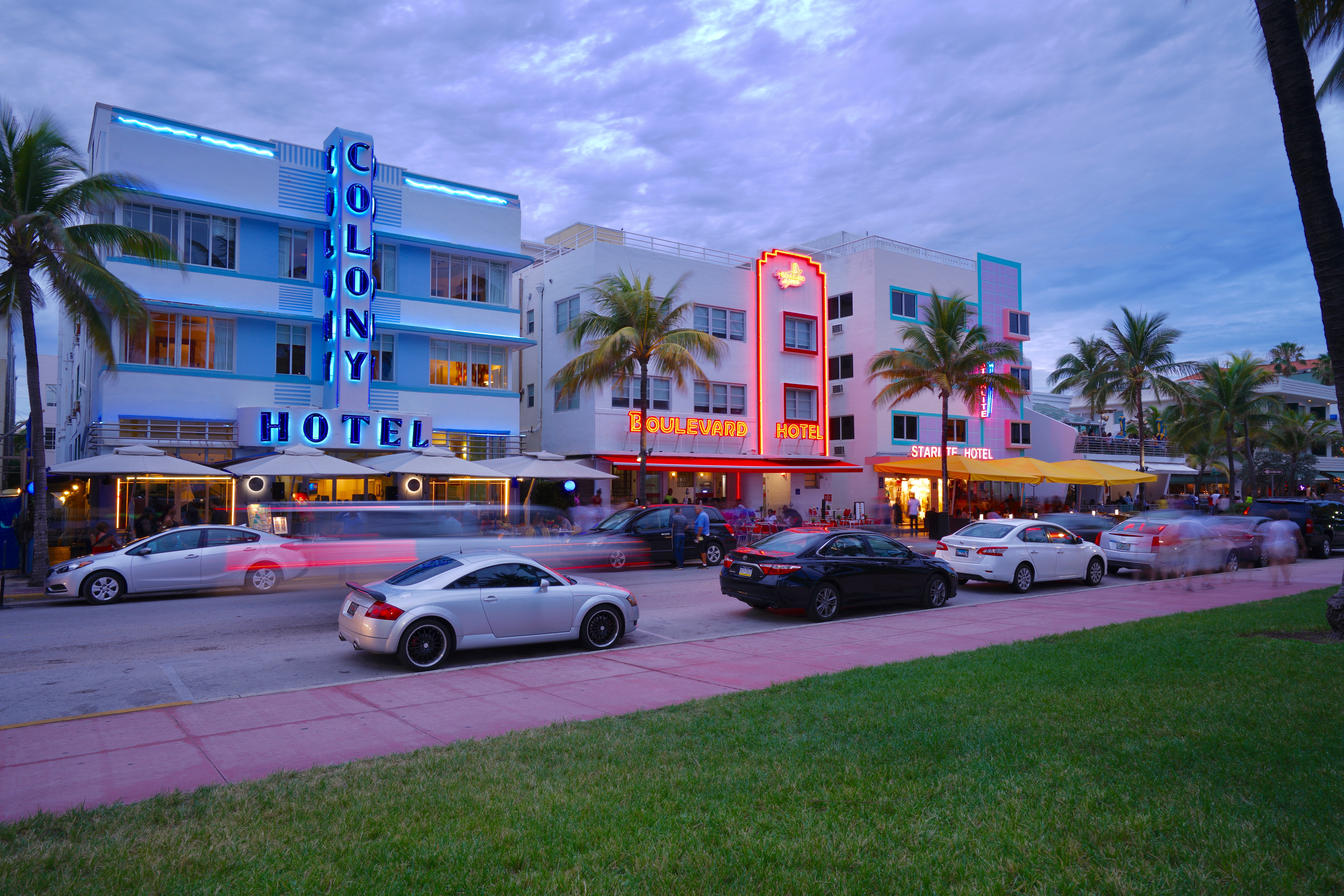
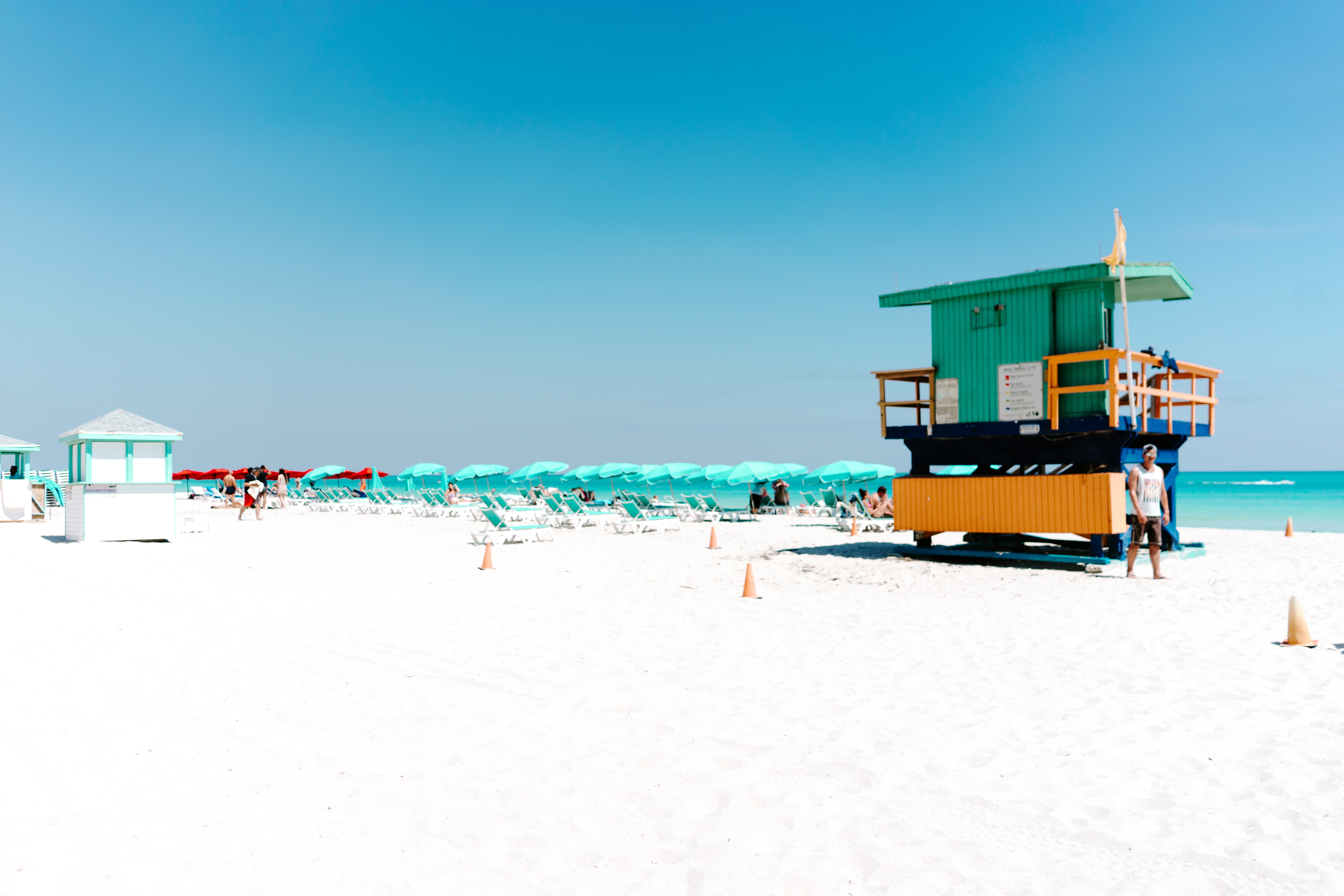
About Miami, Florida
Miami is one of the world’s most popular holiday spots. It has so much to offer; from its countless beach areas, to culture and museums, from spa and shopping days out, to endless cuban restaurants and cafes. Miami is a multicultural city that has something to offer to everyone.
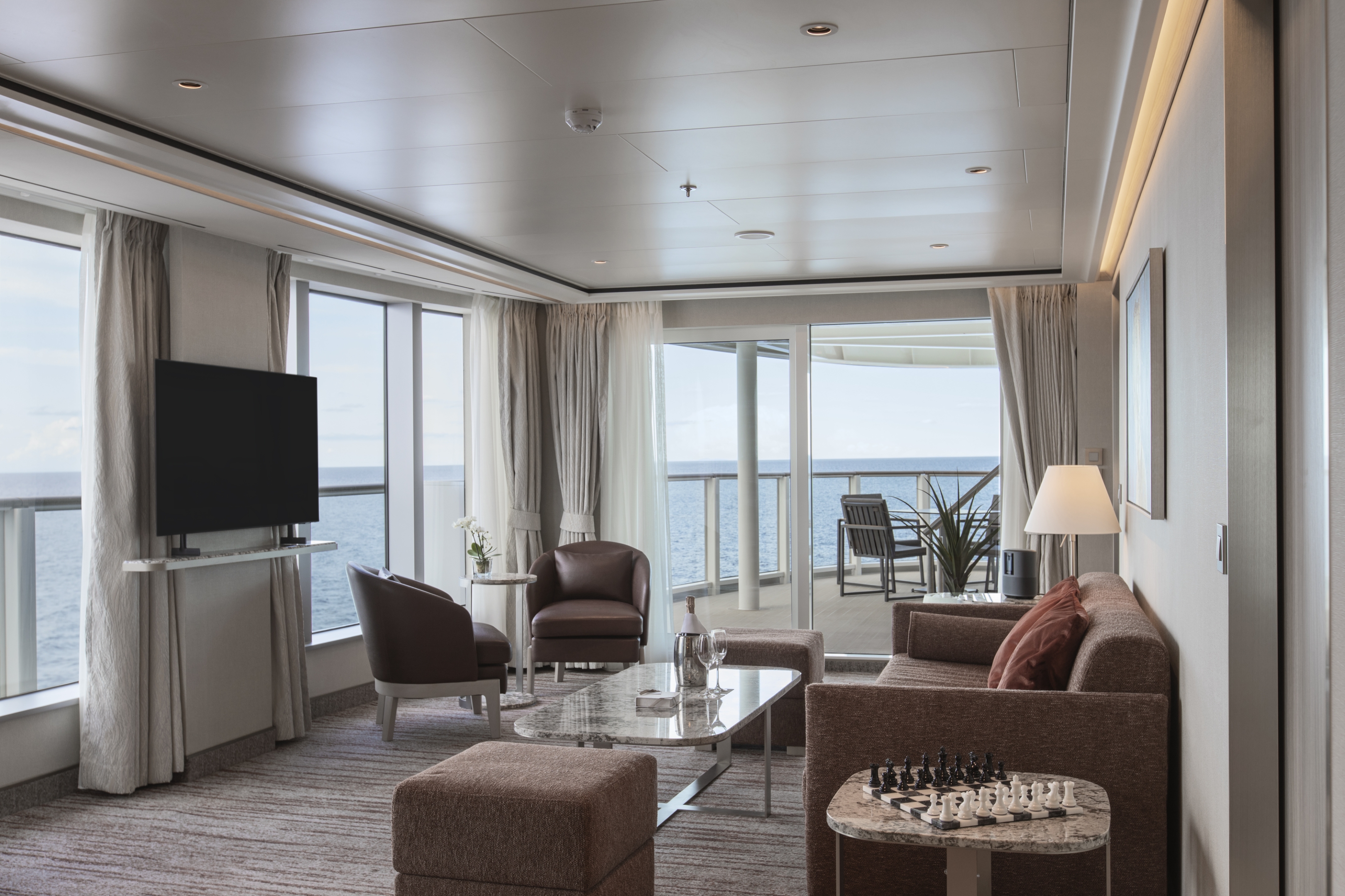
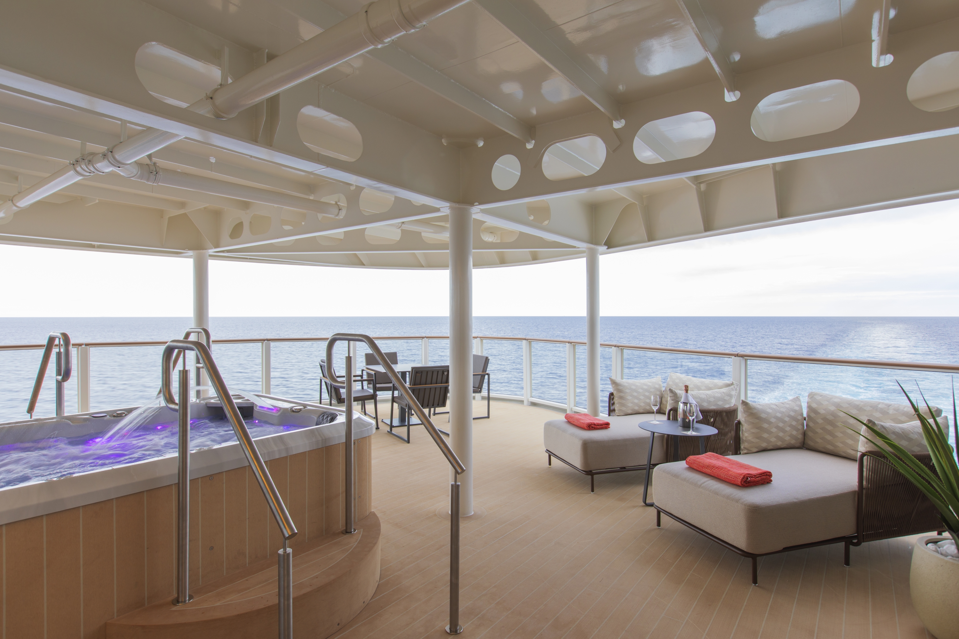
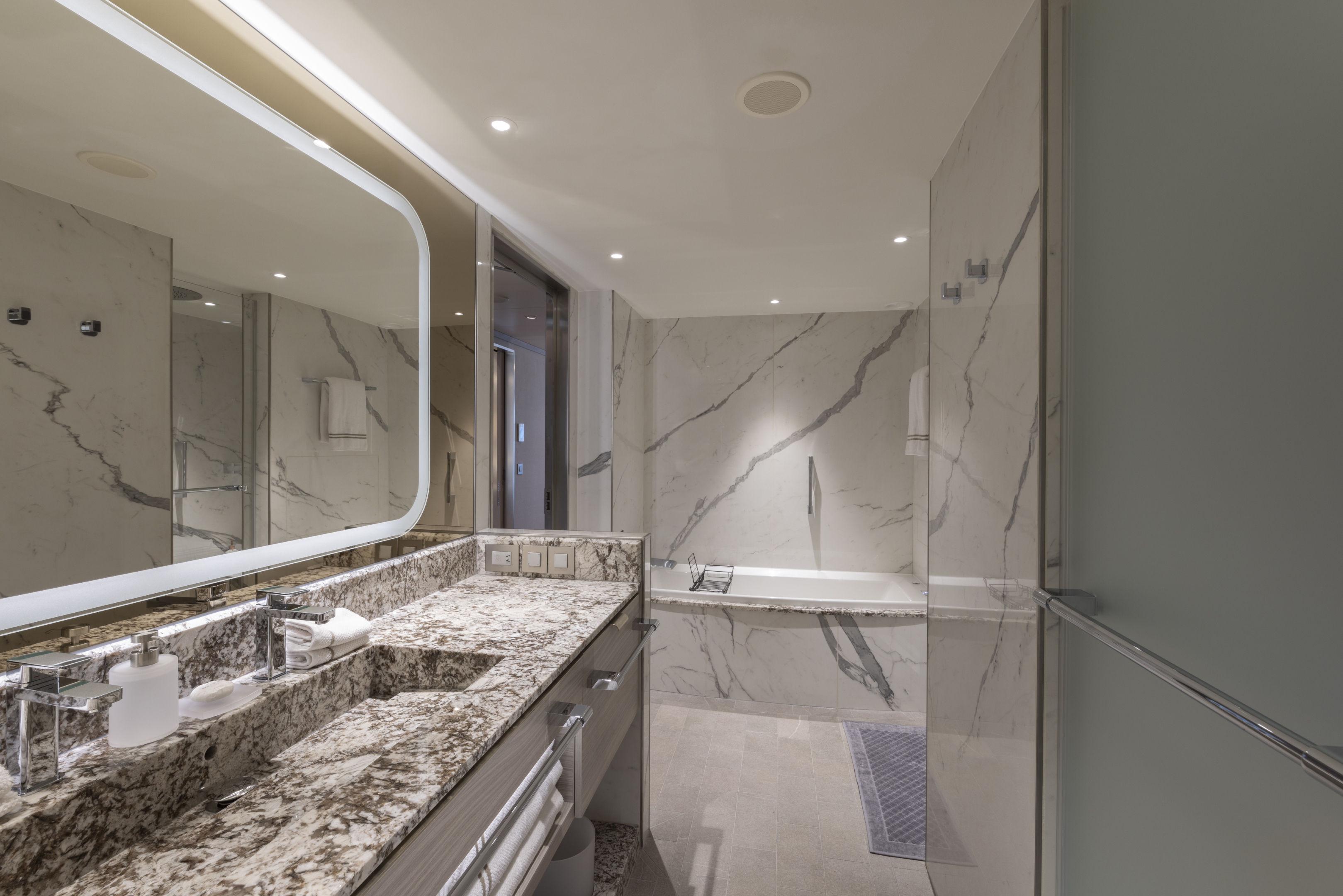
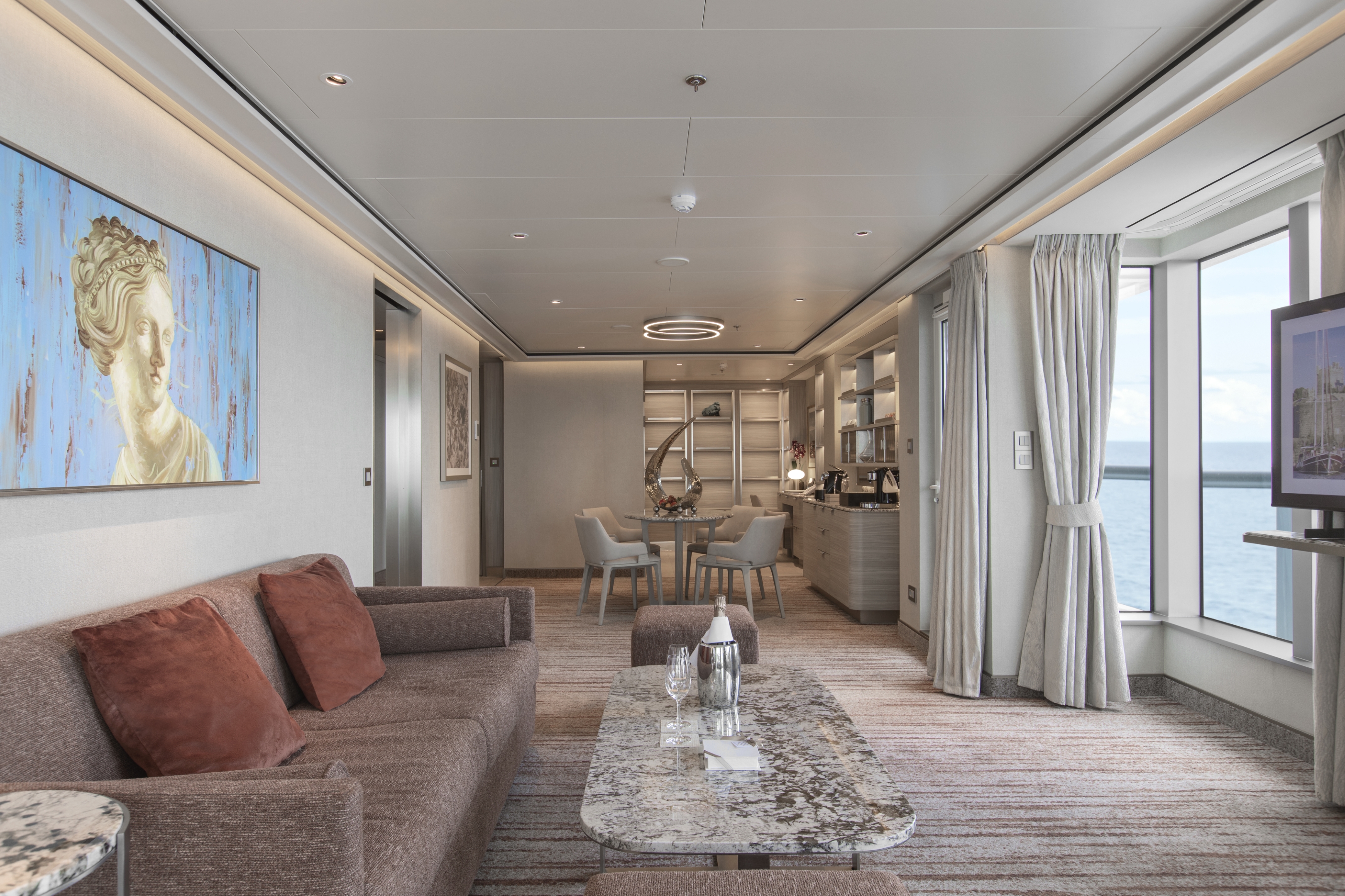
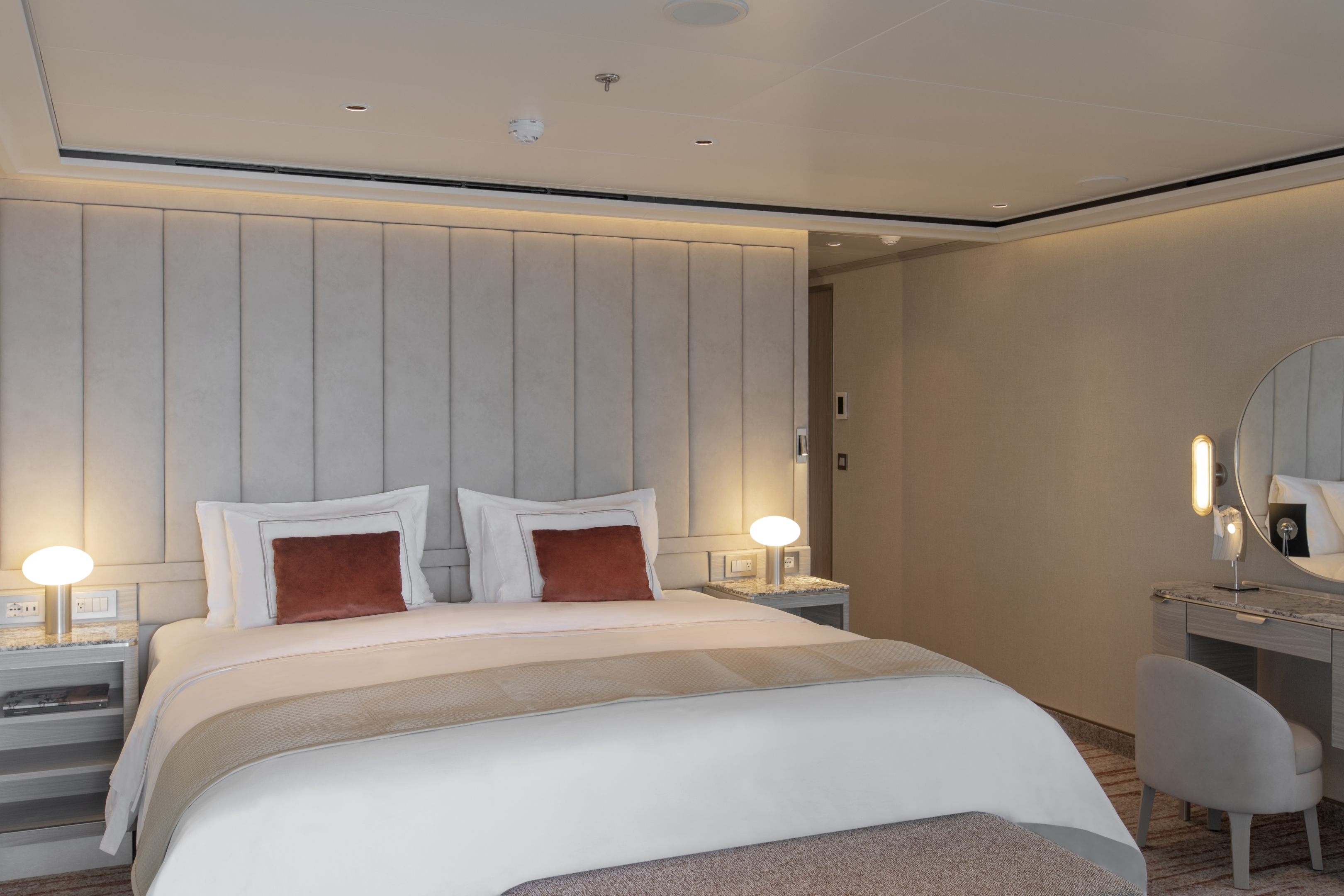
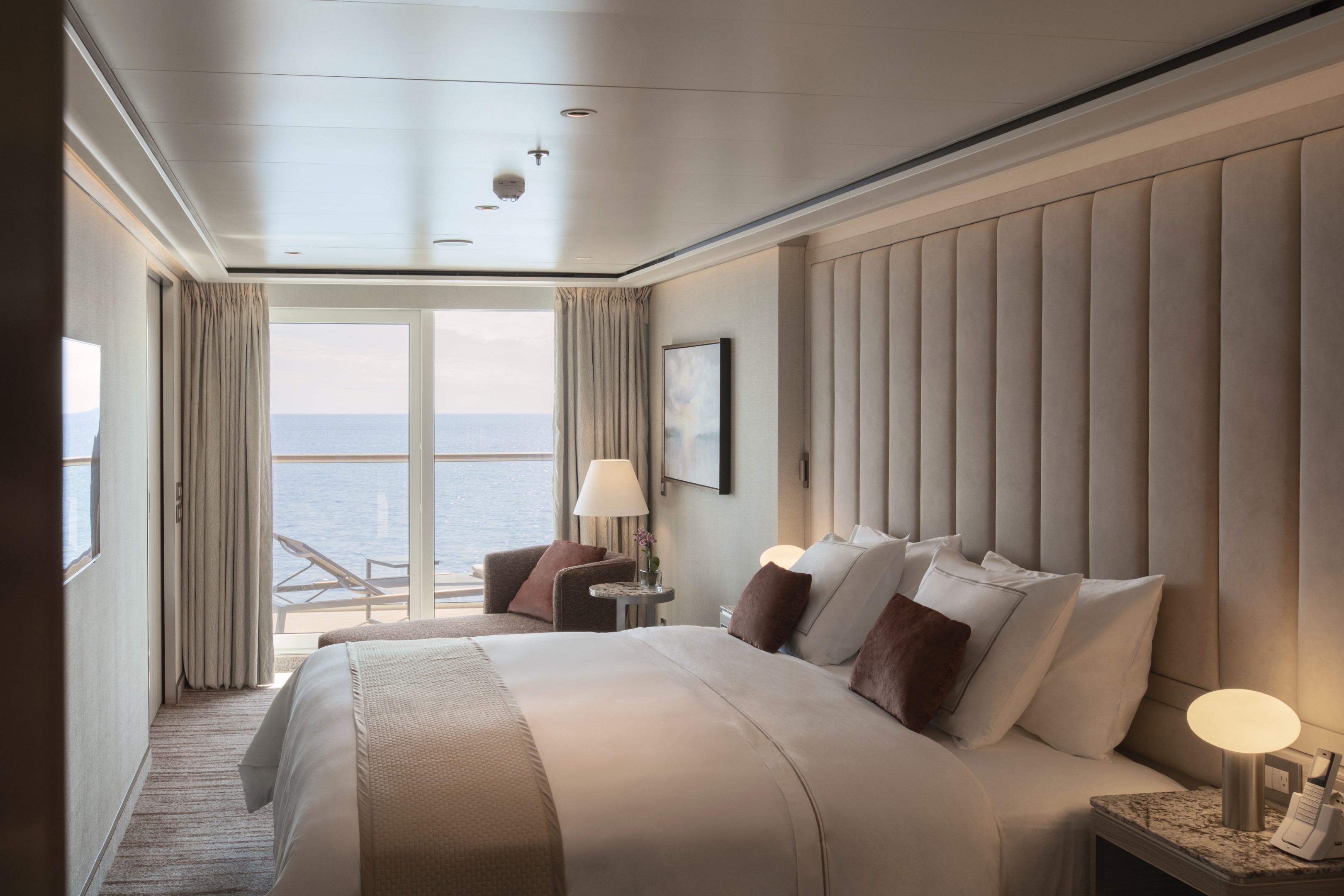
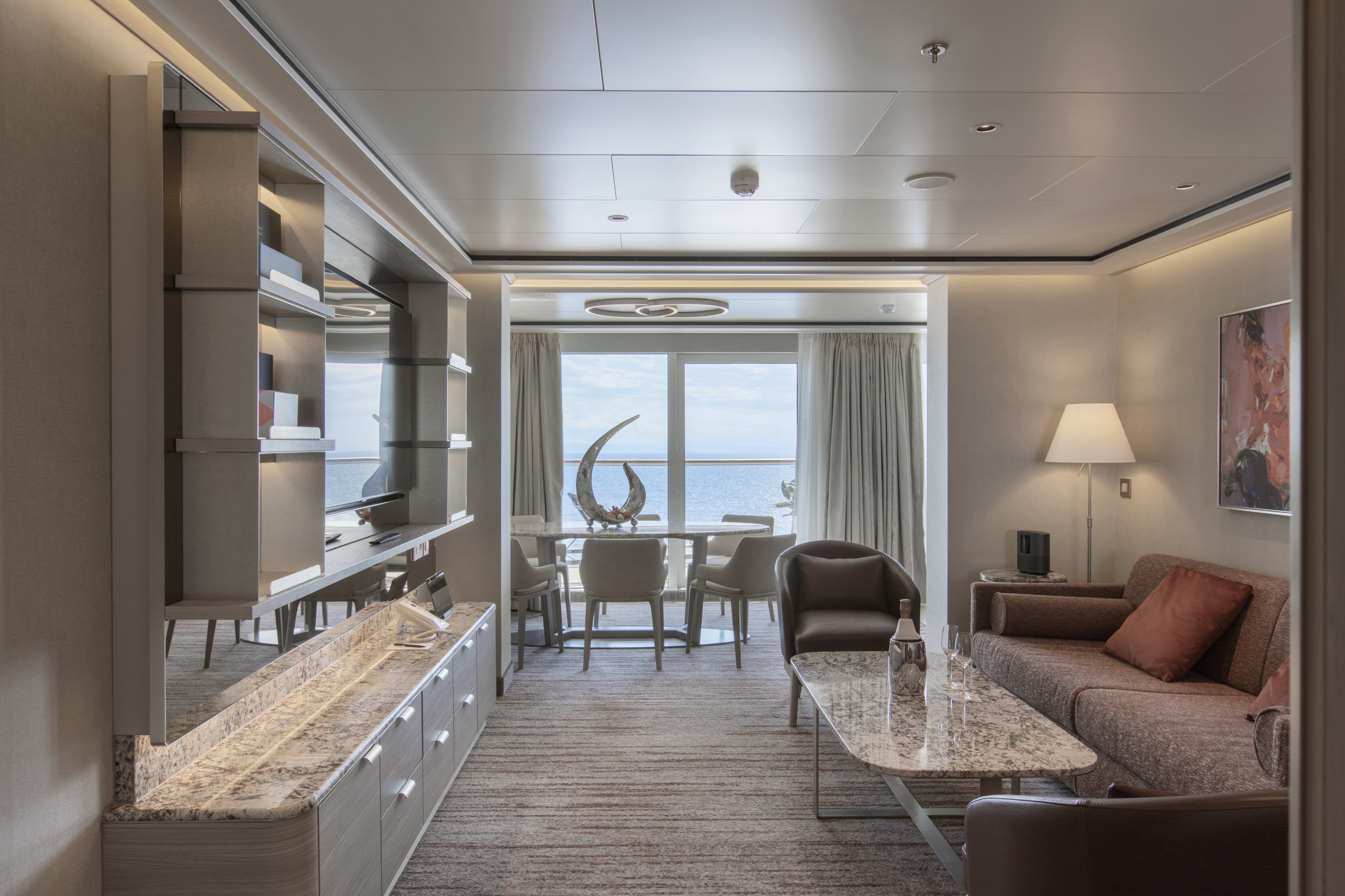
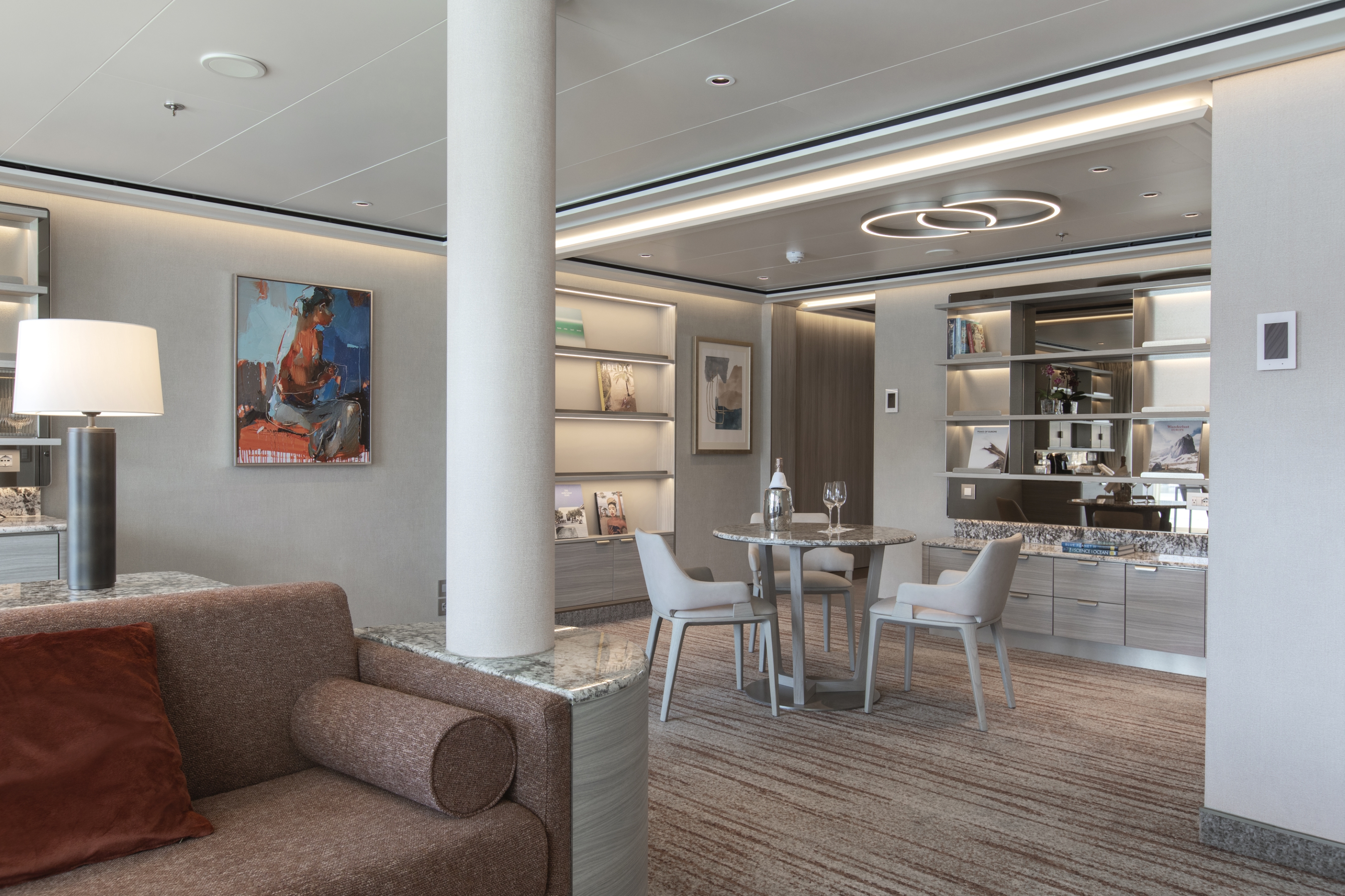
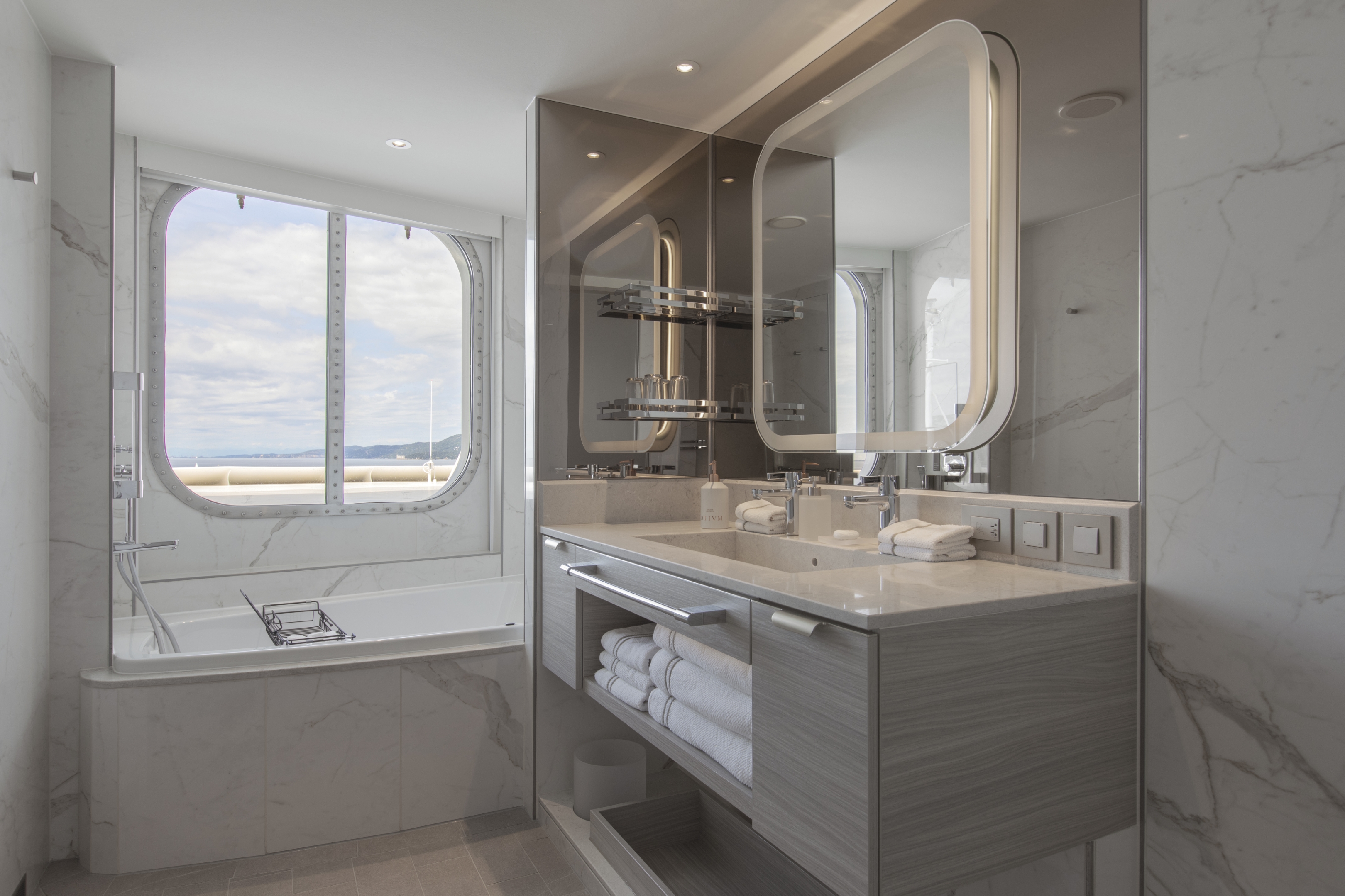
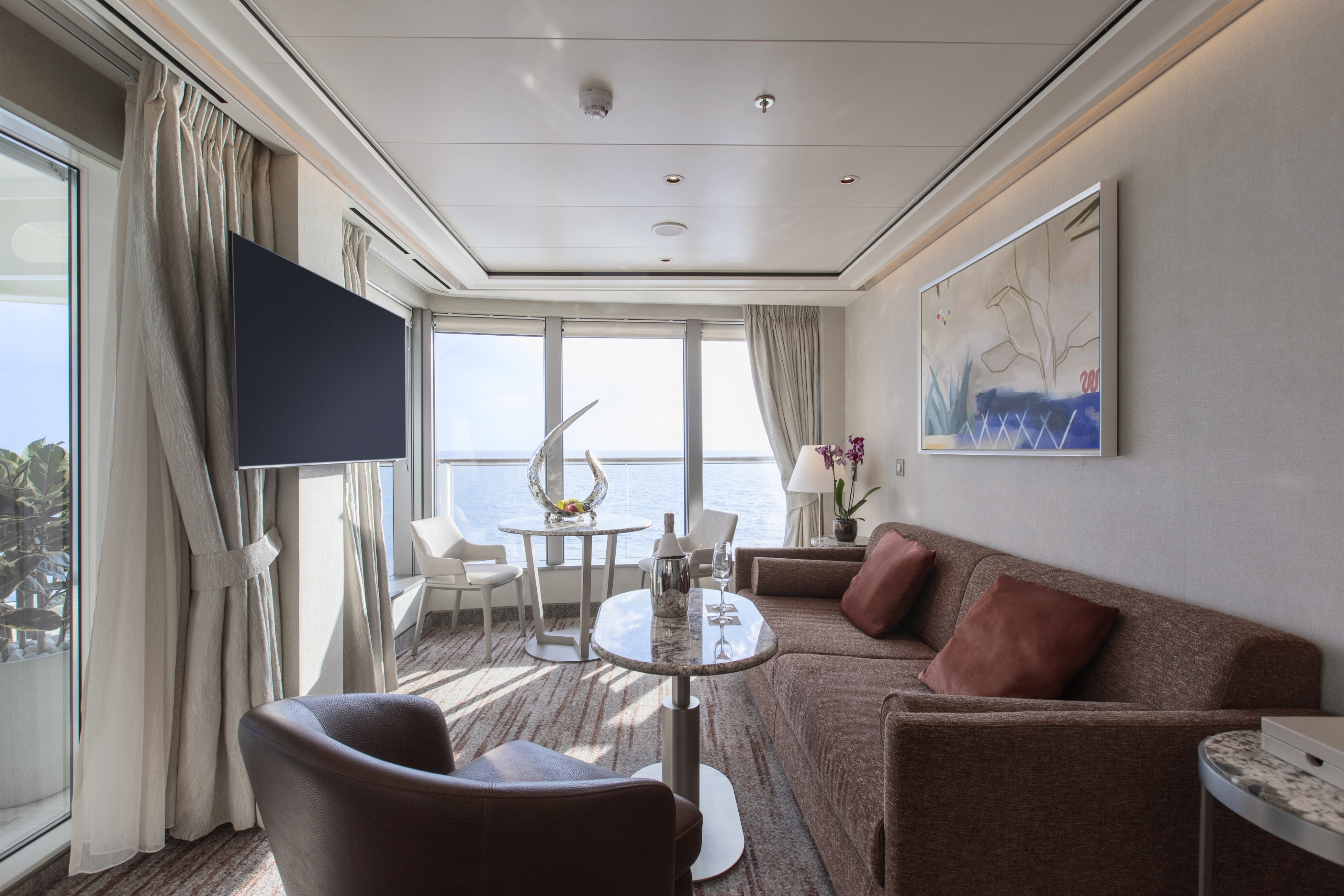
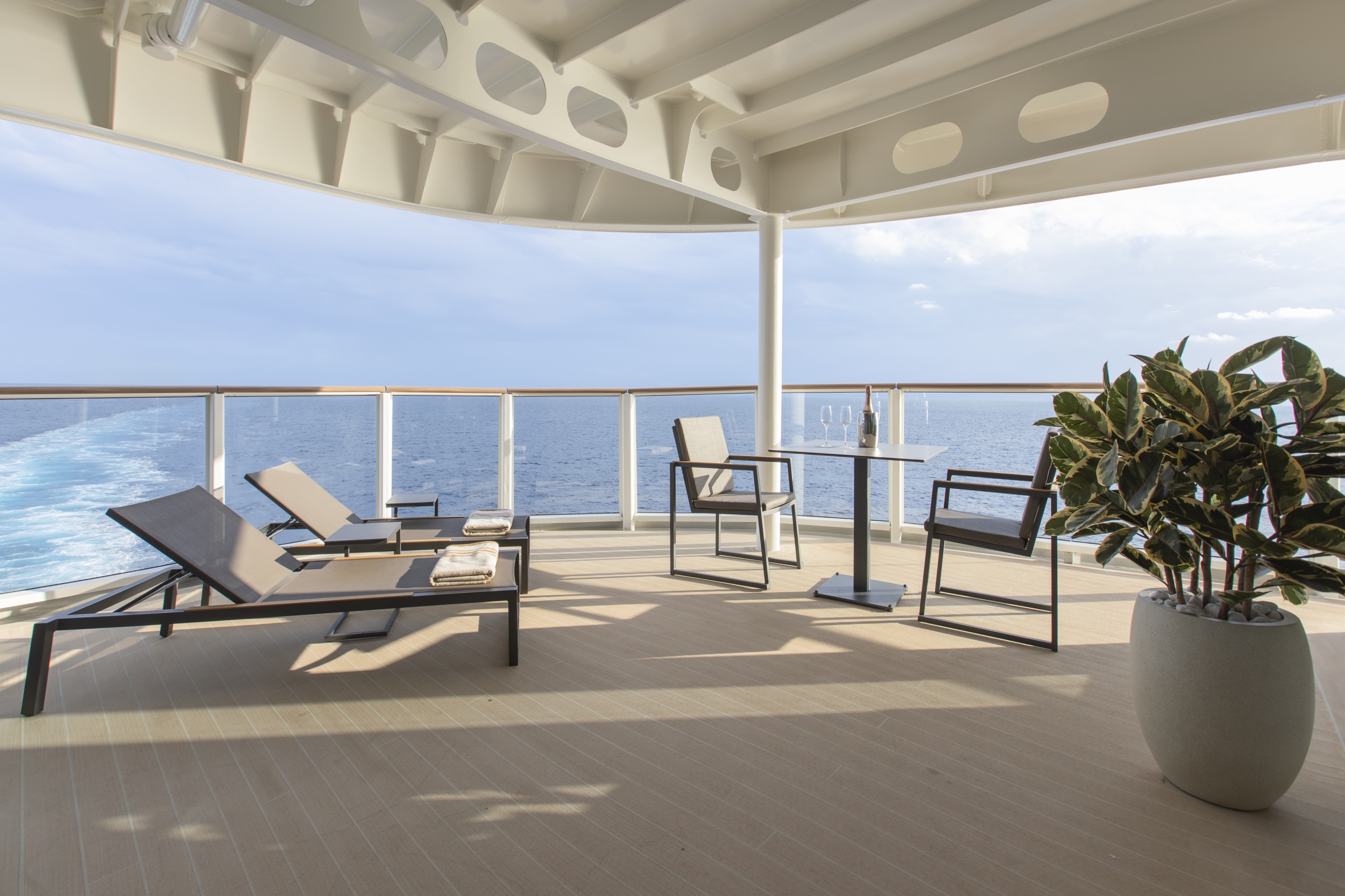
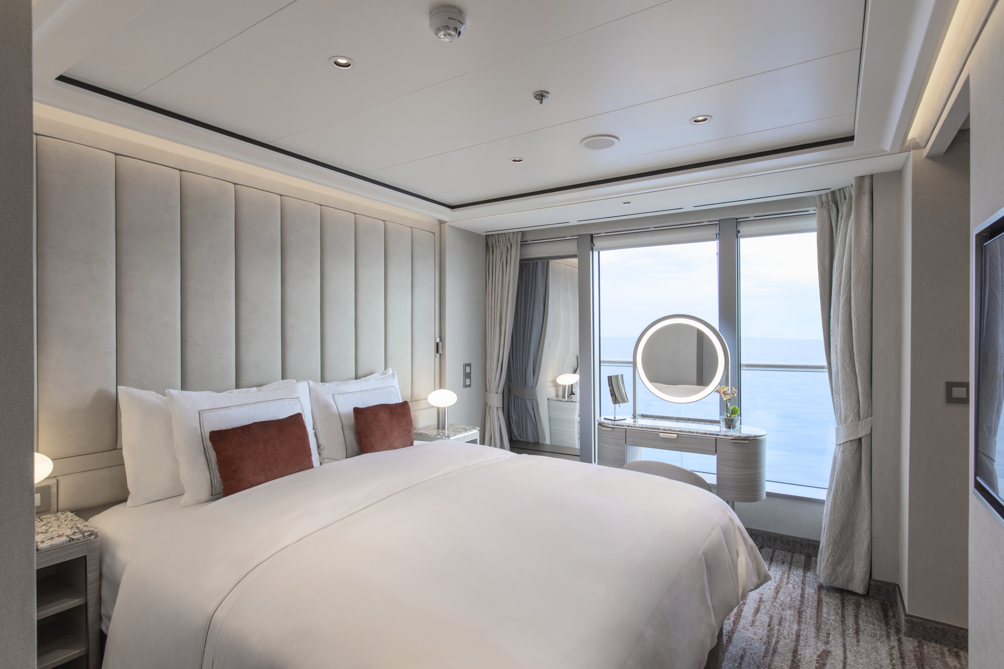
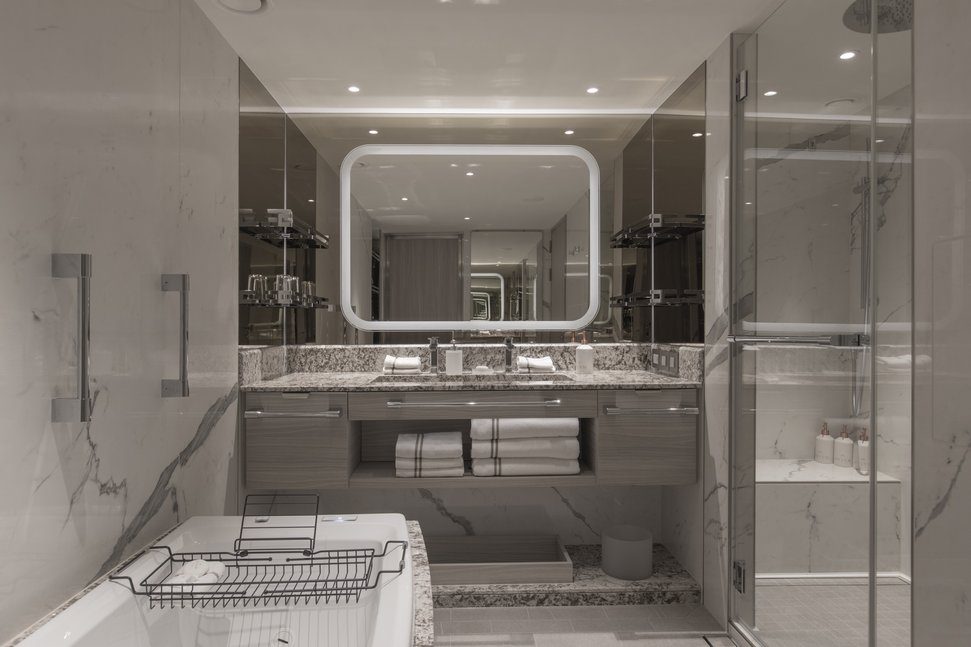
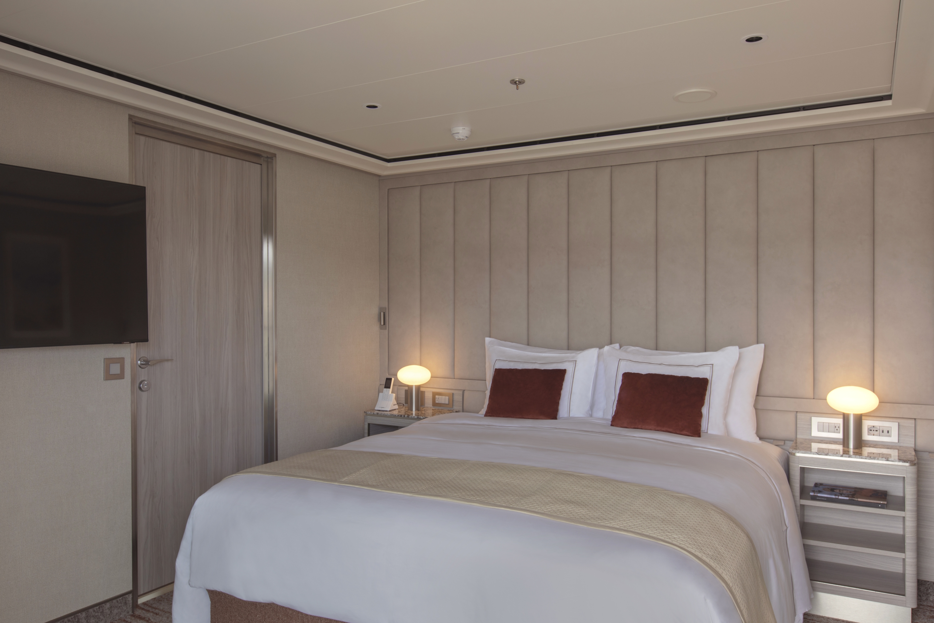
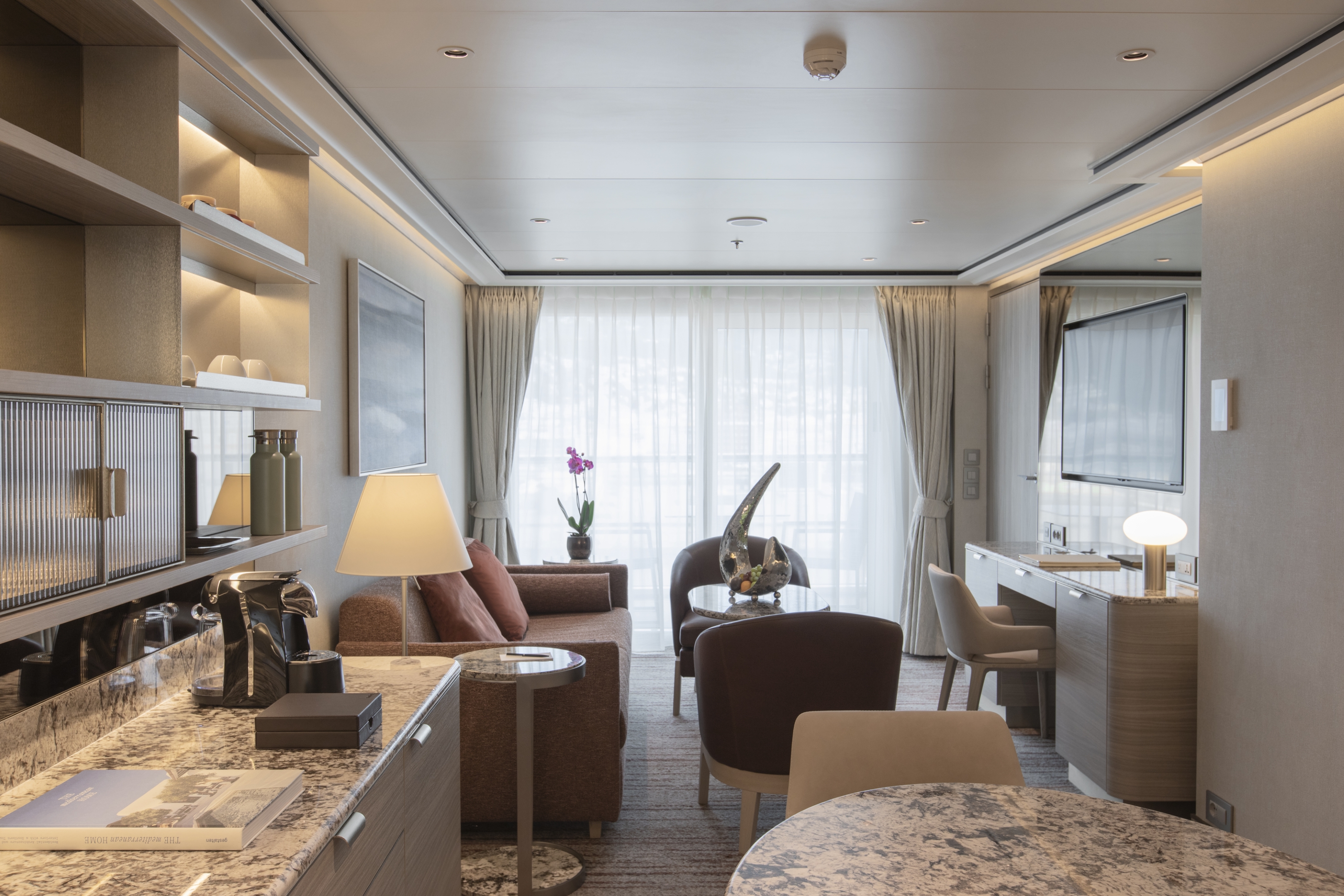
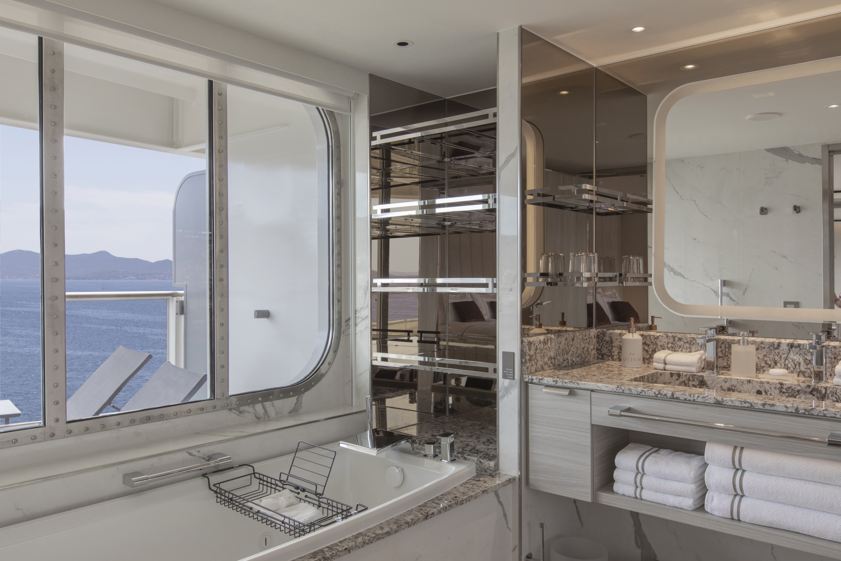
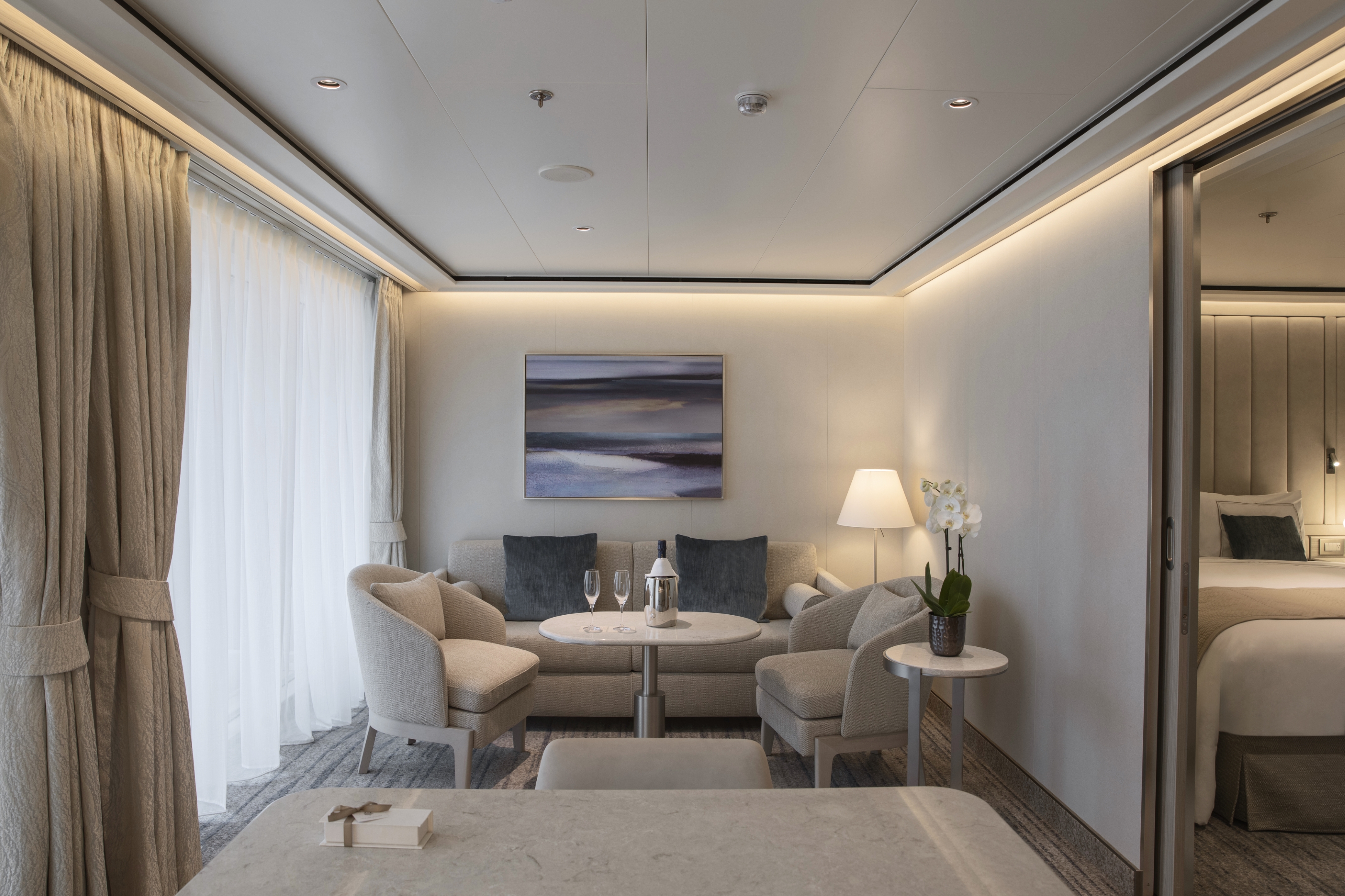
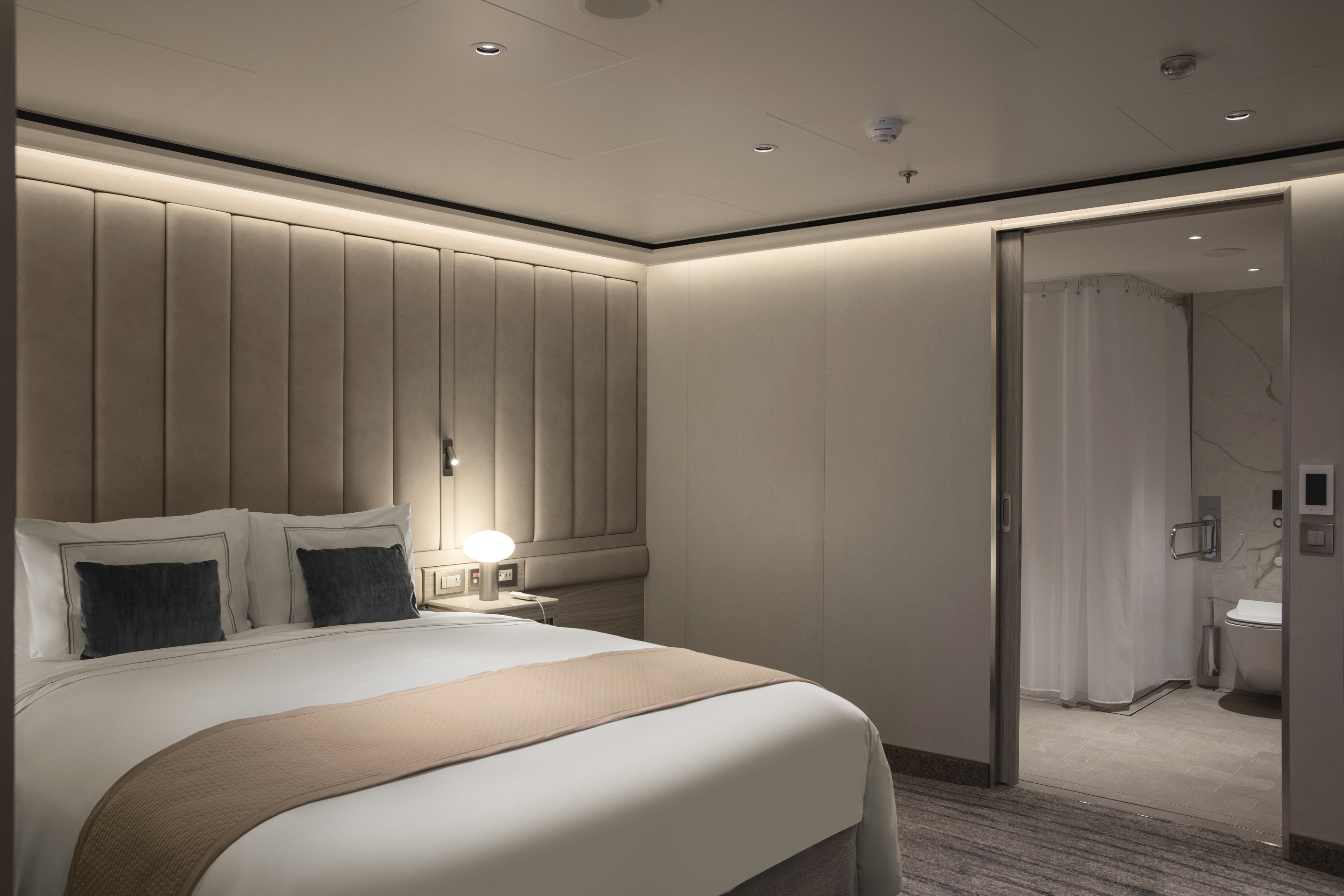
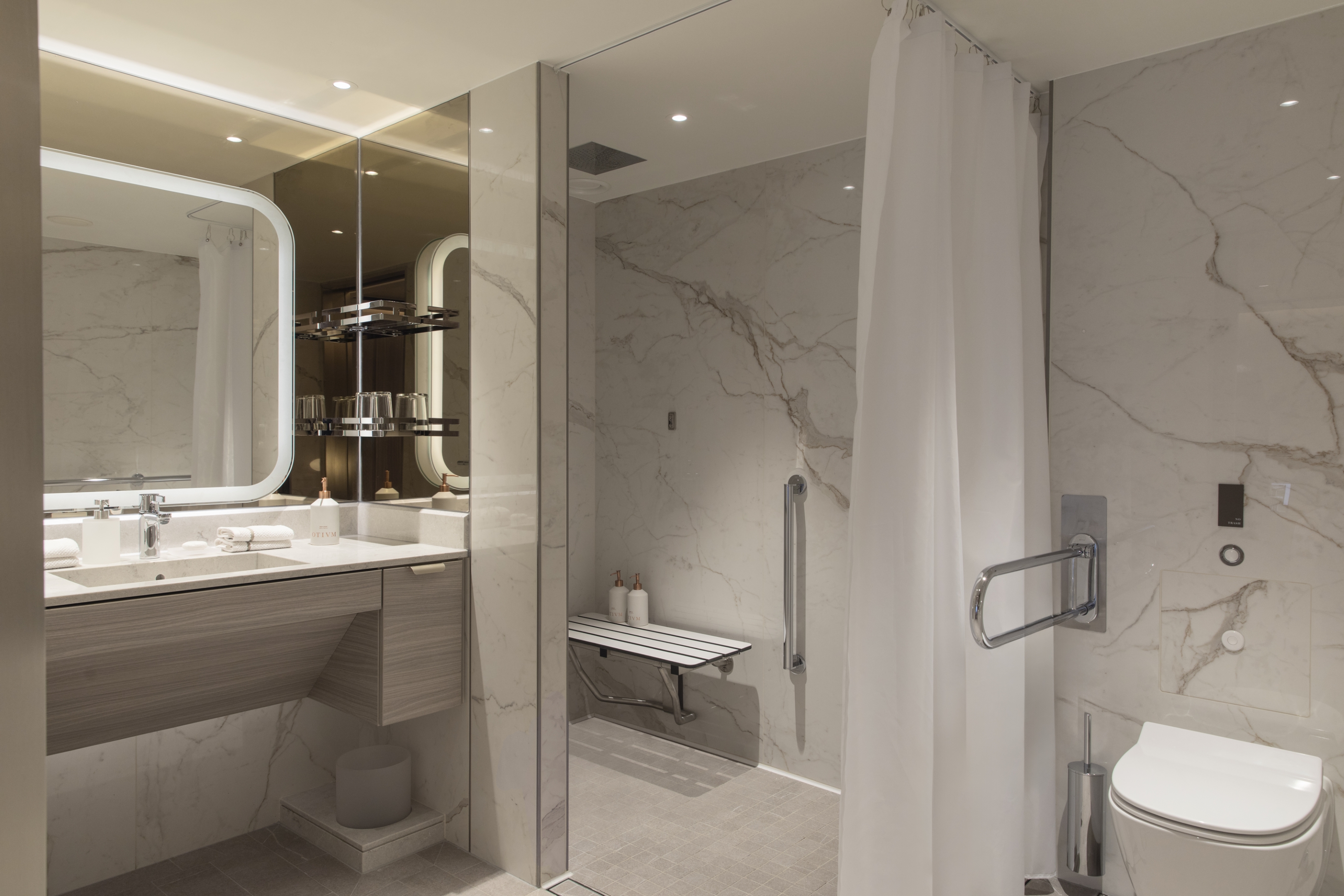
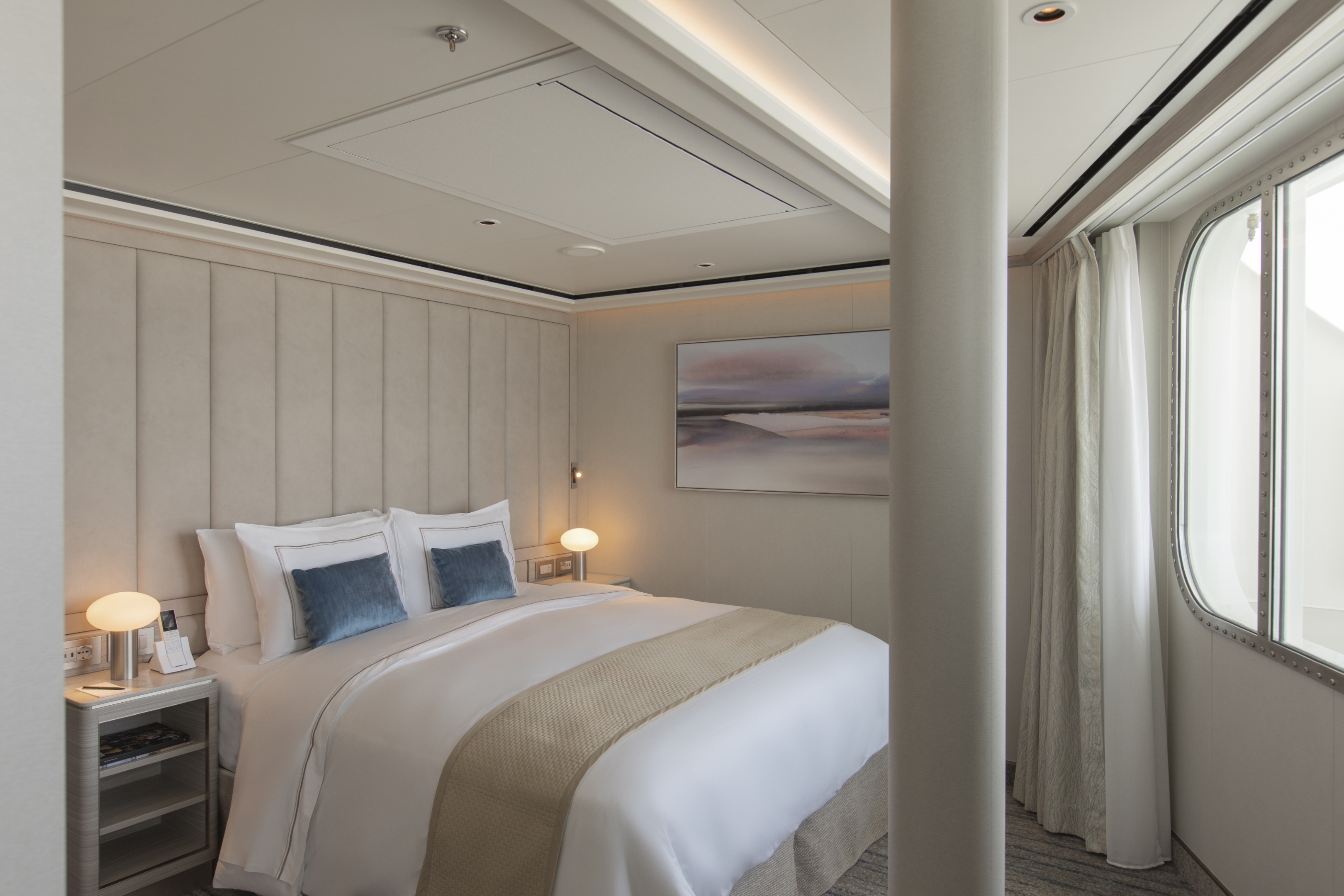
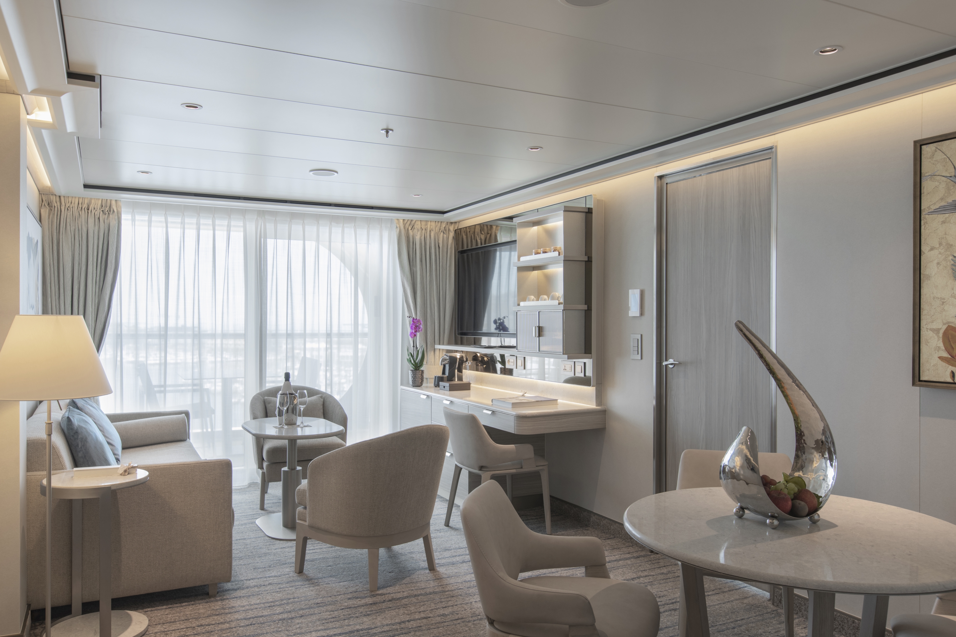
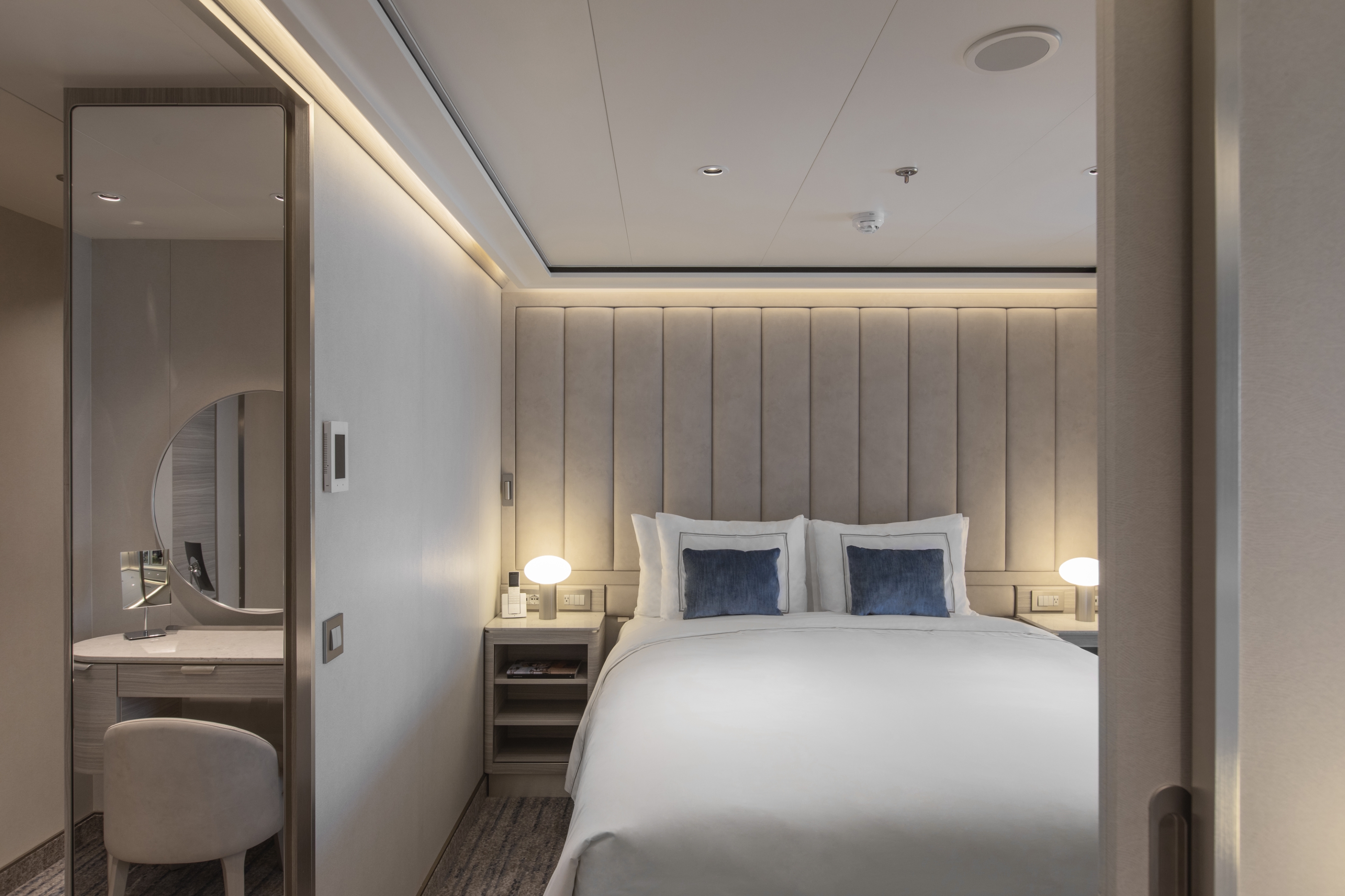
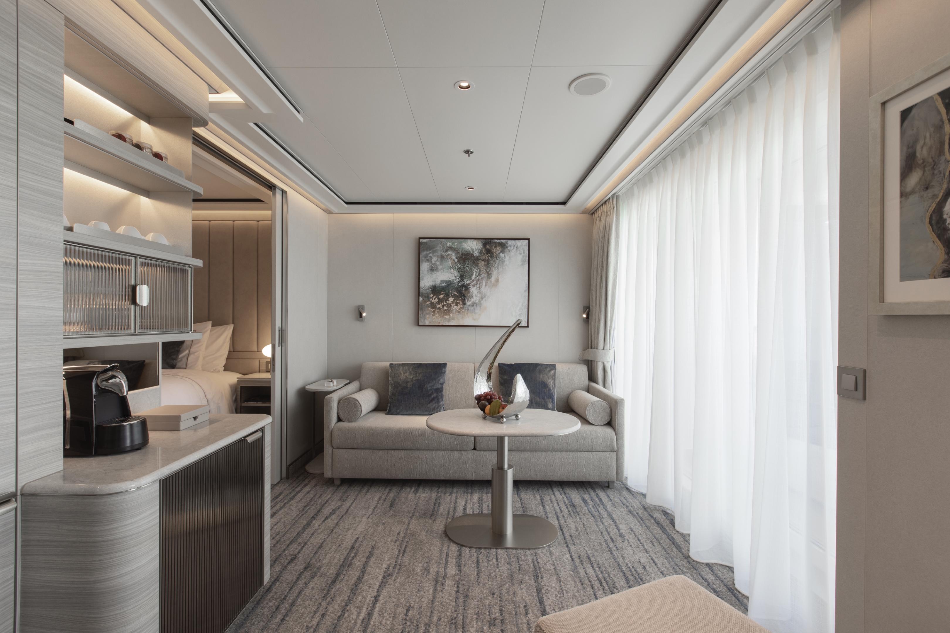
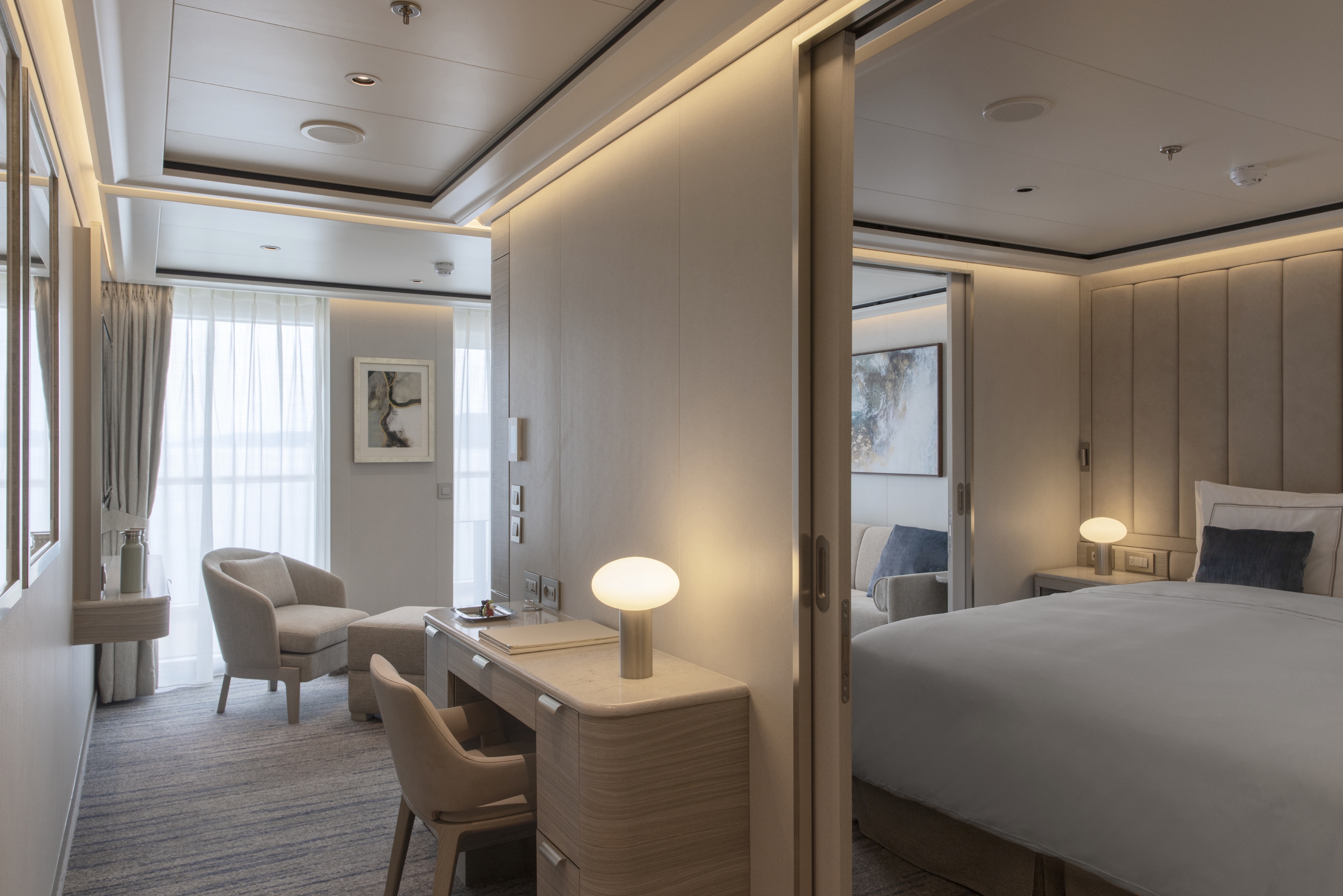
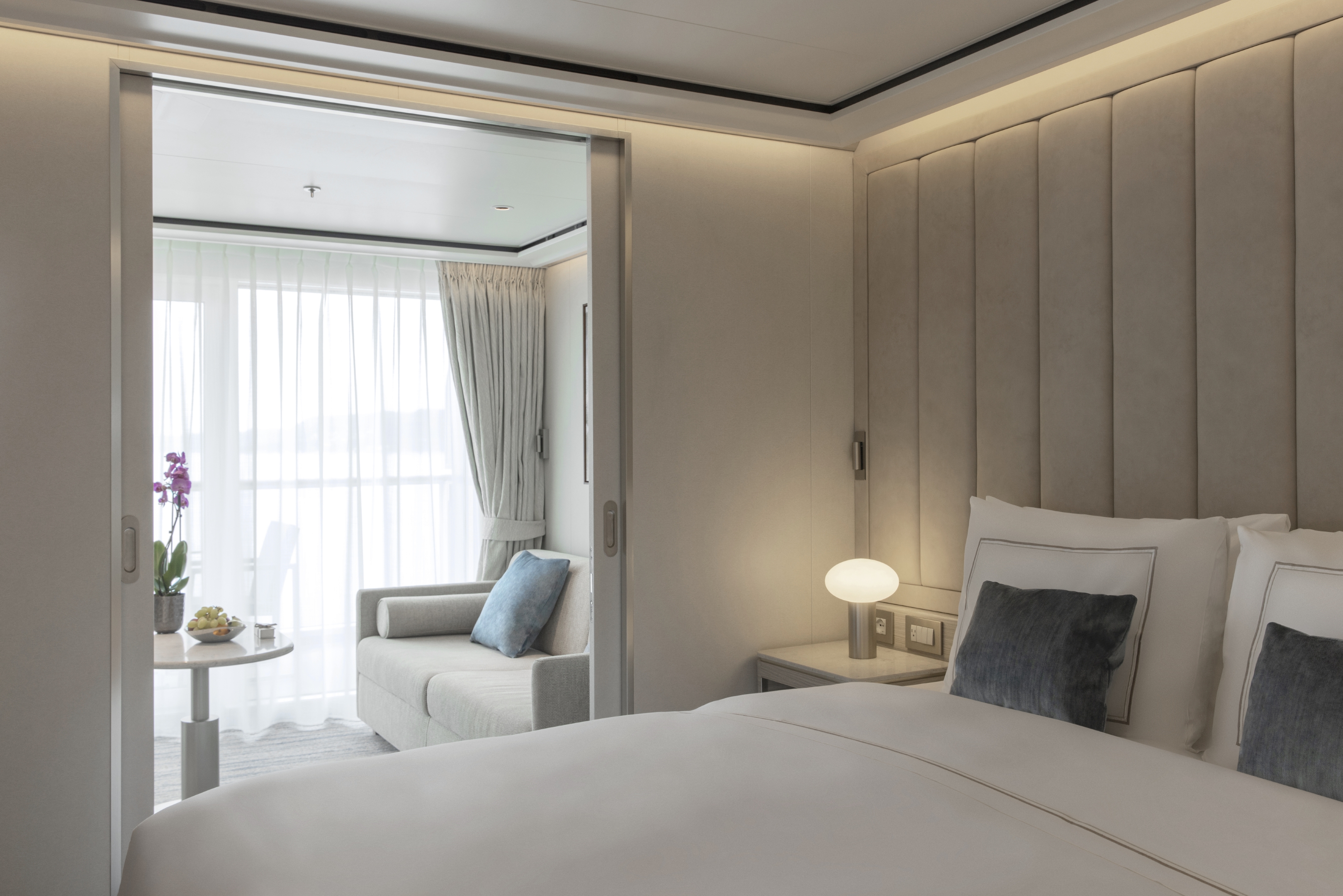
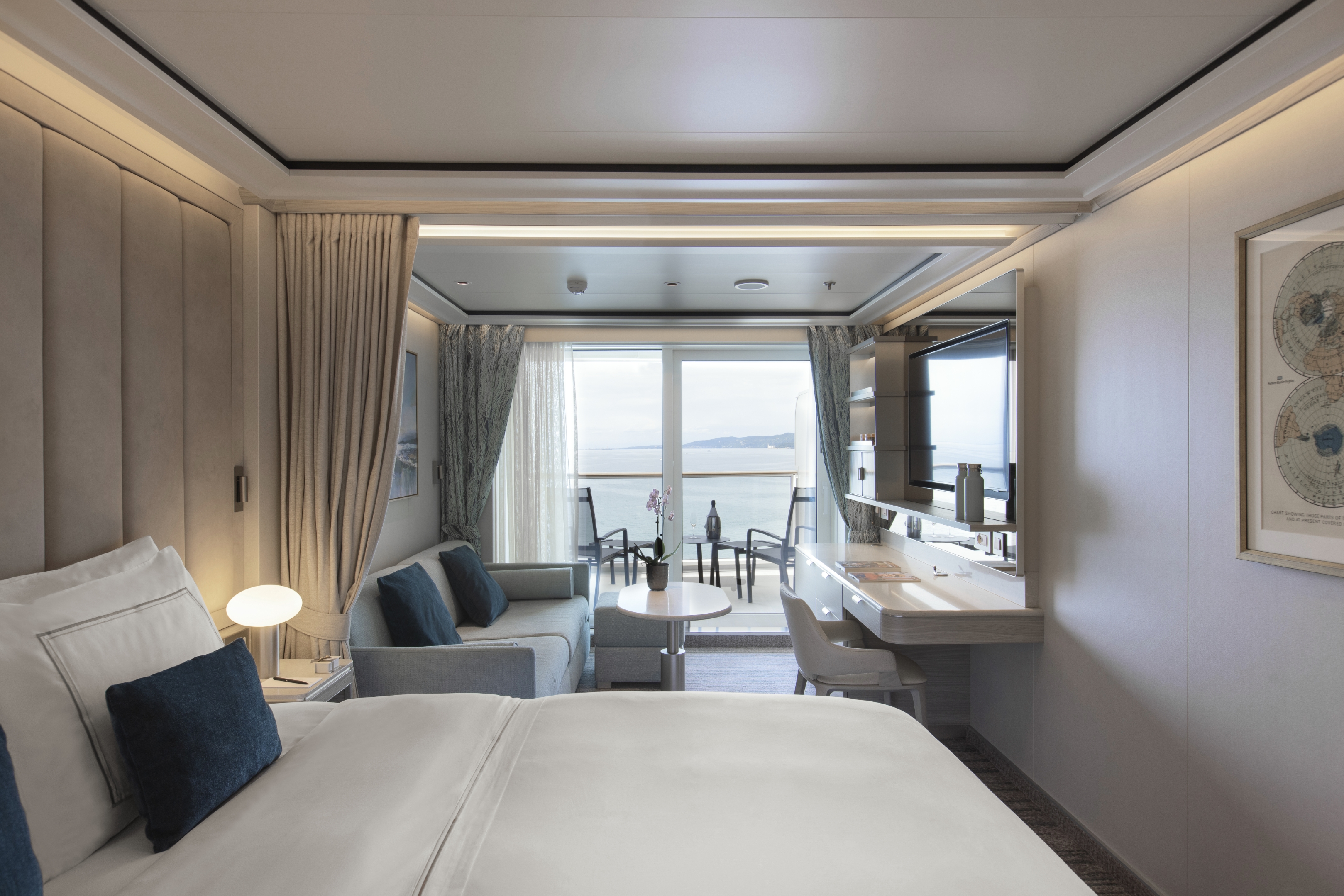
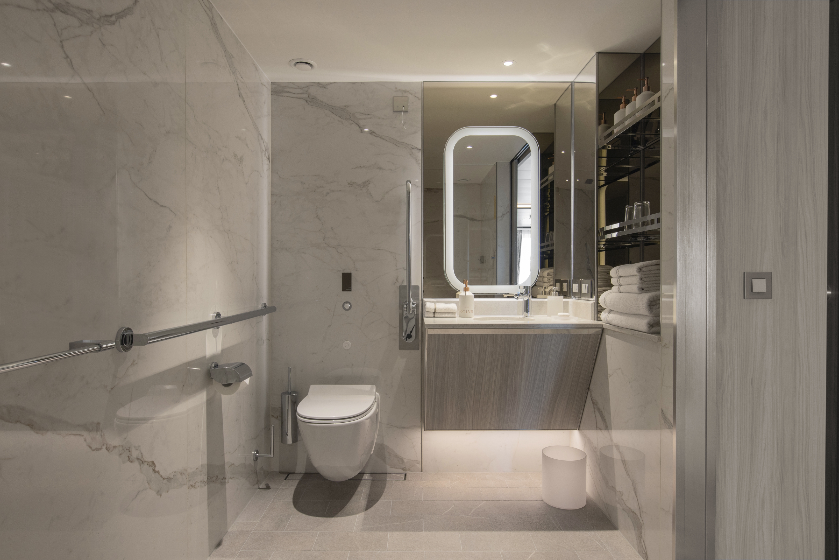
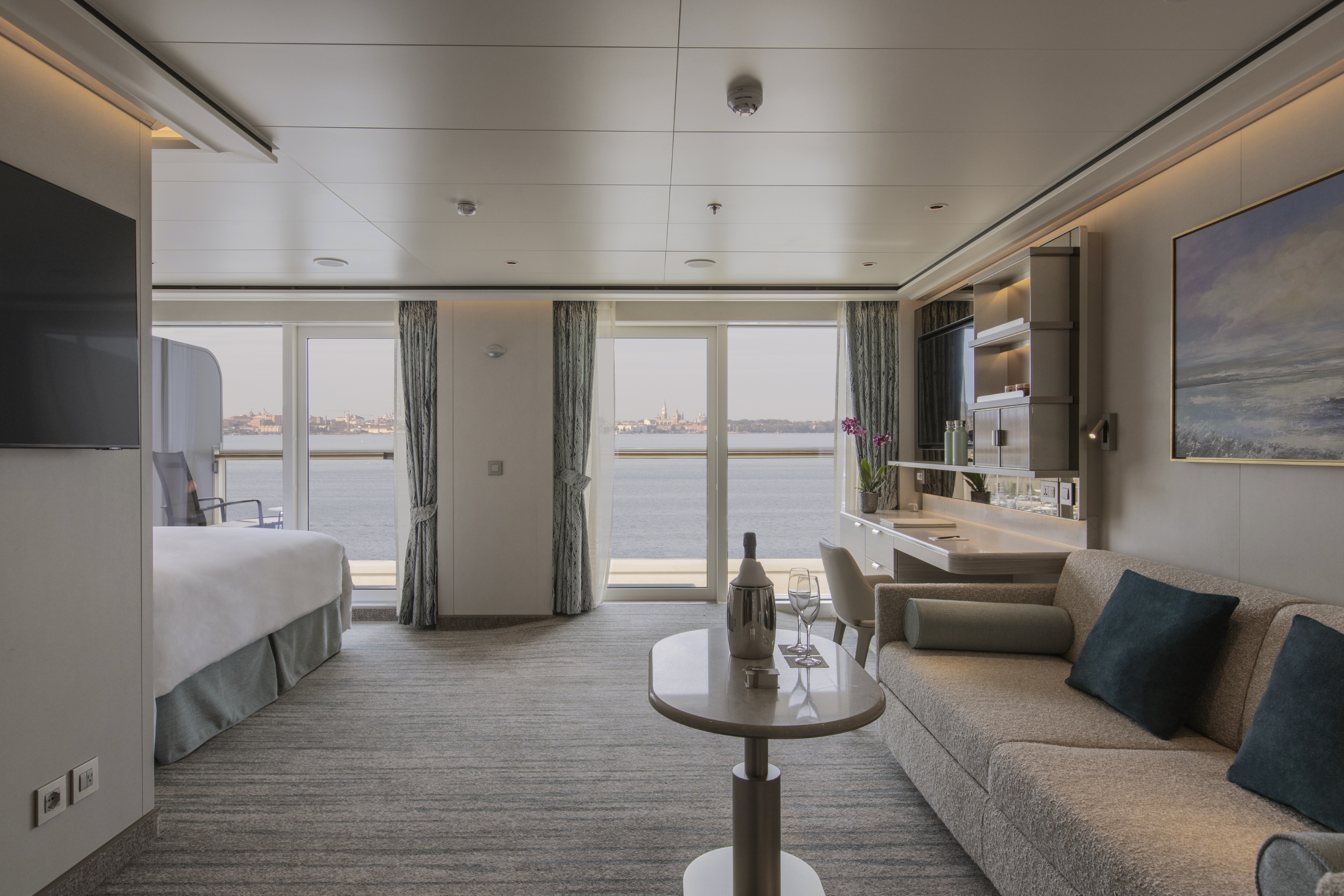
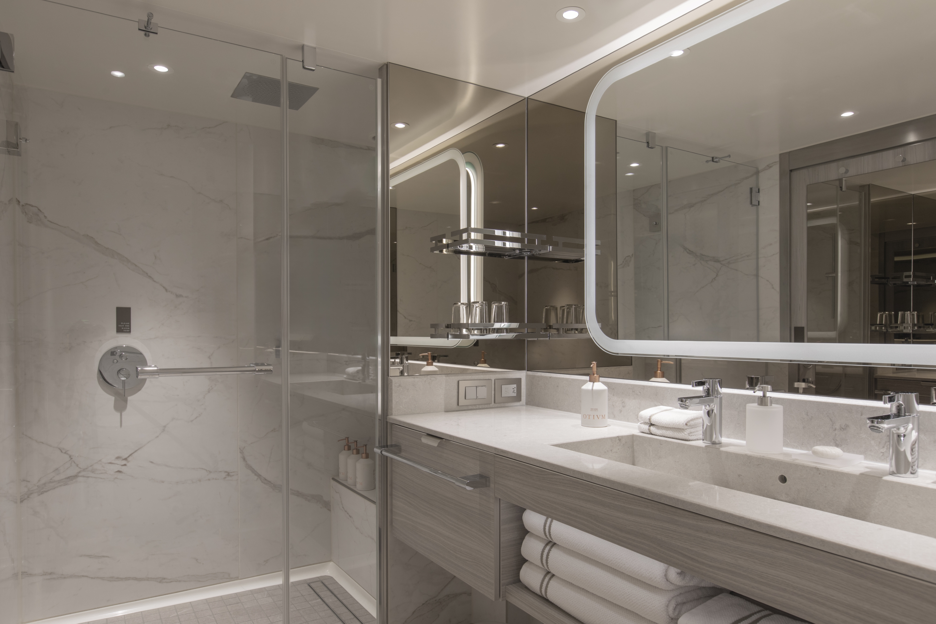
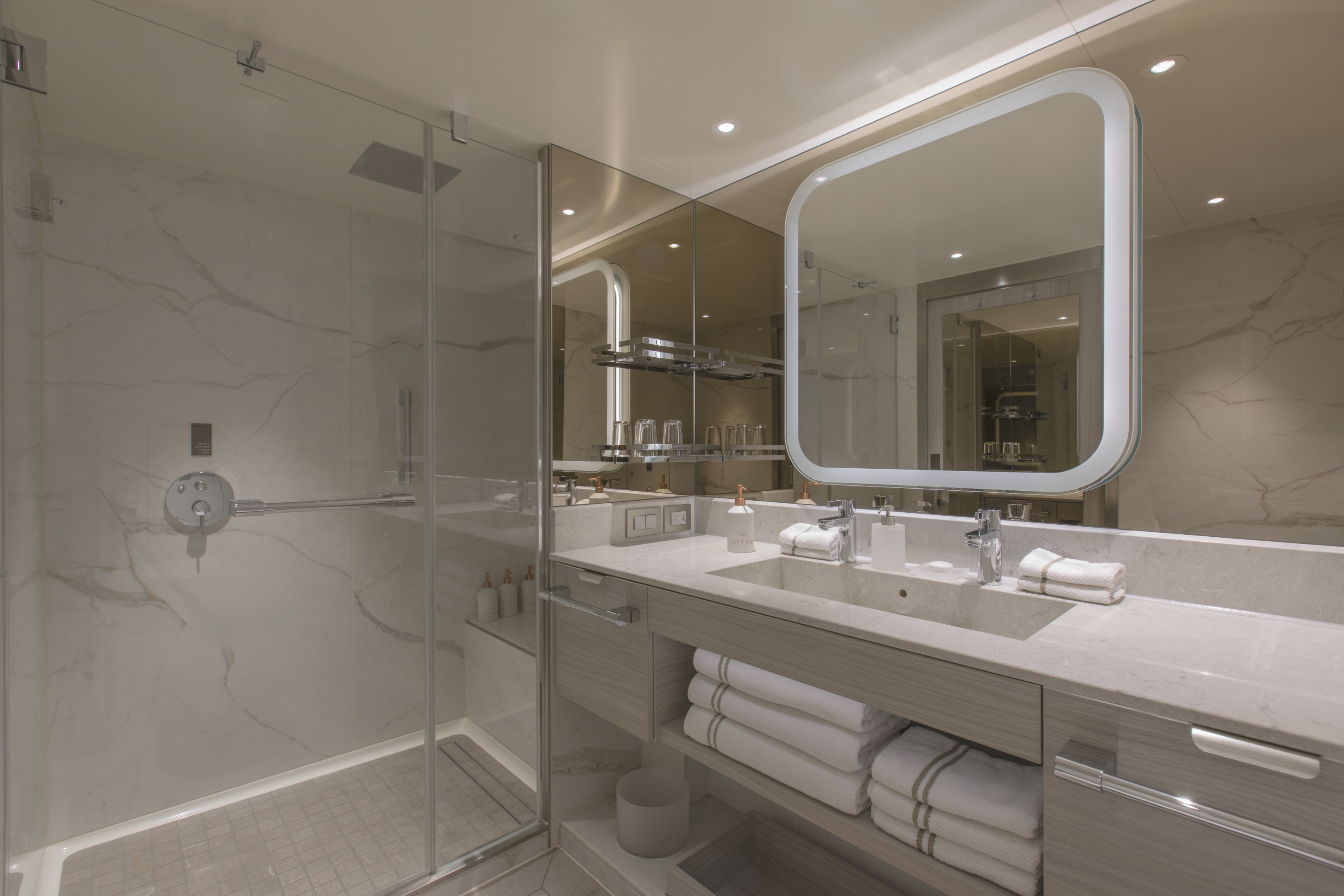
The Otium Suite is one of our newest and finest suites. Located in the premium aft corner position, the Otium Suite has a total size of 123 m2 (1,324 sq ft), including a 40 m2 (431 sq ft) balcony, which comes complete with a whirlpool. Features include a spacious living room area, a luxurious walk-in closet, a separate large bedroom, plus a bathroom with a whirlpool bath and walk-in shower. The crowning glory of the Otium Suite, however, is surely its unprecedented 270-degree view, giving you some of the best possible views of your destination.
One Otium Spa Treatment Per Guest up to $399 (up to two guests per suite).
One bedroom: 123 sq m (40 sq m)
Images are intended as a general reference. Features, materials, finishes and layout may be different than shown.
Please note the 3rd guest will sleep on a comfortable sofa bed in the reception area of suites that have 3rd berth capacity.
Essentials
- Deck(s): 6, 7
- Section: Aft
Characteristics
- Veranda
- Separate dining area
- Living room with sitting area
- Large vanity
- Separate shower
- Whirlpool bath
- Walk-in wardrobe with personal safe
Furniture
- King size bed
- Writing desk
- Vanity table
- Luxury bed mattresses (Custom made)
Media & Communication
- Unlimited Premium Wi-Fi
- 2 large flat screen TVs with Interactive Media Library
- Sound system with bluetooth connectivity
- Direct dial telephone
- Wall mounted USB-C mobile device chargers
- Dual voltage 110/220 outlets
Onboard Services
- Butler service
- Complimentary laundry, pressing & wet cleaning
- Dinner for two in La Dame, one evening per voyage,
- Two hours of worldwide phone use, per voyage segment
- Champagne on arrival
Amenities
- Espresso machine
- Pillow menu
- Refrigerator and bar setup stocked with your preferences
- Plush bathrobe
- Luxury bath amenities
- Umbrella
- Hair Dryer
Slippers
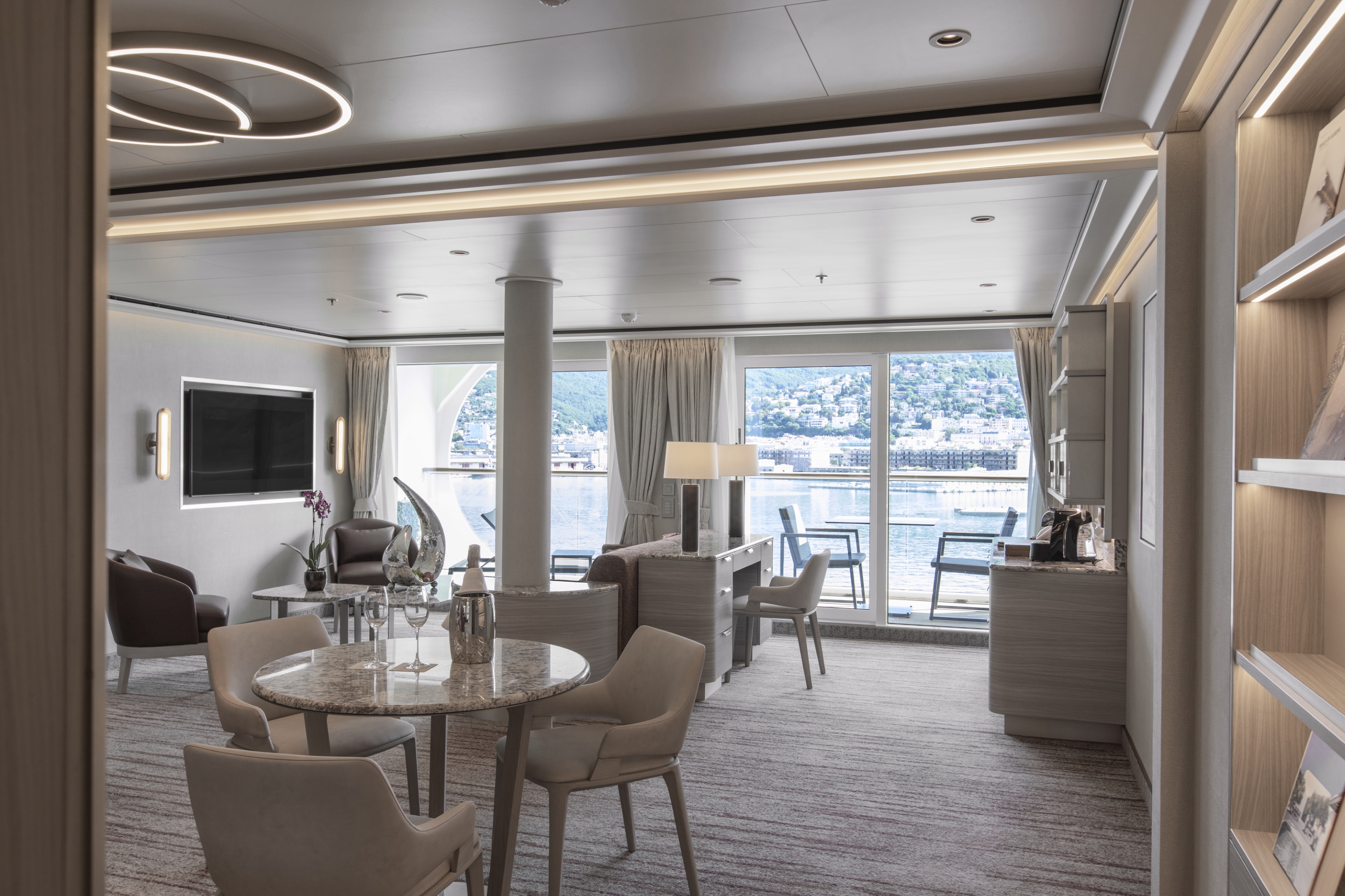
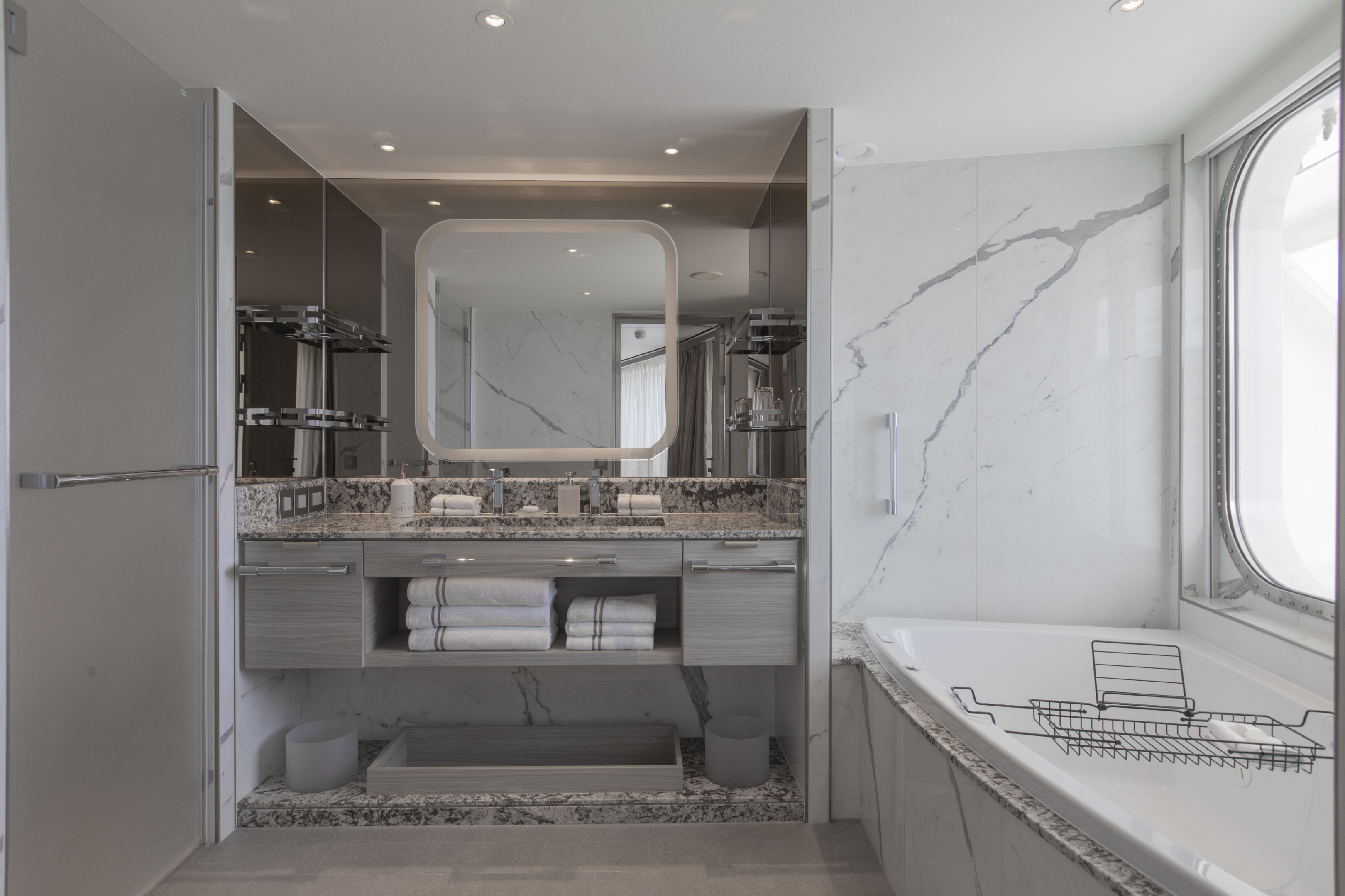
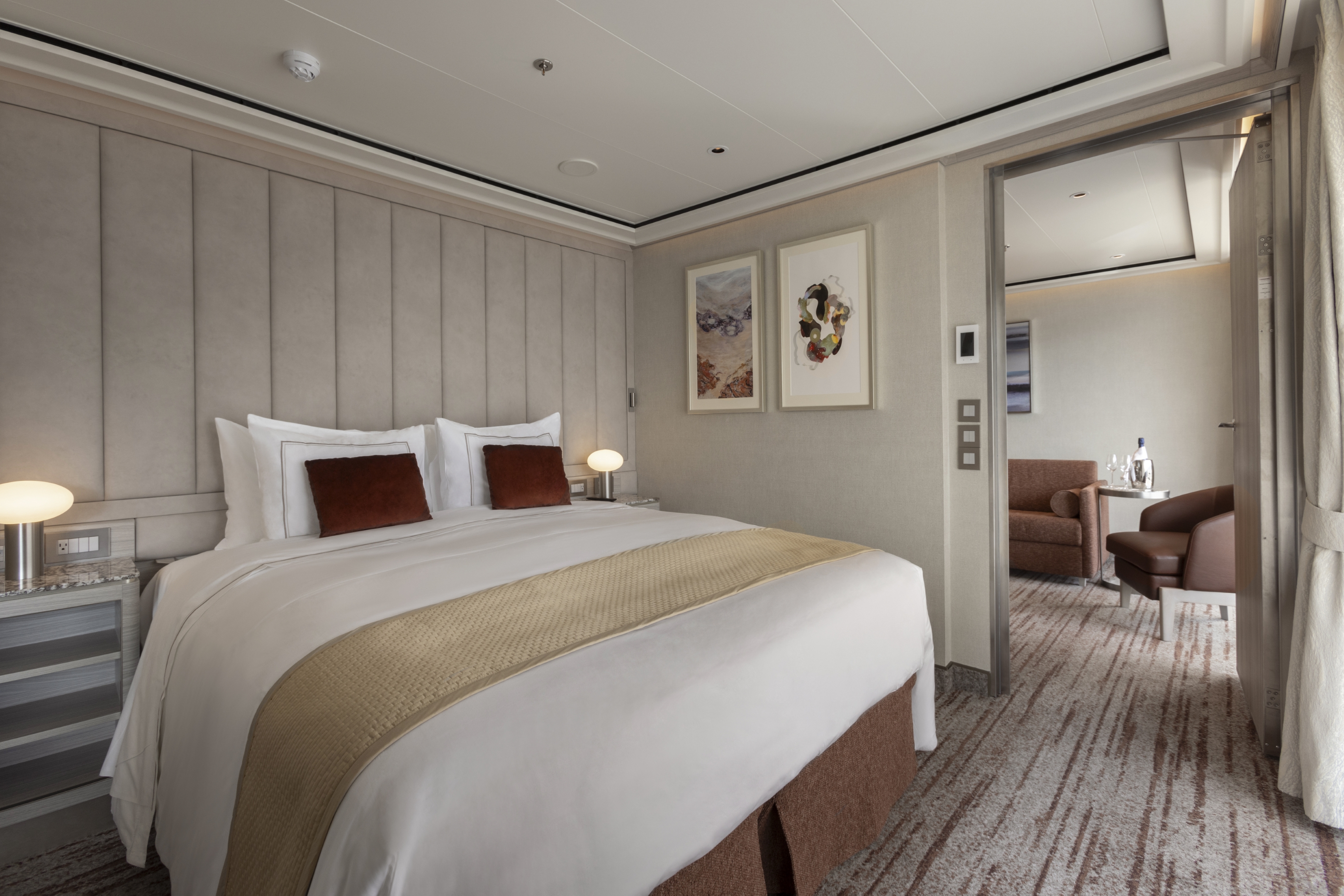
The aptly named Owner’s Suite is a Venetian Society favorite. So, why not travel in this stylish suite and get a taste of the ultimate luxury lifestyle. The suite’s total size is a huge 98 m2, or 1,055 sq ft, which includes 16 m2 (172 sq ft) of balcony, making for comfortable outdoor living. The favorite midship position gives incredible views from both the dining area and bedroom. A luxurious bathroom with a double vanity, plus a whirlpool bath and walk-in shower, bidet, lavatory, and guest restroom perfect the in-suite experience.
One bedroom: 98 sq m (16 sq m)
Two bedrooms: 131 sq m (21 sq m)
Images are intended as a general reference. Features, materials, finishes and layout may be different than shown.
Please note the 3rd guest will sleep on a comfortable sofa bed in the reception area of suites that have 3rd berth capacity.
Essentials
- Deck(s): 8
- Section: Mid-Ship
Characteristics
- Veranda
- Separate dining area
- Living room with sitting area
- Large vanity
- Separate shower
- Whirlpool bath
- Walk-in wardrobe with personal safe
Furniture
- King size bed
- Writing desk
- Vanity table
- Luxury bed mattresses (Custom made)
Media & Communication
- Unlimited Premium Wi-Fi
- 2 large flat screen TVs with Interactive Media Library
- Sound system with bluetooth connectivity
- Direct dial telephone
- Wall mounted USB-C mobile device chargers
- Dual voltage 110/220 outlets
Onboard Services
- Butler service
- Complimentary laundry, pressing & wet cleaning
- Dinner for two in La Dame, one evening per voyage,
- Two hours of worldwide phone use, per voyage segment
- Champagne on arrival
- Espresso machine
- Pillow menu
- Refrigerator and bar setup stocked with your preferences
- Plush bathrobe
- Luxury bath amenities
- Umbrella
- Hair Dryer
- Slippers
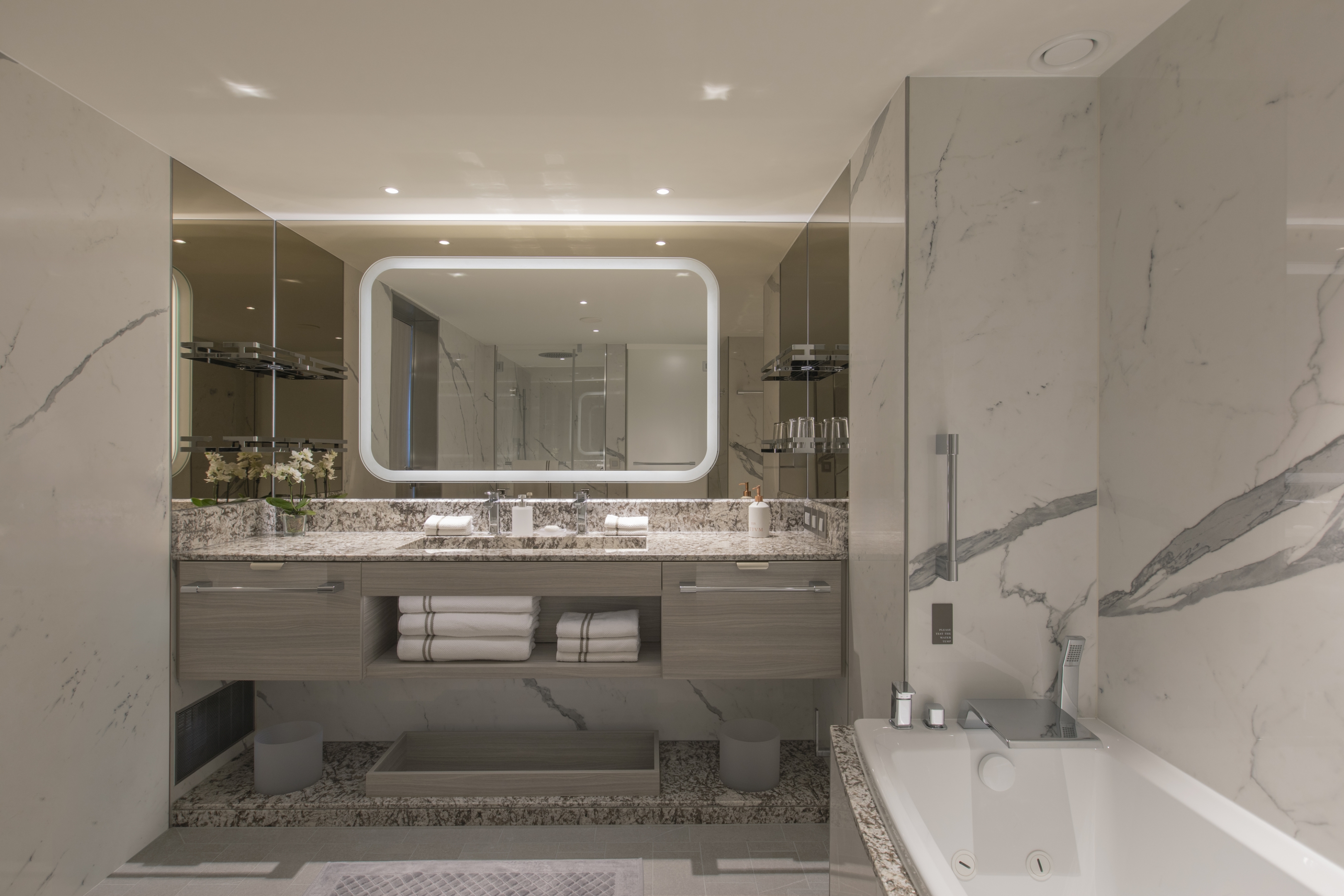
If you have ever wanted to indulge in one of the epitomes of ultra-luxury cruising, then the Grand Suite is perhaps the answer. Situated at the front of the ship, the Grand Suite offers sophistication and style for serious travelers. Thanks to an innovative design, the Grand Suite is one of the most luxurious and spacious suites aboard Silver Nova, offering sweeping sea-to-sky views of your destination from all living areas. A luxurious bathroom with a double vanity, whirlpool bath, and walk-in shower, plus a complete guest restroom.
One bedroom: 85 sq m including veranda (13 sq m)
Two bedrooms: 118 sq m including veranda (18 sq m)
Images are intended as a general reference. Features, materials, finishes and layout may be different than shown.
Please note the 3rd guest will sleep on a comfortable sofa bed in the reception area of suites that have 3rd berth capacity.
Essentials
- Deck(s): 7
- Section: Forward
Characteristics
- Veranda
- Separate dining area
- Living room with sitting area
- Large vanity
- Separate shower
- Whirlpool bath
- Walk-in wardrobe with personal safe
Furniture
- King size bed
- Writing desk
- Vanity table
- Luxury bed mattresses (Custom made)
Media & Communication
- Unlimited Premium Wi-Fi
- 2 large flat screen TVs with Interactive Media Library
- Sound system with bluetooth connectivity
- Direct dial telephone
- Wall mounted USB-C mobile device chargers
- Dual voltage 110/220 outlets
Onboard Services
- Butler service
- Complimentary laundry, pressing & wet cleaning
- Dinner for two in La Dame, one evening per voyage,
- Two hours of worldwide phone use, per voyage segment
- Champagne on arrival
Amenities
- Espresso machine
- Pillow menu
- Refrigerator and bar setup stocked with your preferences
- Plush bathrobe
- Luxury bath amenities
- Umbrella
- Hair Dryer
- Slippers
This new suite category is exclusive to Silver Nova. The Master Suite is stately, commanding, majestic, and perfect for relaxing after a day exploring onshore. Located in the premium aft corner position, the Master Suite has a total size of 67–77 m2 (721–826 sq ft) and includes 22–31 m2 (233–330 sq ft) of balcony. The incredible floor-to-ceiling glazing surrounding the living room and bedroom area will offer outstanding 270-degree views of your destination, regardless of where you are in the world.
Two bedrooms (when connected to a Premium Veranda Suite or a Classic Veranda Suite): 100–110 sq m including veranda (27–36 sq m)
Images are intended as a general reference. Features, materials, finishes and layout may be different than shown.
Please note that the third guest will sleep on a comfortable sofa bed in the reception area of suites that have third-berth capacity.
Essentials
- Deck(s): 6, 7, 8, 9
- Section: Aft
Characteristics
- Veranda
- Separate dining area
- Living room with sitting area
- Large vanity
- Separate shower
- Whirlpool bath
- Walk-in wardrobe with personal safe
Furniture
- King size bed
- Writing desk
- Vanity table
- Luxury bed mattresses (Custom made)
Media & Communication
- Unlimited Premium Wi-Fi
- 2 large flat screen TVs with Interactive Media Library
- Sound system with bluetooth connectivity
- Direct dial telephone
- Wall mounted USB-C mobile device chargers
- Dual voltage 110/220 outlets
Onboard Services
- Butler service
- Complimentary laundry, pressing & wet cleaning
- Dinner for two in La Dame, one evening per voyage,
- Two hours of worldwide phone use, per voyage segment
- Champagne on arrival
Amenities
- Espresso machine
- Pillow menu
- Refrigerator and bar setup stocked with your preferences
- Plush bathrobe
- Luxury bath amenities
- Umbrella
- Hair Dryer
- Slippers
Another exclusivity for Silver Nova. The Signature Suite is one of our most distinctive new suites, offering unparalleled destination immersion through unobstructed views from all interior areas. The Signature Suite is one of the most spacious suites on board totaling 65 m2, or 700 sq ft, including 16 m2, or 172 sq ft, of balcony for superlative outdoor living. The innovative layout will feature a large dining and living room area, as well as a secluded bedroom. The large bathroom features a double vanity, whirlpool bath, walk-in shower, and lavatory, and the suite includes a guest restroom.
One bedroom: 65 sq m including veranda (16 sq m)
Images are intended as a general reference. Features, materials, finishes and layout may be different than shown.
Please note that the third guest will sleep on a comfortable sofa bed in the reception area of suites that have third-berth capacity.
Essentials
- Deck(s): 6, 7, 8, 9
- Section: Mid-Ship
Characteristics
- Veranda
- Separate dining area
- Living room with sitting area
- Large vanity
- Separate shower
- Whirlpool bath
- Walk-in wardrobe with personal safe
Furniture
- Queen size bed
- Writing desk
- Vanity table
- Luxury bed mattresses (Custom made)
Media & Communication
- Unlimited Premium Wi-Fi
- 2 large flat screen TVs with Interactive Media Library
- Sound system with bluetooth connectivity
- Direct dial telephone
- Wall mounted USB-C mobile device chargers
- Dual voltage 110/220 outlets
Onboard Services
- Butler service
- Complimentary laundry, pressing & wet cleaning
- Two hours of worldwide phone use, per voyage segment
- Champagne on arrival
Amenities
- Espresso machine
- Pillow menu
- Refrigerator and bar setup stocked with your preferences
- Plush bathrobe
- Luxury bath amenities
- Umbrella
- Hair Dryer
- Slippers
The Silver Suite is a Silversea favorite. It’s one of the Venetian Society’s favorite choices, and we can see why! The Silver Suite aboard Silver Nova offers an innovative design layout that will unlock full ocean views from both the living room and bedroom while the spacious living area allows for comfortable relaxing. A generous dining area makes cozy nights dining in veritable experiences in themselves. The suite features a generous walk-in closet as well as a bathroom with whirlpool bath, a walk-in shower, double vanity, and separate lavatory.
- One bedroom: 63 sq m including veranda (11 sq m)
- Two bedrooms: 96 sq m including veranda (16 sq m)
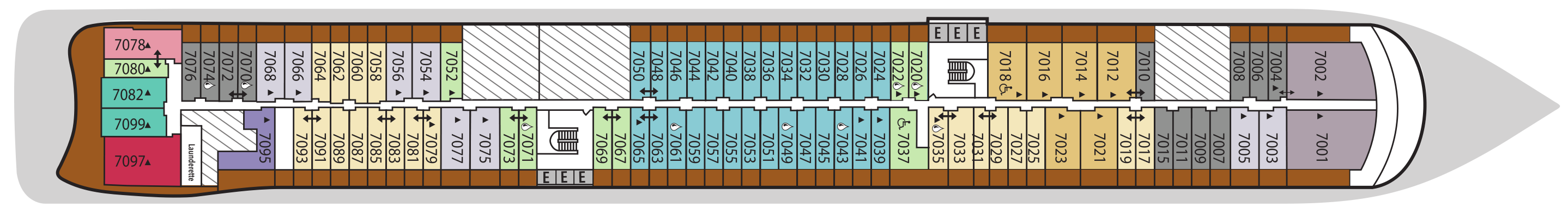
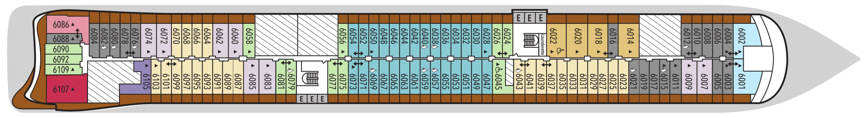
- Wheelchair accessible suites: 6022, 7018
- Images are intended as a general reference. Features, materials, finishes and layout may be different than shown.
- Please note the 3rd guest will sleep on a comfortable sofa bed in the reception area of suites that have 3rd berth capacity.
Essentials
- Deck(s): 6, 7, 8
- Section: Mid-Ship
Characteristics
- Veranda
- Separate dining area
- Living room with sitting area
- Large vanity
- Separate shower
- Whirlpool bath (Except ADA suite (shower))
- Walk-in wardrobe with personal safe
Furniture
- Queen size bed
- Writing desk
- Vanity table
- Luxury bed mattresses (Custom made)
Media & Communication
- Unlimited Premium Wi-Fi
- 2 large flat screen TVs with Interactive Media Library
- Sound system with bluetooth connectivity
- Direct dial telephone
- Wall mounted USB-C mobile device chargers
- Dual voltage 110/220 outlets
Onboard Services
- Butler service
- Complimentary laundry, pressing & wet cleaning
- Champagne on arrival
Amenities
- Espresso machine
- Pillow menu
- Refrigerator and bar setup stocked with your preferences
- Plush bathrobe
- Luxury bath amenities
- Umbrella
- Hair Dryer
- Slippers
Silver Nova’s Junior Grand Suite is a comfortably sized home away from home. Spaciously proportioned at 54-58 m2 or 581-624 sq. ft, including 6 m2 or 64 sq. ft of balcony, the Junior Grand builds on the success of the Grand Suite. It has inherited the best features of the Grand Suite by being positioned in the top bow position, offering spectacular views of the destination. The interior layout features a spacious living and dining area, as well as a secluded bedroom. The large bathroom features a double vanity, whirlpool and walk-in shower.
One bedroom: 54–58 sq m including veranda (6 sq m)
Two bedrooms: 87–91 sq m including veranda (11 sq m)
Images are intended as a general reference. Features, materials, finishes and layout may be different than shown.
Please note the 3rd guest will sleep on a comfortable sofa bed in the reception area of suites that have 3rd berth capacity.
Essentials
- Deck(s): 6, 9
- Section: Forward
Characteristics
- Veranda
- Separate dining area
- Living room with sitting area
- Large vanity
- Separate shower
- Whirlpool bath
- Walk-in wardrobe with personal safe
Furniture
- Queen size bed
- Writing desk
- Vanity table
- Luxury bed mattresses (Custom made)
Media & Communication
- Unlimited Premium Wi-Fi
- 2 large flat screen TVs with Interactive Media Library
- Sound system with bluetooth connectivity
- Direct dial telephone
- Wall mounted USB-C mobile device chargers
- Dual voltage 110/220 outlets
Onboard Services
- Butler service
- Complimentary laundry, pressing & wet cleaning
- Champagne on arrival
Amenities
- Espresso machine
- Pillow menu
- Refrigerator and bar setup stocked with your preferences
- Plush bathrobe
- Luxury bath amenities
- Umbrella
- Hair Dryer
- Slippers
With features similar to our best-selling Medallion Suite, the Premium Medallion enjoys an optimal location at the aft. The Medallion Suite design builds on the phenomenal success of our iconic Veranda Suite while offering the comfort of a generous interior and balcony (49 m2/527 sq ft and 8 m2/86 sq ft, respectively). Additionally, the suite features a large bathroom with a double vanity, a spacious bathtub, and separate shower, as well as a secluded bedroom area with a queen-size bed.
One bedroom: 49 sq m including veranda (8 sq m)
Images are intended as a general reference. Features, materials, finishes and layout may be different than shown.
Please note that the third guest will sleep on a comfortable sofa bed in the reception area of suites that have third-berth capacity.
Essentials
- Deck(s): 6, 7, 8, 9
- Section: Aft, Mid-Ship
Characteristics
- Veranda
- Living room with sitting area
- Large vanity
- Separate shower
- Full-size bath
- Walk-in wardrobe with personal safe
Furniture
- Queen size bed
- Writing desk
- Vanity table
- Luxury bed mattresses (Custom made)
Media & Communication
- Unlimited Premium Wi-Fi
- 2 large flat screen TVs with Interactive Media Library
- Sound system with bluetooth connectivity
- Direct dial telephone
- Wall mounted USB-C mobile device chargers
- Dual voltage 110/220 outlets
Onboard Services
- Butler service
- Complimentary laundry, pressing & wet cleaning
- Champagne on arrival
Amenities
- Espresso machine
- Pillow menu
- Refrigerator and bar setup stocked with your preferences
- Plush bathrobe
- Luxury bath amenities
- Umbrella
- Hair Dryer
- Slippers
A mark of distinction, the Medallion Suite boasts a sumptuous and spacious living area, complete with rich textures and panoramic views from your large private veranda (8 m2, or 86 sq ft). Nestle under plush bed linens for one of the best night’s sleeps of your life, or rejuvenate after a busy day of exploring onshore in the cozy indoor seating area (49 m2, or 527 sq ft) The large bathroom with a double vanity, spacious bathtub, and shower is the perfect place to soak the day away. Relax with ease in the Medallion Suite, as the grandeurs of this stateroom surround you with distinguished luxury.
One bedroom: 49 sq m including veranda (8 sq m)
One bedroom: 527 ft² / 49 m² including veranda
Images are intended as a general reference. Features, materials, finishes and layout may be different than shown.
Please note the 3rd guest will sleep on a comfortable sofa bed in the reception area of suites that have 3rd berth capacity.
Essentials
- Deck(s): 6, 7, 8, 9
- Section: Aft, Mid-Ship
Characteristics
- Veranda
- Living room with sitting area
- Large vanity
- Separate shower
- Full-size bath
- Walk-in wardrobe with personal safe
Furniture
- Queen size bed
- Writing desk
- Vanity table
- Luxury bed mattresses (Custom made)
Media & Communication
- Unlimited Premium Wi-Fi
- 2 large flat screen TVs with Interactive Media Library
- Sound system with bluetooth connectivity
- Direct dial telephone
- Wall mounted USB-C mobile device chargers
- Dual voltage 110/220 outlets
Onboard Services
- Butler service
- Complimentary laundry, pressing & wet cleaning
- Champagne on arrival
Amenities
- Espresso machine
- Pillow menu
- Refrigerator and bar setup stocked with your preferences
- Plush bathrobe
- Luxury bath amenities
- Umbrella
- Hair Dryer
- Slippers


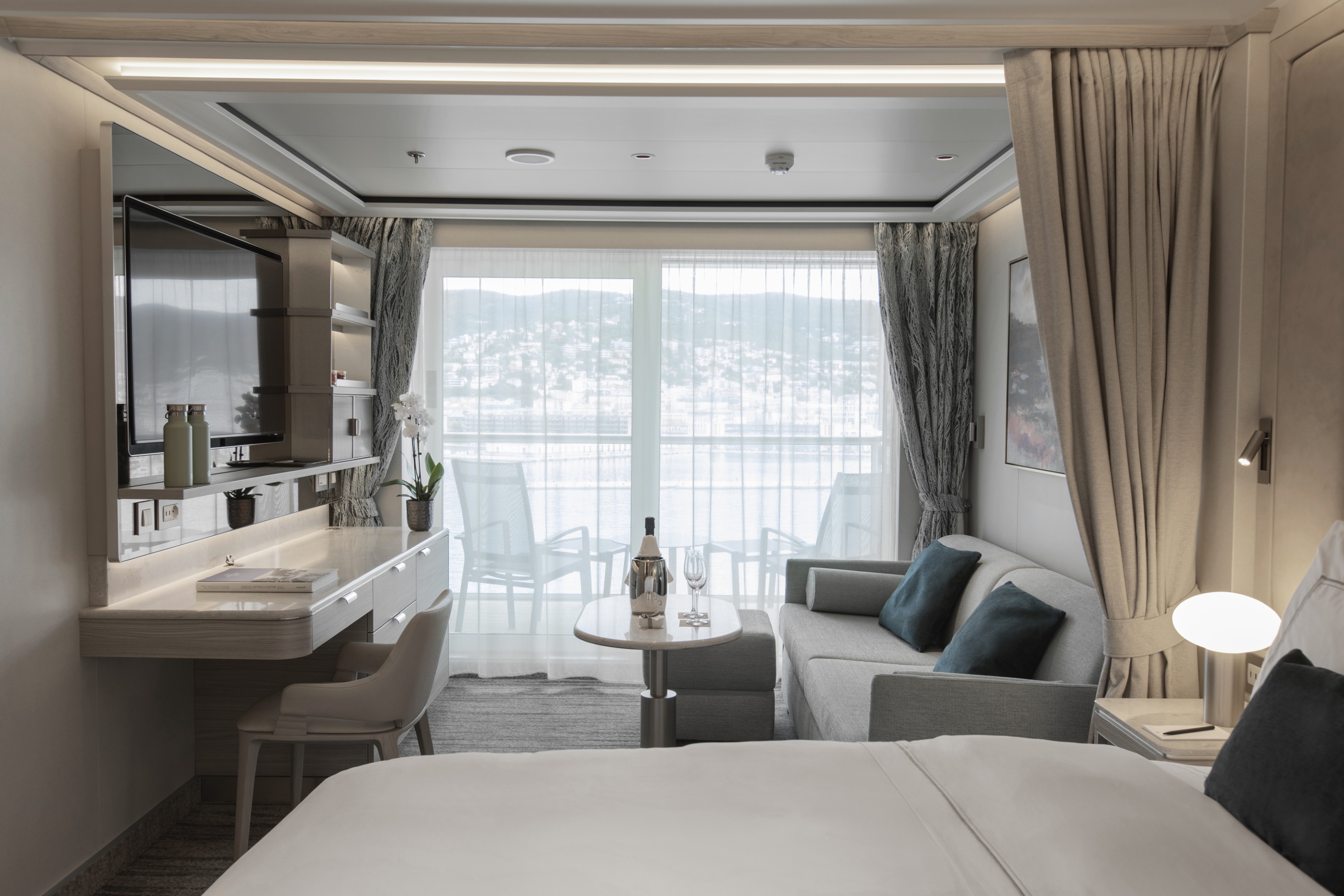
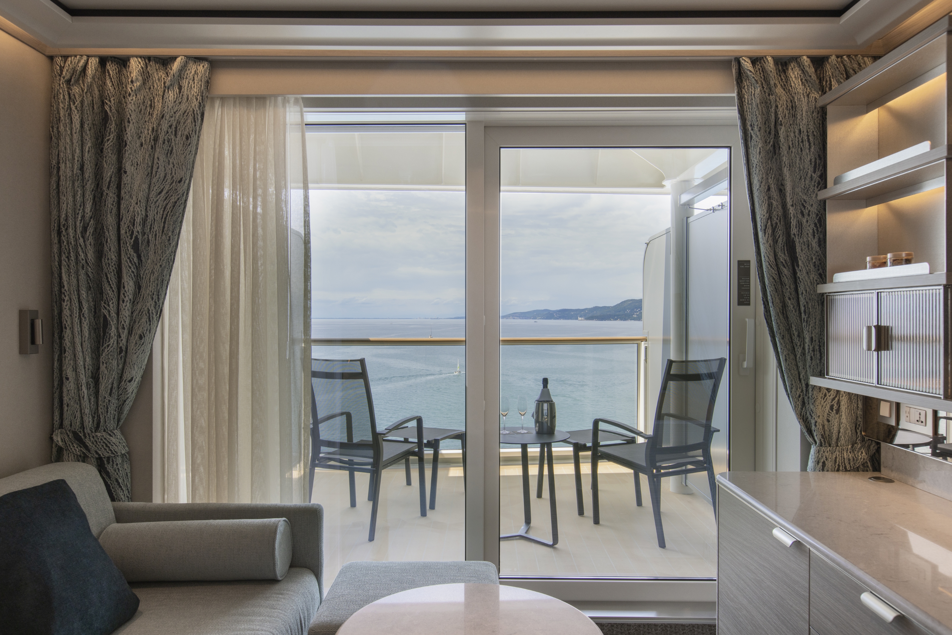
A Silversea signature, the Veranda Suite offers elegant decor, a stunning marbled bathroom with a luxurious double vanity and sumptuous walk-in shower or large bathtub. Located now in the top aft location, the Premium Veranda will offer a comfortable interior. Additionally, an ample seating area provides a generous expanse of interior comforts. Four suites (one on each deck) will offer spacious interiors adapted for guests with disabilities and will be located in the ideal midship position. A new iteration of our iconic and perfect suite configuration.
One bedroom: 33 sq m including veranda (5 sq m)
Wheelchair accessible suites: 6045, 7037, 8031, 9041
Images are intended as a general reference. Features, materials, finishes and layout may be different than shown.
Please note that the third guest will sleep on a comfortable sofa bed in the reception area of suites that have third-berth capacity.
Essentials
- Deck(s): 6, 7, 8, 9
- Section: Aft, Mid-Ship
Characteristics
- Veranda
- Sitting area
- Large vanity
- Separate shower
- Some with full-size bath (Bath & shower combination (indicated with drop sign on deck plan))
- Walk-in wardrobe with personal safe
Furniture
- Queen size bed
- Writing desk
- Vanity table
- Luxury bed mattresses (Custom made)
Media & Communication
- Unlimited Standard Wi-Fi
- 1 large flat screen TV with Interactive Media Library
- Direct dial telephone
- Wall mounted USB-C mobile device chargers
- Dual voltage 110/220 outlets
Onboard Services
- Butler service
- Champagne on arrival
Amenities
- Pillow menu
- Refrigerator and bar setup stocked with your preferences
- Plush bathrobe
- Luxury bath amenities
- Umbrella
- Hair Dryer
- Slippers
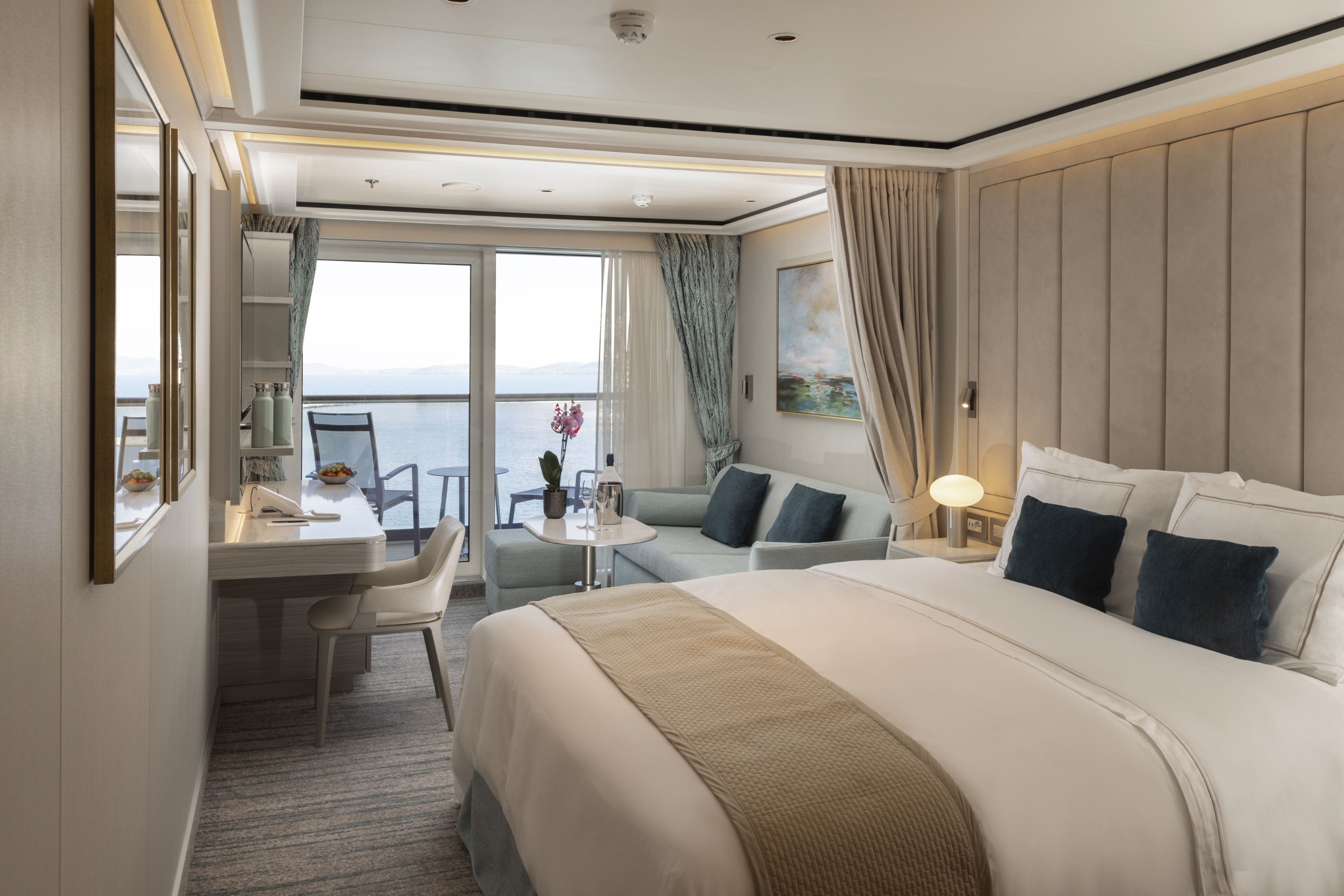
Whether you are preparing for a dynamic day onshore, primping for a romantic dinner on board, or settling down for a quiet evening in-suite, you will be enveloped by the Deluxe Veranda Suite’s warm touches. Located in the ideal midship position, the Deluxe Veranda Suite offers a comfortable 33 m2, or 355 sq ft, of interior luxury. But perhaps this suite’s finest asset lies just outside, as floor-to-ceiling glass doors open onto a 5-m2 (54-sq-ft) furnished private teak veranda offering sweeping views of your destination.
One bedroom: 33 sq m including veranda (8 sq m)
Two bedrooms: 33 sq m including veranda (5 sq m)
Images are intended as a general reference. Features, materials, finishes and layout may be different than shown.
Please note the 3rd guest will sleep on a comfortable sofa bed in the reception area of suites that have 3rd berth capacity.
Essentials
- Deck(s): 6, 7, 8, 9
- Section: Aft, Mid-Ship
Characteristics
- Veranda
- Sitting area
- Large vanity
- Separate shower
- Some with full-size bath (Bath & shower combination (indicated with drop sign on deck plan))
- Walk-in wardrobe with personal safe
Furniture
- Queen size bed
- Writing desk
- Vanity table
- Luxury bed mattresses (Custom made)
Media & Communication
- Unlimited Standard Wi-Fi
- 1 large flat screen TV with Interactive Media Library
- Direct dial telephone
- Wall mounted USB-C mobile device chargers
- Dual voltage 110/220 outlets
Onboard Services
- Butler service
- Champagne on arrival
Amenities
- Pillow menu
- Refrigerator and bar setup stocked with your preferences
- Plush bathrobe
- Luxury bath amenities
- Umbrella
- Hair Dryer
- Slippers
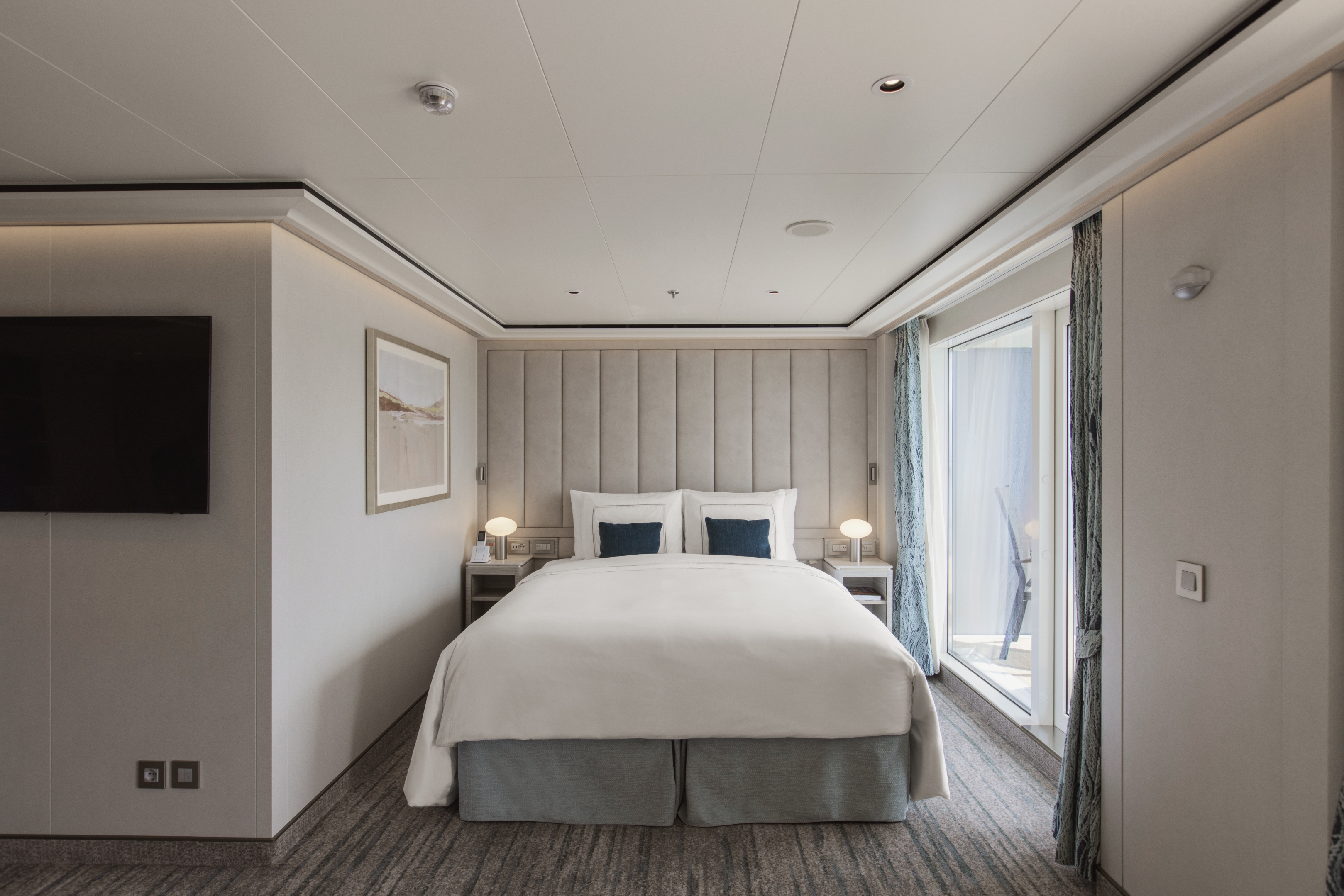
Well situated at the front and back of the ship, the 28 m2 interior of the Veranda Suite is only the beginning. The 5m2 teak balcony makes each spectacular sunset feel like it is yours alone. From beautiful bed linens to sumptuous furniture, our Superior Veranda suites are luxurious inside and out! Whether enjoying some down time with the state of the art entertainment system or taking in dinner in-suite, the Superior Veranda is the cosiest home away from home on the high seas.
One bedroom: 33 sq.m. including veranda
Images are intended as a general reference. Features, materials, finishes and layout may be different than shown.
Please note the 3rd guest will sleep on a comfortable sofa bed in the reception area of suites that have 3rd berth capacity.
Essentials
- Deck(s): 6, 7, 8, 9
- Section: Aft, Mid-Ship
Characteristics
- Veranda
- Sitting area
- Large vanity
- Separate shower
- Some with full-size bath (Bath & shower combination (indicated with drop sign on deck plan))
- Walk-in wardrobe with personal safe
Furniture
- Queen size bed
- Writing desk
- Vanity table
- Luxury bed mattresses (Custom made)
Media & Communication
- Unlimited Standard Wi-Fi
- 1 large flat screen TV with Interactive Media Library
- Direct dial telephone
- Wall mounted USB-C mobile device chargers
- Dual voltage 110/220 outlets
Onboard Services
- Butler service
- Champagne on arrival
Amenities
- Pillow menu
- Refrigerator and bar setup stocked with your preferences
- Plush bathrobe
- Luxury bath amenities
- Umbrella
- Hair Dryer
- Slippers
Located at the bow and aft of the ship, the Classic Veranda Suite will offer travellers a taste of our famous on board luxury. After a busy day of exploring, welcome home to the haven of the Classic Veranda Suite. With butler service, a queen size bed (which can be separated on demand) and beautiful marble bathroom, you won’t want to leave! However, the best part of our Classic Veranda suite is by far the large (5m2) private, teak veranda which offer sweeping views of the destination. Pure bliss.
One bedroom: 33 sq m. including veranda (5 sq m)
Images are intended as a general reference. Features, materials, finishes and layout may be different than shown.
Please note the 3rd guest will sleep on a comfortable sofa bed in the reception area of suites that have 3rd berth capacity.
Essentials
- Deck(s): 6, 7, 8, 9
- Section: Aft, Mid-Ship
Characteristics
- Veranda
- Sitting area
- Large vanity
- Separate shower
- Some with full-size bath (Bath & shower combination (indicated with drop sign on deck plan))
- Walk-in wardrobe with personal safe
Furniture
- Queen size bed
- Writing desk
- Vanity table
- Luxury bed mattresses (Custom made)
Media & Communication
- Unlimited Standard Wi-Fi
- 1 large flat screen TV with Interactive Media Library
- Direct dial telephone
- Wall mounted USB-C mobile device chargers
- Dual voltage 110/220 outlets
Onboard Services
- Butler service
- Champagne on arrival
Amenities
- Pillow menu
- Refrigerator and bar setup stocked with your preferences
- Plush bathrobe
- Luxury bath amenities
- Umbrella
- Hair Dryer
- Slippers
Silver Nova
Transcend horizons on board Silver Nova, the ship that launched Nova Class and a new era of global travel. Bold, asymmetrical architecture frames sweeping views of sea, sky, and shore. Savor unrivaled culinary variety across eight restaurants, including venues and experiences in the celebrated S.A.L.T. program. Find social time in ten diversely themed bars and lounges. Retreat to your sanctuary at sea, where spacious suites and private glass balconies overlook destinations worldwide. And unwind at the largest pool deck in the fleet or relax in pure serenity at the Otium Spa. With a bold new perspective, Silver Nova charts your true north — illuminating a path to rare experiences and timeless beauty across the seas.
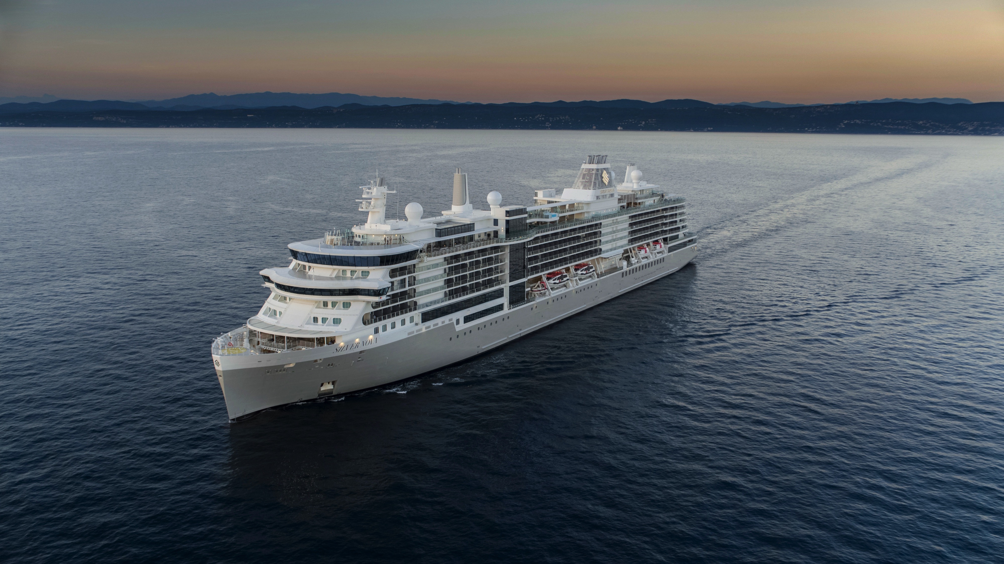
Ship Facts
| Launch Year | 2023 | ||||||||||||
| Refit Year | |||||||||||||
| Language | en | ||||||||||||
| Gross Tonnage | 54700 | ||||||||||||
| Length | 244 | ||||||||||||
| Width | 30 | ||||||||||||
| Currency | USD | ||||||||||||
| Speed | 20 | ||||||||||||
| Capacity | 728 | ||||||||||||
| Crew Count | 556 | ||||||||||||
| Deck Count | 9 | ||||||||||||
| Cabin Count | 364 | ||||||||||||
| Large Cabin Count | N/A | ||||||||||||
| Wheelchair Cabin Count | N/A | ||||||||||||
| Electrical Plugs |
|
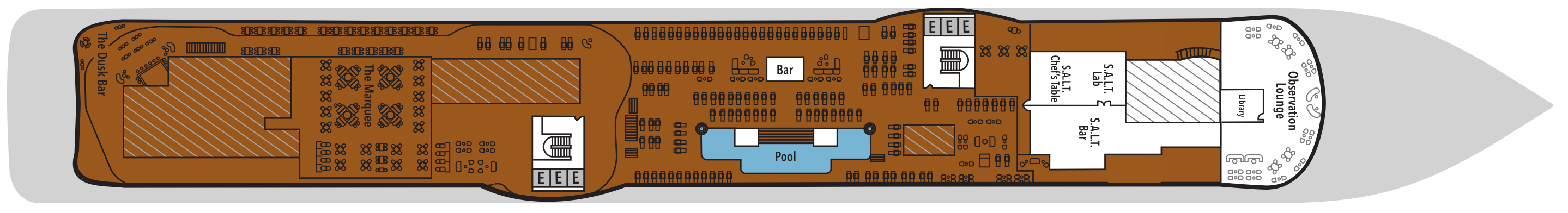
Deck 11
- The Cliff Whirlpool
- Sun Deck
- Elevator
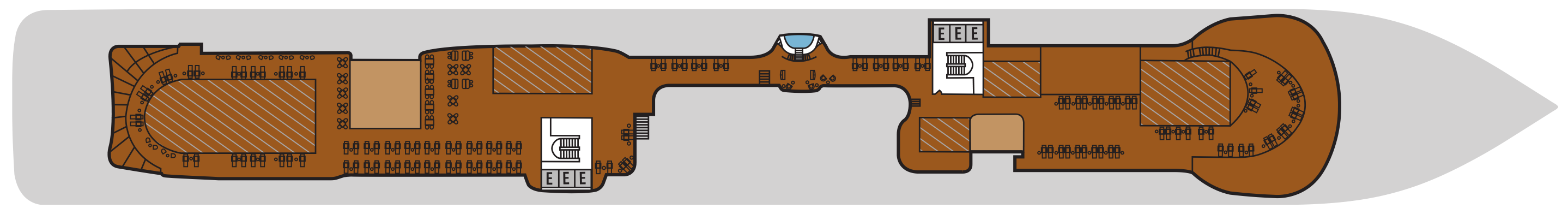
Deck 10
- Observation Lounge
- S.A.L.T. Lab
- S.A.L.T. Bar
- S.A.L.T Chef's Table
- Pool Deck
- Pool Bar
- Library
- The Marquee
- The Dusk Bar
- Jogging Track
- Elevator
Deck 9
- Junior Grand Suite
- Classic Veranda Suite
- Superior Veranda Suite
- Premium Veranda Suite
- Medallion Suite
- Deluxe Veranda Suite
- Master Suite
- Signature Suite
- Premium Medallion Suite
- Launderette
- Elevator
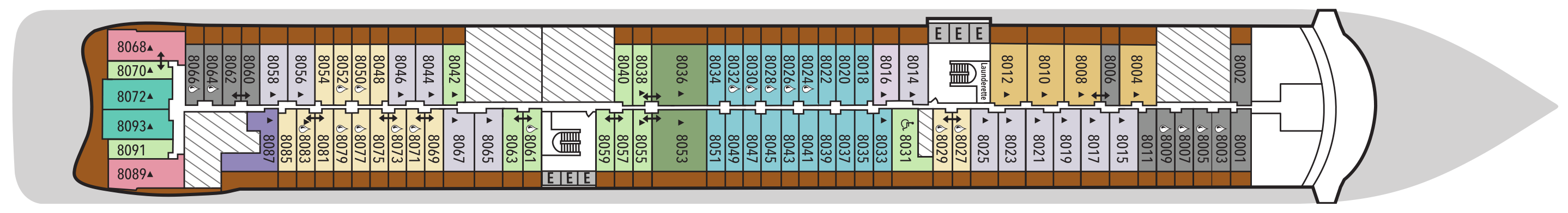
Deck 8
- Class Veranda Suite
- Silver Suite
- Medallion Suite
- Superior Veranda Suite
- Premium Veranda Suite
- Deluxe Veranda Suite
- Owner's Suite
- Master Suite
- Premium Medallion Suite
- Signature Suite
- Launderette
- Elevator
Deck 7
- Grand Suite
- Classic Veranda Suite
- Medallion Suite
- Silver Suite
- Superior Veranda Suite
- Premium Veranda Suite
- Deluxe Veranda Suite
- Otium Suite
- Premium Medallion Suite
- Master Suite
- Signature Suite
- Launderette
- Elevator
Deck 6
- Junior Grand Suite
- Classic Veranda Suite
- Medallion Suite
- Silver Suite
- Superior Veranda Suite
- Premium Veranda Suite
- Deluxe Veranda Suite
- Signature Suite
- Master Suite
- Otium Suite
- Elevator
Deck 5
- Otium Spa
- Fitness Centre
- Beauty Salon
- Casino
- Boutique
- Dolce Vita
- Silver Note
- Library
- Connoisseur's Corner
- Panorama Lounge
- Venetian Lougne
- Elevator

Deck 4
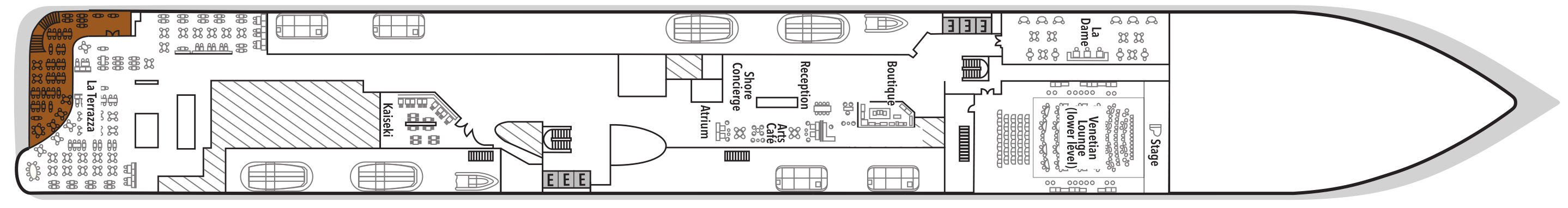
- La Dame
- Venetian Lounge
- Boutique
- Reception
- Arts Café
- Shore Concierge
- Atrium
- Kaiseki
- La Terrazza
- Elevator
Deck 3
- Atlantide
- S.A.L.T. Kitchen
- The Shelter
- Elevator

Our passion for excellent cuisine is at the heart of everything we do. We believe that meals are a celebration of life, a way to bring people together, and an expression of culture and tradition. Each dining venue aboard our ships offers a unique and memorable experience, with multiple dining options available and a variety of spaces and experiences on board; every mealtime is a joy.
S.A.L.T. Kitchen
S.A.L.T. Kitchen transforms dining into discovery with menus that reflect the cuisines of the places you’ll visit. This complimentary venue is the only restaurant at sea with an ever-changing menu based on destination. Plus, a standing menu focuses on broader regional specialties, complemented by a menu featuring hyperlocal fare. Dishes are inspired by local flavors and prepared with responsibly sourced ingredients. Accompanied by a curated selection of over 160 regional wines, S.A.L.T. Kitchen delivers an immersive taste of place without ever leaving the ship.
Images are intended as a general reference. Features, materials, finishes, and layout may be different than shown.
S.A.L.T. Chef's Table
Each evening, S.A.L.T. Lab becomes an intimate culinary theater where chefs showcase their creativity inspired by the setting and season of each voyage. S.A.L.T. Chef's Table presents a thoughtfully choreographed 11-course menu of refined yet approachable small plates — each highlighting local ingredients with contemporary interpretations of regional classics. With just one seating nightly, this experience feels less like a formal restaurant and more like a welcoming gathering of foodies. This is where artistry meets authenticity, creating a delicious memory that will linger on your palate long after the final course.
Per guest reservation fee of US$180 (incl. complimentary wine and cocktail pairing). Reservations will be taken exclusively on board Silver Ray.
Learn more about the Epicurean Experience, which includes dining in three specialty restaurants with preferential rates.
Images are intended as a general reference. Features, materials, finishes and layout may be different than shown.
La Terrazza
La Terrazza elevates casual dining by day and delivers an authentic Italian experience by night. During the breakfast and lunch buffets, our master chefs prepare global favorites at live stations. As evening falls, handmade pastas and classic seafood dishes are the centerpiece — every impeccable bite paired with fine wines from around the world.
Images are intended as a general reference. Features, materials, finishes and layout may be different than shown.
The Marquee
Exclusive to Silver Nova and Silver Ray, The Marquee channels the charm of a Mediterranean piazzetta in a beautiful open-air setting. Start your day with wholesome breakfast options, then return for lunch or after sunset to savor
Spaccanapoli’s pizzas and seared specialties from The Grill under a wide-open sky.
Images are intended as a general reference. Features, materials, finishes and layout may be different than shown.
Silver Note
As the stars come out, Silver Note comes alive with the rhythm of jazz and the artistry of small-plate fine dining. This intimate supper-club experience pairs soulful live performances with inventive, international cuisine in a chic, lounge-style setting — one of the most exclusive dining concepts at sea.
Learn more about the Epicurean Experience, which includes dining in three specialty restaurants with preferential rates.
Images are intended as a general reference. Features, materials, finishes and layout may be different than shown.
La Dame
Experience the pinnacle of French gastronomy at La Dame, where sophistication meets tradition. Here, an exclusive tasting menu unfolds course by course — each plate a study in masterful technique, seasonal ingredients, and modern refinement. From classic Kir Royales to exquisite signatures such as Dover sole à la Grenobloise, this is haute cuisine at its finest.
Per guest reservation fee of US$100. Please visit My Silversea to make your reservations.
Learn more about the Epicurean Experience, which includes dining in three specialty restaurants with preferential rates.
Images are intended as a general reference. Features, materials, finishes and layout may be different than shown.
Kaiseki
Meals at Kaiseki are rooted in the Japanese philosophy of balance and precision. By day, refreshing sushi, sashimi, and izakaya-style dishes guide the menu. During dinner, specialties like miso black cod and wagyu teriyaki nod to Japan’s enduring culinary legacy, while fine sake, whiskies, and teas enhance every course.
Per guest reservation fee of US$80 (incl. complimentary sake, Japanese whiskeys, or TWG tea and tea cocktails selection). Please visit My Silversea to make your reservations.
Learn more about the Epicurean Experience, which includes dining in three specialty restaurants with preferential rates.
Images are intended as a general reference. Features, materials, finishes and layout may be different than shown.
Atlantide
Refined global fare and grilled classics take center stage at Atlantide. Drop in for an indulgent à la carte breakfast, a leisurely lunch, or an elegant dinner among family and new friends, served in a timeless and sophisticated setting.
Images are intended as a general reference. Features, materials, finishes and layout may be different than shown.
Art Café
Arts Café is a vibrant, light-filled haven for conversation, creativity, and indulgence. Snack on light bites and decadent pastries paired with freshly brewed coffee and artisanal teas as you unwind with a good book or get to know your fellow travelers.
Images are intended as a general reference. Features, materials, finishes and layout may be different than shown.
The Grill
A poolside al fresco favorite, The Grill is casual by day and captivating by night. Dig in to crisp salads and grilled classics during lunch, then return after sunset for masterfully seasoned and seared cuts paired with balmy sea breezes.
Images are intended as a general reference. Features, materials, finishes and layout may be different than shown.
Spaccanapoli
Spaccanapoli honors southern Italy’s culinary heritage with handcrafted pies tossed, topped, and baked to perfection. This signature pizzeria captures true Neapolitan flavor — from golden, blistered crusts to the irresistible aromas that drift from the custom-built oven.
Images are intended as a general reference. Features, materials, finishes and layout may be different than shown.
In-Suite Dining
You can order from our Room Service menu 24 hours a day.
Opening hours are for reference only. For precise opening hours, please refer to the Daily Chronicles provided on board.
When you embark on an adventure with Silversea, we keep you thoroughly entertained while you’re sailing from one glorious port to another. Exploring the many different floors and strolling around the variety of areas on your ship is great fun as there’s always so much to see and do. Whether you want to recline on a lounger by the pool, try your luck in the casino, or indulge in our cutting-edge wellness and exercise programs, there’s something for everyone, including those who want to relax in their suite while their butler runs a bubble bath.
S.A.L.T. Bar
S.A.L.T. Bar crafts cultural connections through expertly prepared cocktails that tell the story of each region. Our mixologists blend local ingredients with traditional spirits — creating signature ship cocktails and regionally inspired libations that capture the essence of your journey. The welcoming atmosphere invites conversation about the historical significance of convivial traditions. Offered complimentary, each perfectly balanced pour serves as your passport to the shores you’re exploring.
Images are intended as a general reference. Features, materials, finishes, and layout may be different than shown.
The Shelter
The Shelter is our newest pre- and post-dinner cocktail venue. Settle in amid an intimate and elegant setting, resplendent with sophisticated lighting, inviting sofas, and a stunning wraparound bar. Strategically located on deck 3, the atmospheric hideaway opens onto the Atrium, creating openness and connection to the other neighboring venues. We promise you’ll fall in love with one of the best bars on board while our talented team of mixologists mix and shake our range of signature and bespoke cocktails. With the perfect destination, warm smiles, and legendary Silversea service, get set for unforgettable nights in The Shelter.
Images are intended as a general reference. Features, materials, finishes and layout may be different than shown.
The Pool Deck
Enjoy a reimagined space where you can relax, refresh, and rejuvenate on decks 10 and 11. Ample sun beds for everyone, more space than ever before, and the largest pool in the fleet—which offers exceptional, unhampered, 270-degree views—are just the beginning. The upper-level sun deck is perfectly placed for those who want a quieter space to relax and still enjoy those incredible, expansive views that are the hallmark of Silver Nova. But it is The Cliff Whirlpool, an infinity-edge, glass-fronted whirlpool, that really makes The Pool Deck something special.
Images are intended as a general reference. Features, materials, finishes and layout may be different than shown.
The Dusk Bar
With an emphasis on the destination, panoramic views connect you with the world beyond at The Dusk Bar. This superb open-air sky bar provides plenty of space for guests to enjoy a pre- or post-dinner drink while taking in the jaw-dropping, 270-degree, panoramic views from the stern. The Dusk Bar’s delightful combination of idyllic atmosphere and lovely drinks is guaranteed to check your boxes time after time. Whether you’re enjoying a spritz in South America, a cocktail in the Caribbean, or a night cap in the Mediterranean, we think The Dusk Bar’s unobstructed views give you a new perspective on sunsets at sea.
Images are intended as a general reference. Features, materials, finishes and layout may be different than shown.
Dolce Vita
Our main bar has been newly reimagined for Silver Nova! Dolce Vita has of course kept her legendary charm, inspired cocktails, stylish decor, and comfortable seating, but a central bar now means the warm ambience is better than ever! Oozing Italian glamour, Dolce Vita is a relaxed, refined bar with a nightly piano player playing all your favorite tunes. Perfect for pre-dinner aperitifs or even a post-dinner cocktail, Dolce Vita is truly the beating heart of social life on board.
Images are intended as a general reference. Features, materials, finishes and layout may be different than shown.
Panorama Lounge
From early morning to late at night, the Panorama Lounge offers everything you could wish for. A peaceful retreat that is the perfect place to take a break, a social place to meet and greet old friends, or an evening venue to partake in a cocktail as you sit back and watch the world go by. Sink into the plush seats, and come evening, enjoy listening to the gentle sounds of a pianist or the invigorating beats of our in-house DJ.
Images are intended as a general reference. Features, materials, finishes and layout may be different than shown.
Connoisseur's Corner
Our smoking lounge aboard Silver Nova is our latest venue where cigar lovers can buy and sample some of the world’s finest Havanas, Cohibas, Partagás, Montecristos, Ramón Allones, and Bolívars. Combining all the elements of cigar culture indoors and on its stylish terrace, the Connoisseur’s Corner is where aficionados can meet and mingle to share their iconic passion.
Images are intended as a general reference. Features, materials, finishes and layout may be different than shown.
Atrium
Located on deck 4, the Atrium is the beating heart of Silver Nova. Inspired by Roman architecture, the Atrium’s magnificent windows floods our central meeting areas with abundant natural light. The area is home to both the Arts Café and The Shelter, as well as main service areas such as the Reception, Shore Concierge, and Future Cruise Sales. The Atrium’s enormous glass wall stretches over two decks, guaranteeing a deep connection with your destination whether at sea or docked in port.
Images are intended as a general reference. Features, materials, finishes and layout may be different than shown.
Observation Lounge
Set on the highest level at the very top of the ship, this is a quiet space for reading and reflection while being dazzled by the undulating seascapes that are part of life on board. Borrow a book from the in-house library, read the papers, or just embrace the tranquility of being at sea.
Images are intended as a general reference. Features, materials, finishes and layout may be different than shown.
Boutique
Exceptional shopping experiences do not end in the cosmopolitan cities we visit. Silversea’s striking new shipboard boutiques, reimagined and redesigned, are stunning modern design spaces befitting the finest creations from legendary designers. Carefully selected partners on board Silversea’s duty-free boutiques offer our guests a carefully curated selection of cutting-edge fashions, jewelry, accessories, fine perfumes, cosmetics, and Silversea Logo collection, all at duty-free prices.
Images are intended as a general reference. Features, materials, finishes and layout may be different than shown.
The Venetian Lounge
The grandeur and magic of music and theater. The experience of being transported by performance. That satisfying feeling of seeing an evening show … Welcome to the Venetian Lounge, a place where the arts of theater and music meet with full-scale productions and feature films. Paying tribute to a golden age of glamour, the Venetian Lounge offers belle-époque-style cabaret seating, with intimate tables and chairs subtly placed between the rows of comfortable tiered banquettes. As the stage lights are dimmed, soak up the atmosphere, relax, and enjoy a night of dazzling sights and sounds.
Images are intended as a general reference. Features, materials, finishes and layout may be different than shown.
Casino
Let the fun begin! Channel your inner James Bond and place a bet at a variety of table games, including American Roulette, Blackjack, and Poker, as Silver Nova glides silently through the waves. An assortment of multi-game, multi-denominational reel and video slot machines are also available. Prepare yourself for a luxurious and exhilarating experience with every turn of a card and spin of the wheel. Game on!
Images are intended as a general reference. Features, materials, finishes and layout may be different than shown.
Library