Philipsburg to Bridgetown
Philipsburg to Bridgetown
Cruise overview
WHY BOOK WITH US?
- ✔ The Deluxe Cruises’ team has extensive experience in ultra-luxury cruising.
- ✔ Call now to speak to our helpful and experienced Cruise Concierge team.
- ✔ Enjoy our Unique Deluxe Cruises Bonus for substantial savings.
- ✔ Our team will tailor your holiday to your exacting requirements.
- ✔ As agents, we work under the protection of each cruise lines ABTA / ATOL licences
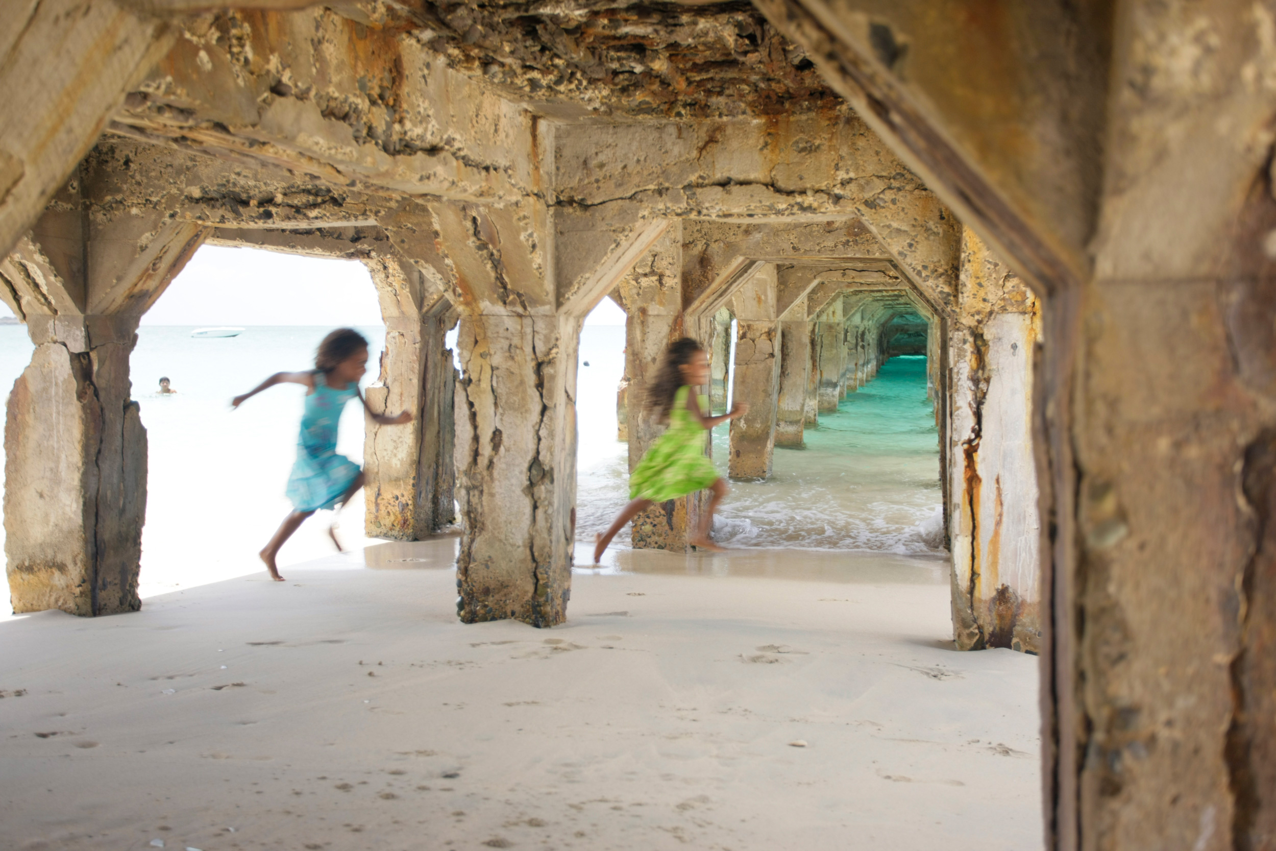
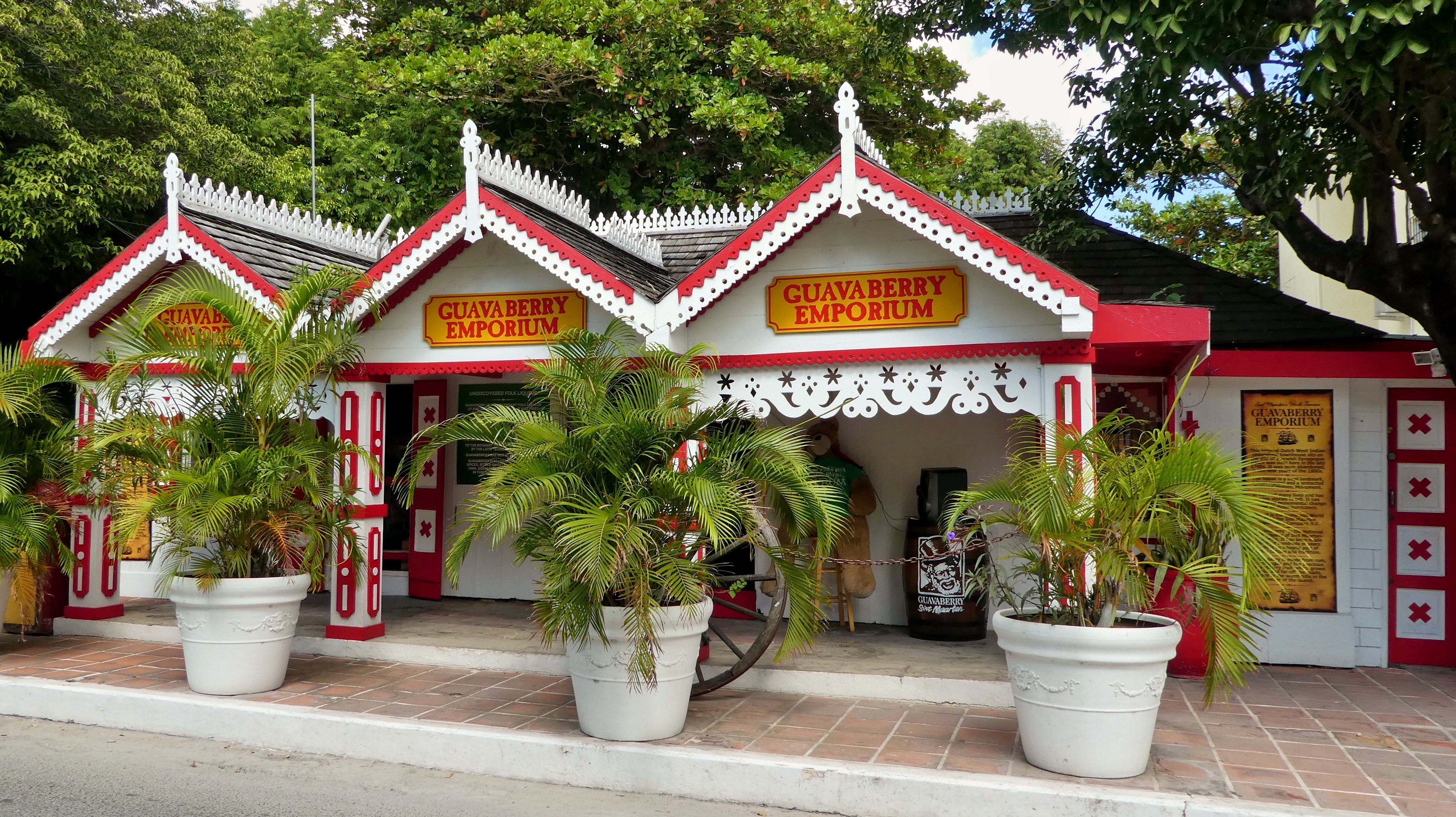
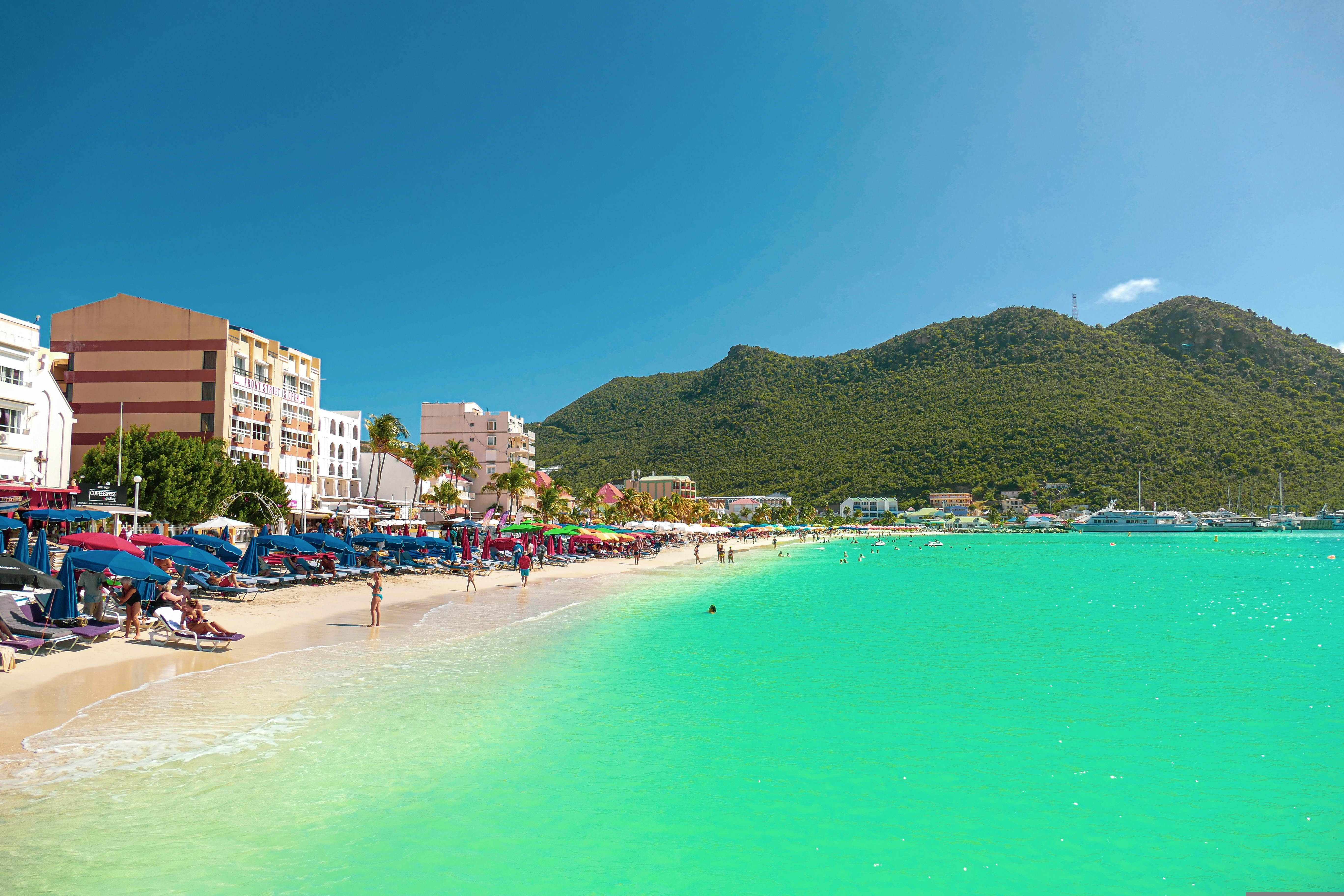
About Philipsburg
The capital of Dutch St. Maarten stretches about a mile (1½ km) along an isthmus between Great Bay and the Salt Pond and has five parallel streets. Most of the village's dozens of shops and restaurants are on Front Street, narrow and cobblestone, closest to Great Bay. It's generally congested when cruise ships are in port, because of its many duty-free shops and several casinos. Little lanes called steegjes connect Front Street with Back Street, which has fewer shops and considerably less congestion. Along the beach is a ½-mile-long (1-km-long) boardwalk with restaurants and several Wi-Fi hot spots.Wathey Square (pronounced watty) is in the heart of the village. Directly across from the square are the town hall and the courthouse, in a striking white building with cupola. The structure was built in 1793 and has served as the commander's home, a fire station, a jail, and a post office. The streets surrounding the square are lined with hotels, duty-free shops, restaurants, and cafés. The Captain Hodge Pier, just off the square, is a good spot to view Great Bay and the beach that stretches alongside.
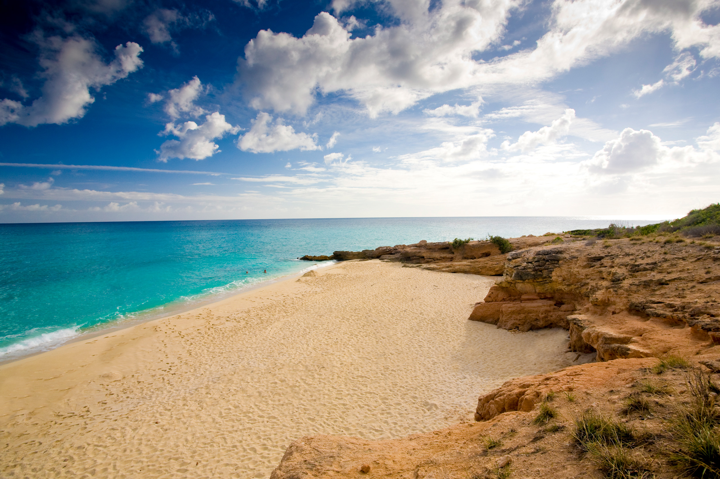
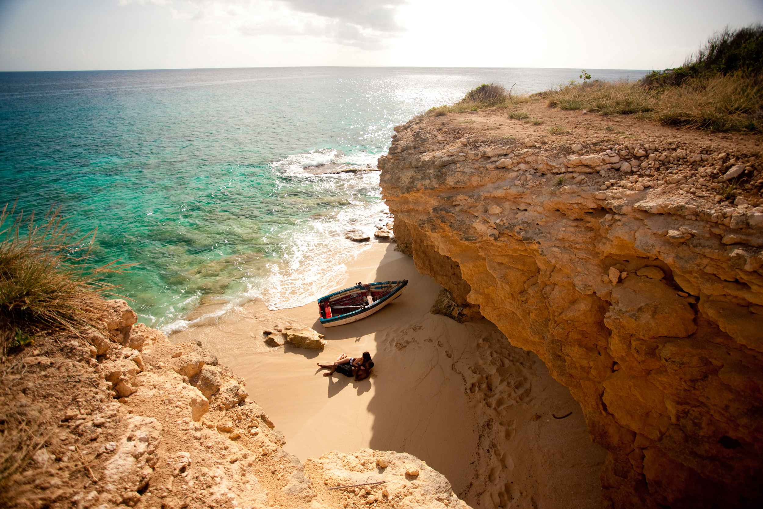
About Saint John Island
St. John, the smallest most idyllic of the three United States Virgin Islands, is best known for its dozens of post card perfect white sand beaches, turquoise bays abounding in colourful corals & rainbows of tropical fish endless vistas of green velvet hills. Only nine miles long (14.5 kilometres) and three miles (4.8 kilometres) wide, two thirds of the island is the Virgin Islands National Park, so its spectacular beaches & untouched forests will remain that way for generations to come and remain accessible to all. There are tours of the National Park by Jeep or safari bus and hikes on spectacular trails led by Park Rangers who enrich the experience with talks on the island's history and geology as well as its flora & fauna. While it is only twenty minutes from St. Thomas by convenient hourly ferry, St. John is the peaceful, uncommercialised paradise of island fantasies. It has no high-rise buildings, cruise ship docks or airport. Visitors can obtain discounted air fares to St. Thomas. Despite its unspoiled atmosphere, it offers every facility and amenity found at major resorts.
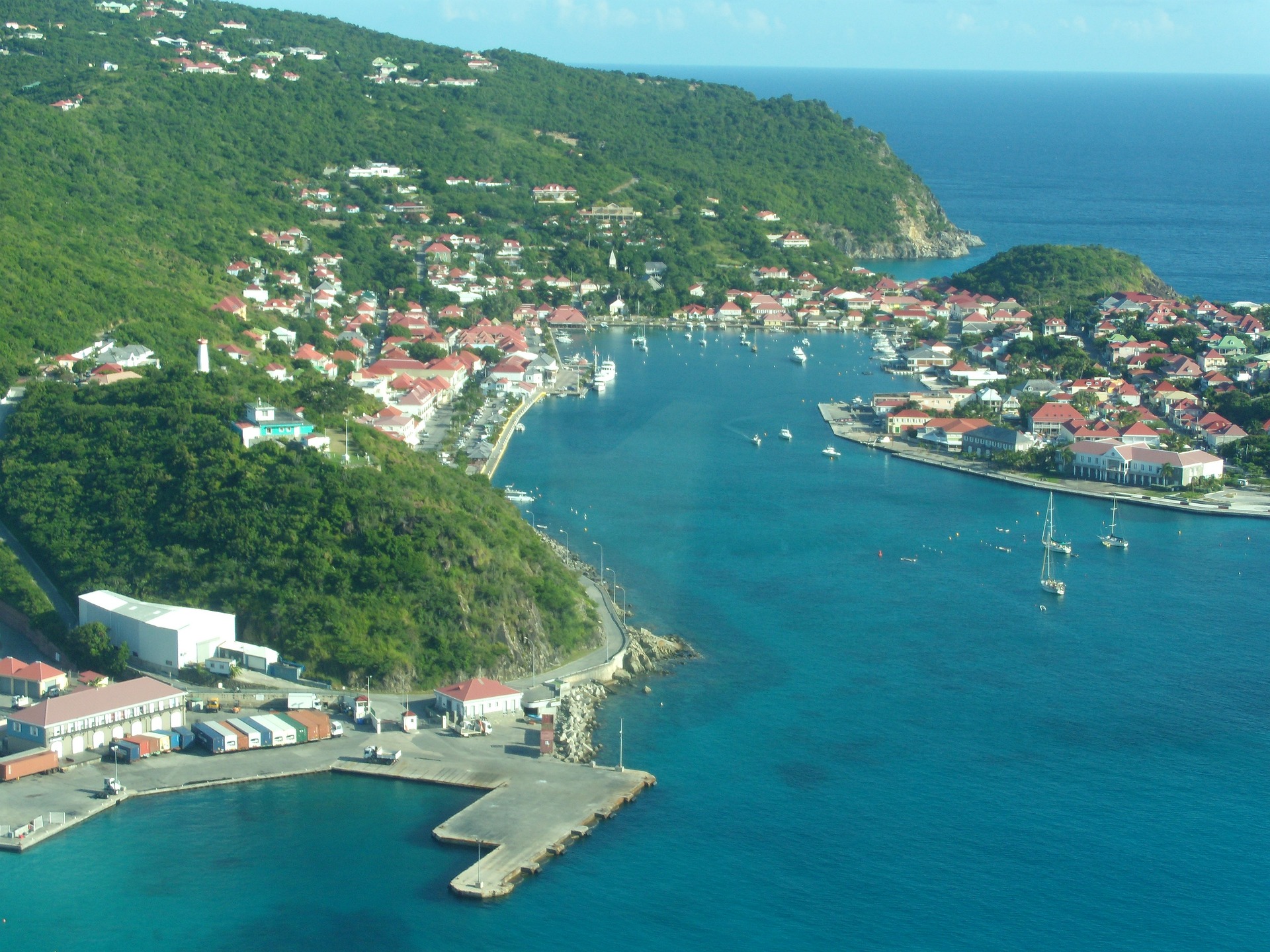
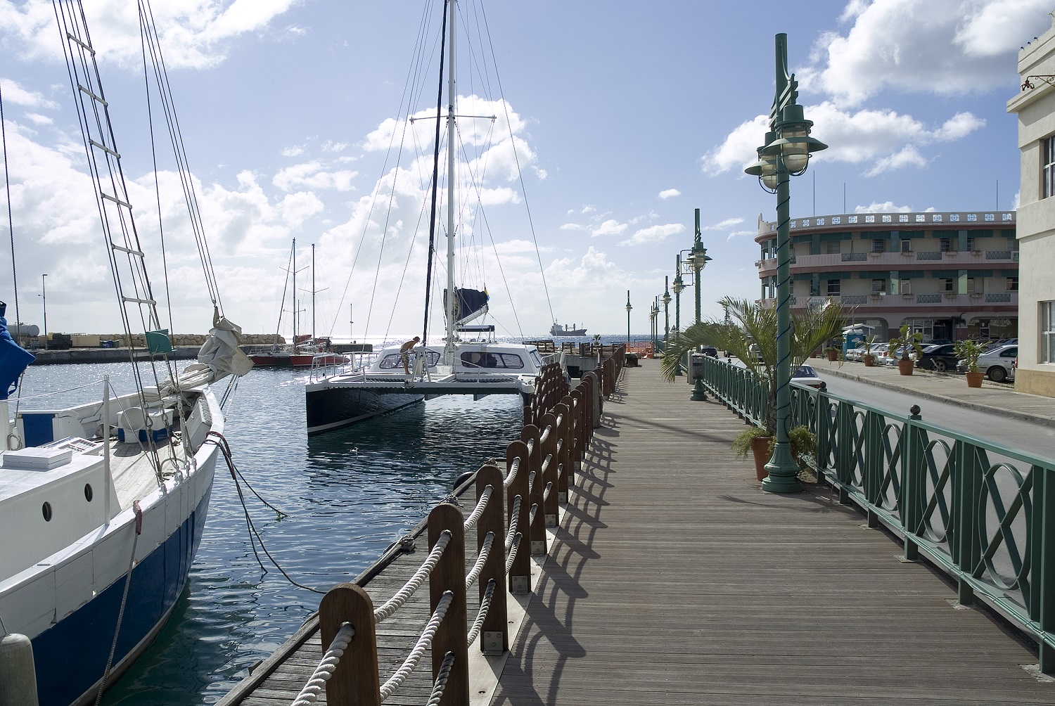
About Gustavia
You can easily explore all of Gustavia during a two-hour stroll. Some shops close from noon to 3 or 4, so plan lunch accordingly, but stores stay open past 7 in the evening. Parking in Gustavia is a challenge, especially during vacation times. A good spot to park is rue de la République, alongside the catamarans, yachts, and sailboats.
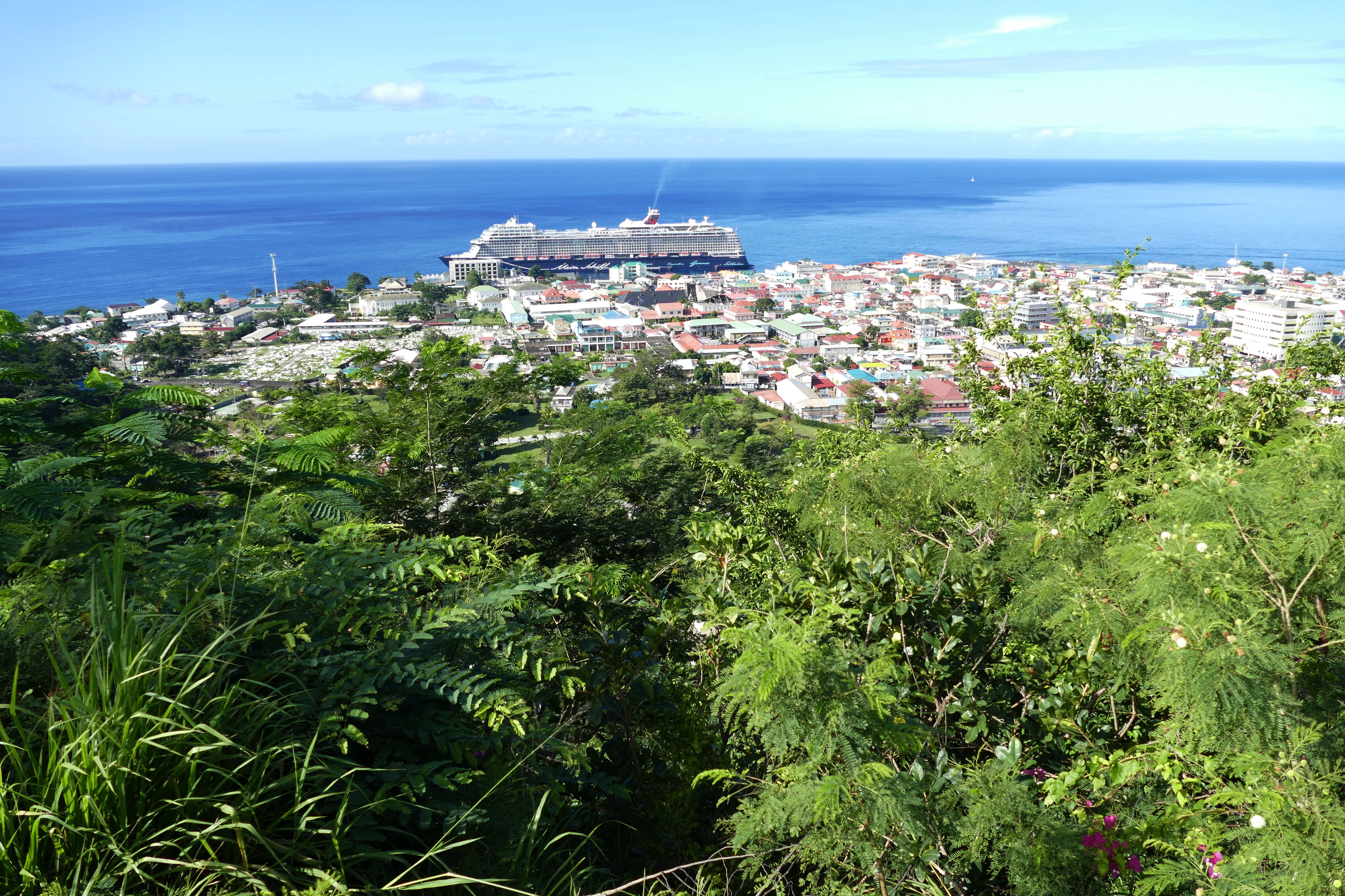
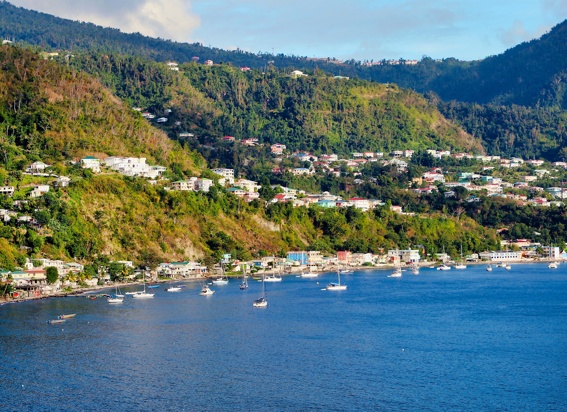
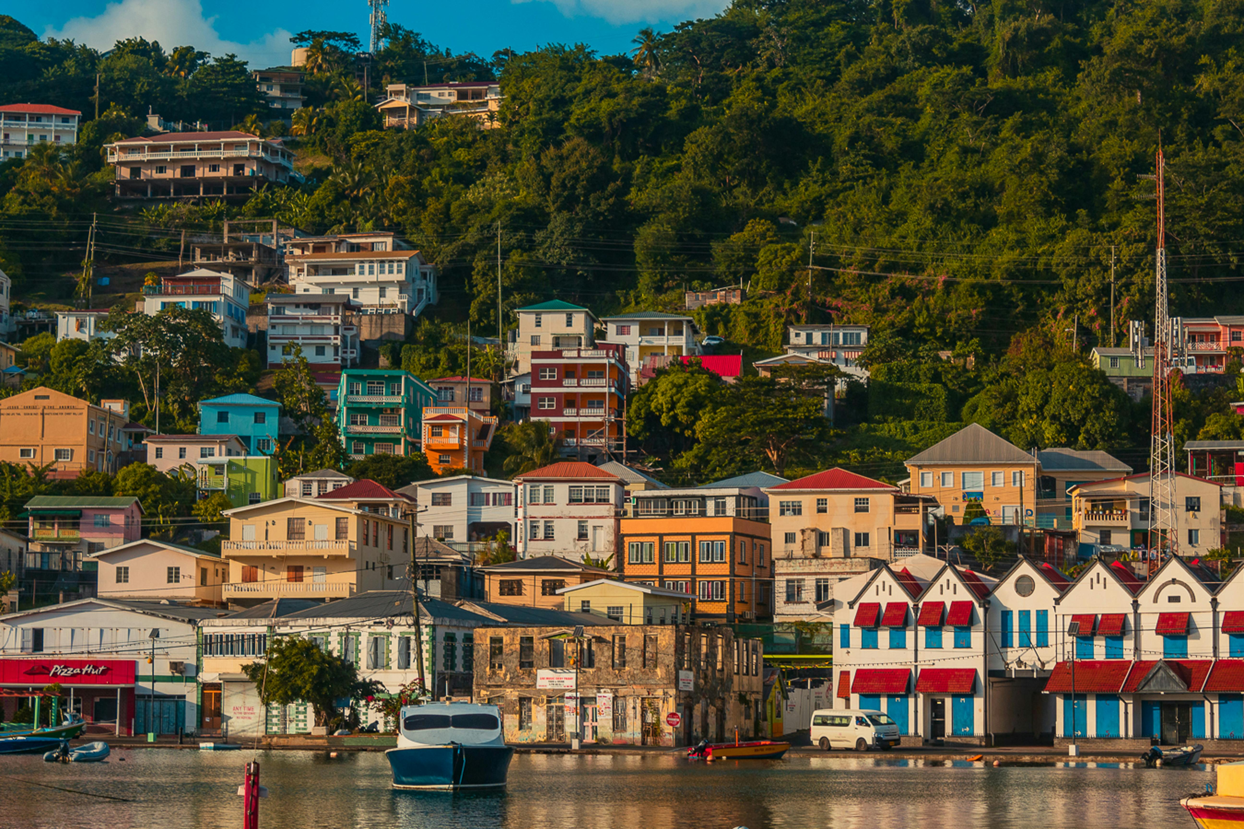
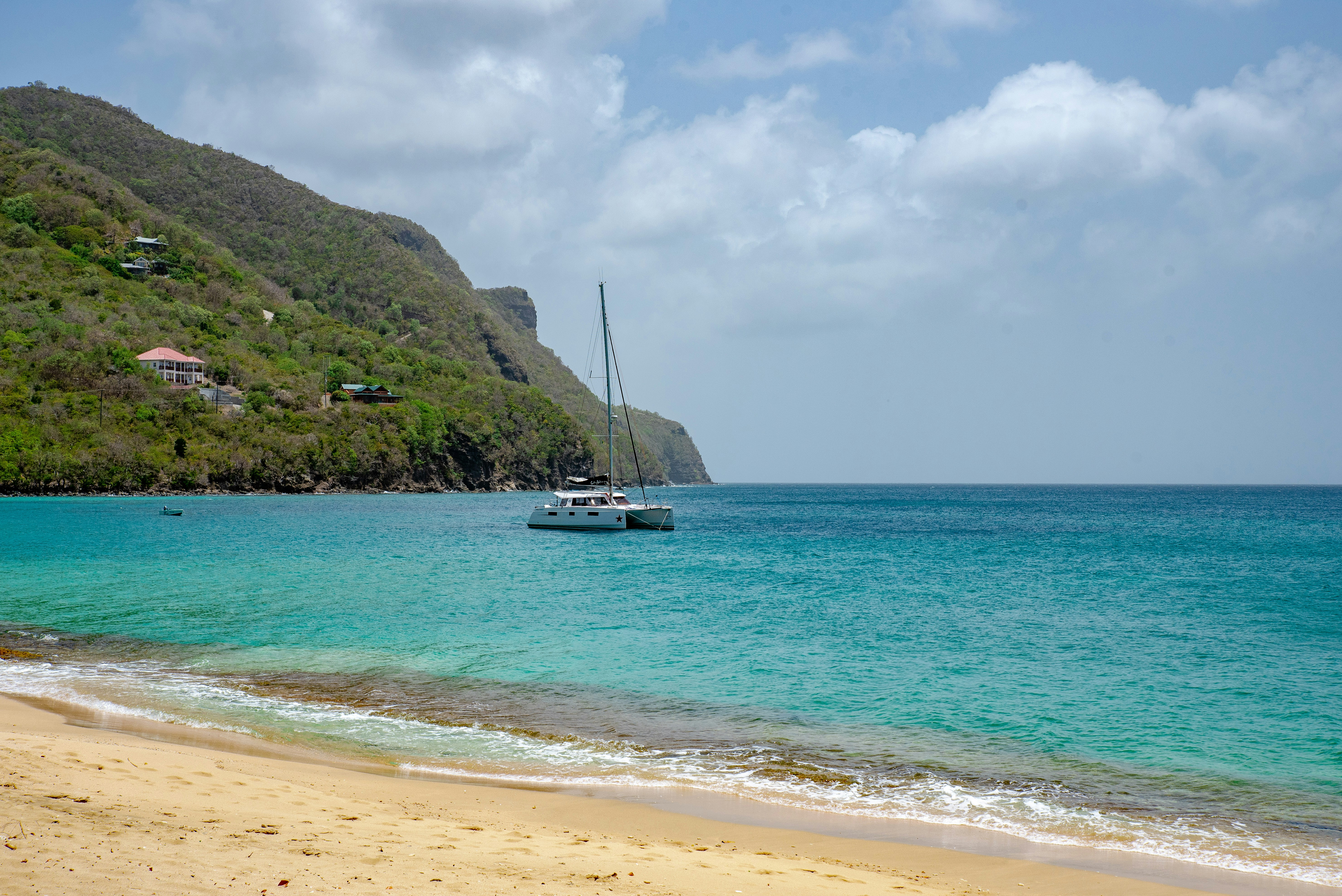
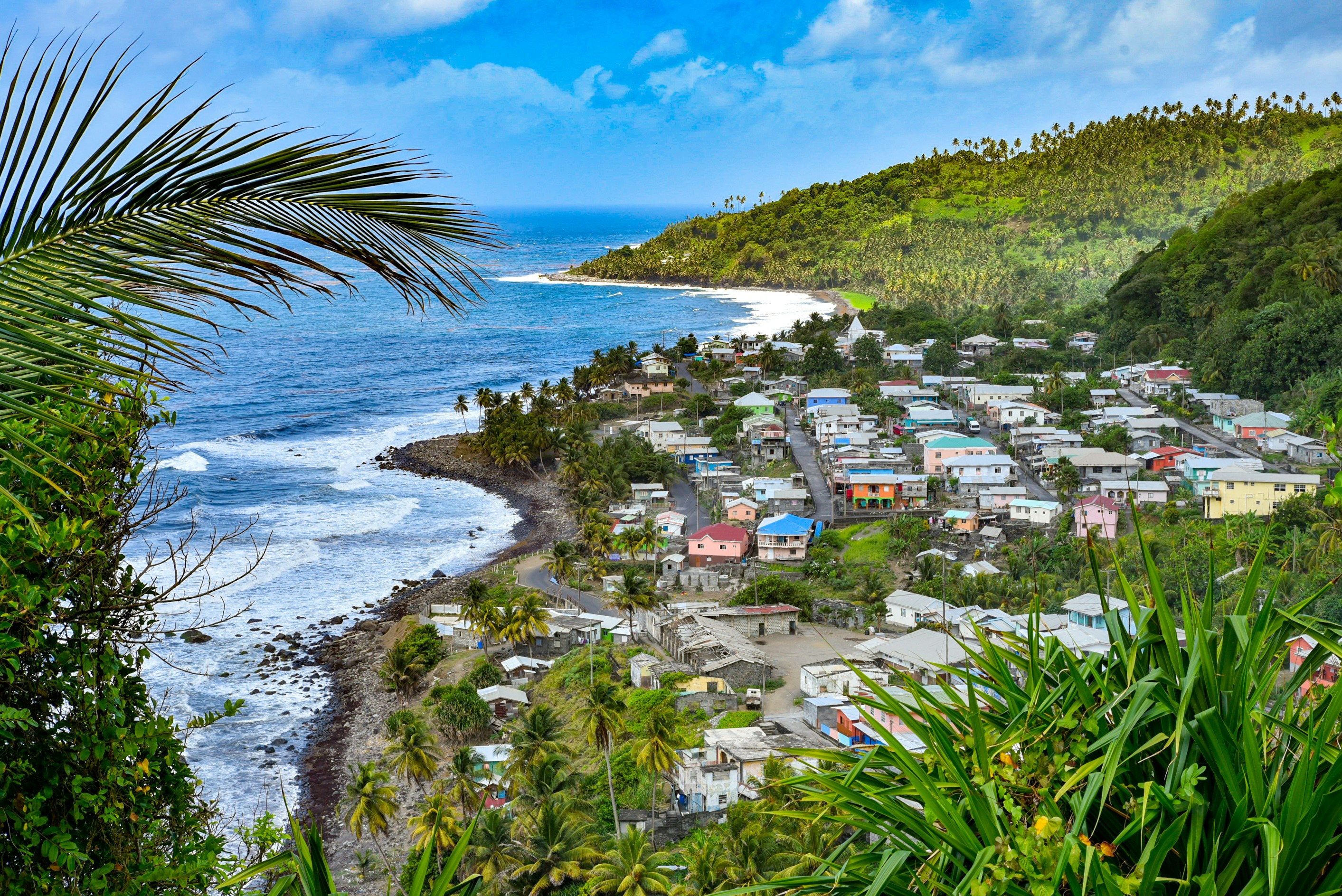
About Roseau
Although it's one of the smallest capitals in the Caribbean, Roseau has the highest concentration of inhabitants of any town in the eastern Caribbean. Caribbean vernacular architecture and a bustling marketplace transport visitors back in time. Although you can walk the entire town in about an hour, you'll get a much better feel for the place on a leisurely stroll. For some years now, the Society for Historical Architectural Preservation and Enhancement (SHAPE) has organized programs and projects to preserve the city's architectural heritage. Several interesting buildings have already been restored. Lilac House, on Kennedy Avenue, has three types of gingerbread fretwork, latticed verandah railings, and heavy hurricane shutters. The J.W. Edwards Building, at the corner of Old and King George V sreets, has a stone base and a wooden second-floor gallery. The Old Market Plaza is the center of Roseau's historic district, which was laid out by the French on a radial plan rather than a grid, so streets such as Hanover, King George V, and Old radiate from this area. South of the marketplace is the Fort Young Hotel, built as a British fort in the 18th century; the nearby statehouse, public library, and Anglican cathedral are also worth a visit. New developments at the bay front on Dame M.E. Charles Boulevard have brightened up the waterfront.
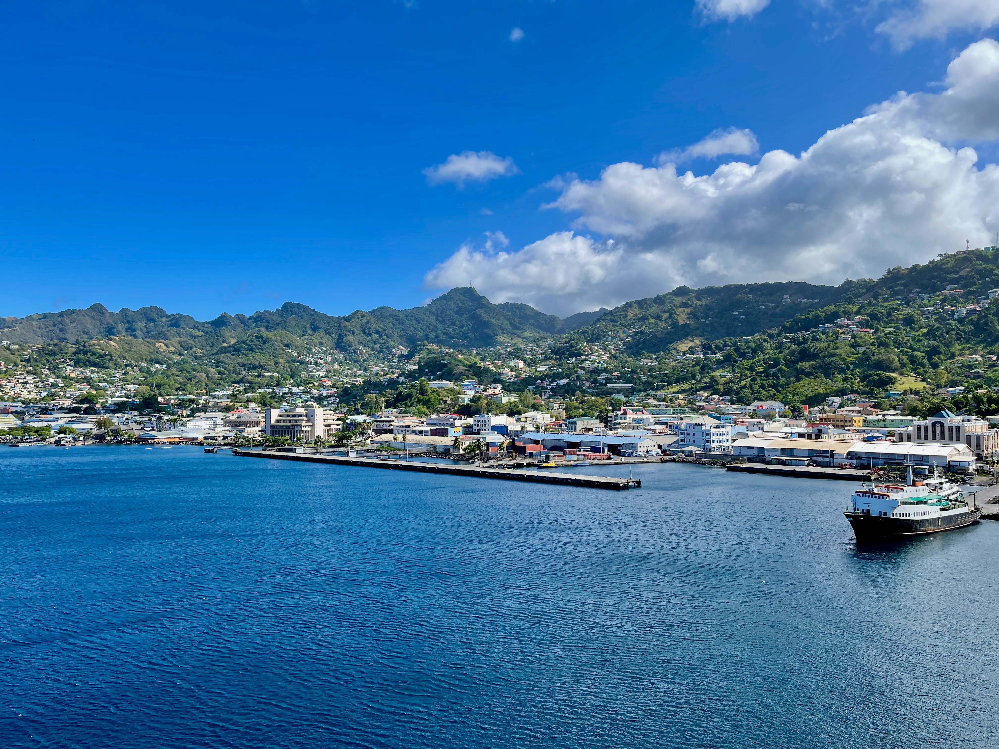
About Saint George's
Nutmeg, cinnamon, cloves, cocoa those heady aromas fill the air in Grenada (pronounced gruh-nay-da). Only 21 miles (33½ km) long and 12 miles (19½ km) wide, the Isle of Spice is a tropical gem of lush rain forests, white-sand beaches, secluded coves, exotic flowers, and enough locally grown spices to fill anyone's kitchen cabinet. St. George's is one of the most picturesque capital cities in the Caribbean, St. George's Harbour is one of the most picturesque harbors, and Grenada's Grand Anse Beach is one of the region's finest beaches. The island has friendly, hospitable people and enough good shopping, restaurants, historic sites, and natural wonders to make it a popular port of call. About one-third of Grenada's visitors arrive by cruise ship, and that number continues to grow each year. Grenada's capital is a bustling West Indian city, much of which remains unchanged from colonial days. Narrow streets lined with shops wind up, down, and across steep hills. Brick warehouses cling to the waterfront, and pastel-painted homes rise from the waterfront and disappear into steep green hills. The horseshoe-shaped St. George's Harbour, a submerged volcanic crater, is arguably the prettiest harbor in the Caribbean. Schooners, ferries, and tour boats tie up along the seawall or at the small dinghy dock. The Carenage (pronounced car-a-nahzh), which surrounds the harbor, is the capital's center. Warehouses, shops, and restaurants line the waterfront. The Christ of the Deep statue that sits on the pedestrian plaza at the center of The Carenage was presented to Grenada by Costa Cruise Line in remembrance of its ship, Bianca C, which burned and sank in the harbor in 1961 and is now a favorite dive site. An engineering feat for its time, the 340-foot-long Sendall Tunnel was built in 1895 and named for Walter Sendall, an early governor. The narrow tunnel, used by both pedestrians and vehicles, separates the harbor side of St. George's from the Esplanade on the bay side of town, where you can find the markets (produce, meat, and fish), the Cruise Ship Terminal, the Esplanade Mall, and the public bus station.
About Trois-Ilets
About Kingstown
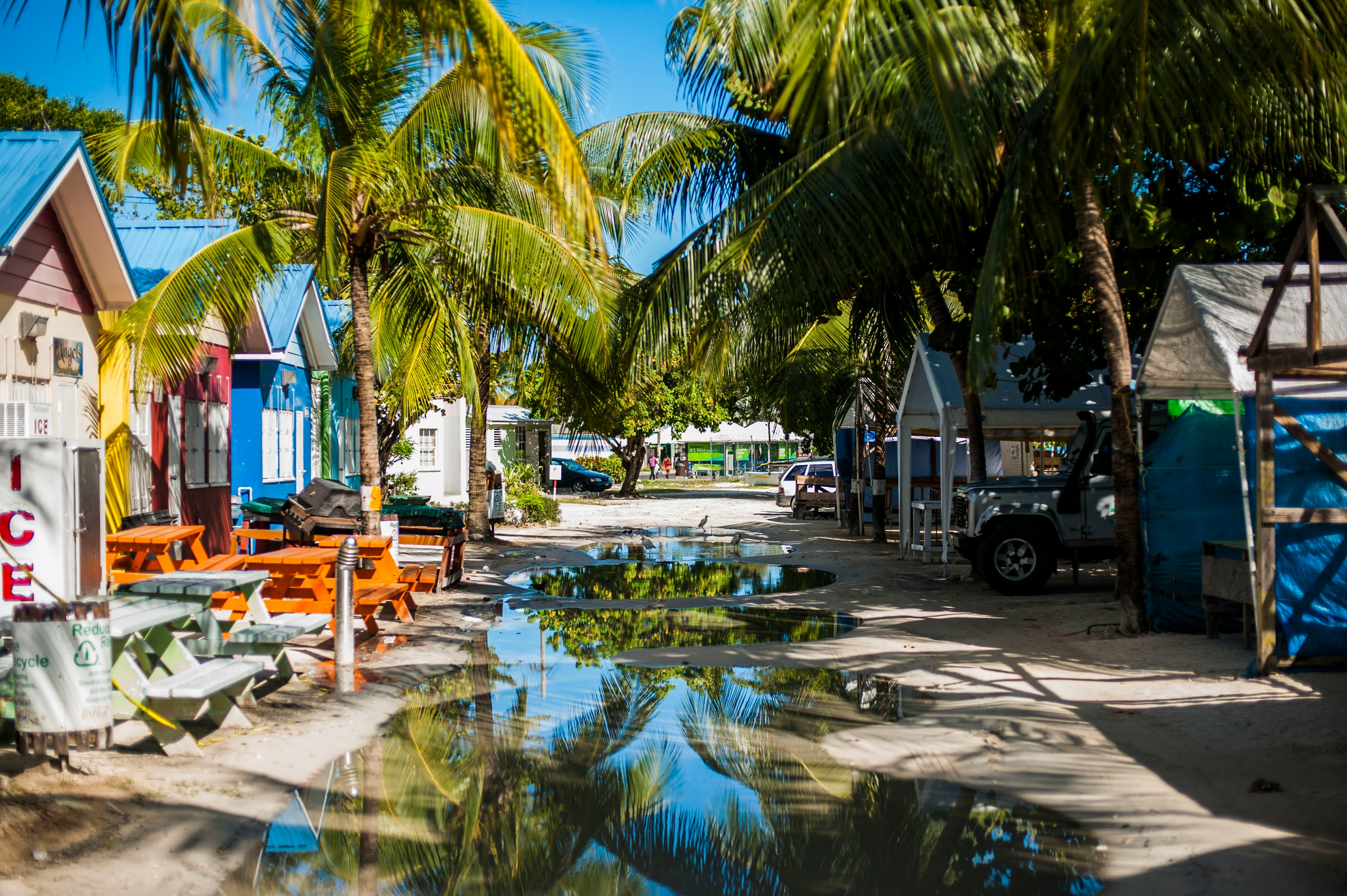
About Bridgetown
Located beside the island’s only natural harbour, the capital of Barbados combines modern and colonial architecture with glorious palm tree-lined beaches and a number of historical attractions. Experience the relaxed culture of the city renowned for its British-style parliament buildings and vibrant beach life, and seek out the Anglican church and the 19th-century Barbados Garrison. The distance between the ship and your tour vehicle may vary. This distance is not included in the excursion grades.

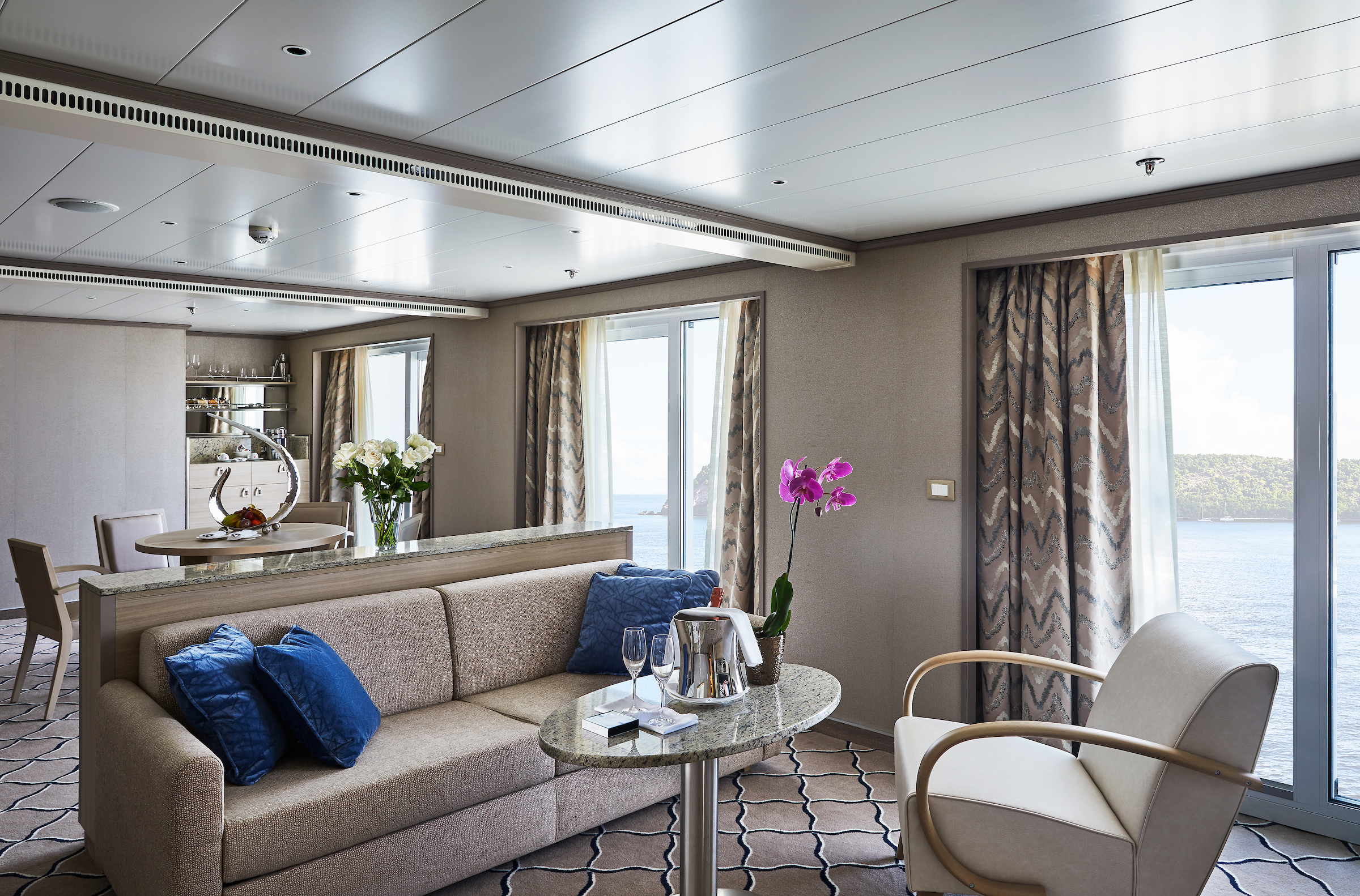
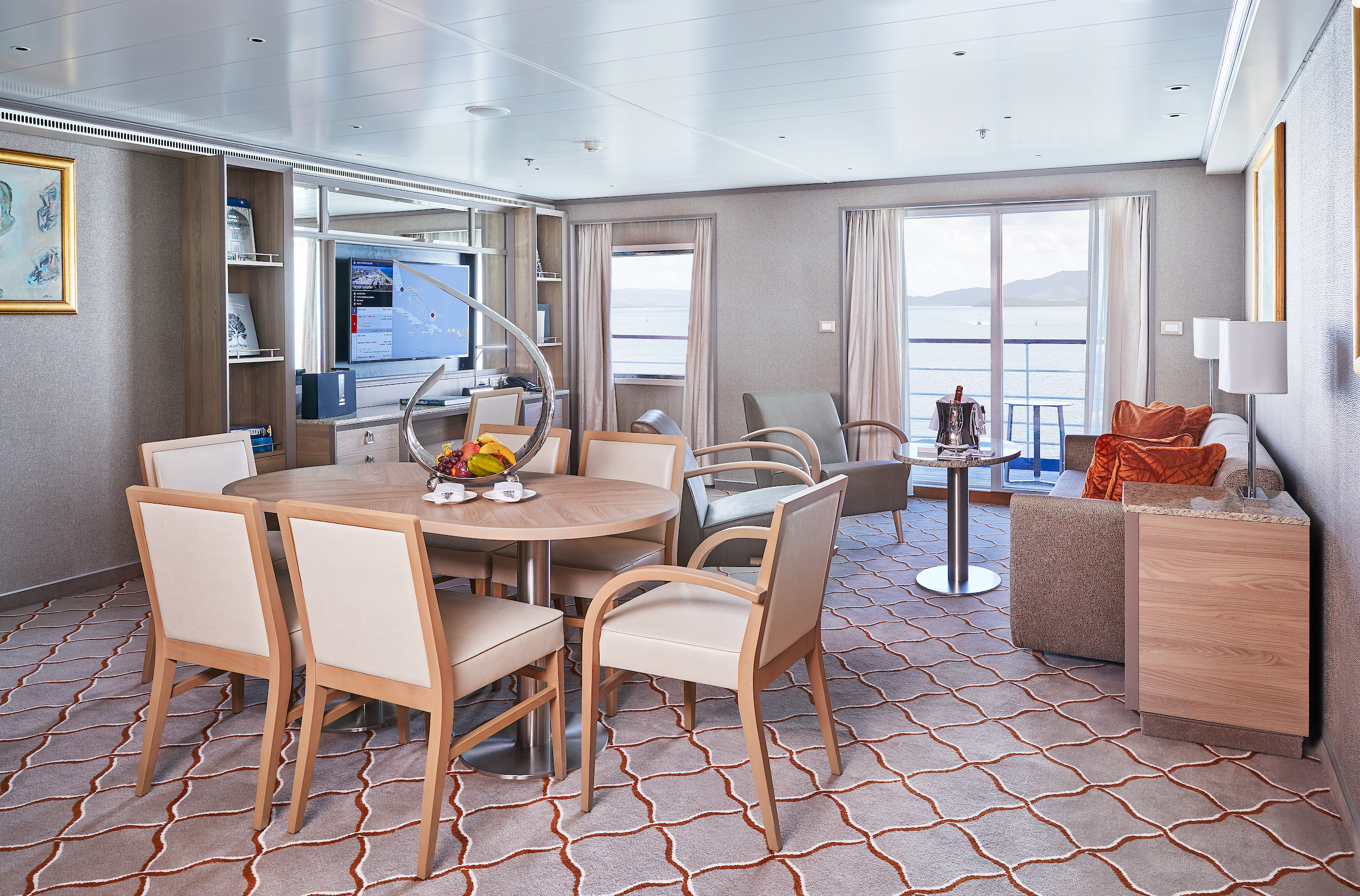
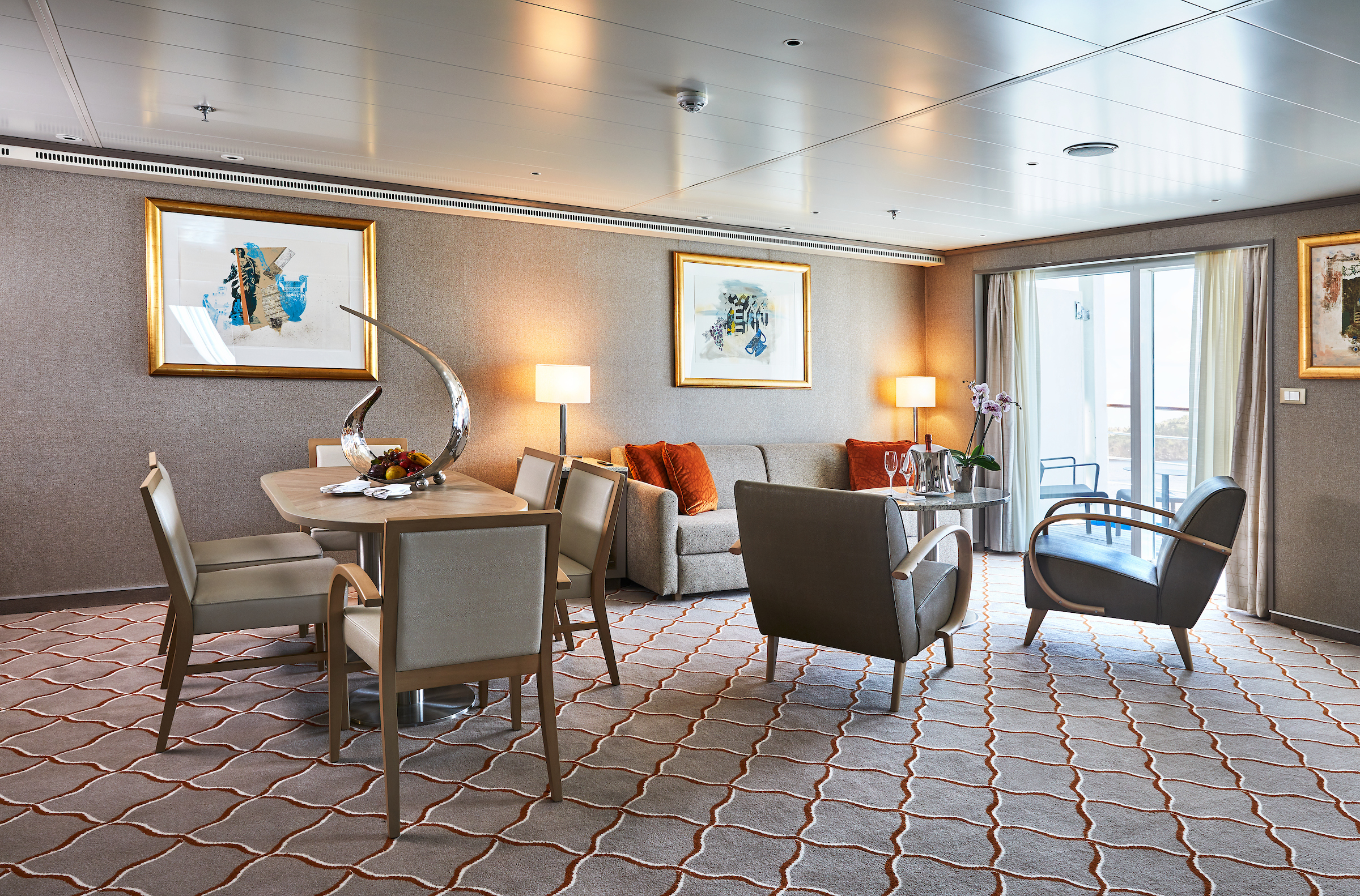
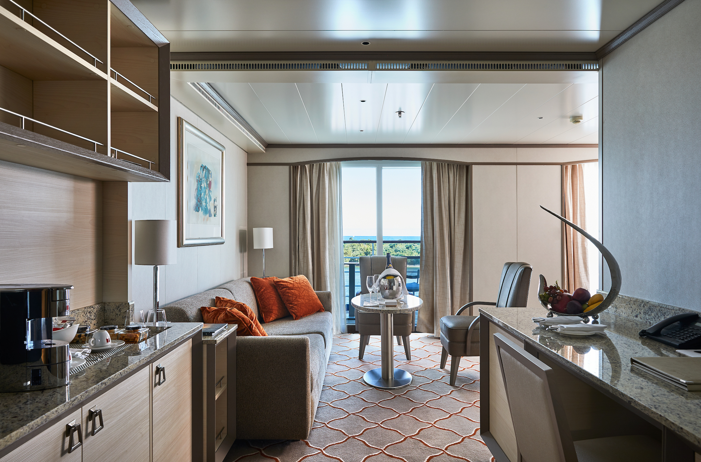
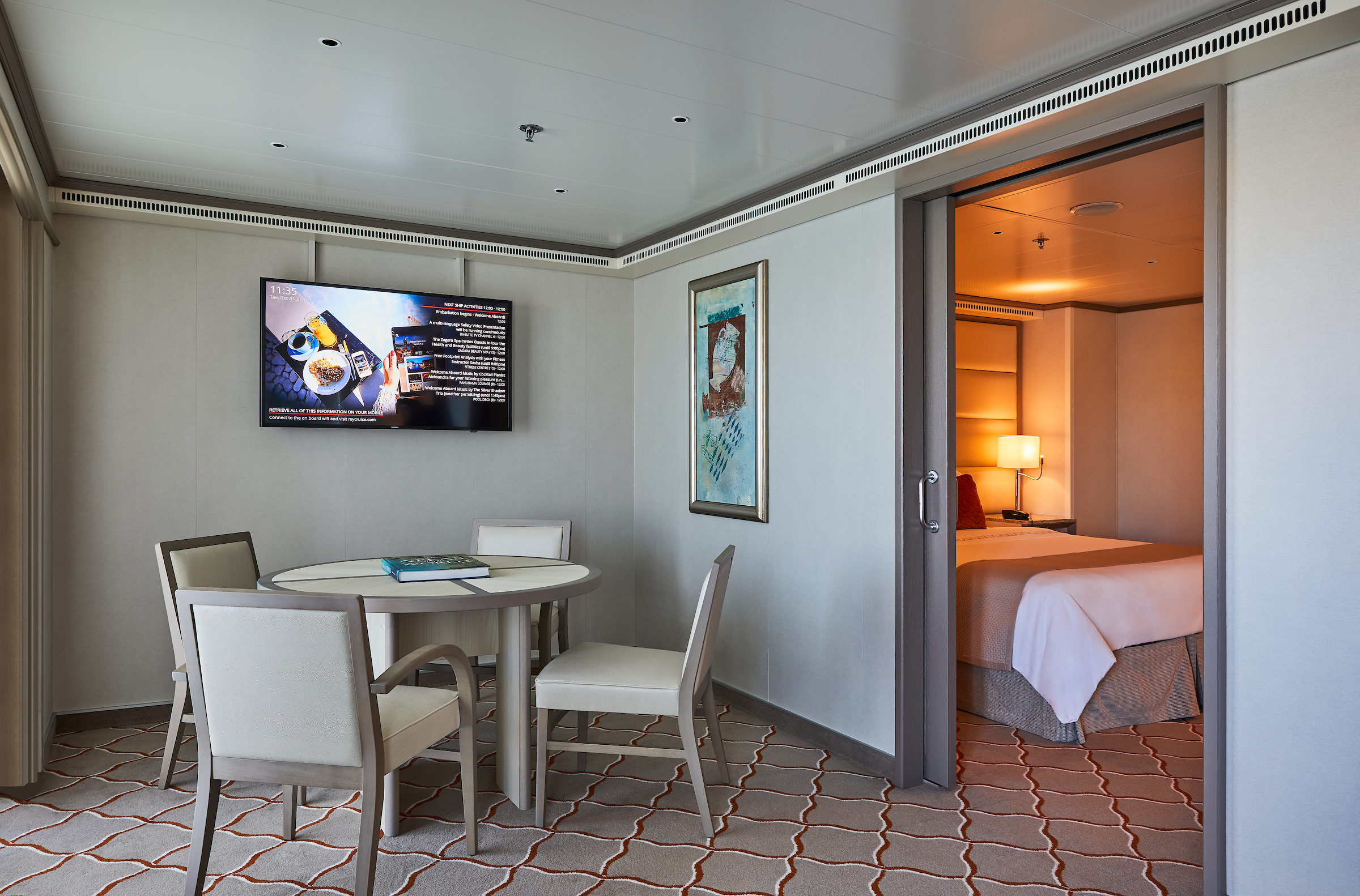
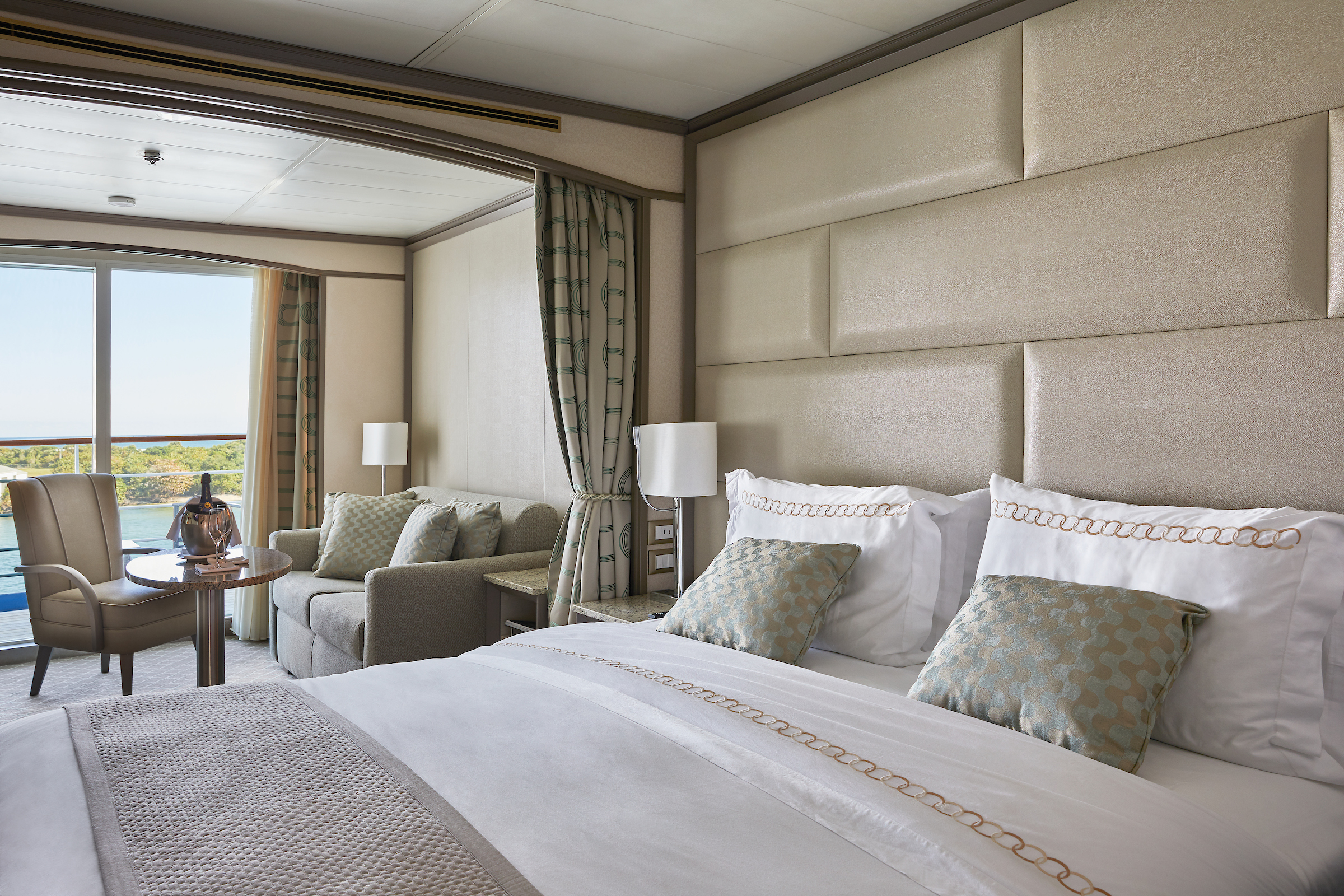
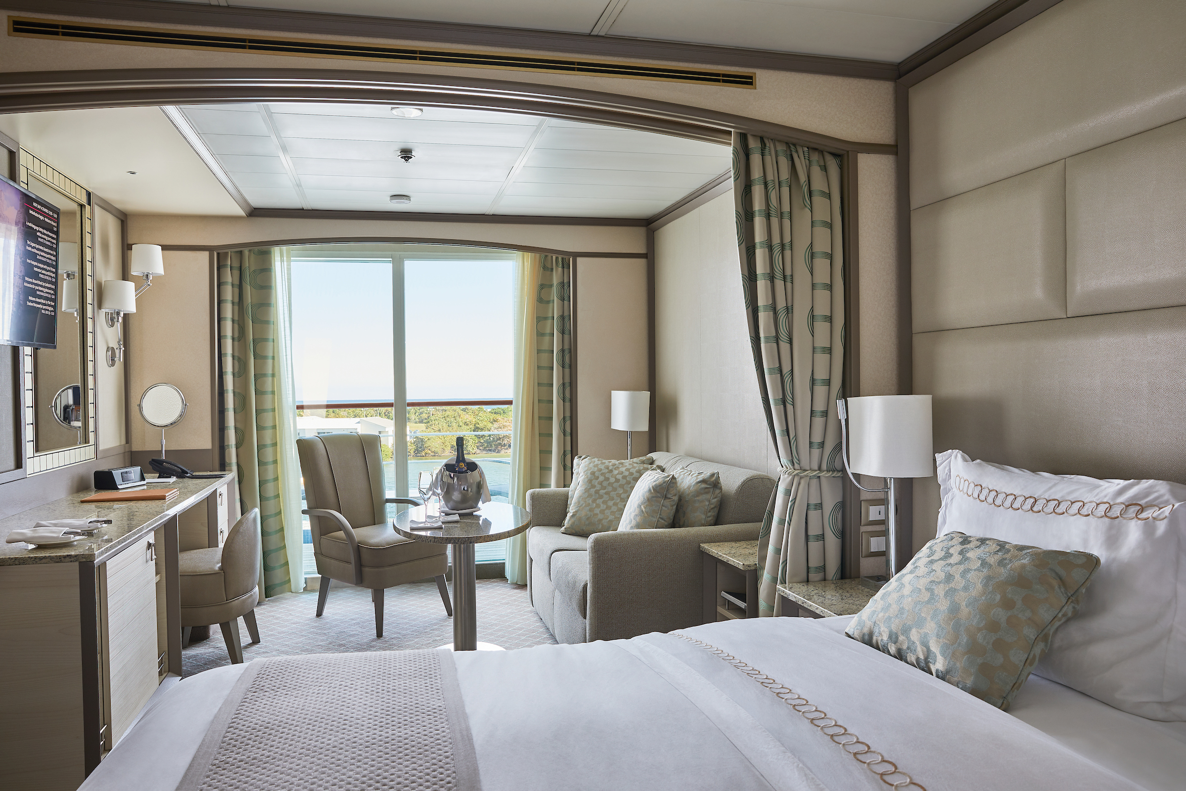
The name Owner’s Suite says it all. A stylish apartment. Prestigious and classic. For those who seek the superlative level of space, comfort, and service on board. Available in a one- or two-bedroom configuration (as illustrated) by adjoining with a Vista Suite.
One bedroom: 85 sq m including veranda (20 sq m)
Two bedrooms: 117 sq m including veranda (20 sq m)
Please note that the 3rd guest will sleep on a comfortable sofa bed in the reception area of the suite.
Essentials
- Deck(s): 7
- Section: Mid-Ship
Characteristics
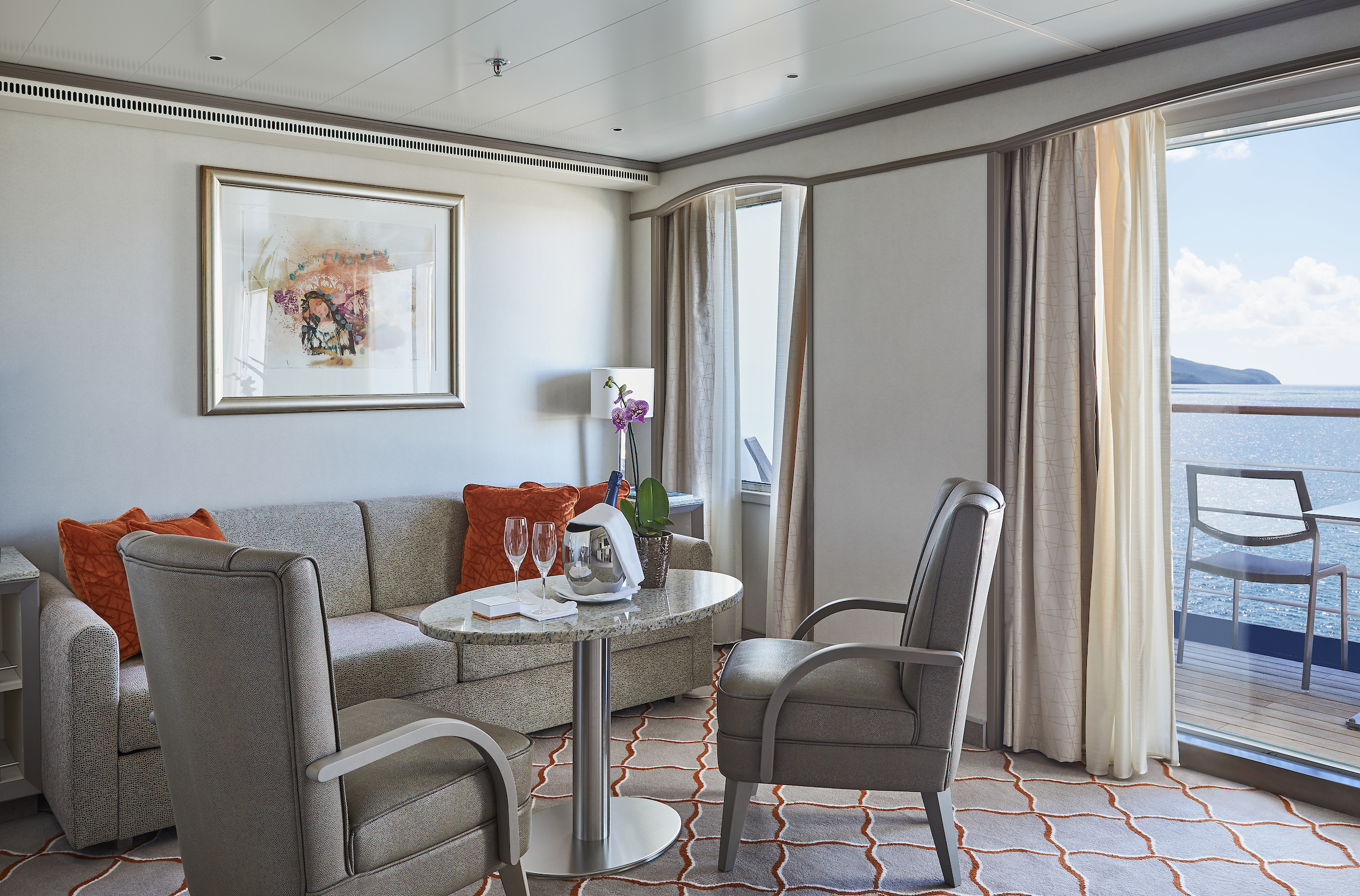
- Veranda
- Separate dining area
- Living room with sitting area
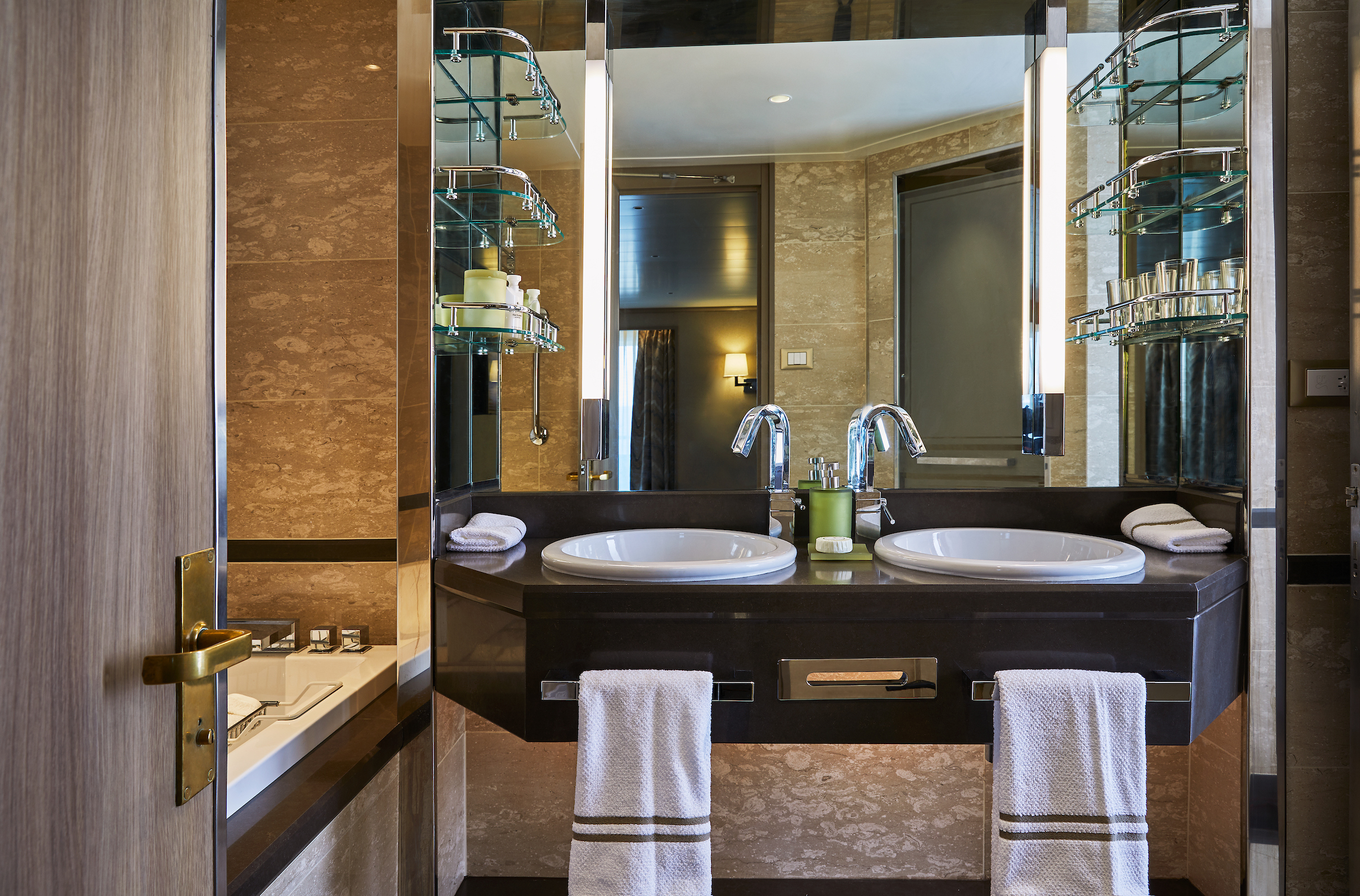
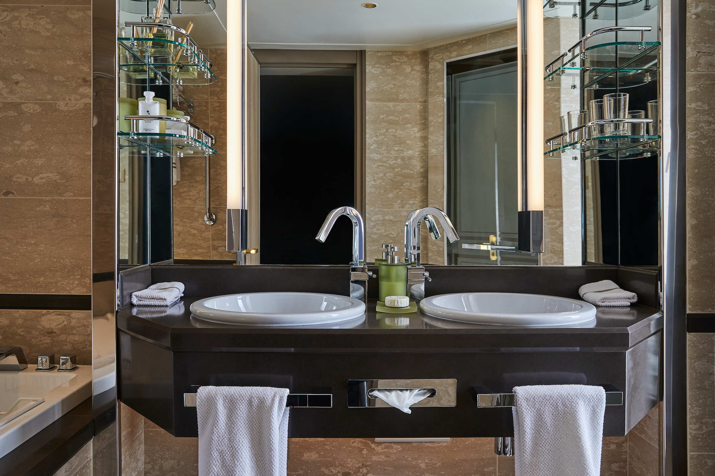
- Double vanity
- Separate shower
- Full-size bath
- Walk-in wardrobe with personal safe
Furniture
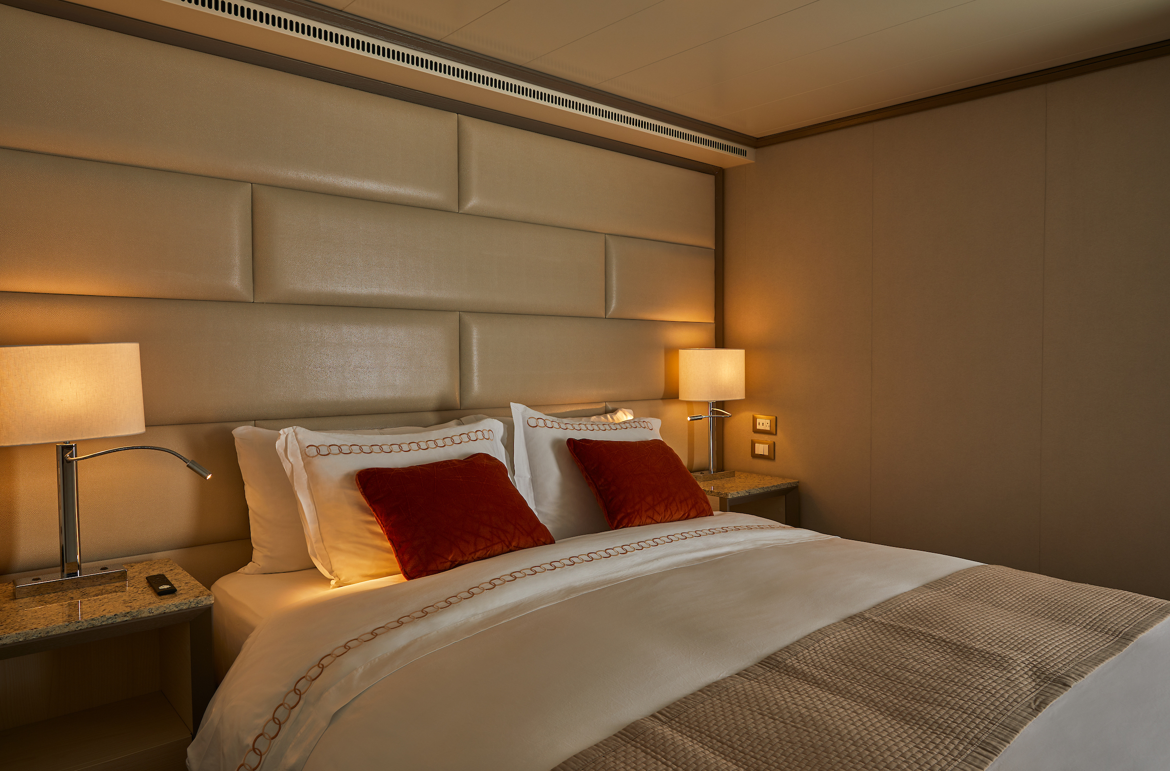
- Queen size bed
- Writing desk
- Vanity table
- Luxury bed mattresses
Media & Communication
- Unlimited Premium Wi-Fi
- 2 large flat screen TVs with Interactive Media Library
- Sound system with bluetooth connectivity
- Direct dial telephone
- Wall mounted USB-C mobile device chargers
- Dual voltage 110/220 outlets
Onboard Services
- Butler service
- Complimentary laundry, pressing & wet cleaning
- Dinner for two in La Dame, one evening per voyage,
- Two hours of worldwide phone use, per voyage segment
- Champagne on arrival
Amenities
- Espresso machine
- Pillow menu
- Refrigerator and bar setup stocked with your preferences
- Plush bathrobe
- Luxury bath amenities
- Umbrella
- Hair Dryer
- Slippers
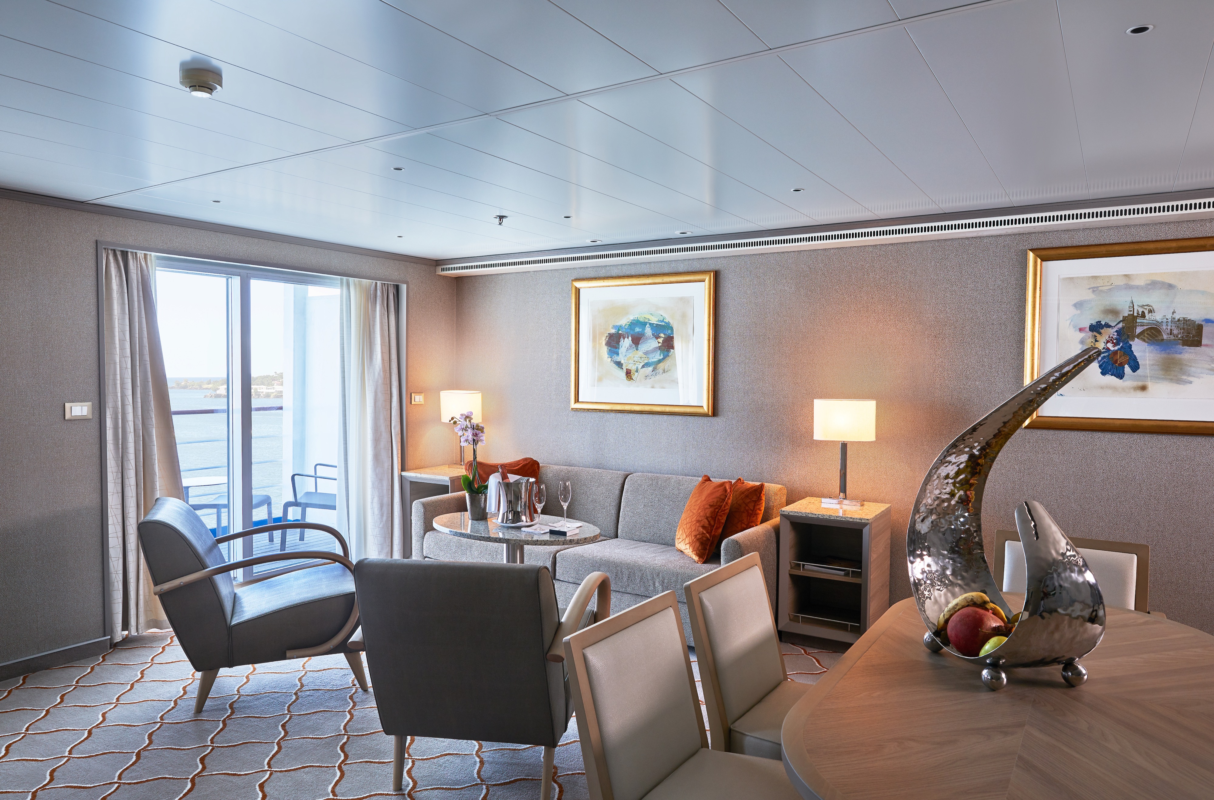
One of Silversea's finest suites, the Grand Suite's spacious amenities allows vou to cruise in comfort and class.
Expertly designed and exquisitely appointed. Ideal for entertaining friends while you cruise or enjoying a quiet dinner “at home”. Available as a one-bedroom configuration or as two-bedrooms (as illustrated) by adjoining with a Silversea Veranda Suite.
One bedroom: 87-101 sq.m. including veranda
Two bedroom: 133 sq.m. including veranda
Please note that the 3rd guest will sleep on a comfortable sofa bed in the reception area of the suite.Essentials
- Deck(s): 6, 7, 8
- Section: Forward
Characteristics
- Veranda
- Separate dining area
- Living room with sitting area
- Double vanity
- Separate shower
- Full-size bath
- Walk-in wardrobe with personal safe
Furniture
- Queen size bed
- Writing desk
- Vanity table
- Luxury bed mattresses
Media & Communication
- Unlimited Premium Wi-Fi
- 2 large flat screen TVs with Interactive Media Library
- Sound system with bluetooth connectivity
- Direct dial telephone
- Wall mounted USB-C mobile device chargers
- Dual voltage 110/220 outlets
Onboard Services
- Butler service
- Complimentary laundry, pressing & wet cleaning
- Dinner for two in La Dame, one evening per voyage,
- Two hours of worldwide phone use, per voyage segment
- Champagne on arrival
Amenities
- Espresso machine
- Pillow menu
- Refrigerator and bar setup stocked with your preferences
- Plush bathrobe
- Luxury bath amenities
- Umbrella
- Hair Dryer
- Slippers
Stately describes the Royal Suite. Commanding and majestic. Perfect for entertaining. Enough living space to roam. The pinnacle of good living. Available in a one- or two-bedroom configuration (as illustrated) by adjoining with a Veranda Suite.
One bedroom: 90–94 sq m including veranda (10–11 sq m)
Two bedrooms: 126 sq m including veranda (16–17 sq m)
Please note that the 3rd guest will sleep on a comfortable sofa bed in the reception area of the suite.
Essentials
- Deck(s): 6, 7
- Section: Forward
Characteristics
- Veranda
- Separate dining area
- Living room with sitting area
- Double vanity
- Separate shower
- Full-size bath
- Walk-in wardrobe with personal safe
Furniture
- Queen size bed
- Writing desk
- Vanity table
- Luxury bed mattresses
Media & Communication
- Unlimited Premium Wi-Fi
- 2 large flat screen TVs with Interactive Media Library
- Sound system with bluetooth connectivity
- Direct dial telephone
- Wall mounted USB-C mobile device chargers
- Dual voltage 110/220 outlets
Onboard Services
- Butler service
- Complimentary laundry, pressing & wet cleaning
- Dinner for two in La Dame, one evening per voyage,
- Two hours of worldwide phone use, per voyage segment
- Champagne on arrival
Amenities
- Espresso machine
- Pillow menu
- Refrigerator and bar setup stocked with your preferences
- Plush bathrobe
- Luxury bath amenities
- Umbrella
- Hair Dryer
- Slippers
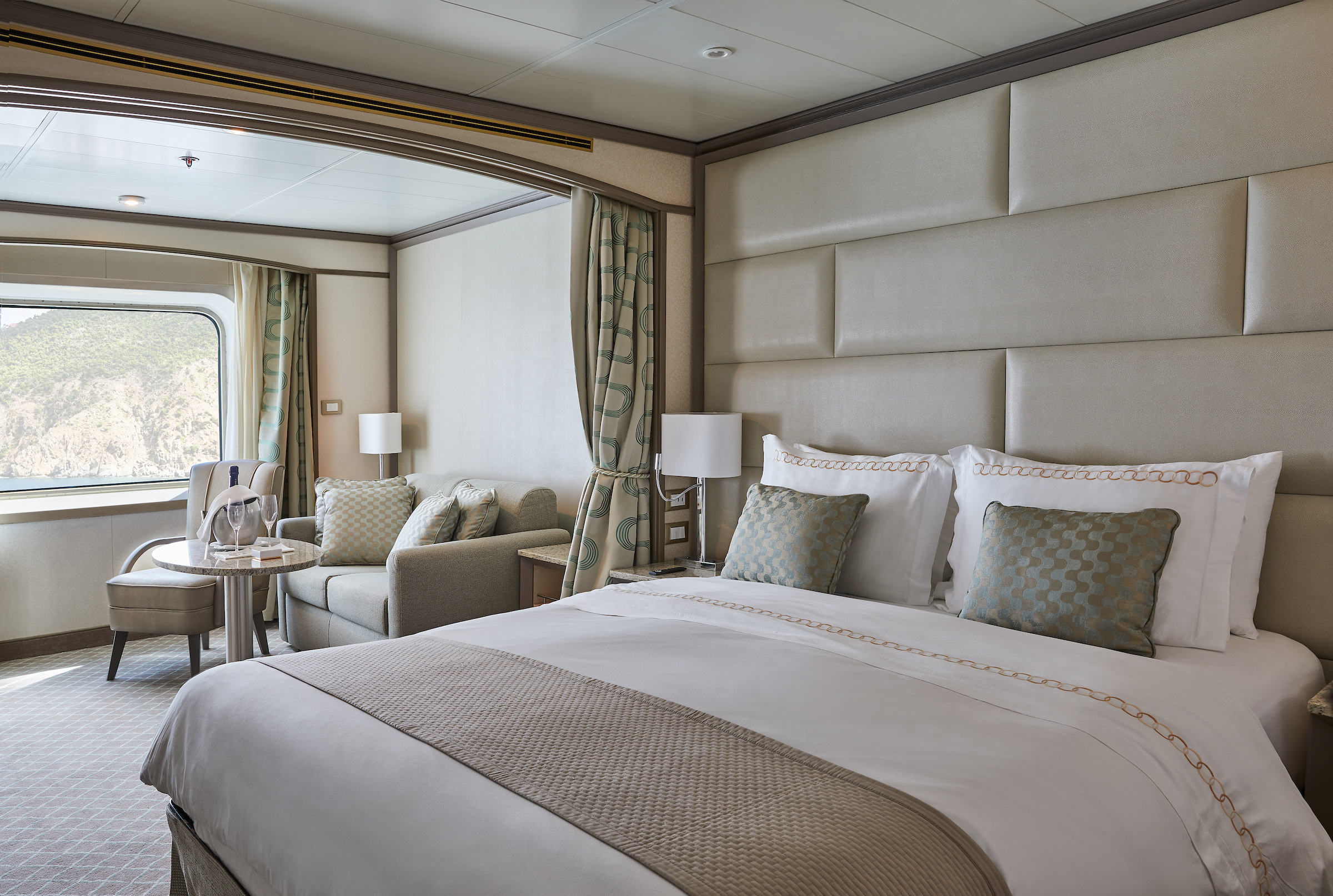
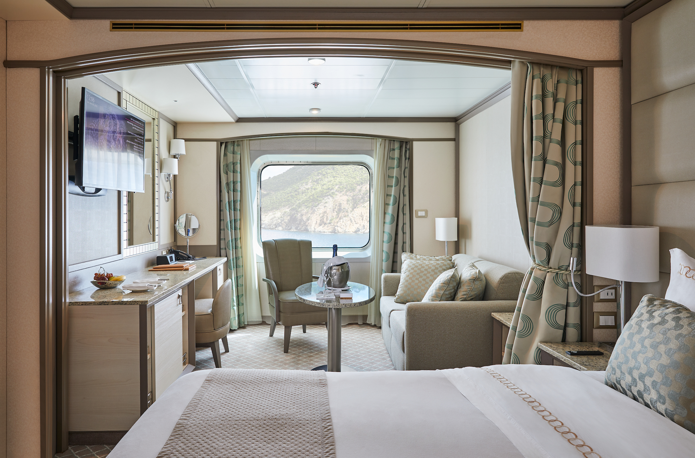
Stylish and sophisticated. Separate dining and living rooms. Larger verandas. Situated midship. Perfection in design for comfortable living. Silver Suites accommodate three guests.
One bedroom: 61–65 sq m including veranda (10–11 sq m)
Please note that the 3rd guest will sleep on a comfortable sofa bed in the reception area of the suite.
Essentials
- Deck(s): 7
- Section: Mid-Ship
Characteristics
- Veranda
- Separate dining area
- Living room with sitting area
- Double vanity
- Separate shower
- Full-size bath
- Walk-in wardrobe with personal safe
Furniture
- Queen size bed
- Writing desk
- Vanity table
- Luxury bed mattresses
Media & Communication
- Unlimited Premium Wi-Fi
- 2 large flat screen TVs with Interactive Media Library
- Sound system with bluetooth connectivity
- Direct dial telephone
- Wall mounted USB-C mobile device chargers
- Dual voltage 110/220 outlets
Onboard Services
- Butler service
- Complimentary laundry, pressing & wet cleaning
- Daily canapé service, Welcome chocolate, Welcome fruit stand
- Champagne on arrival
Amenities
- Espresso machine
- Pillow menu
- Refrigerator and bar setup stocked with your preferences
- Plush bathrobe
- Luxury bath amenities
- Umbrella
- Hair Dryer
- Slippers
Teak-style balcony with floor- to-ceiling glass doors. Relaxing living room space with seating area.
A mark of distinction. Sumptuous. Spacious. Rich textures and panoramic views surround you with distinguished luxury. An extravagant suite for an extravagant cruise.
One bedroom: 49 sq m including veranda (8 sq ft)
Please note that the 3rd guest will sleep on a comfortable sofa bed in the reception area of the suite.
Essentials
- Deck(s): 7
- Section: Mid-Ship
Characteristics
- Veranda
- Living room with sitting area
- Double vanity
- Separate shower
- Full-size bath
- Walk-in wardrobe with personal safe
Furniture
- Queen size bed
- Writing desk
- Vanity table
- Luxury bed mattresses
Media & Communication
- Unlimited Premium Wi-Fi
- 2 large flat screen TVs with Interactive Media Library
- Sound system with bluetooth connectivity
- Direct dial telephone
- Wall mounted USB-C mobile device chargers
- Dual voltage 110/220 outlets
Onboard Services
- Butler service
- Complimentary laundry, pressing & wet cleaning
- Daily canape service, Welcome chocolate, Welcome fruit stand
- Dinner at the officer’s table
- Champagne on arrival
Amenities
- Espresso machine
- Pillow menu
- Refrigerator and bar setup stocked with your preferences
- Plush bathrobe
- Luxury bath amenities
- Umbrella
- Hair Dryer
- Slippers
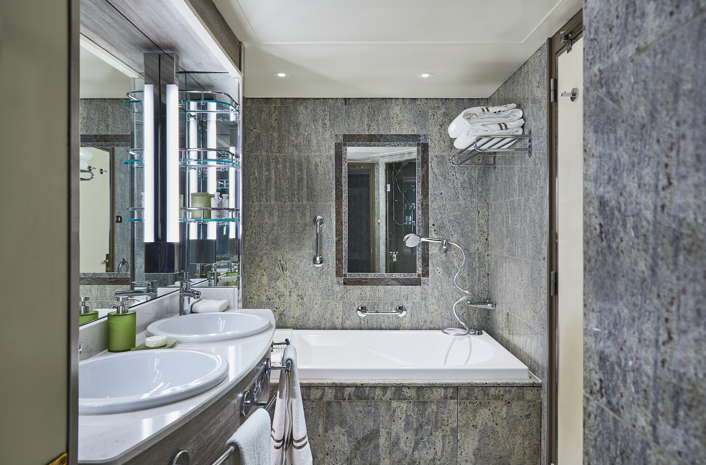
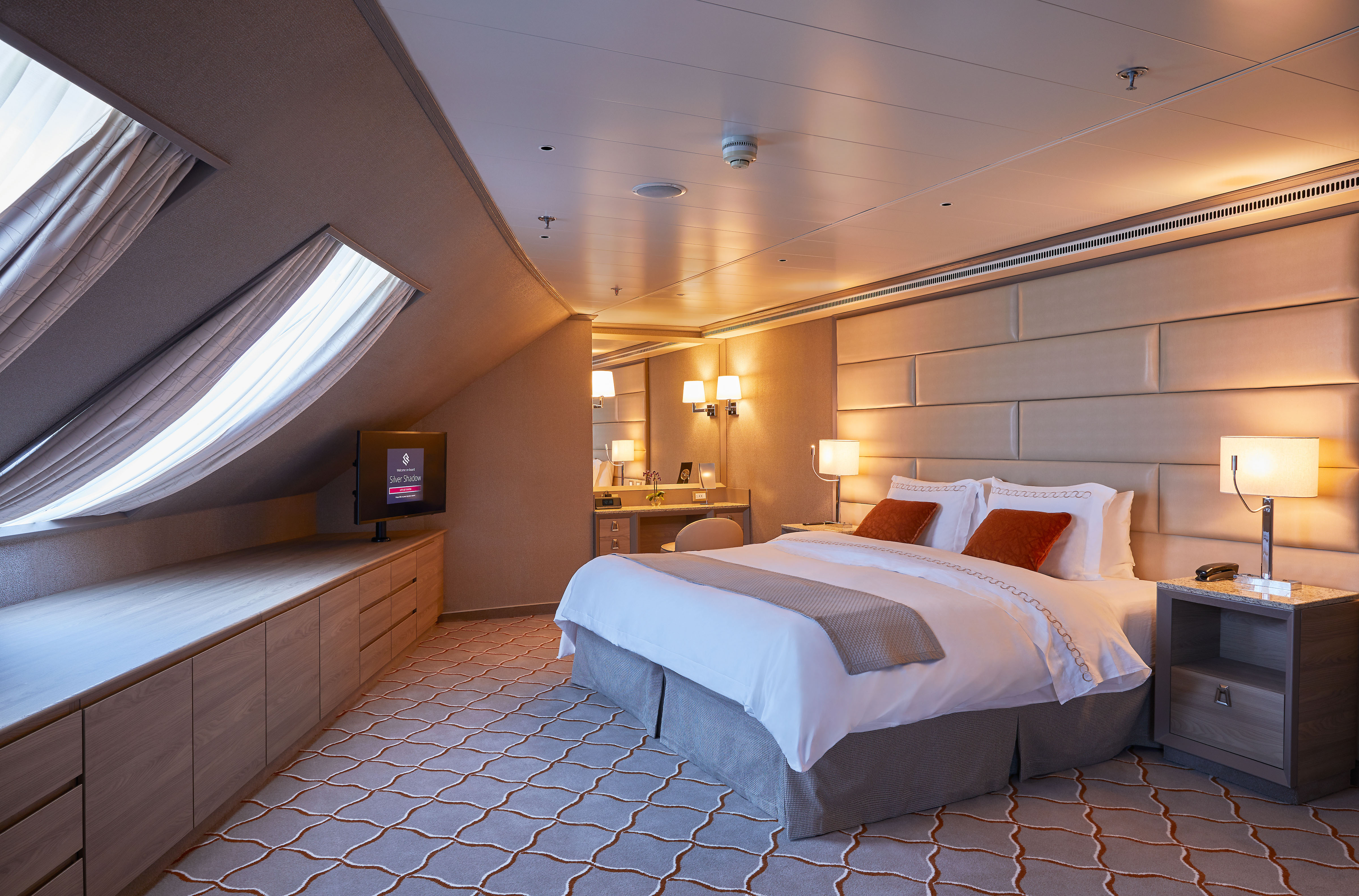
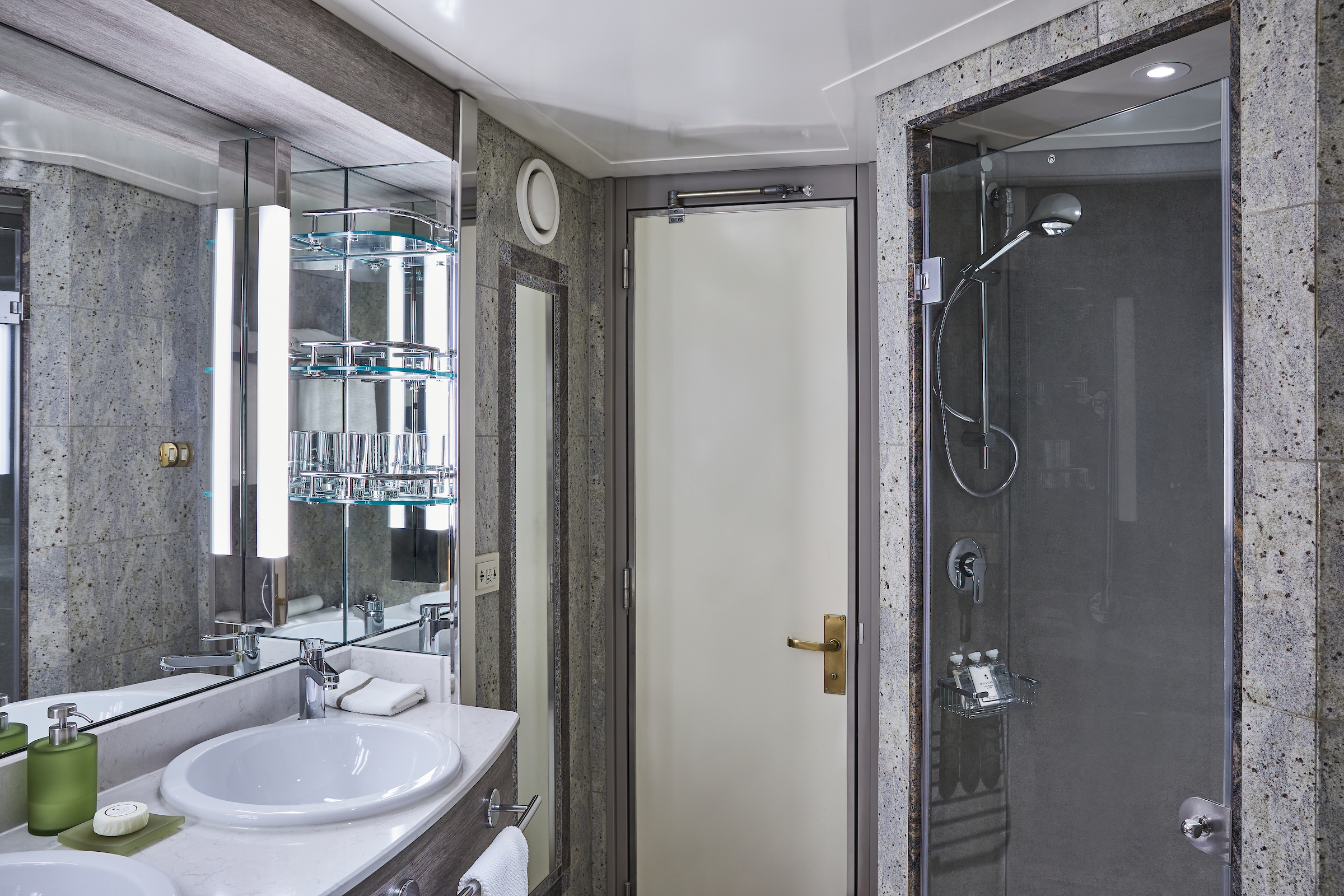
The Deluxe Veranda Suite offers a comfortable living space, close to the heart of the ship. With its preferred midship location and all the comfort and attention to detail that you can expect aboard, the Deluxe Veranda Suite is the savvy traveler’s paradise—both inside and out. Elegant decor, a stunning marble bathroom, and an ample seating area make this a cozy home away from home. But perhaps this suite’s finest asset lies just outside, as floor-to-ceiling glass doors open onto a private veranda, making every sunset feel as if it is yours alone.
One bedroom: 32 sq m including veranda (6 sq m)
Please note that the 3rd guest will sleep on a comfortable sofa bed in the reception area of the suite.
Essentials
- Deck(s): 5, 6, 7, 8
- Section: Forward, Mid-Ship
Characteristics
- Veranda
- Sitting area
- Double vanity
- Separate shower
- Full-size bath
- Walk-in wardrobe with personal safe
Furniture
- Queen size bed
- Writing desk
- Vanity table
- Luxury bed mattresses
Media & Communication
- Unlimited Standard Wi-Fi
- 1 large flat screen TV with Interactive Media Library
- Direct dial telephone
- Wall mounted USB-C mobile device chargers
- Dual voltage 110/220 outlets
Onboard Services
- Butler service
- Champagne on arrival
Amenities
- Pillow menu
- Refrigerator and bar setup stocked with your preferences
- Plush bathrobe
- Luxury bath amenities
- Umbrella
- Hair Dryer
- Slippers
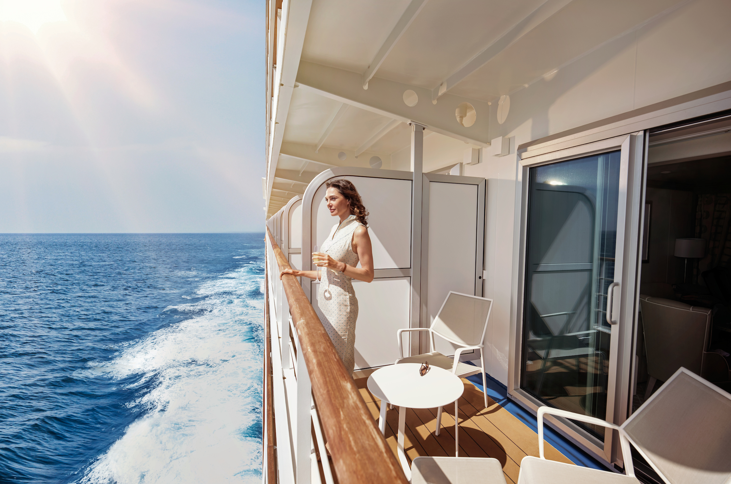
Located on the upper deck, and offering spectacular sunset views, the Superior Veranda Suite has all the comforts and luxury that you can expect aboard. A comfortable living space, attention to detail and a generous expanse of amenities, this stunning suite makes for a cosy home while on the seas. But perhaps this suite’s finest asset lies just outside, as floor-to-ceiling glass doors open onto a private veranda, making every sunset feel as if it is yours alone.
One bedroom: 32 sq m including veranda (6 sq m)
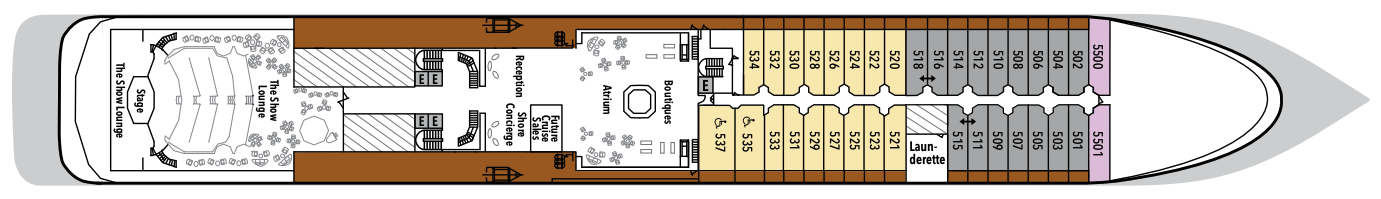
Wheelchair accessible suites: 535 and 537
Please note that the 3rd guest will sleep on a comfortable sofa bed in the reception area of the suite.Essentials
- Deck(s): 5, 6, 7, 8, 9
- Section: Forward, Mid-Ship
Characteristics
- Veranda
- Sitting area
- Double vanity
- Separate shower
- Full-size bath
- Walk-in wardrobe with personal safe
Furniture
- Queen size bed
- Writing desk
- Vanity table
- Luxury bed mattresses
Media & Communication
- Unlimited Standard Wi-Fi
- 1 large flat screen TV with Interactive Media Library
- Direct dial telephone
- Wall mounted USB-C mobile device chargers
- Dual voltage 110/220 outlets
Onboard Services
- Butler service
- Champagne on arrival
Amenities
- Pillow menu
- Refrigerator and bar setup stocked with your preferences
- Plush bathrobe
- Luxury bath amenities
- Umbrella
- Hair Dryer
- Slippers
The Classic Veranda Suite provides a generous living space for voyagers. Located on the lower decks in the bow, the Classic Veranda Suite offers all the comfort and attention to detail that you can expect aboard—both inside and out. A generous expanse of interior comforts—elegant decor, a stunning marble bathroom, and an ample seating area make this a cozy home away from home. But perhaps this suite’s finest asset lies just outside, as floor-to-ceiling glass doors open onto a private veranda, making every sunset feel as if it is yours alone.
One bedroom: 32 sq m including veranda (6 sq m)
Please note that the 3rd guest will sleep on a comfortable sofa bed in the reception area of the suite.
Essentials
- Deck(s): 5, 6
- Section: Forward, Mid-Ship
Characteristics
- Veranda
- Sitting area
- Double vanity
- Separate shower
- Full-size bath
- Walk-in wardrobe with personal safe
Furniture
- Queen size bed
- Writing desk
- Vanity table
- Luxury bed mattresses
Media & Communication
- Unlimited Standard Wi-Fi
- 1 large flat screen TV with Interactive Media Library
- Direct dial telephone
- Wall mounted USB-C mobile device chargers
- Dual voltage 110/220 outlets
Onboard Services
- Butler service
- Champagne on arrival
Amenities
- Pillow menu
- Refrigerator and bar setup stocked with your preferences
- Plush bathrobe
- Luxury bath amenities
- Umbrella
- Hair Dryer
- Slippers
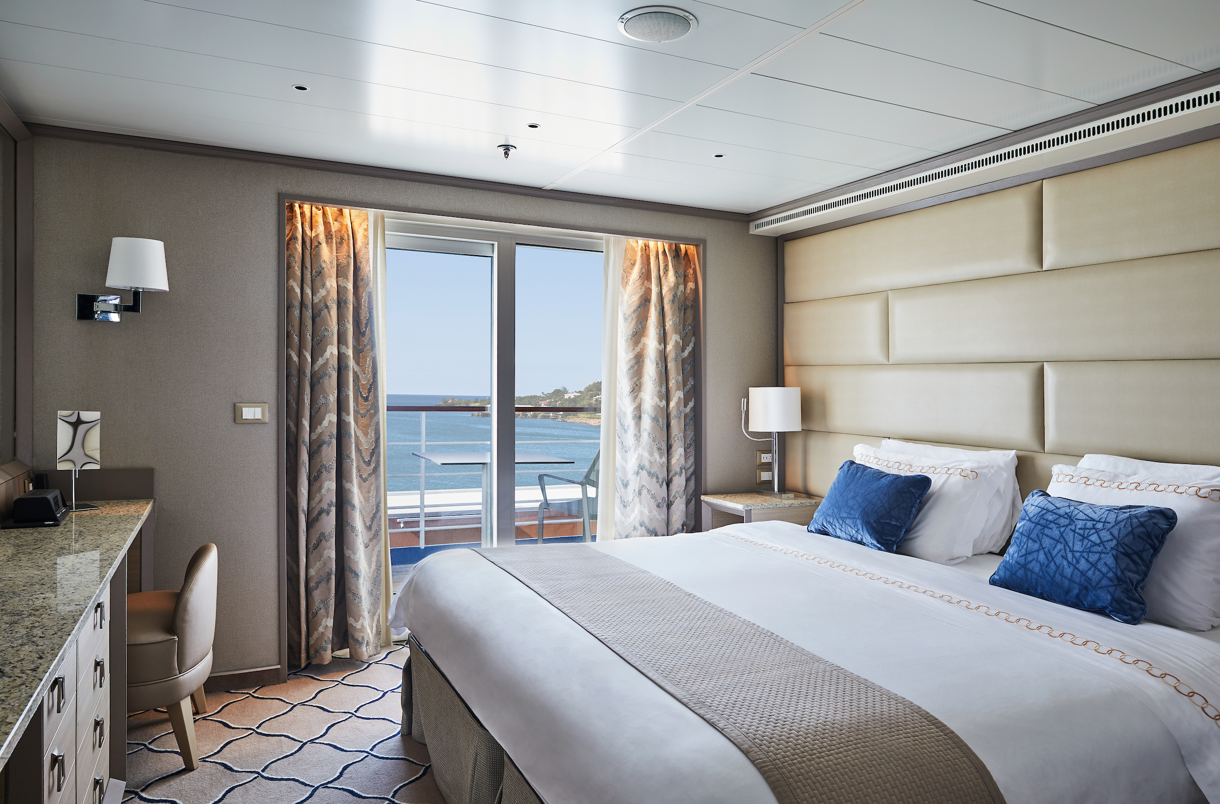
A quiet sanctuary. The seating area of the Vista Suite has plenty of room to relax. Large picture windows frame panoramic ocean views. The perfect backdrop for breakfast in bed.
One bedroom: 27 sq m
Essentials
- Deck(s): 4, 5, 7
- Section: Forward
Characteristics
- Large Balcony Window
- Sitting area
- Double vanity
- Separate shower
- Full-size bath
- Walk-in wardrobe with personal safe
Furniture
- Queen size bed
- Writing desk
- Vanity table
- Luxury bed mattresses
Media & Communication
- Unlimited Standard Wi-Fi
- 1 large flat screen TV with Interactive Media Library
- Direct dial telephone
- Wall mounted USB-C mobile device chargers
- Dual voltage 110/220 outlets
Onboard Services
- Butler service
- Champagne on arrival
Amenities
- Pillow menu
- Refrigerator and bar setup stocked with your preferences
- Plush bathrobe
- Luxury bath amenities
- Umbrella
- Hair Dryer
- Slippers
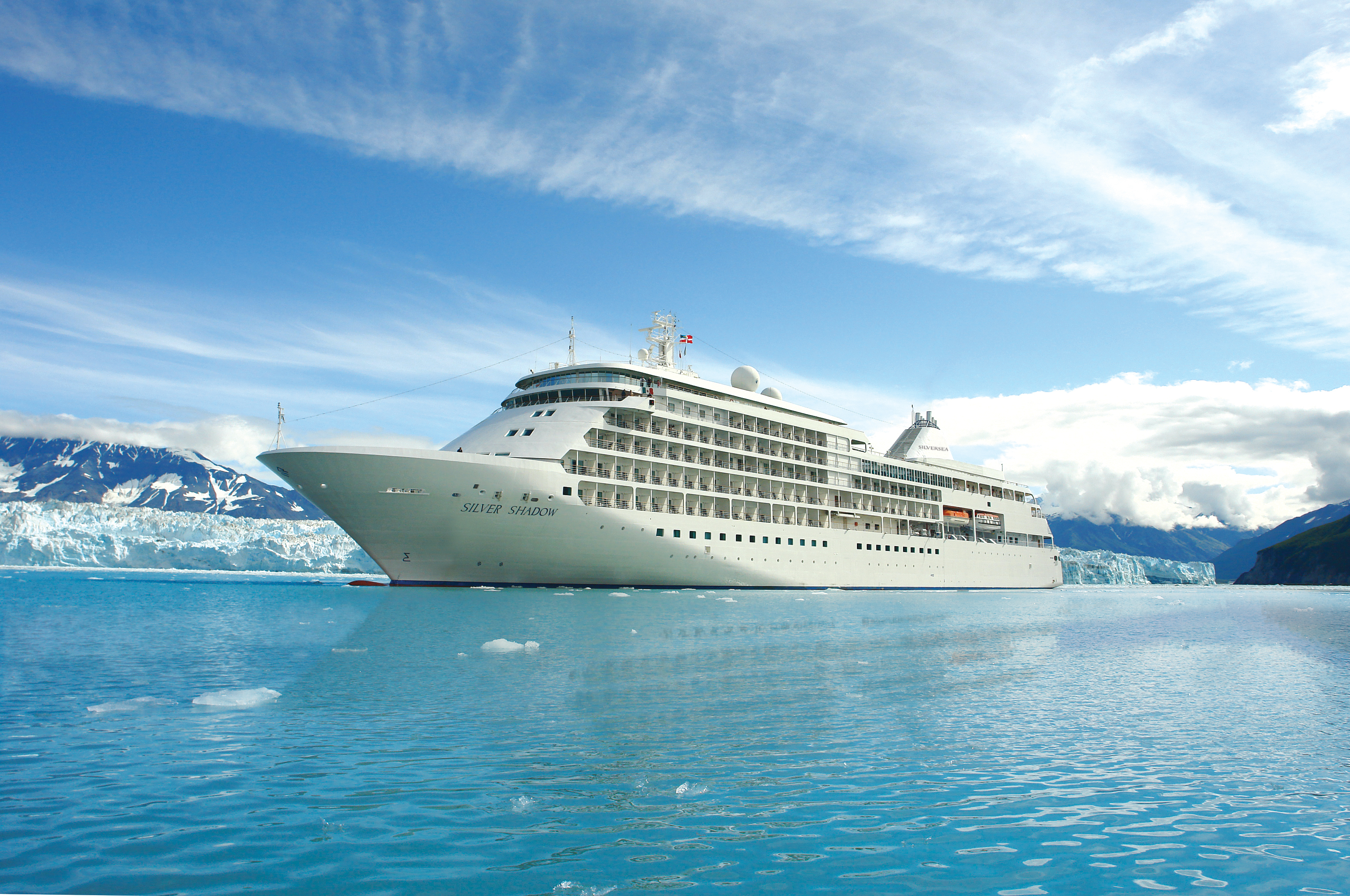
Silver Shadow
Award-winning Silver Shadow is a firm favorite in the Silversea fleet. With one of the highest space-to-guest ratios at sea, she offers authentic experiences, simple pleasures, and shared moments.
Silversea’s Shadow Class luxury cruise ships Silver Shadow and Silver Whisper offer you freedom and space to design your day. Silver Shadow retains Silversea’s essence—spacious suites and superior service—paired with a lively cosmopolitan atmosphere and enhanced amenities. Energise body and mind in the upgraded spa and fitness centre. Savour fine wines and French gastronomy in La Dame and enjoy authentic Italian cuisine in La Terrazza, endless ocean views from The Grill, and internationally inspired dishes in The Restaurant. From delectable dining to relaxation in ultra luxury, cruising has never felt so good.
Ship Facts
| Launch Year | 2000 | ||||||||||
| Refit Year | 2019 | ||||||||||
| Language | en | ||||||||||
| Gross Tonnage | 28258 | ||||||||||
| Length | 186 | ||||||||||
| Width | 24 | ||||||||||
| Currency | USD | ||||||||||
| Speed | 21 | ||||||||||
| Capacity | 392 | ||||||||||
| Crew Count | 302 | ||||||||||
| Deck Count | 7 | ||||||||||
| Cabin Count | 194 | ||||||||||
| Large Cabin Count | 39 | ||||||||||
| Wheelchair Cabin Count | 2 | ||||||||||
| Electrical Plugs |
|
Deck 10
- Fitness Centre
- Zagara Beauty Spa
- Beauty Salon
- Observation Library

Deck 9
- Jogging Track
- Deluxe Veranda Suites

Deck 8
- Pool Deck
- Pool Bar
- The Grill
- Connoisseur's Corner
- Casino
- Panorama Lounge
- Launderette
- Grand Suites
- Superior Veranda Suites
- Deluxe Veranda Suites

Deck 7
- La Terrazza
- La Dame
- Conference/Card Room
- Owner's Suite
- Grand Suites
- Royal Suites
- Silver Suites
- Medallion Suites
- Superior Veranda Suites
- Vista Suites

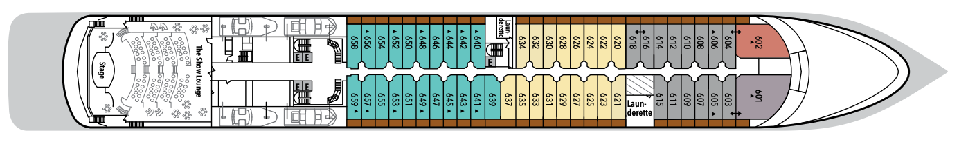
Deck 6
- The Show Lounge
- Launderette
- Grand Suites
- Royal Suites
- Superior Veranda Suites
- Deluxe Veranda Suites
- Classic Veranda Suites
Deck 5
- Boutiques
- Atrium
- Launderette
- Reception/Guest Relations
- Future Cruise Sales
- Shore Concierge
- The Bar
- The Show Lounge
- Superior Veranda Suites
- Vista Suites
- Classic Veranda Suites
Deck 4
- The Restaurant
- Launderette
- Vista Suites

Our passion for excellent cuisine is at the heart of everything we do. We believe that meals are a celebration of life, a way to bring people together, and an expression of culture and tradition. Each dining venue aboard our ships offers a unique and memorable experience, with multiple dining options available and a variety of spaces and experiences on board; every mealtime is a joy.
From fine French cuisine and flavourful Asian options to relaxed Italian meals and international options to suit everyone, our chefs’ creativity knows no limits.
With the importance of food in our culture, it’s no wonder that dining is a high priority at Silversea. We believe gastronomic excellence is a given, thanks to recipes that reflect our heritage and revamp tradition. No matter where you dine, destination influence is readily apparent in the great diversity and freshness of your selections. And every luxury ship also features an array of dining venues. Per guest reservation fee for specialty restaurants. Please visit MySilversea to make your reservations.
The Restaurant
Enjoy Continental and regional specialities, as well as sweeping ocean views in our main dining room.
Sparkling with silver, crystal, and candlelight, Silversea’s main dining room serves contemporary, international cuisine with sophisticated elegance and impeccable service. Menus feature regional specialties unique to the voyage destination, for example, Roasted Chilean Sea Bass while cruising the Chilean fjords and Indian Chicken Korma en route to Mumbai. The Restaurant aboard this luxury cruise ship offers open-seating dining, which means there are no assigned times, no assigned tables. You are free to dine when, where, and with whom you please.
La Dame
La Dame features a bespoke menu by our top chefs, and it is the highest expression of excellence in French dining. The ambience is one of chic, contemporary style, with crisp, white table linens and the impeccable white-gloved service associated with Silversea. Named after “La Dame de Paris,” or the Eiffel Tower, La Dame echoes the traditions and cultures embedded in the French gastronomic past while respecting its bright culinary future. Quintessentially Parisian, extremely elegant, and very refined, meals at La Dame are a fusion of tradition and modernity.
Per guest reservation fee of US$60. Please visit My Silversea to make your reservations.
La Terrazza
Authentic Italian recipes and the freshest, sustainable ingredients come together in this restaurant at sea.
On board this luxury cruise ship, a divine selection of Italy’s best cuisine is served à la carte in La Terrazza. Authentic recipes and the freshest ingredients come together with flair and passion aboard this luxury cruise—a flavorful expression of Silversea’s distinctive Italian heritage. La Terrazza uses buffalo mozzarella from Naples, organic balsamic vinegar and olive oil from Umbria, and air-dried ham out of Parma. The Emilia-Romagna region also produces Silversea’s 24-month aged Parmigiano Reggiano, and the pasta is made daily right on board.
Open seating for breakfast and lunch.
Reservations required for dinner.
The Grill
A Silversea staple, The Grill is where casual dining meets impeccable taste. Savour the best of land and sea, from marbled steaks to seared branzino in a relaxed atmosphere.
A Silversea staple, The Grill is where casual dining meets impeccable taste. Savour the best of land and sea, from marbled steaks to seared branzino in a relaxed atmosphere overlooking endless blue. Pair the perfect glass of wine with your dish, enhancing each bite with every sip. And for the ultimate finale, end with a decadent dessert.
Dress code: Casual
Casual wear consists of pants, blouses, or casual dresses for women; open-neck shirts and slacks for men are appropriate.
Images are intended as a general reference. Features, materials, finishes and layout may be different than shown.
Human connection and a sense of community is at the heart of every Silversea voyage, which is why we’ve created a variety of spaces on board to share the experience with your fellow adventurers. Relax in one of our many bars or restaurants with your favourite tipple and swap stories with other guests.
With attention to every detail, we have ensured that every corner of the ship promises joy
Our world-class voyages are carefully curated by experts who ensure we are always on a quest to discover authentic beauty and adventure in the furthest and less traveled regions on the planet.
We understand that after a long day of discovery, you need perfect service, top-notch cuisine, drinks served just the way you like them and comfortable surroundings.
There’s a tremendous variety of public spaces on board, from relaxed bars to elegant restaurants, always offering you the luxury of choice. Learn more about all the fine details and thoughts put into each space on our ultra-luxury cruise ships.
Atrium
The Atrium aboard provides a unique space at the heart of deck 5. Filled with natural light, this beautiful and spacious bar offers an all-day venue for drinks and snacks.
The Atrium aboard provides a unique space at the heart of deck 5. Filled with natural light, a beautiful and spacious bar blurs the line between traditional bar and modern brasserie, and offers an all-day venue for drinks and snacks in a relaxed, welcoming atmosphere. The elegant café serves light bites, as well as smoothies, fresh juices, bespoke cocktails, and wine by the glass from our extensive drinks menu, and it is the ideal place to meet your friends, grab a coffee or aperitif, and plan your next adventures.
Observation Library
Set on the highest level at the very top of the ship, this is a quiet space for reading and reflection while being dazzled by the undulating seascapes that are constituent to life on board.
The eponymous lounge carries its name well. Set on the highest level at the very top of the ship, this is a quiet space for reading and reflection while being dazzled by the undulating seascapes that are essential to life on board. Borrow a book from the in-house library, read the papers, or just embrace the tranquility of being at sea.
Panorama Lounge
Relax and unwind in the Panorama Lounge, a sophisticated yet amicable space offering beautiful ocean views as you enjoy your cruise.
The Panorama Lounge is specially designed to provide an uninterrupted view of the day’s destination from the comfort of the luxury cruise ship’s interior. This is an ideal place to unwind, enjoy afternoon tea, listen to the pianist, and watch the setting sun. The drinks are complimentary aboard this luxury cruise, and the music is live and inviting. Enjoy dancing to a range of musical styles for every taste, from the classics to the latest club mixes.
Boutique
There is a wealth of luxury shopping experiences aboard all Silversea ships, featuring the most distinctive and appealing brands from across the globe.
Exceptional shopping experiences do not end in the cosmopolitan cities we visit. Silversea’s striking new shipboard boutiques, reimagined and redesigned, are stunning modern design spaces befitting the finest creations from legendary designers. Carefully selected partners in Silversea’s onboard, duty-free boutiques offer our guests a carefully curated selection of cutting-edge fashions, jewellery, accessories, fine perfumes, cosmetics, and Silversea Logo collection, all at duty-free prices.
Connoisseur's Corner
If you appreciate good cognac or premium cigars, be sure to visit the Connoisseur’s Corner to see the ship’s exceptional selection.
The Connoisseur’s Corner offers exceptional cognacs along with a premium selection of cigars for purchase.
The Show Lounge
Enjoy a broad spectrum of entertainment from full-scale production shows and classical soloists, to cultural entertainment and feature films.
Every seat in this multi-tiered venue enjoys a clear view to the stage. Applaud a broad spectrum of entertainment presented during the cruise — from full-scale production shows and classical soloists, to cultural entertainment and feature films. Throughout your voyage, the luxury cruise ship’s The Show Lounge also presents port talks, enrichment lectures and a variety of special events.
Card Room/Conference Room
Whether it is for a card tournament or conference, Silversea will provide a dedicated space for the perfect guest experience.
The Card Room on board this luxury cruise ship is where bridge games and tournaments take place most days. On days at sea, newcomers to the game can learn how to play. Should your group require a conference or meeting space, Silversea is pleased to provide a tailor-made experience. Audio-visual equipment is available and complimentary aboard all luxury cruise ships.
Casino
Try your luck in Silversea’s on-board Casino, featuring a champagne reception and choice of games.
Roulette, blackjack, and slot machines are available in The Casino for guests 18 years old or older. If you are a novice, come to the champagne reception and learn all the games offered aboard this luxury cruise ship.
Reception
Be sure to visit the Reception area, where our experts can provide invaluable information to help you get the most out of your cruise.
This central lobby area welcomes guests to speak with a Guest Relations specialist should they have a question or require any service. Assistance is available 24 hours a day. For guests wishing to make shoreside arrangements, the Silver Shore Concierge is available to assist with knowledgeable suggestions and personalised coordination of all private, independent touring, including sightseeing, water sports, golf, and more. The Cruise Consultant may prove indispensable when planning your next Silversea voyage, or if you wish to extend your current voyage for a day, a week, a month … Like having your own personal onboard Silversea professional, the Cruise Consultant will help you to select the perfect voyage, reserve your preferred suite, and provide immediate confirmation.