World Cruise 2028
World Cruise 2028
Cruise overview
WHY BOOK WITH US?
- ✔ The Deluxe Cruises’ team has extensive experience in ultra-luxury cruising.
- ✔ Call now to speak to our helpful and experienced Cruise Concierge team.
- ✔ Enjoy our Unique Deluxe Cruises Bonus for substantial savings.
- ✔ Our team will tailor your holiday to your exacting requirements.
- ✔ As agents, we work under the protection of each cruise lines ABTA / ATOL licences
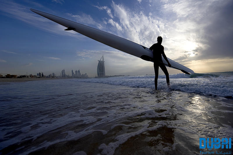
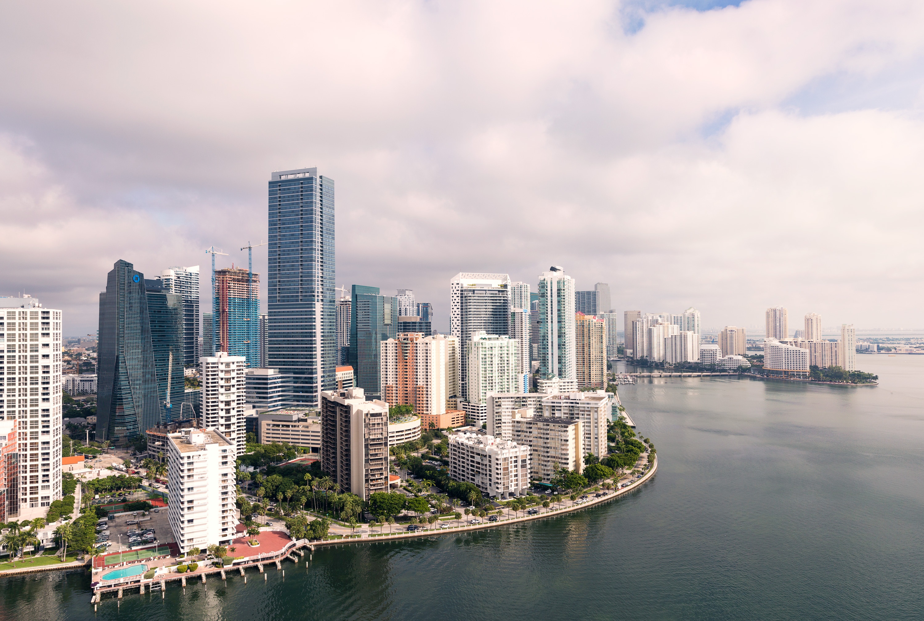
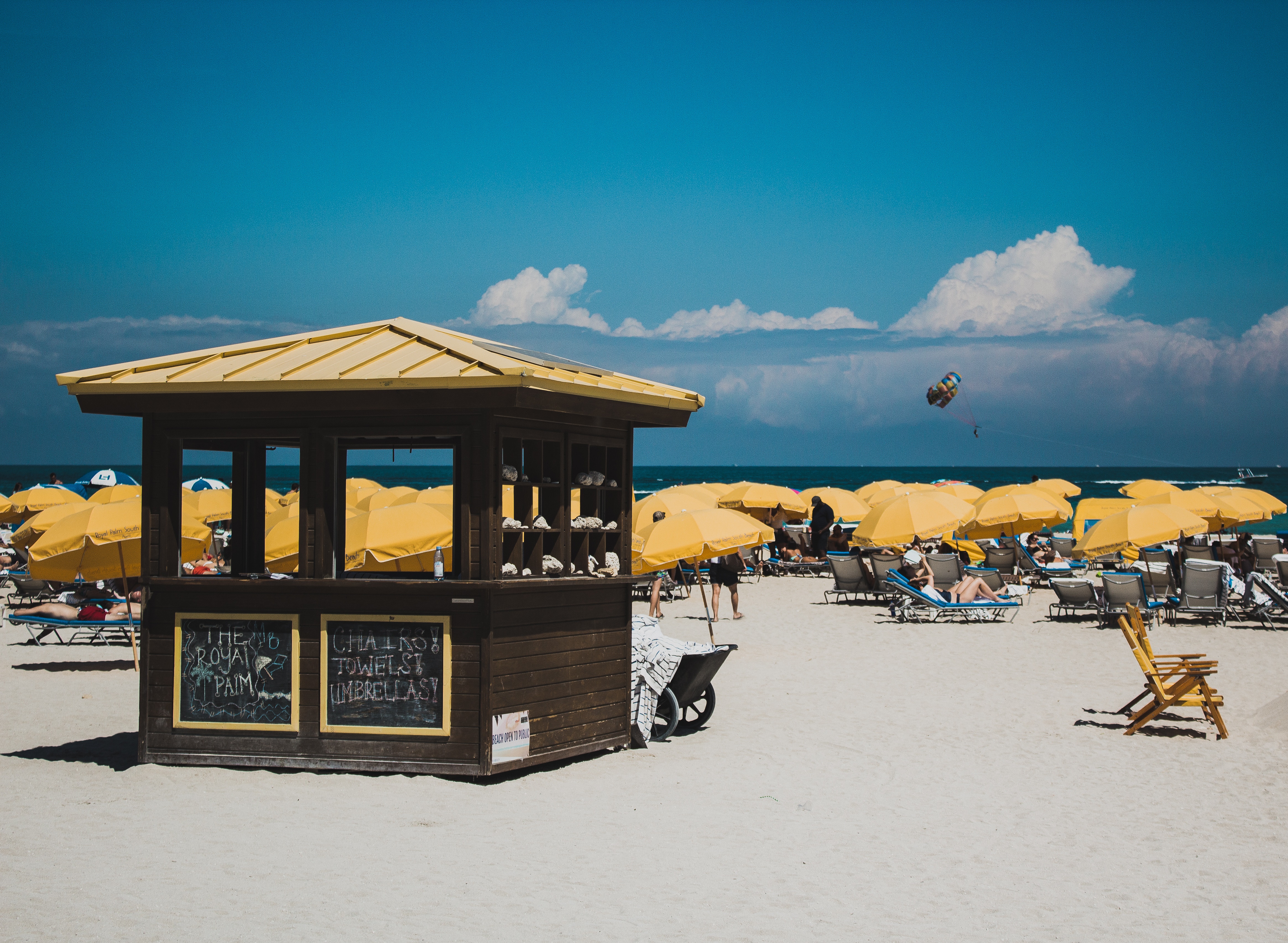
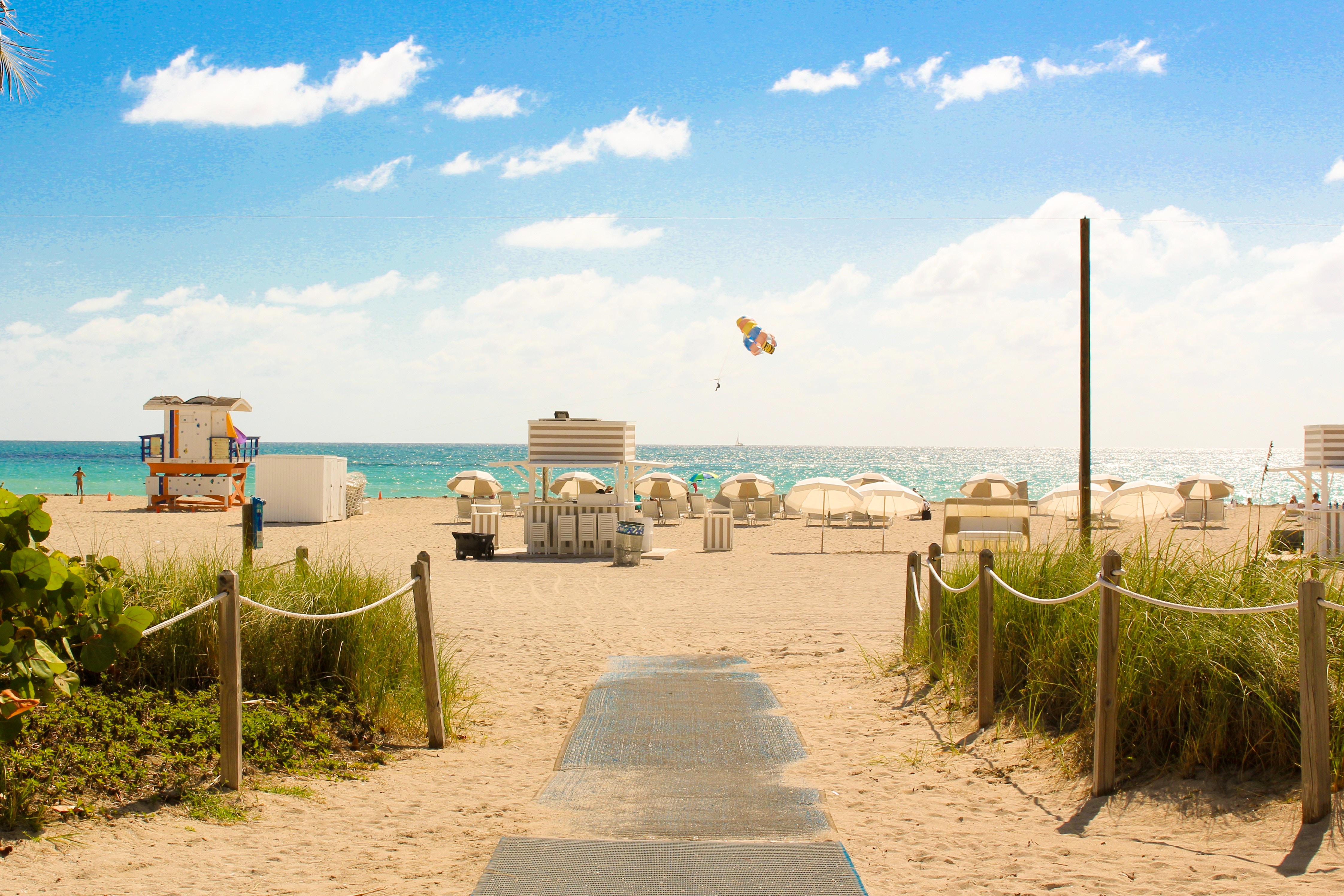
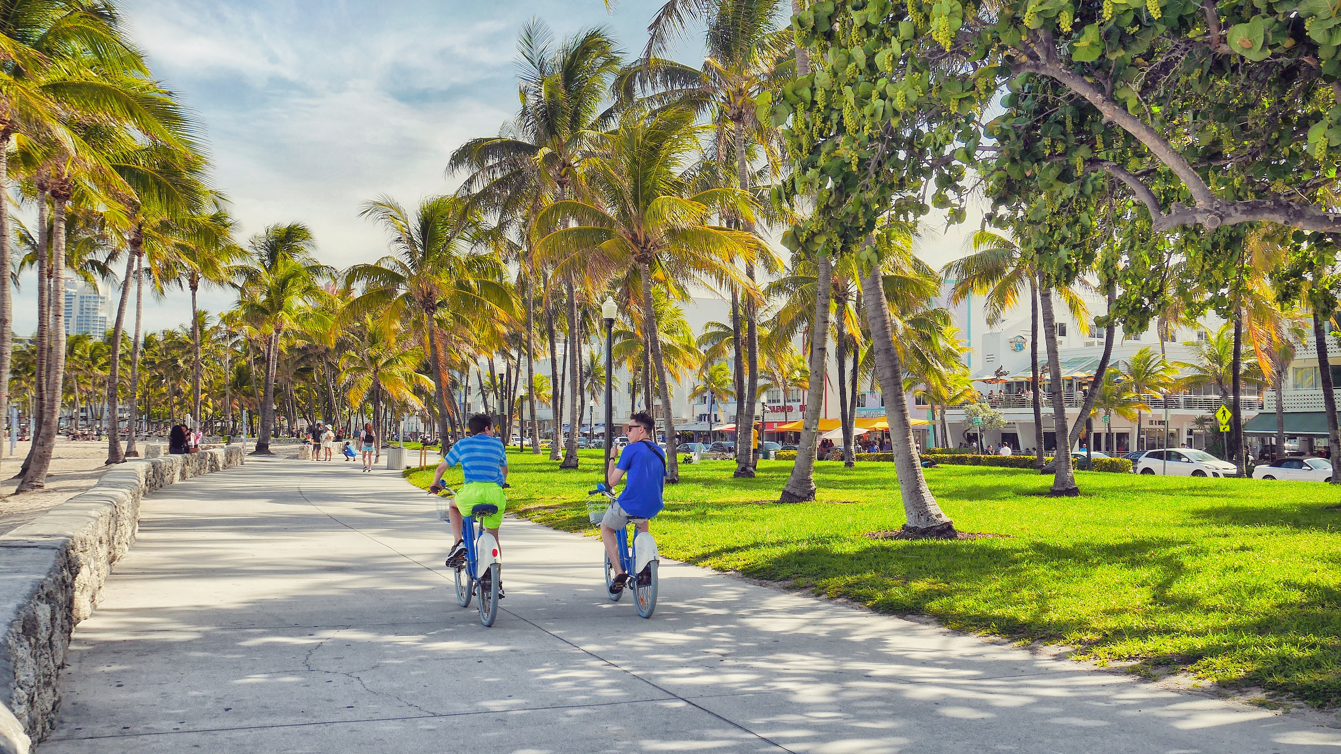
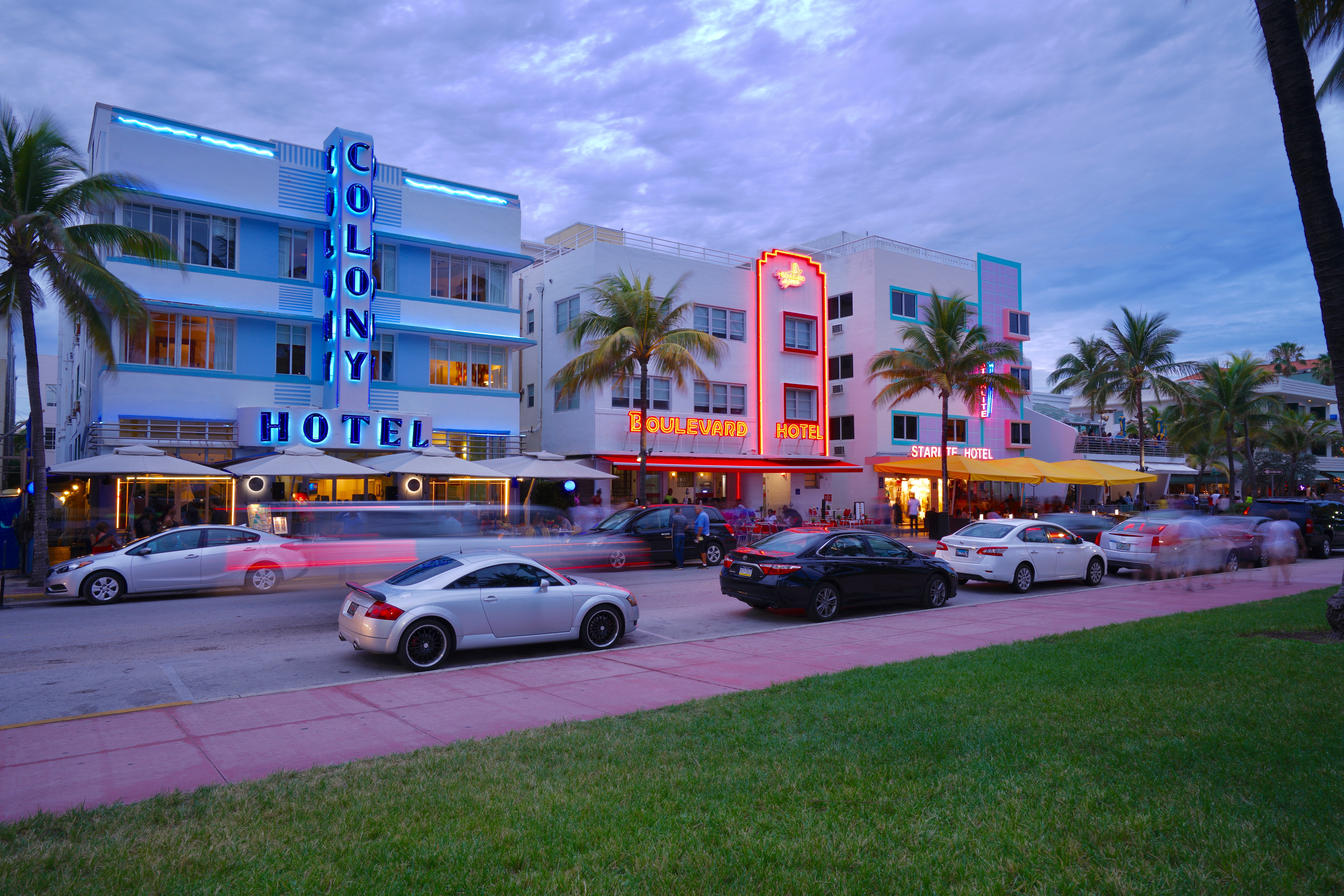
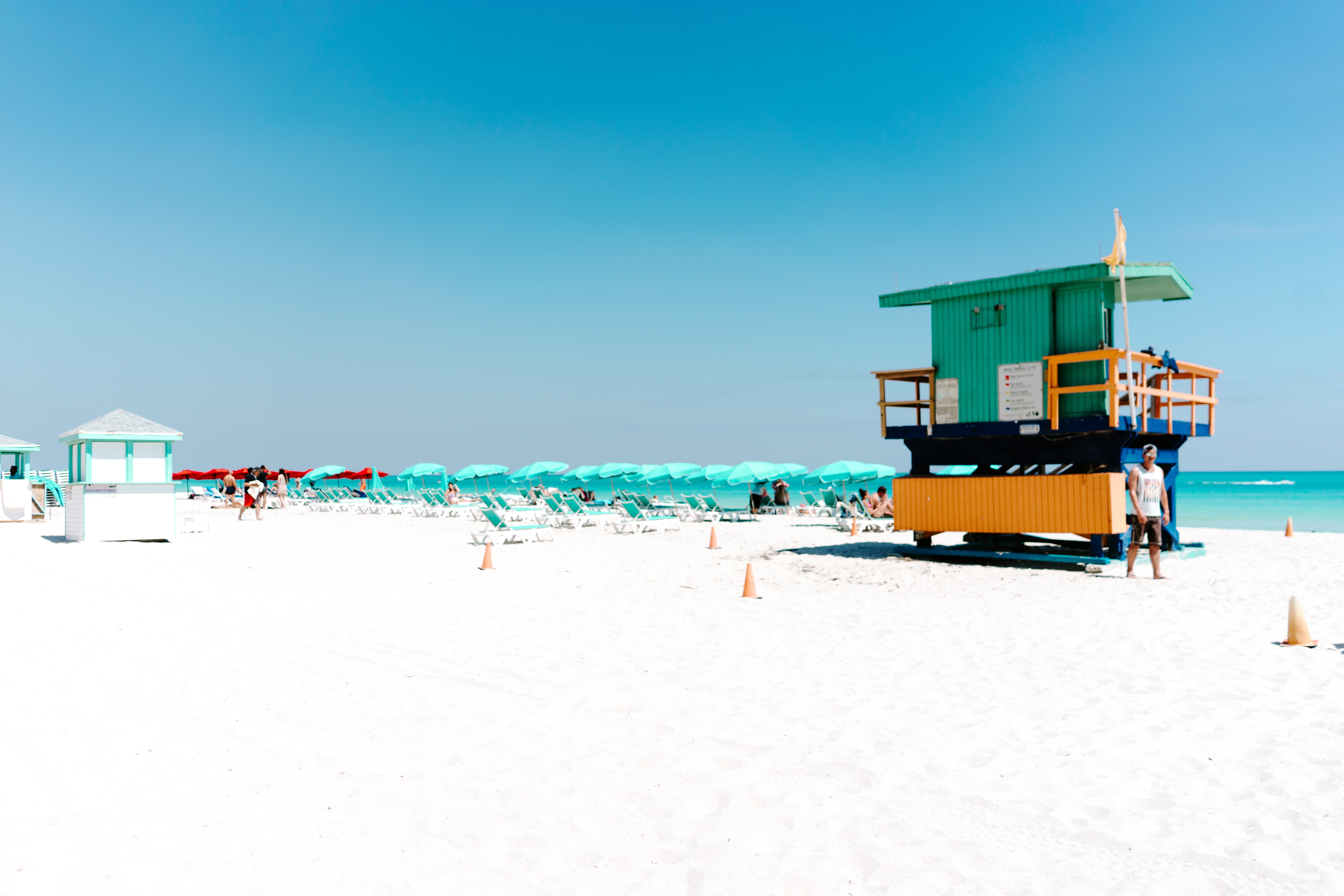
About Miami, Florida
Miami is one of the world’s most popular holiday spots. It has so much to offer; from its countless beach areas, to culture and museums, from spa and shopping days out, to endless cuban restaurants and cafes. Miami is a multicultural city that has something to offer to everyone.
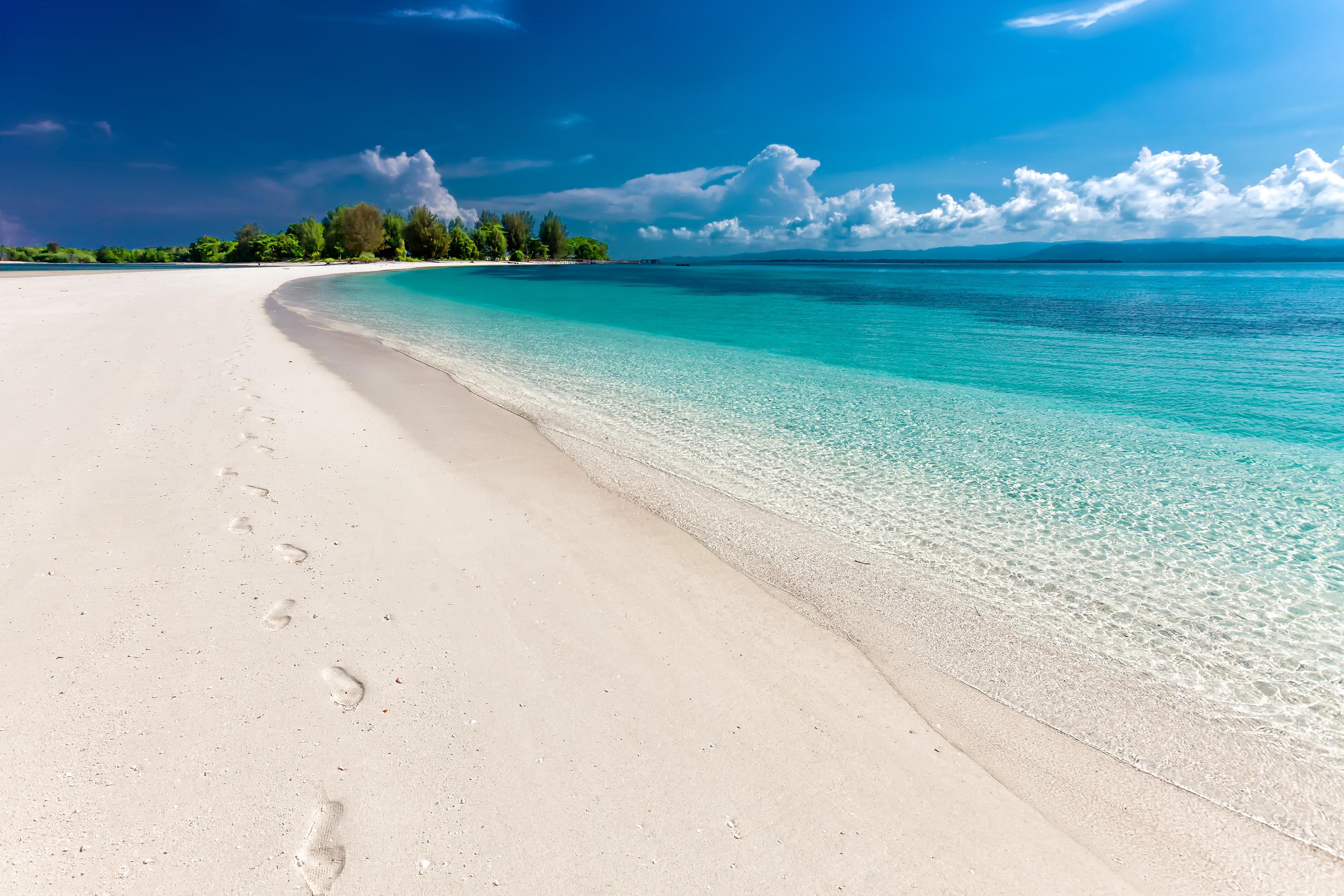
About Great Harbour, Jost Van Dyke
Jost Van Dyke, four miles long, is truly known as the 'barefoot island'. The smallest of the British Virgin Islands, it is known as a popular destination for yachts and is celebrated for its casual lifestyle, protected anchorages, fine beaches and beachfront restaurants and bars. The island has fewer than 200 inhabitants and they are widely known as a welcoming people. The island's name conjures up its rich, colorful past. Jost Van Dyke is said to have been named for an early Dutch settler, a former pirate. At Great Harbour, Little Harbour, and White Bay there are safe, protected bays and pristine beaches shaded with coconut palms and seagrape trees. Discover inviting shops selling local treasures, restaurants, and bars. 'The Painkiller', one of the Caribbean’s most popular drinks, originated at the Soggy Dollar Bar. Foxy’s and Gertrude's in White Bay are renowned for drinks made with the island's famous rum, frosty beers, and tales of pirates and sunken treasure. Explore Jost Van Dyke's history in the vegetation-covered ruins of centuries-old sugar mills, or on the old trails that crisscross the island. Revel in the natural beauty of the pristine, untouched beaches. Hike up to the highest spot on the island, Majohnny Point, and take in a stunning 360 degree view of the Caribbean. Relax in the natural 'bubble pool', a popular tourist attraction. Jost Van Dyke conjures up images of what the British Virgin Islands may have looked like many years ago.
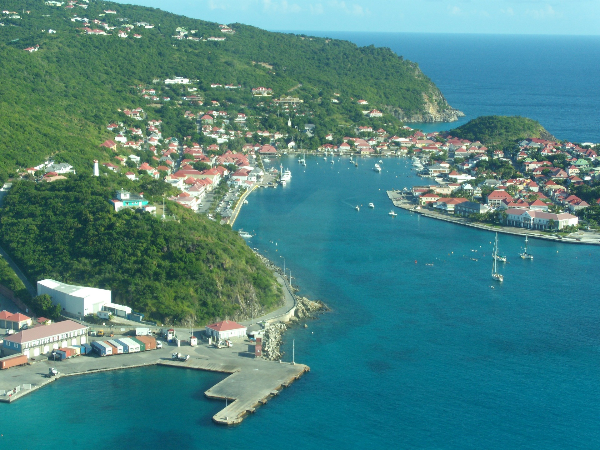
About Gustavia
You can easily explore all of Gustavia during a two-hour stroll. Some shops close from noon to 3 or 4, so plan lunch accordingly, but stores stay open past 7 in the evening. Parking in Gustavia is a challenge, especially during vacation times. A good spot to park is rue de la République, alongside the catamarans, yachts, and sailboats.
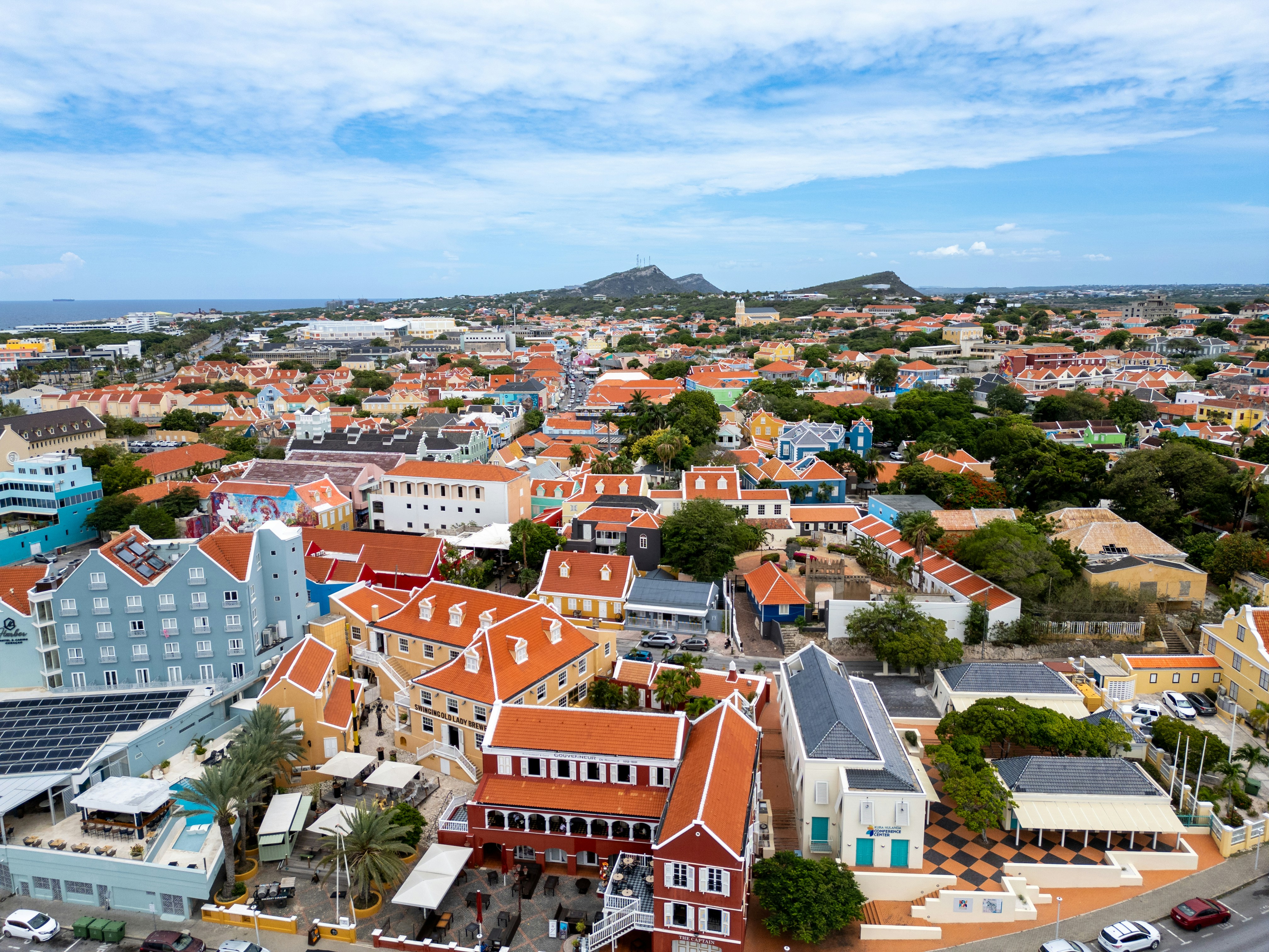
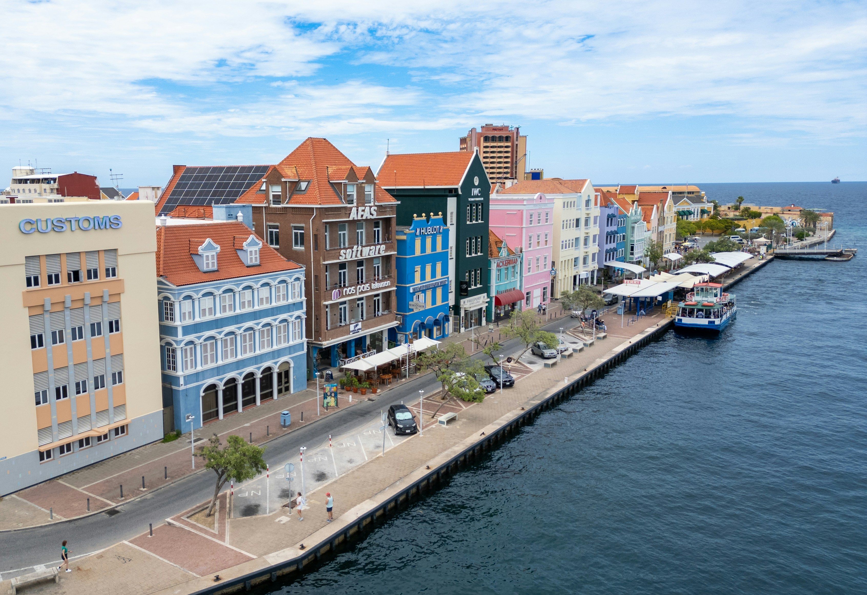
About Willemstad
Dutch settlers came here in the 1630s, about the same time they sailed through the Verazzano Narrows to Manhattan, bringing with them original red-tile roofs, first used on the trade ships as ballast and later incorporated into the architecture of Willemstad. Much of the original colonial structures remain, but this historic city is constantly reinventing itself and the government monument foundation is always busy restoring buildings in one urban neighborhood or another. The salty air causes what is called "wall cancer" which causes the ancient abodes to continually crumble over time. The city is cut in two by Santa Anna Bay. On one side is Punda (the point)—crammed with shops, restaurants, monuments, and markets and a new museum retracing its colorful history. And on the other side is Otrobanda (literally meaning the "other side"), with lots of narrow, winding streets and alleyways (called "steekjes" in Dutch), full of private homes notable for their picturesque gables and Dutch-influenced designs. In recent years the ongoing regeneration of Otrobanda has been apparent, marked by a surge in development of new hotels, restaurants, and shops; the rebirth, concentrated near the waterfront, was spearheaded by the creation of the elaborate Kura Hulanda complex.There are three ways to cross the bay: by car over the Juliana Bridge; by foot over the Queen Emma pontoon bridge (locally called "The Swinging Old Lady"); or by free ferry, which runs when the pontoon bridge is swung open for passing ships. All the major hotels outside town offer free shuttle service to town once or twice daily. Shuttles coming from the Otrobanda side leave you at Riffort. From here it's a short walk north to the foot of the pontoon bridge. Shuttles coming from the Punda side leave you near the main entrance to Ft. Amsterdam.
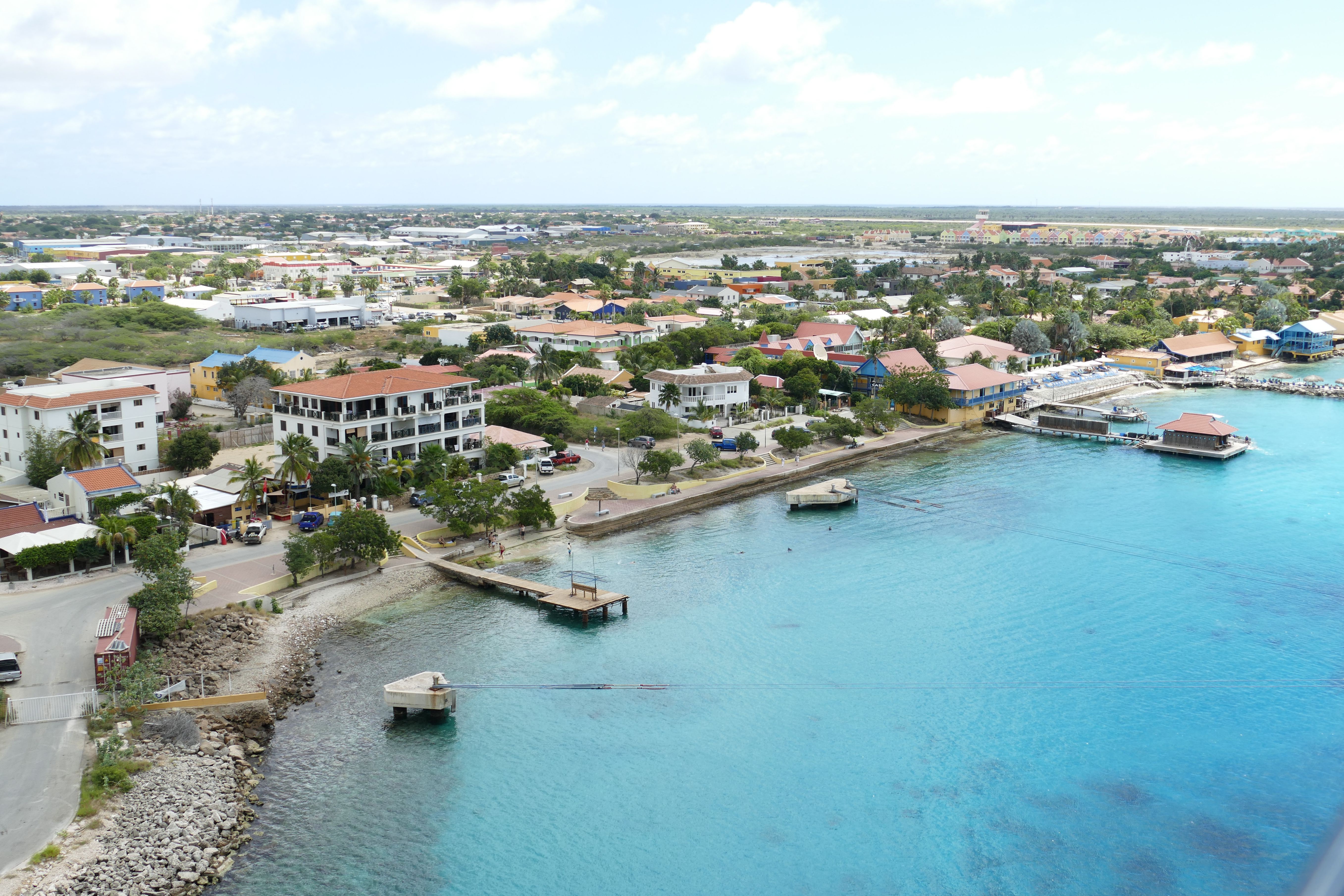
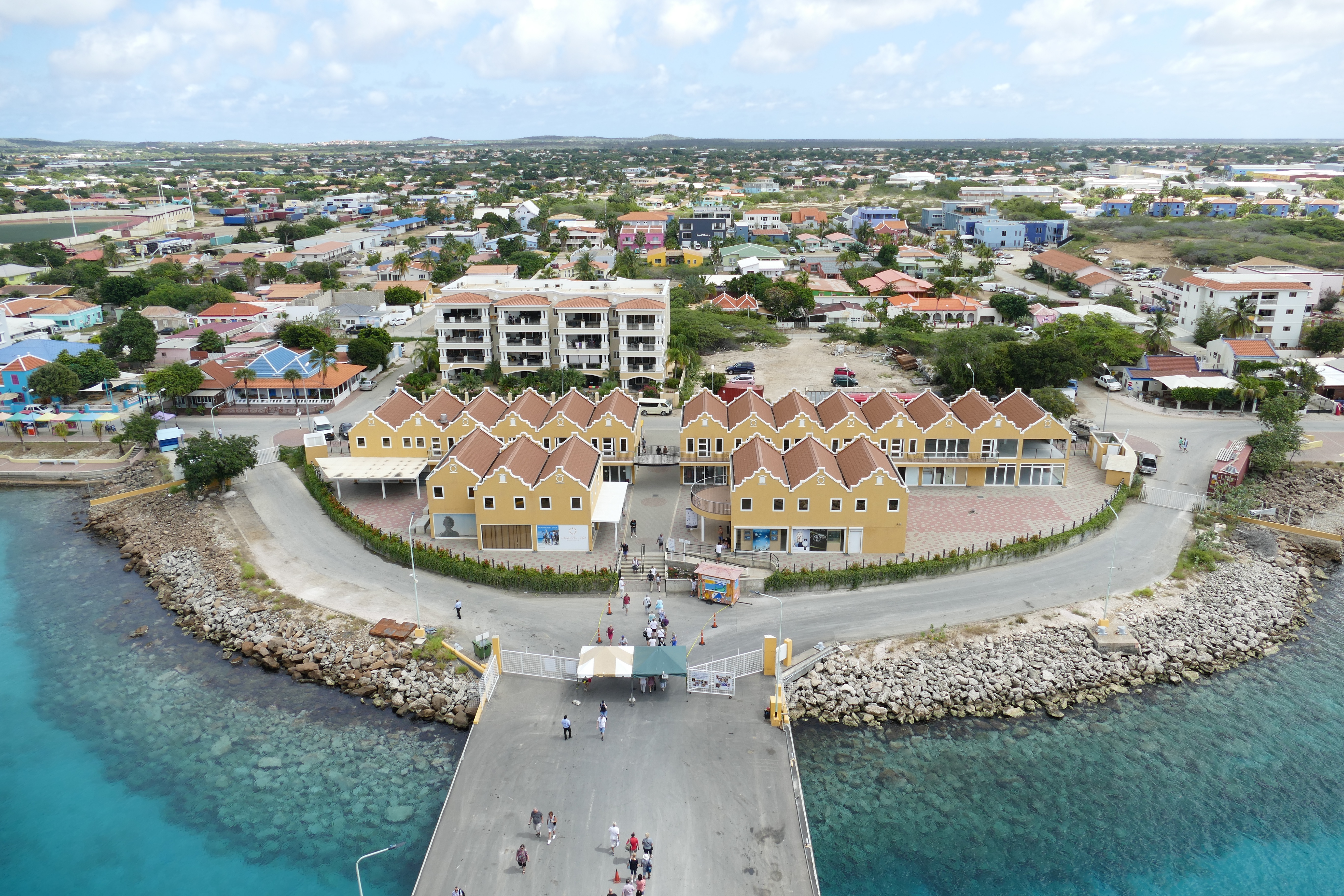
About Kralendijk
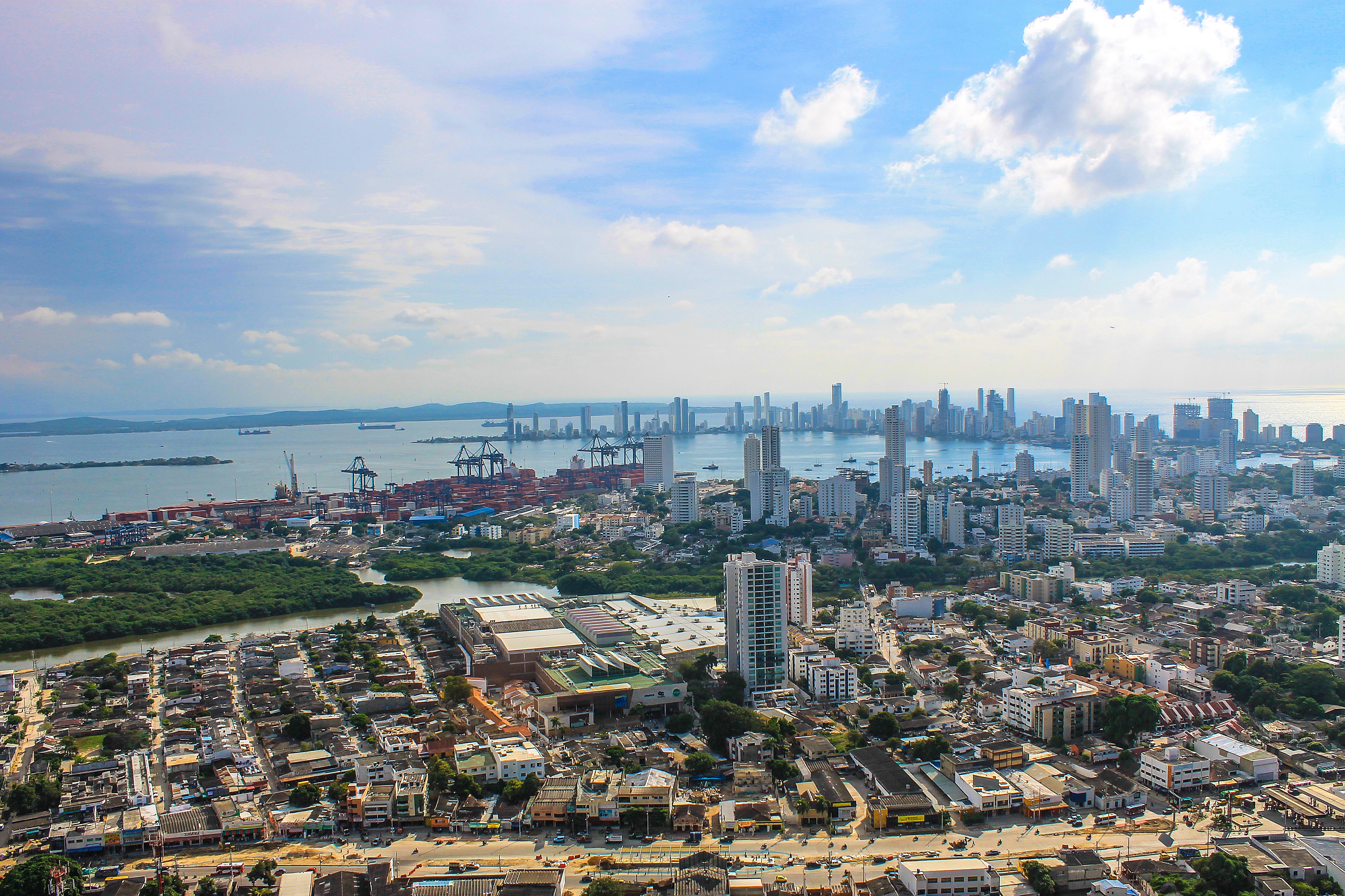
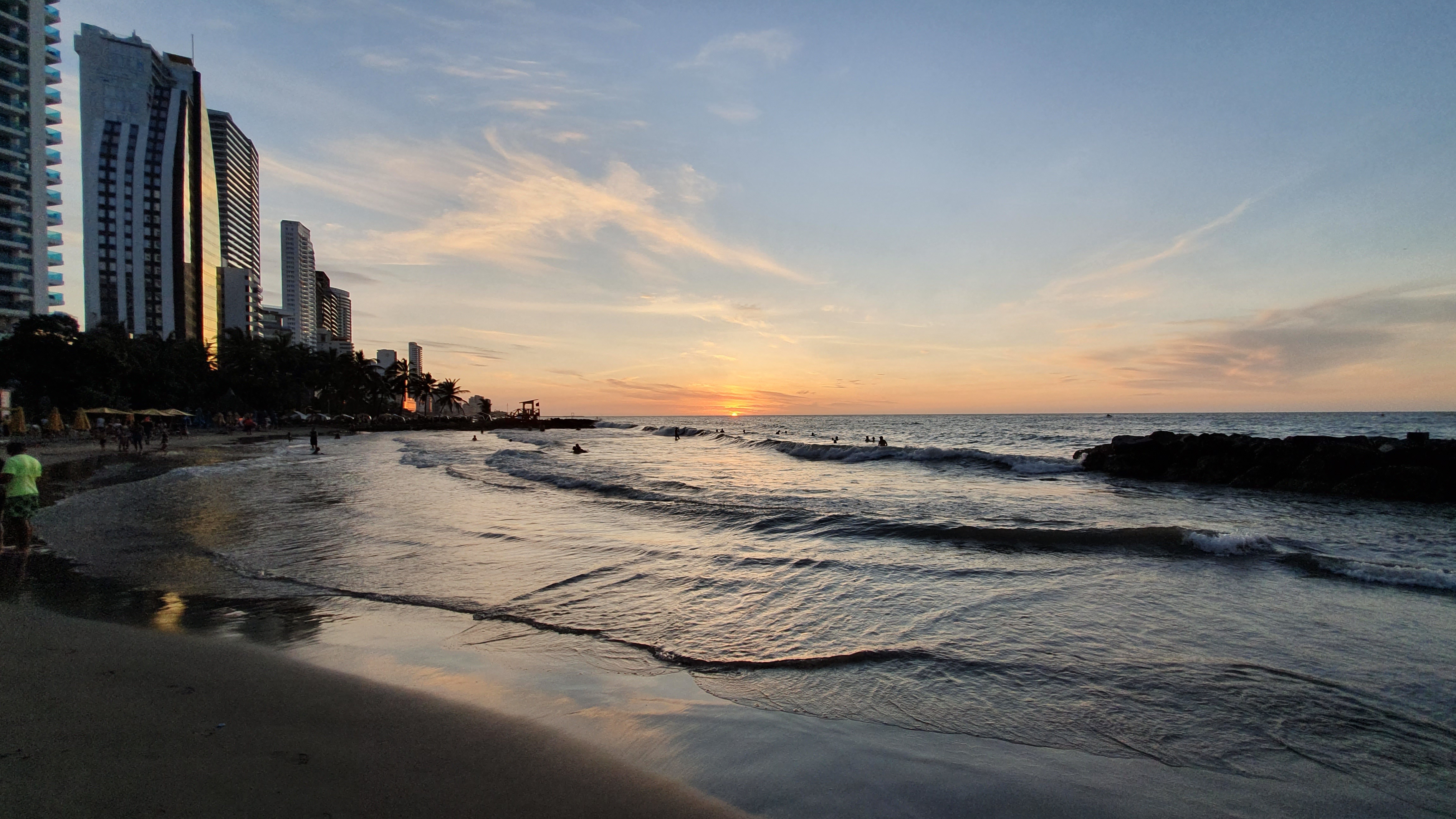
About Cartagena
Cartagena's magnificent city walls and fortresses, now a UNESCO World Heritage Site, enclose a well-restored historic center (the Cuidad Amurallada, or walled city) with plazas, churches, museums, and shops that have made it a lively coastal vacation spot for South Americans and others. New hotels and restaurants make the walled city a desirable place to stay, and the formerly down-at-the-heels Getsemaní neighborhood attracts those seeking a bohemian buzz. The historic center is a small section of Cartagena; many hotels are in the Bocagrande district, an elongated peninsula where high-rise hotels overlook a long, gray-sand beach.When it was founded in 1533 by Spanish conquistador Pedro de Heredia, Cartagena was the only port on the South American mainland. Gold and silver looted from indigenous peoples passed through here en route to Spain and attracted pirates, including Sir Francis Drake, who in 1586 torched 200 buildings. Cartagena's walls protected the city's riches as well as the New World's most important African slave market.
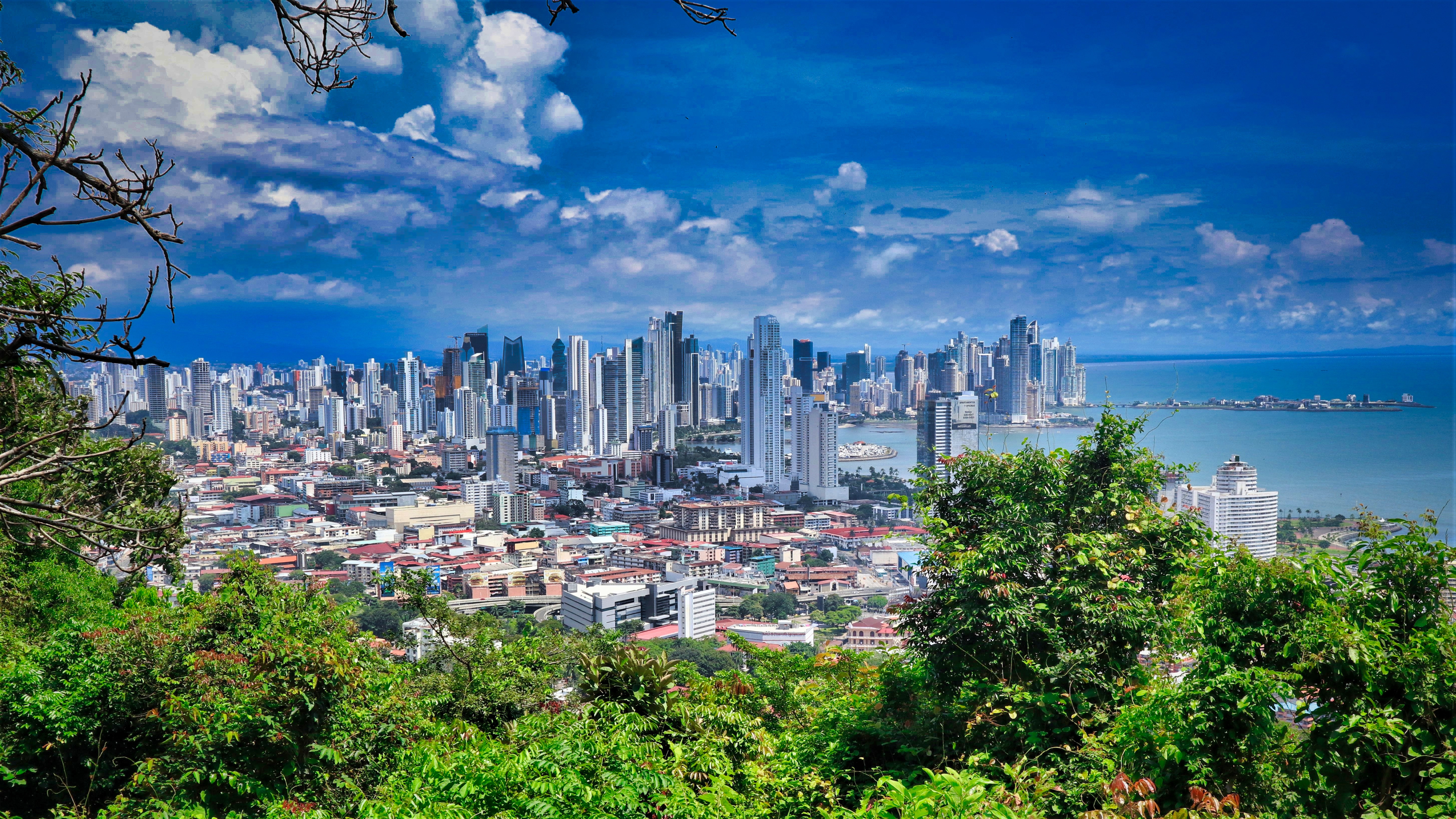
About Panama City
Expect incredible morning views as you arrive into the port for Panama City. Tinged with a silver pre-dawn light, the city will metamorphosise into a golden glow as the sun rises above it. And from then on expect one stunning view after another. Very interesting in its own right, Fuerte Amador is obviously overshadowed by its proximity to Panama City. So should the Miraflores museum of the Canal, which offers a comprehensive and immersive tour of the Canal including a 3-D experience, four exhibition halls, an observation deck, and a surprisingly good restaurant not interest you then there is always the option of lovely Casco Viejo – literally the old quartier of Panama. The grand old colonial houses, cobbled streets, independent boutiques and buzzing street scene make this a must stop on your itinerary. And if you like seafood, you will not want miss the many restaurants and market stalls serving different variations of so-fresh-it’s-still-practically-swimming ceviche. Best eaten like the Panamanians do, with salty crackers and a cold beer on the beach. And if money is no object, a cup of geisha coffee – supposedly the world’s best and definitely the world’s most expensive at $7 a shot is definitely a pick me up! Cool cosmopolitan capital aside, Panama has a skyscraper filled skyline that is worthy of some of its North American counterparts. But if urban utopia is not your scene then fear not, the sandy beaches and lush rainforests are never more than a short cab ride away.
About Manta
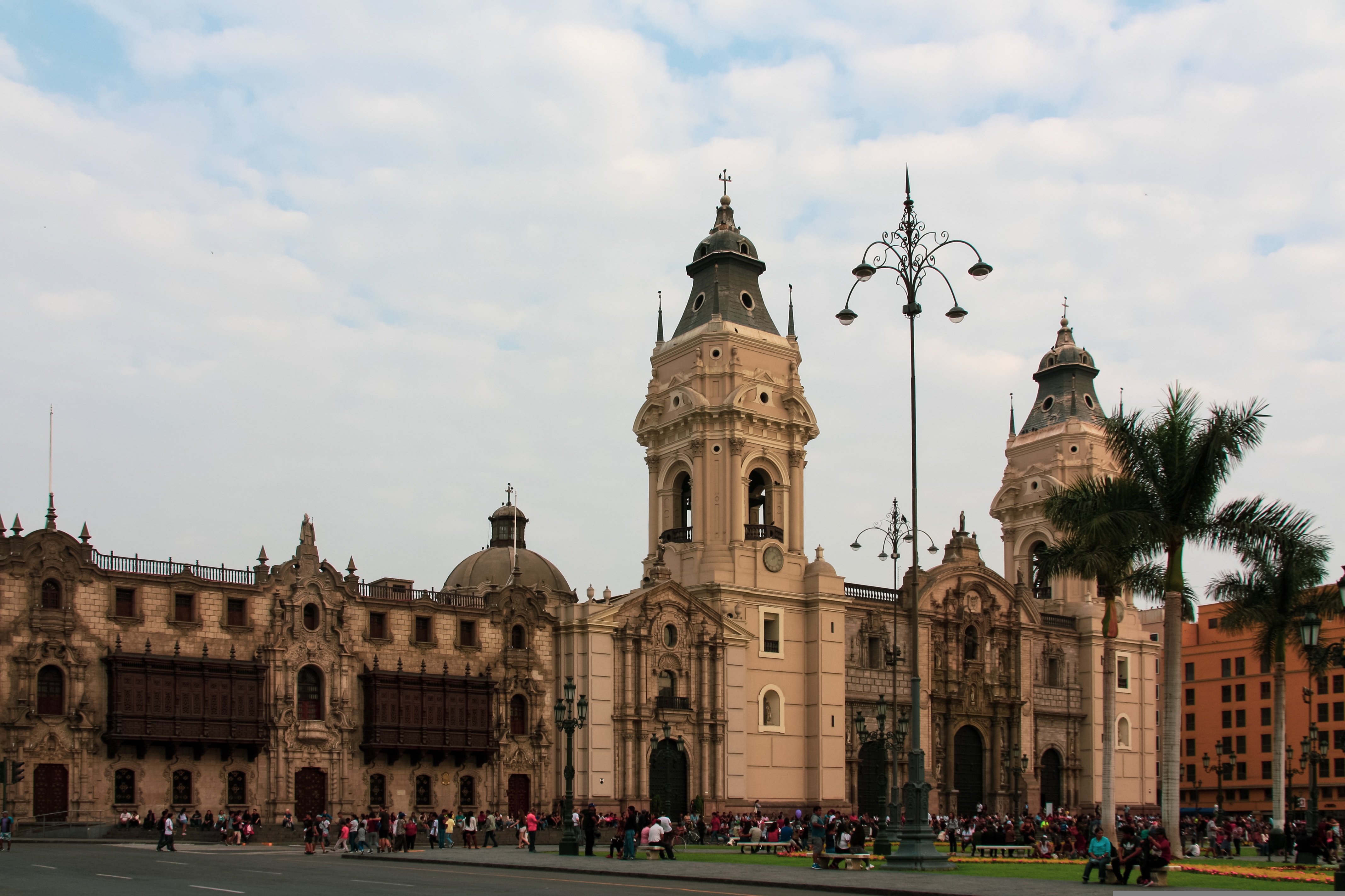
About Callao
When people discuss great South American cities, Lima is often overlooked. But Peru's capital can hold its own against its neighbors. It has an oceanfront setting, colonial-era splendor, sophisticated dining, and nonstop nightlife.It's true that the city—clogged with traffic and choked with fumes—doesn't make a good first impression, especially since the airport is in an industrial neighborhood. But wander around the regal edifices surrounding the Plaza de Armas, among the gnarled olive trees of San Isidro's Parque El Olivar, or along the winding lanes in the coastal community of Barranco, and you'll find yourself charmed.In 1535 Francisco Pizarro found the perfect place for the capital of Spain's colonial empire. On a natural port, the so-called Ciudad de los Reyes (City of Kings) allowed Spain to ship home all the gold the conquistador plundered from the Inca. Lima served as the capital of Spain's South American empire for 300 years, and it's safe to say that no other colonial city enjoyed such power and prestige during this period.When Peru declared its independence from Spain in 1821, the declaration was read in the square that Pizarro had so carefully designed. Many of the colonial-era buildings around the Plaza de Armas are standing today. Walk a few blocks in any direction for churches and elegant houses that reveal just how wealthy this city once was. But the poor state of most buildings attests to the fact that the country's wealthy families have moved to neighborhoods to the south over the past century.The walls that surrounded the city were demolished in 1870, making way for unprecedented growth. A former hacienda became the graceful residential neighborhood of San Isidro. In the early 1920s the construction of tree-lined Avenida Arequipa heralded the development of neighborhoods such as bustling Miraflores and bohemian Barranco.Almost a third of the country's population of 29 million lives in the metropolitan area, many of them in relatively poor conos: newer neighborhoods on the outskirts of the city. Most residents of those neighborhoods moved there from mountain villages during the political violence and poverty that marked the 1980s and ’90s, when crime increased dramatically. During the past decade the country has enjoyed peace and steady economic growth, which have been accompanied by many improvements and refurbishment in the city. Residents who used to steer clear of the historic center now stroll along its streets. And many travelers who once would have avoided the city altogether now plan to spend a day here and end up staying two or three.
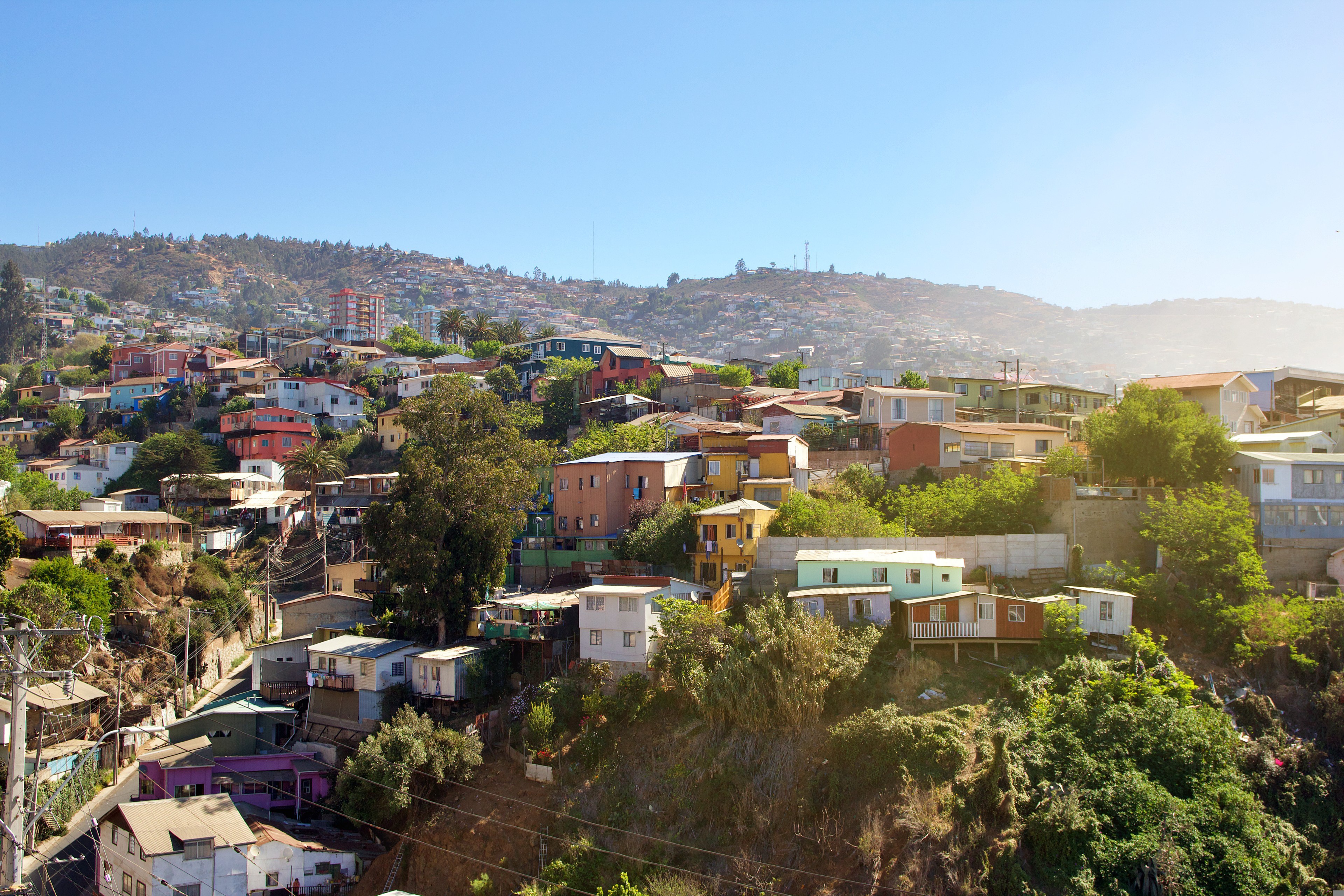
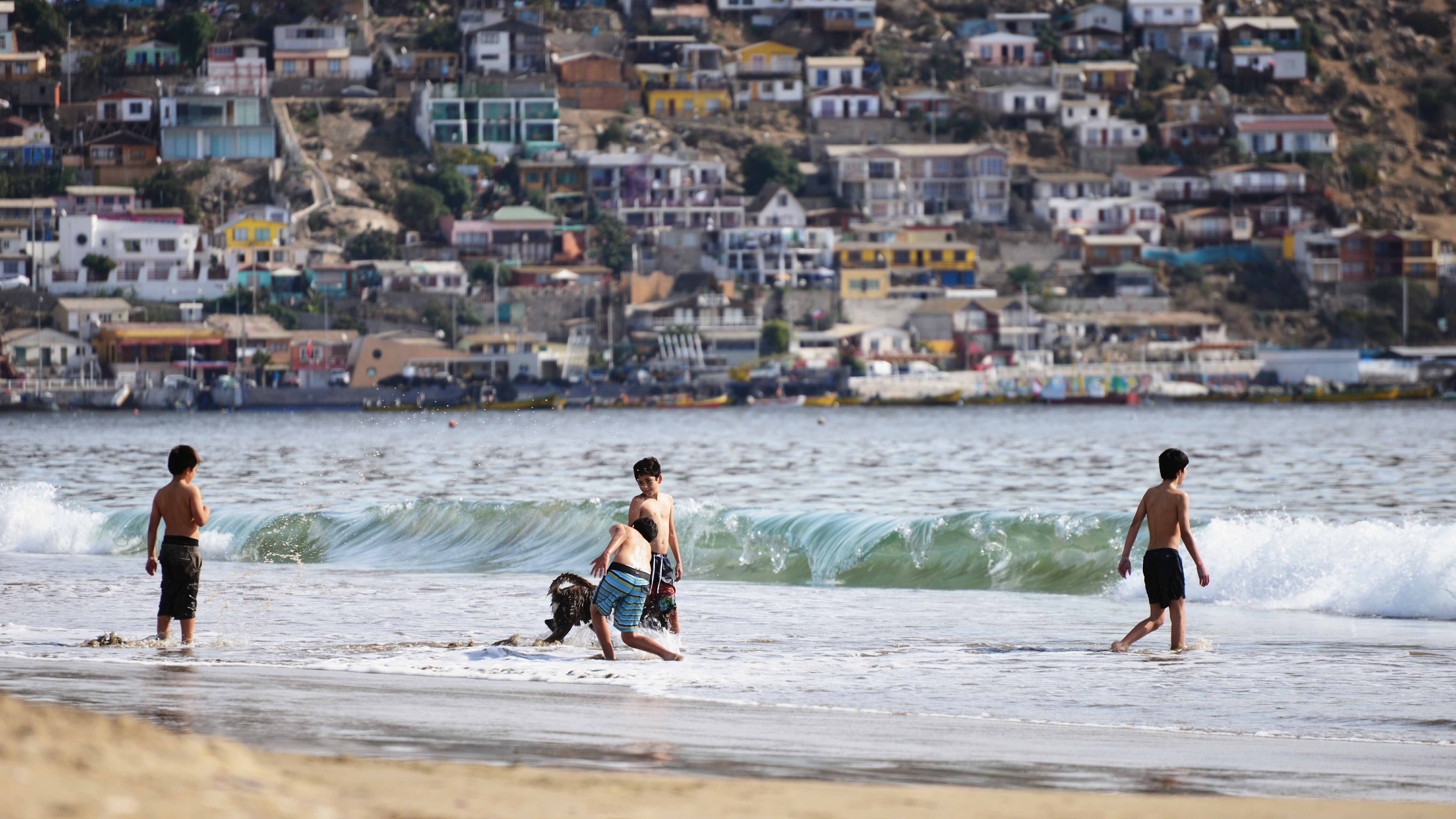
About Valparaiso
Valparaíso's dramatic topography—45 cerros, or hills, overlooking the ocean—requires the use of winding pathways and wooden ascensores (funiculars) to get up many of the grades. The slopes are covered by candy-color houses—there are almost no apartments in the city—most of which have exteriors of corrugated metal peeled from shipping containers decades ago. Valparaíso has served as Santiago's port for centuries. Before the Panama Canal opened, Valparaíso was the busiest port in South America. Harsh realities—changing trade routes, industrial decline—have diminished its importance, but it remains Chile's principal port. Most shops, banks, restaurants, bars, and other businesses cluster along the handful of streets called El Plan (the flat area) that are closest to the shoreline. Porteños (which means "the residents of the port") live in the surrounding hills in an undulating array of colorful abodes. At the top of any of the dozens of stairways, the paseos (promenades) have spectacular views; many are named after prominent Yugoslavian, Basque, and German immigrants. Neighborhoods are named for the hills they cover. With the jumble of power lines overhead and the hundreds of buses that slow down—but never completely stop—to pick up agile riders, it's hard to forget you're in a city. Still, walking is the best way to experience Valparaíso. Be careful where you step, though—locals aren't very conscientious about curbing their dogs.
About Puerto Montt
For most of its history, windy Puerto Montt was the end of the line for just about everyone traveling in the Lake District. Now the Carretera Austral carries on southward, but for all intents and purposes Puerto Montt remains the region's last significant outpost, a provincial city that is the hub of local fishing, textile, and tourist activity.Today the city center is full of malls, condos, and office towers—it's the fastest-growing city in Chile—but away from downtown, Puerto Montt consists mainly of low clapboard houses perched above its bay, the Seno de Reloncaví. If it's a sunny day, head east to Playa Pelluco or one of the city's other beaches. If you're more interested in exploring the countryside, drive along the shore for a good view of the surrounding hills.
About Castro
Bright, wooden huts teeter on stilts over Castro's estuary waterfront, inviting you into a patchwork of colour that’s sure to brighten any day. These traditional palafitos give the warmest of welcomes, as you prepare to experience Chile at its most vibrant. Castro has faced something of a tumultuous past, having been hit by a by a succession of earthquakes and fires - the most recent a devastating earthquake in 1960. But this city is incredibly resilient, and today the capital of Chiloe Island makes for a fantastic base for exploring the archipelago that surrounds it.
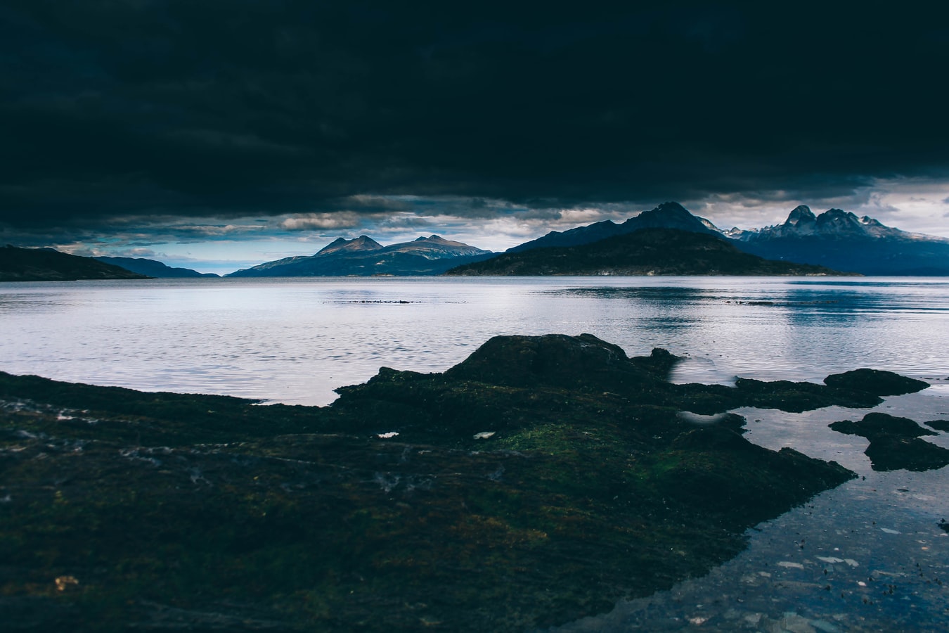
About Chilean Fjords
Strewn through the coast of Chile, these beautiful fjords are world renowned for being one of the most awe-inspiring places on earth. Snow-capped volcanoes nestle majestically alongside rolling valleys of ice and frosty glaciers. Rugged beauty, breathtaking scenery not to mention diverse and profuse wildlife abounds – expect to watch whales from the deck, see playful Magellan Penguins and perhaps even spot the rare Andean Condor. Affectionately named “The End of the World” by the Spaniards who discovered the region in eighteenth century in a quest to Christianise South America, these extraordinary waterways not only encompass a medley of jagged mountains and iceberg strewn bays, but feature a kaleidoscopic spectrum of unexpected colour that offers photographic opportunities like no other destination.
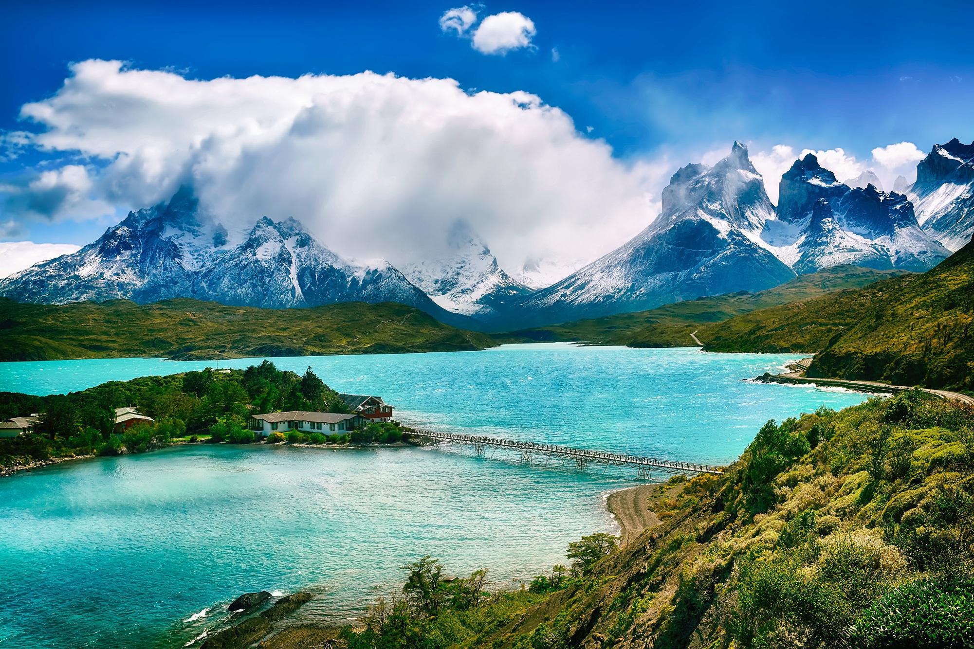
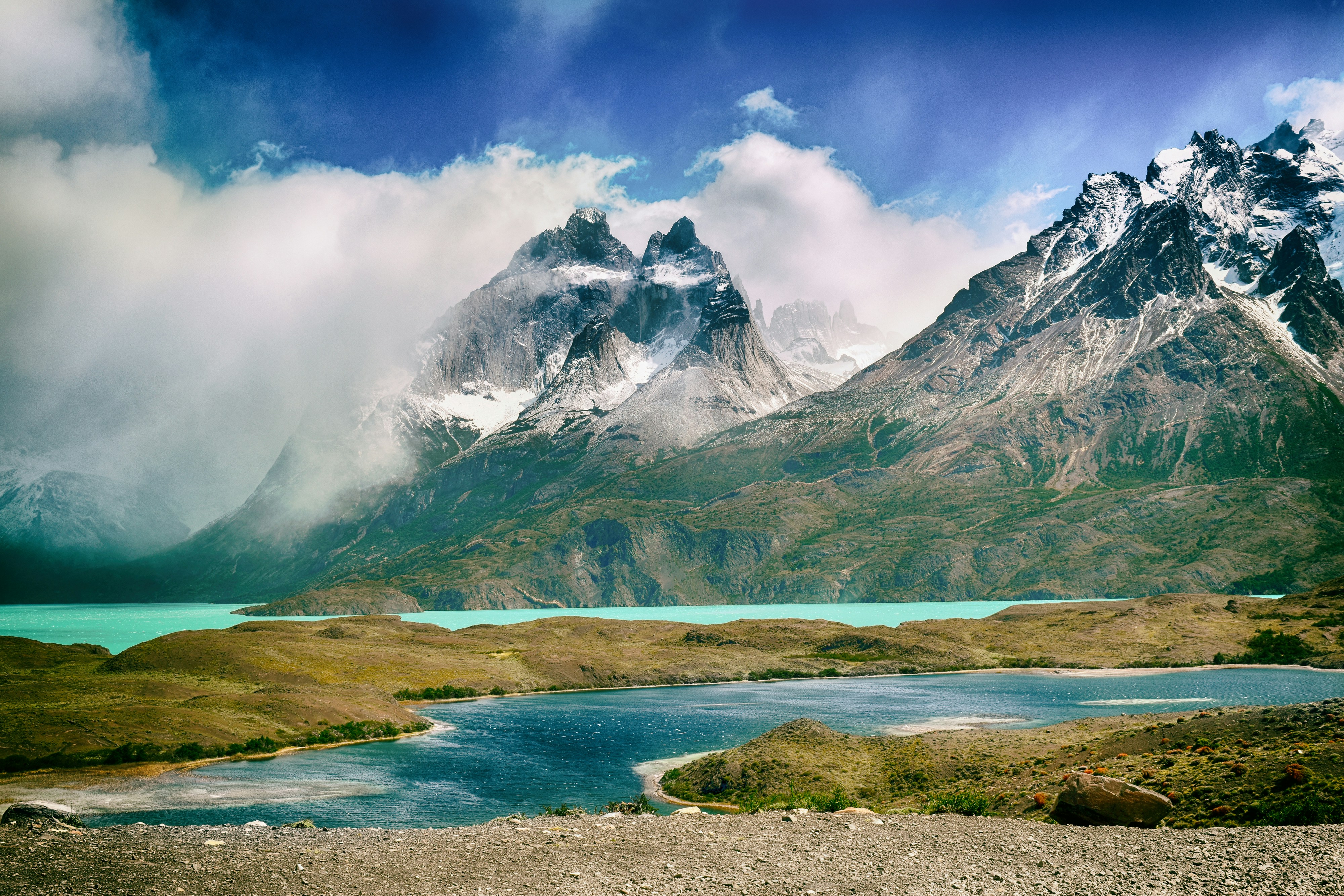
About Punta Arenas
Impenetrable forests, impassable mountains, and endless fields of ice define Chilean Patagonia, and meant that the region went largely unexplored until the beginning of the 20th century. Located in the southernmost part of the country, this area is still sparsely inhabited, though you will find a few populated places—like the colorful provincial city of Punta Arenas, which looks like it's about to be swept into the Strait of Magellan. Some unique wildlife, particularly colonies of elephant seals and penguins, call this breathtaking topography home. To the north is Parque Nacional Torres del Paine, the country's most magnificent natural wonder, and whose snow-covered peaks seem to rise vertically from the plains below. The vistas, such as the fantastic Avenue of the Glaciers, are breathtaking; along this stretch of the Beagle Channel, you can pass six tremendous glaciers all within a stone's throw of each other.Cruise SightsPunta Arenas. Founded a little more than 150 years ago, Punta Arenas (Sandy Point) was Chile's first permanent settlement in Patagonia. Plaza Muñoz Gamero, the central square, is surrounded by evidence of that early prosperity: buildings whose then-opulent brick exteriors recall a time when this was one of Chile's wealthiest cities. The newer houses here have colorful tin roofs, best appreciated when seen from a high vantage point such as the Mirador Cerro la Cruz. Although the city as a whole may not be particularly attractive, look for details: the pink-and-white house on a corner, the bay window full of potted plants, parking attendants wearing the regional blue and yellow colors, and schoolchildren in identical naval pea coats that remind you that the city's fate is tied to the sea.The Museo Naval y Marítimo extols Chile's high-seas prowess, particularly concerning Antarctica. Its exhibits are worth a visit for anyone with an interest in ships and sailing, merchant and military alike. Part of the second floor is designed like the interior of a ship, including a map and radio room. Pedro Montt 989. Admission charged.Housed in what was once the mansion of the powerful Braun-Menéndez family, the Museo Regional de Magallanes is an intriguing glimpse into the daily life of a wealthy provincial family at the beginning of the 20th century. Lavish Carrara marble hearths, English bath fixtures, and cordovan leather walls are among the original accoutrements. The museum also has an excellent group of displays depicting Punta Arenas's past, from the first European contact to the town's decline after the opening of the Panama Canal. The museum is half a block north of the main square. Magallanes 949. Admission charged.The resplendent 1895 Palacio Sara Braun is a national landmark and an architectural showpiece of southern Patagonia. Designed by a French architect, the house was built from materials and by craftsmen imported from Europe during the four years of construction. The city's central plaza and surrounding buildings soon followed, ushering in the region's golden era. Noteworthy are the lavish bedrooms, magnificent parquet floors, marble fireplaces, and hand-painted ceilings. Don't miss the portraits of Braun and her husband José Nogueira in the music room. Afterwards, head to the cellar for a drink or snack in the warm public tavern (a good portion of the mansion is leased to a hotel). Plaza Muñoz Gamero 716. Admission charged.Commonly referred to simply as "El Salesiano," the Museo Salesiano de Maggiorino Borgatello is operated by Italian missionaries whose order arrived in Punta Arenas in the 19th century. The Salesians, most of whom spoke no Spanish, proved to be daring explorers. Traveling throughout the region, they collected the artifacts made by indigenous tribes that are currently on display. Av. Bulnes 398. Admission charged.Isla Magdalena. Punta Arenas is the launching point for a boat trip to the Isla Magdalena to see the more than 100,000 Magellanic penguins at the Monumento Natural Los Pingúinos. A single trail, marked off by rope, is accessible to humans. The boat trip to the island, in the middle of the Estrecho de Magallanes, takes about two hours. Make sure to bring along warm clothing, even in summer; the island can be chilly, particularly if a breeze is blowing across the water.Parque Nacional Torres del Paine. Some 12 million years ago, lava flows pushed up through the thick sedimentary crust that covered the southwestern coast of South America, cooling to form a granite mass. Glaciers then swept through the region, grinding away all but the ash-gray spires that rise over the landscape of one of the world's most beautiful natural phenomena, now the Parque Nacional Torres del Paine (established in 1959). Snow formations dazzle along every turn of road, and the sunset views are spectacular.Among the 2,420-square-km (934-square-mi) park's most beautiful attractions are its lakes of turquoise, aquamarine, and emerald green waters. Another draw is its unusual wildlife. Creatures like the guanaco (a woollier version of the llama) and the ñandú (resembling a small ostrich) abound. They are used to visitors and don't seem to be bothered by the proximity of automobile traffic and the snapping of cameras. Predators, like the gray fox, make less frequent appearances. You may also spot the dramatic aerobatics of a falcon and the graceful soaring of the endangered condor. The beautiful puma is especially elusive, but sightings have become more common. Admission charged.Pingúinera de Seno Otway. The road to this penguin sanctuary begins 30 km (18 mi) north of Punta Arenas. Magellanic penguins, which live up to 20 years in the wild, return to their birthplace here every year to mate with the same partner. For about 2,000 penguin couples—no single penguins make the trip—home is this desolate and windswept land off the Otway Sound. In late September, the penguins begin to arrive from the southern coast of Brazil and the Falkland Islands. They mate and lay their eggs in early October, and brood their eggs in November. Offspring hatch between mid-November and early December. If you're lucky, you may catch sight of one of the downy gray chicks that stick their heads out of the burrows when their parents return to feed them. Otherwise you might see scores of the ungainly adult penguins waddling to the ocean from their nesting burrows. They swim for food every eight hours and dive up to 100 feet deep. The penguins depart from the sound in late March. Note that the sanctuary is a 1-km (1/2-mi) walk from the parking lot. It gets chilly, so bring a windbreaker. Admission charged.Reserva Nacional Laguna Parillar. This 47,000-acre reserve lies west of Puerto Hambre, a tranquil fishing village, and is centered around a shimmering lake in a valley flanked by hills. It's a great place for a picnic, and there are a number of well-marked paths that offer sweeping vistas over the Estrecho de Magallanes. About 2 km (1 mi) west of Puerto Hambre is a small white monolith that marks the geographical center of Chile, the midway point between Chile's northern port Arica and the South Pole.Cruise ShoppingWool may no longer be king of the economy, but vast flocks of sheep still yield a high-quality product that is woven into the clothing here. Leather products are also common, but the prices are not necessarily low. About 3 km (2 mi) north of Punta Arenas is the Zona Franca (Av. Bulnes). This duty-free zone is where people from all around the region come for low-priced electronics and other consumer items.
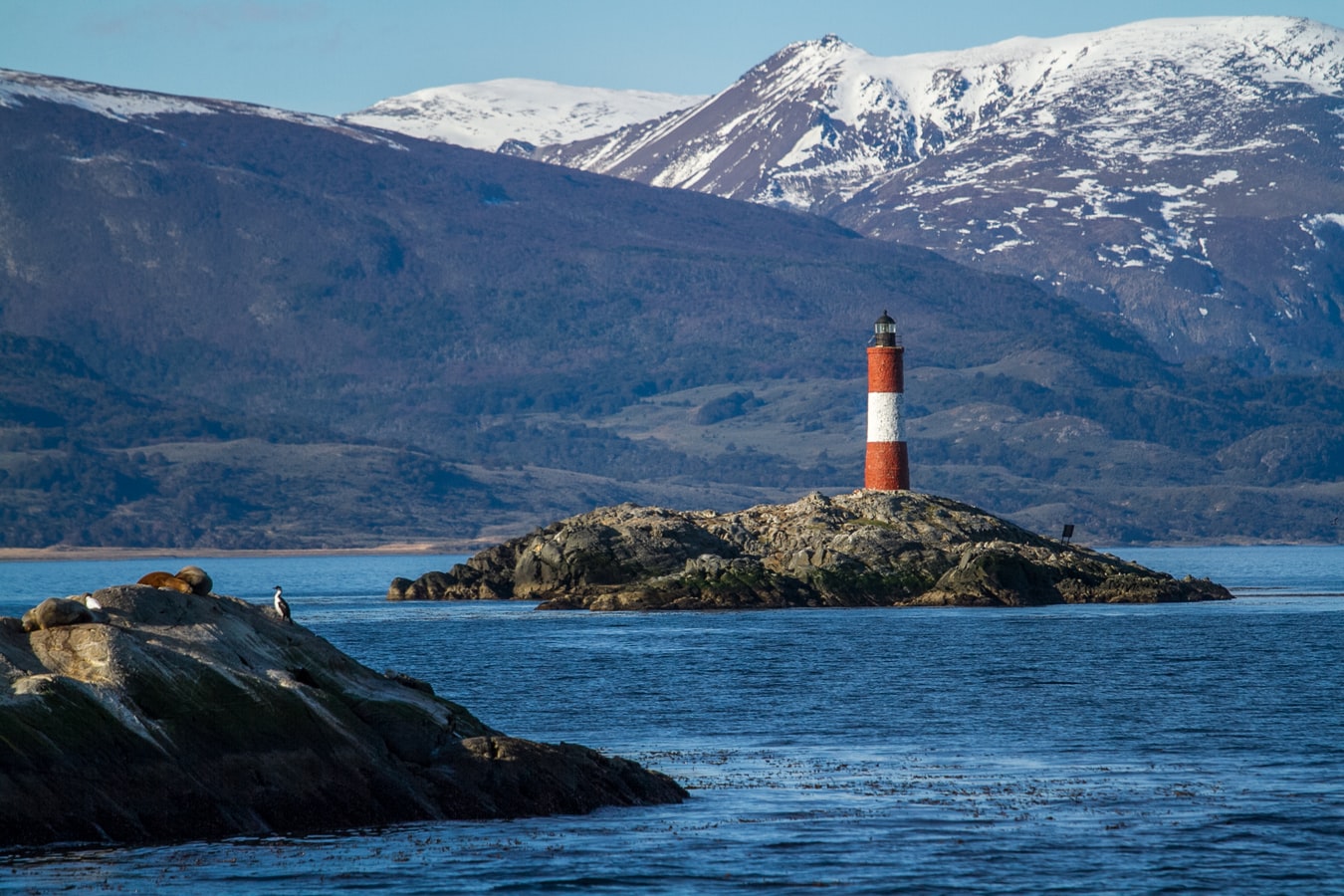
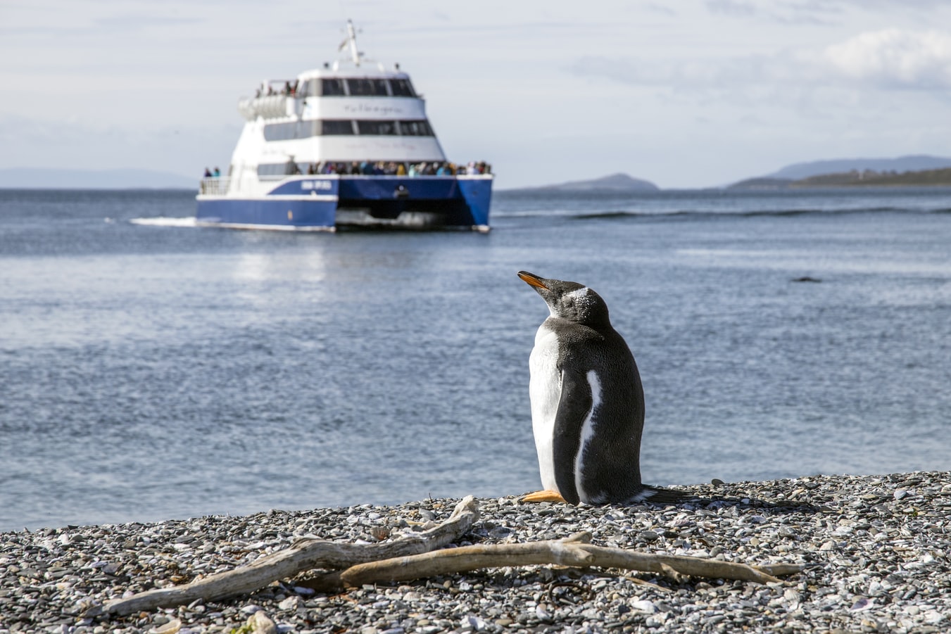
About Ushuaia
At 55 degrees latitude south, Ushuaia (pronounced oo-swy-ah) is closer to the South Pole than to Argentina's northern border with Bolivia. It is the capital and tourism base for Tierra del Fuego, the island at the southernmost tip of Argentina.Although its stark physical beauty is striking, Tierra del Fuego's historical allure is based more on its mythical past than on rugged reality. The island was inhabited for 6,000 years by Yámana, Haush, Selk'nam, and Alakaluf Indians. But in 1902 Argentina, eager to populate Patagonia to bolster its territorial claims, moved to initiate an Ushuaian penal colony, establishing the permanent settlement of its most southern territories and, by implication, everything in between.When the prison closed in 1947, Ushuaia had a population of about 3,000, made up mainly of former inmates and prison staff. Today the Indians of Darwin's "missing link" theory are long gone—wiped out by diseases brought by settlers and by indifference to their plight—and the 60,000 residents of Ushuaia are hitching their star to tourism.The city rightly (if perhaps too loudly) promotes itself as the southernmost city in the world (Puerto Williams, a few miles south on the Chilean side of the Beagle Channel, is a small town). You can make your way to the tourism office to get your clichéd, but oh-so-necessary, "Southernmost City in the World" passport stamp. Ushuaia feels like a frontier boomtown, at heart still a rugged, weather-beaten fishing village, but exhibiting the frayed edges of a city that quadrupled in size in the '70s and '80s and just keeps growing. Unpaved portions of Ruta 3, the last stretch of the Pan-American Highway, which connects Alaska to Tierra del Fuego, are finally being paved. The summer months (December through March) draw more than 120,000 visitors, and dozens of cruise ships. The city is trying to extend those visits with events like March's Marathon at the End of the World and by increasing the gamut of winter activities buoyed by the excellent snow conditions.A terrific trail winds through the town up to the Martial Glacier, where a ski lift can help cut down a steep kilometer of your journey. The chaotic and contradictory urban landscape includes a handful of luxury hotels amid the concrete of public housing projects. Scores of "sled houses" (wooden shacks) sit precariously on upright piers, ready for speedy displacement to a different site. But there are also many small, picturesque homes with tiny, carefully tended gardens. Many of the newer homes are built in a Swiss-chalet style, reinforcing the idea that this is a town into which tourism has breathed new life. At the same time, the weather-worn pastel colors that dominate the town's landscape remind you that Ushuaia was once just a tiny fishing village, snuggled at the end of the Earth.As you stand on the banks of the Canal Beagle (Beagle Channel) near Ushuaia, the spirit of the farthest corner of the world takes hold. What stands out is the light: at sundown the landscape is cast in a subdued, sensual tone; everything feels closer, softer, and more human in dimension despite the vastness of the setting. The snowcapped mountains reflect the setting sun back onto a stream rolling into the channel, as nearby peaks echo their image—on a windless day—in the still waters.Above the city rise the last mountains of the Andean Cordillera, and just south and west of Ushuaia they finally vanish into the often-stormy sea. Snow whitens the peaks well into summer. Nature is the principal attraction here, with trekking, fishing, horseback riding, wildlife spotting, and sailing among the most rewarding activities, especially in the Parque Nacional Tierra del Fuego (Tierra del Fuego National Park).
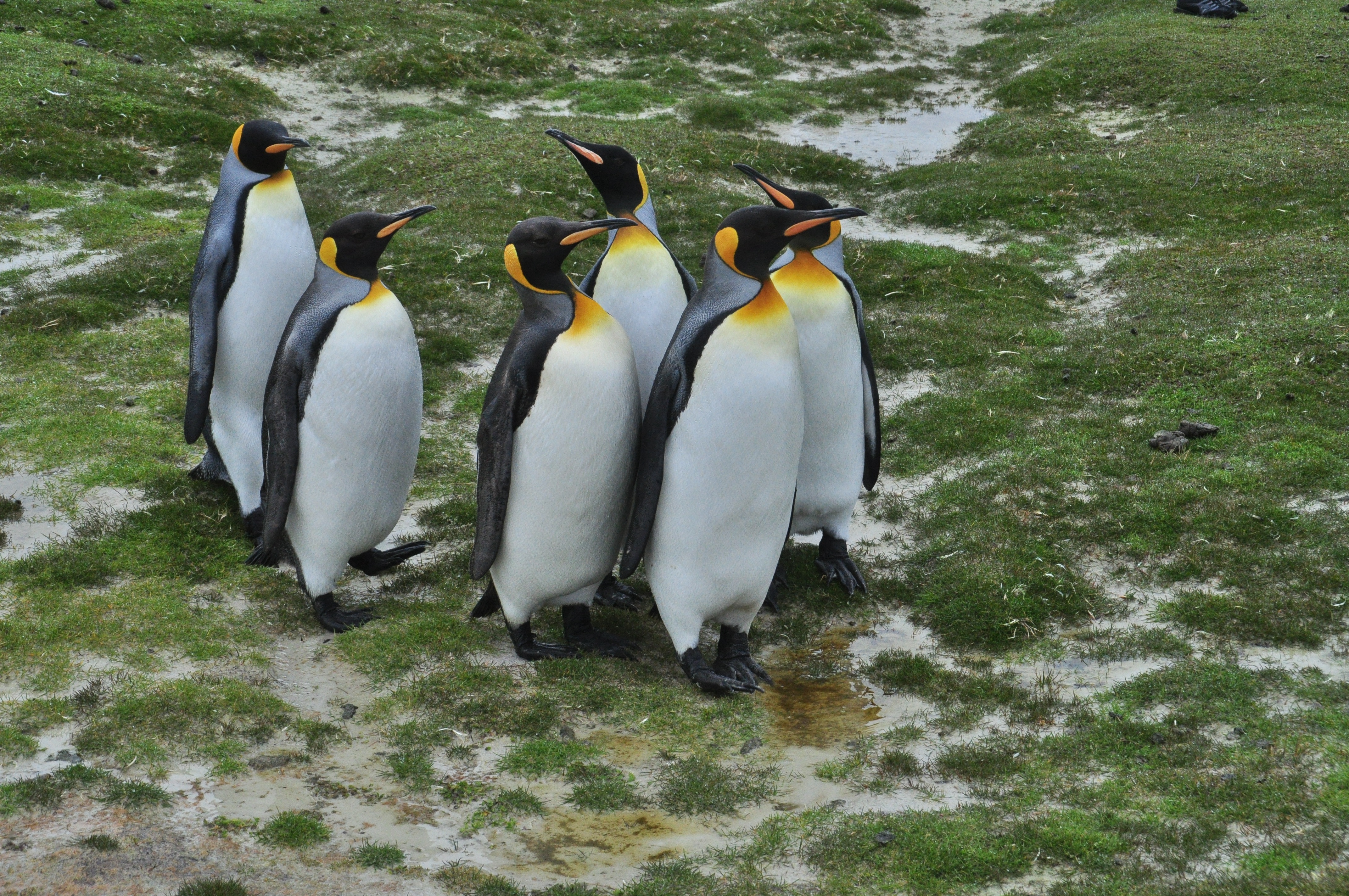
About Port Stanley
Tiny Stanley, capital of the Falklands, seems in many ways like a British village fallen out of the sky. Many homes are painted in bright colours, adding visual appeal to this distant outpost. Not far offshore, the wreck of the Lady Elizabeth, is one of the many vessels remaining as a silent testimonial to the region's frequent harsh weather conditions.The islands, also known by their Spanish name of Islas Malvinas, are home to arguably more tuxedo-clad inhabitants of the penguin variety than human residents. Various species, such as Gentoo, Magellanic and the more elusive King penguins, either live here permanently or use the Falklands as a stopover on their migration route. Darwin found the islands' flora and fauna fascinating - no doubt you will, too.
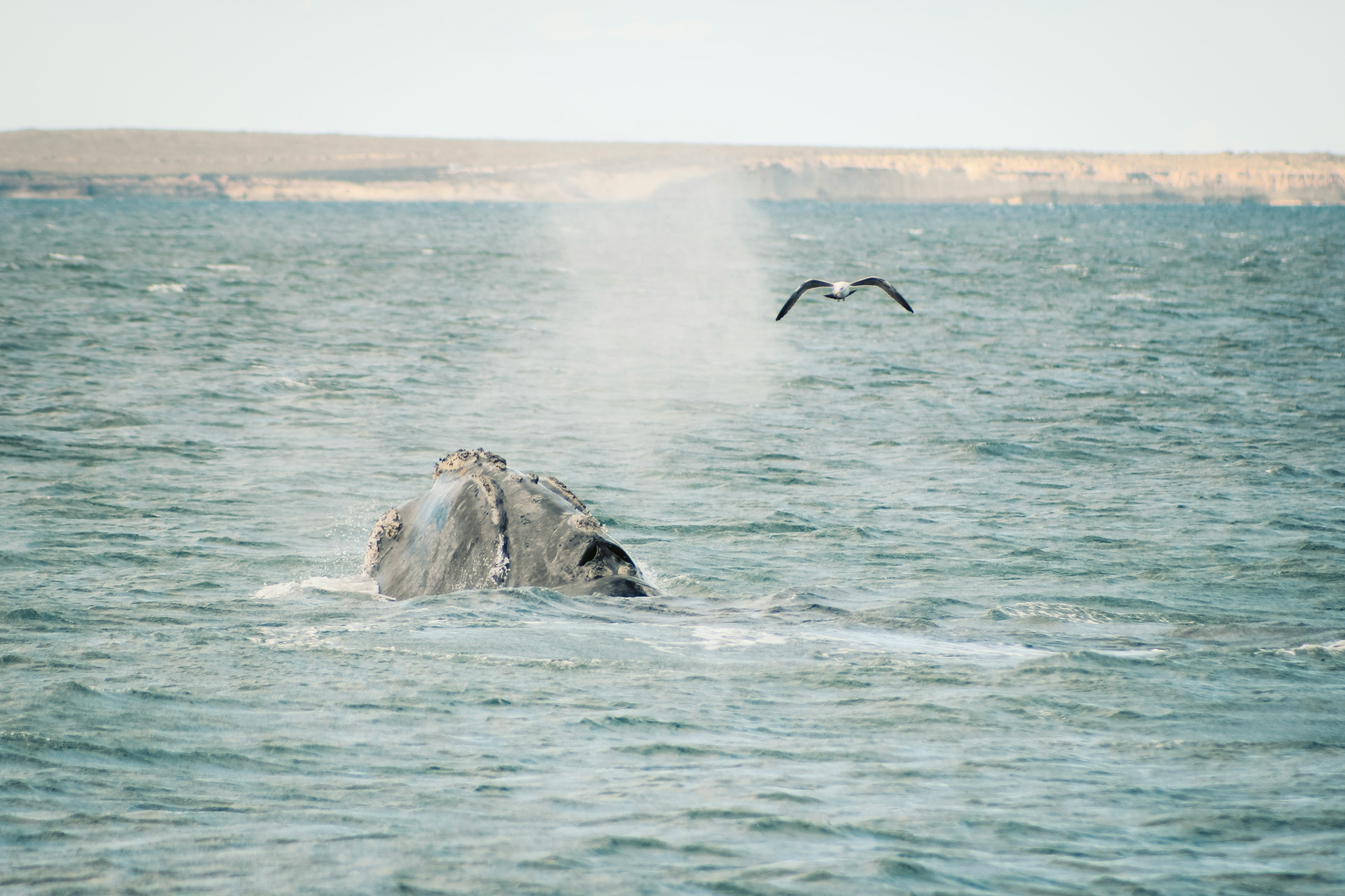
About Puerto Madryn
Approaching from Ruta 3, it's hard to believe that the horizon line of buildings perched just beyond the windswept dunes and badlands is the most successful of all coastal Patagonia settlements. But once you get past the outskirts of town and onto the wide coastal road known as the Rambla, the picture begins to change. Ranged along the clear and tranquil Golfo Nuevo are restaurants, cafés, dive shops, and hotels, all busy—but not yet overcrowded—with tourists from around the world.Puerto Madryn is more a base for visiting nearby wildlife-watching sites like Península Valdés and Punta Tombo than a destination in its own right. The town's architecture is unremarkable, and beyond a walk along the coast there isn't much to do. Indeed, even the few museums serve mainly to introduce you to the fauna you'll see elsewhere. The exception is the beginning of whale season (May through July), when the huge animals cavort right in the bay before heading north—you can even walk out alongside them on the pier. During these months it's worth the extra expense for a room with a sea view.The many tour agencies and rental-car companies here make excursion planning easy. Aim to spend most of your time here on one- or two-day trips exploring the surroundings. Note that competition is fierce between tourism operators in destinations such as Puerto Madryn and Puerto Pirámides on Península Valdés. Take information that tour operators and even the tourism office give you about these with a grain of salt: they often exaggerate Madryn's virtues and other areas' flaws.

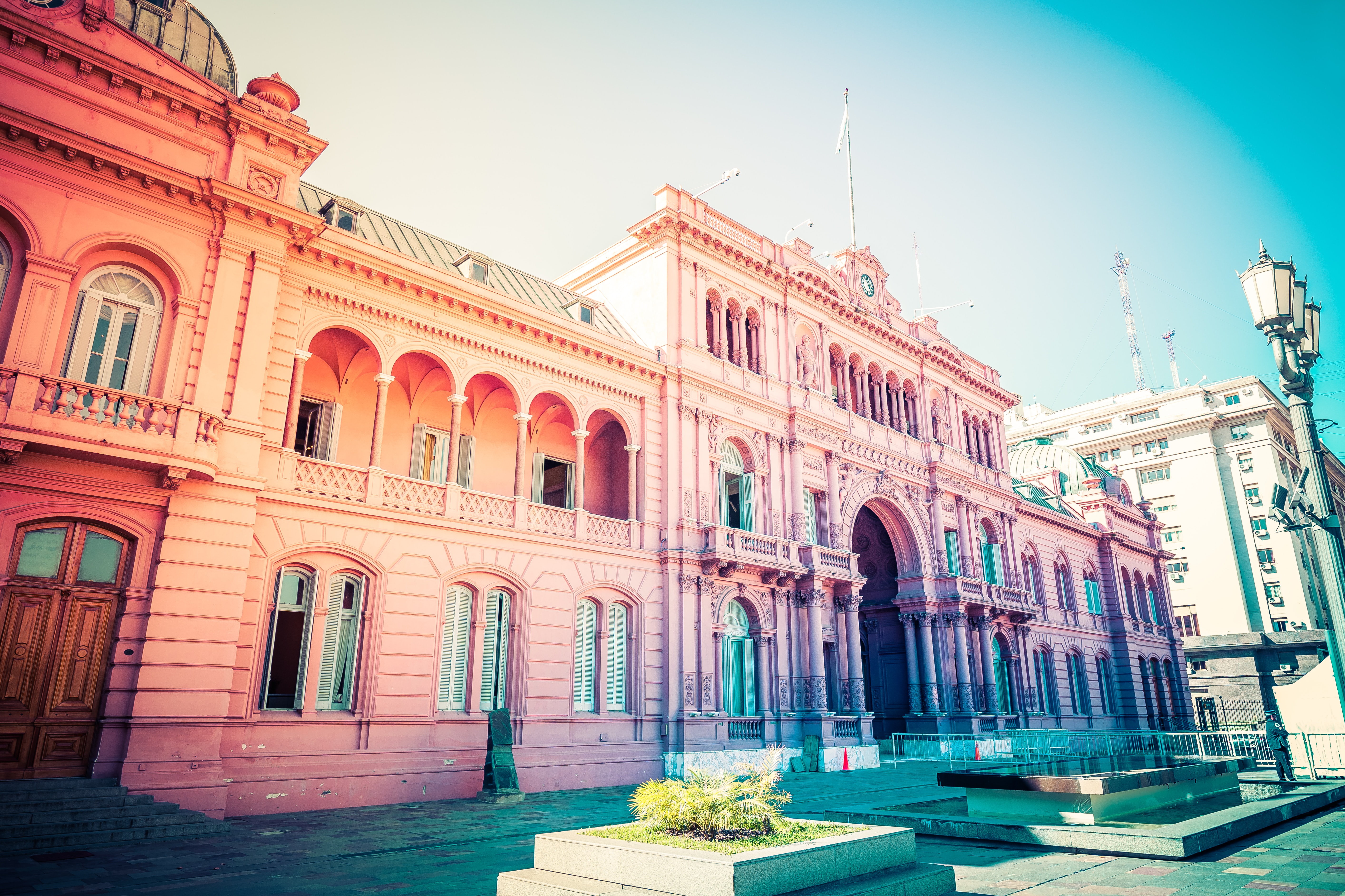
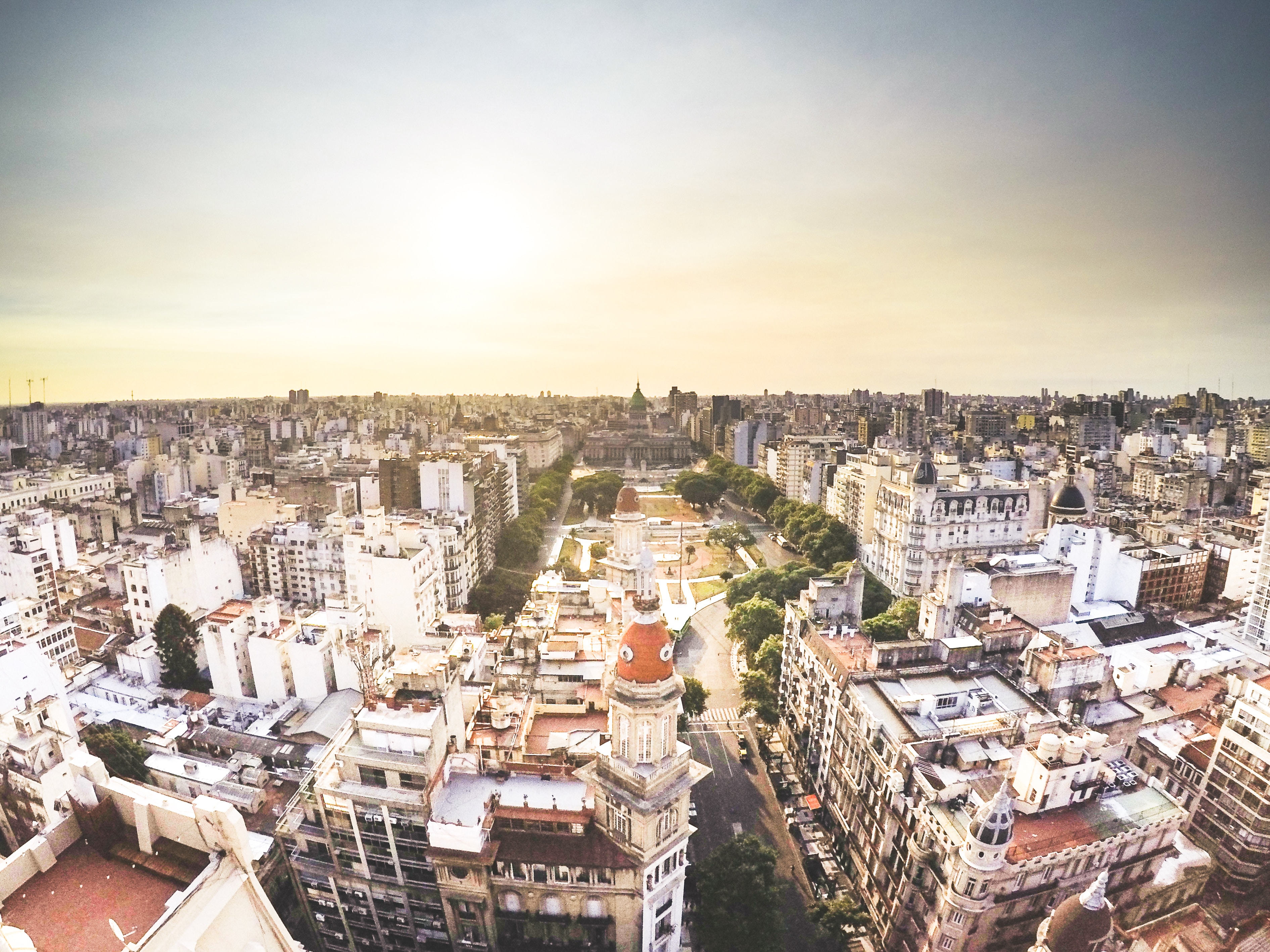
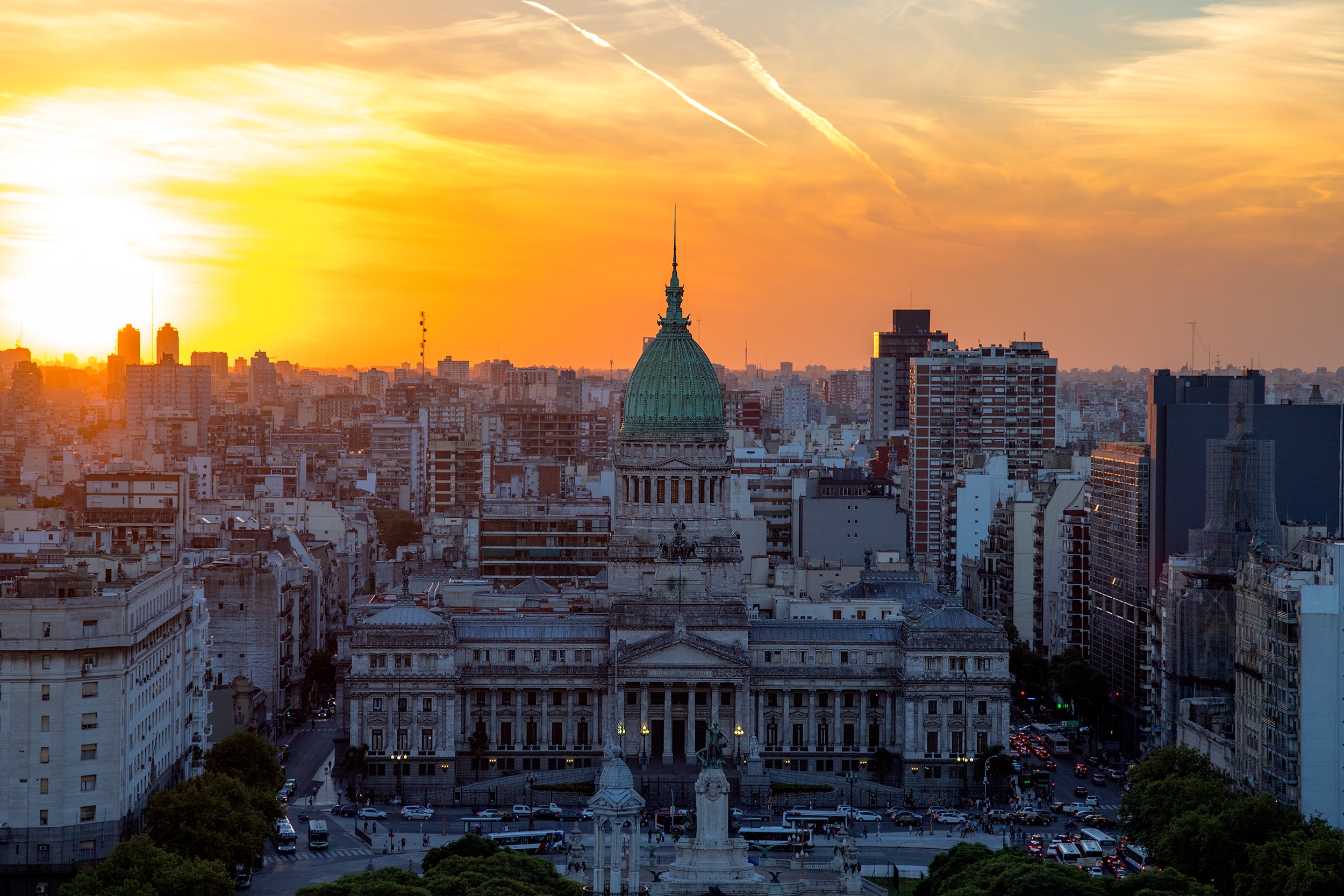
About Buenos Aires
Glamorous and gritty, Buenos Aires is two cities in one. What makes Argentina's capital so fascinating is its dual heritage—part European, part Latin American. Plaza de Mayo resembles a grand square in Madrid, and the ornate Teatro Colón would not be out of place in Vienna. But you’ll know you’re in South America by the leather shoes for sale on cobbled streets and impromptu parades of triumphant soccer fans. Limited-production wines, juicy steaks, and ice cream in countless flavors are among the old-world imports the city has perfected.
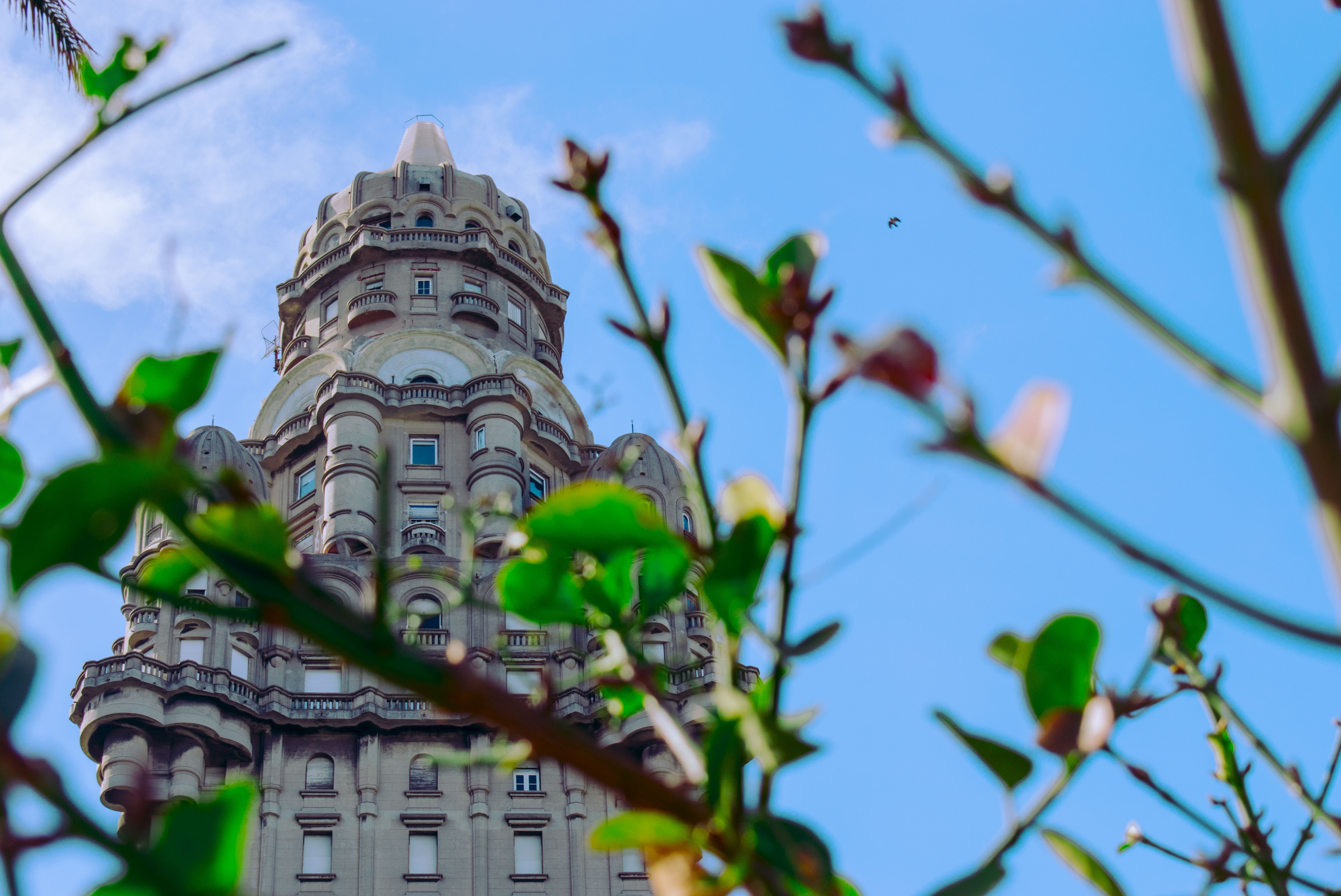
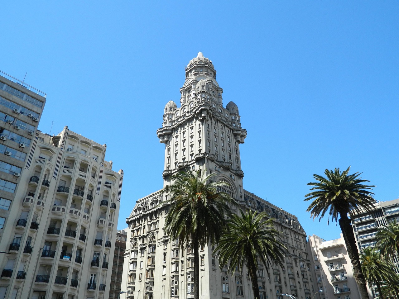
About Montevideo
Uruguay’s capital city hugs the eastern bank of the Río de la Plata. A massive coastal promenade (malecón) that passes fine beaches, restaurants, and numerous parks recalls the sunny sophistications of the Mediterranean and is always dotted with Montevideans strolling, exercising, and lounging along the water. Montevideo has its share of glitzy shopping avenues and modern office buildings, balanced with its historic old city and sumptuous colonial architecture, as well as numerous leafy plazas and parks. It is hard not to draw comparisons to its sister city Buenos Aires across the river, and indeed Montevideo strikes many as a calmer, more manageable incarnation of Argentina's capital.When the weather's good, La Rambla, a 22-km (14-mile) waterfront avenue that links the Old City with the eastern suburbs and changes names about a dozen times, gets packed with fishermen, ice-cream vendors, and joggers. Around sunset, volleyball and soccer games wind down as couples begin to appear for evening strolls. Polls consistently rate Montevideo as having the highest quality of life of any city in Latin America. After one visit here, especially on a lovely summer evening, you probably will agree.
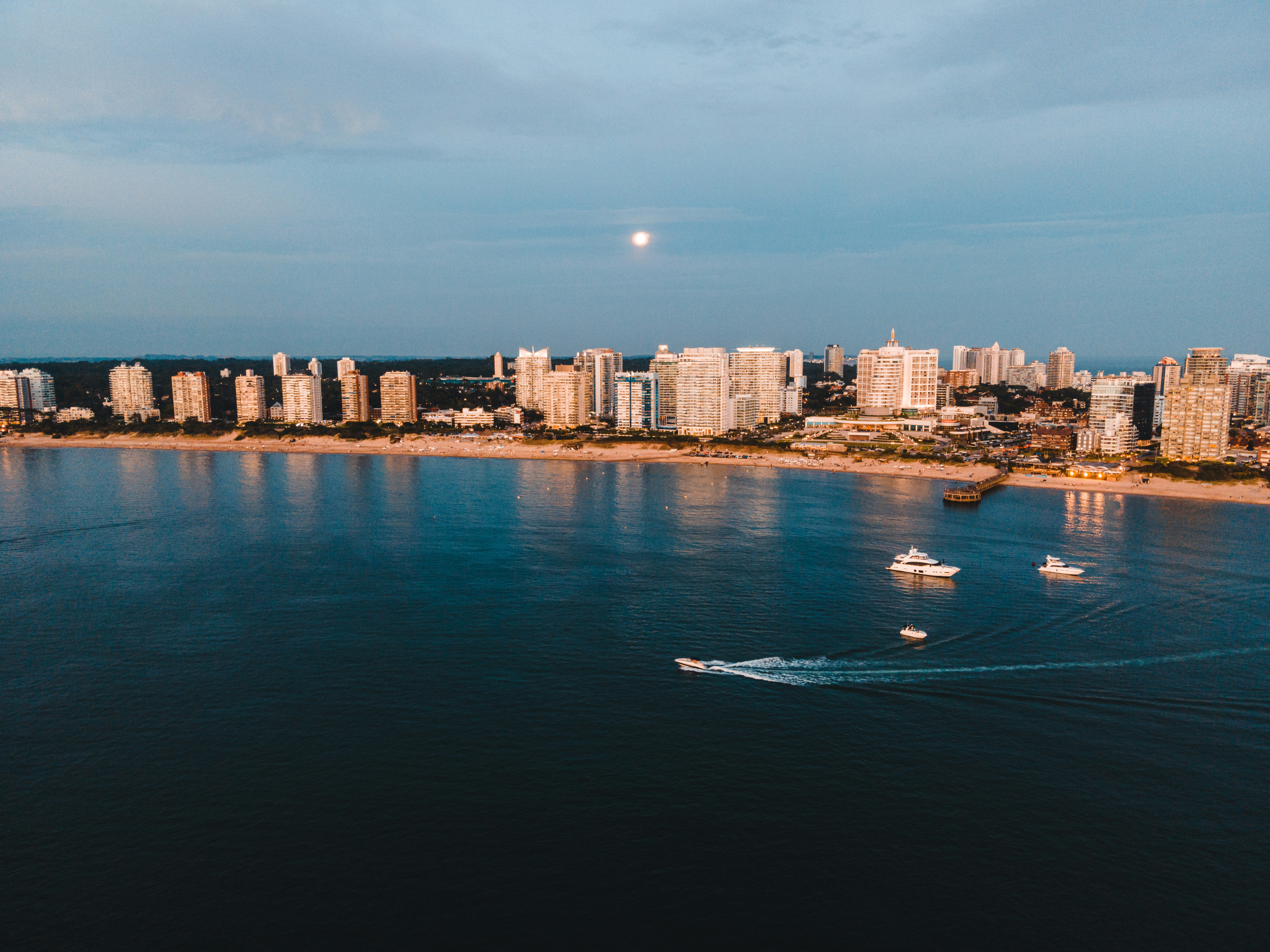
About Punta del Este
Often likened to the Hamptons or St-Tropez, Punta del Este is a flashy destination where parties run nonstop in peak season. But it is also a destination that draws a range of beachgoers to its shores, from summering families to the celebrity jet-set. There's a bustling city on the beach downtown, as well as quiet countryside populated solely with upscale ranches called chacras or estancias, and creative, buzzing hamlets like La Barra and José Ignacio. Though it's pricey and at times a logistical challenge to get around, everyone finds something about Punta to love.The resort takes its name from the "east point" marking the division of the Río de la Plata on the west from the Atlantic Ocean to the east. It also lends its name to the broader region encompassing the nearby communities of Punta Ballena and La Barra de Maldonado. These days even José Ignacio, some 20 miles away, is grouped in. It's usually a given that Argentina’s upper class spends at least part of the summer in Punta, soaking in the ample rays.
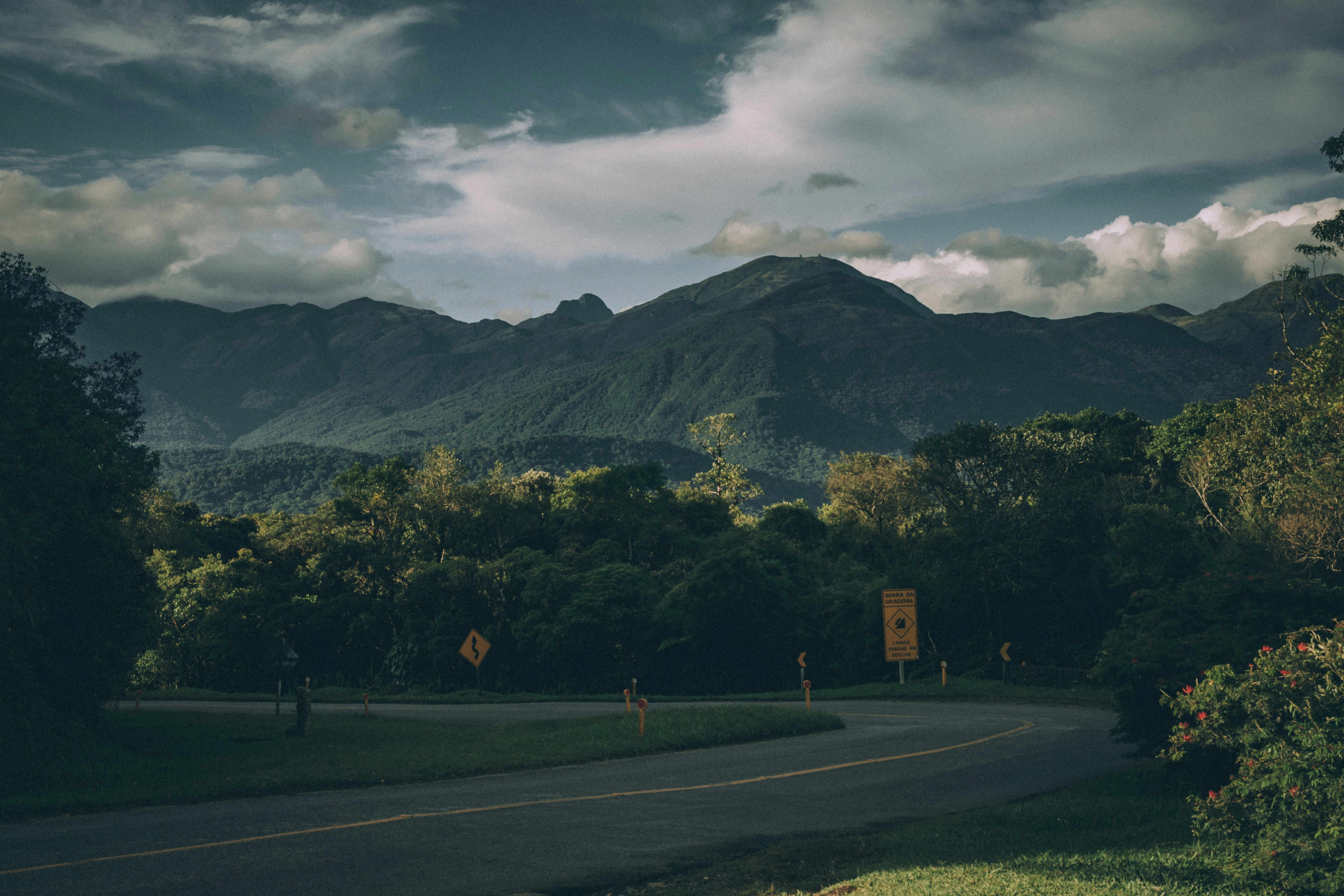
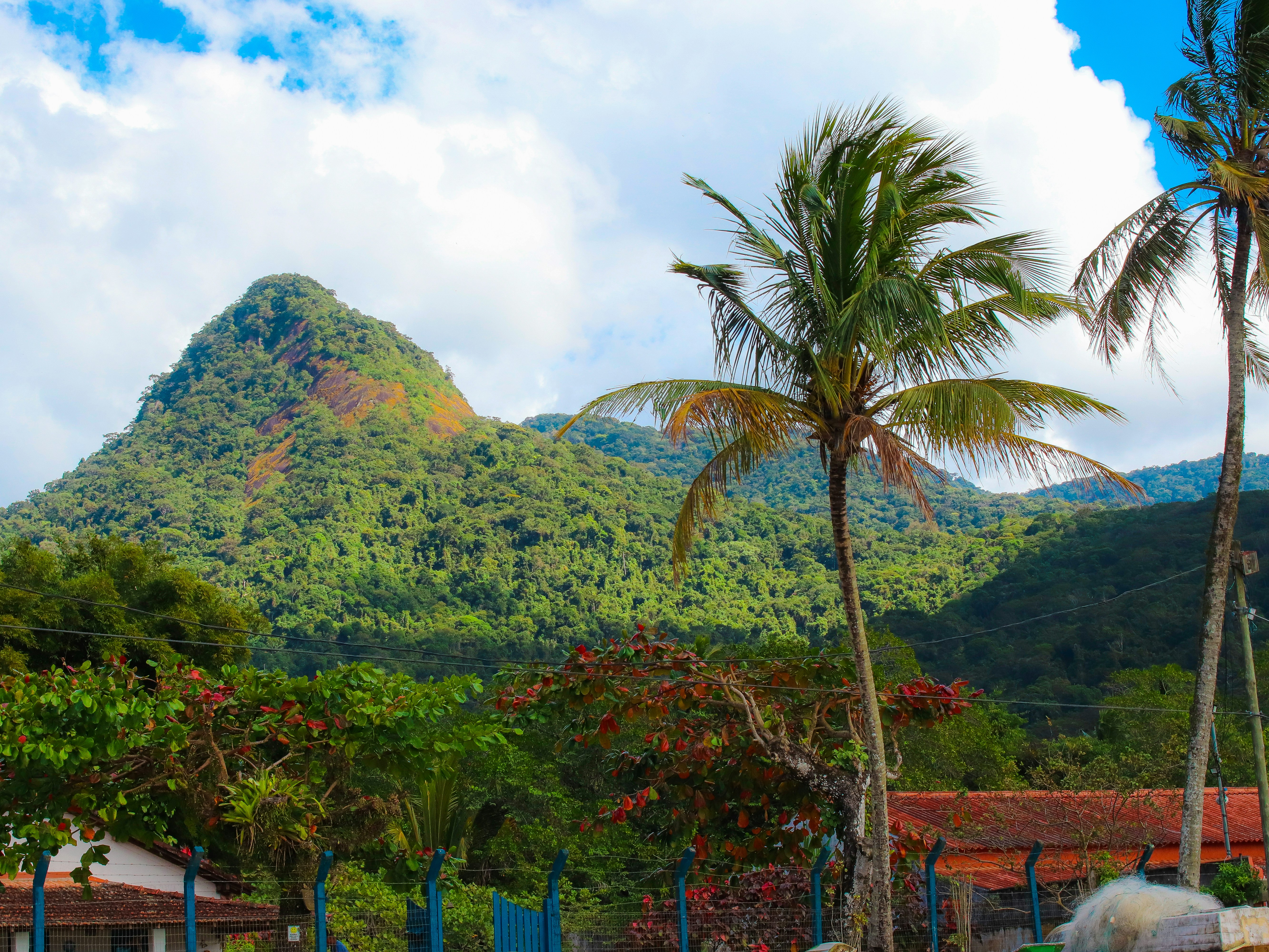
About Porto Belo
About Paranaguá

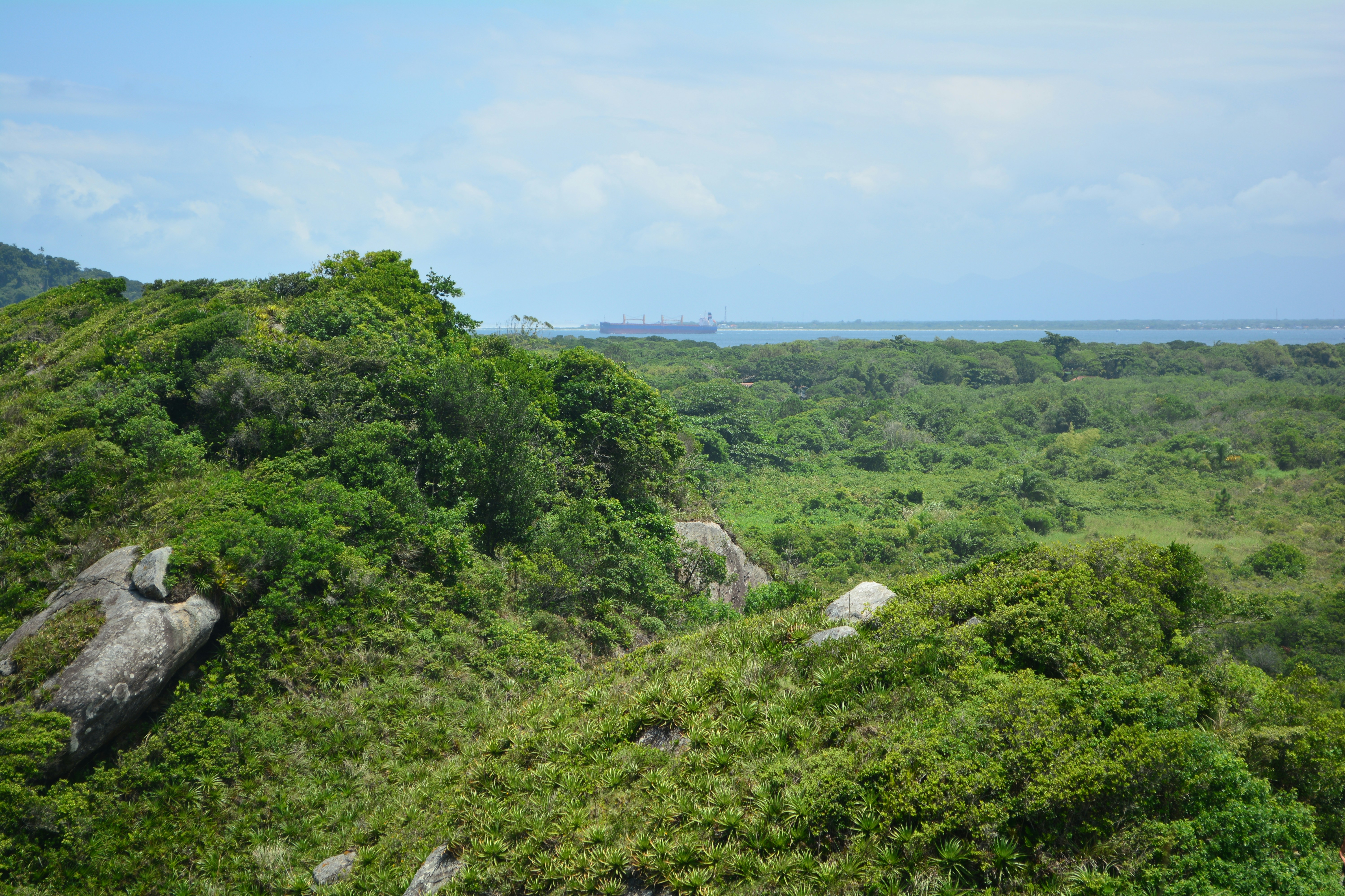
About Ilhabela
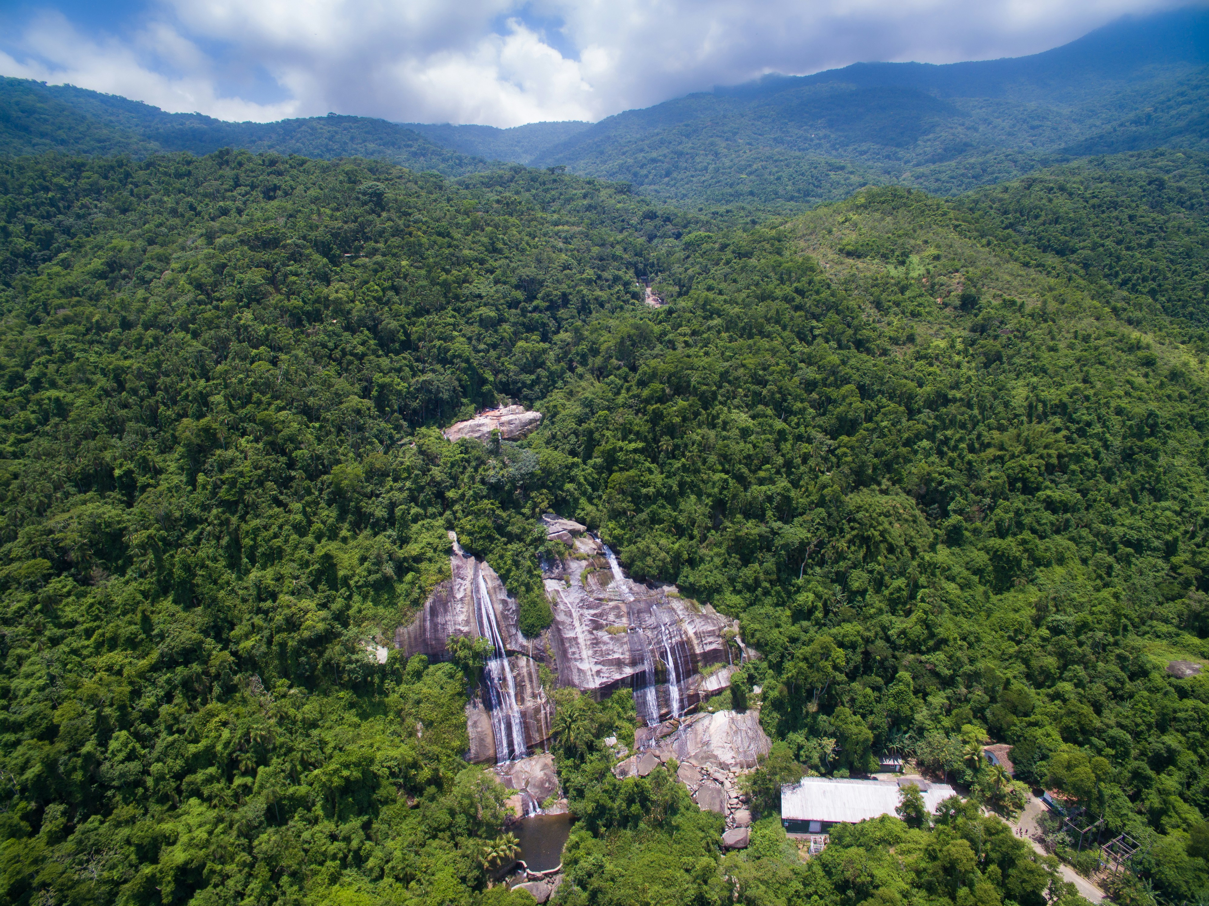
About Ilha Grande
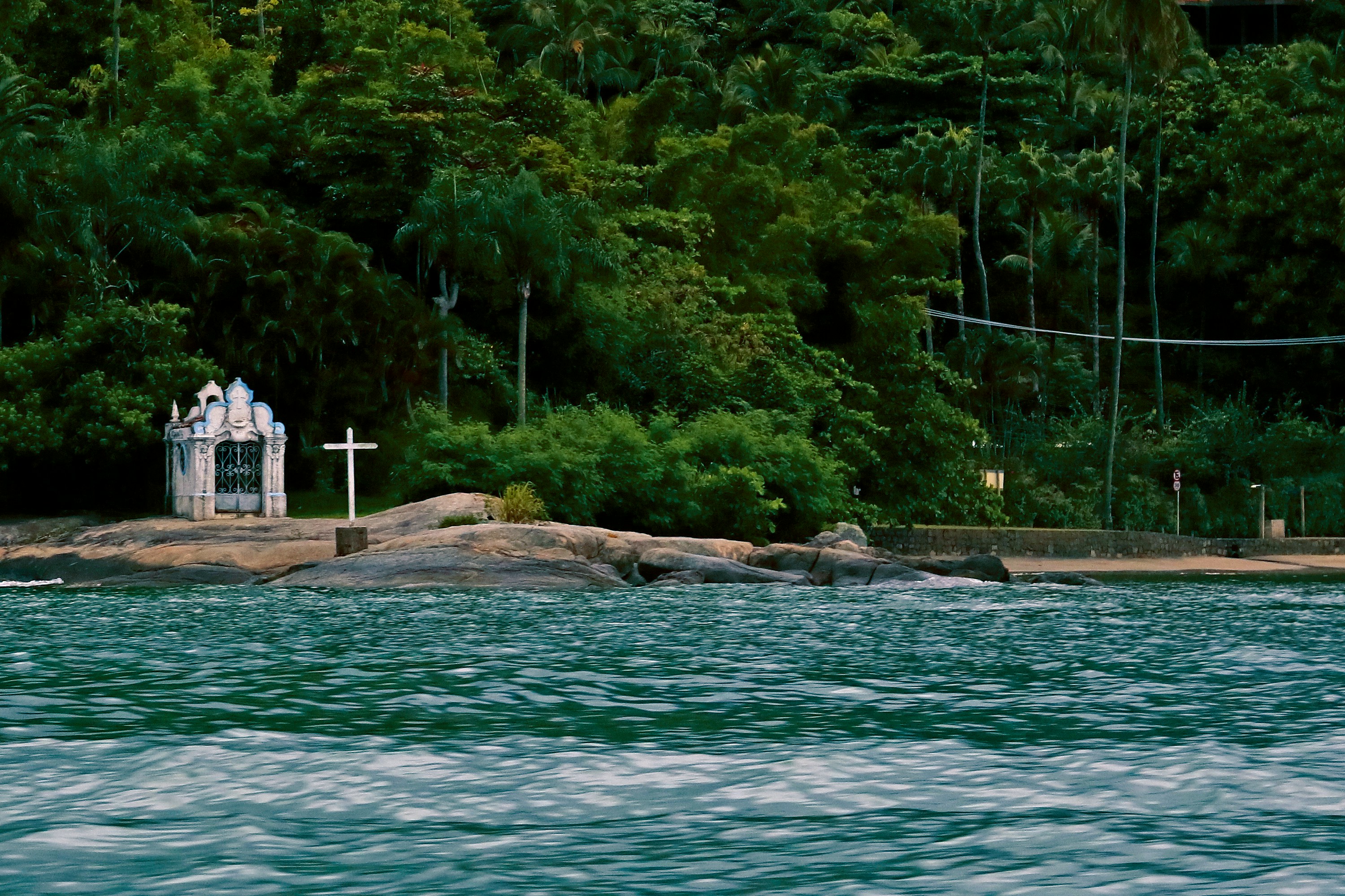
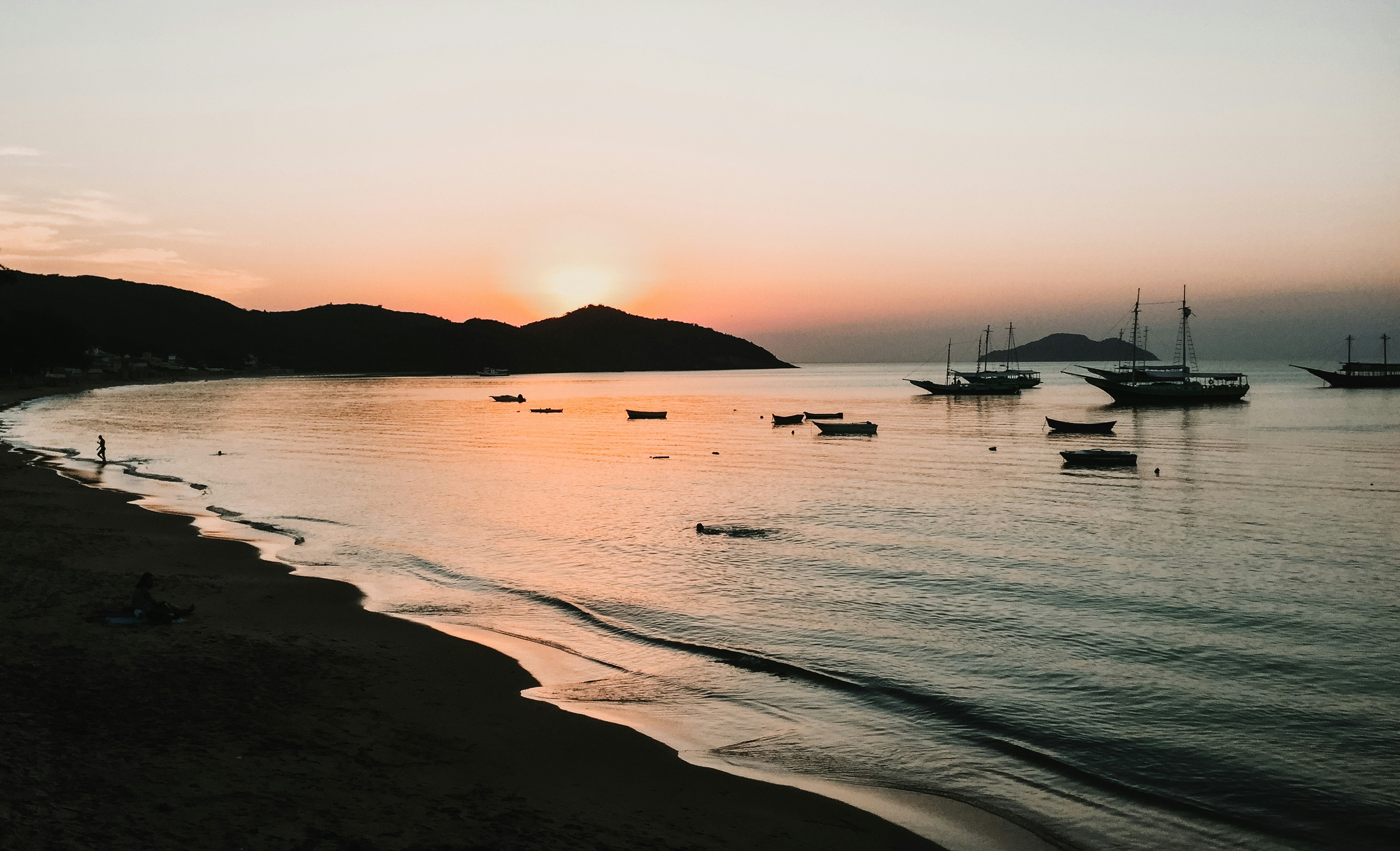
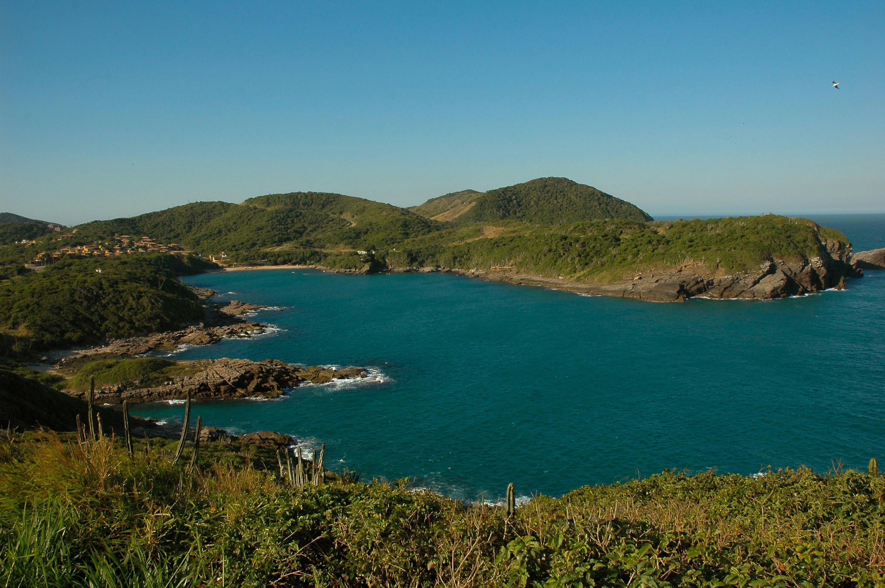
About Buzios
Around two hours from Rio de Janeiro, Búzios is a string of beautiful beaches on an 8-km-long (5-mile-long) peninsula. It was the quintessential sleepy fishing village until the 1960s, when the French actress Brigitte Bardot holidayed here to escape the paparazzi and the place almost instantly transformed into a vacation sensation. Búzios has something for everyone. Some hotels cater specifically to families and provide plenty of activities and around-the-clock child care. Many have spa facilities, and some specialize in weeklong retreats. For outdoor enthusiasts, Búzios offers surfing, windsurfing, kitesurfing, diving, hiking, and mountain biking, as well as leisurely rounds of golf.
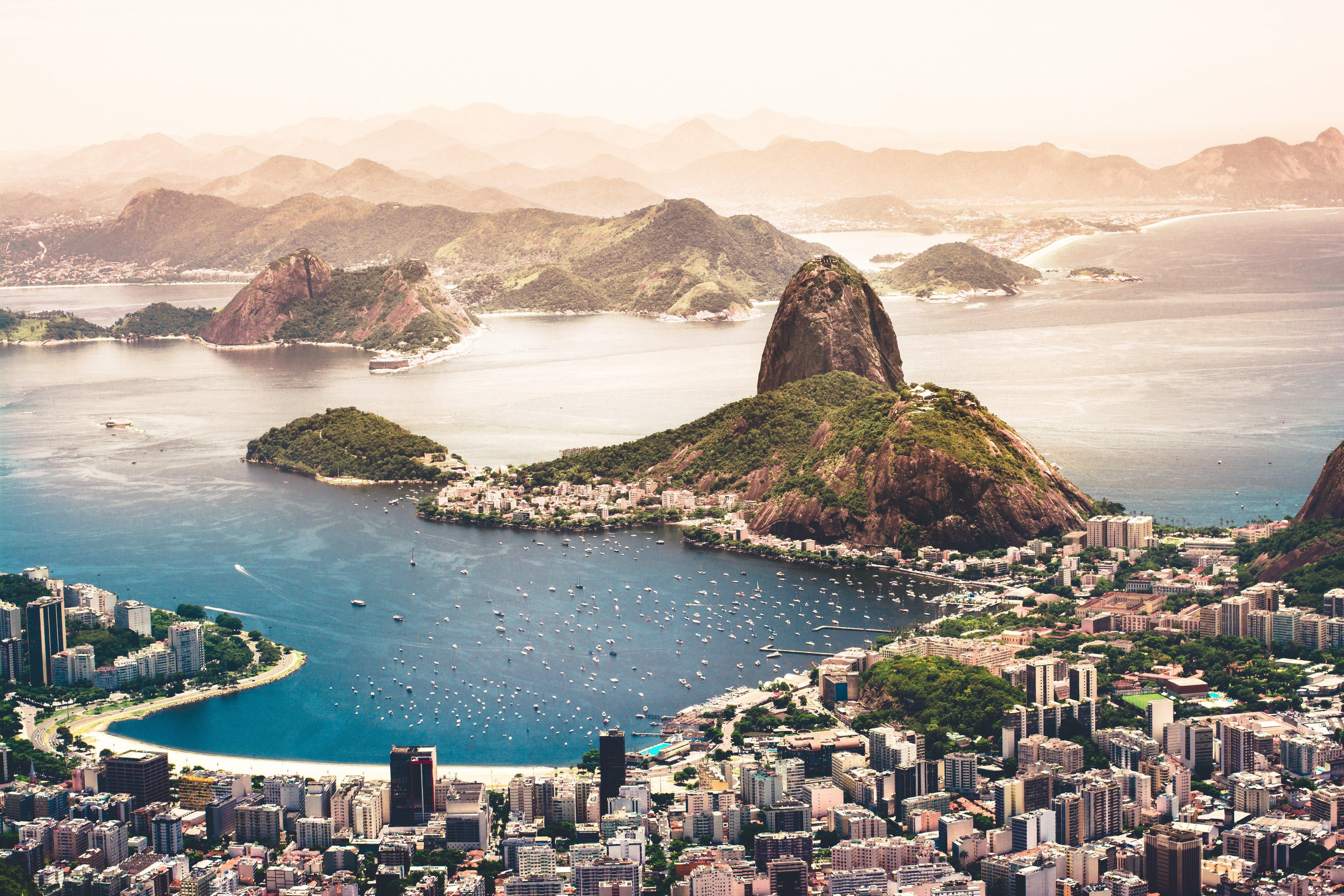
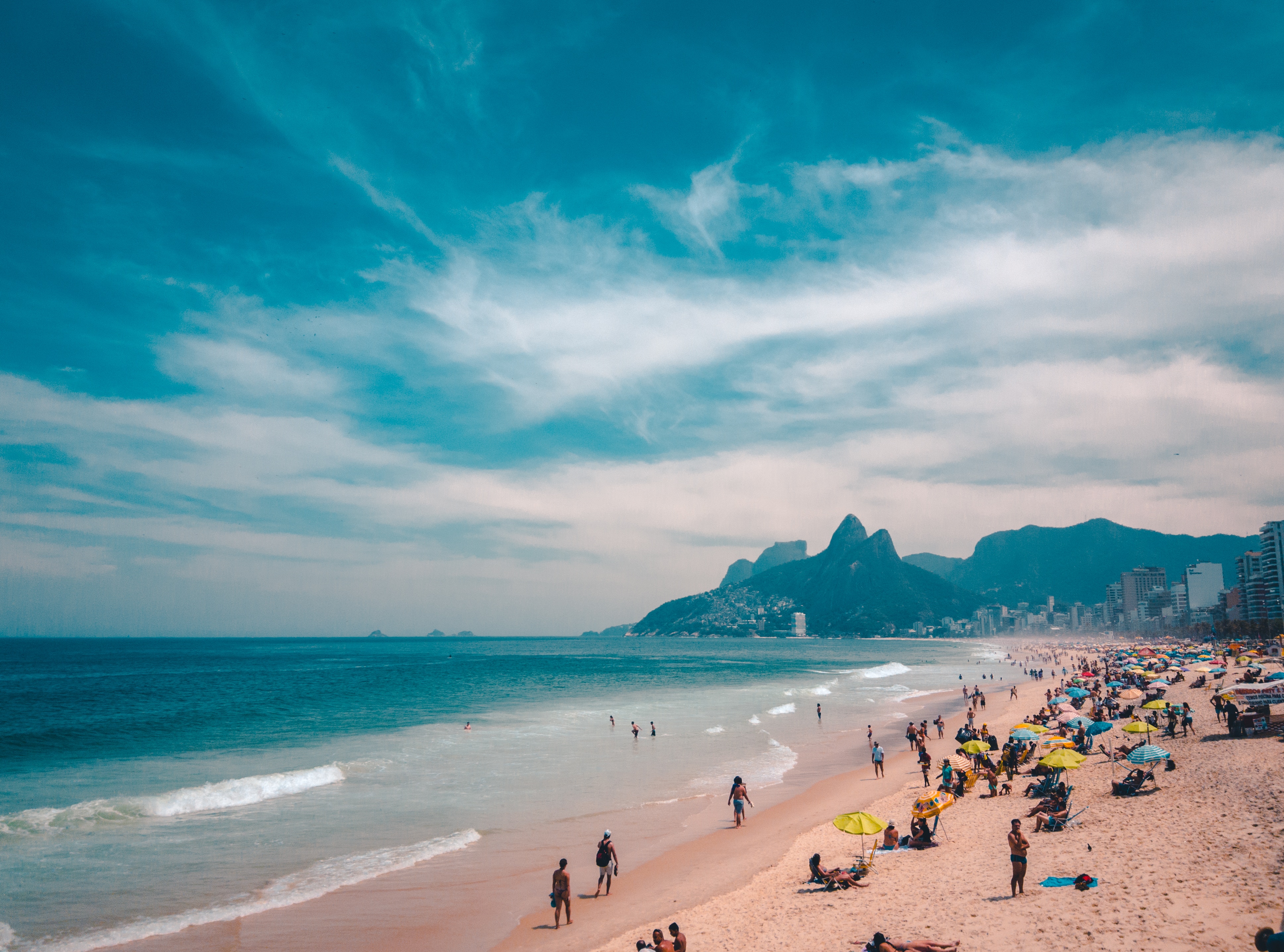
About Rio de Janeiro
Welcome to the Cidade Maravilhosa, or the Marvelous City, as Rio is known in Brazil. Synonymous with the girl from Ipanema, the dramatic views from Christ the Redeemer atop Corcovado mountain, and fabulously flamboyant Carnival celebrations, Rio is a city of stunning architecture, abundant museums, and marvelous food. Rio is also home to 23 beaches, an almost continuous 73-km (45-mile) ribbon of sand.As you leave the airport and head to Rio's beautiful Zona Sul (the touristic South Zone), you'll drive for about 40 minutes on a highway from where you'll begin to get a sense of the dramatic contrast between beautiful landscape and devastating poverty. In this teeming metropolis of 12 million people (6.2 million of whom live in Rio proper), the very rich and the very poor live in uneasy proximity. You'll drive past seemingly endless cinder-block favela, but by the time you reach Copacabana's breezy, sunny Avenida Atlântica—flanked on one side by white beach and azure sea and on the other by condominiums and hotels—your heart will leap with expectation as you begin to recognize the postcard-famous sights. Now you're truly in Rio, where cariocas (Rio residents) and tourists live life to its fullest.Enthusiasm is contagious in Rio. Prepare to have your senses engaged and your inhibitions untied. Rio seduces with a host of images: the joyous bustle of vendors at Sunday's Feira Hippie (Hippie Fair); the tipsy babble at sidewalk cafés as patrons sip their last glass of icy beer under the stars; the blanket of lights beneath the Pão de Açúcar (Sugarloaf Mountain); the bikers, joggers, strollers, and power walkers who parade along the beach each morning. Borrow the carioca spirit for your stay; you may find yourself reluctant to give it back.
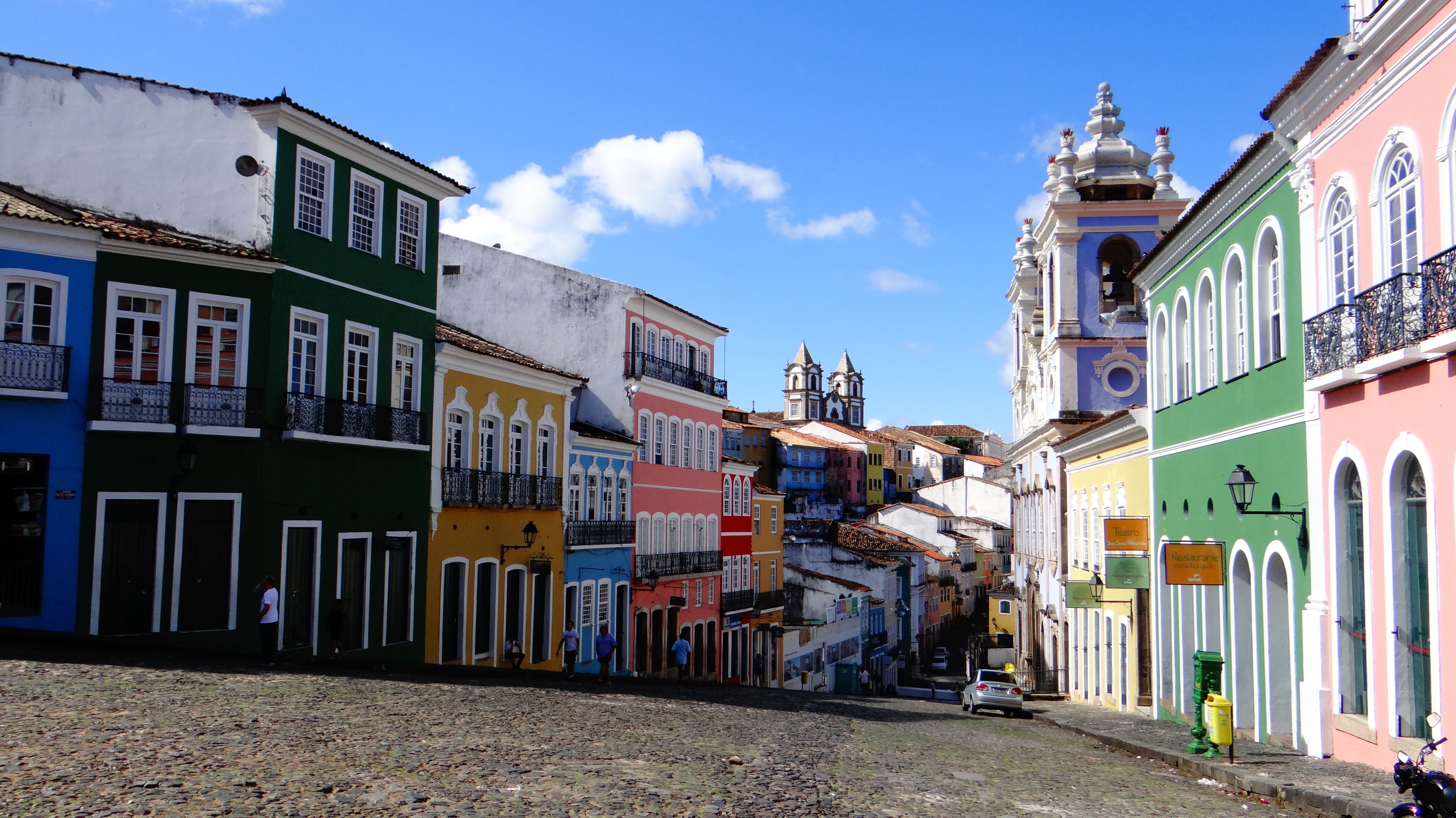
About Salvador de Bahia
According to Salvador's adopted son Jorge Amado, "In Salvador, magic becomes part of the every-day." From the shimmering golden light of sunset over the Baía do Todos os Santos, to the rhythmic beats that race along the streets, Salvador, while no longer Brazil's capital, remains one of its most captivating cities. A large dose of its exoticism comes down to its African heritage—at least 70% of its 2,675,000 population is classified as Afro-Brazilian—and how it has blended into Brazil's different strands, from the native Indians to the Christian colonizers. Salvadorans may tell you that you can visit a different church every day of the year, which is almost true—the city has about 300. Churches whose interiors are covered with gold leaf were financed by the riches of the Portuguese colonial era, when slaves masked their traditional religious beliefs under a thin Catholic veneer. And partly thanks to modern-day acceptance of those beliefs, Salvador has become the fount of Candomblé, a religion based on personal dialogue with the orixás, a family of African deities closely linked to nature and the Catholic saints. The influence of Salvador's African heritage on Brazilian music has also turned the city into one of the musical capitals of Brazil, resulting in a myriad of venues to enjoy live music across the city, along with international acclaim for exponents like Gilberto Gil, Caetano Veloso, and Daniela Mercury. Salvador's economy today is focused on telecommunications and tourism. The still-prevalent African culture draws many tourists—this is the best place in Brazil to hear African music, learn or watch African dance, and see capoeira, a martial art developed by slaves. In the district of Pelourinho, many colorful 18th- and 19th-century houses remain, part of the reason why this is the center of the tourist trade. Salvador sprawls across a peninsula surrounded by the Baía de Todos os Santos on one side and the Atlantic Ocean on the other. The city has about 50 km (31 miles) of coastline. The original city, referred to as the Centro Histórica (Historical Center), is divided into the Cidade Alta (Upper City), also called Pelourinho, and Cidade Baixa (Lower City). The Cidade Baixa is a commercial area—known as Comércio—that runs along the port and is the site of Salvador's indoor market, Mercado Modelo. You can move between the upper and lower cities on foot, via the landmark Elevador Lacerda, behind the market, or on the Plano Inclinado, a funicular lift, which connects Rua Guindaste dos Padres on Comércio with the alley behind Cathedral Basílica. From the Cidade Histórica you can travel north along the bay to the hilltop Igreja de Nosso Senhor do Bonfim. You can also head south to the point, guarded by the Forte Santo Antônio da Barra, where the bay waters meet those of the Atlantic. This area on Salvador's southern tip is home to the trendy neighborhoods of Barra, Ondina, and Rio Vermelho, with many museums, theaters, shops, and restaurants. Beaches along the Atlantic coast and north of Forte Santo Antônio da Barra are among the city's cleanest. Many are illuminated at night and have bars and restaurants that stay open late.

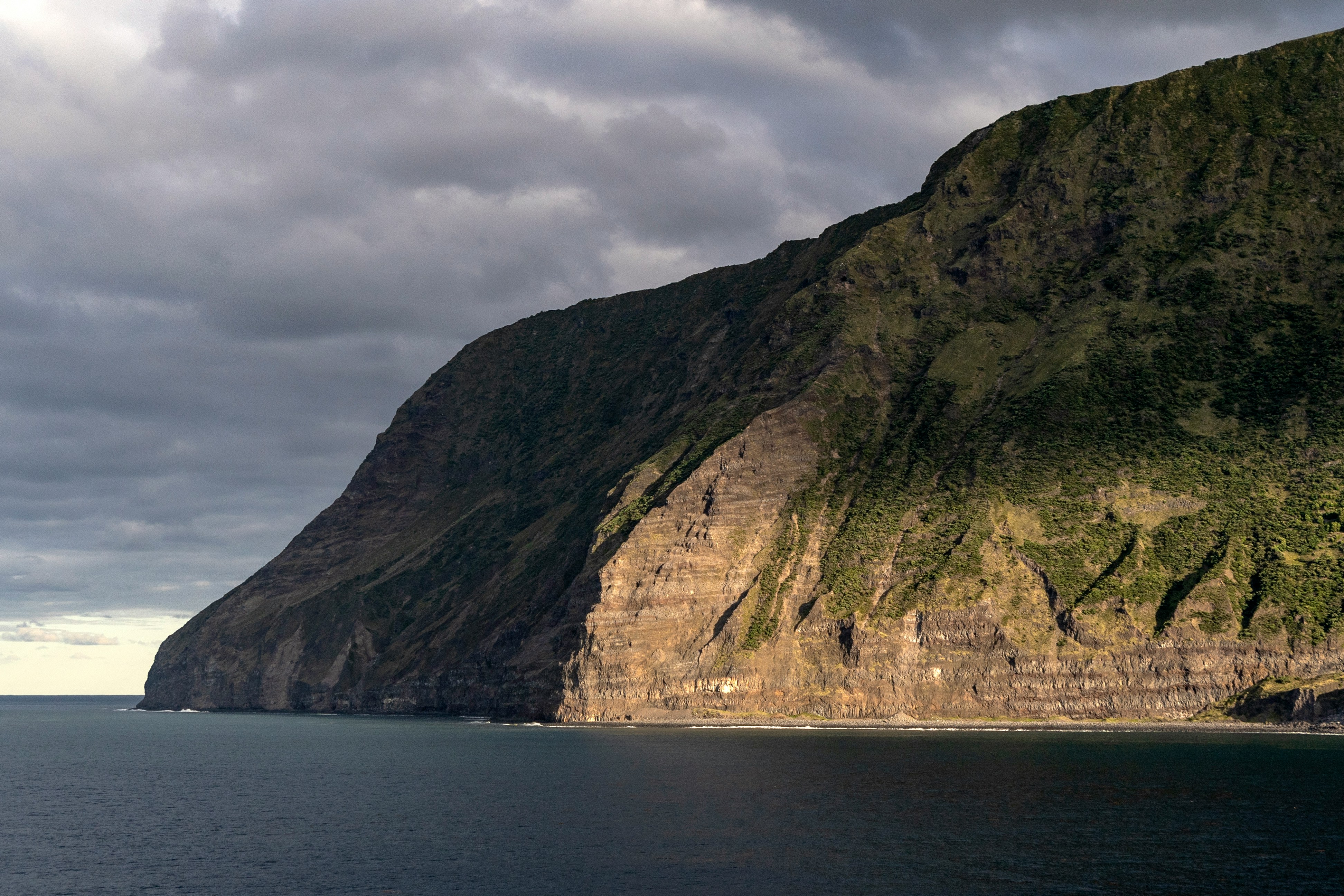
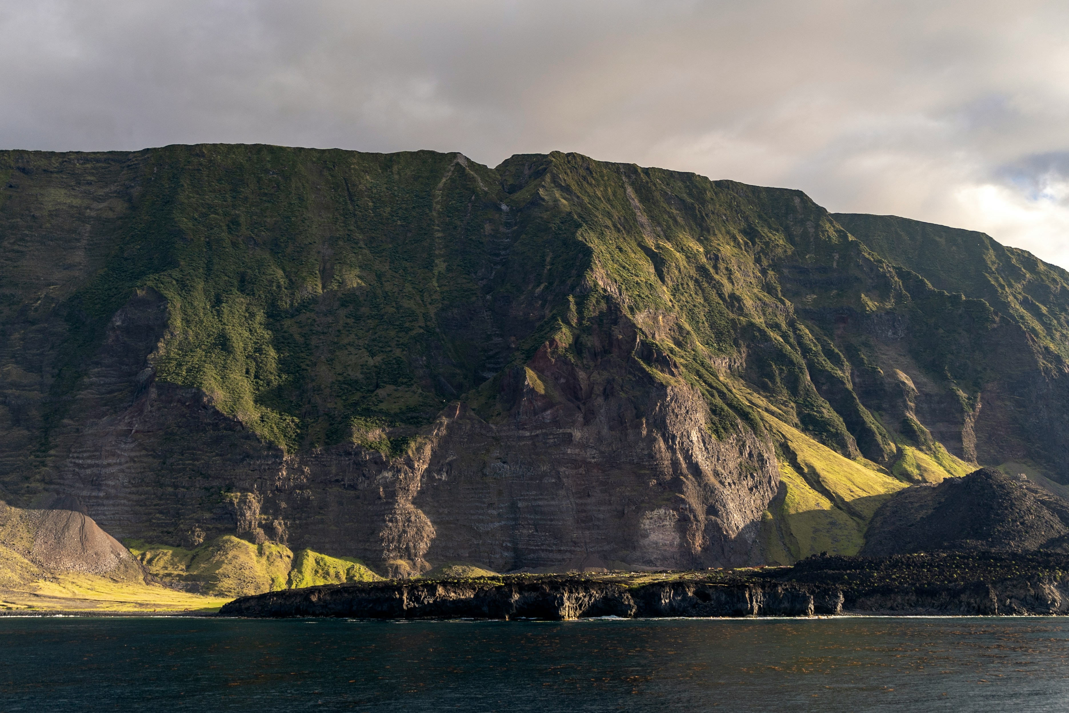
About Saint Helena
St Helena is a tiny, remote island lying in the South Atlantic, and thanks to its isolation it has a rare and unspoilt beauty. The nearest land is Ascension Island, situated some 700 miles north-west of St Helena, and the nearest mainland, West Africa, is over 1,000 miles away. The island was discovered by Juan de Nova Castella on May 21, 1502 and subsequently became a stop-off point for Portuguese vessels to replenish their supplies and break long voyages. In 1676 the famous astonomer Edmund Haley arrived in St Helena to produce his 'Catalogue of the Stars in the Southern Hemisphere'. However, the island is perhaps best known as the final exile of Napoleon Bonaparte. Following his defeat at Waterloo in 1815, Napoleon was exiled to Longwood House where he remained until his death six years later in 1821.
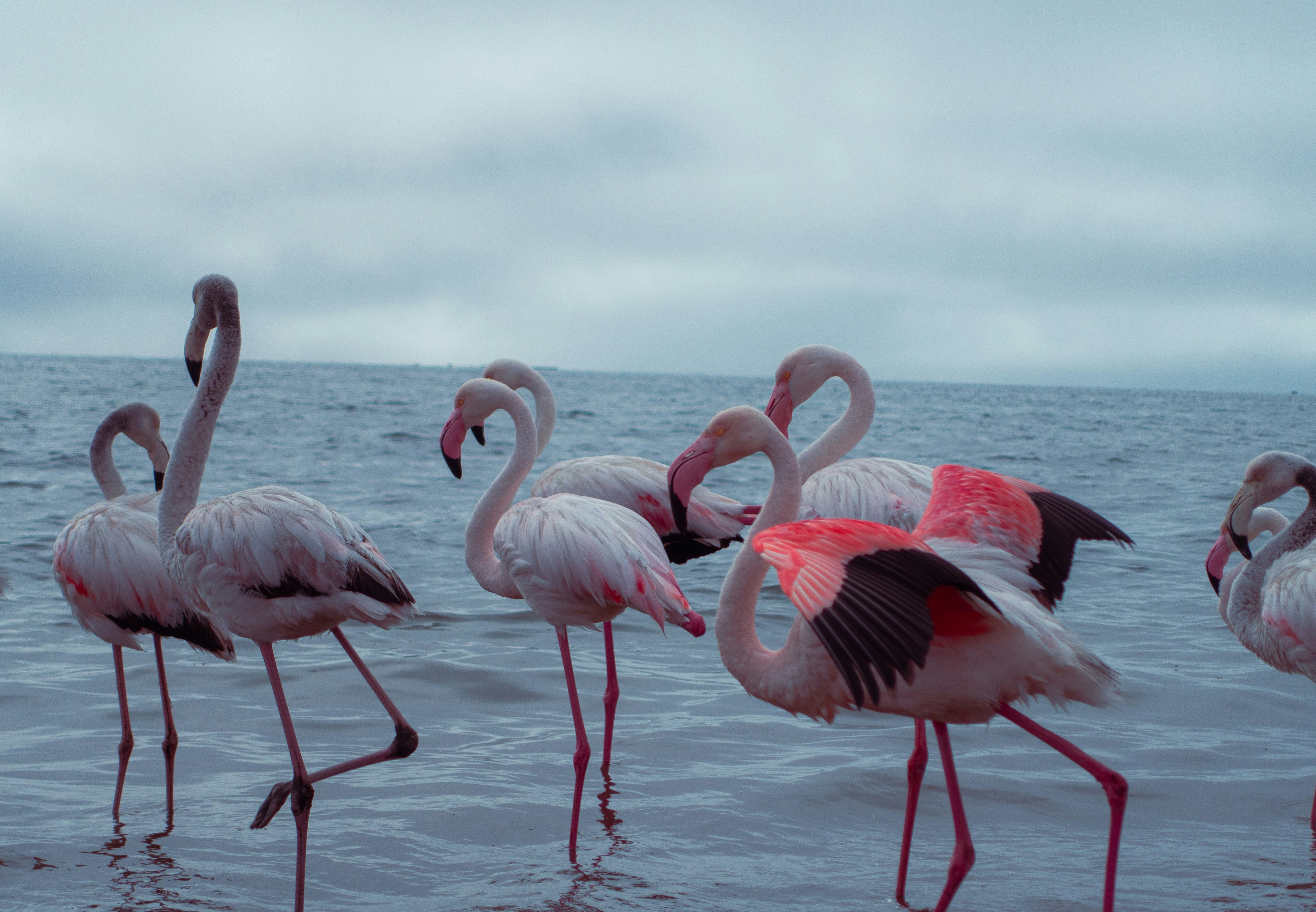
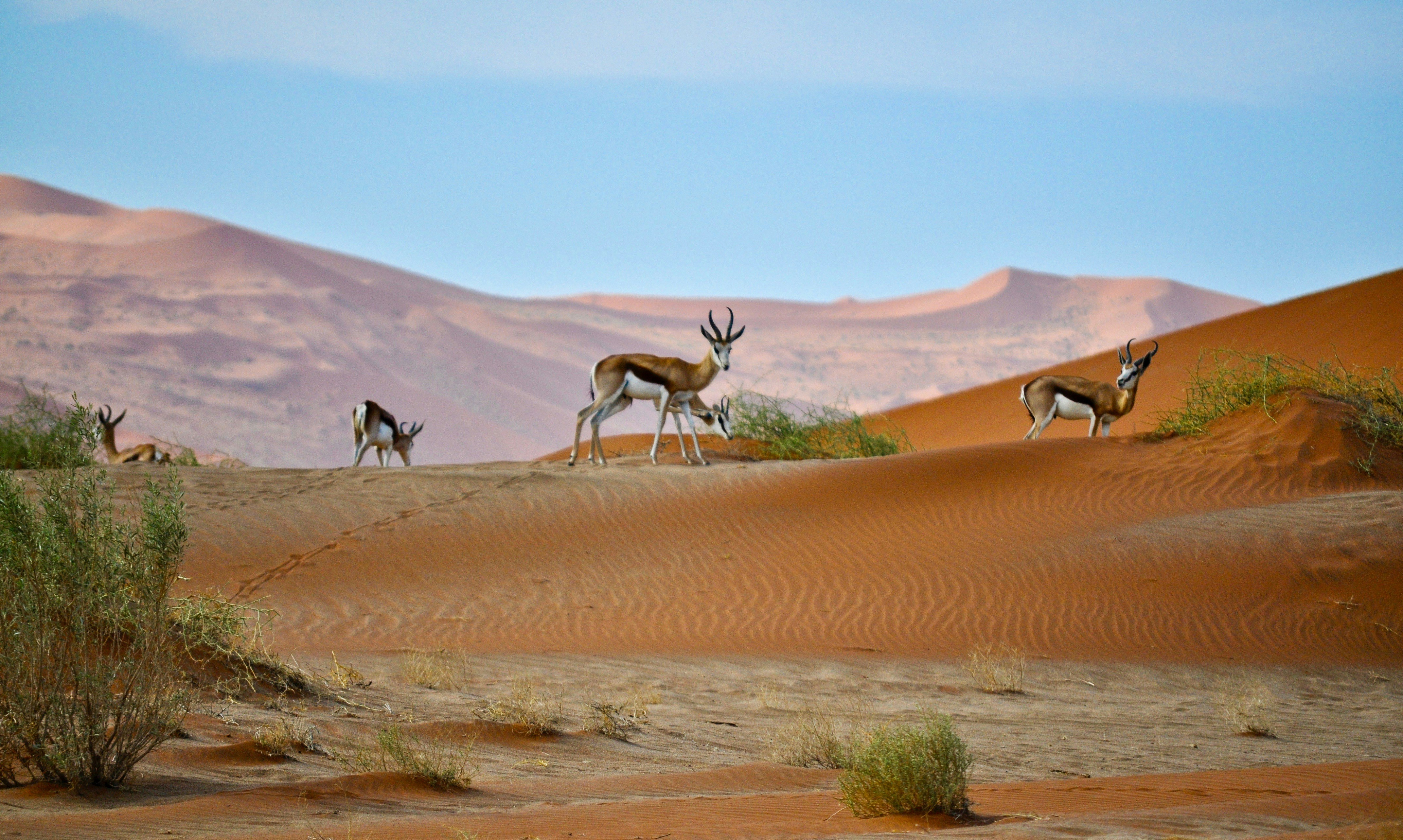
About Walvis Bay
Once a whaling station, Walvis Bay provides a gateway to the extraordinary desert landscapes of Namibia and is itself an area of unusual natural beauty. The showpiece of the Walvis Bay area is the natural lagoon where you can see flamingos in their thousands at certain times of the year, along with a variety of other wading birds such as the white pelican. Further inland you will find the stunning Namib Desert, which provides an unlikely home for a diverse array of wildlife. Alternatively, you could venture into the desert of Sossusvlei, whose mountainous ochre sand dunes are said to be the highest in the world, or visit the colonial town of Swakopmund.
About Lüderitz
The reopening of the diamond mine at Elizabeth Bay 20 years ago has brought the development of tourism and fishing back to this small 19th century village on the barren, windswept Namib Desert coast. One of Namibias oddities, it has everything you'd expect from a small German town - delicatessens, coffee shops and a Lutheran church. Here, the icy but clean South Atlantic is home to seals, penguins and other marine life and the desolate beaches support flamingoes. It was founded in 1883 when Heinrich Vogelsang purchased Angra Pequena and some of the surrounding land on behalf of Adolf Lüderitz, a Hanseat from Germany, from the local Nama chief. Lüderitz began its life as a trading post, with other activities in fishing and guano-harvesting. As a sign of Luderitz's revival, 1996 staged the first traditional German Karneval since 1960.
About Cape Town
Sometimes referred to as the Mother City, Cape Town is the most famous port in South Africa and is influenced by many different cultures, including Dutch, British and Malay. The port was founded in 1652 by Dutch explorer Jan Van Riebeeck, and evidence of Dutch colonial rule remains throughout the region. The port is located on one of the world's most important trade routes, and is mainly a container port and handler of fresh fruit. Fishing is another vital industry, with large Asian fishing fleets using Cape Town as a logistical repair base for much of the year. The region is famous for its natural beauty, with the imposing Table Mountain and Lions Head, as well as the many nature reserves and botanical gardens such as Kirstenbosch which boasts an extensive range of indigenous plant life, including proteas and ferns. Cape Town's weather is mercurial, and can change from beautiful sunshine to dramatic thunderstorms within a short period. A local adage is that in Cape Town you can experience four seasons in one day.
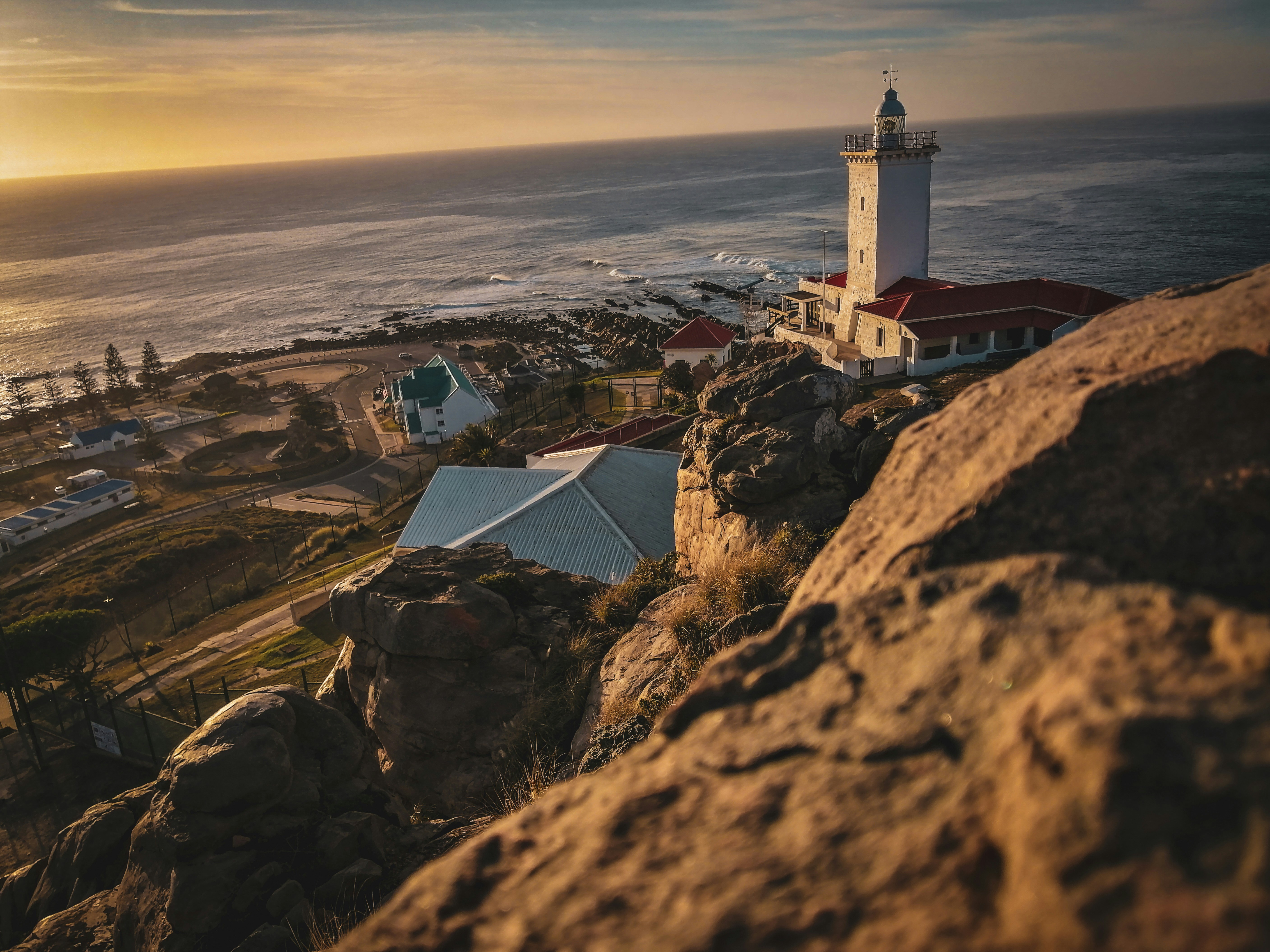
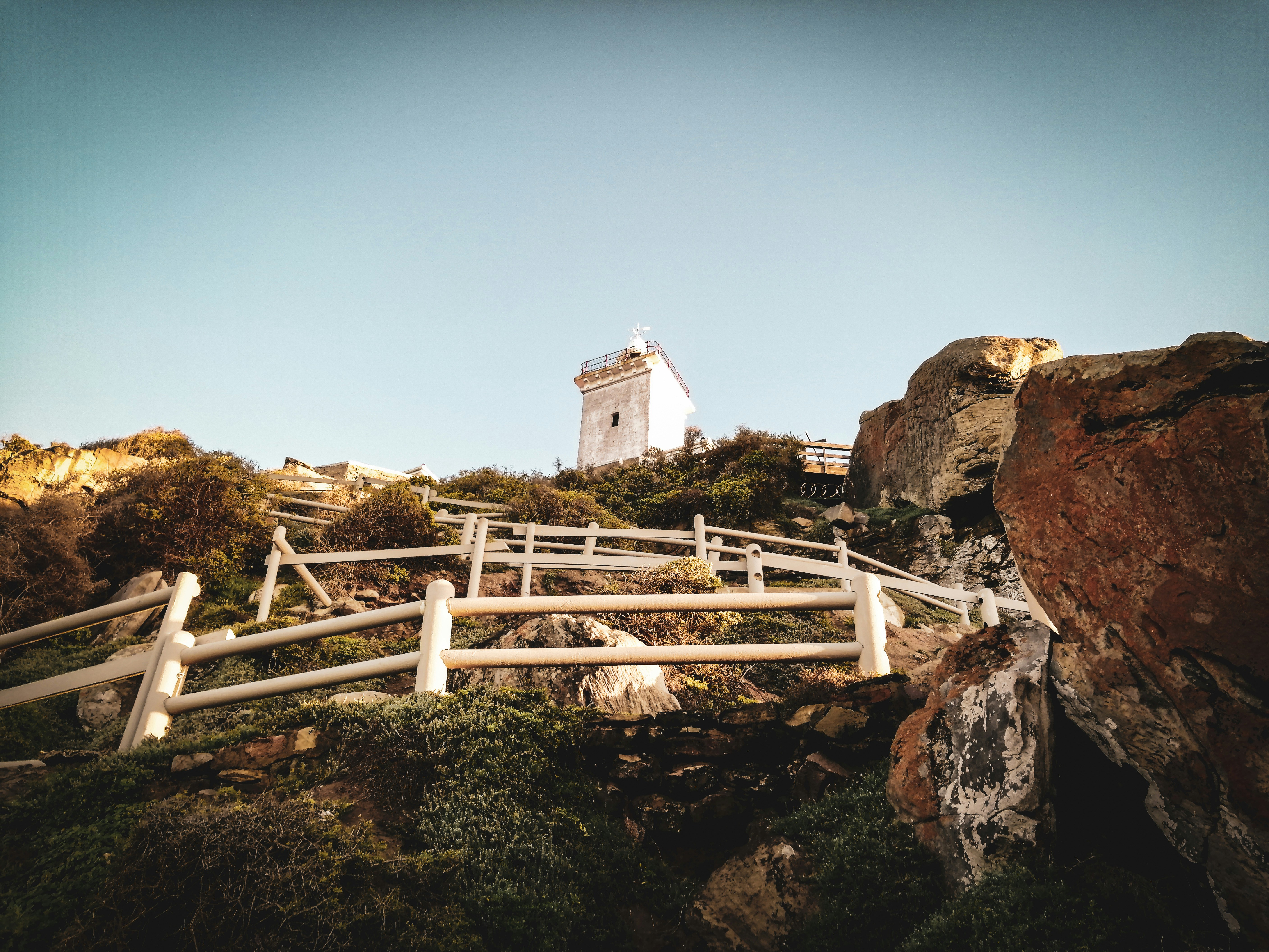
About Mossel Bay
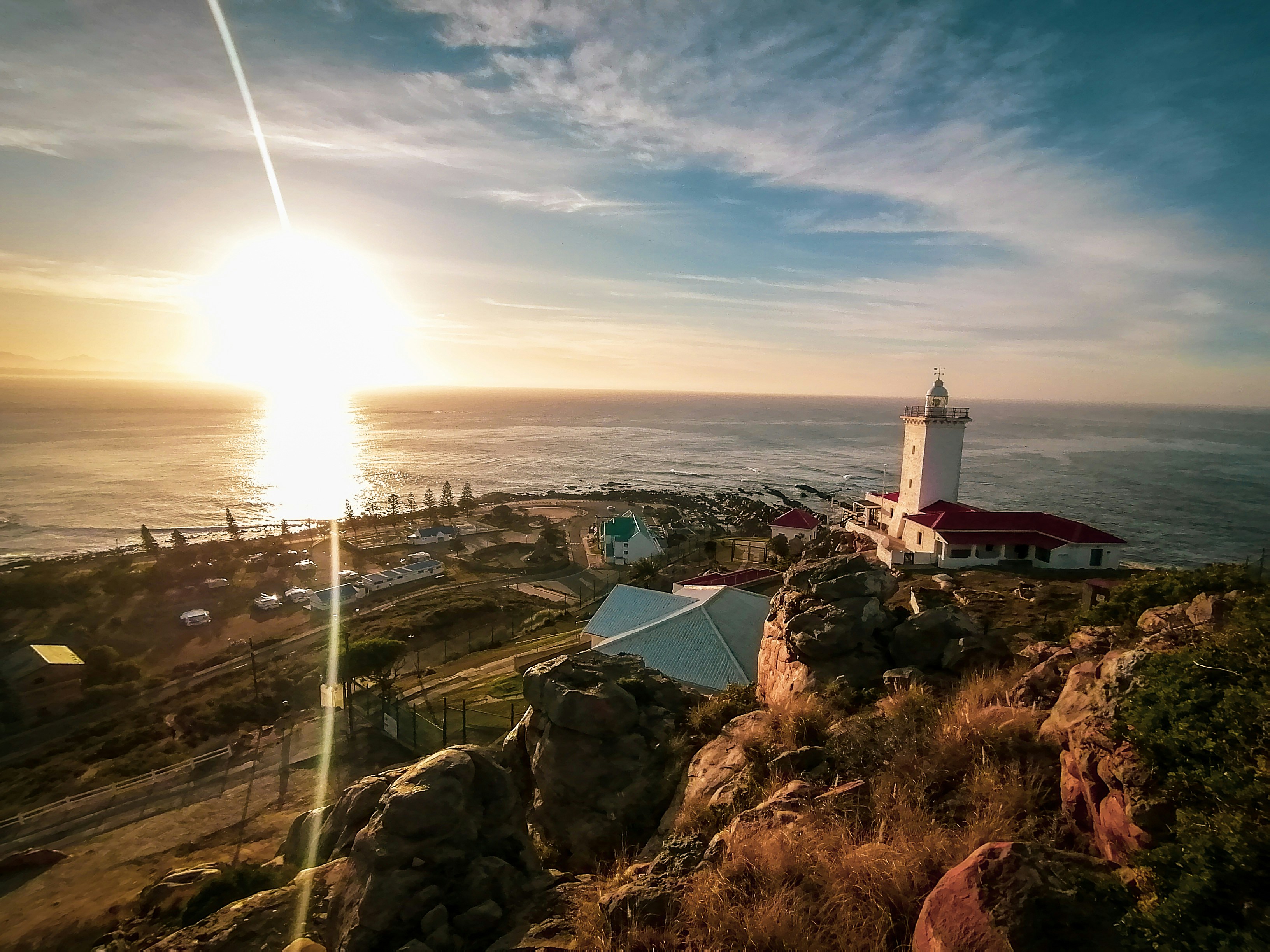

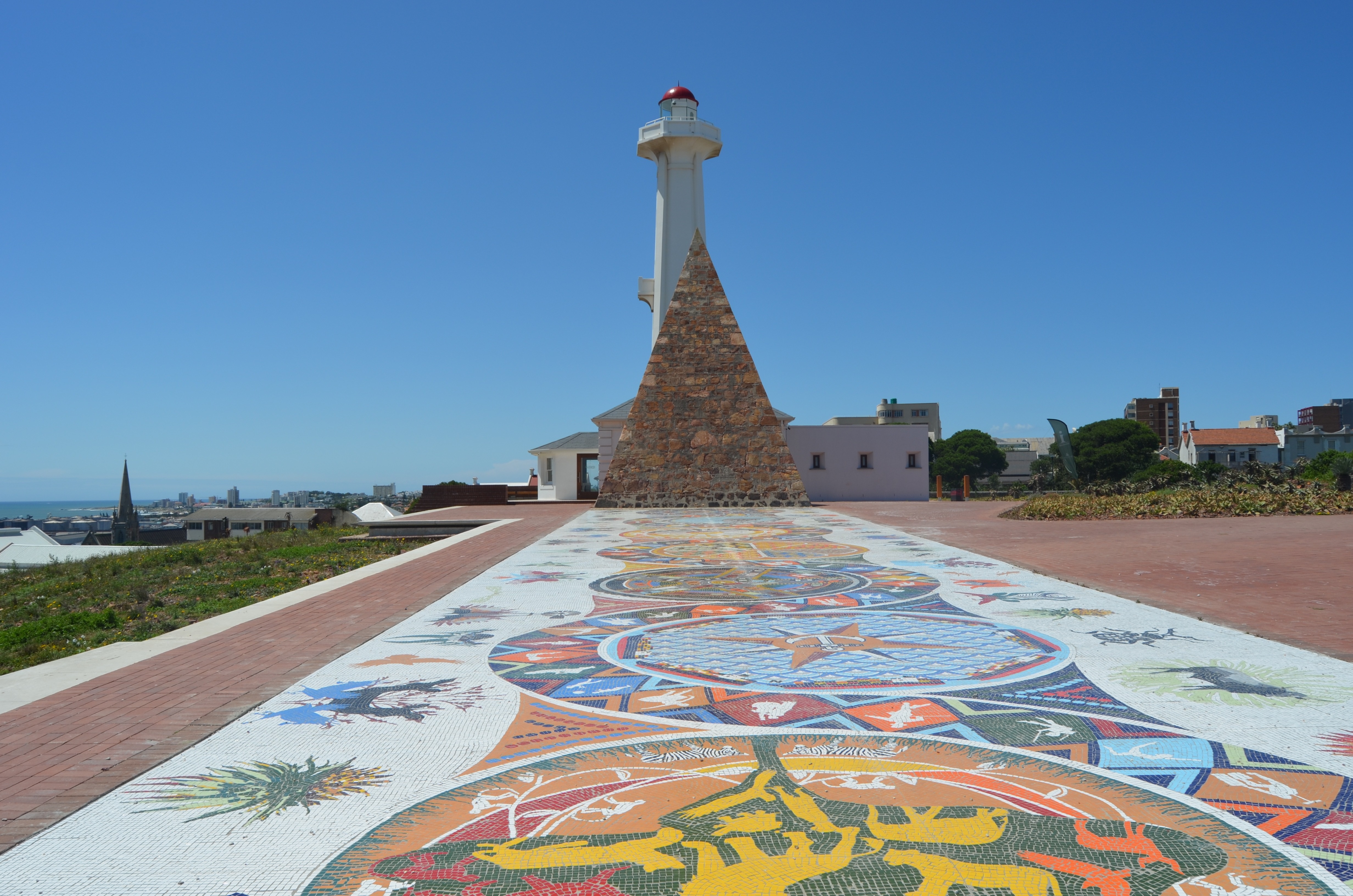
About Gqeberha (ex Port Elizabeth)
Originally the home of the San and Khoisan people and later the Xhosa tribe, the area now known as Gqeberha (previously Port Elizabeth) became a landing place for passing European ships after Portuguese navigator Bartolomew Diaz arrived in Algoa Bay in 1488. As part of the Cape Colony, the British occupied the area during the Napoleonic Wars and it was they who built Fort Frederick here in 1799. Twenty-one years later 4,000 settlers arrived, becoming the first permanent British residents of South Africa and Gqeberha. Sir Rufane Donkin, Acting Governor of the Cape Colony, founded Port Elizabeth, naming the settlement after his late wife. The town underwent rapid growth after 1873 following the construction of the railway to Kimberley, and is now one of the country’s major seaports. Like most South African cities, miles of beautiful coastline surround Gqeberha. Algoa Bay combines warm water and fair breezes, making it a mecca for swimmers and water sports enthusiasts. Those interested in history can follow the Donkin Heritage Trail, past a succession of Victorian and Edwardian town houses, trim gardens and neo-Gothic churches. Just outside the town are a number of game reserves, including the famous Addo Elephant National Park.
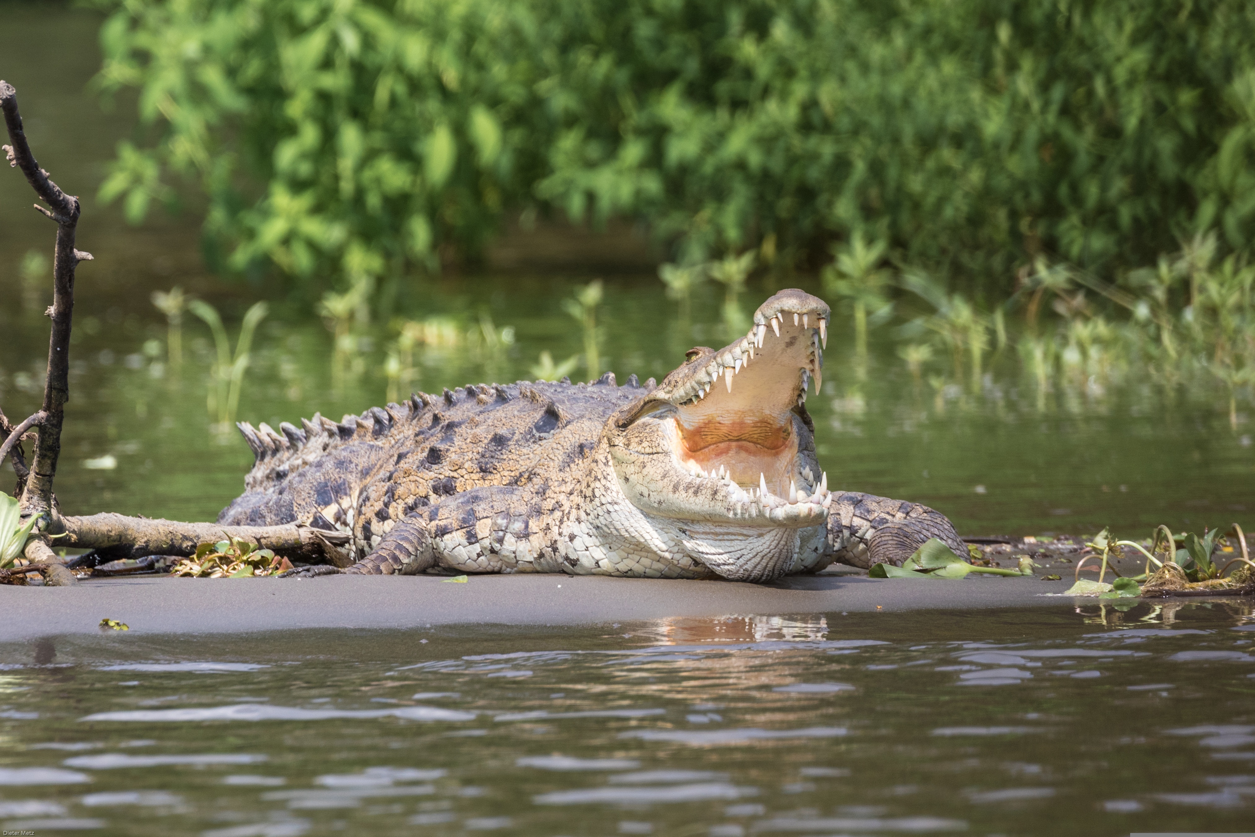
About Richards Bay
South Africa’s largest harbour is located on a lagoon on the Mhlatuze River on the northern coast of KwaZulu-Natal and takes its name from Admiral Sir F W Richards who sailed into the bay to deliver supplies to the troops during the Anglo/Zulu War of 1879. The Richards Bay lagoon was declared a game reserve in 1935, when conservationists objected to the growing industrialisation here. This however did nothing to halt development. Instead a compromise was agreed and a wall was built across the length of the bay to divide the lagoon. The north side became the seaport and the south remained a sanctuary for waterfowl and wildlife. The lagoon is famous for being the site where the longest crocodile ever recorded was shot by hunter John Dunn - it measured over 20 feet. The town was built on the shores of the lagoon in 1954 and although it was only a small fishing community in the 1960s, the development of the deep water harbour and railway in 1976 prompted the growth of the much larger township you see today. The bustling town is now a popular holiday destination with its unspoilt beaches at the edge of the Indian Ocean, year-round sunshine and excellent recreational facilities including surfing and fishing. It is also an excellent gateway to Zululand and the KwaZulu wildlife reserves. Richards Bay has recently undergone a major renovation that has given the town a Caribbean feel.
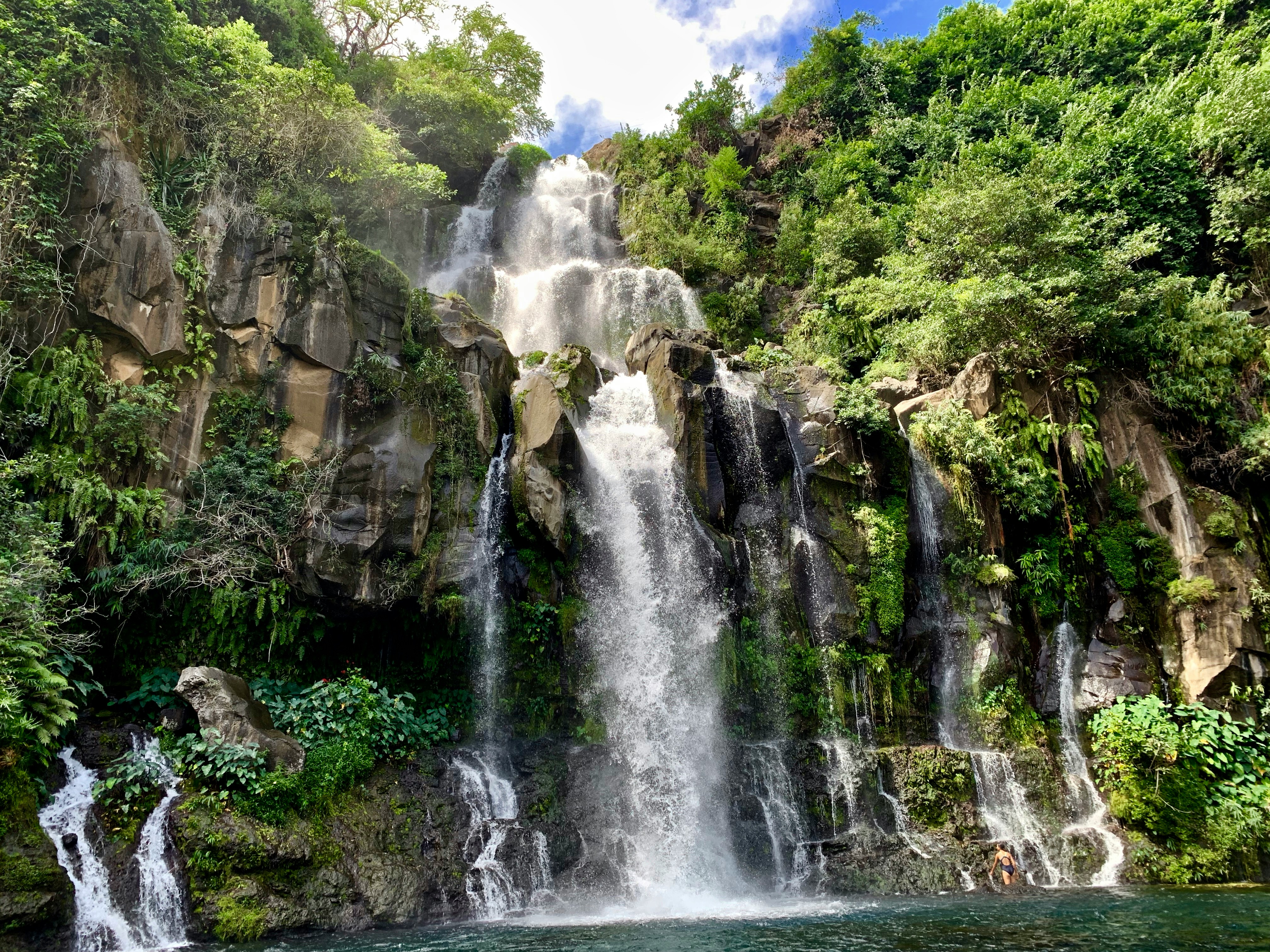
About Pointe des Galets
About Port Louis
Mauritius’ largest city, Port Louis is a vibrant and exciting place whose culture is a mix of African, Chinese and Indian influences. There are activities and sights to keep you busy and explore the different aspects of the city.
About Port Louis
Mauritius’ largest city, Port Louis is a vibrant and exciting place whose culture is a mix of African, Chinese and Indian influences. There are activities and sights to keep you busy and explore the different aspects of the city.
About Mahé
Like jade-coloured jewels in the Indian Ocean, the more than 100 Seychelles Islands are often regarded as the Garden of Eden. Lying just four degrees south of the equator, the Seychelles are some 1,000 miles (1,610 km) from the nearest mainland Africa. Little more than 200 years ago, all 115 islands were uninhabited. Then in 1742 a French ship dispatched from Mauritius sailed into one of the small bays. Captain Lazare Picault was the first to explore these unnamed islands. He encountered breathtaking vistas of rugged mountains, lagoons, coral atolls, splendid beaches and secluded coves. After Picault sailed away, the islands remained untouched for the next 14 years. Then France took possession of the seven islands in the Mahé group. During an expedition Captain Morphey named them the Sechelles, in honour of Vicomte Moreau de Sechelles. This name was later anglicised to Seychelles. The first settlers arrived at St. Anne’s Island in 1770; 15 years later the population of Mahé consisted of seven Europeans and 123 slaves. Today there are about 80,000 Seychellois, the majority of whom live on Mahé; the rest are scattered in small communities throughout the archipelago. The people are a fusion of three continents - Africa, Asia and Europe. This has created a unique culture and the use of three languages - Creole, French and English. Mahé is the largest island in the archipelago and the location of the capital, Victoria. Ringed by steep, magnificent mountains, few capitals can claim a more beautiful backdrop. The town features a mixture of modern and indigenous architecture; it is the centre of business and commerce thanks to the extensive port facilities. Noteworthy sites in Victoria are the museum, cathedral, government house, clock tower, botanical gardens and an open-air market. The major attractions are found outside of town where the island’s quiet, lazy atmosphere delights visitors. With 68 pristine, white sand beaches, Mahé boasts more beaches and tourist facilities than any of the other Seychelles Islands. Beautiful and remote Mahé with its green-clad mountains and palm-fringed beaches is indeed an island of abundance; pleasant surprises are around every bend in the trail. Come ashore and discover for yourself this marvellous island paradise.
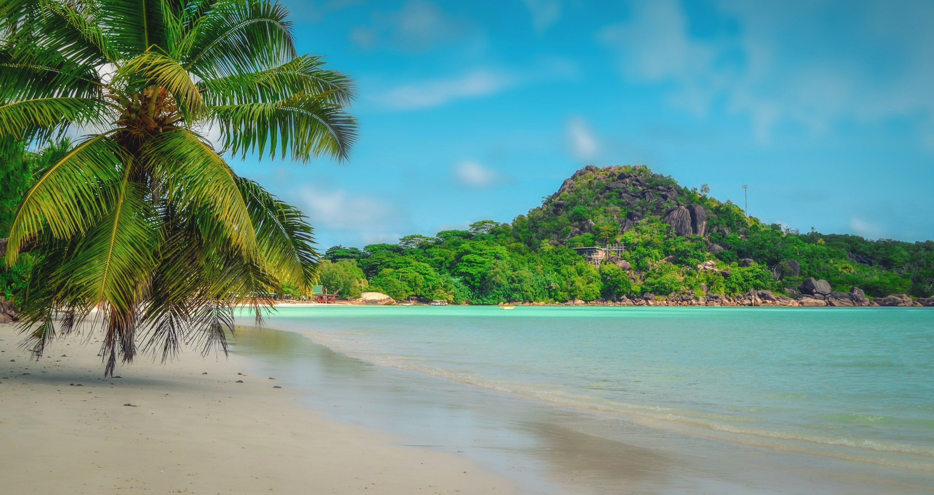
About Praslin Island
Forty kilometers (25 miles) northeast of Mahé, Praslin is just a 15-minute flight or 45-minute ferry ride away. Praslin, at 11 km (7 miles) long and 4 km (2.5 miles) wide, is the second-largest island in the Seychelles. First settled as a hideaway by pirates and Arab merchants, the island's original name, Isle de Palmes, bears testament to its reputation as home of the Vallée de Mai UNESCO World Heritage Site: the only place in the world where the famous Coco de Mer, the world's heaviest nut, grows abundantly in the wild. Praslin's endemic palm forests shelter many rare species, and the island is a major bird-watching destination. Surrounded by a coral reef, majestic bays, and gorgeous beaches, Praslin is much quieter and less developed than Mahé. With few real "sights," the pleasures of Praslin largely involve relaxing in or exploring its stunning beaches and fantastical forests.
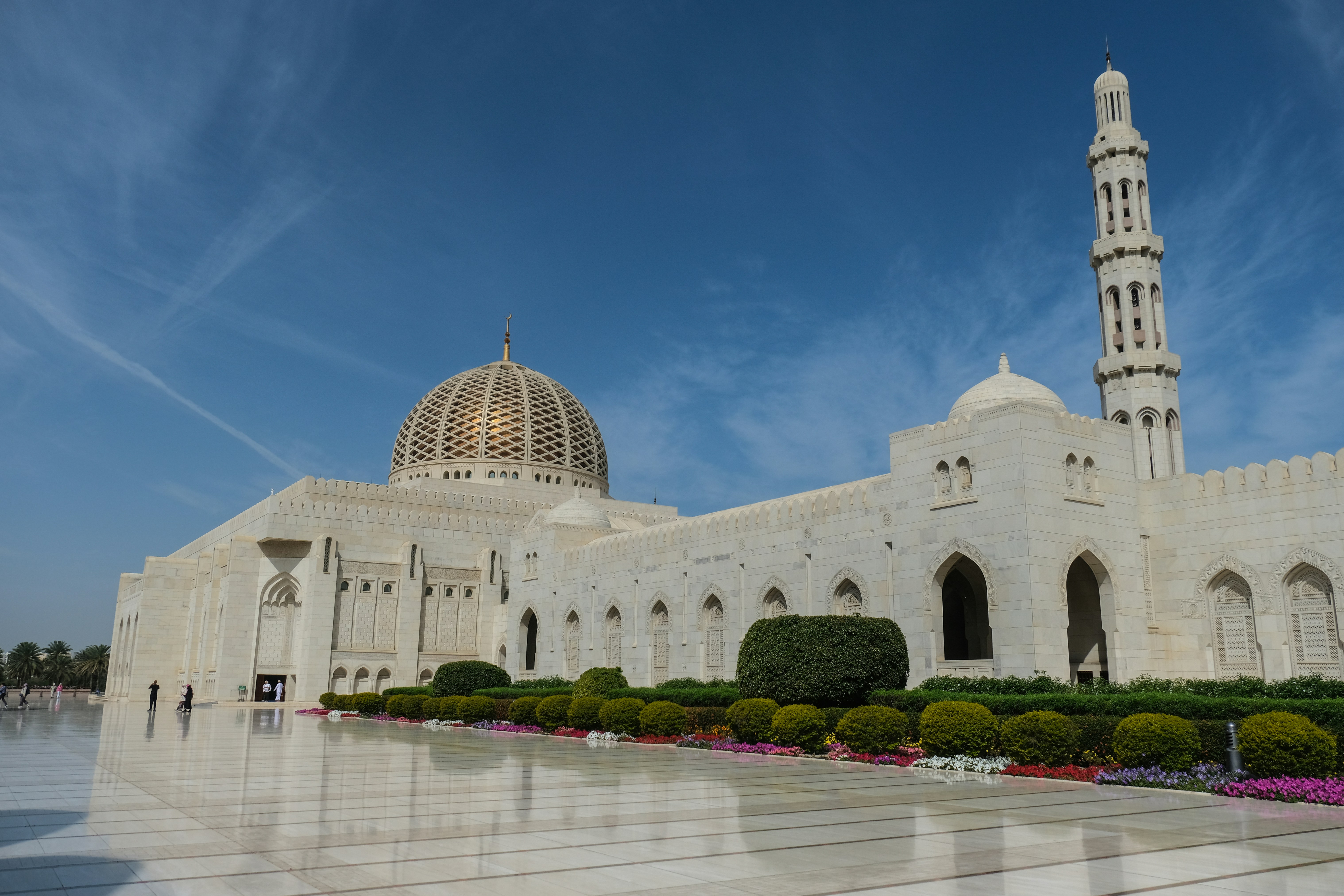
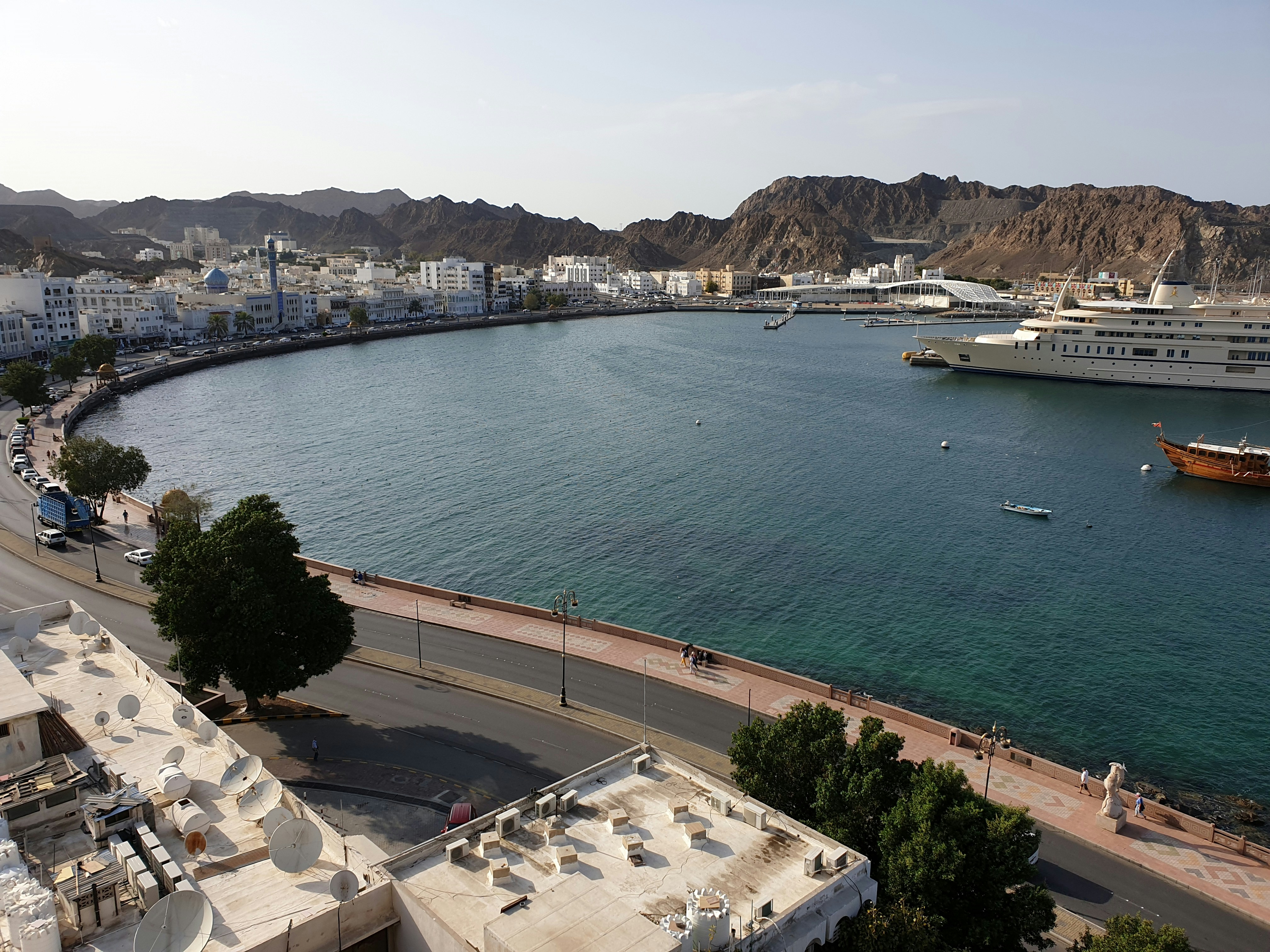
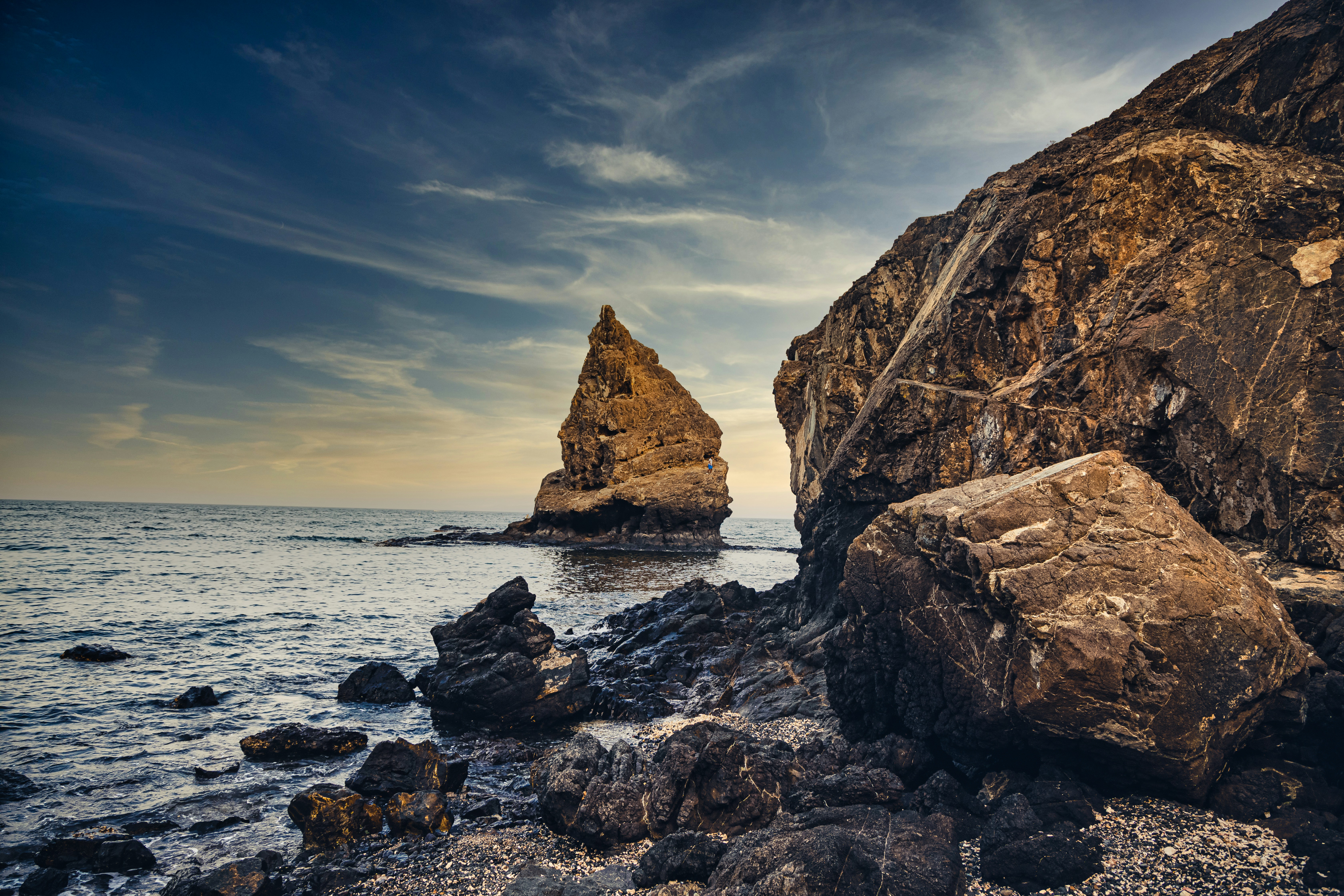
About Muscat
Oman's capital city is hemmed in on one side by spectacular jagged-peaked mountains and on the other by royal blue sea. The architecture is a traditional, sophisticated arabesque blend of white-washed, low-rise buildings surrounded by manicured palms, intricately designed domes set atop the minarets of the mosques, sand-colored villas, a surprising blend of modern art installations, like a giant incense burner that towers over the Corniche, and ancient forts set in the rocky hills. Though tradition abounds, from distinct, local cuisine to the widely worn national dress, the dishdasha, Muscat is a completely modern city, featuring opulent luxury hotels, international restaurants, excellent cellular and data service, sprawling shopping malls, pristine beaches, lively nightlife, world-class performing arts, and a highly educated population, most of whom speak English, Arabic, and often Hindi. Muscat is the ideal base for exploring other areas of the country since many of the most desirable destinations are within a few hours' drive.
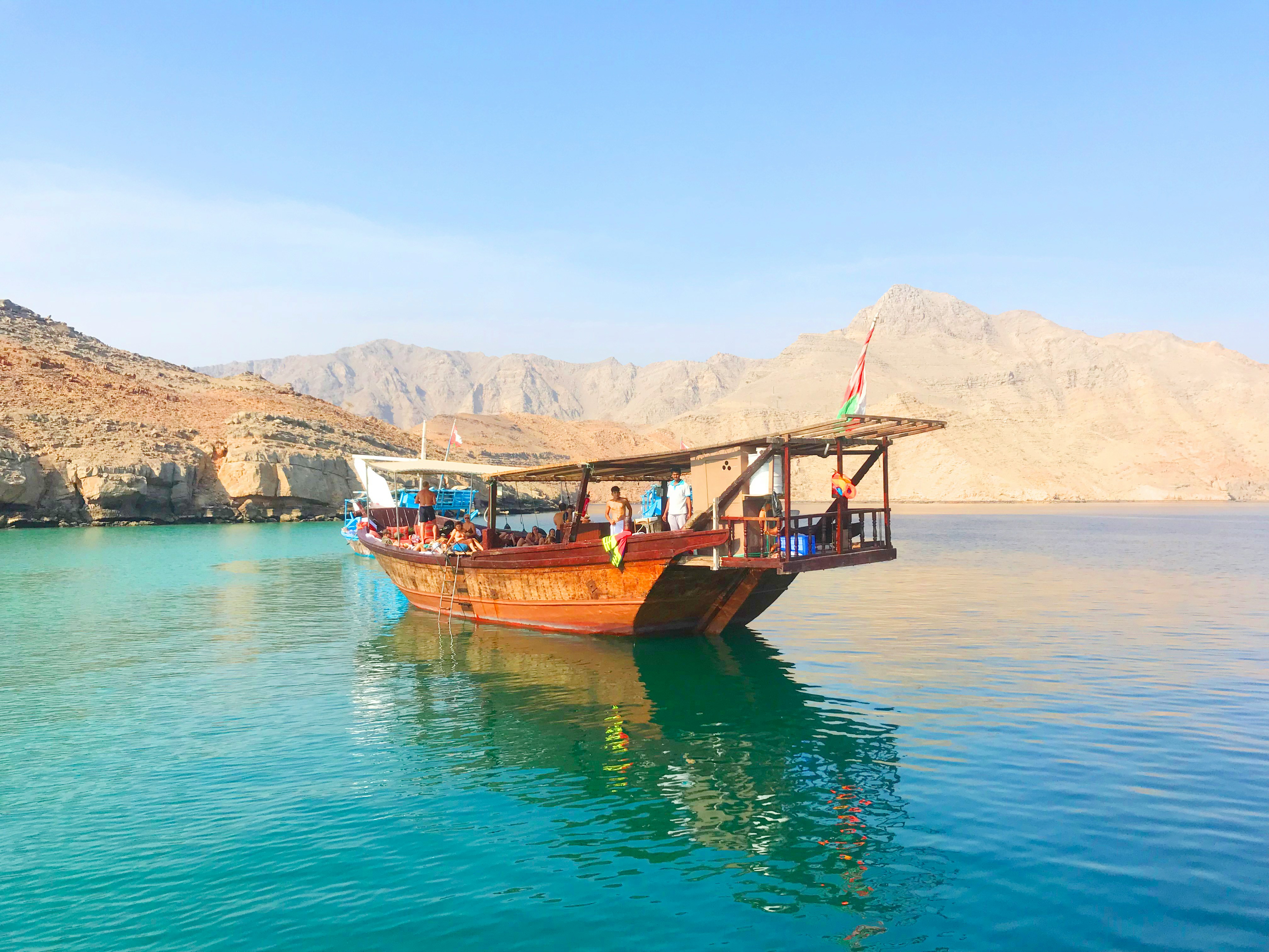
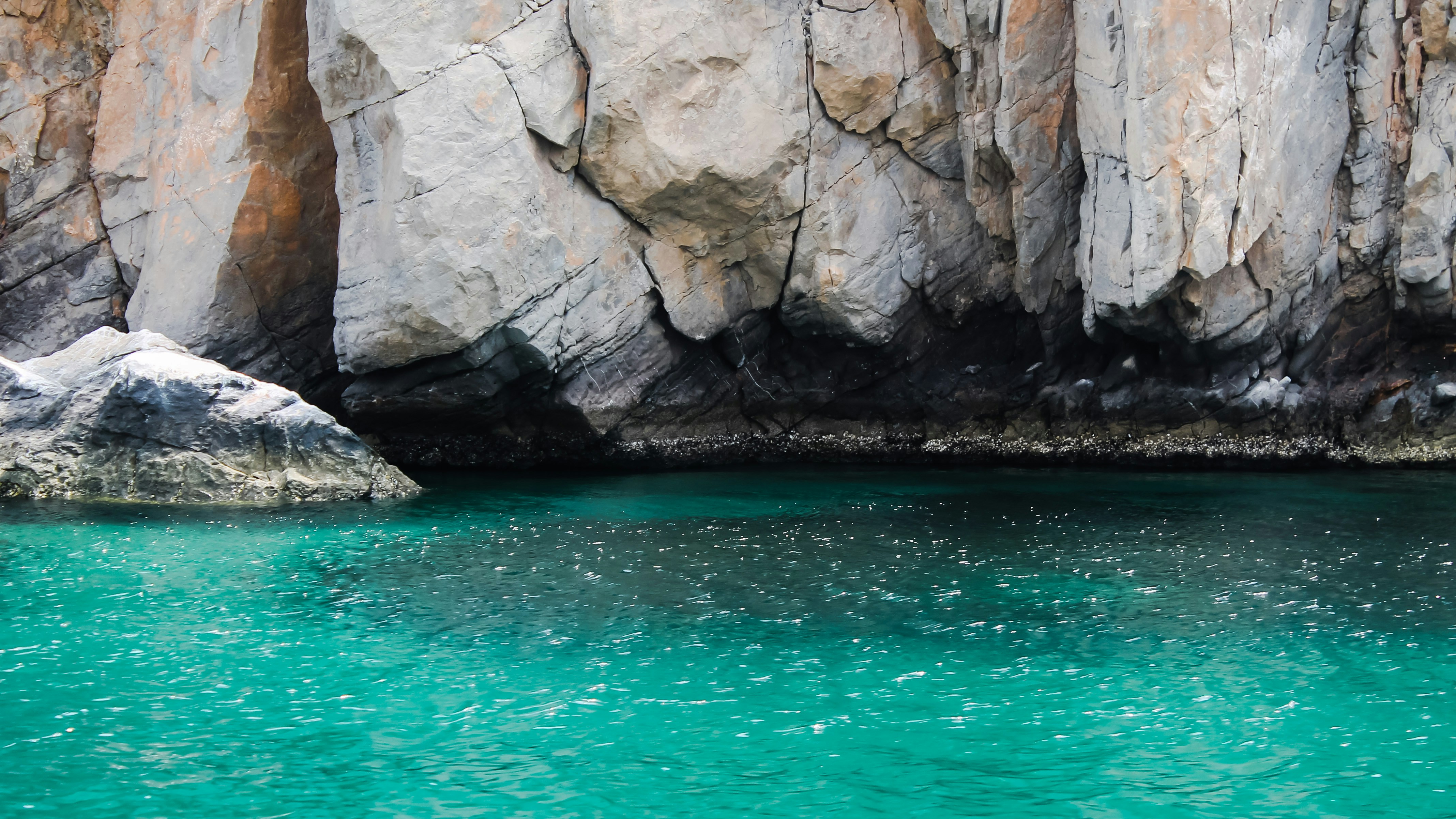
About Khasab
See Khasab’s jutting fjords, and the dolphins playing in the emerald waters, and it’s forgivable to think you’ve stumbled across a surreal Norway. The burning sun and scorched earth, serve as a constant reminder that you're a long way from Europe, however - although the Portuguese roots mean there's a colonial tint to the city. Sitting on the Northern coast of Oman, reaching across towards Iran, this is an isolated and fascinating destination to explore. The remote location, and limited infrastructure here, until recent times, means Khasab has been left to live life at its own pace, and the city sings to its own song sheet. Even now you can see a blind eye being turned to the smugglers who whisk electronics across the Gulf to Iran, in small speed boats.
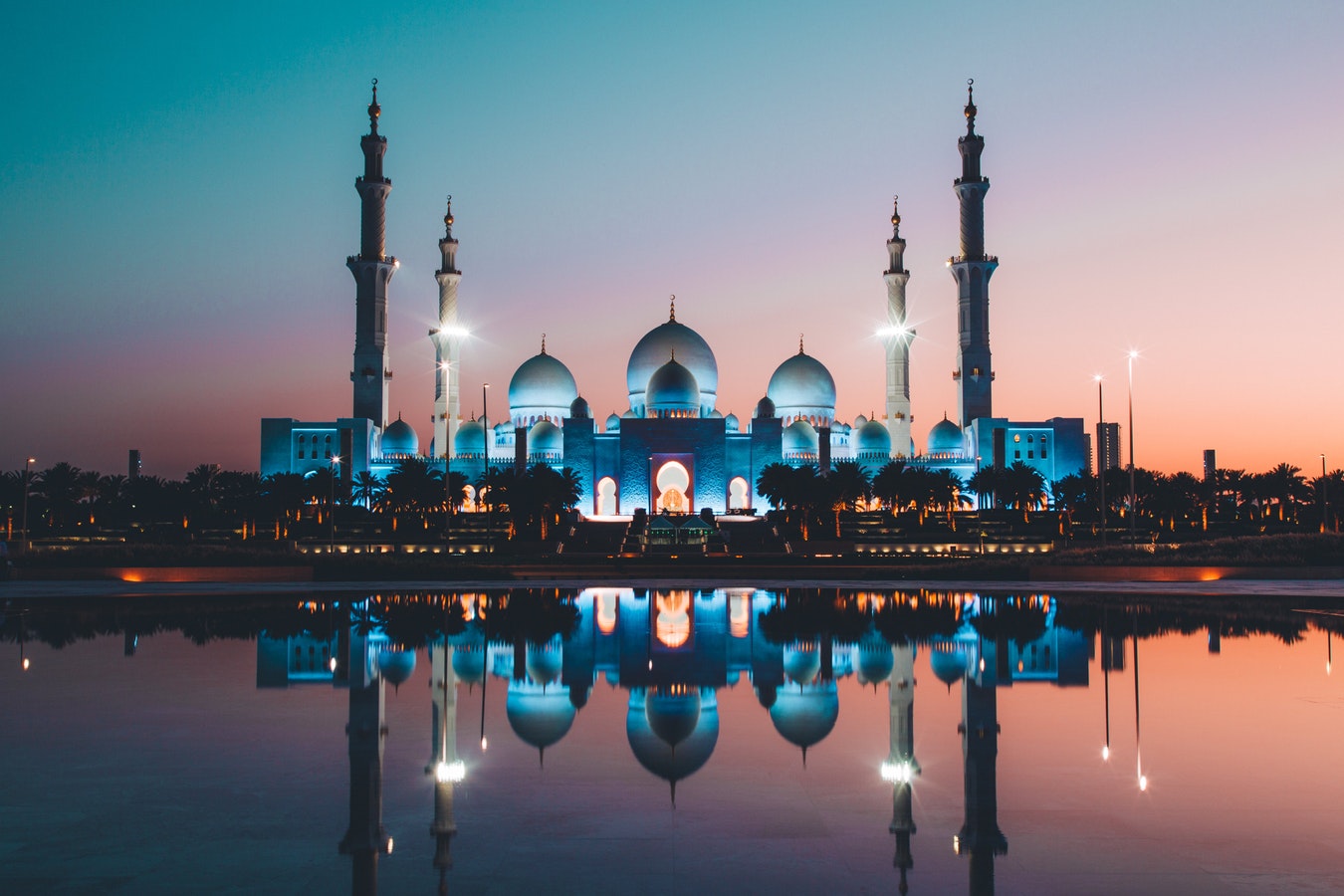
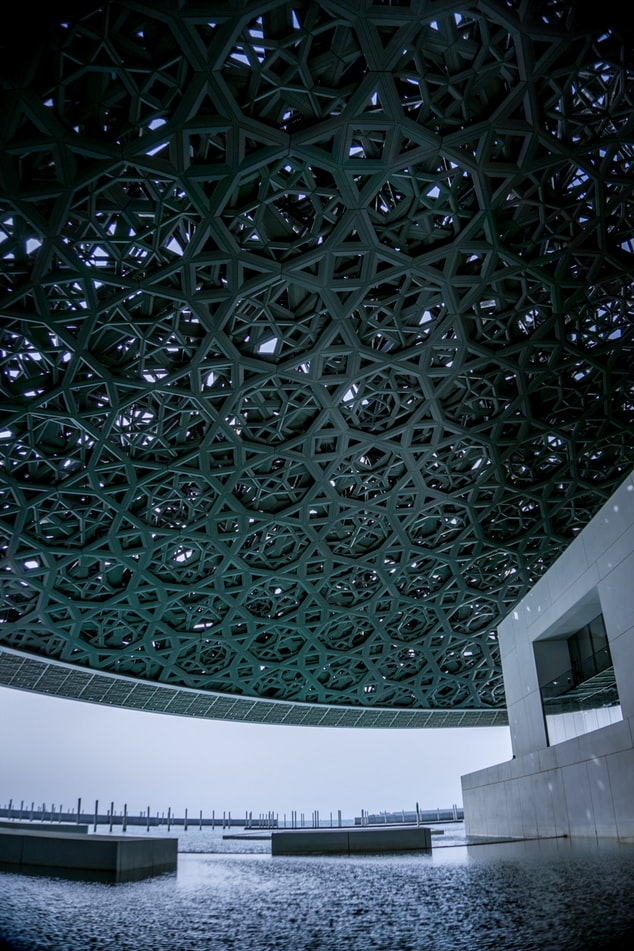
About Abu Dhabi
Just a few decades ago, Abu Dhabi, the island capital of the United Arab Emirates, was a small fishing village with houses made of mud-brick and palm fronds. Today, as a result of revenue from oil, Abu Dhabi is one of the world's richest cities, with wide, tree-lined okulevards, lush green parks, gushing fountains and imposing skyscrapers. Somewhat of a dichotomy, Abu Dhabi is a combination of ultra-modern sophistication and Arab mystique, with friendly and hospitable people offering a warm welcome to visitors. Abu Dhabi's history originated in the 18th century, when, according to legend, a group of tribesmen pursuing a gazelle came upon a freshwater well which they named Abu Dhabi, or "Father of the Gazelle". In the 19th century, the first fort was built over this well by a sheikh of the Al-Nahyan dynasty. The fort's name is Al Husn Palace, also known as Old or White Fort, and it is one of the few buildings in Abu Dhabi that is more than 25 years old. Its whitewashed walls are eye-catching amid the backdrop of today's skyscrapers. Presently, it is home to the Cultural Foundation and serves as a documents centre. Abu Dhabi had little significance until the discovery of vast oil reserves in the late 1950s and early 1960s. In the years following, the city's economy and infrastructure developed rapidly and changed Abu Dhabi beyond recognition.
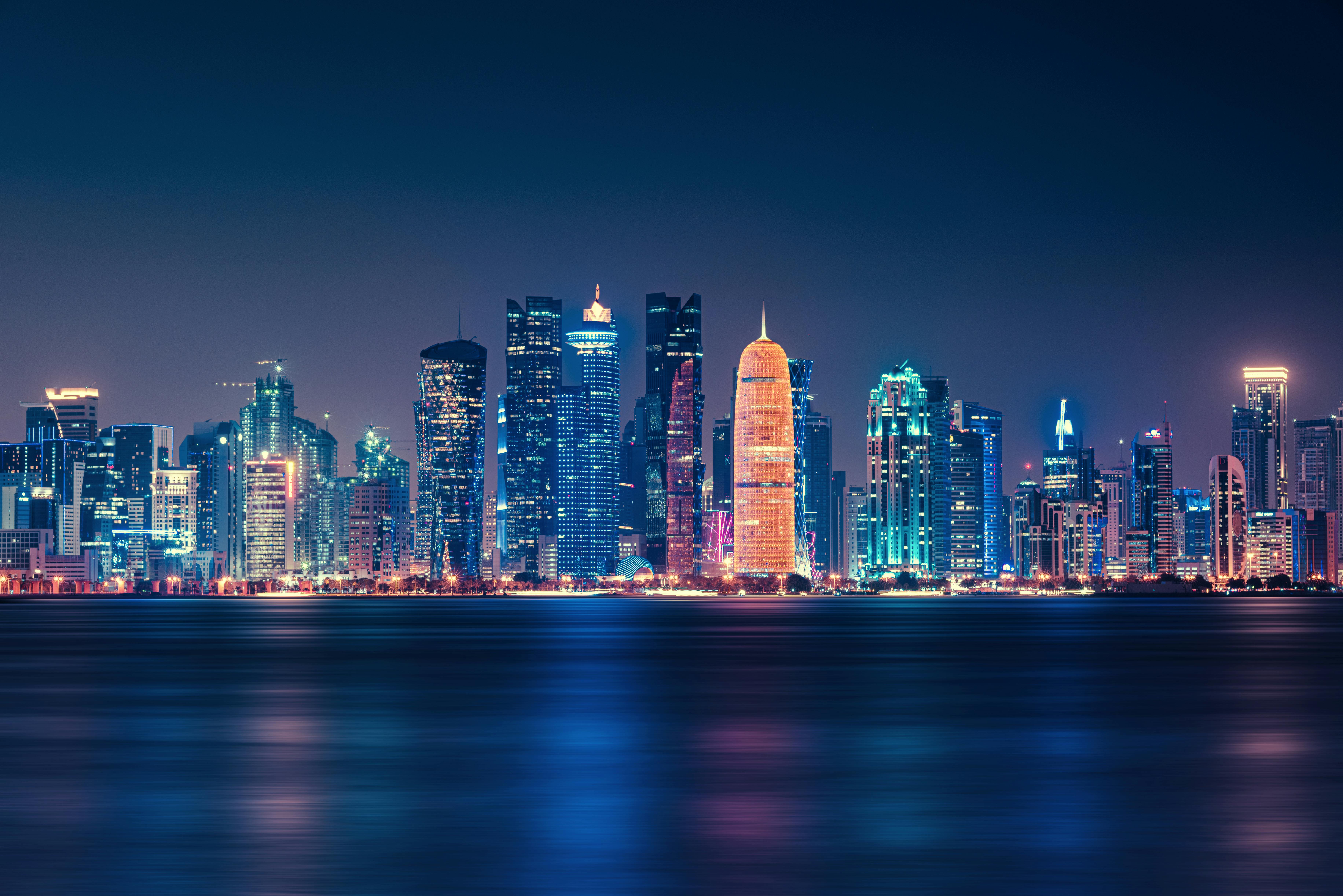
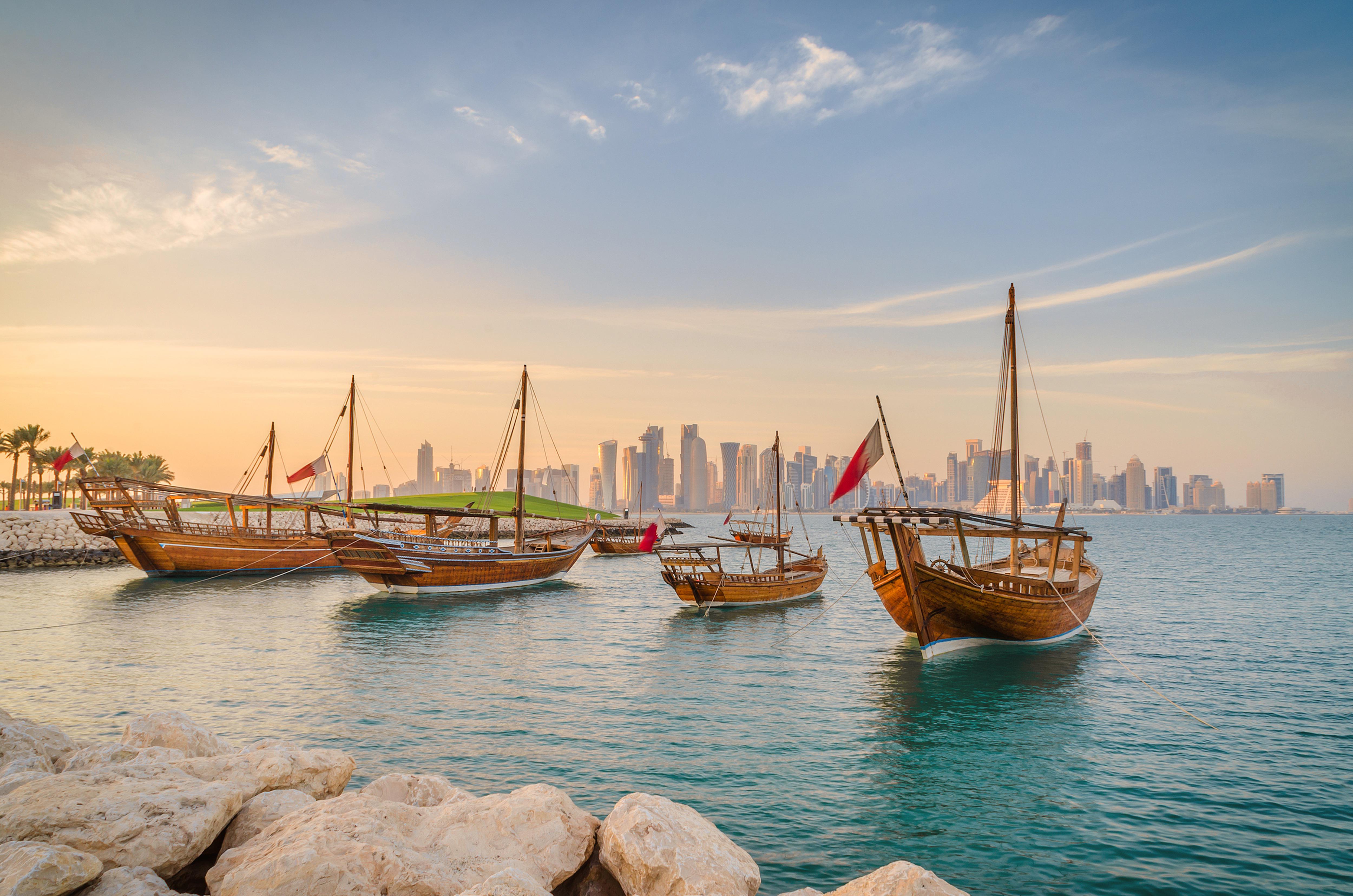
About Doha
Doha (population 700,000) is the capital of the State of Qatar, an emirate occupying the small Qatar Peninsula bordered by Saudi Arabia to the south and otherwise surrounded by the Persian Gulf. Qatar was ruled by many different powers through the centuries, in fact historians have traced human habitation dating back 5000 years. From its earliest history, Qatar was a very important trade route connecting Mesopotamia and the Indus Valley. Among its occupiers were the Portuguese, the Ottomans and finally the British during the turbulent years of the 20th century. Qatar gained independence in 1971, and with resources from oil exportation, His Highness Sheikh Khalifa Bin Hamad made improvements in social programmes including education, health and housing. In 1995, his son, His Highness Sheikh Hamad Bin Khalifa Al-Thani assumed the throne and brought with him a modern and progressive approach that quickly transformed the country. Doha, home to 80 percent of the country’s population, was founded under the name of Al-Bida in 1850. It became the capital of the British protectorate of Qatar in 1916. When the nation gained its independence, Doha remained the capital. During the early 20th century, much of Qatar’s economy depended on fishing and pearling. But after the introduction of Japanese cultured pearls, Doha and the whole region suffered a decline. Only when oil was discovered, prosperity returned following World War II. Today, the country produces over 800,000 barrels of oil daily. Doha is situated halfway down the east coast of the peninsula. It is an intriguing mixture of old and new, with ultra modern architecture next to traditional souqs and historic forts. It boasts a university and the Qatar National Museum (currently closed for renovation), which opened 1975 in what was originally the ruler’s palace. As the country’s cultural and commercial centre, Doha enjoys excellent communications with the outside world through its modern seaport, airport and telephone links. The Al Jazeera Arabic satellite television news channel began broadcasting in 1996 with its headquarters in Doha. While Arabic is the official language, English is widely spoken. Please Note: Conservative dress is required when going ashore. As a rule, women should not wear miniskirts, shorts or sleeveless tops and men should always wear a shirt in public. Please do not photograph people without their permission, especially women.You may not take pictures of government buildings, embassies or anything military in nature, including airports.
About Manama
Rising like an oasis in the Persian Gulf, Manamah is no mirage. The capital of Bahrain (with a population of around 150, 000), the city houses almost a quarter of all Bahranis. At times resembling something from 1001 nights and at others like something from the set of a sci-fi futuristic drama Al Manamah is just beginning to get seen on the savvy traveller’s map. Mentioned in Islamic chronicles since 1345 and conquered by the Portuguese in 1521, Manamah is anything except typical. Expect to feast both your eyes and your stomachs here with the quintessence of Muslim hospitality – from delicious bowls laden with love and eons of history to the plethora of genuine, warm invitations to share tea with the locals, hospitality is taken very seriously here. For culture vultures, the Al Fateh Mosque (one of the world’s largest and by far the largest in Bahrain), this is a sight – and site – to see. First and foremost a place of worship that offers tours on the side, it is important to remember that this is a sacred place and traditions and cultures must be respected. Dress modestly, remove your shoes and women should cover their heads – note that garmets will be provided if necessary. However, as one of the most liberal countries in the Middle East, visitors should expect an enthusiastic welcome, inquisitive guides and a huge library to get lost in. Moving on, seven nominated UNESCO World Heritage sites prove the extent of Bahrain’s dedication to conservation of the past. Although only two so far have been approved – the Ancient Harbour and the Pearling Trail that is said to date back to 2,000 BC, one really does get a feeling in Manamah that the past is all around.
About Dubai
Dubai sits on a golden sandy coastline in the Arabian Gulf, where the warm azure waves of the sea meet the desert. A high-rise oasis, this city is a pleasure-dome surrounded by dunes; one of the most fashionable on the planet thanks to its ability to satisfy the needs of legions of demanding vacationers. Dubai is about having fun—and it's one big adult playground.Nature plays her part here, with year-round sunshine, gorgeous beaches, dramatic arid landscapes, and warm waters, but it's the man-made attractions that make Dubai so alluring. You can launch yourself into high-adrenaline desert adventures, diving and water sports, and some of the world's best golf courses. The 5-, 6-, and 7-star hotels offer the ultimate in luxury, and the party scene is hot. Shopping malls are the biggest in the world and are packed full of high-class merchandise. And with hundreds of restaurants with cuisine from around the world, you can munch your way from Mexico to Malaysia.Dubai is an Arab country with a long history as a trading port. Traces of its traditional life, customs, and architecture can still be seen and explored, but today and tomorrow are much more important than yesterday. Almost every building in this metropolis is less than 20 years old and the most dramatic developments—groundbreaking megaprojects—have just been completed or are still under construction.The city is certainly unique. Islam is its anchor, but it has opened its doors to the rest of the world and has invited them in to work, rest, and play, which creates a truly international atmosphere. Unashamedly modern and materialistic, life here takes place at breakneck speed. The landscape is stark, the confidence is sky high, the can-do spirit is palpable, and the bling is in your face. Dubai produces strong reactions in people, but one thing is certain—love it or loathe it—you will not forget it. It is without a doubt, one of the world's true must-see destinations.Shisha: Smoke Without Fire. Emirati men love socializing, but as they don't drink alcohol they get together over coffee and shisha instead of a drink at the bar after work. The shisha, or hookah, is a smoking device, usually made of glass, that filters smoke through water before it reaches the smoker's mouth. Shisha tobaccos are aromatic and are often mixed with apple, cinnamon, or cherry, so their taste isn't as strong as other tobaccos. Smoking shisha is said to induce relaxation—but you'll have to decide if it's for you!
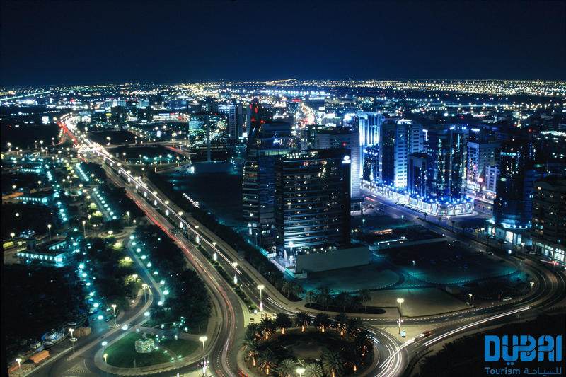
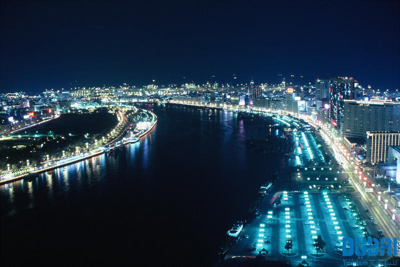
About Salalah
The lush landscape around Salalah is the intriguing result of a quirk of nature. Since it is uniquely situated in the path of the Khareef, or South Western Monsoon, this stretch of the Dhofar Coast is covered in fine mist and frequent rain from mid-June through mid-September. By the time the monsoons cease, the entire coastline is a verdant stretch. Waterfalls, rolling grasslands, and thickly wooded wadis (riverbeds) thrive alongside rapid mountain streams. Unique in this desert region, Salalah attracts many visitors from the surrounding Arabian Gulf countries who are anxious to experience a rare lushness in a region where rain and greenery are in short supply. Once a stop on the ancient trading routes that connected the Levant to India and China, Salalah has a rich history that goes back centuries. Traders from Mesopotamia, the Persian Empire, and beyond passed through Salalah in their search for frankincense, making it a major center for trade in the coveted exotic ingredient. Pre-Islamic tombs and grave sites, some believed to be up to 2,000 years old, are scattered all over the nearby mountainsides and the present-day city, which has an estimated 195,000 inhabitants.
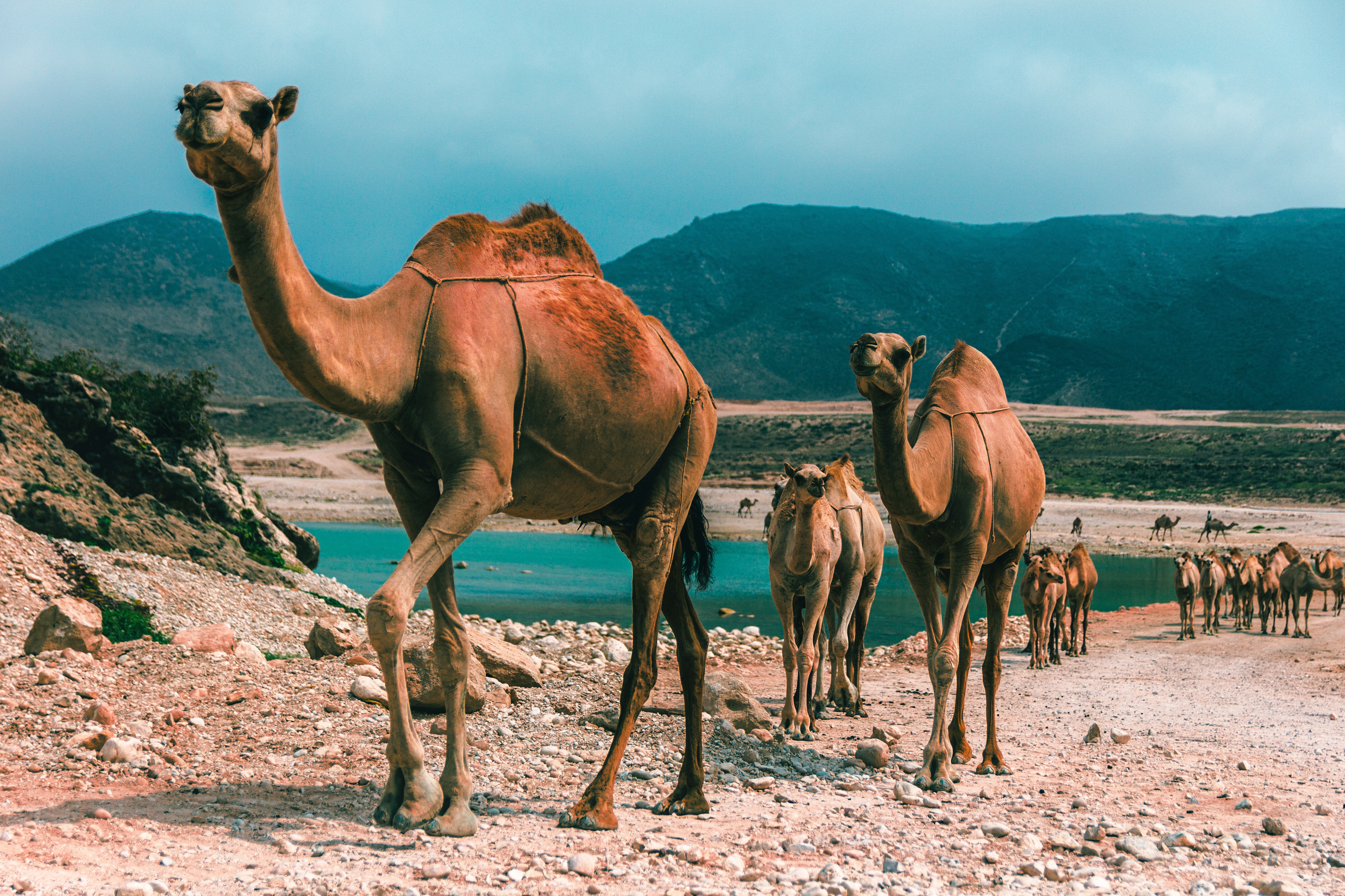
About 'Aqaba
The resort town of Aqaba, on the Red Sea at the southern end of Jordan, is a popular spot for divers with some of the best coral reefs in the world. Snorkeling and other water sports are popular, and it's easy to hire a boat for a day or half-day, including lunch.Aqaba has become quite a bustling destination, with several large luxury hotels and a large shopping area. There are many jewelry stores selling pearls, gem stones, and gold and silver jewelry. It's worth noting that although it's an international beach resort, Aqaba is quite conservative—certainly much more so than Amman—and North Americans tend to be more comfortable at the private hotel beaches.
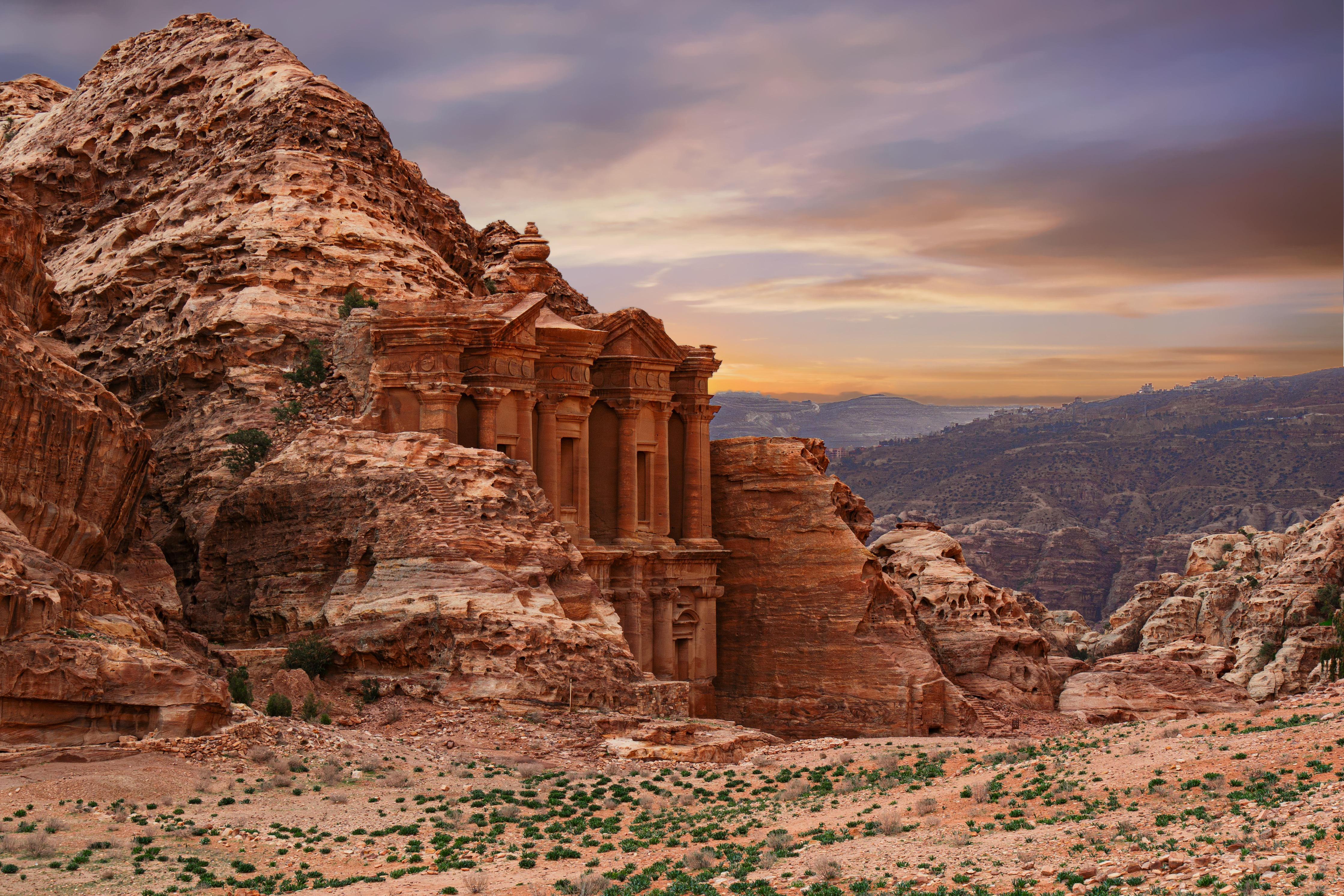
About Safaga
Port Safago has been undergoing a transformation, slowly metamorphosing into a holiday rsort. Like other cities on the Red Sea, the commercial port town sits close to great offshore dive sites. Unlike others, however, tourist development hasn't taken off in a meaningful way. But if the mass tourism in Hurghada is a turnoff, Safaga offers a small-scale and much more low-key alternative, though the best dive sites can still be seen on a day trip from Hurghada. Safaga is also the closest beach resort to Luxor and the Valley of the Kings, which lies 200 km (124 mi) to the southwest; when cruise ships offer land excursions to Luxor, they often do so through Safaga.
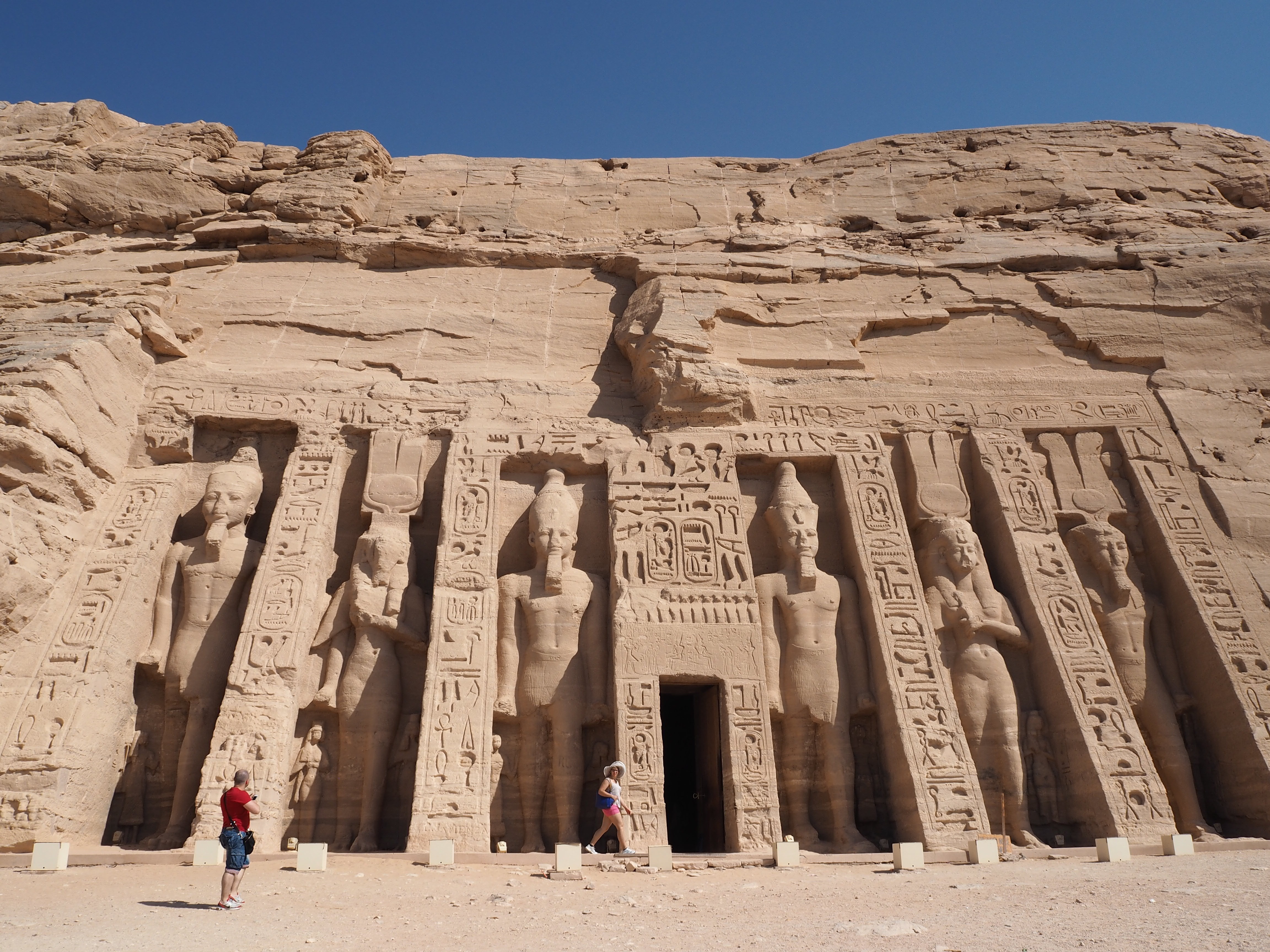
About Alexandria
Founded by Alexander the Great, Alexandria was Egypt's capital for over 1,000 years. Now, it is visited by tourists looking to enjoy some diving and those interested in the Great Library, one of the Seven Wonders of the Ancient World.
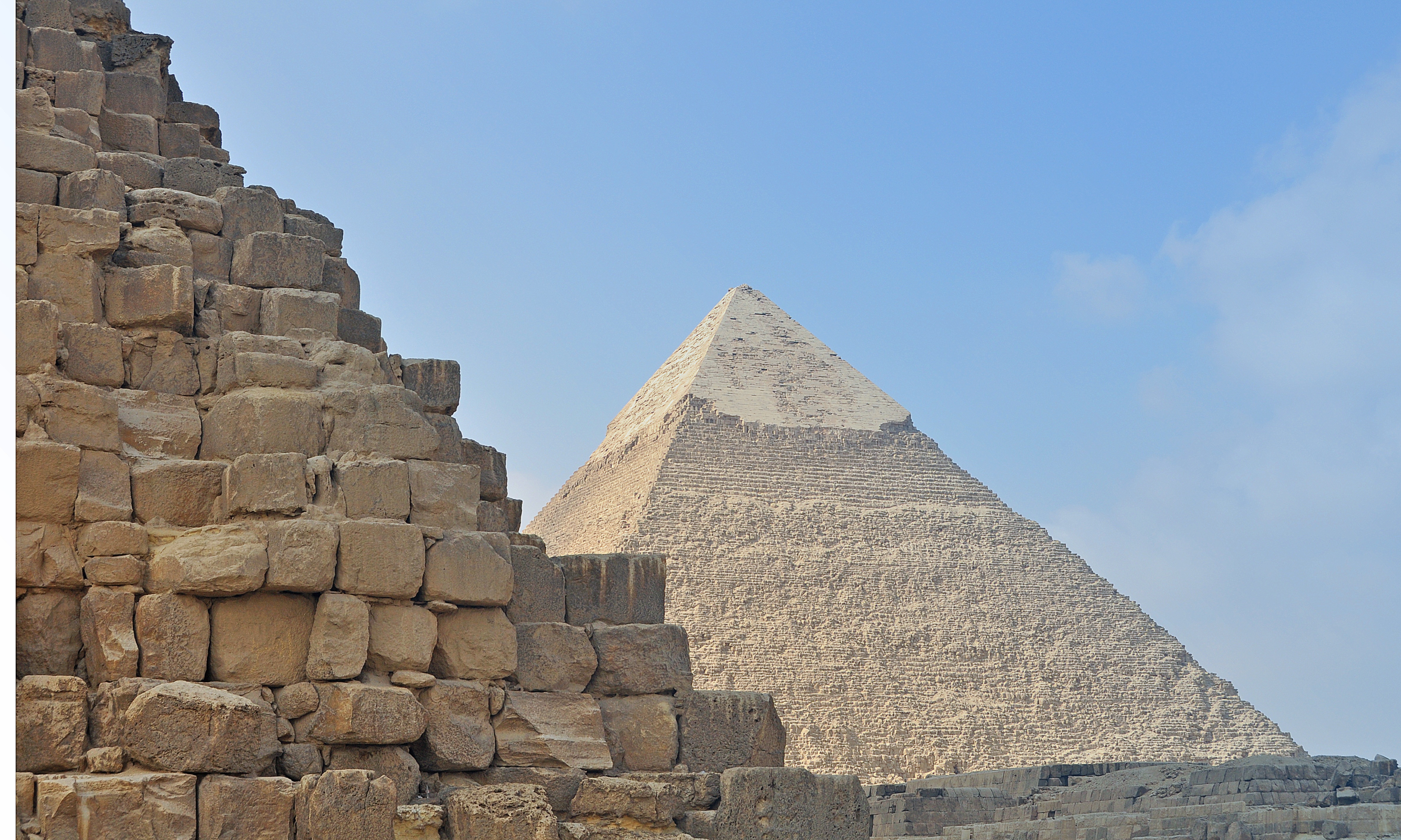
About Alexandria
Founded by Alexander the Great, Alexandria was Egypt's capital for over 1,000 years. Now, it is visited by tourists looking to enjoy some diving and those interested in the Great Library, one of the Seven Wonders of the Ancient World.
About Piraeus
It's no wonder that all roads lead to the fascinating and maddening metropolis of Athens. Lift your eyes 200 feet above the city to the Parthenon, its honey-color marble columns rising from a massive limestone base, and you behold architectural perfection that has not been surpassed in 2,500 years. But, today, this shrine of classical form dominates a 21st-century boomtown. To experience Athens—Athína in Greek—fully is to understand the essence of Greece: ancient monuments surviving in a sea of cement, startling beauty amid the squalor, tradition juxtaposed with modernity. Locals depend on humor and flexibility to deal with the chaos; you should do the same. The rewards are immense. Although Athens covers a huge area, the major landmarks of the ancient Greek, Roman, and Byzantine periods are close to the modern city center. You can easily walk from the Acropolis to many other key sites, taking time to browse in shops and relax in cafés and tavernas along the way. From many quarters of the city you can glimpse "the glory that was Greece" in the form of the Acropolis looming above the horizon, but only by actually climbing that rocky precipice can you feel the impact of the ancient settlement. The Acropolis and Filopappou, two craggy hills sitting side by side; the ancient Agora (marketplace); and Kerameikos, the first cemetery, form the core of ancient and Roman Athens. Along the Unification of Archaeological Sites promenade, you can follow stone-paved, tree-lined walkways from site to site, undisturbed by traffic. Cars have also been banned or reduced in other streets in the historical center. In the National Archaeological Museum, vast numbers of artifacts illustrate the many millennia of Greek civilization; smaller museums such as the Goulandris Museum of Cycladic Art Museum and the Byzantine and Christian Museum illuminate the history of particular regions or periods. Athens may seem like one huge city, but it is really a conglomeration of neighborhoods with distinctive characters. The Eastern influences that prevailed during the 400-year rule of the Ottoman Empire are still evident in Monastiraki, the bazaar area near the foot of the Acropolis. On the northern slope of the Acropolis, stroll through Plaka (if possible by moonlight), an area of tranquil streets lined with renovated mansions, to get the flavor of the 19th-century's gracious lifestyle. The narrow lanes of Anafiotika, a section of Plaka, thread past tiny churches and small, color-washed houses with wooden upper stories, recalling a Cycladic island village. In this maze of winding streets, vestiges of the older city are everywhere: crumbling stairways lined with festive tavernas; dank cellars filled with wine vats; occasionally a court or diminutive garden, enclosed within high walls and filled with magnolia trees and the flaming trumpet-shaped flowers of hibiscus bushes. Formerly run-down old quarters, such as Thission, Gazi and Psirri, popular nightlife areas filled with bars and mezedopoleia (similar to tapas bars), are now in the process of gentrification, although they still retain much of their original charm, as does the colorful produce and meat market on Athinas. The area around Syntagma Square, the tourist hub, and Omonia Square, the commercial heart of the city about 1 km (½ mi) northwest, is distinctly European, having been designed by the court architects of King Otho, a Bavarian, in the 19th century. The chic shops and bistros of ritzy Kolonaki nestle at the foot of Mt. Lycabettus, Athens's highest hill (909 feet). Each of Athens's outlying suburbs has a distinctive character: in the north is wealthy, tree-lined Kifissia, once a summer resort for aristocratic Athenians, and in the south and southeast lie Glyfada, Voula, and Vouliagmeni, with their sandy beaches, seaside bars, and lively summer nightlife. Just beyond the city's southern fringes is Piraeus, a bustling port city of waterside fish tavernas and Saronic Gulf views.
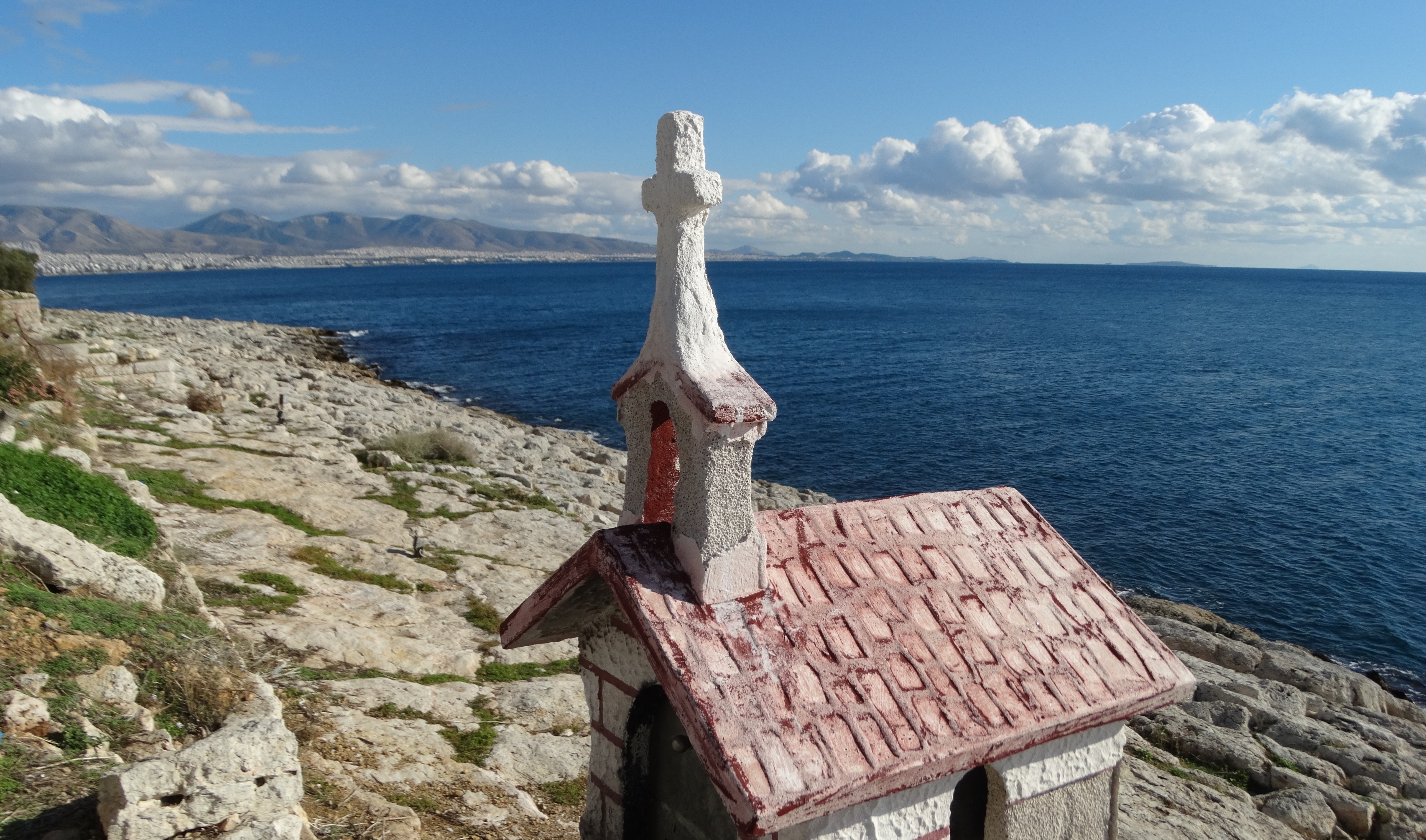
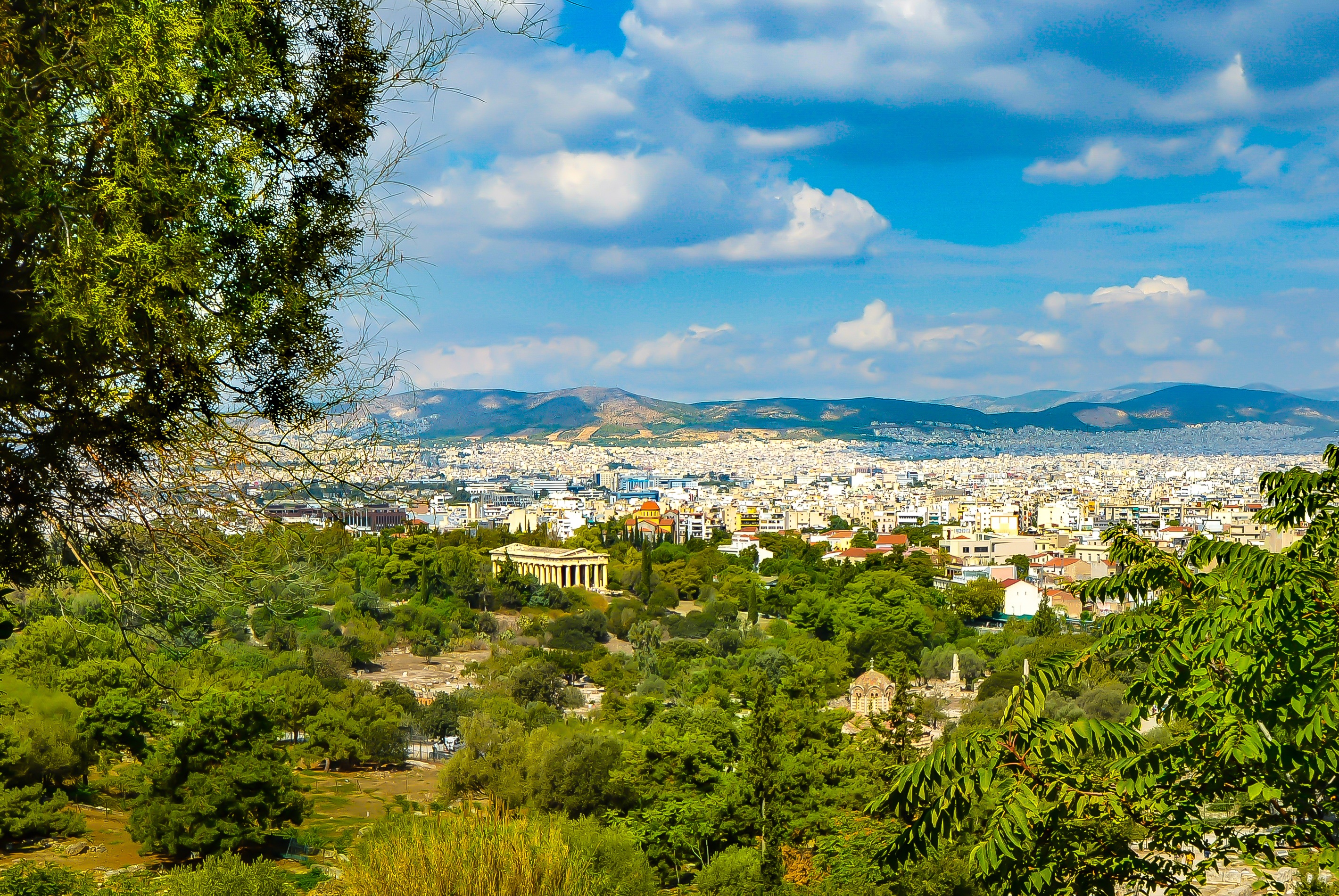
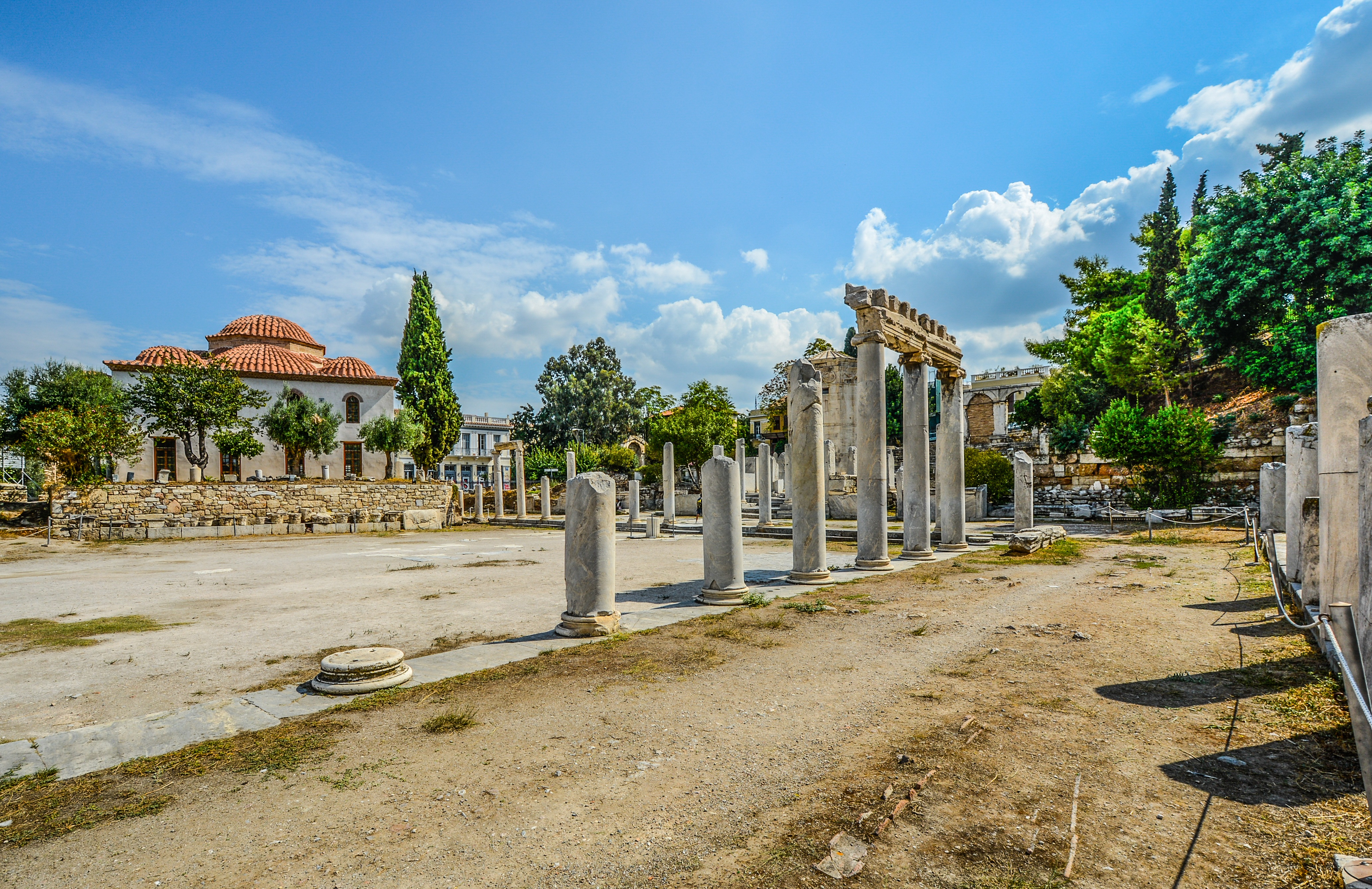
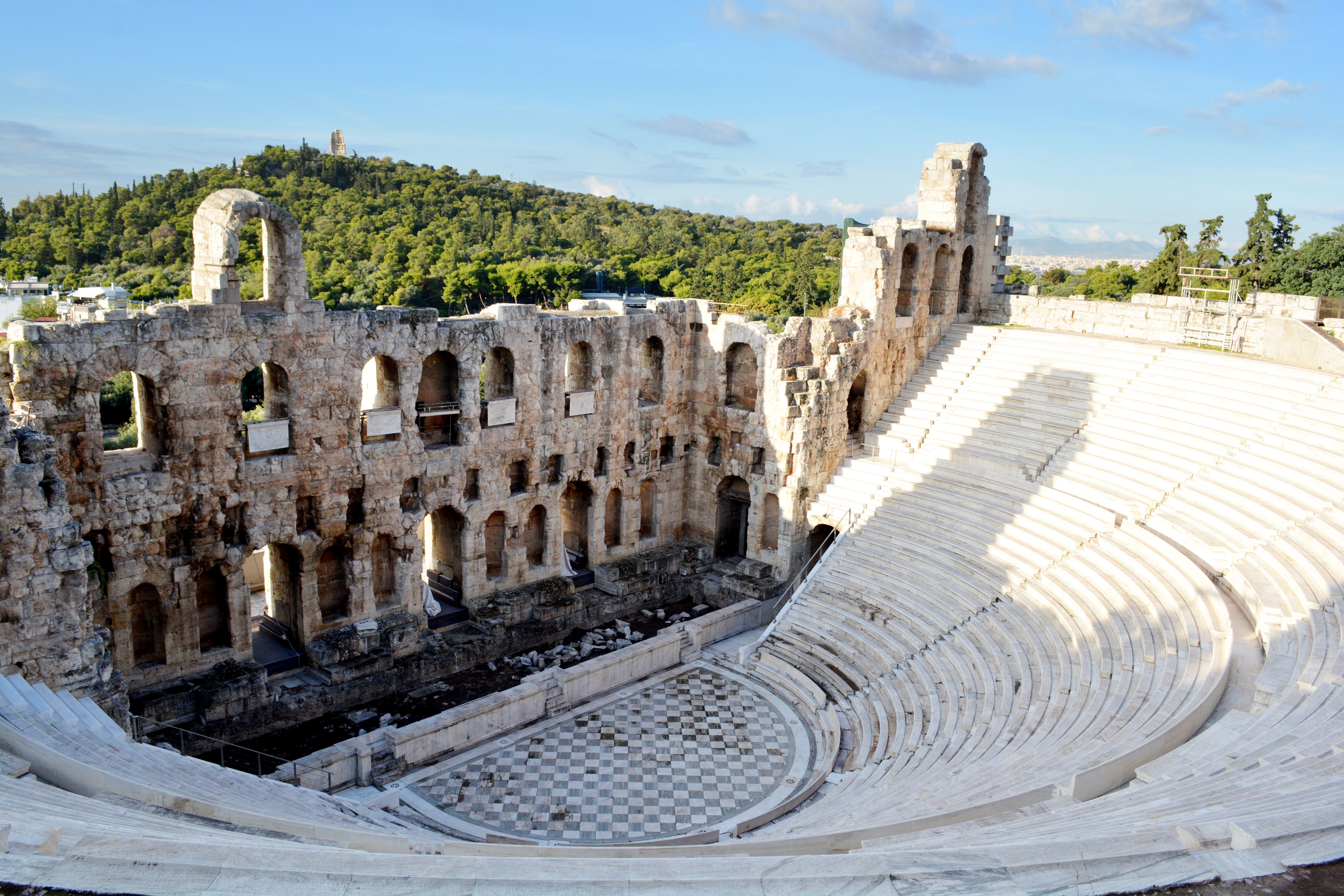
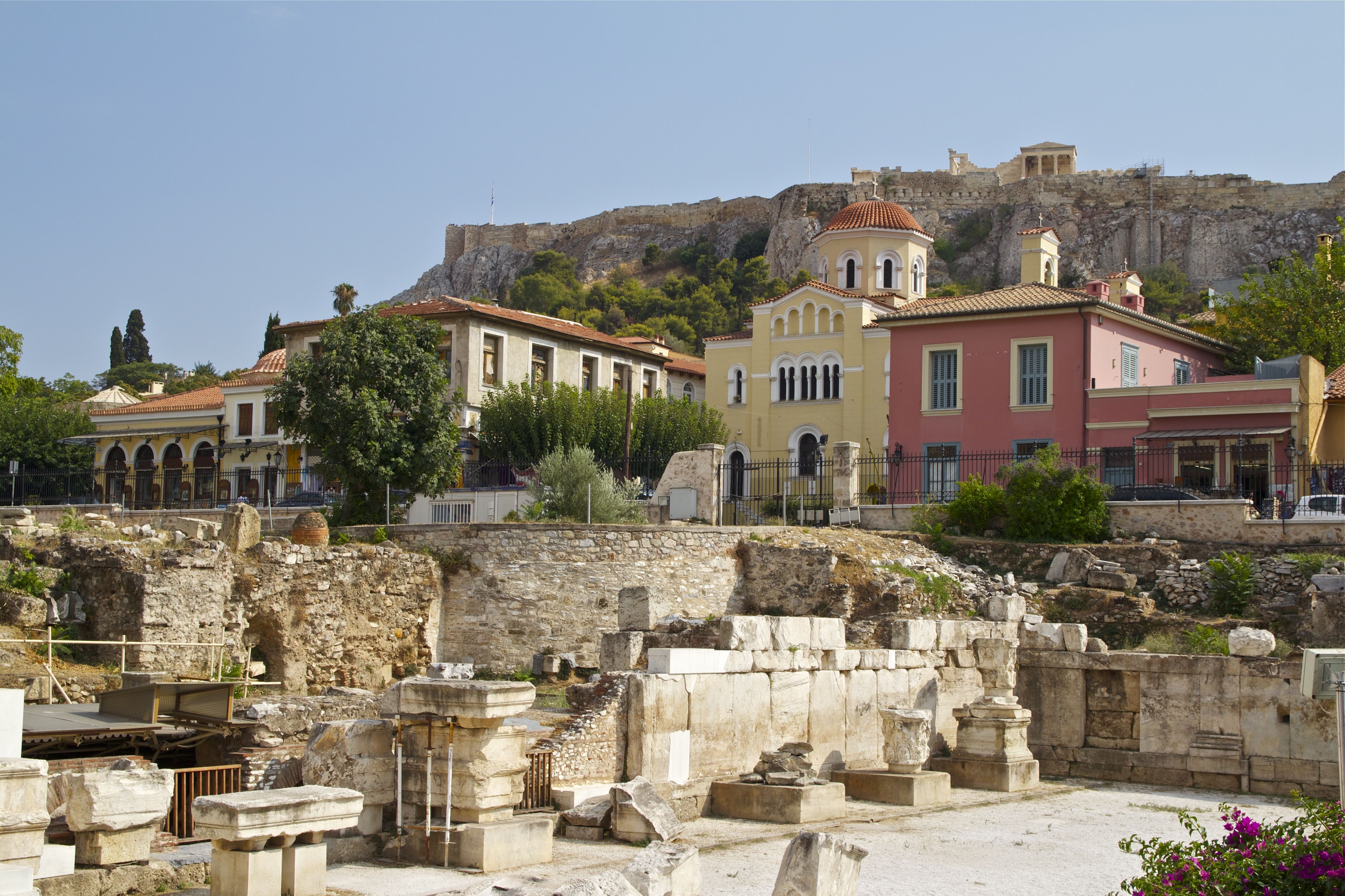
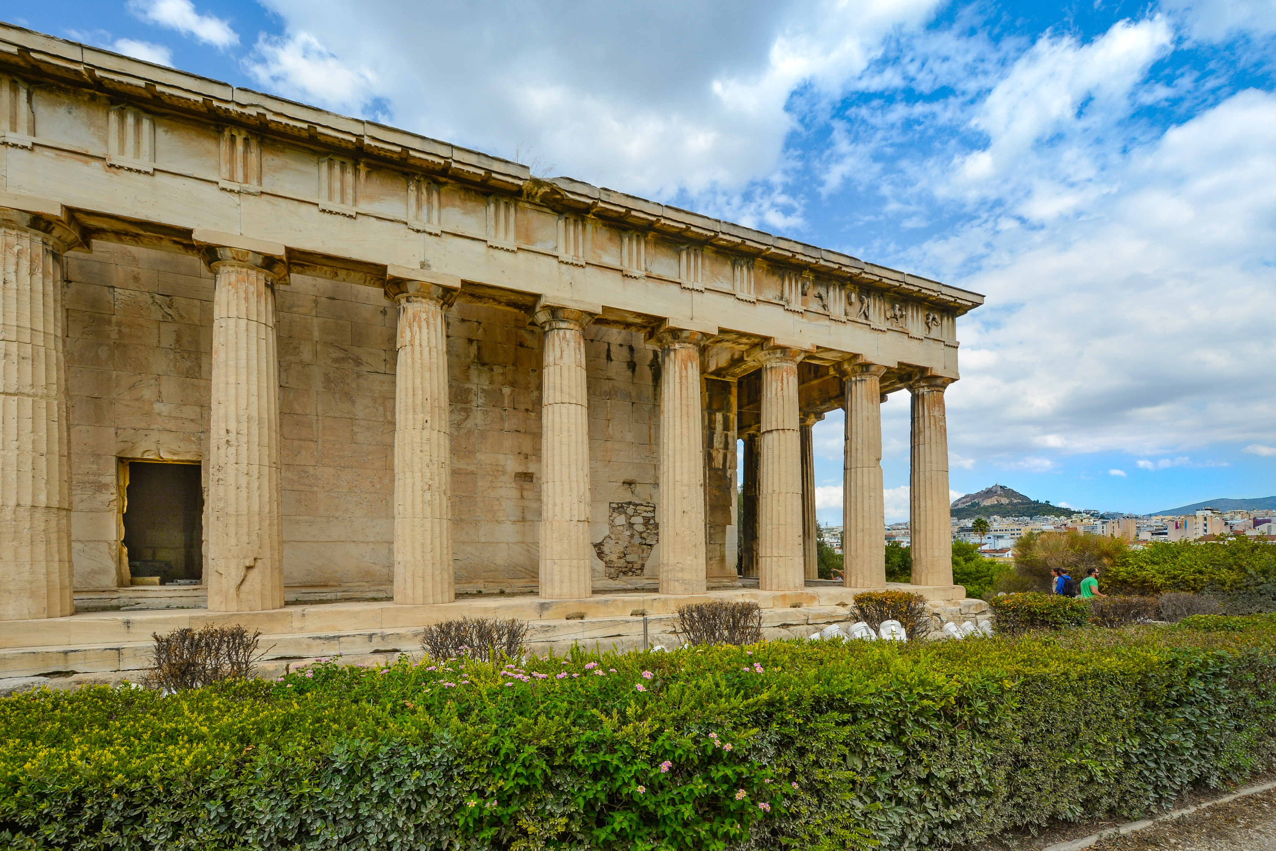
About Milos
Milos or Melos is a volcanic Greek island in the Aegean Sea, just north of the Sea of Crete. Milos is the southwesternmost island in the Cyclades group. The Venus de Milo and the Asclepius of Milos were both found on the island, as were a Poseidon and an archaic Apollo now in Athens.
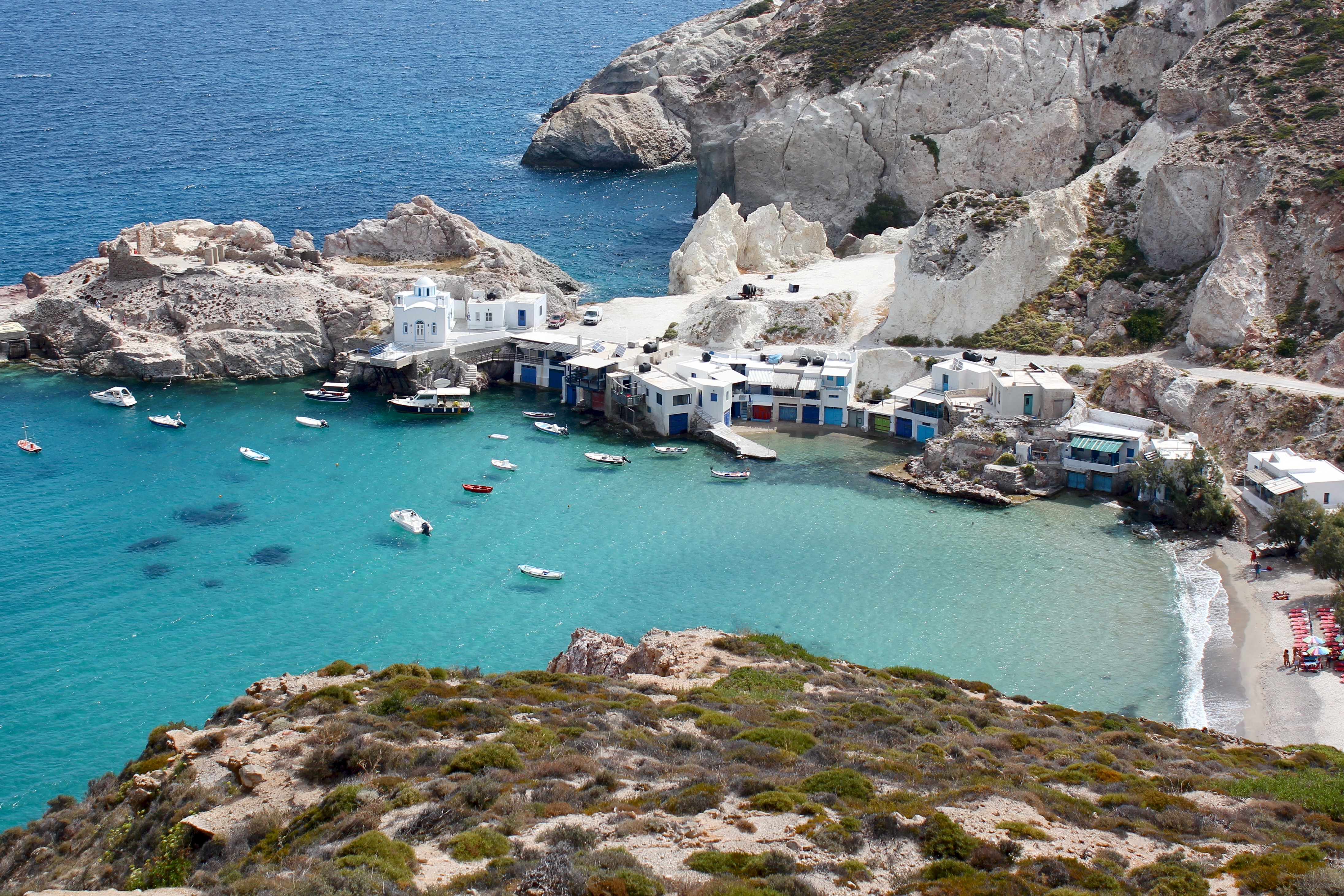
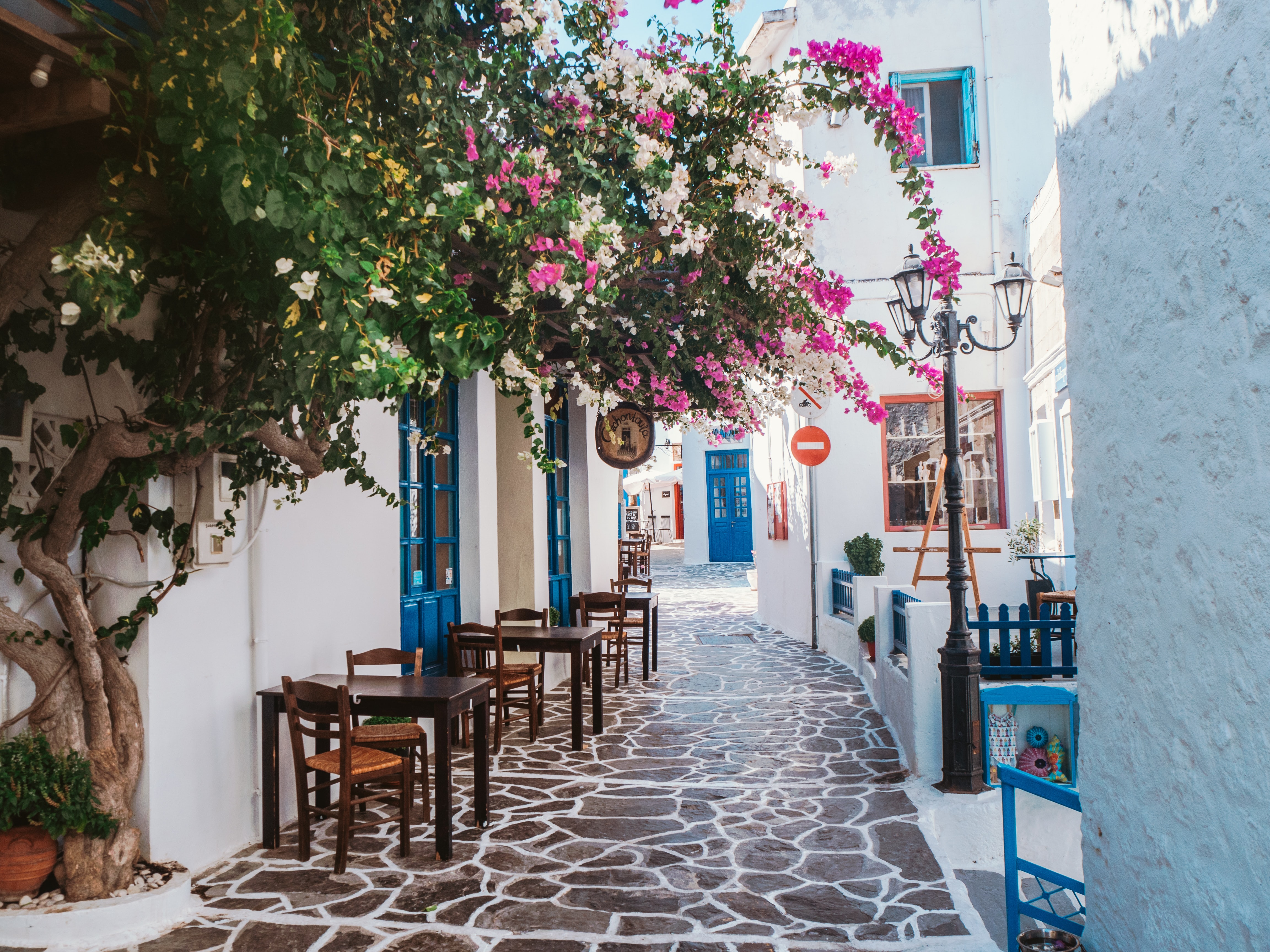
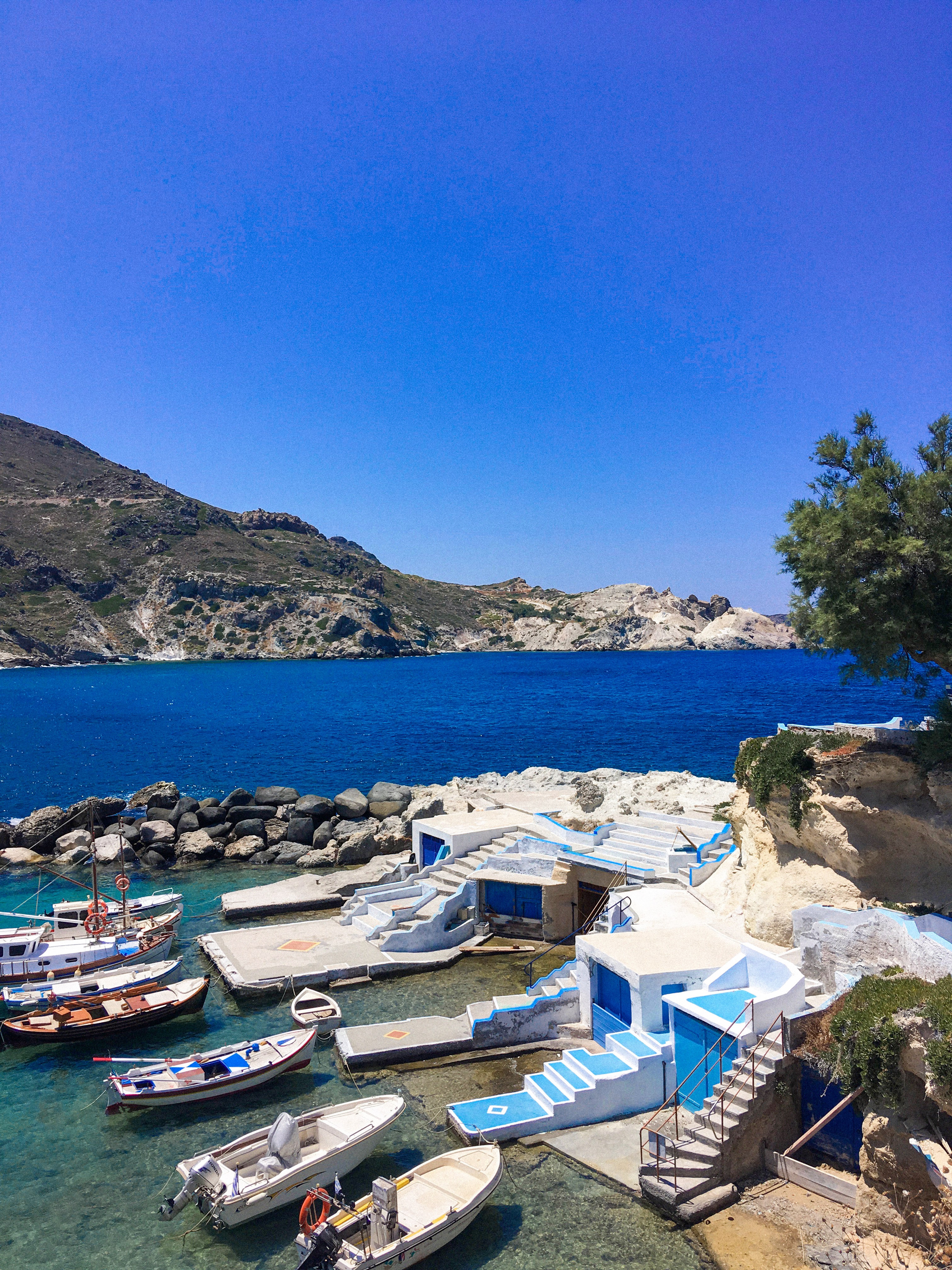
About Náfplion
Oraia (beautiful) is the word Greeks use to describe Nafplion. The town's old section, on a peninsula jutting into the gulf of Argos, mixes Greek, Venetian, and Turkish architecture; narrow streets, often just broad flights of stone stairs, climb the slopes beneath the walls of Acronafplia. Tree-shaded plazas surround neoclassic buildings. The Palamidi fortress—an elegant display of Venetian might from the early 1700s—guards the town. Nafplion deserves at least a leisurely day of your undivided attention, and you may want to spend several days or a week here and use the city as the base from which to explore the many surrounding ancient sights.
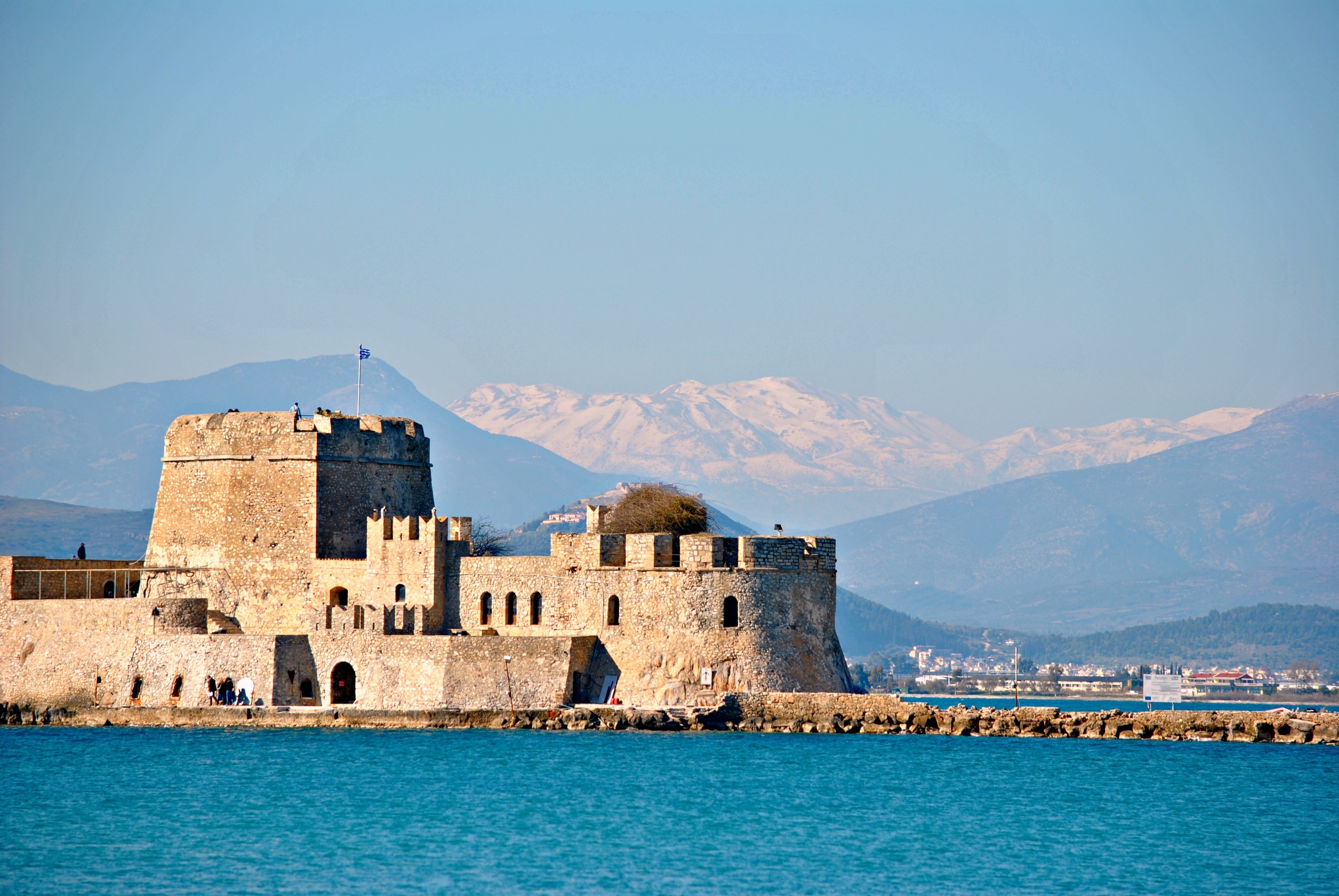

About Valletta
Malta's capital, the minicity of Valletta, has ornate palaces and museums protected by massive fortifications of honey-color limestone. Houses along the narrow streets have overhanging wooden balconies for people-watching from indoors. Generations ago they gave housebound women a window on the world of the street. The main entrance to town is through the City Gate (where all bus routes end), which leads onto Triq Repubblika (Republic Street), the spine of the grid-pattern city and the main shopping street. Triq Mercante (Merchant Street) parallels Repubblika to the east and is also good for strolling. From these two streets, cross streets descend toward the water; some are stepped. Valletta's compactness makes it ideal to explore on foot. City Gate and the upper part of Valletta are experiencing vast redevelopment that includes a new Parliament Building and open-air performance venue. The complex, completed mid-2013, has numerous pedestrian detours in place along with building noise and dust. Before setting out along Republic Street, stop at the tourist information office on Merchant Street for maps and brochures.
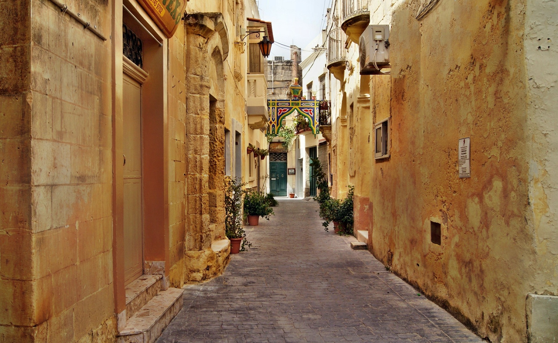
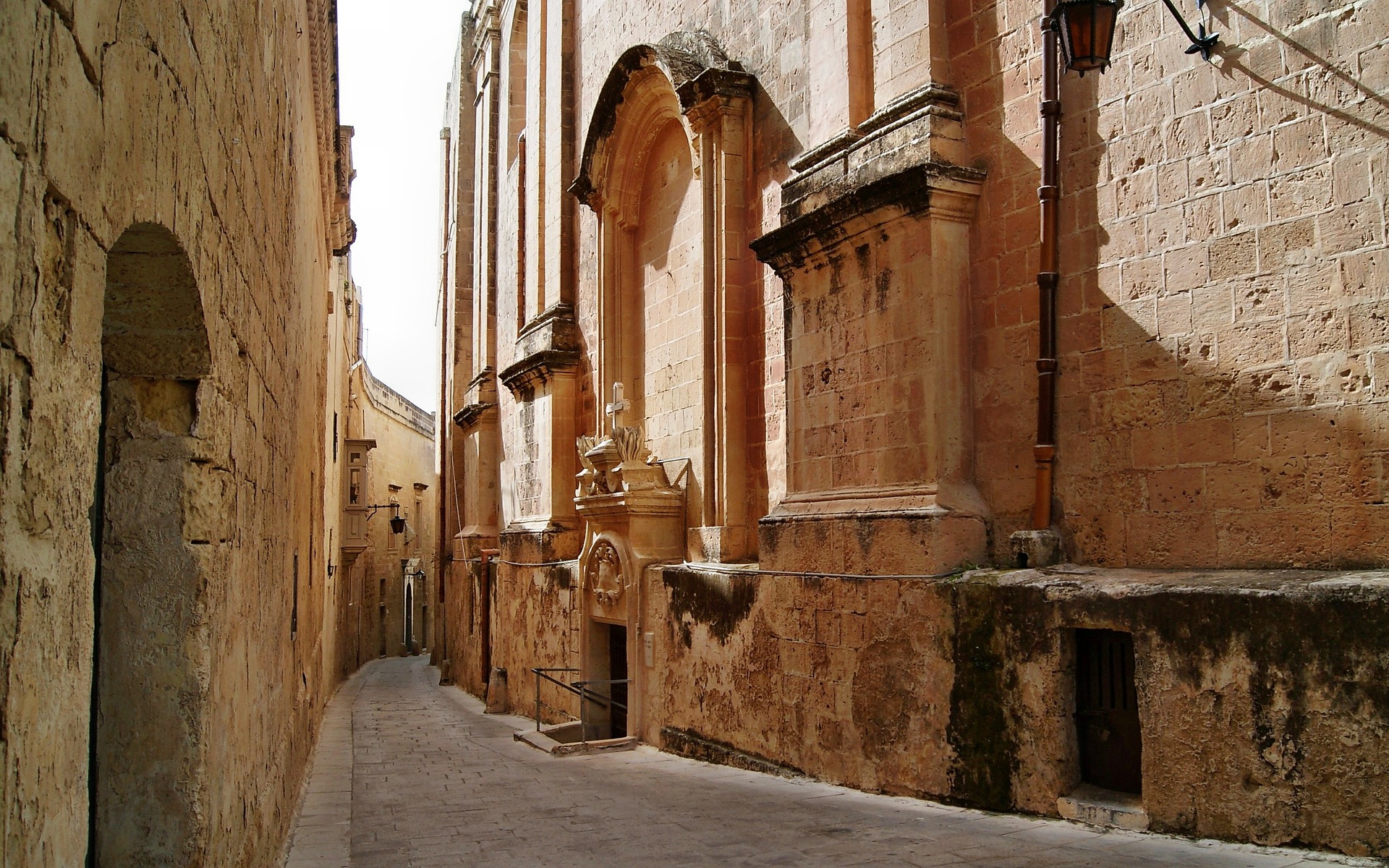
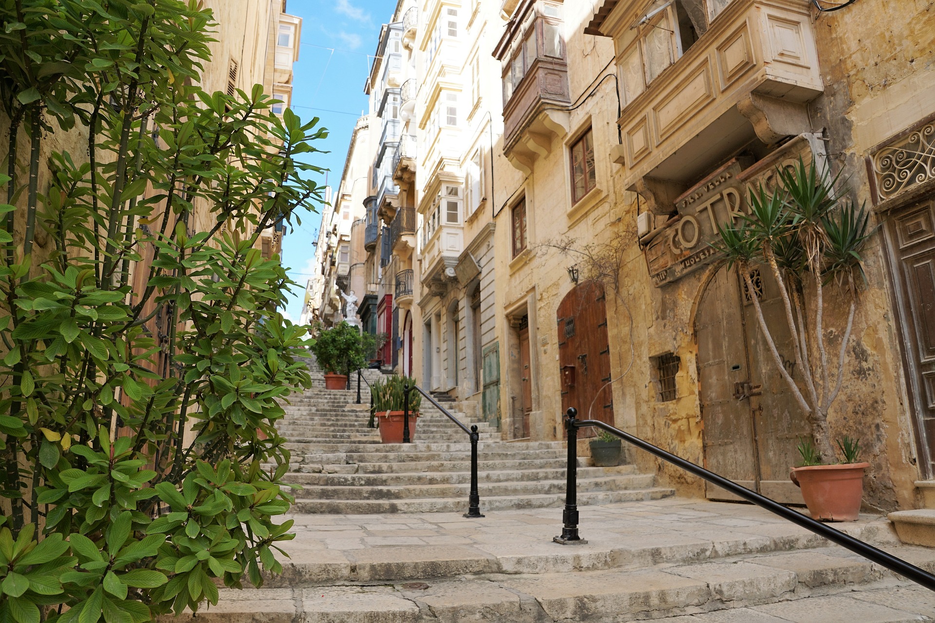
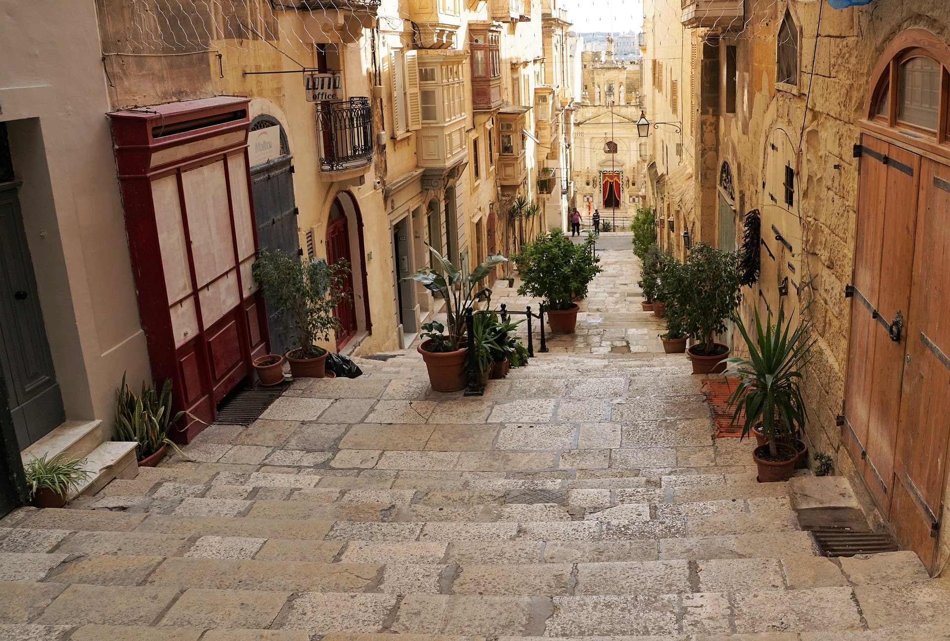
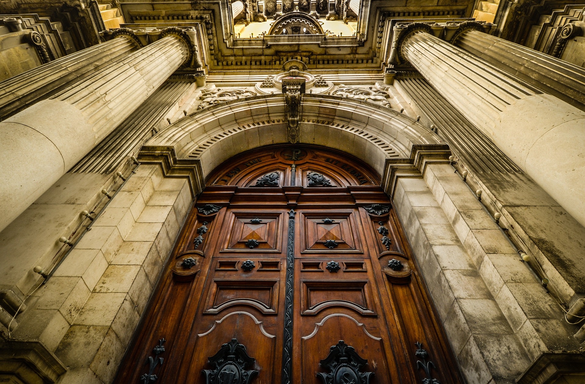
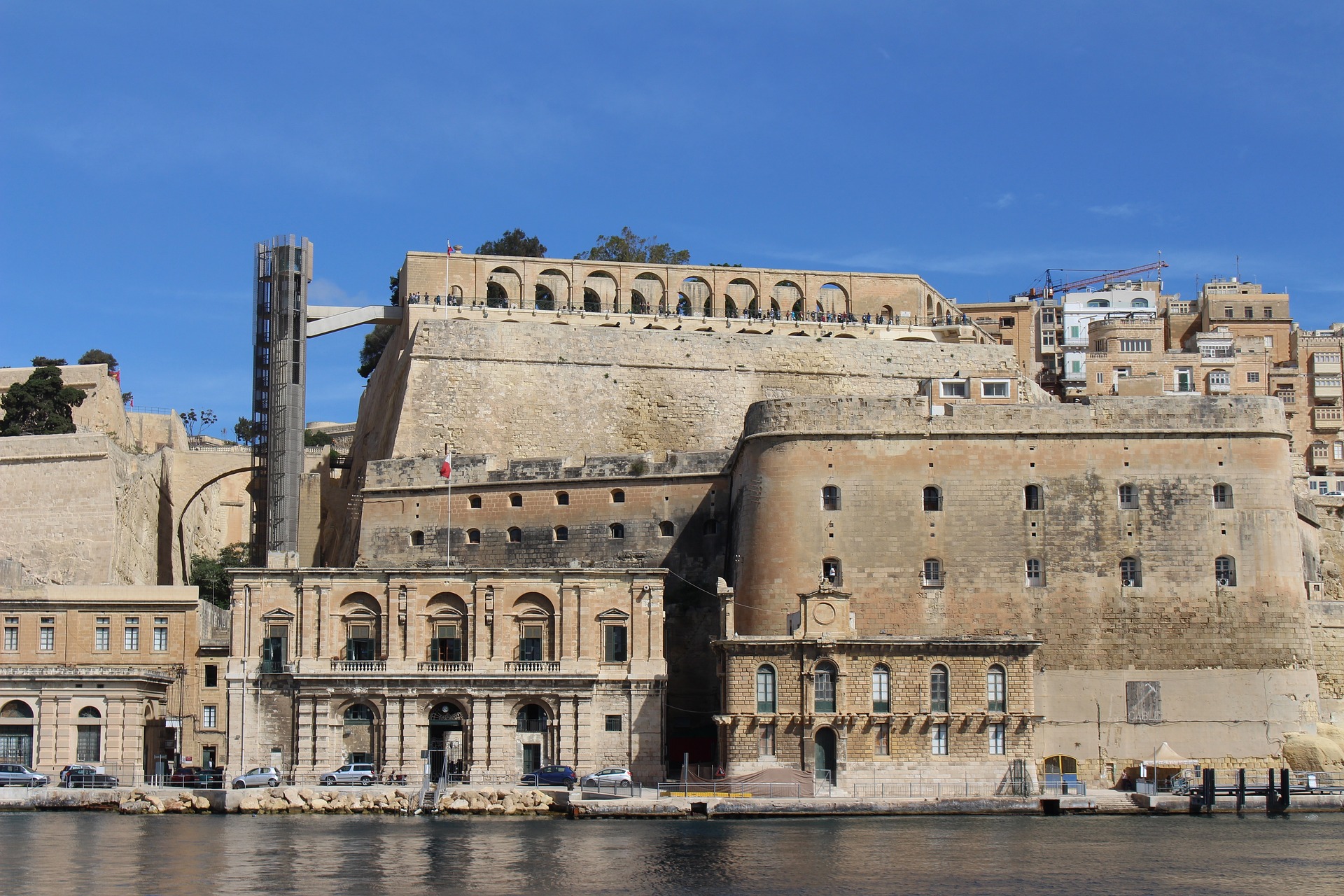
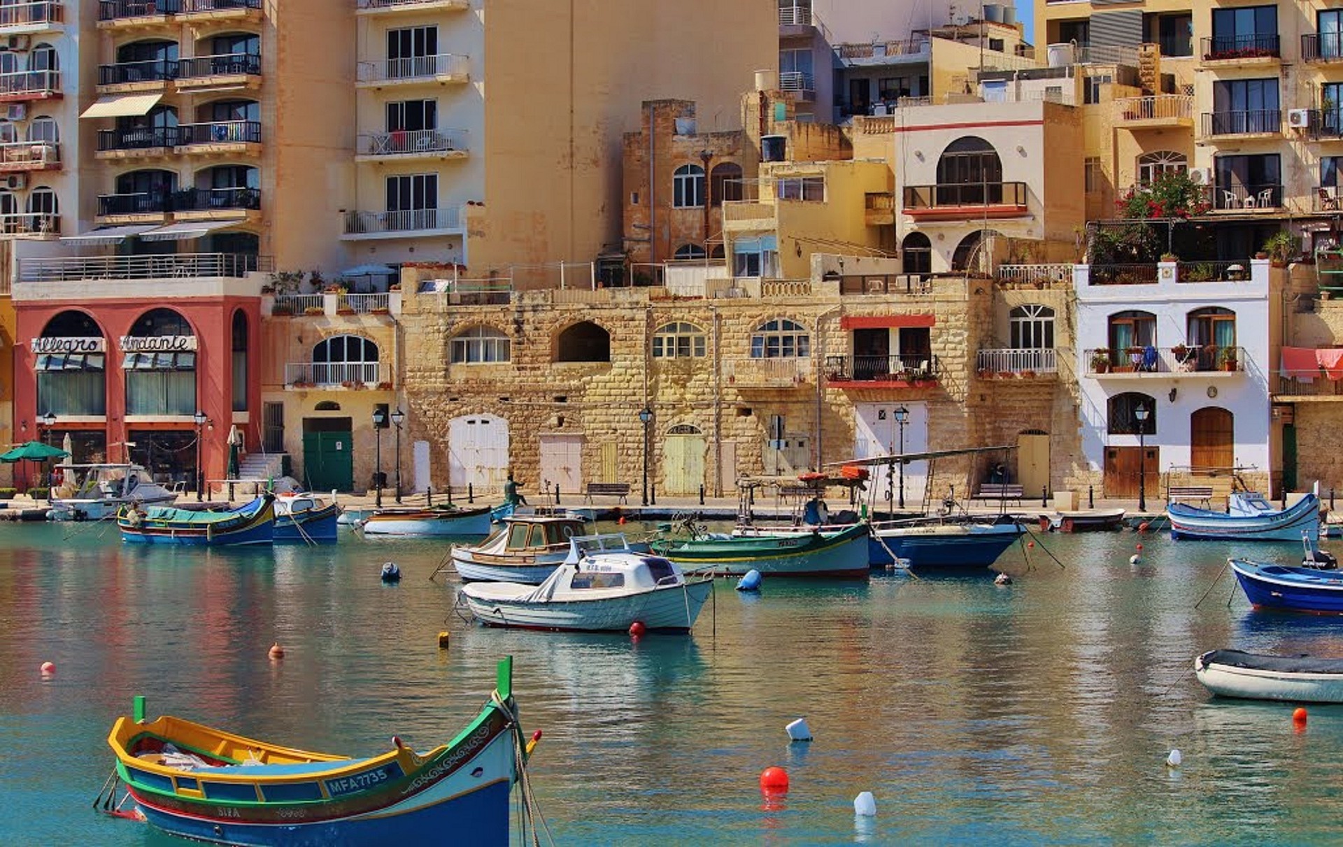
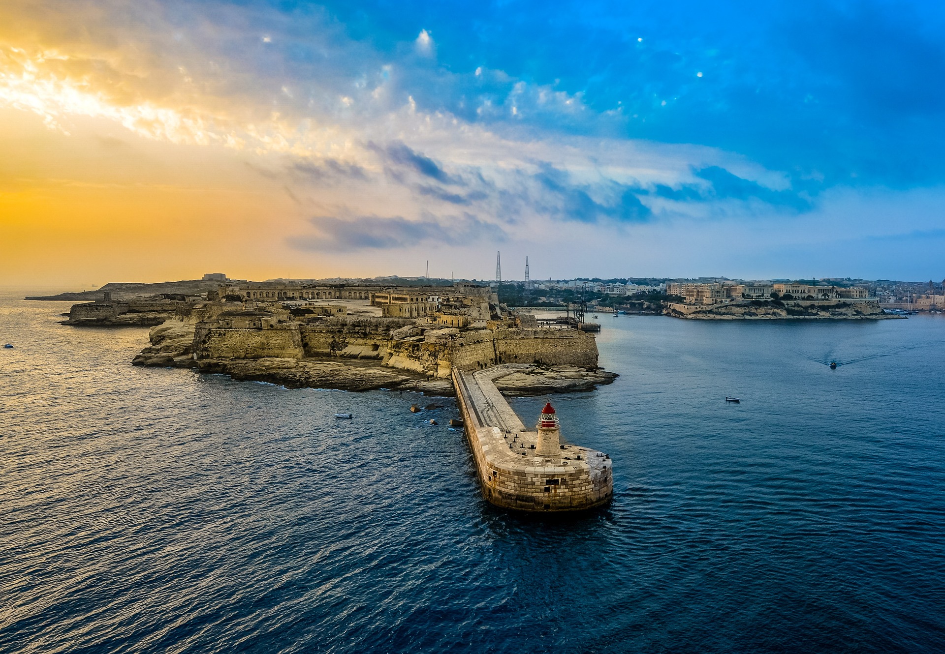
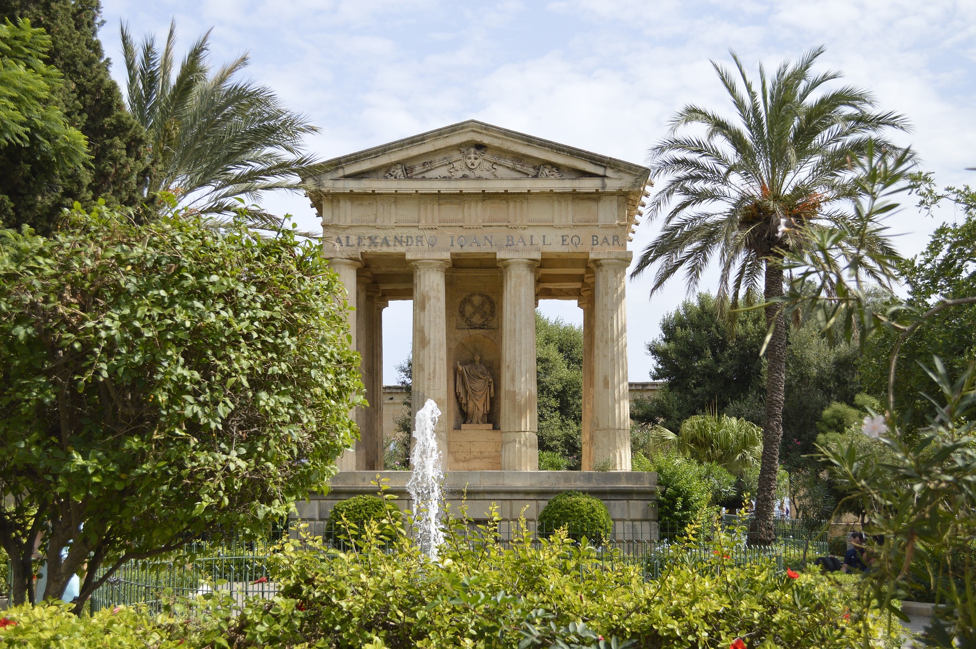
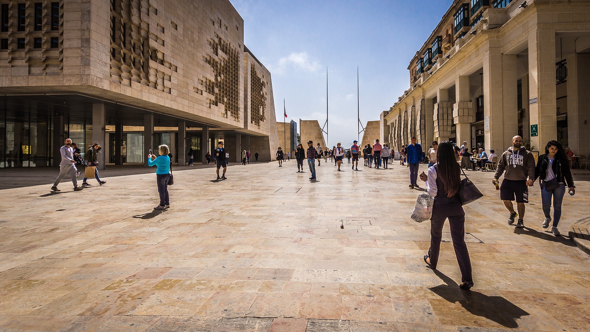
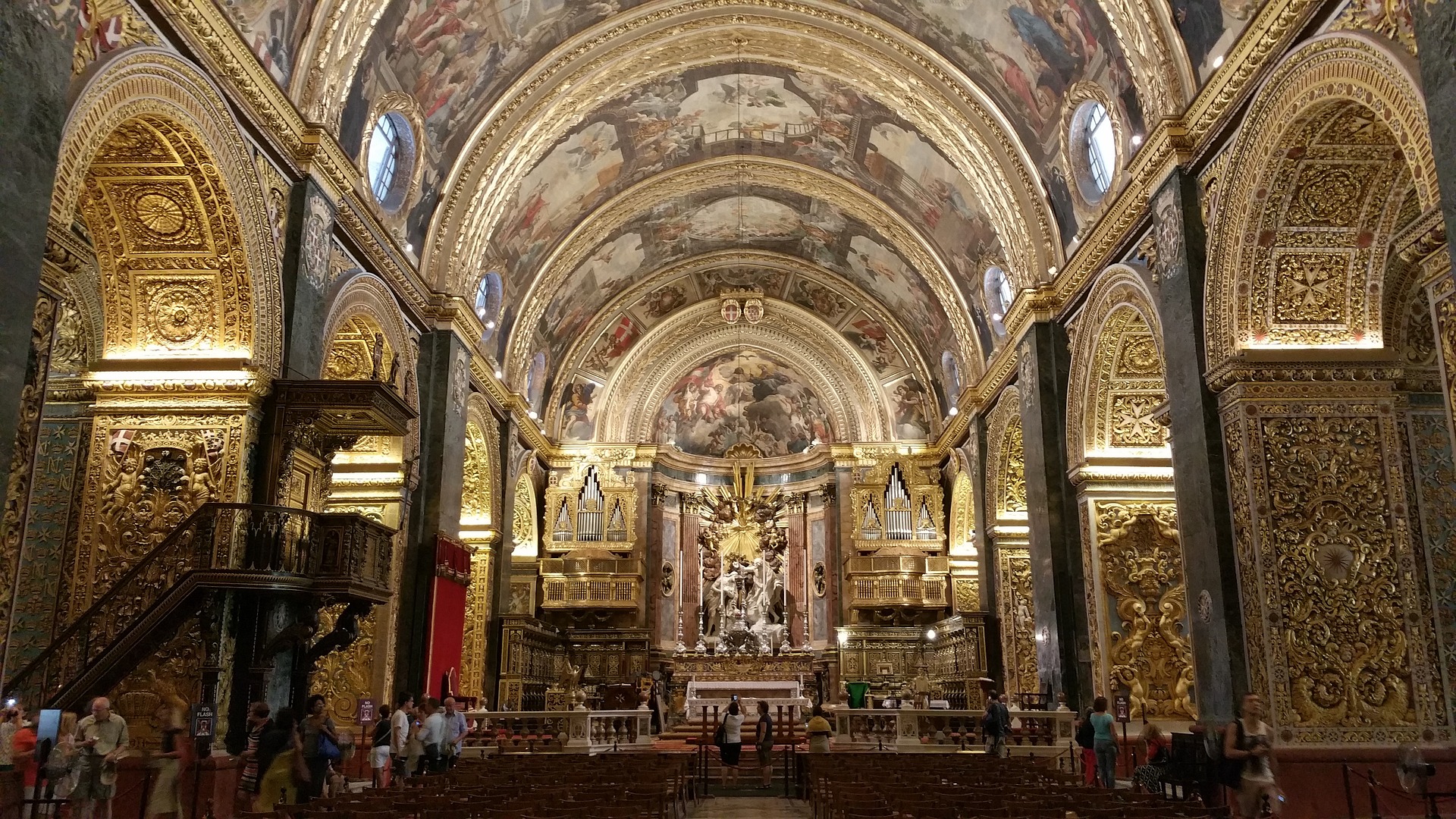
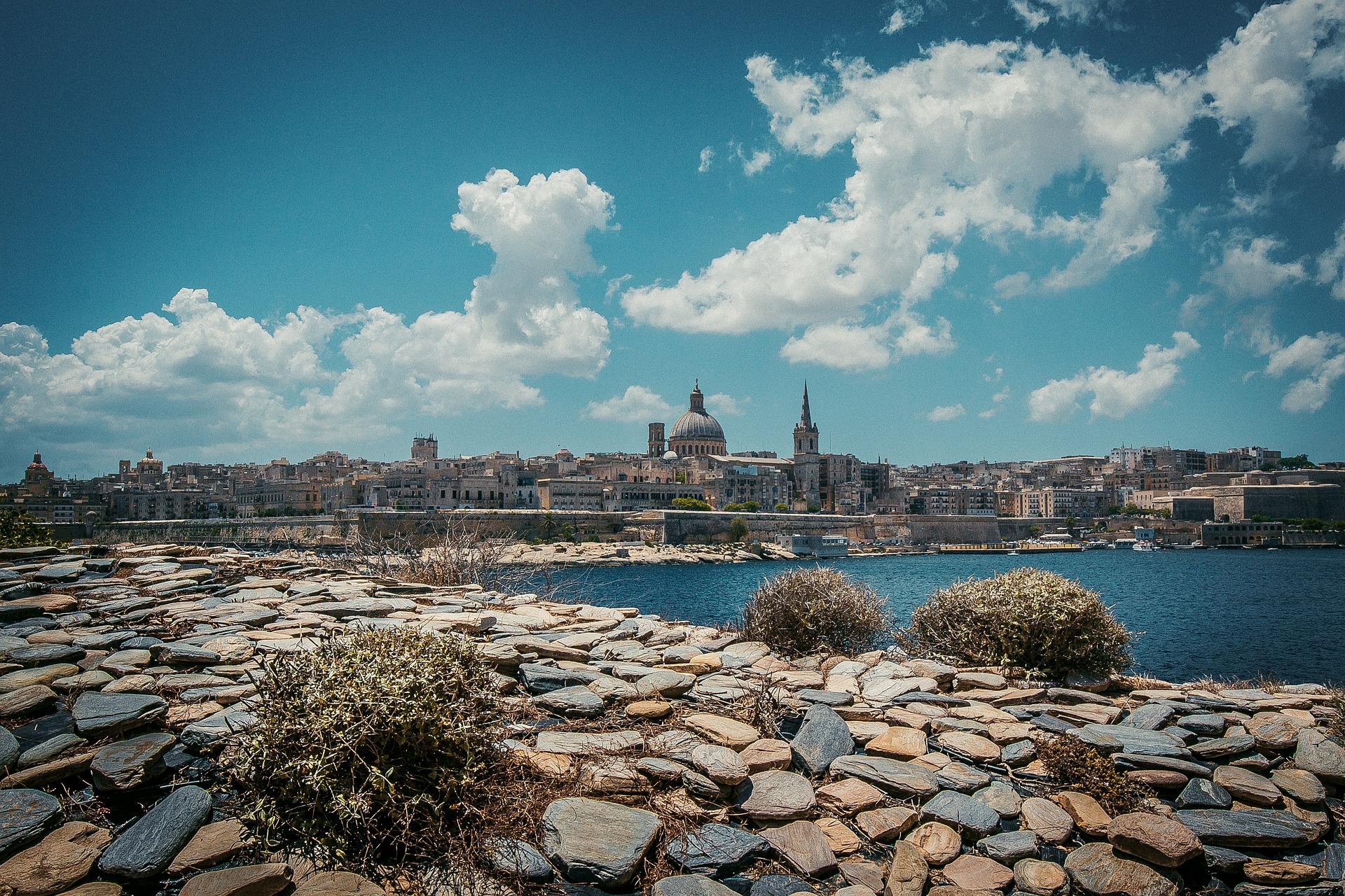
About Lipari
The largest and most developed of the Aeolians, Lipari welcomes you with distinctive pastel-color houses. Fields of spiky agaves dot the northernmost tip of the island, Acquacalda, indented with pumice and obsidian quarries. In the west is San Calogero, where you can explore hot springs and mud baths. From the red-lava base of the island rises a plateau crowned with a 16th-century castle and a 17th-century cathedral.
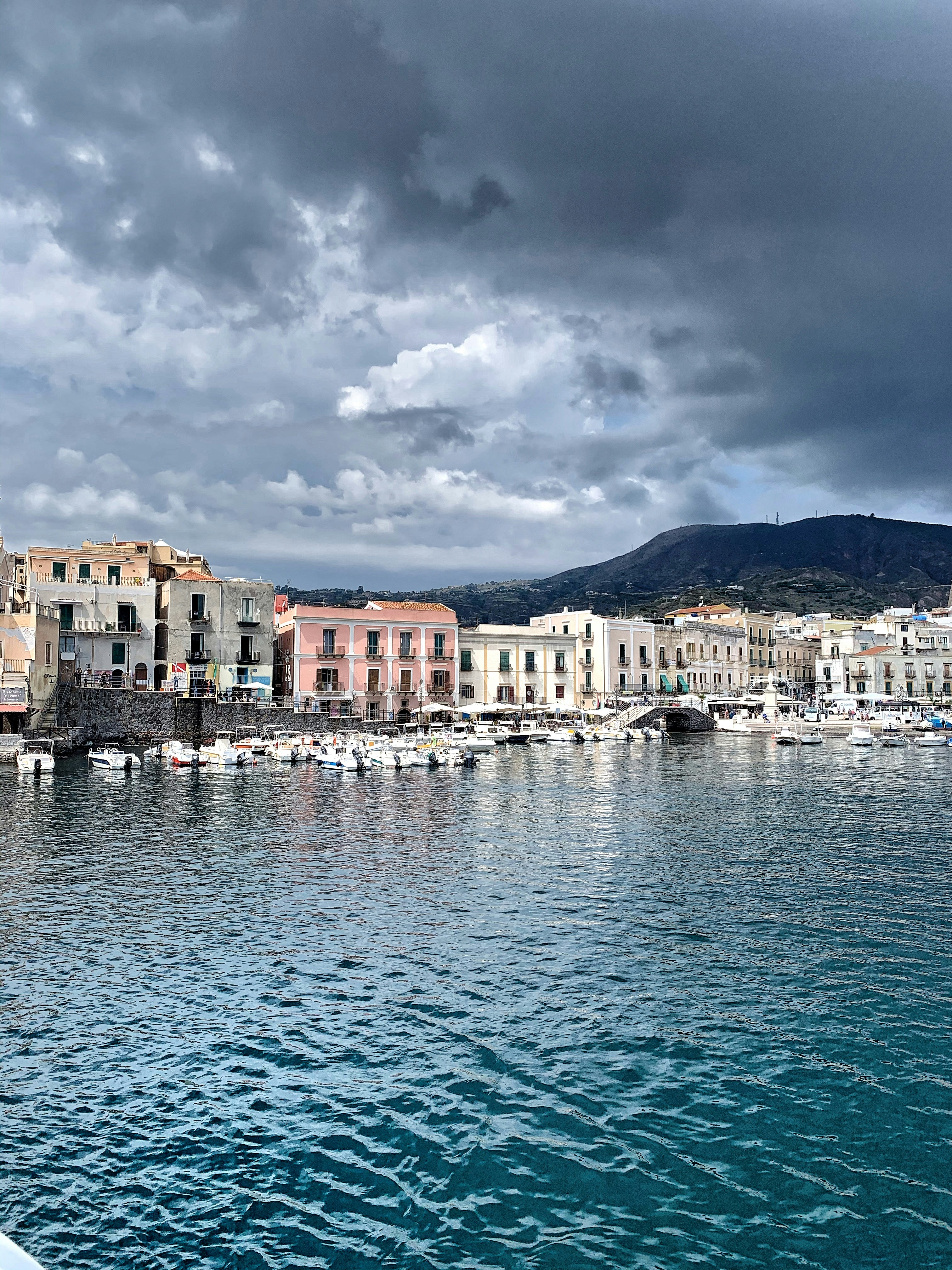
About Agropoli
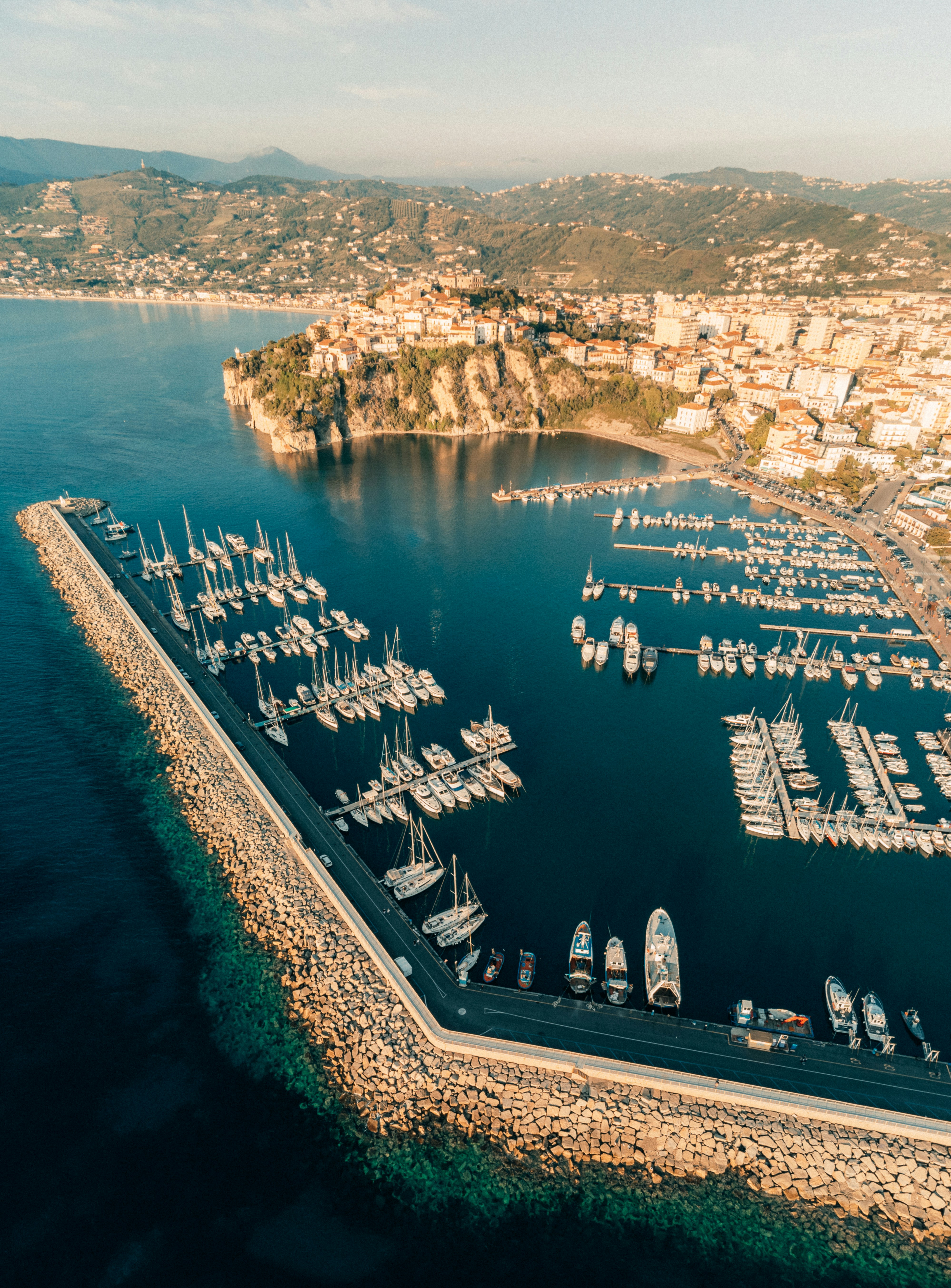
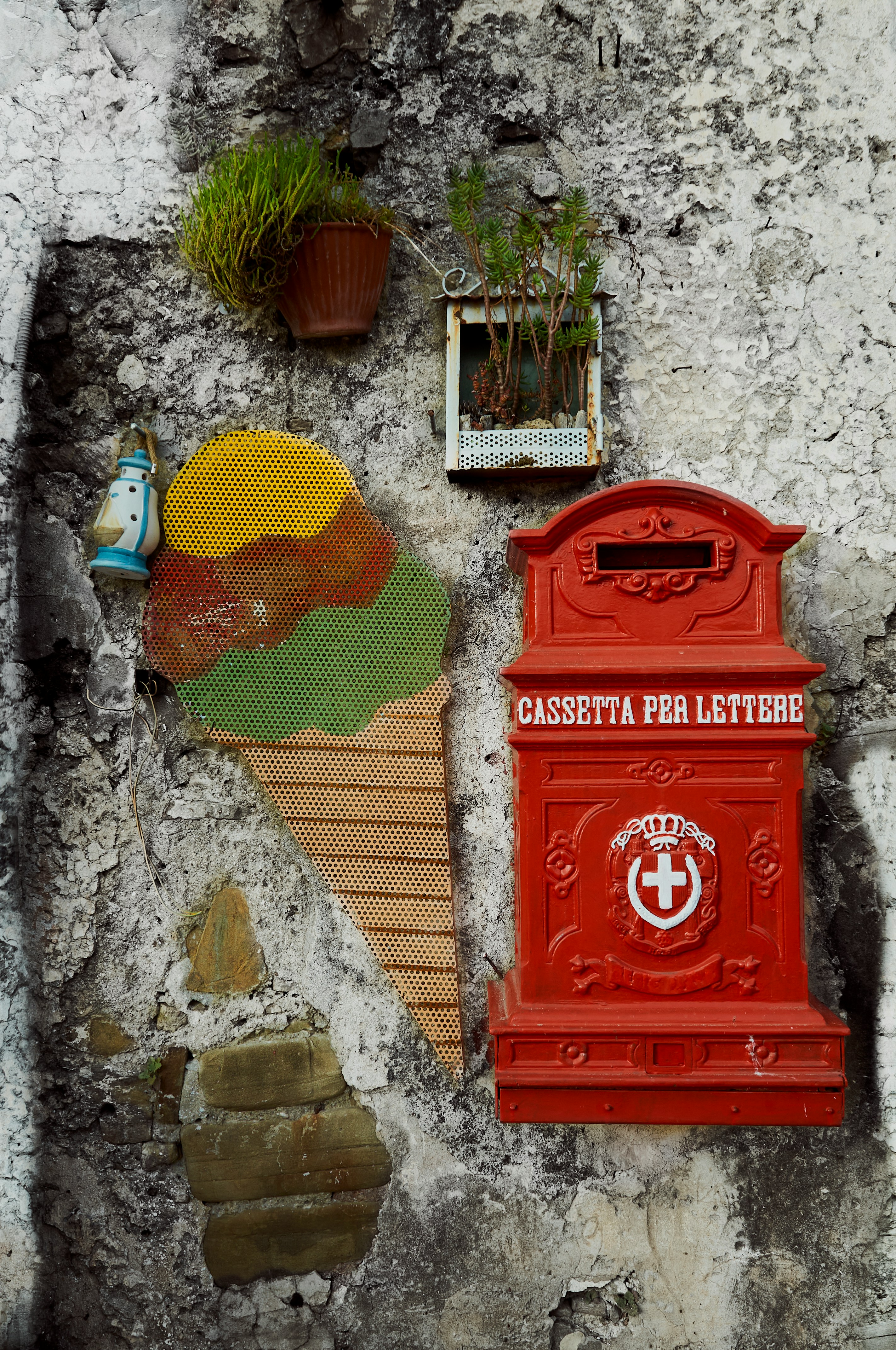
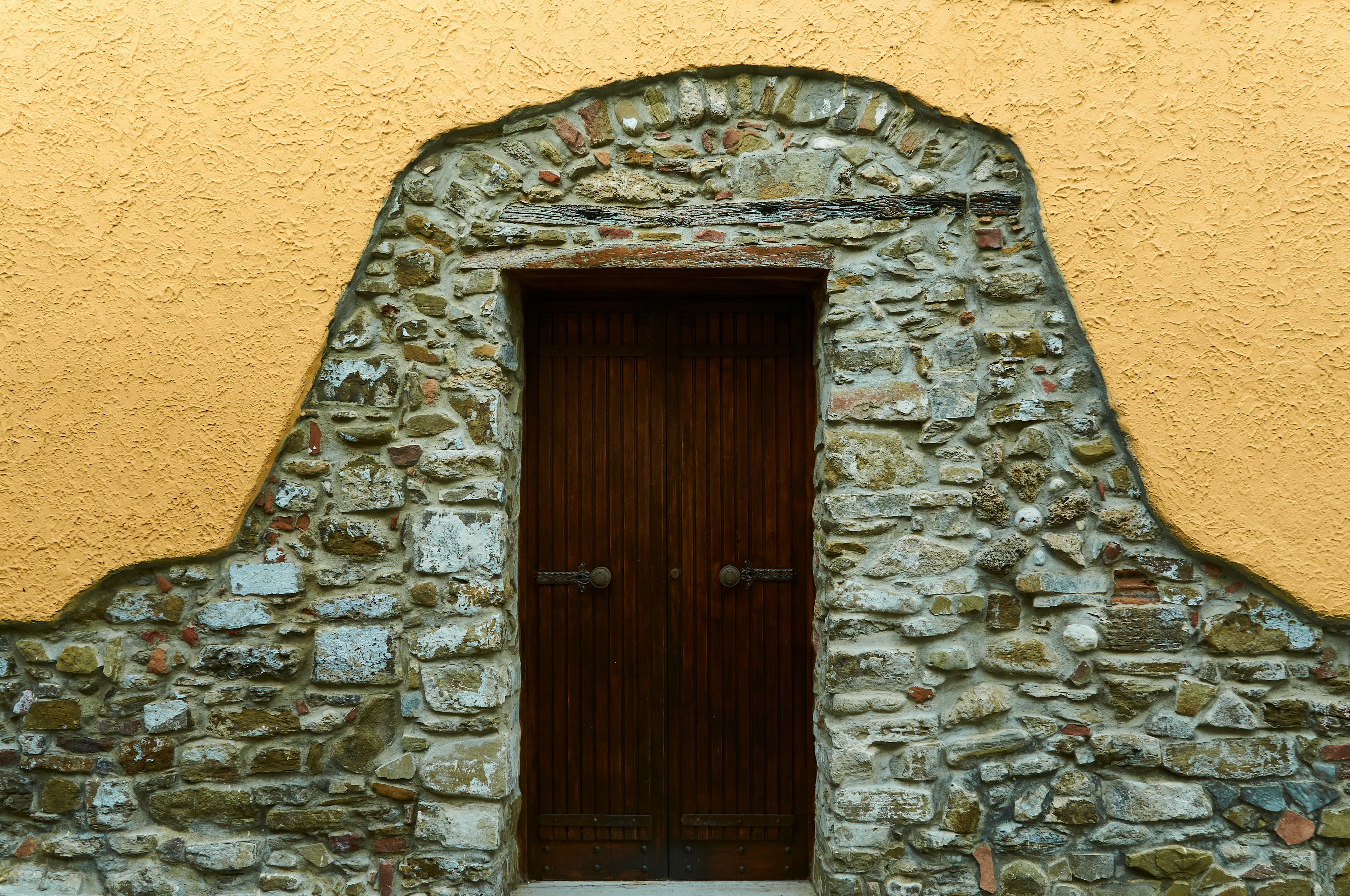
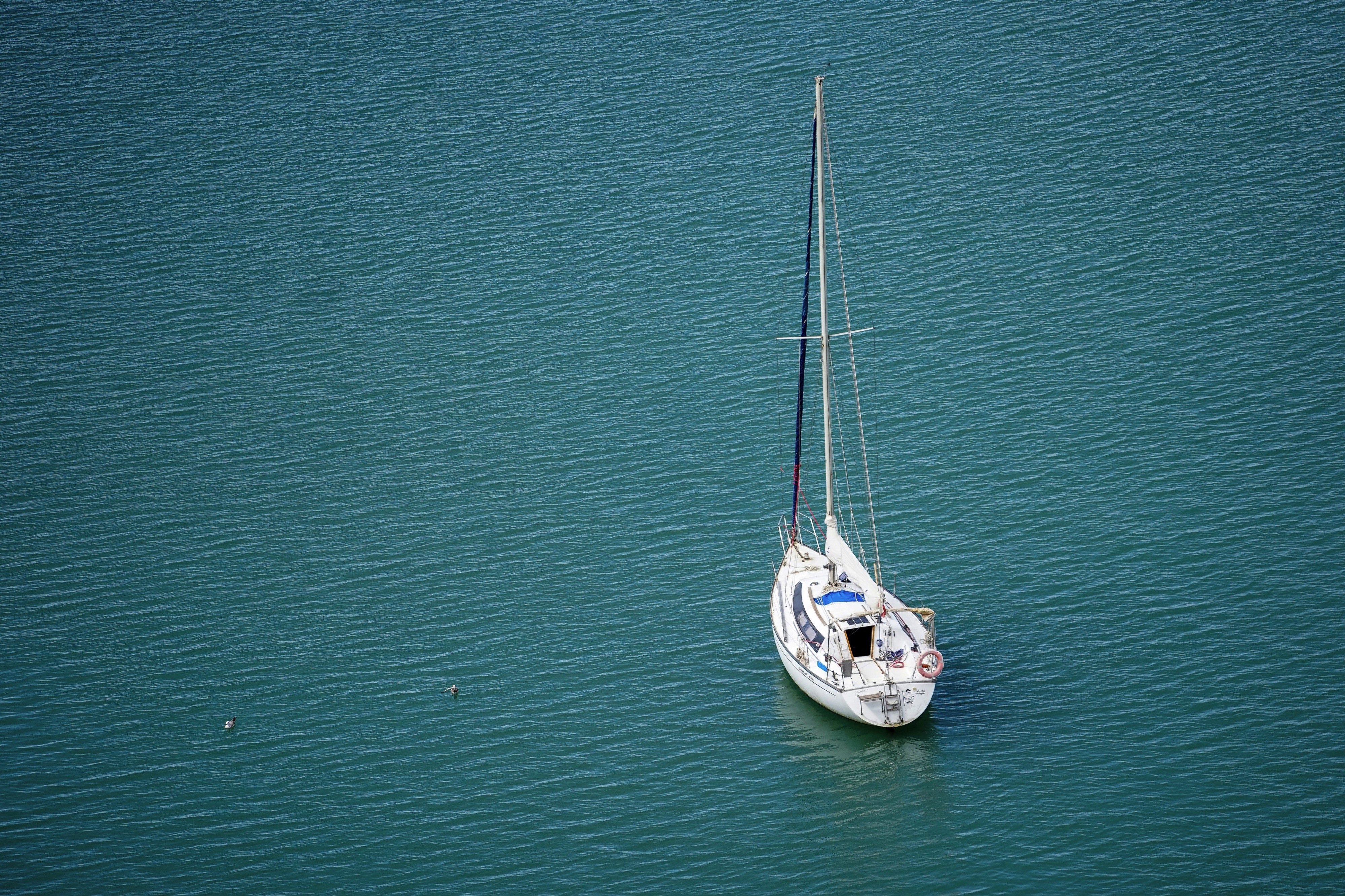
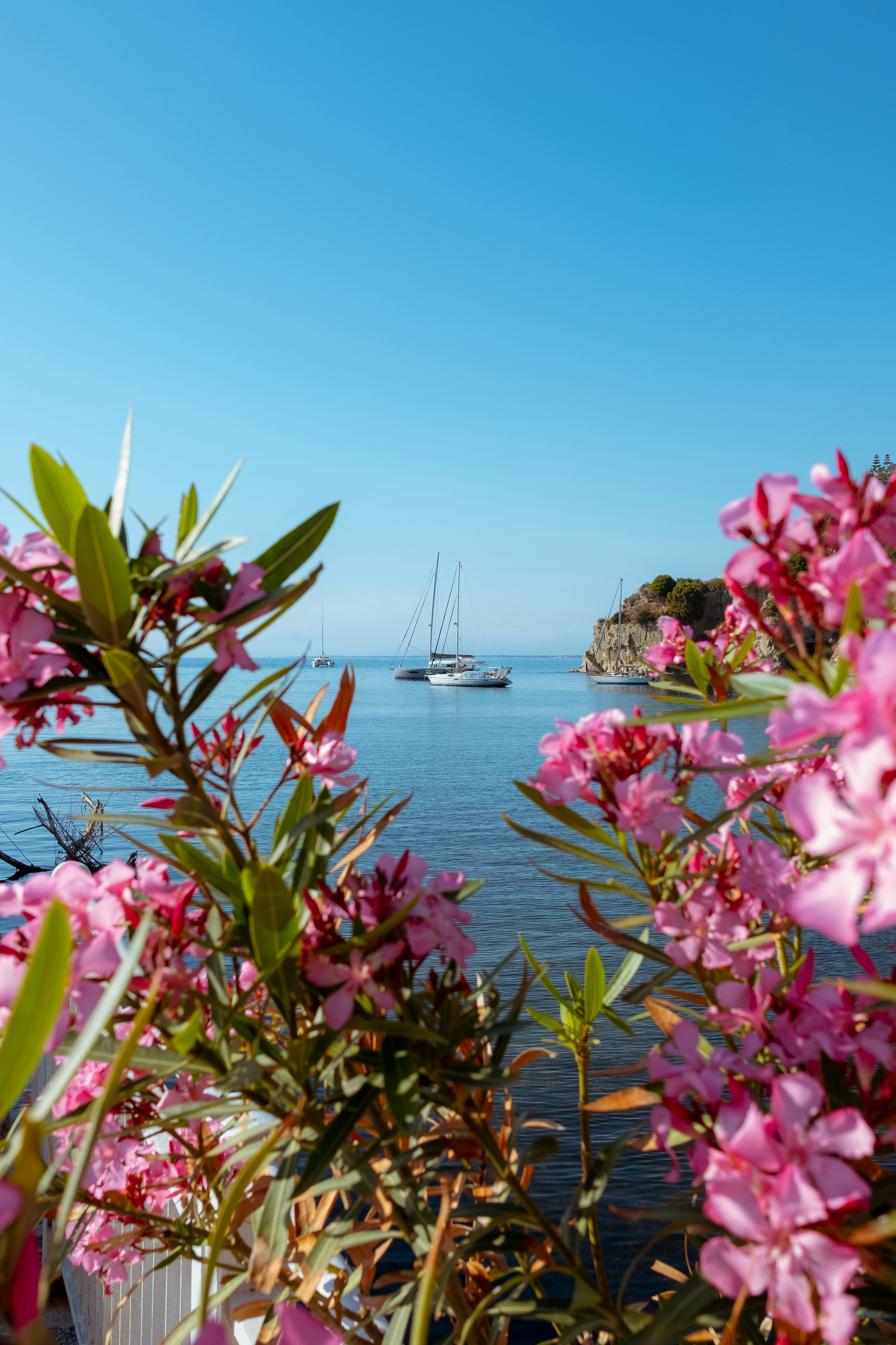
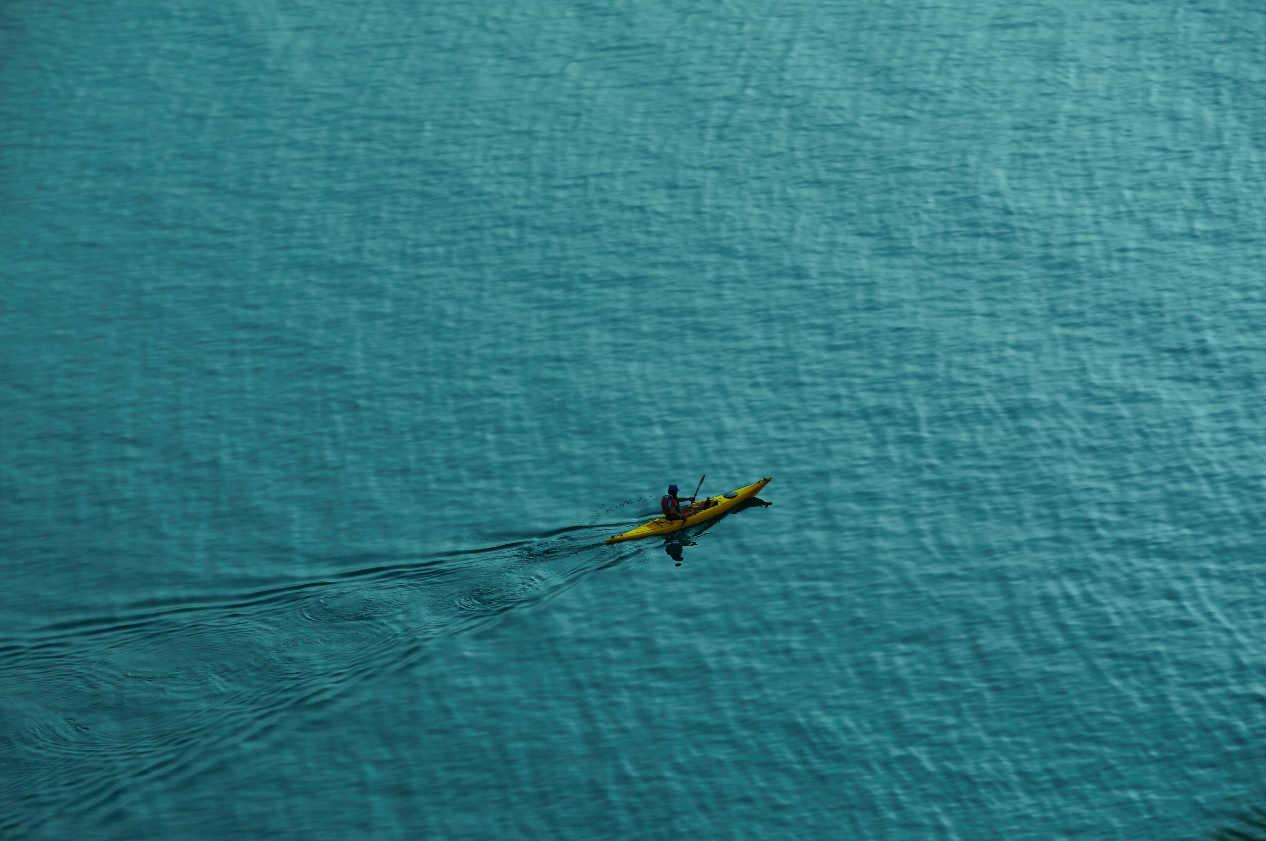
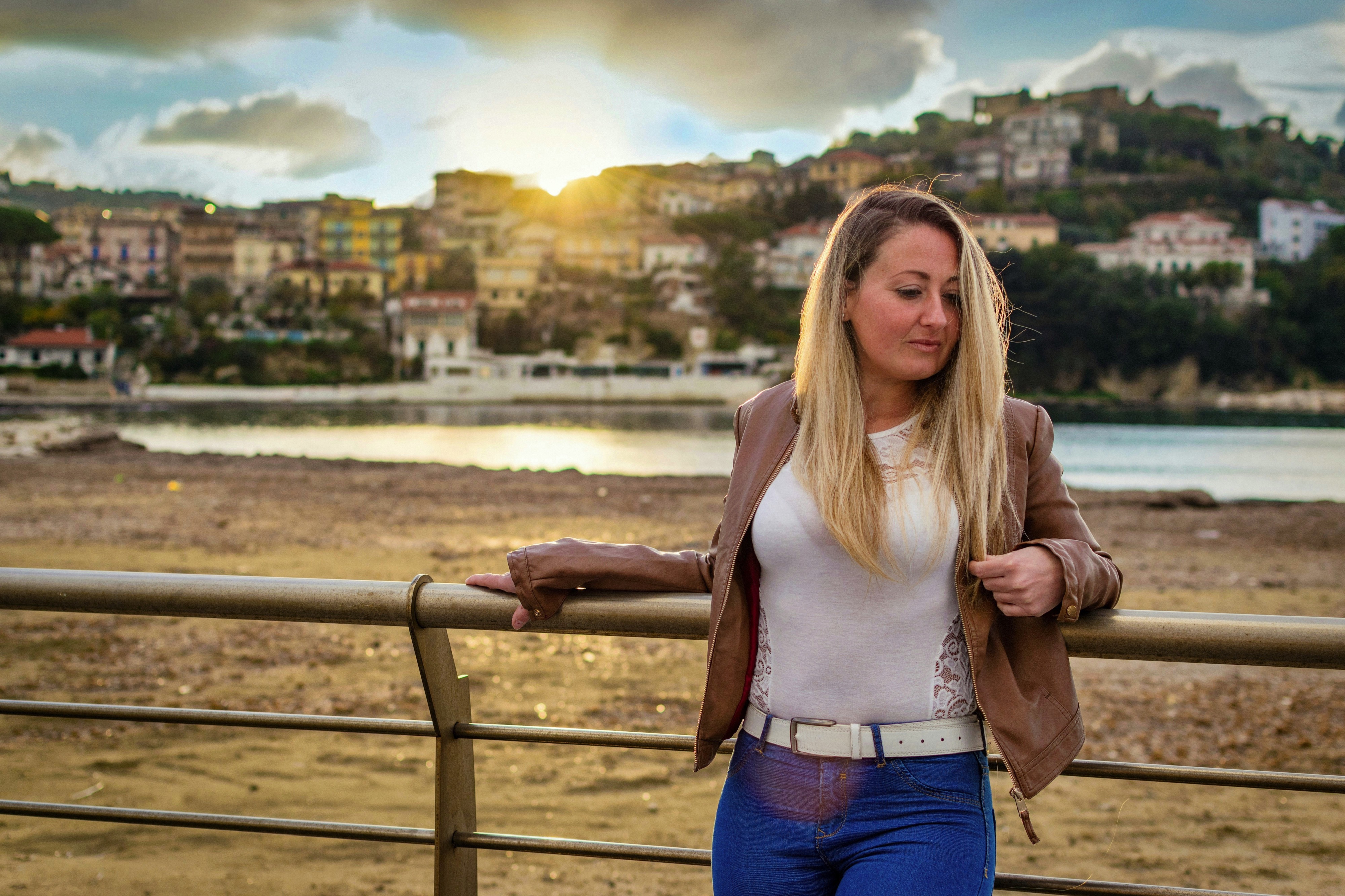
About Livorno
Livorno is a gritty city with a long and interesting history. In the early Middle Ages it alternately belonged to Pisa and Genoa. In 1421 Florence, seeking access to the sea, bought it. Cosimo I (1519–74) started construction of the harbor in 1571, putting Livorno on the map. After Ferdinando I de' Medici (1549–1609) proclaimed Livorno a free city, it became a haven for people suffering from religious persecution; Roman Catholics from England and Jews and Moors from Spain and Portugal, among others, settled here. The Quattro Mori (Four Moors), also known as the Monument to Ferdinando I, commemorates this. (The statue of Ferdinando I dates from 1595, the bronze Moors by Pietro Tacca from the 1620s.)In the following centuries, and particularly in the 18th, Livorno boomed as a port. In the 19th century the town drew a host of famous Britons passing through on their grand tours. Its prominence continued up to World War II, when it was heavily bombed. Much of the town's architecture, therefore, postdates the war, and it's somewhat difficult to imagine what it might have looked like before. Livorno has recovered from the war, however, as it's become a huge point of departure for container ships, as well as the only spot in Tuscany for cruise ships to dock for the day.Most of Livorno's artistic treasures date from the 17th century and aren't all that interesting unless you dote on obscure baroque artists. Livorno's most famous native artist, Amedeo Modigliani (1884–1920), was of much more recent vintage. Sadly, there's no notable work by him in his hometown.There may not be much in the way of art, but it's still worth strolling around the city. The Mercato Nuovo, which has been around since 1894, sells all sorts of fruits, vegetables, grains, meat, and fish. Outdoor markets nearby are also chock-full of local color. The presence of Camp Darby, an American military base just outside town, accounts for the availability of many American products.If you have time, Livorno is worth a stop for lunch or dinner at the very least.
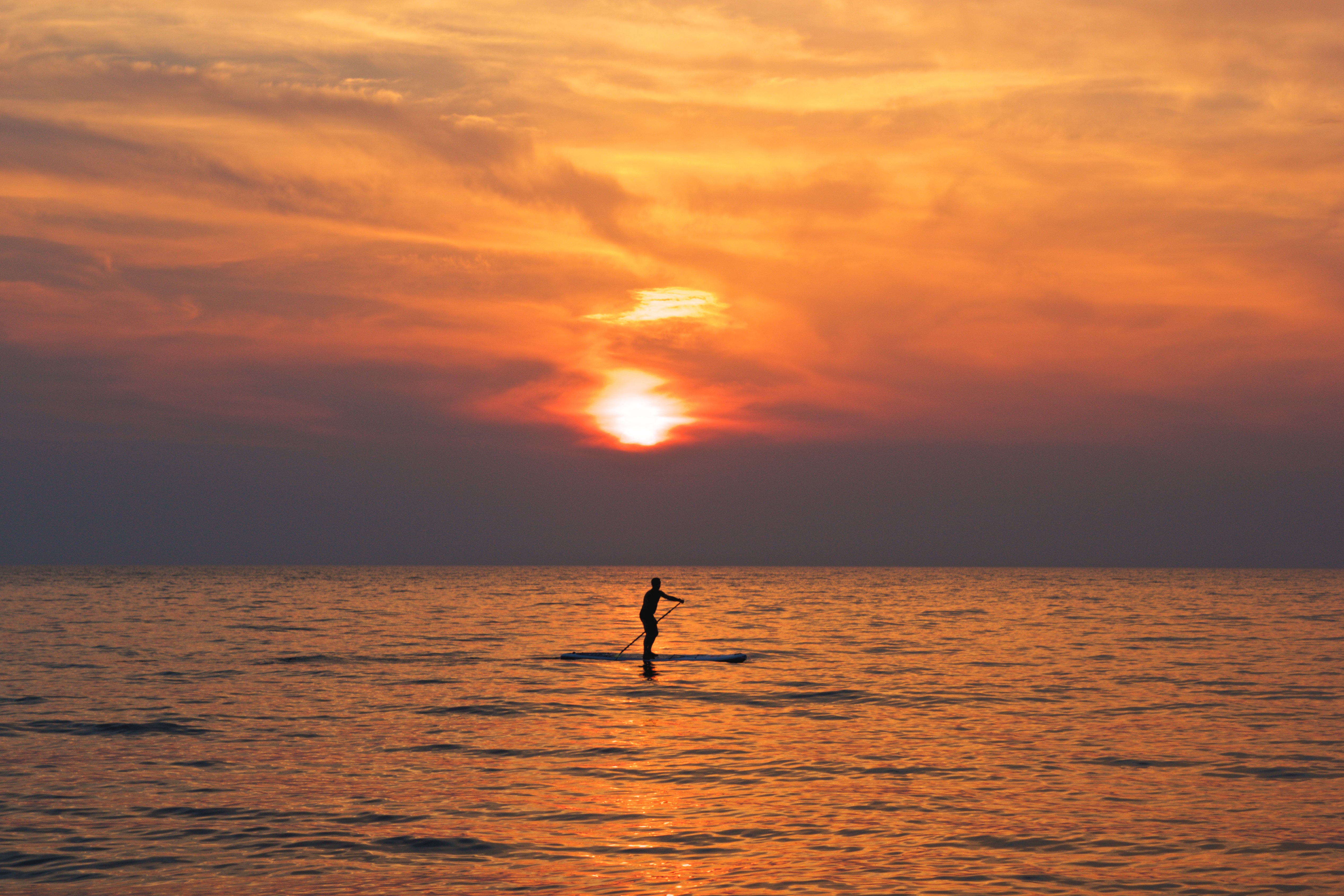
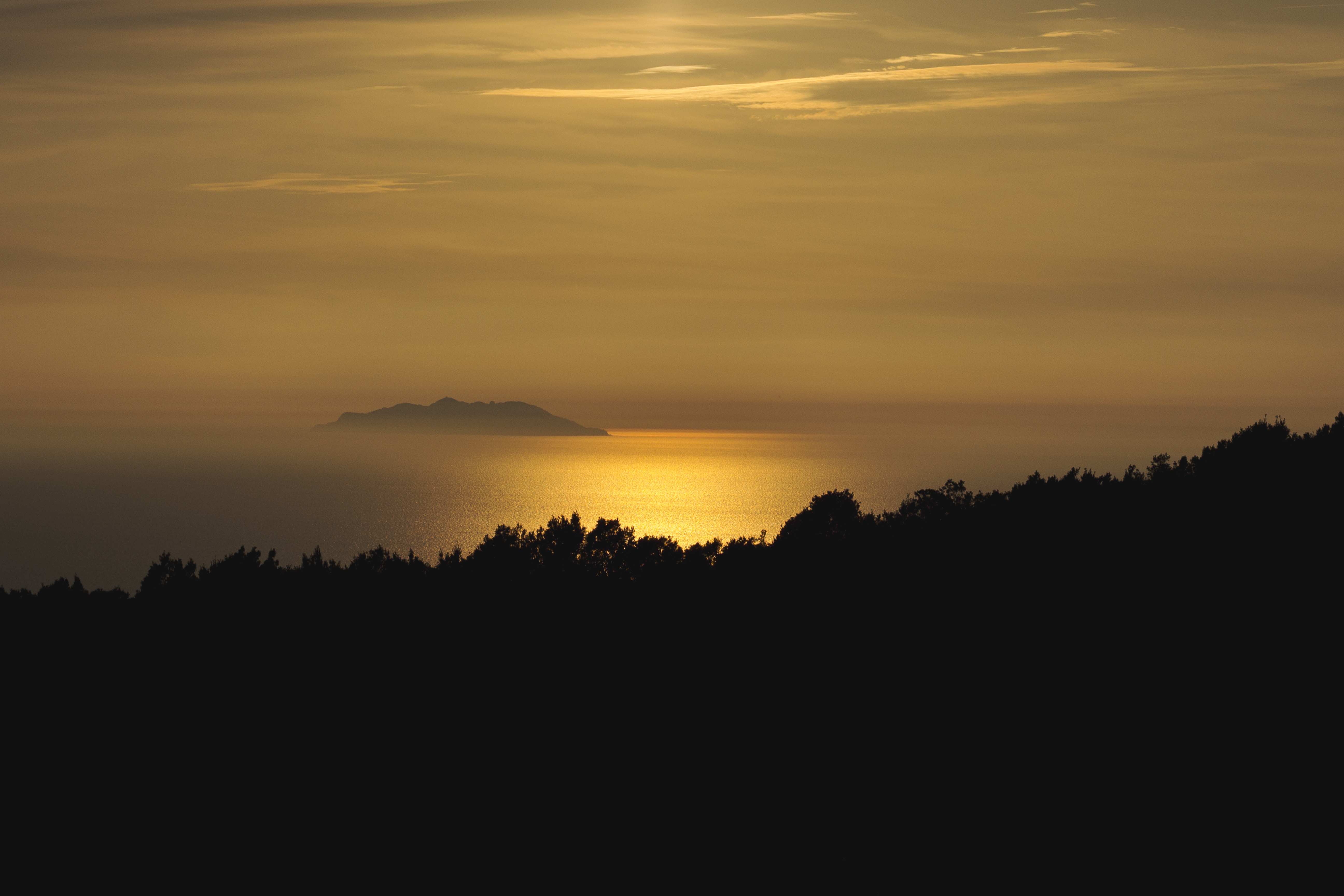
About Nice
United with France only since 1860, Nice has its own history and atmosphere, which dates back 230,000 years. It was on Colline du Château (now château-less) and at the Plage des Ponchettes, in front of the Old Town, that the Greeks established a market-port in 350 BC and named it Nikaia, which would become Marseilles' chief coastal rival. The Romans established themselves a little later on the hills of Cimiez (Cemenelum), already previously occupied by Ligurians and Celts, and quickly overshadowed the waterfront port. After falling to the Saracen invasions, Nice regained power as an independent state, becoming an important port in the early Middle Ages.So cocksure did it become that in 1388, Nice, along with the hill towns behind, effectively seceded from the county of Provence, under Louis d'Anjou, and allied itself with Savoie. Thus began its liaison with the House of Savoy, and through it with Piedmont and Sardinia, it was the Comté de Nice (Nice County). This relationship lasted some 500 years, tinting the culture, architecture, and dialect in rich Italian hues.By the 19th century Nice was flourishing commercially, locked in rivalry with the neighboring shipping port of Genoa. Another source of income: the dawning of tourism, as first the English, then the Russian nobility, discovered its extraordinary climate and superb waterfront position. A parade of fine stone mansions and hotels closed into a nearly solid wall of masonry, separated from the smooth-round rocks of the beach by what was originally named Camin deis Anglés (the English Way), which of course is now the famous Promenade des Anglais. This magnificent crescent, which is seeking UNESCO recognition, is one of the noblest in France. Many of Nice's most delightful attractions—the Cours Saleya market, the Old Town streets, the Hotel Negresco, and the Palais Masséna—are on or close to this 10-km (6-mile) waterfront, making it the first stop for most visitors, while the redevelopment of Nice's port, around the other side of the Colline du Château, makes it easier for amblers who want to take in the Genoese architecture or peruse the antiques at the Puces de Nice, now part of the Promenade des 100 Antiquaires, along Quai Papacino. Nice also has the distinction of the "Family Plus" label, with free strollers, play areas, and restaurants with child-friendly activities.
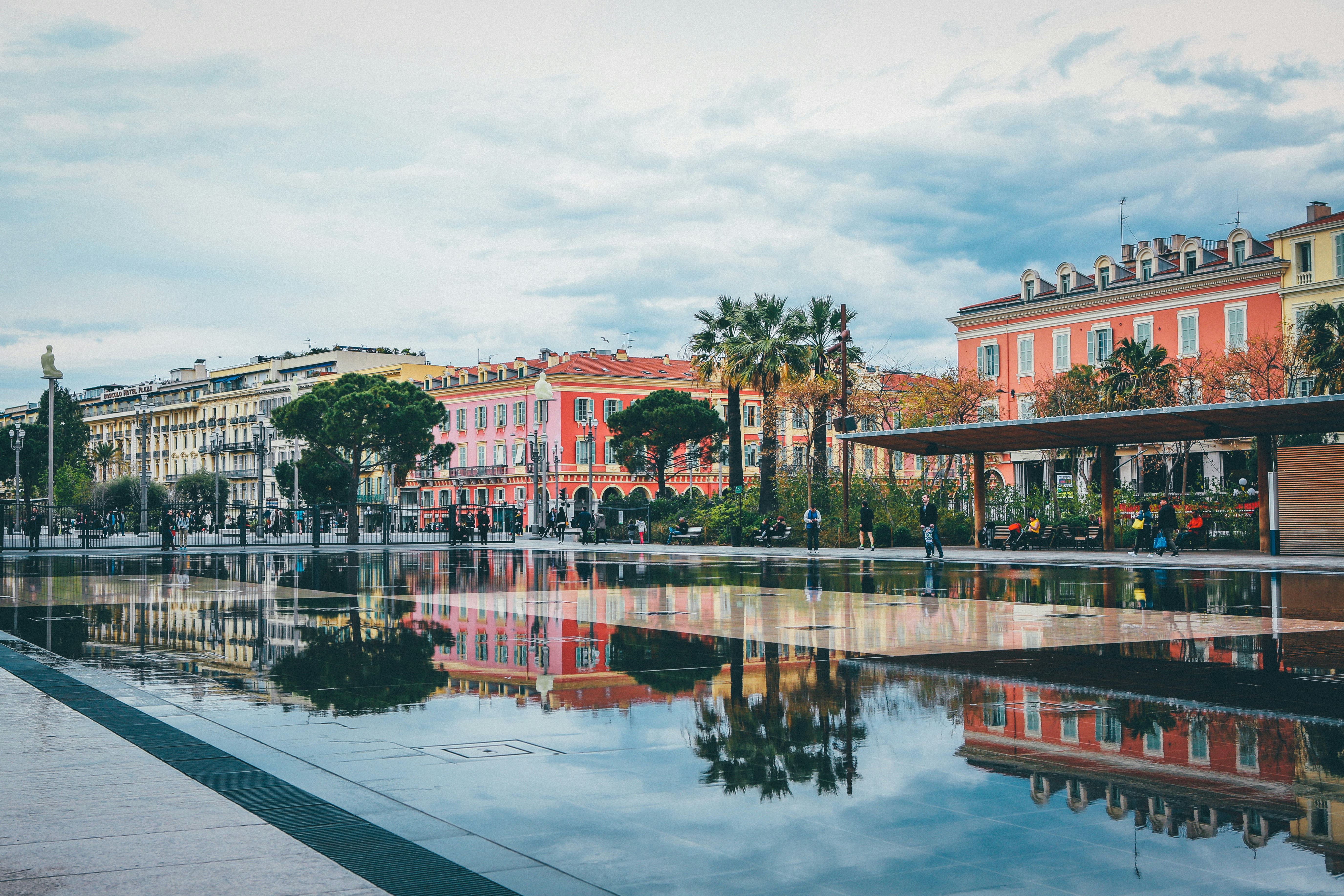
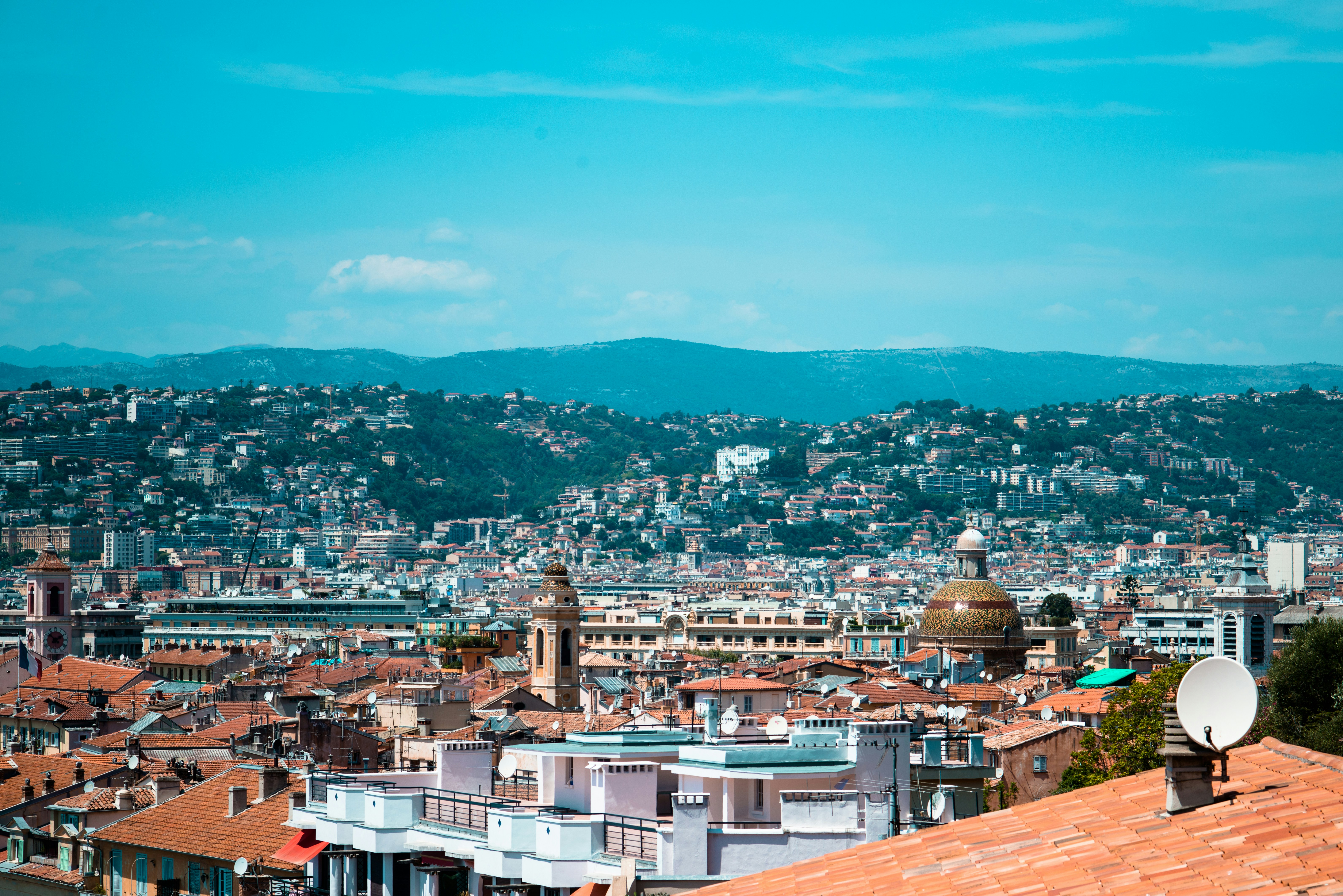
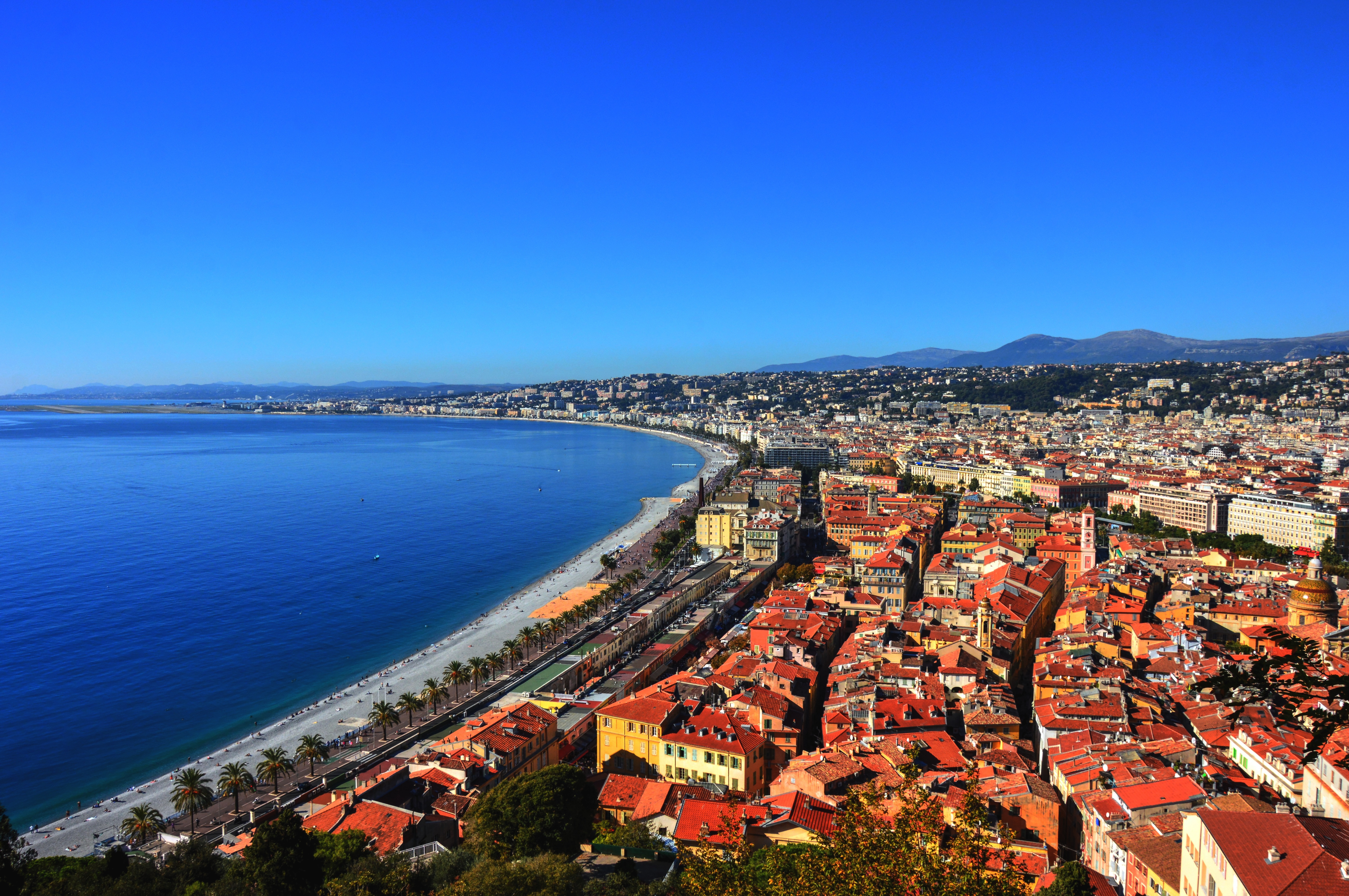
The name Owner’s Suite says it all. A stylish apartment. Prestigious and classic. For those who seek the superlative level of space, comfort, and service on board. Available in a one- or two-bedroom configuration (as illustrated) by adjoining with a Vista Suite.
One bedroom: 85 sq m including veranda (20 sq m)
Two bedrooms: 117 sq m including veranda (20 sq m)
Please note that the 3rd guest will sleep on a comfortable sofa bed in the reception area of the suite.
Essentials
- Deck(s): 7
- Section: Mid-Ship
Characteristics
- Veranda
- Separate dining area
- Living room with sitting area
- Double vanity
- Separate shower
- Full-size bath
- Walk-in wardrobe with personal safe
Furniture
- King size bed
- Writing desk
- Vanity table
- Luxury bed mattresses
Media & Communication
- Unlimited Premium Wi-Fi
- 2 large flat screen TVs with Interactive Media Library
- Sound system with bluetooth connectivity
- Direct dial telephone
- Wall mounted USB-C mobile device chargers
- Dual voltage 110/220 outlets
Onboard Services
- Butler service
- Complimentary laundry, pressing & wet cleaning
- Dinner for two in La Dame, one evening per voyage,
- Two hours of worldwide phone use, per voyage segment
- Champagne on arrival
Amenities
- Espresso machine
- Tea kettle
- Pillow menu
- Refrigerator and bar setup stocked with your preferences
- Plush bathrobe
- Luxury bath amenities
- Umbrella
- Hair Dryer
- Slippers
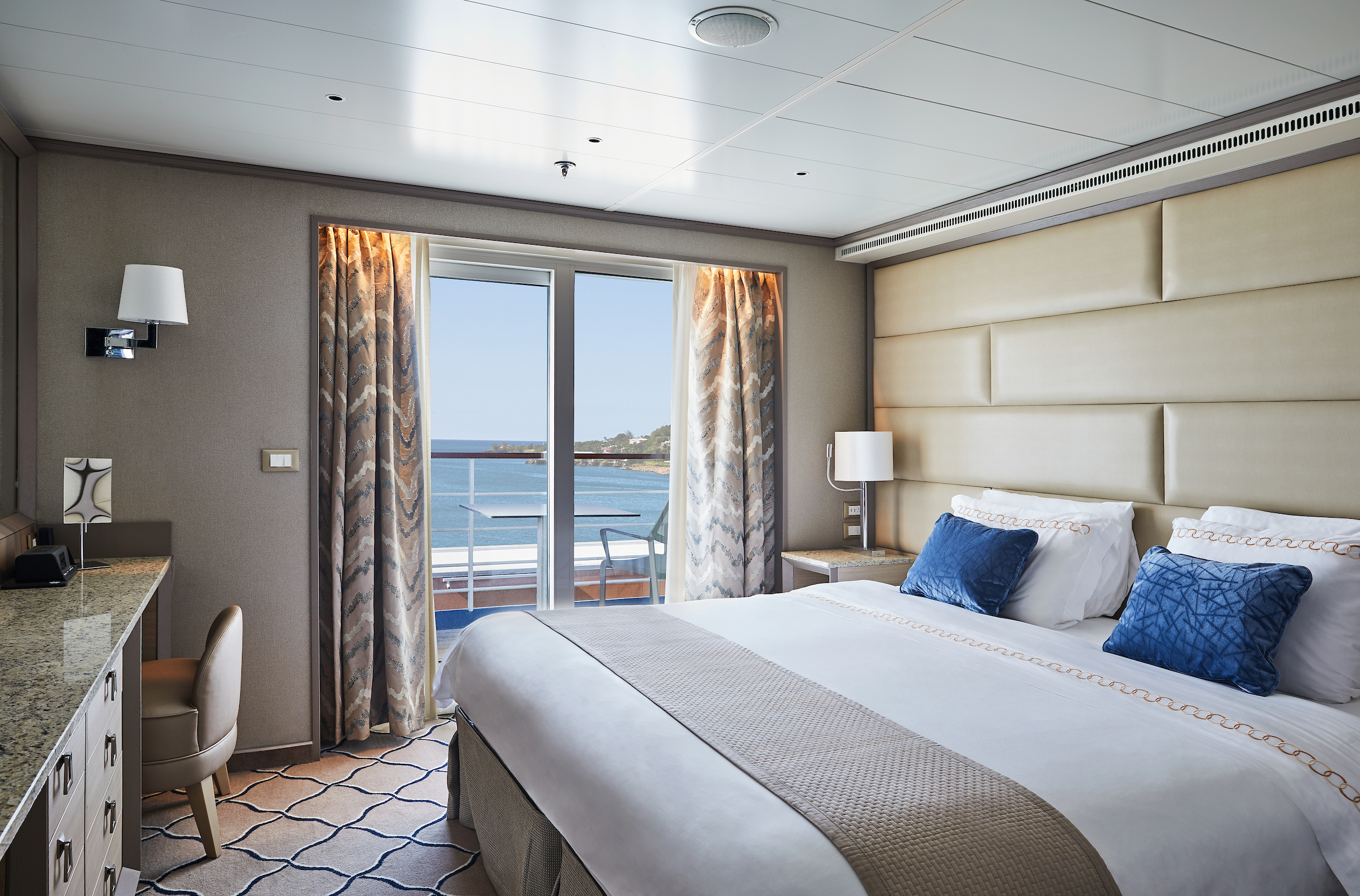
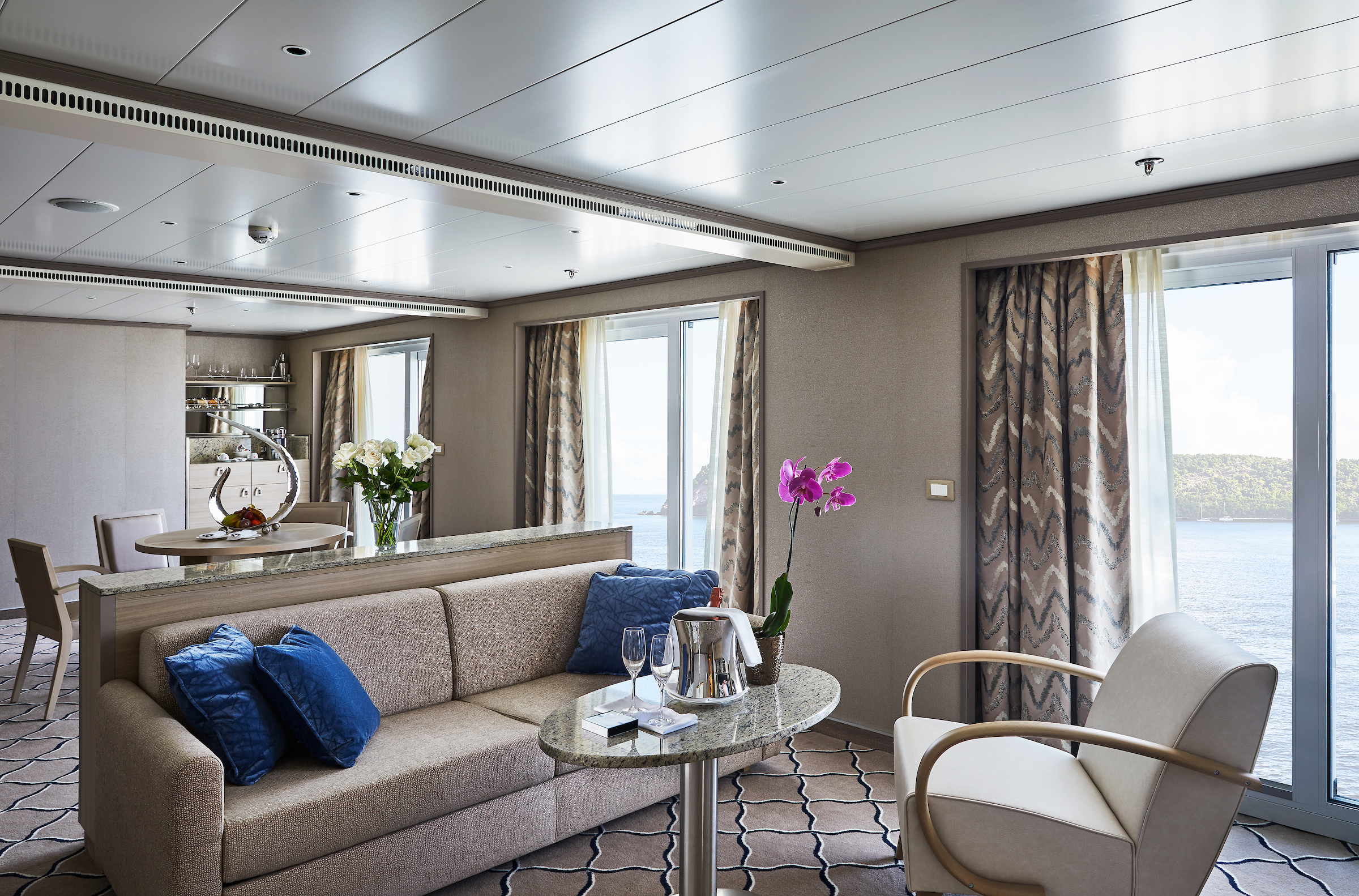
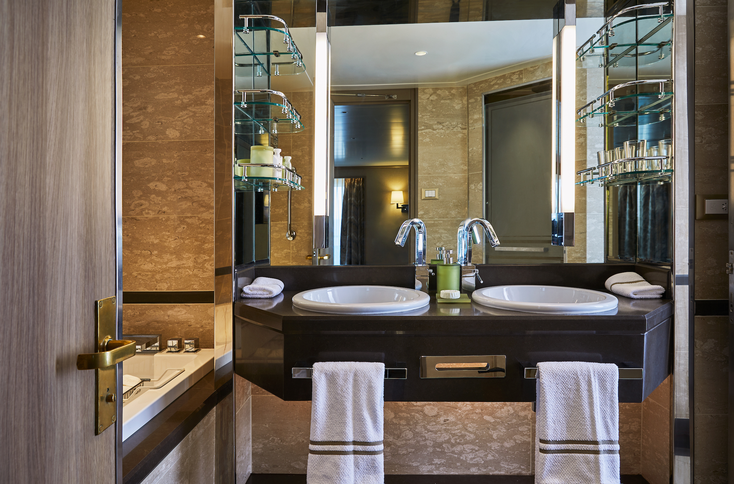
One of Silversea's finest suites, the Grand Suite's spacious amenities allows vou to cruise in comfort and class.
Expertly designed and exquisitely appointed. Ideal for entertaining friends while you cruise or enjoying a quiet dinner “at home”. Available as a one-bedroom configuration or as two-bedrooms (as illustrated) by adjoining with a Silversea Veranda Suite.
One bedroom: 87-101 sq.m. including veranda
Two bedroom: 133 sq.m. including veranda
Please note that the 3rd guest will sleep on a comfortable sofa bed in the reception area of the suite.Essentials
- Deck(s): 6, 7, 8
- Section: Forward
Characteristics
- Veranda
- Separate dining area
- Living room with sitting area
- Double vanity
- Separate shower
- Full-size bath
- Walk-in wardrobe with personal safe
Furniture
King size bed
- Writing desk
- Vanity table
- Luxury bed mattresses
Media & Communication
- Unlimited Premium Wi-Fi
- 2 large flat screen TVs with Interactive Media Library
- Sound system with bluetooth connectivity
- Direct dial telephone
- Wall mounted USB-C mobile device chargers
- Dual voltage 110/220 outlets
Onboard Services
- Butler service
- Complimentary laundry, pressing & wet cleaning
- Dinner for two in La Dame, one evening per voyage,
- Two hours of worldwide phone use, per voyage segment
- Champagne on arrival
Amenities
- Espresso machine
- Tea Kettles
- Pillow menu
- Refrigerator and bar setup stocked with your preferences
- Plush bathrobe
- Luxury bath amenities
- Umbrella
- Hair Dryer
- Slippers
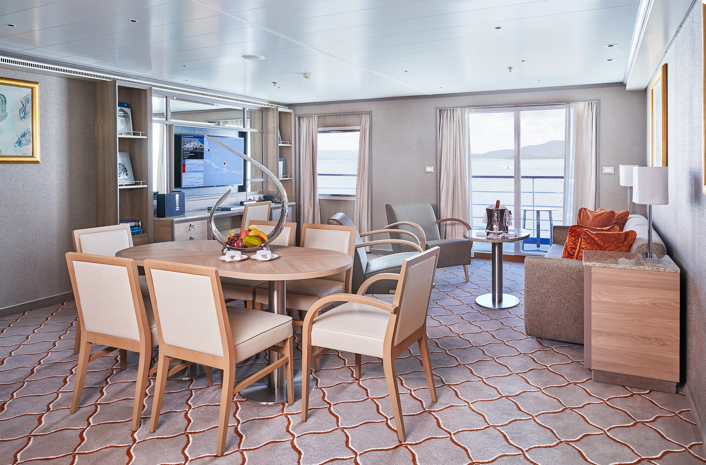
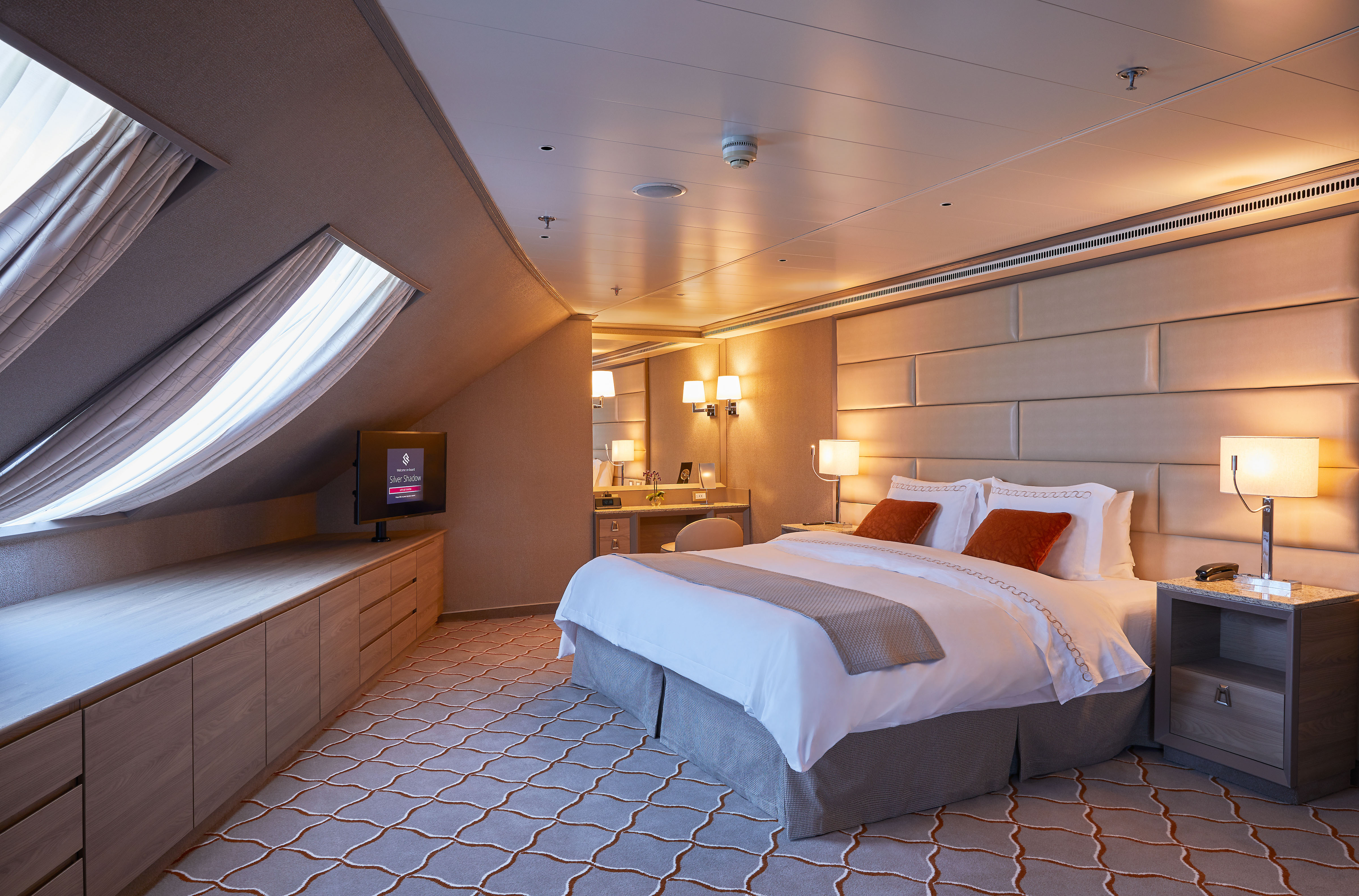
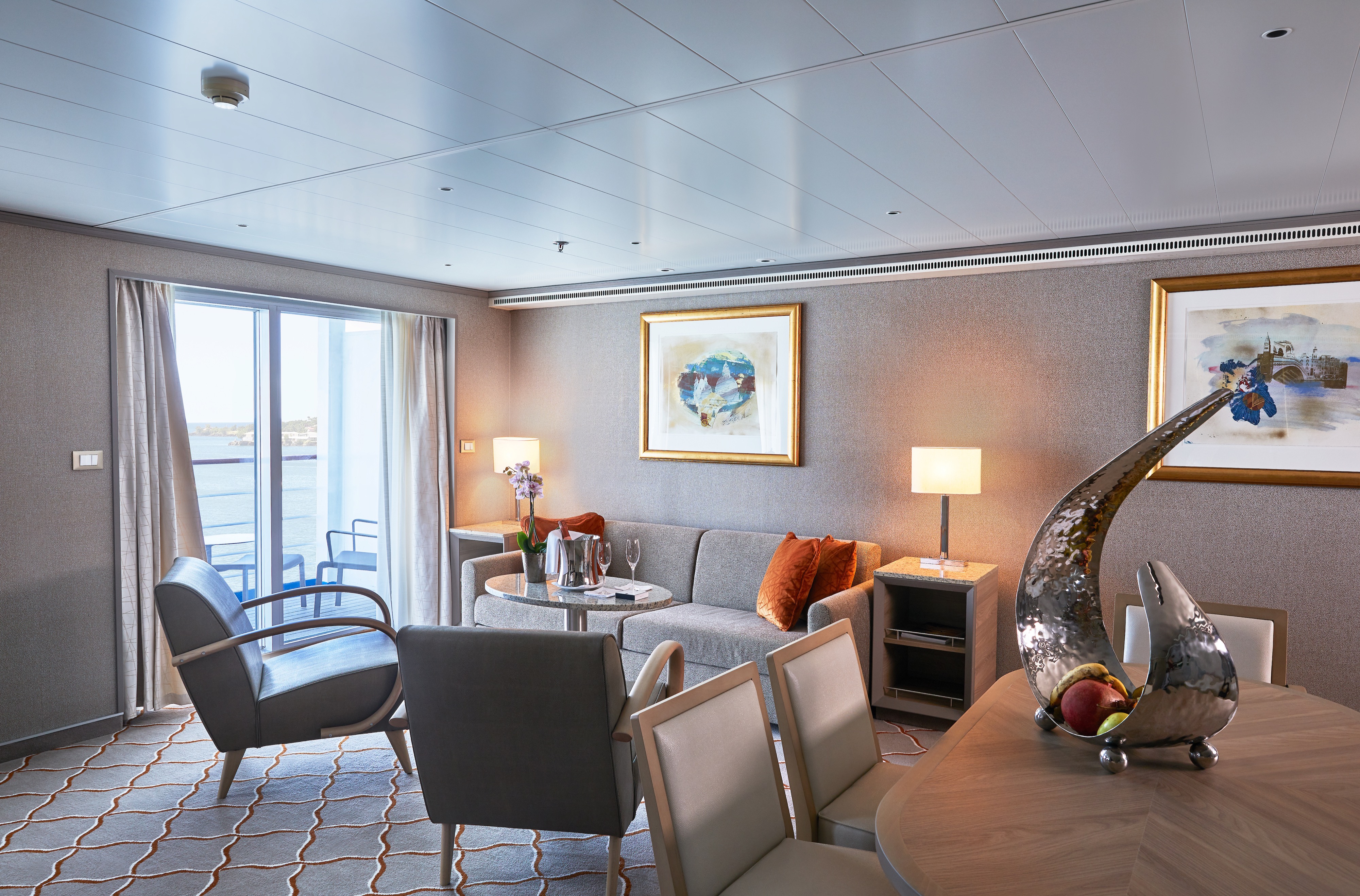
Stately describes the Royal Suite. Commanding and majestic. Perfect for entertaining. Enough living space to roam. The pinnacle of good living. Available in a one- or two-bedroom configuration (as illustrated) by adjoining with a Veranda Suite.
One bedroom: 90–94 sq m including veranda (10–11 sq m)
Two bedrooms: 126 sq m including veranda (16–17 sq m)
Please note that the 3rd guest will sleep on a comfortable sofa bed in the reception area of the suite.
Essentials
- Deck(s): 6, 7
- Section: Forward
Characteristics
- Veranda
- Separate dining area
- Living room with sitting area
- Double vanity
- Separate shower
- Full-size bath
- Walk-in wardrobe with personal safe
Furniture
- King size bed
- Writing desk
- Vanity table
- Luxury bed mattresses
Media & Communication
- Unlimited Premium Wi-Fi
- 2 large flat screen TVs with Interactive Media Library
- Sound system with bluetooth connectivity
- Direct dial telephone
- Wall mounted USB-C mobile device chargers
- Dual voltage 110/220 outlets
Onboard Services
- Butler service
- Complimentary laundry, pressing & wet cleaning
- Dinner for two in La Dame, one evening per voyage,
- Two hours of worldwide phone use, per voyage segment
- Champagne on arrival
Amenities
- Espresso machine
- Tea Kettles
- Pillow menu
- Refrigerator and bar setup stocked with your preferences
- Plush bathrobe
- Luxury bath amenities
- Umbrella
- Hair Dryer
- Slippers
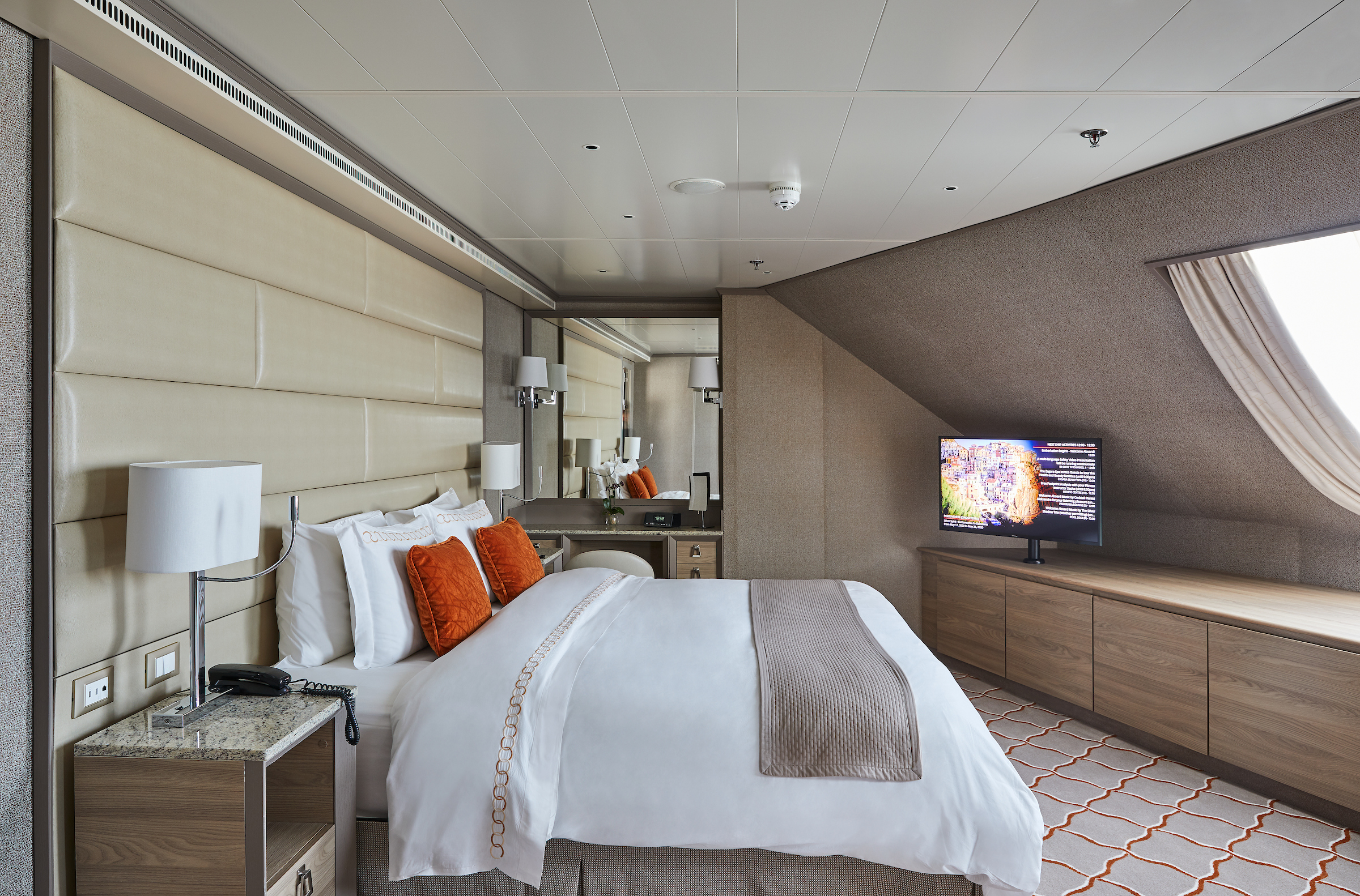
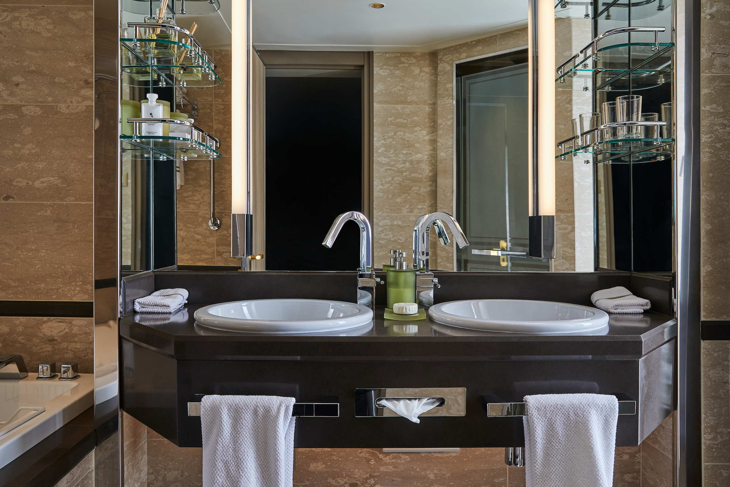
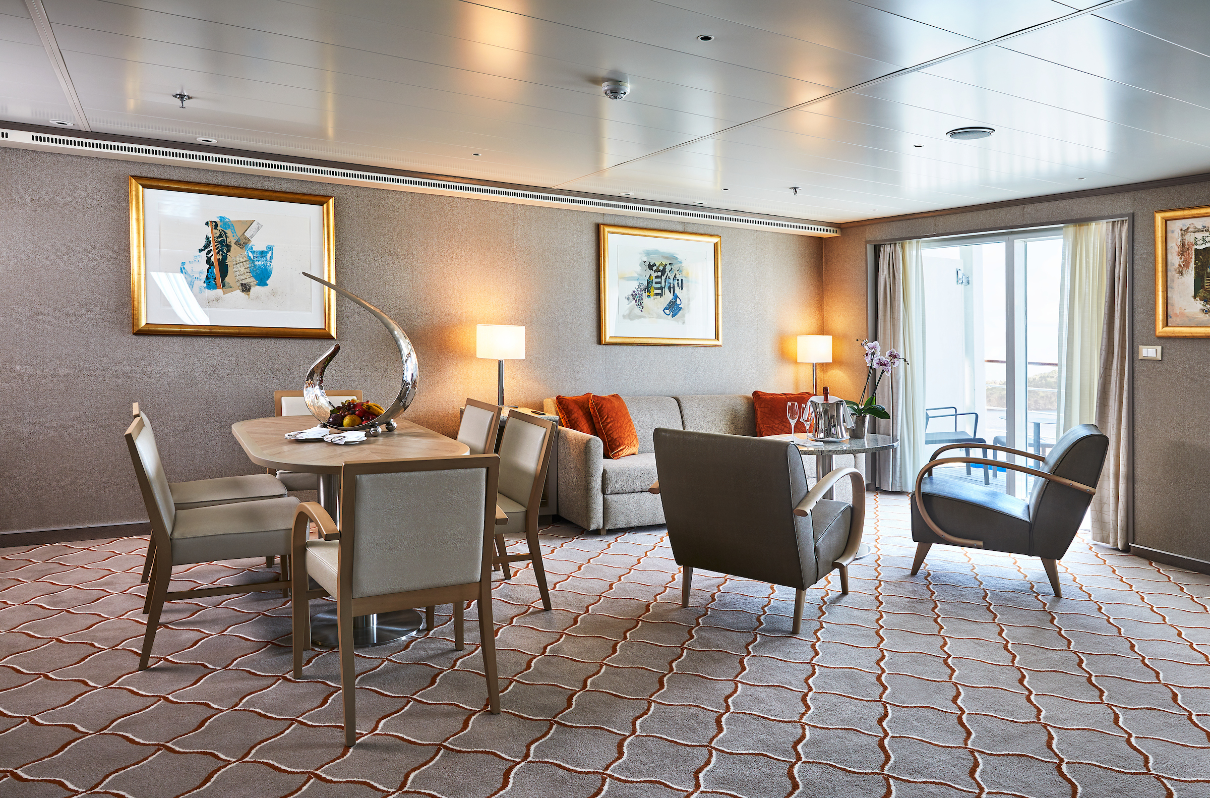
Stylish and sophisticated. Separate dining and living rooms. Larger verandas. Situated midship. Perfection in design for comfortable living. Silver Suites accommodate three guests.
One bedroom: 61–65 sq m including veranda (10–11 sq m)
Please note that the 3rd guest will sleep on a comfortable sofa bed in the reception area of the suite.
Essentials
- Deck(s): 7
- Section: Mid-Ship
Characteristics
- Veranda
- Separate dining area
- Living room with sitting area
- Double vanity
- Separate shower
- Full-size bath
- Walk-in wardrobe with personal safe
Furniture
- Queen size bed
- Writing desk
- Vanity table
- Luxury bed mattresses
Media & Communication
- Unlimited Premium Wi-Fi
- 2 large flat screen TVs with Interactive Media Library
- Sound system with bluetooth connectivity
- Direct dial telephone
- Wall mounted USB-C mobile device chargers
- Dual voltage 110/220 outlets
Onboard Services
- Butler service
- Complimentary laundry, pressing & wet cleaning
- Champagne on arrival
Amenities
- Espresso machine
- Tea Kettles
- Pillow menu
- Refrigerator and bar setup stocked with your preferences
- Plush bathrobe
- Luxury bath amenities
- Umbrella
- Hair Dryer
- Slippers
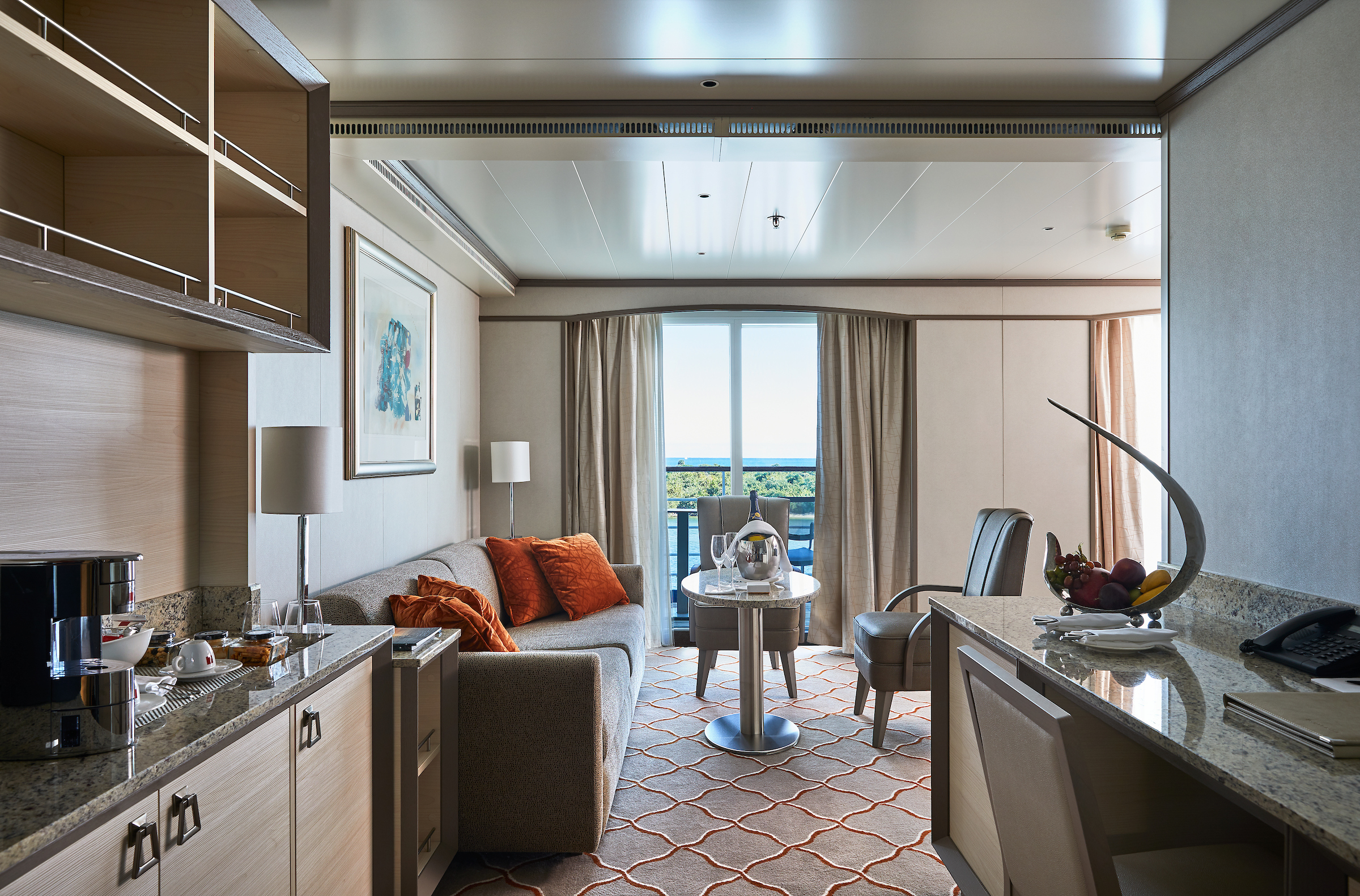
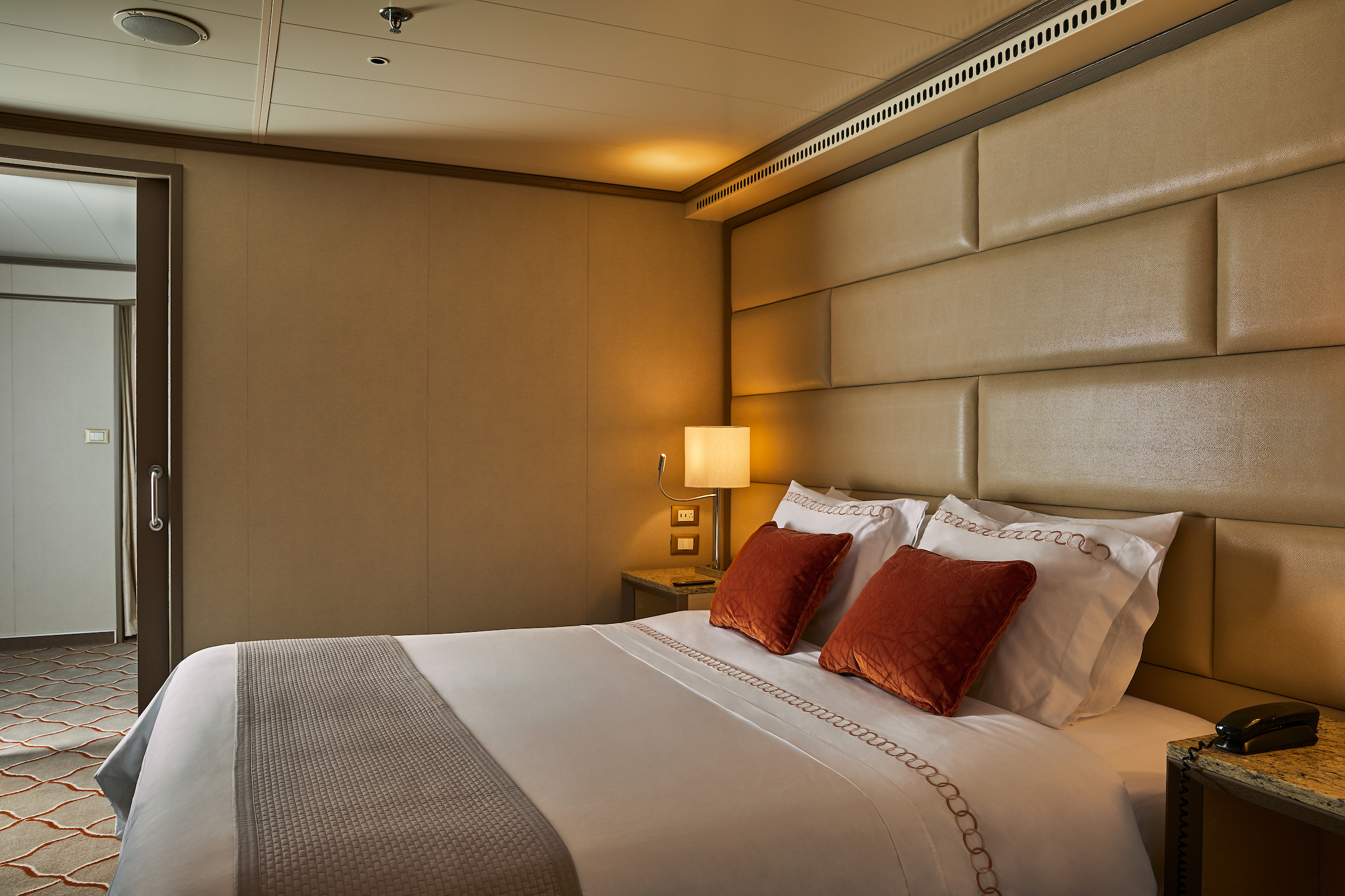
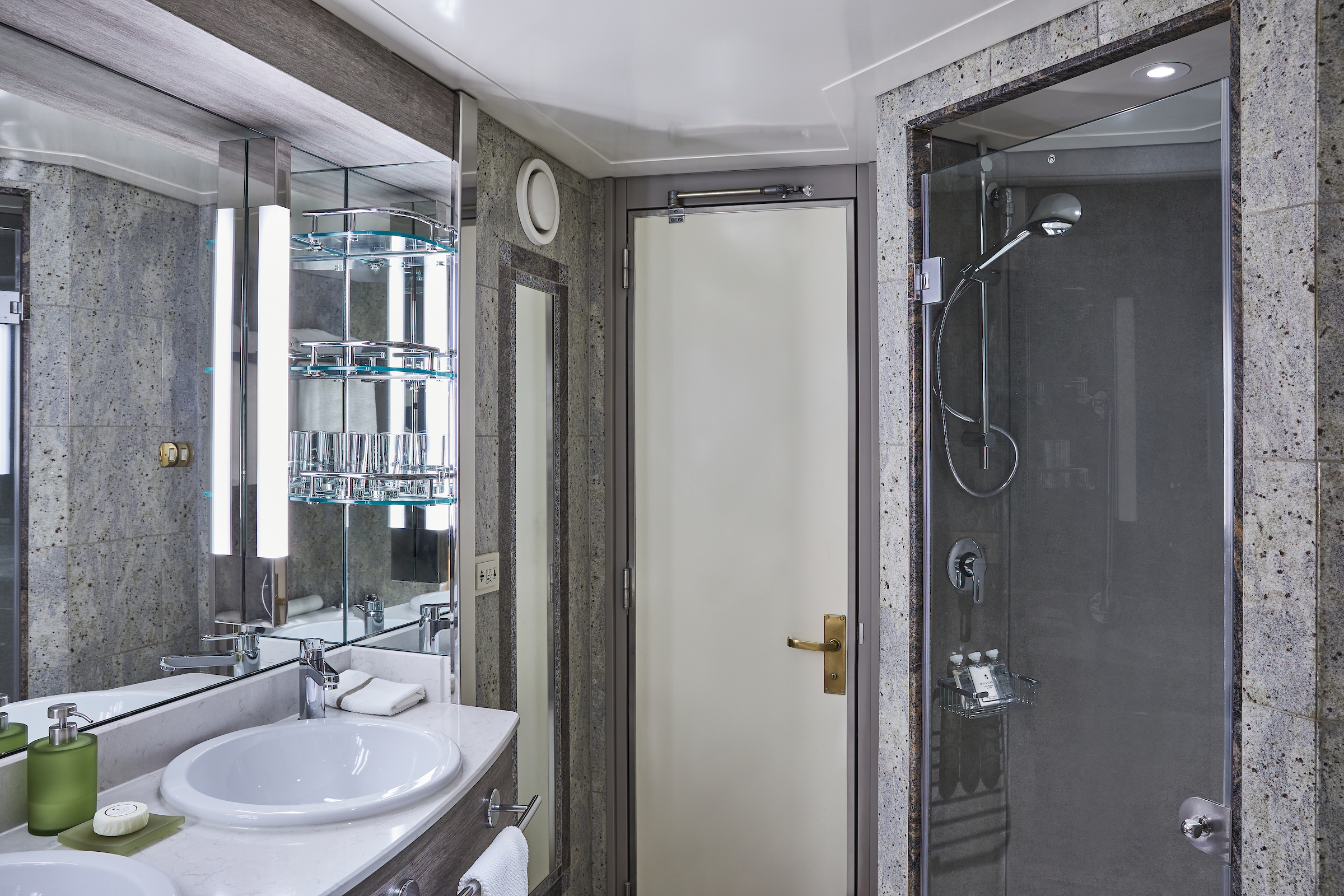
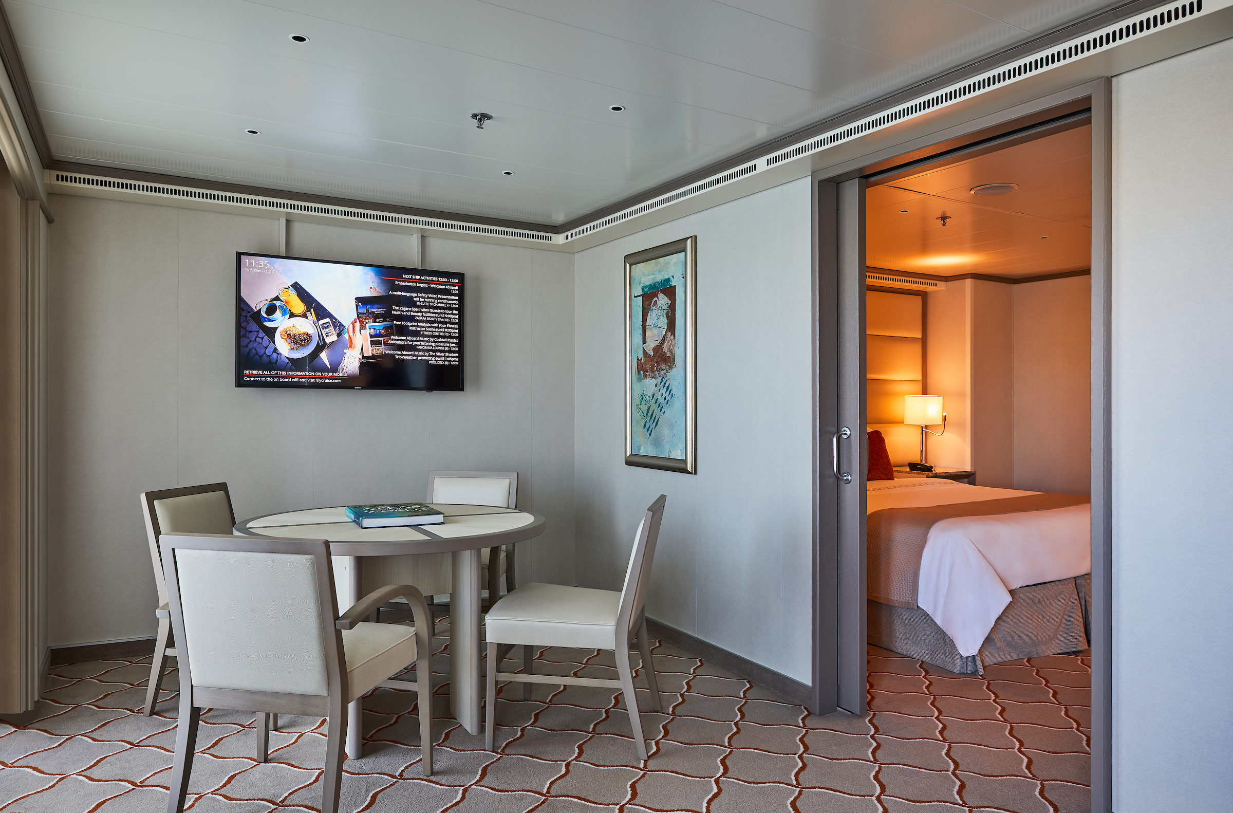
A mark of distinction. Sumptuous. Spacious. Rich textures and panoramic views surround you with distinguished luxury. An extravagant suite for an extravagant cruise.
One bedroom: 49 sq m including veranda (8 sq ft)
Please note that the 3rd guest will sleep on a comfortable sofa bed in the reception area of the suite.
Essentials
- Deck(s): 7
- Section: Mid-Ship
Characteristics
- Veranda
- Living room with sitting area
- Double vanity
- Separate shower
- Full-size bath
- Walk-in wardrobe with personal safe
Furniture
- Queen size bed
- Writing desk
- Vanity table
- Luxury bed mattresses
Media & Communication
- Unlimited Premium Wi-Fi
- 2 large flat screen TVs with Interactive Media Library
- Sound system with bluetooth connectivity
- Direct dial telephone
- Wall mounted USB-C mobile device chargers
- Dual voltage 110/220 outlets
Onboard Services
- Butler service
- Complimentary laundry, pressing & wet cleaning
- Dinner at the officer’s table
- Champagne on arrival
Amenities
- Espresso machine
- Tea Kettle
- Pillow menu
- Refrigerator and bar setup stocked with your preferences
- Plush bathrobe
- Luxury bath amenities
- Umbrella
- Hair Dryer
- Slippers
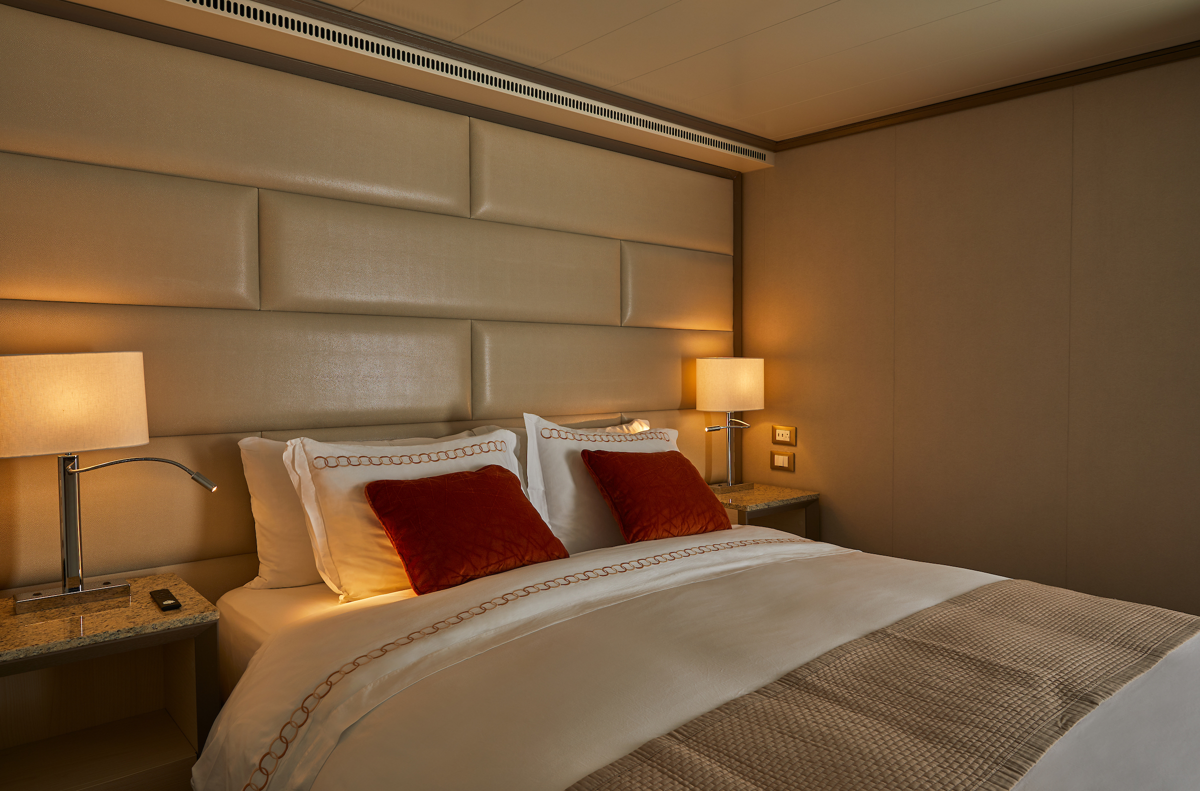
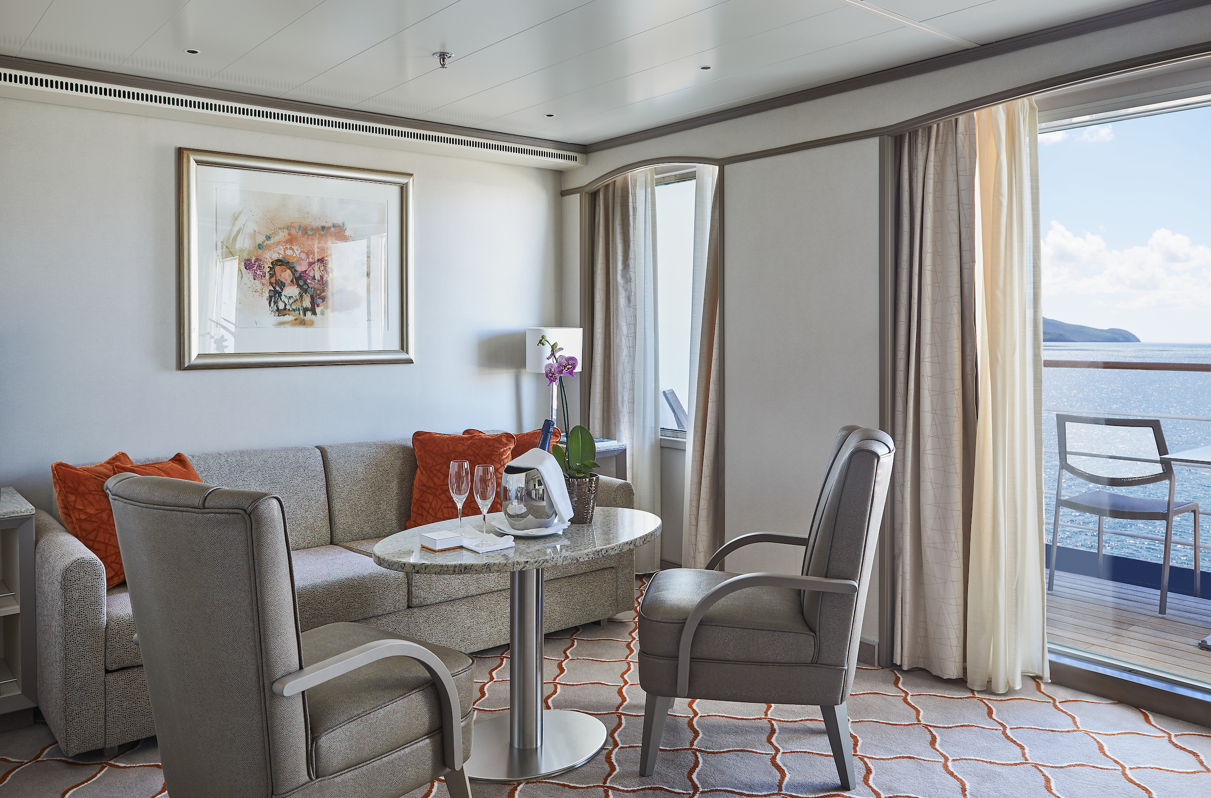
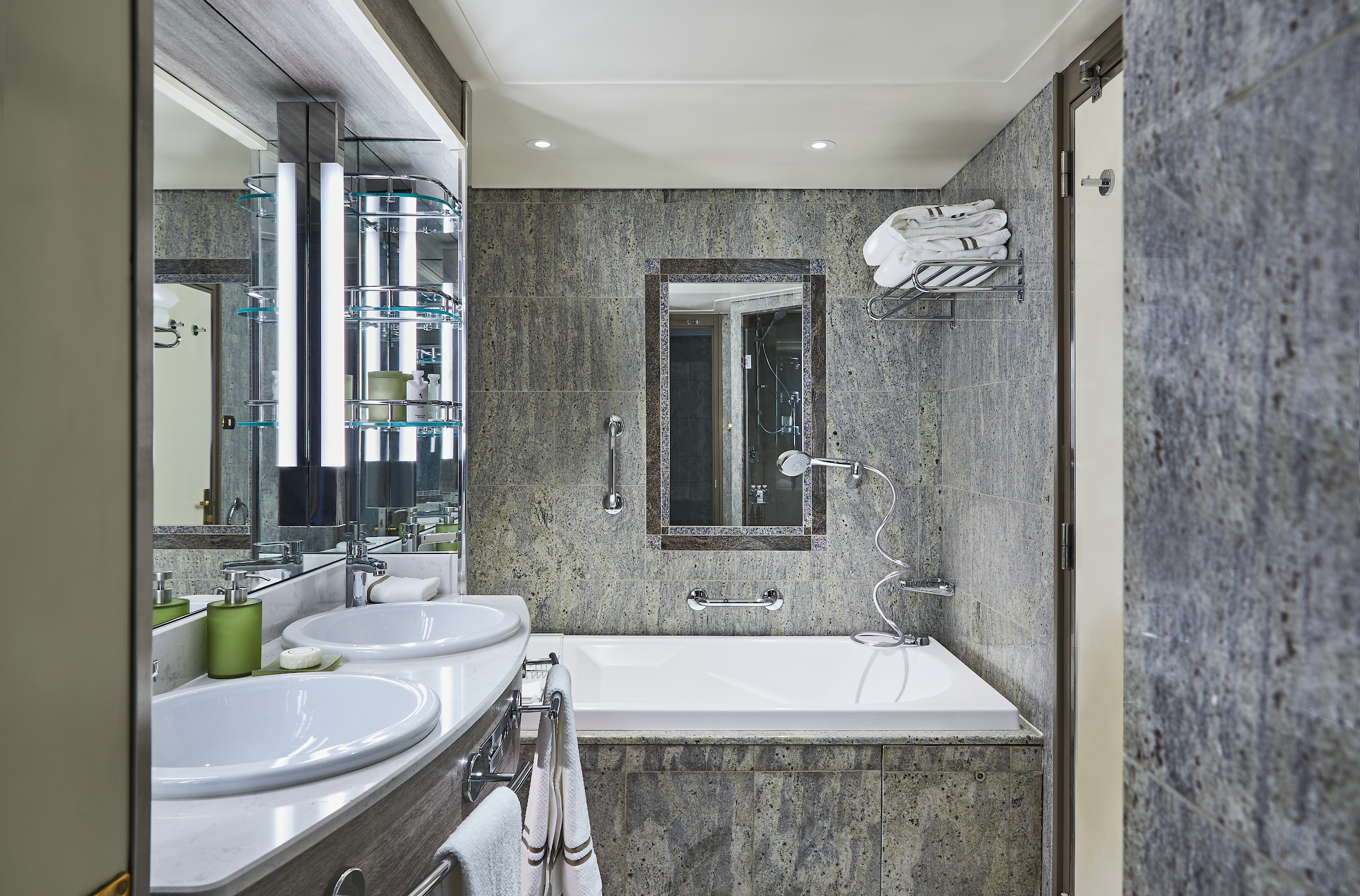
The Deluxe Veranda Suite offers a comfortable living space, close to the heart of the ship. With its preferred midship location and all the comfort and attention to detail that you can expect aboard, the Deluxe Veranda Suite is the savvy traveler’s paradise—both inside and out. Elegant decor, a stunning marble bathroom, and an ample seating area make this a cozy home away from home. But perhaps this suite’s finest asset lies just outside, as floor-to-ceiling glass doors open onto a private veranda, making every sunset feel as if it is yours alone.
One bedroom: 32 sq m including veranda (6 sq m)
Please note that the 3rd guest will sleep on a comfortable sofa bed in the reception area of the suite.
Essentials
- Deck(s): 6, 8, 9
- Section: Forward, Mid-Ship
Characteristics
- Veranda
- Sitting area
- Double vanity
- Separate shower
- Full-size bath
- Walk-in wardrobe with personal safe
Furniture
- Queen size bed
- Writing desk
- Vanity table
- Luxury bed mattresses
Media & Communication
- Unlimited Standard Wi-Fi
- 1 large flat screen TV with Interactive Media Library
- Direct dial telephone
- Wall mounted USB-C mobile device chargers
- Dual voltage 110/220 outlets
Onboard Services
- Butler service
- Champagne on arrival
Amenities
- Pillow menu
- Espresso machine
- Tea Kettles
- Refrigerator and bar setup stocked with your preferences
- Plush bathrobe
- Luxury bath amenities
- Umbrella
- Hair Dryer
- Slippers
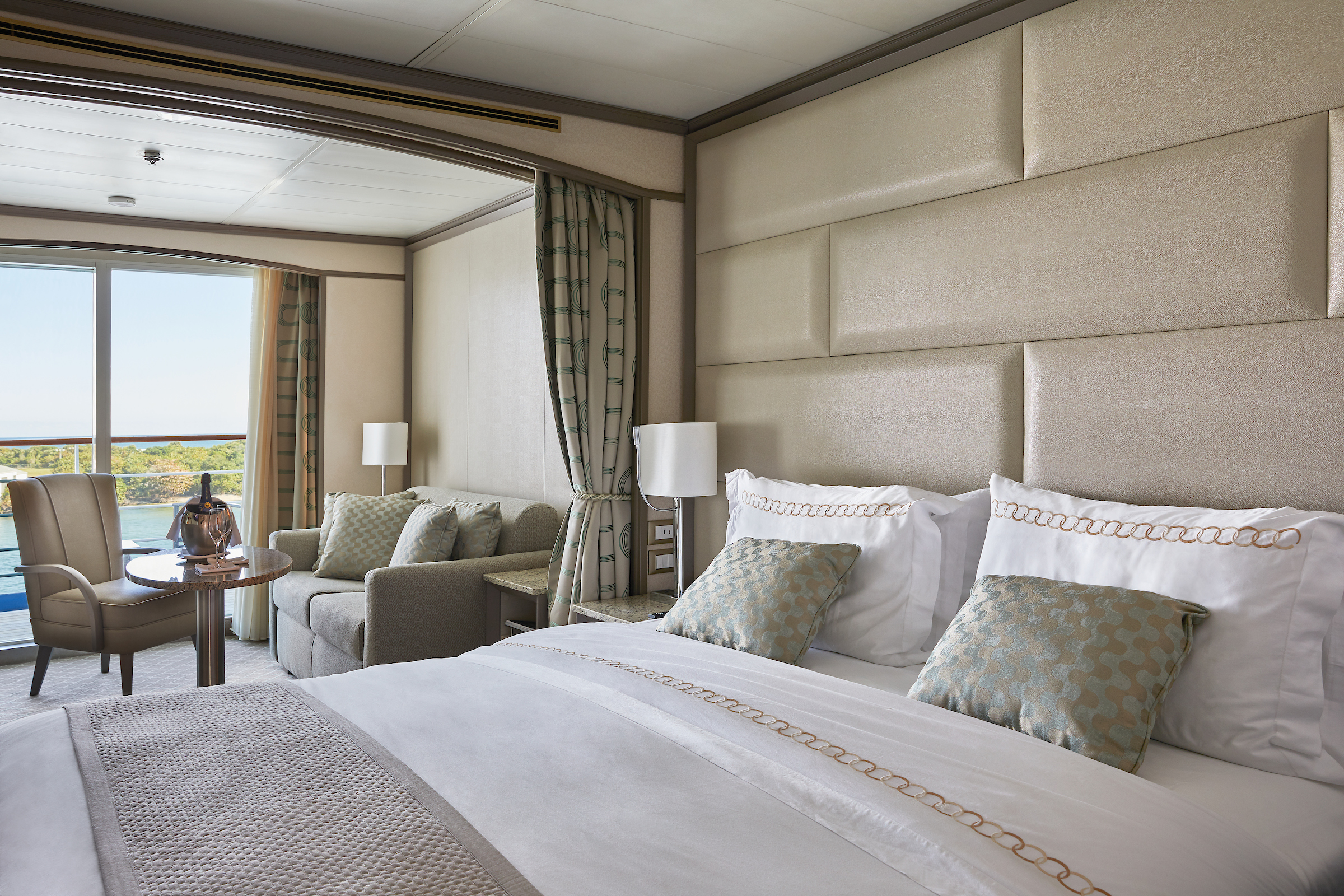
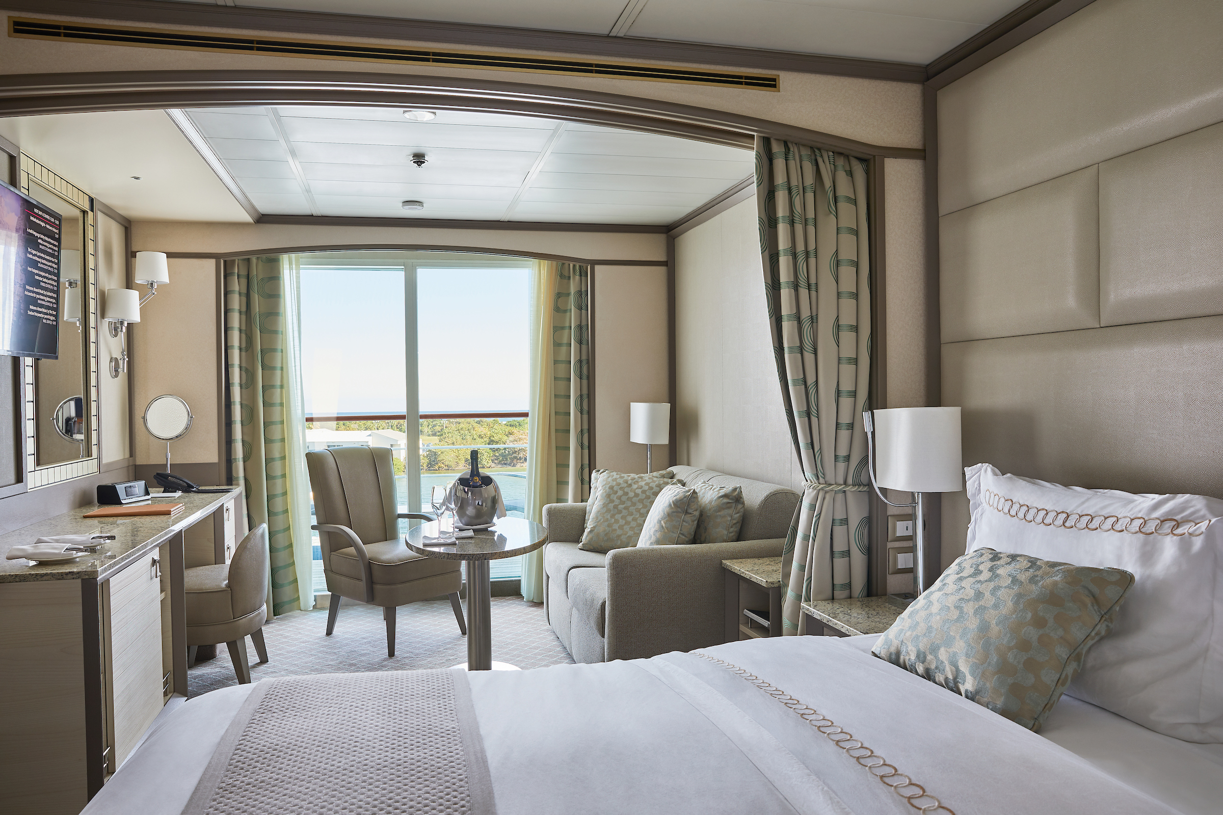
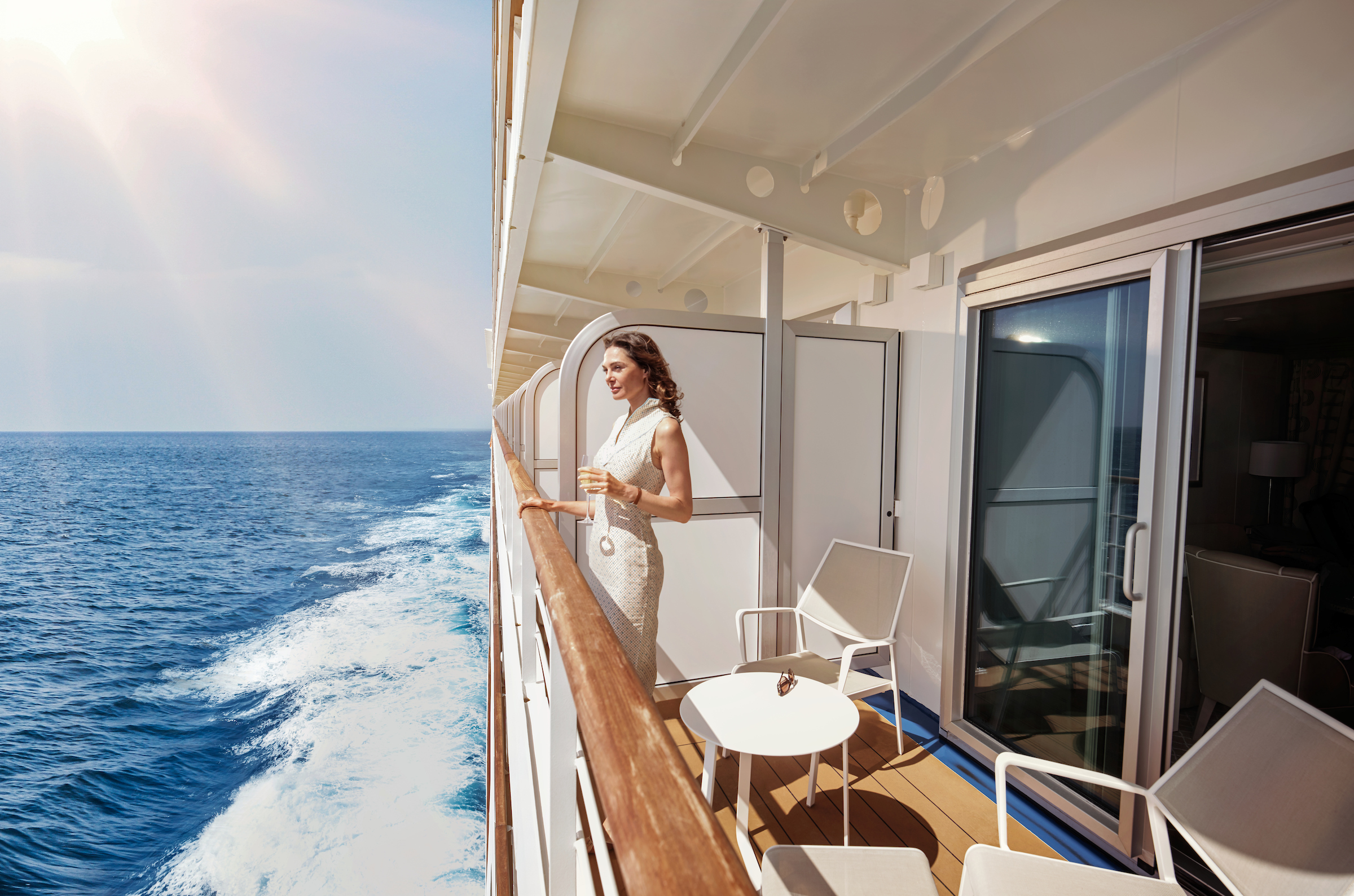
Located on the upper deck, and offering spectacular sunset views, the Superior Veranda Suite has all the comforts and luxury that you can expect aboard. A comfortable living space, attention to detail and a generous expanse of amenities, this stunning suite makes for a cosy home while on the seas. But perhaps this suite’s finest asset lies just outside, as floor-to-ceiling glass doors open onto a private veranda, making every sunset feel as if it is yours alone.
One bedroom: 32 sq m including veranda (6 sq m)
Wheelchair accessible suites: 535 and 537
Please note that the 3rd guest will sleep on a comfortable sofa bed in the reception area of the suite.Essentials
- Deck(s): 5, 6, 7, 8
- Section: Forward, Mid-Ship
Characteristics
- Veranda
- Sitting area
- Double vanity
- Separate shower
- Full-size bath
- Walk-in wardrobe with personal safe
Furniture
- Queen size bed
- Writing desk
- Vanity table
- Luxury bed mattresses
Media & Communication
- Unlimited Standard Wi-Fi
- 1 large flat screen TV with Interactive Media Library
- Direct dial telephone
- Wall mounted USB-C mobile device chargers
- Dual voltage 110/220 outlets
Onboard Services
- Butler service
- Champagne on arrival
Amenities
- Pillow menu
- Espresso Machine
- Tea Kettle
- Refrigerator and bar setup stocked with your preferences
- Plush bathrobe
- Luxury bath amenities
- Umbrella
- Hair Dryer
- Slippers
The Classic Veranda Suite provides a generous living space for voyagers. Located on the lower decks in the bow, the Classic Veranda Suite offers all the comfort and attention to detail that you can expect aboard—both inside and out. A generous expanse of interior comforts—elegant decor, a stunning marble bathroom, and an ample seating area make this a cozy home away from home. But perhaps this suite’s finest asset lies just outside, as floor-to-ceiling glass doors open onto a private veranda, making every sunset feel as if it is yours alone.
One bedroom: 32 sq m including veranda (6 sq m)
Please note that the 3rd guest will sleep on a comfortable sofa bed in the reception area of the suite.
Essentials
- Deck(s): 5, 6
- Section: Forward, Mid-Ship
Characteristics
- Veranda
- Sitting area
- Double vanity
- Separate shower
- Full-size bath
- Walk-in wardrobe with personal safe
Furniture
- Queen size bed
- Writing desk
- Vanity table
- Luxury bed mattresses
Media & Communication
- Unlimited Standard Wi-Fi
- 1 large flat screen TV with Interactive Media Library
- Direct dial telephone
- Wall mounted USB-C mobile device chargers
- Dual voltage 110/220 outlets
Onboard Services
- Butler service
- Champagne on arrival
Amenities
- Pillow menu
- Espresso Machine
- Tea Kettles
- Refrigerator and bar setup stocked with your preferences
- Plush bathrobe
- Luxury bath amenities
- Umbrella
- Hair Dryer
- Slippers
A quiet sanctuary. The seating area of the Vista Suite has plenty of room to relax. Large picture windows frame panoramic ocean views. The perfect backdrop for breakfast in bed.
One bedroom: 27 sq m
Essentials
- Deck(s): 4, 5, 7
- Section: Forward
Characteristics
- Large Balcony Window
- Sitting area
- Double vanity
- Separate shower
- Full-size bath
- Walk-in wardrobe with personal safe
Furniture
- Queen size bed
- Writing desk
- Vanity table
- Luxury bed mattresses
Media & Communication
- Unlimited Standard Wi-Fi
- 1 large flat screen TV with Interactive Media Library
- Direct dial telephone
- Wall mounted USB-C mobile device chargers
- Dual voltage 110/220 outlets
Onboard Services
- Butler service
- Champagne on arrival
Amenities
- Pillow menu
- Espresso Machine
- Tea Kettles
- Refrigerator and bar setup stocked with your preferences
- Plush bathrobe
- Luxury bath amenities
- Umbrella
- Hair Dryer
- Slippers
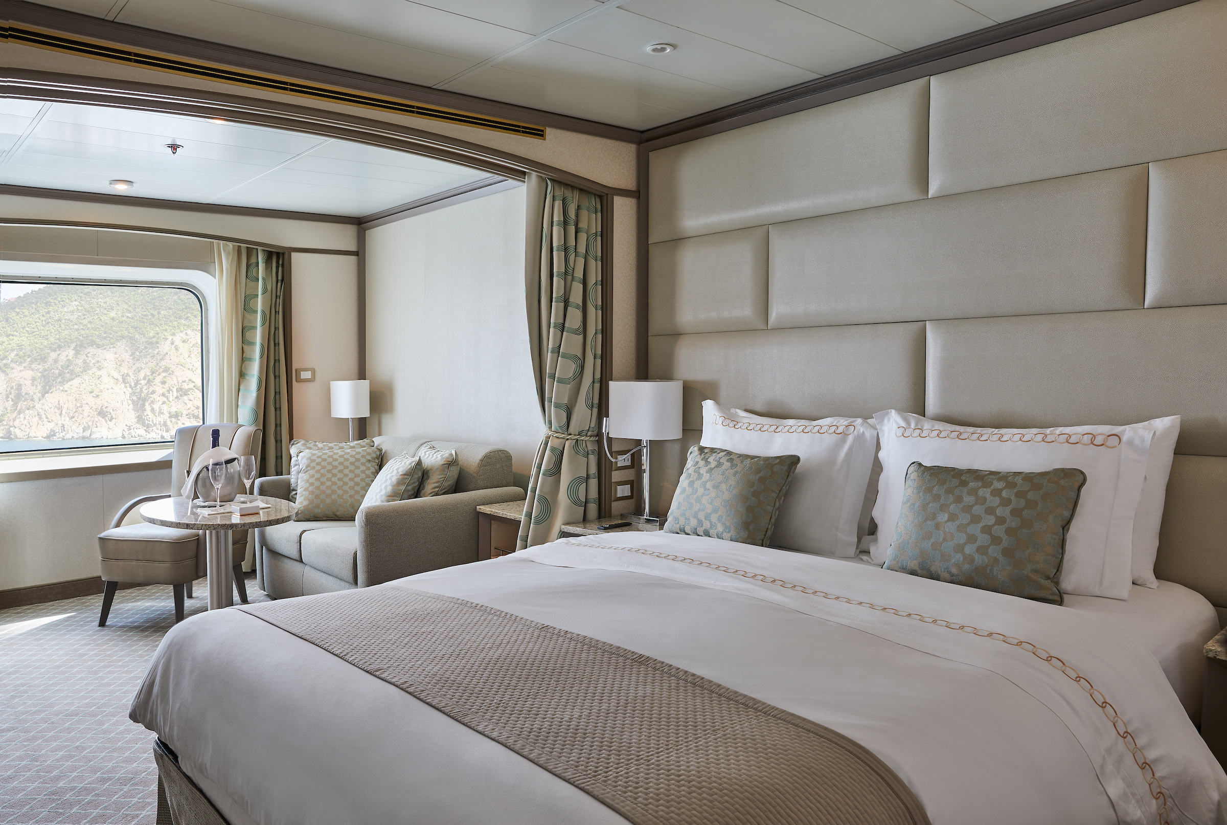
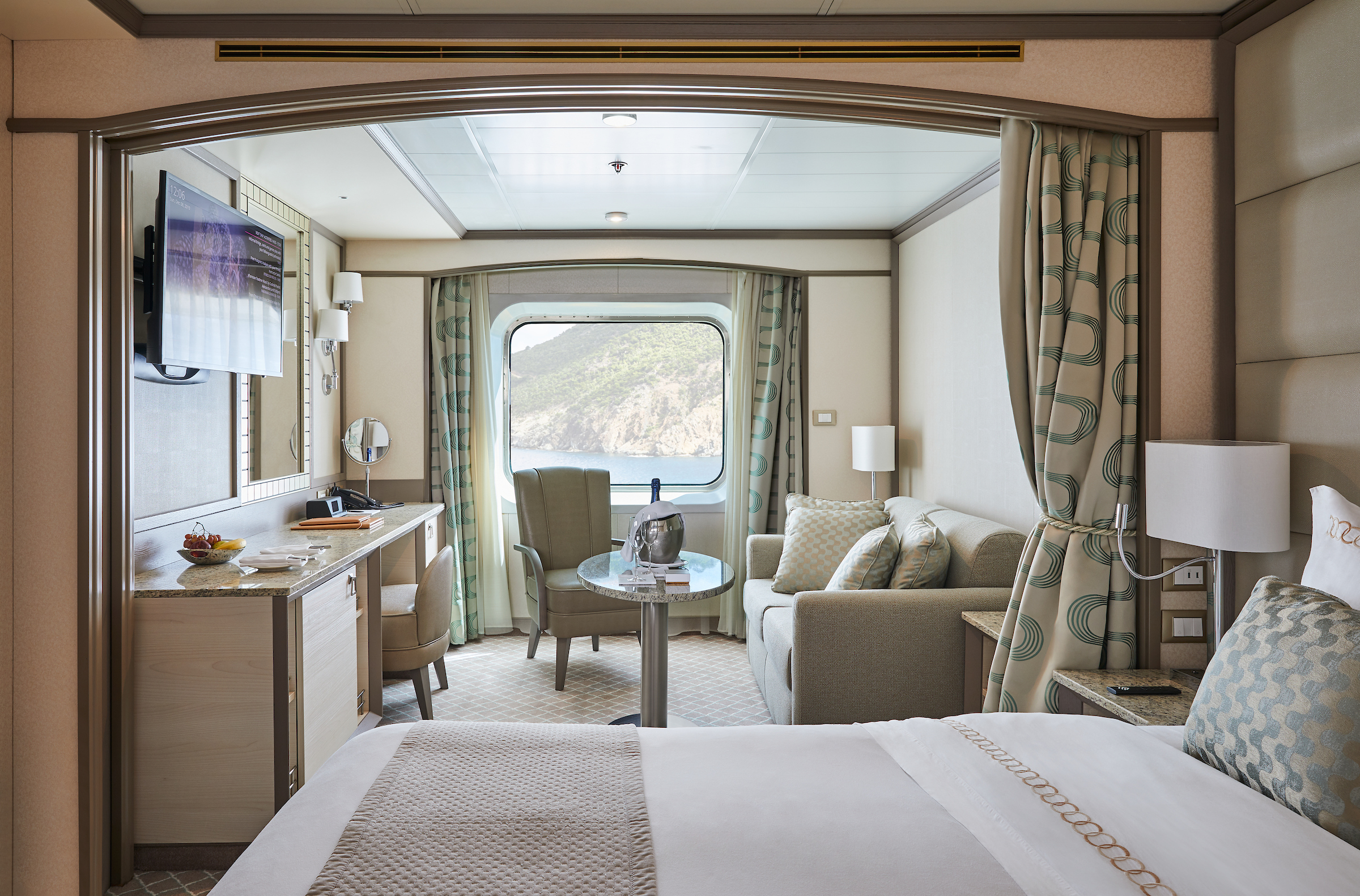
Silver Shadow
Award-winning Silver Shadow is a firm favorite in the Silversea fleet. With one of the highest space-to-guest ratios at sea, she offers authentic experiences, simple pleasures, and shared moments.
Silversea’s Shadow Class luxury cruise ships Silver Shadow and Silver Whisper offer you freedom and space to design your day. Silver Shadow retains Silversea’s essence—spacious suites and superior service—paired with a lively cosmopolitan atmosphere and enhanced amenities. Energise body and mind in the upgraded spa and fitness centre. Savour fine wines and French gastronomy in La Dame and enjoy authentic Italian cuisine in La Terrazza, endless ocean views from The Grill, and internationally inspired dishes in The Restaurant. From delectable dining to relaxation in ultra luxury, cruising has never felt so good.
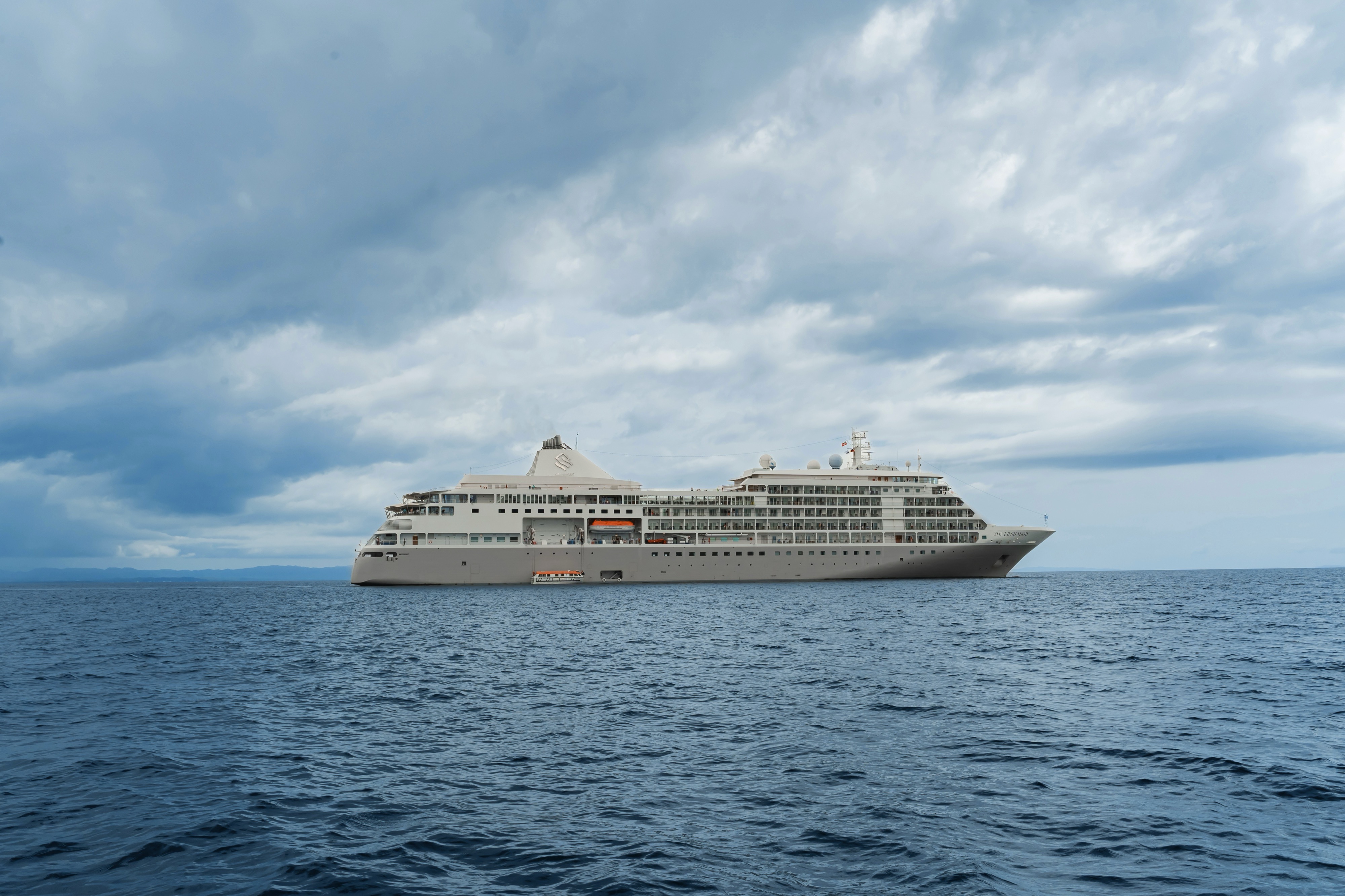
Ship Facts
| Launch Year | 2000 | ||||||||||
| Refit Year | 2019 | ||||||||||
| Language | en | ||||||||||
| Gross Tonnage | 28258 | ||||||||||
| Length | 186 | ||||||||||
| Width | 24 | ||||||||||
| Currency | USD | ||||||||||
| Speed | 21 | ||||||||||
| Capacity | 392 | ||||||||||
| Crew Count | 302 | ||||||||||
| Deck Count | 7 | ||||||||||
| Cabin Count | 194 | ||||||||||
| Large Cabin Count | 39 | ||||||||||
| Wheelchair Cabin Count | 2 | ||||||||||
| Electrical Plugs |
|
Deck 10
- Fitness Centre
- Zagara Beauty Spa
- Beauty Salon
- Observation Library

Deck 9
- Jogging Track
- Deluxe Veranda Suites
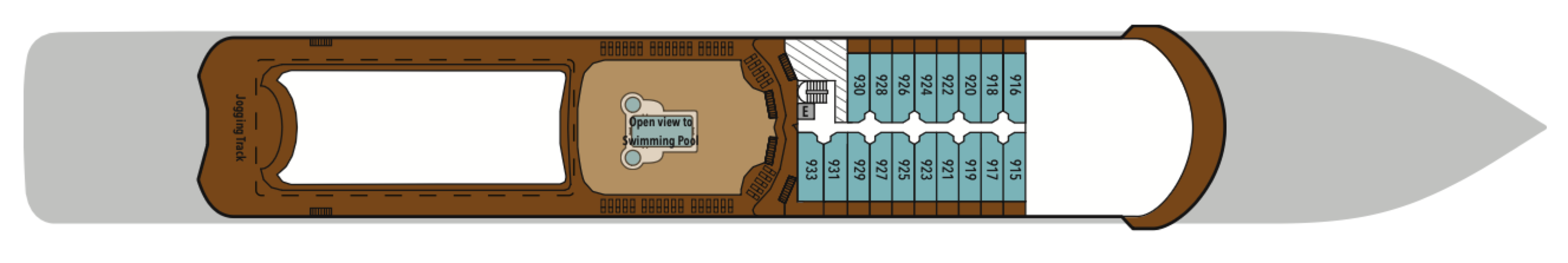
Deck 8
- Pool Deck
- Pool Bar
- The Grill
- Connoisseur's Corner
- Casino
- Panorama Lounge
- Launderette
- Grand Suites
- Superior Veranda Suites
- Deluxe Veranda Suites
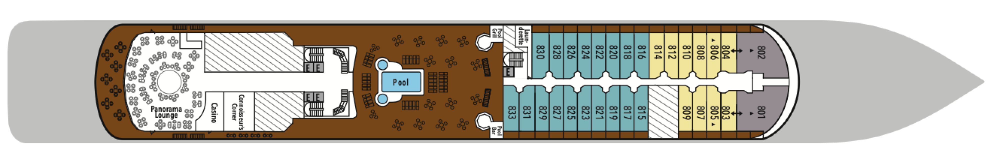
Deck 7
- La Terrazza
- La Dame
- Conference/Card Room
- Owner's Suite
- Grand Suites
- Royal Suites
- Silver Suites
- Medallion Suites
- Superior Veranda Suites
- Vista Suites
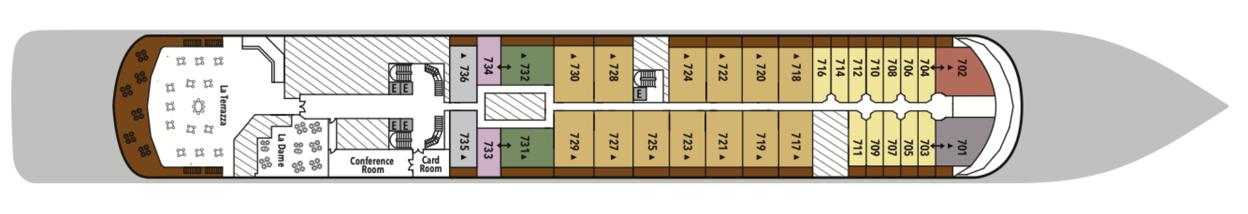
Deck 6
- The Show Lounge
- Launderette
- Grand Suites
- Royal Suites
- Superior Veranda Suites
- Deluxe Veranda Suites
- Classic Veranda Suites
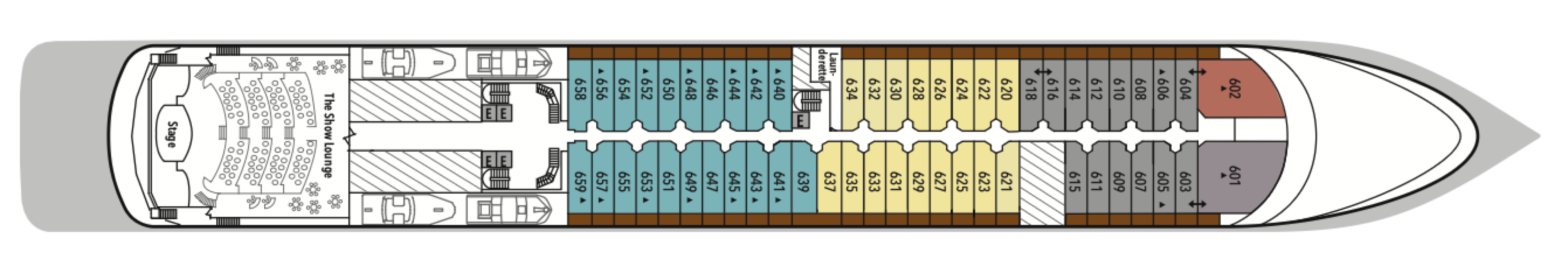
Deck 5
- Boutiques
- Atrium
- Launderette
- Reception/Guest Relations
- Future Cruise Sales
- Shore Concierge
- The Bar
- The Show Lounge
- Superior Veranda Suites
- Vista Suites
- Classic Veranda Suites
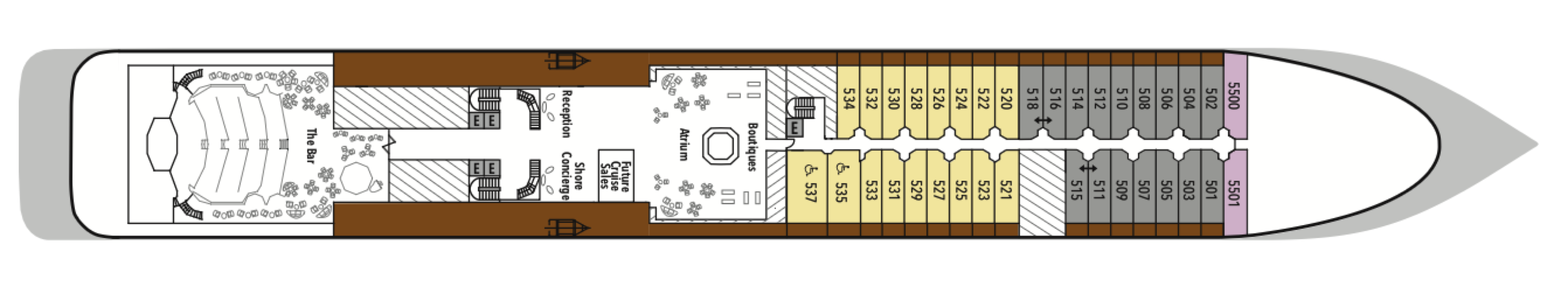
Deck 4
- The Restaurant
- Launderette
- Vista Suites
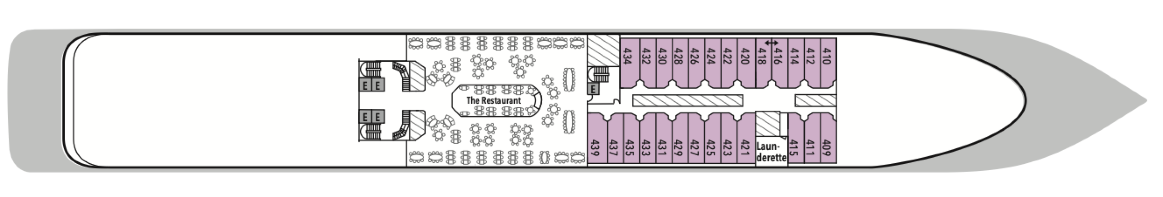
Our passion for excellent cuisine is at the heart of everything we do. We believe that meals are a celebration of life, a way to bring people together, and an expression of culture and tradition. Each dining venue aboard our ships offers a unique and memorable experience, with multiple dining options available and a variety of spaces and experiences on board; every mealtime is a joy.
From fine French cuisine and flavourful Asian options to relaxed Italian meals and international options to suit everyone, our chefs’ creativity knows no limits.
With the importance of food in our culture, it’s no wonder that dining is a high priority at Silversea. We believe gastronomic excellence is a given, thanks to recipes that reflect our heritage and revamp tradition. No matter where you dine, destination influence is readily apparent in the great diversity and freshness of your selections. And every luxury ship also features an array of dining venues. Per guest reservation fee for specialty restaurants. Please visit MySilversea to make your reservations.
The Restaurant
The Restaurant transforms dining into an extraordinary journey of taste. Indulge in international delicacies, refined classics, and destination-driven creations that reflect the flavours of the region you’re exploring. From breakfast favourites to imaginative evening courses, every meal draws inspiration from your voyage.
La Dame
Experience the pinnacle of French gastronomy at La Dame, where sophistication meets tradition. Here, an exclusive tasting menu unfolds course by course — each plate a study in masterful technique, seasonal ingredients, and modern refinement. From classic Kir Royales to exquisite signatures such as Dover sole à la Grenobloise, this is haute cuisine at its finest.
Per guest reservation fee of US$60. Please visit My Silversea to make your reservations.
La Terrazza
La Terrazza elevates casual dining by day and delivers an authentic Italian experience by night. During the breakfast and lunch buffets, our master chefs prepare global favorites at live stations. As evening falls, handmade pastas and classic seafood dishes are the centerpiece — every impeccable bite paired with fine wines from around the world.
Open seating for breakfast and lunch.
Reservations required for dinner.
The Grill
A poolside al fresco favorite, The Grill is casual by day and captivating by night. Dig in to crisp salads and grilled classics during lunch, then return after sunset for masterfully seasoned and seared cuts paired with balmy sea breezes.
Dress code: Casual
Casual wear consists of pants, blouses, or casual dresses for women; open-neck shirts and slacks for men are appropriate.
Images are intended as a general reference. Features, materials, finishes and layout may be different than shown.
In Suite Dining
You can order from our Room Service menu 24 hours a day.
Opening hours are for reference only. For precise opening hours, please refer to the Daily Chronicles provided on board.
Human connection and a sense of community is at the heart of every Silversea voyage, which is why we’ve created a variety of spaces on board to share the experience with your fellow adventurers. Relax in one of our many bars or restaurants with your favourite tipple and swap stories with other guests. Workout in our fully equipped gym or try our elite spa services. Sip a glass of bubbly by the pool by day, or a fine cognac in one of our elegant bars by night.
When you embark on an adventure with Silversea, we keep you thoroughly entertained while you’re sailing from one glorious port to another. Exploring the many different floors and strolling around the variety of areas on your ship is great fun as there’s always so much to see and do. Whether you want to recline on a lounger by the pool, try your luck in the casino, or indulge in our cutting-edge wellness and exercise programs, there’s something for everyone, including those who want to relax in their suite while their butler runs a bubble bath.
Atrium
The Atrium aboard provides a unique space at the heart of deck 5. Filled with natural light, a beautiful and spacious bar blurs the line between traditional bar and modern brasserie, and offers an all-day venue for drinks and snacks in a relaxed, welcoming atmosphere. The elegant café serves light bites, as well as smoothies, fresh juices, bespoke cocktails, and wine by the glass from our extensive drinks menu, and it is the ideal place to meet your friends, grab a coffee or aperitif, and plan your next adventures.
Observation Library
Wrapped in glass and bathed in light, the Observation Lounge offers a serene escape high above the sea. Borrow a book from the in-house library, pour yourself a coffee or tea from the self-service bar, and curl into an armchair to watch the world drift by. This is a sanctuary for reflection, relaxation, and stories — both written and still in the making.
Panorama Lounge
True to its name, Panorama Lounge surrounds you with sweeping views from every angle. Sunlight pours through wraparound windows by day, framing horizons that shift like watercolors. Evenings hum with piano chords and DJ beats that carry you late into the night. And all of it pairs wonderfully with cocktails handcrafted to match your mood.
Boutique
Exceptional shopping experiences do not end in the cosmopolitan cities we visit. Silversea’s striking new shipboard boutiques, reimagined and redesigned, are stunning modern design spaces befitting the finest creations from legendary designers. Carefully selected partners in Silversea’s onboard, duty-free boutiques offer our guests a carefully curated selection of cutting-edge fashions, jewelry, accessories, fine perfumes, cosmetics, and Silversea Logo collection, all at duty-free prices.
Connoisseur's Corner
As evening stretches into night, Connoisseur’s Corner offers a stylish refuge for those who appreciate the time-honored rituals of smoke and spirit. Sink into tufted leather chairs with a hand-rolled cigar and a glass of one of our finest cognacs or whiskeys. Indoors or under the stars, every moment is marked by pure indulgence.
The Show Lounge
At The Show Lounge, theatrical immersion takes centre stage. From captivating performances and screenings to cultural programs, this elegant venue was designed to dazzle. Tiered seating ensures impeccable views while attentive beverage service makes indulging effortless. Raise a glass as the curtain rises on an unforgettable night of entertainment.
Card Room/Conference Room
The Card Room on board this luxury cruise ship is where bridge games and tournaments take place most days. On days at sea, newcomers to the game can learn how to play. Should your group require a conference or meeting space, Silversea is pleased to provide a tailor-made experience. Audiovisual equipment is available and complimentary aboard all luxury cruise ships.
Casino
Roulette, blackjack, and slot machines are available in The Casino for guests 18 years old or older. If you are a novice, come to the champagne reception and learn all the games offered aboard this luxury cruise ship.
Reception
This central lobby area welcomes guests to speak with a Guest Relations specialist should they have a question or require any service. Assistance is available 24 hours a day. For guests wishing to make shoreside arrangements, the Silver Shore Concierge is available to assist with knowledgeable suggestions and personalised coordination of all private, independent touring, including sightseeing, water sports, golf, and more. The Cruise Consultant may prove indispensable when planning your next Silversea voyage, or if you wish to extend your current voyage for a day, a week, a month … Like having your own personal onboard Silversea professional, the Cruise Consultant will help you to select the perfect voyage, reserve your preferred suite, and provide immediate confirmation.