
Tema to Lisbon
Tema to Lisbon
Cruise overview
WHY BOOK WITH US?
- ✔ The Deluxe Cruises’ team has extensive experience in ultra-luxury cruising.
- ✔ Call now to speak to our helpful and experienced Cruise Concierge team.
- ✔ Enjoy our Unique Deluxe Cruises Bonus for substantial savings.
- ✔ Our team will tailor your holiday to your exacting requirements.
- ✔ As agents, we work under the protection of each cruise lines ABTA / ATOL licences
About Tema
From a modest fishing port to the biggest in Ghana, Tema’s industrial activity has all but tarnished the charming, postcard scenery of the region. The neighbouring white-sanded beaches remain immaculate, still serving as a testimony of the rich variety of fishing birds that can be found in the area.In the way Mother Nature intended it, gannets, boobies and kingfishers amongst other species fish in and around the cerulean waters of the coast. A light breeze tickles the inflamed, iron-filled soil of the mainland on which the railway linking Tema to Accra lures hundreds of visitors each day. On board one of the carriages to Accra, distinctively noticeable by their painted coats of red, yellow and green that echo Ghana’s national flag, a peek out of the window will offer scenic views of the harbour and coast, as well as the large fields that separate Tema from the capital by 15 miles/25 kilometres of open space.Accra’s ambiance contrasts with the peaceful setting of Tema, but nevertheless has its own charm to be enjoyed. Through rich, contemporary monuments which recall Ghana’s 1957 independence, the Kwame Nkrumah Memorial Park is an architectural jewel which also narrates the life and exploits of the eponymous president who fought for his country’s freedom. A more casual but perhaps interesting approach to the City’s culture and history is the visit to an artisanal studio, where primary materials such as wood and metal are transformed into stunning carvings of all sorts, illustrating a traditional African belief of a new life beyond death. And for a relaxing yet enriching experience, the hospitable restaurants are always eager to share their Banku, a local dish made out of corn and served with fish or stew.Craft markets are also worth a detour and are great for cherry-picking souvenirs. Demonstrating other fine Ghanaian traditions such as leather crafting and weaving, a popular favourite is the country’s hand-made Black Soap, which is renowned for its soothing virtues.


About Takoradi
Ghana's fourth-largest city plays serene beaches against a bustling commercial centre. People from around the world visit the shore, both for its beauty and to enjoy the fresh seafood served right on the sands. Frantic city life awaits a short distance inland, where an economy fuelled by Ghana’s oil industry is most apparent in the maze of vendors at Market Circle.

About Abidjan
Three hours south of Yamoussoukro, nestled in between the canals and waterways, lies Abidjan the economic capital of the Ivory Coast. Considered the crossroads of West Africa both economically and culturally, Abidjan benefits from clement temperatures year round, reaching average highs of around 88˚ Fahrenheit, or 30˚ Celsius. Like much of West Africa, this city has cachet and soul, and enjoys a diversity of cultures, traditions and people, notably through the French influence, but also through the steady stream of tourists that make the city both vibrant and cosmopolitan. Although its reputation was tarnished during the civil war in 2011, Abidjan held firm and has blossomed into a stunning coastal city, ripe for exploration.

About Tokeh
Tokeh, or Tokeh Town as it is also known, is a coastal resort town thatrelies mainly on fishing and tourism. Only twenty miles outside Freetown, thecapital of Sierra Leone, this town is nestled in an area of beautiful scenery,surrounded by mountains, forests and beaches. The Tokeh Beach is considered oneof the largest and most attractive beaches in West Arica. This town was firstfounded by a Sherbo fisherman who settled along the river bank. Much later, in1968, a prominent barrister from Sierra Leone purchased the land, and inpartnership with a French company, developed the village. Today, it is athriving town with the resort, a church, mosque, community center, school andabout 6000 residents.
About Freetown
About João Vieira, Bijagós Archipelago
About João Vieira, Bijagós Archipelago
About João Vieira, Bijagós Archipelago
About Praia, Santiago Island
Start your Expedition Cruise in Praia, the capital of Cape Verde, located in the south of Santiago Island. You can explore its old centre overlooking the ocean and its historical buildings with transom windows. In the old quarter, you can also learn about the diversity of the archipelago’s cultural origins in the Ethnographic Museum. To finish your day, head to the harbour to visit the Diogo Gomes statue, paying homage to the man who discovered the archipelago in 1460.

About Porto Novo, Santo Antão Island
Porto Novo, the second largest city on Santo Antão, is located in the dry southeast of the island. A dusty wind blows constantly here. You can explore the main street with its former mansions, a little church, markets that have local fish, grogue and fresh goat cheese for sale, shops and-of course-the harbour. At the back of the town is the 2,000m-high Topo de Coroa, which is a fairly easy climb and has magnificent 360-degree views. Around the town, family-owned farms grow fruit and vegetables which are sold at regular markets in the town. There are some old churches from the Portuguese era, as well as a couple of elegant squares with pleasant bars and cafés, from which to watch the world go by.

About Las Palmas de Gran Canaria
Perhaps the prettiest of the Canary Islands, Gran Canaria is an almost circular isle with the peak of Pozo de Las Nieves, its highest point, at the centre. With a wealth of natural beauty and all the exciting attractions of city life in the capital, the island offers the best of both worlds. You will no doubt wish to see the sights of the capital’s old quarter, which dates back to the 15th century and encompassses the Vegueta and Triana districts, and wherever you go you can enjoy the glorious subtropical climate, perfect for growing exotic palms and fruits.

About San Sebastian de la Gomera

About Arrecife, Lanzarote
A volcanic island designated a UNESCO Biosphere Reserve, Lanzarote’s dramatic landscapes were shaped by an explosive past. Today, its pretty beaches and virtual absence of rain together with duty-free shopping make the island an extremely desirable destination. The main port and capital, Arrecife, is a pleasant town with a modern seafront and colourful gardens. Outside the capital there is plenty to explore, from the dazzling white salt flats of Janubio and the rugged terrain of Fire Mountain to the eerie caves of Los Verdes and an array of unspoilt fishing villages scattered around the coast. The island is home to a great selection of restaurants and local specialities including garbanzos compuestos – a chickpea stew; papas arrugadas – potatoes with carrots, peas, ham and green pepper; and of course, plenty of fresh seafood. Please note that those planning to participate in one of the shore excursions from this port may need to take an early lunch on board ship to suit the excursion schedules.

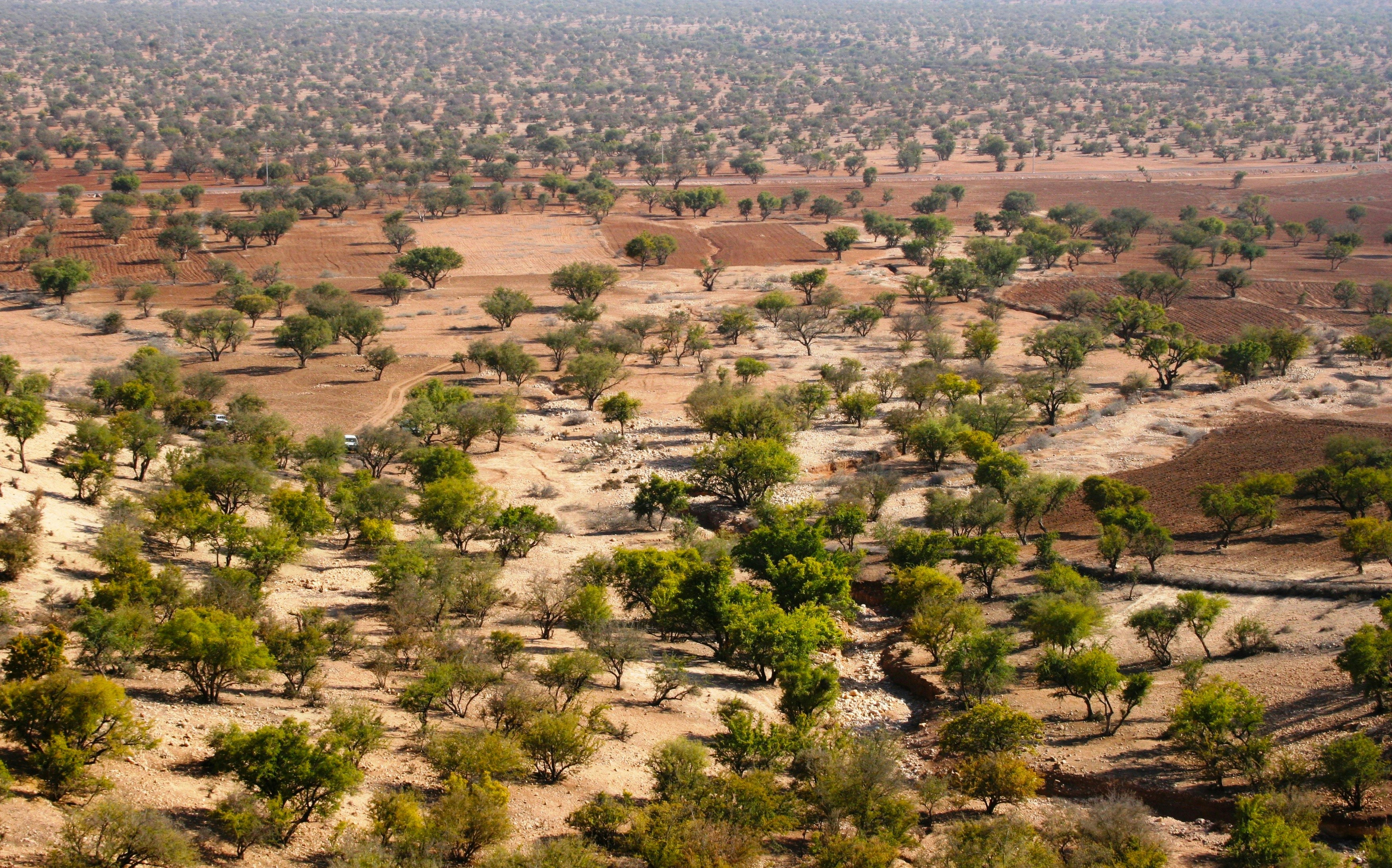
About Agadir
Shaped by the Atlas Mountains on one side, Agadir is framed on the other by a magnificent crescent-shaped beach. While little is known of the city’s origins, the Portuguese created a fortress here at the end of the 15th century, naming it Santa Cruz de Ghir. Freed from Portugal’s occupation by the Saadians in 1540, Agadir grew into a colourful and prosperous port and became newsworthy in 1911 when a German gunboat, the Panther, sailed into the bay as a protest against the division of North Africa between the Spanish and French. Morocco gained independence from the French in 1956, an event which was closely followed in Agadir by the tragic earthquake of 1960. The city, which has been rebuilt to represent the ‘new nation’, is blessed by fine sandy beaches overlooked by luxurious hotels and a great selection of cafés and restaurants. Please note that vendors in the souks can be very persistent and eager to make a sale.

About Safi
Safi’s natural harbor lies on the Atlantic in western Morocco and was once used by the Roman and the Phoenicians. By the 11th century gold, slaves and ivory were the hot commodities being traded between Marrakesh and Guinea. Evolving through the ages to cater to the popular trade of the day, the major industry here today is fishing connected to the country's sardine industry, but there is also an economy based on exported phosphates, textiles and ceramics. The city was overseen by the Portuguese Empire in the 1500s, and a fortress built to safeguard the city by these Portuguese influences still stands today. Safi sits near the foothills of the snow-capped Atlas Mountains where Bedouins once camped.

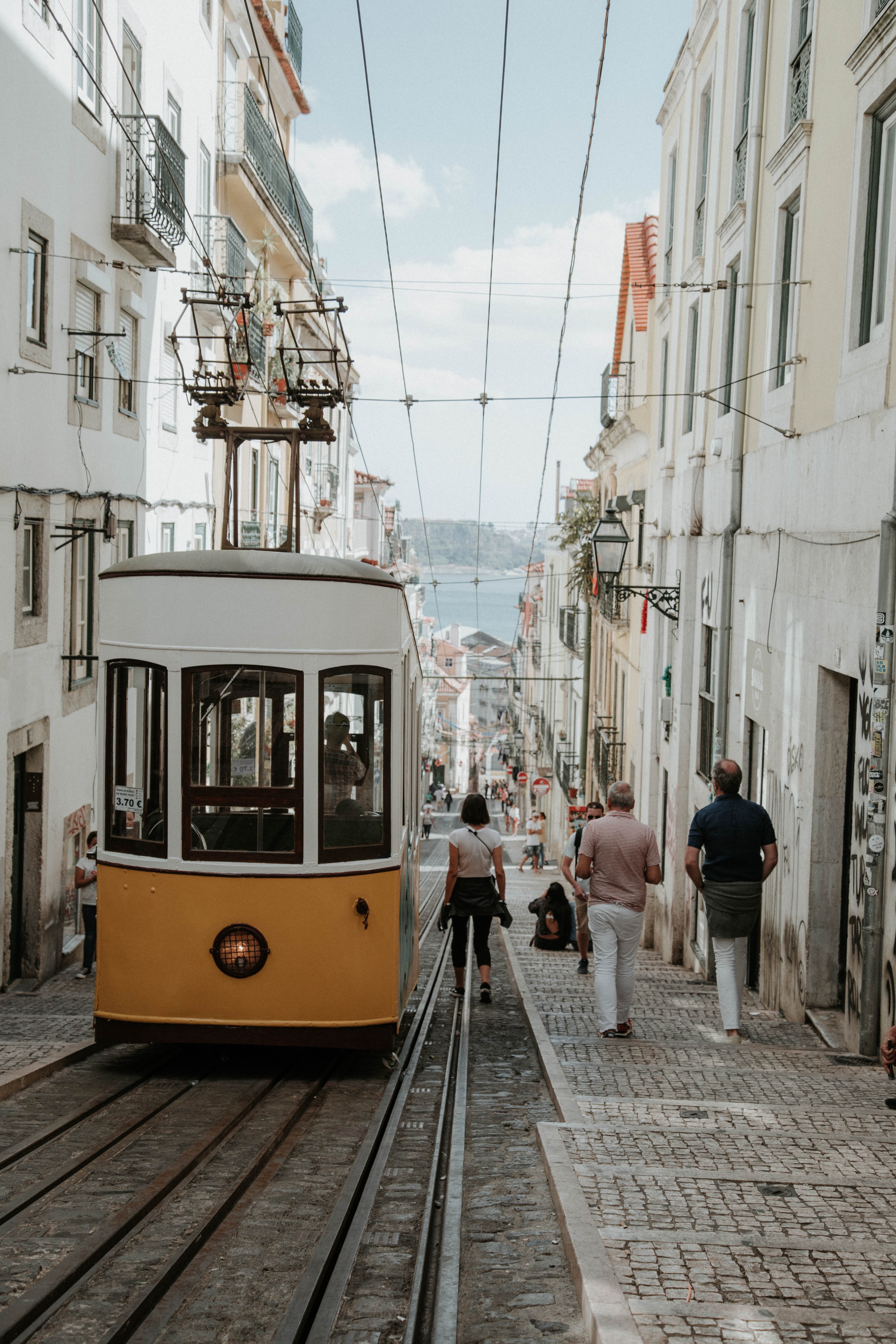
About Lisbon
Set on seven hills on the banks of the River Tagus, Lisbon has been the capital of Portugal since the 13th century. It is a city famous for its majestic architecture, old wooden trams, Moorish features and more than twenty centuries of history. Following disastrous earthquakes in the 18th century, Lisbon was rebuilt by the Marques de Pombal who created an elegant city with wide boulevards and a great riverfront and square, Praça do Comércio. Today there are distinct modern and ancient sections, combining great shopping with culture and sightseeing in the Old Town, built on the city's terraced hillsides. The distance between the ship and your tour vehicle may vary. This distance is not included in the excursion grades.


Where You'll Go


