Nuuk to Reykjavik
Nuuk to Reykjavik
Cruise overview
WHY BOOK WITH US?
- ✔ The Deluxe Cruises’ team has extensive experience in ultra-luxury cruising.
- ✔ Call now to speak to our helpful and experienced Cruise Concierge team.
- ✔ Enjoy our Unique Deluxe Cruises Bonus for substantial savings.
- ✔ Our team will tailor your holiday to your exacting requirements.
- ✔ As agents, we work under the protection of each cruise lines ABTA / ATOL licences
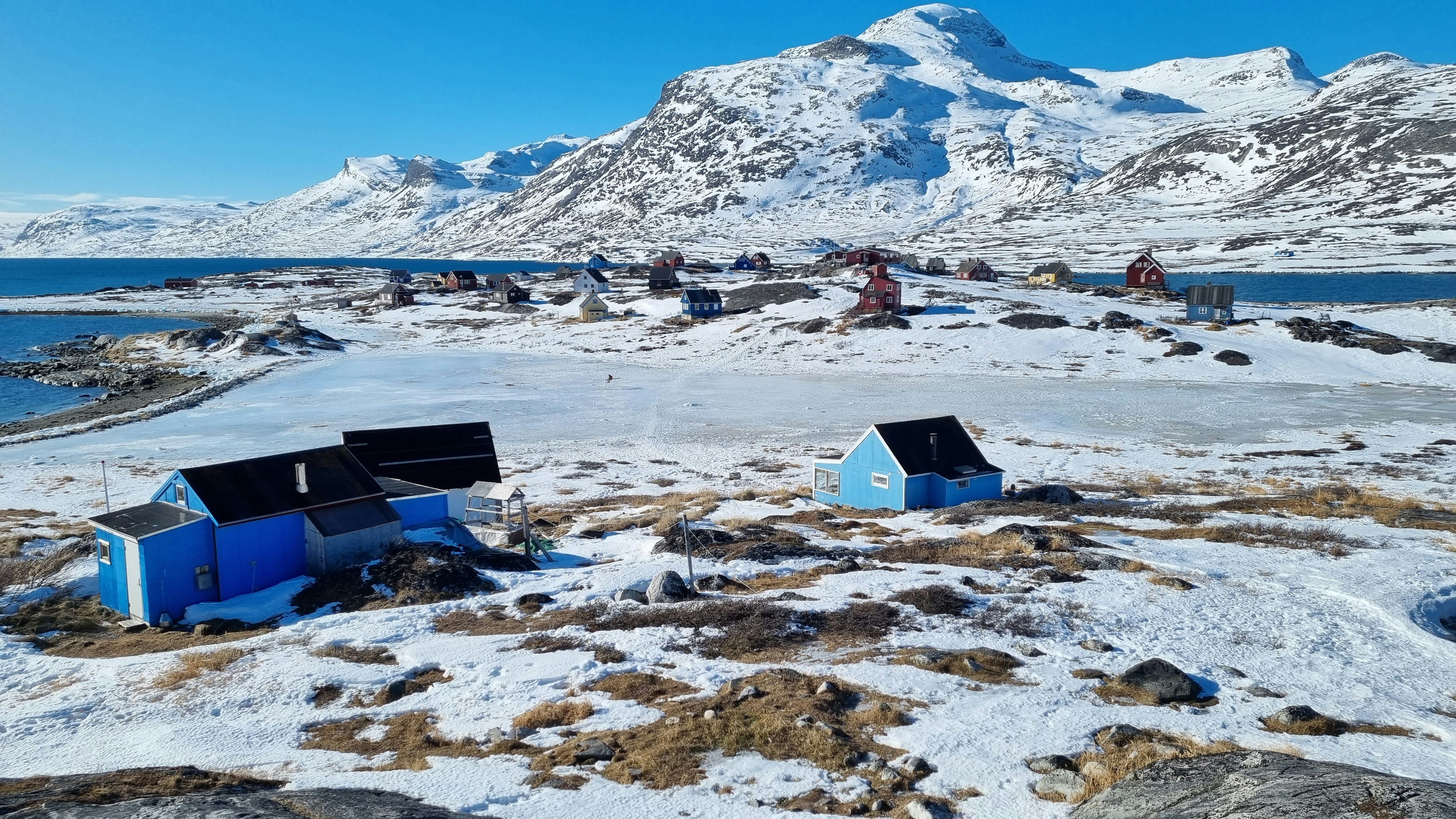
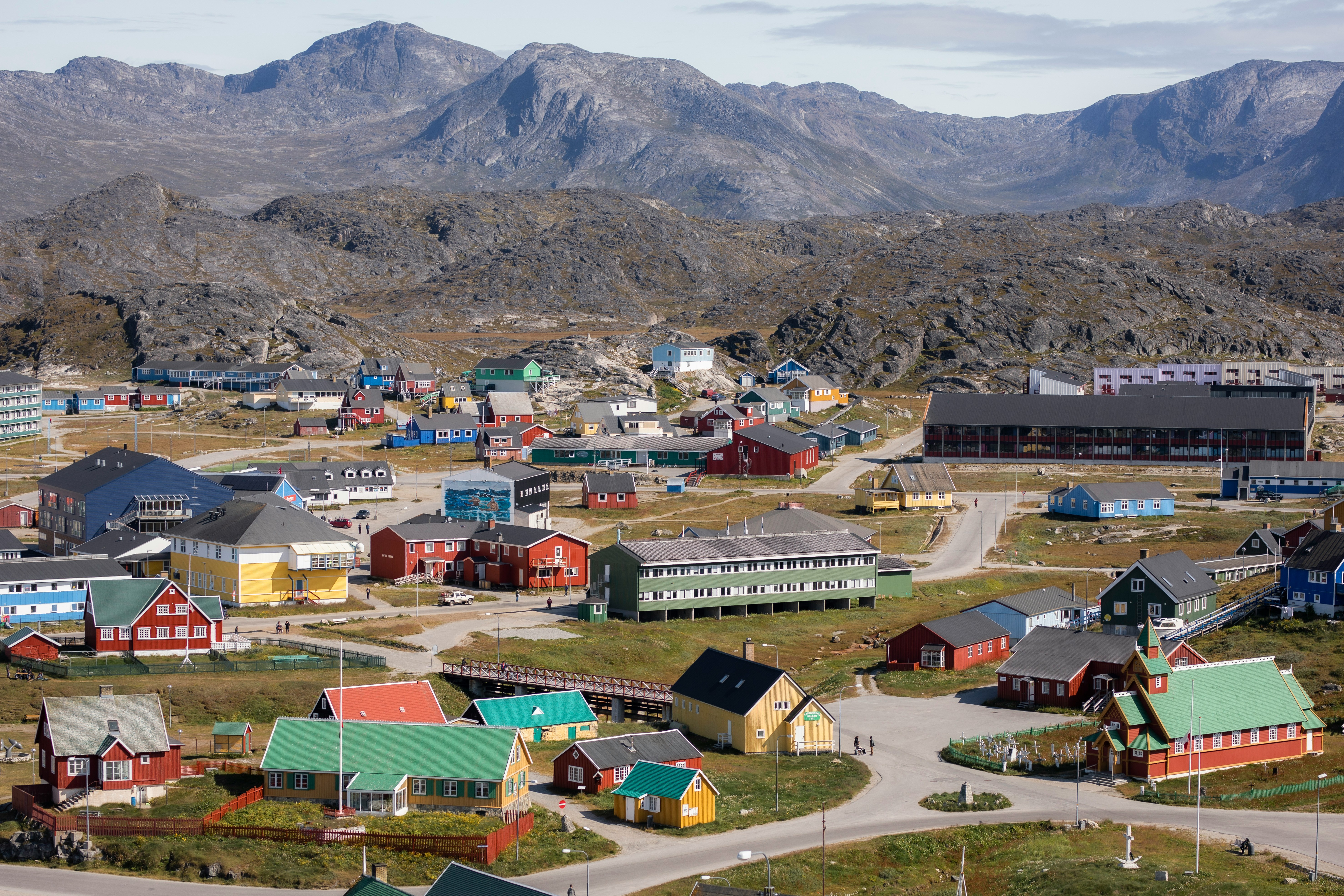
About Nuuk (Godthaab)
Nuuk, meaning “the cape”, was Greenland’s first town (1728). Started as a fort and later mission and trading post some 240 kilometers south of the Arctic Circle, it is the current capital. Almost 30% of Greenland’s population lives in the town. Not only does Nuuk have great natural beauty in its vicinity, but there are Inuit ruins, Hans Egede’s home, the parliament, and the Church of our Saviour as well. The Greenlandic National Museum has an outstanding collection of Greenlandic traditional dresses, as well as the famous Qilakitsoq mummies. The Katuaq Cultural Center’s building was inspired by the undulating Northern Lights and can house 10% of Nuuk’s inhabitants.

About Maniitsoq (Sukkertoppen)
About Qeqertarsuaq (Godhavn)
About Eqip Sermia Glacier
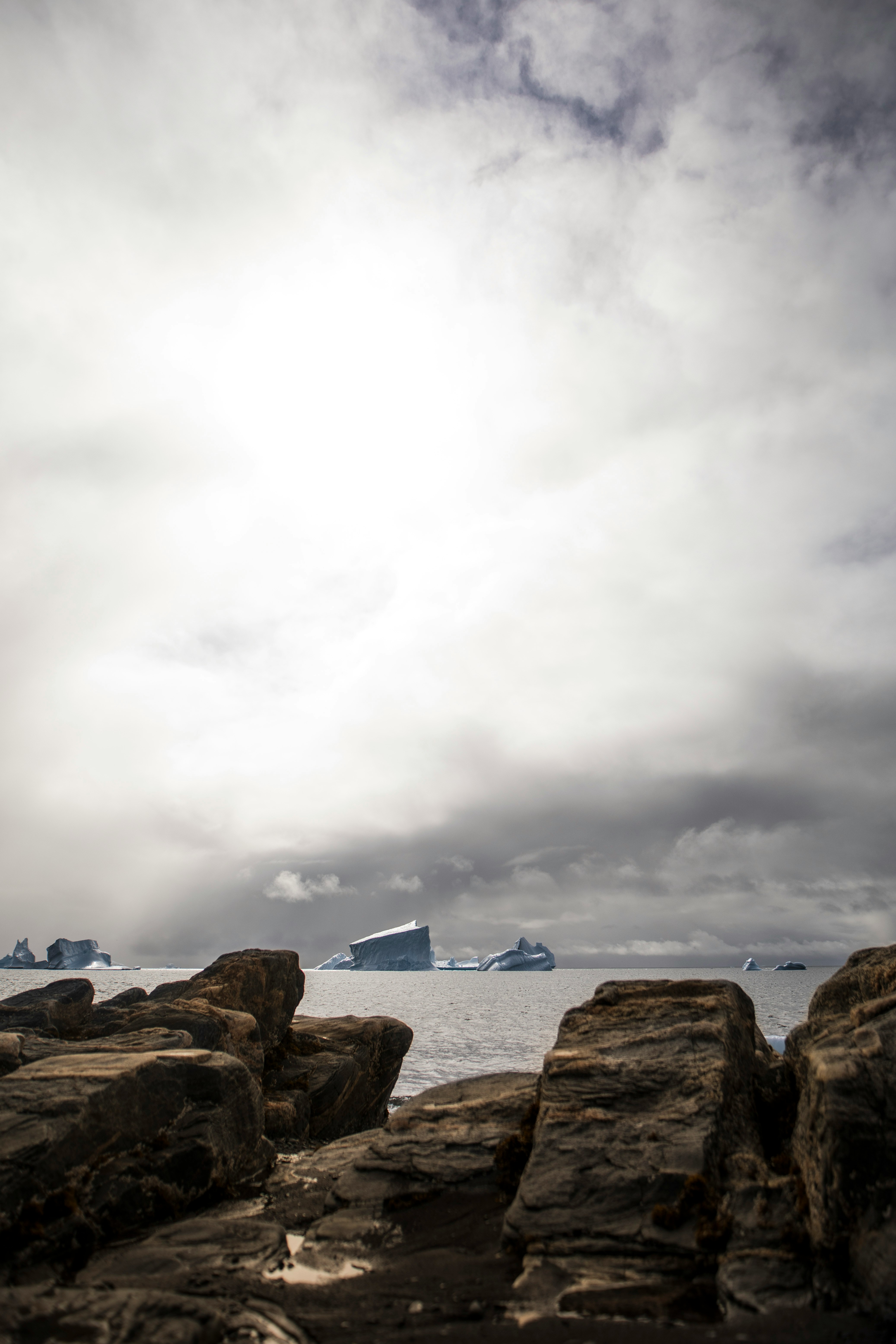
About Ilulissat (Jakobshavn)
Known as the birthplace of icebergs, the Ilulissat Icefjord produces nearly 20 million tons of ice each day. In fact, the word Ilulissat means “icebergs” in the Kalaallisut language. The town of Ilulissat is known for its long periods of calm and settled weather, but the climate tends to be cold due to its proximity to the fjord. Approximately 4,500 people live in Ilulissat, the third-largest town in Greenland after Nuuk and Sisimiut. Some people here estimate that there are nearly as many sled dogs as human beings living in the town that also boasts a local history museum located in the former home of Greenlandic folk hero and famed polar explorer Knud Rasmussen.
About Sisimiut (Holsteinsborg)
Located just north of the Arctic Circle, Sisimiut is the northernmost town in Greenland where the port remains free of ice in the winter. Yet it is also the southernmost town where there is enough snow and ice to drive a dogsled in winter and spring. In Sisimiut, travelling by sled has been the primary means of winter transportation for centuries. In fact, the area has been inhabited for approximately 4,500 years. Modern Sisimiut is the largest business center in the north of Greenland, and is one of the fastest growing Greenlandic cities. Commercial fishing is the lead economy in the town‘s thriving industrial base.

About Amerloq Fjord
About Paamiut (Fredrikshaab)
About Hvalsey
Northeast of Qaqortoq and at the end of a fjord, Hvalsey is one of the best examples of South Greenland’s many scattered ruins from the Norse period. Today the area is used for sheep-grazing, but until the 15th century the settlement at Hvalsey, and specifically Hvalsey’s church, played an important part. Christianity had spread its influence throughout Europe and eventually had reached remote Greenland, where it established itself in the country in 1000 AD. Hvalsey Church was built in the 14th century and is the best preserved of the churches in Greenland from that period. Apart from the church walls, historical ruins from the time of the Norse are just a few meters away.
About Tasermiut Fjord, Klostertal

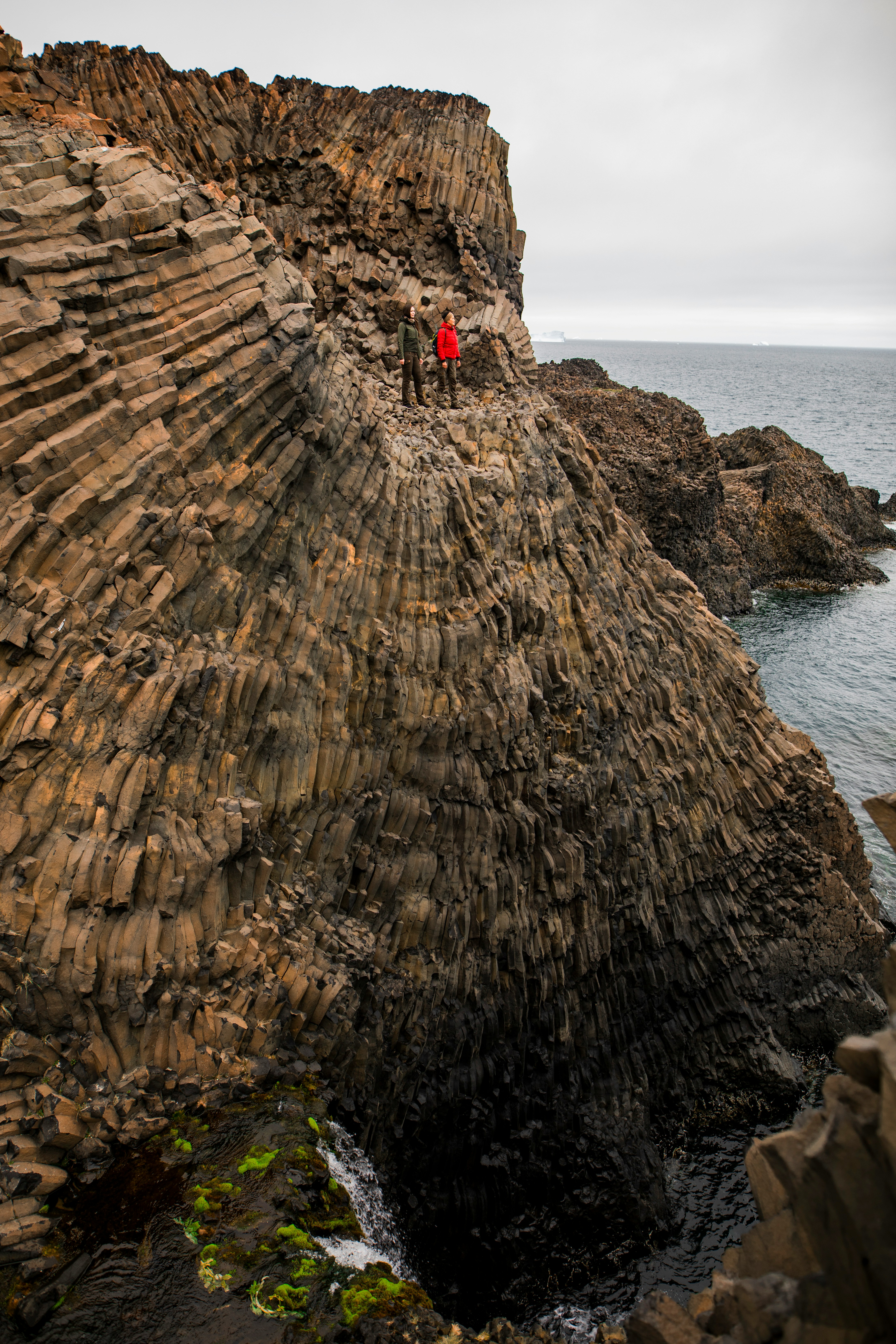
About Prince Christian Sound
The transit through the Sound is one of this voyage’s highlights. Connecting the Labrador Sea with the Irminger Seat, Prince Christian Sound or “Prins Christian Sund” in Danish is named after Prince (later King) Christian VII (1749-1808). 100 km (60 miles ), long and at times just 500 m (1500 ft) wide, this majestic and spectacular fiord throws you back into a Viking era – flanked by soaring snow-topped mountains, rock-strewn cliffs and rolling hills, it is as if time has stood still and one easily forgets that this is the 21st century. As you marvel at the sheer size of the mountains that surround you, with the Arctic waters lapping deceptively at the hull, revel in the silence enveloping you. Icebergs float serenely by, carrying with them the ages of time. Be sure to wear warm clothing as this is one spectacle that you do not want to miss.

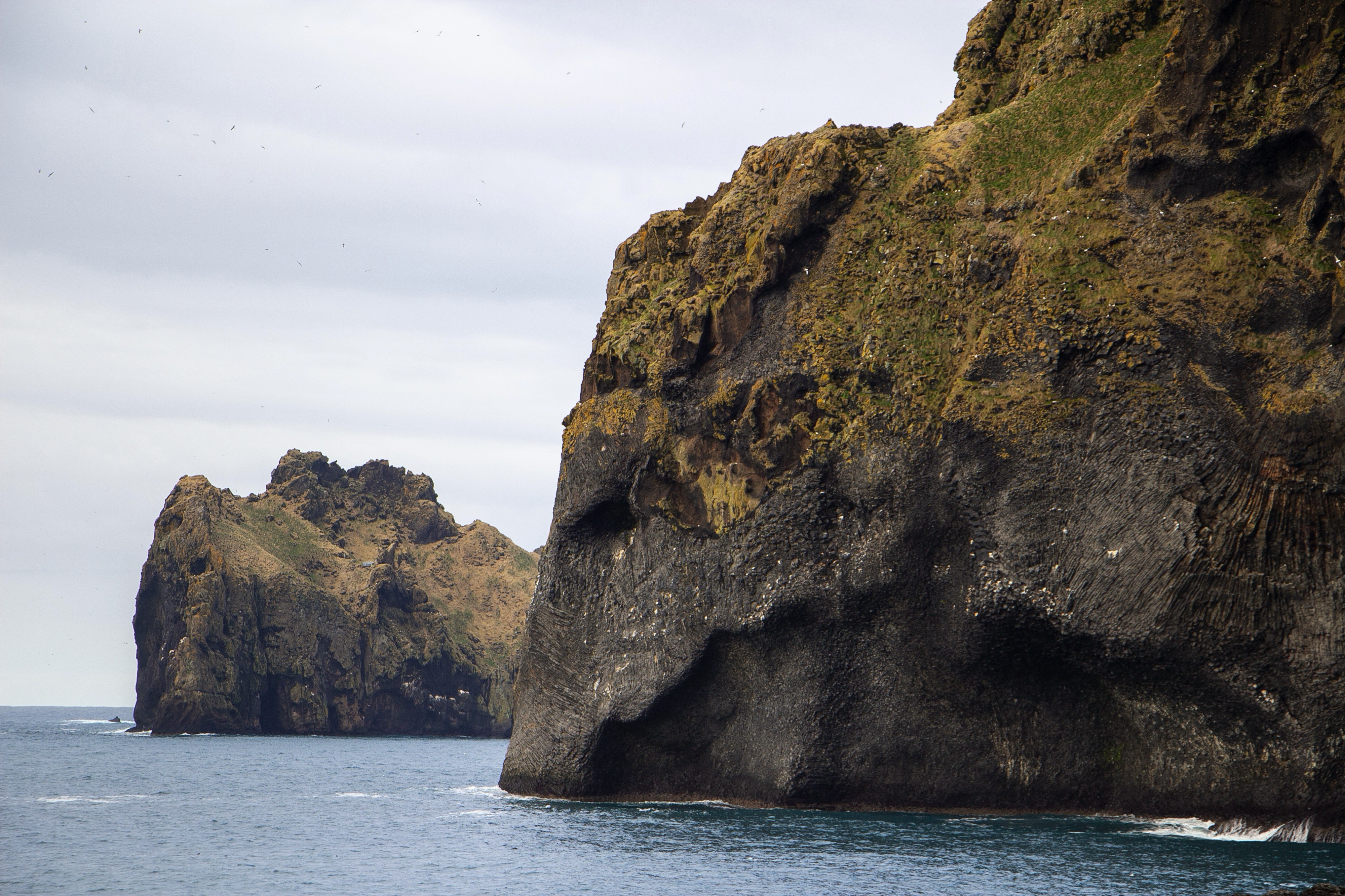
About Westman Islands
The name Vestmannaeyjar refers to both a town and an archipelago off the south coast of Iceland. The largest Vestmannaeyjar island is called Heimaey. It is the only inhabited island in the group and is home to over 4000 people. The eruption of the Eldfell Volcano put Vestmannaeyjar into the international lime light in 1973. The volcano’s eruption destroyed many buildings and forced an evacuation of the residents to mainland Iceland. The lava flow was stopped in its tracks by the application of billions of liters of cold sea water. Since the eruption, life on the small island outpost has returned to the natural ebb and flow of a small coastal fishing community on the edge of the chilly and wild North Atlantic.
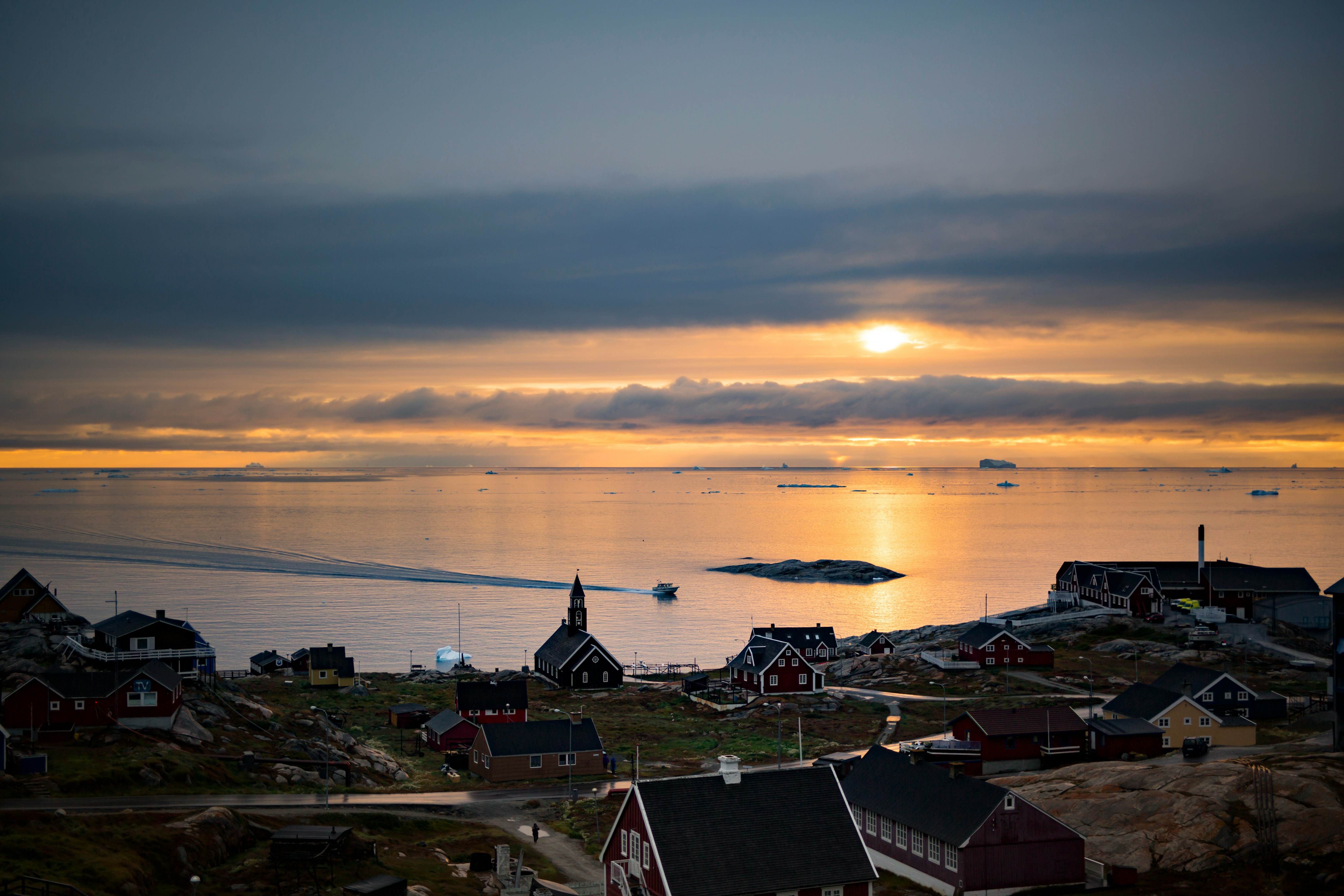
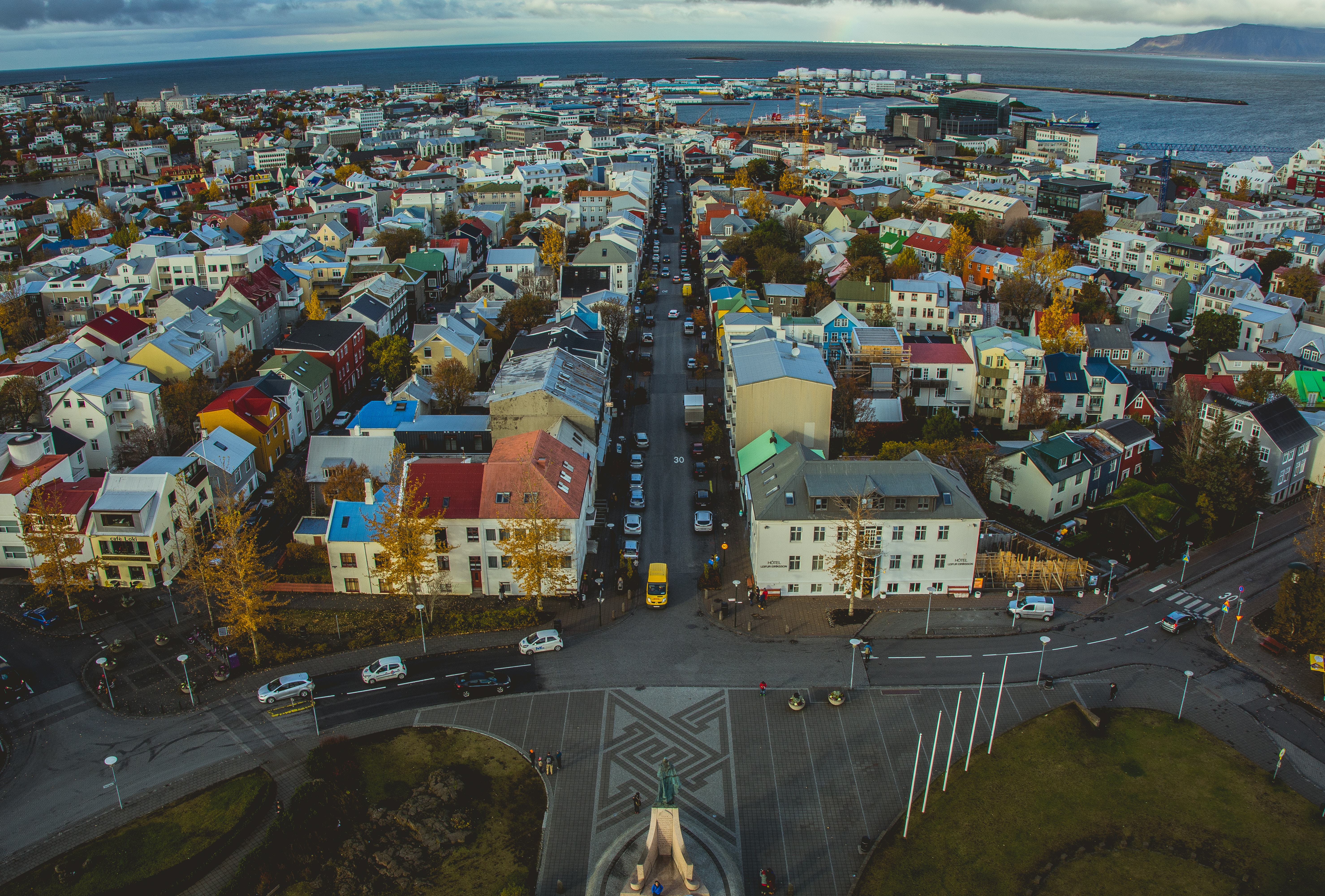
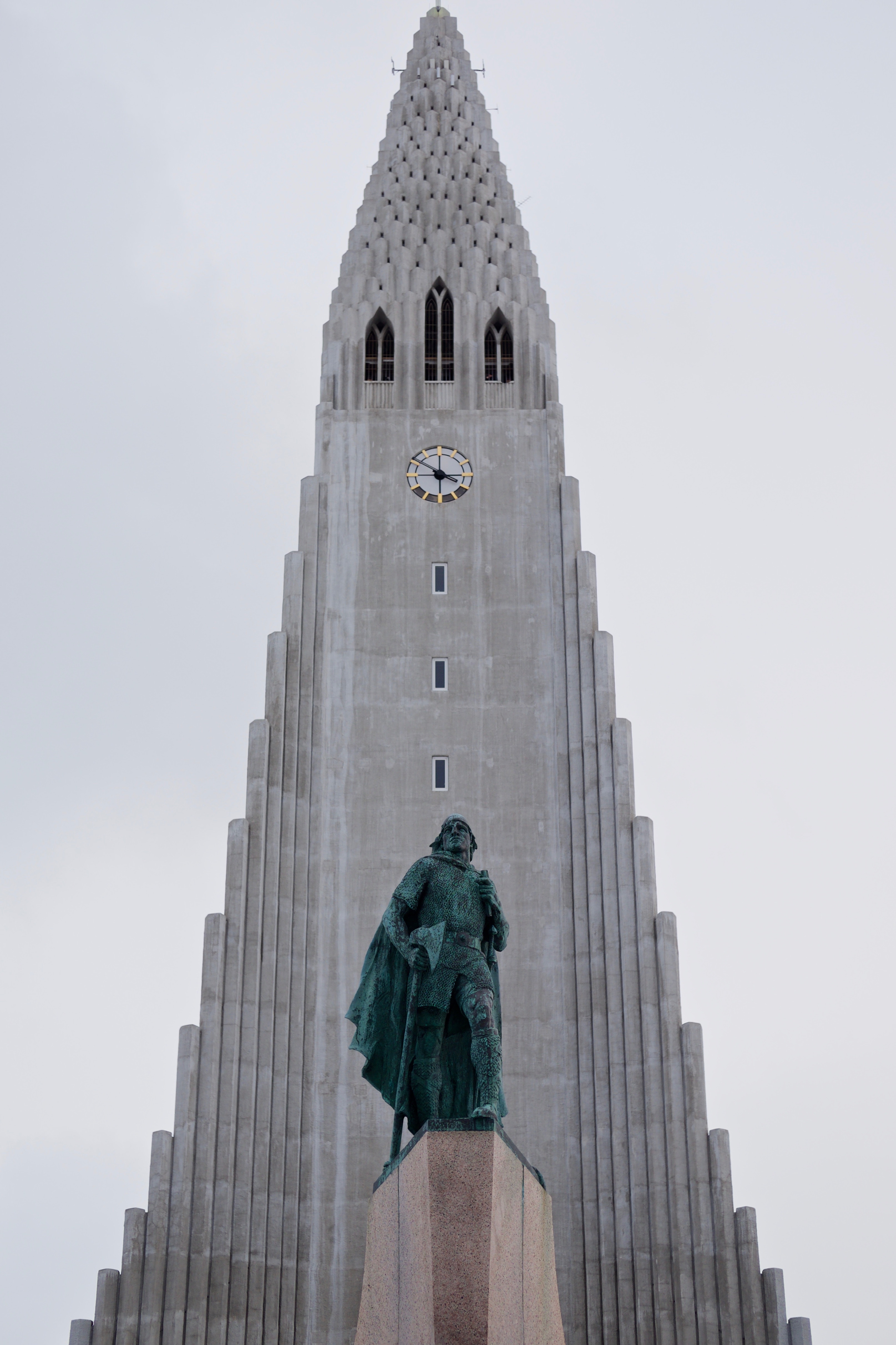
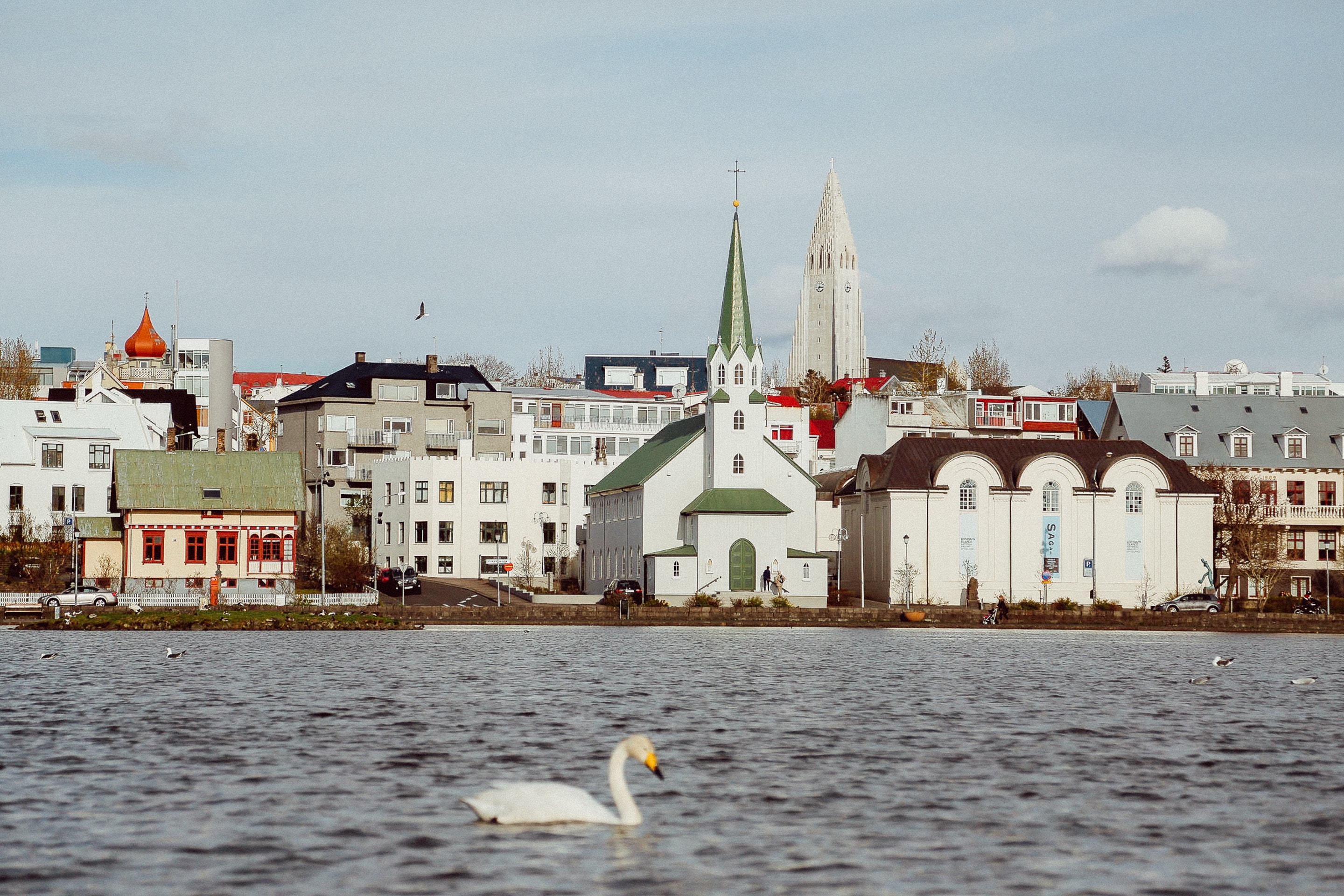
About Reykjavík
Sprawling Reykjavík, the nation's nerve center and government seat, is home to half the island's population. On a bay overlooked by proud Mt. Esja (pronounced eh-shyuh), with its ever-changing hues, Reykjavík presents a colorful sight, its concrete houses painted in light colors and topped by vibrant red, blue, and green roofs. In contrast to the almost treeless countryside, Reykjavík has many tall, native birches, rowans, and willows, as well as imported aspen, pines, and spruces.Reykjavík's name comes from the Icelandic words for smoke, reykur, and bay, vík. In AD 874, Norseman Ingólfur Arnarson saw Iceland rising out of the misty sea and came ashore at a bay eerily shrouded with plumes of steam from nearby hot springs. Today most of the houses in Reykjavík are heated by near-boiling water from the hot springs. Natural heating avoids air pollution; there's no smoke around. You may notice, however, that the hot water brings a slight sulfur smell to the bathroom.Prices are easily on a par with other major European cities. A practical option is to purchase a Reykjavík City Card at the Tourist Information Center or at the Reykjavík Youth Hostel. This card permits unlimited bus usage and admission to any of the city's seven pools, the Family Park and Zoo, and city museums. The cards are valid for one (ISK 3,300), two (ISK 4,400), or three days (ISK 4,900), and they pay for themselves after three or four uses a day. Even lacking the City Card, paying admission (ISK 500, or ISK 250 for seniors and people with disabilities) to one of the city art museums (Hafnarhús, Kjarvalsstaðir, or Ásmundarsafn) gets you free same-day admission to the other two.
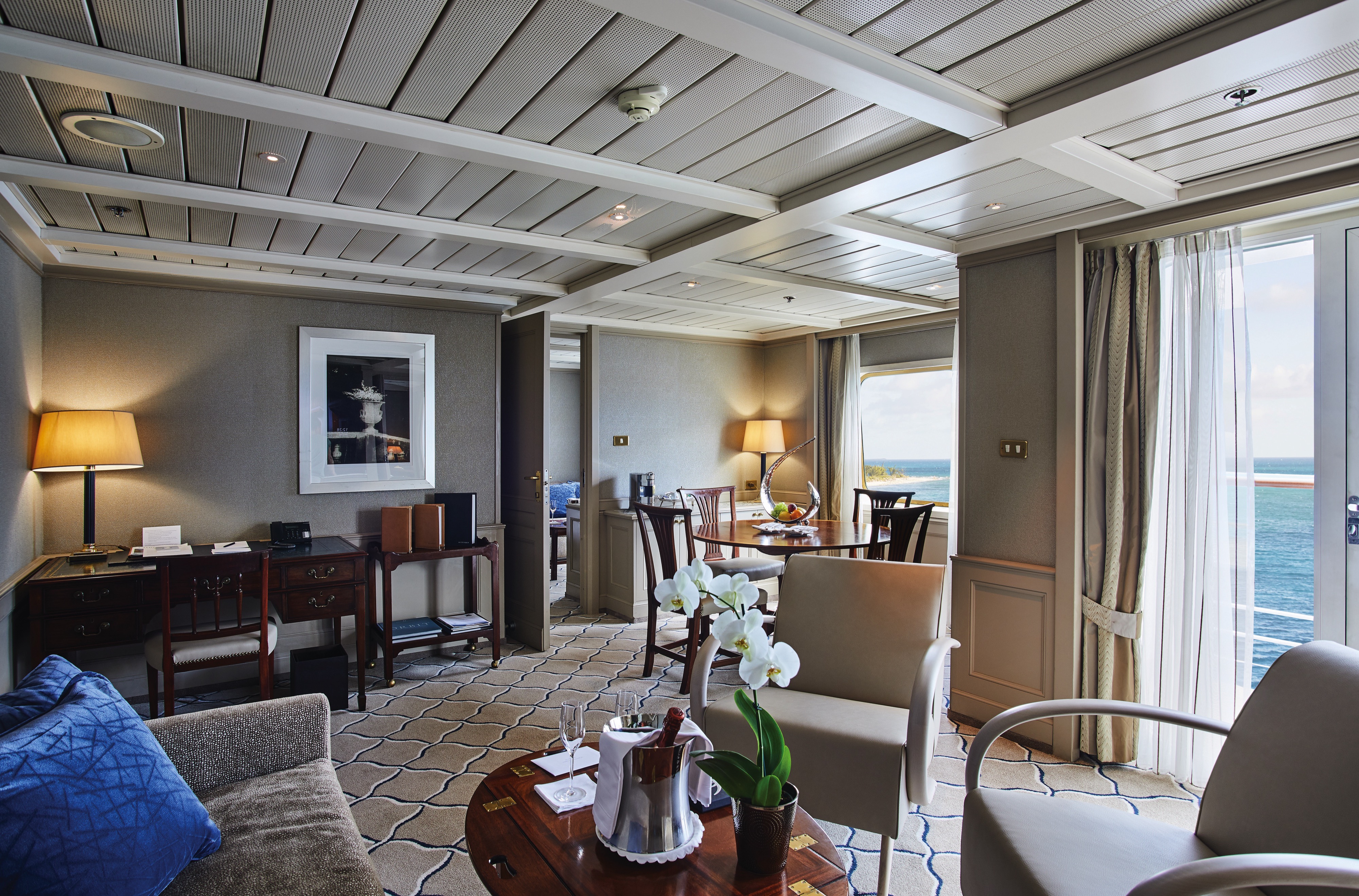
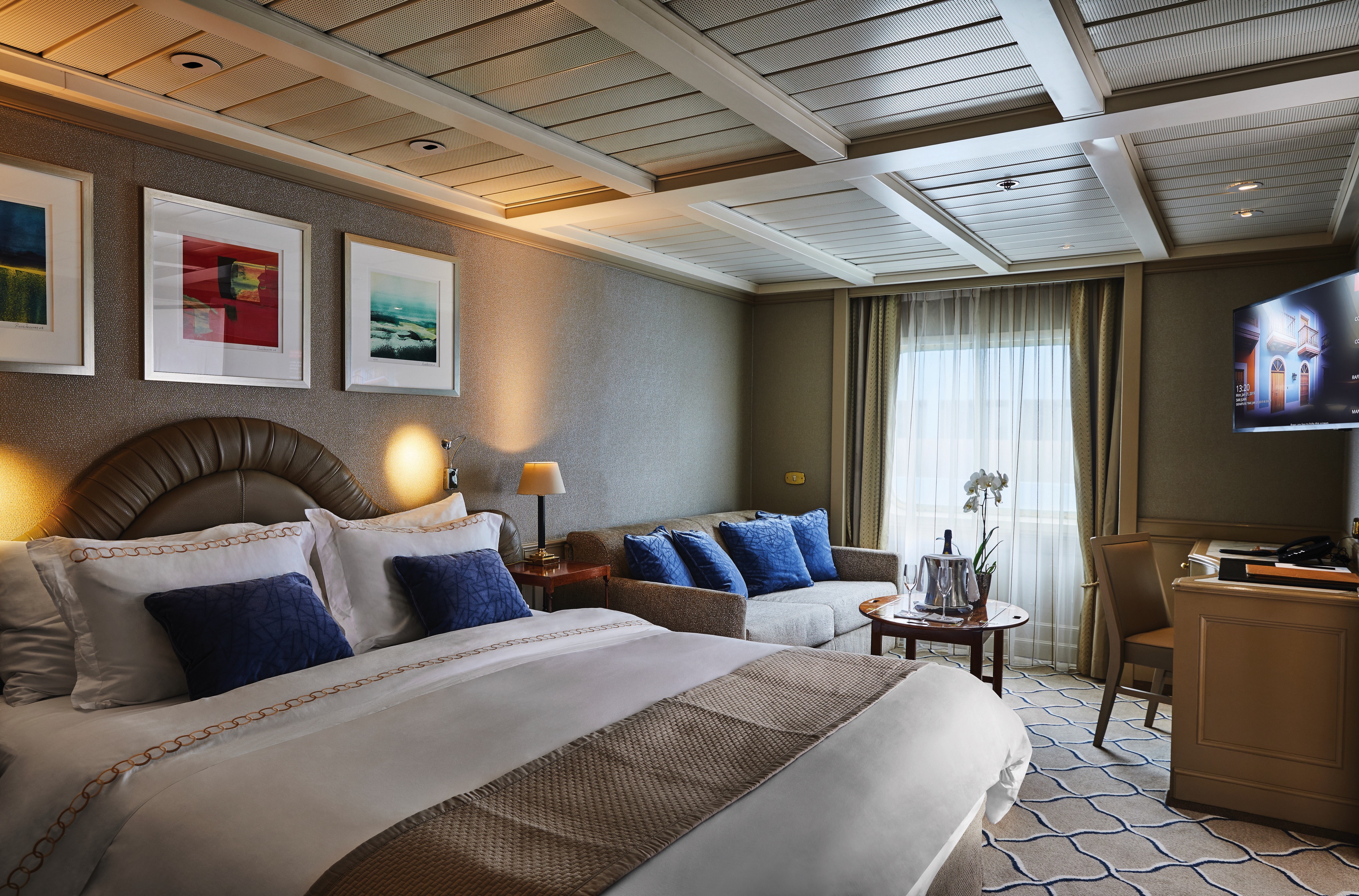
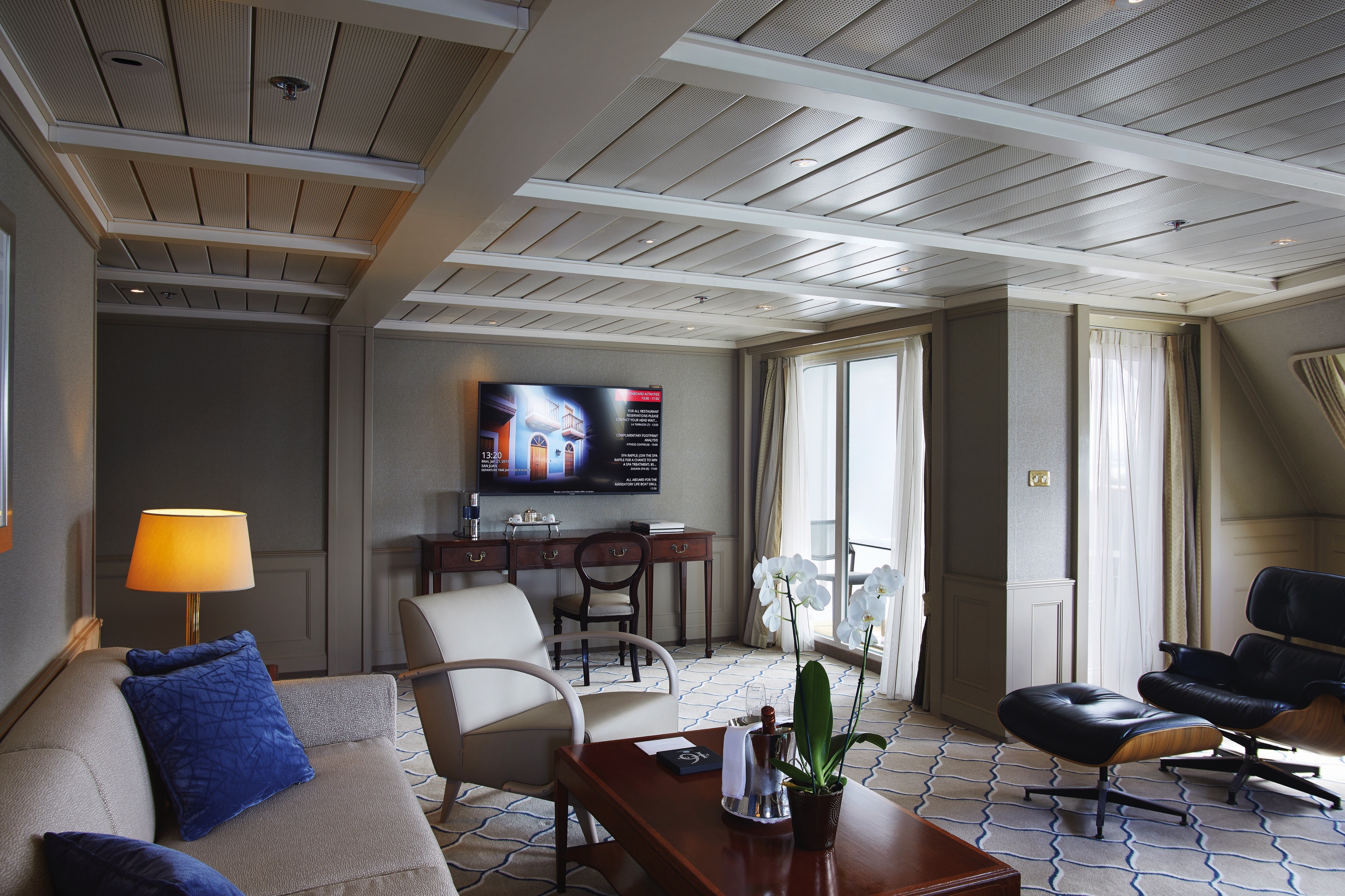
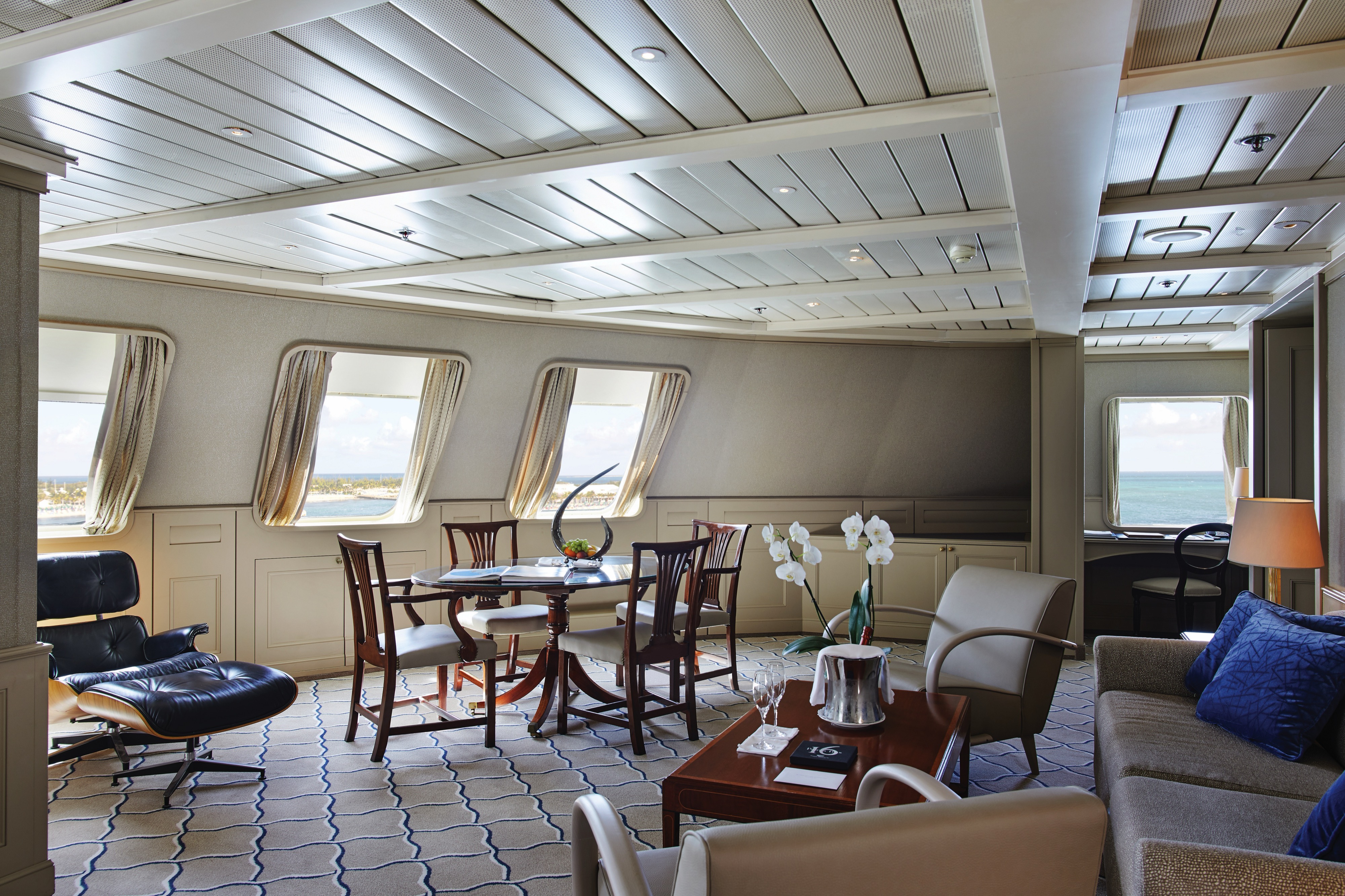
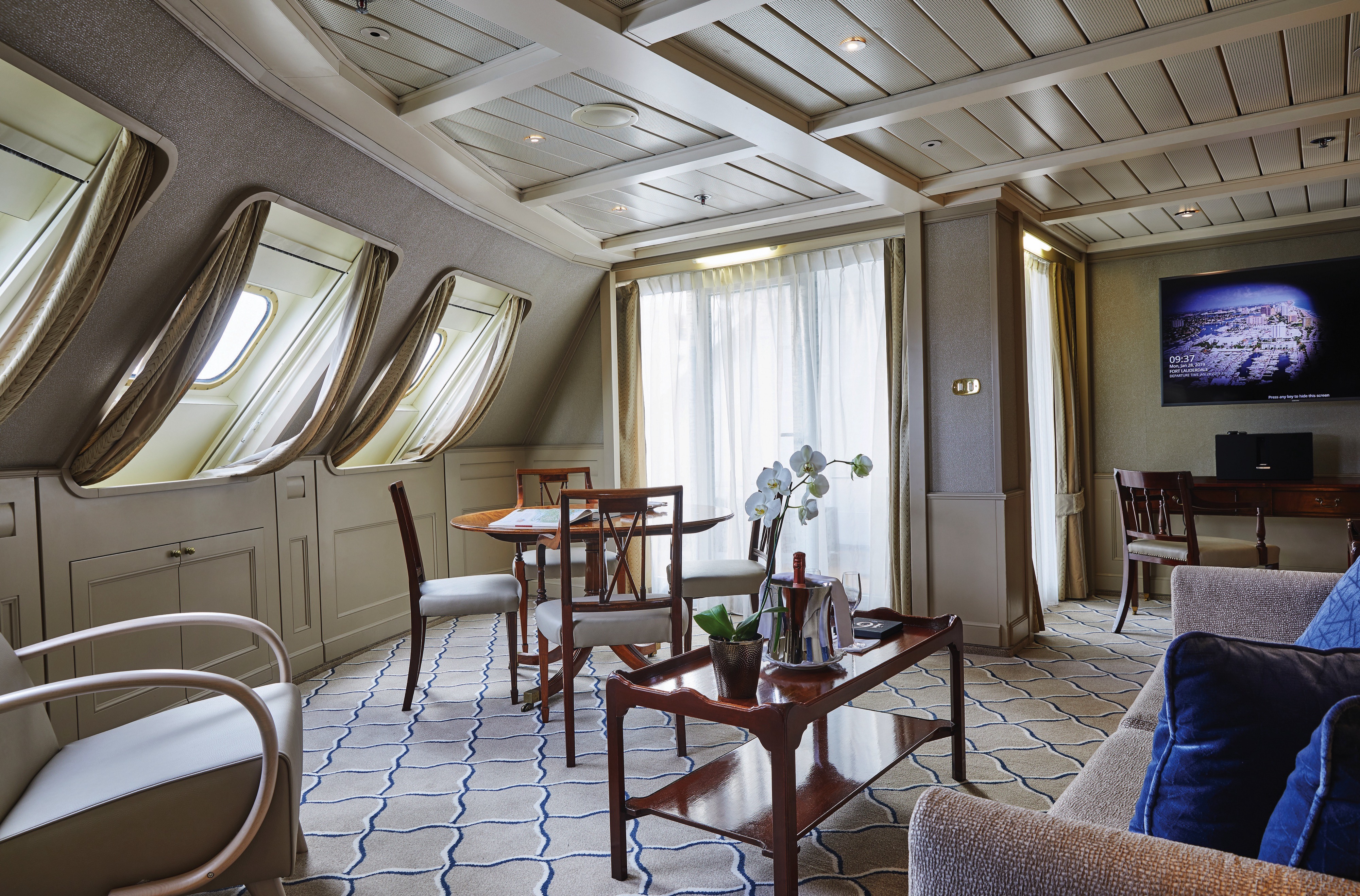
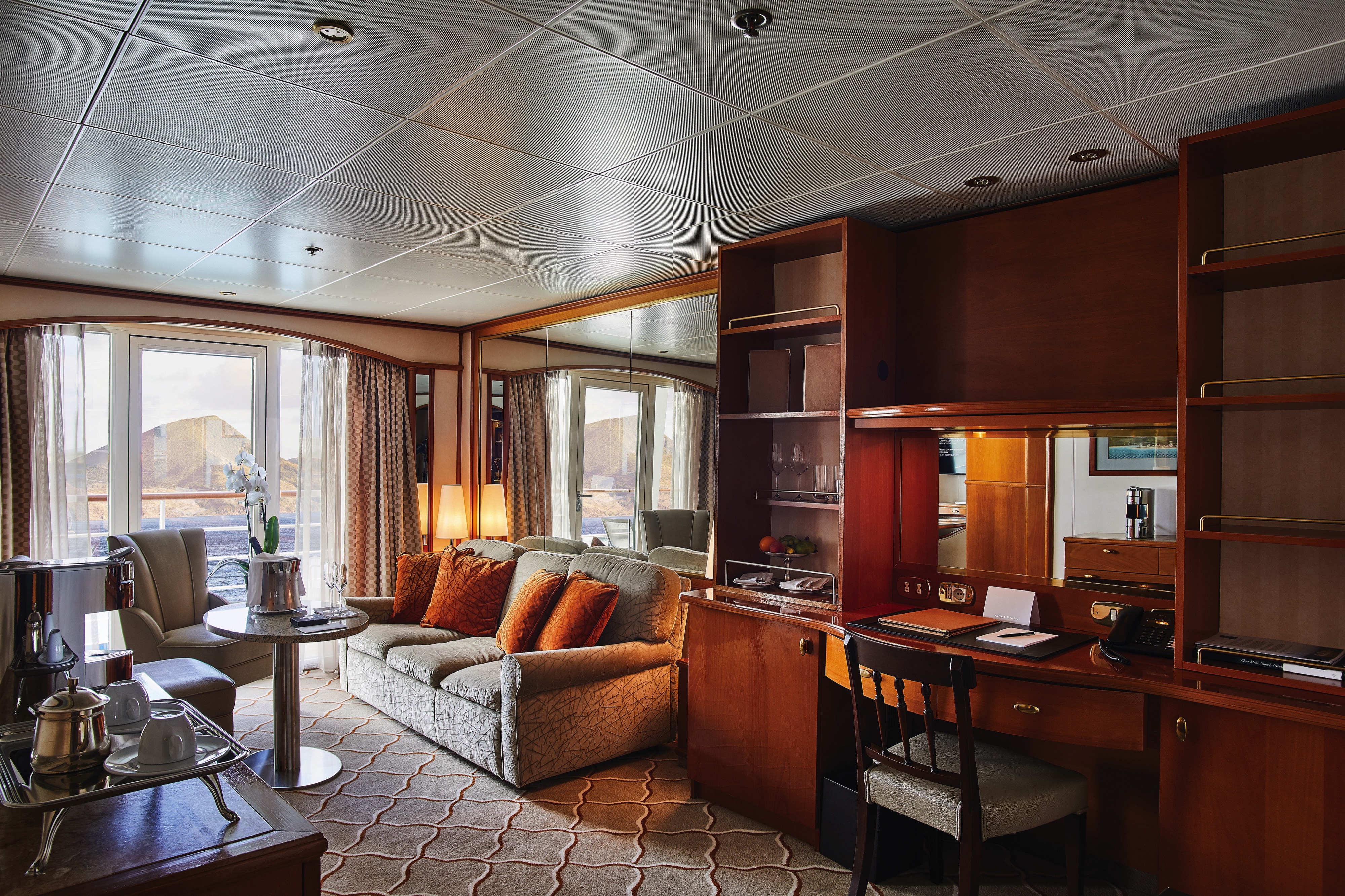
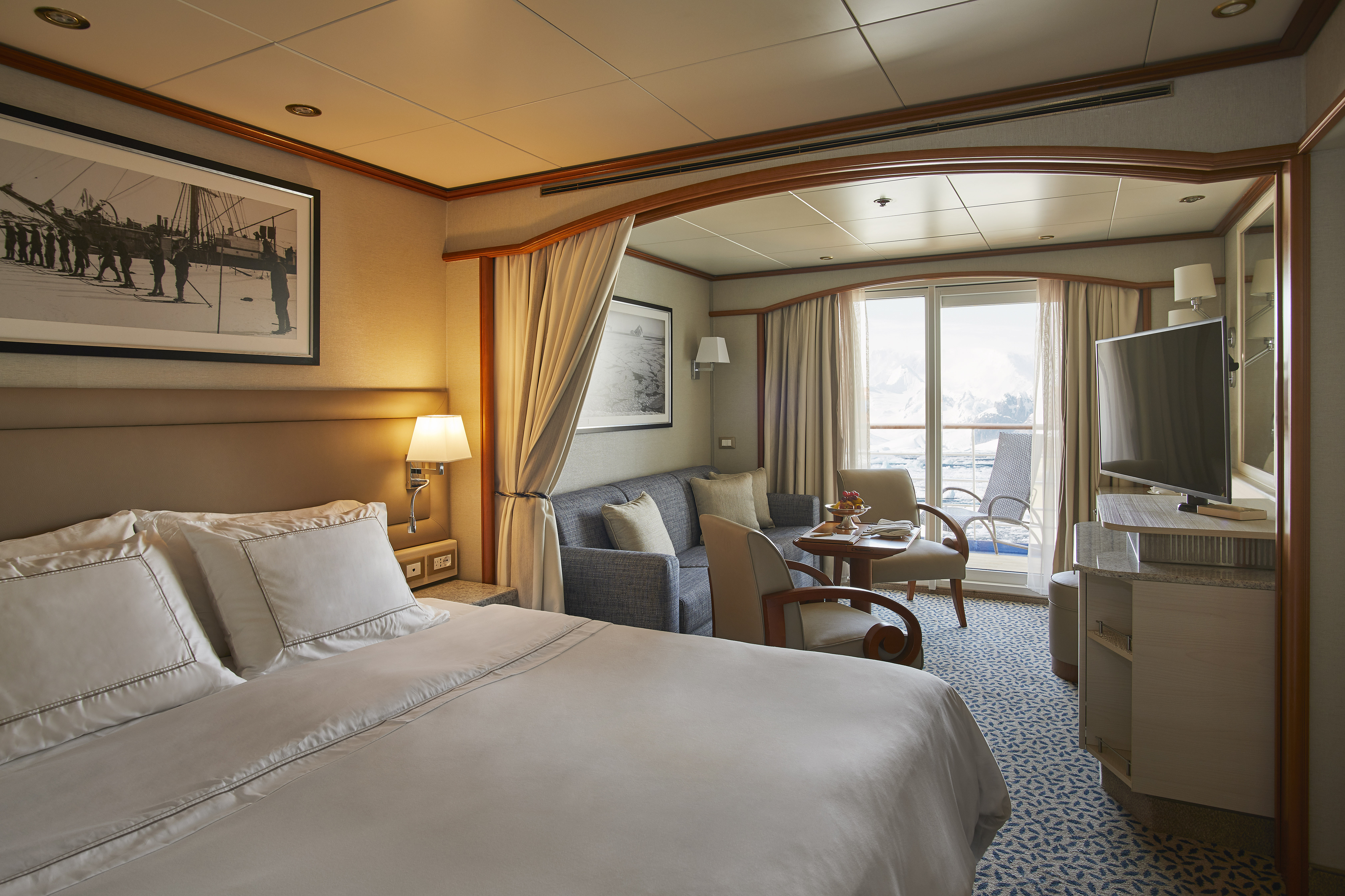
The name says it all. A stylish apartment. Prestigious and classic. For those who seek spaciousness, comfort and service on board. The Owner’s Suite is available as a one-bedroom configuration or as two bedrooms (as illustrated) by adjoining with a Vista Suite so you can enjoy your luxury cruise in style.
One bedroom: 55 sq m (8 sq. m.)
Two bedrooms: 77 sq m (8 sq. m.)
Images and suite plans are intended as a general reference. Features, materials, finishes and layout may be different than shown.
Please note that the 3rd guest will sleep on a comfortable sofa bed in the reception area of the suite.
Essentials
- Deck(s): 7
- Section: Mid-Ship
Characteristics
- Veranda
- Separate dining area
- Living room with sitting area
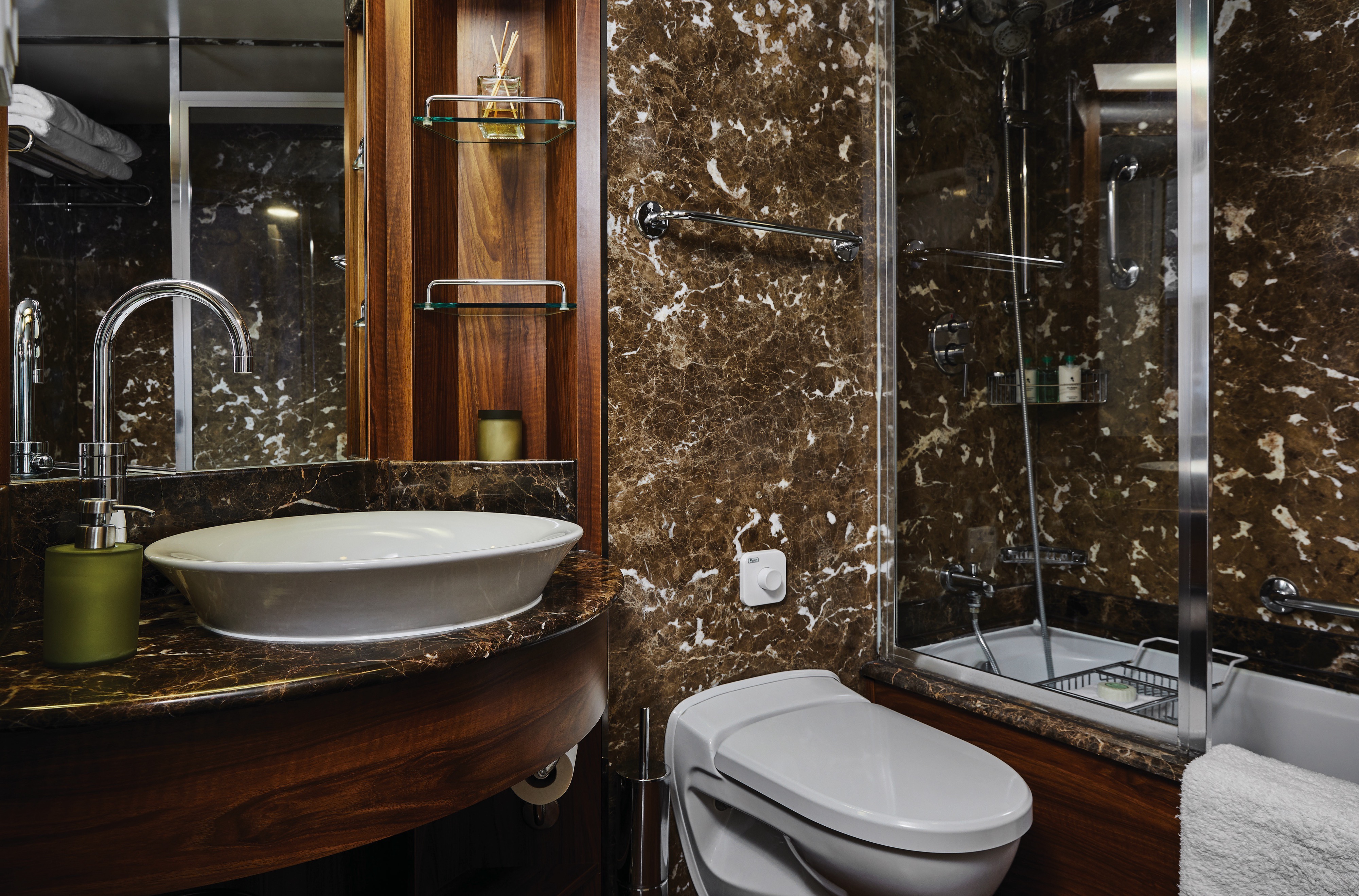
- Standard vanity
- Walk-in shower
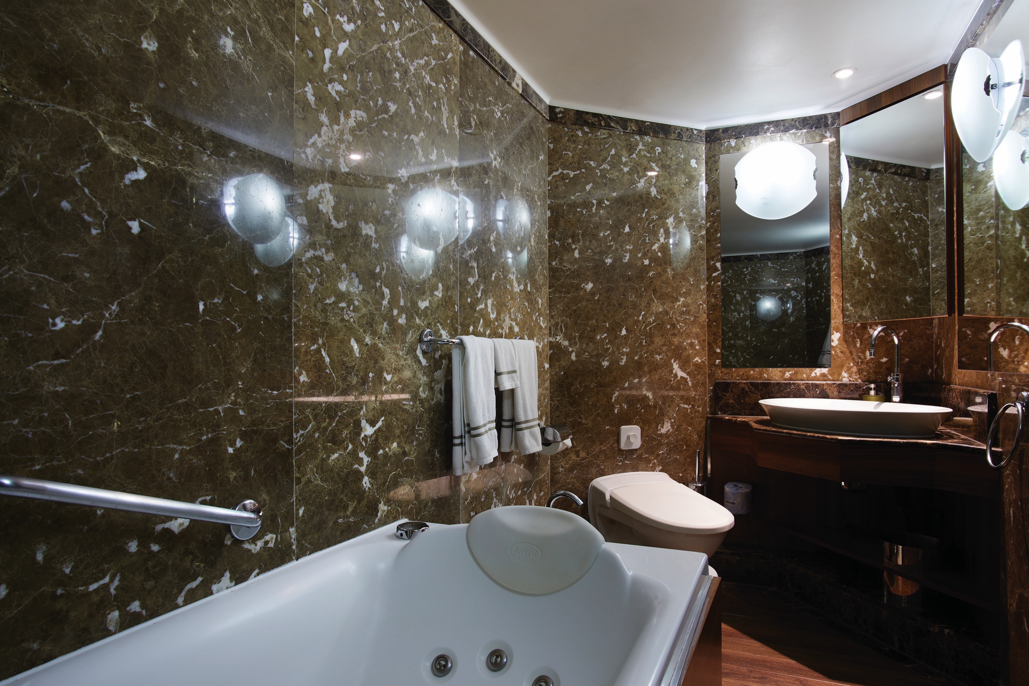
- Whirlpool bath
- Walk-in wardrobe with personal safe
Furniture
- Queen size bed
- Writing desk
- Vanity table
- Luxury bed mattresses
Media & Communication
- Unlimited Premium Wi-Fi
- 2 large flat screen TVs with Interactive Media Library
- Sound system with bluetooth connectivity
- Direct dial telephone
- Wall mounted USB-C mobile device chargers
- Dual voltage 110/220 outlets
Onboard Services
- Butler service
- Complimentary laundry, pressing & wet cleaning
- Dinner for two in La Dame, one evening per voyage,
- Two hours of worldwide phone use, per voyage segment
- Champagne on arrival
Amenities
- Espresso machine
- Tea kettles
- Pillow menu
- Refrigerator and bar setup stocked with your preferences
- Plush bathrobe
- Luxury bath amenities
- Umbrella
- Hair Dryer
- Slippers
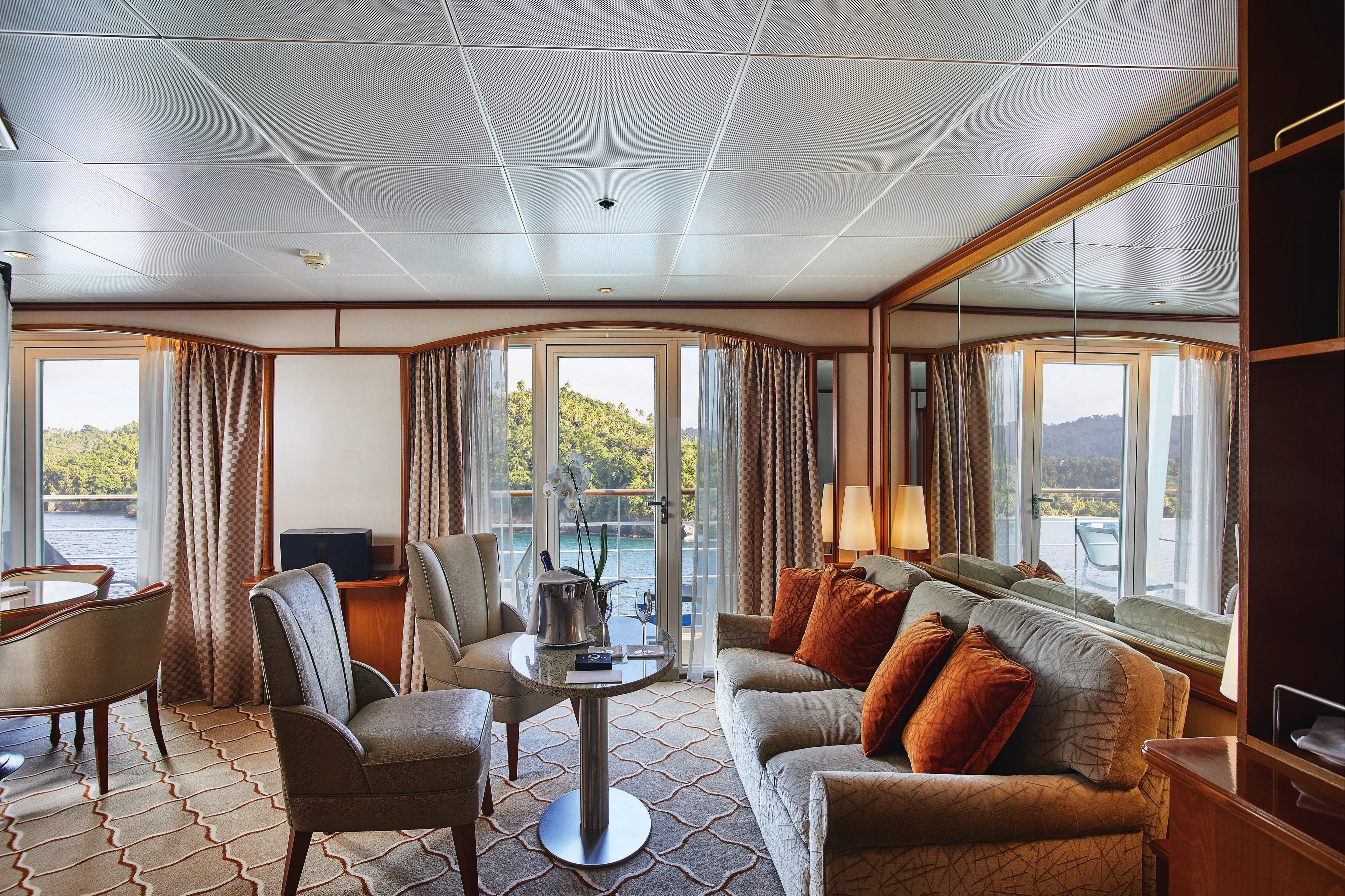
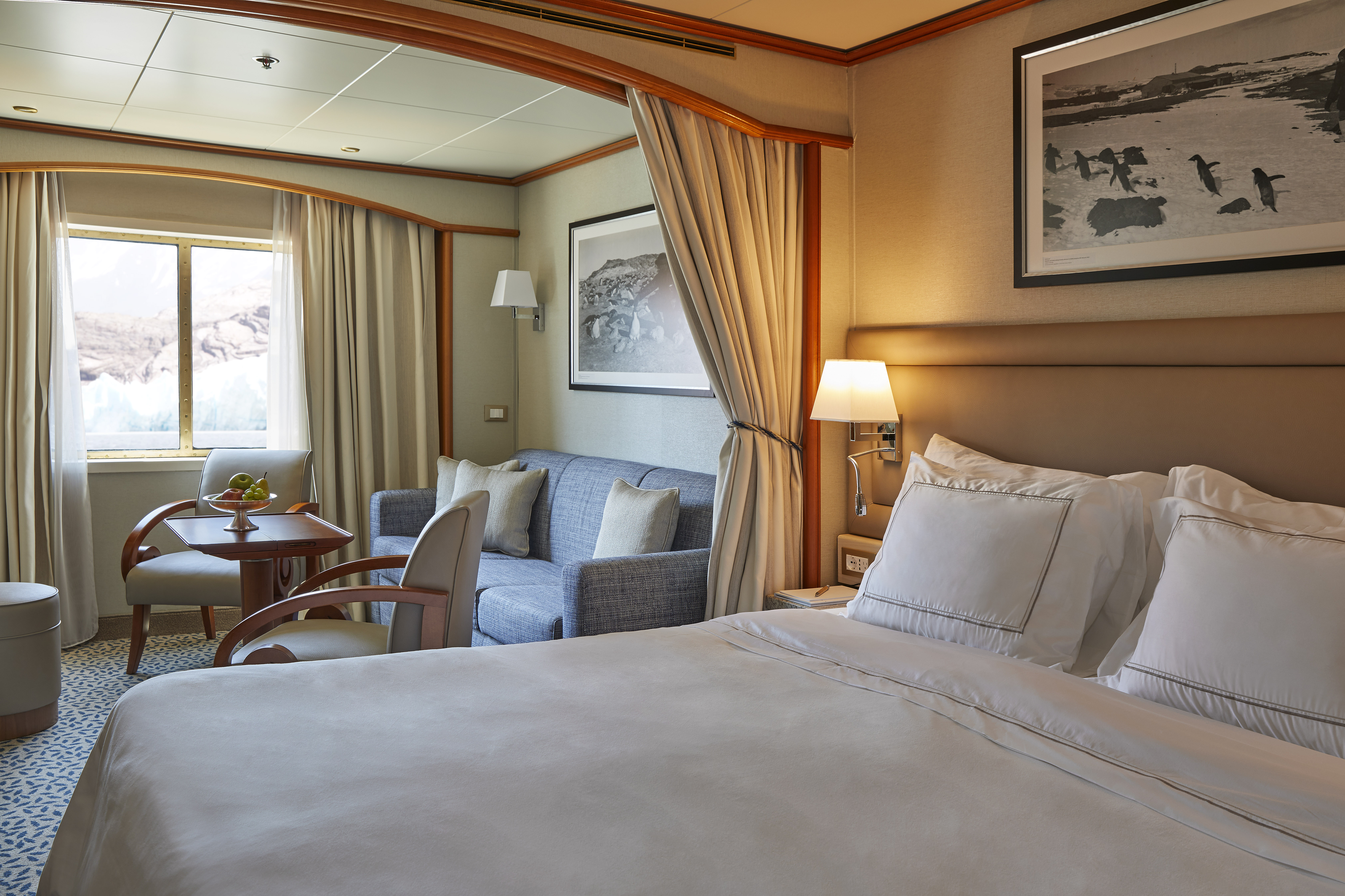
Expertly designed and exquisitely appointed. The Grand Suite on the Silver Wind is ideal for entertaining friends or enjoying a quiet dinner “at home.” Available as a one-bedroom configuration or as two bedrooms by adjoining with a Veranda Suite.
One bedroom: 95 sq m (14 sq. m.)
Two bedrooms: 122 sq m (18.5 sq. m.)
Images and suite plans are intended as a general reference. Features, materials, finishes and layout maybe different than shown.
Please note that the 3rd guest will sleep on a comfortable sofa bed in the reception area of the suite.
Essentials
- Deck(s): 7
- Section: Forward
Characteristics
- Veranda
- Separate dining area
- Living room with sitting area
- Standard vanity
- Walk-in shower
- Whirlpool bath
- Walk-in wardrobe with personal safe
Furniture
- Queen size bed
- Writing desk
- Vanity table
- Luxury bed mattresses
Media & Communication
- Unlimited Premium Wi-Fi
- 2 large flat screen TVs with Interactive Media Library
- Sound system with bluetooth connectivity
- Direct dial telephone
- Wall mounted USB-C mobile device chargers
- Dual voltage 110/220 outlets
Onboard Services
- Butler service
- Complimentary laundry, pressing & wet cleaning
- Dinner for two in La Dame, one evening per voyage,
- Two hours of worldwide phone use, per voyage segment
- Champagne on arrival
Amenities
- Espresso machine
- Tea kettles
- Pillow menu
- Refrigerator and bar setup stocked with your preferences
- Plush bathrobe
- Luxury bath amenities
- Umbrella
- Hair Dryer
- Slippers
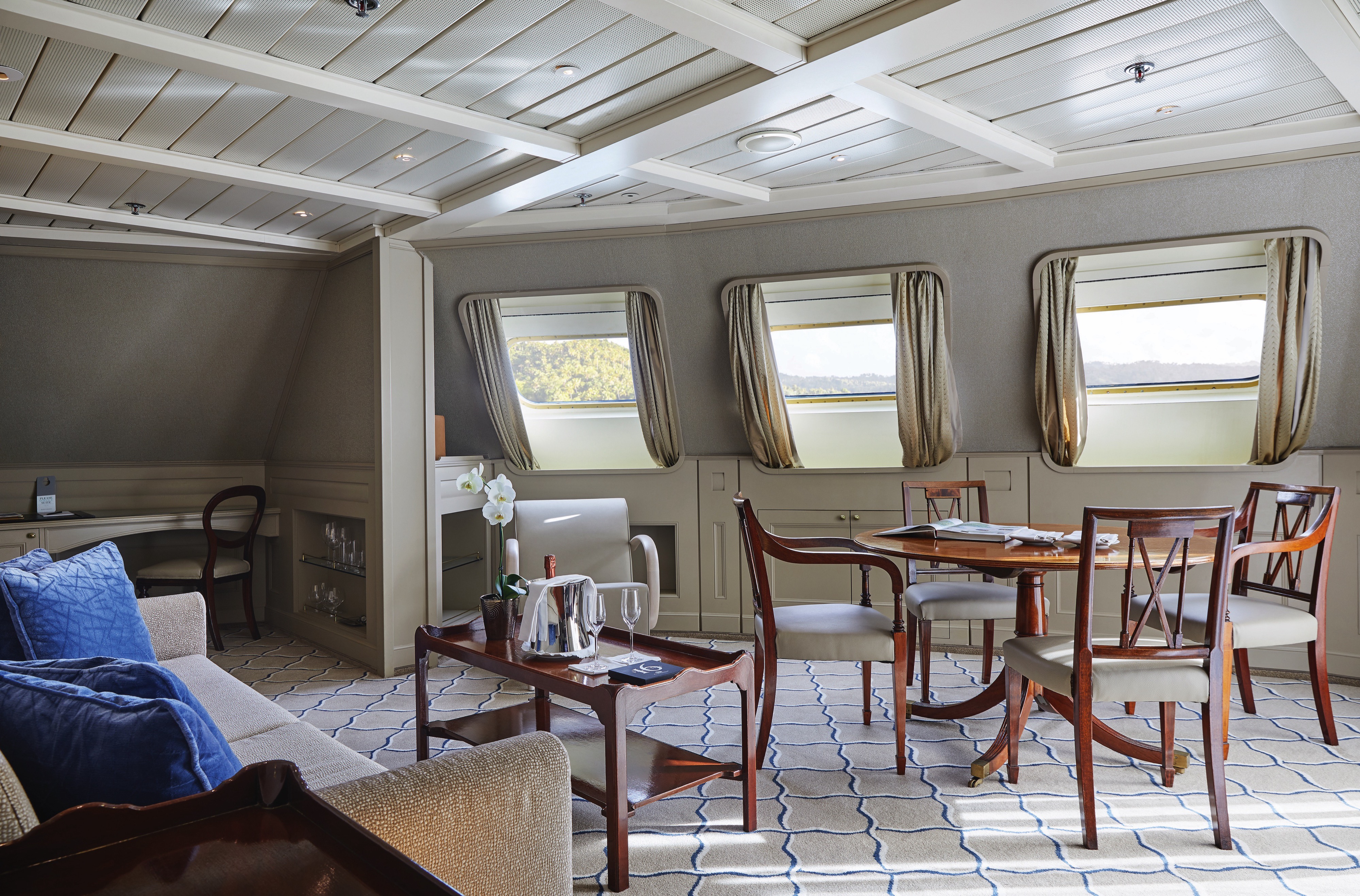
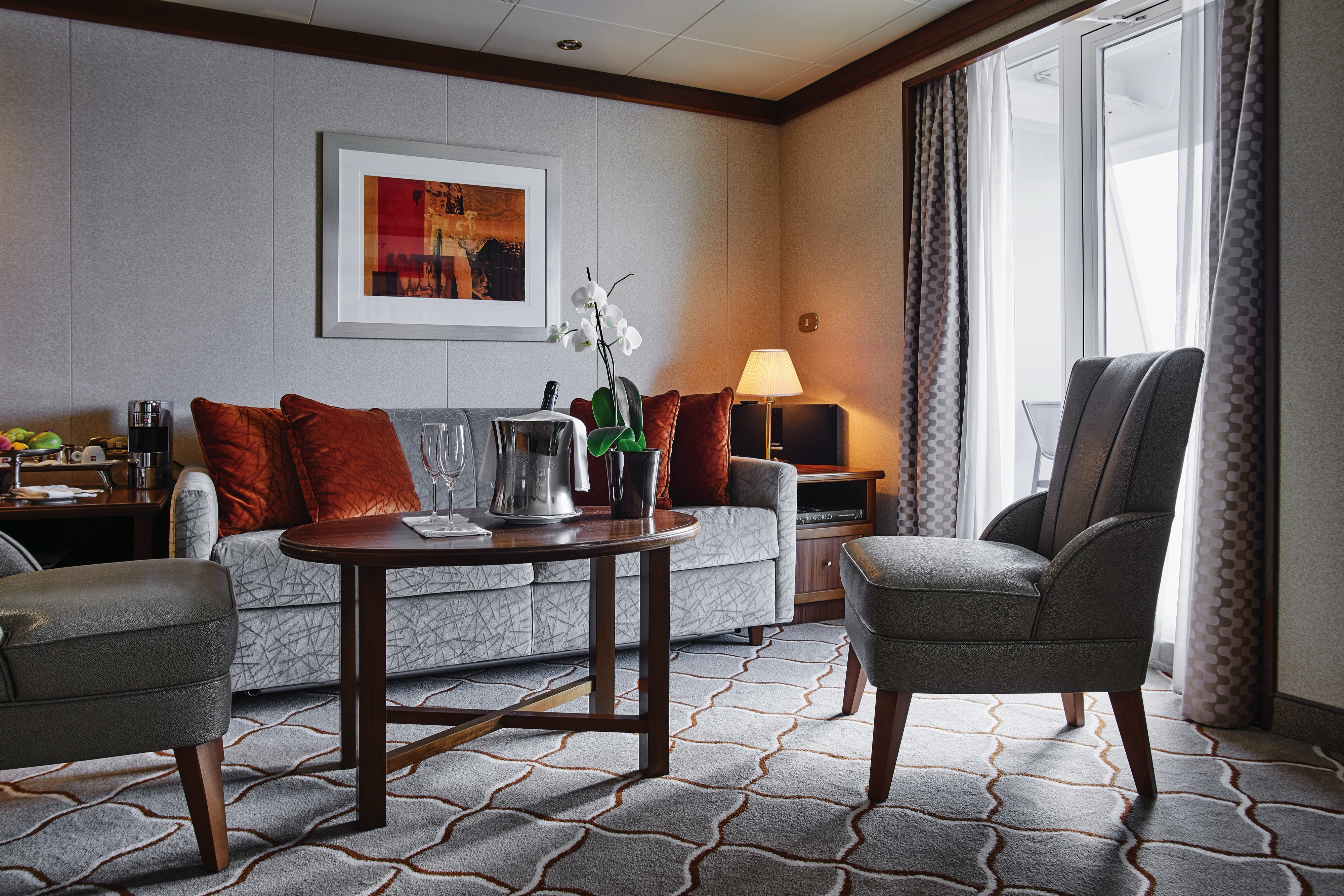
Stately. Commanding and majestic. Perfect for entertaining. The Royal suite lives up to its name. Enough living space to roam. The pinnacle of good living. Available as a one-bedroom configuration or as two bedrooms by adjoining with a Veranda Suite.
One bedroom: 69 sq m (12 sq. m.)
Two bedrooms: 96 sq. m. (16.5 sq. m.)
Images and suite plans are intended as a general reference. Features, materials, finishes and layout maybe different than shown.
Please note that the 3rd guest will sleep on a comfortable sofa bed in the reception area of the suite.
Essentials
- Deck(s): 6
- Section: Forward
Characteristics
- Veranda
- Separate dining area
- Living room with sitting area
- Standard vanity
- Walk-in shower
- Whirlpool bath
- Walk-in wardrobe with personal safe
Furniture
- Queen size bed
- Writing desk
- Vanity table
- Luxury bed mattresses
Media & Communication
- Unlimited Premium Wi-Fi
- 2 large flat screen TVs with Interactive Media Library
- Sound system with bluetooth connectivity
- Direct dial telephone
- Wall mounted USB-C mobile device chargers
- Dual voltage 110/220 outlets
Onboard Services
- Butler service
- Complimentary laundry, pressing & wet cleaning
- Dinner for two in La Dame, one evening per voyage,
- Two hours of worldwide phone use, per voyage segment
- Champagne on arrival
Amenities
- Espresso machine
- Tea kettles
- Pillow menu
- Refrigerator and bar setup stocked with your preferences
- Plush bathrobe
- Luxury bath amenities
- Umbrella
- Hair Dryer
- Slippers
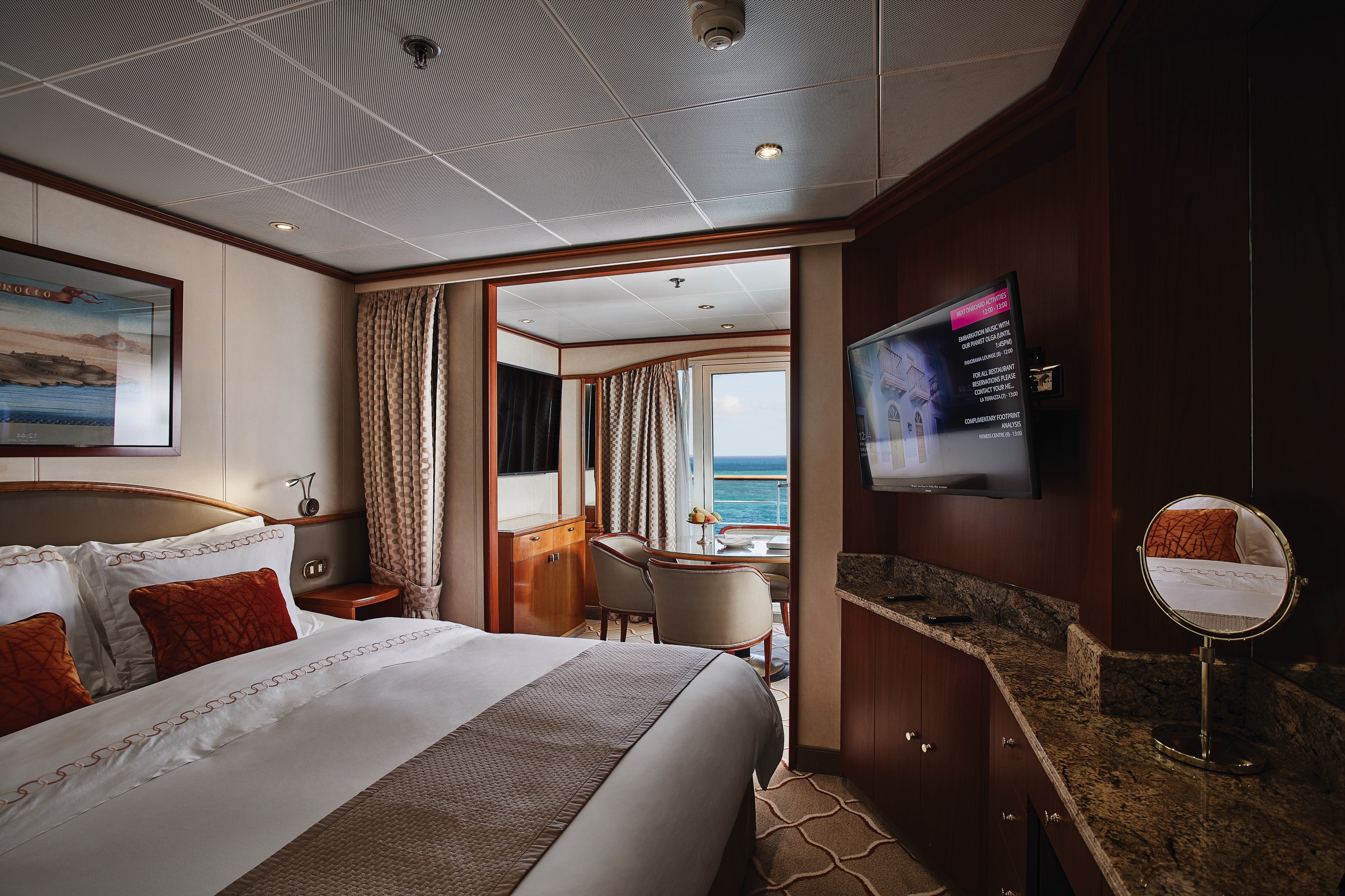
For those wanting more space, Silver Suites are ideal. Stylish and sophisticated. Separate dining and living rooms. Larger verandas. Situated midship on the Silver Wind. Perfection in design for comfortable living. Silver Suites accommodate three guests.
One bedroom: 48 sq m (8 sq. m.)
Images and suite plans are intended as a general reference. Features, materials, finishes and layout maybe different than shown.
Please note that the 3rd guest will sleep on a comfortable sofa bed in the reception area of the suite.
Essentials
- Deck(s): 5, 6, 7
- Section: Mid-Ship
Characteristics
- Veranda
- Separate dining area
- Living room with sitting area
- Standard vanity
- Full-size bath
- Walk-in wardrobe with personal safe
Furniture
- Queen size bed
- Writing desk
- Vanity table
- Luxury bed mattresses
Media & Communication
- Unlimited Premium Wi-Fi
- 2 large flat screen TVs with Interactive Media Library
- Sound system with bluetooth connectivity
- Direct dial telephone
- Wall mounted USB-C mobile device chargers
- Dual voltage 110/220 outlets
Onboard Services
- Butler service
- Complimentary laundry, pressing & wet cleaning
- Champagne on arrival
Amenities
- Espresso machine
- Tea kettles
- Pillow menu
- Refrigerator and bar setup stocked with your preferences
- Plush bathrobe
- Luxury bath amenities
- Umbrella
- Hair Dryer
- Slippers
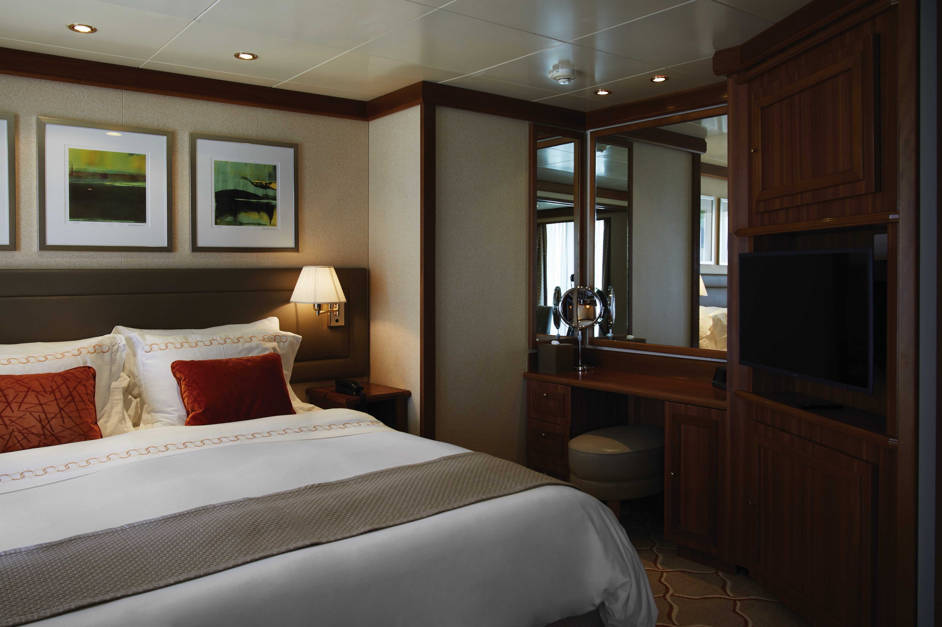
A mark of distinction. Sumptuous. Spacious. Rich textures and panoramic views surround you with distinguished luxury. The perfect summary of The Medallion Suite offered by the world’s best cruise line.
One bedroom: 41 sq m (12 sq. m.)
Suite 741: 667 sq. ft/62 sq. m. with French balcony, separate dining area and full-size bath.
Suites 801–804 only: with Veranda
Images and suite plans are intended as a general reference. Features, materials, finishes and layout maybe different than shown.
Please note that the 3rd guest will sleep on a comfortable sofa bed in the reception area of the suite.
Essentials
- Deck(s): 7, 8
- Section: Mid-Ship
Characteristics
- Veranda (French Balcony in suite 741)
- Separate dining area
- Living room with sitting area
- Standard vanity
- Walk-in shower (Full-sized bath and shower in suite 741)
- Walk-in wardrobe with personal safe
Furniture
- Queen size bed or Twin beds
- Writing desk
- Vanity table
- Luxury bed mattresses
Media & Communication
- Unlimited Premium Wi-Fi
- 2 large flat screen TVs with Interactive Media Library
- Sound system with bluetooth connectivity
- Direct dial telephone
- Wall mounted USB-C mobile device chargers
- Dual voltage 110/220 outlets
Onboard Services
- Butler service
- Complimentary laundry, pressing & wet cleaning
- Champagne on arrival
Amenities
- Espresso machine
- Tea kettles
- Pillow menu
- Refrigerator and bar setup stocked with your preferences
- Plush bathrobe
- Luxury bath amenities
- Umbrella
- Hair Dryer
- Slippers
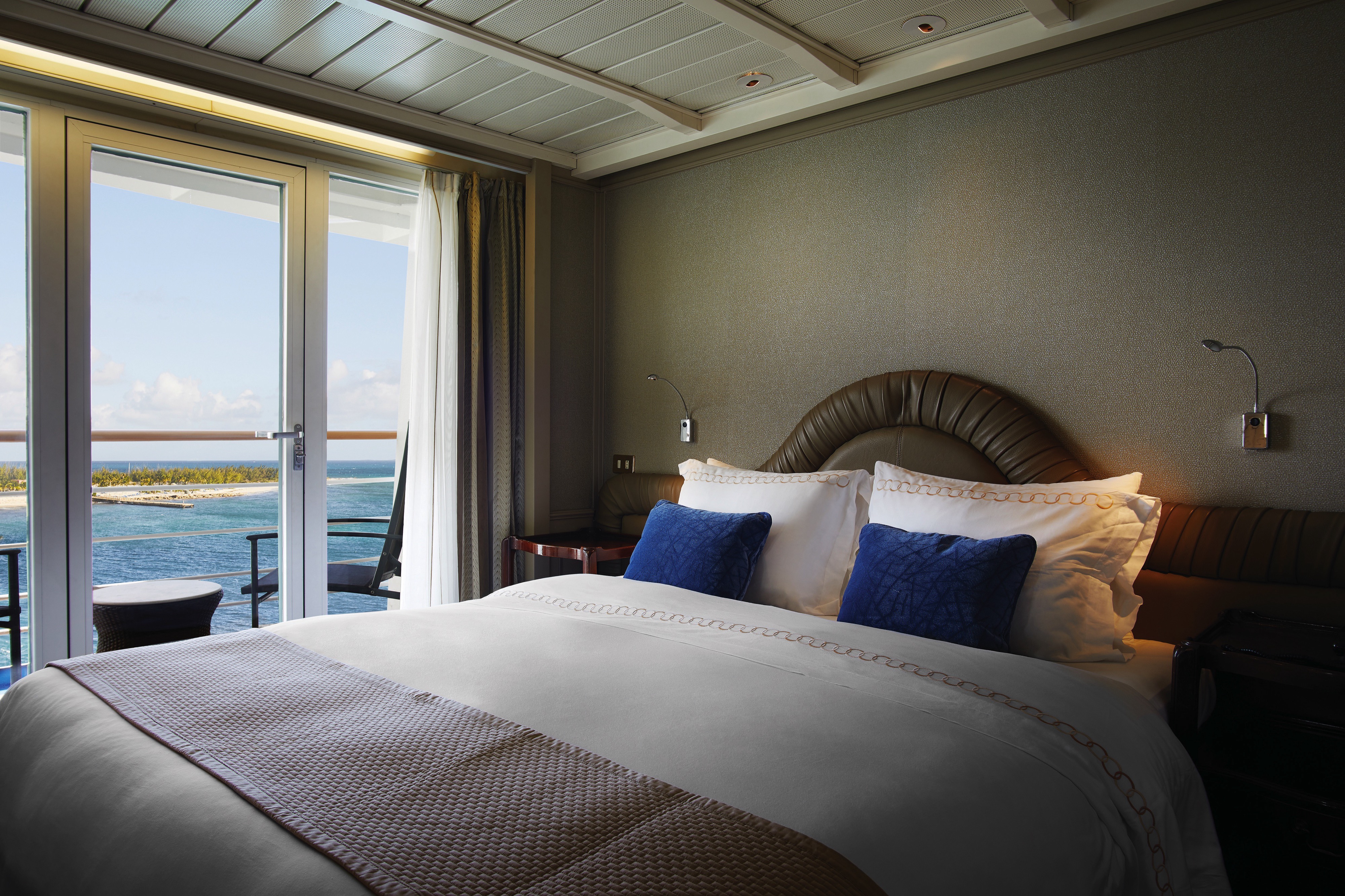
The Deluxe Veranda Suite offers unbeatable views. A Silversea signature. Spacious and welcoming. Floor-to-ceiling glass doors open onto a furnished private teak veranda. Each spectacular sunset feels like it is yours alone. The Deluxe Veranda Suite offers a preferred central location with identical accommodation to a Veranda Suite. No top cruise line would be complete without such a luxury.
One bedroom: 27 sq. m. (4.5 sq. m.)
Images and suite plans are intended as a general reference. Features, materials, finishes and layout maybe different than shown.
Please note that the 3rd guest will sleep on a comfortable sofa bed in the reception area of the suite.
Essentials
- Deck(s): 5, 6, 7
- Section: Mid-Ship
Characteristics
- Veranda
- Sitting area
- Standard vanity
- Walk-in shower
- Walk-in wardrobe with personal safe
Furniture
- Queen size bed
- Writing desk
- Luxury bed mattresses
Media & Communication
- Unlimited Standard Wi-Fi
- 1 large flat screen TV with Interactive Media Library
- Direct dial telephone
- Wall mounted USB-C mobile device chargers
- Dual voltage 110/220 outlets
Onboard Services
- Butler service
- Champagne on arrival
Amenities
- Espresso machine
- Tea kettles
- Pillow menu
- Refrigerator and bar setup stocked with your preferences
- Plush bathrobe
- Luxury bath amenities
- Umbrella
- Hair Dryer
- Slippers
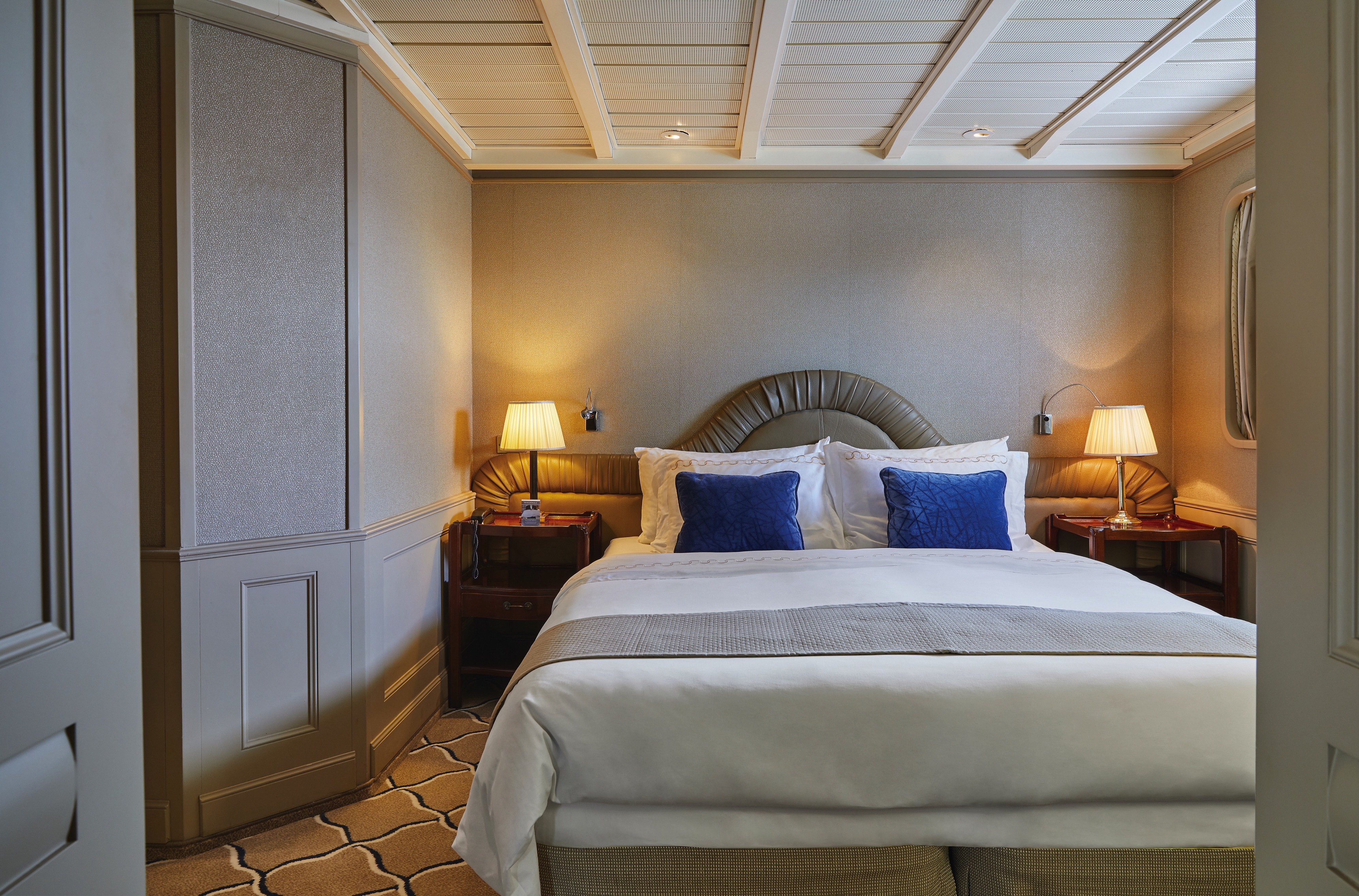
A Silversea signature, the Classic Veranda Suite is spacious and welcoming. Veranda suites offer floor-to-ceiling glass doors that open onto a furnished private teak veranda. Each spectacular sunset feels like it is yours alone. Some Classic Veranda Suites accommodate three guests. A must for the world’s best cruise line.
One bedroom: 27 sq. m. (4.5 sq. m.)
Images and suite plans are intended as a general reference. Features, materials, finishes and layout maybe different than shown.
Please note that the 3rd guest will sleep on a comfortable sofa bed in the reception area of the suite.
Essentials
- Deck(s): 5, 6, 7
- Section: Forward
Characteristics
- Veranda
- Sitting area
- Standard vanity
- Walk-in shower
- Walk-in wardrobe with personal safe
Furniture
- Queen size bed
- Writing desk
- Luxury bed mattresses
Media & Communication
- Unlimited Standard Wi-Fi
- 1 large flat screen TV with Interactive Media Library
- Direct dial telephone
- Wall mounted USB-C mobile device chargers
- Dual voltage 110/220 outlets
Onboard Services
- Butler service
- Champagne on arrival
Amenities
- Espresso machine
- Tea kettles
- Pillow menu
- Refrigerator and bar setup stocked with your preferences
- Plush bathrobe
- Luxury bath amenities
- Umbrella
- Hair Dryer
- Slippers
A quiet sanctuary to escape to on your cruise. The seating area has plenty of room to relax. Large picture windows frame panoramic ocean views. The perfect backdrop for breakfast in bed.
One bedroom: 22 sq. m.
Suite 738: 325 sq. ft./30 sq. m.
Wheelchair accessible suites: 445 and 447
Images and suite plans are intended as a general reference. Features, materials, finishes and layout maybe different than shown.
Please note that the 3rd guest will sleep on a comfortable sofa bed in the reception area of the suite.
Essentials
- Deck(s): 4, 7
- Section: Aft, Forward
Characteristics
- Window
- Sitting area
- Standard vanity
- Walk-in shower
- Walk-in wardrobe with personal safe
Furniture
- Queen size bed
- Writing desk
- Luxury bed mattresses
Media & Communication
- Unlimited Standard Wi-Fi
- 1 large flat screen TV with Interactive Media Library
- Direct dial telephone
- Wall mounted USB-C mobile device chargers
- Dual voltage 110/220 outlets
Onboard Services
- Butler service
- Champagne on arrival
Amenities
- Espresso machine
- Tea kettles
- Pillow menu
- Refrigerator and bar setup stocked with your preferences
- Plush bathrobe
- Luxury bath amenities
- Umbrella
- Hair Dryer
- Slippers
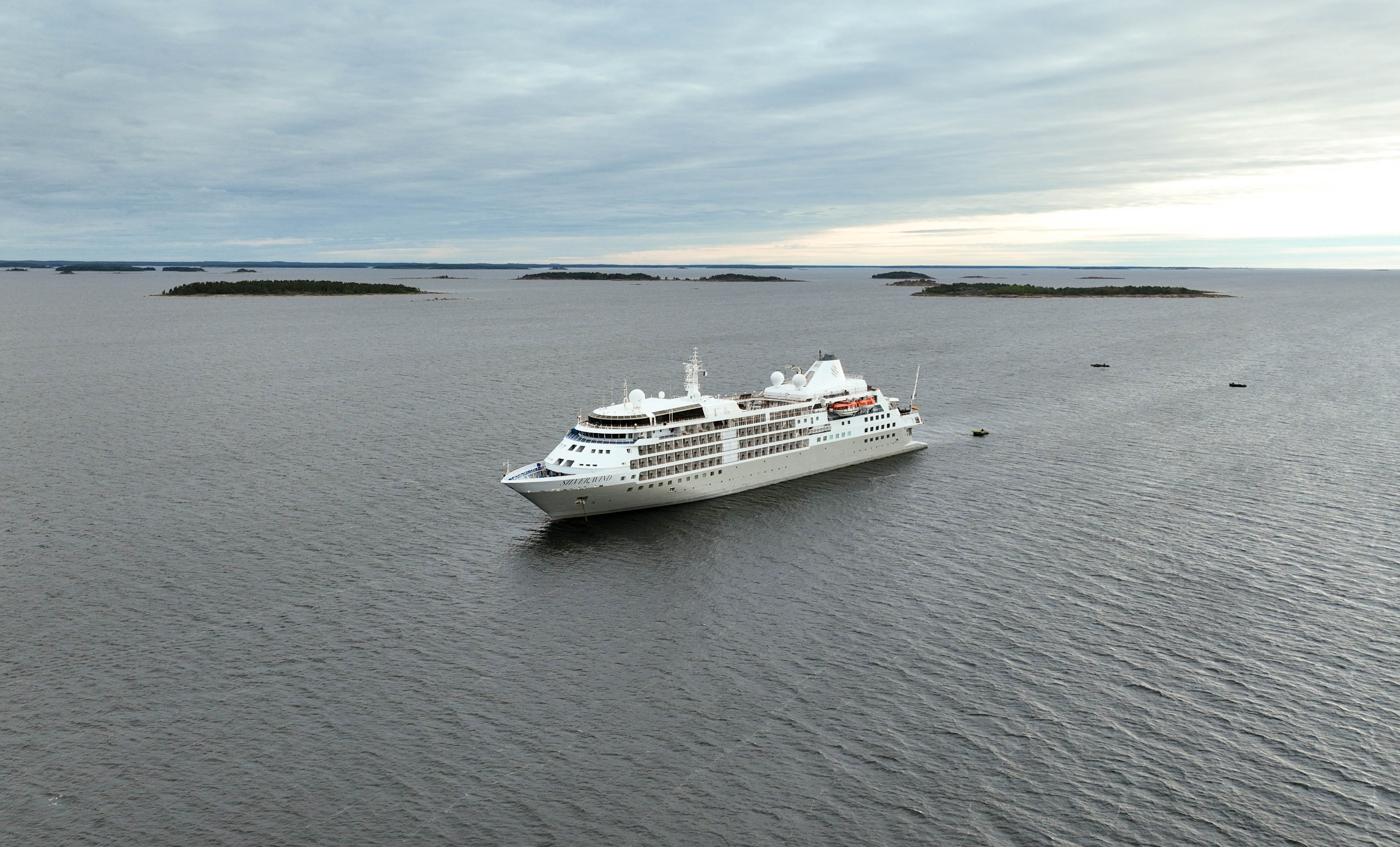
Silver Wind
Explore new waters with Silver Wind.
A major upgrade in December 2018 saw Silver Wind looking better than ever. A second refurbishment in November 2021 saw her benefitting from a strengthened ice-class hull and made her one of the most adaptable ships in our fleet. Still timelessly elegant, still luxuriously relaxed, Silver Wind’s improved cruising versatility means she can travel from Polar Regions to iconic ports with fluid ease. With 24 Zodiac® boats offering an outstanding Zodiac®-to-guest ratio of 1:11, you can explore further in unparalleled comfort. Get ready for a wealth of diverse destination experiences aboard Silver Wind.
Ship Facts
| Launch Year | 1995 | ||||||||
| Refit Year | 2021 | ||||||||
| Language | en | ||||||||
| Gross Tonnage | 17400 | ||||||||
| Length | 155 | ||||||||
| Width | 21 | ||||||||
| Currency | USD | ||||||||
| Speed | 18 | ||||||||
| Capacity | 274 | ||||||||
| Crew Count | 239 | ||||||||
| Deck Count | 7 | ||||||||
| Cabin Count | 148 | ||||||||
| Large Cabin Count | 49 | ||||||||
| Wheelchair Cabin Count | 2 | ||||||||
| Electrical Plugs |
|
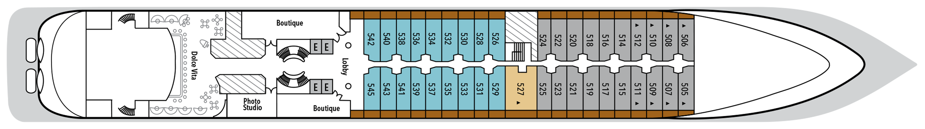
Deck 9
- Fitness Centre
- Beauty Salon & Spa
- Observation Library
- Jogging Track

Deck 8
- Pool Deck
- Pool Bar
- The Grill
- Panorama Lounge
- Connoisseur's Corner
- Whirlpools
- Medallion Suites

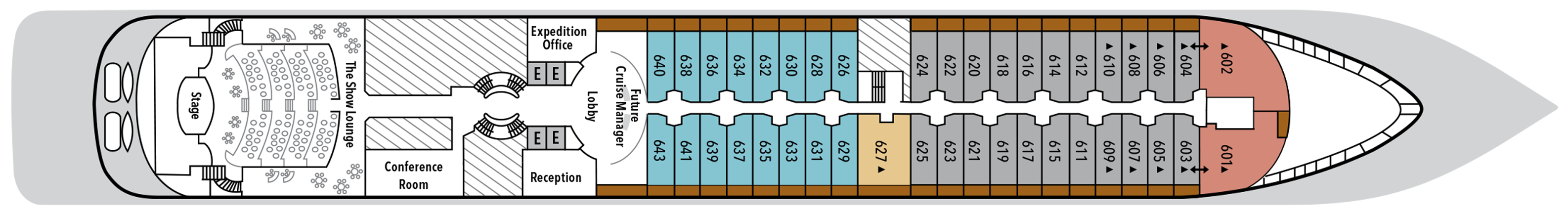
Deck 7
- La Terrazza
- Grand Suites
- Classic Veranda Suites
- Silver Suites
- Deluxe Veranda Suite
- Owners Suites
- Vista Suite
- Medallion Suite

Deck 6
- The Show Lounge
- Conference Room
- Reception
- Expedition Office
- Future Cruise Manager
- Lobby
- Shore Concierge
- Silver Suite
- Classic Veranda Suites
- Deluxe Veranda Suites
- Royal Suites
Deck 5
- Photo Studio
- Lobby
- Dolce Vita
- Boutique
- Silver Suite
- Classic Veranda Suites
- Deluxe Veranda Suites
Deck 4
- The Restaurant
- La Dame
- Launderette
- Vista Suites (x2 Accessible Suites)

Deck 3
- Changing Room
- Embarkation Deck
- Medical Centre

Our passion for excellent cuisine is at the heart of everything we do. We believe that meals are a celebration of life, a way to bring people together, and an expression of culture and tradition. Each dining venue aboard our ships offers a unique and memorable experience, with multiple dining options available and a variety of spaces and experiences on board; every mealtime is a joy.
From fine French cuisine and flavourful Asian options to relaxed Italian meals and international options to suit everyone, our chefs’ creativity knows no limits.
With the importance of food in our culture, it’s no wonder that dining is a high priority at Silversea. We believe gastronomic excellence is a given, thanks to recipes that reflect our heritage and revamp tradition. No matter where you dine, destination influence is readily apparent in the great diversity and freshness of your selections. And every luxury ship also features an array of dining venues. Per guest reservation fee for specialty restaurants. Please visit MySilversea to make your reservations.
The Grill
A poolside al fresco favorite, The Grill is casual by day and captivating by night. Dig in to crisp salads and grilled classics during lunch, then return after sunset for masterfully seasoned and seared cuts paired with balmy sea breezes.
Dress code: Casual
Casual wear consists of pants, blouses or casual dresses for women; open-neck shirts and slacks for men are appropriate.
Images and suite plans are intended as a general reference. Features, materials, finishes and layout may be different than shown.
La Terrazza
La Terrazza elevates casual dining by day and delivers an authentic Italian experience by night. During the breakfast and lunch buffets, our master chefs prepare global favorites at live stations. As evening falls, handmade pastas and classic seafood dishes are the centerpiece — every impeccable bite paired with fine wines from around the world.
Open-seating for breakfast and lunch.
Reservations recommended for dinner.
Images and suite plans are intended as a general reference. Features, materials, finishes and layout may be different than shown.
The Restaurant
The Restaurant transforms dining into an extraordinary journey of taste. Indulge in international delicacies, refined classics, and destination-driven creations that reflect the flavors of the region you’re exploring. From breakfast favorites to imaginative evening courses, every meal draws inspiration from your voyage.
Images and suite plans are intended as a general reference. Features, materials, finishes and layout may be different than shown.
La Dame
Experience the pinnacle of French gastronomy at La Dame, where sophistication meets tradition. Here, an exclusive tasting menu unfolds course by course — each plate a study in masterful technique, seasonal ingredients, and modern refinement. From classic Kir Royales to exquisite signatures such as Dover sole à la Grenobloise, this is haute cuisine at its finest.
Per guest reservation fee of US$60. Please visit My Silversea to make your reservations.
Reservations required for dinner.
Images and suite plans are intended as a general reference. Features, materials, finishes and layout may be different than shown.
Human connection and a sense of community is at the heart of every Silversea voyage, which is why we’ve created a variety of spaces on board to share the experience with your fellow adventurers. Relax in one of our many bars or restaurants with your favorite tipple and swap stories with other guests. Workout in our fully equipped gym or try our elite spa services. Sip a glass of bubbly by the pool by day, or a fine cognac in one of our elegant bars by night.
With attention to every detail, we have ensured that every corner of the ship promises joy
Our world-class voyages are carefully curated by experts who ensure we are always on a quest to discover authentic beauty and adventure in the furthest and less traveled regions on the planet.
We understand that after a long day of discovery, you need perfect service, top-notch cuisine, drinks served just the way you like them and comfortable surroundings.
There’s a tremendous variety of public spaces on board, from relaxed bars to elegant restaurants, always offering you the luxury of choice. Learn more about all the fine details and thoughts put into each space on our ultra-luxury cruise ships.
The Show Lounge
At The Show Lounge, theatrical immersion takes center stage. From captivating performances and screenings to cultural programs, this elegant venue was designed to dazzle. Tiered seating ensures impeccable views while attentive beverage service makes indulging effortless. Raise a glass as the curtain rises on an unforgettable night of entertainment.
Images and suite plans are intended as a general reference. Features, materials, finishes and layout may be different than shown.
Panorama Lounge
True to its name, Panorama Lounge surrounds you with sweeping views from every angle. Sunlight pours through wraparound windows by day, framing horizons that shift like watercolors. Evenings hum with piano chords and DJ beats that carry you late into the night. And all of it pairs wonderfully with cocktails handcrafted to match your mood.
Images and suite plans are intended as a general reference. Features, materials, finishes and layout may be different than shown.
Observation Library
Set on the highest level at the very top of the ship, this is a quiet space for reading and reflection while being dazzled by the undulating seascapes that are part of life on board.
Images and suite plans are intended as a general reference. Features, materials, finishes and layout may be different than shown.
Dolce Vita
Surrender to a world of Italian elegance where the art of aperitivo takes pride of place. Ideal for connecting over spritzes, negronis, and light bites, here each evening feels like a celebration. As laughter lingers, crystal glasses clink, and live piano notes ripple through the air, Dolce Vita compels you to savor the sweetness of life on board.
Images and suite plans are intended as a general reference. Features, materials, finishes and layout may be different than shown.
Connoisseur's Corner
As evening stretches into night, Connoisseur’s Corner offers a stylish refuge for those who appreciate the time-honored rituals of smoke and spirit. Sink into tufted leather chairs with a hand-rolled cigar and a glass of one of our finest cognacs or whiskeys. Indoors or under the stars, every moment is marked by pure indulgence.
Images and suite plans are intended as a general reference. Features, materials, finishes and layout maybe different than shown.
Boutique
Exceptional shopping experiences do not end in the cosmopolitan cities we visit. Silversea’s striking new shipboard boutiques, reimagined and redesigned, are stunning modern design spaces befitting the finest creations from legendary designers. Carefully selected partners available in Silversea’s duty-free boutiques offer our guests a carefully curated selection of cutting-edge fashions, jewelry, accessories, fine perfumes, cosmetics and Silversea Logo collection all at duty-free prices.
Images and suite plans are intended as a general reference. Features, materials, finishes and layout may be different than shown.
Photo Studio
The Photo Studio offers a multitude of options to take your pictures from inside your camera to onto your walls. A vibrant, creatively inspiring space where you can not only master the art of digital photography with Masterclasses in editing, Adobe Lightroom and Photoshop, but also an editing suite where you can print images (including postcard, panorama and A2 prints). State-of-the-art equipment for both Mac and PC users, highly technological printers plus a dedicated photo manager to guide you through the many techniques to help you define yourself as a serious photographer. Even the smartphone photographer can become pro-level with specialized training on how to use your camera phone to its best possible advantage. Fees apply.
Images and suite plans are intended as a general reference. Features, materials, finishes and layout may be different than shown.
Conference Room
The Card Room on board this luxury cruise ship is where Bridge games and tournaments take place most days. On days at sea, newcomers to the game can learn how to play. Should your group require a conference or meeting space, Silversea is pleased to provide a tailor-made experience. Audio-visual equipment is available and complimentary.
Reception
The Silver Wind’s central lobby area welcomes guests to speak with a Guest Relations specialist should they have a question or require any help. Assistance is available 24 hours a day; they will be able to help with any aspect of your cruise. For guests wishing to make shoreside arrangements, the Silver Shore Concierge is available to assist with knowledgeable suggestions and the personalized coordination of all private, independent touring including sightseeing, water sports, golf and more. The Cruise Consultant can prove indispensable when planning your next Silversea voyage, or should you wish to extend your current voyage for a day, a week or a month. Like having your own personal onboard Silversea professional, the Cruise Consultant will help you select the perfect voyage, reserve your preferred suite and provide immediate confirmation.
Images and suite plans are intended as a general reference. Features, materials, finishes and layout may be different than shown.