From Iberia to the Northern Lights
From Iberia to the Northern Lights
Cruise overview
WHY BOOK WITH US?
- ✔ The Deluxe Cruises’ team has extensive experience in ultra-luxury cruising.
- ✔ Call now to speak to our helpful and experienced Cruise Concierge team.
- ✔ Enjoy our Unique Deluxe Cruises Bonus for substantial savings.
- ✔ Our team will tailor your holiday to your exacting requirements.
- ✔ As agents, we work under the protection of each cruise lines ABTA / ATOL licences
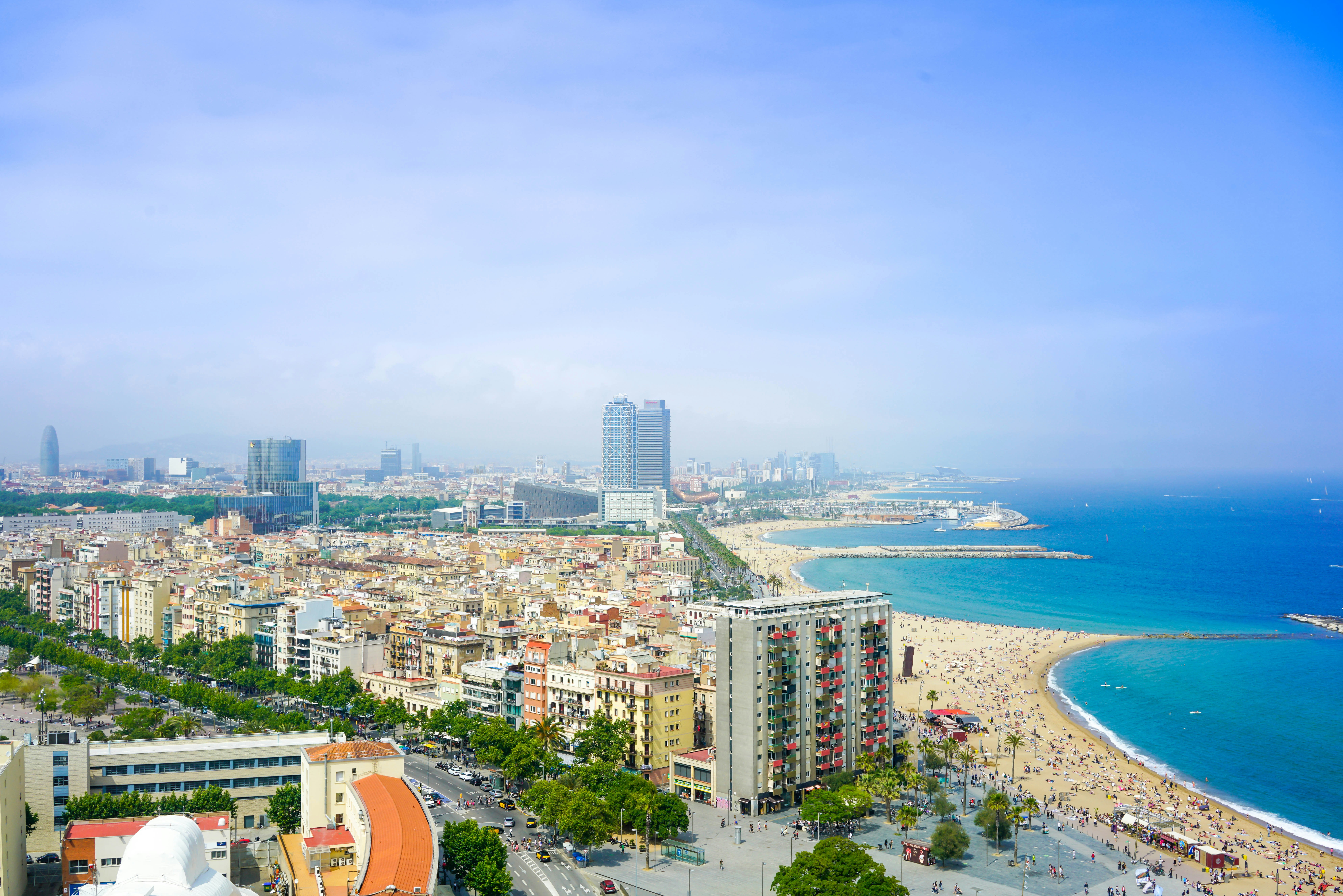
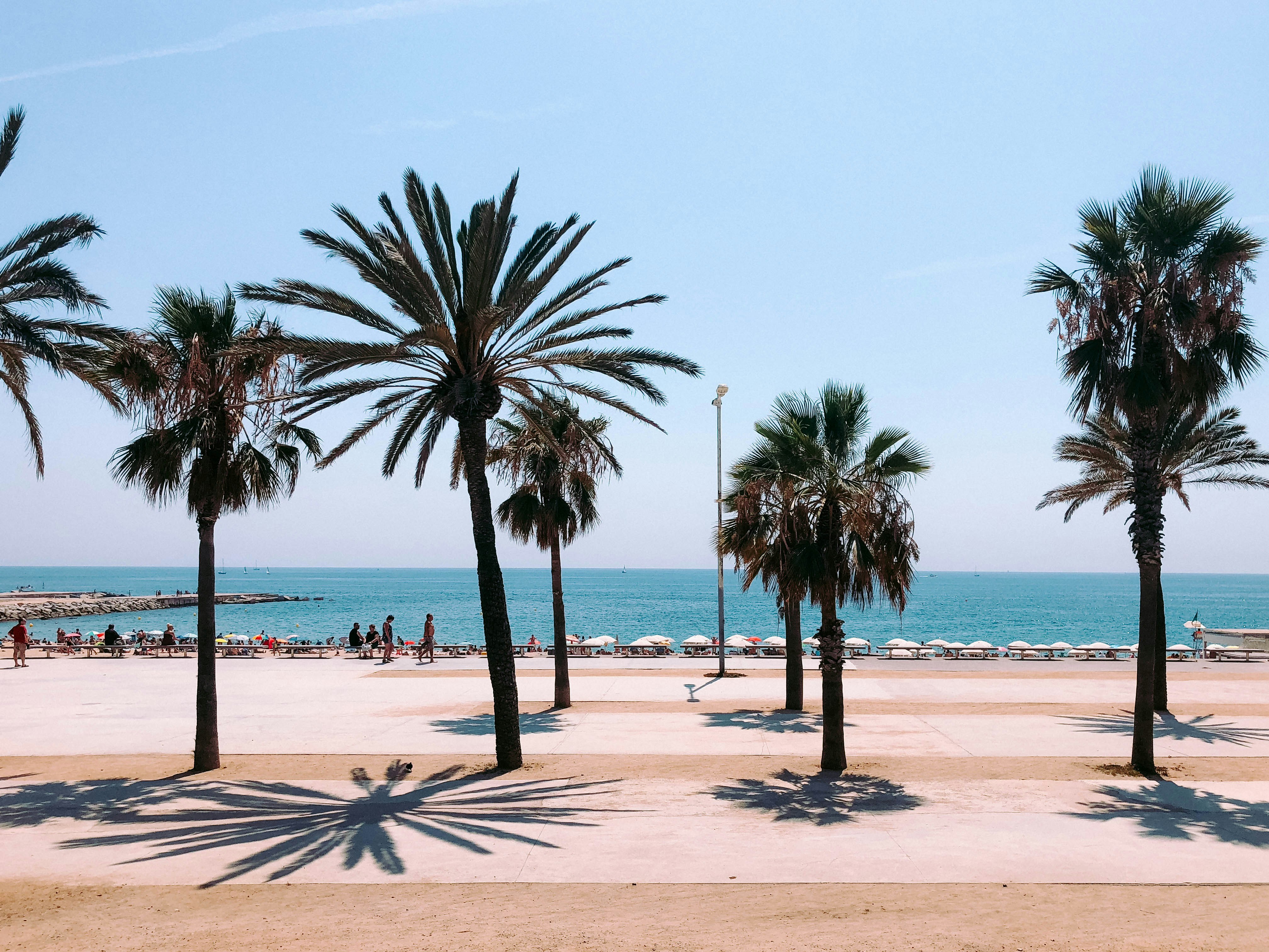
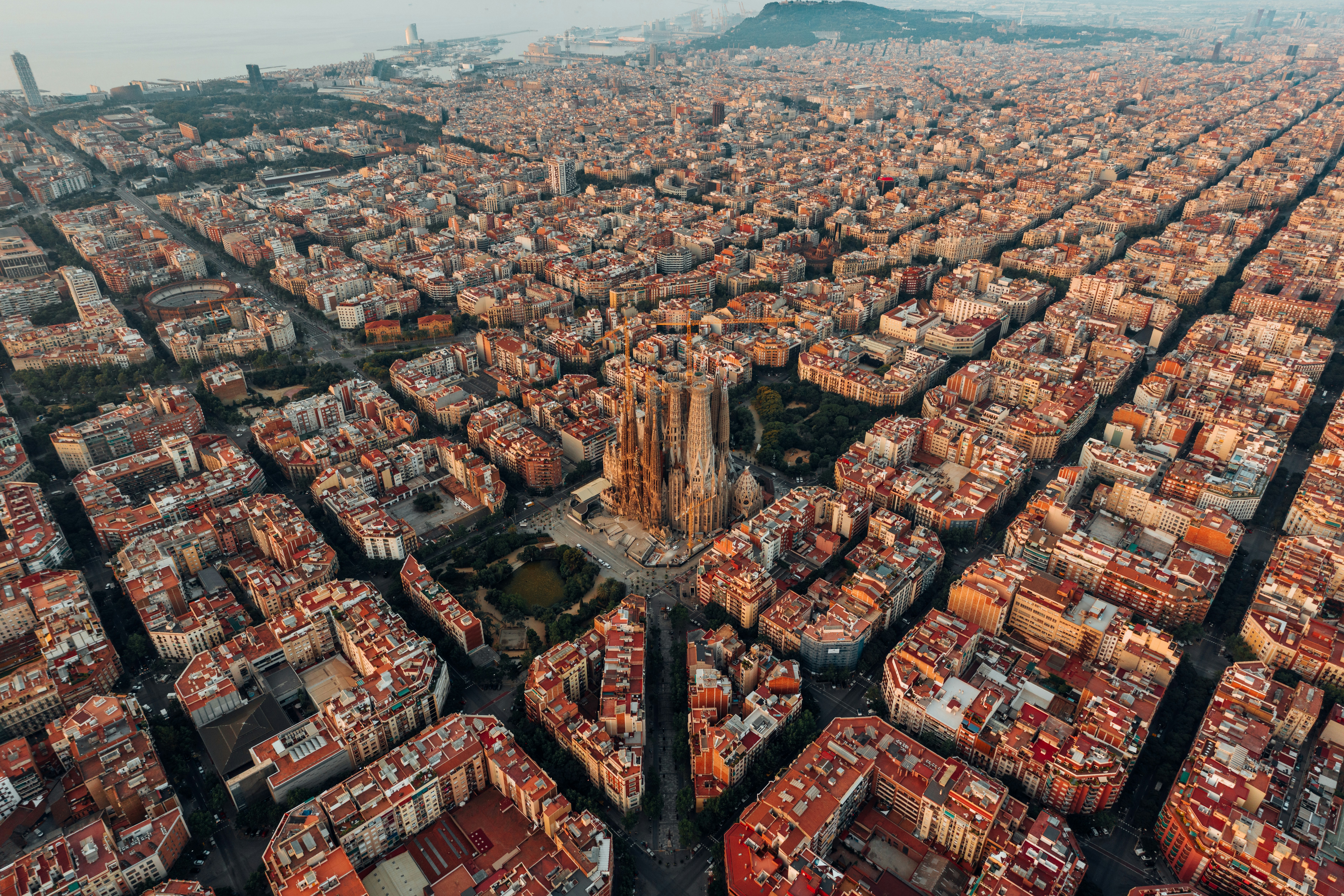
About Barcelona
The infinite variety of street life, the nooks and crannies of the medieval Barri Gòtic, the ceramic tile and stained glass of Art Nouveau facades, the art and music, the throb of street life, the food (ah, the food!)—one way or another, Barcelona will find a way to get your full attention. The capital of Catalonia is a banquet for the senses, with its beguiling mix of ancient and modern architecture, tempting cafés and markets, and sun-drenched Mediterranean beaches. A stroll along La Rambla and through waterfront Barceloneta, as well as a tour of Gaudí's majestic Sagrada Famíliaand his other unique creations, are part of a visit to Spain's second-largest city. Modern art museums and chic shops call for attention, too. Barcelona's vibe stays lively well into the night, when you can linger over regional wine and cuisine at buzzing tapas bars.

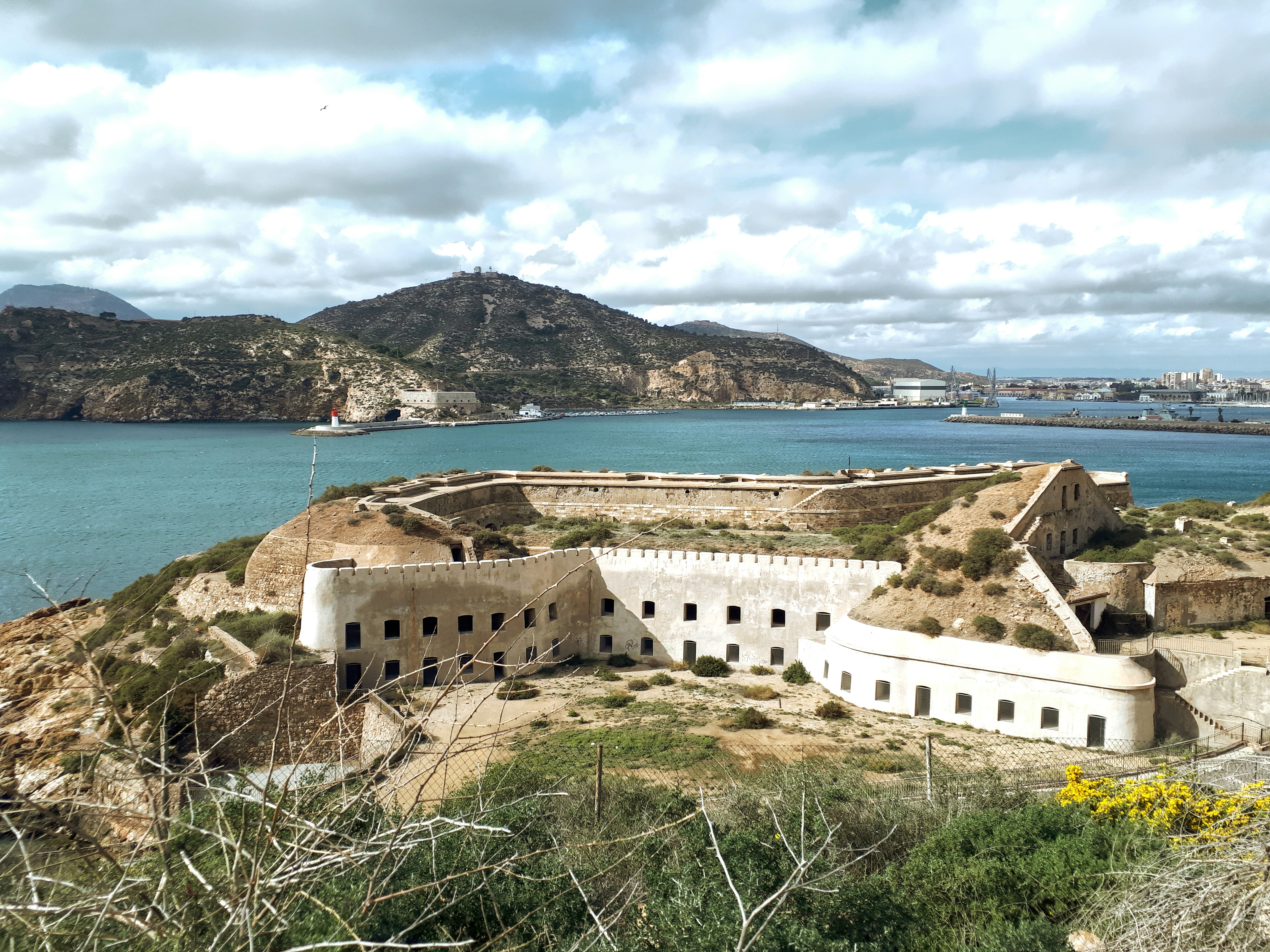
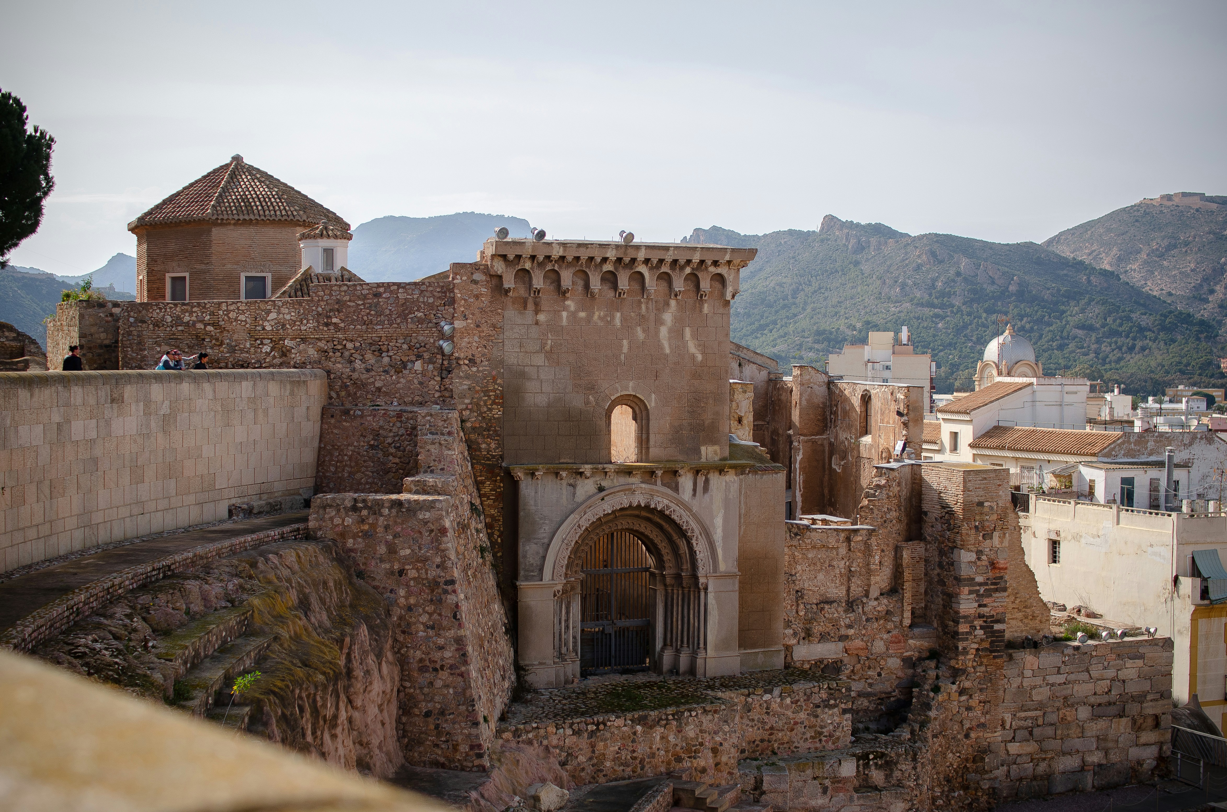
About Cartagena
A Mediterranean city and naval station located in the Region of Murcia, southeastern Spain, Cartagena’s sheltered bay has attracted sailors for centuries. The Carthaginians founded the city in 223BC and named it Cartago Nova; it later became a prosperous Roman colony, and a Byzantine trading centre. The city has been the main Spanish Mediterranean naval base since the reign of King Philip II, and is still surrounded by walls built during this period. Cartagena’s importance grew with the arrival of the Spanish Bourbons in the 18th century, when the Navidad Fortress was constructed to protect the harbour. In recent years, traces of the city’s fascinating past have been brought to light: a well-preserved Roman Theatre was discovered in 1988, and this has now been restored and opened to the public. During your free time, you may like to take a mini-cruise around Cartagena's historic harbour: these operate several times a day, take approximately 40 minutes and do not need to be booked in advance. Full details will be available at the port.
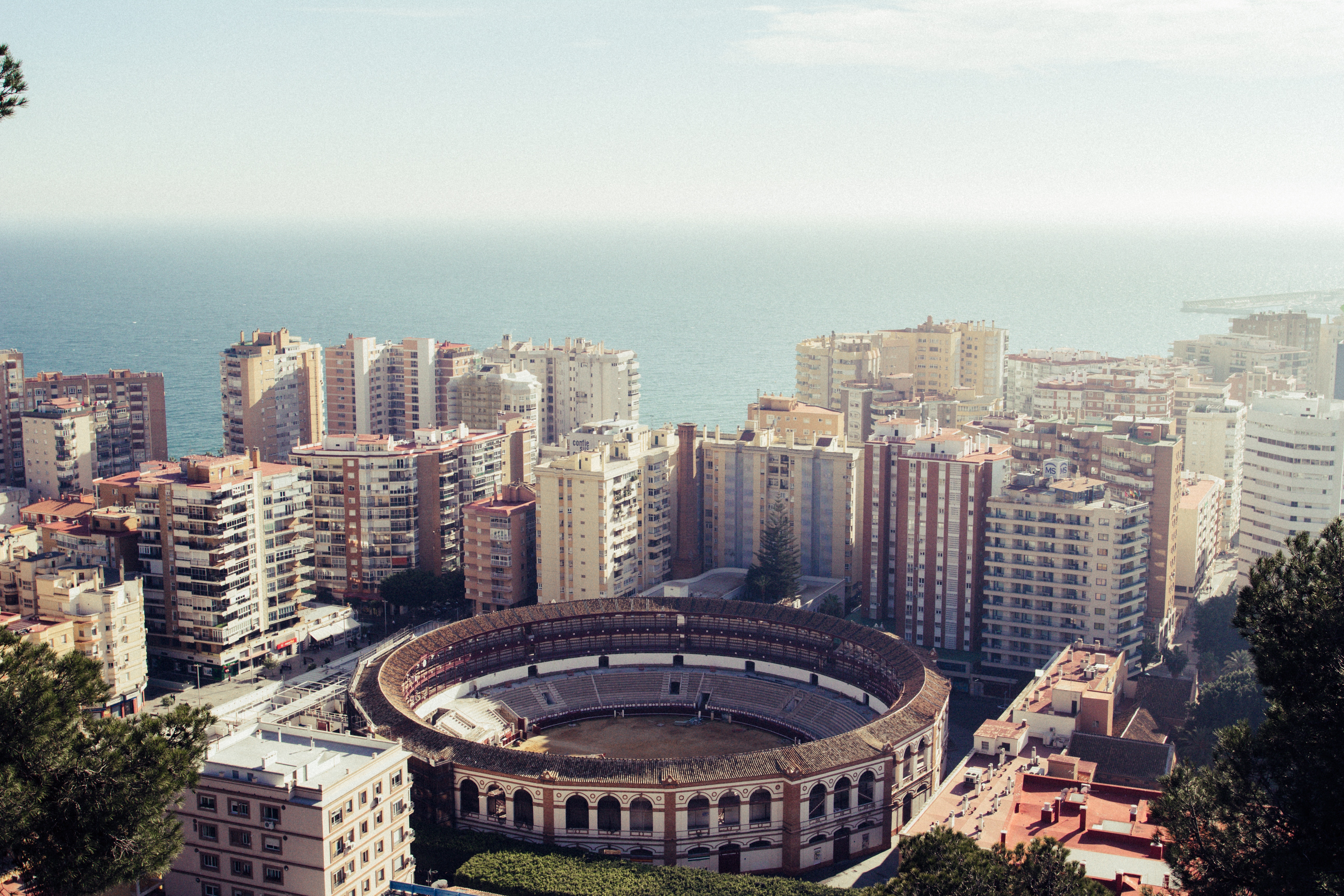
About Málaga
As you sail into Malaga you will notice what an idyllic setting the city enjoys on the famous Costa del Sol. To the east of this provincial capital, the coast along the region of La Axarqua is scattered with villages, farmland and sleepy fishing hamlets - the epitome of traditional rural Spain. To the west stretches a continuous city where the razzmatazz and bustle creates a colourful contrast that is easily recognisable as the Costa del Sol. Surrounding the region, the Penibéetica Mountains provide an attractive backdrop overlooking the lower terraced slopes which yield olives and almonds. This spectacular mountain chain shelters the province from cold northerly winds, giving it a reputation as a therapeutic and exotic place in which to escape from cold northern climes. Malaga is also the gateway to many of Andalusia's enchanting historic villages, towns and cities.
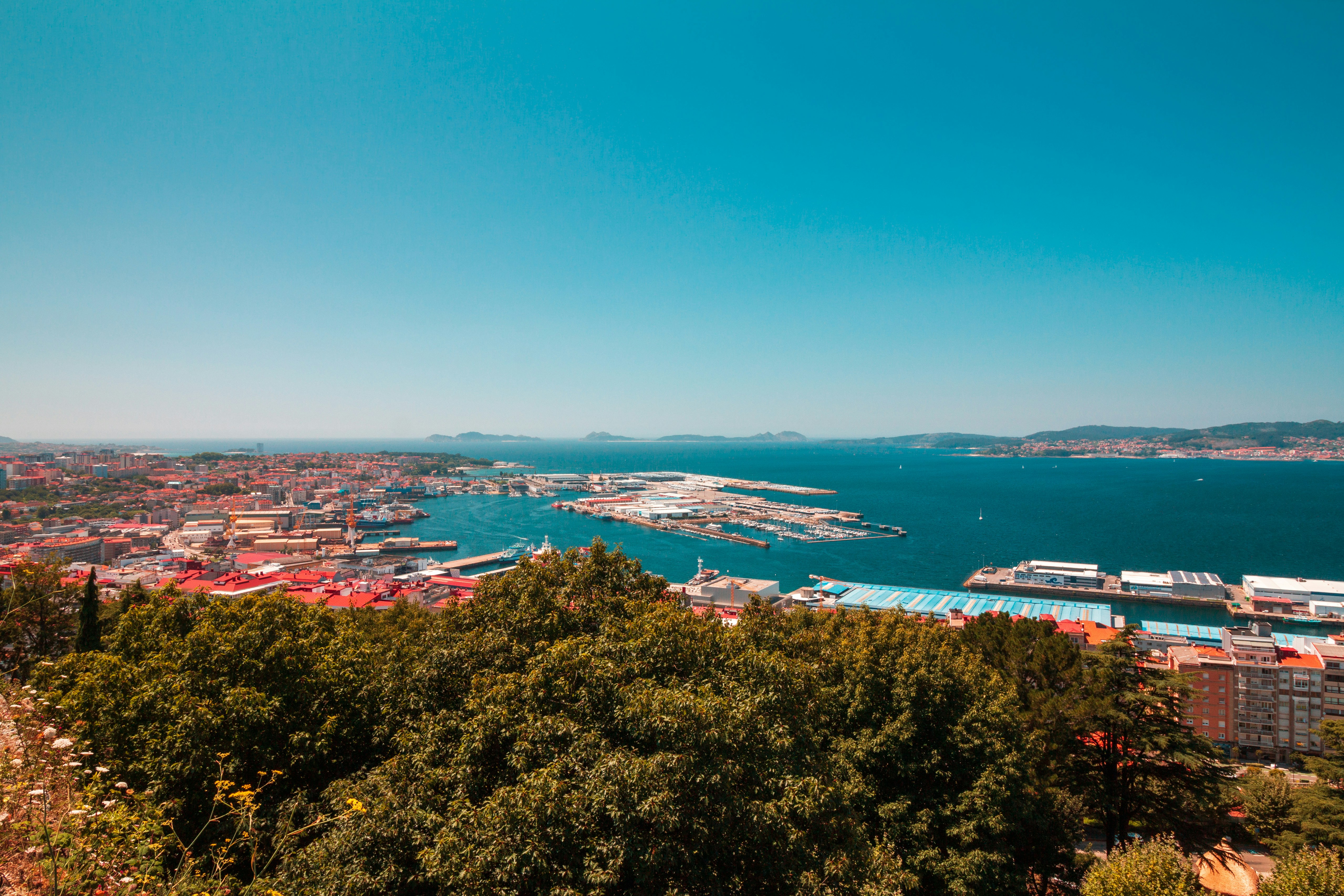
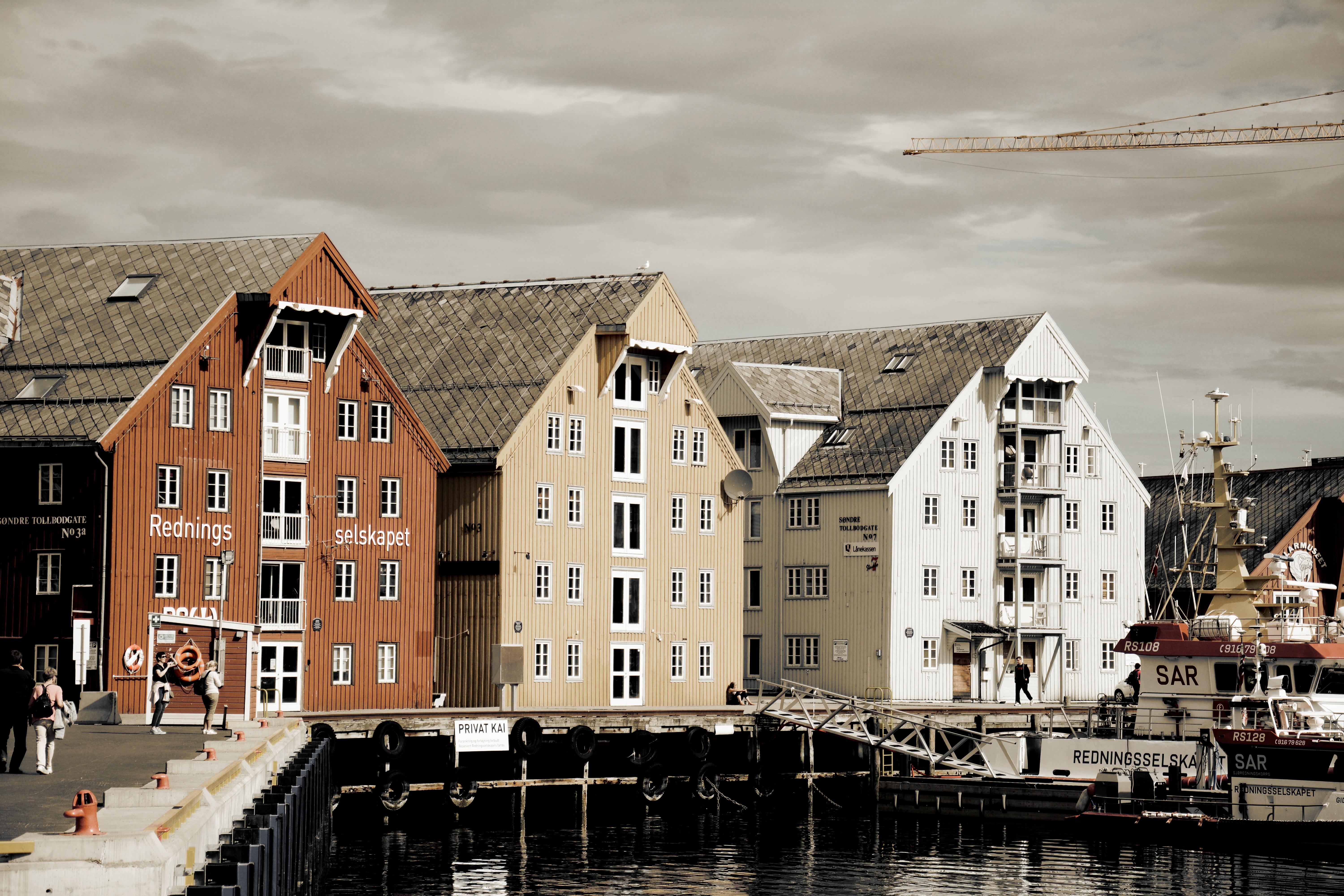
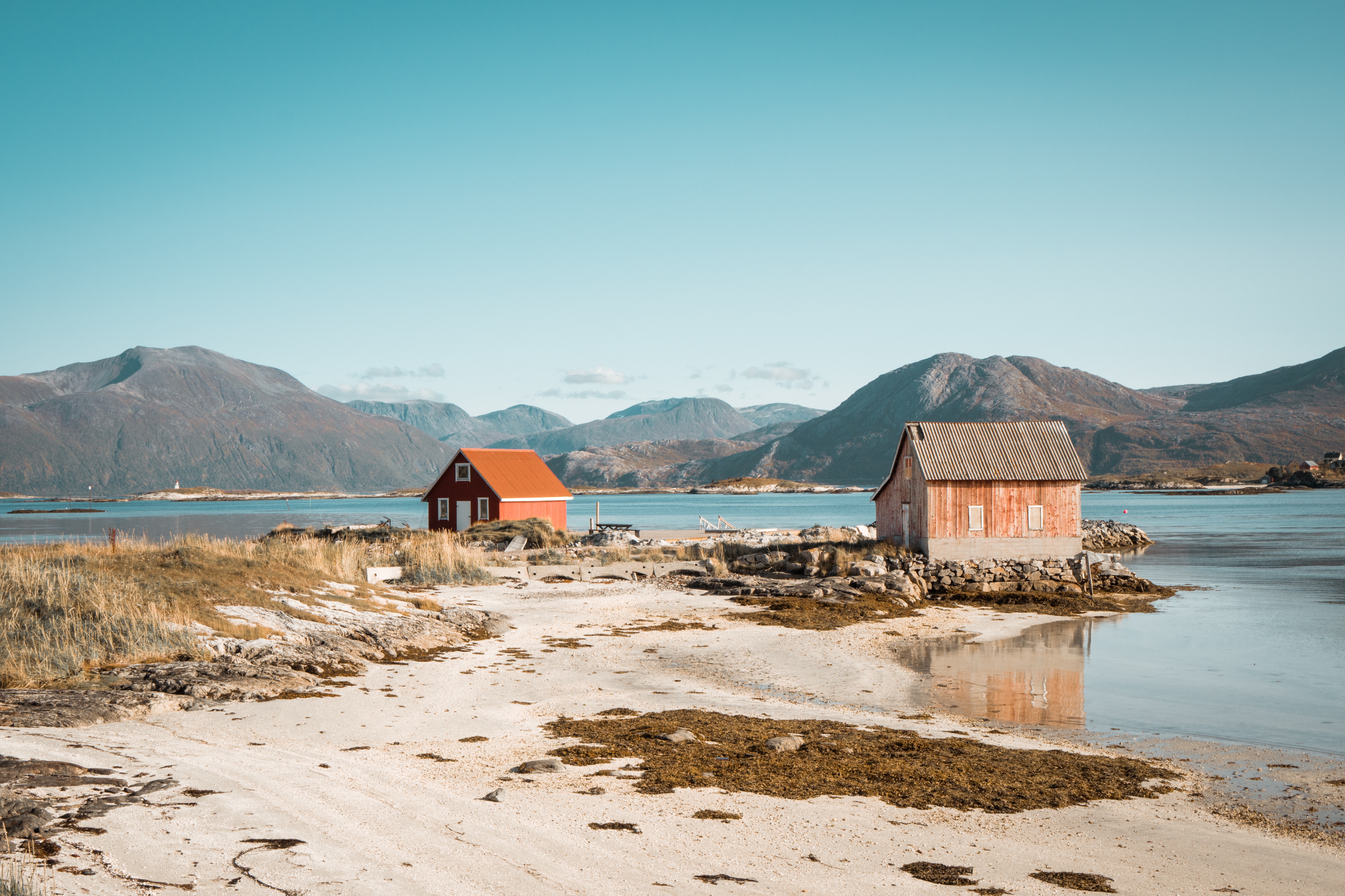
About Vigo
Dating from Roman times, the Galician city of Vigo has a fine natural harbour and is renowned as the biggest fishing port in the world. It is also full of history - it was in this fjord-like quay that the English and Dutch defeated the French and Spanish fleets in 1702. Today, the attractive marinas stand in contrast to the industrialised areas of the city, while further exploration will reveal the characteristic 17th-century architecture and attractive countryside beyond. The charming Old Town is a delight, with its labyrinth of winding narrow streets and shaded squares. Nearby is the Cathedral city of Tui, and further to the north is the pilgrimage centre of Santiago de Compostela, which can be reached by car in approximately 1¼ hours.
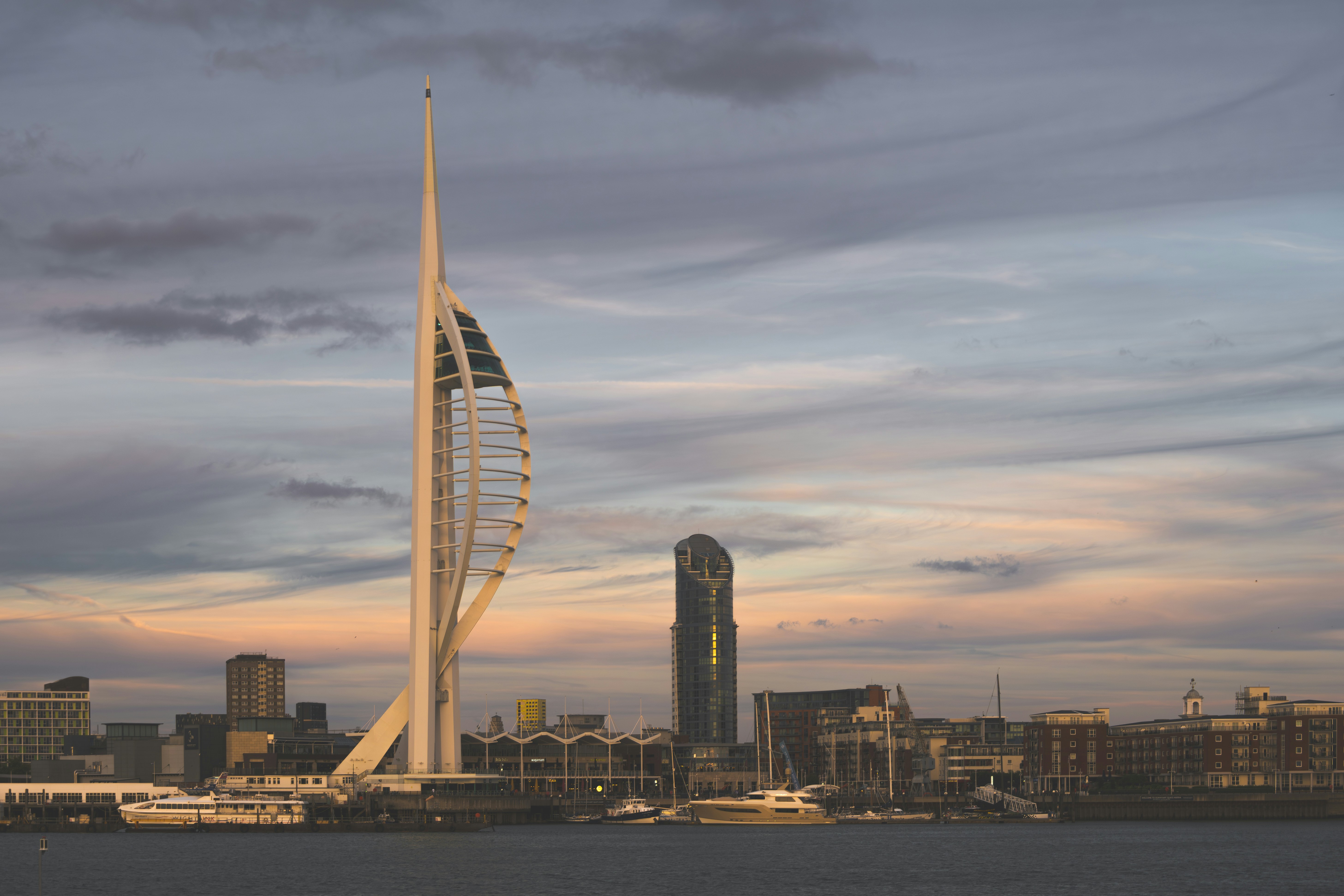
About Portsmouth
Portsmouth is one of the most densely populated cities in Southern England, and is unusual as most of its built-up area occupies Portsea Island, linked to the mainland by road and rail bridges. Although there is a Roman fort at nearby Portchester, occupied later by the Saxons and Normans, there was no settlement on the site of Portsmouth at the time of the 1086 Domesday Book. The town developed in medieval times and received its first charter in 1194 from King Richard I; soon afterwards it became a major naval base. It has the world’s oldest dry dock, and is home to several famous ships, including HMS Victory, HMS Warrior and the Mary Rose, raised from the Solent in 1982. Portsmouth remains an important naval base and is home to a large proportion of the British service fleet. The waterfront area is now dominated by the Spinnaker Tower, 560 feet high, the United Kingdom’s tallest building outside London. Other things to see in the city include the house where Charles Dickens was born, and the City Museum, which contains a permanent exhibition devoted to another famous writer, Sir Arthur Conan Doyle, who lived in the town.
About Tilbury
Just 22 nautical miles down river from the Tower Bridge in London, Tilbury is a popular turnaround port for cruises visiting Baltic and Northern European destinations.
About Rosyth
Edinburgh is to London as poetry is to prose, as Charlotte Brontë once wrote. One of the world's stateliest cities and proudest capitals, it's built—like Rome—on seven hills, making it a striking backdrop for the ancient pageant of history. In a skyline of sheer drama, Edinburgh Castle watches over the capitalcity, frowning down on Princes Street’s glamour and glitz. But despite its rich past, the city’s famous festivals, excellent museums and galleries, as well as the modern Scottish Parliament, are reminders that Edinburgh has its feet firmly in the 21st century. Nearly everywhere in Edinburgh (the burgh is always pronounced burra in Scotland) there are spectacular buildings, whose Doric, Ionic, and Corinthian pillars add touches of neoclassical grandeur to the largely Presbyterian backdrop. Large gardens are a strong feature of central Edinburgh, where the city council is one of the most stridently conservationist in Europe. Arthur's Seat, a mountain of bright green and yellow furze, rears up behind the spires of the Old Town. This child-size mountain jutting 822 feet above its surroundings has steep slopes and little crags, like a miniature Highlands set down in the middle of the busy city. Appropriately, these theatrical elements match Edinburgh's character—after all, the city has been a stage that has seen its fair share of romance, violence, tragedy, and triumph. Modern Edinburgh has become a cultural capital, staging the Edinburgh International Festival and the Fringe Festival in every possible venue each August. The stunning Museum of Scotland complements the city’s wealth of galleries and artsy hangouts. Add Edinburgh’s growing reputation for food and nightlife and you have one of the world’s most beguiling cities. Today the city is the second most important financial center in the United Kingdom, and the fifth most important in Europe. The city regularly is ranked near the top in quality-of-life surveys. Accordingly, New Town apartments on fashionable streets sell for considerable sums. In some senses the city is showy and materialistic, but Edinburgh still supports learned societies, some of which have their roots in the Scottish Enlightenment. The Royal Society of Edinburgh, for example, established in 1783 "for the advancement of learning and useful knowledge," remains an important forum for interdisciplinary activities. Even as Edinburgh moves through the 21st century, its tall guardian castle remains the focal point of the city and its venerable history. Take time to explore the streets—peopled by the spirits of Mary, Queen of Scots; Sir Walter Scott; and Robert Louis Stevenson—and pay your respects to the world's best-loved terrier, Greyfriars Bobby. In the evenings you can enjoy candlelit restaurants or a folk ceilidh (pronounced kay-lee, a traditional Scottish dance with music), though you should remember that you haven't earned your porridge until you've climbed Arthur's Seat. Should you wander around a corner, say, on George Street, you might see not an endless cityscape, but blue sea and a patchwork of fields. This is the county of Fife, beyond the inlet of the North Sea called the Firth of Forth—a reminder, like the mountains to the northwest that can be glimpsed from Edinburgh's highest points, that the rest of Scotland lies within easy reach.
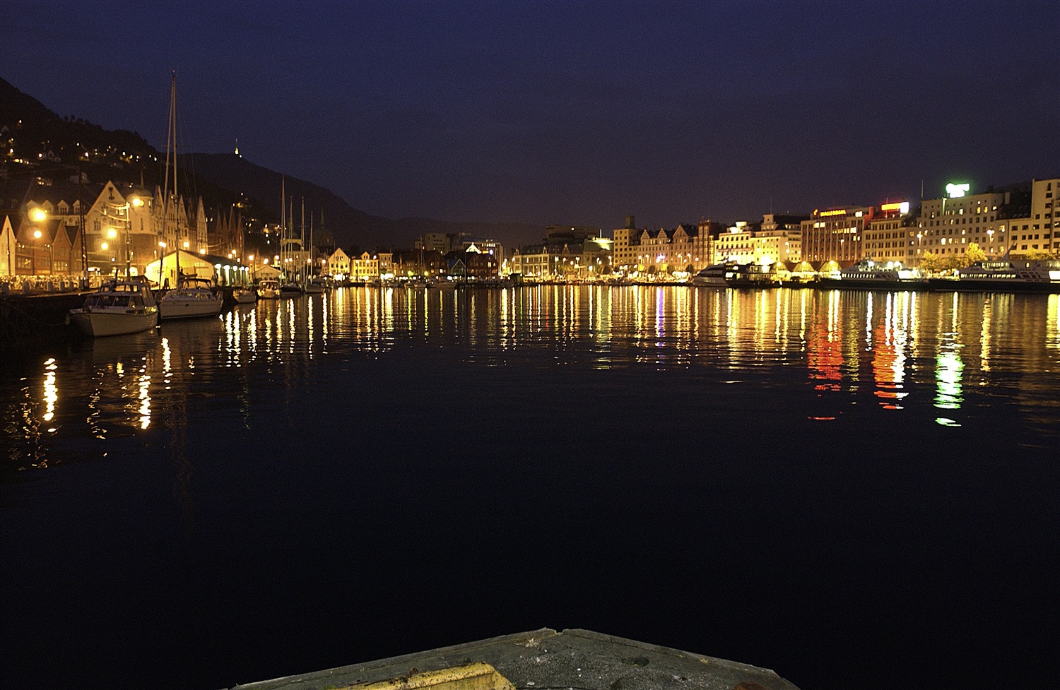
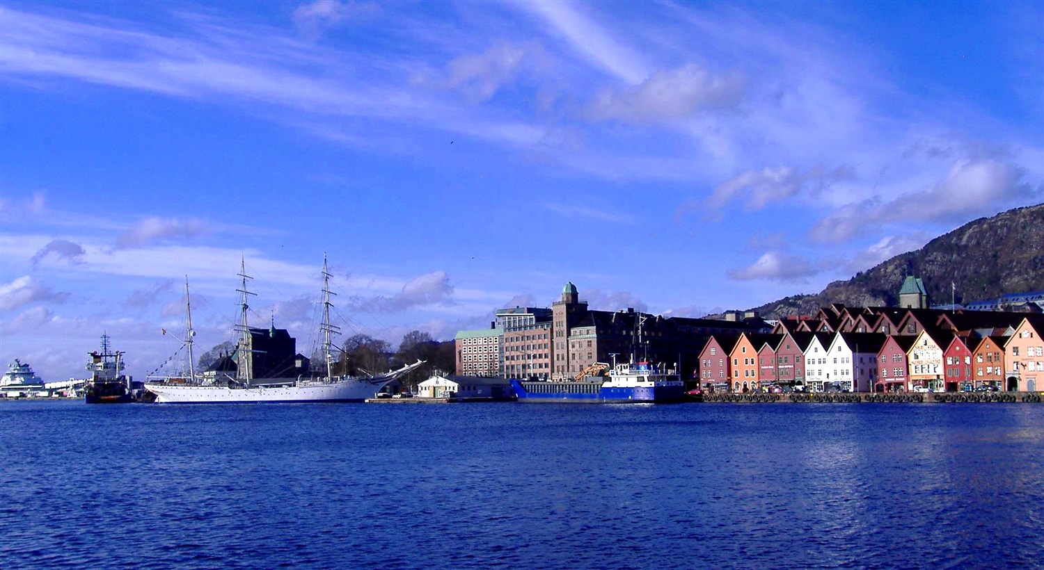
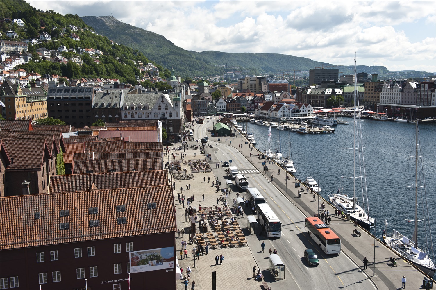
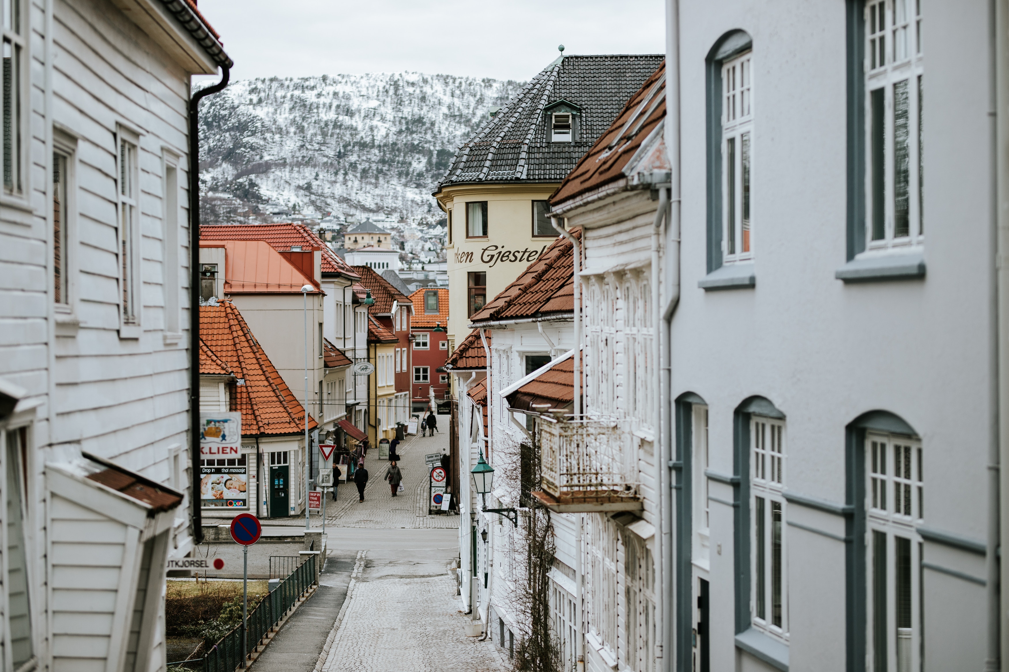
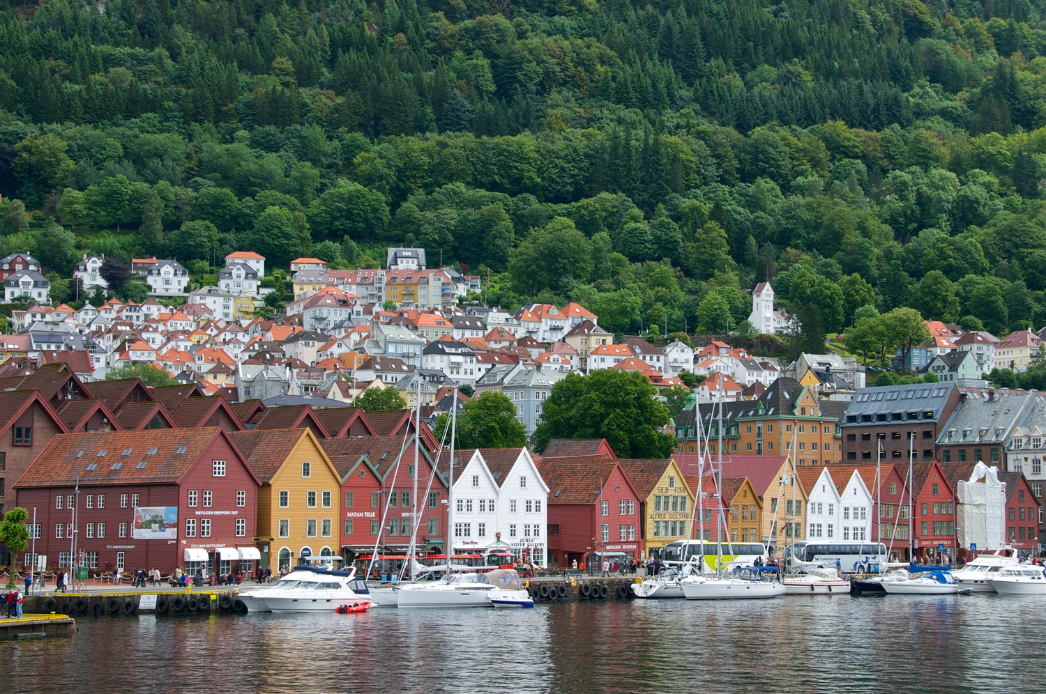
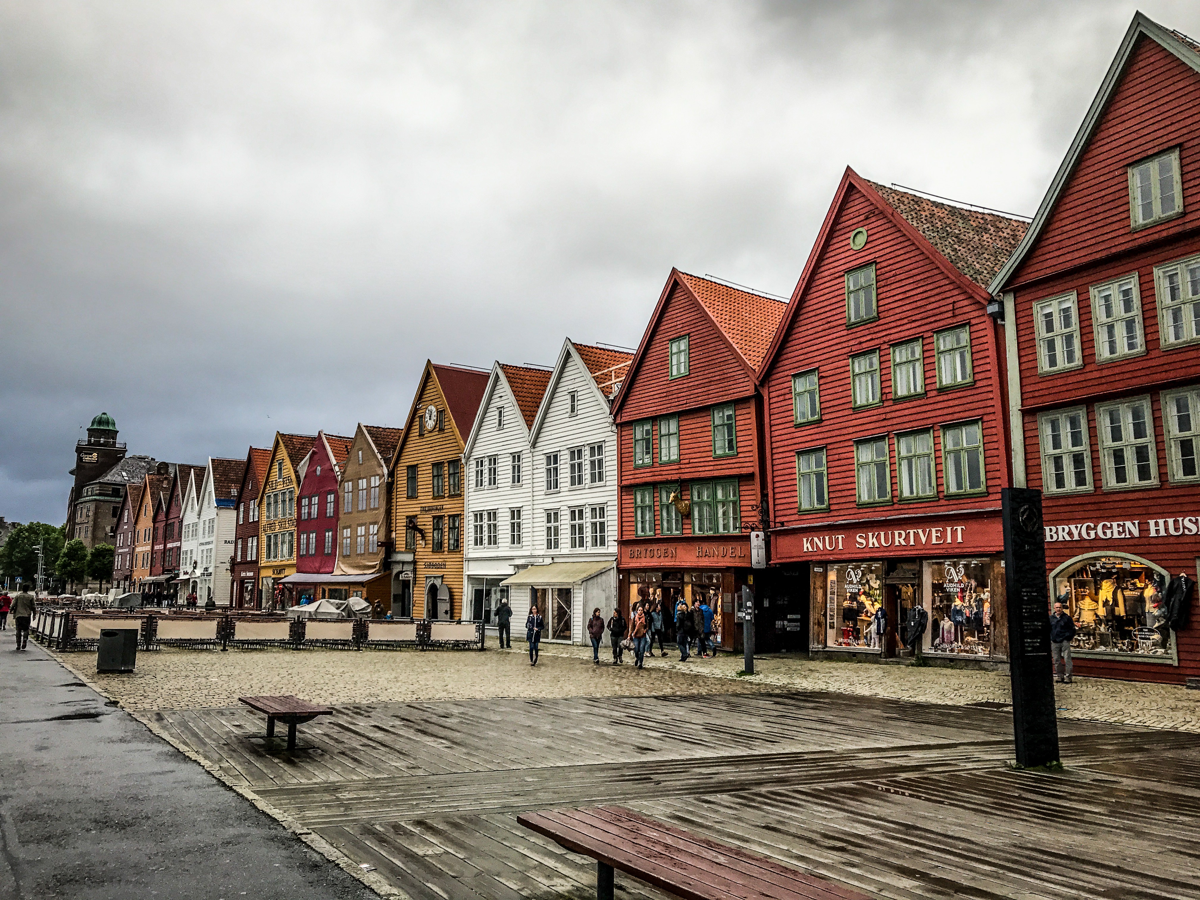
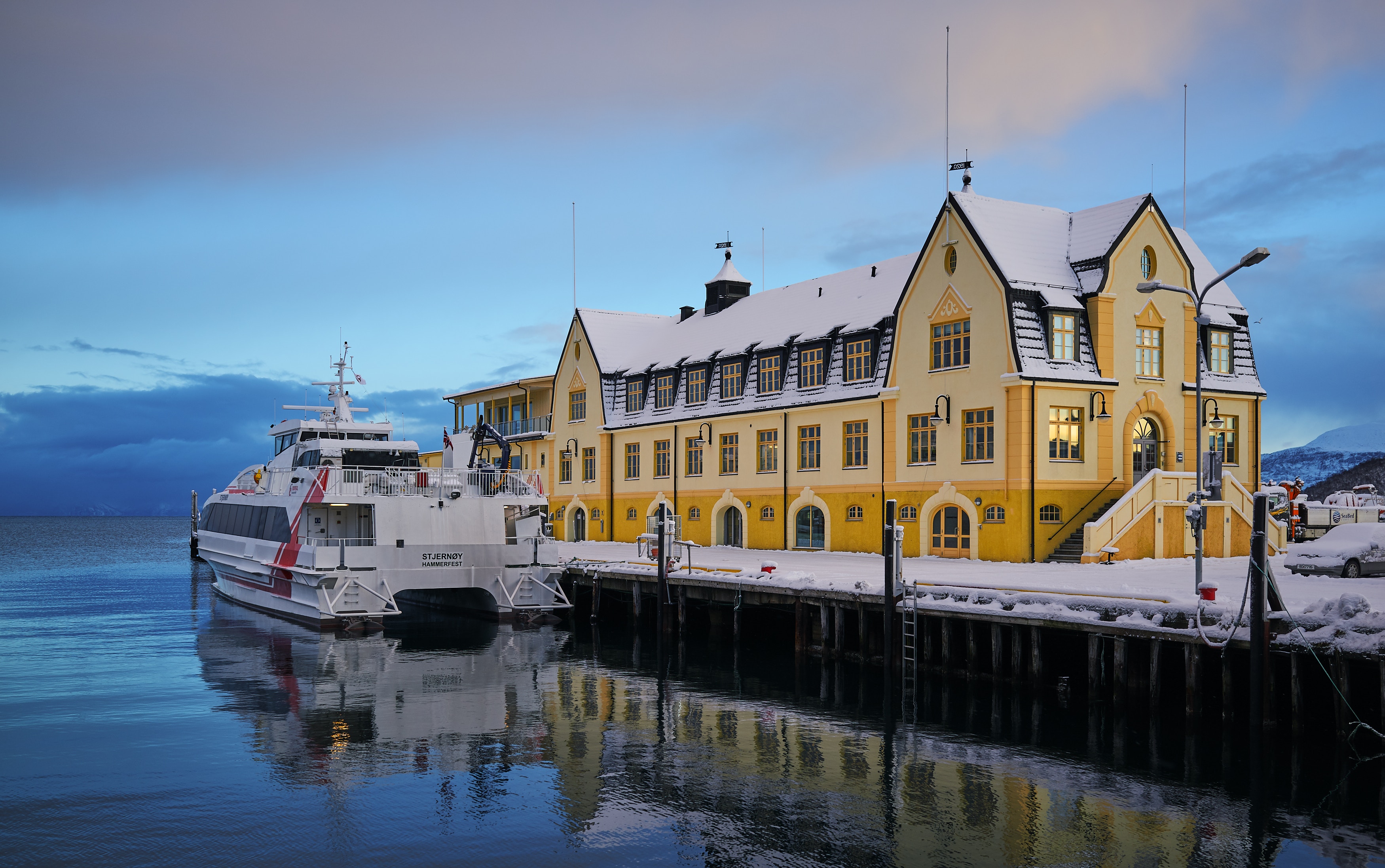
About Bergen
Surrounded by mountains and sparkling fjords, the waterside city of Bergen has a spectacular setting. There has been a settlement here since medieval times and the colourful waterfront buildings of the Hanseatic wharf, known as Bryggen, are testament to its fascinating history of trade. As Norway’s best known medieval settlement, the Bryggen is listed by UNESCO as a World Heritage Site. Our comprehensive selection of excursions allows you to discover the many sides of Bergen, such as the fish market and narrow cobbled streets, as well as stunning views of the city from the summit of Mt Fløyen. Alternatively, those who have visited the city previously may like to experience one of the tours that travel further afield. Just 300 yards from the main piers, you will find the Fortress Museum (Fesningsmuseum), which has an interesting collection of objects related to World War II.
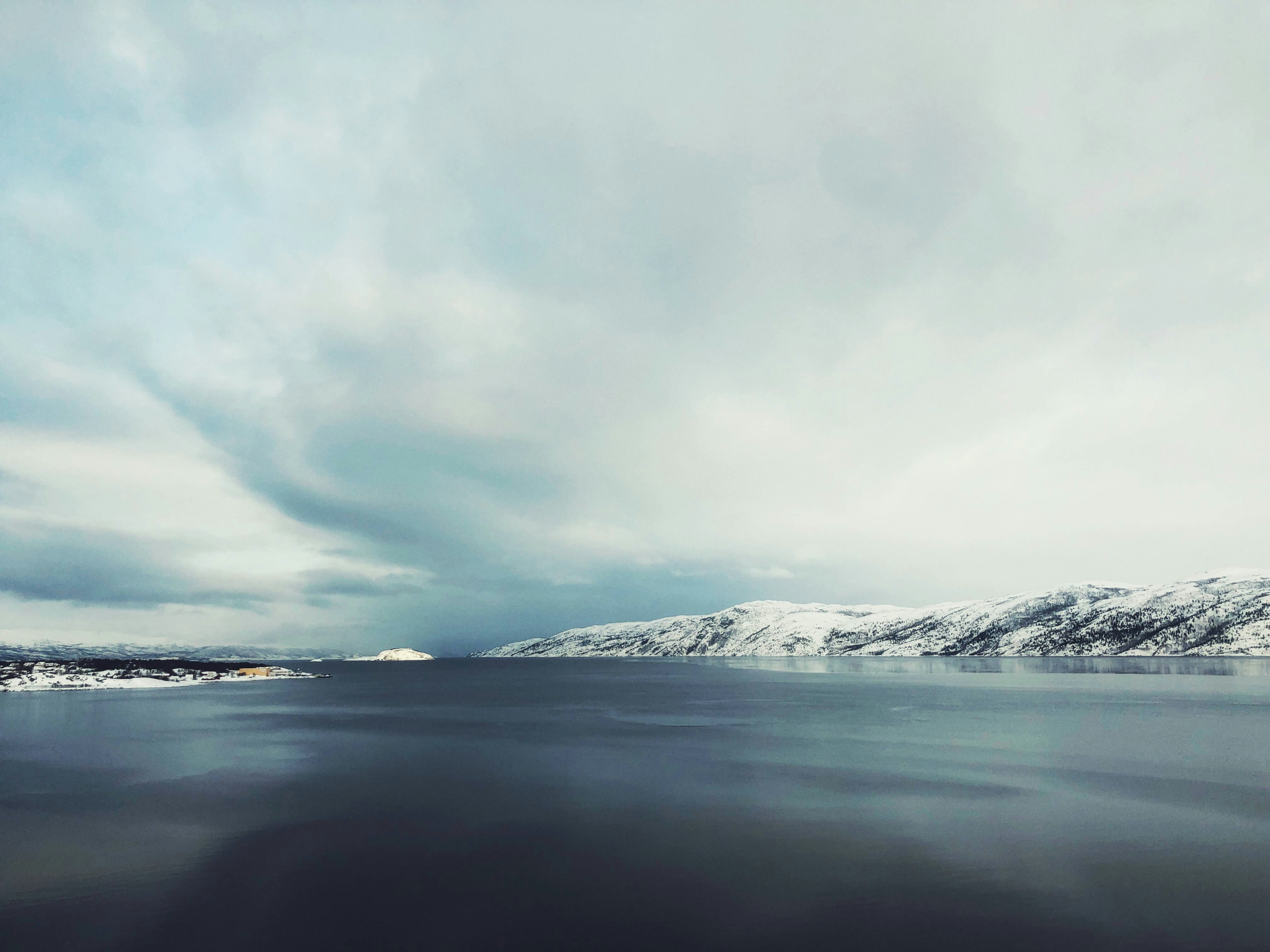
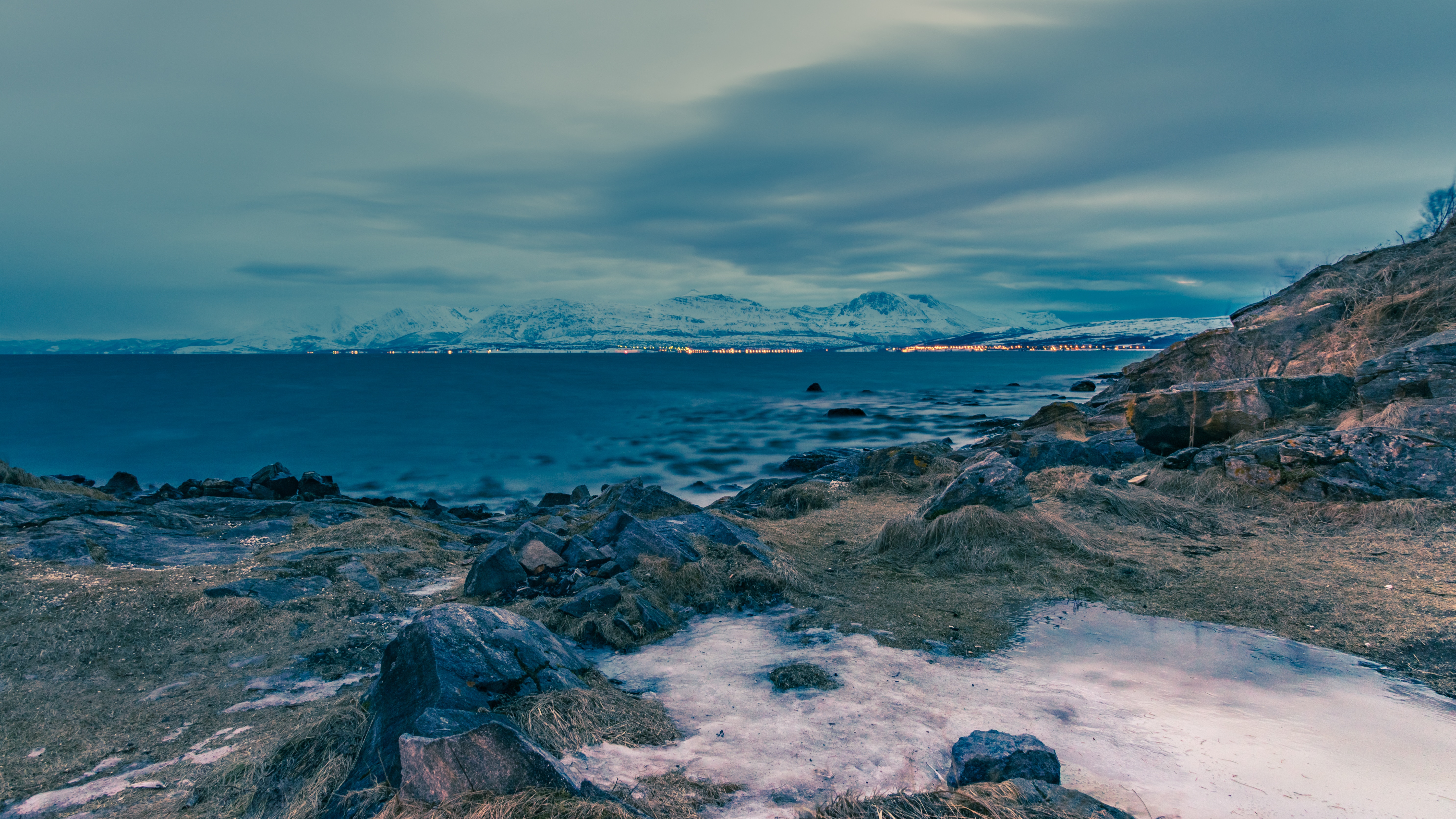
About Narvik
At 68 degrees North, Narvik lies 140 miles inside the Arctic Circle. Its history as a settlement began in the Stone Age, and Vikings are also known to have lived in the area. The modern town came into existence in the 1870s to serve the needs of the iron industry. Iron ore is mined in neighbouring Sweden and, as an ice-free port, Narvik was chosen as the ideal export location. The LKAB mining corporation is still a major employer and landowner in the area, shipping some 25,000,000 tons of iron ore from the port annually. This industrial heritage has shaped the town and now forms the basis of some of its most popular tourist attractions. In 1883 a co-owned British-Swedish company was given permission to build a railway connecting the Swedish iron mines in Kiruna to Narvik. It opened in 1902 and the town, then christened Victoriahavn, grew up around it. Unfortunately much of Narvik was destroyed in World War II. Invaded by the Nazis on 9 April 1940, it was later retaken by the Allies, representing the first military defeat of Hitler’s troops, but was evacuated as part of Operation Alphabet when it came under German occupation again. The local war museum documents the turbulent history of this period.
About Harstad
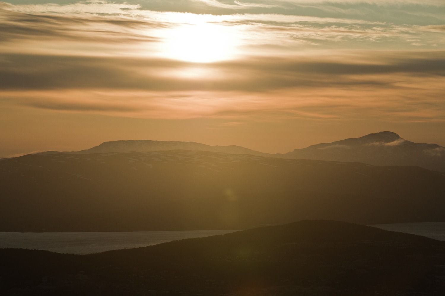
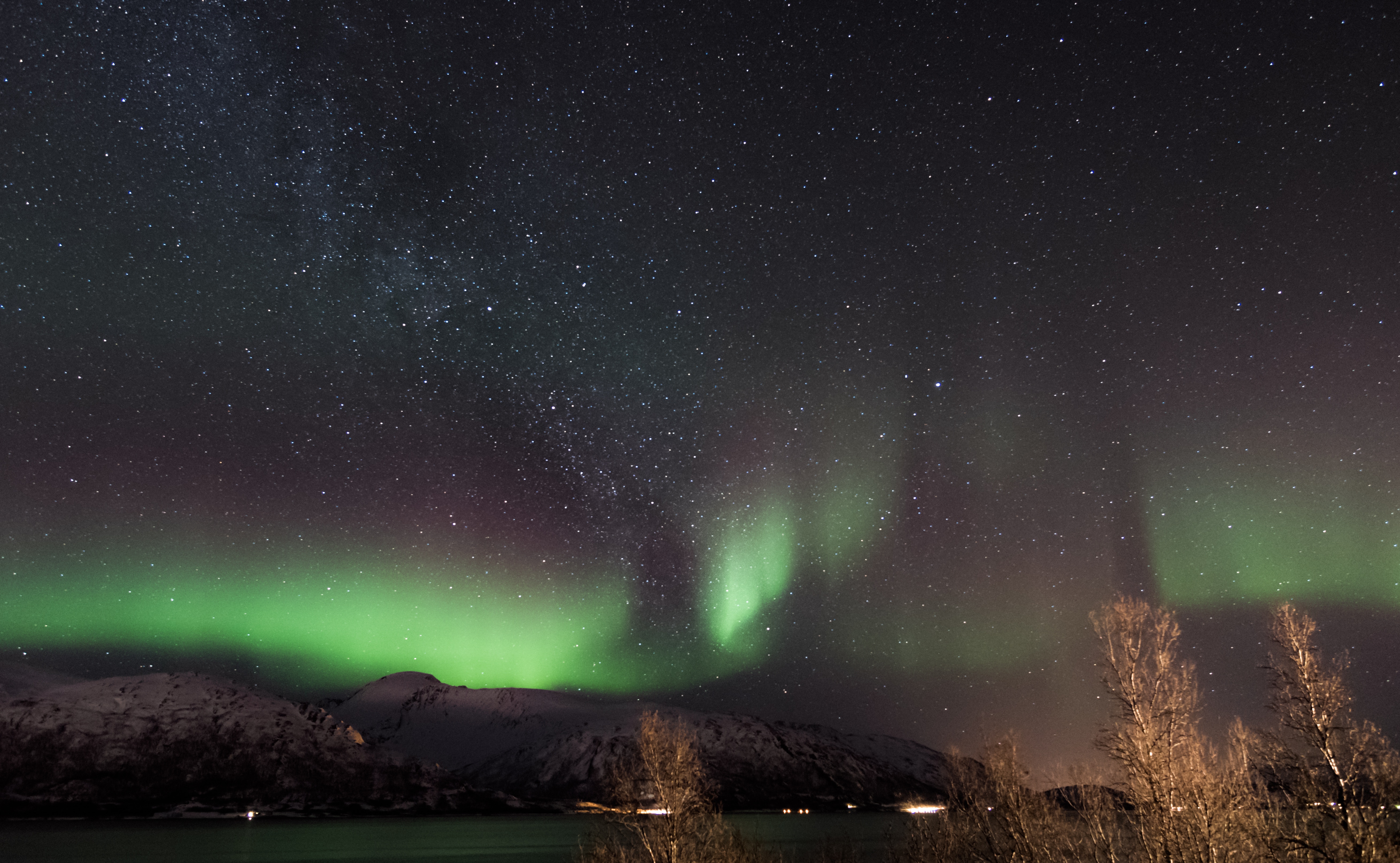
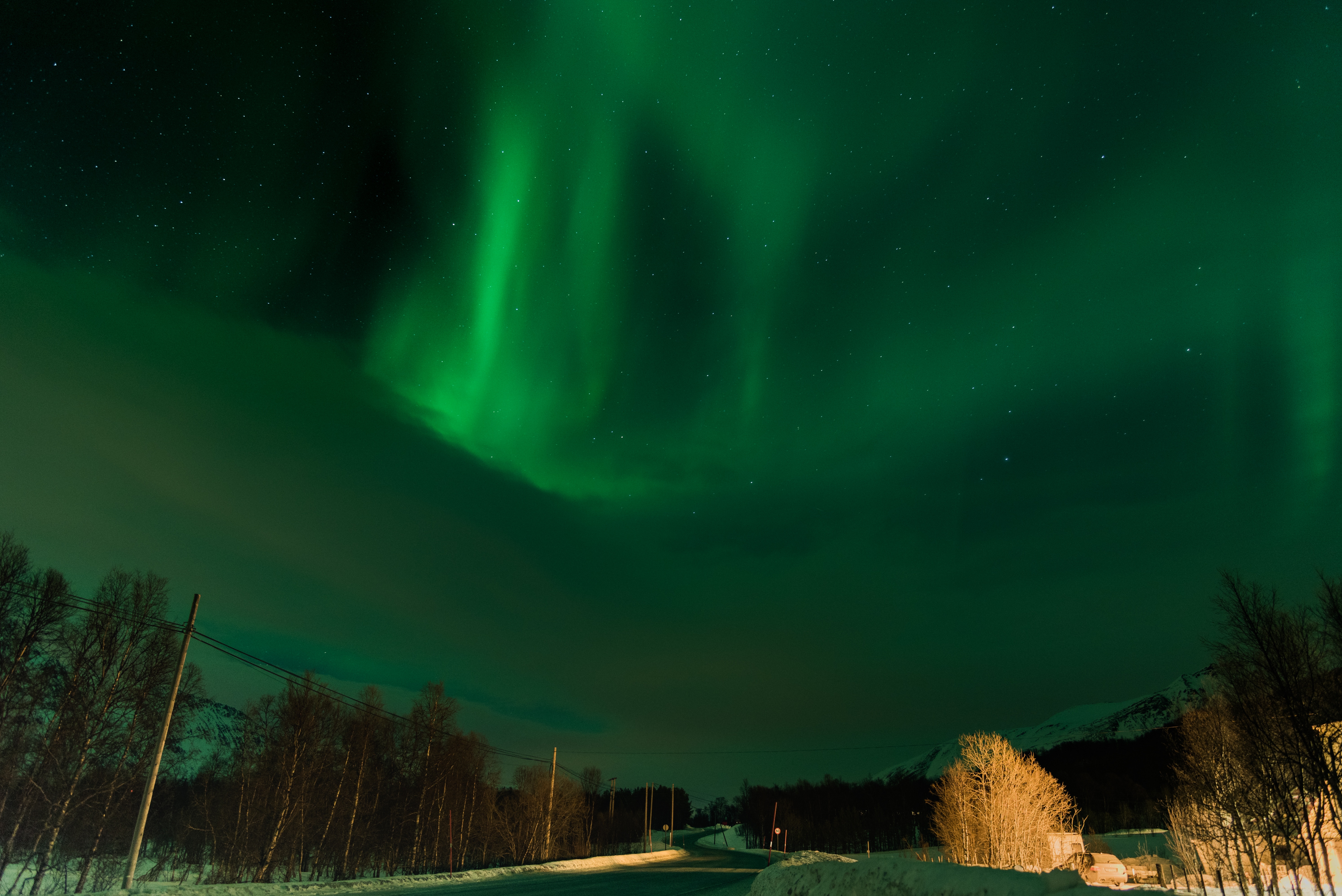
About Alta
People have been attracted to the community of Alta for thousands of years, and prehistoric rock carvings discovered in 1973 can be seen at the Alta Museum. Situated at the head of the Altafjord, it is a lush, green and hospitable shelter in the otherwise cold and windswept Finnmark landscape. Halfway between the grim, barren mountain plateau and the wet, stormy coast, Alta offers tree-clad valleys, pleasant temperatures and no more rain than the Sahara. However at 70 degrees North it is quite a different story in winter, when heavy snowfalls and sub-zero temperatures are the order of the day, and clear dark night skies become the arena for dazzling displays of the elusive Aurora Borealis, also referred to as 'the temperamental lady' by Laplanders. The world’s first Northern Lights Observatory, which played an important role in the development of geophysical and meteorological research during the first half of the 20th century, is located just 12 miles from Alta. Perched atop Haldde Mountain, it towers almost 3,000 feet above Kafjord, where the battleship Tirpitz was based during the Second World War.
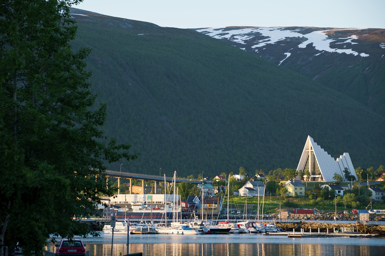
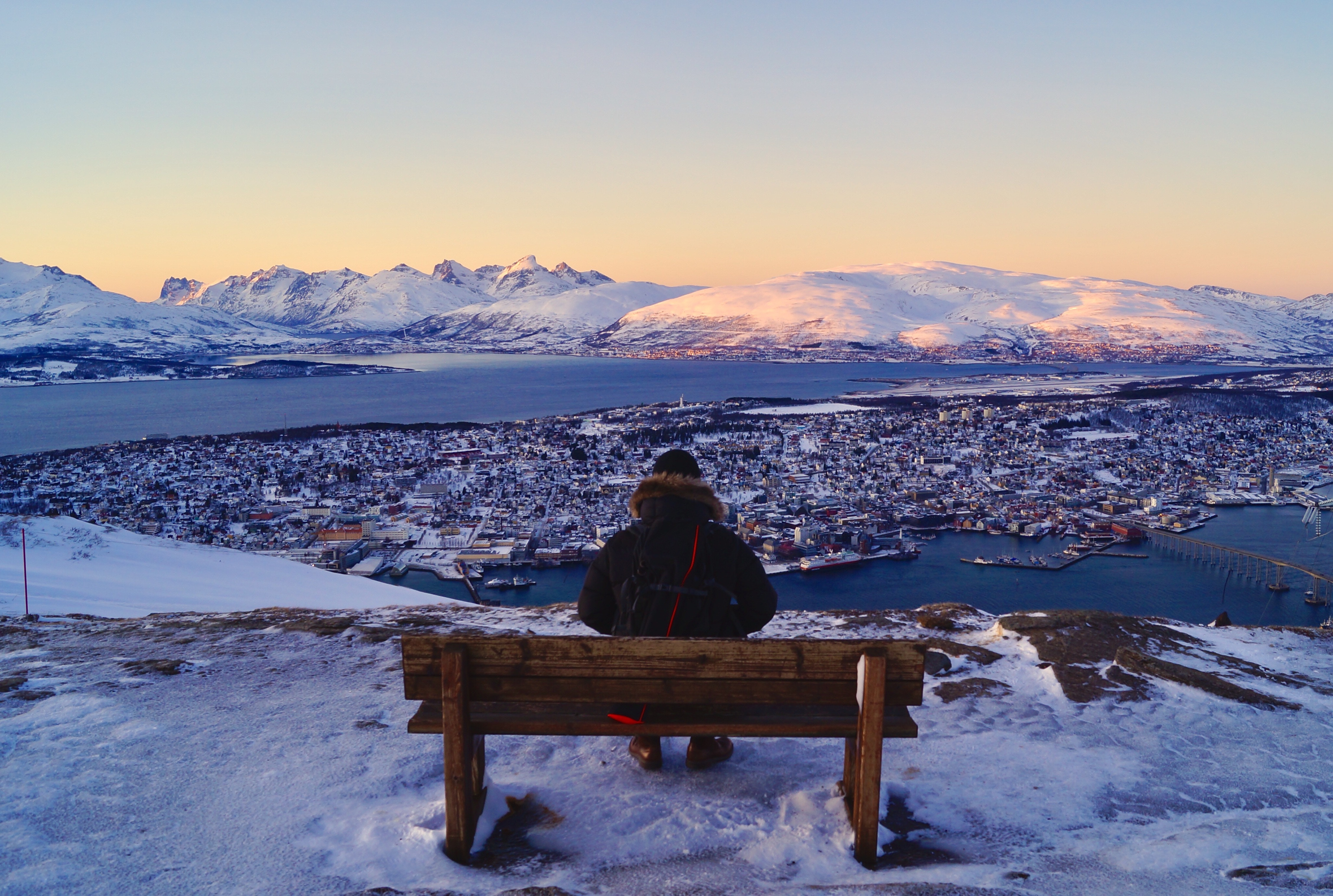
About Tromsø
With its centre located on the island of Tromsø, the municipality of Tromsø is more than five times the size of Norway’s capital, Oslo, and is the world’s northernmost university city. Lying 200 miles inside the Arctic Circle, it is known as the 'Gateway to the Arctic' because it was used as a starting point for hunters looking for Arctic foxes, polar bears and seals. In the 19th century it was a base for explorers on Arctic expeditions – a history that is remembered in the city’s Polar Museum, which you can visit on an excursion. Also commemorated in the area is the history of Norway’s indigenous people, the Sami. Visitors can learn about the traditions, heritage and modern preservation of the Sami culture at the Tromsø Museum. Nowadays, Tromsø is a charming mix of old and new, with wooden buildings sitting alongside contemporary architecture such as the impressive glacier-like Arctic Cathedral, which features one of the largest stained glass windows in Europe. Looking down on the city is Mount Storsteinen, and a cable car runs to the top, giving wonderful views over the surrounding countryside of forested peaks and reindeer pastures.
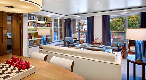
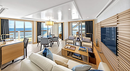
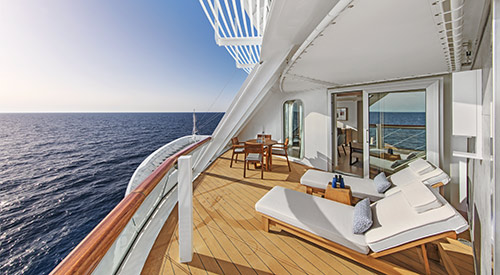
- Stateroom size: 1,488 sq ft multi-room suite including expansive private veranda
- Ocean-view largest multi-room accommodations onboard
- Separate bedroom suite
- Spacious, well-appointed living room
- Separate dining area that seats 6
- Private library, wine & music collections curated by Chairman Torstein Hagen
- Ocean-view dry sauna
- Boardroom that seats 12 for meetings & catered dinner parties, with first oceangoing vapor-light fireplace
- Pantry for room service & hosted events
- 11 AM Embarkation
- 11 AM priority stateroom access
- First priority shore excursion booking 147 days prior to departure
- Complimentary shore excursion with private car & driver (up to 4 guests) in port city of your choice (valued at up to $800)
- 4 priority reservations at each alternative restaurant 100 days prior to departure
- First priority spa treatment bookings 100 days prior to departure
- King-size Viking Explorer Bed with luxury linens & pillows
- Free Wi-Fi (connection speed may vary)
- 42" flat-screen TV featuring MSNBC, FOX News, National Geographic and more
- Two additional 42" flat-screen interactive LCD TVs in living area and boardroom
- 110/220 volt outlets & USB ports
- Large master bathroom with spacious glass-enclosed shower, double-sink vanity, heated floor, anti-fog mirror & hair dryer, plus two guest bathrooms
- Premium Freyja® toiletries
- Plush robes & slippers
- Direct-dial satellite phone & cell service
- Security safe
- Individual climate control
- Purified water refilled daily
- Welcome bottle of Veuve Clicquot champagne
- Mini-bar with alcoholic beverages, soft drinks, water & premium snacks (replenished once daily)
- Binoculars
- Traditional Norwegian Marius-weave blanket
- Personal coffee machine with premium coffee & tea selections
- Stateroom steward & twice-daily housekeeping
- 24-hour room service, including service from any restaurant during open hours
- Daily personalized tea or pre-dinner cocktail & canapés on request
- Dinner & guided tour with ship officers (subject to availability)
- Complimentary laundry, pressing & shoe shine services
- Silver Spirits beverage package included
- Private arrival/departure transfer in destination
- Under-bed suitcase storage space
- Spacious walk-in closet with wooden hangers & drawers
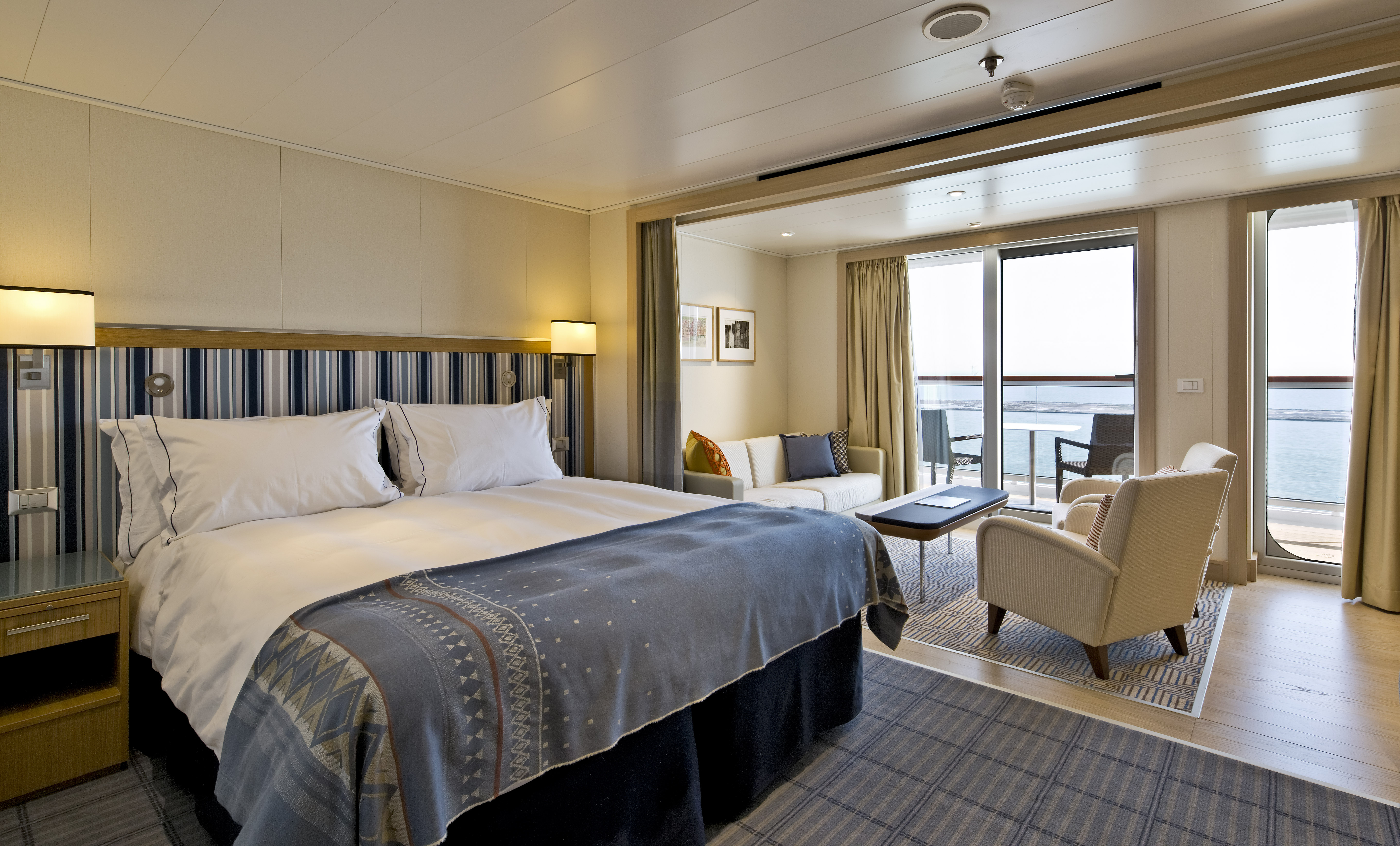
- Stateroom size: 808–1,215 sq ft (includes private veranda)
- Ocean-view two-room suite with floor-to-ceiling sliding glass door opening to a generous veranda (layout varies)
- Well-appointed living area & dining area that seats 4
- 11 AM Embarkation
- 11 AM priority stateroom access
- Priority shore excursion reservations 137 days prior to departure
- 3 priority reservations at each alternative restaurant 90 days prior to departure
- Priority spa treatment bookings 90 days prior to departure
- King-size Viking Explorer Bed (optional twin-bed configuration) with luxury linens & pillows
- Free Wi-Fi (connection speed may vary)
- 42" flat-screen TV featuring MSNBC, FOX News, National Geographic and more
- Additional 42" flat-screen interactive LCD TVs in living area
- 110/220 volt outlets & USB ports
- Large private bathroom with spacious glass-enclosed shower, bathtub, double-sink vanity, heated floor, anti-fog mirror & hair dryer
- Premium Freyja® toiletries
- Plush robes & slippers
- Direct-dial satellite phone & cell service
- Security safe
- Individual climate control
- Purified water refilled daily
- Welcome bottle of champagne
- Mini-bar with alcoholic beverages, soft drinks, water & snacks (replenished once daily)
- Binoculars
- Traditional Norwegian Marius-weave blanket
- Personal coffee machine with premium coffee & tea selections
- Stateroom steward & twice-daily housekeeping
- 24-hour room service
- Complimentary laundry, pressing & shoe shine services
- Under-bed suitcase storage space
- Spacious drawers & closet with wooden hangers
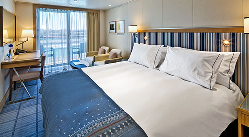
- Stateroom size: 432 sq ft (includes private veranda)
- Ocean-view suite with floor-to-ceiling sliding glass door opening to a full-size veranda
- Wheelchair Accessible (#6020, #6021)
- 11 AM Embarkation
- 11 AM priority stateroom access
- Priority shore excursion reservations 127 days prior to departure
- 3 priority reservations at each alternative restaurant 80 days prior to departure
- Priority spa treatment bookings 80 days prior to departure
- King-size Viking Explorer Bed (optional twin-bed configuration) with luxury linens & pillows
- Free Wi-Fi (connection speed may vary)
- 42" flat-screen TV featuring MSNBC, FOX News, National Geographic and more
- Additional 42" flat-screen interactive LCD TVs in sitting area
- 110/220 volt outlets & USB ports
- Large private bathroom with spacious glass-enclosed shower, double-sink vanity, heated floor, anti-fog mirror & hair dryer
- Premium Freyja® toiletries
- Plush robes & slippers
- Direct-dial satellite phone & cell service
- Security safe
- Individual climate control
- Purified water refilled daily
- Welcome bottle of champagne
- Mini-bar with alcoholic beverages, soft drinks, water & snacks (replenished once daily)
- Binoculars
- Traditional Norwegian Marius-weave blanket
- Personal coffee machine with premium coffee & tea selections
- Stateroom steward & twice-daily housekeeping
- 24-hour room service
- Complimentary laundry, pressing & shoe shine services
- Under-bed suitcase storage space
- Spacious drawers & closet with wooden hangers
- Stateroom size: 360 sq ft (includes private veranda)
- Ocean-view stateroom with floor-to-ceiling sliding glass door opening to full-size veranda
- 11 AM Embarkation
- 1 PM stateroom access
- Priority shore excursion reservations 117 days prior to departure
- 2 priority reservations at each alternative restaurant 70 days prior to departure
- Priority spa treatment bookings 70 days prior to departure
- King-size Viking Explorer Bed (optional twin-bed configuration) with luxury linens & pillows
- Free Wi-Fi (connection speed may vary)
- 42" flat-screen TV featuring MSNBC, FOX News, National Geographic and more
- 110/220 volt outlets & USB ports
- Large private bathroom with spacious glass-enclosed shower, heated floor, anti-fog mirror & hair dryer
- Premium Freyja® toiletries
- Plush robes & slippers
- Direct-dial satellite phone & cell service
- Security safe
- Individual climate control
- Purified water refilled daily
- Welcome bottle of champagne
- Mini-bar with alcoholic beverages, soft drinks, water & snacks (replenished once daily)
- Binoculars
- Traditional Norwegian Marius-weave blanket
- Personal coffee machine with premium coffee & tea selections
- Stateroom steward & twice-daily housekeeping
- 24-hour room service
- Complimentary pressing & shoe shine services
- Under-bed suitcase storage space
- Spacious drawers & closet with wooden hangers
- Stateroom size: 288 sq ft (includes private veranda)
- Ocean-view stateroom with floor-to-ceiling sliding glass door opening to full-size veranda
- 11 AM Embarkation
- 2 PM stateroom access
- Priority shore excursion reservations 107 days prior to departure.
- 1 priority reservation at each alternative restaurant 60 days prior to departure
- Priority spa treatment bookings 60 days prior to departure
- King-size Viking Explorer Bed (optional twin-bed configuration) with luxury linens & pillows
- Free Wi-Fi (connection speed may vary)
- 42" flat-screen TV featuring MSNBC, FOX News, National Geographic and more
- 110/220 volt outlets & USB ports
- Large private bathroom with spacious glass-enclosed shower, heated floor, anti-fog mirror & hair dryer
- Premium Freyja® toiletries
- Plush robes & slippers
- Direct-dial satellite phone & cell service
- Security safe
- Individual climate control
- Purified water refilled daily
- Mini-bar with soft drinks, water & snacks (replenished once daily)
- Binoculars
- Traditional Norwegian Marius-weave blanket
- Personal coffee machine with premium coffee & tea selections
- Stateroom steward & twice-daily housekeeping
- 24-hour room service
- Under-bed suitcase storage space
- Spacious drawers & closet with wooden hangers
- Stateroom size: 288 sq ft (includes private veranda)
- Ocean-view stateroom with floor-to-ceiling sliding glass door opening to full-size veranda
- 11 AM Embarkation
- 3 PM stateroom access
- Priority shore excursion reservations 100 days prior to departure
- King-size Viking Explorer Bed (optional twin-bed configuration) with luxury linens & pillows
- Free Wi-Fi (connection speed may vary)
- 42" flat-screen TV featuring MSNBC, FOX News, National Geographic and more
- 110/220 volt outlets & USB ports
- Large private bathroom with spacious glass-enclosed shower, heated floor, anti-fog mirror & hair dryer
- Premium Freyja® toiletries
- Plush robes & slippers
- Direct-dial satellite phone & cell service
- Security safe
- Individual climate control
- Purified water refilled daily
- Mini-bar with soft drinks, water & snacks
- Stateroom steward & twice-daily housekeeping
- 24-hour room service
- Under-bed suitcase storage space
- Spacious drawers & closet with wooden hangers
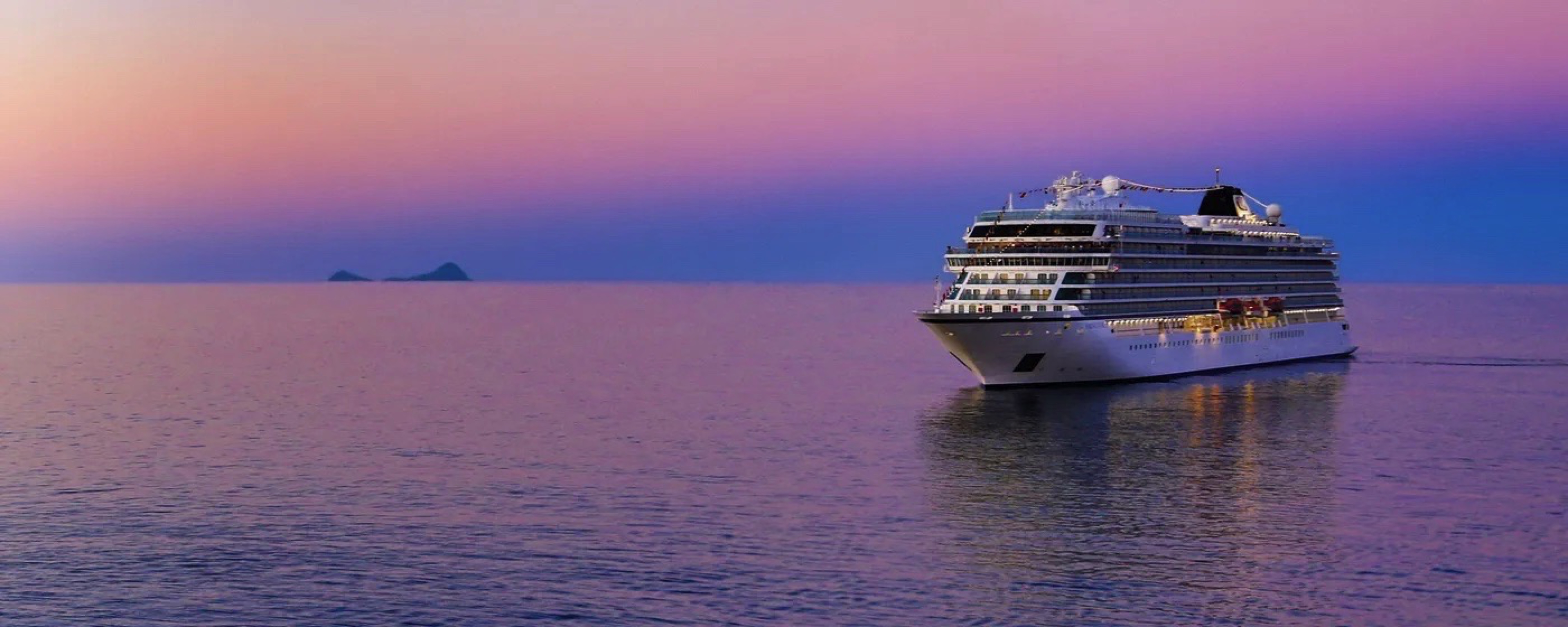
Viking Libra
Expand your horizons on our award-winning, all-veranda small ship, with just 998 guests, allowing us to dock where larger ships cannot.
Ship Facts
| Launch Year | 2027 | ||||||
| Refit Year | |||||||
| Language | en | ||||||
| Gross Tonnage | 48000 | ||||||
| Length | 239 | ||||||
| Width | 31 | ||||||
| Currency | EUR | ||||||
| Speed | 20 | ||||||
| Capacity | 998 | ||||||
| Crew Count | 465 | ||||||
| Deck Count | 9 | ||||||
| Cabin Count | 455 | ||||||
| Large Cabin Count | 0 | ||||||
| Wheelchair Cabin Count | 2 | ||||||
| Electrical Plugs |
|
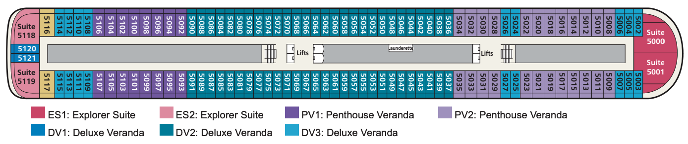
Deck 9
- Sports Deck
- Outdoor Gym & Yoga Area
- Lifts

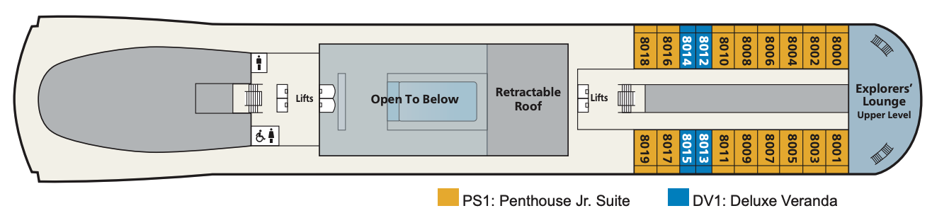
Deck 8
- Penthouse Jr. Suite
- Deluxe Veranda Staterooms
- Explorers Lounge (Upper Level)
- Lift
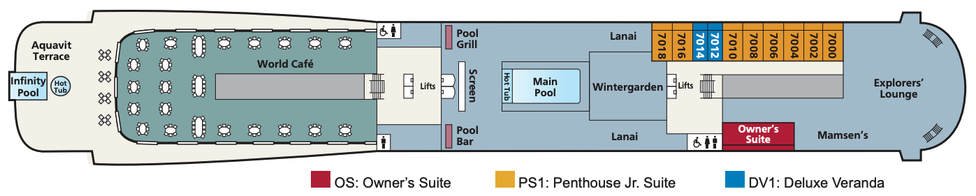
Deck 7
- Main Pool
- Infinity Pool
- Explorers' Lounge
- Wintergarden
- Aquavit Terrace
- World Cafe
- Mamsen's
- Lanai
- Pool Grill
- Outdoor Screen
- Pool Bar
- Owner's Suite
- Penthouse Jr. Suite
- Deluxe Veranda Staterooms
- Lifts
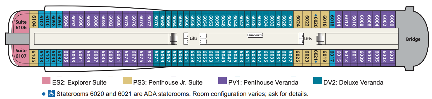
Deck 6
- Penthouse Jr. Suites
- Penthouse Veranda Staterooms
- Deluxe Veranda Staterooms
- Explorer Suites
- Lifts
Deck 5
- Explorer Suites
- Penthouse Veranda Staterooms
- Deluxe Veranda Staterooms
- Lifts
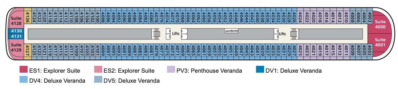
Deck 4
- Explorer Suite
- Penthouse Veranda Staterooms
- Deluxe Veranda Staterooms
- Lifts
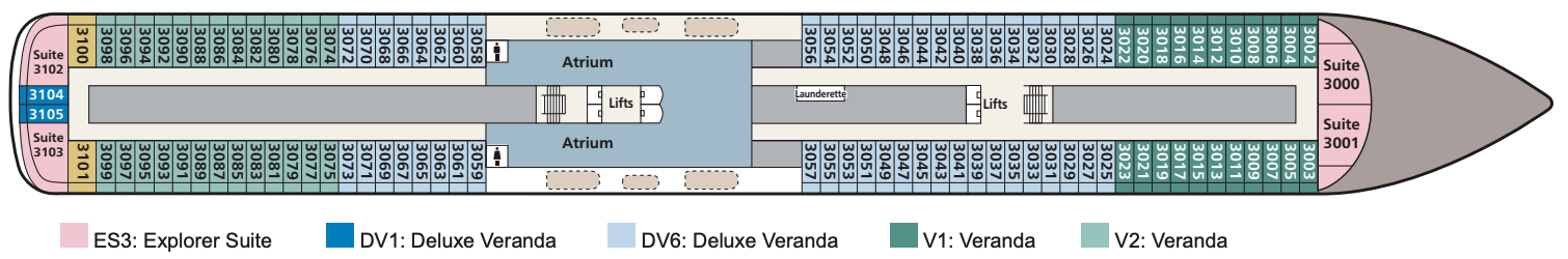
Deck 3
- Atrium
- Penthouse Junior Suites
- Explorer Suites
- Deluxe Veranda Staterooms
- Veranda Staterooms
- Lifts
Deck 2
- The Restaurant
- Atrium
- Promenade
- Torshavn
- The Nordic Shop
- Shop
- Cinema
- Bar
- The Theatre
- Lifts

Deck 1
- The Kitchen Table
- The Chef's Table
- Manfredi's Italian Restaurant
- Private Dining
- The Living Room
- Bar
- Guest Services
- Shop
- Hair Salon
- Fitness Centre
- The Nordic Spa
- Lifts

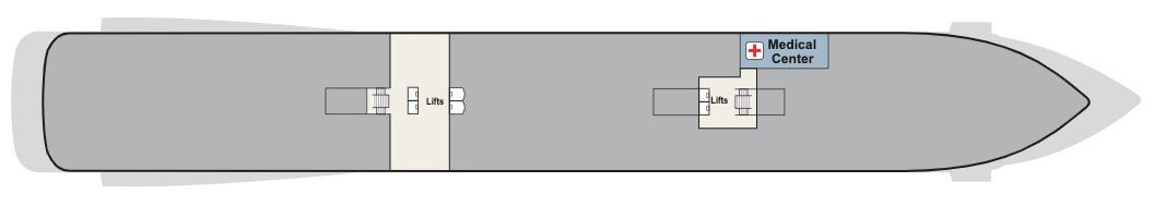
Deck a
Medical Centre
Regional cuisine, always available classics and the most al fresco dining on any waterway.
The Restaurant
Our main dining venue, The Restaurant, offers the highest onboard dining experience. Regional cuisine and always available classics are served surrounded by sweeping exterior views through all-glass walls.
Manfredi's
Inspired by Italy’s beloved trattorias, Manfredi’s offers the best of Italian cuisine with a private dining room providing an opportunity to have an intimate meal with family or friends.
The Pool Grill
In a poolside atmosphere that welcomes lounging and leisurely dips in the water, the Pool Grill offers casual fare prepared to order. For a lighter meal, a small salad bar is available.
Mamsen's
Located in the Explorers’ Lounge and named for “Mamsen,” the Hagen family matriarch, this venue offers Norwegian specialties for breakfast, lunch, an afternoon snack or evening treat.
Aquavit Terrace®
The revolutionary Aquavit Terrace is a magical space where your destination is your dining room. Located outside the World Café, it provides more al fresco dining experiences than on any ship at sea.
The Chef’s Table
The sommeliers and culinary masters at The Chef’s Table create the perfect food and wine pairings during a multi-course tasting, enjoyed in the restaurant or in a private dining room.
There is no such thing as a typical evening onboard, nor shortage of entertainment. Whether it’s a cabaret, opera, classical or popular music concert, the theatre is home to an inspiring choice of productions. Film fans can feast on classic movies and the latest blockbusters in one of the cinemas. Or take in the breeze as you take in a film at the open-air cinema.
When the stars come out, so does the entertainment. From sipping an artisan gin and exchanging stories with newfound friends in Paps, the Explorer’s Bar, to enjoying the sounds of the guitarist, pianist and singer in one of the lounges. Take a seat in the plush theatre for a dazzling show, or dance the night away in Torshavn nightclub. Sing along to a band, or lie back by the pool under the night sky to watch a movie on the giant screen – the popcorn is on the house. However you choose to spend your evenings on board, being bored is never an option
The Wintergarden
When you yearn for serenity, there is no better place on ship than a visit to the Wintergarden. This charming, airy space around the main pool is perfect for relaxing in clean, uncluttered Scandinavian-designed environment. Even here, our focus is on enrichment, as this is the place to witness a tea ceremony, or indulge in an afternoon tea service, complete with hand-selected teas, finger sandwiches and pastries.
Afternoon tea is served at the Wintergarden, adjacent to the Main Pool. Decadent finger sandwiches, scones and desserts are accompanied by international teas, tea ceremony demonstrations and relaxing classical music from the Viking Resident Musicians.
Viking Bar
Enjoy a cocktail in the Viking Bar, which is located on the ground floor of the atrium.
The Viking Living Room
The ideal setting for relaxation, The Viking Living Room draws guests together at the heart of the ship. Spacious seating, calming classical compositions performed by the Viking Resident Musicians and enriching activities foster camaraderie.
The Theatre & Cinema
The perfect venue to attend lectures or watch movies, our state-of-the-art, multipurpose Theatre seats up to 450 guests and can be transformed into two HD cinemas for TED Talks, Destination Insights and occasional specialised seminars.
Explorers' Lounge
With two-story panoramic windows for maximum views, the Explorers’ Lounge is inspired by epic journeys of discovery. This inviting space is the perfect place to share a cocktail with friends or relax while taking in the scenery.