Iceland, Norway & British Isles
Iceland, Norway & British Isles
Cruise overview
WHY BOOK WITH US?
- ✔ The Deluxe Cruises’ team has extensive experience in ultra-luxury cruising.
- ✔ Call now to speak to our helpful and experienced Cruise Concierge team.
- ✔ Enjoy our Unique Deluxe Cruises Bonus for substantial savings.
- ✔ Our team will tailor your holiday to your exacting requirements.
- ✔ As agents, we work under the protection of each cruise lines ABTA / ATOL licences
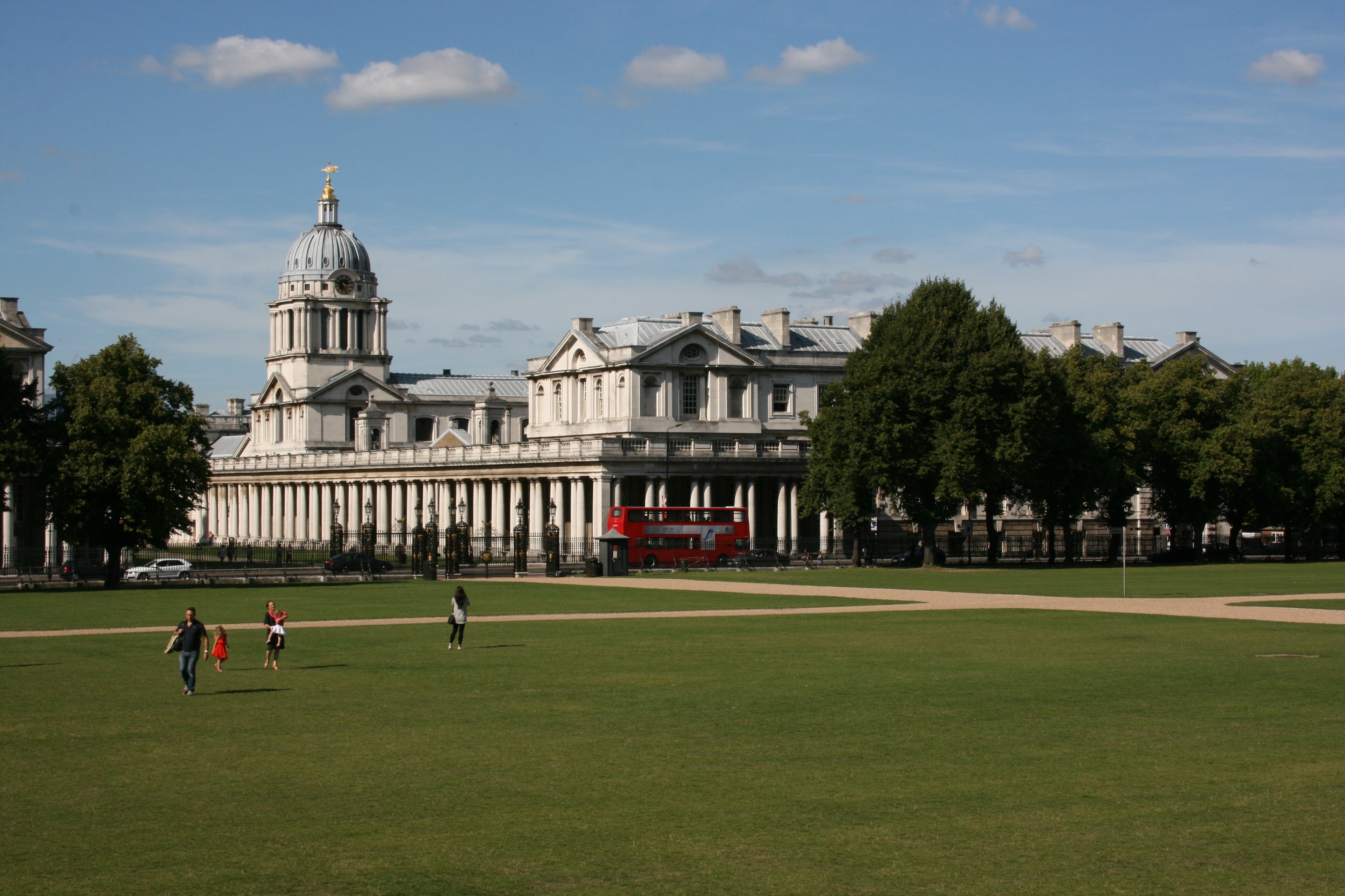
About London (Greenwich)
About 8 miles downstream—which means seaward, to the east—from central London, Greenwich is a small borough that looms large across the world. Once the seat of British naval power, it is not only home to the Old Royal Observatory, which measures time for our entire planet, but also the Greenwich Meridian, which divides the world into two—you can stand astride it with one foot in either hemisphere. Bear in mind that the journey to Greenwich is an event in itself. In a rush, you can take the driverless DLR train—but many opt for arriving by boat along the Thames. This way, you glide past famous sights on the London skyline (there’s a guaranteed spine chill on passing the Tower) and ever-changing docklands, and there’s usually a chirpy Cock-er-ney navigator enlivening the journey with his fun commentary. A visit to Greenwich feels like a trip to a rather elegant seaside town—albeit one with more than its fair share of historic sites. The grandiose Old Royal Naval Hospital, designed by Christopher Wren, was originally a home for veteran sailors. Today it’s a popular visitor attraction, with a more glamorous second life as one of the most widely used movie locations in Britain. Greenwich was originally home to one of England's finest Tudor palaces, and the birthplace of Henry VIII, Elizabeth I, and Mary I. Inigo Jones built what is considered the first "classical" building in England in 1616—the Queen's House, which now houses a collection of fine art. Britain was the world’s preeminent naval power for over 500 years, and the excellent National Maritime Museum> details that history in an engaging way. Its prize exhibits include the coat worn by Admiral Lord Nelson (1758–1805) in his final battle—bullet hole and all. The 19th-century tea clipper Cutty Sark was nearly destroyed by fire in 2007, but reopened in 2012 after a painstaking restoration. Now it’s more pristine than ever, complete with an impressive new visitor center. Greenwich Park, London's oldest royal park, is still home to fallow red deer, just as it has been since they were first introduced here for hunting by Henry VIII. The Ranger's House now houses a private art collection, next door to a beautifully manicured rose garden. Above it all is the Royal Observatory, where you can be in two hemispheres at once by standing along the Greenwich Meridian Line, before seeing a high-tech planetarium show. Toward north Greenwich, the hopelessly ambitious Millennium Dome has been successfully reborn as the O2 and now hosts major concerts and stand-up comedy gigs. More adventurous visitors can also go Up the O2 on a climbing expedition across the massive domed surface. Meanwhile, those who prefer excursions of a gentler kind may prefer to journey a couple of miles south of the borough, farther out into London’s southern suburbs, to the shamefully underappreciated Eltham Palace. Once a favorite of Henry VIII, parts of the mansion were transformed into an art deco masterpiece during the 1930s.
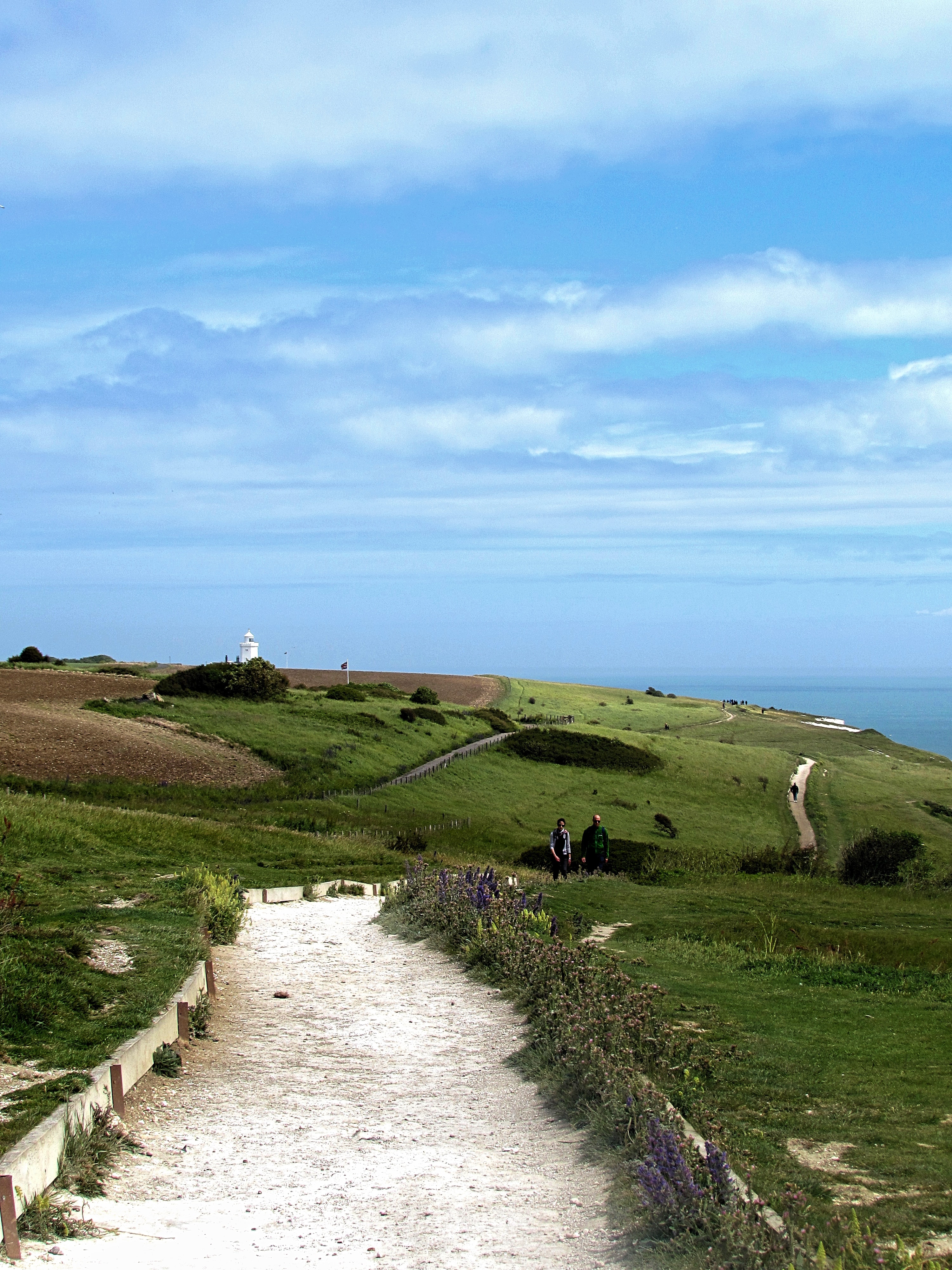
About Dover
Known as the gateway of England, Dover welcomes millions of visitors from all over the globe each year in its role as the ferry capital of the world and the second busiest cruise port in the UK. The White Cliffs Country has a rich heritage. Within the walls of the town’s iconic castle, over 2,000 years of history waits to be explored, whilst the town’s museum is home to the Dover Bronze Age Boat, the world’s oldest known seagoing vessel. The town’s cliffs that are a welcome sight for today's cross-channel travellers also served as the control centre for the Dunkirk evacuation in 1940.
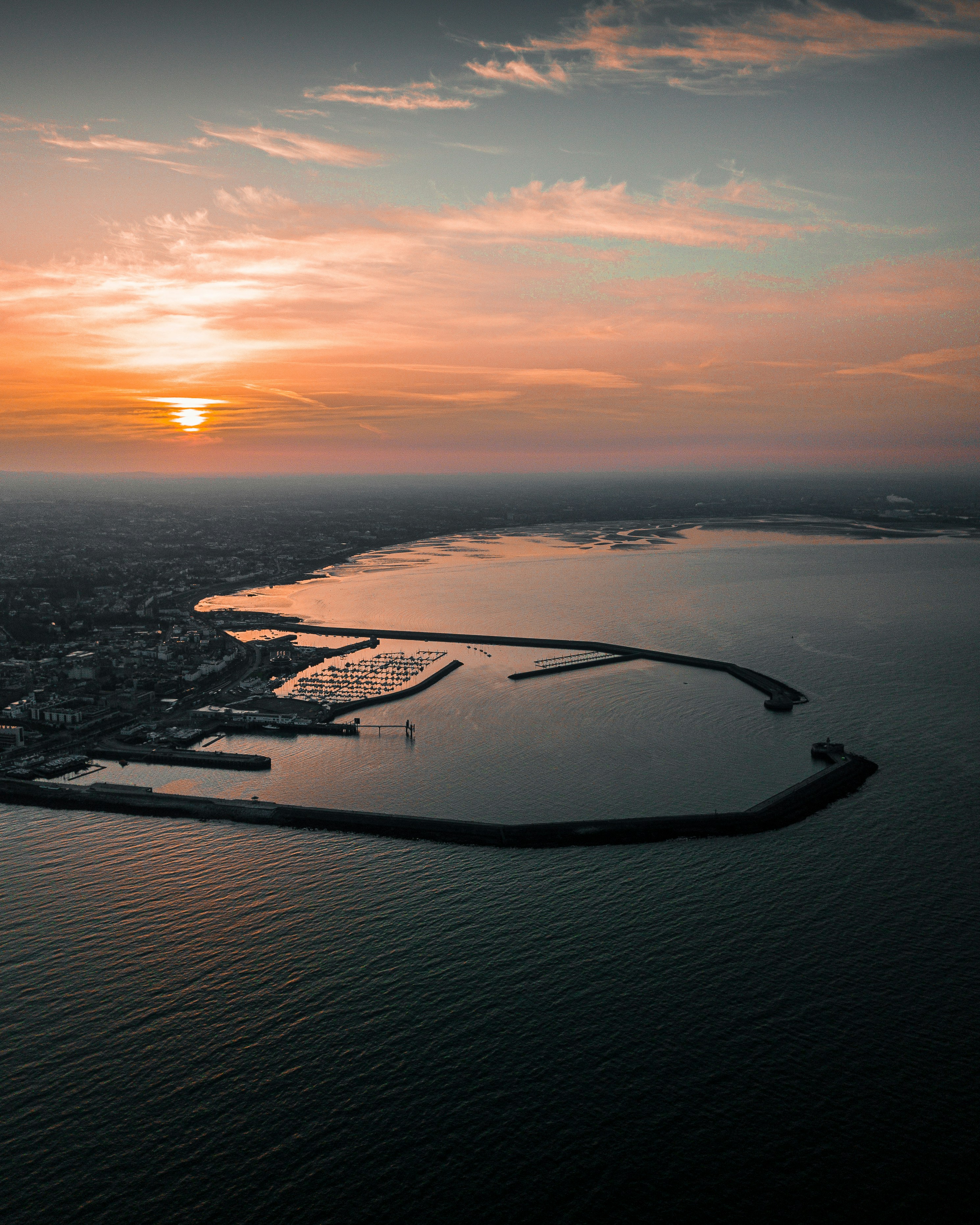
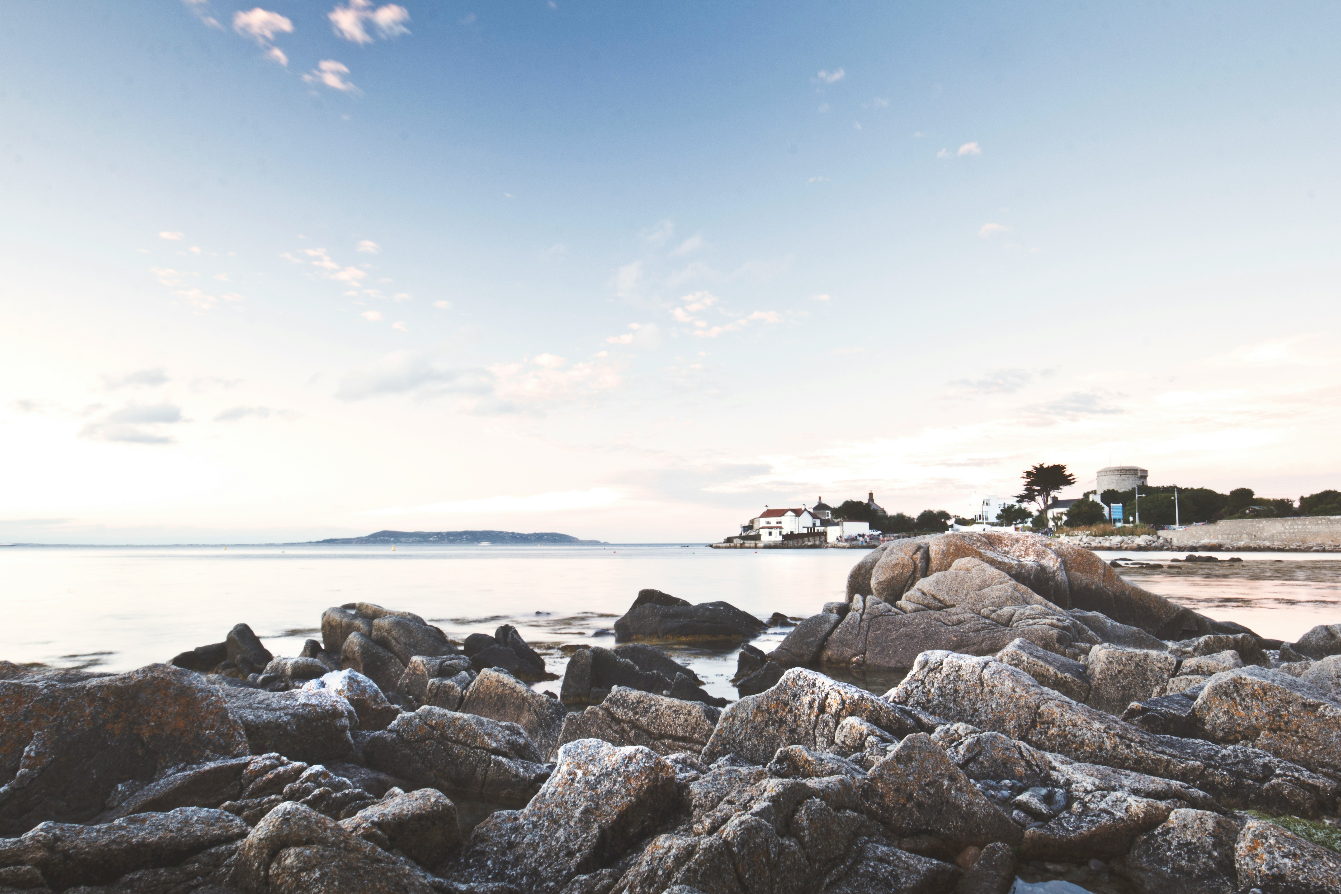
About Dun Laoghaire
About Holyhead
Once a northern defense post against Irish raiders, Holyhead later became best known as a ferry port for Ireland. The dockside bustle is not matched by the town, however, which maintains just a small population. Nonetheless, thousands of years of settlement have given Holyhead rich historical ruins to explore, with more in the surrounding hiking friendly landscape.
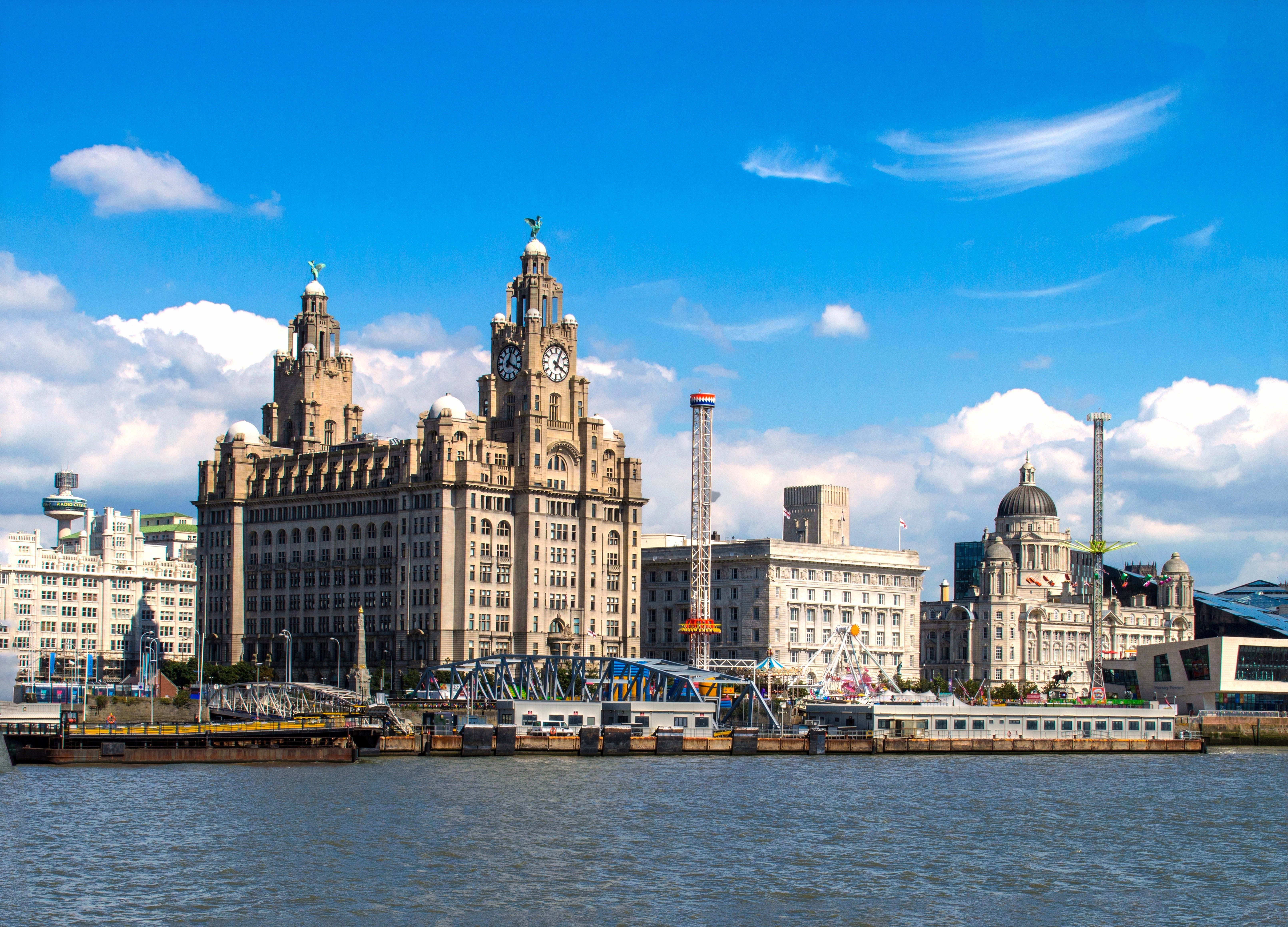
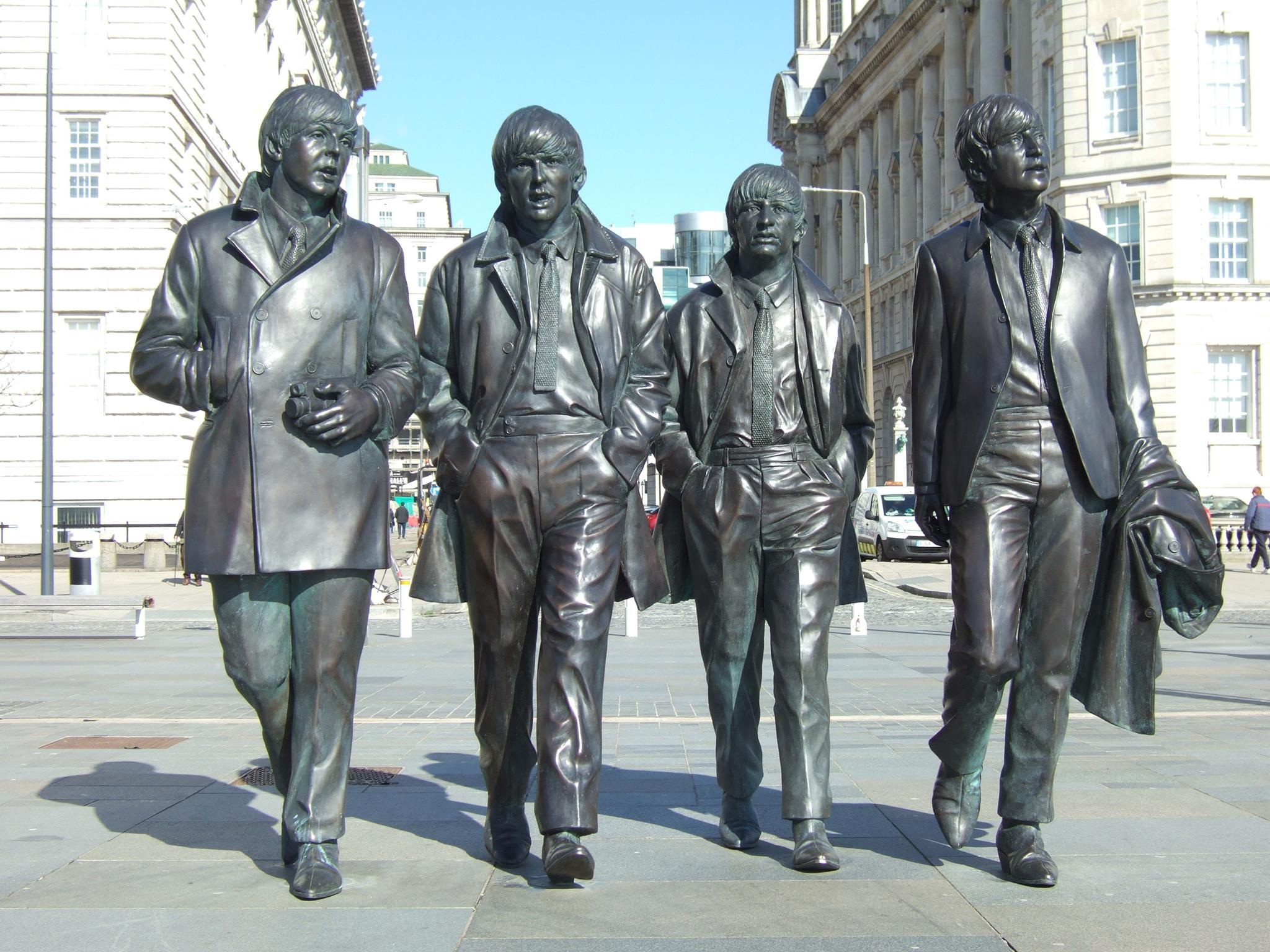
About Liverpool
From world-class attractions and sports to legendary music, Liverpool offers old-world charm with modern sophistication, underpinned by a rich cultural history.
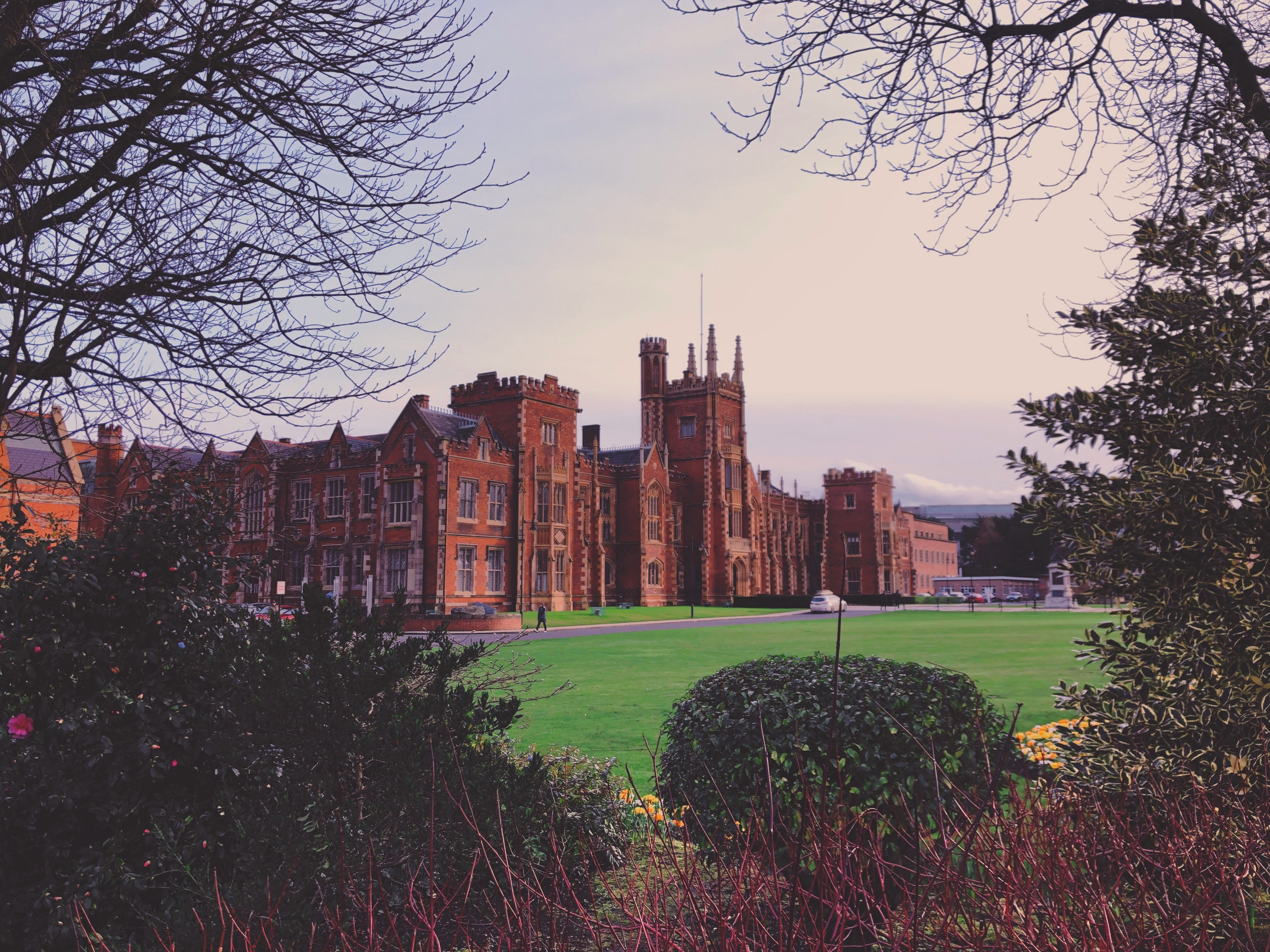
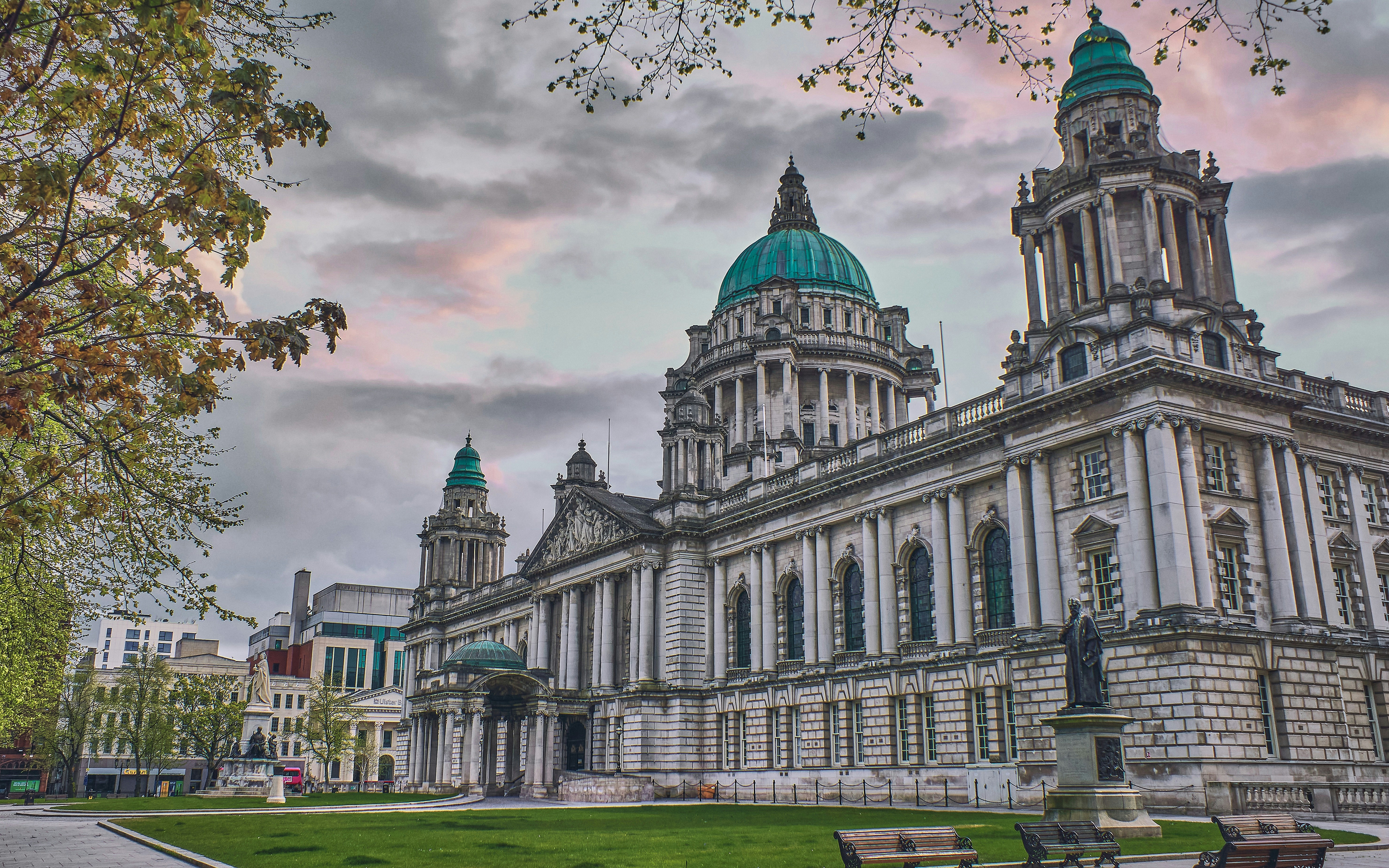
About Belfast
Before English and Scottish settlers arrived in the 1600s, Belfast was a tiny village called Béal Feirste ("sandbank ford") belonging to Ulster's ancient O'Neill clan. With the advent of the Plantation period (when settlers arrived in the 1600s), Sir Arthur Chichester, from Devon in southwestern England, received the city from the English Crown, and his son was made Earl of Donegall. Huguenots fleeing persecution from France settled near here, bringing their valuable linen-work skills. In the 18th century, Belfast underwent a phenomenal expansion—its population doubled every 10 years, despite an ever-present sectarian divide. Although the Anglican gentry despised the Presbyterian artisans—who, in turn, distrusted the native Catholics—Belfast's growth continued at a dizzying speed. The city was a great Victorian success story, an industrial boomtown whose prosperity was built on trade, especially linen and shipbuilding. Famously (or infamously), the Titanic was built here, giving Belfast, for a time, the nickname "Titanic Town." Having laid the foundation stone of the city's university in 1845, Queen Victoria returned to Belfast in 1849 (she is recalled in the names of buildings, streets, bars, monuments, and other places around the city), and in the same year, the university opened under the name Queen's College. Nearly 40 years later, in 1888, Victoria granted Belfast its city charter. Today its population is nearly 300,000, tourist numbers have increased, and this dramatically transformed city is enjoying an unparalleled renaissance.This is all a welcome change from the period when news about Belfast meant reports about "the Troubles." Since the 1994 ceasefire, Northern Ireland's capital city has benefited from major hotel investment, gentrified quaysides (or strands), a sophisticated new performing arts center, and major initiatives to boost tourism. Although the 1996 bombing of offices at Canary Wharf in London disrupted the 1994 peace agreement, the ceasefire was officially reestablished on July 20, 1997, and this embattled city began its quest for a newfound identity.Since 2008, the city has restored all its major public buildings such as museums, churches, theaters, City Hall, Ulster Hall—and even the glorious Crown Bar—spending millions of pounds on its built heritage. A gaol that at the height of the Troubles held some of the most notorious murderers involved in paramilitary violence is now a major visitor attraction.Belfast's city center is made up of three roughly contiguous areas that are easy to navigate on foot. From the south end to the north, it's about an hour's leisurely walk.
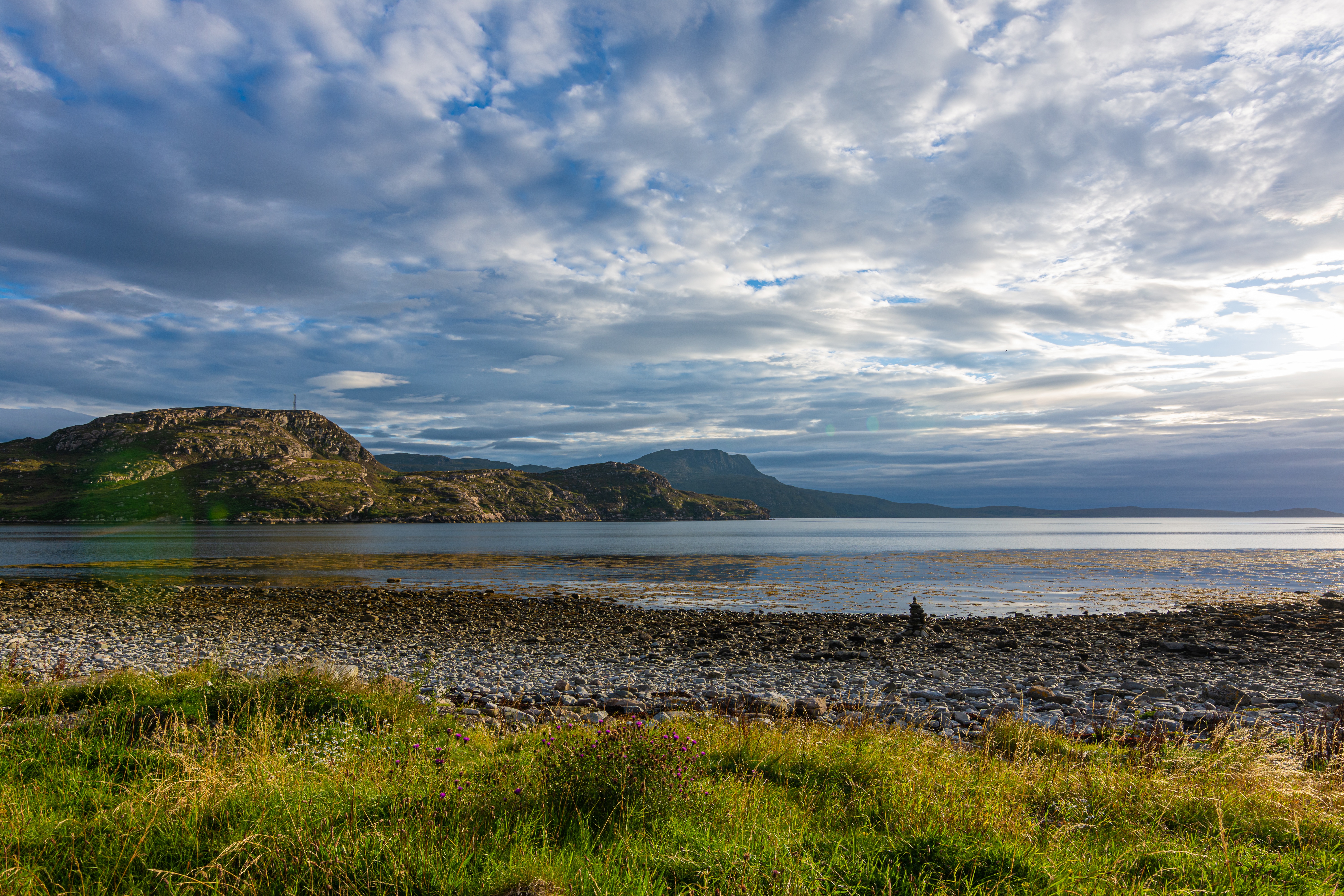
About Ullapool
Ullapool is an ideal base for hiking throughout Sutherland and taking wildlife and nature cruises, especially to the Summer Isles. By the shores of salty Loch Broom, the town was founded in 1788 as a fishing station to exploit the local herring stocks. There's still a smattering of fishing vessels, as well as visiting yachts and foreign ships. When their crews fill the pubs, Ullapool has a cosmopolitan feel. The harbor area comes to life when the Lewis ferry arrives and departs.
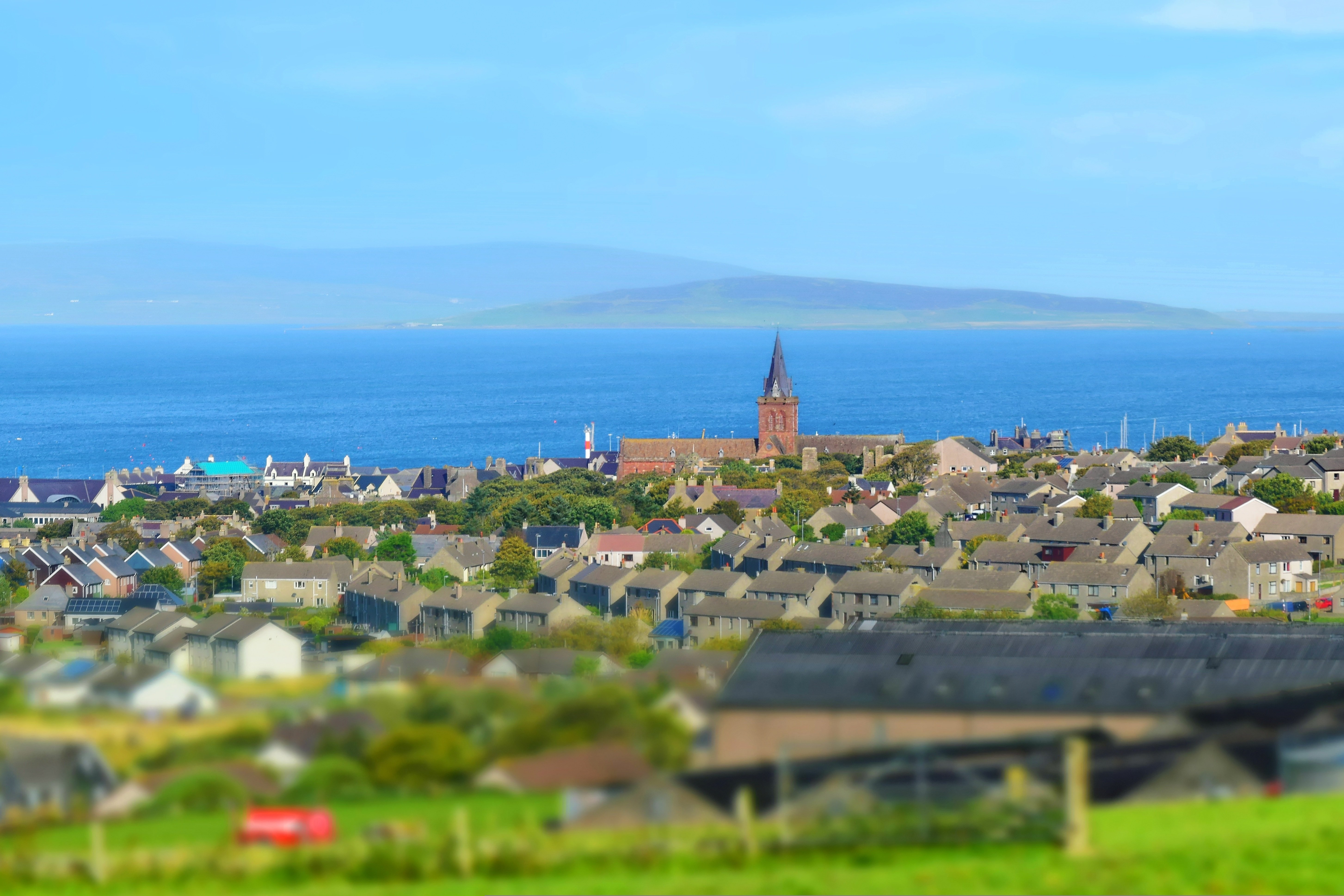
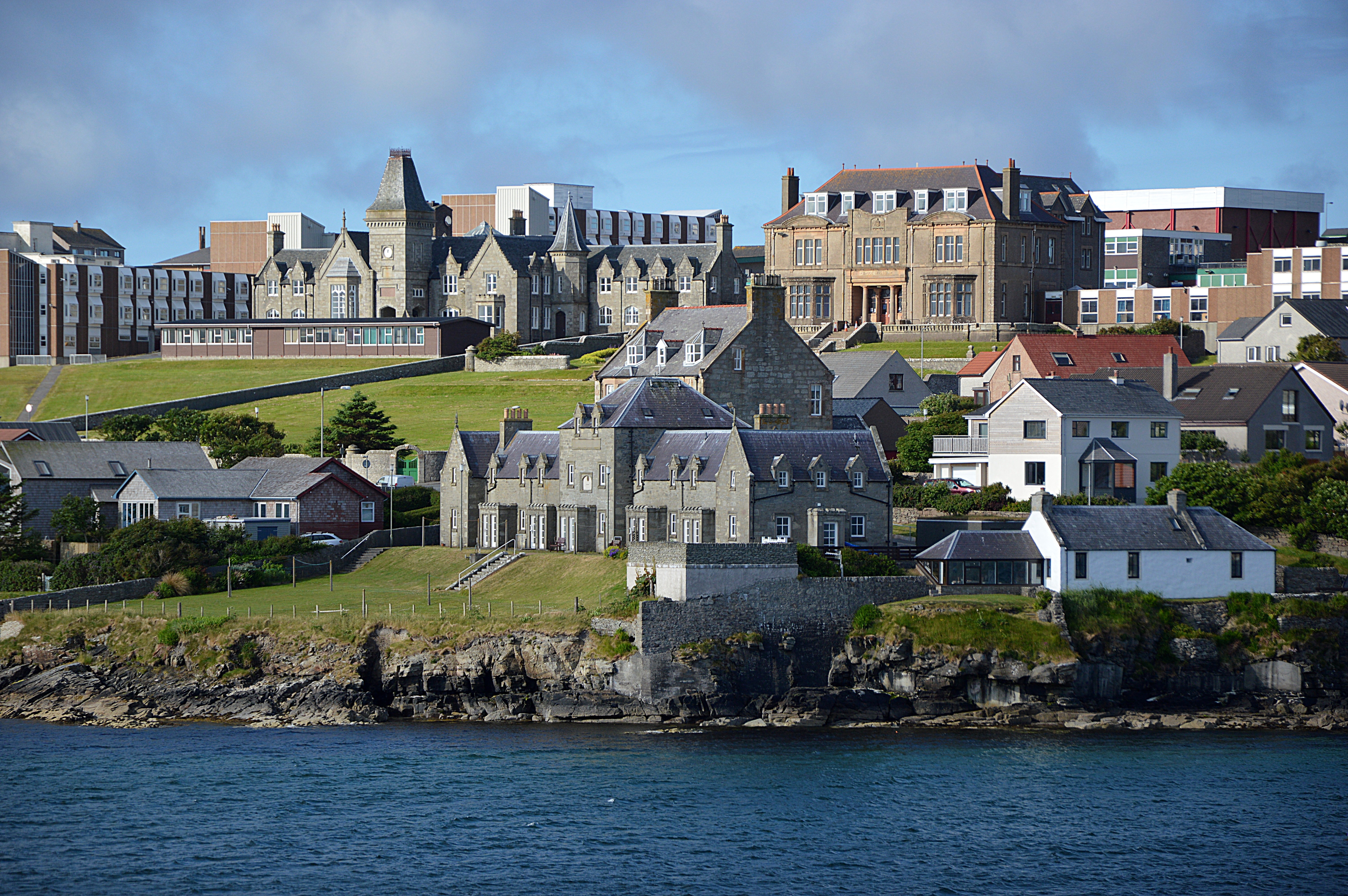
About Kirkwall, Orkney Islands
In bustling Kirkwall, the main town on Orkney, there's plenty to see in the narrow, winding streets extending from the harbor. The cathedral and some museums are highlights.

About Newhaven/Edinburgh
Newhaven is a district in the City of Edinburgh, Scotland, between Leith and Granton and about 2 miles north of the city centre, just north of the Victoria Park district. Formerly a village and harbour on the Firth of Forth.
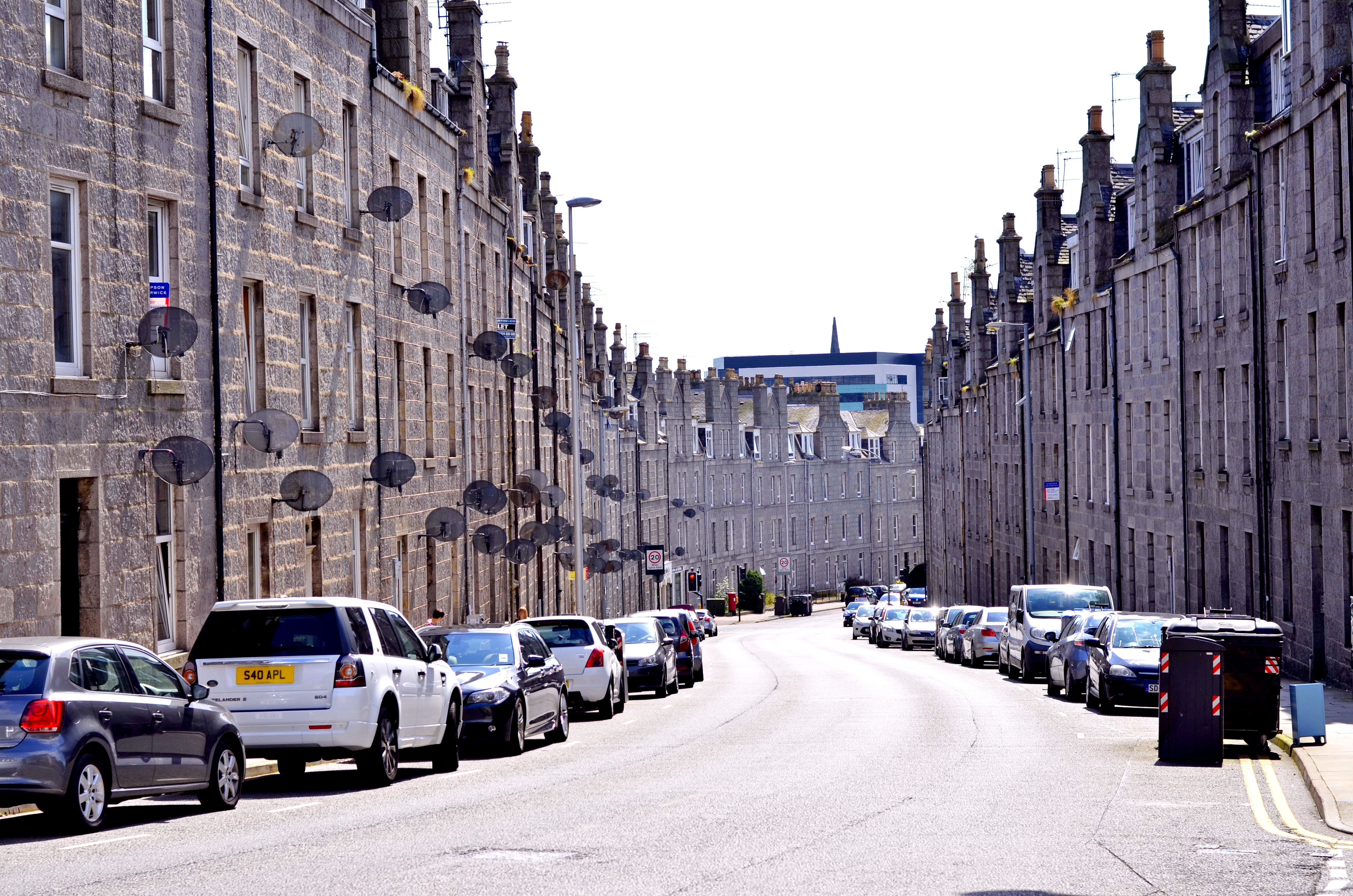
About Aberdeen
With close to 220,000 inhabitants, Aberdeen is Scotland's third most populous city. Locally quarried grey granite was used during the mid-18th to mid-20th centuries for many of Aberdeen's buildings, and hence the nicknames it has earned as the Granite City, or the Grey City. Aberdeen granite was also used to build the terraces of the Houses of Parliament and Waterloo Bridge in London. Since the discovery of North Sea oil in the 1970s, Aberdeen has also been called the Oil Capital of Europe or the Energy Capital of Europe. It is no wonder that because of the oil fields in the North Sea, Aberdeen's seaport is very important. The Heliport with its flights to the oil fields is one of the busiest commercial heliports in the world.
About Lerwick, Shetland Islands
Founded by Dutch fishermen in the 17th century, Lerwick today is a busy town and administrative center. Handsome stone buildings—known as lodberries—line the harbor; they provided loading bays for goods, some of them illegal. The town's twisting flagstone lanes and harbor once heaved with activity, and Lerwick is still an active port today. This is also where most visitors to Shetland dock, spilling out of cruise ships, allowing passengers to walk around the town.

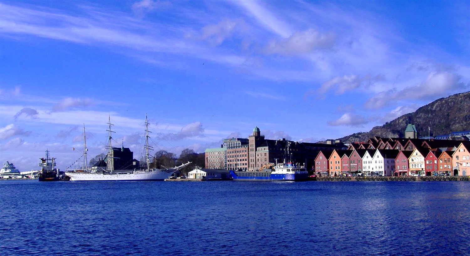
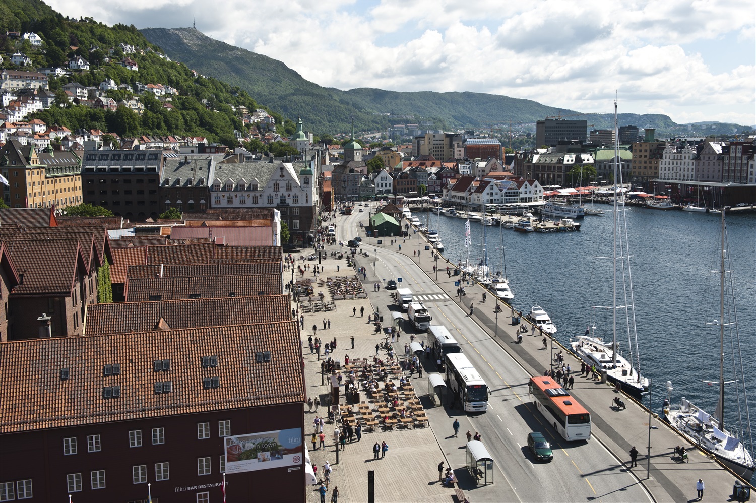
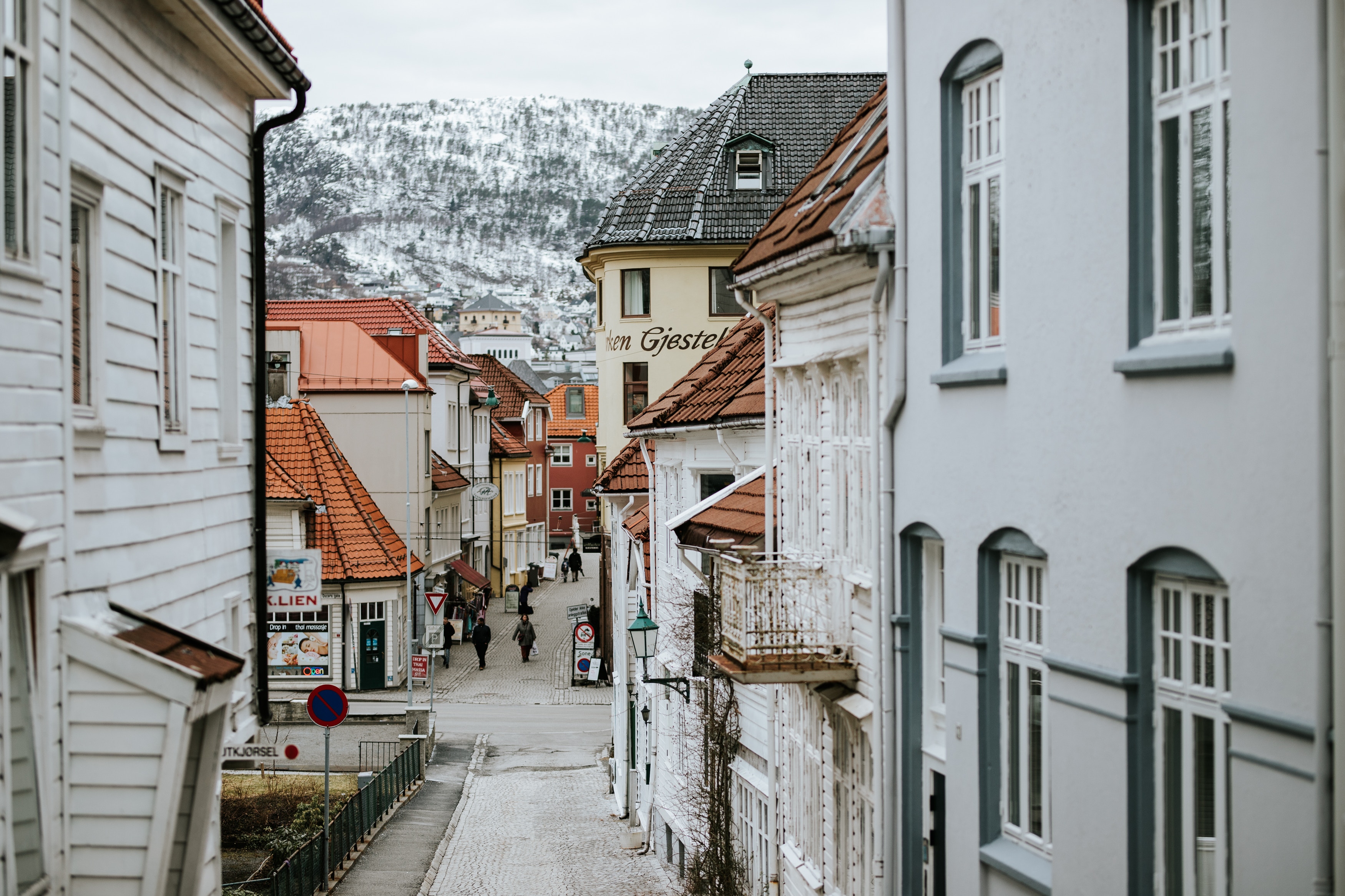
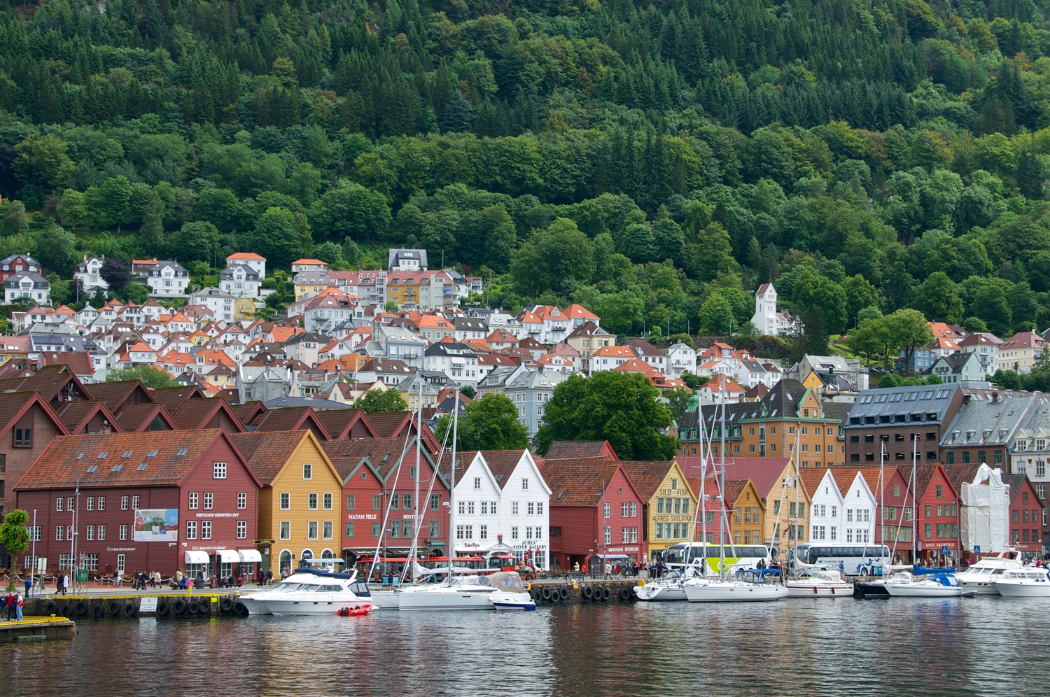
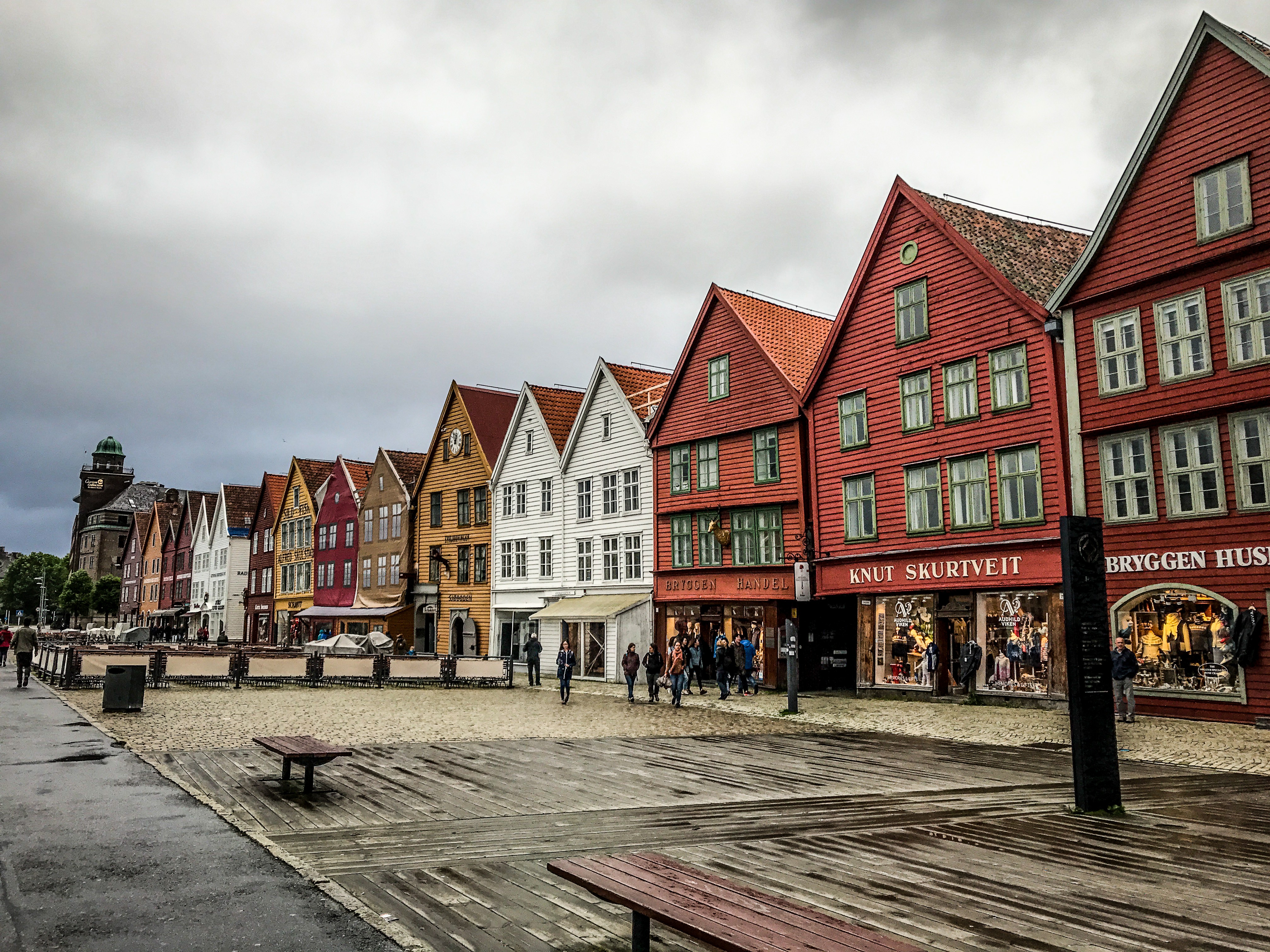
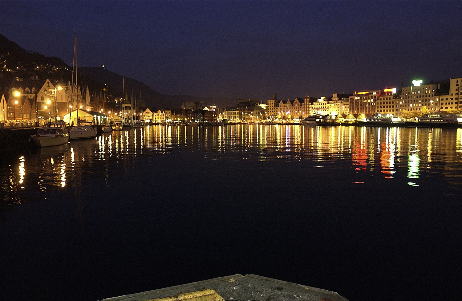
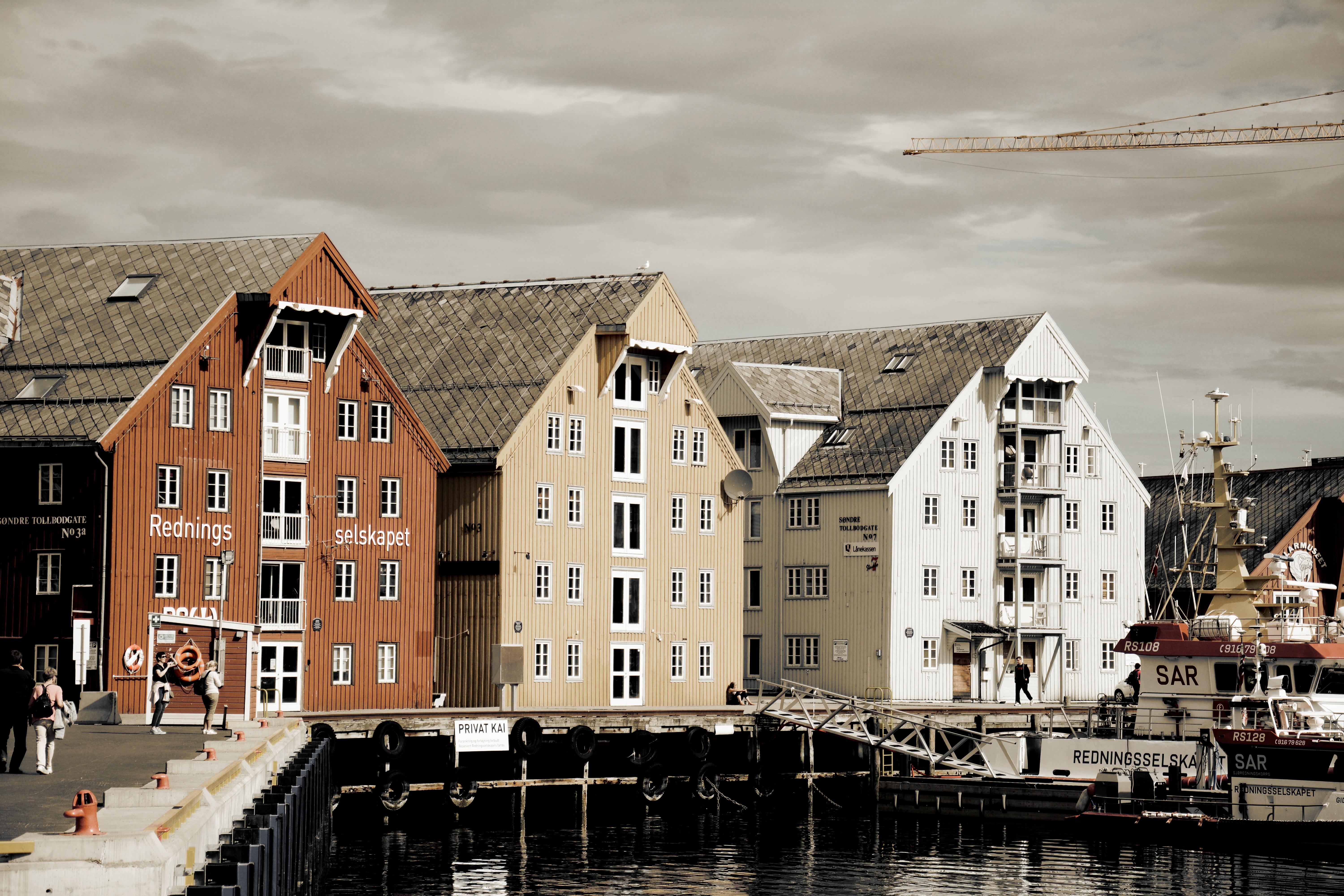
About Bergen
Surrounded by mountains and sparkling fjords, the waterside city of Bergen has a spectacular setting. There has been a settlement here since medieval times and the colourful waterfront buildings of the Hanseatic wharf, known as Bryggen, are testament to its fascinating history of trade. As Norway’s best known medieval settlement, the Bryggen is listed by UNESCO as a World Heritage Site. Our comprehensive selection of excursions allows you to discover the many sides of Bergen, such as the fish market and narrow cobbled streets, as well as stunning views of the city from the summit of Mt Fløyen. Alternatively, those who have visited the city previously may like to experience one of the tours that travel further afield. Just 300 yards from the main piers, you will find the Fortress Museum (Fesningsmuseum), which has an interesting collection of objects related to World War II.
About Eidsdal
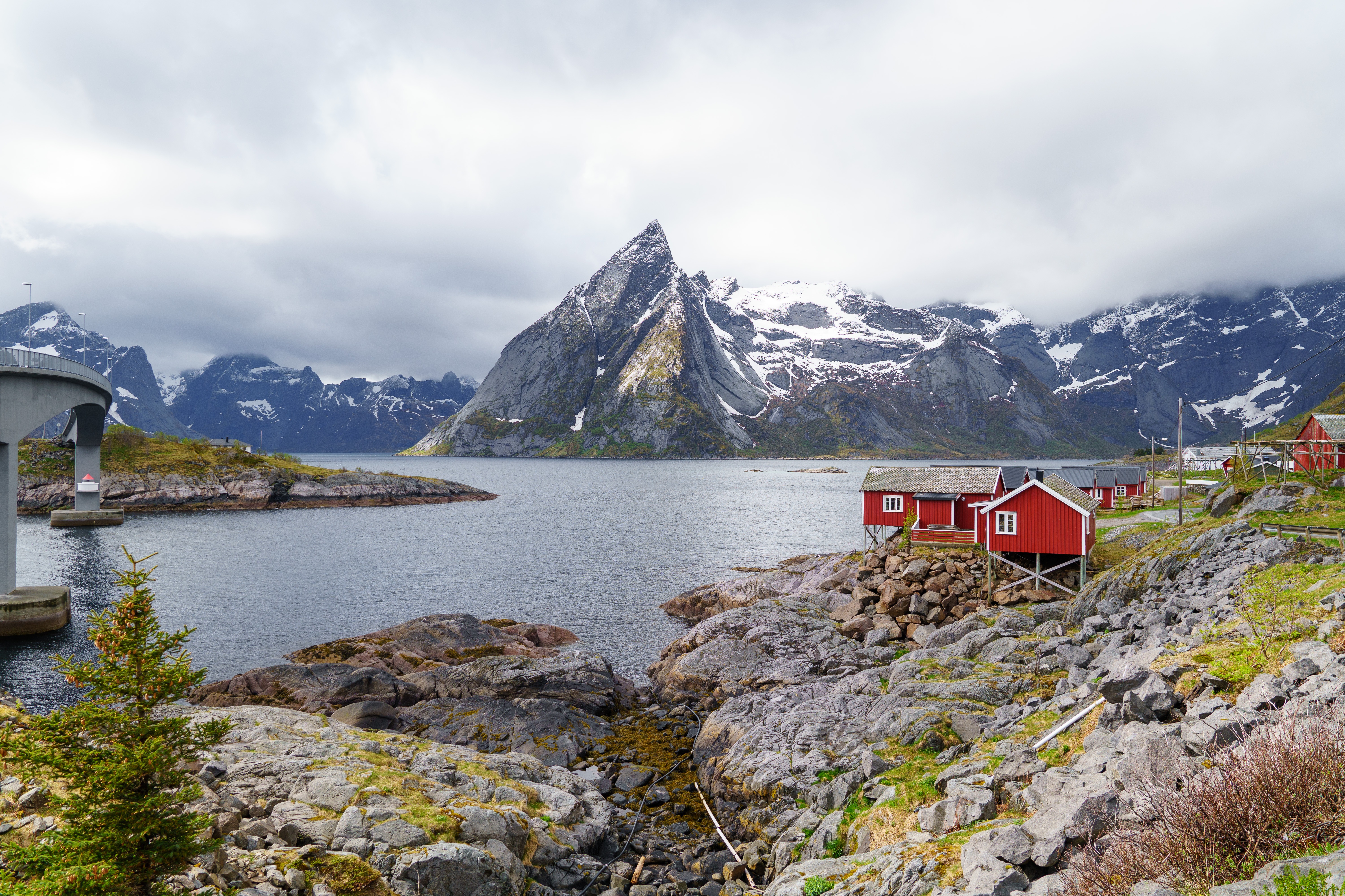
About Leknes
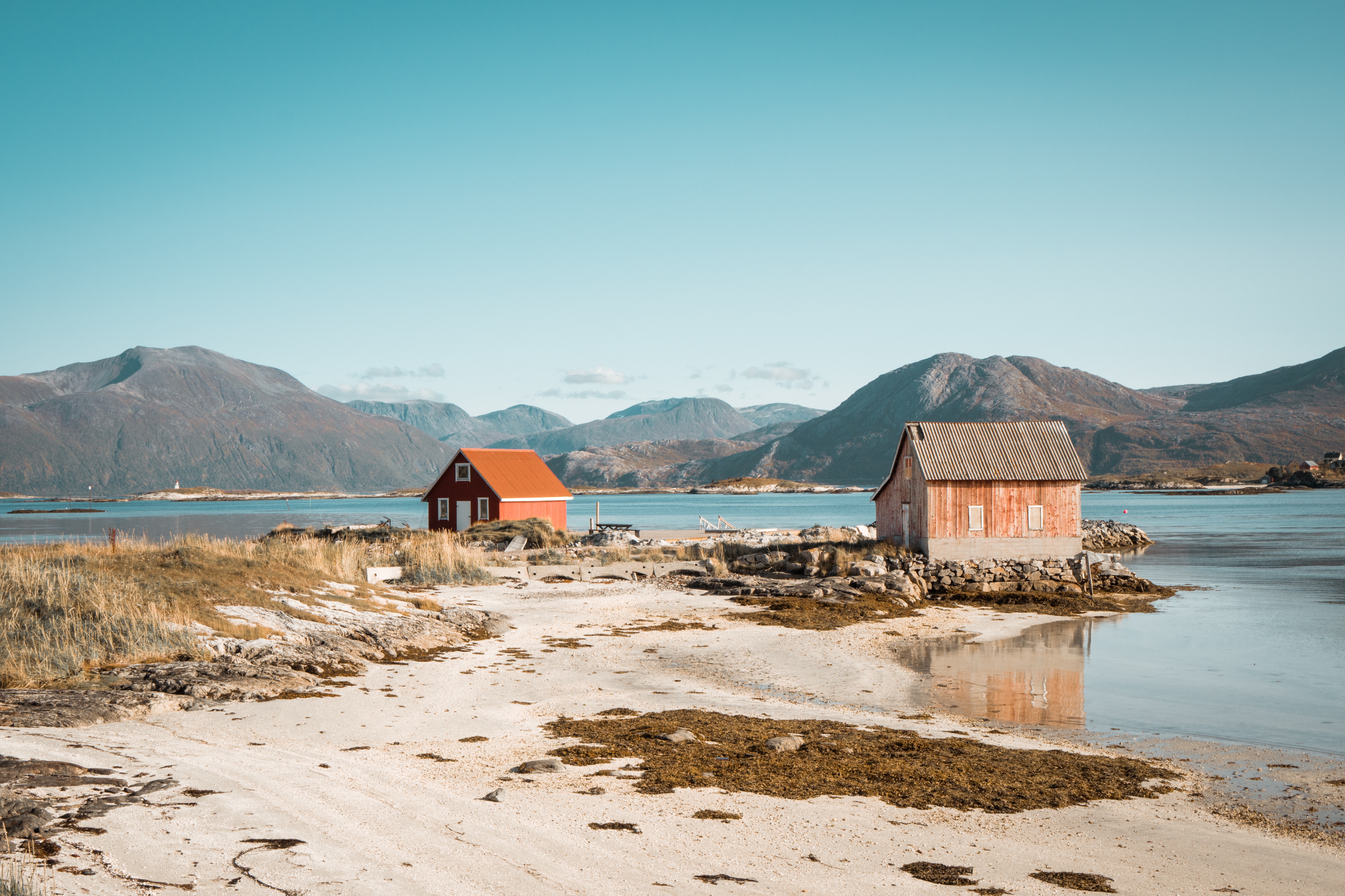
Blessed with some of the most spectacular scenery in Norway (and goodness only know that this is land blessed with rolling hills, soaring peaks, valleys, tranquil fjords and white sandy beaches, so the competition is high!), Leknes is what Norway is meant to be. Pretty red houses lay dotted on the green covered hills, and the midnight sun is rises above the horizon from 26th May to 17th July, (while in winter the sun does not rise from 9th December to 4th January). Part of the stunning Lofoten islands, this pretty port offers much in the way of recreation, although understandably most of this is outdoor based. Take a boat ride around the archipelago, try your hand at some deep sea fishing, or simply stroll thought the city centre, perhaps rent a bicycle and discover the hinterland at your own pace. Bikes can be easily rented and note that hybrid and electric bikes are a great option for those who might be a bit out of practice with their pedal power. Gastronomes with a sweet tooth will be rewarded with one simple pleasure: a fresh-from-the-oven skillingsbolle – or big, fluffy cinnamon rolls, fit for indulging in if all the fresh air has made you hungry! Look out for the quirky coffee shops, settle down for some Norwegian kos, say takk for maten and enjoy!
About Narvik
At 68 degrees North, Narvik lies 140 miles inside the Arctic Circle. Its history as a settlement began in the Stone Age, and Vikings are also known to have lived in the area. The modern town came into existence in the 1870s to serve the needs of the iron industry. Iron ore is mined in neighbouring Sweden and, as an ice-free port, Narvik was chosen as the ideal export location. The LKAB mining corporation is still a major employer and landowner in the area, shipping some 25,000,000 tons of iron ore from the port annually. This industrial heritage has shaped the town and now forms the basis of some of its most popular tourist attractions. In 1883 a co-owned British-Swedish company was given permission to build a railway connecting the Swedish iron mines in Kiruna to Narvik. It opened in 1902 and the town, then christened Victoriahavn, grew up around it. Unfortunately much of Narvik was destroyed in World War II. Invaded by the Nazis on 9 April 1940, it was later retaken by the Allies, representing the first military defeat of Hitler’s troops, but was evacuated as part of Operation Alphabet when it came under German occupation again. The local war museum documents the turbulent history of this period.
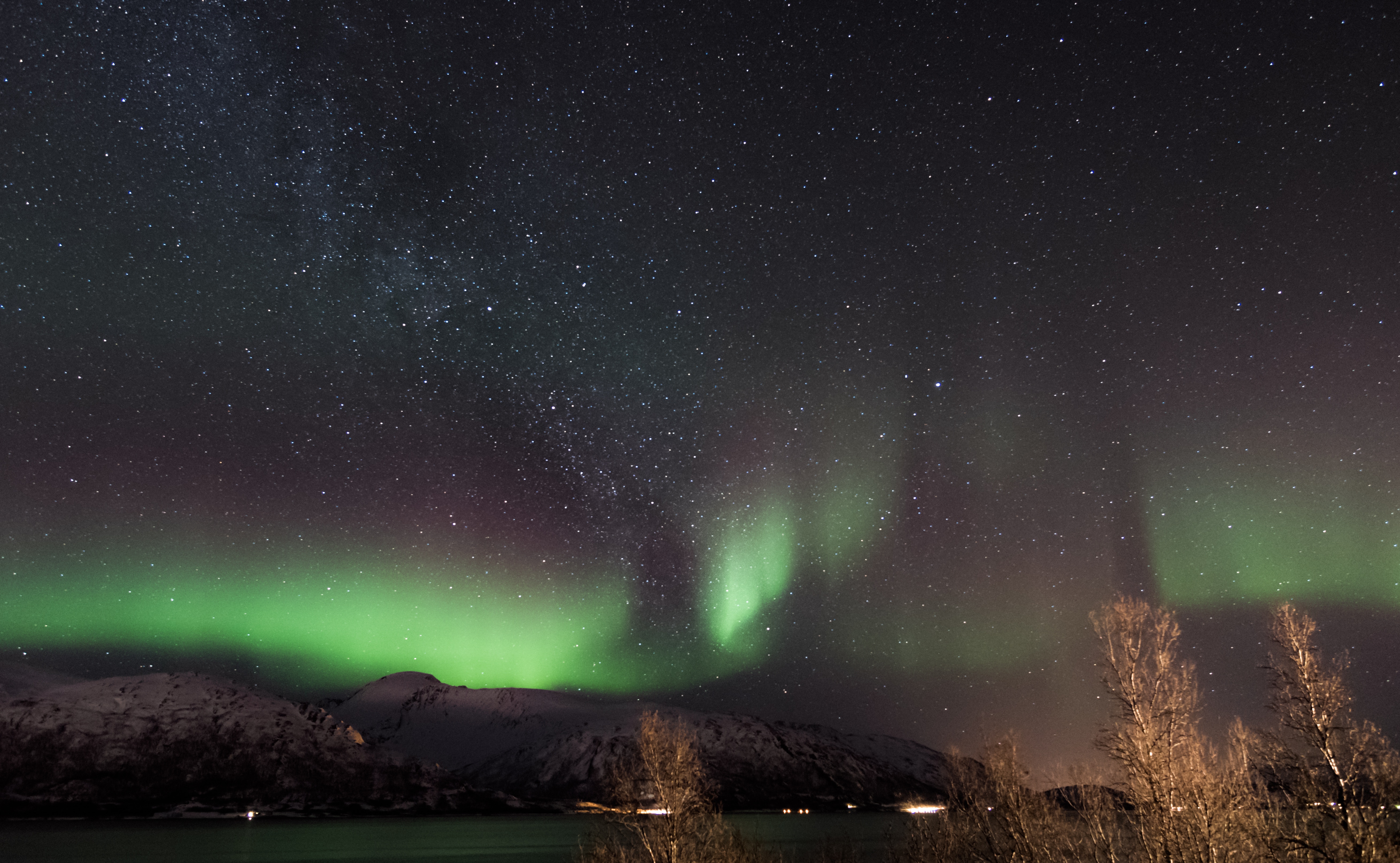
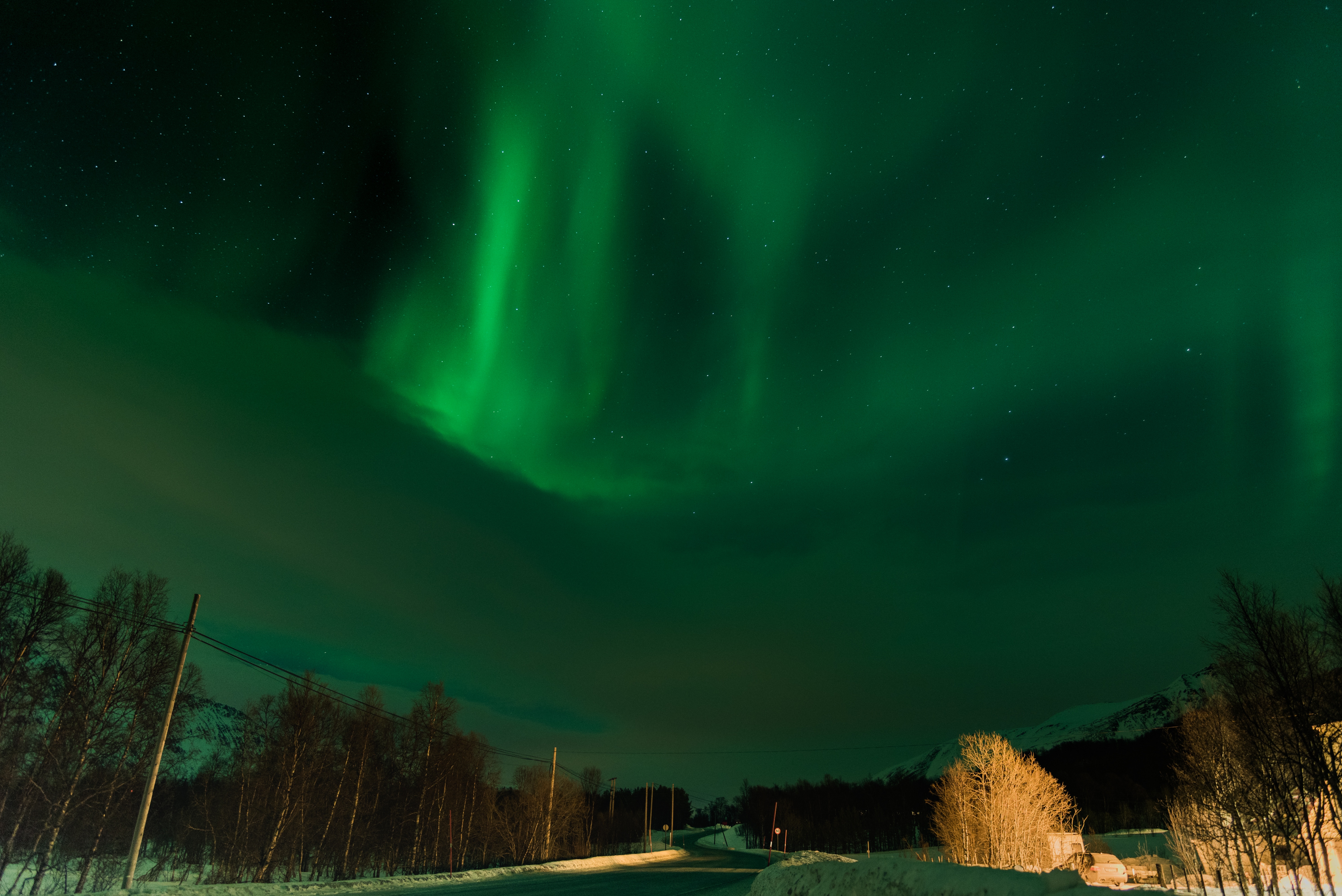
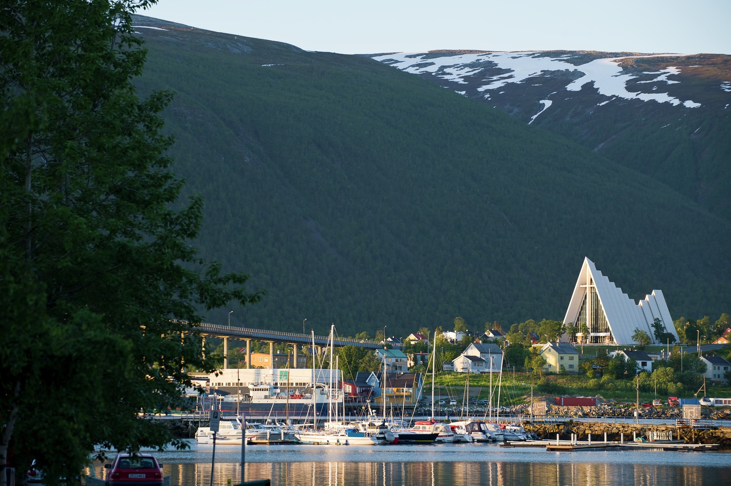
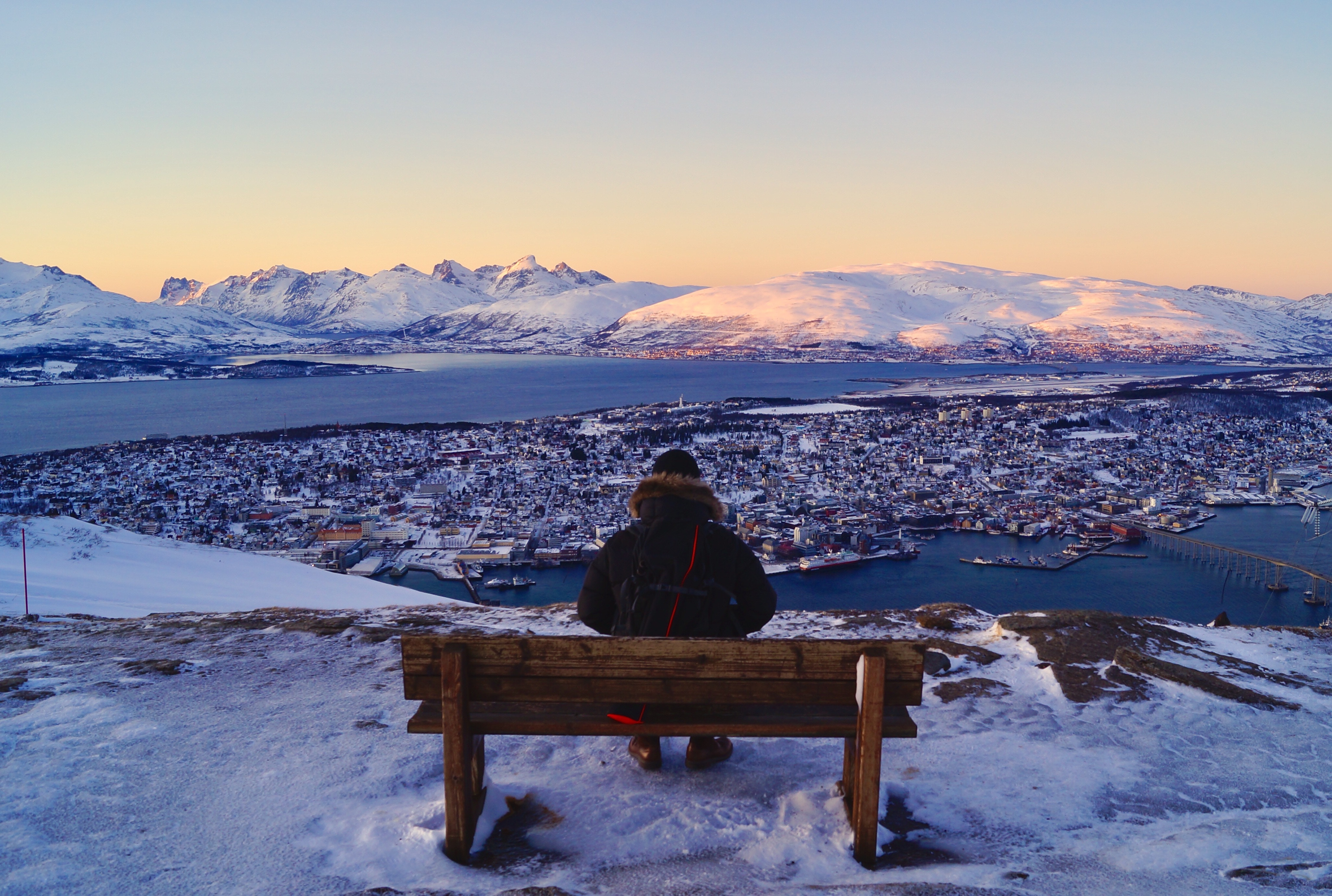
About Tromsø
With its centre located on the island of Tromsø, the municipality of Tromsø is more than five times the size of Norway’s capital, Oslo, and is the world’s northernmost university city. Lying 200 miles inside the Arctic Circle, it is known as the 'Gateway to the Arctic' because it was used as a starting point for hunters looking for Arctic foxes, polar bears and seals. In the 19th century it was a base for explorers on Arctic expeditions – a history that is remembered in the city’s Polar Museum, which you can visit on an excursion. Also commemorated in the area is the history of Norway’s indigenous people, the Sami. Visitors can learn about the traditions, heritage and modern preservation of the Sami culture at the Tromsø Museum. Nowadays, Tromsø is a charming mix of old and new, with wooden buildings sitting alongside contemporary architecture such as the impressive glacier-like Arctic Cathedral, which features one of the largest stained glass windows in Europe. Looking down on the city is Mount Storsteinen, and a cable car runs to the top, giving wonderful views over the surrounding countryside of forested peaks and reindeer pastures.
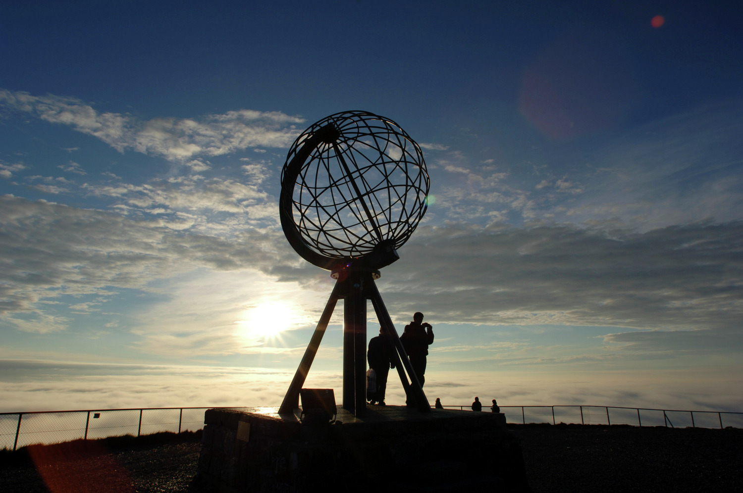
About Honningsvåg
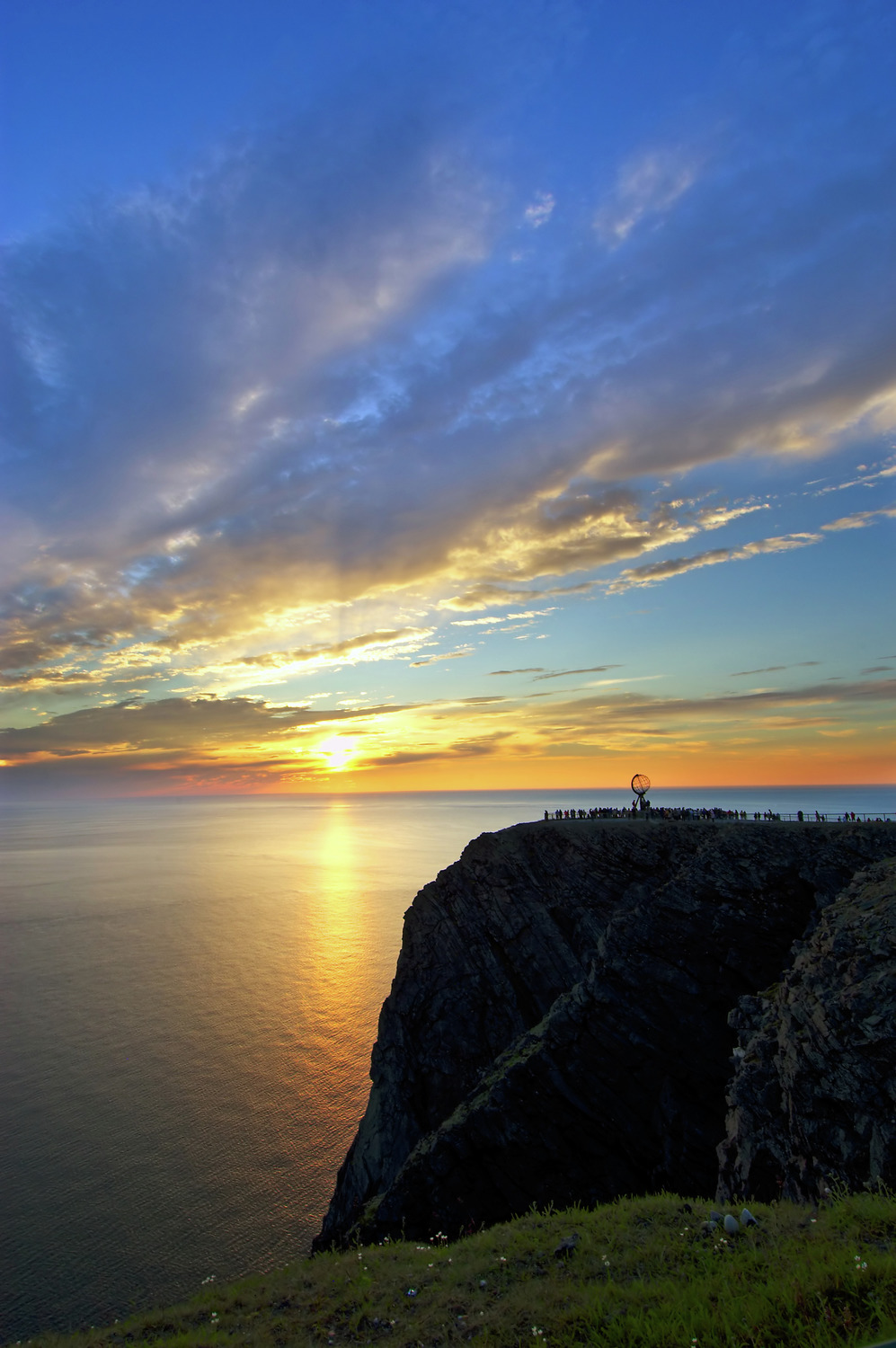
Searching in 1553 for a northeast passage to India, British navigator Richard Chancellor came upon a crag 307 yards above the Barents Sea. He named the jut of rock North Cape, or Nordkapp. Today Europe's northernmost point is a rite-of-passage journey for nearly all Scandinavians and many others. Most cruise passengers visit Nordkapp from Honningsvåg, a fishing village on Magerøya Island. The journey from Honningsvåg to Nordkapp covers about 35 km (22 miles) across a landscape characterized by rocky tundra and grazing reindeer, which are rounded up each spring by Sami herdsmen in boats. The herdsmen herd the reindeer across a mile-wide channel from their winter home on the mainland. Honningvåg's northerly location makes for long, dark winter nights and perpetually sun-filled summer days. The village serves as the gateway to Arctic exploration and the beautiful Nordkapp Plateau, a destination that calls to all visitors of this region. Most of those who journey to Nordkapp (North Cape), the northernmost tip of Europe, are in it for a taste of this unique, otherworldly, rugged yet delicate landscape. You'll see an incredible treeless tundra, with crumbling mountains and sparse dwarf plants. The subarctic environment is very vulnerable, so don't disturb the plants. Walk only on marked trails and don't remove stones, leave car marks, or make campfires. Because the roads are closed in winter, the only access is from the tiny fishing village of Skarsvåg via Sno-Cat, a thump-and-bump ride that's as unforgettable as the desolate view.
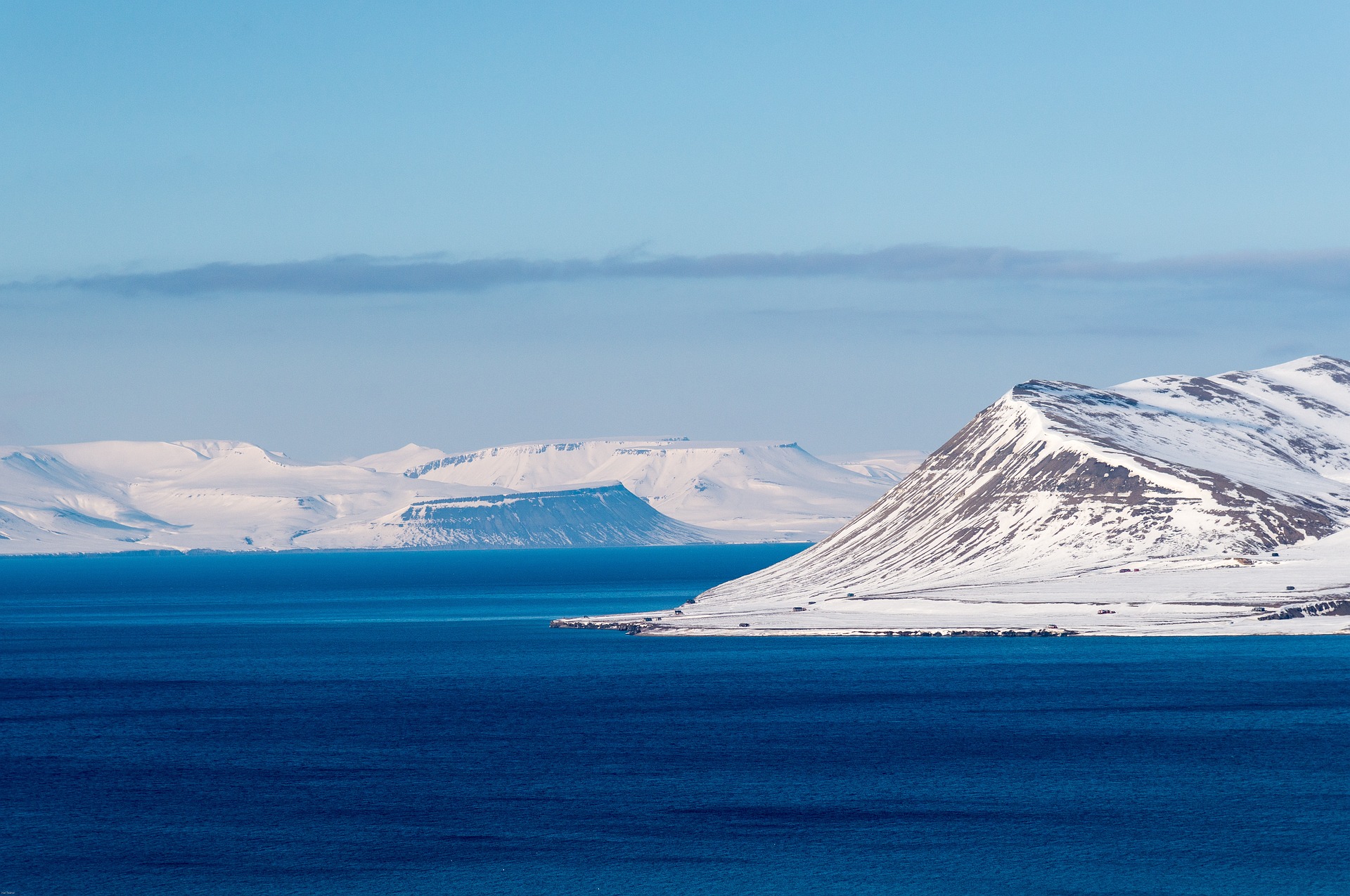
About Longyearbyen
Longyearbyen is the biggest settlement in Svalbard. Seat of the Norwegian administration, it also has the best services and infrastructure in the archipelago. Located deep in the Adventfjord, a sidearm of the Isfjorden (Icefjord), Longyearbyen’s airport can be used all-year round, but its harbor is blocked by ice in winter. Most shops, hotels, restaurants and a hospital are within easy walking distance of the port. One of the most prominent buildings in town is the UNIS center, where several Norwegian universities have joined forces to operate and offer the northernmost higher education to both Norwegian and international students. Adjacent to UNIS, and well worth a visit, is the Svalbard Museum, covering the natural history and exploitation of Svalbard. Remnants of the former mining activity can be seen all around Longyearbyen and even in town.
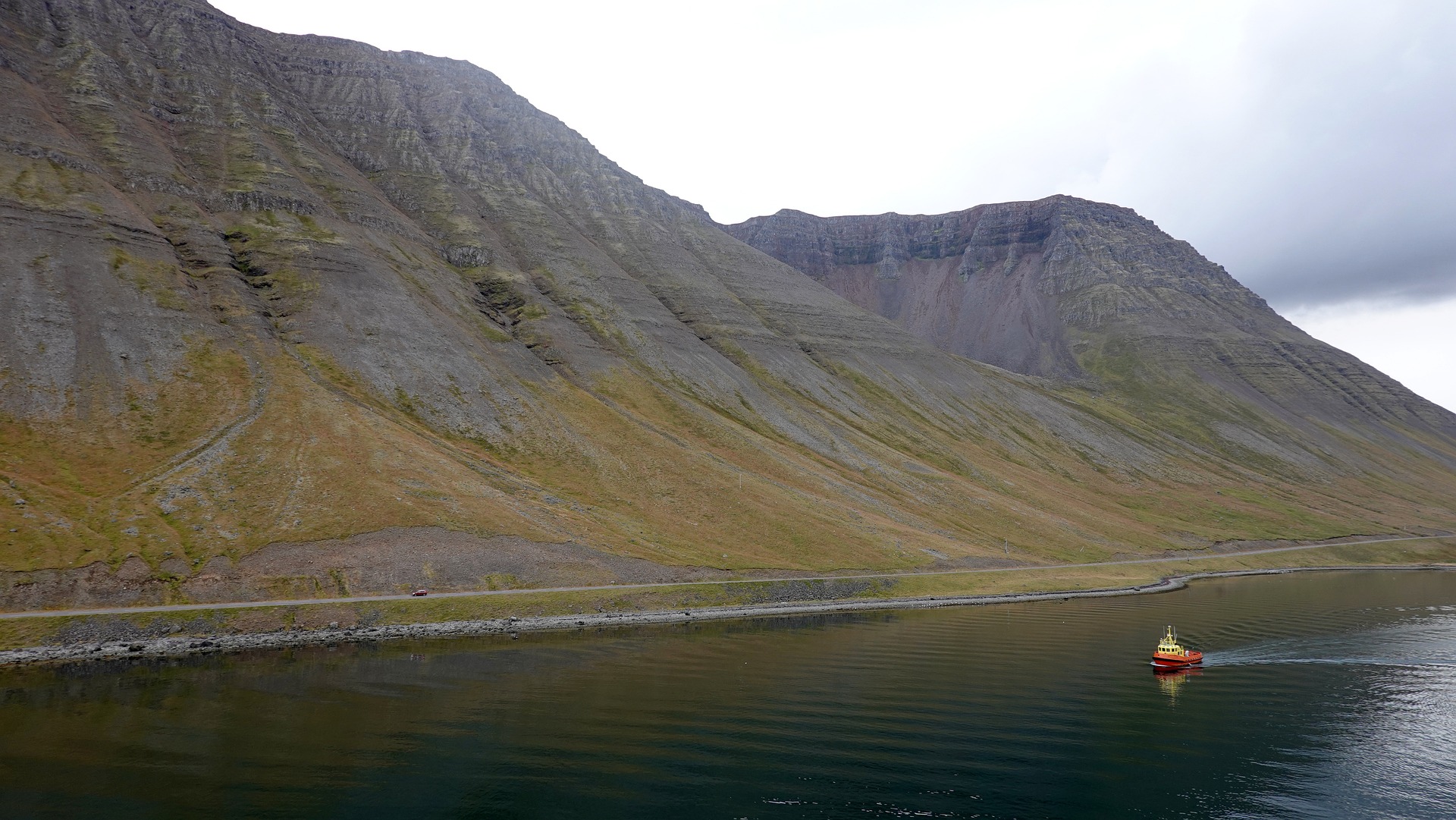
About Isafjørdur
Two colossal terraces of sheer rock stand either side of this extraordinarily located town - which rides a jutting spit onto an immensity of black fjord water. Surprisingly, considering the remoteness of its location and its compact size, Isafjordur is a modern and lively place to visit, offering a great choice of cafes and delicious restaurants – which are well stocked to impress visitors. The town is a perfectly located base for adventures amongst Iceland's fantastic wilderness - with skiing, hiking and water-sports popular pursuits among visitors.
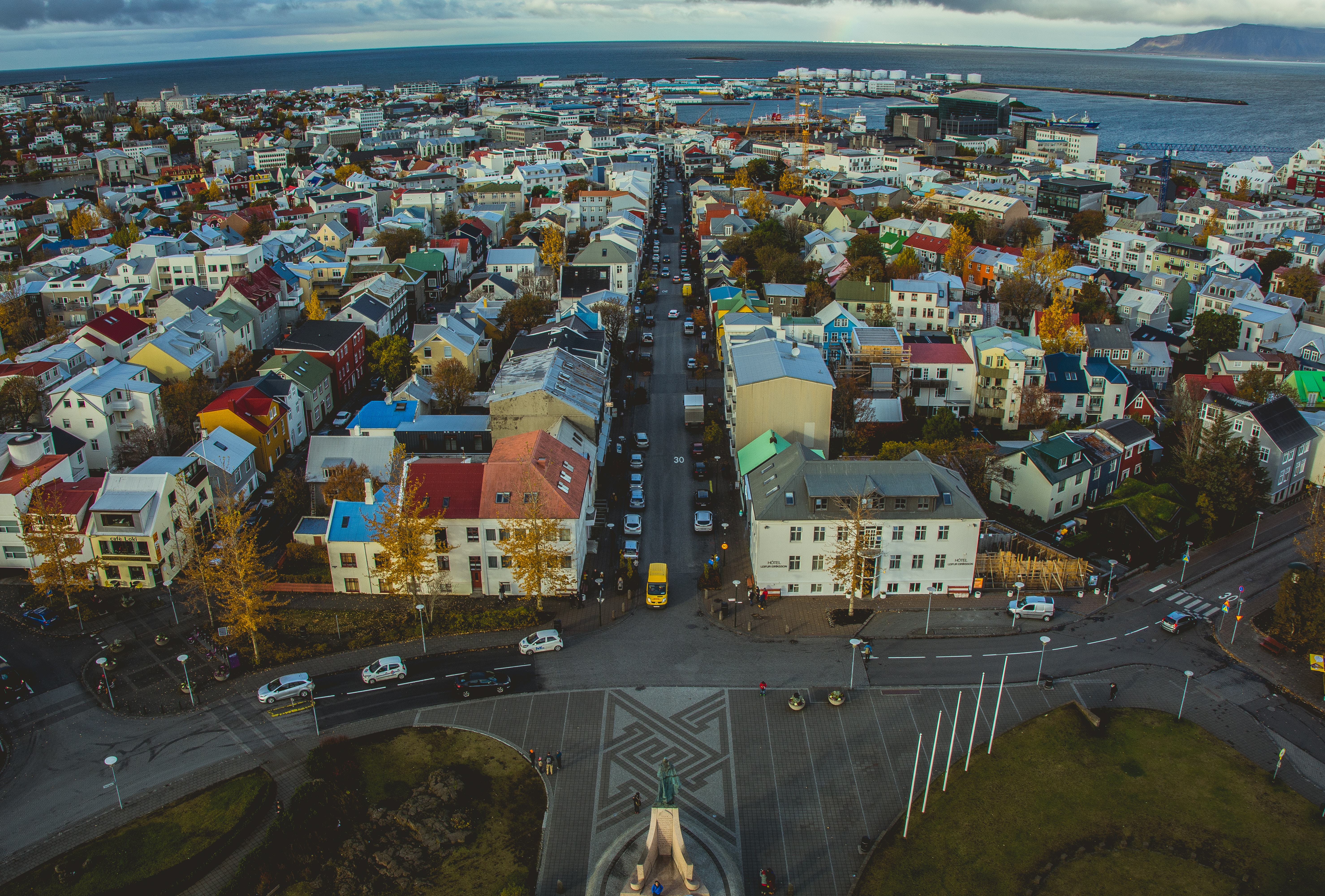
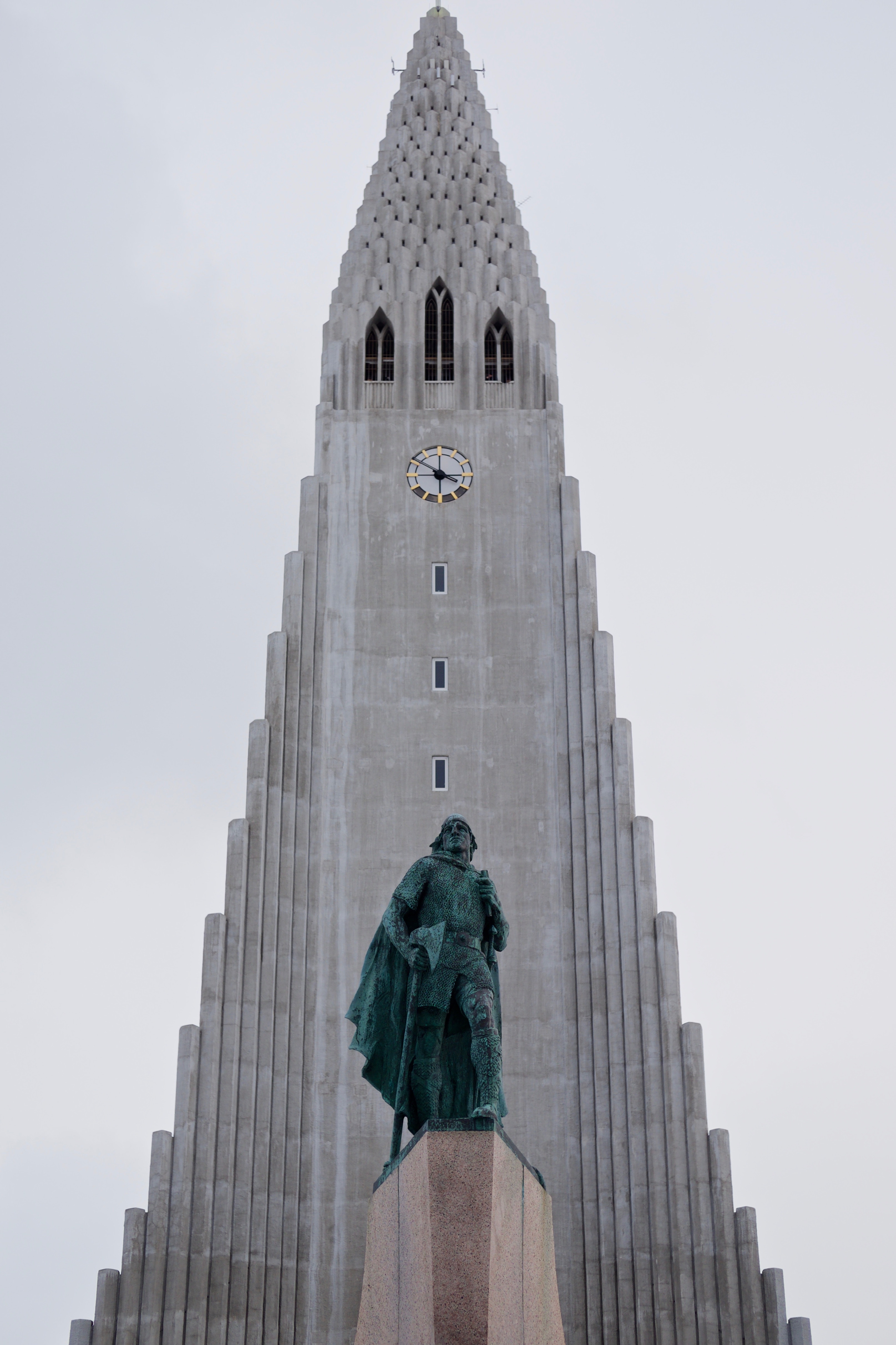
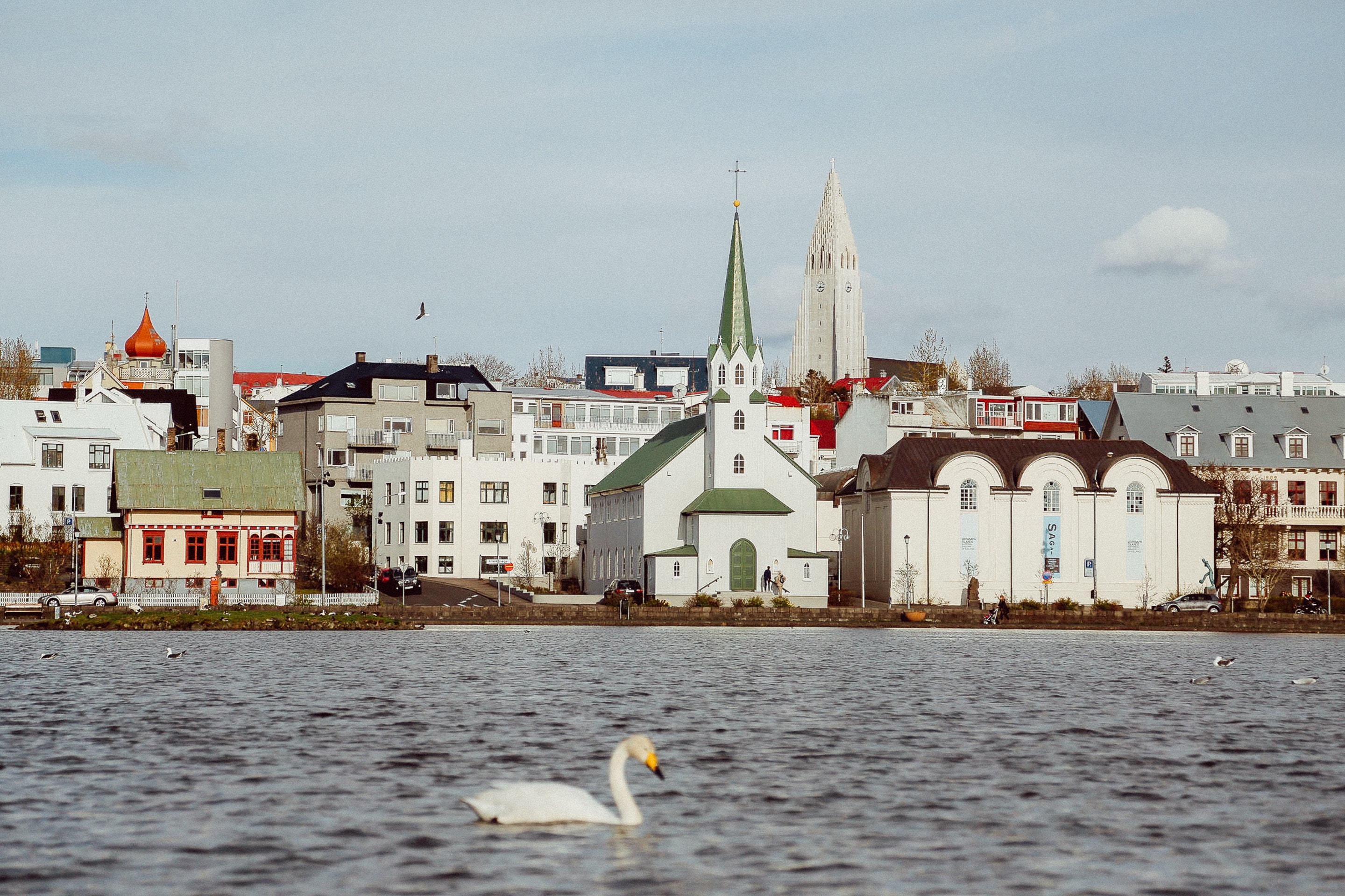
About Reykjavík
Sprawling Reykjavík, the nation's nerve center and government seat, is home to half the island's population. On a bay overlooked by proud Mt. Esja (pronounced eh-shyuh), with its ever-changing hues, Reykjavík presents a colorful sight, its concrete houses painted in light colors and topped by vibrant red, blue, and green roofs. In contrast to the almost treeless countryside, Reykjavík has many tall, native birches, rowans, and willows, as well as imported aspen, pines, and spruces.Reykjavík's name comes from the Icelandic words for smoke, reykur, and bay, vík. In AD 874, Norseman Ingólfur Arnarson saw Iceland rising out of the misty sea and came ashore at a bay eerily shrouded with plumes of steam from nearby hot springs. Today most of the houses in Reykjavík are heated by near-boiling water from the hot springs. Natural heating avoids air pollution; there's no smoke around. You may notice, however, that the hot water brings a slight sulfur smell to the bathroom.Prices are easily on a par with other major European cities. A practical option is to purchase a Reykjavík City Card at the Tourist Information Center or at the Reykjavík Youth Hostel. This card permits unlimited bus usage and admission to any of the city's seven pools, the Family Park and Zoo, and city museums. The cards are valid for one (ISK 3,300), two (ISK 4,400), or three days (ISK 4,900), and they pay for themselves after three or four uses a day. Even lacking the City Card, paying admission (ISK 500, or ISK 250 for seniors and people with disabilities) to one of the city art museums (Hafnarhús, Kjarvalsstaðir, or Ásmundarsafn) gets you free same-day admission to the other two.
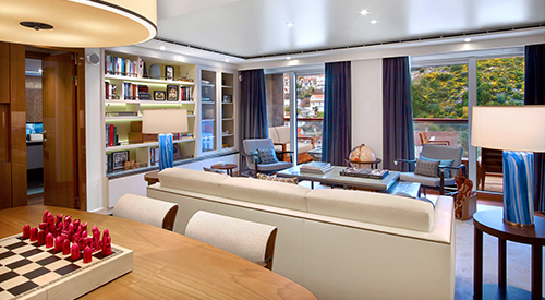
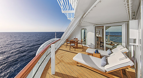
- Stateroom size: 1,488 sq ft multi-room suite including expansive private veranda
- Ocean-view largest multi-room accommodations onboard
- Separate bedroom suite
- Spacious, well-appointed living room
- Separate dining area that seats 6
- Private library, wine & music collections curated by Chairman Torstein Hagen
- Ocean-view dry sauna
- Boardroom that seats 12 for meetings & catered dinner parties, with first oceangoing vapor-light fireplace
- Pantry for room service & hosted events
- 11 AM Embarkation
- 11 AM priority stateroom access
- First priority shore excursion booking 147 days prior to departure
- Complimentary shore excursion with private car & driver (up to 4 guests) in port city of your choice (valued at up to $800)
- 4 priority reservations at each alternative restaurant 100 days prior to departure
- First priority spa treatment bookings 100 days prior to departure
- King-size Viking Explorer Bed with luxury linens & pillows
- Free Wi-Fi (connection speed may vary)
- 42" flat-screen TV featuring MSNBC, FOX News, National Geographic and more
- Two additional 42" flat-screen interactive LCD TVs in living area and boardroom
- 110/220 volt outlets & USB ports
- Large master bathroom with spacious glass-enclosed shower, double-sink vanity, heated floor, anti-fog mirror & hair dryer, plus two guest bathrooms
- Premium Freyja® toiletries
- Plush robes & slippers
- Direct-dial satellite phone & cell service
- Security safe
- Individual climate control
- Purified water refilled daily
- Welcome bottle of Veuve Clicquot champagne
- Mini-bar with alcoholic beverages, soft drinks, water & premium snacks (replenished once daily)
- Binoculars
- Traditional Norwegian Marius-weave blanket
- Personal coffee machine with premium coffee & tea selections
- Stateroom steward & twice-daily housekeeping
- 24-hour room service, including service from any restaurant during open hours
- Daily personalized tea or pre-dinner cocktail & canapés on request
- Dinner & guided tour with ship officers (subject to availability)
- Complimentary laundry, pressing & shoe shine services
- Silver Spirits beverage package included
- Private arrival/departure transfer in destination
- Under-bed suitcase storage space
- Spacious walk-in closet with wooden hangers & drawers
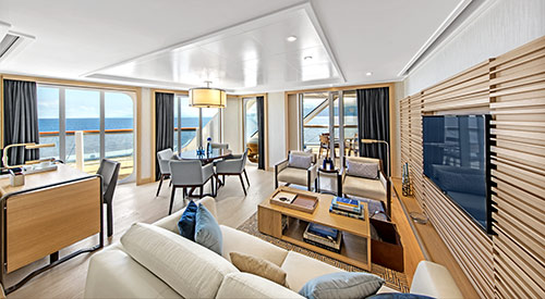
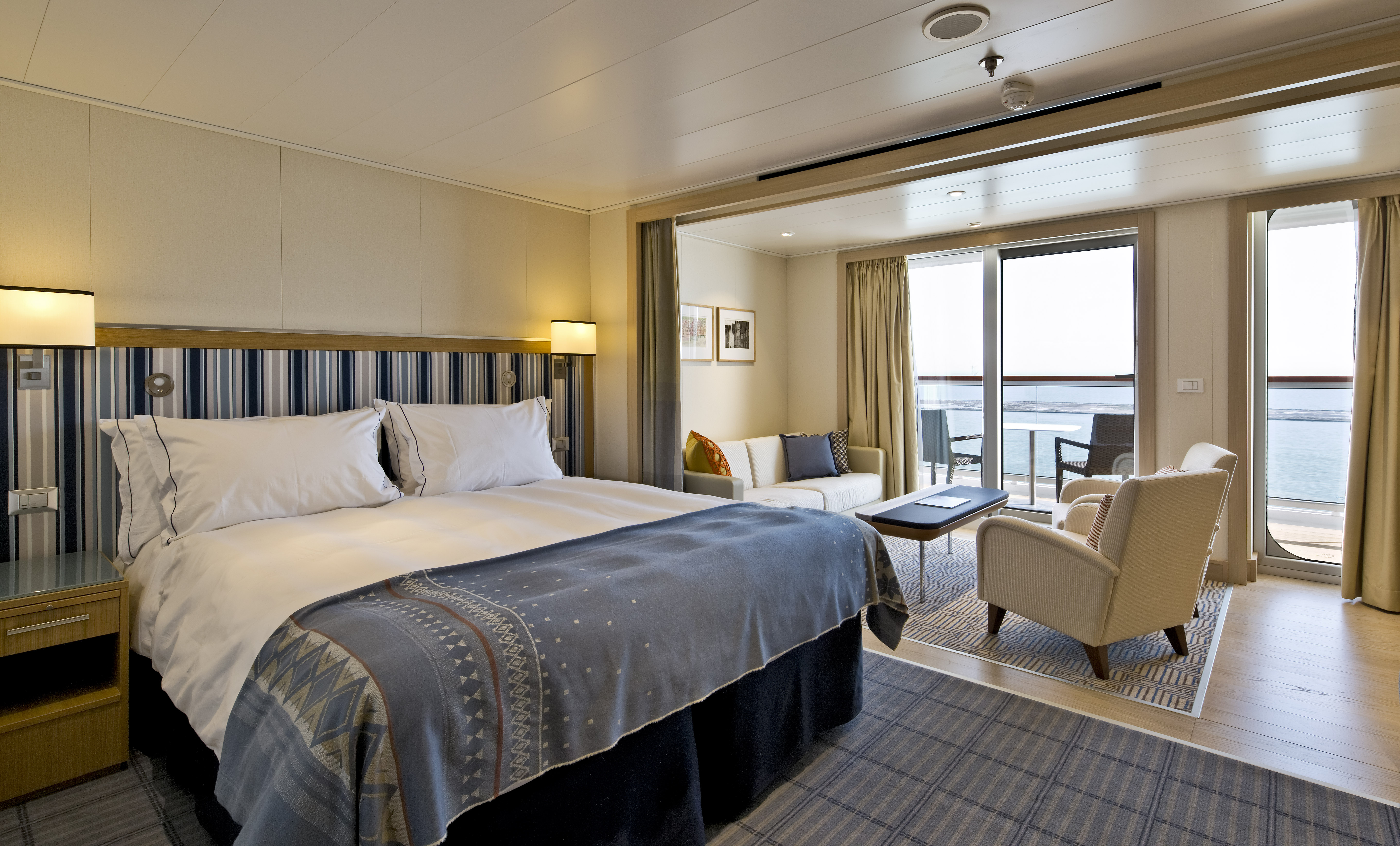
- Stateroom size: 808–1,215 sq ft (includes private veranda)
- Ocean-view two-room suite with floor-to-ceiling sliding glass door opening to a generous veranda (layout varies)
- Well-appointed living area & dining area that seats 4
- 11 AM Embarkation
- 11 AM priority stateroom access
- Priority shore excursion reservations 137 days prior to departure
- 3 priority reservations at each alternative restaurant 90 days prior to departure
- Priority spa treatment bookings 90 days prior to departure
- King-size Viking Explorer Bed (optional twin-bed configuration) with luxury linens & pillows
- Free Wi-Fi (connection speed may vary)
- 42" flat-screen TV featuring MSNBC, FOX News, National Geographic and more
- Additional 42" flat-screen interactive LCD TVs in living area
- 110/220 volt outlets & USB ports
- Large private bathroom with spacious glass-enclosed shower, bathtub, double-sink vanity, heated floor, anti-fog mirror & hair dryer
- Premium Freyja® toiletries
- Plush robes & slippers
- Direct-dial satellite phone & cell service
- Security safe
- Individual climate control
- Purified water refilled daily
- Welcome bottle of champagne
- Mini-bar with alcoholic beverages, soft drinks, water & snacks (replenished once daily)
- Binoculars
- Traditional Norwegian Marius-weave blanket
- Personal coffee machine with premium coffee & tea selections
- Stateroom steward & twice-daily housekeeping
- 24-hour room service
- Complimentary laundry, pressing & shoe shine services
- Under-bed suitcase storage space
- Spacious drawers & closet with wooden hangers
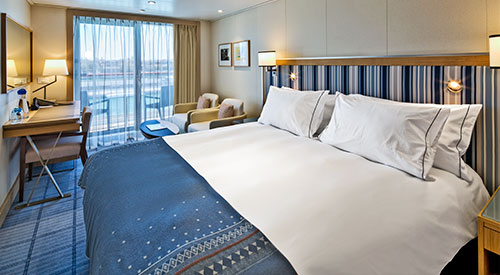
- Stateroom size: 432 sq ft (includes private veranda)
- Ocean-view suite with floor-to-ceiling sliding glass door opening to a full-size veranda
- Wheelchair Accessible (#6020, #6021)
- 11 AM Embarkation
- 11 AM priority stateroom access
- Priority shore excursion reservations 127 days prior to departure
- 3 priority reservations at each alternative restaurant 80 days prior to departure
- Priority spa treatment bookings 80 days prior to departure
- King-size Viking Explorer Bed (optional twin-bed configuration) with luxury linens & pillows
- Free Wi-Fi (connection speed may vary)
- 42" flat-screen TV featuring MSNBC, FOX News, National Geographic and more
- Additional 42" flat-screen interactive LCD TVs in sitting area
- 110/220 volt outlets & USB ports
- Large private bathroom with spacious glass-enclosed shower, double-sink vanity, heated floor, anti-fog mirror & hair dryer
- Premium Freyja® toiletries
- Plush robes & slippers
- Direct-dial satellite phone & cell service
- Security safe
- Individual climate control
- Purified water refilled daily
- Welcome bottle of champagne
- Mini-bar with alcoholic beverages, soft drinks, water & snacks (replenished once daily)
- Binoculars
- Traditional Norwegian Marius-weave blanket
- Personal coffee machine with premium coffee & tea selections
- Stateroom steward & twice-daily housekeeping
- 24-hour room service
- Complimentary laundry, pressing & shoe shine services
- Under-bed suitcase storage space
- Spacious drawers & closet with wooden hangers
- Stateroom size: 360 sq ft (includes private veranda)
- Ocean-view stateroom with floor-to-ceiling sliding glass door opening to full-size veranda
- 11 AM Embarkation
- 1 PM stateroom access
- Priority shore excursion reservations 117 days prior to departure
- 2 priority reservations at each alternative restaurant 70 days prior to departure
- Priority spa treatment bookings 70 days prior to departure
- King-size Viking Explorer Bed (optional twin-bed configuration) with luxury linens & pillows
- Free Wi-Fi (connection speed may vary)
- 42" flat-screen TV featuring MSNBC, FOX News, National Geographic and more
- 110/220 volt outlets & USB ports
- Large private bathroom with spacious glass-enclosed shower, heated floor, anti-fog mirror & hair dryer
- Premium Freyja® toiletries
- Plush robes & slippers
- Direct-dial satellite phone & cell service
- Security safe
- Individual climate control
- Purified water refilled daily
- Welcome bottle of champagne
- Mini-bar with alcoholic beverages, soft drinks, water & snacks (replenished once daily)
- Binoculars
- Traditional Norwegian Marius-weave blanket
- Personal coffee machine with premium coffee & tea selections
- Stateroom steward & twice-daily housekeeping
- 24-hour room service
- Complimentary pressing & shoe shine services
- Under-bed suitcase storage space
- Spacious drawers & closet with wooden hangers
- Stateroom size: 288 sq ft (includes private veranda)
- Ocean-view stateroom with floor-to-ceiling sliding glass door opening to full-size veranda
- 11 AM Embarkation
- 2 PM stateroom access
- Priority shore excursion reservations 107 days prior to departure.
- 1 priority reservation at each alternative restaurant 60 days prior to departure
- Priority spa treatment bookings 60 days prior to departure
- King-size Viking Explorer Bed (optional twin-bed configuration) with luxury linens & pillows
- Free Wi-Fi (connection speed may vary)
- 42" flat-screen TV featuring MSNBC, FOX News, National Geographic and more
- 110/220 volt outlets & USB ports
- Large private bathroom with spacious glass-enclosed shower, heated floor, anti-fog mirror & hair dryer
- Premium Freyja® toiletries
- Plush robes & slippers
- Direct-dial satellite phone & cell service
- Security safe
- Individual climate control
- Purified water refilled daily
- Mini-bar with soft drinks, water & snacks (replenished once daily)
- Binoculars
- Traditional Norwegian Marius-weave blanket
- Personal coffee machine with premium coffee & tea selections
- Stateroom steward & twice-daily housekeeping
- 24-hour room service
- Under-bed suitcase storage space
- Spacious drawers & closet with wooden hangers
- Stateroom size: 288 sq ft (includes private veranda)
- Ocean-view stateroom with floor-to-ceiling sliding glass door opening to full-size veranda
- 11 AM Embarkation
- 3 PM stateroom access
- Priority shore excursion reservations 100 days prior to departure
- King-size Viking Explorer Bed (optional twin-bed configuration) with luxury linens & pillows
- Free Wi-Fi (connection speed may vary)
- 42" flat-screen TV featuring MSNBC, FOX News, National Geographic and more
- 110/220 volt outlets & USB ports
- Large private bathroom with spacious glass-enclosed shower, heated floor, anti-fog mirror & hair dryer
- Premium Freyja® toiletries
- Plush robes & slippers
- Direct-dial satellite phone & cell service
- Security safe
- Individual climate control
- Purified water refilled daily
- Mini-bar with soft drinks, water & snacks
- Stateroom steward & twice-daily housekeeping
- 24-hour room service
- Under-bed suitcase storage space
- Spacious drawers & closet with wooden hangers
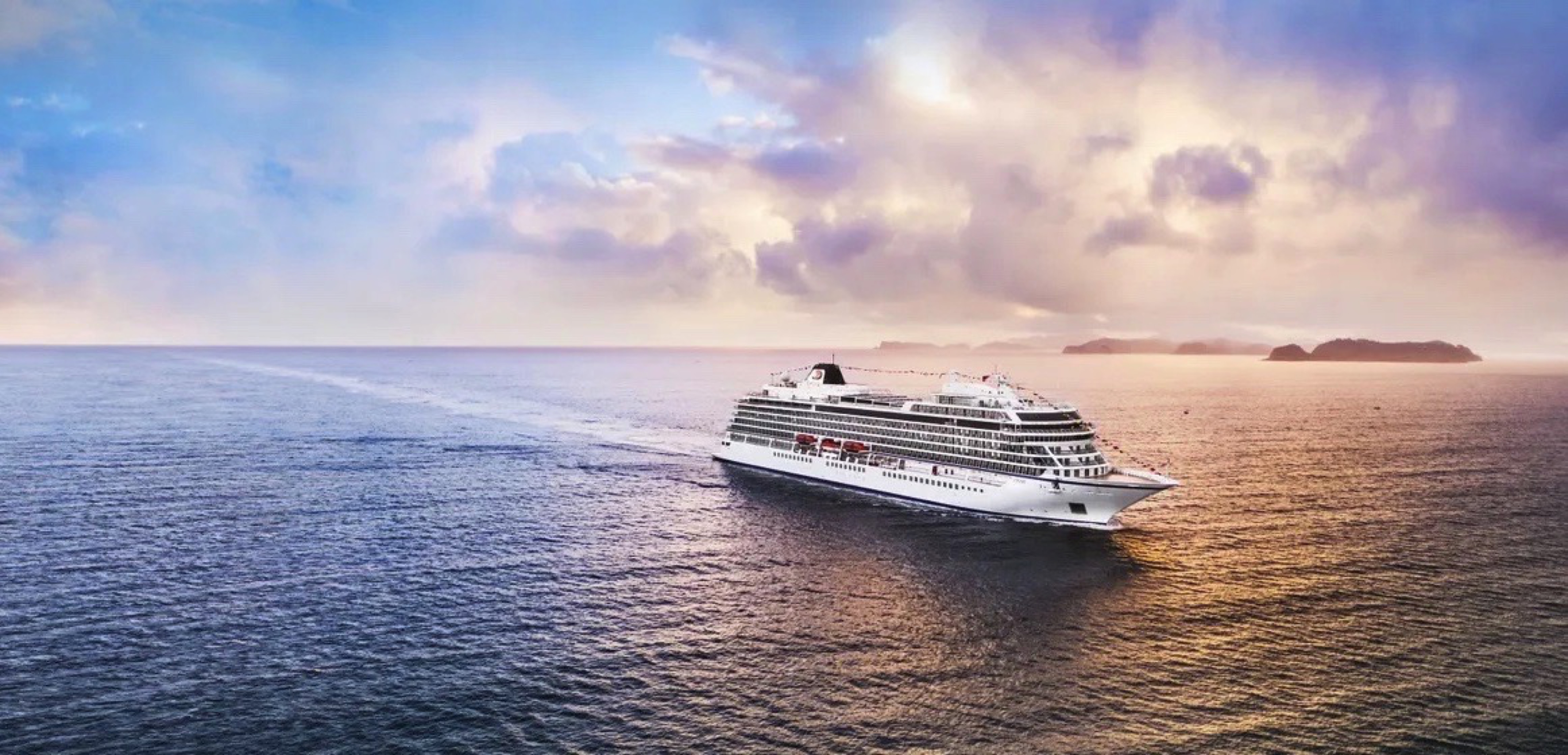
Viking Mira
Expand your horizons on our award-winning, all-veranda small ship, with just 998 guests, allowing us to dock where larger ships cannot.
Ship Facts
| Launch Year | 2026 | ||||||
| Refit Year | |||||||
| Language | en | ||||||
| Gross Tonnage | 48000 | ||||||
| Length | 239 | ||||||
| Width | 31 | ||||||
| Currency | EUR | ||||||
| Speed | 20 | ||||||
| Capacity | 998 | ||||||
| Crew Count | 465 | ||||||
| Deck Count | 9 | ||||||
| Cabin Count | 455 | ||||||
| Large Cabin Count | 0 | ||||||
| Wheelchair Cabin Count | 2 | ||||||
| Electrical Plugs |
|
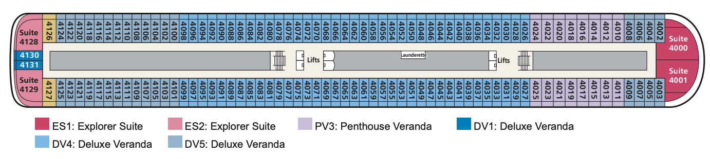
Deck 9
- Sports Deck
- Outdoor Gym & Yoga Area
- Lifts

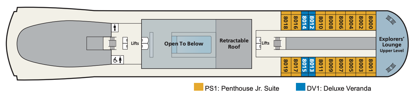
Deck 8
- Penthouse Jr. Suite
- Deluxe Veranda Staterooms
- Explorers Lounge (Upper Level)
- Lift
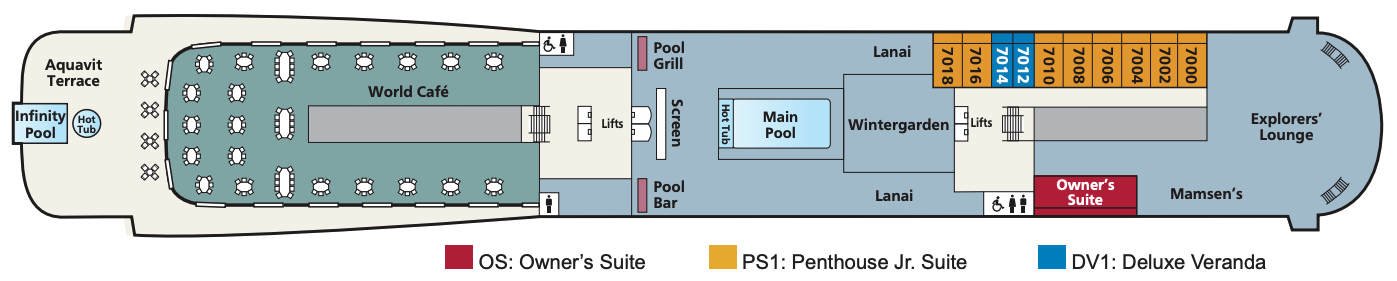
Deck 7
- Main Pool
- Infinity Pool
- Explorers' Lounge
- Wintergarden
- Aquavit Terrace
- World Cafe
- Mamsen's
- Lanai
- Pool Grill
- Outdoor Screen
- Pool Bar
- Owner's Suite
- Penthouse Jr. Suite
- Deluxe Veranda Staterooms
- Lifts
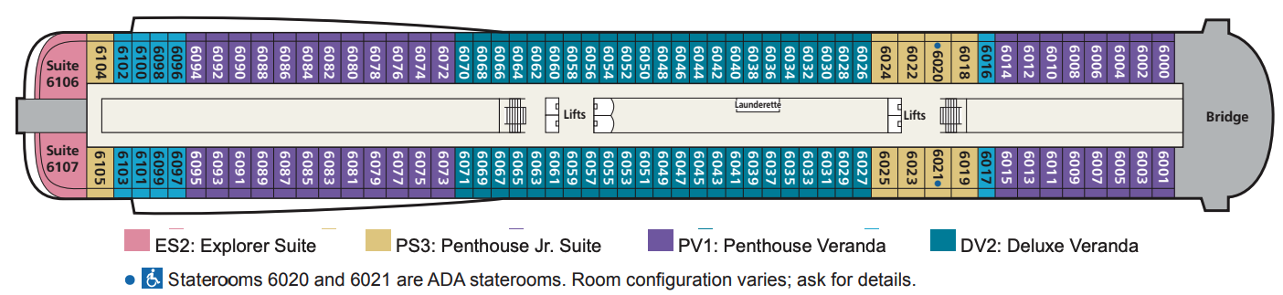
Deck 6
- Penthouse Jr. Suites
- Penthouse Veranda Staterooms
- Deluxe Veranda Staterooms
- Explorer Suites
- Lifts
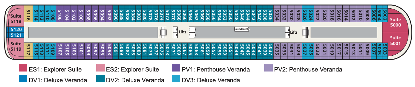
Deck 5
- Explorer Suites
- Penthouse Veranda Staterooms
- Deluxe Veranda Staterooms
- Lifts
Deck 4
- Explorer Suite
- Penthouse Veranda Staterooms
- Deluxe Veranda Staterooms
- Lifts
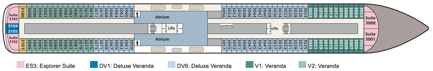
Deck 3
- Atrium
- Penthouse Junior Suites
- Explorer Suites
- Deluxe Veranda Staterooms
- Veranda Staterooms
- Lifts
Deck 2
- The Restaurant
- Atrium
- Promenade
- Torshavn
- The Nordic Shop
- Shop
- Cinema
- Bar
- The Theatre
- Lifts

Deck 1
- The Kitchen Table
- The Chef's Table
- Manfredi's Italian Restaurant
- Private Dining
- The Living Room
- Bar
- Guest Services
- Shop
- Hair Salon
- Fitness Centre
- The Nordic Spa
- Lifts

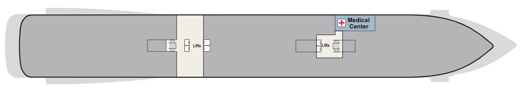
Deck a
Medical Centre
Regional cuisine, always available classics and the most al fresco dining on any waterway.
The Restaurant
Our main dining venue, The Restaurant, offers the highest onboard dining experience. Regional cuisine and always available classics are served surrounded by sweeping exterior views through all-glass walls.
Manfredi's
Inspired by Italy’s beloved trattorias, Manfredi’s offers the best of Italian cuisine with a private dining room providing an opportunity to have an intimate meal with family or friends.
The Pool Grill
In a poolside atmosphere that welcomes lounging and leisurely dips in the water, the Pool Grill offers casual fare prepared to order. For a lighter meal, a small salad bar is available.
Mamsen's
Located in the Explorers’ Lounge and named for “Mamsen,” the Hagen family matriarch, this venue offers Norwegian specialties for breakfast, lunch, an afternoon snack or evening treat.
Aquavit Terrace®
The revolutionary Aquavit Terrace is a magical space where your destination is your dining room. Located outside the World Café, it provides more al fresco dining experiences than on any ship at sea.
The Chef’s Table
The sommeliers and culinary masters at The Chef’s Table create the perfect food and wine pairings during a multi-course tasting, enjoyed in the restaurant or in a private dining room.
There is no such thing as a typical evening onboard, nor shortage of entertainment. Whether it’s a cabaret, opera, classical or popular music concert, the theatre is home to an inspiring choice of productions. Film fans can feast on classic movies and the latest blockbusters in one of the cinemas. Or take in the breeze as you take in a film at the open-air cinema.
When the stars come out, so does the entertainment. From sipping an artisan gin and exchanging stories with newfound friends in Paps, the Explorer’s Bar, to enjoying the sounds of the guitarist, pianist and singer in one of the lounges. Take a seat in the plush theatre for a dazzling show, or dance the night away in Torshavn nightclub. Sing along to a band, or lie back by the pool under the night sky to watch a movie on the giant screen – the popcorn is on the house. However you choose to spend your evenings on board, being bored is never an option
The Wintergarden
When you yearn for serenity, there is no better place on ship than a visit to the Wintergarden. This charming, airy space around the main pool is perfect for relaxing in clean, uncluttered Scandinavian-designed environment. Even here, our focus is on enrichment, as this is the place to witness a tea ceremony, or indulge in an afternoon tea service, complete with hand-selected teas, finger sandwiches and pastries.
Afternoon tea is served at the Wintergarden, adjacent to the Main Pool. Decadent finger sandwiches, scones and desserts are accompanied by international teas, tea ceremony demonstrations and relaxing classical music from the Viking Resident Musicians.
Viking Bar
Enjoy a cocktail in the Viking Bar, which is located on the ground floor of the atrium.
The Viking Living Room
The ideal setting for relaxation, The Viking Living Room draws guests together at the heart of the ship. Spacious seating, calming classical compositions performed by the Viking Resident Musicians and enriching activities foster camaraderie.
The Theatre & Cinema
The perfect venue to attend lectures or watch movies, our state-of-the-art, multipurpose Theatre seats up to 450 guests and can be transformed into two HD cinemas for TED Talks, Destination Insights and occasional specialised seminars.
Explorers' Lounge
With two-story panoramic windows for maximum views, the Explorers’ Lounge is inspired by epic journeys of discovery. This inviting space is the perfect place to share a cocktail with friends or relax while taking in the scenery.