In Search of the Northern Lights
In Search of the Northern Lights
Cruise overview
WHY BOOK WITH US?
- ✔ The Deluxe Cruises’ team has extensive experience in ultra-luxury cruising.
- ✔ Call now to speak to our helpful and experienced Cruise Concierge team.
- ✔ Enjoy our Unique Deluxe Cruises Bonus for substantial savings.
- ✔ Our team will tailor your holiday to your exacting requirements.
- ✔ As agents, we work under the protection of each cruise lines ABTA / ATOL licences
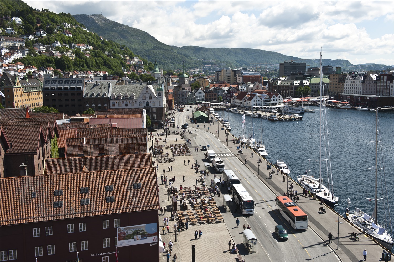
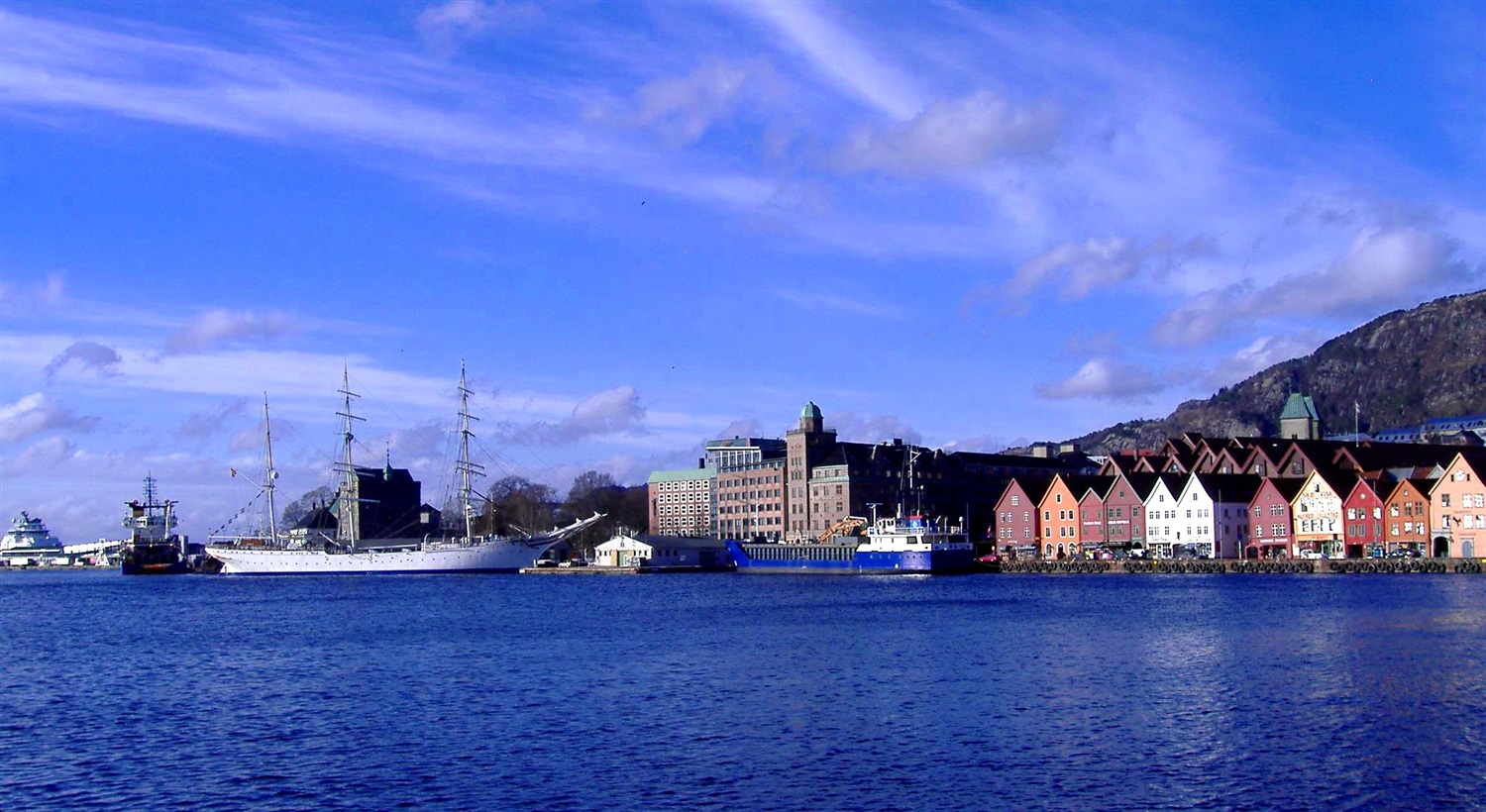
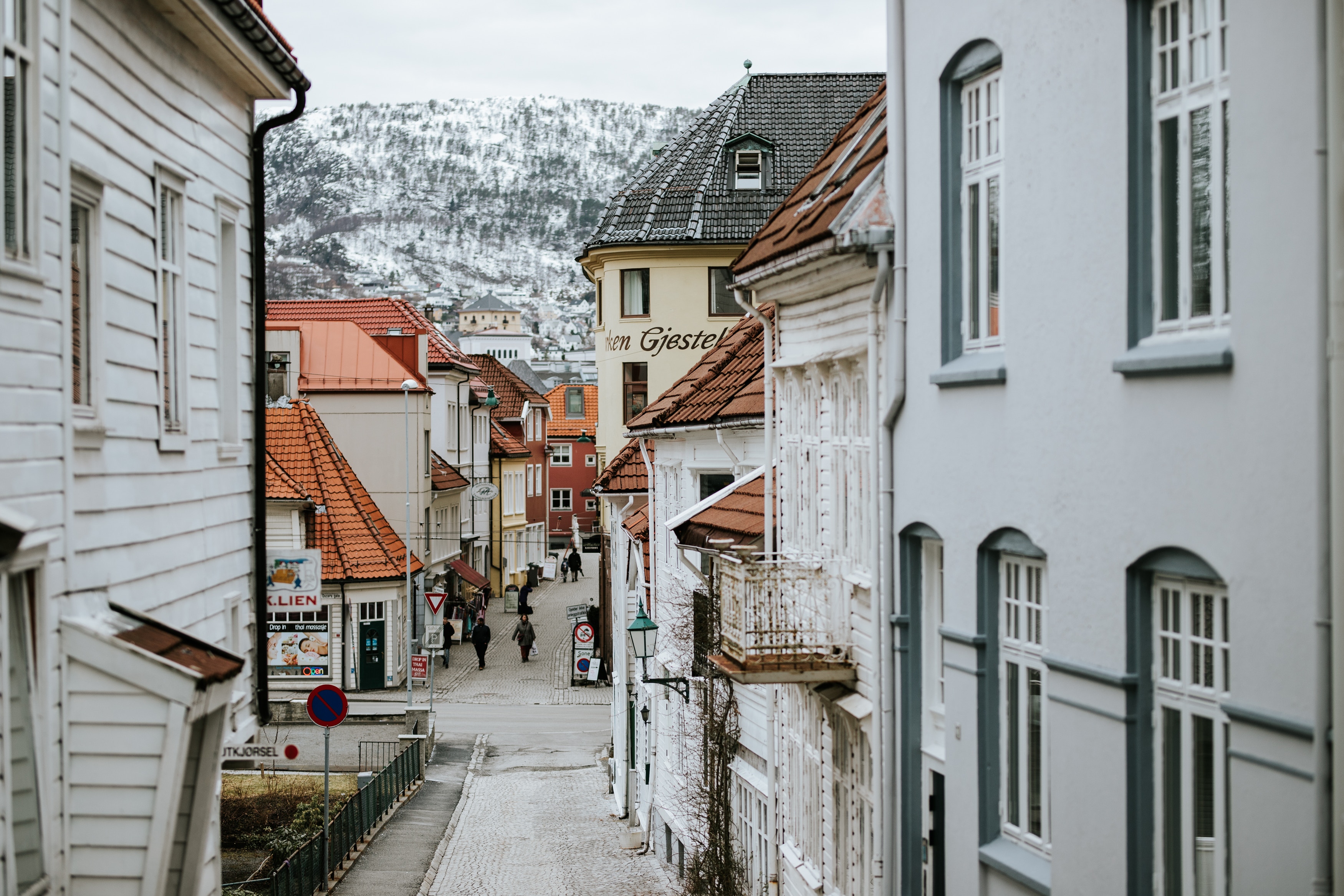
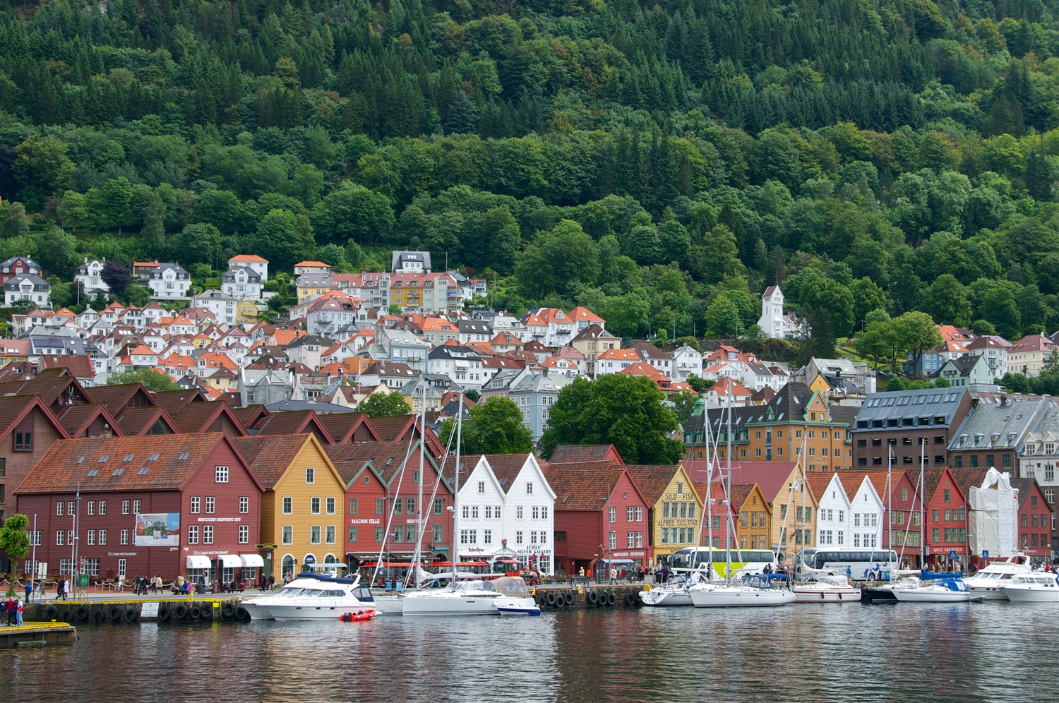
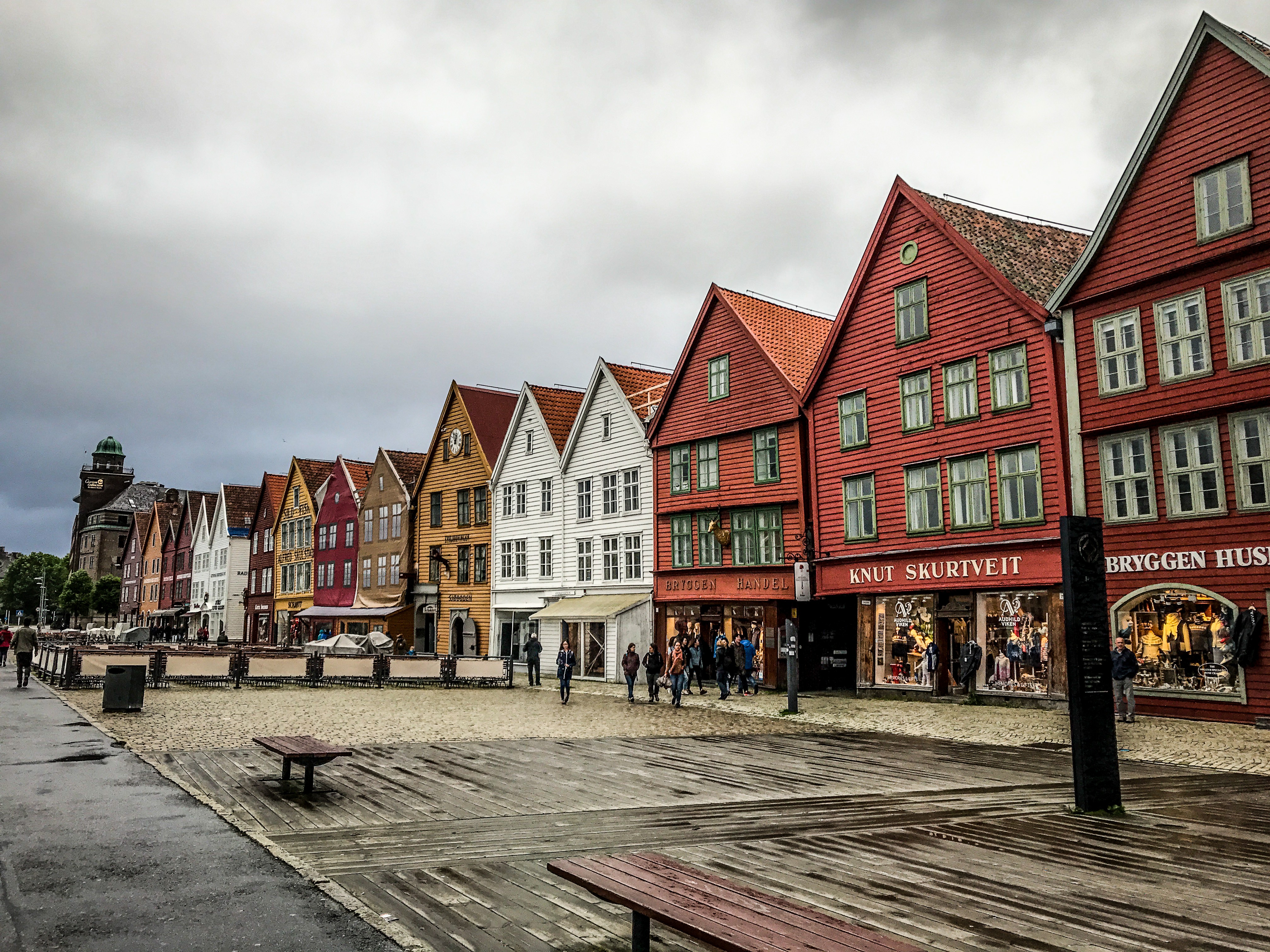
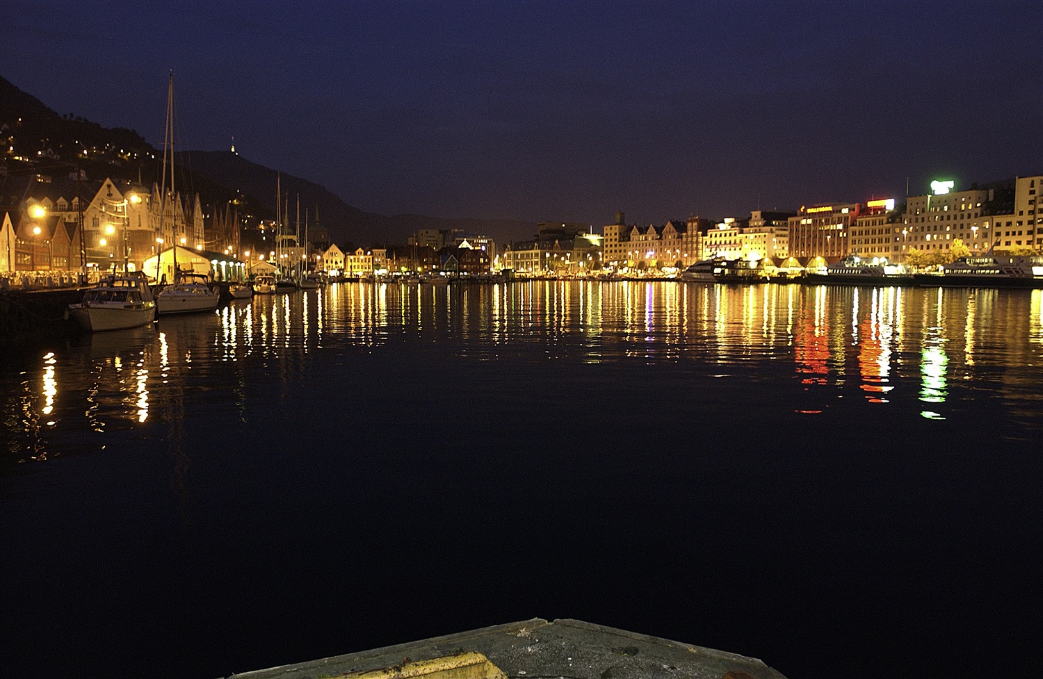
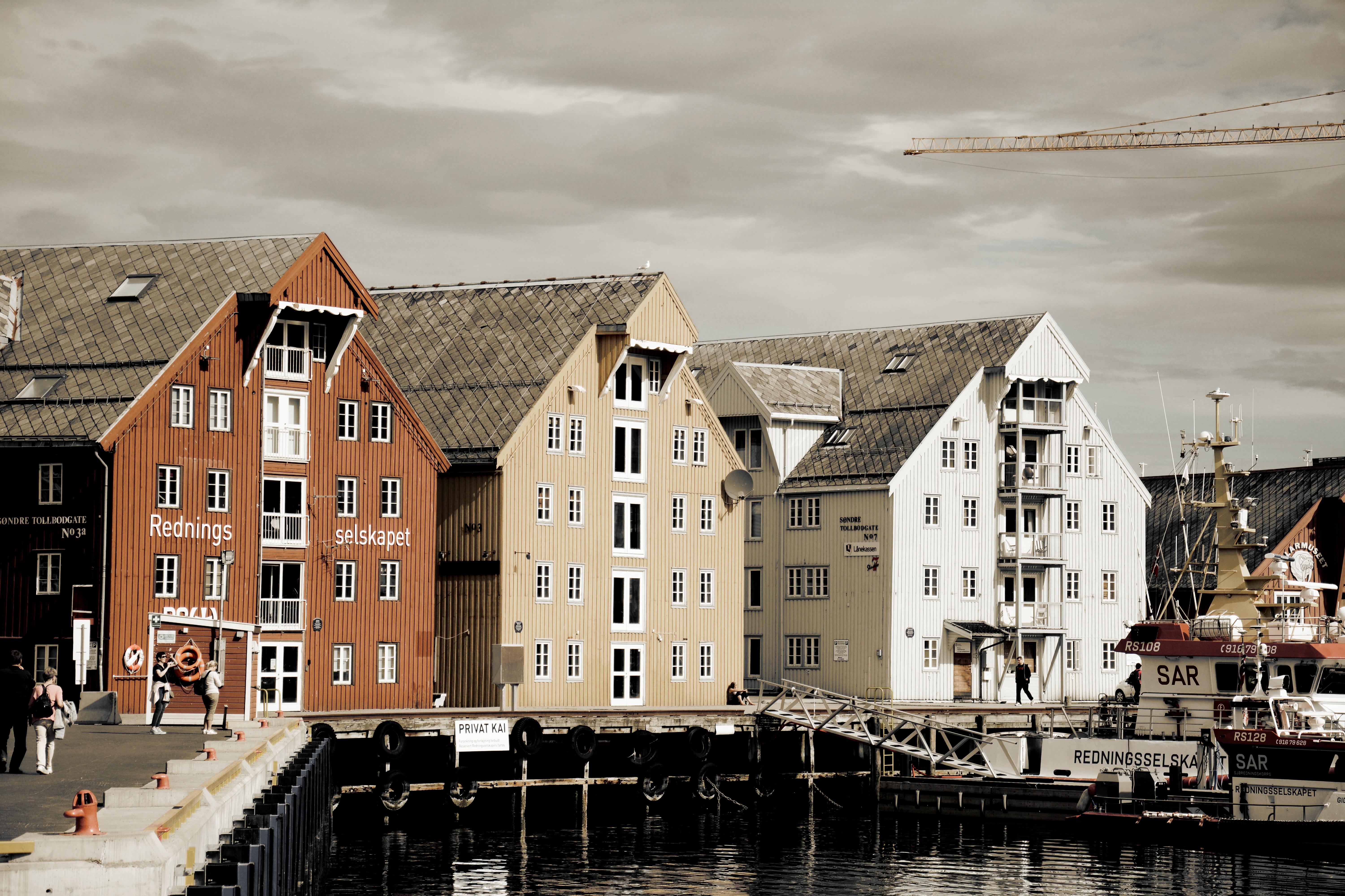
About Bergen
Surrounded by mountains and sparkling fjords, the waterside city of Bergen has a spectacular setting. There has been a settlement here since medieval times and the colourful waterfront buildings of the Hanseatic wharf, known as Bryggen, are testament to its fascinating history of trade. As Norway’s best known medieval settlement, the Bryggen is listed by UNESCO as a World Heritage Site. Our comprehensive selection of excursions allows you to discover the many sides of Bergen, such as the fish market and narrow cobbled streets, as well as stunning views of the city from the summit of Mt Fløyen. Alternatively, those who have visited the city previously may like to experience one of the tours that travel further afield. Just 300 yards from the main piers, you will find the Fortress Museum (Fesningsmuseum), which has an interesting collection of objects related to World War II.
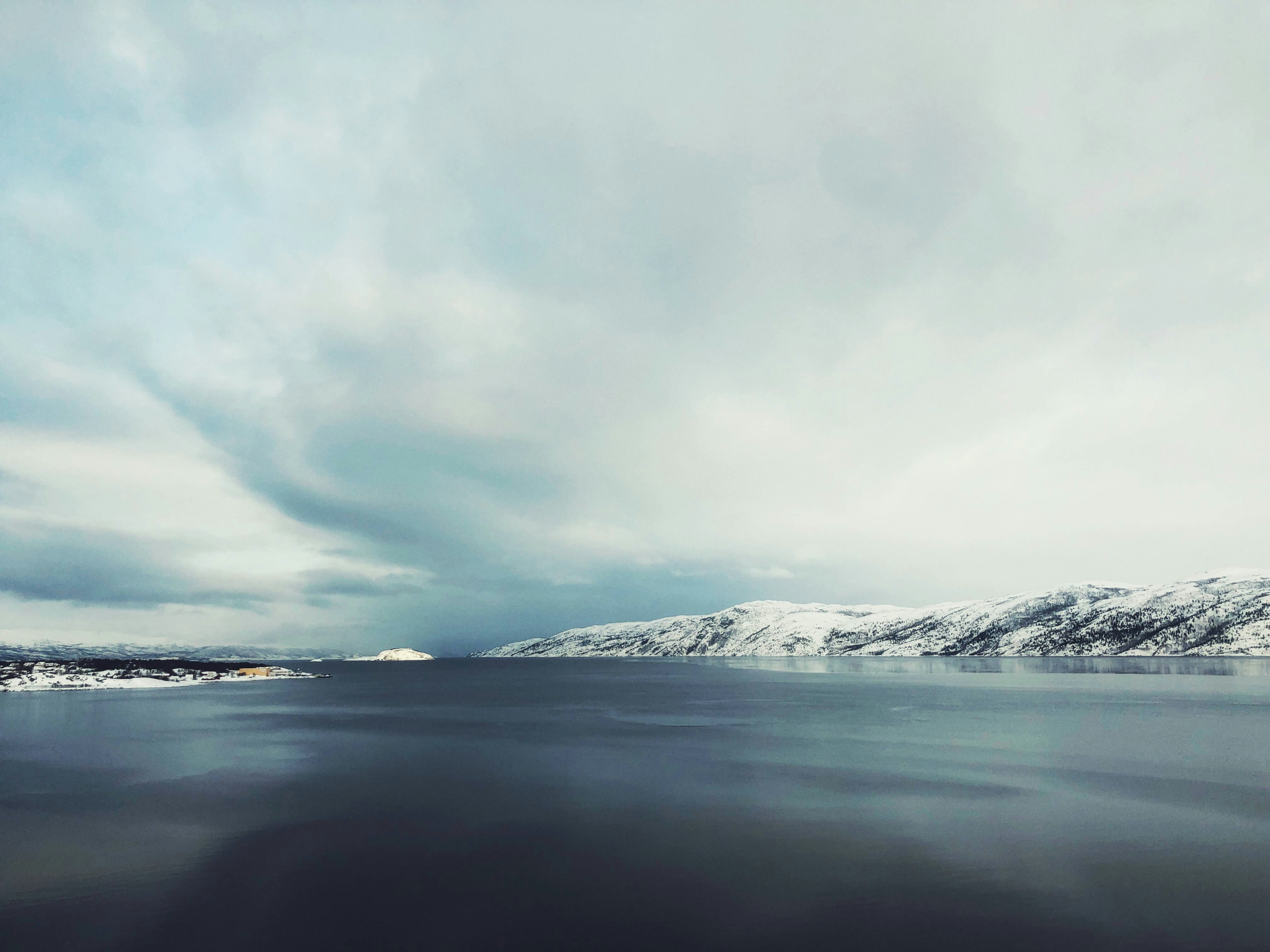
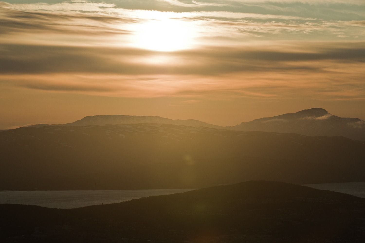
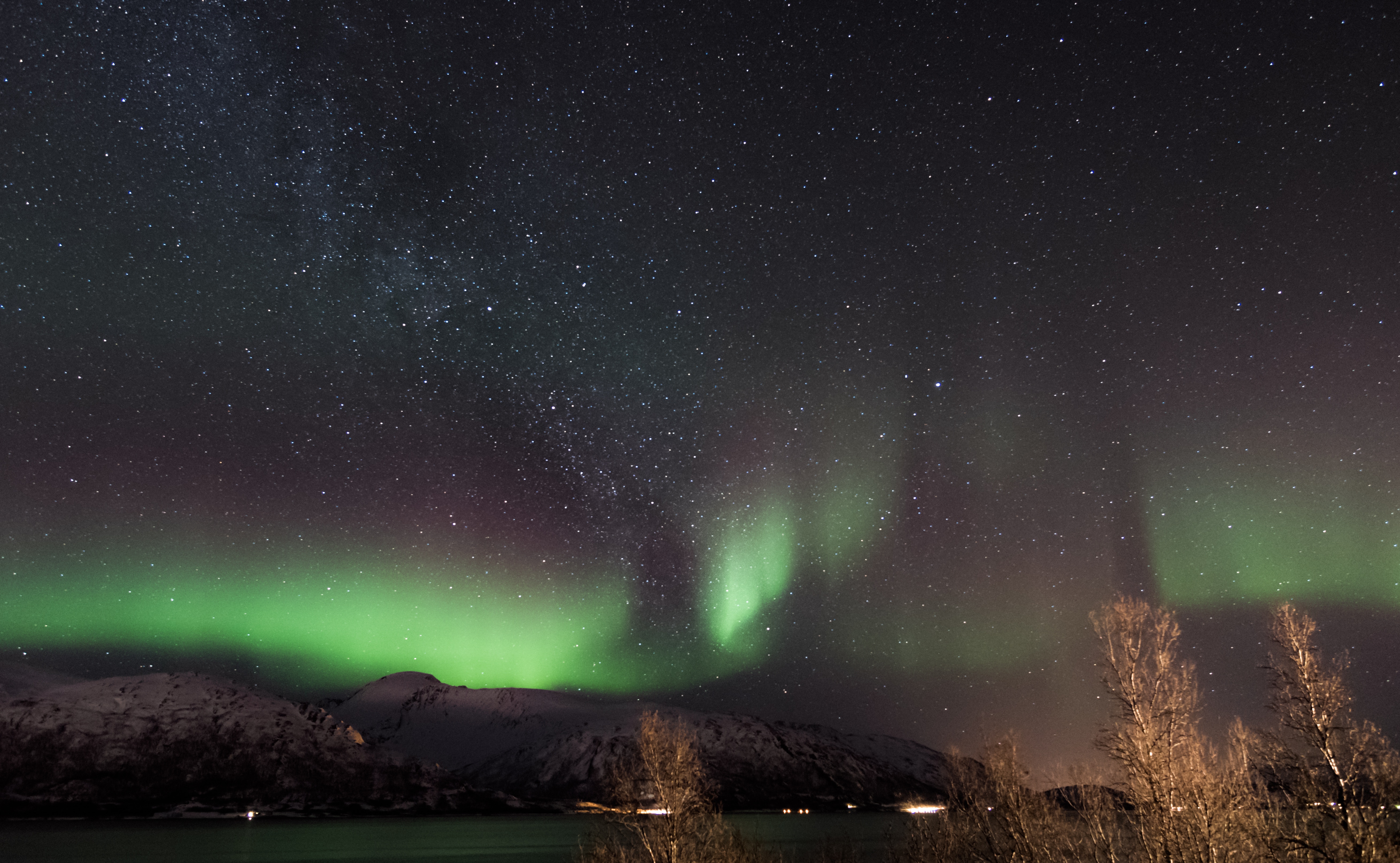
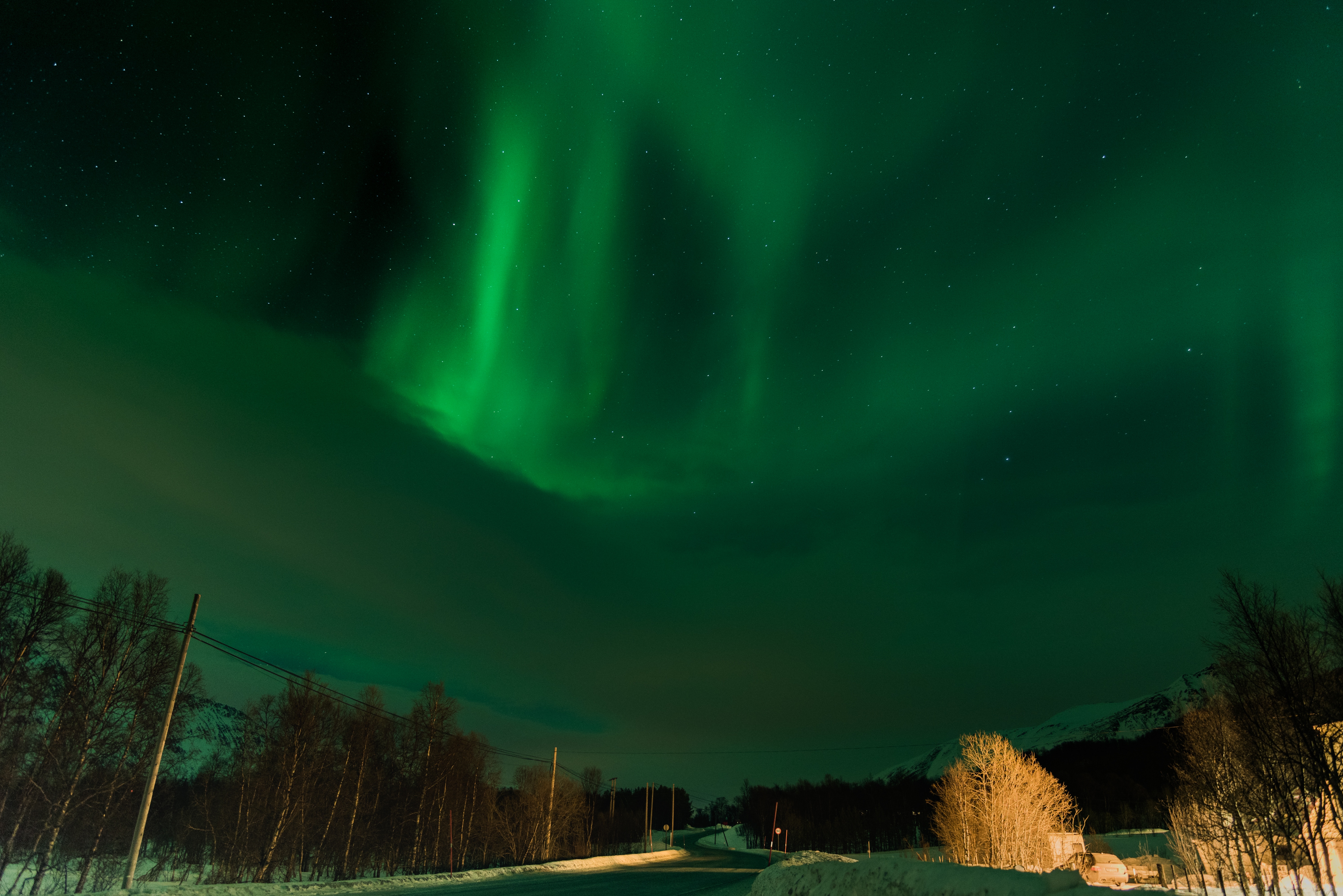
About Alta
People have been attracted to the community of Alta for thousands of years, and prehistoric rock carvings discovered in 1973 can be seen at the Alta Museum. Situated at the head of the Altafjord, it is a lush, green and hospitable shelter in the otherwise cold and windswept Finnmark landscape. Halfway between the grim, barren mountain plateau and the wet, stormy coast, Alta offers tree-clad valleys, pleasant temperatures and no more rain than the Sahara. However at 70 degrees North it is quite a different story in winter, when heavy snowfalls and sub-zero temperatures are the order of the day, and clear dark night skies become the arena for dazzling displays of the elusive Aurora Borealis, also referred to as 'the temperamental lady' by Laplanders. The world’s first Northern Lights Observatory, which played an important role in the development of geophysical and meteorological research during the first half of the 20th century, is located just 12 miles from Alta. Perched atop Haldde Mountain, it towers almost 3,000 feet above Kafjord, where the battleship Tirpitz was based during the Second World War.
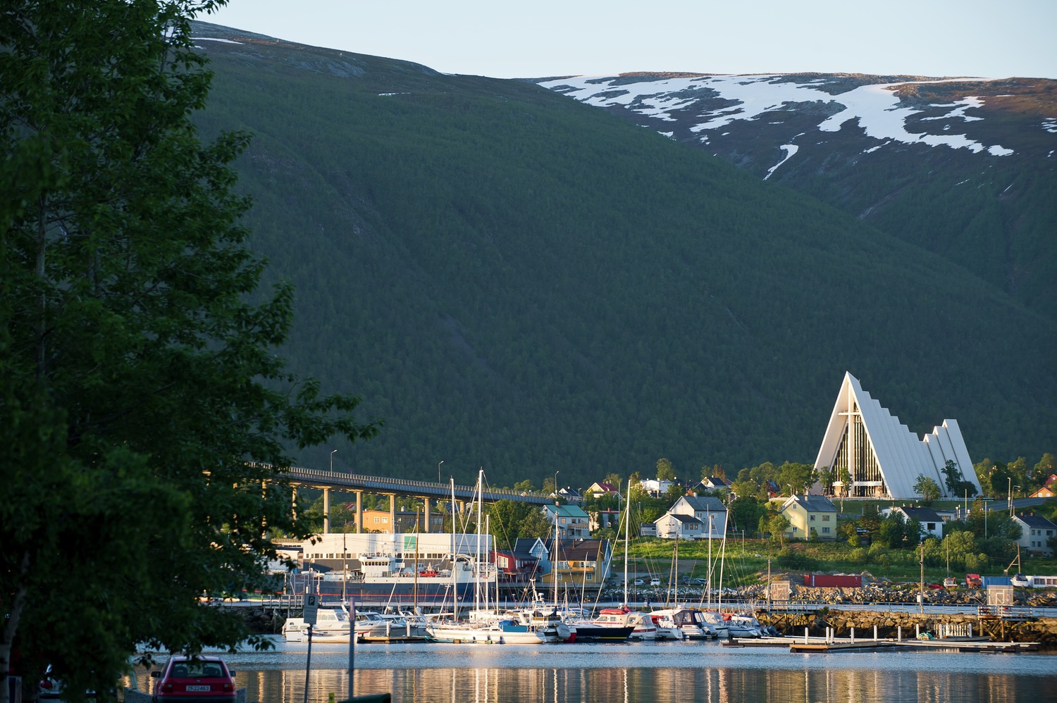
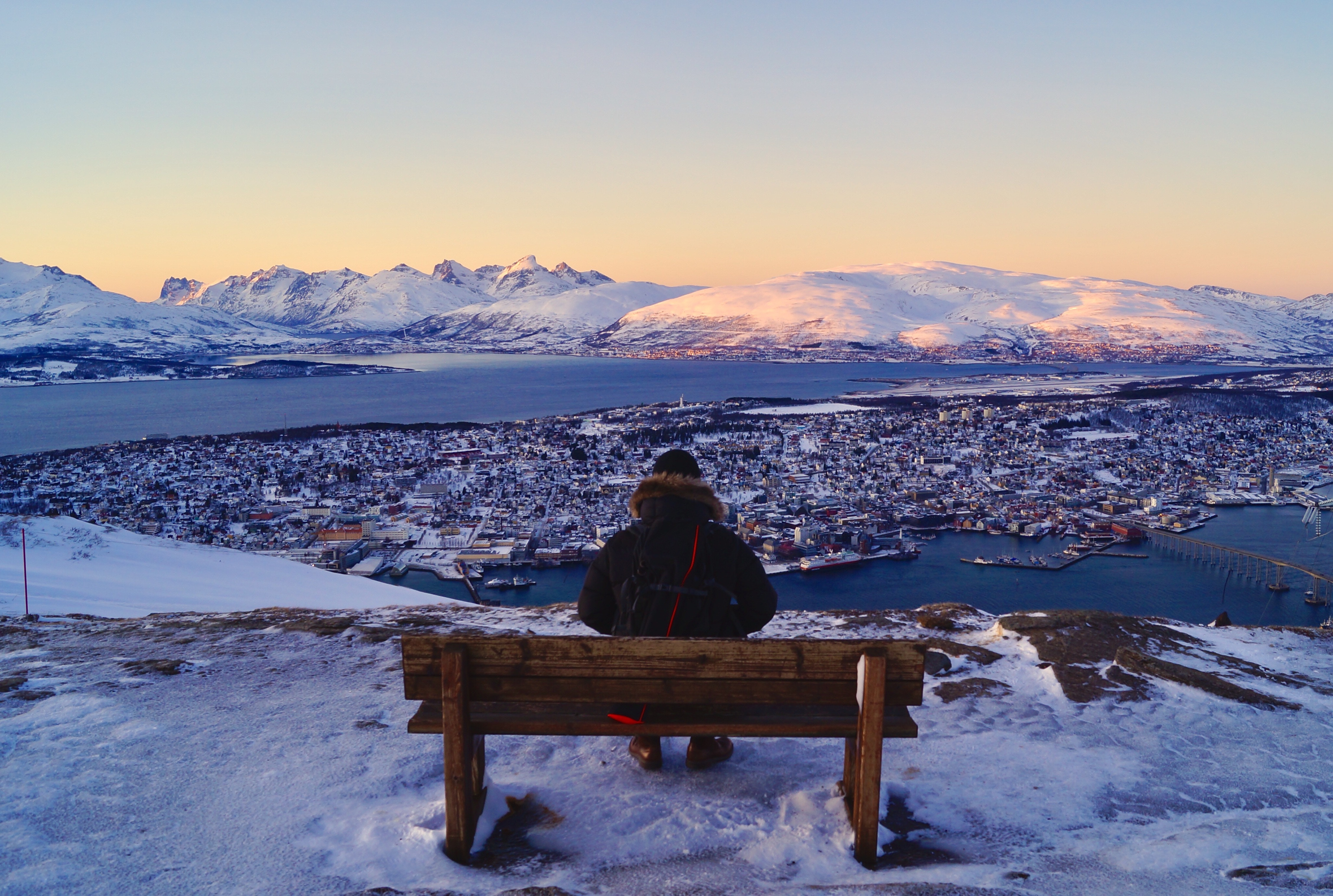
About Tromsø
With its centre located on the island of Tromsø, the municipality of Tromsø is more than five times the size of Norway’s capital, Oslo, and is the world’s northernmost university city. Lying 200 miles inside the Arctic Circle, it is known as the 'Gateway to the Arctic' because it was used as a starting point for hunters looking for Arctic foxes, polar bears and seals. In the 19th century it was a base for explorers on Arctic expeditions – a history that is remembered in the city’s Polar Museum, which you can visit on an excursion. Also commemorated in the area is the history of Norway’s indigenous people, the Sami. Visitors can learn about the traditions, heritage and modern preservation of the Sami culture at the Tromsø Museum. Nowadays, Tromsø is a charming mix of old and new, with wooden buildings sitting alongside contemporary architecture such as the impressive glacier-like Arctic Cathedral, which features one of the largest stained glass windows in Europe. Looking down on the city is Mount Storsteinen, and a cable car runs to the top, giving wonderful views over the surrounding countryside of forested peaks and reindeer pastures.
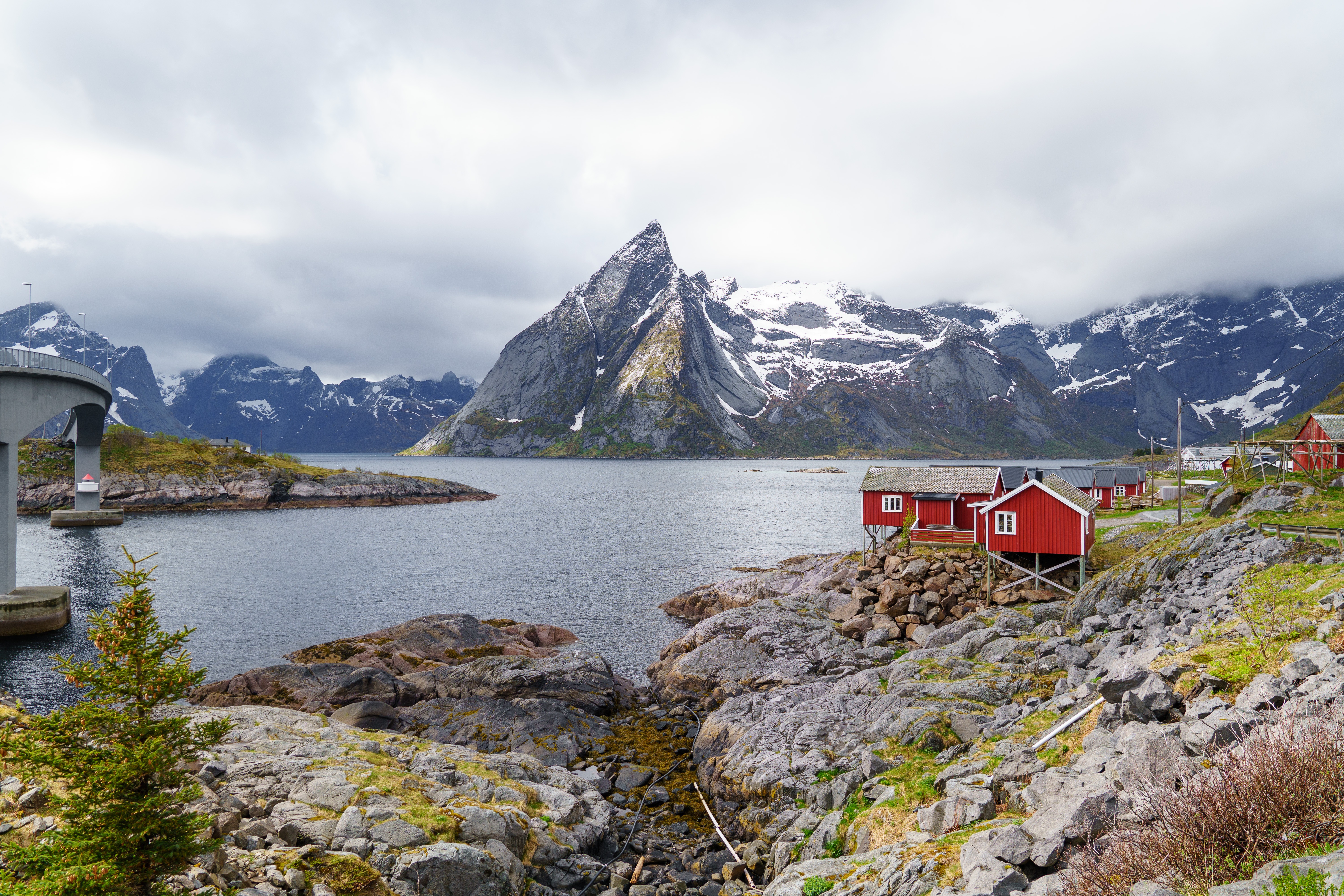
About Narvik
At 68 degrees North, Narvik lies 140 miles inside the Arctic Circle. Its history as a settlement began in the Stone Age, and Vikings are also known to have lived in the area. The modern town came into existence in the 1870s to serve the needs of the iron industry. Iron ore is mined in neighbouring Sweden and, as an ice-free port, Narvik was chosen as the ideal export location. The LKAB mining corporation is still a major employer and landowner in the area, shipping some 25,000,000 tons of iron ore from the port annually. This industrial heritage has shaped the town and now forms the basis of some of its most popular tourist attractions. In 1883 a co-owned British-Swedish company was given permission to build a railway connecting the Swedish iron mines in Kiruna to Narvik. It opened in 1902 and the town, then christened Victoriahavn, grew up around it. Unfortunately much of Narvik was destroyed in World War II. Invaded by the Nazis on 9 April 1940, it was later retaken by the Allies, representing the first military defeat of Hitler’s troops, but was evacuated as part of Operation Alphabet when it came under German occupation again. The local war museum documents the turbulent history of this period.
About IJmuiden
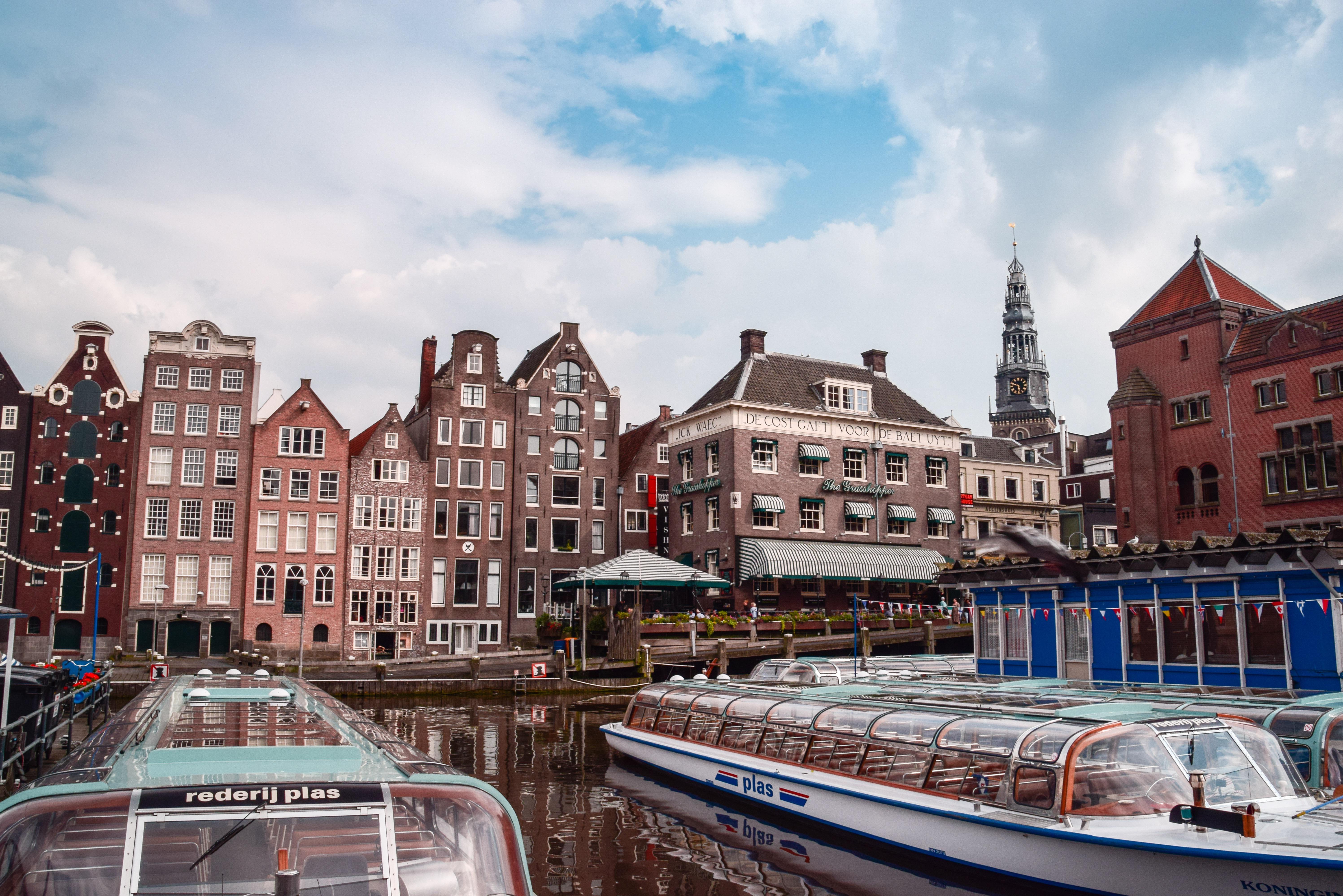
North Holland’s ‘Gate to the North Sea’, IJmuiden has four harbours: the Vissershaven, Haringhaven, IJmondhaven and the Seaport Marina - the latter used by pleasure craft. It is the largest Dutch fishing port, but is a relatively young town: it grew up in the 1870s when the North Sea Canal was opened. During World War II, the German Navy demolished much of the town and built huge fortified concrete bunkers for their torpedo boats and submarines. After 1945, the town was rebuilt by the architect Willem Marinus Dudok. He designed IJmuiden’s most impressive building, the Stadhuis van Velsen, which houses local government offices. For cruise passengers IJmuiden is the gateway to Amsterdam, the Dutch capital and one of Europe’s truly great cities, where elegant canals are lined by old brick gabled houses, and superb art galleries and museums are home to some of the world’s best-known paintings. Please note that complimentary shuttle buses operate from the port to the centre of IJmuiden, not to Amsterdam.
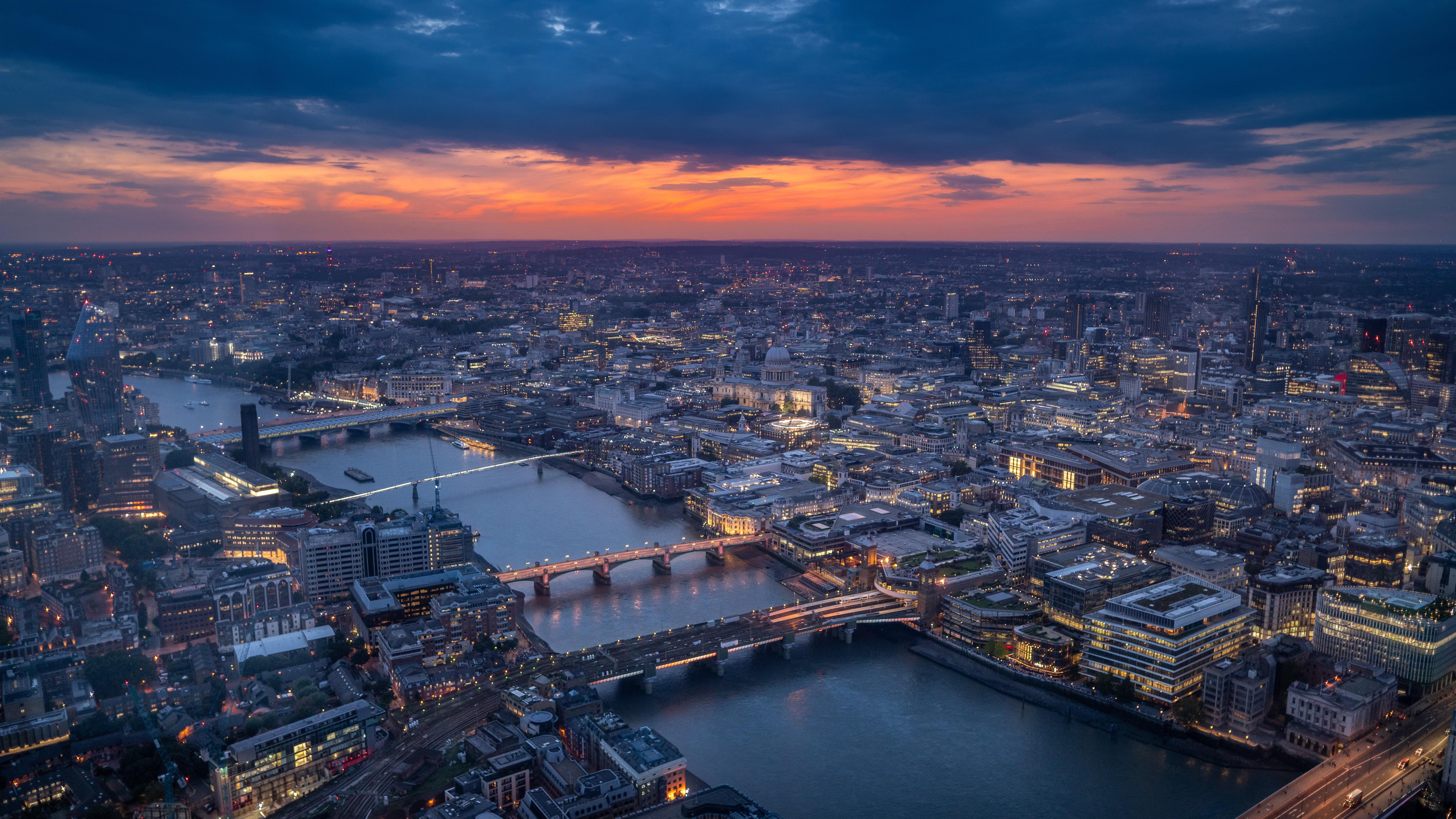
About Tilbury
Just 22 nautical miles down river from the Tower Bridge in London, Tilbury is a popular turnaround port for cruises visiting Baltic and Northern European destinations.
- 11:00 AM embarkation
- 11:00 AM priority stateroom access
- First opportunity to reserve shore excursions: 107 days prior to departure
- 4 guaranteed priority reservations at each alternative restaurant: 100 days prior to departure
- First priority booking of spa treatments: 100 days prior to departure
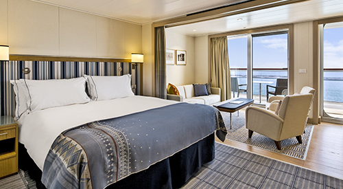
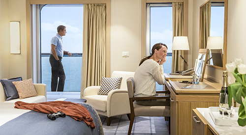
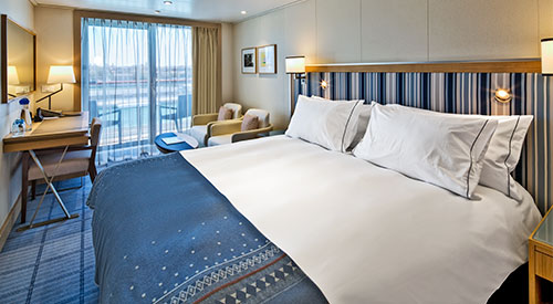
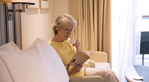
- King-size Viking Explorer Bed with luxury linens & pillows
- Free Wi-Fi (connection speed may vary)
- Three 42 flat-screen, interactive LCD TVs with intuitive remote & complimentary Movies On Demand
- 110/220 volt outlets & USB ports
- Mini-bar with alcoholic beverages, soft drinks, water & upgraded snacks (replenished once daily); security safe; hair dryer
- Direct-dial satellite phone & cell service
- Large master bathroom featuring a spacious glass-enclosed shower, double-sink vanity, heated bathroom floor & anti-fog mirror, plus two guest bathrooms
- Premium Freyja® toiletries; plush robes & slippers
- Purified water refilled daily
- Stateroom steward & twice-daily housekeeping
- 24-hour room service (including service from any restaurant during open hours)
- Spacious walk-in closet & drawers
- Complimentary laundry, dry cleaning, pressing & shoe shine services
- Welcome bottle of Veuve Clicquot champagne
- In-suite binoculars, coffee brewer & traditional Norwegian Marius-weave blanket
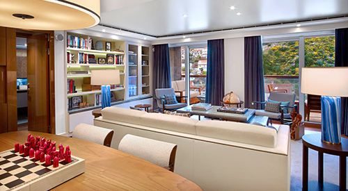
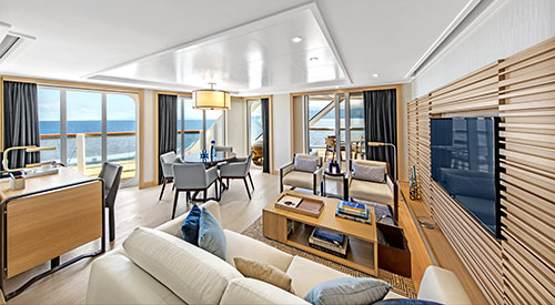
- Spacious, well-appointed living room
- Separate dining area that seats 6 guests
- Private library, wine & music collections curated by Chairman Torstein Hagen
- Ocean-view dry sauna
- Boardroom (seats 12) for business meetings & catered dinner parties, with first oceangoing vapor-light fireplace
- Pantry for room service & hosted events
- Complimentary shore excursion with private car & driver (up to 4 guests) in port city of your choice (valued at up to $800)
- Daily personalized tea or pre-dinner cocktail & canapés by request
- Dinner & guided tour with ship officers (subject to availability)
- 11:00 AM embarkation
- 11:00 AM priority stateroom access
- Priority shore excursion reservations: 97 days prior to departure
- 3 guaranteed priority reservations at each alternative restaurant: 90 days prior to departure
- Priority booking of spa treatments: 90 days prior to departure
- King-size Viking Explorer Bed with luxury linens & pillows
- Free Wi-Fi (connection speed may vary)
- Two 42" flat-screen, interactive LCD TVs with intuitive remote & complimentary Movies On Demand
- 110/220 volt outlets & USB ports
- Mini-bar with alcoholic beverages, soft drinks, water & snacks (replenished once daily); security safe; hair dryer
- Direct-dial satellite phone & cell service
- Large private bathroom with spacious glass-enclosed shower, double-sink vanity, heated bathroom floor & anti-fog mirror
- Premium Freyja® toiletries; plush robes & slippers
- Purified water refilled daily
- Stateroom steward & twice-daily housekeeping
- 24-hour room service
- Spacious closet & drawers
- Complimentary laundry, dry cleaning, pressing & shoe shine services
- Welcome bottle of champagne
- In-suite binoculars, coffee brewer & traditional Norwegian Marius-weave blanket
- Well-appointed living room & dining area that seats 4 guests
- 11:00 AM embarkation
- 11:00 AM priority stateroom access
- Priority shore excursion reservations: 87 days prior to departure
- 3 guaranteed priority reservations at each alternative restaurant: 80 days prior to departure
- Priority booking of spa treatments: 80 days prior to departure
- King-size Viking Explorer Bed with luxury linens & pillows
- Free Wi-Fi (connection speed may vary)
- Two 42" flat-screen, interactive LCD TVs with intuitive remote & complimentary Movies On Demand
- 110/220 volt outlets & USB ports
- Mini-bar with alcoholic beverages, soft drinks, water & snacks (replenished once daily); security safe; hair dryer
- Direct-dial satellite phone & cell service
- Large private bathroom with spacious glass-enclosed shower, double-sink vanity, heated bathroom floor & anti-fog mirror
- Premium Freyja® toiletries; plush robes & slippers
- Purified water refilled daily
- Stateroom steward & twice-daily housekeeping
- 24-hour room service
- Spacious closet & drawers
- Complimentary laundry, dry cleaning, pressing & shoe shine services
- Welcome bottle of champagne
- In-suite binoculars, coffee brewer & traditional Norwegian Marius-weave blanket
- 11:00 AM embarkation
- 1:00 PM stateroom access
- Priority shore excursion reservations: 77 days prior to departure
- 2 guaranteed priority reservations at each alternative restaurant: 70 days prior to departure
- Priority booking of spa treatments: 70 days prior to departure
- King-size Viking Explorer Bed with luxury linens & pillows
- Free Wi-Fi (connection speed may vary)
- 42" flat-screen, interactive LCD TV with intuitive remote & complimentary Movies On Demand
- 110/220 volt outlets & USB ports
- Mini-bar with alcoholic beverages, soft drinks, water & snacks (replenished once daily); security safe; hair dryer
- Direct-dial satellite phone & cell service
- Large private bathroom with spacious glass-enclosed shower, heated bathroom floor & anti-fog mirror
- Premium Freyja® toiletries; plush robes & slippers
- Purified water refilled daily
- Stateroom steward & twice-daily housekeeping
- 24-hour room service
- Spacious closet & drawers
- Complimentary pressing & shoe shine services
- Welcome bottle of champagne
- In-suite binoculars, coffee brewer & traditional Norwegian Marius-weave blanket
- 11:00 AM embarkation
- 2:00 PM stateroom access
- Priority shore excursion reservations: 67 days prior to departure
- 1 guaranteed priority reservation at each alternative restaurant: 60 days prior to departure
- Priority booking of spa treatments: 60 days prior to departure
- King-size Viking Explorer Bed with luxury linens & pillows
- Free Wi-Fi (connection speed may vary)
- 42" flat-screen, interactive LCD TV with intuitive remote & complimentary Movies On Demand
- 110/220 volt outlets & USB ports
- Mini-bar with soft drinks, water & snacks (replenished once daily); security safe; hair dryer
- Direct-dial satellite phone & cell service
- Large private bathroom with spacious glass-enclosed shower, heated bathroom floor & anti-fog mirror
- Premium Freyja® toiletries; plush robes & slippers
- Purified water refilled daily
- Stateroom steward & twice-daily housekeeping
- 24-hour room service
- Spacious closet & drawers
- In-suite binoculars, coffee brewer & traditional Norwegian Marius-weave blanket
- 11:00 AM embarkation
- 3:00 PM stateroom access
- Shore excursion reservations: 60 days prior to departure
- King-size Viking Explorer Bed with luxury linens & pillows
- Free Wi-Fi (connection speed may vary)
- 42" flat-screen, interactive LCD TV with intuitive remote & complimentary Movies On Demand
- 110/220 volt outlets & USB ports
- Mini-bar with soft drinks, water & snacks; security safe; hair dryer
- Direct-dial satellite phone & cell service
- Large private bathroom with spacious glass-enclosed shower, heated bathroom floor & anti-fog mirror
- Premium Freyja® toiletries; plush robes & slippers
- Purified water refilled daily
- Stateroom steward & twice-daily housekeeping
- 24-hour room service
- Spacious closet & drawers
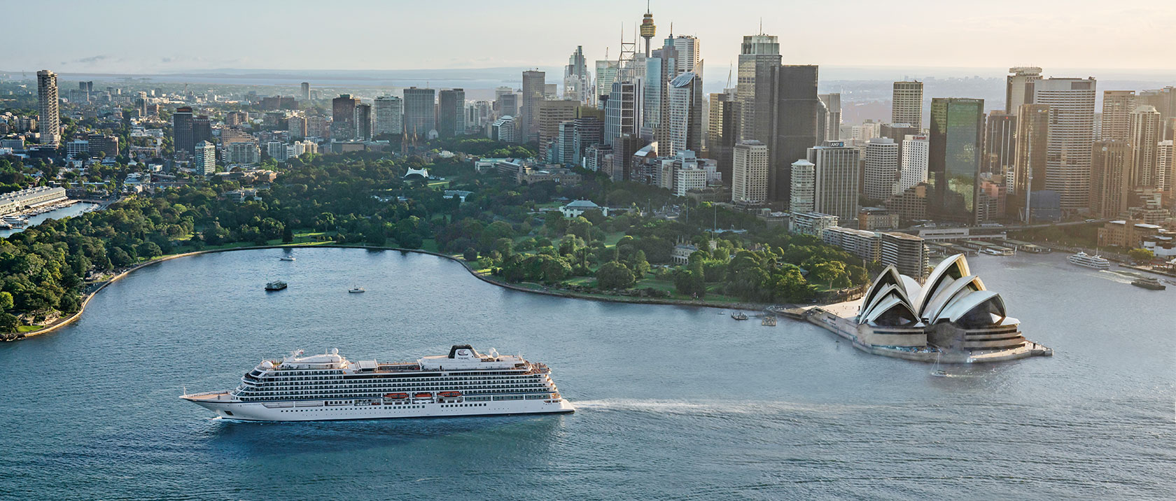
Viking Neptune
Expand your horizons on this comfortable, award-winning ship design, intimate and thoughtfully created by experienced nautical architects and designers to enrich your interaction with your destination in every way.
Ship Facts
| Launch Year | 2022 | ||||||||
| Refit Year | |||||||||
| Language | en | ||||||||
| Gross Tonnage | N/A | ||||||||
| Length | 2444 | ||||||||
| Width | 310 | ||||||||
| Currency | EUR | ||||||||
| Speed | N/A | ||||||||
| Capacity | 930 | ||||||||
| Crew Count | N/A | ||||||||
| Deck Count | N/A | ||||||||
| Cabin Count | N/A | ||||||||
| Large Cabin Count | N/A | ||||||||
| Wheelchair Cabin Count | N/A | ||||||||
| Electrical Plugs |
|
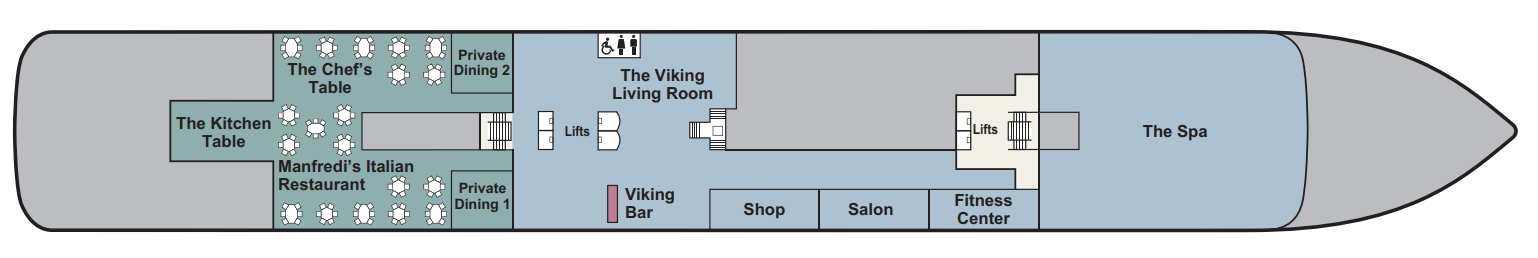
Deck 1
- The Kitchen Table
- The Chef's Table
- Manfredi's Italian Restaurant
- Private Dining 1
- Private Dining 2
- Lifts
- The Viking Living Room
- Viking Bar
- Shop
- Salon
- Fitness Center
- The Spa
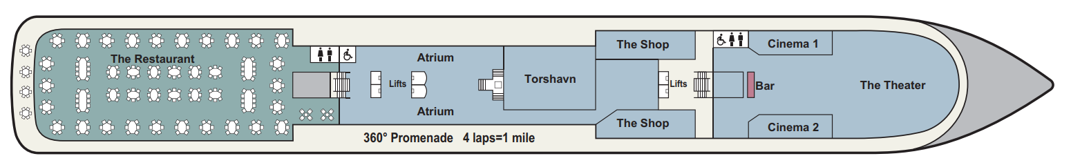
Deck 2
- The Restaurant
- Atrium
- Torshavn
- The Shop
- Cinema 1
- Cinema 2
- Bar
- The Theatre
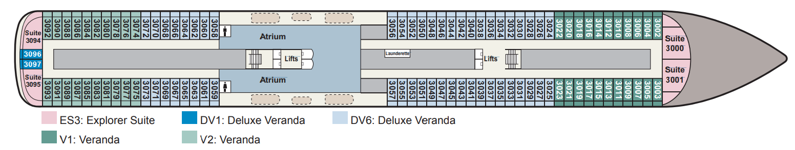
Deck 3
- Atrium
- Lifts
- Launderette
- Explorer Suites
- Verandas
- Deluxe Verandas
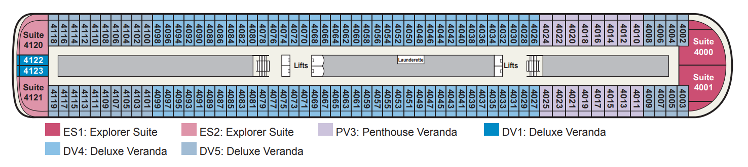
Deck 4
- Lifts
- Launderette
- Explorer Suites
- Deluxe Verandas
- Penthouse Verandas
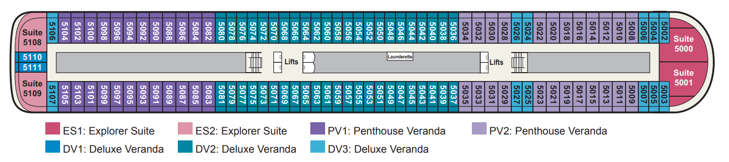
Deck 5
- Lifts
- Launderette
- Explorer Suites
- Deluxe Verandas
- Penthouse Verandas
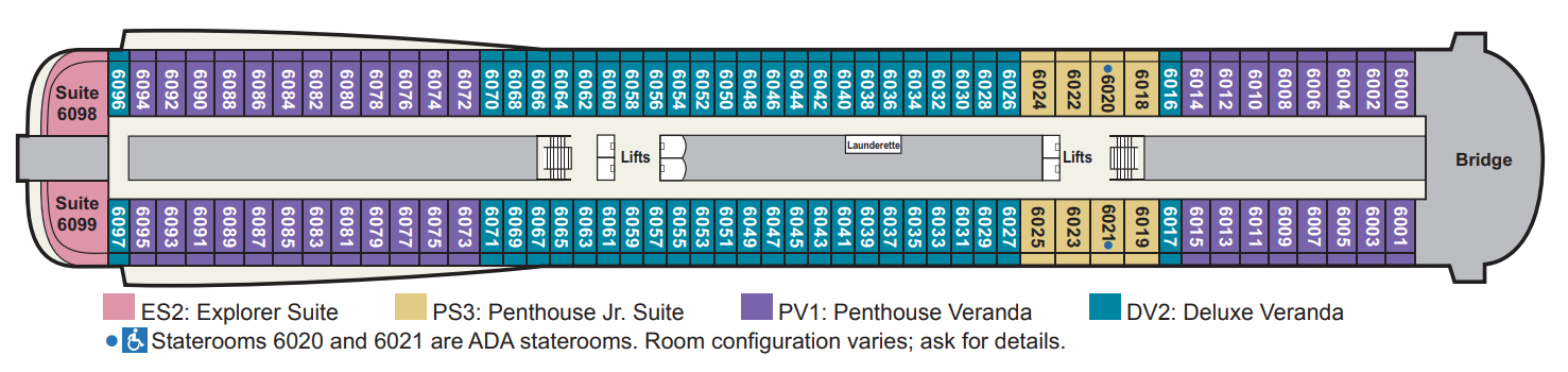
Deck 6
- Lifts
- Launderette
- Explorer Suites
- Penthouse Jr. Suites (Accessible)
- Penthouse Verandas
- Deluxe Verandas
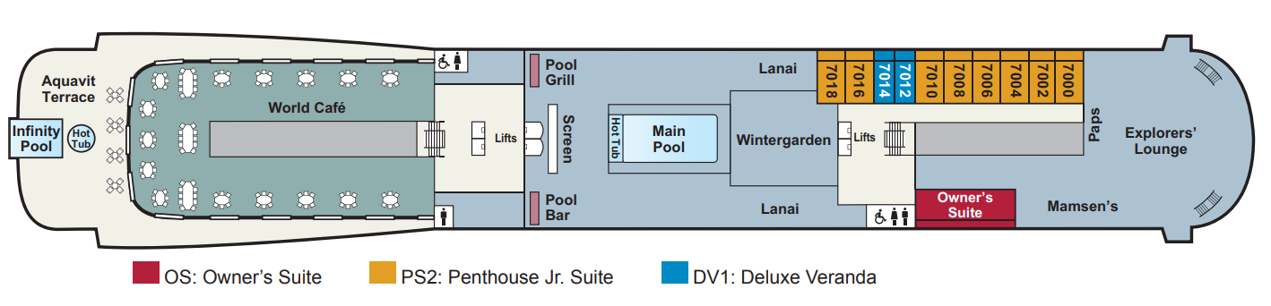
Deck 7
- Infinity Pool
- Aquavit Terrace
- Hot Tub
- World Cafe
- Lifts
- Pool Grill
- Pool Bar
- Screen
- Main Pool
- Wintergarden
- Lanai
- Mamsen's
- Paps
- Explorers' Lounge
- Owner's Suites
- Penthouse Jr. Suite
- Deluxe Verandas
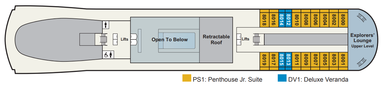
Deck 8
- Lifts
- Retractable Roof
- Explorers' Lounge Upper Level
- Penthouse Jr. Suites
- Deluxe Verandas
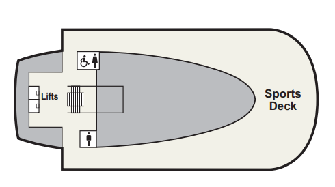
Deck 9
- Lifts
- Sports Deck
The Restaurant
Manfredi’s® Italian Restaurant
The Chef’s Table
World Café
Aquavit Terrace®
Mamsen’s®
Wintergarden
Pool Grill
Room Service
Elegant, light-filled ships thoughtfully designed to connect you to your destination.
The Library
The Living Room
Explorers' Lounge
Wintergarden
Under a canopy of Scandinavian trellised wood in the serene Wintergarden, indulge in afternoon tea service, complete with freshly made finger sandwiches, richly textured scones and delightful desserts.
Aquavit Terrace
Torshavn®
The Theatre & 2 Cinemas