Southeast Asia
Southeast Asia
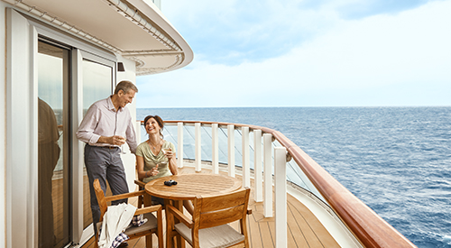
Cruise overview
WHY BOOK WITH US?
- ✔ The Deluxe Cruises’ team has extensive experience in ultra-luxury cruising.
- ✔ Call now to speak to our helpful and experienced Cruise Concierge team.
- ✔ Enjoy our Unique Deluxe Cruises Bonus for substantial savings.
- ✔ Our team will tailor your holiday to your exacting requirements.
- ✔ As agents, we work under the protection of each cruise lines ABTA / ATOL licences
About Benoa, Bali
Bali really is as alluring as everyone says. This island, slightly bigger than Delaware, has it all: beaches, volcanoes, terraced rice fields, forests, renowned resorts, surfing, golf, and world-class dive sites. But what sets Bali apart from other nearby tropical destinations is Balinese tradition, and villagers dedicated to celebrating it. The hundreds of temples, dances, rituals, and crafts linked to their ancient Hindu faith aren't a show for tourists, but a living, breathing culture in which visitors are warmly received by the Balinese, who cherish their own identities.
About Surabaya

About Semarang
Semarang is one of the oldest cities in Indonesia, situated on Java's north coast between the shore of the Java Sea and a small ridge of mountains. Ceded to the Dutch West India Company in 1677 by King Amangkurat I in payment of his debts, it became their headquarters and the seat of the Dutch governor of the northeast provinces. Semarang's usefulness as a port waned due to the gradual silting up of the harbor; by the 19th century, Surabaya had eclipsed Semarang as Java's premier port. With a population of over one million, a third of whom are thought to be of Chinese extraction, Semarang is the largest city in Central Java and its administrative capital. The city consists of two parts: the coastal lowland where most of the commercial activities are found; and the hilly residential area. Although more a business center than a city for tourists, Semarang serves as a popular gateway to the mountainous interior of Central Java and to fabled Borobudur.


About Jakarta

About Jakarta
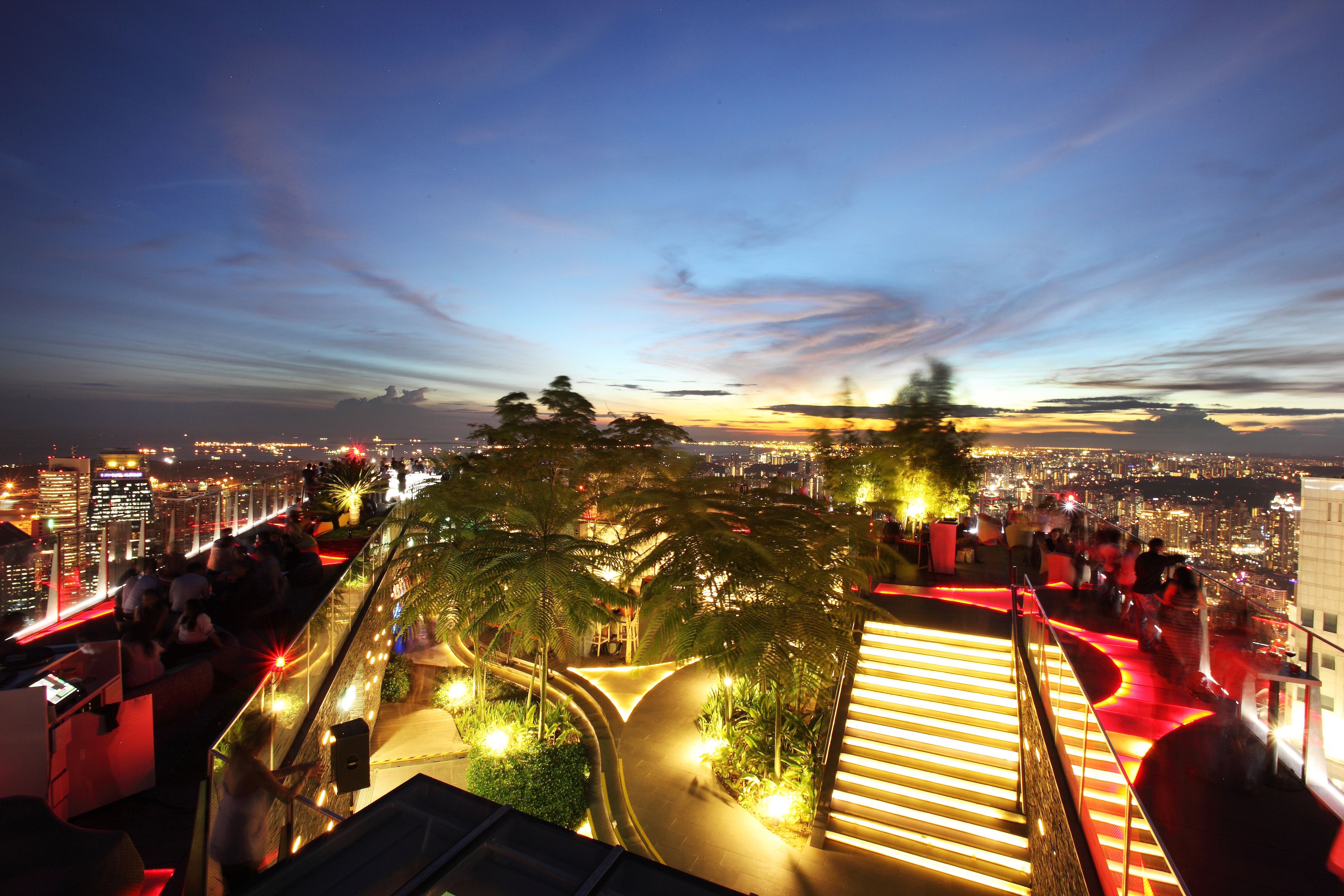
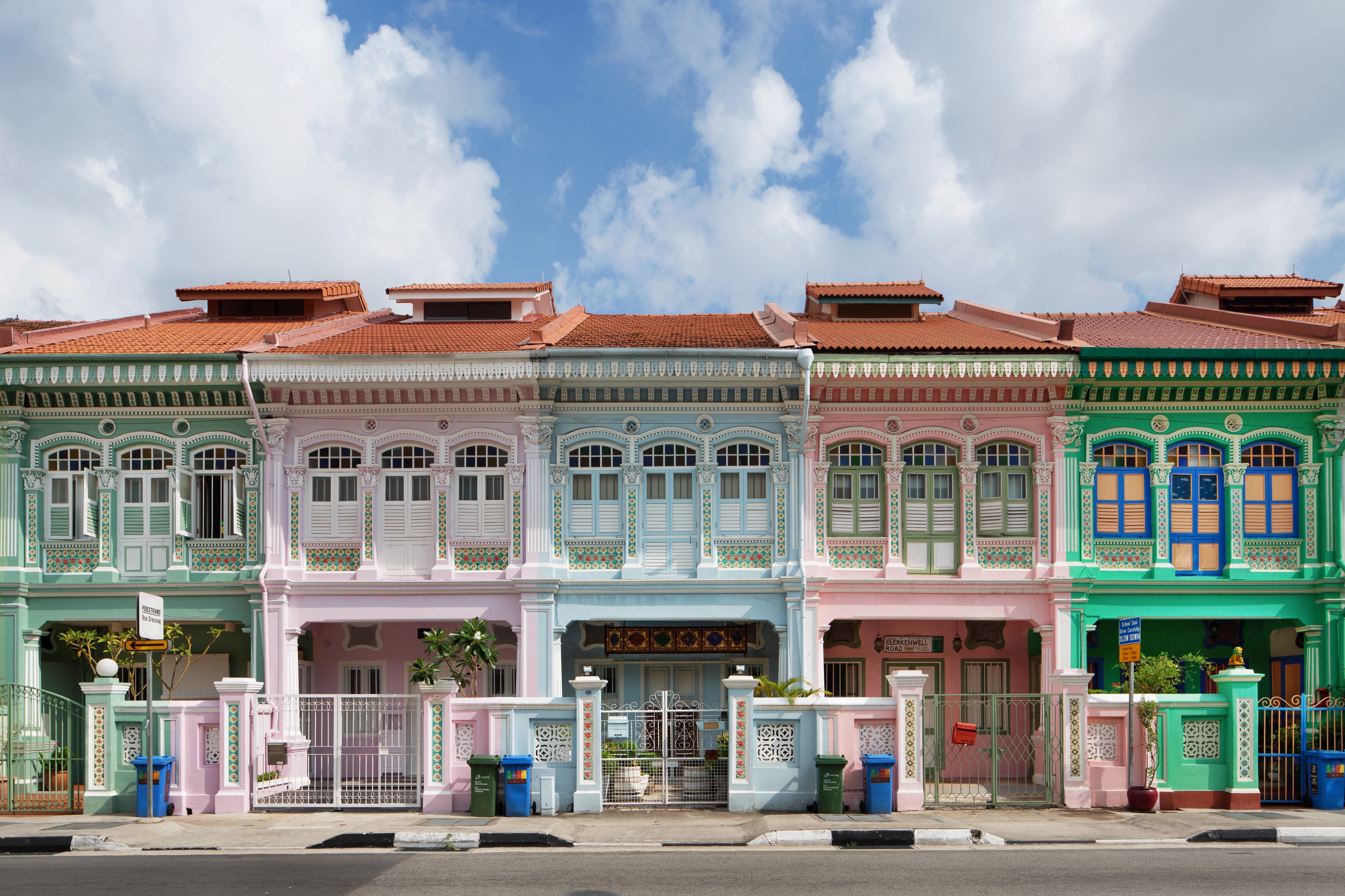
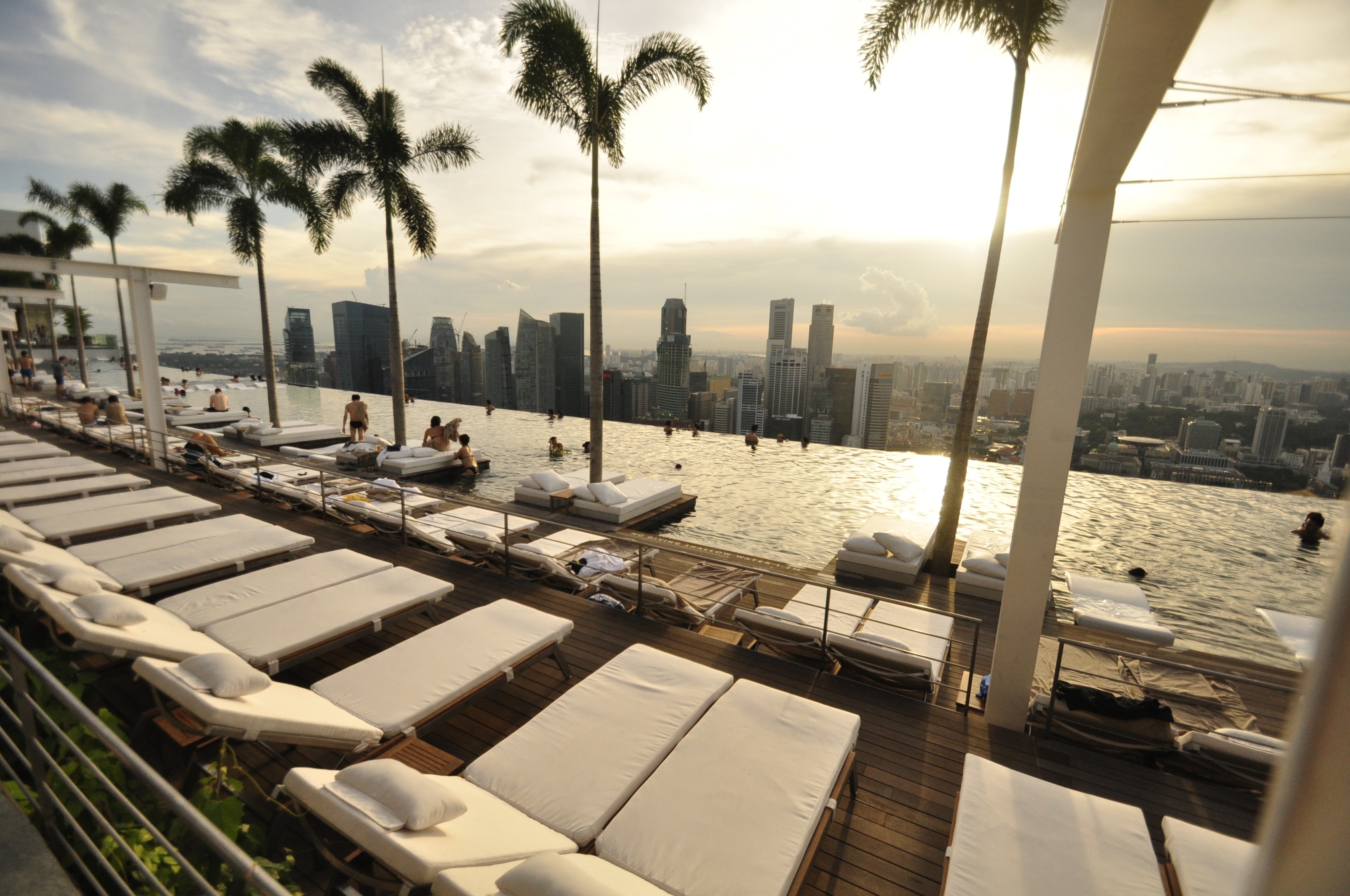
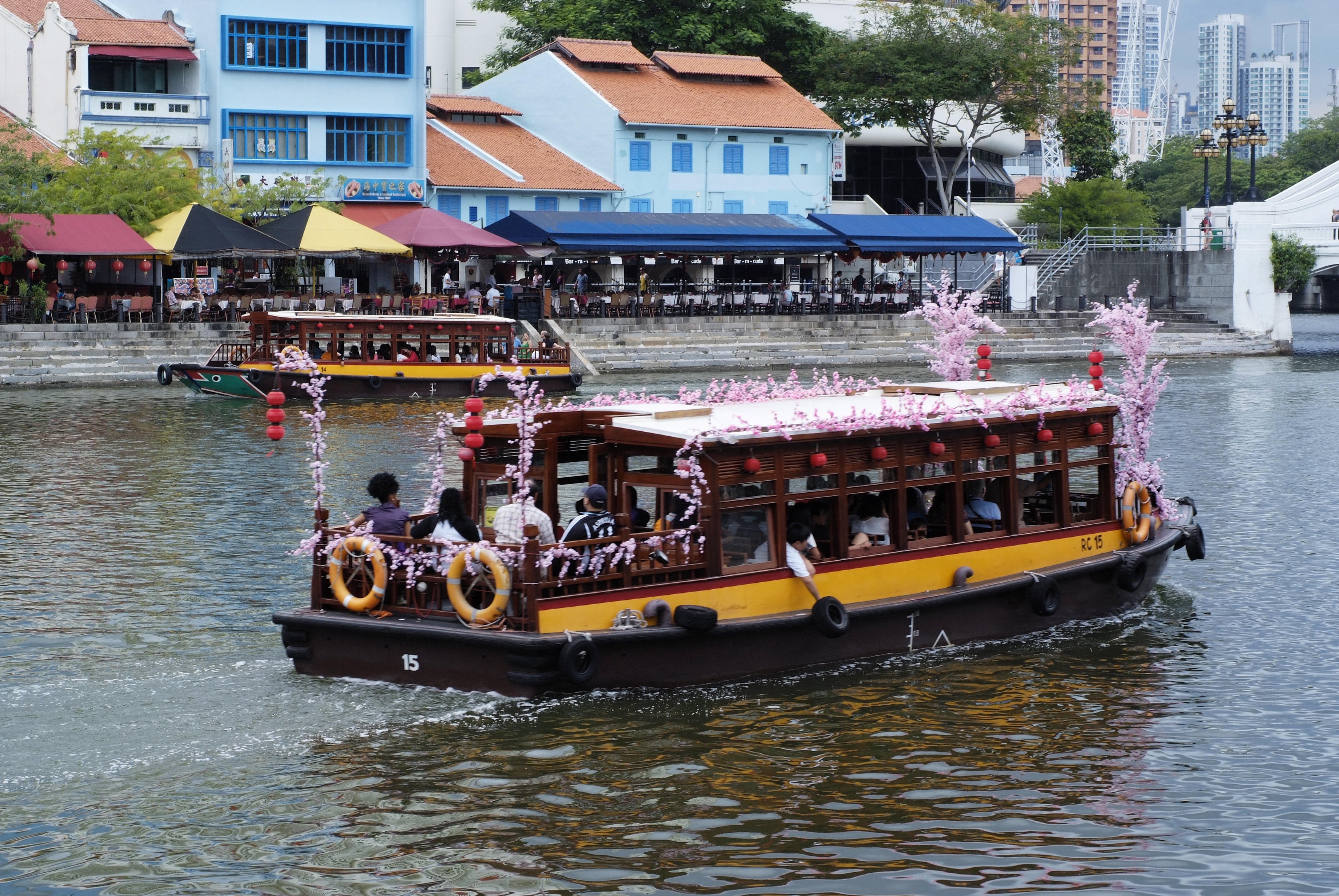
About Singapore
The main island of Singapore is shaped like a flattened diamond, 42 km (26 miles) east to west and 23 km (14 miles) north to south. Near the northern peak is the causeway leading to West Malaysia—Kuala Lumpur is less than four hours away by car. It is at the southern foot where you will find most of the city-state’s action, with its gleaming office towers, working docks, and futuristic "supertrees," which are solar-powered and serve as vertical gardens. Offshore are Sentosa and over 60 smaller islands, most uninhabited, that serve as bases for oil refining or as playgrounds and beach escapes from the city. To the east is Changi International Airport, connected to the city by metro, bus, and a tree-lined parkway. Of the island's total land area, more than half is built up, with the balance made up of parkland, farmland, plantations, swamp areas, and rain forest. Well-paved roads connect all parts of the island, and Singapore city has an excellent, and constantly expanding, public transportation system. The heart of Singapore's history and its modern wealth are in and around the Central Business District. The area includes the skyscrapers in the Central Business District, the 19th-century Raffles Hotel, the convention centers of Marina Square, on up to the top of Ft. Canning. Although most of old Singapore has been knocked down to make way for the modern city, most colonial landmarks have been preserved in the CBD, including early-19th-century buildings designed by the Irish architect George Coleman.


About Port Klang
Kuala Lumpur, or KL as locals refer to it, intrigues visitors with its diversity and multicultural character. The city's old quarter features stretches of shop houses that hint at its colonial past, while modern buildings—including the iconic Petronas Towers—give a glimpse of its modern financial ambitions. The city is filled with culturally colorful quarters dedicated to Chinese, Malay, and Indian communities. New shopping malls with designer labels, five-star hotels, and top-notch restaurants also proliferate in this bustling city of 1.6 million.

About Laem Chabang
There are two Bangkoks, the ancient soul of Thailand with its long and fascinating history and the frantic, modern metropolis that embraces the latest trends both Eastern and Western. The two blend together remarkably well—even the most jarring juxtapositions of old and new somehow make sense. Bangkok is not only the biggest city in Thailand, but also the most mesmerizing, with some of the country's most beautiful temples and shrines. The city's energy is palpable, especially at night, when traffic opens up a bit, its famous markets get going, and everything seems lit up—from its proudest monuments to its seediest streets. When Ayutthaya was besieged and pillaged by the Burmese in 1766, Thonburi became Thailand's capital. The Thais call Bangkok Krung Thep (City of Angels), and in 1782 King Rama I moved his capital here, just across the Chao Praya River. Laem Chabang is approximately 130 km (81 mi) from Bangkok.
About Sihanoukville

About Sihanoukville
About Ho Chi Minh City
Romantically referred to by the French as the Pearl of the Orient, Ho Chi Minh City today is a super-charged city of sensory overload. Motorbikes zoom day and night along the wide boulevards, through the narrow back alleys and past vendors pushing handcarts hawking goods of all descriptions. Still called Saigon by most residents, this is Vietnam's largest city and the engine driving the country's current economic resurgence, but despite its frenetic pace, it's a friendlier place than Hanoi and locals will tell you the food—simple, tasty, and incorporating many fresh herbs—is infinitely better than in the capital.This is a city full of surprises. The madness of the city's traffic—witness the oddball things that are transported on the back of motorcycles—is countered by tranquil pagodas, peaceful parks, quirky coffee shops, and whole neighborhoods hidden down tiny alleyways, although some of these quiet spots can be difficult to track down. Life in Ho Chi Minh City is lived in public: on the back of motorcycles, on the sidewalks, and in the parks. Even when its residents are at home, they're still on display. With many living rooms opening onto the street, grandmothers napping, babies being rocked, and food being prepared, are all in full view of passersby.Icons of the past endure in the midst of the city’s headlong rush into capitalism. The Hotel Continental, immortalized in Graham Greene's The Quiet American, continues to stand on the corner of old Indochina's most famous thoroughfare, the rue Catinat, known to American G.I.s during the Vietnam War as Tu Do (Freedom) Street and renamed Dong Khoi (Uprising) Street by the Communists. The city still has its ornate opera house and its old French city hall, the Hôtel de Ville. The broad colonial boulevards leading to the Saigon River and the gracious stucco villas are other remnants of the French colonial presence. Grisly reminders of the more recent past can be seen at the city's war-related museums. Residents, however, prefer to look forward rather than back and are often perplexed by tourists' fascination with a war that ended 40 years ago.The Chinese influence on the country is still very much in evidence in the Cholon district, the city's Chinatown, but the modern office towers and international hotels that mark the skyline symbolize Vietnam's fixation on the future.
About Chan May
Hue (pronounced hway), bisected by the Perfume River and 13 km (8 mi) inland from the South China Sea, in the foothills of the Annamite Mountains (Truong Son Mountains), stands as a reminder of Vietnam's imperial past. The seat of 13 Nguyen-dynasty emperors between 1802 and 1945, Hue was once Vietnam's splendid Imperial City. Although it was devastated by the French in the 19th century and again by fighting between the Vietnamese Communists and the Americans in the 20th, the monument-speckled former capital has a war-ravaged beauty. One can still imagine its former splendor, despite gaping holes in its silhouette. Hue is a UNESCO World Heritage Site, and the city's gems are slowly being restored.

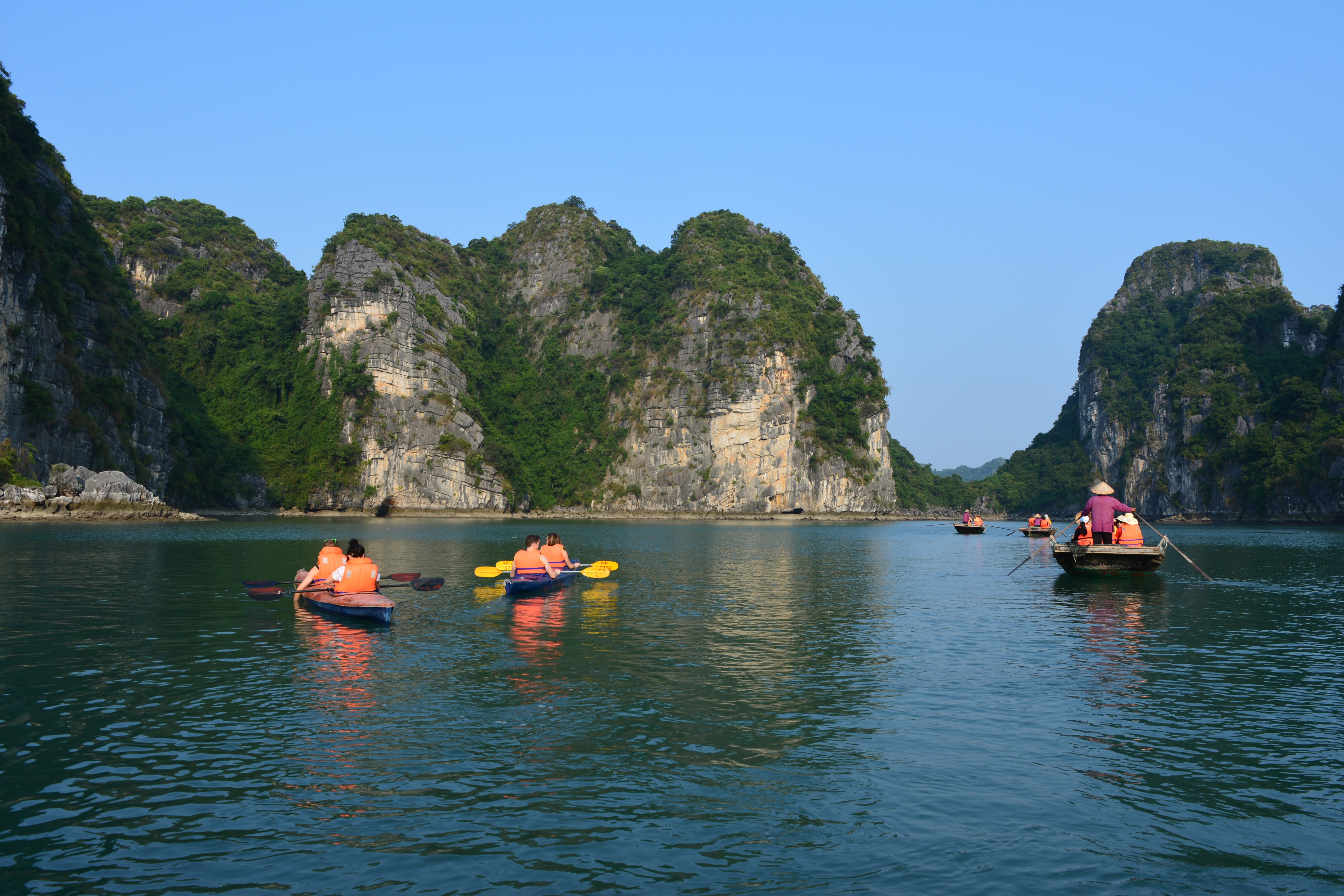
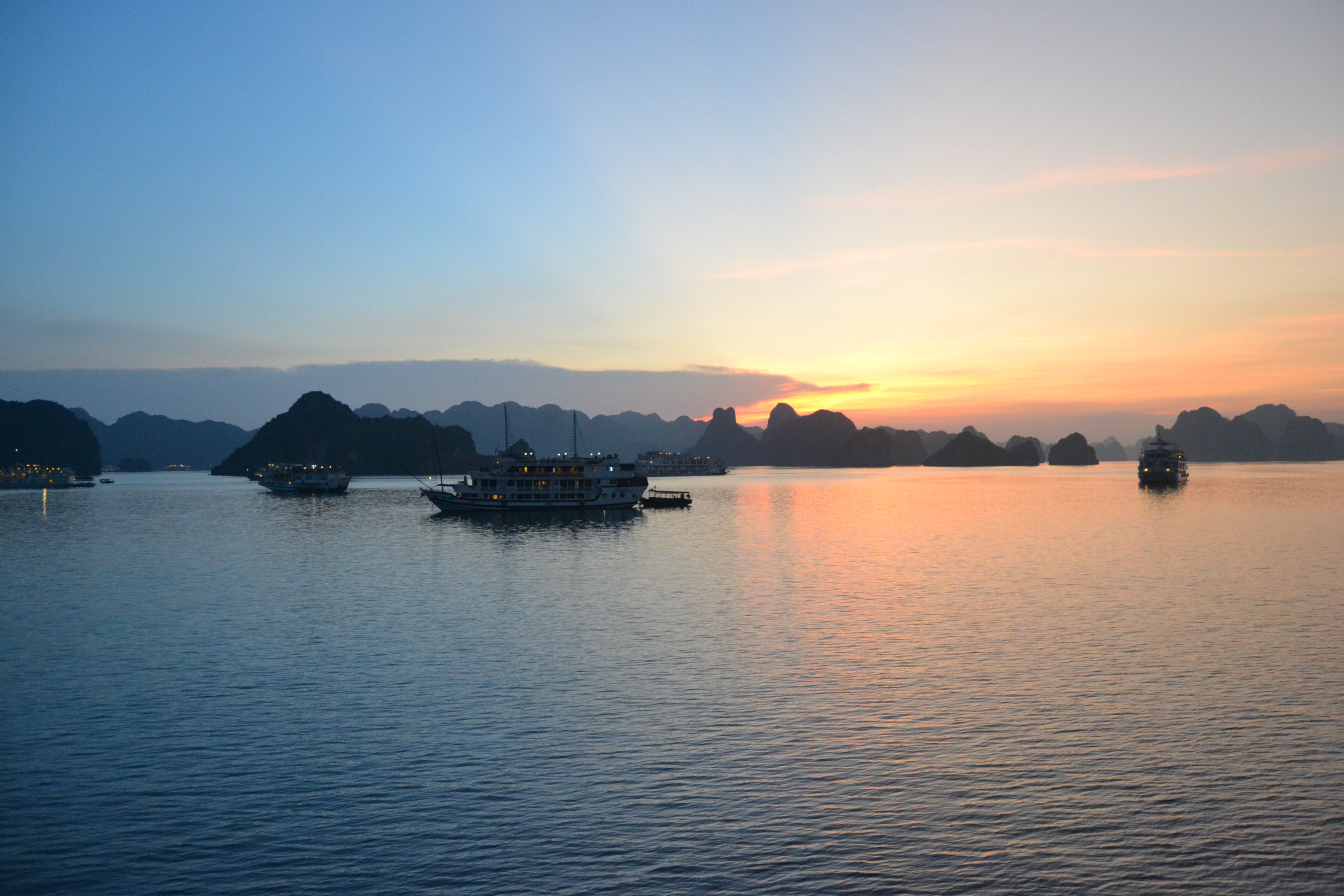
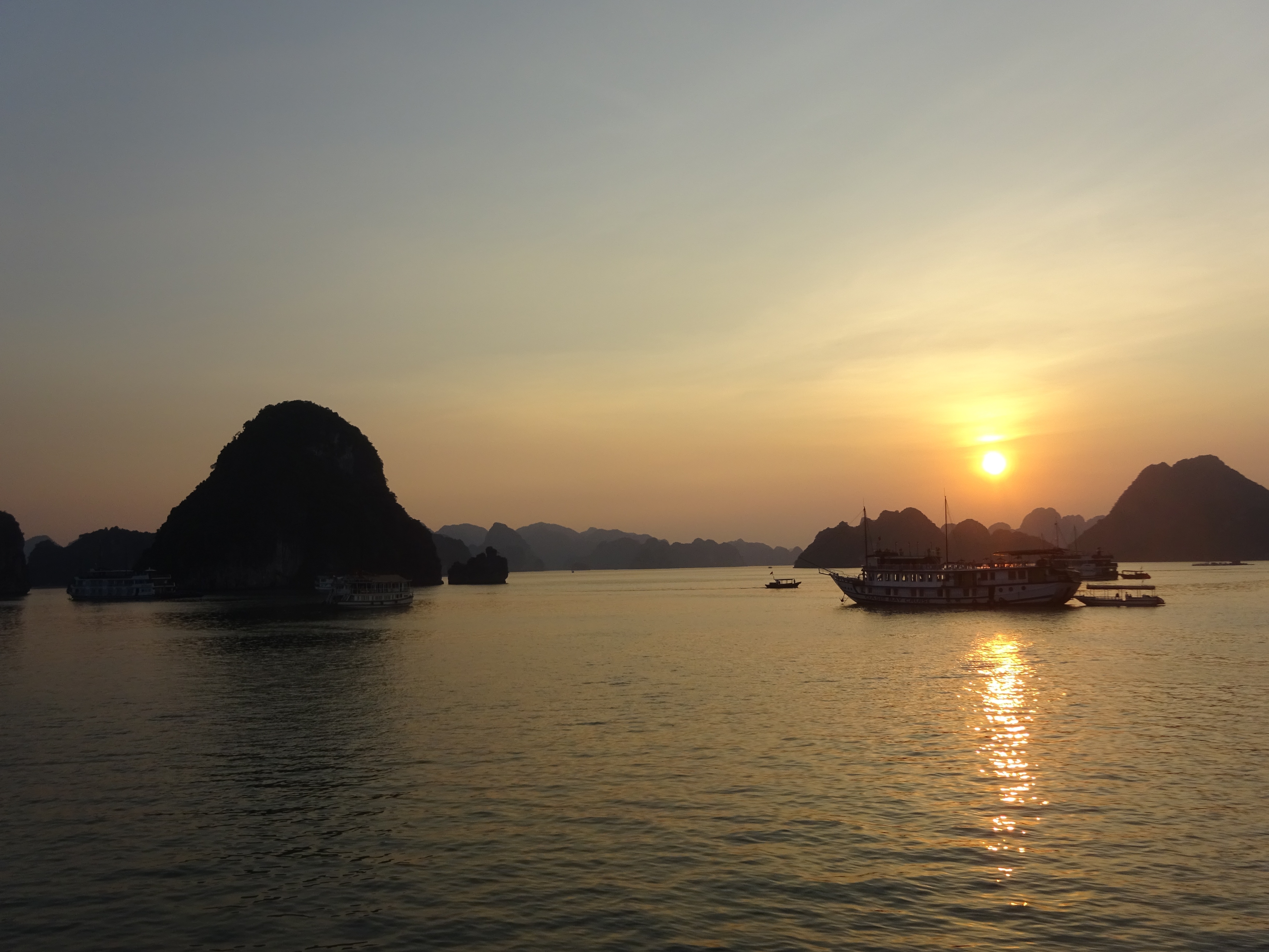
About Ha Long Bay
A visit to the north is not complete without a trip to Halong Bay, where placid waters give way to more than 3,000 limestone karsts and wind-sculpted limestone formations that jut from foggy lagoons. Dotting the bay are tiny islands bordered by white sandy coves and hidden caves, adding to the majestic landscape of this UNESCO World Heritage Site. Adding to this naturalist’s dream is the biodiversity of islets, grottos, and Cat Ba Island National Park. The bay, however, shows tourism’s impact: the clearing of mangrove forests to make way for jetties and piers, marine life threatened by game fishing, and garbage from passenger boats and fishing villages washed up on the shores.Beyond its geological uniqueness are activities like hiking, kayaking, rock climbing, or exploring one of the many floating villages where fishermen bring in their daily catch. The downside to all this allure is the large number of unlicensed boats it draws to the bay each day.Boat trips out onto the bay are the main tourism stock in trade farther north, but a more multifaceted side of the area can be experienced at Cat Ba Island. The largest island in Halong Bay, Cat Ba is very much its own entity. Its national park offers incredible biodiversity, with more than a thousand species of plants having been recorded here. Animal life is slightly thinner on the ground, but alert visitors may spy inhabitants such as the endangered golden-headed langur, wild boar, deer, civets, and several species of squirrel. Trekking through the wilderness is a highlight with a number of fascinating trails to follow.Cat Ba Island has also become a firm favorite with the adventure sports set. Indeed, along with Railay Beach in Thailand, it is recognized as one of the top spots in the region for rock climbing. Other outdoor pursuits include sailing and kayaking around the karsts. Although Halong Bay has arguably been tainted by over-exposure, Bai Tu Long Bay farther east toward China, retains all the majesty of Vietnam’s premier bucket-list natural attraction but sees a fraction of the traffic of its immediate neighbor to the west. Here, visitors will find islands of substantial size with deserted beaches and untamed jungle. Halong Bay's 3,000 islands of dolomite and limestone cover a 1,500-square-km (580-square-mile) area, extending across the Gulf of Tonkin nearly to the Chinese border. According to legend, this breathtaking land- and seascape was formed by a giant dragon that came barreling out of the mountains toward the ocean—hence the name (Halong translates into "descent of the dragon"). Geologists are more likely to attribute the formations to sedimentary limestone that formed here between 300 and 500 million years ago, in the Paleozoic Era. Over millions of years water receded and exposed the limestone to wind, rain, and tidal erosion.Today the limestone formations are exposed to hordes of tourists—but don't let that discourage you. Hundreds of fishing trawlers and tour boats share space on these crystal waters, yet there seems to be room for everyone. Most people use the main population center, Halong City, as a base from which to venture into the bay. Although it's now officially one municipality, Halong City was, until 1996, two separate towns: Bai Chay is now Halong City West, where Halong Road winds its way around the coast and past the lifeless central beach; Hon Gai is the grimier Halong City East, where a coal transportation depot dominates the center of town and covers nearby roads and buildings with a sooty film. Locals still refer to the towns by their old names, but they are now inexorably lassoed together by a bridge. Boat trips through Halong Bay are the main attraction. Little of the majesty of this region can be found in the city, so head out onto the water and start exploring. Countless 10- and 30-foot fishing boats have been converted into Halong Bay's formidable tourist-boat fleet. Hotels or travel agencies in Halong City or Hanoi can arrange boat trips for you (often they are part of organized tours from Hanoi). It is still possible to go down to the wharf and bargain yourself onto a boat for the day, but you are likely to be charged (sometimes significantly) more than you would pay for a prebooked tour, so this is not advised. Self-sufficient travelers have fallen victim to the old bait-and-switch: they've arranged a next-day boat tour with local fishermen, only to be told in no uncertain terms the following morning that they could not board their chosen boat, but they could take a different one for quite a bit more money. You may have no choice in the end. Usually travel agencies, however, have their tried-and-true favorites.
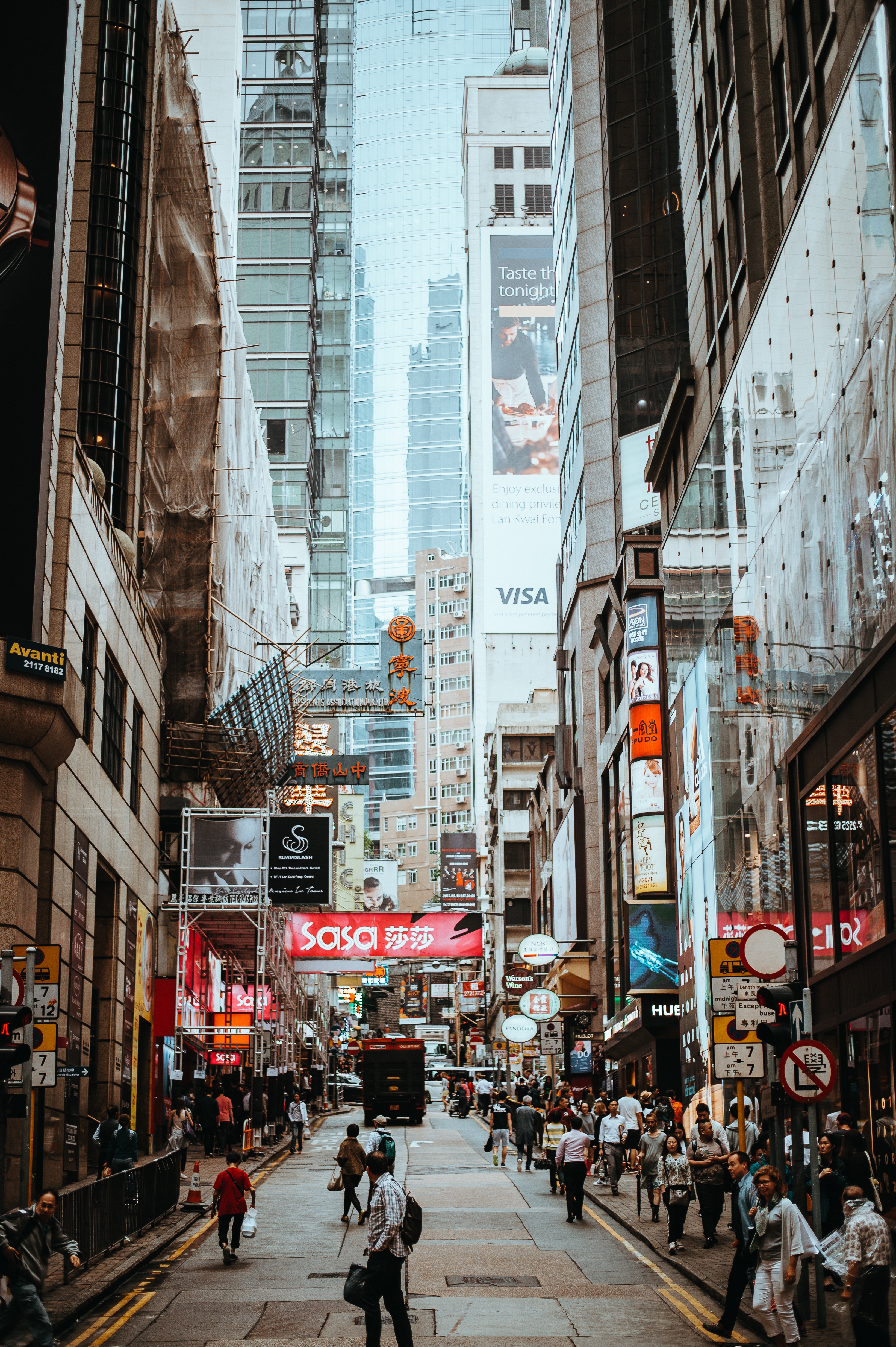
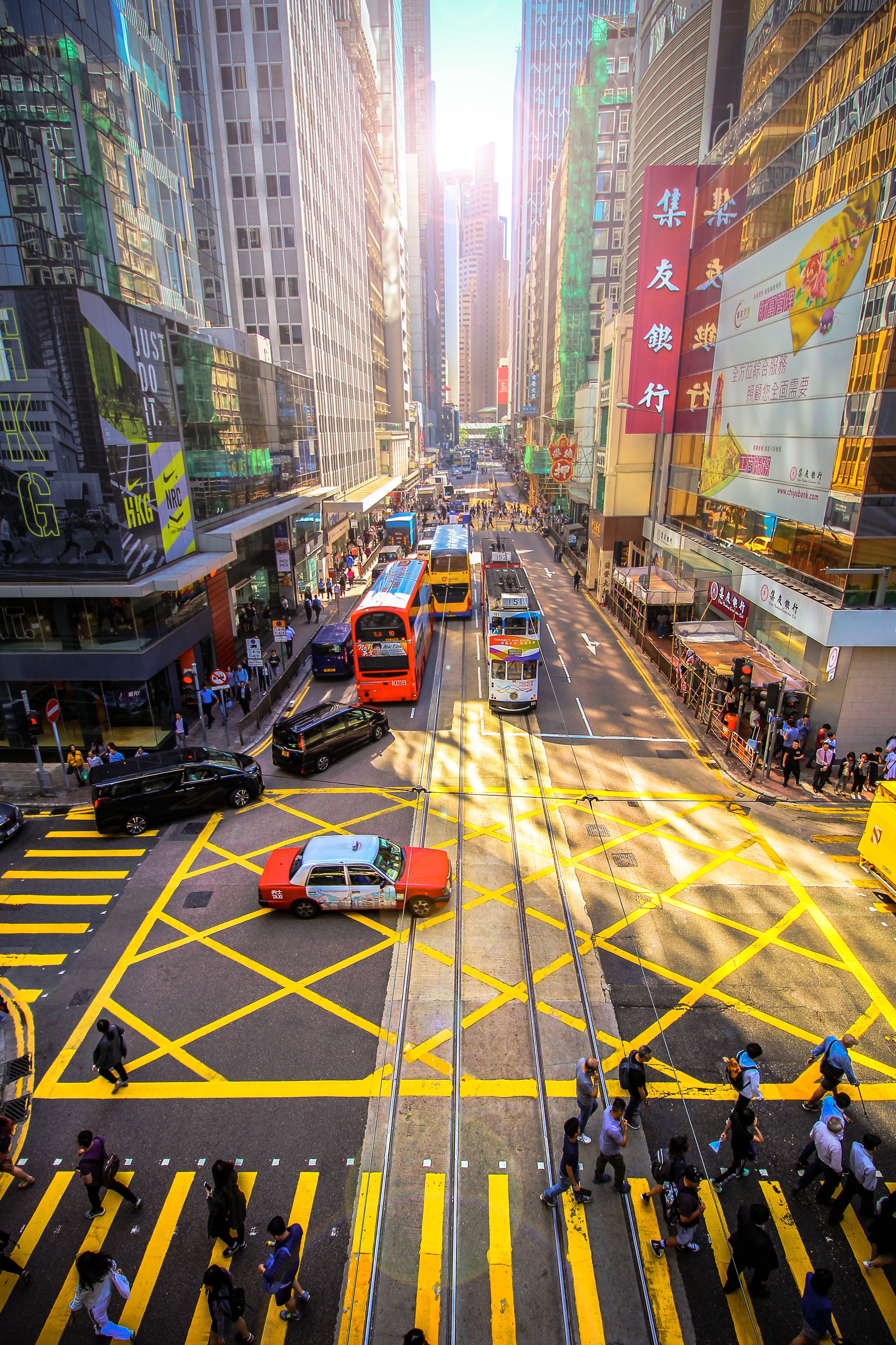
About Hong Kong
The Hong Kong Island skyline, with its ever-growing number of skyscrapers, speaks to ambition and money. Paris, London, even New York were centuries in the making, while Hong Kong's towers, bright lights, and glitzy shopping emporia weren't yet part of the urban scene when many of the young investment bankers who fuel one of the world's leading financial centers were born. Commerce is concentrated in the glittering high-rises of Central, tucked between Victoria Harbor and forested peaks on Hong Kong Island's north shore. While it's easy to think all the bright lights are the sum of today's Hong Kong, you need only walk or board a tram for the short jaunt west into Western to discover a side of Hong Kong that is more traditionally Chinese but no less high-energy. You'll discover the real Hong Kong to the east of Central, too, in Wan Chai, Causeway Bay, and beyond. Amid the residential towers are restaurants, shopping malls, bars, convention centers, a nice smattering of museums, and—depending on fate and the horse you wager on—one of Hong Kong's luckiest or unluckiest spots, the Happy Valley Racecourse. Kowloon sprawls across a generous swath of the Chinese mainland across Victoria Harbour from Central. Tsim Sha Tsui, at the tip of Kowloon peninsula, is packed with glitzy shops, first-rate museums, and eye-popping views of the skyline across the water. Just to the north are the teeming market streets of Mong Kok and in the dense residential neighborhoods beyond, two of Hong Kong's most enchanting spiritual sights, Wong Tai Sin Temple and Chi Lin Nunnery. As you navigate this huge metropolis (easy to do on the excellent transportation network), keep in mind that streets are usually numbered odd on one side, even on the other. There's no baseline for street numbers and no block-based numbering system, but street signs indicate building numbers for any given block.


Where You'll Go


