South Pacific Sojourn
South Pacific Sojourn
Cruise overview
WHY BOOK WITH US?
- ✔ The Deluxe Cruises’ team has extensive experience in ultra-luxury cruising.
- ✔ Call now to speak to our helpful and experienced Cruise Concierge team.
- ✔ Enjoy our Unique Deluxe Cruises Bonus for substantial savings.
- ✔ Our team will tailor your holiday to your exacting requirements.
- ✔ As agents, we work under the protection of each cruise lines ABTA / ATOL licences
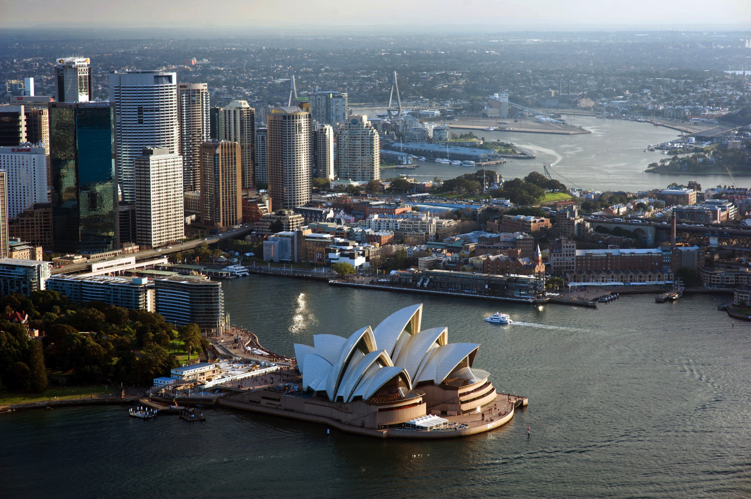
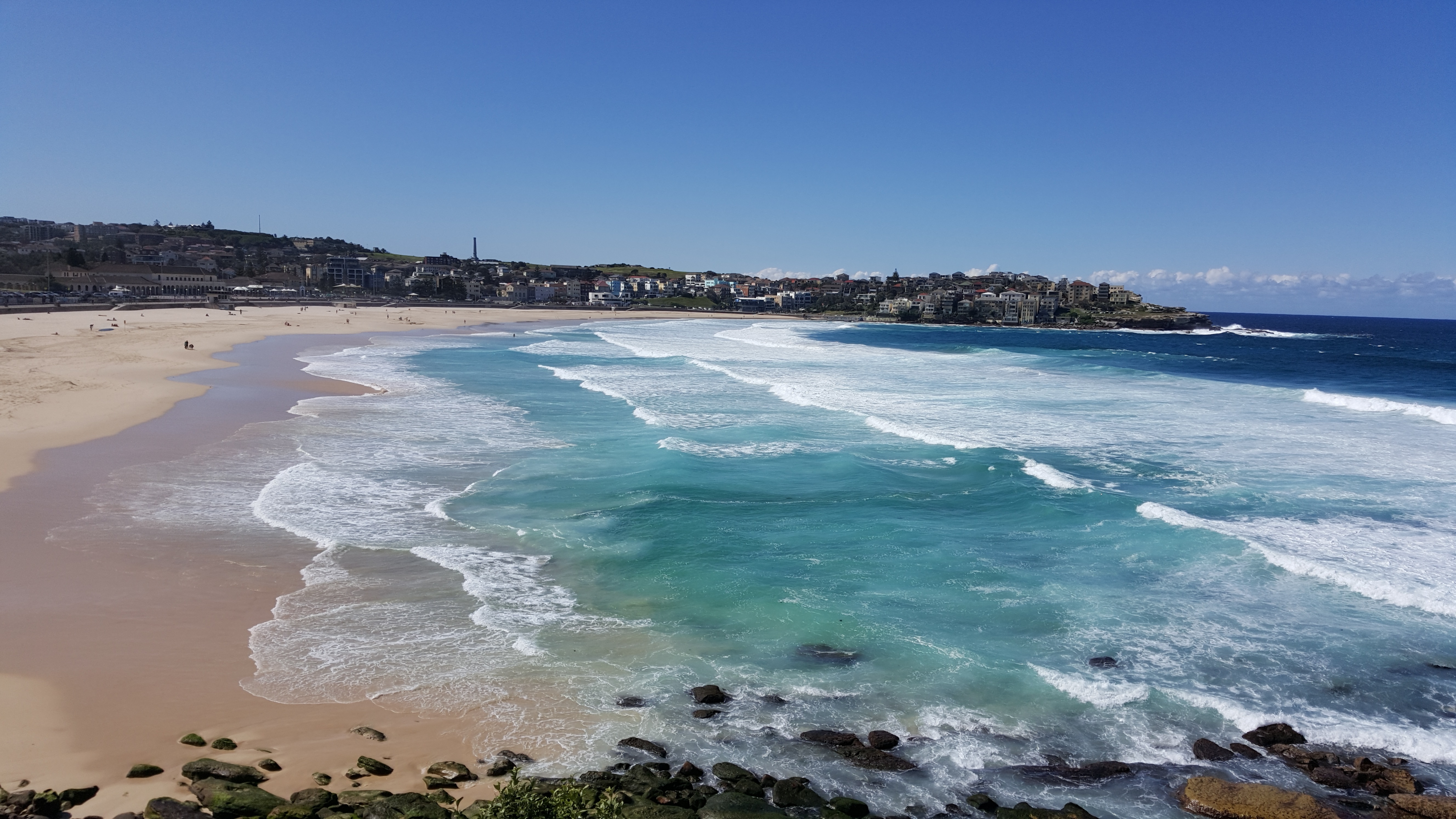
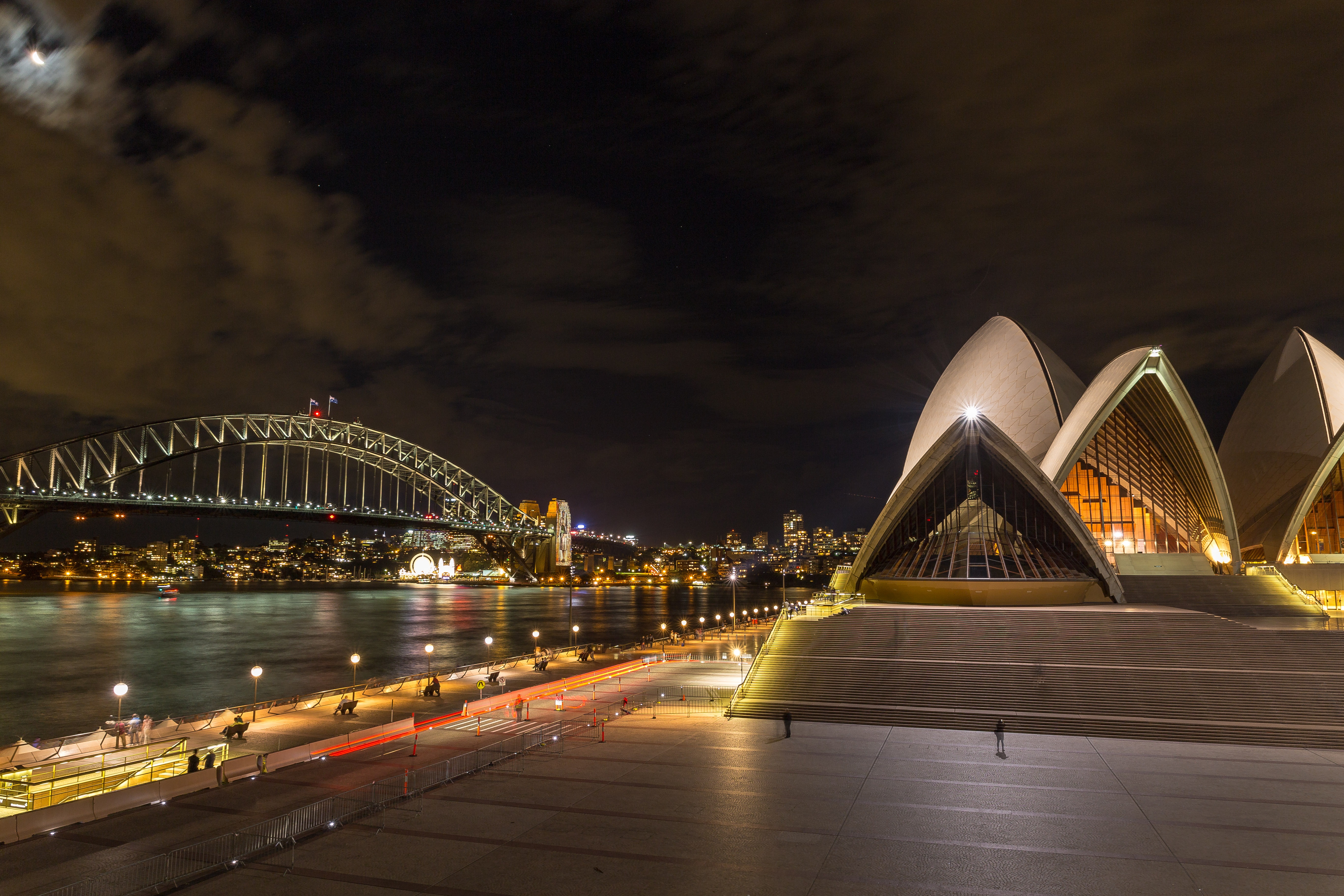
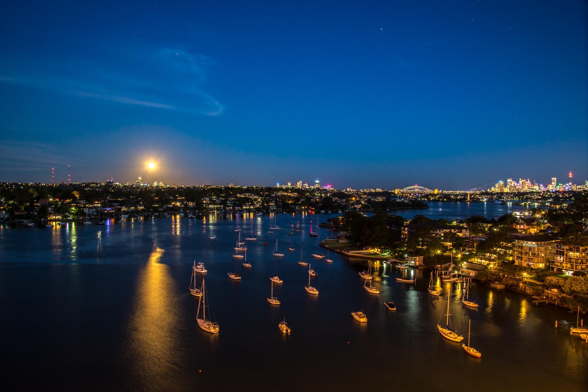
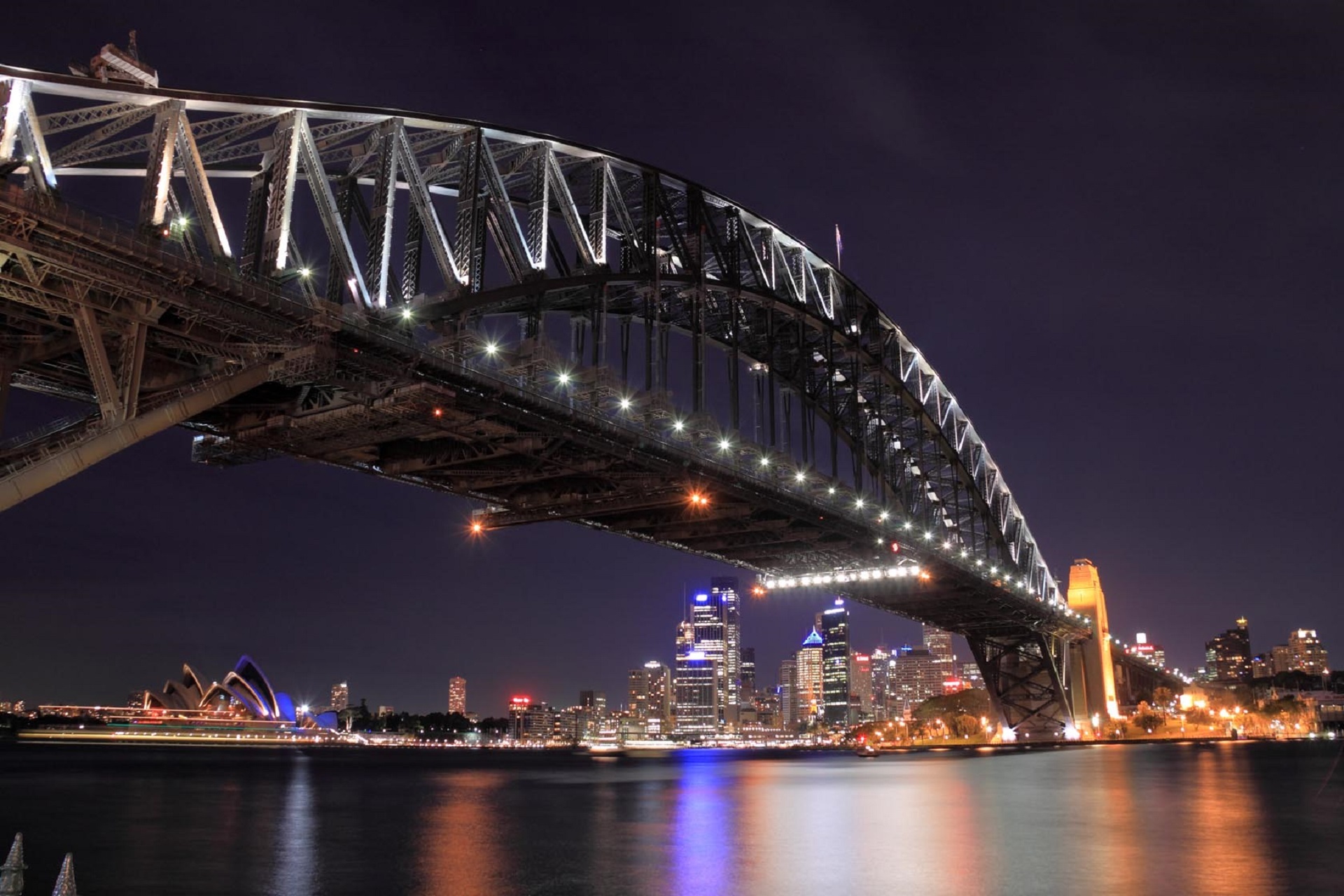
About Sydney, New South Wales
Sydney, capital of New South Wales and one of Australia's largest cities, is best known for its harbourfront Sydney Opera House, with a distinctive sail-like design. Massive Darling Harbour and the smaller Circular Quay port are hubs of waterside life, with the arched Harbour Bridge and esteemed Royal Botanic Garden nearby. Sydney Tower’s outdoor platform, the Skywalk, offers 360-degree views of the city and suburbs.
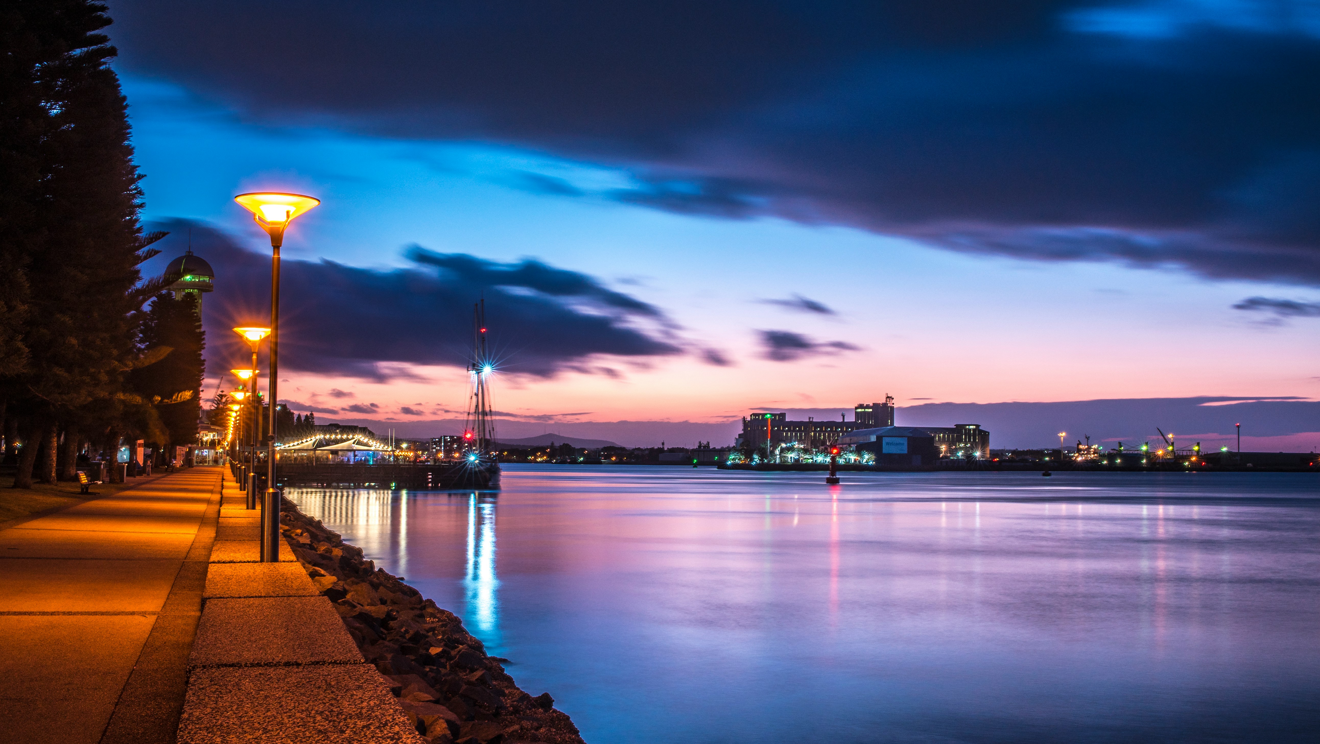
About Newcastle, New South Wales

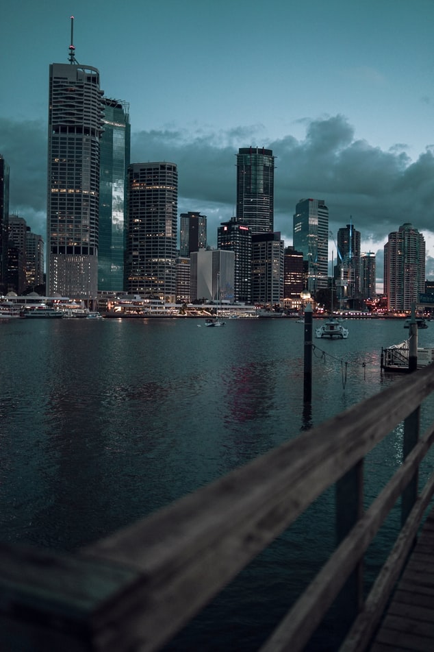
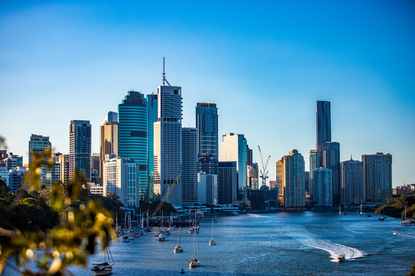
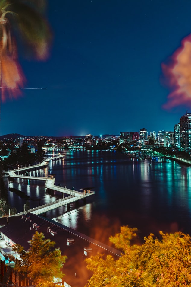
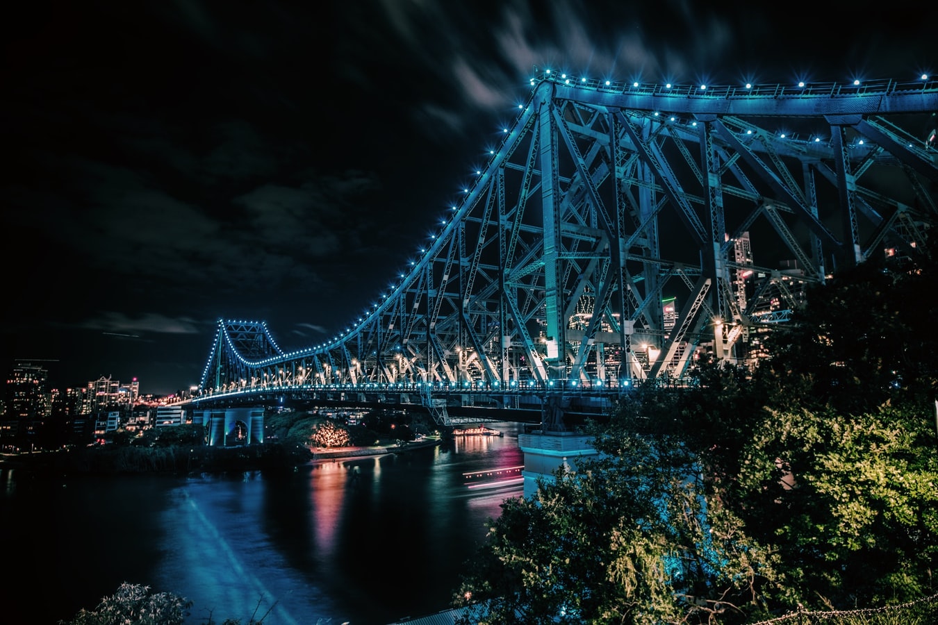
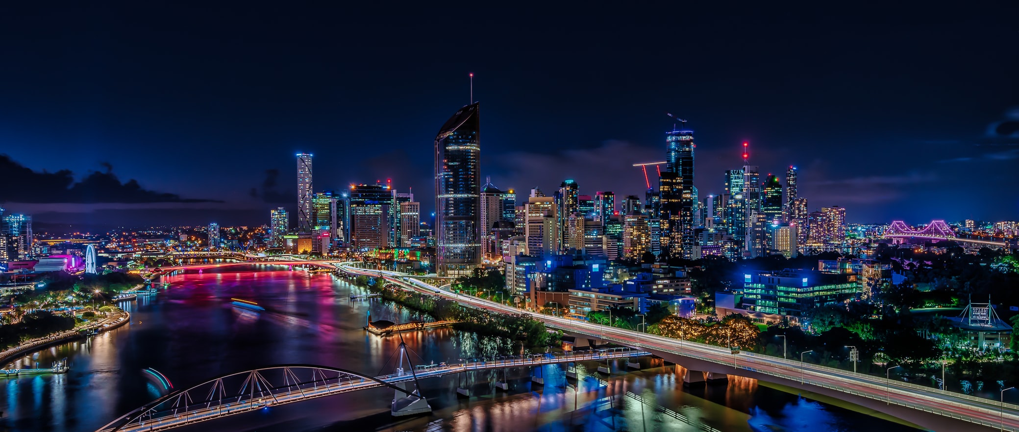
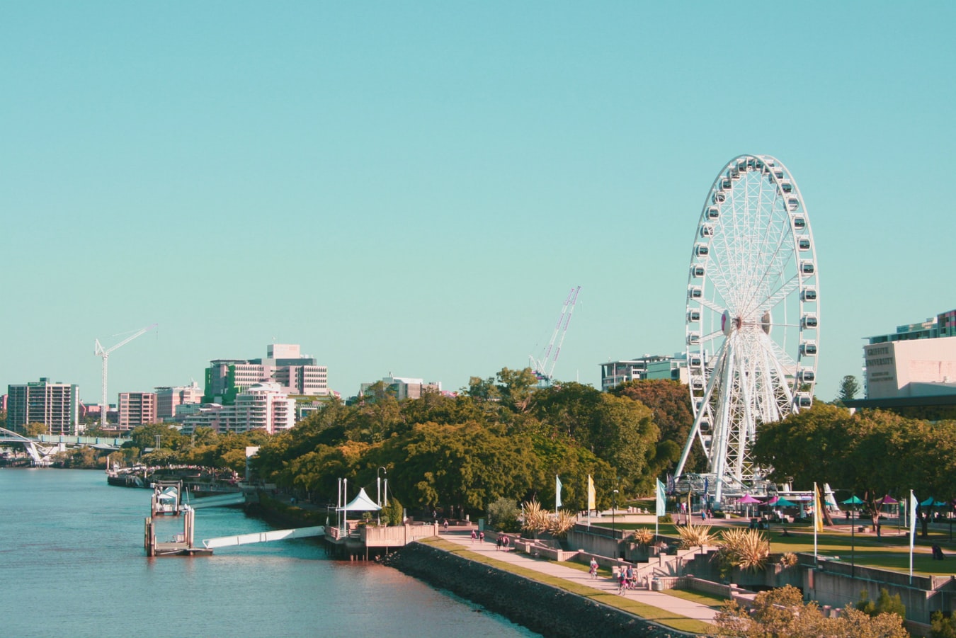
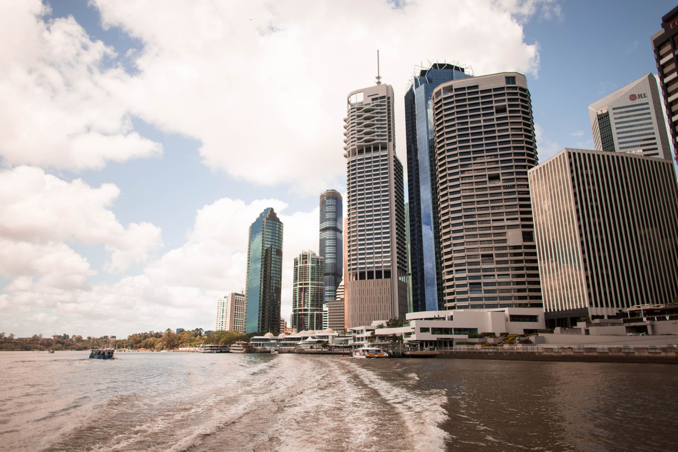
About Brisbane, Queensland
Founded in 1824 on the banks of the wide, meandering Brisbane River, the former penal colony of Brisbane was for many years regarded as just a big country town. Many beautiful timber Queenslander homes, built in the 1800s, still dot the riverbanks and inner suburbs, and in spring the city's numerous parks erupt in a riot of colorful jacaranda, poinciana, and bougainvillea blossoms. Today the Queensland capital is one of Australia's most up-and-coming cities: glittering high-rises mark its polished business center, slick fashion boutiques and restaurants abound, and numerous outdoor attractions beckon. In summer, temperatures here are broilingly hot and days are often humid, a reminder that this city is part of a subtropical region. Wear SPF 30-plus sunscreen and a broad-brimmed hat outdoors, even on overcast days.Brisbane's inner suburbs, a 5- to 10-minute drive or 15- to 20-minute walk from the city center, have a mix of intriguing eateries and quiet accommodations. Fortitude Valley combines Chinatown with a cosmopolitan mix of clubs, cafés, and boutiques. Spring Hill has several high-quality hotels, and Paddington, New Farm, Petrie Terrace, West End, and Woolloongabba are full of an eclectic mix of restaurants and bars. Brisbane is also a convenient base for trips to the Sunshine and Gold coasts, the mountainous hinterlands, and the Moreton Bay islands.
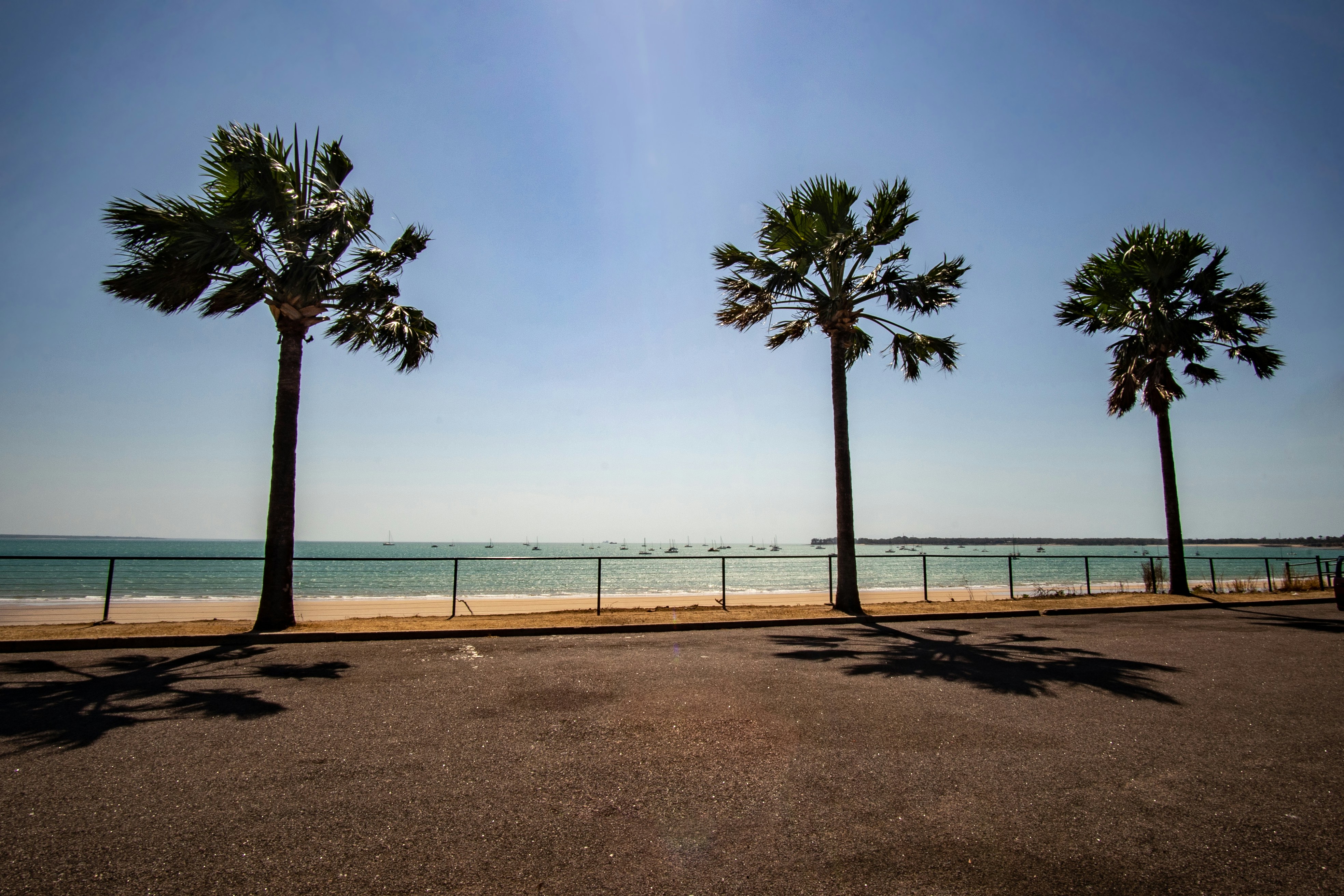
About Airlie Beach
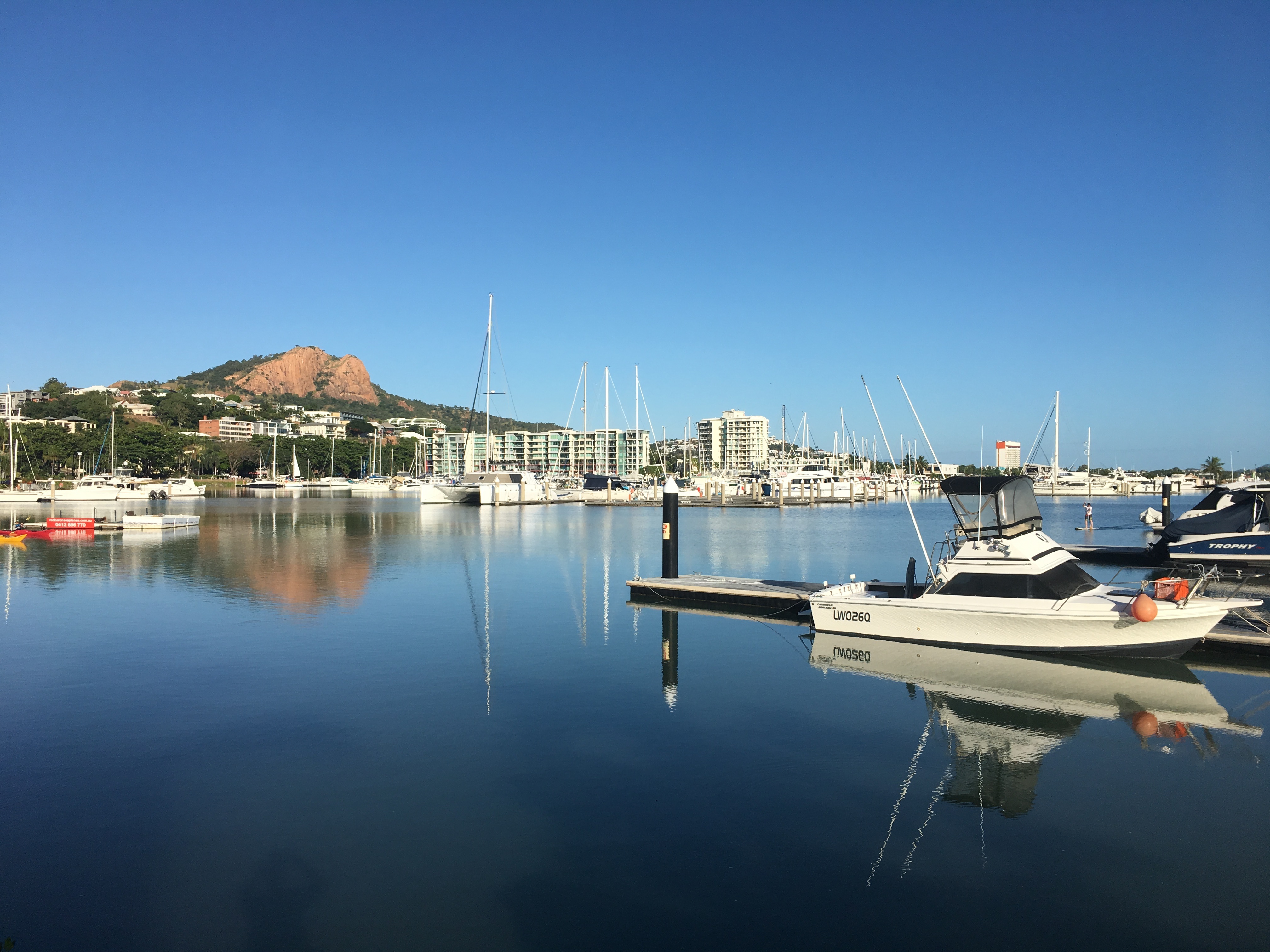
About Townsville, Queensland
This coastal city has little in the way of sandy beaches or surf, but it does have shady parks, charming colonial buildings, and a boardwalk-flanked waterfront Esplanade with a terrific man-made beach and picnic facilities. The historic town center has thrived recently, with an influx of lively eateries and bars. There are also some excellent museum and a world-class aquarium.Queensland Parks and Wildlife Service has an office on Magnetic Island, but Townsville Enterprise's information kiosks in Flinders Square and the Museum of Tropical Queensland (MTQ), on the mainland, are the best sources of visitor info about the island.
About Cairns, Queensland
Tourism is the lifeblood of Cairns (pronounced Caans). The city makes a good base for exploring the wild top half of Queensland, and tens of thousands of international travelers use it as a jumping-off point for activities such as scuba diving and snorkeling trips to the Barrier Reef, as well as boating, fishing, parasailing, scenic flights, and rain-forest treks.It's a tough environment, with intense heat and fierce wildlife. Along with wallabies and grey kangaroos in the savannah and tree kangaroos in the rain forest, you'll find stealthy saltwater crocodiles, venomous snakes, and jellyfish so deadly they put the region’s stunning beaches off- limits to swimmers for nearly half the year. Yet despite this formidable setting, Cairns and tropical North Queensland are far from intimidating places. The people are warm and friendly, the sights spectacular, and—at the right time of year—the beachside lounging is world-class.
About Thursday Island, Queensland
About Darwin, Northern Territory
Darwin is Australia's most colorful, and exotic, capital city. Surrounded on three sides by the turquoise waters of the Timor Sea, the streets are lined with tropical flowers and trees. Warm and dry in winter, hot and steamy in summer, it's a relaxed and casual place, as well as a beguiling blend of tropical frontier outpost and Outback hardiness. Thanks to its close proximity to Southeast Asia and its multicultural population it also seems more like Asia than the rest of Australia. Darwin is a city that has always had to fight for its survival. The seductiveness of contemporary Darwin lifestyles belies a history of failed attempts that date from 1824 when Europeans attempted to establish an enclave in this harsh, unyielding climate. The original 1869 settlement, called Palmerston, was built on a parcel of mangrove wetlands and scrub forest that had changed little in 15 million years. It was not until 1911, after it had already weathered the disastrous cyclones of 1878, 1882, and 1897, that the town was named after the scientist who had visited Australia's shores aboard the Beagle in 1839. During World War II it was bombed more than 60 times, as the harbor full of warships was a prime target for the Japanese war planes. Then, on the night of Christmas Eve 1974, the city was almost completely destroyed by Cyclone Tracy, Australia’s greatest natural disaster. It's a tribute to those who stayed and to those who have come to live here after Tracy that the rebuilt city now thrives as an administrative and commercial center for northern Australia. Old Darwin has been replaced by something of an edifice complex—such buildings as Parliament House and the Supreme Court all seem very grand for such a small city, especially one that prides itself on its casual, outdoor-centric lifestyle. Today Darwin is the best place from which to explore Australia's Top End, with its wonders of Kakadu and the Kimberley region.
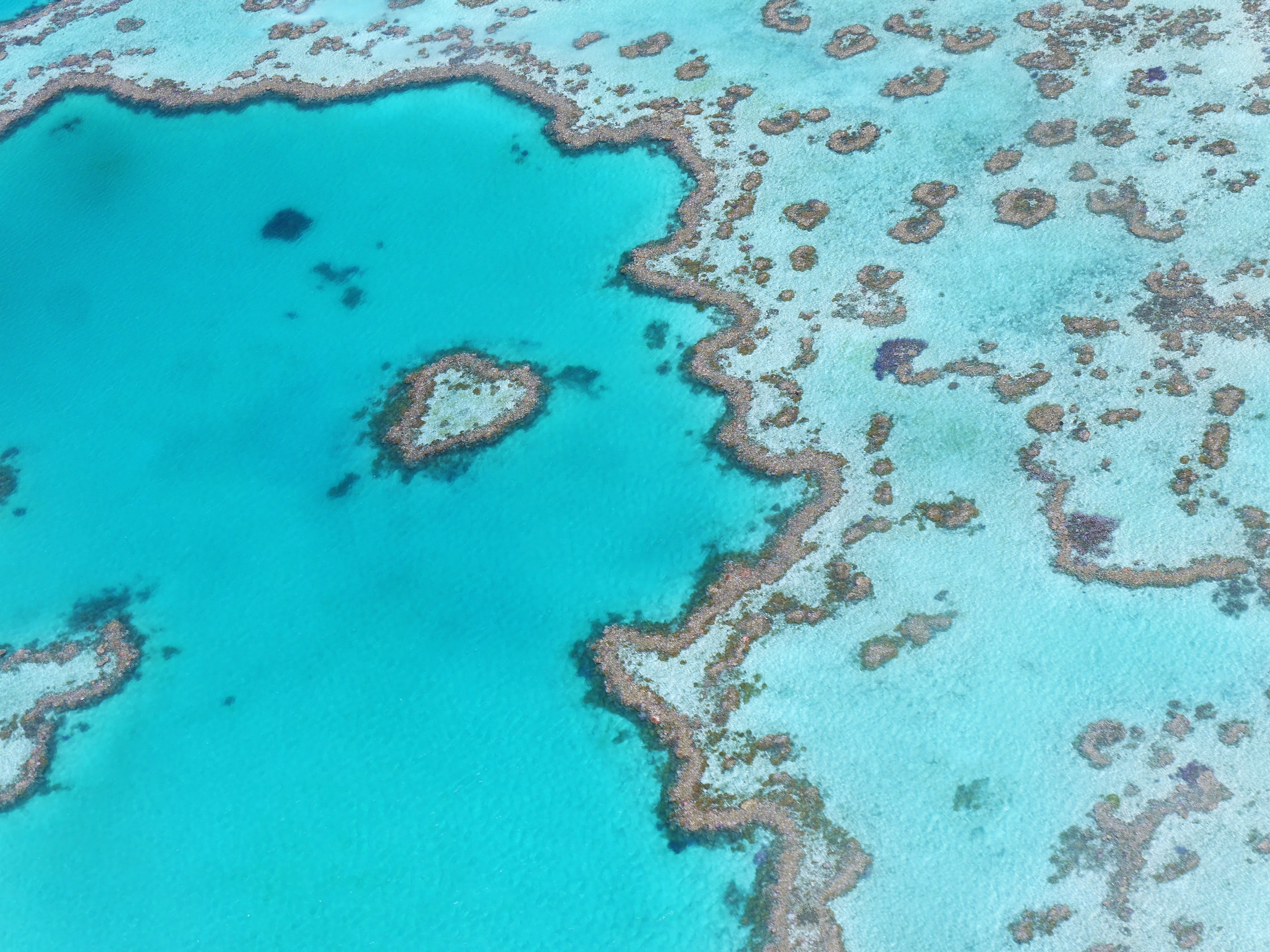
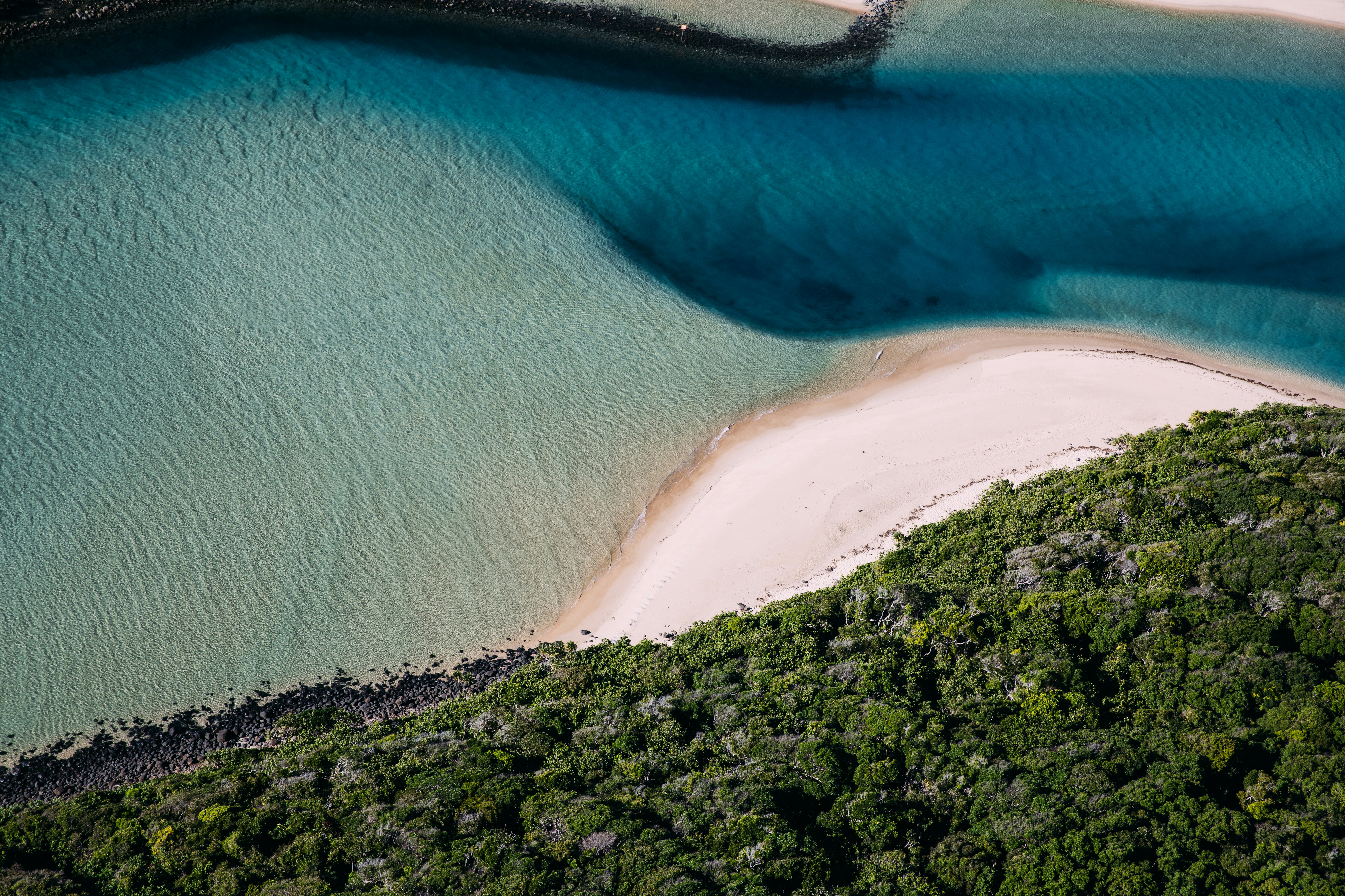
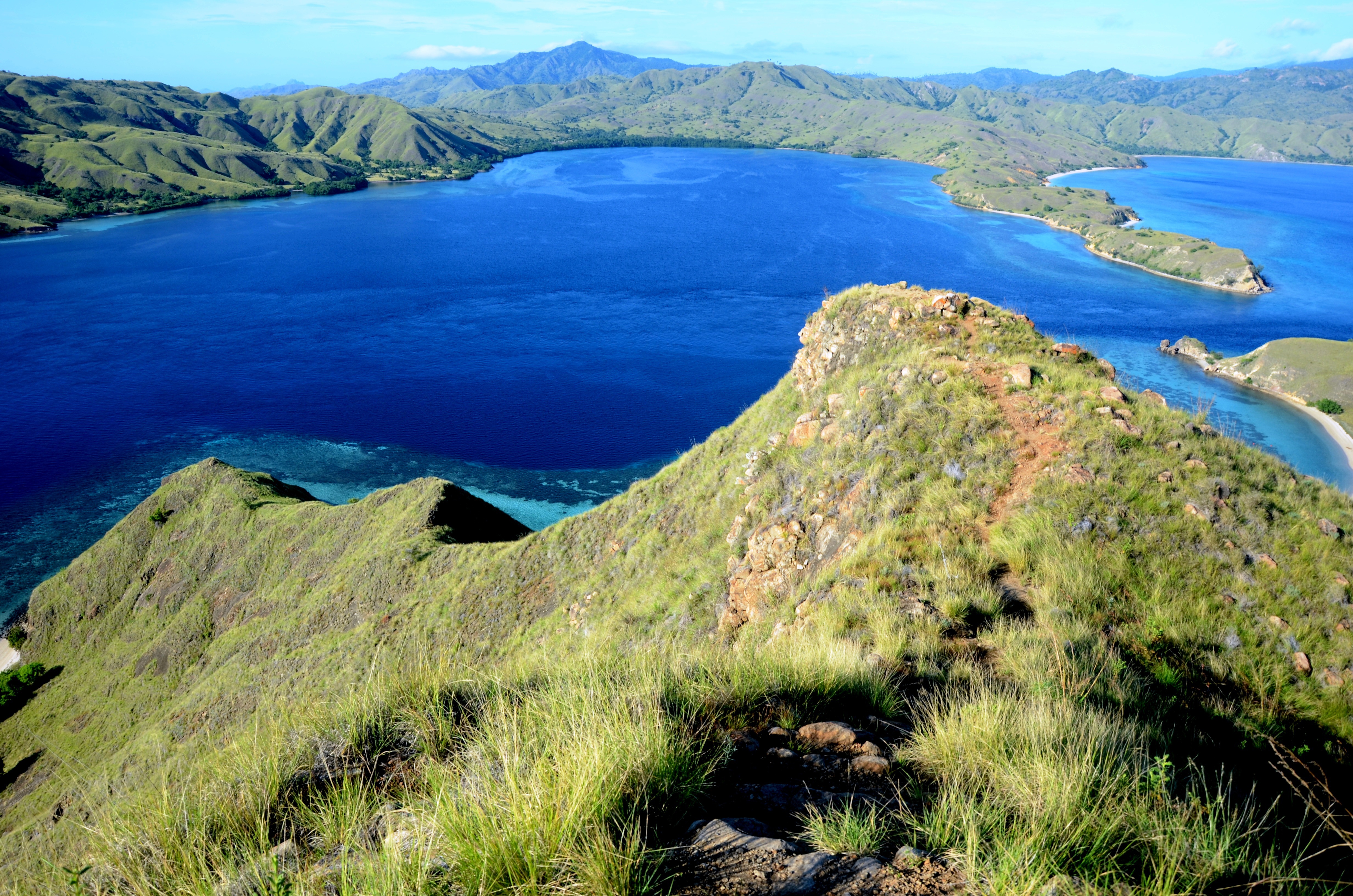
About Rinca Island
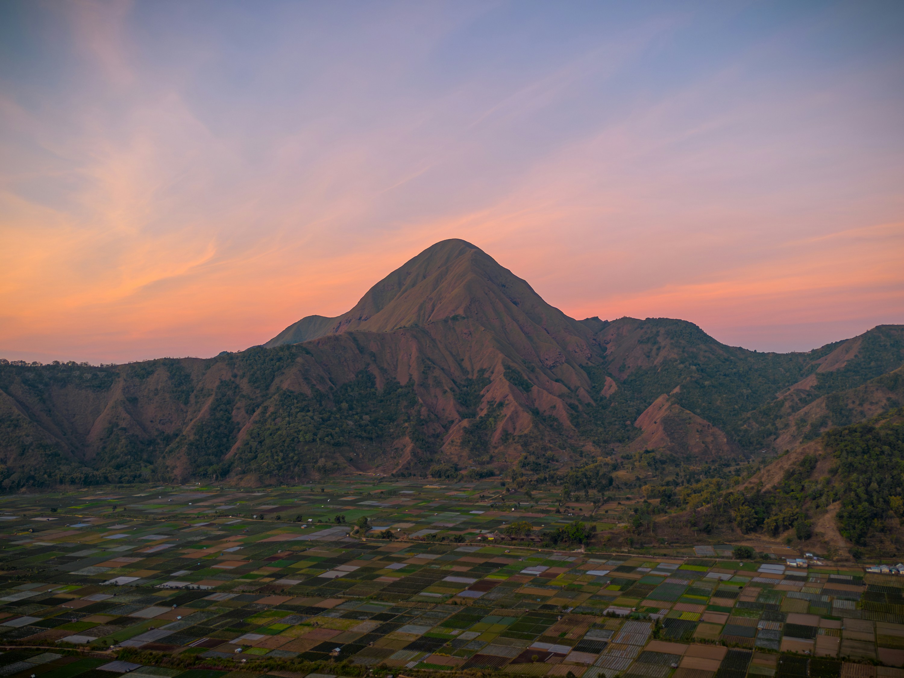
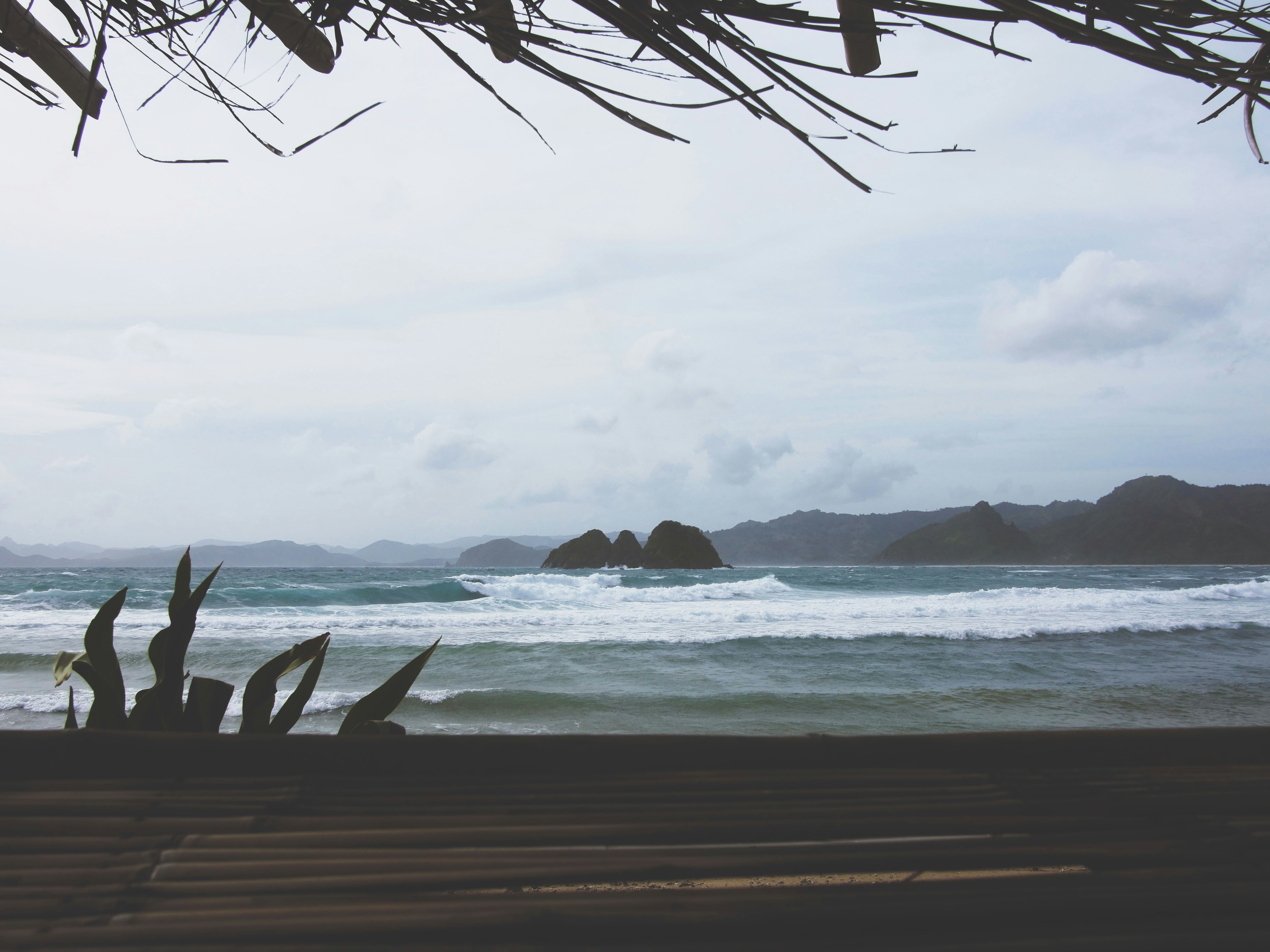
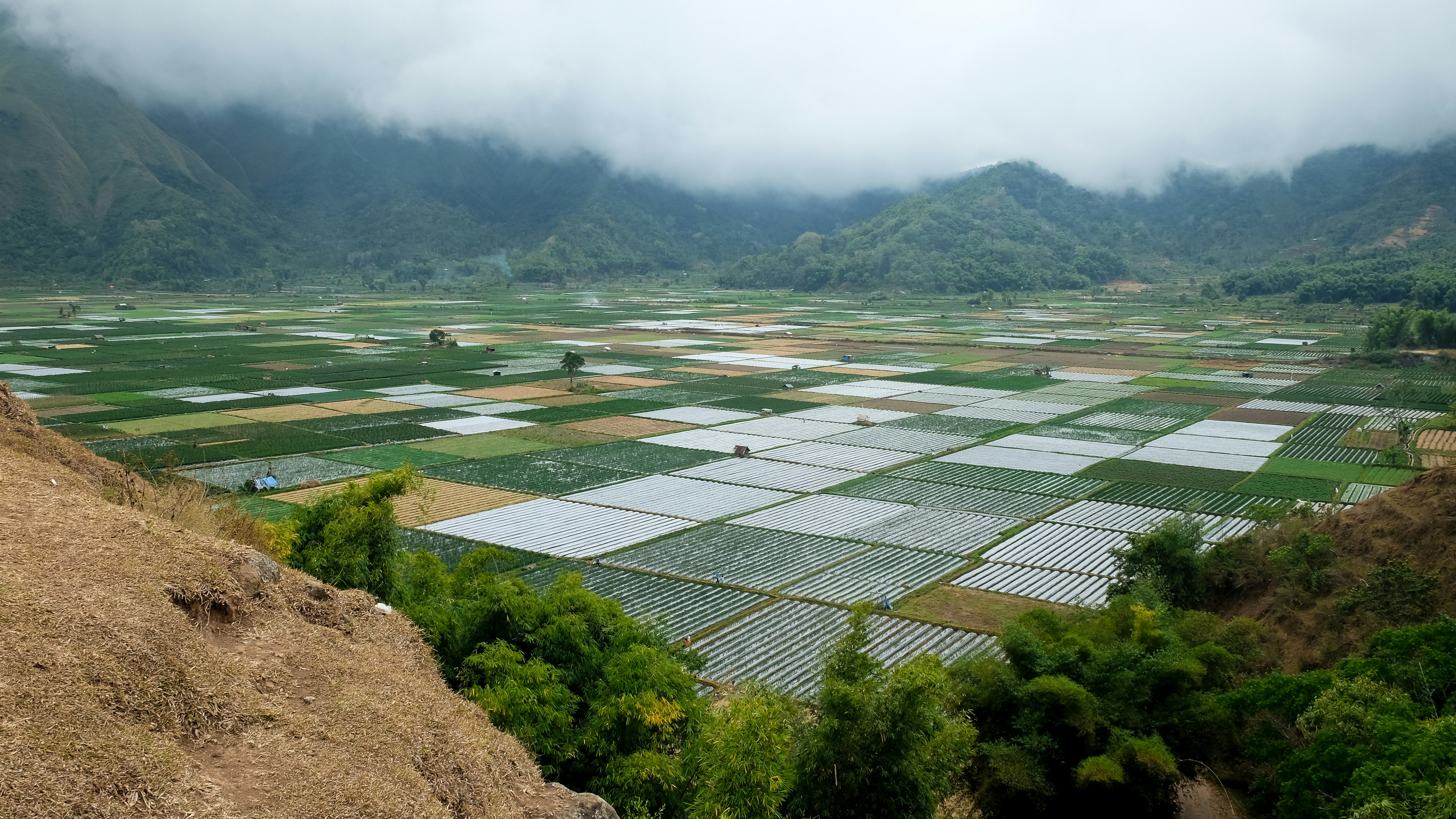
About Lombok
About Benoa, Bali
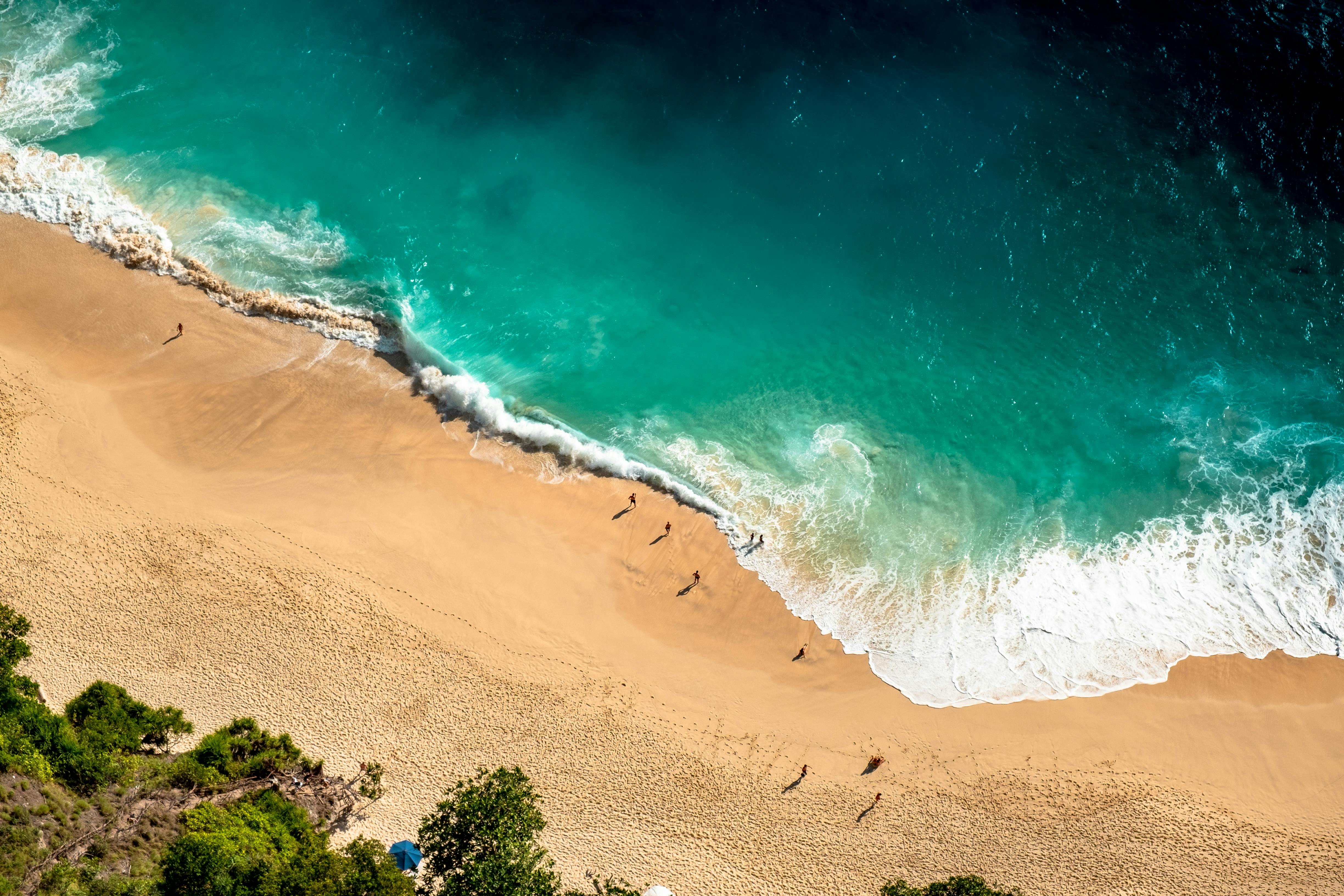
Bali really is as alluring as everyone says. This island, slightly bigger than Delaware, has it all: beaches, volcanoes, terraced rice fields, forests, renowned resorts, surfing, golf, and world-class dive sites. But what sets Bali apart from other nearby tropical destinations is Balinese tradition, and villagers dedicated to celebrating it. The hundreds of temples, dances, rituals, and crafts linked to their ancient Hindu faith aren't a show for tourists, but a living, breathing culture in which visitors are warmly received by the Balinese, who cherish their own identities.
About Benoa, Bali
Bali really is as alluring as everyone says. This island, slightly bigger than Delaware, has it all: beaches, volcanoes, terraced rice fields, forests, renowned resorts, surfing, golf, and world-class dive sites. But what sets Bali apart from other nearby tropical destinations is Balinese tradition, and villagers dedicated to celebrating it. The hundreds of temples, dances, rituals, and crafts linked to their ancient Hindu faith aren't a show for tourists, but a living, breathing culture in which visitors are warmly received by the Balinese, who cherish their own identities.
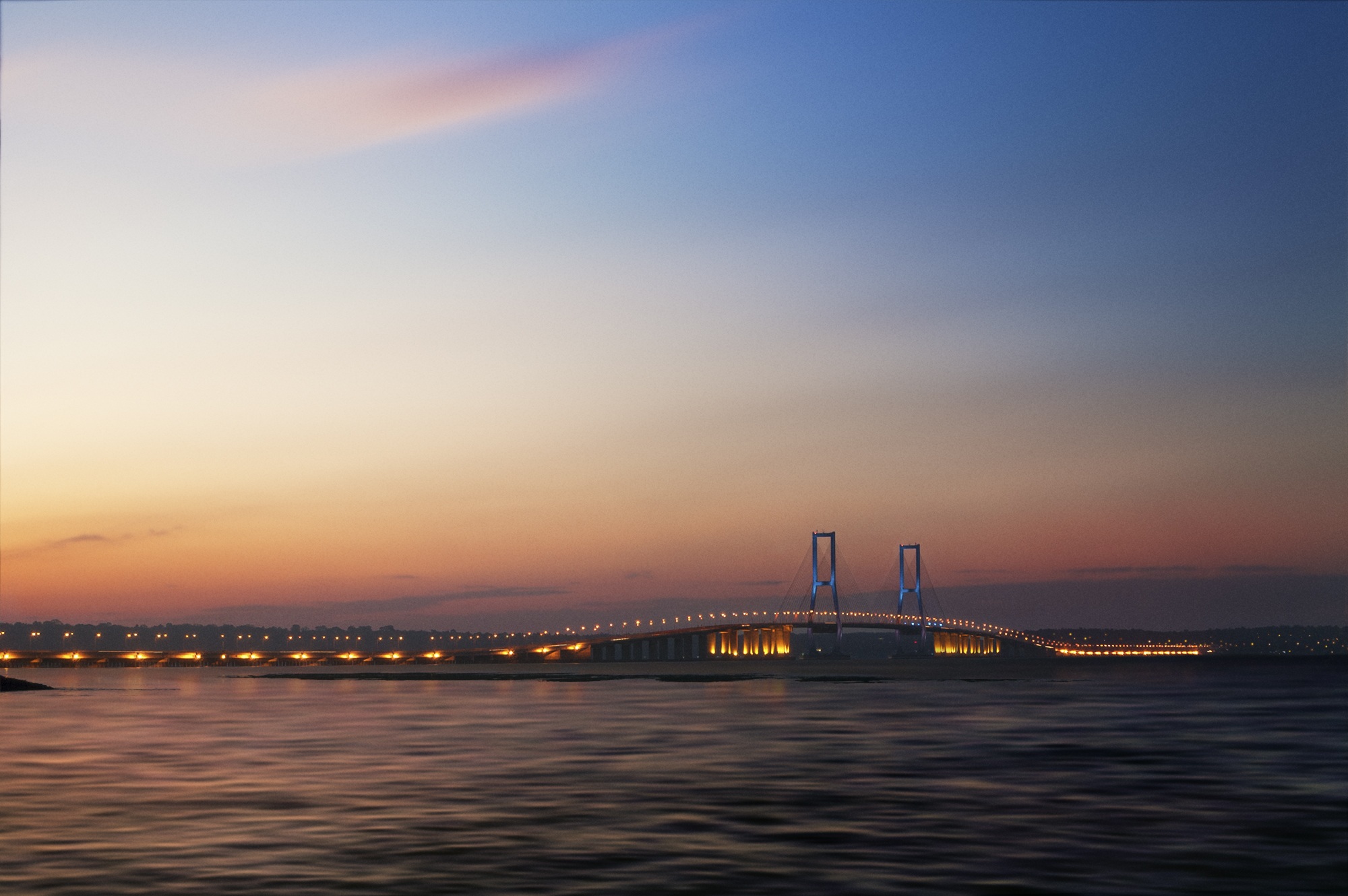
About Surabaya
About Semarang
Semarang is one of the oldest cities in Indonesia, situated on Java's north coast between the shore of the Java Sea and a small ridge of mountains. Ceded to the Dutch West India Company in 1677 by King Amangkurat I in payment of his debts, it became their headquarters and the seat of the Dutch governor of the northeast provinces. Semarang's usefulness as a port waned due to the gradual silting up of the harbor; by the 19th century, Surabaya had eclipsed Semarang as Java's premier port. With a population of over one million, a third of whom are thought to be of Chinese extraction, Semarang is the largest city in Central Java and its administrative capital. The city consists of two parts: the coastal lowland where most of the commercial activities are found; and the hilly residential area. Although more a business center than a city for tourists, Semarang serves as a popular gateway to the mountainous interior of Central Java and to fabled Borobudur.
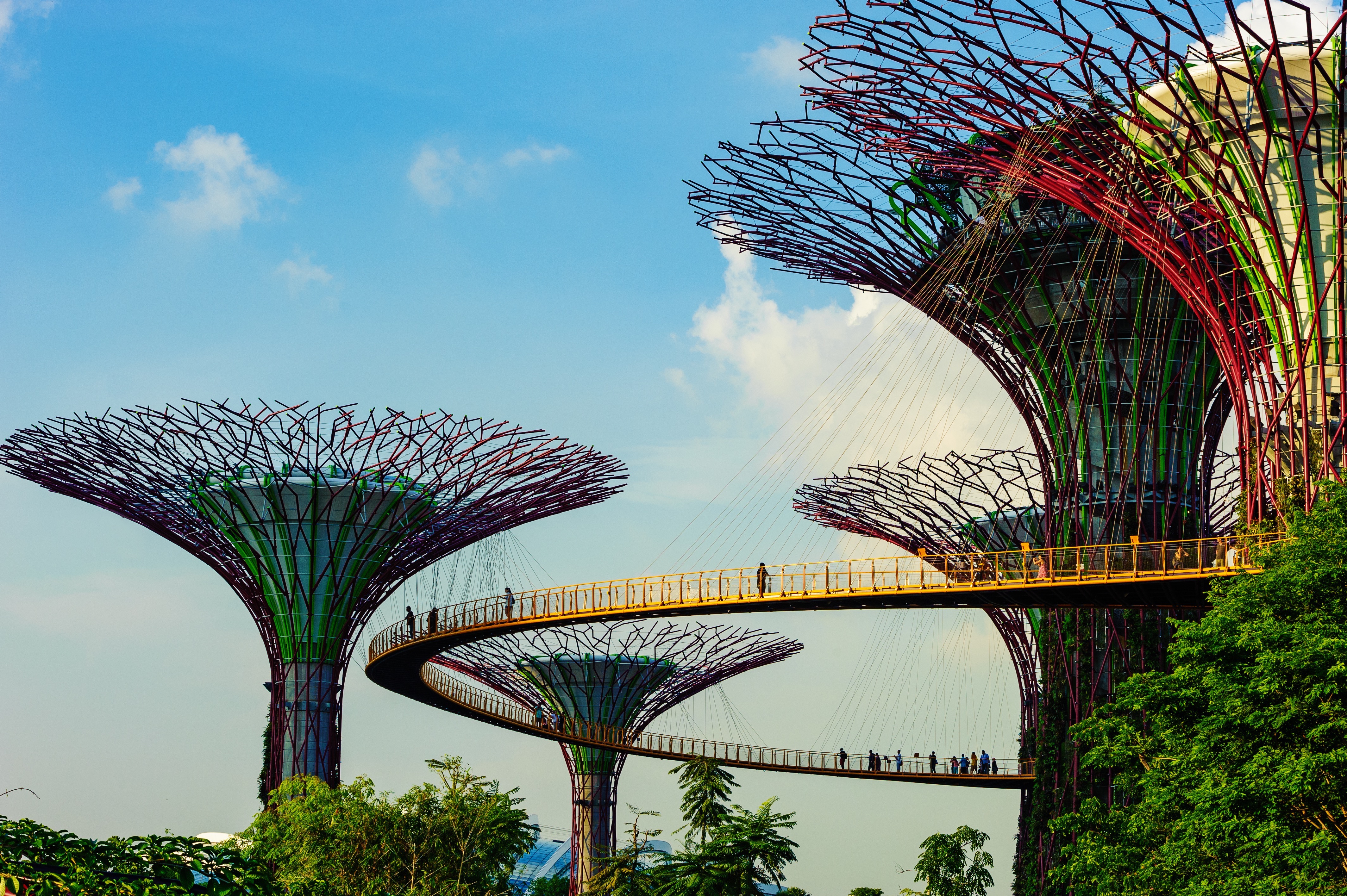
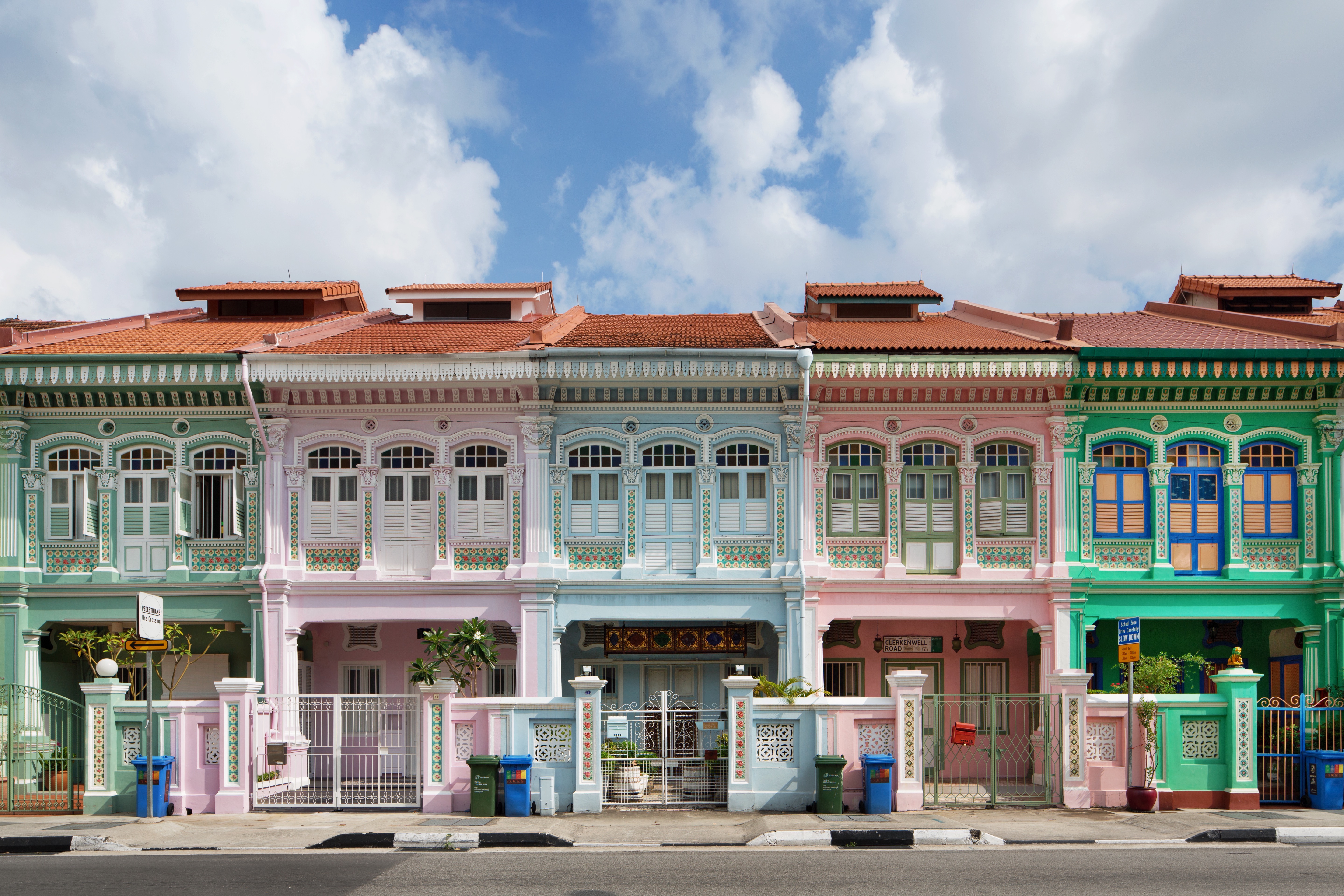
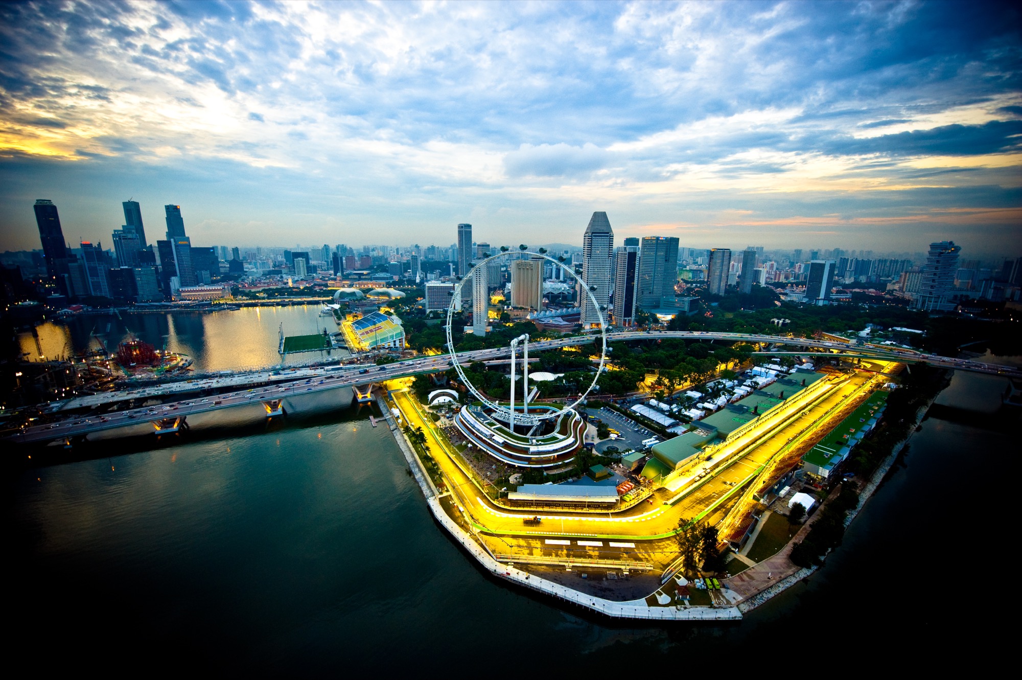
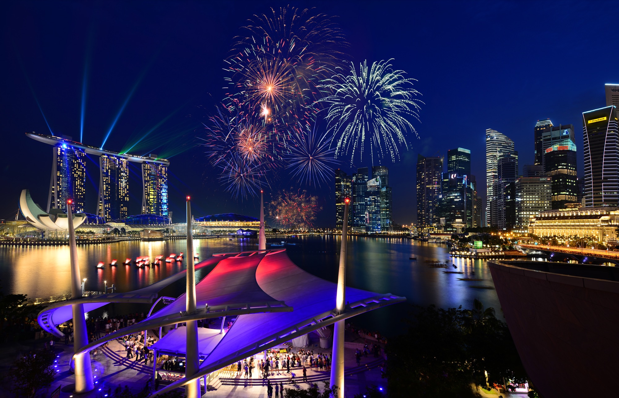
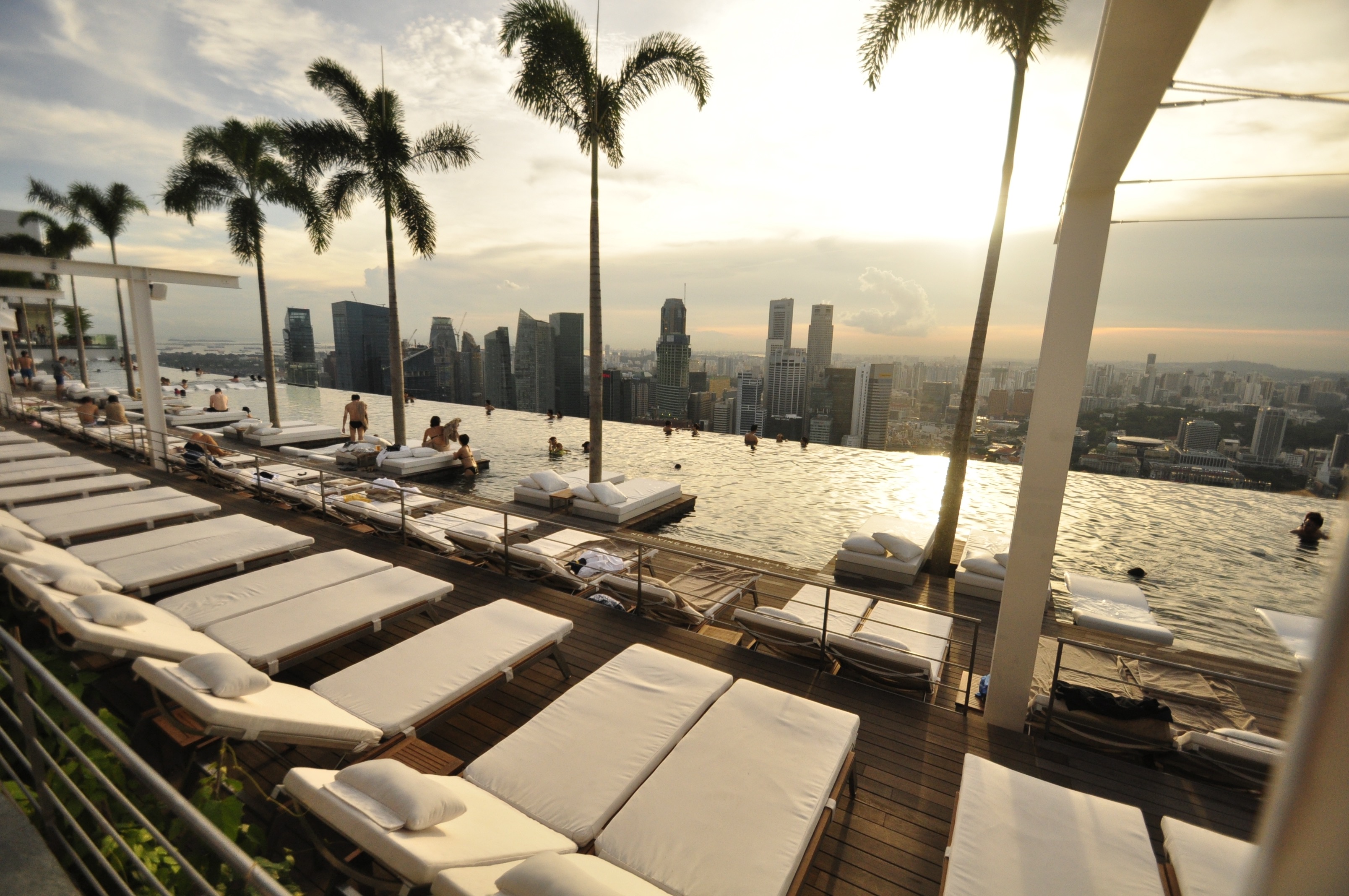
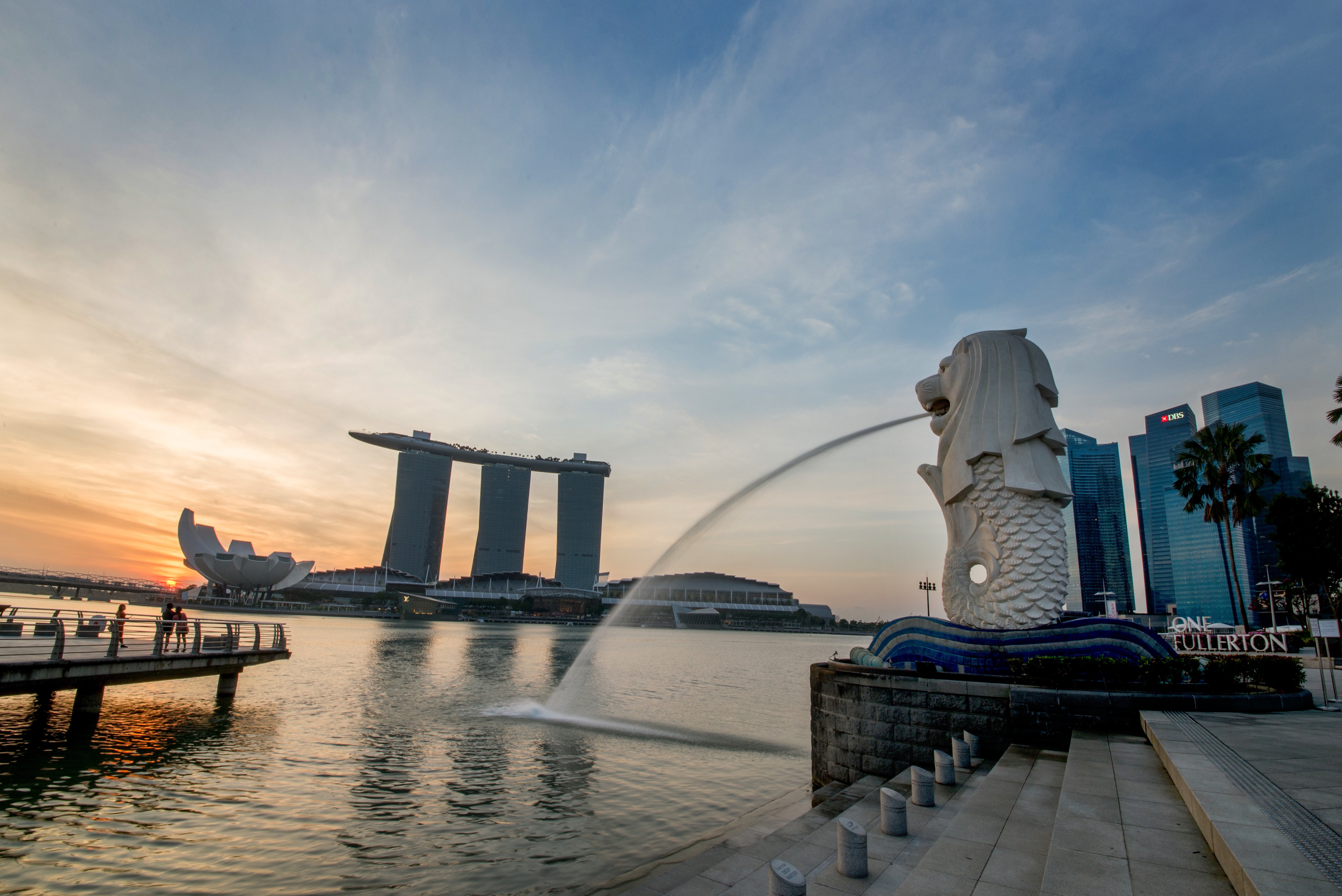
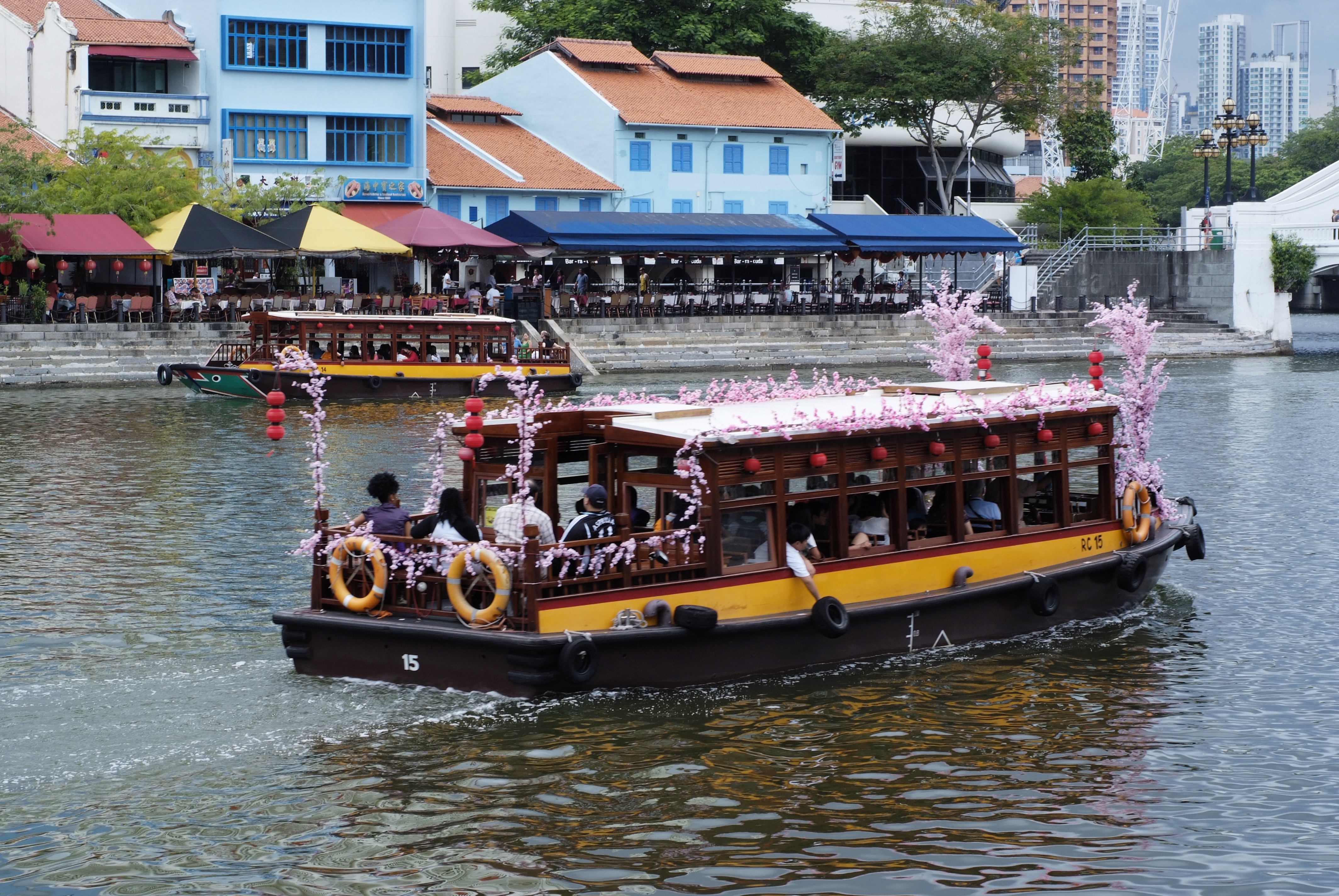
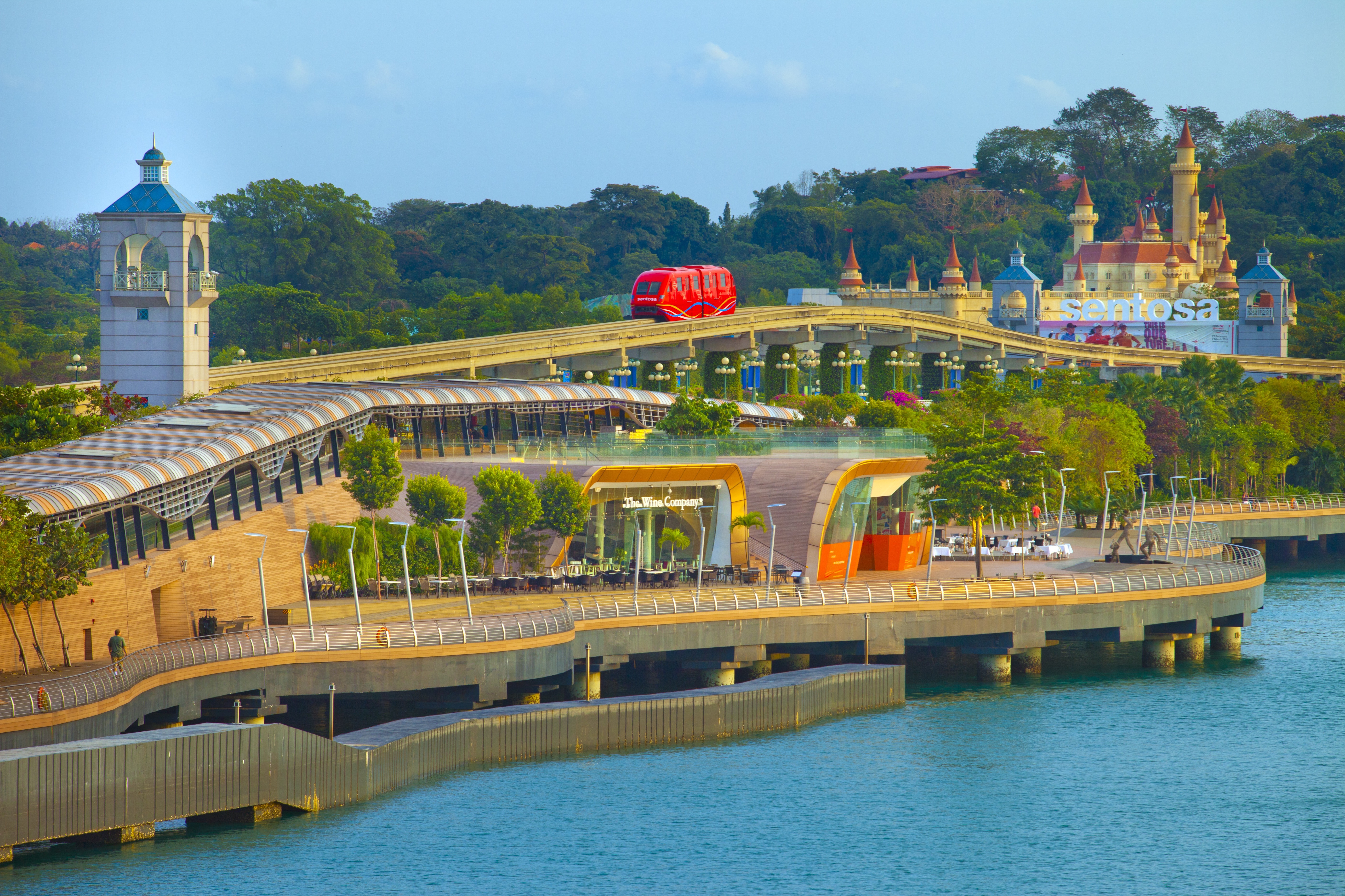
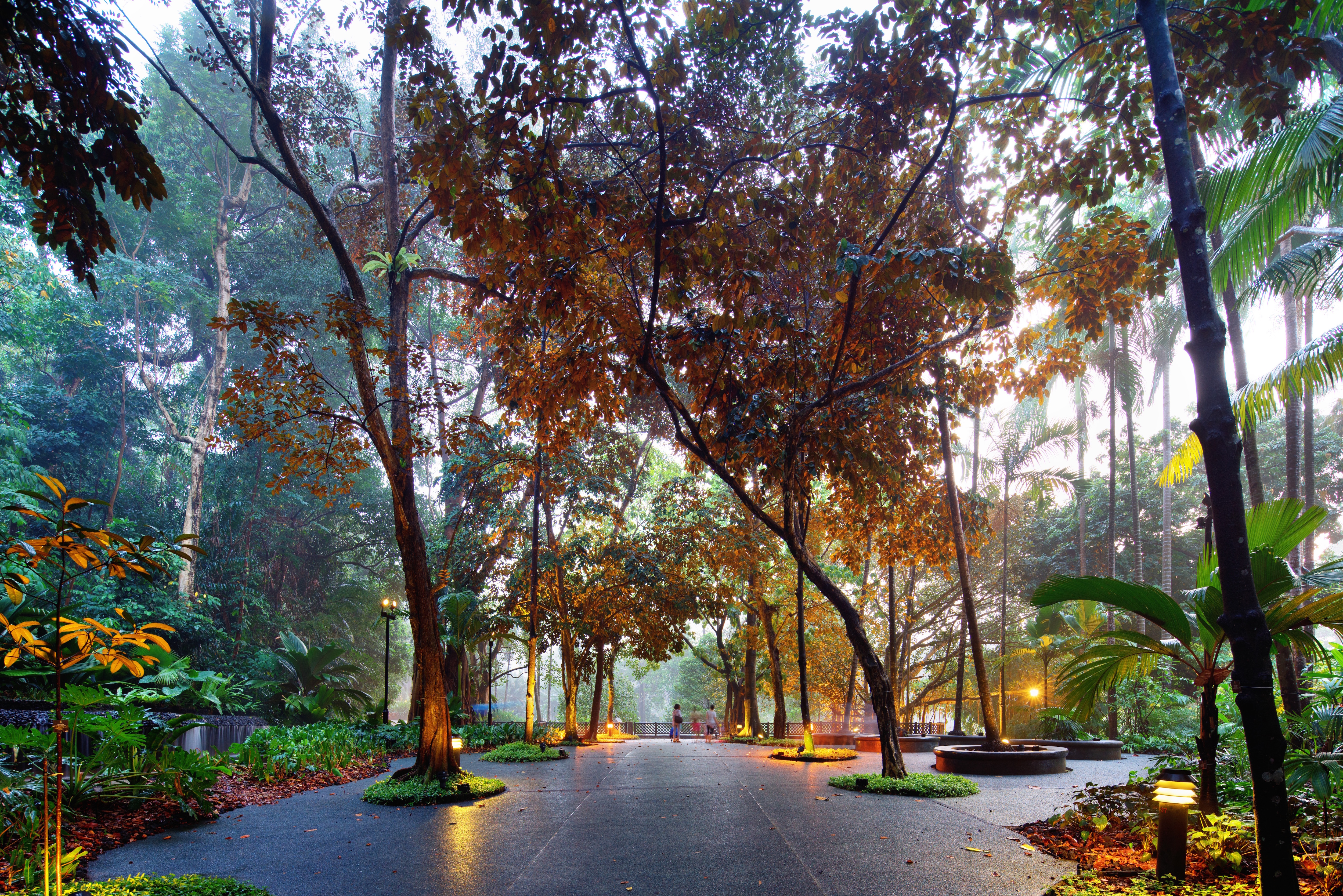
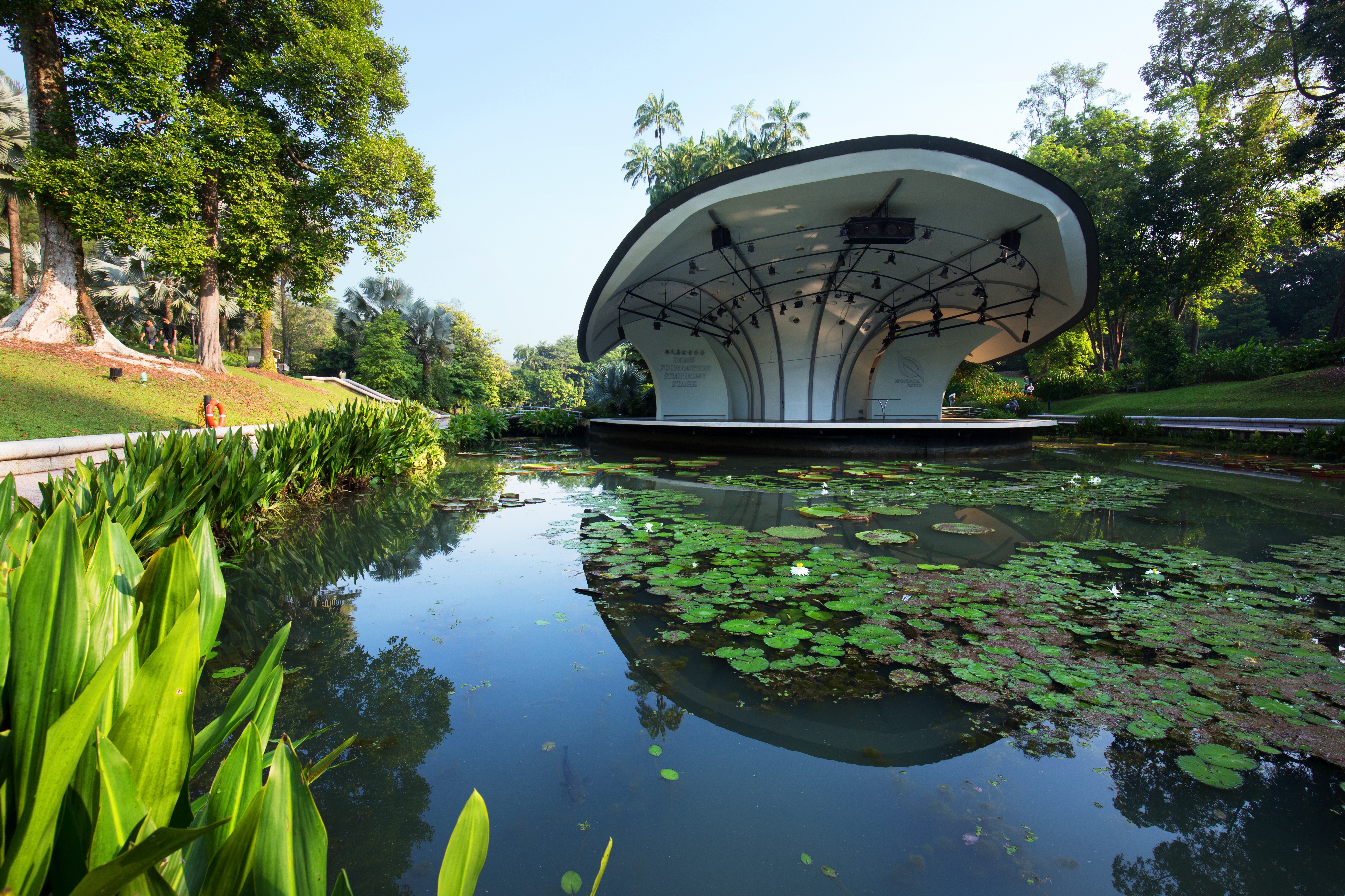
About Singapore
The main island of Singapore is shaped like a flattened diamond, 42 km (26 miles) east to west and 23 km (14 miles) north to south. Near the northern peak is the causeway leading to West Malaysia—Kuala Lumpur is less than four hours away by car. It is at the southern foot where you will find most of the city-state’s action, with its gleaming office towers, working docks, and futuristic "supertrees," which are solar-powered and serve as vertical gardens. Offshore are Sentosa and over 60 smaller islands, most uninhabited, that serve as bases for oil refining or as playgrounds and beach escapes from the city. To the east is Changi International Airport, connected to the city by metro, bus, and a tree-lined parkway. Of the island's total land area, more than half is built up, with the balance made up of parkland, farmland, plantations, swamp areas, and rain forest. Well-paved roads connect all parts of the island, and Singapore city has an excellent, and constantly expanding, public transportation system. The heart of Singapore's history and its modern wealth are in and around the Central Business District. The area includes the skyscrapers in the Central Business District, the 19th-century Raffles Hotel, the convention centers of Marina Square, on up to the top of Ft. Canning. Although most of old Singapore has been knocked down to make way for the modern city, most colonial landmarks have been preserved in the CBD, including early-19th-century buildings designed by the Irish architect George Coleman.
About Port Klang
Kuala Lumpur, or KL as locals refer to it, intrigues visitors with its diversity and multicultural character. The city's old quarter features stretches of shop houses that hint at its colonial past, while modern buildings—including the iconic Petronas Towers—give a glimpse of its modern financial ambitions. The city is filled with culturally colorful quarters dedicated to Chinese, Malay, and Indian communities. New shopping malls with designer labels, five-star hotels, and top-notch restaurants also proliferate in this bustling city of 1.6 million.
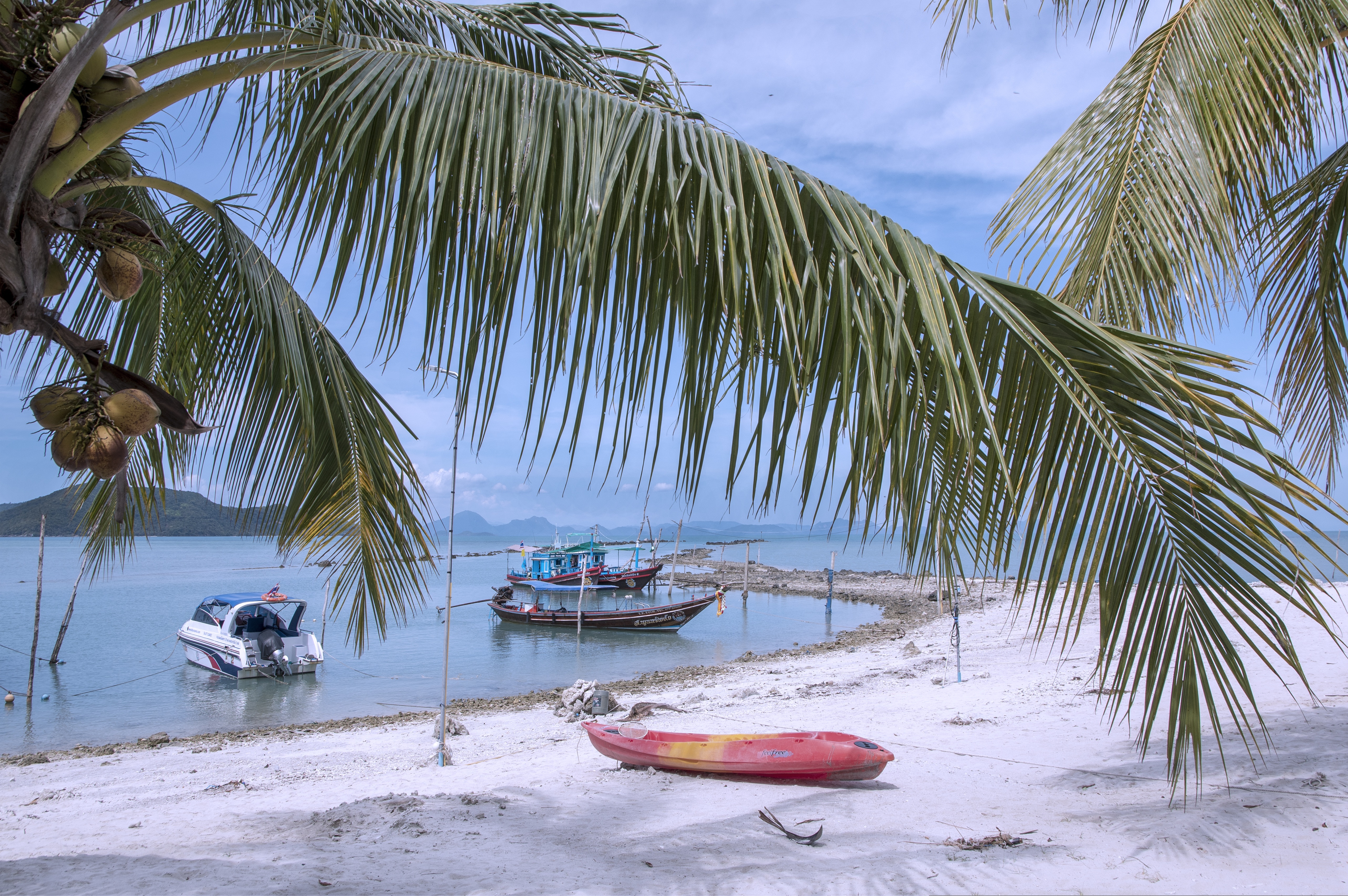
About Ko Samui
Koh Samui is the most popular tourist destination on the Western Gulf coast, which isn't surprising, considering the island's gorgeous beaches, perfect weather, and sparkling blue, almost turquoise, water. Koh Samui has seen rapid development since the 1990s, and you'll encounter hotels in all price ranges.Koh Samui is half the size of Phuket, so you could easily drive around it in a day. But Koh Samui is best appreciated by those who take a slower, more casual approach. Most people come for the sun and sea, so they head straight to their hotel and rarely venture beyond its beach. But it's worth exploring beyond your lodging. Every beach has its own character, and you might find the perfect one for you. One beach many visitors find to their liking is Chawaeng. On Koh Samui's east coast, this stretch of glistening white sand is divided into two main sections—Chawaeng Yai (yai means "big") and Chawaeng Noi (noi means "little"). You'll find the greatest variety of hotels, restaurants, and bars here. Despite the crowds, Chawaeng is no Pattaya or Patong—the mood is very laid-back. A rocky headland separates Chawaeng Lamai Beach, whose clear water and long stretch of sand were the first place on the island to attract developers. More budget accommodations are available here than in Chawaeng, and there are some happening nightclubs.On the west coast of Koh Samui, Na Thon is the island's primary port and the spot where ferries arrive from the mainland. It's home to the island's governmental offices, including the Tourism Authority of Thailand, and there are banks, foreign-exchange booths, travel agents, shops, restaurants, and cafés by the ferry pier. A few places rent rooms, but there's really no reason to stay here—nicer accommodations can be found a short songthaew ride away.To the north and east of Na Thon lie a few beaches worthy of exploration. Laem Yai, 5 km (3 miles) north, has great seafood. East of here, a small headland separates two low-key communities on the northern shore, Mae Nam and Bophut Beach. Mae Nam is also the departure point for boats bound for Koh Phangan and Koh Tao . Just south of the Samui's northeastern tip you'll find sandy Choengmon Beach, a good area for swimming that's not overdeveloped.
About Laem Chabang
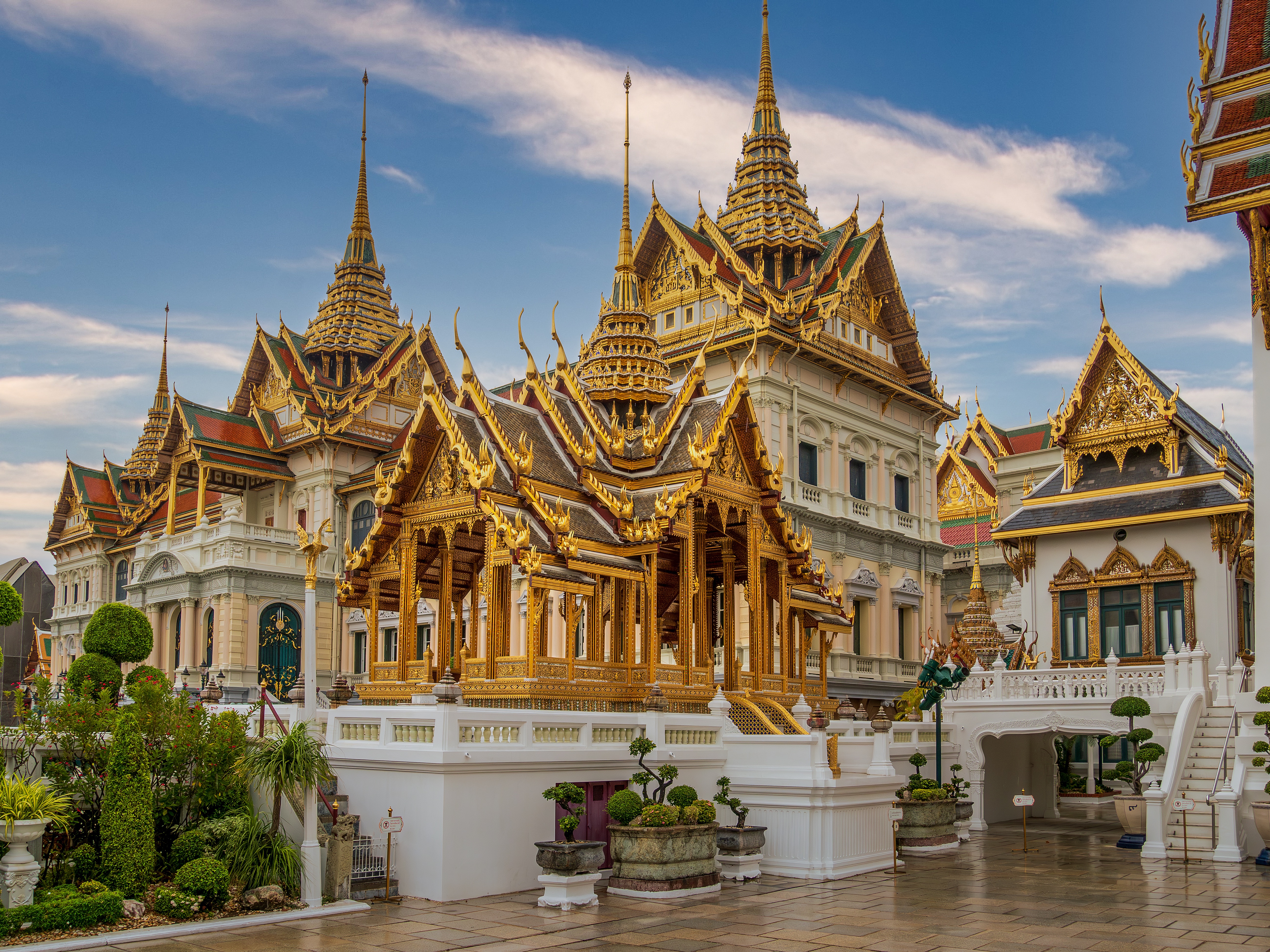
There are two Bangkoks, the ancient soul of Thailand with its long and fascinating history and the frantic, modern metropolis that embraces the latest trends both Eastern and Western. The two blend together remarkably well—even the most jarring juxtapositions of old and new somehow make sense. Bangkok is not only the biggest city in Thailand, but also the most mesmerizing, with some of the country's most beautiful temples and shrines. The city's energy is palpable, especially at night, when traffic opens up a bit, its famous markets get going, and everything seems lit up—from its proudest monuments to its seediest streets. When Ayutthaya was besieged and pillaged by the Burmese in 1766, Thonburi became Thailand's capital. The Thais call Bangkok Krung Thep (City of Angels), and in 1782 King Rama I moved his capital here, just across the Chao Praya River. Laem Chabang is approximately 130 km (81 mi) from Bangkok.
About Laem Chabang
There are two Bangkoks, the ancient soul of Thailand with its long and fascinating history and the frantic, modern metropolis that embraces the latest trends both Eastern and Western. The two blend together remarkably well—even the most jarring juxtapositions of old and new somehow make sense. Bangkok is not only the biggest city in Thailand, but also the most mesmerizing, with some of the country's most beautiful temples and shrines. The city's energy is palpable, especially at night, when traffic opens up a bit, its famous markets get going, and everything seems lit up—from its proudest monuments to its seediest streets. When Ayutthaya was besieged and pillaged by the Burmese in 1766, Thonburi became Thailand's capital. The Thais call Bangkok Krung Thep (City of Angels), and in 1782 King Rama I moved his capital here, just across the Chao Praya River. Laem Chabang is approximately 130 km (81 mi) from Bangkok.
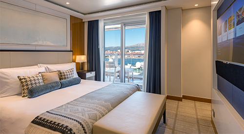
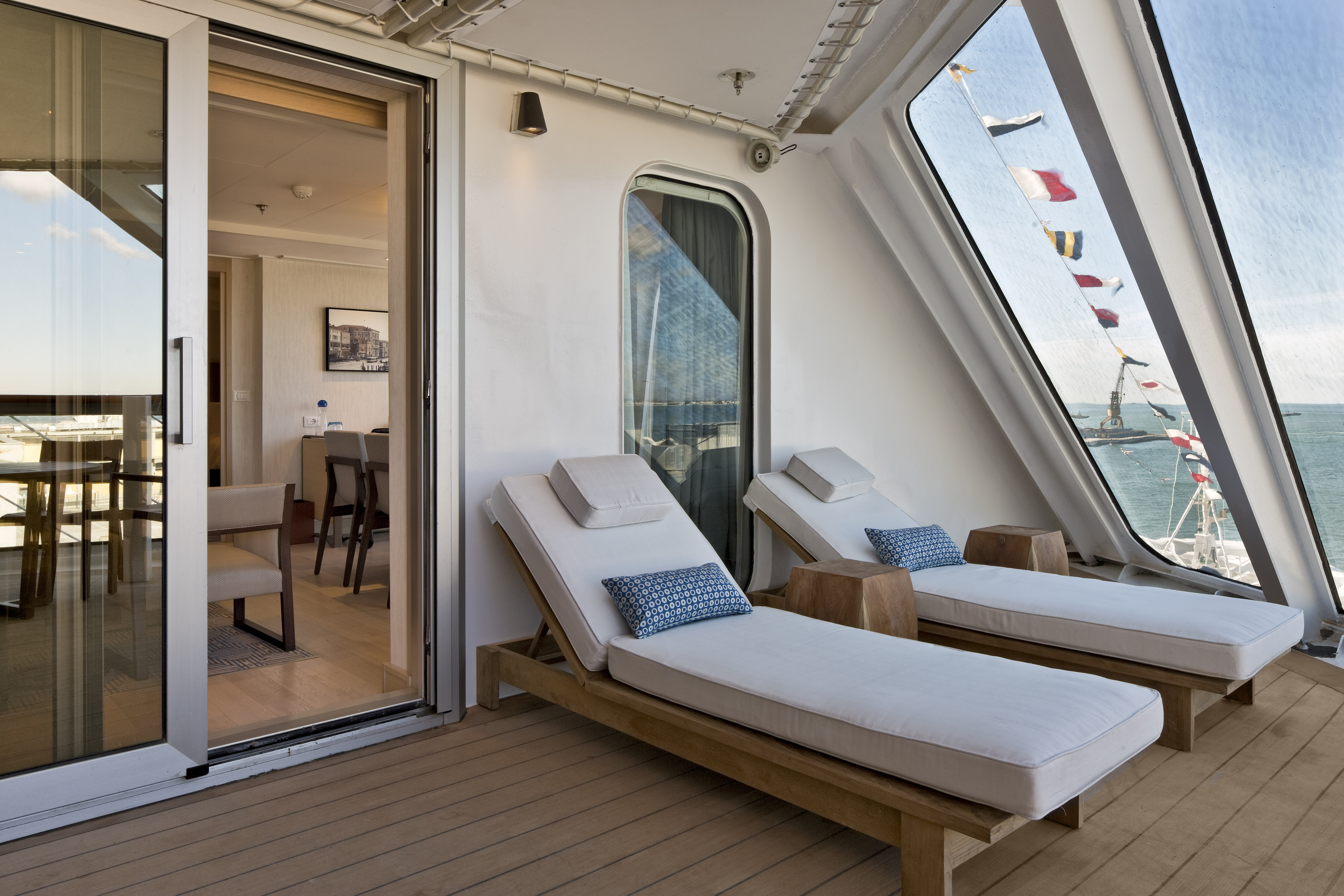
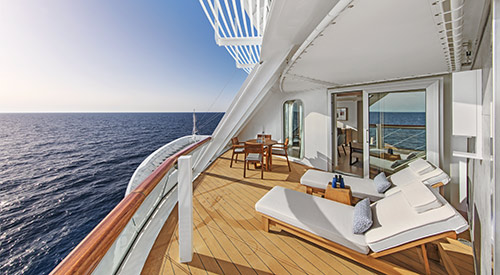
- Largest suite on board: 1,448 sq ft including expansive private veranda (multi-room suite)
- 11:00 AM embarkation
- 11:00 AM priority stateroom access
- First opportunity to reserve shore excursions: 107 days prior to departure
- 4 guaranteed priority reservations at each alternative restaurant: 100 days prior to departure
- First priority booking of spa treatments: 100 days prior to departure
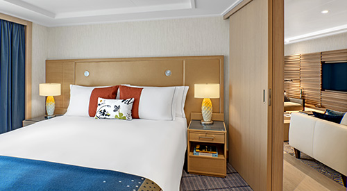
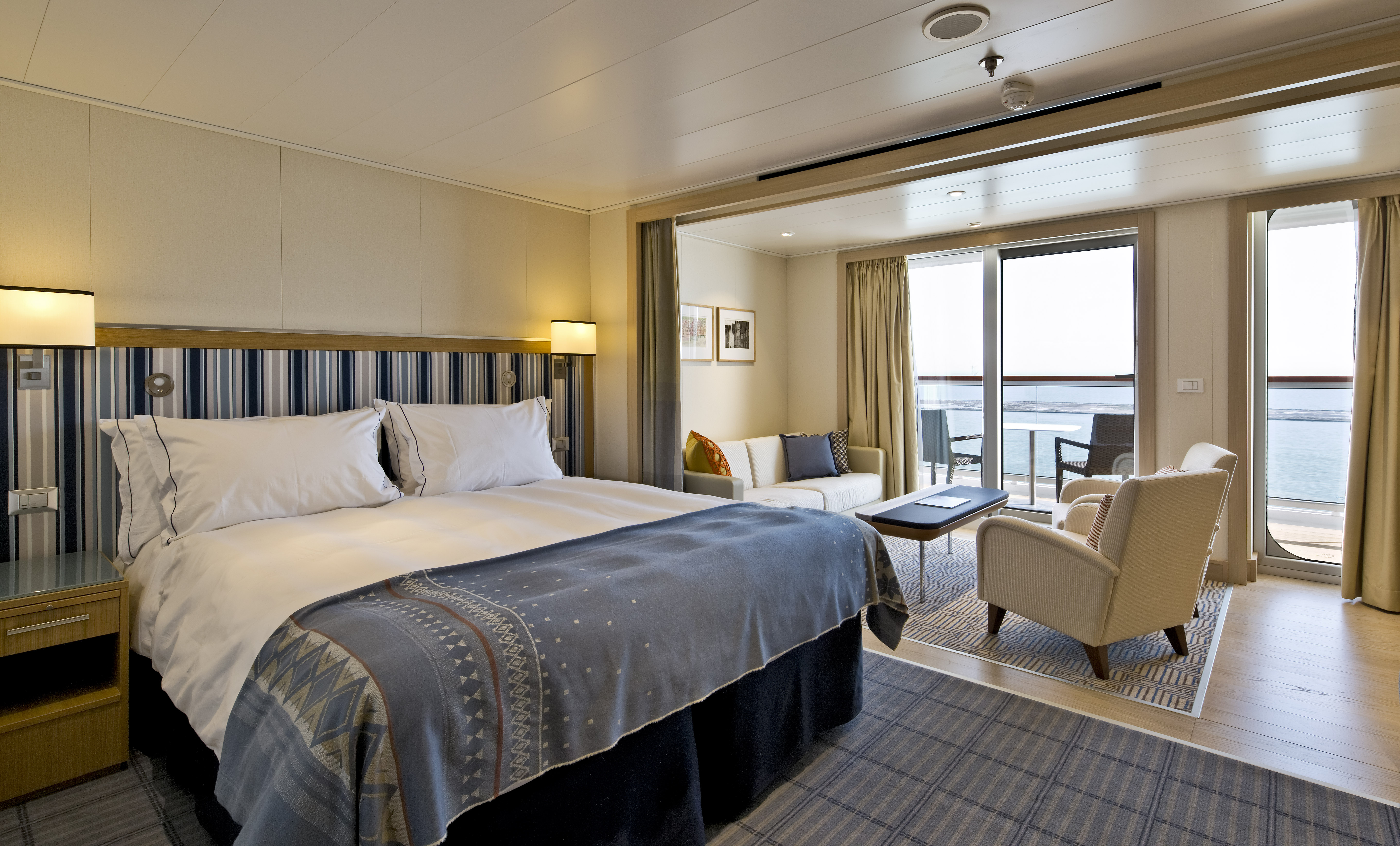
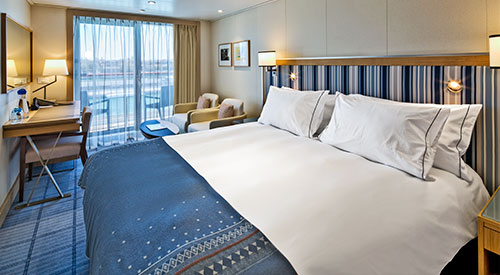
- King-size Viking Explorer Bed with luxury linens & pillows
- Free Wi-Fi (connection speed may vary)
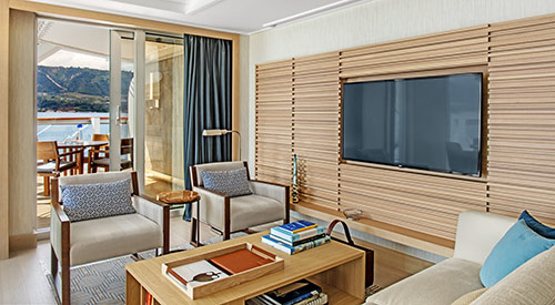
- Three 42 flat-screen, interactive LCD TVs with intuitive remote & complimentary Movies On Demand
- 110/220 volt outlets & USB ports
- Mini-bar with alcoholic beverages, soft drinks, water & upgraded snacks (replenished once daily); security safe; hair dryer
- Direct-dial satellite phone & cell service
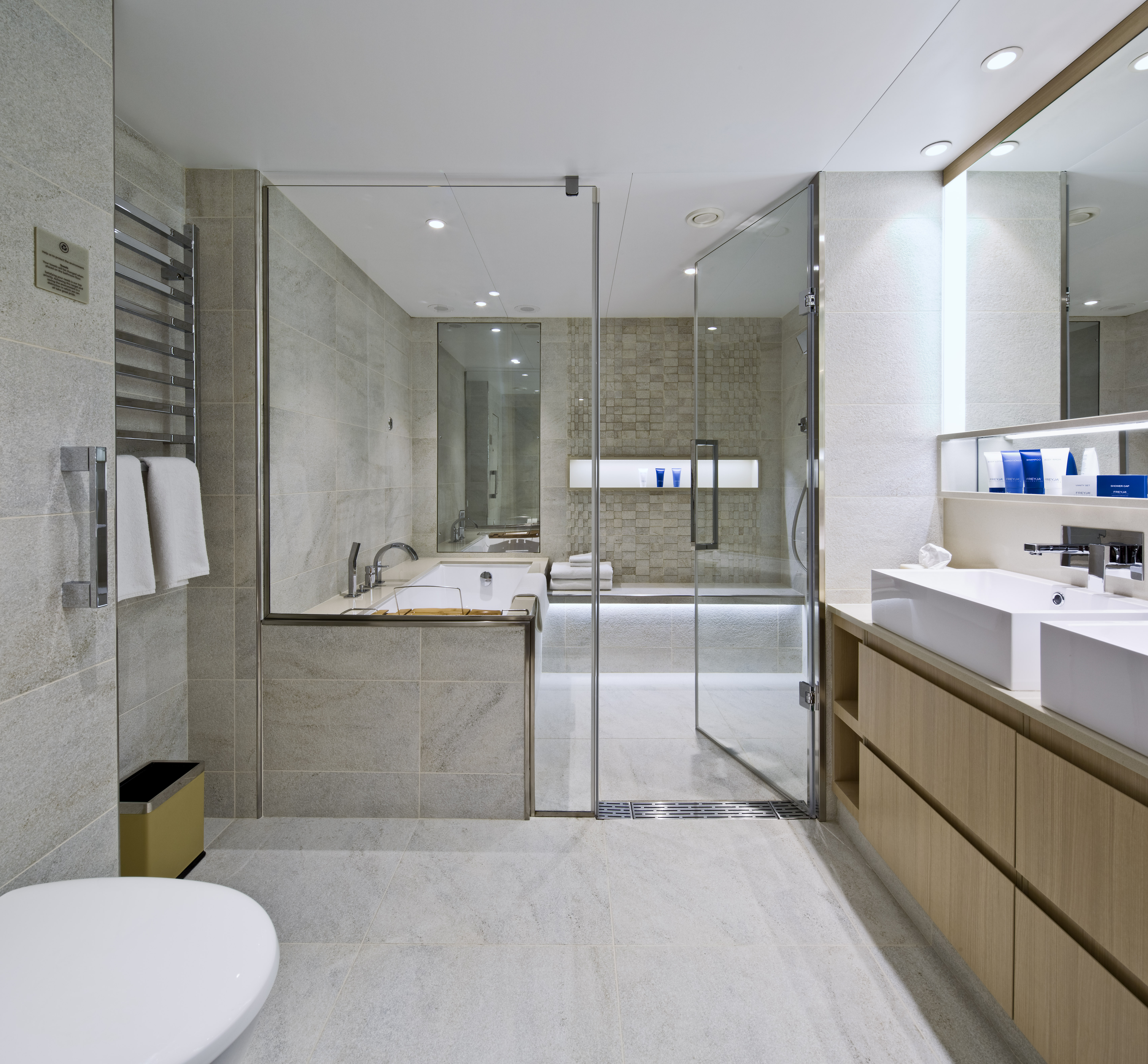
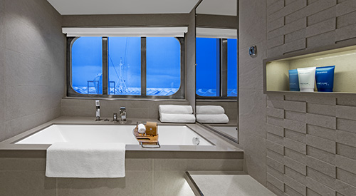
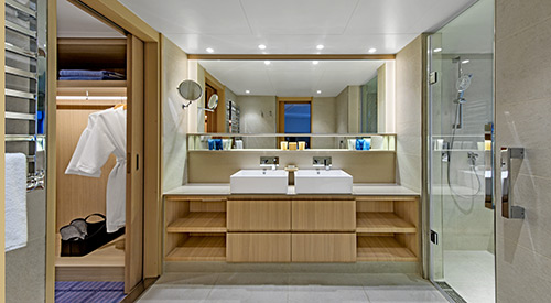
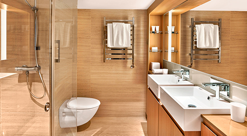
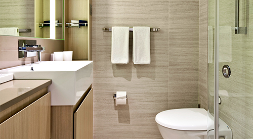
- Large master bathroom featuring a spacious glass-enclosed shower, double-sink vanity, heated bathroom floor & anti-fog mirror, plus two guest bathrooms
- Premium Freyja® toiletries; plush robes & slippers
- Purified water refilled daily
- Stateroom steward & twice-daily housekeeping
- 24-hour room service (including service from any restaurant during open hours)
- Spacious walk-in closet & drawers
- Complimentary laundry, dry cleaning, pressing & shoe shine services
- Welcome bottle of Veuve Clicquot champagne
- In-suite binoculars, coffee brewer & traditional Norwegian Marius-weave blanket
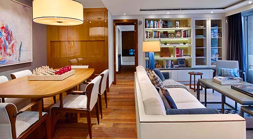
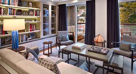
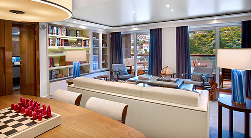
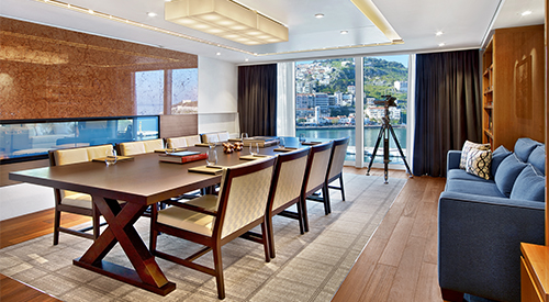
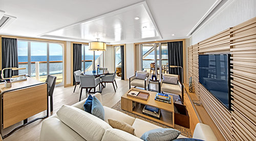
- Spacious, well-appointed living room
- Separate dining area that seats 6 guests
- Private library, wine & music collections curated by Chairman Torstein Hagen
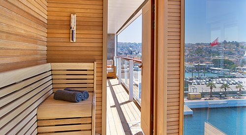
- Ocean-view dry sauna
- Boardroom (seats 12) for business meetings & catered dinner parties, with first oceangoing vapor-light fireplace
- Pantry for room service & hosted events
- Complimentary shore excursion with private car & driver (up to 4 guests) in port city of your choice (valued at up to $800)
- Daily personalized tea or pre-dinner cocktail & canapés by request
- Dinner & guided tour with ship officers (subject to availability)
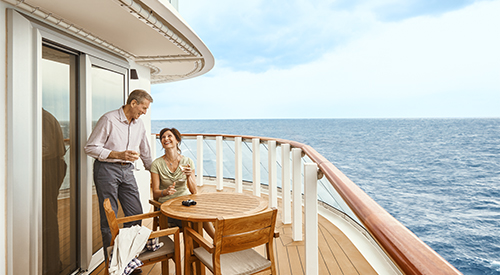
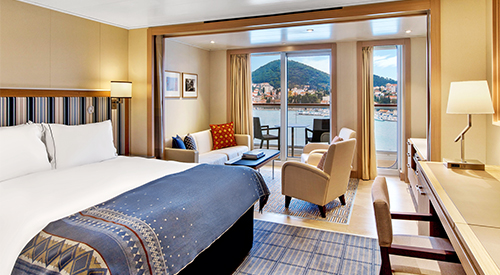
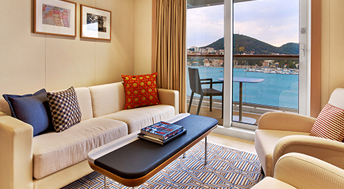
- Size including veranda: 757+ sq. ft.
- 11:00 a.m. embarkation
- 11:00 a.m. priority stateroom access
- 3 guaranteed priority reservations at each specialty restaurant: 90 days prior
- Priority shore excursion reservations: 97 days prior
- Priority booking of spa treatments: 90 days prior
- Mini-bar with alcoholic beverages, soft drinks, water & snacks, replenished once daily
- Welcome Bottle of Champagne
- Premium in-suite binoculars, coffee maker & cashmere blanket
- Complimentary laundry, dry cleaning, shoe shine & pressing
- Purified water refilled daily
- King-size Viking Explorer bed with luxury linens
- 24-hour room service
- Luxury robes, slippers & toiletries
- 42" flat-screen LCD TV
- Interactive TV & movies-on-demand
- Security safe, hair dryer, 110/220 volt outlets
- Direct dial satellite phone & cell service
- Wi-Fi
- Size including veranda: 405 sq. ft.
- 11:00 a.m. embarkation
- 11:00 a.m. priority stateroom access
- 3 guaranteed priority reservations at each specialty restaurant: 80 days prior
- Priority shore excursion reservations: 87 days prior
- Priority booking of spa treatments: 80 days prior
- Mini-bar with alcoholic beverages, soft drinks, water & snacks, replenished once daily
- Welcome Bottle of Champagne
- Premium in-suite binoculars, coffee maker & cashmere blanket
- Complimentary laundry, dry cleaning, shoe shine & pressing
- Purified water refilled daily
- King-size Viking Explorer bed with luxury linens
- 24-hour room service
- Luxury robes, slippers & toiletries
- 42" flat-screen LCD TV
- Interactive TV & movies-on-demand
- Security safe, hair dryer, 110/220 volt outlets
- Direct dial satellite phone & cell service
- Wi-Fi
- Size including veranda: 338 sq. ft.
- 11:00 a.m. embarkation
- 1:00 p.m. stateroom access
- 2 guaranteed priority reservations at each specialty restaurant: 70 days prior
- Priority shore excursion reservations: 77 days prior
- Priority booking of spa treatments: 70 days prior
- Mini-bar with alcoholic beverages, soft drinks, water & snacks, replenished once daily
- Welcome Bottle of Champagne
- In-suite binoculars, coffee maker & cashmere blanket
- Complimentary shoe shine & pressing service
- Purified water refilled daily
- King-size Viking Explorer bed with luxury linens
- 24-hour room service
- Luxury robes, slippers & toiletries
- 42" flat-screen LCD TV
- Interactive TV & movies-on-demand
- Security safe, hair dryer, 110/220 volt outlets
- Direct dial satellite phone & cell service
- Wi-Fi
- Size including veranda: 270 sq. ft.
- 11:00 a.m. embarkation
- 2:00 p.m. stateroom access
- 1 guaranteed priority reservations at each specialty restaurant: 60 days prior
- Priority shore excursion reservations: 67 days prior
- Priority booking of spa treatments: 60 days prior
- Mini-bar with soft drinks, water & snacks, replenished once daily
- In-suite binoculars, coffee maker & cashmere blanket
- Purified water refilled daily
- King-size Viking Explorer bed with luxury linens
- 24-hour room service
- Luxury robes, slippers & toiletries
- 42" flat-screen LCD TV
- Interactive TV & movies-on-demand
- Security safe, hair dryer, 110/220 volt outlets
- Direct dial satellite phone & cell service
- Wi-Fi
- Size including veranda: 270 sq. ft.
- 11:00 a.m. embarkation
- 3:00 p.m. stateroom access
- Shore excursion reservations: 60 days prior
- Mini-bar with soft drinks, water & snacks
- Laundry, dry cleaning, shoe shine & pressing
- Purified water refilled daily
- Viking Explorer bed with luxury linens
- 24-hour room service
- Luxury robes, slippers & toiletries
- 42" flat-screen LCD TV
- Interactive TV & movies-on-demand
- Security safe, hair dryer, 110/220 volt outlets
- Direct dial satellite phone & cell service
- Wi-Fi
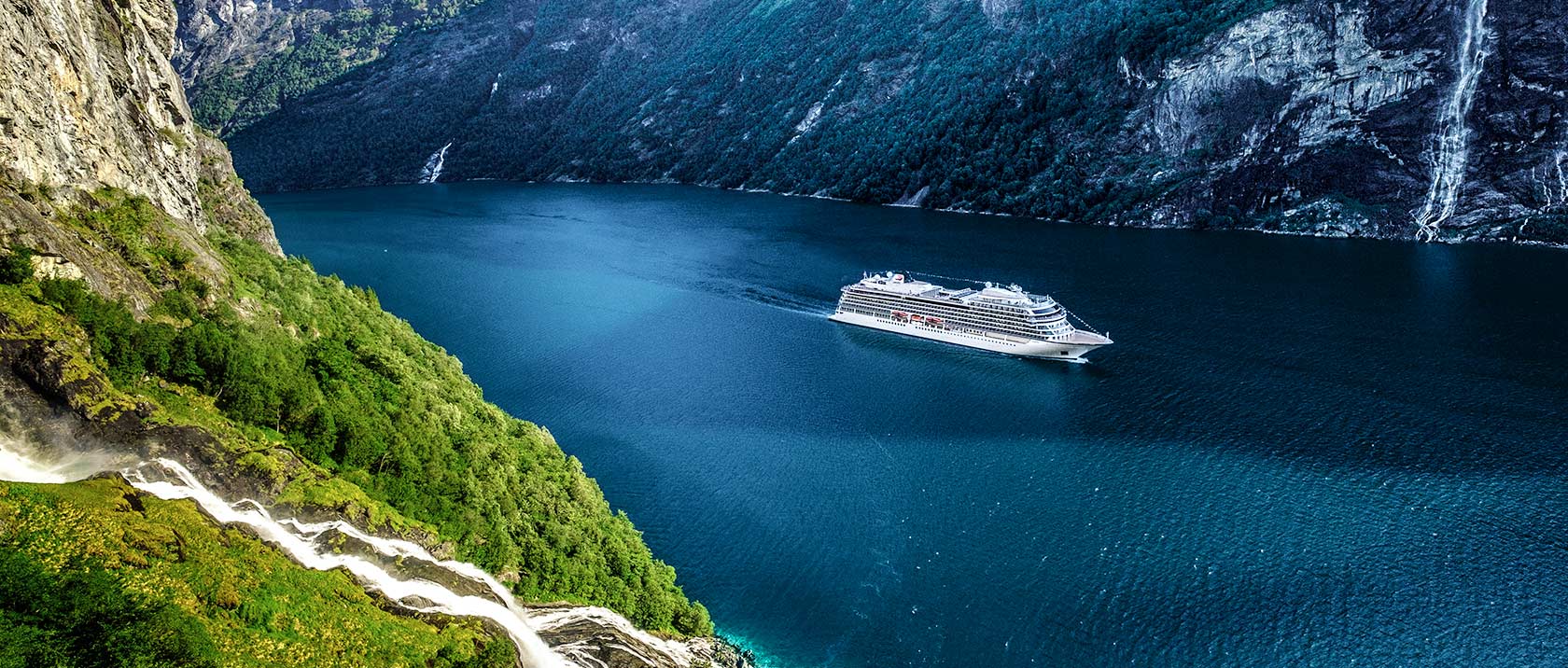
Viking Venus
Expand your horizons on comfortable, state-of-the-art ships, intimate and thoughtfully created by experienced nautical architects and designers to enrich your interaction with your destination in every way. Each sister ship carries only 930 guests and is engineered at a scale that allows direct access into most ports. The fleet features understated elegance and modern Scandinavian design.
Ship Facts
| Launch Year | 2020 | ||||||||
| Refit Year | |||||||||
| Language | en | ||||||||
| Gross Tonnage | 48000 | ||||||||
| Length | 227 | ||||||||
| Width | 29 | ||||||||
| Currency | EUR | ||||||||
| Speed | 20 | ||||||||
| Capacity | 930 | ||||||||
| Crew Count | 465 | ||||||||
| Deck Count | 9 | ||||||||
| Cabin Count | 465 | ||||||||
| Large Cabin Count | 0 | ||||||||
| Wheelchair Cabin Count | 2 | ||||||||
| Electrical Plugs |
|
Deck 9
- Outdoor Gym & Yoga Area

Deck 8
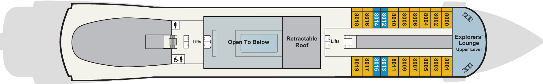
- Staterooms
- Explorers' Lounge (upper level)
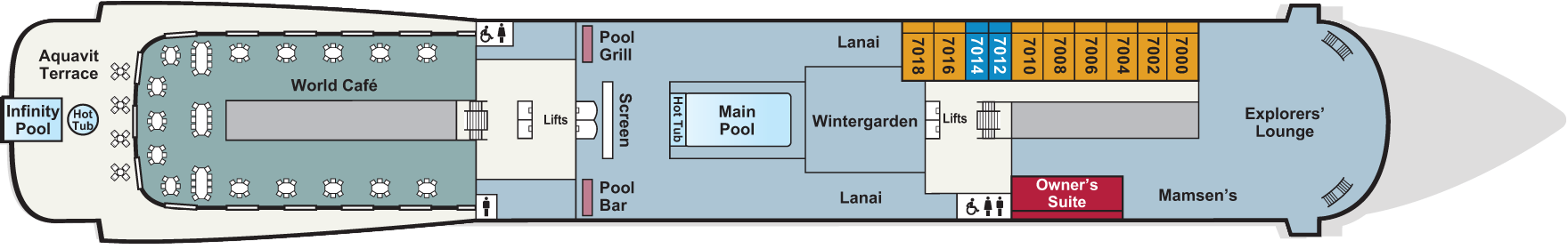
Deck 7
- Main Pool (with retractable roof)
- Explorers' Lounge (main level)
- Wintergarden
- Aquavit Terrace (with al fresco dining)
- Infinity Pool & Hot Tub
- Mamsen's
- Lanai
- Pool Grill
- Cinema
- Pool Bar
- Owner's Suite
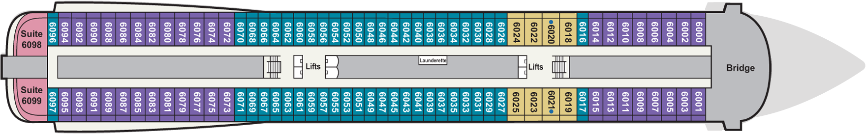
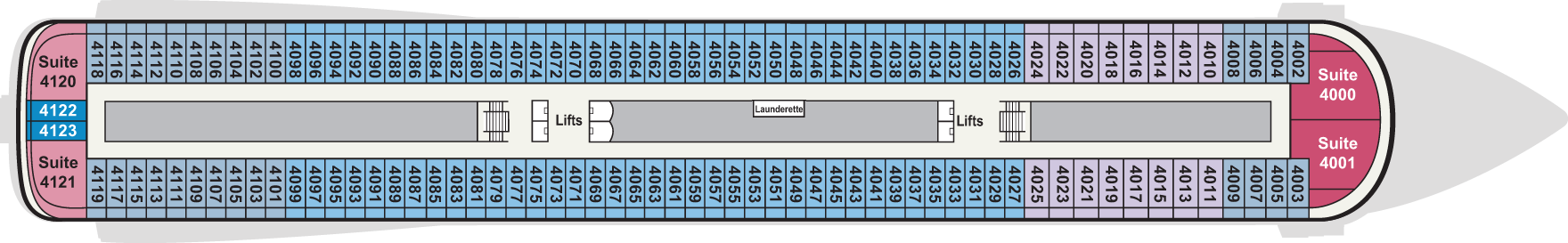
Deck 6
- Navigational Bridge
- Staterooms
- Self-service Launderette
- 2 ADA Cabins
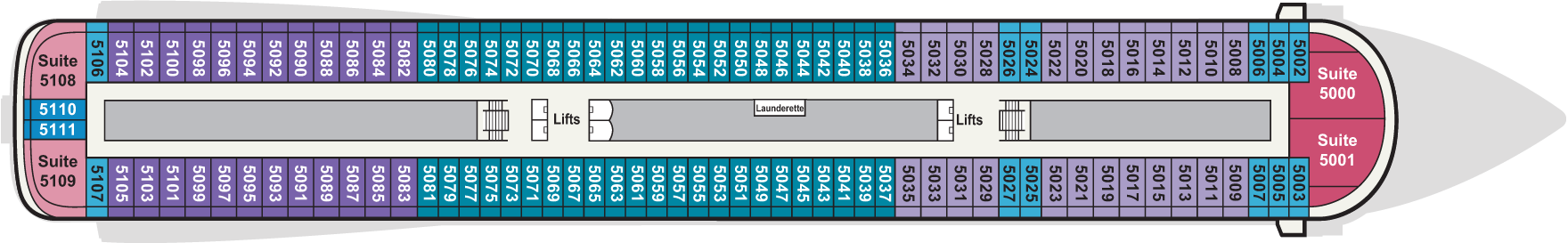
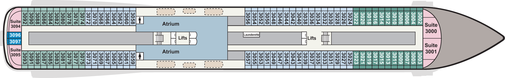
Deck 5
- Staterooms
- Self-service Launderette
Deck 4
- Staterooms
- Self-service Launderette
Deck 3
- Staterooms
- Self-service Launderette
- Atrium (top level)
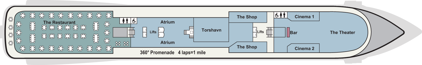
Deck 2
- Theatre & Bar
- Cinema 1 & 2
- Torshavn
- Shops
- Atrium
- Restaurant
- Wraparound Promenade
Deck 1
- The Spa
- Viking Living Room
- Guest Services
- Fitness Centre
- Viking Bar

Deck A
- Medical Centre

The ship offers multiple restaurant venues and unique dining experiences, from casual cafés and pool grills to wine-pairing menus and regional specialties.
The Restaurant
Breakfast and dinner, welcome to The Restaurant. One of the finest restaurants you'll find. Anywhere. Where the daily changing menus complement the daily changing views. And where you can feast on traditional favourites as well as local specialities, all perfectly prepared and presented.
Aquavit Terrace
There is nothing like dining in the great outdoors. Big sky. Setting sun and a chance to drink in the fresh air, as well as the views. Step out of The World Café onto The Aquavit Terrace. Breakfast, lunch and dinner, it is everything you want relaxed dining to be.
World Café
Discover flavours of the east in Copenhagen, the tastes of Tuscany in Sydney, and the freshest sushi in the Amazon jungle. Morning, noon and night, explore a world of taste at the World Cafe. A celebration of foods that make us different, but also bring us together.
Explorers' Lounge
Inspired by the trade routes of Vikings, the Explorers’ Lounge is the ideal place for guests to share their discoveries over an aquavit or a craft beer while sampling fine Scandinavian fare. Central to the Explorers’ Lounge is Mamsen’s, a casual gourmet deli inspired by Norwegian cuisine, from smoked salmon to open-faced sandwiches and locally sourced charcuterie and cheeses. The daily “Waffle Hour” provides mouth-watering samples of the beloved treat.
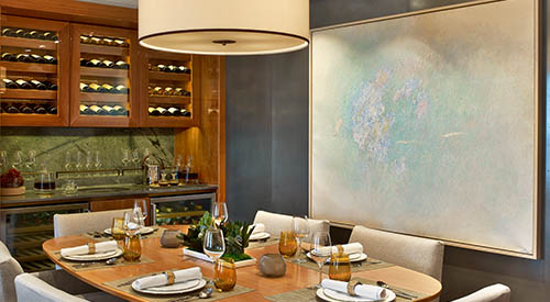
The Chef's Table
Executive Chef Anthony Mamboussin's dining concept has been impressing guests on every cruise. Five courses, each with a wine pairing, follow a specific theme. Venice Carnival. Sweet and Sour. Asian Panorama. It's a whole new world of discovery.
Manfredi's
Long, laughter-filled dinners don't get better than those in Manfredi's, the Italian grill restaurant. Traditional Tuscan and Roman cuisine (think perfectly cooked steaks, fresh seafood, handmade pastas and an overflowing antipasto trolley) in a warm, contemporary setting. Buon Appetito!
The Pool Grill
When stepping in for lunch is a step too far, tuck into a tasty snack at the Pool Grill. Classic, American-style sandwiches, burgers and hot dogs always hit the spot. Pile on the mustard, dress with pickles, slaw and sauces and wash it down with an ice-cold beer or crisp white wine. Lap it up, it’s all included.
Mamsen's
In the Nordic deli, feast on waffles laden with fresh blueberries and cream or gjetjost, Norway's sweet nutty cheese. Or tuck into pancakes covered in cloudberry jam or glistening with lemon and sugar. Flipping marvellous.
The Wintergarden
A good afternoon. A comfy sofa in The Wintergarden. Sandwiches, cakes and scones, and a pot of your favourite blend of tea. The light and airy surroundings and the striking blonde wooden canopy are as delicious as the cream teas.
Private Dining
Because it’s a special occasion. Or just because. Book your table in one of the private dining rooms at Manfredi’s of The Chef’s Table. An intimate setting made even more personal.
24-hour Room Service
Breakfast in bed. Lunch on your private veranda. Late night nibbles. Enjoy room service at any time, without paying any more.
There is no such thing as a typical evening onboard, nor shortage of entertainment. Whether it’s a cabaret, opera, classical or popular music concert, the theatre is home to an inspiring choice of productions. Film fans can feast on classic movies and the latest blockbusters in one of the cinemas. Or take in the breeze as you take in a film at the open-air cinema.
When the stars come out, so does the entertainment. From sipping an artisan gin and exchanging stories with newfound friends in Paps, the Explorer’s Bar, to enjoying the sounds of the guitarist, pianist and singer in one of the lounges. Take a seat in the plush theatre for a dazzling show, or dance the night away in Torshavn nightclub. Sing along to a band, or lie back by the pool under the night sky to watch a movie on the giant screen – the popcorn is on the house. However you choose to spend your evenings on board, being bored is never an option
The Wintergarden
When you yearn for serenity, there is no better place on ship than a visit to the Wintergarden. This charming, airy space around the main pool is perfect for relaxing in clean, uncluttered Scandinavian-designed environment. Even here, our focus is on enrichment, as this is the place to witness a tea ceremony, or indulge in an afternoon tea service, complete with hand-selected teas, finger sandwiches and pastries.
Viking Bar
Enjoy a cocktail in the Viking Bar, which is located on the ground floor of the atrium.
The Viking Living Room
The ideal setting for relaxation and conversation, The Viking Living Room draws guests together. Spacious seating, melodic piano tunes, live entertainment and planned activities foster rich camaraderie. And its well-curated Viking Library informs even the best-read traveler. Adorned with nautical touches from Viking days, including the clinker-built bar inspired by ancient longships, it is the most inspired living room at sea.
The Theatre & Cinema
Even our theaters connect you to the destinations.
Our main venue, The Theater, features live performances that bring you closer to the culture of our destinations. Sometimes, the destination we connect you to exists solely in the realm of an otherworldly theatrical journey, as is the case with beautifully themed shows.
We will also pull back the curtains of our destinations with cinema in our two movie theaters, which show first-run films you have not yet seen as well as destination-driven cinema such as "Room with A View," "Roman Holiday," or "Skyfall." And because the intellect also needs to be stimulated, our theaters will always be buzzing with fresh, new insights from our port talks and onboard lectures that feature the history, art, and culture of our destinations. And since we have always promised you will explore the world in comfort, we have banished uncomfortable theater seating in favor of soft and spacious sofa seating
Explorers' Lounge
Inspired by the trade routes of Vikings, the Explorers’ Lounge is the ideal place for guests to share their discoveries over an aquavit or a craft beer while sampling fine Scandinavian fare. Central to the Explorers’ Lounge is Mamsen’s, a casual gourmet deli inspired by Norwegian cuisine, from smoked salmon to open-faced sandwiches and locally sourced charcuterie and cheeses. The daily “Waffle Hour” provides mouth-watering samples of the beloved treat.
The Shops
There are shops located on Deck 2.