Panama Canal & the Americas
Panama Canal & the Americas
Cruise overview
WHY BOOK WITH US?
- ✔ The Deluxe Cruises’ team has extensive experience in ultra-luxury cruising.
- ✔ Call now to speak to our helpful and experienced Cruise Concierge team.
- ✔ Enjoy our Unique Deluxe Cruises Bonus for substantial savings.
- ✔ Our team will tailor your holiday to your exacting requirements.
- ✔ As agents, we work under the protection of each cruise lines ABTA / ATOL licences
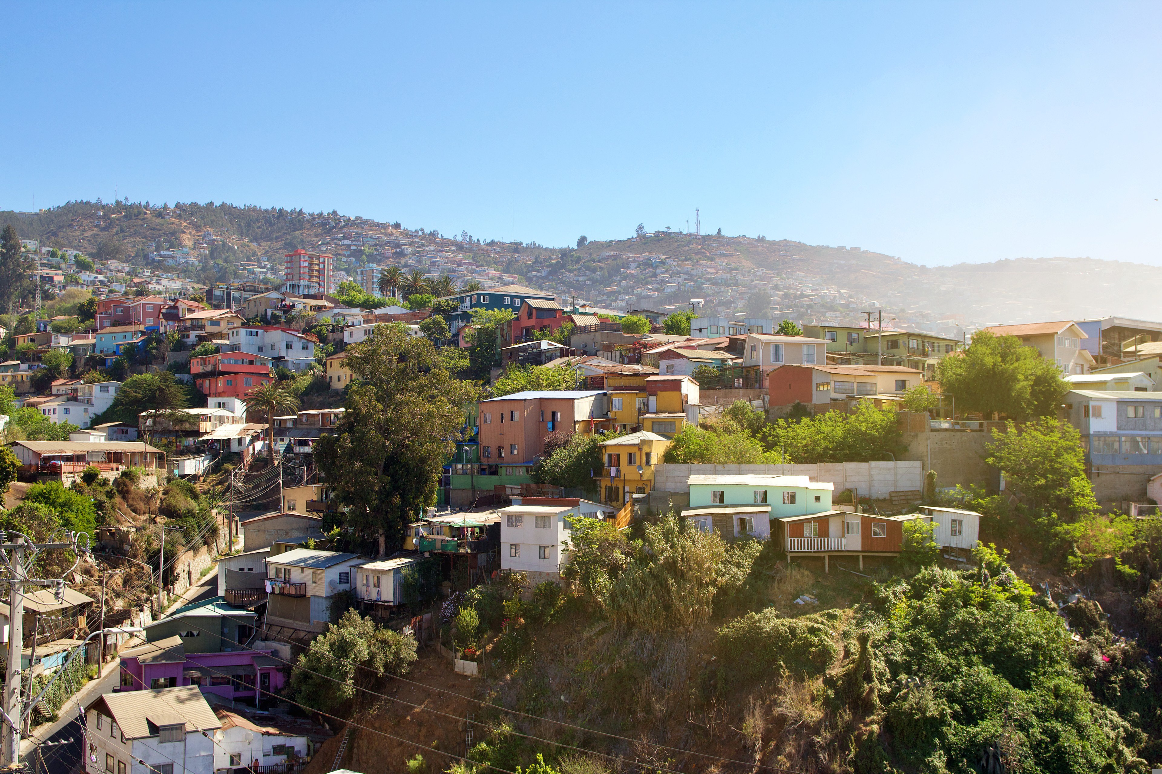
About Valparaiso
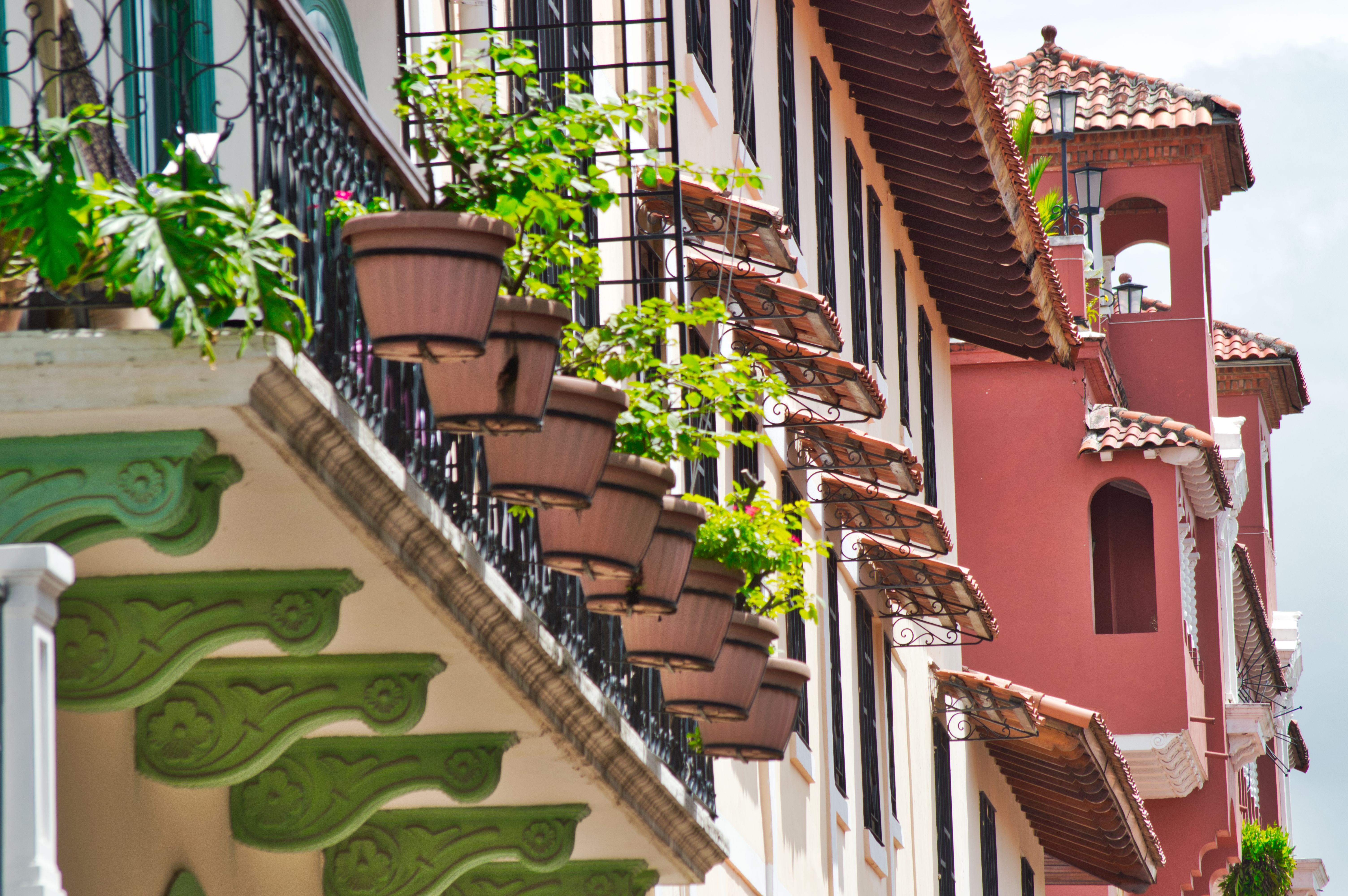
Valparaíso's dramatic topography—45 cerros, or hills, overlooking the ocean—requires the use of winding pathways and wooden ascensores (funiculars) to get up many of the grades. The slopes are covered by candy-color houses—there are almost no apartments in the city—most of which have exteriors of corrugated metal peeled from shipping containers decades ago. Valparaíso has served as Santiago's port for centuries. Before the Panama Canal opened, Valparaíso was the busiest port in South America. Harsh realities—changing trade routes, industrial decline—have diminished its importance, but it remains Chile's principal port. Most shops, banks, restaurants, bars, and other businesses cluster along the handful of streets called El Plan (the flat area) that are closest to the shoreline. Porteños (which means "the residents of the port") live in the surrounding hills in an undulating array of colorful abodes. At the top of any of the dozens of stairways, the paseos (promenades) have spectacular views; many are named after prominent Yugoslavian, Basque, and German immigrants. Neighborhoods are named for the hills they cover. With the jumble of power lines overhead and the hundreds of buses that slow down—but never completely stop—to pick up agile riders, it's hard to forget you're in a city. Still, walking is the best way to experience Valparaíso. Be careful where you step, though—locals aren't very conscientious about curbing their dogs.
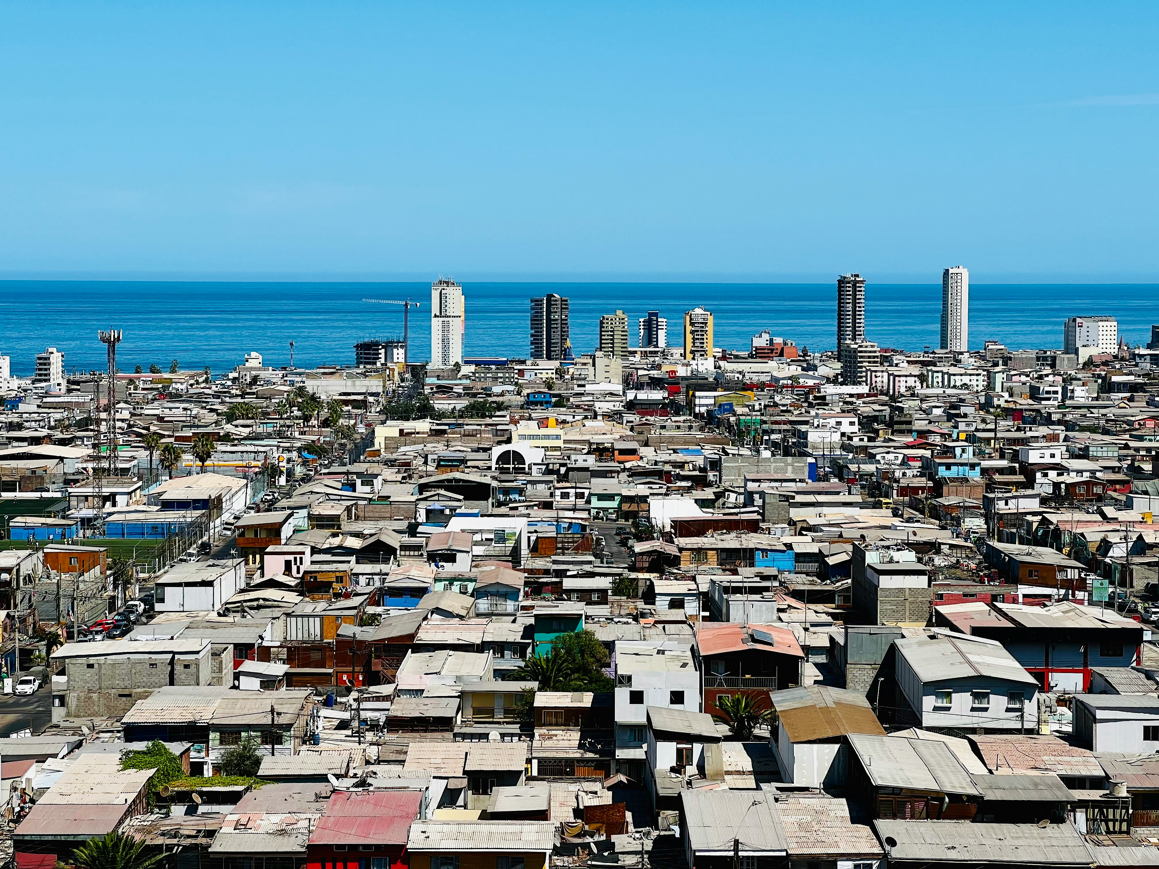
About Iquique
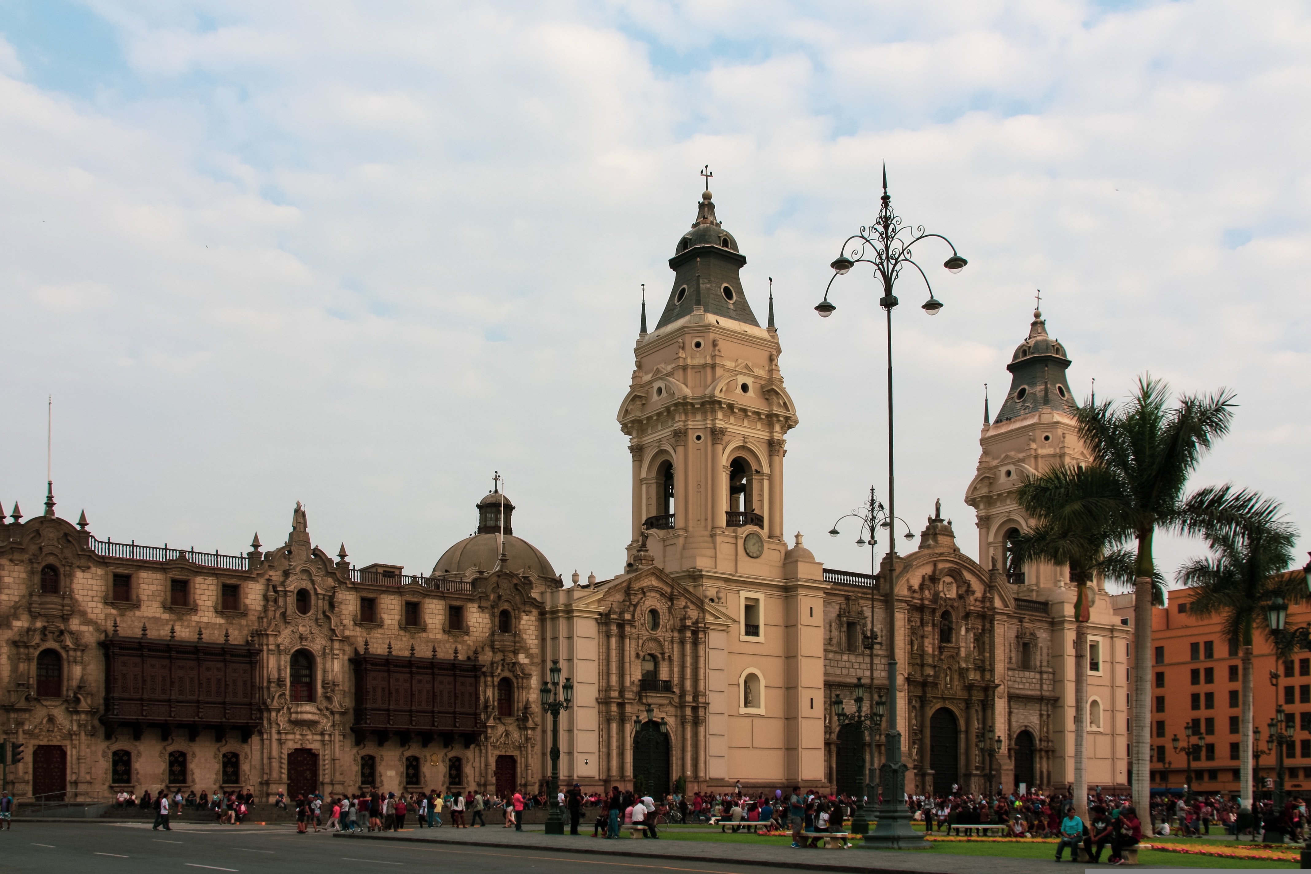
About Callao
When people discuss great South American cities, Lima is often overlooked. But Peru's capital can hold its own against its neighbors. It has an oceanfront setting, colonial-era splendor, sophisticated dining, and nonstop nightlife.It's true that the city—clogged with traffic and choked with fumes—doesn't make a good first impression, especially since the airport is in an industrial neighborhood. But wander around the regal edifices surrounding the Plaza de Armas, among the gnarled olive trees of San Isidro's Parque El Olivar, or along the winding lanes in the coastal community of Barranco, and you'll find yourself charmed.In 1535 Francisco Pizarro found the perfect place for the capital of Spain's colonial empire. On a natural port, the so-called Ciudad de los Reyes (City of Kings) allowed Spain to ship home all the gold the conquistador plundered from the Inca. Lima served as the capital of Spain's South American empire for 300 years, and it's safe to say that no other colonial city enjoyed such power and prestige during this period.When Peru declared its independence from Spain in 1821, the declaration was read in the square that Pizarro had so carefully designed. Many of the colonial-era buildings around the Plaza de Armas are standing today. Walk a few blocks in any direction for churches and elegant houses that reveal just how wealthy this city once was. But the poor state of most buildings attests to the fact that the country's wealthy families have moved to neighborhoods to the south over the past century.The walls that surrounded the city were demolished in 1870, making way for unprecedented growth. A former hacienda became the graceful residential neighborhood of San Isidro. In the early 1920s the construction of tree-lined Avenida Arequipa heralded the development of neighborhoods such as bustling Miraflores and bohemian Barranco.Almost a third of the country's population of 29 million lives in the metropolitan area, many of them in relatively poor conos: newer neighborhoods on the outskirts of the city. Most residents of those neighborhoods moved there from mountain villages during the political violence and poverty that marked the 1980s and ’90s, when crime increased dramatically. During the past decade the country has enjoyed peace and steady economic growth, which have been accompanied by many improvements and refurbishment in the city. Residents who used to steer clear of the historic center now stroll along its streets. And many travelers who once would have avoided the city altogether now plan to spend a day here and end up staying two or three.
About Fuerte Amador
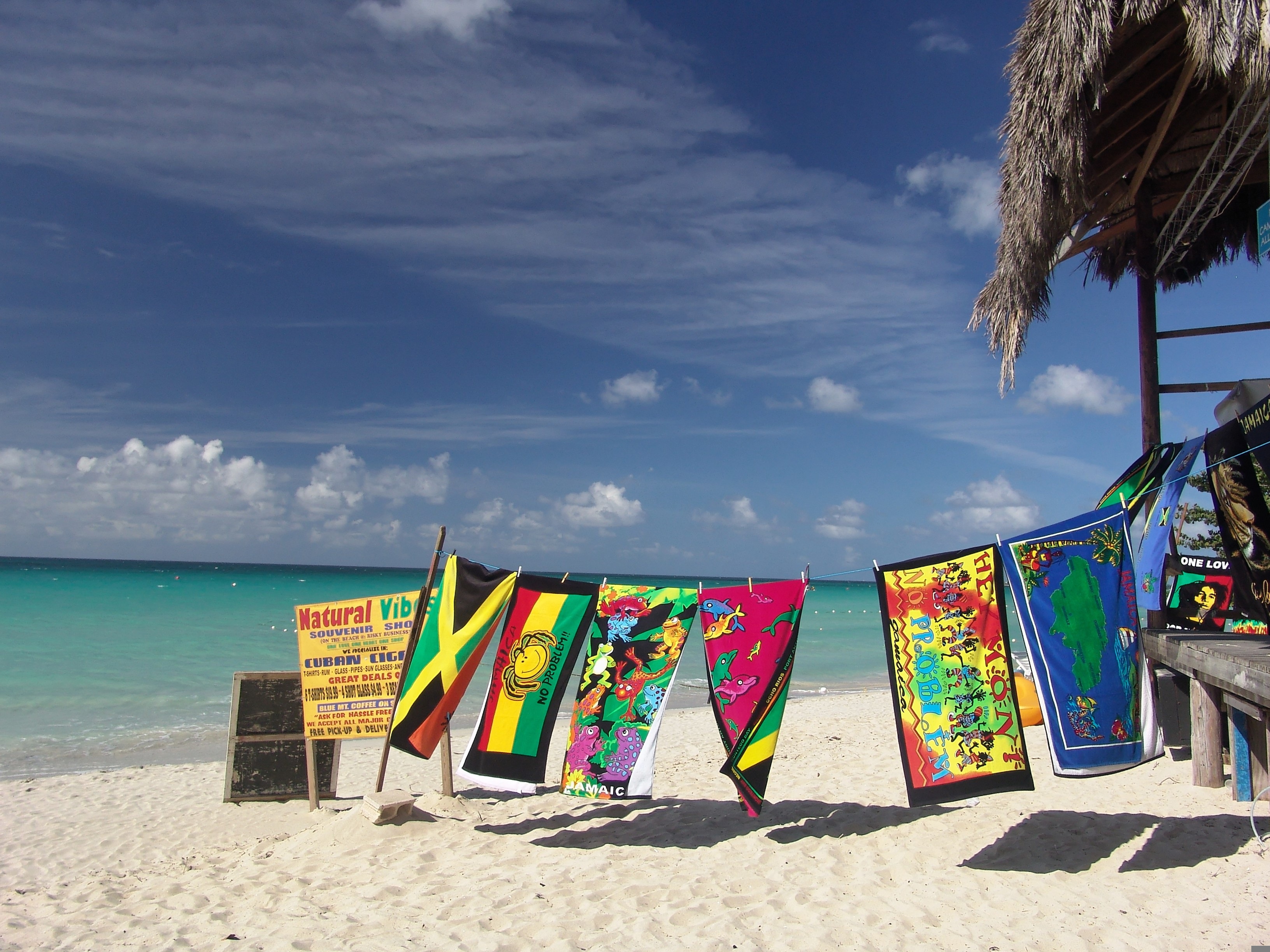
About Port Antonio
Port Antonio, on the Northeast coast of Jamaica, is the islands third largest port, mainly for bananas and coconuts. It is also an important tourist destination. In fact, it has been featured as a model of paradise in several famous Hollywood films such as Club Paradise and Cocktail. Port Antonio was a sleepy coastal town until the 1880s, when Lorenzo Dow Baker, an American businessman, started the banana trade in Jamaica and promoted Port Antonio as a vacation spot for wealthy Americans. "Portie", as it is nicknamed, became a boom town. Even the movie star Errol Flynn was enamoured and ended up buying property here after his yacht washed ashore in 1946. Today it is still a major destination with plenty to do and see, from stunning scenery, creative arts and crafts, and cultural and historical sites.
About Inagua
About San Salvador Island

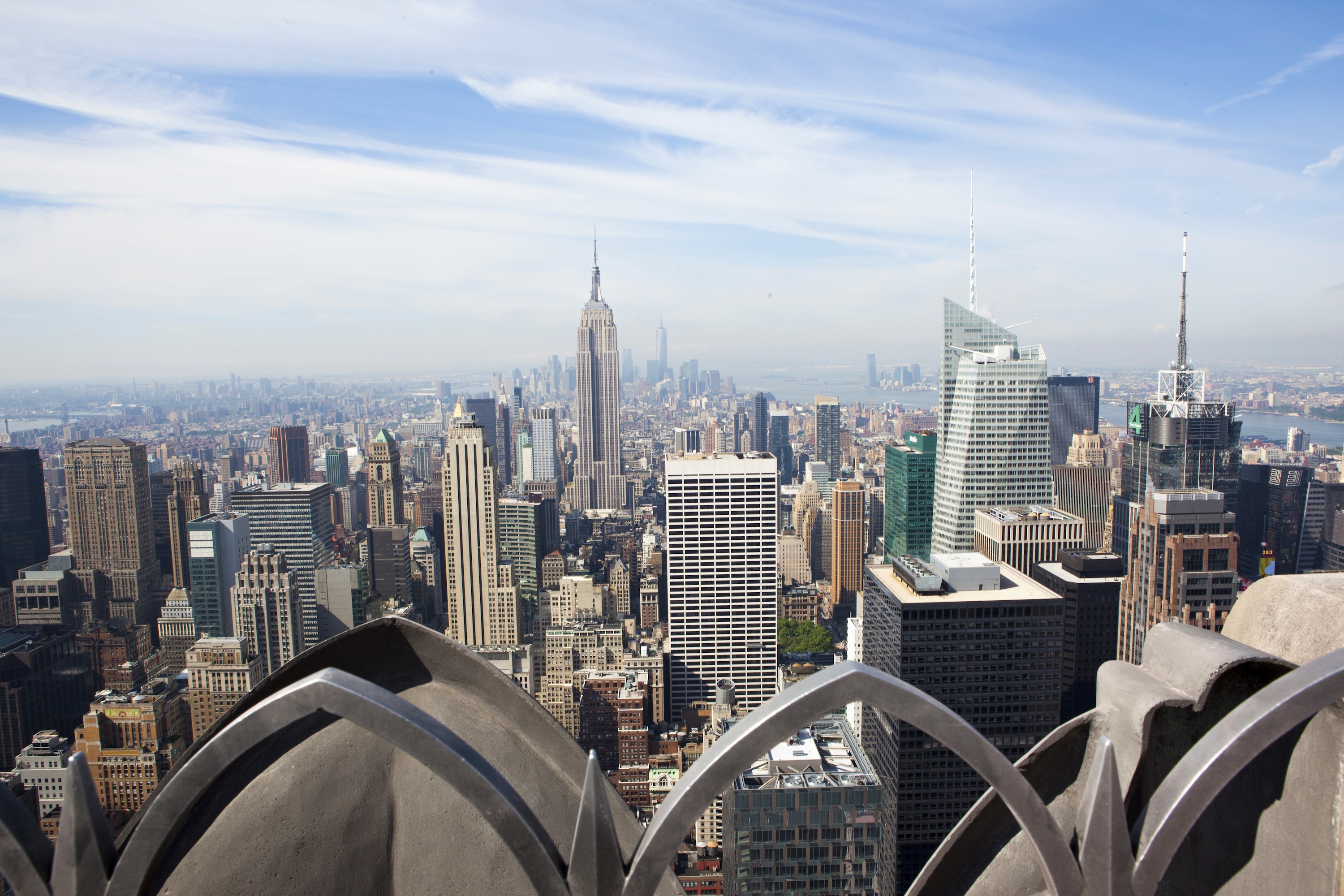
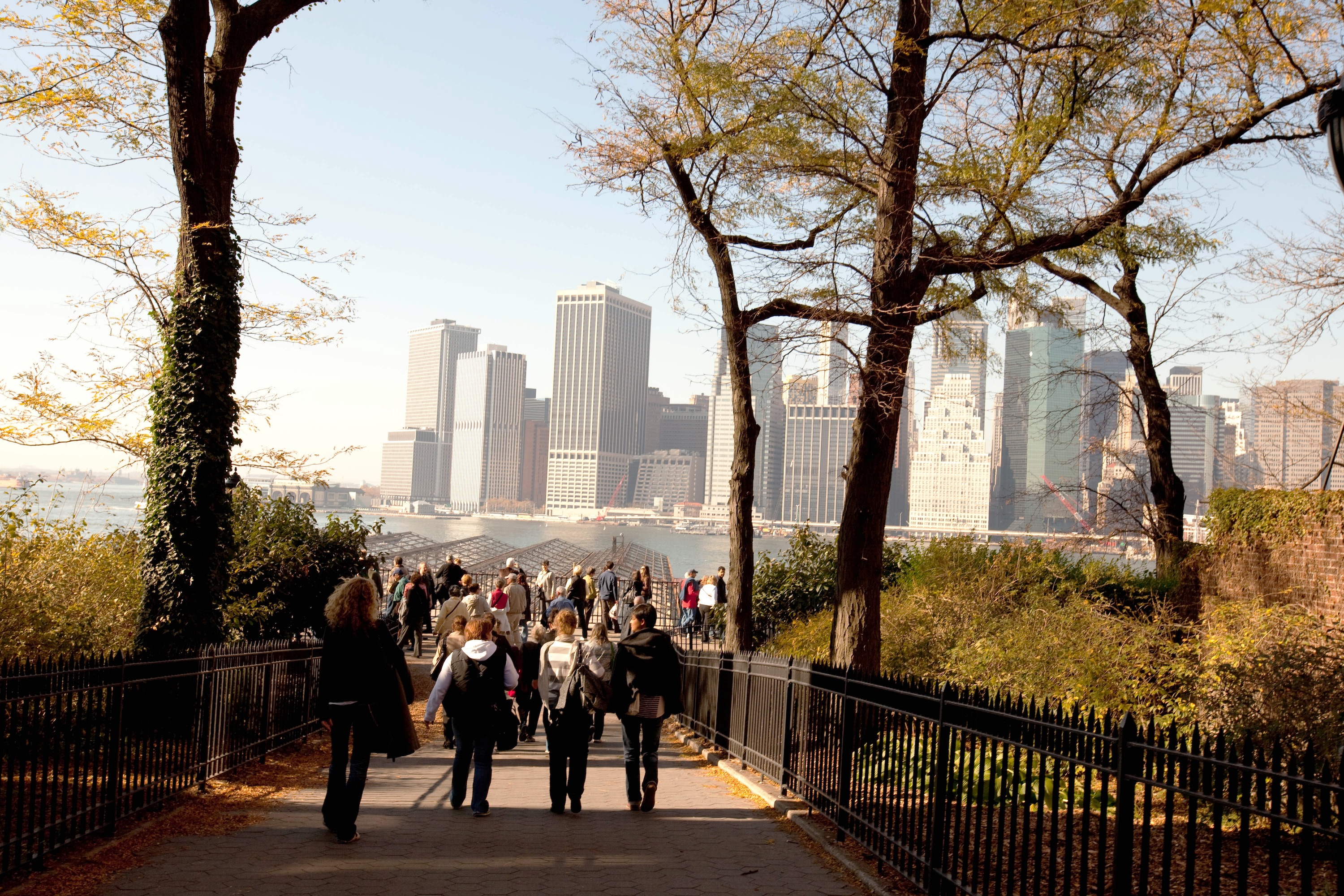
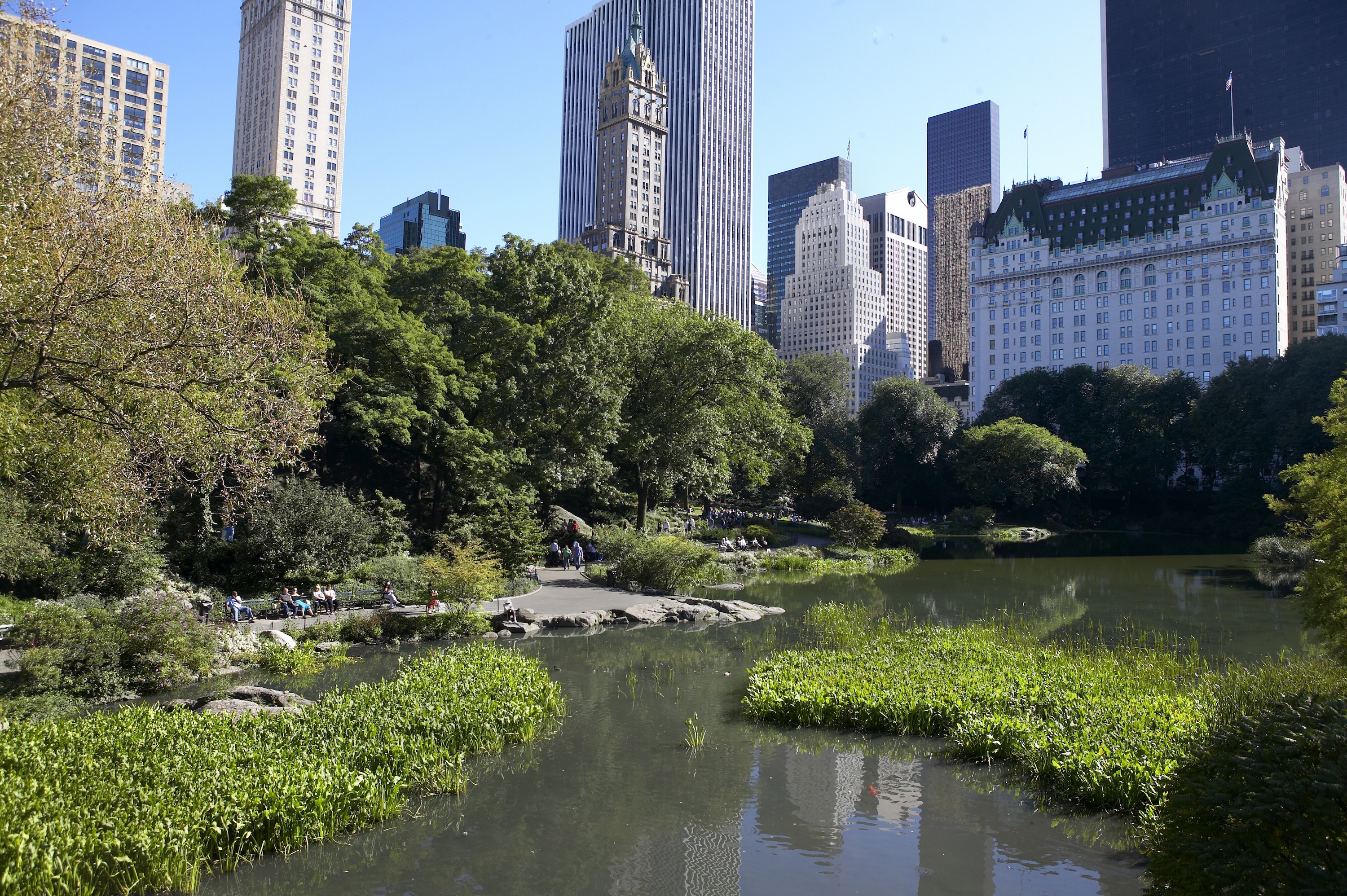
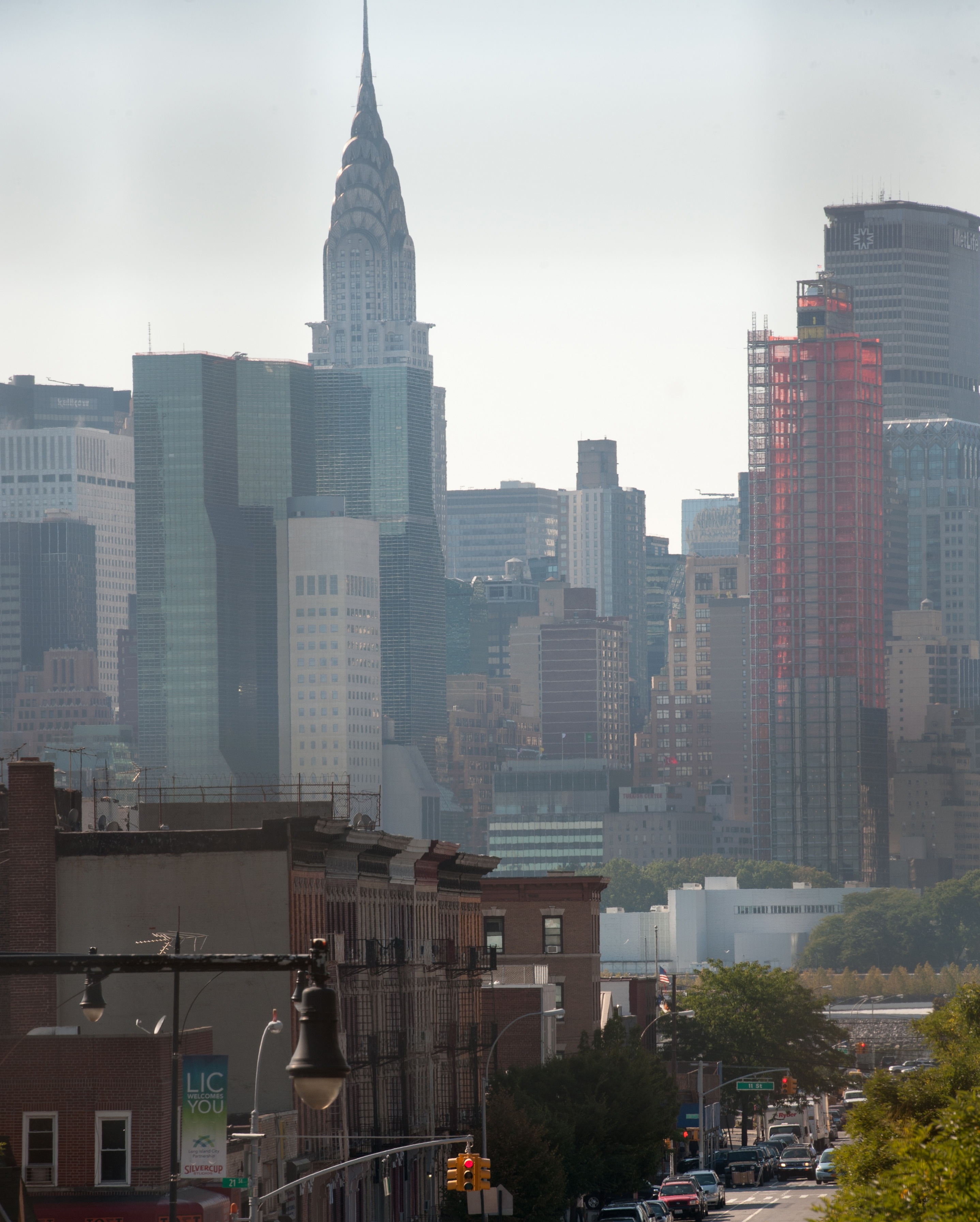
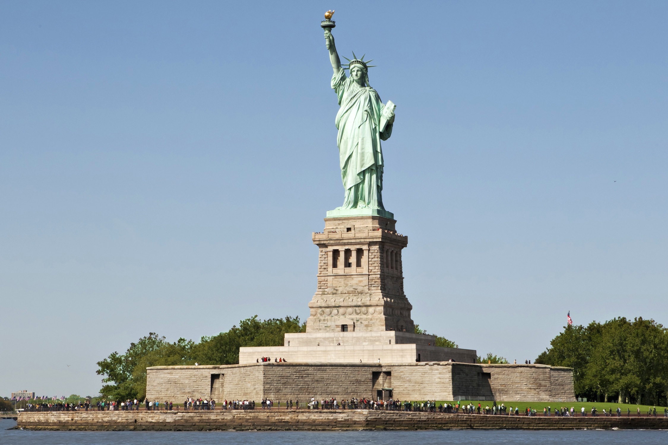
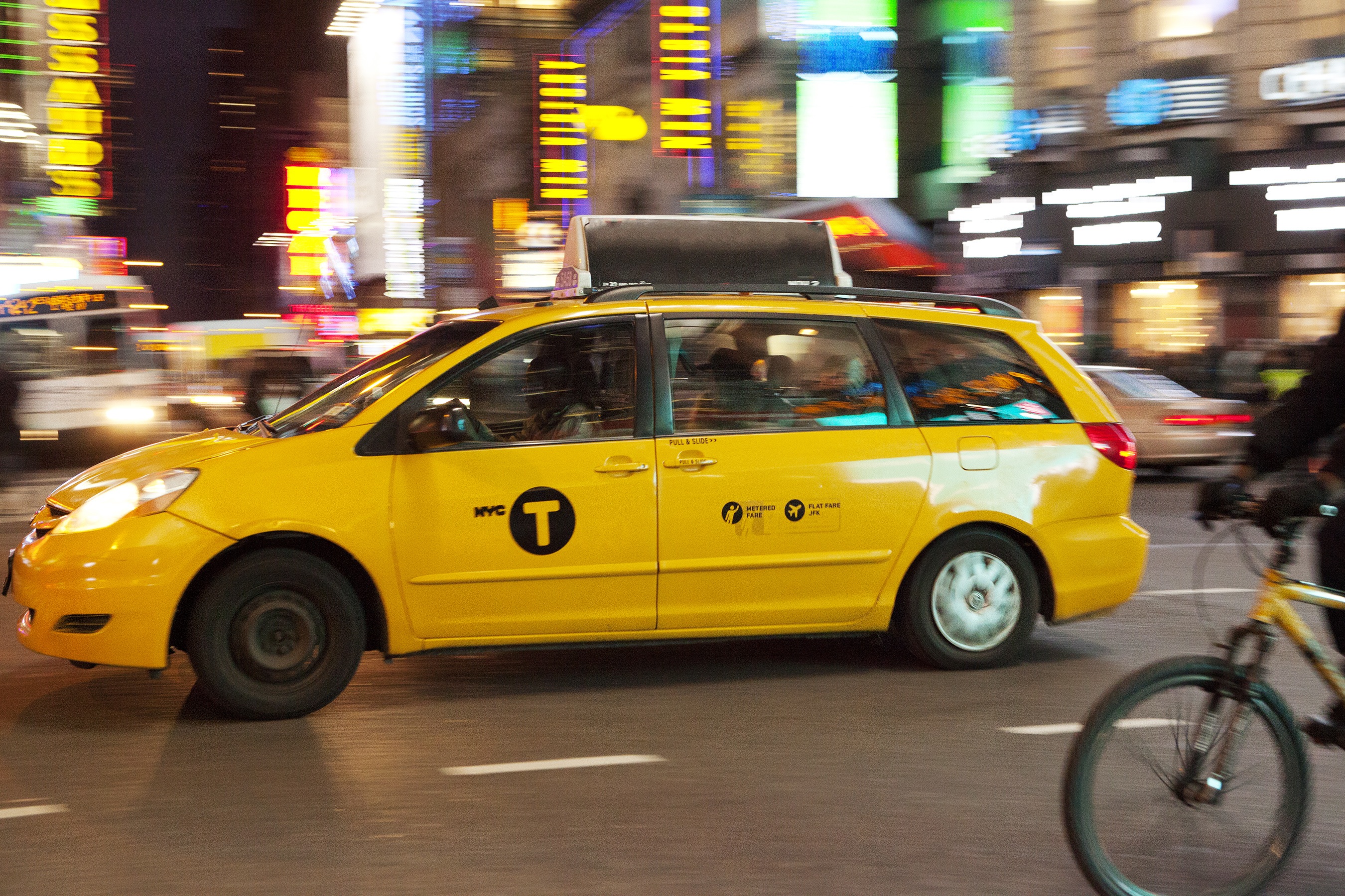
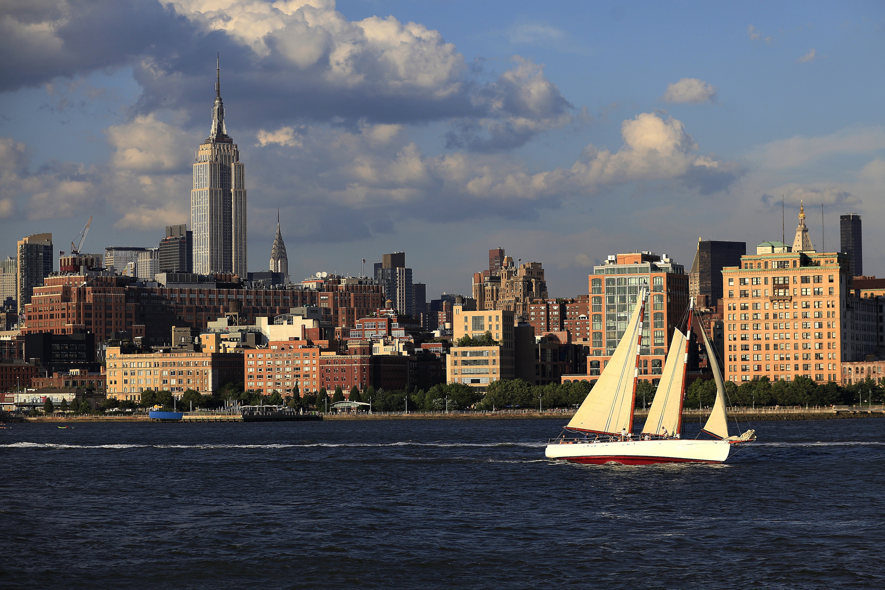
About New York, New York
From Wall Street's skyscrapers to the neon of Times Square to Central Park's leafy paths, New York City pulses with an irrepressible energy. History meets hipness in this global center of entertainment, fashion, media, and finance. World-class museums like MoMA and unforgettable icons like the Statue of Liberty beckon, but discovering the subtler strains of New York's vast ambition is equally rewarding: ethnic enclaves and shops, historic streets of dignified brownstones, and trendy bars and eateries all add to the urban buzz.
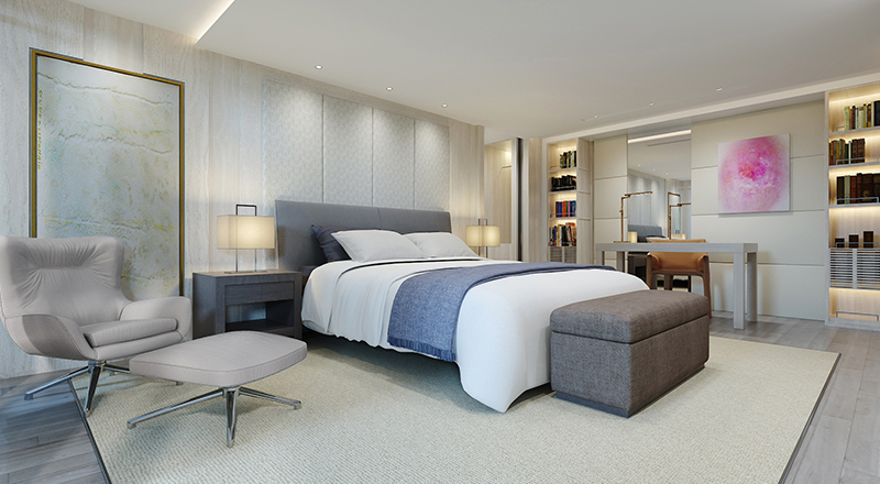
- Largest suite on board: 1,223 sq. ft. with a 792 sq. ft. private garden lounge area with badestamp
- All amenities of the Explorer Suite, plus:
- Priority stateroom access
- Floor-to-ceiling drying closet
- Four guaranteed priority reservations at each alternative restaurant (100 days prior to departure)
- First priority expedition activity reservations (107 days prior to departure)
- First priority booking of spa treatments (100 days prior to departure)
- Dinner & guided tour with ship officers (subject to availability)
- Large master bathroom, plus one guest bathroom
- Separate dining area/board room that seats six guests
- Private library, wine & music collections curated by Chairman Torstein Hagen
- And more; ask for details
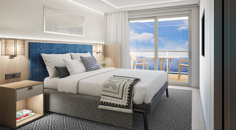
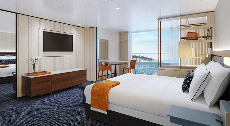
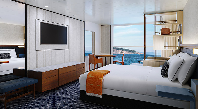
- Size including Nordic Balcony & private veranda: 580 sq. ft.
- 11 AM stateroom access
- Floor-to-ceiling drying closet
- Priority expedition activity reservations (97 days prior to departure)
- Three guaranteed priority reservations at each alternative restaurant (90 days prior to departure)
- Priority booking of spa treatments (90 days prior to departure)
- Mini-bar with alcoholic beverages, soft drinks, water & snacks, replenished once daily
- In-suite binoculars, coffee & Marius-weave blanket
- Laundry, dry cleaning, pressing & shoe shine services
- Welcome bottle of champagne
- Exclusive access to shared Explorer Suite private garden lounge area
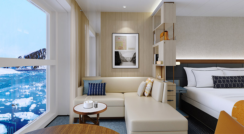
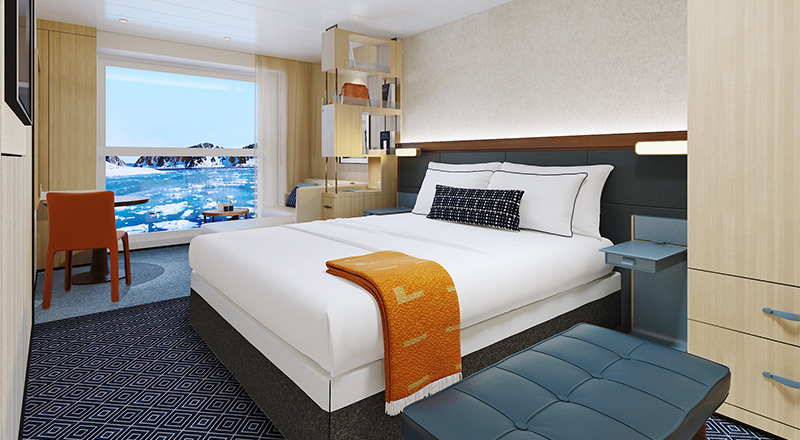
Size including Nordic Balcony: 322 sq ft
- 11 AM stateroom access
- Floor-to-ceiling drying closet
- Priority expedition activity reservations (87 days prior to departure)
- Three guaranteed priority reservations at each alternative restaurant (80 days prior to departure)
- Priority booking of spa treatments (80 days prior to departure)
- Mini-bar with alcoholic beverages, soft drinks, water & snacks, replenished once daily
- In-suite binoculars, coffee & Marius-weave blanket
- Laundry, dry cleaning, pressing & shoe shine services
- Bottle of champagne
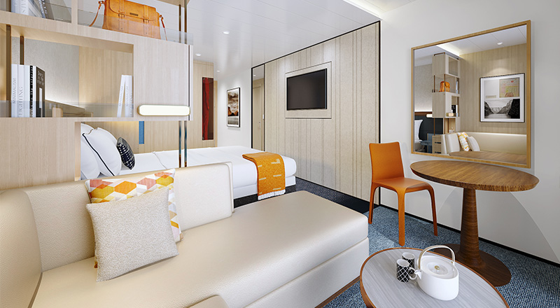
Size including Nordic Balcony: 269 sq ft
- 1 PM stateroom access
- Floor-to-ceiling drying closet
- Priority expedition activity reservations (77 days prior to departure)
- Two guaranteed priority reservations at each alternative restaurant (70 days prior to departure)
- Priority booking of spa treatments (70 days prior to departure)
- Mini-bar with alcoholic beverages, soft drinks, water & snacks, replenished once daily
- In-suite binoculars, coffee & Marius-weave blanket
- Pressing & shoe shine services
- Bottle of champagne
Size including Nordic Balcony: 222 sq ft
- 2 PM stateroom access
- Floor-to-ceiling drying closet
- Priority expedition activity reservations (67 days prior to departure)
- One guaranteed priority reservation at each alternative restaurant (60 days prior to departure)
- Priority booking of spa treatments (60 days prior to departure)
- Mini-bar with soft drinks, water & snacks, replenished once daily
- In-suite binoculars, coffee & Marius-weave blanket
Size including Nordic Balcony: 222 sq ft
- 3 PM stateroom access
- Floor-to-ceiling drying closet
- Expedition activity reservations (60 days prior to departure)
- Mini-bar with soft drinks, water & snacks
- In-suite binoculars & Marius-weave blanket
Viking Octantis
First, we invented modern river cruising. Then, we redefined ocean cruising. Now, experience all the comfort and elegance of our award-winning fleet with an expedition ship built specifically to explore the world's most remote destinations and allow you to immerse yourself in these regions.
Ship Facts
| Launch Year | 2022 | ||||||
| Refit Year | |||||||
| Language | en | ||||||
| Gross Tonnage | 30105 | ||||||
| Length | 205 | ||||||
| Width | 21 | ||||||
| Currency | EUR | ||||||
| Speed | 18 | ||||||
| Capacity | 378 | ||||||
| Crew Count | 260 | ||||||
| Deck Count | 6 | ||||||
| Cabin Count | N/A | ||||||
| Large Cabin Count | N/A | ||||||
| Wheelchair Cabin Count | N/A | ||||||
| Electrical Plugs |
|
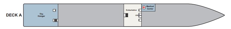
Deck A
- The Hangar
- Medical Center
- Embarkation
- Lifts
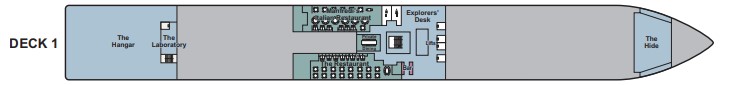
Deck 1
- The Hangar
- The Science Lab
- Manfredi's Restaurant
- The Restaurant
- Guest Services
- Lifts
- The Hide
- Bar
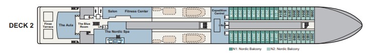
Deck 2
- The Aula
- Hair Salon
- Fitness Center
- The Nordic Spa
- Finse Terrace
- Expedition Central
- Nordic Balcony Staterooms
- Lifts
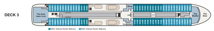
Deck 3
- The Aula (upper level)
- The Nordic Shop
- Travel Consultant
- The Shelter
- The Bow
- Deluxe Nordic Balcony
- Lifts
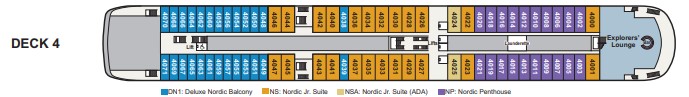
Deck 4
- Explorers' Lounge
- Bar
- Deluxe Nordic Balcony
- Nordic Junior Suite
- Nordic Penthouse
- Lifts
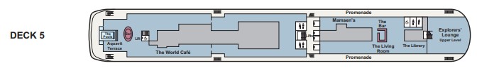
Deck 5
- Aquavit Terrace
- The Pools
- World Cafe
- Mamsen's
- Promenade Deck
- Bar
- The Living Room
- The Library
- Explorers' Lounge (upper level)
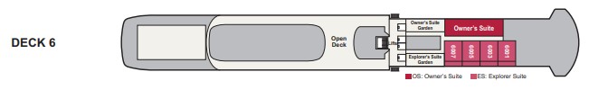
Deck 6
- Owner's Suite & Garden
- Explorer's Suite & Garden
- Open Deck
- Bridge
- Lifts
The World Cafe
Mamsen's
The Restaurant
Manfredi's
24-Hour Options
Innovative, light-filled spaces where comfort meets discovery.
Explorers' Lounge
The Pools
Aquavit Terrace
The Living Room
The Library
Finse Terrace