Star Collector: Scottish and Viking Adventure
Star Collector: Scottish and Viking Adventure
Cruise overview
WHY BOOK WITH US?
- ✔ The Deluxe Cruises’ team has extensive experience in ultra-luxury cruising.
- ✔ Call now to speak to our helpful and experienced Cruise Concierge team.
- ✔ Enjoy our Unique Deluxe Cruises Bonus for substantial savings.
- ✔ Our team will tailor your holiday to your exacting requirements.
- ✔ As agents, we work under the protection of each cruise lines ABTA / ATOL licences
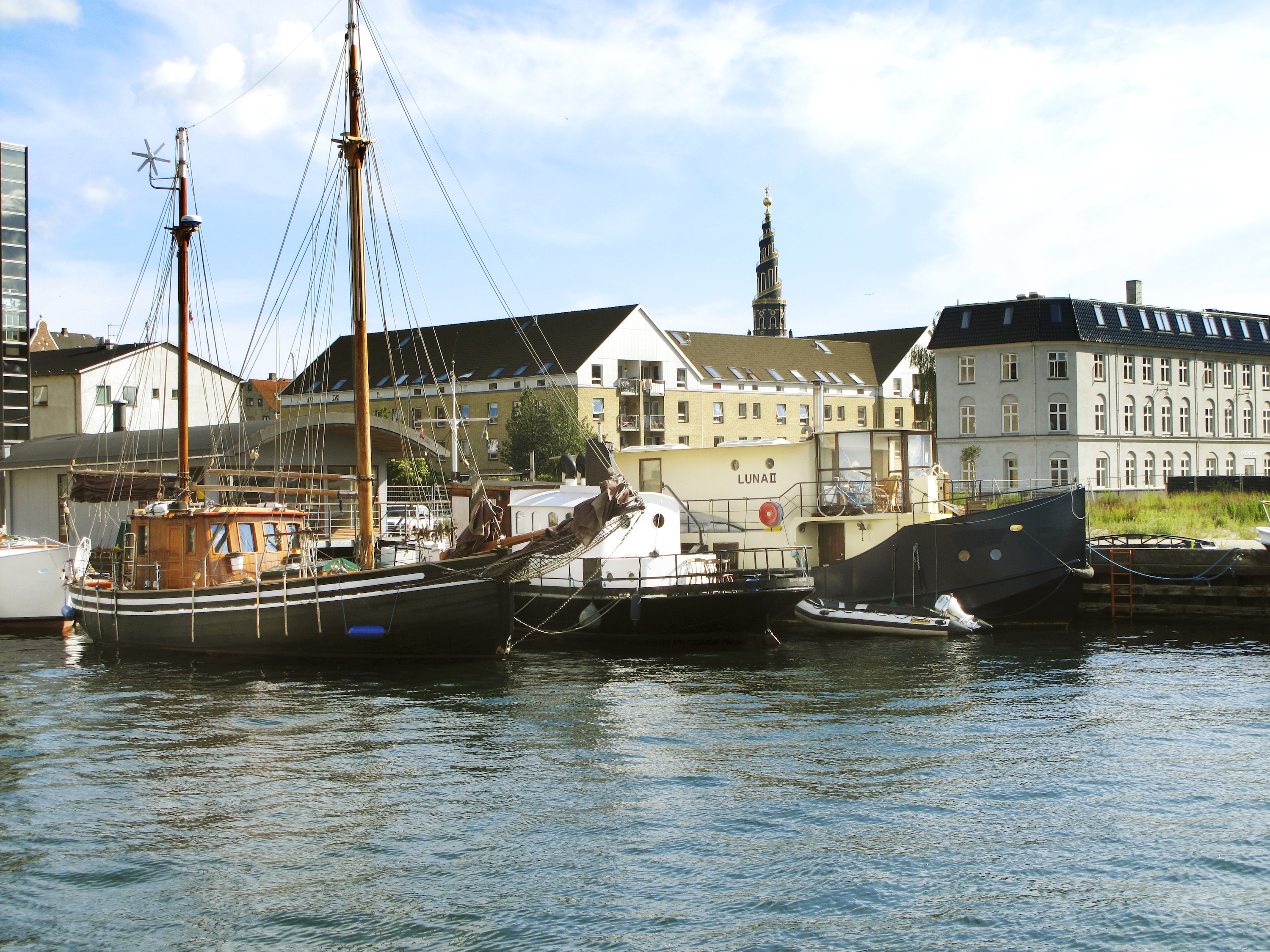
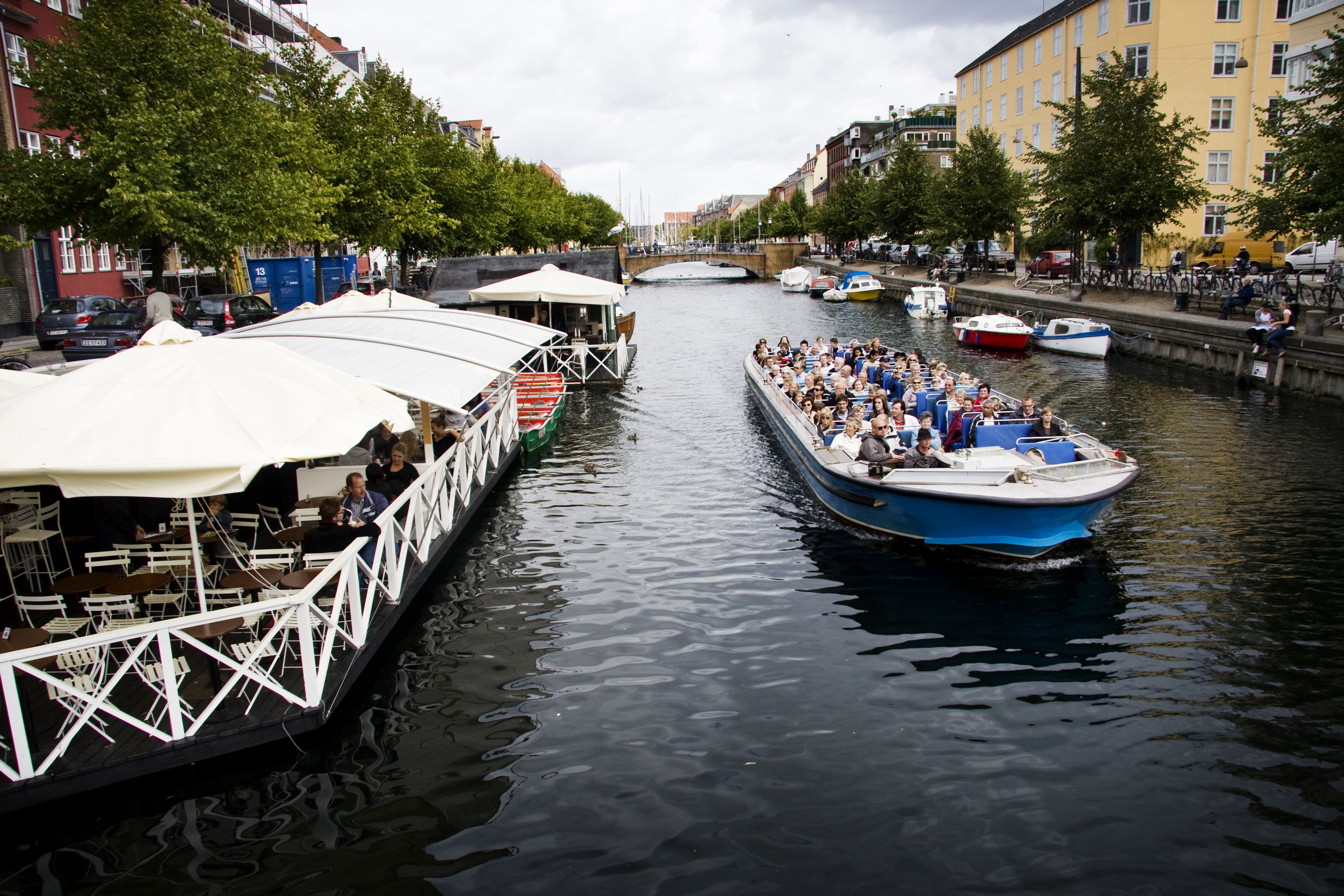
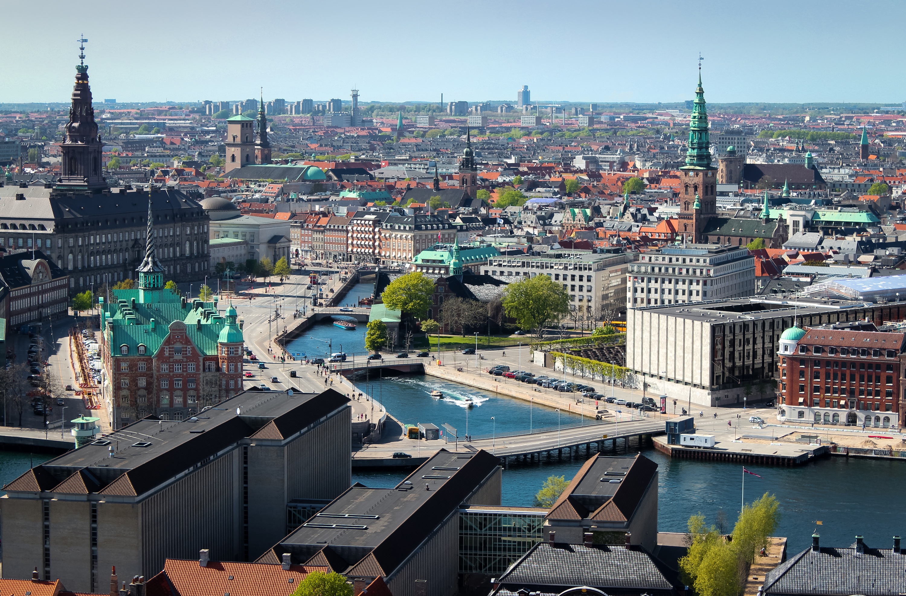
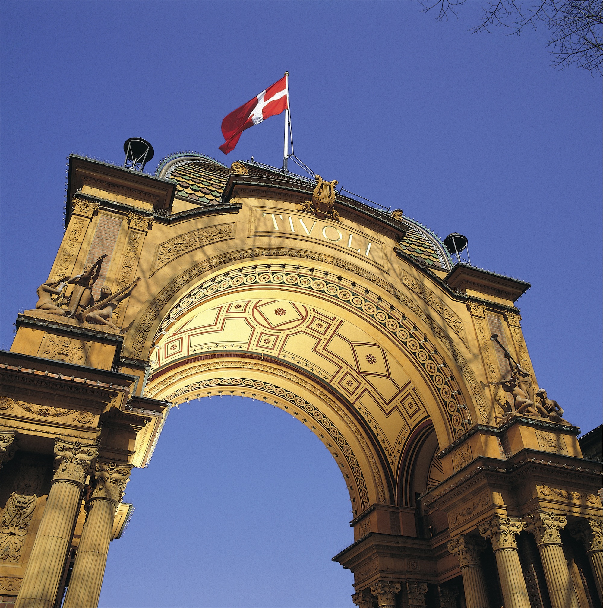
About Copenhagen
By the 11th century, Copenhagen was already an important trading and fishing centre and today you will find an attractive city which, although the largest in Scandinavia, has managed to retain its low-level skyline. Discover some of the famous attractions including Gefion Fountain and Amalienborg Palace, perhaps cruise the city’s waterways, visit Rosenborg Castle or explore the medieval fishing village of Dragoer. Once the home of Hans Christian Andersen, Copenhagen features many reminders of its fairytale heritage and lives up to the reputation immortalised in the famous song ‘Wonderful Copenhagen’.

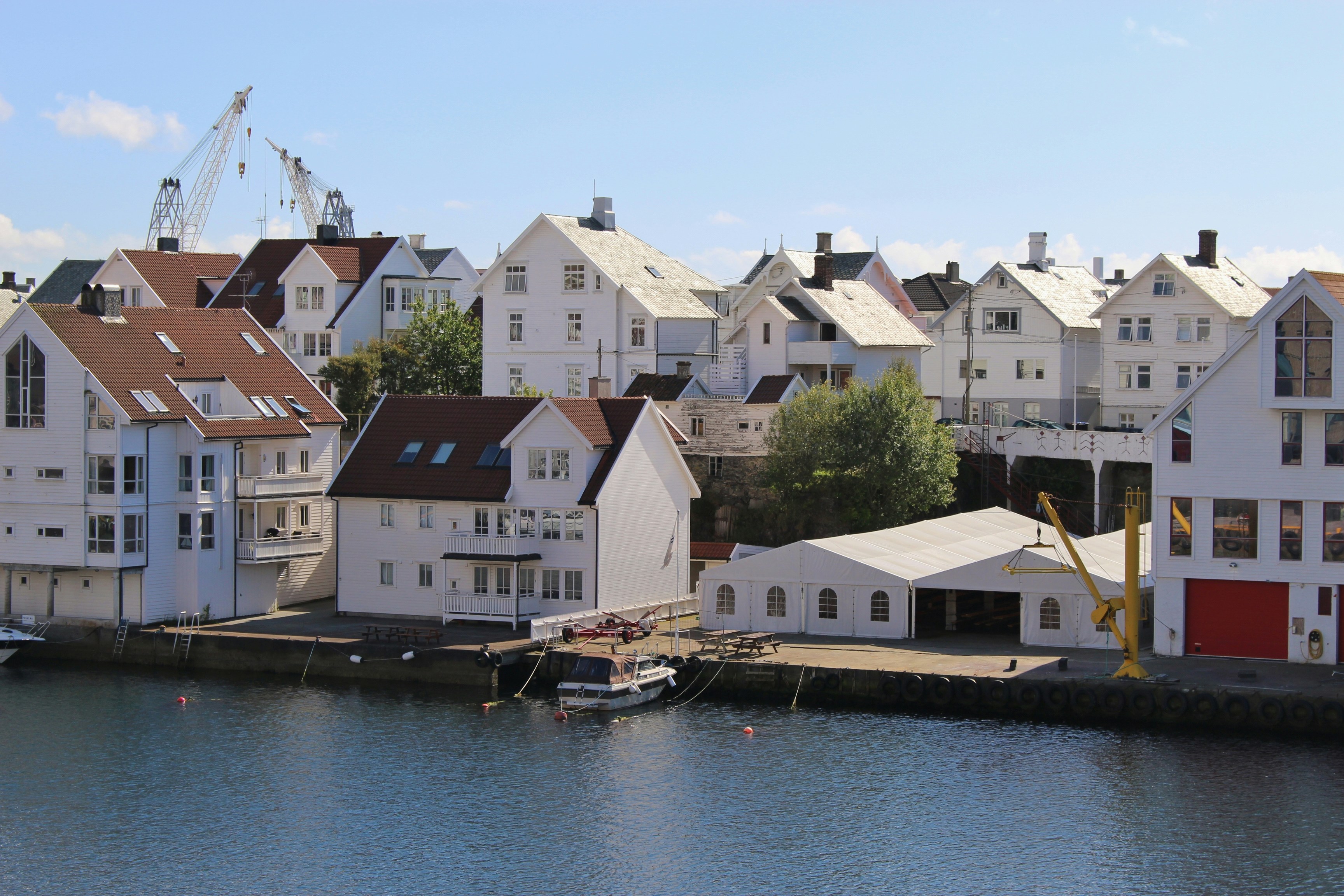
About Haugesund
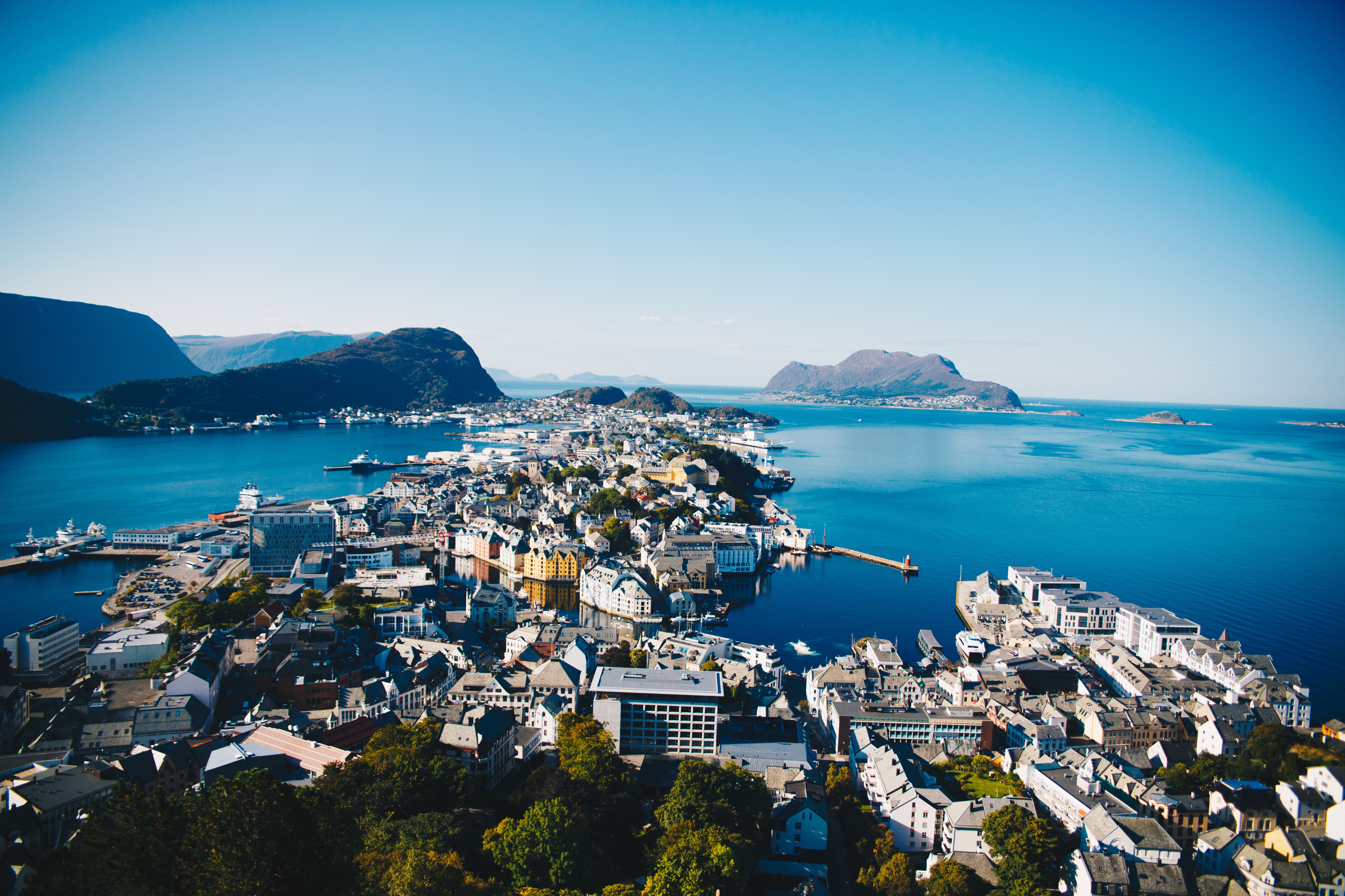
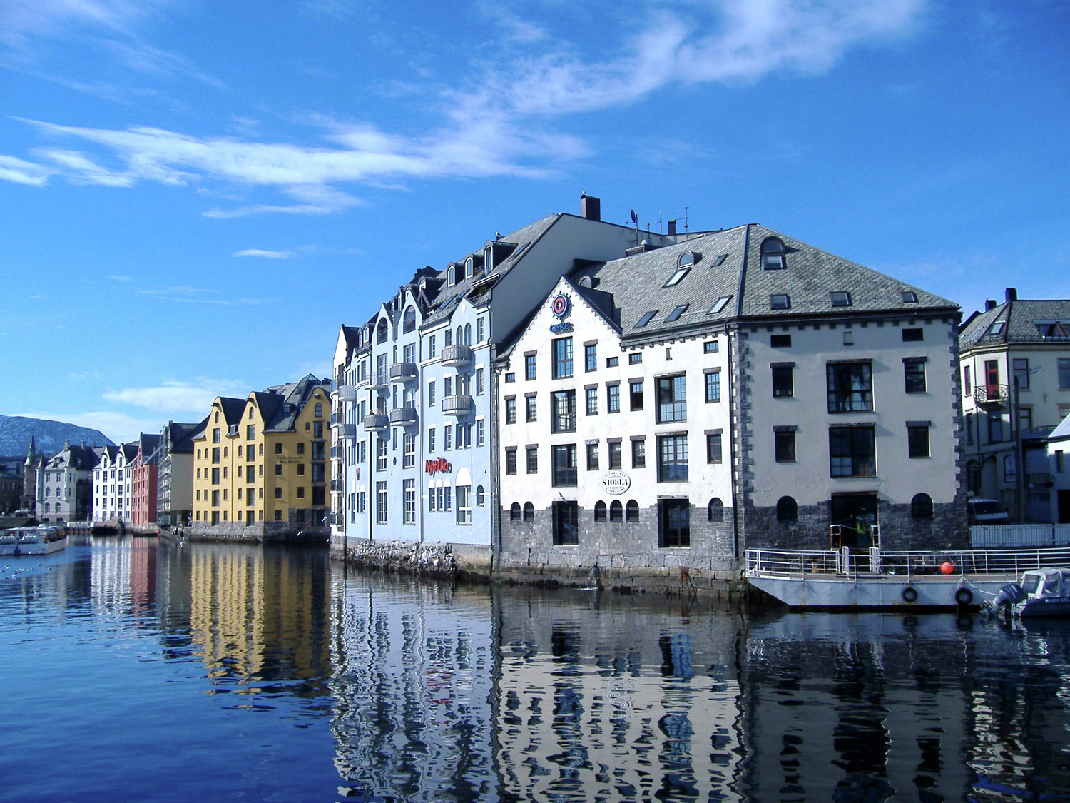
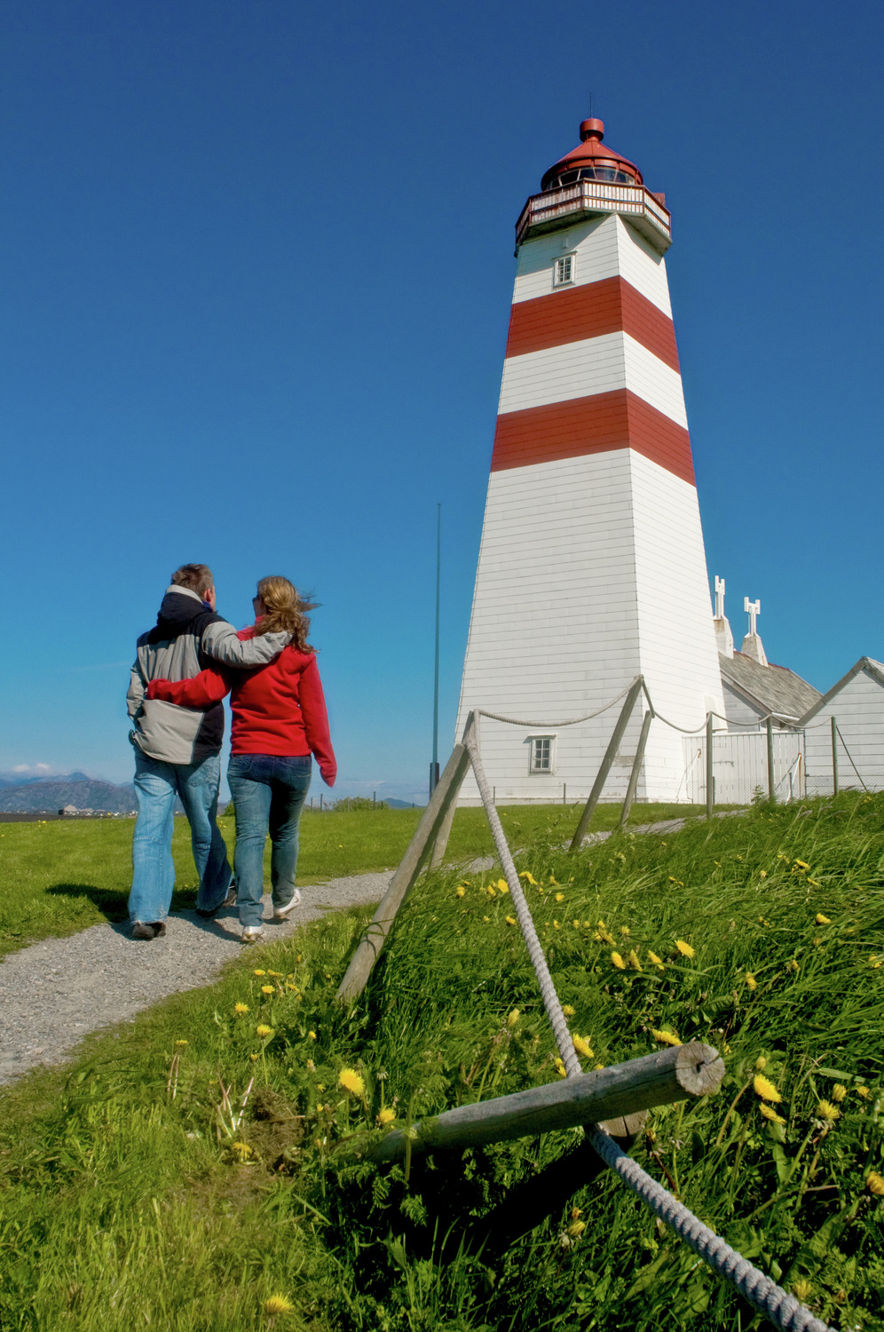
About Ålesund
The coastal town of Ålesund is the commercial capital of the Møre og Romsdal district. But more important, it is noted for its characteristic Jugendstil (Art Nouveau) buildings, which some claim make Ålesund one of the most beautiful towns in Norway. This Art Nouveau style emerged when the town was completely rebuilt after a devastating fire in 1904 destroyed nearly 800 buildings and left 10,000 residents homeless. It is said that the fire started by a tipped oil lamp. Rebuilding was carried out with the help of many young, foreign architects who added their own flourishes to the architectural blend of German Jugendstil and Viking roots. Today, narrow streets are crammed with buildings topped with turrets, spires and gables that bear decorations of dragonheads and curlicues. As one of the few remaining Art Nouveau towns in the world, in 1998 Ålesund was awarded the coveted Houens National Memorial Prize for the preservation of its unique architecture.


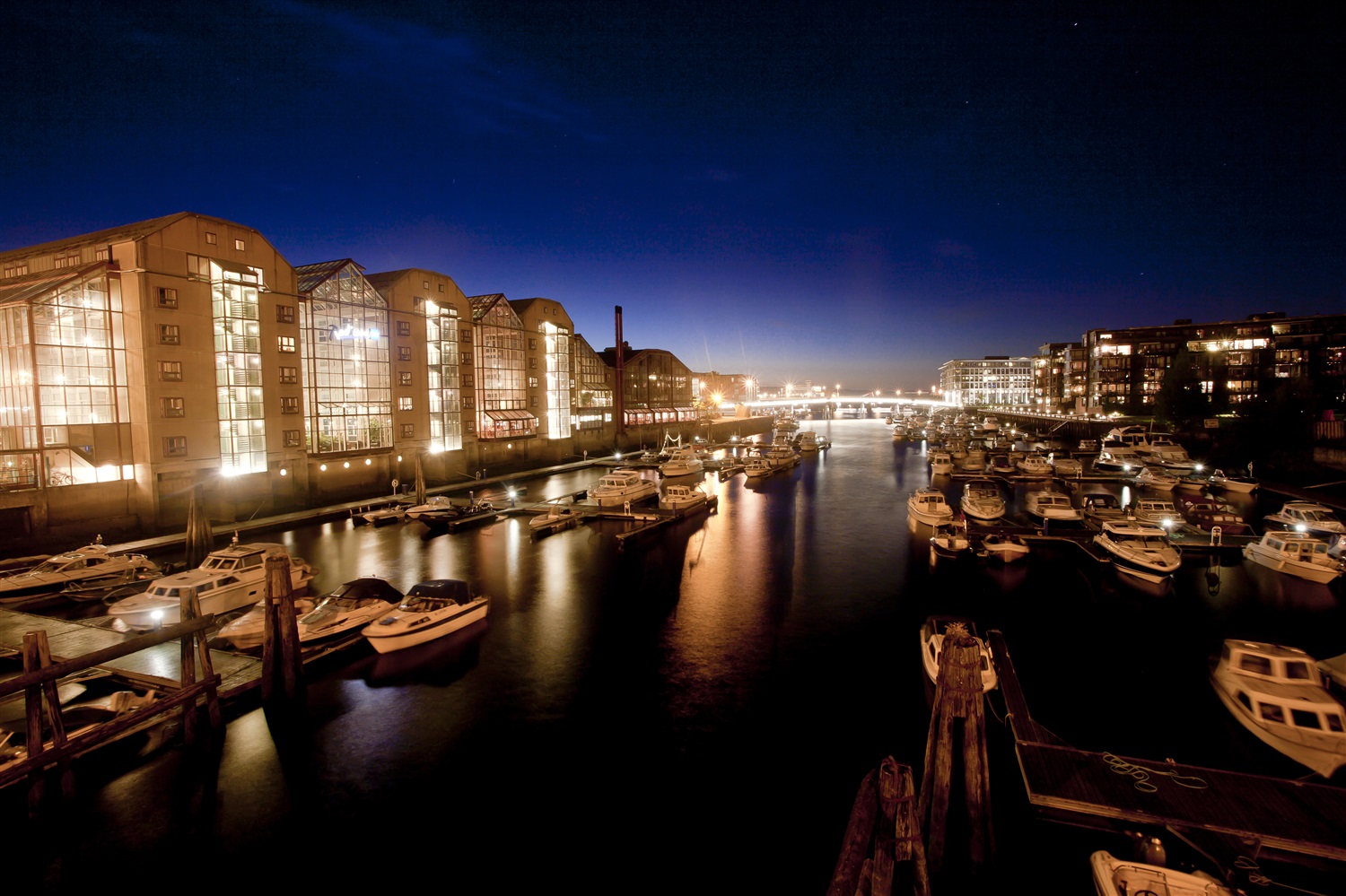
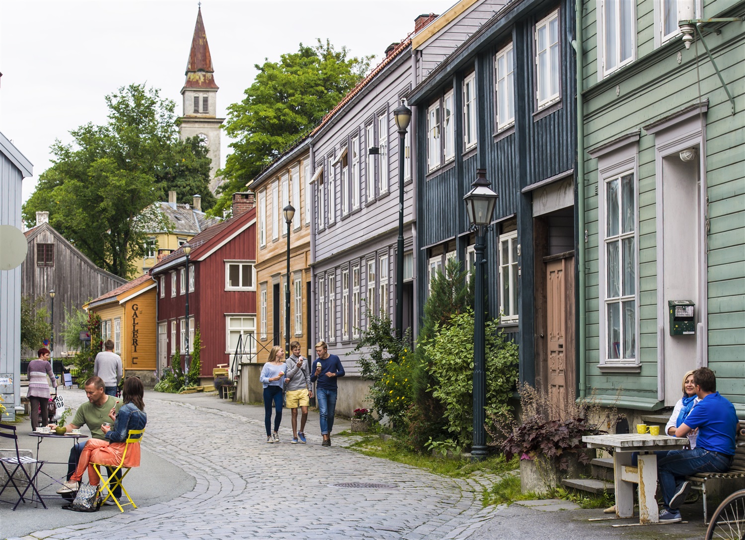
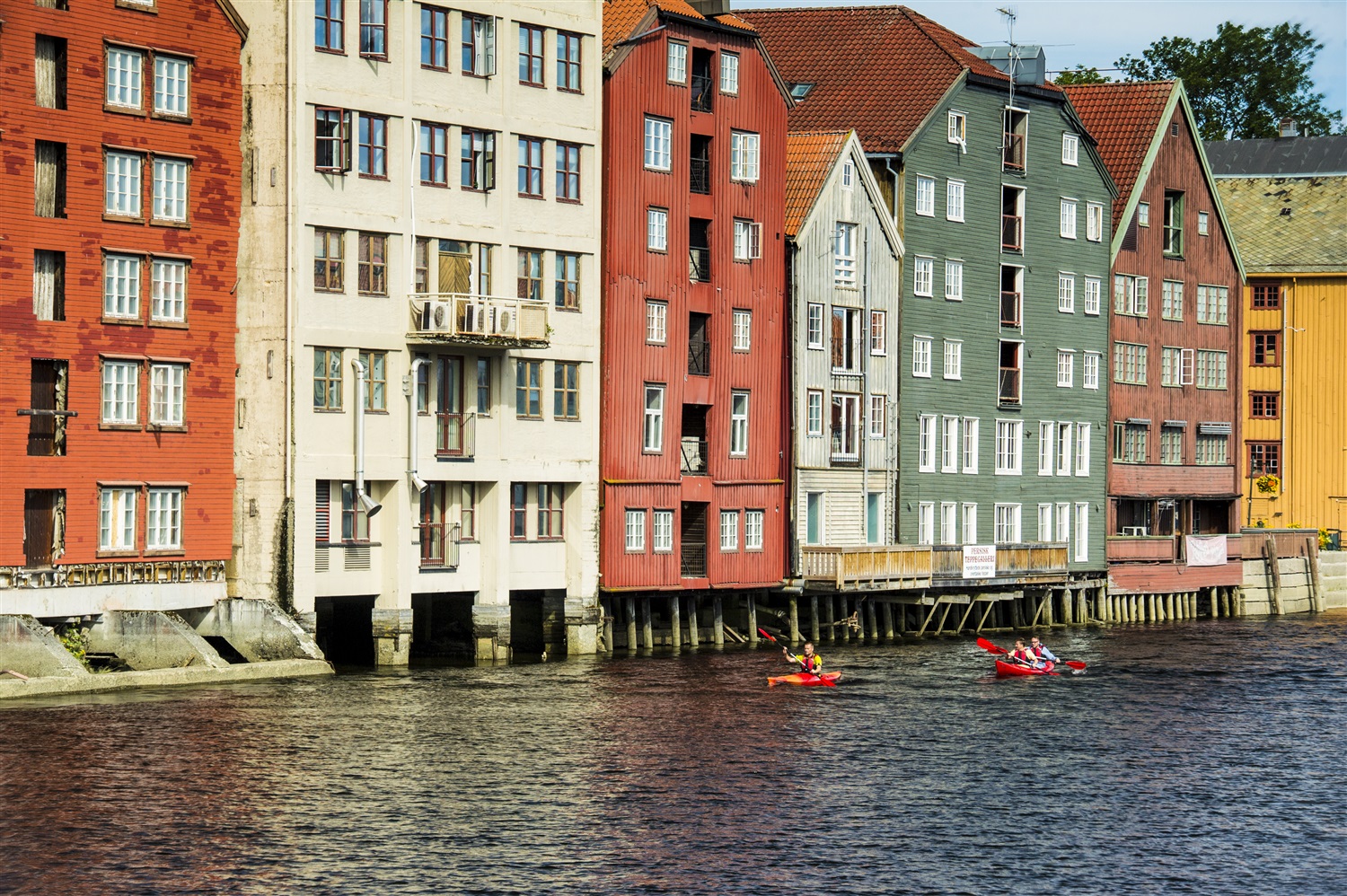
About Trondheim
One of Scandinavia's oldest cities, Trondheim was the first capital of Norway, from AD 997 to 1380. Founded in 997 by Viking king Olav Tryggvason, it was first named Nidaros (still the name of the cathedral), a composite word referring to the city's location at the mouth of the Nidelva River. Today, it's Central Norway's largest (and Norway's third largest) city, with a population of 150,000. The wide streets of the historic city center remain lined with brightly painted wood houses and striking warehouses. But it's no historic relic: it's also the home to NTNU (Norwegian University of Science and Technology) and is Norway's technological capital.


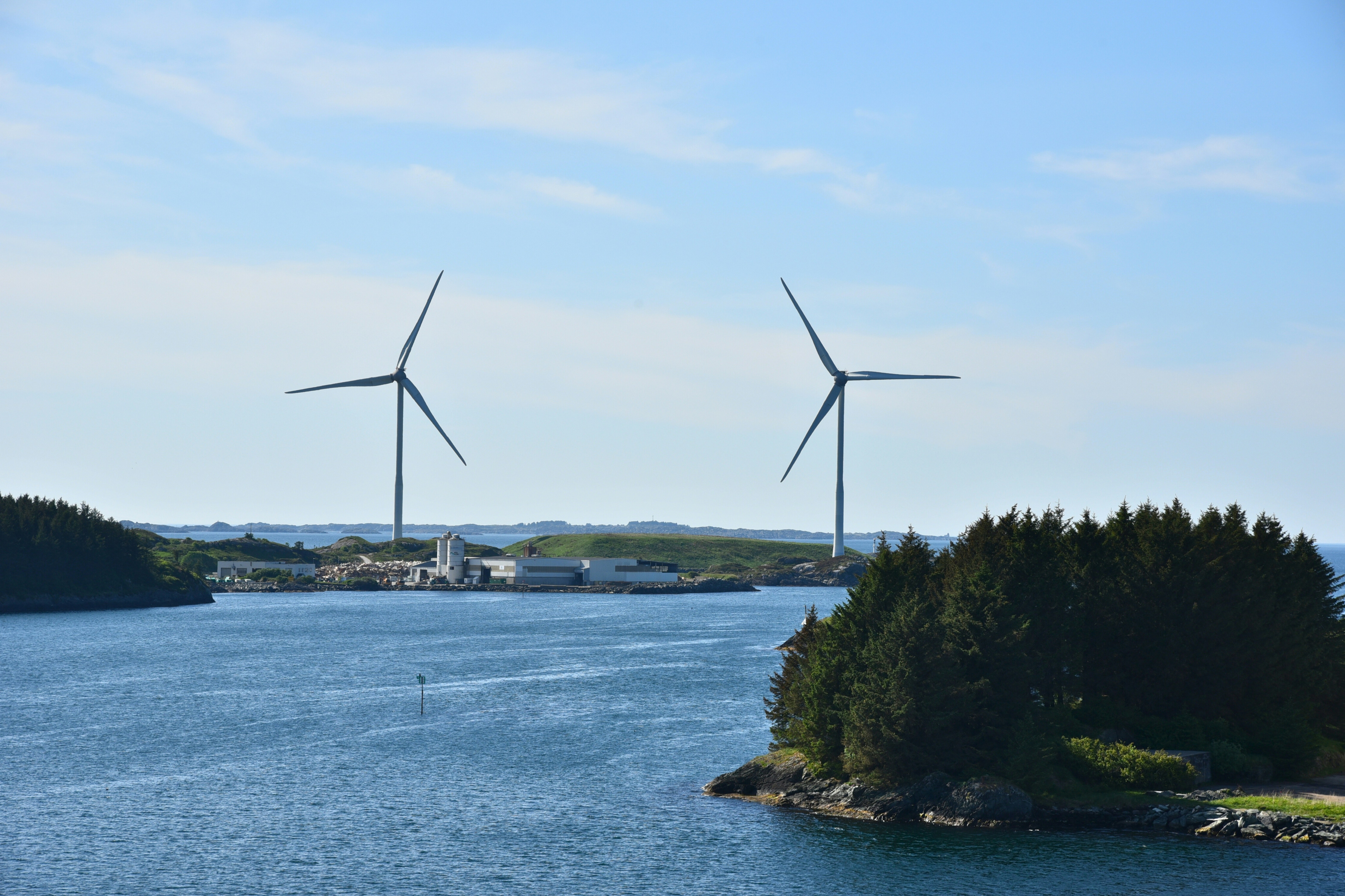
About Frøya
About Olden
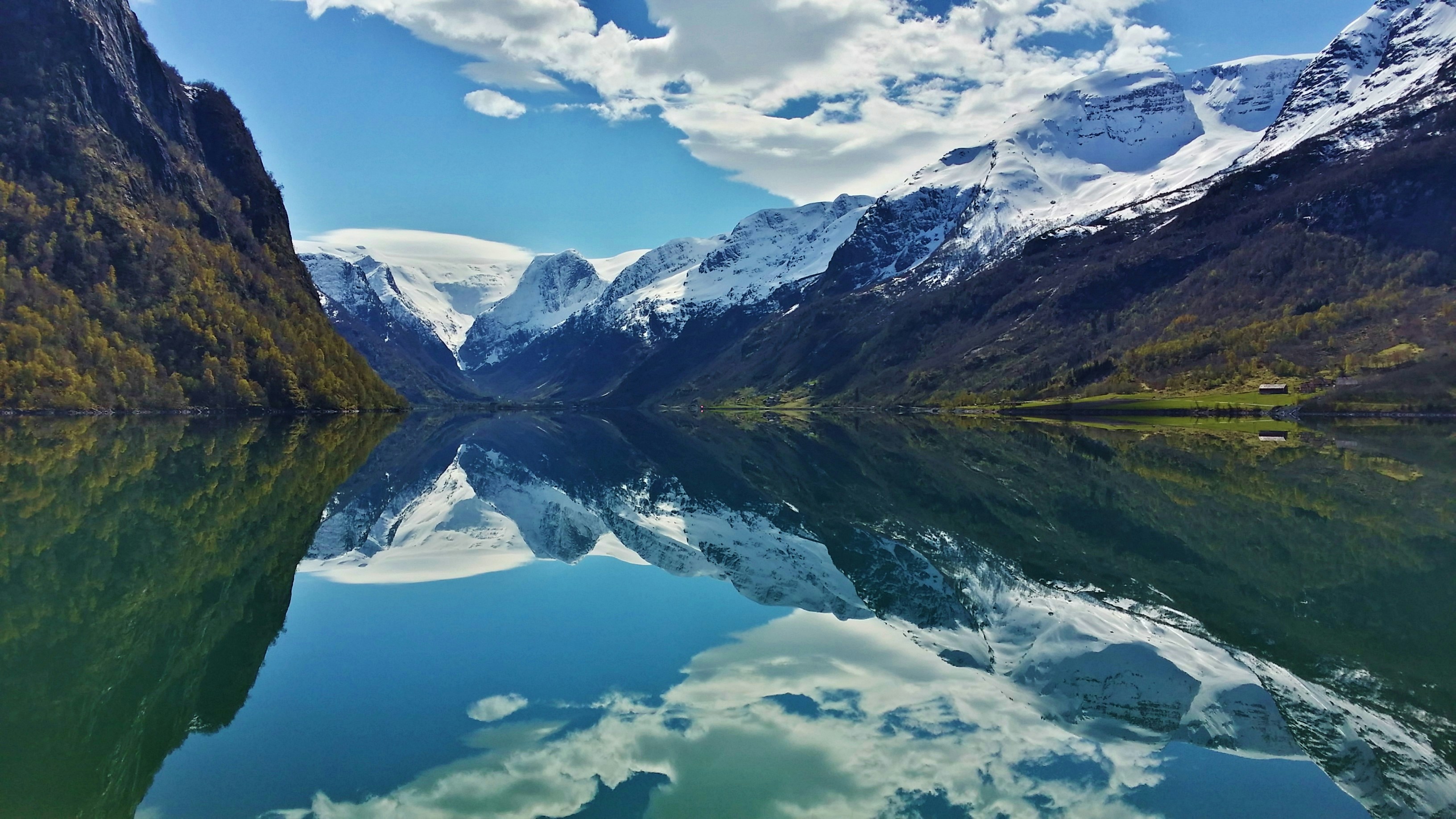
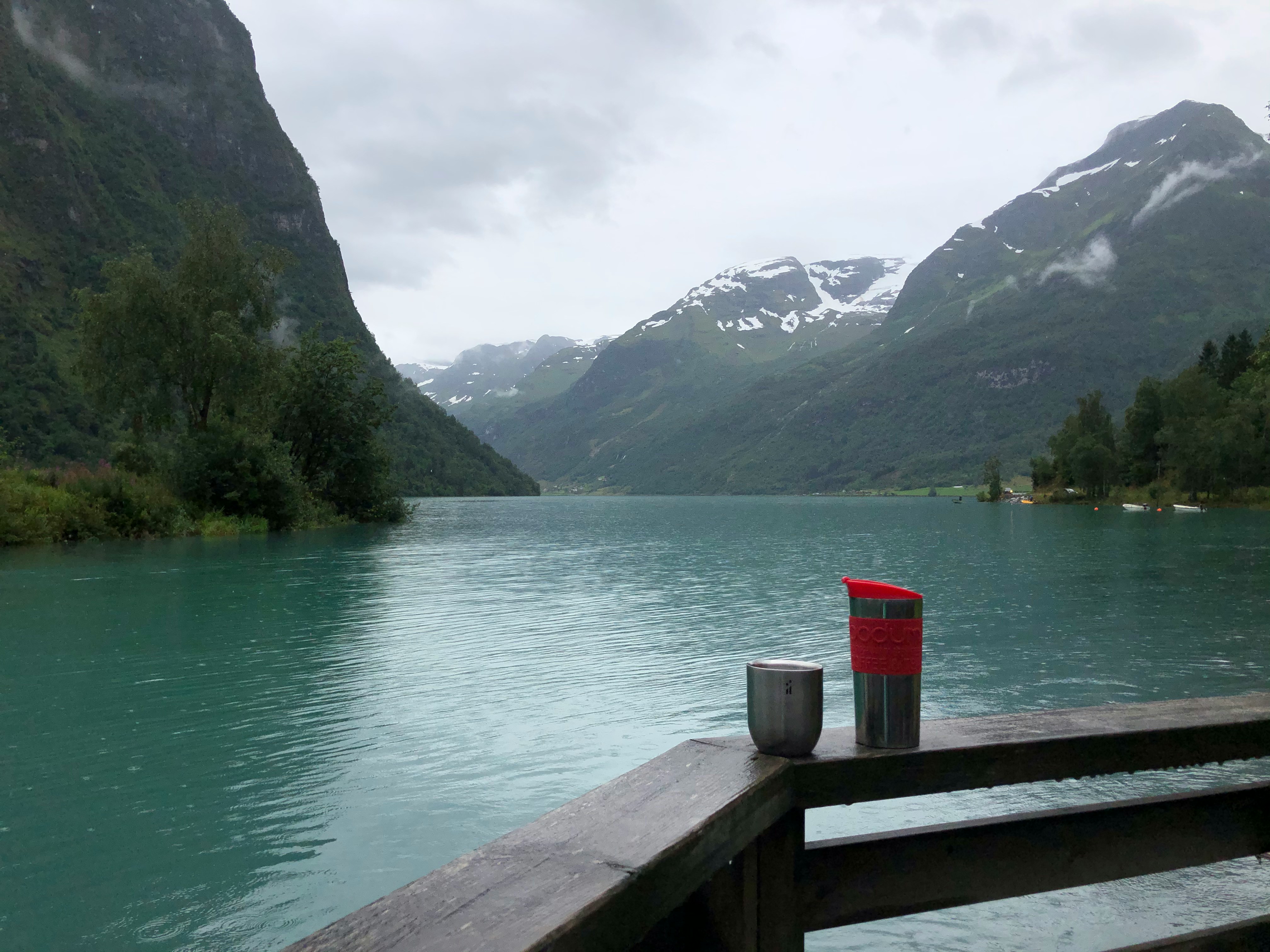
See the aqua blue ice of the Jostedal Glacier cascading down the stunning Oldedalen Valley, as you navigate the spindly fjords of Norway. Feel your breath catching in your throat, as you sail into this world of wonder, and the dramatic fjord scenery and interlocking valleys inspire you. The village of Olden opens up some of Norway's most majestic natural wonders, from the glacier - which is mainland Europe's largest - to the sloshing waterfalls that run off it, and the bowing forests that sway all around it. A visit to picturesque Olden is all thrilling panoramas and hikes through wildflower sprinkled trails. The Briksdalsbreen arm of ice, reaches out from the main glacier, and sits around an hour's stroll from the village of Olden itself - regular busses can also take you there. Snaking through steep-sided valleys, you can enjoy a walk close to the foot of the ice, and feel the spray of the waterfalls that plummet nearby, as you breathe in some of the freshest air you’ve ever tasted. The crisp glacial meltwater is so clean and pure that it’s bottled up to be sold across Norway.
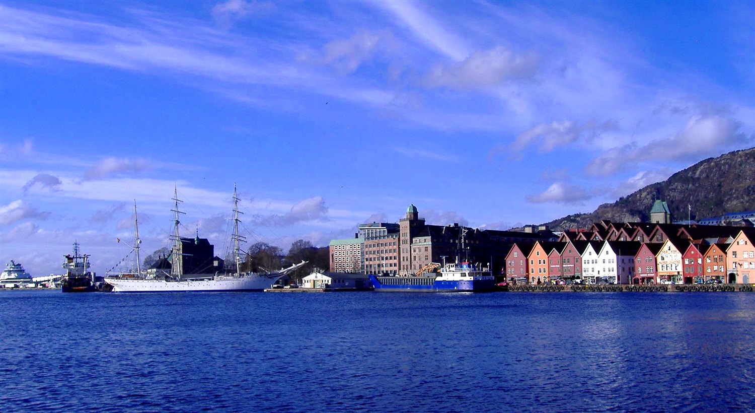
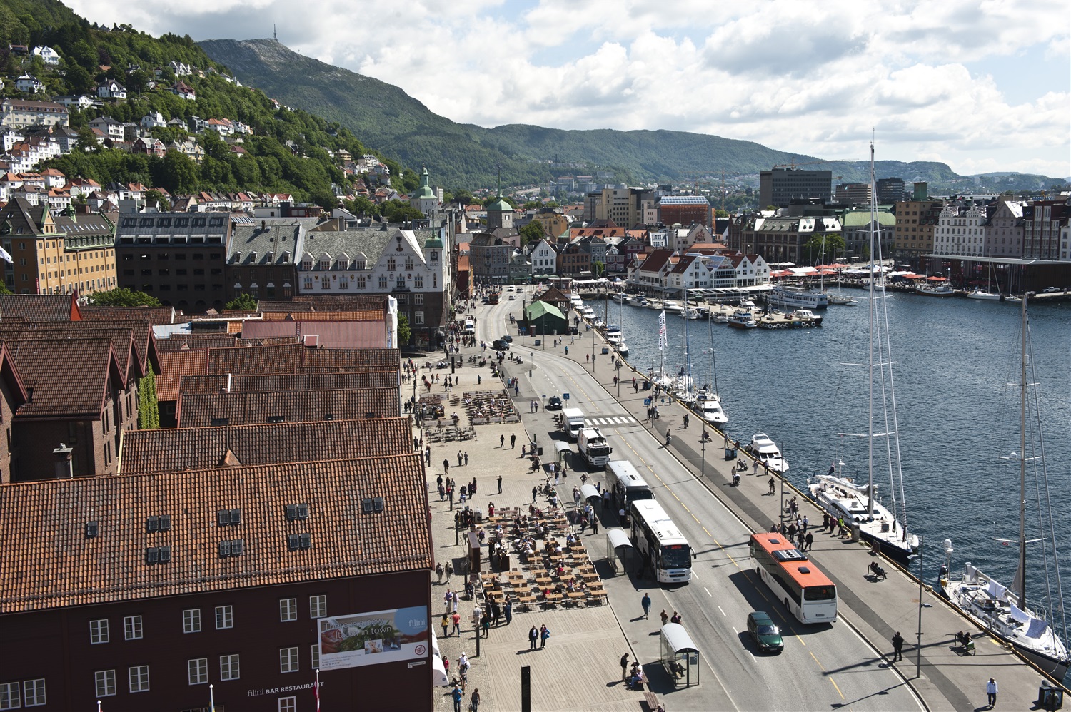
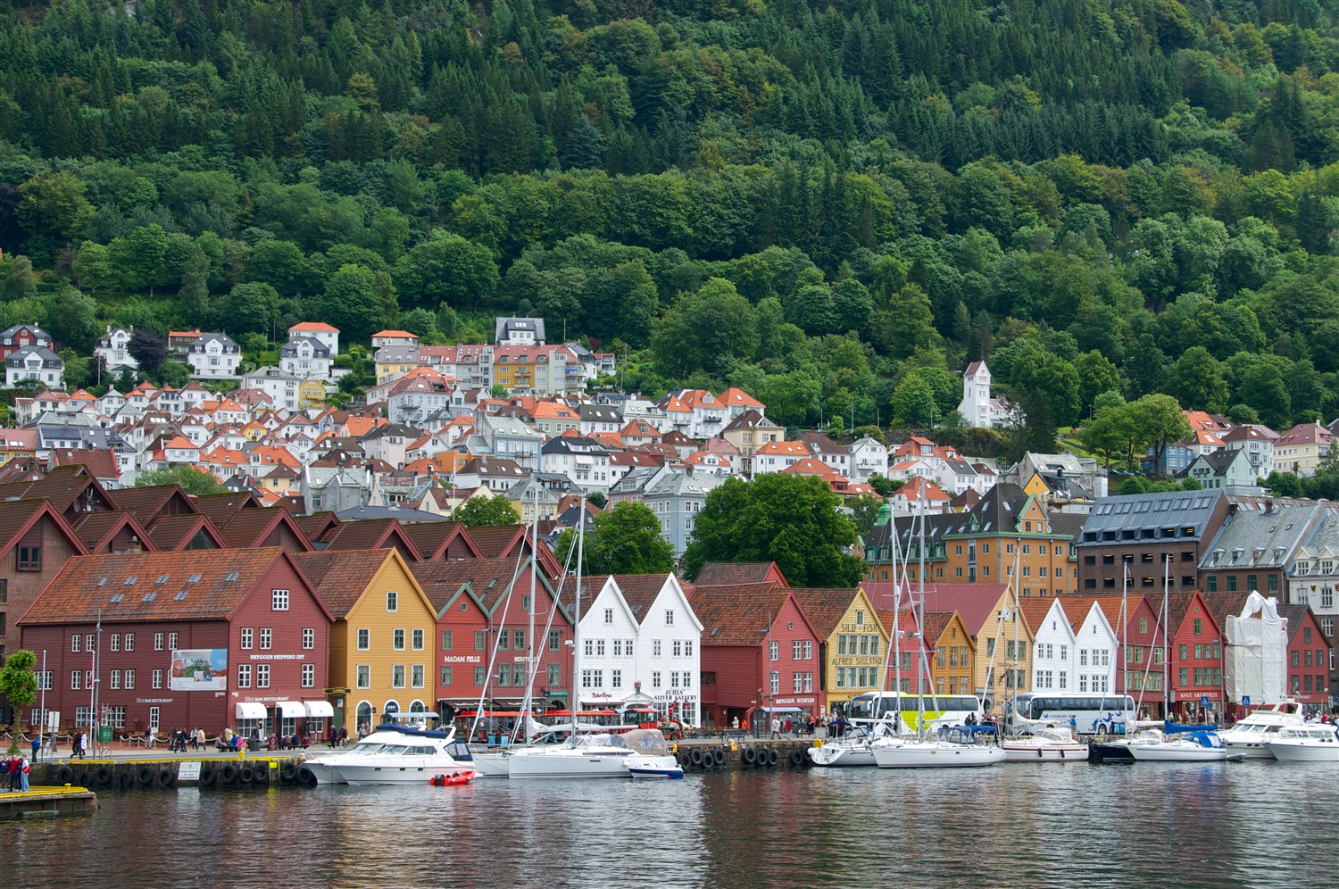
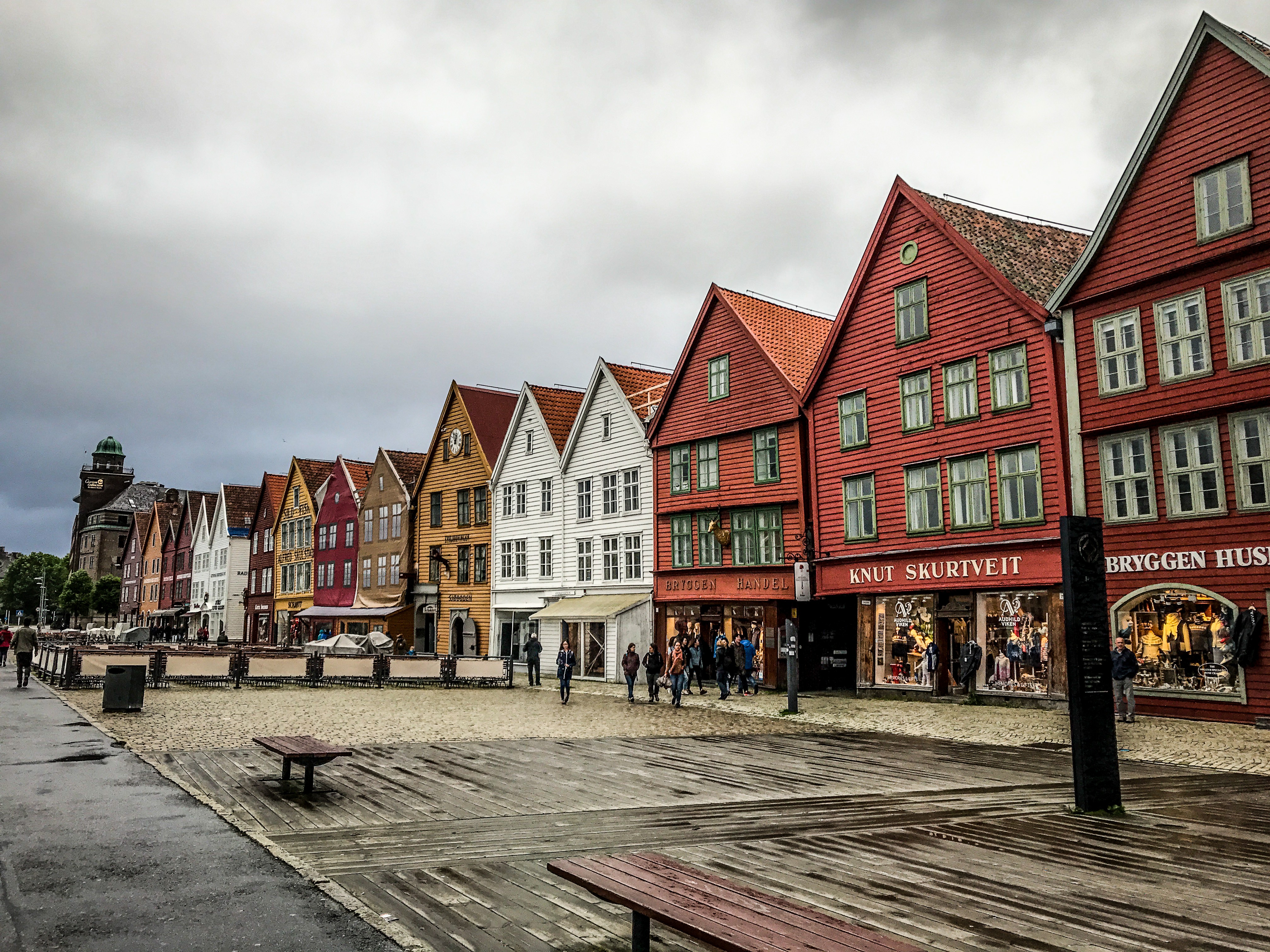
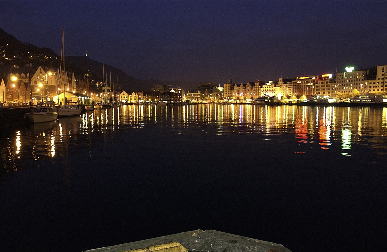
About Bergen
Surrounded by mountains and sparkling fjords, the waterside city of Bergen has a spectacular setting. There has been a settlement here since medieval times and the colourful waterfront buildings of the Hanseatic wharf, known as Bryggen, are testament to its fascinating history of trade. As Norway’s best known medieval settlement, the Bryggen is listed by UNESCO as a World Heritage Site. Our comprehensive selection of excursions allows you to discover the many sides of Bergen, such as the fish market and narrow cobbled streets, as well as stunning views of the city from the summit of Mt Fløyen. Alternatively, those who have visited the city previously may like to experience one of the tours that travel further afield. Just 300 yards from the main piers, you will find the Fortress Museum (Fesningsmuseum), which has an interesting collection of objects related to World War II.

About Leith
About Invergordon
The port of Invergordon is your gateway to the Great Glen, an area of Scotland that includes Loch Ness and the city of Inverness. Inverness, the capital of the Highlands, has the flavor of a Lowland town, its winds blowing in a sea-salt air from the Moray Firth. The Great Glen is also home to one of the world's most famous monster myths: in 1933, during a quiet news week, the editor of a local paper decided to run a story about a strange sighting of something splashing about in Loch Ness. But there's more to look for here besides Nessie, including inland lochs, craggy and steep-sided mountains, rugged promontories, deep inlets, brilliant purple and emerald moorland, and forests filled with astonishingly varied wildlife, including mountain hares, red deer, golden eagles, and ospreys.

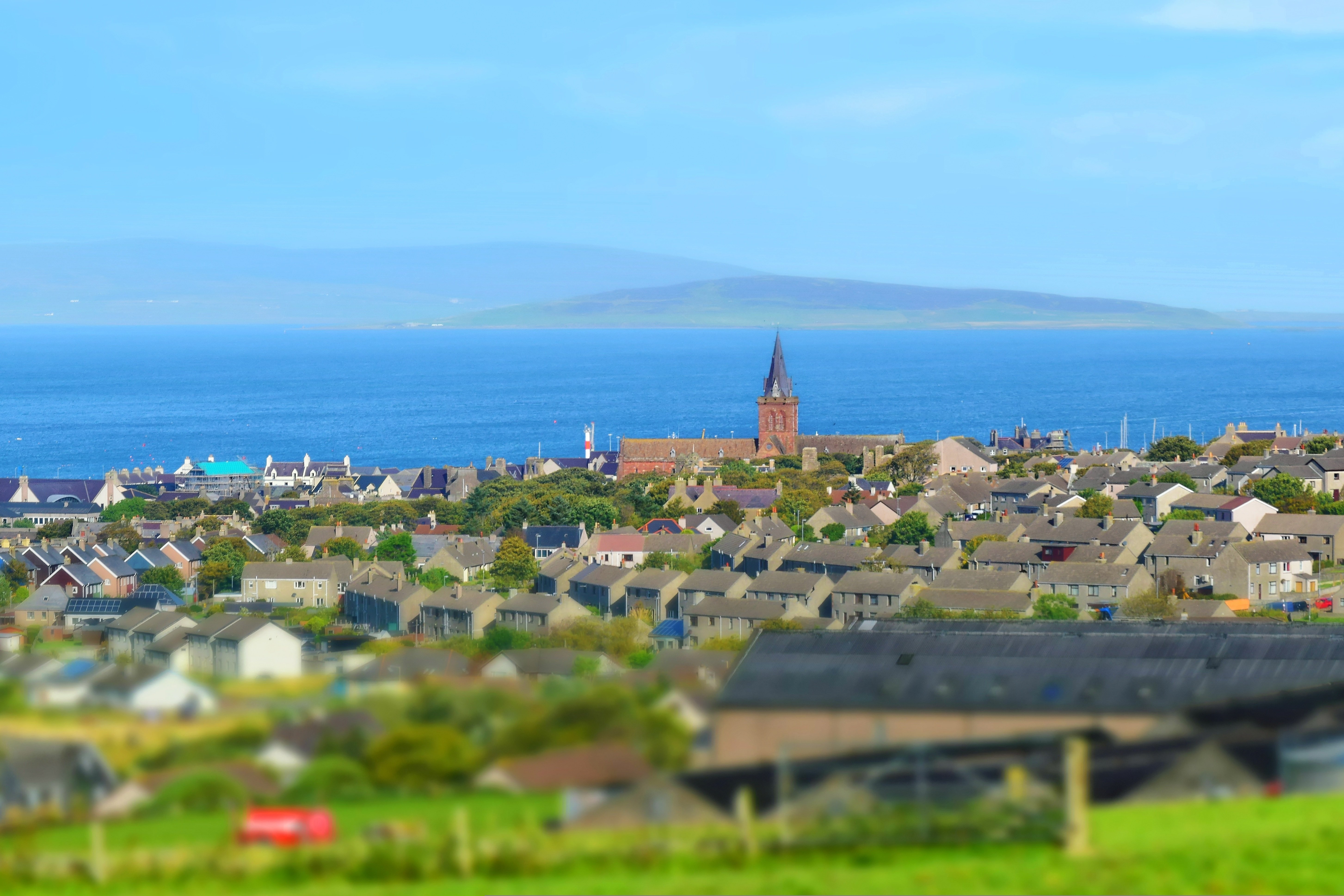
About Kirkwall, Orkney Islands
In bustling Kirkwall, the main town on Orkney, there's plenty to see in the narrow, winding streets extending from the harbor. The cathedral and some museums are highlights.

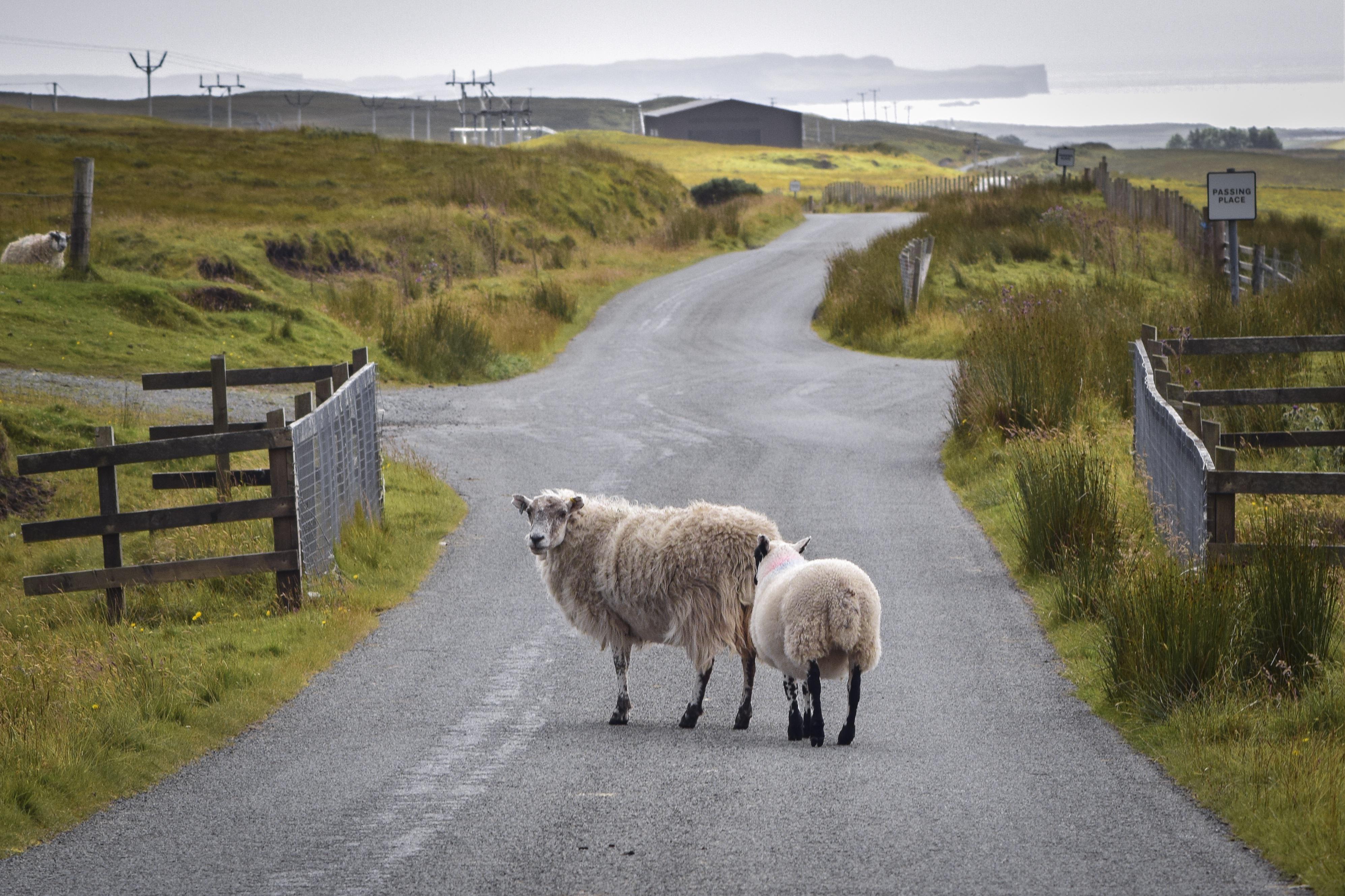
About Portree, Isle of Skye
The Isle of Skye ranks near the top of most visitors' priority lists: the romance of Prince Charles Edward Stuart, known as Bonnie Prince Charlie, combined with the misty Cuillin Hills and their proximity to the mainland all contribute to its popularity. Today Skye remains mysterious and mountainous, an island of sunsets that linger brilliantly until late at night and of beautiful, soft mists. Much photographed are the really old crofts, one or two of which are still inhabited, with their thick stone walls and thatch roofs. Orientation on Skye is easy: follow the only roads around the loops on the northern part of the island and enjoy the road running the length of the Sleat Peninsula in southern Skye, taking the loop roads that exit to the north and south as you please. There are some stretches of single-lane road, but none poses a problem.

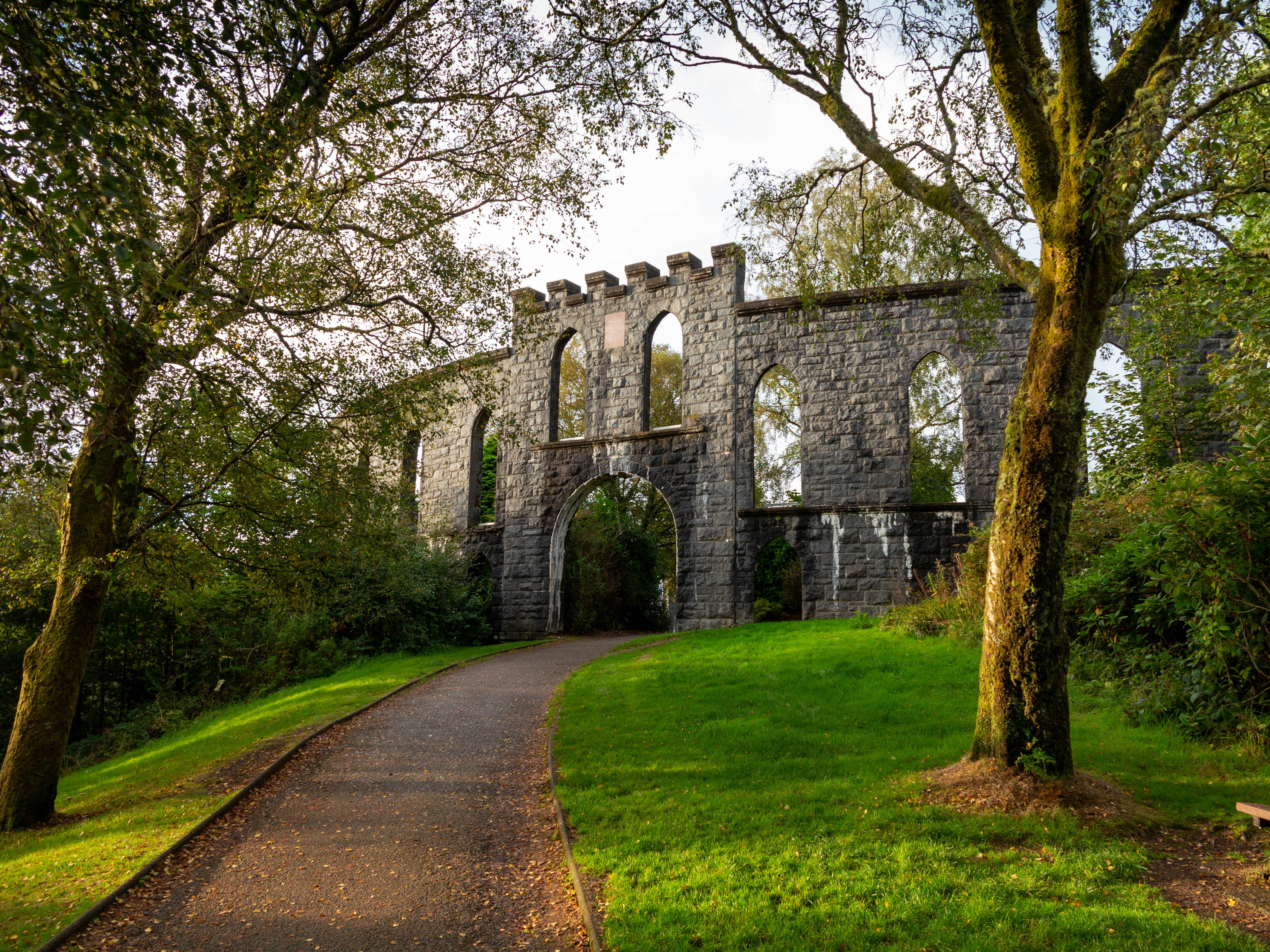
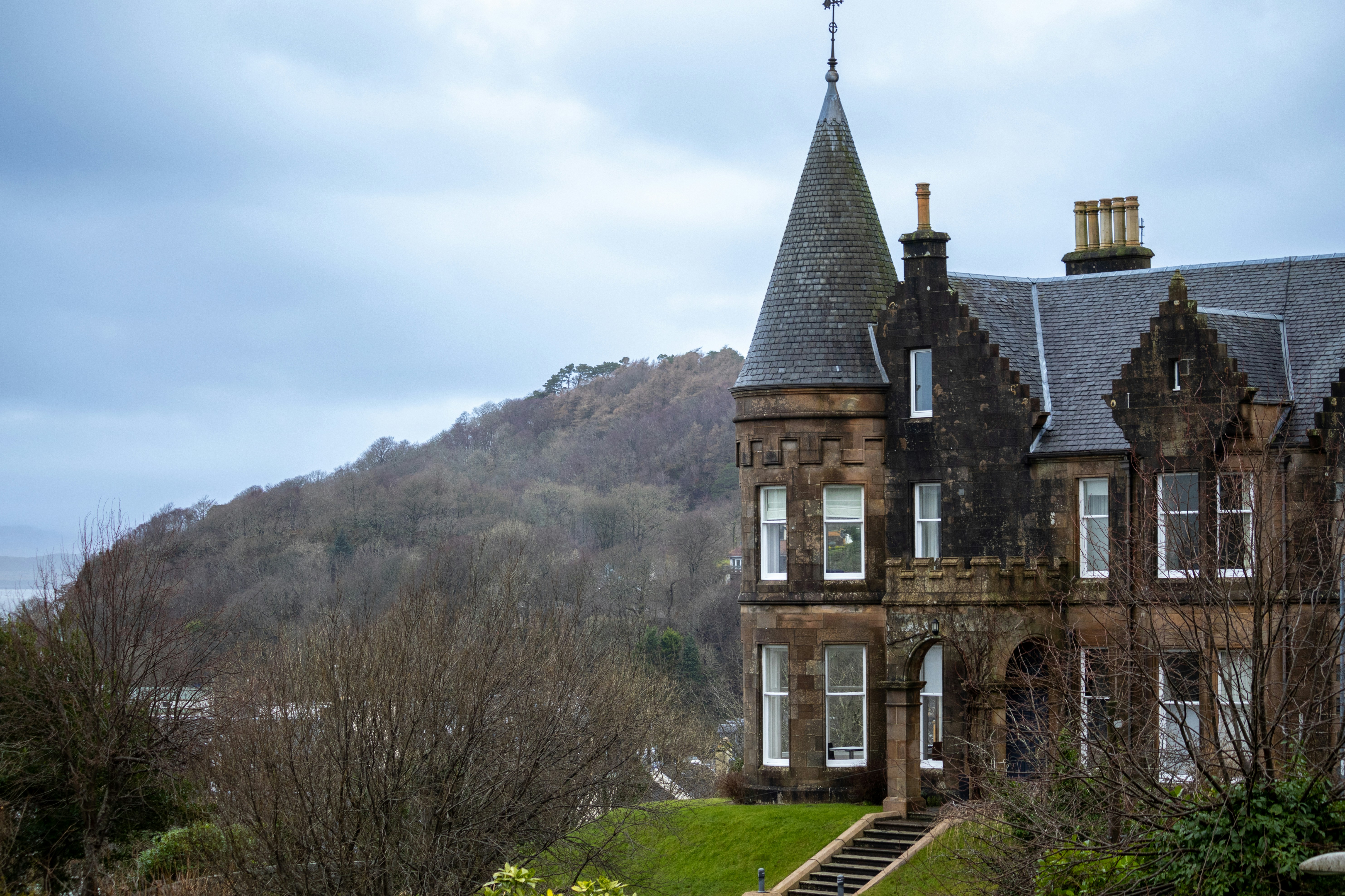
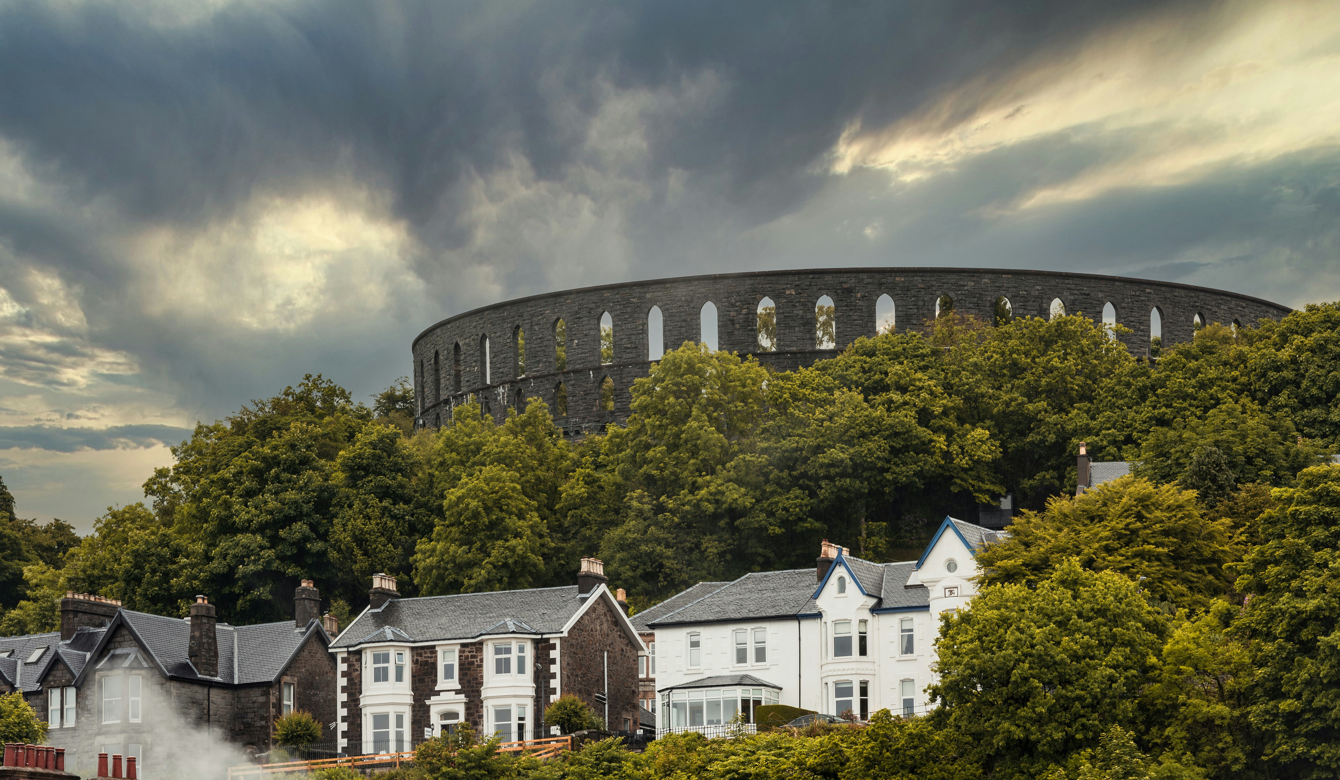
About Oban
Oban, "little bay" in Gaelic, today has a resident population of 8,500 and is the unofficial capital of the West Highlands - the "Gateway to the Isles." The panoramic views of the mountains, lochs and islands which have captivated artists, authors, composers, and poets for centuries are as striking now as they were when Dunollie Castle, a ruined keep which has stood sentinel over the narrow entrance to the sheltered bay for around six hundred years, was the northern outpost of the Dalriadic Scots. It is no surprise to find Oban in the 21st-century remains a magnet for travellers from all over the world. The town's present day popularity owes much to the Victorians, and as early as 1812, when the Comet steamship linked Oban with Glasgow, the town played host to intrepid travellers touring Staffa - the inspiration for Mendelssohn's Hebridean Overture - and Iona - home of Scottish Christianity since St Columba stepped ashore in AD563. Indeed once Oban had the royal seal of approval from Queen Victoria, who called it "one of the finest spots we have seen," the town's destiny as an endearingly enchanting holiday destination was as firmly set as the lava columns of Fingal's Cave in Oban is justifiably known as the “gateway to the Isles.” The town's south pier is the embarkation point for car ferries to Mull, Coll, Tiree, Barra, South Uist, Colonsay, Lismore and Islay. From these islands you can travel further a field to Iona, Staffa and to many of the smaller less well known isles.

About Portrush
Portrush is adjacent to the stunning North Antrim coastline. Here lies the medieval Dunluce Castle ruins. Perched picturesquely at the edge of a rocky outcropping high above the sea, the castle is dramatically surrounded by terrifyingly steep drops, which the early Christians and Vikings would have considered a very important security feature. The castle and surrounding areas have been frequently used for the filming of “Game of Thrones”. Another attraction reached from Portrush is the Giant’s Causeway -40,000 hexagonal basalt columns that descend in a kind of pathway to the sea. Formed over 50 million years ago, visitors have marvelled at its majesty and mystery for centuries, and UNESCO has recognised this site with World Heritage status.

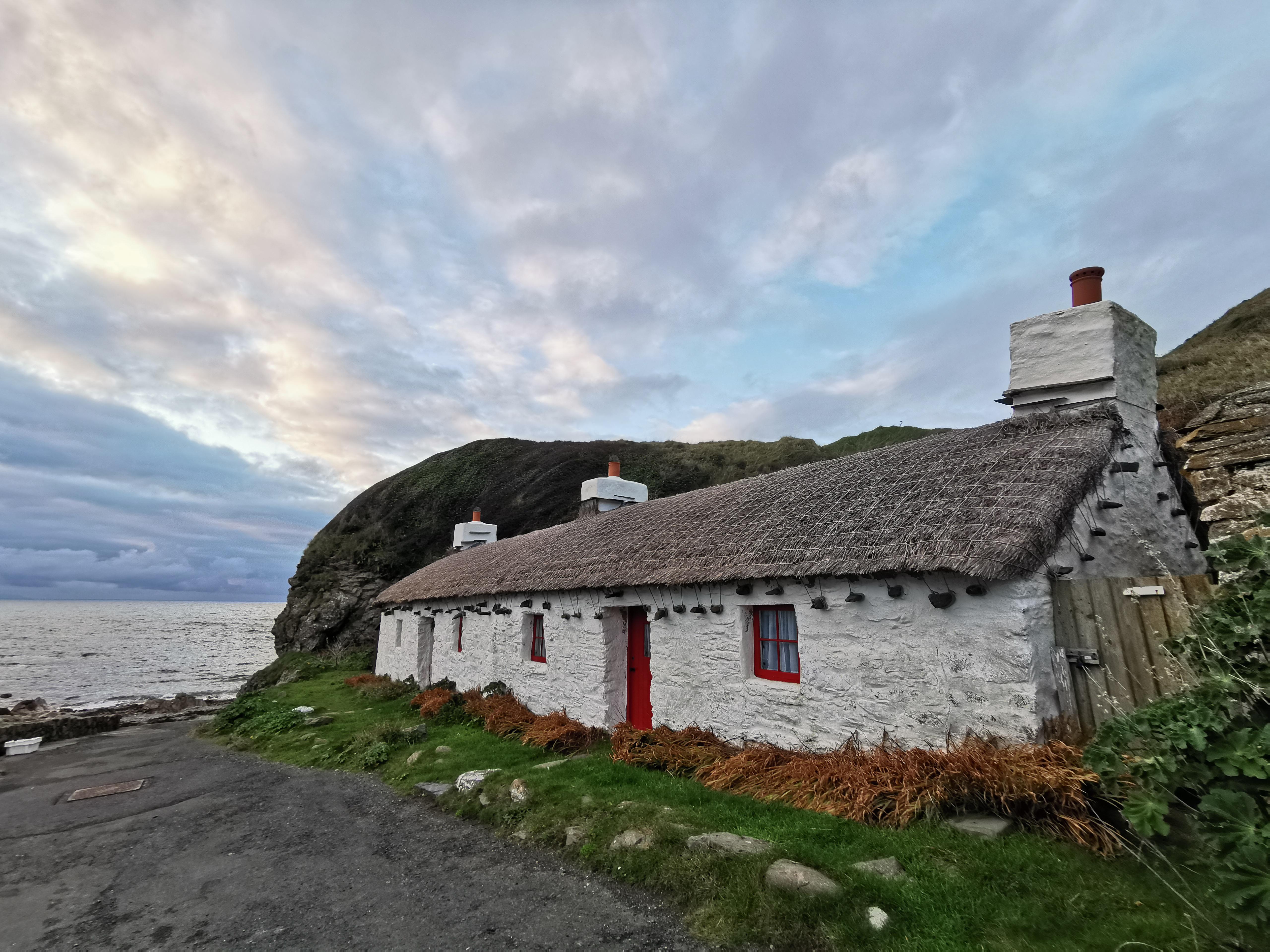
About Douglas
The Isle of Man, situated in the Irish Sea off the west coast of England, is a mountainous, cliff-fringed island and one of Britain’s most beautiful spots. Measuring just 30 miles by 13 miles, the Isle of Man remains semi-autonomous. With its own postage stamps, laws, currency, and the Court of Tynwald (the world’s oldest democratic parliament), the Isle of Man is rich with history and lore.Inhabited from Neolithic times, the island became a refuge for Irish missionaries after the 5th Century. Norsemen took the island during the 9th Century and sold it to Scotland in 1266. However, since the 14th Century, it has been held by England. Manx, the indigenous Celtic language, is still spoken by a small minority. The Isle of Man has no income tax, which has encouraged many Britains to regard the island as a refuge. Otherwise, it is populated by Gaelic farmers, fishermen, and the famous tailless manx cats. The varied landscape features austere moorlands and wooded glens, interspersed by fine castles, narrow-gauge railways, and scores of standing stones with Celtic crosses. The hilly terrain rises to a height of 2,036 feet at Mount Snaefell, which dominates the center of the island.
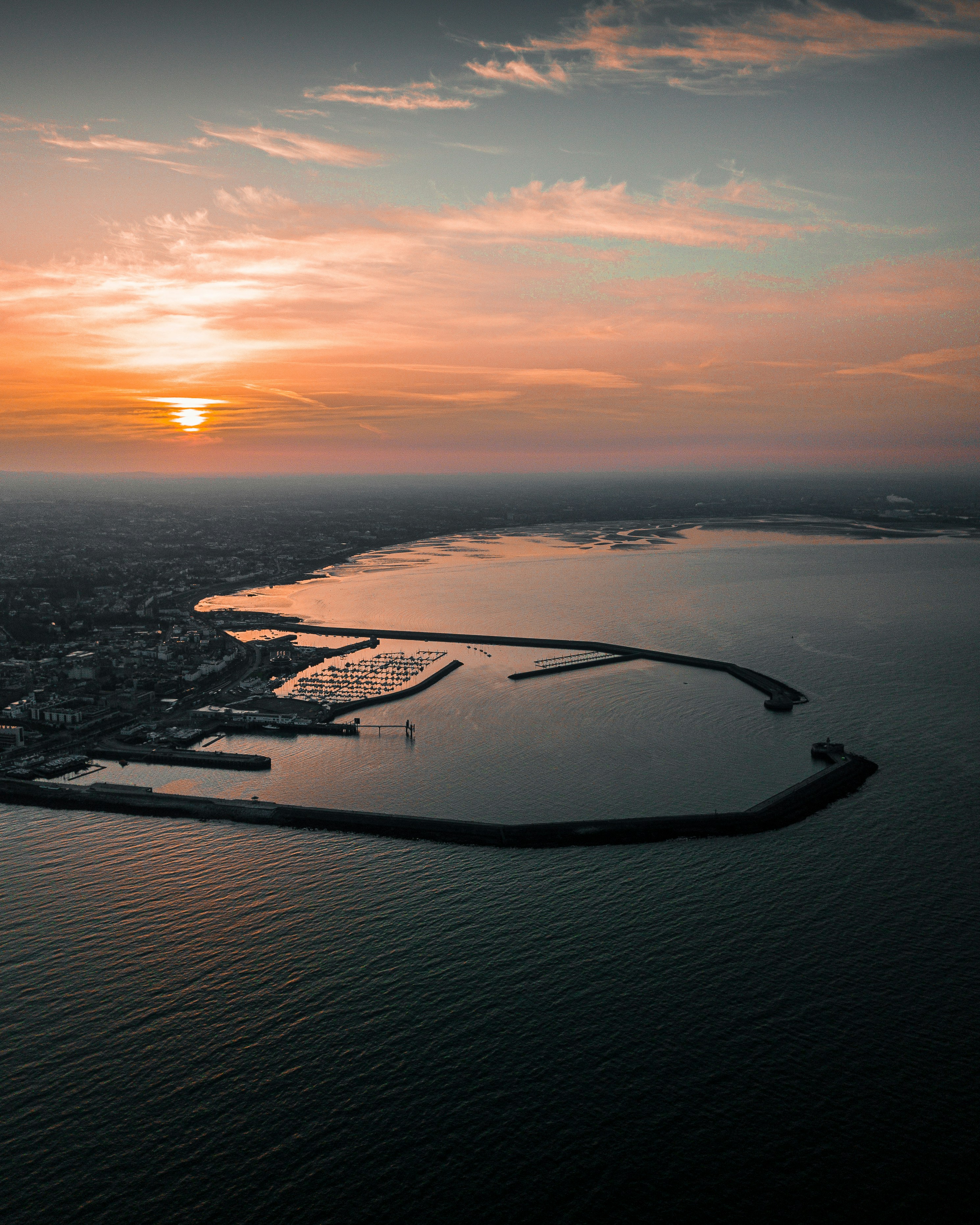
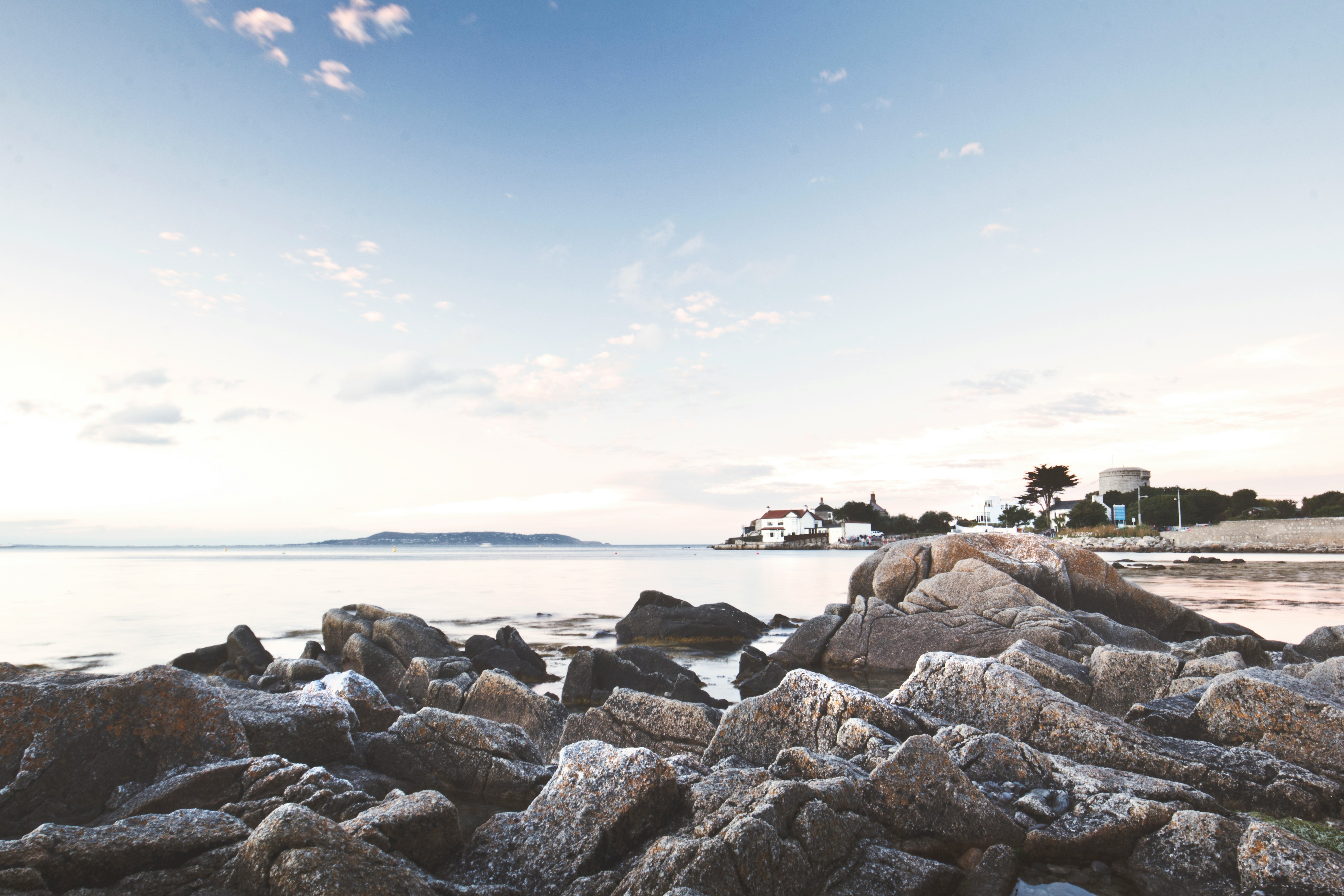
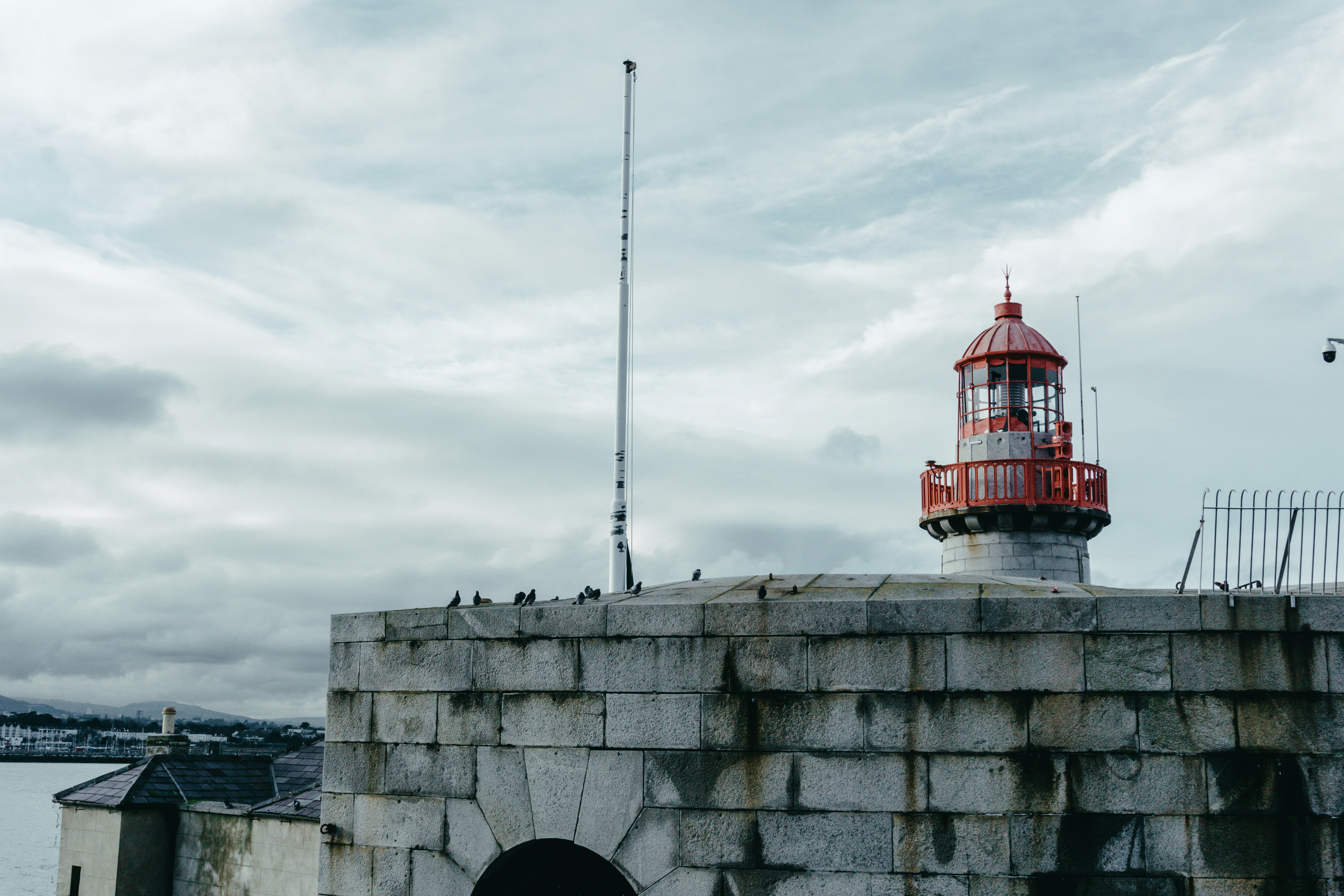
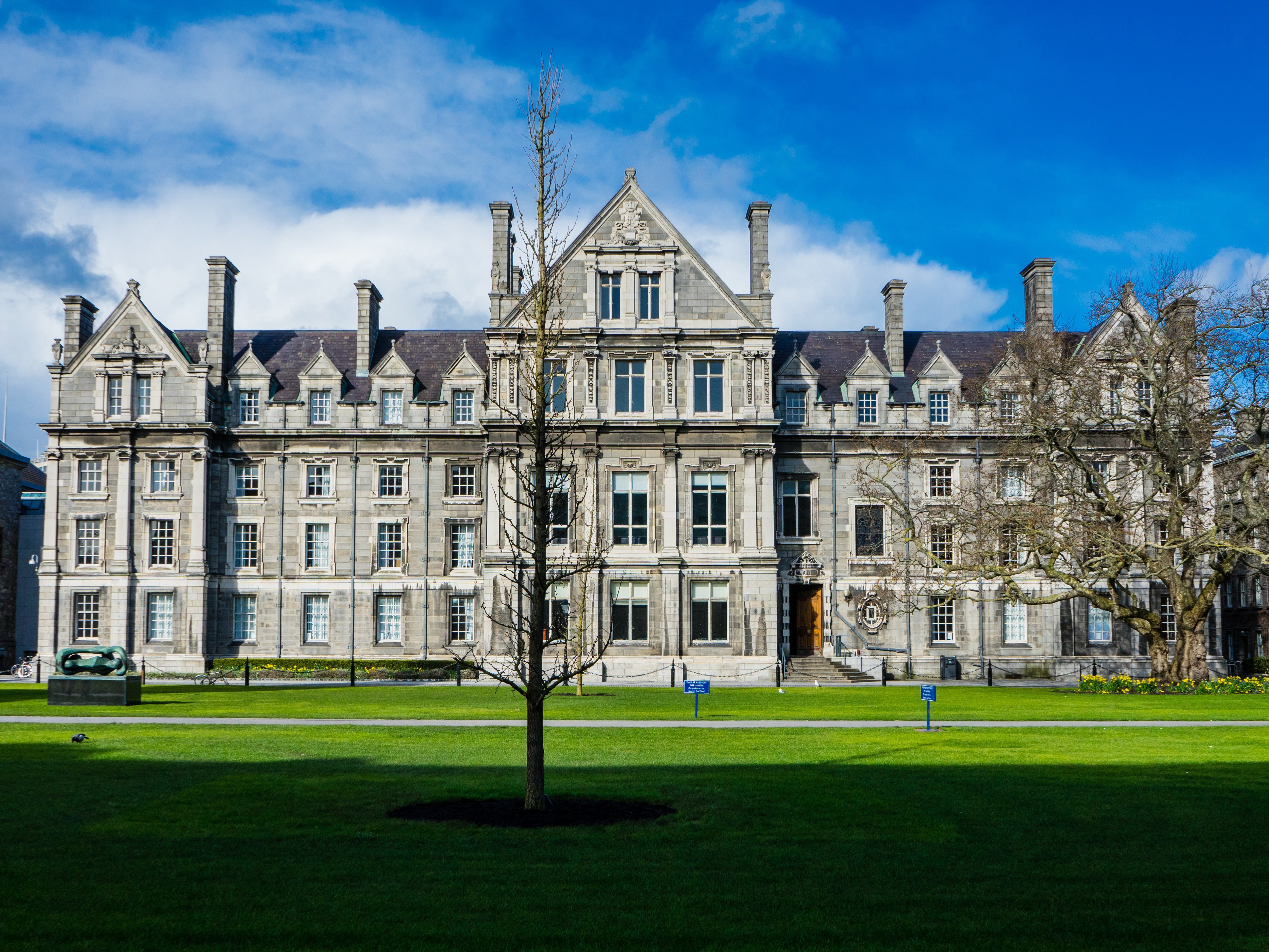
About Dun Laoghaire
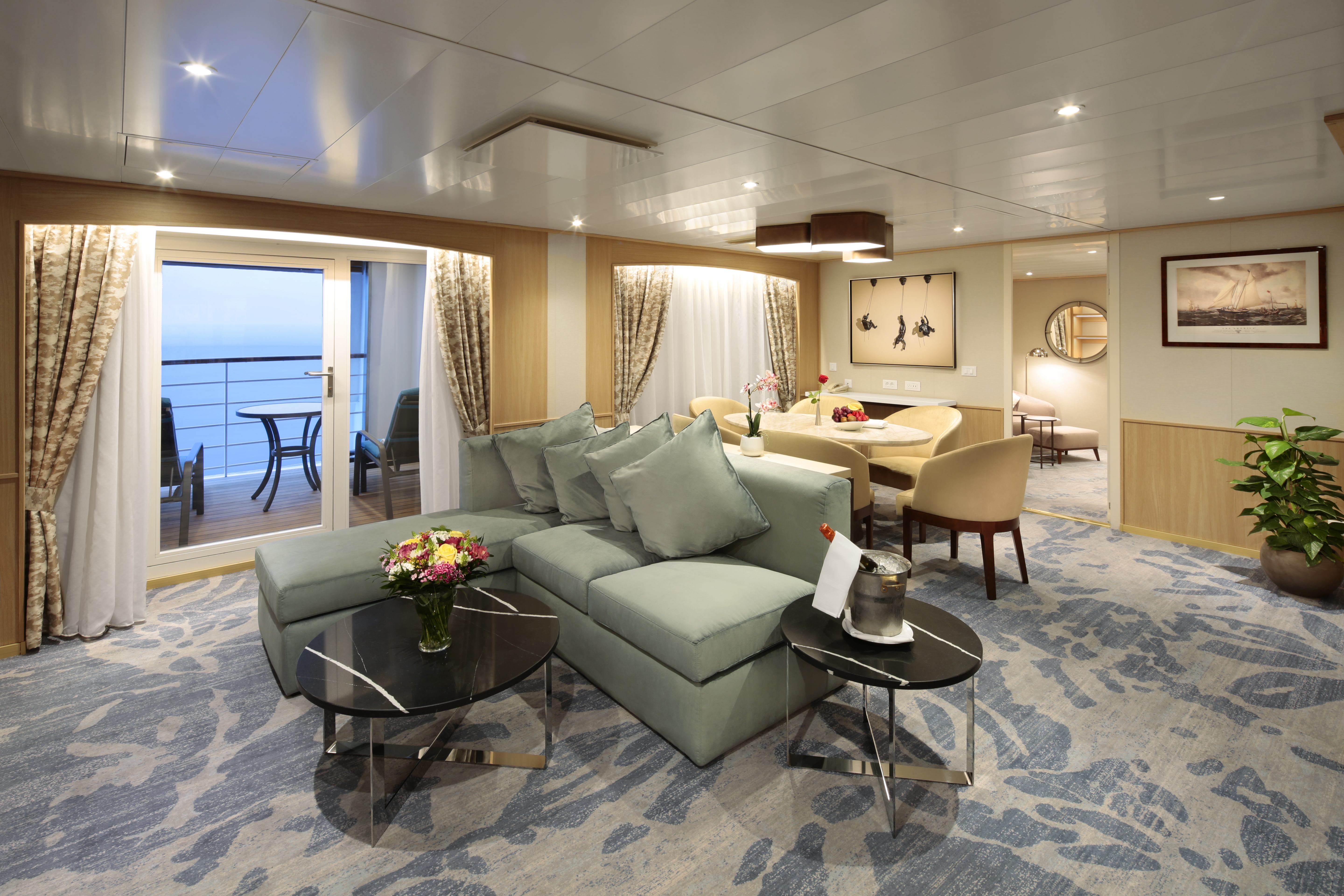
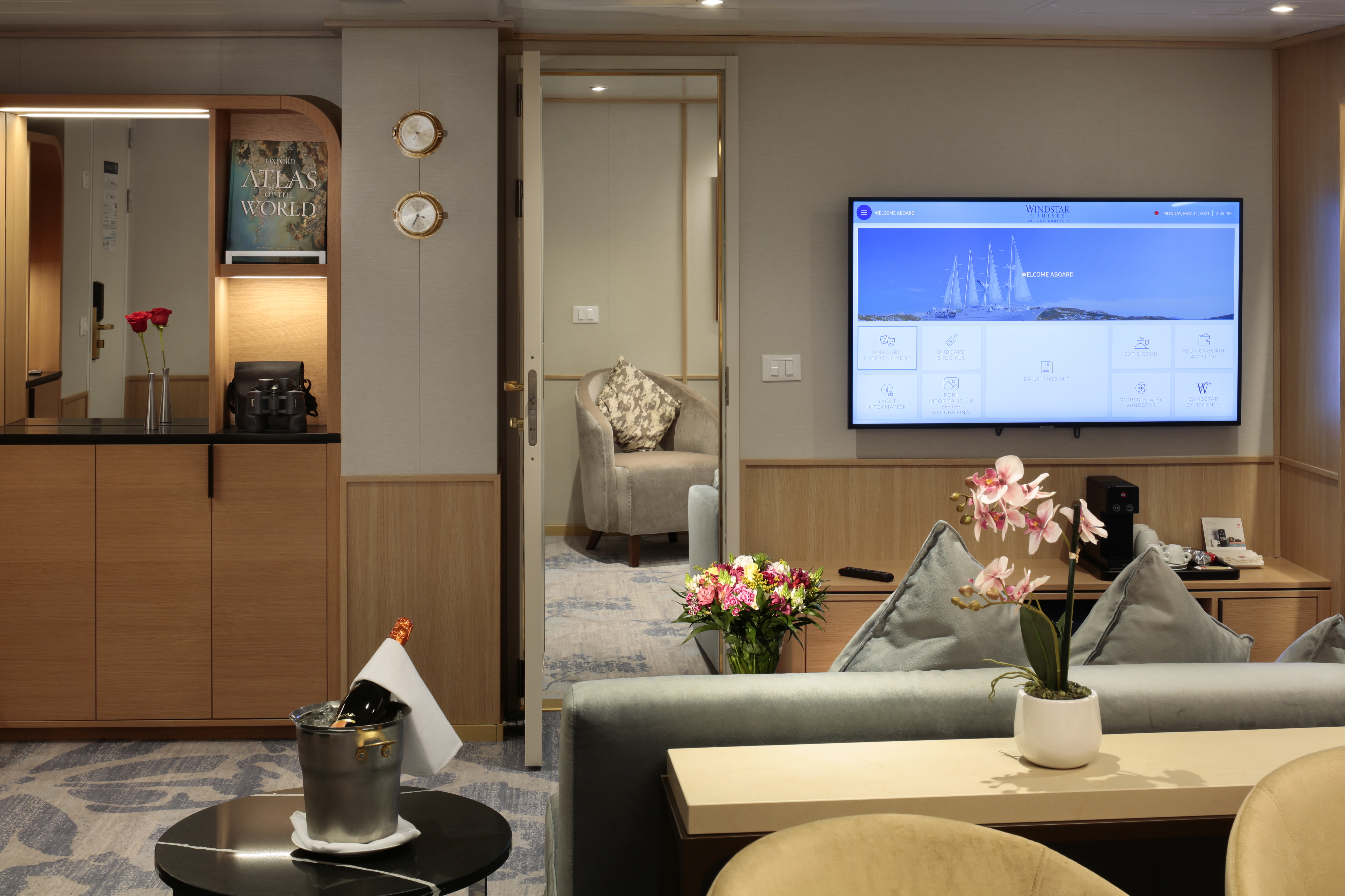
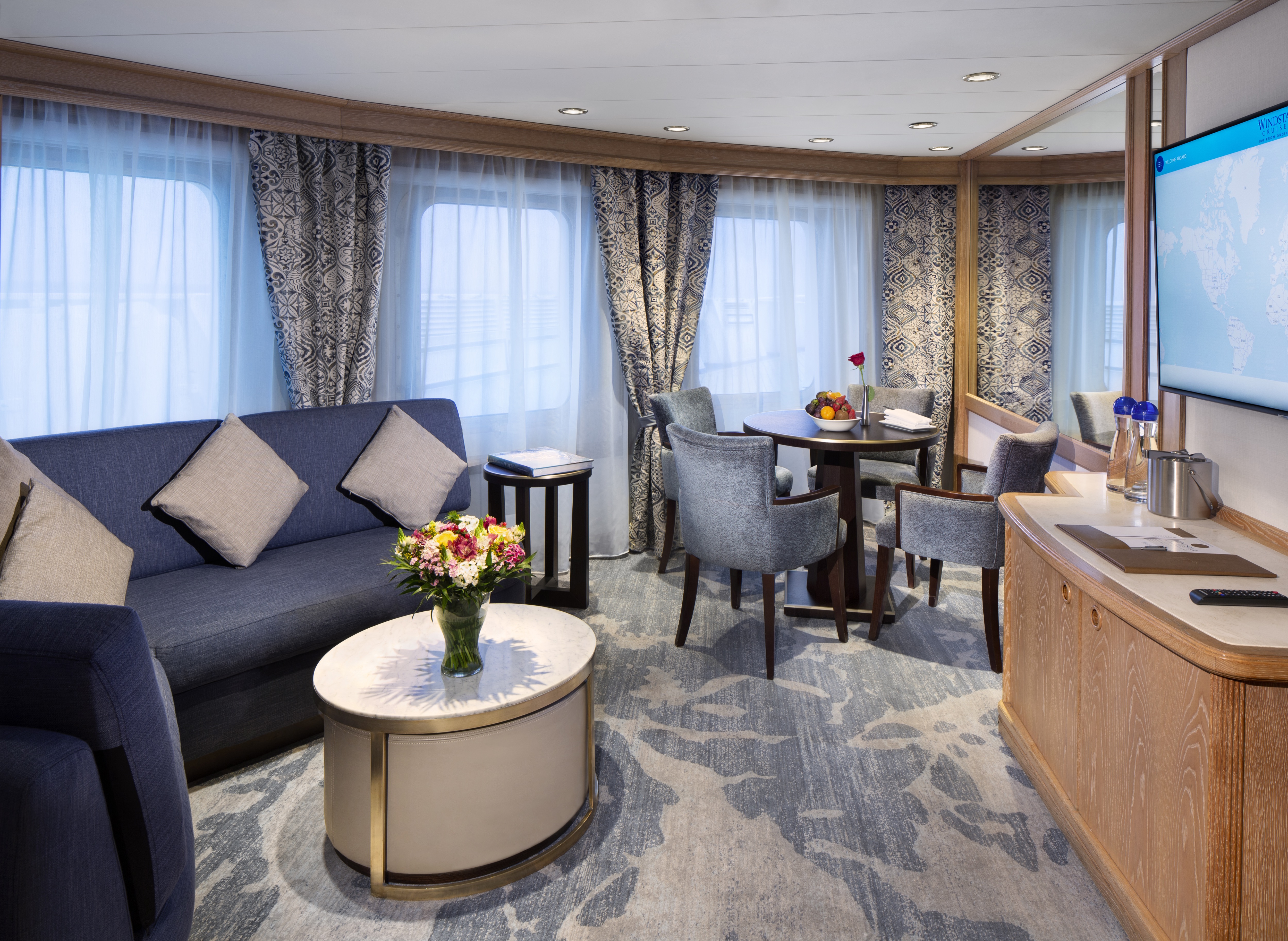
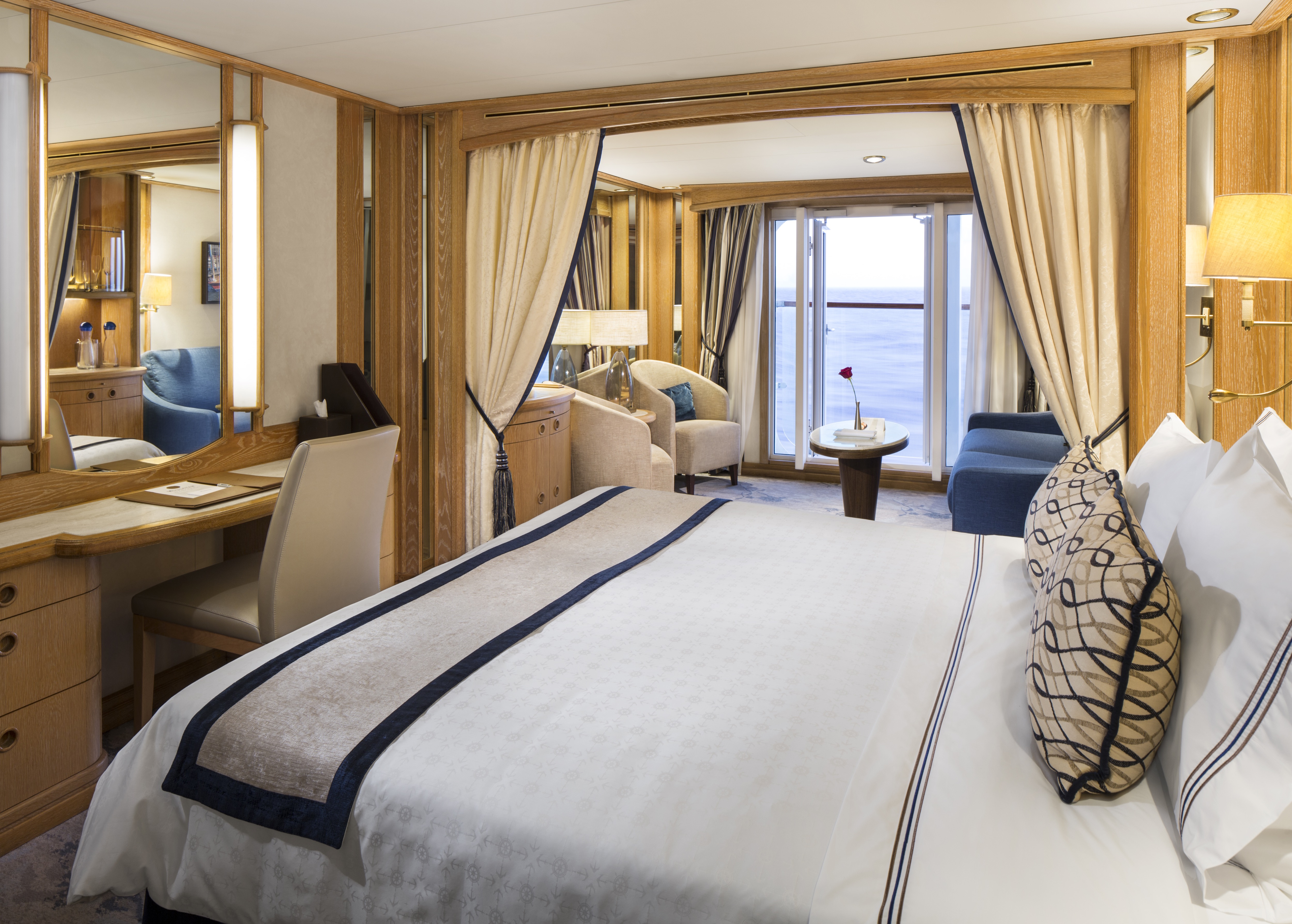
With 575 square feet, your Owner's Suite offers separate living room and dining areas. A veranda, Interactive TVs, and a full master bath and separate powder room indulge you in spacious comfort.
Amenities: Owner's Suite
- Queen Size Bed with Luxurious Linens
- Buttery soft velour bathrobe and slippers
- Upgraded L'Occitane bath amenities
- Mini Bar offering and fridge
- In-room premium filtered water
- Large upgraded fruit plate
- Macarons & Berries upon arrival
- Daily Canapés service
- Chilled bottle of Champagne upon arrival
- Fresh flower arrangement
- Illy capsule espresso machine
- Walk-in closet
- Magnifying mirror, hairdryer and umbrella
- TV with complimentary on-demand entertainment
- Safe
- 110/220-volt outlets
- Ultimate Internet Package (Complimentary)
- Preferred check-in
- Personalized wake-up call with beverage
- Binoculars
- Invitation to Captain or Senior officer table
- Preferred Specialty Restaurant dining
- Laundry Service (various packages available for purchase)
- 24 Hour In-Room dining (complimentary)
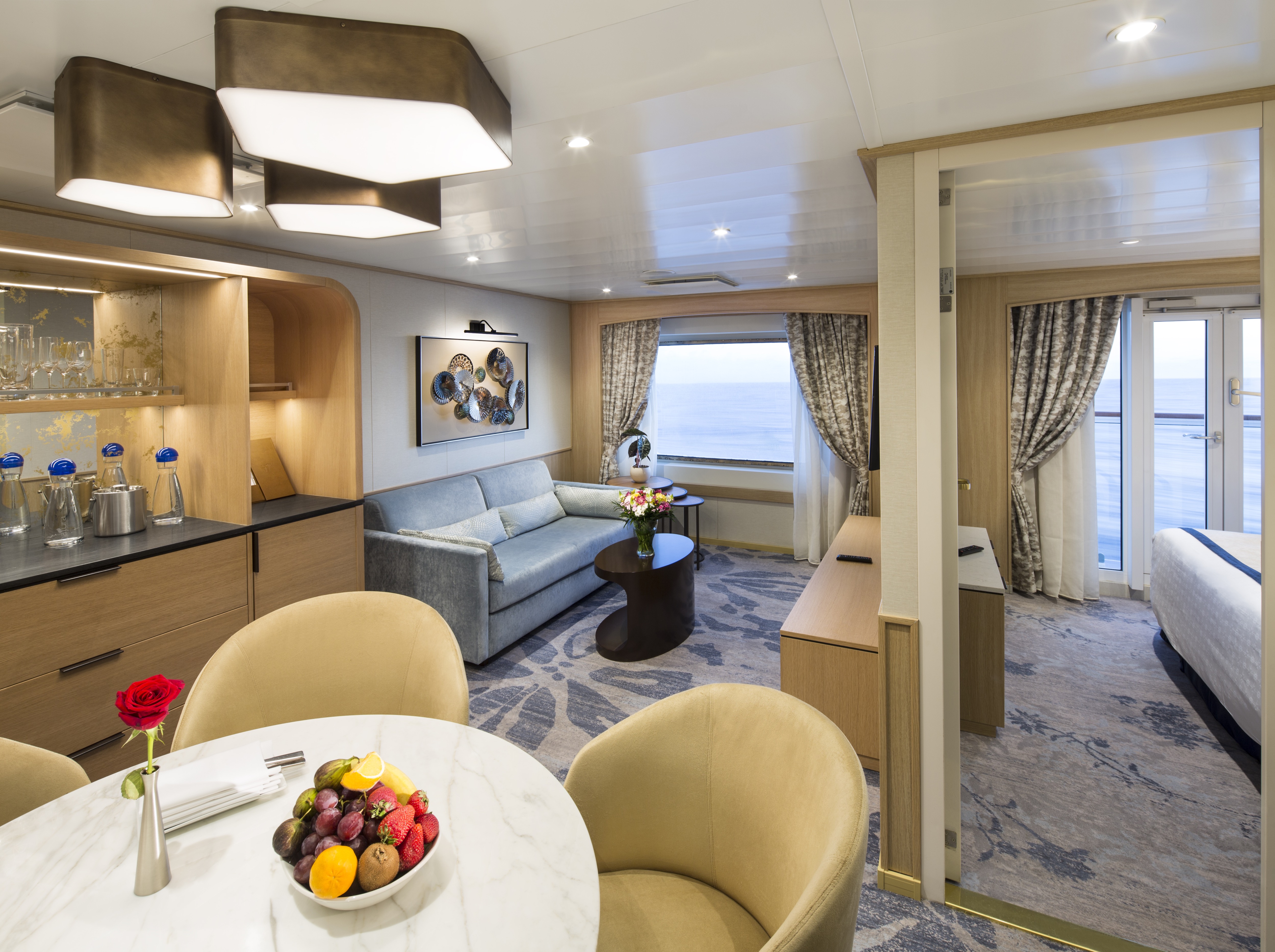
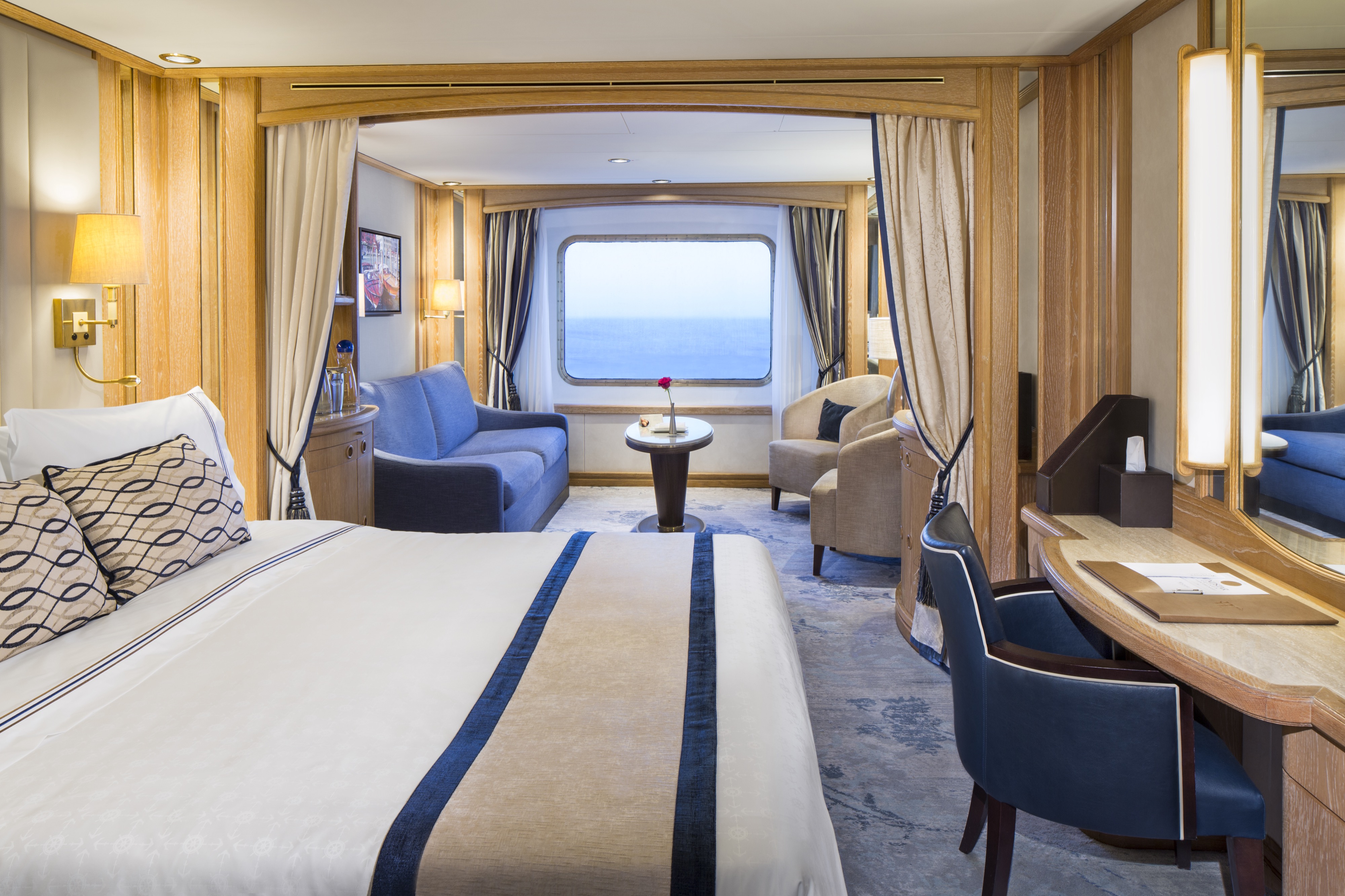
Relax in 400 spacious square feet, thoughtfully designed for comfort and style. Your inviting living area offers plenty of light through forward-facing windows and French doors from your bedroom that open onto your private veranda. Generous closets provide ample space to unpack and settle in with ease. Each suite reflects a distinctive sense of place—one inspired by the timeless elegance of Sea Island (Suite 501), a renowned Xanterra property known for its refined coastal charm and gracious Southern hospitality, and the other capturing the classic sophistication of The Broadmoor (Suite 500), celebrated for its grand mountain resort heritage and impeccable service.
Amenities: Broadmoor Suite/Sea Island Suite
- Queen-size bed with luxurious linens
- Buttery soft velour bathrobe and slippers
- Upgraded L'Occitane bath amenities
- Mini Bar offering and fridge
- In-room premium filtered water
- Macarons & Berries upon arrival
- Large upgraded fruit plate
- Daily Canapés service
- Chilled bottle of Champagne upon arrival
- Fresh flower arrangement
- Illy capsule espresso machine
- Walk-in closet
- Magnifying mirror, hairdryer and umbrella
- TV with complimentary on-demand entertainment
- Safe
- 110/220-volt outlets
- Ultimate Internet Package (Complimentary)
- Preferred check-in
- Personalized wake-up call with beverage
- Binoculars
- Invitation to Captain or Senior officer table
- Preferred Specialty Restaurant dining
- Laundry Service (various packages available for purchase)
- 24 Hour In-Room dining (complimentary)
Amenities: Deluxe Suite
- Queen Size Bed with Luxurious Linens
- Buttery soft velour bathrobe and slippers
- Upgraded L'Occitane bath amenities
- Mini Bar offering and fridge
- In-room premium filtered water
- Fresh Fruit Plate
- Chilled bottle of sparkling wine upon arrival
- Fresh flower arrangement
- Walk-in closet
- Magnifying mirror, hairdryer and umbrella
- TV with complimentary on-demand entertainment
- Safe
- 110/220-volt outlets
- Ultimate Internet Package (Complimentary)
- Illy capsule espresso machine
- Preferred check-in
- Personalized wake-up call with beverage
- Binoculars
- Invitation to hosting table by Officer
- Laundry Service (various packages available for purchase)
- 24 Hour In-Room dining (complimentary)
Amenities: Star Balcony Suite
- Queen Size Bed with Luxurious Linens
- TV with complimentary on-demand entertainment
- Safe
- L'Occitane Bath Amenities
- Fresh Fruit Plate
- Wi-Fi (internet packages available for purchase)
- Waffle Weave Robe and Slippers
- Mini Bar offering and fridge
- Magnifying mirror, hairdryer and umbrella
- Walk-in closet
- In-room premium filtered water
- 110/220-volt outlets
- Laundry Service (various packages available for purchase)
- 24 Hour In-Room dining (complimentary)
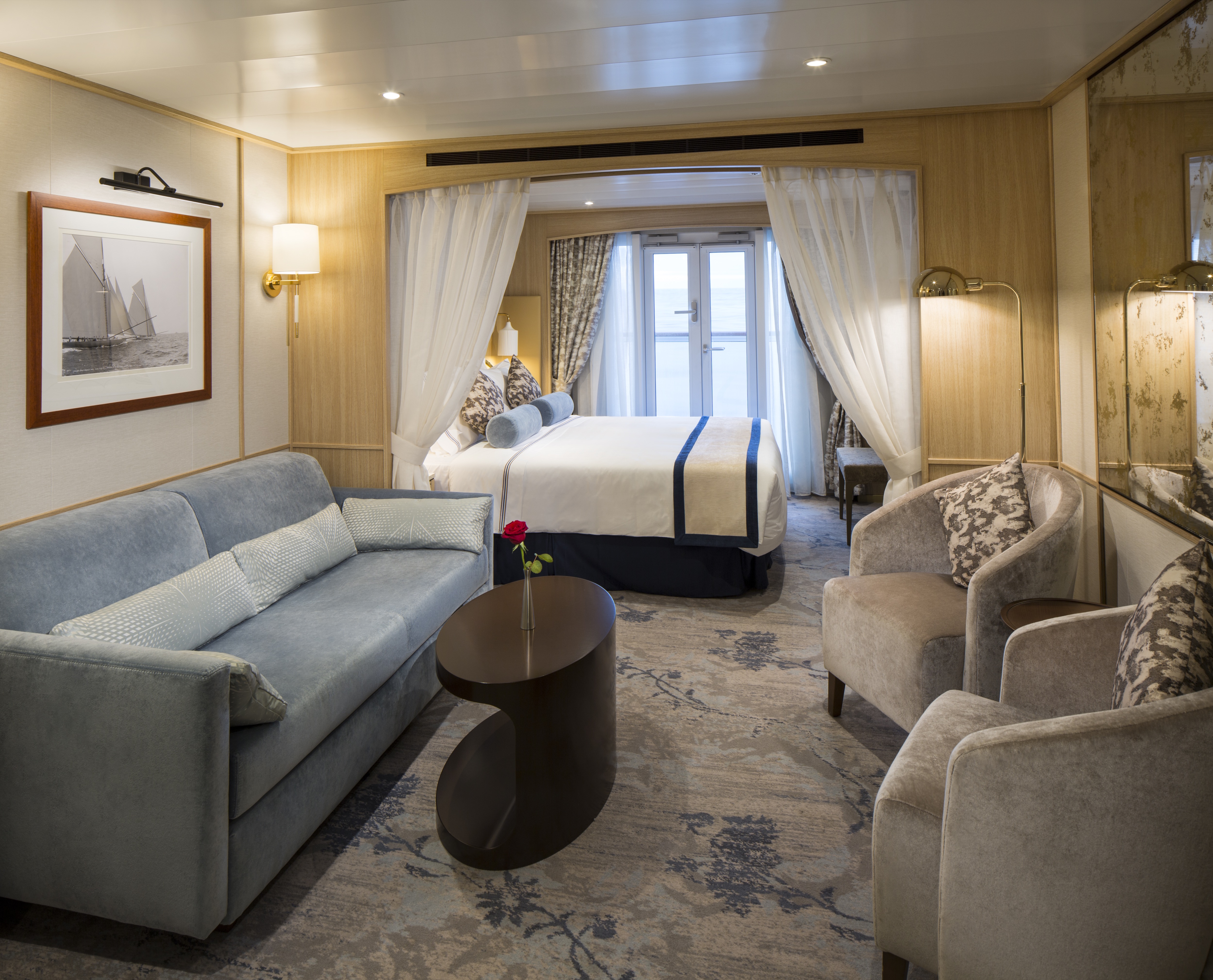
As soon as you walk through the door, you’re greeted with an open living area for a more welcoming entrance. Drift off to sleep by the window in your queen bed as you watch the same stars that sailors used to navigate the seas hundreds of years ago.
Amenities: Star Balcony Suite 1
Queen Size Bed with Luxurious Linens
TV with complimentary on-demand entertainment
Safe
L'Occitane Bath Amenities
Fresh Fruit Plate
Wi-Fi (internet packages available for purchase)
Waffle-weave robe and slippers
Mini Bar offering and fridge
Magnifying mirror, hairdryer and umbrella
Walk-in closet
In-room premium filtered water
110/220-volt outlets
Laundry Service (various packages available for purchase)
24 Hour In-Room dining (complimentary)
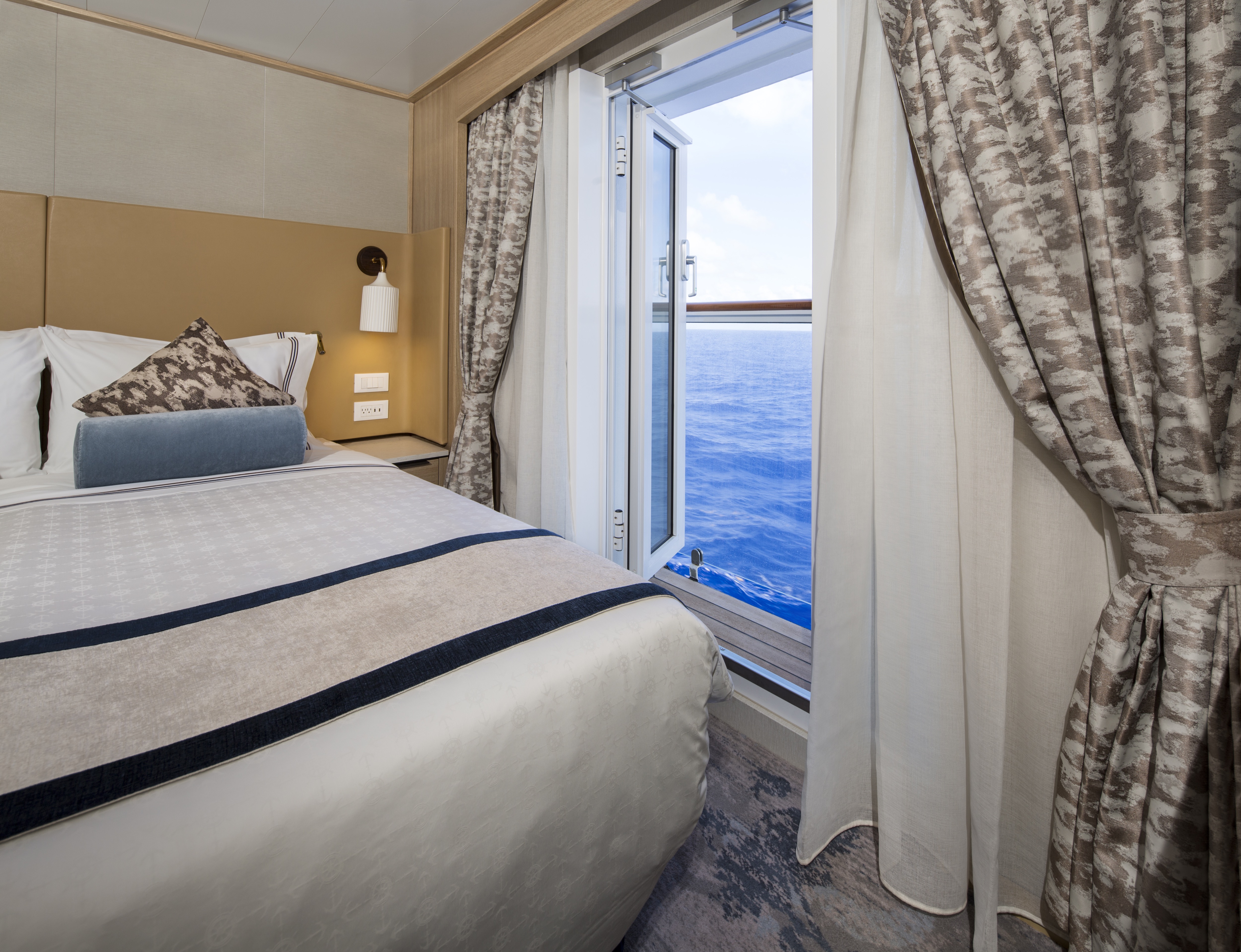
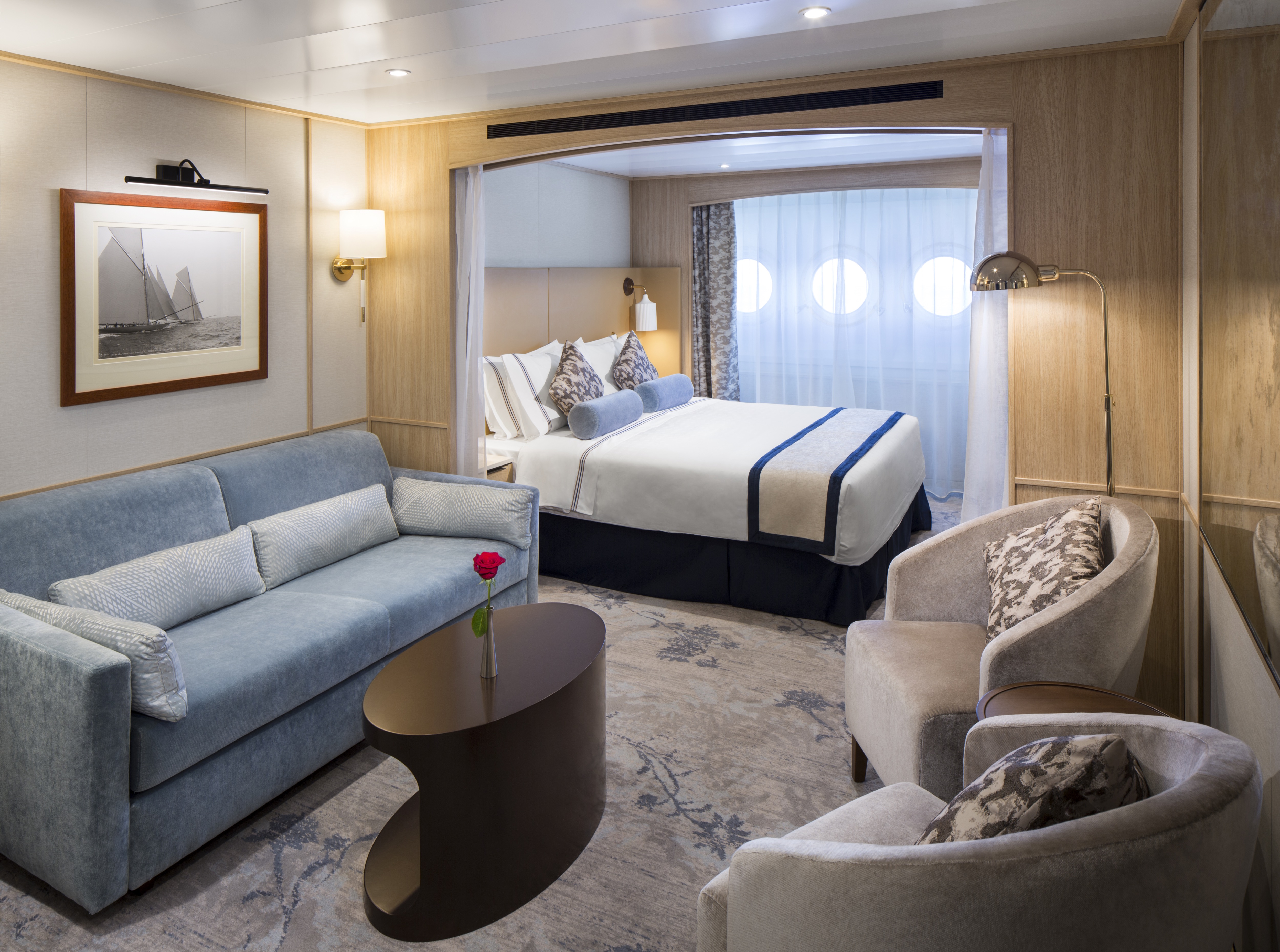
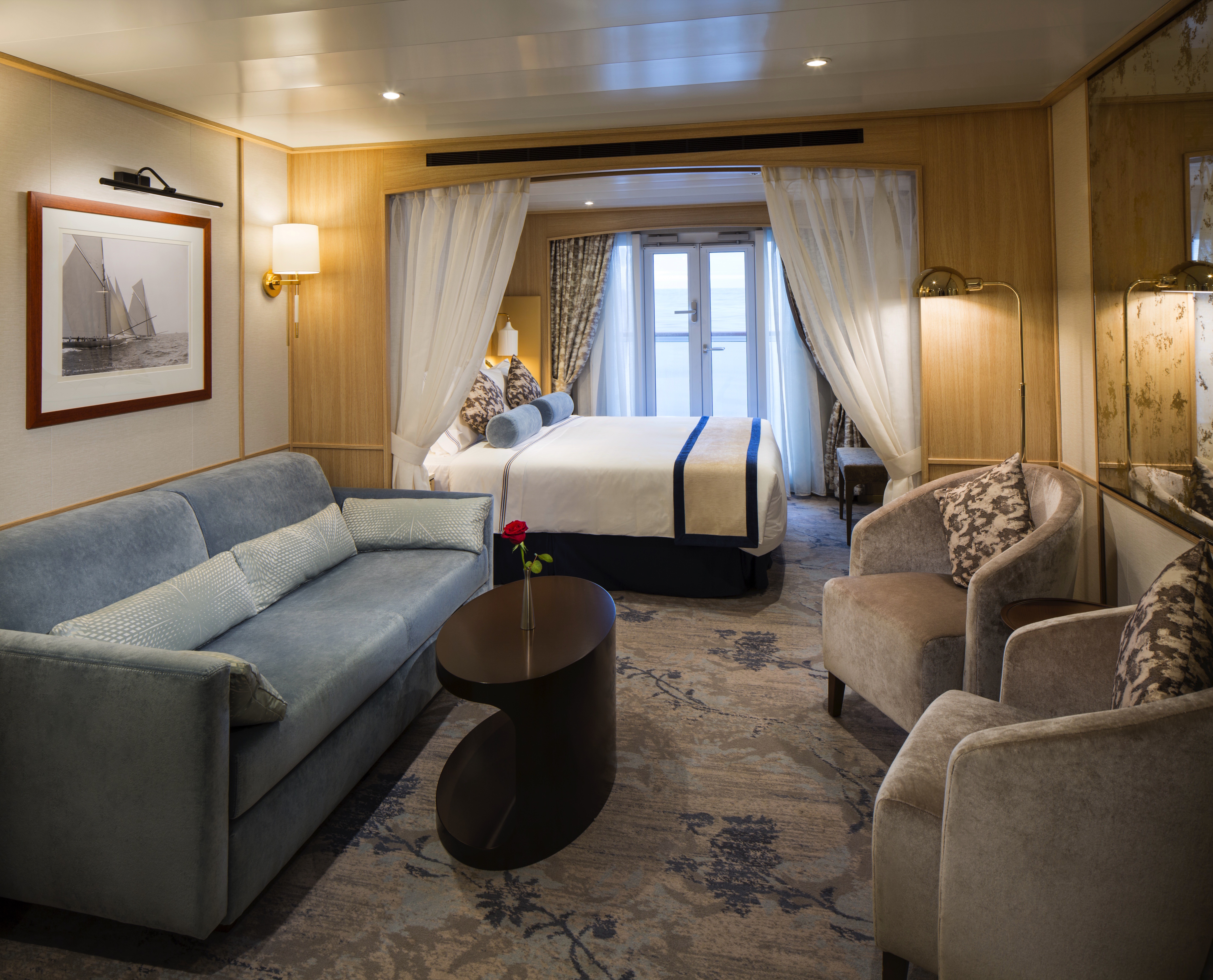
Stylish comfort and ocean views welcome you in 277 square feet. Your queen bed (which can be separated as twins if you prefer) features luxurious Egyptian cotton linens. Enjoy a luxurious soak in your full-size tub or an invigorating shower, then wrap up in your waffle-weave robe and slippers, savour a treat from the fresh fruit bowl, or simply stretch out and enjoy the fresh flowers.
Amenities: Balcony Suite
- Queen Size Bed with Luxurious Linens
- TV with complimentary on-demand entertainment
- Safe
- L'Occitane Bath Amenities
- Fresh Fruit Plate
- Wi-Fi (internet packages available for purchase)
- Waffle Weave Robe and Slippers
- Mini Bar offering and fridge
- Magnifying mirror, hairdryer and umbrella
- Walk-in closet
- In-room premium filtered water
- 110/220-volt outlets
- Laundry Service (various packages available for purchase)
- 24 Hour In-Room dining (complimentary)
Stylish comfort and ocean views welcome you in 277 square feet. Your queen bed (which can be separated as twins if you prefer) features luxurious Egyptian cotton linens. Enjoy a luxurious soak in your full-size tub or an invigorating shower, then wrap up in your waffle-weave robe and slippers, savour a treat from the fresh fruit bowl, or simply stretch out and enjoy the fresh flowers.
Amenities: Balcony Suite 1
- Queen Size Bed with Luxurious Linens
- TV with complimentary on-demand entertainment
- Safe
- L'Occitane Bath Amenities
- Fresh Fruit Plate
- Wi-Fi (internet packages available for purchase)
- Waffle Weave Robe and Slippers
- Mini Bar offering and fridge
- Magnifying mirror, hairdryer and umbrella
- Walk-in closet
- In-room premium filtered water
- 110/220-volt outlets
- Laundry Service (various packages available for purchase)
- 24 Hour In-Room dining (complimentary)
Amenities: Star Ocean View Suite 1
- Queen Size Bed with Luxurious Linens
- TV with complimentary on-demand entertainment
- Safe
- L'Occitane Bath Amenities
- Fresh Fruit Plate
- Wi-Fi (internet packages available for purchase)
- Waffle Weave Robe and Slippers
- Mini Bar offering and fridge
- Magnifying mirror, hairdryer and umbrella
- Walk-in closet
- In-room premium filtered water
- 110/220-volt outlets
- Laundry Service (various packages available for purchase)
- 24 Hour In-Room dining (complimentary)
Stylish comfort and ocean views welcome you in 277 square feet. Your queen bed (which can be separated as twins if you prefer) features luxurious Egyptian cotton linens. Enjoy a luxurious soak in your full-size tub or an invigorating shower, then wrap up in your waffle-weave robe and slippers, savor a treat from the fresh fruit bowl, or simply stretch out and enjoy the fresh flowers.
Amenities: Ocean View Suite- Queen Size Bed with Luxurious Linens
- TV with complimentary on-demand entertainment
- Safe
- L'Occitane Bath Amenities
- Fresh Fruit Plate
- Wi-Fi (internet packages available for purchase)
- Waffle Weave Robe and Slippers
- Mini Bar offering and fridge
- Magnifying mirror, hairdryer and umbrella
- Walk-in closet
- In-room premium filtered water
- 110/220-volt outlets
- Laundry Service (various packages available for purchase)
- 24 Hour In-Room dining (complimentary)
Stylish comfort and ocean views welcome you in 277 square feet. Your queen bed (which can be separated as twins if you prefer) features luxurious Egyptian cotton linens. Enjoy a luxurious soak in your full-size tub or an invigorating shower, then wrap up in your waffle-weave robe and slippers, savour a treat from the fresh fruit bowl, or simply stretch out and enjoy the fresh flowers.
Amenities: Ocean View Suite 1
- Queen Size Bed with Luxurious Linens
- TV with complimentary on-demand entertainment
- Safe
- L'Occitane Bath Amenities
- Fresh Fruit Plate
- Wi-Fi (internet packages available for purchase)
- Waffle Weave Robe and Slippers
- Mini Bar offering and fridge
- Magnifying mirror, hairdryer and umbrella
- Walk-in closet
- In-room premium filtered water
- 110/220-volt outlets
- Laundry Service (various packages available for purchase)
- 24 Hour In-Room dining (complimentary)
Stylish comfort and ocean views welcome you in 277 square feet. Your queen bed (which can be separated as twins if you prefer) features luxurious Egyptian cotton linens. Enjoy a luxurious soak in your full-size tub or an invigorating shower, then wrap up in your waffle-weave robe and slippers, savour a treat from the fresh fruit bowl, or simply stretch out and enjoy the fresh flowers.
Amenities: Ocean View Suite 2
- Queen Size Bed with Luxurious Linens
- TV with complimentary on-demand entertainment
- Safe
- L'Occitane Bath Amenities
- Fresh Fruit Plate
- Wi-Fi (internet packages available for purchase)
- Waffle Weave Robe and Slippers
- Mini Bar offering and fridge
- Magnifying mirror, hairdryer and umbrella
- Walk-in closet
- In-room premium filtered water
- 110/220-volt outlets
- Laundry Service (various packages available for purchase)
- 24 Hour In-Room dining (complimentary)
Stylish comfort and ocean views welcome you in 277 square feet. Your queen bed (which can be separated as twins if you prefer) features luxurious Egyptian cotton linens. Enjoy a luxurious soak in your full-size tub or an invigorating shower, then wrap up in your waffle-weave robe and slippers, savor a treat from the fresh fruit bowl, or simply stretch out and enjoy the fresh flowers.
Amenities: Ocean View Suite 3
- Queen Size Bed with Luxurious Linens
- TV with complimentary on-demand entertainment
- Safe
- L'Occitane Bath Amenities
- Fresh Fruit Plate
- Wi-Fi (internet packages available for purchase)
- Waffle Weave Robe and Slippers
- Mini Bar offering and fridge
- Magnifying mirror, hairdryer and umbrella
- Walk-in closet
- In-room premium filtered water
- 110/220-volt outlets
- Laundry Service (various packages available for purchase)
- 24 Hour In-Room dining (complimentary)
Amenities: Star Porthole Suite
- Queen Size Bed with Luxurious Linens
- TV with complimentary on-demand entertainment
- Safe
- L'Occitane Bath Amenities
- Fresh Fruit Plate
- Wi-Fi (internet packages available for purchase)
- Waffle Weave Robe and Slippers
- Mini Bar offering and fridge
- Magnifying mirror, hairdryer and umbrella
- Walk-in closet
- In-room premium filtered water
- 110/220-volt outlets
- Laundry Service (various packages available for purchase)
- 24 Hour In-Room dining (complimentary)
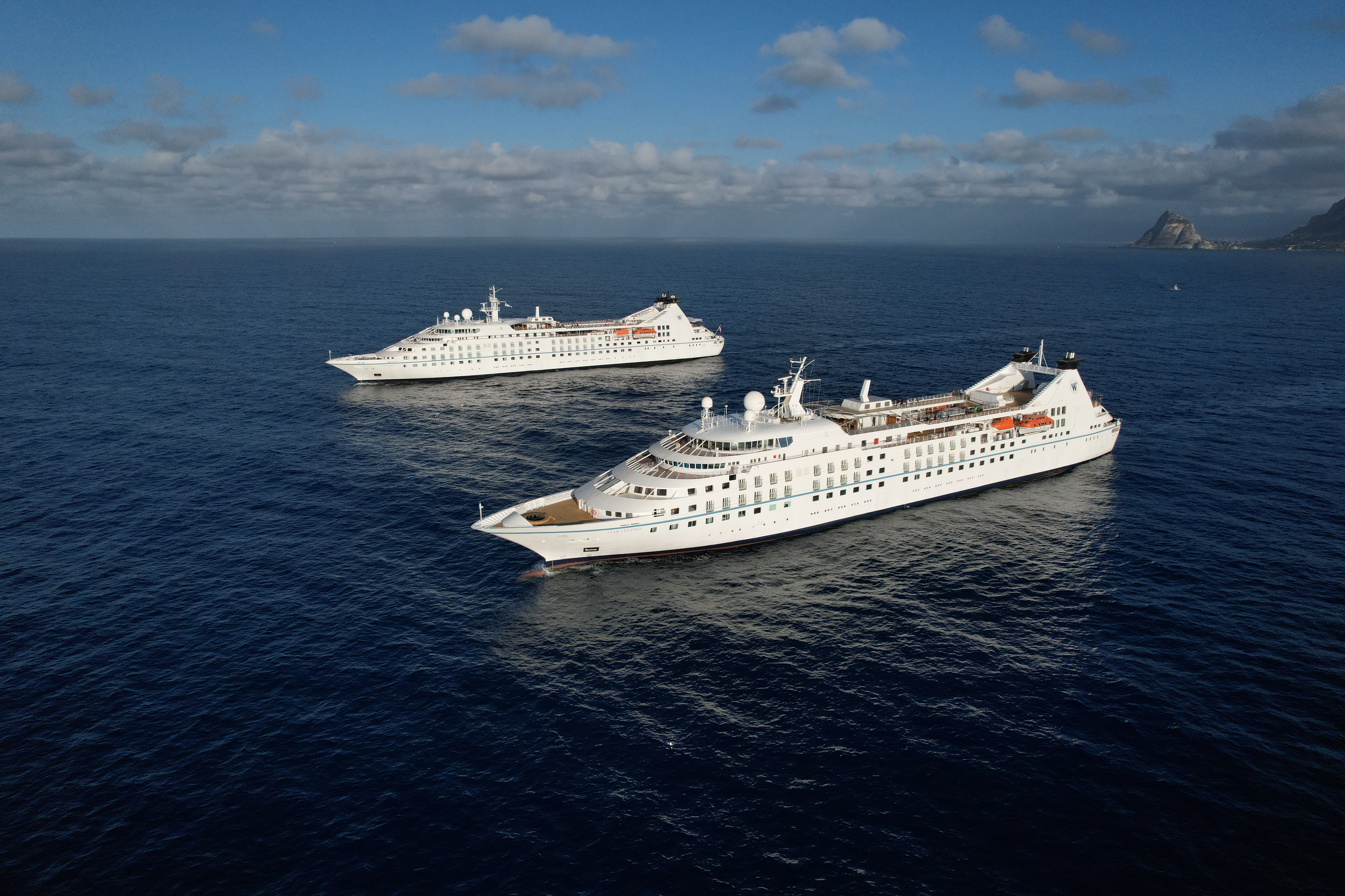
Star Legend
Serving just 312 guests, Star Legend is the perfect size — small enough to offer unique experiences that set Windstar apart from other cruise lines (think crossing the Corinth Canal), yet large enough for you to make plenty of new connections on board — all without ever feeling crowded.
This intimate all-suite yacht features spacious, ocean-view accommodations, each with a walk-in closet and updated double-vanity bathroom. On board, you’ll find a fully equipped fitness center, a spa with complimentary sauna, an infinity pool, two full-service bars, on-deck hot tubs, a water-access marina platform, and so much more.
And did we mention all dining is included? From gourmet bites at our Yacht Club Café to 24-hour room service and even specialty restaurants like Basil + Bamboo (available starting December 13, 2025), Windstar’s award-winning cuisine is always complimentary, so you can indulge freely and enjoy every moment of your journey.
Ready to experience Star Legend for yourself? Join us on one of our voyages across Northern Europe and the Mediterranean, where she sails year-round — and get ready to sail beyond ordinary.
Ship Facts
| Launch Year | 1992 | ||||||||
| Refit Year | 2021 | ||||||||
| Language | en | ||||||||
| Gross Tonnage | 12995 | ||||||||
| Length | 159 | ||||||||
| Width | 19 | ||||||||
| Currency | USD | ||||||||
| Speed | 15 | ||||||||
| Capacity | 312 | ||||||||
| Crew Count | 204 | ||||||||
| Deck Count | 6 | ||||||||
| Cabin Count | 156 | ||||||||
| Large Cabin Count | 0 | ||||||||
| Wheelchair Cabin Count | 4 | ||||||||
| Electrical Plugs |
|
Deck 8
- Yacht Club Café & Library (1)
- Star Bar (2)
- Star Grill (3)

Deck 7
- Bridge (4)
- World Spa by Windstar (5)
- Fitness Centre and Motion Studio (6)
- Pool and Whirlpool (7)
- Veranda/Candles (8)

Deck 6
- Basil & Bamboo Restaurant* (9)
- Star Boutique (10)
- Compass Rose (11)
- Owner's Suites
- Star Porthole Suites
- Star Balcony Suites
- Deluxe Suite
- Star Ocean View Suites
- Balcony Suites

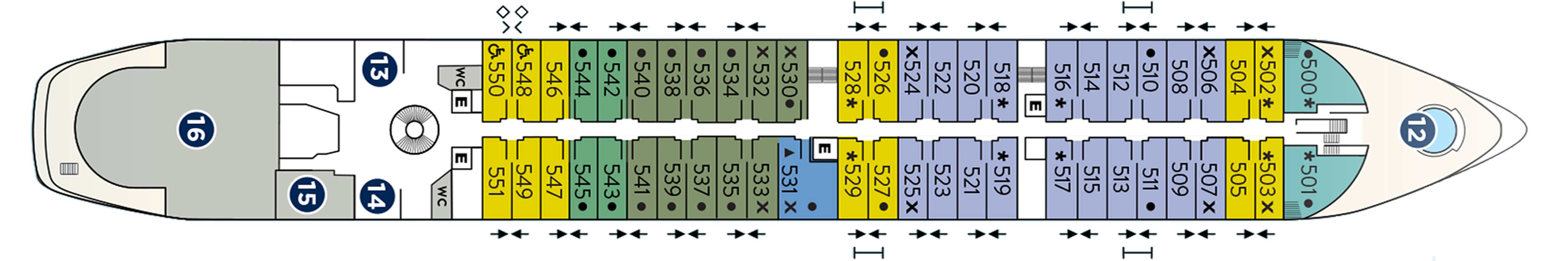
Deck 5
- Whirlpool (12)
- Reception (13)
- Destination Office (14)
- Screening Room (15)
- Lounge (16)
- Deluxe Suite
- Ocean View Suites
- Balcony Suites
- Deluxe Suite
- Star Balcony Suite
- Star Ocean View Suite
- Ocean View Suite - Accessible Suites (548, 550)
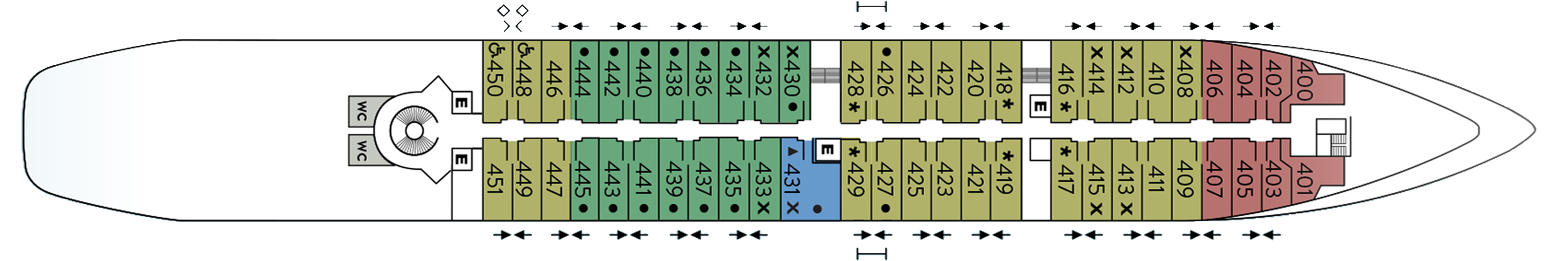
Deck 4
- Star Ocean View Suites
- Balcony Suite
- Ocean View Suites - Accessible Suites (448,450)
- Deluxe Suite
Deck 3
- Watersports Platform (19)
- Amphora Restaurant (18)
- Medical Facility (17)
- Star Porthole Suites

World Class Dining Experience
We’ve upped the onboard dining game with our culinary program, featuring an array of fresh, seasonal ingredients sourced from each ports along the journey. The menu us crafted to highlight the spectacular flavors of the regional cuisine.
Amphora Restaurant
Here, the dining room manager seats you, but where is your decision. There are no pre-assigned tables or first or second seatings. When you dine and with whom are entirely up to you. Seating usually begins at 6:30 p.m. and will be printed in the ship's daily program. Each delightful dish is prepared exactly to your liking – an exquisite dinner served course-by-course with a fine selection of vintage wines.
Veranda
It's breakfast alfresco, full service or buffet-style, anytime till 9:30 a.m. No need to hurry. Again, the choices are many in Veranda. Choose the sumptuous, seemingly endless buffet. Or, order from the lunch menu between noon and 2:30 p.m.
Candles Restaurant
Here’s the perfect place for a romantic tête-a-tête under the stars in Candles, Windstar’s signature outdoor restaurant transformed by night into a dreamlike paradise. Delectable cuisine, memorable surroundings, inspired wine pairings.
Star Grill
You'll find all your traditional grilled and barbecued favorites (and discover new dishes from around the world) in our new casual outdoor restaurant.
Basil + Bamboo
Step into Basil + Bamboo, where clean lines and warm accents set the stage for a relaxed, refined experience. Savor dishes that fuse Asian influences with a Mediterranean twist — an inventive culinary adventure designed to delight your palate and create moments of shared discovery.
A day on board your Windstar ship is a day of choices, all of them good. Perhaps you’ll begin with a relaxing massage in World Spa by Windstar. Or maybe an invigorating workout in the Fitness Center. Even better, why not both? After a sumptuous lunch in Veranda, make a splash from the Watersports Platform off the ship’s stern. Everything you can think of for fun in the water is there — swimming, kayaking, sail-boarding, even water skiing. And it’s all complimentary, of course. Sun yourself on deck, take a dip in the whirlpool, then catch up on email ororder a cheese plate for your stateroom or suite. After dinner, dance to live music in the Lounge. This is your yacht, so of course you’re welcome on the Bridge, where the Captain and officers are delighted to share charts, routes, and vistas with you.
As you prepare for another amazing Windstar day, enjoy a nightcap anywhere you like — on deck, in the Lounge, or why not let us bring it to your suite or stateroom? Your day ends just as it began, blissfully.
Compass Rose
Compass Rose can be found on Deck 6.
The Yacht Club and Library
Stop by the Yacht Club Café for a bite or coffee crafted by our barista.
Lounge
The Lounge can be found on Deck 5.
Open Bridge
We’re the only cruise line welcoming guests on to an Open Bridge, where they can pop in to watch the Captain and crew at work, and learn about chart navigation.
Screening Room
The ship’s card room is now the new Star Screening Room, where guests can view current movies.
Live Entertainment
After a long day at port or sea, relax in the lounge and enjoy a drink while being entertained by our onboard band, local performers or our talented crew members.
Each cruise, our crew demonstrates their hidden abilities, whether dancing, singing, magic or comedy. Our team will continue to delight you through the night during the crew talent show, and perhaps you'll find a hidden talent of your own.
Sun Deck
The Sun Deck can be located on Deck 7.
Star Boutique
Visit our newly transformed specialty shopping boutique, Star Boutique, rolling out fleet-wide through early 2022. The new shop features quality brand-name and exclusive Star Collection merchandise, from clothing and fragrances to jewelry and accessories, all at duty free or special pricing.