Windward Islands Surf & Sunsets
Windward Islands Surf & Sunsets
Cruise overview
WHY BOOK WITH US?
- ✔ The Deluxe Cruises’ team has extensive experience in ultra-luxury cruising.
- ✔ Call now to speak to our helpful and experienced Cruise Concierge team.
- ✔ Enjoy our Unique Deluxe Cruises Bonus for substantial savings.
- ✔ Our team will tailor your holiday to your exacting requirements.
- ✔ As agents, we work under the protection of each cruise lines ABTA / ATOL licences
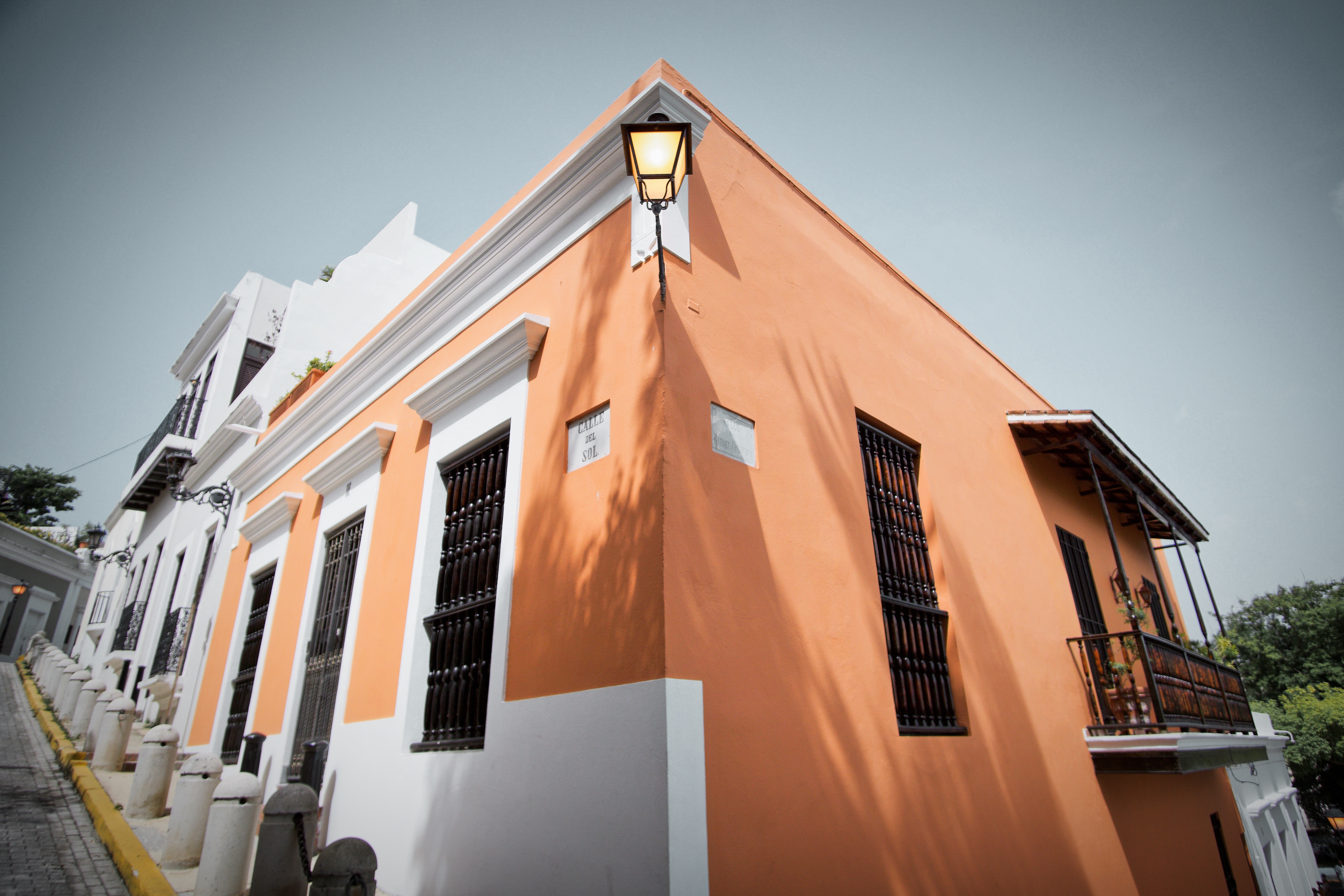
About San Juan (Puerto Rico)
If you associate Puerto Rico's capital with the colonial streets of Old San Juan, then you know only part of the picture. San Juan is a major metropolis, radiating out from the bay on the Atlantic Ocean that was discovered by Juan Ponce de León. More than a third of the island's nearly 4 million citizens proudly call themselves sanjuaneros. The city may be rooted in the past, but it has its eye on the future. Locals go about their business surrounded by colonial architecture and towering modern structures.By 1508 the explorer Juan Ponce de León had established a colony in an area now known as Caparra, southeast of present-day San Juan. He later moved the settlement north to a more hospitable peninsular location. In 1521, after he became the first colonial governor, Ponce de León switched the name of the island—which was then called San Juan Bautista in honor of St. John the Baptist—with that of the settlement of Puerto Rico ("rich port").Defended by the imposing Castillo San Felipe del Morro (El Morro) and Castillo San Cristóbal, Puerto Rico's administrative and population center remained firmly in Spain's hands until 1898, when it came under U.S. control after the Spanish-American War. Centuries of Spanish rule left an indelible imprint on the city, particularly in the walled area now known as Old San Juan. The area is filled with cobblestone streets and brightly painted, colonial-era structures, and its fortifications have been designated a UNESCO World Heritage Site.Old San Juan is a monument to the past, but most of the rest of the city is planted firmly in the 21st century and draws migrants island-wide and from farther afield to jobs in its businesses and industries. The city captivates residents and visitors alike with its vibrant lifestyle as well as its balmy beaches, pulsing nightclubs, globe-spanning restaurants, and world-class museums. Once you set foot in this city, you may never want to leave.

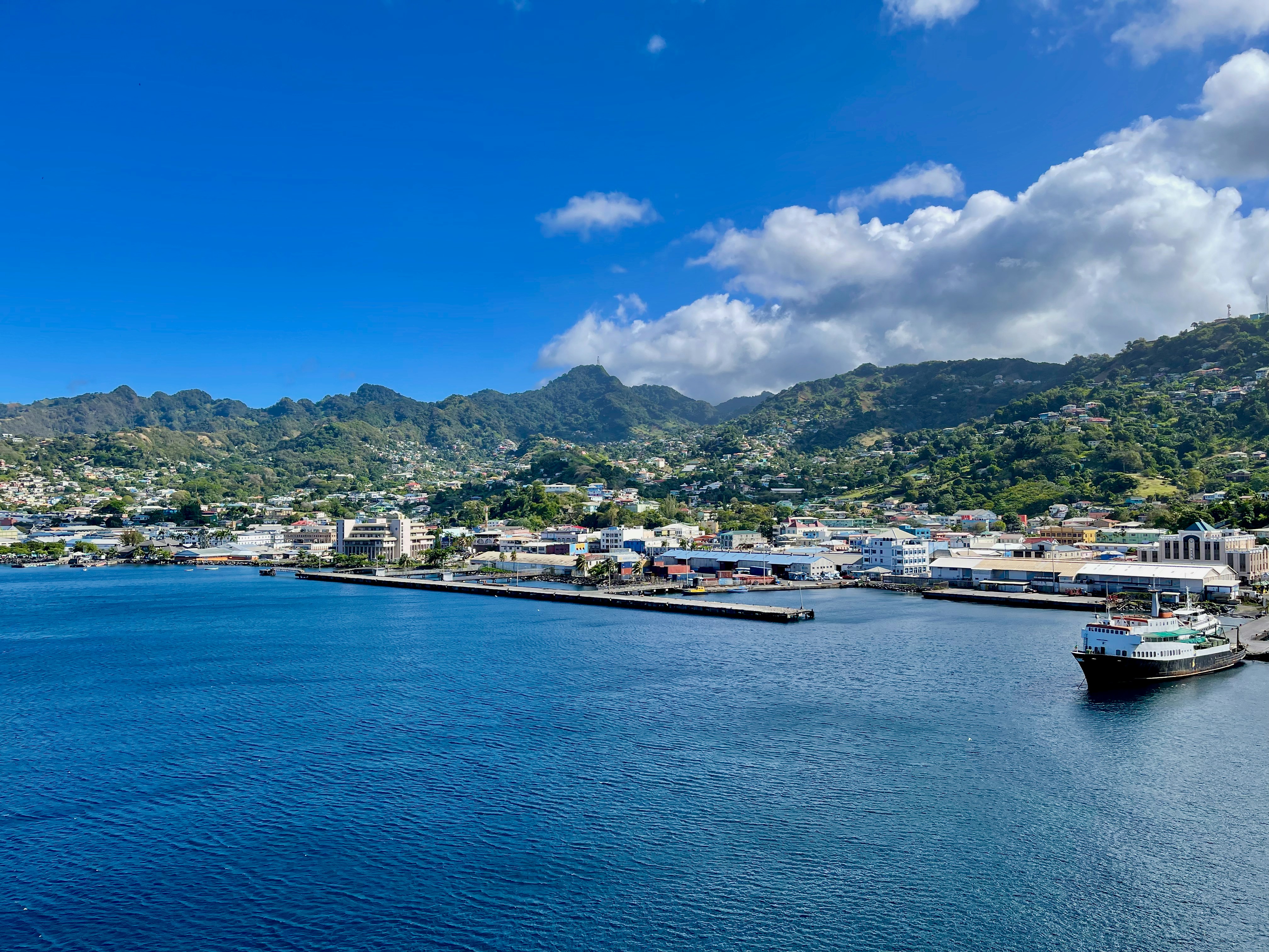
About Port Elizabeth, Bequia
Bequia is a Carib word meaning "island of the cloud." Hilly and green with several golden-sand beaches, Bequia is 9 miles (14½ km) south of St. Vincent's southwestern shore; with a population of 5,000, it's the largest of the Grenadines. Although boatbuilding, whaling, and fishing have been the predominant industries here for generations, sailing has now become almost synonymous with Bequia. Admiralty Bay is a favored anchorage for both privately owned and chartered yachts. Lodgings range from comfortable resorts and villas to cozy West Indian—style inns. Bequia's airport and the frequent ferry service from St. Vincent make this a favorite destination for day-trippers, as well. The ferry docks in Port Elizabeth, a tiny town with waterfront bars, restaurants, and shops where you can buy handmade souvenirs—including the exquisitely detailed model sailboats that are a famous Bequia export. The Easter Regatta is held during the four-day Easter weekend, when revelers gather to watch boat races and celebrate the island's seafaring traditions with food, music, dancing, and competitive games.To see the views, villages, beaches, and boatbuilding sites around Bequia, hire a taxi at the jetty in Port Elizabeth. Several usually line up under the almond trees to meet each ferry from St. Vincent.
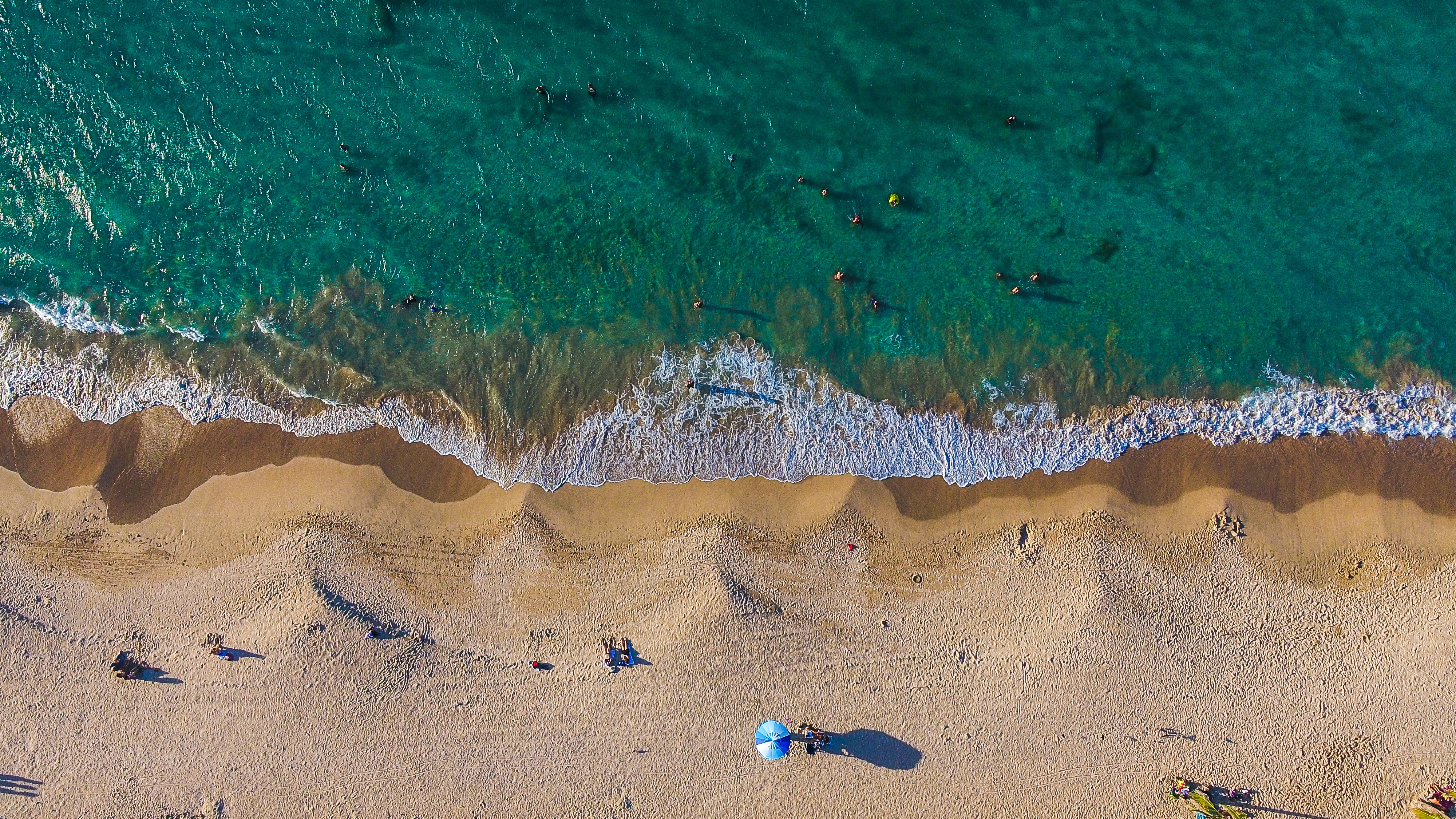
About Mayreau Island
The small island of Mayreau, just one and 1/2 square miles in area (3.9 square kilometres) is the smallest inhabited island of The Grenadines, and is part of the independent state of St.Vincent in the eastern Caribbean Sea. Two of the best known islands in The Grenadines are Mustique and Bequia, the second largest island in this group. The Grenadine Islands are strung out in a gentle sweep between St.Vincent and Grenada. Most visitors to Mayreau arrive from cruise ships, on the regular ferry, or by yacht. There are no proper roads on the island, only a few vehicles, no airport and only a single unnamed village. Mayreau and the neighboring Tobago Cays are very popular for divers and snorkellers. Saline Bay, on the west coast of the island, has a wonderful broad beach and a few local vendors selling T-shirts and local craft. A climb up the road to the hilltop village on the island provides breathtaking views across Mayreau, Canouan, the Tobago Cays and Carriacou.
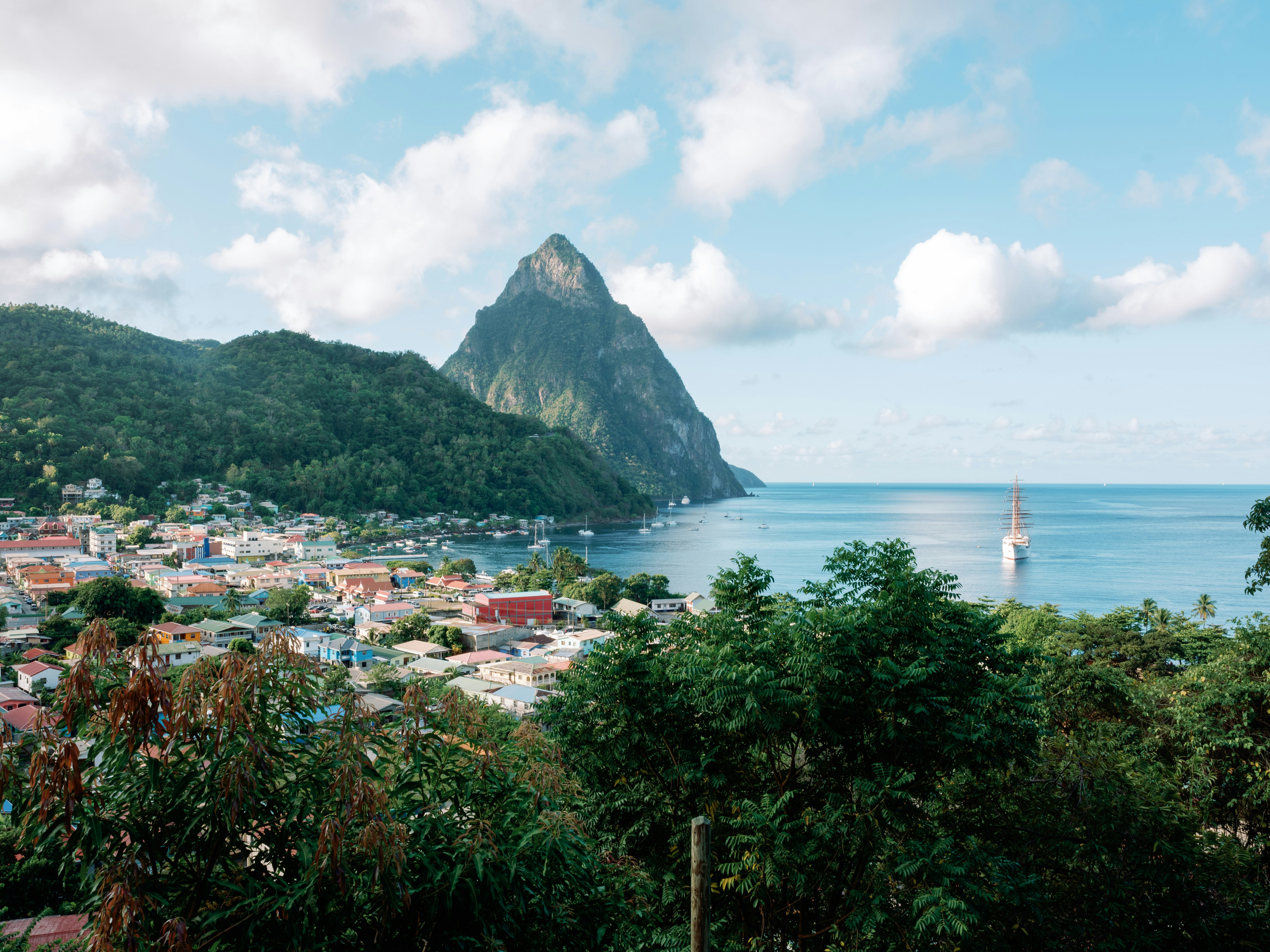
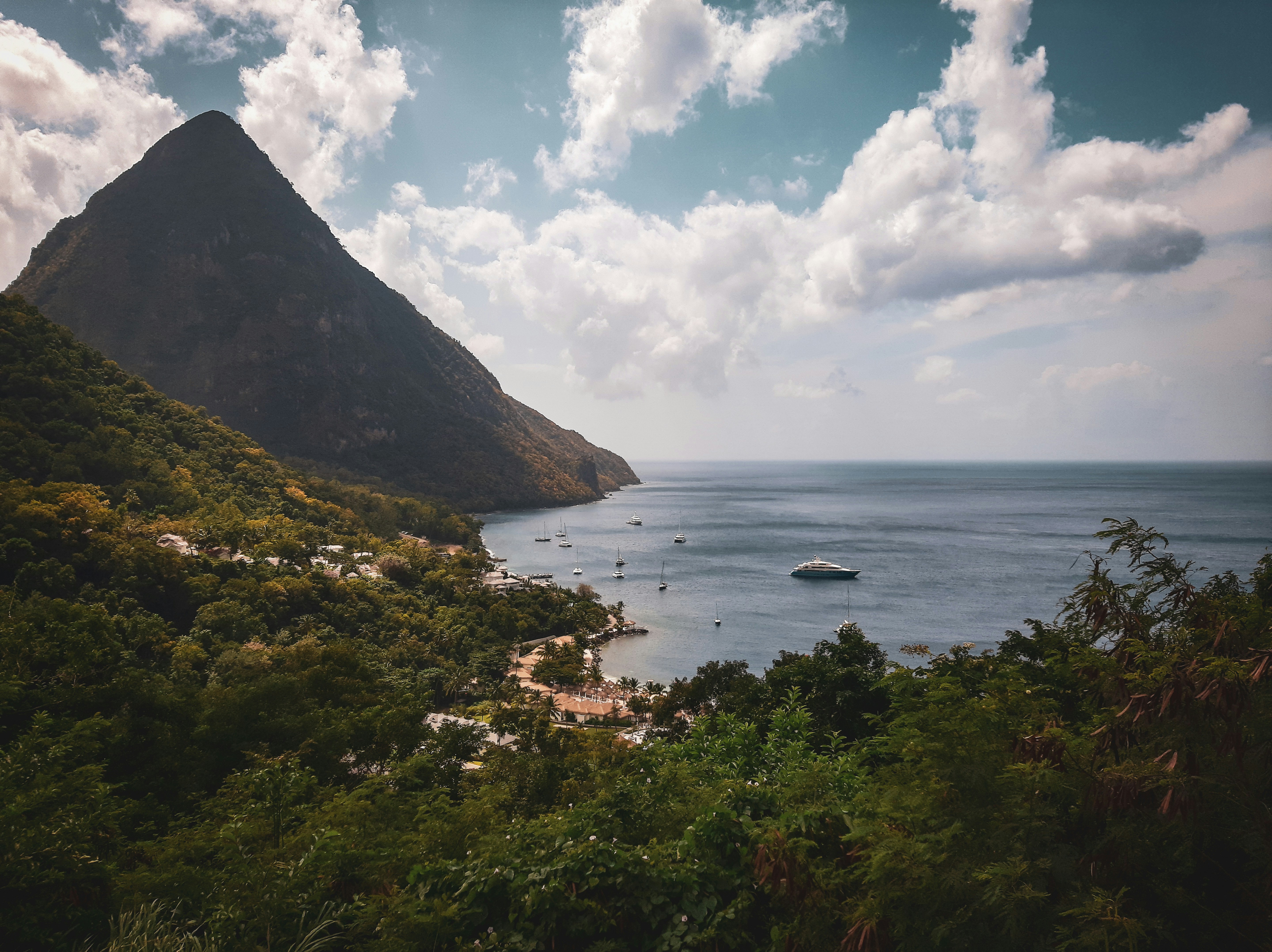
About Soufrière
The oldest town in St. Lucia and the island’s former French colonial capital, Soufrière was founded by the French in 1746 and named for its proximity to the volcano of the same name. The wharf is the center of activity in this sleepy town (population, 9,000), particularly when a cruise ship anchors in pretty Soufrière Bay. French colonial influences are evident in the second-story verandahs, gingerbread trim, and other appointments of the wooden buildings that surround the market square. The market building itself is decorated with colorful murals. Soufrière, the site of much of St. Lucia’s renowned natural beauty, is the destination of most sightseeing trips. This is where you can get up close to the iconic Pitons and visit colonial capital of St. Lucia, with its "drive-in" volcano, botanical gardens, working plantations, waterfalls, and countless other examples of the natural beauty for which St. Lucia is deservedly famous.
About Terre-de-Haut
About Marigot
French and Dutch have lived side by side on St. Maarten/St. Martin for hundreds of years—with no border patrols or customs between them. The French side has a more genteel ambience, more fashionable shopping, and a Continental flair. The Dutch tends to be less expensive, has casino hotels, and more nightlife. Water sports abound all over—diving, snorkeling, sailing, and windsurfing are all top draws. And it's easy to while away the day relaxing on one of the 37 beaches, strolling the boardwalk of Dutch-side Philipsburg, and exploring the very French town of Marigot. Although luck is an important commodity at St. Maarten's 13 casinos, chance plays no part in finding a good meal at the island’s excellent eateries. The best way to explore St. Maarten/St. Martin is by car. Though often congested, especially around Philipsburg and Marigot, the roads are fairly good, though narrow and winding, with some speed bumps, potholes, roundabouts, and an occasional wandering goat herd. Few roads are marked with their names, but destination signs are common. Besides, the island is so small that it's hard to get really lost—at least that is what locals tell you. If you’re spending a few days, get to know the area with a scenic "loop" around the island. Be sure to pack a towel and some water shoes, a hat, sunglasses, and sunblock. Head up the east shoreline from Philipsburg, and follow the signs to Dawn Beach and Oyster Pond. The road winds past soaring hills, turquoise waters, quaint West Indian houses, and wonderful views of St. Barth. As you cross over to the French side, turn into Le Galion for a stop at the calm sheltered beach, the stables, the butterflies, or the windsurfing school, then keep following the road toward Orient Bay, the St-Tropez of the Caribbean. Continue to Anse Marcel, Grand Case, Marigot, and Sandy Ground. From Marigot, the flat island of Anguilla is visible. Completing the loop brings you past Cupecoy Beach, through Maho and Simpson Bay, where Saba looms in the horizon, and back over the mountain road into Philipsburg.
About San Juan (Puerto Rico)
If you associate Puerto Rico's capital with the colonial streets of Old San Juan, then you know only part of the picture. San Juan is a major metropolis, radiating out from the bay on the Atlantic Ocean that was discovered by Juan Ponce de León. More than a third of the island's nearly 4 million citizens proudly call themselves sanjuaneros. The city may be rooted in the past, but it has its eye on the future. Locals go about their business surrounded by colonial architecture and towering modern structures.By 1508 the explorer Juan Ponce de León had established a colony in an area now known as Caparra, southeast of present-day San Juan. He later moved the settlement north to a more hospitable peninsular location. In 1521, after he became the first colonial governor, Ponce de León switched the name of the island—which was then called San Juan Bautista in honor of St. John the Baptist—with that of the settlement of Puerto Rico ("rich port").Defended by the imposing Castillo San Felipe del Morro (El Morro) and Castillo San Cristóbal, Puerto Rico's administrative and population center remained firmly in Spain's hands until 1898, when it came under U.S. control after the Spanish-American War. Centuries of Spanish rule left an indelible imprint on the city, particularly in the walled area now known as Old San Juan. The area is filled with cobblestone streets and brightly painted, colonial-era structures, and its fortifications have been designated a UNESCO World Heritage Site.Old San Juan is a monument to the past, but most of the rest of the city is planted firmly in the 21st century and draws migrants island-wide and from farther afield to jobs in its businesses and industries. The city captivates residents and visitors alike with its vibrant lifestyle as well as its balmy beaches, pulsing nightclubs, globe-spanning restaurants, and world-class museums. Once you set foot in this city, you may never want to leave.
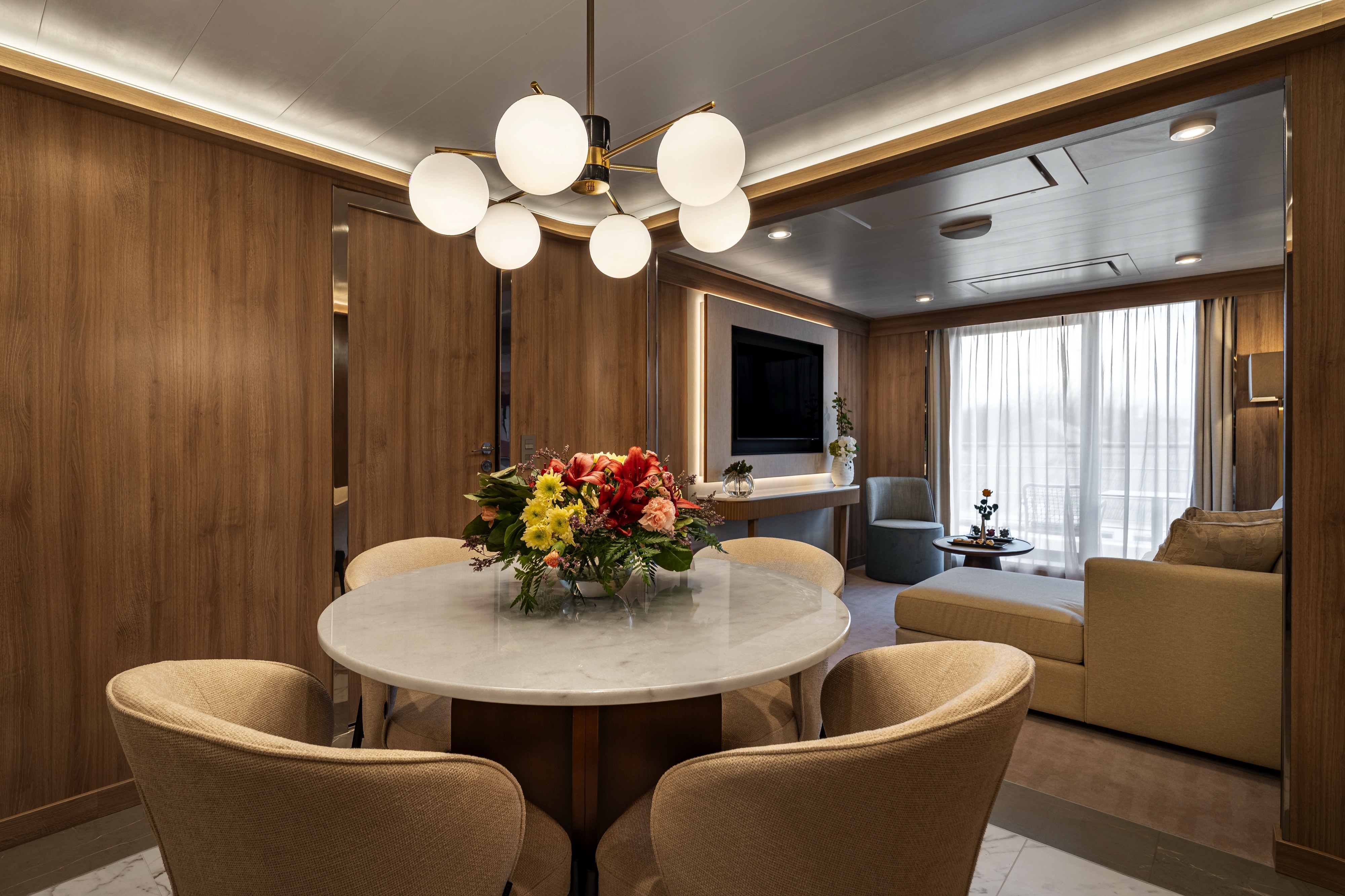
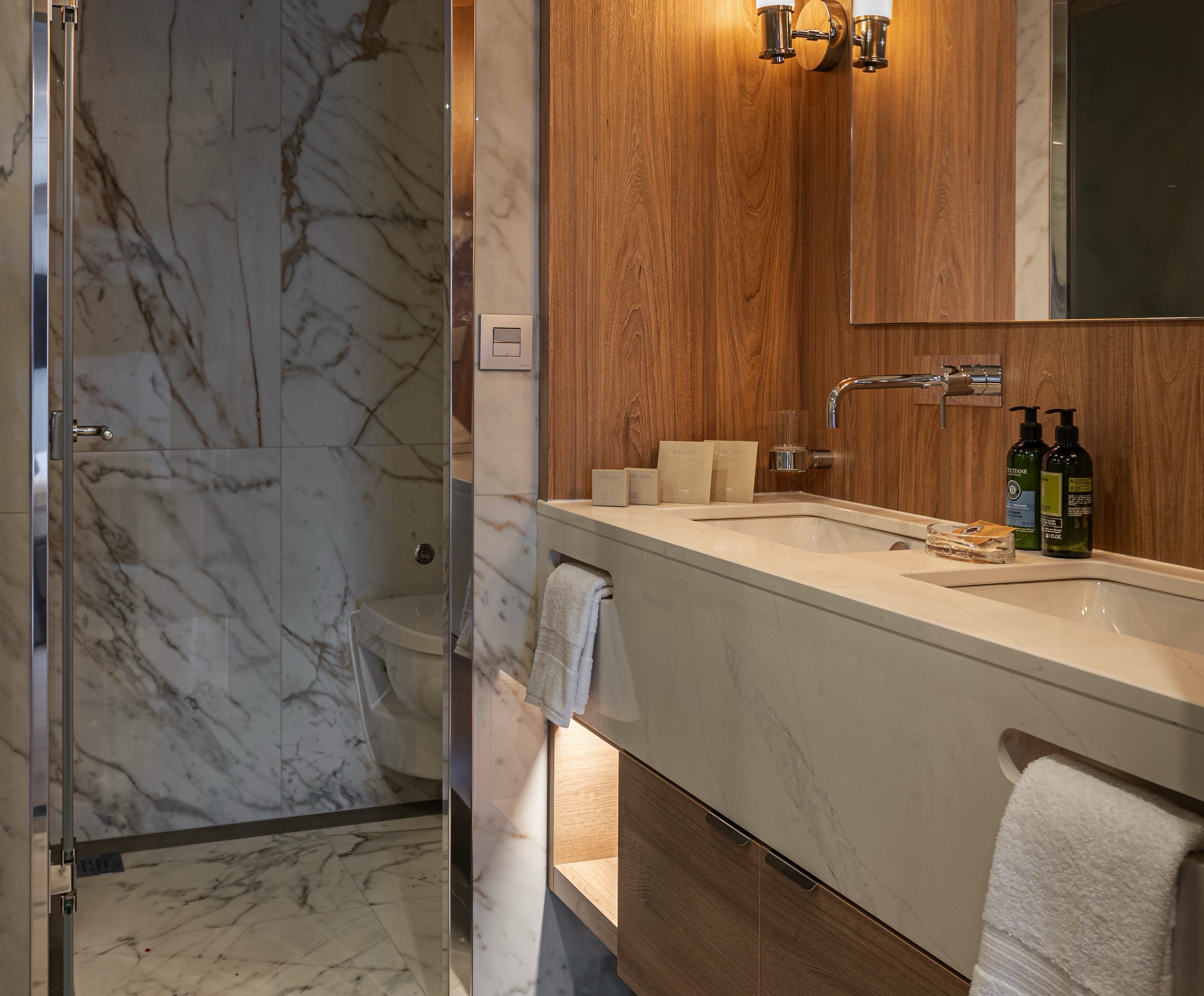
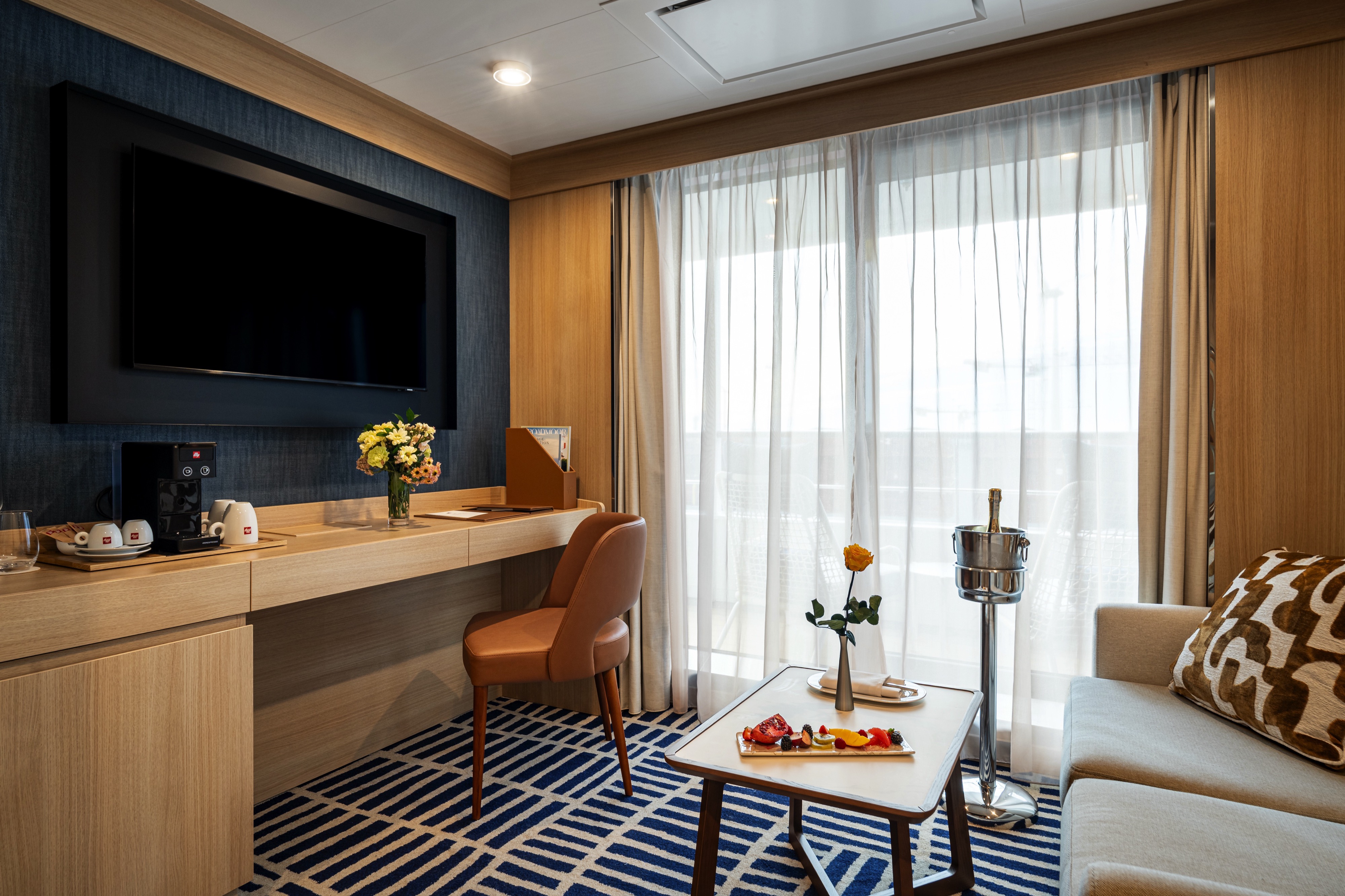
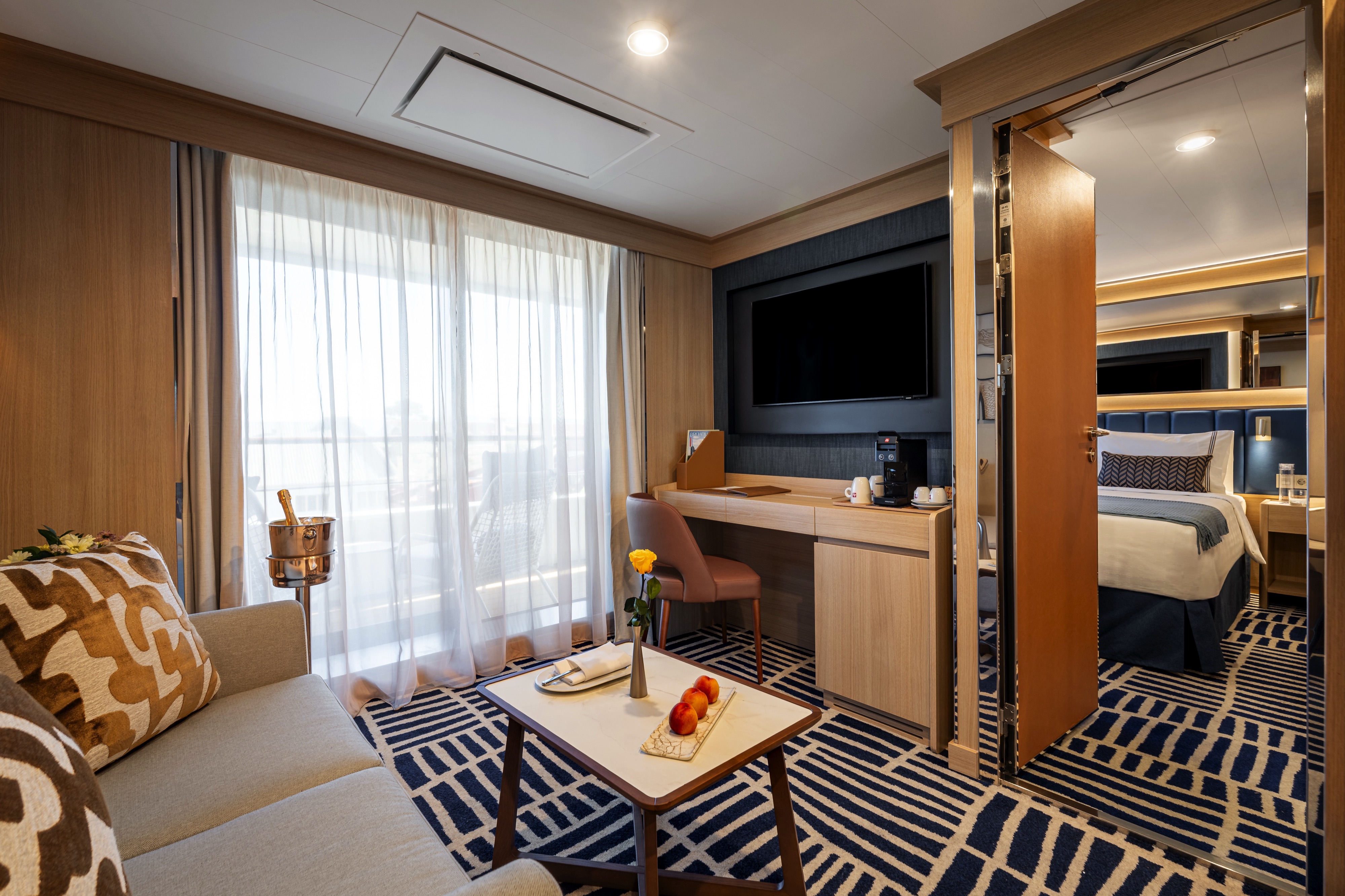
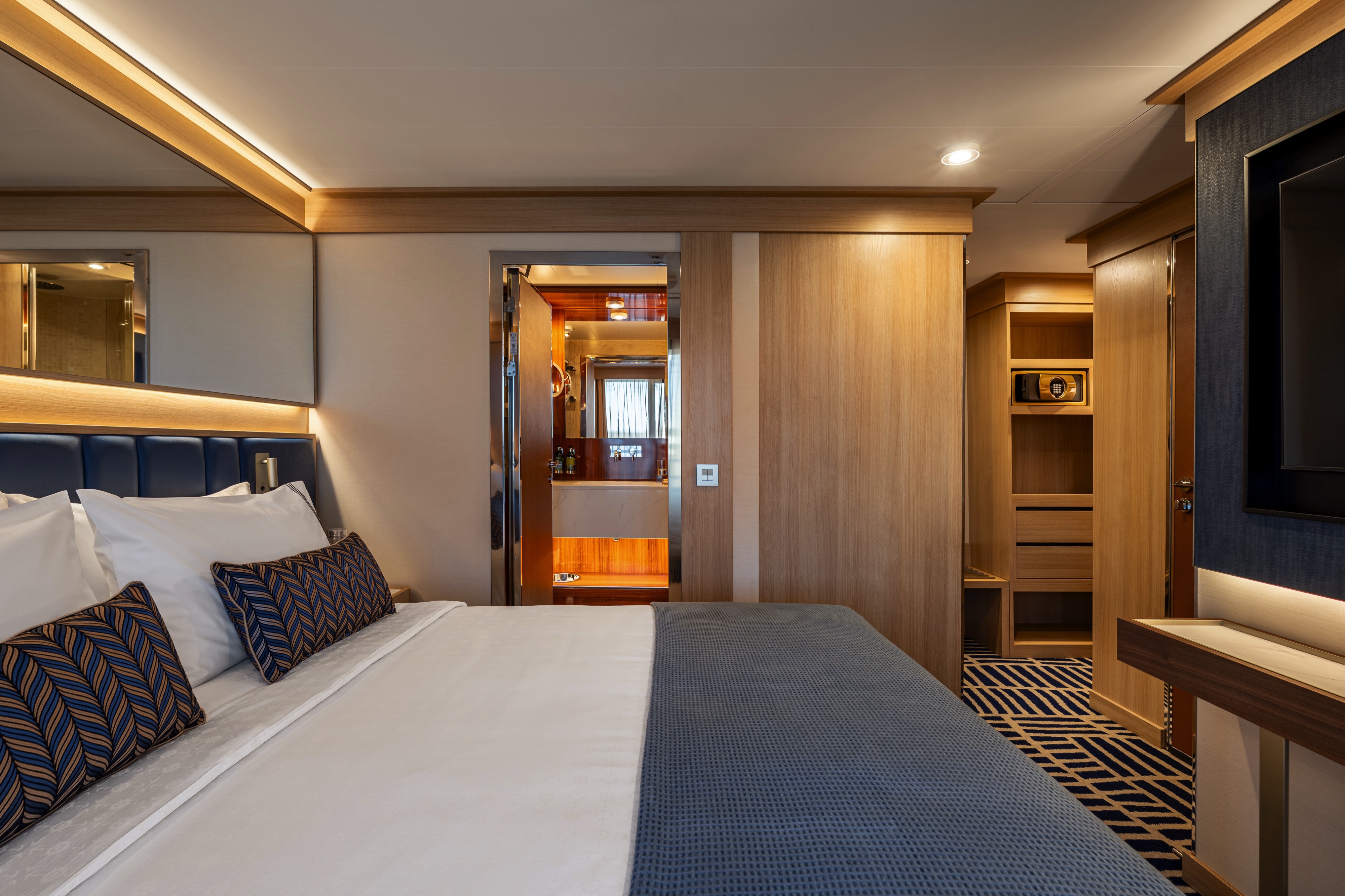
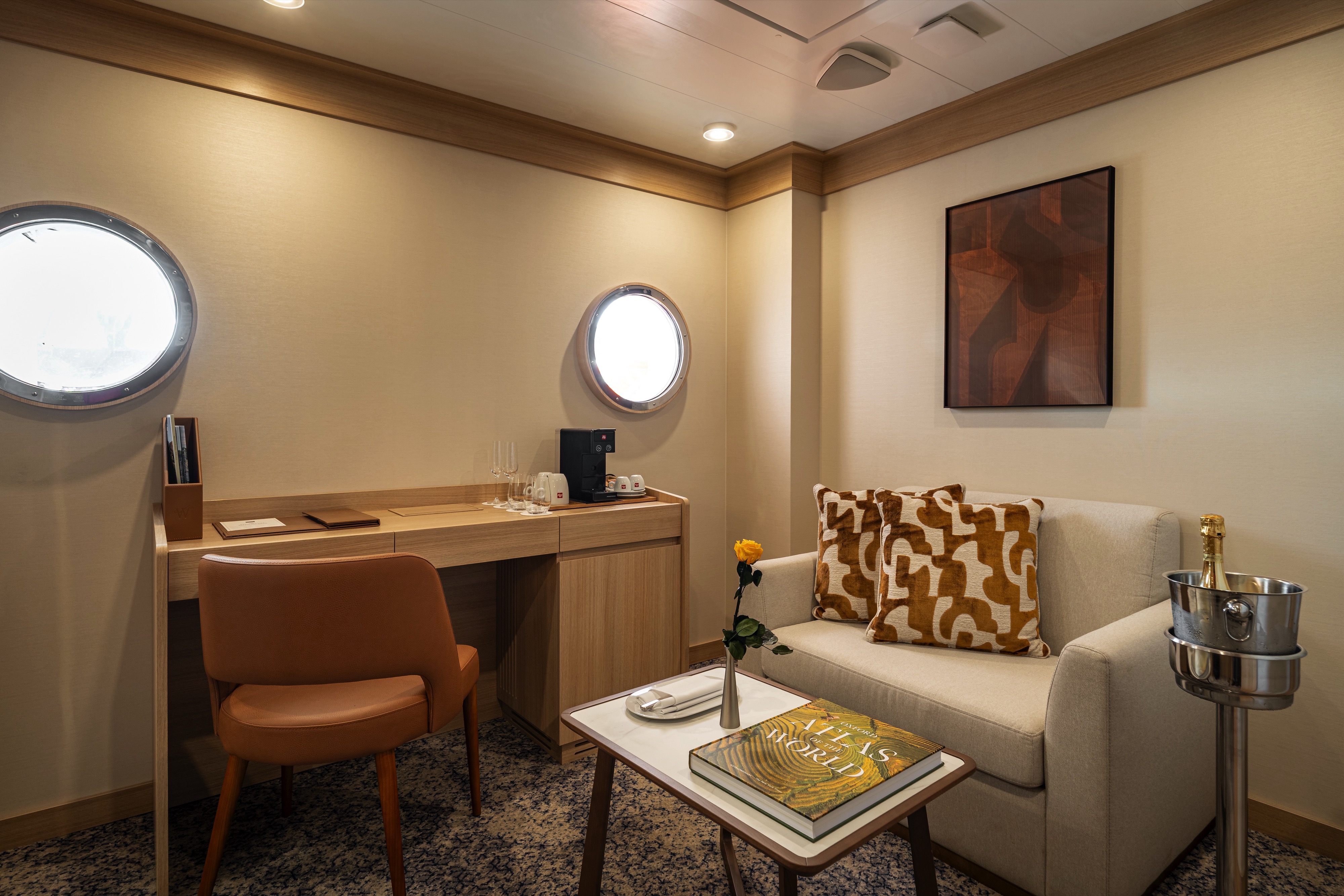
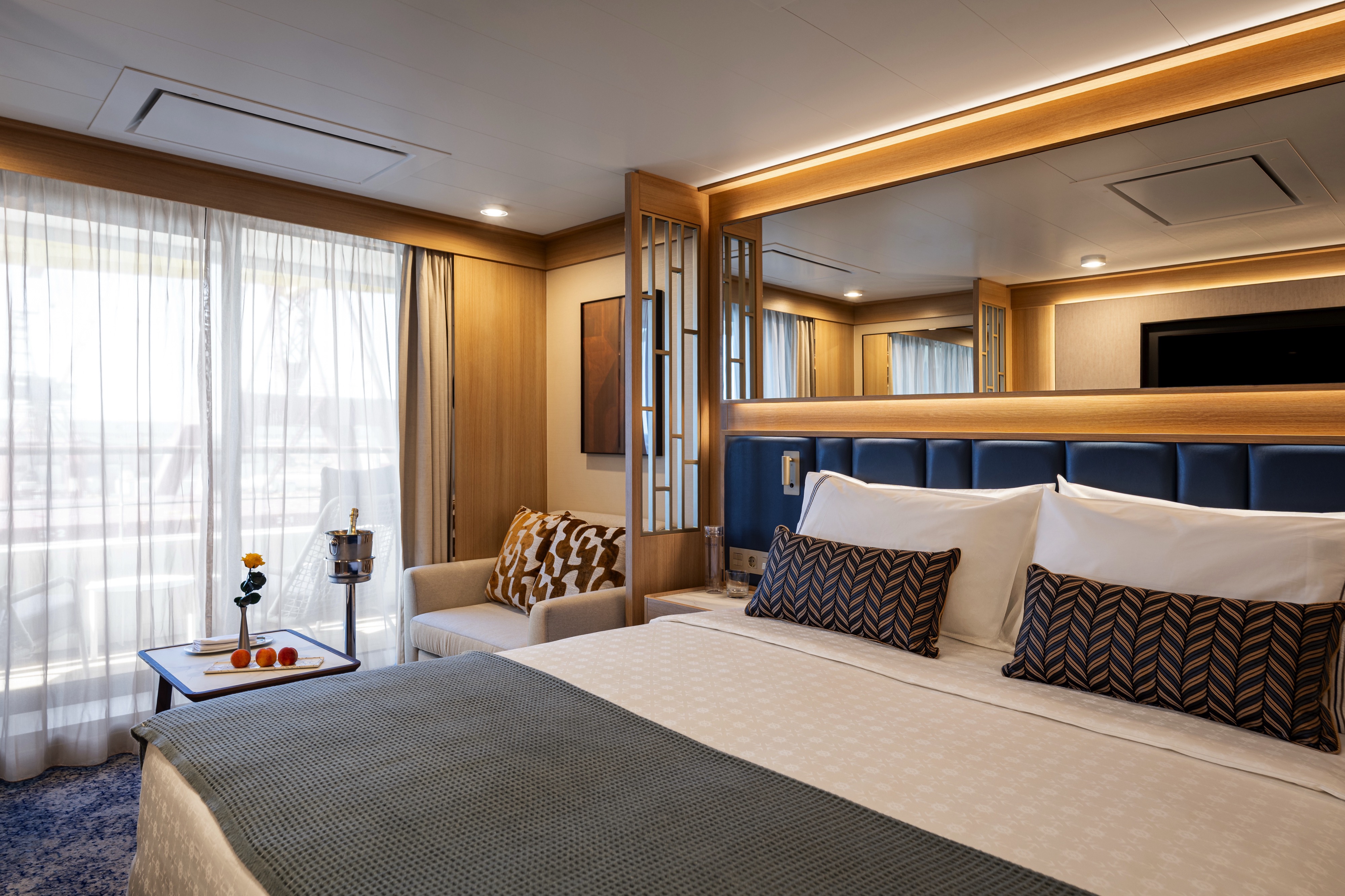
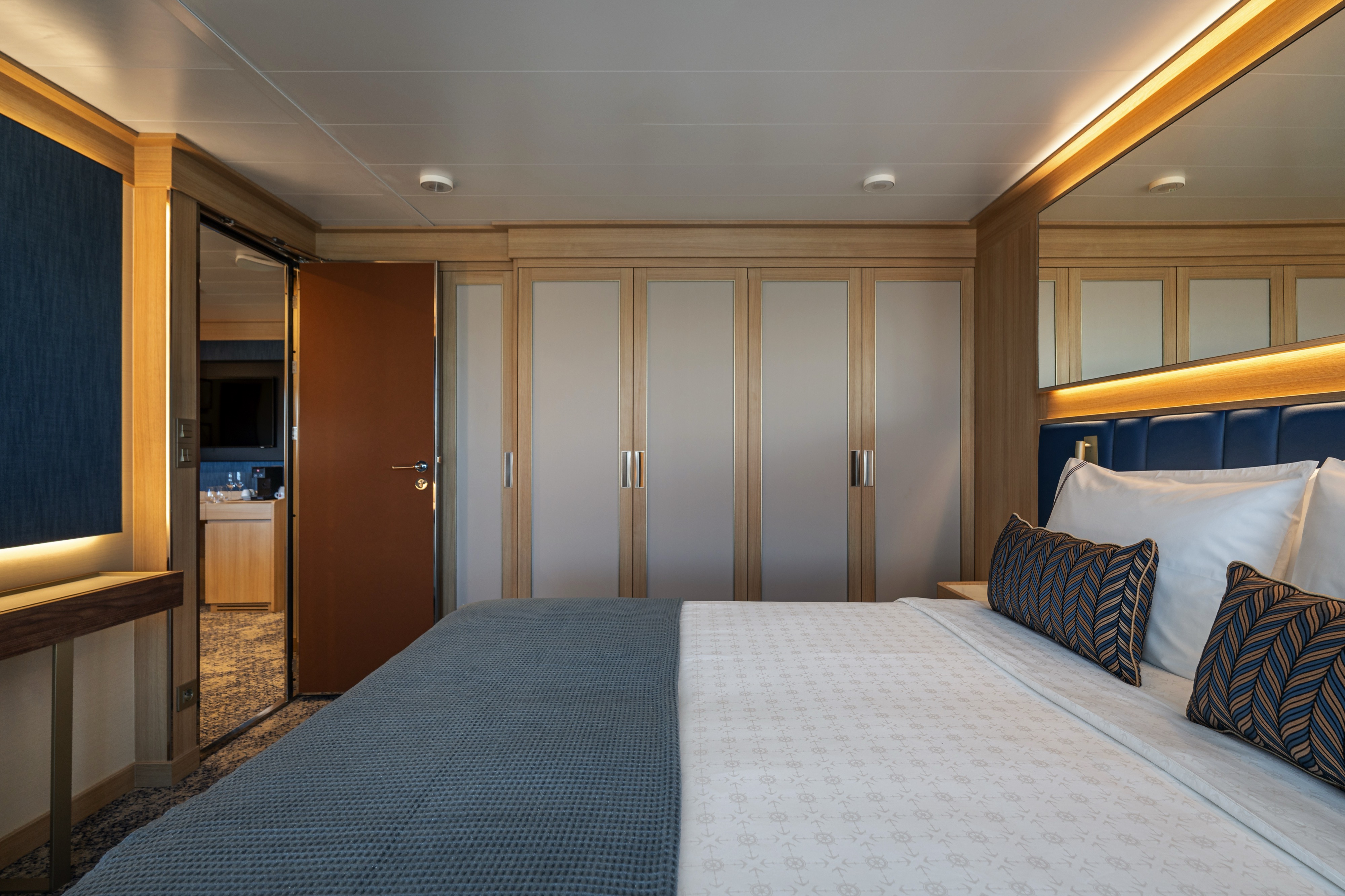
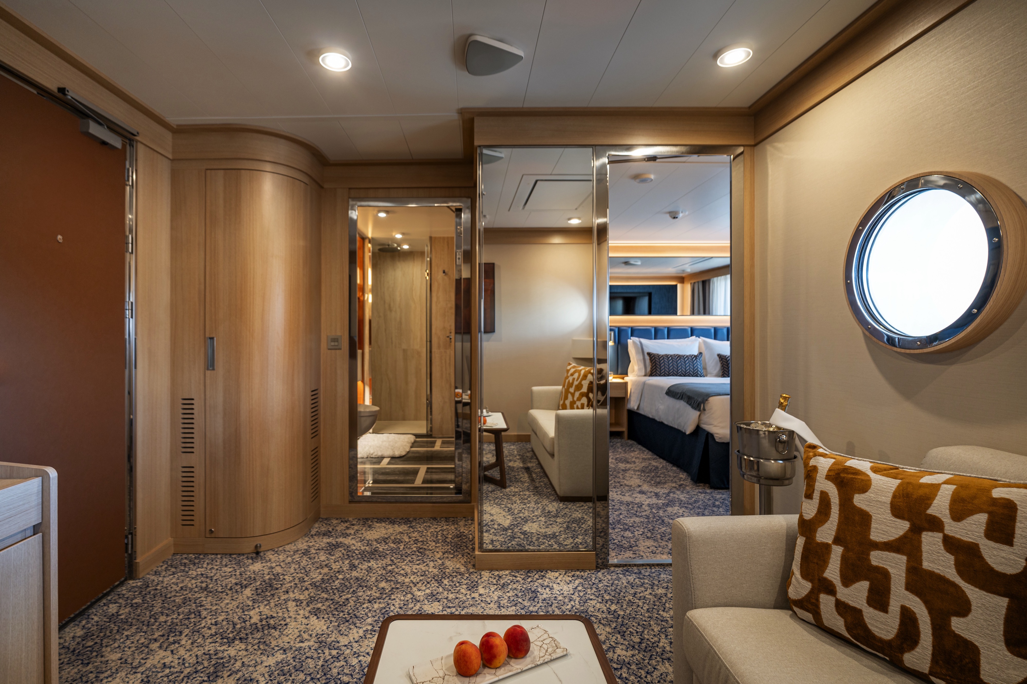
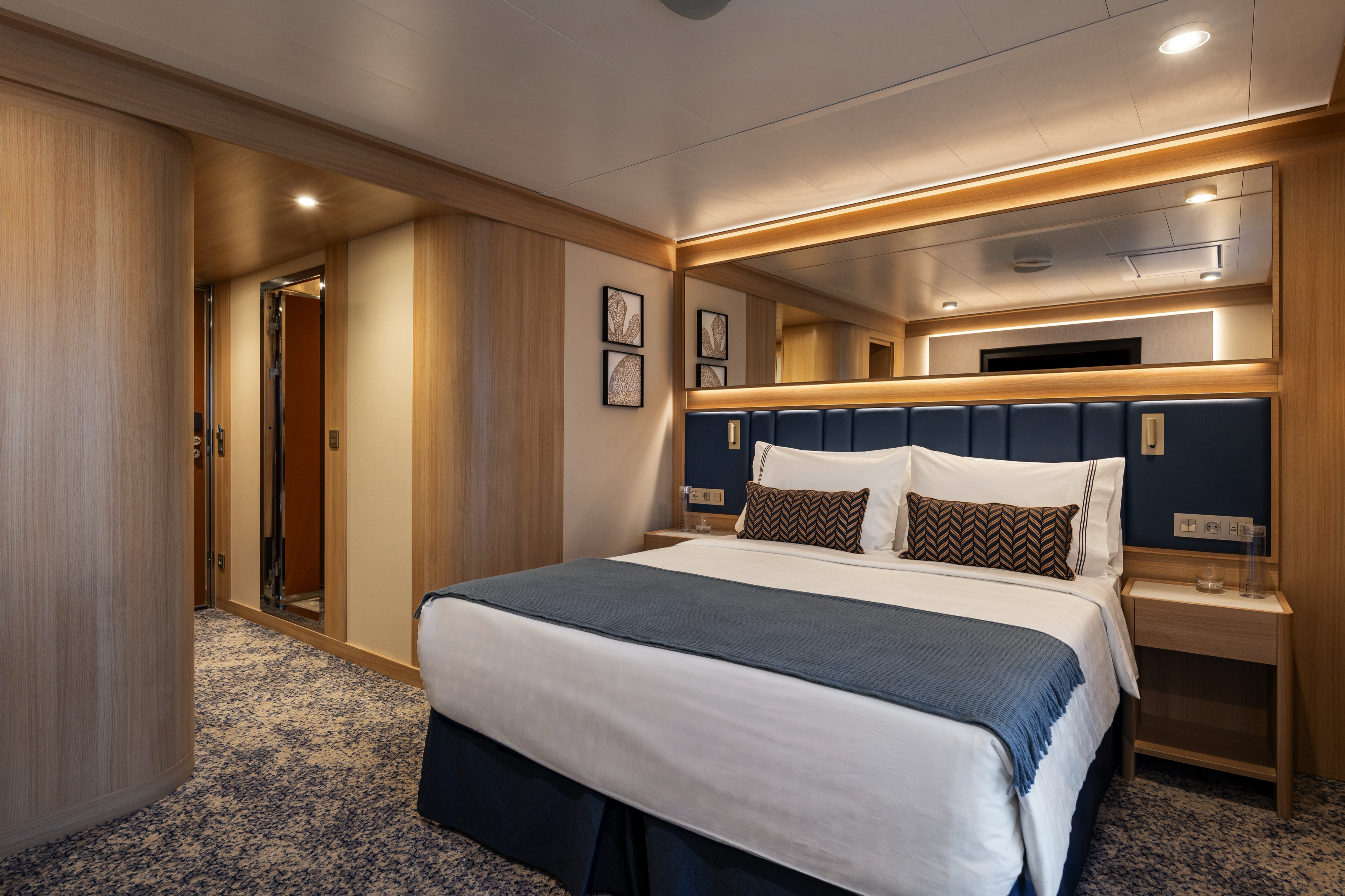
DECK | CABIN TYPE: Suite | 548 SQ FT
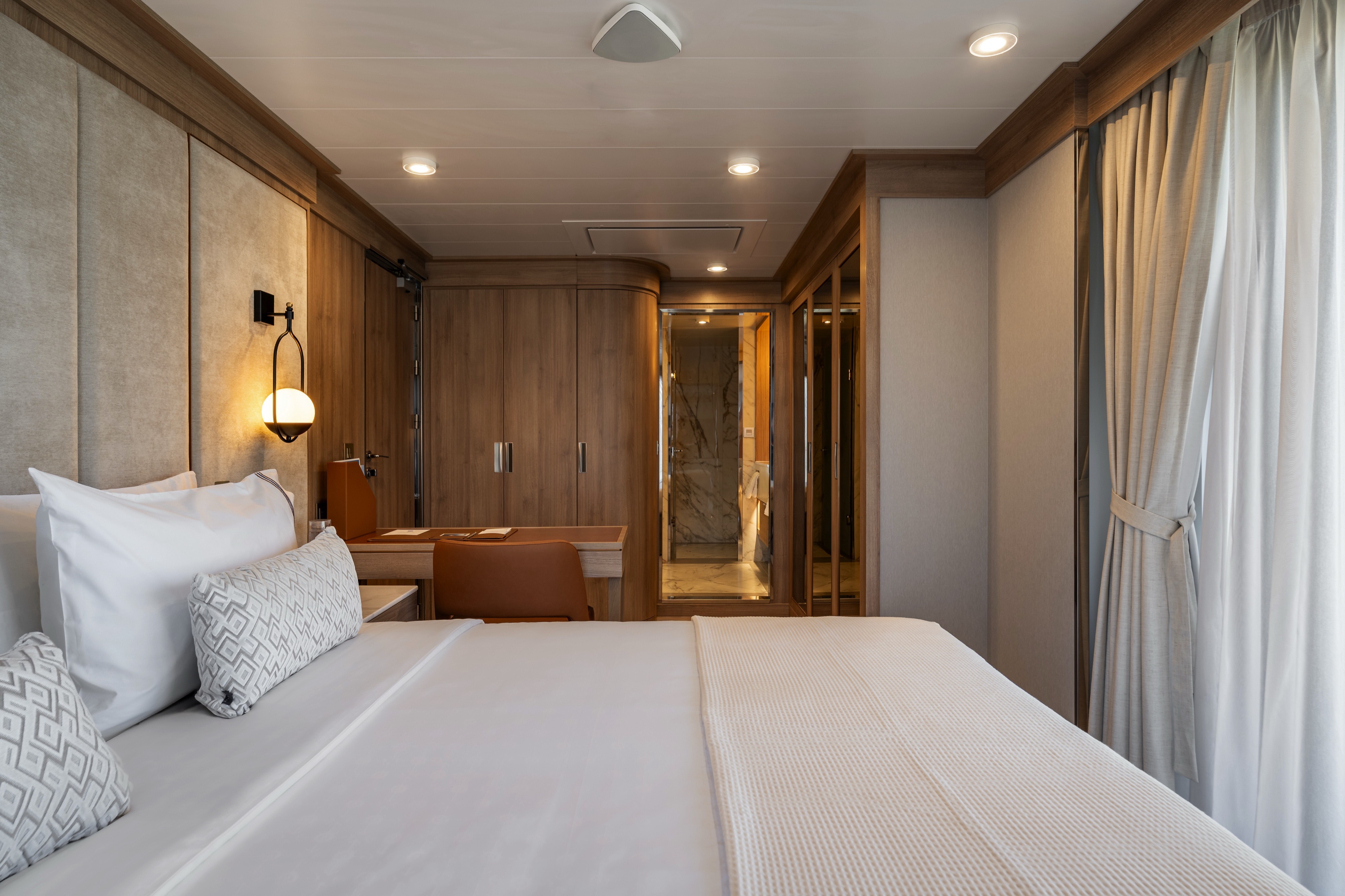
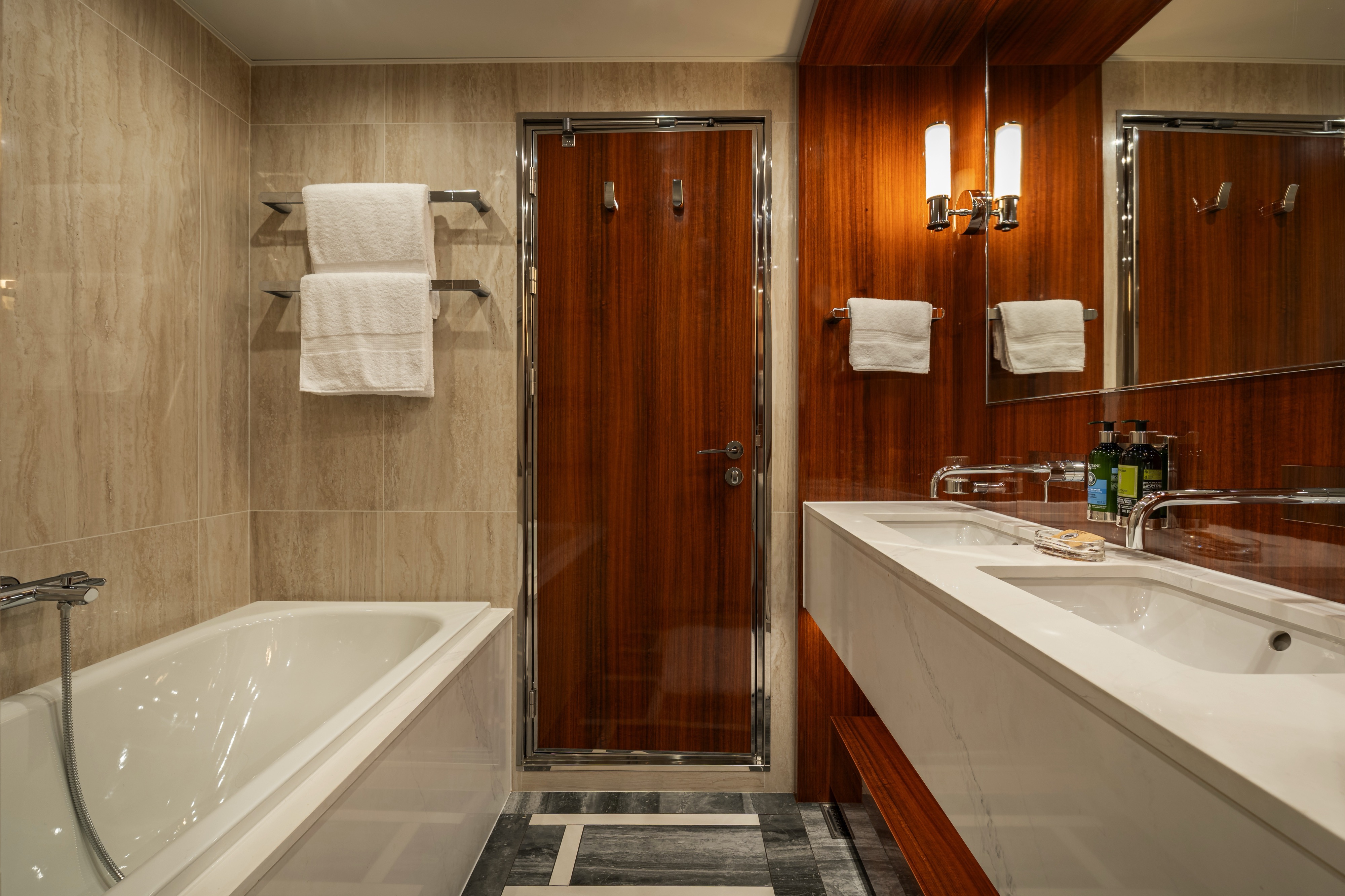
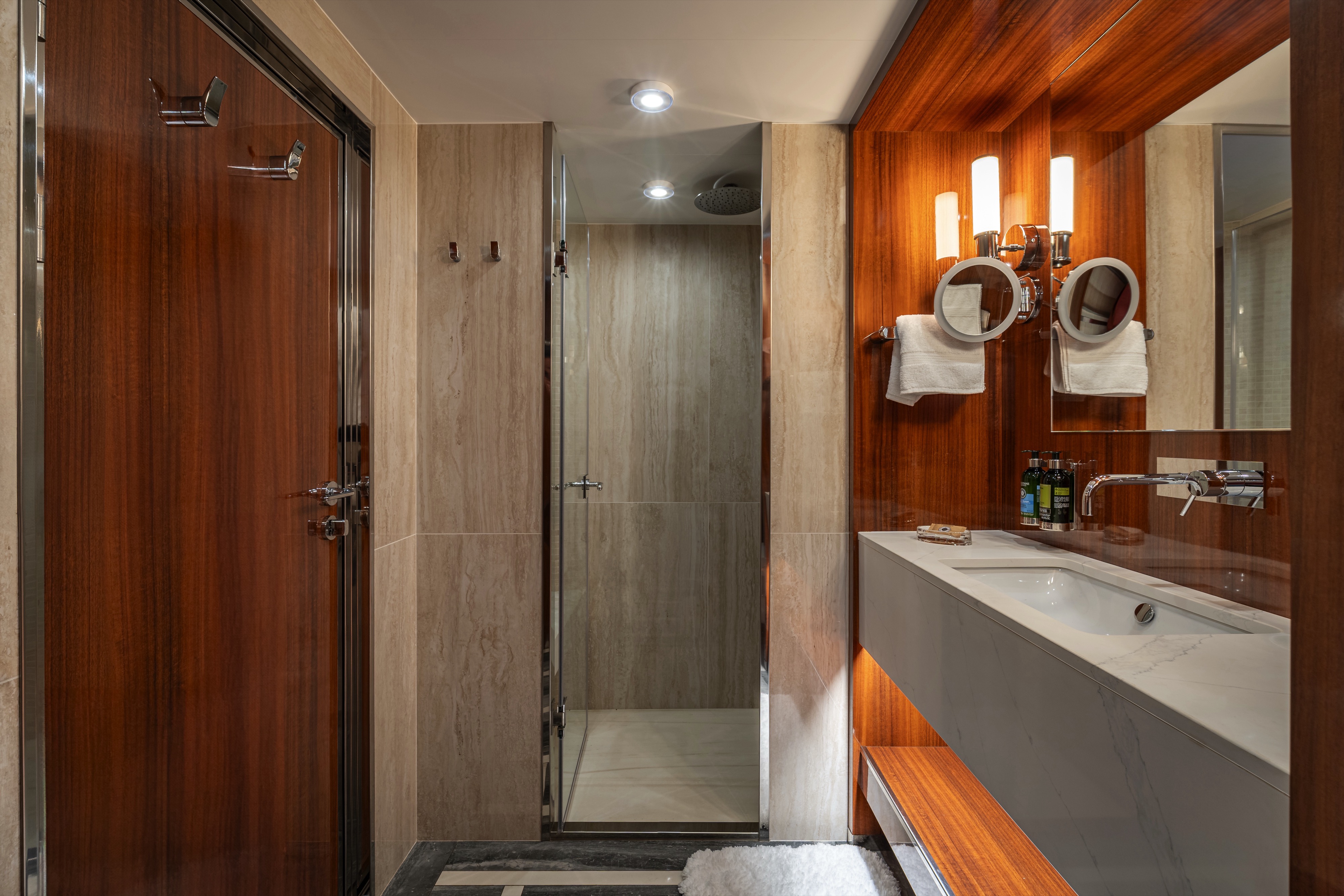
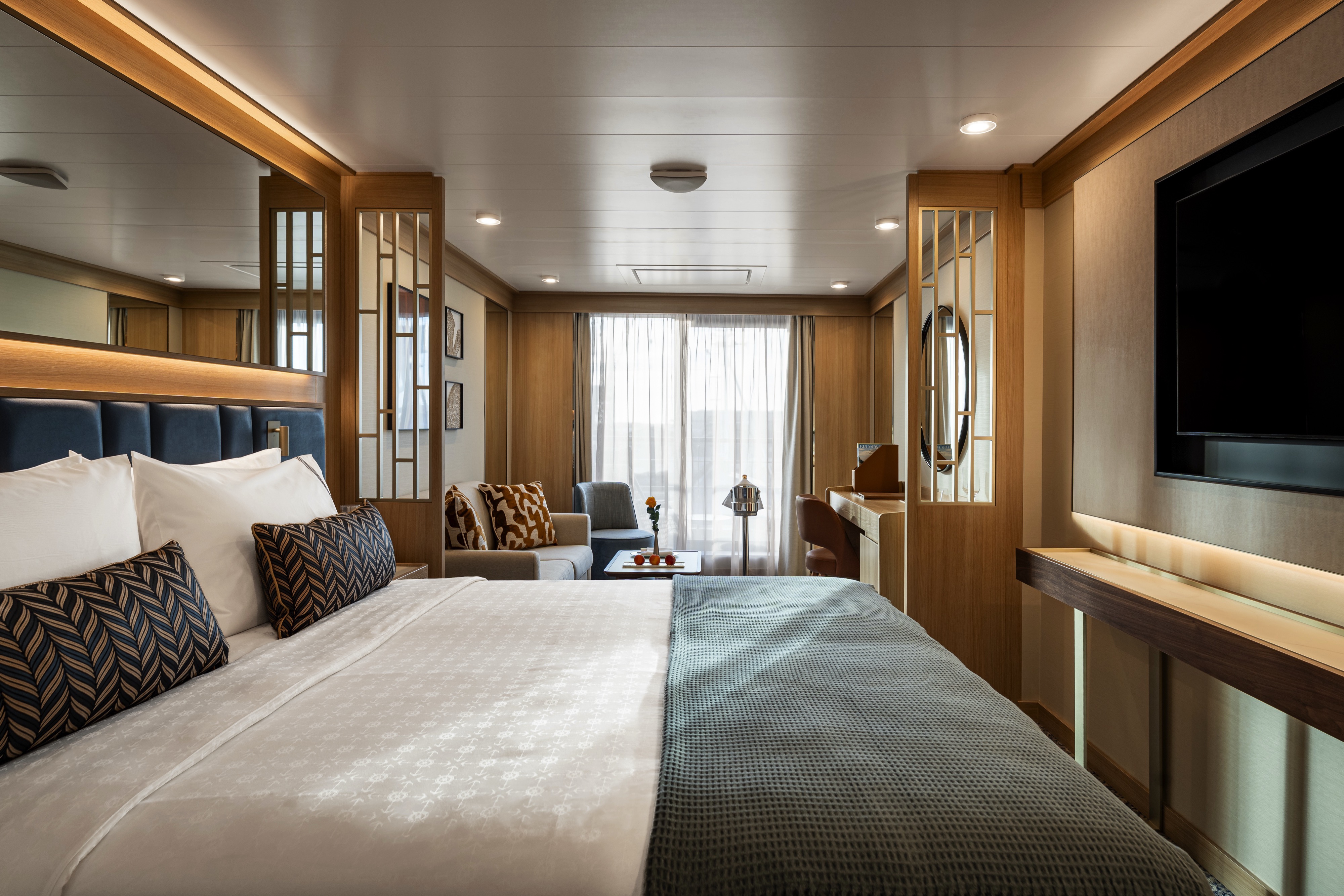
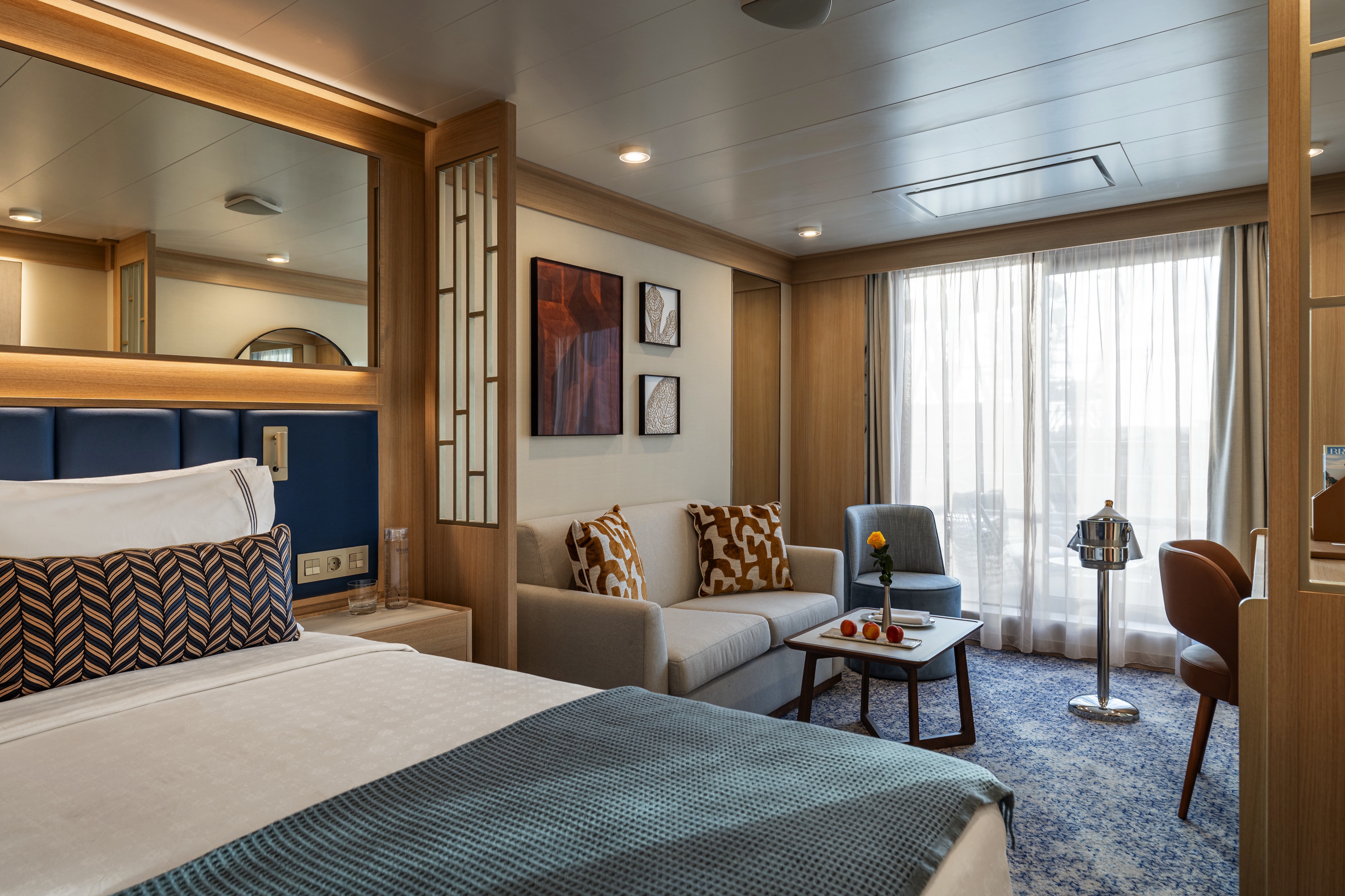
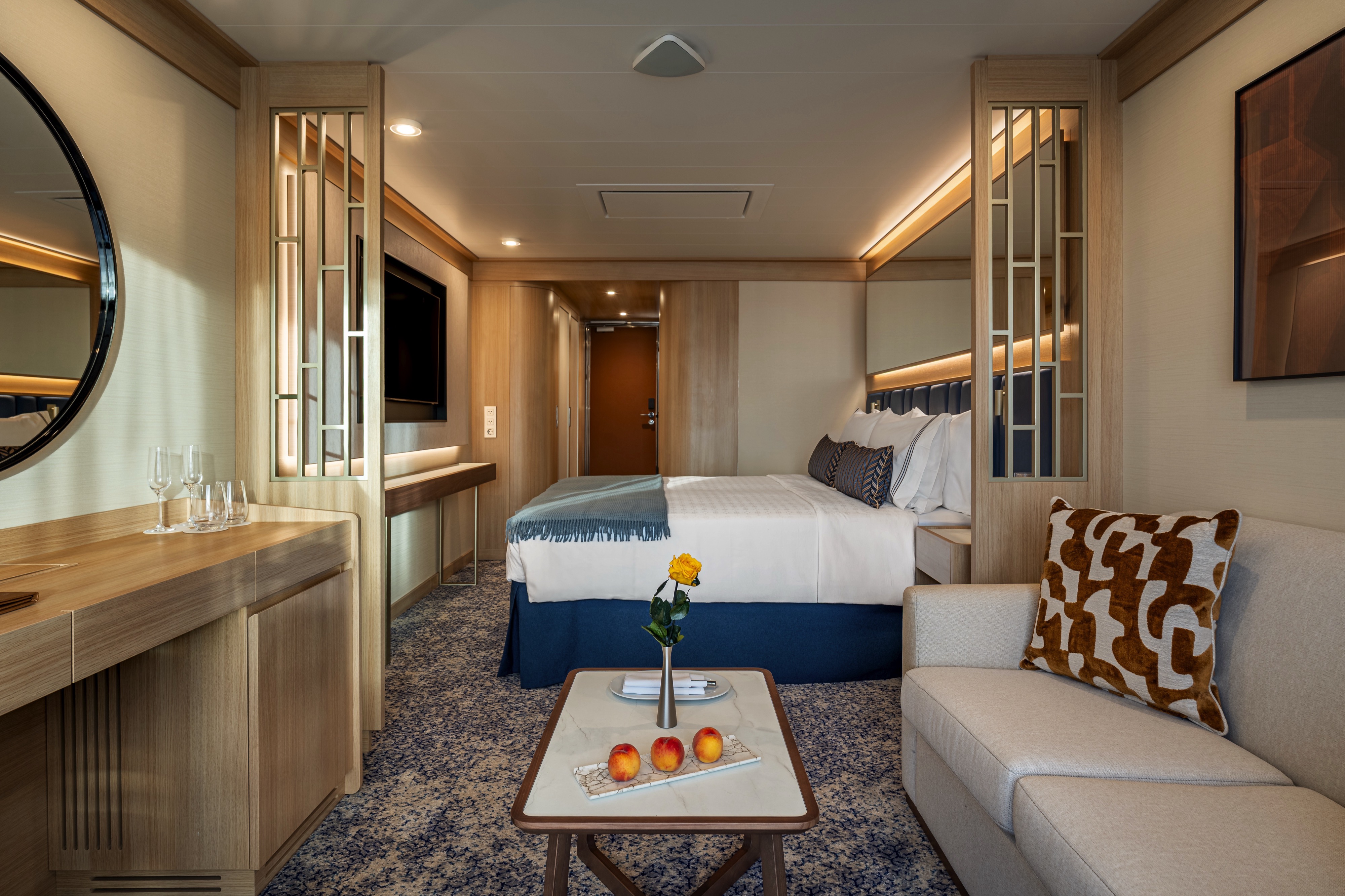
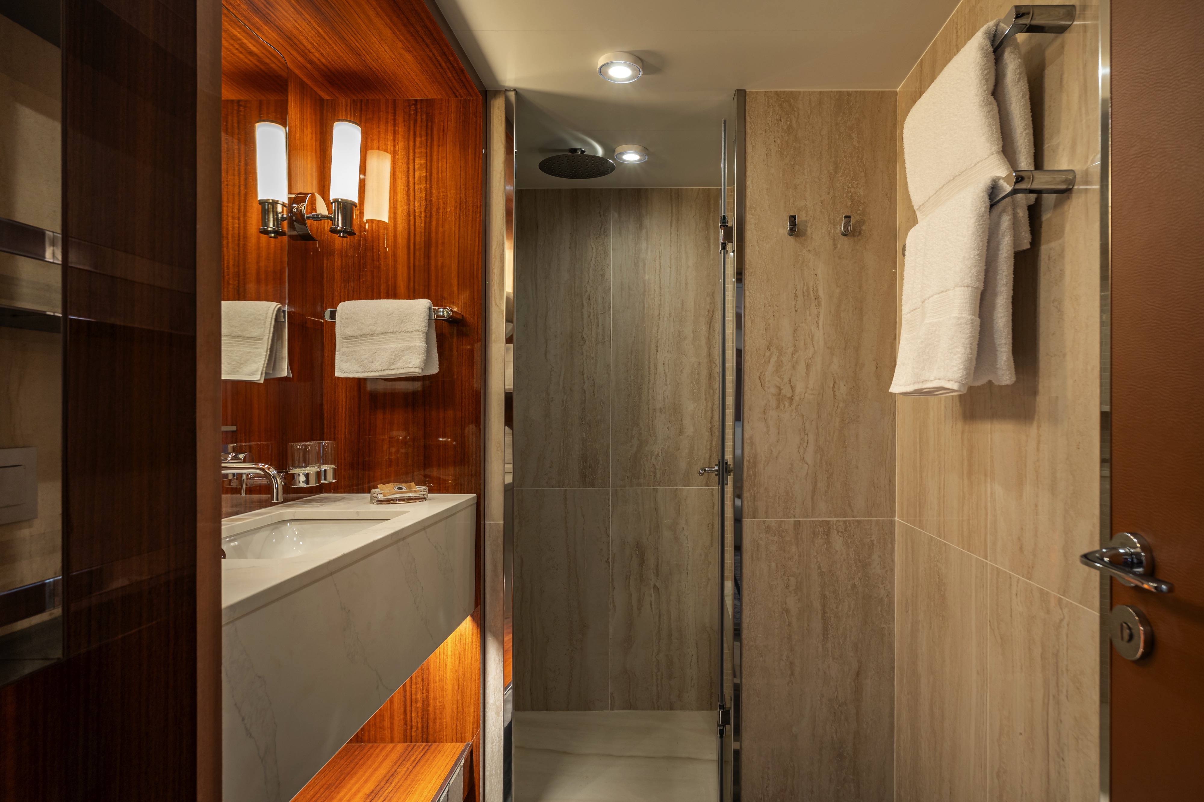
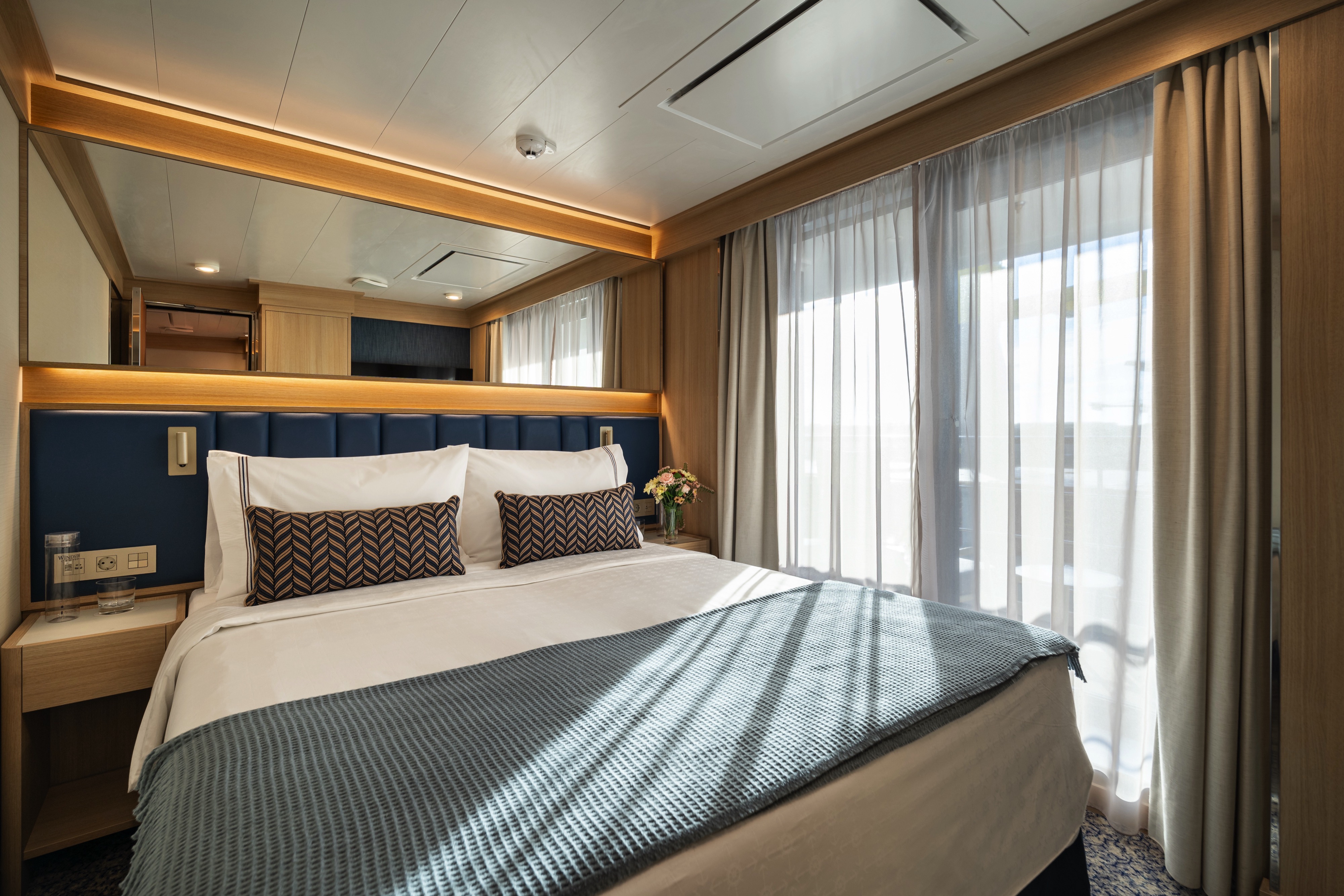
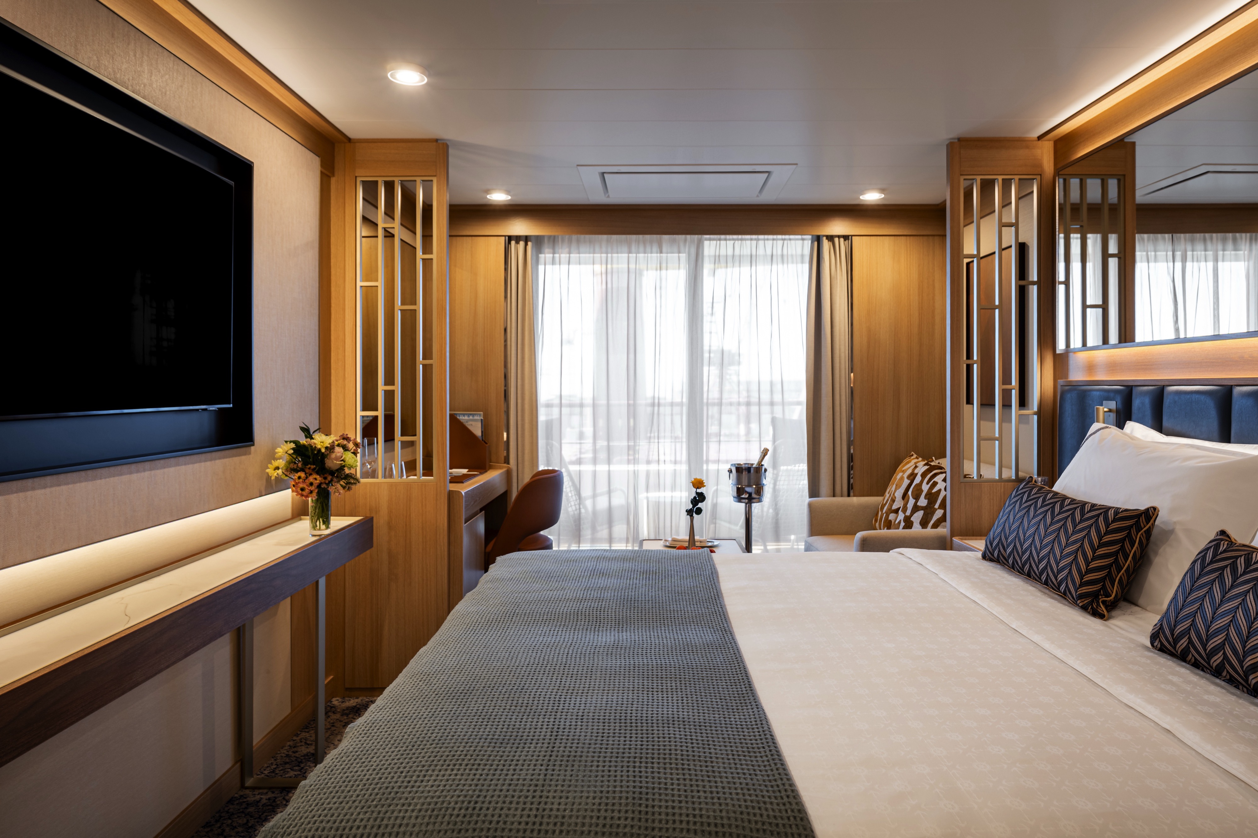
This luxurious 548-square-foot suite combines floor-to-ceiling windows and a wrap-around balcony for an unparalleled cruising experience. Perfect for evening cocktails or a private dinner, the wrap-around balcony adds 248 square feet of space and offers unobstructed views of the sea. The suite boasts a separate entryway — as well as separate dining and living areas — and a guest powder room. The bedroom includes an inviting king bed (convertible into two XL twin beds if desired), and the bathroom features a luxurious double walk-in mosaic glass shower with rain head and body jets. For family bookings, the adjacent suite can be combined to provide extra bedrooms and space for entertaining.
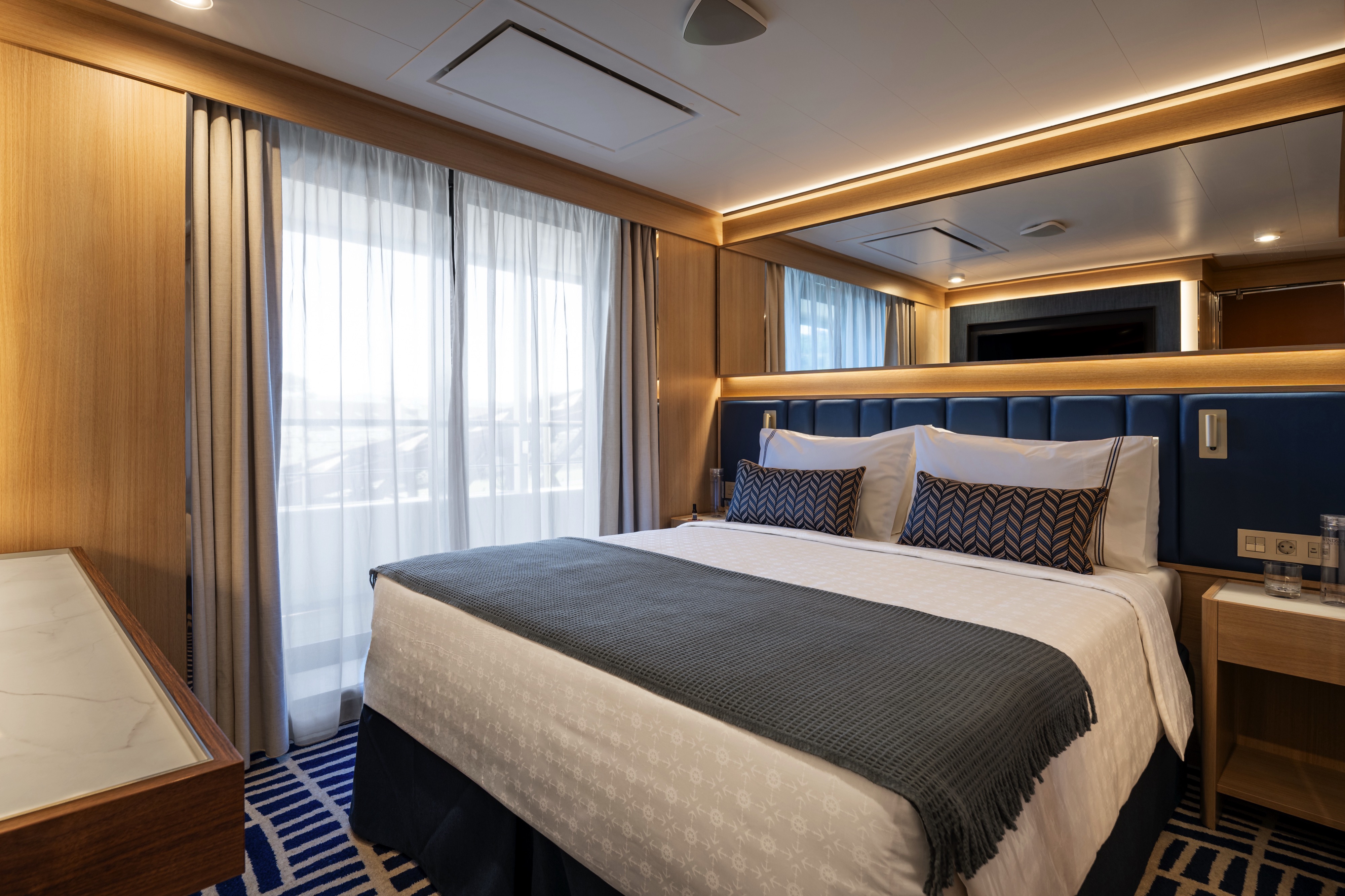
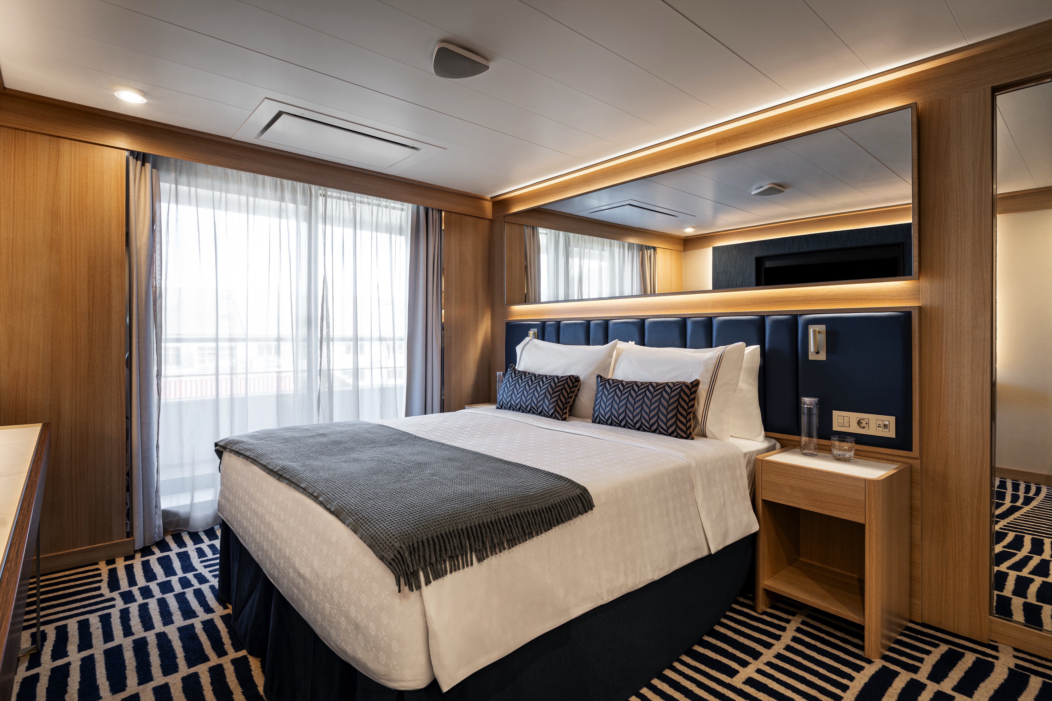
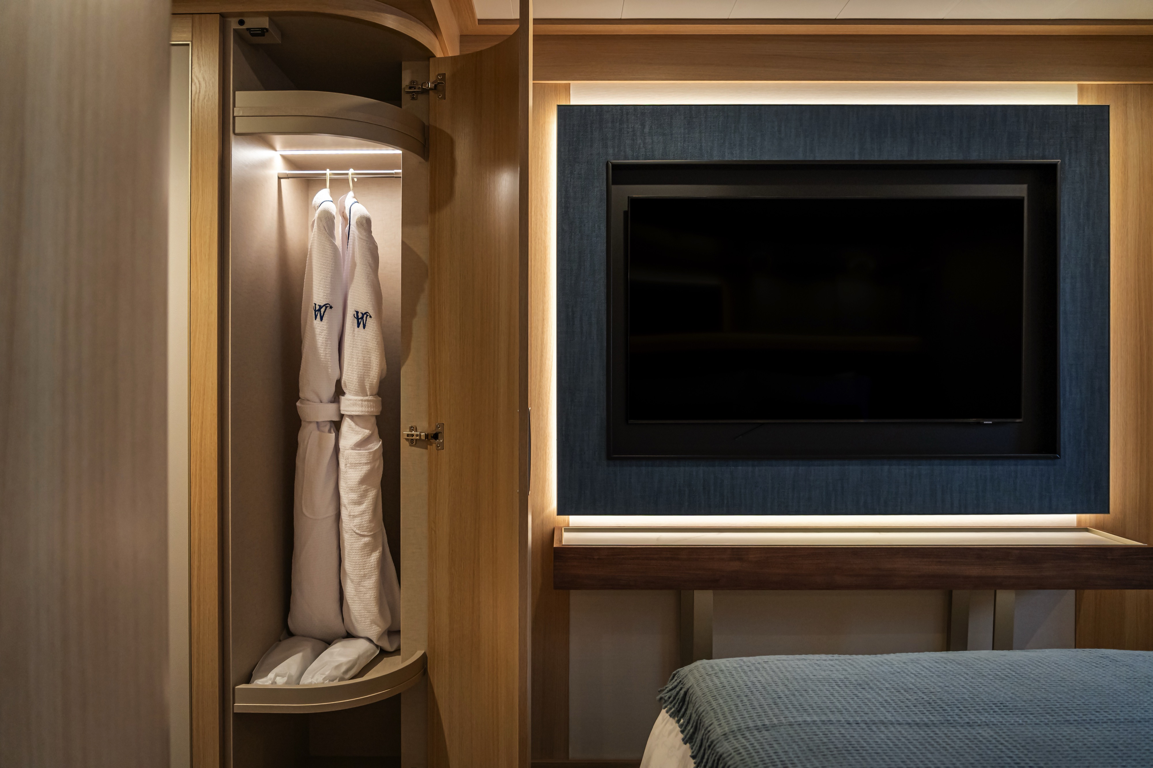
All Accommodations Feature
- Queen Size Bed with Luxurious Linens
- Waffle Weave Robe and Slippers
- Interactive TV
- Mini Bar/Refrigerator
- Safe
- Direct Dial Phone
- L'Occitane Bath Amenities
- Fresh Fruit
- Hair Dryers and 110/220 outlets
- Wi-Fi Internet Access (various plans available for purchase)
- Mirrored closet with ample drawer space
- Vanity with magnifying mirror and chair

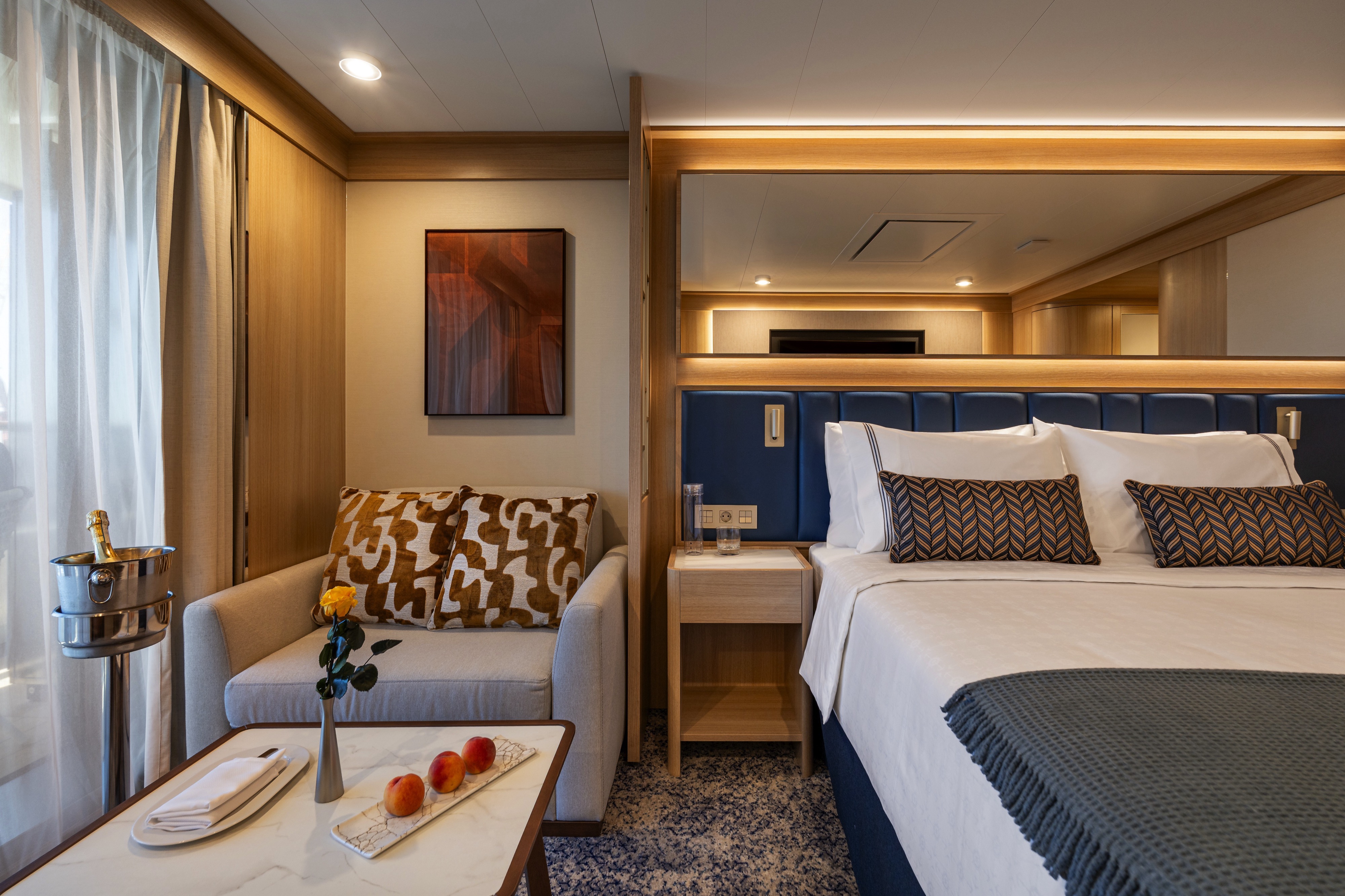
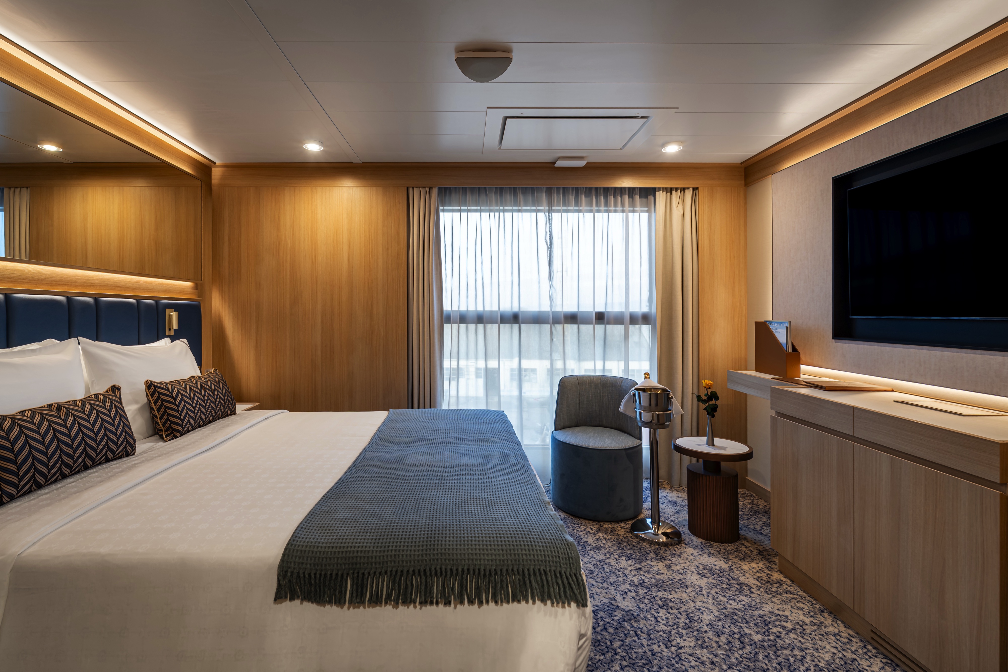
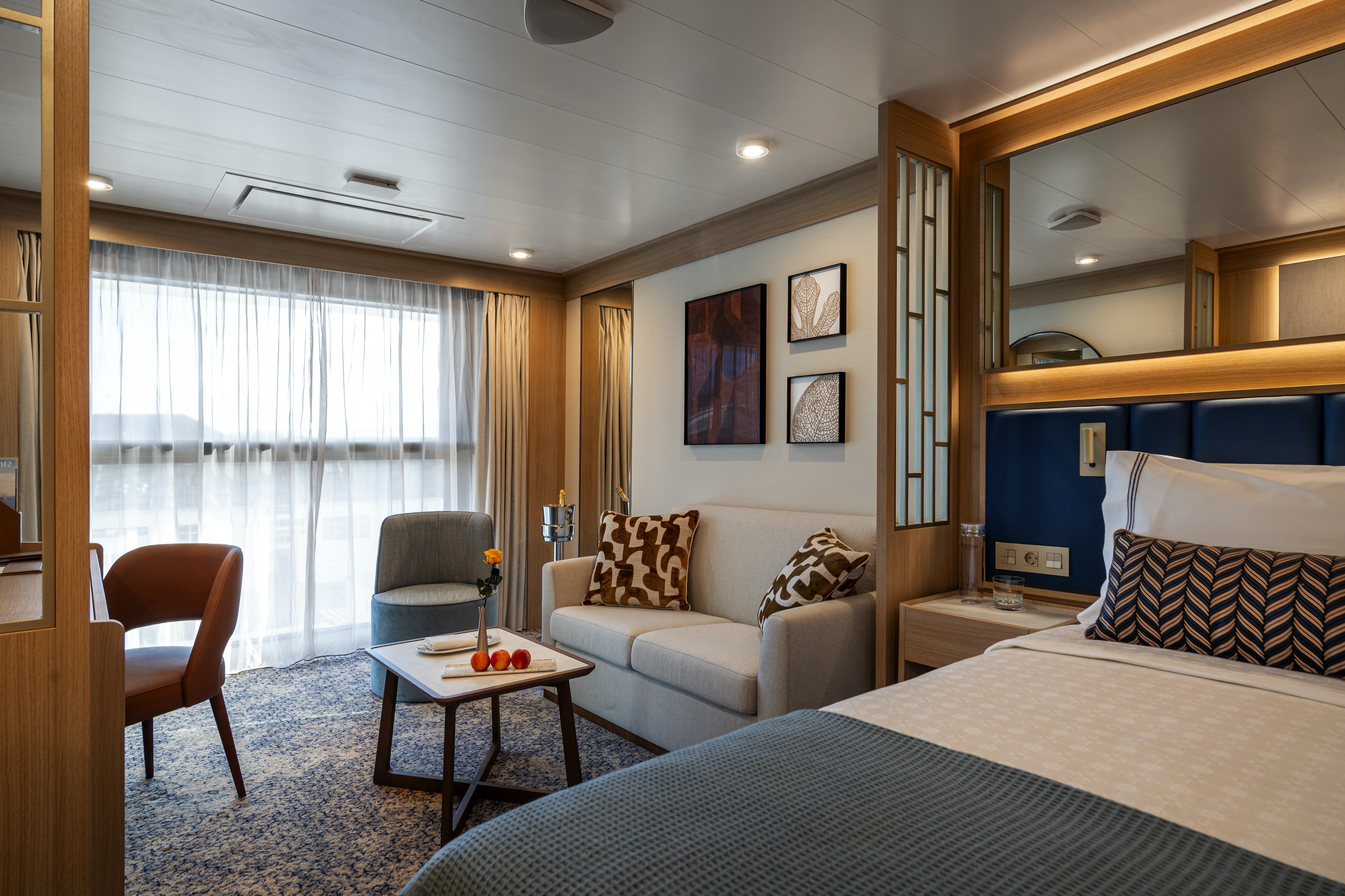
DECK | CABIN TYPE: Suite | 380 SQ FT
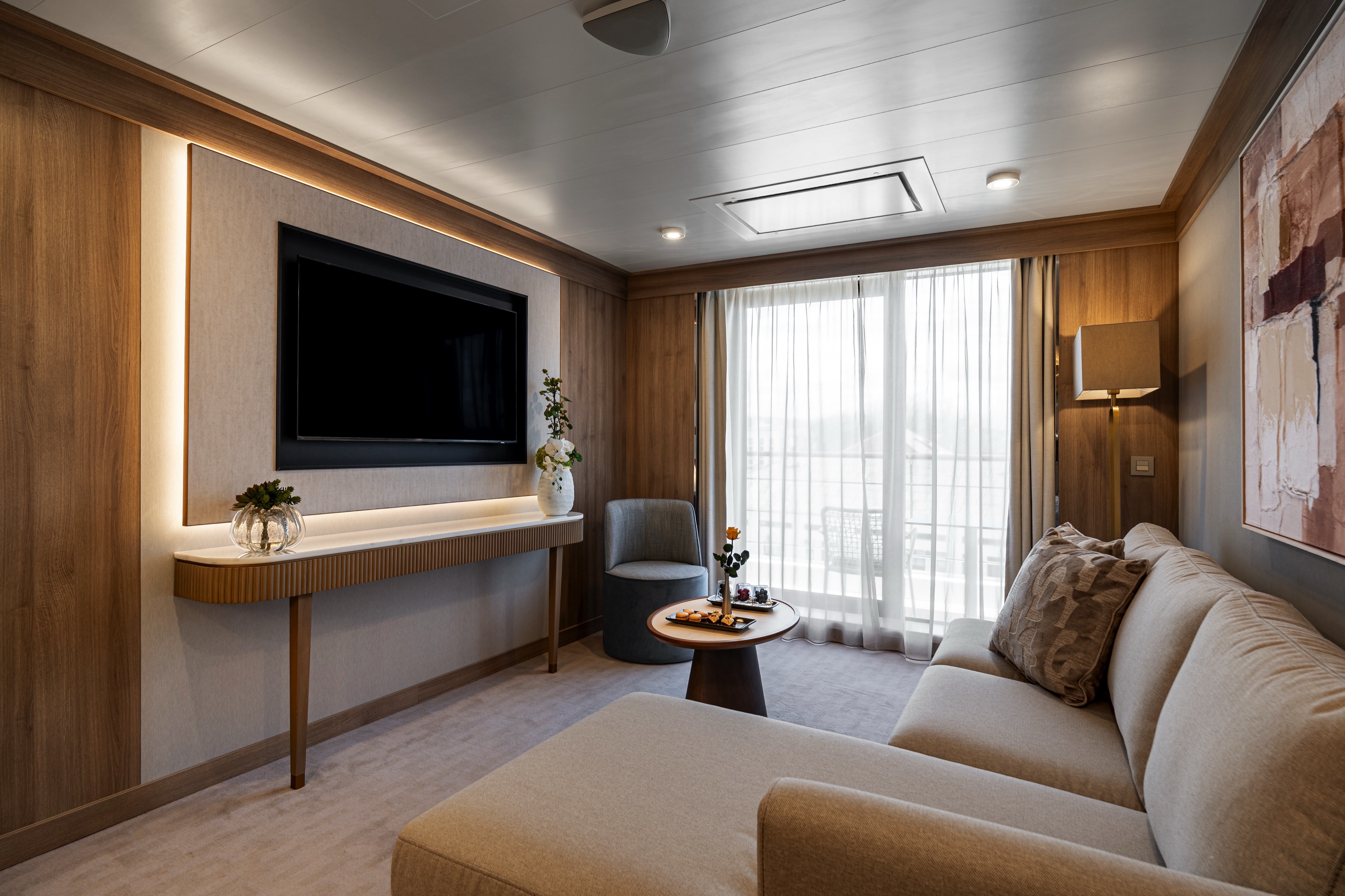
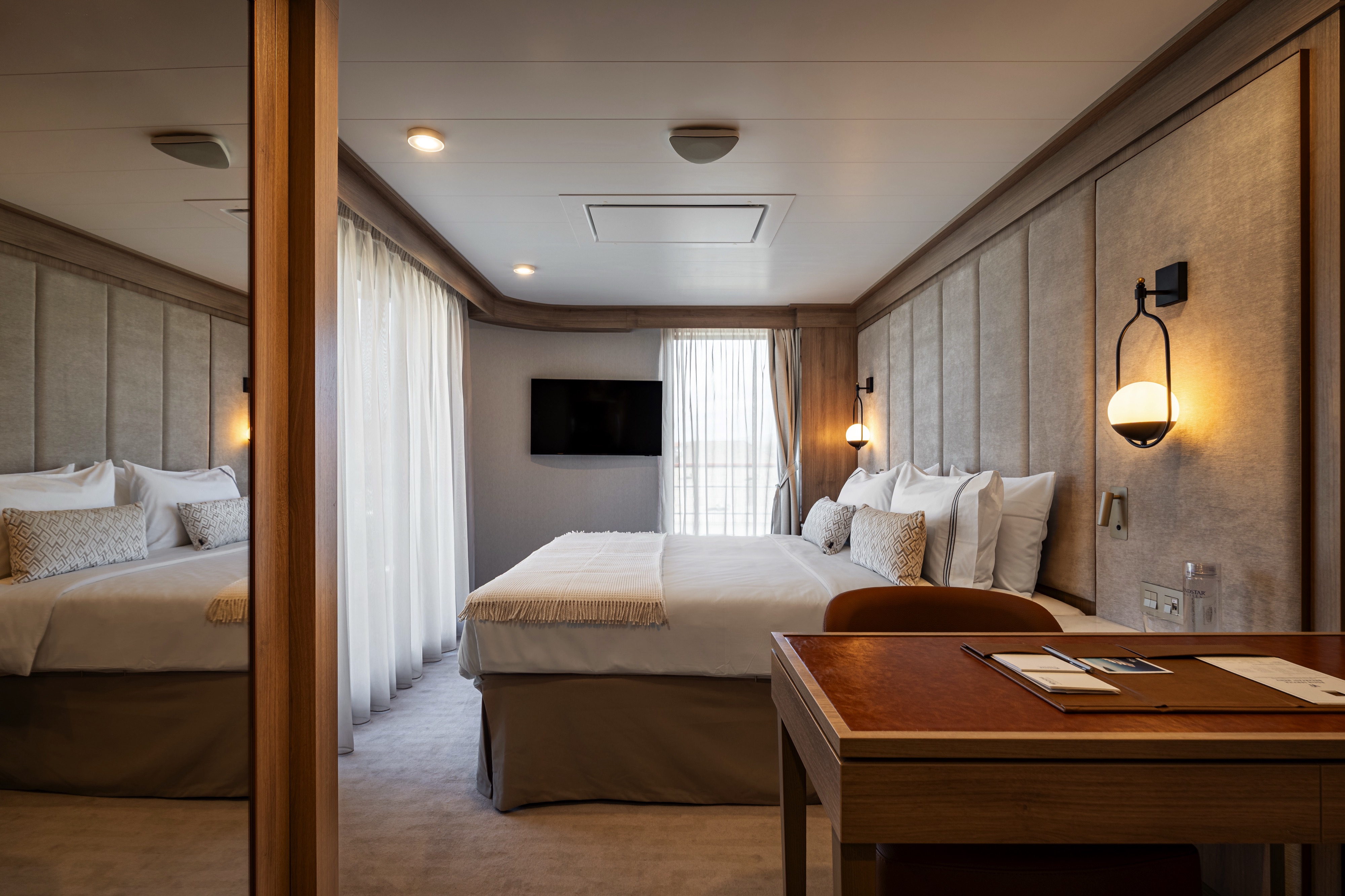
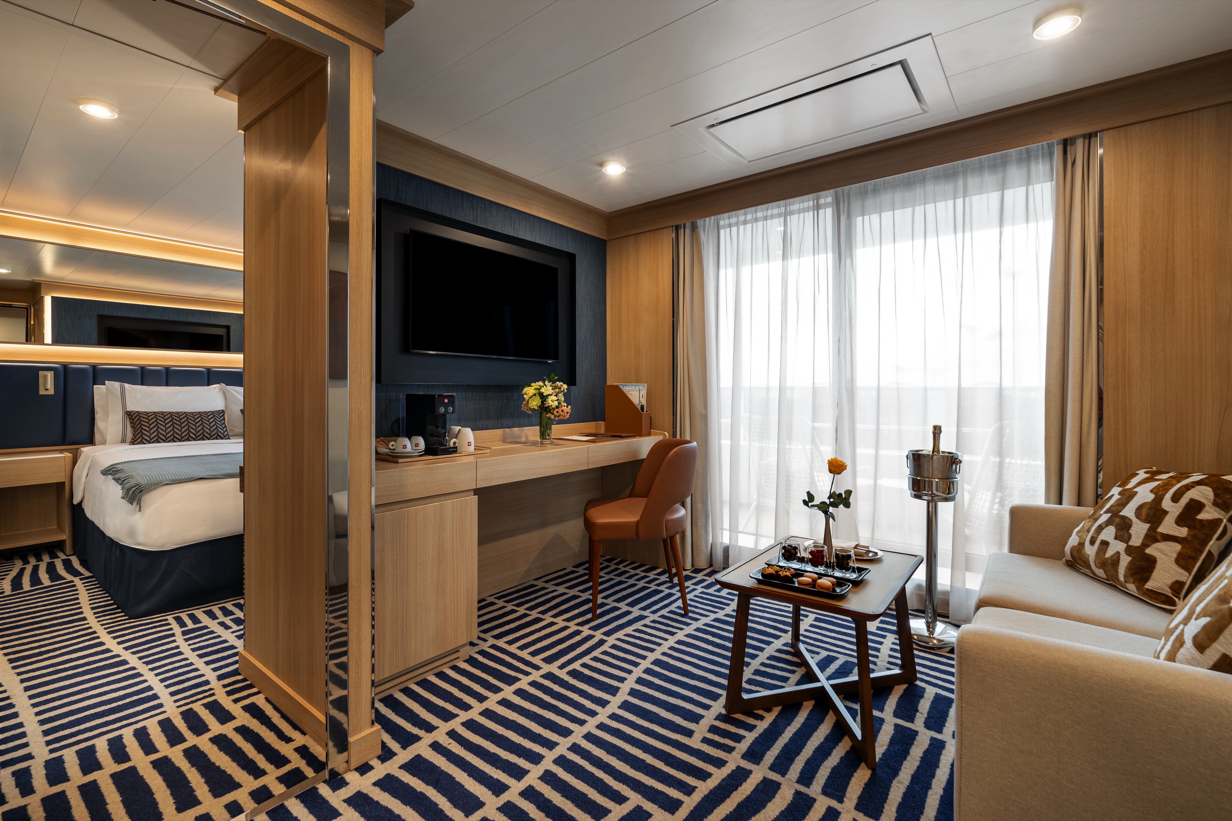
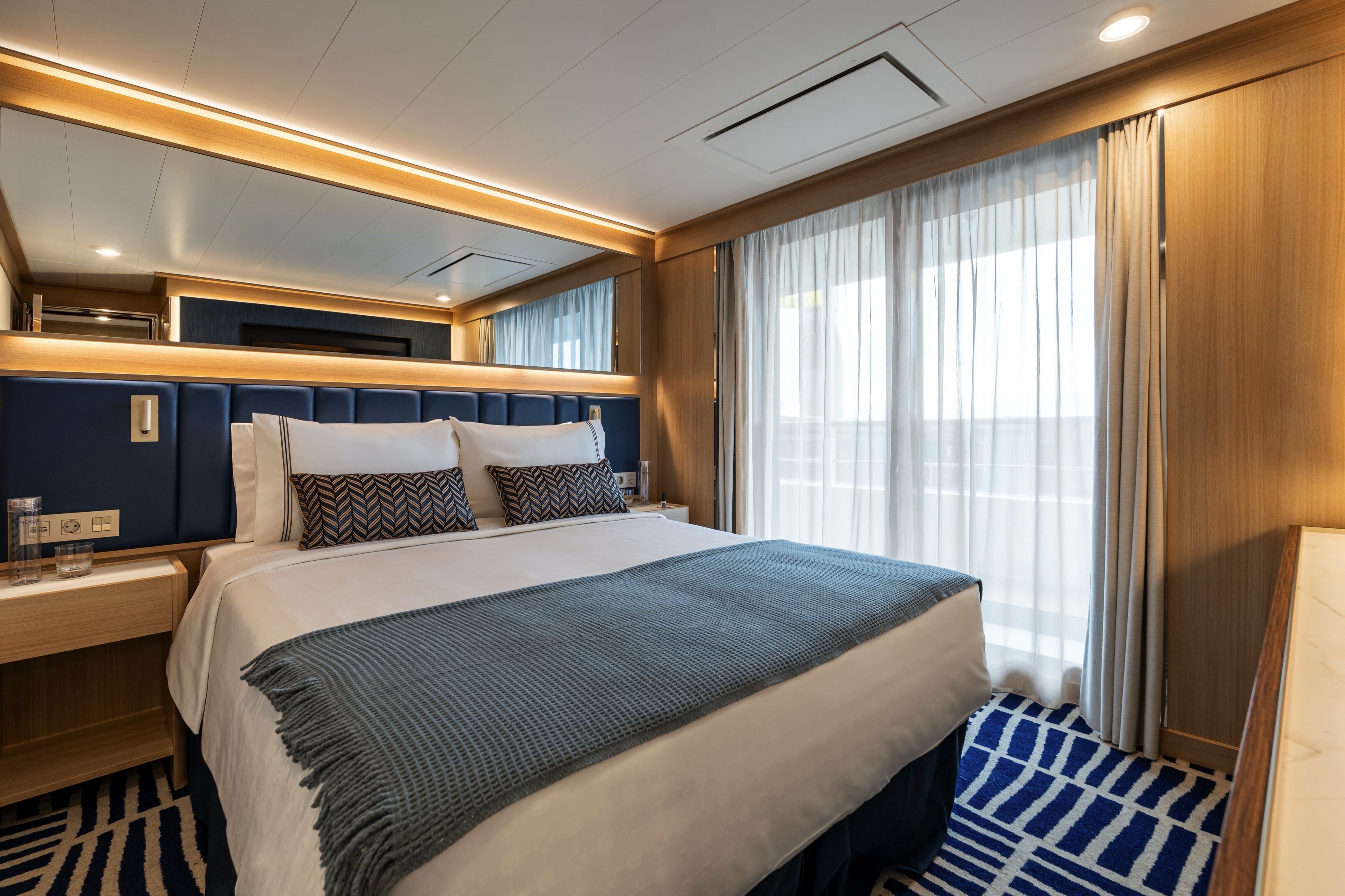
Step into a stylish and bright open living area with a spacious adjacent bedroom. This 380-square-foot suite welcomes you with spectacular views, courtesy of the sliding glass doors that lead out to your private balcony. The outdoor space adds another 110 square feet, enough to sit outside comfortably and enjoy the breeze. The bedroom features an inviting queen bed (convertible into two twin beds if desired) and its own sliding glass door with balcony access, while the bathroom includes a bathtub and walk-in mosaic glass shower with rain head and body jets.
All Accommodations Feature
- Queen Size Bed with Luxurious Linens
- Waffle Weave Robe and Slippers
- Interactive TV
- Mini Bar/Refrigerator
- Safe
- Direct Dial Phone
- L'Occitane Bath Amenities
- Fresh Fruit
- Hair Dryers and 110/220 outlets
- Wi-Fi Internet Access (various plans available for purchase)
- Mirrored closet with ample drawer space
- Vanity with magnifying mirror and chair
DECK | CABIN TYPE: Suite | 288 SQ FT
This 288-square-foot suite welcomes you with spectacular views, courtesy of the sliding glass doors that lead out to your private balcony. The outdoor space adds another 110 square feet, enough to sit outside comfortably and enjoy the breeze. The bedroom features an inviting queen bed and its own sliding glass door with balcony access, while the bathroom includes a luxurious walk-in mosaic glass shower with rain head and body jets.
All Accommodations Feature
- Queen Size Bed with Luxurious Linens
- Waffle Weave Robe and Slippers
- Interactive TV
- Mini Bar/Refrigerator
- Safe
- Direct Dial Phone
- L'Occitane Bath Amenities
- Fresh Fruit
- Hair Dryers and 110/220 outlets
- Wi-Fi Internet Access (various plans available for purchase)
- Mirrored closet with ample drawer space
- Vanity with magnifying mirror and chair
DECK | CABIN TYPE: Suite | 353 SQ FT
Step into a stylish and bright open living area with a spacious adjacent bedroom. This 353-square-foot suite welcomes you with spectacular views, courtesy of the sliding glass doors that lead out to your private balcony. The outdoor space adds another 110 square feet, enough to sit outside comfortably and enjoy the breeze. The bedroom features an inviting queen bed that can be converted into two twins if desired, while the bathroom includes a luxurious walk-in mosaic glass shower with rain head and body jets.
All Accommodations Feature
- Queen Size Bed with Luxurious Linens
- Waffle Weave Robe and Slippers
- Interactive TV
- Mini Bar/Refrigerator
- Safe
- Direct Dial Phone
- L'Occitane Bath Amenities
- Fresh Fruit
- Hair Dryers and 110/220 outlets
- Wi-Fi Internet Access (various plans available for purchase)
- Mirrored closet with ample drawer space
- Vanity with magnifying mirror and chair
DECK 7 | CABIN TYPE: SUITE | 268 SQ FT
Located on deck 7, this 268-square-foot suite welcomes you with stylish comfort and stunning ocean views. Relax on your queen bed (convertible into two twin beds if desired) or lounge in the nearby living area. The outdoor space adds another 55 square feet, enough to sit outside comfortably and enjoy the breeze. In the bathroom, you’ll find a luxurious walk-in mosaic glass shower with rain head and body jets.
All Accommodations Feature
- Queen Size Bed with Luxurious Linens
- Waffle Weave Robe and Slippers
- Interactive TV
- Mini Bar/Refrigerator
- Safe
- Direct Dial Phone
- L'Occitane Bath Amenities
- Fresh Fruit
- Hair Dryers and 110/220 outlets
- Wi-Fi Internet Access (various plans available for purchase)
- Mirrored closet with ample drawer space
- Vanity with magnifying mirror and chair
DECK 6 | CABIN TYPE: Suite | 246 SQ FT
Located on deck 6, this 246-square-foot suite welcomes you with stylish comfort and stunning ocean views. Featuring an inviting queen bed (convertible into two twin beds if desired) and a pull-out sofa in the living area, the suite allows for triple occupancy. The outdoor space adds another 55 square feet, enough to sit outside comfortably and enjoy the breeze. In the bathroom, you’ll find a luxurious walk-in mosaic glass shower with rain head and body jets.
All Accommodations Feature
- Queen Size Bed with Luxurious Linens
- Waffle Weave Robe and Slippers
- Interactive TV
- Mini Bar/Refrigerator
- Safe
- Direct Dial Phone
- L'Occitane Bath Amenities
- Fresh Fruit
- Hair Dryers and 110/220 outlets
- Wi-Fi Internet Access (various plans available for purchase)
- Mirrored closet with ample drawer space
- Vanity with magnifying mirror and chair
DECK | CABIN TYPE: Suite | 225 SQ FT
Stylish comfort and ocean views welcome you to this 225-square-foot suite. Relax on your queen bed (convertible into two twin beds if desired) or lounge in the nearby living area. The outdoor space adds another 55 square feet, enough to sit outside comfortably and enjoy the breeze. In the bathroom, you’ll find a luxurious walk-in mosaic glass shower with rain head and body jets.
All Accommodations Feature
- Queen Size Bed with Luxurious Linens
- Waffle Weave Robe and Slippers
- Interactive TV
- Mini Bar/Refrigerator
- Safe
- Direct Dial Phone
- L'Occitane Bath Amenities
- Fresh Fruit
- Hair Dryers and 110/220 outlets
- Wi-Fi Internet Access (various plans available for purchase)
- Mirrored closet with ample drawer space
- Vanity with magnifying mirror and chair

Located at the middle of the ship, these 225-square-foot suites welcome you with stylish comfort and beautiful ocean views. Relax on your queen bed (convertible into two twin beds if desired) or lounge in the nearby living area. The outdoor space adds another 55 square feet, enough to sit outside comfortably and enjoy the breeze. In the bathroom, you’ll find a luxurious walk-in mosaic glass shower with rain head and body jets.
All Accommodations Feature
- Queen Size Bed with Luxurious Linens
- Waffle Weave Robe and Slippers
- Interactive TV
- Mini Bar/Refrigerator
- Safe
- Direct Dial Phone
- L'Occitane Bath Amenities
- Fresh Fruit
- Hair Dryers and 110/220 outlets
- Wi-Fi Internet Access (various plans available for purchase)
- Mirrored closet with ample drawer space
- Vanity with magnifying mirror and chair
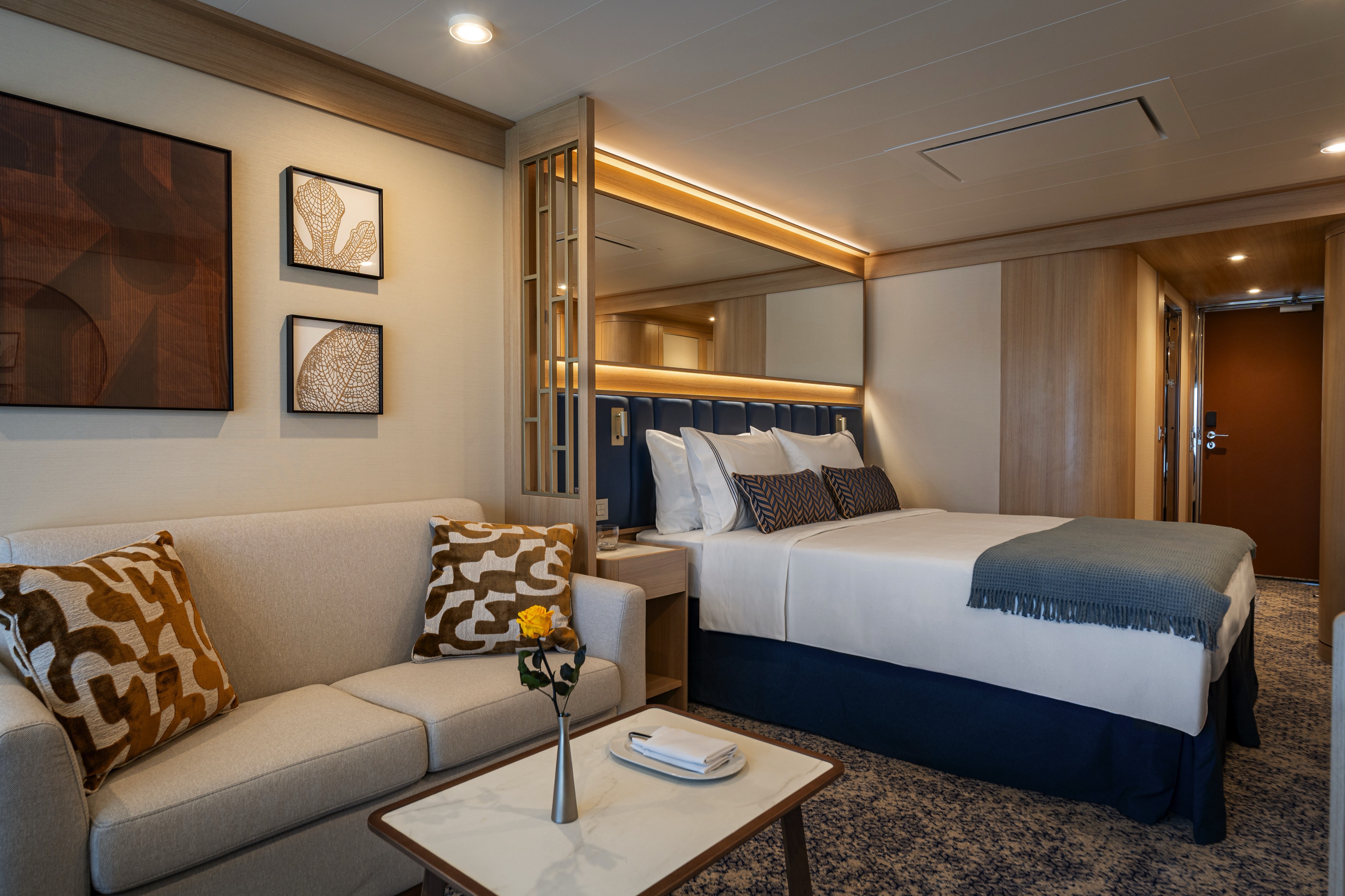
DECK | CABIN TYPE: Suite | 301 SQ FT
This roomy 301-square-foot suite features a wide floor-to-ceiling infinity window in the bedroom, allowing for stunning ocean views. You can even open the top half to enjoy the cool ocean breeze. This suite also features an inviting queen bed (convertible into two twin beds if desired) and a pull-out sofa in the separate living area, allowing for triple occupancy. In the bathroom, you’ll find a luxurious walk-in mosaic glass shower with rain head and body jets.
All Accommodations Feature
- Queen Size Bed with Luxurious Linens
- Waffle Weave Robe and Slippers
- Interactive TV
- Mini Bar/Refrigerator
- Safe
- Direct Dial Phone
- L'Occitane Bath Amenities
- Fresh Fruit
- Hair Dryers and 110/220 outlets
- Wi-Fi Internet Access (various plans available for purchase)
- Mirrored closet with ample drawer space
- Vanity with magnifying mirror and chair

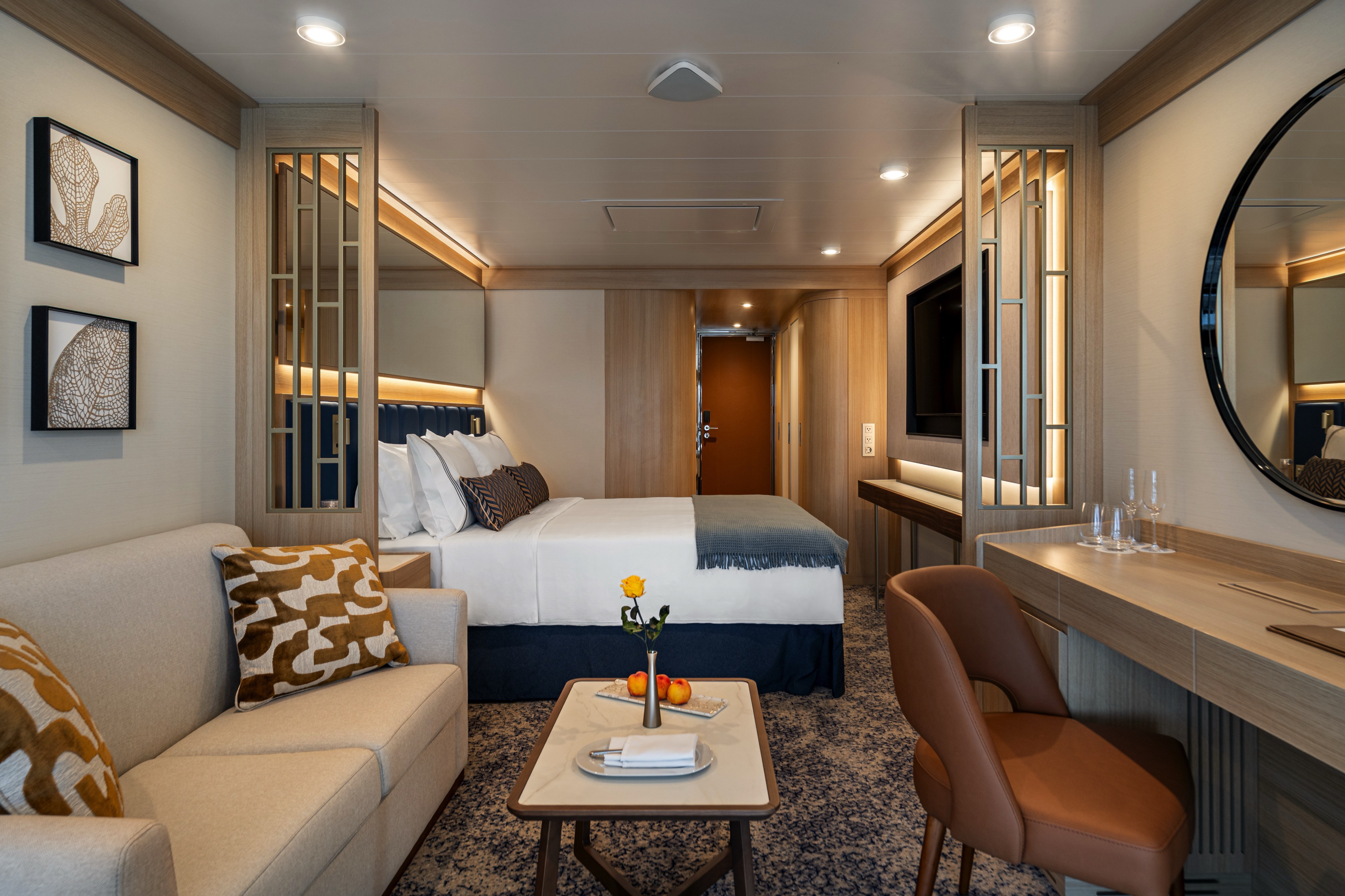
DECK 7 | CABIN TYPE: Suite | 280 SQ FT
Located on deck 7, this 280-square-foot suite features a wide floor-to-ceiling infinity window that allows for stunning ocean views. You can even open the top half to enjoy the cool ocean breeze. Your suite features an inviting queen bed (convertible into two twin beds if desired), a walk-in mosaic glass shower and a comfortable living area where you can lounge and enjoy the view.
All Accommodations Feature
- Queen Size Bed with Luxurious Linens
- Waffle Weave Robe and Slippers
- Interactive TV
- Mini Bar/Refrigerator
- Safe
- Direct Dial Phone
- L'Occitane Bath Amenities
- Fresh Fruit
- Hair Dryers and 110/220 outlets
- Wi-Fi Internet Access (various plans available for purchase)
- Mirrored closet with ample drawer space
- Vanity with magnifying mirror and chair
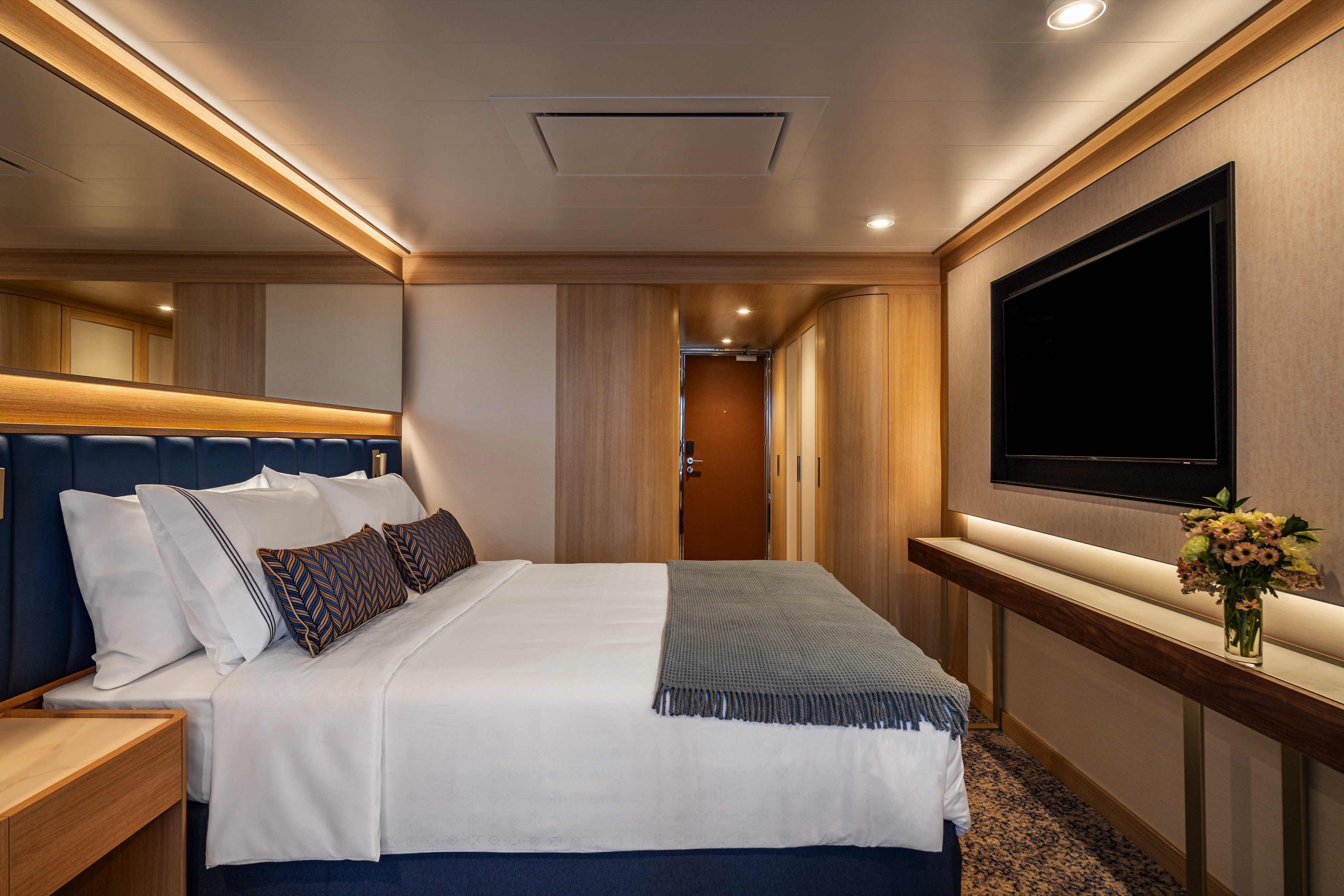
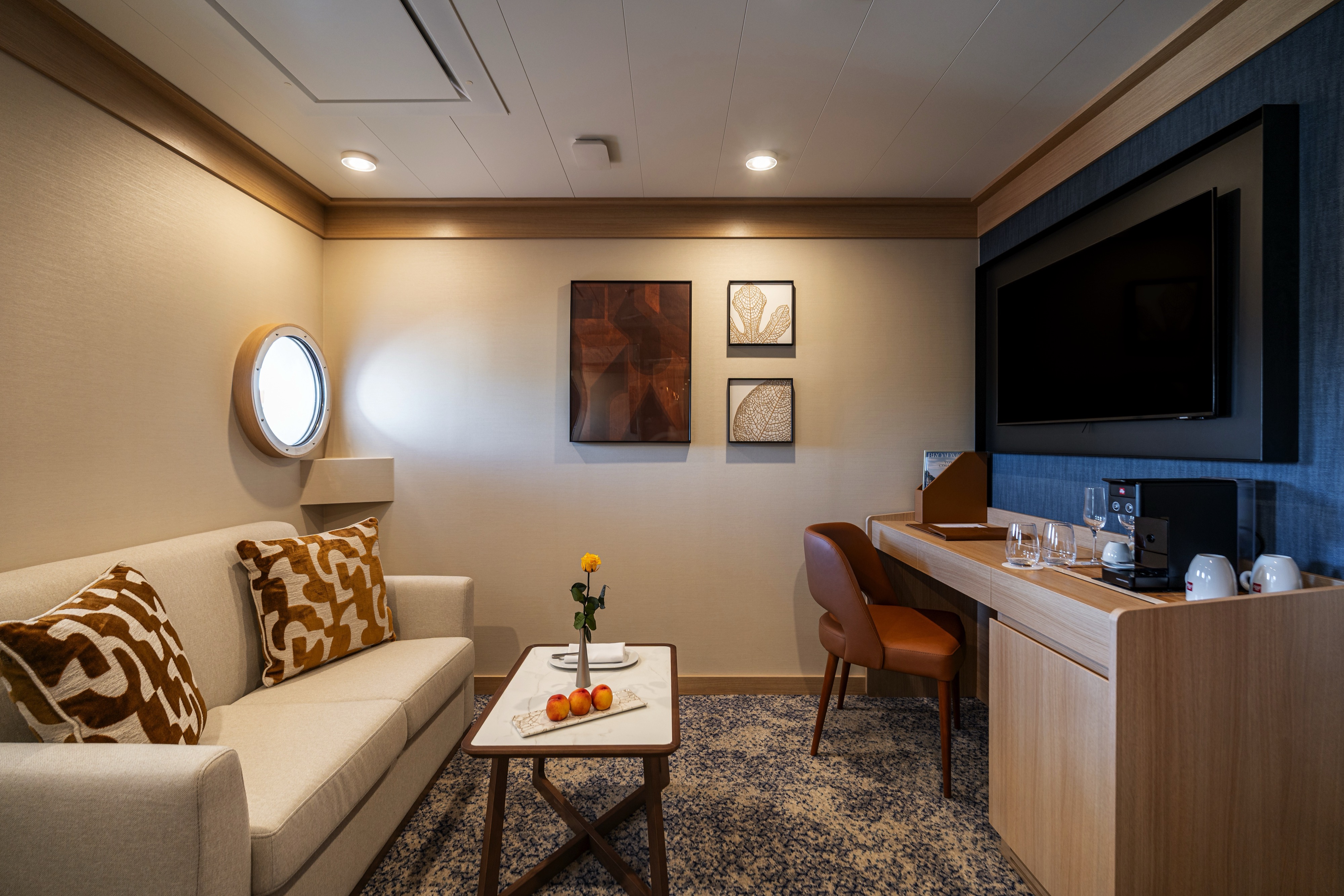
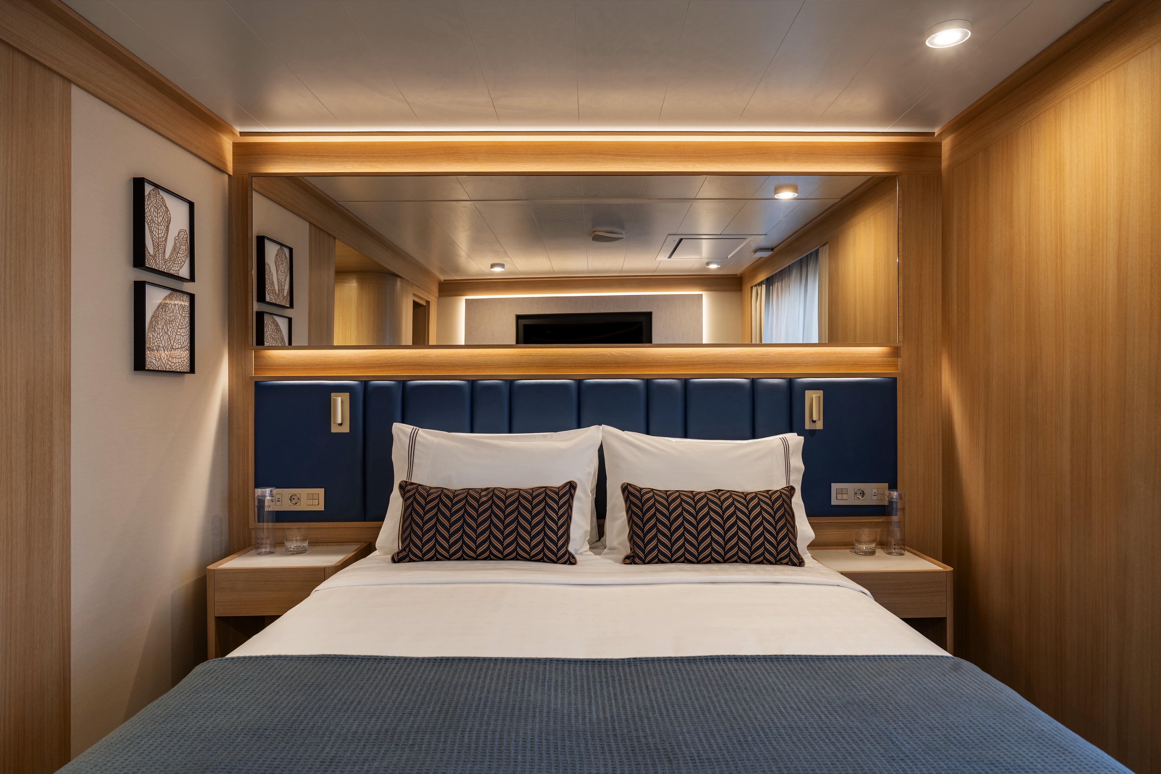
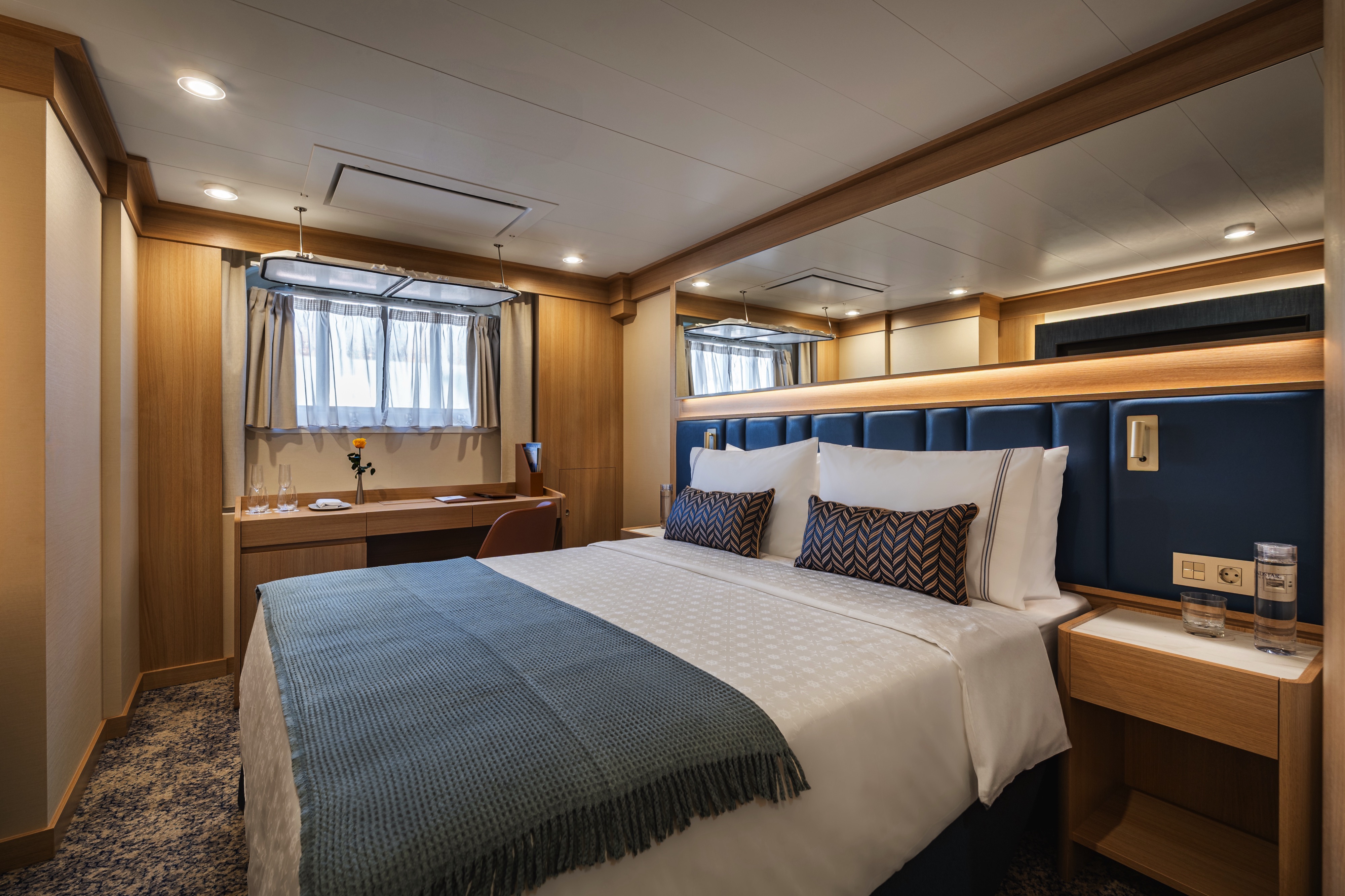
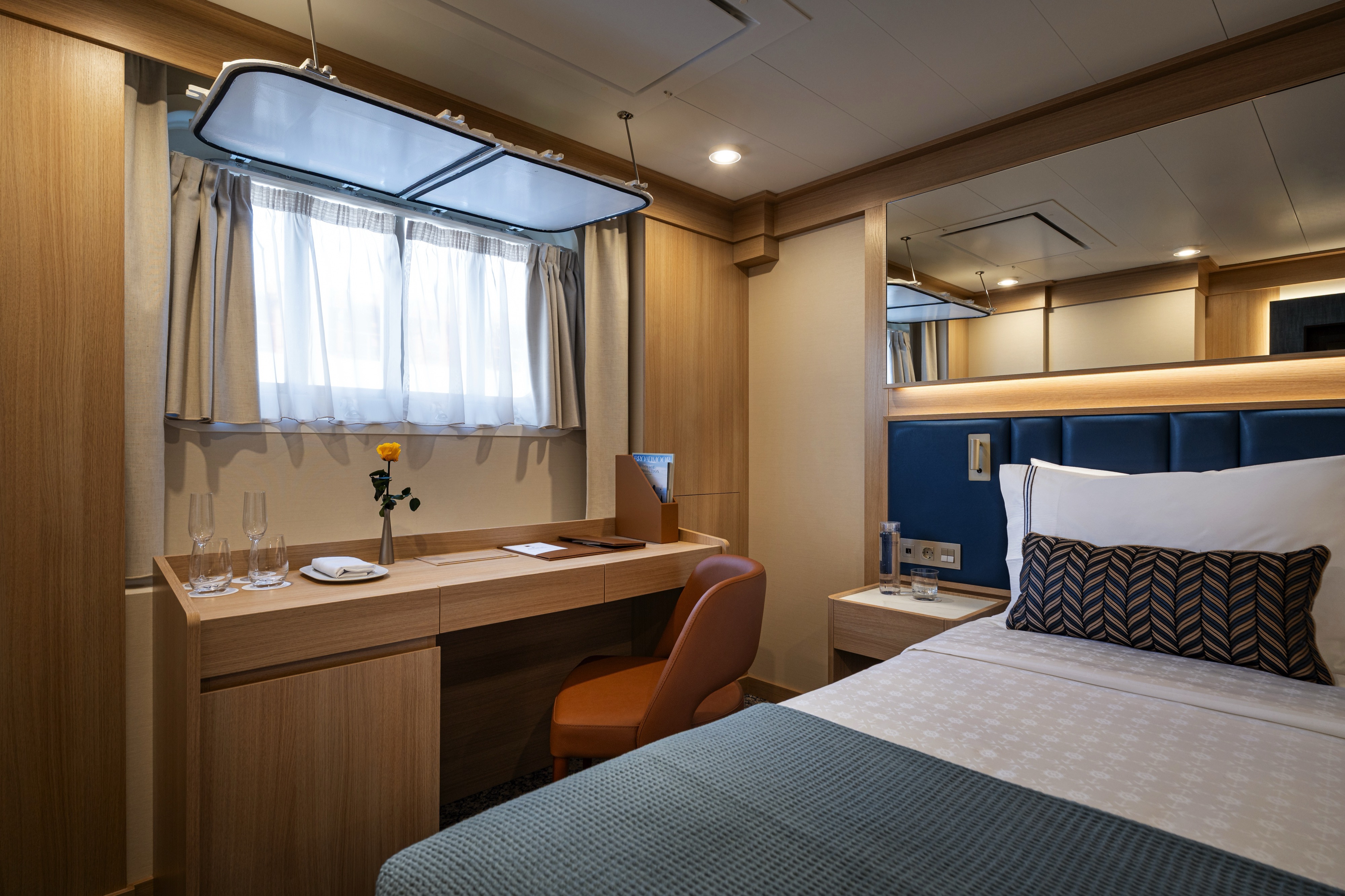
DECK | CABIN TYPE: Suite | 203 SQ FT
Experience the perfect blend of style and functionality in this thoughtfully designed 203-square-foot suite. The well-planned layout creates an ideal retreat with plenty of natural light, a view of the sea, a walk-in mosaic glass shower and an inviting queen bed (convertible into two twins if desired), perfect for unwinding after a day of fun and exploration.
All Accommodations Feature
- Queen Size Bed with Luxurious Linens
- Waffle Weave Robe and Slippers
- Interactive TV
- Mini Bar/Refrigerator
- Safe
- Direct Dial Phone
- L'Occitane Bath Amenities
- Fresh Fruit
- Hair Dryers and 110/220 outlets
- Wi-Fi Internet Access (various plans available for purchase)
- Mirrored closet with ample drawer space
- Vanity with magnifying mirror and chair
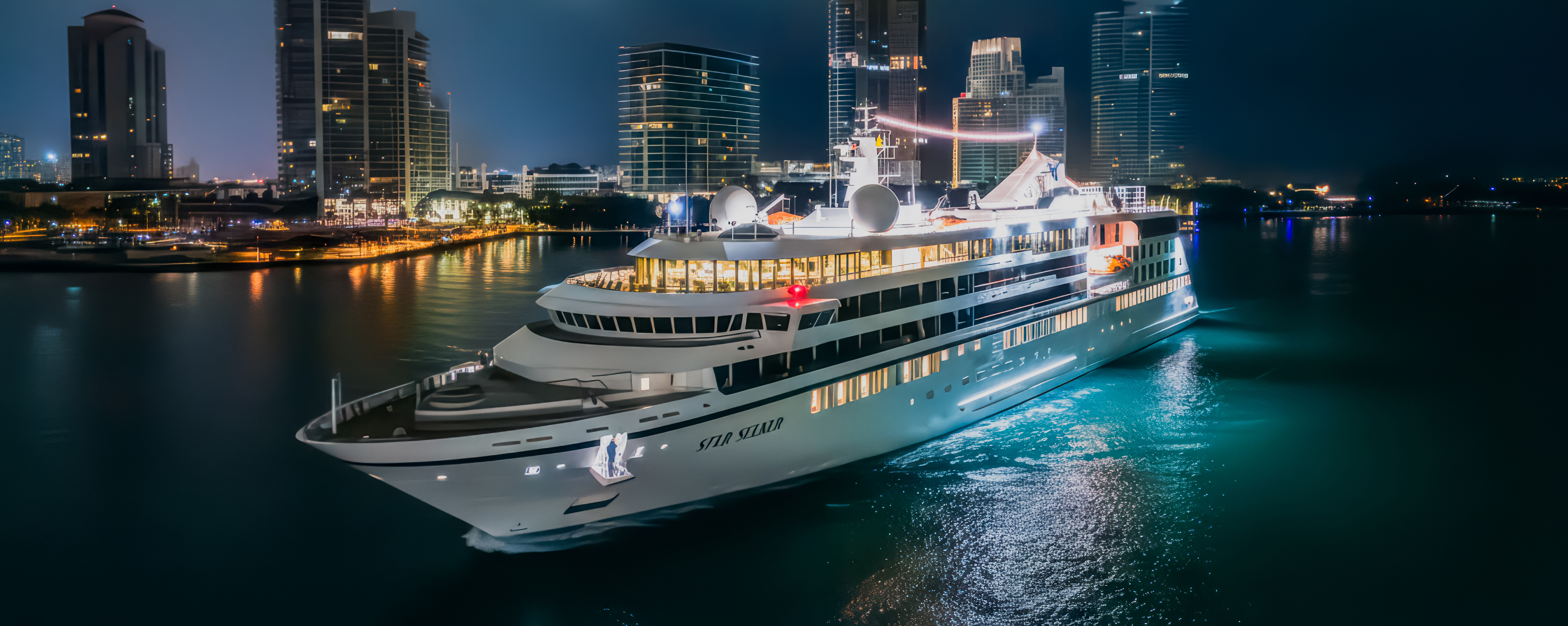
Star Seeker
Be one of the first to experience Star Seeker, Windstar’s newest yacht, during her first-ever sailing season beginning December 2025!
Featuring our new specialty restaurant Basil + Bamboo, upgraded amenities and 112 spacious suites — nearly all with a full private veranda or a floor-to-ceiling infinity window — Star Seeker is a fresh take on our Star Class that remains unmistakably Windstar.Featuring our new specialty restaurant Basil + Bamboo, upgraded amenities and 112 spacious suites — nearly all with a full private veranda or a floor-to-ceiling infinity window — Star Seeker is a fresh take on our Star Class that remains unmistakably Windstar.
Ship Facts
| Launch Year | 2025 | ||||||||||
| Refit Year | |||||||||||
| Language | en | ||||||||||
| Gross Tonnage | 9923 | ||||||||||
| Length | 132 | ||||||||||
| Width | 19 | ||||||||||
| Currency | USD | ||||||||||
| Speed | 16 | ||||||||||
| Capacity | 224 | ||||||||||
| Crew Count | 135 | ||||||||||
| Deck Count | 6 | ||||||||||
| Cabin Count | 112 | ||||||||||
| Large Cabin Count | N/A | ||||||||||
| Wheelchair Cabin Count | N/A | ||||||||||
| Electrical Plugs |
|
Deck 8
- Elevator
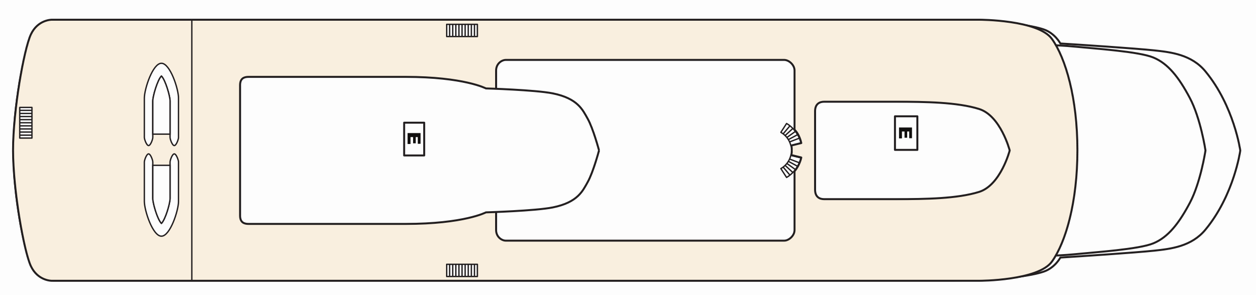
Deck 7
- Elevator
- Yacht Club (1)
- Pool and Whirlpool (2)
- Star Grill (3)
- Star Bar (4)
- Horizon Owner's Suite
- Vista Veranda Suite
- Vista Infinity Suite
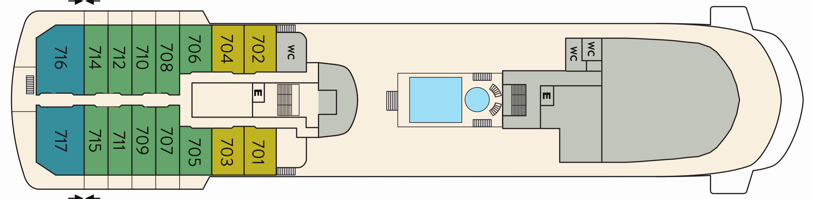
Deck 6
- Elevator
- Bridge (5)
- Premium Veranda Suite
- Deluxe Suite
- Star Suite
- Triple Premier Veranda Suite
- Triple Infinity Suite
- Infinity Suite (x1 Accessible Suite)
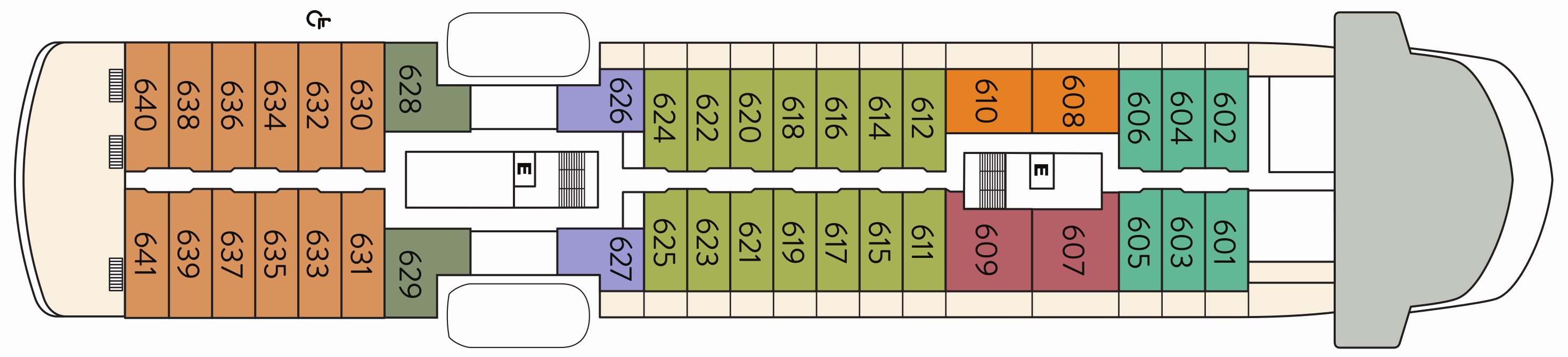
Deck 5
- Spa Entrance
- Elevator
- Whirlpool (6)
- Infinity Suite
- Classic Suite
- Premier Veranda Suite
- Star Suite
- Deluxe Suite
- Veranda Suite
Deck 4
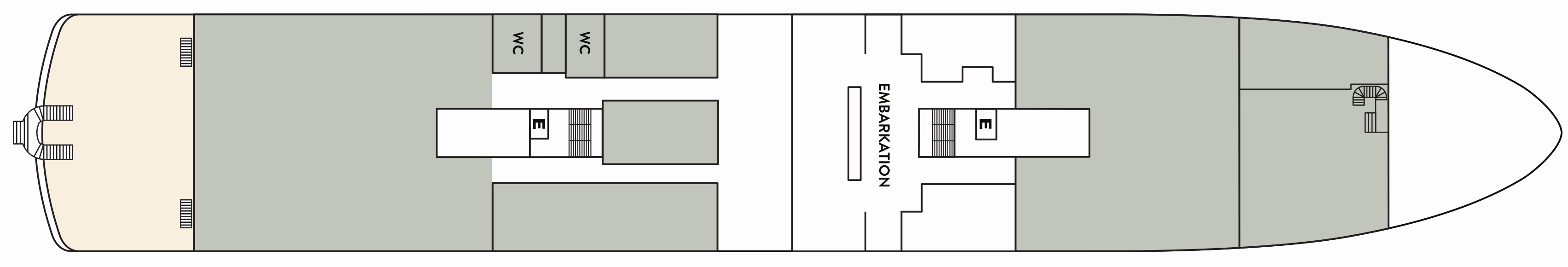
- Embarkation
- Elevator
- World Spa by Windstar (7)
- Lounge (8)
- Medical Facility (9)
- Reception (10)
- Destination Desk (11)
- Fitness Center and Motion Studio (12)
- Star Boutique (13)
- Basil & Bamboo Restaurant (14)
- Amphora Restaurant (15)
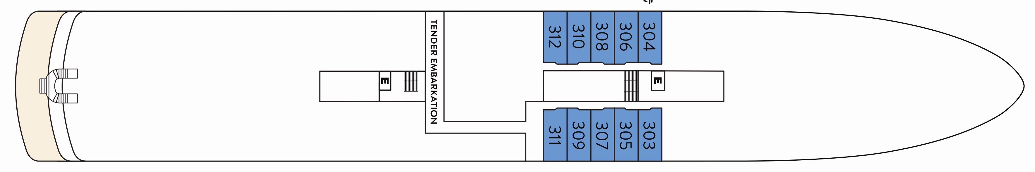
Deck 3
- Tender Embarkation
- Elevator
- Watersports Platform (16)
- Oceanview Suite
Fine dining has always been a pillar of the Windstar experience. As the Official Cruise Line of the James Beard Foundation featuring locally inspired cuisine, developed by a list of culinary all-stars using new flavours and fresh ingredients.
Basil + Bamboo
Step into Basil + Bamboo, where clean lines and warm accents set the stage for a relaxed, refined experience. Savor dishes that fuse Asian influences with a Mediterranean twist — an inventive culinary adventure designed to delight your palate and create moments of shared discovery.
Amphora
Amphora presents a contemporary, international menu and fresh local dishes.
Yacht Club
A pleasant lounge and all-day coffee bar, which is the perfect place to relax with new friends and enjoy the 270 degree views from atop the ship.
Star Grill
You’ll find all your traditional grilled and barbecued favorites (and discover new dishes from around the world) in our casual outdoor restaurant.
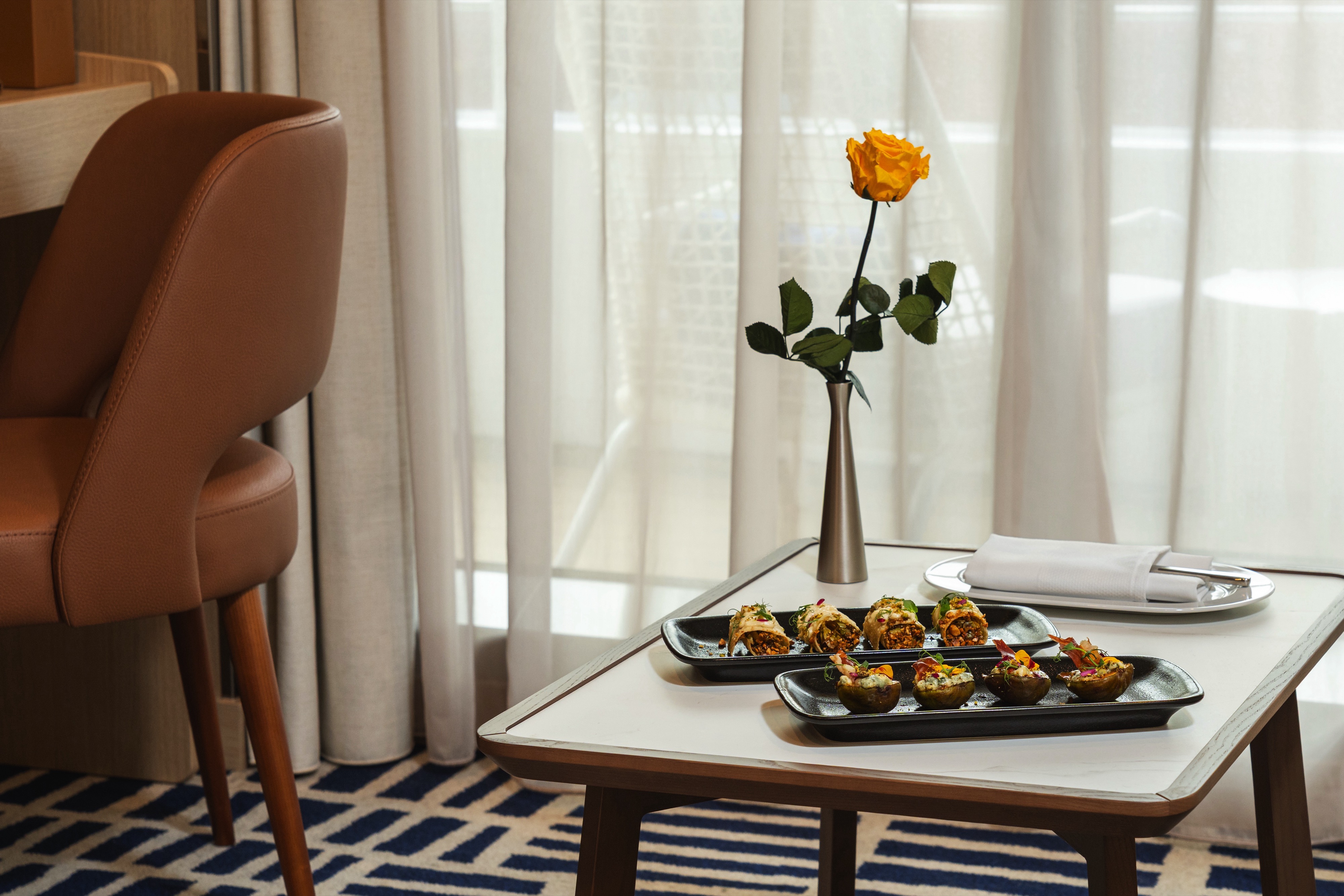
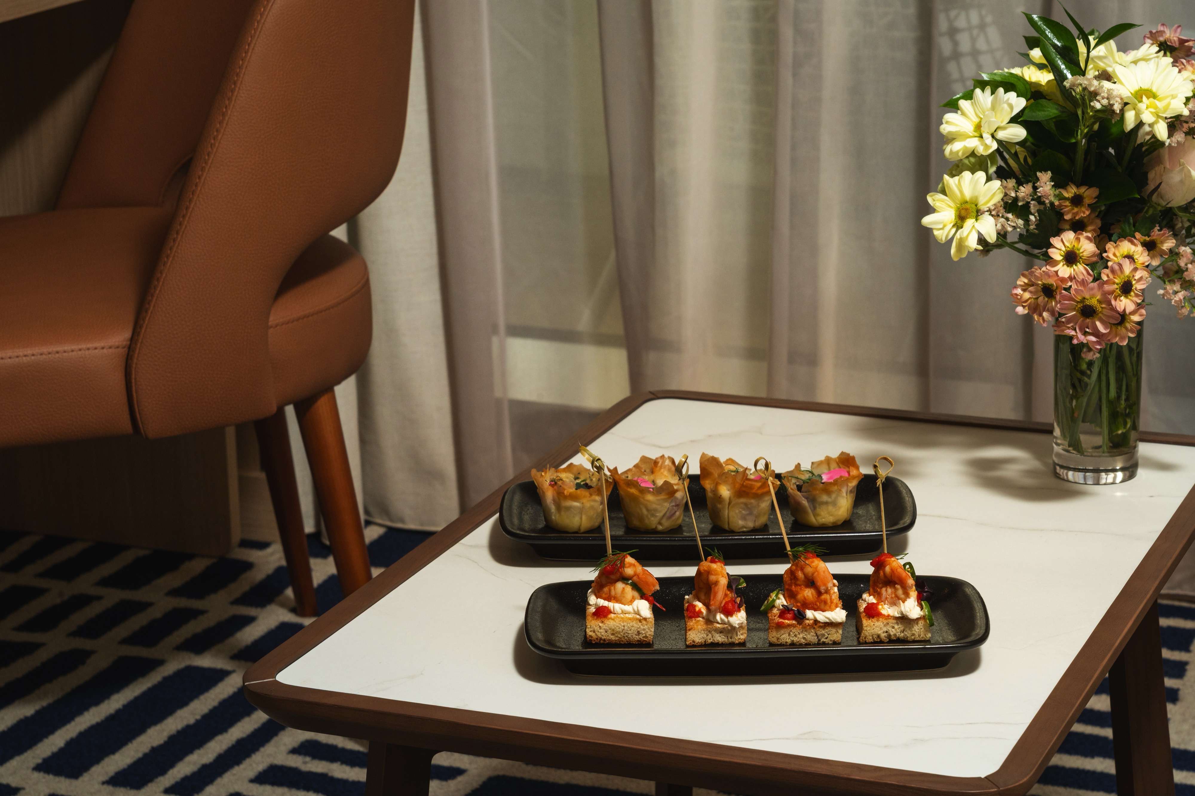
Complimentary Room Service
24-hour room service menu for in-room dining features coursed menu from the main Amphora dining room during dining hours.
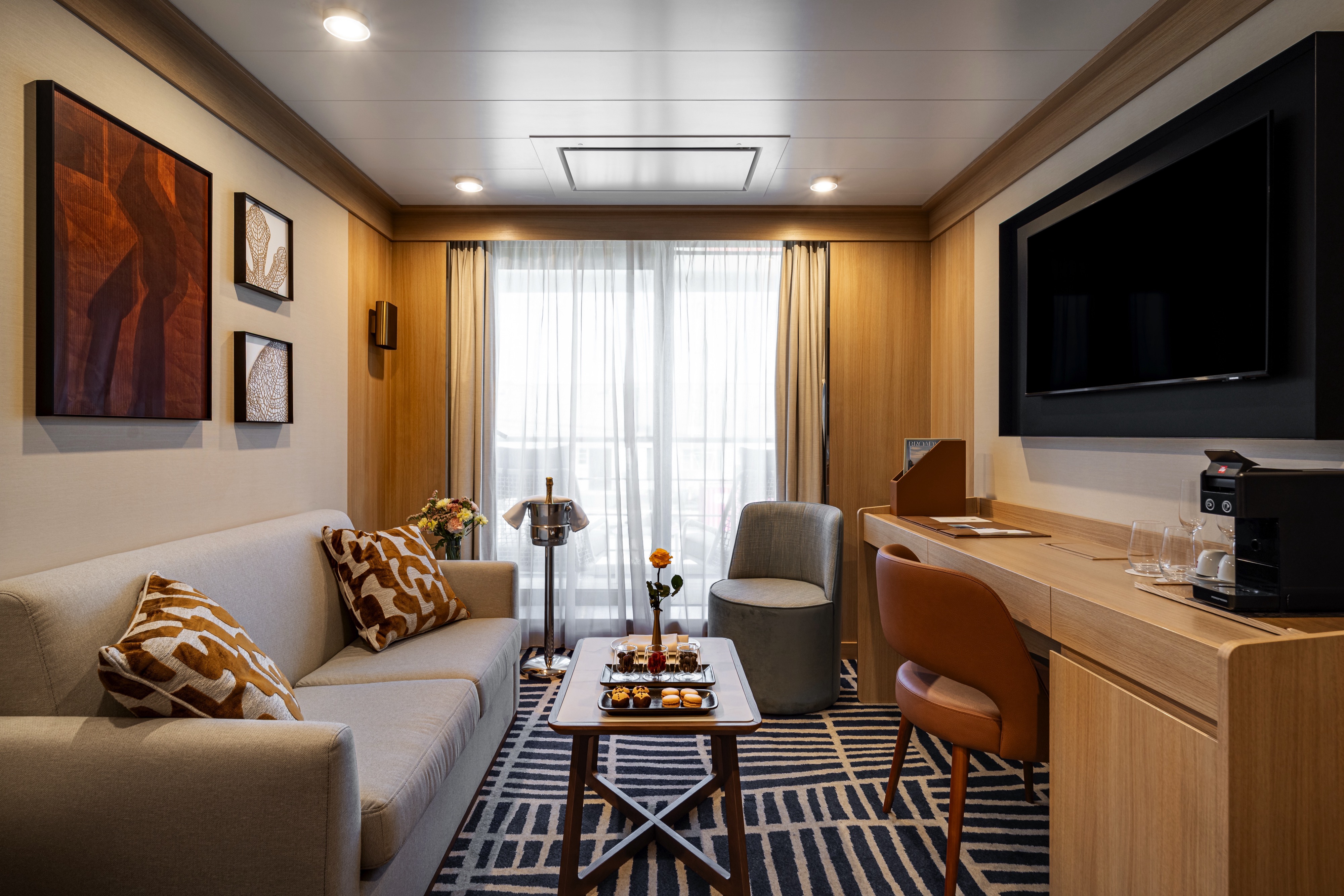
A day on board your Windstar ship is a day of choices, all of them good. Perhaps you’ll begin with a relaxing massage in World Spa by Windstar. Or maybe an invigorating workout in the Fitness Center. Even better, why not both? After a sumptuous lunch in Veranda, make a splash from the Marina off the ship’s stern. Everything you can think of for fun in the water is there — swimming, kayaking, and stand-up paddleboarding. And it’s all complimentary, of course. Sun yourself on deck, take a dip in the whirlpool, then catch up on email or order a cheese plate for your stateroom or suite. After dinner, dance to live music in the Lounge. This is your yacht, so of course you’re welcome on the Bridge, where the Captain and officers are delighted to share charts, routes, and vistas with you.
As you prepare for another amazing Windstar day, enjoy a nightcap anywhere you like — on deck, in the Lounge, or why not let us bring it to your suite or stateroom? Your day ends just as it began, blissfully.
Lounge
The Lounge can be found on Deck 8
Open Bridge
Guests can talk with the Captain and officers on watch, view the navigational charts with the crew and enjoy one of the best views on the ship.
Star Boutique
Visit our newly transformed specialty shopping boutique, Star Boutique, rolling out fleet-wide through early 2022. The new shop features quality brand-name and exclusive Star Collection merchandise, from clothing and fragrances to jewellery and accessories, all at duty free or special pricing.
Reception
The Reception can be located on Deck 4