Scenic Alaska
Scenic Alaska
Cruise overview
WHY BOOK WITH US?
- ✔ The Deluxe Cruises’ team has extensive experience in ultra-luxury cruising.
- ✔ Call now to speak to our helpful and experienced Cruise Concierge team.
- ✔ Enjoy our Unique Deluxe Cruises Bonus for substantial savings.
- ✔ Our team will tailor your holiday to your exacting requirements.
- ✔ As agents, we work under the protection of each cruise lines ABTA / ATOL licences
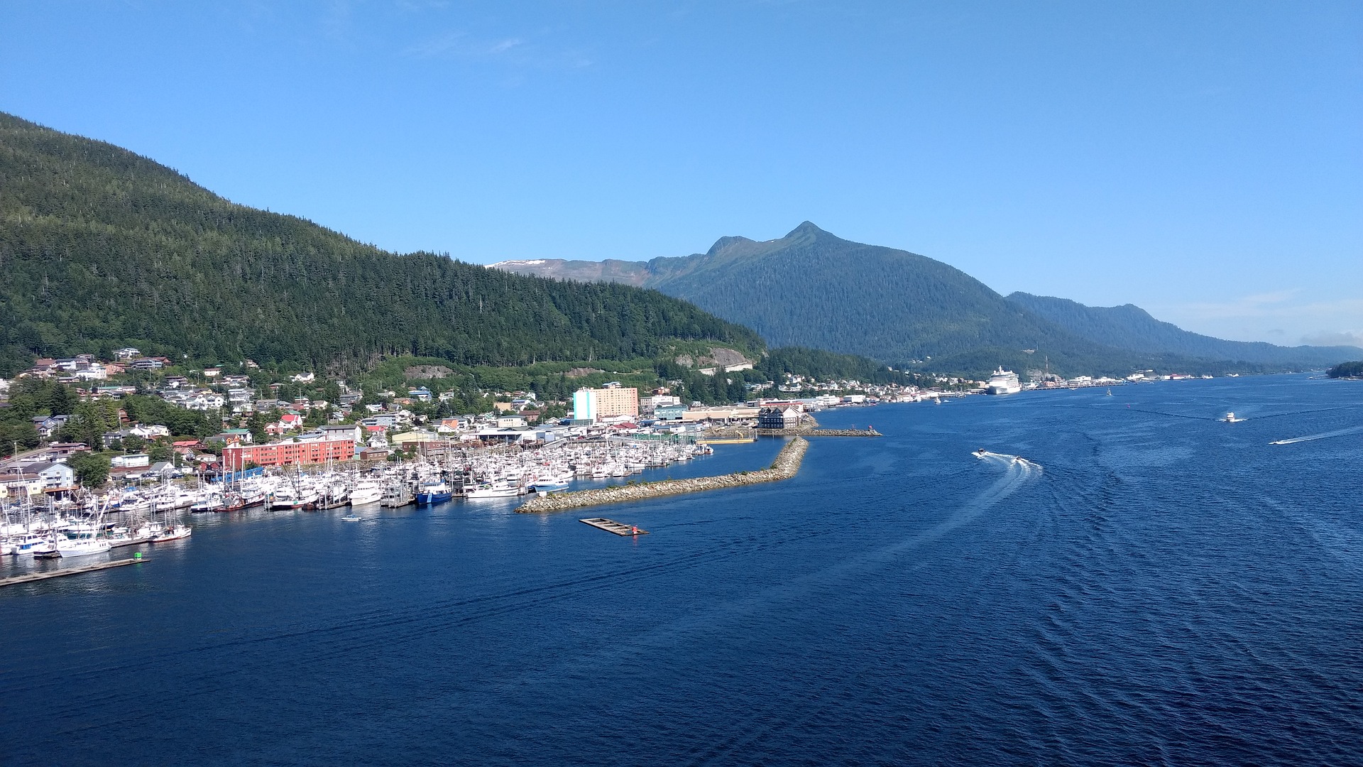
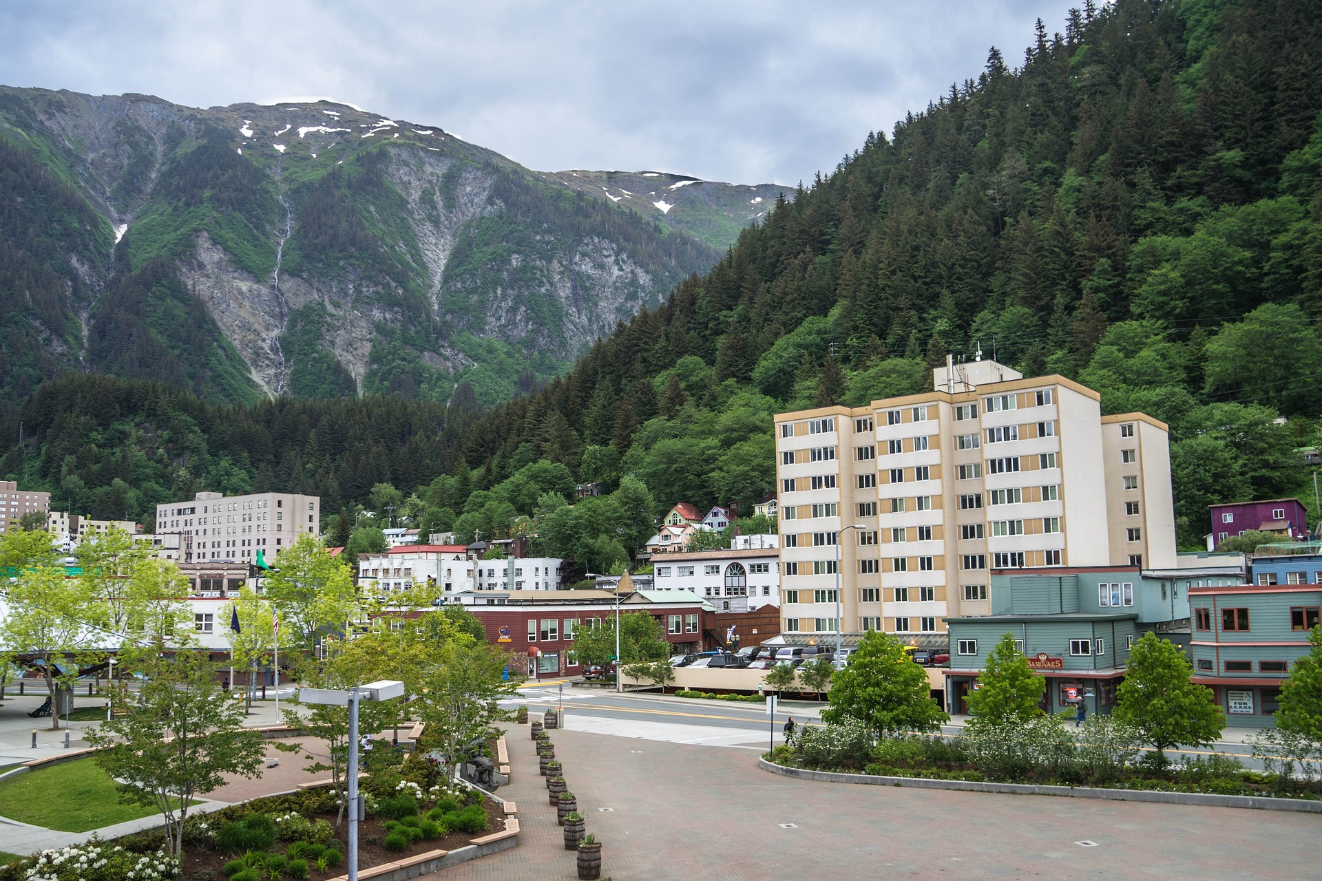
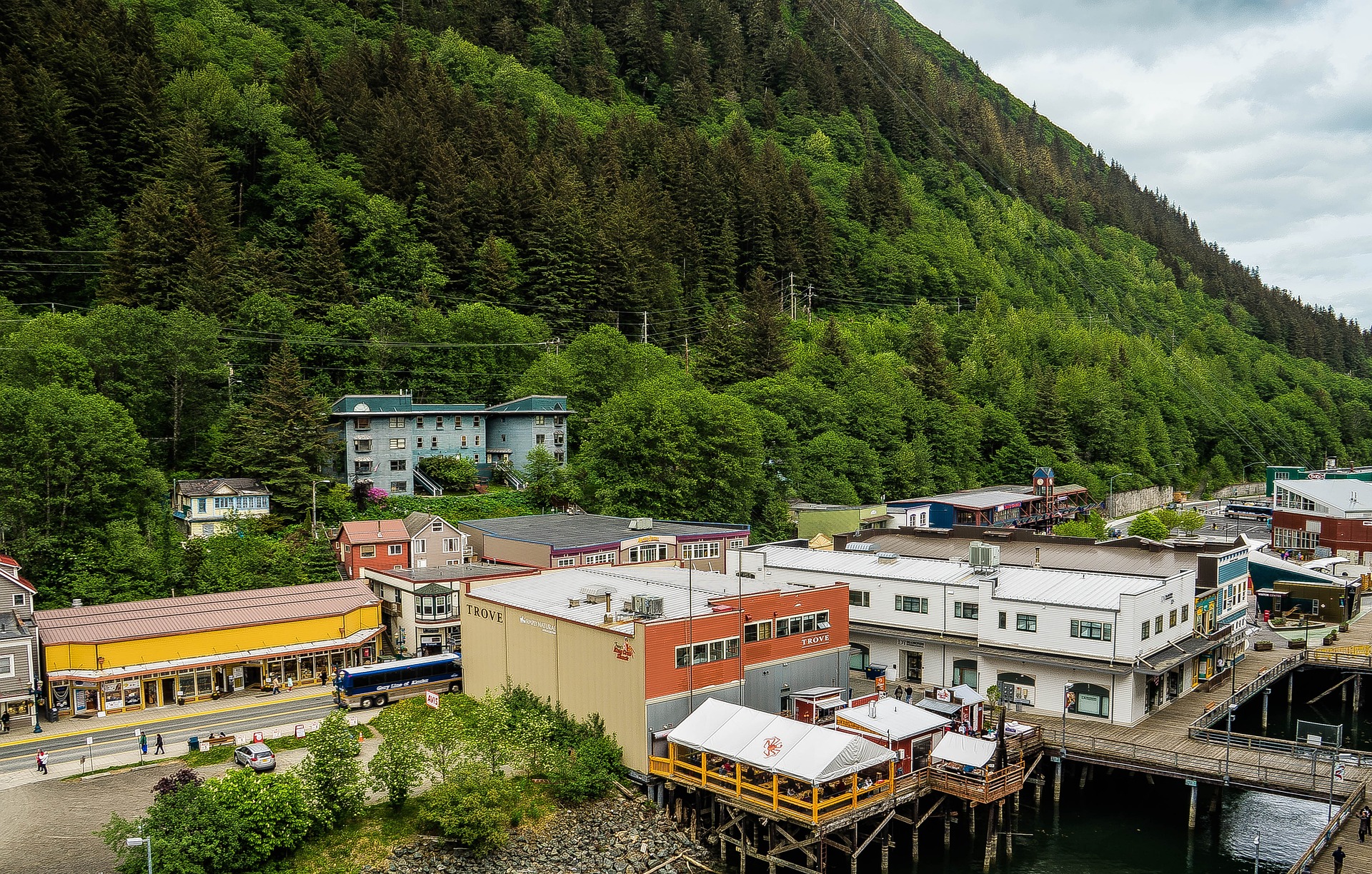
About Juneau, Alaska
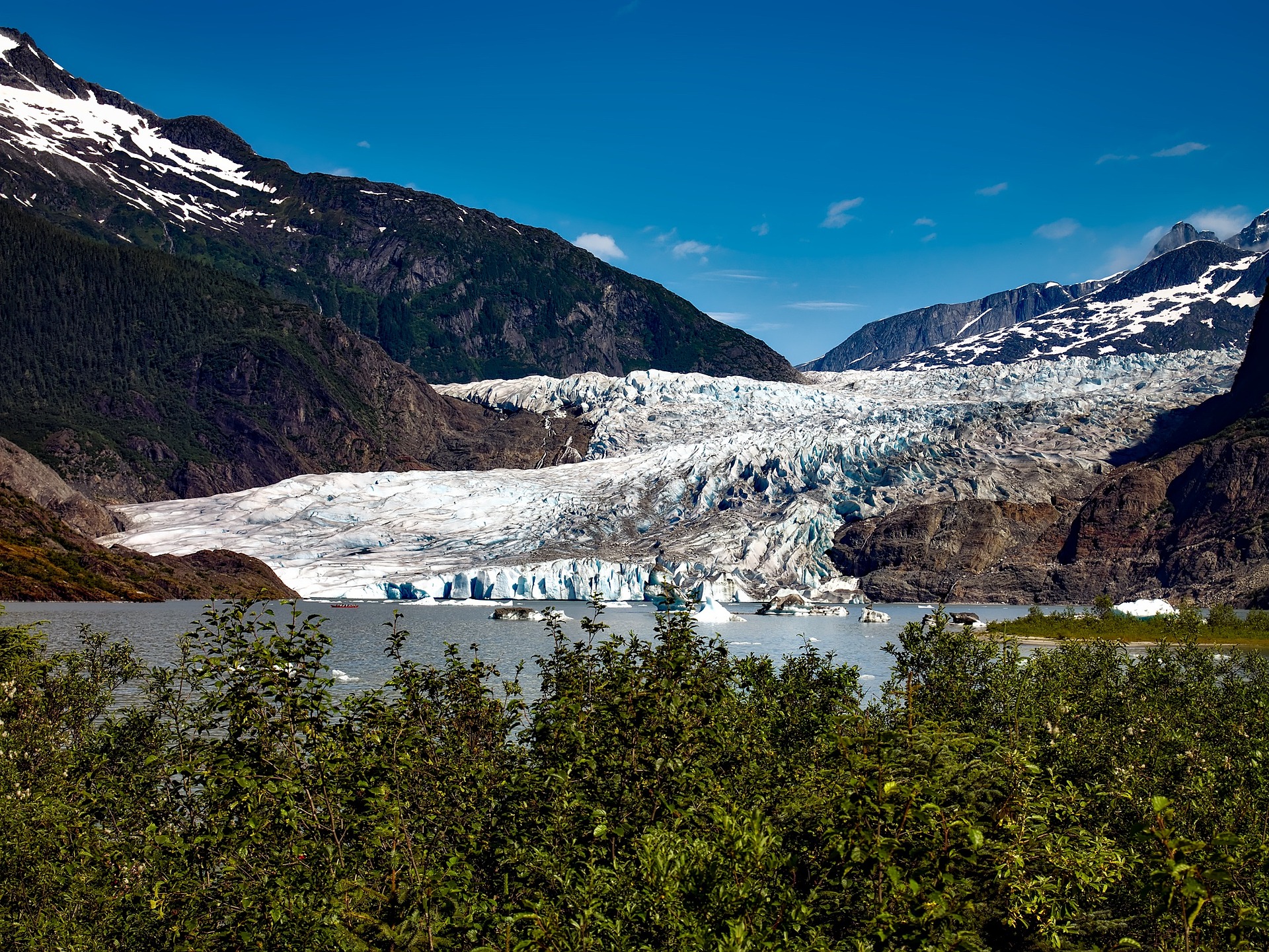
Juneau, Alaska's capital and third-largest city, is on the North American mainland but can't be reached by road. Bounded by steep mountains and water, the city’s geographic isolation and compact size make it much more akin to an island community such as Sitka than to other Alaskan urban centers, such as Fairbanks or Anchorage. Juneau is full of contrasts. Its dramatic hillside location and historic downtown buildings provide a frontier feeling, but the city's cosmopolitan nature comes through in fine museums, noteworthy restaurants, and a literate and outdoorsy populace. The finest of the museums, the Alaska State Museum, is scheduled to reopen in May 2016 on its old site as the expanded Alaska State Library, Archives, and Museum (SLAM) following several years of planning and exhibit research. Another new facility, the Walter Soboleff Center, offers visitors a chance to learn about the indigenous cultures of Southeast Alaska–-Tlingit, Haida, and Tsimshian. Other highlights include the Mt. Roberts Tramway, plenty of densely forested wilderness areas, quiet bays for sea kayaking, and even a famous drive-up glacier, Mendenhall Glacier. For goings-on, pick up the Juneau Empire (www.juneauempire.com), which keeps tabs on state politics, business, sports, and local news.


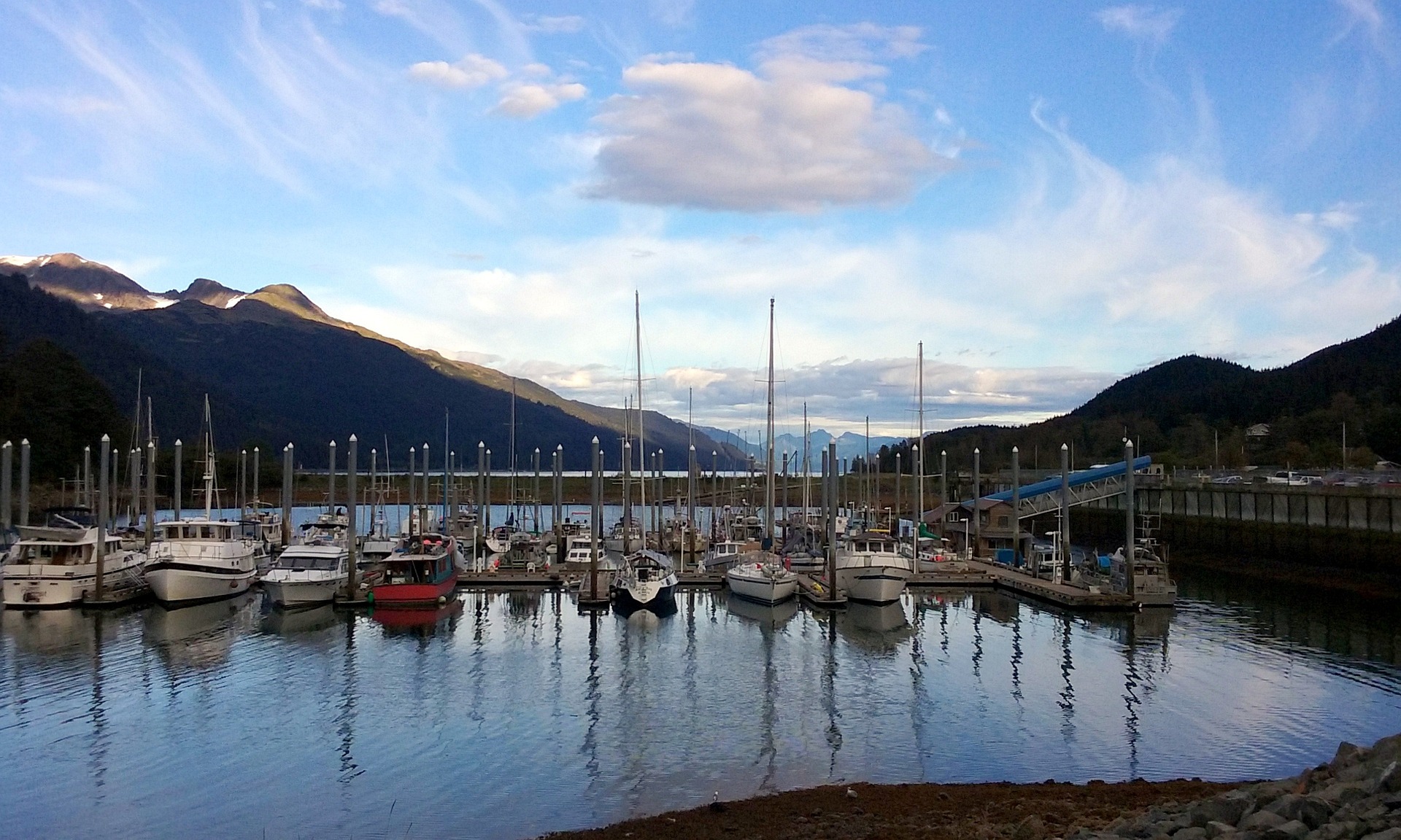
About Haines, Alaska
Unlike most cities of Southeast Alaska, Haines can be reached by road. With a population of 2,200, Haines lies in the upper northern reaches of the Inside Passage and is an important access point to the Yukon Territory and Interior Alaska. While cruising into Haines, see the Lynn Canal, the longest and deepest fjord in North America. Once in town, mountains seem to surround you on all sides while the jagged cathedral peaks of the Chilkat Mountains loom over Fort Seward. Haines has two distinct personalities. On the north side of the Haines Highway is the section of Haines that developed around the Presbyterian mission. After its missionary beginnings, it served as the trailhead for the Jack Dalton Trail into the Yukon during the 1897 gold rush to the Klondike. South of the highway, the town resembles a military post, which is exactly what it was for nearly half a century. In 1903 the U.S. Army established Fort William Henry Seward at Portage Cove just south of town. The post (renamed Chilkoot Barracks in 1922) was the only military base in the territory until World War II. In 1939, the army built the Alaska Highway and the Haines Highway to connect Alaska with the other states. Today, the community of Haines is recognized for the Native American dance and culture center at Fort Seward as well as for its superb fishing, camping and outdoor recreation.

About Wrangell, Alaska
A small, unassuming timber and fishing community, Wrangel sits on the northern tip of Wrangel Island, near the mouth of the fast-flowing Stikine River—North America's largest undammed river. The Stikine plays a large role in the life of many Wrangel residents, including those who grew up homesteading on the islands that pepper the area. Trips on the river with local guides are highly recommended as they provide, basically, an insider's guide to the Stikine and a very Alaskan way of life. Like much of Southeast, Wrangel has suffered in recent years from a declining resource-based economy. But locals are working to build tourism in the town. Bearfest, which started in 2010, celebrates Wrangel's proximity to Anan Creek, where you can get a close-up view of both brown and black bears. Wrangel has flown three different national flags in its time. Russia established Redoubt St. Dionysius here in 1834. Five years later Great Britain's Hudson's Bay Company leased the southern Alaska coastline, renaming the settlement Ft. Stikine. It was rechristened Wrangel when the Americans took over in 1867; the name came from Baron Ferdinand Petrovich von Wrangel, governor of the Russian-American Company. The rough-around-the-edges town is off the track of the larger cruise ships, so it does not get the same seasonal traffic that Ketchikan and Juneau do. Hence, it is nearly devoid of the souvenir shops that dominate so many other nearby downtown areas. But the gift shops and art galleries that are here do sell locally created work, and the town is very welcoming to visitors; independent travelers would do well to add a stop in Wrangel during their Southeast wanderings.
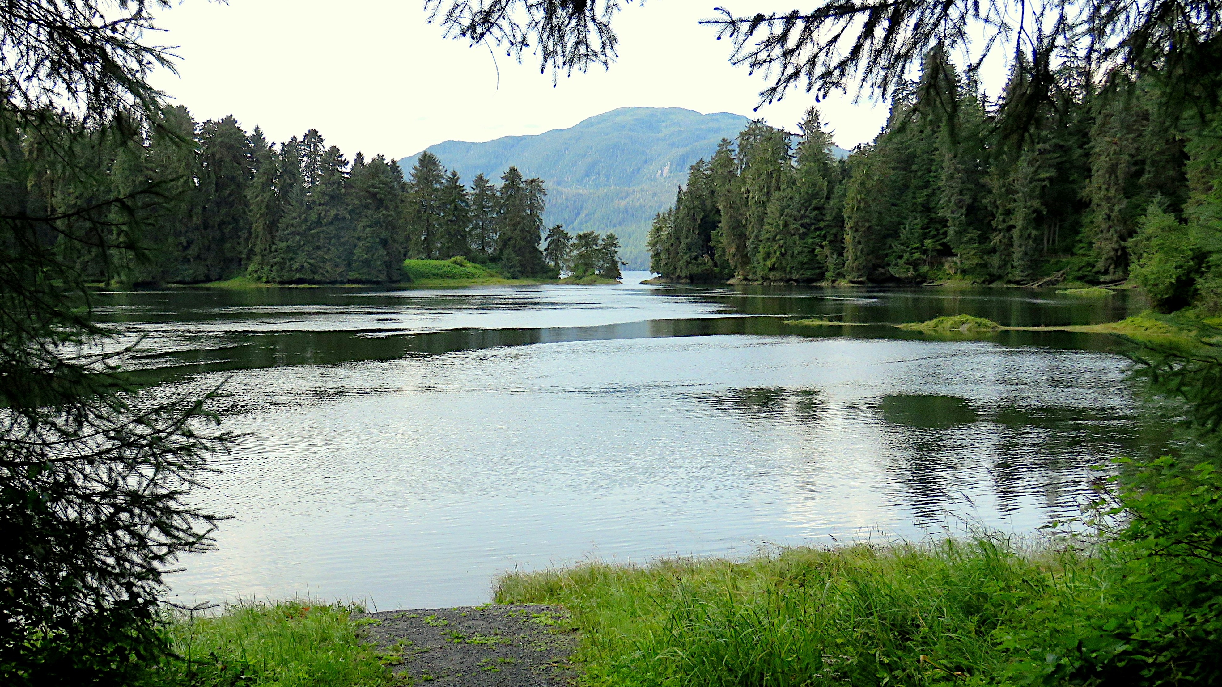
About Misty Fjords National Monument, Alaska
Rudyerd Bay is one of the highlights of the Misty Fiords, 40 miles east of Ketchikan, along the Inside Passage. This fjord cuts through steep-sided mountainous terrain and extends far into the mainland. The scenery is stunning, with dramatic thousand-foot waterfalls plunging down rainforest covered cliffs to the water below.
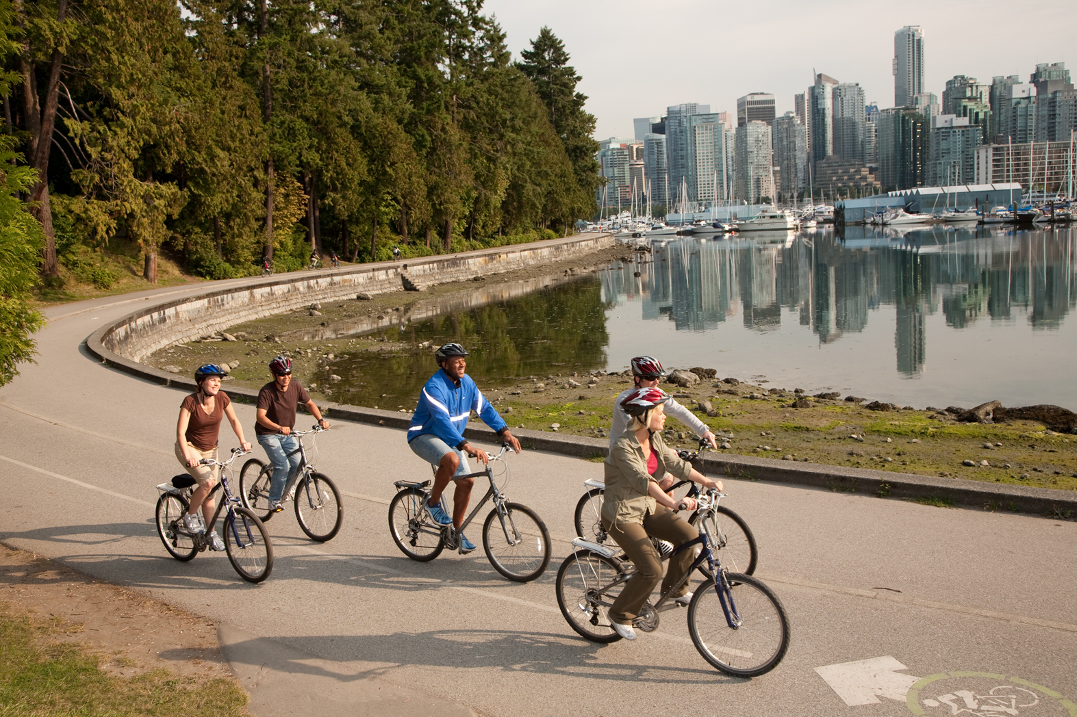
About Vancouver, British Columbia
Vancouver is a delicious juxtaposition of urban sophistication and on-your-doorstep wilderness adventure. The mountains and seascape make the city an outdoor playground for hiking, skiing, kayaking, cycling, and sailing—and so much more—while the cuisine and arts scenes are equally diverse, reflecting the makeup of Vancouver's ethnic (predominantly Asian) mosaic. Vancouver is consistently ranked as one of the world's most livable cities, and it's easy for visitors to see why. It's beautiful, it's outdoorsy, and there's a laidback West Coast vibe. On the one hand, there's easy access to a variety of outdoor activities, a fabulous variety of beaches, and amazing parks. At the same time, the city has a multicultural vitality and cosmopolitan flair. The attraction is as much in the range of food choices—the fresh seafood and local produce are some of North America's best—as it is in the museums, shopping, and nightlife.Vancouver's landscaping also adds to the city's walking appeal. In spring, flowerbeds spill over with tulips and daffodils while sea breezes scatter scented cherry blossoms throughout Downtown; in summer office workers take to the beaches, parks, and urban courtyards for picnic lunches and laptop meetings. More than 8 million visitors each year come to Vancouver, Canada's third-largest metropolitan area. Because of its peninsula location, traffic flow is a contentious issue. Thankfully, Vancouver is wonderfully walkable, especially in the downtown core. The North Shore is a scoot across the harbor, and the rapid-transit system to Richmond and the airport means that staying in the more affordable ’burbs doesn't have to be synonymous with sacrificing convenience. The mild climate, exquisite natural scenery, and relaxed outdoor lifestyle keep attracting residents, and the number of visitors is increasing for the same reasons. People often get their first glimpse of Vancouver when catching an Alaskan cruise, and many return at some point to spend more time here.
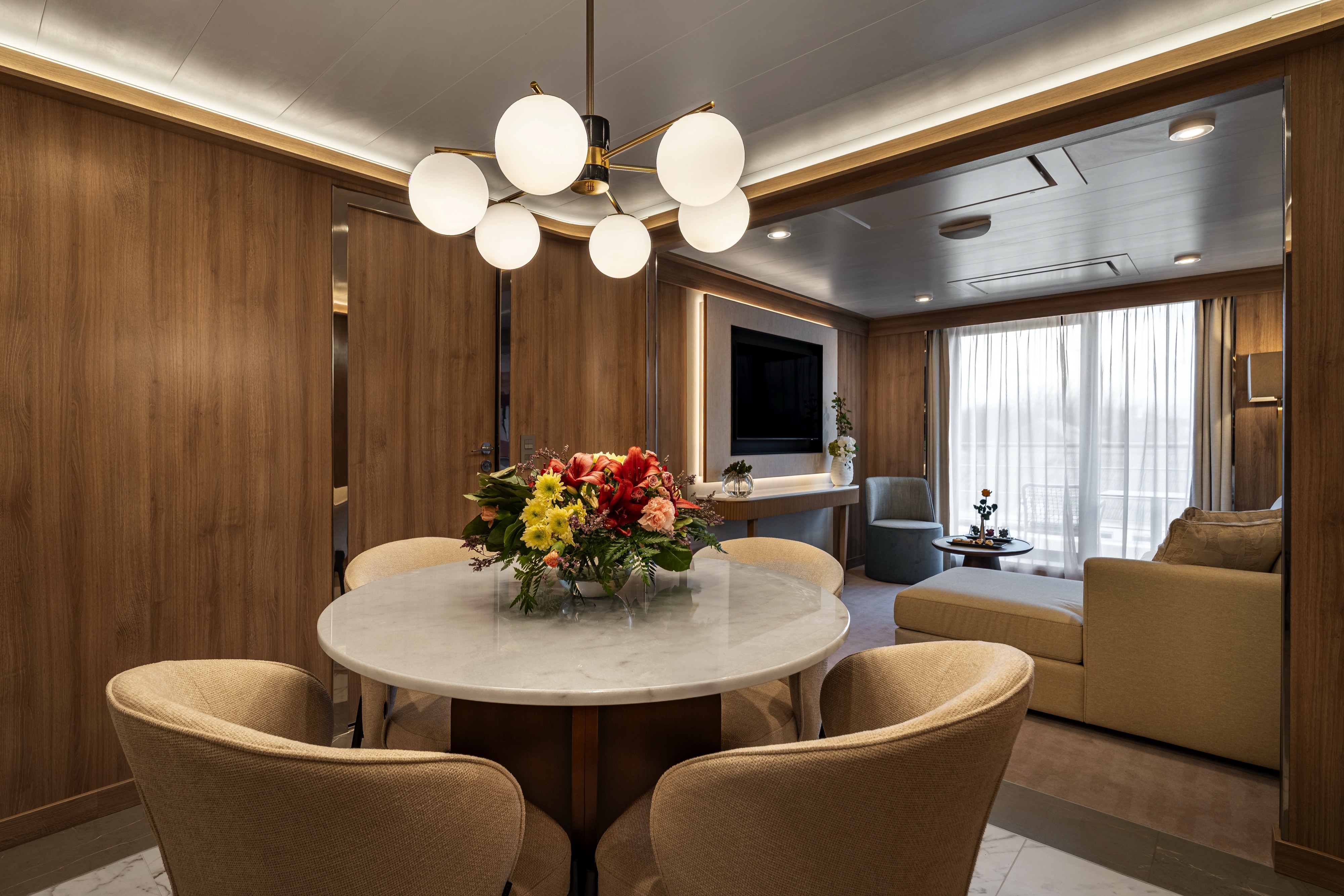
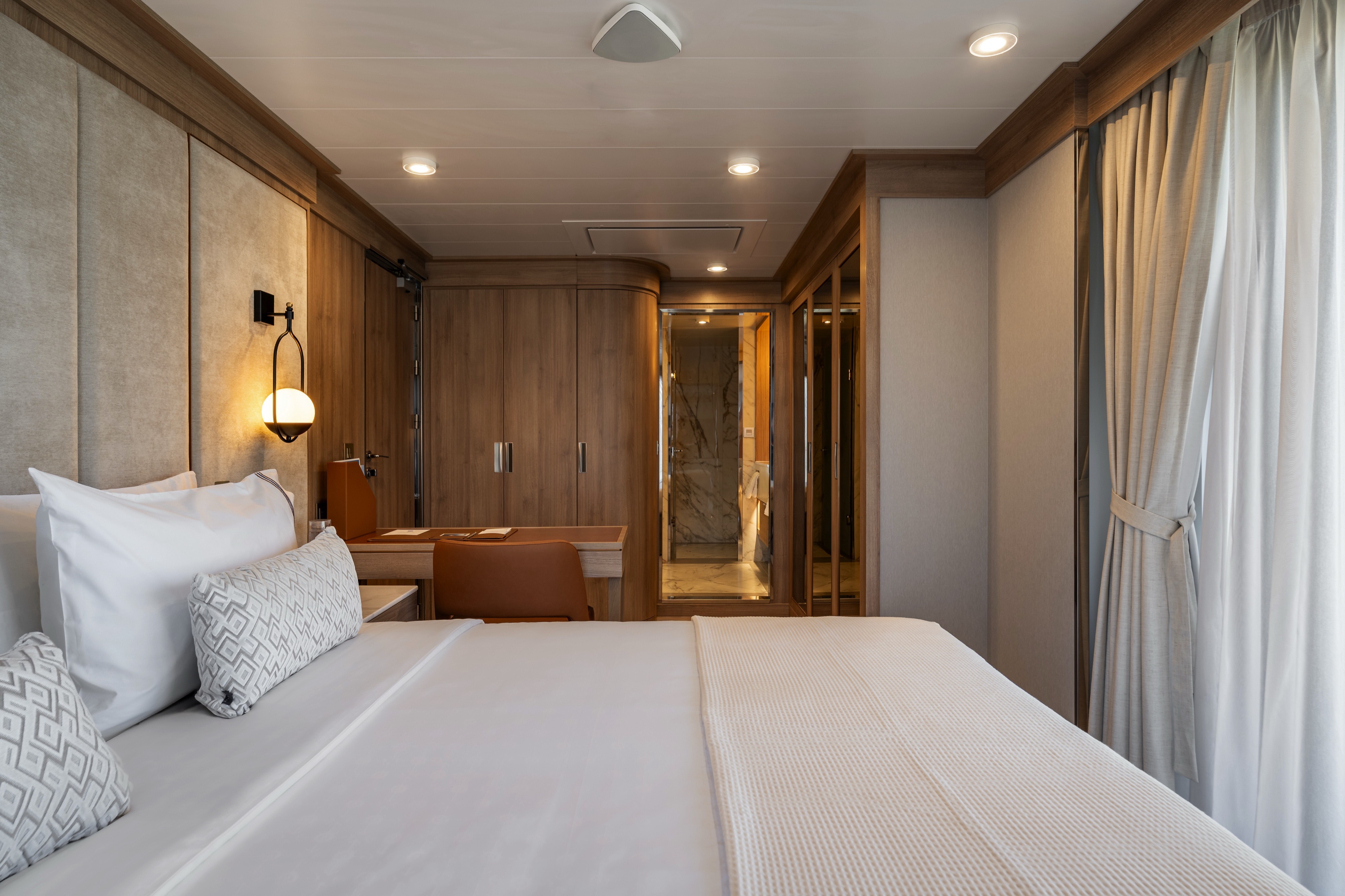
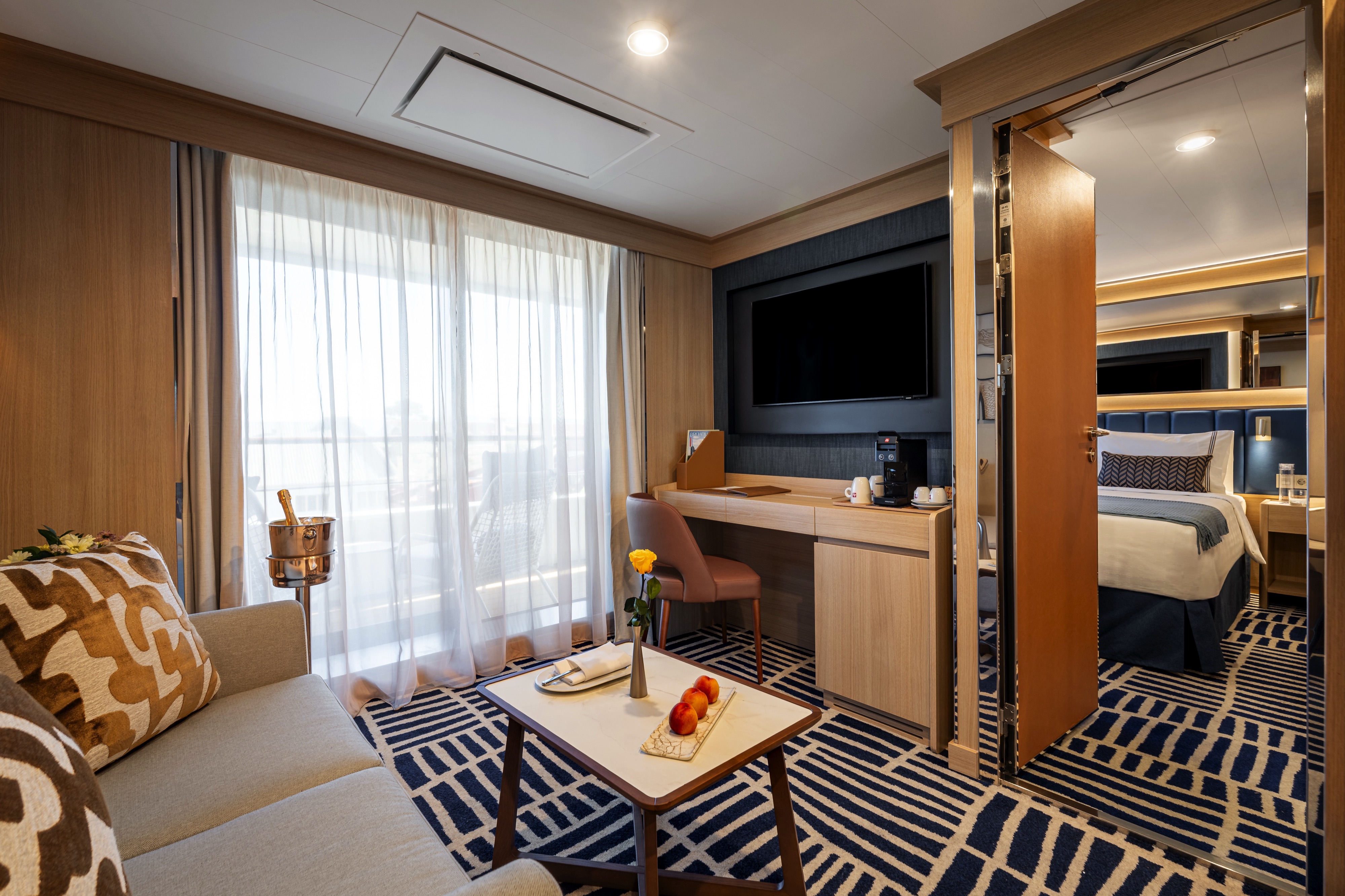
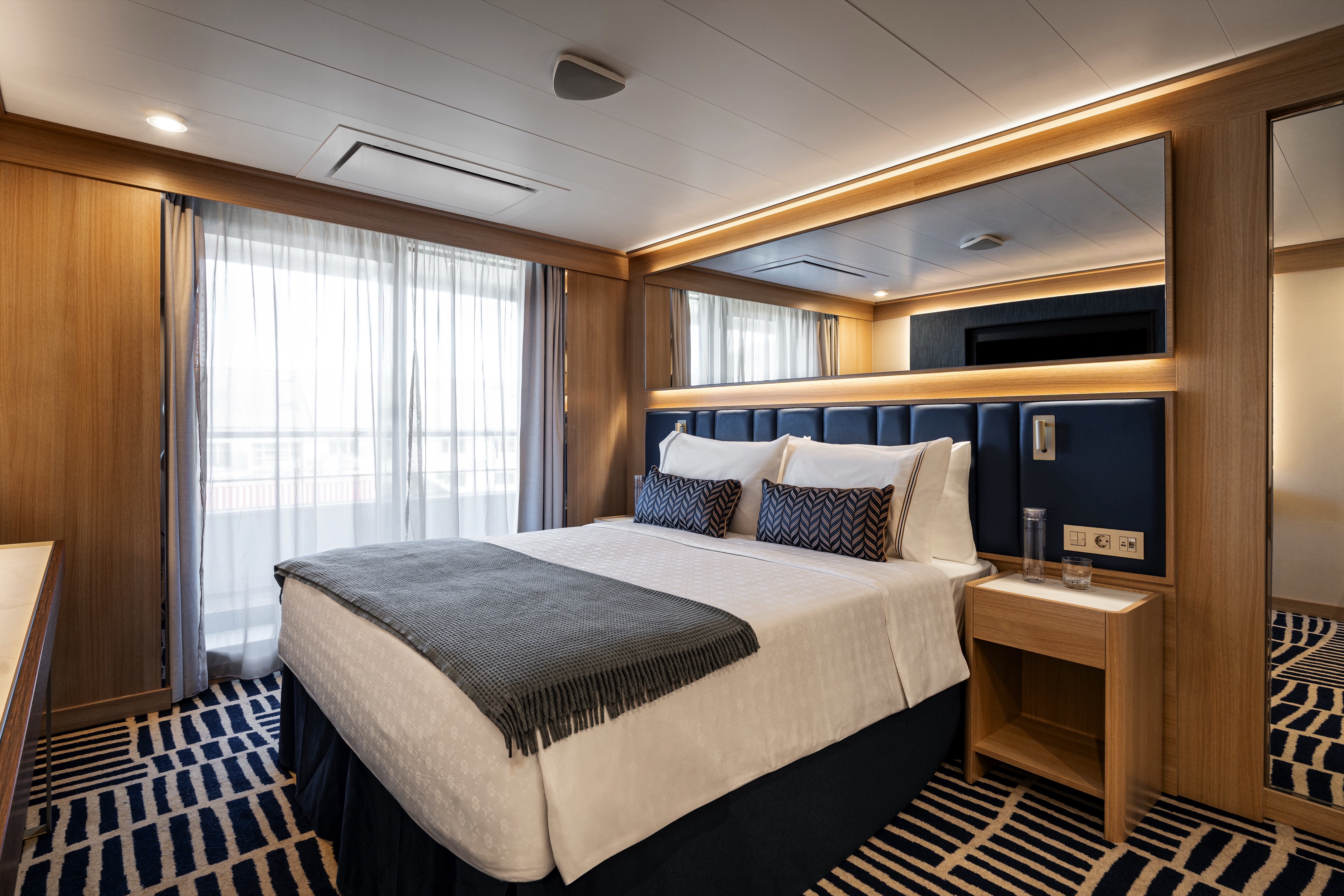
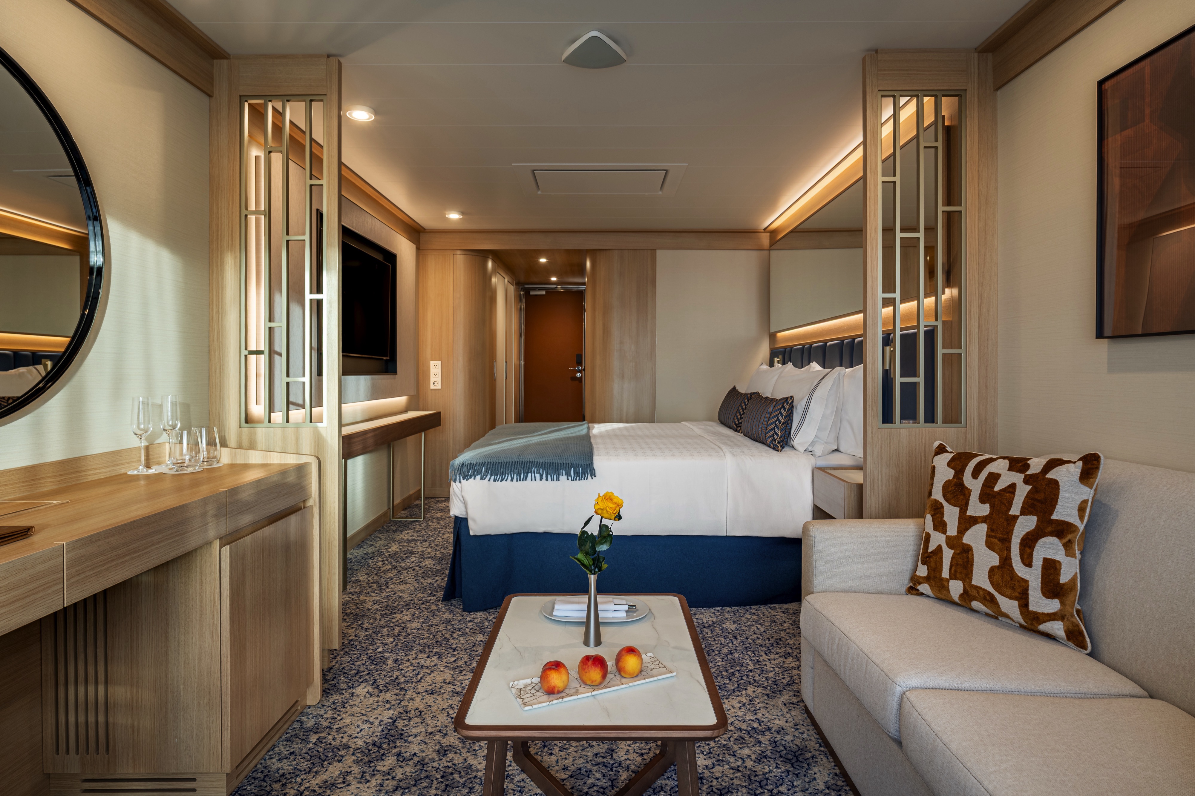
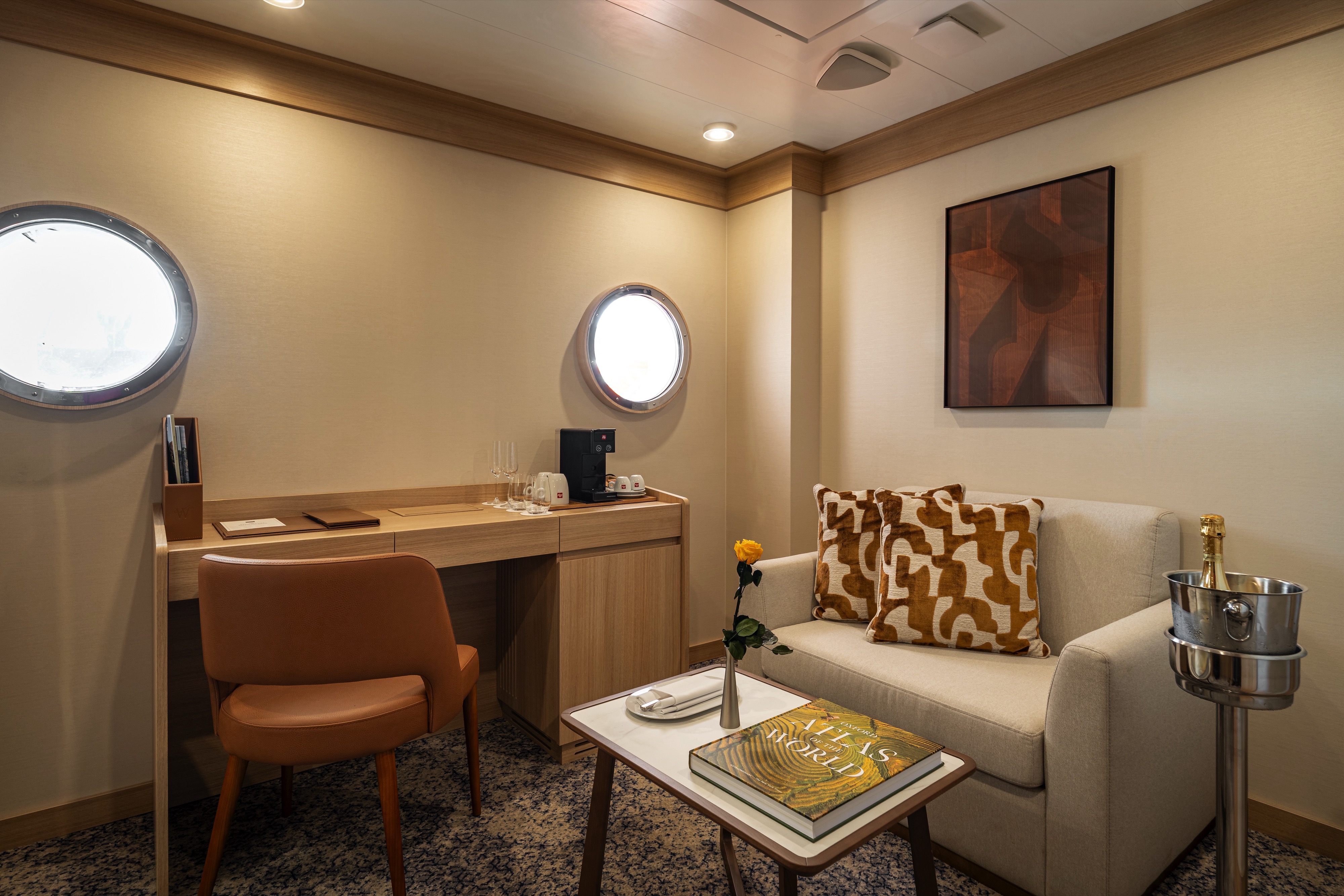
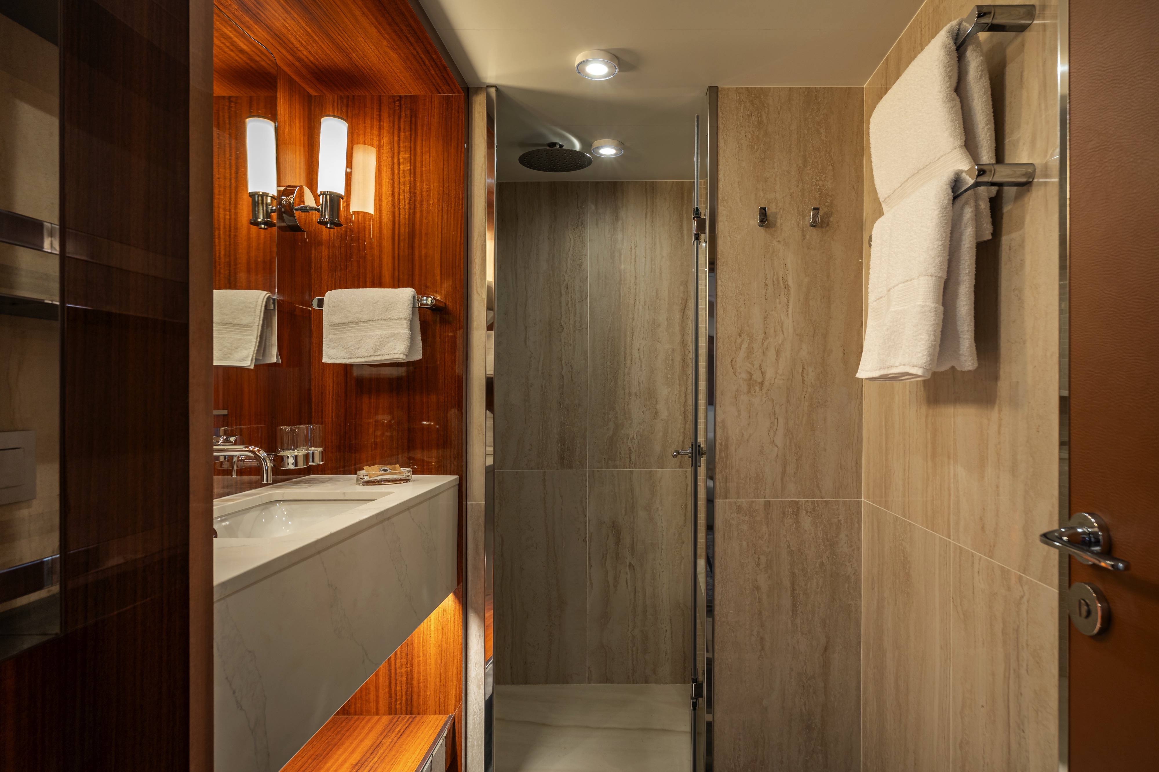
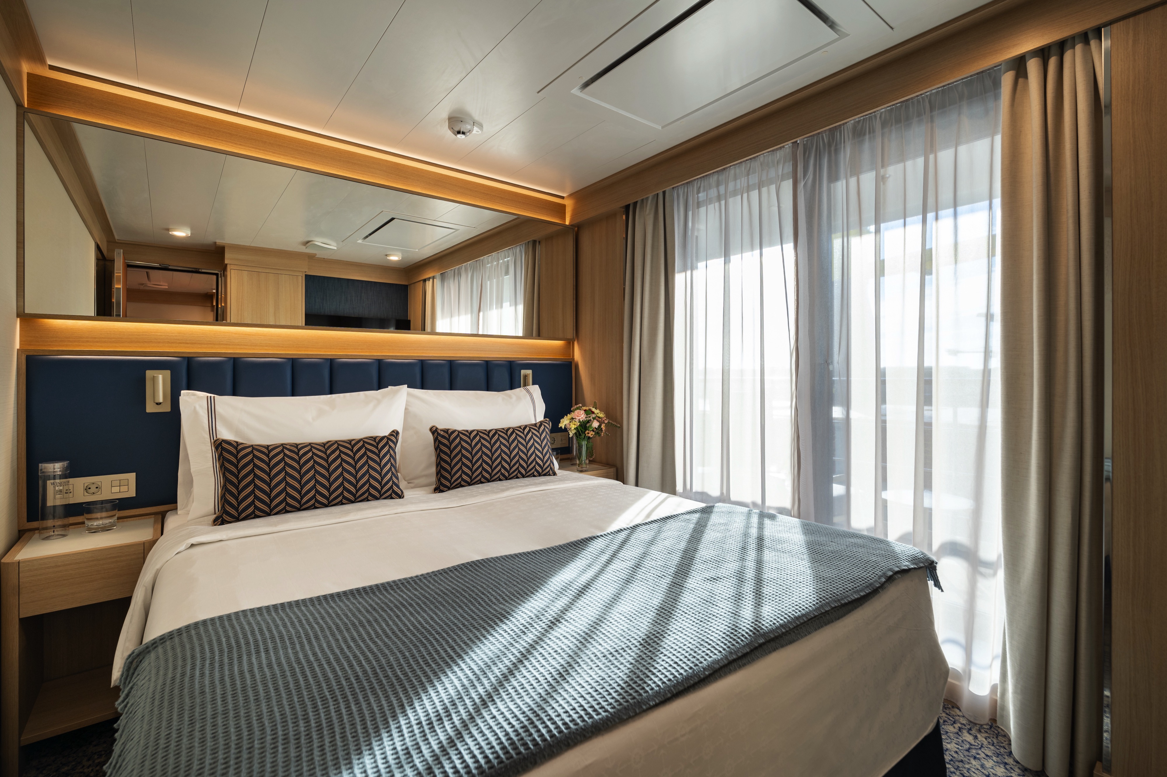
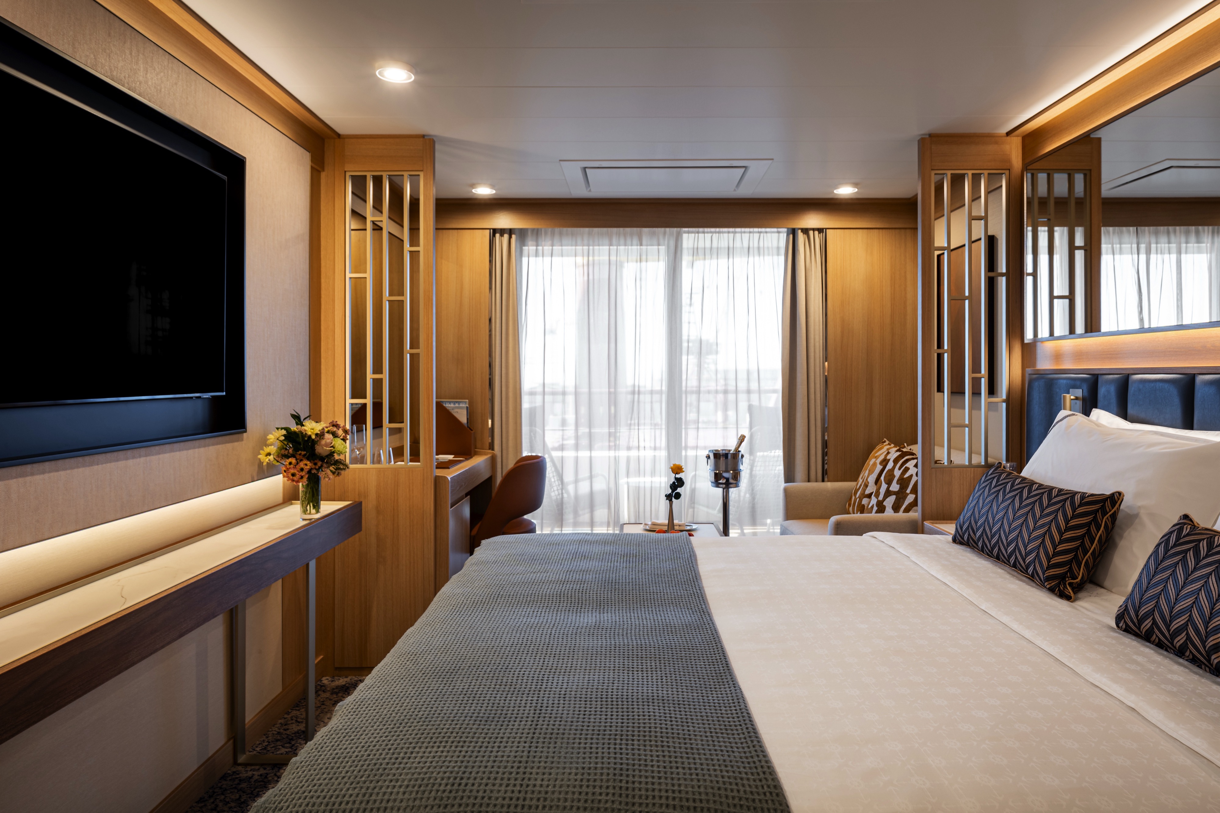
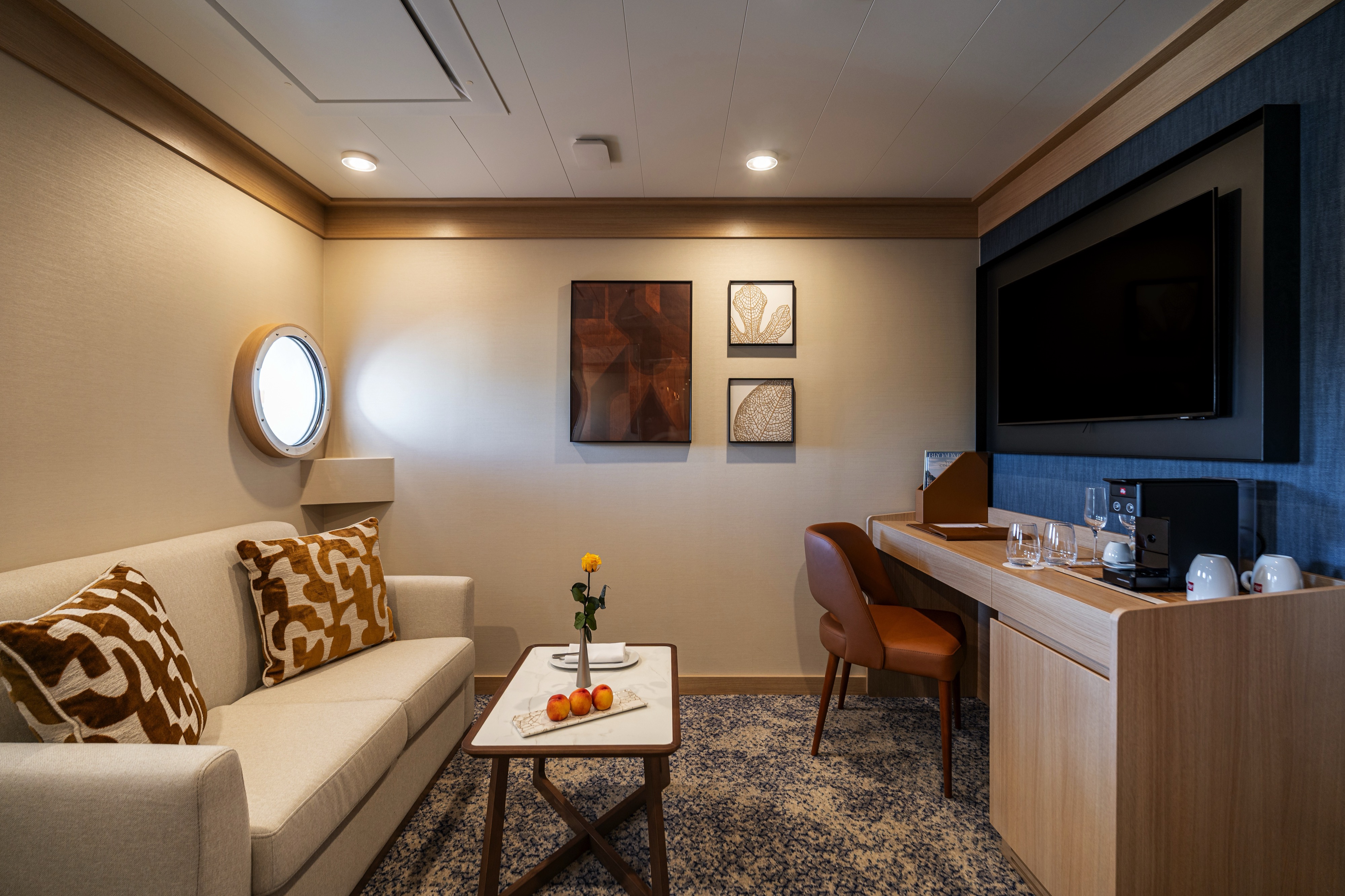
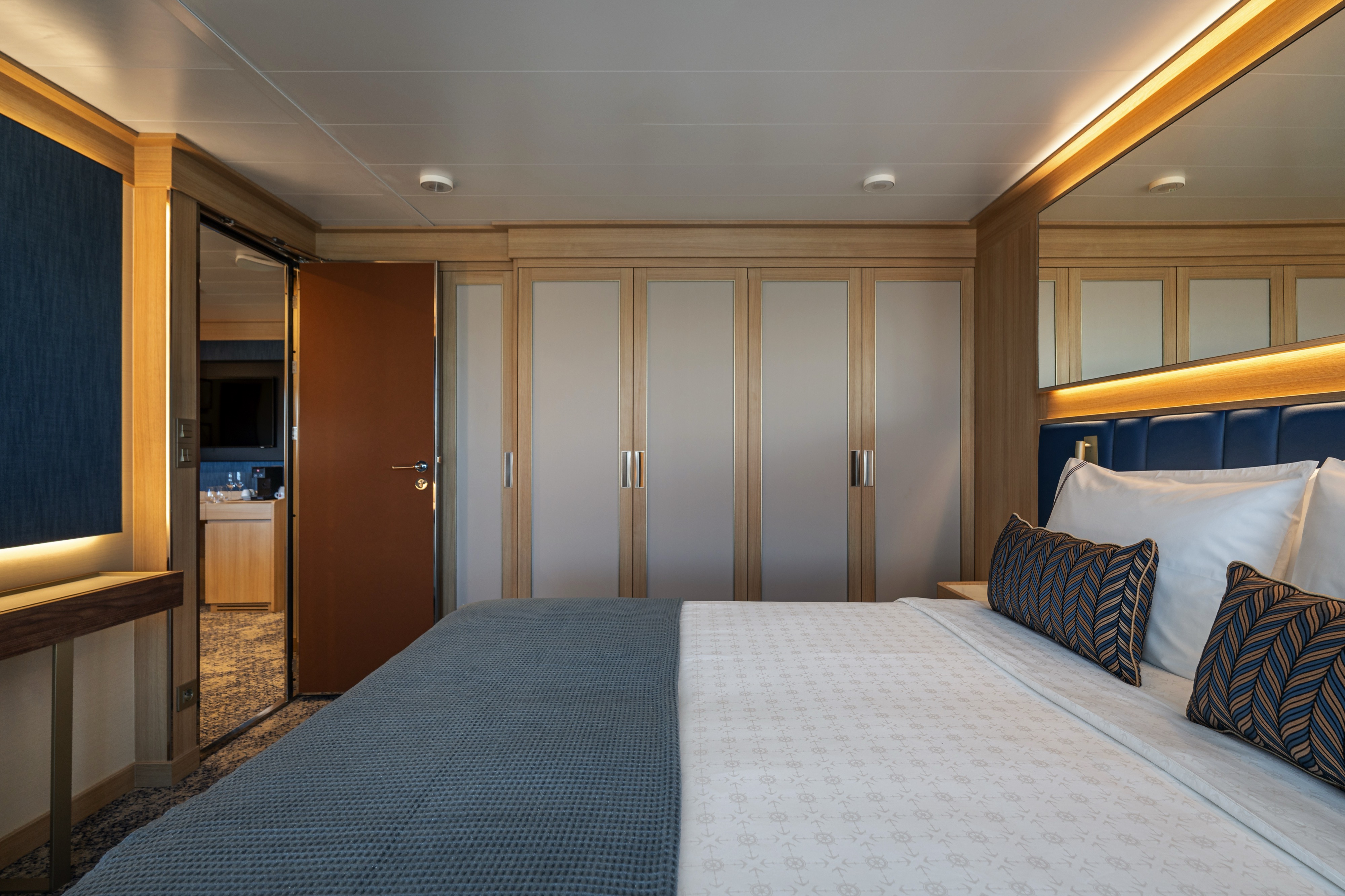
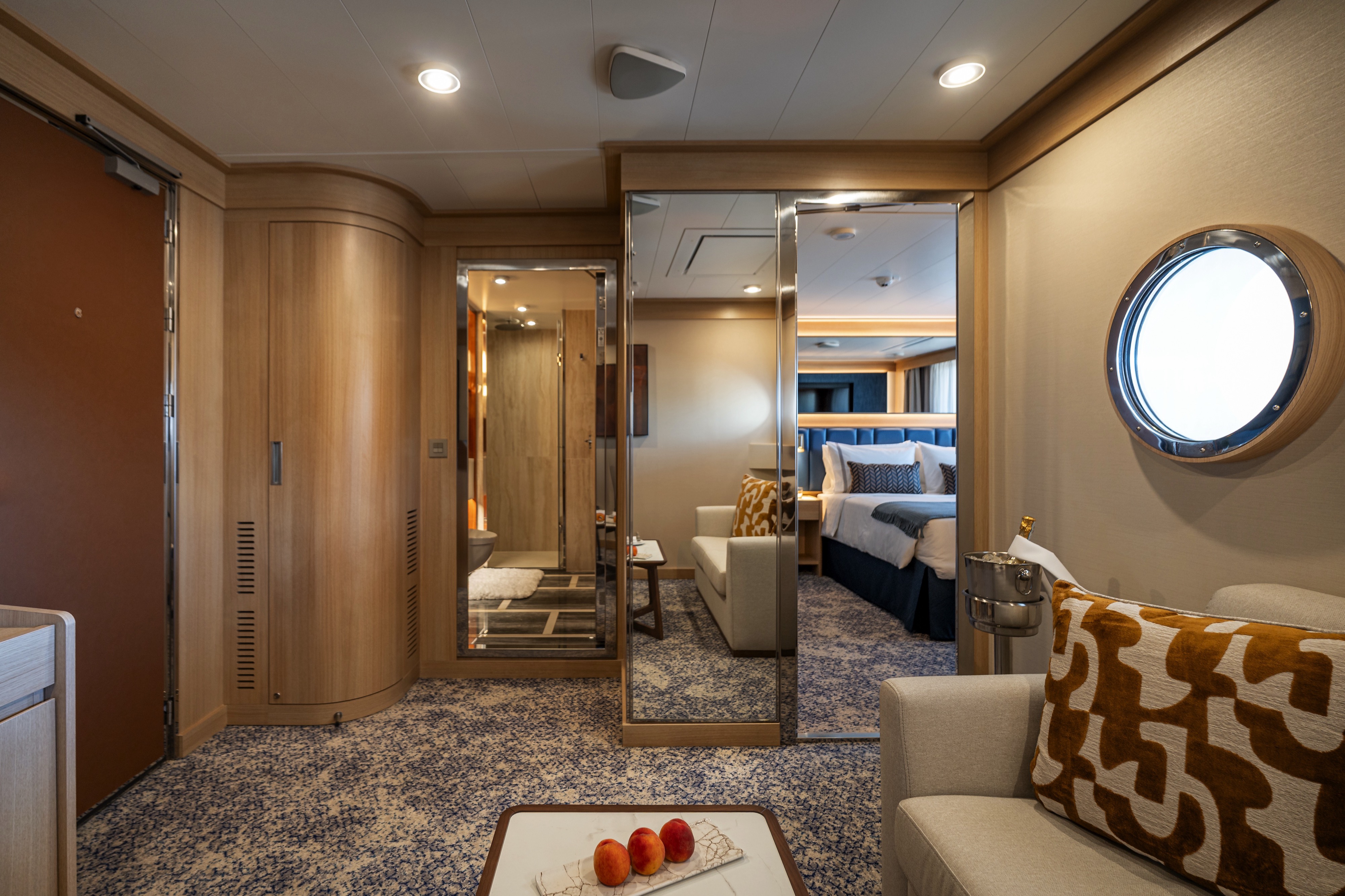
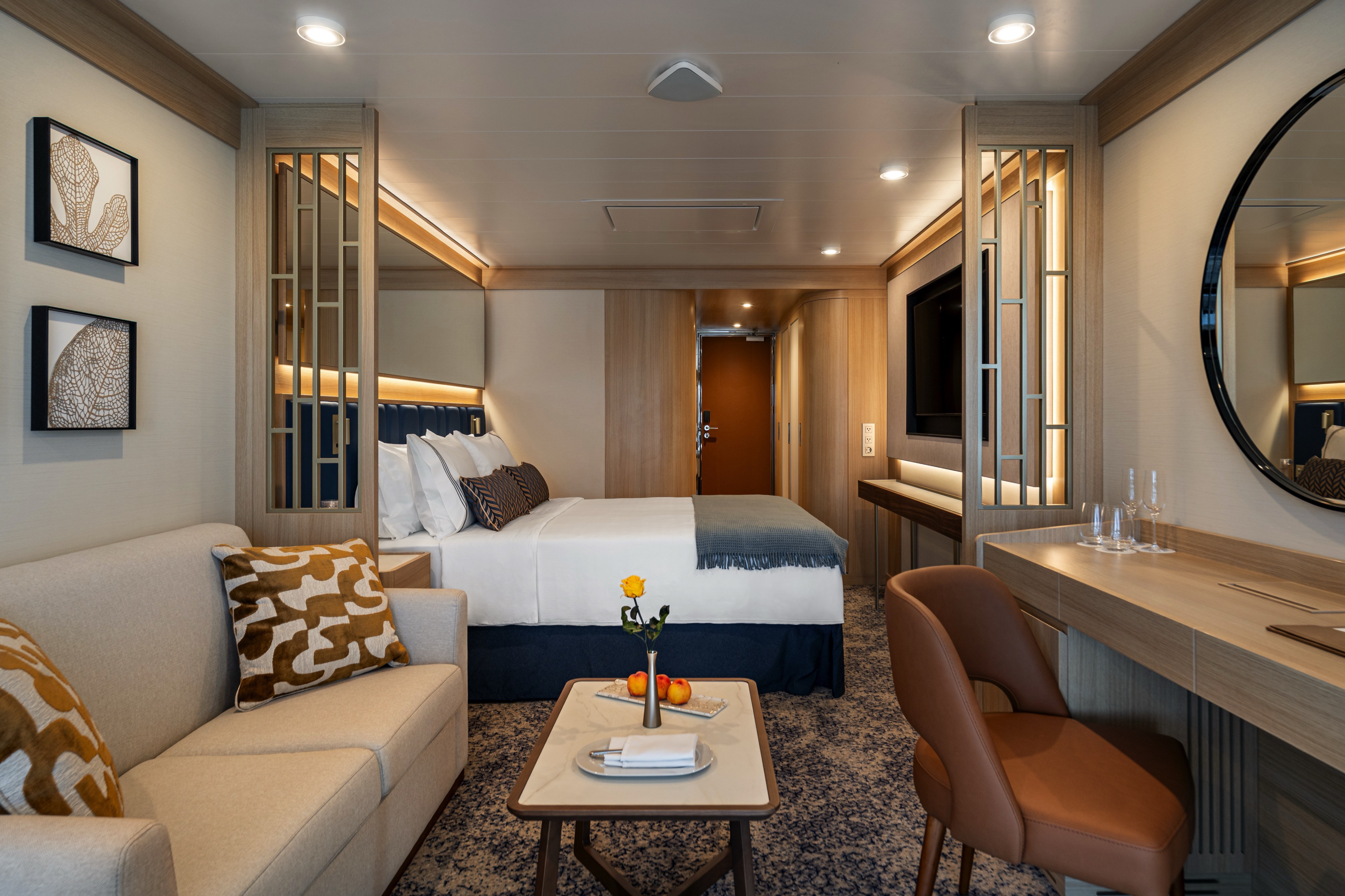
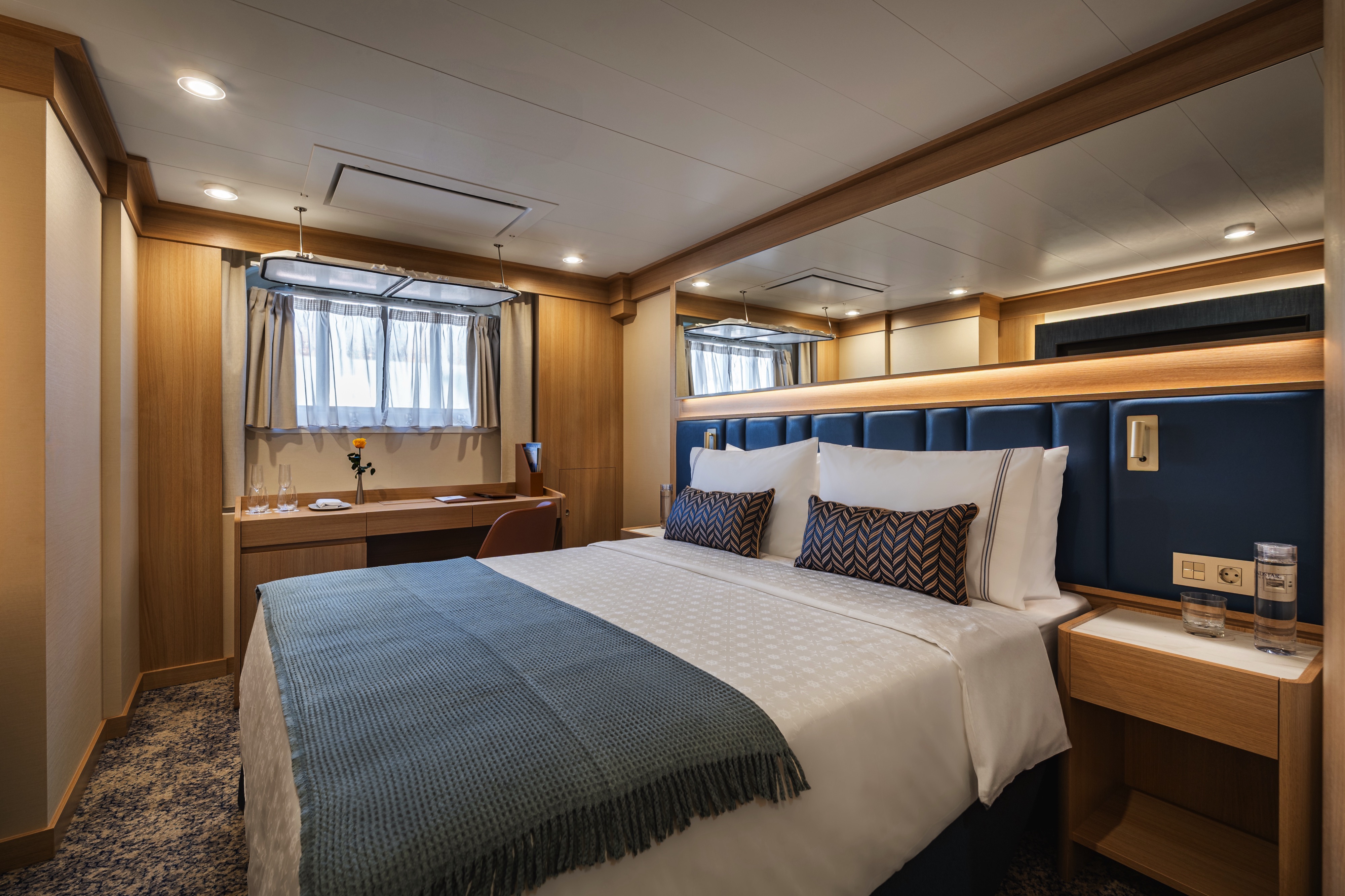
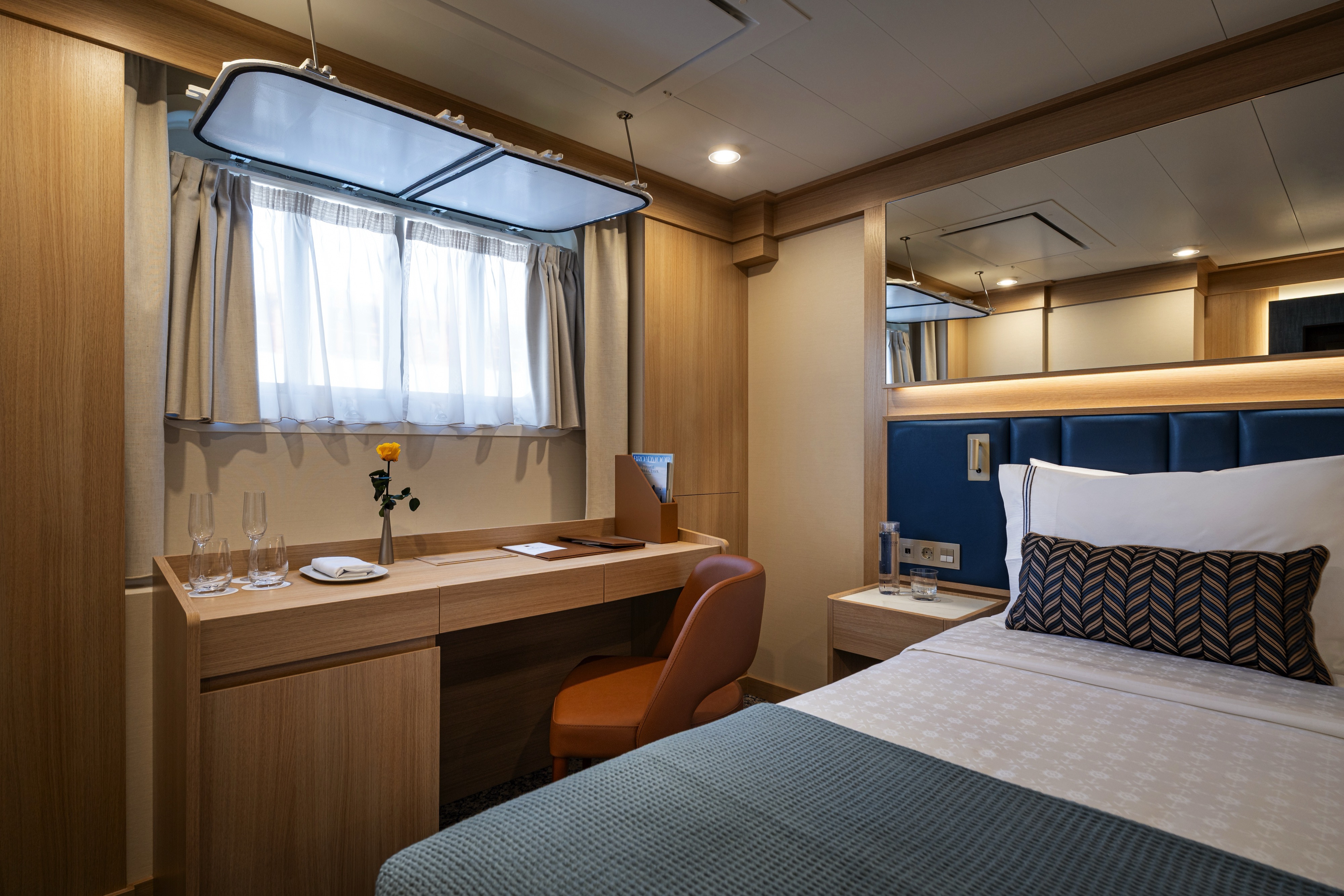
DECK | CABIN TYPE: Suite | 548 SQ FT
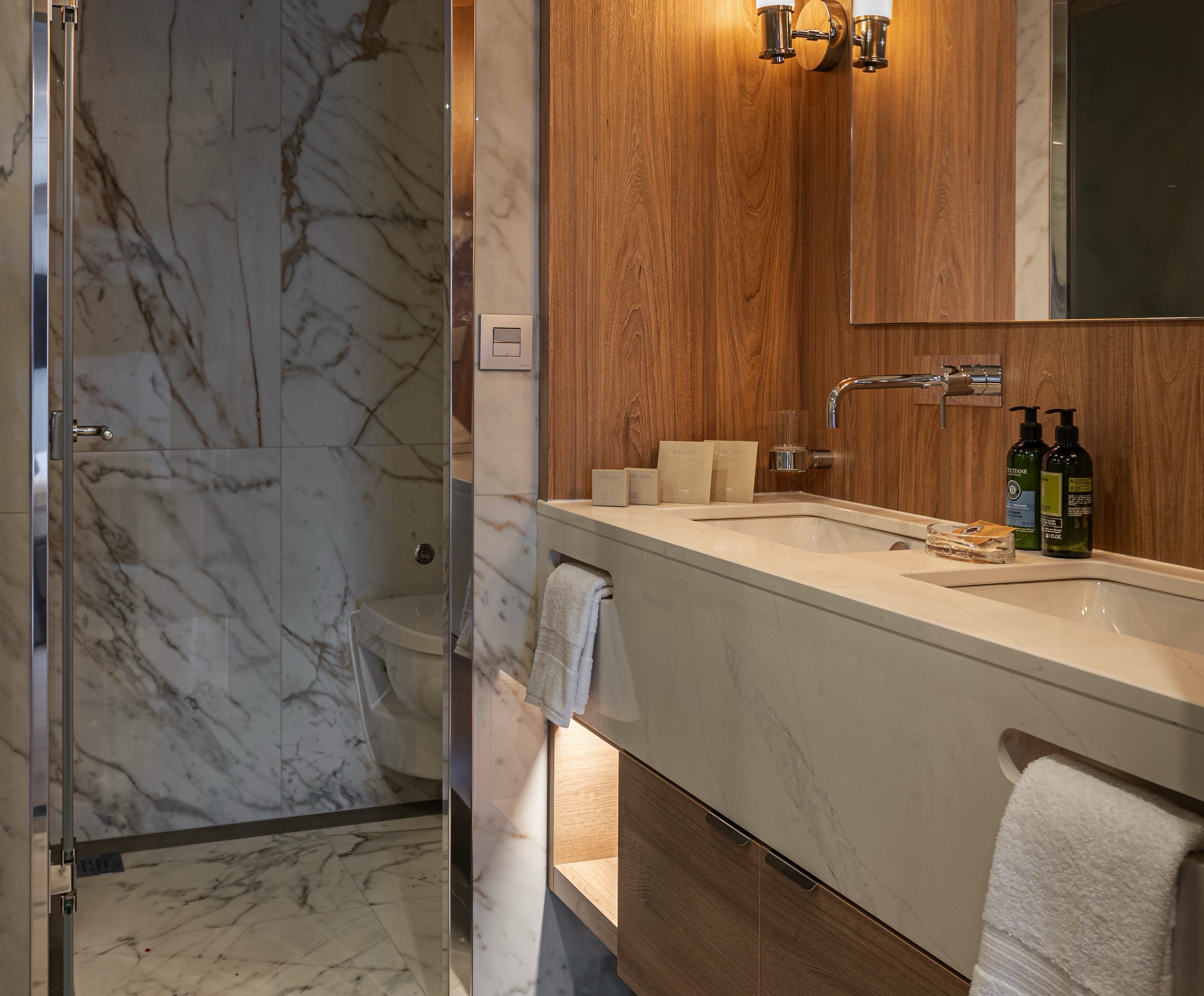
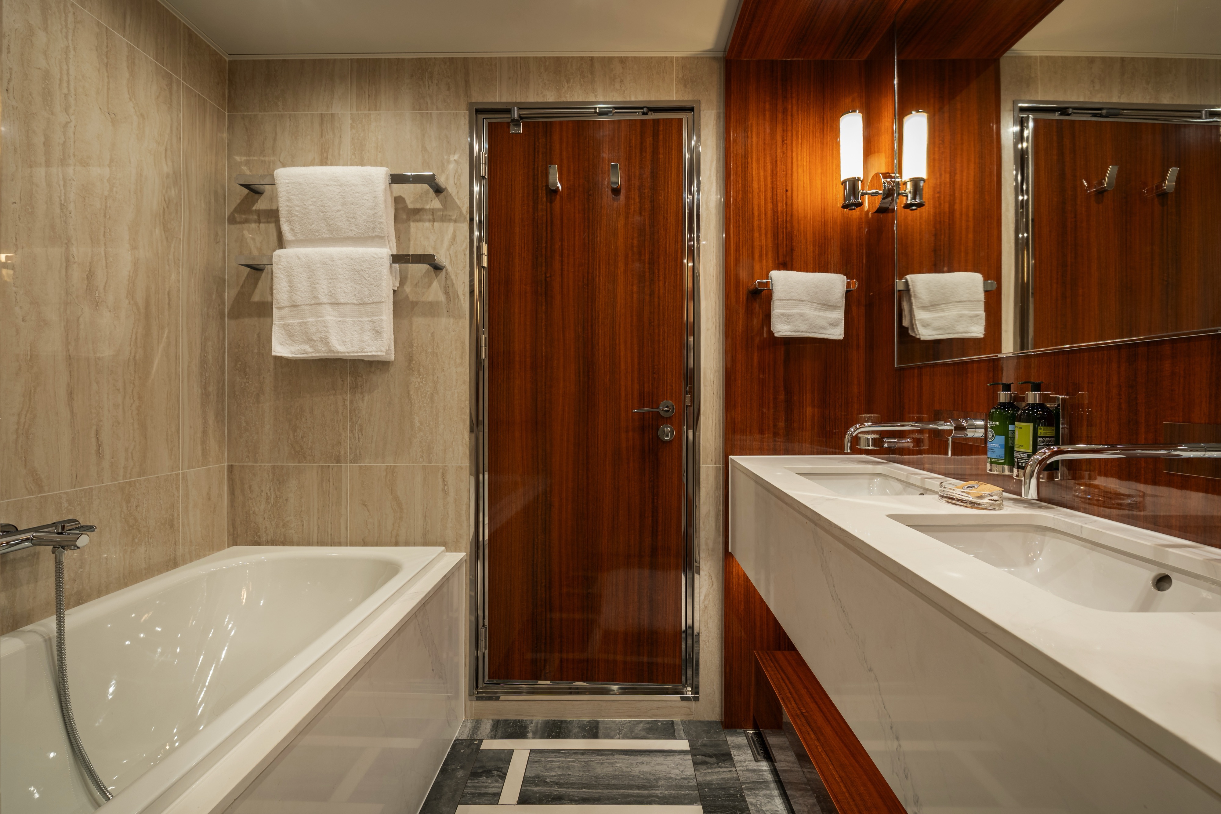
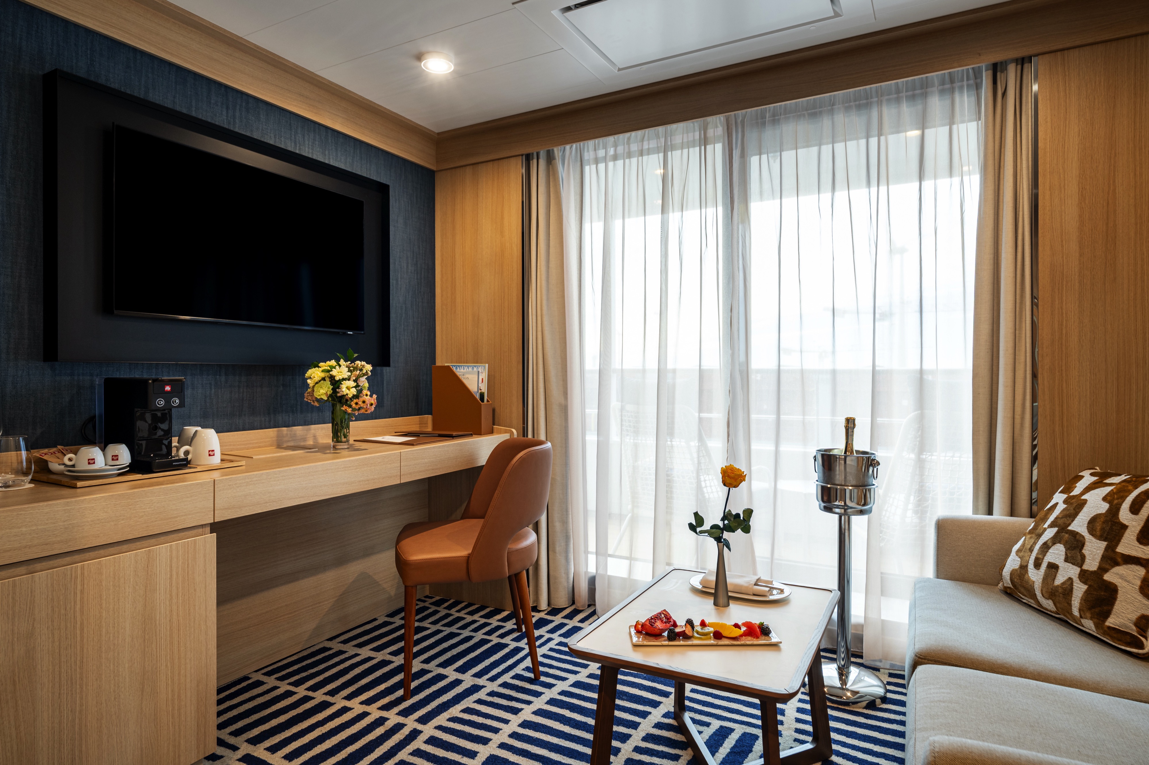
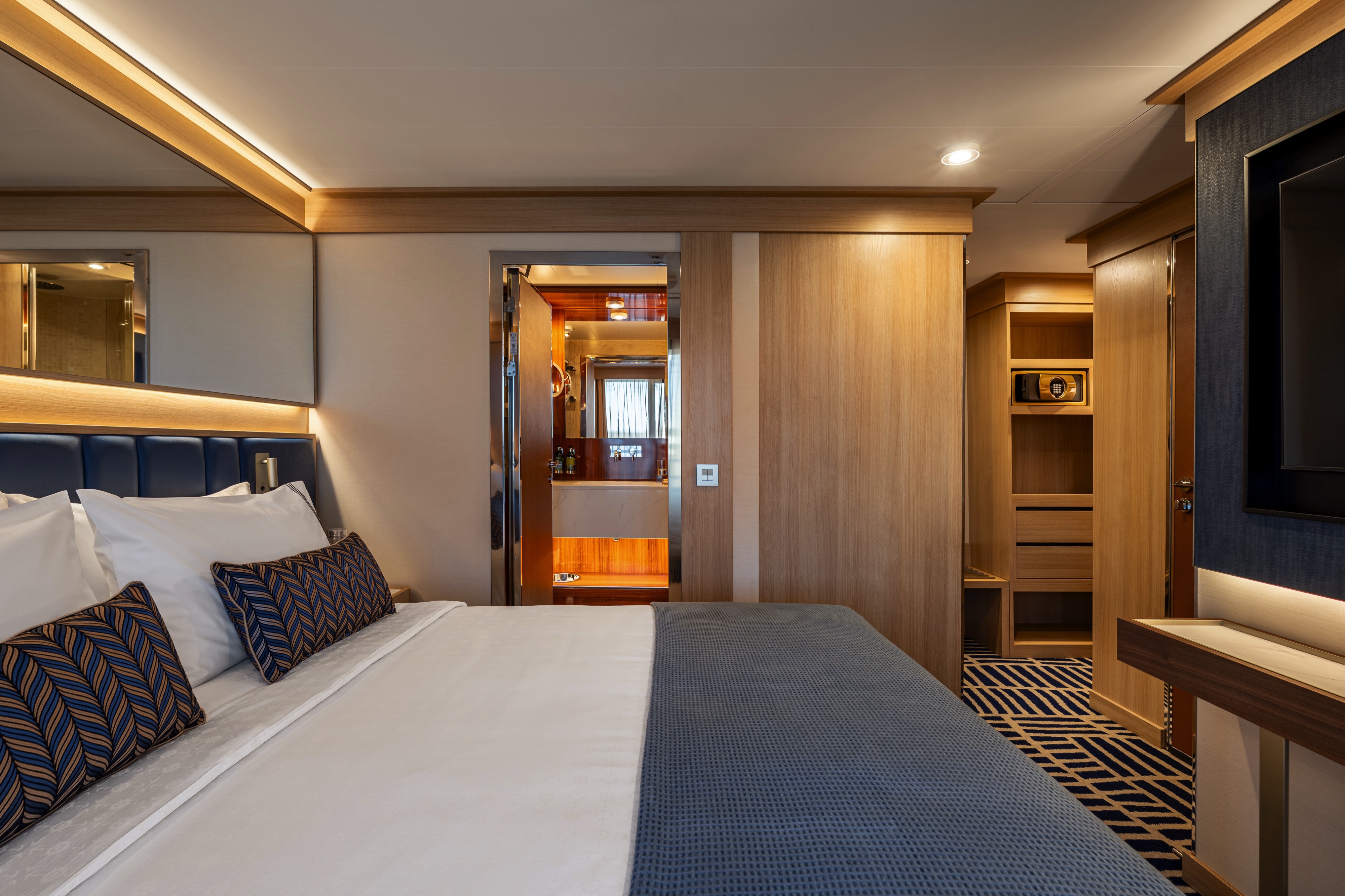
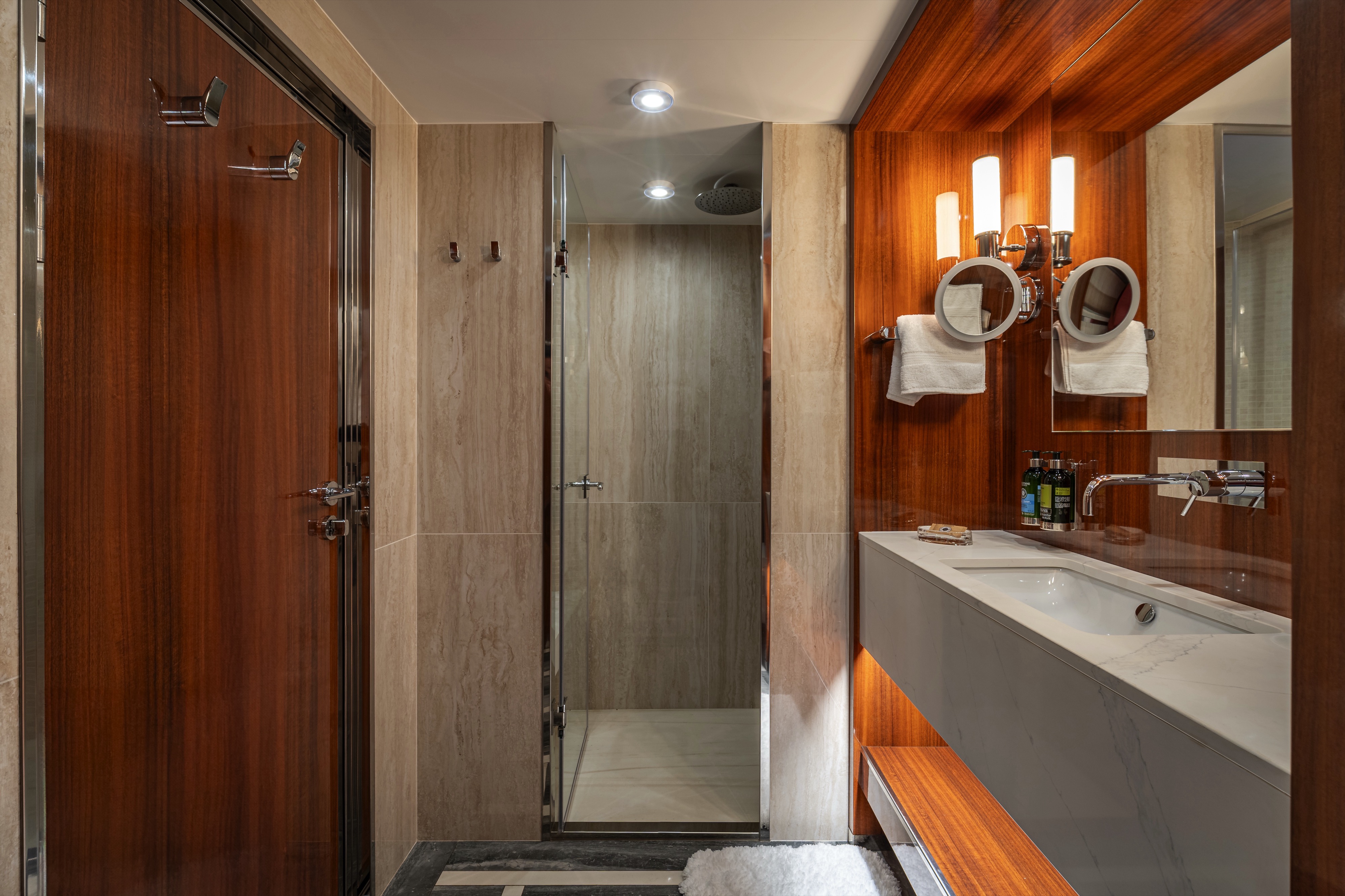
This luxurious 548-square-foot suite combines floor-to-ceiling windows and a wrap-around balcony for an unparalleled cruising experience. Perfect for evening cocktails or a private dinner, the wrap-around balcony adds 248 square feet of space and offers unobstructed views of the sea. The suite boasts a separate entryway — as well as separate dining and living areas — and a guest powder room. The bedroom includes an inviting king bed (convertible into two XL twin beds if desired), and the bathroom features a luxurious double walk-in mosaic glass shower with rain head and body jets. For family bookings, the adjacent suite can be combined to provide extra bedrooms and space for entertaining.
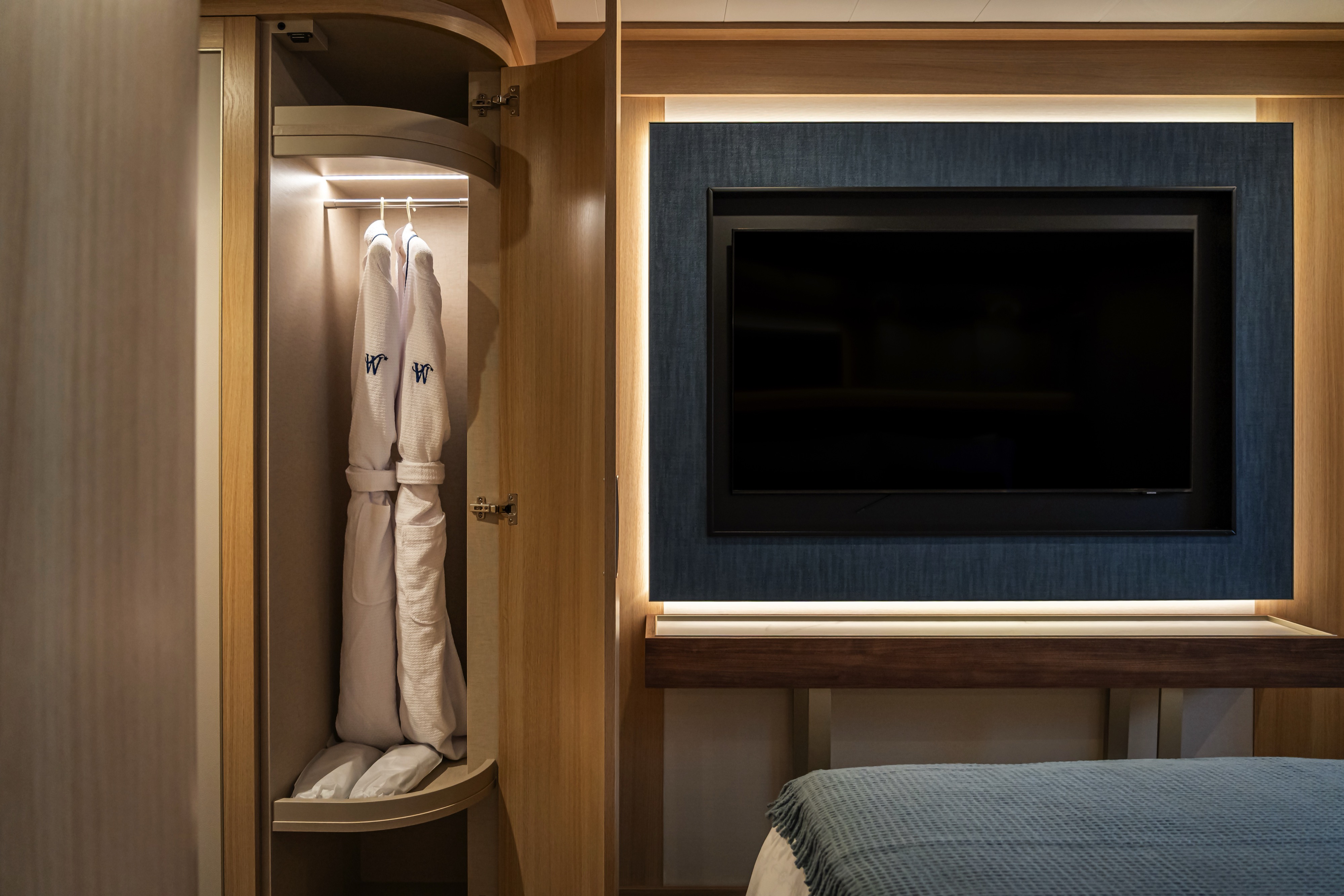
All Accommodations Feature
- Queen Size Bed with Luxurious Linens
- Waffle Weave Robe and Slippers
- Interactive TV
- Mini Bar/Refrigerator
- Safe
- Direct Dial Phone
- L'Occitane Bath Amenities
- Fresh Fruit
- Hair Dryers and 110/220 outlets
- Wi-Fi Internet Access (various plans available for purchase)
- Mirrored closet with ample drawer space
- Vanity with magnifying mirror and chair
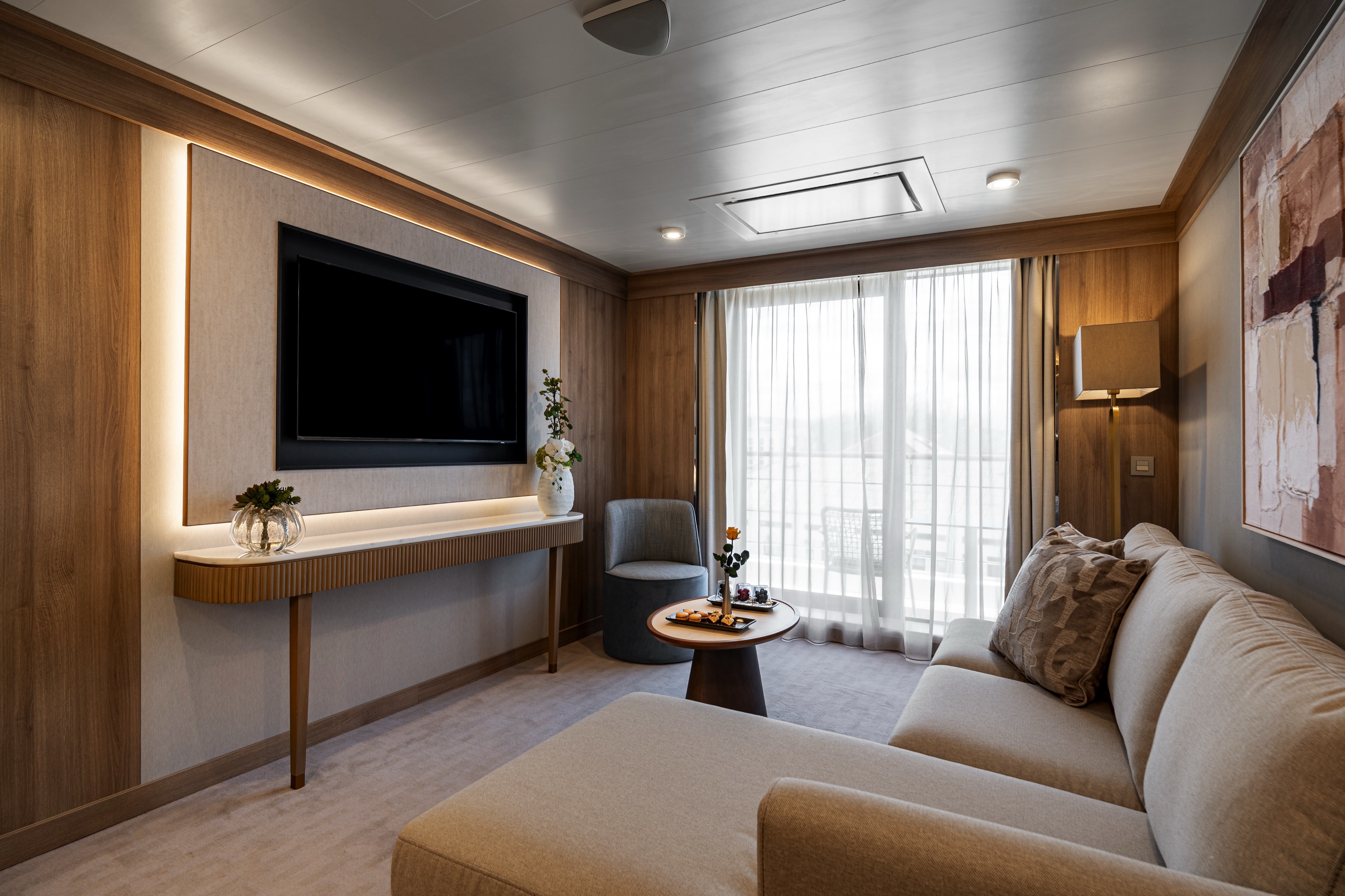
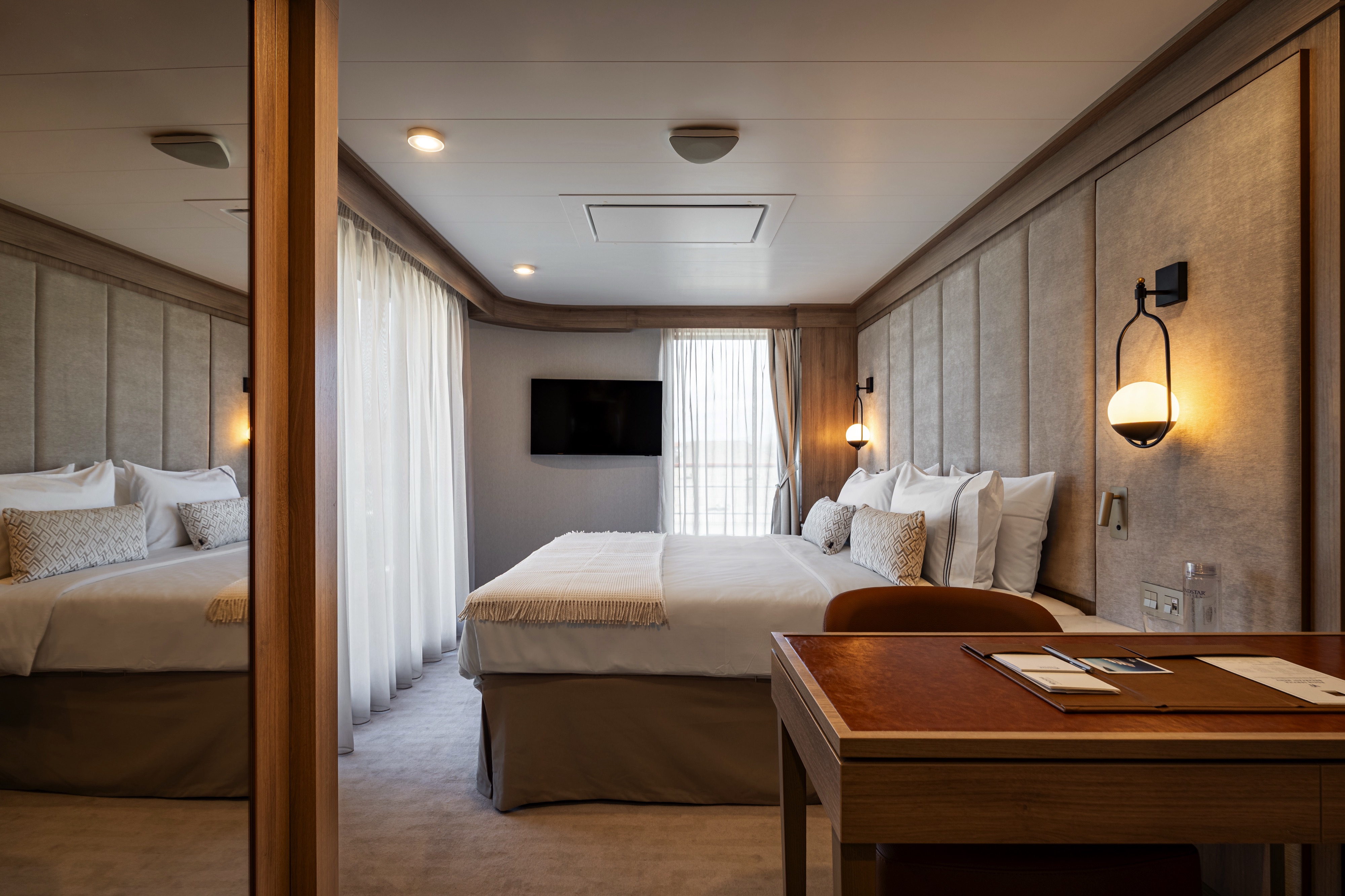

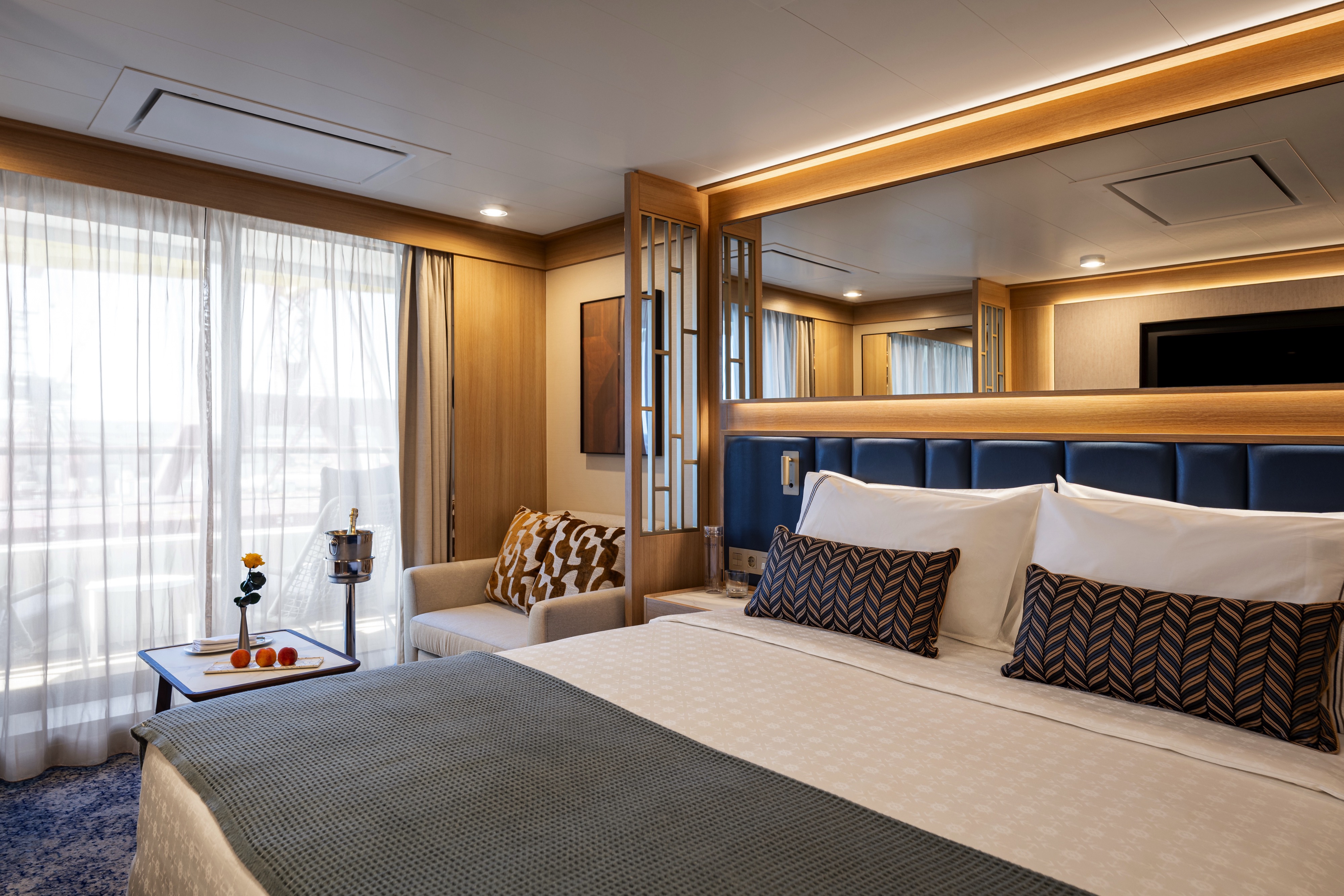
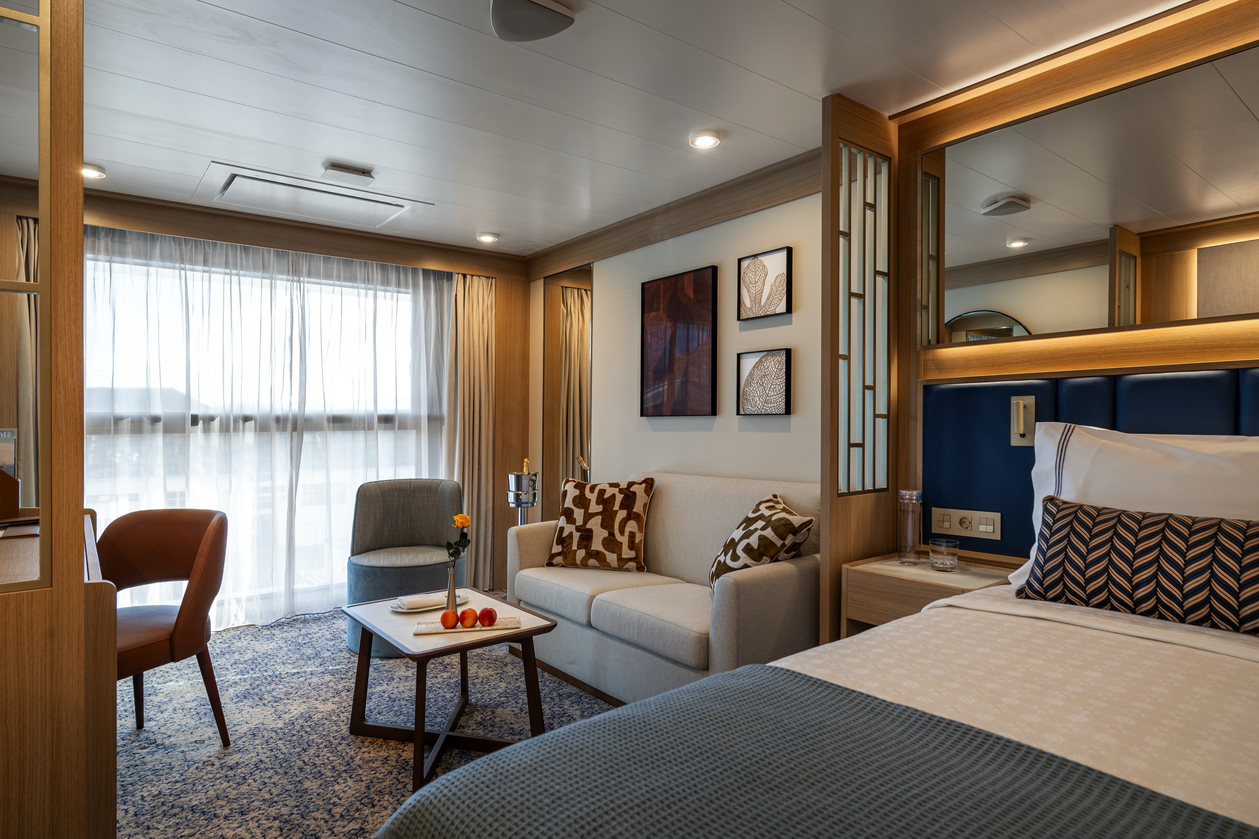
DECK | CABIN TYPE: Suite | 380 SQ FT
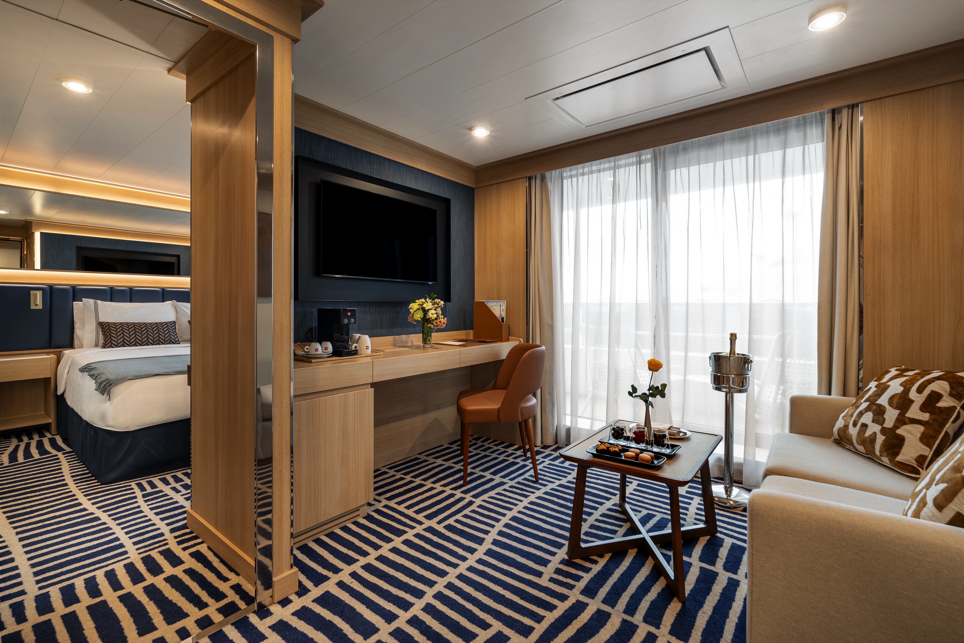
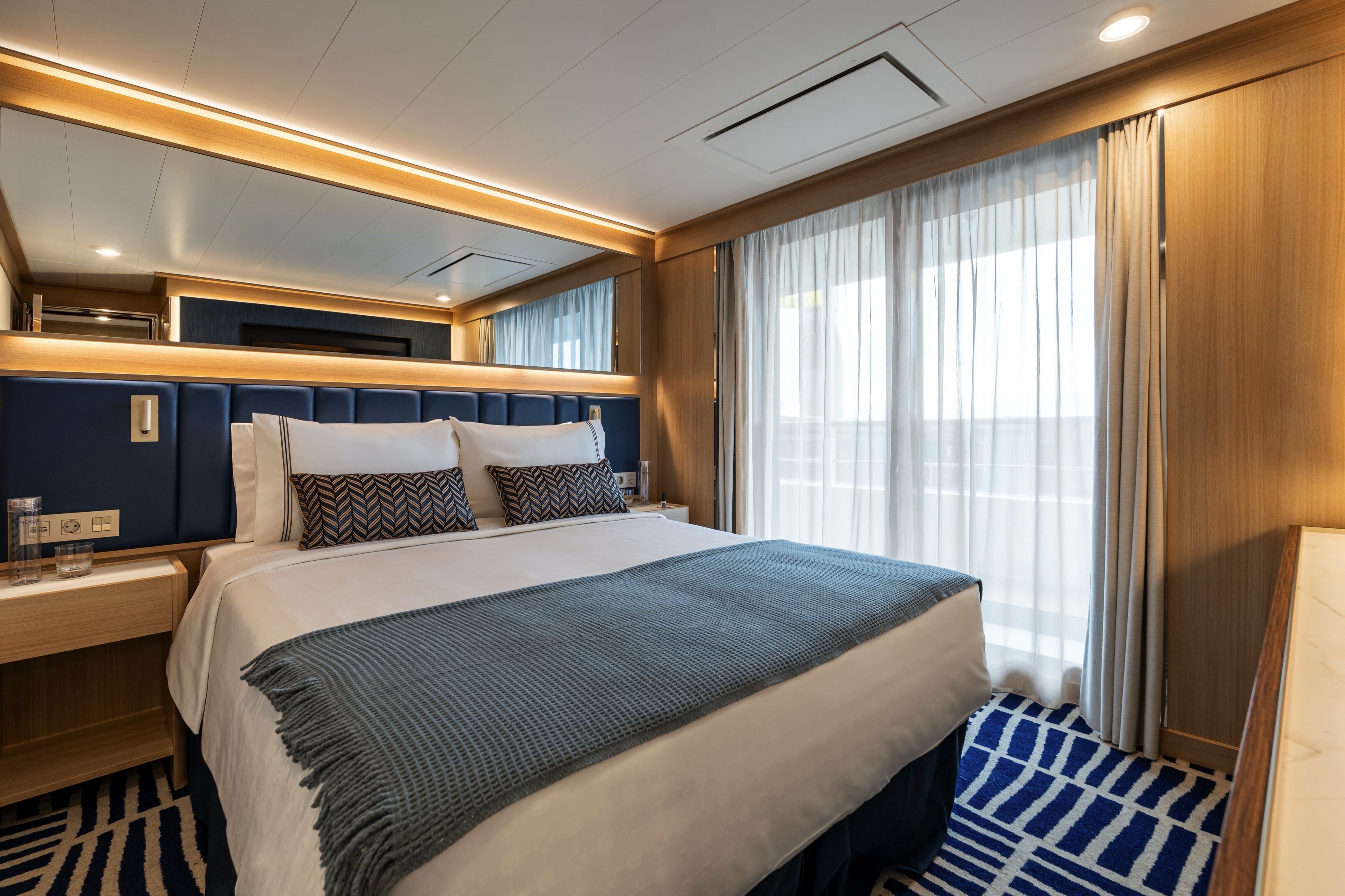
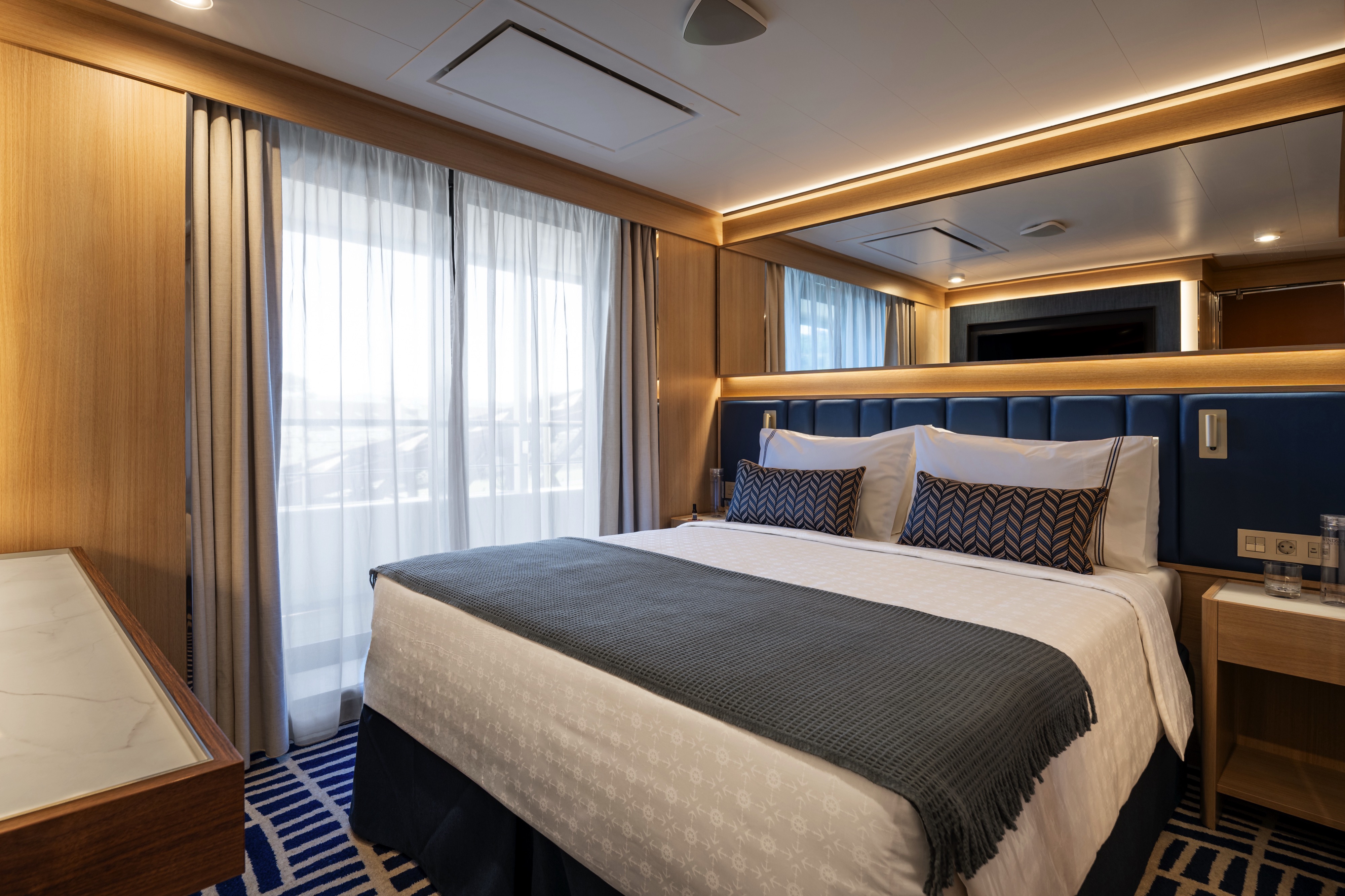
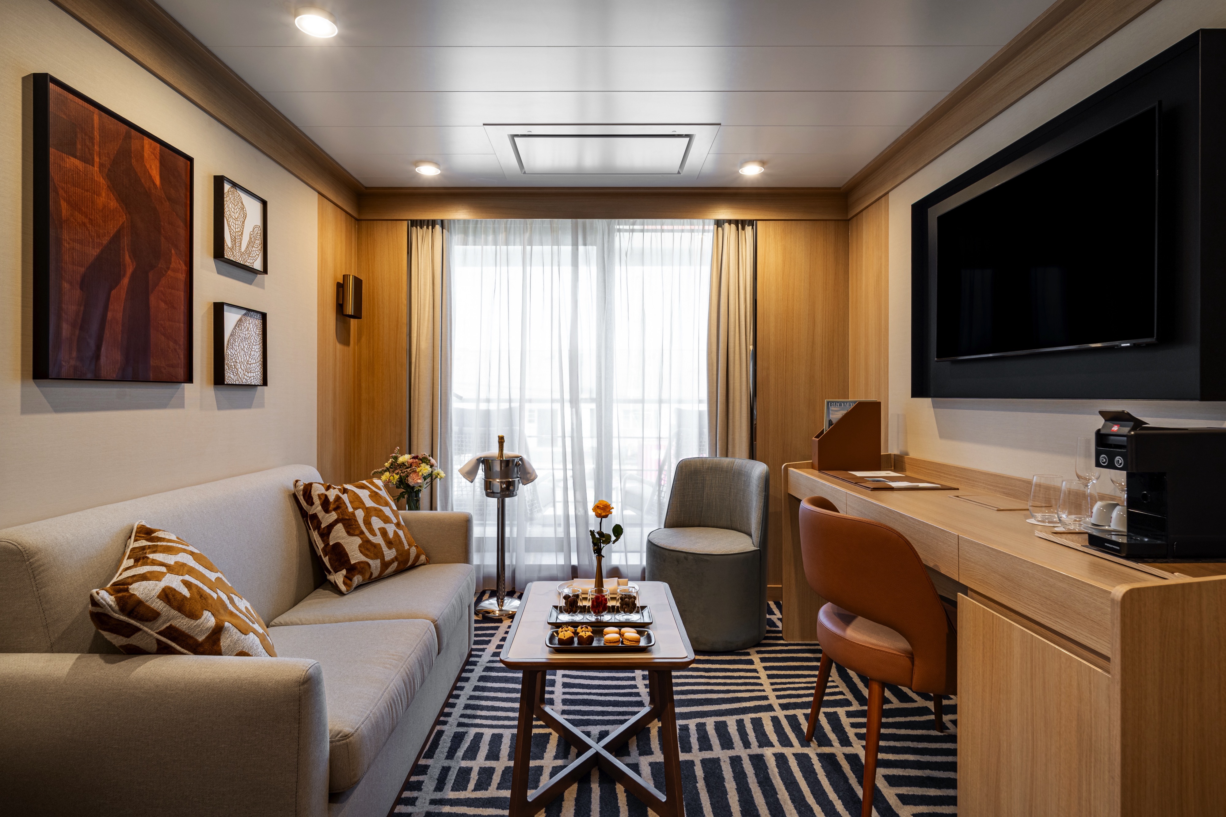
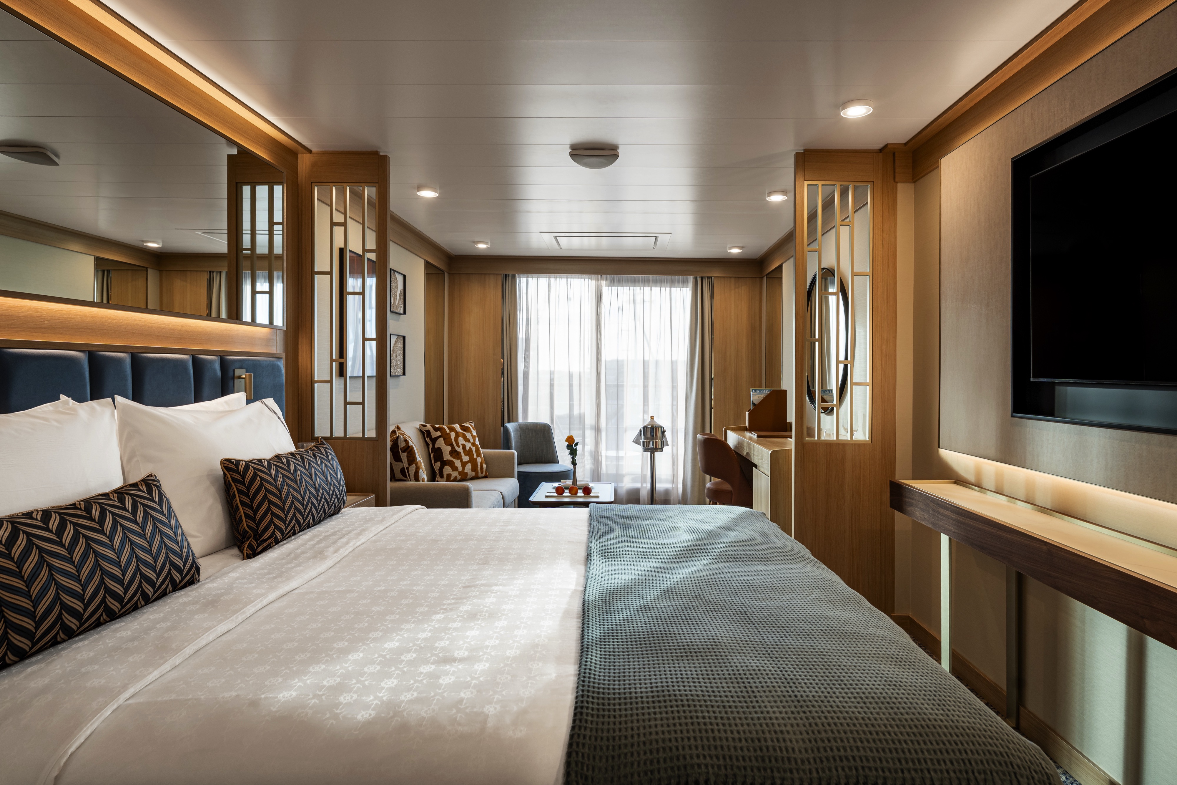
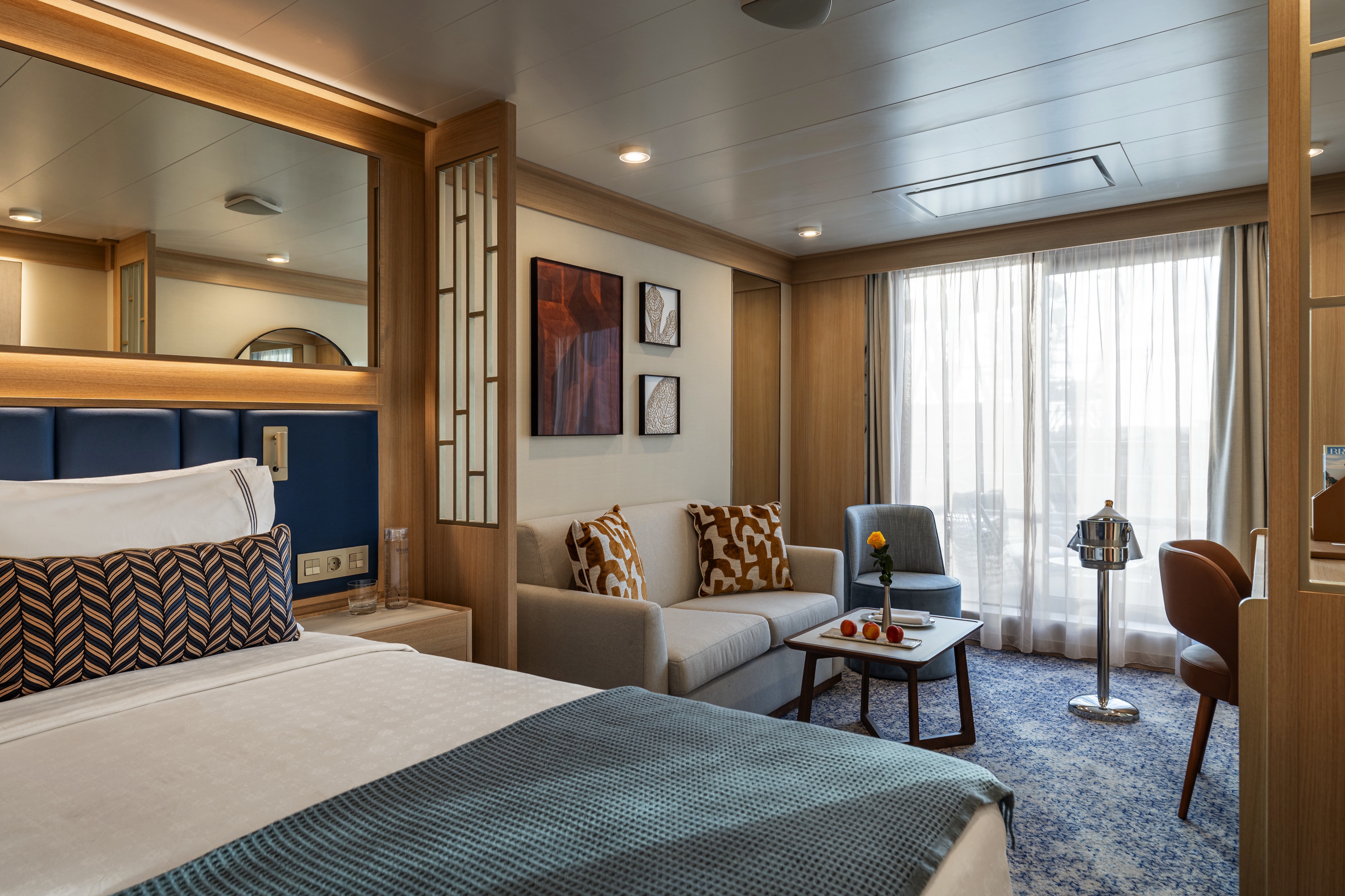
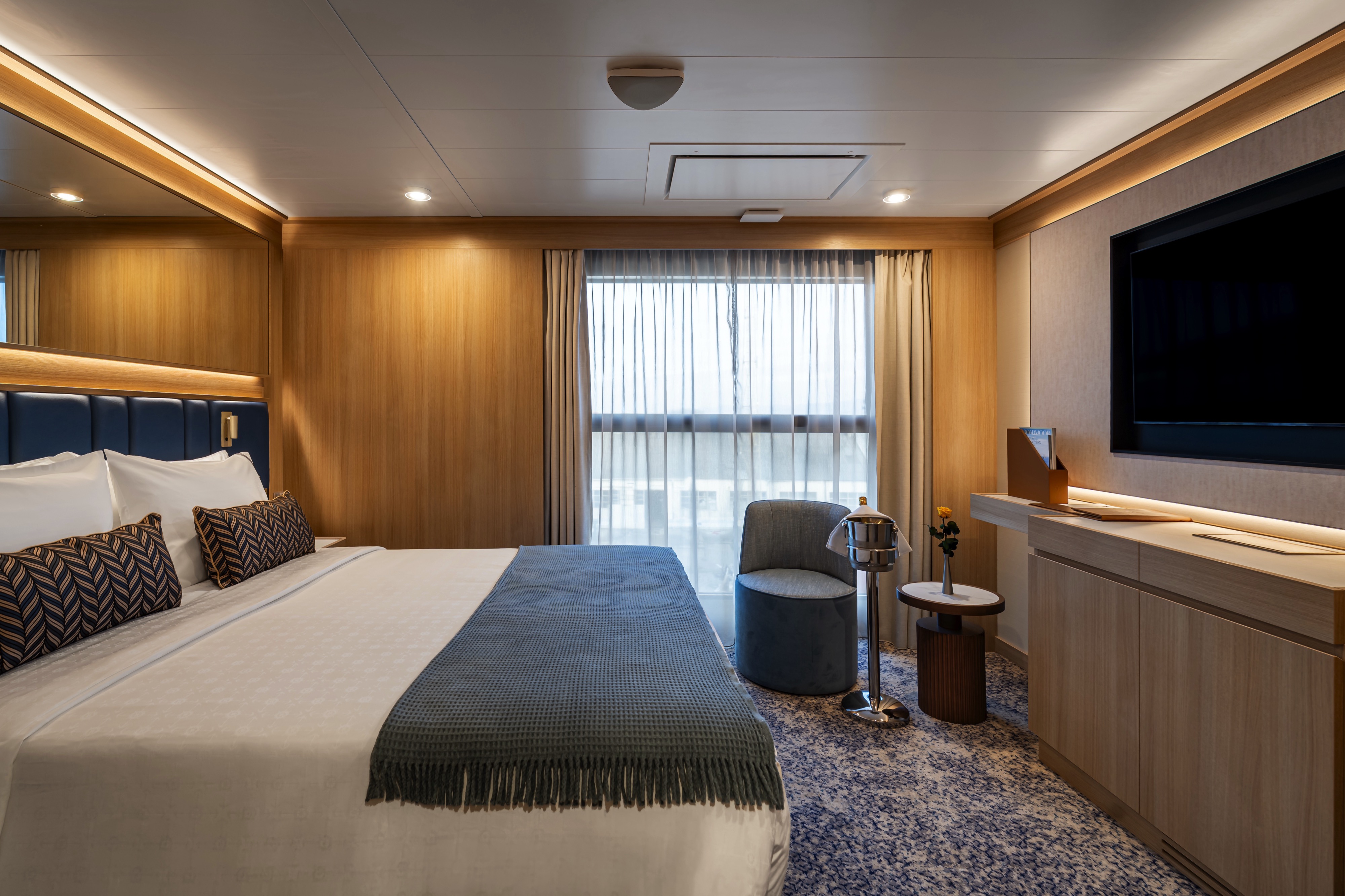
Step into a stylish and bright open living area with a spacious adjacent bedroom. This 380-square-foot suite welcomes you with spectacular views, courtesy of the sliding glass doors that lead out to your private balcony. The outdoor space adds another 110 square feet, enough to sit outside comfortably and enjoy the breeze. The bedroom features an inviting queen bed (convertible into two twin beds if desired) and its own sliding glass door with balcony access, while the bathroom includes a bathtub and walk-in mosaic glass shower with rain head and body jets.
All Accommodations Feature
- Queen Size Bed with Luxurious Linens
- Waffle Weave Robe and Slippers
- Interactive TV
- Mini Bar/Refrigerator
- Safe
- Direct Dial Phone
- L'Occitane Bath Amenities
- Fresh Fruit
- Hair Dryers and 110/220 outlets
- Wi-Fi Internet Access (various plans available for purchase)
- Mirrored closet with ample drawer space
- Vanity with magnifying mirror and chair
DECK | CABIN TYPE: Suite | 288 SQ FT
This 288-square-foot suite welcomes you with spectacular views, courtesy of the sliding glass doors that lead out to your private balcony. The outdoor space adds another 110 square feet, enough to sit outside comfortably and enjoy the breeze. The bedroom features an inviting queen bed and its own sliding glass door with balcony access, while the bathroom includes a luxurious walk-in mosaic glass shower with rain head and body jets.
All Accommodations Feature
- Queen Size Bed with Luxurious Linens
- Waffle Weave Robe and Slippers
- Interactive TV
- Mini Bar/Refrigerator
- Safe
- Direct Dial Phone
- L'Occitane Bath Amenities
- Fresh Fruit
- Hair Dryers and 110/220 outlets
- Wi-Fi Internet Access (various plans available for purchase)
- Mirrored closet with ample drawer space
- Vanity with magnifying mirror and chair
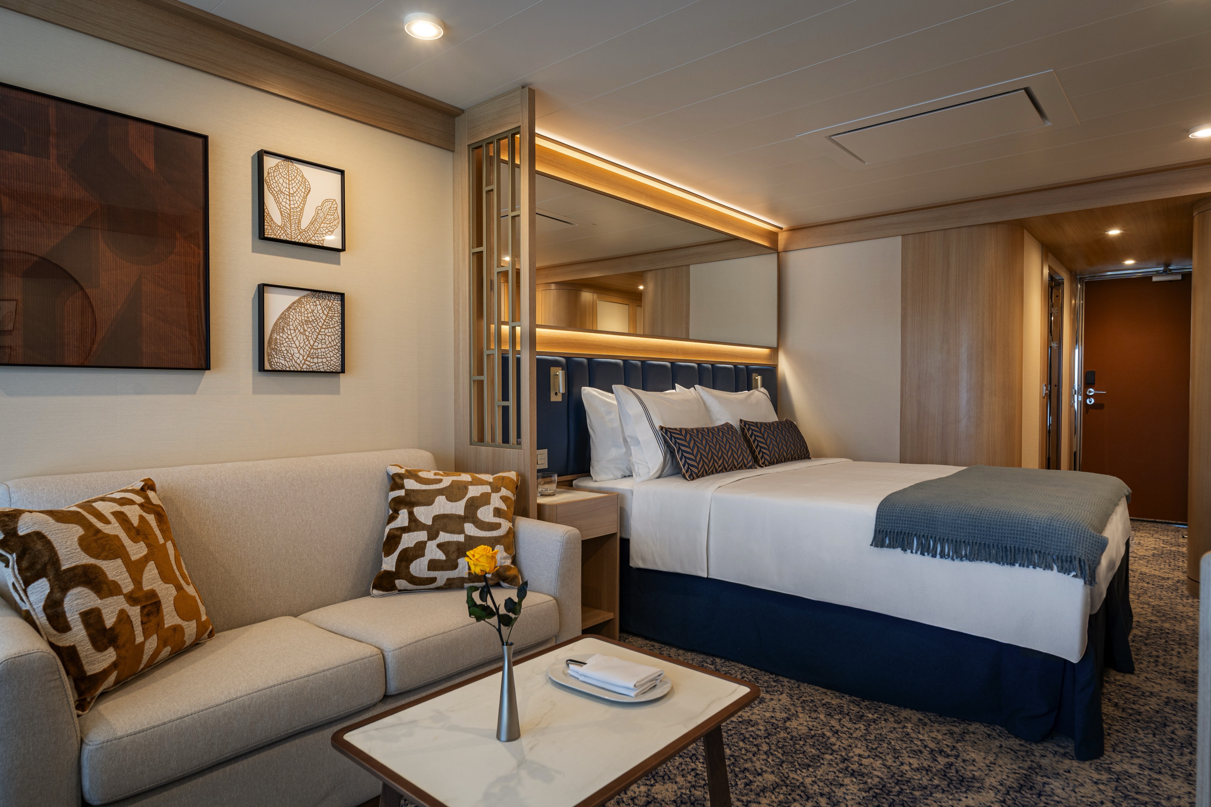
DECK | CABIN TYPE: Suite | 353 SQ FT
Step into a stylish and bright open living area with a spacious adjacent bedroom. This 353-square-foot suite welcomes you with spectacular views, courtesy of the sliding glass doors that lead out to your private balcony. The outdoor space adds another 110 square feet, enough to sit outside comfortably and enjoy the breeze. The bedroom features an inviting queen bed that can be converted into two twins if desired, while the bathroom includes a luxurious walk-in mosaic glass shower with rain head and body jets.
All Accommodations Feature
- Queen Size Bed with Luxurious Linens
- Waffle Weave Robe and Slippers
- Interactive TV
- Mini Bar/Refrigerator
- Safe
- Direct Dial Phone
- L'Occitane Bath Amenities
- Fresh Fruit
- Hair Dryers and 110/220 outlets
- Wi-Fi Internet Access (various plans available for purchase)
- Mirrored closet with ample drawer space
- Vanity with magnifying mirror and chair
DECK 7 | CABIN TYPE: SUITE | 268 SQ FT
Located on deck 7, this 268-square-foot suite welcomes you with stylish comfort and stunning ocean views. Relax on your queen bed (convertible into two twin beds if desired) or lounge in the nearby living area. The outdoor space adds another 55 square feet, enough to sit outside comfortably and enjoy the breeze. In the bathroom, you’ll find a luxurious walk-in mosaic glass shower with rain head and body jets.
All Accommodations Feature
- Queen Size Bed with Luxurious Linens
- Waffle Weave Robe and Slippers
- Interactive TV
- Mini Bar/Refrigerator
- Safe
- Direct Dial Phone
- L'Occitane Bath Amenities
- Fresh Fruit
- Hair Dryers and 110/220 outlets
- Wi-Fi Internet Access (various plans available for purchase)
- Mirrored closet with ample drawer space
- Vanity with magnifying mirror and chair
DECK 6 | CABIN TYPE: Suite | 246 SQ FT
Located on deck 6, this 246-square-foot suite welcomes you with stylish comfort and stunning ocean views. Featuring an inviting queen bed (convertible into two twin beds if desired) and a pull-out sofa in the living area, the suite allows for triple occupancy. The outdoor space adds another 55 square feet, enough to sit outside comfortably and enjoy the breeze. In the bathroom, you’ll find a luxurious walk-in mosaic glass shower with rain head and body jets.
All Accommodations Feature
- Queen Size Bed with Luxurious Linens
- Waffle Weave Robe and Slippers
- Interactive TV
- Mini Bar/Refrigerator
- Safe
- Direct Dial Phone
- L'Occitane Bath Amenities
- Fresh Fruit
- Hair Dryers and 110/220 outlets
- Wi-Fi Internet Access (various plans available for purchase)
- Mirrored closet with ample drawer space
- Vanity with magnifying mirror and chair
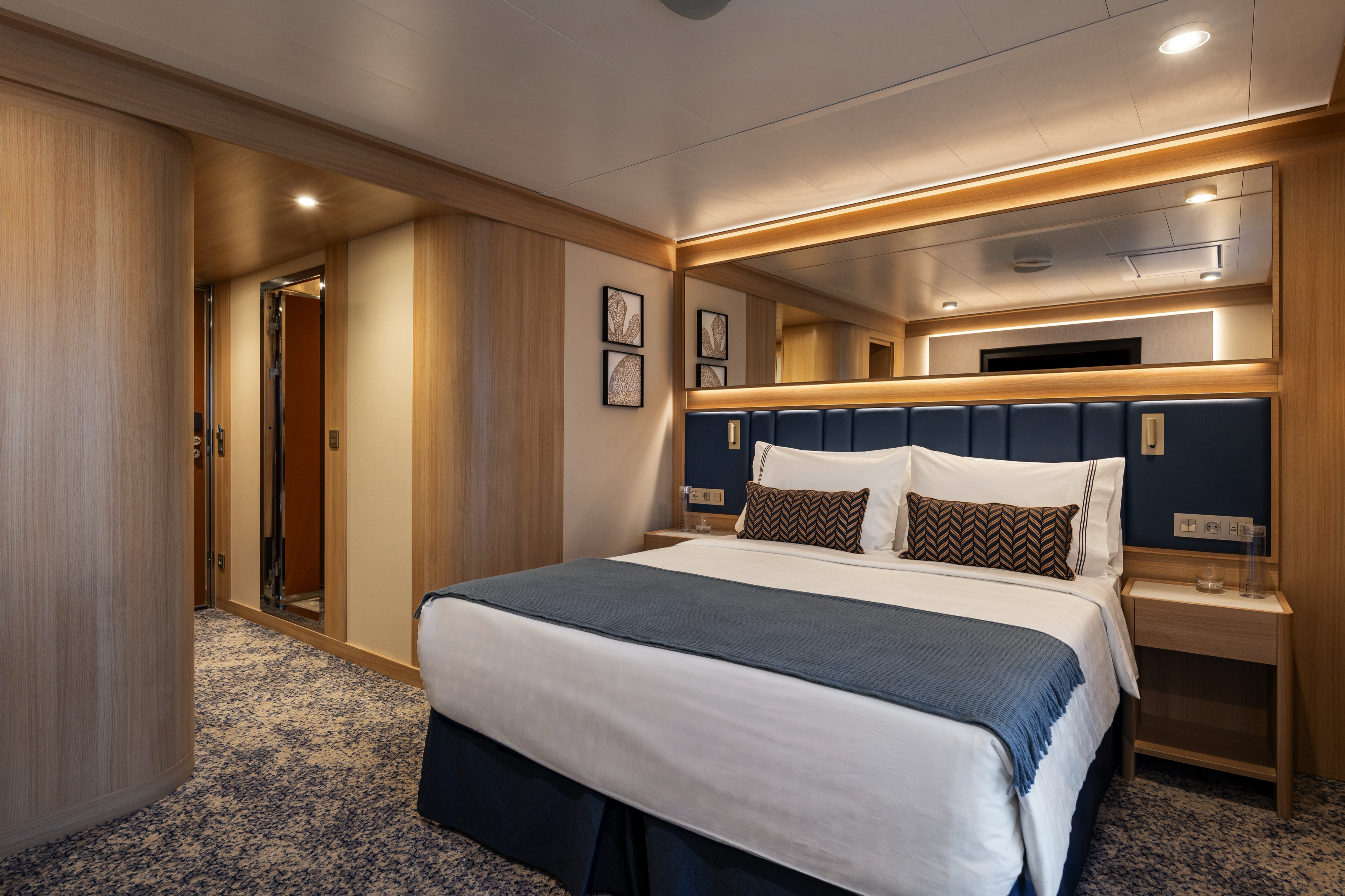
DECK | CABIN TYPE: Suite | 225 SQ FT
Stylish comfort and ocean views welcome you to this 225-square-foot suite. Relax on your queen bed (convertible into two twin beds if desired) or lounge in the nearby living area. The outdoor space adds another 55 square feet, enough to sit outside comfortably and enjoy the breeze. In the bathroom, you’ll find a luxurious walk-in mosaic glass shower with rain head and body jets.
All Accommodations Feature
- Queen Size Bed with Luxurious Linens
- Waffle Weave Robe and Slippers
- Interactive TV
- Mini Bar/Refrigerator
- Safe
- Direct Dial Phone
- L'Occitane Bath Amenities
- Fresh Fruit
- Hair Dryers and 110/220 outlets
- Wi-Fi Internet Access (various plans available for purchase)
- Mirrored closet with ample drawer space
- Vanity with magnifying mirror and chair

Located at the middle of the ship, these 225-square-foot suites welcome you with stylish comfort and beautiful ocean views. Relax on your queen bed (convertible into two twin beds if desired) or lounge in the nearby living area. The outdoor space adds another 55 square feet, enough to sit outside comfortably and enjoy the breeze. In the bathroom, you’ll find a luxurious walk-in mosaic glass shower with rain head and body jets.
All Accommodations Feature
- Queen Size Bed with Luxurious Linens
- Waffle Weave Robe and Slippers
- Interactive TV
- Mini Bar/Refrigerator
- Safe
- Direct Dial Phone
- L'Occitane Bath Amenities
- Fresh Fruit
- Hair Dryers and 110/220 outlets
- Wi-Fi Internet Access (various plans available for purchase)
- Mirrored closet with ample drawer space
- Vanity with magnifying mirror and chair
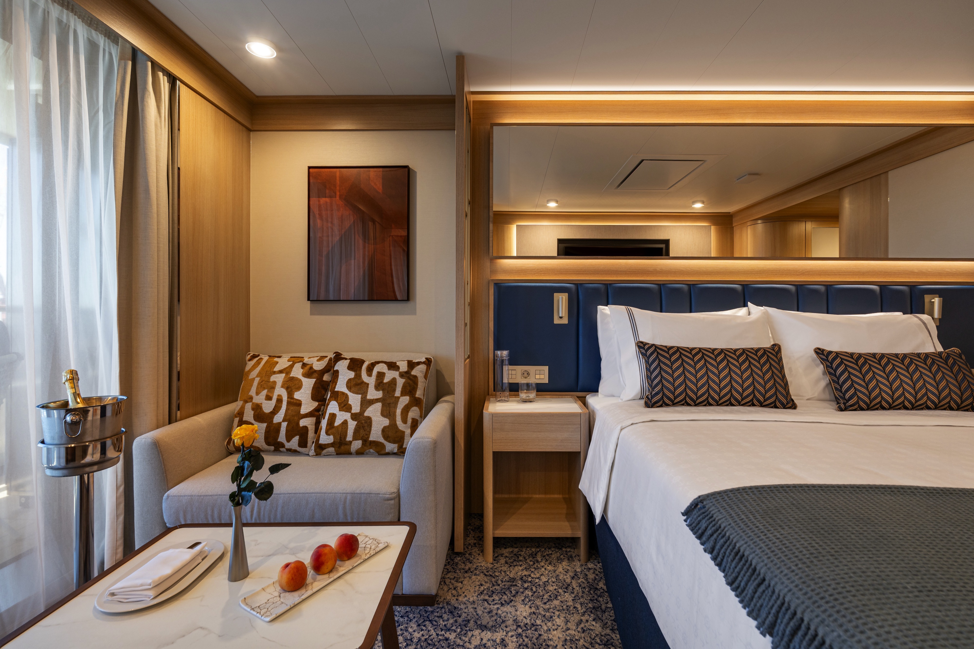
DECK | CABIN TYPE: Suite | 301 SQ FT
This roomy 301-square-foot suite features a wide floor-to-ceiling infinity window in the bedroom, allowing for stunning ocean views. You can even open the top half to enjoy the cool ocean breeze. This suite also features an inviting queen bed (convertible into two twin beds if desired) and a pull-out sofa in the separate living area, allowing for triple occupancy. In the bathroom, you’ll find a luxurious walk-in mosaic glass shower with rain head and body jets.
All Accommodations Feature
- Queen Size Bed with Luxurious Linens
- Waffle Weave Robe and Slippers
- Interactive TV
- Mini Bar/Refrigerator
- Safe
- Direct Dial Phone
- L'Occitane Bath Amenities
- Fresh Fruit
- Hair Dryers and 110/220 outlets
- Wi-Fi Internet Access (various plans available for purchase)
- Mirrored closet with ample drawer space
- Vanity with magnifying mirror and chair

DECK 7 | CABIN TYPE: Suite | 280 SQ FT
Located on deck 7, this 280-square-foot suite features a wide floor-to-ceiling infinity window that allows for stunning ocean views. You can even open the top half to enjoy the cool ocean breeze. Your suite features an inviting queen bed (convertible into two twin beds if desired), a walk-in mosaic glass shower and a comfortable living area where you can lounge and enjoy the view.
All Accommodations Feature
- Queen Size Bed with Luxurious Linens
- Waffle Weave Robe and Slippers
- Interactive TV
- Mini Bar/Refrigerator
- Safe
- Direct Dial Phone
- L'Occitane Bath Amenities
- Fresh Fruit
- Hair Dryers and 110/220 outlets
- Wi-Fi Internet Access (various plans available for purchase)
- Mirrored closet with ample drawer space
- Vanity with magnifying mirror and chair
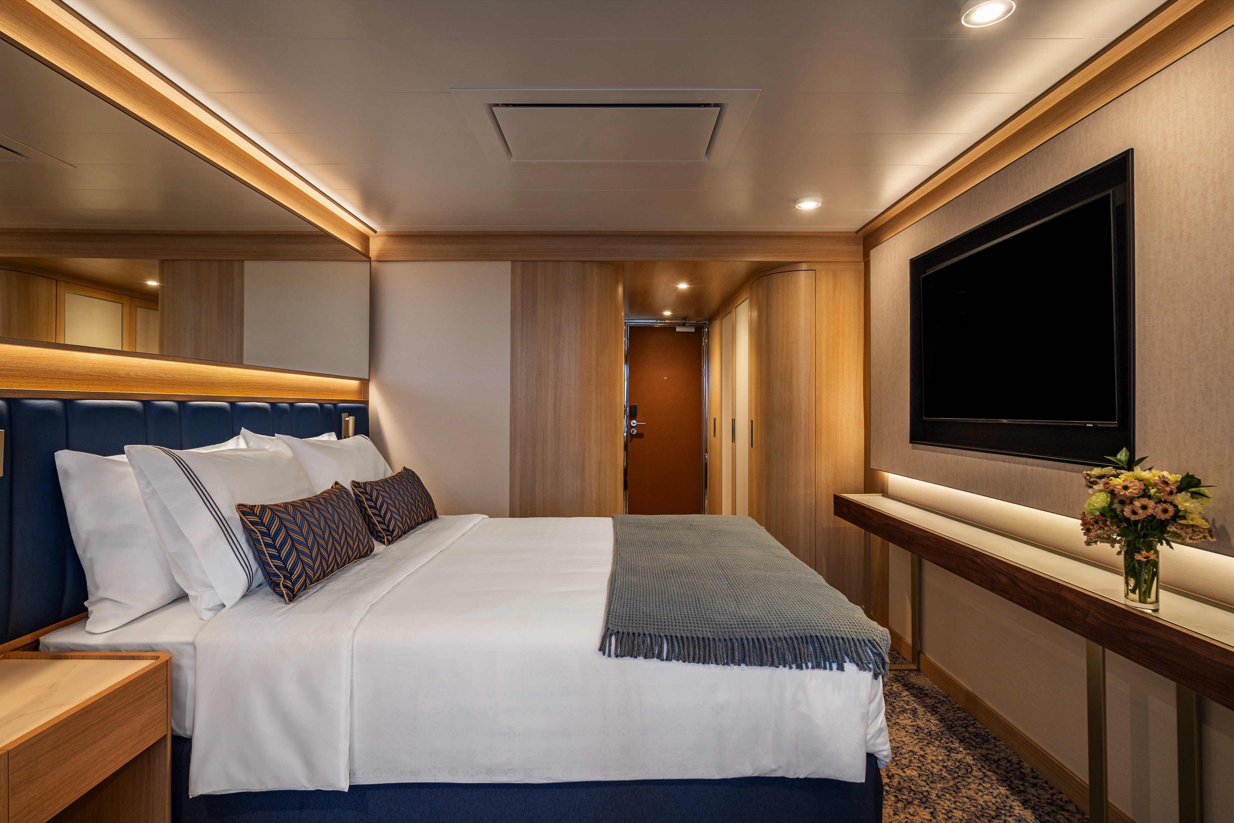
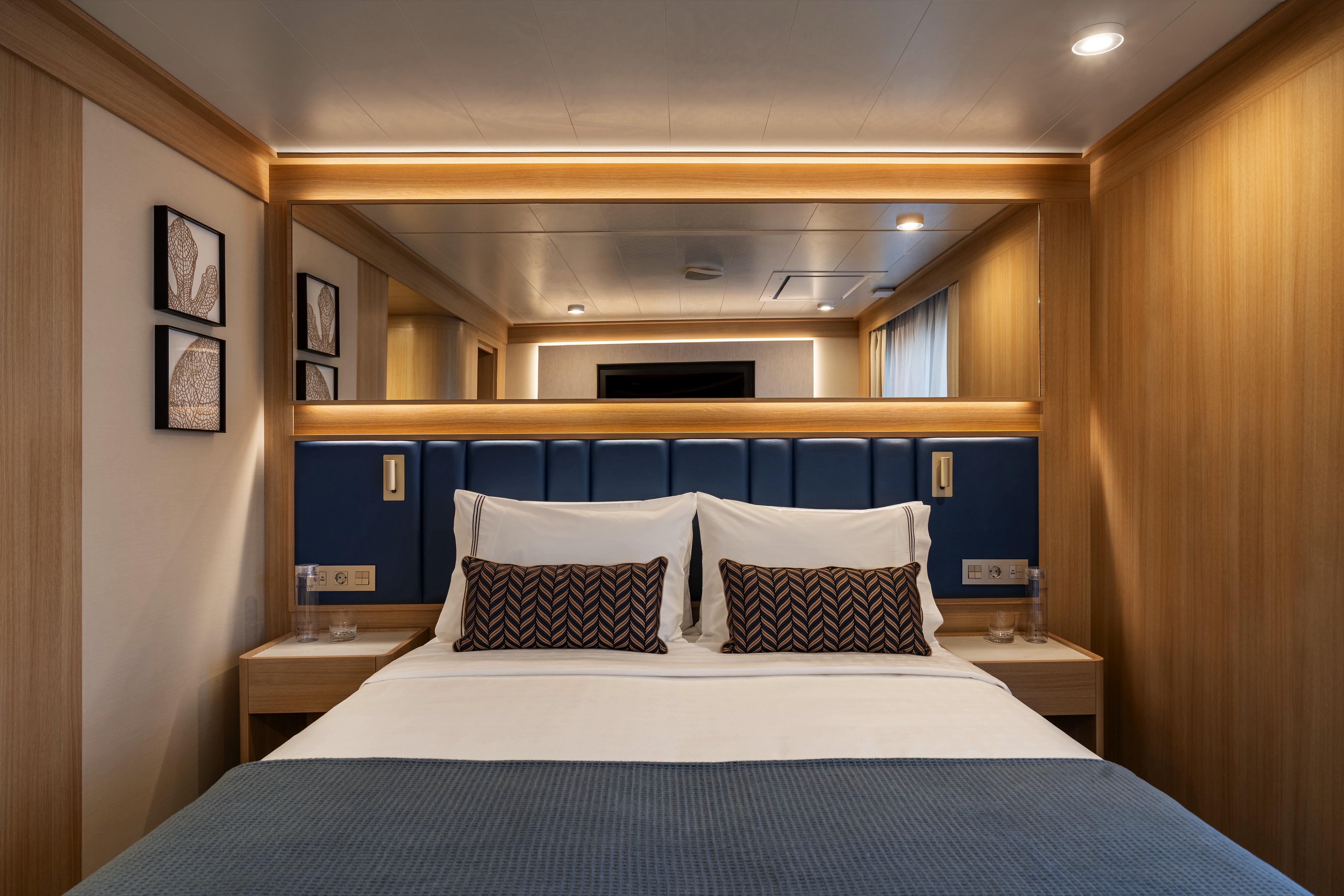
DECK | CABIN TYPE: Suite | 203 SQ FT
Experience the perfect blend of style and functionality in this thoughtfully designed 203-square-foot suite. The well-planned layout creates an ideal retreat with plenty of natural light, a view of the sea, a walk-in mosaic glass shower and an inviting queen bed (convertible into two twins if desired), perfect for unwinding after a day of fun and exploration.
All Accommodations Feature
- Queen Size Bed with Luxurious Linens
- Waffle Weave Robe and Slippers
- Interactive TV
- Mini Bar/Refrigerator
- Safe
- Direct Dial Phone
- L'Occitane Bath Amenities
- Fresh Fruit
- Hair Dryers and 110/220 outlets
- Wi-Fi Internet Access (various plans available for purchase)
- Mirrored closet with ample drawer space
- Vanity with magnifying mirror and chair
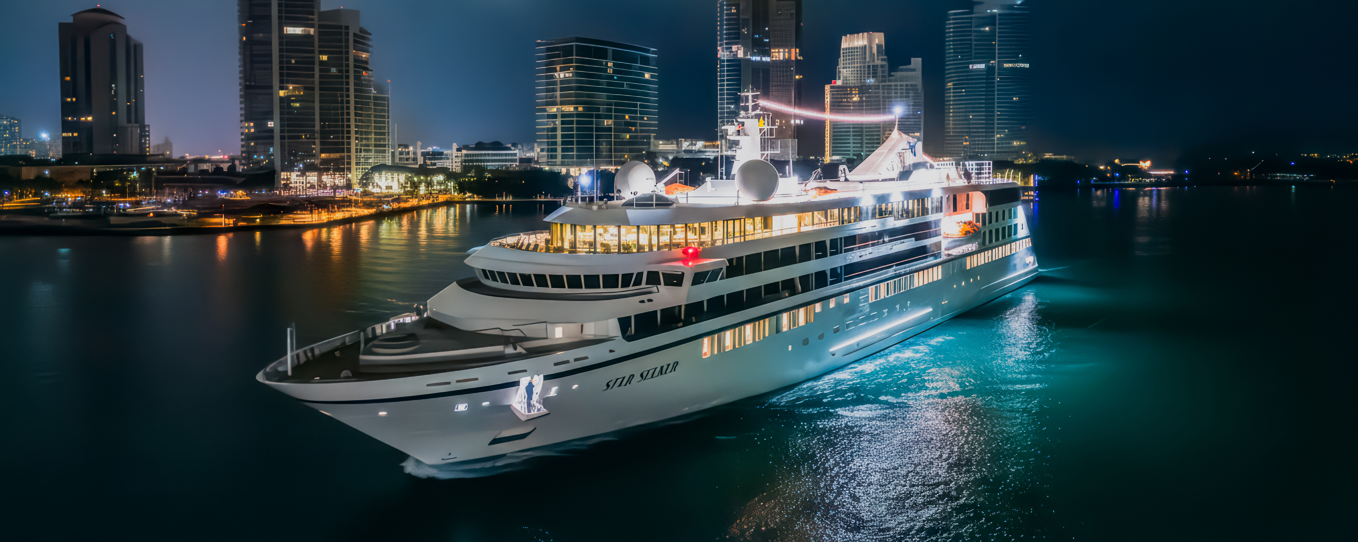
Star Seeker
Be one of the first to experience Star Seeker, Windstar’s newest yacht, during her first-ever sailing season beginning December 2025!
Featuring our new specialty restaurant Basil + Bamboo, upgraded amenities and 112 spacious suites — nearly all with a full private veranda or a floor-to-ceiling infinity window — Star Seeker is a fresh take on our Star Class that remains unmistakably Windstar.Featuring our new specialty restaurant Basil + Bamboo, upgraded amenities and 112 spacious suites — nearly all with a full private veranda or a floor-to-ceiling infinity window — Star Seeker is a fresh take on our Star Class that remains unmistakably Windstar.
Ship Facts
| Launch Year | 2025 | ||||||||||
| Refit Year | |||||||||||
| Language | en | ||||||||||
| Gross Tonnage | 9923 | ||||||||||
| Length | 132 | ||||||||||
| Width | 19 | ||||||||||
| Currency | USD | ||||||||||
| Speed | 16 | ||||||||||
| Capacity | 224 | ||||||||||
| Crew Count | 135 | ||||||||||
| Deck Count | 6 | ||||||||||
| Cabin Count | 112 | ||||||||||
| Large Cabin Count | N/A | ||||||||||
| Wheelchair Cabin Count | N/A | ||||||||||
| Electrical Plugs |
|
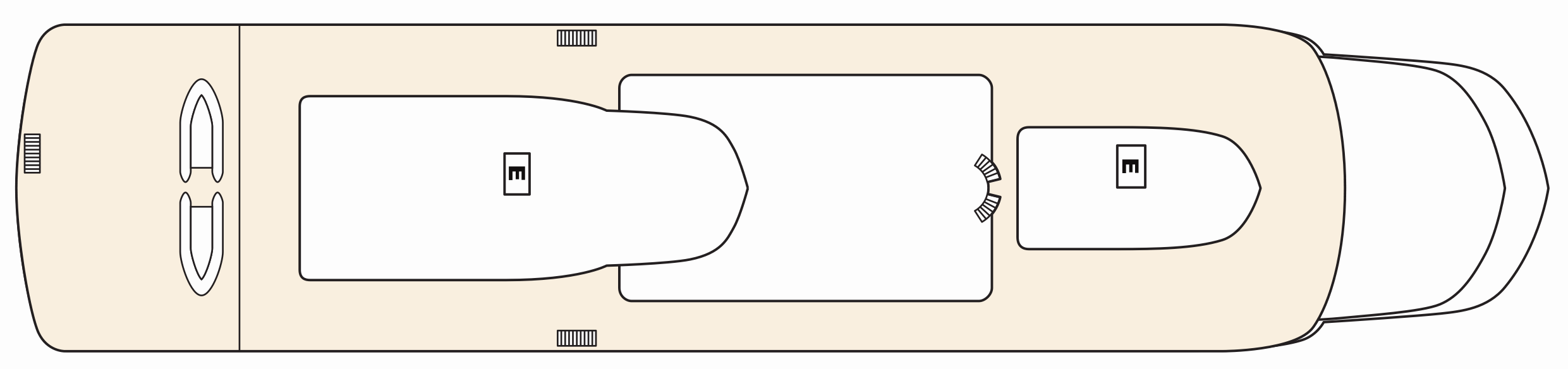
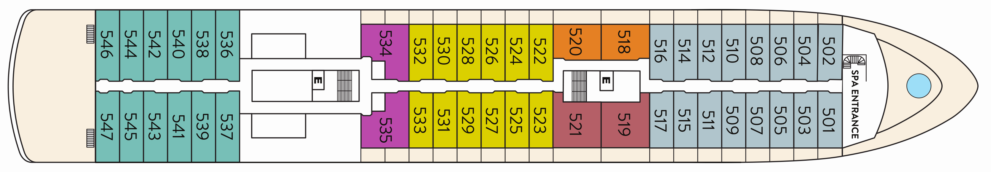
Deck 8
- Elevator
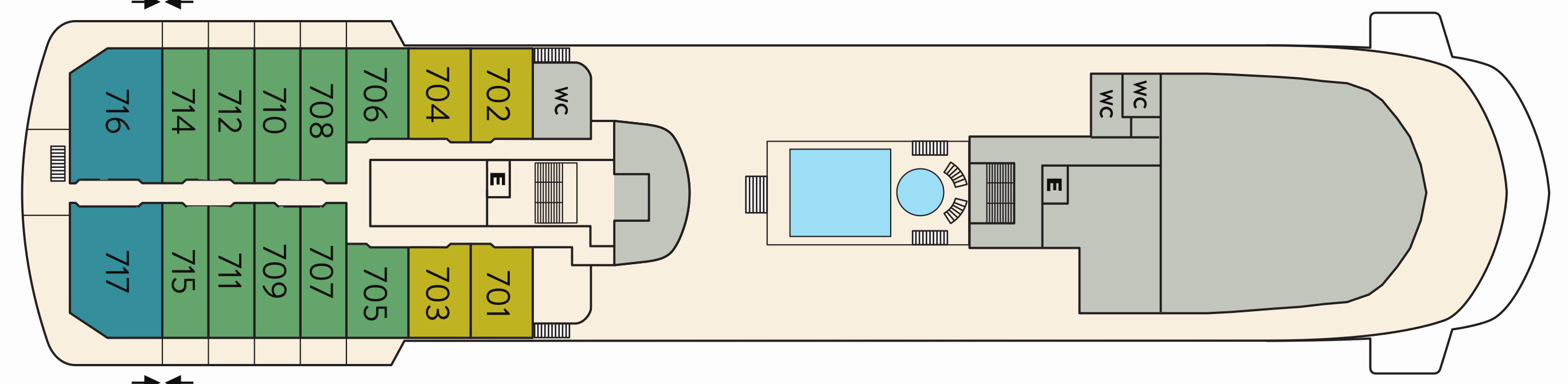
Deck 7
- Elevator
- Yacht Club (1)
- Pool and Whirlpool (2)
- Star Grill (3)
- Star Bar (4)
- Horizon Owner's Suite
- Vista Veranda Suite
- Vista Infinity Suite
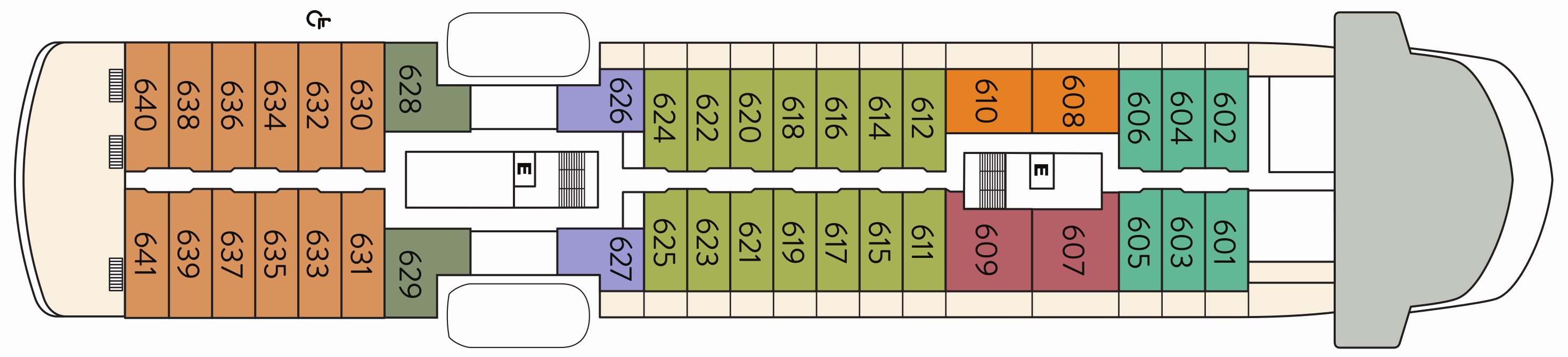
Deck 6
- Elevator
- Bridge (5)
- Premium Veranda Suite
- Deluxe Suite
- Star Suite
- Triple Premier Veranda Suite
- Triple Infinity Suite
- Infinity Suite (x1 Accessible Suite)
Deck 5
- Spa Entrance
- Elevator
- Whirlpool (6)
- Infinity Suite
- Classic Suite
- Premier Veranda Suite
- Star Suite
- Deluxe Suite
- Veranda Suite
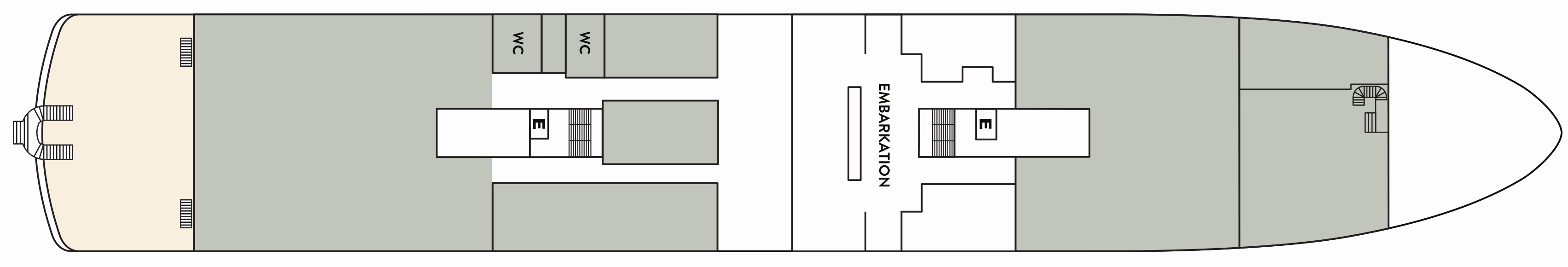
Deck 4
- Embarkation
- Elevator
- World Spa by Windstar (7)
- Lounge (8)
- Medical Facility (9)
- Reception (10)
- Destination Desk (11)
- Fitness Center and Motion Studio (12)
- Star Boutique (13)
- Basil & Bamboo Restaurant (14)
- Amphora Restaurant (15)
Deck 3
- Tender Embarkation
- Elevator
- Watersports Platform (16)
- Oceanview Suite

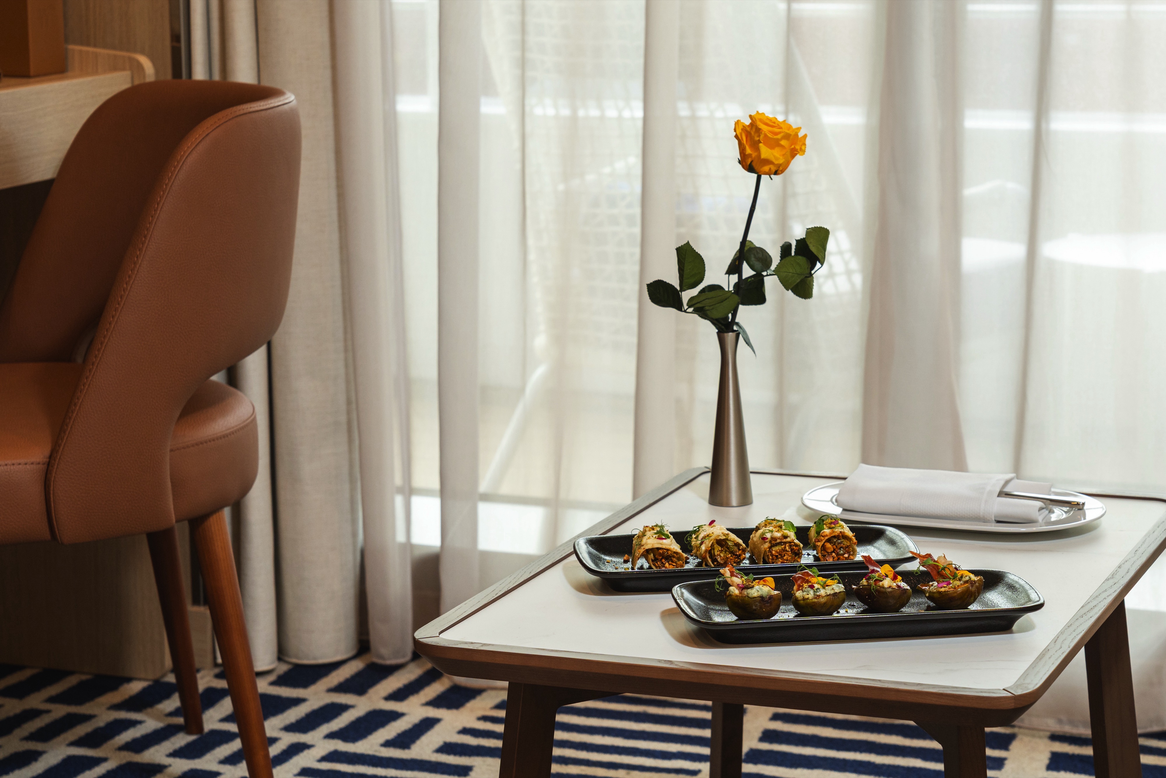
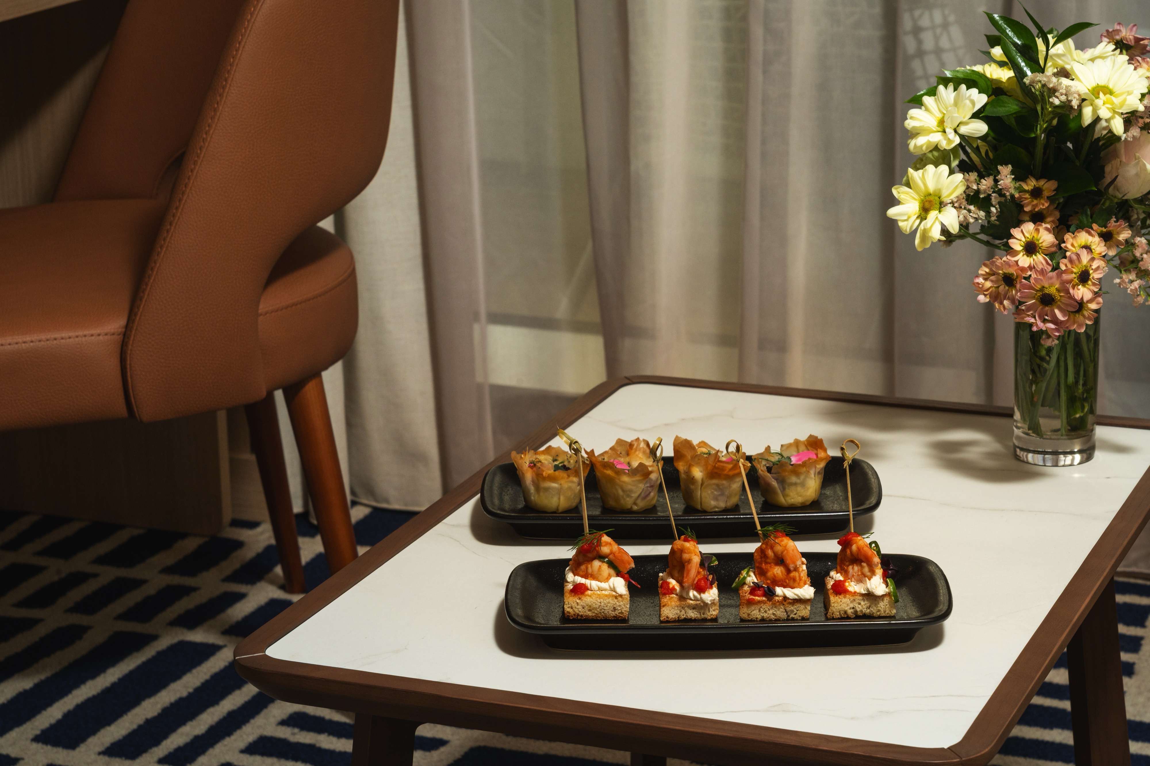
Fine dining has always been a pillar of the Windstar experience. As the Official Cruise Line of the James Beard Foundation featuring locally inspired cuisine, developed by a list of culinary all-stars using new flavours and fresh ingredients.
Basil + Bamboo
Step into Basil + Bamboo, where clean lines and warm accents set the stage for a relaxed, refined experience. Savor dishes that fuse Asian influences with a Mediterranean twist — an inventive culinary adventure designed to delight your palate and create moments of shared discovery.
Amphora
Amphora presents a contemporary, international menu and fresh local dishes.
Yacht Club
A pleasant lounge and all-day coffee bar, which is the perfect place to relax with new friends and enjoy the 270 degree views from atop the ship.
Star Grill
You’ll find all your traditional grilled and barbecued favorites (and discover new dishes from around the world) in our casual outdoor restaurant.
Complimentary Room Service
24-hour room service menu for in-room dining features coursed menu from the main Amphora dining room during dining hours.
A day on board your Windstar ship is a day of choices, all of them good. Perhaps you’ll begin with a relaxing massage in World Spa by Windstar. Or maybe an invigorating workout in the Fitness Center. Even better, why not both? After a sumptuous lunch in Veranda, make a splash from the Marina off the ship’s stern. Everything you can think of for fun in the water is there — swimming, kayaking, and stand-up paddleboarding. And it’s all complimentary, of course. Sun yourself on deck, take a dip in the whirlpool, then catch up on email or order a cheese plate for your stateroom or suite. After dinner, dance to live music in the Lounge. This is your yacht, so of course you’re welcome on the Bridge, where the Captain and officers are delighted to share charts, routes, and vistas with you.
As you prepare for another amazing Windstar day, enjoy a nightcap anywhere you like — on deck, in the Lounge, or why not let us bring it to your suite or stateroom? Your day ends just as it began, blissfully.
Lounge
The Lounge can be found on Deck 8
Open Bridge
Guests can talk with the Captain and officers on watch, view the navigational charts with the crew and enjoy one of the best views on the ship.
Star Boutique
Visit our newly transformed specialty shopping boutique, Star Boutique, rolling out fleet-wide through early 2022. The new shop features quality brand-name and exclusive Star Collection merchandise, from clothing and fragrances to jewellery and accessories, all at duty free or special pricing.
Reception
The Reception can be located on Deck 4