Kyoto & East Asia Dreams Cruise Tour
Kyoto & East Asia Dreams Cruise Tour
Cruise overview
WHY BOOK WITH US?
- ✔ The Deluxe Cruises’ team has extensive experience in ultra-luxury cruising.
- ✔ Call now to speak to our helpful and experienced Cruise Concierge team.
- ✔ Enjoy our Unique Deluxe Cruises Bonus for substantial savings.
- ✔ Our team will tailor your holiday to your exacting requirements.
- ✔ As agents, we work under the protection of each cruise lines ABTA / ATOL licences
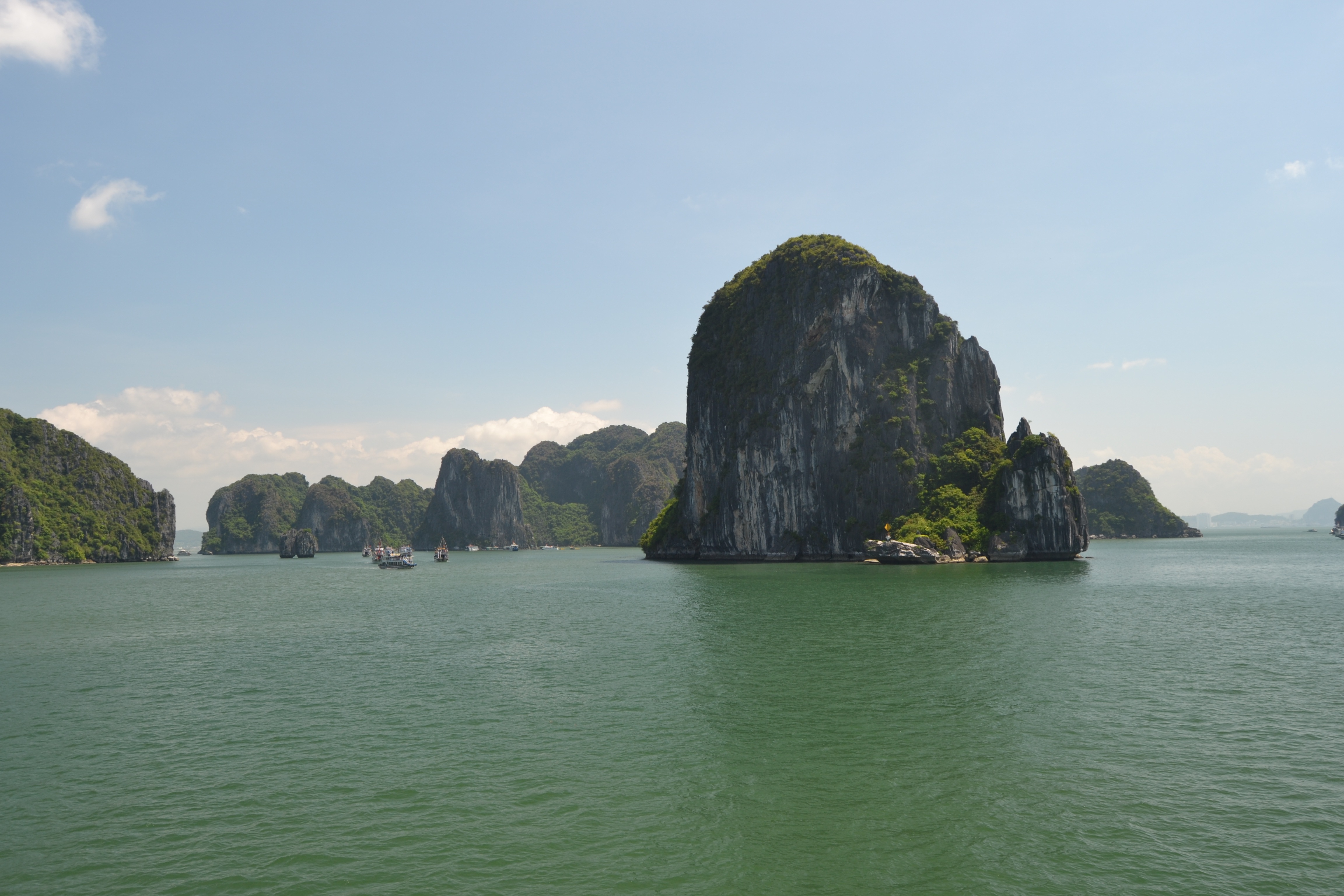
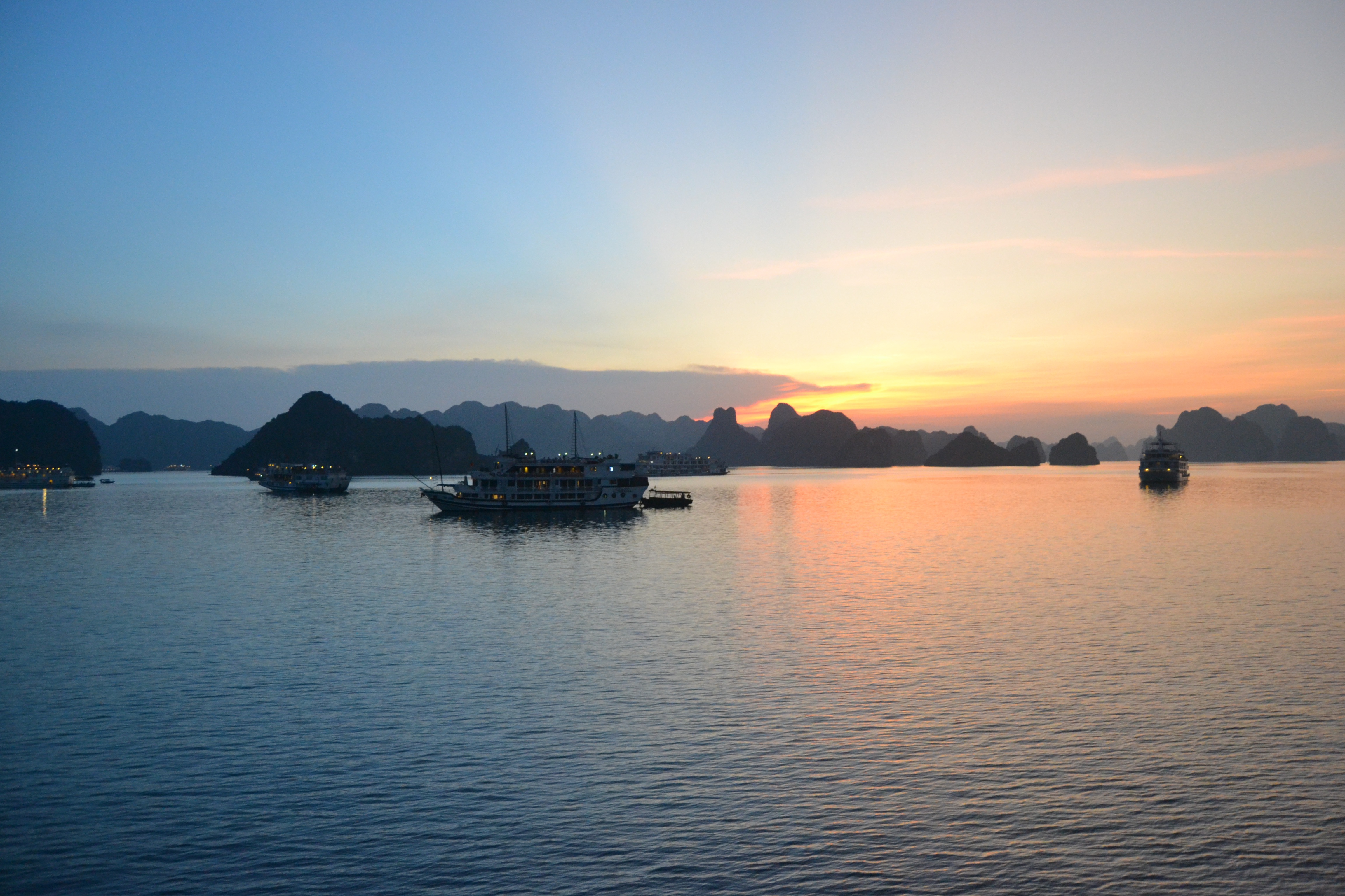
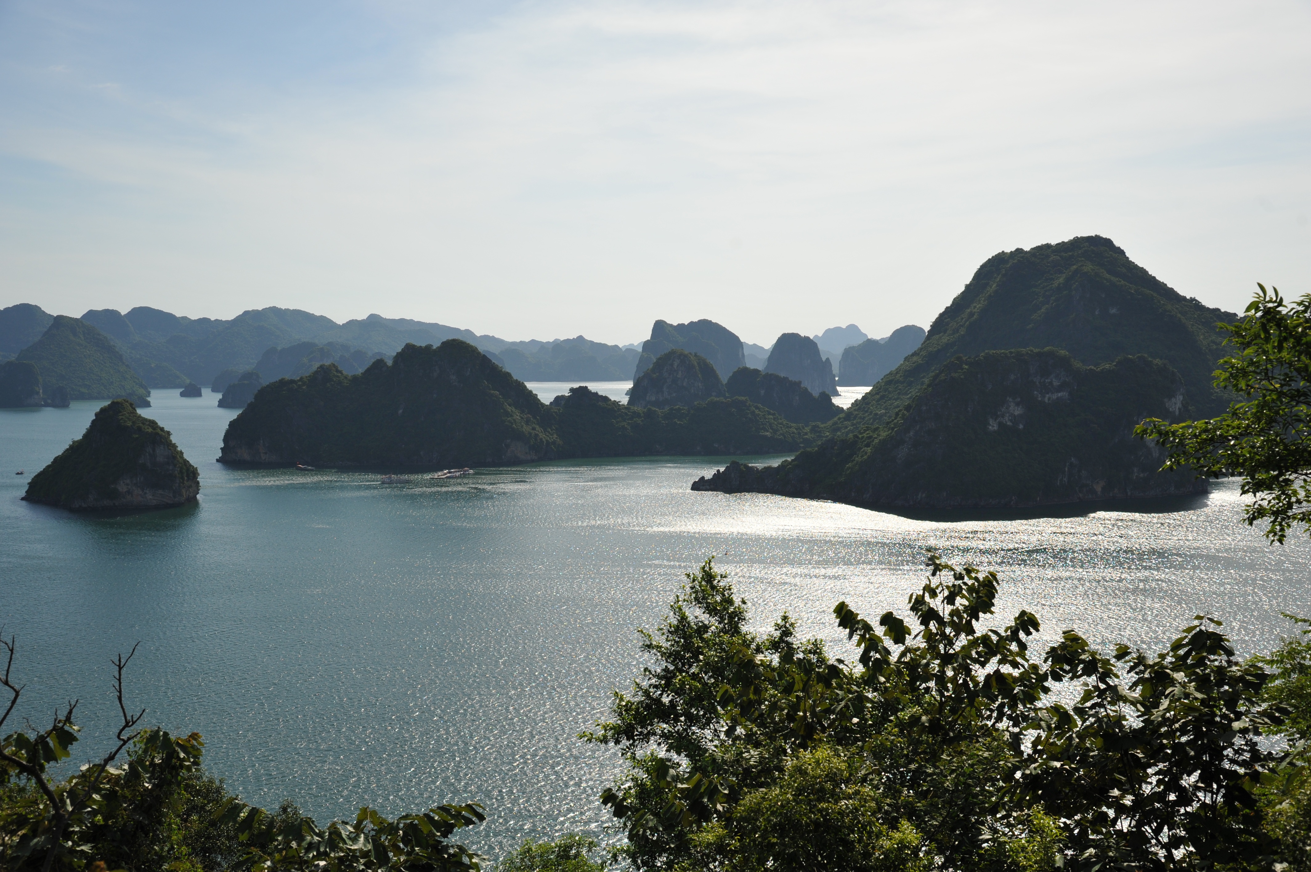
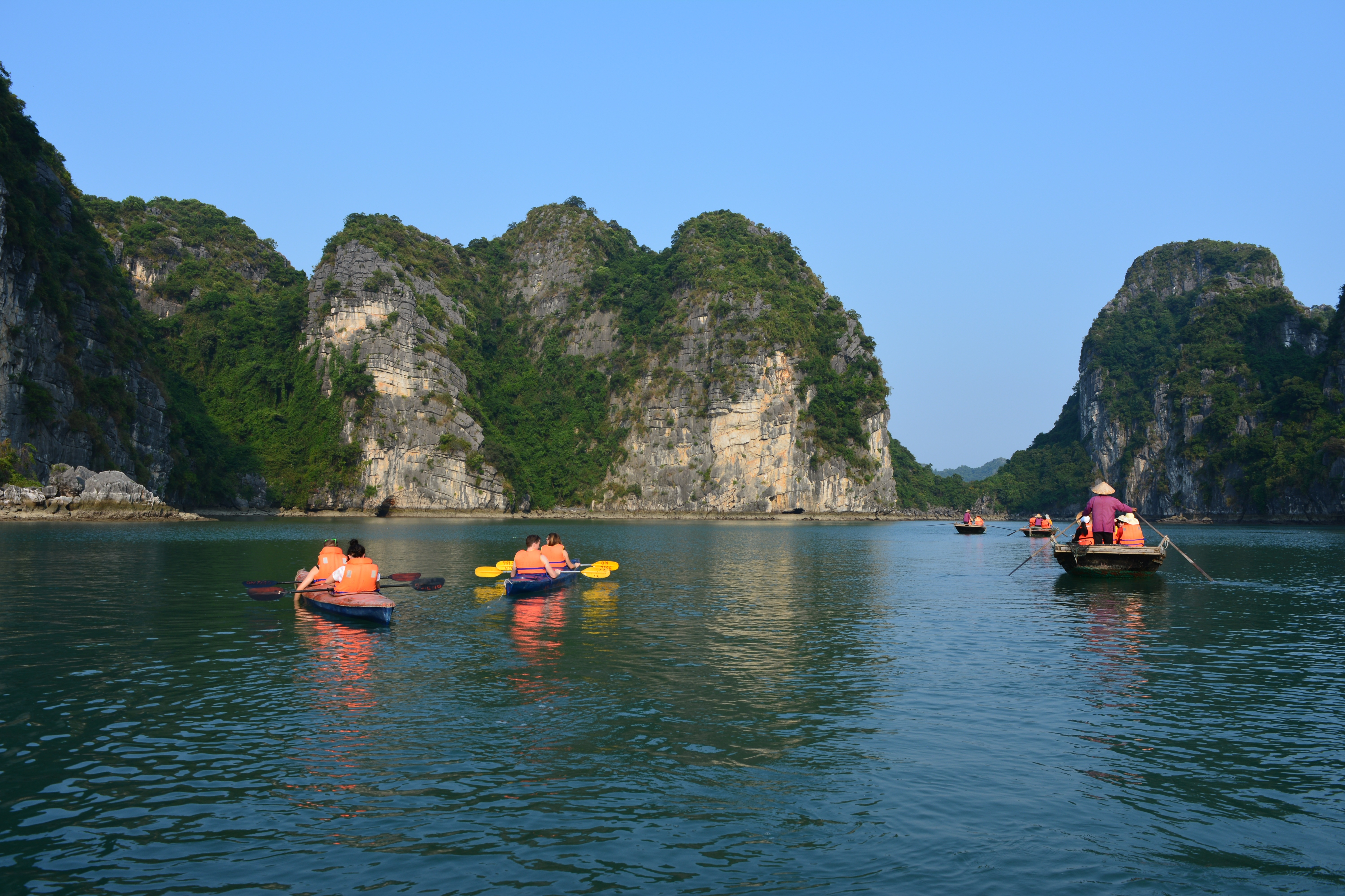
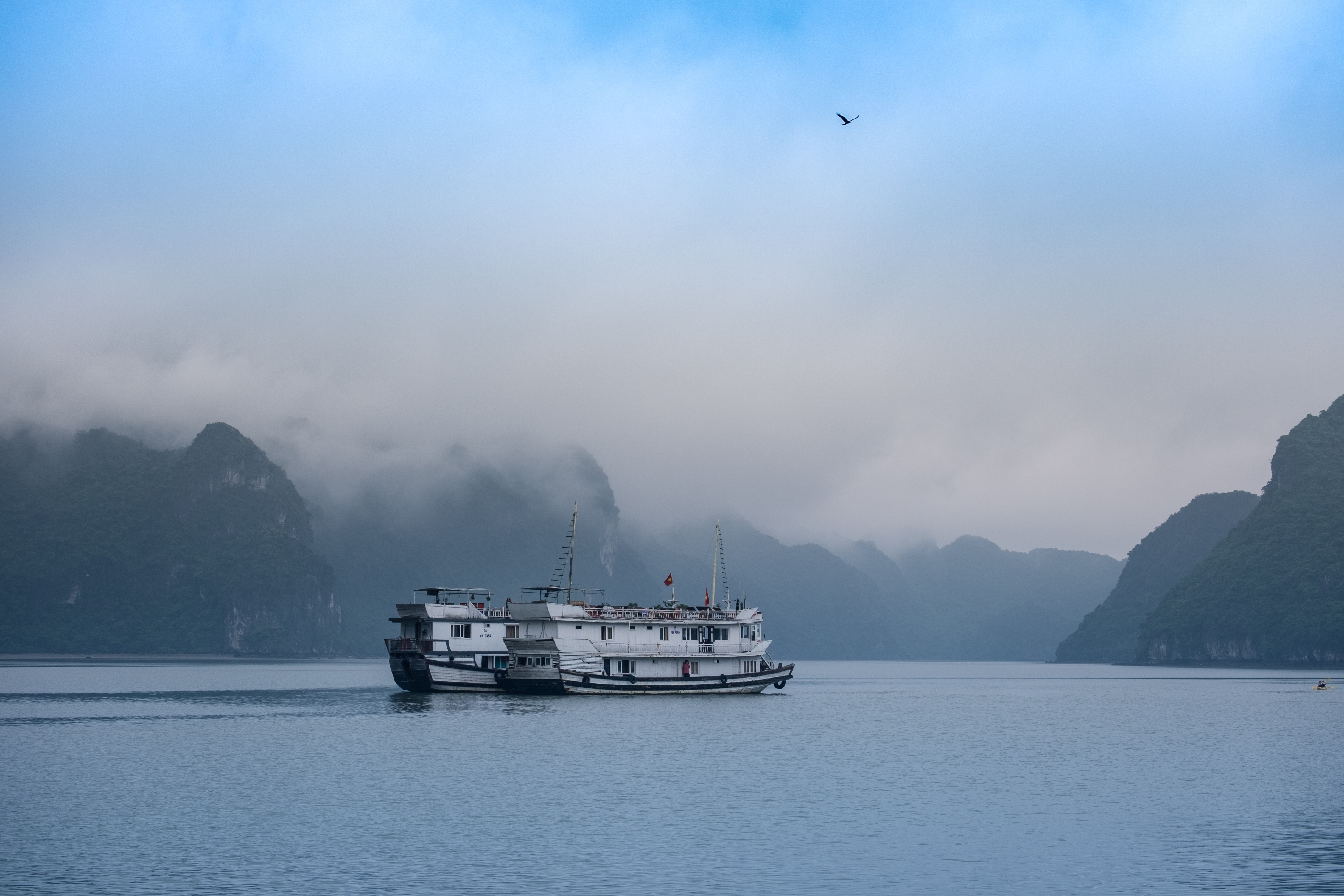
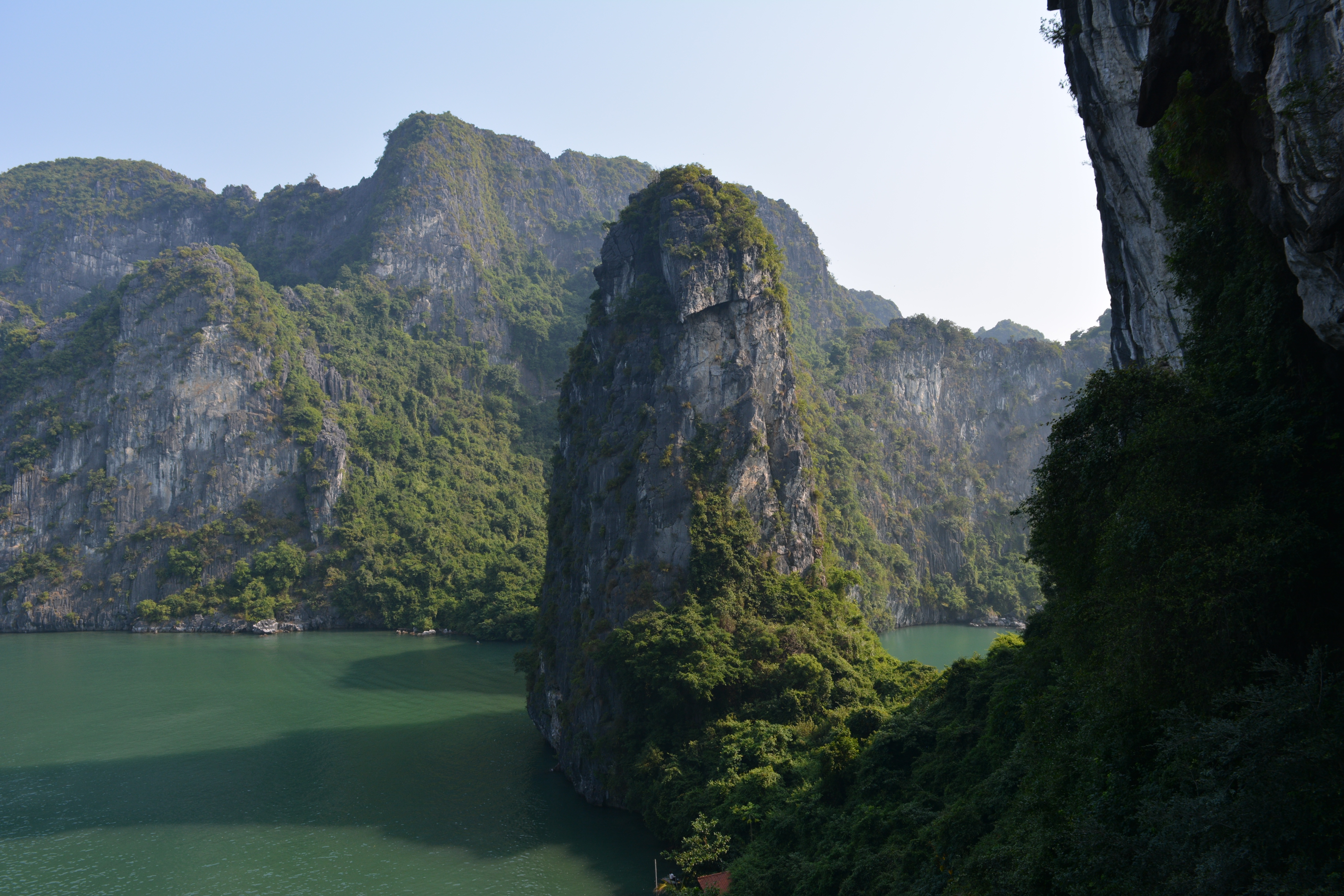
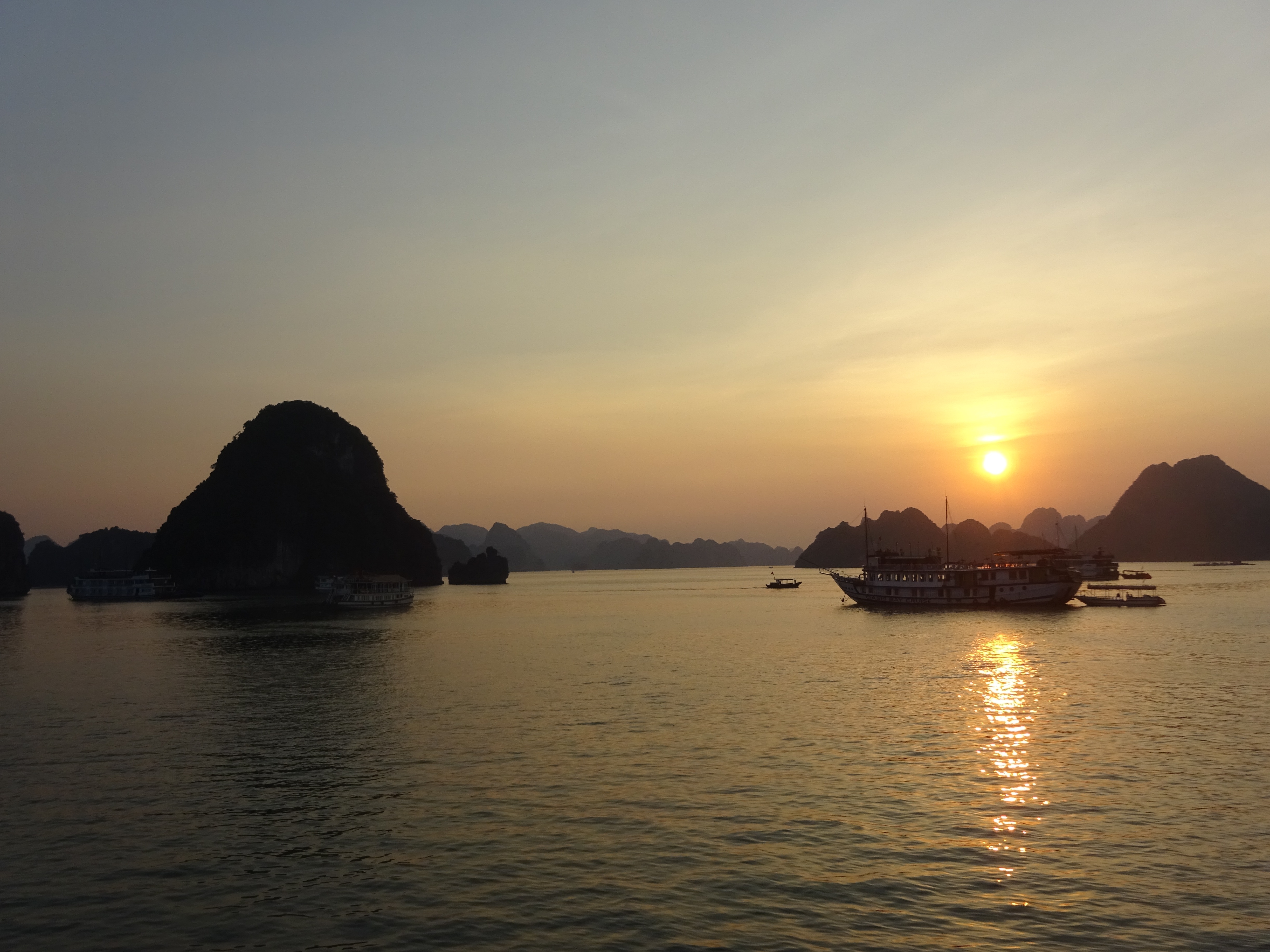
About Ha Long Bay
A visit to the north is not complete without a trip to Halong Bay, where placid waters give way to more than 3,000 limestone karsts and wind-sculpted limestone formations that jut from foggy lagoons. Dotting the bay are tiny islands bordered by white sandy coves and hidden caves, adding to the majestic landscape of this UNESCO World Heritage Site. Adding to this naturalist’s dream is the biodiversity of islets, grottos, and Cat Ba Island National Park. The bay, however, shows tourism’s impact: the clearing of mangrove forests to make way for jetties and piers, marine life threatened by game fishing, and garbage from passenger boats and fishing villages washed up on the shores.Beyond its geological uniqueness are activities like hiking, kayaking, rock climbing, or exploring one of the many floating villages where fishermen bring in their daily catch. The downside to all this allure is the large number of unlicensed boats it draws to the bay each day.Boat trips out onto the bay are the main tourism stock in trade farther north, but a more multifaceted side of the area can be experienced at Cat Ba Island. The largest island in Halong Bay, Cat Ba is very much its own entity. Its national park offers incredible biodiversity, with more than a thousand species of plants having been recorded here. Animal life is slightly thinner on the ground, but alert visitors may spy inhabitants such as the endangered golden-headed langur, wild boar, deer, civets, and several species of squirrel. Trekking through the wilderness is a highlight with a number of fascinating trails to follow.Cat Ba Island has also become a firm favorite with the adventure sports set. Indeed, along with Railay Beach in Thailand, it is recognized as one of the top spots in the region for rock climbing. Other outdoor pursuits include sailing and kayaking around the karsts. Although Halong Bay has arguably been tainted by over-exposure, Bai Tu Long Bay farther east toward China, retains all the majesty of Vietnam’s premier bucket-list natural attraction but sees a fraction of the traffic of its immediate neighbor to the west. Here, visitors will find islands of substantial size with deserted beaches and untamed jungle. Halong Bay's 3,000 islands of dolomite and limestone cover a 1,500-square-km (580-square-mile) area, extending across the Gulf of Tonkin nearly to the Chinese border. According to legend, this breathtaking land- and seascape was formed by a giant dragon that came barreling out of the mountains toward the ocean—hence the name (Halong translates into "descent of the dragon"). Geologists are more likely to attribute the formations to sedimentary limestone that formed here between 300 and 500 million years ago, in the Paleozoic Era. Over millions of years water receded and exposed the limestone to wind, rain, and tidal erosion.Today the limestone formations are exposed to hordes of tourists—but don't let that discourage you. Hundreds of fishing trawlers and tour boats share space on these crystal waters, yet there seems to be room for everyone. Most people use the main population center, Halong City, as a base from which to venture into the bay. Although it's now officially one municipality, Halong City was, until 1996, two separate towns: Bai Chay is now Halong City West, where Halong Road winds its way around the coast and past the lifeless central beach; Hon Gai is the grimier Halong City East, where a coal transportation depot dominates the center of town and covers nearby roads and buildings with a sooty film. Locals still refer to the towns by their old names, but they are now inexorably lassoed together by a bridge. Boat trips through Halong Bay are the main attraction. Little of the majesty of this region can be found in the city, so head out onto the water and start exploring. Countless 10- and 30-foot fishing boats have been converted into Halong Bay's formidable tourist-boat fleet. Hotels or travel agencies in Halong City or Hanoi can arrange boat trips for you (often they are part of organized tours from Hanoi). It is still possible to go down to the wharf and bargain yourself onto a boat for the day, but you are likely to be charged (sometimes significantly) more than you would pay for a prebooked tour, so this is not advised. Self-sufficient travelers have fallen victim to the old bait-and-switch: they've arranged a next-day boat tour with local fishermen, only to be told in no uncertain terms the following morning that they could not board their chosen boat, but they could take a different one for quite a bit more money. You may have no choice in the end. Usually travel agencies, however, have their tried-and-true favorites.
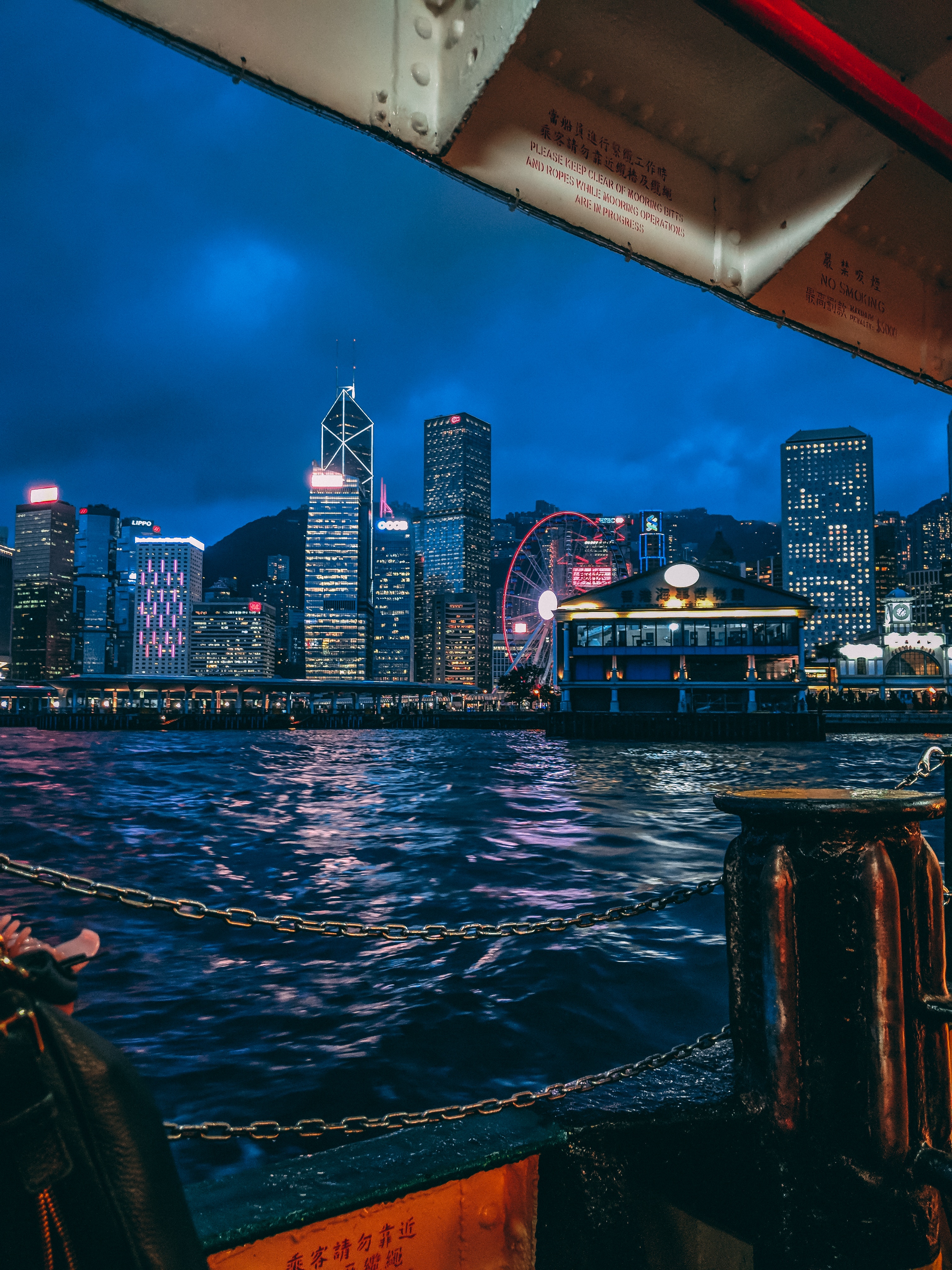
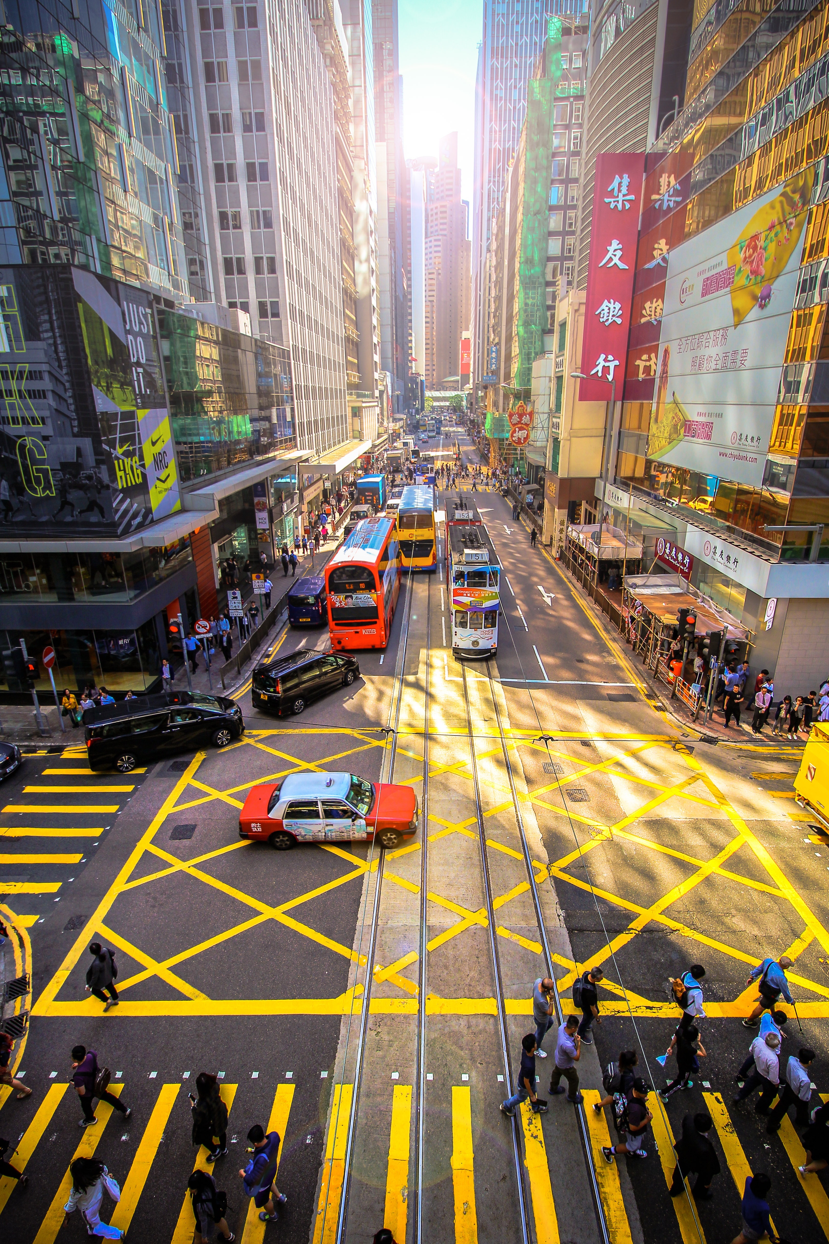
About Hong Kong
The Hong Kong Island skyline, with its ever-growing number of skyscrapers, speaks to ambition and money. Paris, London, even New York were centuries in the making, while Hong Kong's towers, bright lights, and glitzy shopping emporia weren't yet part of the urban scene when many of the young investment bankers who fuel one of the world's leading financial centers were born. Commerce is concentrated in the glittering high-rises of Central, tucked between Victoria Harbor and forested peaks on Hong Kong Island's north shore. While it's easy to think all the bright lights are the sum of today's Hong Kong, you need only walk or board a tram for the short jaunt west into Western to discover a side of Hong Kong that is more traditionally Chinese but no less high-energy. You'll discover the real Hong Kong to the east of Central, too, in Wan Chai, Causeway Bay, and beyond. Amid the residential towers are restaurants, shopping malls, bars, convention centers, a nice smattering of museums, and—depending on fate and the horse you wager on—one of Hong Kong's luckiest or unluckiest spots, the Happy Valley Racecourse. Kowloon sprawls across a generous swath of the Chinese mainland across Victoria Harbour from Central. Tsim Sha Tsui, at the tip of Kowloon peninsula, is packed with glitzy shops, first-rate museums, and eye-popping views of the skyline across the water. Just to the north are the teeming market streets of Mong Kok and in the dense residential neighborhoods beyond, two of Hong Kong's most enchanting spiritual sights, Wong Tai Sin Temple and Chi Lin Nunnery. As you navigate this huge metropolis (easy to do on the excellent transportation network), keep in mind that streets are usually numbered odd on one side, even on the other. There's no baseline for street numbers and no block-based numbering system, but street signs indicate building numbers for any given block.
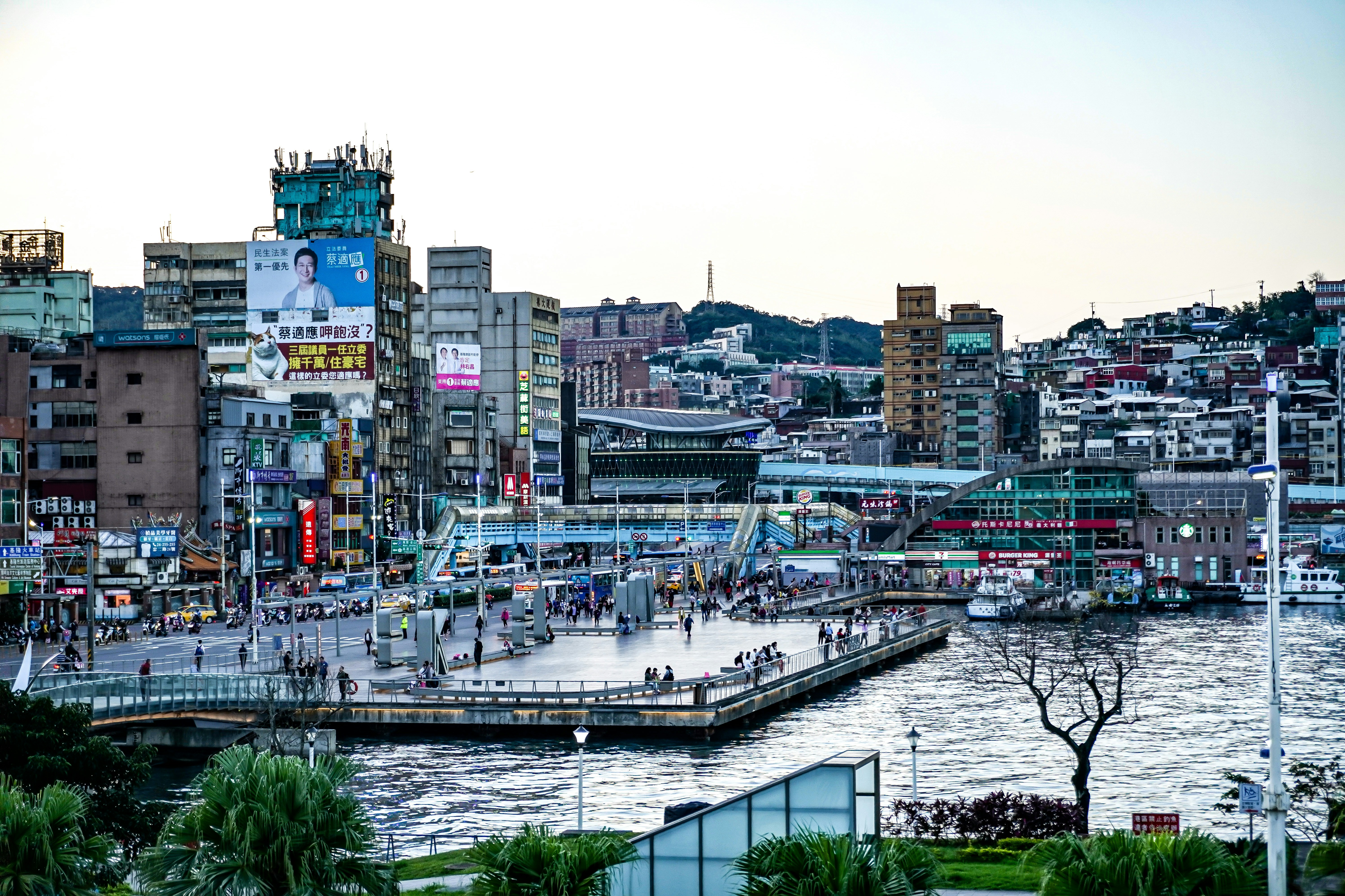
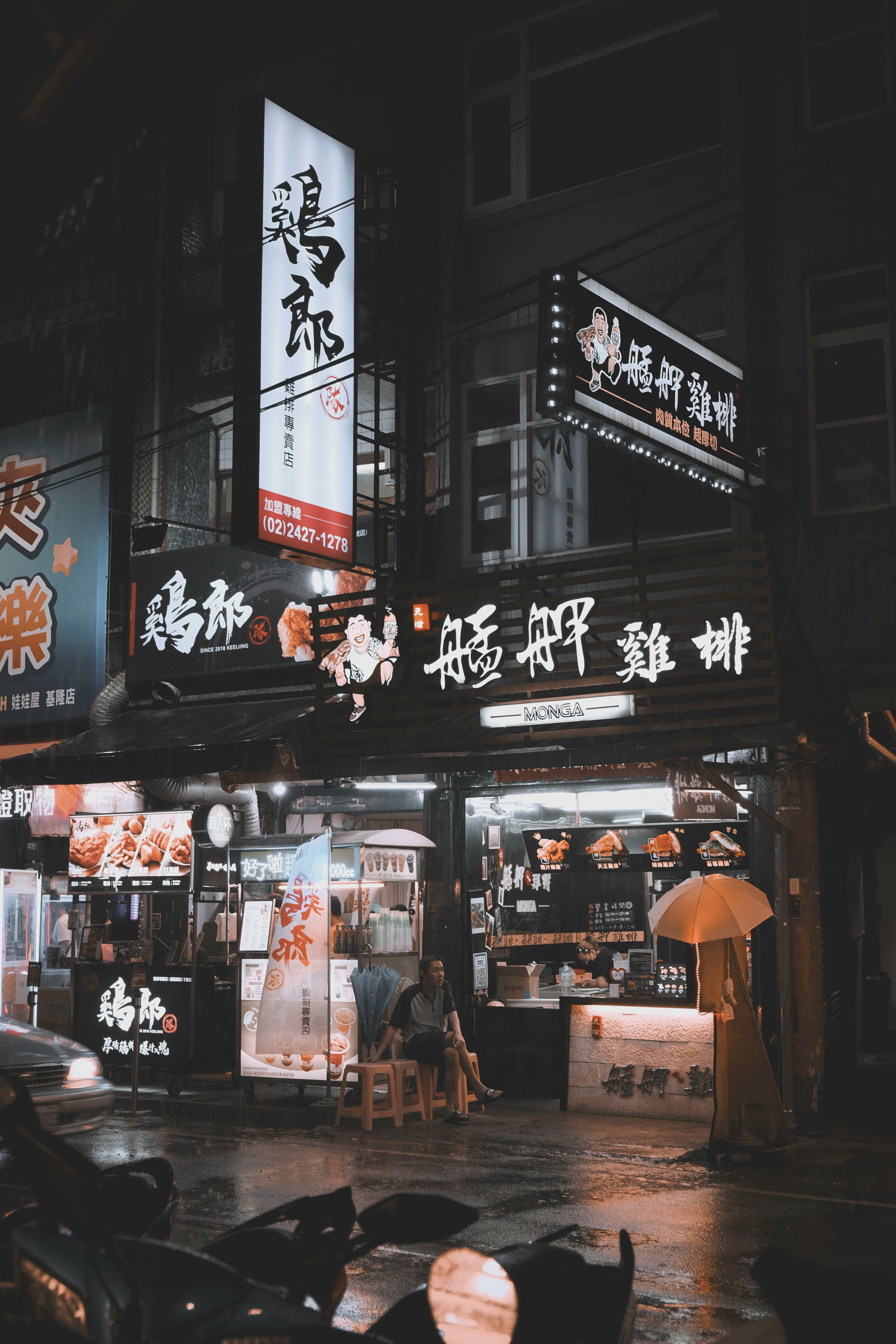
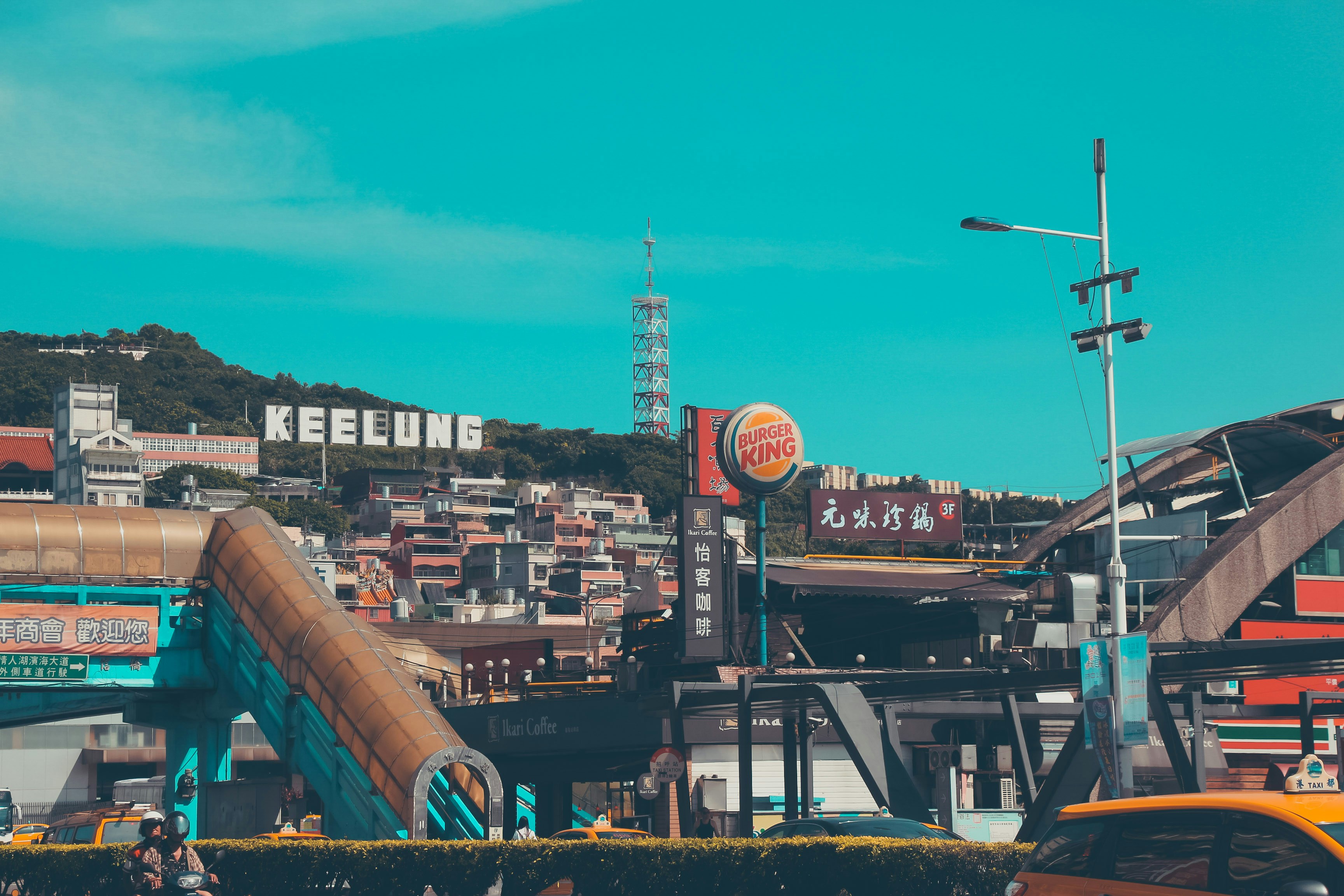
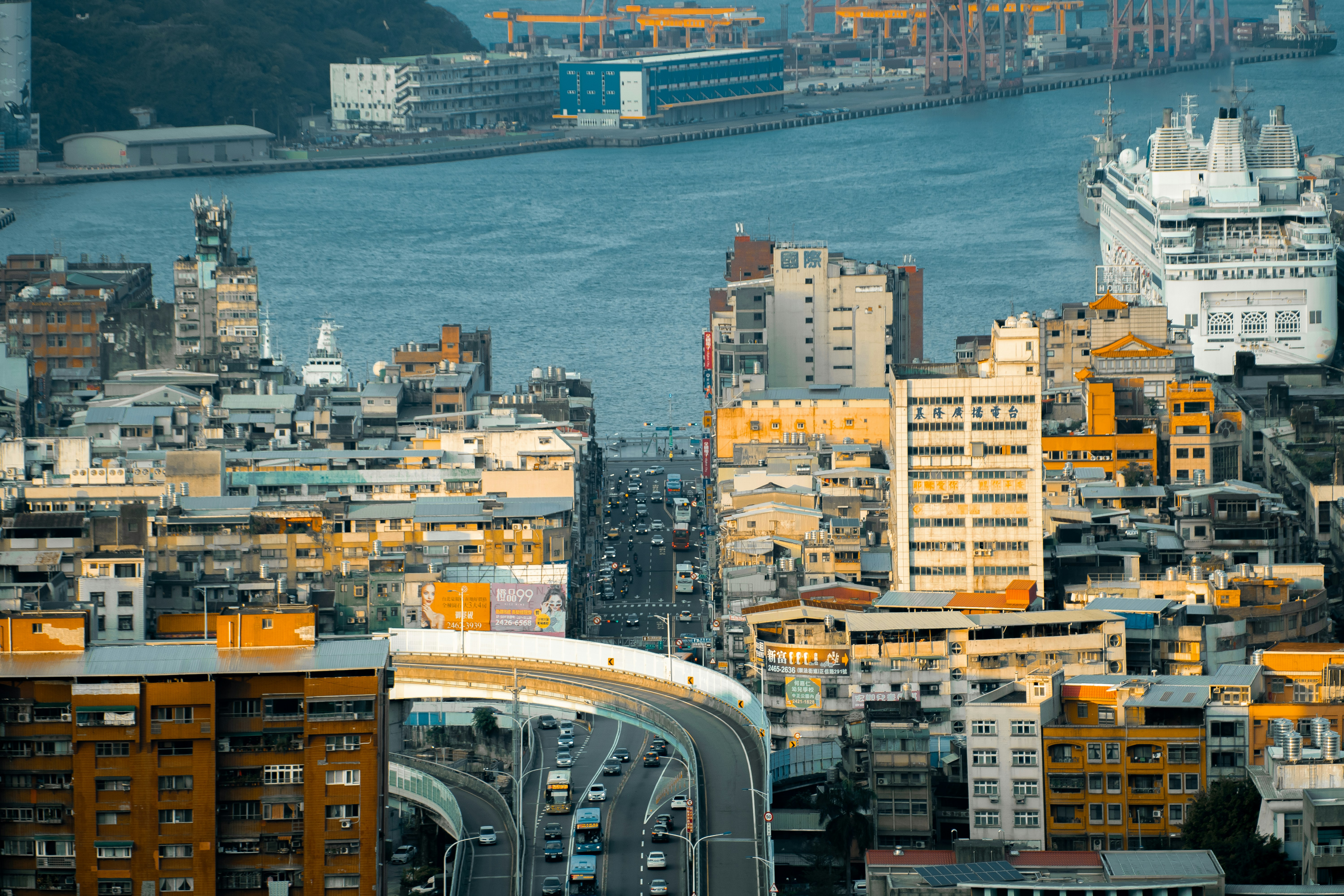
About Keelung (Chilung)
With the glittering lights of Taipei - a futuristic metropolis of culture and ideas - sparkling nearby, Keelung is the first calling point for many visitors arriving in Taiwan. While this port city essentially serves as Taipei's ocean gateway, you shouldn’t be too hasty in dashing off to Taipei's neon-lit magic – first it’s well worth spending some time exploring the famous glowing night market, which hums with life each evening and is famous for its local seafood.
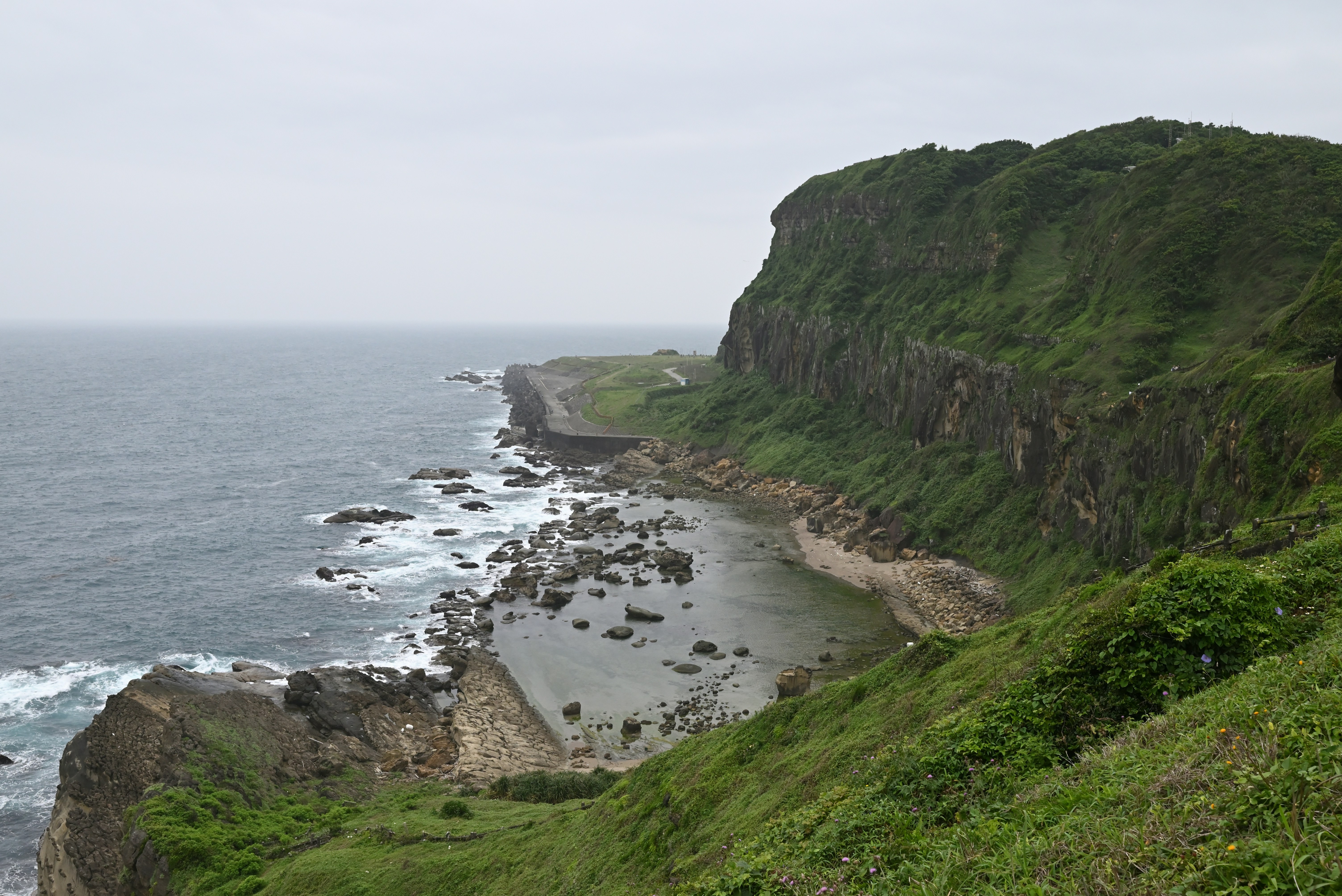

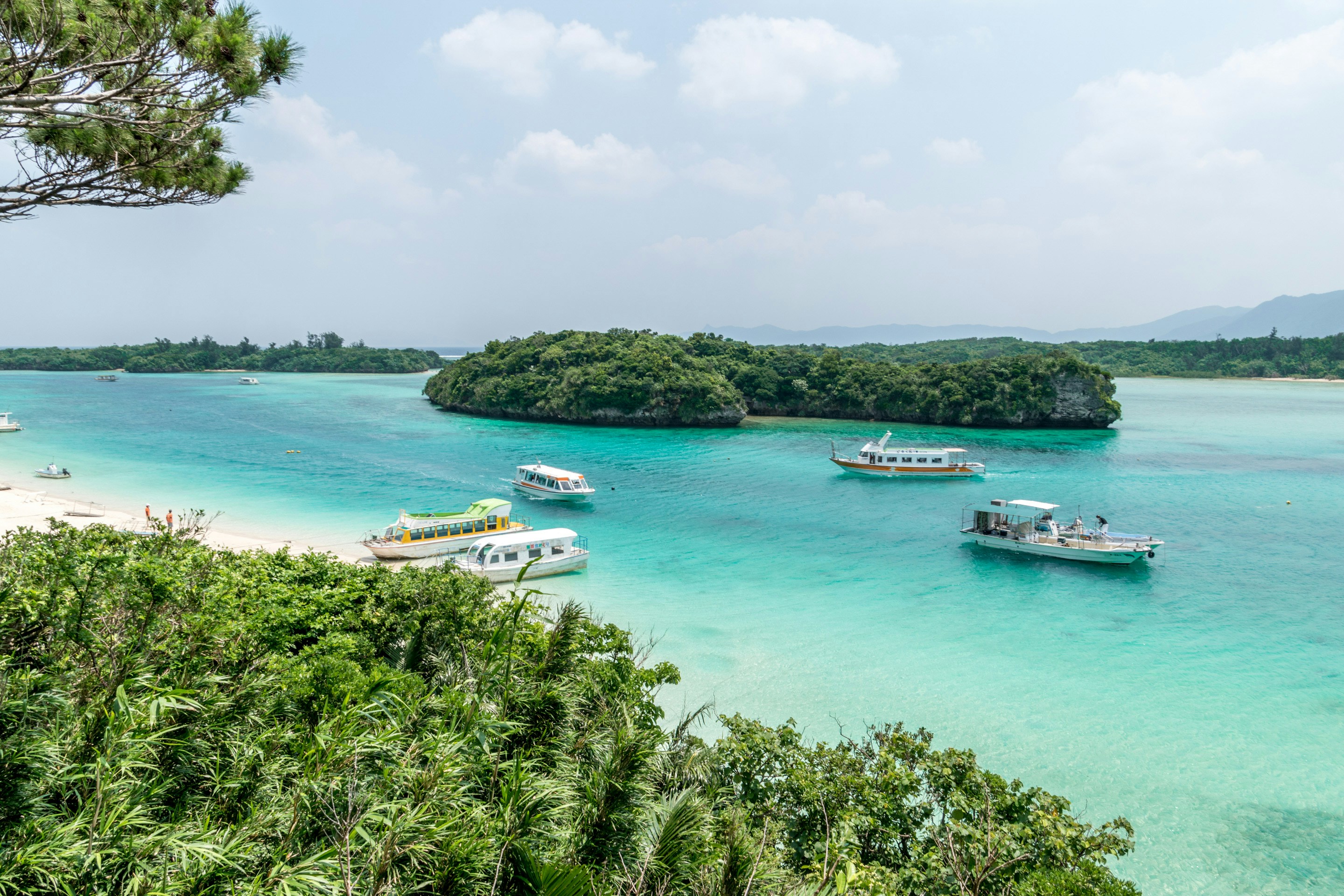
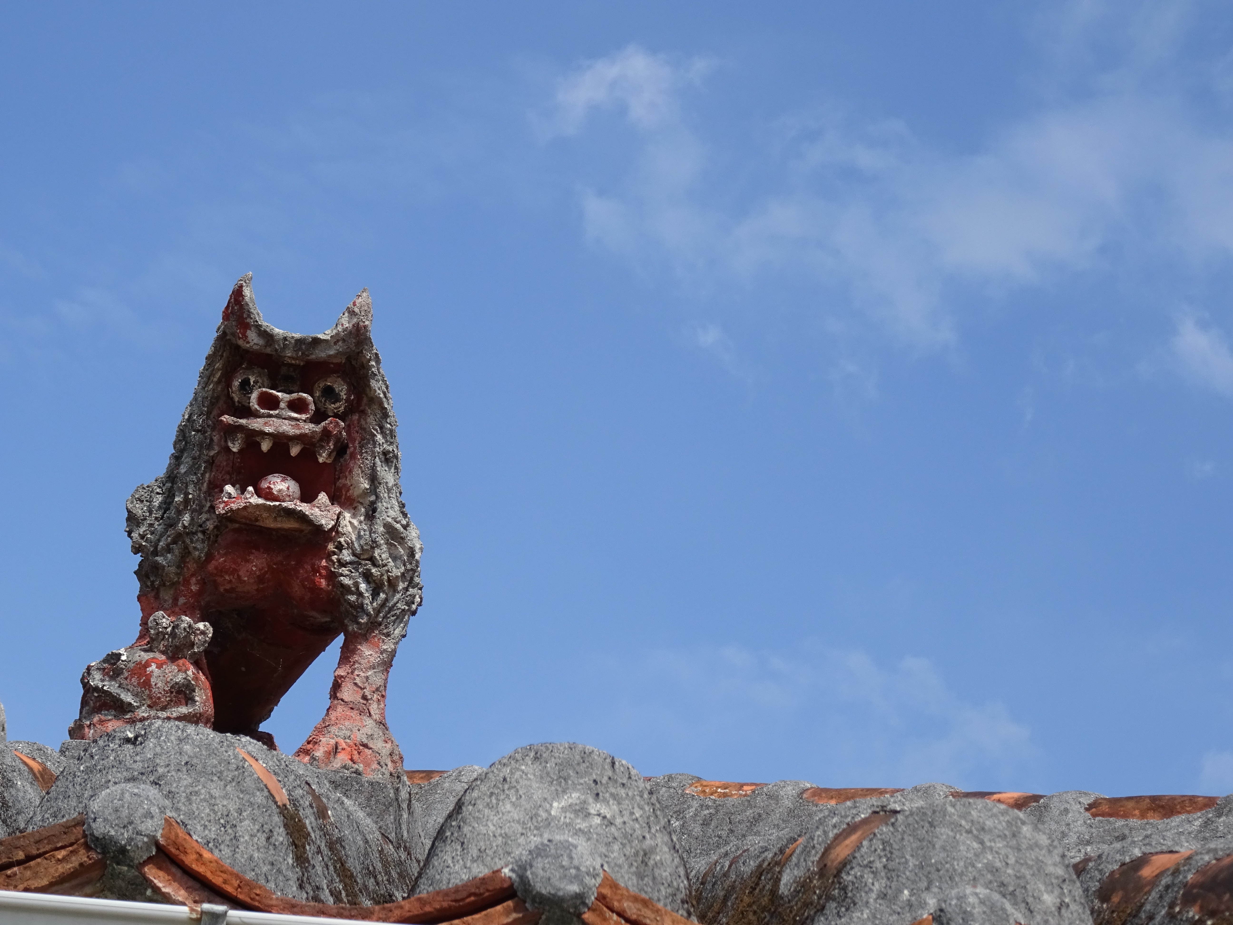
About Ishigaki
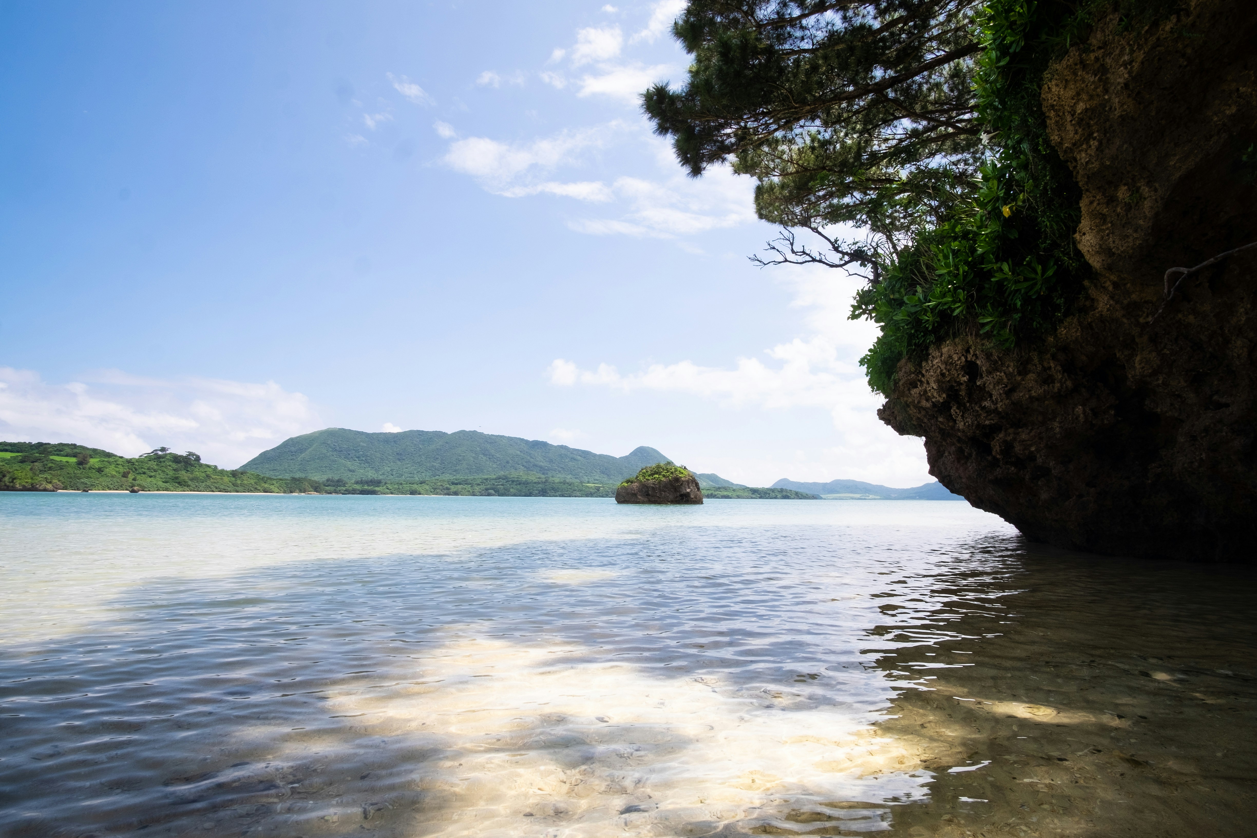
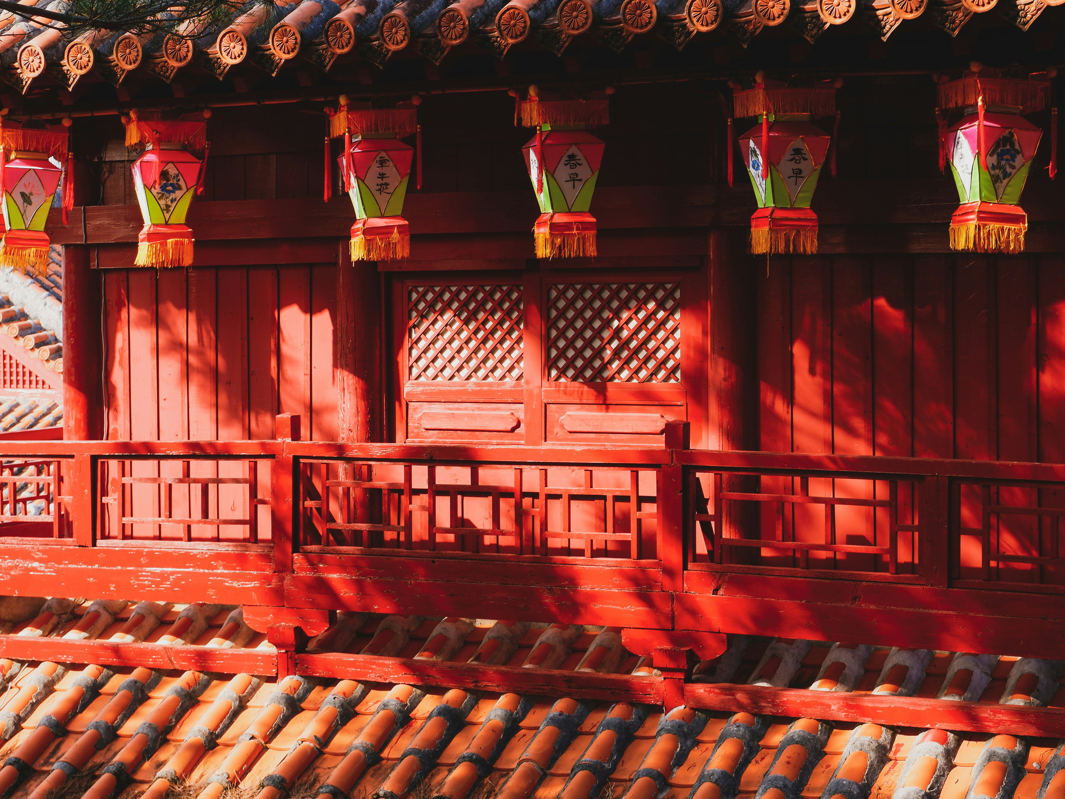
About Okinawa
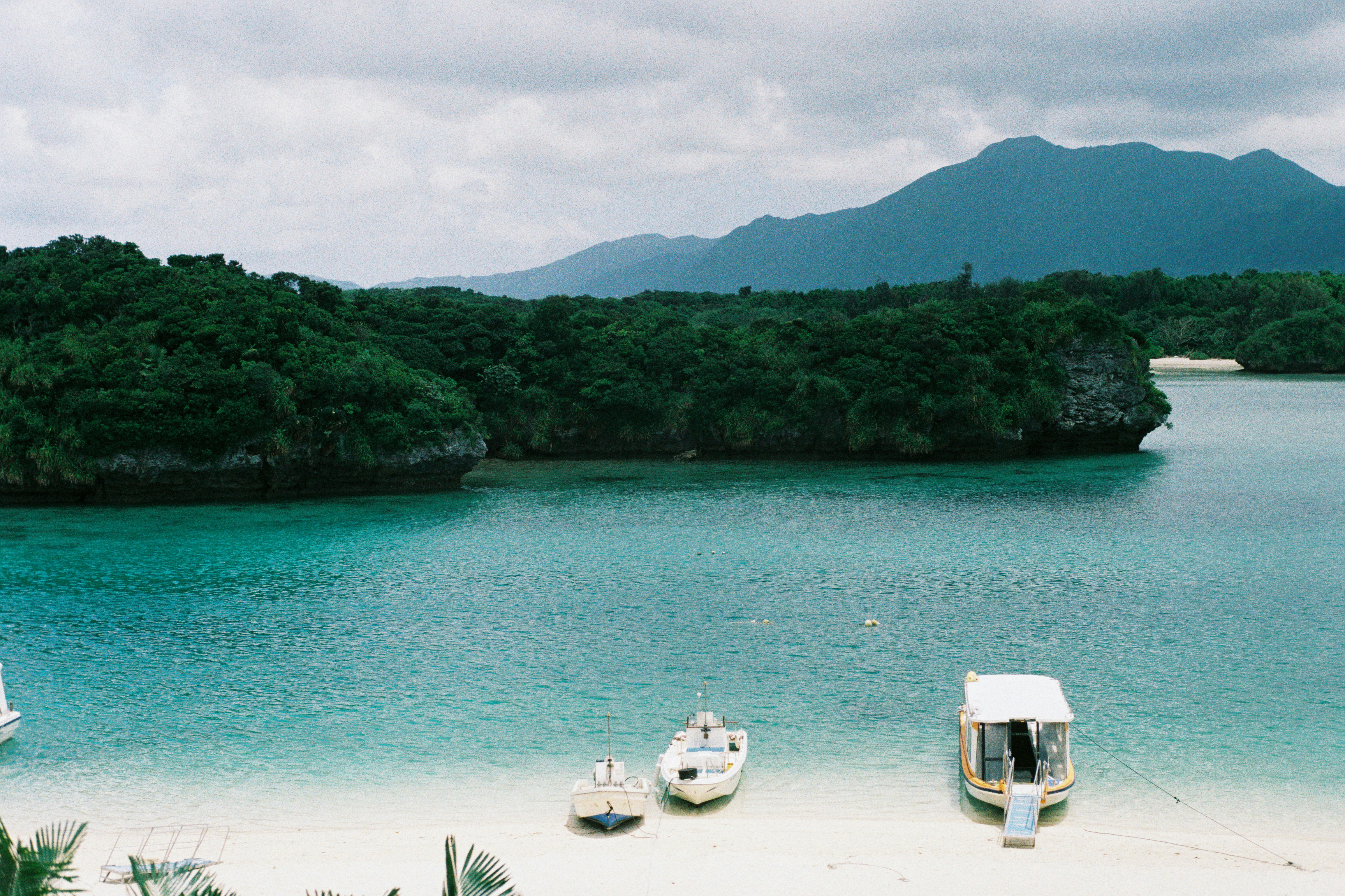
About Amami Ōshima
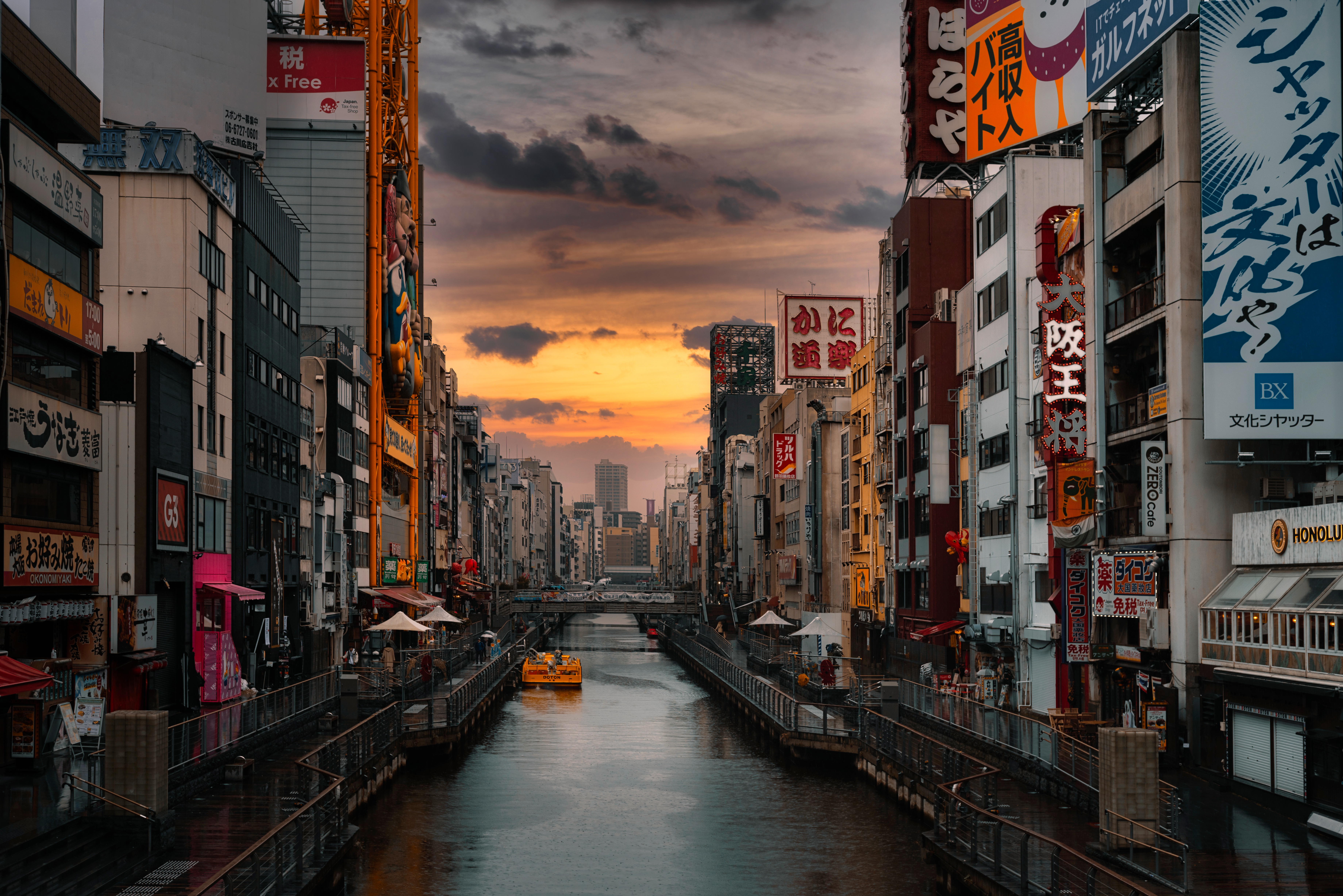
About Osaka
From Minami's neon-lighted Dotombori and historic Tenno-ji to the high-rise class and underground shopping labyrinths of Kita, Osaka is a city that pulses with its own unique rhythm. Though Osaka has no shortage of tourist sites, it is the city itself that is the greatest attraction. Home to some of Japan's best food, most unique fashions, and warmest locals, Osaka does not beg to be explored—it demands it. More than anywhere else in Japan, it rewards the impulsive turn down an interesting side street or the chat with a random stranger. People do not come here to see the city, they come to experience it.Excluded from the formal circles of power and aristocratic culture in 16th-century Edo (Tokyo), Osaka took advantage of its position as Japan's trading center, developing its own art forms such as Bunraku puppet theater and Rakugo comic storytelling. It was in Osaka that feudal Japan's famed Floating World—the dining, theater, and pleasure district—was at its strongest and most inventive. Wealthy merchants and common laborers alike squandered fortunes on culinary delights, turning Osaka into "Japan's Kitchen," a moniker the city still has today. Though the city suffered a blow when the Meiji government canceled all of the samurai class's outstanding debts to the merchants, it was quick to recover. At the turn of the 20th century, it had become Japan's largest and most prosperous city, a center of commerce and manufacturing.Today Osaka remains Japan's iconoclastic metropolis, refusing to fit Tokyo's norms and expectations. Unlike the hordes of Tokyo, Osakans are fiercely independent. As a contrast to the neon and concrete surroundings, the people of Osaka are known as Japan's friendliest and most outgoing. Ask someone on the street for directions in Tokyo and you are lucky to get so much as a glance. Ask someone in Osaka and you get a conversation.The main areas of the city, Kita (north) and Minami (south), are divided by two rivers: the Dojima-gawa and the Tosabori-gawa. Between Kita and Minami is Naka-no-shima, an island and the municipal center of Osaka. Kita (north of Chuo Dori) is Osaka's economic hub and contains Osaka's largest stations: JR Osaka and Hankyu Umeda. The area is crammed with shops, department stores, and restaurants. Nearby are a nightlife district, Kita-shinchi; Naka-no-shima and the Museum of Oriental Ceramics; Osaka-jo (Osaka Castle); and Osaka Koen (Osaka Park). Restaurants, bars, department stores, and boutiques attract Osaka's youth to Minami (south Chuo Dori); theatergoers head to the National Bunraku Theatre and electronics-lovers to Den Den Town. For a glimpse of old Osaka, visit Tenno-ji Temple and Shin Sekai. The main stations are Namba, Shin-sai-bashi, Namba Nankai, and Tenno-ji. There's easy access to the Municipal Museum of Fine Art and Sumiyoshi Taisha (Sumiyoshi Grand Shrine).The bay area, to the west of the city center, is home to the Osaka Aquarium and Universal Studios Japan. The Shinkansen stops at Shin-Osaka, three stops (about five minutes) north of Osaka Station on the Mido-suji subway line. To the north of Shin-Osaka is Senri Expo Park.
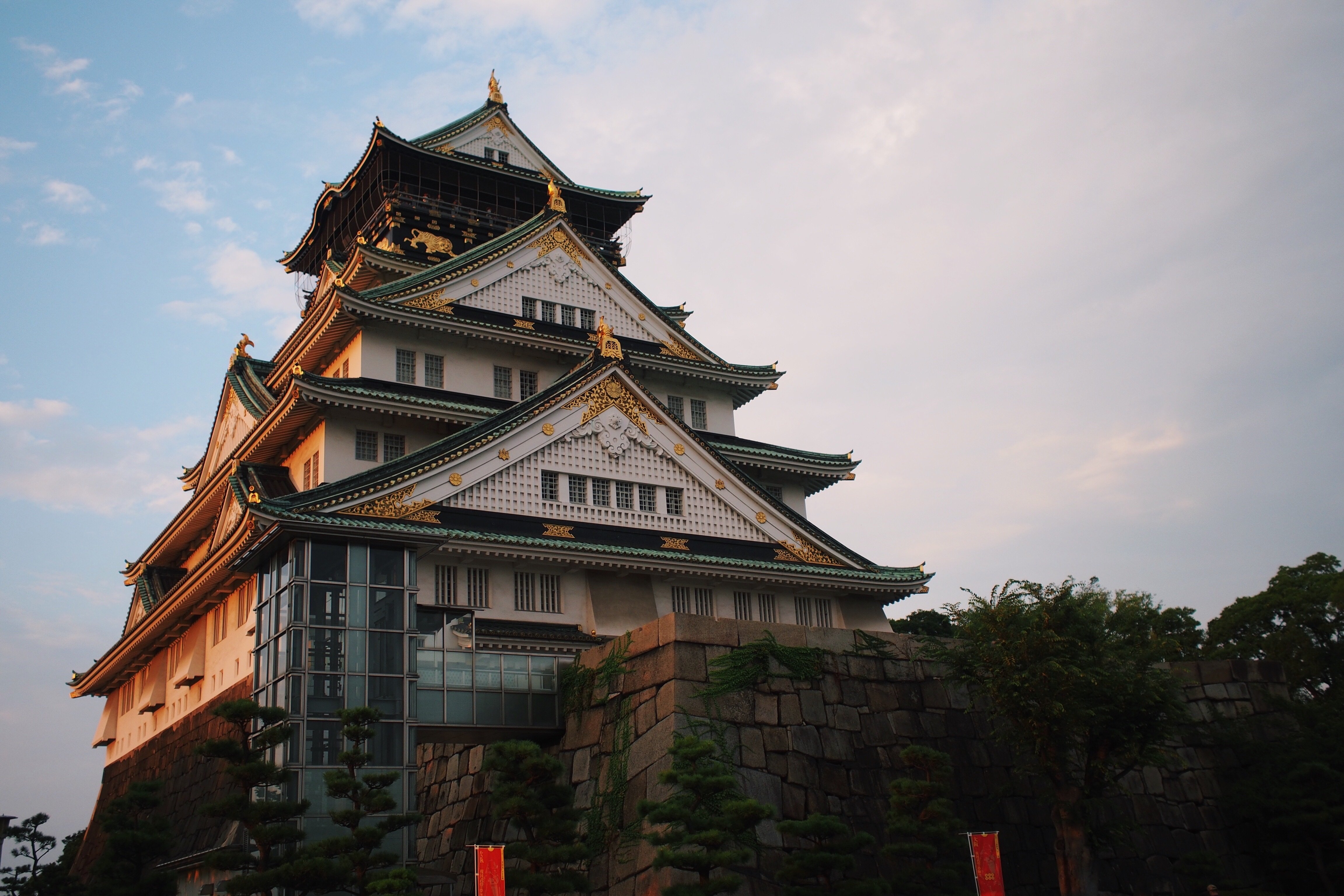
About Kyoto
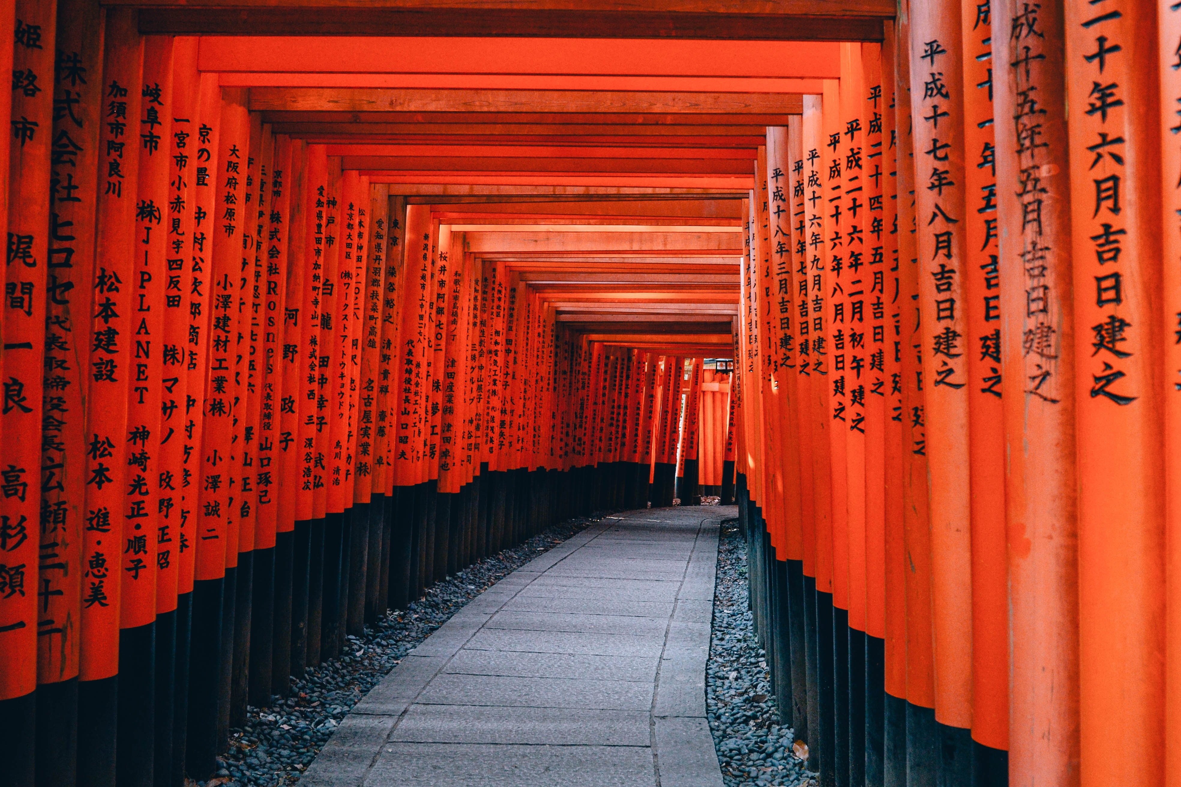
About Kyoto
About Osaka
From Minami's neon-lighted Dotombori and historic Tenno-ji to the high-rise class and underground shopping labyrinths of Kita, Osaka is a city that pulses with its own unique rhythm. Though Osaka has no shortage of tourist sites, it is the city itself that is the greatest attraction. Home to some of Japan's best food, most unique fashions, and warmest locals, Osaka does not beg to be explored—it demands it. More than anywhere else in Japan, it rewards the impulsive turn down an interesting side street or the chat with a random stranger. People do not come here to see the city, they come to experience it.Excluded from the formal circles of power and aristocratic culture in 16th-century Edo (Tokyo), Osaka took advantage of its position as Japan's trading center, developing its own art forms such as Bunraku puppet theater and Rakugo comic storytelling. It was in Osaka that feudal Japan's famed Floating World—the dining, theater, and pleasure district—was at its strongest and most inventive. Wealthy merchants and common laborers alike squandered fortunes on culinary delights, turning Osaka into "Japan's Kitchen," a moniker the city still has today. Though the city suffered a blow when the Meiji government canceled all of the samurai class's outstanding debts to the merchants, it was quick to recover. At the turn of the 20th century, it had become Japan's largest and most prosperous city, a center of commerce and manufacturing.Today Osaka remains Japan's iconoclastic metropolis, refusing to fit Tokyo's norms and expectations. Unlike the hordes of Tokyo, Osakans are fiercely independent. As a contrast to the neon and concrete surroundings, the people of Osaka are known as Japan's friendliest and most outgoing. Ask someone on the street for directions in Tokyo and you are lucky to get so much as a glance. Ask someone in Osaka and you get a conversation.The main areas of the city, Kita (north) and Minami (south), are divided by two rivers: the Dojima-gawa and the Tosabori-gawa. Between Kita and Minami is Naka-no-shima, an island and the municipal center of Osaka. Kita (north of Chuo Dori) is Osaka's economic hub and contains Osaka's largest stations: JR Osaka and Hankyu Umeda. The area is crammed with shops, department stores, and restaurants. Nearby are a nightlife district, Kita-shinchi; Naka-no-shima and the Museum of Oriental Ceramics; Osaka-jo (Osaka Castle); and Osaka Koen (Osaka Park). Restaurants, bars, department stores, and boutiques attract Osaka's youth to Minami (south Chuo Dori); theatergoers head to the National Bunraku Theatre and electronics-lovers to Den Den Town. For a glimpse of old Osaka, visit Tenno-ji Temple and Shin Sekai. The main stations are Namba, Shin-sai-bashi, Namba Nankai, and Tenno-ji. There's easy access to the Municipal Museum of Fine Art and Sumiyoshi Taisha (Sumiyoshi Grand Shrine).The bay area, to the west of the city center, is home to the Osaka Aquarium and Universal Studios Japan. The Shinkansen stops at Shin-Osaka, three stops (about five minutes) north of Osaka Station on the Mido-suji subway line. To the north of Shin-Osaka is Senri Expo Park.
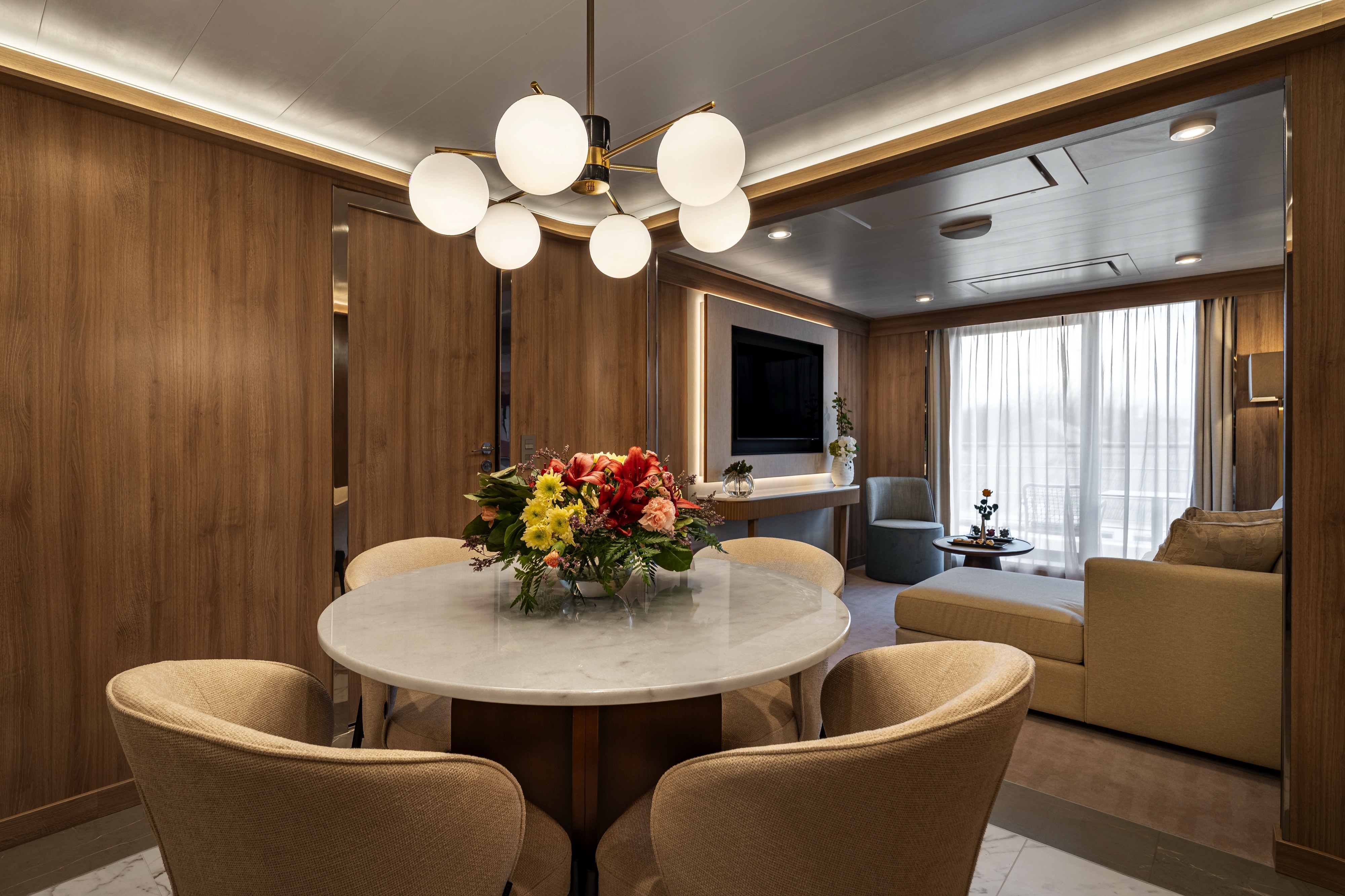
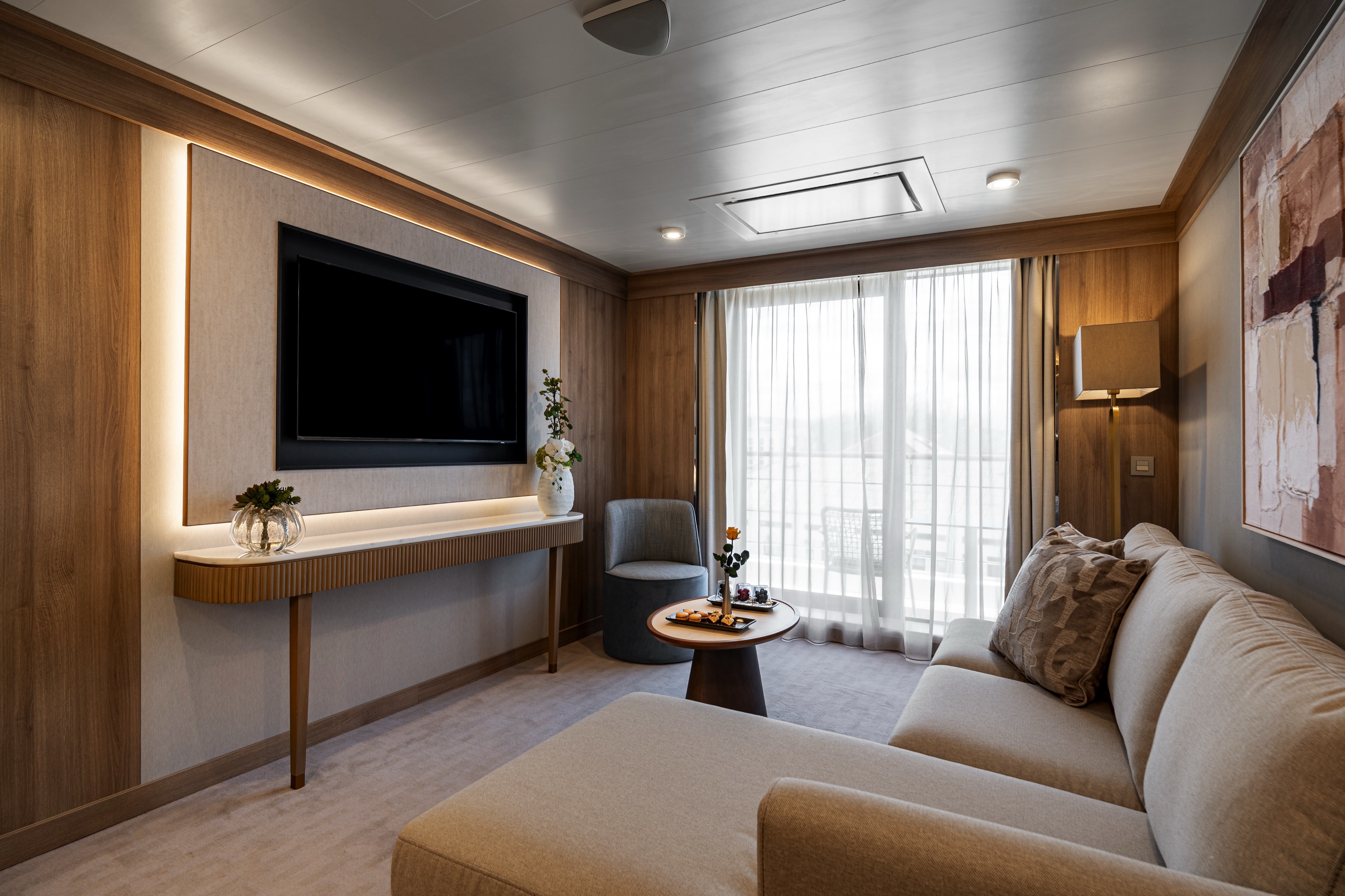
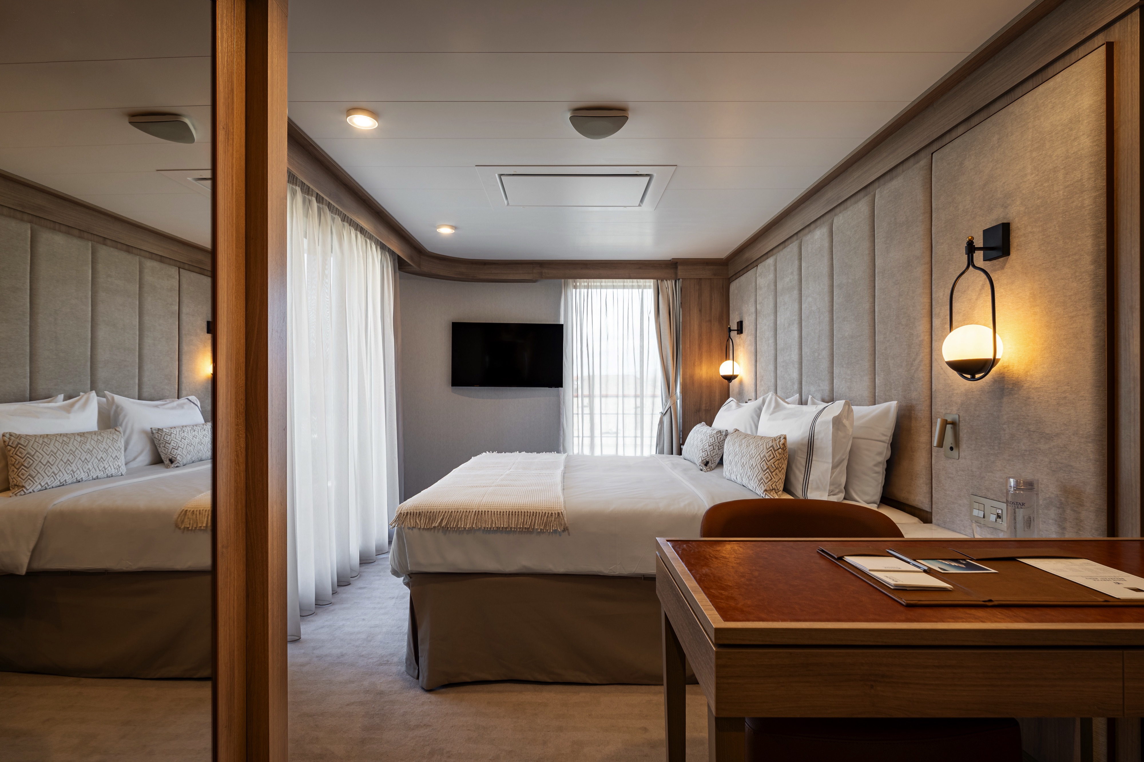
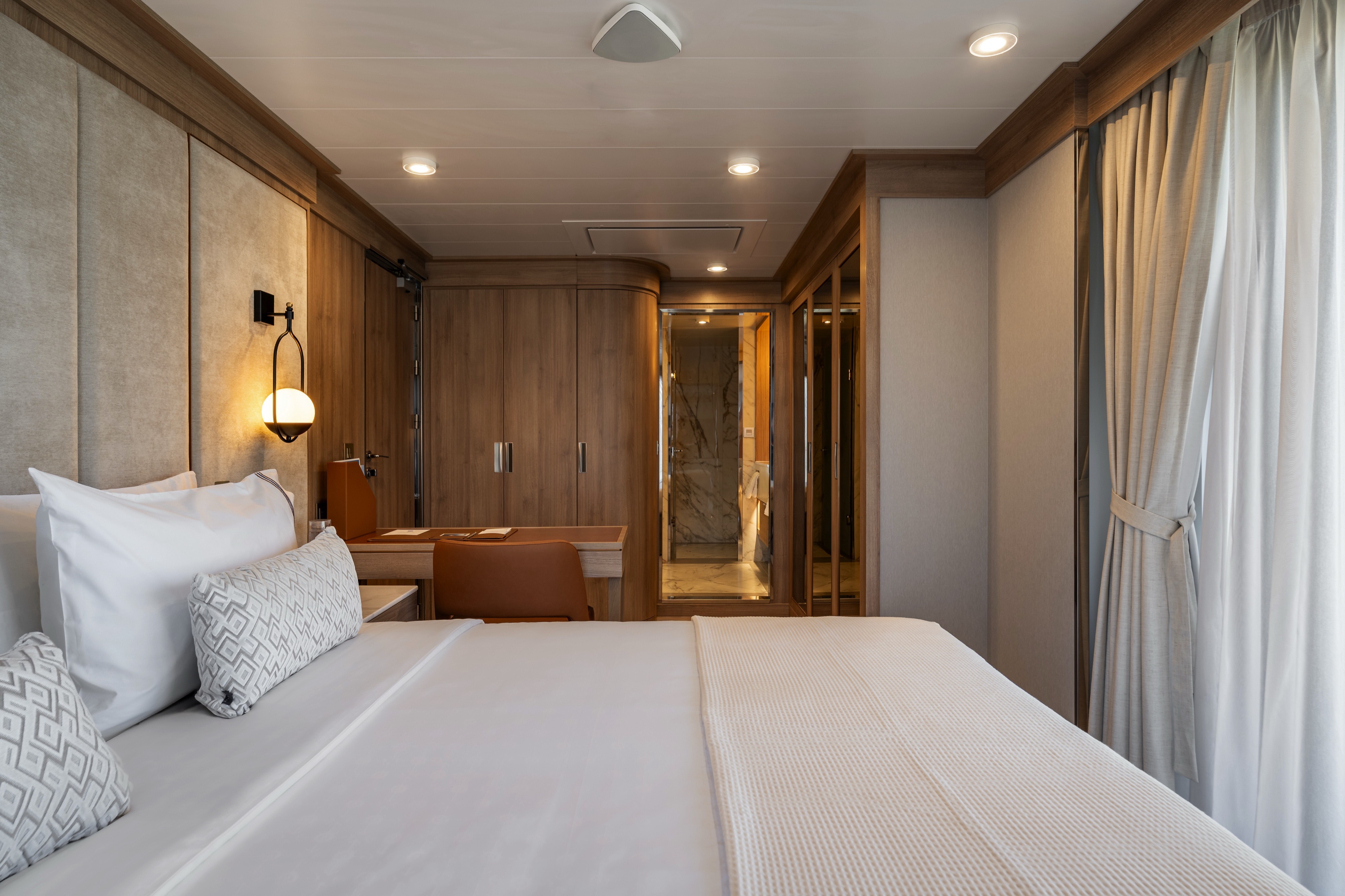
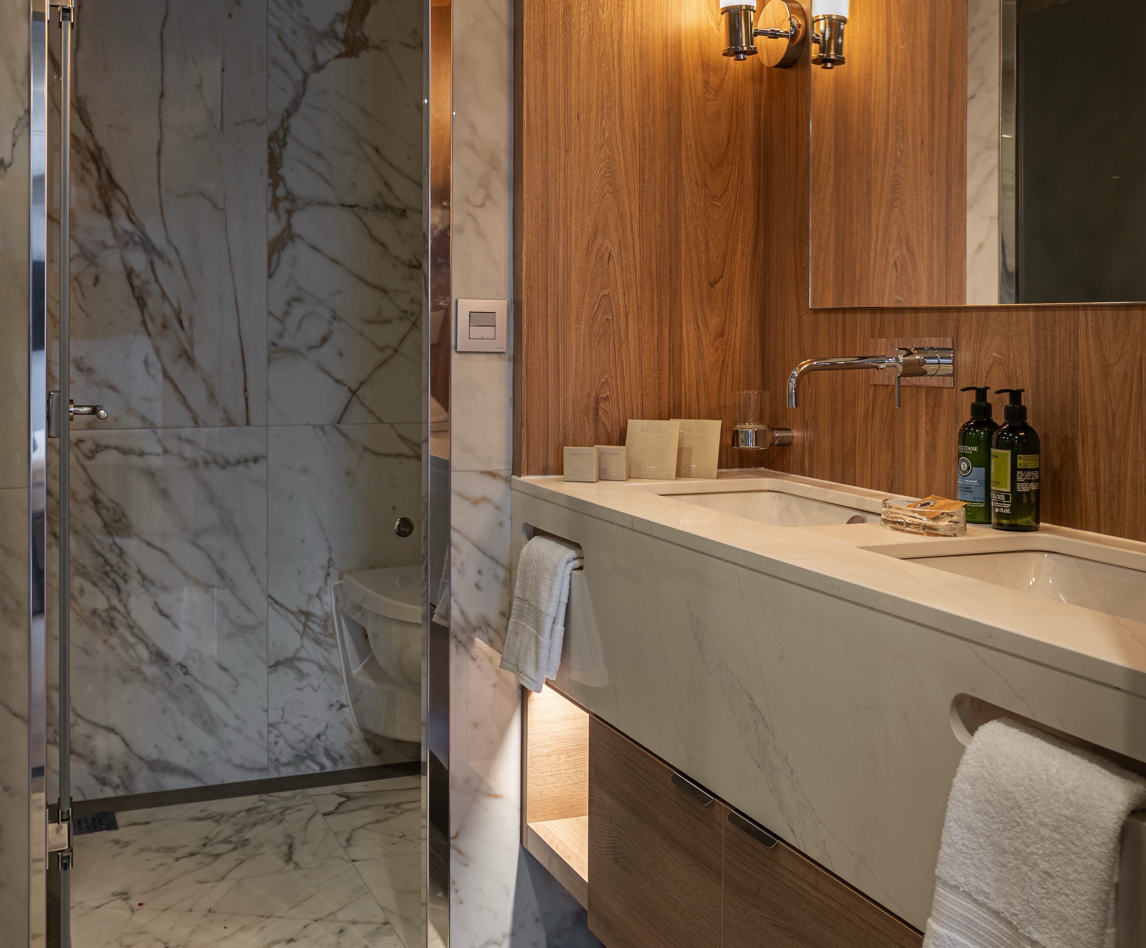
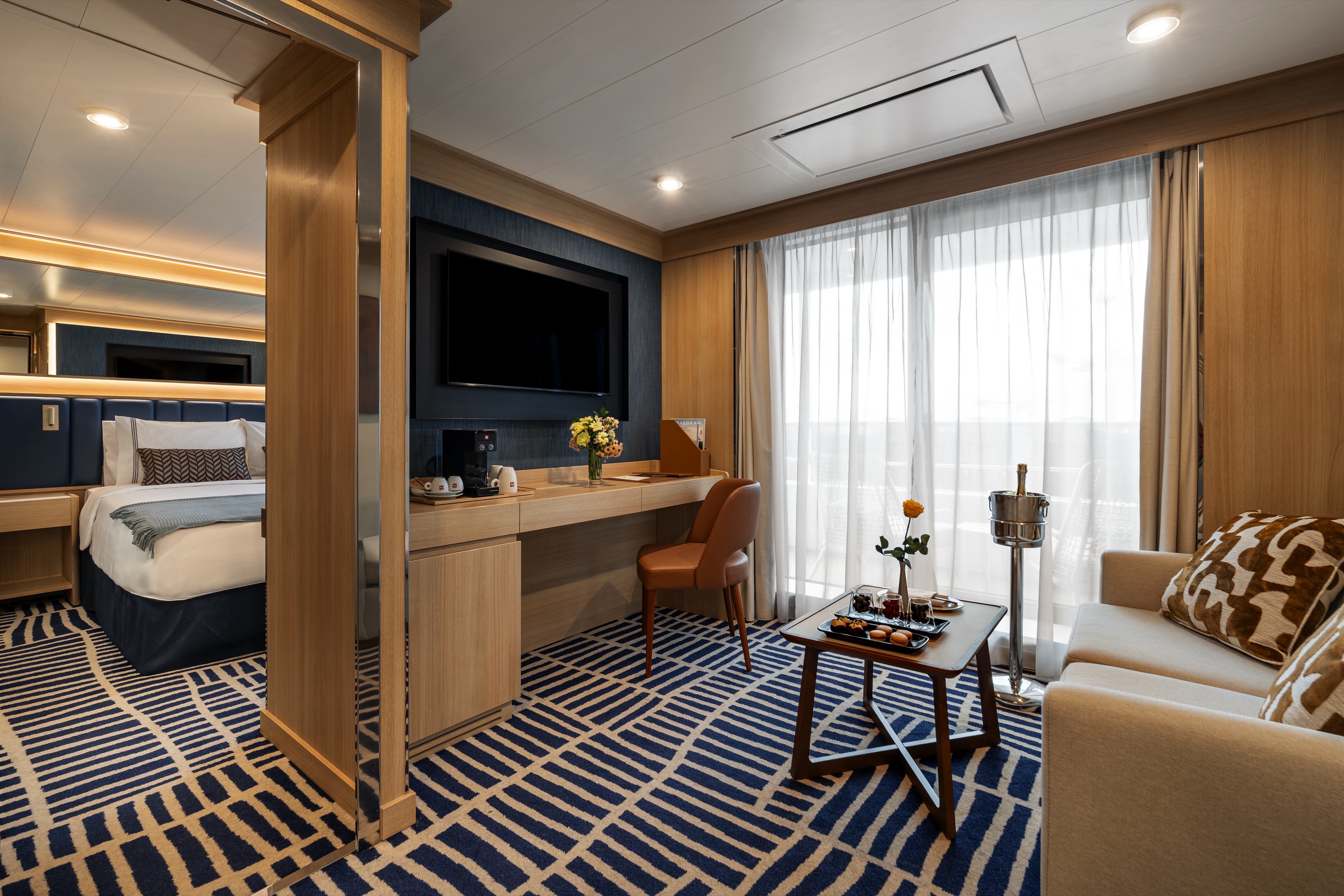
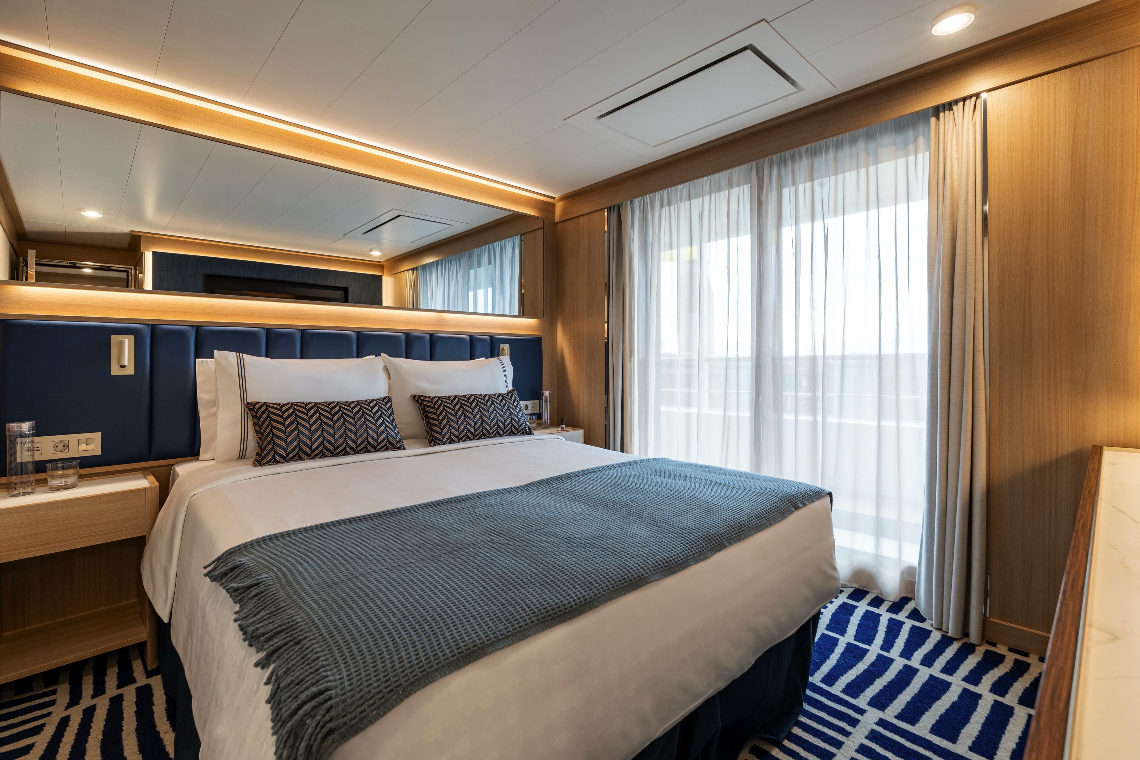
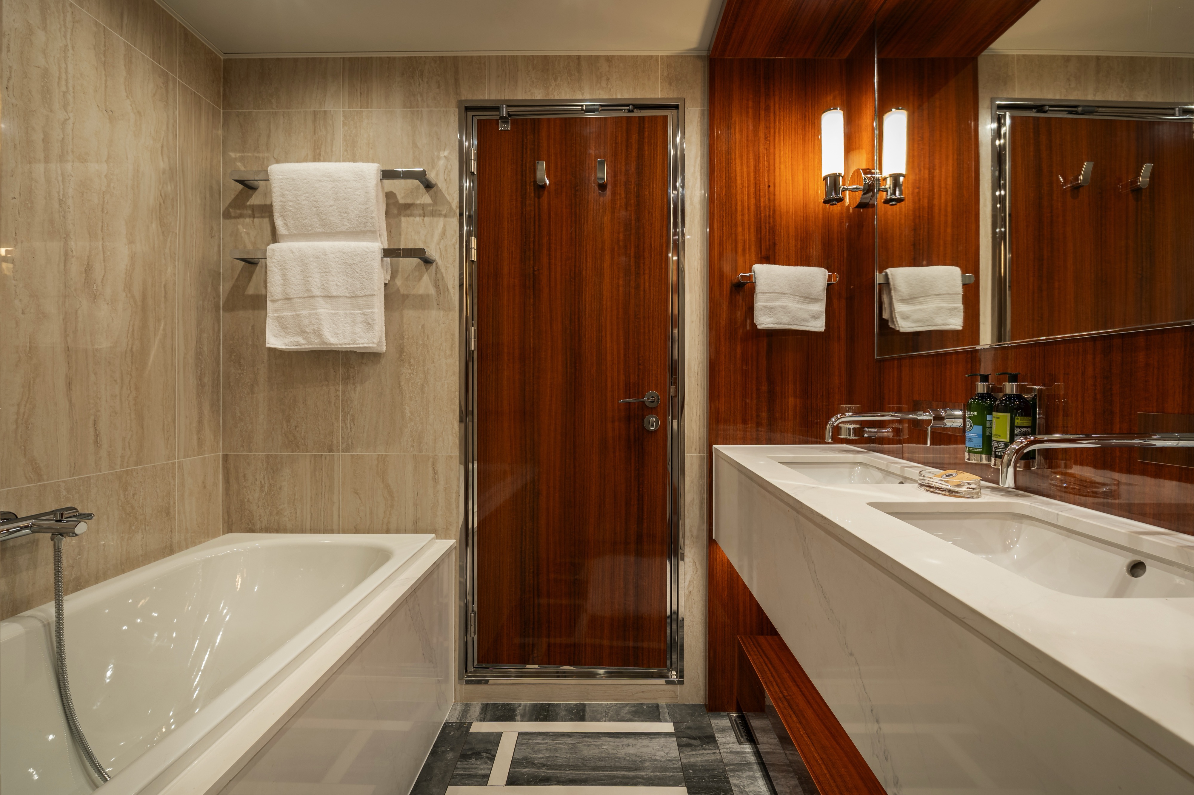
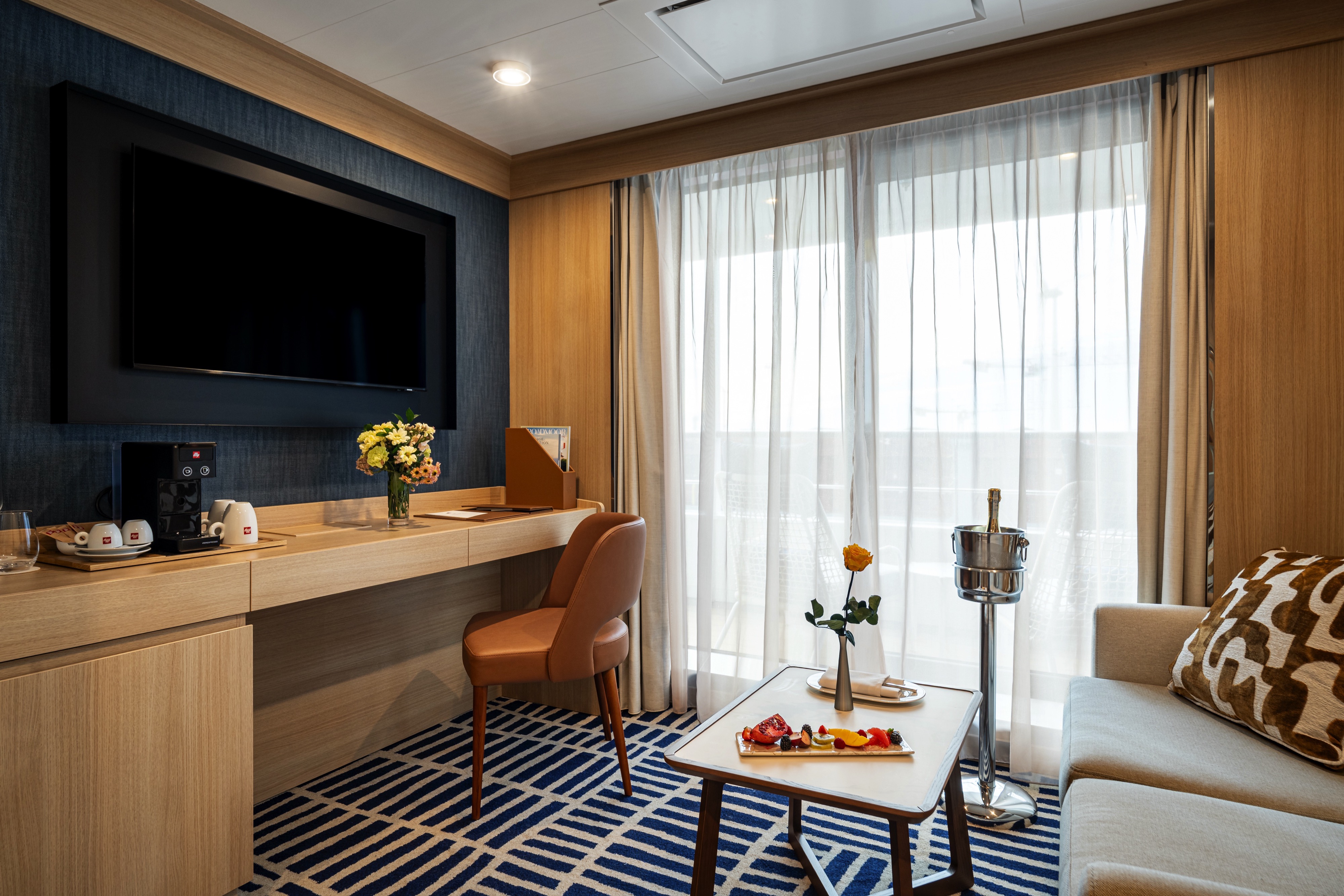
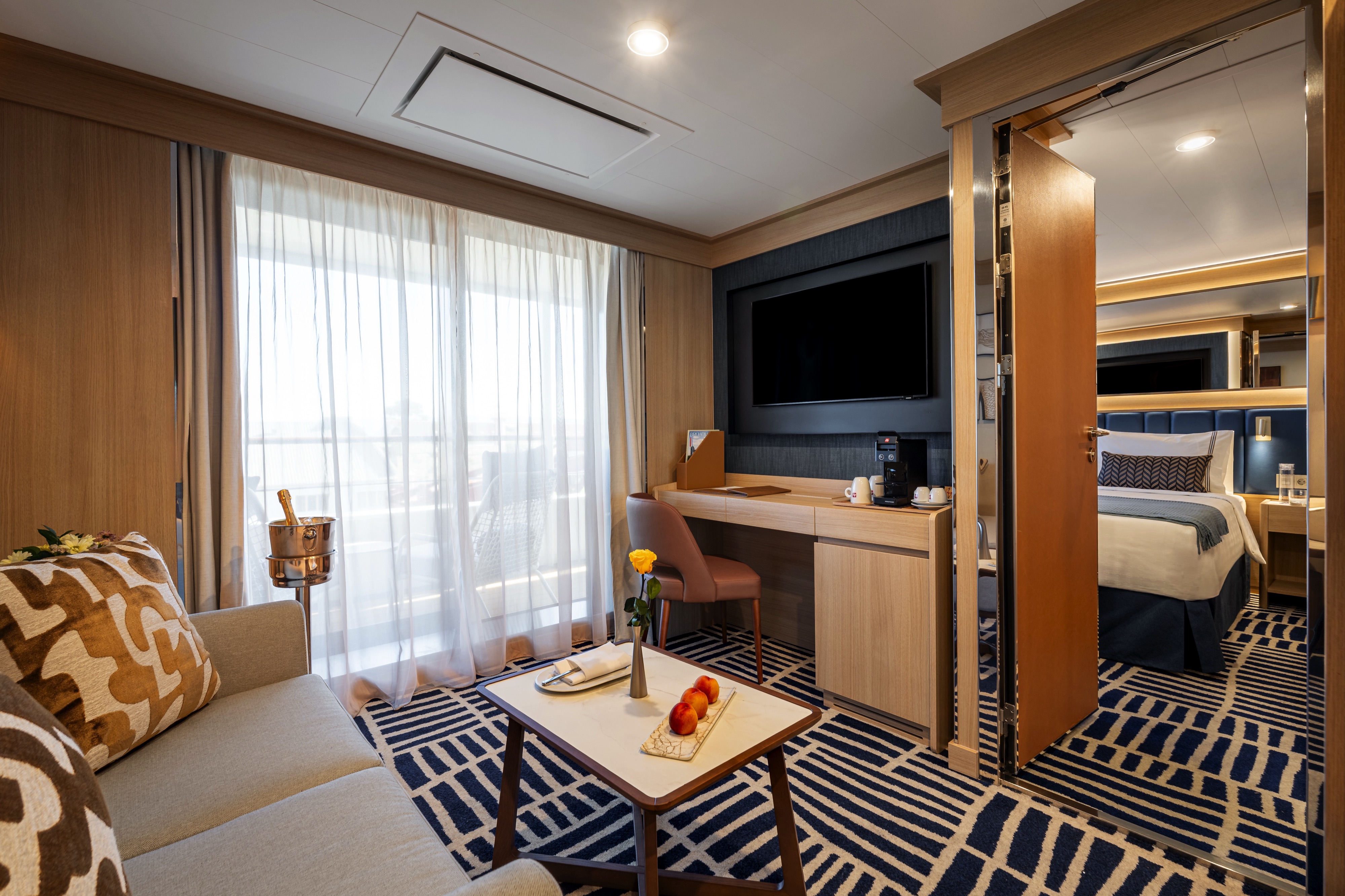
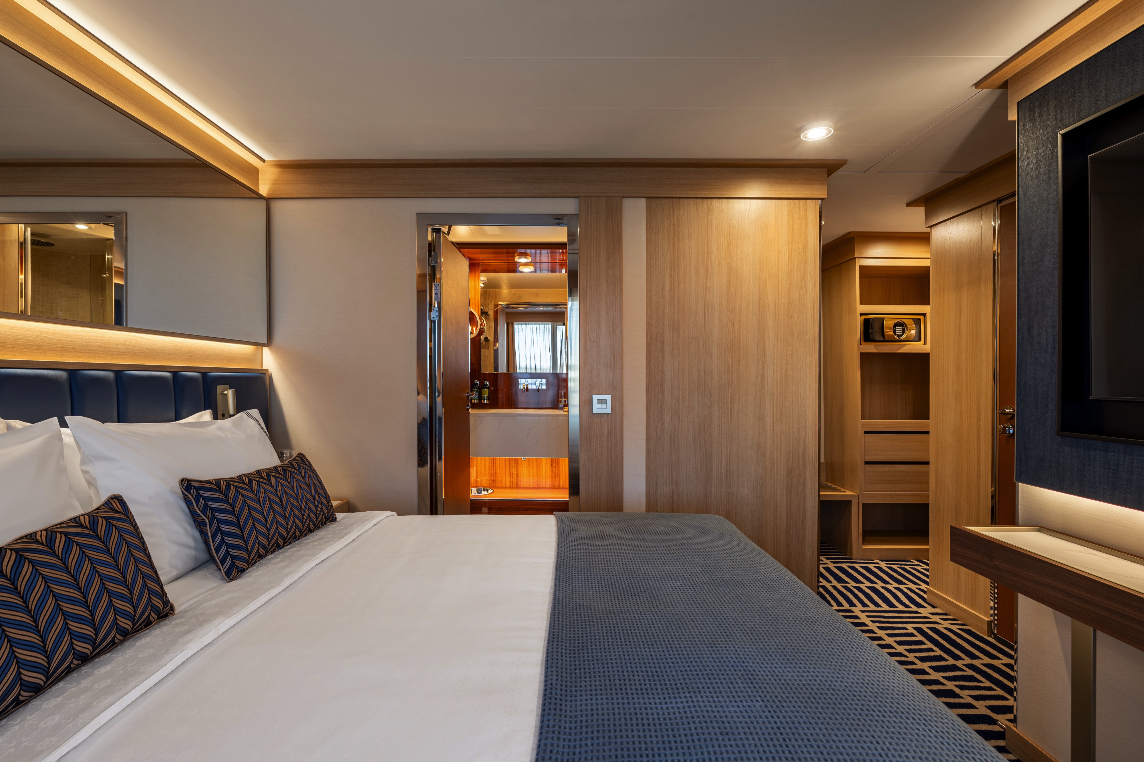
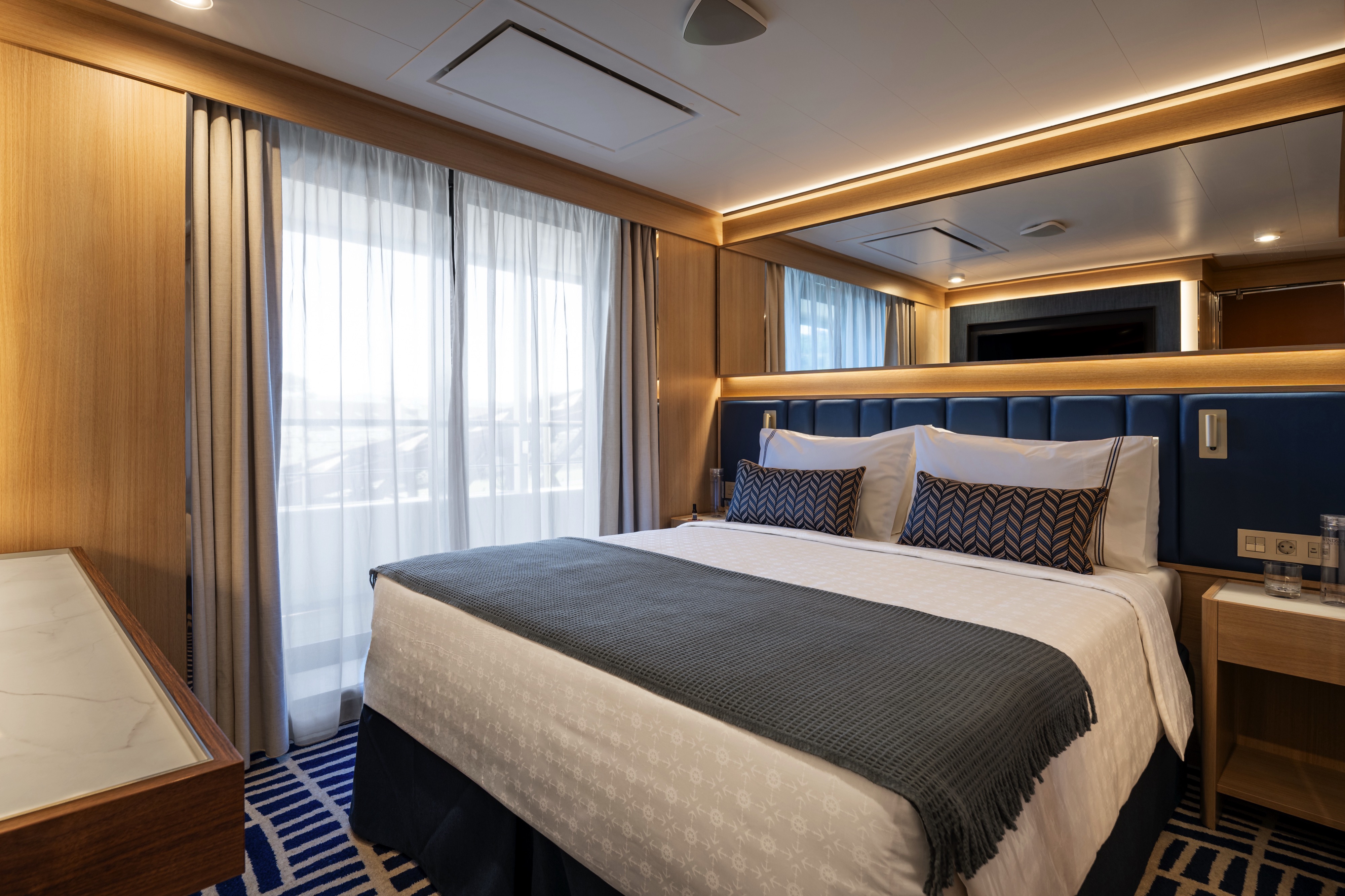
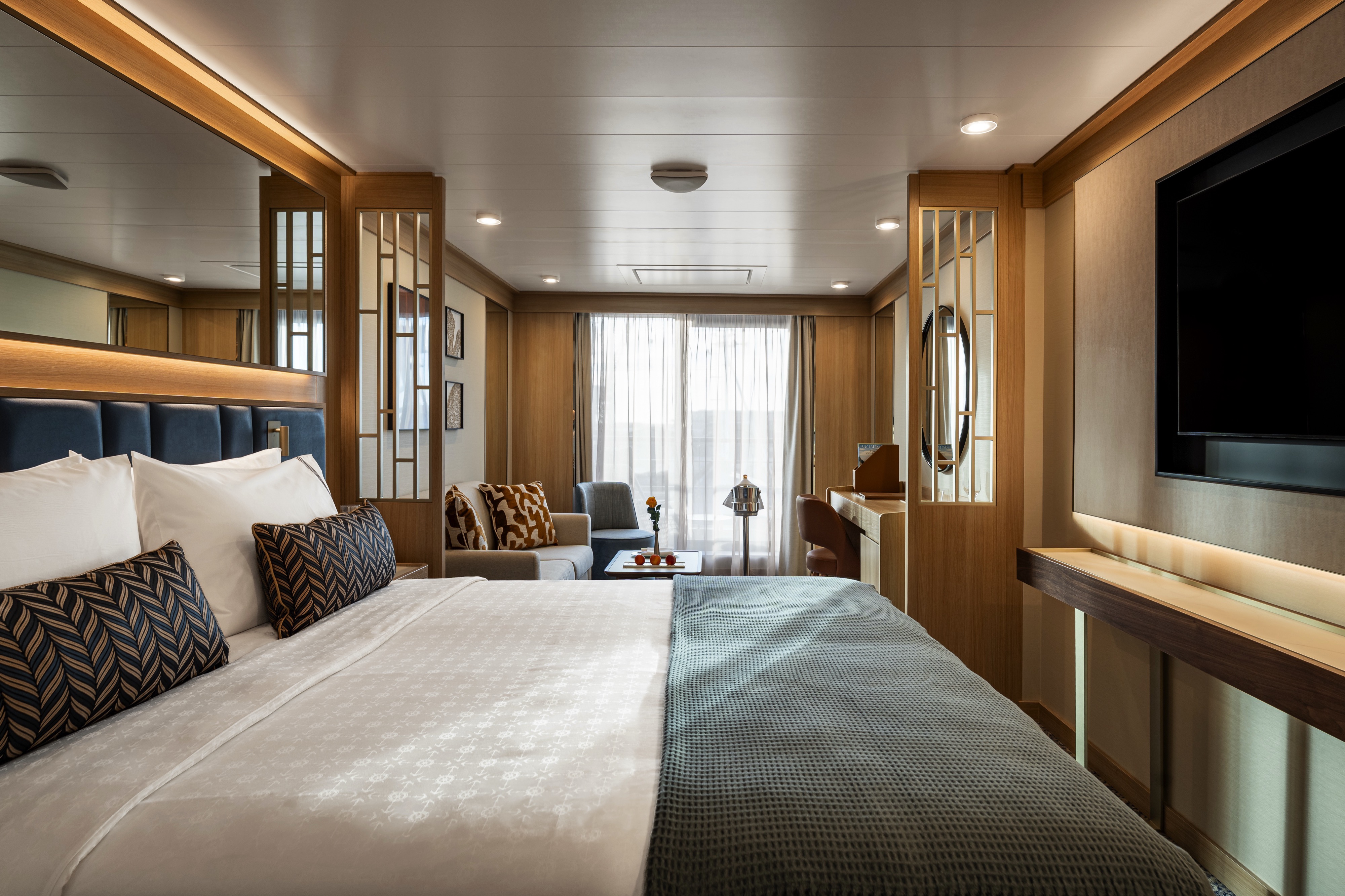
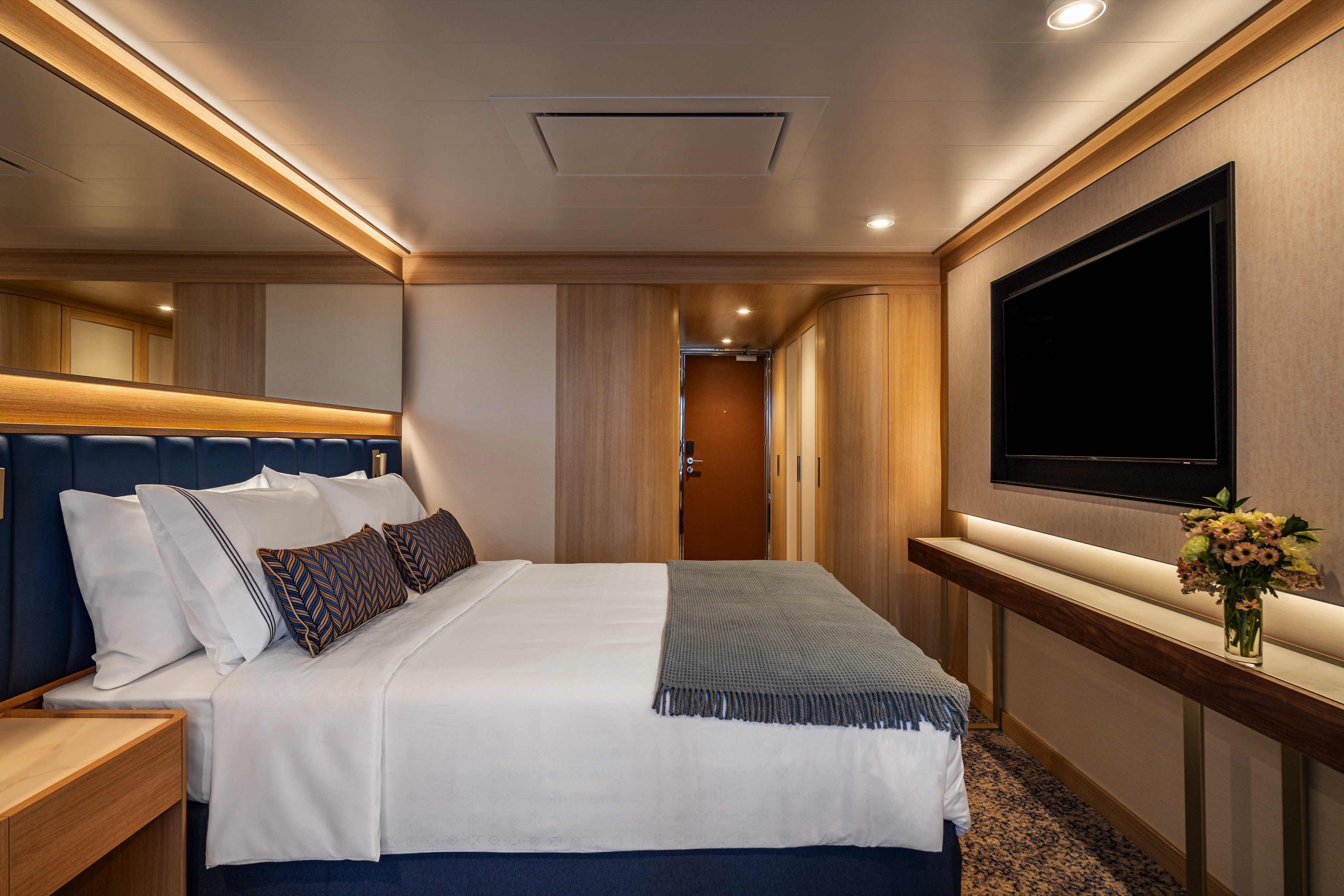
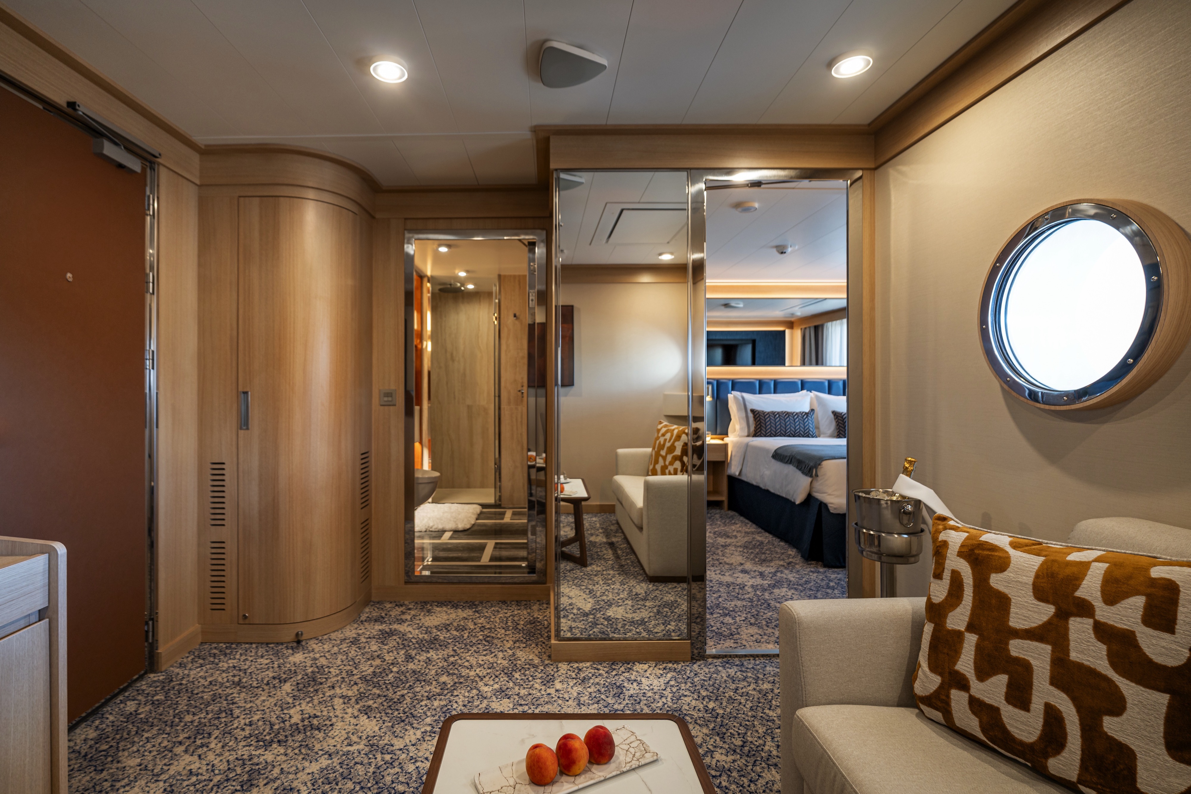
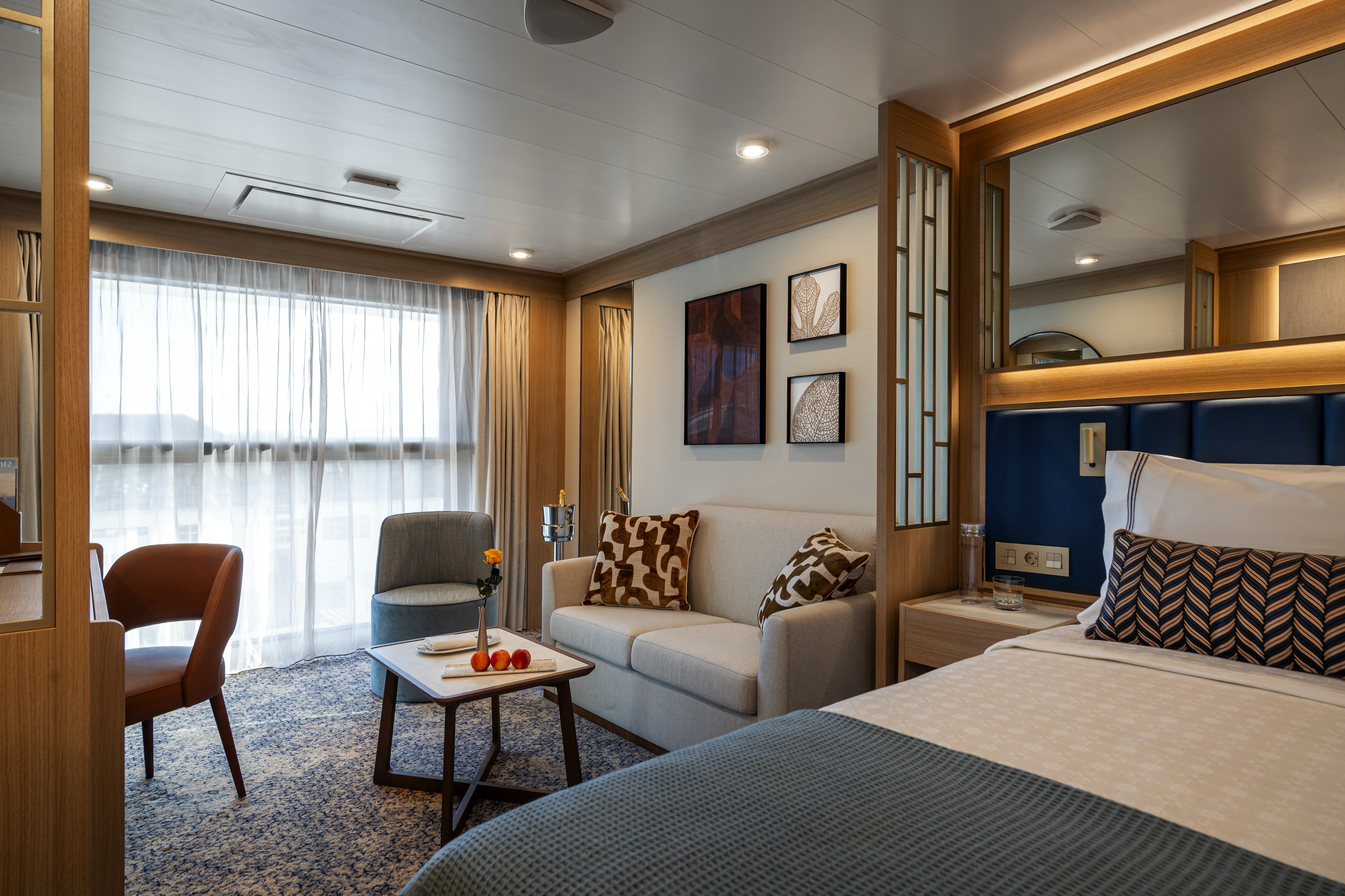
DECK | CABIN TYPE: Suite | 548 SQ FT
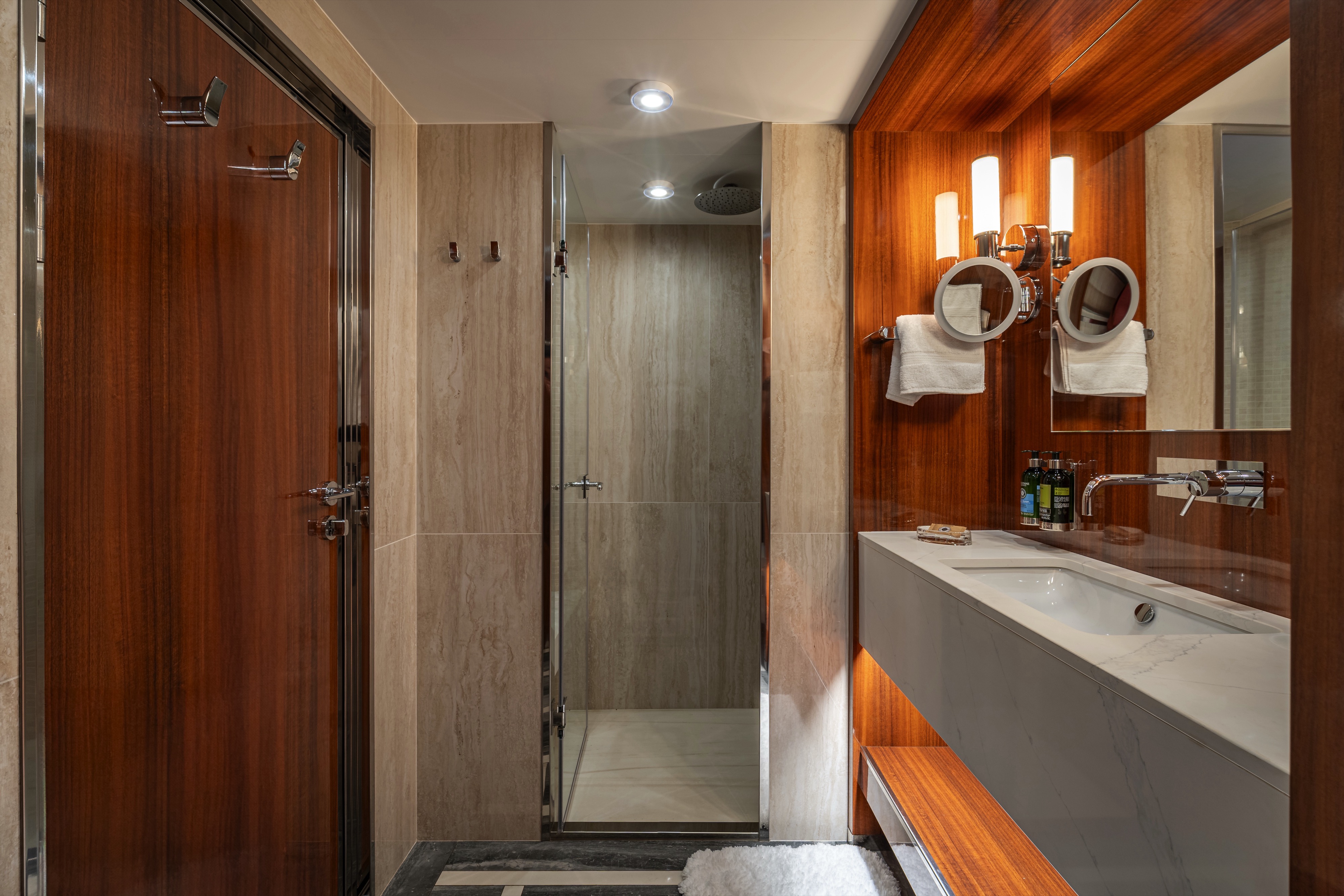
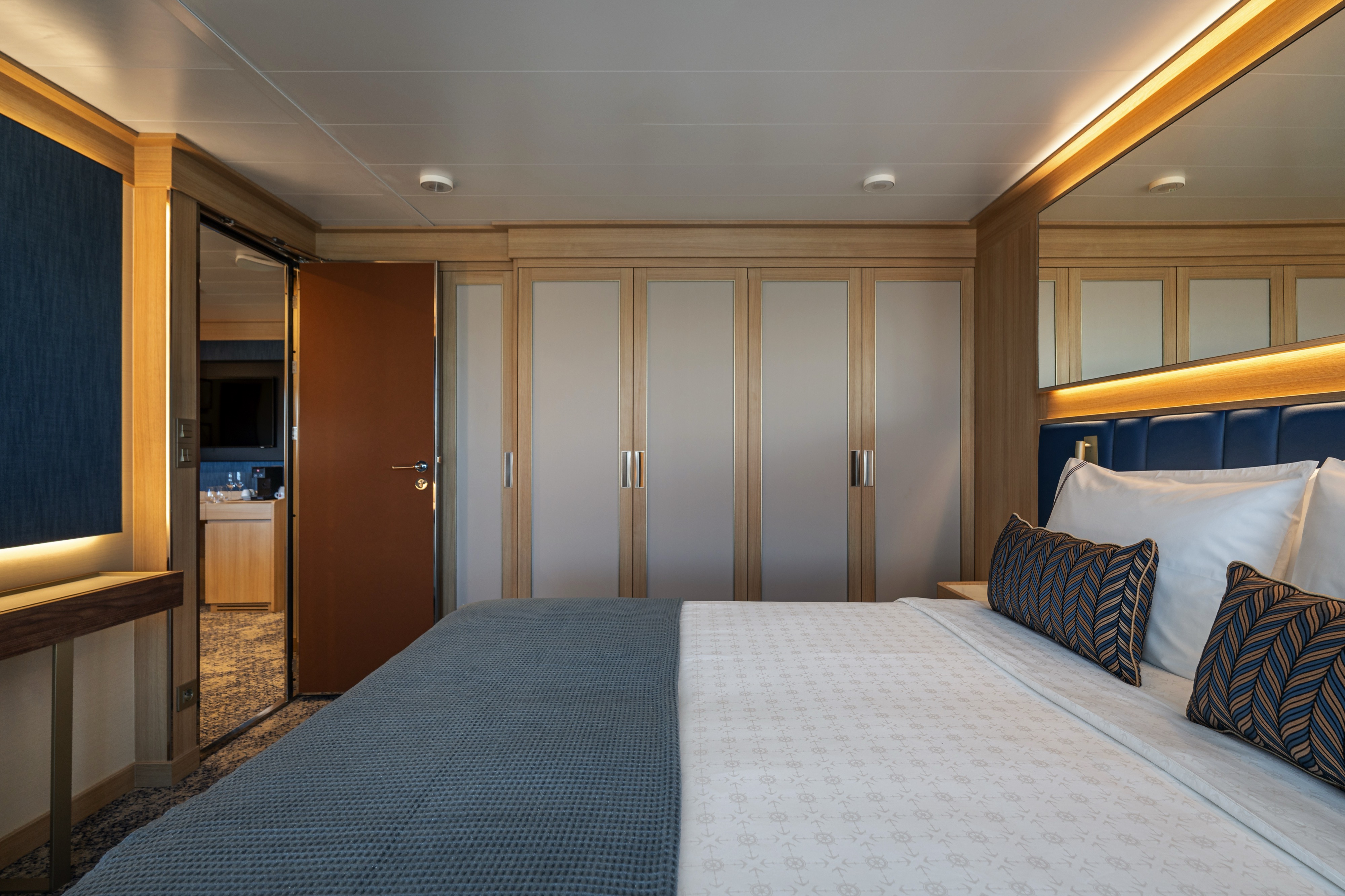
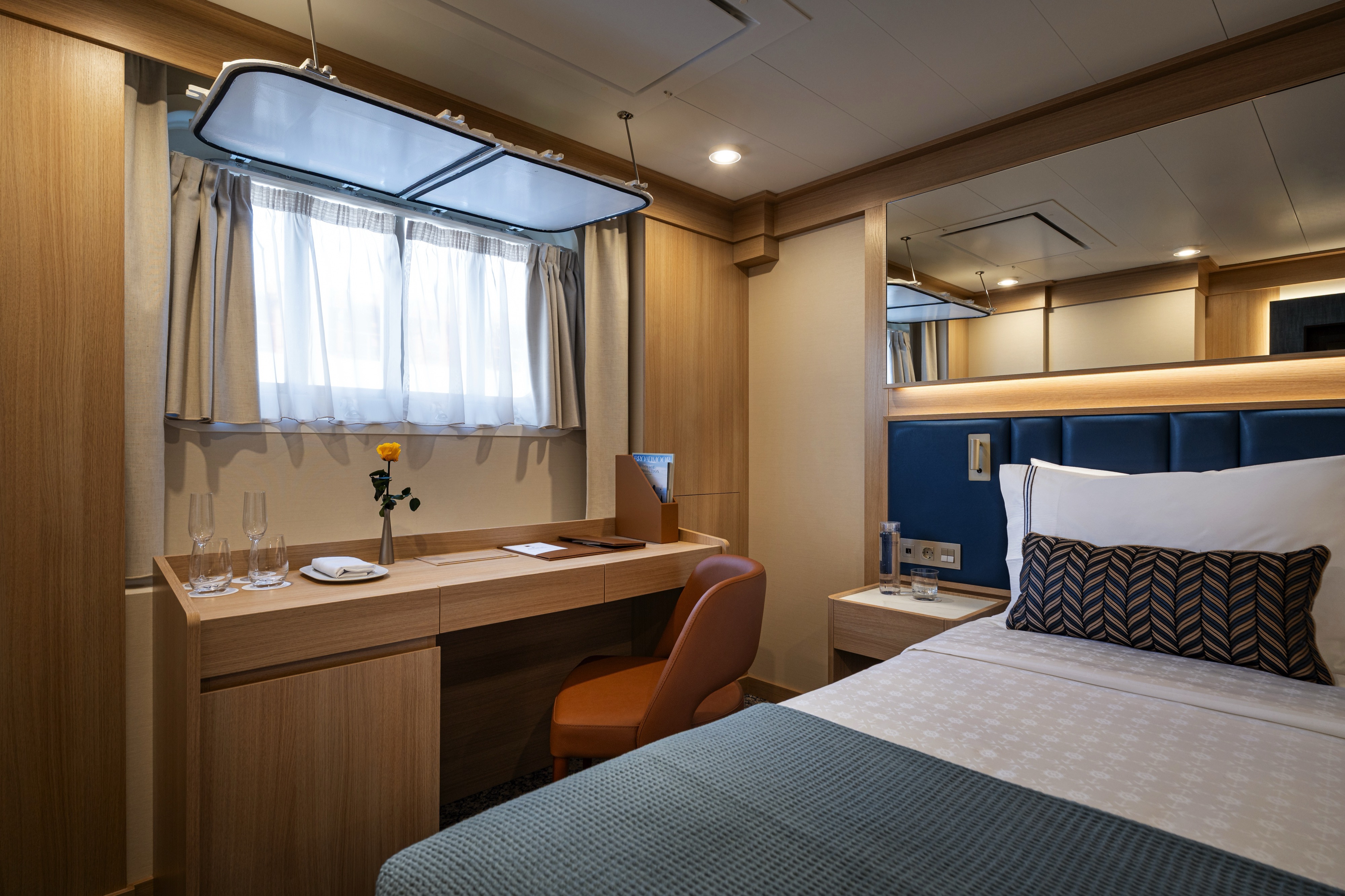
This luxurious 548-square-foot suite combines floor-to-ceiling windows and a wrap-around balcony for an unparalleled cruising experience. Perfect for evening cocktails or a private dinner, the wrap-around balcony adds 248 square feet of space and offers unobstructed views of the sea. The suite boasts a separate entryway — as well as separate dining and living areas — and a guest powder room. The bedroom includes an inviting king bed (convertible into two XL twin beds if desired), and the bathroom features a luxurious double walk-in mosaic glass shower with rain head and body jets. For family bookings, the adjacent suite can be combined to provide extra bedrooms and space for entertaining.
Amenities: Horizon Owner's Suite
- Queen Size Bed with Luxurious Linens
- Buttery soft velour bathrobe and slippers
- Upgraded L'Occitane bath amenities
- Mini Bar offering and fridge
- In-room premium filtered water
- Large upgraded fruit plate
- Macarons & Berries upon arrival
- Daily Canapés service
- Chilled bottle of Champagne upon arrival
- Fresh flower arrangement
- Illy capsule espresso machine
- Magnifying mirror, hairdryer and umbrella
- TV with complimentary on-demand entertainment
- Safe
- 110/220-volt outlets
- Ultimate Internet Package (Complimentary)
- Preferred check-in
- Personalized wake-up call with beverage
- Binoculars
- Invitation to Captain or Senior officer table
- Preferred Specialty Restaurant dining
- Laundry Service (various packages available for purchase)
- 24 Hour In-Room dining (complimentary)
- Rainfall shower with integrated side jets

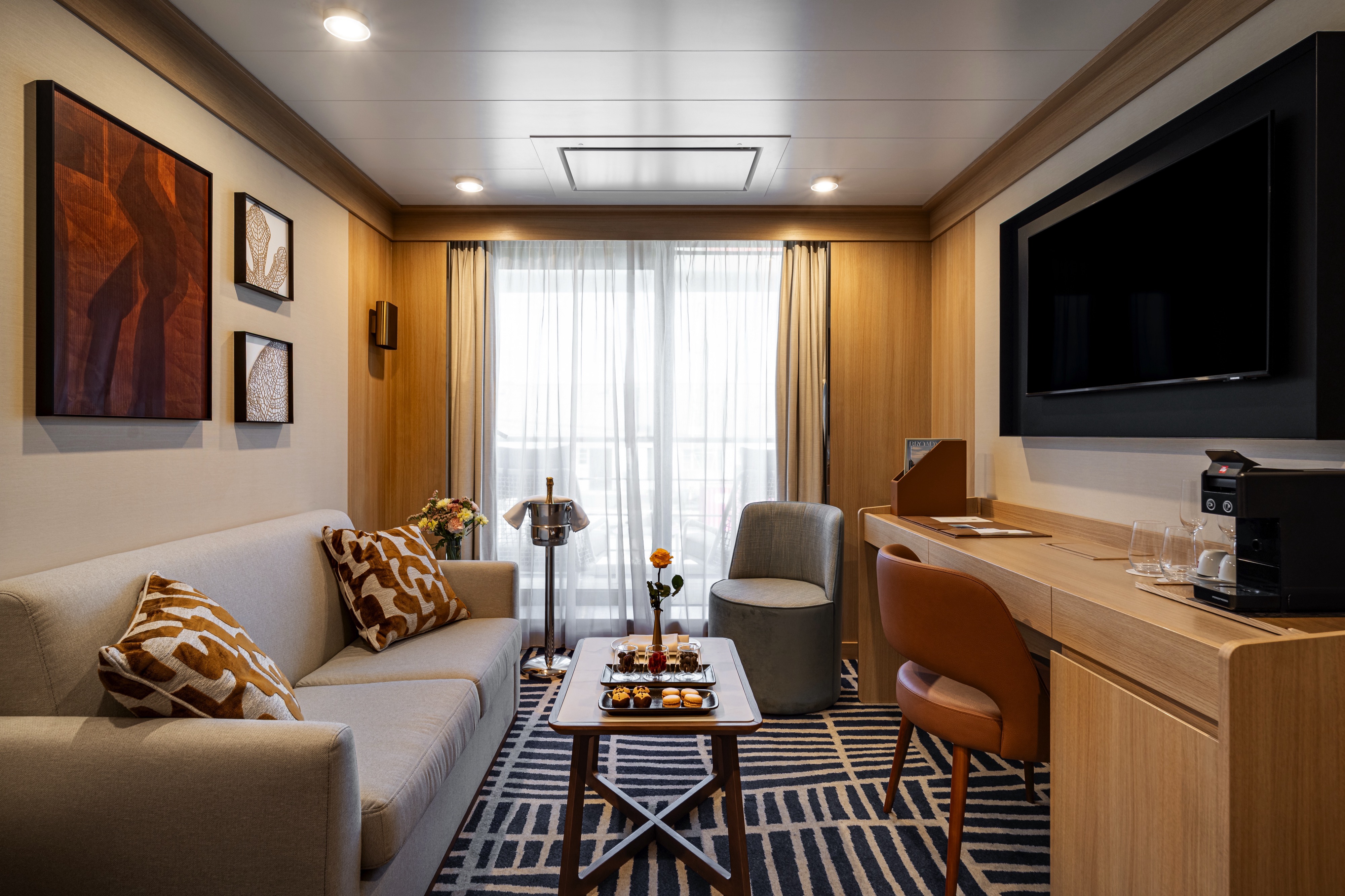
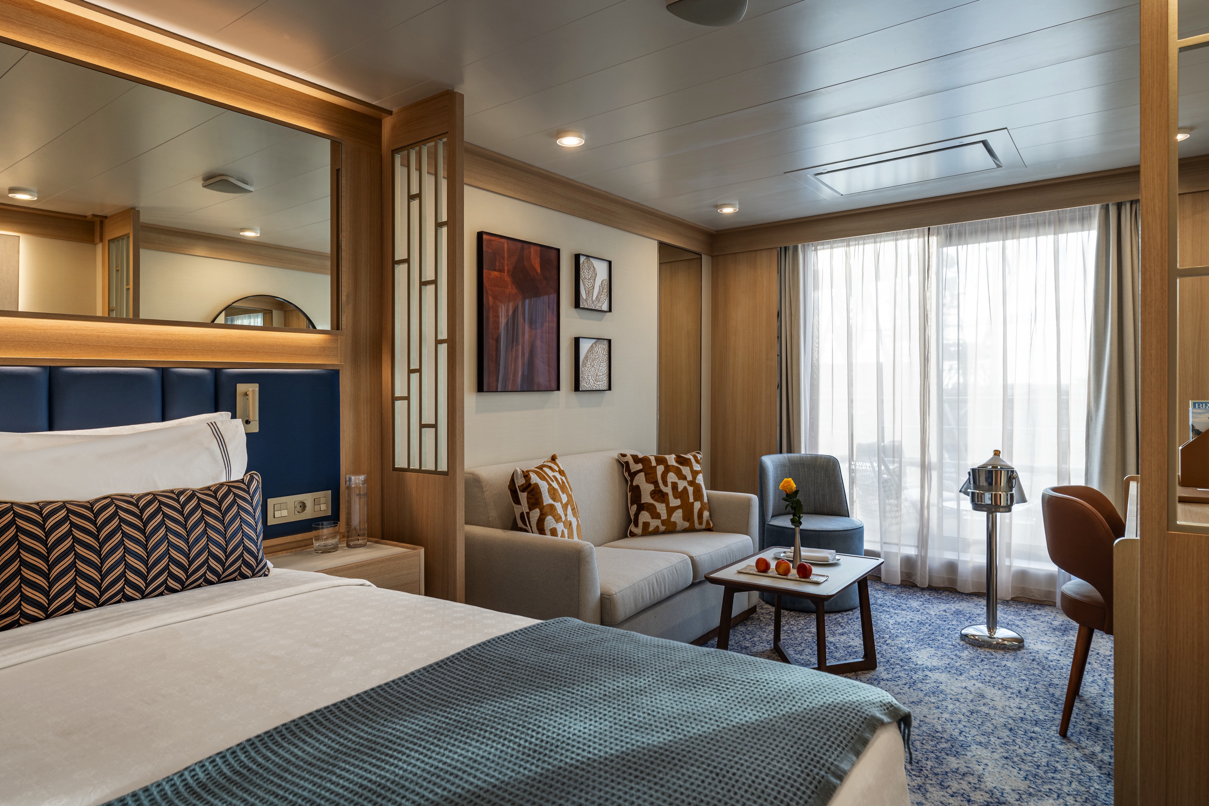
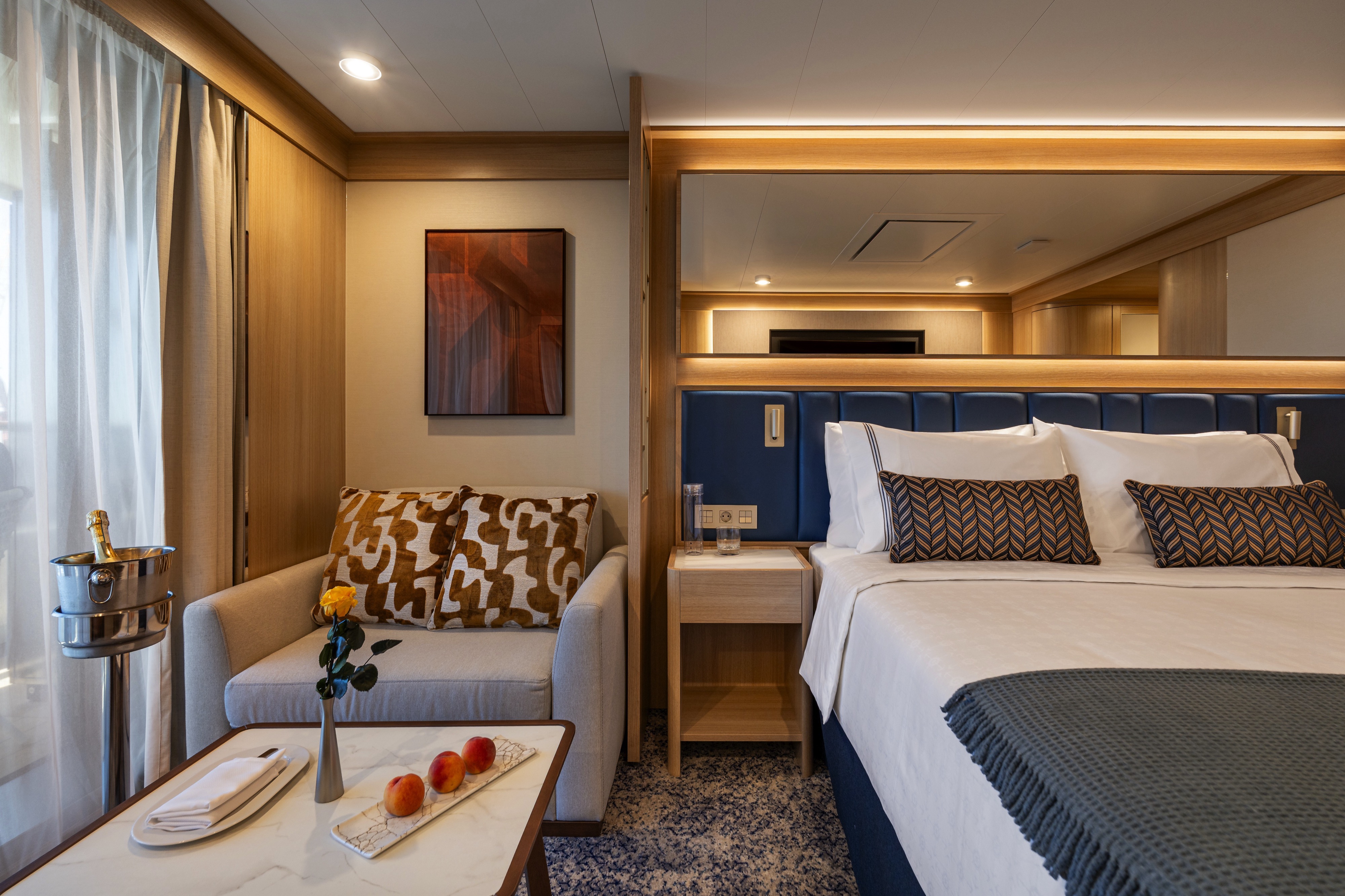
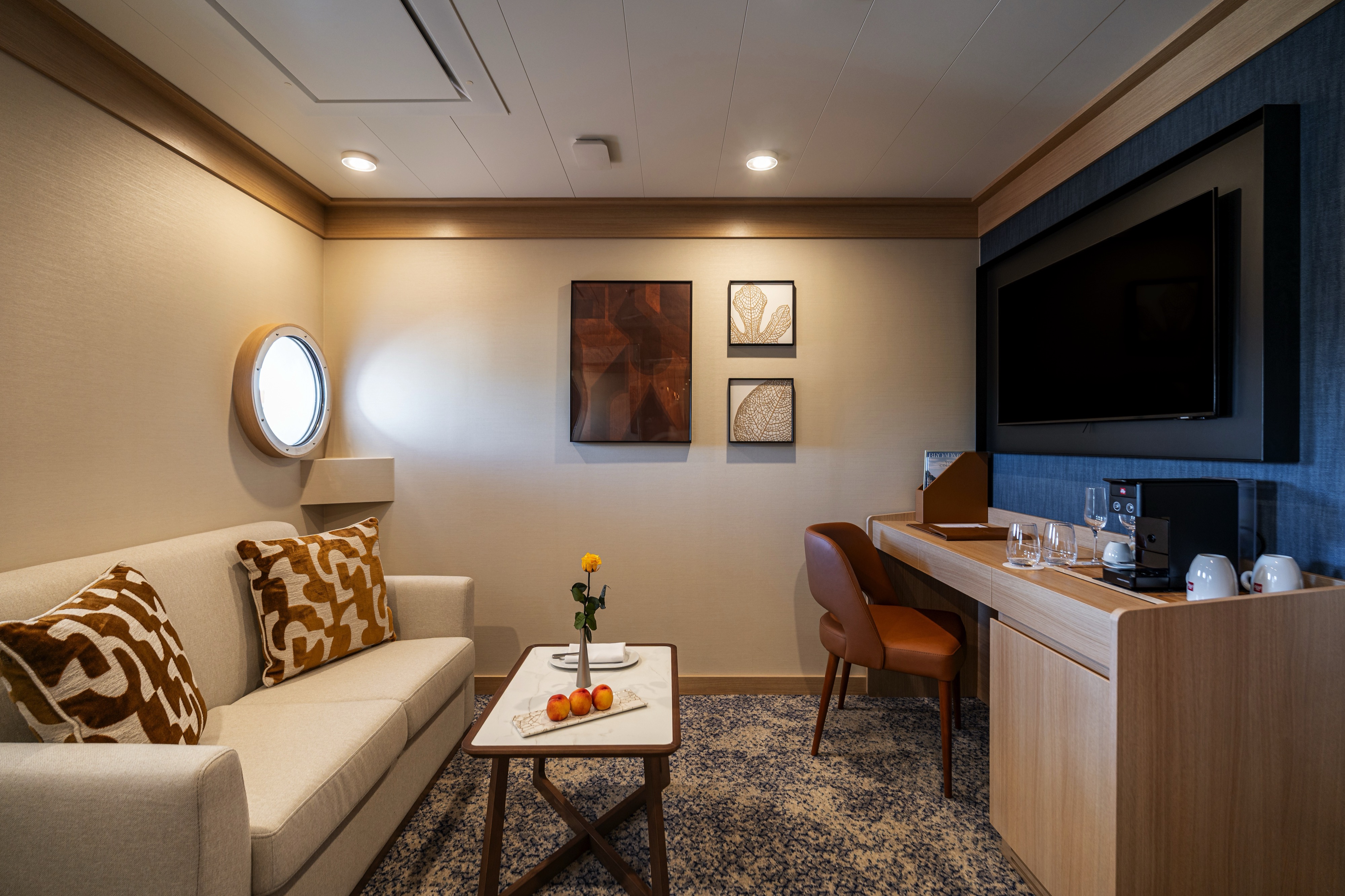
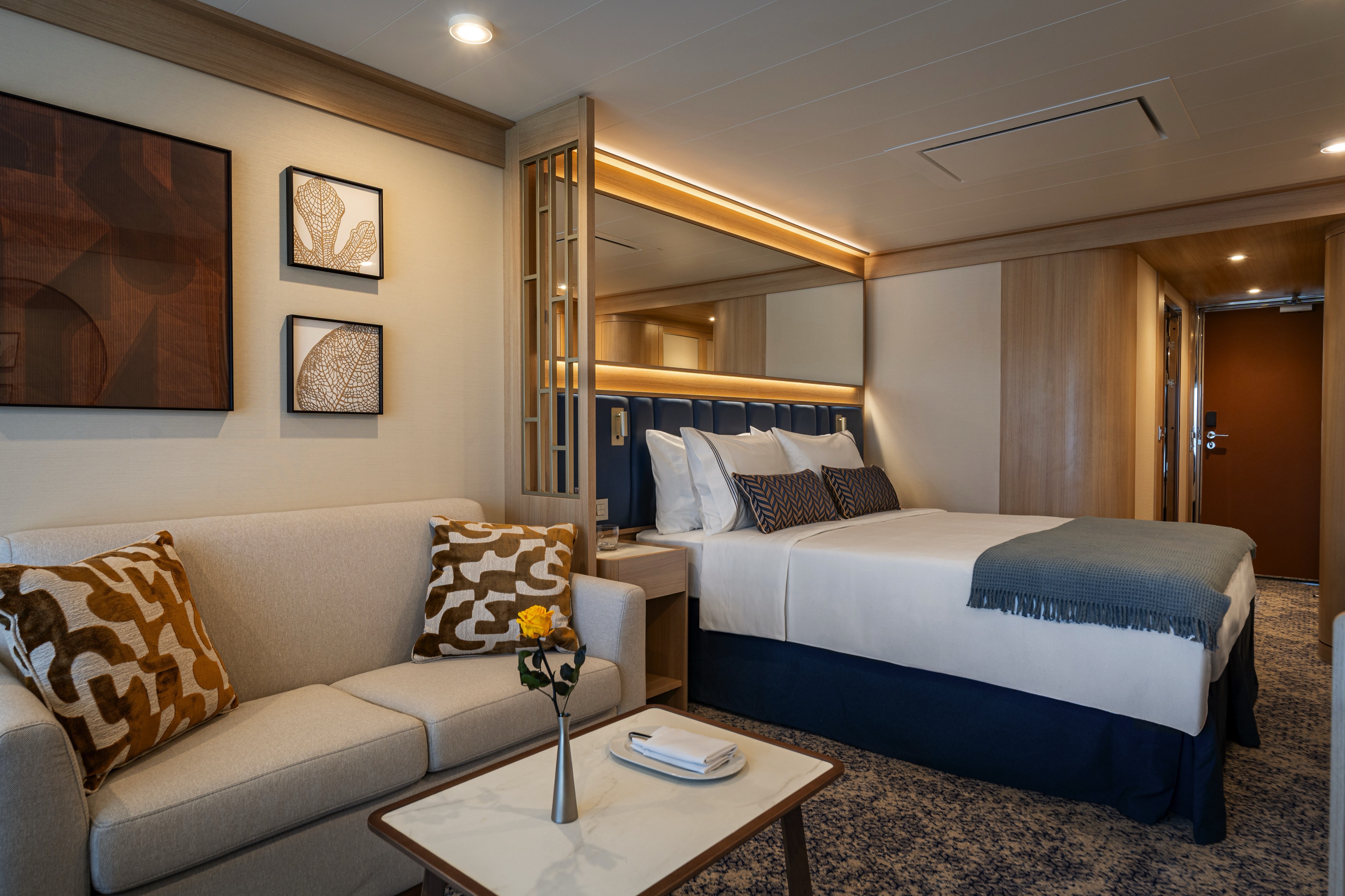
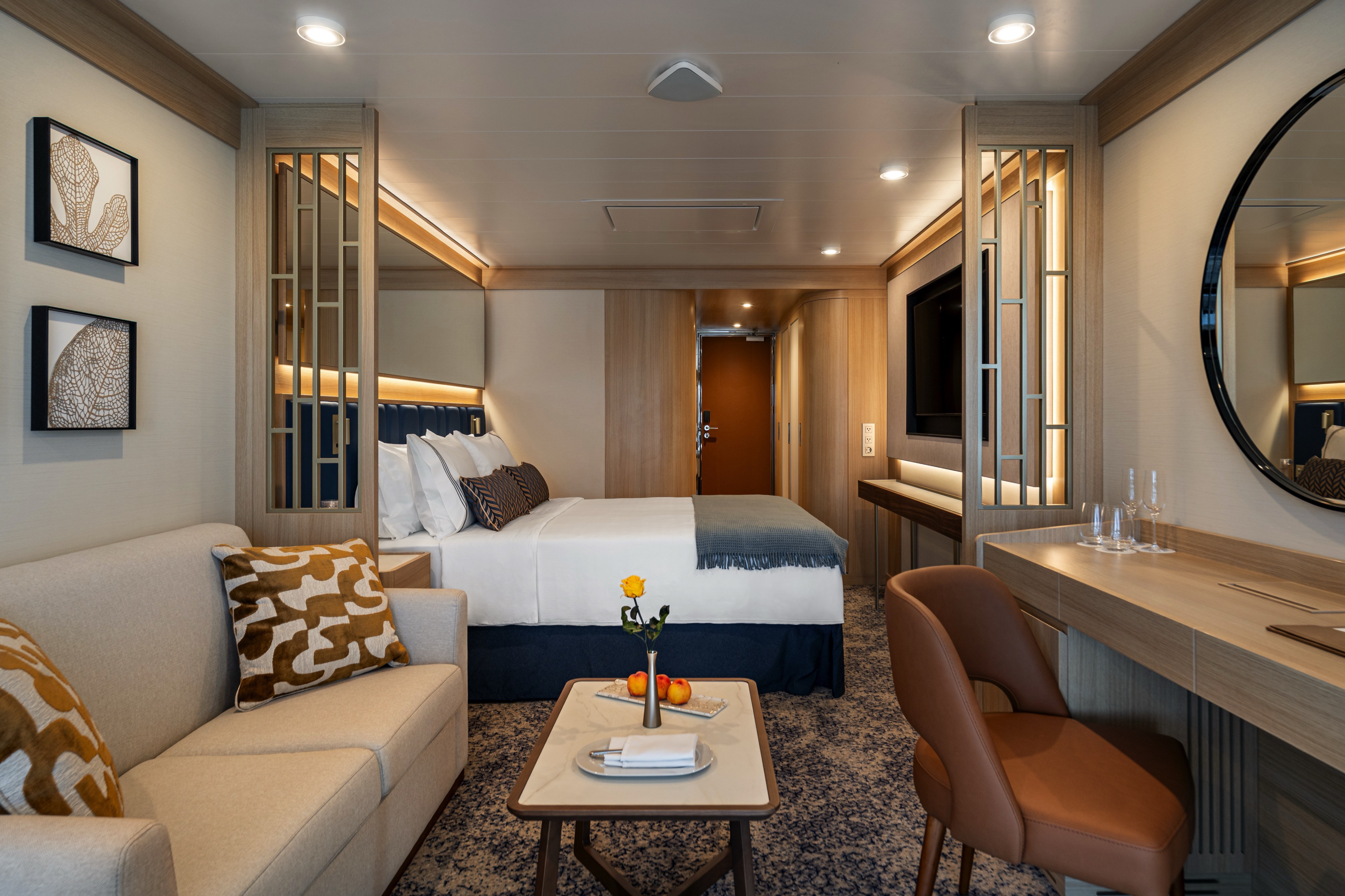
DECK | CABIN TYPE: Suite | 380 SQ FT
Step into a stylish and bright open living area with a spacious adjacent bedroom. This 380-square-foot suite welcomes you with spectacular views, courtesy of the sliding glass doors that lead out to your private balcony. The outdoor space adds another 110 square feet, enough to sit outside comfortably and enjoy the breeze. The bedroom features an inviting queen bed (convertible into two twin beds if desired) and its own sliding glass door with balcony access, while the bathroom includes a bathtub and walk-in mosaic glass shower with rain head and body jets.
Amenities: Star Suite
- Queen Size Bed with Luxurious Linens
- Buttery soft velour bathrobe and slippers
- Upgraded L'Occitane bath amenities
- Mini Bar offering and fridge
- In-room premium filtered water
- Large upgraded fruit plate
- Macarons & Berries upon arrival
- Daily Canapés service
- Chilled bottle of Champagne upon arrival
- Fresh flower arrangement
- Illy capsule espresso machine
- Magnifying mirror, hairdryer and umbrella
- TV with complimentary on-demand entertainment
- Safe
- 110/220-volt outlets
- Ultimate Internet Package (Complimentary)
- Preferred check-in
- Personalized wake-up call with beverage
- Binoculars
- Invitation to Captain or Senior officer table
- Preferred Specialty Restaurant dining
- Laundry Service (various packages available for purchase)
- 24 Hour In-Room dining (complimentary)
- Rainfall shower with integrated side jets
DECK | CABIN TYPE: Suite | 288 SQ FT
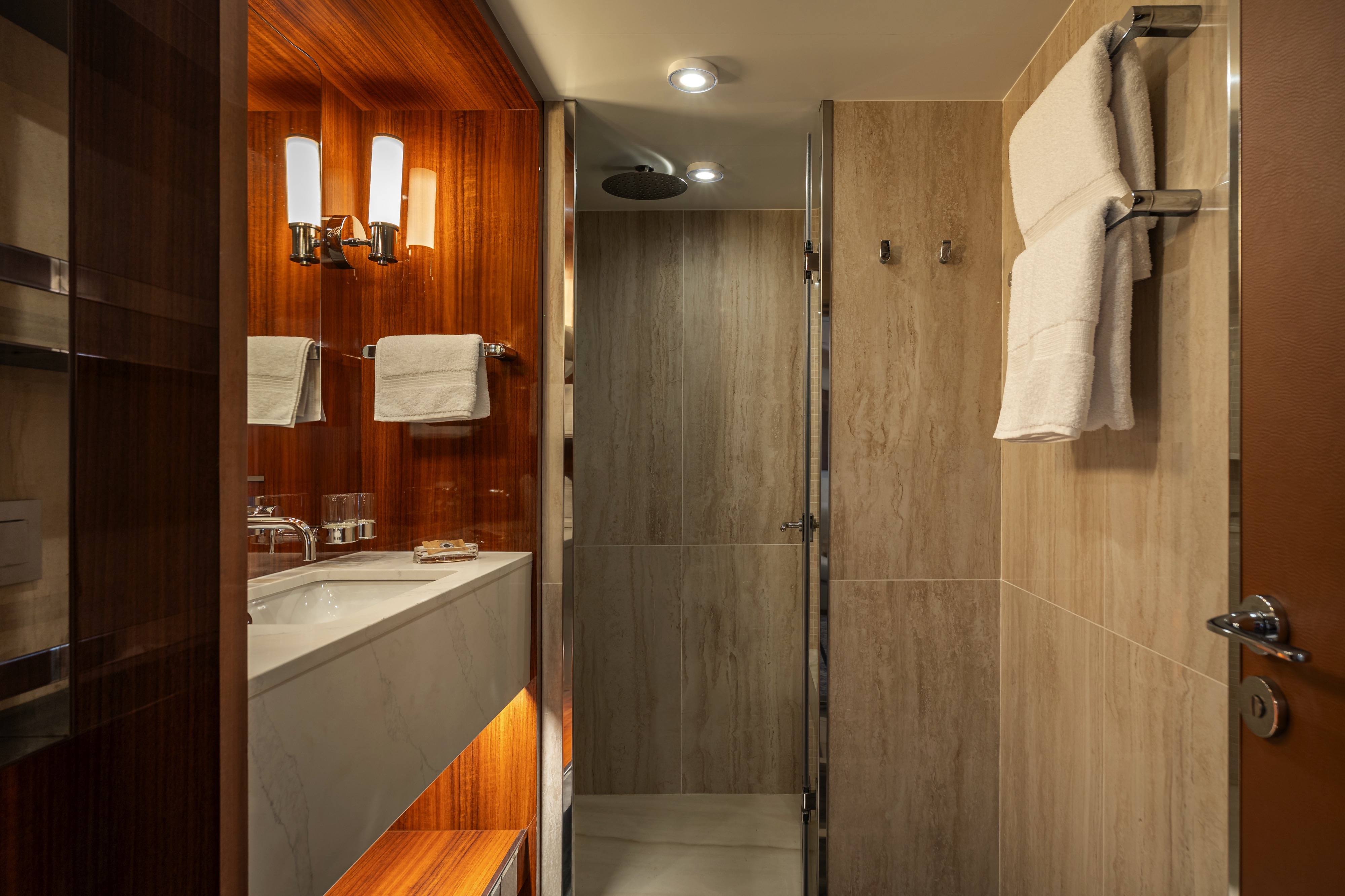
This 288-square-foot suite welcomes you with spectacular views, courtesy of the sliding glass doors that lead out to your private balcony. The outdoor space adds another 110 square feet, enough to sit outside comfortably and enjoy the breeze. The bedroom features an inviting queen bed and its own sliding glass door with balcony access, while the bathroom includes a luxurious walk-in mosaic glass shower with rain head and body jets.
Amenities: Deluxe Suite
- Queen Size Bed with Luxurious Linens
- Buttery soft velour bathrobe and slippers
- Upgraded L'Occitane bath amenities
- Mini Bar offering and fridge
- In-room premium filtered water
- Fresh Fruit Plate
- Chilled bottle of sparkling wine upon arrival
- Fresh flower arrangement
- Magnifying mirror, hairdryer and umbrella
- TV with complimentary on-demand entertainment
- Safe
- 110/220-volt outlets
- Ultimate Internet Package (Complimentary)
- Illy capsule espresso machine
- Preferred check-in
- Personalized wake-up call with beverage
- Binoculars
- Invitation to hosting table by Officer
- Laundry Service (various packages available for purchase)
- 24 Hour In-Room dining (complimentary)
- Rainfall shower with integrated side jets
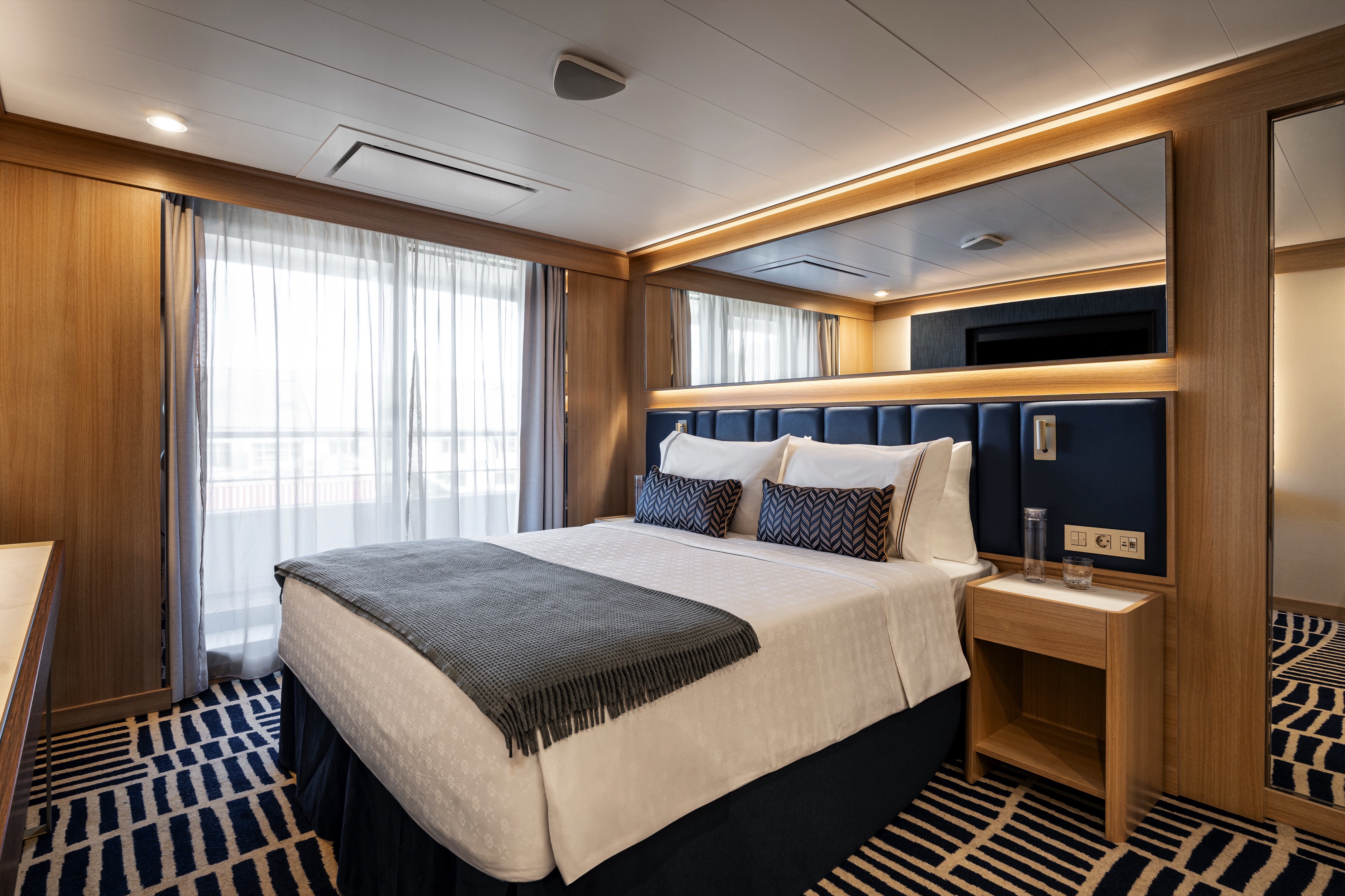
DECK | CABIN TYPE: Suite | 353 SQ FT
Step into a stylish and bright open living area with a spacious adjacent bedroom. This 353-square-foot suite welcomes you with spectacular views, courtesy of the sliding glass doors that lead out to your private balcony. The outdoor space adds another 110 square feet, enough to sit outside comfortably and enjoy the breeze. The bedroom features an inviting queen bed that can be converted into two twins if desired, while the bathroom includes a luxurious walk-in mosaic glass shower with rain head and body jets.
Amenities: Classic Suite
- Queen Size Bed with Luxurious Linens
- Buttery soft velour bathrobe and slippers
- Upgraded L'Occitane bath amenities
- Mini Bar offering and fridge
- In-room premium filtered water
- Large upgraded fruit plate
- Macarons & Berries upon arrival
- Daily Canapés service
- Chilled bottle of Champagne upon arrival
- Fresh flower arrangement
- Illy capsule espresso machine
- Magnifying mirror, hairdryer and umbrella
- TV with complimentary on-demand entertainment
- Safe
- 110/220-volt outlets
- Ultimate Internet Package (Complimentary)
- Preferred check-in
- Personalized wake-up call with beverage
- Binoculars
- Invitation to Captain or Senior officer table
- Preferred Specialty Restaurant dining
- Laundry Service (various packages available for purchase)
- 24 Hour In-Room dining (complimentary)
- Rainfall shower with integrated side jets
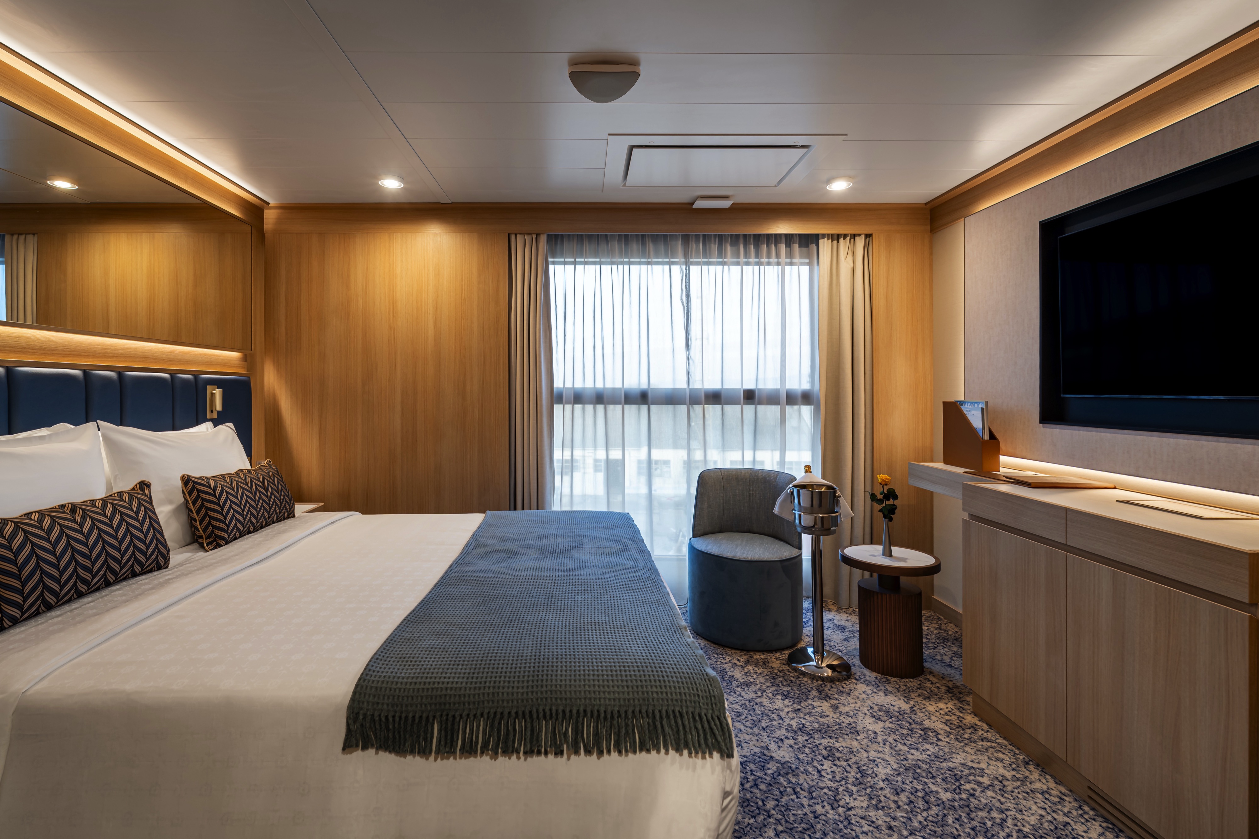
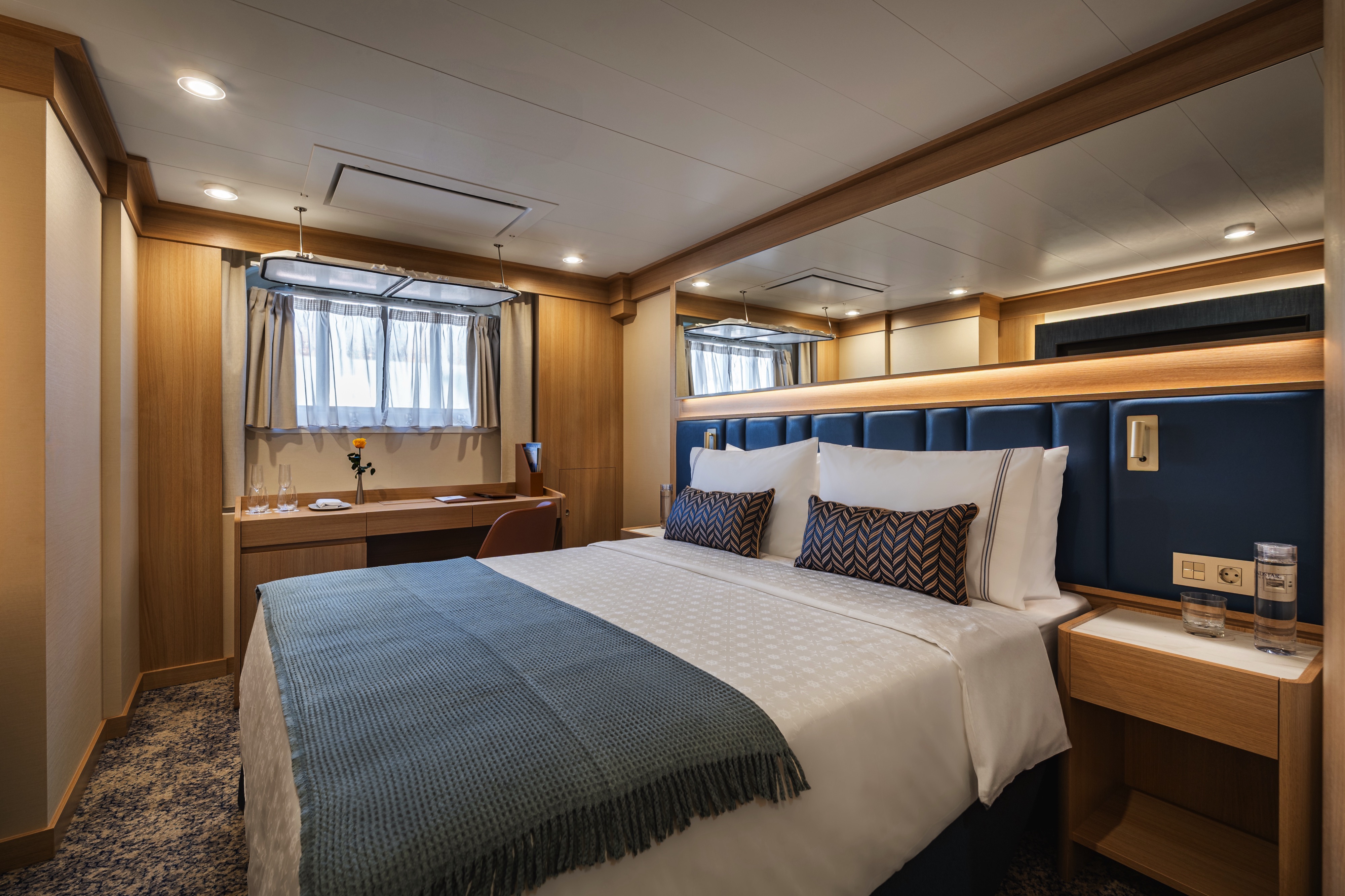
DECK 7 | CABIN TYPE: SUITE | 268 SQ FT
Located on deck 7, this 268-square-foot suite welcomes you with stylish comfort and stunning ocean views. Relax on your queen bed (convertible into two twin beds if desired) or lounge in the nearby living area. The outdoor space adds another 55 square feet, enough to sit outside comfortably and enjoy the breeze. In the bathroom, you’ll find a luxurious walk-in mosaic glass shower with rain head and body jets.
Amenities: Vista Veranda Suite
- Queen Size Bed with Luxurious Linens
- Waffle Weave Robe and Slippers
- L'Occitane bath amenities
- Mini Bar offering and fridge
- In-room premium filtered water
- Fresh Fruit Plate
- Magnifying mirror, hairdryer and umbrella
- TV with complimentary on-demand entertainment
- Safe
- Wi-Fi (internet packages available for purchase)
- 110/220-volt outlets
- Laundry Service (various packages available for purchase)
- 24 Hour In-Room dining (complimentary)
- Rainfall shower with integrated side jets
DECK 6 | CABIN TYPE: Suite | 246 SQ FT
Located on deck 6, this 246-square-foot suite welcomes you with stylish comfort and stunning ocean views. Featuring an inviting queen bed (convertible into two twin beds if desired) and a pull-out sofa in the living area, the suite allows for triple occupancy. The outdoor space adds another 55 square feet, enough to sit outside comfortably and enjoy the breeze. In the bathroom, you’ll find a luxurious walk-in mosaic glass shower with rain head and body jets.
Amenities: Triple Premier Veranda Suite
- Queen Size Bed with Luxurious Linens
- Waffle Weave Robe and Slippers
- L'Occitane bath amenities
- Mini Bar offering and fridge
- In-room premium filtered water
- Fresh Fruit Plate
- Magnifying mirror, hairdryer and umbrella
- TV with complimentary on-demand entertainment
- Safe
- Wi-Fi (internet packages available for purchase)
- 110/220-volt outlets
- Laundry Service (various packages available for purchase)
- 24 Hour In-Room dining (complimentary)
- Rainfall shower with integrated side jets
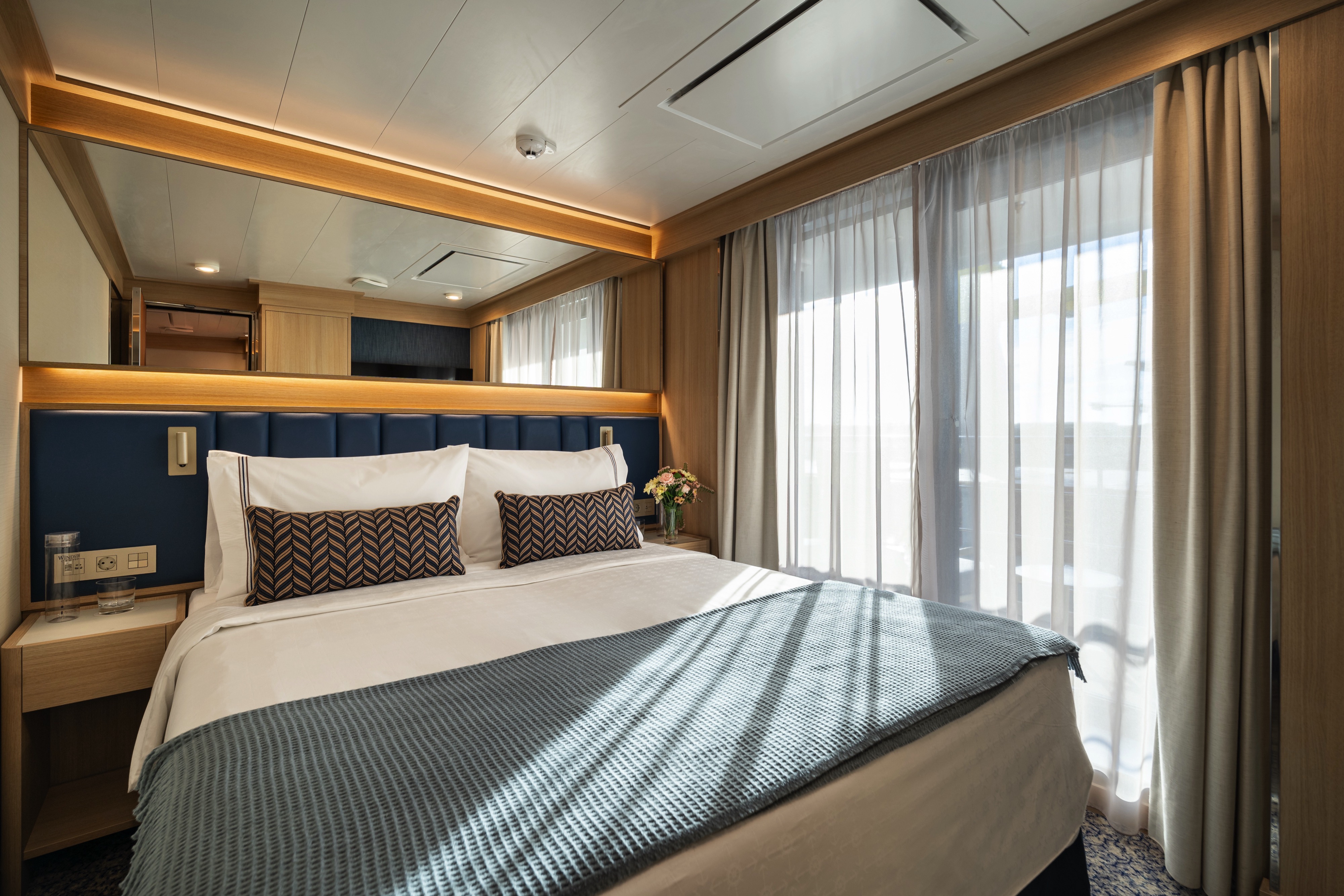
DECK | CABIN TYPE: Suite | 225 SQ FT
Stylish comfort and ocean views welcome you to this 225-square-foot suite. Relax on your queen bed (convertible into two twin beds if desired) or lounge in the nearby living area. The outdoor space adds another 55 square feet, enough to sit outside comfortably and enjoy the breeze. In the bathroom, you’ll find a luxurious walk-in mosaic glass shower with rain head and body jets.
Amenities: Veranda Suite
- Queen Size Bed with Luxurious Linens
- Waffle Weave Robe and Slippers
- L'Occitane bath amenities
- Mini Bar offering and fridge
- In-room premium filtered water
- Fresh Fruit Plate
- Magnifying mirror, hairdryer and umbrella
- TV with complimentary on-demand entertainment
- Safe
- Wi-Fi (internet packages available for purchase)
- 110/220-volt outlets
- Laundry Service (various packages available for purchase)
- 24 Hour In-Room dining (complimentary)
- Rainfall shower with integrated side jets

Located at the middle of the ship, these 225-square-foot suites welcome you with stylish comfort and beautiful ocean views. Relax on your queen bed (convertible into two twin beds if desired) or lounge in the nearby living area. The outdoor space adds another 55 square feet, enough to sit outside comfortably and enjoy the breeze. In the bathroom, you’ll find a luxurious walk-in mosaic glass shower with rain head and body jets.
Amenities: Premier Veranda Suite
- Queen Size Bed with Luxurious Linens
- Waffle Weave Robe and Slippers
- L'Occitane bath amenities
- Mini Bar offering and fridge
- In-room premium filtered water
- Fresh Fruit Plate
- Magnifying mirror, hairdryer and umbrella
- TV with complimentary on-demand entertainment
- Safe
- Wi-Fi (internet packages available for purchase)
- 110/220-volt outlets
- Laundry Service (various packages available for purchase)
- 24 Hour In-Room dining (complimentary)
- Rainfall shower with integrated side jets
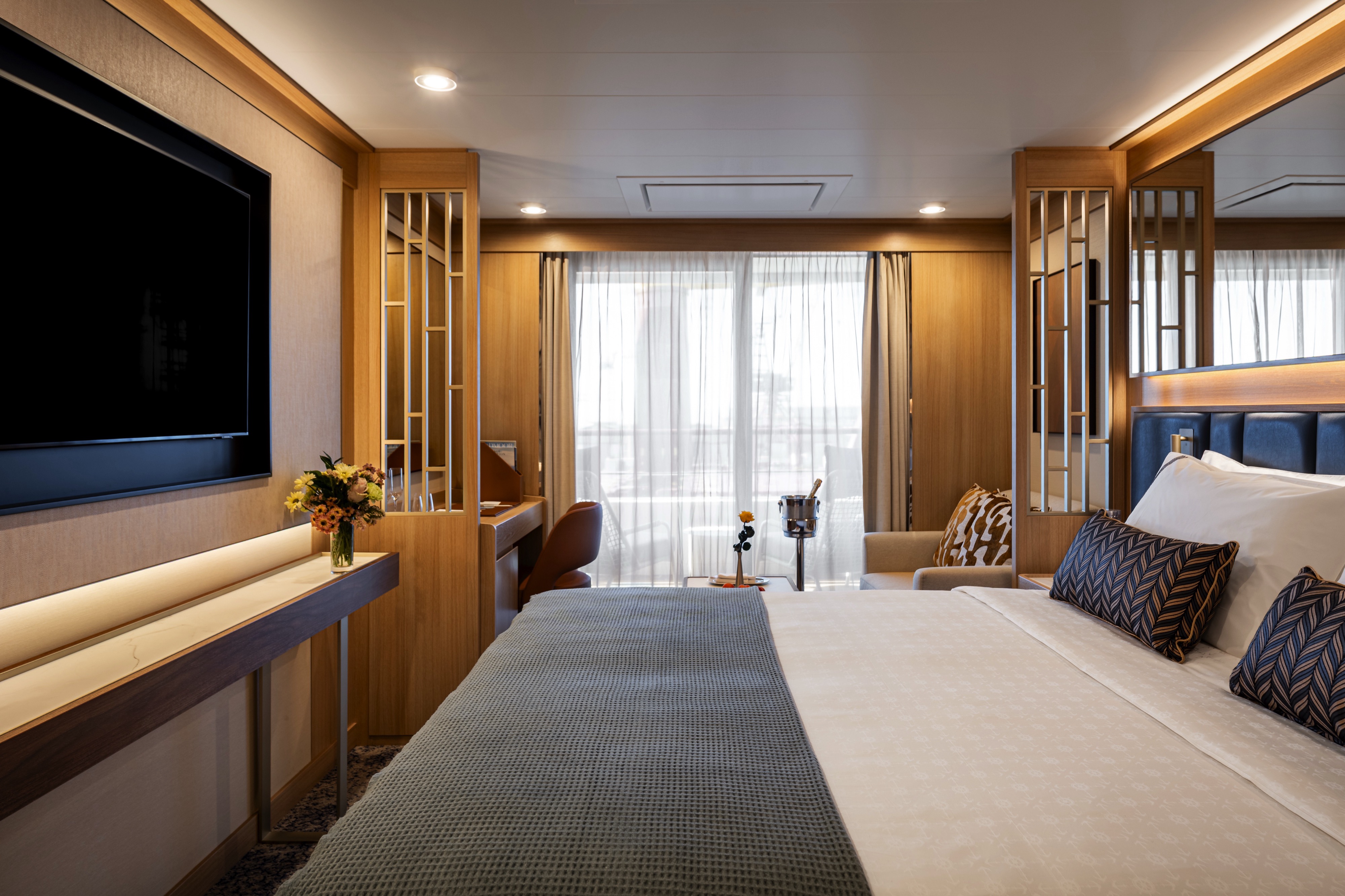
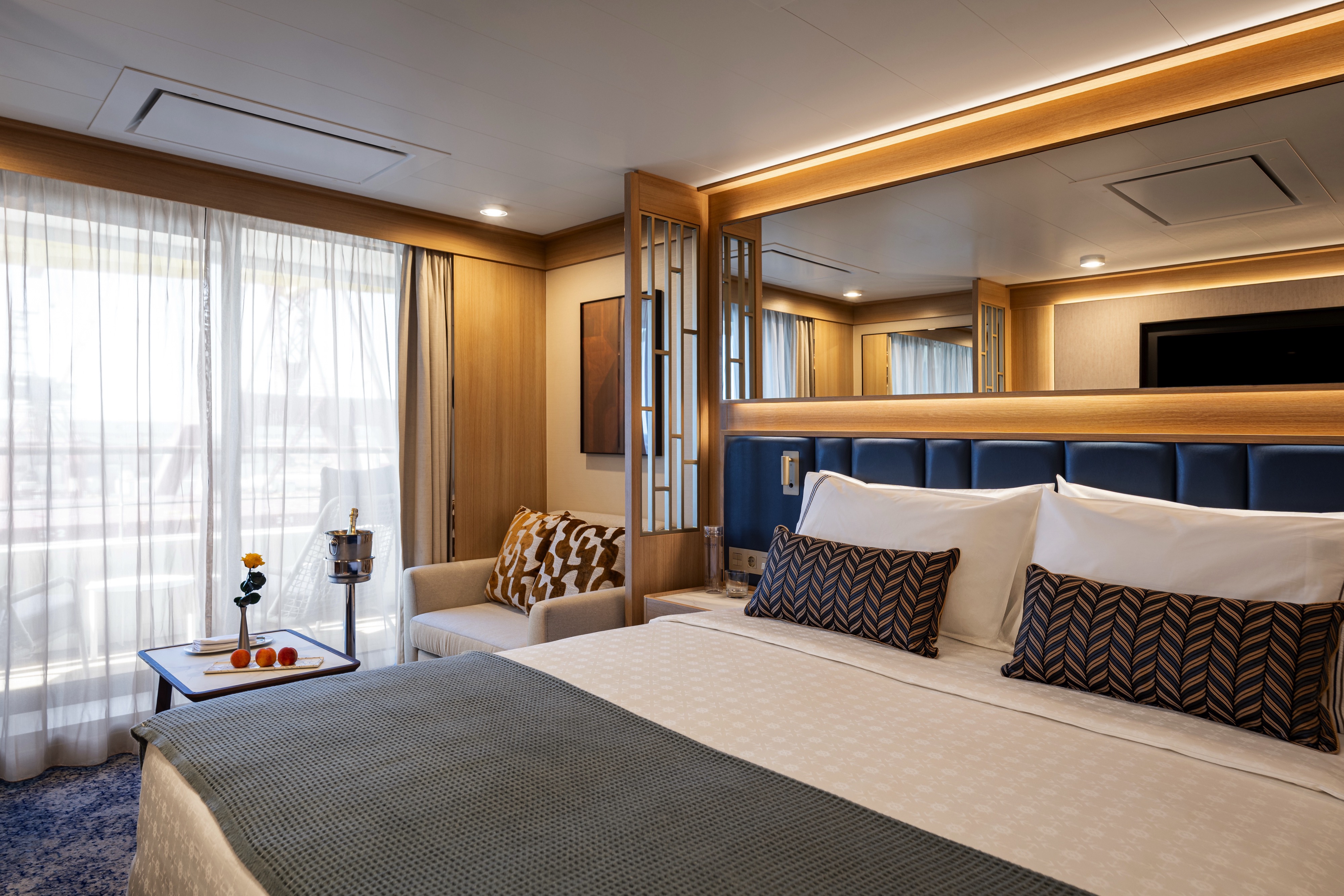
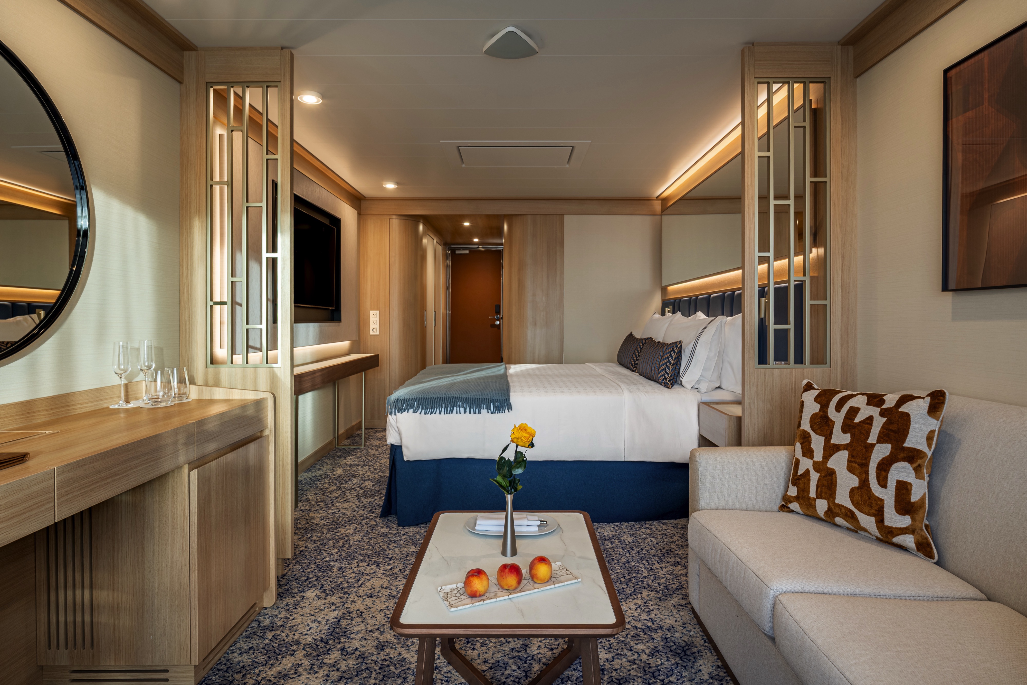
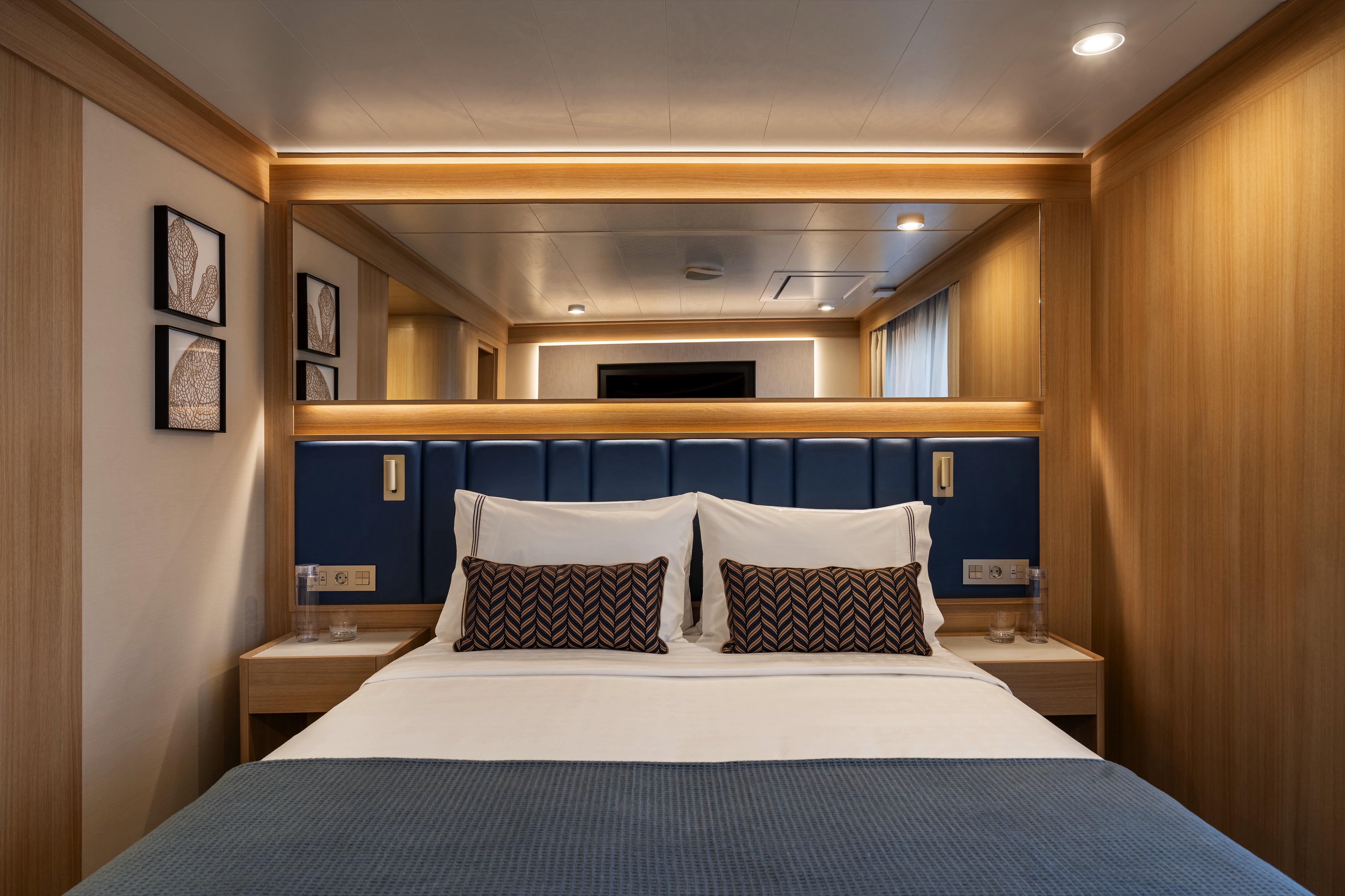
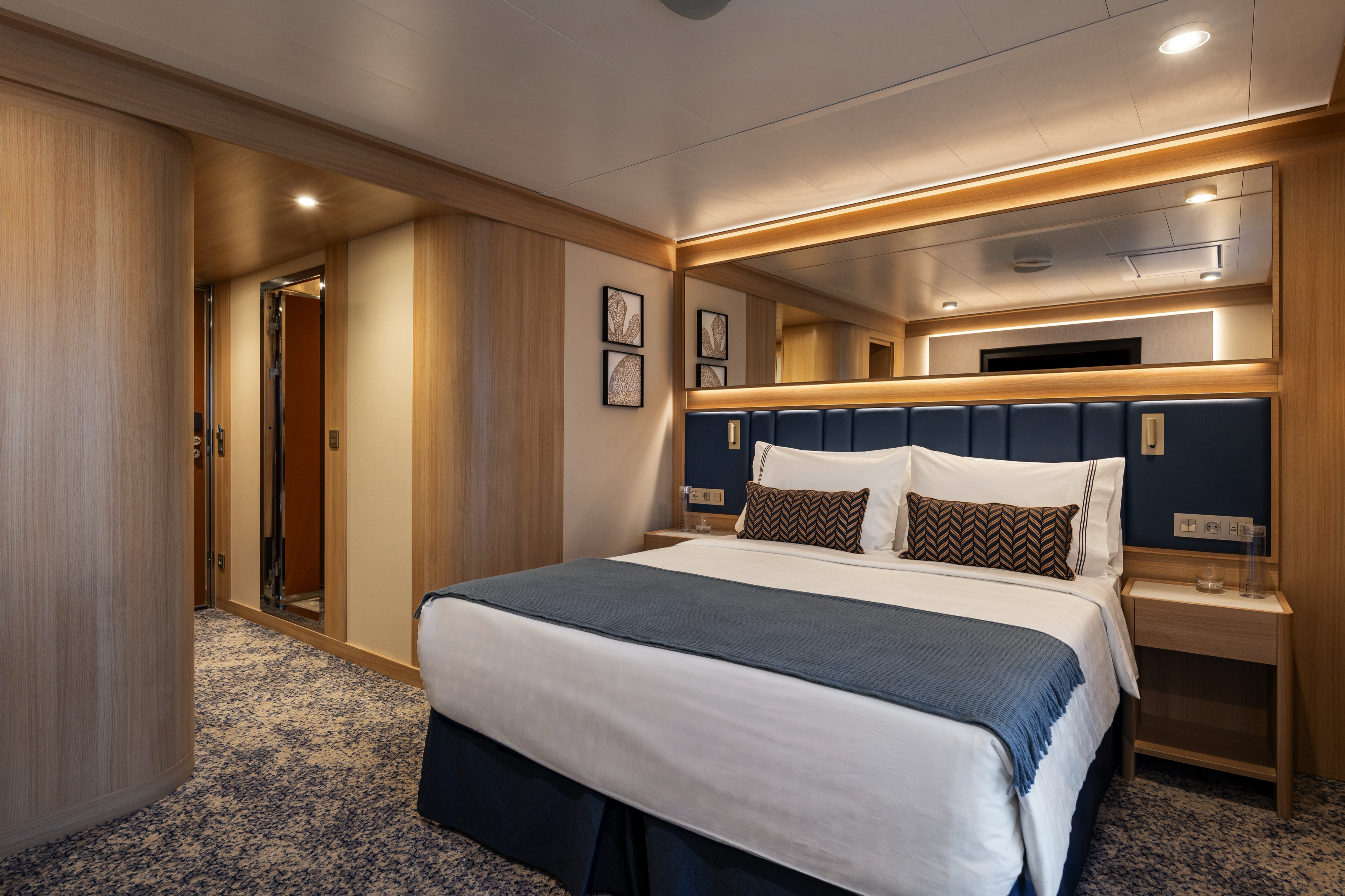
DECK | CABIN TYPE: Suite | 301 SQ FT
This roomy 301-square-foot suite features a wide floor-to-ceiling infinity window in the bedroom, allowing for stunning ocean views. You can even open the top half to enjoy the cool ocean breeze. This suite also features an inviting queen bed (convertible into two twin beds if desired) and a pull-out sofa in the separate living area, allowing for triple occupancy. In the bathroom, you’ll find a luxurious walk-in mosaic glass shower with rain head and body jets.
Amenities: Triple Infinity Suite
- Queen Size Bed with Luxurious Linens
- Waffle-Weave Robe and Slippers
- L'Occitane bath amenities
- Mini Bar offering and fridge
- In-room premium filtered water
- Fresh Fruit Plate
- Magnifying mirror, hairdryer and umbrella
- TV with complimentary on-demand entertainment
- Safe
- Wi-Fi (internet packages available for purchase)
- 110/220-volt outlets
- Laundry Service (various packages available for purchase)
- 24 Hour In-Room dining (complimentary)
- Rainfall shower with integrated side jets

DECK 7 | CABIN TYPE: Suite | 280 SQ FT
Located on deck 7, this 280-square-foot suite features a wide floor-to-ceiling infinity window that allows for stunning ocean views. You can even open the top half to enjoy the cool ocean breeze. Your suite features an inviting queen bed (convertible into two twin beds if desired), a walk-in mosaic glass shower and a comfortable living area where you can lounge and enjoy the view.
Amenities: Vista Infinity Suite
- Queen Size Bed with Luxurious Linens
- Waffle-Weave Robe and Slippers
- L'Occitane bath amenities
- Mini Bar offering and fridge
- In-room premium filtered water
- Fresh Fruit Plate
- Magnifying mirror, hairdryer and umbrella
- TV with complimentary on-demand entertainment
- Safe
- Wi-Fi (internet packages available for purchase)
- 110/220-volt outlets
- Laundry Service (various packages available for purchase)
- 24 Hour In-Room dining (complimentary)
- Rainfall shower with integrated side jets
DECK 7 | CABIN TYPE: Suite | 280 SQ FT
This 280-square-foot suite features a wide floor-to-ceiling infinity window that allows for stunning ocean views. You can even open the top half to enjoy the cool ocean breeze. Your suite features an inviting queen bed (convertible into two twin beds if desired), a walk-in mosaic glass shower and a comfortable living area where you can lounge and enjoy the view.
Amenities: Infinity Suite
- Queen Size Bed with Luxurious Linens
- Waffle-weave robe and slippers
- L'Occitane bath amenities
- Mini Bar offering and fridge
- In-room premium filtered water
- Fresh Fruit Plate
- Magnifying mirror, hairdryer and umbrella
- TV with complimentary on-demand entertainment
- Safe
- Wi-Fi (internet packages available for purchase)
- 110/220-volt outlets
- Laundry Service (various packages available for purchase)
- 24 Hour In-Room dining (complimentary)
- Rainfall shower with integrated side jets
DECK | CABIN TYPE: Suite | 203 SQ FT
Experience the perfect blend of style and functionality in this thoughtfully designed 203-square-foot suite. The well-planned layout creates an ideal retreat with plenty of natural light, a view of the sea, a walk-in mosaic glass shower and an inviting queen bed (convertible into two twins if desired), perfect for unwinding after a day of fun and exploration.
Amenities: Oceanview Suite
- Queen Size Bed with Luxurious Linens
- Waffle Weave Robe and Slippers
- L'Occitane bath amenities
- Mini Bar offering and fridge
- In-room premium filtered water
- Fresh Fruit Plate
- Magnifying mirror, hairdryer and umbrella
- TV with complimentary on-demand entertainment
- Safe
- Wi-Fi (internet packages available for purchase)
- 110/220-volt outlets
- Laundry Service (various packages available for purchase)
- 24 Hour In-Room dining (complimentary)
- Rainfall shower with integrated side jets
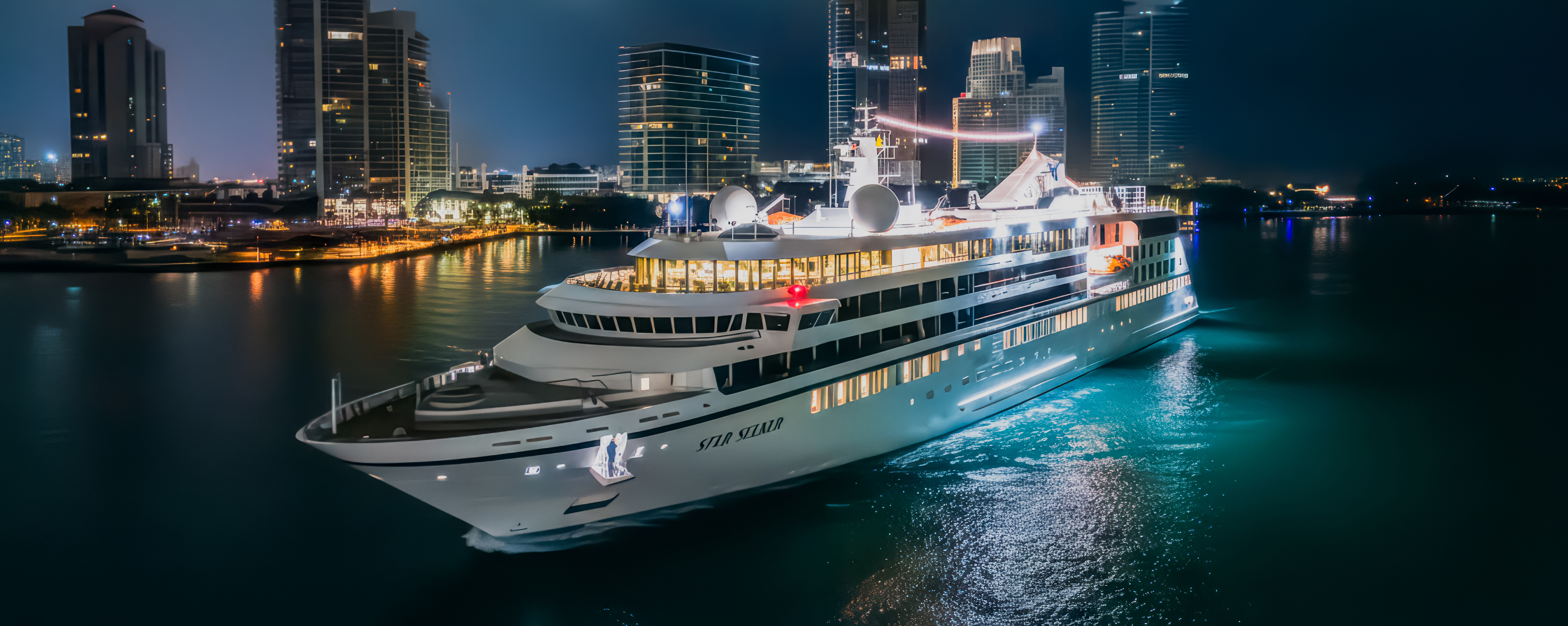
Star Seeker
Be one of the first to experience Star Seeker, Windstar’s newest yacht, during her first-ever sailing season beginning December 2025!
Featuring our new specialty restaurant Basil + Bamboo, upgraded amenities and 112 spacious suites — nearly all with a full private veranda or a floor-to-ceiling infinity window — Star Seeker is a fresh take on our Star Class that remains unmistakably Windstar.Featuring our new specialty restaurant Basil + Bamboo, upgraded amenities and 112 spacious suites — nearly all with a full private veranda or a floor-to-ceiling infinity window — Star Seeker is a fresh take on our Star Class that remains unmistakably Windstar.
Ship Facts
| Launch Year | 2025 | ||||||||||
| Refit Year | |||||||||||
| Language | en | ||||||||||
| Gross Tonnage | 9923 | ||||||||||
| Length | 132 | ||||||||||
| Width | 19 | ||||||||||
| Currency | USD | ||||||||||
| Speed | 16 | ||||||||||
| Capacity | 224 | ||||||||||
| Crew Count | 135 | ||||||||||
| Deck Count | 6 | ||||||||||
| Cabin Count | 112 | ||||||||||
| Large Cabin Count | N/A | ||||||||||
| Wheelchair Cabin Count | N/A | ||||||||||
| Electrical Plugs |
|
Deck 8
- Elevator
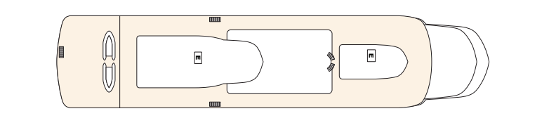
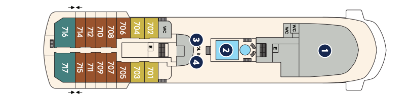
Deck 7
- Elevator
- Yacht Club (1)
- Pool and Whirlpool (2)
- Star Grill (3)
- Star Bar (4)
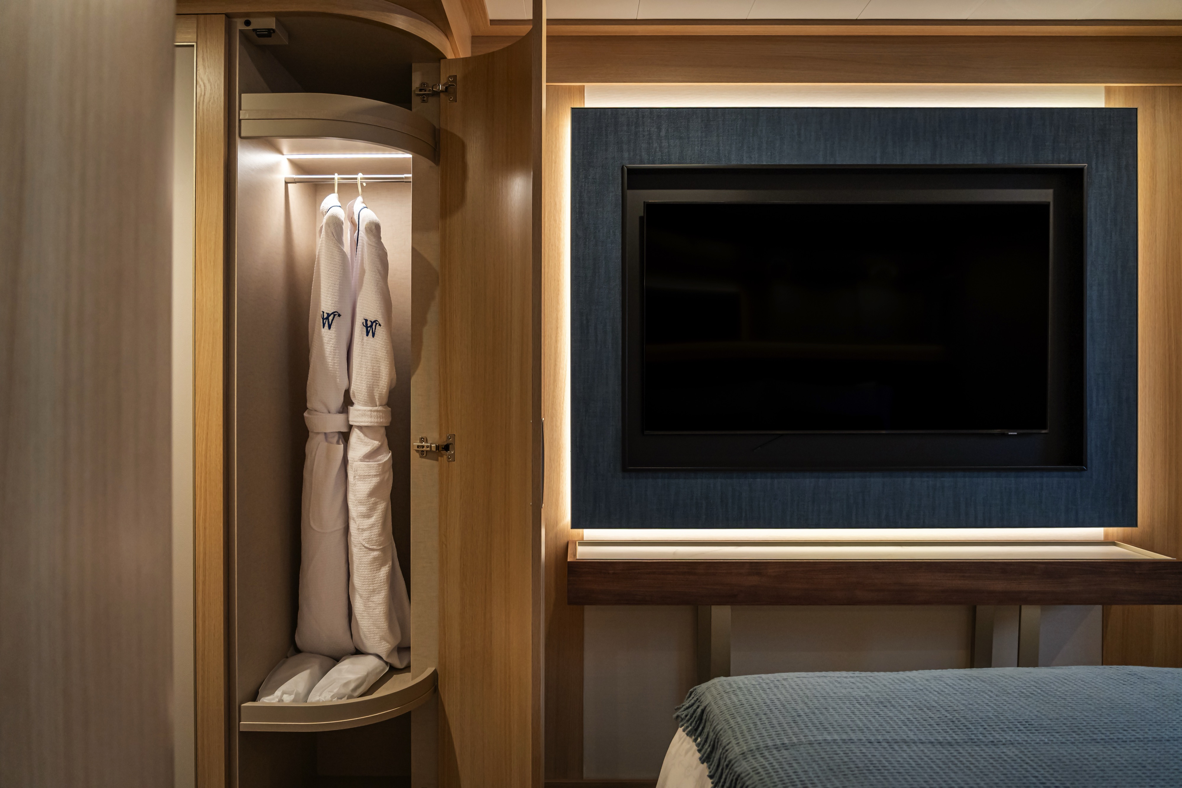
- Horizon Owner's Suite
- Vista Veranda Suite
- Vista Infinity Suite
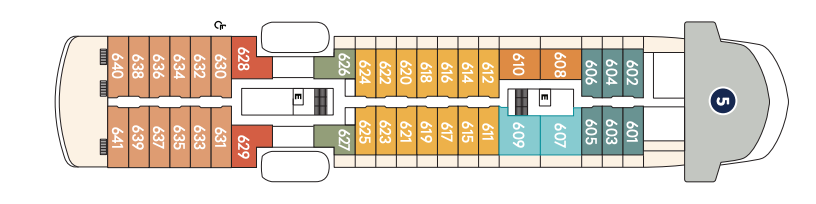
Deck 6
- Elevator
- Bridge (5)
- Premium Veranda Suite
- Deluxe Suite
- Star Suite
- Triple Premier Veranda Suite
- Triple Infinity Suite
- Infinity Suite (x1 Accessible Suite)
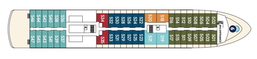
Deck 5
- Spa Entrance
- Elevator
- Whirlpool (6)
- Infinity Suite
- Classic Suite
- Premier Veranda Suite
- Star Suite
- Deluxe Suite
- Veranda Suite
Deck 4
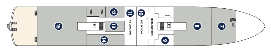
- Embarkation
- Elevator
- World Spa by Windstar (7)
- Lounge (8)
- Medical Facility (9)
- Reception (10)
- Destination Desk (11)
- Fitness Center and Motion Studio (12)
- Star Boutique (13)
- Basil & Bamboo Restaurant (14)
- Amphora Restaurant (15)
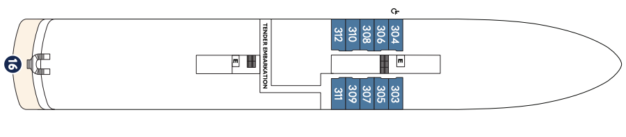
Deck 3
- Tender Embarkation
- Elevator
- Watersports Platform (16)
- Oceanview Suite
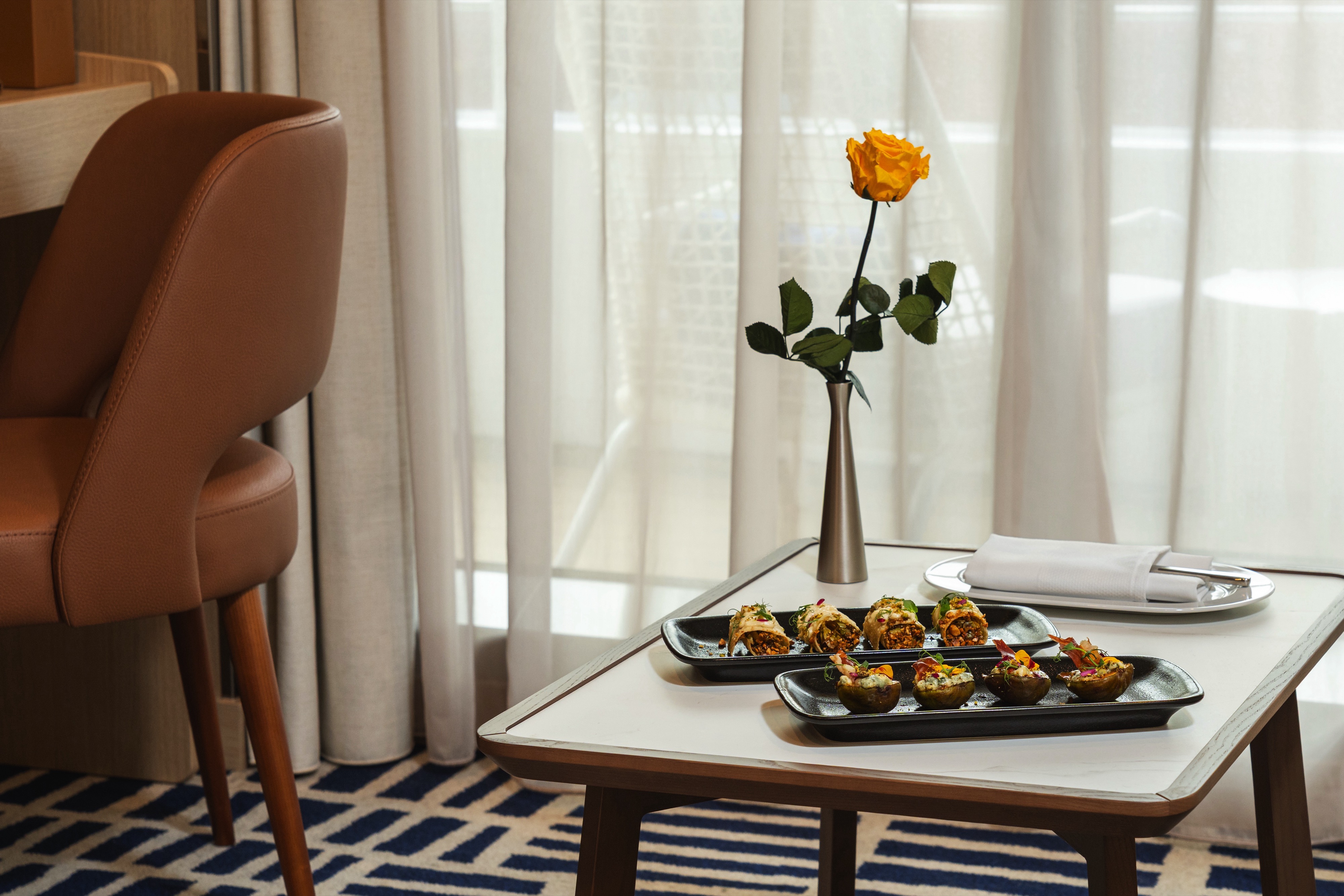
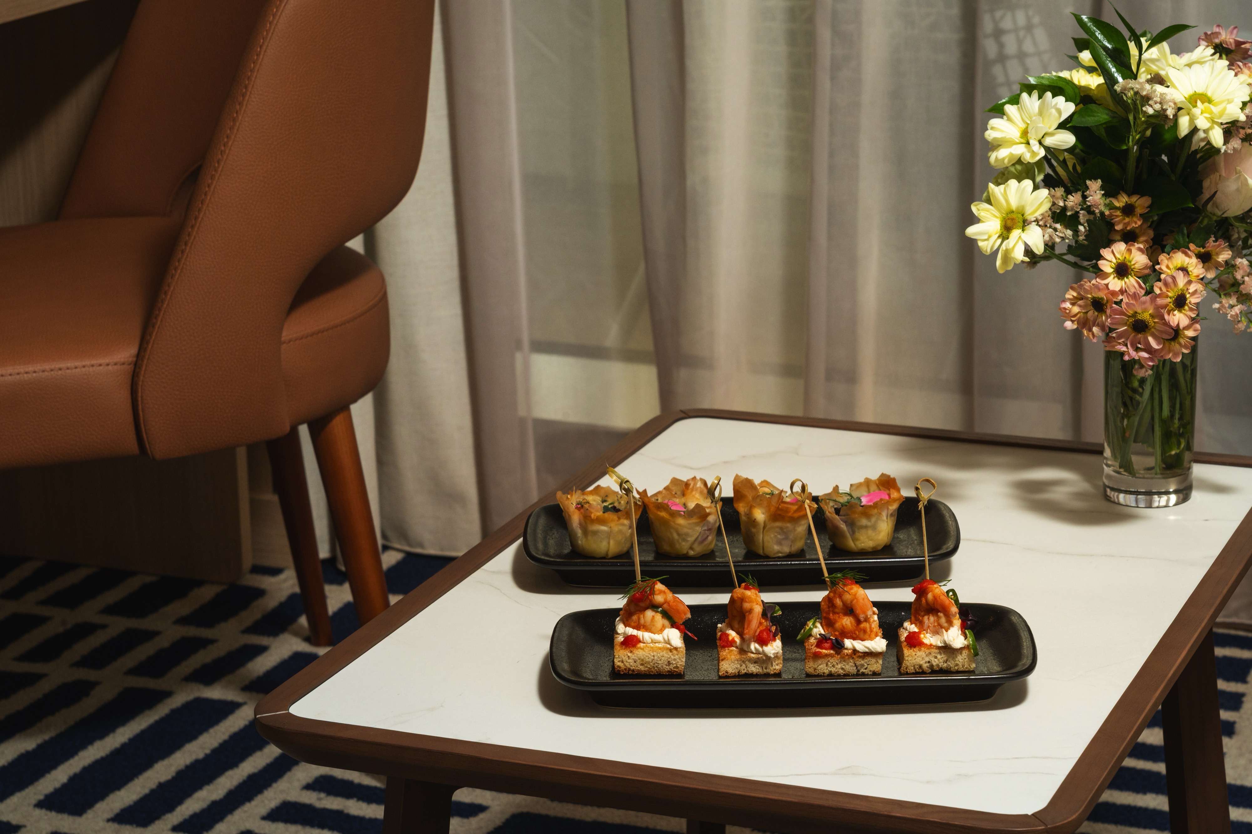
World Class Dining Experience
We’ve upped the on board dining game with our culinary program, featuring an array of fresh, seasonal ingredients sourced from each ports along the journey. The menu is crafted to highlight the spectacular flavors of the regional cuisine.
Basil + Bamboo
Step into Basil + Bamboo, where clean lines and warm accents set the stage for a relaxed, refined experience. Savor dishes that fuse Asian influences with a Mediterranean twist — an inventive culinary adventure designed to delight your palate and create moments of shared discovery.
Amphora
Here, the dining room manager seats you, but where is your decision. There are no pre-assigned tables or first or second seatings. When you dine and with whom are entirely up to you. Seating usually begins at 6:30 p.m. and will be printed in the ship's daily program. Each delightful dish is prepared exactly to your liking – an exquisite dinner served course-by-course with a fine selection of vintage wines.
Star Grill
You'll find all your traditional grilled and barbecued favorites (and discover new dishes from around the world) in our new casual outdoor restaurant.
Complimentary Room Service
24-hour room service menu for in-room dining features coursed menu from the main Amphora dining room during dining hours.
A day on board your Windstar ship is a day of choices, all of them good. Perhaps you’ll begin with a relaxing massage in World Spa by Windstar. Or maybe an invigorating workout in the Fitness Center. Even better, why not both? After a sumptuous lunch in Veranda, make a splash from the Marina off the ship’s stern. Everything you can think of for fun in the water is there — swimming, kayaking, and stand-up paddleboarding. And it’s all complimentary, of course. Sun yourself on deck, take a dip in the whirlpool, then catch up on email or order a cheese plate for your stateroom or suite. After dinner, dance to live music in the Lounge. This is your yacht, so of course you’re welcome on the Bridge, where the Captain and officers are delighted to share charts, routes, and vistas with you.
As you prepare for another amazing Windstar day, enjoy a nightcap anywhere you like — on deck, in the Lounge, or why not let us bring it to your suite or stateroom? Your day ends just as it began, blissfully.
Open Bridge
We’re the only cruise line welcoming guests on to an Open Bridge, where they can pop in to watch the Captain and crew at work, and learn about chart navigation.
The Yacht Club
Stop by the Yacht Club Café for a bite or coffee crafted by our barista.
Lounge
The Lounge can be found on Deck 8
Star Boutique
Visit our newly transformed specialty shopping boutique, Star Boutique, rolling out fleet-wide through early 2022. The new shop features quality brand-name and exclusive Star Collection merchandise, from clothing and fragrances to jewellery and accessories, all at duty free or special pricing.
Star Bar
The Star Bar is Located on Deck 7
Live Entertainment
After a long day at port or sea, relax in the lounge and enjoy a drink while being entertained by our onboard band, local performers or our talented crew members.
Each cruise, our crew demonstrates their hidden abilities, whether dancing, singing, magic or comedy. Our team will continue to delight you through the night during the crew talent show, and perhaps you'll find a hidden talent of your own.
Reception
The Reception can be located on Deck 4