Red Sea Revelries via the Suez Canal
Red Sea Revelries via the Suez Canal
Cruise overview
WHY BOOK WITH US?
- ✔ The Deluxe Cruises’ team has extensive experience in ultra-luxury cruising.
- ✔ Call now to speak to our helpful and experienced Cruise Concierge team.
- ✔ Enjoy our Unique Deluxe Cruises Bonus for substantial savings.
- ✔ Our team will tailor your holiday to your exacting requirements.
- ✔ As agents, we work under the protection of each cruise lines ABTA / ATOL licences
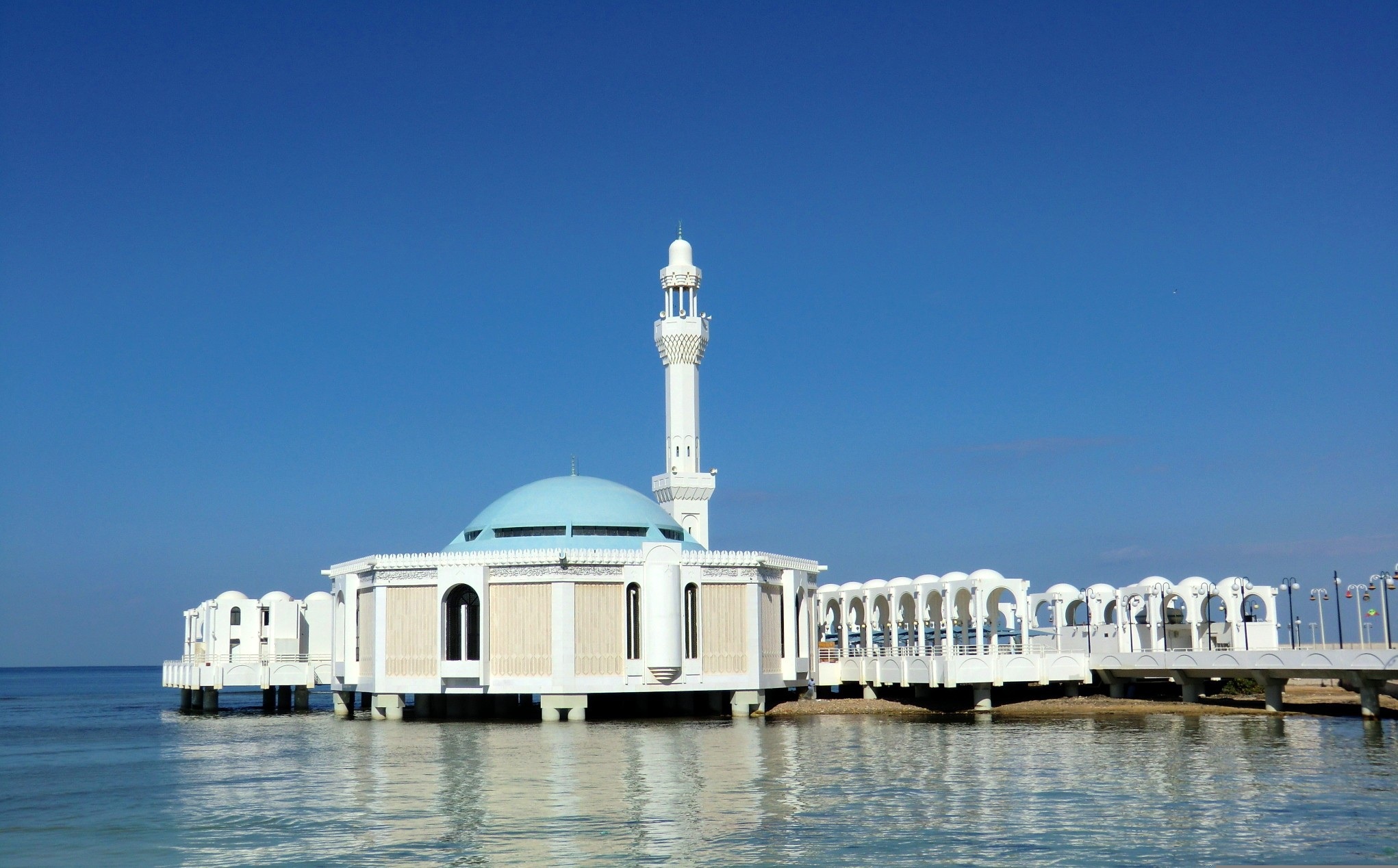
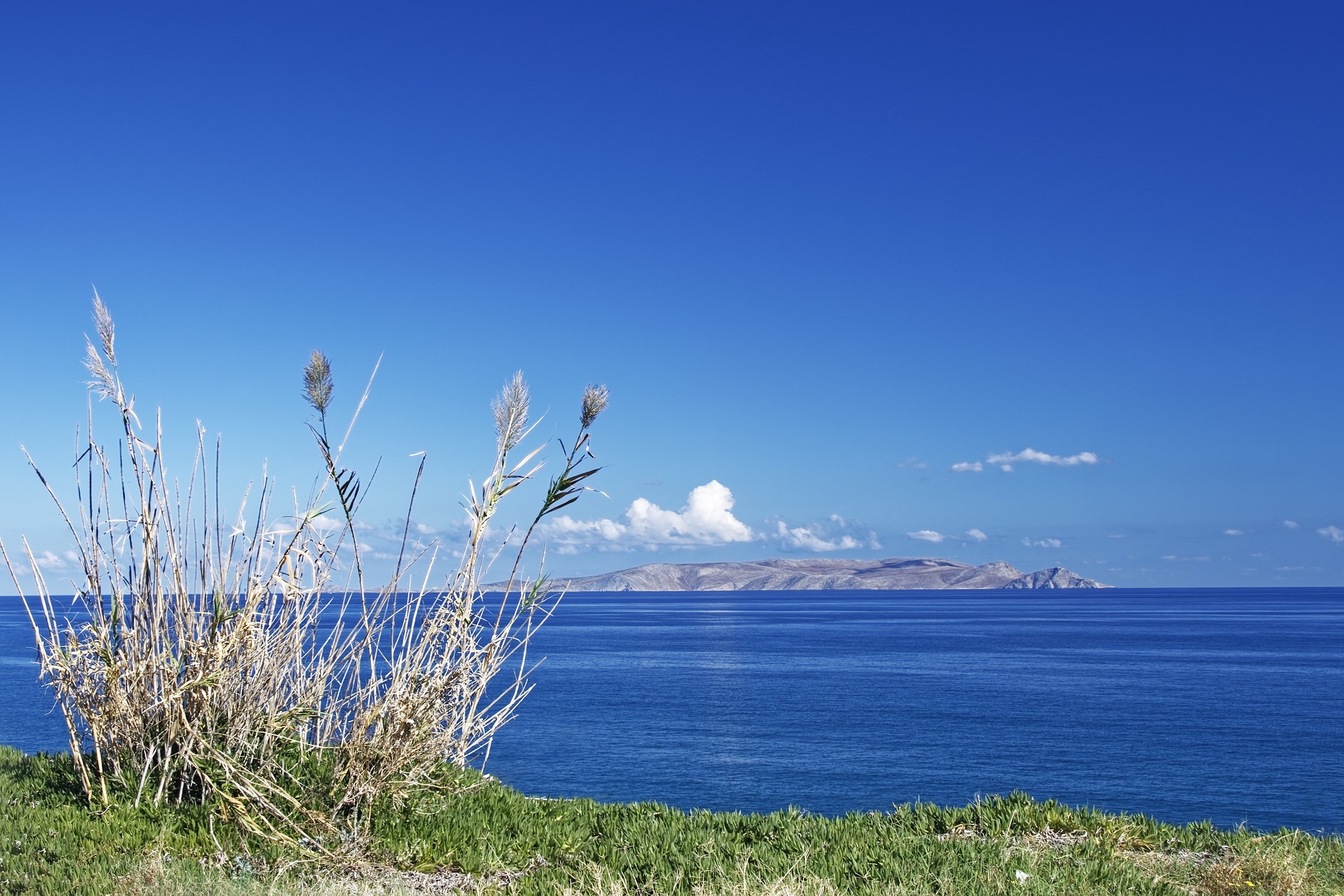
About Jeddah
About Yanbu al-Bahr
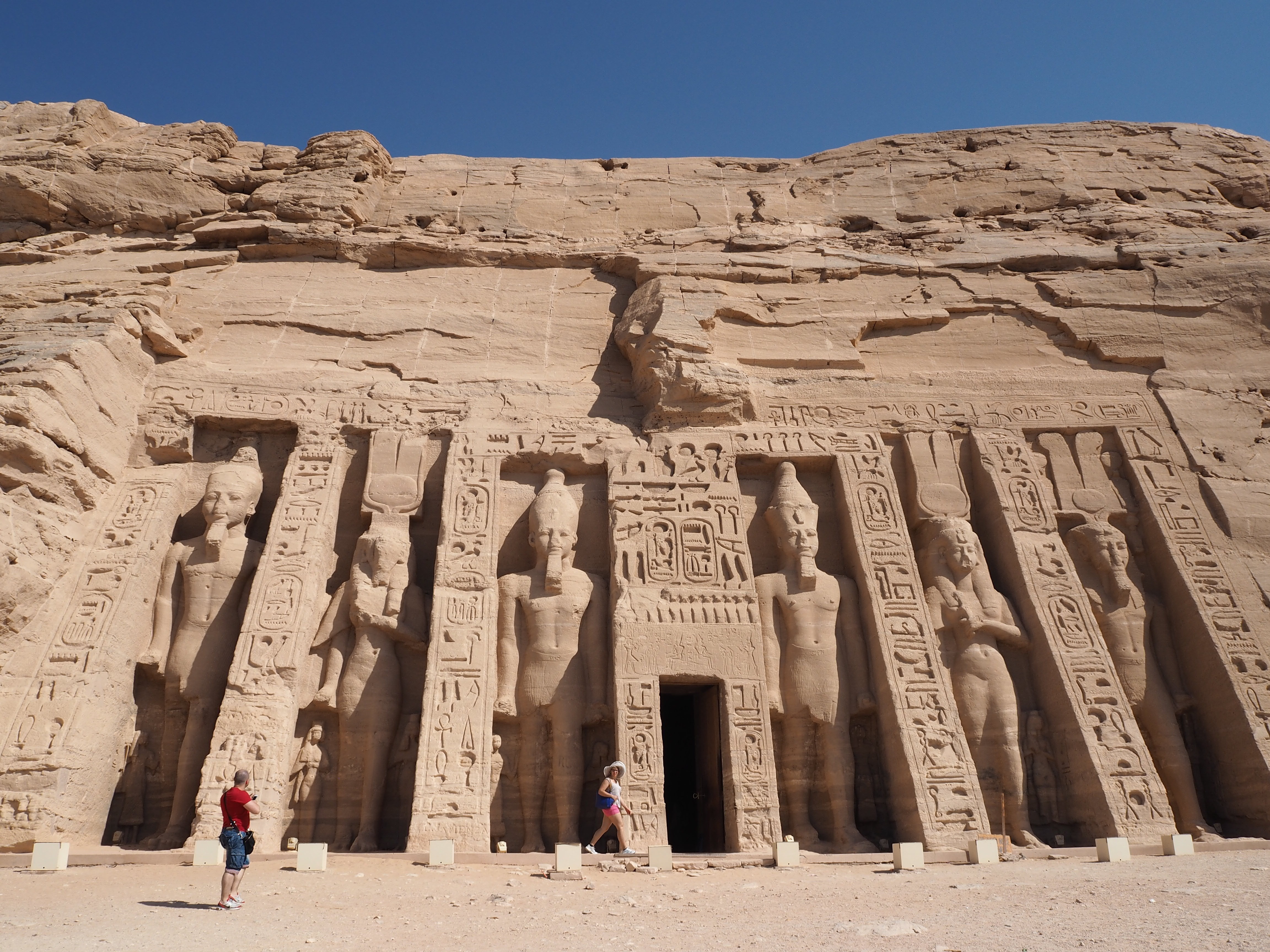
About Safaga
Port Safago has been undergoing a transformation, slowly metamorphosing into a holiday rsort. Like other cities on the Red Sea, the commercial port town sits close to great offshore dive sites. Unlike others, however, tourist development hasn't taken off in a meaningful way. But if the mass tourism in Hurghada is a turnoff, Safaga offers a small-scale and much more low-key alternative, though the best dive sites can still be seen on a day trip from Hurghada. Safaga is also the closest beach resort to Luxor and the Valley of the Kings, which lies 200 km (124 mi) to the southwest; when cruise ships offer land excursions to Luxor, they often do so through Safaga.
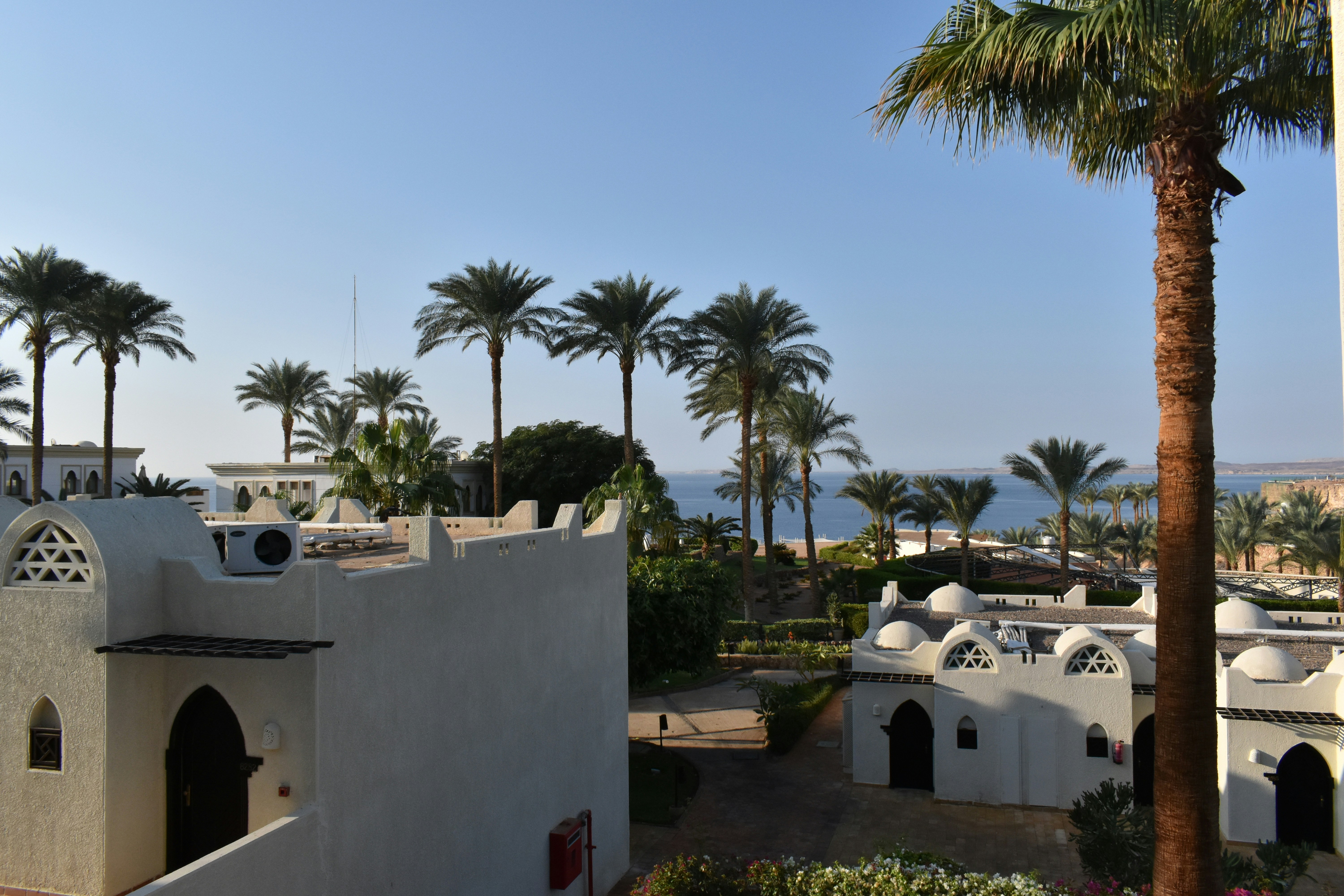
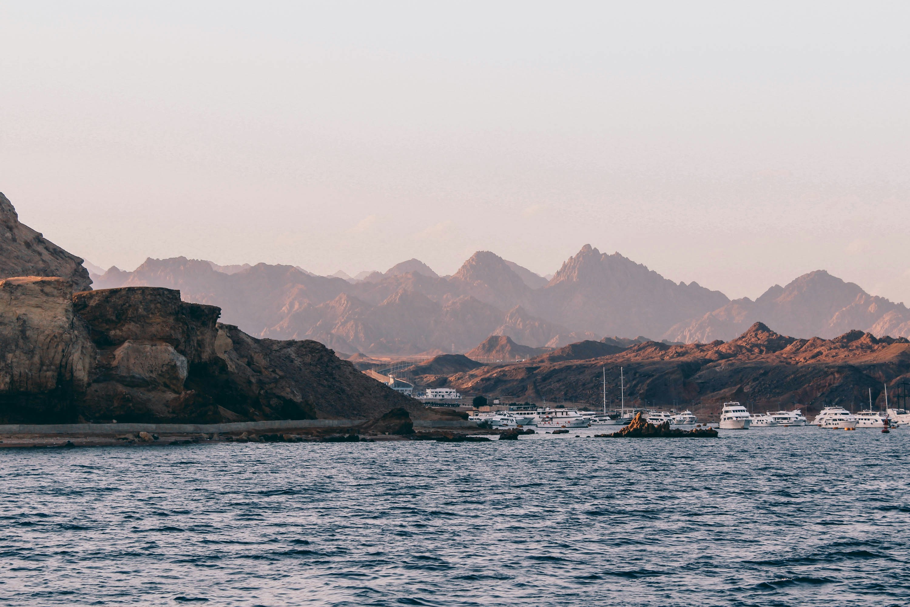
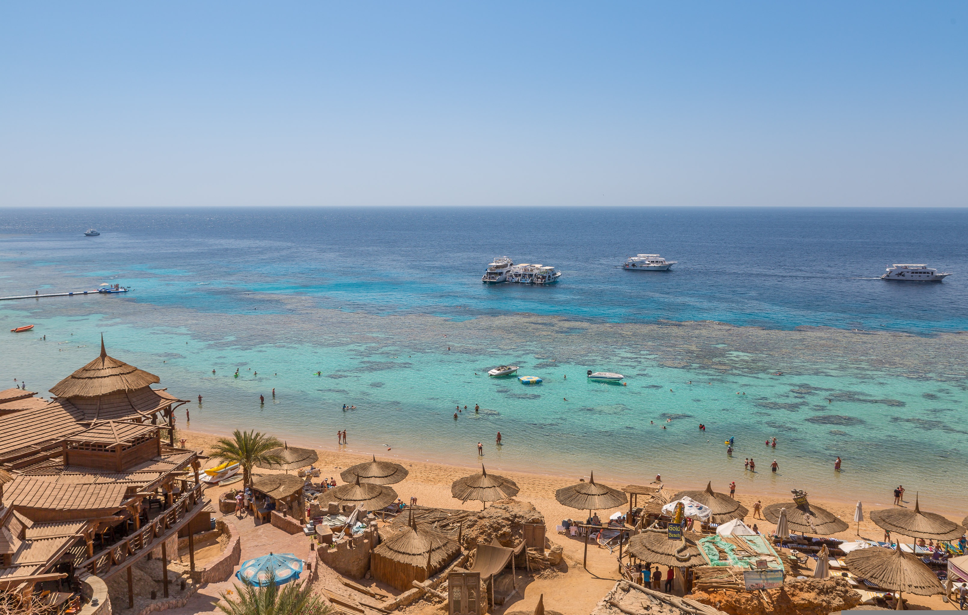
About Sharm El Sheikh
The port and town of Sharm-el-Sheikh lies near the southernmost tip of the Sinai Peninsula where the Straits of Tiran meet the Gulf of Aqaba. With its strategic position, the Sinai posed a desirable target for various rulers over the centuries. In recent times, the last battle for the Sinai was fought between Egypt and Israel from 1967 to 1979, ending with a peace treaty signed in Washington, D.C. Since the withdrawal of the Israelis, more and more Egyptians have settled in the Sinai, taking advantage of the booming tourist trade. However, vast interior regions are still sparsely populated. Many Bedouins have been affected by the advent of the 21st century, which is rapidly changing their age-old customs and nomadic lifestyle. As tourism and hotel projects continue to spring up along the Sinai coast, contact with Bedouins not involved in tourism is becoming increasingly rare. Once their nomadic life kept them on the move with their tents; today many Bedouins cultivate grain, vegetables and dates in addition to catering to the tourists. Sharm-el-Sheikh was initially developed by the Israelis during the Sinai occupation. Na'ama Bay, a short drive from the port, has grown from virtually nothing into a sizeable resort since the early 1980s. Between the two towns, a string of hotels line a once-untouched coastline. Resort hotels offer great opportunities for swimming, snorkelling and scuba diving. Glass bottom boat trips are available for those preferring to view the exotic marine life of the Red Sea without getting their feet wet.
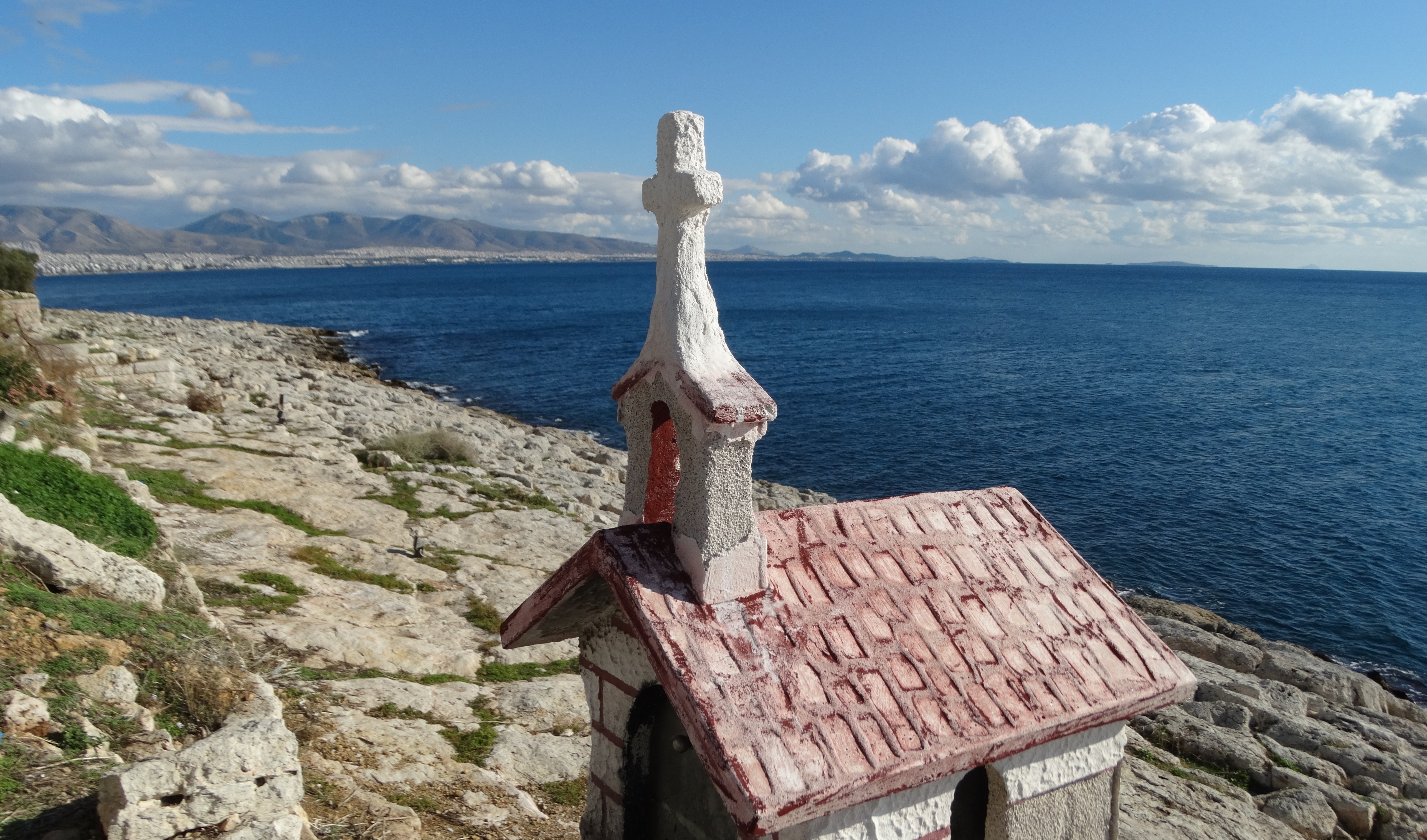
About 'Aqaba
The resort town of Aqaba, on the Red Sea at the southern end of Jordan, is a popular spot for divers with some of the best coral reefs in the world. Snorkeling and other water sports are popular, and it's easy to hire a boat for a day or half-day, including lunch.Aqaba has become quite a bustling destination, with several large luxury hotels and a large shopping area. There are many jewelry stores selling pearls, gem stones, and gold and silver jewelry. It's worth noting that although it's an international beach resort, Aqaba is quite conservative—certainly much more so than Amman—and North Americans tend to be more comfortable at the private hotel beaches.

About Hurghada
About Ain Sukhna
About Suez


About Suez
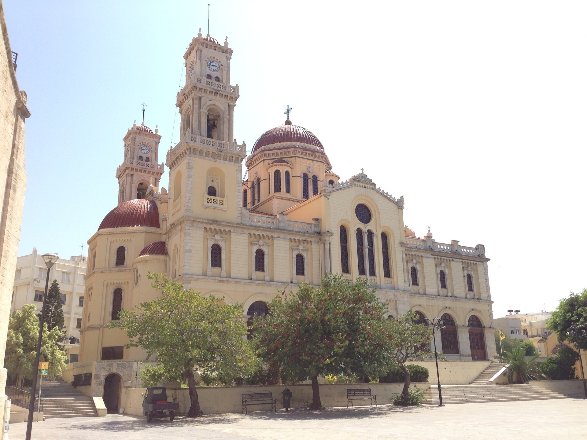
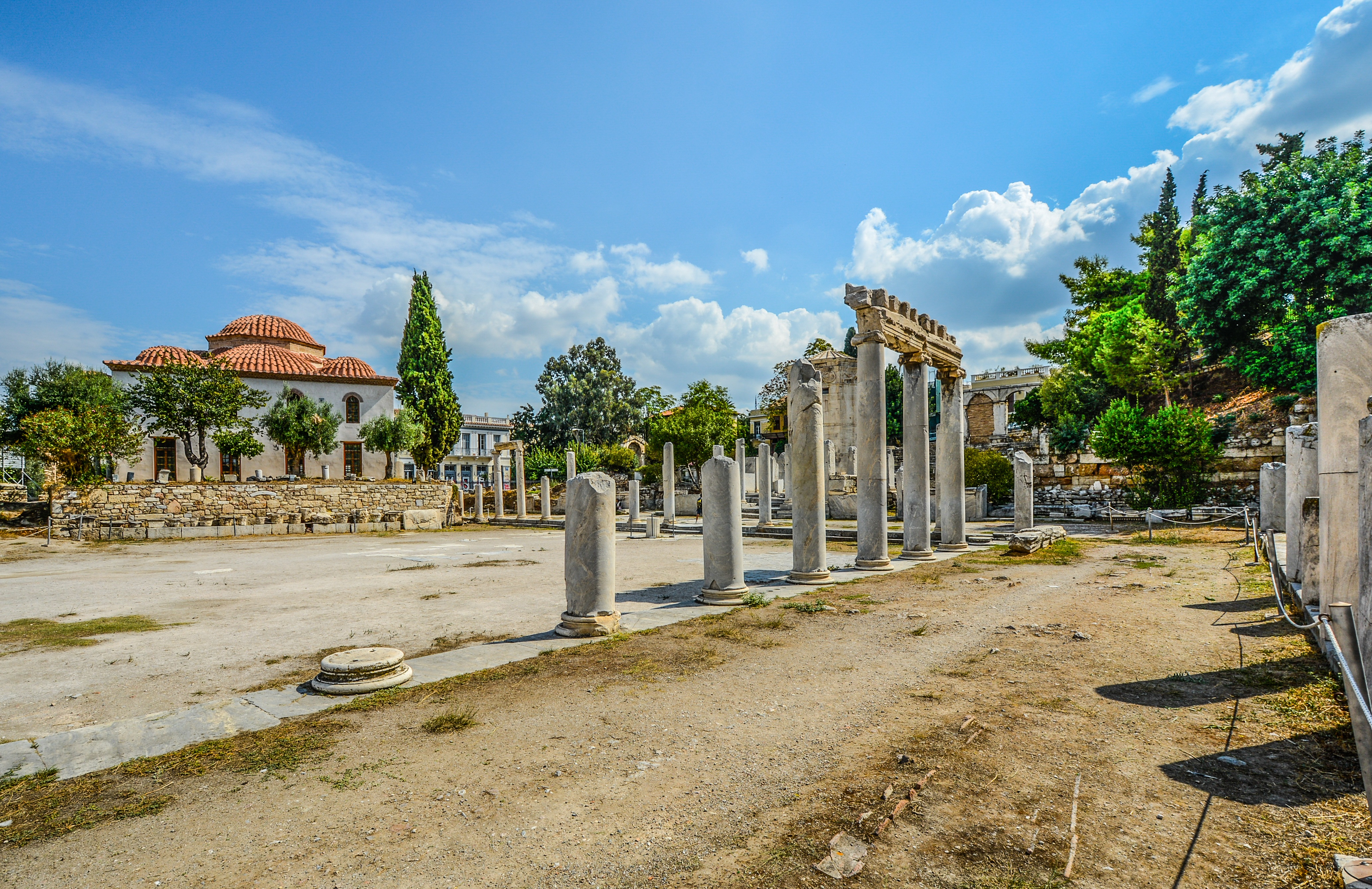
About Heraklion (Iraklion), Crete
Having been controlled by Arabic, Venetian and Ottoman empires over the years - it's no surprise that Heraklion is a diverse patchwork of exotic cultures and historical treasures. Celebrated as the birthplace of the Spanish Renaissance artist, El Greco, you can visit to explore the storied ruins of the Minoan empire's capital, and unearth the rich cultural treasures that Crete’s bustling modern capital has to offer.

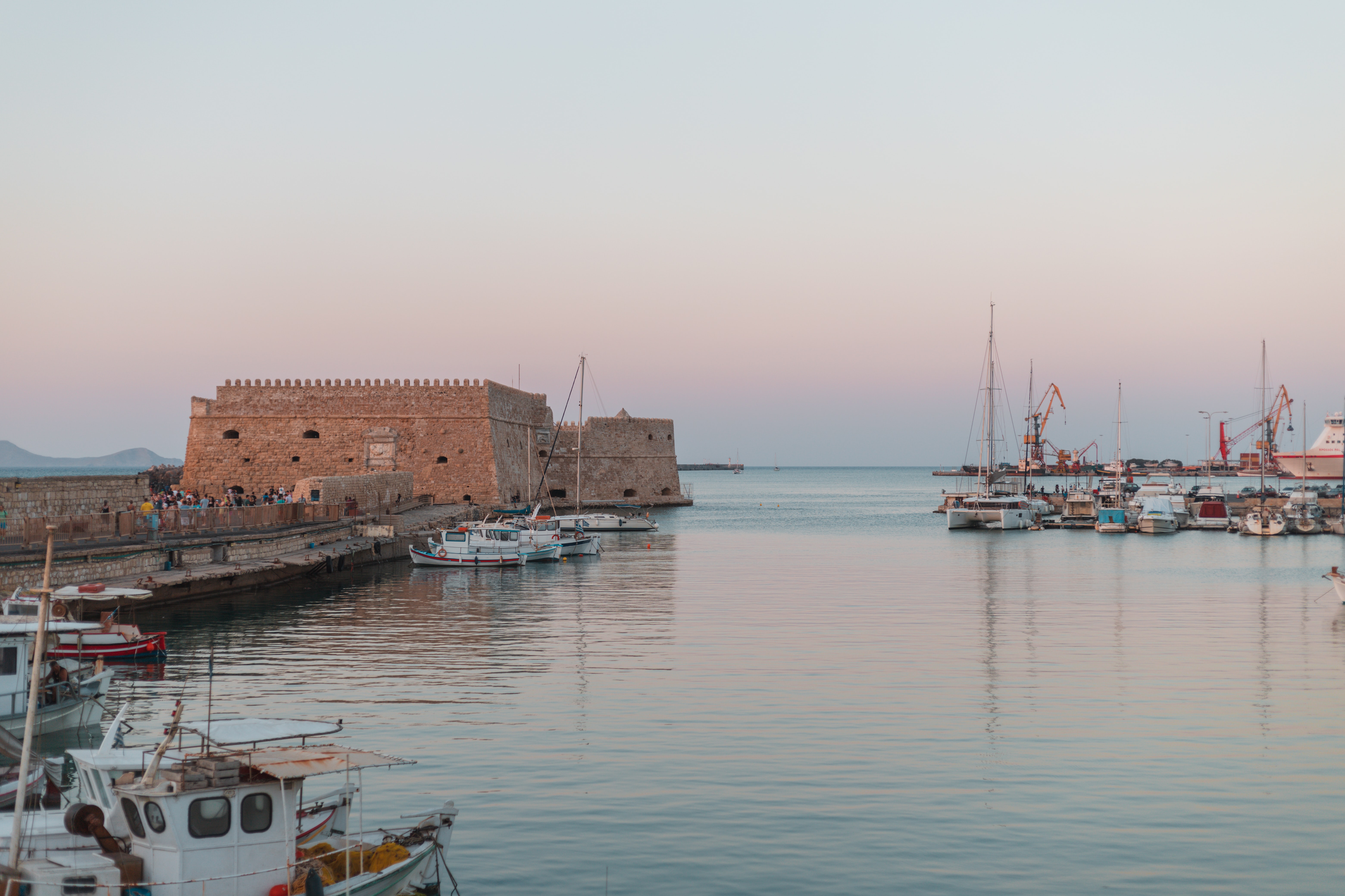
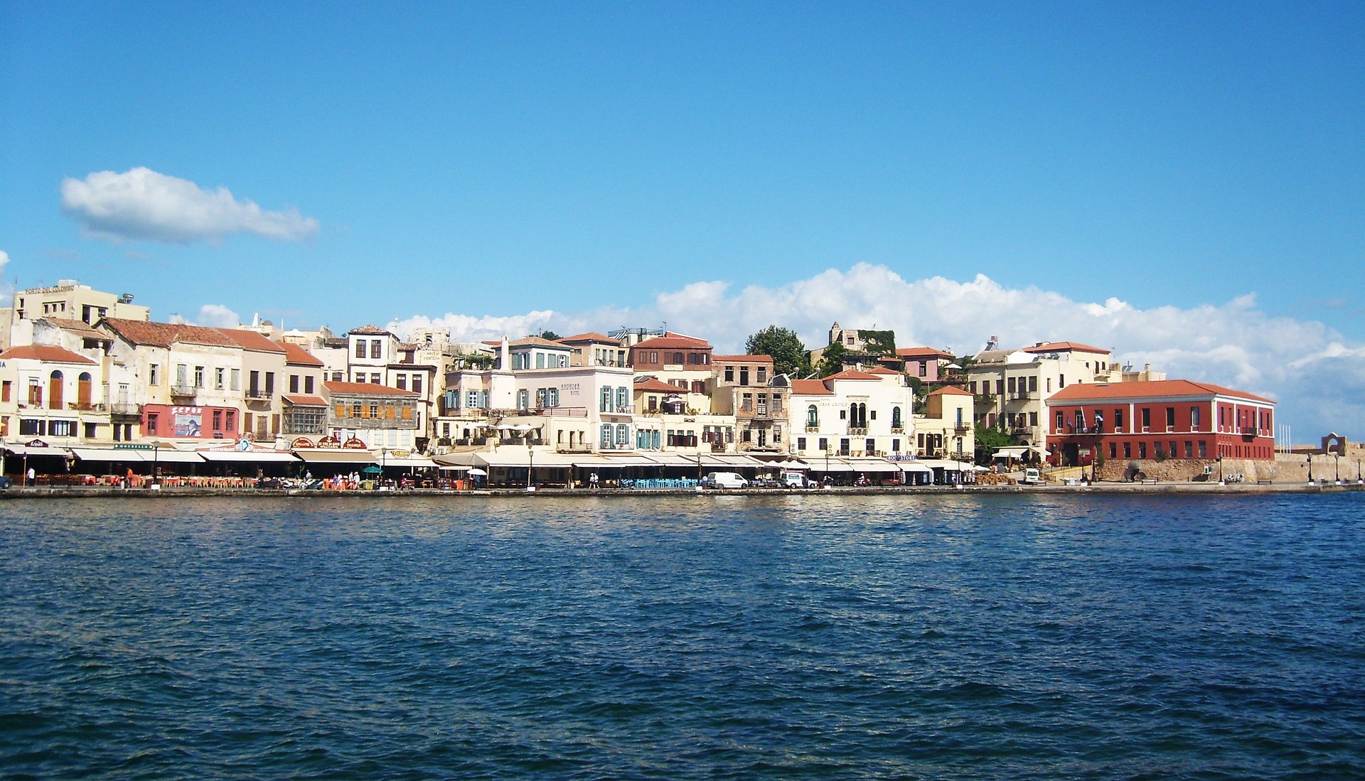
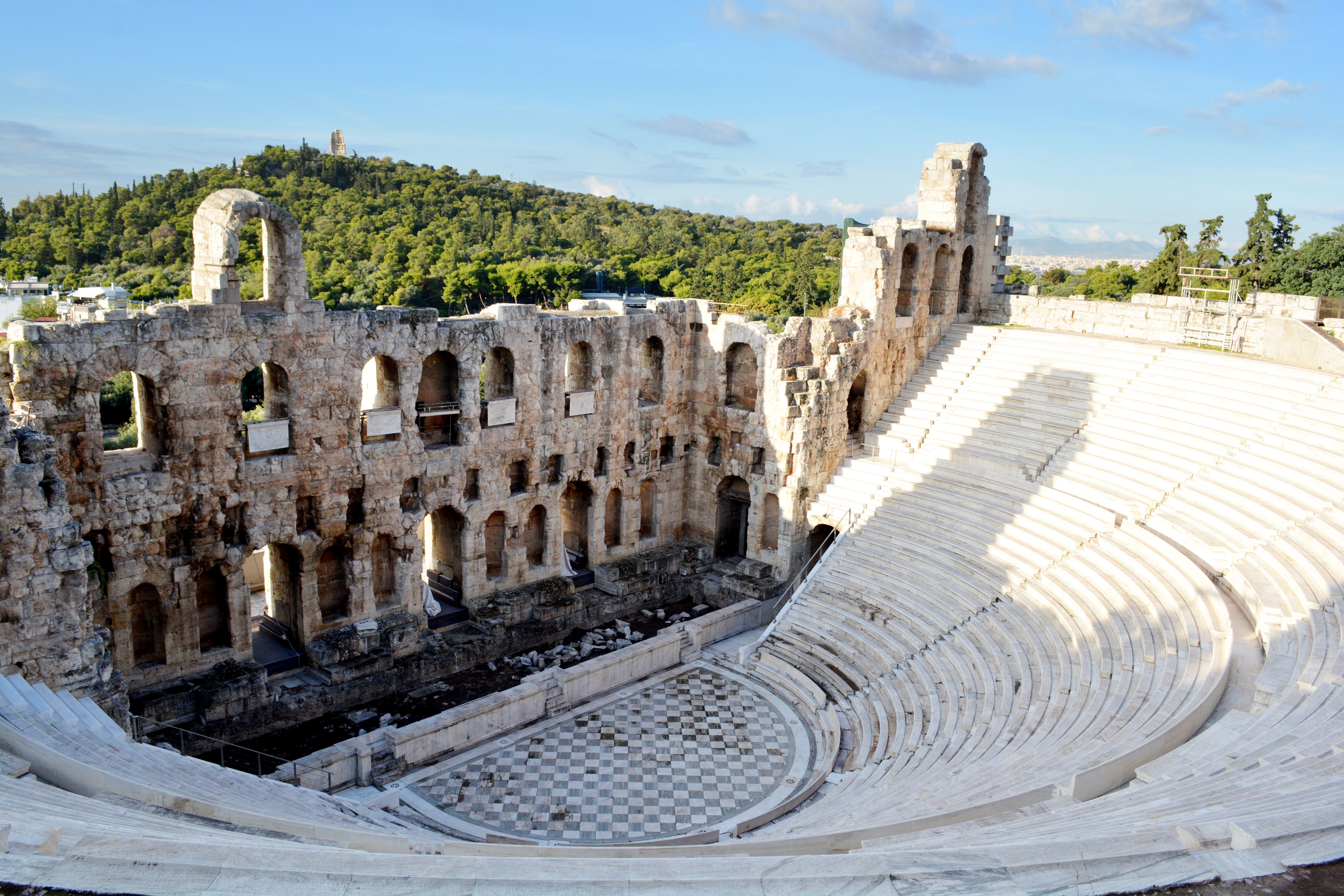
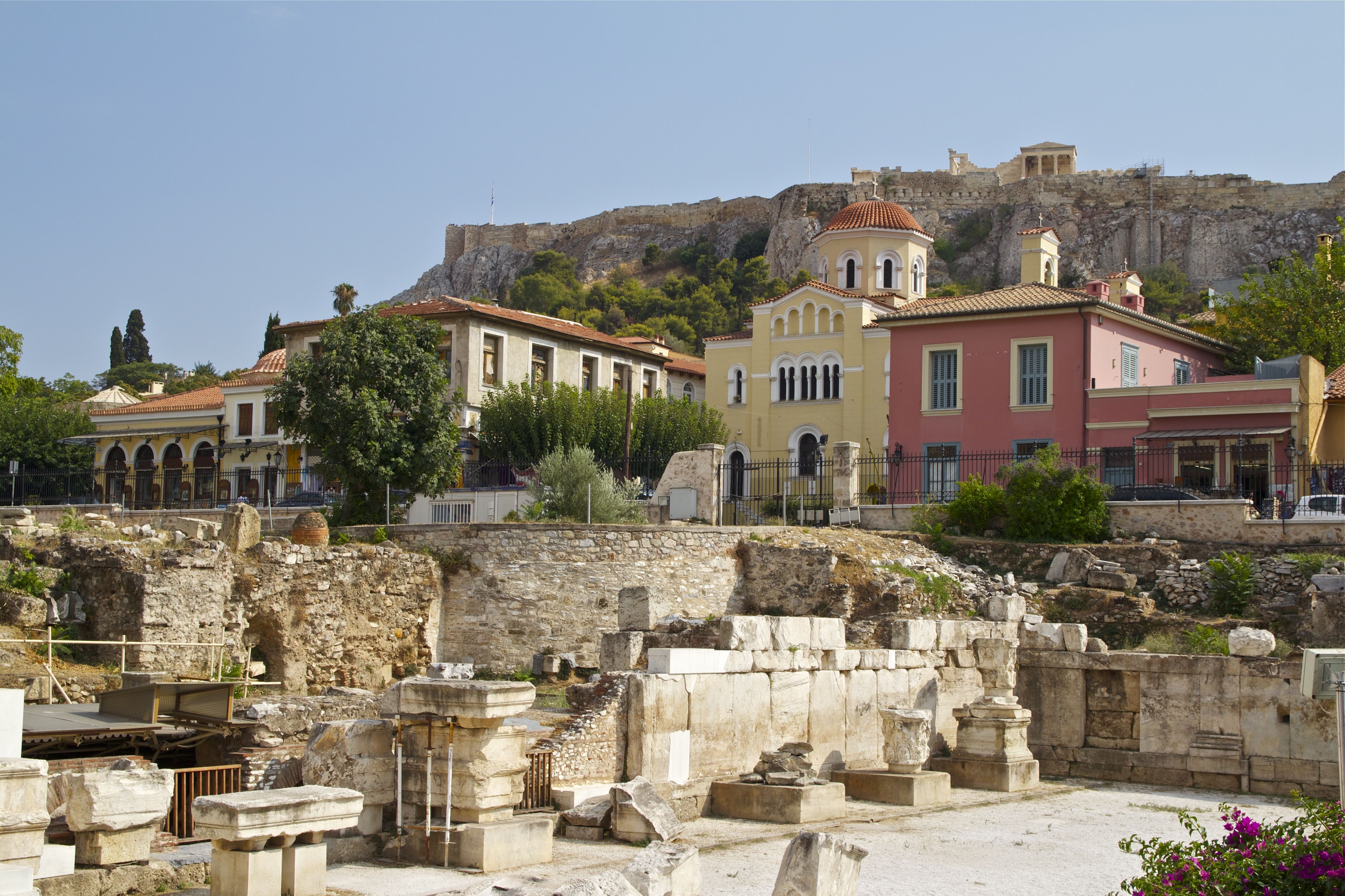
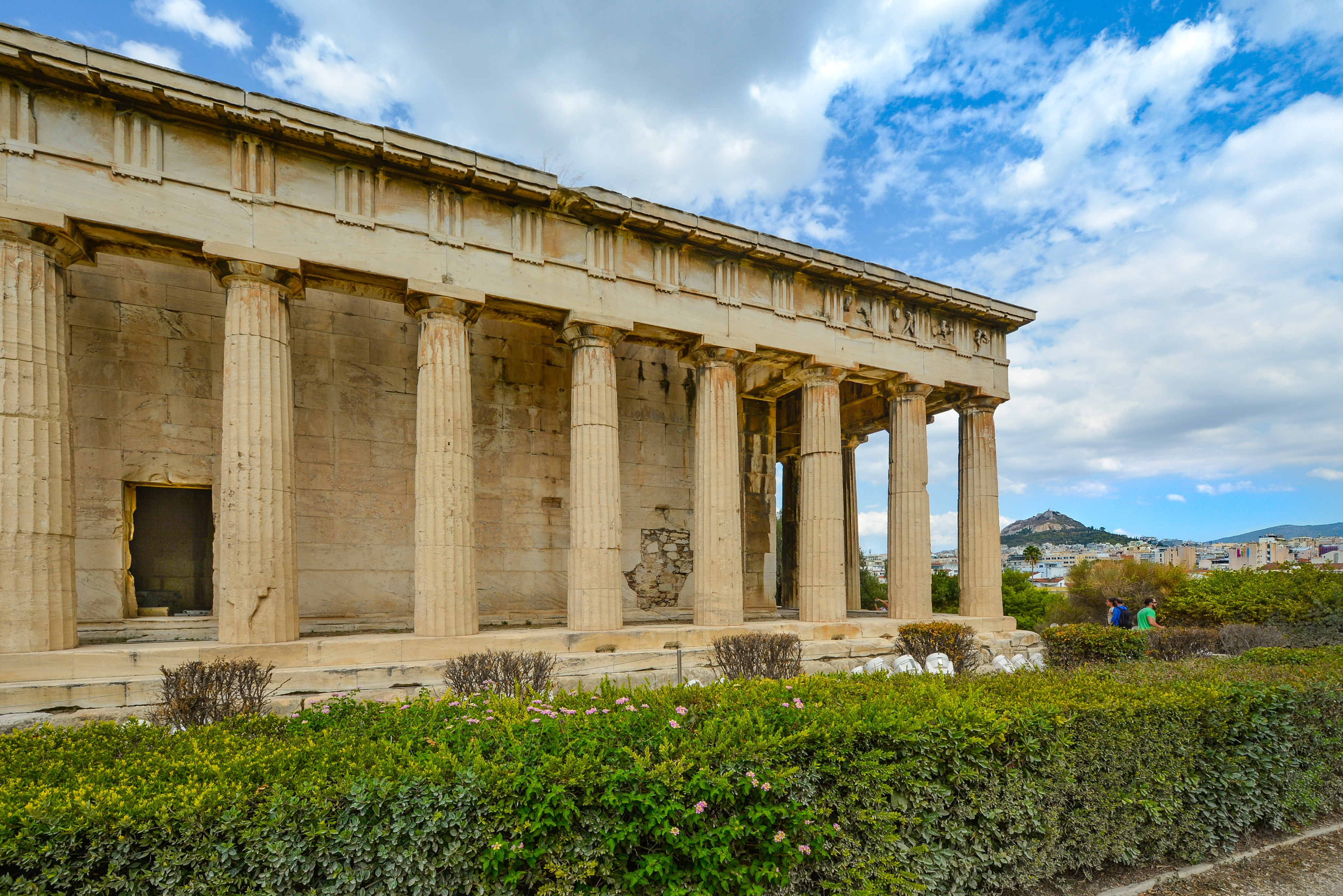
About Piraeus
It's no wonder that all roads lead to the fascinating and maddening metropolis of Athens. Lift your eyes 200 feet above the city to the Parthenon, its honey-color marble columns rising from a massive limestone base, and you behold architectural perfection that has not been surpassed in 2,500 years. But, today, this shrine of classical form dominates a 21st-century boomtown. To experience Athens—Athína in Greek—fully is to understand the essence of Greece: ancient monuments surviving in a sea of cement, startling beauty amid the squalor, tradition juxtaposed with modernity. Locals depend on humor and flexibility to deal with the chaos; you should do the same. The rewards are immense. Although Athens covers a huge area, the major landmarks of the ancient Greek, Roman, and Byzantine periods are close to the modern city center. You can easily walk from the Acropolis to many other key sites, taking time to browse in shops and relax in cafés and tavernas along the way. From many quarters of the city you can glimpse "the glory that was Greece" in the form of the Acropolis looming above the horizon, but only by actually climbing that rocky precipice can you feel the impact of the ancient settlement. The Acropolis and Filopappou, two craggy hills sitting side by side; the ancient Agora (marketplace); and Kerameikos, the first cemetery, form the core of ancient and Roman Athens. Along the Unification of Archaeological Sites promenade, you can follow stone-paved, tree-lined walkways from site to site, undisturbed by traffic. Cars have also been banned or reduced in other streets in the historical center. In the National Archaeological Museum, vast numbers of artifacts illustrate the many millennia of Greek civilization; smaller museums such as the Goulandris Museum of Cycladic Art Museum and the Byzantine and Christian Museum illuminate the history of particular regions or periods. Athens may seem like one huge city, but it is really a conglomeration of neighborhoods with distinctive characters. The Eastern influences that prevailed during the 400-year rule of the Ottoman Empire are still evident in Monastiraki, the bazaar area near the foot of the Acropolis. On the northern slope of the Acropolis, stroll through Plaka (if possible by moonlight), an area of tranquil streets lined with renovated mansions, to get the flavor of the 19th-century's gracious lifestyle. The narrow lanes of Anafiotika, a section of Plaka, thread past tiny churches and small, color-washed houses with wooden upper stories, recalling a Cycladic island village. In this maze of winding streets, vestiges of the older city are everywhere: crumbling stairways lined with festive tavernas; dank cellars filled with wine vats; occasionally a court or diminutive garden, enclosed within high walls and filled with magnolia trees and the flaming trumpet-shaped flowers of hibiscus bushes. Formerly run-down old quarters, such as Thission, Gazi and Psirri, popular nightlife areas filled with bars and mezedopoleia (similar to tapas bars), are now in the process of gentrification, although they still retain much of their original charm, as does the colorful produce and meat market on Athinas. The area around Syntagma Square, the tourist hub, and Omonia Square, the commercial heart of the city about 1 km (½ mi) northwest, is distinctly European, having been designed by the court architects of King Otho, a Bavarian, in the 19th century. The chic shops and bistros of ritzy Kolonaki nestle at the foot of Mt. Lycabettus, Athens's highest hill (909 feet). Each of Athens's outlying suburbs has a distinctive character: in the north is wealthy, tree-lined Kifissia, once a summer resort for aristocratic Athenians, and in the south and southeast lie Glyfada, Voula, and Vouliagmeni, with their sandy beaches, seaside bars, and lively summer nightlife. Just beyond the city's southern fringes is Piraeus, a bustling port city of waterside fish tavernas and Saronic Gulf views.


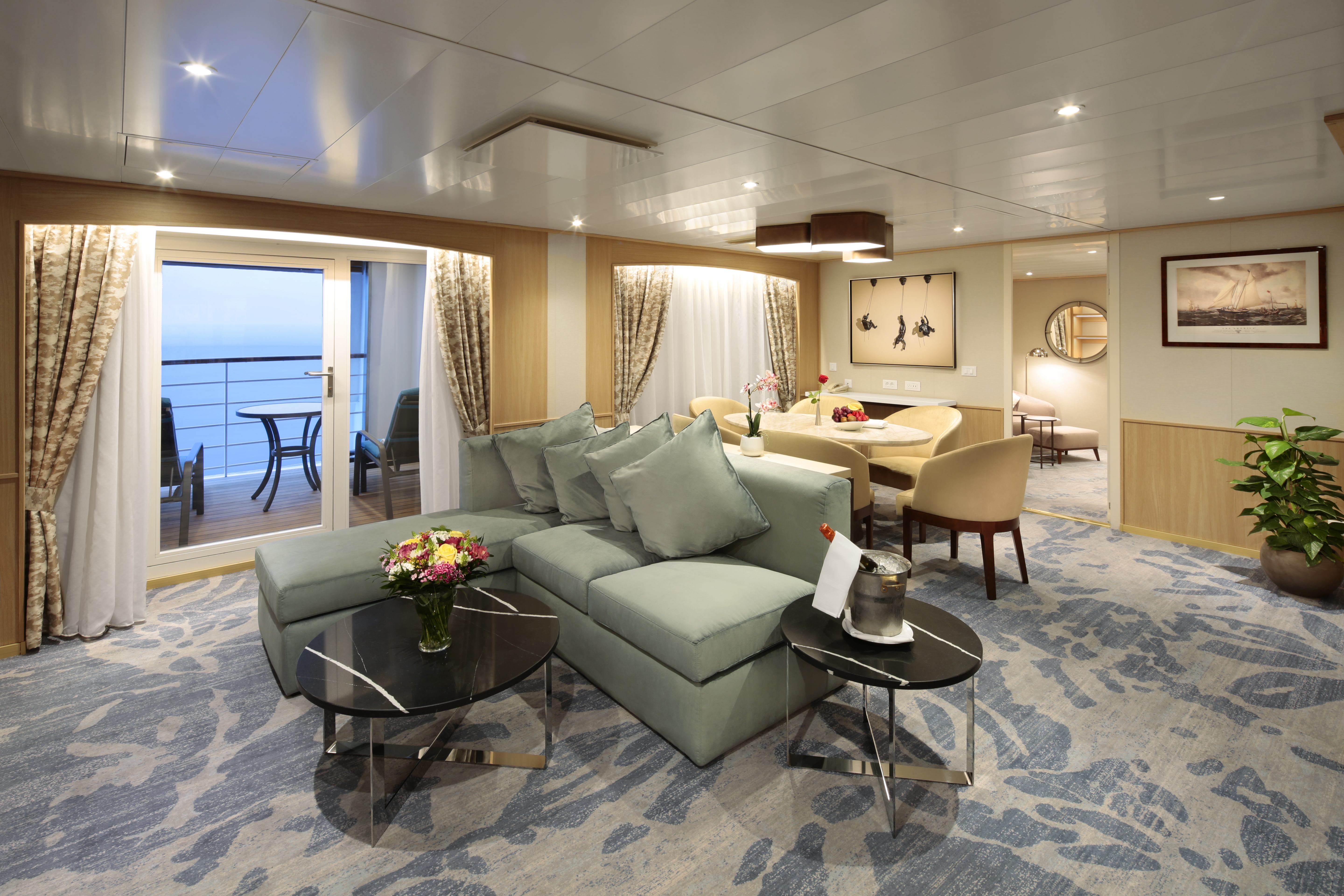
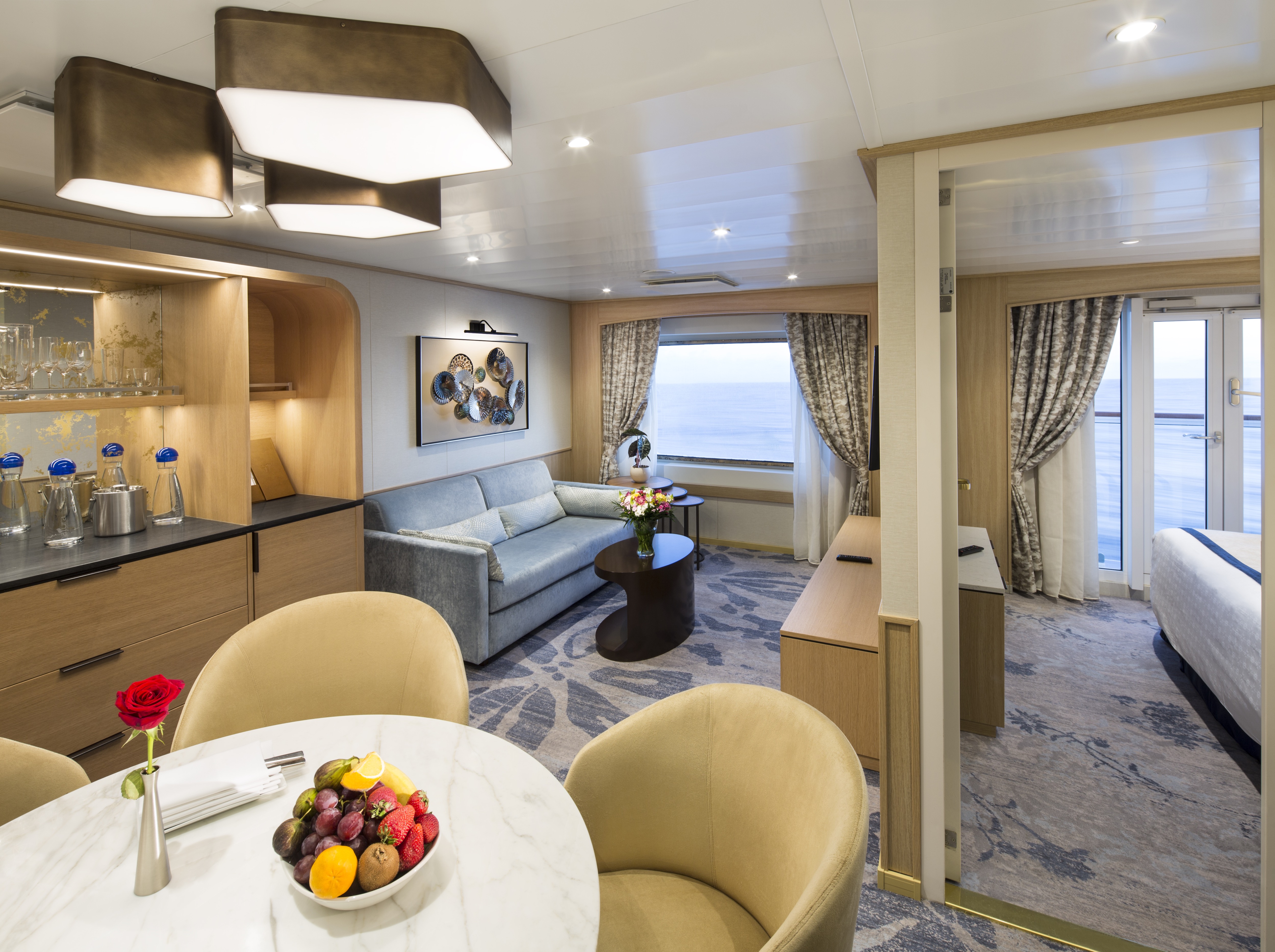
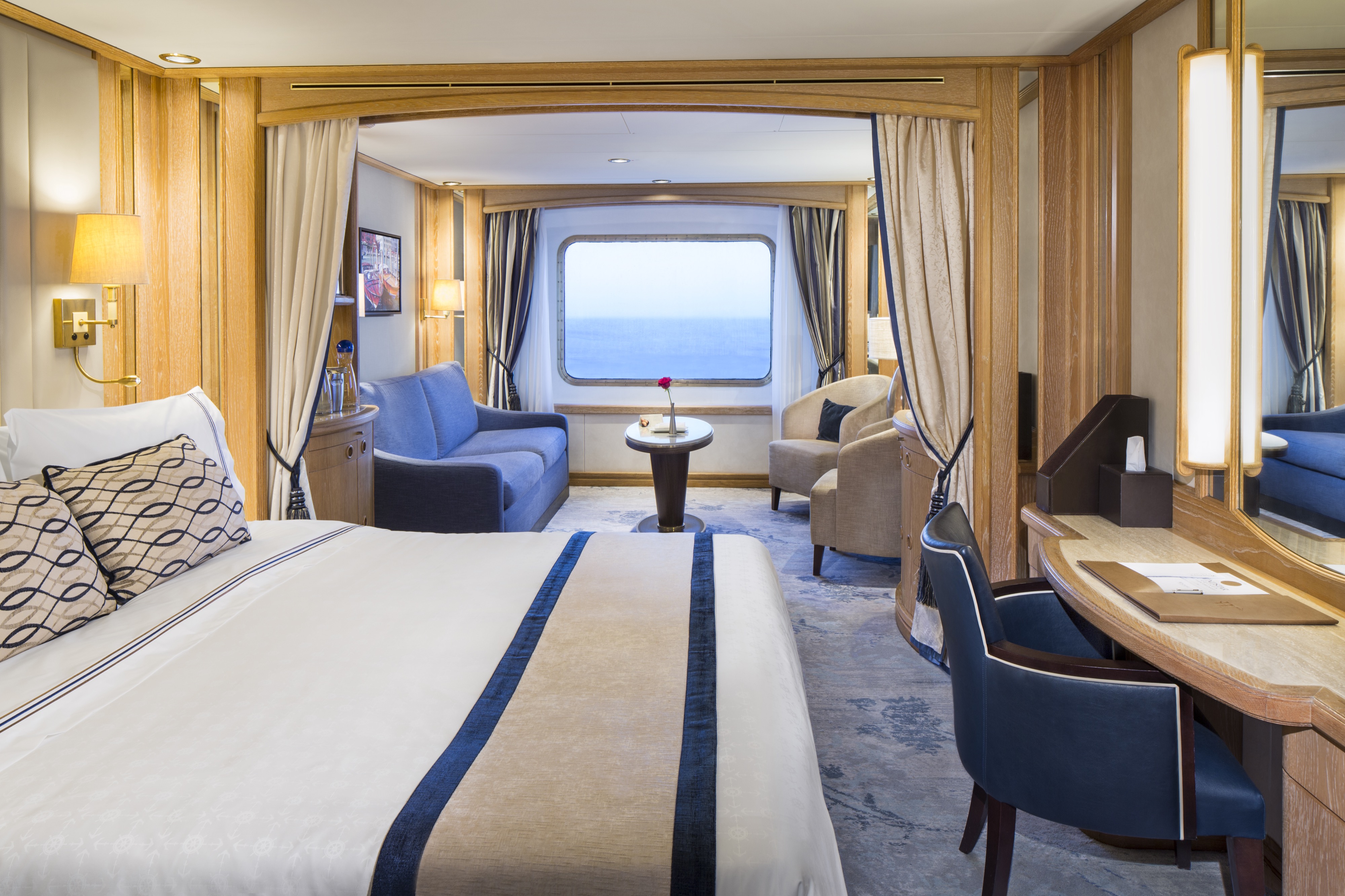
A stunning brand new owner's suites with 820 square feet of space featuring two bedrooms and two bathrooms, a verandah, and plenty of space in the sitting area for entertaining. This is the most sought after suite on the entire ship and once you stay here, you'll never stay anywhere else.
Newly Redesigned Restrooms
We reimagined our restrooms to provide you a private oasis within your own room.
Amenities
- Queen Size Bed with Luxurious Linens
- Interactive Television
- Safe
- Fully Upgraded Bath Amenity Line Including Pure Pampering L'Occitane
- Fruit Basket with Berries
- Free Internet Service (1 Voucher per Suite)
- Upgraded High End Quality Bath Robes
- Fully Stocked Mini Bar/Refrigerator
- Direct Dial Phone
- Fresh Flowers
- Hair Dryers and 110/220 Outlets
- Mirrored Closet with Ample Drawer Space
- Granite Vanity with Magnifying Mirror and Chair
- Preferred On Board Check In
- Invitation to Captain or Senior Officer Table
- Personalised Wake-Up Call Service with Preferred Beverage Coffee/Tea/Juice
- Preferred Specialty Restaurant Dining
- Preferred Canapés Service
- Maschio Prosecco
- Illy Espresso Machine
- Binoculars

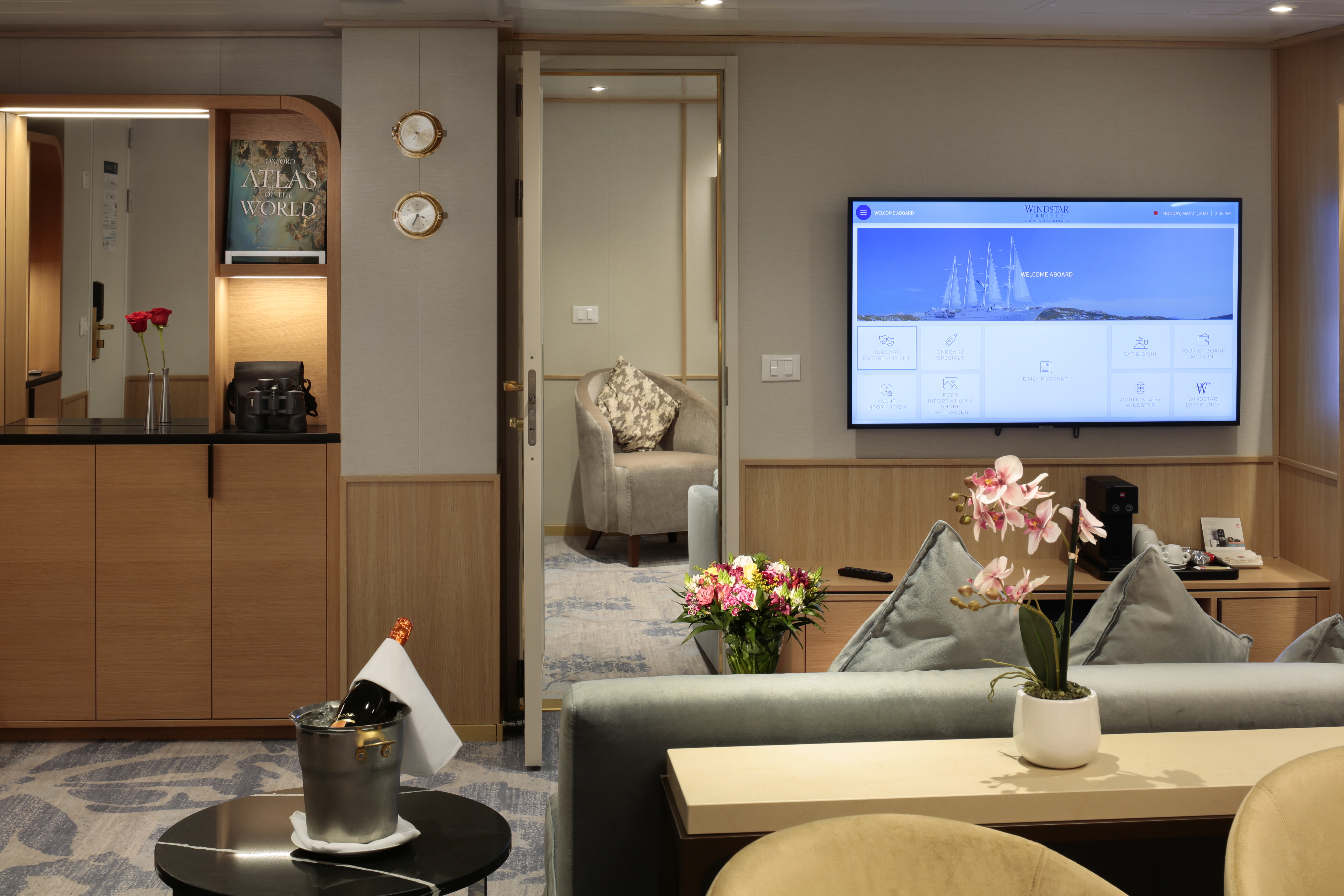
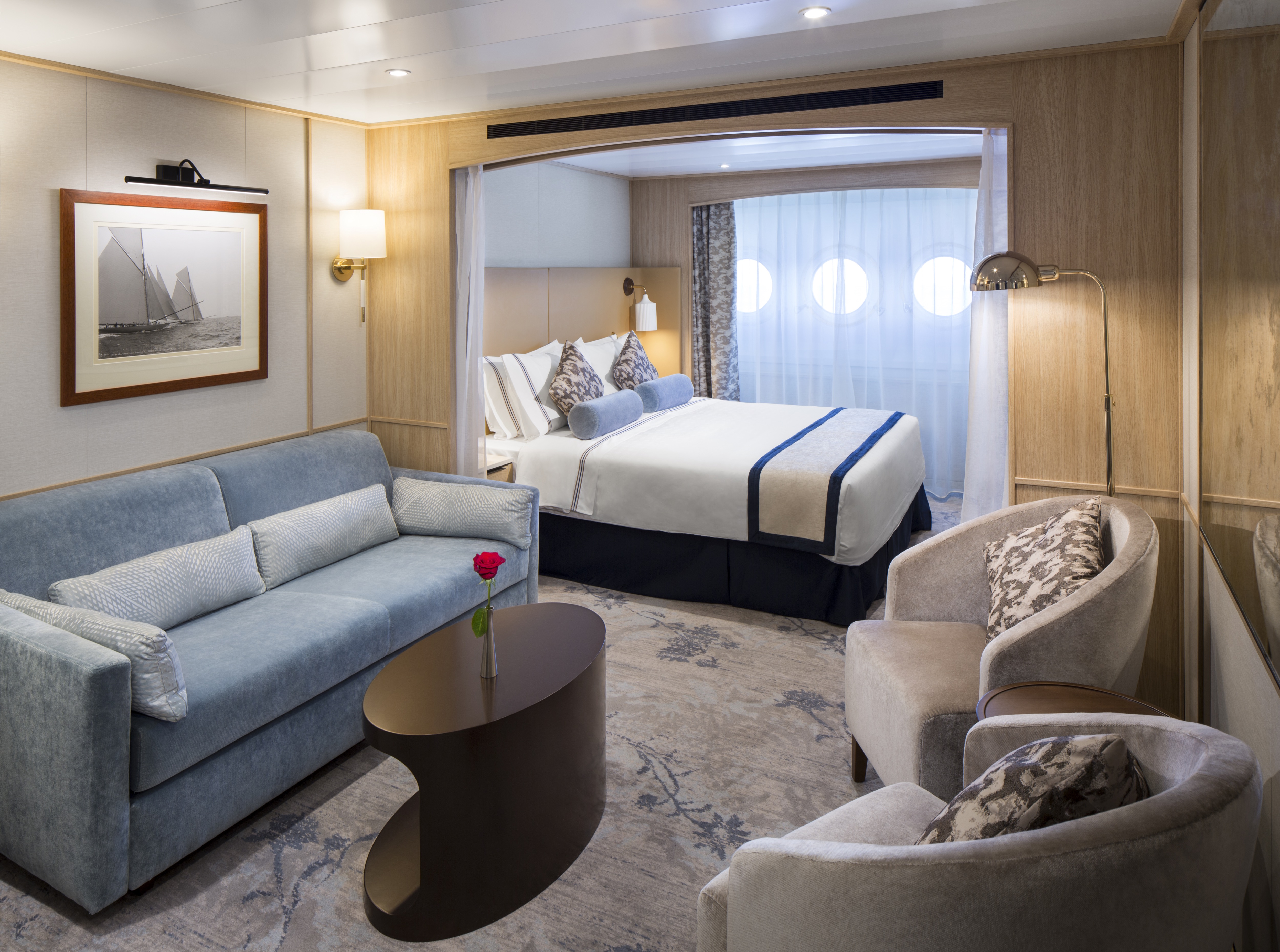
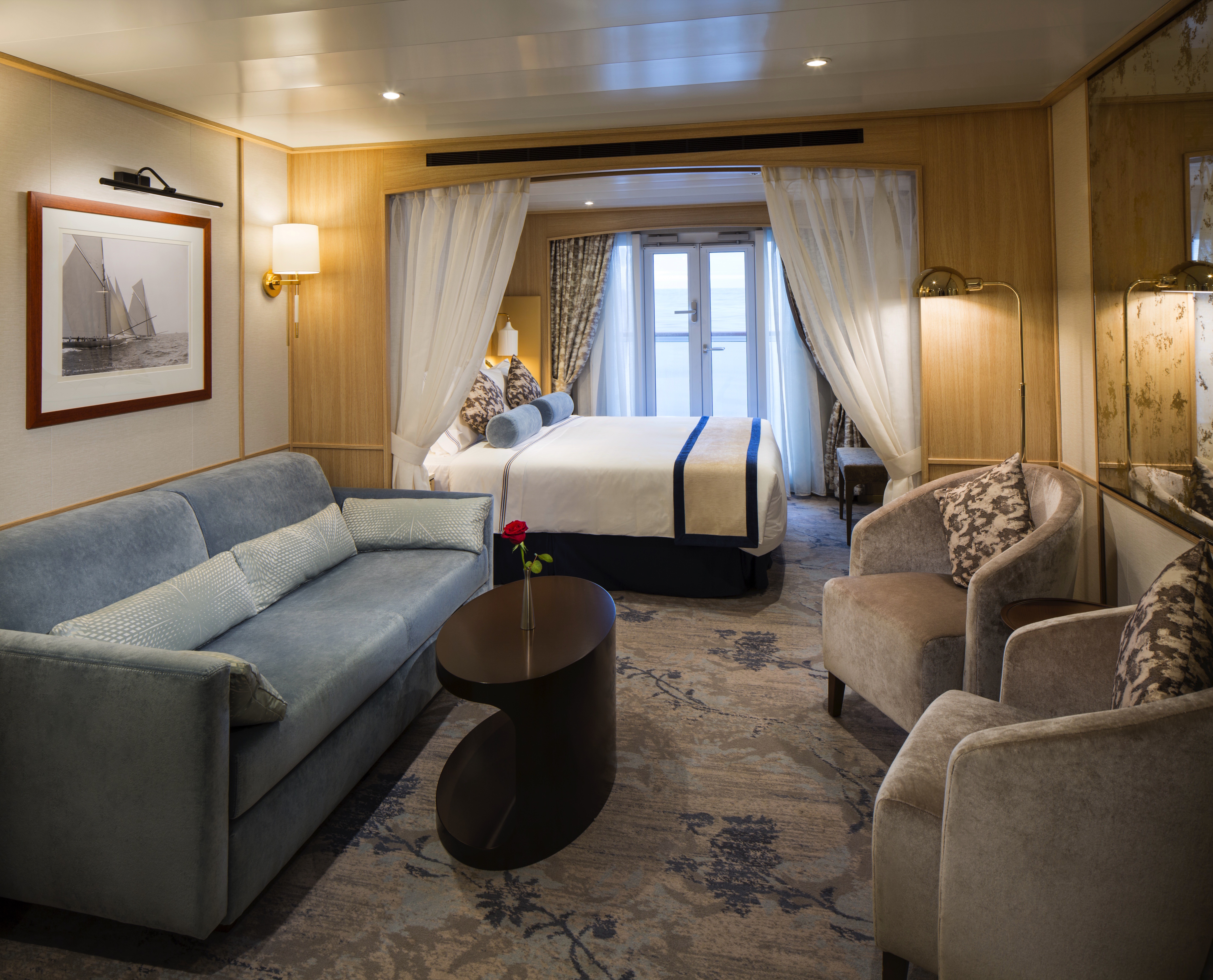
With 575 square feet, your Owner's Suite offers separate living room and dining areas. A veranda, Interactive TVs, and a full master bath and separate powder room indulge you in spacious comfort.
Newly Redesigned Restrooms
We reimagined our restrooms to provide you a private oasis within your own room.
Amenities
- Queen Size Bed with Luxurious Linens
- Interactive Television
- Safe
- Fully Upgraded Bath Amenity Line Including Pure Pampering L'Occitane
- Fruit Basket with Berries
- Free Internet Service (1 Voucher per Suite)
- Upgraded High End Quality Bath Robes
- Fully Stocked Mini Bar/Refrigerator
- Direct Dial Phone
- Fresh Flowers
- Hair Dryers and 110/220 Outlets
- Mirrored Closet with Ample Drawer Space
- Granite Vanity with Magnifying Mirror and Chair
- Preferred On Board Check In
- Invitation to Captain or Senior Officer Table
- Personalised Wake-Up Call Service with Preferred Beverage Coffee/Tea/Juice
- Preferred Specialty Restaurant Dining
- Preferred Canapés Service
- Maschio Prosecco
- Illy Espresso Machine
- Binoculars
Newly Redesigned Restrooms
We reimagined our restrooms to provide you a private oasis within your own room.
Amenities
- Queen Size Bed with Luxurious Linens
- Waffle Weave Robe and Slippers
- Interactive TV
- Fully Stocked Mini Bar/Refrigerator
- Safe
- Direct Dial Phone
- L'Occitane Bath Amenities
- Fresh Fruit
- Hair Dryers and 110/220 outlets
- Wi-Fi Internet Access(various plans available for purchase)
- Mirrored closet with ample drawer space
- Granite vanity with magnifying mirror and chair
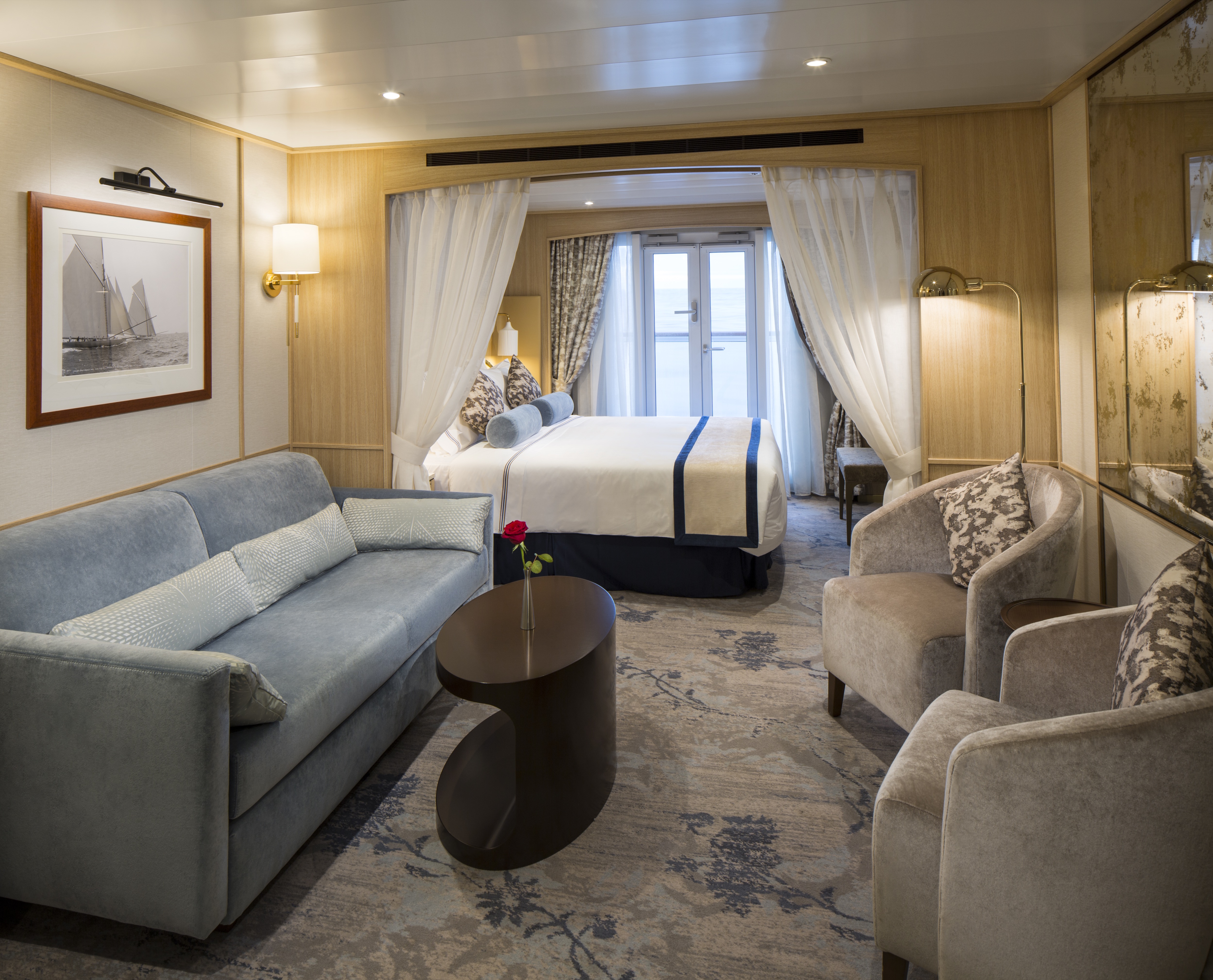
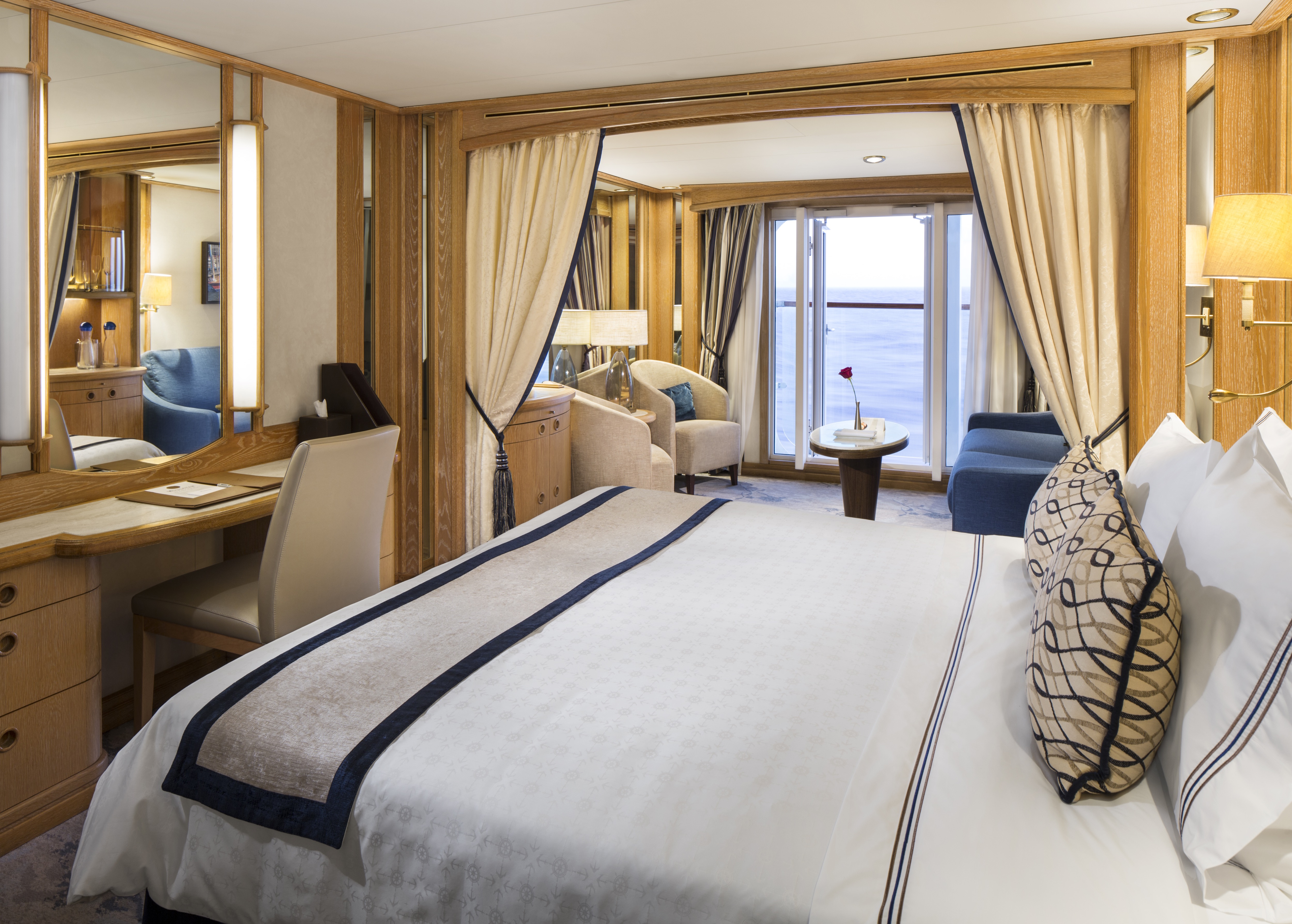
Relax in 400 to 530 spacious square feet. Your living area offers beautiful views from the forward-facing window and French doors onto your private veranda. Two spacious closets give you plenty of room to unpack.
Newly Redesigned Restrooms
We reimagined our restrooms to provide you a private oasis within your own room.
Amenities
- Queen Size Bed with Luxurious Linens
- Interactive Television
- Safe
- Fully Upgraded Bath Amenity Line Including Pure Pampering L'Occitane
- Fruit Basket with Berries
- Free Internet Service (1 Voucher per Suite)
- Upgraded High End Quality Bath Robes
- Fully Stocked Mini Bar/Refrigerator
- Direct Dial Phone
- Fresh Flowers
- Hair Dryers and 110/220 Outlets
- Mirrored Closet with Ample Drawer Space
- Granite Vanity with Magnifying Mirror and Chair
- Preferred On Board Check In
- Invitation to Captain or Senior Officer Table
- Personalized Wake-Up Call Service with Preferred Beverage Coffee/Tea/Juice
- Preferred Specialty Restaurant Dining
- Preferred Canapes Service
- Maschio Prosecco
- Illy Espresso Machine
- Binoculars
Newly Redesigned Restrooms
We reimagined our restrooms to provide you a private oasis within your own room.
Amenities
- Queen Size Bed with Luxurious Linens
- Waffle Weave Robe and Slippers
- Interactive TV
- Fully Stocked Mini Bar/Refrigerator
- Safe
- Direct Dial Phone
- L'Occitane Bath Amenities
- Fresh Fruit
- Hair Dryers and 110/220 outlets
- Wi-Fi Internet Access(various plans available for purchase)
- Mirrored closet with ample drawer space
- Granite vanity with magnifying mirror and chair
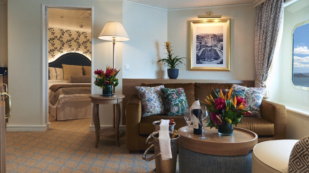
As soon as you walk through the door, you’re greeted with an open living area for a more welcoming entrance. Drift off to sleep by the window in your queen bed as you watch the same stars that sailors used to navigate the seas hundreds of years ago.
Newly Redesigned Restrooms
We reimagined our restrooms to provide you a private oasis within your own room.
Amenities
- Queen Size Bed with Luxurious Linens
- Waffle Weave Robe and Slippers
- Interactive TV
- Fully Stocked Mini Bar/Refrigerator
- Safe
- Direct Dial Phone
- L'Occitane Bath Amenities
- Fresh Fruit
- Hair Dryers and 110/220 outlets
- Wi-Fi Internet Access(various plans available for purchase)
- Mirrored closet with ample drawer space
- Granite vanity with magnifying mirror and chair
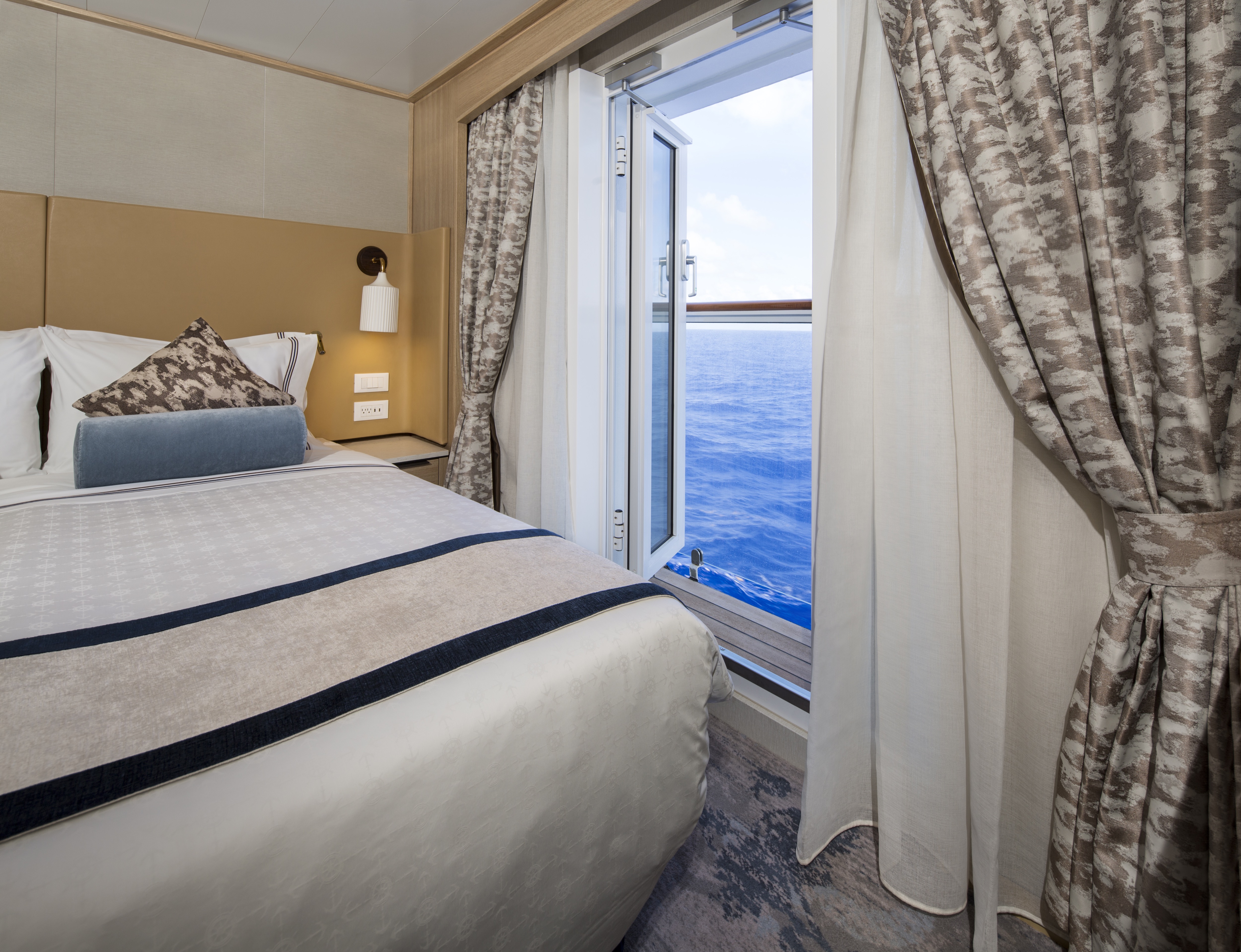
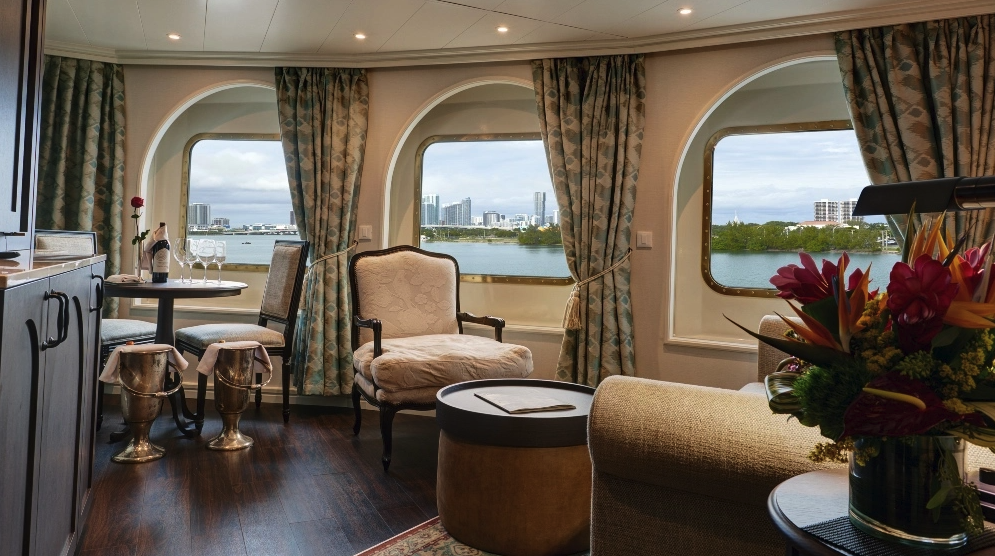
Stylish comfort and ocean views welcome you in 277 square feet. Your queen bed (which can be separated as twins if you prefer) features luxurious Egyptian cotton linens. Enjoy a luxurious soak in your full-size tub or an invigorating shower, then wrap up in your waffle-weave robe and slippers, savour a treat from the fresh fruit bowl, or simply stretch out and enjoy the fresh flowers.
Newly Redesigned Restrooms
We reimagined our restrooms to provide you a private oasis within your own room.
Amenities
- Queen Size Bed with Luxurious Linens
- Waffle Weave Robe and Slippers
- Interactive TV
- Fully Stocked Mini Bar/Refrigerator
- Safe
- Direct Dial Phone
- L'Occitane Bath Amenities
- Fresh Fruit
- Hair Dryers and 110/220 outlets
- Wi-Fi Internet Access (various plans available for purchase)
- Mirrored closet with ample drawer space
- Granite vanity with magnifying mirror and chair
Stylish comfort and ocean views welcome you in 277 square feet. Your queen bed (which can be separated as twins if you prefer) features luxurious Egyptian cotton linens. Enjoy a luxurious soak in your full-size tub or an invigorating shower, then wrap up in your waffle-weave robe and slippers, savor a treat from the fresh fruit bowl, or simply stretch out and enjoy the fresh flowers.
Newly Redesigned Restrooms
We reimagined our restrooms to provide you a private oasis within your own room.
Amenities
- Queen Size Bed with Luxurious Linens
- Waffle Weave Robe and Slippers
- Interactive TV
- Fully Stocked Mini Bar/Refrigerator
- Safe
- Direct Dial Phone
- L'Occitane Bath Amenities
- Fresh Fruit
- Hair Dryers and 110/220 outlets
- Wi-Fi Internet Access (various plans available for purchase)
- Mirrored closet with ample drawer space
- Granite vanity with magnifying mirror and chair
Stylish comfort and ocean views welcome you in 277 square feet. Your queen bed (which can be separated as twins if you prefer) features luxurious Egyptian cotton linens. Enjoy a luxurious soak in your full-size tub or an invigorating shower, then wrap up in your waffle-weave robe and slippers, savour a treat from the fresh fruit bowl, or simply stretch out and enjoy the fresh flowers.
Newly Redesigned Restrooms
We reimagined our restrooms to provide you a private oasis within your own room.
Amenities
- Queen Size Bed with Luxurious Linens
- Waffle Weave Robe and Slippers
- Interactive TV
- Fully Stocked Mini Bar/Refrigerator
- Safe
- Direct Dial Phone
- L'Occitane Bath Amenities
- Fresh Fruit
- Hair Dryers and 110/220 outlets
- Wi-Fi Internet Access (various plans available for purchase)
- Mirrored closet with ample drawer space
- Granite vanity with magnifying mirror and chair
Stylish comfort and ocean views welcome you in 277 square feet. Your queen bed (which can be separated as twins if you prefer) features luxurious Egyptian cotton linens. Enjoy a luxurious soak in your full-size tub or an invigorating shower, then wrap up in your waffle-weave robe and slippers, savor a treat from the fresh fruit bowl, or simply stretch out and enjoy the fresh flowers.
Newly Redesigned Restrooms
We reimagined our restrooms to provide you a private oasis within your own room.
Amenities
- Queen Size Bed with Luxurious Linens
- Waffle Weave Robe and Slippers
- Interactive TV
- Fully Stocked Mini Bar/Refrigerator
- Safe
- Direct Dial Phone
- L'Occitane Bath Amenities
- Fresh Fruit
- Hair Dryers and 110/220 outlets
- Wi-Fi Internet Access (various plans available for purchase)
- Mirrored closet with ample drawer space
- Granite vanity with magnifying mirror and chair
Inspired by the design of The Broadmoor, the suite offers a traditional space with classic furniture, floral motifs, white trim with gold finishes, and wide crown moulding. New furnishings, and wall sconces have been specially commissioned in the resort's style. The striking wallpaper used in the suite's walk-in closet is an exact replica of the wallpaper used throughout The Broadmoor. The resort's signature carpeting, with shades of light blue, brown, yellow and gold, was also recreated for the space. Historical black and white images of The Broadmoor will be on display.
Newly Redesigned Restrooms
We reimagined our restrooms to provide you a private oasis within your own room.
Amenities
- Queen Size Bed with Luxurious Linens
- Waffle Weave Robe and Slippers
- Interactive TV
- Fully Stocked Mini Bar/Refrigerator
- Safe
- Direct Dial Phone
- L'Occitane Bath Amenities
- Fresh Fruit
- Hair Dryers and 110/220 outlets
- Wi-Fi Internet Access (various plans available for purchase)
- Mirrored closet with ample drawer space
- Granite vanity with magnifying mirror and chair
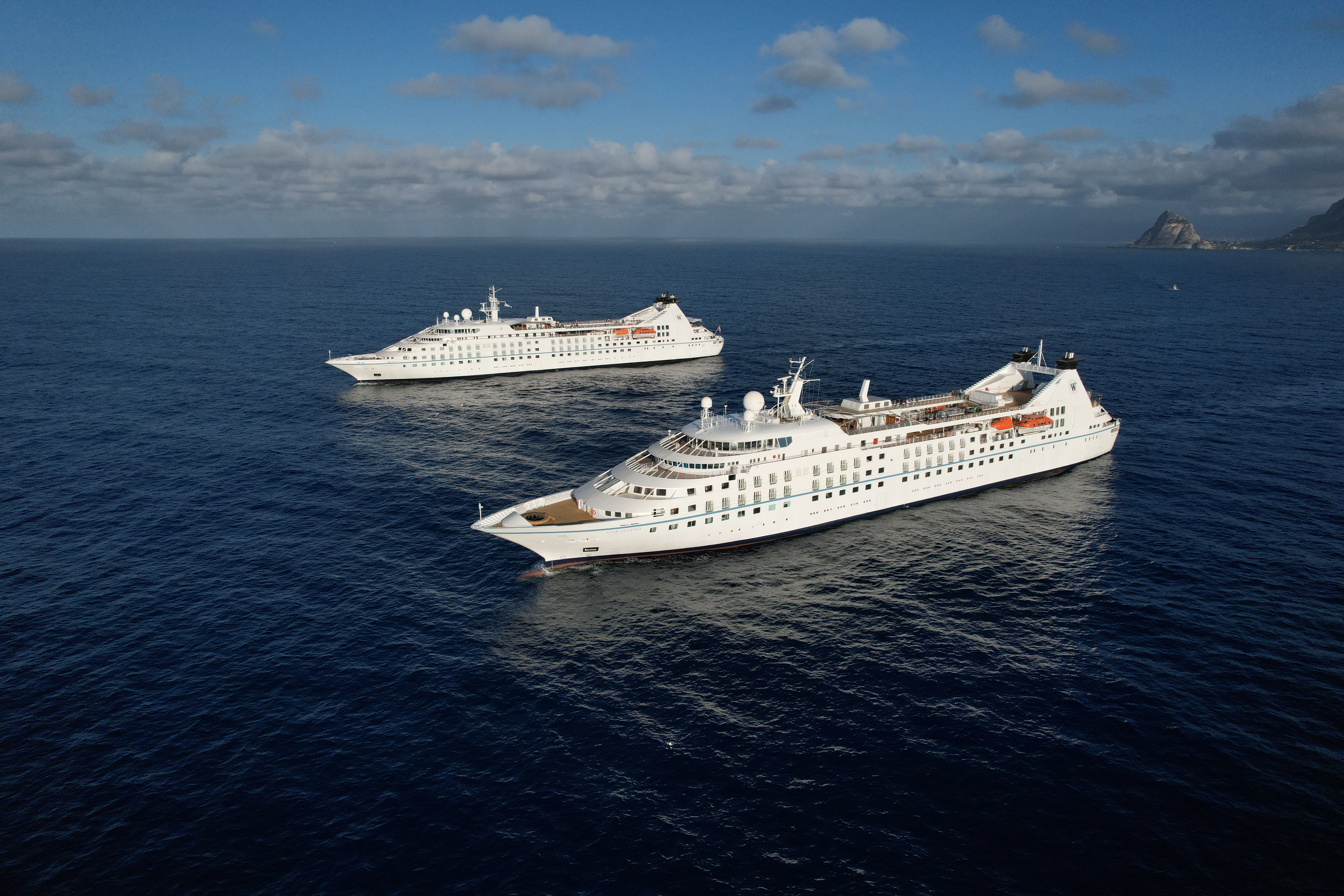
Star Legend
Serving just 312 guests, Star Legend is the perfect size — small enough to offer unique experiences that set Windstar apart from other cruise lines (think crossing the Corinth Canal), yet large enough for you to make plenty of new connections on board — all without ever feeling crowded.
This intimate all-suite yacht features spacious, ocean-view accommodations, each with a walk-in closet and updated double-vanity bathroom. On board, you’ll find a fully equipped fitness center, a spa with complimentary sauna, an infinity pool, two full-service bars, on-deck hot tubs, a water-access marina platform, and so much more.
And did we mention all dining is included? From gourmet bites at our Yacht Club Café to 24-hour room service and even specialty restaurants like Basil + Bamboo (available starting December 13, 2025), Windstar’s award-winning cuisine is always complimentary, so you can indulge freely and enjoy every moment of your journey.
Ready to experience Star Legend for yourself? Join us on one of our voyages across Northern Europe and the Mediterranean, where she sails year-round — and get ready to sail beyond ordinary.
Ship Facts
| Launch Year | 1992 | ||||||||
| Refit Year | 2021 | ||||||||
| Language | en | ||||||||
| Gross Tonnage | 12995 | ||||||||
| Length | 159 | ||||||||
| Width | 19 | ||||||||
| Currency | USD | ||||||||
| Speed | 15 | ||||||||
| Capacity | 312 | ||||||||
| Crew Count | 204 | ||||||||
| Deck Count | 6 | ||||||||
| Cabin Count | 156 | ||||||||
| Large Cabin Count | 0 | ||||||||
| Wheelchair Cabin Count | 4 | ||||||||
| Electrical Plugs |
|
Deck 8
- Yacht Club Café & Library (1)
- Star Bar (2)
- Star Grill by Steven Raichlen (3)
Deck 7
- Bridge (4)
- World Spa by Windstar (5)
- Fitness Centre and Motion Studio (6)
- Pool and Whirlpool (7)
- Veranda/Candles (8)

Deck 6
- Cuadro 44/Basil & Bamboo Restaurant* (9)
- Star Boutique (10)
- Compass Rose (11)
- Owner's Suites
- Star Porthole Suites
- Star Balcony Suites
- Deluxe Suite
- Star Ocean View Suites
- Balcony Suites

Deck 5
- Whirlpool (12)
- Reception (13)
- Destination Office (14)
- Screening Room (15)
- Lounge (16)
- Deluxe Suite
- Ocean View Suites
- Balcony Suites
- Deluxe Suite
- Star Balcony Suite
- Star Ocean View Suite
- Ocean View Suite - Accessible Suites (548, 550)
Deck 4
- Star Ocean View Suites
- Balcony Suite
- Ocean View Suites - Accessible Suites (448,450)
- Deluxe Suite
Deck 3
- Watersports Platform (19)
- Amphora Restaurant (18)
- Medical Facility (17)
- Star Porthole Suites

World Class Dining Experience
We’ve upped the onboard dining game with our culinary program, featuring an array of fresh, seasonal ingredients sourced from each ports along the journey. The menu us crafted to highlight the spectacular flavors of the regional cuisine.
Amphora Restaurant
Here, the dining room manager seats you, but where is your decision. There are no pre-assigned tables or first or second seatings. When you dine and with whom are entirely up to you. Seating usually begins at 6:30 p.m. and will be printed in the ship's daily program. Each delightful dish is prepared exactly to your liking – an exquisite dinner served course-by-course with a fine selection of vintage wines.
The Yacht Club
Certainly a Windstar favourite, The Yacht Club is the perfect place if you want to enjoy some casual dining. Serving gourmet sandwiches, snacks and beverages, all the food is prepared to your liking and is presented in impeccable Windstar style.
Veranda
It's breakfast alfresco, full service or buffet-style, anytime till 9:30 a.m. No need to hurry. Again, the choices are many in Veranda. Choose the sumptuous, seemingly endless buffet. Or, order from the lunch menu between noon and 2:30 p.m.
Candles Restaurant
Here’s the perfect place for a romantic tête-a-tête under the stars in Candles, Windstar’s signature outdoor restaurant transformed by night into a dreamlike paradise. Delectable cuisine, memorable surroundings, inspired wine pairings.
Star Grill by Steven Raichlen
You’ll find all your traditional grilled and barbecued favourites (and discover new dishes from around the world) in our new casual outdoor restaurant brought to you in partnership with global grilling authority, Steven Raichlen.
Basil + Bamboo
Step into Basil + Bamboo, where clean lines and warm accents set the stage for a relaxed, refined experience. Savor dishes that fuse Asian influences with a Mediterranean twist — an inventive culinary adventure designed to delight your palate and create moments of shared discovery.
A day on board your Windstar ship is a day of choices, all of them good. Perhaps you’ll begin with a relaxing massage in World Spa by Windstar. Or maybe an invigorating workout in the Fitness Center. Even better, why not both? After a sumptuous lunch in Veranda, make a splash from the Watersports Platform off the ship’s stern. Everything you can think of for fun in the water is there — swimming, kayaking, sail-boarding, even water skiing. And it’s all complimentary, of course. Sun yourself on deck, take a dip in the whirlpool, then catch up on email ororder a cheese plate for your stateroom or suite. After dinner, dance to live music in the Lounge. This is your yacht, so of course you’re welcome on the Bridge, where the Captain and officers are delighted to share charts, routes, and vistas with you.
As you prepare for another amazing Windstar day, enjoy a nightcap anywhere you like — on deck, in the Lounge, or why not let us bring it to your suite or stateroom? Your day ends just as it began, blissfully.
Compass Rose
Compass Rose can be found on Deck 6.
The Yacht Club
The Yacht Club can be found on Deck 8.
Lounge
The Lounge can be found on Deck 5.
Screening Room
The ship’s card room is now the new Star Screening Room, where guests can view current movies.
Sun Deck
The Sun Deck can be located on Deck 7.
Star Boutique
Visit our newly transformed specialty shopping boutique, Star Boutique, rolling out fleet-wide through early 2022. The new shop features quality brand-name and exclusive Star Collection merchandise, from clothing and fragrances to jewelry and accessories, all at duty free or special pricing.