Marvels of Ecuador, Peru, and the Panama Canal
Marvels of Ecuador, Peru, and the Panama Canal
Cruise overview
WHY BOOK WITH US?
- ✔ The Deluxe Cruises’ team has extensive experience in ultra-luxury cruising.
- ✔ Call now to speak to our helpful and experienced Cruise Concierge team.
- ✔ Enjoy our Unique Deluxe Cruises Bonus for substantial savings.
- ✔ Our team will tailor your holiday to your exacting requirements.
- ✔ As agents, we work under the protection of each cruise lines ABTA / ATOL licences
About Colón
The provincial capital of Colón, beside the canal's Atlantic entrance, is named for the Spanish-language surname of Christopher Columbus, though the Americans called it Aspinwall in the 19th century.. The city was founded in 1850 by Americans working on the Panama railroad and named Aspinwall for one of the railway engineers. Following completion in 1855, Colon gained in importance, which was furthered by the plans for an isthmian canal. During the time of the French canal attempt, a fire in 1885 burned the city nearly to the ground and left thousands of people homeless. Colon was rebuilt in the architectural style then popular in France. Buildings from that era plus the ones constructed by Americans between 1904 and 1914 are still in use today, although the majority is on the verge of collapse. In addition to its importance as a port, Colon boasts the world’s second largest duty-free zone, known as Zona Libre, which is contained in a huge fortress like, walled-off area with giant international stores. However, most of the merchandise is sold in bulk to commercial businesses throughout the country.
About Manta
About Manta

About Guayaquil
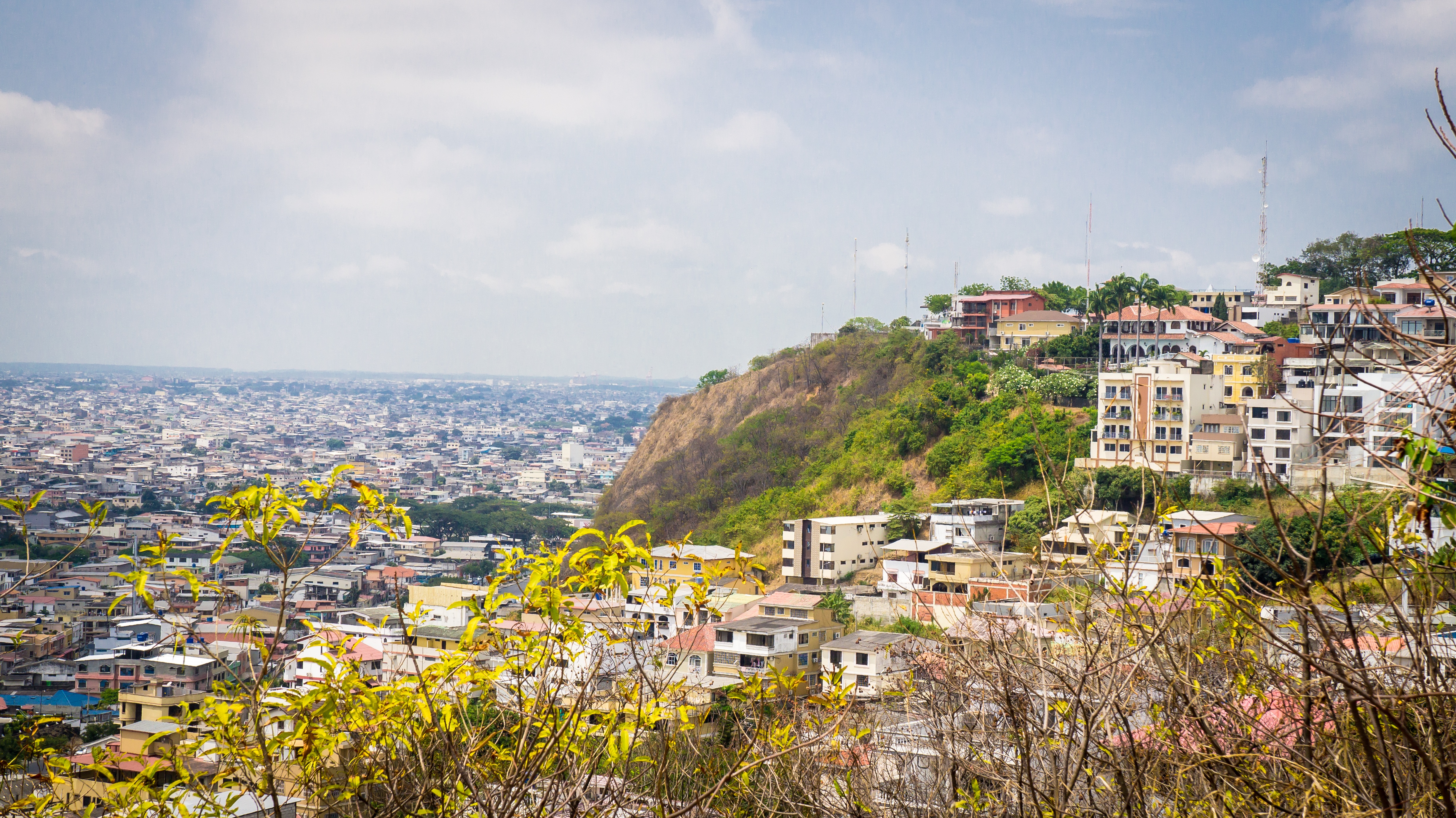
The second major jumping off point for the Galapagos Islands after Quito, this is a little city with a big heart. A sea port first and foremost, the city’s personality has been founded on that, and all the better it is for it too. Almost Caribbean in feeling, the clement climate coupled with the intermingling rhythms floating from the windows and abundance of fresh seafood make this a very tropical destination. Once not even considered by the travel books as a potential destination in its own right, the city has undergone something of a resurgence in the past few years. Proud Guayaquileños will not hestitate to point out the Malecón or the exciting new riverfront promenade, once a no-go area after dark, now happily (and hippily) lined with museums, restaurants, shops, and ongoing entertainment. The new airport and urban transportation network are also lauded to the happy tourists who find themselves here. As the largest and most populous city in Ecuador as well as being the commercial centre, it would only be natural that the city would have some kind of modern architecture, but it is the colourful favelas, or to use their real name guasmos, that cling to the side of the hillside like limpets that really catch your eye. A blend of old and new, the first inhabitants can be traced back to 1948 when the government cleared the area for affordable housing, these shanty towns are witness to the social and political particularities that Guayaquil has faced in the past.

About Machala
Several National Sanctuaries and Ecological Reserves found near Machala boast sun-drenched beaches and mangrove forests. Pelicans, frigatebirds, and egrets nest nearby as Blue-footed Boobies dive for fish further out to sea. Whales and dolphins can occasionally be seen in the vicinity. Machala, with a population of approximately 250,000 inhabitants, is moreover known for traditional Latin American foods from shrimp ceviche to fried bananas. In fact, bananas feature heavily in the culture as the city is also known as the “Capital of the Banana.” During the third week of September the ‘World Fair of the Banana’ is held here and producers and buyers from Perú, Costa Rica, Colombia, Venezuela, México, Paraguay, Uruguay, Bolivia, Argentina, Guatemala, Panamá, República Dominicana, El Salvado, Honduras and Ecuador attend the event.
About Trujillo
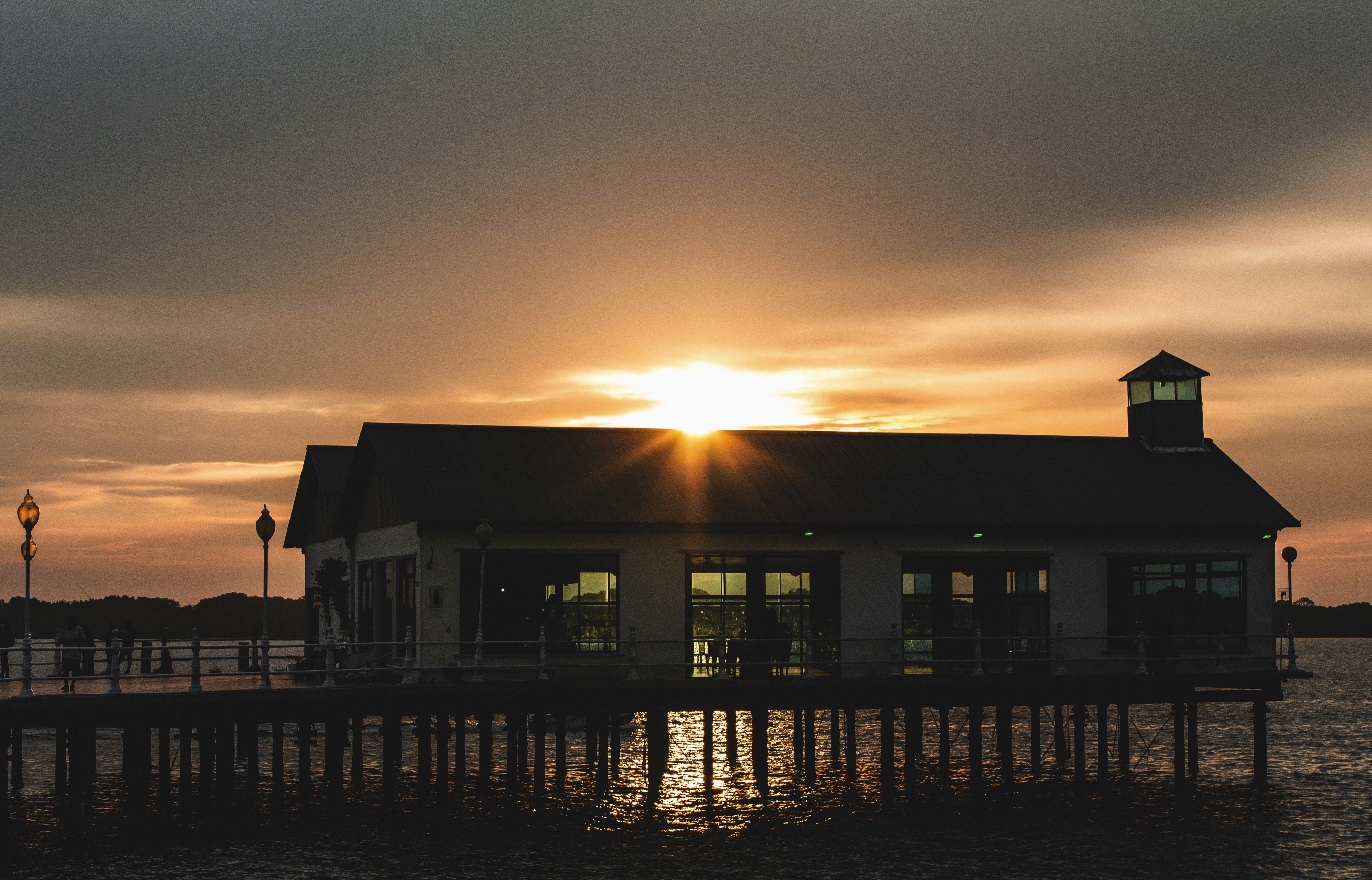
The town of Trujillo is located in the western Caribbean on Honduras’ gorgeous and dramatic North Coast. Christopher Columbus landed in present-day Trujillo in 1502, during his fourth and final voyage to the New World. The Santa Bárbara Fort was constructed beginning around 1575 and provided protection for the town with its large cannons overlooking the Bay. A town plaza and park are near the fort, as is the San Juan Bautista Church. Experience the culture, the warmth, the hospitality and the seaside charm of this coastal location.
About Lima
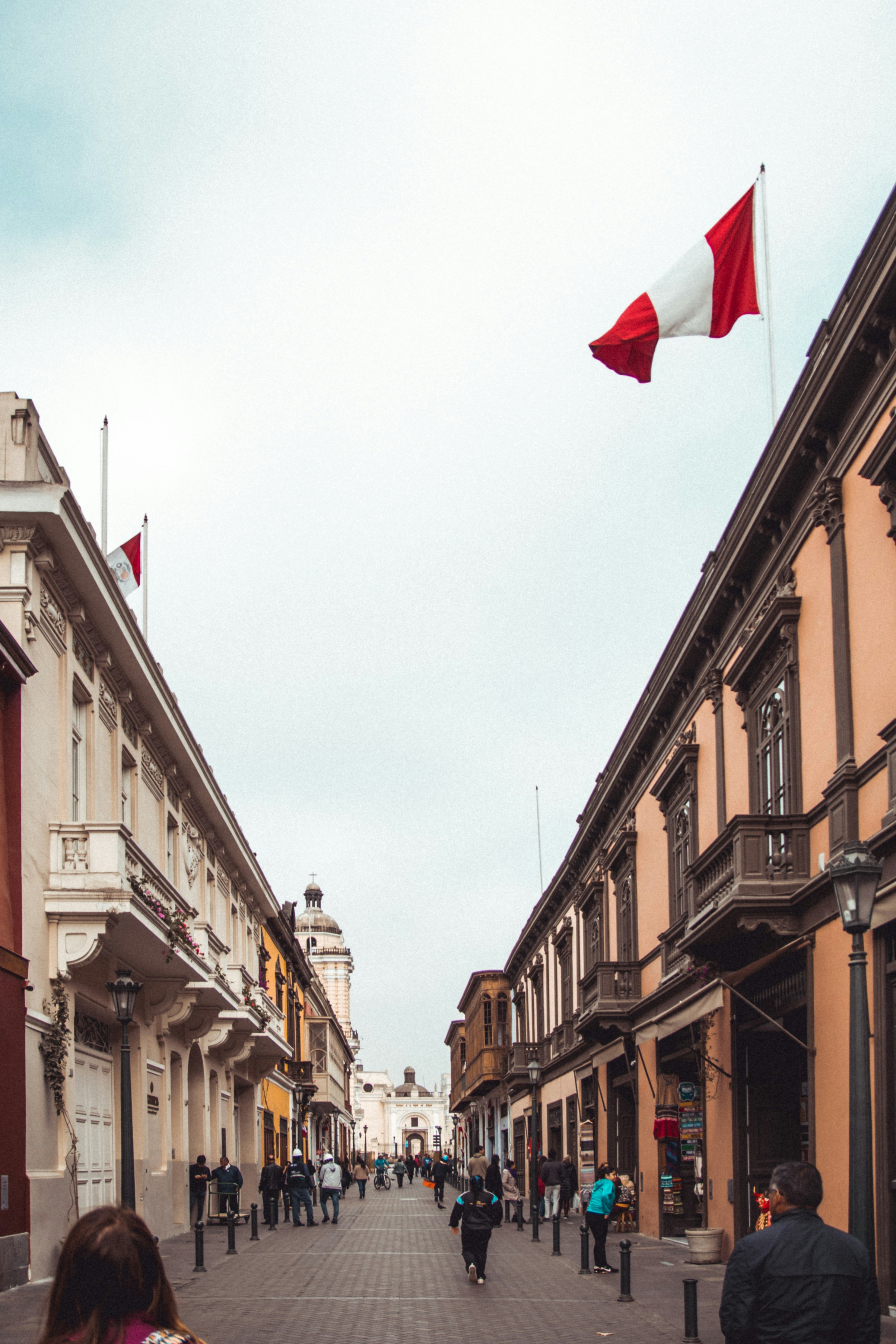
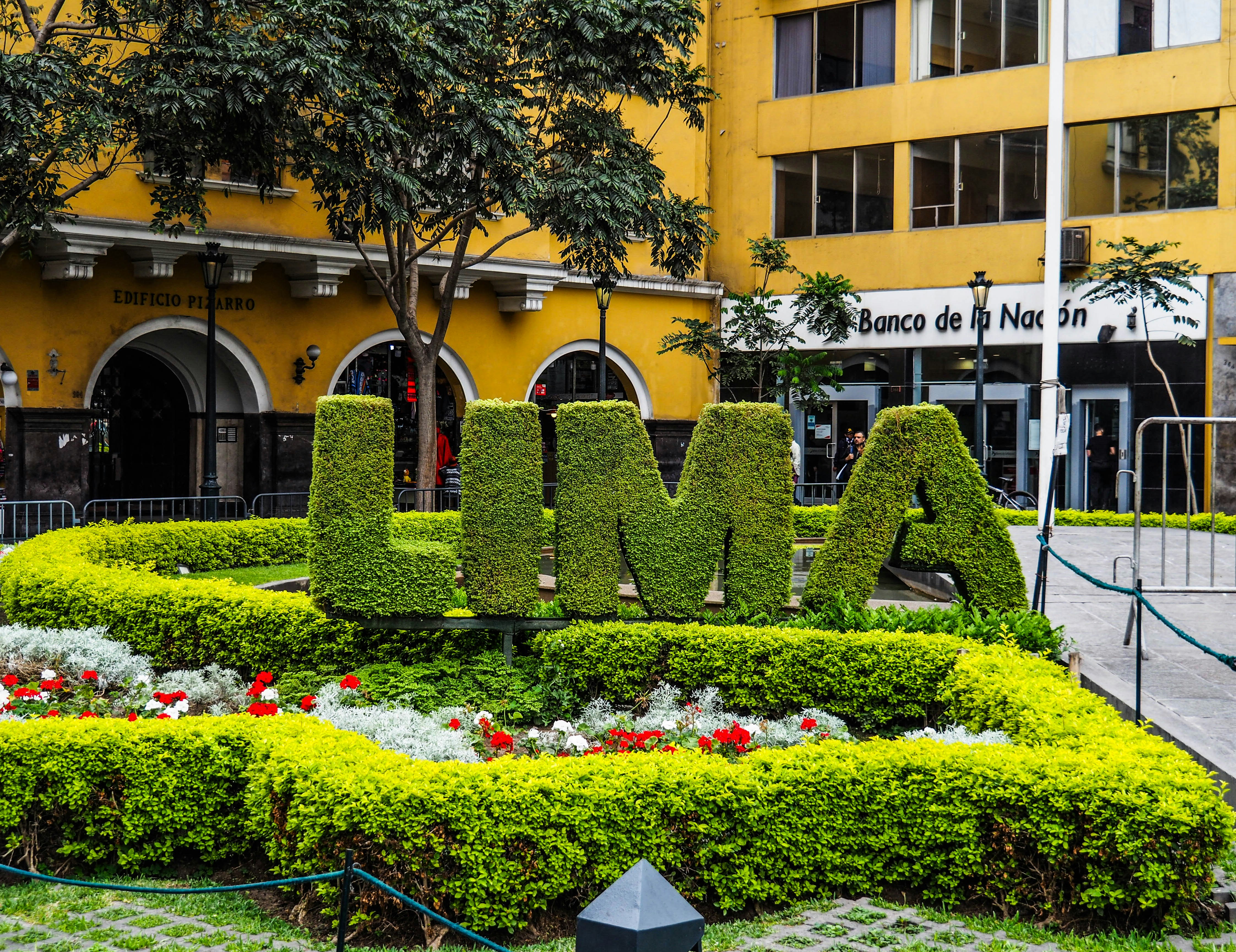
Lima, Peru, the vibrant capital, blends colonial charm with modern dynamism. Known for its rich history, the city showcases splendid architecture in the historic center, a UNESCO World Heritage site. Nestled along the Pacific coast, Lima boasts scenic ocean views, exquisite cuisine, and lively cultural scenes. Its diverse neighborhoods, from Miraflores' upscale vibe to Barranco's bohemian allure, offer unique experiences. Renowned museums, bustling markets, and the iconic Huaca Pucllana ruins highlight its heritage. Lima's bustling streets and warm, welcoming atmosphere make it a captivating destination for travelers.


Newly Redesigned Restrooms
We re-imagined our restrooms to provide you a private oasis within your own room.
All Accommodations Feature
- Queen Size Bed with Luxurious Linens
- Waffle Weave Robe and Slippers
- Interactive TV
- Fully Stocked Mini Bar/Refrigerator
- Safe
- Direct Dial Phone
- L'Occitane Bath Amenities
- Fresh Fruit
- Hair Dryers and 110/220 outlets
- Wi-Fi Internet Access(various plans available for purchase)
- Mirrored closet with ample drawer space
- Granite vanity with magnifying mirror and chair
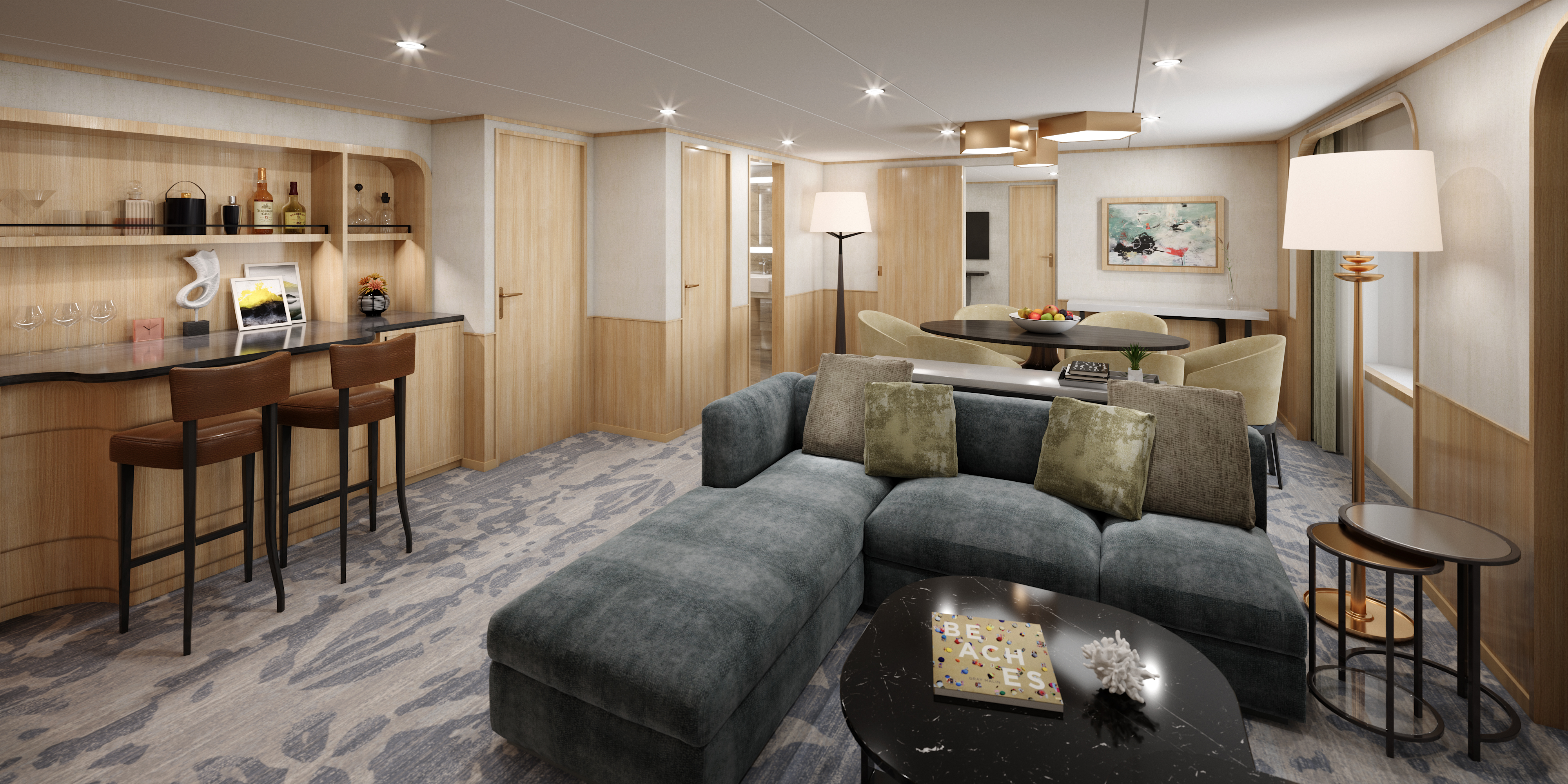

A stunning brand new owner’s suites with 820 square feet of space featuring two bedrooms and two bathrooms, a verandah, and plenty of space in the sitting area for entertaining. This is the most sought after suite on the entire ship and once you stay here, you’ll never stay anywhere else.
Newly Redesigned Restrooms
We re-imagined our restrooms to provide you a private oasis within your own room.
All Accommodations Feature
- Queen Size Bed with Luxurious Linens
- Waffle Weave Robe and Slippers
- Interactive TV
- Fully Stocked Mini Bar/Refrigerator
- Safe
- Direct Dial Phone
- L'Occitane Bath Amenities
- Fresh Fruit
- Hair Dryers and 110/220 outlets
- Wi-Fi Internet Access(various plans available for purchase)
- Mirrored closet with ample drawer space
- Granite vanity with magnifying mirror and chair
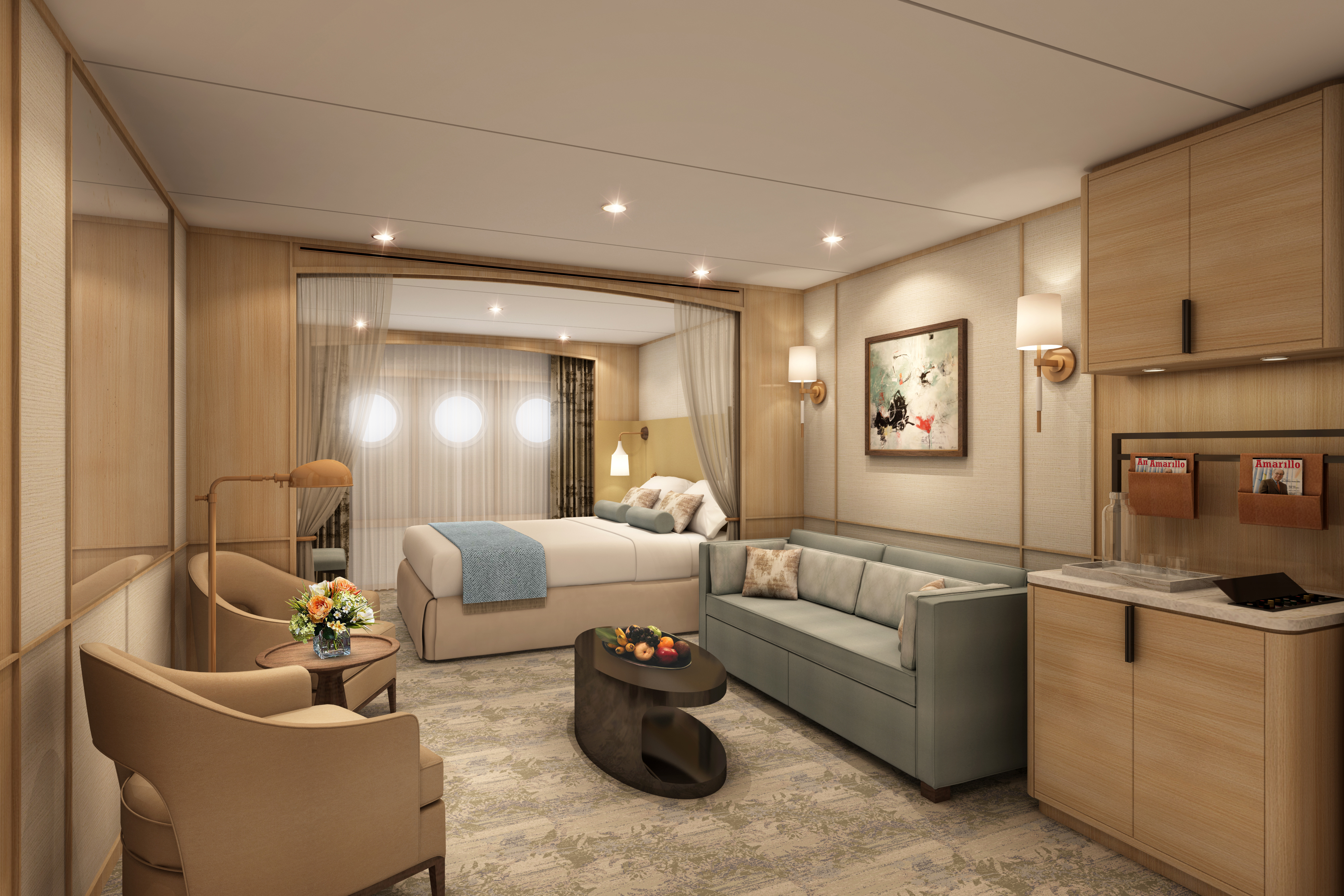
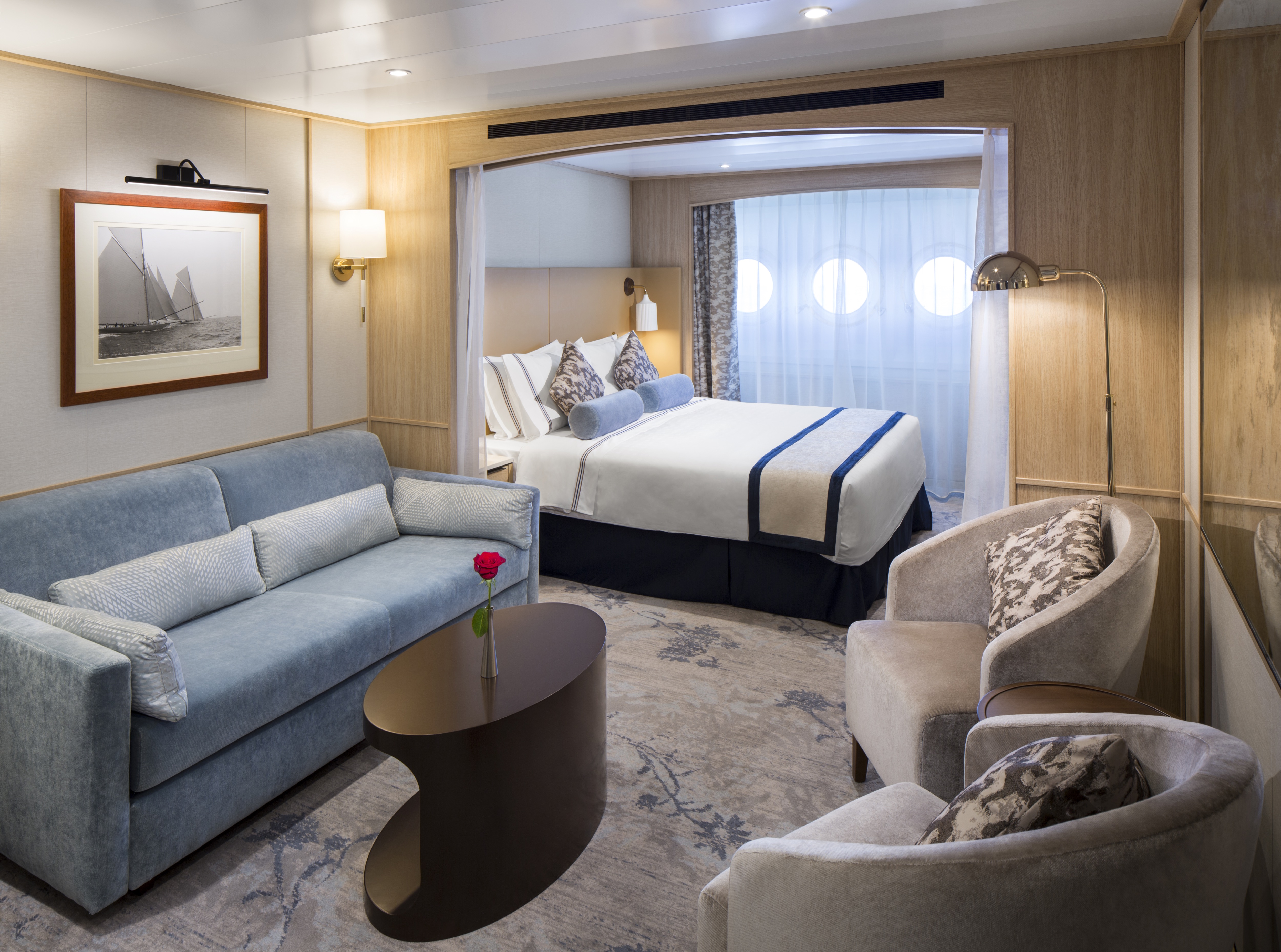
With 575 square feet, your Owner’s Suite offers separate living room and dining areas. A veranda, two interactive TVs, and a full master bath and separate powder room indulge you in spacious comfort. *Please note this suite has a shower only
Newly Redesigned Restrooms
We re-imagined our restrooms to provide you a private oasis within your own room.
All Accommodations Feature
- Queen Size Bed with Luxurious Linens
- Waffle Weave Robe and Slippers
- Interactive TV
- Fully Stocked Mini Bar/Refrigerator
- Safe
- Direct Dial Phone
- L'Occitane Bath Amenities
- Fresh Fruit
- Hair Dryers and 110/220 outlets
- Wi-Fi Internet Access(various plans available for purchase)
- Mirrored closet with ample drawer space
- Granite vanity with magnifying mirror and chair
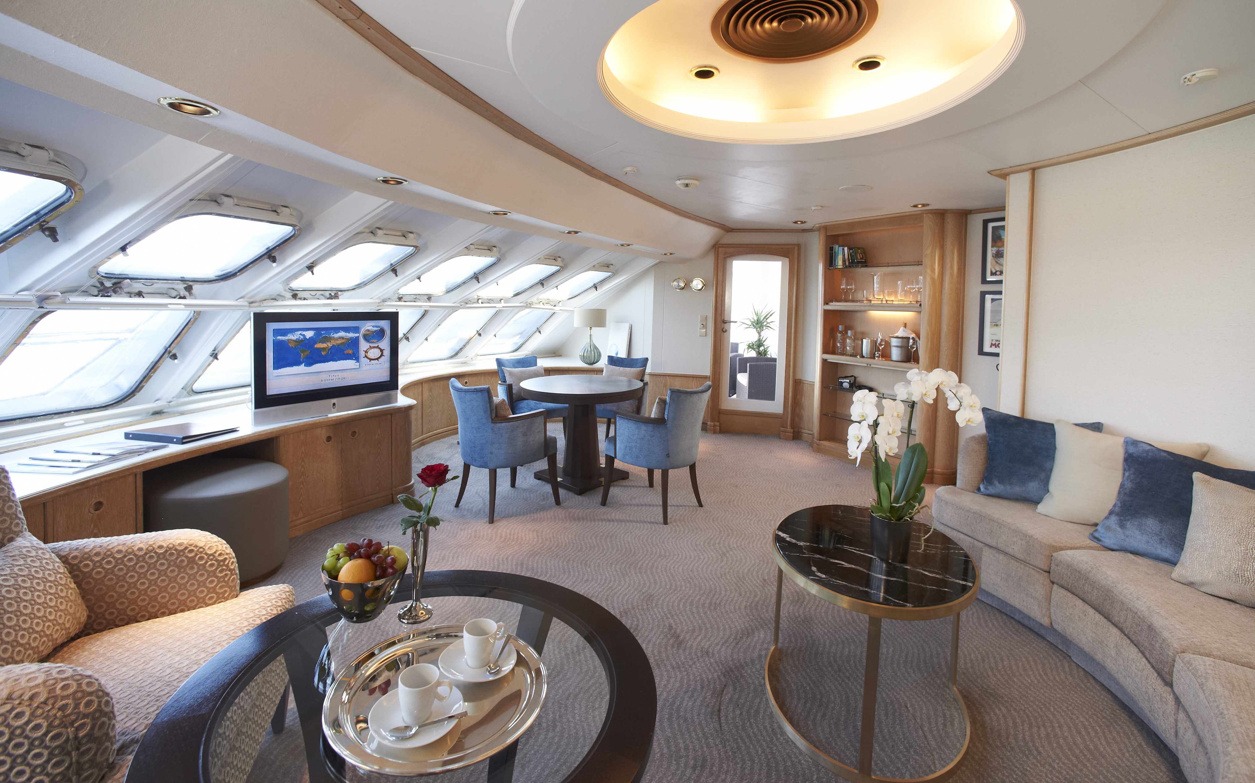
Relax in 400 to 530 spacious square feet. Your living area offers beautiful views from the forward-facing window and French doors onto your private veranda. Two spacious closets give you plenty of room to unpack.
Newly Redesigned Restrooms
We re-imagined our restrooms to provide you a private oasis within your own room.
All Accommodations Feature
- Queen Size Bed with Luxurious Linens
- Waffle Weave Robe and Slippers
- Interactive TV
- Fully Stocked Mini Bar/Refrigerator
- Safe
- Direct Dial Phone
- L'Occitane Bath Amenities
- Fresh Fruit
- Hair Dryers and 110/220 outlets
- Wi-Fi Internet Access(various plans available for purchase)
- Mirrored closet with ample drawer space
- Granite vanity with magnifying mirror and chair

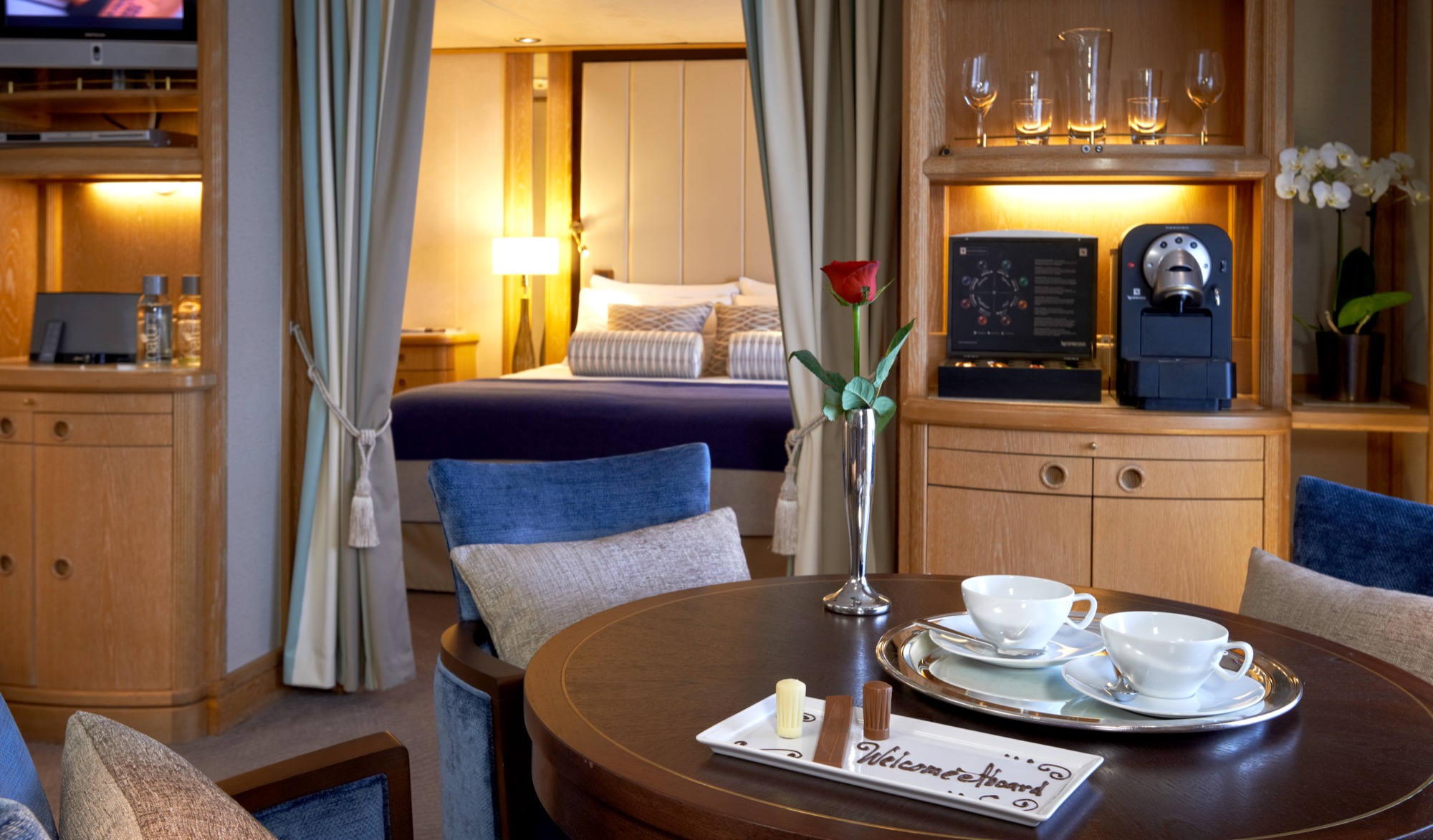
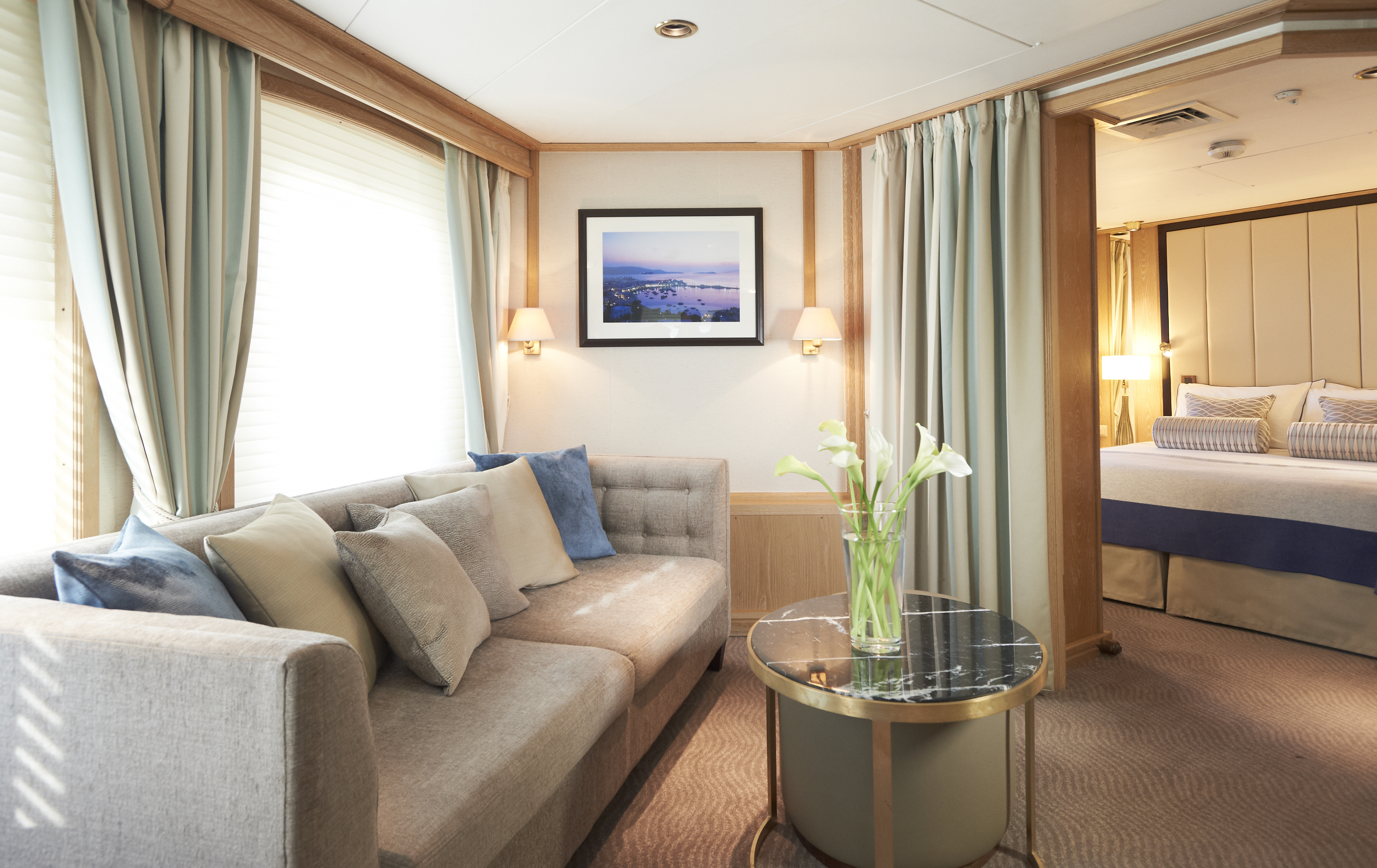
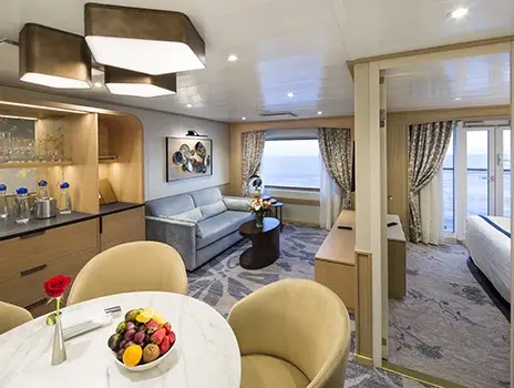
Brand new Deluxe Suites welcome you with 468 square feet of casually elegant living space and an ocean viewing French balcony. All these suites feature 3rd berths, and a sleep-inducing queen bed easily converted to twins.
Newly Redesigned Restrooms
We re-imagined our restrooms to provide you a private oasis within your own room.
All Accommodations Feature
- Queen Size Bed with Luxurious Linens
- Waffle Weave Robe and Slippers
- Interactive TV
- Fully Stocked Mini Bar/Refrigerator
- Safe
- Direct Dial Phone
- L'Occitane Bath Amenities
- Fresh Fruit
- Hair Dryers and 110/220 outlets
- Wi-Fi Internet Access(various plans available for purchase)
- Mirrored closet with ample drawer space
- Granite vanity with magnifying mirror and chair
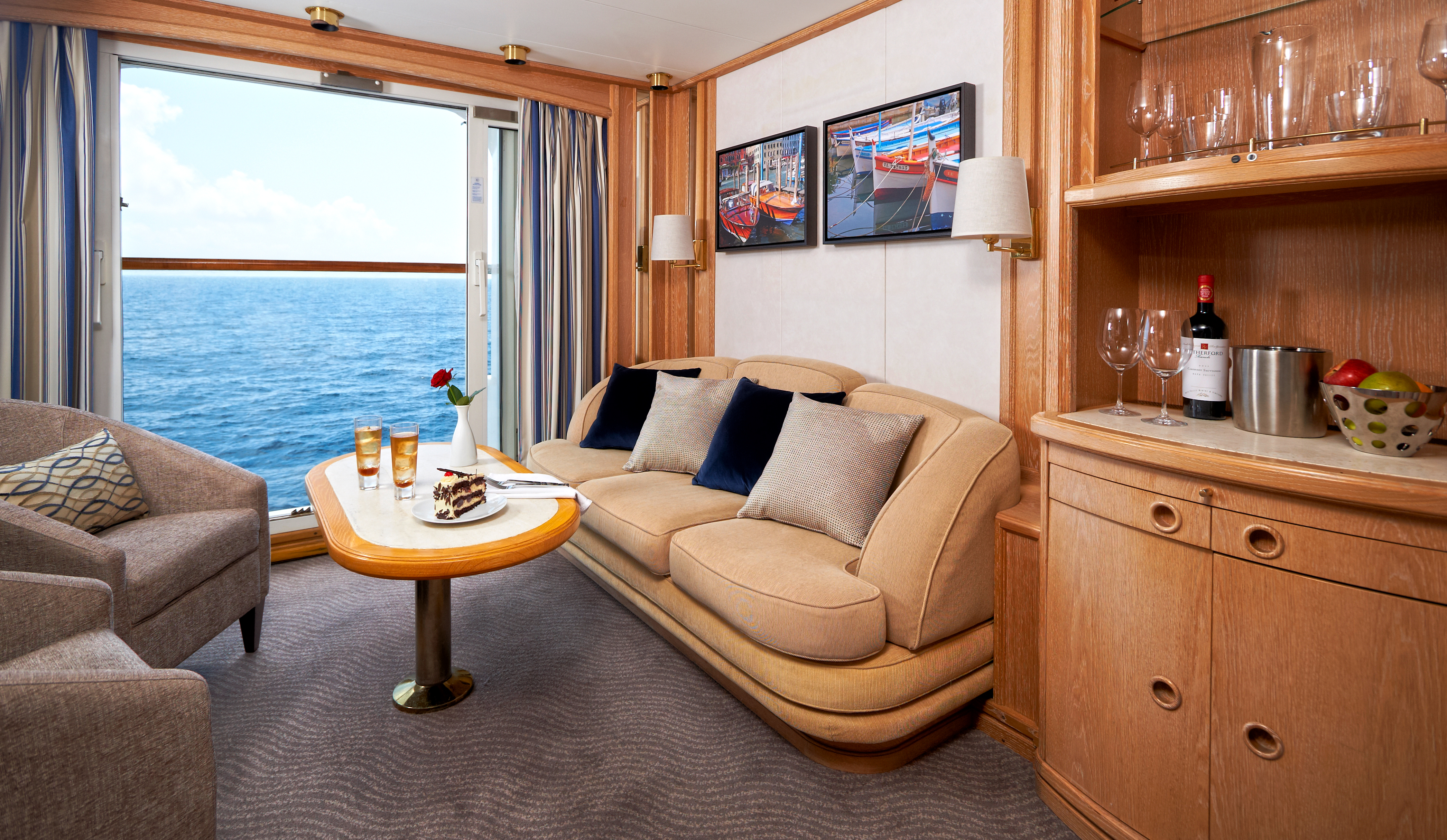
Stylish comfort and ocean views welcome you in 277 square feet. Your queen bed (which can be separated as twins if you prefer) features luxurious Egyptian cotton linens. Enjoy a luxurious soak in your full-size tub or an invigorating shower, then wrap up in your waffle-weave robe and slippers, savour a treat from the fresh fruit bowl, or simply stretch out and enjoy the fresh flowers.
Newly Redesigned Restrooms
We re-imagined our restrooms to provide you a private oasis within your own room.
All Accommodations Feature
- Queen Size Bed with Luxurious Linens
- Waffle Weave Robe and Slippers
- Interactive TV
- Fully Stocked Mini Bar/Refrigerator
- Safe
- Direct Dial Phone
- L'Occitane Bath Amenities
- Fresh Fruit
- Hair Dryers and 110/220 outlets
- Wi-Fi Internet Access(various plans available for purchase)
- Mirrored closet with ample drawer space
- Granite vanity with magnifying mirror and chair
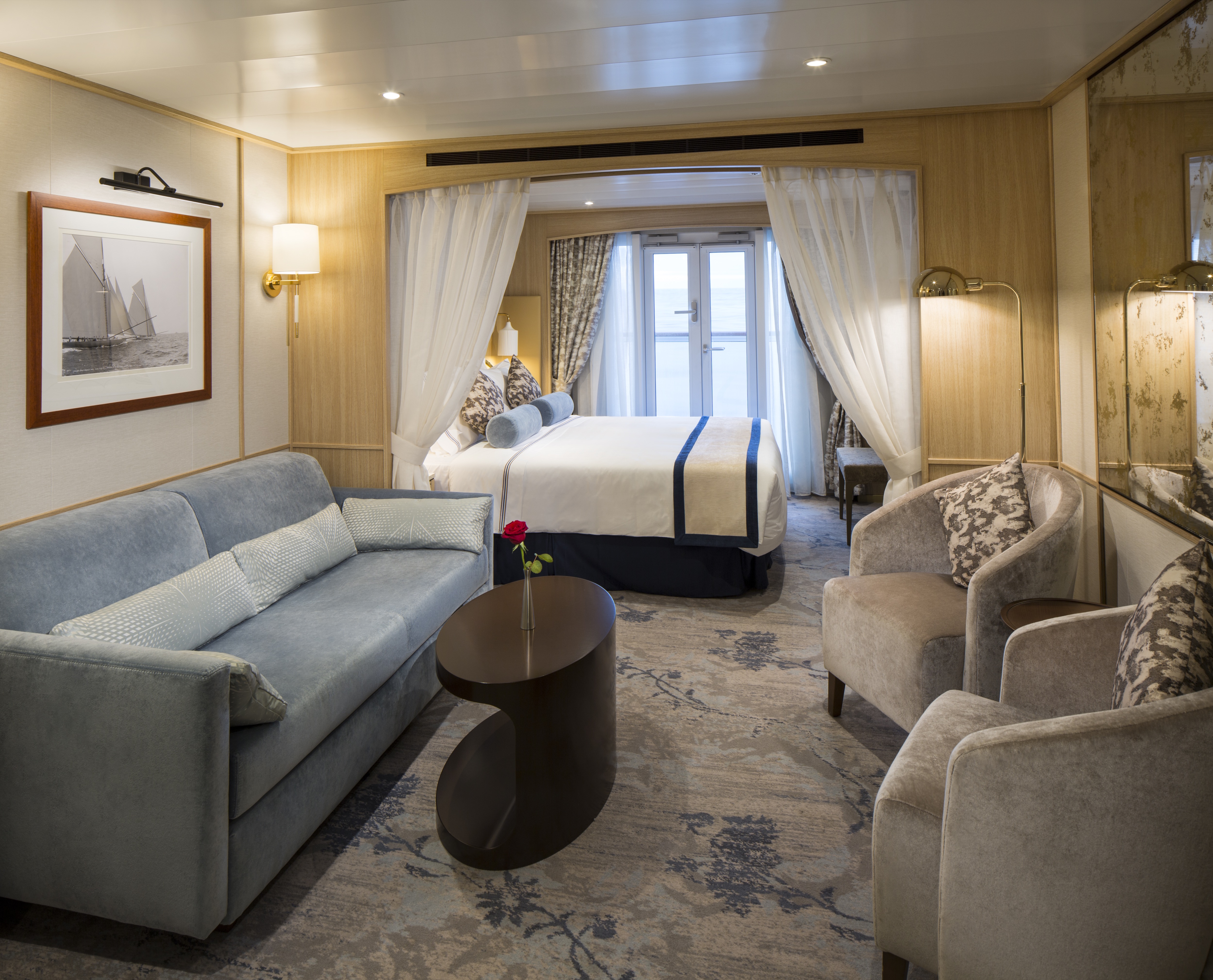
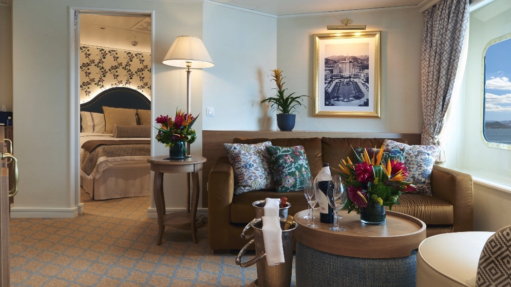
As soon as you walk through the door, you're greeted with an open living area for a more welcoming entrance. Drift off to sleep by the window in your queen bed as you watch the same stars that sailors used to navigate the seas hundreds of years ago.
Newly Redesigned Restrooms
We re-imagined our restrooms to provide you a private oasis within your own room.
All Accommodations Feature
- Queen Size Bed with Luxurious Linens
- Waffle Weave Robe and Slippers
- Interactive TV
- Fully Stocked Mini Bar/Refrigerator
- Safe
- Direct Dial Phone
- L'Occitane Bath Amenities
- Fresh Fruit
- Hair Dryers and 110/220 outlets
- Wi-Fi Internet Access(various plans available for purchase)
- Mirrored closet with ample drawer space
- Granite vanity with magnifying mirror and chair
Stylish comfort and ocean views welcome you in 277 square feet. Your queen bed (which can be separated as twins if you prefer) features luxurious Egyptian cotton linens. Enjoy a luxurious soak in your full-size tub or an invigorating shower, then wrap up in your waffle-weave robe and slippers, savour a treat from the fresh fruit bowl, or simply stretch out and enjoy the fresh flowers.
Four suites with ocean view are modified accessible; they feature a shower with a small lip into shower, a step into the bathroom with a portable ramp, standard interior and exterior doorways.
Newly Redesigned Restrooms
We re-imagined our restrooms to provide you a private oasis within your own room.
All Accommodations Feature
- Queen Size Bed with Luxurious Linens
- Waffle Weave Robe and Slippers
- Interactive TV
- Fully Stocked Mini Bar/Refrigerator
- Safe
- Direct Dial Phone
- L'Occitane Bath Amenities
- Fresh Fruit
- Hair Dryers and 110/220 outlets
- Wi-Fi Internet Access(various plans available for purchase)
- Mirrored closet with ample drawer space
- Granite vanity with magnifying mirror and chair
As soon as you walk through the door, you're greeted with an open living area for a more welcoming entrance. Drift off to sleep by the window in your queen bed as you watch the same stars that sailors used to navigate the seas hundreds of years ago.
Newly Redesigned Restrooms
We re-imagined our restrooms to provide you a private oasis within your own room.
All Accommodations Feature
- Queen Size Bed with Luxurious Linens
- Waffle Weave Robe and Slippers
- Interactive TV
- Fully Stocked Mini Bar/Refrigerator
- Safe
- Direct Dial Phone
- L'Occitane Bath Amenities
- Fresh Fruit
- Hair Dryers and 110/220 outlets
- Wi-Fi Internet Access(various plans available for purchase)
- Mirrored closet with ample drawer space
- Granite vanity with magnifying mirror and chair
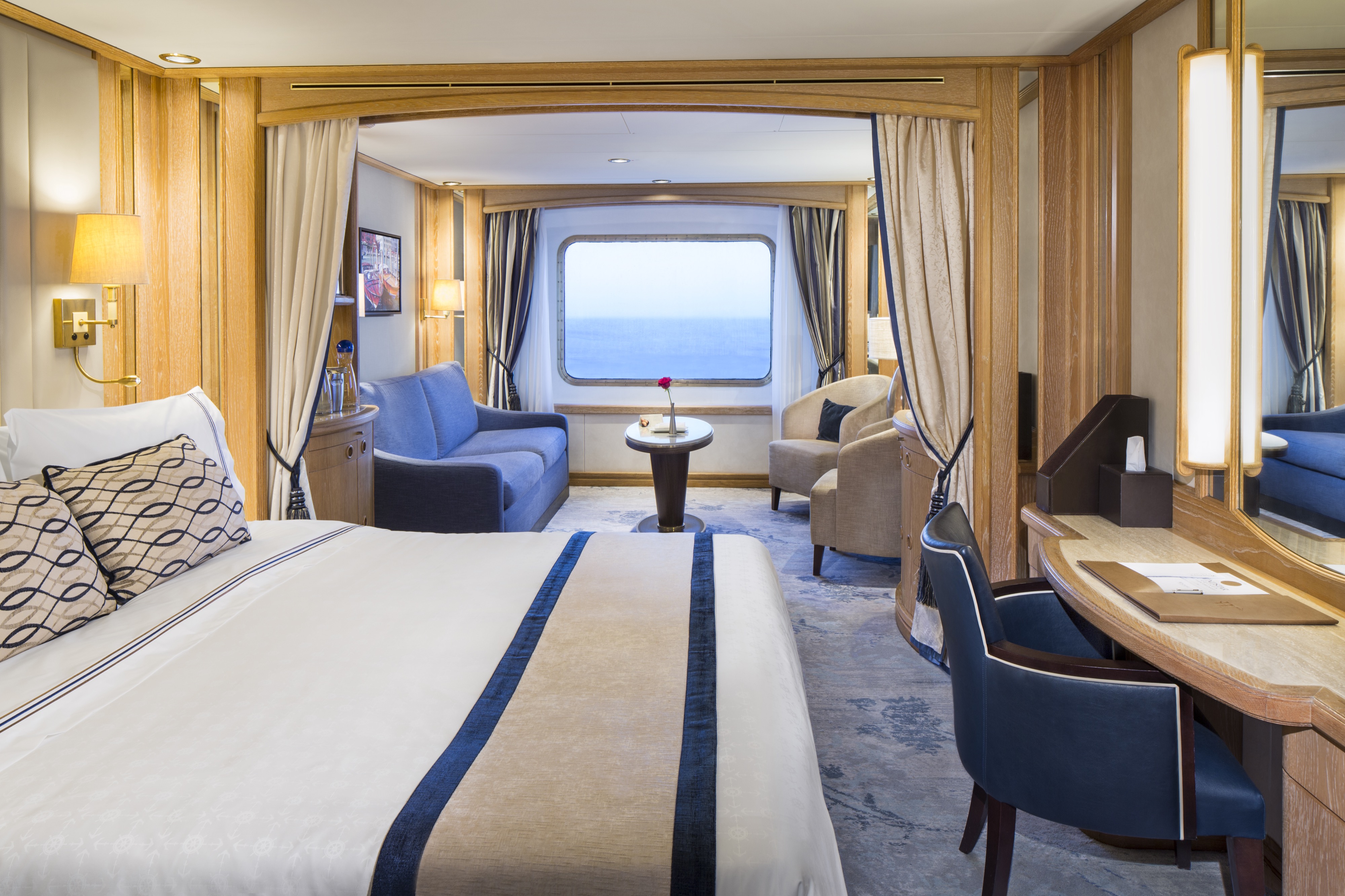
This suite will offer a coastal airy space with curved arches, lovely "hardwood" floors, gorgeous inset carpeting, light walls, and white trim with black finishes. New antique-style furnishings and custom wallpapers have been specially commissioned in the resort's style. You'll never see a TV at Sea Island (they are all tucked away in cabinets), so you won't see one in this suite, either. Historical black and white images of Sea Island will be on display.
Newly Redesigned Restrooms
We re-imagined our restrooms to provide you a private oasis within your own room.
All Accommodations Feature
- Queen Size Bed with Luxurious Linens
- Waffle Weave Robe and Slippers
- Interactive TV
- Fully Stocked Mini Bar/Refrigerator
- Safe
- Direct Dial Phone
- L'Occitane Bath Amenities
- Fresh Fruit
- Hair Dryers and 110/220 outlets
- Wi-Fi Internet Access(various plans available for purchase)
- Mirrored closet with ample drawer space
- Granite vanity with magnifying mirror and chair
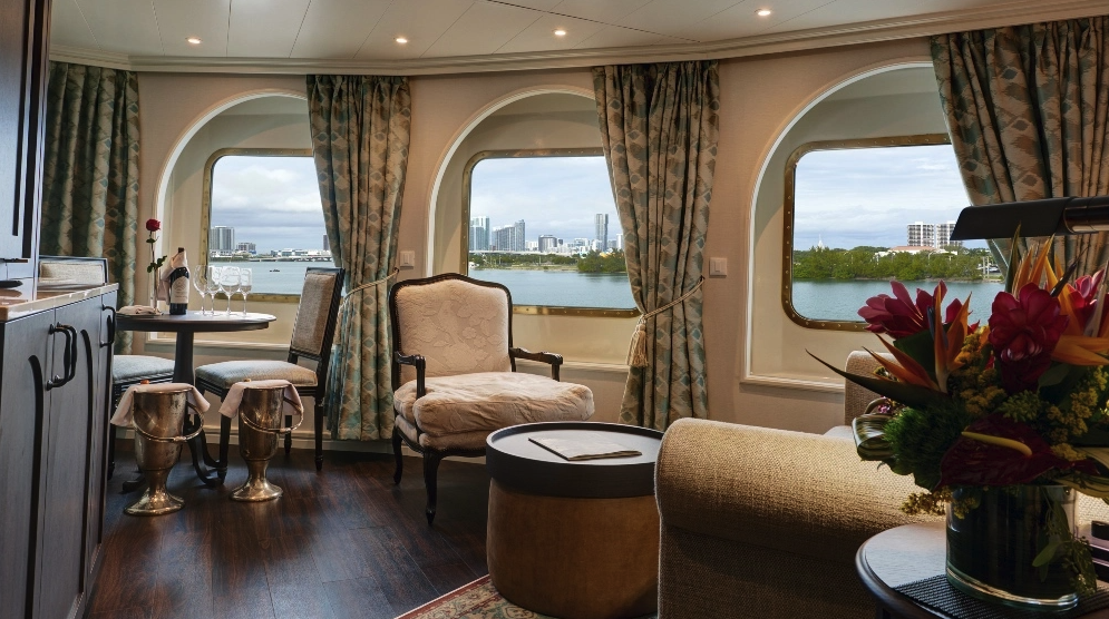
Inspired by the design of The Broadmoor, the suite offers a traditional space with classic furniture, floral motifs, white trim with gold finishes, and wide crown moulding. New furnishings, and wall sconces have been specially commissioned in the resort's style. The striking wallpaper used in the suite's walk-in closet is an exact replica of the wallpaper used throughout The Broadmoor. The resort's signature carpeting, with shades of light blue, brown, yellow and gold, was also recreated for the space. Historical black and white images of The Broadmoor will be on display.
Newly Redesigned Restrooms
We re-imagined our restrooms to provide you a private oasis within your own room.
All Accommodations Feature
- Queen Size Bed with Luxurious Linens
- Waffle Weave Robe and Slippers
- Interactive TV
- Fully Stocked Mini Bar/Refrigerator
- Safe
- Direct Dial Phone
- L'Occitane Bath Amenities
- Fresh Fruit
- Hair Dryers and 110/220 outlets
- Wi-Fi Internet Access(various plans available for purchase)
- Mirrored closet with ample drawer space
- Granite vanity with magnifying mirror and chair
Star Pride
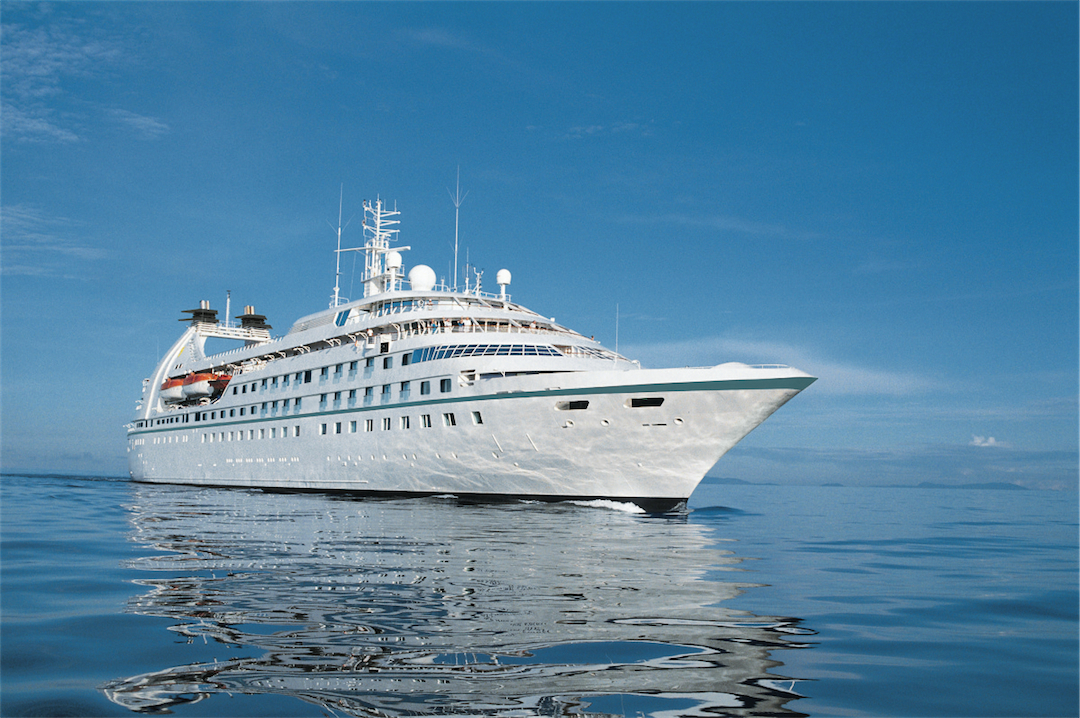
Serving just 312 guests, Star Pride is the perfect size — small enough to offer unique experiences that set Windstar apart from other cruise lines (like our complimentary Signature Beach Party), yet large enough for you to make plenty of new connections on board — all without ever feeling crowded.
This intimate all-suite yacht features spacious, ocean-view accommodations, each with a walk-in closet and updated double-vanity bathroom. On board, you’ll find a fully equipped fitness center, a spa with complimentary sauna, an infinity pool, two full-service bars, on-deck hot tubs, a water-access marina platform, and so much more.
And did we mention all dining is included? From gourmet bites at our Yacht Club Café to 24-hour room service and even specialty restaurants like Basil + Bamboo (available April 7, 2026), Windstar’s award-winning cuisine is always complimentary, so you can indulge freely and enjoy every moment of your journey.
Ready to experience Star Pride for yourself? Join us on one of her voyages across the world — and get ready to sail beyond ordinary.
Ship Facts
| Launch Year | 1990 | ||||||||
| Refit Year | 2021 | ||||||||
| Language | en | ||||||||
| Gross Tonnage | 12995 | ||||||||
| Length | 159 | ||||||||
| Width | 19 | ||||||||
| Currency | USD | ||||||||
| Speed | 15 | ||||||||
| Capacity | 312 | ||||||||
| Crew Count | 204 | ||||||||
| Deck Count | 6 | ||||||||
| Cabin Count | 156 | ||||||||
| Large Cabin Count | N/A | ||||||||
| Wheelchair Cabin Count | 4 | ||||||||
| Electrical Plugs |
|
Deck 8
- Yacht Club Café & Library (1)
- Star Bar (2)
- Star Grill by Steven Raichlen (3)

Deck 7
- Bridge (4)
- World Spa by Windstar (5)
- Fitness Centre and Motion Studio (6)
- Pool and Whirlpool (7)
- Veranda/Candles (8)

Deck 6
- Cuadro 44/Basil & Bamboo Restaurant* (9)
- Star Boutique (10)
- Compass Rose (11)
- Owner's Suites
- Star Porthole Suites
- Star Balcony Suites
- Deluxe Suite
- Star Ocean View Suites
- Balcony Suites

Deck 5
- Whirlpool (12)
- Reception (13)
- Destination Office (14)
- Screening Room (15)
- Lounge (16)
- Deluxe Suite
- Ocean View Suites
- Balcony Suites
- Deluxe Suite
- Star Balcony Suite
- Star Ocean View Suite
- Ocean View Suite - Accessible Suites (548, 550)

Deck 4
- Star Ocean View Suites
- Balcony Suite
- Ocean View Suites - Accessible Suites (448,450)
- Deluxe Suite

Deck 3
- Watersports Platform (19)
- Amphora Restaurant (18)
- Medical Facility (17)
- Star Porthole Suites

World Class Dining Experience
We’ve upped the onboard dining game with our culinary program, featuring an array of fresh, seasonal ingredients sourced from each ports along the journey. The menu us crafted to highlight the spectacular flavors of the regional cuisine.
Amphora Restaurant
Here, the dining room manager seats you, but where is your decision. There are no pre-assigned tables or first or second seatings. When you dine and with whom are entirely up to you. Seating usually begins at 6:30 p.m. and will be printed in the ship's daily program. Each delightful dish is prepared exactly to your liking – an exquisite dinner served course-by-course with a fine selection of vintage wines.
The Yacht Club
Certainly a Windstar favourite, The Yacht Club is the perfect place if you want to enjoy some casual dining. Serving gourmet sandwiches, snacks and beverages, all the food is prepared to your liking and is presented in impeccable Windstar style.
Candles Restaurant
Here’s the perfect place for a romantic tête-a-tête under the stars in Candles, Windstar’s signature outdoor restaurant transformed by night into a dreamlike paradise. Delectable cuisine, memorable surroundings, inspired wine pairings.
Veranda
It's breakfast alfresco, full service or buffet-style, anytime till 9:30 a.m. No need to hurry. Again, the choices are many in Veranda. Choose the sumptuous, seemingly endless buffet. Or, order from the lunch menu between noon and 2:30 p.m.
Star Grill by Steven Raichlen
You’ll find all your traditional grilled and barbecued favourites (and discover new dishes from around the world) in our new casual outdoor restaurant brought to you in partnership with global grilling authority, Steven Raichlen.
Cuadro 44 by Anthony Sasso
Savour flavours of Spanish local culture as you dine in intimate surroundings that encourage sharing and camaraderie by ten-time Michelin-starred Chef Anthony Sasso. With seating for 38 including a chef’s counter and communal table, it’s an inventive take on modern Spanish cuisine. (Coming Soon, Star Plus Class ships only)
A day on board your Windstar ship is a day of choices, all of them good. Perhaps you’ll begin with a relaxing massage in World Spa by Windstar. Or maybe an invigorating workout in the Fitness Center. Even better, why not both? After a sumptuous lunch in Veranda, make a splash from the Watersports Platform off the ship’s stern. Everything you can think of for fun in the water is there — swimming, kayaking, sail-boarding, even water skiing. And it’s all complimentary, of course. Sun yourself on deck, take a dip in the whirlpool, then catch up on email ororder a cheese plate for your stateroom or suite. After dinner, dance to live music in the Lounge. This is your yacht, so of course you’re welcome on the Bridge, where the Captain and officers are delighted to share charts, routes, and vistas with you.
As you prepare for another amazing Windstar day, enjoy a nightcap anywhere you like — on deck, in the Lounge, or why not let us bring it to your suite or stateroom? Your day ends just as it began, blissfully.
Compass Rose
Compass Rose can be found on Deck 6.
The Yacht Club
The Yacht Club can be found on Deck 8.
The Lounge
The Lounge can be found on Deck 5.
Screening Room
The ship’s card room is now the new Star Screening Room, where guests can view current movies.
Sun Deck
The Sun Deck can be located on Deck 7.
Star Boutique
Visit our newly transformed specialty shopping boutique, Star Boutique, rolling out fleet-wide through early 2022. The new shop features quality brand-name and exclusive Star Collection merchandise, from clothing and fragrances to jewelry and accessories, all at duty free or special pricing.