16-Day Trinidad To Rio: South American Expedition
16-Day Trinidad To Rio: South American Expedition
Cruise overview
WHY BOOK WITH US?
- ✔ The Deluxe Cruises’ team has extensive experience in ultra-luxury cruising.
- ✔ Call now to speak to our helpful and experienced Cruise Concierge team.
- ✔ Enjoy our Unique Deluxe Cruises Bonus for substantial savings.
- ✔ Our team will tailor your holiday to your exacting requirements.
- ✔ As agents, we work under the protection of each cruise lines ABTA / ATOL licences
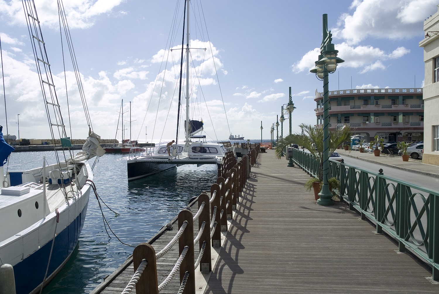
About Bridgetown
Located beside the island’s only natural harbour, the capital of Barbados combines modern and colonial architecture with glorious palm tree-lined beaches and a number of historical attractions. Experience the relaxed culture of the city renowned for its British-style parliament buildings and vibrant beach life, and seek out the Anglican church and the 19th-century Barbados Garrison. The distance between the ship and your tour vehicle may vary. This distance is not included in the excursion grades.
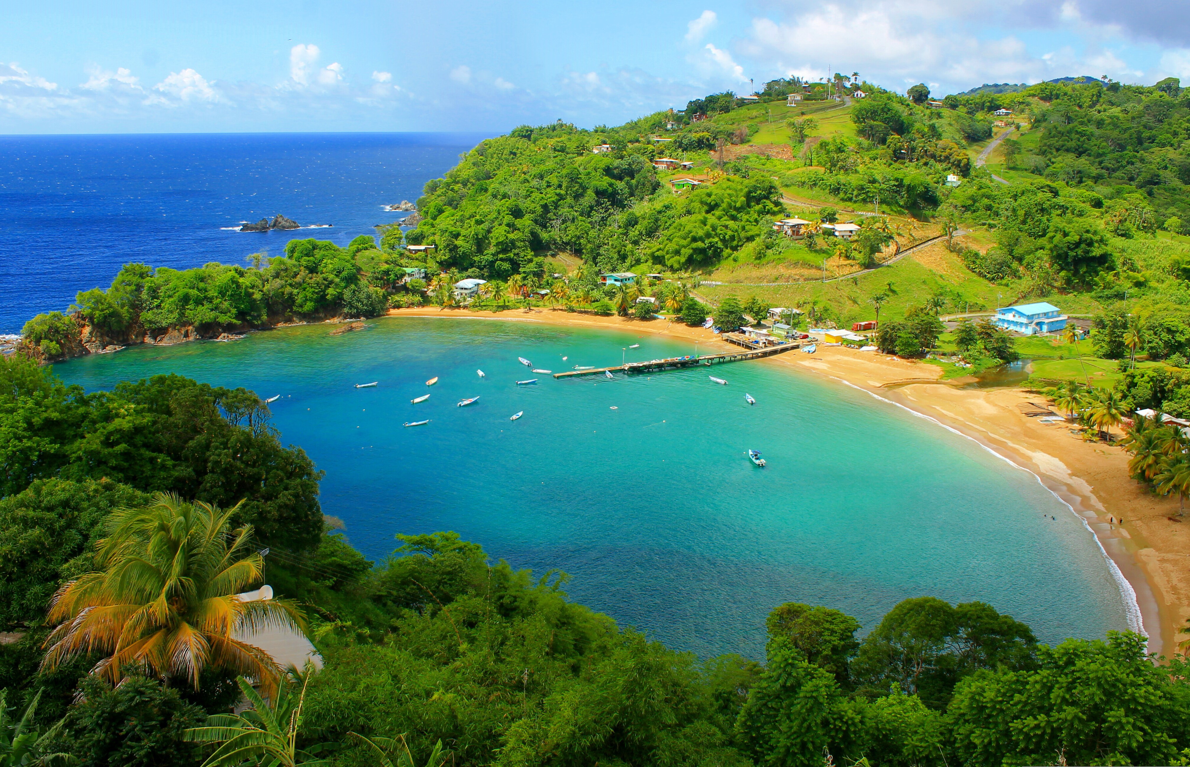
About Port-of-Spain
Port of Spain is a seaport on the north-west coast of the island of Trinidad. The capital and commercial centre of Trinidad and Tobago, Port of Spain has architecture from around the world from Hindu temples to gingerbread Rococo. Trinidad, home of the carnival and the steel band, is an astonishing melting-pot of people and cultures - including African, Oriental, Indian, European and New World. It is also home to an interesting array of South American flora, as well as more than 400 species of birds, some of which can be seen if you visit the Asa Wright Nature Reserve. A Native American village known as Conquerabia occupied the site when the Spanish settled in the area in 1595 and renamed the community 'Puerto de España'. After the British took control of the island in 1797, the settlement's name was anglicised to Port of Spain. The city served as the capital of the Federation of the West Indies from 1958 to 1962, before the grouping was dissolved.
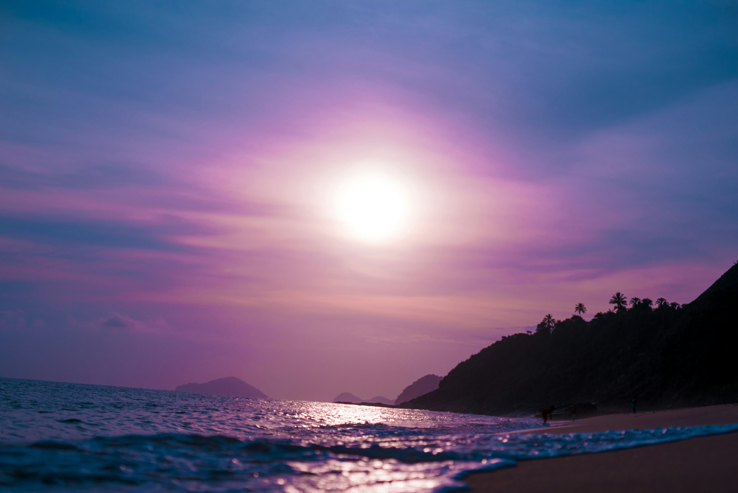
About Devil's Island
Discarded off the coast of French Guiana, lies an ominous, key-shaped island of sharp rocks and swaying palm trees - Devil's Island. As the site of one of history’s most infamous and feared prisons, the island's reputation as hell on earth was well earned, having been used to brutally imprison, torture and punish the French Empire's most notorious criminals. Closed down in 1953, it now lies in an eerie purgatory, and the sense of unease as you approach it is hard to avoid, with its laden-coconut trees duplicitously waving you ashore.
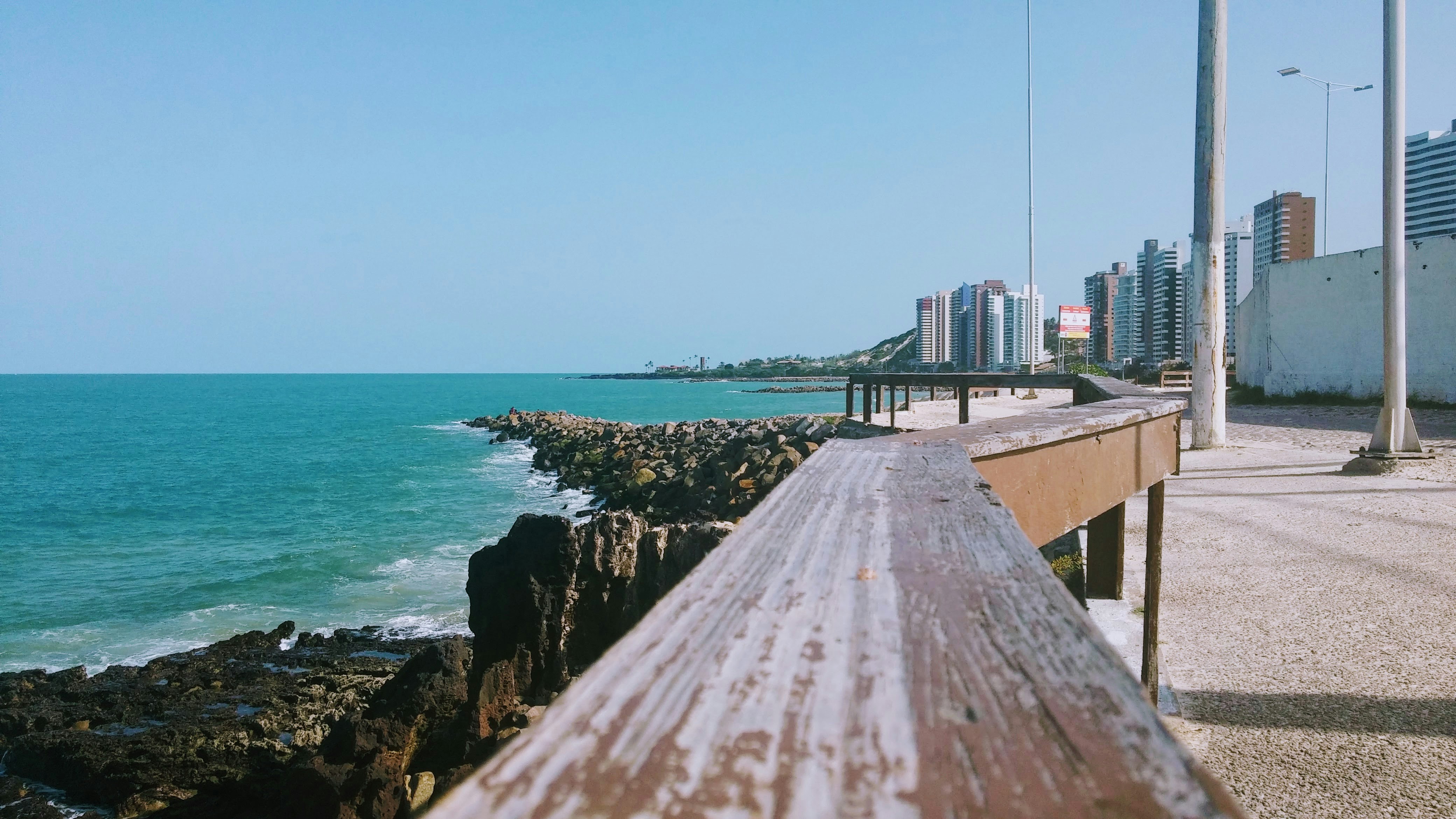
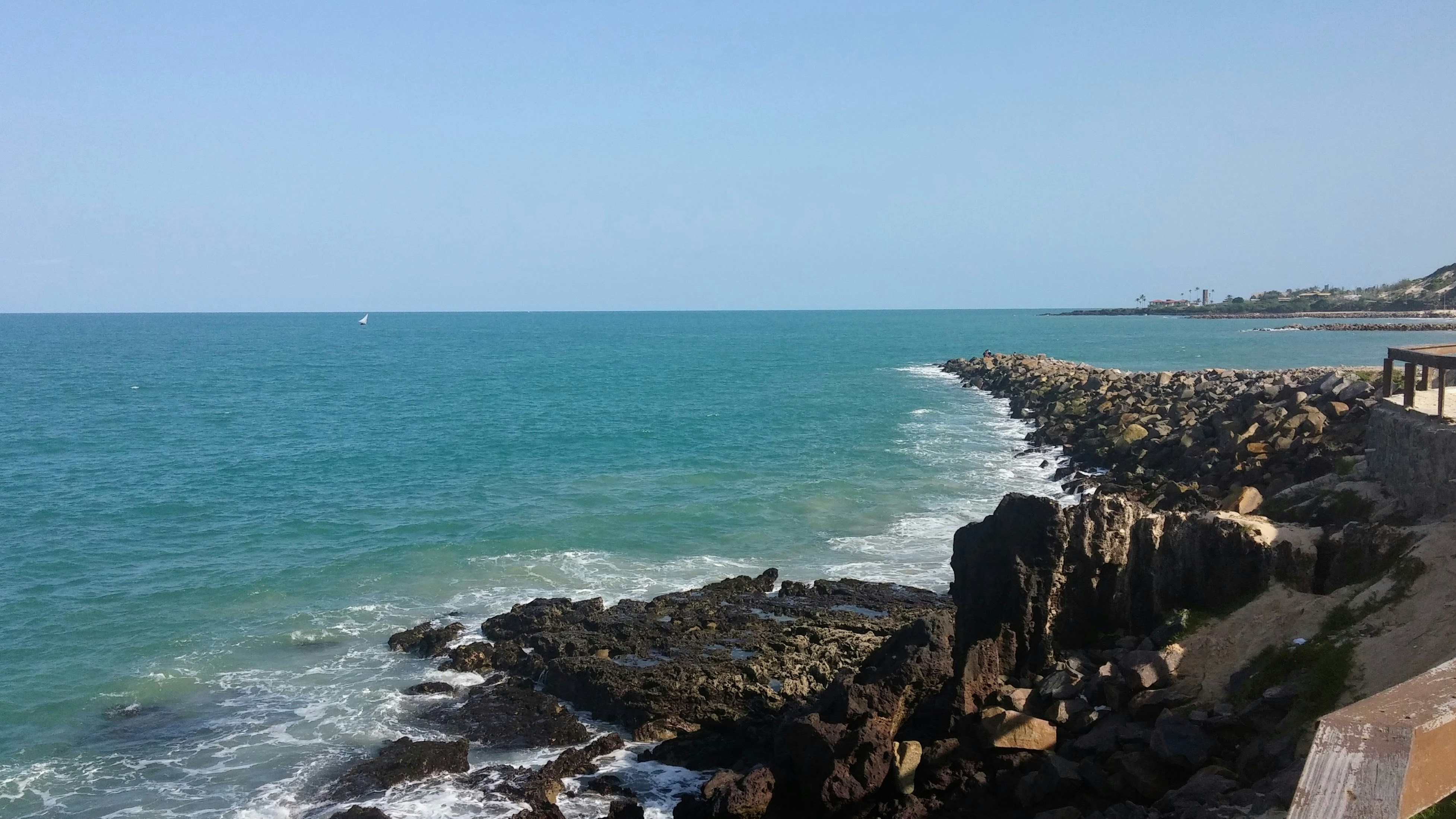
About Fortaleza
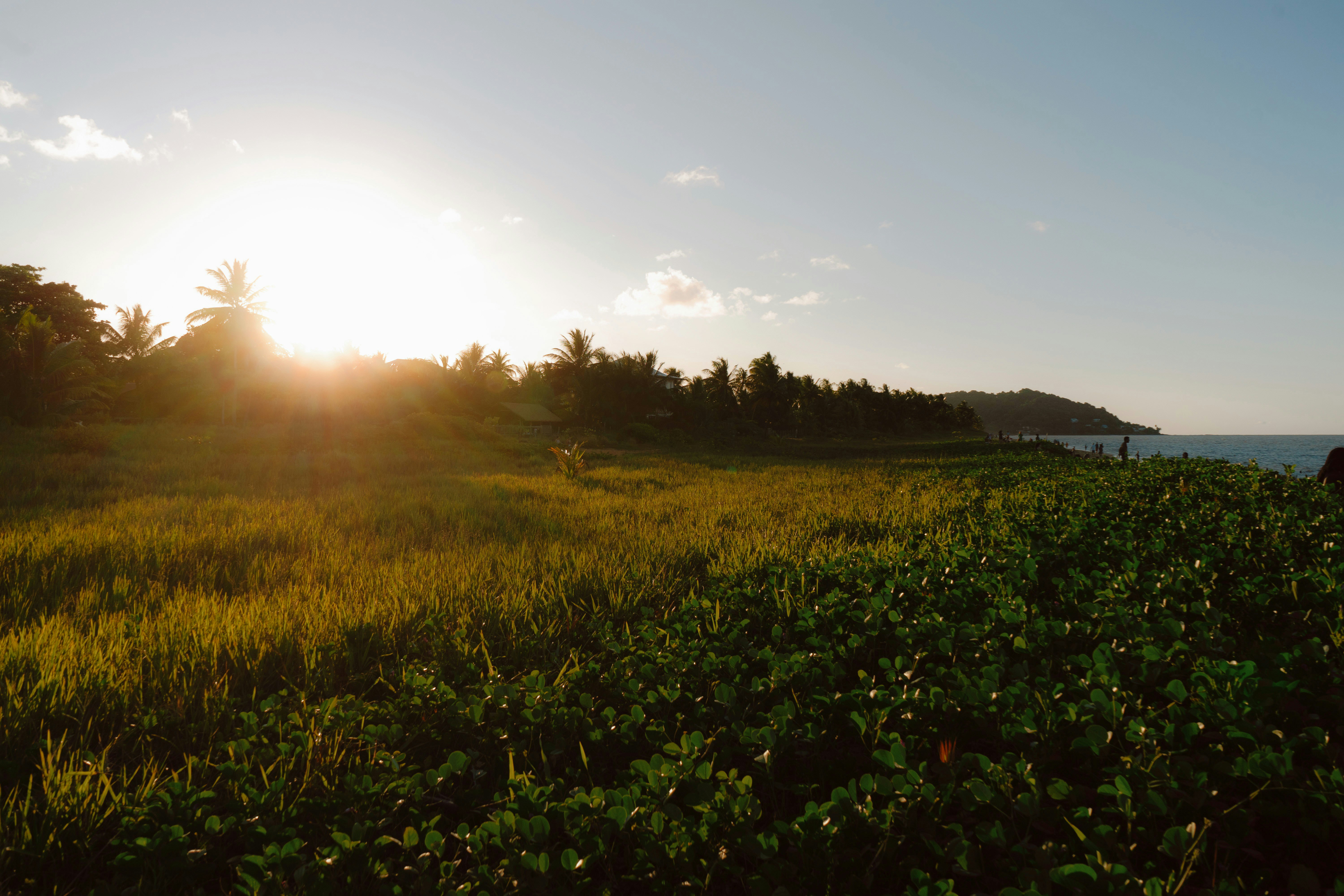
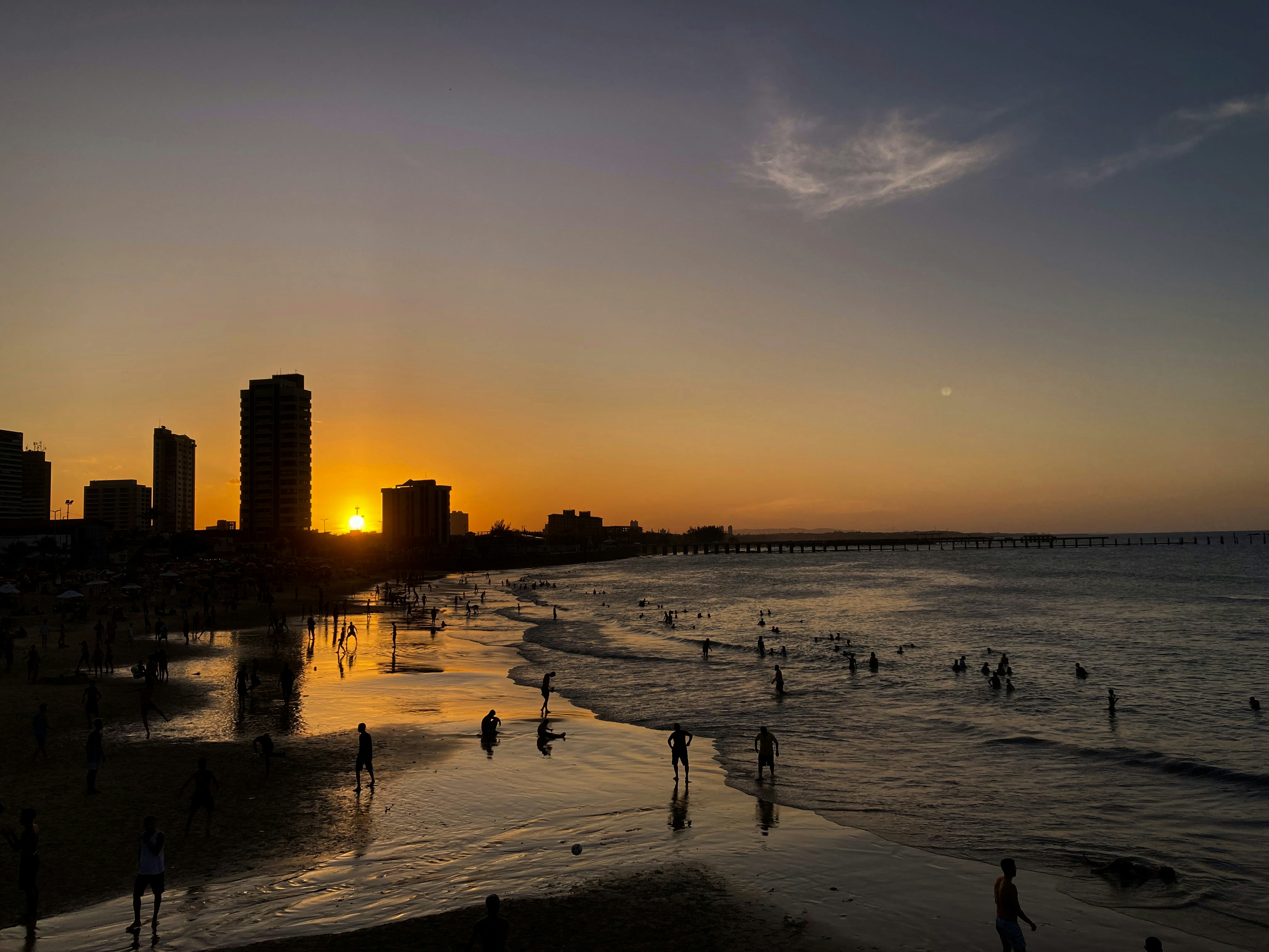
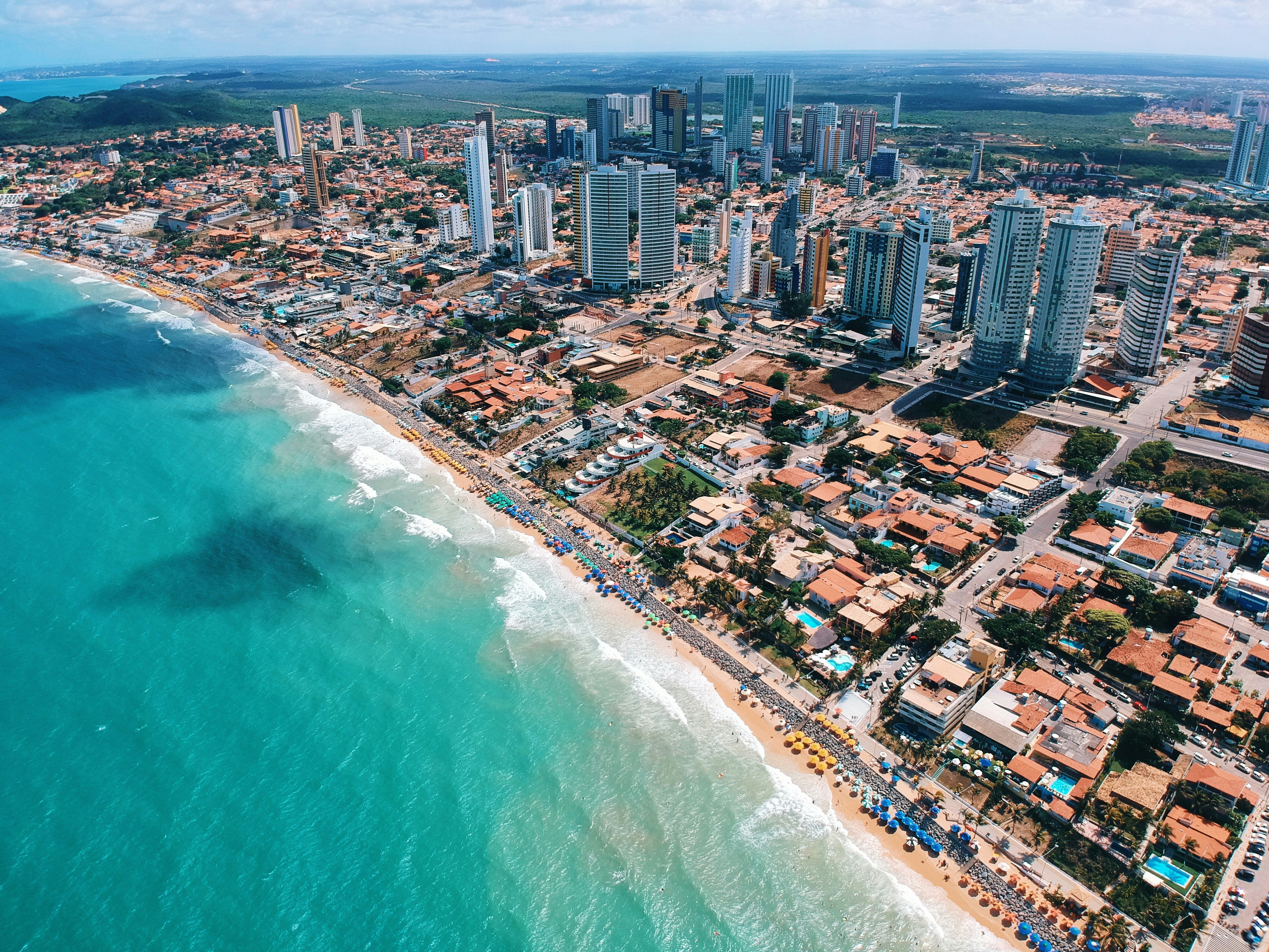
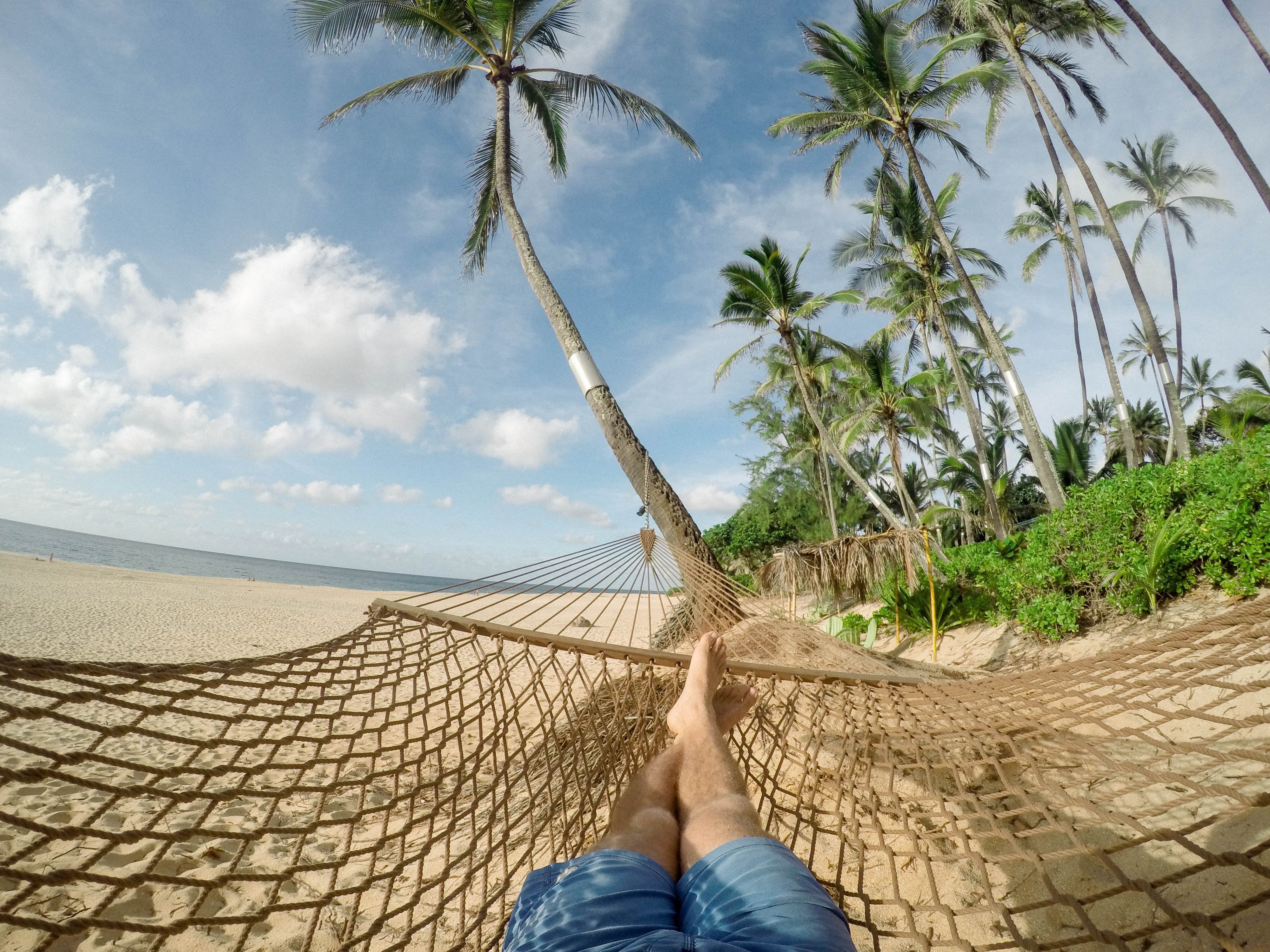
Called the "City of Light," Fortaleza claims that the sun shines on it 2,800 hours a year. And it's a good thing, too, as the coastline stretches far beyond the city. To the east, along the Litoral Leste or the Costa Sol Nascente (Sunrise Coast) are many fishing villages. To the west, along the Litoral Oeste or the Costa Sol Poente (Sunset Coast), there are pristine stretches of sand. The shores here are cooled by constant breezes and lapped by waters with an average temperature of 24°C (72°F).Today Fortaleza, a large, modern state capital with more than 2 million inhabitants, is Brazil's fifth-largest city. It's also on the move, with one of the country's newest airports, a modern convention center, a huge cultural center with a planetarium, large shopping malls, several museums and theaters, and an abundance of sophisticated restaurants. At Praia de Iracema there's a revitalized beachfront area of sidewalk cafés, bars, and dance clubs. But if you wander along the shore, you're still bound to encounter fishermen unloading their catch from traditional jangadas—just as they've done for hundreds of years.
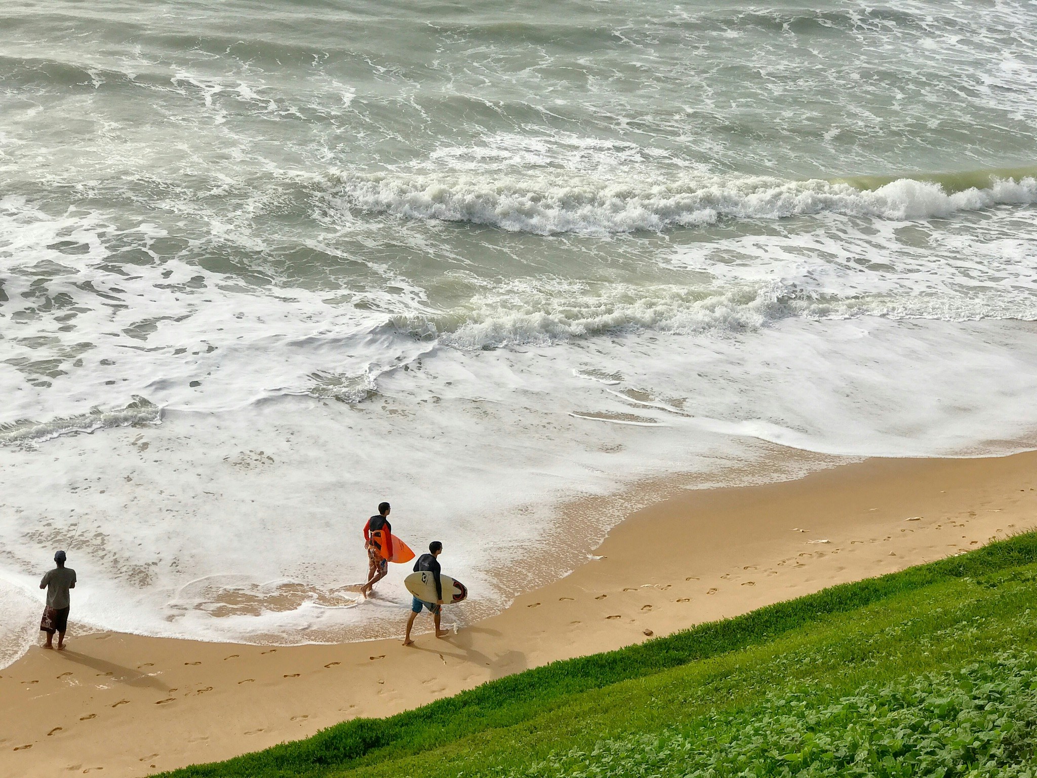
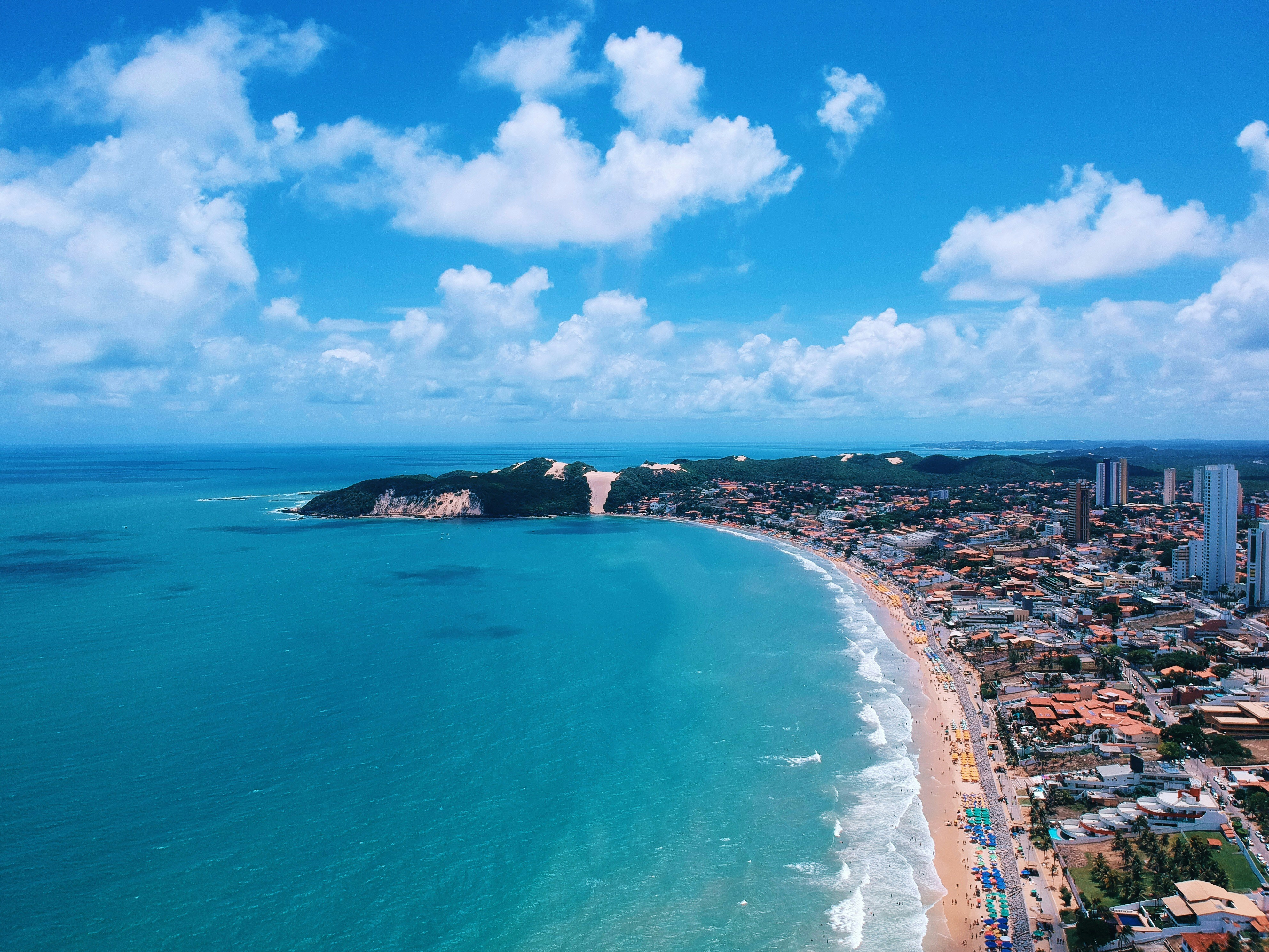
About Natal

About Salvador de Bahia
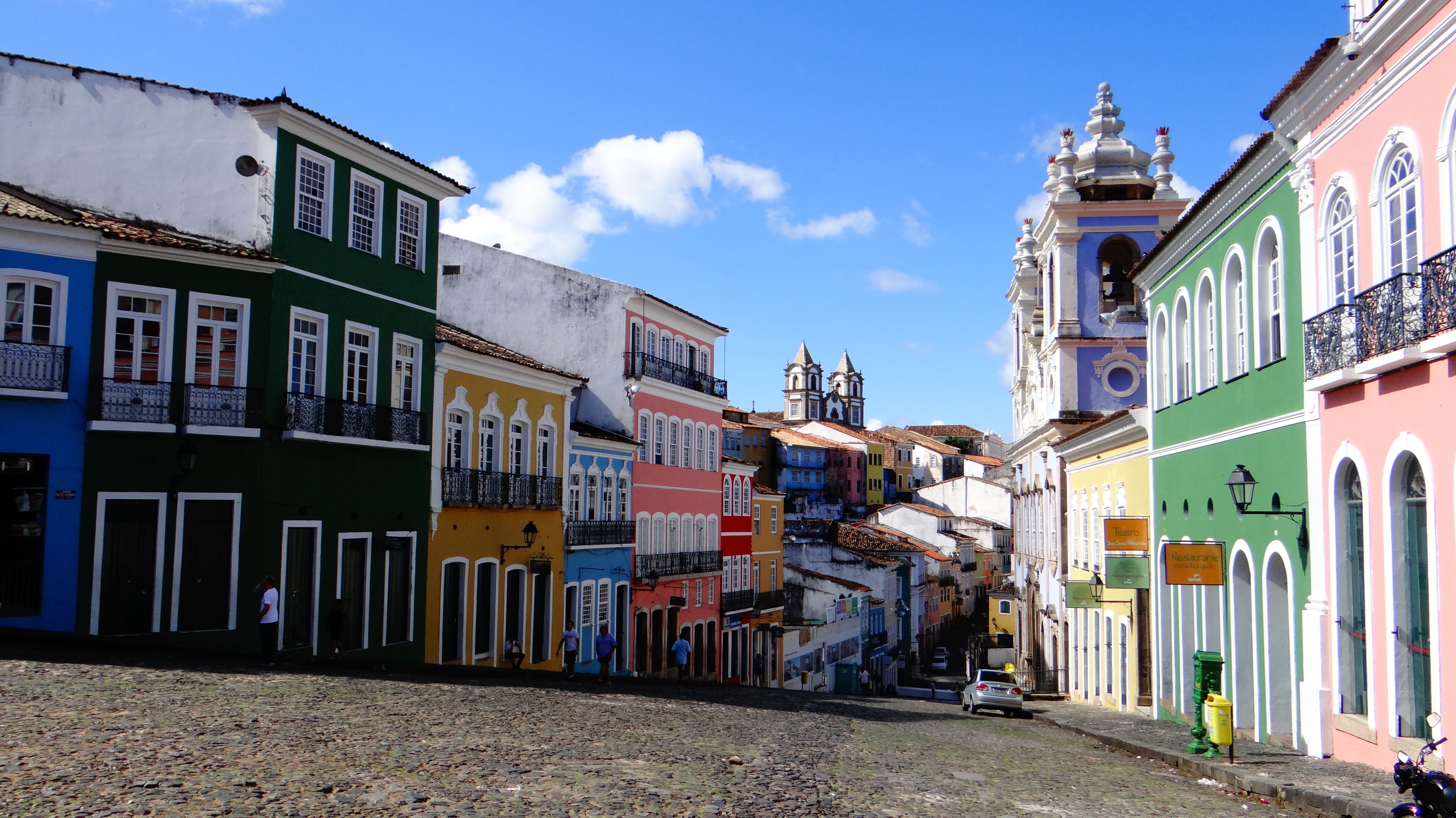
According to Salvador's adopted son Jorge Amado, "In Salvador, magic becomes part of the every-day." From the shimmering golden light of sunset over the Baía do Todos os Santos, to the rhythmic beats that race along the streets, Salvador, while no longer Brazil's capital, remains one of its most captivating cities. A large dose of its exoticism comes down to its African heritage—at least 70% of its 2,675,000 population is classified as Afro-Brazilian—and how it has blended into Brazil's different strands, from the native Indians to the Christian colonizers. Salvadorans may tell you that you can visit a different church every day of the year, which is almost true—the city has about 300. Churches whose interiors are covered with gold leaf were financed by the riches of the Portuguese colonial era, when slaves masked their traditional religious beliefs under a thin Catholic veneer. And partly thanks to modern-day acceptance of those beliefs, Salvador has become the fount of Candomblé, a religion based on personal dialogue with the orixás, a family of African deities closely linked to nature and the Catholic saints. The influence of Salvador's African heritage on Brazilian music has also turned the city into one of the musical capitals of Brazil, resulting in a myriad of venues to enjoy live music across the city, along with international acclaim for exponents like Gilberto Gil, Caetano Veloso, and Daniela Mercury. Salvador's economy today is focused on telecommunications and tourism. The still-prevalent African culture draws many tourists—this is the best place in Brazil to hear African music, learn or watch African dance, and see capoeira, a martial art developed by slaves. In the district of Pelourinho, many colorful 18th- and 19th-century houses remain, part of the reason why this is the center of the tourist trade. Salvador sprawls across a peninsula surrounded by the Baía de Todos os Santos on one side and the Atlantic Ocean on the other. The city has about 50 km (31 miles) of coastline. The original city, referred to as the Centro Histórica (Historical Center), is divided into the Cidade Alta (Upper City), also called Pelourinho, and Cidade Baixa (Lower City). The Cidade Baixa is a commercial area—known as Comércio—that runs along the port and is the site of Salvador's indoor market, Mercado Modelo. You can move between the upper and lower cities on foot, via the landmark Elevador Lacerda, behind the market, or on the Plano Inclinado, a funicular lift, which connects Rua Guindaste dos Padres on Comércio with the alley behind Cathedral Basílica. From the Cidade Histórica you can travel north along the bay to the hilltop Igreja de Nosso Senhor do Bonfim. You can also head south to the point, guarded by the Forte Santo Antônio da Barra, where the bay waters meet those of the Atlantic. This area on Salvador's southern tip is home to the trendy neighborhoods of Barra, Ondina, and Rio Vermelho, with many museums, theaters, shops, and restaurants. Beaches along the Atlantic coast and north of Forte Santo Antônio da Barra are among the city's cleanest. Many are illuminated at night and have bars and restaurants that stay open late.

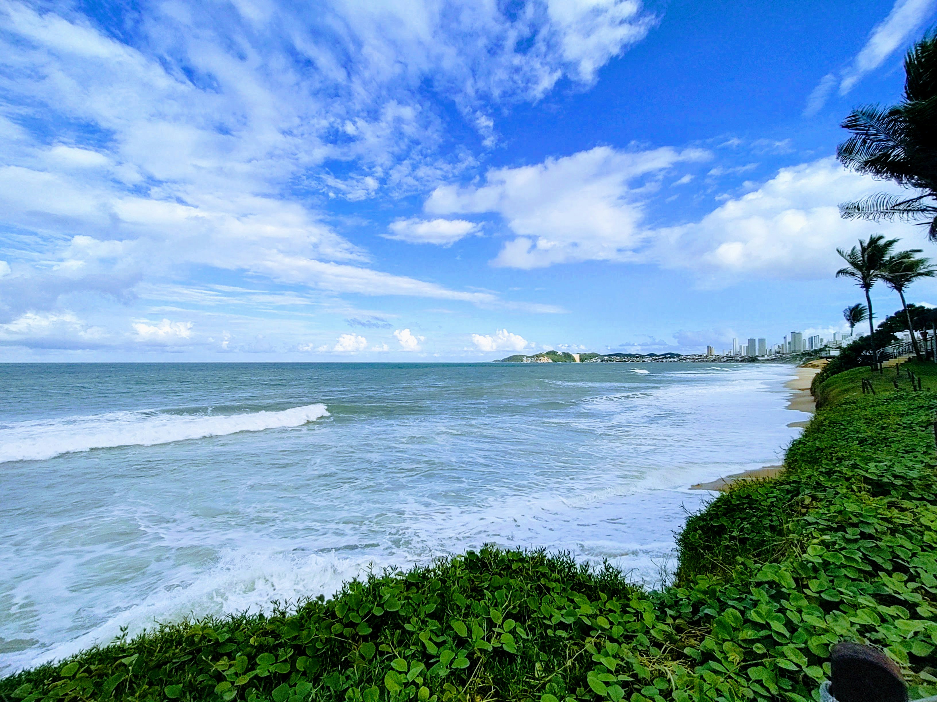
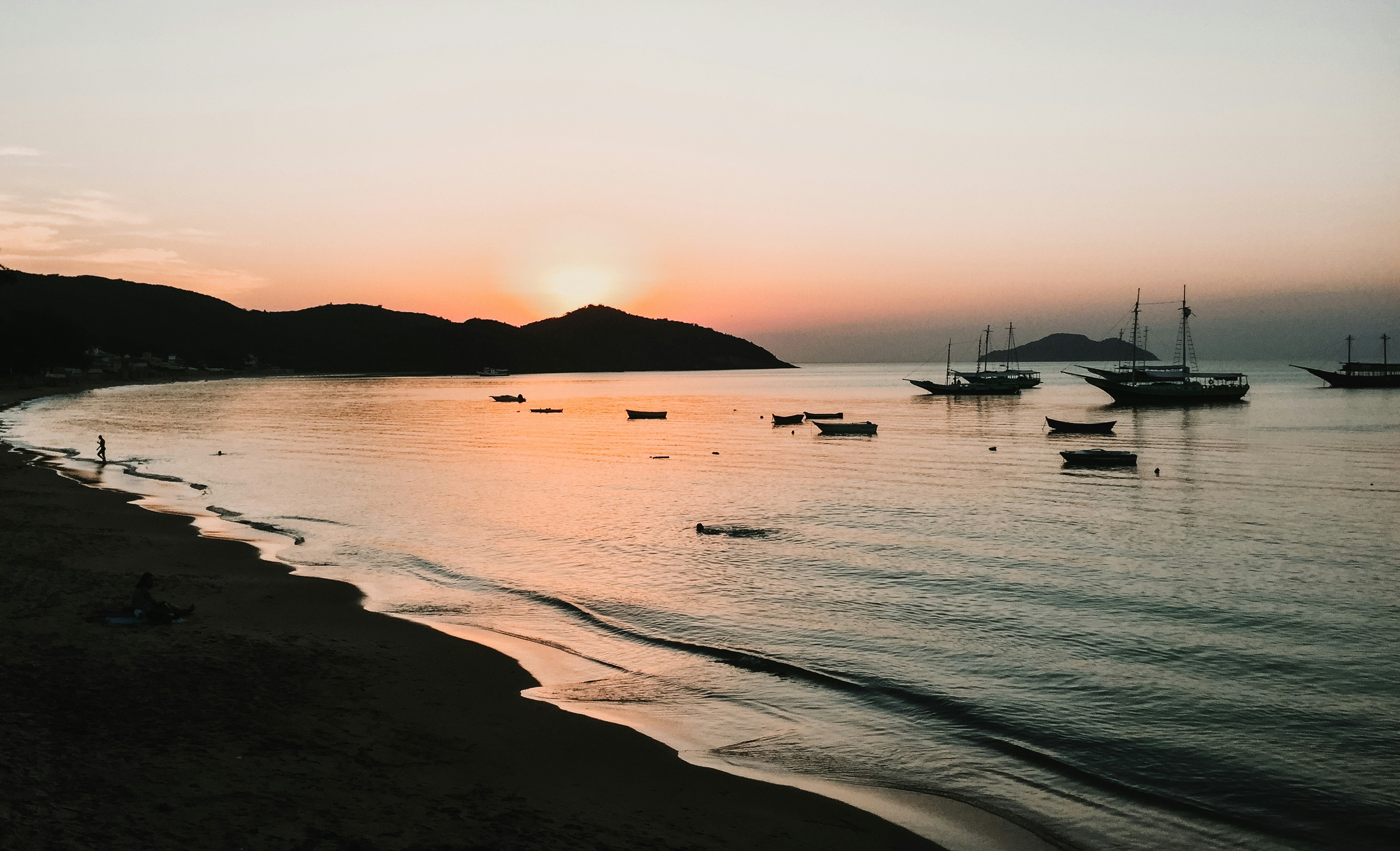
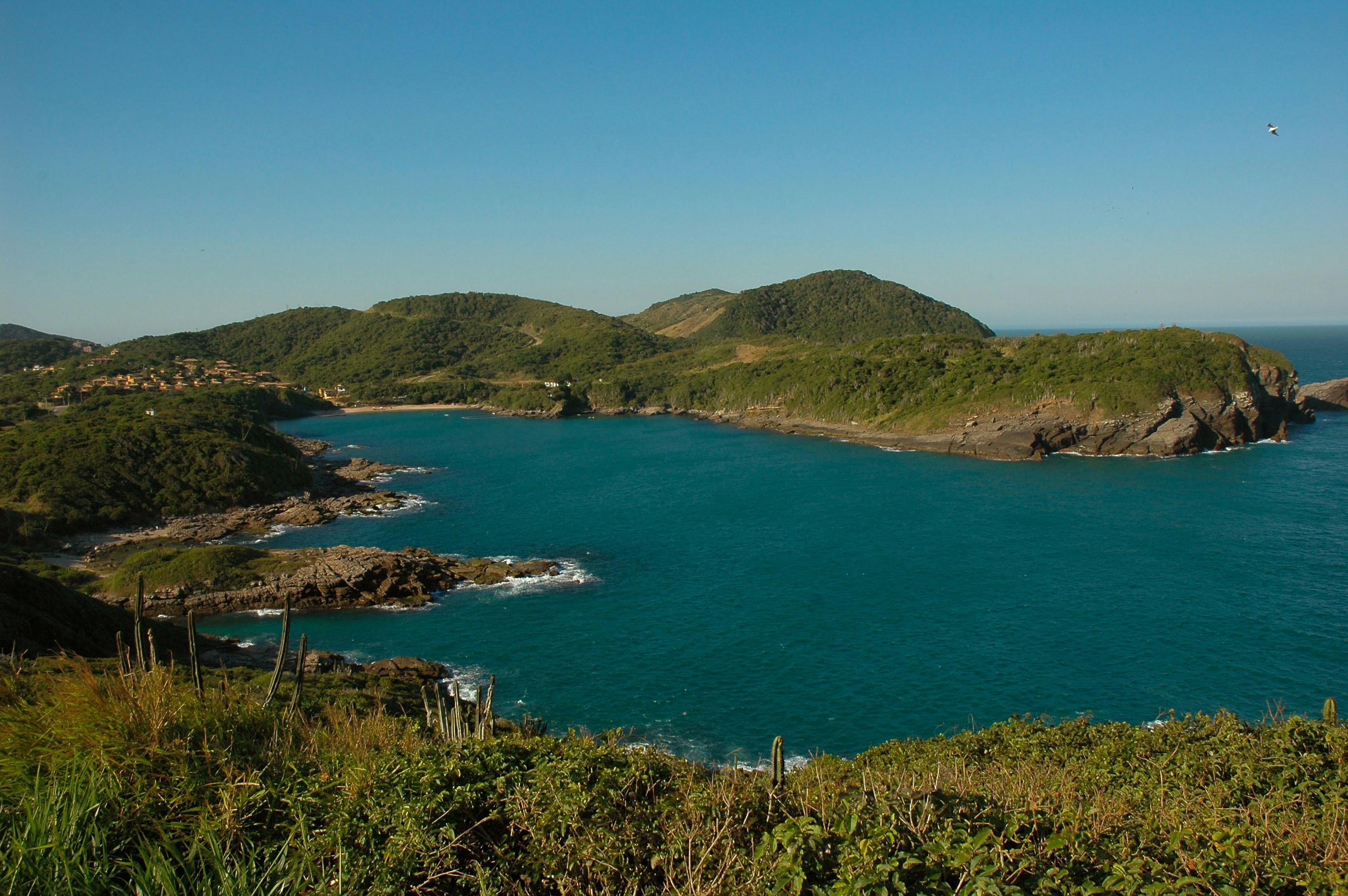
About Buzios
Around two hours from Rio de Janeiro, Búzios is a string of beautiful beaches on an 8-km-long (5-mile-long) peninsula. It was the quintessential sleepy fishing village until the 1960s, when the French actress Brigitte Bardot holidayed here to escape the paparazzi and the place almost instantly transformed into a vacation sensation. Búzios has something for everyone. Some hotels cater specifically to families and provide plenty of activities and around-the-clock child care. Many have spa facilities, and some specialize in weeklong retreats. For outdoor enthusiasts, Búzios offers surfing, windsurfing, kitesurfing, diving, hiking, and mountain biking, as well as leisurely rounds of golf.
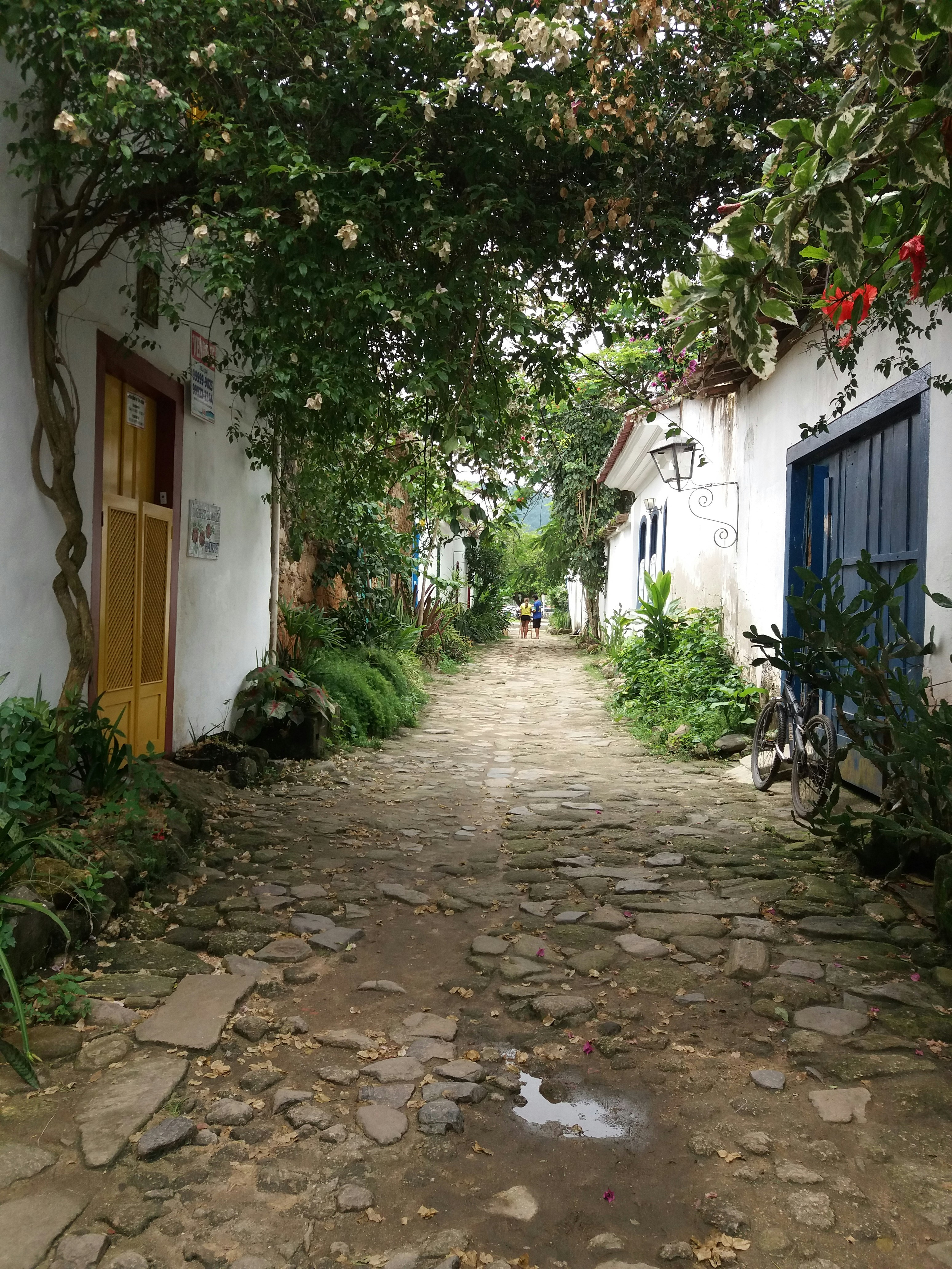
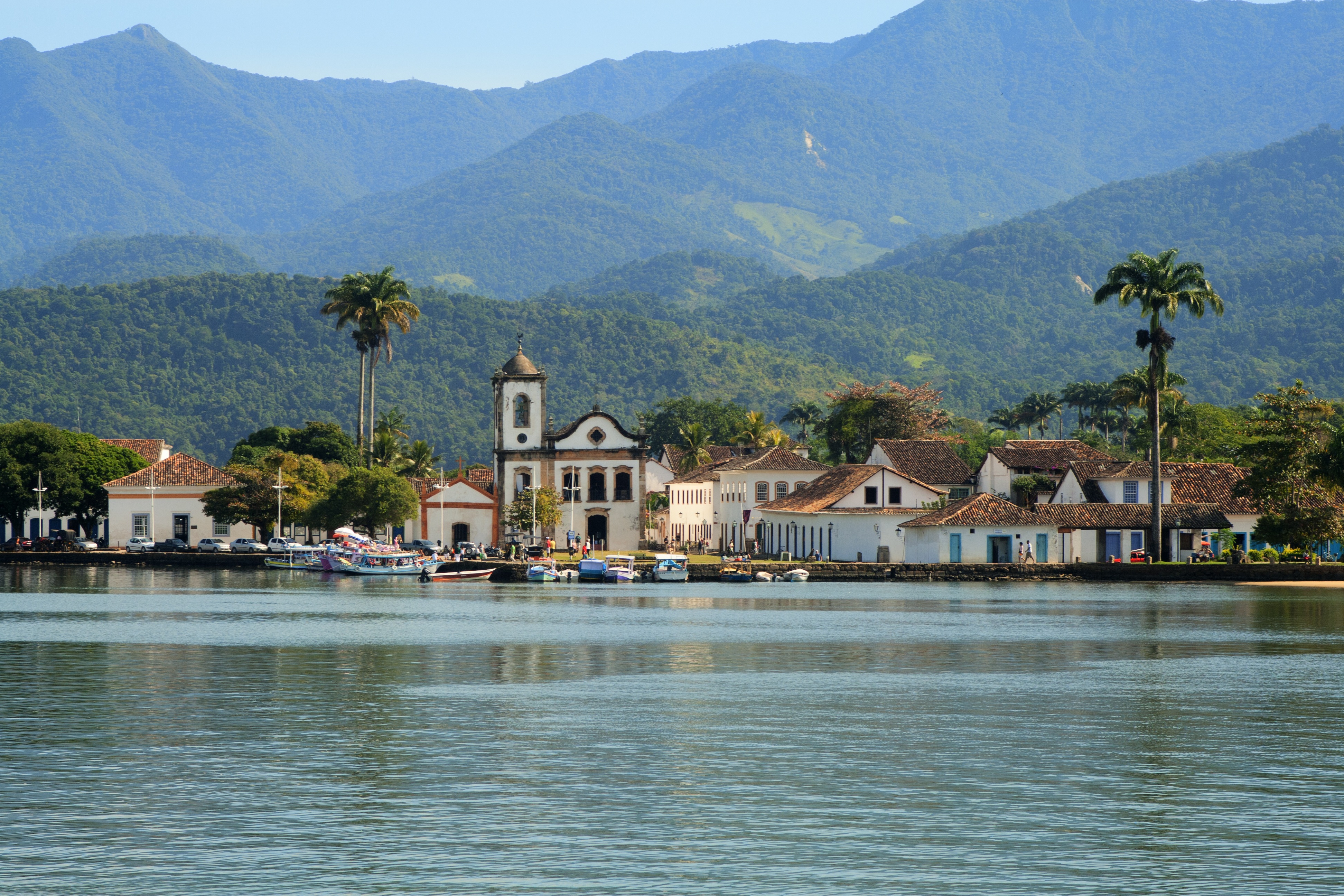
About Parati
The Costa Verde's main attraction, the coastal village of Parati, is about 180 miles south of Rio de Janeiro. Inhabited since 1660, this small town has remained fundamentally unaltered since its heyday. It was a staging post for 18th-century trade in Brazilian gold from Minas Gerais to Portugal. Raids and pirate attacks necessitated the establishment of a new route linking Minas Gerais directly with Rio de Janeiro. A decline in Parati’s fortunes resulted; being off the beaten track, it remained quietly hidden away. Today, the entire town has been declared a national historic monument by UNESCO as one of the most important examples of colonial architecture. With its newly acclaimed status, Parati has become a popular destination. Its beautifully restored colonial buildings line narrow, cobbled streets which are closed to vehicular traffic. Parati's population of some 15,000 people depends on fishing, farming and tourism for its livelihood. Local artists display their attractive crafts in galleries and souvenir shops. The town, reached via a long pier from the tender landing, must be explored on foot. Among Parati’s attractions is the 1722 Church of Santa Rita de Cassia, a classic example of Brazilian baroque architecture. The surrounding area boasts a scenic backdrop with green-clad mountains and numerous islands are scattered across the bay.
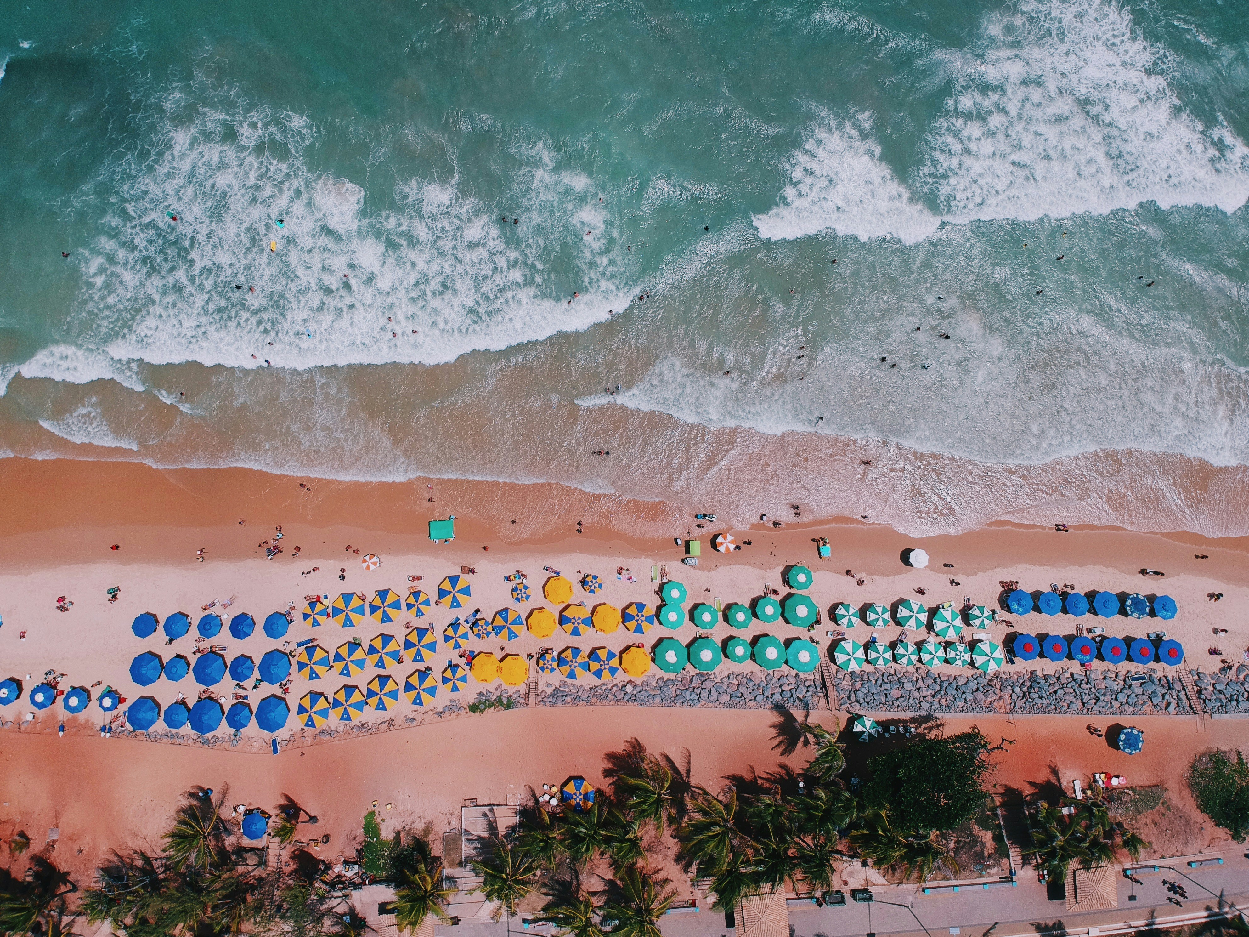
About Rio de Janeiro
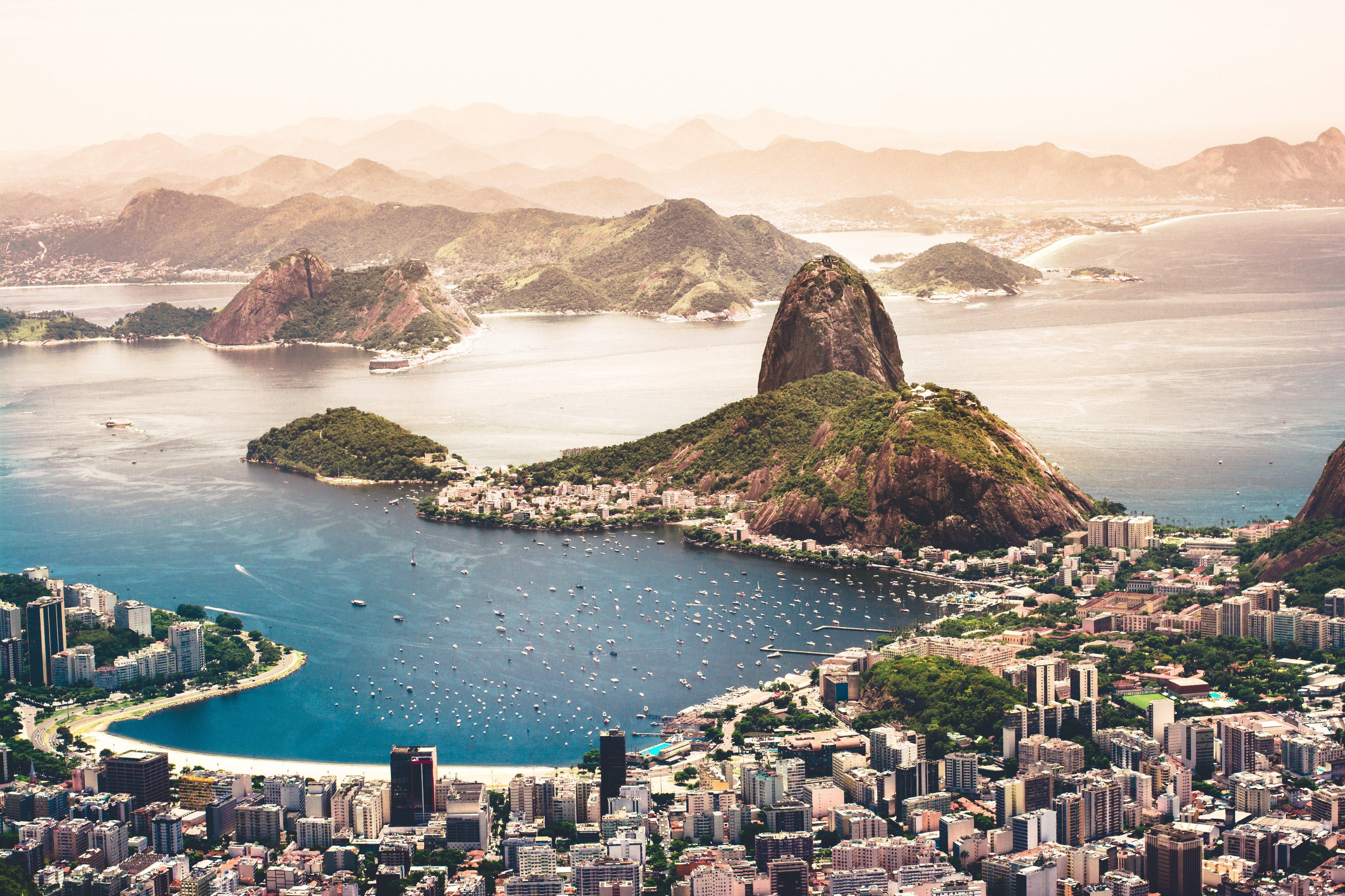
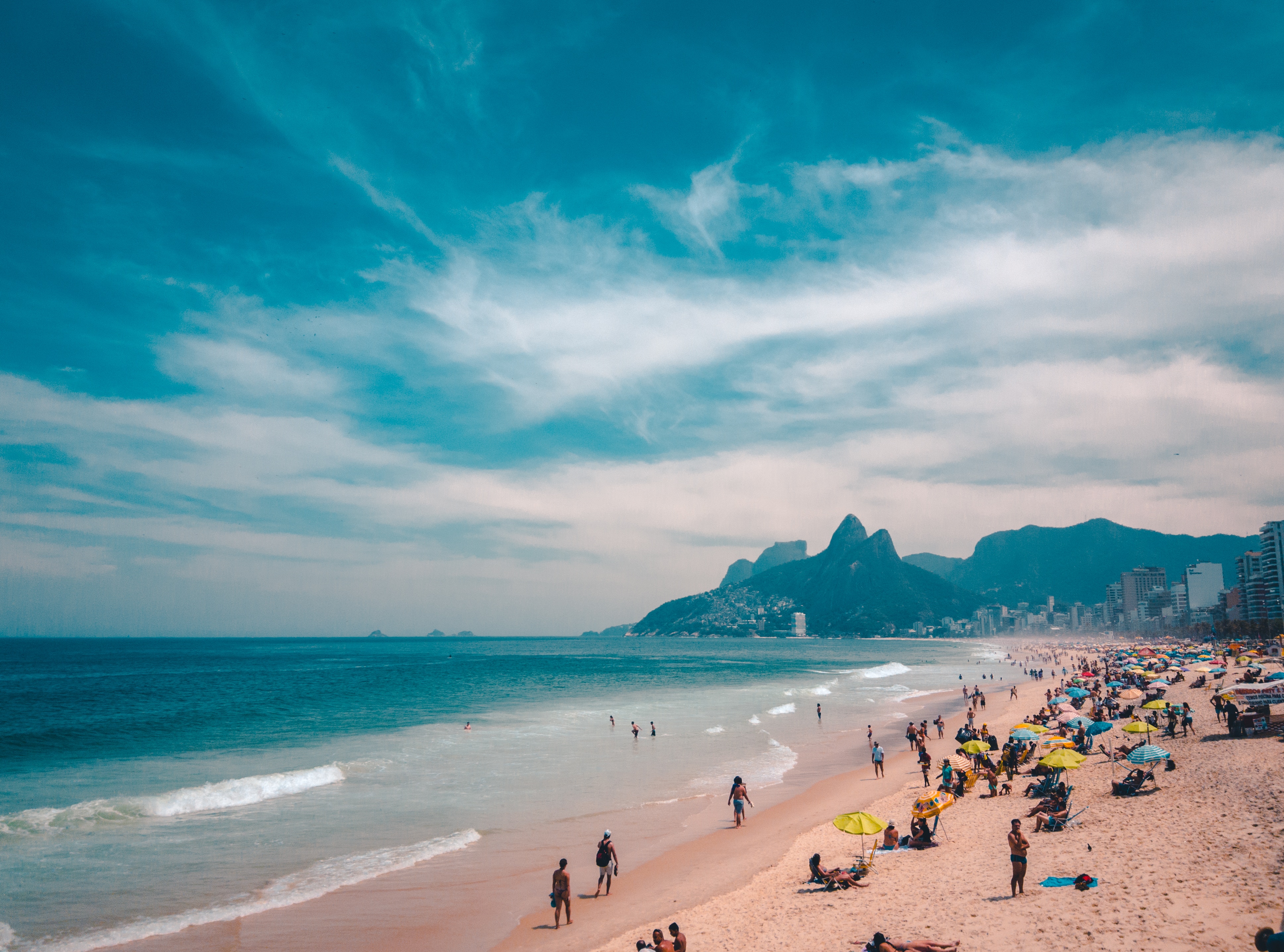
Welcome to the Cidade Maravilhosa, or the Marvelous City, as Rio is known in Brazil. Synonymous with the girl from Ipanema, the dramatic views from Christ the Redeemer atop Corcovado mountain, and fabulously flamboyant Carnival celebrations, Rio is a city of stunning architecture, abundant museums, and marvelous food. Rio is also home to 23 beaches, an almost continuous 73-km (45-mile) ribbon of sand.As you leave the airport and head to Rio's beautiful Zona Sul (the touristic South Zone), you'll drive for about 40 minutes on a highway from where you'll begin to get a sense of the dramatic contrast between beautiful landscape and devastating poverty. In this teeming metropolis of 12 million people (6.2 million of whom live in Rio proper), the very rich and the very poor live in uneasy proximity. You'll drive past seemingly endless cinder-block favela, but by the time you reach Copacabana's breezy, sunny Avenida Atlântica—flanked on one side by white beach and azure sea and on the other by condominiums and hotels—your heart will leap with expectation as you begin to recognize the postcard-famous sights. Now you're truly in Rio, where cariocas (Rio residents) and tourists live life to its fullest.Enthusiasm is contagious in Rio. Prepare to have your senses engaged and your inhibitions untied. Rio seduces with a host of images: the joyous bustle of vendors at Sunday's Feira Hippie (Hippie Fair); the tipsy babble at sidewalk cafés as patrons sip their last glass of icy beer under the stars; the blanket of lights beneath the Pão de Açúcar (Sugarloaf Mountain); the bikers, joggers, strollers, and power walkers who parade along the beach each morning. Borrow the carioca spirit for your stay; you may find yourself reluctant to give it back.

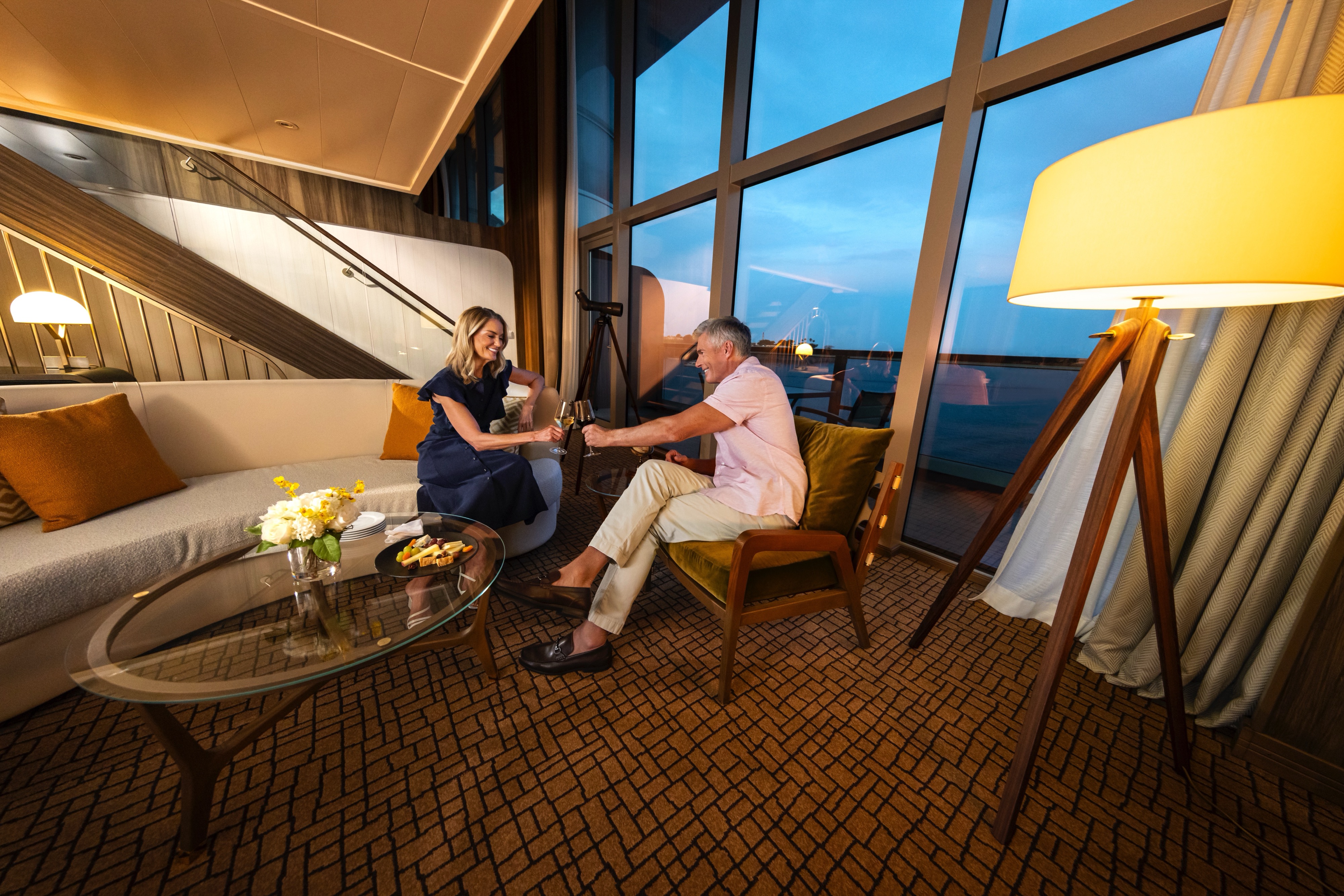
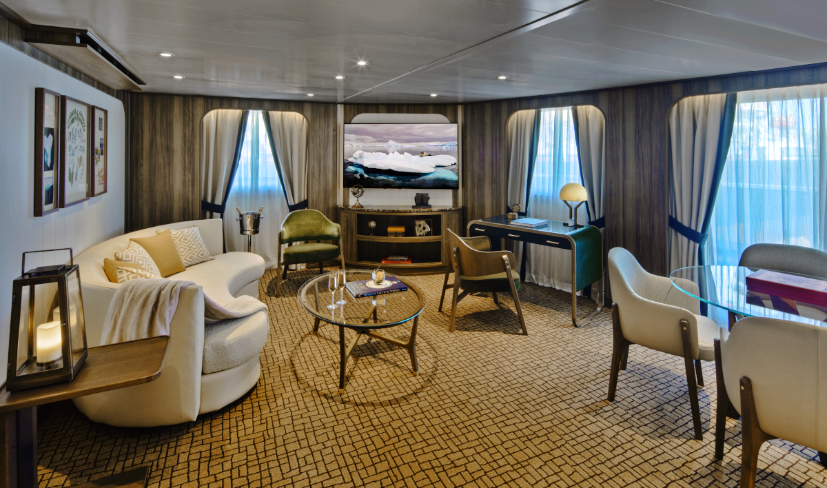
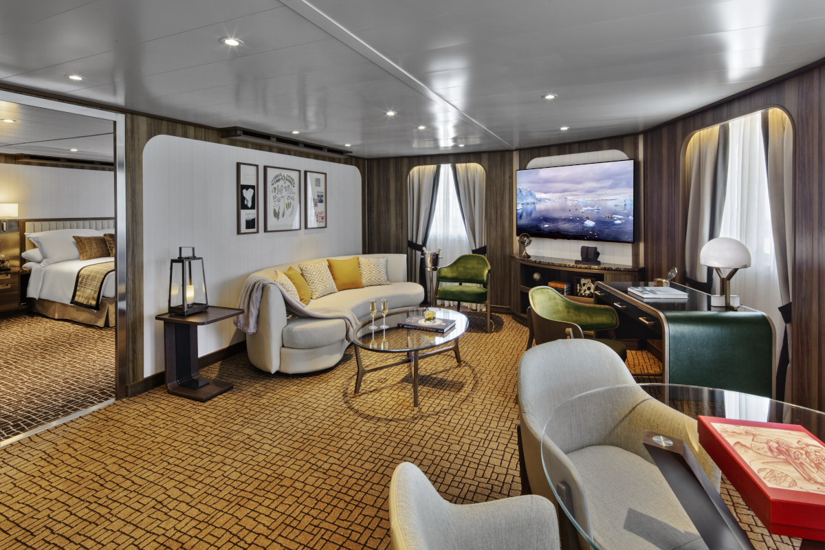
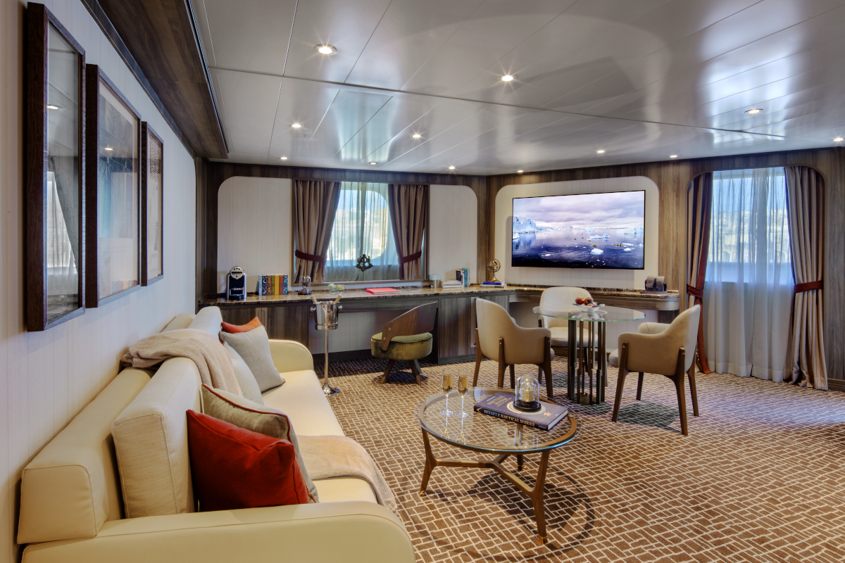
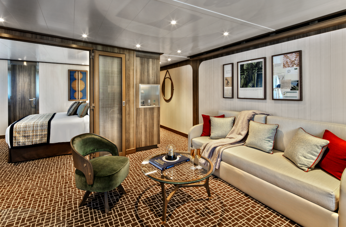
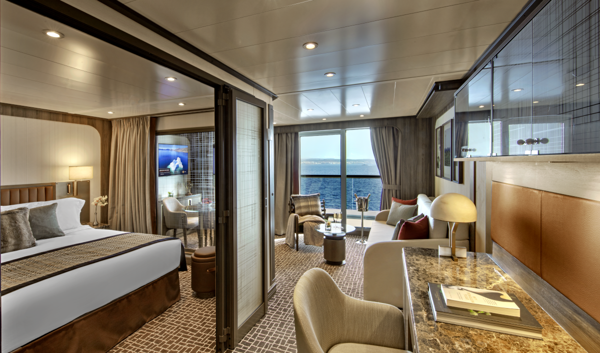
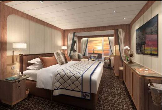
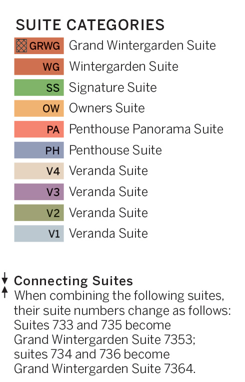
All Grand Wintergarden Suites onboard Seabourn Venture feature a comfortable living area; private veranda; queen-size bed or two twin beds; walk-in closet; personal safe; interactive TV with music and movies; fully stocked bar and refrigerator; writing desk with personalised stationery; makeup vanity; spacious bathroom, separate tub and shower, plush robes, slippers, luxury health and beauty products, hairdryer and 110/220V AC outlets.Expansive apartment-style suite stretching over two decks located midship. Entry opens to seamless double height views and generous lower level living area large enough for entertaining with a dining table for four, separate guest bath and pantry with wet bar stocked with a customised selection of spirits. Sculptured staircase leading to upper level and the master bedroom with a queen-sized Duxiana Axion 15 adjustable high-performance sleep system facing expansive windows, a wall of closets along with advanced technology including a roll-up LG OLED TV. Separate walk-in closet adjacent to the five-piece bathroom complete with a whirlpool spa tub and separate shower. Wintergarden suite guests also enjoy wildlife and vista spotting using a Swarovski ATX Interior spotting scope. The tripod-mounted scope, with its 25-60x85 lens capability, is for use in-suite while onboard. Entertainment experience features a high-end Bang & Olufsen Beolab 5 speaker system and Bang & Olufsen H4 Bluetooth headphones for guest use onboard.
- Large windows
- Dining for four
- Bathroom with whirlpool bathtub
- Guest bath
- Convertible sofa bed for one
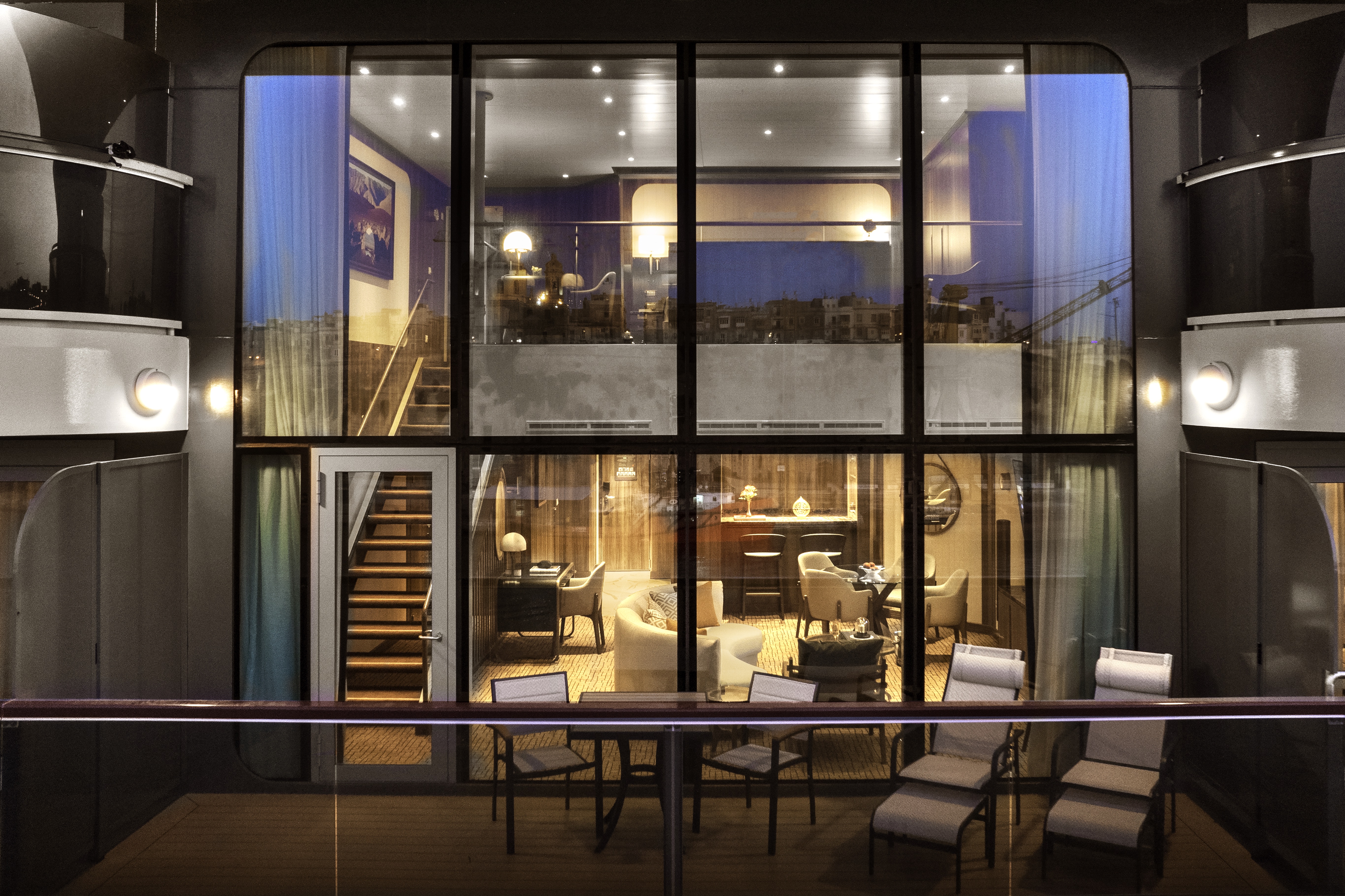
All Wintergarden Suites onboard Seabourn Venture feature a comfortable living area; private veranda; queen-size bed or two twin beds; walk-in closet; personal safe; interactive TV with music and movies; fully stocked bar and refrigerator; writing desk with personalised stationery; makeup vanity; spacious bathroom, separate tub and shower, plush robes, slippers, luxury health and beauty products, hairdryer and 110/220V AC outlets.Expansive apartment-style suite stretching over two decks located midship. Entry opens to seamless double height views and generous lower level living area large enough for entertaining with a dining table for four, separate guest bath and pantry with wet bar stocked with a customised selection of spirits. Sculptured staircase leading to upper level and the master bedroom with a queen-sized Duxiana Axion 15 adjustable high-performance sleep system facing expansive windows, a wall of closets along with advanced technology including a roll-up LG OLED TV. Separate walk-in closet adjacent to the five-piece bathroom complete with a whirlpool spa tub and separate shower. Wintergarden suite guests also enjoy wildlife and vista spotting using a Swarovski ATX Interior spotting scope. The tripod-mounted scope, with its 25-60x85 lens capability, is for use in-suite while onboard. Entertainment experience features a high-end Bang & Olufsen Beolab 5 speaker system and Bang & Olufsen H4 Bluetooth headphones for guest use onboard.Wintergarden Suite Features
Large windows
- Glass door to private veranda
- Comfortable living area
- Dining for four
- Separate bedroom
- Queen-size bed or two twin beds
- Walk-in closet
- Two flat-screen TVs
- Complimentary Internet/Wi-Fi service.
- Fully stocked bar and refrigerator
- Makeup vanity
- Guest bath
- Bathroom with whirlpool bathtub
*Wheelchair accessible suites are roll-in shower only.
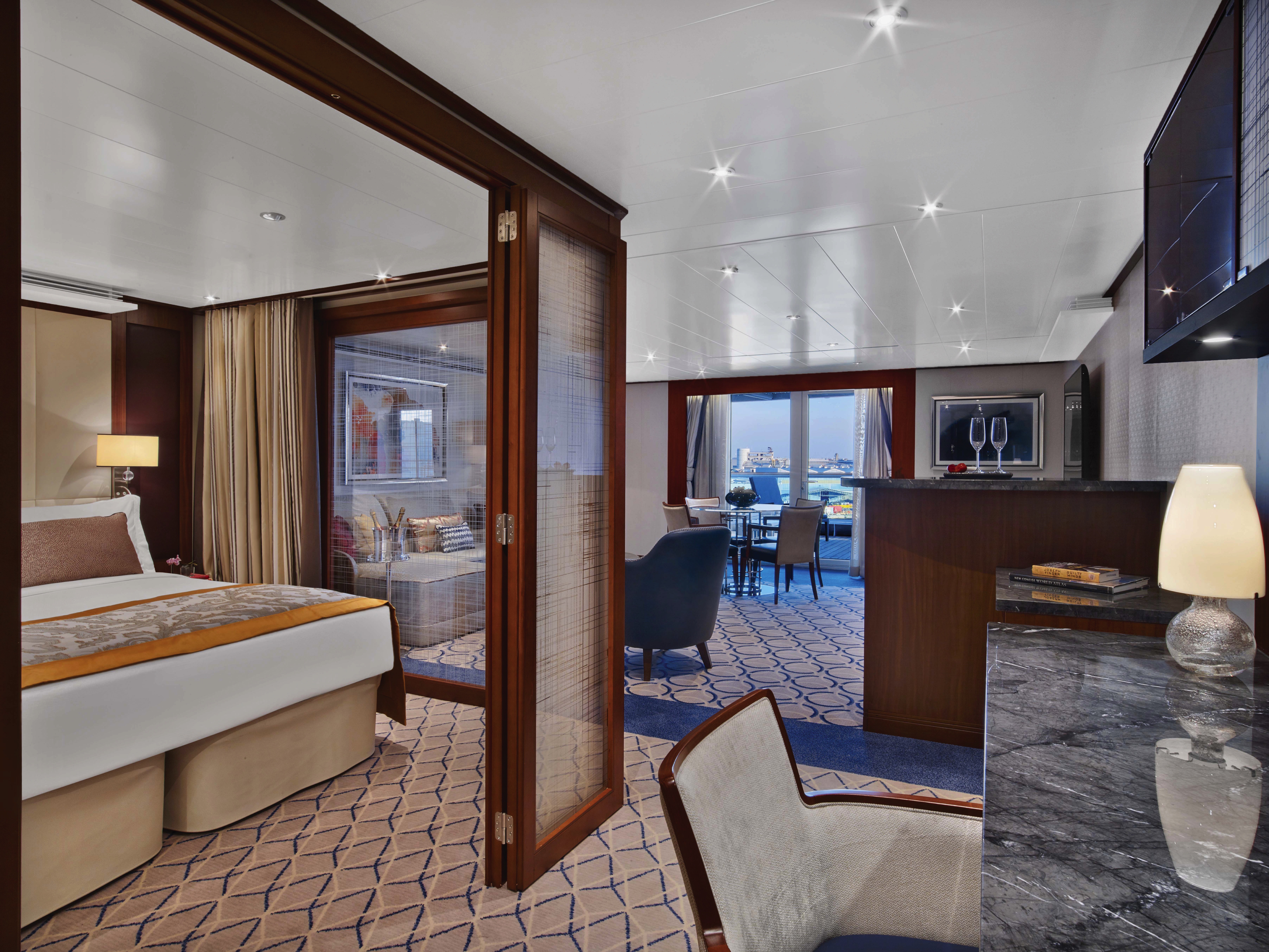
All Signature Suites onboard Seabourn Venture feature a comfortable living area; private veranda; queen-size bed or two twin beds; walk-in closet, personal safe; interactive TV with music and movies; fully stocked bar and refrigerator; writing desk with personalised stationery; makeup vanity; spacious bathroom, separate tub and shower, plush robes, slippers, luxury health and beauty products, hairdryer and 110/220V AC outlets.Foyer entry to living area with high-definition TV, dining table for four, guest bath, pantry with wet bar and large windows. Separate bedroom with queen-sized bed, makeup vanity, generous closet space and a glass door leading to a large curved 595 square foot veranda that includes its own canopied whirlpool spa tub, sun loungers, sofa and chairs. A five-piece bathroom with a separate shower and tub.
Signature Suite Features
- Large windows
- Glass door to private veranda
- Comfortable living area
- Dining for four
- Separate bedroom
- Queen-size bed or two twin beds
- Walk-in closet
- Two flat-screen TVs
- Complimentary Internet/Wi-Fi service.
- Fully stocked bar and refrigerator
- Makeup vanity
- Guest bath
- Bathroom with whirlpool bathtub
*Wheelchair accessible suites are roll-in shower only.
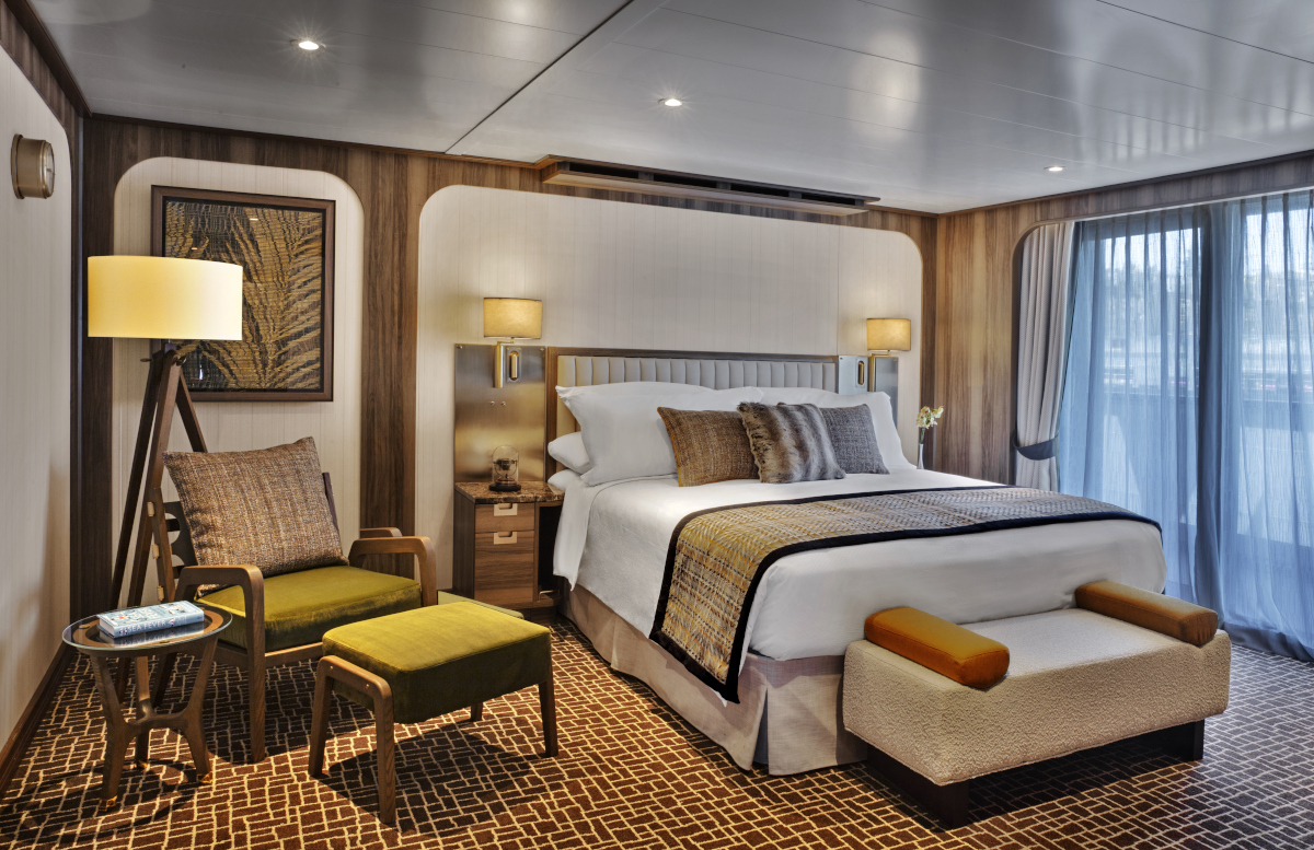
Owner's Suites on Seabourn Venture feature a comfortable living area; private veranda; queen-size bed or two twin beds; extra-large walk-in closet for expedition gear; personal safe; interactive flat-screen TV with music and movies; fully stocked bar and refrigerator; writing desk with personalised stationery; makeup vanity; spacious bathroom with double vanities, tub and shower, plush robes, slippers, hairdryer and 110/220V AC outlets.Entry with large closet to store gear and personal belongings. Comfortable living area with high-definition TV, writing desk and dining table for two for meals in-suite. Glass door leading to a curved veranda with sun loungers and a table for four. Separate bedroom with queen-sized bed has its own high-definition TV, a large window, makeup vanity and walk-in closet. Five-piece bathroom designed with multiple doors that can create a half-bath, and also features a separate shower and bathtub.Owner's Suite Features
- Large windows
- Glass door to private veranda
- Comfortable living area
- Dining for four
- Separate bedroom
- Queen-size bed or two twin beds
- Walk-in closet
- Two flat-screen TVs
- Complimentary Internet/Wi-Fi service.
- Fully stocked bar and refrigerator
- Makeup vanity
- Guest bath
- Bathroom with whirlpool bathtub
*Wheelchair accessible suites are roll-in shower only.
Suites 513-516, 611-614, 711-714, 802-805; Total space: 417 sq. ft. (39 sq. m.) incl. veranda of 85 sq. ft. (8 sq. m.) All Panorama Veranda Suites feature a comfortable living area; private veranda; queen-size bed or two twin beds; walk-in closet; personal safe; interactive TV with music and movies; fully stocked bar and refrigerator; writing desk with personalized stationery; makeup vanity; spacious bathroom, separate tub and shower, plush robes, slippers, luxury health and beauty products, hairdryer and 110/220V AC outlets. *Some veranda sizes vary.Panorama Penthouse Suite Features
- Large windows
- Glass door to private veranda
- Comfortable living area
- Dining for four
- Separate bedroom
- Queen-size bed or two twin beds
- Walk-in closet
- Two flat-screen TVs
- Complimentary Internet/Wi-Fi service.
- Fully stocked bar and refrigerator
- Makeup vanity
- Guest bath
- Bathroom with whirlpool bathtub
*Wheelchair accessible suites are roll-in shower only.
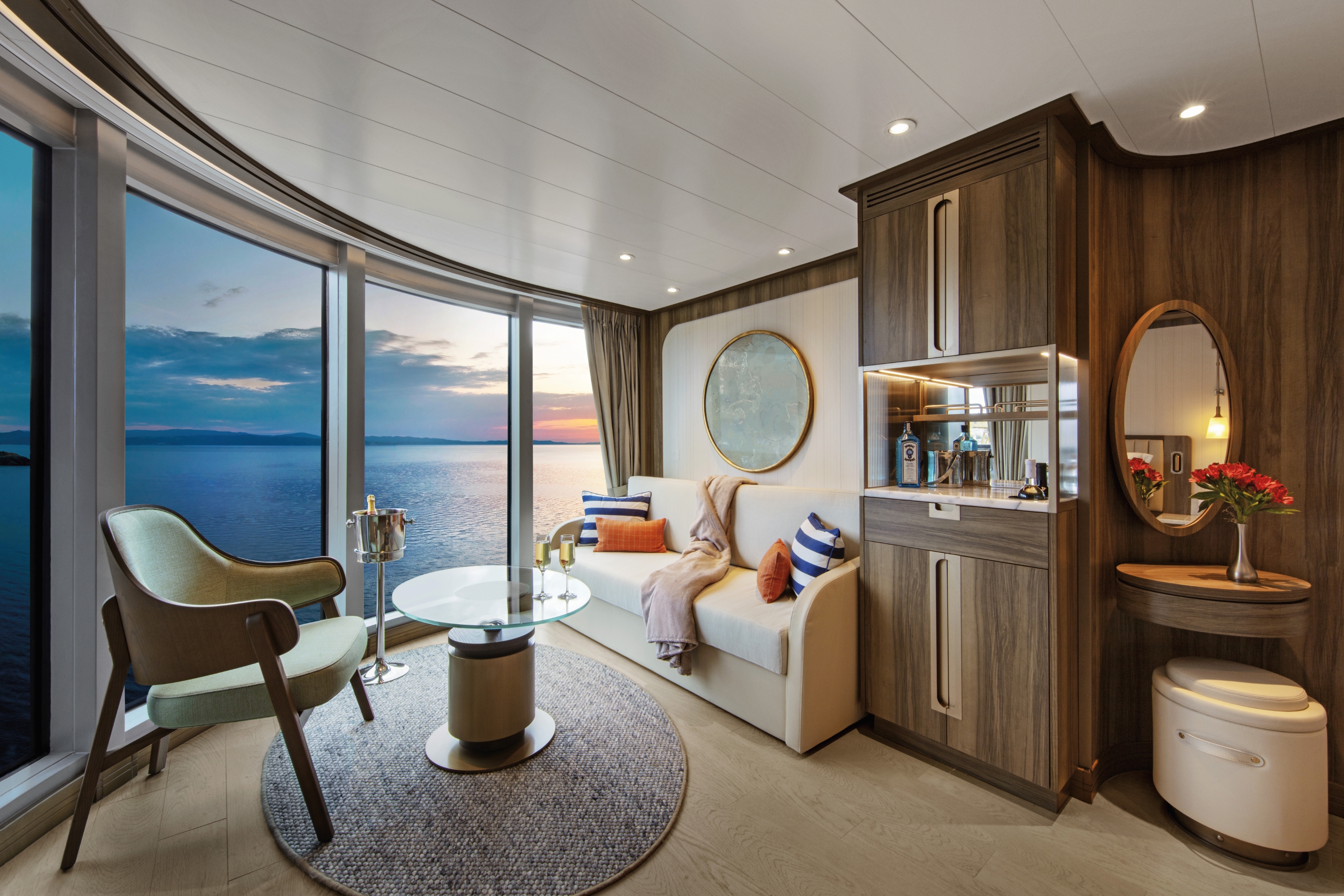
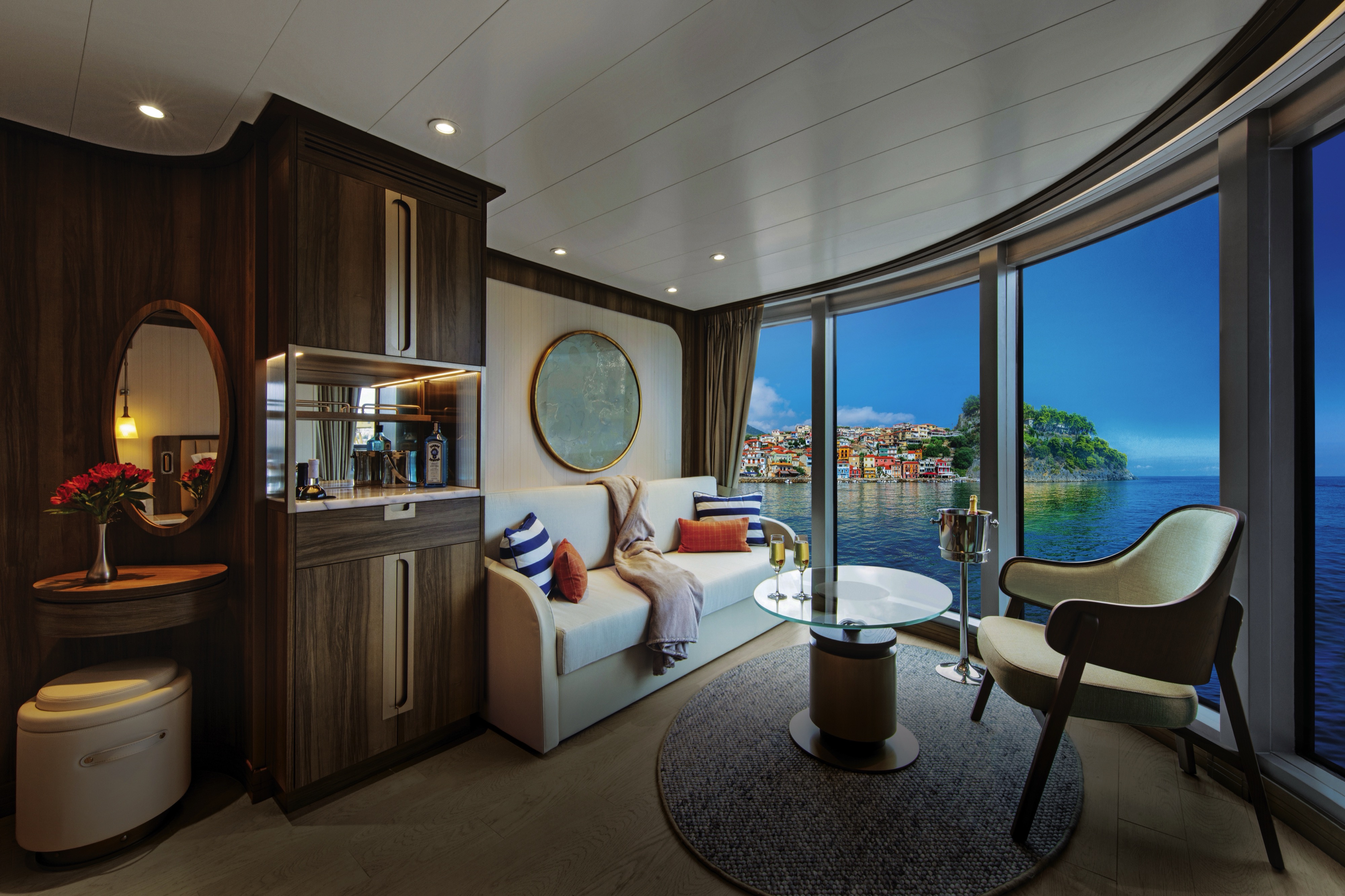
Approximate total space: 527 sq. ft. (49 sq. m.) including veranda of 97 sq. ft. (9 sq. m.) All Penthouse Suites feature a comfortable living area; private veranda; queen-size bed or two twin beds; walk-in closet; personal safe; interactive TV with music and movies; fully stocked bar and refrigerator; writing desk with personalized stationery; makeup vanity; spacious bathroom, separate tub and shower, plush robes, slippers, luxury health and beauty products, hairdryer and 110/220V AC outlets.
Penthouse Suite Features
- Large windows
- Glass door to private veranda
- Comfortable living area
- Dining for four
- Separate bedroom
- Queen-size bed or two twin beds
- Walk-in closet
- Two flat-screen TVs
- Complimentary Internet/Wi-Fi service.
- Fully stocked bar and refrigerator
- Makeup vanity
- Guest bath
- Bathroom with whirlpool bathtub
*Wheelchair accessible suites are roll-in shower only.
- Dining table for two to four
- Separate bedroom
- Glass door to veranda
- Two flat-screen TVs
- Fully stocked bar
- Spacious bathroom with tub, shower and large vanity
All Panorama Veranda Suites onboard Seabourn Venture feature a comfortable living area; private veranda; queen-size bed or two twin beds; walk-in closet; personal safe; interactive TV with music and movies; fully stocked bar and refrigerator; writing desk with personalised stationery; makeup vanity; spacious bathroom, separate tub and shower, plush robes, slippers, luxury health and beauty products, hairdryer and 110/220V AC outlets. Semi-circular separate living area with comfortable seating and expansive floor-to-ceiling windows. Queen-sized bed or twin beds oriented to face the windows to enjoy views of beautiful scenery and gorgeous sunrises and sunsets. Bathroom features a separate shower and large soaking tub placed next to a wide window.*Some veranda sizes vary.

Penthouse Spa Suites on board feature a comfortable living area, glass door to private veranda, queen-size-bed or two twin beds; walk-in closet with personal safe, interactive flat-screen TV, fully stocked bar and refrigerator and spacious marble bath with double vanities.
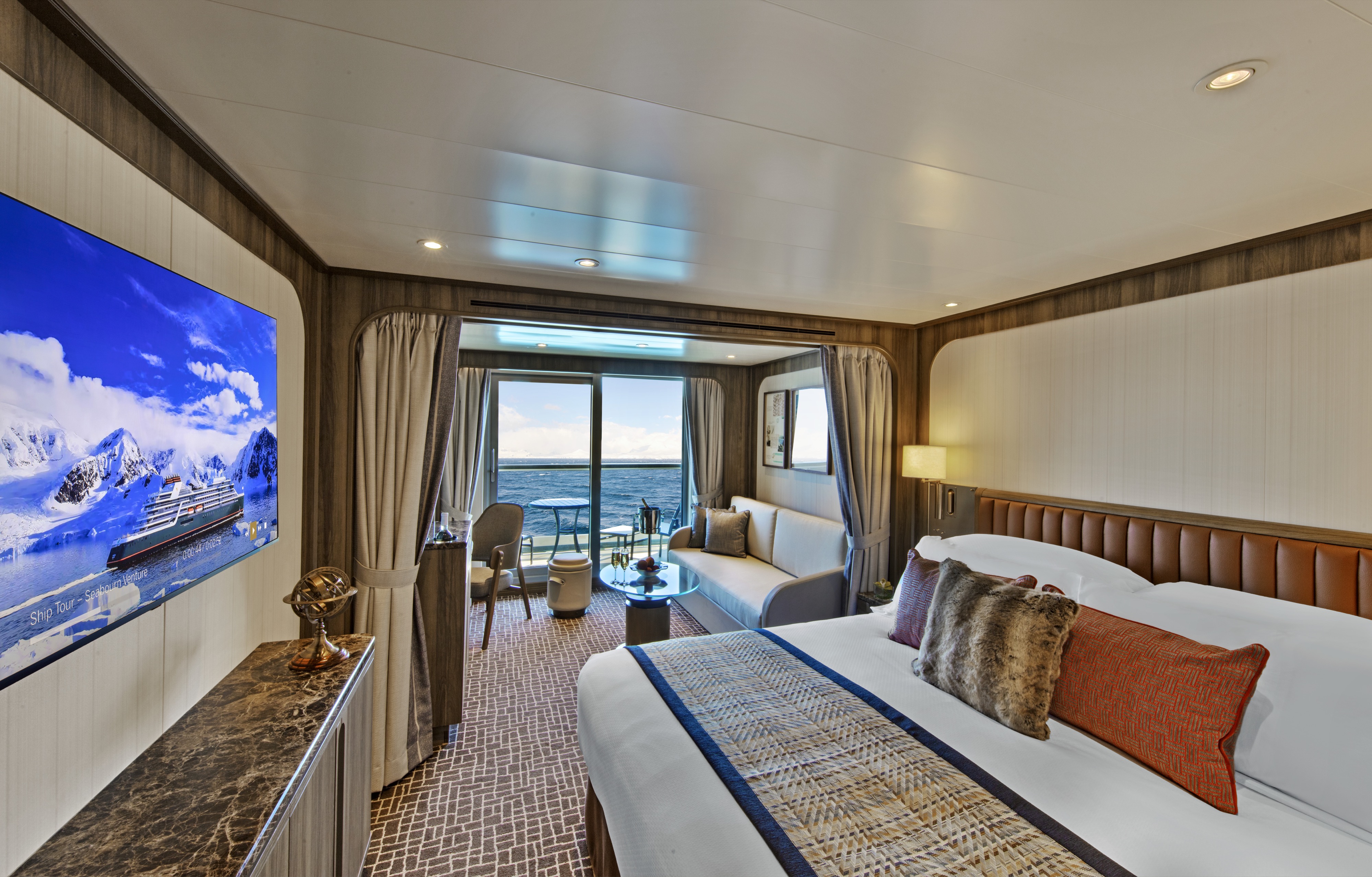
Approximate total space: 355 sq. ft. (33 sq. m.) including veranda of 75 sq. ft. (7 sq. m.)* Suites on Seabourn Venture feature a comfortable living area; private veranda; queen-size bed or two twin beds; extra-large walk-in closet for expedition gear; personal safe; interactive flat-screen TV with music and movies; fully stocked bar and refrigerator; writing desk with personalized stationery; makeup vanity; spacious bathroom with double vanities, tub and shower, plush robes, slippers, hairdryer and 110/220V AC outlets.
- A large picture window
- Comfortable living area
- Queen-size bed or two twin beds
- Walk-in closet
- Interactive flat-screen television with music and movies
- Fully stocked bar and refrigerator
- Spacious bathroom with separate tub and shower.
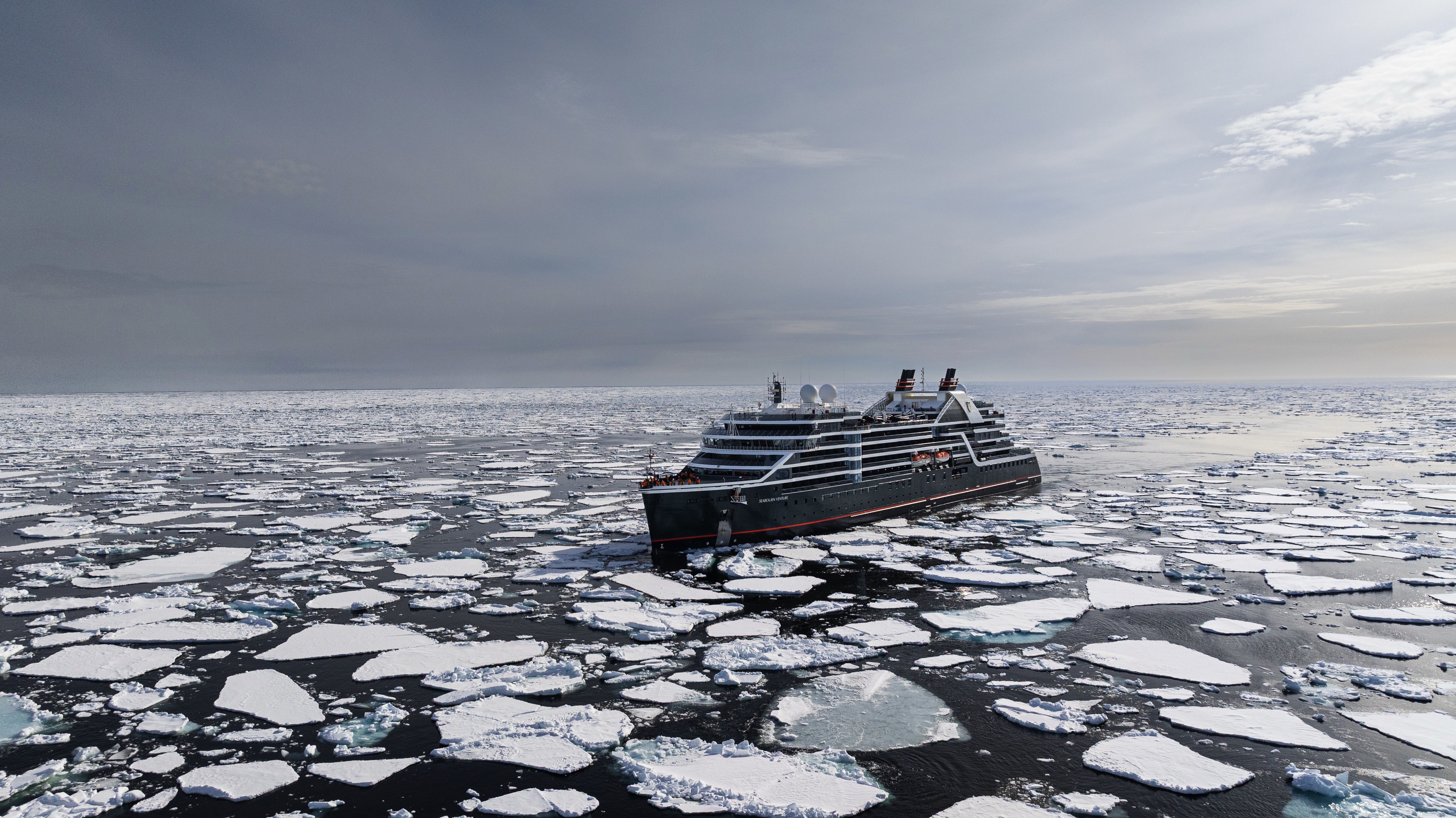
Seabourn Venture
Our first ultra-luxury, purpose-built expedition ship, Seabourn Venture offers the same luxurious small ship experience that travelers have come to expect from Seabourn, while transporting guests to the most coveted, remote destinations in the world.
Launched in 2022, Seabourn Venture is designed and built for diverse environments to PC6 Polar Class standards and includes modern hardware and technology that will extend the ships’ global deployment and capabilities. She and her sister ship Seabourn Pursuit each 24 Zodiac® boats, kayaks, and a 23-person expert Expedition Team enabling guests to engage in up-close wildlife encounters, off-the-beaten-path excursions, and enriching cultural experiences. A fully-inclusive yacht-like experience, Seabourn Venture blends state-of-the-art capability with world-class service and luxury.
Learn more about Seabourn's first purpose-built, ultra-luxury Expedition ship. Truly a state-of-the-art vessel, Seabourn Venture's private yacht-like atmosphere, and incredible design details seamlessly blend the worlds of ultra-luxury cruising and expedition exploration into an intimate utopia of discovery.
Ship Facts
| Launch Year | 2022 | ||||||||
| Refit Year | |||||||||
| Language | en | ||||||||
| Gross Tonnage | 23000 | ||||||||
| Length | 170 | ||||||||
| Width | 24 | ||||||||
| Currency | USD | ||||||||
| Speed | 19 | ||||||||
| Capacity | 264 | ||||||||
| Crew Count | 120 | ||||||||
| Deck Count | 8 | ||||||||
| Cabin Count | 132 | ||||||||
| Large Cabin Count | N/A | ||||||||
| Wheelchair Cabin Count | 5 | ||||||||
| Electrical Plugs |
|
To see the legend for these deck plans, please hover your mouse over the images below
To toggle the legend for these deck plans, please tap on any of the images below
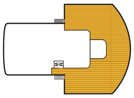
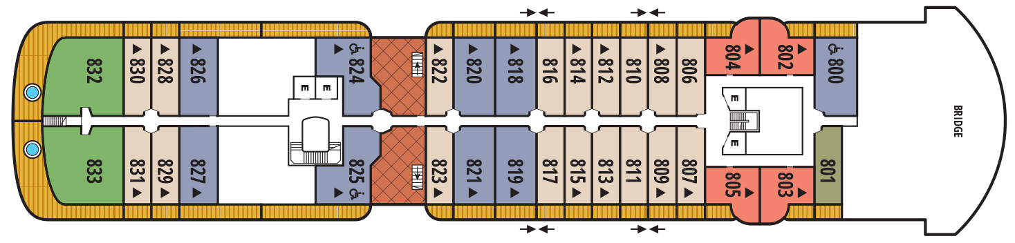
Deck 10
- Sun deck
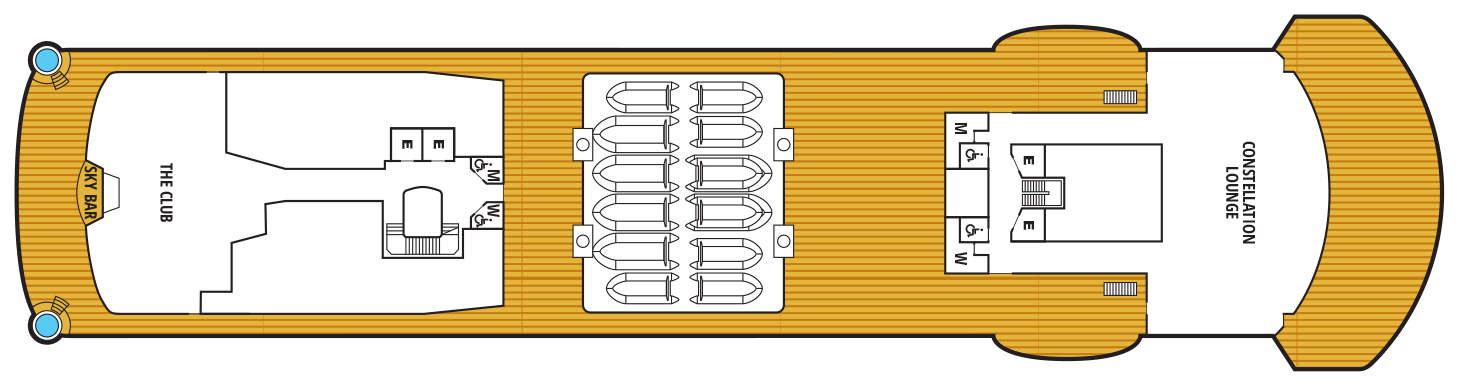
Deck 9
- Constellation Lounge
- The Club
- Sky Bar
Deck 8
- Bridge
- Wintergarden Suite
- Signature Suite
- Penthouse Suite
- Veranda Suite
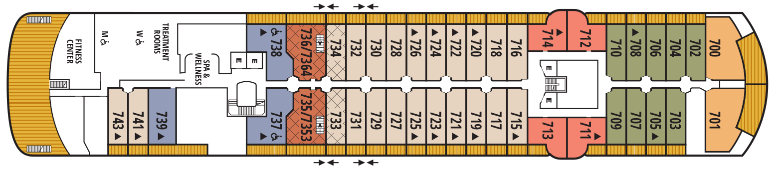
Deck 7
- Spa & Wellness Area
- Treatment Rooms
- Fitness Centre
- Grand Wintergarden Suite
- Penthouse Panorama Suite
- Penthouse Suite
- Owner's Suite
- Veranda Suite
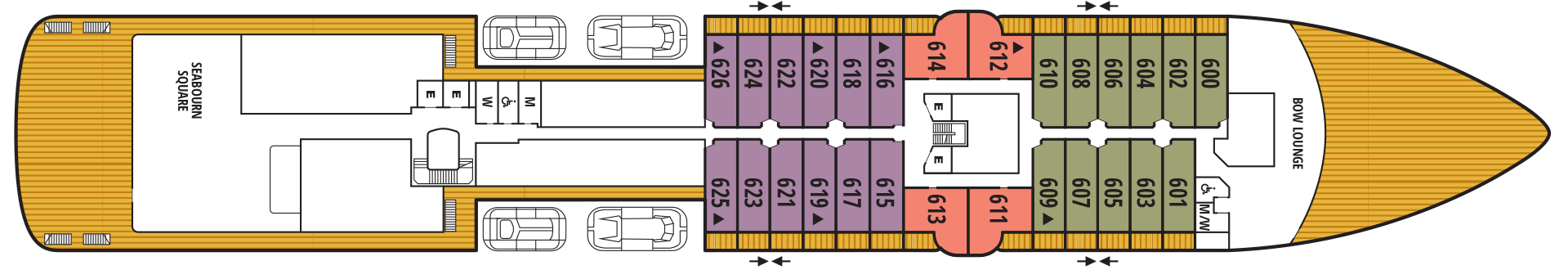
Deck 6
- Bow Lounge
- Seabourn Square
- Penthouse Panorama Suite
- Veranda Suite
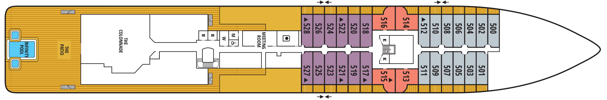
Deck 5
- Meeting Room
- The Colonnade
- The Patio
- Infinity Pool
- Penthouse Panorama Suite
- Verandah Suite
Deck 4
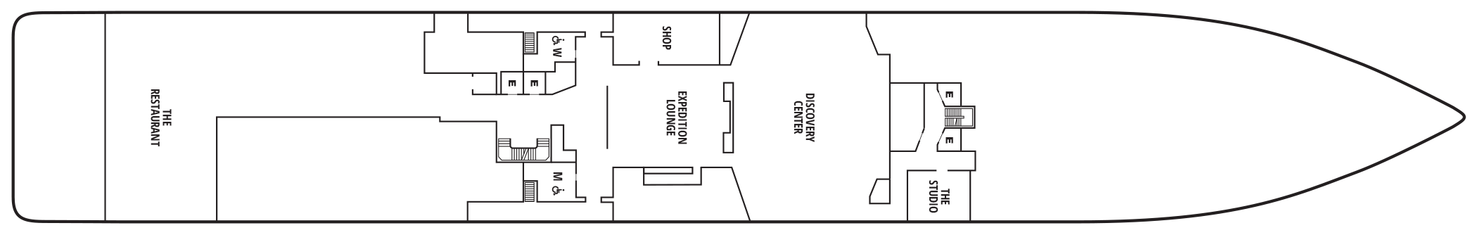
- The Studio
- Discovery Centre
- Expedition Lounge
- Shop
- The Restaurant
Deck 3
- Medical Facility
- Zodiac Embark
- Landing Zone

Complimentary world-class dining experiences range from the adventurous to the familiar, yours to choose from to suit your mood. Dine when, where, and with whom you choose, with no tipping expected nor required. Our skilled and talented chefs expand your awareness of the places you travel by creating dishes with locally sourced ingredients, techniques and specialties. Complimentary spirits and fine wines selected by our Sommeliers are yours for the asking as well, any time
The Restaurant
Before Seabourn, open-seating dining on a cruise ship was unheard of. Come when you like, with whom you please, and be seated as you wish. The room is beautiful, the cuisine is exquisite, and the service is simultaneously flawless, friendly and fun.
The Colonnade
Our more casual, indoor/outdoor alternative, features an open kitchen, lavish buffets or table service for breakfasts and lunch, and serves regionally themed, bistro-style dinners with table service nightly.
The Patio
Constellation Lounge
The Constellation Lounge is the highest indoor viewing point on each ship. Floor-to-ceiling glass walls wrap around the space, offering guests stunning 270-degree, outward-facing views as far as their eyes can see, heightening their expeditionary spirit while bringing them closer to wildlife and wonders at sea and in port.
In addition, the expedition team will be in the lounge regularly to help identify points of interest, wildlife and geological wonders. Imagine glimpsing killer whales, waddling penguins, and sea lions in Antarctica; sleepy-eyed sloths, sprightly monkeys, and colorful parrots in the rainforests of South and Central America; and icebergs bobbing in the seas and waterfalls rushing over cliffs in the far reaches of the Arctic and Northern Europe – all from the comfort of the Constellation Lounge.
The Constellation Lounge offers Seabourn’s popular Early Morning Riser continental breakfast, while afternoons features the line’s popular and recently enhanced Afternoon Tea service. Steeped in the tradition of proper English tea service, yet as fresh and memorable as a newly brewed pot, the elegant daily tea service incorporates the finest luxury tea brand TWG Tea. As the sun dips and the night sky lights up, live piano entertainment delights guests as cocktails and tapas are served both before and after dinner.
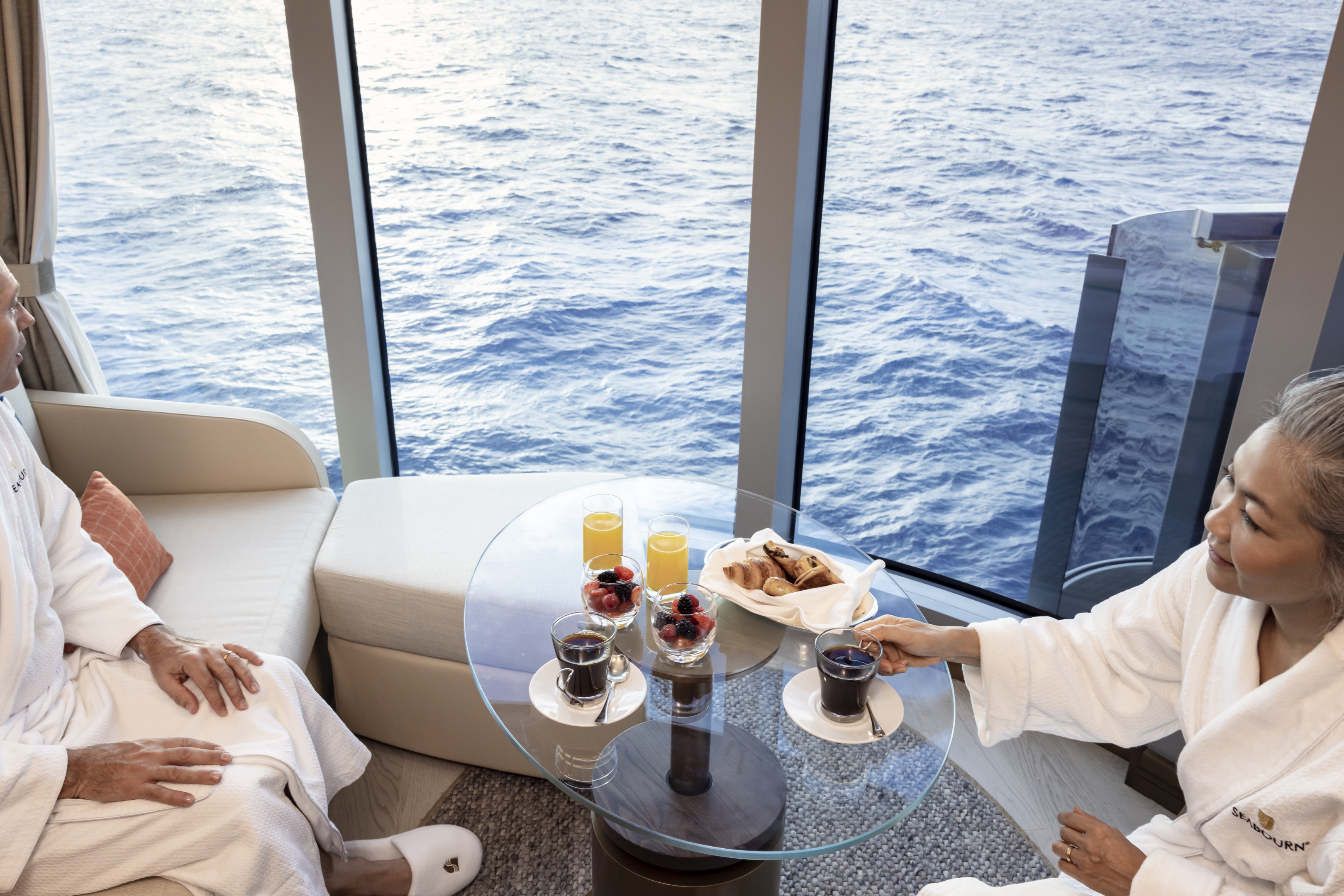
In-Suite Dining
Seabourn is pleased to offer a varied menu available around the clock for service in your suite. You may also order dinner from The Restaurant menu and have your meal served, course by course, in your suite or on your veranda.
Earth & Ocean
Each evening, our skilled Earth & Ocean chefs create an imaginative array of fresh, inventive dishes—a sophisticated menu celebrating eclectic traditional flavors from around the world, served in a relaxed setting under the stars for a distinctive dining experience unlike any other on board.
In every area of the ship, an elegant aesthetic awakens the senses to capture the romanticism of early explorers and the thrill of discovery.
Expedition Lounge
The Expedition Lounge, located on Deck 4, is the heart of the ship. A gathering place for the curious, guests are invited to relax or linger with a complimentary cocktail or glass of fine wine from the bar as they share photos and stories from the day with their fellow travelers and the onboard staff. The Expedition Lounge will be central to the Seabourn expedition operation where guests convene before and after expeditions each day.
Custom furniture designed in a variety of warm, natural materials creates an inviting, tactile atmosphere. An ode to the adventurous, the Expedition Lounge features an etched glass partition displaying a vintage map of Antarctica and vitrines showcasing intricate tools and devices of the trade. Two large touchscreens will also display a wealth of information including photos, navigational charts, weather charts, and maps.
The Club
The liveliest lounge on board is the scene of daily afternoon tea service. It is a popular spot for pre-dinner drinks and dancing to live music. After dinner, the dancing music continues, and later a DJ spins dance music until late at night. Another terrace of open deck aft of The Club boasts a plunge pool and two small whirlpool spas.
Seabourn Sojourn, Seabourn Quest, Seabourn Venture, and Seabourn Pursuit offer Sushi in The Club, serving a variety of light sushi bites freshly made to order each evening.
Seabourn Square
A place to enjoy some light reading or to socialize with your fellow passengers, Seabourn Square is what you're looking for. Seabourn Square is the true ‘living room’ of the ships. An inviting sociable space where guests will find a charming European style coffee bar, Seabourn Square has been designed as an open, comfortable environment for guests to interact with onboard officers and the expedition team and engage in conversation with family and new friends. The space is also home to the highly-trained Guest Services staff, who provide a range of concierge services such as general ship information, assistance with special service requests, port and travel information, and more.
A selection of coffees are prepared by the skilled onboard baristas some using beans roasted in Seabourn Square. For those feeling a bit hungry, Seabourn Square offers freshly made pastries and other on-the-go breakfast items in the morning, as well as an assortment of light sandwiches and desserts later in the day, along with a selection of artisanal gelati made on board. Guests will also find a wide range of books in the adjoining library, with a host of titles on subjects such as adventure, expeditions and other topics of interest to enjoy while onboard. Staying current with the news is made easy with tablets featuring the Press Reader news application available to browse each day.
Bow Lounge
Located on Deck 6, at the forward-most part of the vessel, the Bow Lounge provides the closest access to water level via the foredeck, making it the perfect spot for guests to spend some time watching for marine life. Within a few steps, guests can be outside, with a vantage point that is ideal to watch the ship’s course, spot wildlife, or take in the beautiful natural scenery.
The Bow Lounge introduces some technological enhancements, providing guests with a first for Seabourn with touch screens showing the ship’s plotted location, as well as navigational charts and scientific information used to help guide the ship on its journey. Large screens project live footage from mounted cameras outside the ship, and from a drone when conditions permit, while the touch screen monitors invite guests to explore on their own with a live map, weather information, and notes detailing upcoming expeditions. Expedition Team members will be available within the Lounge throughout the day to interact with guests, answer questions, provide interpretation and aid in spotting wildlife.
The space provides direct access to the Bow Sprit on Deck 6 forward (when conditions permit) to give guests the sensation of standing in front of the ship and views of waves parting and ice sloughing off the bow at the waterline.
Sky Bar
Overlooking the beautiful Pool Patio, the open-air Sky Bar presents you with a gorgeous setting to take a break from the afternoon sun while enjoying a refreshing tropical beverage, or spend the evening enjoying a few social cocktails under the stars.
Evenings Under The Stars
One of the most FUN evenings during any cruise, Evenings Under the Stars is a night where guests can let their hair down and simply be in the moment. Enjoy Let’s Dance! with great live music, interact with fellow travelers and be spoiled in true Seabourn style by our food and beverage team with Desserts Under the Stars. A signature event, this dance party has been a part of the line’s rich culture, and a Seabourn cruise is not complete without Let’s Dance! and Desserts Under The Stars.
Weather permitting, this high-energy dance party is hosted poolside and under the stars by the entire entertainment team, featuring performances by The Band, vocalists and dancers. There is even the possibility your Cruise Director and Assistant Cruise Director might jump on stage to perform, as well! Guests can expect music that appeals to everyone’s taste with a great mix of hit songs. It’s a real treat and guests LOVE Evenings Under the Stars!
Card Room
Many veteran cruisers specifically choose cruises that provide at least a few days at sea. The Card Room is a great choice for the sea-loving cruiser who craves that languorous feeling of lazy leisure. There will be loads of on board activities during those days, including a great game of bridge.
Meeting Room
For meetings and gatherings, our ships offer meeting rooms that can accommodate up to 40 guests. The meeting rooms can be arranged to guests’ specifications including theater-style or with tables; and each of the rooms have large-screen TVs for presentations. Guests may also reserve the Card Room when available. Our crew members are happy to assist guests with meeting room reservations and setup.
Onboard Shopping
Whether you're buying souvenirs for your friends at home or want a memento of your vacation, our Shops will have what you need. Shop for fashion and cosmetics at The Boutique, jewelry and fine watches at The Collection, or logo cruisewear at the Shop.
Zero @ Sea
A Zero-proof cocktail experience featuring a unique array of non-alcoholic cocktails
Zero @ Sea offers an inventive menu of mixology cocktails, with ingredients and flavors free of alcohol, such as elderflower, bursts of fresh citrus, botanical spirits, and more.
Zero @ Sea cocktails are available fleetwide in all bars and lounges aboard the ships together with an upgraded selection of nonalcoholic wines, sparkling wines, and beers.
The new cocktails were developed by Seabourn’s expert culinary and beverage team, led by Michael Simon, senior manager of restaurant and bar operations, and Francisco Fernandes, corporate manager service operations.